Recently Viewed ›
Recently Downloaded 
Close x

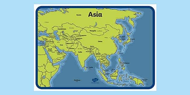

This colourful map of Asia with Names features all the different countries of Asia and their capital cities. Great for use as part of a general world map display or as a reference when completing geography tasks. This map is also great for more specific studies of the continent, countries or geography of Asia. This map is perfect for improving geographical knowledge and can be used in a variety of different ways.
 asia
world map
map of asia with names
philippines map
philippines
europe map
map of the philippines
pakistan
africa
south america
world map with countries
pakistan map
map of philippines
asia
world map
map of asia with names
philippines map
philippines
europe map
map of the philippines
pakistan
africa
south america
world map with countries
pakistan map
map of philippines
Brilliant
Great Resource - it's great to see Palestine on the map :)
This colourful map of Asia with Names features all the different countries of Asia and their capital cities. Great for use as part of a general world map display or as a reference when completing geography tasks. This map is also great for more specific studies of the continent, countries or geography of Asia. This map is perfect for improving geographical knowledge and can be used in a variety of different ways.
Use this map so your children can see the location of different places around the world. Print off and display in your home or on the fridge.
We also have maps of the other continents that you might find useful too. This map of North America is an example of the other resources we have to offer.
Asia is the largest continent in the world and has the largest population. This Asian continent map is made up of 50 countries, including the transcontinental countries of Kazakhstan and Azerbaijan.
 Home
Home  Membership
  Customer Support
  Create
  Blog
Blog