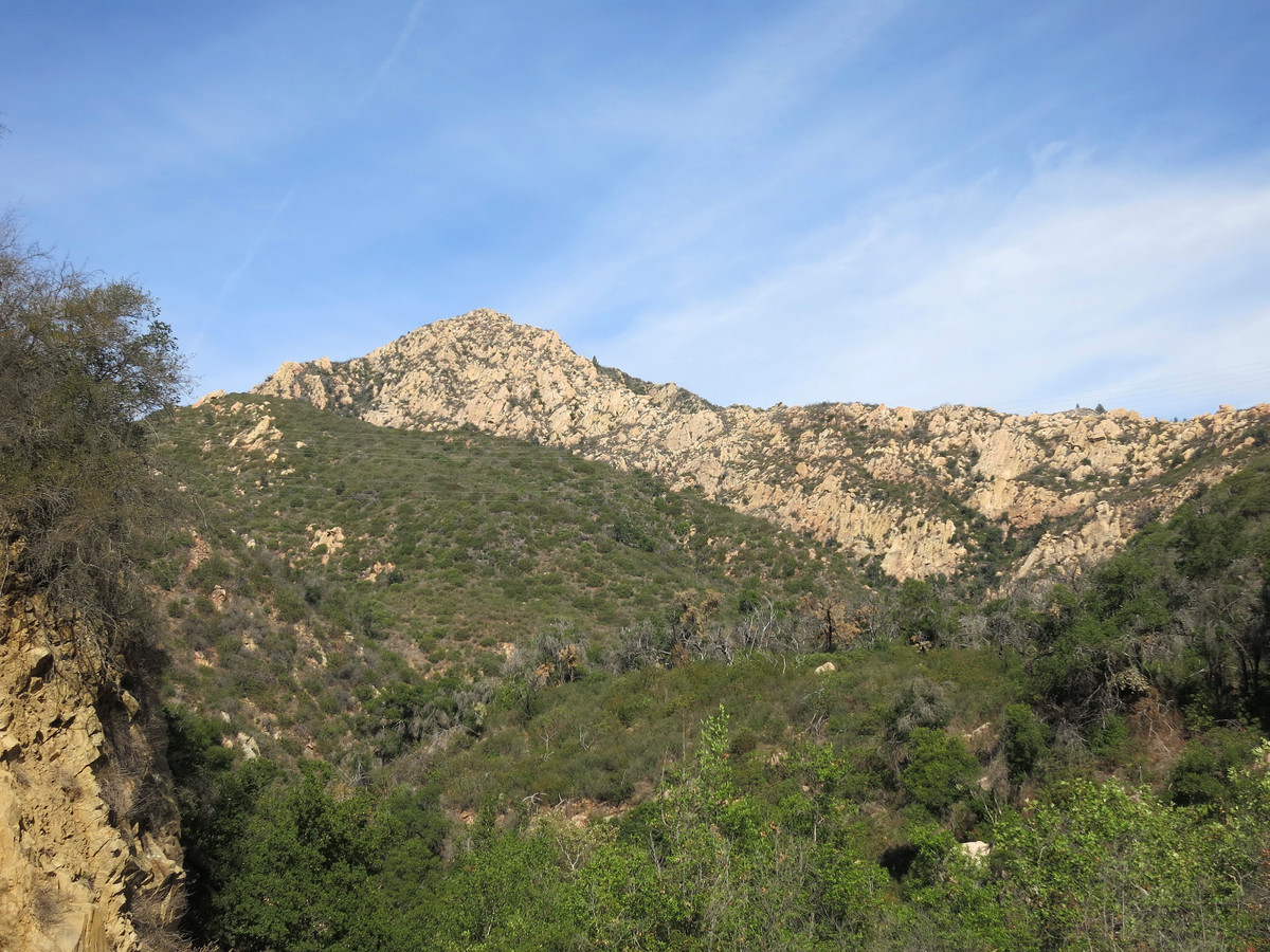
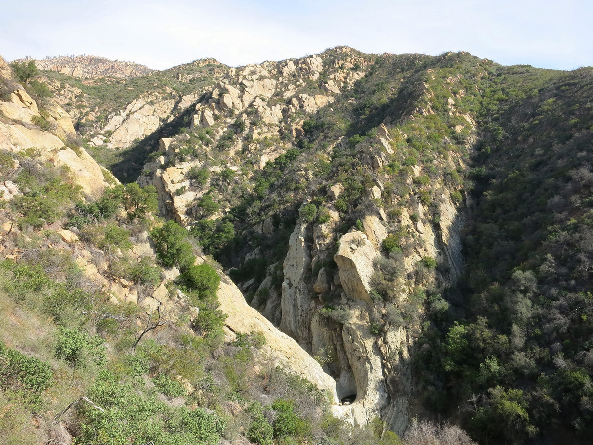
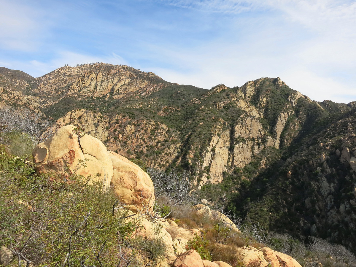
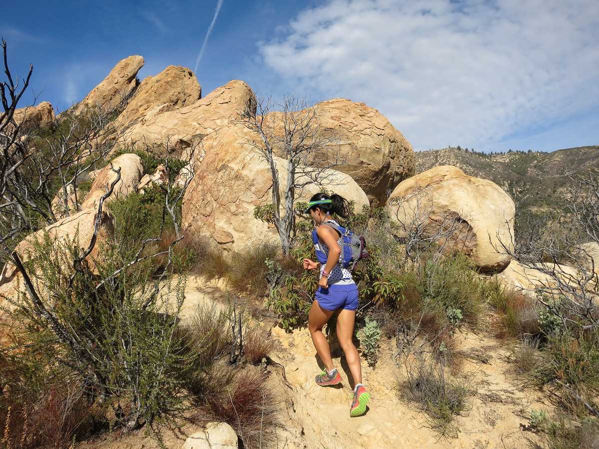
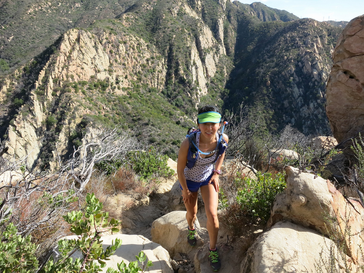
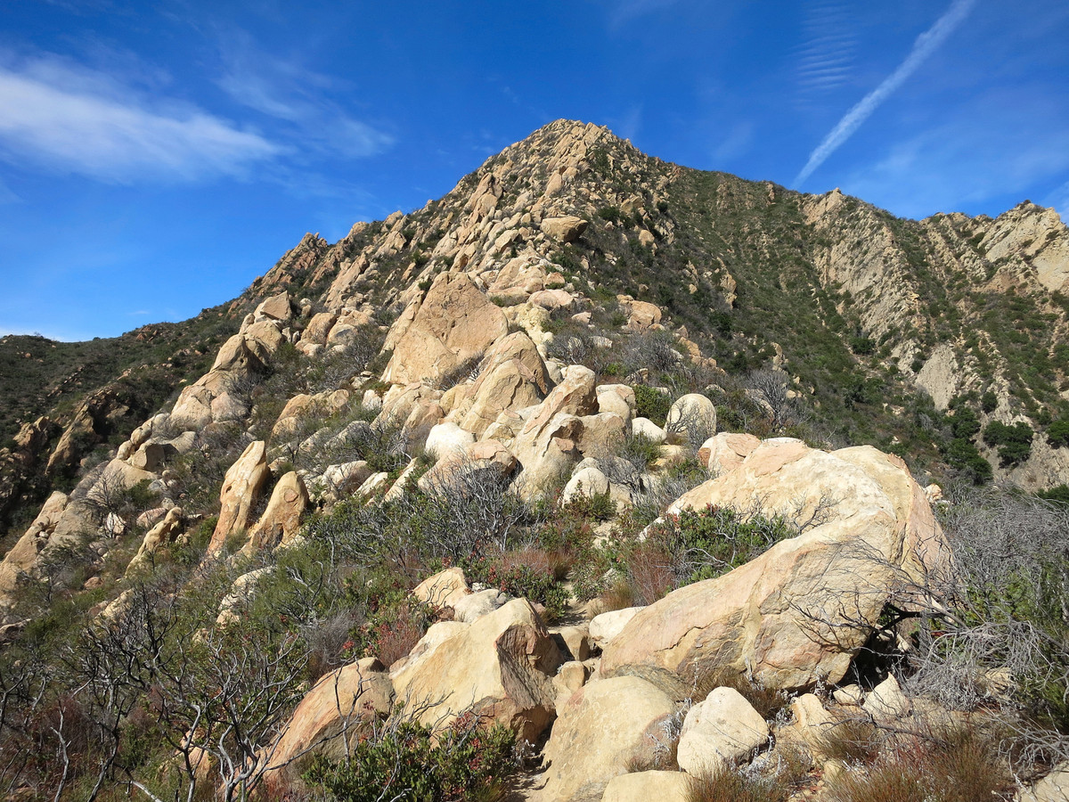
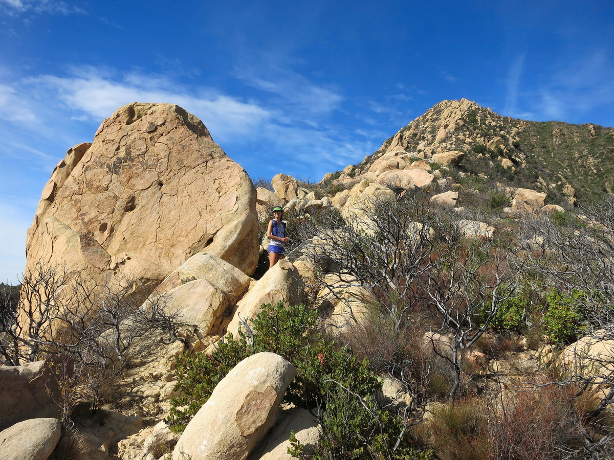
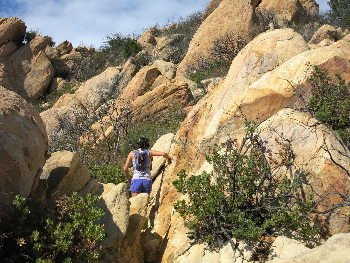
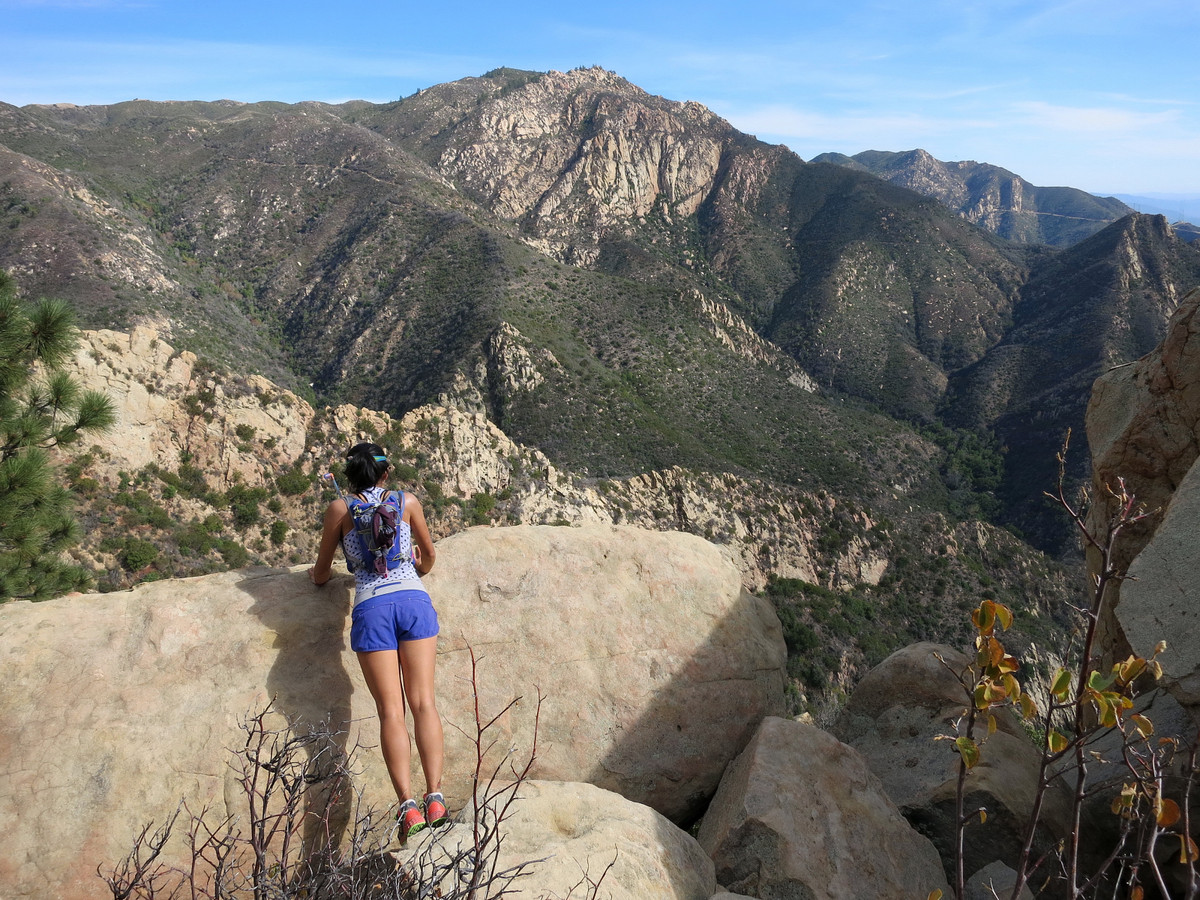
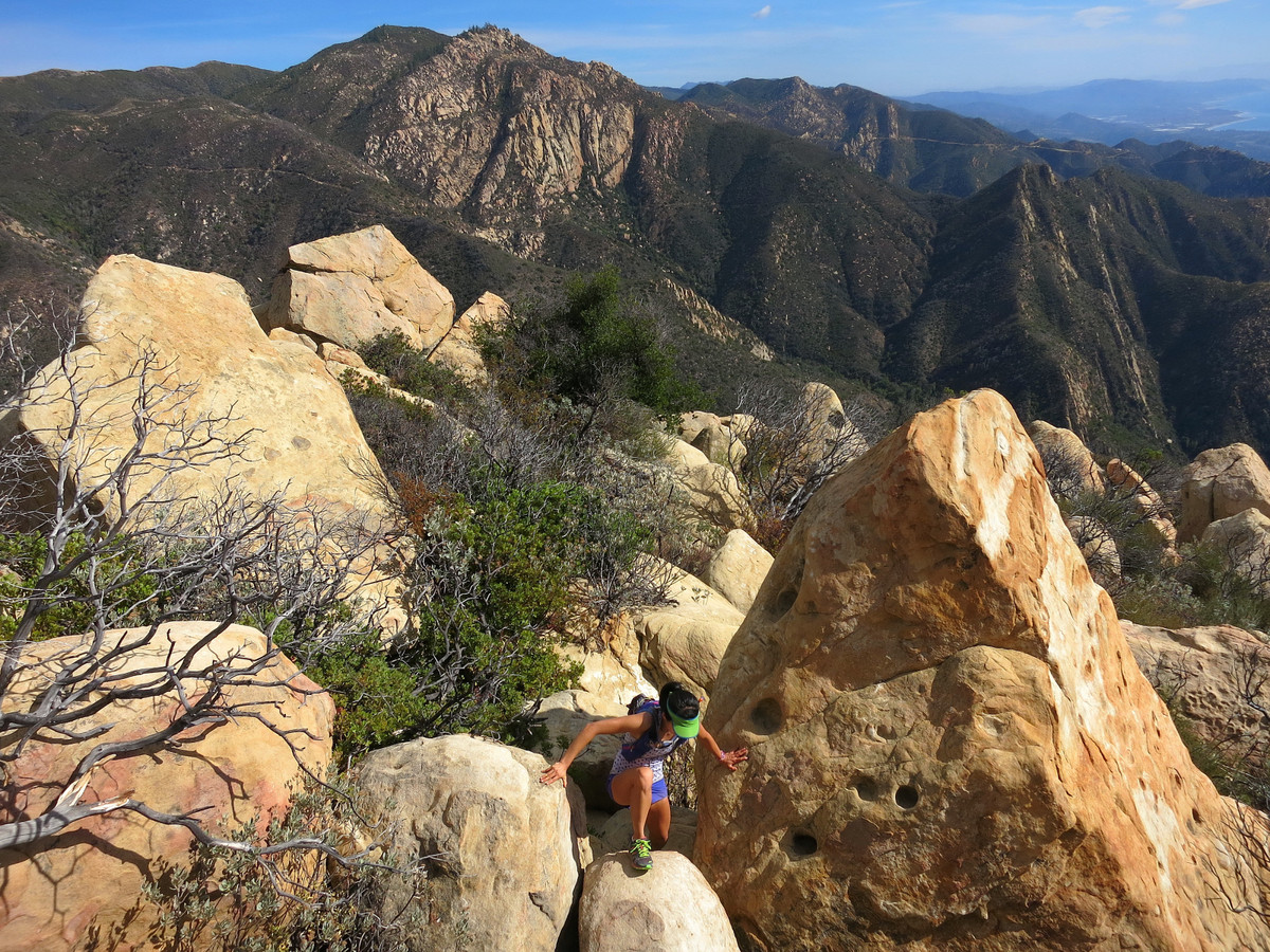
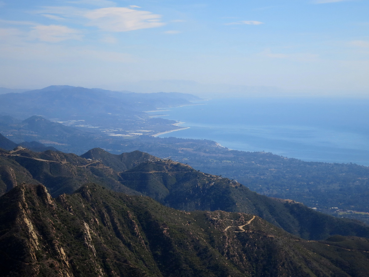
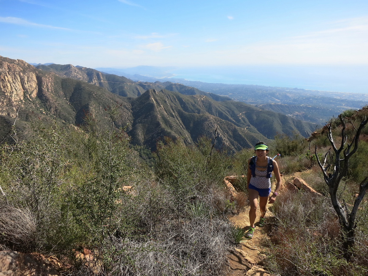
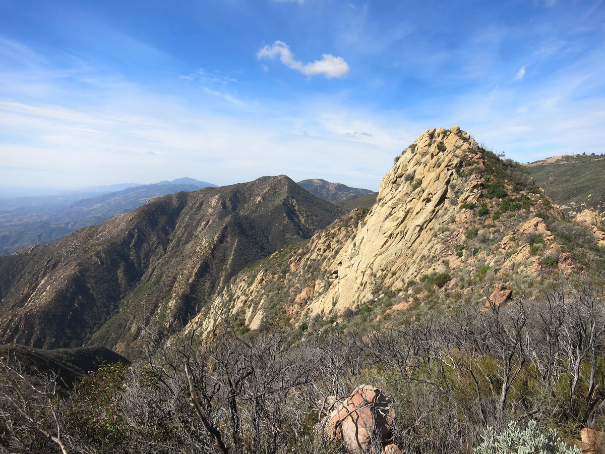
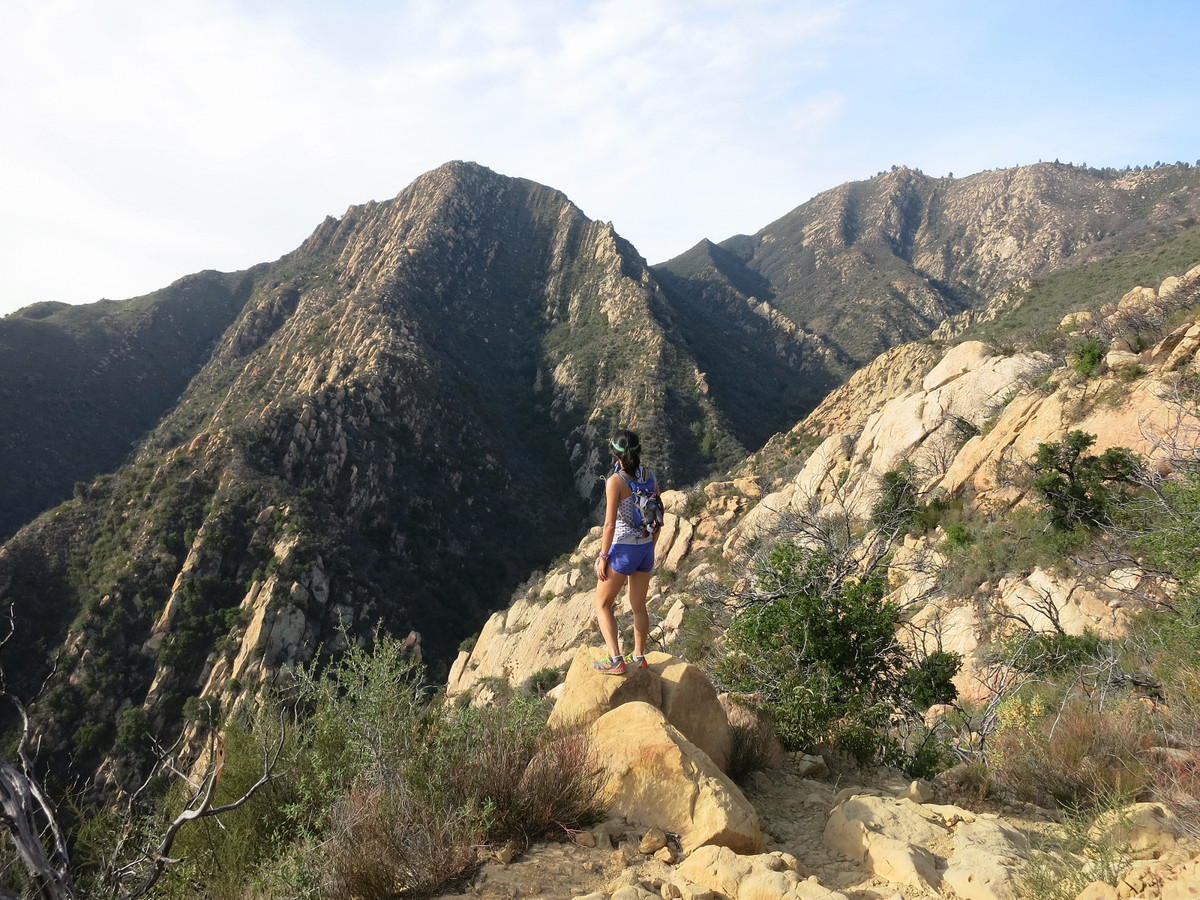
The Santa Ynez Mountains are an east to west coastal mountain range part of the greater Transverse Ranges of Southern California. The range is essentially a high ridge with steep and rugged terrain on either side mostly inhabited by chaparral vegetation but there is oak woodland on the lower slopes and some pine tree stands on the ridge crest. Immediately above Santa Barbara is one of the higher points along the ridge, La Cumbre Peak, rising nearly 4,000 ft in short order from downtown and the highest point by the city. The Cathedral Peak route is an amazing line up the spine of a rugged ridge to La Cumbre Peak in the Santa Barbara front country. Along the route is an exquisite section of Matilija sandstone that is ubiquitous on the ridge leading to Arlington Peak and is sustained for over 2 miles of rock hopping and scrambling totaling nearly 2,000 vertical feet. Add in astounding view of the coastline, Channel Islands and Santa Ynez Mountains and you have one of the finest coastal scrambles along the west coast. The route starts at the end of the road in foothill residential community of Santa Barbara. Parking is limited and challenging so expect to walk an extra section of road on weekends. From the trailhead, travel about a mile along the paved Edison access road and then turn left to follow a short section on the Jesusita Trail. When the Jesusita Trail crosses Mission Creek, turn right and take a use path that rises steeply above the Mission Creek canyon. This rugged canyons was basically dry when we ascended the route, but after rains there are several pools and waterfalls. The trail continues to rise steeply to the distinct southeast ridgeline of Arlington Peak. 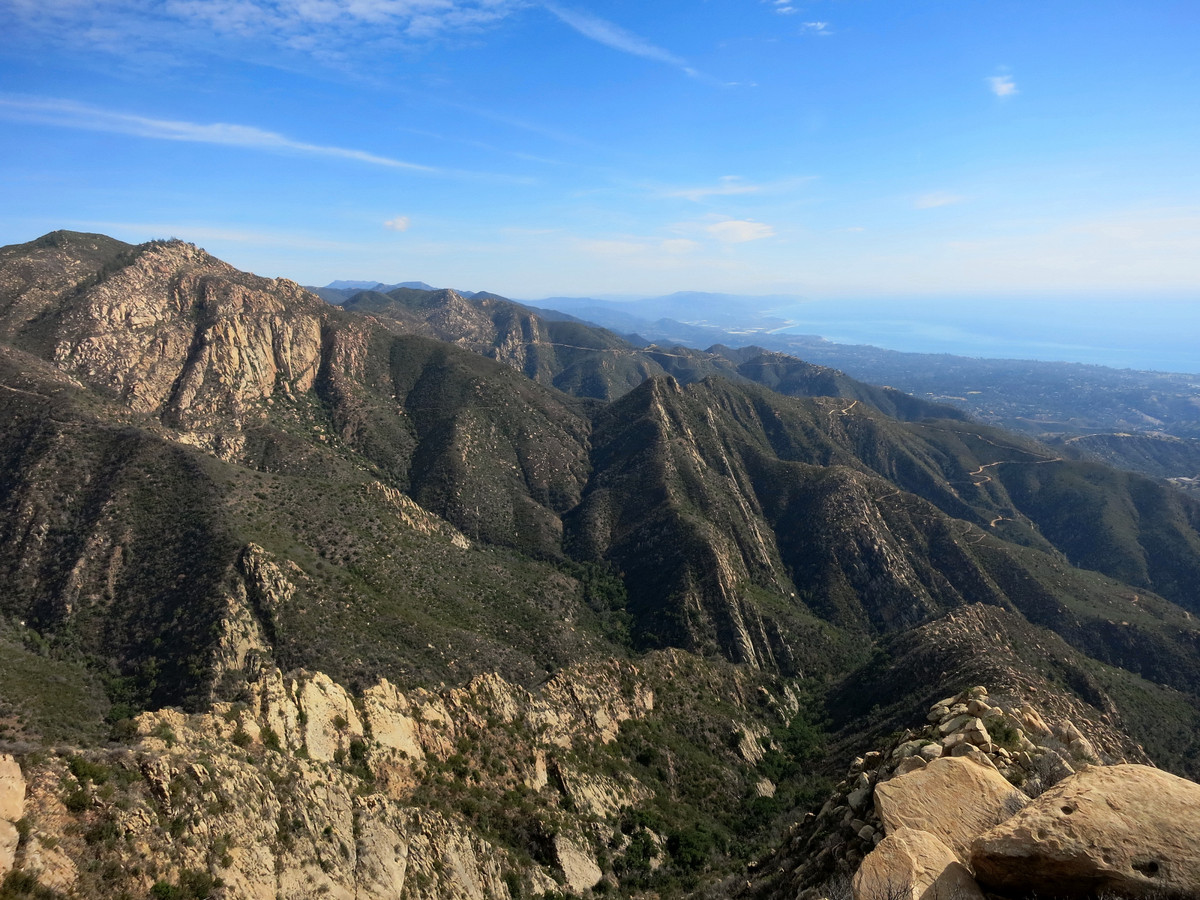
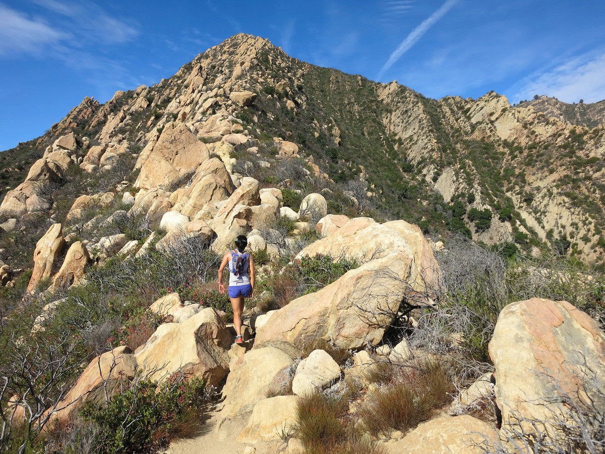

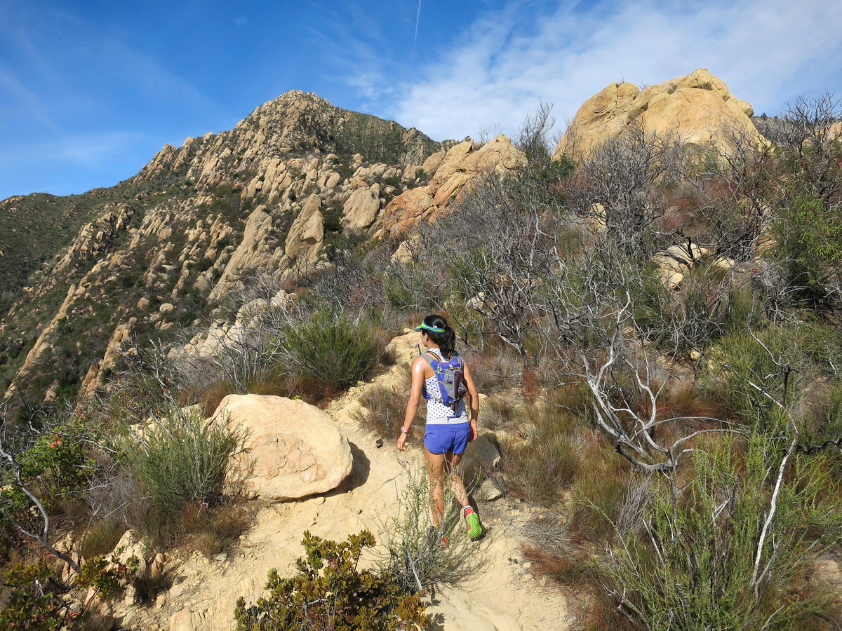
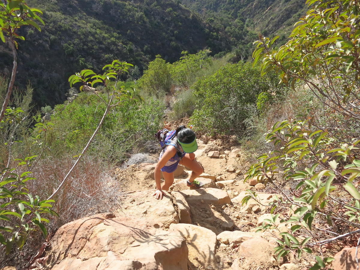
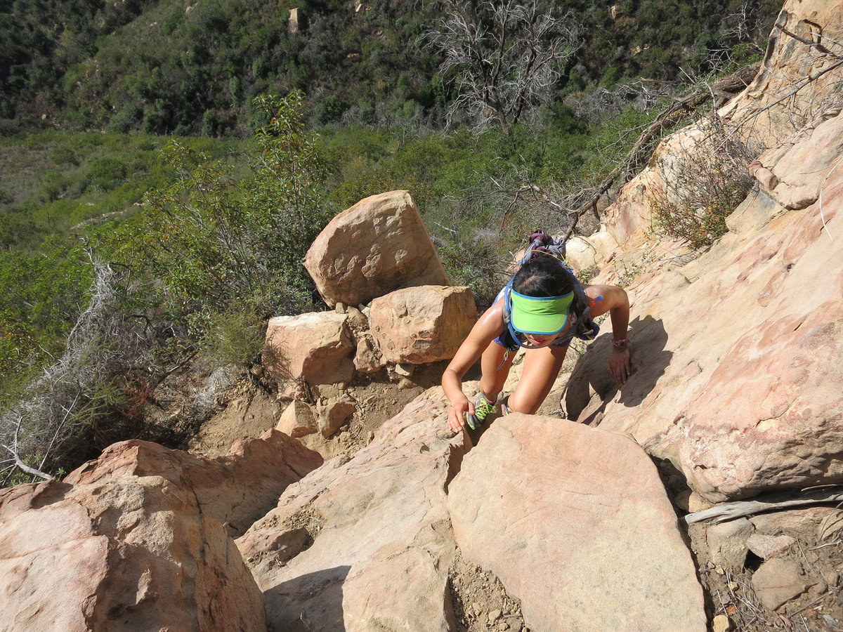
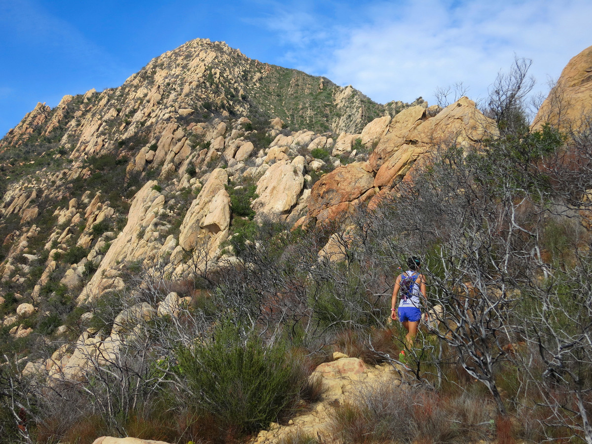
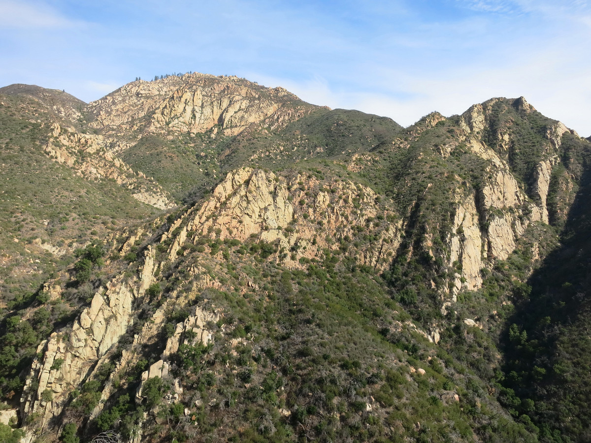
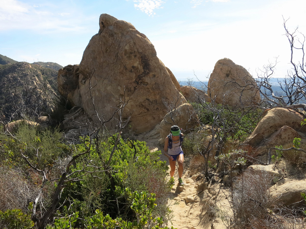
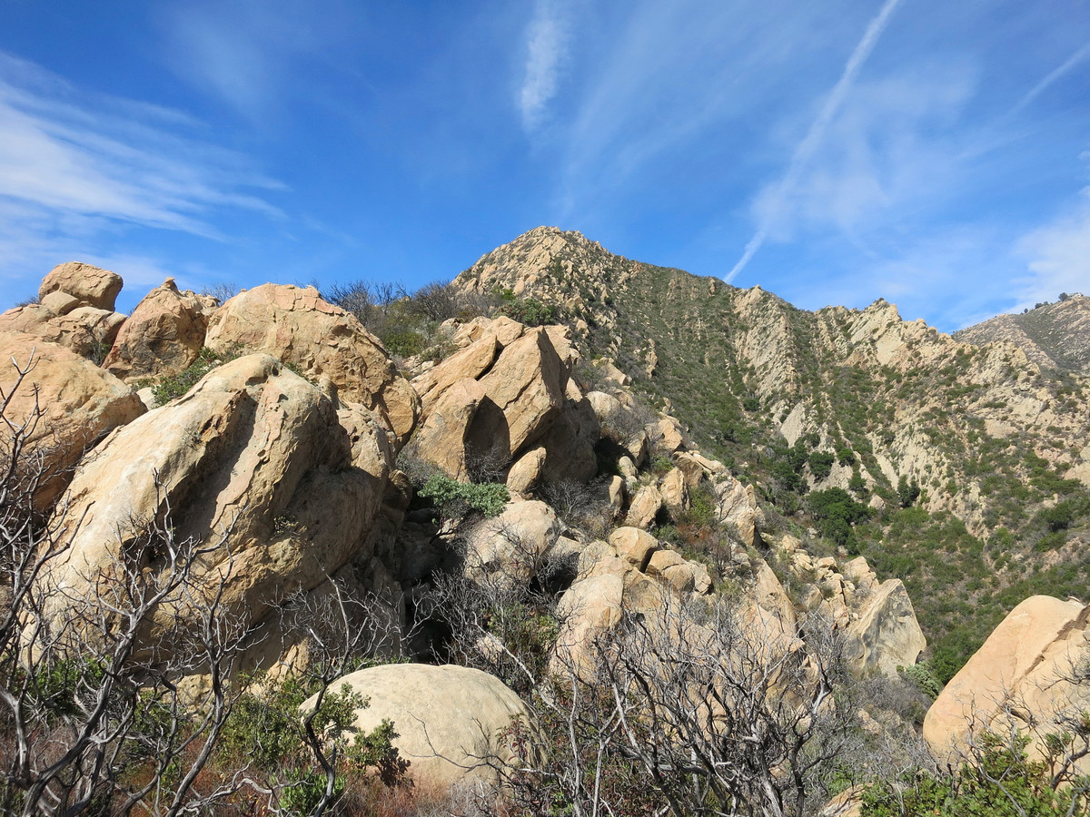
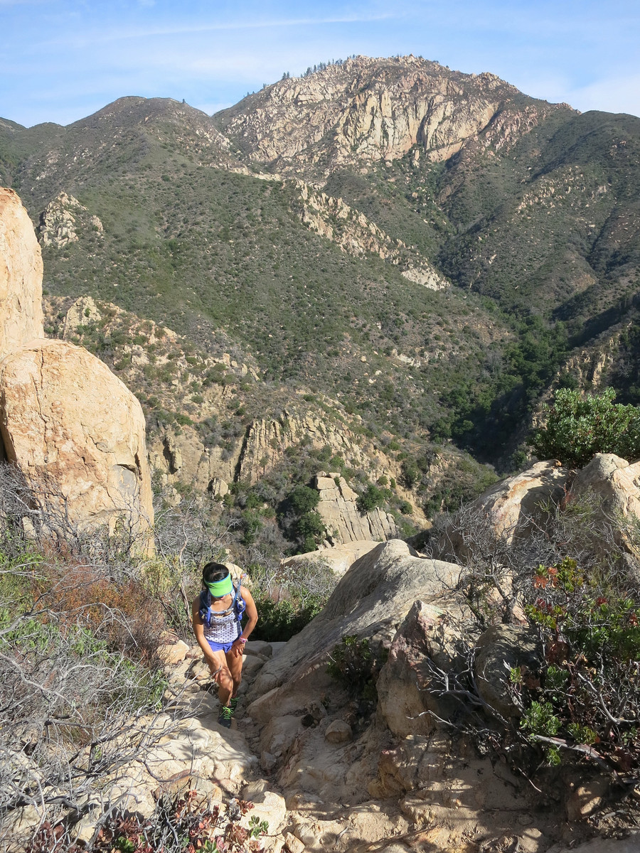
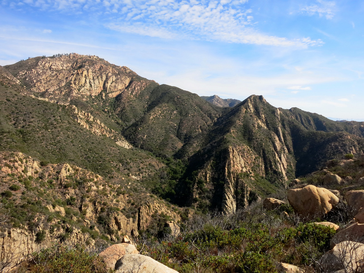
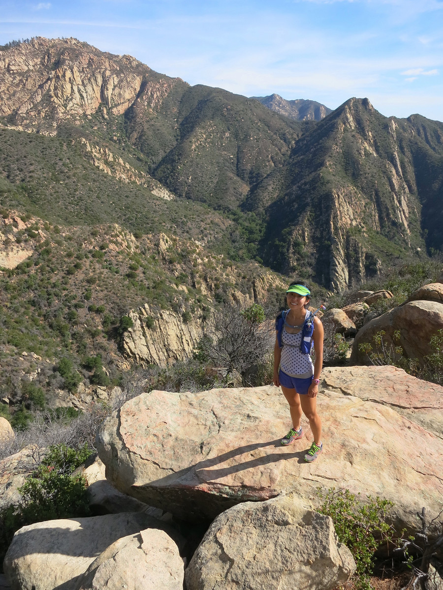
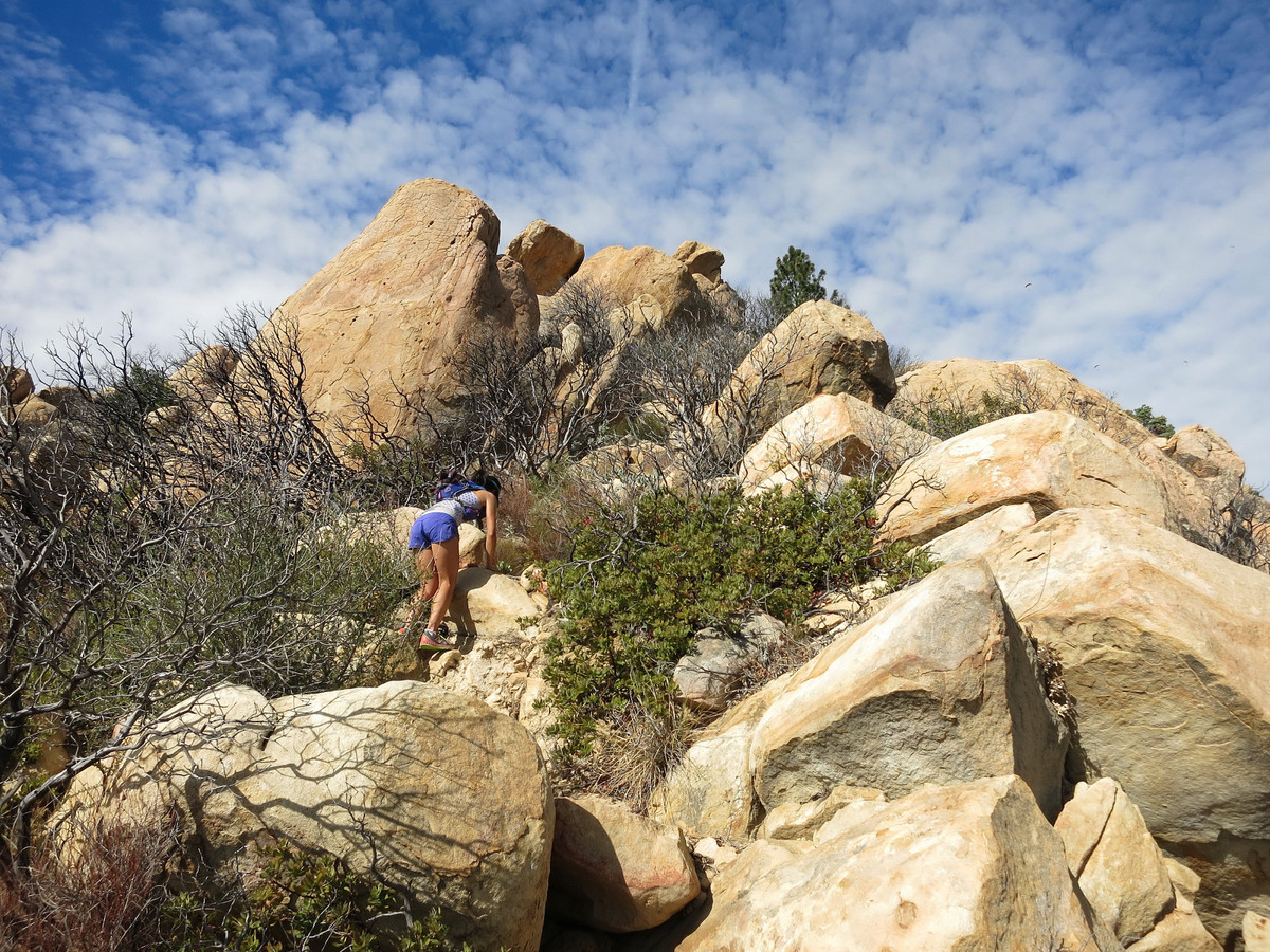
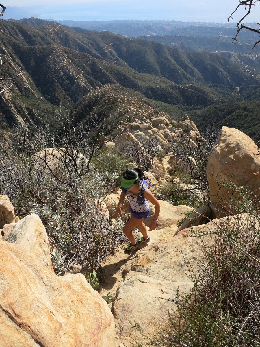
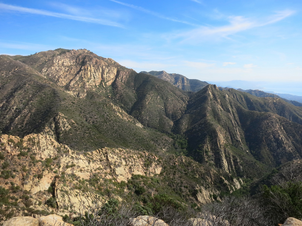
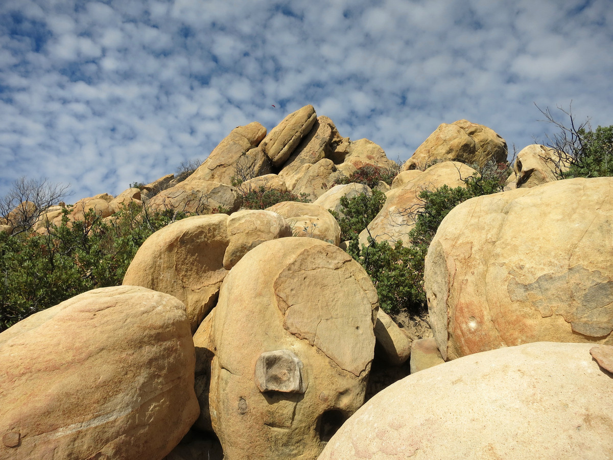
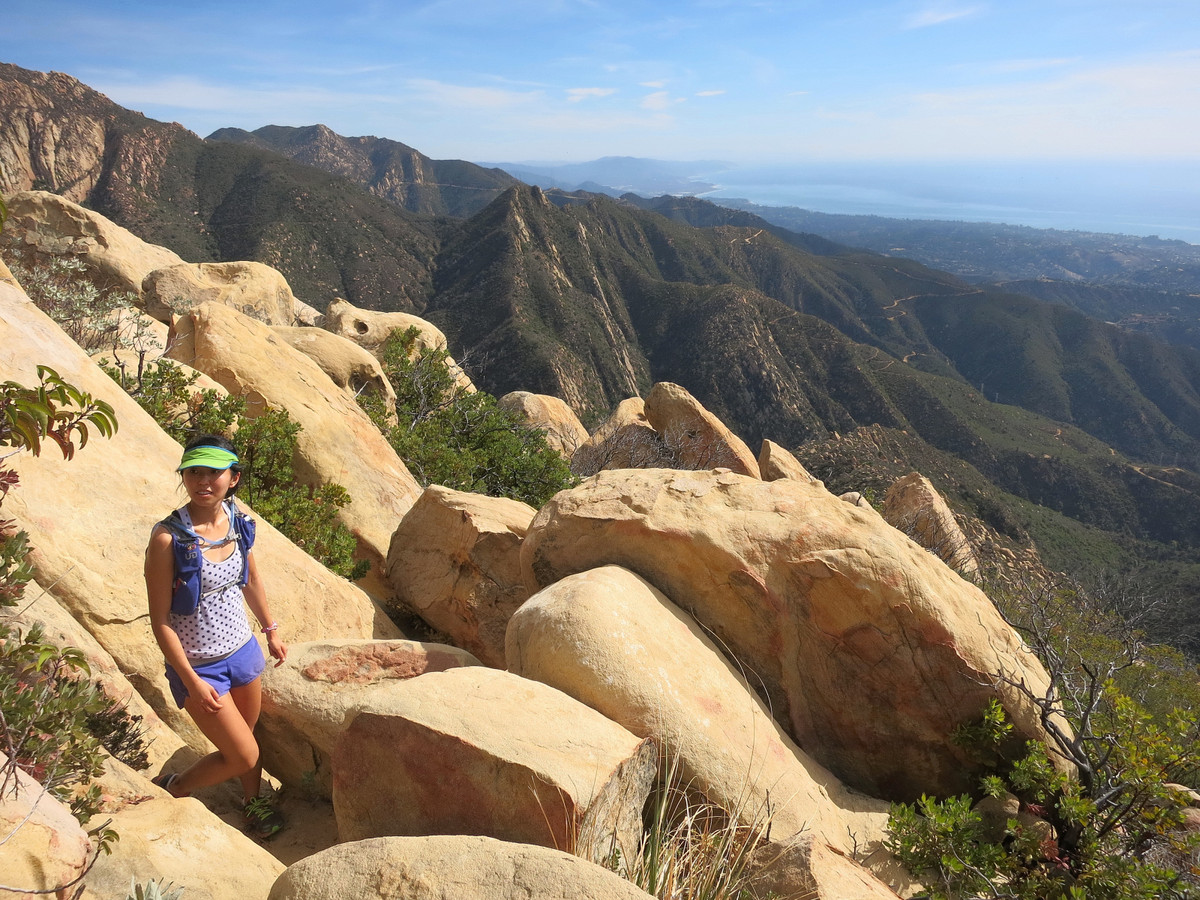
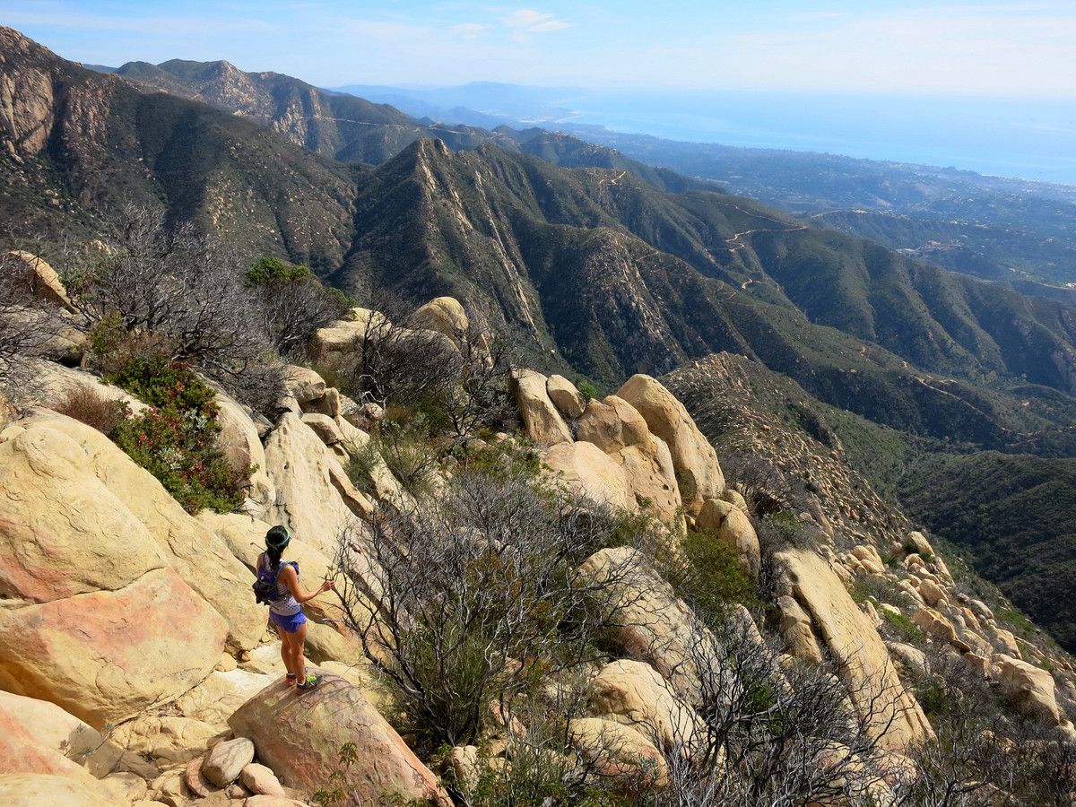
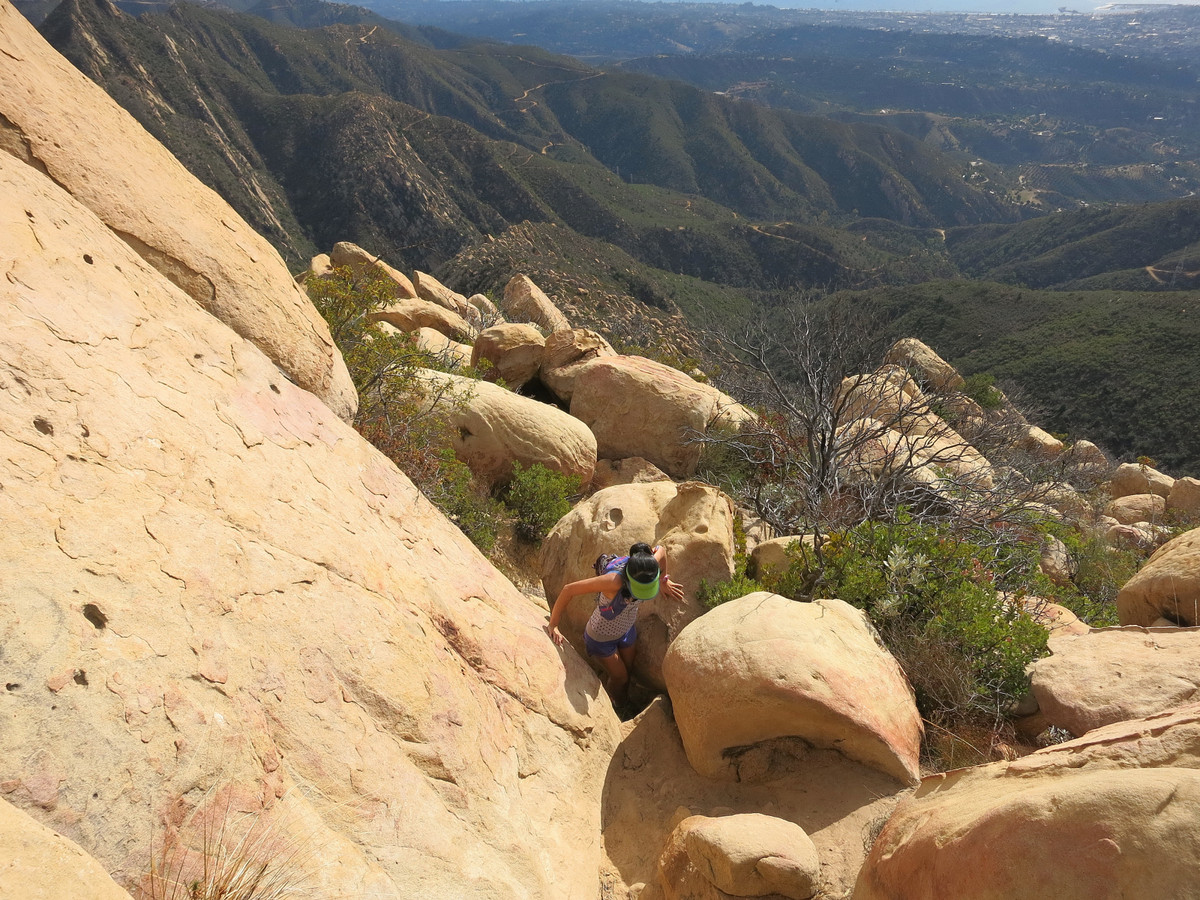
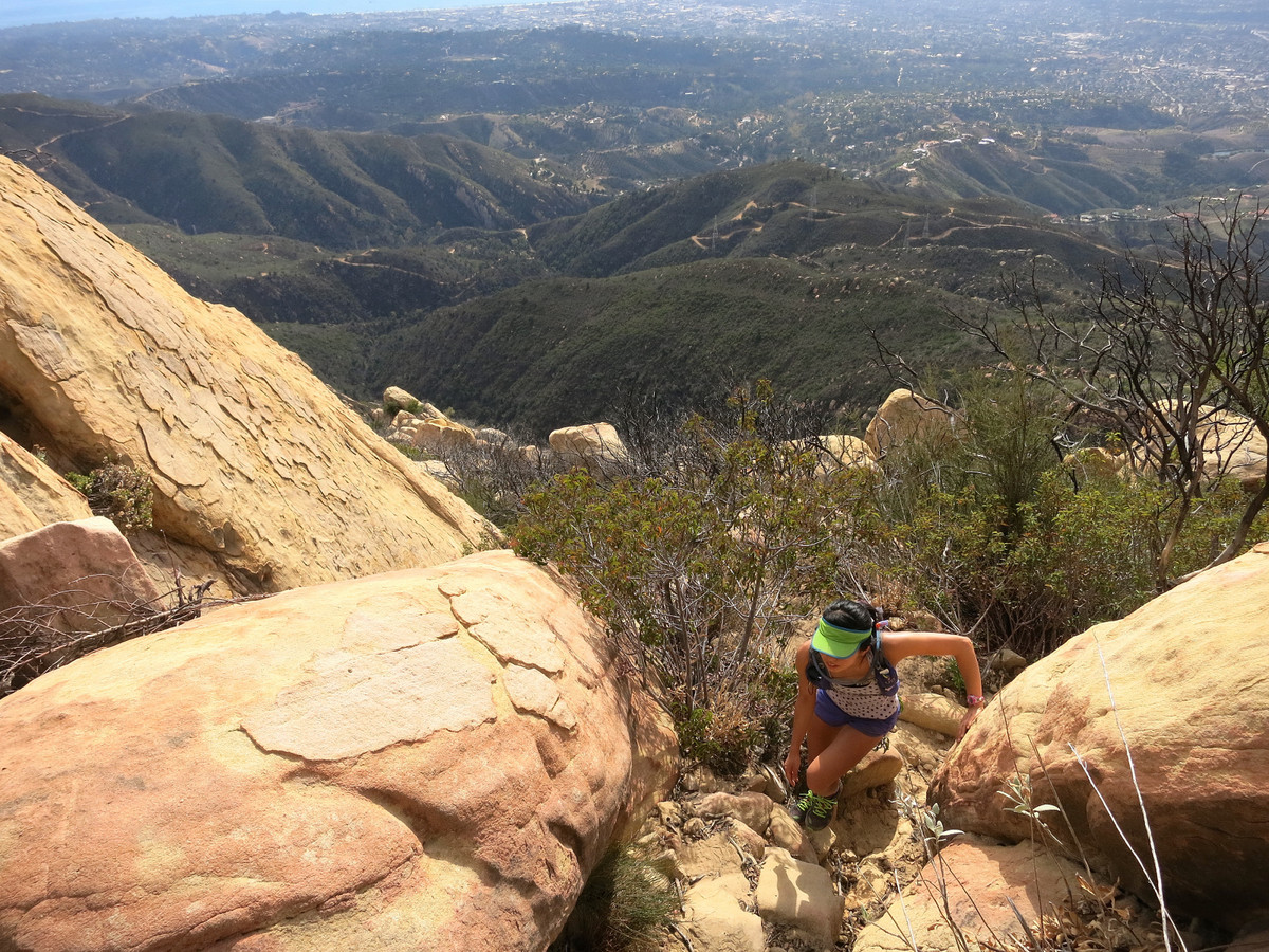
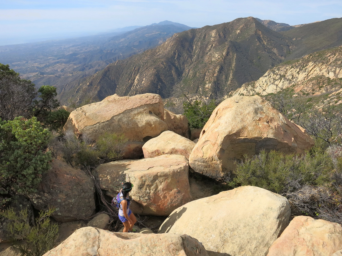
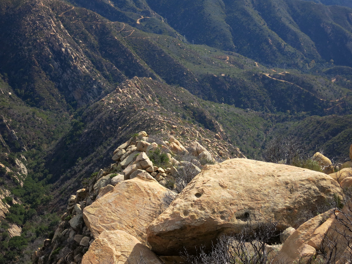
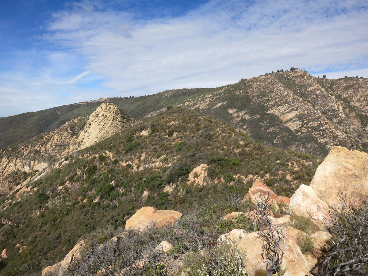
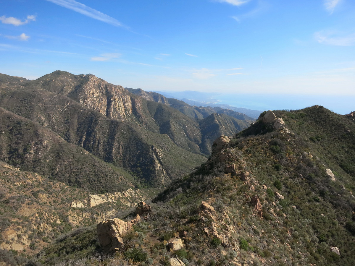
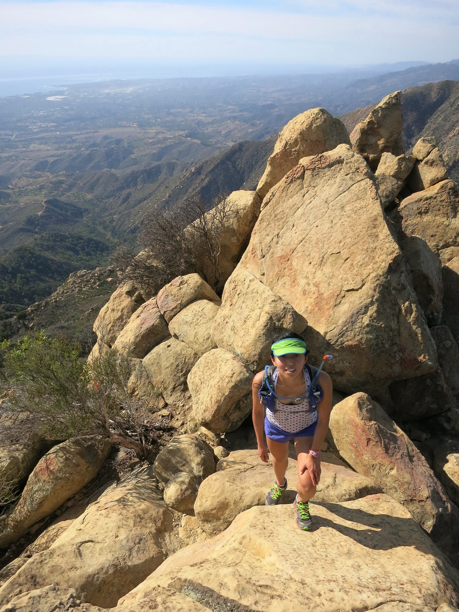
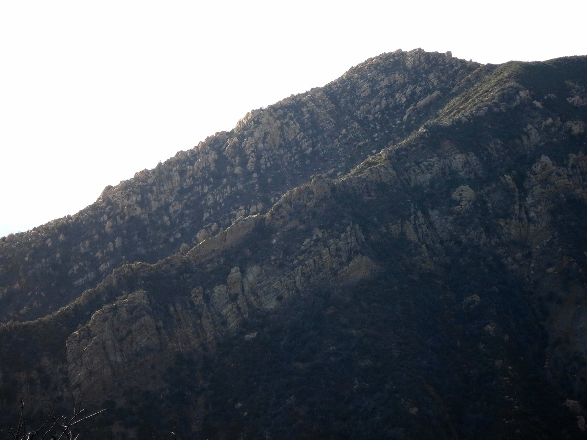
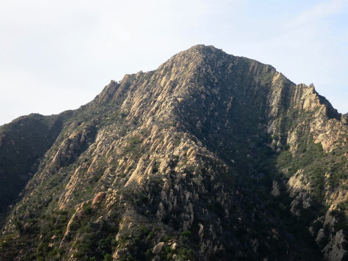
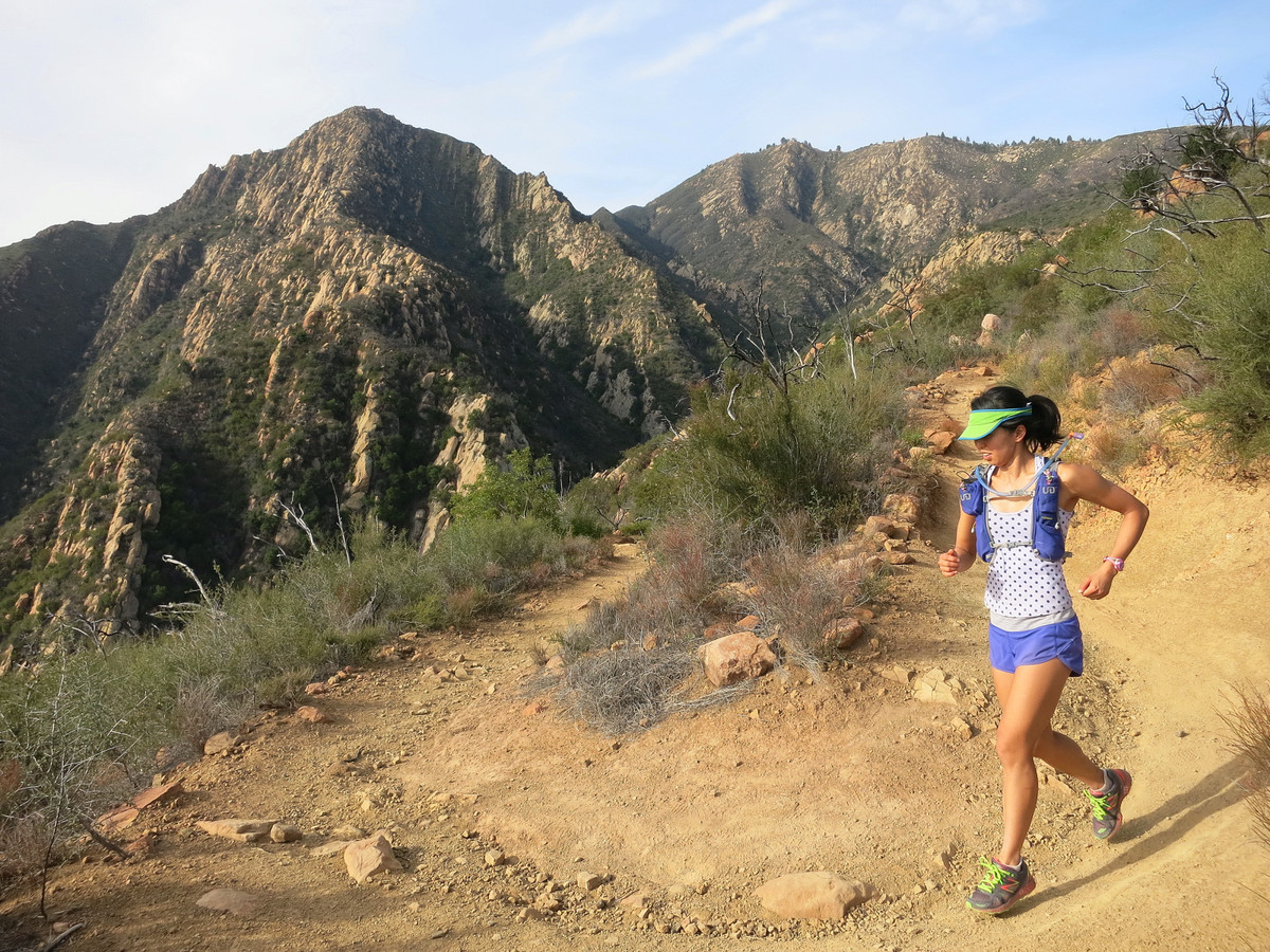
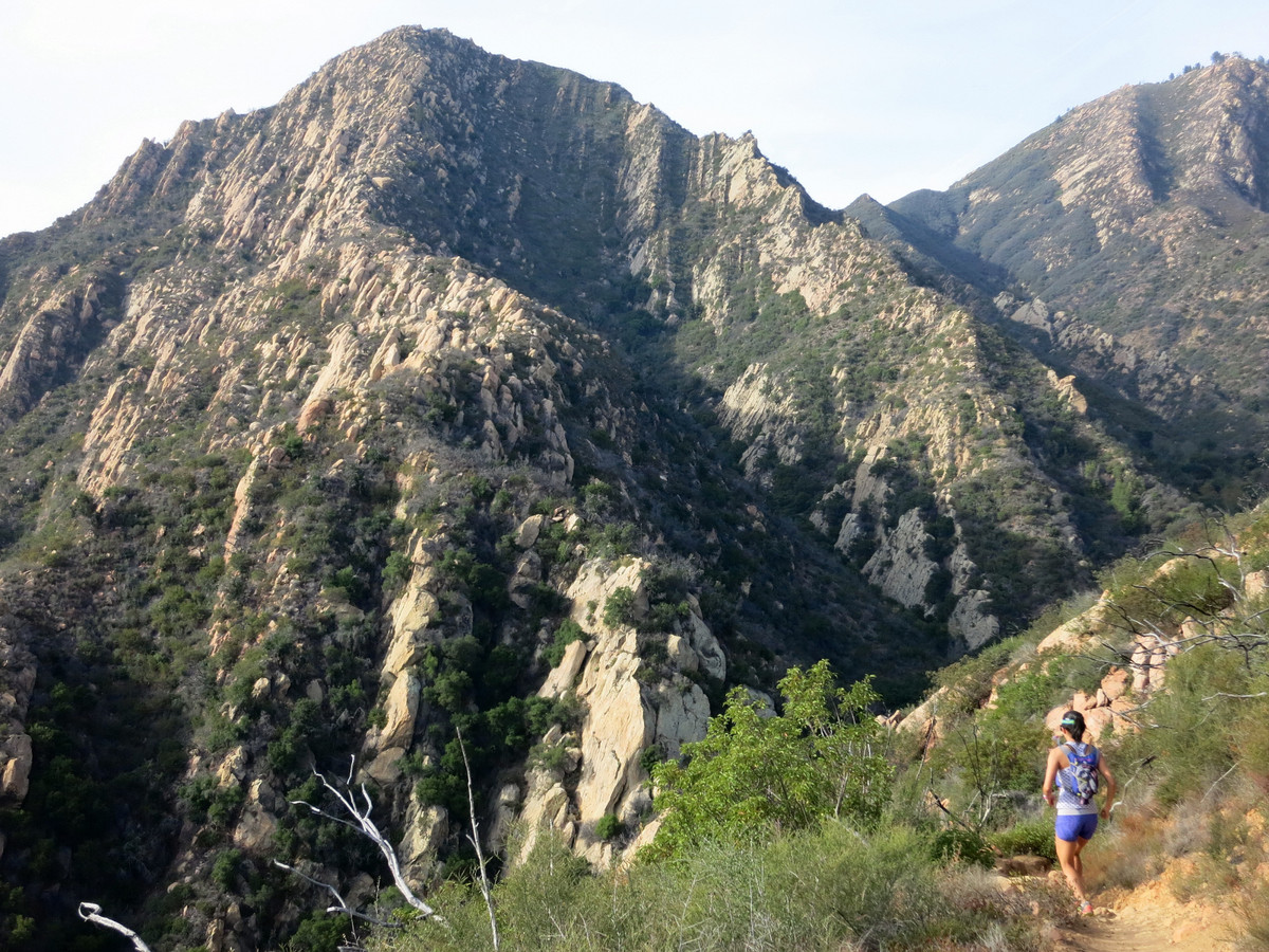
 From this point is a sustained 2 mile rock hop scramble on beautiful Matilija sandstone with it’s distinctive rock formations and orange color to the 3,275 ft summit of Arlington Peak. This section is arduous and steep, but the views of the Santa Barbara and Ventura County coastline are incredible. As one ascends higher, the views become increase with an excellent vantage into the Mission Creek Canyon and beyond to the spine of the Santa Ynez Mountains, the Santa Barbara region and the Channel Islands. The summit of Arlington marks the end of the sustained scrambling and the trail levels off as it continues to Cathedral Peak, with its impressive south buttress cliff face visible from many points in Santa Barbara. A use path continues from Cathedral Peak in a chaparral tunnel down to a saddle from which a final very steep section that leads to the summit of La Cumbre Peak. La Cumbre Peak is vehicle accessible via the East Camino Cielo Road. For an excellent loop back to the trailhead, travel along the road east to the upper trailhead of the Tunnel Trail, one of the more popular trails in the Santa Barbara Frontcountry. The Tunnel Trail traverses along the canyon of Mission Creek and then switchbacks down to the access road with excellent views back to Arlington Peak and Cathedral Peak. This is a super fun route that I hope to do again next time I’m in Santa Barbara. GPS route here.
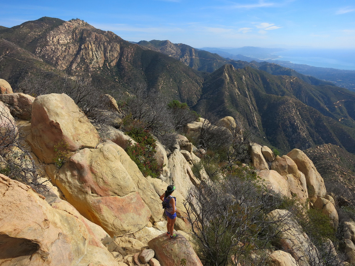


One Comment Add yours