Most people living in the present village or small town of Pontardawe probably consider that it has always been here. That is not in fact so – Pontardawe is a relatively new town only about two hundred years old. Three maps in particular show how the communities in the Swansea Valley including Pontardawe developed. In 1729 Emanuel Bowen produced his New and Accurate Map of South Waleswhich is now considered to be not at all very accurate. (See Around Pontardawe1996 for this map).
However, he does identify places that are pertinent to this article. At the location we refer to as the Cross area of Pontardawe Mr Bowen has marked a Pont Cledach, and about half a mile to the east Pont – ar Dawye. They both refer to bridges as the word Pont signifies. There are no buildings or a village identified that later became Pontardawe. The two places identified as Pont are simply bridges crossing rivers in the mid Swansea Valley, one on the Upper Clydach River (the Pont Cledac) and the bridge about half a mile away crossing the River Tawe (the Pont-ar Dawye). (See Two Centuries of Pontardawe1794–1994 by Clive Reed for more on this bridge and Pontardawe).
In 1797 Mr George Yates produced a Map of Glamorgan that showed the major places in the old county. They include the names of towns, villages, mountains, rivers, churches and the seats or country houses of the gentry and clergy. In the Swansea Valley there were still no towns at that time, apart from the small village of Morriston and places such as Gellygron, Ynis Penllwch, Llanguge, Ystradgynllais and Kilybebill. The new Swansea Canal is identified, this having been completed by 1796 as far as what is now Godre’r Graig, and would eventually be completed by 1798 to its terminus at Hen Noyadd (the Old Hall at Abercraf).
I mentioned the Cross area of Pontardawe a little earlier, but it was not a crossroads in 1797. The location was originally the junction of two parish roads. One road from Llandeilo to Neath and one from Swansea to Brecon, but the Brecon road turned east down what we now refer to as Herbert Street before turning up what is now Holly Street and continuing on toward Brecon. The road junction at the Cross was a tee junction.
There are just four buildingsmarked on Mr Yates’ Map. There were probably a few additional habitable places for the farm labourers or poorer people working in agriculture but they were too insignificant to record. In 1797, near the Swansea Canal, are a small group of three buildings that are unidentified but what is Ynys Gelynen Farm. This is spelt in different ways in different documents. In 1777 the Land Tax Assessments (WGAS) record it as Ynis Glinen and occupied by Mr William Elias, in 1797 it is recorded as Ynys–y–Glynen, and by 1838 as Ynysgelynnen. This wording translates from the Welsh into English as “a meadow where holly grew”, indicating the presence of a large number of holly trees growing in the locality.
What is pertinent to this article is the area we refer to as the Cross. In the 18th century the Government encouraged private enterprises to invest in the road infrastructure of the UK, and private companies took over the responsibility of improving and maintaining the country’s main roads, hence the Turnpike Trusts were created. The parish still maintained the lesser roads. In 1805 the road up the Swansea Valley from Swansea to the Twrch River became the Twrch Road. At the Pont Cledach instead of turning to the eastward to Neath a new road was created through the farmlands toward Ystradgynlais creating a crossroad. The new section was later named as High Street continuing into Brecon Road.
Other developments took place soon afterwards. On 6 March 1821 The Swansea Canal Navigation Company recorded in its Minutes Ledger (PRO Rail 876/3) “thatthe Companyresolved thatthe clerkinform MrLockwood thatthe CanalCompanyfeel disposed to meet lord Dynevor’s views and that theywill bereadyto Assign groundfor wharfs and other conveniences at Pontertawey whenever requested”.That ground granted to Lord Dynevor was from the road junction at Pont Cledach and running eastward. The wharf ran alongside what is now Herbert Street as far as Herbert Street Canal Bridge, enclosing the area to the southward as far as the canal aqueduct and back alongside the Upper Clydach River, forming an inland dock (See Two Centuries of Pontardawe.
Miss Davies of the Cross Ironmongers donated a plan to me in 1986 that had been prepared for the construction of the ironmongery business, whose headed notepaper stated it had been established in 1856. The plan showed the canal dock and wharf. The dock could accommodate two canal barges in line for the loading and unloading of goods. Hannes yGwrhyd recorded that iron ore from the Gwrhyd iron mines was carried to the wharf in panniers on horses along what is currently James Street, then transferred to canal barges for delivery to the ironworks in the locality. Also marked on the plan at the junction of the crossroads was the Cross Inn, this no doubt giving the location its familiar name of the Cross. The Inn was only a small two–storey establishment at that time.
A later map, the Tithe Apportionment Map of the Parish of Llanguicke 1838 (NLW) and shown in this article, identifies the plots of ground with their respective owners and occupiers and the use of that land. Two small “settlements” had now developed in what was to become Pontardawe and are shown on the following map.
The smaller one lay along the road towards Rhyd–y-fro and was a compact group of buildings that included five cottages, a homestead, a limekiln, a furze outhouse (gorse) and a public house, later the Dynevor Arms.
A slightly larger group of buildings is shown around the cross and canal area that included the two breweries, a public house (the Dillwyn Arms), Ynysgelynnen Farm, two houses (not cottage, and indicating a group of buildings), a fulling mill, a small group of industrial buildings that included a limekiln and dwelling of sorts, and the first terrace or row of buildings in the new community. This terrace consisted of five dwellings which in 1844 are named as Carpenters Row. This larger settlement was later to develop into the small village of Pontardawe.
Joseph Martin is identified as the occupier of plots 35, which is a house, 27 a Pandy (fulling mill), 28 Cae Pandy and the unidentified plot 29 which was the canal company limekiln that is presently to be seen built into the wall alongside the pavement on Holly Street. Ynysgelynnen farm was demolished in 1906 and the Pontardawe Public Hall erected on the site by public subscription and later to be known as The Pontardawe Art Centre.
Two other properties interest me at the present time. They are plots 24 and 30, both owned by Henry Leach of Plas Cilybebill and occupied by John Jones who farmed the nearby Ynisderw Farm, and who brewed beer in a brew house on the farm. Plots 24 and 30 are both breweries. Plot 30 is recorded as the new brewery erected in 1838 to replace the older smaller brewery of c1810. John Jones was
obviously a man with business acumen. His
original brew house was too small to cater for the numbers of persons wanting to buy beer, such as the canal bargemen, iron ore miners, coalminers and drovers. He first built his old brewery, then the larger new brewery to cater for the demand for his beer. In 1838 two public houses are recorded near the brewery, The Dillwyn Arms and The Dynevor. The original old brewery was demolished much later to make way for the Castle Hotel.
The new brewery is shown in local artist Mr Mike Jones’ depiction of it as it would have appeared in that period with a barge laden with barrels of beer about to set off on a journey along the Swansea Canal to canal side public houses or inns. The buildings are constructed of local stone, probably quarried from the hillside below Barley Hill and with slated roofs. The brewery was a substantial structure comprising a brewing room, bran house, cask washing house, malt room with a malt mill dated 1849 probably to replace a less efficient or smaller malt mill of 1838, a barm house, fermenting room, washing room, boiler house with an 18 feet long steam boiler, an engine house with a vertical steam engine, cart shed, coopers shop, cellar, brewery stores, stables, coach house, and offices (Whitbread and Co archives 1919). Barges also brought anthracite coal to the brewery for the coal fired steam boiler that powered the steam engine that worked the equipment in the brewery. The canal barges would have delivered all the above equipment to the brewery during its construction.
In the original documents a cart shed and stables are recorded and also the type of and numbers of different types of horse tackle in the brewery stables indicating that horses pulled dray carts with beers to local taverns and inns.
In the 1920s the brewery was capable of making 200 barrels of beer per week. The brewery was essential to the working men of Pontardawe after William Parsons built his iron and tinplate works on Ynisderw farm land in 1838 and where over 200 men and boys laboured at strenuous work in heat to produce sheets of iron. Later the works became the Gilbertson Steelworks and employed over 1000 persons. In the 1980s a Mrs Williams of Pontardawe told me a story of her husband working at the steelworks in the 1940/50s and who sweated so much because of the hard physical work that he lost a lot of liquid and salt from his body. To replace that lost fluid he drank about ten to fifteen pints of beer every day in work, and afterwards she said he went out for a drink with the boys, yet he was not drunk. He had to replace the lost fluid or he could have been seriously ill, and beer at that time was safer to drink than the local water. It was common practice to send young boys to the nearest pub for jars of beer. Beer was an essential element to men working in such industries, hence the proliferation of public houses at works entrances.
Mrs Eunice Williams of this Society told me that as a little girl she used to go to the brewery to buy yeast that her mother then used to make a liquid locally known as jovine. That was a weak beer drunk by children when they were unwell.
The new brewery operated as such until the c1920s and afterwards as a storage building until World War Two when it became the main headquarters of the Air raid Precautions (ARP). In 1947 it was used as a pickling factory for onions and cabbage and operated to about the late 1950s. The buildings later became a car repair business and operated as such until about 2016. That business provided an excellent first-classvehicle repair service for the people of Pontardawe and the surrounding area and will be very much missed by all who knew of Duncan and Mike.
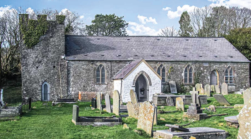
The former new brewery of 1838 is one of the oldest, if not theoldest, building surviving in Pontardawe from the earliest times of the village, still in its unaltered state. The other structures identified on the Tithe Map have been demolished or rebuilt. Its setting with the canal running alongside and St Peters Church above is a relatively unaltered scene from the period 1860 when St Peters Church was completed. The whole scene is one of an historic character that creates an attractive and heritage element in the centre of Pontardawe. It provides a physical link between the past and the present.
Regeneration projects were proposed in 1988 to improve the fabric of a number of Pontardawe’s commercial buildings, including the former brewery. They were to restore the structure of the buildings to encourage investment in the town. One project was to convert the brewery buildings into an Outward-Bound Centre. The Urbed Regeneration Report recommended that the buildings could be redeveloped as such and boats could be operated on the adjacent canal. That project would have seen the brewery building fully restored and becoming an attractive heritage asset to Pontardawe. Unfortunately, the project was not supported by the local authority of that time.
There are Planning Policies extant at the present time designed to improve and protect historic buildings in towns such as Pontardawe. These could see the brewery building renovated and become an attractive asset to the town. I ask why are they not implemented? The hope is that our local authorities will support them in the near future.
Our National Government, The Welsh Assembly, has policies to assist local authorities with protecting and enhancing historic buildings. Among them Planning Policy Wales which has as an
Objective: “To ensure that the characterof historic buildings is safeguardedfrom alterationsor demolition that would compromise thebuilding’s specialarchitecturalinterest. And that Local Planning Authorities havean important role in securing the conservationof thehistoric environment whilstensuring thatitaccommodates and remainsresponsiveto present dayneeds”.
I look forward to the time when those objectives are implemented to save the oldest surviving building in Pontardawe.
© Reproduction by kind permission of Clive Reed. No part of this article may be copied or reproduced without the permission of the author/or The Swansea Valley History Society.