Blog Archives
A delightful shady walk from Chanajiga picnic area in the Orotava valley
July has been very hot here in Tenerife, but the temperatures have gone down to pleasanter levels this week so we did this walk last Wednesday, 28th July. The forecast was good for the Orotava valley, with full sun and no cloud predicted. This is important for the upper Orotava valley as Chanajiga picnic area is in the cloud forest zone at the foot of the steep forested slope of the valley and is frequently in the cloud and although we wanted a walk in the shade of the forest, we preferred not to be in the cloud which takes away the chances of views and can also be quite disorientating.
We approached the Orotava valley on the north motorway – TF-5 – and went through some rain, so were wondering if it was the right day, but then saw sunshine ahead so continued up the Orotava valley. As we neared Chanajiga there was light cloud, but when we got there we were just above the cloud, in lovely sunshine. We left the main road through the Orotava valley at the junction in Camino de Chasna, signposted Benijos and Palo Blanco. After passing through Benijos we came to a turning left with a signpost to Chanajiga. From there on the road is very rural and we even came across a goatherd with a small flock of goats grazing the sides of the road.
When we arrived at Chanajiga I discovered I did not have the GPS track we had intended to follow on my GPS. I thought I had loaded it but did not check it before leaving the house. So we decided to do a bit of exploring and we might find the route intended, or part of it, or not as the case may be. We started off scrambling up an exceedingly steep unofficial path, which I am not recommending, till we got to a track, where we turned left and walked a little way till we saw a very well defined path crossing the track diagonally, and decided to go up that.
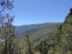
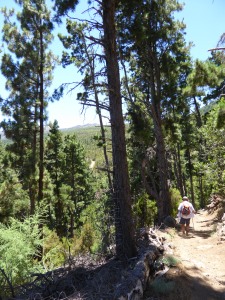
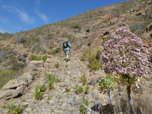
The path was going up a very steep hill, but with zig-zags it was not excessively steep to climb. There was shade from pines above the path and at intervals views through them to the mountains at the top of the Orotava valley, and the sea of cloud beneath. The day felt warm for the climb and we were glad of a gentle breeze through the trees.
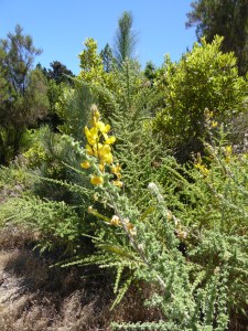
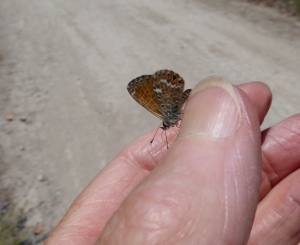
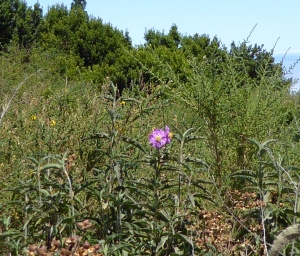
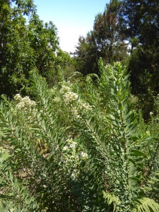
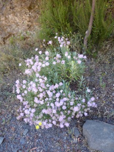
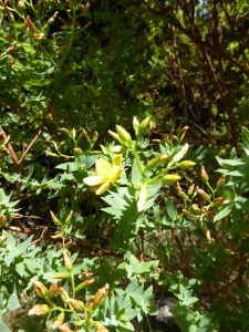
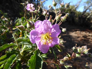
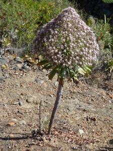
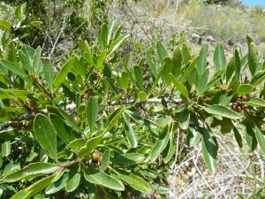
Very suddenly the path came out on a wide dusty track, so we found we had reached the top of the steep side of the valley. At this point the footpath continued to the left, starting parallel to the track, but probably diverging from it – to be explored another time! We joined the track, and, after a lunch break, walked steeply downhill on the track. The track had very mixed vegetation either side, of the type found on the edge of the laurel forest with Fayas (Myrica faya) and Madrono (Arbutus canariensis), and lots of different flowering shrubs such as Sticky Broom (Adenocarpus foliosus), Pine forest Cistus (Cistus symphytifolius), Shrubby Burnet (Bencomia caudata), Shrubby scabious (Pterocephalus lasiospermus) along with Tenerife Birds-foot Trefoil (Lotus campylocladus). The flowers and sunshine on the edge of the forest attracted many butterflies including Canary Blues (Cyclyrius webbianus), Bath Whites (Pontia daplidice) and Clouded Yellows (Colias crocea).
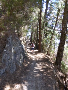
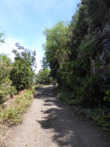
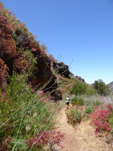
We descended on the track from around 1600m to just below 1350m where we came to a track crossroads and decided to turn right. The track we were now on was the same track we had reached first reached near the beginning of the walk, but nearly 2 km to the north. It was a delightful shady walk, roughly level with cliffs to the right where the track had been carved out of the hillside.
Beside the track, on the rocks, were shrubby plants with flowers, including Cardo de Cristo (Carlina salicifolia) or Willow-leaved carline thistle, and Cruzadilla (Hypericum reflexum) or Reflexed St Johns Wort. At the base of the rocks Wild Marjoram (Oreganum vulgare) and Lesser Calamint (Calamintha nepeta) were flowering.
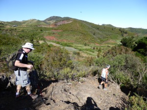
We got to the path junction where we had turned uphill earlier, and this time we went down on the path the other side of the track. This was a gentle descent, which after a while crossed a barranco and passed some buildings of the Galeria de la Zarza. Continuing on we joined a track and turned downhill. A hundred metres or so on we saw a cairn on the left of the track and a well used footpath going downhill. However, it was badly eroded by rain and bicycle use, with loose stones on a very steep slope, so we decided to continue on the track. The path would probably be OK to climb, but it looked somewhat dangerous going down. Soon the track reached a T-junction and we turned left to return to Chanajiga.
Because our initial ascent was not recommended, I have edited the GPS track to start and finish the walk on the same path. The walk should still only take about 3.5 hours. The GPS track can be found here: http://www.wikiloc.com/wikiloc/spatialArtifacts.do?event=setCurrentSpatialArtifact&id=10339097
An early summer flower and butterfly walk near San Jose de los Llanos
We did this walk last Wednesday, 3rd June. It did not go to plan because of a path overgrown with brambles which resulted in us turning back and having to do an alternative walk to that planned. So I will not be describing the walk in detail, or sharing a GPS trail because it was a fairly haphazard route. I just wanted to share the delights of the flowers and butterflies we saw in the area.
In the south of Tenerife now, where I live, the flowers are getting hard to find, as it is now so dry after a dry winter and a very hot heatwave a couple of weeks ago, which finished off a lot of greenery. However, just over the watershed between Santiago del Teide and Erjos, there are still some flowers, so that is why we planned a walk there.
We parked at the start of the track to the rural hotel which leaves the Eco Museum roundabout about 1km west of the turning to San Jose de los Llanos on the TF-373. (The Eco Museum is a low traditional building to the north of the roundabout which was built and completed a few years ago but has not yet opened. The building is used once a year for a threshing festival in late July, but is otherwise unused.)
We planned to do a circle starting to the north of the road, crossing at San Jose de los Llanos and finishing the circle on the south of the road, which we did, but not quite the route planned. The north side of the road has some remnants of laurel forest, and a lot of lush vegetation, with little farms in between, whereas the south side of the road is the edge of the pine forest, with a shrub covered open area around the rural hotel.
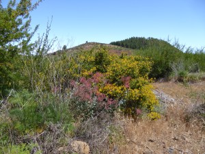
Red Madeiran sorrel -(Rumex maderiensis) in front of the yellow-flowered bush of Sticky Broom – Codeso -(Adenocarpus foliosus) near the rural hotel
Unfortunately the lushness of the area favours the growth of brambles, which we encountered blocking the path as we descended to the delightful patch of laurel forest we discovered only last July. On that walk we had encountered a very difficult and overgrown part of the path at the end of a lovely path through the laurels. This time we met a barrier of brambles before we reached that bit. Even though we had secateurs, we would have taken a long time cutting our way through the bit we saw, and we still did not know if last year’s bad patch would have been cleared so we turned around.
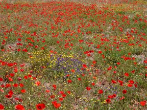
A neglected field full of field poppies (Papaver rhoeas), with a little blue Vipers Bugloss (Echium vulgare) and yellow field marigolds
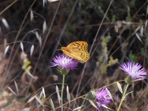
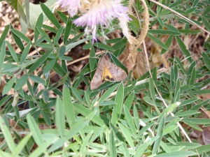
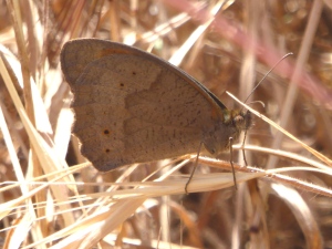
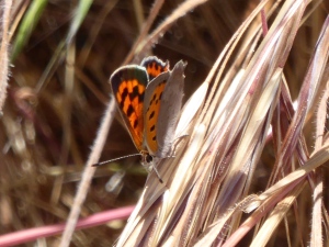
From San Jose de los Llanos we took the track from the top of the road that passes Bar Risco and on the edge of the pines we saw several Cardinal butterflies. We were also seeing many Meadow Brown butterflies in the grassy areas, though most were uncooperative for photos! The Clouded yellow butterflies we saw lots of were all camera shy! We also saw Yellow under Pearl moths flying, and Bath White, and Canary Blue butterflies in quite large numbers. Then towards the end of the walk, we saw two Small Copper butterflies.
So I am sorry the photos are not the best, on walks it is difficult to take the necessary time to get good butterfly and moth photos – and I don’t carry my big camera either. As it is I am not very popular with my walking companions for breaking off conversations on a butterfly hunt, and ending up well behind and having to catch up!
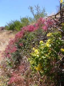
Malfurada (Hypericum grandifolium), a yellow flowered plant typical of the laurel forest and its edges, in front of the more Madeira sorrel
However, I hope the description of some of the lovely flowers and butterflies and moths that can be seen will inspire you to go out and look for them.
Arafo to Arenas Volcano
I apologise for the long interval since the last posting on the blog. I have been away, visiting family, and haven’t been walking in Tenerife. I am now back, and have walked on 3 of the first 4 days back, so my muscles are getting back into trim, despite some complaints!
This is a walk from Arafo in the Guimar valley up to the volcano which erupted in 1705, delivering lava which covered 47 square kilometres, and lots of fire-fountaining of molten lava, resulting in the ‘sand’ and volcanic bombs in the vicinity of the cone. It is a route with great views and passing through different landscapes in the one walk.
The route we followed up is part of the popular pilgrimage path from the Orotava valley to Candelaria, so it was a very clear route, although not signposted or waymarked.
I parked the car quite near the centre of Arafo, thinking that it would not be possible to park higher up. However, it did add a lot of very steep walking, both up and down, and, as we were to discover, there was parking for the odd car nearer the start of the paths. However, the walk through the farmland above the town, with its neat and productive fincas was a very pleasant one. I always enjoy seeing what crops are grown locally and there were lots of vines, fruit trees and onions, in addition to the ubiquitous potatoes.
We walked straight up the street from the church, passing some restored old public laundry places, just below an old water mill for grinding gofio. Continuing straight up we were passing a finca when the owner asked us if we were walking to the volcano. When we said yes, he pointed out we should have turned left a little lower down as we were on the road that ended in the Barranco Añavingo. So we retraced our steps and went up the road indicated till we got to a right-angled bend where the road went to the left. A track straight ahead was marked ‘sin salida’ (no exit), but this was our path. A couple of hundred yards further up, just before a gate, we turned right off the driveable track onto a footpath, still continuing steeply up.
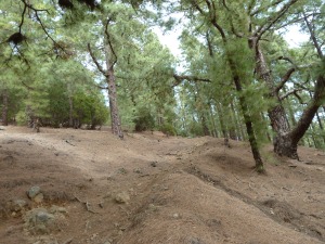
At first the path was badly eroded, then there were parts well cobbled, and finally arriving in pine woodland, the path continued upwards in zig-zags on a more pleasant pine-needle covered surface. This continued for some distance passing some fine old pine trees, till we arrived at a more open area with sweet chestnut trees and low shrubs. A notice stated that the finca was private, clearly the sweet chestnut trees had been very productive last year, judging from the shucks piled up outside the old farmhouse which we passed in front of not long after.
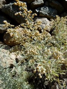
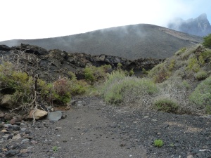
From there on the landscape was open black ‘sand’ or lapilli, which was a bit difficult to climb on, but we continued up with the volcano on our left. To our right was a barranco, and beyond that, pine forest. To the right of the track, the border of the barranco had quite a variety of wild plants in flower including Flixweed (Descurainia millefolia), Sticky broom (Adenocarpus foliosus), Tenerife vipers bugloss (Echium virescens), False sage (Sideritis sp.), Marguerites (Argyranthemum gracile), Tree houseleeks (Aeonium arboreum), and Escobon (Chaemaecytisus proliferus).
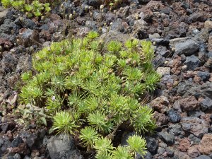
Continuing on we followed a GPS trail from Wikiloc contributed by ‘llanodelmoro’. This was fine, though not easy, with a GPS and an intrepid spirit, but, as there was no footpath most of this part, I would not recommend it to less intrepid or less well-equipped walkers (just turn round and walk back down to the old farmhouse the way you came up). So we followed the GPS trail around the south side of the volcano, between it and the cliff-like side of Pico Cho Marcial. In one dip there were a lot of Teide knapweed (Cheirolophus teydis) growing. It was a very dramatic landscape, but slow going, and we were glad to get back to the old farmhouse after crossing the black ‘sand’ plain above it.
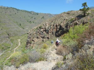
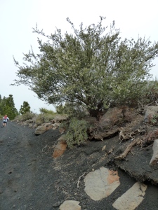
At the old farmhouse, instead of going left back the way we came, we went down the right-hand track which wound its way across a lot of the lava from the volcano. It was a gentler descent than it would have been the way we came up. After passing a house by a canal, the track turned more steeply downhill and soon there were patches of tarmac, and then it became a properly tarmaced minor road. We could have continued this road down further and turned left lower down, but we chose to take part of another route put on Wikiloc by ‘llanodelmoro’, going left on a track crossing the lava again. This was a pleasant walk until the track ended, now in pine woods on the far side of the lava. We then had to go down a footpath which was OK at first but soon became very steep, stony and eroded, so we were glad this stretch was not too far before we again joined a tarmac country road.
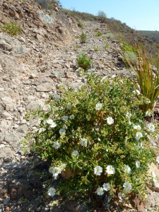
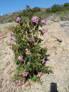
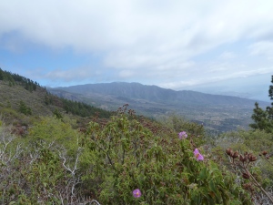
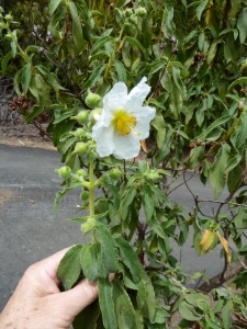
On the section of road through the lava I saw a Cistus plant like the pink Pine Forest cistus (Cistus symphytifolius), (and growing next to one) but with white flowers. I was not sure what it was – perhaps a white sport of the Cistus symphytifolius. If any reader knows what it is, I would be very interested.
Having reached the tarmac, and with Arafo clearly in view below, we walked down the road, although it was a different one from the one we came up. Half-way down we turned left to join the previous one just above the gofio mill and get back to the town.
The walk totalled 15km with 990m of climbing and descent and took approximately 6 hours. Parking higher up could cut at least an hour off this, and up to 250m of the climb.
