Blog Archives
A varied and mainly gentle walk in Anaga from Mirador Jardina
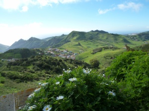
The view from the Mirador Jardina, with the Canary endemic marguerite, Argyranthemum broussonetii in the foreground
We like to do some walks in Anaga when the weather is good, and had not done one so far this winter. However, last Wednesday, February 12th, we decided the forecast was just about alright for a walk there. This walk was ideal for this time of year as it combined some walking in the laurel forest with some out of forest on the south side, where there were a lot of flowers to see. It also featured some spectacular views.
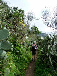
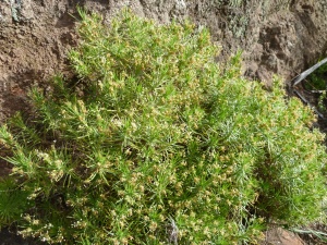
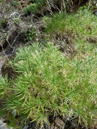
We started the walk from the Mirador Jardina which is on a bend in the main road between Las Canteras and Cruz de Carmen. The walk was a figure of eight, so we visited twice a crossing of paths on a ridge, and walked all four of the paths joining there. We left the Mirador on a track on the southern side, and continued down it for about 700m, by which time it was tarmac. Along the edge of the track, on a low cliff, I spotted some Canarian shrubby plantain (Plantago arborescens), which was flowering, so it is easy to see how it is a plantain, even though the leaves and habit is so different from the common species. There were also examples of the Canary endemic marguerite which is common in the laurel forest, Argyranthemum broussonetii, with its large daisy flowers and large soft leaves.
The slope above the track was covered with the yellow flowers of the ubiquitous Bermuda buttercup, (Oxalis pes-caprae) between bushes of Tree heath (Erica arborea), which were in flower beside the road. We left the track on a bend, joining a narrow footpath going left.
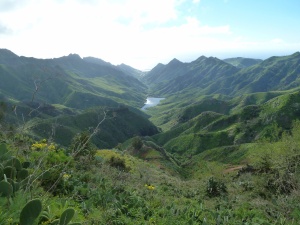
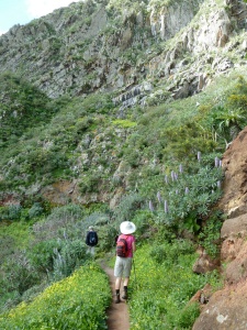
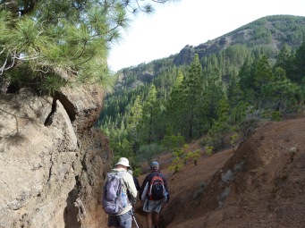
The footpath hugged a slope with views down to the Tahodio reservoir, the sea, and the knife edge ridges running down to the sea from the central ridge. Then it reached a lookout point before plunging into deep laurel forest. Springing from the forest floor were some large arrow-shaped leaves, with a few odd-looking, striped and hooded flowers hiding beneath them. These were Arisarum simorrhinum, which has no English name that I know, but one of its many local names is Candil. They are worth looking for if you see the leaves.
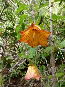
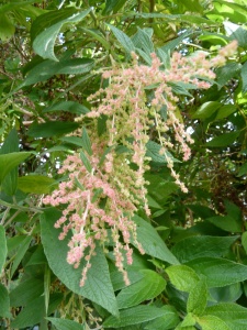
Soon we were delighted as we started to see lots of Canary bellflowers (Canarina canariensis) with their beautiful orange flowers, and also some purple cineraria flowers, (Pericallis echinata) brightening up the forest floor. The path began to climb, still in forest, towards our highest point of the walk, Pico del Inglés. We came out on a road near the crest of the central ridge where we saw in flower a beautiful bush of the Canary endemic Gesnouinia arborea, which again I do not know an English name for. However, its spanish name is Ortigón de los Montes, or Mountain nettle, since it is of that family.
We had to walk a little way along this quiet road, till we reached the Mirador Pico del Inglés, where we were glad to see a yellow/white liveried signpost for our path, as it was difficult to see, plunging downhill beside the Mirador. It zig-zagged down, passing an abandoned building and continuing along a ridge, going downhill all the way. There were some very luxuriant ferns, and several clumps of the little green Two-leaved orchid, Gennaria diphylla. Half-way down the slope we met the path junction at the waist of our figure-of-eight, and continued down on the left-hand path.
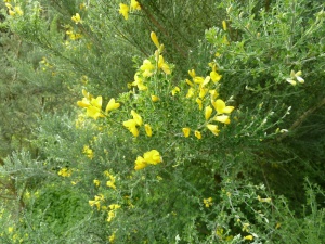
After a long descent under laurels and tree heaths the path broke out into the open with another fabulous view, and immediately, more flowers. The highlights were the rich blue spires of the Tenerife vipers bugloss (Echium virescens), and the yellow broom-like flowers on the Canary whin (Teline canariensis). The path wound around above the small village of Catalanes and passed beneath a dramatic cliff, at the foot of which were patches of colourful flowers.
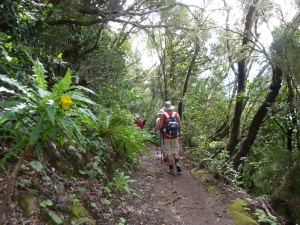
The path descending from Pico del Ingles under trees, brightened up in places by the Anaga sow-thistle (Sonchus congestus)
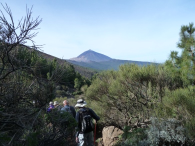
After the cliff the path began turning to the right, reached a junction near an old house, and we continued to the right around the nose of the ridge to reach a couple more houses, behind which we started to ascend the ridge again. This stretch had fabulous views towards Santa Cruz de Tenerife, where we could see the port, and the Auditorium with its unusual roof. There was also a great view towards Teide.
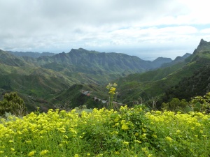
Bermuda buttercups (Oxalis pes-caprae) brighten the view where we emerged from forest above Las Catalanes.
As we climbed the ridge, we entered the trees again, and reached the path crossroads again, where we went left, descending a path somewhat eroded by bikes, after a while we left the main path onto a minor path going right. This bit was a bit overgrown, and at times we fought our way through. However the path was well-walked and we were in no danger of losing it, and as time went on, where it entered the deeper shade of laurel trees, it improved. In this area we saw many of the distinctive seven-fingered leaves of the Canary arum lily (Dracunculus canariensis). However, it was too early for the huge white spathes that accompany the flowers.
Climbing gently in the forest we finally rejoined the first path we had taken, and we returned on it to the track, and then the Mirador where we started. A dramatic and flower-filled excursion which we all thorougly enjoyed.
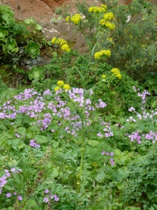
A patch of purple Cineraria (Pericallis echinata) with yellow-flowered Canary fennel (Ferula linkii) in their midst situated in a shady spot at the foot of the cliff
The walk was about 12 km / 7.5 miles long, with about 580m of climbing and descent, and took us 4 hours 40 minutes. Our thanks to Wikiloc contributor nacho1951 for sharing the GPS track to such a lovely walk. You can find his track on this link:
Dramatic walk past Los Organos de Orotava and the Camino de Joco
WARNING: (posted 3.12.2015) The path along the top of the Organos walk (Walk 33 in the book) is closed between points 7 and 12 as there has been a small landslide near to point 10, which is dangerous. The remainder of the path is passable, although it has always needed caution in places. So you can enter from either side to see the fantastic scenery and botanical diversity.
We did this walk in the north of Tenerife last Wednesday because the weather was nearly perfect for it, with nearly clear skies and no cloud between the crest and the coast, as there so often is. We had wanted to do it ever since doing stage 2 of the GR131 in December 2011, when we were unable to see one of the most scenic bits of the path due to low cloud and rain. This time we walked in the opposite direction, and took in the top of the Los Organos path as well as the Camino de Joco (part of the GR131) for a really exciting walk.
We started the walk from the ridge road from El Portillo to La Esperanza ( TF-24) at La Crucita, which is near km 30. There is a small viewpoint parking place there, where the Camino de Candelaria, a traditional pilgrimage path from the Orotava valley, crosses the crest of the ridge to plunge down the other side to Arafo and Candelaria. We went down the pilgrim path on the north side towards the Orotava valley, enjoying fine views to Teide across the valley as we went down in zig-zags.
On the way down we passed two dykes crossing the path, and later on one beside the path, both vertical sheets of magma intruded into the local rock during violent volcanic activity in the past. Now, though, they punctuate the hillside, helping stop erosion.
After about an hour of walking down (about 4.7km/2.9ml) we reached a junction of paths with signposts of yellow and white livery. We had joined the Los Organos circular walk. We went right and started an up and down section of path across the cliffs. This is a very interesting area botanically, but unfortunately it is a bit early for much to be in flower yet – in a couple of months it will be at its best. However, we did see some Canarian shrubby plantain (Plantago arborescens) in flower fairly soon after the path junction.
Soon afterwards we started seeing Shrubby Burnet (Bencomia caudata) plants by the path, and they continued to feature for much of the way across this section. They are distinctive plants with large pinnate leaves, even though they did not have their tassel-like flowers or seeds yet.
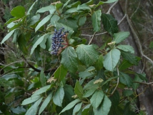
We then passed one of the most dramatic points of the walk where the path goes around a vertical pillar of rock, behind a very stout fence. There are great views from this point. Also in this area, which is less shaded by pine trees, there are lots of interesting plants, but none were in flower yet. Soon after the viewpoint, though, was a good example of a Canary guelder rose (Viburnum rigidum), not in flower, but with mature fruits and some flower buds at the same time.
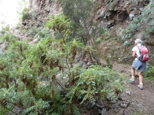
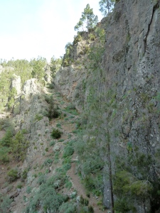
Soon afterwards the path curved in an out to cross a couple of ravines which were almost vertical, but full of interesting plants due to the increased moisture around them. One of them had Canary strawberry trees (Arbutus canariensis) up one side.
Then a zig-zag path took us up the far side of a large barranco, on to a level path which then went around a corner to a path junction. We reached this point after 2hrs 45mins. Here the path met the GR 131 with its red markings, and the yellow and white path we had been following went downhill with the GR 131, but we went right, uphill, with the GR 131. A red notice announces this as a dangerous section, but hardly more that the previous section of path.
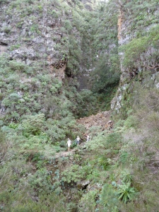
One of the almost vertical ravines the path passes. This one with Canary strawberry trees on the right of it.
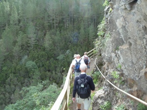
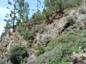
The path climbed quite a lot under trees, finally reaching a point next to a pinnacle of rock on the left and a vertical cliff on the right where the path started dramatically plunging downwards in steep zig-zags, and, after a few metres of relatively level ground zig-zagged upwards on steep stone steps opposite. After negotiating this switchback the view opens out to reveal the path curving around another large ravine, with stout fencing protecting the walkers at dangerous points. On the other side of this ravine was a viewpoint with a signboard pointing out the places in the Orotava valley that you can see from this point.
After the viewpoint, and passing a short stretch where there was a warning of possible landslips we arrived at the end of the ‘dangerous’ stretch, and a track. Crossing the track and staying with the GR131 we began a descent into the woods until the path levelled out parallel with but slightly above a track. Eventually the path did descend onto the track, but only for a few metres around a corner, before climbing up away from the track again. When we joined the track a third time, we turned right, leaving the GR 131, to climb with the track for about 1.5km/1ml to reach the main road again near km24. We had previously parked a car there, at the entrance to the track which had a sign naming it as Pista (i.e. track) Risco Atravesado.
The walk was a linear walk, requiring a car to be parked at each end (or other transport arrangements for pickup). The distance on the road between the two points is only around 6 km, so the arrangement of the vehicles does not take too long. The walk itself was 13.3 km/8.3 miles, and involved 644m of climbing and a greater descent. It took us 4.25 hours, but we did walk quite fast.
A GPS downloadable track for this walk can be found at:
