


Carnforth
Carnforth is first recorded in the Domesday Book as ‘Chreneforde’. This is Old English (Anglo-Saxon) meaning ‘Crane Ford’. No doubt the low-lying wetland in the area was perfect for cranes.
Like Scotforth, over time the Old English ‘ford’ changed to ‘forth’. This change is most common in Yorkshire with the most southerly example just south of Nottingham.
The ford was an important crossing point over the River Keer for the Roman road, which now seems to have headed via Warton and Yealand to Watercrook near Kendal. The ford was overlooked by the Iron Age hillfort at Warton.
Carnforth was likely an important crossing point in the Early Medieval period as the Roman road seems to have come up from Lancaster to the south and then headed north via Warton.
Meanwhile to the east a route (now the B6254) may already have run through to Kirkby Lonsdale to join with the Aire Gap route across the Pennines (now roughly the A65).
There was also likely to be an alternative route up to Kendal via Burton-in-Kendal as near to this road there was a district meeting place or ‘Moot Haw’ – also overlooked by Warton. This route crosses the Keer further north, so will not be the ford that Carnforth is named after.
Unfortunately the Moot Haw was destroyed by first the railway and then the M6.
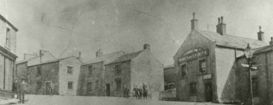
The photo dates to around 1900 and looks north up North Road – to the right is the road to Kirkby Lonsdale and to the left the road to Warton and Yealand.