Biodiversity Assessment of Michigan
Technical Report
Prepared by:
John J. Paskus, A. L. Derosier, E. H. Schools, H. D. Enander,
B. S. Slaughter, M. A. Kost, and R. L. Rogers
Michigan Natural Features Inventory
P.O. Box 30444
Lansing, MI 48909-7944
For:
Michigan Department of Natural Resources
Wildlife Division
March 31, 2008
Report Number 2007-11
�Suggested citation: Paskus J. J., A. L. Derosier, E. H. Schools, H. D. Enander, B. S. Slaughter, M. A.
Kost, and R. L. Rogers. 2007. Biodiversity Assessment of Michigan Technical Report. Report to the
Wildlife Division, Michigan Department of Natural Resources. Report number MNFI 2007-11. Michigan
Natural Features Inventory, Lansing, MI.
Copyright 2007 Michigan State Board of Trustees.
Michigan State University Extension programs and materials are open to all without regards to race, color,
national origin, gender, religion, age disability, political beliefs, sexual orientation, marital status, or family
status.
Cover photos: top left, limestone bedrock lakeshore (Patrick J. Comer); top middle, dwarf lake iris
(Thomas Arter); top right, northern blue (David Cuthrell); top right, piping plover (MDNR staff); bottom
left, American lotus (MNFI staff); bottom middle, wood turtle (Jim H. Harding); bottom middle, pugnose
shiner (Konrad Schmidt); bottom right, Tahquamenon Falls State Park aerial (David Kenyon).
�Acknowledgements
We would like to thank the Michigan Department of Natural Resources (MDNR) Wildlife Division for
funding this effort to assess the biodiversity of Michigan’s terrestrial and aquatic ecosystems. The Nature
Conservancy also provided important funding to upgrade our computer technology for handling the
massive amounts of data needed to complete this project. We especially would like to thank Ray Rustem,
MDNR Natural Heritage Coordinator, for having the vision to see the importance of this project, and
ensuring it was adequately funded over the past few years. More so than any other MNFI project, this
effort relied very heavily on data collected by many present and former Michigan Natural Features
Inventory (MNFI) field scientists and contributors. This includes all staff that collected data, entered data
in the database, provided quality control and assurance of the data, and/or secured funds that supported
these activities. In particular, we are very grateful for the work of: Michael Penskar and Ryan O-Connor
for meticulously reviewing all existing plant records in the MNFI database, as well as processing the
majority of the botany data backlog from outside sources; Dave Cuthrell, Michael Sanders, and Bradford
Yocum for processing the biggest backlog of data (animals), compared to all other programs, that
primarily came from outside sources such as the U. S. Forest Service, and the MDNR; and Shari
Gregory for transcribing the natural community data that was unprocessed from previous project work.
We would like to thank the following people for reviewing and providing feedback on earlier versions of
the aquatic methodology: Patricia Soranno and Mary Bremigan of Michigan State University, Lizhu
Wang of the MDNR Institute of Fisheries Research (IFR), and Michelle DePhillip and Matthew Herbert
of The Nature Conservancy (TNC). We would also like to thank Paul Seelbach (IFR), Arthur Cooper
(IFR), Christine Geddes (IFR), and Michelle DePhillip (TNC) for help with and discussions about
available aquatics GIS data.We would also like to thank Michael Donovan, Paul Seelbach, Peter Badra,
Doug Pearsall, Matthew Herbert, and Patrick Doran for reviewing the report and providing valuable
insight. Much appreciated administrative support was provided by Sue Ridge, Lyn Scrimger, Nancy
Toben, Connie Brinson, and Patrick Brown.
��Table of Contents
Introduction .................................................................................................................................................. 1
Brief Summary of Michigan’s biological diversity ...................................................................................... 4
Approach ...................................................................................................................................................... 8
Terrestrial Biodiversity Assessment Methodology ..................................................................................... 17
Aquatic Biodiversity Assessment Methodology ........................................................................................ 61
Looking for Patterns: Integrating the Data Layers Together .................................................................... 127
Next Steps ................................................................................................................................................. 135
References Cited ....................................................................................................................................... 137
List of Figures
Figure 1. Percentage of species tracked by major taxon ............................................................................. 4
Figure 2. Percentage of element occurrences by major taxon ..................................................................... 5
Figure 3. Percentage of natural communities by global rank ........................................................................ 6
Figure 4. Percentage of natural communities by state rank ......................................................................... 6
Figure 5. Regional landscapes of Michigan. ................................................................................................12
Figure 6. Ecological Drainage Units (EDUs) of the Great Lakes. ..............................................................14
Figure 7. IFMAP landcover classification, 2000. .........................................................................................19
Figure 8. Circa 1800 vegetation map. ..........................................................................................................22
Figure 9. All forest patches with boundaries defined by all roads, with a 0, 90, 210, and 300 m buffer ......28
Figure 10. Natural vegetation core areas defined by the no road, major road, and all road data layers ......32
Figure 11. Natural vegetation core areas defined by all roads with a 0, 90, 210, and 300 m buffer . ..........33
Figure 12. Potentially unchanged vegetation core areas ..............................................................................37
Figure 13. Large functional landscape patches defined by all roads with a 0, 90, 210, and 300 m buffer . 40
Figure 14. Large functional landscape patches defined by no roads, major roads, and all roads ................41
Figure 15. Frequency of rare terrestrial species using all last observed dates. ...........................................44
Figure 16. Likelihood of a known rare terrestrial species occurrence still occurring ..................................47
Figure 17. Bio-rarity scores for all element occurrences using all last observed dates - top 10%. .............50
Figure 18: Bio-rarity scores for rare terrestrial species with last observed dates > 1985 - top 10%. .........51
Figure 19. Best two terrestrial element occurrences by sub-subsection or subsection. ..............................53
Figure 20. High quality natural communities with an EO rank of >B/C. .....................................................56
Figure 21. Three best occurrences of each natural community type at the statewide scale. ......................60
Figure 22. Map of size and temperature river classification framework used in analysis. ..........................65
Figure 23. Map of gradient classification framework used in analysis. .......................................................66
Figure 24. Map of connectivity and shoreline complexity for lake classification framework . ....................68
Figure 25. Map of proximate geology lake classification framework used in analysis. ...............................69
Figure 26. Unique river ecosystems in Michigan using the 5% rule. ...........................................................74
Figure 27. Unique river ecosystems in Michigan using the 1% rule. ...........................................................75
Figure 28. Unique river ecosystems in Michigan by EDU using the 5% rule. ............................................76
Figure 29. Unique river ecosystems in Michigan by EDU using the 1% rule. ............................................77
Figure 30. High quality river ecosystems in Michigan by EDU. ..................................................................79
Figure 31. Rivers in Michigan with unimpeded access to the Great Lakes. ................................................81
Figure 32. Intact watersheds of headwater streams in Michigan. ...............................................................83
�Figure 33. Percent natural land cover in watersheds of headwater streams in Michigan. ..........................84
Figure 34. Unique lake ecosystems in Michigan using the 5% rule. ............................................................87
Figure 35. Unique lake ecosystems in Michigan using the 1% rule. ............................................................88
Figure 36. Unique lake ecosystems in Michigan by EDU using the 5% rule. .............................................90
Figure 37. Unique lake ecosystems in Michigan by EDU using the 1% rule. .............................................91
Figure 38. High quality lakes by EDU. ........................................................................................................93
Figure 39. Percent natural land cover by sub-watershed. ...........................................................................95
Figure 40. Percent natural land cover in riparian areas by subwatershed. ..................................................96
Figure 41. Land cover analysis by subwatershed. .......................................................................................97
Figure 42. Number of dams per river mile by sub-watershed. .................................................................. 100
Figure 43. Number of road crossings per river mile by sub-watershed. .................................................... 101
Figure 44. Fragmentation analysis by sub-watershed. ............................................................................... 102
Figure 45. Number of DEQ non-point source pollution permits per river mile by sub-watershed. ........... 103
Figure 46. Percent impervious surface by sub-watershed. ....................................................................... 104
Figure 47. Number of active mines per river mile by sub-watershed. ....................................................... 105
Figure 48. Pollution analysis by sub-watershed. ........................................................................................ 106
Figure 49. Sub-watersheds in Michigan scored from least-modified to most-modified. ............................ 108
Figure 50. Frequency counts of aquatic element occurrences by PLSS. .................................................. 112
Figure 51. Frequency counts of aquatic element occurrences without loon EOs by PLSS. ..................... 113
Figure 52. Element occurrence likelihood by PLSS. .................................................................................. 116
Figure 53. Element occurrence biological rarity by PLSS. ........................................................................ 117
Figure 54. Aquatic rare species richness per river mile by sub-watershed. .............................................. 120
Figure 55. Aquatic species of greatest conservation need richness.. ........................................................ 124
Figure 56. Locations of the best occurrences for each element by watershed. ........................................ 125
Figure 57. Prioritized terrestrial biodiversity areas . .................................................................................. 128
Figure 58. Prioritized aquatic biodiversity areas ........................................................................................ 130
Figure 59. High priority great lakes shoreline sites. ................................................................................... 132
List of Tables
Table 1. Aquatic and terrestrial species summary ........................................................................................ 4
Table 2. Summary of Natural Communities tracked by MNFI .................................................................... 5
Table 3. IFMAP land cover classification. ...................................................................................................18
Table 4. Summary of Circa 1800 Vegetation Classification. ...................................................................... 21
Table 5. Modified IFMAP land cover classes. ........................................................................................... 24
Table 6. Natural vegetation communities organized by patch type and minimum size. ............................ 26
Table 7. All forest patches with different road and buffer combinations applied. ..................................... 27
Table 8. Summary of natural vegetation core areas in the SLP ecoregional section. ................................. 30
Table 9. Summary of natural vegetation core areas in the NLP ecoregional section. ................................ 30
Table 10. Summary of natural vegetation core areas in the UP ecoregional section. ................................ 31
Table 11. Summary of potentially unchanged vegetation core areas statewide. ........................................ 36
Table 12. Summary of large functional landscape patches statewide. ....................................................... 39
Table 13. Total number of best two terrestrial element occurrences by sub-subsection or subsection. ..... 52
Table 14. Summary of high quality natural communities with an EO rank of > BC. ................................ 55
Table 15. Summary of classification of river valley segments and statewide uniqueness analysis. .......... 71
Table 16. Number of statewide unique VSECs in each EDU using the 5% and 1% rule. ......................... 71
Table 17. Names of rivers within EDUs that have unique VSECs using the 1% rule statewide. ...............72
Table 18. Summary of general river and VSEC statistics within EDUs. ....................................................72
�Table 19. Summary of unique river ecosystems by EDUs based on the 5% rule. ......................................72
Table 20. Summary of unique river ecosystems by EDUs based on the 1% rule. ......................................73
Table 21. Names of additional rivers within EDUs that have unique VSECs using the 1% rule . ..............73
Table 22. Landscape variables used to determine quality ............................................................................78
Table 23. Summary of the number of river reaches classified as common ecosystems. ............................78
Table 24. Number of 100% natural headwater watersheds in each EDU. .................................................82
Table 25. Summary of classification of lakes and uniqueness analysis. ......................................................85
Table 26. Number of statewide unique lakes in each EDU using the 5% and 1% rule. .............................85
Table 27. Summary of general lake statistics within EDUs. ........................................................................86
Table 28. Summary of unique lake ecosystems by EDU based on the 5% rule. ........................................86
Table 29. Summary of unique lake ecosystems by EDU based on the 1% rule. ........................................89
Table 30. Summary of the number of high quality lakes by size class in each EDU. ..................................92
Table 31. Percent of sub-watersheds in each EDU in each score category of the functional analysis. . . 109
Table 32. Frequency of element occurrences and number of species occurring in EDUs. ....................... 111
Table 33. Summary statistics on river miles per sub-watershed. ............................................................. 119
Table 34. Summary statistics of 19 sub-watersheds that had <0.1 mi of river. ........................................ 119
Table 35. Species richness per river mile by EDU. .................................................................................. 119
Table 36. Average species of greatest conservation need (SGCN) richness per river mile by EDU. ...... 122
Table 37. Important terrestrial biodiversity area data layers. ................................................................... 126
Table 38. Prioritized terrestrial biodiversity area descriptions. ................................................................ 127
Table 39. Summary of prioritized terrestrial biodiversity area scores. .................................................... 127
List of Appendices
Appendix A - Rare terrestrial plant list ................................................................................................... A - 1
Appendix B - Rare terrestrial animal list .............................................................................................. A - 10
Appendix C - Rare aquatic plant list .................................................................................................... A - 14
Appendix D - Rare aquatic animal list ................................................................................................. A - 15
Appendix E - Global and State rank descriptions ................................................................................ A - 17
Appendix F - MNFI Natural Community List ...................................................................................... A - 18
Appendix G - Description of Ecological Drainage Units ..................................................................... A - 20
Appendix H - Natural Vegetation Type datalayers and descriptions .................................................... A - 22
Appendix I - Natural vegetation core area datalayers and descriptions ............................................... A - 54
Appendix J - Potentially unchanged natural vegetation core area datalayers ...................................... A - 72
Appendix K - Matrix vegetation datalayers and descriptions ............................................................... A - 77
Appendix L - EO based datalayers and descriptions ............................................................................ A - 81
Appendix M - Aquatic datalayers and descriptions .............................................................................. A - 83
��Introduction
Michigan is approximately 37 million acres in size, and contains over 43,000 miles of rivers and
streams, nearly 11,000 inland lakes, as well as over 4,500 miles of Great Lakes shoreline. Its diverse
glaciated terrain contains a variety of forest, wetland, and grassland communities that provide habitat
to over 15,000 native species of insects, 1,815 native species of vascular plants, and 691 native
species of animals (Evers 1994). Several of these species, such as Michigan monkey flower and
dwarf lake iris are only found in the Great Lakes region.
Michigan’s landscape, however, has undergone major changes over the last century and the pace of
this change is rapidly increasing. Between 1982 and 1997, acreage of developed land in Michigan
grew by over 30 percent. If current trends continue, projections indicate that the built areas of
Michigan will increase by 178% between 1980 and 2040 (Public Sector Consultants 2001). In addition
to direct habitat destruction, sprawling development patterns are continuing to fragment Michigan’s
remaining forests, grasslands, and wetlands, as well as alter hydrologic routing and increase levels of
stormwater.
As a result of these and other changes to the landscape that have occurred since the early 1800’s, 665
species of the state’s plants, birds, mammals, reptiles, amphibians, fish, insects, and mollusks are
listed as threatened, endangered, and special concern. In addition, 46 plants and 10 animals are
currently extinct or extirpated in Michigan (Michigan Natural Features Inventory 2006). The major
factor contributing to this loss of biological diversity or biodiversity is loss of habitat. Since the mid
1800’s, Michigan has lost over 99 percent of its prairies, oak savannas, and oak and oak-pine barrens.
What remains of these communities tend to be small, isolated patches. Michigan has also lost
approximately 35 percent of its wetlands through conversion to urban and agricultural land uses, with
most of these losses occurring in the southern portion of the Lower Peninsula. In some counties, over
75 percent of the wetlands have been lost. In addition, Michigan has lost approximately 50% of its
forest cover, with the majority of that loss occurring in the southern Lower Peninsula.
One of the first steps towards conserving Michigan’s natural heritage is knowing what is left on the
landscape. With limited resources it is especially important to be able to identify and prioritize the
best places to conserve biodiversity. Before too many resources have been allocated, and before too
much of our precious natural heritage is lost, a focused effort to assess Michigan’s biodiversity needs
to be conducted. This technical report was born out of the MDNR’s Wildlife Action Plan (WAP),
which was officially approved by the Natural Resource Council in November, 2005 (Eagle et al.
2005). Of the fourteen threats identified in the WAP, fragmentation was listed as one of the two most
important threats to the future of Michigan’s wildlife and landscape features. Conservation needs
identified in the WAP to address fragmentation include: 1) identifying large tracts and systems to
target for protection, 2) identifying areas of biological significance, 3) identifying lands that serve as
important linkages between isolated patches of priority landscape features, and 4) completing an
analysis of biodiversity elements to identify areas of high biodiversity regardless of ownership type.
In addition, another key issue identified in the plan focuses on ecosystem representation and
networks. Conservation needs to address this issue include: 1) establishing a cooperative system that
captures the full variety of landscape features and associated wildlife and 2) identifying and
protecting additional important lands in representative networks (Eagle et al. 2005).
To address the conservation needs stated in the WAP the following key questions need to be
answered:
1. How do we go about conducting a biodiversity assessment for the state of Michigan?
1
�2. What type of framework should be used to organize the landscape and conduct a statewide
analysis?
3. What parts of biodiversity should we focus on for conservation?
4. Where are the best places to conserve these elements of biodiversity?
Goals
Ultimately, Michigan’s biodiversity needs to be protected by maintaining and restoring all natural
community and aquatic ecosystem types, as well as viable populations of all native species in natural
patterns of abundance and distribution. The primary goal of this initial effort was to gather, develop,
and assess a series of data layers for both terrestrial and aquatic natural features that could be used for
future conservation planning efforts at multiple scales. Ultimately, we hope this project provides a
foundation for end users to target potentially important terrestrial and aquatic biodiversity areas
across the state for biological surveys, and eventually strategic conservation at a variety of scales.
This work will inform one of the most important conservation strategies identified in the WAP; the
development of a cooperative, voluntary based, statewide, conservation network by providing
information and data layers focused on: 1) large, intact natural landscapes, 2) rare species hotspots, 3)
representative natural areas and high quality natural communities, 4) functional watersheds, and 5)
rare and high quality stream segments and lakes.
One of the key decisions made early on in this project was to provide end users with a series of data
layers, that can be mixed and matched depending on the end users needs and preferences, to
construct a conservation network or help set priorities for inventory. One of the shortcomings with
providing a statewide conservation network is that watershed councils, township planning
commissions, and park managers all have different conservation values, as well as different needs to
help them assess important conservation areas. Providing access to multiple data layers allows the
end user to determine their own methods of analysis for identifying important conservation areas for
whatever jurisdiction or region that may be of interest. Likewise, it was also decided that at least one
possible conservation network alternative would be provided from a scientific point of view. This
gives end users the option of utilizing an existing, defensible product, or at the very least an alternative
that can be modified to best suit their needs.
Major Steps
The four major steps of this project were to: 1) review other state biodiversity projects; 2) enhance
the natural heritage database; 3) develop an approach and methodology for a GIS biodiversity
assessment; and 4) conduct the GIS analysis and develop a technical product.
Review Other State Biodiversity Projects
Before initiating a biodiversity project in Michigan, we explored and summarized other state level
biodiversity conservation efforts from around the country. We expected that only a few such projects
existed. In fact, we found that 24 states were involved in some sort of statewide terrestrial
biodiversity project since the early 1990’s, however, only three state projects involved aquatic
biodiversity (Florida, Massachusetts, and Missouri). Only a few of these projects were completed as
of December 2002, most were a work in progress, and some were just getting under way. In total, 35
different projects from 24 states were reviewed. We used these previous efforts to inform the
approach we developed to ensure we captured the best components.
Enhance the Natural Heritage Database
The natural heritage database is a critical component of the biodiversity assessment. In fact it is
probably the heart of the assessment. When this project was initiated, the Michigan Natural Features
2
�Inventory (MNFI) had a high volume of data backlog to review in each of the field science
disciplines, particularly zoology and botany. In addition, many of our existing Element Occurrences’
(EOs) were missing relevant pieces of information such as EO rank, or required a comprehensive
review due to revised EO specifications or other issues. During the course of this project, over 2,500
element occurrence records were added to the MNFI database. In addition, all plant, animal, and
natural community records were quality checked for element occurrence rank and spatial location
accuracy. For the terrestrial natural communities, a new procedure was developed to improve the
standardization of natural community ranks, provide consistent identification of natural community
observations, and provide consistent specifications for each type of natural community.
Develop an Approach and Methodology
As stated previously, Michigan’s biodiversity comes from both terrestrial and aquatic ecosystems.
These ecosystems and associated species have evolved, function, and are classified very differently.
Terrestrial ecosystems are primarily influenced by climate, landforms, soils, and vegetation and are
described in terms of biomes, ecoregions, landscapes, and vegetation types. Whereas aquatic
ecosystems are also influenced by these variables, they are further defined by how water flows over
the landscape and are described in terms of basins, watersheds, and water body types. As a result,
species distributions and migrations for most aquatic species tend to be restricted to watersheds.
Terrestrial species on the other hand tend to be much less restricted, and many terrestrial animal
species use both terrestrial and aquatic habitats to complete their life cycle or to exploit resources.
Another complication is the discrepancy in available classification frameworks. A solid framework
and classification system had already existed and has been tracked in the MNFI database for
terrestrial systems in Michigan for several decades. On the other hand, frameworks and
classifications for aquatic systems have only recently been described, are still under development and
have not been tracked by MNFI. In Michigan, it is critical that both terrestrial and aquatic elements
are taken into account, in order to sufficiently address biodiversity. As a result of the functional and
practical differences, the terrestrial and aquatic analyses were generally conducted separately. By
having both, it also makes it possible to combine data layers and identify places that are important for
both terrestrial and aquatic biodiversity.
We outlined a methodology and conducted preliminary analyses for conducting a statewide
assessment for terrestrial and aquatic biodiversity. We used a fine and coarse filter approach with
prioritization to represent biodiversity at a variety of levels; this approach has been frequently used and
advocated for (Angermeir and Schlosser 1995, Grossman et al. 1998, Abel et al. 2000, Noss 2004).
More information will be given on the fine and coarse filter approach in the approach section of this
document. This methodology brings together existing and newly created data to begin assessing
Michigan’s biodiversity statewide and regionally as well as identifying weaknesses or information gaps
needed to create a more robust assessment.
Develop Technical Product
The primary purpose of this effort was to produce a technical report detailing a methodology for
conducting a statewide assessment for biodiversity in Michigan. This report brings together existing
GIS data layers and produces new data layers with associated metadata relevant to the assessment.
This information can be used to begin answering key conservation questions, and to address some of
the most important conservation needs outlined in Michigan’s WAP. As a follow up to this project, it is
our intention to utilize the information resulting from this project along with additional input, information,
and analyses to create a user-friendly publication, such as Massachusetts’ BioMap and Living Waters
or Oregon’s Living Landscape, for the state of Michigan.
3
�Brief Summary of Michigan’s Biological Diversity
What exactly are we trying to conserve? Most conservation references today focus on the
conservation of an area’s biological diversity or biodiversity. Biodiversity is most simply defined as
the variety of life on earth and its processes. More specifically, it is the variety of living organisms,
the genetic differences among them, the communities and ecosystems in which they occur, and the
ecological and evolutionary processes that keep them functioning, yet ever changing and adapting
(Noss and Cooperrider 1994). It is typically measured at several levels of organization: genes,
species, natural communities, and landscape ecosystems.
The principles of biological protection and restoration are based on several assumptions: 1)
biodiversity depends on functioning ecosystems, 2) biodiversity, at all levels, is integral to ecosystem
function, 3) priority should be given to keystone species, 4) ecological redundancy is important to the
long-term persistence of ecosystems, and 5) natural processes and disturbances are critical to the
health and evolutionary pathways of native ecosystems and their associated biota (Armstrong, 1993).
In addition, it is important to realize that native ecosystems are complex systems that we still do not
fully understand.
The MNFI database tracks a total of 665 different plant and animal species (Table 1, Appendix A, B,
C, and D). The majority, 417 (62%) are plants, and the next largest category is insects with 94 (14%)
(figure 1). The five species that have gone extinct include: one bird (passenger pigeon), three fish
(deepwater cisco, blackfin cisco, and bluepike), and one snail (acorn ramshorn). Of the 665 species
tracked, 94 or 14% have a global rank of G1-G3 as assigned by NatureServe (Figure 2). G1 refers to
species that are considered critically imperiled on a global scale; G2 means that a species is
considered globally imperiled, and G3 means that a species is either very rare throughout its range or
found locally in a restricted range. Although plants have the highest number of G1-G3 species, 58%
of the mussels tracked by MNFI have a global rank of G1- G3. This represents approximately 20% of
all native mussels found in Michigan. In addition, 40% of the reptiles and 32% of the insects tracked
in the MNFI database have a global rank of G1 – G3. For more information about global and state
ranks, please refer to Appendix E.
Table 1. Aquatic and terrestrial species summary (MNFI 2006)
Major Taxon
plants
mammals
breeding birds
reptiles
amphibians
fish
insects
snails
mussels
Totals
Total
Total
Native
Extinct State X State E State T State SC Tracked # of EOs *G1-G3 % G1-G3
1,815
46
52
210
109
417
5,923
32
8%
68
4
2
4
10
79
1
10%
238
1
1
8
13
21
43
3,056
3
7%
28
2
2
6
10
1,211
4
40%
23
1
1
2
4
149
0
0%
136
3
6
8
7
11
35
761
7
20%
15-20,000
8
11
75
94
1,061
30
32%
180
1
2
2
29
33
207
7
21%
46
8
2
8
19
700
11
58%
5
53
94
250
265
665 13,147
95
14%
4
�Figure 1. Percent of species tracked by major taxon
insects
14%
snails mussels
5%
3%
fish
amphibians
5%
1%
reptiles
2%
Plants 62%
breeding birds
6%
mammals
2%
Figure 2. Percent of element occurrences by major taxon
fish
6%
insects
8%
snails
2%
mussels
5%
amphibians
1%
plants
45%
reptiles
9%
breeding birds
23%
mammals
1%
There were a total of 1,371 natural community element occurrences in the MNFI database with the
most recent last observed date of September 28, 2006 (Table 2). This represented about 9 % of the
total MNFI database (plants, animals, and natural communities). Of the 1,371 natural community
element occurrences in the MNFI database, 68 % (932) of these occurrences had an element
occurrence rank of BC or higher (A, AB, B, BC). These ranks were interpreted to mean that these
occurrences are high quality and viable over a long period of time. The spatial extent of natural
communities with a BC rank or higher totaled 390,919 acres; approximately 1 % of the landscape.
Of the 74 different types of natural communities tracked by MNFI, 56 % are considered to be
critically imperiled or imperiled in Michigan (SX - S2) (Figure 3). Incredibly, 90 % of Michigan’s
natural communities are considered to be at least rare or uncommon in Michigan (SX - S3), and 64 %
are considered to be at least very rare or local throughout their range (G1-G3) (Figure 4). All prairies
and savannahs (grassland dominated systems) in Michigan have a state rank of SX – S3 and a global
rank of G1 - G3. Bur oak plains, a type of savannah historically found in the interlobate region of the
5
�Table 2. Summary of Natural Communities tracked by MNFI
Major Natural
Community Groupings
Upland Forest
Lowland Forest
Non-forested wetlands
Prairie
Savanna/barrens
Other (mostly Great
Lakes shoreline)
# of
# of
MNFI
Acres SX S1 S2 S3 S4 S5
EOs
types
7 255 105,277
7
7 184 42,890
6 1
24 598 135,643
5 5 8 4 2
5
47
884
3 2
8
75 13,209 1 4 3
23
74 1,371 431,964
Totals
4 15
212 134,061
1 16 25 25
Figure 3. Percentage of natural communities by state rank
S5
3%
SX
1%
S4
7%
S1
22%
S3
34%
S2
33%
Figure 4. Percentage of natural communities by global rank
G5
0%
GNR
3%
GU
11%
G1
8%
4
G2
14%
G4
22%
G3
42%
6
5
2
G1 G2 G3 G4 G5 GNR GU
3
1
2
2
3
6
3
3
4
4
3
1 15
5
6
1
2
1
1
5
1
6 10 32 16
0
1
1
2
8
�southern Lower Peninsula, is the only natural community considered extirpated from Michigan. In
terms of the 6 major categories of natural communities identified in table 2, the non-forested
wetlands category contains the most natural community types tracked by MNFI with 24 (32 %). The
non-forested wetlands category also has the highest number of element occurrences at 598, which
represents approximately 44 % of all natural community EO’s in Michigan (For a list natural
communities tracked by MNFI, please see Appendix F).
7
�Approach
Different Types of Approaches
To help the inform assessment of Michigan’s biological diversity, we reviewed and summarized other
state level biodiversity conservation efforts from around the country. We expected only a few such
projects existed. In fact, we found that 24 states were involved in some sort of statewide terrestrial
biodiversity project since the early 1990’s, and only three states had conducted aquatic biodiversity
projects. Few of these projects were completed (as of 2002), the majority were still a work in
progress, and some were just getting under way. In total, there were 35 different projects to review
(several states had multiple projects), and only 16 projects developed a repeatable methodology.
The approaches taken by these 16 projects were categorized into four different types: status, fine
filter, coarse filter, and prioritization. Status refers to the current status and trends of biodiversity in
the state without identifying conservation priorities or specific sites on the landscape. Fine filter
focuses on species that slip through the cracks such as rare, focal, or restricted species. Coarse filter
focuses on natural communities, ecological hubs, core areas, connecting corridors, enduring features
(e.g., land type associations), and large blocks of undeveloped land. The main idea behind the coarse
filter is that these larger features, such as natural communities, capture the majority of common
species associated with that feature. Prioritization involves ranking the final set of sites based on
some sort of value system. For a species or natural community, this could be based on its global or
state rarity rank, and/or element occurrence rank, i.e. its viability.
Of the 16 projects that developed assessment methodology, states either conducted: 1) a status
assessment, or employed: 2) a coarse filter approach, 3) a combination of a fine and coarse filter
approach, 4) a combination of a coarse filter and prioritization approach, or 5) a combination of a
fine filter, coarse filter, and prioritization approach. Maine was the only state to conduct strictly a
status assessment. Five projects (Florida: ecological network project, Illinois, Indiana, Missouri:
aquatic integrity areas, and Wisconsin) employed the coarse filter approach, while six projects
(Delaware, Florida: closing the gaps, Massachusetts: biomap and living waters, Oregon, and
Vermont) used a combination of fine filter and coarse filter. Maryland was the only state to use a
coarse filter-prioritization approach, while New Jersey, Florida (Florida Forever conservation needs
assessment), and Missouri (GAP) were the only projects to use a combination of fine filter, coarse
filter, and prioritization.
In our opinion, the best assessment methodologies were developed by the states of Florida, Missouri,
and New Jersey. These states used a fine and coarse filter approach with prioritization. It should be
noted that Florida was motivated by legislation to acquire land based on a scientific approach, and
Missouri has been working on their assessment since 1997. Other commendable assessments were
developed by Massachusetts (and used by Delaware), Oregon, Maryland, and Vermont. All four of
these states used both a fine and coarse filter approach but decided not to prioritize the final selection
of sites based on ecological significance. Below is a brief summary of the Florida, New Jersey, and
Missouri assessments.
Florida Forever Conservation Needs Assessment
The Florida Forever Conservation Needs Assessment was prepared by the Florida Natural Areas
Inventory in 2000. It was funded by the Florida Department of Environmental Protection, Division of
State Lands and was initiated by the Florida Forever Act, a 10 year, $3-billion land and water
conservation program. The act specifically states that acquisition should be based on a
8
�comprehensive assessment of Florida’s natural resources and planned so as to protect the integrity of
ecosystems. The goal of the project was to develop and compile statewide resource data to evaluate
the protection status of these resources and guide decisions about future conservation efforts.
Three overlay models were developed for the report: 1) a biodiversity model, 2) a water resources
model, and 3) an integrated conservation priorities model. The biodiversity model overlayed the
Strategic Habitat Conservation Areas (SHCA), Florida Natural Areas Inventory (FNAI) element
occurrence records, Habitat Conservation Priorities (HCP), ecological greenways and underrepresented natural community data layers. Overlap was addressed by halving the weighting factor
for individual species habitats in the FNAI data layer that were common to both FNAI and SHCA.
Areas of the natural community data layer that overlapped with SHCAs were removed from the
natural community data layer. The water resources model combined the floodplain, surface water,
wetlands, and aquifer recharge data layers. The floodplain data layer was scored significantly less to
reduce double counting. The integrated model combined the biodiversity model, water resources
model, and two additional layers – coastal resources and recreation. Scores for each model were
lumped into five priority classes.
A GAP Analysis For Riverine Ecosystems Of Missouri
The GAP Analysis for Riverine Ecosystems of Missouri (Sowa et al. 2005, 2007), prepared by the
Missouri Resource Assessment Partnership (MoRAP), was started in 1997 and completed in 2005. It
was funded by the U.S. Geological Survey’s National Water Quality Assessment Program, the U.S.
Department of Defense-Legacy Program, and the Missouri Department of Conservation.
This project is a bit different from the other state efforts in that it is a GAP analysis. The GAP project
set out to identify riverine ecosystems, habitats, and species that are not adequately represented within
existing conservation lands. To accomplish this they created a hierarchical riverine ecosystem
classification using GIS. This classification scheme incorporated and nested ecological drainage units,
aquatic ecological system types, and valley segment types. They also predicted species distributions
based on available data and the create classification. By using this data in conjunction with public
ownership and stewardship lands, and a human-threat index, a conservation plan for Missouri was
developed.
New Jersey Landscape Project
The New Jersey Landscape Project (2001) was prepared by the Endangered and Nongame Species
Program, New Jersey Division of Fish, and Wildlife and Rutgers University. The goal of the project
was to protect New Jersey’s biological diversity by maintaining and enhancing rare wildlife
populations within healthy, functioning ecosystems.
To achieve this goal, the project set out to identify and map areas of critical habitat for rare species
within each of the five major landscape regions. Continuous patches for each habitat type are
delineated and then intersected with endangered and threatened species location data. Patches were
classified based on conservation status of species present (i.e., patches with federally listed species
were given a higher ranking than patches with state listed species). Only seconds precision records
with a last observation date of 1970 or greater were used. The project also identified critical area
maps for species dependent on forests, forested wetlands, emergent wetlands, grasslands, and dunes.
Highest rank was assigned to patches with federally listed species, followed by state endangered, state
threatened, non-listed state priority species, and finally patches that met the minimum size
requirement (different for each habitat type). In addition, each patch was coded with the number of
listed species present as well as the total number of species records within the patch.
9
�Our Approach
There are essentially five basic concepts that form the foundation of the Michigan statewide
biodiversity assessment: 1) representation, 2) regionalization, 3) quality (viability), 4) core ecological
areas, and 5) supporting natural landscapes. Each of these concepts can be applied to both the
terrestrial and aquatic analysis.
Representation
To truly conserve biodiversity, The Nature Conservancy (TNC) recommends that there be a
sufficient number, distribution, and quality of each native species and ecosystem to ensure their long
term persistence within an ecoregion (1996). Capturing multiple examples is necessary to capture
variability and to ensure persistence in the face of natural and human disturbances. However, it is an
impossible task to track all native species of biota. The native biota of an area includes innumerable
species unknown or at best poorly known to science, embedded in numerous ecosystems whose webs
of biotic and abiotic interactions are only poorly understood (Parrish et al. 2003). Ideally,
conservation decisions would be based on definitive knowledge of the distribution and viability of
native species within an ecosystem. However, it is impossible to track all native species and their
biotic and abiotic interactions.
Coarse Filter - Fine Filter Approach:
One solution to this problem is to identify conservation targets. TNC defines conservation targets as a
limited number of species, natural communities or ecosystems chosen to represent the biodiversity of
a given area. Due to the limitations of using individual species as filters for other species, it is
recommended to initially select ecological communities or ecosystems as coarse filter targets (Noss
et al. 1994). Ecological communities or ecosystems are often defined as the sum of the assemblages
of populations of plants, animal, bacteria, and fungi and their environment (Groves 2003). If ecological
communities are to work as coarse filters for all associated plants and animals they must (Anderson
et al. 1999):
1) be conserved as often as possible at a size and scale that they naturally occurred prior to
major human impacts;
2) be conserved as part of dynamic, intact, landscape mosaics;
3) maintain some level of connectivity between communities; and
4) contain a full complement of their associated flora and fauna in so far as it is known.
In addition, TNC also recommends that smaller and rarer natural community types (lakeplain prairie,
prairie fen, coastal plain marsh, bog) should be represented at a higher number in the landscape than
larger and more common community types such as mesic southern forest.
The coarse filter approach should then be followed by the selection of species with unique ecological
requirements that cannot be met through the conservation of natural communities or ecosystems.
Wide ranging, rare, extremely localized or keystone species are all likely to need fine filter strategies
(Abell et al. 2002). Furthermore, the spatial scale at which organisms use the environment differs
tremendously among species and depends on body size, food habits, mobility, and other factors.
Hence, no coarse filter will be a complete assessment of biodiversity protection status and needs.
However, species that are not addressed using the coarse filter, such as narrow endemics and wideranging mammals or fish, can be captured by the safety net of the fine filter. Community-level
(coarse-filter) protection is a complement to, not a substitute for, protection of individual rare species
(Donovan et al. 2004).
One approach is to identify a set of species typical of or restricted to a particular community in the
ecoregion and then use available information on their space, resource, and breeding habitat needs to
10
�determine minimum area requirements for the community type (Anderson et. al. 1999). Building on
this concept, Lambeck (1997) recommends the use of a suite of focal species to define different
spatial and compositional attributes that must be present in a landscape and their appropriate
management regimes. All species considered at risk are grouped according to the processes that
threaten their persistence. Within each group, the species most sensitive to the threat is used to define
the minimum acceptable level at which that threat can occur. Species are categorized as either arealimited, resource-limited, dispersal-limited, and/or process-limited (Lambeck 1997). Combined, this has
commonly been referred to as the coarse filter-fine filter approach to biological conservation.
Representative Outliers:
High quality and/or rare occurrences of species may not be located in high biodiversity value areas or
large functional sites. As mentioned earlier, to truly conserve biodiversity, there needs to be a
sufficient number, distribution, and quality of each native species to ensure their long term persistence
within an ecoregion. Since it is impossible to track all species and their occurrences in Michigan, only
species tracked by the MNFI database were considered (endangered, threatened, and special
concern). It is important to ensure that a sufficient number of occurrences for each rare and declining
species in Michigan are identified for protection regardless of landscape context and integrity and
possibly even viability. These outlier occurrences may actually be more important than populations
that are located in more contiguous settings because they may contain unique genomes.
Regionalization
To adequately ensure representation, species and ecosystems need to be distributed across their
range. A critical step to ensuring representation is determining a regionalization framework. For the
terrestrial analysis, we used Albert’s (1995) regional landscape ecosystems of Michigan. Albert’s
approach to classifying landscapes in the upper Midwest can be characterized as multifactor and
multilevel in orientation. Landscape units are delineated based on multiple abiotic factors (bedrock
geology, glacial landforms, soils, hydrology, and climate). This approach provides a basis for
understanding patterns of species distribution, natural disturbance regimes, and natural processes. The
classification is also hierarchical; the landscape is viewed as a series of various sized ecosystems
nested within one another. The three hierarchical levels are section, subsection, and sub-subsection.
There are 4 sections, 22 subsections, and 38 sub-subsections in Michigan (Albert 1995). Section
boundaries were used for the coarse scale terrestrial analysis. Due to the relative intactness of the
vegetation in the Upper Peninsula, the western and eastern Upper Peninsula sections were combined
for this study. Related to this, the boundary between the northern and southern Lower Peninsula was
modified slightly in order to minimize false fragmentation of vegetation patches that fell along the
section boundary. Subsection and sub-subsection boundaries were used as a surrogate to capture
potential genetic diversity for the species representation analysis (Figure 5). All levels were used to
identify high quality natural communities.
For the aquatic assessment, we used Ecological Drainage Units (EDU’s) of the Great Lakes as the
regionalization framework (TNC 2001, Higgins et al. 2005). EDU’s are aggregates of watersheds
based on hydrologic units that share similar ecological characteristics such as climate, hydrologic
regime, physiography, and zoogeographic history. EDU’s and ecoregions do share similar
characteristics but EDU’s are based on watersheds which provide a more effective framework for
aquatic ecosystems and species distributions. EDU’s have been shown to be effective in landscapebased classification efforts for both riverine and lake ecosystems (Higgins et al. 2005, Cheruveilil in
prep) and have been used in other biodiversity planning efforts (Sowa et al. 2005, 2007). This
regionalization will allow us to break the state up into meaningful units to ensure representation of
aquatic ecosystems and populations. There are a total of nine Ecological Drainage Units in Michigan
11
�Figure 5. Regional landscapes of Michigan.
12
�(Figure 6). We combined the Bayfield Peninsula and Uplands (12) EDU with the Western Upper
Pennisula and Keweenaw Penninsula (6) EDU and the Western Lake Erie (2) EDU with the
Southeast Michigan Interlobate and Lake Plain (16) EDU together for a total of 7 EDUs for this
analysis. For a detailed description of each EDU see Appendix G.
Quality (viability)
TNC defines ecological integrity as the ability of an ecological system to support and maintain a
community of organisms that has species composition, diversity, and functional organization
comparable to those of natural habitats within a region (reference sites). An ecosystem or species
has integrity or is viable when its dominant ecological characteristics - composition, structure,
function, and processes - occur within their natural ranges of variation and can withstand and recover
from most disturbances. In other words, ecosystems and populations of plants and animals should be
self-sustaining. Integrity expresses itself in the characteristics of resistance and resilience. TNC
recommends using three criteria to assess integrity: 1) size, 2) current condition, and 3) landscape
context.
Size:
Stability and resilience of a terrestrial natural community tend to increase with the size of the patch.
For a natural community occurrence to persist over long time frames, it much be large enough to
sustain, absorb, and buffer disturbances. For rivers, size is thought of more as longitudinal intactness,
although there is little research to suggest optimal stream lengths for the preservation of natural
processes. However, research is working towards identifying minimal units for river conservation
(Fausch et al. 2002, Allen 2004). On the other hand, the persistence of small patch natural
communities however, such as depressional wetlands or lakes, is largely dependent on the surrounding
landscape context rather than size. Evidence also suggests that species loss is strongly correlated
with the size and landscape context of the area (Newmark 1987).
For species, size is a quantitative measure of the area and/or abundance of an occurrence.
Components of this factor are:
a) area of occupancy;
b) population abundance;
c) population density; and
d) population fluctuation (NatureServe 2003)
Current Condition:
Current condition refers to the viability of the occurrence. For a natural community or ecosystem,
condition refers to native species diversity, threats, presence of exotic species, and is affected by: 1)
anthropogenic impacts (exp. fragmentation, pollution) and 2) biological legacies. TNC defines
biological legacies as critical features that take hundreds to thousands of years to develop. In forests
these might include: presence of fallen logs and rotting wood, a well developed moss and herbaceous
understory, structural complexity in the canopy and understory layers, a reservoir of soil organic
matter for nutrient storage, seed banks, and evidence of intact nutrient cycles. For rivers these might
include: channel sinuosity, riffle – pool – run composition, and available substrates.
For species, condition refers to demographics, reproductive success, degree of threats, and extent and
quality of critical habitat. For many animals, condition is very difficult to determine due to the intensity
and duration of sampling required to get scientifically defensible data. As a result, the majority of
animal occurrences in the MNFI database (64%) are given an element occurrence rank of E for
13
�Figure 6. Ecological Drainage Units (EDUs) of the Great Lakes.
14
�extant. In other words, if an individual or several individuals are found within a given area, their
presence alone does not allow scientists to comment on the long-term viability of the population.
Landscape Context:
Landscape context for terrestrial ecosystems refers to the size of the surrounding natural vegetation
patch or block, proximity and extent of incompatible land uses, and the potential for ecological
processes to occur at natural rates and scales. Surrounding landscape functionality (context) is an
issue for all communities, but particularly for patch types that depend on easily disrupted processes
occurring at scales larger than those of the individual community. Examples of key threats to consider
in the surrounding landscape include: fire suppression, diversion of groundwater, coastal revetments,
impervious surface, and agricultural runoff.
For aquatic ecosystems, landscape context must be viewed at different spatial scales. Ecological
processes (i.e. hydrologic, geomorphic) function at the catchment (or watershed) scale for each reach
of a stream or the catchment of a lake. Additionally, adjacent and upstream riparian areas can have a
strong influence on the functionality of a stream reach and the availability of habitat. Landscape
context in aquatic ecosystems refers to the proximity and extent of incompatible land uses, the
potential for ecological processes to occur at natural rates and scales, and the amount of natural land
cover within the catchment and the riparian area. Examples of key threats to consider in the
surrounding landscape include: dams, impervious surface, erosion, diversion of groundwater,
agricultural runoff, and road crossings.
Core Ecological Areas
Large Functional Landscapes:
These are the best areas to conserve terrestrial biodiversity over the long term, maintain essential
ecological processes and services and provide habitat for common species. These areas also provide
the best opportunity for supporting viable populations of rare species and high quality natural
communities. Landscape integrity is critical to maintaining the long-term viability of species and
natural communities. Landscape integrity addresses the health of the larger ecosystem, as well as
large scale stresses impacting individual components across the landscape. Without landscape
integrity, maintaining fragmented patches of habitat and isolated populations of flora and fauna
becomes akin to keeping a patient alive on a respirator in the hopes that a cure will be discovered in
the future. Fragmentation is one of the greatest threats to biodiversity. Large functional landscapes
provide the best chances for mitigating the effects of roads, invasive species, pollution, development,
and other threats to biodiversity, and allow natural processes to occur at more natural rates and
scales. Natural disturbances such as flooding, wildfires, tornadoes, ice storms, insect outbreaks, and
disease alter the landscape and ultimately help create the variety of ecosystems needed to provide
habitat for Michigan’s native species.
Functional Watersheds:
Aquatic species conservation is a very difficult task given the interconnected nature of rivers and the
high vulnerability of both lake and river ecosystems to human disturbance. Parallel to the large
functional terrestrial landscapes, functional watersheds provide the best opportunity to conserve
biodiversity over the long-term, maintain essential ecological processes and services and provide
habitat for common species. By identifying watersheds that have a relatively high degree of integrity,
we can focus conservation efforts on those watersheds that can have the greatest long-term impact
on aquatic conservation, including rare species. Functional watersheds are areas that can be
characterized as having: 1) high percentage of natural land cover, 2) low imperviousness, 3) intact
riparian buffers, and 4) minimal road/stream crossings, dams, point source pollution sites, and nearby
mining operations.
15
�Biological Rarity Hotspots (biological rarity score):
This concept has often been referred to as biological hotspots. The general idea is to prioritize
spatially defined areas on the landscape that contain a large number of rare or declining species and
natural communities. These areas may not coincide with the conditions of the other concepts
(representation, quality, functional watersheds, and large functional landscapes), but in general areas
that contain concentrations of globally imperiled species and/or occurrences of rare species or natural
communities with high viability should receive higher priority over areas with concentrations of
element occurrences with low viability and/or more secure species.
Supporting Natural Landscape
This concept was borrowed from the Massachusetts BioMap project (2000), however our
interpretation of the supporting natural landscape is much narrower. We define the supporting natural
landscape as natural lands not included as part of the large functional landscapes described in the
previous section. Although these lands do not contain known occurrences of rare species or natural
communities, or are not part of a large, high quality, undeveloped roadless area, these lands provide
potential ecological services or functions. They provide the potential for connectivity between
important wildlife habitat areas, buffering large intact patches from incompatible land uses, and
allowing natural processes such as flooding to occur at more natural rates and scales. These lands
may be smaller fragments, degraded due to human activity, or intensively managed for natural
resources such as timber, game species, or other recreational pursuits. The important point here is
that these areas have potential natural resource value that should be evaluated by the local or regional
community or land manager. Primary evaluation should be based on the ecological value these lands
could provide to nearby or adjacent terrestrial and aquatic core ecological areas and representative
plant, animal, and natural community occurrences.
Products
One of the things we noticed from the other state biodiversity projects was the tendency to develop
only one solution. However, we realized up front that different end users have different needs and
values. The very concept of conservation is inherently based on values. A group or an individual
conserves things in the natural environment based on what they think is important. Potential criteria
for conservation may include: function, aesthetics, services, goods, recreation, jobs, and/or the needs
of future generations.
Another very important point to consider is that there will always be uncertainty in the data used in
the analysis, and new information will have the tendency to change outcomes, sometimes
significantly. Some of the data sets available for this statewide analysis are outdated, incomplete, and/
or have a level of accuracy that may be appropriate at the statewide or regional scale but may not be
appropriate to use at a smaller scale. A local unit of government for example, may have a more
recent and/or more accurate land cover data set than the statewide IFMAP land cover data set used
in this analysis. By providing only one composite product, we eliminate the opportunity for end users
to incorporate better data sets. To address these challenges, we decided to focus on flexibility instead
of the creation of one solution that somehow fits every end user’s needs. The primary goal of this
initial effort was to gather, develop, and assess a series of data layers for both terrestrial and aquatic
natural features that could be used for future conservation planning efforts. We addressed this by
creating a wide-ranging series of data layers with associated documentation, as well as creating
several composite maps to show end users different ways the various data layers can be integrated to
develop various conservation network designs at multiple scales.
16
�Terrestrial Biodiversity Assessment Methodology
Introduction
The analysis used in the assessment of Michigan’s terrestrial biodiversity was based on two major
categories of data: land cover and element occurrences of natural features. The two land cover
datasets used were developed from two different projects: the Michigan GAP Analysis project
developed by the Michigan Department of Natural Resources (MDNR), and the circa 1800
vegetation of Michigan project developed by the Michigan Natural Features Inventory (MNFI). The
element occurrence dataset is a continuously updated database developed and maintained by the
Michigan Natural Features Inventory (MNFI). From the land cover datasets we developed a large
number of new data layers that can be used to identify and prioritize core vegetation areas, potentially
unchanged vegetation, large functional landscapes, important patches of different vegetation cover
types, and large supporting landscapes. The MNFI element occurrence database identifies places on
the land that contain unique elements of biodiversity – rare species and high quality natural
communities, which MNFI refers to as element occurrences. The database, which is updated
periodically throughout the year, contains a wealth of detailed information that was used to identify
and prioritize areas based on frequency, likelihood of persistence, viability, and/or rarity of EOs. Both
land cover and EOs of natural features are discussed in more detail below.
Categories of land cover based datasets developed by this project:
1. Natural vegetation core areas - by ecoregional section
2. Potentially unchanged natural vegetation core areas - by ecoregional section
3. Natural vegetation types - statewide
4. Large functional landscapes – statewide
Categories of MNFI EO based datasets developed by this project:
1. EO frequency count
2. EO likelihood
3. Bio-rarity score
4. Best two occurrences of each terrestrial species by sub-subsection
5. High quality natural communities (> B/C rank)
6. Best three occurrences of each natural community (statewide, section, subsection, and subsubsection)
A table summarizing the EO based datasets can be found in Appendix L.
Coarse Filter: Land Cover Data
The following paragraph was primarily borrowed from the Michigan GAP Analysis Project Final
Report (Donovan et al. 2004).Vegetation patterns are an integrated reflection of the physical and
chemical factors that shape the environment of a given land area (Whittaker 1965). They also are
determinants for overall biodiversity patterns (Franklin 1993, Levin 1981, Noss 1990), and they can be
used as a currency for habitat types in conservation evaluations (Specht 1975, Austin 1991). The
central concept is that the physiognomic and floristic characteristics of vegetation (and, in the
absence of vegetation, other physical structures) across the land surface can be used to define
biologically meaningful biogeographic patterns.
17
�IFMAP land cover
Description:
A major component of the Michigan GAP Analysis Project was the development of a statewide
digital land coverage called the Integrated Forest Monitoring Assessment and Prescription (IFMAP)
land cover (Figure 7). IFMAP was developed to assess the distribution and protection status of
terrestrial vertebrate species in Michigan, and to assist with forest inventory on state lands (Donovan
et al. 2004). We decided to use the IFMAP land coverage for this assessment because it is currently
the most up-to-date, statewide, digital land coverage for Michigan. The IFMAP land coverage was
derived from classification of Landsat Thematic Mapper (TM) imagery taken between 1999 and
2001. The data is stored in a raster format with a cell resolution of 30 meters. Both supervised and
unsupervised classication techniques were used in conjunction with multiple ancillary data sources to
produce 32 categories of land cover ranging from high density residential to lowland deciduous forest
(Table 3).
Table 3. IFMAP land cover classification.
Class Name
Low Intensity Urban
High Intensity Urban
Airports
Roads / Paved
Non-vegetated Farmland
Row Crops
Forage Crops / Non-tilled herbaceous
Orchards / Vineyards / Nursery
Herbaceous Openland
Upland Shrub / Low-density trees
Parks / Golf Courses
Northern Hardwood Association
Oak Association
Aspen Association
Other Upland Deciduous
Mixed Upland Deciduous
Pines
Other Upland Conifers
Mixed Upland Conifers
Upland Mixed Forest
Water
Lowland Deciduous Forest
Lowland Coniferous Forest
Lowland Mixed Forest
Floating Aquatic
Lowland Shrub
Emergent Wetland
Mixed Non-Forest Wetland
Sand / Soil
Exposed Rock
Mud Flats
Other Bare / Sparsely Vegetated
Value
1
2
3
4
5
6
7
9
10
12
13
14
15
16
17
18
19
20
21
22
23
24
25
26
27
28
29
30
31
32
33
35
18
�Figure 7. IFMAP landcover classification, 2000.
19
�Limitations:
IFMAP data products and assessments represent a snapshot in time generally representing the date
of the satellite imagery (1999-2001). Users of the data must be aware of the static nature of the
products. IFMAP data are derived from remote sensing and modeling. Any decisions based on the
data must be supported by ground-verification and more detailed analyses. An accuracy assessment
of the final land cover layer determined it to be 87 percent accurate at level 2 in the hierarchical
classication scheme. At the next level of classification detail (level 3), class accuracies range from 36
to 87 percent. Overall accuracy was 80.7 percent for the non-forested types and 67.9 percent for
forested types (Donovan et al. 2004). Please see the Space Imaging Report “Review of Remote
Sensing Technologies used in the IFMAP Project” (Space Imaging 2004) for a complete discussion of
the accuracy assessment and associated tables.
MNFI Circa 1800 Vegetation of Michigan
Description:
Between 1816 and 1855 Government Land Office Surveyors mapped a one-mile grid across the
entire surface of Michigan, starting in the southeast near Lake Erie and finishing along the Wisconsin
border along Lake Superior. The Land Office Surveyors were not only creating a grid for land sales,
they were also recording information about the land and its vegetation, describing the fertility of the
soil, mapping bedrock exposures, and recording the size and species of the trees. As they measured
out the boundaries of townships and sections, surveyors made notes on the topography, soils, and
vegetation they encountered along each one mile section line. Surveyors were instructed to note the
exact location of wetlands, lakes and streams, comment on the agricultural potential of soils, and note
the quantity and quality of timber resources as they were encountered along each section line (White
1984, Caldwell 1990).
With this information plotted over topography maps, ecologists interpreted cover type boundaries
primarily using the locations of dominant tree species and associated landforms. Wetland boundaries
were interpolated between section lines by using associated elevation lines as they were depicted on
the topographic maps. Ecologists consulted surface geology maps, soils maps, and earlier vegetation
maps throughout the process of interpretation. Once cover type boundaries were interpreted and
assigned codes, the maps were proofed and then digitized (Figure 8, Table 4) (Comer et al. 1995).
Limitations:
Given that these surveys were not undertaken as a scientific sample of vegetation, they should not be
considered as such. It is important to place the circa 1800 vegetation map within the context of the
times when the surveys were conducted. Aspects of long-term climatic cycles, Native American
activities, and the European fur trade, all had the potential to influence natural patterns on the
landscape traversed by surveyors in the nineteenth century. The interpolated boundary line between
each section line should be considered an approximation that could differ on the ground depending on
local variation not apparent on topographic maps. Upland and wetland boundaries in interior sections
should be most accurate where topography is abrupt. Given the scale of survey data, much of the
small-scale variation one normally encounters in natural environments was not well represented. One
should assume that wetlands which naturally occur as relatively small, complex shapes, totaling less
than 50 acres in area, are highly under-represented in this data layer (Comer et al. 1995).
20
�Table 4. Summary of Circa 1800 Vegetation Classification.
Cover Type
Aspen-birch forest
Beech-sugar maple forest
Beech-sugar maple-hemlock forest
black ash swamp
Black oak barren
Cedar swamp
Exposed bedrock
Grassland
Hemlock-white pine forest
Hemlock-yellow birch forest
Jack pine-red pine forest
Lake/river
Mixed conifer swamp
Mixed hardwood swamp
Mixed oak forest
Mixed oak savannah
Mixed pine-oak forest
Muskeg/bog
Oak-hickory forest
Oak/pine barrens
Pine barrens
Sand dune
Shrub swamp/emergent marsh
Spruce-fir-cedar forest
Sugar maple-basswood forest
Sugar maple-hemlock forest
Sugar maple-yellow birch forest
Wet prairie
White pine-mixed hardwood forest
White pine-red pine forest
White pine-white oak forest
Total
Acres
292,266
5,845,677
6,346,662
280,705
719,043
1,254,093
9,209
73,088
1,962,192
295,314
1,112,655
799,203
4,290,553
1,421,462
418,363
1,061,564
106,331
287,610
1,888,010
112,051
270,330
18,365
608,044
954,169
213,036
2,321,507
948,608
382,029
1,185,681
1,272,127
437,231
37,187,178
Coarse Filter: Land Cover Analysis
Introduction
The primary purpose of the land cover analysis was to identify the most important natural vegetation
areas in the state. Ideally, condition would be one of the primary variables to prioritize or rank one
patch over another. Other relevant variables include size, core area, shape, proximity, connectivity,
and landscape context. Due to the large area of analysis, high degree of variation from one part of
the state to another, and the high number of pixels that needed to be processed, we decided to
minimize the number of variables, and focus primarily on: 1) total size, 2) core area, and 3) condition.
Using these three variables, five different types of land cover analyses were conducted for the whole
state.
21
�Figure 8. Circa 1800 vegetation map.
22
�1.
2.
3.
4.
Land cover analyses
Natural vegetation core areas - by ecoregional section
Potentially unchanged natural vegetation core areas - by ecoregional section
Natural vegetation types - statewide
Large functional landscapes – statewide
All four analyses are based on the 2001 IFMAP land coverage, and one includes the MNFI circa
1800 vegetation data layer. Two analyses provide information on an ecoregional section basis, and the
other two analyze natural vegetation patches from a statewide perspective. As stated earlier, the
boundaries of Albert’s (1995) four ecoregional sections were modified to minimize problems
associated with artificially fragmenting natural vegetation patches that fell along the section
boundaries. The western and eastern Upper Peninsula were combined, and the boundary between the
Northern Lower Peninsula and Southern Lower Peninsula were slightly modified to follow existing
breaks in the vegetation. A brief discussion of how these data layers can be used in combination with
other data layers is provided at the end of this chapter, as well as the chapter entitled: Looking for
Patterns: Bringing the Data Layers Together.
IFMAP Reclassification
A modified version of the IFMAP land cover classes was created to help minimize inaccuracies and
to simplify a land cover analysis of the whole state. For example the aspen, oak, and maple layers
were combined together to form an upland deciduous forest type layer, rather than treating each
forest type individually. In total, eight different natural land cover types were identified for this project:
1) upland deciduous forest, 2) upland mixed forest, 3) upland conifer forest, 4) lowland deciduous
forest, 5) lowland mixed forest, 6) lowland conifer forest, 7) grassland, and 8) non-forested wetlands
(table 5).
Roads
Three different road data layers were used in the analysis to distinguish between patches of
vegetation. The first data layer did not include any roads, the second data layer used only major roads
to differentiate between patches, while the third data layer used all roads to identify vegetation
patches. The road data layer used in the analysis is the Michigan Geographic Framework Statewide
All Roads Layer Version 5a. All road arcs identified in the Framework were converted to a 30 meter
raster dataset.
Roads were used to differentiate and define vegetation patches due to their widespread yet uneven
distribution across the landscape, combined with their potential impact on wildlife and ecological
processes. According to Diamondback (1990), the construction and maintenance of roads is among
the most widespread form of modification in the United States during the past century. Road
construction kills sessile and slow moving organisms in the path of or areas influenced by the road.
Existing roads: 1) cause mortality of both vertebrates and invertebrates from collision with vehicles, 2)
modify animal behavior (such as altered home range, altered movements, altered reproductive
success and altered escape patterns), and 3) increase the spread of exotic species (Trombulak and
Frissell 2000).
Species prone to road kill include moose, white-tailed deer, raccoon, opossum, wolf, barn owl, eastern
screech owl, American kestrel, frogs, turtles, amphibians, and flying invertebrates such as butterflies.
Research has shown that many different types of animal species are impacted by roads. Black bear
in North Carolina shift their home range away from areas with high road densities (Brody and Pelton
1989), and several species of rodents, such as white footed mice and prairie voles, will not cross
23
�Table 5. Modified IFMAP land cover classes.
IFMAP Class Name
Low Intensity Urban
High Intensity Urban
Airports
Roads / Paved
Non-vegetated Farmland
Row Crops
Forage Crops / Non-tilled herbaceous
Orchards / Vineyards / Nursery
Herbaceous Openland
Upland Shrub / Low-density trees
Parks / Golf Courses
Northern Hardwood Association
Oak Association
Aspen Association
Other Upland Deciduous
Mixed Upland Deciduous
Pines
Other Upland Conifers
Mixed Upland Conifers
Upland Mixed Forest
Water
Lowland Deciduous Forest
Lowland Coniferous Forest
Lowland Mixed Forest
Floating Aquatic
Lowland Shrub
Emergent Wetland
Mixed Non-Forest Wetland
Sand / Soil
Exposed Rock
Mud Flats
Other Bare / Sparsely Vegetated
Value
1
2
3
4
5
6
7
9
10
12
13
14
15
16
17
18
19
20
21
22
23
24
25
26
27
28
29
30
31
32
33
35
IFMAP_Code
110
123
121
122
2111
2112
2113
222
310
320
350
411
412
413
414
419
421
423
429
431
500
611
612
613
621
622
623
629
710
720
730
790
Natural
Vegetation
New Class Name
X
X
Filtered grassland
Filtered grassland
X
X
X
X
X
X
X
X
X
X
X
X
X
X
X
X
X
Upland decidious forest
Upland decidious forest
Upland decidious forest
Upland decidious forest
Upland mixed forest
Upland conifer forest
Upland conifer forest
Upland conifer forest
Upland mixed forest
Water
Lowland decidious forest
Lowland conifer forest
Lowland mixed forest
Non-forested wetland
Non-forested wetland
Non-forested wetland
Non-forested wetland
roads as narrow as 3 meters (Swihart and Slade, 1984). Productivity of bald eagles in Oregon and
Illinois declined with proximity to roads (Anthony and Issacs 1989, Paruk 1987), and they
preferentially nested away from roads. Sandhill cranes also avoid nesting near paved and gravel
roads (Norling et al. 1992). In Ontario, it was discovered that the local abundance of toads and frogs
was inversely related to traffic density on adjacent roads. Despite the lower populations adjacent to
highly trafficked roads, roadkill relative to abundance was higher on highly traveled roads (Fahrig et
al. 1995). More recently, a study conducted in upstate New York found that turtle populations in high
road density areas had a much higher proportion of males than populations found in low road density
areas. The study suggests that more female turtles are killed on roads presumably during nesting
migration (Gibbs and Steen 2005).
Grassland and forest interior birds also appear to be affected by roads. The population density of the
most sensitive forest interior species (cuckoo) in a recent study was significantly reduced within a
distance of 650 meters from the road (Forman and Deblinger 1999). Similarly, in a Netherlands study,
24
�the most sensitive grassland species (black tailed godwit) was significantly reduced in density within a
distance of 930 meters from the road (Reijen et al. 1996).
Buffers
In addition to roads, three different buffers were applied to roads and non-natural landcover classes
to represent the potential impact of incompatible edges on wildlife and natural processes: 90 meters,
210 meters, and 300 meters. Initially we intended to use 100 meter increments; however, the IFMAP
raster land cover data layer consists of 30 meter pixels. As a result we chose to substitute 90 meters
for 100 meters, and 210 meters for 200 meters. These distances were chosen based on a literature
review of buffers. Rodgers et al. (1997) found that flushing distances of waterbirds extended to 100
meters, and a 100 meter buffer around forests was found to be sufficient for a relatively sensitive
guild of bird species (Sandilands and Hounsell 1994). Bolger et al. (1997) found that the abundance of
interior habitat bird species was reduced within 200 meters of an edge, and Sandilands and Hounsell
(1994) found that a 200 meter buffer around a forest was sufficient for a second more sensitive guild
of bird species. Lastly, Brittingham and Temple (1983) found that nest parasitism by brown headed
cowbirds decreased with distance away from forest edge, but extended greater than 300 meters into
the forest, and Environment Canada (2004) recommended that natural lands should be buffered up to
300 meters to avoid the negative effects of edges on wildlife.
Natural vegetation types - statewide
Description:
This analysis focused on the different natural vegetation communities found in Michigan. Each patch
of natural vegetation was buffered from roads and non-natural land cover using several different
buffer widths, and then either selected or removed based on the large patch, small patch, matrix size
criteria developed by The Nature Conservancy (Anderson et al. 1999). A matrix community is
defined as a large, regional sized cover type that ranges in size from 2,000 to 100,000 hectares. They
typically encompass a variety of large and small patch communities. Examples of matrix communities
include: northern hardwood forests, deserts, mangrove swamps, tallgrass prairies, and tundra. For
Michigan, only upland deciduous forests were categorized as a matrix community type. Large patch
communities are communities that are relatively easy to define spatially, and range in size from 20 to
2,000 hectares. In Michigan, large patch communities include: forested wetlands, coastal wetlands,
barrens and savannas, and upland conifer forests. Small patch communities were defined as
communities with a very limited, highly defined spatial extent that are typically embedded with larger
community types. Sizes typically range from .1 hectares to 20 hectares. Examples of small patch
communities in Michigan include: fen, coastal plain marsh, emergent marsh, dry sand prairie, and bog.
The 11 different vegetation categories used in the analysis were: 1) forest, 2) upland forest, 3) upland
deciduous forest, 4) upland mixed forest, 5) upland coniferous forest, 6) lowland forest, 7) lowland
deciduous forest, 8) lowland mixed forest, 9) lowland coniferous forest, 10) filtered grassland, and 11)
non-forested wetland (Table 6). Due to the large amount of anthropogenic grasslands in Michigan, a
process was used to identify existing grasslands that were also historically grasslands; these patches
are referred to as filtered grassland.
Twelve different data layers were developed for each of the 11 vegetation type categories mentioned
above, for a total of 132 data layers. The 12 data layers are: 1) no roads – no buffer, 2) no roads - 90
m buffer, 3) no roads – 210 m buffer, 4) no roads – 300 m buffer, 5) major roads – no buffer, 6)
major roads – 90 m buffer, 7) major roads – 210 m buffer, 8) major roads – 300 m buffer, 9) all roads
– no buffer, 10) all roads – 90 m buffer, 11) all roads – 210 m buffer, and 12) all roads – 300 m
buffer.
25
�Table 6. Natural vegetation communities organized by patch type and minimum size.
Natural Vegetation Types
forest
upland forest
upland decidous forest
upland mixed forest
upland coniferous forest
lowland forest
lowland deciduous forest
lowland mixed forest
lowland coniferous forest
filtered grassland
non-forested wetland
Patch Type
matrix
matrix
matrix
matrix
large
large
large
large
large
large
small
Minimum size
(hectares)
2,000
2,000
2,000
2,000
20
20
20
20
20
20
0.1
Please refer to appendix H for metadata.
Use:
The analysis can be used to identify the largest most intact patches for each of the 11 vegetation type
categories. These data layers can also be used to analyze patch statistics for each of the 11 types
such as mean and median patch size, range, total acreage, etc.
Limitations:
As mentioned earlier, IFMAP land coverage is limited in accuracy. In addition, the IFMAP land cover
was documented from satellite imagery taken between 1999 and 2001. Some areas of land have been
altered since that time period rendering the land cover outdated for those areas.
File names:
nva2 (grid)
nva2_buffered (grid)
Data source:
Michigan Geographic Framework statewide all roads layer version 5a
Lu2001v2_g – IFMAP circa 2000 land use data for entire state of Michigan in grid format.
Results:
Due to the large number of data layers associated with this analysis, the results section only focused
on the all forest category. There were a total of 24,617 patches of forestland in the state totaling
17,860,005 acres (Table 7). When a minimum patch size of 5,000 acres was applied, total acres of all
forest dropped to 15,024,720 acres (only a 16% decrease). However, when all roads are used to
define patch boundaries, and a 300 meter buffer is applied to each road and non-natural landcover,
forest area dropped to 628,640 acres (a 96.5 % decrease). This demonstrates that although forest
(both upland and lowland combined) is the dominant land cover in the state, roads have a tremendous
impact on Michigan’s forest ecosystems (Figure 9).
26
�Table 7. All forest patches with different road and buffer combinations applied.
Vegetation
Type
All Forest
All Forest
All Forest
All Forest
All Forest
All Forest
All Forest
All Forest
All Forest
All Forest
All Forest
All Forest
road
layer
none
none
none
none
major
major
major
major
all
all
all
all
Total acres
# of minimum acres with
% acres buffer
of natural patches
size
road layer that with road size in
vegetation
patches
meet
layer that meters
type
(acres) minimum size meet
minimum
size
17,860,005
17,860,005
17,860,005
17,860,005
17,818,578
17,818,578
17,818,578
17,818,578
16,834,320
16,834,320
16,834,320
16,834,320
24,617
24,617
24,617
24,617
25,496
25,496
25,496
25,496
48,097
48,097
48,097
48,097
5,000
5,000
5,000
5,000
5,000
5,000
5,000
5,000
5,000
5,000
5,000
5,000
15,024,720
15,024,720
15,024,720
15,024,720
14,674,106
14,674,106
14,674,106
14,674,106
6,820,601
6,820,601
6,820,601
6,820,601
84%
84%
84%
84%
82%
82%
82%
82%
41%
41%
41%
41%
acres with
road layer
and buffer
0 15,024,720
90 5,889,270
210 2,185,384
300 1,147,199
0 14,674,106
90 5,779,619
210 2,177,455
300 1,145,941
0 6,820,601
90 2,900,842
210 1,206,356
300
628,640
% acres
with road
layer and
buffer that
meet
minimum
size
100%
39%
15%
8%
100%
39%
15%
8%
100%
43%
18%
9%
Natural vegetation core areas - by ecoregional section
Description:
All natural vegetation types identified by the IFMAP land coverage were combined together to form a
new natural vegetation core area data layer. All natural vegetation patches greater than a threshold
size, with the threshold dependent on the modified ecoregional section were selected. The Upper
Peninsula (UP) threshold was set at 5000 acres, the Northern Lower Peninsula (NLP) threshold was
set at 2,500 acres, and the Southern Lower Peninsula (SLP) was set at 500 acres. These select
patches were then buffered inward with a series of three buffer sizes (90 meter, 210 meter, and 300
meter). For each buffer, all natural vegetation patches greater than a threshold size, with the threshold
dependent on the ecoregional section, were extracted. Water, which includes lakes, ponds, and large
river segments, was originally included as part of the natural vegetation data layer. Once the buffers
were applied, water bodies with a surface area greater than 10 acres were subtracted out of the data
layer and the remaining patches were regrouped and extracted based on the ecoregional thresholds
mentioned above.
Threshold sizes were set for each of the three ecoregions based on the percentage of natural lands
remaining, degree of fragmentation, and mean patch size using all roads with no buffer to define
patches. The Nature Conservancy suggests using a 5,000 acre minimal size for matrix patches,
however, due to the wide variation in patch sizes between the UP and SLP, thresholds had to be
customized to each ecoregional section. We decided to keep the 5,000 acre threshold for the UP due
to its high percentage of natural lands (86 %) and large mean patch size (1,299 acres). A threshold of
2,500 acres was set for the NLP due to its moderate amount of natural lands (53%) and mean patch
size (341 acres). Additionally, 2,500 acres is within the range needed for to support a female black
bear and cubs (Roger and Allen 1987) and 75-80 % of all highly sensitive bird species (Herkert et al.
1993). The threshold for the SLP was set at only 500 acres due to its relatively low percentage of
natural lands (25%) and small mean patch size (108 acres). However, 500 acres was found to be
sufficient for supporting 80 % of all expected bird species (Tate 1998).
27
�Figure 9. All forest patches with boundaries defined by all roads, with 0, 90, 210, and 300 meter
buffers applied to roads and non-natural vegetative landcover.
28
�Twenty-four different data layers were developed for natural vegetation core areas based on roads
and buffers. Twelve data layers included water in the analysis, and the remaining 12 did not include
water in the analysis. The 12 data layers are: 1) no roads – no buffer, 2) no roads - 90 m buffer, 3)
no roads – 210 m buffer, 4) no roads – 300 m buffer, 5) major roads – no buffer, 6) major roads – 90
m buffer, 7) major roads – 210 m buffer, 8) major roads – 300 m buffer, 9) all roads – no buffer, 10)
all roads – 90 m buffer, 11) all roads – 210 m buffer, and 12) all roads – 300 m buffer. The remaining
12 data layers are the same except that water was removed from the analysis.
Please refer to appendix I for metadata.
Use:
The natural vegetation core areas can be used to identify the largest patches of natural vegetation
within each ecoregion.
Limitations:
As mentioned earlier, IFMAP land coverage is limited in accuracy. In addition, the IFMAP land cover
was documented from satellite imagery taken between 1999 and 2001. Some areas of land have been
altered since that time period rendering the land cover outdated for those areas.
File names:
natveg2 (grid)
_natveg2 (grid - water removed)
Data source:
Lu2001v2_g – IFMAP circa 2000 land use data for entire state of Michigan in grid format.
Michigan Geographic Framework statewide all roads layer version 5a
Results:
Total area of natural vegetation in the SLP equals 4,266,953 acres (20 % of the statewide total)
(Table 8). This represents 27 % of the SLP region. Using 500 acres as a minimum patch size, the
total area of natural vegetation in the SLP dropped to 3,065,733 acres (a 38 % decrease). Mean patch
size was 4,194 acres. When all roads were used to define patch boundaries, and a 300 meter buffer
was applied to each road and non-natural landcover, total area of natural vegetation in the SLP
decreased to 14,373 acres. This represents only 0.3 % of the original area. These numbers indicate
that natural vegetation in the SLP primarily consists of small, isolated, highly fragmented patches that
are heavily impacted by roads (Figures 10 and 11).
Total area of natural vegetation in the NLP equals 7,325,525 acres (35 % of the statewide total)
(Table 9). This represents 67 % of the NLP region. Using 2,500 acres as a minimum patch size, the
total area of natural vegetation in the NLP dropped to 6,845,366 acres (a 7 % decrease). Mean patch
size was 60,047 acres. When all roads are used to define patch boundaries, and a 300 meter buffer
was applied to each road and non-natural landcover, total area of natural vegetation in the NLP
decreased to 409,586 acres. This represents only 5.6 % of the original area. These numbers indicate
that natural vegetation in the NLP primarily consists of moderately sized, somewhat fragmented
patches that are impacted primarily by minor roads (Figures 10 and 11).
29
�Table 8. Summary of natural vegetation core areas in the SLP ecoregional section.
Ecoregions
(modified)
water
removed
SLP
SLP
SLP
SLP
SLP
SLP
SLP
SLP
SLP
SLP
SLP
SLP
road
layer
none
none
none
none
major
major
major
major
all
all
all
all
Total acres # of
min. acres with
of natural patches size
road layer
vegetation
(acres) that meet
minimum
size
4,266,953
4,266,953
4,266,953
4,266,953
4,251,419
4,251,419
4,251,419
4,251,419
3,829,234
3,829,234
3,829,234
3,829,234
19,859
19,859
19,859
19,859
20,414
20,414
20,414
20,414
35,192
35,192
35,192
35,192
500
500
500
500
500
500
500
500
500
500
500
500
3,065,733
3,065,733
3,065,733
3,065,733
3,000,175
3,000,175
3,000,175
3,000,175
1,135,828
1,135,828
1,135,828
1,135,828
% acres buffer acres with
% acres
with road size in road layer with road
layer that meters and buffer layer and
meet
buffer that
minimum
meet
size
minimum
size
72%
0 3,065,733
100%
72%
90
328,973
11%
72%
210
126,979
4%
72%
300
51,526
2%
71%
0 3,000,175
100%
71%
90
328,973
11%
71%
210
126,979
4%
71%
300
51,526
2%
30%
0 1,135,828
100%
30%
90
144,204
13%
30%
210
39,883
4%
30%
300
14,373
1%
Mean
patch
size
4,194
1,574
1,549
1,145
3,375
1,574
1,549
1,145
917
936
928
898
Table 9. Summary of natural vegetation core areas in the NLP ecoregional section.
Ecoregions road Total acres # of
min.
(modified) - layer of natural patches size
water
vegetation
(acres)
removed
acres with
road layer
that meet
minimum
size
NLP
NLP
NLP
NLP
NLP
NLP
NLP
NLP
NLP
NLP
NLP
NLP
6,845,366
6,845,366
6,845,366
6,845,366
6,845,366
6,845,366
6,845,366
6,845,366
2,730,501
2,730,501
2,730,501
2,730,501
none
none
none
none
major
major
major
major
all
all
all
all
7,325,535
7,325,535
7,325,535
7,325,535
7,305,038
7,305,038
7,305,038
7,305,038
6,859,681
6,859,681
6,859,681
6,859,681
4,712
4,712
4,712
4,712
5,229
5,229
5,229
5,229
20,080
20,080
20,080
20,080
2,500
2,500
2,500
2,500
2,500
2,500
2,500
2,500
2,500
2,500
2,500
2,500
30
% acres buffer
with road size in
layer that meters
meet
minimum
size
93%
93%
93%
93%
94%
94%
94%
94%
40%
40%
40%
40%
0
90
210
300
0
90
210
300
0
90
210
300
acres with
road layer
and buffer
6,845,366
2,872,189
1,638,581
835,520
6,845,366
2,872,189
1,638,581
835,520
2,730,501
1,971,399
905,964
409,586
% acres
Mean
with road patch size
layer and
buffer that
meet
minimum
size
100% 60,047
42% 16,699
24% 13,655
12%
9,495
100% 60,047
42% 16,699
24% 13,655
12%
9,495
100%
5,450
72%
5,357
33%
5,148
15%
5,319
�Total area of natural vegetation in the UP was 9,502,487 acres (45 % of the statewide total) (table
10). This represented 88 % of the UP region. Using 5,000 acres as a minimum patch size, the total
area of natural vegetation in the UP dropped to 9,354,185 acres (only a 2 % decrease). The mean
patch size was 1,169,273 acres. When all roads were used to define patch boundaries, and a 300
meter buffer was applied to each road and non-natural landcover, total area of natural vegetation in
the UP decreased to 2,659,822 acres. This represents 28 % of the original area. These numbers
indicate that natural vegetation in the UP primarily consists of large, highly connected patches that are
somewhat impacted by minor roads (Figures 10 and 11).
Table 10. Summary of natural vegetation core areas in the UP ecoregional section.
Ecoregion(
modified)
UP
UP
UP
UP
UP
UP
UP
UP
UP
UP
UP
UP
road Total acres
# of
min.
layer of natural patches size
vegetation
(acres)
none
none
none
none
major
major
major
major
all
all
all
all
9,502,487
9,502,487
9,502,487
9,502,487
9,484,693
9,484,693
9,484,693
9,484,693
9,247,664
9,247,664
9,247,664
9,247,664
1,944
1,944
1,944
1,944
2,296
2,296
2,296
2,296
7,117
7,117
7,117
7,117
5,000
5,000
5,000
5,000
5,000
5,000
5,000
5,000
5,000
5,000
5,000
5,000
acres with % acres buffer
road layer with road size in
that meet layer that meters
minimum
meet
size
minimum
size
acres with
road layer
and buffer
9,354,185
9,354,185
9,354,185
9,354,185
9,291,547
9,291,547
9,291,547
9,291,547
7,019,981
7,019,981
7,019,981
7,019,981
9,354,185
6,859,935
5,395,673
4,242,582
9,291,547
6,824,489
5,372,619
4,224,697
7,019,981
4,997,897
3,645,053
2,659,822
31
98%
98%
98%
98%
98%
98%
98%
98%
76%
76%
76%
76%
0
90
210
300
0
90
210
300
0
90
210
300
Mean
% acres
with road patch size
(acres)
layer and
buffer that
meet
minimum
size
100% 1,169,273
73% 107,186
58%
78,198
45%
44,659
100% 154,859
73%
80,288
58%
62,472
45%
40,235
100%
18,093
71%
16,333
52%
16,129
38%
16,834
�Figure 10. Natural vegetation core areas defined by the no road, major road, and all road data layers,
and a 210 m buffer along roads and non-natural vegetation landcover.
32
�Figure 11. Natural vegetation core areas defined by all roads with a 0, 90, 210, 300 m buffer applied
to roads and non-natural vegetation landcover.
33
�Potentially unchanged natural vegetation core areas - by ecoregional section
Description:
The potentially unchanged natural vegetation core areas analysis identifies patches with pixels that
appear to contain the same vegetation that was recorded in circa 1800. In order to accomplish this,
MNFI staff created a table that crosswalks each of the circa 1800 vegetation types (31) to each of
the 32 IFMAP level 2 class types. Each of the IFMAP level 2 classes were crosswalked to one of
the eleven modified IFMAP vegetation classes created by MNFI, and then lumped together to form
an unchanged vegetation data layer. All unchanged natural vegetation patches greater than a
threshold size (see below) were selected. These select patches were then buffered inward by 90
meters. Again, patches greater than a threshold size were reselected. Water, which includes lakes,
ponds, and large river segments, was originally included as part of the natural vegetation data layer.
Once the 90 meter buffer was applied, water bodies greater than 10 acres were subtracted out of the
data layer and the remaining patches were regrouped and extracted based on the ecoregional section
thresholds.
Threshold sizes were set for each of the three ecoregional sections based on the percentage of
potentially unchanged natural lands remaining, degree of fragmentation, and mean patch size. Due to
the relatively small size of potentially unchanged natural vegetation patches across the state, it was
determined that minimum thresholds would be set at 10% of the natural land patch minimum threshold
sizes by ecoregional section. Therefore, the UP was set at 500 acres, the NLP was set at 250 acres,
and the SLP was set at 50 acres.
Six different data layers of potentially unchanged natural vegetation core areas were developed for
each ecoregional section based on roads and buffers (for a total of 18 data layers). The 6 data layers
were: 1) no roads – no buffer, 2) no roads - 90 m buffer, 3) major roads – no buffer, 4) major roads –
90 m buffer, 50 all roads – no buffer, and 6) all roads – 90 m buffer.
Please refer to appendix J for metadata.
Use:
The potentially unchanged vegetation analysis can be used to identify what appears to be the least
modified or altered patches of natural vegetation by ecoregional section. Unchanged vegetation was
used to identify those areas that appear to be unchanged between circa 1800 and circa 2000. It can
be assumed that these patches have a higher probability of being in high quality condition compared to
patches that appear to be changed. This data layer can also be used to analyze unchanged natural
vegetation patch statistics such as mean and median patch size, maximum size, and total acreage
either at the statewide scale or by ecoregional section.
Limitations:
As mentioned earlier, IFMAP land cover is limited in accuracy. In addition, vegetation coverage was
documented from satellite imagery taken between 1999 and 2001, and some areas have been altered
since that time period. The circa 1800 vegetation data layer is based on general land office survey
notes taken along section lines in the early to mid 1800’s. This limited information from surveyor notes
had to be extrapolated out to the remainder of the section (1 square mile), which means the majority
of area within each section is based on scientific interpretation rather than empirical data.
File name:
unchanged (grid)
34
�Data source:
Michigan Geographic Framework statewide all roads layer version 5a
Lu1800_g – circa 1800 vegetation for entire state of Michigan in grid format
Lu2001v2_g – IFMAP circa 2000 land use data for entire state of Michigan in grid format
Results:
Total area of potentially unchanged natural vegetation in the SLP was 663,803 acres (10.5 % of the
statewide total) (Table 11). This represented only 4.3 % of the SLP region. Using 50 acres as a
minimum patch size, the total area of potentially unchanged natural vegetation in the SLP dropped to
395,140 acres (a 40% decrease). The mean patch size was 126 acres. When all roads are used to
define patch boundaries, and a 300 meter buffer is applied to each road and non-natural landcover,
total area of potentially unchanged natural vegetation in the SLP decreased to 6,241 acres. This
represents .9 % of the original area of potentially unchanged natural vegetation. These numbers
indicate that potentially unchanged natural vegetation in the SLP consists of very small, isolated, and
highly fragmented patches that are heavily impacted by both major and minor roads (Figure 12).
Total area of potentially unchanged natural vegetation in the NLP was 1,652,985 acres (26 % of the
statewide total) (Table 11). This represented only 15 % of the NLP region. Using 250 acres as a
minimum patch size, the total area of potentially unchanged natural vegetation in the NLP dropped to
1,071,634 acres (a 35 % decrease). The mean patch size was 1,142 acres. When all roads were used
to define patch boundaries, and a 300 meter buffer was applied to each road and non-natural
landcover, total area of potentially unchanged natural vegetation in the NLP decreased to 110,485
acres. This represents 6.7 % of the original area of potentially unchanged natural vegetation. These
numbers indicate that potentially unchanged natural vegetation in the NLP consists of moderately
sized, somewhat fragmented patches that are impacted by minor roads (Figure 12).
Total area of potentially unchanged natural vegetation in the UP was 4,032,176 acres (63.5 % of the
statewide total) (Table 11). This represented 37.5 % of the UP region. Using 500 acres as a minimum
patch size, the total area of potentially unchanged natural vegetation in the UP dropped to 3,273,235
acres (a 29 % decrease). The mean patch size was 4,696 acres. When all roads are used to define
patch boundaries, and a 300 meter buffer was applied to each road and non-natural landcover, total
area of potentially unchanged natural vegetation in the UP decreased to 668,238 acres. This
represents only 16.6 % of the original area of potentially unchanged natural vegetation. These
numbers indicate that potentially unchanged natural vegetation in the UP consists of very large,
connected patches that are impacted by minor roads. The largest patches of potentially unchanged
vegetation in the state are concentrated in the northern half of the eastern UP (Figure 12).
35
�Table 11. Summary of potentially unchanged vegetation core areas statewide.
Ecoregion road
(Modified) layer
Total acres
of
potentially
unchanged
natural
vegetation
# of
patches
UP
UP
UP
UP
UP
UP
NLP
NLP
NLP
NLP
NLP
NLP
SLP
SLP
SLP
SLP
SLP
SLP
4,032,176
4,032,176
4,025,336
4,025,336
3,894,087
3,894,087
1,648,104
1,648,104
1,652,985
1,652,985
1,510,390
1,510,390
663,803
663,803
660,273
660,273
549,943
549,943
9,386
9,386
9,553
9,553
12,529
12,529
11,661
11,661
11,538
11,538
14,266
14,266
13,690
13,690
13,631
13,631
12,870
12,870
none
none
major
major
all
all
none
none
major
major
all
all
none
none
major
major
all
all
min.
patch
size
(acres)
500
500
500
500
500
500
250
250
250
250
250
250
50
50
50
50
50
50
acres with
road layer
that meet
minimum
size
% acres
with road
layer that
meet
minimum
size
buffer
size in
meters
3,273,235
3,273,235
3,253,778
3,253,778
2,820,870
2,820,870
1,071,634
1,071,634
1,059,367
1,059,367
750,674
750,674
395,140
395,140
393,055
393,055
294,670
294,670
81%
81%
81%
81%
72%
72%
65%
65%
64%
64%
50%
50%
60%
60%
60%
60%
54%
54%
0
90
0
90
0
90
0
90
0
90
0
90
0
90
0
90
0
90
36
acres with % acres with Mean
road layer road layer patch
and buffer and buffer
size
that meet (acres)
minimum
size
3,273,235
941,821
3,253,778
845,117
2,820,870
668,238
1,071,634
213,692
1,059,367
210,306
750,674
110,485
395,140
10,963
393,055
10,787
294,670
6,241
100%
29%
100%
26%
100%
24%
100%
20%
100%
20%
100%
15%
100%
3%
100%
3%
100%
2%
4,696
1,351
4,253
3,422
2,345
1,877
1,142
1,068
1,101
922
590
511
126
169
125
166
103
104
�Figure 12. Potentially unchanged vegetation core areas defined by no road, major road, and all road
data layers with a 0 m buffer.
37
�Large Functional Landscapes
Description:
The large functional landscape analysis is a statewide look at natural vegetation core areas, without
differentiating by ecoregion. In that sense, these patches are identical to the patches created for the
natural vegetation core areas analysis. The difference is that these natural vegetation core areas
were selected based on the matrix community criterion of 5,000 acres or greater as defined by The
Nature Conservancy (Anderson et al. 1999). Patches greater than the minimum threshold are
buffered inward using three different buffer sizes (90 m, 210 m, 300 m). After buffering, patches
greater then the 5,000 acre criterion were reselected and retained. Water, which includes lakes,
ponds, and large river segments, was originally included as part of the natural vegetation data layer.
After each buffer was applied, water was subtracted out of the landscape, and the remaining patches
regrouped, and reselected based on the minimum size threshold of 5,000 acres.
Twenty-four different data layers were developed for large functional landscape patches based on
different road and buffer combinations. Twelve data layers included water in the analysis, and the
remaining 12 did not include water in the analysis. The 12 data layers are: 1) no roads – no buffer, 2)
no roads - 90 m buffer, 3) no roads – 210 m buffer, 4) no roads – 300 m buffer, 5) major roads – no
buffer, 6) major roads – 90 m buffer, 7) major roads – 210 m buffer, 8) major roads – 300 m buffer,
9) all roads – no buffer, 10) all roads – 90 m buffer, 11) all roads – 210 m buffer, and 12) all roads –
300 m buffer. The remaining 12 data layers are the same as above except that water was removed
from the analysis.
Please refer to appendix K for metadata.
Use:
The purpose of this analysis was to identify the largest most intact areas of natural vegetation in the
state – sites that have the potential to function as matrix communities now or in the future. All natural
vegetation types were combined to create one natural vegetation data layer. The reason for
combining them together is that matrix communities typically contain numerous large and small patch
natural community types.
Limitations:
As mentioned earlier, IFMAP land cover is limited in accuracy. In addition, vegetation coverage was
documented from satellite imagery taken between 1999 and 2001. Some areas have been altered
since that time period.
File names:
natveg2_matrix (grid)
natveg2_matrix\_water_out (grid water removed)
Data source:
Michigan Geographic Framework statewide all roads layer version 5a
Lu2001v2_g – IFMAP circa 2000 land use data for entire state of Michigan in grid format.
38
�Results:
Total area of natural vegetation in the state of Michigan (including water) was 22,084,814 acres
(Table 12). Using a minimum patch size of 5,000 acres to define large functional landscapes, and
removing water from these patches, the area of natural vegetation decreased to 18,749,300 (a 15 %
decrease). When all roads were used to define patch boundaries, and a 300 m buffer was applied to
each road and non-natural landcover, large functional landscapes decreased to 2,825,288 acres, or
12.8% of the original area of natural vegetation in the state. This demonstrates that 85% of the
vegetation in Michigan is considered to be part of a large functional landscape patch, and that minor
roads have a high impact on large functional landscapes in the state. The vast majority of large
functional landscape patches are located in the UP (Figures 13 and 14).
Table 12. Summary of large functional landscape patches statewide.
Matrix
Vegetation
water
removed
Matrix
Matrix
Matrix
Matrix
Matrix
Matrix
Matrix
Matrix
Matrix
Matrix
Matrix
Matrix
road Total acres of
# of
layer
natural
patches
vegetation
none
none
none
none
major
major
major
major
all
all
all
all
22,084,814
22,084,814
22,084,814
22,084,814
22,029,008
22,029,008
22,029,008
22,029,008
20,909,709
20,909,709
20,909,709
20,909,709
18,634
18,634
18,634
18,634
19,657
19,657
19,657
19,657
45,280
45,280
45,280
45,280
min.
size
(acres)
5,000
5,000
5,000
5,000
5,000
5,000
5,000
5,000
5,000
5,000
5,000
5,000
acres with % acres buffer
road layer with road size in
that meet layer that meters
minimum meet min.
size
size
acres with
road layer
and buffer
18,749,300
18,749,300
18,749,300
18,749,300
18,239,182
18,239,182
18,239,182
18,239,182
8,934,329
8,934,329
8,934,329
8,934,329
18,749,300
11,437,341
7,025,589
4,994,044
18,239,182
11,270,153
6,954,357
4,957,123
8,934,329
6,123,369
3,927,944
2,825,288
39
85%
85%
85%
85%
83%
83%
83%
83%
43%
43%
43%
43%
0
90
210
300
0
90
210
300
0
90
210
300
% acres
with road
layer and
buffer that
meet
minimum
size
100%
61%
37%
27%
100%
62%
38%
27%
100%
69%
44%
32%
�Figure 13. Large functional landscape patches defined by all roads with 0, 90, 210, and 300 m buffers
applied.
40
�Figure 14. Large functional landscape patches defined by no road, major road, and all road data
layers with a 210 m buffer applied.
41
�Fine Filter - Element Occurrence Data
Description:
The Michigan Natural Features Inventory has been inventorying and tracking Michigan’s threatened,
endangered, and special concern species and high quality natural communities since 1979. As of
September, 2006, MNFI tracked 417 plant species, 248 animal species, and 74 natural community
types. In addition to species and natural communities, MNFI also tracks other natural features such
as colonial bird nesting colonies and significant geological features. The tracked species include those
with Federal and State legal protection and special concern species, which have no legal protection.
Like the special concern species, natural communities also have no legal protection status. As of
September, 2006, The MNFI database contained approximately 14,532 records of these natural
features (plants, animals, and natural communities). Data sources include museum and herbarium
collections, published reports, MNFI field surveys, and information from cooperators. Database
records span a range from historic information to very current information from the latest field
season. The MNFI database is continually being updated and is the most complete record of
Michigan’s sensitive species and natural features.
The MNFI database is a Natural Heritage database and utilizes Natural Heritage methodology and
data standards originally designed by The Nature Conservancy and now maintained by Natureserve
(www.natureserve.org). The MNFI database is more than a presence/absence database. Among
other information, it contains dates of sightings, global and state imperilment rankings for species, and
a quality (or viability) ranking for individual occurrences. Definitions of the global and state (or subnational) rankings can be found in appendix A. The quality ranking is an A – D scale with A being the
highest quality. Other codes such as E for extant, H for historic, and X for extirpated are also used.
Extant is used when not enough information is available to assess population viability. The standards
for applying a quality rank to an occurrence vary by species and community, but generally fall into
three main categories: size, condition, and context. See the chapter entitled approach for more
information.
Limitations:
The primary limitations to MNFI’s element occurrence database are: 1) it contains static information
– each element occurrence is updated infrequently 2) a lack of a statewide systematic survey, and 3)
the presence of very old and/or general (non location specific) records. Biological information from
the field is collected annually from MNFI staff and other reliable contributors. Once this information
is entered into the database, it may be decades before it gets updated. For example, approximately 36
% of the records in the database are over 20 years old. More significantly, there has never been a
systematic survey of element occurrences in the state. This means that something can be said about
the biological significance of an area containing element occurrence records, however nothing can be
said definitively about the biological significance of areas with no known element occurrence records.
This is where the quote “absence of evidence is not evidence of absence” comes into play. Related to
this, is that there have been small areas of the state that have been systematically surveyed; however
they are predominantly owned by public agencies or non-governmental organizations such as The
Nature Conservancy.
42
�Fine Filter - Element Occurrence Data Analysis
EO Frequency Count
Description:
The EO frequency count is a count of all element occurrences that fall within a given public land
survey system (PLSS) section. The model utilizes a statewide GIS data layer (Environmental Systems
Research Institution (ESRI) shapefile) of the PLSS sections. A numeric count field is added to the
section shapefile theme table. Each section shape is selected in turn and intersected with the MNFI
GIS database. The number of occurrences intersecting each section shape is counted and that value
is calculated into the count field in the section shapefile theme table. A cutoff date of September 1,
2006 was used to create the EO frequency datasets. All records added to the Michigan Natural
Features database after this date are not included in this analysis.
A total of 6 data layers were developed for the terrestrial EO frequency count. They are
differentiated by element categories and last observed dates. The 9 data layers are: 1) all species (no
natural communities) – all dates, 2) all species (no natural communities) – only dates > 1985, 3) only
terrestrial species – all dates, 4) only terrestrial species – only dates > 1985, 5) all element
occurrences – all dates, and 6) all element occurrences – only dates > 1985.
Use:
The EO frequency count is a relatively simple representation of the MNFI data. It is designed to
show users where there are concentrations of known species or natural community occurrences in
the MNFI database. While the EO frequency count provides limited information, it does fulfill its
intended purpose. Users can see if there are known occurrences in the vicinity of a proposed project
or delineate those areas where there are concentrations of occurrences. All species information is
removed so locations of particularly sensitive species cannot be determined from the model.
Limitations:
The primary disadvantage is that it provides very limited information. The user only knows that the
known boundary of an occurrence overlaps the boundary of the area of interest. No allowance is
made for the age of the record, relative importance of the species, or the extent of potential habitat
within the occurrence boundary.
File names:
Ter_EO_trs_0906.shp
freq_ter_trs_v9-06.shp
Data source:
Biot_p – Biotics polygon database created directly from Biotics from version created September 1,
2006.
Results:
Values vary depending on which dates and natural feature elements are utilized in the analysis. Using
only terrestrial species and all last observed dates in the database, frequency values for PLSS
sections range from a low of 0 to a high of 65 (Figure 15). Using the Jenk’s optimization classification
method to define groupings, < 1 % (51) of all PLSS sections fell into the highest category (scores 34 65). Geographic areas that fell into the highest category included: northern half of Isle Royale,
southwest corner of the Lower Peninsula, and eastern Washtenaw County (figure 15).
43
�Figure 15. Frequency of rare terrestrial species using all last observed dates.
44
�EO Likelihood
Description:
The overall modeling process of EO likelihood consists of grouping species into habitat guilds, creating
a habitat layer for each guild, using the habitat layer to redefine the spatial extent of the appropriate
occurrences, intersecting the spatially redefined occurrences with political boundaries (PLSS unit),
and then assigning each political unit a likelihood value. The process starts by grouping species into
habitat classes and assigning a habitat identifier code to each species occurrence. Features in the
MNFI database other than species and natural communities, such as geological formations, are
removed from the analysis.
Next a habitat layer is created for each habitat class. The habitat layers are then used to redefine the
spatial extent of the occurrences. This is accomplished by selecting all the occurrences with a given
habitat code then clipping the selected occurrences using the appropriate habitat layer as the clipping
overlay theme. The result of this operation produces a new theme for each habitat group. In each
new theme the spatial extent of each occurrence is replaced by the spatial extent of the habitat within
the original boundary of the occurrence. The new theme retains all the database attributes of the
original occurrence database. Where fragmented habitat patches occur within an occurrence
boundary, the occurrence will be converted from a single shape to multiple shapes. The clipping
operation was not performed on natural community occurrences because the communities have a
defined spatial extent. The natural communities are selected out of the occurrence database and
converted to a separate layer.
The themes for each habitat group and the natural community themes are then all merged together.
After merging the themes for each habitat type into a single theme, the merged theme is dissolved on
the unique code number assigned to each individual occurrence. This operation consolidates all the
separate shapes for each occurrence into a single shape. Each occurrence is then assigned a value
based on the age of the record. This value is used to represent the likelihood of the occurrence still
existing. Occurrences with a last observed date of no later than 1982 are assigned a value of one,
occurrences between 1970 and 1982 are assigned a value of 0.5, and occurrences prior to 1972 are
assigned a value of 0.25. All natural community records are assigned a value of one.
To create the EO likelihood value for the PLSS data set, all records in the PLSS data set are selected
and assigned a “No Status” value. Next the records in the species database with the lowest likelihood
of still existing (value = 0.25) are selected. The PLSS data set is intersected with the species
database and the selected PLSS records are assigned a value of “Low.” Next those records with a
moderate likelihood of still existing are selected (value = 0.5). The PLSS data set is intersected with
the species database and the selected PLSS records are assigned a value of “Moderate.” Finally the
records in the species database with the highest likelihood of still existing (value = 1) are selected.
The PLSS data set is intersected with the species database and the selected PLSS records are
assigned a value of “High.” Performing the selections and intersections in this order insures that a
higher likelihood value in any PLSS feature will override a lower likelihood value. A cutoff date of
September 1, 2006 was used to create EO likelihood datasets. All records added to the Michigan
Natural Features database after this date are not included in this analysis.
A total of six data layers were developed for the terrestrial EO likelihood count. They are
differentiated by element categories and last observed dates. The six data layers are: 1) all species
(no natural communities) – all dates, 2) all species (no natural communities) – only dates > 1985, 3)
only terrestrial species – all dates, 4) only terrestrial species – only dates > 1985, 5) all element
occurrences – all dates, and 6) all element occurrences – only dates > 1985.
45
�Use:
The EO likelihood model is designed to help protect biodiversity and minimize potential regulatory
problems by directing development away from those areas with a high likelihood of encountering a
sensitive species. Because no specific species information is presented, the model reduces the
sensitivity of the underlying MNFI data. A high probability indicates that the area of interest contains
the spatial extent of an occurrence, there is potential habitat within the area, and the occurrence has
been observed in the recent past. A low probability indicates that the area contains the spatial extent
of an historic species occurrence and there is potential habitat within the area. While the low
likelihood indicates that the underlying occurrences are historic, there is still a possibility that the
species persists in appropriate habitat. In the recent past, MNFI botanists have reconfirmed three 100
year old plant records. A moderate likelihood indicates, by default, something between the other two
values.
The EO likelihood model provides users with a higher level of information than the simple EO
frequency count. Unlike the EO frequency count, which only implies that the extent of an occurrence
lies within an area of interest, the EO likelihood model delineates those areas where there is a higher
likelihood of encountering a known occurrence of a sensitive species or natural community. Also, by
utilizing potential habitat within the known extent of the occurrences, areas without potential habitat
are eliminated from consideration. The EO likelihood model can be used in the context of both land
use planning efforts and conservation planning efforts. By delineating areas with a high likelihood of
encountering a sensitive species or natural community, the model can be used to direct development
away from those areas, or to identify areas worthy of conservation efforts.
Limitations:
One shortcoming of the EO likelihood model is that all high likelihood areas are treated the same.
Whether there is one recent occurrence in the area or thirty recent occurrences, the same high
likelihood value is assigned to the area. There is also no allowance for the relative imperilment of the
species found in any unit of interest, and there is no numeric value assigned to any of the units of
interest that allow them to be compared to each other.
File names:
Ter_EO_trs_0906.shp
likelihood_ter_trs_v9-06.shp
Data source:
Biot_p – Biotics polygon database created directly from Biotics from version created September 1,
2006.
Results:
The number of PLSS sections that fell into any one category varied depending on the last observed
dates of the natural feature elements used in the analysis. Using only rare terrestrial species and all
last observed dates in the MNFI database, 17 % of all PLSS sections in the state fell into the high
probability category (Figure 16).
46
�Figure 16. Likelihood of a known rare terrestrial species occurrence still occurring in its last observed
location using all last observed dates.
47
�Bio-rarity Score
Description:
In addition to the EO likelihood value described above, each element occurrence is also assigned
three other values based on: 1) the species global status, 2) the species state status, and 3) on the
occurrence’s viability rank. The greater the threat of imperilment to the species, the higher the value
assigned to the occurrence. In a similar manner, the higher the quality or viability of each occurrence,
the higher the value assigned to it. The biodiversity value of each occurrence is then calculated by
adding the values for the global status, state status, and the quality ranking, then multiplying the sum
by the EO likelihood value described above. To calculate the biodiversity value of a given PLSS
feature, each feature in the PLSS theme is selected in sequence. Next, all the species occurrences
intersecting the PLSS feature are selected. The biodiversity values of the selected species
occurrences are summed and assigned to the PLSS feature. The result is a value for each PLSS unit
that is the sum of the biodiversity values of all occurrences falling within the PLSS unit. A cutoff date
of September 1, 2006 was used to create the bio-rarity datasets. All records added to the Michigan
Natural Features database after this date are not included in this analysis.
A total of six data layers were developed for the terrestrial bio-rarity score. They are differentiated
by element categories and last observed dates. The six data layers are: 1) all species (no natural
communities) – all dates, 2) all species (no natural communities) – only dates > 1985, 3) only
terrestrial species – all dates, 4) only terrestrial species – only dates > 1985, 5) all element
occurrences – all dates, and 6) all element occurrences – only dates > 1985.
Use:
Unlike the EO likelihood model, the bio-rarity score allows similar areas to be compared to each other
to determine their relative contributions to biodiversity. Because resources for conservation are
generally limited, the bio-rarity score can help direct limited resources to those areas where the
resources will have the greatest conservation impact.
Limitations:
As with other element occurrence based information, this data layer is limited by: 1) static
information, which is updated infrequently, 2) incomplete data, and 3) old and/or general (non location
specific) records.
File names:
Ter_EO_trs_0906.shp
br_ter_trs_v9-06.shp
br_ter85_trs_v9-06.shp
Data source:
Biot_p – Biotics polygon database created directly from Biotics from version created September 1,
2006.
Results:
Values vary depending on which dates and natural feature elements are utilized in the analysis. Using
only rare terrestrial species and all last observed dates in the MNFI database, bio-rarity values for
PLSS sections range from a low of 0 to a high of 357.88. Using quantiles to statistically define
groupings, PLSS sections with bio-rarity scores > 23.13 fell into the top 10 % of scores. A few
spatially distinct areas that fell into the highest category included: northern half of Isle Royale, Allegan
48
�State Game Area, Fort Custer Recreation Area, southeast Newaygo County, southern Oceana and
northern Muskegon Counties, northern Lake Michigan and Lake Huron shorelines, and the central
high plains of the northern Lower Peninsula (Figure 17 and 18). These results may be due to survey
bias and/or the naturally high concentrations of natural features in these areas.
Best two occurrences of each terrestrial species by sub-subsection
Description:
The two highest ranking occurrences of each rare terrestrial plant and animal tracked by MNFI were
identified for each sub-subsection (as described by Albert et. al., 1995). There are a total of 398
terrestrial plants (appendix A) and 174 animals (appendix B) currently tracked by MNFI. There are a
total of 38 sub-subsections, plus 7 sub-sections that do not contain any sub-subsections, in Michigan
(for a total of 45 units used in this analysis). A cutoff date of September 1, 2006 was used to create
this dataset. All records added to the MNFI database after this date were not included in the analysis.
Use:
In some cases, important element occurrences may be located outside areas deemed significant due
to other natural assets such as size, intactness, connectivity, and quality. Identifying areas with high
quality element occurrences regardless of natural vegetation quality or landscape context can be
important for ensuring adequate biological representation, and in turn protecting potential genetic
variability.
How many occurrences of each element are enough for sufficient representation is a difficult
question to answer. Two was chosen simply because it is more than one. However, given 45 units and
the wide geographic range of some of these species and communities, 2 element occurrences per unit
could theoretically add up to 90 occurrences of each element statewide.
Limitations:
As with the other element occurrence based information, this data layer is limited by: 1) static
information, which is updated infrequently, 2) incomplete data, and 3) old and/or general (non location
specific) records.
File names:
best2_ter_subsubsection_trs_0906.shp
best2_ter_subsub_summed_trs_0906.shp
Data source:
Biot_p – Biotics polygon database created directly from Biotics from version created September 1,
2006.
Results:
As a result of this analysis, 3,768 occurrences (out of 9,985 total terrestrial element occurrences)
were identified as one of the best two occurrences of each terrestrial species by sub-subsection. This
represents approximately 38% of all terrestrial species element occurrences.The three subsubsections with the highest number of best two terrestrial element occurrences are: 1) Battle Creek
Outwash Plain (340 EO’s), 2) Maumee Lake Plain (236 EO’s), and 3) Southern Lake Michigan Lake
Plain (231 EO’s). All three are located in the southern Lower Peninsula (Table 13, Figure 19).
49
�Fig. 17. Bio-rarity scores for all element occurrences using all last observed dates - top 10%.
50
�Figure 18: Bio-rarity scores for rare terrestrial species with last observed dates > 1985 - top 10%.
51
�Table 13. Total number of best two terrestrial element occurrences by sub-subsection or subsection.
Subsubsection or
subsection
Name of sub-subsection or subsection
0
611
612
613
621
622
631
632
633
641
642
651
652
660
711
712
721
722
723
730
740
751
752
761
762
763
811
812
813
821
822
831
832
833
910
920
931
932
950
961
962
963
971
972
973
980
Total
Maumee Lake Plain
Ann Arbor Moraines
Jackson Interlobate
Battle Creek Outwash Plain
Cassopolis Ice-Contact Ridges
Berrien Springs
Southern Lake Michigan Lake Plain
Jamestown
Lansing
Greenville
Sandusky Lake Plain
Lum Interlobate
Saginaw Bay Lake Plain
Standish
Wiggins Lake
Cadillac
Grayling Outwash Plain
Vanderbilt Moraines
newaygo Outwash Plain
Manistee
Williamsburg
Traverse City
Onaway
Stutsmanville
Cheboygan
St. Ignace
Rudyard
Escanaba/Door Peninsula
Seney Sand Lake Plain
Grand Marais Sandy End Moraine and Outwash
Northern Lake Michigan Till Plain
Gwinn
Deerton
Spead Eagle-Dunbar Barrens
Michigame Highland
Brule and Paint Rivers
Winegar Moraine
Lac Veaux Desert Outwash Plain
Gogebic-Penokee Iron Range
Ewen
Baraga
Gay
Calumet
Isle Royale
Lake Superior Lake Plain
52
Total # of
best 2
terrestrial
EO's
31
236
199
185
340
172
150
231
22
197
61
101
23
83
44
5
42
92
57
108
137
7
41
73
14
84
159
31
90
72
100
53
14
11
39
67
13
46
3
45
24
18
13
101
113
21
3,768
�Figure 19. Best two terrestrial element occurrences by sub-subsection or subsection.
53
�High quality natural communities
Description:
The MNFI database contains records of high quality and/or rare natural communities. Currently,
MNFI tracks 74 different natural community types (Appendix B). As of September 28, 2006, the
database contained 1,371 natural community records which represent approximately 9% of the total
records for plants, animals, and natural communities. High quality natural communities were defined
as those communities with a B/C element occurrence rank or higher. A “C” ranked community, which
was not included in the high quality category, means that the natural community is moderately
degraded and long-term viability is estimated to be fair. A cutoff date of September 28, 2006 was
used to create this dataset. All records added to the MNFI database after this date were not included
in this analysis.
Use:
High quality natural communities represent the best, most viable known occurrences of the 74
different natural community types found in Michigan (as recognized by MNFI). Natural communities
are important because they provide the environment necessary for plants and animals to persist and
evolve over the long-term. High quality natural communities provide the genetic material needed for
changing environmental conditions and restoration projects. They also are a good benchmark for
guiding the planning, implementation, and monitoring of natural community restoration and
management projects.
Limitation:
As with the other element occurrence based information, this data layer is limited by: 1) static
information, which is updated infrequently, 2) incomplete data, and 3) old and/or general (non location
specific) records. In addition, EO ranks for natural communities have a certain degree of
inconsistency due to human judgment, changes in EO rank specifications over time, and an emphasis
on qualitative criteria. In addition, approximately 64 natural community occurrences were missing
acreage information.
File names:
community_w_best_attributes.shp
natcomm_bcrank.shp
Data sources:
Biot_p – Biotics polygon database created directly from Biotics from version with a last observed
date of 09/28/2006.
Biot_x – Biotics point database created directly from Biotics from version with a last observed date
of 09/28/2006.
Results:
Of the 1,371 natural community element occurrences in the MNFI database, 68 % (932) of these
occurrences had an element occurrence rank of BC or higher (A, AB, B, BC) (Table 14). These
ranks were interpreted to mean that these occurrences are high quality and viable over a long period
of time. The spatial extent of natural communities with a BC rank or higher totaled 390,919 acres.
This represents approximately 1 % of the landscape in Michigan (Figure 20).
54
�Table 14. Summary of high quality natural communities with an EO rank of > BC.
Total # of
natural
community
EO's
1,371
Total acres
431,964
Total # >
B/C rank
932
% of Total acres
total > B/C rank
68%
390,919
% of
Total
acres
90%
Best occurrences of each natural community type
Description:
The highest quality occurrences of Michigan’s 74 natural community types (Appendix B) were
identified at four scales: statewide, Ecological section, Ecological subsection, and Ecological subsubsection (Albert 1995). At each scale, the three highest-quality examples of each community type
were identified. The rankings were nested so that the highest quality occurrence of a natural
community at the broad scale (statewide or section) was also the highest quality occurrence at the
appropriate local scale (subsection and sub-subsection). It is important to note that the MNFI natural
community classification was revised after this analysis was completed.
Rankings were primarily based on existing EO data in the MNFI database. All occurrences of each
natural community type are ranked according to condition/quality, size, and landscape context.
Rankings for these factors are combined to calculate an overall EO Rank on an A-D scale, with Aranked occurrences representing the highest quality sites, C-ranked occurrences meeting the minimal
standards for a community to be included in the MNFI database as an element occurrence, and Dranked communities representing occurrences for rare communities that are not represented by any
A-C ranked (high quality) examples. For the purposes of determining the highest quality EOs for
each community type, C-ranked occurrences were generally omitted from consideration, unless no Aor B-ranked occurrences were documented at a particular scale.
Due to the fact that element occurrences have been documented and ranked by different surveyors
over the course of approximately 25 years, and given that the tools and methods for assessing
community quality have evolved over that time, A-ranked occurrences were not necessarily assumed
to be of higher quality than AB- or B-ranked occurrences. For each community type, field notes and
the most recent aerial photographs (1998) were consulted to identify the highest quality occurrences
at each scale. Digital maps for each occurrence were checked against hand-drawn maps for
accuracy, and, in many cases, occurrences were remapped. Two primary reasons for remapping
were inaccurate digitization of the original maps and post-survey changes in spatial extent of
occurrences due to anthropogenic disturbance or development. In some instances, significant changes
in acreage associated with remapping warranted lowering or raising the overall EO Rank.
In some cases, especially for natural communities with a high number of occurrences (e.g., prairie
fen, bog), there are many occurrences of equal rank at one or multiple scales. For example, in
subsection 7.3, there are five B-ranked bog occurrences. In sub-subsection 6.1.3, there are three Aranked prairie fen occurrences. In these instances, occurrences were ranked relative to each other
based on the best available information regarding condition/quality, size, and landscape context, in the
following manner.
55
�Figure 20. High quality natural communities with an EO rank of >B/C.
56
�1) Condition
Condition ranking was based primarily on field notes and interpretation of aerial photos. Community
intactness, structure, anthropogenic impacts, presence/abundance of invasive species, vascular plant
species diversity, and presence/representation of typical, indicator, or rare vascular plant species were
assessed. Community intactness and anthropogenic impacts were assessed from field notes in
addition to inspection of 1998 aerial photographs. Information on invasive species, structure, diversity,
and presence of rare species relied on existing field notes, although some aspects of structure could
be confirmed through inspection of aerial photographs.
One caveat particular to species-level data is that some community occurrences were more
thoroughly surveyed (either spatially or temporally) than other sites. Therefore, apparent differences
in diversity between one site and another of similar rank may be an artifact of sample effort rather
than an actual biological difference between the sites. In addition, the manner in which a community
occurrence is mapped often affects its condition rank, which in turn affects the overall EO Rank.
2) Landscape context
Historically, high quality occurrences of natural communities in the MNFI database were ranked
primarily or entirely based on condition/quality ranks, as long as minimum size criteria were met.
However, the field of conservation has moved towards landscape-level approaches, and landscape
context is vitally important to viability of natural community occurrences and the conservation of
biodiversity over the short and especially long term. A 30-acre old-growth mesic southern forest
bordered by residential development on all sides is not as viable as a 30-acre old-growth mesic
southern forest surrounded by 150 acres of second- and third-growth forest in an agricultural setting.
For sites of similar EO ranks, landscape context was used to determine the highest quality
occurrences. Landscape context consists of two levels: buffer of associated natural communities and
overall landscape condition. These levels were broken down using the following criteria, ranked from
best condition to worst condition.
• Landscape buffer condition
o Buffered by associated natural communities
o Buffered, but not by associated natural communities
o Agricultural buffer
o Developed buffer
• Overall landscape condition
o Natural - Landscape is largely natural cover.
o Partially agriculture - EO in partially agricultural landscape.
o Agriculture - EO in predominantly agricultural landscape.
o Urban - EO surrounded in part or wholly by urban/suburban development, regardless of
remaining buffer type (natural, agriculture).
Buffers were visually inspected using 1998 aerial photographs for high quality EOs in order to
determine the highest quality community occurrence of a similar or identical EO Rank. In some
instances, landscape context was poor enough to warrant lowering the overall EO rank for particular
occurrences. This was especially true in fast-developing regions of the state where large amounts of
land were converted from natural cover or agriculture to suburban and exurban development in the
time between the original date the community occurrence was surveyed and 1998.
57
�3) Size
Sites of small size are more vulnerable to successional changes, dominance by exotic species, and
“island” effects than sites of large size. Large sites are more likely to support higher-level ecosystem
functions and are less vulnerable to local extirpations and elimination via natural or non-natural
successional processes. Size was used as a tiebreaker if condition and landscape context were of
similar rank, or if an overwhelming difference in size balanced out slightly lower condition and
landscape context ranks. Due to differences in element occurrence mapping strategy used by
different surveyors, size was checked against condition to ensure apparent “size” based on EO
acreage accurately reflected the size of the high quality community occurrence.
One consideration outside of the traditional EO specifications was also used to determine which
occurrences were highlighted. Certain communities (e.g., prairie fen) are characterized by subtypes.
If these subtypes are unique (e.g., lakebed marl fens dominated by calciphiles vs. streamside prairie
fens dominated by prairie forbs and grasses), representation of the variation on the landscape was
addressed in situations where high quality occurrences of more than one subtype existed.
Based on the above criteria and considerations, the three highest quality element occurrences for
each of the 74 natural community types currently known from Michigan were identified at each of the
four scales (statewide, Section, Subsection, Sub-subsection), with the understanding that the accuracy
of this assessment is limited by the amount of biological information available for each occurrence.
Use:
High quality natural communities represent the best, most viable known occurrences of the 74
different natural community types found in Michigan (as recognized by MNFI). Natural communities
are important because they provide the environment necessary for plants and animals to persist and
evolve over the long-term. High quality natural communities provide the genetic material needed for
changing environmental conditions and restoration projects. They also are a good benchmark for
guiding the planning, implementation, and monitoring of natural community restoration and
management projects.
Limitations:
Determination of the highest-quality examples of each community type relies on existing information,
some of which dates to the early 1980s. Selection of approximately three occurrences for each
community at each scale should compensate for the potential uncertainty relating to accuracy. Quality
(especially with regards to vascular plant diversity) relies heavily on sampling method and effort.
High diversity in particular community occurrences will be incorporated into the overall ranking
system, but apparent low diversity (e.g., short plant species lists) often reflects sampling effort rather
than complete biological inventory.
File names:
natcomm_combined.shp
natcomm_state.shp
natcomm_section.shp
natcomm_subsections.shp
natcomm_subsubsection.shp
58
�Data source:
Biot_x – Biotics point database created directly from Biotics from version with a last observed date
of 09/28/2006.
Results:
Further analysis needs to be completed by identify any significant trends regarding the three best
occurrences of each natural community type at the statewide scale (Figure 21). Areas of relatively
high concentrations of high quality natural communities included: 1) Pinckney-Waterloo Recreation
Areas, 2) southwestern Huron County (along the Saginaw Bay shoreline), 3) northern Marquette
County, and 4) the tip of the Keweenaw Peninsula.
59
�Figure 21. Three best occurrences of each natural community type at the statewide scale.
60
�Aquatic Biodiversity Assessment Methodology
Introduction
The analysis used in the assessment of Michigan’s aquatic biodiversity was based on two major
categories of data: Landscape-based classifications for ecosystems and element occurrences of
natural features. Since MNFI does not currently track aquatic natural communities, the aquatic
assessment had to rely heavily on previously developed classifications and data by other entities. The
two landscape-based ecosystem classifications were developed from multiple projects. The river
classification framework used was first proposed by Seelbach et al. (1997) and was then revised by
Brenden et al. (2008). This latest version was modeled using expert opinion as the final review. The
lake classification framework used was developed by Higgins et al. (1998). Both of these
frameworks are based on landscape-level data. The element occurrence dataset is a continuously
updated database developed and maintained by the Michigan Natural Features Inventory (MNFI).
Using the ecosystem classification frameworks, we developed new data layers that can be used to
identify and prioritize potentially unique aquatic ecosystems, important areas for Great Lakes
migrating species, intact headwater watersheds, and functional sub-watersheds. The MNFI element
occurrence database identifies places on the land that contain unique elements of biodiversity – rare
species and high quality natural communities, which MNFI refers to as element occurrences (EOs).
The database, which is updated periodically throughout the year, contains a wealth of detailed
information that was used to identify and prioritize areas based on frequency, likelihood of
persistence, viability, and/or rarity of EOs. Both aquatic ecosystems and EOs of natural features are
discussed in more detail below.
Categories of ecosystem level datasets developed by this project:
1. Unique river and lake ecosystems – by EDU and statewide
2. High quality rivers and lakes – by EDU and statewide
3. Rivers with access to the Great Lakes
4. Level of intactness of headwater watersheds – statewide
5. Functional sub-watersheds and watersheds – statewide
Categories of MNFI EO based datasets developed by this project:
1. EO frequency count
2. EO likelihood
3. Bio-rarity score
4. Rare species richness by sub-watershed
5. Species of greatest conservation need richness by sub-watershed
6. Best two occurrences of each rare aquatic species by watershed
For a list aquatic datalayers and descriptions see Appendix M. The list of EO based aquatic
datalayers can be found in appendix L.
Defining uniqueness
Defining what is rare or unique is often subjective and can be difficult to quantify. Rare species are
often determined using geographic distribution, habitat specificity, and population size (Rabinowitz
1981, Rabinowitz et al. 1986). However, community rarity or uniqueness has received much less
attention (Izco 1998). We do not know how many ecosystems are needed to ensure continued
persistence but we expect that frequency of occurrence and geographical range are important
components. Uniqueness is affected by the number of individual ecosystems, the classification
framework used, and how uniqueness is defined.
61
�We define ecosystem uniqueness using geographic range and frequency of occurrence. We
considered those ecosystem types occurring in only one watershed statewide as having a restricted
geographic range and hence unique. Additionally, we defined uniqueness as those lakes or rivers that
have the fewest occurrences and that make up 5% and 1% of the total number of lakes or rivers in
Michigan or within an EDU. We defined uniqueness using the 5% and 1% to provide options. We felt
that this scheme captured what we intuitively felt was unique or rare, and that it was easily applied to
different classifications. If new classifications are introduced in Michigan this analysis could be easily
reassessed.
Determining representation
There is little guidance for abundance and distributional goals for the preservation of ecosystems.
Although most literature agrees that smaller and rarer ecosystems should be represented in higher
quantities across the landscape than larger and more common ecosystems, specific numbers are not
agreed upon. One school of thought suggests using a percentage of the historic distribution, but these
percentages vary greatly from 10% to 40% (Tear et al. 2005). Even following the lowest percentage
could require large numbers of sites to be protected which could be impractical and unmanageable.
Yet others suggest targeting a specific number of ecosystems, but again these numbers vary and can
seem too limited (Smith et al. 2001). The question of how much is enough to protect species and
ecosystems is unknown. We chose to represent all unique ecosystems, as well as high quality
common ecosystems as follows: 10 small rivers, 5 medium rivers, 1 large river, 10 unconnected ponds
or small lakes, 5 connected ponds or small lakes, 5 medium lakes, and 1 large lake within each EDU.
These were minimum quotas to ensure representation. However, when there were ties in the scores
for quality, all occurrences with that score were selected.
Determining quality
It should be noted that all of the quality analysis conducted on aquatic ecosystems in this report rely
on the surrounding terrestrial landscape and not field data. Aquatic ecosystems are so tied and
intricately linked to the surrounding lands and watershed that it is difficult to separate the aquatic
ecosystem from the terrestrial landscape. The coarse filter approach is generally based on identifying
areas of land that have intact natural processes. For terrestrial ecosystems it is relatively easier to
determine the size needed to allow for natural processes to occur in different types of ecosystems or
natural communities. Aquatic ecosystems are inherently more difficult to assess because the
surrounding landscape has such a direct influence. For example, it is easy to draw a boundary around
a lake. The natural processes that function within that lake are sediment and nutrient dynamics,
internal water movements, water retention, turbidity, water temperature, and oxygen concentration, to
name a few. Since most of these processes rely on external inputs from the landscape or water
bodies within the watershed of the lake, the lake can not function without these external inputs.
Because these inputs are difficult and time-consuming to gather information on, we had to rely on
landscape or terrestrial surrogates to determine if natural ecosystem processes are occurring in the
aquatic systems.
Coarse-Filter: Aquatic Ecosystem Data
Watershed and sub-watershed defined
Description:
Throughout this document we use the terminology watershed and sub-watershed. Watershed is
defined as the 8-digit hydrologic units or HUC’s, and sub-watershed is defined here as the 12-digit
HUC’s, sometimes called sub-basins. There are 57 watersheds and 2,319 sub-watersheds in
Michigan.
62
�Limitations:
Hydrologic units (or HUC’s) were initially delineated to break the state up into similarly sized units
based on hydrology. These units are often termed sub-watersheds. However, they are not
hydrologically accurate. A true watershed is defined by all waters draining from an area to a
particular point. HUC’s often break up true watersheds such that a point in a HUC can actually get
all of its water from a completely different HUC. We used HUC’s as a way to summarize the data
with full knowledge that the use of these units does not provide a full picture of the area needed to
protect or manage for important species or ecosystems.
File name:
mi_subwatersheds.shp
Data source:
The 8 digit HUCs are from the National Hydrography Dataset (NHD). The 12 digit HUCs are from
the DEQ, but they did not cover all of Michigan. Parts of Ohio and Indiana’s 12 digit Watershed
boundary units (WBUs) were used to fill in the missing area, and the final layer was clipped to the
Michigan state boundary.
River classification
Description:
Riverine ecosystems were delineated using river valley segments (VSECs) as defined by the DNR
Fisheries Division as of August 2007 (Seelbach et al. 1997, Brenden et al. 2008). VSECs are
relatively large stretches of river that have similar hydrology, limnology, channel morphology, and
riparian dynamics. VSECs often change at stream junctions or landform boundaries. VSECs use
catchment size, hydrology, water chemistry, water temperature, valley character, and channel
character as the basis for delineation. VSECs are made up of reaches, which are segments with
similar hydrologic characteristics, such as a stretch of stream between two confluences or a lake. A
reach is the smallest unit in the hydrology data layer. VSECs defined the boundaries of river
ecosystems in this analysis.
The classification we used to determine different types of river ecosystems is based on size, water
temperature, and gradient. Physical, chemical, and biological changes occur on a longitudinal gradient
from the headwaters to the very large rivers (Vannote et al. 1980). Headwaters and small tributaries
tend to be shaded and rely on energy inputs from riparian vegetation; their macroinvertebrate
communities tend to be dominated by shredders. Medium rivers tend to be less shaded and rely on
energy inputs from primary production; their macroinvertebrate communities tend to be dominated by
grazers. Large rivers tend to rely on energy inputs from upstream and their macroinvertebrate
communities tend to be dominated by collectors. Fish, mussel, and aquatic plant communities all vary
as well. Rivers do vary from this general model (the river continuum concept), however it provides
insight into how size is an important factor in determining and defining river communities. Water
temperature is also important because species have optimum temperature preferences. Gradient
provides a measure of channel morphology which correlates to valley shape, sinuosity, water velocity,
and substrate size. All three factors are important in determining species compositions in rivers.
Four size classes were defined using drainage areas of VSECs, following the Wildlife Action Plan
(Eagle et al. 2005): headwaters and small tributaries are less than 40 mi2, medium rivers are between
40 and 179 mi2, large rivers are between 180 and 620 mi2, and very large rivers are greater than 620
mi2. Four classes of temperature were defined for each VSEC, generally defined as: cold (<19°C),
63
�cool (19-21°C), and warm (>21°C). Three classes of gradient were defined: low (an average
gradient less than 0.001), moderate (between 0.001 and 0.006), and high (greater than 0.006).
Gradient classes were defined using the 25th and 75th percentiles of all stream reach gradients. See
figures 23 and 23 for map of classification framework used.
Limitations:
Classification requires discrete boundaries however riverine ecosystems are essentially a continuum.
As a result, river classification is inherently difficult. The main limitation to using VSECs is that the
current VSEC framework is still under construction. We used the most current version (August,
2007), yet the MDNR Fisheries Division is continuing to refine and evaluate the framework. They
are working on finalizing version 3. Since there has been significant work already towards evaluation
of VSECs, we decided to proceed with our analysis using this version, which had change quite a bit
from version 1. We do not expect major changes in the boundaries of the current VSECs, the reach
identifier (pugap_code) is provided in the analysis. One limitation with our classification is that the
gradient classes are not necessarily ecologically based. However, we were unable to find literature
backing specific gradient breaks. To build a stronger classification, future research is needed to
determine or document gradient classes that are ecologically meaningful.
File name: vsec_size_temp.shp, vsec_gradient.shp
Data source:
Institute for Fisheries Research, Michigan Department of Natural Resources, version as of August
2007. groundwater_vsec_statewide_6_29_07.shp
Lake classification
Description:
Lake ecosystems were classified using Higgins et al. (1998), which was based on available GIS data.
Most of the data used in this classification were queried from or calculated using queried information
from available data layers. Lakes were classified based on size, connectivity, shoreline complexity,
and proximate geology.
These particular variables were used based on available data, literature, and expert review. Size
provides a measure of the availability and types of habitat in a lake (Eagle et al. 2005). Most small
lakes are shallow, unstratified, have relatively high nutrient concentrations, and are somewhat likely to
have low oxygen levels in winter. Additionally, they can either be turbid due to wind resuspension
with no rooted plants or dominated by rooted plants with clear water. Succession is also a factor
with these ecosystems because over time they fill in with sediments and become marsh. Small lakes
can range from not stratified to fully stratified throughout the summer, and low winter oxygen levels
can lead to winter kills. In lakes that stratify, a true pelagic or open-water zone develops and is
distinct from the shallow littoral (or nearshore) zone. In medium lakes stratification and winter
oxygen levels are also variable. They tend to have more complexity in their shoreline (lakes with
many bays) and basin (lakes with more than one deep hole). Large lakes tend to be more
homogenous in their chemical and biological makeup, but more diverse in their habitats than smaller
lakes. They also are dominated by the pelagic zone. Connectivity refers to whether or not there are
stream connections to the lake. Streams can influence a lake through the input or removal of water
and nutrients as well as an exchange of species. Shoreline complexity becomes more important as
lake size increases, increasing habitat variation. We used proximate geology as a surrogate for lake
hydrology. All of these factors can influence species composition and communities. Typically ponds
only have one community of fish, however as size increases, the pelagic habitat becomes more
abundant and a pelagic fish community will be also present.
64
�Figure 22. Map of size and temperature river classification framework used in analysis.
65
�Figure 23. Map of gradient classification framework used in analysis.
66
�We modified the size classes that Higgins et al. (1998) used as follows: ponds are >2 and <= 10
acres, small lakes are >10 and <100 acres, medium lakes are >= 100 and < 1000 acres, and large
lakes are >1000. These size classes generally follow the Wildlife Action Plan (ponds <5 acres, small
lakes 5-99 acres, medium lakes 100-999 acres, and large >1000 acres), however we increased the
size range of ponds because water bodies less than 10 acres are often treated differently than larger
lakes. For example, they are not typically surveyed or monitored. See Figures 24 and 25 for map of
classification framework used.
It should be noted that the Institute of Fisheries Research (MNDR) and Michigan State University are
currently working on a lake classification for Michigan. For this effort we used Higgins et al. (1998)
because it was both available and statewide in coverage. As more detailed and accurate classifications
for Michigan become available, they should be evaluated for use in a statewide biodiversity
assessment.
Limitations:
This classification is based on coarse scale data. To date there has been no ground-truthing and little
analysis to determine accuracy and precision of assigned lake types in this classification. There are
also many “single occurrence” lake types in this classification that may not be ecologically meaningful
but artifacts of the classification process, which needs to be recognized in the unique lakes analysis.
Although there are some critical issues with using this classification, it is currently the only lake
classification for Michigan that is statewide and available in GIS format.
Lake ecosystems undergo succession and begin to fill in with sediment; this process is important to
keep in mind when setting conservation priorities, especially for ponds. MNFI typically distinguishes
ponds from marshes if they have an open water area. Those “ponds” that have macrophytes across
the entire water surface were identified as marsh for our work. Sampling for ponds can be difficult
because they can be difficult to find, and during dry years could be designated as a marsh. We hope
that by representing a variety of different types (Abell et al. 2002) of ponds that we will account for
this process at least partially.
File name: milakes_conn_shoreline.shp, milakes_proxgeol.shp
Data source:
The Nature Conservancy – Great Lakes Program, Higgins et al. 1998: milakes_w_attributes.shp
Great Lakes
Classification of areas within the Great Lakes is still largely in its infancy. The MNFI database
contains point and polygon data for rare species found within the Great Lakes, however this data may
or may not show important or critical areas for these species. Because most Great Lakes species
can have large scale movements, single date location data does not provide adequate information
when determining important areas for management and conservation. In addition, there have been
other efforts focused on modeling important habitats for fish that we will currently defer to (Koonce
et al. 1999). Due to lake of good information, habitats within the Great Lakes will not be considered
in this analysis.
Great Lakes nearshore areas are addressed in the terrestrial portion of this assessment. However, in
the future this analysis should be revisited with both terrestrial and aquatic functions and processes in
mind. The current analysis may miss out on important processes and functions of nearshore areas for
fully aquatic species since this analysis was mainly based on coastal wetlands and did not include
67
�Figure 24. Map of connectivity and shoreline complexity for lake classification framework used in
analysis.
68
�Figure 25. Map of proximate geology lake classification framework used in analysis.
69
�other types of shoreline / nearshore types. The Institute of Fisheries Research and the University of
Michigan are currently working on Great Lakes classification in Michigan. The US Geological Survey
is also undertaking efforts to classify habitats in the Great Lake region through their Aquatic GAP
program. As these efforts become available they should be examined for their use in expanding the
statewide biodiversity assessment.
Coarse-Filter: Aquatic Ecosystem Analysis
Unique River Ecosystems statewide and by EDU
Description:
River ecosystems or VSECs were classified as unique using a 5% and 1% rule at two scales: EDU
and statewide. See previous section on defining uniqueness for more detail.
Use:
By highlighting unique VSECs, we hope to capture potentially unique and important ecosystems that
contribute to the diversity regionally and statewide. These layers will provide a relatively simple
representation of where unique ecosystems are located within an EDU and statewide, and will help
direct future survey efforts to determine true rarity, importance, and condition of these ecosystems.
Limitations:
Unique VSECs identified may be an artifact of the classification process and the accuracy of
available digital data. As a result, true rarity is uncertain. But it does provide a basis that will help
direct future survey efforts and analysis. In addition, we do not include a landscape context analysis
with this layer because we are looking for rarity and not necessarily the best of the unique
ecosystems. See river classification section for limitations associated with data used in this analysis.
File names:
vsec_unique_statewide_5pct.shp, vsec_unique_statewide_1pct.shp
vsec_unique_edu_5pct.shp, vsec_unique_edu_1pct.shp
Data source:
Institute for Fisheries Research, Michigan Department of Natural Resources, version as of August
2007: groundwater_vsec_statewide_6_29_07.shp
Results - statewide:
There were 29,037 river reaches used in our analysis, which were aggregated into VSECs. Seventysix VSECs were removed from the analysis because they were not fully classified, leaving a total
population of 9,961 VSECs statewide. These VSECs were categorized into one of 45 river types
(there were a possible total of 48). Overall, river types were well represented statewide (Table 15).
The number of VSECs within a type for headwaters and small tributaries ranged from 97 to 1,793,
medium rivers ranged from 3 to 155, large rivers ranged from 1 to 78, and very large rivers ranged
from 2 to 92. No headwaters and small tributaries were designated as unique statewide; large rivers
and very large rivers dominated unique river ecosystems statewide (Table 15). This may be an
artifact of the classification framework we used.
Using the 5% rule, a total of 498 VSECs were targeted to be designated as unique (9,961*.05=498).
Due to the number of VSECs within a type, a total of 524 VSECs were selected as unique statewide
(Figure 26). The types of rivers selected as unique were very large rivers (except warm, low
gradient types), all large rivers, all high gradient medium rivers, and cold low gradient medium rivers.
The number of VSECs designated as unique increases from the southeast part of the state to the
70
�northwest part of the state. The Southeast Michigan Interlobate and Lake Plain (16+2) EDU had the
fewest VSECs selected as unique statewide with 26, whereas the Central Upper Peninsula (8) EDU
had the most VSECS designated with 105 (Table 16).
Using the 1% rule, a total of 109 VSECs were selected as unique statewide (Table 15, 16). Again,
very large rivers were selected as well as mainly high gradient large rivers, and high gradient medium
rivers (Figure 27). The Southeast Lake Michigan (3) EDU had the fewest designated as unique
statewide with 2 VSECs and the Northern Lake Michigan, Lake Huron, and Straits of Mackinac (5)
EDU has the most with 46 VSECs when using the 1% rule (Table 17).
Results – in EDU:
The number of VSECs in an EDU ranged from 722 to 2,049 and the number of river types ranged
from 22 to 40 (Table 18); 48 was the maximum potential. The minimum number of VSECs in river
types for all EDU’s was one and the maximum number ranged from 225 to 760. Although no
headwaters and small tributaries were designated as unique statewide, they were designated as
unique within EDUs.
Using the 5% rule, a total of 36 to102 VSECs were targeted as unique dependent upon EDU (Figure
28). In the end, a total of 566 VSECs were selected as unique across EDUs (Table 19). The
number of river types and VSECs designated as unique ranged from 11 to 22 and 37 to 124,
respectively. The Northern Lake Michigan, Lake Huron, and Straits Of Mackinac (5) EDU had the
most VSECs selected, where as the Eastern Upper Peninsula (7) EDU had the least. All river sizes
were represented in the selected unique ecosystems.
Using the 1% a total of 129 VSECs were selected as unique in EDUs (Table 20, 21, Figure 29). The
number of river types and VSECs selected as unique across EDUs ranged from 6 to 10 and 12 to 26,
respectively. In this analysis, the Southeast Lake Michigan (3) EDU had the most VSECs selected
and the Eastern Upper Peninsula (7) EDU and the Western Upper Peninsula and Keweenaw
Peninsula (6+12) EDU had the fewest. Not all river sizes were represented across EDUs.
Table 15. Summary of classification of river valley segments (VSECs) and statewide uniqueness
analysis.
Number of VSECs
Number of river types
Minimum number of VSECs in a river type
Maximum number of VSECs in a river type
Number of river types in only one watershed
Headwaters
/ Small
Tributaries
8513
12
97
155
0
Medium
Rivers
904
12
3
155
0
Large
Rivers
346
12
1
78
1
Very Large
Rivers
198
9
2
92
0
51
0
0
0
0
40
72
5
29
3
27
346
12
35
6
22
106
8
45
6
Maximum number of watersheds a river type occurred
Number of unique VSECs (5%)
Number of unique river types (5%)
Number of unique VSECs (1%)
Number of unique river types (1%)
Table 16. Number of statewide unique VSECs in each EDU using the 5% and 1% rule.
Number of unique VSECs statewide (5%)
Number of unique VSECs statewide (1%)
2+16
26
3
3
80
2
71
4
81
5
5
145
46
7
31
8
8
105
29
6+12
56
16
�Table 17. Names of rivers within EDUs that have unique VSECs using the 1% rule statewide.
EDU
Southeast Michigan
Interlobate and Lake
Plain (16+2)
Southeast Lake
Michigan (3)
Saginaw Bay (4)
Rivers with unique VSECs
Huron, Saline, and unnamed
Coldwater and Portage
unnamed, Hemmingway and Whittle Drain, North Branch of the Flint River, Pine River,
Sugar River, and Tittabawassee River
Ausable River (mainstem and north branch), Baker Creek, Black River, Boardman
Northern Lake
Michigan, Lake Huron, River, Crumley Creek, Flinton Creek, Hudson Creek, Little Manistee River, Manistee
and Straits Of Mackinac River, Manton Creek, Muskegon River, Pere Marquette River, Pine River, South
Branch of the White River, Sturgeon River, Thunder Bay River, and West Branch of
(5)
Big Creek.
Eastern Upper
Tahquamenon River and Two Hearted River
Peninsula (7)
Central Upper
unnamed, Daults Creek, Dead River, Huron River, Menominnee River, Michigamee
Peninsula (8)
River, Silver Creek, Silver River, Six-mile Creek, Sturgeon River, West Branch Huron
River, West Branch Sturgeon River, Yellow Dog Creek
Western Upper
Black River, Ontonagon River (main, east, middle, and west branches), Jackson Creek,
Peninsula and
Montreal River, Pelton River, Portage River, Presque Isle River, Slate River, Sparkling
Keweenaw Peninsula Creek, and Sturgeon River
(6+12)
Table 18. Summary of general river and VSEC statistics within EDUs.
Number of river miles
Total number of VSECs
Number of actual river types
Minimum number of VSECs in
river types
Maximum number of VSECs in
river types
Number of headwater / small
tributary VSECs
Number of medium VSECs
Number of large VSECs
Number of very large VSECs
Ecological Drainage Unit
4
5
7
13,091
7,416
3,034
1,913
1,888
722
31
40
32
2+16
4,648
1,024
22
3
9,127
2,043
29
8
4,559
1,414
37
6+12
3,463
957
36
1
1
1
1
1
1
1
283
580
760
623
225
383
306
898
94
18
14
1,768
170
66
39
1,648
164
69
32
1,546
192
87
63
623
71
17
11
1,191
143
50
30
839
70
39
9
Table 19. Summary of unique river ecosystems by EDUs based on the 5% rule.
Number of river types
Number of VSECs
Number of headwaters/ small
VSECs
Number of medium VSECs
Number of large VSECs
Number of very large VSECS
Common Number of river types
Number of VSECs
Unique
2+16
11
57
3
13
119
4
16
101
5
22
124
7
16
37
8
18
74
6+12
20
54
11
14
18
14
12
967
20
46
40
13
18
1924
11
37
42
11
17
1812
10
16
56
42
19
1764
6
9
11
11
16
685
9
22
22
21
21
1314
5
21
19
9
19
903
72
�Table 20. Summary of unique river ecosystems by EDUs based on the 1% rule.
Unique
Common
Number of river types
Number of VSECs
Number of headwaters/ small
tributary VSECs
Number of medium VSECs
Number of large VSECs
Number of very large VSECS
Number of river types
Number of VSECs
2+16
6
16
3
7
26
4
10
25
5
9
20
7
9
12
8
8
18
6+12
9
12
3
7
0
6
17
1,008
0
7
19
0
24
2,017
3
8
13
1
23
1,888
0
5
10
5
32
1,868
3
0
4
5
23
710
0
5
4
9
31
1,370
2
4
4
2
30
945
Table 21. Names of additional rivers within EDUs that have unique VSECs using the 1% rule in each
EDU.
EDU
Southeast Michigan Interlobate and
Lake Plain (16+2)
Southeast Lake Michigan (3)
Saginaw Bay (4)
Northern Lake Michigan, Lake Huron,
and Straits Of Mackinac (5)
Eastern Upper Peninsula (7)
Central Upper Peninsula (8)
Western Upper Peninsula and
Keweenaw Peninsula (6+12)
Rivers with unique VSECs
Clinton River, and the St. Joseph River (main stem, east fork west
branch, west branch)
15 new rivers
Au Gres River, Cedar River, North Branch Chippewa River, Gamble
Creek, Silver Creek, and West Branch Rifle River
Carp Lake River
Manistique River and Munuscony Rivers
Black Creek, Escanaba River, Otter River, Walton River, and the
West Branch of the Cedar River
Flintsteel River, Little Gratiot River, Salmon Trout River, Tenmile
Creek, and Tobacco River
High-Quality Common River Ecosystems within EDUs
Description:
River ecosystems or VSECs were classified as common in an EDU using a greater than 5% rule; see
previous section on defining uniqueness for more detail. Quality of common VSECs were assessed
using Wang et al.’s (2006) analysis of landscape-level GIS data (Table 22). Quality will be relative
within each EDU.
Use:
This analysis provides a relatively simple representation of where potential high-quality river
ecosystems are located in each EDU and will help direct survey efforts to determine true condition
and importance.
Limitations:
One main limitation of this data layer is that it does not include representation of all common river
ecosystems. In addition, no field survey data was used to determine true condition and integrity of
the ecosystems, so the individual VSECs highlighted may not be the best representatives available.
Local factors that are not captured in this analysis could drive the quality of ecosystems. However, it
does provide a basis to start from that will help direct future survey efforts. See river classification
section for limitations associated with data used in this analysis.
File name:
vsec_HQ_edu.shp
73
�Figure 26. Unique river ecosystems in Michigan using the 5% rule.
74
�Figure 27. Unique river ecosystems in Michigan using the 1% rule.
75
�Figure 28. Unique river ecosystems in Michigan by EDU for the 5% rule.
76
�Figure 29. Unique river ecosystems in Michigan by EDU for the 1% rule.
77
�Data source:
Institute for Fisheries Research, Michigan Department of Natural Resources, version as of August
2007: groundwater_vsec_statewide_6_29_07.shp
Institute for Fisheries Research, Michigan Department of Natural Resources:
mi_epastar_nhd_stresref.shp
Results:
Of the 9,935 VSECs, 9,369 were classified as common in an EDU using the greater than 5% rule.
Using the disturbance classification created by Wang et al. (2006), we selected the highest quality of
the common river ecosystems (Figure 30). However, the Wang et al. (2006) analysis was conducted
at the reach level. VSECs are made up of multiple reaches, and consequently, VSECs were not
consistently classified in their disturbance classification. Reaches within a single VSEC could have
different associated quality. For example, if a VSEC was made up of 4 reaches, each reach could
have a different disturbance class (e.g. reference, no impact, degraded, reference). Therefore, only
those reaches classified as reference within common VSECs were selected in our analysis (Table
23). Future work should review the entire VSEC and identify those common VSECs with an overall
high quality.
The most common type of headwater and small tributary streams were cool or warm with moderate
gradient. The most common type of medium rivers was warm moderate gradient. The most common
type of large river and very large river types were warm, low gradient.
Table 22. Landscape variables used to determine quality (from Wang et al. 2006). Network
watershed encompasses all areas upstream from the stream reach.
Variables for all streams
Active mining (#/10000 km2)
Network watershed agricultural land use (%)
Network watershed urban land use (%)
MDEQ’s permitted point source facilities (#/100 km 2)
MDEQ’s permitted point source facilities having direct connection with stream (#/100 km2)
USEPA’s toxic release inventory sites (#/10000 km2)
Population density (#/km2)
Road crossing (#/km2)
Road density (km/km2)
Total nitrogen plus (phosphorus*10) loading (kg/l/yr)
Watershed area treated with manure from barn yards (m/km)
Additional variables for coldwater streams
Total nitrogen plus (phosphorus*10) yield (kg/l/year)
Additional variables for warmwater streams
Dam density (#/100 km2)
USEPA’s toxic release inventory sites discharging into
surface water (#/10000 km2)
Table 23. Summary of the number of river reaches classified as common ecosystems.
River size
headwaters/small tributaries
medium rivers
large rivers
very large rivers
Count
26,100
4,361
686
511
78
�Figure 30. High quality river ecosystems in Michigan by EDU.
79
�Rivers with Unimpeded Access To The Great Lakes
Description:
This shapefile shows river stretches still accessible to the Great Lakes. These data were obtained
from Institute of Fisheries Research, Michigan Department of Natural Resources.
Use:
This layer identifies rivers that may have important habitats for migrating fish species, such as
suckers, redhorse, salmon, and sturgeon, and ecosystem function in terms of connectivity.
Limitations:
This layer provides limited information since it is not coupled with migrating or exotic species data.
File name:
mi_epastar_nhd_damseg.shp
Data source:
mi_epastar_nhd_damseg.shp. Produced and supplied by Great Lakes GIS project of the University of
Michigan and Michigan Department of Natural Resources, Institute for Fisheries Research, Ann
Arbor, Michigan, USA, (May, 2007).
Results:
Many of the rivers highlighted in Figure 31 in the Saginaw Bay (4) EDU area are ditched streams
that may be seasonal and may not be important to migrating fish species. Future work should
compare accessible rivers with known species data to help determine priority areas for migrating fish.
Intact Headwaters in Michigan
Description:
A land cover analysis was conducted to identify intactness of headwater (stream order 1)
watersheds. Headwater watersheds with 100% natural cover were identified. Additionally, percent
naturalness for all headwater watersheds was provided.
Use:
Headwaters are critical ecosystems that can serve as refuge areas, sources of organic material, and
stream cooling. They are important areas for fish, macroinvertebrates, amphibians, and reptiles.
These ecosystems are also very sensitive to disturbance and any negative impacts to them can cause
negative impacts downstream.
Limitations:
Land coverage data is limited in accuracy and is static. IFMAP land coverage is limited in accuracy.
In addition, the IFMAP land cover was documented from satellite imagery taken between 1999 and
2001. Some areas of land have been altered since that time period rendering the land cover outdated
for those areas.
File name:
headwaters100Natural.shp
headwatersPctnatural.shp
80
�Figure 31. Rivers in Michigan with unimpeded access to the Great Lakes.
81
�Data sources:
Michigan Department of Natural Resources. 2003. Integrated Forest Monitoring Assessment and
Prescription (IFMAP) / GAP Landuse/Landcover (Lower Peninsula and Upper Peninsula) GIS data
layer, version 1 (2003). lu2000_f.
reach_watersheds.shp. Date unknown. Produced and supplied by Great Lakes GIS project of the
University of Michigan and Michigan Department of Natural Resources, Institute for Fisheries
Research, Ann Arbor, Michigan, USA, (May, 2007).
mi_nhd_gap.shp. Date unknown. Produced and supplied by the University of Michigan and
Michigan Department of Natural Resources, Institute for Fisheries Research, Ann Arbor, Michigan,
USA, (September, 2005).
Results:
There are 43,288 miles of river in Michigan according to the data layer we used, and more than half
of them, 25,227 miles, are first order streams. There are 19,426 first order reach watersheds out of
35,858 reach watersheds in Michigan. Headwater (first order) watersheds account for 22,802,925
acres in Michigan. There are 1,116 headwater watersheds with 100% natural land cover and they
make up about 670,274 acres in Michigan. Most of the 100% natural headwater watersheds occur in
the Upper Peninsula, however there are also some located in the Lower Peninsula (Figure 32). The
majority of the natural headwaters were found in the Central Upper Peninsula (7) EDU, and the
fewest were found in the Southeast Michigan Interlobate and Lake Plain (16+2) EDU (Table 24). By
decreasing the threshold to 87% naturalness, more headwater watersheds in the southern Lower
Peninsula were included (Figure 33).
Table 24. Number of 100% natural headwater watersheds in each EDU.
EDU
3
4
5
6+12
7
8
16+2
Count
9
32
93
322
201
457
2
Unique Lake Ecosystems in by statewide and by EDU
Description:
Lake ecosystems were classified as unique using a 5% and 1% rule; see previous section on defining
uniqueness for more detail.
Use:
By highlighting unique lakes, we hope to capture potentially unique and important ecosystems that
contribute to the diversity of Michigan and the Great Lakes Region. This analysis will provide a
relatively simple representation of where in Michigan unique ecosystems are located and will help
direct future survey efforts to determine true rarity, importance, and condition of these ecosystems.
82
�Figure 32. Intact watersheds of headwater streams in Michigan.
83
�Figure 33. Percent natural land cover in watersheds of headwater streams in Michigan.
84
�Limitations:
Unique lake types identified may be an artifact of the classification process and the accuracy of
available digital data. Although true rarity is uncertain, this analysis provides a basis that will help
direct future survey efforts. In addition, a landscape context analysis is not included with this layer
because we are looking for rarity and not necessarily the best of the unique. See lake classification
section for limitations associated with data used in this analysis.
File name:
lake_unique_statewide_5pct.shp, lake_unique_statewide_1pct.shp
lake_unique_edu_5pct.shp, lake_unique_edu_1pct
Data source:
The Nature Conservancy – Great Lakes Program, Higgins et al. 1998
milakes_w_attributes.shp
Results - statewide:
There were 10,772 lakes used in our analysis. Originally, the dataset we used had a universe of
11,172 lakes but 372 were removed due to small size (<=2 acres), lack of proximate geology value, or
lack of EDU assignment. The current EDU layer does not cover most islands and the boundary lines
are at a coarser scale than the state boundary. Statewide there are 157 lake types. Twenty-three
lake types occurred in only one watershed. The number of lakes within a type for ponds ranged from
1 to 1,226, for small lakes from 1 to 1,128, for medium lakes from 1 to 116, and for large lakes from 1
to 18 (Table 25). There were 61 lake types with five or fewer lakes. Lakes were identified as
unique within each of the four size classes.
Table 25. Summary of classification of lakes and uniqueness analysis.
Ponds
5,136
5,101
38
1
1,226
7
44
14
53
12
23
Total number of lakes*
Number of lakes in analysis
Number of lake types
Minimum number of lakes in a lake type
Maximum number of lakes in a lake type
Number of lake types in only one watershed
Maximum number of watersheds a lake type occurred
Number of unique lake types (5%)
Number of unique lakes (5%)
Number of unique lake types (1%)
Number of unique lakes (1%)
Small
Lakes
4,837
4,805
52
1
1,128
3
45
24
165
13
35
Medium
Lakes
873
792
50
1
116
8
28
40
281
17
38
Large
Lakes
86
74
17
1
18
5
12
17
74
14
32
Using the 5% rule, a total of 539 lakes were targeted as unique, the actual number selected was 573
assigned among 95 lake types (Figure 34). Lakes selected as unique were scattered across the state
and no pattern was apparent. The Eastern Upper Peninsula (7) EDU had the fewest lakes identified,
while the Northern Lake Michigan, Lake Huron, and Straits of Machinac (5) EDU had the most
(Table 26) lakes identified.
Table 26. Number of statewide unique lakes in each EDU using the 5% and 1% rule.
Number of unique lakes statewide (5%)
Number of unique lakes statewide (1%)
16+2
46
11
3
98
16
85
4
104
21
5
127
32
7
28
8
8
88
21
6+12
82
19
�Using the 1% rule, a total of 108 lakes were selected as unique statewide (Table 25). The Eastern
Upper Peninsula (7) EDU again had the fewest lakes selected, whereas the Northern Lake Michigan,
Lake Huron, and Straits of Mackinac (5) EDU had the most (Figure 35) lakes identified.
Results – by EDU:
The number of lakes in an EDU ranged from 550 to 2,547 and the number of lake types ranged from
56 to 99 (Table 27). The minimum number of lakes in a lake type for all EDUs was one and the
maximum ranged from 92 to 379.
Table 27. Summary of general lake statistics within EDUs.
Number of lakes
Number of ponds
Number of small lakes
Number of medium lakes
Number of large lakes
Number of possible lake types
Number of actual lakes types
Minimum number of lakes in a type
Maximum number of lakes in a type
16+2
1,123
522
511
89
1
176
79
1
169
3
2,547
1,238
1,126
177
6
176
88
1
367
4
1,446
769
589
82
6
208
99
1
92
5
2,304
970
1,089
207
38
192
94
1
379
7
1,362
605
647
100
10
160
78
1
198
8
1,413
710
594
100
9
208
85
1
135
6+12
550
287
222
37
4
176
56
1
134
Using the 5% rule, a total of 33 to 131 lakes were targeted as unique dependent upon EDU (Figure
36). A total of 577 lakes were selected as unique across EDUs (Table 28). The Western Upper
Peninsula and Keweenaw Peninsula (6+12) EDU had the fewest lakes identified and the Southeast
Lake Michigan (3) EDU had the most lakes identified. The Northern Lake Michigan, Lake Huron,
and Straits of Mackinac (5) EDU had the highest number of unique lake types. Overall, unique lakes
selected were typically spread out throughout an EDU and were distributed across size classes. In
general, small lakes and medium lakes were represented more than ponds and large lakes.
Table 28. Summary of unique lake ecosystems by EDU based on the 5% rule.
Unique
Common
Number of lake types
Number of lakes
Number of ponds
Number of small lakes
Number of medium lakes
Number of large lakes
Number of lake types
Number of lakes
16+2
38
65
12
21
31
1
41
1058
3
46
131
31
29
65
6
42
2416
86
4
44
74
8
22
38
6
55
1372
5
48
123
15
37
46
25
46
2181
7
37
74
15
29
20
10
41
1315
8
47
77
19
27
26
5
38
1336
6+12
28
33
6
11
12
4
28
517
�Figure 34. Unique lake ecosystems in Michigan using the 5% rule.
87
�Figure 35. Unique lake ecosystems in Michigan using the 1% rule.
88
�Using the 1% rule, a total of 185 lakes were selected as unique across EDUs (Table29). The number
of lakes and lake types designated as unique ranged from 17 to 41 and 17 to 26, respectively. The
Eastern Upper Peninsula (7) EDU had the fewest lakes selected, whereas the Southeast Lake
Michigan (3) EDU had the most (Figure 37). All lakes size classes were represented, except in the
Southeast Lake Michigan (3) EDU where no large lakes were designated as unique. In general,
ponds and large lakes were less represented than small and medium lakes.
Table 29. Summary of unique lake ecosystems by EDU based on the 1% rule.
Unique
Common
Number of lake classes
Number of lakes
Number of ponds
Number of small lakes
Number of medium lakes
Number of large lakes
Number of lake classes
Number of lakes
16+2
19
19
2
7
9
1
60
1104
3
26
41
5
14
22
0
62
2506
4
23
23
2
8
9
4
76
1423
5
25
37
8
7
15
7
69
2267
7
17
17
3
6
5
3
61
1372
8
25
25
9
5
8
3
60
1388
6+12
23
23
4
7
8
4
33
527
High-Quality Common Lake Ecosystems within EDUs
Description:
Lake ecosystems were classified as common in an EDU using a greater than 5% rule; see previous
section on defining uniqueness for more details. Quality of common lakes was assessed by
calculating percent natural land use and road density in a 500 m buffer around each lake (Soranno et
al. in prep). Values of the landscape variables were put into classes and lakes were ranked according
to lowest road density and highest percent natural land use. Land use (Allen 2004) is known to affect
the quality of aquatic ecosystems and species. Road density was included as part of the landscape
context analysis because we felt true land use may be masked in the IFMAP data. Natural vegetation
buffers often surround lakes, even if housing density is high. Quality was relative within each EDU.
For this analysis we targeted 10 unconnected ponds or small lakes, 5 connected ponds or small lakes,
5 medium lakes, and 1 large or very large lake ecosystem in each EDU with the best landscape
context. No threshold values for quality were used, just target numbers of lakes. The best qualilty
lakes were seleceted until we got our target number. However, more lakes than the target number
could be selected if many lakes had the same quality value.
Use:
This analysis provides a relatively simple representation of where potential high-quality lake
ecosystems are located in each EDU, and helps direct survey efforts to determine true condition and
importance.
Limitations:
One main limitation of this data layer is that it does not include representation of all common lake
ecosystems. In addition, no field survey data was used to determine true condition and integrity of the
ecosystems. Individual lakes highlighted may not be the best representatives available, because local
factors that are not captured in this analysis could drive the quality of an ecosystems. However this
analysis does provide a basis to help direct future survey efforts. See lake classification section for
limitations associated with data used in this analysis.
89
�Figure 36. Unique lake ecosystems in Michigan by EDU using the 5% rule.
90
�Figure 37. Unique lake ecosystems in Michigan by EDU using the 1% rule.
91
�File name:
lake_HQ_edu.shp
Data sources:
The Nature Conservancy – Great Lakes Program, Higgins et al. 1998
milakes_w_attributes.shp
Michigan Department of Natural Resources. 2003. Integrated Forest Monitoring Assessment and
Prescription (IFMAP) / GAP Landuse/Landcover (Lower Peninsula and Upper Peninsula) GIS data
layer, version 1 (2003). lu2000_f. Forest, Minerals and Fire Management Division, Michigan
Department of Natural Resources (MDNR), Lansing, Michigan.
Michigan Center for Geographic Information. 2006. Michigan Geographic Framework v6b.
roads_only_6b.shp.
Results:
As to be expected, more high quality ponds were selected than larger lakes (Table 30). The Eastern
Upper Peninsula (7) EDU had the most high quality lakes selected in each of the four size classes,
and the Saginaw Bay (4) EDU had the fewest (Figure 38), likely due to the paucity of lakes in that
EDU.
Table 30. Summary of the number of high quality lakes by size class in each EDU.
Ponds
Small lakes
Medium lakes
Large lakes
Total:
2 +16
26
20
6
0
52
3
55
40
7
1
103
4
32
8
4
1
45
5
52
13
43
0
108
7
147
91
66
4
308
8
60
26
50
0
136
6 + 12
29
24
21
1
75
Total:
401
222
197
7
827
Functional (or least modified) sub-watersheds
Description:
This analysis integrated land cover, fragmentation, and pollution analyses into a shapefile that
highlights functional sub-watersheds (huc-12). Three different analyses (land cover, fragmentation,
and pollution) were conducted and scored between 1 and 5 using quantiles, 1 being the least disturbed
and 5 being the most disturbed. A single metric was pooled to determine the 2 least disturbed subwatersheds within each watershed and the least disturbed sub-watersheds statewide.
Use:
The quality of an aquatic ecosystem is largely dependent upon its landscape context, which include
those areas upstream. To truly protect or manage a river or lake its contributing watershed must be
taken into account. This analysis provides a method for assessing the quality of sub-watersheds
based on available data. This information can be used to direct future surveys or target conservation
efforts.
Limitations:
We call this analysis “functional sub-watersheds,” however true functionality is unknown. This layer
is essentially our “best-guess” based on available data. Functionality and disturbance are complicated
processes, and in this analysis we are only targeting a few potential indicators.
92
�Figure 38. High quality lakes by EDU.
93
�Land cover analysis
Description:
The land cover analysis was based on a combination of natural land cover for the entire
catchment and within the riparian zones. All natural vegetation types identified by the IFMAP
land coverage were combined together to form a new all natural vegetation data layer.
Natural vegetation included grassland/herbaceous, shrubland, forest, and wetland. The
percent of sub-watershed with natural land cover was determined and placed in one of 5
classes based on quartiles. Additionally, all rivers and lakes were buffered outward by 60 m to
create the riparian zone for analysis. The percent of natural land cover within riparian zones
was determined and placed in one of 5 classes based on quartiles. These two analyses were
added together and divided by 2 to determine the overall class (1-5) for each sub-watershed.
Use:
This analysis was used to rank sub-watersheds in terms of natural cover, and was one
component of the functional watershed analysis.
Limitations:
IFMAP land coverage is limited in accuracy. In addition, the IFMAP land cover was
documented from satellite imagery taken between 1999 and 2001. Some areas of land have
been altered since that time period rendering the land cover outdated for those areas.
File names:
pctNat_subwatershed.shp
pctNat_Riparian_subwatershed.shp
Data source:
Michigan Department of Natural Resources. 2003. Integrated Forest Monitoring Assessment
and Prescription (IFMAP) / GAP Landuse/Landcover (Lower Peninsula and Upper
Peninsula) GIS data layer, version 1 (2003). lu2000_f. Forest, Minerals and Fire
Management Division, Michigan Department of Natural Resources (MDNR), Lansing,
Michigan.
Results:
The percent natural land cover in sub-watersheds showed the expected; sub-watersheds in
the northern Lower Peninsula and Upper Peninsula have more natural land cover (Figure 40).
However, when only riparian land cover was considered, more sub-watersheds in the
southern Lower Peninsula have relatively good natural riparian buffers (Figure 41), and more
sub-watersheds in the northern Lower Peninsula and Upper Peninsula have poor riparian
cover relative to the overall sub-watershed land cover. Many of the sub-watersheds with
poor riparian cover are located in more urban environments (exp. Alpena, Escanaba, Sault St.
Marie). When both natural land cover in the entire sub-watershed and within the riparian
buffer were combined, the map shows something in between the two analyses (Figure 42).
94
�Figure 39. Percent natural land cover by sub-watershed.
95
�Figure 40. Percent natural land cover in riparian areas by subwatershed.
96
�Figure 41. Land cover analysis by subwatershed.
97
�Fragmentation analysis
Description:
This analysis provides information on the level of fragmentation of the rivers in each subwatershed. There are two major fragmentation factors for rivers that can be easily gleaned
from GIS data: dams and road crossings. Both can alter hydrologic flows, sediment exchange,
and disrupt fish and mussel movements and population exchanges. Not all road and stream
crossings fragment aquatic habitats, but if improperly installed and maintained they can.
Because the quality of road crossing cannot be determined using available data, we treated all
crossings as a level of fragmentation. In this analysis, the number of dams per river mile and
the number of road and stream crossings per river mile in each sub-watershed were
calculated, ranked within each watershed, and placed in one of 5 classes based on quartiles.
These two analyses were added together and then divided by 2 to determine the overall class
(1-5) for each sub-watershed.
Use:
This analysis provides information on which sub-watersheds have the least fragmentation,
and was used to calculate the overall functional score of each sub-watershed.
Limitations:
Sub-watersheds with <0.1 miles of river were eliminated from the analysis. The data used in
this analysis are static and hence may be outdated for some areas. Additionally, these are not
the only factors that create fragmentation in aquatic ecosystems, however they are the
easiest to determine given the available data. Even if sub-watersheds have no dams and few
road crossings, they still can be substantially impacted by fragmentation upstream or
downstream from the sub-watershed boundaries.
File names:
damCount_subwatershed.shp
rdxStrCount_subwatershed.shp
fragementation_subwatershed.shp
Data sources:
dams.shp from MDEQ
Michigan Center for Geographic Information. 2006. Michigan Geographic Framework v6b.
roads_only_6b.shp.
Institute for Fisheries Research, Michigan Department of Natural Resources.
mi_nhd_gap.shp. Date unknown. Produced and supplied by the University of Michigan and
Michigan Department of Natural Resources, Institute for Fisheries Research, Ann Arbor,
Michigan, USA, (September, 2005).
Results:
Some sub-watersheds, according to the available data, have very small sections of river,
which can create high numbers of dams and stream crossings per river mile. For example,
the sub-watershed with the highest number of dams (9) per river mile. This sub-watershed
actually had 5 dams in 0.54 miles of river. The sub-watershed with the highest number of
road crossings (22), resulted from a sub-watershed with 0.18 miles of river and 4 stream
crossings.
98
�Road crossings are a larger fragmentation issue in the southern Lower Peninsula, whereas
dams are a bigger issue in the northern Lower Peninsula and the Upper Peninsula (Figure 42,
43). Figure 44 suggests that fragmentation is a major issue for aquatic ecosystems in
Michigan across the state; there are few areas where fragmentation is not an issue.
Pollution analysis
Description:
This analysis provides an overall pollution score to each sub-watershed. This metric includes
a variety of variables to target both point and non-point source pollution. The number of
DEQ permitted point source facilities and active mining operations was calculated. In
addition, the percent impervious surface for each sub-watershed was calculated. As in the
previous analyses, each was placed in one of 5 classes (1-5) within a sub-watershed based
on quartiles. The overall pollution metric was calculated by adding together each individual
rank and divided by 3. This resultant metric ranged from 1 to 5, with 1 being the least
polluted and 5 being the most polluted.
Use:
This analysis provides a broad look at both point and non-point source pollution within subwatersheds. Those sub-watersheds with the least pollution threats were identified. The
overall metric was used to calculate the overall functional score for each sub-watershed.
Limitations:
The point source and toxic release site data used in this analysis is static and may be outdated
for some areas. IFMAP land coverage is limited in accuracy. In addition, the IFMAP land
cover was documented from satellite imagery taken between 1999 and 2001. Some areas of
land have been altered since that time period rendering the land cover outdated for those
areas.
File names:
imperv_subwatershed.shp
npdesCount_subwatershed.shp
mineCount_subwatershed.shp
pollution_subwatershed.shp
Data sources:
U.S. Geological Survey (USGS) Active Mines and Mineral Processing Plants in the United
States in 2003. http://mrdata.usgs.gov. mineplant_mi_georef.shp. Published 2005. USGS,
Reston, VA.
Michigan Department of Environmental Quality (DEQ), Non-point source data,
npdes_gw_permits1_georef.shp.
Michigan Department of Natural Resources. 2003. Integrated Forest Monitoring Assessment
and Prescription (IFMAP) / GAP Landuse/Landcover (Lower Peninsula and Upper
Peninsula) GIS data layer, version 1 (2003). G:\gis\landu\lu2000_f. Forest, Minerals and Fire
Management Division, Michigan Department of Natural Resources (MDNR), Lansing,
Michigan.
99
�Figure 42. Number of dams per river mile in sub-watersheds.
100
�Figure 43. Number of road crossings per river mile in sub-watersheds.
101
�Figure 44. Fragmentation analysis by sub-watersheds.
102
�Figure 45. Number of DEQ non-point source pollution permits per river mile in sub-watersheds.
103
�Figure 46. Percent impervious surface in sub-watersheds.
104
�Figure 47. Number of active mines per river mile in sub-watersheds.
105
�Figure 48. Pollution analysis by sub-watersheds.
106
�Results:
The non-point source pollution (Figure 45) indicator shows a similar pattern as the impervious
surface pollution indicator (Figure 46); they closely follow locations of cities or major towns.
Active mines (Figure 47) are more limited in area as a pollution threat. The overall pollution
analysis (Figure 48) shows that most of the Lower Peninsula of Michigan has moderate to
high pollution threats.
Many studies have shown that watersheds with as little as 10 to 20% impervious surfaces are
heavily degraded (Paul and Meyer 2001). Yet, for much of Michigan impervious surfaces
range between 6 and 10% suggesting that most of Michigan’s streams still have the potential
for healthy natural processes to exist.
Overall Functional Sub-Watershed Results:
File name:
functional_subwatersheds.shp
As expected, the Upper Peninsula had the most sub-watersheds that were classified as least
modified, and the southern Lower Peninsula had the most sub-watersheds classified as most modified
(Figure 49). The sub-watersheds with the lowest score within each EDU occurred along the coast or
at the border between Michigan and Indiana. This is likely an artifact of the small size of these subwatersheds and lack of rivers in these areas.
Overall, the Lower Peninsula had very few sub-watersheds that scored a 1 (least-modified). In the
Upper Peninsula between 13 and 26% of sub-watersheds scored a 1. When the top two leastmodified scores (1 and 2) are combined, greater than 70% of sub-watersheds are in good functioning
condition (Table 31). The Northern Lake Michigan, Lake Huron, and Straits of Mackinac (5) EDU
had the next group of most functional sub-watersheds. The Saginaw Bay (4) and Southeast Lake
Michigan (3) EDUs were ranked fairly similarly with most sub-watersheds having moderate amounts
of modification. The Southeast Michigan Interlobate and Lake Plain (16+2) EDU, as expected,
contained the most-modified (or least functional) sub-watersheds in the State.
There were 145 sub-watersheds that were classified as highly functional with a score of 1. In the
Northern Lake Michigan, Lake Huron, and Straits of Mackinac (5) EDU these sub-watersheds
occurred in Black, Cheboygan, Lone Lake – Ocqueoc, Manistee, and Pere Marquete – White
watersheds. In the Eastern Upper Peninsula (7) EDU they occurred in the Betsy – Chocolay,
Brevoort – Millecoquin, Carp – Pine, Fishdam – Sturgeon, Manistique, St. Marys, Tahquamenon, and
Waiska watersheds. In the Central Upper Peninsula (8) EDU they occurred in the Brule, Cedar –
Ford, Dead – Kelsey, Escanaba, Menominee, Ontonagon, and Sturgeon watersheds. And in the
Western Upper Peninsula and Keweenaw Peninsula (6+12) EDU they occurred in the Black –
Presque Isle, Dead – Kelsey, Keweenaw Peninsula, and Ontonagon watersheds. The most functional
sub-watersheds, with a score of 2, for the other EDUs are following: In the Saginaw Bay (4) EDU
occurred in the Au Gres – Riffle, Flint, Kawkawlin – Pine, Pine, Shiawassee, Tittabawassee, and
Upper Grand watersheds. In the Southeast Lake Michigan (3) EDU they occurred in the Black –
Macatawa, Kalamazoo, Muskegon, Pine, Shiawassee, St. Joseph, and Upper Grand watersheds. And
in the Southeast Michigan Interlobate and Lake Plain (16+2) EDU they occurred in the Flint, Huron,
and St. Joseph watersheds.
107
�Figure 49. Sub-watersheds in Michigan scored from least-modified to most-modified.
108
�Table 31. Percent of sub-watersheds in each EDU in each score category of the functional analysis.
Scores of 1 are the least modified sub-watersheds and scores of 5 are the most modified subwatersheds.
Score
1
2
3
4
5
16+2
0
1
32
58
10
3
0
3
45
46
7
4
0
5
55
37
3
5
3
37
44
14
2
7
23
49
25
3
0
8
13
61
22
4
1
6+12
26
58
14
2
0
Fine-Filter: Element Occurrence Data
Description:
The Michigan Natural Features Inventory has been inventorying and tracking Michigan’s threatened,
endangered, and special concern species and high quality natural communities since 1979. As of
September, 2006, MNFI tracked 417 plant species, 248 animal species, and 74 natural community
types. In addition to species and natural communities, MNFI also tracks other natural features such as
colonial bird nesting colonies and significant geological features. The tracked species include those
with Federal and State legal protection and special concern species which have no legal protection.
Like the special concern species, natural communities also have no legal protection status. As of
September, 2006, The MNFI database contained approximately 14,532 records of these natural
features (plants, animals, and natural communities). Data sources include museum and herbarium
collections, published reports, MNFI field surveys, and information from cooperators. Database
records span a range from historic information to very current information from the latest field season.
The data in the MNFI database are based on ground-truthed observations by reliable experts and are
continually updated. The MNFI database is the most complete record of Michigan’s sensitive species
and natural features.
The MNFI database is a Natural Heritage database and utilizes Natural Heritage methodology and
data standards originally designed by The Nature Conservancy and now maintained by Natureserve
(www.natureserve.org). The MNFI database is more than a presence/absence database. Among
other information, it contains dates of sightings, global and state imperilment rankings for species, and
a quality (or viability) ranking for individual occurrences. Definitions of the global and state (or subnational) rankings can be found in appendix A. The quality ranking is an A – D scale with A being the
highest quality. Other codes such as E for extant, H for historic, and X for extirpated are also used.
The standards for applying a quality rank to an occurrence vary by species and community, but
generally fall into three main categories: size, condition, and context.
Approximately 50% of the mussels tracked by MNFI are considered globally critically imperiled (G1),
imperiled (G2), or vulnerable (G3). This represents approximately 20% of all native mussels found in
Michigan. In addition, 40% of the reptiles and 32% of the insects tracked in the MNFI database have
a global rank of G1 – G3 some of which rely on aquatic ecosystems. For a list of aquatic species
used in these analyses see Appendix D.
Limitations:
The primary limitations to MNFI’s element occurrence database are 1) it contains static information –
each element occurrence is updated infrequently, 2) lack of a statewide systematic survey, and 3) in
some cases, very old and/or general (non location specific) records. Biological information from the
109
�field is collected annually from MNFI staff and other reliable contributors. Once this information is
entered into the database, it may be decades before it gets updated. For example, approximately 36 %
of the records in the database are over 20 years old. More significantly, there has never been a
systematic survey of element occurrences in the state. This means that something can be said about
the biological significance of an area containing element occurrence records, however nothing can be
said definitively about the biological significance of areas with no known element occurrence records.
This is where the quote “absence of evidence is not evidence of absence” comes into play. Related to
this, is that there have been small areas of the state that have been systematically surveyed; however
they are predominantly owned by public agencies or non-governmental organizations such as The
Nature Conservancy.
Fine-Filter: Element Occurrence Data Analysis
EO Frequency Count
Description:
The EO frequency count is a count of all element occurrences that fall within a given public land
survey system (PLSS) section. The model utilizes a statewide GIS data layer (Environmental Systems
Research Institution (ESRI) shapefile) of the PLSS sections. A numeric count field is added to the
section shapefile theme table. Each section shape is selected in turn and intersected with the MNFI
GIS database. The number of aquatic occurrences intersecting each section shape is counted and that
value is calculated into the count field in the section shapefile theme table. A cutoff date of
September 1, 2006 was used to create the EO frequency datasets. All records added to the Michigan
Natural Features database after this date are not included in this analysis.
This analysis is based on terrestrial boundaries (1 mile blocks) to allow for this analysis to be easily
combined or overlaid with the terrestrial analysis.
Use:
The EO frequency count is a relatively simple representation of the MNFI data. It is designed to
show users where there are concentrations of known species or natural community occurrences in
the MNFI database. While the EO frequency count provides limited information, it does fulfill its
intended purpose. Users can see if there are known occurrences in the vicinity of a proposed project
or delineate those areas where there are concentrations of occurrences. All species information is
removed so locations of particularly sensitive species cannot be determined from the model.
Limitations:
The primary disadvantage is that it provides very limited information. The user only knows that the
known boundary of an occurrence overlaps the boundary of the area of interest. No allowance is
made for the age of the record, relative importance of the species, or the extent of potential habitat
within the occurrence boundary.
File name:
Aq_EO_trs_0906.shp
Data source:
Biot_p – Biotics polygon database created directly from Biotics from version created September 1,
2006.
110
�Results:
As the map shows (Figure 50), there are limited concentrations of rare aquatic species across the
state. In the Upper Peninsula and the northern Lower Peninsula the high frequency counts are driven
by common loon occurrences (Table 32), whereas, in the southern portion of the Lower Peninsula the
high concentrations are driven by fully aquatic species, fish and mussels (Figure 51). The areas with
the highest frequency counts of aquatic rare species are found in the Lower Grand River watershed,
the St. Joseph River of the Maumee, the River Raisin, and the Black River in the St. Clair river
watershed. This is not surprising since the Lake Erie basin and portions of the Southeast Lake
Michigan (3) EDU have the most diverse aquatic species assemblages due to species range
distributions.
Table 32. Frequency of element occurrences (with and without loons) and number of species
occurring in EDUs.
3
4
5
6+12
7
8
2+16
Frequency
(all aquatic sp)
384
273
438
157
172
181
524
Frequency
(no Loons)
376
222
196
38
53
53
523
Species
Count
30
26
25
13
10
16
35
EO Likelihood
Description:
The likelihood modeling process consists of grouping species into habitat guilds, creating a habitat layer
for each guild, using the habitat layer to redefine the spatial extent of the corresponding occurrences,
and intersecting the spatially redefined occurrences with political boundaries such as Public Land
Survey System (PLSS) units. Each political unit is then assigned the “highest” likelihood value for all
occurrences that fall within it’s boundary.
Aquatic species’ habitat layers were created from either stream lines, the water class in the current
land cover layer, or a combination of the two. The habitat layers are then used to redefine the spatial
extent of the occurrences. The spatial extent of each occurrence is replaced by the spatial extent of
the habitat within.
After the overlay process, each occurrence still retains all database attribute values, including the date
of the last observation. A value is assigned based on this field and is used to represent the likelihood
that the occurrence still exists. Occurrences with a last observed date of no later than 1982 are
assigned a value of one, occurrences between 1970 and 1982 are assigned a value of 0.5, and
occurrences prior to 1972 are assigned a value of 0.25.
These likelihood values are then aggregated up to a PLSS data set. First all records in the PLSS data
set are selected and assigned a No Status value. Next the records in the occurrence layer with the
lowest likelihood of still existing (value = 0.25) are selected. The PLSS data set is intersected with the
occurrence layer and the selected PLSS records are assigned a value of “Low”. Next those records
with a moderate likelihood of still existing are selected (value = 0.5). The PLSS data set is intersected
with the occurrence layer and the selected PLSS records are assigned a value of “Moderate”. Finally
111
�Figure 50. Frequency counts of aquatic element occurrences by PLSS.
112
�Figure 51. Frequency counts of aquatic element occurrences without loon EOs by PLSS.
113
�the occurrences with the highest likelihood of still existing (value = 1) are selected. The PLSS data set
is intersected with the selected occurrence features and the selected PLSS records are assigned a
value of “High”. Performing the selections and intersections in this order insures that a higher
likelihood value in any PLSS feature will override a lower likelihood value.
The element occurrence database for this model was accessed September 1, 2006. Any records
added to the Michigan Natural Features database after this date are not included in this analysis. This
analysis is aggregated to terrestrial boundaries (1 mile blocks) to allow for merging or overlay with the
terrestrial analysis.
This analysis is based on terrestrial boundaries (1 mile blocks) to allow for this analysis to be easily
combined or overlaid with the terrestrial analysis.
Use:
The EO likelihood model is designed to help protect biodiversity and minimize potential regulatory
problems by directing development away from those areas with a high likelihood of encountering a
sensitive species. Because no specific species information is presented, the model reduces the
sensitivity of the underlying MNFI data. A high probability indicates that the area of interest contains
the spatial extent of an occurrence, there is potential habitat within the area, and the occurrence has
been observed in the recent past. A low probability indicates that the area contains the spatial extent
of an historic species occurrence and there is potential habitat within the area. While the low
likelihood indicates that the underlying occurrences are historic, there is still a possibility that the
species persists in appropriate habitat. In the recent past, MNFI botanists have reconfirmed three 100
year old plant records. A moderate likelihood indicates, by default, something between the other two
values.
The EO likelihood model provides users with a higher level of information than the simple EO
frequency count. Unlike the EO frequency count, which only implies that the extent of an occurrence
lies within an area of interest, the EO likelihood model delineates those areas where there is a higher
likelihood of encountering a sensitive species or natural community. Also, by utilizing potential habitat
within the known extent of the occurrences, areas without potential habitat are eliminated from
consideration.
The EO likelihood model can be used in the context of both land use planning efforts and
conservation planning efforts. By delineating areas with high likelihood of encountering sensitive
species or natural communities, the model can be used to direct development away from those areas,
or to identify areas worthy of conservation efforts.
Limitations:
One shortcoming of the EO likelihood model is that all high likelihood areas are treated the same.
Whether there is one recent occurrence in the area or thirty recent occurrences, the same high
likelihood value is assigned to the area. There is also no allowance for the relative imperilment of the
species found in any unit of interest, and there is no numeric value assigned to any of the units of
interest that allow them to be compared to each other.
File name:
Aq_EO_trs_0906.shp
114
�Data source:
Biot_p – Biotics polygon database created directly from Biotics from version created September 1,
2006.
Results:
The results of this analysis did not provide significant additional information than the EO frequency
count for the aquatic species (Figure 52). This is due to two main issues. The first is the coarseness
of the available aquatic habitat data used. The habitat information was taken from IFMAP, and there
is only one category for aquatic habitats (water body), whereas the terrestrial habitat was able to be
broken up into more categories and hence provide more information. Second, many of the aquatic
EOs are relatively old records. Little work has been conducted over the last 10 years on rare fish,
macroinvertebrates, and macrophytes.
Bio-rarity Score
Description:
In addition to the EO likelihood value described above, each element occurrence is also assigned
three other values, one based on the species global status, one based on the species state status, and
one based on the occurrence viability rank. The greater the threat of imperilment to the species, the
higher the value assigned to the occurrence. In a similar manner, the higher the quality or viability of
each occurrence, the higher the value assigned to it. The biodiversity value of each occurrence is
then calculated by adding the values for the global status, state status, and the quality ranking, then
multiplying the sum by the EO likelihood value described above. To calculate the biodiversity value of
a given PLSS feature, each feature in the PLSS theme is selected in sequence. Next, all the species
occurrences intersecting the PLSS feature are selected. Then the biodiversity values of the selected
species occurrences are summed and assigned to the PLSS feature. The result is a value for each
PLSS unit that is the sum of the biodiversity values of all occurrences falling within the PLSS unit. A
cutoff date of September 1, 2006 was used to create the bio-rarity datasets. All records added to the
Michigan Natural Features database after this date are not included in this analysis.
This analysis is based on terrestrial boundaries (1 mile blocks) to allow for this analysis to be easily
combined or overlaid with the terrestrial analysis.
Use:
Unlike the EO likelihood model, the bio-rarity score allows similar areas to be compared to each other
to determine their relative contributions to biodiversity. Because resources for conservation are
generally limited, the bio-rarity score can help direct limited resources to those areas where the
resources will have the greatest conservation impact.
Limitations:
As with other element occurrence based information, this data layer is limited by: 1) static
information, which is updated infrequently, 2) incomplete data, and 3) old and/or general (non location
specific) records.
File name:
Aq_EO_trs_0906.shp
115
�Figure 52. Aquatic element occurrence likelihood map by PLSS.
116
�Figure 53. Aquatic element occurrence biological rarity by PLSS.
117
�Data source:
Biot_p – Biotics polygon database created directly from Biotics from version created September 1,
2006.
Results:
This analysis did provide some additional information to the EO frequency analysis (Figure 53), but it
is likely less informative than the terrestrial analysis. More individual or small clumps of PLSS units
are highlighted as important likely due to the status of the EO (S and G rank). This analysis is not as
informative because of the limitations with the EO likelihood analysis and the EO rank. For most
aquatic species the EO rank is simply extant. We do not have enough information for most aquatic
EOs to determine viability of occurrences.
Rare Species Richness
Description:
This analysis counts the number of rare (state-listed and special concern) aquatic plant and animal
species that fall within a given sub-watershed. The model utilizes a statewide GIS data layer
(Environmental Systems Research Institution (ESRI) shapefile) of sub-watersheds and normalizes the
data by river miles (Table 33). River miles are used because the majority of aquatic rare species use
riverine habitats. One hundred twenty-five sub-watersheds did not contain a river, based on the NHD
hydrology layer. An additional 19 sub-watersheds contained less than 0.1 miles of river, probably due
to the inherent geometric inaccuracy of the spatial data layers (Table 34). These 146 sub-watersheds
were removed from the analysis. A numeric count field was added to the sub-watershed shapefile
theme table and the total number of species based on the MNFI Biotics database was determined.
The count was then divided by sub-watershed river miles and then placed in categories based on
quartiles.
Use:
Species richness is another relatively simple representation of the MNFI data. It is designed to show
users where there are known rare species rich areas. While the species richness analysis provides
limited information, it does fulfill its intended purpose.
Limitations:
As with the other element occurrence based information, this data layer is limited by: 1) static
information, which is updated infrequently, 2) incomplete data, and 3) old and/or general (non location
specific) records.
File name:
aq_EO_richness_subwatershed.shp
Data sources:
Institute for Fisheries Research, Michigan Department of Natural Resources.
mi_epastar_nhd_stresref.shp
Biot_p – Biotics polygon database created directly from Biotics from version created September 1,
2006.
Results:
The results of this analysis generally follow the EO frequency count analysis (Figure 54). Listedspecies richness ranged from 0 to 13 species per sub-watershed. Only four sub-watersheds, three
within the River Raisin watershed and one draining directly to Lake St. Clair, had 10 or more listedspecies. Thirty-four sub-watersheds had greater than 5 listed-species; these occurred in the Dead (1
118
�sub-watershed), Muskegon (2), Lower Grand (2), St. Joseph (2), St. Joseph of the Maumee (2), Tiffin
(1), Raisin (10), Huron (8), Lake St. Clair (4), and Clinton (2) watersheds. When the data was
standardize the results are slightly altered. The number of listed-species per river mile ranged from 0
to 6.5. Thirteen sub-watersheds had greater than 2 listed-species per river mile, including: 2 subwatersheds in the Huron watershed with 6.5 and 2.9 listed-species per river mile, four sub-watersheds
in the St. Joseph watershed with between 4.4 and 5.6 listed-species per river mile, two subwatersheds in the Upper Grand watershed with 4.07 listed-species per river mile in each, and one subwatershed in the Huron, Lower Grand, Betsie-Platte, Black, Ottawa-Stony, and Manistique
watersheds with 2.9, 2.7, 2.5, 2.4, 5.7, and 2.1 listed-species per river mile, respectively. The
Southeast Michigan Interlobate and Lake Plain (16+2) EDU had the greatest aquatic species richness
and the Saginaw Bay (4) EDU had the least (Table 35).
Table 33. Summary statistics on river miles per sub-watershed.
Count
Minimum
Maximum
Mean
Std Deviation
2,319
0
331.55
19.93
19.05
Table 34. Summary statistics of 19 sub-watersheds that had <0.1 mi of river.
Minimum
Maximum
Mean
Median
Standard Deviation
0
6.5
0.08
0
0.33
Table 35. Species richness per river mile by EDU.
EDU
3
4
5
6+12
7
8
16+2
Richness/river mi
(x1000)
3.287
1.986
3.371
3.754
3.296
3.51
7.53
Species of Greatest Conservation Need Richness
Description:
This analysis counts the number of aquatic animal species of greatest conservation need (SGCN), as
listed in Michigan’s Wildlife Action Plan (Eagle et al. 2005), that fall within a given sub-watershed.
The model utilizes a statewide GIS data layer (Environmental Systems Research Institution (ESRI)
shapefile) of sub-watersheds and normalizes the data by river miles. River miles are used because
the majority of aquatic rare species use riverine habitats. A numeric count field is added to the subwatershed shapefile theme table. Each sub-watershed shape is selected in turn and intersected with
the available SGCN GIS data. Species richness intersecting each sub-watershed shape is counted and
that value is calculated into the count field in the sub-watershed shapefile theme table and then placed
in categories based on quantiles.
119
�Figure 54. Aquatic rare species richness per river mile in sub-watersheds. Categories are based on
quantiles.
120
�In addition to the state-listed aquatic animal species, the following SGCN have available point location
data:
Mussels: pimpleback (Quadrula pustulosa), cylindrical papershell (Anodontoides
ferussacianus), creek heelsplitter (Lasmignona compressa), black sandshell (Ligumia
recta), threehorn wartyback (Obliquaria reflexa), and kidneyshell (Ptychobranchus
fasciolaris).
Amphibians (fully aquatic only): mudpuppy (Necturus maculosus maculosus) and western
lesser siren (Siren intermedia nettingi).
Fish (all SGCN fish have available point location data): brassy minnow (Hybognathus
hankinsoni), striped shiner (Luxilus chrysocephalus), silver chub (Macrhybopsis
storeriana), river chub (Nocomis micropogon), finescale dace (Phoxinus neogaeus), lake
chubsucker (Erimyzon sucetta), spotted sucker (Minytrema melanops), black redhorse
(Moxostoma duquesnei), golden redhorse (Moxostoma erythrurum), brown bullhead
(Ameiurus nebulosus), stonecat (Noturus flavus), tadpole madtom (Noturus gyrinus), grass
pickerel (Esox americanus), pirate perch (Aphredoderus sayanus), slimy sculpin (Cottus
cognatus), fantail darter (Etheostoma flabellare), and least darter (Etheostoma
microperca).
Use:
The species of greatest conservation need richness count is another relatively simple representation of
known areas important to species biodiversity. While the species richness count provides limited
information, it does fulfill its intended purpose.
Limitations:
As with the other species based information, this data layer is limited by: 1) static information, which is
updated infrequently and 2) incomplete data because field sampling is limited, especially for particular
species.
File name:
aq_SGCN_richness_subwatershed.shp
Data sources:
Institute for Fisheries Research, Michigan Department of Natural Resources
mi_epastar_nhd_stresref.shp
The Nature Conservancy – Great Lakes Program, Higgins et al. 1998
milakes_w_attributes.shp
Digital Water Atlas v1, Fish Atlas 03, Institute for Fisheries Research, MI DNR Fisheries Division
Mussel data from University of Michigan Museum of Zoology, created September 27, 2007
Biot_p – Biotics polygon database created directly from Biotics from version created September 1,
2006.
121
�Results:
This analysis highlighted different sub-watersheds (Figure 55) than the previous analysis. Thirteen
sub-watersheds had greater than 15 SGCN located within their borders: 6 sub-watersheds were in the
River Raisin watershed, 4 were in the Huron watershed, 2 in the Muskegon watershed, and 1 in the
Clinton watershed. Fifty-three sub-watersheds had greater than 10 SGCN within their borders and
1,137 sub-watersheds had no aquatic SGCN reported. However, once the data was standardized by
river miles the location of “hot spots” changed. Six sub-watersheds had greater than 5 SGCN per
river mile including: 1 sub-watershed in the St. Joseph watershed (Lake Michigan Basin) with 26.6
SGCN per river mile, 2 sub-watersheds in the Huron watershed with 8.7 and 7 SGCN per river mile,
one sub-watershed in the Upper Grand watershed with 5.4 SGCN per river mile, and one subwatershed in the Ottawa-Stony and the Betsie-Platte watershed, with 17 and 9.8 SGCN per river
mile, respectively.
There were 2,617 sub-watersheds with less than 1 SGCN per river mile. The sub-watersheds with
high SGCN richness did not always coincide with high listed-species richness due to the plant species
that were included in the listed-species list but not in the SGCN list. The Southeast Lake Michigan (3)
and the Southeast Michigan Interlobate and Lake Plain (16+2) were the richest EDUs for SGCN.
Whereas, the Saginaw Bay (4) and the Western Upper Peninsula and Keweenaw Peninsula (6+12)
were the least rich EDUs (Table 36).
Table 36. Average species of greatest conservation need (SGCN) richness per river mile by EDU.
EDU
3
4
5
6+12
7
8
16+2
Average SGCN richness
per river mile
0.29
0.06
0.18
0.06
0.14
0.08
0.44
Best Two Occurrences of Each Element by Watershed
Description:
The two highest ranking occurrences of each rare aquatic species tracked by MNFI were identified
for each watershed and, when possible, at least 10 occurrences across the state were represented.
There are a total of 19 aquatic plants (appendix C) and 74 animals (appendix D) currently tracked by
MNFI. For this analysis, aquatic plants were strictly defined as plants that are floating or submerged.
The ranking of occurrences used viability ranking in EO data, year EO was last observed, and
landscape context. Again, there is often little available data to provide an accurate viability ranking,
since most animal EOs received an extant ranking. Thus, the other two ranking factors were more
important. The most recent EOs are ranked higher. Landscape context for river EOs was accessed
using the analysis conducted by Wang et al. (2006), which classifies river reaches across a
disturbance gradient (reference to disturbed). Landscape context for lakes was determined by
analyzing land use and road density within a 500m buffer around the lakes. Land use is known to
affect the quality of aquatic ecosystems and species (Allen 2004). We added road density as part of
our landscape context analysis because we felt true land use may be masked in the IFMAP data
because often natural vegetation buffers surround lakes, even if housing density is high since many
roads are not at a scale that is detectable on Landsat satellite imagery. For those cases where EO
viability, last observed date, and landscape quality was a tie, all occurrences were included.
122
�Use:
In some cases, important element occurrences may be located outside areas deemed significant due
to other natural assets such as size, intactness, connectivity, and quality. Identifying areas with high
quality EOs regardless of landscape context can be important for ensuring adequate biological
representation, and in turn protecting potential genetic variability.
Limitations:
As with the other element occurrence based information, this data layer is limited by: 1) static
information, which is updated infrequently, 2) incomplete data, and 3) old and/or general (non location
specific) records.
File name:
best2_aq_watershed_0906.shp
Data sources:
Biot_p – Biotics polygon database created directly from Biotics from version created September 1,
2006.
Institute for Fisheries Research, Michigan Department of Natural Resources
mi_epastar_nhd_stresref.shp
The Nature Conservancy – Great Lakes Program, Higgins et al. 1998
milakes_w_attributes.shp
Results:
A total of 977 EOs were selected to represent the best 2 aquatic EOs within each watershed. The
majority of EOs selected for riverine plants occurred in the Erie Basin and the northern tip of the
Lower Peninsula, while the majority of EOs selected for lake plants occurred in the western Lower
Peninsula and the Upper Peninsula (Figure 56). For riverine fish, the majority of EOs selected were
located in the southern lower peninsula, and for lake fish the majority of EOs selected occurred
throughout the state. Invertebrate EOs selected, including mussels, were mainly located in the Lower
Peninsula. The Raisin, St. Joseph (Lake Michigan Basin), and Huron watersheds had the most EOs
selected, partly due to species distributions and sampling effort.
Discussion
The methodology outlined here provides a key first step in assessing Michigan’s aquatic biodiversity
statewide. However due to the nature of the data used in this assessment, we can only point to areas
with potential importance to Michigan’s biodiversity. There has been no comprehensive statewide
systematic survey to identify locations or habitat types for rare species in Michigan. Currently, we can
only provide information based on available known data which has been inconsistently collected. This
is not sufficient for understanding what these species need and how best to manage and protect them.
As classification frameworks for aquatic habitats become available and finalized in Michigan, we will
be able to design systematic surveys to search for rare aquatic species as well as unique ecosystems.
This next step will allow us to begin truly quantifying Michigan’s aquatic biodiversity.
As stated previously, the methodology developed for this project is a good first step. However, due to
the nature of the project and available funding we were unable to conduct a detailed field-expert
review. We view this as a critical next step to a robust statewide assessment. Due to the coarseness
123
�of some of the data and the emphasis on modeling, we need to begin scrutinizing the results to ensure
that we are targeting what is important to Michigan’s biodiversity (species and ecosystems). We also
need to ensure that we do not miss key components of Michigan’s biodiversity. In the future we hope
to bring together a variety of experts to begin reviewing the results of this project.
Additionally, we want to tie this work with other aquatic efforts in the state and continue to develop a
more robust statewide assessment of biodiversity. As aquatic habitat classifications become more
refined in Michigan, we would like to update our analyses to ensure they provide the most current
state of knowledge. We also want to look at this work in the context of The Nature Conservancy’s
conservation priority areas and the Wildlife Divisions (DNR) protected lands. The Great Lakes GAP
analysis, when completed, will provide more detailed information on important habitats to the diversity
of fish in Michigan and will provide information about important Great Lakes’ habitats. Additionally,
there are some datasets that we were unable to incorporate but would like to in the future, such as
riparian ecosystems of the Lower Peninsula of Michigan (Baker) and Great Lakes ecosystems (in
progress – Rutherford and Geddes, Aquatic GAP). By assessing this work in the context of how it fits
in with other efforts in the state and a field-based expert review, we will be able to develop a more
accurate assessment of Michigan’s aquatic biodiversity.
124
�Figure 55. Aquatic species of greatest conservation need richness. Categories are based on quantiles.
125
�Figure 56. Locations of the best occurrences for each element by watershed.
126
�Looking for Patterns: Integrating the Data Layers Together
Introduction
As stated earlier in the report, it was decided that the best way to address the various needs of
potential end users was to develop a series of data layers that could be used individually or in
combination with each other. The previous two chapters addressed the different data layers that were
developed for both terrestrial and aquatic biodiversity; however, we haven’t addressed how these
data layers may be combined to identify important biodiversity areas based on several variables. From
the authors’ perspective, there are two major methods to combining the data layers; merging and
prioritizing.
Merging is when several data layers containing different datasets are combined together to form an
aggregate, and all areas identified are given the same priority. Areas where there is overlap between
two or more data layers are not given a higher priority over an area with just one data layer. Data
layers that seemed important to incorporate into the identification of core terrestrial biodiversity areas
included: 1) bio-rarity hotspots, 2) natural vegetation core areas, 3) high quality natural communities,
and 4) potentially unchanged natural vegetation core areas (Table 37).
Table 37. Important terrestrial biodiversity area data layers.
Data Layer
Bio-rarity Hotspots
Description
Only terrestrial species tracked in MNFI database; only top 10% of
scores
Natural Vegetation Core Areas
All natural vegetation patches that meet a minimum size threshold
determined by ecoregion, split by major roads and buffered 210 meters
from roads and non-natural land cover
High Quality Natural Communities
All natural communities with an EO rank of A-B/C
Potentially unchanged natural vegetation All potentially unchanged natural vegetation patches that meet a
core areas - by ecoregion
minimum size threshold determined by ecoregion; split by major roads;
no buffer.
Prioritizing involves the same steps as merging. The difference is that areas which overlap are given
a higher priority. The assumption is that areas containing several components of biodiversity have a
higher value than areas that only contain one, and therefore are more valuable. Another way to view
this is from an economic perspective. If two areas of approximately the same size contain different
values, it makes sense to apply limited resources to the area with more value. Data layers
incorporated into the identification of prioritized core terrestrial biodiversity areas included: 1) biorarity hotspots, 2) natural vegetation core areas, 3) high quality natural communities, and 4) potentially
unchanged natural vegetation core areas. The resulting data layer is displayed as pixels with a score
ranging from 0 (no data layers) to 4 (all four data layers) (Table 38). Note that a score of 3 or 4
requires the occurrence of a high quality natural community and/or high biorarity score. Both of these
data layers are based on field observations that are biased towards certain species and natural
communties, as well as certain areas of the state. One way to interpret this analysis is that: 1) all
areas receiving a score of one or greater are important, 2) areas recieving a score of three or four
may be the best places to focus on initially, and 3) a score of zero does not mean an area is
unimportant to biodiversity conservation (could be due to lack of survey effort).
127
�Table 38. Prioritized terrestrial biodiversity area descriptions.
Data Layers
Score
Bio-rarity Hotspots
Existing
Data type
Grid
1
2
Converted to:
30m2 pixel
Natural Vegetation Core Areas
1
30m pixel
30m2 pixel
High Quality Natural Communities
1
polygon
30m2 pixel
Potentially Unchanged Natural Vegetation
Core Areas – by ecoregion
1
30m2 pixel
30m2 pixel
In addition to the prioritized biodiversity areas, since many of these areas are small and/or isolated, it
seemed important to incorporate those lands that may support these core biodiversity areas. This is
called the supporting natural landscape, a term borrowed from the Massachusetts BioMap project.
The supporting natural landscape was defined as all natural vegetation patches with no roads and no
buffer that intersected with a core biodiversity area.
We also provided one example of prioritized core aquatic biodiversity areas in the state. We
incorporated the two best classes of the functional sub-watersheds with the best two classes of the
SGCN richness data layer. The resulting data layer displays sub-watersheds where the two data
layers overlap (Figure 58).
Terrestrial Results:
A total of 12,609,097 acres fell into one of four categories of prioritized terrestrial biodiversity areas in
the state. Using the criteria described above, these areas combined to represent approximately 35%
of the total area of the state (not including inland water) (Table 39). Although the majority of these
areas were located in the UP and NLP, the highest priority areas with scores of 3 and 4 were
distributed across the state (Figure 57). High priority areas in the UP included: 1) Seney National
Wildlife Refuge, 2) Grand Island National Recreation Area, 3) area just north of St. Ignace, 4) Lake
Michigan shoreline in western Mackinac County and eastern Schoolcraft County, 5) Tahquamenon
State Park, 6) Porcupine Mountains Wilderness State Park, 7) northern Marquette County, and 8) the
north portion of the Keweenaw Peninsula. High priority areas in the NLP included: 1) Wilderness
State Park, 2) Thompson’s Harbor State Park, 3) eastern portion of Thunder Bay – east of Alpena, 4)
large portions of the Au Sable watershed, 5) southeast Newaygo County, and 6) the Blue Lakes
region of Oceana and Muskegon Counties. High priority areas in the SLP included: 1) Allegan State
Game Area, 2) Fort Custer Recreation Area, 3) Pinckney-Waterloo Recreation Areas, and 4) St.
Clair Flats.
Table 39. Summary of prioritized terrestrial biodiversity area scores.
Score
Total area in
acres
1
2
3
4
Total
9,045,789
3,371,944
184,995
6,369
12,609,097
% of State (not
including water)
24.90%
9.28%
0.51%
0.02%
34.71%
Aquatic Results:
A total of 78 sub-watersheds were selected as relatively functional and important to species of
greatest conservation need. The selected sub-watersheds occurred in all EDUs but were most
128
�Figure 57. Prioritized terrestrial biodiversity areas displayed at a 1 mile2 resolution.
129
�prevalent in the Northern Lake Michigan, Lake Huron, and Straits of Mackinac and Easter Upper
Peninsula EDUs, with 23 and 26 sub-watersheds selected, respectively. Five of the sub-watersheds
occurred in the Southeast Michigan Interlobate and Lake Plain EDU (Bean Creek, the West Fork of
the West Branch of the St. Joseph River, the River Raisin, and two are along the lake shore); the
Southeast Lake Michigan (3) EDU had 6 sub-watersheds highlighted (Grand River, Looking Glass
River, Battle Creek, South Branch of the Kalamazoo River, St. Joseph River, and Pigeon River);
Saginaw Bay (4) EDU had 5 (South Branch of the Flint River, Shiawassee River, Molasses River,
Black River, and one along the lake shore), Central Upper Peninsula (8) EDU had 9, and the Western
Uppper Peninsula and Keweenaw Peninsula (6+12) EDU had 4 sub-watersheds (Tenderfoot Creek,
West Branch of the Presque Isle River, and two watersheds that drain directly into Lake Superior)
highlighted.
Additional ways to bring the data layers together
Aside from the example provided above to identify and prioritize potentially important biodiversity
areas, there are many additional ways to analyze or overlay the different data layers described in this
report to identify important natural resource areas in the state. The first example provided below
focuses on identifying and prioritizing sites along the Great lakes shoreline. This analysis is important
to conduct as a separate product due to the global and regional significance of the Great Lakes
shoreline in Michigan. In addition, three other major categories of analysis that could be further
explored include (but not limited to): 1) bio-rarity hotspots, 2) high quality natural communities, and 3)
natural land cover types. Examples of a few analyses that could be conducted are listed under each
of the headings. Lastly, it is important to identify gaps in protection by overlaying the data layer or
layers you think are most important with the latest conservation lands or public lands data layer.
Great Lakes shoreline
An analysis was conducted to identify and prioritize sites along the Great Lakes shoreline which
support concentrations of threatened and endangered species. The first step of the analysis involved
selecting all natural community element occurrences, and all plant and animal occurrences from the
MNFI database within a distance of 0.5 miles of the Michigan portion of the Great Lakes shoreline.
Plant and animal occurrences greater than 20 years old were discarded. The shoreline layer was
derived from the Michigan County layer, at 1:24,000 scale, and consists of a line delineating the entire
Great Lakes shoreline of Michigan. The resulting features were buffered by 0.5 kilometers, and the
boundaries between overlapping buffers were dissolved to create a new layer of shoreline sites.
The newly created sites were then scored using specific criteria outlined in the biological rarity score.
The biological rarity model is generated by assigning each element occurrence a value based on the
age of the record. This value is used to represent the probability that the occurrence still exist. Each
element occurrence is also assigned three other values, one based on the species global status, one
based on the species State status, and one based on the element occurrence quality rank. The greater
the threat of imperilment to the species and the higher the quality of each occurrence, the higher the
value assigned to the occurrence. Sites were then ranked based on the summed biological rarity
scores.
File name:
GL shoreline sites\sites.shp
Data source:
Biot_p – Biotics polygon database created directly from Biotics from version created September 1,
2006.
130
�Figure 58. Prioritized aquatic biodiversity areas based on species of greatest conservation concern
and functional sub-watersheds.
131
�Results:
A total of 1,960 element occurrences (all natural communities and only plant and animal occurrences
observed within the last 20 years) were located within .5 miles of one of the Great Lakes. This
represents 13% of the database. Once these occurrences were buffered by 0.5 kilometers and
merged together, a total of 461 distinct sites were identified along the Great Lakes shoreline. Biorarity scores ranged from a low of 4 to a high of 1,957. The five sites with the highest scores were: 1)
north half of Isle Royale, 2) Schoolcraft County shoreline, 3) Wilderness State Park, 4) Seiner’s Point
to Big Knob Campground, and 5) Drummond Island-Maxton Plains (Figure 59).
Bio-rarity hotspots
High terrestrial species bio-rarity score. Purpose is to identify areas with high unique natural features
value regardless of patch or landscape integrity.
[High terrestrial species bio-rarity score] intersected with [all natural vegetation – all roads – 210m
buffer]. Purpose is to identify areas with high unique natural features value located within landscapes
of high ecological integrity. These sites are important because they contain a concentration of high
quality natural features that have the best opportunity for long-term viability.
[High terrestrial species bio-rarity score] intersected with [matrix – all roads – 210m buffer]. Purpose
is to identify areas with high unique natural features value located within landscapes of high
ecological integrity. These sites are important because they contain a concentration of high quality
natural features that have the best opportunity for long-term viability.
High quality natural communities
[High quality natural communities] intersected with [all natural vegetation – all roads - 210m buffer] –
Identify high quality natural communities located within landscapes of high integrity.
[High quality natural communities] intersected with [matrix – all roads – 210m buffer] - Identify high
quality natural communities located within landscapes of high integrity.
Natural landcover types
[natural vegetation types – all roads – 210m buffer]. Purpose is to identify areas with high patch
integrity regardless of landscape integrity.
[natural vegetation types – all roads – 210m buffer] intersected with [all natural vegetation – all roads
- 210m buffer]. Purpose is to identify areas with high patch and landscape integrity that have the
potential to harbor a high diversity of plants and animals and/or rare species.
[natural vegetation types – all roads – 210m buffer] intersected with [matrix – all roads – 210m
buffer] - Identify areas with high patch and landscape integrity that have the potential to harbor a high
diversity of plants and animals and/or rare species.
Unique Aquatic ecosystems
[Unique river ecosystems] and [Unique lake ecosystems] intersected with [functional subwatersheds] – Identify where there are higher concentrations of unique ecosystems within functional
subwatersheds. This analysis could also help prioritize areas to survey for aquatic elements.
Unique river ecosystems] and [Unique lake ecosystems] intersected with [SGCN richness] – Identity
sub-watersheds that may be key areas for overall aquatic biodiversity.
132
�Figure 59. High priority great lakes shoreline sites.
133
�Ownership Patterns
Lastly, it is important to also highlight important biodiversity lands that are under the highest degree of
threat. The simplest way to accomplish this is to overlay the various data layers mentioned earlier
with a public lands data layer. When using land ownership this way, we are assuming that the public
lands shown on this data layer are at least somewhat protected from development or habitat
destruction. From this perspective, the resulting maps will highlight private lands that fall within
important biodiversity areas. Based on the most recent Conservation and Recreation Lands (CARL)
database, developed by Ducks Unlimited and The Nature Conservancy, approximately 21% of the
land in Michigan is under public ownership. However, these ownership patterns are not evenly
distributed. The Eastern Upper Peninsula leads the state with 47% of the land in public ownership.
This is followed by the western Upper Peninsula with 35%, the northern Lower Peninsula with 25%,
and the southern Lower Peninsula with only 5%.
134
�Next Steps
Assessing the state of Michigan’s biodiversity and identifying important areas for conservation is far
from complete. The primary focus of this initial effort was to gather, develop, and assess a series of
data layers for both terrestrial and aquatic natural features that could be used for future conservation
planning efforts at multiple scales. Given this basis of information, there are five categories of next
steps: 1) gathering needed data, 2) conducting field-expert reviews, 3) examining this work in light of
other efforts in the state (TNC’s conservation priority areas, and the terrestrial and aquatic Michigan
GAP projects), 4) updating models, and 5) setting conservation priorities.
First, this project helped crystallize that more data is needed to aid in more effective models and
analyses. One element that is still missing and that plays a key role in conducting a critical assessment
of Michigan’s biodiversity is a comprehensive, systematic biological survey. Very few places in
Michigan have had a systematic survey of its natural features. The vast majority of areas where
surveys have been conducted are publicly owned, and our knowledge of the places that have been
surveyed is incomplete. We need comprehensive statewide data, as well as more data on species
viability. The majority of rare animal element occurrences in the MNFI database have an EO rank of
E for extant. As a result, all of the data layers that utilize rare animal occurrence data, specifically the
EO rank, are not as robust as they could be. Predictive models for species can help identify areas with
potentially high species diversity or areas important for particular guilds of species, such as wading
birds. As part of the Michigan GAP Project, predictive models were developed for 327 vertebrate
terrestrial species. The Michigan Aquatic GAP analysis is still in progress. However, in order to obtain
the level of confidence needed to effectively model where important natural features occur across the
state of Michigan, we need field data that is more comprehensive, accurate, and complete.
Other data needs include:
• Biotic and abiotic surveys of significant sites identified through GIS models to determine if
those sites truly are significant and/or unique.
• A scientifically defensible lakes classification system in Michigan.
• Defined riverine natural communities with associated species
• Improved methodology for identifying high quality natural land cover
Second, since this project relied on broad GIS data and modeling to conduct our analyses, a detailed
field-expert review is needed to determine the accuracy and validity of our methods. Three key
reasons to include regional experts in the review of our work are to: 1) gather data to fine tune the
models; 2) set priorities for field surveys, and 3) expand ownership of the assessment. Although we
were unable to include a large stakeholder or user group in the development of this project, we
understand the importance of stakeholder input. We believe an expert review is an important next
step.
Third, we need to tie our work to other statewide efforts in Michigan. Future aquatic classifications
(lakes, Great Lakes) should be examined for their utility in an updated aquatic assessment. We would
also like to examine how our results fit in with TNC’s conservation priority areas for Michigan and the
Great Lakes, as well as the terrestrial and aquatic Michigan GAP projects. Examining the variety of
conservation and natural resource efforts in Michigan allows us to more accurately identify where
there are gaps in knowledge.
Fourth, to begin setting conservation priorities for Michigan’s biodiversity, we need to determine
135
�important areas for both terrestrial and aquatic biodiversity, and identify and design an interconnected
network of conservation areas, including connecting corridors. Although the initial efforts for the
aquatic and terrestrial assessment needed to be completed separately, we now need to determine the
best way to bring these two different components together. By connecting these components in a
scientifically defensible, efficient, and meaningful way, we can begin prioritizing areas across the state
that are potentially important for both aquatic and terrestrial biodiversity. More than likely important
areas will compliment each other, and GIS tools that evaluate adjacency and proximity will help
identify where these areas of terrestrial and aquatic features converge on the landscape.
Fifth, this report provides examples of how the data could be used to spatially identify important areas
on the landscape; however designing an interconnected network of conservation areas is a bit more
complicated. One key element that still needs to be addressed is connecting corridors or linkages
between important areas and sites. Corridors can be difficult to identify because: 1) their location and
design are dependent on the specific requirements of the biotic and/or abiotic target(s), and 2)
obstacles such as roads, development, dams, large scale intensive agricultural operations, railroads, and
other non-natural land cover types fragment the landscape, restrict opportunities and lead to numerous
design challenges. One way to address an interconnected network of conservation areas is by
developing green infrastructure plans at multiple scales.
Green infrastructure plans essentially consist of three design elements: hubs, sites, and linkages. Hubs
are large areas of natural land that act as anchors for a variety of natural processes, and provide an
origin or destination for many species of wildlife. Hubs tend to have a wide diversity of habitats, and
are resilient to natural disturbances such as fire, flooding, and wind throw. At the next finer scale, it is
important to identify sites. Sites are smaller landscape areas that incorporate smaller-scale ecologically
important features. They tend to be well defined, isolated places on the landscape, such as an isolated
wetland, a sink hole, or a great blue heron rookery. Once these are identified, it is important to identify
a suite a species that would benefit from a corridor or linkage between two or more hubs or sites.
Again, multiple scales need to be considered. Wide ranging terrestrial species such as black bear,
moose, elk, martin, or bobcat, or migrating fish might be good candidates for the design and
incorporation of linkages at the 102 to 103 m scale. On a finer scale, smaller ranging species that
require multiple habitat types for survival, such as many of Michigan’s snakes and turtles, or species
whose populations are characterized as meta-populations, might be good candidates for the design of
very site specific travel corridors at the 101 m scale. Determining effective and meaningful
conservation areas is a difficult and complicated endeavor, but through this report we now have data
to help Michigan’s resource agencies, conservation organizations, and concerned citizens begin the
process.
This report provides the basis for the next steps in completing a comprehensive and robust assessment
of Michigan’s biodiversity. Despite the several areas of improvement mentioned above, the data layers
provided in this report reflect the best information currently available on Michigan’s biodiversity at the
state and regional scales. Data layers that are particularly weak due to lack of empirical data are the
unique lakes and streams analyses. However, the rest of the data layers provided in this report,
particularly the terrestrial layers, should meet the majority of end user needs. The information and data
on terrestrial and aquatic biodiversity can be used by: 1) government agencies to help develop
conservation plans at multiple scales, 2) local units of government that are interested in creating green
infrastructure plans or updating their parks and recreation plans, 3) watershed councils for watershed
planning and protection, and 4) land conservancies for prioritizing lands for permanent protection. All
of these efforts should include field visits to verify the modeling results.
136
�References Cited
Allan, J.D. 2004. Landscapes and riverscapes: the influence of land use on river ecosystems. Annual
Reviews of Ecology, Evolution and Systematics 35:257-284.
Abell, R., D.M. Olson, E. Dinerstein, P.T. Hurley, et al. 2000. Freshwater ecoregions of North
America: a conservation assessment. World Wildlife Fund – United States. Island Press,
Washington, D.C., USA.
Abell, R., M. Thieme, E. Dinerstein, and D. Olson. 2002. A sourcebook for conducting biological
assessments and developing biodiversity visions for ecoregion conservation. Volume II:
Freshwater ecoregions. World Wildlife Fund, Washington, D.C. USA.
Albert, D. A.1995. Regional landscape Ecosystems of Michigan, Minnesota, and Wisconsin: a
working map and classification. Gen. Tech. Rep. NC-178. St. Paul,. MN: U.S. Department of
Agriculture, Forest Service, North Central Forest Experiment Station. 250 pp.
Anderson, M., P. Comer, D. Grossman, C. Groves, K. Poiani, M. Reid, R. Schneider, B Vickery, and
A. Weakley. 1999. Guidelines for Representing Ecological Communities in Ecoregional
Conservation Plans. The Nature Conservancy.
Angermeier, P.L. and I.J. Schlosser. 1995. Conserving aquatic biodiversity. American Fisheries
Society Symposium. 17: 402-414.
Anthony, R. G. and F. B. Isaacs. 1989. Characteristics of bald eagle nest sites in Oregon. Journal of
Wildlife Management. 53:148 159.
Armstrong, J. K. 1993. Restoration of function or diversity. Nature Conservation III: Reconstruction
of Fragmented Ecosystems edited by D A Saunders, R J Hobbs, and P R Ehrlich. Surrey, Beatty
& Sons: Perth. Pp. 209-214.
Austin, M. P. 1991. Vegetation: Data collection and analysis. In C.R.Margules and M.P. Austin,
editors, Nature conservation: Cost effective biological surveys and data analysis, Pages 37-41.
Australia CSIRO, East Melbourne.
Bolger D. T., T. A. Scott, and J. T. Rotenberry. 1997. Breeding Bird Abundance in an Urbanizing
Landscape in Coastal Southern California. Conservation Biology 11 (2), 406–421.
Brittingham M. C., and S. A. Temple. 1983. Have Cowbirds Caused Forest Songbirds to Decline?
BioScience, Vol. 33, No., pp. 31-35.
Brenden, T.O., L. Wang, P.W. Seelbach, R.D. Clark Jr., M.J. Wiley, and B.L. Sparks-Jackson. 2008.
A spatially constrained clustering program for river valley segment delineation from GIS digital
river networks. Environmental Modeling & Software 23(5): 638-649.
Brody, A. J. and M. P. Pelton. 1989. Effects of roads on black bear movements in western North
Carolina. Wildlife Society Bulletin 17:5-10.
137
�Caldwell, N. C. (Ed.). 1990. Special Instructions to Deputy Surveyors in Michigan. 1808-1854.
Michigan Museum of Surveying, Lansing, MI.
Cheruvelil, K.S., P.A. Soranno, M.T. Bremigan, T. Wagner, S.L. Martin. In prep. Grouping lakes for
water quality assessment and monitoring: the roles of regionalization and spatial scale.
Comer, P. J., D. A., Albert, H. A. Wells, B. L. Hart, J. B. Raab, D. L. Price, D. M. Kashian, R. A.
Coner, and D. W. Shuen. 1995. Michigan’s Native Landscape, as Interpreted from the General
Land Office Surveys 1816-1956. Report to the U.S. E.P.A. Water Division and the Wildlife
Division, Michigan Department of Natural Resources. Michigan Natural Features Inventory,
Lansing, MI. 76 pp.
Diamondback. 1990. Ecological effects of roads (or, the road to destruction). Pages 1-5 in J. Davis,
editor. Killing roads: a citizen’s primer on the effects and removal of roads. Biodiversity special
publication. Earth First!, Tucson, Arizona.
Donovan M. L., G. M. Nesslage, J. J. Skillen, and B. A. Maurer. 2004. The Michigan Gap Analysis
Project Final Report. Wildlife Division, Michigan Department of Natural Resources, Lansing, MI.
Eagle, A.C., E.M. Hay-Chmielewski, K.T. Cleveland, A.L. Derosier, M.E. Herbert, and R.A.
Rustem, eds. 2005. Michigan’s Wildlife Action Plan. Michigan Department of Natural
Resources. Lansing, Michigan. 1592 pp. http://www.michigan.gov/dnrwildlifeactionplan.
Environment Canada. 2004. How Much Habitat is Enough? A framework for guiding habitat
rehabilitation in Great Lakes Areas of Concern. Canadian Wildlife Service. 80 pp.
Evers, D. C. 1994. Endangered and Threatened Wildlife of Michigan. The University of Michigan
Press. Ann Arbor, MI.
Fahrig, L., J. H. Pedlar, S. E. Pope, P. D. Taylor, J. F. Wenger. 1995. Effect of road traffic on
amphibian density. Biological Conservation 73:177 182.
Fausch, K. D., C.E. Torgersen, and C.V. Baxter. 2002. Landscapes to riverscapes:bridging the gap
between research and conservation of stream fishes. BioScience 52(6):483-498
Forman, R. T. T. and R. D. Deblinger. 1999. The ecological road-effect zone of a Massachusetts
(USA) suburban highway. Conservation Biology 14:36 46.
Franklin, J. F. 1993. Preserving biodiversity: Species, ecosystems, or landscapes? Ecological
Applications 3(2):202-205.
Gibbs J. P. and D. A. Steen. 2005. Trends in sex ratios of turtles in the U.S.: implications of road
mortality. Conservation Biology 19(2): 552-556.
Grossman, D. H., D. Daber-Langendoen, A. S. Weakley, M. Anderson, P. Bourgeron, R. Crawford,
K. Goodin, S. Landaal, K. Metzler, K. D. Patterson, M. Pyne, M. Reid, and L. Sneddon. 1998.
Terrestrail vegetation of the United States. Volume I. The national vegeation classification
system: development, status, and applications. International classification of ecological
communities. The Nature Conservancy, Arlington, Virginia, U.S.A.
138
�Groves, C. 2003. Drafting a conservation blueprint: a practitioner’s guide to planning for biodiversity.
Washington, The Nature Conservancy. Island Press.
Herkert, J. R., R. E. Szafoni, V. M. Kleen, and J. E. Schwegman. 1993. Habitat establishment,
enhancement and management for forest and grassland birds in Illinois. Natural Heritage
Technical Publication #1, Illinois Department of Conservation, Springfield, Illinois. 22 pp.
Higgins, J., M. Lammert, M. Bryer, M. DePhilip, D. Grossman. 1998. Freshwater conservation in the
Great Lakes Basin: development and application of an aquatic community classification
framework. A report to The George Gund Foundation and the U.S. Environmental Protection
Agency, Great Lakes National Program Office, November 1998.
Higgins, J. V., M.T. Bryer, M. L. Khoury, and T. W. Fitzhugh. 2005. A freshwater classification
approach for biodiversity conservation planning. Conservation Biology 19(2): 432-445.
Izco, J. 1998. Types of rarity of plant communities. Journal of Vegetation Science 9: 641-646.
Koonce, J. F., C. K. Minns, and H. A. Morrison. 1999. Aquatic biodiversity investment areas in the
Great Lakes Basin: Identification and Validation, version 3. State of the Lakes Ecosystem
Conference 1998, Biodiversity Investment Areas: Aquatic Ecosystems.
Lambeck, R. J. 1997. Focal species: A multi-species umbrella for nature conservation. Conservation
Biology 11:849-856.
Levin, S. A. 1981. The problem of pattern and scale in ecology. Ecology 73:1942-1968.
Michigan Natural Features Inventory. 2006. BIOTICS natural heritage database. Lansing, MI.
Natural Heritage & Endangered Species Program. 2003. Living Waters technical report: a
supplement to Living Waters: guiding the protection of freshwater biodiversity in Massachusetts.
Massachusetts Division of Fisheries and Wildlife. Westborough, MA.
NatureServe. 2003. Element Occurrence Data Standard. Accessed 28 January 2005. http://
whiteoak.natureserve.org/eodraft/all.pdf.
Newmark, W. D. 1987. Mammalian extinctions in western North American parks: a land-bridge
island perspective. Nature 325:430-432.
Norling, B. S., S. H. Anderson, W. A. Hubert. 1992. Roost sites used by Sandhill Crane staging along
the Platte River, Nebraska. Great Basin Naturalist 52:253 261.
Noss, R. F. 2004. Conservation targets and information needs for regional conservation planning.
Natural Areas Journal 24: 223-231.
Noss, R. F. 1990. Indicators for monitoring biodiversity: A hierarchical approach. Conservation
Biology 4:355-364.
139
�Noss R. F. and A. Y. Cooperrider. 1994. Saving Nature’s Legacy: Protecting and restoring
biodiversity. Island Press, Washington, D. C.
Parrish J. D., D. P. Braun, and R. S. Unnasch. 2003. Are We Conserving What We Say We Are?
Measuring Ecological Integrity within Protected Areas. BioScience, vol. 53, no. 9, pp. 851860(10).
Paruk, J. D. 1987. Habitat utilization by bald eagles wintering along the Mississippi River (USA).
Transactions of the Illinois State Academy of Science 80: 333-342.
Paul, M. J. and J. L. Meyer. 2001. Streams in the urban landscape. Annu. Rev. Ecol. Syst. 32: 333365.
Public Sector Consultants, Inc. 2001. Michigan Land Resource Project. Lansing, MI.
Rabinowitz, D. 1981. Seven forms of rarity. In: Synge, H. (ed.) The biololgical aspects of rare plant
conservation, pp. 205-217. John Wiley & Sons, Chichester.
Rabinowitz, D., S. Cairns, and T. Dillon. 1986. Seven forms of rarity and their frequencies in the
flora of the British Isles : In: Soule, M.E. (ed.) Conservation Biology. The science of scarity and
diversity, pp. 182-204. Sinauer, Sunderland, MS.
Reijnen, R., R. Foppen, and H. Meeuwsen. 1996. The effects of car traffic on the density of breeding
birds in Dutch agricultural grasslands. Biological Conservation 75:255 260.
Rodgers, J. A., and H. T. Smith. 1997. Buffer zone distances to protect foraging and loafing
waterbirds from human disturbances. Wildlife Society Bulletin Vol. 25, No. 1.
Rogers, L. L., and A. W. Allen. 1987. Habitat suitability index models: black bear, Upper Great Lakes
Region. U. S. Fish and Wildlife Service. Biological Report 82(10.144). 54 pp.
Sandilands, A. P. and S. W. Hounsell. 1994. The effects of 500kV transmission facilities on forest
birds in two wetland forest systems in southern Ontario - testing for the edge effect. pp. 1-12 In:
Snodgrass, W.J. (ed.). Wetland Impacts Workshop. Grand River Conservation Authority.
Cambridge, Ontario.
Seelbach, P. W., M. J. Wiley, J. C. Kotanchik, and M. E. Baker. 1997. A landscape-based ecological
classification system for river valley segments in lower Michigan. Fisheries Research Report No.
2036. Michigan Department of Natural Resources, Ann Arbor, MI. 51pp.
Specht, R. L. 1975. The report and its recommendations. In: F. Fenner, editor, A national system of
ecological reserves in Australia, Pages 11-16 . Australian Academy of Sciences Report No. 19.
Canberra, Australia.
Smith, R. K., P. L. Freeman, K. S. Wheaton, J. V. Higgins, T. W. Fitzhugh, A. A. Das, and K. J.
Ernstrom. 2001. Priority areas for freshwater conservation action: a biodiversity assessment of
the Southeastern United States. Draft document. The Nature Conservancy.
140
�Sowa, S. P., D. D. Diamond, R. Abbitt, G. M. Annis, T. Gordon, M. E. Morey, G. R. Sorensen, D.
True. 2005. A GAP analysis for riverine ecosystems of Missouri. Final report.
Sowa, S. P., G. Annis, M. E. Morey, and D. D. Diamond. 2007. A GAP analysis and comprehensive
conservation strategy for riverine ecosystems of Missouri. Ecological Monographs 77(3): 301334.
Space Imaging. 2004. Review of Remote Sensing Technology used in the IFMAP Project. Final
Report. Prepared for State of Michigan, Department of Natural Resources.
Swihart, R. K. and N. A. Slade. 1984. Road crossing in Sigmodon hispidus and Microtus ochrogaster.
Journal of Mammalogy 65:357 360.
Tate, D. P. 1998. Assessment of the Biological Integrity of Forest Bird Communities: A Draft
Methodology and Field Test in the Severn Sound Area of Concern. Severn Sound RAP Technical
Report. Canadian Wildlife Service – Ontario Region.
Tear, T. H., P. Kareiva, P. L. Angermeier, P. Comer, B. Czech, R. Kautz, L. Landon, D. Mehlman, K.
Murphy, M. Ruckelshaus, J. M. Scott, and G. Wilhere. 2005. How much is enough? The
recurrent problem of setting measurable objectives in conservation. BioScience 55(10): 835-849.
The Nature Conservancy. 1996. Conservation by design: a framework for mission success. The
Nature Conservancy, Arlington, VA.
The Nature Conservancy. 2001. Aquatic Ecoregional Planning in the U.S. Portion of the Great Lakes
Watershed. Great Lakes Program. Chicago, IL.
Trombulak, S. C. and C. A. Frissell. 2000. Review of Ecological Effects of Roads on Terrestrial and
Aquatic Communities. Conservation Biology 14 (1), 18-30.
Vannote, R. L., G. W. Minshall, K. W. Cummins, J. R. Sedell, and C. E. Cushing. 1980. The river
continuum concept. Canadian Journal of Aquatic Sciences 37:130-137.
Wang, L., T. Brenden, P. Seelbach, A. Cooper, D. Allan, R. Clark, Jr., and M. Wiley. 2006.
Landscape based identification of human disturbance gradients and reference conditions for
Michigan streams. Environmental Monitoring and Assessment DOI 10.1007/S10661-006-9510-4
White, C. A. 1984. A History of the Rectangular Survey System. Bureau of land Management. U.S.
Department of Interior, Washington D. C.
Whittaker, R. H. 1965. Dominance and diversity in land plant communities. Science 147:250-259.
141
�Appendix A - Rare terrestrial plant list
Species
Adlumia fungosa
Agalinis gattingeri
Agalinis skinneriana
Agoseris glauca
Agrimonia rostellata
Agropyron spicatum
Allium schoenoprasum
Amerorchis rotundifolia
Amorpha canescens
Androsace occidentalis
Angelica venenosa
Antennaria parvifolia
Antennaria rosea
Arabis missouriensis var. deamii
Arabis perstellata sensu lato
Arenaria macrophylla
Aristida dichotoma
Aristida longespica
Aristida tuberculosa
Aristolochia serpentaria
Arnica cordifolia
Artemisia ludoviciana
Asclepias hirtella
Asclepias ovalifolia
Asclepias purpurascens
Asclepias sullivantii
Asplenium montanum
Asplenium rhizophyllum
Asplenium ruta-muraria
Asplenium scolopendrium var. americanum
Asplenium trichomanes-ramosum
Aster furcatus
Aster modestus
Aster praealtus
Aster sericeus
Astragalus canadensis
Astragalus neglectus
Baptisia lactea
Baptisia leucophaea
Bartonia paniculata
Beckmannia syzigachne
Berula erecta
Besseya bullii
Betula murrayana
Botrychium acuminatum
Botrychium campestre
Botrychium hesperium
Botrychium mormo
Botrychium pallidum
Common name
Climbing fumitory
Gattinger's gerardia
Skinner's gerardia
Prairie or pale agoseris
Beaked agrimony
Bluebunch wheatgrass
Wild chives
Round-leaved orchis
Leadplant
Rock-jasmine
Hairy angelica
Pussy-toes
Rosy pussytoes
Missouri rock-cress
Rock cress
Big-leaf sandwort
Shinner's three-awned grass
Three-awned grass
Beach three-awned grass
Virginia snakeroot
Heart-leaved arnica
Western mugwort
Tall green milkweed
Dwarf milkweed
Purple milkweed
Sullivant's milkweed
Mountain spleenwort
Walking fern
Wall-rue
Hart's-tongue fern
Green spleenwort
Forked aster
Great northern aster
Willow aster
Western silvery aster
Canadian milk-vetch
Cooper's milk-vetch
White or prairie false indigo
Cream wild indigo
Panicled screw-stem
Slough grass
Cut-leaved water-parsnip
Kitten-tails
Murray birch
Acute-leaved moonwort
Prairie moonwort
Western moonwort
Goblin moonwort
pale moonwort
Fed State
SC
E
E
T
SC
X
T
E
SC
E
SC
SC
T
SC
T
T
X
T
T
T
E
T
T
E
SC
T
X
T
E
LT E
T
T
T
SC
T
T
SC
SC
E
T
T
T
T
SC
E
T
T
T
SC
Grank
G4
G4
G3
G5
G5
G5
G5
G5
G5
G5
G5
G5
G5
G4G5QT3?Q
G5
G4
G5
G5
G5
G4
G5
G5
G5
G5?
G5?
G5
G5
G5
G5
G4T3
G4
G3
G5
G5
G5
G5
G4
G4Q
G4G5T4T5
G5
G5
G4G5
G3
G1Q
G1
G3G4
G3G4
G3
G2G3
A-1
Srank
S3
S1
S1
S2
S1S2
SX
S2
S1
S3
SH
S3
S1
SH
S2
S1
S1
SX
S2
S1
S2
S1
S1
S2
S1
S3
S2
SH
S2S3
S1
S1
S2S3
S1
S1
S3
S2
S1S2
S3
S3
S1
S2
S2
S2
S1S2
S1
S1
S2
S2
S2
S3
�Appendix A - Rare terrestrial plant list - continued
Species
Bouteloua curtipendula
Braya humilis
Bromus pumpellianus
Buchnera americana
Cacalia plantaginea
Calamagrostis lacustris
Calamagrostis stricta
Calypso bulbosa
Camassia scilloides
Carex albolutescens
Carex assiniboinensis
Carex atratiformis
Carex concinna
Carex conjuncta
Carex crus-corvi
Carex davisii
Carex decomposita
Carex festucacea
Carex frankii
Carex gravida
Carex haydenii
Carex heleonastes
Carex lupuliformis
Carex media
Carex nigra
Carex novae-angliae
Carex oligocarpa
Carex platyphylla
Carex richardsonii
Carex rossii
Carex scirpoidea
Carex seorsa
Carex squarrosa
Carex straminea
Carex tincta
Carex trichocarpa
Carex typhina
Carex wiegandii
Castanea dentata
Castilleja septentrionalis
Ceanothus sanguineus
Celtis tenuifolia
Chamaerhodos nuttallii var. keweenawensis
Chasmanthium latifolium
Chelone obliqua
Cirsium hillii
Cirsium pitcheri
Clematis occidentalis
Collinsia parviflora
A-2
Common name
Side-oats grama grass
Low northern rock-cress
Pumpelly's brome grass
Blue-hearts
Prairie indian-plantain
Northern reedgrass
Narrow-leaved reedgrass
Calypso or fairy-slipper
Wild-hyacinth
Greenish-white sedge
Assiniboia sedge
Sedge
Beauty sedge
Sedge
Raven's-foot sedge
Davis's sedge
Log sedge
Fescue sedge
Frank's sedge
Sedge
Hayden's sedge
Hudson bay sedge
False hop sedge
Sedge
Black sedge
New england sedge
Eastern few-fruited sedge
Broad-leaved sedge
Richardson's sedge
Ross's sedge
Bulrush sedge
Sedge
Sedge
Straw sedge
Sedge
Hairy-fruited sedge
Cat-tail sedge
Wiegand's sedge
American chestnut
Pale indian paintbrush
Redstem ceanothus
Dwarf hackberry
Keweenaw rock-rose
Wild-oats
Purple turtlehead
Hill's thistle
Pitcher's thistle
Purple clematis
Small blue-eyed mary
Fed State
T
T
T
X
SC
T
T
T
T
T
T
T
SC
T
T
SC
X
SC
SC
X
X
E
T
T
E
T
T
T
SC
T
T
T
SC
E
SC
SC
T
T
E
T
T
SC
E
T
E
SC
LT T
SC
T
Grank
G5
G5
G5T4
G5?
G4G5
G3Q
G5
G5
G4G5
G5
G4G5
G5
G4G5
G4G5
G5
G4
G3
G5
G5
G5
G5
G4
G4
G5T5?
G5
G5
G4
G5
G4
G5
G5
G4
G4G5
G5
G4G5
G4
G5
G3
G4
G5
G4G5
G5
G5T1Q
G5
G4
G3
G3
G5
G5
Srank
S1S2
S1
S2
SX
S3
S1
S1
S2
S2
S2
S2
S2
S3
S1
SH
S3
SX
S1
S2S3
SX
SX
S1
S2
S2S3
S1
S1
S2
S1
S3S4
S2
S2
S2
S1
SH
SNR
S2
S1
S2
S1S2
S2S3
S2
S3
S1
S1
S1
S3
S3
S3
S2
�Appendix A - Rare terrestrial plant list - continued
Species
Commelina erecta
Coreopsis palmata
Corydalis flavula
Crataegus douglasii
Cryptogramma acrostichoides
Cryptogramma stelleri
Cuscuta campestris
Cuscuta glomerata
Cuscuta indecora
Cuscuta pentagona
Cuscuta polygonorum
Cyperus acuminatus
Cyperus flavescens
Cypripedium arietinum
Cypripedium candidum
Cystopteris laurentiana
Dalea purpurea
Dalibarda repens
Danthonia compressa
Danthonia intermedia
Dasistoma macrophylla
Dennstaedtia punctilobula
Dentaria maxima
Diarrhena americana
Digitaria filiformis
Disporum hookeri
Disporum maculatum
Disporum trachycarpum
Dodecatheon meadia
Draba arabisans
Draba cana
Draba glabella
Draba incana
Draba nemorosa
Draba reptans
Drosera anglica
Dryopteris celsa
Dryopteris filix-mas
Dryopteris fragrans
Echinacea purpurea
Echinodorus tenellus
Eleocharis atropurpurea
Eleocharis caribaea
Eleocharis compressa
Eleocharis engelmannii
Eleocharis equisetoides
Eleocharis melanocarpa
Eleocharis microcarpa
Eleocharis nitida
Common name
Slender day-flower
Prairie coreopsis
Yellow fumewort
Douglas's hawthorn
American rock-brake
Slender cliff-brake
Field dodder
Rope dodder
Dodder
Dodder
Knotweed dodder
Nut-grass
Yellow nut-grass
Ram's head lady's-slipper
White lady-slipper
Laurentian fragile fern
Purple prairie-clover
False-violet
Flat oat grass
Wild oat-grass
Mullein foxglove
Hay-scented fern
Large toothwort
Beak grass
Slender finger-grass
Fairy bells
Nodding mandarin
northern fairy bells
Shooting-star
Rock whitlow-grass
Ashy whitlow-grass
Smooth whitlow-grass
Twisted whitlow-grass
Whitlow-grass
Creeping whitlow-grass
English sundew
Log fern
Male fern
Fragrant cliff woodfern
Purple coneflower
Dwarf burhead
Purple spike-rush
Spike-rush
Flattened spike-rush
Engelmann's spike-rush
Horsetail spike-rush
Black-fruited spike-rush
Small-fruited spike-rush
Slender spike-rush
Fed State
X
T
T
SC
E
SC
SC
SC
SC
SC
SC
X
SC
SC
T
SC
X
T
SC
SC
T
X
T
T
X
E
X
T
E
SC
T
E
T
X
T
SC
T
SC
SC
X
E
E
T
T
SC
SC
SC
E
E
Grank
G5
G5
G5
G5
G5
G5
G5T5
G5
G5
G5
G5
G5
G5
G3
G4
G3
G5
G5
G5
G5
G4
G5
G5Q
G4?
G5
G5
G3G4
G5
G5
G4
G5
G4G5
G5
G5
G5
G5
G4
G5
G5
G4
G5?
G4G5
G4G5
G4
G4G5Q
G4
G4
G5
G3G4
A-3
Srank
SX
S2
S2
S3S4
S2
S3S4
SH
SH
SH
SH
S2
SX
S2S3
S3
S2
S1S2
SX
S1S2
S1
S1S2
S1S2
SNR
S1S2
S2
SX
S1
SX
S1
S1
S3
S1
S1
S1
SX
S1
S3
S2
S3
S3
SX
S1
S1
S1
S2
S2S3
S3
S3
S1
S1
�Appendix A - Rare terrestrial plant list - continued
Species
Eleocharis parvula
Eleocharis radicans
Eleocharis tricostata
Elymus glaucus
Elymus mollis
Empetrum nigrum
Equisetum telmateia
Eragrostis capillaris
Eragrostis pilosa
Erigeron acris
Erigeron hyssopifolius
Eryngium yuccifolium
Euonymus atropurpurea
Eupatorium fistulosum
Eupatorium sessilifolium
Euphorbia commutata
Euphrasia hudsoniana
Euphrasia nemorosa
Festuca scabrella
Filipendula rubra
Fimbristylis puberula
Fraxinus profunda
Fuirena squarrosa
Galearis spectabilis
Galium kamtschaticum
Gentiana flavida
Gentiana linearis
Gentiana puberulenta
Gentiana saponaria
Gentianella quinquefolia
Geum triflorum
Geum virginianum
Gillenia trifoliata
Glyceria acutiflora
Gnaphalium sylvaticum
Gratiola aurea
Gratiola virginiana
Gymnocarpium jessoense
Gymnocarpium robertianum
Gymnocladus dioicus
Hedyotis nigricans
Hedysarum alpinum
Helianthus hirsutus
Helianthus microcephalus
Helianthus mollis
Hemicarpha micrantha
Hibiscus laevis
Hibiscus moscheutos
Hieracium paniculatum
A-4
Common name
Dwarf spike-rush
Spike-rush
Three-ribbed spike-rush
Blue wild-rye
American dune wild-rye
Black crowberry
Giant horsetail
Love grass
Small love grass
fleabane
Hyssop-leaved fleabane
Rattlesnake-master
Wahoo
Hollow-stemmed joe-pye-weed
Upland boneset
Tinted spurge
Eyebright
Common eyebright
Rough fescue
Queen-of-the-prairie
Chestnut sedge
Pumpkin ash
Umbrella-grass
Showy orchis
Bedstraw
White gentian
Narrow-leaved gentian
Downy gentian
Soapwort gentian
Stiff gentian
Prairie-smoke
Pale avens
Bowman's root
Manna grass
Cudweed
Hedge-hyssop
Round-fruited hedge hyssop
Northern oak fern
Limestone oak fern
Kentucky coffee-tree
Hedyotis
Alpine sainfoin
Whiskered sunflower
Small wood sunflower
Downy sunflower
Dwarf-bulrush
Smooth rose-mallow
Swamp rose-mallow
Panicled hawkweed
Fed State
T
X
T
SC
SC
T
X
SC
SC
SC
T
T
SC
T
T
T
T
T
T
T
X
T
T
T
T
E
T
E
X
T
T
SC
T
X
T
T
T
E
T
SC
X
E
SC
X
T
SC
SC
SC
SC
Grank
G5
G5
G4
G5
G5
G5
G5
G5
G4
G5
G5
G5
G5
G5?
G5
G5
G5?
G5
G5
G4G5
G5
G4
G4G5
G5
G5
G4
G4G5
G4G5
G5
G5
G5
G5
G4G5
G5
G3G4
G5
G5
G5
G5
G5
G5
G5
G5
G5
G4G5
G5
G5
G5
G5
Srank
S1
SX
S2
S3
S3
S2
SX
SH
SH
SR
S1
S2
S3
S1
S1
S1
SNR
S1
S2S3
S2
SX
S2
S2
S2
S1
S1
S2
S1
SX
S2
S2S3
S1S2
S1
SX
S1
S1S2
S1
S1
S2
S3S4
SX
S1
S3
SX
S2
S3
SH
S3S4
S2
�Appendix A - Rare terrestrial plant list - continued
Species
Houstonia caerulea
Huperzia appalachiana
Huperzia selago
Hybanthus concolor
Hydrastis canadensis
Hymenoxys herbacea
Hypericum gentianoides
Hypericum sphaerocarpum
Ipomoea pandurata
Iris lacustris
Isoetes engelmannii
Isotria medeoloides
Isotria verticillata
Jeffersonia diphylla
Juncus brachycarpus
Juncus militaris
Juncus scirpoides
Juncus stygius
Juncus vaseyi
Justicia americana
Kuhnia eupatorioides
Lactuca floridana
Lactuca pulchella
Lechea minor
Lechea pulchella
Lechea stricta
Lespedeza procumbens
Leucospora multifida
Liatris punctata
Liatris squarrosa
Linum sulcatum
Linum virginianum
Liparis liliifolia
Listera auriculata
Lithospermum incisum
Lithospermum latifolium
Littorella uniflora
Lonicera involucrata
Ludwigia alternifolia
Ludwigia sphaerocarpa
Luzula parviflora
Lycopodiella margueriteae
Lycopodiella subappressa
Lycopus virginicus
Lygodium palmatum
Lysimachia hybrida
Mertensia virginica
Mikania scandens
Mimulus alatus
Common name
bluets
mountain fir-moss
Fir clubmoss
Green violet
Goldenseal
Lakeside daisy
Gentian-leaved st. john's-wort
Round-fruited st. john's-wort
Wild potato-vine
Dwarf lake iris
Appalachian quillwort
Smaller whorled pogonia
Whorled pogonia
Twinleaf
Short-fruited rush
Bayonet rush
Scirpus-like rush
Moor rush
Vasey's rush
Water-willow
False boneset
Woodland lettuce
Blue lettuce
Least pinweed
Leggett's pinweed
Erect pinweed
Trailing bush-clover
conobea
Dotted blazing-star
Blazing-star
Furrowed flax
Virginia flax
Purple twayblade
Auricled twayblade
Narrow-leaved puccoon
Broad-leaved puccoon
American shore-grass
Black twinberry
Seedbox
Globe-fruited seedbox
Small-flowered woodrush
northern prostrate clubmoss
Northern appressed clubmoss
Virginia water-horehound
Climbing fern
Swamp candles
Virginia bluebells
Mikania
Wing-stemmed monkey-flower
Fed State
SC
E
SC
SC
T
LT E
SC
T
T
LT T
E
LT E
T
SC
T
T
T
T
T
T
SC
T
T
SC
T
SC
X
SC
X
X
SC
T
SC
SC
X
SC
SC
T
SC
T
T
T
SC
T
E
SC
T
X
X
Grank
G5
G4G5
G5
G5
G4
G2
G5
G5
G5
G3
G4
G2
G5
G5
G4G5
G4
G5
G5
G5?
G5
G5
G5
G5T5
G5
G5
G4?
G5
G5
G5
G5
G5
G4G5
G5
G3
G5
G4
G5
G4G5
G5
G5
G5
G2
G2
G5
G4
G5
G5
G5
G5
Srank
SNR
S?
S3
S3
S2
S1
S3
S1
S2
S3
S1
S1
S2
S3
S1S2
S1
S2
S1S2
S1S2
S2
S2
S2
SH
SH
S1S2
S1
SX
SNR
SX
SX
S2S3
S2
S3
S2S3
SX
S2
S2S3
S2
S3
S1
S1
S2
S2
S2
S1
S2
S2
SX
SX
A-5
�Appendix A - Rare terrestrial plant list - continued
Species
Mimulus glabratus var. michiganensis
Mimulus guttatus
Monarda didyma
Morus rubra
Muhlenbergia cuspidata
Muhlenbergia richardsonis
Onosmodium molle
Ophioglossum vulgatum
Oplopanax horridus
Opuntia fragilis
Orobanche fasciculata
Oryzopsis canadensis
Osmorhiza depauperata
Oxalis violacea
Panax quinquefolius
Panicum leibergii
Panicum longifolium
Panicum microcarpon
Panicum polyanthes
Panicum verrucosum
Parnassia palustris
Paronychia fastigiata
Pellaea atropurpurea
Penstemon calycosus
Penstemon gracilis
Penstemon pallidus
Petasites sagittatus
Phacelia franklinii
Phaseolus polystachios
Phleum alpinum
Phlox bifida
Phlox maculata
Pinguicula vulgaris
Piperia unalascensis
Plantago cordata
Platanthera ciliaris
Platanthera leucophaea
Poa alpina
Poa canbyi
Poa paludigena
Polemonium reptans
Polygala cruciata
Polygala incarnata
Polygonatum biflorum var. melleum
Polygonum careyi
Polygonum viviparum
Polymnia uvedalia
Polytaenia nuttallii
Populus heterophylla
A-6
Common name
Michigan monkey-flower
Western monkey-flower
Oswego tea
Red mulberry
Plains muhly
Mat muhly
Marbleweed
Southeastern adder's tongue
Devil's-club
Fragile prickly-pear
Fascicled broom-rape
Canada rice-grass
Sweet cicely
Violet wood-sorrel
Ginseng
Leiberg's panic-grass
Long-leaved panic-grass
Small-fruited panic-grass
Round-seed panic grass
Warty panic-grass
Marsh grass-of-parnassus
Low-forked chickweed
Purple cliff-brake
Smooth beard tongue
Slender beard-tongue
Pale beard tongue
Sweet coltsfoot
Franklin's phacelia
Wild bean
Mountain timothy
Cleft phlox
Spotted phlox
Butterwort
Alaska orchid
Heart-leaved plantain
Orange or yellow fringed orchid
Prairie fringed orchid
Alpine bluegrass
Canby's bluegrass
Bog bluegrass
Jacob's ladder or greek-valerian
Cross-leaved milkwort
Pink milkwort
Honey-flowered solomon-seal
Carey's smartweed
Alpine bistort
Large-flowered leafcup
Prairie-parsley
Swamp or black cottonwood
Fed State
LE E
SC
X
T
X
T
X
T
T
E
T
T
T
T
T
T
T
SC
E
T
T
SC
T
T
E
SC
T
T
SC
X
T
T
SC
SC
E
T
LT E
T
E
T
T
SC
X
X
T
T
T
X
E
Grank
G5T1
G5
G5
G5
G4
G5
G4G5
G5
G4
G4G5
G4
G5
G5
G5
G3G4
G5
G4
G5T5
G5T5
G4
G5
G5
G5
G5
G5
G5
G5
G5
G4
G5
G5?
G5
G5
G5
G4
G5
G2
G5
G4G5
G3
G5
G5
G5
G5TH
G4
G5
G4G5
G5
G5
Srank
S1
S1
SX
S2
SX
S2
SX
S1
S2
S1
S2
S2
S2
S1
S2S3
S2
S2
S2
S1
S1
S2
SH
S2
S2
S1
S3
S1S2
S1
SH
SX
S1
S1
S3
S2S3
S1
S2
S1
S1S2
S1
S2
S2
S3
SX
SX
S1S2
S1S2
S1
SX
S1
�Appendix A - Rare terrestrial plant list - continued
Species
Potentilla paradoxa
Potentilla pensylvanica
Proserpinaca pectinata
Prunus alleghaniensis var. davisii
Psilocarya scirpoides
Pterospora andromedea
Pycnanthemum muticum
Pycnanthemum pilosum
Pycnanthemum verticillatum
Quercus shumardii
Ranunculus ambigens
Ranunculus cymbalaria
Ranunculus lapponicus
Ranunculus macounii
Ranunculus rhomboideus
Rhexia mariana var. mariana
Rhexia virginica
Rhynchospora globularis
Rhynchospora macrostachya
Ribes oxyacanthoides
Rotala ramosior
Rubus acaulis
Rudbeckia subtomentosa
Ruellia humilis
Ruellia strepens
Rumex occidentalis
Sabatia angularis
Sagina nodosa
Sagittaria montevidensis
Salix pellita
Salix planifolia
Sanguisorba canadensis
Sarracenia purpurea ssp. heterophylla
Saxifraga paniculata
Saxifraga tricuspidata
Scirpus clintonii
Scirpus hallii
Scirpus olneyi
Scirpus torreyi
Scleria pauciflora
Scleria reticularis
Scleria triglomerata
Scutellaria elliptica
Scutellaria incana
Scutellaria nervosa
Scutellaria ovata
Scutellaria parvula
Senecio congestus
Senecio indecorus
Common name
Sand cinquefoil
Prairie cinquefoil
Mermaid-weed
Alleghany or sloe plum
Bald-rush
Pine-drops
Mountain-mint
Hairy mountain-mint
Whorled mountain-mint
Shumard's oak
Spearwort
Seaside crowfoot
Lapland buttercup
Macoun's buttercup
Prairie buttercup
Maryland meadow-beauty
Meadow-beauty
Globe beak-rush
Tall beak-rush
Northern gooseberry
Tooth-cup
Dwarf raspberry
Sweet coneflower
Hairy ruellia
Smooth ruellia
Western dock
Rose-pink
Pearlwort
Arrowhead
Satiny willow
Tea-leaved willow
Canadian burnet
Yellow pitcher-plant
Encrusted saxifrage
Prickly saxifrage
Clinton's bulrush
Hall's bulrush
Olney's bulrush
Torrey's bulrush
Few-flowered nut-rush
Netted nut-rush
Tall nut-rush
Hairy skullcap
Downy skullcap
Skullcap
Heart-leaved skullcap
Small skullcap
Marsh-fleabane
Rayless mountain ragwort
Fed State
T
T
E
SC
T
T
T
T
SC
SC
T
T
T
T
T
T
SC
E
SC
SC
SC
E
X
T
T
E
T
T
T
SC
T
T
T
T
T
SC
T
T
SC
E
T
SC
SC
X
T
X
T
X
T
Grank
G5
G5
G5
G4T3Q
G4
G5
G5
G5T5
G5
G5
G4
G5
G5
G5
G5
G5T5
G5
G5
G4
G5
G5
G5
G5
G5
G4G5
G5
G5
G5
G4G5
G5
G5
G5
G5T1T2Q
G5
G4G5
G4
G2
G4Q
G5?
G5
G4
G5
G5
G5
G5
G5
G4
G5
G5
A-7
Srank
SU
S1
S1
S3
S2
S2
S1
S2
S2
S2
SH
S1
S1S2
S1
S2
S1S2
S3
S1
S3S4
S3
S3
S1
S?
S1
S1
SNR
S2
S2
S1S2
S2
SH
S1
S1
S1
S2
S3
S2
S1
S2S3
S1
S2
S3
S3
SX
S1
SX
S2
SX
S1
�Appendix A - Rare terrestrial plant list - continued
Species
Silene stellata
Silene virginica
Silphium integrifolium
Silphium laciniatum
Silphium perfoliatum
Sisyrinchium atlanticum
Sisyrinchium farwellii
Sisyrinchium hastile
Sisyrinchium strictum
Smilax herbacea
Solidago bicolor
Solidago houghtonii
Solidago missouriensis
Spiranthes ochroleuca
Spiranthes ovalis
Sporobolus clandestinus
Sporobolus heterolepis
Stellaria crassifolia
Stellaria longipes
Strophostyles helvula
Tanacetum huronense
Thalictrum venulosum var. confine
Tipularia discolor
Tofieldia pusilla
Tomanthera auriculata
Tradescantia bracteata
Tradescantia virginiana
Trichostema brachiatum
Trichostema dichotomum
Trillium nivale
Trillium recurvatum
Trillium sessile
Trillium undulatum
Trillium viride
Triphora trianthophora
Triplasis purpurea
Trisetum spicatum
Vaccinium cespitosum
Vaccinium uliginosum
Vaccinium vitis-idaea
Valeriana edulis var. ciliata
Valerianella chenopodiifolia
Valerianella umbilicata
Viburnum edule
Viburnum prunifolium
Viola epipsila
Viola novae-angliae
Viola pedatifida
Vitis vulpina
A-8
Common name
Starry campion
Fire pink
Rosinweed
Compass-plant
Cup-plant
Atlantic blue-eyed-grass
Farwell's blue-eyed-grass
Blue-eyed-grass
Blue-eyed-grass
Smooth carrion-flower
White goldenrod
Houghton's goldenrod
Missouri goldenrod
Yellow ladies'-tresses
Lesser ladies'-tresses
Dropseed
Prairie dropseed
Fleshy stitchwort
Stitchwort
Trailing wild bean
Lake huron tansy
Veiny meadow-rue
Cranefly orchid
False asphodel
Eared false foxglove
Long-bracted spiderwort
Virginia spiderwort
False pennyroyal
Bastard pennyroyal
Snow trillium
Prairie trillium
Toadshade
Painted trillium
Green trillium
Three-birds orchid
Sand grass
Downy oat-grass
Dwarf bilberry
Alpine blueberry
Mountain-cranberry
Edible valerian
Goosefoot corn-salad
Corn-salad
Squashberry or mooseberry
Black haw
Northern marsh violet
New england violet
Prairie birdfoot violet
Frost grape
Fed State
T
T
T
T
T
T
X
X
SC
SC
SC
LT T
T
SC
T
SC
SC
T
SC
SC
T
SC
T
T
X
X
SC
T
T
T
T
T
E
X
T
SC
SC
T
T
E
T
T
T
T
SC
T
T
T
T
Grank
G5
G5
G5
G5
G5
G5
GHQ
GUGHQ
G2Q
G5
G5
G3
G5
G4
G5?
G5
G5
G5
G5
G5
G5T4T5
G5T4?Q
G4G5
G5
G3
G5
G5
G5
G5
G4
G5
G4G5
G5
G4G5
G3G4
G4G5
G5
G5
G5
G5
G5T3
G5
G3G5
G5
G5
G4
G4Q
G5
G5
Srank
S2
S1
S2
S1S2
S2
S2
SX
SX
S2
S3
S3
S3
SNR
S3
S1
S1
S3
S1S2
S2
S3
S3
S3
S1
S2
SX
SX
S2
S1
S2
S2
S2S3
S2S3
S1S2
SX
S1
S2
S2S3
S1S2
S2
S1
S2
S1
S2
S2S3
S3
SH
S2
S1
S1S2
�Appendix A - Rare terrestrial plant list - continued
Species
Wisteria frutescens
Woodsia alpina
Woodsia obtusa
Woodwardia areolata
Zizania aquatica var. aquatica
Zizia aptera
Common name
Wisteria
Northern woodsia
Blunt-lobed woodsia
Netted chain-fern
Wild-rice
Prairie golden alexanders
Fed State
T
T
T
X
T
T
Grank
G5
G4
G5
G5
G5T5
G5
Srank
S1
S1
S1S2
SX
S2S3
S1S2
A-9
�Appendix B - Rare terrestrial animal list
Scientic Name
AMPHIBIANS
Acris crepitans blanchardi
Ambystoma opacum
Ambystoma texanum
Pseudacris triseriata maculata
BIRDS
Protonotaria citrea
Rallus elegans
Seiurus motacilla
Spiza americana
Sterna caspia
Sterna forsteri
Sterna hirundo
Sturnella neglecta
Pandion haliaetus
Phalaropus tricolor
Picoides arcticus
Tympanuchus phasianellus
Tyto alba
Wilsonia citrina
Xanthocephalus xanthocephalus
Ammodramus henslowii
Ammodramus savannarum
Asio flammeus
Accipiter cooperii
Accipiter gentilis
Botaurus lentiginosus
Buteo lineatus
Asio otus
Chondestes grammacus
Circus cyaneus
Cistothorus palustris
Charadrius melodus
Chlidonias niger
Cygnus buccinator
Dendroica cerulea
Dendroica discolor
Dendroica dominica
Dendroica kirtlandii
Coturnicops noveboracensis
Falcipennis canadensis
Falco columbarius
Falco peregrinus
Gallinula chloropus
Haliaeetus leucocephalus
Ixobrychus exilis
Lanius ludovicianus migrans
A - 10
Common Name
State
Federal State
Global rank
rank
status status
Blanchard's Cricket Frog
Marbled Salamander
Smallmouth Salamander
Boreal Chorus Frog
SC
T
E
SC
G5T5
G5
G5
G5T5
S2S3
S1
S1
S1
Prothonotary Warbler
King Rail
Louisiana Waterthrush
Dickcissel
Caspian Tern
Forster's Tern
Common Tern
Western Meadowlark
Osprey
Wilson's Phalarope
Black-backed Woodpecker
Sharp-tailed Grouse
Barn Owl
Hooded Warbler
Yellow-headed Blackbird
Henslow's Sparrow
Grasshopper Sparrow
Short-eared Owl
Cooper's Hawk
Northern Goshawk
American Bittern
Red-shouldered Hawk
Long-eared Owl
Lark Sparrow
Northern Harrier
Marsh Wren
Piping Plover
Black Tern
Trumpeter Swan
Cerulean Warbler
Prairie Warbler
Yellow-throated Warbler
Kirtland's Warbler
Yellow Rail
Spruce Grouse
Merlin
Peregrine Falcon
Common Moorhen
Bald Eagle
Least Bittern
Migrant Loggerhead Shrike
SC
E
SC
SC
T
SC
T
SC
T
SC
SC
SC
E
SC
SC
T
SC
E
SC
SC
SC
T
T
X
SC
SC
E
SC
T
SC
E
T
E
T
SC
T
E
SC
T
T
E
G5
G4
G5
G5
G5
G5
G5
G5
G5
G5
G5
G4
G5
G5
G5
G4
G5
G5
G5
G5
G4
G5
G5
G5
G5
G5
G3
G4
G4
G4
G5
G5
G1
G4
G5
G5
G4
G5
G4
G5
G4T3Q
S3
S1
S2S3
S3
S2
S2
S2
S4
S4
S2
S2
S3S4
S1
S3
S2
S2S3
S3S4
S1
S3S4
S3
S3S4
S3S4
S2
SX
S3
S3S4
S1
S3
S3
S3
S1
S1
S1
S1S2
S2S3
S1S2
S1
S3
S4
S2
S1
LE
LE
�Appendix B - Rare terrestrial animal list - continued
Scientic Name
Common Name
Nycticorax nycticorax
Beetles
Nicrophorus americanus
Dryobius sexnotatus
Liodessus cantralli
Lordithon niger
Somatochlora hineana
Somatochlora incurvata
Butterflies and Moths
Lycaeides idas nabokovi
Lycaeides melissa samuelis
Merolonche dolli
Meropleon ambifusca
Oarisma poweshiek
Neonympha mitchellii mitchellii
Erebia discoidalis
Euphyes dukesi
Euxoa aurulenta
Fixsenia favonius ontario
Euchloe ausonides
Incisalia henrici
Incisalia irus
Hesperia ottoe
Heterocampa subrotata
Heteropacha rileyana
Hemileuca maia
Eacles imperialis pini
Erora laeta
Erynnis baptisiae
Erynnis persius persius
Chlosyne gorgone carlota
Brachionycha borealis
Atrytonopsis hianna
Basilodes pepita
Battus philenor
Boloria freija
Boloria frigga
Calephelis mutica
Catocala amestris
Catocala dulciola
Catocala illecta
Catocala robinsoni
Acronicta falcula
Pachypolia atricornis
Phyciodes batesii
Oeneis macounii
Oncocnemis piffardi
Papaipema aweme
Black-crowned Night-heron
American Burying Beetle
Six-banded Longhorn Beetle
Cantrall's Bog Beetle
Black Lordithon Rove Beetle
Hine's Emerald
Incurvate Emerald
Northern Blue
Karner Blue
Doll's Merolonche
Newman's Brocade
Poweshiek Skipperling
Mitchell's Satyr
Red-disked Alpine
Dukes' Skipper
Dune Cutworm
Northern Hairstreak
Large Marble
Henry's Elfin
Frosted Elfin
Ottoe Skipper
Small Heterocampa
Riley's Lappet Moth
Barrens Buckmoth
Pine Imperial Moth
Early Hairstreak
Wild Indigo Duskywing
Persius Duskywing
Gorgone Checkerspot
Boreal Brachionyncha
Dusted Skipper
Gold Moth
Pipevine Swallowtail
Freija Fritillary
Frigga Fritillary
Swamp Metalmark
Three-staff Underwing
Quiet Underwing
Magdalen Underwing
Robinson's Underwing
Corylus Dagger Moth
Three-horned Moth
Tawny Crescent
Macoun's Arctic
3-striped Oncocnemis
Aweme Borer
State
Federal State
Global rank
rank
status status
SC
G5
S2S3
LE
LE
LE
LE
E
SC
SC
SC
E
SC
G2G3
GNR
GNR
GU
G2G3
G4
SH
SH
S1S3
SH
S1
S1S2
T
T
SC
SC
T
E
SC
T
SC
SC
SC
SC
T
T
SC
SC
SC
SC
SC
SC
T
SC
SC
T
SC
SC
SC
SC
SC
E
SC
SC
SC
SC
SC
SC
SC
SC
SC
G5TU
G5T2
G3G4
G3G4
G2G3
G1G2T1T2
G5
G3
G5
G4T4
G5
G5
G3
G3G4
G4G5
G4
G5
G5T3T4
G3G4
G5
G5T1T3
G5T5
G4
G4G5
G4
G5
G5
G5
G3
G4
G3
G5
G4
G2G4
G3G4
G4
G5
G4
GH
S2
S2
S1S2
S1S2
S1S2
S1
S2S3
S1
S1S2
S1
S1S2
S2S3
S2S3
S1S2
S1S2
S1S2
S2S3
S2S3
S2S3
S2S3
S3
S2S3
S1S2
S2S3
S1S2
S1S2
S3S4
S3S4
S1S2
S1
S1S2
S2S3
S2S3
S2S3
S1S2
S4
S2S3
S1S2
SH
A - 11
�Appendix B - Rare terrestrial animal list - continued
Scientic Name
Common Name
Papaipema beeriana
Papaipema cerina
Papaipema maritima
Papaipema sciata
Papaipema silphii
Papaipema speciosissima
Pyrgus wyandot
Spartiniphaga inops
Speyeria idalia
Polygonia gracilis
Proserpinus flavofasciata
Schinia indiana
Schinia lucens
Pygarctia spraguei
Cicadas and Hoppers
Prosapia ignipectus
Philaenarcys killa
Dorydiella kansana
Flexamia delongi
Flexamia huroni
Flexamia reflexus
Lepyronia angulifera
Lepyronia gibbosa
Damselflies and Dragonflies
Tachopteryx thoreyi
Williamsonia fletcheri
Grasshoppers and Crickets
Trimerotropis huroniana
Psinidia fenestralis
Scudderia fasciata
Orchelimum concinnum
Orchelimum delicatum
Orphulella pelidna
Paroxya hoosieri
Atlanticus davisi
Appalachia arcana
Melanoplus flavidus
Oecanthus laricis
Oecanthus pini
Neoconocephalus lyristes
Neoconocephalus retusus
Mammals
Myotis sodalis
Microtus ochrogaster
Microtus pinetorum
Felis concolor
Felis lynx
Alces alces
Blazing Star Borer
Golden Borer
Maritime Sunflower Borer
Culvers Root Borer
Silphium Borer Moth
Regal Fern Borer
Grizzled Skipper
Spartina Moth
Regal Fritillary
Hoary Comma
Yellow-banded Day-sphinx
Phlox Moth
Leadplant Flower Moth
Sprague's Pygarctia
A - 12
Federal State
Global rank
status status
SC
G3
SC
G4
SC
G3
SC
G3G4
T
G3G4
SC
G4
SC
G1G2Q
SC
G2G4
E
G3
SC
G5
SC
G4
E
G2G4
E
G4
SC
G5
State
rank
S1S2
S1S2
S1S2
S2S3
S1S2
S2S3
S1S2
S1S2
SH
S3
S2S3
S1S2
S1
S2S3
Red-legged Spittlebug
Spittlebug
Leafhopper
Leafhopper
Huron River Leafhopper
Leafhopper
Angular Spittlebug
Great Plains Spittlebug
SC
SC
SC
SC
SC
SC
SC
T
G4
GNR
GNR
GNR
GNR
GNR
G3
G3G4
S2S3
S1S2
S1S2
S1S2
S1
S1
S1S2
S1S2
Grey Petaltail
Ebony Boghaunter
SC
SC
G4
G3G4
S1S3
S1S2
Lake Huron Locust
Atlantic-coast Locust
Pine Katydid
Red-faced Meadow Katydid
Delicate Meadow Katydid
Green Desert Grasshopper
Hoosier Locust
Davis's Shield-bearer
Secretive Locust
Blue-legged Locust
Tamarack Tree Cricket
Pinetree Cricket
Bog Conehead
Conehead Grasshopper
T
SC
SC
SC
SC
SC
SC
SC
SC
SC
SC
SC
SC
SC
G2G3
G5
GNR
GNR
GNR
G5
G5
GNR
G2G3
G4
G1G2
GNR
GNR
GNR
S2S3
S1S3
S1S3
S2S3
S1S3
S1S3
S2S3
S2S3
S2S3
S1S3
S1S2
S1S2
S1S3
S1
E
E
SC
E
E
SC
G2
G5
G5
G5
G5
G5
S1
S1
S3S4
SH
S1
S4
Indiana Bat or Indiana Myotis
Prairie Vole
Woodland Vole
Cougar
Lynx
Moose
LE
PS
LT
�Appendix B - Rare terrestrial animal list - continued
Scientic Name
Common Name
Canis lupus
Cryptotis parva
Pipistrellus subflavus
Sorex fumeus
Reptiles
Nerodia erythrogaster neglecta
Glyptemys insculpta
Emydoidea blandingii
Clonophis kirtlandii
Cnemidophorus sexlineatus
Clemmys guttata
Pantherophis gloydi
Pantherophis spiloides
Sistrurus catenatus catenatus
Terrapene carolina carolina
Snails
Pupilla muscorum
Philomycus carolinianus
Planogyra asteriscus
Vertigo bollesiana
Vertigo cristata
Vertigo elatior
Vertigo hubrichti
Vertigo modesta
Vertigo modesta parietalis
Vertigo morsei
Vertigo nylanderi
Vertigo paradoxa
Vertigo pygmaea
Vallonia gracilicosta albula
Xolotrema denotata
Discus patulus
Appalachina sayanus
Anguispira kochi
Catinella exile
Gastrocopta holzingeri
Guppya sterkii
Hendersonia occulta
Euconulus alderi
Mesodon elevatus
Mesomphix cupreus
Gray Wolf
Least Shrew
Eastern Pipistrelle
Smoky Shrew
Copperbelly Watersnake
Wood Turtle
Blanding's Turtle
Kirtland's Snake
Six-lined Racerunner
Spotted Turtle
Eastern Fox Snake
Black Rat Snake
Eastern Massasauga
Eastern Box Turtle
Widespread Column
Carolina Mantleslug
Eastern Flat-whorl
Delicate Vertigo
Land Snail
Tapered Vertigo
Hubricht's Vertigo
Cross Vertigo
Land Snail
Six-whorl Vertigo
Deep-throat Vertigo
Land Snail
Crested Vertigo
Land Snail
Velvet Wedge
Domed Disc
Spike-lip Crater
Banded Globe
Land Snail
Lambda Snaggletooth Snail
Land Snail
Cherrystone Drop
Land Snail
Proud Globe
Copper Button
Federal State
Global rank
status status
LT
T
G4
T
G5
SC
G5
SC
G5
State
rank
S3
S1S2
S2
S1
LT
C
E
SC
SC
E
SC
T
T
SC
SC
SC
G5T2T3
G4
G4
G2
G5
G5
G5T3
G5T5
G3G4T3T4
G5T5
S1
S2S3
S3
S1
SU
S2
S2
S3
S3S4
S2S3
SC
SC
SC
SC
SC
SC
SC
SC
SC
SC
SC
SC
SC
SC
SC
SC
SC
SC
SC
SC
SC
T
SC
SC
SC
G5
G5
G3G4
G3
G4
G5
G3
G5
G5T1
G2G3
G2
G3G4Q
G5
G4Q
G5
G5
G5
G5
G2
G5
G5Q
G5
G3Q
G5
G5
SU
SU
S3
S2
S3
S3
S2
S1
S1
S2
S1
S3
SU
S1
SU
SU
SU
SU
SU
S1
S1
S1
S2
SU
SU
A - 13
�Appendix C - Rare aquatic plant list
Species
Armoracia lacustris
Callitriche hermaphroditica
Callitriche heterophylla
Lemna valdiviana
Myriophyllum alterniflorum
Myriophyllum farwellii
Nelumbo lutea
Nuphar pumila
Nymphaea tetragona
Potamogeton bicupulatus
Potamogeton confervoides
Potamogeton hillii
Potamogeton pulcher
Potamogeton vaseyi
Ruppia maritima
Subularia aquatica
Utricularia inflata
Utricularia subulata
Wolffia papulifera
A - 14
Common name
Lake cress
Autumnal water-starwort
Large water-starwort
Pale duckweed
Alternate-leaved water-milfoil
Farwell's water-milfoil
American lotus
Small yellow pond-lily
pygmy water-lily
Waterthread pondweed
Alga pondweed
Hill's pondweed
Spotted pondweed
Vasey's pondweed
Widgeon-grass
Awlwort
Floating bladderwort
Zigzag bladderwort
Water-meal
Fed
State
T
SC
T
X
SC
T
T
E
E
T
SC
T
T
T
T
E
E
T
T
Grank
G4?
G5
G5
G5
G5
G5
G4
G5T4T5
G5
G4
G4
G3
G5
G4
G5
G5
G5
G5
G4
Srank
S2
S2
S1
SX
S2S3
S2
S2
S1S2
S1
S2
S3
S2
S2
SH
S1
S1
S1
S1
S1
�Appendix D - Rare aquatic animal list
Species
BIRDS
Gavia immer
INSECTS
Brychius hungerfordi
Cordulegaster erronea
Gomphus lineatifrons
Gomphus quadricolor
Ophiogomphus anomalus
Ophiogomphus howei
Stenelmis douglasensis
Stylurus amnicola
Stylurus laurae
Stylurus notatus
Stylurus plagiatus
FISH
Acipenser fulvescens
Ammocrypta pellucida
Clinostomus elongatus
Coregonus artedi
Coregonus hubbsi
Coregonus johannae
Coregonus kiyi
Coregonus nigripinnis
Coregonus reighardi
Coregonus zenithicus
Coregonus zenithicus bartletti
Cottus ricei
Erimyzon oblongus
Etheostoma zonale
Fundulus dispar
Hiodon tergisus
Hybopsis amblops
Ictiobus niger
Lepisosteus oculatus
Macrhybopsis storeriana
Moxostoma carinatum
Notropis anogenus
Notropis chalybaeus
Notropis photogenis
Notropis texanus
Noturus miurus
Noturus stigmosus
Opsopoeodus emiliae
Percina copelandi
Percina shumardi
Phoxinus erythrogaster
Polyodon spathula
Common Name
Federal State Global State
status Status Rank Rank
Common loon
Hungerford's crawling water beetle
Tiger spiketail
Splendid clubtail
Rapids clubtail
Extra-striped snaketail
Pygmy snaketail
Douglas stenelmis riffle beetle
Riverine snaketail
Laura's snaketail
Elusive snaketail
Russet-tipped clubtail
Lake Sturgeon
Eastern Sand Darter
Redside Dace
Cisco or Lake Herring
Ives Lake Cisco
Deepwater Cisco
Kiyi
Blackfin Cisco
Shortnose Cisco
Shortjaw Cisco
Siskiwit Lake Cisco
Spoonhead Sculpin
Creek Chubsucker
Banded Darter
Starhead Topminnow
Mooneye
Bigeye Chub
Black Buffalo
Spotted Gar
Silver Chub
River Redhorse
Pugnose Shiner
Ironcolor Shiner
Silver Shiner
Weed Shiner
Brindled Madtom
Northern Madtom
Pugnose Minnow
Channel Darter
River Darter
Southern Redbelly Dace
Paddlefish
LE
T
G5
S3S4
E
SC
SC
SC
SC
SC
SC
SC
SC
SC
SC
G1
G4
G4
G3G4
G3
G3
G1G3
G4
G4
G3
G5
S1
S1S2
S2S3
S2S3
S1
S1
S1S2
S1S2
S1S2
S1S2
S1S2
T
T
E
T
SC
X
SC
X
X
T
SC
SC
E
SC
SC
T
X
SC
SC
SC
T
SC
X
E
X
SC
E
E
E
E
E
X
G3G4
G3
G4
G5
G1Q
GX
G3
GXQ
GH
G3
GHQ
G5
G5
G5
G4
G5
G5
G5
G5
G5
G4
G3
G4
G5
G5
G5
G3
G5
G4
G5
G5
G4
S2
S1S2
S1S2
S3
S1
SX
S3
SX
SH
S2
S1
S3
S1S2
S1
S2
S2
SH
S3
S2S3
S2S3
S1
S3
S1
S1
S1
S2S3
S1
S1
S1S2
S1
S1
SX
A - 15
�Appendix D - Rare aquatic animal list continued
Species
Common Name
Sander canadensis
Stizostedion vitreum glaucum
Thymallus arcticus
MUSSELS
Alasmidonta marginata
Alasmidonta viridis
Anodonta subgibbosa
Cyclonaias tuberculata
Dysnomia sulcata
Epioblasma obliquata perobliqua
Epioblasma torulosa rangiana
Epioblasma triquetra
Lampsilis fasciola
Leptodea leptodon
Obovaria olivaria
Obovaria subrotunda
Pleurobema clava
Pleurobema coccineum
Simpsonaias ambigua
Toxolasma lividus
Venustaconcha ellipsiformis
Villosa fabalis
Villosa iris
SNAILS
Acella haldemani
Fontigens nickliniana
Planorbella multivolvis
Planorbella smithi
Pomatiopsis cincinnatiensis
Pyrgulopsis letsoni
Stagnicola contracta
Stagnicola petoskeyensis
Sauger
Bluepike
Arctic Grayling
A - 16
Elktoe
Slippershell Mussel
Lake Floater
Purple Wartyback
Catspaw
White Catspaw
Northern Riffleshell
Snuffbox
Wavy-rayed Lampmussel
Scaleshell
Hickorynut
Round Hickorynut
Clubshell
Round Pigtoe
Salamander Mussel
Purple Lilliput
Ellipse
Rayed Bean
Rainbow
Spindle Lymnaea
Watercress Snail
Acorn Ramshorn
Aquatic Snail
Brown Walker
Gravel Pyrg
Deepwater Pondsnail
Petoskey Pondsnail
Federal State
status Status
T
X
X
LE
LE
LE
LE
LE
C
Global
Rank
G5
G5TX
G5
State
Rank
S1
SX
SX
SC
SC
T
SC
E
E
E
E
T
SC
SC
E
E
SC
E
E
SC
E
SC
S2S3
S2S3
S1
S2S3
SH
SH
S1
S1
S2
SU
S2S3
S1
S1
S2S3
S1
S1
S2S3
S1
S2S3
G4
G4G5
G1Q
G5
G1
G1T1
G2T2
G3
G4
G1
G4
G4
G2
G4
G3
G2
G3G4
G1G2
G5
SC
SC
E
SC
SC
SC
T
E
S3
SU
SX
S2
SU
SU
S1
SH
G3
G5
GX
G2
G4
G5
G1
GH
�Appendix E - Global and State rank descriptions
GLOBAL RANKS
G1 =
critically imperiled globally because of extreme rarity (5 or fewer occurrences rangewide or very few remaining individuals or acres) or because of some factor(s) making
it especially vulnerable to extinction.
G2 = imperiled globally because of rarity (6 to 20 occurrences or few remaining individuals
or acres) or because of some factor(s) making it very vulnerable to extinction
throughout its range.
G3 = either very rare and local throughout its range or found locally (even abundantly at
some of its locations) in a restricted range (e.g. a single western state, a physiographic
region in the East) or because of other factor(s) making it vulnerable to extinction
throughout its range; in terms of occurrences, in the range of 21 to 100.
G4 = apparently secure globally, though it may be quite rare in parts of its range, especially
at the periphery.
G5 = demonstrably secure globally, though it may be quite rare in parts of its range,
especially at the periphery.
GH = of historical occurrence throughout its range, i.e. formerly part of the established biota,
with the expectation that it may be rediscovered (e.g. Bachman’s Warbler).
GU = possibly in peril range-wide, but status uncertain; need more information.
GX = believed to be extinct throughout its range (e.g. Passenger Pigeon) with virtually no
likelihood that it will be rediscovered.
STATE RANKS
S1 =
critically imperiled in the state because of extreme rarity (5 or fewer occurrences or
very few remaining individuals or acres) or because of some factor(s) making it
especially vulnerable to extirpation in the state.
S2 = imperiled in state because of rarity (6 to 20 occurrences or few remaining individuals
or acres) or because of some factor(s) making it very vulnerable to extirpation from the
state.
S3 = rare or uncommon in state (on the order of 21 to 100 occurrences).
S4 = apparently secure in state, with many occurrences.
S5 = demonstrably secure in state and essentially ineradicable under present conditions.
SA = accidental in state, including species (usually birds or butterflies) recorded once or
twice or only at very great intervals, hundreds or even thousands of miles outside their
usual range.
SE = an exotic established in the state; may be native elsewhere in North America (e.g.
house finch or catalpa in eastern states).
SH = of historical occurrence in state and suspected to be still extant.
SN = regularly occurring, usually migratory and typically nonbreeding species.
SR = reported from state, but without persuasive documentation which would provide a
basis for either accepting or rejecting the report.
SRF = reported falsely (in error) from state but this error persisting in the literature.
SU = possibly in peril in state, but status uncertain; need more information.
SX = apparently extirpated from state.
A - 17
�Appendix F - MNFI Natural Community List
(Names in italics represent categories that are not currently tracked as separate natural communities)
Community Name
Alvar [Alvar grassland]
Bedrock glade
Basalt bedrock glade
Igneous bedrock glade
Limestone bedrock glade [Alvar glade]
Sandstone bedrock glade
Volcanic conglomerate bedrock glade
Bedrock lakeshore
Basalt bedrock lakeshore
Igneous bedrock lakeshore
Limestone pavement lakeshore [Alvar pavement]
Volcanic conglomerate bedrock lakeshore
Bog
Boreal forest
Bur oak plains
Cave
Cliff
Dry acid cliff
Dry non-acid cliff
Moist acid cliff
Moist non-acid cliff
Coastal plain marsh
Cobble beach [Cobble shore]
Dry northern forest [Pine forest]
Dry sand prairie
Dry southern forest [Oak forest]
Dry-mesic northern forest [Pine-hardwood forest]
Dry-mesic southern forest [Oak-hardwood forest]
Emergent marsh
Great Lakes barrens
Great Lakes marsh
Hardwood-conifer swamp
Hillside prairie
Inland salt marsh
Interdunal wetland
Intermittent wetland [Boggy seepage wetland]
Inundated shrub swamp
Lakeplain mesic sand prairie
Lakeplain oak openings
Lakeplain wet prairie
Lakeplain wet-mesic prairie
Lakeshore cliff
Basalt lakeshore cliff
Sandstone lakeshore cliff
Volcanic conglomerate lakeshore cliff
Mesic northern forest [Northern hardwood forest; Hemlock-hardwood forest]
Mesic prairie
Mesic sand prairie
Mesic southern forest [Southern hardwood forest]
Muskeg
A - 18
State Rank Global Rank
S1
G2
S2
S2
S2
S2?
S2
G3
G3G4
G2?
G3G4
G3
S2
S2
S2
S2
S4
S3
SX
S1
G4G5
G?
G?
G4G5
G5
G4G5
G1
G4?
S2?
S2
S2?
S2
S2
S3
S3
S2
S3
S3
S3
S4
S2
S3
S3
S1
S1
S2
S3
S3
S1
S1
S2
S2
G4G5
G4G5
G4G5
G4G5
G2?
G4G5
G4
G2G3
G4?
G4?
G4?
G5
G2
G4
G3G4
G3
G1
G3?
G3
G4
G1
G1
G2G3
G2
S1
S2
S1
S3
S1
S1
S3
S3
G3?
G3?
G3?
G4
G1G2
G2
G3G4
G4G5
�Appendix F - MNFI Natural Community List - Continued
Northern bald [Krummholz ridgetop]
Northern fen
Northern shrub thicket
Northern swamp
Northern wet meadow
Northern wet-mesic prairie
Oak barrens
Oak openings
Oak-pine barrens
Open dunes
Patterned fen
Pine barrens
Poor conifer swamp
Poor fen
Prairie fen
Relict conifer swamp
Rich conifer swamp
Sand/gravel beach
Sinkhole
Southern floodplain forest
Southern shrub-carr
Southern swamp
Southern wet meadow
Submergent marsh
Wet prairie
Wet-mesic prairie
Wooded dune and swale complex
Woodland prairie
S1
S3
S5
S3?
S4
S1
S2
S1
S2
S3
S2
S2
S4
S3
S3
S3
S3
S3
S2
S3
S5
S3
S3
S4
S2
S2
S3
S2
G3G4
G4G5
G5?
G4?
G4G5
G?
G3
G1
G2?
G3G5
G3G4
G2
G5
G3G4
G3G4
G3
G4
G3?
G3G5
G3G5
G5
G4?
G4?
G5
G3?
G2G3
G3
G3
A - 19
�Appendix G - Description of Ecological Drainage Units
There are nine Ecological Drainage Units in Michigan, we combined them into 7 EDUs. The
following paragraphs briefly describe each one in terms of climate, within ecoregion sections and
subsections, major landforms, water features, and zoogeography.
(16) Southeast Michigan Interlobate and Lake Plain (SEMILP) contains most of the Lake Erie
drainage in Michigan. Mean annual temperature is 48.6ˆF (sd 1.1) and has a mean annual
precipitation of 30.5 inches (sd 4.8). This EDU contains many kettle lakes, ponds, and wetland
complexes in the interlobate headwaters region. In the lake and till plains, there are few lakes but
many low gradient streams. Historically, all streams flow to the Ohio River via the Teays River but
today they all flow into western Lake Erie and Lake St. Clair.
(2) Only a small portion of the Western Lake Erie (WLE) EDU is in Michigan, most of the EDU is in
Ohio. The mean annual temperature in this EDU is 48.6-50.1ˆF (sd 1.0-1.2) and the mean annual
precipitation is between 30.5-34.3 (sd 4.6-4.8) inches. This EDU mainly has low gradient, surface
water-fed streams except in the interlobate area (along the glacial boundary) where moderate
gradient streams occur. Historically, all streams drained to the Ohio River via Teays River but today
they all flow into western Lake Erie. Because only a small area of this EDU is in Michigan, it will be
combined with the SEMILP EDU for this analysis.
(4) The Saginaw Bay (SB) EDU if found in the lower half of the Huron River Basin. The mean
annual temperature is 48.5 to 43.3 (sd 1.08) ˆF and the mean annual precipitation is 29.2 (sd 3.8) to
31.7 (sd 4.56) inches from south to north respectively. Many of the streams in this EDU are
intermittent. Those that are perennial are part of the Saginaw River system and are generally low
gradient streams. Historically, all streams drained west out to the Grand River into Lake Chicago but
today they drain to Saginaw Bay and Lake St. Clair.
(3) The Southeast Lake Michigan (SELM) EDU is the southern portion of the Lake Michigan basin.
Mean annual air temperatures range from 48.6 (sd 1.15) to 47.4 (sd 1.11) ˆF and mean annual
precipitation is 35.1 (sd 4.9) to 31.7 (sd 4.56) inches with the rain shadow from west to east. This
EDU has three major river systems (Grand, Kalamazoo, and St. Joseph) which flow east to west.
There are many kettle lakes in the interlobate region to the east, which forms the headwaters of all
three river systems. Historically, all waters in this region drained west out the Grand River into Lake
Chicago, today all rivers flow west to southern Lake Michigan.
(5) The Northern Lake Michigan, Lake Huron, and Straits of Mackinac (NLMLHSM) EDU
encompasses the northern half of the lower peninsula of Michigan. Mean annual air temperatures
range from 46.1 (sd 1.16) to 43.3 (sd 1.08) ˆF from west to east and mean annual precipitation
ranges from 33.1 (sd 4.38) to 29.5 (sd 3.29) inches from west to each with a rain shadow from
southwest to northwest. There are kettle lakes in the outwash plains areas. In the lake plain area
there are some large lakes, lakes of many geneses, and intermittent streams. Groundwater streams
can be found in the outwash surrounded by coarse moraines and ice contact. Historically, this area
likely drained to the St. Lawrence River via the Ottowa River and Champlain Sea but today, rivers
drain west to Lake Michigan, east to Lake Huron, and north to the straits. The Lake Michigan and
Lake Huron drainage divide roughly bisects this EDU.
A - 20
�Appendix G - Description of Ecological Drainage Units - Continued
(7) In the Eastern Upper Peninsula (EUP) EDU the mean annual temperature is 41.1 (sd 1.06) ˆF
and the mean annual precipitation is 32.5 (sd 4.07) inches. This EDU has many small and medium
sized low-gradient streams which are underlain by deep sandy outwash deposits or sedimentary rock.
They are also often connected to wetlands. Historically, the streams in this area likely drained to the
St. Lawrence River via the Ottowa River and Champlain Sea, but today waters drain to the north to
Lake Superior and to the south to Lakes Michigan and Huron and to the St. Mary’s River.
(8) In the Central Upper Peninsula (CUP) EDU the mean annual temperature is 40.4 (sd 1.22) ˆF
and the mean annual precipitation is 32.5 (sd 4.39) inches. Half of this EDU is within the Menominee
River drainage. There are many lakes, spring ponds, springs, wetlands, and streams in this EDU.
Kettle lakes are common. Streams tend to be low in density and have dendritic drainages and high
spring and fall water flows with relatively low flows in the summer. These low gradient streams are
underlain by sandy outwash, limestone, or shale. Historically, the waters in this EDU drained south to
the Mississippi River via a connection through Green Bay (Wolf/Fox Rivers), but today it drains north
to Lake Superior and south to northern Lake Michigan / Green Bay.
(6) The Western Upper Peninsula and Keweenaw Peninsula (WUPKP) EDU has mean annual air
temperatures of 40.42 (sd 1.22) ˆF and a mean annual precipitation of 32.5 (sd 4.39) inches. This
EDU has many kettle lakes in the outwash plains. Historically, the waters in this EDU drained to the
upper Mississippi River via St. Croix River drainage of glacial Lake Duluth with a possible connection
to Hudson Bay and Lake Agassiz. Today the waters drain to the southwest into Lake Superior.
(12) A very small portion of Michigan is in the Bayfield Peninsula and Uplands (BPU) EDU. The
mean annual temperature in this EDU is 41.41 (sd 1.16) ˆF and the mean annual precipitation is
31.29 (sd 5.39) inches, this precipitation. There are few lakes in this EDU and the streams are low
gradient and flow from west to east into Lake Michigan. Historically, this EDU drained to the
Mississippi River via the Fox River, but today it drains to western Lake Michigan. Only a very small
portion of this EDU is in Michigan, hence we will combine it with the WUPKP EDU during our
analysis because it is in the same ecoregion.
A - 21
�Appendix H - Natural Vegetation Type datalayers and descriptions
File Name
allforgps
allfor_min
allfor_90
allfor_210
allfor_300
allforjgps
allforj_min
allforj_90
allforj_210
allforj_300
allformgps
allform_min
allform_90
allform_210
allform_300
upfgps
upf_min
upf_90
upf_210
upf_300
upfjgps
upfj_min
upfj_90
upfj_210
upfj_300
upfmgps
upfm_min
upfm_90
upfm_210
upfm_300
updecgps
updec_min
updec_90
updec_210
updec_300
updecjgps
updecj_min
updecj_90
updecj_210
updecj_300
updecmgps
updecm_min
updecm_90
n/a
n/a
upmgps
A - 22
Vegetation Type
All Forest
All Forest
All Forest
All Forest
All Forest
All Forest
All Forest
All Forest
All Forest
All Forest
All Forest
All Forest
All Forest
All Forest
All Forest
Upland Forest
Upland Forest
Upland Forest
Upland Forest
Upland Forest
Upland Forest
Upland Forest
Upland Forest
Upland Forest
Upland Forest
Upland Forest
Upland Forest
Upland Forest
Upland Forest
Upland Forest
Upland decidious forest
Upland decidious forest
Upland decidious forest
Upland decidious forest
Upland decidious forest
Upland decidious forest
Upland decidious forest
Upland decidious forest
Upland decidious forest
Upland decidious forest
Upland decidious forest
Upland decidious forest
Upland decidious forest
Upland decidious forest
Upland decidious forest
Upland mixed forest
road
layer
none
none
none
none
none
major
major
major
major
major
all
all
all
all
all
none
none
none
none
none
major
major
major
major
major
all
all
all
all
all
none
none
none
none
none
major
major
major
major
major
all
all
all
all
all
none
minimum
size
buffer
patches size in
(acres)
meters
20
0
5000
0
5000
90
5000
210
5000
300
20
0
5000
0
5000
90
5000
210
5000
300
20
0
5000
0
5000
90
5000
210
5000
300
20
0
5000
0
5000
90
5000
210
5000
300
20
0
5000
0
5000
90
5000
210
5000
300
20
0
5000
0
5000
90
5000
210
5000
300
20
0
5000
0
5000
90
5000
210
5000
300
20
0
5000
0
5000
90
5000
210
5000
300
20
0
5000
0
5000
90
5000
210
5000
300
20
0
�Appendix H - Natural Vegetation Type datalayers and descriptions - continued
File Name
upmix_min
n/a
n/a
n/a
upmjgps
upmixj_min
n/a
n/a
n/a
upmmgps
upmixm_min
n/a
n/a
n/a
upcongps
upcon_min
upcon_90
upcon_210
upcon_300
upconjgps
upconj_min
upconj_90
upconj_210
upconj_300
upconmgps
upconm_min
upconm_90
upconm_210
upconm_300
wetforgps
wetfor_min
wetfor_90
wetfor_210
wetfor_300
wetforjgps
wetforj_min
wetforj_90
wetforj_210
wetforj_300
wetformgps
wetform_min
wetform_90
wetform_210
wetform_300
lowdecgps
lowdec_min
Vegetation Type
Upland mixed forest
Upland mixed forest
Upland mixed forest
Upland mixed forest
Upland mixed forest
Upland mixed forest
Upland mixed forest
Upland mixed forest
Upland mixed forest
Upland mixed forest
Upland mixed forest
Upland mixed forest
Upland mixed forest
Upland mixed forest
Upland coniferous forest
Upland coniferous forest
Upland coniferous forest
Upland coniferous forest
Upland coniferous forest
Upland coniferous forest
Upland coniferous forest
Upland coniferous forest
Upland coniferous forest
Upland coniferous forest
Upland coniferous forest
Upland coniferous forest
Upland coniferous forest
Upland coniferous forest
Upland coniferous forest
Lowland forest
Lowland forest
Lowland forest
Lowland forest
Lowland forest
Lowland forest
Lowland forest
Lowland forest
Lowland forest
Lowland forest
Lowland forest
Lowland forest
Lowland forest
Lowland forest
Lowland forest
Lowland deciduous forest
Lowland deciduous forest
road
layer
none
none
none
none
major
major
major
major
major
all
all
all
all
all
none
none
none
none
none
major
major
major
major
major
major
all
all
all
all
none
none
none
none
none
major
major
major
major
major
all
all
all
all
all
none
none
minimum
size
buffer
patches size in
(acres)
meters
5000
0
5000
90
5000
210
5000
300
20
0
5000
0
5000
90
5000
210
5000
300
20
0
5000
0
5000
90
5000
210
5000
300
20
0
50
0
50
90
50
210
50
300
20
0
50
0
50
90
50
210
50
300
20
0
50
0
50
90
50
210
50
300
20
0
50
0
50
90
50
210
50
300
20
0
50
0
50
90
50
210
50
300
20
0
50
0
50
90
50
210
50
300
20
0
50
0
A - 23
�Appendix H - Natural Vegetation Type datalayers and descriptions - continued
File Name
lowdec_90
lowdec_210
lowdec_300
lowdecgps
lowdecj_min
lowdecj_90
lowdecj_210
lowdecj_300
lowdecmgps
lowdecm_min
lowdecm_90
lowdecm_210
lowdecm_300
lowmixgps
lowmix_min
lowmix_90
n/a
n/a
lowmixjgps
lowmixj_min
lowmixj_90
n/a
n/a
lowmixmgps
lowmixm_min
lowmixm_90
n/a
n/a
lowcongps
lowcon_min
lowcon_90
lowcon_210
lowcon_300
lowconjgps
lowconj_min
lowconj_90
lowconj_210
lowconj_300
lowconmgps
lowconm_min
lowconm_90
lowconm_210
lowconm_300
grassgps
grass_min
grass_90
A - 24
Vegetation Type
Lowland deciduous forest
Lowland deciduous forest
Lowland deciduous forest
Lowland deciduous forest
Lowland deciduous forest
Lowland deciduous forest
Lowland deciduous forest
Lowland deciduous forest
Lowland deciduous forest
Lowland deciduous forest
Lowland deciduous forest
Lowland deciduous forest
Lowland deciduous forest
Lowland mixed forest
Lowland mixed forest
Lowland mixed forest
Lowland mixed forest
Lowland mixed forest
Lowland mixed forest
Lowland mixed forest
Lowland mixed forest
Lowland mixed forest
Lowland mixed forest
Lowland mixed forest
Lowland mixed forest
Lowland mixed forest
Lowland mixed forest
Lowland mixed forest
Lowland coniferous forest
Lowland coniferous forest
Lowland coniferous forest
Lowland coniferous forest
Lowland coniferous forest
Lowland coniferous forest
Lowland coniferous forest
Lowland coniferous forest
Lowland coniferous forest
Lowland coniferous forest
Lowland coniferous forest
Lowland coniferous forest
Lowland coniferous forest
Lowland coniferous forest
Lowland coniferous forest
Filtered grassland
Filtered grassland
Filtered grassland
road
layer
none
none
none
major
major
major
major
major
all
all
all
all
all
none
none
none
none
none
major
major
major
major
major
all
all
all
all
all
none
none
none
none
none
none
major
major
major
major
all
all
all
all
all
none
none
none
minimum
size
buffer
patches size in
(acres)
meters
50
90
50
210
50
300
20
0
50
0
50
90
50
210
50
300
20
0
50
0
50
90
50
210
50
300
20
0
50
0
50
90
50
210
50
300
20
0
50
0
50
90
50
210
50
300
20
0
50
0
50
90
50
210
50
300
20
0
50
0
50
90
50
210
50
300
20
0
50
0
50
90
50
210
50
300
20
0
50
0
50
90
50
210
50
300
20
0
50
0
50
90
�Appendix H - Natural Vegetation Type datalayers and descriptions - continued
File Name
grass_210
grass_300
grassjgps
grassj_min
grassj_90
grassj_210
grassj_300
grassmgps
grassm_min
grassm_90
grassm_210
grassm_300
nonforgps
nonfor_90
nonfor_210
nonfor_300
nonforjgps
nonforj_90
nonforj_210
nonforj_300
nonformgps
nonform_90
nonform_210
nonform_300
Vegetation Type
Filtered grassland
Filtered grassland
Filtered grassland
Filtered grassland
Filtered grassland
Filtered grassland
Filtered grassland
Filtered grassland
Filtered grassland
Filtered grassland
Filtered grassland
Filtered grassland
Non-forested wetland
Non-forested wetland
Non-forested wetland
Non-forested wetland
Non-forested wetland
Non-forested wetland
Non-forested wetland
Non-forested wetland
Non-forested wetland
Non-forested wetland
Non-forested wetland
Non-forested wetland
road
layer
none
none
major
major
major
major
major
all
all
all
all
all
none
none
none
none
major
major
major
major
all
all
all
all
minimum
size
buffer
patches size in
(acres)
meters
50
210
50
300
20
0
50
0
50
90
50
210
50
300
20
0
50
0
50
90
50
210
50
300
0.1
0
0.1
90
0.1
210
0.1
300
0.1
0
0.1
90
0.1
210
0.1
300
0.1
0
0.1
90
0.1
210
0.1
300
A - 25
�Appendix H - Natural Vegetation Type datalayers and descriptions - continued
All forests
Allforgps
Patches of all forest types.
All forest land cover types in the Integrated Forest Monitoring Assessment and Prescription
(IFMAP) / GAP Landuse/Landcover (Michigan DNR, 2003) are extracted and grouped together into
patches.
Allforjgps
Patches of all forest types, cut by major roads.
All forest land cover types in the Integrated Forest Monitoring Assessment and Prescription
(IFMAP) / GAP Landuse/Landcover (Michigan DNR, 2003) are extracted. Major roads are
converted to raster and the road raster removed from the forest land cover types. The remaining
forest cover type cells are then grouped together into patches.
Allformgps
Patches of all forest types, cut by all roads.
All forest land cover types in the Integrated Forest Monitoring Assessment and Prescription
(IFMAP) / GAP Landuse/Landcover (Michigan DNR, 2003) are extracted. All roads are converted to
raster and the road raster removed from the forest land cover types. The remaining forest cover type
cells are then grouped together into patches.
Allfor_min
Patches of all forest types, greater than 2000 hectares.
All forest land cover types in the Integrated Forest Monitoring Assessment and Prescription
(IFMAP) / GAP Landuse/Landcover (Michigan DNR, 2003) are extracted and grouped together into
patches. Patches greater than or equal to 2000 hectares are extracted.
Allforj_min
Patches of all forest types, cut by major roads, greater than 2000 hectares.
All forest land cover types in the Integrated Forest Monitoring Assessment and Prescription
(IFMAP) / GAP Landuse/Landcover (Michigan DNR, 2003) are extracted. Major roads are
converted to raster and the road raster removed from the forest land cover types. The remaining
forest cover type cells are then grouped together into patches. Patches greater than or equal to 2000
hectares are extracted.
Allform_min
Patches of all forest types, cut by all roads, greater than 2000 hectares.
All forest land cover types in the Integrated Forest Monitoring Assessment and Prescription
(IFMAP) / GAP Landuse/Landcover (Michigan DNR, 2003) are extracted. All roads are converted to
raster and the road raster removed from the forest land cover types. The remaining forest cover type
A - 26
�Appendix H - Natural Vegetation Type datalayers and descriptions - continued
cells are then grouped together into patches. Patches greater than or equal to 2000 hectares are
extracted.
Allfor_90
Patches of all forest types, greater than 2000 hectares, after buffering inward 90 meters.
All forest land cover types in the Integrated Forest Monitoring Assessment and Prescription
(IFMAP) / GAP Landuse/Landcover (Michigan DNR, 2003) are extracted and grouped together into
patches. Patches greater than or equal to 2000 hectares are extracted. Patches are shrunk by 3 cells
(90 meters), regrouped into patches, and patches greater than or equal to 2000 hectares extracted.
Allfor_210
Patches of all forest types, greater than 2000 hectares, after buffering inward 210 meters.
All forest land cover types in the Integrated Forest Monitoring Assessment and Prescription
(IFMAP) / GAP Landuse/Landcover (Michigan DNR, 2003) are extracted and grouped together into
patches. Patches greater than or equal to 2000 hectares are extracted. Patches are shrunk by 7 cells
(210 meters), regrouped into patches, and patches greater than or equal to 2000 hectares extracted.
Allfor_300
Patches of all forest types, greater than 2000 hectares, after buffering inward 300 meters.
All forest land cover types in the Integrated Forest Monitoring Assessment and Prescription
(IFMAP) / GAP Landuse/Landcover (Michigan DNR, 2003) are extracted and grouped together into
patches. Patches greater than or equal to 2000 hectares are extracted. Patches are shrunk by 10 cells
(300 meters), regrouped into patches, and patches greater than or equal to 2000 hectares extracted.
Allforj_90
Patches of all forest types, cut by major roads, greater than 2000 hectares, after buffering inward 90
meters.
All forest land cover types in the Integrated Forest Monitoring Assessment and Prescription
(IFMAP) / GAP Landuse/Landcover (Michigan DNR, 2003) are extracted. Major roads are
converted to raster and the road raster removed from the forest land cover types. The remaining
forest cover type cells are then grouped together into patches. Patches greater than or equal to 2000
hectares are extracted. Patches are shrunk by 3 cells (90 meters), regrouped into patches, and patches
greater than or equal to 2000 hectares extracted.
Allforj_210
Patches of all forest types, cut by major roads, greater than 2000 hectares, after buffering inward 210
meters.
All forest land cover types in the Integrated Forest Monitoring Assessment and Prescription
(IFMAP) / GAP Landuse/Landcover (Michigan DNR, 2003) are extracted. Major roads are
converted to raster and the road raster removed from the forest land cover types. The remaining
forest cover type cells are then grouped together into patches. Patches greater than or equal to 2000
A - 27
�Appendix H - Natural Vegetation Type datalayers and descriptions - continued
hectares are extracted. Patches are shrunk by 7 cells (210 meters), regrouped into patches, and
patches greater than or equal to 2000 hectares extracted.
Allforj_300
Patches of all forest types, cut by major roads, greater than 2000 hectares, after buffering inward 300
meters.
All forest land cover types in the Integrated Forest Monitoring Assessment and Prescription
(IFMAP) / GAP Landuse/Landcover (Michigan DNR, 2003) are extracted. Major roads are
converted to raster and the road raster removed from the forest land cover types. The remaining
forest cover type cells are then grouped together into patches. Patches greater than or equal to 2000
hectares are extracted. Patches are shrunk by 10 cells (300 meters), regrouped into patches, and
patches greater than or equal to 2000 hectares extracted.
Allform_90
Patches of all forest types, cut by all roads, greater than 2000 hectares, after buffering inward 90
meters.
All forest land cover types in the Integrated Forest Monitoring Assessment and Prescription
(IFMAP) / GAP Landuse/Landcover (Michigan DNR, 2003) are extracted. All roads are converted to
raster and the road raster removed from the forest land cover types. The remaining forest cover type
cells are then grouped together into patches. Patches greater than or equal to 2000 hectares are
extracted. Patches are shrunk by 3 cells (90 meters), regrouped into patches, and patches greater than
or equal to 2000 hectares extracted.
Allform_210
Patches of all forest types, cut by all roads, greater than 2000 hectares, after buffering inward 210
meters.
All forest land cover types in the Integrated Forest Monitoring Assessment and Prescription
(IFMAP) / GAP Landuse/Landcover (Michigan DNR, 2003) are extracted. All roads are converted to
raster and the road raster removed from the forest land cover types. The remaining forest cover type
cells are then grouped together into patches. Patches greater than or equal to 2000 hectares are
extracted. Patches are shrunk by 7 cells (210 meters), regrouped into patches, and patches greater
than or equal to 2000 hectares extracted.
Allform_300
Patches of all forest types, cut by all roads, greater than 2000 hectares, after buffering inward 300
meters.
All forest land cover types in the Integrated Forest Monitoring Assessment and Prescription
(IFMAP) / GAP Landuse/Landcover (Michigan DNR, 2003) are extracted. All roads are converted to
raster and the road raster removed from the forest land cover types. The remaining forest cover type
cells are then grouped together into patches. Patches greater than or equal to 2000 hectares are
extracted. Patches are shrunk by 10 cells (300 meters), regrouped into patches, and patches greater
than or equal to 2000 hectares extracted.
A - 28
�Appendix H - Natural Vegetation Type datalayers and descriptions - continued
Lowland coniferous forests
Lcgps
Patches of lowland coniferous forest types.
Lowland coniferous forest land cover types in the Integrated Forest Monitoring Assessment and
Prescription (IFMAP) / GAP Landuse/Landcover (Michigan DNR, 2003) are extracted and grouped
together into patches.
Lcjgps
Patches of lowland coniferous forest types, cut by major roads.
Lowland coniferous forest land cover types in the Integrated Forest Monitoring Assessment and
Prescription (IFMAP) / GAP Landuse/Landcover (Michigan DNR, 2003) are extracted. Major roads
are converted to raster and the road raster removed from the forest land cover types. The remaining
lowland coniferous forest cover type cells are then grouped together into patches.
Lcmgps
Patches of lowland coniferous forest types, cut all roads.
Lowland coniferous forest land cover types in the Integrated Forest Monitoring Assessment and
Prescription (IFMAP) / GAP Landuse/Landcover (Michigan DNR, 2003) are extracted. All roads are
converted to raster and the road raster removed from the forest land cover types. The remaining
lowland coniferous forest cover type cells are then grouped together into patches.
Lowcon_min
Patches of lowland coniferous forest types, greater than 50 hectares.
Lowland coniferous forest land cover types in the Integrated Forest Monitoring Assessment and
Prescription (IFMAP) / GAP Landuse/Landcover (Michigan DNR, 2003) are extracted and grouped
together into patches. Patches greater than or equal to 50 hectares are extracted.
Lowconj _min
Patches of lowland coniferous forest types, cut by major roads, greater than 50 hectares.
Lowland coniferous forest land cover types in the Integrated Forest Monitoring Assessment and
Prescription (IFMAP) / GAP Landuse/Landcover (Michigan DNR, 2003) are extracted. Major roads
are converted to raster and the road raster removed from the lowland coniferous forest land cover
types. The remaining lowland coniferous forest cover type cells are then grouped together into
patches. Patches greater than or equal to 50 hectares are extracted.
Lowconm _min
Patches of lowland coniferous forest types, cut by all roads, greater than 50 hectares.
Lowland coniferous forest land cover types in the Integrated Forest Monitoring Assessment and
Prescription (IFMAP) / GAP Landuse/Landcover (Michigan DNR, 2003) are extracted. All roads are
A - 29
�Appendix H - Natural Vegetation Type datalayers and descriptions - continued
converted to raster and the road raster removed from the lowland coniferous forest land cover types.
The remaining lowland coniferous forest cover type cells are then grouped together into patches.
Patches greater than or equal to 50 hectares are extracted.
Lowcon _90
Patches of lowland coniferous forest types, greater than 50 hectares, after buffering inward 90
meters.
Lowland coniferous forest land cover types in the Integrated Forest Monitoring Assessment and
Prescription (IFMAP) / GAP Landuse/Landcover (Michigan DNR, 2003) are extracted and grouped
together into patches. Patches greater than or equal to 50 hectares are extracted. Patches are shrunk
by 3 cells (90 meters), regrouped into patches, and patches greater than or equal to 50 hectares
extracted.
Lowcon _210
Patches of lowland coniferous forest types, greater than 50 hectares, after buffering inward 210
meters.
Lowland coniferous forest land cover types in the Integrated Forest Monitoring Assessment and
Prescription (IFMAP) / GAP Landuse/Landcover (Michigan DNR, 2003) are extracted and grouped
together into patches. Patches greater than or equal to 50 hectares are extracted. Patches are shrunk
by 7 cells (210 meters), regrouped into patches, and patches greater than or equal to 50 hectares
extracted.
Lowcon _300
Patches of lowland coniferous forest types, greater than 50 hectares, after buffering inward 300
meters.
Lowland coniferous forest land cover types in the Integrated Forest Monitoring Assessment and
Prescription (IFMAP) / GAP Landuse/Landcover (Michigan DNR, 2003) are extracted and grouped
together into patches. Patches greater than or equal to 50 hectares are extracted. Patches are shrunk
by 10 cells (300 meters), regrouped into patches, and patches greater than or equal to 50 hectares
extracted.
Lowconj_90
Patches of lowland coniferous forest types, cut by major roads, greater than 50 hectares, after
buffering inward 90 meters.
Lowland coniferous forest land cover types in the Integrated Forest Monitoring Assessment and
Prescription (IFMAP) / GAP Landuse/Landcover (Michigan DNR, 2003) are extracted. Major roads
are converted to raster and the road raster removed from the lowland coniferous forest land cover
types. The remaining lowland coniferous forest cover type cells are then grouped together into
patches. Patches greater than or equal to 50 hectares are extracted. Patches are shrunk by 3 cells (90
meters), regrouped into patches, and patches greater than or equal to 50 hectares extracted.
A - 30
�Appendix H - Natural Vegetation Type datalayers and descriptions - continued
Lowconj_210
Patches of lowland coniferous forest types, cut by major roads, greater than 50 hectares, after
buffering inward 210 meters.
Lowland coniferous forest land cover types in the Integrated Forest Monitoring Assessment and
Prescription (IFMAP) / GAP Landuse/Landcover (Michigan DNR, 2003) are extracted. Major roads
are converted to raster and the road raster removed from the lowland coniferous forest land cover
types. The remaining lowland coniferous forest cover type cells are then grouped together into
patches. Patches greater than or equal to 50 hectares are extracted. Patches are shrunk by 7 cells (210
meters), regrouped into patches, and patches greater than or equal to 50 hectares extracted.
Lowconj_300
Patches of lowland coniferous forest types, cut by major roads, greater than 50 hectares, after
buffering inward 300 meters.
Lowland coniferous forest land cover types in the Integrated Forest Monitoring Assessment and
Prescription (IFMAP) / GAP Landuse/Landcover (Michigan DNR, 2003) are extracted. Major roads
are converted to raster and the road raster removed from the lowland coniferous forest land cover
types. The remaining lowland coniferous forest cover type cells are then grouped together into
patches. Patches greater than or equal to 50 hectares are extracted. Patches are shrunk by 10 cells
(300 meters), regrouped into patches, and patches greater than or equal to 50 hectares extracted.
Lowconm_90
Patches of lowland coniferous forest types, cut by all roads, greater than 50 hectares, after buffering
inward 90 meters.
Lowland coniferous forest land cover types in the Integrated Forest Monitoring Assessment and
Prescription (IFMAP) / GAP Landuse/Landcover (Michigan DNR, 2003) are extracted. All roads are
converted to raster and the road raster removed from the lowland coniferous forest land cover types.
The remaining lowland coniferous forest cover type cells are then grouped together into patches.
Patches greater than or equal to 50 hectares are extracted. Patches are shrunk by 3 cells (90 meters),
regrouped into patches, and patches greater than or equal to 50 hectares extracted.
Lowconm_210
Patches of lowland coniferous forest types, cut by all roads, greater than 50 hectares, after buffering
inward 210 meters.
Lowland coniferous forest land cover types in the Integrated Forest Monitoring Assessment and
Prescription (IFMAP) / GAP Landuse/Landcover (Michigan DNR, 2003) are extracted. All roads are
converted to raster and the road raster removed from the lowland coniferous forest land cover types.
The remaining lowland coniferous forest cover type cells are then grouped together into patches.
Patches greater than or equal to 50 hectares are extracted. Patches are shrunk by 7 cells (210 meters),
regrouped into patches, and patches greater than or equal to 50 hectares extracted.
Lowconm_300
Patches of lowland coniferous forest types, cut by all roads, greater than 50 hectares, after buffering
inward 300 meters.
A - 31
�Appendix H - Natural Vegetation Type datalayers and descriptions - continued
Lowland coniferous forest land cover types in the Integrated Forest Monitoring Assessment and
Prescription (IFMAP) / GAP Landuse/Landcover (Michigan DNR, 2003) are extracted. All roads are
converted to raster and the road raster removed from the lowland coniferous forest land cover types.
The remaining lowland coniferous forest cover type cells are then grouped together into patches.
Patches greater than or equal to 50 hectares are extracted. Patches are shrunk by 10 cells (300
meters), regrouped into patches, and patches greater than or equal to 50 hectares extracted.
Lowland deciduous
Ldgps
Patches of lowland deciduous forest types.
Lowland deciduous forest land cover types in the Integrated Forest Monitoring Assessment and
Prescription (IFMAP) / GAP Landuse/Landcover (Michigan DNR, 2003) are extracted and grouped
together into patches.
Ldjgps
Patches of lowland deciduous forest types, cut by major roads.
Lowland deciduous forest land cover types in the Integrated Forest Monitoring Assessment and
Prescription (IFMAP) / GAP Landuse/Landcover (Michigan DNR, 2003) are extracted. Major roads
are converted to raster and the road raster removed from the lowland forest land cover types. The
remaining lowland coniferous forest cover type cells are then grouped together into patches.
Ldmgps
Patches of lowland deciduous forest types, cut by all roads.
Lowland deciduous forest land cover types in the Integrated Forest Monitoring Assessment and
Prescription (IFMAP) / GAP Landuse/Landcover (Michigan DNR, 2003) are extracted. All roads are
converted to raster and the road raster removed from the lowland forest land cover types. The
remaining lowland deciduous forest cover type cells are then grouped together into patches.
Lowdec_min
Patches of lowland deciduous forest types, greater than 50 hectares.
Lowland deciduous forest land cover types in the Integrated Forest Monitoring Assessment and
Prescription (IFMAP) / GAP Landuse/Landcover (Michigan DNR, 2003) are extracted and grouped
together into patches. Patches greater than or equal to 50 hectares are extracted.
Lowdecj _min
Patches of lowland deciduous forest types, cut by major roads, greater than 50 hectares.
Lowland deciduous forest land cover types in the Integrated Forest Monitoring Assessment and
Prescription (IFMAP) / GAP Landuse/Landcover (Michigan DNR, 2003) are extracted. Major roads
are converted to raster and the road raster removed from the lowland deciduous forest land cover
types. The remaining lowland deciduous forest cover type cells are then grouped together into
patches. Patches greater than or equal to 50 hectares are extracted.
A - 32
�Appendix H - Natural Vegetation Type datalayers and descriptions - continued
Lowdecm _min
Patches of lowland deciduous forest types, cut by all roads, greater than 50 hectares.
Lowland deciduous forest land cover types in the Integrated Forest Monitoring Assessment and
Prescription (IFMAP) / GAP Landuse/Landcover (Michigan DNR, 2003) are extracted. All roads are
converted to raster and the road raster removed from the lowland deciduous forest land cover types.
The remaining lowland deciduous forest cover type cells are then grouped together into patches.
Patches greater than or equal to 50 hectares are extracted.
Lowdec _90
Patches of lowland deciduous forest types, greater than 50 hectares, after buffering inward 90
meters.
Lowland deciduous forest land cover types in the Integrated Forest Monitoring Assessment and
Prescription (IFMAP) / GAP Landuse/Landcover (Michigan DNR, 2003) are extracted and grouped
together into patches. Patches greater than or equal to 2000 hectares are extracted. Patches are
shrunk by 3 cells (90 meters), regrouped into patches, and patches greater than or equal to 50
hectares extracted.
Lowdecj_90
Patches of lowland deciduous forest types, cut by major roads, greater than 50 hectares, after
buffering inward 90 meters.
Lowland deciduous forest land cover types in the Integrated Forest Monitoring Assessment and
Prescription (IFMAP) / GAP Landuse/Landcover (Michigan DNR, 2003) are extracted. Major roads
are converted to raster and the road raster removed from the lowland deciduous forest land cover
types. The remaining lowland deciduous forest cover type cells are then grouped together into
patches. Patches greater than or equal to 50 hectares are extracted. Patches are shrunk by 3 cells (90
meters), regrouped into patches, and patches greater than or equal to 50 hectares extracted.
Lowdecm_90
Patches of lowland deciduous forest types, cut by all roads, greater than 50 hectares, after buffering
inward 90 meters.
Lowland coniferous forest land cover types in the Integrated Forest Monitoring Assessment and
Prescription (IFMAP) / GAP Landuse/Landcover (Michigan DNR, 2003) are extracted. All roads are
converted to raster and the road raster removed from the lowland deciduous forest land cover types.
The remaining lowland deciduous forest cover type cells are then grouped together into patches.
Patches greater than or equal to 50 hectares are extracted. Patches are shrunk by 3 cells (90 meters),
regrouped into patches, and patches greater than or equal to 50 hectares extracted.
Lowland mixed
Lmgps
Patches of lowland mixed forest types.
A - 33
�Appendix H - Natural Vegetation Type datalayers and descriptions - continued
Lowland mixed forest land cover types in the Integrated Forest Monitoring Assessment and
Prescription (IFMAP) / GAP Landuse/Landcover (Michigan DNR, 2003) are extracted and grouped
together into patches.
Lmjgps
Patches of lowland mixed forest types, cut by major roads.
Lowland mixed forest land cover types in the Integrated Forest Monitoring Assessment and
Prescription (IFMAP) / GAP Landuse/Landcover (Michigan DNR, 2003) are extracted. Major roads
are converted to raster and the road raster removed from the forest land cover types. The remaining
lowland mixed forest cover type cells are then grouped together into patches.
Lmmgps
Patches of lowland mixed forest types, cut by all roads.
Lowland mixed forest land cover types in the Integrated Forest Monitoring Assessment and
Prescription (IFMAP) / GAP Landuse/Landcover (Michigan DNR, 2003) are extracted. All roads are
converted to raster and the road raster removed from the forest land cover types. The remaining
lowland mixed forest cover type cells are then grouped together into patches.
Lowmix_min
Patches of lowland mixed forest types, greater than 50 hectares.
Lowland mixed forest land cover types in the Integrated Forest Monitoring Assessment and
Prescription (IFMAP) / GAP Landuse/Landcover (Michigan DNR, 2003) are extracted and grouped
together into patches. Patches greater than or equal to 50 hectares are extracted.
Lowmixj _min
Patches of lowland mixed forest types, cut by major roads, greater than 50 hectares.
Lowland mixed forest land cover types in the Integrated Forest Monitoring Assessment and
Prescription (IFMAP) / GAP Landuse/Landcover (Michigan DNR, 2003) are extracted. Major roads
are converted to raster and the road raster removed from the lowland mixed forest land cover types.
The remaining lowland mixed forest cover type cells are then grouped together into patches. Patches
greater than or equal to 50 hectares are extracted.
Lowmixm _min
Patches of lowland mixed forest types, cut by all roads, greater than 50 hectares.
Lowland mixed forest land cover types in the Integrated Forest Monitoring Assessment and
Prescription (IFMAP) / GAP Landuse/Landcover (Michigan DNR, 2003) are extracted. All roads are
converted to raster and the road raster removed from the lowland mixed forest land cover types. The
remaining lowland mixed forest cover type cells are then grouped together into patches. Patches
greater than or equal to 50 hectares are extracted.
A - 34
�Appendix H - Natural Vegetation Type datalayers and descriptions - continued
Lowmix_90
Patches of lowland deciduous forest types, greater than 50 hectares, after buffering inward 90
meters.
Lowland mixed forest land cover types in the Integrated Forest Monitoring Assessment and
Prescription (IFMAP) / GAP Landuse/Landcover (Michigan DNR, 2003) are extracted and grouped
together into patches. Patches greater than or equal to 2000 hectares are extracted. Patches are
shrunk by 3 cells (90 meters), regrouped into patches, and patches greater than or equal to 50
hectares extracted.
Lowmixj_90
Patches of lowland mixed forest types, cut by major roads, greater than 50 hectares, after buffering
inward 90 meters.
Lowland mixed forest land cover types in the Integrated Forest Monitoring Assessment and
Prescription (IFMAP) / GAP Landuse/Landcover (Michigan DNR, 2003) are extracted. Major roads
are converted to raster and the road raster removed from the lowland mixed forest land cover types.
The remaining lowland mixed forest cover type cells are then grouped together into patches. Patches
greater than or equal to 50 hectares are extracted. Patches are shrunk by 3 cells (90 meters),
regrouped into patches, and patches greater than or equal to 50 hectares extracted.
Lowmixm_90
Patches of lowland mixed forest types, cut by all roads, greater than 50 hectares, after buffering
inward 90 meters.
Lowland mixed forest land cover types in the Integrated Forest Monitoring Assessment and
Prescription (IFMAP) / GAP Landuse/Landcover (Michigan DNR, 2003) are extracted. All roads are
converted to raster and the road raster removed from the lowland mixed forest land cover types. The
remaining lowland mixed forest cover type cells are then grouped together into patches. Patches
greater than or equal to 50 hectares are extracted. Patches are shrunk by 3 cells (90 meters),
regrouped into patches, and patches greater than or equal to 50 hectares extracted.
Upland coniferous
Upcgps
Patches of upland coniferous forest types.
Upland coniferous forest land cover types in the Integrated Forest Monitoring Assessment and
Prescription (IFMAP) / GAP Landuse/Landcover (Michigan DNR, 2003) are extracted and grouped
together into patches.
Upcjgps
Patches of upland coniferous forest types, cut by major roads.
Upland coniferous forest land cover types in the Integrated Forest Monitoring Assessment and
Prescription (IFMAP) / GAP Landuse/Landcover (Michigan DNR, 2003) are extracted. Major roads
are converted to raster and the road raster removed from the upland coniferous forest land cover
types. The remaining upland coniferous forest cover type cells are then grouped together into
patches.
A - 35
�Appendix H - Natural Vegetation Type datalayers and descriptions - continued
Upcmgps
Patches of upland coniferous forest types, cut by all roads.
Upland coniferous forest land cover types in the Integrated Forest Monitoring Assessment and
Prescription (IFMAP) / GAP Landuse/Landcover (Michigan DNR, 2003) are extracted. All roads are
converted to raster and the road raster removed from the upland forest coniferous land cover types.
The remaining upland coniferous forest cover type cells are then grouped together into patches.
Upcon_min
Patches of upland coniferous forest types, greater than 50 hectares.
Upland coniferous forest land cover types in the Integrated Forest Monitoring Assessment and
Prescription (IFMAP) / GAP Landuse/Landcover (Michigan DNR, 2003) are extracted and grouped
together into patches. Patches greater than or equal to 50 hectares are extracted.
Upconj _min
Patches of upland coniferous forest types, cut by major roads, greater than 50 hectares.
Upland coniferous forest land cover types in the Integrated Forest Monitoring Assessment and
Prescription (IFMAP) / GAP Landuse/Landcover (Michigan DNR, 2003) are extracted. Major roads
are converted to raster and the road raster removed from the upland coniferous forest land cover
types. The remaining upland coniferous forest cover type cells are then grouped together into
patches. Patches greater than or equal to 50 hectares are extracted.
Upconm _min
Patches of upland coniferous forest types, cut by all roads, greater than 50 hectares.
Upland coniferous forest land cover types in the Integrated Forest Monitoring Assessment and
Prescription (IFMAP) / GAP Landuse/Landcover (Michigan DNR, 2003) are extracted. All roads are
converted to raster and the road raster removed from the upland coniferous forest land cover types.
The remaining upland coniferous forest cover type cells are then grouped together into patches.
Patches greater than or equal to 50 hectares are extracted.
Upcon _90
Patches of upland coniferous forest types, greater than 50 hectares, after buffering inward 90 meters.
Upland coniferous forest land cover types in the Integrated Forest Monitoring Assessment and
Prescription (IFMAP) / GAP Landuse/Landcover (Michigan DNR, 2003) are extracted and grouped
together into patches. Patches greater than or equal to 2000 hectares are extracted. Patches are
shrunk by 3 cells (90 meters), regrouped into patches, and patches greater than or equal to 50
hectares extracted.
Upcon _210
Patches of upland coniferous forest types, greater than 50 hectares, after buffering inward 210
meters.
A - 36
�Appendix H - Natural Vegetation Type datalayers and descriptions - continued
Upland coniferous forest land cover types in the Integrated Forest Monitoring Assessment and
Prescription (IFMAP) / GAP Landuse/Landcover (Michigan DNR, 2003) are extracted and grouped
together into patches. Patches greater than or equal to 2000 hectares are extracted. Patches are
shrunk by 7 cells (210 meters), regrouped into patches, and patches greater than or equal to 50
hectares extracted.
Upcon _300
Patches of upland coniferous forest types, greater than 50 hectares, after buffering inward 300
meters.
Upland coniferous forest land cover types in the Integrated Forest Monitoring Assessment and
Prescription (IFMAP) / GAP Landuse/Landcover (Michigan DNR, 2003) are extracted and grouped
together into patches. Patches greater than or equal to 2000 hectares are extracted. Patches are
shrunk by 10 cells (300 meters), regrouped into patches, and patches greater than or equal to 50
hectares extracted.
Upconj_90
Patches of upland coniferous forest types, cut by major roads, greater than 50 hectares, after
buffering inward 90 meters.
Upland coniferous forest land cover types in the Integrated Forest Monitoring Assessment and
Prescription (IFMAP) / GAP Landuse/Landcover (Michigan DNR, 2003) are extracted. Major roads
are converted to raster and the road raster removed from the upland coniferous forest land cover
types. The remaining upland coniferous forest cover type cells are then grouped together into
patches. Patches greater than or equal to 50 hectares are extracted. Patches are shrunk by 3 cells (90
meters), regrouped into patches, and patches greater than or equal to 50 hectares extracted.
Upconj_210
Patches of upland coniferous forest types, cut by major roads, greater than 50 hectares, after
buffering inward 210 meters.
Upland coniferous forest land cover types in the Integrated Forest Monitoring Assessment and
Prescription (IFMAP) / GAP Landuse/Landcover (Michigan DNR, 2003) are extracted. Major roads
are converted to raster and the road raster removed from the upland coniferous forest land cover
types. The remaining upland coniferous forest cover type cells are then grouped together into
patches. Patches greater than or equal to 50 hectares are extracted. Patches are shrunk by 7 cells (210
meters), regrouped into patches, and patches greater than or equal to 50 hectares extracted.
Upconj_300
Patches of upland coniferous forest types, cut by major roads, greater than 50 hectares, after
buffering inward 300 meters.
Upland coniferous forest land cover types in the Integrated Forest Monitoring Assessment and
Prescription (IFMAP) / GAP Landuse/Landcover (Michigan DNR, 2003) are extracted. Major roads
are converted to raster and the road raster removed from the upland coniferous forest land cover
types. The remaining upland coniferous forest cover type cells are then grouped together into
A - 37
�Appendix H - Natural Vegetation Type datalayers and descriptions - continued
patches. Patches greater than or equal to 50 hectares are extracted. Patches are shrunk by 10 cells
(300 meters), regrouped into patches, and patches greater than or equal to 50 hectares extracted.
Upconm_90
Patches of upland coniferous forest types, cut by all roads, greater than 50 hectares, after buffering
inward 90 meters.
Upland coniferous forest land cover types in the Integrated Forest Monitoring Assessment and
Prescription (IFMAP) / GAP Landuse/Landcover (Michigan DNR, 2003) are extracted. All roads are
converted to raster and the road raster removed from the upland coniferous forest land cover types.
The remaining upland coniferous forest cover type cells are then grouped together into patches.
Patches greater than or equal to 50 hectares are extracted. Patches are shrunk by 3 cells (90 meters),
regrouped into patches, and patches greater than or equal to 50 hectares extracted.
Upconm_210
Patches of upland coniferous forest types, cut by all roads, greater than 50 hectares, after buffering
inward 210 meters.
Upland coniferous forest land cover types in the Integrated Forest Monitoring Assessment and
Prescription (IFMAP) / GAP Landuse/Landcover (Michigan DNR, 2003) are extracted. All roads are
converted to raster and the road raster removed from the upland coniferous forest land cover types.
The remaining upland coniferous forest cover type cells are then grouped together into patches.
Patches greater than or equal to 50 hectares are extracted. Patches are shrunk by 7 cells (210 meters),
regrouped into patches, and patches greater than or equal to 50 hectares extracted.
Upconm_300
Patches of upland coniferous forest types, cut by all roads, greater than 50 hectares, after buffering
inward 300 meters.
Upland coniferous forest land cover types in the Integrated Forest Monitoring Assessment and
Prescription (IFMAP) / GAP Landuse/Landcover (Michigan DNR, 2003) are extracted. All roads are
converted to raster and the road raster removed from the upland coniferous forest land cover types.
The remaining upland coniferous forest cover type cells are then grouped together into patches.
Patches greater than or equal to 50 hectares are extracted. Patches are shrunk by 10 cells (300
meters), regrouped into patches, and patches greater than or equal to 50 hectares extracted.
Upland deciduous
Updgps
Patches of upland deciduous forest types.
Upland deciduous forest land cover types in the Integrated Forest Monitoring Assessment and
Prescription (IFMAP) / GAP Landuse/Landcover (Michigan DNR, 2003) are extracted and grouped
together into patches.
Updjgps
Patches of upland deciduous forest types, cut by major roads.
A - 38
�Appendix H - Natural Vegetation Type datalayers and descriptions - continued
Upland deciduous forest land cover types in the Integrated Forest Monitoring Assessment and
Prescription (IFMAP) / GAP Landuse/Landcover (Michigan DNR, 2003) are extracted. Major roads
are converted to raster and the road raster removed from the upland deciduous forest land cover
types. The remaining upland deciduous forest cover type cells are then grouped together into
patches.
Updmgps
Patches of upland deciduous forest types, cut by all roads.
Upland deciduous forest land cover types in the Integrated Forest Monitoring Assessment and
Prescription (IFMAP) / GAP Landuse/Landcover (Michigan DNR, 2003) are extracted. All roads are
converted to raster and the road raster removed from the upland deciduous forest land cover types.
The remaining upland deciduous forest cover type cells are then grouped together into patches.
Updec_min
Patches of deciduous forest types, greater than 2000 hectares.
Upland deciduous forest land cover types in the Integrated Forest Monitoring Assessment and
Prescription (IFMAP) / GAP Landuse/Landcover (Michigan DNR, 2003) are extracted and grouped
together into patches. Patches greater than or equal to 2000 hectares are extracted.
Updecj_min
Patches of deciduous forest types, cut by major roads, greater than 2000 hectares.
Upland deciduous forest land cover types in the Integrated Forest Monitoring Assessment and
Prescription (IFMAP) / GAP Landuse/Landcover (Michigan DNR, 2003) are extracted. Major roads
are converted to raster and the road raster removed from the upland deciduous forest land cover
types. The remaining upland deciduous forest cover type cells are then grouped together into
patches. Patches greater than or equal to 2000 hectares are extracted.
Updecm_min
Patches of deciduous forest types, cut by all roads, greater than 2000 hectares.
Upland deciduous forest land cover types in the Integrated Forest Monitoring Assessment and
Prescription (IFMAP) / GAP Landuse/Landcover (Michigan DNR, 2003) are extracted. All roads are
converted to raster and the road raster removed from the upland deciduous forest land cover types.
The remaining upland deciduous forest cover type cells are then grouped together into patches.
Patches greater than or equal to 2000 hectares are extracted.
Updec_90
Patches of deciduous forest types, greater than 2000 hectares, after buffering inward 90 meters.
Upland deciduous forest land cover types in the Integrated Forest Monitoring Assessment and
Prescription (IFMAP) / GAP Landuse/Landcover (Michigan DNR, 2003) are extracted and grouped
together into patches. Patches greater than or equal to 2000 hectares are extracted. Patches are
shrunk by 3 cells (90 meters), regrouped into patches, and patches greater than or equal to 2000
hectares extracted.
A - 39
�Appendix H - Natural Vegetation Type datalayers and descriptions - continued
Updec_210
Patches of deciduous forest types, greater than 2000 hectares, after buffering inward 210 meters.
Upland deciduous forest land cover types in the Integrated Forest Monitoring Assessment and
Prescription (IFMAP) / GAP Landuse/Landcover (Michigan DNR, 2003) are extracted and grouped
together into patches. Patches greater than or equal to 2000 hectares are extracted. Patches are
shrunk by 7 cells (210 meters), regrouped into patches, and patches greater than or equal to 2000
hectares extracted.
Updec_300
Patches of deciduous forest types, greater than 2000 hectares, after buffering inward 300 meters.
Upland deciduous forest land cover types in the Integrated Forest Monitoring Assessment and
Prescription (IFMAP) / GAP Landuse/Landcover (Michigan DNR, 2003) are extracted and grouped
together into patches. Patches greater than or equal to 2000 hectares are extracted. Patches are
shrunk by 10 cells (300 meters), regrouped into patches, and patches greater than or equal to 2000
hectares extracted.
Updecj_90
Patches of upland deciduous forest types, cut by major roads, after buffering inward 90 meters.
Upland deciduous forest land cover types in the Integrated Forest Monitoring Assessment and
Prescription (IFMAP) / GAP Landuse/Landcover (Michigan DNR, 2003) are extracted. Major roads
are converted to raster and the road raster removed from the upland deciduous forest land cover
types. The remaining upland deciduous forest cover type cells are then grouped together into
patches. Patches greater than or equal to 50 hectares are extracted. Patches are shrunk by 3 cells (90
meters), regrouped into patches, and patches greater than or equal to 2000 hectares extracted.
Updecj_210
Patches of upland deciduous forest types, cut by major roads, after buffering inward 210 meters.
Upland deciduous forest land cover types in the Integrated Forest Monitoring Assessment and
Prescription (IFMAP) / GAP Landuse/Landcover (Michigan DNR, 2003) are extracted. Major roads
are converted to raster and the road raster removed from the upland deciduous forest land cover
types. The remaining upland deciduous forest cover type cells are then grouped together into
patches. Patches greater than or equal to 50 hectares are extracted. Patches are shrunk by 7 cells (210
meters), regrouped into patches, and patches greater than or equal to 2000 hectares extracted.
Updecj_300
Patches of upland deciduous forest types, cut by major roads, after buffering inward 300 meters.
Upland deciduous forest land cover types in the Integrated Forest Monitoring Assessment and
Prescription (IFMAP) / GAP Landuse/Landcover (Michigan DNR, 2003) are extracted. Major roads
are converted to raster and the road raster removed from the upland deciduous forest land cover
types. The remaining upland deciduous forest cover type cells are then grouped together into
patches. Patches greater than or equal to 50 hectares are extracted. Patches are shrunk by 10 cells
(300 meters), regrouped into patches, and patches greater than or equal to 2000 hectares extracted.
A - 40
�Appendix H - Natural Vegetation Type datalayers and descriptions - continued
Updecm_90
Patches of upland deciduous forest types, cut by all roads, after buffering inward 90 meters.
Upland deciduous forest land cover types in the Integrated Forest Monitoring Assessment and
Prescription (IFMAP) / GAP Landuse/Landcover (Michigan DNR, 2003) are extracted. All roads are
converted to raster and the road raster removed from the upland deciduous forest land cover types.
The remaining upland deciduous forest cover type cells are then grouped together into patches.
Patches greater than or equal to 50 hectares are extracted. Patches are shrunk by 3 cells (90 meters),
regrouped into patches, and patches greater than or equal to 2000 hectares extracted.
Upland forests
Upfgps
Patches of all upland forest types.
All upland forest land cover types in the Integrated Forest Monitoring Assessment and Prescription
(IFMAP) / GAP Landuse/Landcover (Michigan DNR, 2003) are extracted and grouped together into
patches.
Upfjgps
Patches of all upland forest types, cut by major roads.
All upland forest land cover types in the Integrated Forest Monitoring Assessment and Prescription
(IFMAP) / GAP Landuse/Landcover (Michigan DNR, 2003) are extracted. Major roads are
converted to raster and the road raster removed from the upland forest land cover types. The
remaining upland forest cover type cells are then grouped together into patches.
Upfmgps
Patches of all upland forest types, cut by all roads.
All upland forest land cover types in the Integrated Forest Monitoring Assessment and Prescription
(IFMAP) / GAP Landuse/Landcover (Michigan DNR, 2003) are extracted. All roads are converted to
raster and the road raster removed from the upland forest land cover types. The remaining upland
forest cover type cells are then grouped together into patches.
Upf_min
Patches of all upland forest types, greater than 2000 hectares.
All upland forest land cover types in the Integrated Forest Monitoring Assessment and Prescription
(IFMAP) / GAP Landuse/Landcover (Michigan DNR, 2003) are extracted and grouped together into
patches. Patches greater than or equal to 2000 hectares are extracted.
Upfj_min
Patches of all upland forest types, cut by major roads, greater than 2000 hectares.
All upland forest land cover types in the Integrated Forest Monitoring Assessment and Prescription
(IFMAP) / GAP Landuse/Landcover (Michigan DNR, 2003) are extracted. Major roads are
converted to raster and the road raster removed from the upland forest land cover types. The
A - 41
�Appendix H - Natural Vegetation Type datalayers and descriptions - continued
remaining upland forest cover type cells are then grouped together into patches. Patches greater than
or equal to 2000 hectares are extracted.
Upfm_min
Patches of all upland forest types, cut by all roads, greater than 2000 hectares.
All upland forest land cover types in the Integrated Forest Monitoring Assessment and Prescription
(IFMAP) / GAP Landuse/Landcover (Michigan DNR, 2003) are extracted. All roads are converted to
raster and the road raster removed from the upland forest land cover types. The remaining upland
forest cover type cells are then grouped together into patches. Patches greater than or equal to 2000
hectares are extracted.
Upf_90
Patches of all upland forest types, greater than 2000 hectares, after buffering inward 90 meters.
All upland forest land cover types in the Integrated Forest Monitoring Assessment and Prescription
(IFMAP) / GAP Landuse/Landcover (Michigan DNR, 2003) are extracted and grouped together into
patches. Patches greater than or equal to 2000 hectares are extracted. Patches are shrunk by 3 cells
(90 meters), regrouped into patches, and patches greater than or equal to 2000 hectares extracted.
Upfor_210
Patches of all upland forest types, greater than 2000 hectares, after buffering inward 210 meters.
All upland forest land cover types in the Integrated Forest Monitoring Assessment and Prescription
(IFMAP) / GAP Landuse/Landcover (Michigan DNR, 2003) are extracted and grouped together into
patches. Patches greater than or equal to 2000 hectares are extracted. Patches are shrunk by 7 cells
(210 meters), regrouped into patches, and patches greater than or equal to 2000 hectares extracted.
Upf_300
Patches of all upland forest types, greater than 2000 hectares, after buffering inward 300 meters.
All upland forest land cover types in the Integrated Forest Monitoring Assessment and Prescription
(IFMAP) / GAP Landuse/Landcover (Michigan DNR, 2003) are extracted and grouped together into
patches. Patches greater than or equal to 2000 hectares are extracted. Patches are shrunk by 10 cells
(300 meters), regrouped into patches, and patches greater than or equal to 2000 hectares extracted.
Upfj_90
Patches of all upland forest types, cut by major roads, greater than 2000 hectares, after buffering
inward 90 meters.
All upland forest land cover types in the Integrated Forest Monitoring Assessment and Prescription
(IFMAP) / GAP Landuse/Landcover (Michigan DNR, 2003) are extracted. Major roads are
converted to raster and the road raster removed from the upland forest land cover types. The
remaining upland forest cover type cells are then grouped together into patches. Patches greater than
or equal to 2000 hectares are extracted. Patches are shrunk by 3 cells (90 meters), regrouped into
patches, and patches greater than or equal to 2000 hectares extracted.
A - 42
�Appendix H - Natural Vegetation Type datalayers and descriptions - continued
Upfj_210
Patches of all upland forest types, cut by major roads, greater than 2000 hectares, after buffering
inward 210 meters.
All upland forest land cover types in the Integrated Forest Monitoring Assessment and Prescription
(IFMAP) / GAP Landuse/Landcover (Michigan DNR, 2003) are extracted. Major roads are
converted to raster and the road raster removed from the upland forest land cover types. The
remaining upland forest cover type cells are then grouped together into patches. Patches greater than
or equal to 2000 hectares are extracted. Patches are shrunk by 7 cells (210 meters), regrouped into
patches, and patches greater than or equal to 2000 hectares extracted.
Upfj_300
Patches of all upland forest types, cut by major roads, greater than 2000 hectares, after buffering
inward 300 meters.
All upland forest land cover types in the Integrated Forest Monitoring Assessment and Prescription
(IFMAP) / GAP Landuse/Landcover (Michigan DNR, 2003) are extracted. Major roads are
converted to raster and the road raster removed from the upland forest land cover types. The
remaining upland forest cover type cells are then grouped together into patches. Patches greater than
or equal to 2000 hectares are extracted. Patches are shrunk by 10 cells (300 meters), regrouped into
patches, and patches greater than or equal to 2000 hectares extracted.
Upfm_90
Patches of all upland forest types, cut by all roads, greater than 2000 hectares, after buffering inward
90 meters.
All upland forest land cover types in the Integrated Forest Monitoring Assessment and Prescription
(IFMAP) / GAP Landuse/Landcover (Michigan DNR, 2003) are extracted. All roads are converted to
raster and the road raster removed from the upland forest land cover types. The remaining upland
forest cover type cells are then grouped together into patches. Patches greater than or equal to 2000
hectares are extracted. Patches are shrunk by 3 cells (90 meters), regrouped into patches, and patches
greater than or equal to 2000 hectares extracted.
Upfm_210
Patches of all upland forest types, cut by all roads, greater than 2000 hectares, after buffering inward
210 meters.
All upland forest land cover types in the Integrated Forest Monitoring Assessment and Prescription
(IFMAP) / GAP Landuse/Landcover (Michigan DNR, 2003) are extracted. All roads are converted to
raster and the road raster removed from the upland forest land cover types. The remaining upland
forest cover type cells are then grouped together into patches. Patches greater than or equal to 2000
hectares are extracted. Patches are shrunk by 7 cells (210 meters), regrouped into patches, and
patches greater than or equal to 2000 hectares extracted.
A - 43
�Appendix H - Natural Vegetation Type datalayers and descriptions - continued
Upfm_300
Patches of all upland forest types, cut by all roads, greater than 2000 hectares, after buffering inward
300 meters.
All upland forest land cover types in the Integrated Forest Monitoring Assessment and Prescription
(IFMAP) / GAP Landuse/Landcover (Michigan DNR, 2003) are extracted. All roads are converted to
raster and the road raster removed from the upland forest land cover types. The remaining upland
forest cover type cells are then grouped together into patches. Patches greater than or equal to 2000
hectares are extracted. Patches are shrunk by 10 cells (300 meters), regrouped into patches, and
patches greater than or equal to 2000 hectares extracted.
Wetland forests
Wforgps
Patches of all wetland forest types.
All wetland forest land cover types in the Integrated Forest Monitoring Assessment and Prescription
(IFMAP) / GAP Landuse/Landcover (Michigan DNR, 2003) are extracted and grouped together into
patches.
Wforjgps
Patches of all wetland forest types, cut by major roads.
All wetland forest land cover types in the Integrated Forest Monitoring Assessment and Prescription
(IFMAP) / GAP Landuse/Landcover (Michigan DNR, 2003) are extracted. Major roads are
converted to raster and the road raster removed from the wetland forest land cover types. The
remaining wetland forest cover type cells are then grouped together into patches.
Wformgps
Patches of all wetland forest types, cut by all roads.
All wetland forest land cover types in the Integrated Forest Monitoring Assessment and Prescription
(IFMAP) / GAP Landuse/Landcover (Michigan DNR, 2003) are extracted. All roads are converted to
raster and the road raster removed from the wetland forest land cover types. The remaining wetland
forest cover type cells are then grouped together into patches.
Wetfor_min
Patches of all wetland forest types, greater than 50 hectares.
All wetland forest land cover types in the Integrated Forest Monitoring Assessment and Prescription
(IFMAP) / GAP Landuse/Landcover (Michigan DNR, 2003) are extracted and grouped together into
patches. Patches greater than or equal to 50 hectares are extracted.
Wetforj_min
Patches of all wetland forest types, cut by major roads, greater than 50 hectares.
A - 44
�Appendix H - Natural Vegetation Type datalayers and descriptions - continued
All wetland forest land cover types in the Integrated Forest Monitoring Assessment and Prescription
(IFMAP) / GAP Landuse/Landcover (Michigan DNR, 2003) are extracted. Major roads are
converted to raster and the road raster removed from the wetland forest land cover types. The
remaining wetland forest cover type cells are then grouped together into patches. Patches greater
than or equal to 50 hectares are extracted.
Wetform_min
Patches of all wetland forest types, cut by all roads, greater than 50 hectares.
All wetland forest land cover types in the Integrated Forest Monitoring Assessment and Prescription
(IFMAP) / GAP Landuse/Landcover (Michigan DNR, 2003) are extracted. All roads are converted to
raster and the road raster removed from the wetland forest land cover types. The remaining wetland
forest cover type cells are then grouped together into patches. Patches greater than or equal to 50
hectares are extracted.
Wetfor_90
Patches of all wetland forest types, greater than 50 hectares, after buffering inward 90 meters.
All wetland forest land cover types in the Integrated Forest Monitoring Assessment and Prescription
(IFMAP) / GAP Landuse/Landcover (Michigan DNR, 2003) are extracted and grouped together into
patches. Patches greater than or equal to 50 hectares are extracted. Patches are shrunk by 3 cells (90
meters), regrouped into patches, and patches greater than or equal to 50 hectares extracted.
Wetfor_210
Patches of all wetland forest types, greater than 50 hectares, after buffering inward 210 meters.
All wetland forest land cover types in the Integrated Forest Monitoring Assessment and Prescription
(IFMAP) / GAP Landuse/Landcover (Michigan DNR, 2003) are extracted and grouped together into
patches. Patches greater than or equal to 50 hectares are extracted. Patches are shrunk by 7 cells (210
meters), regrouped into patches, and patches greater than or equal to 50 hectares extracted.
Wetfor_300
Patches of all wetland forest types, greater than 50 hectares after buffering inward 300 meters.
All wetland forest land cover types in the Integrated Forest Monitoring Assessment and Prescription
(IFMAP) / GAP Landuse/Landcover (Michigan DNR, 2003) are extracted and grouped together into
patches. Patches greater than or equal to 50 hectares are extracted. Patches are shrunk by 10 cells
(300 meters), regrouped into patches, and patches greater than or equal to 50 hectares extracted.
Wetforj_90
Patches of all wetland forest types, cut by major roads, greater than 50 hectares after buffering
inward 90 meters.
All wetland forest land cover types in the Integrated Forest Monitoring Assessment and Prescription
(IFMAP) / GAP Landuse/Landcover (Michigan DNR, 2003) are extracted. Major roads are
converted to raster and the road raster removed from the wetland forest land cover types. The
A - 45
�Appendix H - Natural Vegetation Type datalayers and descriptions - continued
remaining wetland forest cover type cells are then grouped together into patches. Patches greater
than or equal to 50 hectares are extracted. Patches are shrunk by 3 cells (90 meters), regrouped into
patches, and patches greater than or equal to 50 hectares extracted.
Wetforj_210
Patches of all wetland forest types, cut by major roads, greater than 50 hectares after buffering
inward 210 meters.
All wetland forest land cover types in the Integrated Forest Monitoring Assessment and Prescription
(IFMAP) / GAP Landuse/Landcover (Michigan DNR, 2003) are extracted. Major roads are
converted to raster and the road raster removed from the wetland forest land cover types. The
remaining wetland forest cover type cells are then grouped together into patches. Patches greater
than or equal to 50 hectares are extracted. Patches are shrunk by 7 cells (210 meters), regrouped into
patches, and patches greater than or equal to 50 hectares extracted.
Wetforj_300
Patches of all wetland forest types, cut by major roads, greater than 50 hectares after buffering
inward 300 meters.
All wetland forest land cover types in the Integrated Forest Monitoring Assessment and Prescription
(IFMAP) / GAP Landuse/Landcover (Michigan DNR, 2003) are extracted. Major roads are
converted to raster and the road raster removed from the wetland forest land cover types. The
remaining wetland forest cover type cells are then grouped together into patches. Patches greater
than or equal to 50 hectares are extracted. Patches are shrunk by 10 cells (300 meters), regrouped
into patches, and patches greater than or equal to 50 hectares extracted.
Wetform_90
Patches of all wetland forest types, cut by all roads, greater than 50 hectares after buffering inward
90 meters.
All wetland forest land cover types in the Integrated Forest Monitoring Assessment and Prescription
(IFMAP) / GAP Landuse/Landcover (Michigan DNR, 2003) are extracted. All roads are converted to
raster and the road raster removed from the wetland forest land cover types. The remaining wetland
forest cover type cells are then grouped together into patches. Patches greater than or equal to 50
hectares are extracted. Patches are shrunk by 3 cells (90 meters), regrouped into patches, and patches
greater than or equal to 50 hectares extracted.
Wetform_210
Patches of all wetland forest types, cut by all roads, greater than 50 hectares after buffering inward
210 meters.
All wetland forest land cover types in the Integrated Forest Monitoring Assessment and Prescription
(IFMAP) / GAP Landuse/Landcover (Michigan DNR, 2003) are extracted. All roads are converted to
raster and the road raster removed from the wetland forest land cover types. The remaining wetland
forest cover type cells are then grouped together into patches. Patches greater than or equal to 50
hectares are extracted. Patches are shrunk by 7 cells (210 meters), regrouped into patches, and
patches greater than or equal to 50 hectares extracted.
A - 46
�Appendix H - Natural Vegetation Type datalayers and descriptions - continued
Wetform_300
Patches of all wetland forest types, cut by all roads, greater than 50 hectares after buffering inward
300 meters.
All wetland forest land cover types in the Integrated Forest Monitoring Assessment and Prescription
(IFMAP) / GAP Landuse/Landcover (Michigan DNR, 2003) are extracted. All roads are converted to
raster and the road raster removed from the wetland forest land cover types. The remaining wetland
forest cover type cells are then grouped together into patches. Patches greater than or equal to 50
hectares are extracted. Patches are shrunk by 10 cells (300 meters), regrouped into patches, and
patches greater than or equal to 50 hectares extracted.
Grasslands
Grassgps
Patches of current grasslands in areas know to have historic grasslands.
All grassland cover types in the Integrated Forest Monitoring Assessment and Prescription (IFMAP)
/ GAP Landuse/Landcover (Michigan DNR, 2003) that coincide with grassland cover types in the
Circa 1800 vegetation layer (BLACK OAK BARREN, EXPOSED BEDROCK, GRASSLAND,
JACK PINE-RED PINE FOREST, MIXED OAK FOREST, MIXED OAK SAVANNA, MIXED
PINE-OAK FOREST, OAK-HICKORY FOREST, OAK/PINE BARRENS, PINE BARRENS, SAND
DUNE, WHITE PINE-RED PINE FOREST, WHITE PINE-WHITE OAK FOREST, WET PRAIRIE)
are extracted and grouped together into patches.
Grassjgps
Patches of current grasslands in areas know to have historic grasslands, cut by major roads.
All grassland cover types in the Integrated Forest Monitoring Assessment and Prescription (IFMAP)
/ GAP Landuse/Landcover (Michigan DNR, 2003) that coincide with grassland cover types in the
Circa 1800 vegetation layer (BLACK OAK BARREN, EXPOSED BEDROCK, GRASSLAND,
JACK PINE-RED PINE FOREST, MIXED OAK FOREST, MIXED OAK SAVANNA, MIXED
PINE-OAK FOREST, OAK-HICKORY FOREST, OAK/PINE BARRENS, PINE BARRENS, SAND
DUNE, WHITE PINE-RED PINE FOREST, WHITE PINE-WHITE OAK FOREST, WET PRAIRIE)
are extracted and grouped together into patches. Major roads are converted to raster and the road
raster removed from the grassland cover types. The remaining grassland cover type cells are then
grouped together into patches.
Grassmgps
Patches of current grasslands in areas know to have historic grasslands, cut by all roads.
All grassland cover types in the Integrated Forest Monitoring Assessment and Prescription (IFMAP)
/ GAP Landuse/Landcover (Michigan DNR, 2003) that coincide with grassland cover types in the
Circa 1800 vegetation layer (BLACK OAK BARREN, EXPOSED BEDROCK, GRASSLAND,
JACK PINE-RED PINE FOREST, MIXED OAK FOREST, MIXED OAK SAVANNA, MIXED
PINE-OAK FOREST, OAK-HICKORY FOREST, OAK/PINE BARRENS, PINE BARRENS, SAND
DUNE, WHITE PINE-RED PINE FOREST, WHITE PINE-WHITE OAK FOREST, WET PRAIRIE)
are extracted and grouped together into patches. All roads are converted to raster and the road raster
removed from grassland cover types. The remaining grassland cover type cells are then grouped
together into patches.
A - 47
�Appendix H - Natural Vegetation Type datalayers and descriptions - continued
Grass_min
Patches of current grasslands in areas know to have historic grasslands, greater than 50 hectares.
All grassland cover types in the Integrated Forest Monitoring Assessment and Prescription (IFMAP)
/ GAP Landuse/Landcover (Michigan DNR, 2003) that coincide with grassland cover types in the
Circa 1800 vegetation layer (BLACK OAK BARREN, EXPOSED BEDROCK, GRASSLAND,
JACK PINE-RED PINE FOREST, MIXED OAK FOREST, MIXED OAK SAVANNA, MIXED
PINE-OAK FOREST, OAK-HICKORY FOREST, OAK/PINE BARRENS, PINE BARRENS, SAND
DUNE, WHITE PINE-RED PINE FOREST, WHITE PINE-WHITE OAK FOREST, WET PRAIRIE)
are extracted and grouped together into patches and patches greater than or equal to 50 hectares are
extracted.
Grassj_min
Patches of current grasslands in areas know to have historic grasslands, cut by major roads, greater
than 50 hectares.
All grassland cover types in the Integrated Forest Monitoring Assessment and Prescription (IFMAP)
/ GAP Landuse/Landcover (Michigan DNR, 2003) that coincide with grassland cover types in the
Circa 1800 vegetation layer (BLACK OAK BARREN, EXPOSED BEDROCK, GRASSLAND,
JACK PINE-RED PINE FOREST, MIXED OAK FOREST, MIXED OAK SAVANNA, MIXED
PINE-OAK FOREST, OAK-HICKORY FOREST, OAK/PINE BARRENS, PINE BARRENS, SAND
DUNE, WHITE PINE-RED PINE FOREST, WHITE PINE-WHITE OAK FOREST, WET PRAIRIE)
are extracted and grouped together into patches. Major roads are converted to raster and the road
raster removed from the grassland cover types. The remaining grassland cover type cells are then
grouped together into patches and patches greater than or equal to 50 hectares are extracted.
Grassm_min
Patches of current grasslands in areas know to have historic grasslands, cut by all roads, greater than
50 hectares.
All grassland cover types in the Integrated Forest Monitoring Assessment and Prescription (IFMAP)
/ GAP Landuse/Landcover (Michigan DNR, 2003) that coincide with grassland cover types in the
Circa 1800 vegetation layer (BLACK OAK BARREN, EXPOSED BEDROCK, GRASSLAND,
JACK PINE-RED PINE FOREST, MIXED OAK FOREST, MIXED OAK SAVANNA, MIXED
PINE-OAK FOREST, OAK-HICKORY FOREST, OAK/PINE BARRENS, PINE BARRENS, SAND
DUNE, WHITE PINE-RED PINE FOREST, WHITE PINE-WHITE OAK FOREST, WET PRAIRIE)
are extracted and grouped together into patches. Major roads are converted to raster and the road
raster removed from the grassland cover types. The remaining grassland cover type cells are then
grouped together into patches and patches greater than or equal to 50 hectares are extracted.
Grass_90
Patches of current grasslands in areas known to have historic grasslands, greater than 50 hectares
after buffering inward 90 meters.
All grassland cover types in the Integrated Forest Monitoring Assessment and Prescription (IFMAP)
/ GAP Landuse/Landcover (Michigan DNR, 2003) that coincide with grassland cover types in the
A - 48
�Appendix H - Natural Vegetation Type datalayers and descriptions - continued
Circa 1800 vegetation layer (BLACK OAK BARREN, EXPOSED BEDROCK, GRASSLAND,
JACK PINE-RED PINE FOREST, MIXED OAK FOREST, MIXED OAK SAVANNA, MIXED
PINE-OAK FOREST, OAK-HICKORY FOREST, OAK/PINE BARRENS, PINE BARRENS, SAND
DUNE, WHITE PINE-RED PINE FOREST, WHITE PINE-WHITE OAK FOREST, WET PRAIRIE)
are extracted and grouped together into patches and patches greater than or equal to 50 hectares are
extracted. These patches are then shrunk by 3 cells (90 meters), regrouped into patches, and patches
greater than or equal to 50 hectares extracted.
Grass_210
Patches of current grasslands in areas known to have historic grasslands, greater than 50 hectares
after buffering inward 210 meters.
All grassland cover types in the Integrated Forest Monitoring Assessment and Prescription (IFMAP)
/ GAP Landuse/Landcover (Michigan DNR, 2003) that coincide with grassland cover types in the
Circa 1800 vegetation layer (BLACK OAK BARREN, EXPOSED BEDROCK, GRASSLAND,
JACK PINE-RED PINE FOREST, MIXED OAK FOREST, MIXED OAK SAVANNA, MIXED
PINE-OAK FOREST, OAK-HICKORY FOREST, OAK/PINE BARRENS, PINE BARRENS, SAND
DUNE, WHITE PINE-RED PINE FOREST, WHITE PINE-WHITE OAK FOREST, WET PRAIRIE)
are extracted and grouped together into patches and patches greater than or equal to 50 hectares are
extracted. These patches are then shrunk by 7 cells (210 meters), regrouped into patches, and patches
greater than or equal to 50 hectares extracted.
Grass_300
Patches of current grasslands in areas known to have historic grasslands, greater than 50 hectares
after buffering inward 300 meters.
All grassland cover types in the Integrated Forest Monitoring Assessment and Prescription (IFMAP)
/ GAP Landuse/Landcover (Michigan DNR, 2003) that coincide with grassland cover types in the
Circa 1800 vegetation layer (BLACK OAK BARREN, EXPOSED BEDROCK, GRASSLAND,
JACK PINE-RED PINE FOREST, MIXED OAK FOREST, MIXED OAK SAVANNA, MIXED
PINE-OAK FOREST, OAK-HICKORY FOREST, OAK/PINE BARRENS, PINE BARRENS, SAND
DUNE, WHITE PINE-RED PINE FOREST, WHITE PINE-WHITE OAK FOREST, WET PRAIRIE)
are extracted and grouped together into patches and patches greater than or equal to 50 hectares are
extracted. These patches are then shrunk by 10 cells (300 meters), regrouped into patches, and
patches greater than or equal to 50 hectares extracted.
Grassj_90
Patches of current grasslands in areas known to have historic grasslands, cut by major roads, greater
than 50 hectares after buffering inward 90 meters.
All grassland cover types in the Integrated Forest Monitoring Assessment and Prescription (IFMAP)
/ GAP Landuse/Landcover (Michigan DNR, 2003) that coincide with grassland cover types in the
Circa 1800 vegetation layer (BLACK OAK BARREN, EXPOSED BEDROCK, GRASSLAND,
JACK PINE-RED PINE FOREST, MIXED OAK FOREST, MIXED OAK SAVANNA, MIXED
PINE-OAK FOREST, OAK-HICKORY FOREST, OAK/PINE BARRENS, PINE BARRENS, SAND
DUNE, WHITE PINE-RED PINE FOREST, WHITE PINE-WHITE OAK FOREST, WET PRAIRIE)
A - 49
�Appendix H - Natural Vegetation Type datalayers and descriptions - continued
are extracted and grouped together into patches. Major roads are converted to raster and the road
raster removed from the grassland cover types. The remaining grassland cover type cells are then
grouped together into patches and patches greater than or equal to 50 hectares are extracted. These
patches are then shrunk by 3 cells (90 meters), regrouped into patches, and patches greater than or
equal to 50 hectares extracted.
Grassj_210
Patches of current grasslands in areas known to have historic grasslands, cut by major roads, greater
than 50 hectares after buffering inward 210 meters.
All grassland cover types in the Integrated Forest Monitoring Assessment and Prescription (IFMAP)
/ GAP Landuse/Landcover (Michigan DNR, 2003) that coincide with grassland cover types in the
Circa 1800 vegetation layer (BLACK OAK BARREN, EXPOSED BEDROCK, GRASSLAND,
JACK PINE-RED PINE FOREST, MIXED OAK FOREST, MIXED OAK SAVANNA, MIXED
PINE-OAK FOREST, OAK-HICKORY FOREST, OAK/PINE BARRENS, PINE BARRENS, SAND
DUNE, WHITE PINE-RED PINE FOREST, WHITE PINE-WHITE OAK FOREST, WET PRAIRIE)
are extracted and grouped together into patches. Major roads are converted to raster and the road
raster removed from the grassland cover types. The remaining grassland cover type cells are then
grouped together into patches and patches greater than or equal to 50 hectares are extracted. These
patches are then shrunk by 7 cells (210 meters), regrouped into patches, and patches greater than or
equal to 50 hectares extracted.
Grassj_300
Patches of current grasslands in areas known to have historic grasslands, cut by major roads, greater
than 50 hectares after buffering inward 300 meters.
All grassland cover types in the Integrated Forest Monitoring Assessment and Prescription (IFMAP)
/ GAP Landuse/Landcover (Michigan DNR, 2003) that coincide with grassland cover types in the
Circa 1800 vegetation layer (BLACK OAK BARREN, EXPOSED BEDROCK, GRASSLAND,
JACK PINE-RED PINE FOREST, MIXED OAK FOREST, MIXED OAK SAVANNA, MIXED
PINE-OAK FOREST, OAK-HICKORY FOREST, OAK/PINE BARRENS, PINE BARRENS, SAND
DUNE, WHITE PINE-RED PINE FOREST, WHITE PINE-WHITE OAK FOREST, WET PRAIRIE)
are extracted and grouped together into patches. Major roads are converted to raster and the road
raster removed from the grassland cover types. The remaining grassland cover type cells are then
grouped together into patches and patches greater than or equal to 50 hectares are extracted. These
patches are then shrunk by 10 cells (300 meters), regrouped into patches, and patches greater than or
equal to 50 hectares extracted.
Grassm_90
Patches of current grasslands in areas known to have historic grasslands, cut by all roads, greater
than 50 hectares after buffering inward 90 meters.
All grassland cover types in the Integrated Forest Monitoring Assessment and Prescription (IFMAP)
/ GAP Landuse/Landcover (Michigan DNR, 2003) that coincide with grassland cover types in the
Circa 1800 vegetation layer (BLACK OAK BARREN, EXPOSED BEDROCK, GRASSLAND,
JACK PINE-RED PINE FOREST, MIXED OAK FOREST, MIXED OAK SAVANNA, MIXED
PINE-OAK FOREST, OAK-HICKORY FOREST, OAK/PINE BARRENS, PINE BARRENS, SAND
A - 50
�Appendix H - Natural Vegetation Type datalayers and descriptions - continued
DUNE, WHITE PINE-RED PINE FOREST, WHITE PINE-WHITE OAK FOREST, WET PRAIRIE)
are extracted and grouped together into patches. Major roads are converted to raster and the road
raster removed from the grassland cover types. The remaining grassland cover type cells are then
grouped together into patches and patches greater than or equal to 50 hectares are extracted. These
patches are then shrunk by 3 cells (90 meters), regrouped into patches, and patches greater than or
equal to 50 hectares extracted.
Grassm_210
Patches of current grasslands in areas known to have historic grasslands, cut by all roads, greater
than 50 hectares after buffering inward 210 meters.
All grassland cover types in the Integrated Forest Monitoring Assessment and Prescription (IFMAP)
/ GAP Landuse/Landcover (Michigan DNR, 2003) that coincide with grassland cover types in the
Circa 1800 vegetation layer (BLACK OAK BARREN, EXPOSED BEDROCK, GRASSLAND,
JACK PINE-RED PINE FOREST, MIXED OAK FOREST, MIXED OAK SAVANNA, MIXED
PINE-OAK FOREST, OAK-HICKORY FOREST, OAK/PINE BARRENS, PINE BARRENS, SAND
DUNE, WHITE PINE-RED PINE FOREST, WHITE PINE-WHITE OAK FOREST, WET PRAIRIE)
are extracted and grouped together into patches. Major roads are converted to raster and the road
raster removed from the grassland cover types. The remaining grassland cover type cells are then
grouped together into patches and patches greater than or equal to 50 hectares are extracted. These
patches are then shrunk by 7 cells (210 meters), regrouped into patches, and patches greater than or
equal to 50 hectares extracted.
Grassm_300
Patches of current grasslands in areas known to have historic grasslands, cut by all roads, greater
than 50 hectares after buffering inward 300 meters.
All grassland cover types in the Integrated Forest Monitoring Assessment and Prescription (IFMAP)
/ GAP Landuse/Landcover (Michigan DNR, 2003) that coincide with grassland cover types in the
Circa 1800 vegetation layer (BLACK OAK BARREN, EXPOSED BEDROCK, GRASSLAND,
JACK PINE-RED PINE FOREST, MIXED OAK FOREST, MIXED OAK SAVANNA, MIXED
PINE-OAK FOREST, OAK-HICKORY FOREST, OAK/PINE BARRENS, PINE BARRENS, SAND
DUNE, WHITE PINE-RED PINE FOREST, WHITE PINE-WHITE OAK FOREST, WET PRAIRIE)
are extracted and grouped together into patches. Major roads are converted to raster and the road
raster removed from the grassland cover types. The remaining grassland cover type cells are then
grouped together into patches and patches greater than or equal to 50 hectares are extracted. These
patches are then shrunk by 10 cells (300 meters), regrouped into patches, and patches greater than or
equal to 50 hectares extracted.
Non-forested wetlands
Nforgps
Patches of all non-forested wetland types.
All non-forested wetland land cover types in the Integrated Forest Monitoring Assessment and
Prescription (IFMAP) / GAP Landuse/Landcover (Michigan DNR, 2003) are extracted and grouped
together into patches.
A - 51
�Appendix H - Natural Vegetation Type datalayers and descriptions - continued
Nforjgps
Patches of all non-forested wetland types, cut by major roads.
All non-forested wetland land cover types in the Integrated Forest Monitoring Assessment and
Prescription (IFMAP) / GAP Landuse/Landcover (Michigan DNR, 2003) are extracted. Major roads
are converted to raster and the road raster removed from the non-forested wetland land cover types.
The remaining non-forested wetland cover type cells are then grouped together into patches.
Nformgps
Patches of all non-forested wetland types, cut by major roads.
All non-forested wetland land cover types in the Integrated Forest Monitoring Assessment and
Prescription (IFMAP) / GAP Landuse/Landcover (Michigan DNR, 2003) are extracted. All roads are
converted to raster and the road raster removed from the non-forested wetland land cover types. The
remaining non-forested wetland cover type cells are then grouped together into patches.
Nonfor_90
Patches of all non-forested wetland types, after buffering inward 90 meters.
All non-forested wetland land cover types in the Integrated Forest Monitoring Assessment and
Prescription (IFMAP) / GAP Landuse/Landcover (Michigan DNR, 2003) are extracted and grouped
together into patches. Patches are shrunk by 3 cells (90 meters) and then regrouped into patches.
Nonfor_210
Patches of all non-forested wetland types, after buffering inward 210 meters.
All non-forested wetland land cover types in the Integrated Forest Monitoring Assessment and
Prescription (IFMAP) / GAP Landuse/Landcover (Michigan DNR, 2003) are extracted and grouped
together into patches. Patches are shrunk by 7 cells (210 meters) and regrouped into patches.
Nonfor_300
Patches of all non-forested wetland types, after buffering inward 210 meters.
All non-forested wetland land cover types in the Integrated Forest Monitoring Assessment and
Prescription (IFMAP) / GAP Landuse/Landcover (Michigan DNR, 2003) are extracted and grouped
together into patches. Patches are shrunk by 10 cells (300 meters) and regrouped into patches.
Nonforj_90
Patches of all non-forested wetland types, cut by major roads, after buffering inward 90 meters.
All non-forested wetland land cover types in the Integrated Forest Monitoring Assessment and
Prescription (IFMAP) / GAP Landuse/Landcover (Michigan DNR, 2003) are extracted. Major roads
are converted to raster and the road raster removed from the non-forested wetland land cover types.
The remaining non-forested wetland cover type cells are then grouped together into patches. Patches
are shrunk by 3 cells (90 meters) and then regrouped into patches.
A - 52
�Appendix H - Natural Vegetation Type datalayers and descriptions - continued
Nonforj_210
Patches of all non-forested wetland types, cut by major roads, after buffering inward 210 meters.
All non-forested wetland land cover types in the Integrated Forest Monitoring Assessment and
Prescription (IFMAP) / GAP Landuse/Landcover (Michigan DNR, 2003) are extracted. Major roads
are converted to raster and the road raster removed from the non-forested wetland land cover types.
The remaining non-forested wetland cover type cells are then grouped together into patches. Patches
are shrunk by 7 cells (210 meters) and then regrouped into patches.
Nonforj_300
Patches of all non-forested wetland types, cut by major roads, after buffering inward 300 meters.
All non-forested wetland land cover types in the Integrated Forest Monitoring Assessment and
Prescription (IFMAP) / GAP Landuse/Landcover (Michigan DNR, 2003) are extracted. Major roads
are converted to raster and the road raster removed from the non-forested wetland land cover types.
The remaining non-forested wetland cover type cells are then grouped together into patches. Patches
are shrunk by 10 cells (300 meters) and then regrouped into patches.
Nonform_90
Patches of all non-forested wetland types, cut by major roads, after buffering inward 90 meters.
All non-forested wetland land cover types in the Integrated Forest Monitoring Assessment and
Prescription (IFMAP) / GAP Landuse/Landcover (Michigan DNR, 2003) are extracted. All roads are
converted to raster and the road raster removed from the non-forested wetland land cover types. The
remaining non-forested wetland cover type cells are then grouped together into patches. Patches are
shrunk by 3 cells (90 meters) and then regrouped into patches.
Nonform _210
Patches of all non-forested wetland types, cut by major roads, after buffering inward 210 meters.
All non-forested wetland land cover types in the Integrated Forest Monitoring Assessment and
Prescription (IFMAP) / GAP Landuse/Landcover (Michigan DNR, 2003) are extracted. All roads are
converted to raster and the road raster removed from the non-forested wetland land cover types. The
remaining non-forested wetland cover type cells are then grouped together into patches. Patches are
shrunk by 7 cells (210 meters) and then regrouped into patches.
Nonform_300
Patches of all non-forested wetland types, cut by major roads, after buffering inward 300 meters.
All non-forested wetland land cover types in the Integrated Forest Monitoring Assessment and
Prescription (IFMAP) / GAP Landuse/Landcover (Michigan DNR, 2003) are extracted. All roads are
converted to raster and the road raster removed from the non-forested wetland land cover types. The
remaining non-forested wetland cover type cells are then grouped together into patches. Patches are
shrunk by 10 cells (300 meters) and then regrouped into patches.
A - 53
�Appendix I - natural vegetation core area datalayers and descriptions
File Name
nat2up
nat2up_c1
nat2up_c2
nat2up_c3
nat2mup
nat2mup_c1
nat2mup_c2
nat2mup_c3
nat2jup
nat2jup_c1
nat2jup_c2
nat2jup_c3
nat2nlp
nat2nlp_c1
nat2nlp_c2
nat2nlp_c3
nat2jnlp
nat2jnlp_c1
nat2jnlp_c2
nat2jnlp_c3
nat2mnlp
nat2mnlp_c1
nat2mnlp_c2
nat2mnlp_c3
nat2slp
nat2slp_c1
nat2slp_c2
nat2slp_c3
nat2jslp
nat2jslp_c1
nat2jslp_c2
nat2jslp_c3
nat2mslp
nat2mslp_c1
nat2mslp_c2
nat2mslp_c3
A - 54
Description
all natural vegetation
all natural vegetation
all natural vegetation
all natural vegetation
all natural vegetation
all natural vegetation
all natural vegetation
all natural vegetation
all natural vegetation
all natural vegetation
all natural vegetation
all natural vegetation
all natural vegetation
all natural vegetation
all natural vegetation
all natural vegetation
all natural vegetation
all natural vegetation
all natural vegetation
all natural vegetation
all natural vegetation
all natural vegetation
all natural vegetation
all natural vegetation
all natural vegetation
all natural vegetation
all natural vegetation
all natural vegetation
all natural vegetation
all natural vegetation
all natural vegetation
all natural vegetation
all natural vegetation
all natural vegetation
all natural vegetation
all natural vegetation
road
Ecoregion layer
UP
none
UP
none
UP
none
UP
none
UP
major
UP
major
UP
major
UP
major
UP
all
UP
all
UP
all
UP
all
NLP
none
NLP
none
NLP
none
NLP
none
NLP
major
NLP
major
NLP
major
NLP
major
NLP
all
NLP
all
NLP
all
NLP
all
SLP
none
SLP
none
SLP
none
SLP
none
SLP
major
SLP
major
SLP
major
SLP
major
SLP
all
SLP
all
SLP
all
SLP
all
minimum buffer
size
size in
(acres) meters
5,000
0
5,000
90
5,000
210
5,000
300
5,000
0
5,000
90
5,000
210
5,000
300
5,000
0
5,000
90
5,000
210
5,000
300
2,500
0
2,500
90
2,500
210
2,500
300
2,500
0
2,500
90
2,500
210
2,500
300
2,500
0
2,500
90
2,500
210
2,500
300
500
0
500
90
500
210
500
300
500
0
500
90
500
210
500
300
500
0
500
90
500
210
500
300
�Appendix I - natural vegetation core area datalayers and descriptions - continued
minimum patch sizes dependent on ecoregion
Nat2up
Michigan Upper Peninsula natural vegetation classes, patches greater than 5000 acres.
All natural vegetation classes, including water, are grouped together. Patches greater than or equal to
5000 acres are extracted. Water bodies greater than ten acres are then removed from the patches, the
patches regrouped, and those larger than 5000 acres extracted.
Nat2nlp
Michigan Northern Lower Peninsula natural vegetation classes, patches greater than 2500 acres.
All natural vegetation classes, including water, are grouped together. Patches greater than or equal to
2500 acres are extracted. Water bodies greater than ten acres are then removed from the patches, the
patches regrouped, and those larger than 2500 acres extracted.
Nat2slp
Michigan Southern Lower Peninsula natural vegetation classes, patches greater than 500 acres.
All natural vegetation classes, including water, are grouped together. Patches greater than or equal to
500 acres are extracted. Water bodies greater than ten acres are then removed from the patches, the
patches regrouped, and those larger than 500 acres extracted.
Nat2jup
Michigan Upper Peninsula natural vegetation classes, patches greater than 5000 acres after cutting
by major roads.
All natural vegetation classes, including water, are grouped together. Major roads are converted to
raster and then removed from the natural vegetation classes. Patches are re-grouped and those greater
than or equal to 5000 acres are extracted. Water bodies greater than ten acres are then removed from
the patches, the patches regrouped, and those larger than 5000 acres extracted.
Nat2jnlp
Michigan Northern Lower Peninsula natural vegetation classes, patches greater than 2500 acres after
cutting by major roads.
All natural vegetation classes, including water, are grouped together. Major roads are converted to
raster and then removed from the natural vegetation classes. Patches are re-grouped and those
greater than or equal to 2500 acres are extracted. Water bodies greater than ten acres are then
removed from the patches, the patches regrouped, and those larger than 2500 acres extracted.
Nat2jslp
Michigan Southern Lower Peninsula natural vegetation classes, patches greater than 500 acres after
cutting by major roads.
All natural vegetation classes, including water, are grouped together. Major roads are converted to
raster and then removed from the natural vegetation classes. Patches are re-grouped and those
A - 55
�Appendix I - natural vegetation core area datalayers and descriptions - continued
greater than or equal to 500 acres are extracted. Water bodies greater than ten acres are then removed
from the patches, the patches regrouped, and those larger than 500 acres extracted.
Nat2mup
Michigan Upper Peninsula natural vegetation classes, patches greater than 5000 acres after cutting
by all roads.
All natural vegetation classes, including water, are grouped together. All roads are converted to raster
and then removed from the natural vegetation classes. Patches are re-grouped and those greater than
or equal to 5000 acres are extracted. Water bodies greater than ten acres are then removed from the
patches, the patches regrouped, and those larger than 5000 acres extracted.
Nat2mnlp
Michigan Northern Lower Peninsula natural vegetation classes, patches greater than 2500 acres after
cutting by all roads.
All natural vegetation classes, including water, are grouped together. All roads are converted to raster
and then removed from the natural vegetation classes. Patches are re-grouped and those greater than
or equal to 2500 acres are extracted. Water bodies greater than ten acres are then removed from the
patches, the patches regrouped, and those larger than 2500 acres extracted.
Nat2mslp
Michigan Southern Lower Peninsula natural vegetation classes, patches greater than 500 acres after
cutting by all roads.
All natural vegetation classes, including water, are grouped together. All roads are converted to raster
and then removed from the natural vegetation classes. Patches are re-grouped and those greater than
or equal to 500 acres are extracted. Water bodies greater than ten acres are then removed from the
patches, the patches regrouped, and those larger than 500 acres extracted.
Nat2up_c
Michigan Upper Peninsula natural vegetation classes, patches greater than 5000 acres after buffering
inward 90 meters.
All natural vegetation classes, including water, are grouped together. Patches greater than or equal to
5000 acres are extracted. These patches are then shrunk by 3 cells (90 meters), regrouped, and those
patches greater than or equal to 5000 acres are extracted. Water bodies greater than ten acres are then
removed from the patches, the patches regrouped, and those larger than 5000 acres extracted.
Nat2nlp_c
Michigan Northern Lower Peninsula natural vegetation classes, patches greater than 2500 acres after
buffering inward 90 meters.
All natural vegetation classes, including water, are grouped together. Patches greater than or equal to
2500 acres are extracted. These patches are then shrunk by 3 cells (90 meters), regrouped, and those
patches greater than or equal to 2500 acres are extracted. Water bodies greater than ten acres are then
removed from the patches, the patches regrouped, and those larger than 2500 acres extracted.
A - 56
�Appendix I - natural vegetation core area datalayers and descriptions - continued
Nat2slp_c
Michigan Southern Lower Peninsula natural vegetation classes, patches greater than 500 acres after
buffering inward 90 meters.
All natural vegetation classes, including water, are grouped together. Patches greater than or equal to
500 acres are extracted. These patches are then shrunk by 3 cells (90 meters), regrouped, and those
patches greater than or equal to 500 acres are extracted. Water bodies greater than ten acres are then
removed from the patches, the patches regrouped, and those larger than 500 acres extracted.
Nat2jup_c
Michigan Upper Peninsula natural vegetation classes, patches greater than 5000 acres after cutting
by major roads and buffering inward 90 meters.
All natural vegetation classes, including water, are grouped together. Major roads are converted to
raster and then removed from the natural vegetation classes. Patches are re-grouped and those greater
than or equal to 5000 acres are extracted. These patches are then shrunk by 3 cells (90 meters),
regrouped, and those patches greater than or equal to 5000 acres are extracted. Water bodies greater
than ten acres are then removed from the patches, the patches regrouped, and those larger than 5000
acres extracted.
Nat2jnlp_c
Michigan Northern Lower Peninsula natural vegetation classes, patches greater than 2500 acres after
cutting by major roads and buffering inward 90 meters.
All natural vegetation classes, including water, are grouped together. Major roads are converted to
raster and then removed from the natural vegetation classes. Patches are re-grouped and those
greater than or equal to 2500 acres are extracted. These patches are then shrunk by 3 cells (90
meters), regrouped, and those patches greater than or equal to 2500 acres are extracted. Water bodies
greater than ten acres are then removed from the patches, the patches regrouped, and those larger
than 2500 acres extracted.
Nat2jslp_c
Michigan Southern Lower Peninsula natural vegetation classes, patches greater than 500 acres after
cutting by major roads and buffering inward 90 meters.
All natural vegetation classes, including water, are grouped together. Major roads are converted to
raster and then removed from the natural vegetation classes. Patches are re-grouped and those
greater than or equal to 500 acres are extracted. These patches are then shrunk by 3 cells (90 meters),
regrouped, and those patches greater than or equal to 500 acres are extracted. Water bodies greater
than ten acres are then removed from the patches, the patches regrouped, and those larger than 500
acres extracted.
Nat2mup_c
Michigan Upper Peninsula natural vegetation classes, patches greater than 5000 acres after cutting
by all roads and buffering inward 90 meters.
A - 57
�Appendix I - natural vegetation core area datalayers and descriptions - continued
All natural vegetation classes, including water, are grouped together. All roads are converted to raster
and then removed from the natural vegetation classes. Patches are re-grouped and those greater than
or equal to 5000 acres are extracted. These patches are then shrunk by 3 cells (90 meters), regrouped,
and those patches greater than or equal to 5000 acres are extracted. Water bodies greater than ten
acres are then removed from the patches, the patches regrouped, and those larger than 5000 acres
extracted.
Nat2mnlp_c
Michigan Northern Lower Peninsula natural vegetation classes, patches greater than 2500 acres after
cutting by all roads and buffering inward 90 meters.
All natural vegetation classes, including water, are grouped together. All roads are converted to raster
and then removed from the natural vegetation classes. Patches are re-grouped and those greater than
or equal to 2500 acres are extracted. These patches are then shrunk by 3 cells (90 meters), regrouped,
and those patches greater than or equal to 2500 acres are extracted. Water bodies greater than ten
acres are then removed from the patches, the patches regrouped, and those larger than 2500 acres
extracted.
Nat2mslp_c
Michigan Southern Lower Peninsula natural vegetation classes, patches greater than 500 acres after
cutting by all roads and buffering inward 90 meters.
All natural vegetation classes, including water, are grouped together. All roads are converted to raster
and then removed from the natural vegetation classes. Patches are re-grouped and those greater than
or equal to 500 acres are extracted. These patches are then shrunk by 3 cells (90 meters), regrouped,
and those patches greater than or equal to 500 acres are extracted. Water bodies greater than ten
acres are then removed from the patches, the patches regrouped, and those larger than 500 acres
extracted.
Nat2up_c1
Michigan Upper Peninsula natural vegetation classes, patches greater than 5000 acres after buffering
inward 90 meters.
All natural vegetation classes, including water, are grouped together. Patches greater than or equal to
5000 acres are extracted. These patches are then shrunk by 3 cells (90 meters), regrouped, and those
patches greater than or equal to 5000 acres are extracted. To eliminate small connectors, the patches
are further shrunk by 3 cells (90 meters) grouped, and patches greater than or equal to 5000 acres are
extracted, then 3 cells (90 meters) added back to the patches. Water bodies greater than ten acres are
then removed from the patches, the patches regrouped, and those larger than 5000 acres extracted.
Nat2nlp_c1
Michigan Northern Lower Peninsula natural vegetation classes, patches greater than 2500 acres after
buffering inward 90 meters.
All natural vegetation classes, including water, are grouped together. Patches greater than or equal to
2500 acres are extracted. These patches are then shrunk by 3 cells (90 meters), regrouped, and those
A - 58
�Appendix I - natural vegetation core area datalayers and descriptions - continued
patches greater than or equal to 2500 acres are extracted. To eliminate small connectors, the patches
are further shrunk by 3 cells (90 meters) grouped, and patches greater than or equal to 2500 acres are
extracted, then 3 cells (90 meters) added back to the patches. Water bodies greater than ten acres are
then removed from the patches, the patches regrouped, and those larger than 2500 acres extracted.
Nat2slp_c1
Michigan Southern Lower Peninsula natural vegetation classes, patches greater than 500 acres after
buffering inward 90 meters.
All natural vegetation classes, including water, are grouped together. Patches greater than or equal to
500 acres are extracted. These patches are then shrunk by 3 cells (90 meters), regrouped, and those
patches greater than or equal to 500 acres are extracted. To eliminate small connectors, the patches
are further shrunk by 3 cells (90 meters) grouped, and patches greater than or equal to 500 acres are
extracted, then 3 cells (90 meters) added back to the patches. Water bodies greater than ten acres are
then removed from the patches, the patches regrouped, and those larger than 500 acres extracted.
Nat2jup_c1
Michigan Upper Peninsula natural vegetation classes, patches greater than 5000 acres after cutting
by major roads and buffering inward 90 meters.
All natural vegetation classes, including water, are grouped together. Major roads are converted to
raster and then removed from the natural vegetation classes. Patches are re-grouped and those greater
than or equal to 5000 acres are extracted. These patches are then shrunk by 3 cells (90 meters),
regrouped, and those patches greater than or equal to 5000 acres are extracted. To eliminate small
connectors, the patches are further shrunk by 3 cells (90 meters) grouped, and patches greater than or
equal to 5000 acres are extracted, then 3 cells (90 meters) added back to the patches. Water bodies
greater than ten acres are then removed from the patches, the patches regrouped, and those larger
than 5000 acres extracted.
Nat2jnlp_c1
Michigan Northern Lower Peninsula natural vegetation classes, patches greater than 2500 acres after
cutting by major roads and buffering inward 90 meters.
All natural vegetation classes, including water, are grouped together. Major roads are converted to
raster and then removed from the natural vegetation classes. Patches are re-grouped and those
greater than or equal to 2500 acres are extracted. These patches are then shrunk by 3 cells (90
meters), regrouped, and those patches greater than or equal to 2500 acres are extracted. To eliminate
small connectors, the patches are further shrunk by 3 cells (90 meters) grouped, and patches greater
than or equal to 2500 acres are extracted, then 3 cells (90 meters) added back to the patches. Water
bodies greater than ten acres are then removed from the patches, the patches regrouped, and those
larger than 2500 acres extracted.
Nat2jslp_c1
Michigan Southern Lower Peninsula natural vegetation classes, patches greater than 500 acres after
cutting by major roads and buffering inward 90 meters.
A - 59
�Appendix I - natural vegetation core area datalayers and descriptions - continued
All natural vegetation classes, including water, are grouped together. Major roads are converted to
raster and then removed from the natural vegetation classes. Patches are re-grouped and those
greater than or equal to 500 acres are extracted. These patches are then shrunk by 3 cells (90 meters),
regrouped, and those patches greater than or equal to 500 acres are extracted. To eliminate small
connectors, the patches are further shrunk by 3 cells (90 meters) grouped, and patches greater than or
equal to 500 acres are extracted, then 3 cells (90 meters) added back to the patches. Water bodies
greater than ten acres are then removed from the patches, the patches regrouped, and those larger
than 500 acres extracted.
Nat2mup_c1
Michigan Upper Peninsula natural vegetation classes, patches greater than 5000 acres after cutting
by all roads and buffering inward 90 meters.
All natural vegetation classes, including water, are grouped together. All roads are converted to raster
and then removed from the natural vegetation classes. Patches are re-grouped and those greater than
or equal to 5000 acres are extracted. These patches are then shrunk by 3 cells (90 meters), regrouped,
and those patches greater than or equal to 5000 acres are extracted. To eliminate small connectors,
the patches are further shrunk by 3 cells (90 meters) grouped, and patches greater than or equal to
5000 acres are extracted, then 3 cells (90 meters) added back to the patches. Water bodies greater
than ten acres are then removed from the patches, the patches regrouped, and those larger than 5000
acres extracted.
Nat2mnlp_c1
Michigan Northern Lower Peninsula natural vegetation classes, patches greater than 2500 acres after
cutting by all roads and buffering inward 90 meters.
All natural vegetation classes, including water, are grouped together. All roads are converted to raster
and then removed from the natural vegetation classes. Patches are re-grouped and those greater than
or equal to 2500 acres are extracted. These patches are then shrunk by 3 cells (90 meters), regrouped,
and those patches greater than or equal to 2500 acres are extracted. To eliminate small connectors,
the patches are further shrunk by 3 cells (90 meters) grouped, and patches greater than or equal to
2500 acres are extracted, then 3 cells (90 meters) added back to the patches. Water bodies greater
than ten acres are then removed from the patches, the patches regrouped, and those larger than 2500
acres extracted.
Nat2mslp_c1
Michigan Southern Lower Peninsula natural vegetation classes, patches greater than 500 acres after
cutting by all roads and buffering inward 90 meters.
All natural vegetation classes, including water, are grouped together. All roads are converted to raster
and then removed from the natural vegetation classes. Patches are re-grouped and those greater than
or equal to 500 acres are extracted. These patches are then shrunk by 3 cells (90 meters), regrouped,
and those patches greater than or equal to 500 acres are extracted. To eliminate small connectors, the
patches are further shrunk by 3 cells (90 meters) grouped, and patches greater than or equal to 500
acres are extracted, then 3 cells (90 meters) added back to the patches. Water bodies greater than ten
acres are then removed from the patches, the patches regrouped, and those larger than 500 acres
extracted.
A - 60
�Appendix I - natural vegetation core area datalayers and descriptions - continued
Nat2up_c2
Michigan Upper Peninsula natural vegetation classes, patches greater than 5000 acres after buffering
inward 210 meters.
All natural vegetation classes, including water, are grouped together. Patches greater than or equal to
5000 acres are extracted. These patches are then shrunk by 3 cells (90 meters), regrouped, and those
patches greater than or equal to 5000 acres are extracted. To eliminate small connectors, the patches
are further shrunk by 3 cells (90 meters) grouped, and patches greater than or equal to 5000 acres are
extracted, then 3 cells (90 meters) added back to the patches. These patches are shrunk a further four
cells (120 meters, 210 meters total) and patches greater than or equal to 5000 acres are extracted.
Water bodies greater than ten acres are then removed from the patches, the patches regrouped, and
those larger than 5000 acres extracted.
Nat2nlp_c2
Michigan Northern Lower Peninsula natural vegetation classes, patches greater than 2500 acres after
buffering inward 210 meters.
All natural vegetation classes, including water, are grouped together. Patches greater than or equal to
2500 acres are extracted. These patches are then shrunk by 3 cells (90 meters), regrouped, and those
patches greater than or equal to 2500 acres are extracted. To eliminate small connectors, the patches
are further shrunk by 3 cells (90 meters) grouped, and patches greater than or equal to 2500 acres are
extracted, then 3 cells (90 meters) added back to the patches. These patches are shrunk a further four
cells (120 meters, 210 meters total) and patches greater than or equal to 2500 acres are extracted.
Water bodies greater than ten acres are then removed from the patches, the patches regrouped, and
those larger than 2500 acres extracted.
Nat2slp_c2
Michigan Southern Lower Peninsula natural vegetation classes, patches greater than 500 acres after
buffering inward 210 meters.
All natural vegetation classes, including water, are grouped together. Patches greater than or equal to
500 acres are extracted. These patches are then shrunk by 3 cells (90 meters), regrouped, and those
patches greater than or equal to 500 acres are extracted. To eliminate small connectors, the patches
are further shrunk by 3 cells (90 meters) grouped, and patches greater than or equal to 500 acres are
extracted, then 3 cells (90 meters) added back to the patches. These patches are shrunk a further four
cells (120 meters, 210 meters total) and patches greater than or equal to 500 acres are extracted.
Water bodies greater than ten acres are then removed from the patches, the patches regrouped, and
those larger than 500 acres extracted.
Nat2jup_c2
Michigan Upper Peninsula natural vegetation classes, patches greater than 5000 acres after cutting
by major roads and buffering inward 210 meters.
All natural vegetation classes, including water, are grouped together. Major roads are converted to
raster and then removed from the natural vegetation classes. Patches are re-grouped and those greater
than or equal to 5000 acres are extracted. These patches are then shrunk by 3 cells (90 meters),
A - 61
�Appendix I - natural vegetation core area datalayers and descriptions - continued
regrouped, and those patches greater than or equal to 5000 acres are extracted. To eliminate small
connectors, the patches are further shrunk by 3 cells (90 meters) grouped, and patches greater than or
equal to 5000 acres are extracted, then 3 cells (90 meters) added back to the patches. These patches
are shrunk a further four cells (120 meters, 210 meters total) and patches greater than or equal to
5000 acres are extracted. Water bodies greater than ten acres are then removed from the patches, the
patches regrouped, and those larger than 5000 acres extracted.
Nat2jnlp_c2
Michigan Northern Lower Peninsula natural vegetation classes, patches greater than 2500 acres after
cutting by major roads and buffering inward 210 meters.
All natural vegetation classes, including water, are grouped together. Major roads are converted to
raster and then removed from the natural vegetation classes. Patches are re-grouped and those
greater than or equal to 2500 acres are extracted. These patches are then shrunk by 3 cells (90
meters), regrouped, and those patches greater than or equal to 2500 acres are extracted. To eliminate
small connectors, the patches are further shrunk by 3 cells (90 meters) grouped, and patches greater
than or equal to 2500 acres are extracted, then 3 cells (90 meters) added back to the patches. These
patches are shrunk a further four cells (120 meters, 210 meters total) and patches greater than or
equal to 2500 acres are extracted. Water bodies greater than ten acres are then removed from the
patches, the patches regrouped, and those larger than 2500 acres extracted.
Nat2jslp_c2
Michigan Southern Lower Peninsula natural vegetation classes, patches greater than 500 acres after
cutting by major roads and buffering inward 210 meters.
All natural vegetation classes, including water, are grouped together. Major roads are converted to
raster and then removed from the natural vegetation classes. Patches are re-grouped and those
greater than or equal to 500 acres are extracted. These patches are then shrunk by 3 cells (90 meters),
regrouped, and those patches greater than or equal to 500 acres are extracted. To eliminate small
connectors, the patches are further shrunk by 3 cells (90 meters) grouped, and patches greater than or
equal to 500 acres are extracted, then 3 cells (90 meters) added back to the patches. These patches
are shrunk a further four cells (120 meters, 210 meters total) and patches greater than or equal to 500
acres are extracted. Water bodies greater than ten acres are then removed from the patches, the
patches regrouped, and those larger than 500 acres extracted.
Nat2mup_c2
Michigan Upper Peninsula natural vegetation classes, patches greater than 5000 acres after cutting
by all roads and buffering inward 210 meters.
All natural vegetation classes, including water, are grouped together. All roads are converted to raster
and then removed from the natural vegetation classes. Patches are re-grouped and those greater than
or equal to 5000 acres are extracted. These patches are then shrunk by 3 cells (90 meters), regrouped,
and those patches greater than or equal to 5000 acres are extracted. To eliminate small connectors,
the patches are further shrunk by 3 cells (90 meters) grouped, and patches greater than or equal to
5000 acres are extracted, then 3 cells (90 meters) added back to the patches. These patches are
shrunk a further four cells (120 meters, 210 meters total) and patches greater than or equal to 5000
A - 62
�Appendix I - natural vegetation core area datalayers and descriptions - continued
acres are extracted. Water bodies greater than ten acres are then removed from the patches, the
patches regrouped, and those larger than 5000 acres extracted.
Nat2mnlp_c2
Michigan Northern Lower Peninsula natural vegetation classes, patches greater than 2500 acres after
cutting by all roads and buffering inward 210 meters.
All natural vegetation classes, including water, are grouped together. All roads are converted to raster
and then removed from the natural vegetation classes. Patches are re-grouped and those greater than
or equal to 2500 acres are extracted. These patches are then shrunk by 3 cells (90 meters), regrouped,
and those patches greater than or equal to 2500 acres are extracted. To eliminate small connectors,
the patches are further shrunk by 3 cells (90 meters) grouped, and patches greater than or equal to
2500 acres are extracted, then 3 cells (90 meters) added back to the patches. These patches are
shrunk a further four cells (120 meters, 210 meters total) and patches greater than or equal to 2500
acres are extracted. Water bodies greater than ten acres are then removed from the patches, the
patches regrouped, and those larger than 2500 acres extracted.
Nat2mslp_c2
Michigan Southern Lower Peninsula natural vegetation classes, patches greater than 500 acres after
cutting by all roads and buffering inward 210 meters.
All natural vegetation classes, including water, are grouped together. All roads are converted to raster
and then removed from the natural vegetation classes. Patches are re-grouped and those greater than
or equal to 500 acres are extracted. These patches are then shrunk by 3 cells (90 meters), regrouped,
and those patches greater than or equal to 500 acres are extracted. To eliminate small connectors, the
patches are further shrunk by 3 cells (90 meters) grouped, and patches greater than or equal to 500
acres are extracted, then 3 cells (90 meters) added back to the patches. These patches are shrunk a
further four cells (120 meters, 210 meters total) and patches greater than or equal to 500 acres are
extracted. Water bodies greater than ten acres are then removed from the patches, the patches
regrouped, and those larger than 500 acres extracted.
Nat2up_c3
Michigan Upper Peninsula natural vegetation classes, patches greater than 5000 acres after buffering
inward 300 meters.
All natural vegetation classes, including water, are grouped together. Patches greater than or equal to
5000 acres are extracted. These patches are then shrunk by 3 cells (90 meters), regrouped, and those
patches greater than or equal to 5000 acres are extracted. To eliminate small connectors, the patches
are further shrunk by 3 cells (90 meters) grouped, and patches greater than or equal to 5000 acres are
extracted, then 3 cells (90 meters) added back to the patches. These patches are shrunk a further four
cells (120 meters, 210 meters total) and patches greater than or equal to 5000 acres are extracted.
The remaining patches are then shrunk a further 3 cells (90 meters, 300 meters total) and all patches
greater than or equal to 5000 acres are extracted. Water bodies greater than ten acres are then
removed from the patches, the patches regrouped, and those larger than 500 acres extracted.
A - 63
�Appendix I - natural vegetation core area datalayers and descriptions - continued
Nat2nlp_c3
Michigan Northern Lower Peninsula natural vegetation classes, patches greater than 2500 acres after
buffering inward 300 meters.
All natural vegetation classes, including water, are grouped together. Patches greater than or equal to
2500 acres are extracted. These patches are then shrunk by 3 cells (90 meters), regrouped, and those
patches greater than or equal to 2500 acres are extracted. To eliminate small connectors, the patches
are further shrunk by 3 cells (90 meters) grouped, and patches greater than or equal to 2500 acres are
extracted, then 3 cells (90 meters) added back to the patches. These patches are shrunk a further four
cells (120 meters, 210 meters total) and patches greater than or equal to 2500 acres are extracted.
The remaining patches are then shrunk a further 3 cells (90 meters, 300 meters total) and all patches
greater than or equal to 2500 acres are extracted. Water bodies greater than ten acres are then
removed from the patches, the patches regrouped, and those larger than 2500 acres extracted.
Nat2slp_c3
Michigan Southern Lower Peninsula natural vegetation classes, patches greater than 500 acres after
buffering inward 300 meters.
All natural vegetation classes, including water, are grouped together. Patches greater than or equal to
500 acres are extracted. These patches are then shrunk by 3 cells (90 meters), regrouped, and those
patches greater than or equal to 500 acres are extracted. To eliminate small connectors, the patches
are further shrunk by 3 cells (90 meters) grouped, and patches greater than or equal to 500 acres are
extracted, then 3 cells (90 meters) added back to the patches. These patches are shrunk a further four
cells (120 meters, 210 meters total) and patches greater than or equal to 500 acres are extracted. The
remaining patches are then shrunk a further 3 cells (90 meters, 300 meters total) and all patches
greater than or equal to 500 acres are extracted. Water bodies greater than ten acres are then removed
from the patches, the patches regrouped, and those larger than 500 acres extracted.
Nat2jup_c3
Michigan Upper Peninsula natural vegetation classes, patches greater than 5000 acres after cutting
by major roads and buffering inward 300 meters.
All natural vegetation classes, including water, are grouped together. Major roads are converted to
raster and then removed from the natural vegetation classes. Patches are re-grouped and those greater
than or equal to 5000 acres are extracted. These patches are then shrunk by 3 cells (90 meters),
regrouped, and those patches greater than or equal to 5000 acres are extracted. To eliminate small
connectors, the patches are further shrunk by 3 cells (90 meters) grouped, and patches greater than or
equal to 5000 acres are extracted, then 3 cells (90 meters) added back to the patches. These patches
are shrunk a further four cells (120 meters, 210 meters total) and patches greater than or equal to
5000 acres are extracted. The remaining patches are then shrunk a further 3 cells (90 meters, 300
meters total) and all patches greater than or equal to 5000 acres are extracted. Water bodies greater
than ten acres are then removed from the patches, the patches regrouped, and those larger than 5000
acres extracted.
Nat2jnlp_c3
Michigan Northern Lower Peninsula natural vegetation classes, patches greater than 2500 acres after
cutting by major roads and buffering inward 300 meters.
A - 64
�Appendix I - natural vegetation core area datalayers and descriptions - continued
All natural vegetation classes, including water, are grouped together. Major roads are converted to
raster and then removed from the natural vegetation classes. Patches are re-grouped and those
greater than or equal to 2500 acres are extracted. These patches are then shrunk by 3 cells (90
meters), regrouped, and those patches greater than or equal to 2500 acres are extracted. To eliminate
small connectors, the patches are further shrunk by 3 cells (90 meters) grouped, and patches greater
than or equal to 2500 acres are extracted, then 3 cells (90 meters) added back to the patches. These
patches are shrunk a further four cells (120 meters, 210 meters total) and patches greater than or
equal to 2500 acres are extracted. The remaining patches are then shrunk a further 3 cells (90 meters,
300 meters total) and all patches greater than or equal to 2500 acres are extracted. Water bodies
greater than ten acres are then removed from the patches, the patches regrouped, and those larger
than 2500 acres extracted.
Nat2jslp_c3
Michigan Southern Lower Peninsula natural vegetation classes, patches greater than 500 acres after
cutting by major roads and buffering inward 300 meters.
All natural vegetation classes, including water, are grouped together. Major roads are converted to
raster and then removed from the natural vegetation classes. Patches are re-grouped and those
greater than or equal to 500 acres are extracted. These patches are then shrunk by 3 cells (90 meters),
regrouped, and those patches greater than or equal to 500 acres are extracted. To eliminate small
connectors, the patches are further shrunk by 3 cells (90 meters) grouped, and patches greater than or
equal to 500 acres are extracted, then 3 cells (90 meters) added back to the patches. These patches
are shrunk a further four cells (120 meters, 210 meters total) and patches greater than or equal to 500
acres are extracted. The remaining patches are then shrunk a further 3 cells (90 meters, 300 meters
total) and all patches greater than or equal to 500 acres are extracted. Water bodies greater than ten
acres are then removed from the patches, the patches regrouped, and those larger than 500 acres
extracted.
Nat2mup_c3
Michigan Upper Peninsula natural vegetation classes, patches greater than 5000 acres after cutting
by all roads and buffering inward 300 meters.
All natural vegetation classes, including water, are grouped together. All roads are converted to raster
and then removed from the natural vegetation classes. Patches are re-grouped and those greater than
or equal to 5000 acres are extracted. These patches are then shrunk by 3 cells (90 meters), regrouped,
and those patches greater than or equal to 5000 acres are extracted. To eliminate small connectors,
the patches are further shrunk by 3 cells (90 meters) grouped, and patches greater than or equal to
5000 acres are extracted, then 3 cells (90 meters) added back to the patches. These patches are
shrunk a further four cells (120 meters, 210 meters total) and patches greater than or equal to 5000
acres are extracted. The remaining patches are then shrunk a further 3 cells (90 meters, 300 meters
total) and all patches greater than or equal to 5000 acres are extracted. Water bodies greater than ten
acres are then removed from the patches, the patches regrouped, and those larger than 5000 acres
extracted.
Nat2mnlp_c3
Michigan Northern Lower Peninsula natural vegetation classes, patches greater than 2500 acres after
cutting by all roads and buffering inward 300 meters.
A - 65
�Appendix I - natural vegetation core area datalayers and descriptions - continued
All natural vegetation classes, including water, are grouped together. All roads are converted to raster
and then removed from the natural vegetation classes. Patches are re-grouped and those greater than
or equal to 2500 acres are extracted. These patches are then shrunk by 3 cells (90 meters), regrouped,
and those patches greater than or equal to 2500 acres are extracted. To eliminate small connectors,
the patches are further shrunk by 3 cells (90 meters) grouped, and patches greater than or equal to
2500 acres are extracted, then 3 cells (90 meters) added back to the patches. These patches are
shrunk a further four cells (120 meters, 210 meters total) and patches greater than or equal to 2500
acres are extracted. The remaining patches are then shrunk a further 3 cells (90 meters, 300 meters
total) and all patches greater than or equal to 2500 acres are extracted. Water bodies greater than ten
acres are then removed from the patches, the patches regrouped, and those larger than 2500 acres
extracted.
Nat2mslp_c3
Michigan Southern Lower Peninsula natural vegetation classes, patches greater than 500 acres after
cutting by all roads and buffering inward 300 meters.
All natural vegetation classes, including water, are grouped together. All roads are converted to raster
and then removed from the natural vegetation classes. Patches are re-grouped and those greater than
or equal to 500 acres are extracted. These patches are then shrunk by 3 cells (90 meters), regrouped,
and those patches greater than or equal to 500 acres are extracted. To eliminate small connectors, the
patches are further shrunk by 3 cells (90 meters) grouped, and patches greater than or equal to 500
acres are extracted, then 3 cells (90 meters) added back to the patches. These patches are shrunk a
further four cells (120 meters, 210 meters total) and patches greater than or equal to 500 acres are
extracted. The remaining patches are then shrunk a further 3 cells (90 meters, 300 meters total) and
all patches greater than or equal to 500 acres are extracted. Water bodies greater than ten acres are
then removed from the patches, the patches regrouped, and those larger than 500 acres extracted.
Merged core areas
Nat2
Natural vegetation patches with the patch size dependent on ecoregion (Michigan Upper Peninsula,
Northern Lower Peninsula, or Southern Lower Peninsula).
All natural vegetation classes, including water, are grouped together. Three raster datasets are
created, one for the Upper Peninsula, one for the Northern Lower Peninsula, and one for the
Southern Lower Peninsula. For each of the three raster datasets, patches greater than or equal to a
threshold (UP 5000 acres, NLP 2500 acres, SLP 500 acres) are extracted. Water bodies greater than
ten acres are then removed from the patches, the patches regrouped, and those larger than the criteria
are extracted. The three raster datasets are then merged into one statewide raster.
Nat2j
Natural vegetation patches with the patch size dependent on ecoregion (Michigan Upper Peninsula,
Northern Lower Peninsula, or Southern Lower Peninsula) after the patches are cut by major roads.
All natural vegetation classes, including water, are grouped together. Major roads are converted to
raster and then removed from the natural vegetation classes. Three raster datasets are created, one for
the Upper Peninsula, one for the Northern Lower Peninsula, and one for the Southern Lower
A - 66
�Appendix I - natural vegetation core area datalayers and descriptions - continued
Peninsula. For each of the three raster datasets, patches greater than or equal to a threshold (UP 5000
acres, NLP 2500 acres, SLP 500 acres) are extracted. Water bodies greater than ten acres are then
removed from the patches, the patches regrouped, and those larger than the criteria are extracted. The
three raster datasets are then merged into one statewide raster.
Nat2m
Natural vegetation patches with the patch size dependent on ecoregion (Michigan Upper Peninsula,
Northern Lower Peninsula, or Southern Lower Peninsula) after the patches are cut by all roads.
All natural vegetation classes, including water, are grouped together. All roads are converted to raster
and then removed from the natural vegetation classes. Three raster datasets are created, one for the
Upper Peninsula, one for the Northern Lower Peninsula, and one for the Southern Lower Peninsula.
For each of the three raster datasets, patches greater than or equal to a threshold (UP 5000 acres,
NLP 2500 acres, SLP 500 acres) are extracted. Water bodies greater than ten acres are then removed
from the patches, the patches regrouped, and those larger than the criteria are extracted. The three
raster datasets are then merged into one statewide raster.
Nat2_c
Natural vegetation patches with the patch size dependent on ecoregion (Michigan Upper Peninsula,
Northern Lower Peninsula, or Southern Lower Peninsula), after buffering inward 90 meters.
All natural vegetation classes, including water, are grouped together. Three raster datasets are
created, one for the Upper Peninsula, one for the Northern Lower Peninsula, and one for the
Southern Lower Peninsula. For each of the three raster datasets, patches greater than or equal to a
threshold (UP 5000 acres, NLP 2500 acres, SLP 500 acres) are extracted. These patches are then
shrunk by 3 cells (90 meters), regrouped, and those patches greater than or equal to the ecoregional
thresholds are extracted. Water bodies greater than ten acres are then removed from the patches, the
patches regrouped, and those greater than or equal to the ecoregional thresholds are extracted. The
three raster datasets are then merged into one statewide raster.
Nat2j_c
Natural vegetation patches with the patch size dependent on ecoregion (Michigan Upper Peninsula,
Northern Lower Peninsula, or Southern Lower Peninsula), after cutting by major roads and buffering
inward 90 meters.
All natural vegetation classes, including water, are grouped together. Major roads are converted to
raster and then removed from the natural vegetation classes. Three raster datasets are created, one for
the Upper Peninsula, one for the Northern Lower Peninsula, and one for the Southern Lower
Peninsula. For each of the three raster datasets, patches greater than or equal to a threshold (UP 5000
acres, NLP 2500 acres, SLP 500 acres) are extracted. These patches are then shrunk by 3 cells (90
meters), regrouped, and those patches greater than or equal to the ecoregional thresholds are
extracted. Water bodies greater than ten acres are then removed from the patches, the patches
regrouped, and those greater than or equal to the ecoregional thresholds are extracted. The three
raster datasets are then merged into one statewide raster.
A - 67
�Appendix I - natural vegetation core area datalayers and descriptions - continued
Nat2m_c
Natural vegetation patches with the patch size dependent on ecoregion (Michigan Upper Peninsula,
Northern Lower Peninsula, or Southern Lower Peninsula), after cutting by all roads and buffering
inward 90 meters.
All natural vegetation classes, including water, are grouped together. All roads are converted to raster
and then removed from the natural vegetation classes. Three raster datasets are created, one for the
Upper Peninsula, one for the Northern Lower Peninsula, and one for the Southern Lower Peninsula.
For each of the three raster datasets, patches greater than or equal to a threshold (UP 5000 acres,
NLP 2500 acres, SLP 500 acres) are extracted. These patches are then shrunk by 3 cells (90 meters),
regrouped, and those patches greater than or equal to the ecoregional thresholds are extracted. Water
bodies greater than ten acres are then removed from the patches, the patches regrouped, and those
greater than or equal to the ecoregional thresholds are extracted. The three raster datasets are then
merged into one statewide raster.
Nat2_c1
Natural vegetation patches with the patch size dependent on ecoregion (Michigan Upper Peninsula,
Northern Lower Peninsula, or Southern Lower Peninsula), after buffering inward 90 meters.
All natural vegetation classes, including water, are grouped together. Three raster datasets are
created, one for the Upper Peninsula, one for the Northern Lower Peninsula, and one for the
Southern Lower Peninsula. For each of the three raster datasets patches greater than or equal to a
threshold (UP 5000 acres, NLP 2500 acres, SLP 500 acres) are extracted. These patches are then
shrunk by 3 cells (90 meters), regrouped, and those patches greater than or equal to the ecoregional
threshold are extracted. To eliminate small connectors, the patches are further shrunk by 3 cells (90
meters) grouped, and patches greater than or equal to the ecoregional threshold are extracted, then 3
cells (90 meters) added back to the patches. Water bodies greater than ten acres are then removed
from the patches, the patches regrouped, and those larger than the ecoregional threshold extracted.
The three raster datasets are then merged into one statewide raster.
Nat2j_c1
Natural vegetation patches with the patch size dependent on ecoregion (Michigan Upper Peninsula,
Northern Lower Peninsula, or Southern Lower Peninsula), after cutting by major roads and buffering
inward 90 meters.
All natural vegetation classes, including water, are grouped together. Major roads are converted to
raster and then removed from the natural vegetation classes. Three raster datasets are created, one for
the Upper Peninsula, one for the Northern Lower Peninsula, and one for the Southern Lower
Peninsula. For each of the three raster datasets patches greater than or equal to a threshold (UP 5000
acres, NLP 2500 acres, SLP 500 acres) are extracted. These patches are then shrunk by 3 cells (90
meters), regrouped, and those patches greater than or equal to the ecoregional threshold are
extracted. To eliminate small connectors, the patches are further shrunk by 3 cells (90 meters)
grouped, and patches greater than or equal to the ecoregional threshold are extracted, then 3 cells (90
meters) added back to the patches. Water bodies greater than ten acres are then removed from the
patches, the patches regrouped, and those larger than the ecoregional threshold extracted. The three
raster datasets are then merged into one statewide raster.
A - 68
�Appendix I - natural vegetation core area datalayers and descriptions - continued
Nat2m_c1
Natural vegetation patches with the patch size dependent on ecoregion (Michigan Upper Peninsula,
Northern Lower Peninsula, or Southern Lower Peninsula), after cutting by all roads and buffering
inward 90 meters.
All natural vegetation classes, including water, are grouped together. All roads are converted to raster
and then removed from the natural vegetation classes. Three raster datasets are created, one for the
Upper Peninsula, one for the Northern Lower Peninsula, and one for the Southern Lower Peninsula.
For each of the three raster datasets patches greater than or equal to a threshold (UP 5000 acres, NLP
2500 acres, SLP 500 acres) are extracted. These patches are then shrunk by 3 cells (90 meters),
regrouped, and those patches greater than or equal to the ecoregional threshold are extracted. To
eliminate small connectors, the patches are further shrunk by 3 cells (90 meters) grouped, and
patches greater than or equal to the ecoregional threshold are extracted, then 3 cells (90 meters)
added back to the patches. Water bodies greater than ten acres are then removed from the patches,
the patches regrouped, and those larger than the ecoregional threshold extracted. The three raster
datasets are then merged into one statewide raster.
Nat2_c2
Natural vegetation patches with the patch size dependent on ecoregion (Michigan Upper Peninsula,
Northern Lower Peninsula, or Southern Lower Peninsula), after buffering inward 210 meters.
All natural vegetation classes, including water, are grouped together. Three raster datasets are
created, one for the Upper Peninsula, one for the Northern Lower Peninsula, and one for the
Southern Lower Peninsula. For each of the three raster datasets patches greater than or equal to a
threshold (UP 5000 acres, NLP 2500 acres, SLP 500 acres) are extracted. These patches are then
shrunk by 3 cells (90 meters), regrouped, and those patches greater than or equal to the ecoregional
threshold are extracted. To eliminate small connectors, the patches are further shrunk by 3 cells (90
meters) grouped, and patches greater than or equal to the ecoregional threshold are extracted, then 3
cells (90 meters) added back to the patches. These patches are shrunk a further four cells (120
meters, 210 meters total) and patches greater than or equal to the ecoregional threshold are extracted.
Water bodies greater than ten acres are then removed from the patches, the patches regrouped, and
those larger than the ecoregional threshold extracted. The three raster datasets are then merged into
one statewide raster.
Nat2j_c2
Natural vegetation patches with the patch size dependent on ecoregion (Michigan Upper Peninsula,
Northern Lower Peninsula, or Southern Lower Peninsula), after cutting by major roads and buffering
inward 210 meters.
All natural vegetation classes, including water, are grouped together. Major roads are converted to
raster and then removed from the natural vegetation classes. Three raster datasets are created, one for
the Upper Peninsula, one for the Northern Lower Peninsula, and one for the Southern Lower
Peninsula. For each of the three raster datasets patches greater than or equal to a threshold (UP 5000
acres, NLP 2500 acres, SLP 500 acres) are extracted. These patches are then shrunk by 3 cells (90
meters), regrouped, and those patches greater than or equal to the ecoregional threshold are
extracted. To eliminate small connectors, the patches are further shrunk by 3 cells (90 meters)
grouped, and patches greater than or equal to the ecoregional threshold are extracted, then 3 cells (90
meters) added back to the patches. These patches are shrunk a further four cells (120 meters, 210
A - 69
�Appendix I - natural vegetation core area datalayers and descriptions - continued
meters total) and patches greater than or equal to the ecoregional threshold are extracted. Water
bodies greater than ten acres are then removed from the patches, the patches regrouped, and those
larger than the ecoregional threshold extracted. The three raster datasets are then merged into one
statewide raster.
Nat2m_c2
Natural vegetation patches with the patch size dependent on ecoregion (Michigan Upper Peninsula,
Northern Lower Peninsula, or Southern Lower Peninsula), after cutting by all roads and buffering
inward 210 meters.
All natural vegetation classes, including water, are grouped together. All roads are converted to raster
and then removed from the natural vegetation classes. Three raster datasets are created, one for the
Upper Peninsula, one for the Northern Lower Peninsula, and one for the Southern Lower Peninsula.
For each of the three raster datasets patches greater than or equal to a threshold (UP 5000 acres, NLP
2500 acres, SLP 500 acres) are extracted. These patches are then shrunk by 3 cells (90 meters),
regrouped, and those patches greater than or equal to the ecoregional threshold are extracted. To
eliminate small connectors, the patches are further shrunk by 3 cells (90 meters) grouped, and
patches greater than or equal to the ecoregional threshold are extracted, then 3 cells (90 meters)
added back to the patches. These patches are shrunk a further four cells (120 meters, 210 meters
total) and patches greater than or equal to the ecoregional threshold are extracted. Water bodies
greater than ten acres are then removed from the patches, the patches regrouped, and those larger
than the ecoregional threshold extracted. The three raster datasets are then merged into one statewide
raster.
Nat2_c3
Natural vegetation patches with the patch size dependent on ecoregion (Michigan Upper Peninsula,
Northern Lower Peninsula, or Southern Lower Peninsula), after buffering inward 300 meters.
All natural vegetation classes, including water, are grouped together. Three raster datasets are
created, one for the Upper Peninsula, one for the Northern Lower Peninsula, and one for the
Southern Lower Peninsula. For each of the three raster datasets patches greater than or equal to a
threshold (UP 5000 acres, NLP 2500 acres, SLP 500 acres) are extracted. These patches are then
shrunk by 3 cells (90 meters), regrouped, and those patches greater than or equal to the ecoregional
threshold are extracted. To eliminate small connectors, the patches are further shrunk by 3 cells (90
meters) grouped, and patches greater than or equal to the ecoregional threshold are extracted, then 3
cells (90 meters) added back to the patches. These patches are shrunk a further four cells (120
meters, 210 meters total) and patches greater than or equal to the ecoregional threshold are extracted.
The remaining patches are then shrunk a further 3 cells (90 meters, 300 meters total) and all patches
greater than or equal to the ecoregional threshold are extracted. Water bodies greater than ten acres
are then removed from the patches, the patches regrouped, and those larger than the ecoregional
threshold extracted. The three raster datasets are then merged into one statewide raster.
Nat2j_c3
Natural vegetation patches with the patch size dependent on ecoregion (Michigan Upper Peninsula,
Northern Lower Peninsula, or Southern Lower Peninsula), after cutting by major roads and buffering
inward 300 meters.
A - 70
�Appendix I - natural vegetation core area datalayers and descriptions - continued
All natural vegetation classes, including water, are grouped together. Major roads are converted to
raster and then removed from the natural vegetation classes. Three raster datasets are created, one for
the Upper Peninsula, one for the Northern Lower Peninsula, and one for the Southern Lower
Peninsula. For each of the three raster datasets patches greater than or equal to a threshold (UP 5000
acres, NLP 2500 acres, SLP 500 acres) are extracted. These patches are then shrunk by 3 cells (90
meters), regrouped, and those patches greater than or equal to the ecoregional threshold are
extracted. To eliminate small connectors, the patches are further shrunk by 3 cells (90 meters)
grouped, and patches greater than or equal to the ecoregional threshold are extracted, then 3 cells (90
meters) added back to the patches. These patches are shrunk a further four cells (120 meters, 210
meters total) and patches greater than or equal to the ecoregional threshold are extracted. The
remaining patches are then shrunk a further 3 cells (90 meters, 300 meters total) and all patches
greater than or equal to the ecoregional threshold are extracted. Water bodies greater than ten acres
are then removed from the patches, the patches regrouped, and those larger than the ecoregional
threshold extracted. The three raster datasets are then merged into one statewide raster.
Nat2m_c3
Natural vegetation patches with the patch size dependent on ecoregion (Michigan Upper Peninsula,
Northern Lower Peninsula, or Southern Lower Peninsula), after cutting by all roads and buffering
inward 300 meters.
All natural vegetation classes, including water, are grouped together. All roads are converted to raster
and then removed from the natural vegetation classes. Three raster datasets are created, one for the
Upper Peninsula, one for the Northern Lower Peninsula, and one for the Southern Lower Peninsula.
For each of the three raster datasets patches greater than or equal to a threshold (UP 5000 acres, NLP
2500 acres, SLP 500 acres) are extracted. These patches are then shrunk by 3 cells (90 meters),
regrouped, and those patches greater than or equal to the ecoregional threshold are extracted. To
eliminate small connectors, the patches are further shrunk by 3 cells (90 meters) grouped, and
patches greater than or equal to the ecoregional threshold are extracted, then 3 cells (90 meters)
added back to the patches. These patches are shrunk a further four cells (120 meters, 210 meters
total) and patches greater than or equal to the ecoregional threshold are extracted. The remaining
patches are then shrunk a further 3 cells (90 meters, 300 meters total) and all patches greater than or
equal to the ecoregional threshold are extracted. Water bodies greater than ten acres are then
removed from the patches, the patches regrouped, and those larger than the ecoregional threshold
extracted. The three raster datasets are then merged into one statewide raster.
A - 71
�Appendix J - Potentially unchanged natural vegetation core area datalayers and descriptions
File Name
up_un_core
up_un_500
up_un_500_c1
up_unj_500
up_unj_500_c1
up_unm_500
up_unm_500_c1
nlp_un_core
nlp_un_250
nlp_un_250_c1
nlp_unj_250
nlp_unj_250_c1
nlp_unm_250
nlp_unm_250_c1
slp_un_core
slp_un_50
slp_un_50_c1
slp_unj_50
slp_unj_50_c1
slp_unm_50
slp_unm_50_c1
A - 72
Ecoregion
UP
UP
UP
UP
UP
UP
UP
NLP
NLP
NLP
NLP
NLP
NLP
NLP
SLP
SLP
SLP
SLP
SLP
SLP
SLP
road
layer
none
none
none
major
major
all
all
none
none
none
major
major
all
all
none
none
none
major
major
all
all
minimum buffer
size in
size
(acres) meters
0
0
500
0
500
90
500
0
500
90
500
0
500
90
0
0
250
0
250
90
250
0
250
90
250
0
250
90
0
0
50
0
50
90
50
0
50
90
50
0
50
90
�Appendix J - Potentially unchanged natural vegetation core area datalayers and descriptions continued
un_core
Potentially unchanged vegetation communities.
The Integrated Forest Monitoring Assessment and Prescription (IFMAP) / GAP Landuse/Landcover
dataset (Michigan DNR, 2003) and the Circa 1800 Vegetation dataset (Michigan Natural Features
Inventory, 1995) are combined. Vegetation communities in the two datasets that are similar to each
other are extracted and grouped into patches.
un_core_90
Potentially unchanged vegetation communities after buffering inward 90 meters.
The Integrated Forest Monitoring Assessment and Prescription (IFMAP) / GAP Landuse/Landcover
dataset (Michigan DNR, 2003) and the Circa 1800 Vegetation dataset (Michigan Natural Features
Inventory, 1995) are combined. Vegetation communities in the two datasets that are similar to each
other are extracted and grouped into patches. These patches are then shrunk inward by 90 meters (3
cells) and regrouped into patches.
unj_core
Potentially unchanged vegetation communities after removing major roads.
The Integrated Forest Monitoring Assessment and Prescription (IFMAP) / GAP Landuse/Landcover
dataset (Michigan DNR, 2003) and the Circa 1800 Vegetation dataset (Michigan Natural Features
Inventory, 1995) are combined. Vegetation communities in the two datasets that are similar to each
other are extracted. Major roads from the Michigan Framework are converted to a raster and
subtracted from the potentially unchanged vegetation communities. The remaining unchanged
vegetation cells are then grouped into patches.
unj_core_90
Potentially unchanged vegetation communities after removing major roads and buffering inward 90
meters.
The Integrated Forest Monitoring Assessment and Prescription (IFMAP) / GAP Landuse/Landcover
dataset (Michigan DNR, 2003) and the Circa 1800 Vegetation dataset (Michigan Natural Features
Inventory, 1995) are combined. Vegetation communities in the two datasets that are similar to each
other are extracted. Major roads from the Michigan Framework are converted to a raster and
subtracted from the potentially unchanged vegetation communities. The remaining unchanged
vegetation cells are then grouped into patches and these patches shrunk by 90 meters (3 cells) and
regrouped.
unm_core
Potentially unchanged vegetation communities after removing major roads.
The Integrated Forest Monitoring Assessment and Prescription (IFMAP) / GAP Landuse/Landcover
dataset (Michigan DNR, 2003) and the Circa 1800 Vegetation dataset (Michigan Natural Features
Inventory, 1995) are combined. Vegetation communities in the two datasets that are similar to each
other are extracted. All roads from the Michigan Framework are converted to a raster and subtracted
A - 73
�Appendix J - Potentially unchanged natural vegetation core area datalayers and descriptions
from the potentially unchanged vegetation communities. The remaining unchanged vegetation cells
are then grouped into patches.
unm_core_90
Potentially unchanged vegetation communities after removing major roads and buffering inward 90
meters.
The Integrated Forest Monitoring Assessment and Prescription (IFMAP) / GAP Landuse/Landcover
dataset (Michigan DNR, 2003) and the Circa 1800 Vegetation dataset (Michigan Natural Features
Inventory, 1995) are combined. Vegetation communities in the two datasets that are similar to each
other are extracted. All roads from the Michigan Framework are converted to a raster and subtracted
from the potentially unchanged vegetation communities. The remaining unchanged vegetation cells
are then grouped into patches and these patches shrunk by 90 meters (3 cells) and regrouped.
Nlp_un_core
Potentially unchanged vegetation communities in Michigan’s Northern Lower Peninsula.
The Integrated Forest Monitoring Assessment and Prescription (IFMAP) / GAP Landuse/Landcover
dataset (Michigan DNR, 2003) and the Circa 1800 Vegetation dataset (Michigan Natural Features
Inventory, 1995) are combined. Vegetation communities in the two datasets that are similar to each
other are extracted and grouped into patches.
Nlp_unj_core
Potentially unchanged vegetation communities in Michigan’s Northern Lower Peninsula after
removing major roads.
The Integrated Forest Monitoring Assessment and Prescription (IFMAP) / GAP Landuse/Landcover
dataset (Michigan DNR, 2003) and the Circa 1800 Vegetation dataset (Michigan Natural Features
Inventory, 1995) are combined. Vegetation communities in the two datasets that are similar to each
other are extracted. Major roads from the Michigan Framework are converted to a raster and
subtracted from the potentially unchanged vegetation communities. The remaining unchanged
vegetation cells are then grouped into patches.
Nlp_unm_core
Potentially unchanged vegetation communities in Michigan’s Northern Lower Peninsula after
removing all roads.
The Integrated Forest Monitoring Assessment and Prescription (IFMAP) / GAP Landuse/Landcover
dataset (Michigan DNR, 2003) and the Circa 1800 Vegetation dataset (Michigan Natural Features
Inventory, 1995) are combined. Vegetation communities in the two datasets that are similar to each
other are extracted. All roads from the Michigan Framework are converted to a raster and subtracted
from the potentially unchanged vegetation communities. The remaining unchanged vegetation cells
are then grouped into patches.
Slp_un_core
Potentially unchanged vegetation communities in Michigan’s Southern Lower Peninsula.
A - 74
�Appendix J - Potentially unchanged natural vegetation core area datalayers and descriptions
The Integrated Forest Monitoring Assessment and Prescription (IFMAP) / GAP Landuse/Landcover
dataset (Michigan DNR, 2003) and the Circa 1800 Vegetation dataset (Michigan Natural Features
Inventory, 1995) are combined. Vegetation communities in the two datasets that are similar to each
other are extracted and grouped into patches.
Slp_unj_core
Potentially unchanged vegetation communities in Michigan’s Southern Lower Peninsula after
removing major roads.
The Integrated Forest Monitoring Assessment and Prescription (IFMAP) / GAP Landuse/Landcover
dataset (Michigan DNR, 2003) and the Circa 1800 Vegetation dataset (Michigan Natural Features
Inventory, 1995) are combined. Vegetation communities in the two datasets that are similar to each
other are extracted. Major roads from the Michigan Framework are converted to a raster and
subtracted from the potentially unchanged vegetation communities. The remaining unchanged
vegetation cells are then grouped into patches.
Slp_unm_core
Potentially unchanged vegetation communities in Michigan’s Southern Lower Peninsula after
removing all roads.
The Integrated Forest Monitoring Assessment and Prescription (IFMAP) / GAP Landuse/Landcover
dataset (Michigan DNR, 2003) and the Circa 1800 Vegetation dataset (Michigan Natural Features
Inventory, 1995) are combined. Vegetation communities in the two datasets that are similar to each
other are extracted. All roads from the Michigan Framework are converted to a raster and subtracted
from the potentially unchanged vegetation communities. The remaining unchanged vegetation cells
are then grouped into patches.
Up_un_core
Potentially unchanged vegetation communities in Michigan’s Upper Peninsula.
The Integrated Forest Monitoring Assessment and Prescription (IFMAP) / GAP Landuse/Landcover
dataset (Michigan DNR, 2003) and the Circa 1800 Vegetation dataset (Michigan Natural Features
Inventory, 1995) are combined. Vegetation communities in the two datasets that are similar to each
other are extracted and grouped into patches.
Up_unj_core
Potentially unchanged vegetation communities in Michigan’s Upper Peninsula after removing major
roads.
The Integrated Forest Monitoring Assessment and Prescription (IFMAP) / GAP Landuse/Landcover
dataset (Michigan DNR, 2003) and the Circa 1800 Vegetation dataset (Michigan Natural Features
Inventory, 1995) are combined. Vegetation communities in the two datasets that are similar to each
other are extracted. Major roads from the Michigan Framework are converted to a raster and
subtracted from the potentially unchanged vegetation communities. The remaining unchanged
vegetation cells are then grouped into patches.
A - 75
�Appendix J - Potentially unchanged natural vegetation core area datalayers and descriptions
Up_unm_core
Potentially unchanged vegetation communities in Michigan’s Upper Peninsula after removing all
roads.
The Integrated Forest Monitoring Assessment and Prescription (IFMAP) / GAP Landuse/Landcover
dataset (Michigan DNR, 2003) and the Circa 1800 Vegetation dataset (Michigan Natural Features
Inventory, 1995) are combined. Vegetation communities in the two datasets that are similar to each
other are extracted. All roads from the Michigan Framework are converted to a raster and subtracted
from the potentially unchanged vegetation communities. The remaining unchanged vegetation cells
are then grouped into patches.
A - 76
�Appendix K - Matrix vegetation datalayers and descriptions
File Name
nat2_min
nat2_90
nat2_210
nat2_300
nat2j_min
nat2j_90
nat2j_210
nat2j_300
nat2m_min
nat2m_90
nat2m_210
nat2m_300
Description
Matrix vegetation patches statewide water removed
Matrix vegetation patches statewide water removed
Matrix vegetation patches statewide water removed
Matrix vegetation patches statewide water removed
Matrix vegetation patches statewide water removed
Matrix vegetation patches statewide water removed
Matrix vegetation patches statewide water removed
Matrix vegetation patches statewide water removed
Matrix vegetation patches statewide water removed
Matrix vegetation patches statewide water removed
Matrix vegetation patches statewide water removed
Matrix vegetation patches statewide water removed
road layer
minimum size
(acres)
none
5000
none
5000
none
5000
none
5000
major
5000
major
5000
major
5000
major
5000
all
5000
all
5000
all
5000
all
5000
A - 77
�Appendix K - Matrix vegetation datalayers and descriptions
Nat2gps
All natural vegetation classes, including water, are grouped together.
Nat2jgps
All natural vegetation classes, including water, are grouped together. Major roads are converted to
raster and then removed from the natural vegetation classes.
Nat2mgps
All natural vegetation classes, including water, are grouped together. All roads are converted to raster
and then removed from the natural vegetation classes.
Matrix vegetation, patch sizes not differentiated by ecoregion.
Nat2_min
Michigan statewide natural vegetation classes, patches greater than 2000 hectares.
All natural vegetation classes, including water, are grouped together. Patches greater than or equal to
2000 hectares are extracted. Water bodies greater than ten acres are then removed from the patches,
the patches regrouped, and those larger than 2000 hectares extracted.
Nat2j_min
Michigan statewide natural vegetation classes, patches greater than 2000 hectares after cutting by
major roads.
All natural vegetation classes, including water, are grouped together. Major roads are converted to
raster and then removed from the natural vegetation classes. Patches are re-grouped and those greater
than or equal to 2000 hectares are extracted. Water bodies greater than ten acres are then removed
from the patches, the patches regrouped, and those larger than 2000 hectares extracted.
Nat2m_min
Michigan statewide natural vegetation classes, patches greater than 2000 hectares after cutting by
major roads.
All natural vegetation classes, including water, are grouped together. All roads are converted to raster
and then removed from the natural vegetation classes. Patches are re-grouped and those greater than
or equal to 2000 hectares are extracted. Water bodies greater than ten acres are then removed from
the patches, the patches regrouped, and those larger than 2000 hectares extracted.
Nat2_90
Michigan statewide natural vegetation classes, patches greater than 2000 hectares, after buffering
inward 90 meters.
All natural vegetation classes, including water, are grouped together. Patches greater than or equal to
2000 hectares are extracted. These patches are shrunk by 3 cells (90 meters) and patches greater than
or equal to 2000 hectares extracted. Water bodies greater than ten acres are then removed from the
patches, the patches regrouped, and those larger than 2000 hectares extracted
A - 78
�Appendix K - Matrix vegetation datalayers and descriptions
Nat2j_90
Michigan statewide natural vegetation classes, patches greater than 2000 hectares after cutting by
major roads and buffering inward 90 meters.
All natural vegetation classes, including water, are grouped together. Major roads are converted to
raster and then removed from the natural vegetation classes. Patches are re-grouped and those greater
than or equal to 2000 hectares are extracted. These patches are shrunk by 3 cells (90 meters) and
patches greater than or equal to 2000 hectares extracted. Water bodies greater than ten acres are then
removed from the patches, the patches regrouped, and those larger than 2000 hectares extracted.
Nat2m_90
Michigan statewide natural vegetation classes, patches greater than 2000 hectares after cutting by all
roads and buffering inward 90 meters.
All natural vegetation classes, including water, are grouped together. All roads are converted to raster
and then removed from the natural vegetation classes. Patches are re-grouped and those greater than
or equal to 2000 hectares are extracted. These patches are shrunk by 3 cells (90 meters) and patches
greater than or equal to 2000 hectares extracted. Water bodies greater than ten acres are then
removed from the patches, the patches regrouped, and those larger than 2000 hectares extracted.
Nat2_210
Michigan statewide natural vegetation classes, patches greater than 2000 hectares, after buffering
inward 210 meters.
All natural vegetation classes, including water, are grouped together. Patches greater than or equal to
2000 hectares are extracted. These patches are shrunk by 7 cells (210 meters) and patches greater
than or equal to 2000 hectares extracted. Water bodies greater than ten acres are then removed from
the patches, the patches regrouped, and those larger than 2000 hectares extracted.
Nat2j_210
Michigan statewide natural vegetation classes, patches greater than 2000 hectares after cutting by
major roads and buffering inward 210 meters.
All natural vegetation classes, including water, are grouped together. Major roads are converted to
raster and then removed from the natural vegetation classes. Patches are re-grouped and those greater
than or equal to 2000 hectares are extracted. These patches are shrunk by 7 cells (210 meters) and
patches greater than or equal to 2000 hectares extracted. Water bodies greater than ten acres are then
removed from the patches, the patches regrouped, and those larger than 2000 hectares extracted.
Nat2m_210
Michigan statewide natural vegetation classes, patches greater than 2000 hectares after cutting by all
roads and buffering inward 210 meters.
All natural vegetation classes, including water, are grouped together. All roads are converted to raster
and then removed from the natural vegetation classes. Patches are re-grouped and those greater than
or equal to 2000 hectares are extracted. These patches are shrunk by 7 cells (210 meters) and patches
A - 79
�Appendix K - Matrix vegetation datalayers and descriptions
greater than or equal to 2000 hectares extracted. Water bodies greater than ten acres are then
removed from the patches, the patches regrouped, and those larger than 2000 hectares extracted.
Nat2_300
Michigan statewide natural vegetation classes, patches greater than 2000 hectares, after buffering
inward 3000 meters.
All natural vegetation classes, including water, are grouped together. Patches greater than or equal to
2000 hectares are extracted. These patches are shrunk by 10 cells (300 meters) and patches greater
than or equal to 2000 hectares extracted. Water bodies greater than ten acres are then removed from
the patches, the patches regrouped, and those larger than 2000 hectares extracted.
Nat2j_300
Michigan statewide natural vegetation classes, patches greater than 2000 hectares after cutting by
major roads and buffering inward 300 meters.
All natural vegetation classes, including water, are grouped together. Major roads are converted to
raster and then removed from the natural vegetation classes. Patches are re-grouped and those greater
than or equal to 2000 hectares are extracted. These patches are shrunk by 10 cells (300 meters) and
patches greater than or equal to 2000 hectares extracted. Water bodies greater than ten acres are then
removed from the patches, the patches regrouped, and those larger than 2000 hectares extracted.
Nat2m_300
Michigan statewide natural vegetation classes, patches greater than 2000 hectares after cutting by all
roads and buffering inward 300 meters.
All natural vegetation classes, including water, are grouped together. All roads are converted to raster
and then removed from the natural vegetation classes. Patches are re-grouped and those greater than
or equal to 2000 hectares are extracted. These patches are shrunk by 10 cells (300 meters) and
patches greater than or equal to 2000 hectares extracted. Water bodies greater than ten acres are then
removed from the patches, the patches regrouped, and those larger than 2000 hectares extracted.
A - 80
�Appendix L - EO based datalayers and descriptions
File name
EO Frequency
Ter_EO_trs_0906.shp
Ter_EO_trs_0906.shp
Ter_EO_trs_0906.shp
Ter_EO_trs_0906.shp
Ter_EO_trs_0906.shp
Ter_EO_trs_0906.shp
Aq_EO_trs_0906.shp
Aq_EO_trs_0906.shp
Aq_EO_trs_0906.shp
Aq_EO_trs_0906.shp
F_noc
F_noc_85
F_ter
F_ter_85
F_all
F_all_85
F_aq
F_aq_85
F_aq_nl
Faq85_nl
all species - no communities - all dates
all species - no communities - only dates > 1985
only terrestrial species - all dates
only terrestrial species - only dates > 1985
all element occurrences - all dates
all element occurrences - only dates > 1985
only aquatic species - all dates
only aquatic species - only dates > 1985
only aquatic species - all dates - no loons
only aquatic species - only dates > 1985 - no loons
EO Likelihood
Ter_EO_trs_0906.shp
Ter_EO_trs_0906.shp
Ter_EO_trs_0906.shp
Ter_EO_trs_0906.shp
Ter_EO_trs_0906.shp
Ter_EO_trs_0906.shp
Aq_EO_trs_0906.shp
Aq_EO_trs_0906.shp
Aq_EO_trs_0906.shp
Aq_EO_trs_0906.shp
L_noc
L_noc_85
L_ter
L_ter_85
L_all
L_all_85
L_aq
L_aq_85
L_aq_nl
Laq85_nl
all species - no communities - all dates
all species - no communities - only dates > 1985
only terrestrial species - all dates
only terrestrial species - only dates > 1985
all element occurrences - all dates
all element occurrences - only dates > 1985
only aquatic species - all dates
only aquatic species - only dates > 1985
only aquatic species - all dates - no loons
only aquatic species - only dates > 1985 - no loons
Bio-rarity
Ter_EO_trs_0906.shp
Ter_EO_trs_0906.shp
Ter_EO_trs_0906.shp
Ter_EO_trs_0906.shp
Ter_EO_trs_0906.shp
Ter_EO_trs_0906.shp
Aq_EO_trs_0906.shp
Aq_EO_trs_0906.shp
Aq_EO_trs_0906.shp
Aq_EO_trs_0906.shp
B_noc
B_noc_85
B_ter
B_ter_85
B_all
B_all_85
B_aq
B_aq_85
B_aq_nl
Baq85_nl
all species - no communities - all dates
all species - no communities - only dates > 1985
only terrestrial species - all dates
only terrestrial species - only dates > 1985
all element occurrences - all dates
all element occurrences - only dates > 1985
only aquatic species - all dates
only aquatic species - only dates > 1985
only aquatic species - all dates - no loons
only aquatic species - only dates > 1985 - no loons
Best 2 occurrences of each species
best2_ter_subsubsection_trs_0906.shp
best2_ter_subsub_summed_trs_0906.shp
best2_aq_watershed_0906.shp
Aquatic species richness
aq_EO_richness_subwatershed.shp
aq_SGCN_richness_subwatershed.shp
Field
Description
best 2 occurrences of each terrestrial species for each
sub-subsection
the sum of the best 2 occurrences of each terrestrial
species by sub-subsection
best 2 occurrences of each aquatic species by
watershed
aquatic rare species richness per river mile by subwatershed
aquatic species of greatest conservaton need per river
mile by sub-watershed
A - 81
�Appendix L - EO based datalayers and descriptions - continued
File name
High quality natural communities
natcomm_bcrank.shp
natcomm_combined.shp
natcomm_state.shp
natcomm_section.shp
natcomm_subsections.shp
natcomm_subsubsection.shp
A - 82
Field
Description
all natural communities with an EO rank > B/C
the best 3 occurrences of each natural community type
in the state and by section, subsection, and subsubsection
the best 3 occurrences of each natural community type
in the state
the best 3 occurrences of each natural community type
for each section (4)
the best 3 occurrences of each natural community type
for each subsection (22)
the best 3 occurrences of each natural community type
for each sub-subsection (38)
�Appendix M - Aquatic datalayers and descriptions
File name
Rivers
mi_subwatersheds.shp
vsec_size_temp.shp
vsec_gradient.shp
vsec_unique_statewide_5pct.shp
vsec_unique_statewide_1pct.shp
vsec_unique_edu_5pct.shp
vsec_unique_edu_1pct.shp
vsec_HQ_edu.shp
Lakes
milakes_conn_shoreline.shp
Description
michigan subwatersheds
River classification framework - one of 2 shapefiles - this one shows
the size and water temperature classes used in this report
River classification framework - one of 2 shapefiles - this one shows
the gradient classes used in this report
Potentially unique vsecs statewide using 5% rule
Potentially unique vsecs statewide using 1% rule
Potentially unique vsecs within an EDU using 5% rule
Potentially unique vsecs within an EDU using 1% rule
High quality common vsecs by EDU
lake_unique_statewide_5pct.shp
lake_unique_statewide_1pct.shp
lake_unique_EDU_5pct.shp
lake_unique_EDU_1pct.shp
lake_HQ_edu.shp
Lake classification framework - one of 2 shapefiles - this one shows
the connectivity and shoreline classes used in this report
Lake classification framework - one of 2 shapefiles - this one shows
the proximate geology classes used in this report
Potentially unique lakes statewide using 5% rule
Potentially unique lakes statewide using 1% rule
Potentially unique lakes within an EDU using 5% rule
Potentially unique lakes within an EDU using 1% rule
High quality common lakes by EDU - based on landscape context
Subwatersheds
pctNat_subwatershed.shp
pctNat_Riparian_subwatershed.shp
rdXStrCount_subwatershed.shp
Percent natural landcover in sub-watershed
Percent natural landcover in riparian zones of sub-watershed
Number of road and stream crossings per river mile in sub-watershed
milakes_proxgeol.shp
damCount_subwatershed.shp
fragmentation_subwatershed.shp
imperv_subwatershed.shp
npdesCount_subwatershed.shp
mineCounts_subwatershed.shp
pollution_subwatershed.shp
functional_subwatershed.shp
headwaters100natural.shp
headwatersPctnatural.shp
Number of dams per river mile in sub-watershed
Overall fragmentation analysis metric by sub-watersheds
Percent impervious suface in sub-watersheds
Number of DEQ non-point source pollution permits per river mile in
sub-watersheds
Number of active mines per river mile in sub-watersheds
Overall pollution analysis metric by sub-watersheds
Overall functional analysis metric by sub-watersheds
100 percent natural landcover in catchments of headwater (order 1)
streams
Percent natural landcover in catchments of headwater (order 1)
streams
A - 83
�
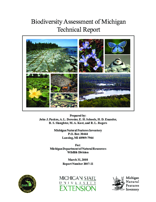
 Helen Enander
 John Paskus