What are the Somerset Levels?
- Published
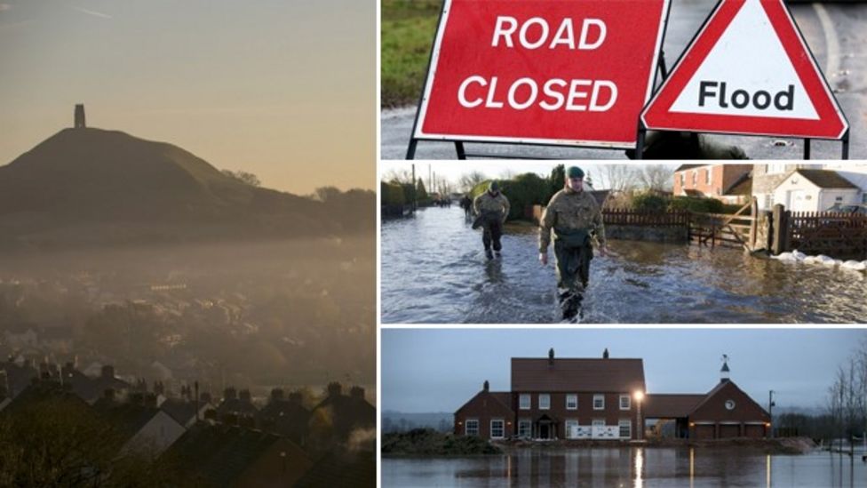
As further flooding on the Somerset Levels sparks more evacuations, questions are being asked about why the area is so badly affected.
Just what makes the region so prone to being submerged by flood water? And who has been affected by the current crisis?

What are the Somerset Levels?
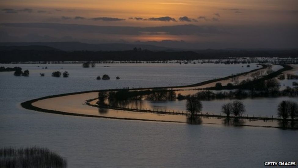
The Somerset Levels and Moors is a unique flat landscape that extends for about 170,000 acres (70,000 ha) across parts of the north and centre of the county of Somerset in the West of England.
It reaches from Clevedon near Bristol in the north to Ilchester in the south. Bridgwater Bay and the tidal Bristol Channel beyond form its western boundary.
Thousands of years ago the area was covered by the sea, but today it's a landscape of rivers and wetlands - artificially drained, irrigated and modified to allow productive farming.

Has anyone ever tried to tame them?
In Roman times artificial flood defences were built to keep out the tides from the nearby Severn Estuary, and ditches were dug. This created a network of inland channels to drain large areas of floodplain marsh.
During the Middle Ages the monasteries at Glastonbury, Athelney and Muchelney drained and looked after the land.
Dutch engineers arrived to drain the Levels in the 17th Century. Farmers have managed the landscape ever since.

Why do they seem to flood so much?
It's one of lowest and flattest areas in the country with much of it below high water level on spring tides, and a maximum altitude of only 25ft (8m) above sea level.
The wetland is supplied by the rivers Axe, Sheppey and Brue in the north, while to the south, the rivers are the Cary, Yeo, Tone and Parrett. It is these rivers which are at the centre of claims by farmers who say a lack of dredging has caused flooding.

Is the area not just a flood plain anyway?
Well, it's not unusual for the area to flood. The latest widespread flooding of the Levels is just one in a long record of flood events.
Records show more than a third of the area (70,000 acres or 28,000 ha) was submerged in 1919. In the 2014 flood, it is estimated about 6,500 ha (16,000 acres), or about 10% of the Levels, are under water.
Wasn't there a tsunami there once?
Yes, according to some scientists. About 400 years ago. A tsunami, described as "huge and mighty hills of water" advancing at a speed "faster than a greyhound can run" is thought to have swept down the Bristol Channel in 1607, with the water reaching 14 miles inland and 200 square miles (520 sq km) of land eventually submerged.

How many homes have actually flooded?
Somerset County Council says about 150 properties, in the villages of North Moor, Salt Moor, Fordgate and Moorland, are affected by the current crisis. The Environment Agency says up to 40 homes have actually flooded.

Lots of farmers work on the Levels - how will it affect them?
It's too early to say. Farmers have seen as much as 95% of their land covered in water, sometimes up to 10ft (3m) deep.
Some have resorted to moving their animals from flood-hit fields and buildings to safer ground.
The National Farmers Union says the area is mainly used for livestock and is not a particular hotbed for growing crops. When the waters eventually recede we should get a better idea of how the land has been affected.

- Published7 February 2014
- Published7 February 2014
- Published6 February 2014
- Published7 February 2014
- Published7 February 2014
- Published7 February 2014
- Published7 February 2014