Flora survey for Hamersley Drive recreation - Environmental ...
Flora survey for Hamersley Drive recreation - Environmental ...
Flora survey for Hamersley Drive recreation - Environmental ...

Create successful ePaper yourself
Turn your PDF publications into a flip-book with our unique Google optimized e-Paper software.
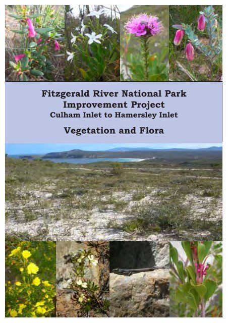
Fitzgerald River National Park<br />
Improvement Project<br />
Culham Inlet to <strong>Hamersley</strong> Inlet<br />
Vegetation and <strong>Flora</strong>
FITZGERALD RIVER NATIONAL PARK<br />
IMPROVEMENT PROJECT<br />
CULHAM INLET to HAMERSLEY INLET<br />
VEGETATION & FLORA<br />
Gillian F Craig<br />
A report prepared <strong>for</strong><br />
Main Roads Western Australia<br />
Great Southern Region<br />
Chester Pass Road, PO Box 503, Albany WA 6331<br />
July 2010<br />
Dr G F Craig<br />
<strong>Environmental</strong> Consultant<br />
ABN: 96 108 756 719<br />
PO Box 130, Ravensthorpe 6346<br />
T 08 9838 1071
© GF Craig 2010. Reproduction of this report in whole or in part by any means, including<br />
photocopying, recording or by any in<strong>for</strong>mation storage and retrieval system is strictly prohibited<br />
without the express approval of the authors, Main Roads Western Australia (Albany) and/or the<br />
Department of Environment and Conservation (Albany).<br />
In undertaking this work, the author has made every ef<strong>for</strong>t to ensure the accuracy of the<br />
in<strong>for</strong>mation. Any conclusions drawn or recommendations made in the report are done in good<br />
faith and the consultant takes no responsibility <strong>for</strong> how this in<strong>for</strong>mation is used subsequently by<br />
others.<br />
Cover photos: Clockwise from top left: Microcorys longiflora, Anthocercis fasciculata, Kunzea<br />
similis, Pimelea physodes (Qualup Bell), view west from East Mt Barren,<br />
Adenanthos ellipticus (Oval-leaf Adenanthos), Napolean Skink, Stylidium<br />
galioides (Yellow Mountain Triggerplant), Hibbertia papillata (©G.F.Craig 2010).
FRNP Improvement Project: Culham Inlet to <strong>Hamersley</strong> Inlet GF Craig– July 2010<br />
TABLE OF CONTENTS<br />
Executive Summary ......................................................................................................................iii<br />
Vegetation .......................................................................................................................................... iii<br />
Vegetation condition .............................................................................................................................. iii<br />
Declared Rare and Priority flora............................................................................................................. iv<br />
Threatened Ecological Communities...................................................................................................... iv<br />
Recommendations .................................................................................................................................. iv<br />
1. Introduction............................................................................................................................... 1<br />
Purpose ............................................................................................................................... 1<br />
Background ............................................................................................................................... 1<br />
Study Area ............................................................................................................................... 1<br />
2. Methods ............................................................................................................................... 3<br />
Desktop ............................................................................................................................... 3<br />
Field <strong>survey</strong> ............................................................................................................................... 3<br />
Analysis of data....................................................................................................................................... 5<br />
Digitising ........................................................................................................................................... 5<br />
3. Desktop Assessment ............................................................................................................... 5<br />
Physical Environment.................................................................................................................... 5<br />
Climate ........................................................................................................................................... 5<br />
Geology and Soils ................................................................................................................................... 6<br />
Previous biological <strong>survey</strong>s........................................................................................................... 7<br />
Fitzgerald Biosphere Reserve.................................................................................................................. 7<br />
Vegetation Classification............................................................................................................... 7<br />
Threatened Ecological Communities ............................................................................................ 8<br />
Declared Rare and Priority <strong>Flora</strong>................................................................................................... 8<br />
4. Field Investigation .................................................................................................................... 9<br />
Vegetation ............................................................................................................................... 9<br />
Declared Rare and Priority <strong>Flora</strong>................................................................................................. 11<br />
Declared Rare flora (Figure 2)............................................................................................................... 11<br />
Priority Three flora (Figure 3)............................................................................................................... 16<br />
Priority Four flora (Figure 4)................................................................................................................. 16<br />
Significant flora............................................................................................................................ 20<br />
Threatened Ecological Communities .......................................................................................... 23<br />
Significant Ecological Community ....................................................................................................... 23<br />
Vegetation Condition Assessment .............................................................................................. 23<br />
Fire ......................................................................................................................................... 23<br />
Climate change...................................................................................................................................... 23<br />
Plant disease ......................................................................................................................................... 24<br />
Weeds ......................................................................................................................................... 24<br />
5. Requirement <strong>for</strong> Referral or Other Clearances ...................................................................... 25<br />
6. Conclusions and Recommendations...................................................................................... 26<br />
Stage 1 ......................................................................................................................................... 26<br />
Stages 2 & 3 ......................................................................................................................................... 26<br />
Stage 4 ......................................................................................................................................... 27<br />
Acknowledgements ..................................................................................................................... 28<br />
References and Further Reading................................................................................................ 28<br />
i
FRNP Improvement Project: Culham Inlet to <strong>Hamersley</strong> Inlet GF Craig– July 2010<br />
LIST OF APPENDICES<br />
Appendix 1.1 Rare flora legislation and guidelines <strong>for</strong> gazettal..................................................31<br />
Appendix 1.2 DEC's Priority Species List...................................................................................32<br />
Appendix 1.3 Declared Rare and Priority <strong>Flora</strong> recorded in Fitzgerald River<br />
National Park <strong>survey</strong> area....................................................................................33<br />
Appendix 2 Muir’s Vegetation Classification...........................................................................35<br />
Appendix 3 Vegetation maps and unit descriptions............................................................... 37<br />
Appendix 3.1 Coverage of vegetation maps..............................................................................37<br />
Appendix 3.2 Vegetation units adjacent to the <strong>Hamersley</strong> <strong>Drive</strong> upgrade ................................37<br />
Appendix 3.3 Attributes used <strong>for</strong> the description of vegetation units.........................................38<br />
Appendix 4 Declared Rare, Priority and Significant flora........................................................63<br />
Appendix 5 Plant species list ................................................................................................103<br />
Appendix 6 Location of relevés and monitoring quadrats.....................................................117<br />
Appendix 6.1 Location of author’s releves and Ken Newbey vegetation sites included in<br />
the PRIMER analysis......................................................................................... 117<br />
Appendix 6.2 GPS locations of Chapman and Newbey (1995) permanent monitoring<br />
quadrats between Culham Inlet and Hamersely Inlet, and Moir Track...............120<br />
Appendix 6.3 Two-way table of relevé data used <strong>for</strong> PRIMER® analysis .............................. 123<br />
Appendix 7 Location of weeds ..............................................................................................133<br />
LIST OF FIGURES<br />
Figure 1: Survey area in Fitzgerald River National Park – <strong>Hamersley</strong> Inlet to Culham Inlet.......2<br />
Figure 2: Location of Declared Rare flora.................................................................................. 21<br />
Figure 3: Location of Priority flora.............................................................................................. 22<br />
LIST OF TABLES<br />
Table 1: Climate data <strong>for</strong> Hopetoun North (BOM 2009) .................................................................. 6<br />
Table 2: Declared Rare flora near <strong>Hamersley</strong> <strong>Drive</strong> ....................................................................... 8<br />
Table 3: Vegetation units in the Fitzgerald River National Park.................................................... 10<br />
ii
FRNP Improvement Project: Culham Inlet to <strong>Hamersley</strong> Inlet GF Craig– July 2010<br />
Executive Summary<br />
Main Roads Western Australia is undertaking upgrade works as part of the Fitzgerald<br />
River National Park (FRNP) Improvement Project in the Shire of Ravensthorpe on behalf<br />
of the Department of Environment and Conservation. The works will involve widening and<br />
sealing the current alignment of <strong>Hamersley</strong> <strong>Drive</strong>, spur roads, and provision of new<br />
carparks and turn-arounds between Culham Inlet and <strong>Hamersley</strong> Inlet. It is likely that the<br />
works will require the clearing of up to 10 m of native vegetation on either side of the<br />
existing gravel road from the current centerline and some road realignments.<br />
Vegetation and flora <strong>survey</strong>s are being carried out in a staged process. The first report<br />
on Stage 1 from Culham Inlet to <strong>Hamersley</strong> Inlet Road (10 km) was finalized in<br />
November 2009 (Craig and Hickman 2009). This second report amalgamates the<br />
results from Stages 1, 2 and 3, which includes <strong>Hamersley</strong> Inlet Road and the spur roads<br />
to Four Mile Beach, Barrens Beach, Mylies Beach (East and West), Cave Point and<br />
West Beach (a further 11 km) and the <strong>recreation</strong> nodes. Concept plans are still being<br />
developed <strong>for</strong> Stage 4, the <strong>Hamersley</strong> Inlet <strong>recreation</strong> nodes, and will be <strong>survey</strong>ed at a<br />
later date.<br />
Vegetation<br />
The <strong>survey</strong> area mainly lies in the Barren Ranges system of Beard (1976). Thirteen<br />
vegetation units were mapped and described. Most of the vegetation comprises four units<br />
of ‘Barren Ranges thicket’ – one characterized by Adenanthos venosus on shallow soils<br />
over outcropping quartzite at the base of East Mt Barren and wave-cut bench, two<br />
predominantly on laterised soils, Dryandra quercifolia and Eucalyptus preissiana/ D.<br />
quercifolia, and Melaleuca papillosa on valley slopes where schist is exposed.<br />
Three units are associated with consolidated limestone, Eucalyptus angulosa is typical<br />
with either E. falcata or Calothamnus macrocarpus, and on the eastern side of <strong>Hamersley</strong><br />
Inlet a woodland of E. utilis is found. Dune sands support scrub thicket with Melaleuca<br />
lanceolata or Banksia speciosa.<br />
Deeper, sandy soils have typical coastal plain vegetation of the Qualup system that<br />
includes Eucalyptus pleurocarpa. Two units were recognized that were characterized by<br />
either Banksia repens or Banksia baxteri.<br />
On the fringes of the inlets a wetland community of M. cuticularis grows. Inland drainage<br />
lines support Eucalyptus occidentalis dominated plant associations.<br />
Vegetation condition<br />
The majority vegetation is in excellent condition, although the record hot temperatures<br />
(48 o C) in January 2010 severely scorched many species. Plant associations appear to be<br />
recovering following the October 2006 fire that burnt parts of the <strong>survey</strong> area east of West<br />
Beach road. Weeds, including the Weed of National Significance Asparagus<br />
asparagoides (bridal creeper) and noxious Trachyandra divaricata (dune onion weed)<br />
were found at the Ranger station and Barrens Beach respectively. Weed infestations<br />
were also recorded at the Four Mile Beach carpark and campsite, East Mylies Beach<br />
carpark and beach access path and <strong>Hamersley</strong> Inlet.<br />
iii
FRNP Improvement Project: Culham Inlet to <strong>Hamersley</strong> Inlet GF Craig– July 2010<br />
Declared Rare and Priority flora<br />
Field <strong>survey</strong>s carried out in 2009 identified six Declared Rare flora (DRF) - Adenanthos<br />
ellipticus, Eucalyptus burdettiana, Eucalyptus coronata, Kunzea similis subsp. similis,<br />
Stylidium galioides and Verticordia pityrhops - growing on the wave-cut bench on the south<br />
side of East Mt Barren, in the proposed area of disturbance.<br />
Both 2009 and 2010 <strong>survey</strong>s identified the Priority Two species - Calothamnus<br />
macrocarpus, Gonocarpus hispidus, Hibbertia papillata and Leptospermum confertum occur<br />
between Mylies Creek and Culham Inlet. The Priority Three Microcorys longiflora grows on<br />
West Beach road.<br />
Seven Priority Four species, Acacia argutifolia, Anthocercis fasciculata, Dampiera deltoidea,<br />
Jacksonia compressa, Leucopogon compactus, Melaleuca papillosa and Pimelea<br />
physodes are spread across the <strong>survey</strong> area. Another four Priority Four’s, Lechenaultia<br />
superba, Hakea hookeriana, Corybas limpidus and Pleurosphascum occidentalis have been<br />
collected near <strong>Hamersley</strong> <strong>Drive</strong> or spur roads in the past, but were not found in the<br />
proposed impact area during this <strong>survey</strong>. The latter two need flowers or fruiting bodies<br />
respectively, to be identified.<br />
In addition, two Significant species, Lepidosperma sp. Fitzgerald River (AS George 9935),<br />
Lepidosperma sp. GFC8831 were found.<br />
Since the first <strong>survey</strong> (Craig and Hickman 2009), Acacia moirii subsp. dasycarpa and<br />
Lissanthe pleurandroides have been deleted from the Priority flora list.<br />
Threatened Ecological Communities<br />
No listed Threatened or Priority Ecological Communities were found during the field <strong>survey</strong>,<br />
although a community of ecological significance is located on the wave-cut bench that<br />
extends south of East Mt Barren. These micro-wetlands are sedge-dominated communities<br />
that are fed by freshwater from further upslope. They occur within the Banksia speciosa<br />
vegetation unit and were too subtle to map individually.<br />
Recommendations<br />
The wave-cut bench on the seaward side of East Mt Barren is the one of the most<br />
botanically significant areas in the Fitzgerald River National Park and the south coast. The<br />
following recommendations were made following the 2009 <strong>survey</strong> of Stage 1:<br />
• keep road verges and spur drains to the absolute minimum width/size allowed by<br />
road design;<br />
• consult an expert in freshwater habitats to assess the ecological value of the<br />
micro-wetlands;<br />
• ensure that sub-surface drainage to and from the micro-wetlands is not impeded<br />
by the road base;<br />
• have an on-site inspection of the wave-cut bench with biologists and <strong>survey</strong>or/<br />
road engineer present;<br />
• design a high quality walk trail along the wave-cut bench, linking the carparks at<br />
the east and west ends of East Mt Barren;<br />
• weed invasion and plant disease have the greatest potential to impact the high<br />
biological and conservation value of the FRNP. Road materials (including water)<br />
must come from weed- and disease-free areas, so that they are not imported by<br />
either the material itself or the machinery carting it.<br />
iv
FRNP Improvement Project: Culham Inlet to <strong>Hamersley</strong> Inlet GF Craig– July 2010<br />
Additional recommendations following 2010 <strong>survey</strong>s of Stages 2 and 3:<br />
• an on-site inspection during winter-spring 2010 by DEC’s <strong>Environmental</strong><br />
Officer should be carried out at all campsites, Barrens Beach and Mylies<br />
Beach East to familiarize the areas of weed infestation and <strong>for</strong>mulate a weed<br />
management program <strong>for</strong> coming years;<br />
• eradication of weeds, particularly the Asparagus asparagoides (bridal creeper)<br />
and Trachyandra divaricata (dune onion weed) should be carried out at the<br />
<strong>recreation</strong> nodes be<strong>for</strong>e flowering in late winter - spring;<br />
• it is essential that the gravel from <strong>recreation</strong>al sites that require rehabilitation is<br />
not translocated to other sites within the FRNP;<br />
• construction materials <strong>for</strong> <strong>recreation</strong> facilities must be checked <strong>for</strong> Theba<br />
pisana (white Italian snail), especially if they have been stored in Hopetoun;<br />
• Corybas limpidus (P4) and Pleurosphascum occidentalis (P4) need to be<br />
<strong>survey</strong>ed in late winter – spring.<br />
v
FRNP Improvement Project: Culham Inlet to <strong>Hamersley</strong> Inlet GF Craig– July 2010<br />
1. Introduction<br />
Purpose<br />
Main Roads Western Australia (Main Roads) is undertaking upgrade works between Culham Inlet and<br />
<strong>Hamersley</strong> Inlet in the Fitzgerald River National Park (FRNP) on behalf of the Department of<br />
Environment and Conservation (DEC). The works will involve widening and sealing of <strong>Hamersley</strong> <strong>Drive</strong>,<br />
spur roads and carparks <strong>for</strong> tourism purposes. It is likely that the works will require the clearing of up to<br />
10 m of native vegetation on either side of the existing gravel roads from the current centre line.<br />
Main Roads require biological <strong>survey</strong>s <strong>for</strong> the above project. The purpose of the <strong>survey</strong>s is to provide an<br />
appropriate examination and description of the receiving environment to ensure that all aspects of<br />
biological/ecological significance are identified and recorded. The results of the biological <strong>survey</strong> will<br />
assist in the preparation of an <strong>Environmental</strong> Impact Assessment and an <strong>Environmental</strong> Management<br />
Plan or other referral documents.<br />
Background<br />
The proposal to upgrade roads in the Fitzgerald River National Park was first announced on the<br />
30 January 2009 by the Honorable Colin Barnett Premier; Minister <strong>for</strong> State Development with the intent<br />
to offset the economic effect of the closure of the Ravensthorpe nickel mine. The State Government<br />
committed to a long term measure of support to increase economic viability of the towns of<br />
Ravensthorpe and Hopetoun in the Shire of Ravensthorpe.<br />
The road upgrade is intended to inject funds into the communities of Hopetoun and Ravensthorpe by<br />
providing opportunities <strong>for</strong> local sub-contractors to be employed through the construction process.<br />
Economic benefits will also flow to service providers in the local towns through the delivery of this<br />
project.<br />
Study Area<br />
Figure 1 details the location of the biological <strong>survey</strong>. The <strong>survey</strong> is restricted to an area 25 m either side<br />
of the existing road alignment, including all spur roads and the car park loop roads which have been<br />
identified by DEC’s Landscape Architects. Eventually, the <strong>survey</strong> area is to include borrow and gravel<br />
pits, base course and sub-base pits, spoil sites, proposed works camp and compound areas, stockpile<br />
sites and any other areas to be disturbed.<br />
This report amalgamates in<strong>for</strong>mation from Stage 1, and includes new data from Stages 2 and 3. Stage 4<br />
will be provided in a separate report.<br />
Stage 1<br />
The first stage included 10 km of <strong>Hamersley</strong> <strong>Drive</strong>, from Culham Inlet to the <strong>Hamersley</strong> Inlet Road<br />
intersection. An interim report was provided to Main Roads WA in November 2009 (Craig and Hickman<br />
2009). An addendum, which included locations of the Declared Rare Verticordia pityrhops,, was<br />
provided in December 2009 (Craig 2009).<br />
Stage 2<br />
The second stage <strong>survey</strong>ed a further 11 km and included <strong>Hamersley</strong> Inlet Road to <strong>Hamersley</strong> Inlet, to<br />
both the Shire of Ravensthorpe and DEC camping areas, plus the spur roads to Four Mile Beach,<br />
Barrens Beach, Mylies Beach (East and West), Cave Point and West Beach. These were <strong>survey</strong>ed<br />
between January and April 2010.<br />
Stage 3<br />
The <strong>recreation</strong>al sites at the end of each spur road are currently being designed by DEC. The carparks<br />
and small loop roads between Culham Inlet and West Beach had draft concept plans available in June<br />
2010 and were <strong>survey</strong>ed in July.<br />
1
FRNP Improvement Project: Culham Inlet to <strong>Hamersley</strong> Inlet GF Craig– July 2010<br />
Stage 4<br />
The <strong>Hamersley</strong> Inlet campsites (Shire and DEC) still require substantial planning and will need to be fully<br />
<strong>survey</strong>ed at a later date. This stage will be provided in a separate report.<br />
Other biological studies<br />
Separate reports that <strong>for</strong>m part of the biological studies <strong>for</strong> the FRNP Improvement Project have been<br />
prepared by:<br />
1. Gillian Craig and Ellen Hickman <strong>survey</strong>ed Stage 1 of the <strong>Hamersley</strong> <strong>Drive</strong> upgrade (Craig and<br />
Hickman 2009)<br />
2. Ellen Hickman <strong>survey</strong>ed the vegetation and flora at the proposed gravel pits on Location 6382<br />
Steeredale Road, Hopetoun (Hickman 2009);<br />
3. Andrew Chapman has assessed the implications <strong>for</strong> fauna (Chapman 2009, Chapman 2010 in<br />
prep);<br />
4. Malcom Grant has <strong>survey</strong>ed <strong>for</strong> dieback Phytophthora and other plant pathogens.<br />
<strong>Hamersley</strong><br />
Inlet<br />
Figure 1: Survey area in Fitzgerald River National Park – <strong>Hamersley</strong> Inlet to Culham Inlet<br />
2
FRNP Improvement Project: Culham Inlet to <strong>Hamersley</strong> Inlet GF Craig– July 2010<br />
2. Methods<br />
The botanical <strong>survey</strong>s were carried out by Gillian Craig, except <strong>for</strong> the Declared Rare eucalypts on East<br />
Mt Barren which were <strong>survey</strong>ed independently by Ellen Hickman (Craig and Hickman 2009). The results<br />
of those <strong>survey</strong>s have been included here to provide complete documentation of the flora between<br />
<strong>Hamersley</strong> Inlet and Culham Inlet.<br />
Desktop<br />
A search was made of the Department of Environment and Conservation’s (DEC) Threatened <strong>Flora</strong><br />
Database (DEFL), WA Herbarium database (WAHerb) and the Declared Rare and Priority <strong>Flora</strong> Species<br />
List. The search co-ordinates requested were NW corner: 33 o 45'S 119 o 45'E SE corner: 33 o 57'<br />
120 o 14'E. A search was undertaken of the DEC Threatened Ecological Communities database.<br />
The Commonwealth’s Threatened <strong>Flora</strong> database was searched to determine the category under the<br />
<strong>Environmental</strong> Protection and Biodiversity Conservation Act (EPBC Act) <strong>for</strong> listed Threatened flora.<br />
The flora database in<strong>for</strong>mation was imported into OziExplorer® software to determine those species<br />
likely to occur in the impact area. Digital orthophotos of the Whoogerup (2003- pre-burn) and<br />
Ravensthorpe (2007 – post-burn) map sheets were provided by DEC to use as base imagery.<br />
Scientific licences and a Regulation 4 Authority permit were obtained from DEC to take flora within the<br />
Fitzgerald River National Park. Permission to use digital in<strong>for</strong>mation was obtained from DEC’s Species<br />
and Community Branch, Kensington.<br />
Previous reports and publications relevant to the region were reviewed.<br />
K.R. Newbey relevés<br />
During 1985 and 1986, the late Ken Newbey recorded plant taxa in 309 relevés in the park with<br />
permanent quadrats marked at 65 of these sites <strong>for</strong> fauna sampling (Chapman and Newbey 1987). The<br />
plant species data from all Newbey’s relevés within and immediately adjacent to the study area were<br />
databased using the Perth herbarium’s MAX V3 software. Since 1987 there has been considerable<br />
revision of the taxonomy, there<strong>for</strong>e the author updated Newbey’s species names to current taxonomy<br />
and changed species names to those which are known from the area, e.g. Isopogon attenuatus became<br />
I. polycephalus, and I. buxifolius became Isopogon sp. Fitzgerald River. This in<strong>for</strong>mation was used to<br />
provide an initial species list <strong>for</strong> the area.<br />
Eucalypts on East Mt Barren<br />
DEC Albany’s threatened flora files <strong>for</strong> Eucalyptus coronata and Eucalyptus burdettiana were reviewed<br />
by Ellen Hickman, specific locations of all known population on and around East Mt Barren were<br />
identified and plant numbers were summarised to get an overview of each species.<br />
Orthophotos from the Ravensthorpe sheet (2003 – pre-burn and 2007 – post-burn) were provided by<br />
DEC <strong>for</strong> use in the field.<br />
Field <strong>survey</strong><br />
<strong>Hamersley</strong> <strong>Drive</strong>, spur roads and carparks<br />
The <strong>survey</strong> was carried out according to the <strong>Environmental</strong> Protection Authority’s Draft Guidance No.51<br />
(EPA 2004). Each side of the road, new alignments and proposed walk paths identified by DEC were<br />
traversed on foot, between the verge and up to 25 m into the undisturbed vegetation. Along each<br />
traverse, boundaries of vegetation units (based on changes in species composition) and threatened flora<br />
were marked as waypoints on the GPS using the GDA94 datum.<br />
3
FRNP Improvement Project: Culham Inlet to <strong>Hamersley</strong> Inlet GF Craig– July 2010<br />
Relevés were recorded and a digital photo taken of representative vegetation units. Common species<br />
were recorded, ie more than five plants were observed in the general vicinity, in a plotless 10 m x 10 m<br />
quadrat <strong>for</strong> shrubs (< 2 m tall), sedges and herbs, and 20 m x 20 m <strong>for</strong> tall shrubs (> 2 m tall) and<br />
eucalypts. Vegetation structure, based on a modified Muir classification (Appendix 2), was recorded.<br />
The condition of the vegetation was noted. The usual vegetation condition scales, e.g. Keighery (1994)<br />
were not considered suitable <strong>for</strong> this <strong>survey</strong>, as there is minimal disturbance of the vegetation, except by<br />
fire. Specific locations of weeds were GPSed. It must be noted, however, that some of the <strong>recreation</strong><br />
sites (Four Mile and <strong>Hamersley</strong> Inlet campsites) were <strong>survey</strong>ed in summer and early autumn, prior to<br />
any germination of annual weeds.<br />
Stage 1<br />
Surveys were carried out along <strong>Hamersley</strong> <strong>Drive</strong> on 22 nd , 25 th and 29 th September, 1 st , 12 th , 16 th and 23 rd<br />
October 2009. Sites of nominated Declared Rare <strong>Flora</strong> at East Mt Barren were GPSed again with a<br />
<strong>survey</strong>or on 21 st December 2009.<br />
Stages 2 & 3<br />
Surveys along <strong>Hamersley</strong> Inlet Road, the spur roads and <strong>recreation</strong> nodes between Culham Inlet and<br />
West Beach were carried out on 20 th - 21 st January, 12 th and 22 nd February, 10 th March, 8 th and 16 th April,<br />
and 8 th July 2010.<br />
The weather was mostly cool to warm (16 o C – 21 O C max), the hottest day was in April with 24 O C. Days<br />
were sunny or intermittently overcast with a slight to moderate winds.<br />
Plant specimens were verified using the author’s private herbarium (previously verified in the Perth<br />
Herbarium), Albany and Ravensthorpe Regional Herbaria, and the Perth Herbarium; nomenclature<br />
follows that of WAHERB, except <strong>for</strong> Dryandra. Voucher specimens will be lodged in the Perth and<br />
Ravensthorpe herbaria.<br />
Waypoints were downloaded from the GPS to OziExplorer®, then divided into individual files <strong>for</strong> each<br />
species of declared rare or priority flora.<br />
Eucalypts on East Mt Barren<br />
Foot traverses of all the populations identified from the Threatened <strong>Flora</strong> file review of Eucalyptus<br />
coronata and E.burdettiana on and around East Mt Barren were carried out on 29 th and 30 th September,<br />
1 st , 2 nd , 21 st , 22 nd , 23 rd and 24 th October 2009 by Ellen Hickman. The weather was cool to warm (15 o C –<br />
28 o C max) and sunny or overcast with slight to moderate winds.<br />
Most plants were marked as waypoints on a Garmin GPS 60 using the GDA94 datum. A proportion of<br />
each species was also tagged using sheep tags. The tags were of two shades of green to distinguish<br />
the two species and scribed with the species initials and a number in sequence (ie EC001, EC002 to<br />
EC500 <strong>for</strong> E.coronata, and EB001, EB002 to EB500 <strong>for</strong> E.burdettiana). When the tags ran out the plants<br />
were simply marked with a waypoint.<br />
Plants of each species identified as growing within 25 m on either side of the <strong>Hamersley</strong> <strong>Drive</strong> road were<br />
waypointed and flagged with blue flagging tape, but not tagged.<br />
Areas of vegetation known to have plants of either species that were not burnt in the 2006 fire proved to<br />
be too thick to traverse by foot so estimations of plant numbers were made by interpreting aerial<br />
photography.<br />
Waypoints and tracks were downloaded from the GPS using DNR Garmin software. The waypoints<br />
were exported as text files to be imported into Excel to allow <strong>for</strong> sorting the data into individual files <strong>for</strong><br />
each species. These were then imported into Arcview to provide shape files of each species location on<br />
and around East Mt Barren. The tracks were saved as shape files <strong>for</strong> direct import into Arcview.<br />
4
FRNP Improvement Project: Culham Inlet to <strong>Hamersley</strong> Inlet GF Craig– July 2010<br />
Analysis of data<br />
Tracks and waypoints were downloaded from the GPS units using OziExplorer® software. Tracks and<br />
waypoints were saved as .plt/.wpt and .txt files (UTM/UPS and hddd.ddddd o ), the latter allows importing<br />
of data into Excel® spreadsheets.<br />
Plant species were recorded in a MAX V3 data table, a software program developed by DEC’s Western<br />
Australian herbarium which links datasets to the Census of Western Australian Plants master list. The<br />
‘relevé number’ was entered into the database.<br />
To assist in clarifying the vegetation units, Anne Rick used PRIMER® multivariate analysis to produce<br />
dendrograms that grouped relevés on the basis of species similarity. Both Newbey’s (Chapman and<br />
Newbey 1987) and the author’s data were included in the analysis. Only perennial species were<br />
included, and <strong>for</strong> the Newbey data, only those species with > 0.5 abundance. Relevés with only a few<br />
species recorded were excluded as they skewed the data.<br />
Once the vegetation units had been clarified using the PRIMER® analysis, species lists <strong>for</strong> each unit<br />
were prepared. Vegetation units were mapped using a combination of field data, PRIMER® analysis<br />
and interpretation of orthophotos.<br />
Digitising<br />
Digital files including waypoints of each species of threatened flora encountered during the <strong>survey</strong> and<br />
line work of the vegetation map (1:10 000 scale) were sent to Meredith Spencer in 2009 and Janet<br />
Newell in 2010 (DEC Albany) <strong>for</strong> digitising. Final maps were provided as shapefiles <strong>for</strong> compatibility<br />
with ArcMap.<br />
3. Desktop Assessment<br />
Physical Environment<br />
Climate<br />
A Mediterranean climate of warm to hot summers and cool, wet winters is generally experienced. The<br />
nearest weather station is Hopetoun North, <strong>for</strong> which the last 13 years of data is available (Table 1).<br />
Mean maximum temperature recorded at Hopetoun in the hottest month (February) is 26 o C. Mean<br />
minimum temperature in the coldest months (July-August) is 8 o C. The highest recorded temperature of<br />
48 o C was recorded on 6 January 2010, while the lowest of -0.3 o C was in July 2000. Frosts have been<br />
recorded by farmers in the catchment during winter and spring, but are usually rare on the coast.<br />
The rainfall is typical of a Mediterranean climate with a pronounced winter maximum and a long dry<br />
summer. The mean annual rainfall on the coast is about 500 mm, but has been highly variable over the<br />
past 10 years with the maximum of 610 mm in 2001, followed by a very dry year in 2002 when only<br />
274 mm fell. Sporadic heavy rainfall events can occur in summer as a result of cyclonic events in the<br />
north of the State - the highest monthly rainfall of 185 mm was recorded in January 2000.<br />
Annual evaporation is generally 1500 mm.<br />
Morning wind speeds are typically 17-22 km/h and increase in the afternoon to average 20-29 km/h. On<br />
the hottest recorded day, i.e. 6 January 2010, the strong winds from the NNW had only 5% Relative<br />
Humidity at 3 pm (BOM, 2010), the strongest wind gust was not recorded!<br />
Climate Change is predicted to impact the south coast of Western Australia. Changes in temperature<br />
and rainfall patterns may lead to changes in the physical condition of the region and to the growing<br />
season, incidence of frost and flood events etc.<br />
5
FRNP Improvement Project: Culham Inlet to <strong>Hamersley</strong> Inlet GF Craig– July 2010<br />
Table 1: Climate data <strong>for</strong> Hopetoun North (BOM 2009)<br />
Statistics Jan Feb Mar Apr May Jun Jul Aug Sep Oct Nov Dec Annual Years<br />
Temperature<br />
Maximum temperature<br />
Mean<br />
maximum<br />
temperature<br />
1996<br />
(°C) 25.2 25.8 25 23.3 21.6 19.2 18.2 18.9 20.5 21.4 23.1 24.4 22.2 14 2009<br />
Minimum temperature<br />
Mean<br />
minimum<br />
temperature<br />
1996<br />
(°C) 15.2 15.7 14.3 12.6 10.5 8.5 7.7 7.9 8.7 10 12.2 13.9 11.4 14 2009<br />
Rainfall<br />
Mean<br />
rainfall<br />
1996<br />
(mm) 48.6 18.1 29.3 44.5 36.8 49.5 66.3 54.1 49.1 39.5 37.4 24 496.4 13 2009<br />
Highest<br />
rainfall<br />
1996<br />
(mm) 185 72.4 69.4 138 78.4 106 126 127 109 70.4 97.2 54.6 609.8 13 2009<br />
Date 2000 1997 2006 2007 1999 2005 2001 2001 1996 2008 2008 2008 2001<br />
Lowest<br />
rainfall<br />
1996<br />
(mm) 0 0.2 0 0 8.2 14.4 30 19.6 5.2 14.4 1.4 3.2 274 13 2009<br />
Date 1998 2008 2008 2008 2002 2002 1996 1996 2000 2006 2007 2006 2002<br />
Mean<br />
number of<br />
1996<br />
days of rain 6.5 5.4 7.8 11.5 12.5 13.8 15 14.8 13.9 10.9 8.1 6.7 126.9 13 2009<br />
Geology and Soils<br />
The Barren Ranges group of hard massive Proterozoic quartzites rise into a small abrupt mountain at<br />
East Mt Barren (about 275 m) with a pediment 90 m above sea level that fronts onto the sea, creating<br />
one of the most striking coastlines of the south coast. Soils on the mountain and pediment are rocky<br />
and skeletal. The 90 m plat<strong>for</strong>m at the base of East Mt Barren is a wave-cut bench <strong>for</strong>med during the<br />
Tertiary when sea levels were about 100 m higher than today. The ranges at that time would have been<br />
isolated islands at the time of deposition of the Plantagenet sediments that <strong>for</strong>m the coastal plains.<br />
The coastal plain that <strong>for</strong>med during the Tertiary to the west of East Mt Barren rises gently inland from<br />
the coast to about 150 m altitude. These Plantagenet Group of sediments consist of thin-bedded<br />
mudstones and siltstones which are overlain by Quarternary drift sands on the seaward margin of the<br />
plain. The surface has developed a clearly differentiated profile with a superficial layer of bleached sand<br />
overlying a band of ironstone nodules over a mottled loam.<br />
Numerous intermittent streams flow directly to the sea, flooding after heavy rain and usually dry up in<br />
summer, except Mylies Creek which maintains pools of water either side of <strong>Hamersley</strong> <strong>Drive</strong>. Water<br />
runoff is generally brackish, becoming more saline as volumes decrease.<br />
A major fault east of East Mt Barren provides the boundary of the Esperance plain developed by Tertiary<br />
Plantagenet sediments. Again Quaternary sands have overlain the pediments on the lower, eastern<br />
slopes of the mount.<br />
6
FRNP Improvement Project: Culham Inlet to <strong>Hamersley</strong> Inlet GF Craig– July 2010<br />
Previous biological <strong>survey</strong>s<br />
Vegetation and flora <strong>survey</strong>s have been carried out by:<br />
• Beard (1976, 1979) mapped the vegetation at 1:250 000 scale;<br />
• Aplin and Newbey (1990 a & b) described the vegetation and flora of the FRNP;<br />
• Chapman and Newbey (1995) established a series of monitoring quadrats <strong>for</strong> flora and trap<br />
lines <strong>for</strong> fauna across the FRNP (Appendix 6);<br />
• Chapman and Newbey (1987) documented plant species, land<strong>for</strong>m, geology and soil data<br />
<strong>for</strong> 309 vegetation sites in the FRNP;<br />
• Lamont and Witkowski (1995 and 1999) have measured the response to fire of Banksia<br />
species growing near Hopetoun;<br />
• in 2007, DEC Albany established monitoring plots north of <strong>Hamersley</strong> <strong>Drive</strong>, to determine<br />
vegetation response to the October 2006 fire. The fire followed from a prescribed burn<br />
between Eyre Range and East Mt Barren to achieve some ‘break up’ of the 1989 wildfire.<br />
Assessment of the state of biological knowledge and its relevance to the FRNP can be found in:<br />
• Hopper and Gioia (2004) discuss the evolution and conservation of the south-west’s flora in<br />
the context of the area being an International biodiversity hotspot. The FRNP is recognized<br />
as an area of particularly high diversity within the south-west;<br />
• Deegan (2005 and 2006) prepared a bibliography and review of the state of knowledge of<br />
the Fitzgerald Biosphere;<br />
• a list of the 1,665 plant taxa known from the Park is given in Newbey and Hickman (2008);<br />
• Barrett et al (2009) identified fire sensitive ecosystems in the South Coast region;<br />
• a Regional Strategic Management Plan <strong>for</strong> threatened species and ecological communities<br />
(Gilfillan et al. 2009) and Recovery Plan <strong>for</strong> those in the Fitzgerald Biosphere (Newell et al.<br />
2010).<br />
Fitzgerald Biosphere Reserve<br />
The national park is the core area of the Fitzgerald Biosphere which is a part-tenured management<br />
concept recognised by UNESCO’s Man and the Biosphere program. The Fitzgerald Biosphere Reserve<br />
is recognised as being a ‘hotspot’ within one of Earth’s 34 global biodiversity ‘hotspots’. The FRNP has<br />
approximately 1,660 plant taxa, containing over one-quarter (29%) of the south-west’s flora.<br />
The protection of biodiversity is increasingly seen as a global concern. This change in perspective has<br />
been associated with an increasing number of international instruments addressing biodiversity<br />
conservation issues. Some of these instruments, such as those relating to Biosphere Reserves, have<br />
been given some recognition in the Commonwealth’s Environment Protection and Biodiversity<br />
Conservation Act 1999. Moreover, the <strong>Environmental</strong> Protection Authority has recognised the<br />
importance of maintaining ecosystem/ecological processes <strong>for</strong> ecologically sustainable management<br />
(EPA 1999).<br />
The government of Western Australia occasionally discusses the Biodiversity Conservation Act in<br />
Parliament. This Act proposes to enhance legislation <strong>for</strong> the protection, restoration and sustainable use<br />
of our native plants, animals and other native organisms. The government recognises that “all of our<br />
natural biodiversity is important and it is our responsibility to ensure that our biodiversity is conserved”<br />
(Government of WA 2002).<br />
Vegetation Classification<br />
The <strong>survey</strong> area lies in the South West Botanical Province and the Esperance Biogeographic Region<br />
(after Cresswell and Thackway 1995) and is in the Barren Ranges System described by Beard (1973,<br />
1976), although the coastal dunes have affinity with the Fanny’s Cove System. These systems include<br />
four types of pediments:<br />
7
FRNP Improvement Project: Culham Inlet to <strong>Hamersley</strong> Inlet GF Craig– July 2010<br />
• the small mountains of the Barren Ranges group supporting Barren Ranges thicket – the<br />
most consistent species being Eucalyptus preissiana and Dryandra quercifolia;<br />
• small adjacent portions of coastal plain on sandy lateritic soil supports Eucalyptus<br />
pleurocarpa mallee-heath;<br />
• river trenches with mallee, including Eucalyptus redunca, E. uncinata and E. conglobata;<br />
• areas of coastal drift sand with coastal scrub – Eucalyptus angulosa and Melaleuca<br />
pentagona being typical.<br />
Threatened Ecological Communities<br />
The search of DEC’s Threatened Ecological Communities database found no known occurrences of<br />
threatened ecological communities in the study area (M. Hunter, pers.comm.). However, there are<br />
occurrences of the following ecological communities within approximately 5 km of the <strong>survey</strong> area:<br />
• The ‘Vulnerable’ threatened ecological community – ‘Thumb Peak - Mid-Mount Barren -<br />
Woolburnup Hill (Central Barren Ranges) Eucalyptus acies mallee heath' ;<br />
• The ‘Priority 1’ ecological community – ‘Very open mallee over Melaleuca sp. Kundip (GF Craig<br />
6020) dense heath’.<br />
Declared Rare and Priority <strong>Flora</strong><br />
The WAHERB and DEFL searches found 40 species in the vicinity of the <strong>survey</strong> area, including eight<br />
Declared Rare flora. After ovelaying their locations on an orthophoto, this number was reduced to 22<br />
species being recorded in the <strong>survey</strong> area (Appendix 1.2). Six Declared Rare flora were located on or<br />
near East Mt Barren (Table 2).<br />
DEC updated the conservation codes in March 2010 (Smith 2010), one species which was widespread in<br />
<strong>survey</strong> area, Acacia moirii subsp. dasycarpa was deleted from the list. Another known from the general<br />
area Lissanthe pleurandroides was also deleted.<br />
Table 2: Declared Rare flora near <strong>Hamersley</strong> <strong>Drive</strong><br />
Species Name<br />
8<br />
DEC<br />
Conservation<br />
Code EPBC Act<br />
Adenanthos ellipticus R Vulnerable<br />
Eucalyptus burdettiana R Endangered<br />
Eucalyptus coronata R Vulnerable<br />
Kunzea similis subsp. similis R -<br />
Stylidium galioides R Vulnerable<br />
Verticordia pityrhops R Endangered
FRNP Improvement Project: Culham Inlet to <strong>Hamersley</strong> Inlet GF Craig– July 2010<br />
4. Field Investigation<br />
Vegetation<br />
The <strong>survey</strong> area lies in the Barren Ranges system of Beard (1973, 1976), except <strong>for</strong> the coastal dunes<br />
which are more typical of the Fanny’s Cove system. Two vegetation types are characteristic of the<br />
Qualup system. Appendix 3 provides eight maps at 1:10 000 scale of the project area and species lists<br />
<strong>for</strong> each of the 13 vegetation units.<br />
Most of the vegetation comprises four units of ‘Barren Ranges thicket’ (Table 3) – one characterized by<br />
Adenanthos venosus [Adven] on shallow soils over outcropping quartzite at the base of East Mt Barren,<br />
two on predominantly on lateritised soils with Dryandra quercifolia predominant [Dque], but in areas<br />
including large patches of Eucalyptus preissiana [Epre/Dque]. Melaleuca papillosa [Mpap] grows on<br />
valley slopes where schist is exposed. Small winter-wet depressions support low heath characterized by<br />
Melaleuca pulchella, but these were too small (
FRNP Improvement Project: Culham Inlet to <strong>Hamersley</strong> Inlet GF Craig– July 2010<br />
Table 3: Vegetation units in the Fitzgerald River National Park<br />
Vegetation<br />
Unit Vegetation structure Typical Species<br />
Quartzite & schist (BARRENS SYSTEM):<br />
Adven Heath Adenanthos venosus, Taxandria conspicua ssp. abrupta, Regelia velutina<br />
Dque Open mallee-thicket/scrub Dryandra quercifolia, Eucalyptus pleurocarpa, Banksia lemanniana<br />
Epre/Dque Mallee-thicket/scrub Eucalyptus preissiana, Dryandra quercifolia<br />
Mpap Heath Melaleuca papillosa<br />
Coast (BARRENS/ FANNY"S COVE SYSTEM):<br />
Shallow sand over consolidated limestone -<br />
Eang/Cmac Open mallee-heath Eucalyptus angulosa, E. pleurocarpa, Calothamnus macrocarpus<br />
Eang/Efal Mallee -scrub Eucalyptus angulosa, E. falcata, Templetonia retusa, Melaleuca pentagona<br />
Euti<br />
Dune sand -<br />
Woodland Eucalyptus utilis, E. conglobata ssp. perata<br />
Mlan Scrub thicket Melaleuca lanceolata, M. nesophila, Acacia rostellifera, Scaevola crassifolia<br />
Bspe Scrub thicket - sedge Banksia speciosa, Anarthria laevis<br />
Coastal plain (QUALUP SYSTEM):<br />
Eple/Brep Open mallee-heath Eucalyptus pleurocarpa, Banksia repens, Adenanthos cuneatus<br />
Bbax Scrub heath Banksia baxteri<br />
Creeklines & wetlands:<br />
Eocc Woodland Eucalyptus occidentalis, Rhagodia preissii<br />
Mcut Shrubland Melaleuca cuticularis<br />
10
FRNP Improvement Project: Culham Inlet to <strong>Hamersley</strong> Inlet GF Craig– July 2010<br />
Declared Rare and Priority <strong>Flora</strong><br />
Six species of Declared Rare flora were found adjacent to <strong>Hamersley</strong> <strong>Drive</strong>, principally on the wave-cut<br />
bench south of East Mt Barren or on the western flanks of the mountain. Twelve species of Priority <strong>Flora</strong><br />
were located in the <strong>survey</strong> area, however a further four which had been collected previously were not<br />
found. A summary of each species is given below and full details of GPS locations and population<br />
numbers given in Appendix 4.<br />
Declared Rare flora (Figure 2)<br />
Adenanthos ellipticus Oval-leaf Adenanthos (Vulnerable)<br />
Endemic to the Fitzgerald River National Park, this species grows on the summit and south-west slopes<br />
of East Mt Barren, extending onto the wave-cut bench south of the mountain. It is a<br />
relatively slow growing plant that is killed by fire, but regenerates readily from seed.<br />
Field observations (Robinson and Coates 1995) suggest a high susceptibility to<br />
Phytophthora dieback.<br />
This population was <strong>survey</strong>ed by DEC Albany in 2008 and estimated to be 30,000+<br />
mature plants and approximately 10,000 seedlings in the burnt area (2006<br />
prescribed burn). In addition, Adenanthos ellipticus is known to occur on Thumb<br />
Peak and West Mt Barren. Less than 1% of the East Mt Barren population will be<br />
impacted by the <strong>Hamersley</strong> <strong>Drive</strong> upgrade.<br />
No.<br />
Plants<br />
% EMB<br />
population<br />
% all<br />
populations<br />
<strong>Hamersley</strong> <strong>Drive</strong> upgrade 350 0.9 0.7<br />
1<br />
East Mt Barren 40,000+<br />
2<br />
Thumb Peak 10,000+<br />
2<br />
West Mt Barren 1,000+<br />
1 DEC Albany 2008<br />
2 Robinson & Coates 1995<br />
Eucalyptus burdettiana Burdett Gum (Endangered)<br />
Burdett gum is a multi-stemmed mallee, up to 4m high. It has smooth bark and glossy green leaves<br />
9 cm long and 1.7 cm wide. It has stalkless clusters of 7 to 11 flowers on a flattened flower stalk. The<br />
floral tubes are not fused and they have very long, horn-shaped bud caps that are slightly warty. This<br />
species only grows on and around East Mt Barren.<br />
Prior to this <strong>survey</strong> E.burdettiana was recognised to occur in 2 populations, with population 1 divided into<br />
5 sub-populations (1A, 1B, 1C, 1D & 1E). The total number of plants was believed to be 239, however<br />
these numbers fluctuated across visitation from the 1980’s to 2000’s particularly in populations 1A and<br />
1B. Ellen Hickman’s <strong>survey</strong> estimates the population to consist of 3500 – 4000<br />
plants, with 1571 plants actually waypointed. 42 plants were identified within the<br />
25 m road buffer. There<strong>for</strong>e the plants deemed to be under threat from the<br />
proposed road works constitutes 1.2% of the entire population on East Mt Barren.<br />
Population 1E was visited but no plants located and after review of notes on this<br />
population it is believed to be equivalent to population 1C. E.burdettiana plants<br />
were found on all slopes of East Mt Barren with the exception of the extreme<br />
eastern slopes, populations 1A, 1B, 1C and 1D all merge and as such the<br />
subdivision of these populations is irrelevant. Specific comments on each<br />
population are presented in Appendix 4.<br />
11
FRNP Improvement Project: Culham Inlet to <strong>Hamersley</strong> Inlet GF Craig– July 2010<br />
No. Plants<br />
% EMB<br />
population<br />
12<br />
% all<br />
populations<br />
<strong>Hamersley</strong> <strong>Drive</strong> upgrade 42 1.2 1.2<br />
East Mt Barren 3580<br />
Eucalyptus coronata Crowned Mallee (Vulnerable)<br />
The Crowned Mallee is a small multi-stemmed, smooth-barked mallee up to 2.5 m high, with bluishgreen<br />
leaves 12 cm long and 3 cm wide. Strongly ribbed buds occur in threes on a broad flattened stalk.<br />
The large fruits have a broad disc and domed, protruding valves that look like a crown.<br />
Prior to this <strong>survey</strong> E.coronata was recognised to occur in 4 populations, from East<br />
Mt Barren, Eyre Range, Whoogarup Range and Mid Mt Barren. The total plant<br />
numbers was estimated at 215, with 150 of these plants known from East Mt<br />
Barren, within 2 sub-populations 1A on the eastern slopes consisting of 100 plants<br />
and 1B the summit consisting of 50 plants. Ellen Hickman’s <strong>survey</strong> amended the<br />
population number on East Mt Barren to approximately 2000 plants, with 461 plants<br />
actually waypointed. Nine plants identified within the 25 m road buffer. There<strong>for</strong>e<br />
the plants deemed to be under threat from the proposed road works constitutes<br />
0.5% of the entire population on East Mt Barren.<br />
Since populations 1A and 1B merge on the southern slopes of East Mt Barren the<br />
division into sub-populations is irrelevant. Specific comments on each population are presented in<br />
Appendix 4. E.burdettiana and E.coronata population overlap near the summit and on the south-eastern<br />
slopes of East Mt Barren.<br />
No.<br />
Plants<br />
% EMB<br />
population<br />
% all<br />
populations<br />
<strong>Hamersley</strong> <strong>Drive</strong> upgrade 9 0.45%
FRNP Improvement Project: Culham Inlet to <strong>Hamersley</strong> Inlet GF Craig– July 2010<br />
Stylidium galioides – Yellow Mountain Triggerplant (Vulnerable)<br />
Endemic to the Eyre Range, a plant with trailing stems that apparently roots at the nodes, which makes it<br />
difficult to count the number of plants in a population/area. It is common on East Mt Barren and during<br />
the eucalypt <strong>survey</strong> Ellen Hickman observed S. galioides along the walk trail to the summit, all over<br />
summit, on the south-eastern face above <strong>Hamersley</strong> <strong>Drive</strong>, on the north-eastern face up into the gully<br />
directly below the summit and in the gully on west side of East Mt Barren.<br />
Along <strong>Hamersley</strong> <strong>Drive</strong>, S. galioides occurs from the western slopes of<br />
East Mt Barren to the eastern carpark on the wave-cut bench,<br />
preferring shallow soil amongst outcropping quartzite. Although the<br />
table below indicates a significant percentage of plants would be<br />
impacted, the widespread occurrence of S. galioides on East Mt<br />
Barren suggests that in reality only a very small percentage of plants<br />
will be affected by the road upgrade.<br />
% EMB<br />
population<br />
% all<br />
populations<br />
<strong>Hamersley</strong> <strong>Drive</strong> upgrade 500+
FRNP Improvement Project: Culham Inlet to <strong>Hamersley</strong> Inlet GF Craig– July 2010<br />
Priority Two flora (Figure 3)<br />
Calothamnus macrocarpus<br />
Endemic to the East Mt Barren and immediate environs. A robust shrub that grows in sandy soils<br />
between Mylies Creek and Culham Inlet, often in association with the very similar<br />
Calothamnus validus. Appendix 3 maps the vegetation unit [Eang/Cmac] (32 ha)<br />
where this species typically grows in association with Eucalyptus angulosa in sand<br />
over limestone. A large population (300+) occurs on the east bank of Mylies Creek<br />
and extends along the coast to East Mylies Beach Road. Another sub-population is<br />
found on the low sandplain north of Four Mile Beach.<br />
A scattered population (estimated 1,000) occurs on the wave-cut bench south and<br />
south-east of East Mt Barren growing in shallow soil over rocky quartzite.<br />
C. macrocarpus readily resprouts from rootstock following disturbance - some of the<br />
largest plants occur on the road verge where plant competition is reduced and there is increased water<br />
runoff. A significant number of plants will be affected by the FRNP Improvement Project.<br />
% EMB<br />
population<br />
14<br />
% all<br />
populations<br />
FRNP Improvement Project:<br />
A. Mylies Beach 297 unknown unknown<br />
B. Wave-cut bench 156 15% unknown<br />
C. Four Mile Beach 250 unknown unknown<br />
1 East Mt Barren 200+<br />
2 Wave-cut bench<br />
1 Robinson & Coates 1995<br />
2 S.Barrett DEC Albany 2008<br />
est. 1,000<br />
Gonocarpus hispidus<br />
No.<br />
Plants<br />
Endemic to the Eyre Range, an unobtrusive, weak shrub that is known only<br />
from the summit and slopes of East Mt Barren and immediate surrounding<br />
hills (Robinson and Coates 1995), growing amongst outcropping quartzite.<br />
The species shows massive germination when stimulated by fire and on<br />
the lower, east slope of East Mt Barren a large population (1,000+) plants<br />
occurs upslope of <strong>Hamersley</strong> <strong>Drive</strong> in an area burnt in October 2006. This<br />
sub-population starts 15 m from the verge, extending north and north-east,<br />
and is not likely to be impacted by the road upgrade.<br />
% EMB<br />
population<br />
% all<br />
populations<br />
<strong>Hamersley</strong> <strong>Drive</strong><br />
upgrade 50 0.05 0.05<br />
1 East Mt Barren 100,000+<br />
1 Robinson & Coates 1995
FRNP Improvement Project: Culham Inlet to <strong>Hamersley</strong> Inlet GF Craig– July 2010<br />
Hibbertia papillata<br />
Endemic to the Eyre Range, being recorded from East Mt Barren and the Eyre<br />
Range only (Wheeler 2004) - the size and extent of the population has not been<br />
<strong>survey</strong>ed. It is apparently frequent on mid- and upper-elevations of the mountain<br />
(Horn & Butcher, 1999 voucher collection). H. papillata is a common component of<br />
the Adenanthos venosus vegetation unit on the wave-cut bench and extends <strong>for</strong><br />
nearly 4 km along <strong>Hamersley</strong> <strong>Drive</strong>, around the base of East Mt Barren.<br />
A significant number of plants will be affected by the upgrade of <strong>Hamersley</strong> <strong>Drive</strong>.<br />
15<br />
No. Plants<br />
% EMB<br />
population<br />
% all<br />
populations<br />
<strong>Hamersley</strong> <strong>Drive</strong> upgrade est. 500+ unknown unknown<br />
East Mt Barren not <strong>survey</strong>ed<br />
Leptospermum confertum<br />
Endemic to the Fitzgerald River National Park, known mainly from the summit of<br />
East Mt Barren and Thumb Peak. The population on East Mt Barren has not been<br />
fully <strong>survey</strong>ed, although Sarah Barrett (DEC Albany 2005) counted approximately<br />
100 plants adjacent to the walk trail to the summit. A dense thicket of ten plants<br />
occurs on the north side of <strong>Hamersley</strong> <strong>Drive</strong>, within 10 m of the verge and is likely<br />
to be impacted by the road upgrade. They are in the same vicinity as Eucalyptus<br />
burdettiana and E. coronata.<br />
% EMB<br />
population<br />
% all<br />
populations<br />
<strong>Hamersley</strong> <strong>Drive</strong> upgrade 10 ?10% unknown<br />
1<br />
East Mt Barren +/-100<br />
2<br />
Thumb Peak 500+<br />
1 S.Barret, DEC Albany 2005<br />
2 Robinson & Coates 1995
FRNP Improvement Project: Culham Inlet to <strong>Hamersley</strong> Inlet GF Craig– July 2010<br />
Priority Three flora (Figure 3)<br />
Microcorys longiflora<br />
A shrub that grows to 1 m high with dark green leaves and purplish-pink flowers. This species is known<br />
from as far west as Cape Riche, although the majority of collections are from peaks (Thumb Peak, Mt<br />
Drummond, Eyre Range) in the FRNP where it generally grows in association with Dryandra quercifolia.<br />
Priority Four flora (Figure 3)<br />
About 50 plants were found on the slashed road verge of West Beach Road, in<br />
a Dryandra quercifolia [Dque] vegetation unit. Scattered plants were observed<br />
in the undisturbed thicket west of the road, however east of the road was burnt<br />
in October 2006. The east-west distribution of this sub-population is unknown.<br />
16<br />
No.<br />
Plants<br />
% FRNP<br />
population<br />
FRNP Improvement Project 50+ unknown<br />
FRNP unknown<br />
Acacia argutifolia East Barrens Wattle<br />
This species is known from a number of ranges in the Fitzgerald River National Park, including<br />
Whoogerup Range, Thumb Peak and Sepulcralis Hill. It extends northward from East Mt Barren through<br />
the Eyre Range, occurring at No Tree Hill and eastwards at Kundip (Robinson and Coates 1995). Along<br />
<strong>Hamersley</strong> <strong>Drive</strong> it is a frequent component of the Adenanthos venosus vegetation unit on wave-cut<br />
bench.<br />
Although 100+ plants will be affected by the road upgrade, the impact on this species will relatively low.<br />
No. Plants<br />
% EMB<br />
population<br />
% all<br />
populations<br />
<strong>Hamersley</strong> <strong>Drive</strong> upgrade est. 100 est.
FRNP Improvement Project: Culham Inlet to <strong>Hamersley</strong> Inlet GF Craig– July 2010<br />
No.<br />
Plants<br />
% EMB<br />
population<br />
17<br />
% all<br />
populations<br />
<strong>Hamersley</strong> <strong>Drive</strong> upgrade 100 est.
FRNP Improvement Project: Culham Inlet to <strong>Hamersley</strong> Inlet GF Craig– July 2010<br />
Hakea hookeriana<br />
A robust shrub that grows to about 2 m high which grows on shallow sand over outcropping quartzite<br />
adjacent to the coast. It is endemic to the FRNP and is known from the plat<strong>for</strong>m west of West Beach,<br />
Thumb Peak and Two Bump Hill. It has previously been collected near <strong>Hamersley</strong> <strong>Drive</strong> on the east of<br />
East Mt Barren (WAHERB), close to the unburnt/ burnt 2006 boundary.<br />
H. hookeriana was not found in this <strong>survey</strong> – the known plant/s were probably burnt in 2006 thus only<br />
seedlings would be present. Seedlings would be difficult to identify from the similar Hakea pandanicarpa<br />
subsp. crassifolia which may also grow in the area.<br />
No.<br />
Plants<br />
% EMB<br />
population<br />
18<br />
% all<br />
populations<br />
<strong>Hamersley</strong> <strong>Drive</strong> upgrade nil seen unknown unknown<br />
East Mt Barren ?<br />
1<br />
Thumb Peak 100+<br />
1<br />
Two Bump Hill 50+<br />
1 Robinson & Coates 1995<br />
Jacksonia compressa<br />
A species that is widespread in the FRNP, and known from West Mt Barren, Mid<br />
Mt Barren, Woolbernup Hill and East Mt Barren. It was frequent and widespread<br />
in the <strong>survey</strong> area, particularly on disturbed road verges. Hundreds of plants will<br />
be impacted by the road upgrade, but J. compressa appears to readily reestablish<br />
following disturbance. Areas burnt in 2006, including a small subpopulation<br />
near Cave Point, may not have developed an adequate seed bank <strong>for</strong><br />
regeneration.<br />
No. Plants<br />
% all<br />
populations<br />
FRNP Improvement Project 1,900 est.
FRNP Improvement Project: Culham Inlet to <strong>Hamersley</strong> Inlet GF Craig– July 2010<br />
Leucopogon compactus<br />
A low shrub, with compact ‘pom-pom’-like heads of compact white flowers which is known to frequent<br />
coastal scrub heaths in the FRNP. A large population of several thousand plants is known from Quoin<br />
Head.<br />
During this project, the largest population was found growing along West Beach road in a Dryandra<br />
quercifolia [Dque] vegetation unit. A few plants were located further to north-west,<br />
adjacent to Hamersely <strong>Drive</strong> in the Eucalyptus angulosa/ E. falcata [Eang/Efal]<br />
vegetation unit. It is not expected to be significantly impacted by road upgrades.<br />
Melaleuca papillosa<br />
No. Plants<br />
% all<br />
populations<br />
FRNP Improvement Project 25+ unknown<br />
<strong>Hamersley</strong> Inlet to Culham Inlet unknown<br />
A species endemic to the FRNP which <strong>for</strong>ms shrub thickets on schist on<br />
valley slopes. It covers large areas west of Mylies Creek, and huge patches<br />
of flowering plants could be seen extending <strong>for</strong> hundreds of metres north of<br />
<strong>Hamersley</strong> <strong>Drive</strong> plus on slopes behind West Beach. These have been<br />
mapped as their own vegetation unit [Mpap], a total of 64 ha (see<br />
Appendix 3).<br />
Seedlings were regenerating in areas that had been burnt in 2006 and an<br />
earlier fire (?1989) – apparently a very slow growing species.<br />
It is recommended that this species be deleted from the Priority <strong>Flora</strong> list.<br />
No. Plants<br />
% FRNP<br />
population<br />
<strong>Hamersley</strong> <strong>Drive</strong> upgrade 2,000+ est.
FRNP Improvement Project: Culham Inlet to <strong>Hamersley</strong> Inlet GF Craig– July 2010<br />
Pleurophascum occidentale (Moss)<br />
A moss with a small dense tuft, 2-3 mm high. Leaves are broadly ovate, concave, with a short apical<br />
mucro. Fruiting bodies are distinctive orange and are necessary to identify this taxon (R. Cranfield,<br />
pers.comm.). It has previously been collected from “sand dunes above West Beach”, although the<br />
WAHERB lat/long gives the location as the Cave Point carpark<br />
A couple of mosses were collected during the July <strong>survey</strong> from the proposed carpark and beach access<br />
path to West Beach - these have been kept alive to see what fruiting bodies appear. No mosses were<br />
evident in the mallee-heath surrounding the Cave Point carpark, possibly because soil detritus levels<br />
have not developed enough following the 2006 fire.<br />
Significant flora<br />
20<br />
Photos courtesy Ray Cranfield<br />
Lepidosperma sp. Fitzgerald River (AS George 9935)<br />
A sedge with relatively soft culms which are spreading, producing untidy tussocks. Culm margins are<br />
very scabrous. It is closely related to L. squamatum (s. lat.) and known from the Ravensthorpe Range,<br />
Bandalup Hill and FRNP. This taxon has been recommended Priority 2 listing (Barrett et al., 2009).<br />
This taxon was abundant in the creekline that drains the escarpment above the Ranger station, north of<br />
<strong>Hamersley</strong> <strong>Drive</strong>. It will not be impacted according to the current concept <strong>for</strong> the road upgrade, unless<br />
the already bitumenised section going up the escarpment is widened or realigned in future.<br />
Lepidosperma sp. GFC8831<br />
A sedge with greyish-green culms which are spreading; culm margins are scabrous. This taxon is very<br />
poorly known (R. Barrett, pers.comm.). It was collected immediately west of the Cave Point carpark<br />
where a few plants grow in association with the more common L. sp. Mt Burdett (which has shiny,<br />
yellow-green, smooth-culms) amongst resprouting Eucalyptus angulosa.<br />
The current concept plans <strong>for</strong> the Cave Point carpark will not intrude on this population, however the<br />
proposed walk path to Cave Point may impact some plants. It is desirable that the route of the path<br />
avoid any Lepidosperma sp. GFC8831.
FRNP Improvement Project: Culham Inlet to <strong>Hamersley</strong> Inlet GF Craig– July 2010<br />
21
FRNP Improvement Project: Culham Inlet to <strong>Hamersley</strong> Inlet GF Craig– July 2010<br />
22
FRNP Improvement Project: Culham Inlet to <strong>Hamersley</strong> Inlet GF Craig– July 2010<br />
Threatened Ecological Communities<br />
No listed Threatened or Priority Ecological Communities were found during the field <strong>survey</strong>, although a<br />
community of ecological significance is located on the wave-cut bench that extends south of East Mt<br />
Barren.<br />
Significant Ecological Community<br />
The perched micro-wetlands on the wave-cut bench are considered to be a rare community on the south<br />
coast (A. Chapman 2009; S.Comer, pers.comm.). These sedge-dominated communities occur within the<br />
Banksia speciosa vegetation unit and have permanently wet soil fed by freshwater from further upslope -<br />
they were too subtle to map individually. A number of small, freshwater pools were present. According<br />
to Chapman (2009) they are significant because “they maintain small patches of mesic environment in<br />
an otherwise very fire prone and possibly drying environment”.<br />
Currently, <strong>Hamersley</strong> <strong>Drive</strong> cuts through these micro-wetlands, but the porosity of the road base does<br />
not appear to be impeding water flow. It is imperative that any upgrade does not prevent natural water<br />
flow downslope of the road, nor cause unnatural ponding of water on the upside.<br />
Vegetation Condition Assessment<br />
The vegetation was generally in excellent health, although small patches of weeds were observed at<br />
some campsites and <strong>recreation</strong> nodes. These are described in more detail below.<br />
Fire<br />
In 1989, much of the <strong>survey</strong> area was burnt during a wildfire started by lightning strikes. Now, twenty<br />
years later, most of the plant communities have re-established with the majority of plants being sexually<br />
mature (producing fruits and seeds).<br />
An escaped prescribed burn in October 2006 burnt most of an area between West Beach Road and the<br />
western slopes of East Mt Barren area <strong>for</strong> a second time. Resuckering species are up to 1 m tall, with<br />
many having flowers and/or fruits, while obligate seeder species are still establishing. Sandier soils have<br />
some relatively bare patches, although overall the original pre-burn suite of plants appears to be<br />
establishing successfully. Notes were taken during the <strong>survey</strong> of the method of regeneration of plants, ie<br />
resuckering from rootstock or obligate seeders (see Appendix 5).<br />
Climate change<br />
Following the hottest day (48 o C) on record <strong>for</strong><br />
Hopetoun in January 2010, along with the strong<br />
northerly winds with only 5% relative humidity,<br />
many species in the FRNP showed signs of<br />
severe scorching. Species along <strong>Hamersley</strong><br />
Inlet Road that were particularly affected with<br />
>70% leaf death on numerous individual plants<br />
were Acacia phlebopetala, A. moirii spp.<br />
dasycarpa, Allocasuarina humilis, Andersonia<br />
parviflora, Banksia nutans, B. violacea, Daviesia<br />
emarginata, D. incrassata ssp. reversifolia, D.<br />
striata, Dryandra quercifolia, Hakea trifurcata,<br />
Isopogon sp. Fitzgerald River, Lambertia inermis,<br />
Leptospermum sp. Bandalup and Petrophile<br />
squamata ssp. northern.<br />
23
FRNP Improvement Project: Culham Inlet to <strong>Hamersley</strong> Inlet GF Craig– July 2010<br />
Plant disease<br />
Several aerially-dispersed, canker-causing fungi including species of<br />
Botryosphaeria, Diplodina and Zythiostroma, have been isolated from<br />
Banksia in the Hopetoun region. Aerial canker Botryosphaeria ribis, which<br />
kills from the top down, was observed in a few areas, eg in old gravel pits<br />
south of <strong>Hamersley</strong> Inlet Road. In addition, the native dieback<br />
Phytophthora megasperma is known to occur on East Mt Barren. Plant<br />
pathogens appear to be causing decline of a patch of Banksia speciosa on<br />
the wave-cut bench, north side of <strong>Hamersley</strong> <strong>Drive</strong>. A full report on plant<br />
diseases and pathogens has been prepared by Malcom Grant.<br />
Weeds<br />
Introduced, exotic species were found at a number of <strong>recreation</strong> nodes and the Ranger station. The<br />
latter location had a few outbreaks of the Weed of National Significance, Asparagus asparagoides (bridal<br />
creeper).<br />
Barrens Beach carpark has the noxious perennial Trachyandra divaricata (dune onion weed), which has<br />
also been observed spreading across sand dunes rehabilitating post-fire at Quoin Head. Another<br />
perennial Mesembryanthemum crystallinum (common iceplant) is also at the Barrens Beach carpark and<br />
Four Mile campsite.<br />
Annual weeds, notably Ehrharta longiflora (annual veldtgrass), Conyza (fleabane), Sonchus (sowthistle),<br />
Solanum nigrum (blackberry nightshade), occur around the Ranger station and Mylies Beach East<br />
carpark, beside the path to the beach and adjacent sump.<br />
Ken Newbey (in Chapman and Newbey 1987) recorded numerous annual weeds, mainy from the<br />
Asteraceae, Brassicaceae, Carophyllaceae and Poaceae families (see Appendix 5), from near the Shire<br />
campsite at <strong>Hamersley</strong> Inlet. Both DEC and Shire campsites were <strong>survey</strong>ed in Summer <strong>for</strong> this project,<br />
hence the current level of infestation is unknown.<br />
24
FRNP Improvement Project: Culham Inlet to <strong>Hamersley</strong> Inlet GF Craig– July 2010<br />
5. Requirement <strong>for</strong> Referral or Other Clearances<br />
DEC has ranked plant taxa considered to be threatened under a series of conservation<br />
codes, depending on their apparent degree of threat (see Appendix 1). Taxa listed as<br />
Declared Rare <strong>Flora</strong> require permission from the Minister responsible <strong>for</strong> the Wildlife<br />
Conservation Act 1950, if any portion of the plant is to be, or likely to be, disturbed.<br />
The <strong>Hamersley</strong> <strong>Drive</strong> upgrade will require permits to take Adenanthos ellipticus, Eucalyptus<br />
burdettiana, Eucalyptus coronata, Kunzea similis subsp. similis, Stylidium galioides and<br />
Verticordia pityrhops.<br />
Schedule 5 of the <strong>Environmental</strong> Protection Act 1986 has 10 principles of clearing. The<br />
wave-cut bench at the base of East Mt Barren, is one of the most botanically important sites<br />
in the FRNP and along the south coast. It is highly diverse with a large number of short-range<br />
endemics, including six species of Declared Rare flora two of which (K. similis and V.<br />
pityrhops) grow nowhere else. Also, a number of micro-wetlands supporting sedge<br />
communities important to fauna occur here (see Chapman 2009).<br />
According to Schedule 5, native vegetation should not be cleared if —<br />
1. it comprises a high level of biological diversity;<br />
2. it includes, or is necessary <strong>for</strong> the continued existence of, rare flora;<br />
3. it is growing in, or in association with, an environment associated with a watercourse<br />
or wetland;<br />
4. the clearing of the vegetation is likely to have an impact on the environmental values<br />
of any adjacent or nearby conservation area.<br />
According to the above criteria, none of the vegetation on the wave-cut bench should have<br />
any further disturbance.<br />
Concept plans <strong>for</strong> the <strong>recreation</strong>al nodes propose installation of new roads and carparks. As<br />
well, the intersection of <strong>Hamersley</strong> Road and <strong>Hamersley</strong> Inlet Road is proposed <strong>for</strong><br />
realignment. A number of these sites will require clearing of native vegetation of an area<br />
greater than one hectare. It is recommended that Main Roads WA determine the requirement<br />
to obtain a permit under the <strong>Environmental</strong> Protection (Clearing of Native Vegetation)<br />
Regulations 2004 from the Department of Environment and Conservation (DEC). Permit<br />
applications need to consider impacts including, but not restricted to: biodiversity, rare flora,<br />
threatened ecological communities and level of remnant vegetation representation (EPA<br />
2004).<br />
The Deputy Secretary of the Department of Environment, Water, Heritage and the Arts<br />
decided on 17 July 2010 that the FRNP Improvement Project is not a “controlled action” under<br />
the Commonwealth’s <strong>Environmental</strong> Protection and Biodiversity Conservation Act (EPBC<br />
Act). According to this decision, (i) DEC must adhere to a number of strict environment<br />
management protocols to mitigate any environmental impacts, and (ii) DEC has committed to<br />
mitigating any consequential and cumulative impacts from the development to ensure there is<br />
no significant impact upon an EPBC listed species in the future.<br />
25
FRNP Improvement Project: Culham Inlet to <strong>Hamersley</strong> Inlet GF Craig– July 2010<br />
6. Conclusions and Recommendations<br />
Stage 1<br />
Stage 1 of the biological <strong>survey</strong> included 10 km of <strong>Hamersley</strong> <strong>Drive</strong>, from Culham Inlet to the <strong>Hamersley</strong><br />
<strong>Drive</strong> turnoff and was included in an interim report (Craig and Hickman 2009). The principal findings<br />
were that the section of road from about 2 km west of the carpark at the western end of East Mt Barren,<br />
to the eastern carpark on the wave-cut bench, was the most critical <strong>for</strong> road design and engineering. A<br />
high number of short-range endemic species grow here, including six Declared Rare flora which will be<br />
impacted by the upgrade.<br />
Additionally, on the wave-cut bench there are some ecologically significant micro-wetlands that will<br />
require care to ensure that drainage is not impeded by the road (also see Chapman 2009). It was<br />
recommended that an expert in freshwater wetlands be consulted to assess the ecological value of these<br />
communities.<br />
Further consultation will be required between DEC and Main Roads to determine the preferred biological<br />
trade-offs in the road upgrade, particularly on the wave-cut bench. Most of the DRF occur at each end of<br />
the bench where outcropping quartzite may limit road construction – it is imperative that the intervening<br />
section of sandy soils characterized by the Banksia speciosa vegetation unit (which includes many of<br />
the micro-wetlands), is not compromised in the upgrade.<br />
As well as the wave-cut bench being one of the most important botanical sites in the FRNP, it is also one<br />
of the most scenic. Despite the “No Stopping/Parking” signs along this section of road, tourists regularly<br />
stop to admire the plants and views. Although a ‘pull-off’ area is desirable to appease the tourists, there<br />
is no obvious location to put one. An alternative suggestion is to have a high quality, walk trail along the<br />
wave-cut bench, linking the carparks at the east and west ends of East Mt Barren.<br />
An on-site inspection was held with the author and a <strong>survey</strong>or in December 2009 to get accurate<br />
locations of DRF Eucalyptus burdettiana, E. coronata and Verticordia pityrhops likely to be impacted. In<br />
addition, a few large boulders on each side of the road which provide habitat <strong>for</strong> Napolean skinks<br />
Egernia napoleonis were marked. In deciding the road alignment, this fauna habitat will need to be<br />
considered as well as the threatened flora.<br />
Stages 2 & 3<br />
Stage 2 <strong>survey</strong>ed a further 11 km and included <strong>Hamersley</strong> Inlet Road and the spur roads to Four Mile<br />
Beach, Barrens Beach, Mylies Beach (East and West), Cave Point and West Beach. Stage 3 included<br />
the <strong>recreation</strong> nodes between Culham Inlet and West Beach.<br />
The summer and autumn <strong>survey</strong>s identified additional populations of four species of Priority flora which<br />
had previously been found during Stage 1. The Priority Three Microcorys longiflora was also found,<br />
which had not been previously recorded from the area. Two Priority Four species, Corybas limpidus and<br />
Pleurophascum occidentale need to be <strong>survey</strong>ed in late winter-spring when their flowers or fruiting<br />
bodies respectively, are present <strong>for</strong> identification. Two Significant Lepidosperma species were found,<br />
one is adjacent to the current Cave Point carpark and needs to be considered when defining the new<br />
access path to Cave Point.<br />
Thirteen vegetation units were identified and mapped. They were strongly correlated with the geology<br />
and soils, ie quartzite, schist, limestone, dune sand or sand plain. None of these units are considered to<br />
be Threatened Ecological Communities.<br />
Exotic pests<br />
Both weed invasion and plant disease have the greatest potential to impact the high biological and<br />
conservation value of the FRNP. Road materials (including water) must come from weed- and diseasefree<br />
areas, so that they are not imported by either the material itself or the machinery carting it.<br />
Construction materials <strong>for</strong> <strong>recreation</strong> facilities must be checked <strong>for</strong> White Italian snails Theba pisana,<br />
26
FRNP Improvement Project: Culham Inlet to <strong>Hamersley</strong> Inlet GF Craig– July 2010<br />
especially if they have been stored in Hopetoun. An infestation of these White Italian snails is now at<br />
Quoin Head adjacent to the boardwalk/ beach access path, probably as a result of transporting infested<br />
materials to the site.<br />
Eradication of weeds, particularly Asparagus asparagoides (bridal creeper) and Trachyandra divaricata<br />
(dune onion weed) should be carried out at the <strong>recreation</strong> nodes be<strong>for</strong>e flowering in late winter - spring<br />
(Moore and Wheeler, 2002). An on-site visit during winter-spring by DEC’s <strong>Environmental</strong> Officer should<br />
be carried out at all campsites, Barrens Beach and Mylies Beach East to familiarize the areas of weed<br />
infestation and <strong>for</strong>mulate a weed management program <strong>for</strong> coming years. Most of these sites will<br />
require rehabilitation of carparks and the beach access paths where weeds occur. It is essential that the<br />
gravel from these sites is not translocated to other sites within the FRNP.<br />
Stage 4<br />
The <strong>Hamersley</strong> Inlet campsites (Shire and DEC) still require substantial planning and will need to be fully<br />
<strong>survey</strong>ed at a later date. This area includes the known population of Corybas limpidus (P4) mentioned<br />
above. This stage will be provided in a separate report.<br />
27
FRNP Improvement Project: Culham Inlet to <strong>Hamersley</strong> Inlet GF Craig– July 2010<br />
Acknowledgements<br />
The assistance of Department of Environment and Conservation (Albany) staff in providing background<br />
in<strong>for</strong>mation and maps <strong>for</strong> this report is appreciated, notably Deon Utber, Janet Newell, Sarah Barrett,<br />
Meredith Spencer and Sarah Comer. In<strong>for</strong>mation on was provided on fauna by Andrew Chapman and<br />
plant disease by Malcom Grant.<br />
Charmaine Hickman accompanied Ellen in her scrambles over East Mt Barren in search of eucalypts.<br />
Rosemary Jasper confirmed identification of plant specimens at the Perth herbarium. Russell Barrett<br />
provided expert taxonomic identifications of Lepidosperma and other sedges/rushes, and Mike Hislop a<br />
number of Ericaceae.<br />
References and Further Reading<br />
Aplin, T.E.H. and Newbey, K.R. (1990) The <strong>Flora</strong> of the Fitzgerald River National Park, Western<br />
Australia. Kingia 1(2) pp 155-193. Western Australian Herbarium Publication.<br />
Aplin, T.E.H. and Newbey, K.R. (1990) The Vegetation of the Fitzgerald River National Park, Western<br />
Australia. Kingia 1(2) pp 141-153. Western Australian Herbarium Publication.<br />
Aplin, T.E.H. and Newbey, K.R. (1990) Additional notes on the flora of the Fitzgerald River National Park,<br />
Western Australia. -1. Additional and unnamed taxa, and taxa with a high conservation value.<br />
Kingia 1(2) pp 141-153. Western Australian Herbarium Publication.<br />
Barrett R, M Barrett and M Wallace 2009 Preliminary assessment of taxonomic and conservation status<br />
of Lepidosperma species (Cyperaceae) from the greater Ravesnthorpe Range. Report #45<br />
Genetics Laboratory, Kings Park and Botanic Garden. Research report to the Department of<br />
Environment and Conservation.<br />
Barrett S, S Comer, N McQuoid, M Porter, C Tiller and D Utber 2009 Identification and conservation of<br />
fire sensitive ecosystems and species of the south coast natural resource management region.<br />
Department of Environment and Conservation, Albany.<br />
Beard, J.S. (1976) The Vegetation of the Newdegate & Bremer Bay Areas, Western Australia. Vegmap<br />
Publications, Perth.<br />
Beard JS 1979 The vegetation of the Ravensthorpe area, Western Australia. Map and explanatory<br />
memoir 1:250 000 series. Vegmap Publications, Perth.<br />
Bradby K 1989 A Park in Perspective: a report on the past, present and future of the Fitzgerald River<br />
National Park. Fitzgerald River Park Association.<br />
CALM 1991 Fitzgerald River National Park Management Plan 1991-2001. Department of<br />
Conservation and Land Managment, Perth.<br />
CALM 1992 South Coast Region. Regional Management Plan 1992-2002. Management Plan No.24.<br />
Department of Conservation and Land Managment, Perth.<br />
CALM 1994 A plan <strong>for</strong> the protection of South Coast vegetation from dieback. No.3, 1994-1998.<br />
Department of Conservation and Land Management, Albany.<br />
Chapman A 2009 Faunal considerations <strong>for</strong> proposed upgrade of <strong>Hamersley</strong> <strong>Drive</strong> – East Mt Barren to<br />
<strong>Hamersley</strong> Inlet in Fitzgerald River National Park, Western Australia. Unpublished report <strong>for</strong> Main<br />
Roads Western Australia, Albany.<br />
Chapman A and KR Newbey (eds) 1987 A biological <strong>survey</strong> of the Fitzgerald area, Western Australia.<br />
Final Report (June 1987) Part 2. Site description and rainfall data. Fitzgerald River National Park<br />
Association Inc.<br />
Chapman A and KR Newbey 1995 A biological <strong>survey</strong> of the Fitzgerald area, Western Australia.<br />
CALMScience [Supplement 3]. Department of Conservation and Land Management, Perth.<br />
28
FRNP Improvement Project: Culham Inlet to <strong>Hamersley</strong> Inlet GF Craig– July 2010<br />
Cockerton G and GF Craig 2000 <strong>Flora</strong> and vegetation <strong>survey</strong>ing <strong>for</strong> Ravensthorpe Nickel Project –<br />
September-October 2000. Unpublished report <strong>for</strong> Sinclair Knight Merz and Ravensthorpe Nickel<br />
Operations, Perth.<br />
Craig GF 1995 Native plants of the Ravensthorpe Region. Ravensthorpe Wildflower Show Inc.<br />
Craig GF 2000 Kunzea similis: regional <strong>survey</strong> and trial sites. Unpublished report <strong>for</strong> Landcare<br />
Services Pty Ltd, on behalf of Sinclair Knight Merz and Ravensthorpe Nickel Operations.<br />
Craig GF and DJ Coates 2001 Declared Rare <strong>Flora</strong> and Other Plants in Need of Special Protection in<br />
the Esperance District. Wildlife Management Program No.21. Department of Conservation and<br />
Land Management, Como.<br />
Craig GF and EJ Hickman 2009 Fitzgerald River National Park <strong>Hamersley</strong> <strong>Drive</strong> upgrade: vegetation<br />
and flora <strong>survey</strong>. Unpublished report <strong>for</strong> Main Roads Western Australia (Albany). October 2009.<br />
Cresswell R and ID Thackway (eds) 1995 An interim biogeographic regionalization <strong>for</strong> Australia: a<br />
framework <strong>for</strong> establishing the national system of reserves, Version 4.0. Australia Nature<br />
Conservancy Agency, Canberra.<br />
Deegan P 2005 Fitzgerald Biosphere bibliography. Fitzgerald Biosphere Group, Jerramungup.<br />
Deegan P 2006 Fitzgerald Biosphere review: the state of knowledge of the Fitzgerald Biosphere.<br />
Fitzgerald Biosphere Group, Jerramungup.<br />
EPA 1999 <strong>Environmental</strong> protection of native vegetation in Western Australia. Preliminary Position<br />
Statement No.2. <strong>Environmental</strong> Protection Authority, Perth.<br />
EPA 2004 Guidance <strong>for</strong> the assessment of environmental factors (in accordance with the <strong>Environmental</strong><br />
Protection Act 1986). Terrestrial flora and vegetation <strong>survey</strong>s <strong>for</strong> environmental impact<br />
assessment in Western Australia. No. 51. <strong>Environmental</strong> Protection Authority, June 2004.<br />
George EA 2002 Verticordia: the turner of hearts. University of WA Press, Perth.<br />
Gilfillan S, P Mitchell, J Newell, A Danks and S Comer 2009 South Coast threatened species and<br />
ecological communities strategic management plan. Department of Environment and<br />
Conservation, Albany.<br />
Government of WA 2002 A Biodiversity Conservation Act <strong>for</strong> Western Australia. Consultation Paper.<br />
December 2002.<br />
Hickman EJ 2009 <strong>Flora</strong> <strong>survey</strong>: portion of Lot 6382 Steeredale Road, Hopetoun, WA. Proposed gravel<br />
extraction sites <strong>for</strong> Hammersley <strong>Drive</strong> up-grade work. Unpublished report to Main Roads WA,<br />
Albany, 2009.<br />
Hoffman N and A Brown 1992 Orchids of South-West Australia. UWA Press.<br />
Hopper SD and P Gioia 2004 The Southwest Australian floristic region: evolution and conservation of a<br />
global hot spot of biodiversity. Annu. Rev. Ecol. Evol. Syst. 35: 623-650.<br />
Hussey BMJ, GJ Keighery, RD Cousens, J Dodd and SG Lloyd 1997 Western Weeds: a guide to the<br />
weeds of Western Australia. The Plant Protection Society of Western Australia Inc.<br />
Keighery B 1994 Bushland Plant Survey: a guide to plant community <strong>survey</strong> <strong>for</strong> the community.<br />
Wildflower Society of WA.<br />
Lamont BB and ETF Witkowski 1995 A test <strong>for</strong> lottery recruitment among four Banksia species based<br />
on their demography and biological attributes. Oecologica 101, 299-308.<br />
Lamont BB, PK Groom, MB Richards and ETF Witkowski 1999 Recovery of Banksia and Hakea<br />
communities after fire in mediterranean Australia – the role of species identity and functional<br />
attributes. Diversity and Distributions 5, 15-26.<br />
Moore J and J Wheeler 2002 Southern weeds and their control. Department of Agriculture, WA Bulletin<br />
No 4558/02.<br />
Newbey K and EJ Hickman 2008 Checklist of plants; Fitzgerald River National Park. Second Edition.<br />
Friends of the Fitzgerald River National Park.<br />
29
FRNP Improvement Project: Culham Inlet to <strong>Hamersley</strong> Inlet GF Craig– July 2010<br />
Newell J, S Comer and D Utber 2010 Recovery plan <strong>for</strong> the Threatened Species and Ecological<br />
Communities of the Fitzgerald Biosphere. Department of Environment and Conservation,<br />
Albany.<br />
Paczkowska G and AR Chapman 2000 The Western Australian <strong>Flora</strong>: a descriptive catalogue.<br />
Wildflower Society of WA, WA Herbarium, CALM, and the Botanic Gardens and Parks Authority.<br />
Robinson CJ and DJ Coates 1995 Declared rare and poorly known flora in the Albany district. Western<br />
Australian Wildlife Management Program No.20. ANCA, Canberra and CALM, Como.<br />
Sanders A 1996 Conservation value of Fitzgerald Biosphere Reserve buffer/transition zone, phases 1-<br />
1V. Unpublished report to Environment Australia, Canberra.<br />
Shepherd DP, GR Beeston and AJM Hopkins 2002 Native vegetation in Western Australia: Extent,<br />
Type and Status. Resource Management Technical Report 249. Department of Agriculture, WA.<br />
Smith MG 2010 Declared rare and priority flora list <strong>for</strong> Western Australia. Department of Environment<br />
and Conservation, Como. March 2010.<br />
Wheeler J 2004 Miscellaneous new Hibbertia species (Dilleniaceae) from the south coast and adjacent<br />
interior of Western Australia. Nuytsia 15(2): 303-5.<br />
Wills RT and GJ Keighery 1994 Ecological impact of plant disease on plant communities. Journal of<br />
the Royal Society of Western Australia, 77, 127-131.<br />
Witkowski ETF, BB Lamont and SJ Connell 1991 Seed bank dynamics of three co-occurring banksias in<br />
south coastal Western Australia: the role of plant age, cockatoos, senescence and interfire<br />
establishment. Australian Journal of Botany 39: 385-397.<br />
Witt WK 1997 Geology of the Ravensthorpe and Cocanarup 1: 100 000 sheets. Geological <strong>survey</strong> of<br />
WA, Dept Minerals and Energy.<br />
Witt WK 1998 Geology and mineral resources of the Ravensthorpe and Cocanarup 1: 100 000 sheets.<br />
Report 54. Geological <strong>survey</strong> of WA, Dept Minerals and Energy.<br />
30
FRNP Improvement Project: Culham Inlet to <strong>Hamersley</strong> Inlet GF Craig– July 2010<br />
Appendix 1: Department of Environment and Conservation’s<br />
declared rare and priority flora list<br />
Appendix 1.1 Rare flora legislation and guidelines <strong>for</strong> gazettal<br />
The State Conservation Strategy, Wildlife Conservation Act, 1950, and Conservation and Land<br />
Management Act 1984 provide the guidelines and legislative basis <strong>for</strong> the conservation of the State's<br />
indigenous plant and animal species. Under the Wildlife Conservation Act, the Department of<br />
Environment and Conservation (DEC) is responsible <strong>for</strong> the protection of flora and fauna of all lands and<br />
waters throughout the State. Section 23F of the Act gives the Minister responsible <strong>for</strong> the Act statutory<br />
responsibility <strong>for</strong> the protection of those classes of flora declared to be rare.<br />
The Wildlife Conservation Act (1950-1985) protects all classes of indigenous flora throughout the State.<br />
Protected flora includes:<br />
Spermatophyta - flowering plants, conifers and cycads<br />
Pteridophyta - ferns and fern allies<br />
Bryophyta - mosses and liverworts<br />
Thallophyta - algae, fungi and lichens<br />
Section 23F of the Act provides special protection to those taxa (species, subspecies, varieties)<br />
considered by the Minister to be:<br />
* in danger of extinction - the taxon is in serious risk of disappearing from the wild state within one<br />
or two decades if present land use and other factors continue to operate;<br />
* rare - less than a few thousand adult plants of the taxon existing in the wild;<br />
* in need of Special Protection - the taxon is not presently in danger of extinction but is at risk over<br />
a longer period through continued depletion, or occurs largely on sites likely to experience<br />
changes in land use which could threaten its survival in the wild;<br />
or<br />
* presumed Extinct - taxa which have not been collected, or otherwise verified, over the past 50<br />
years despite thorough searching, or of which all known wild populations have been destroyed<br />
more recently.<br />
This is achieved by declaring them to be 'rare' by notice published in the Government Gazette. DEC's<br />
Policy Statement No.9 discusses the legislation relating to Declared Rare <strong>Flora</strong> and outlines the criteria<br />
<strong>for</strong> gazettal.<br />
Under the provisions of Section 23F, the 'taking' of Declared Rare <strong>Flora</strong> is prohibited by any person on<br />
any category of land throughout the State without the written consent of the Minister. A breach of the Act<br />
is liable to a penalty of up to $10 000. The legislation refers only to wild growing populations and applies<br />
equally to Government officers and private citizens on Crown and private land.<br />
To 'take' in relation to any flora includes 'to gather, pluck, cut, pull up, destroy, dig up, remove or injure<br />
the flora or to cause a permit the same to be done by any means'. This includes not only direct<br />
destruction or injury by human hand or machine but also such activities as allowing grazing by stock,<br />
introducing pathogens, altering water-tables so as to inundate or deprive the flora of adequate soil<br />
moisture, allowing air pollutants to harm foliage, and burning.<br />
The schedule published in the Government Gazette is revised annually to accommodate additions and<br />
deletions to the Declared Rare <strong>Flora</strong>. To qualify <strong>for</strong> gazettal, plants must satisfy certain requirements as<br />
defined in Policy Statement No.9, namely:<br />
* the taxon (species, subspecies, variety) must be well-defined, readily identifiable and<br />
represented by a voucher specimen in the State or National Herbarium. It need not be <strong>for</strong>mally<br />
31
FRNP Improvement Project: Culham Inlet to <strong>Hamersley</strong> Inlet GF Craig– July 2010<br />
described under conventions in the International Code of Botanical Nomenclature, but such a<br />
description is preferred and should be undertaken as soon as possible after listing on the<br />
schedule;<br />
* the taxon must have been thoroughly searched <strong>for</strong> in most likely habitats in the wild by<br />
competent botanists during the past five years;<br />
* the searches have established that the plant in the wild is either rare, endangered or deemed to<br />
be threatened and in need of special protection.<br />
Plants may be deleted from the Rare <strong>Flora</strong> schedule where:<br />
* recent botanical <strong>survey</strong> has shown that the taxon is no longer rare, endangered or in need of<br />
special protection;<br />
* the taxon is shown to be a hybrid;<br />
* the taxon is no longer in danger of extinction because it has been adequately protected by<br />
reservation of land on which it occurs or because population numbers have increased beyond<br />
the danger point.<br />
Appendix 1.2 DEC's Priority Species List<br />
DEC maintains a priority species list to determine <strong>for</strong> <strong>survey</strong> of plants of uncertain conservation status.<br />
The list comprises some 1000+ taxa that are poorly known and in need of high priority <strong>survey</strong> or are<br />
adequately <strong>survey</strong>ed but in need of monitoring. The poorly known taxa are possibly at risk but do not<br />
meet the <strong>survey</strong> requirements <strong>for</strong> gazettal as Declared Rare <strong>Flora</strong> (DRF), as outlined in Policy Statement<br />
No.9. Only those plants considered to be threatened on the basis of thorough <strong>survey</strong> or presumed<br />
extinct can be included on the DRF schedule.<br />
The priority flora list is divided into the following categories according to the degree of threat.<br />
Priority One - Poorly known Taxa<br />
Taxa which are known <strong>for</strong>m one or a few (generally
FRNP Improvement Project: Culham Inlet to <strong>Hamersley</strong> Inlet GF Craig– July 2010<br />
Appendix 1.3 Declared Rare and Priority <strong>Flora</strong> recorded in Fitzgerald River<br />
National Park <strong>survey</strong> area<br />
The following list includes all species that have been recorded by the Department of Environment and<br />
Conservation between <strong>Hamersley</strong> Inlet and Culham Inlet (column 1). Species recorded in the near<br />
vicinity of <strong>Hamersley</strong> <strong>Drive</strong> (according to DEC records) are ticked in column 3, those found during the<br />
spring 2009 <strong>survey</strong> (Craig and Hickman 2009) ticked in column 4 and the recent Summer-Autumn 2010<br />
<strong>survey</strong> in column 5.<br />
Conservation codes were updated in March 2010 (Smith 2010).<br />
DEC Codes: R – Declared Rare <strong>Flora</strong> (X – presumed extinct)<br />
P1 – Priority One<br />
P2 – Priority Two<br />
P3 – Priority Three<br />
P4 – Priority Four<br />
<strong>Environmental</strong> Protection and Biodiversity Conservation Act:<br />
Codes EN – endangered<br />
VU – vulnerable<br />
Species Name<br />
DEC<br />
Conserv<br />
Code<br />
33<br />
EPBC<br />
Act<br />
Adenanthos dobagii R EN<br />
<strong>Hamersley</strong><br />
<strong>Drive</strong><br />
DEFL &<br />
WAHERB<br />
Spring<br />
<strong>survey</strong><br />
2009<br />
Adenanthos ellipticus R VU <br />
Coopernookia georgei R EN<br />
Eucalyptus burdettiana R EN <br />
Eucalyptus coronata R VU <br />
Kunzea similis subsp. similis R - <br />
Stylidium galioides R VU <br />
Verticordia pityrhops R EN <br />
Astartea sp. Fitzgerald (K.R. Newbey 10844) P2<br />
Summer-<br />
Autum<br />
<strong>survey</strong><br />
2010<br />
Calothamnus macrocarpus P2 <br />
Eremophila chamaephila P2<br />
Eucalyptus sinuosa P2<br />
Gonocarpus hispidus P2 <br />
Hibbertia papillata P2 <br />
Leptospermum confertum P2 <br />
Pimelea longiflora subsp. eyrei P2<br />
Pultenaea brachyphylla P2<br />
Stenanthemum cristatum P2
FRNP Improvement Project: Culham Inlet to <strong>Hamersley</strong> Inlet GF Craig– July 2010<br />
Species Name<br />
DEC<br />
Conserv<br />
Code<br />
Thysanotus brachiatus P2<br />
Calycopeplus marginatus P3<br />
Eucalyptus arborella P3<br />
Gastrolobium stenophyllum P3<br />
Lasiopetalum monticola P3<br />
Thomasia pygmaea P3<br />
34<br />
EPBC<br />
Act<br />
<strong>Hamersley</strong><br />
<strong>Drive</strong><br />
DEFL &<br />
WAHERB<br />
Spring<br />
<strong>survey</strong><br />
2009<br />
Summer-<br />
Autum<br />
<strong>survey</strong><br />
2010<br />
Microcorys longiflora P3 <br />
Acacia argutifolia P4 <br />
Adenanthos labillardierei P4<br />
Anthocercis fasciculata P4 <br />
Corybas limpidus P4<br />
Dampiera deltoidea P4 <br />
Eucalyptus praetermissa P4<br />
Eucalyptus x erythrandra P4<br />
Hakea hookeriana P4 <br />
Jacksonia compressa P4 <br />
Lechenaultia superba P4 <br />
Leucopogon compactus P4 <br />
Melaleuca papillosa P4 <br />
Pimelea physodes P4 <br />
Pleurophascum occidentale P4<br />
Total species 38 20 17 5<br />
Acacia moirii subsp. dasycarpa DELETED <br />
Lissanthe pleurandroides DELETED
FRNP Improvement Project: Culham Inlet to <strong>Hamersley</strong> Inlet GF Craig– July 2010<br />
Appendix 2: Muir’s (1977) Vegetation Classification<br />
The classification was modified in this project by combining the ‘Shrubs 1-1.5 m’ and ‘Shrubs 1.5 – 2 m’<br />
into a single layer, ie Shrubs 1-2 m.<br />
LIFE FORM/ HEIGHT<br />
CLASS<br />
35<br />
CANOPY COVER<br />
DENSE MID-DENSE SPARSE VERY SPARSE<br />
70-100% 30-70% 10-30% 2-10%<br />
T Trees >30m Dense Tall Forest Tall Forest Tall Woodland Open Tall Woodland<br />
M Trees 15-30m Dense Forest Forest Woodland Open Woodland<br />
LA Trees 5-15m Dense Low Forest A Low Forest A Low Woodland A Open Low Woodland A<br />
LB Trees 2m Dense Thicket Thicket Scrub Open Scrub<br />
Very Open Shrub Mallee<br />
SA Shrubs 1.5-2m Dense Heath A Heath A Low Scrub A Open Low Scrub A<br />
SB Shrubs 1-1.5m Dense Heath B Heath B Low Scrub B Open Low Scrub B<br />
SC Shrubs 0.5-1m Dense Low Heath C Low Heath C Dwarf Scrub C Open Dwarf Scrub C<br />
SD Shrubs 0.5m<br />
GL Bunch grass<br />
0.5m Dense Tall Sedges Tall Sedges Open Tall Sedges Very Open Tall Sedges<br />
VL Sedges
FRNP Improvement Project: Culham Inlet to <strong>Hamersley</strong> Inlet GF Craig– July 2010<br />
36
FRNP Improvement Project: Culham Inlet to <strong>Hamersley</strong> Inlet GF Craig– July 2010<br />
Appendix 3: Vegetation maps and unit descriptions<br />
Appendix 3.1: Coverage of vegetation maps<br />
Appendix 3.2: Vegetation units adjacent to the <strong>Hamersley</strong> <strong>Drive</strong> upgrade<br />
Vegetation Unit Vegetation structure Typical Species<br />
Quartzite & schist (BARRENS SYSTEM):<br />
Adven Heath Adenanthos venosus, Taxandria conspicua ssp. abrupta, Regelia velutina<br />
Dque Open mallee-thicket/scrub Dryandra quercifolia, Eucalyptus pleurocarpa, Banksia lemanniana<br />
Epre/Dque Mallee-thicket/scrub Eucalyptus preissiana, Dryandra quercifolia<br />
Mpap Heath Melaleuca papillosa<br />
Coast (BARRENS/ FANNY"S COVE SYSTEM):<br />
Consolidated limestone -<br />
Eang/Cmac Open mallee-heath Eucalyptus angulosa, E. pleurocarpa, Calothamnus macrocarpus<br />
Eang/Efal Mallee -scrub Eucalyptus angulosa, E. falcata, Templetonia retusa, Melaleuca pentagona<br />
Euti<br />
Dune sand -<br />
Woodland Eucalyptus utilis, E. conglobata ssp. perata<br />
Mlan Scrub thicket Melaleuca lanceolata, M. nesophila, Acacia rostellifera, Scaevola crassifolia<br />
Bspe Scrub thicket - sedge Banksia speciosa, Anarthria laevis<br />
Coastal plain (QUALUP SYSTEM):<br />
Eple/Brep Open mallee-heath Eucalyptus pleurocarpa, Banksia repens, Adenanthos cuneatus<br />
Bbax Scrub heath Banksia baxteri<br />
Creeklines & wetlands:<br />
Eocc Woodland Eucalyptus occidentalis, Rhagodia preissii<br />
Mcut Shrubland Melaleuca cuticularis<br />
37
FRNP Improvement Project: Culham Inlet to <strong>Hamersley</strong> Inlet GF Craig– July 2010<br />
Appendix 3.3: Attributes used <strong>for</strong> the description of vegetation units<br />
1. Eucalyptus angulosa / E. falcata (Eang/Efal)<br />
vegetation unit<br />
Unit area: total area of vegetation unit in project area (ha)<br />
Sampling: number of relevés which had common species recorded by GF Craig (this project) and<br />
Ken Newbey (Chapman and Newbey 1987). Appendix 6 gives location of sampling sites.<br />
Muir classification: A modified classification of vegetation structure (Appendix 2); most typical<br />
structure determined from botanists’ records, although variation is frequent.<br />
Beard Vegetation System: from Beard (1973, 1976) 1:250,000 series vegetation <strong>survey</strong><br />
Plant Species are included in the following list if:<br />
15-30 polygons/relevés sampled then > 14% occurrence of species;<br />
6-15 polygons/relevés sampled then > 20% occurrence of species;<br />
5 polygons/relevés sampled then > 40% occurrence of species;<br />
< 4 polygons/relevés sampled then all species recorded.<br />
A full list of species <strong>for</strong> each vegetation unit is provided in Appendix 6.<br />
The following definitions were used to describe the life <strong>for</strong>m, ascribed using field observations, of<br />
each plant species.<br />
Tree: a plant over 2 m high with a single stem and a usually open-branching habit. Branching may<br />
occur a short distance above ground level.<br />
Mallet: a small to medium-sized tree, usually of steep-branching habit and with a<br />
conspicuously dense, terminal crown. The base of the trunk is sometimes fluted.<br />
Mallee: a multi-stemmed plant from ground level, usually less than 10 m in height. Mallee<br />
<strong>for</strong>ms are produced when several stems of similar size grow from a lignotuber into a mature plant.<br />
Tall shrub: a plant over 2 m tall, usually with more than one main branch below 1.3 m<br />
Mid shrub: a shrub between 1 and 2 m in height<br />
Low shrub: a shrub between 0.5 and 1 m in height<br />
Dwarf shrub: a shrub less than 0.5 m in height<br />
Sedge/sedge-like: a plant of the family Cyperaceae, Restionaceae or Juncaceae<br />
Grass/herb: a plant which is non-woody or woody at the base only, the above ground stems<br />
usually being ephemeral<br />
Land<strong>for</strong>m: in<strong>for</strong>mation noted during <strong>survey</strong>.<br />
Notes: general field observations.<br />
Photo: in<strong>for</strong>mation includes photo number, direction, location (relevé number) & GPS location.<br />
38<br />
map code
FRNP Improvement Project: Culham Inlet to <strong>Hamersley</strong> Inlet GF Craig– July 2010<br />
39
FRNP Improvement Project: Culham Inlet to <strong>Hamersley</strong> Inlet GF Craig– July 2010<br />
40
FRNP Improvement Project: Culham Inlet to <strong>Hamersley</strong> Inlet GF Craig– July 2010<br />
41
FRNP Improvement Project: Culham Inlet to <strong>Hamersley</strong> Inlet GF Craig– July 2010<br />
42
FRNP Improvement Project: Culham Inlet to <strong>Hamersley</strong> Inlet GF Craig– July 2010<br />
43
FRNP Improvement Project: Culham Inlet to <strong>Hamersley</strong> Inlet GF Craig– July 2010<br />
44
FRNP Improvement Project: Culham Inlet to <strong>Hamersley</strong> Inlet GF Craig– July 2010<br />
45
FRNP Improvement Project: Culham Inlet to <strong>Hamersley</strong> Inlet GF Craig– July 2010<br />
46
FRNP Improvement Project: Culham Inlet to <strong>Hamersley</strong> Inlet GF Craig– July 2010<br />
1. Adenanthos venosus (Adven)<br />
Unit area: 294 ha Sampling: 11 relevés (this project)<br />
3 relevés (Newbey 1987)<br />
Muir classification: Thicket<br />
Beard Vegetation System - Unit: Barrens – edSc (Barren Ranges thicket)<br />
The following common species were recorded:<br />
Tall shrubs: Regelia velutina<br />
Mid shrubs: Adenanthos venosus, Agonis baxteri, Banksia oreophila, Calothamnus macrocarpus, Calothamnus<br />
pinifolius, Calothamnus validus, Dryandra quercifolia, Eutaxia neurocalyx ms, Hakea victoria,<br />
Hypocalymma strictum, Taxandria conspicua subsp. abrupta, Jacksonia compressa, Melaleuca citrina<br />
Low shrubs: Baeckea ovalifolia, Hibbertia papillata, Leucopogon flavescens var. brevifolius, Lysinema ciliatum,<br />
Melaleuca striata<br />
Dwarf shrubs: Acacia argutifolia, Banksia baueri, Leucopogon conostephioides<br />
Sedges/sedge-like: Anarthria laevis, Anarthria scabra, Hypolaena exsulca, Lepidosperma sp. U1 big heads (A.S. George<br />
11294), Schoenus sublaxus<br />
Grasses/herbs: Sphenotoma squarrosa, Stylidium albomontis, Xanthorrhoea platyphylla<br />
Land<strong>for</strong>m: Rock quartzite<br />
Notes:<br />
Photo no: dscn6479<br />
Photo direction: NE<br />
Location: R35 – GDA94 -33.92714 120.02425<br />
47
FRNP Improvement Project: Culham Inlet to <strong>Hamersley</strong> Inlet GF Craig– July 2010<br />
2. Dryandra quercifolia (Dque)<br />
Unit area: 280 ha Sampling: 13 relevés (this project)<br />
1 relevé (Newbey 1987)<br />
Muir classification: Thicket, Scrub<br />
Beard Vegetation System - Unit: Barrens – edSc (Barren Ranges thicket)<br />
The following common species were recorded:<br />
Mallees: Eucalyptus pleurocarpa, Eucalyptus preissiana<br />
Tall shrubs: Agonis baxteri, Banksia lemanniana, Dryandra quercifolia, Hakea pandanicarpa subsp. crassifolia,<br />
Mid shrubs: Daviesia emarginata, Daviesia striata, Dryandra falcata, Dryandra plumosa, Hakea ferruginea, Hakea<br />
victoria, Jacksonia viscosa, Melaleuca striata,<br />
Low shrubs: Acacia phlebopetala, Allocasuarina humilis, Beau<strong>for</strong>tia micrantha, Calothamnus gracilis, Goodenia<br />
scapigera, Grevillea coccinea, Grevillea nudiflora, Isopogon <strong>for</strong>mosus, Isopogon trilobus,<br />
Leptospermum spinescens, Leucopogon carinatus, Leucopogon crassifolius, Lysinema ciliatum,<br />
Melaleuca subtrigona, Petrophile seminuda<br />
Dwarf shrubs: Acacia moirii subsp. dasycarpa, Andersonia parvifolia, Banksia repens, Banksia violacea, Boronia<br />
crassifolia, Gompholobium knightianum, Hibbertia gracilipes, Isopogon polycephalus, Leptospermum<br />
sp. Bandalup Hill (G. Cockerton 11001), Taxandria spathulata<br />
Sedges/sedge-like: Caustis dioica, Chordifex sphacelatus, Desmocladus flexuosus, Lepidosperma sp. Clathrate (RL<br />
Barrett & GF Craig RLB 3570), Lepidosperma sp. Dale River (R Davis 1051), Mesomelaena stygia,<br />
Schoenus sublaxus<br />
Grasses/herbs: Conostylis vaginata, Dampiera juncea, Stylidium albomontis, Xanthorrhoea platyphylla<br />
Land<strong>for</strong>m:<br />
Notes:<br />
48
FRNP Improvement Project: Culham Inlet to <strong>Hamersley</strong> Inlet GF Craig– July 2010<br />
Dryandra quercifolia (Dque) – cont.<br />
Photo no: dscn6920<br />
Photo direction: W<br />
Location: R9 (burnt Oct 2006) GDA94 -33.93828 119.97257<br />
Photo no: dscn7002<br />
Photo direction: S<br />
Location: R74/ FS159/ CN44A GDA94 -33.94354 119.97372<br />
49
FRNP Improvement Project: Culham Inlet to <strong>Hamersley</strong> Inlet GF Craig– July 2010<br />
3. Eucalyptus preissiana/ Dryandra quercifolia (Epre/Dque)<br />
Unit area: 106 ha Sampling: relevés (this project)<br />
relevés (Newbey 1987)<br />
Muir classification: Dense Shrub Mallee, Thicket/ Scrub<br />
Beard Vegetation System - Unit: Barrens – edSc (Barren Ranges thicket)<br />
The following common species were recorded:<br />
Mallees: Eucalyptus pleurocarpa, Eucalyptus preissiana<br />
Tall shrubs: Banksia lemanniana, Dryandra quercifolia, Hakea pandanicarpa subsp. crassifolia,<br />
Mid shrubs: Beau<strong>for</strong>tia schaueri, Dryandra plumosa,<br />
Low shrubs: Allocasuarina humilis, Beau<strong>for</strong>tia micrantha, Leucopogon crassifolius, Lysinema ciliatum, Melaleuca<br />
striata, Taxandria spathulata<br />
Sedges/sedge-like: Anarthria scabra, Caustis dioica, Mesomelaena stygia, Schoenus sublaxus,<br />
Grasses/herbs: Conostylis vaginata, Xanthorrhoea platyphylla<br />
Land<strong>for</strong>m:<br />
Notes:<br />
Photo no: dscn6704<br />
Photo direction: W<br />
Location: R46 GDA94 -33.93488 119.95101<br />
50
FRNP Improvement Project: Culham Inlet to <strong>Hamersley</strong> Inlet GF Craig– July 2010<br />
4. Melaleuca papillosa (Mpap)<br />
Unit area: 64 ha Sampling: 2 relevés (this project)<br />
Muir classification: Heath<br />
Beard Vegetation System - Unit: Barrens – edSc (Barren Ranges thicket)<br />
The following common species were recorded:<br />
Mid shrubs: Agonis baxteri, Banksia lemanniana, Calothamnus pinifolius, Dryandra cuneata, Melaleuca nesophila,<br />
Melaleuca papillosa,<br />
Low shrubs: Acacia gonophylla, Acacia phlebopetala, Beau<strong>for</strong>tia micrantha, Calothamnus gracilis, Daviesia<br />
incrassata subsp. reversifolia, Dryandra nivea, Grevillea nudiflora, Lasiopetalum compactum,<br />
Melaleuca subtrigona, Petrophile teretifolia,<br />
Dwarf shrubs: Acacia moirii subsp. dasycarpa, Boronia albiflora, Boronia crassifolia, Gompholobium knightianum,<br />
Hibbertia gracilipes, Leucopogon conostephioides, Platysace compressa, Stirlingia anethifolia,<br />
Sedges/sedge-like: Desmocladus flexuosus, Gahnia lanigera, Mesomelaena stygia, Tricostularia neesii var. elatior<br />
Grasses/herbs: Amphipogon turbinatus, Stylidium albomontis<br />
Land<strong>for</strong>m:<br />
Notes:<br />
Photo no: dscn6980<br />
Photo direction: SW<br />
Location: R69 GDA94 -33.95357 119.98351<br />
51
FRNP Improvement Project: Culham Inlet to <strong>Hamersley</strong> Inlet GF Craig– July 2010<br />
5. Eucalyptus angulosa/ Calothamnus macrocarpus (Eang/Cmac)<br />
Unit area: 32 ha Sampling: 4 relevés (this project)<br />
1 relevé (Newbey 1987)<br />
Muir classification: Open mallee, heath and open low sedges<br />
Beard Vegetation System - Unit: Barrens/ Fanny’s Cove – eaSi (Coastal Scrub on drift sand)<br />
The following common species were recorded:<br />
Mallees: Eucalyptus angulosa, Eucalyptus falcata, Eucalyptus pleurocarpa<br />
Tall shrubs: Banksia lemanniana<br />
Mid shrubs: Acacia rostellifera, Agonis baxteri, Calothamnus macrocarpus, Calothamnus quadrifidus, Hakea<br />
victoria, Leptospermum oligandrum, Melaleuca pentagona, Spyridium globulosum<br />
Low shrubs: Acacia cochlearis, Goodenia scapigera, Grevillea nudiflora, Guichenotia ledifolia, Labichea lanceolata<br />
subsp. brevifolia, Platysace compressa<br />
Dwarf shrubs: Corynotheca micrantha, Gompholobium tomentosum, Hibbertia gracilipes, Hibbertia racemosa,<br />
Phyllanthus calycinus<br />
Sedges/sedge-like: Anarthria laevis, Desmocladus flexuosus<br />
Grasses: Cyathochaeta equitans, Neurachne alopecuroidea<br />
Herbs: Stylidium albomontis<br />
Land<strong>for</strong>m:<br />
Notes:<br />
Photo no: dscn6369<br />
Photo direction: SE<br />
Location: R22 GDA94 -33.93237 119.99812<br />
52
FRNP Improvement Project: Culham Inlet to <strong>Hamersley</strong> Inlet GF Craig– July 2010<br />
6. Eucalyptus angulosa/ E. falcata (Eang/Efal)<br />
Unit area: 108 ha Sampling: 8 relevés (this project)<br />
Muir classification: Shrub mallee, scrub and open low sedges<br />
Beard Vegetation System - Unit: Barrens/ Fanny’s Cove – eaSi (Coastal Scrub on drift sand)<br />
The following common species were recorded:<br />
Mallees: Eucalyptus angulosa, Eucalyptus conglobata subsp. perata, Eucalyptus falcata, Eucalyptus<br />
preissiana, Eucalyptus uncinata<br />
Tall shrubs: Banksia lemanniana<br />
Mid shrubs: Logania buxifolia, Melaleuca pentagona, Pomaderris myrtilloides, Templetonia retusa<br />
Low shrubs: Acacia phlebopetala, Acrotriche cordata, Chorizema trigonum, Goodenia scapigera, Grevillea<br />
nudiflora, Lasiopetalum quinquenervium<br />
Sedges/sedge-like: Gahnia lanigera, Lepidosperma sp. Mt Burdett (M.A. Burgman & C. Layman MAB 3287)<br />
Grasses/herbs: Stylidium albomontis<br />
Land<strong>for</strong>m:<br />
Notes:<br />
Photo no: dscn6762<br />
Photo direction: NW<br />
Location: R56 GDA 94 -33.94508 119.92959<br />
53
FRNP Improvement Project: Culham Inlet to <strong>Hamersley</strong> Inlet GF Craig– July 2010<br />
7. Eucalyptus utilis (Euti)<br />
Unit area: 63 ha Sampling: 3 relevés (this project)<br />
4 relevés (Newbey 1987)<br />
Muir classification: Woodland, open scrub, low scrub, very open herbs<br />
Beard Vegetation System - Unit: Barrens/ Fanny’s Cove – eaSi (Coastal Scrub on drift sand)<br />
The following common species were recorded:<br />
Mallets: Eucalyptus utilis<br />
Mallees: Eucalyptus angulosa<br />
Tall shrubs: Acacia rostellifera, Melaleuca lanceolata, Melaleuca nesophila, Melaleuca pentagona<br />
Mid shrubs: Boronia tetrandra, Chamelaucium axillare, Dodonaea bursariifolia, Pomaderris myrtilloides, Pultenaea<br />
heterochila, Rhagodia baccata, Rhagodia crassifolia, Trymalium elachophyllum<br />
Low shrubs: Acacia cochlearis, Hibbertia mucronata<br />
Herbs: Carpobrotus rossii, Suaeda australis, Tetragonia implexicoma, Zygophyllum glaucum<br />
Land<strong>for</strong>m: Consolidated dunes - coastal limestone (Quaternary)<br />
Notes: Although Eucalyptus conglobata subsp. perata is not included within a relevé, it is a frequent component of the<br />
Euti vegetation unit on the low rises east of <strong>Hamersley</strong> Inlet.<br />
Photo no: dscn6754<br />
Photo direction: N<br />
Location: R53 GDA94 -33.94902 119.92659<br />
54
FRNP Improvement Project: Culham Inlet to <strong>Hamersley</strong> Inlet GF Craig– July 2010<br />
8. Melaleuca lanceolata (Mlan)<br />
Unit area: 76 ha Sampling: 3 relevés (this project)<br />
8 relevés (Newbey 1987)<br />
Muir classification: Dense thicket, scrub heath and very open low sedges<br />
Beard Vegetation System - Unit: Barrens/ Fanny’s Cove – eaSi (Coastal Scrub on drift sand)<br />
The following common species were recorded:<br />
Tall shrubs: Melaleuca lanceolata<br />
Mid shrubs: Acacia rostellifera, Olearia axillaris, Rhagodia baccata, Rhagodia crassifolia<br />
Low shrubs: Scaevola crassifolia<br />
Herbs: Carpobrotus virescens, Suaeda australis, Tetragonia implexicoma<br />
Land<strong>for</strong>m: Coastal dunes<br />
Notes: Melaleuca nesophila is a frequent component on the coastal dunes in association with M. lanceolata.<br />
Photo no: dscn6994<br />
Photo direction: E<br />
Location: R72 GDA94 -33.95201 119.97675<br />
55
FRNP Improvement Project: Culham Inlet to <strong>Hamersley</strong> Inlet GF Craig– July 2010<br />
9. Banksia speciosa (Bspe)<br />
Unit area: 14 ha Sampling: 3 relevés (this project)<br />
Muir classification: Dense thicket, scrub heath and low sedges<br />
Beard Vegetation System - Unit: Fanny’s Cove – xSZc (Scrub heath with Banksia on coastal plain)<br />
The following common species were recorded:<br />
Tall shrubs: Banksia baxteri, Banksia speciosa, Nuytsia floribunda<br />
Mid shrubs: Agonis baxteri, Banksia oreophila, Hakea victoria, Jacksonia furcellata, Leptospermum oligandrum<br />
Low shrubs: Adenanthos cuneatus, Allocasuarina humilis, Baeckea ovalifolia, Calothamnus gracilis,<br />
Conospermum teretifolium, Eutaxia neurocalyx ms, Hibbertia mucronata, Isopogon trilobus, Lysinema<br />
ciliatum, Melaleuca striata, Oligarrhena micrantha, Petrophile teretifolia<br />
Dwarf shrubs: Banksia baueri, Hibbertia gracilipes, Leucopogon conostephioides, Leucopogon flavescens var.<br />
brevifolius<br />
Sedges/sedge-like: Anarthria prolifera, Anarthria scabra, Caustis dioica, Chordifex sphacelatus, Desmocladus<br />
fasciculatus, Hypolaena exsulca, Lepidosperma sp. U1 big heads (A.S. George 11294),<br />
Mesomelaena stygia, Schoenus caespititius<br />
Grasses/herbs: Conostylis vaginata, Johnsonia acaulis, Lechenaultia heteromera<br />
Land<strong>for</strong>m: Wave-cut bench<br />
Notes: This unit is typically found on the coastal plain east of Culham Inlet. Its occurrence on the wave-cut bench at<br />
the base of East Mt Barren is unusual and coincides with the wetter, sandy soils where run-off and seepage from<br />
upslope creates micro-habitats. The unit is a mosaic of tall Banksia shrubs with pockets of sedge-land in the wettest<br />
areas.<br />
Photo no: dscn6446<br />
Photo direction: E<br />
Location: R31 GDA94 -33.93066 120.0152<br />
56
FRNP Improvement Project: Culham Inlet to <strong>Hamersley</strong> Inlet GF Craig– July 2010<br />
10. Eucalyptus pleurocarpa/ Banksia repens (Eple/Brep)<br />
Unit area: 222 ha Sampling: 17 relevés (this project)<br />
3 relevés (Newbey 1987)<br />
Muir classification: Very open shrub mallee, Open scrub, Heath and Low sedges<br />
Beard Vegetation System - Unit: Qualup – e26SZc (Eucalyptus pleurocarpa mallee-heath)<br />
The following common species were recorded:<br />
Mallees: Eucalyptus pleurocarpa<br />
Tall shrubs: Banksia lemanniana, Hakea pandanicarpa subsp. crassifolia,<br />
Mid shrubs: Agonis baxteri, Allocasuarina acuaria, Grevillea tripartita, Hakea corymbosa, Hakea victoria,<br />
Jacksonia viscose, Templetonia retusa<br />
Low shrubs: Acacia cochlearis, Adenanthos cuneatus, Allocasuarina humilis, Banksia violacea, Calothamnus<br />
gracilis, Conospermum floribundum, Conospermum teretifolium, Dryandra cuneata, Dryandra obtusa,<br />
Grevillea coccinea, Grevillea nudiflora, Isopogon polycephalus, Isopogon trilobus, Leptospermum<br />
spinescens, Leucopogon crassifolius, Leucopogon fimbriatus, Lysinema ciliatum, Melaleuca striata,<br />
Melaleuca subtrigona, Petrophile teretifolia, Taxandria spathulata,<br />
Dwarf shrubs: Acacia moirii subsp. dasycarpa, Astroloma prostratum, Banksia repens, Boronia crassifolia,<br />
Conothamnus aureus, Daviesia incrassata subsp. reversifolia, Gompholobium knightianum,<br />
Gompholobium scabrum, Hibbertia gracilipes, Leptospermum sp. Bandalup Hill (G. Cockerton<br />
11001), Leucopogon conostephioides, Stirlingia anethifolia,<br />
Sedges/sedge-like: Anarthria prolifera, Anarthria scabra, Caustis dioica, Chordifex sphacelatus, Desmocladus<br />
flexuosus, Lepidosperma carphoides, Lepidosperma sp. Mt Burdett (M.A. Burgman & C. Layman<br />
MAB 3287), Lyginia barbata, Mesomelaena stygia, Schoenus brevisetis, Schoenus caespititius,<br />
Schoenus sublaxus, Tricostularia neesii var. elatior<br />
Grasses Amphipogon turbinatus<br />
Herbs: Conostylis vaginata, Dampiera juncea, Lechenaultia heteromera, Patersonia lanata, Stylidium<br />
albomontis, Tripterococcus brunonis, Xanthorrhoea platyphylla<br />
Land<strong>for</strong>m: Coastal plain<br />
Notes:<br />
57
FRNP Improvement Project: Culham Inlet to <strong>Hamersley</strong> Inlet GF Craig– July 2010<br />
Eucalyptus pleurocarpa/ Banksia repens (Eple/Brep) – cont.<br />
Photo no: dscn6839<br />
Photo direction: S<br />
Location: R64/ FS158/ CN40A (burnt Oct 2006) GDA94 -33.93212 119.98507<br />
Photo no: dscn6933<br />
Photo direction: W<br />
Location: R65/ FS172/ CN47A GDA94 -33.94228 119.93703<br />
58
FRNP Improvement Project: Culham Inlet to <strong>Hamersley</strong> Inlet GF Craig– July 2010<br />
11. Banksia baxteri (Bbax)<br />
Unit area: 52 ha Sampling: 4 relevés (this project)<br />
3 relevés (Newbey 1987)<br />
Muir classification: Very open mallee, Thicket, Heath, Low scrub and Low sedges<br />
Beard Vegetation System - Unit: Qualup – e26SZc (Eucalyptus pleurocarpa mallee-heath)<br />
The following common species were recorded:<br />
Mallees: Eucalyptus preissiana<br />
Mid shrubs: Banksia baxteri, Dryandra quercifolia, Hakea ferruginea, Hakea trifurcata, Hakea victoria, Logania<br />
buxifolia, Melaleuca striata<br />
Low shrubs: Acrotriche cordata, Adenanthos cuneatus, Allocasuarina humilis, Allocasuarina microstachya,<br />
Banksia violacea, Calothamnus gracilis, Dryandra cuneata, Hibbertia mucronata, Isopogon<br />
polycephalus, Isopogon trilobus, Leucopogon crassifolius, Lysinema ciliatum, Microcorys barbata,<br />
Petrophile teretifolia, Taxandria spathulata<br />
Dwarf shrubs: Banksia baueri, Conothamnus aureus<br />
Sedges/sedge-like: Anarthria prolifera, Anarthria scabra Caustis dioica, Desmocladus flexuosus, Hypolaena fastigiata,<br />
Lyginia barbata, Mesomelaena stygia, Mesomelaena tetragona, Tricostularia neesii var. elatior<br />
Herbs: Conostylis vaginata<br />
Land<strong>for</strong>m: Coastal plain<br />
Notes:<br />
Photo no: dscn6714<br />
Photo direction: SW<br />
Location: R47 GDA94 -33.93449 119.95276<br />
59
FRNP Improvement Project: Culham Inlet to <strong>Hamersley</strong> Inlet GF Craig– July 2010<br />
12. Eucalyptus occidentalis (Eocc)<br />
Unit area: 43 ha Sampling: 3 relevés (this project)<br />
3 relevés (Newbey 1987)<br />
Muir classification: Low woodland, Thicket and Scrub<br />
Beard Vegetation System - Unit: Qualup/ Esperance (widespread) – e7Mi (Yate)<br />
The following common species were recorded:<br />
Trees: Eucalyptus occidentalis<br />
Mallees: Eucalyptus falcata<br />
Tall shrubs: Alyogyne wrayae ms, Melaleuca cuticularis, Melaleuca nesophila, Templetonia retusa<br />
Mid shrubs: Acacia myrtifolia, Acacia rostellifera, Calothamnus quadrifidus<br />
Low shrubs: Guichenotia ledifolia<br />
Sedges/sedge-like: Gahnia decomposita<br />
Herbs: Clematis pubescens, Suaeda australis<br />
Land<strong>for</strong>m: Drainage lines<br />
Notes:<br />
Photo no: dscn6330<br />
Photo direction: W<br />
Location: R13 GDA94 -33.93033 119.98482<br />
60
FRNP Improvement Project: Culham Inlet to <strong>Hamersley</strong> Inlet GF Craig– July 2010<br />
13. Melaleuca cuticularis (Mcut)<br />
Unit area: 18 ha Sampling: 3 relevés (Newbey 1987)<br />
Muir classification: Thicket, open low scrub, very open mat plants, very open herbs<br />
Beard Vegetation System - Unit: Qualup/ Esperance (widespread) – e7Mi (Yate)<br />
The following common species were recorded:<br />
Tall shrubs: Acacia cyclops, Melaleuca brevifolia, Melaleuca cuticularis, Myoporum tetrandrum<br />
Mid shrubs: Acacia rostellifera, Rhagodia crassifolia<br />
Dwarf shrubs: Atriplex cinerea, Frankenia tetrapetala, Sarcocornia blackiana, Tecticornia lepidosperma, Tecticornia<br />
pergranulata<br />
Herbs: Disphyma crassifolium, Samolus repens, Suaeda australis, Tetragonia implexicoma, Threlkeldia<br />
diffusa<br />
Land<strong>for</strong>m: Inlet/ coastal lagoon margins<br />
Notes:<br />
Photo no: dscn6940<br />
Photo direction: N<br />
Location: near FS196, east margin of <strong>Hamersley</strong> Inlet<br />
61
FRNP Improvement Project: Culham Inlet to <strong>Hamersley</strong> Inlet GF Craig– July 2010<br />
62
FRNP Improvement Project: Culham Inlet to <strong>Hamersley</strong> Inlet GF Craig – July 2010<br />
Appendix 4: Declared Rare, Priority and<br />
Significant flora<br />
Species are described in the following order:<br />
Species Name<br />
Adenanthos ellipticus R<br />
Eucalyptus burdettiana R<br />
Eucalyptus coronata R<br />
Kunzea similis subsp. similis R<br />
Stylidium galioides R<br />
Verticordia pityrhops R<br />
63<br />
DEC<br />
Code<br />
Calothamnus macrocarpus P2<br />
Gonocarpus hispidus P2<br />
Hibbertia papillata P2<br />
Leptospermum confertum P2<br />
Microcorys longiflora P3<br />
Acacia argutifolia P4<br />
Anthocercis fasciculata P4<br />
Corybas limpidus P4<br />
Dampiera deltoidea P4<br />
Hakea hookeriana P4<br />
Jacksonia compressa P4<br />
Lechenaultia superba P4<br />
Leucopogon compactus P4<br />
Melaleuca papillosa P4<br />
Pimelea physodes P4<br />
Pleurophascum occidentale P4<br />
Lepidosperma sp. Fitzgerald River Significant<br />
Lepidosperma sp. GFC8831 Significant
FRNP Improvement Project: <strong>Hamersley</strong> Inlet to Culham Inlet GF Craig– July 2010<br />
64
FRNP Improvement Project: Culham Inlet to <strong>Hamersley</strong> Inlet GF Craig – July 2010<br />
Adenanthos ellipticus (DRF)<br />
Surveyed by Gillian Craig – October 2009<br />
Waypoint Latitude Longitude Date Alt<br />
Plant<br />
Count Size Notes DigiPic<br />
<strong>Hamersley</strong> <strong>Drive</strong> upgrade:<br />
59 -33.9267 120.01115 1-Oct-09 100.6 2 dscn6420-23<br />
60 -33.92672 120.01123 1-Oct-09 98.5 20
FRNP Improvement Project: <strong>Hamersley</strong> Inlet to Culham Inlet GF Craig– July 2010<br />
Adenanthos ellipticus – cont.<br />
No.<br />
Plants<br />
% EMB<br />
population<br />
66<br />
% all<br />
populations<br />
<strong>Hamersley</strong> <strong>Drive</strong> upgrade 350 0.9 0.7<br />
1<br />
East Mt Barren 40,000+<br />
2<br />
Thumb Peak 10,000+<br />
2<br />
West Mt Barren 1,000+<br />
1 DEC Albany 2008<br />
2 Robinson & Coates 1995
FRNP Improvement Project: Culham Inlet to <strong>Hamersley</strong> Inlet GF Craig – July 2010<br />
Kunzea similis subsp. similis (DRF)<br />
Surveyed by Gillian Craig – October 2009<br />
Waypoint Latitude Longitude Date Altitude<br />
<strong>Hamersley</strong> <strong>Drive</strong> upgrade<br />
11 -33.93104 120.01294 12-Oct-09 92 1<br />
67<br />
Plant<br />
Count Notes Size DigiPic<br />
14 -33.93115 120.01327 12-Oct-09 95.4 70 to wpt 15<br />
15 -33.93113 120.01347 12-Oct-09 93.9<br />
16 -33.93108 120.01361 12-Oct-09 92.7 1<br />
19 -33.93083 120.01456 12-Oct-09 90.8 5<br />
21 -33.93043 120.01611 12-Oct-09 82.9 3<br />
23 -33.92956 120.01743 12-Oct-09 88.4 1<br />
25 -33.93064 120.01411 12-Oct-09 90.5 5<br />
26 -33.93072 120.01393 12-Oct-09 92.7 4<br />
28 -33.93077 120.0133 12-Oct-09 95.7 5<br />
84 -33.93057 120.0184 16-Oct-09 73.8 5<br />
100<br />
East Mt Barren (WAHERB & DEFL):<br />
201Ks -33.93153<br />
-<br />
120.01347 11/05/2005<br />
201Ks 33.932259 120.01262 07 09 1986<br />
203Ks -33.93347 120.01206 04 01 2001 10 ha<br />
No.<br />
Plants<br />
% EMB<br />
population<br />
% all<br />
populations<br />
<strong>Hamersley</strong> <strong>Drive</strong> upgrade 100 2.8 2.8<br />
1 East Mt Barren 3,600<br />
1 DEC Albany 2009<br />
dscn6433-<br />
8
FRNP Improvement Project: <strong>Hamersley</strong> Inlet to Culham Inlet GF Craig– July 2010<br />
Eucalyptus burdettiana (DRF)<br />
Surveyed by Ellen Hickman- October 2009<br />
[Note – complete list of waypoints <strong>for</strong> East Mt Barren are provided on DVD at back of report]<br />
Waypoint Latitude Longitude y_proj x_proj Date Altitude<br />
Plant<br />
Count<br />
<strong>Hamersley</strong> <strong>Drive</strong> upgrade:<br />
23 -33.9287249 120.0205123 6241747 224574 30-Sep-09 92 1<br />
24 -33.9285661 120.0206604 6241765 224587 30-Sep-09 92 1<br />
25 -33.9285392 120.0206471 6241768 224586 30-Sep-09 93 1<br />
26 -33.9285297 120.0206463 6241769 224586 30-Sep-09 96 1<br />
27 -33.9285016 120.0209229 6241773 224611 30-Sep-09 95 1<br />
28 -33.9284123 120.0209826 6241783 224617 30-Sep-09 94 1<br />
2 -33.9241108 120.0294694 6242283 225387 30-Sep-09 86 1<br />
3 -33.9247515 120.0275988 6242207 225217 30-Sep-09 97 1<br />
4 -33.9245827 120.0273505 6242225 225193 30-Sep-09 90 1<br />
5 -33.924585 120.0273392 6242225 225192 30-Sep-09 91 1<br />
6 -33.9247328 120.0272272 6242208 225182 30-Sep-09 91 1<br />
7 -33.9247898 120.0271298 6242202 225173 30-Sep-09 101 1<br />
8 -33.9247976 120.027071 6242201 225168 30-Sep-09 103 1<br />
9 -33.9251008 120.0266809 6242166 225133 30-Sep-09 98 1<br />
10 -33.9251094 120.0267091 6242165 225135 30-Sep-09 99 1<br />
13 -33.9254482 120.0260613 6242126 225077 30-Sep-09 94 1<br />
14 -33.925424 120.0260233 6242128 225073 30-Sep-09 98 1<br />
15 -33.9257424 120.0256209 6242092 225037 30-Sep-09 97 1<br />
18 -33.9289674 120.0202768 6241720 224553 30-Sep-09 96 1<br />
19 -33.9288234 120.0203926 6241736 224563 30-Sep-09 90 1<br />
20 -33.9287992 120.020383 6241739 224562 30-Sep-09 93 1<br />
21 -33.9288111 120.0203379 6241737 224558 30-Sep-09 92 1<br />
30 -33.9290463 120.0201499 6241711 224542 30-Sep-09 90 1<br />
31 -33.9290353 120.0202277 6241712 224549 30-Sep-09 90 1<br />
33 -33.9291188 120.0210128 6241705 224622 30-Sep-09 91 1<br />
35 -33.9259481 120.0258895 6242070 225062 30-Sep-09 99 1<br />
36 -33.9254957 120.0261001 6242121 225080 30-Sep-09 95 1<br />
37 -33.9255242 120.026105 6242118 225081 30-Sep-09 96 1<br />
39 -33.9254707 120.0262328 6242124 225093 30-Sep-09 100 1<br />
40 -33.9254684 120.0263565 6242124 225104 30-Sep-09 100 1<br />
41 -33.9254716 120.0266466 6242125 225131 30-Sep-09 97 1<br />
42 -33.9255715 120.0266922 6242114 225135 30-Sep-09 96 1<br />
43 -33.9255661 120.0266395 6242114 225130 30-Sep-09 95 1<br />
44 -33.9253376 120.0267516 6242140 225140 30-Sep-09 96 1<br />
45 -33.9253099 120.0267647 6242143 225141 30-Sep-09 96 1<br />
46 -33.9253151 120.0267883 6242143 225143 30-Sep-09 93 1<br />
47 -33.9252779 120.0268573 6242147 225150 30-Sep-09 91 1<br />
48 -33.9249459 120.027257 6242185 225186 30-Sep-09 90 1<br />
49 -33.9248718 120.0274608 6242194 225204 30-Sep-09 88 1<br />
50 -33.9248717 120.0274753 6242194 225206 30-Sep-09 88 1<br />
51 -33.9248518 120.0276342 6242196 225220 30-Sep-09 85 1<br />
52 -33.9247981 120.0276199 6242202 225219 30-Sep-09 79 1<br />
42<br />
No. Plants<br />
% EMB<br />
population<br />
68<br />
% all<br />
populations<br />
<strong>Hamersley</strong> <strong>Drive</strong> upgrade 42 1.2 1.2<br />
East Mt Barren 3580
FRNP Improvement Project: Culham Inlet to <strong>Hamersley</strong> Inlet GF Craig – July 2010<br />
Eucalyptus burdettiana – cont.<br />
69
FRNP Improvement Project: <strong>Hamersley</strong> Inlet to Culham Inlet GF Craig– July 2010<br />
Eucalyptus coronata (DRF)<br />
Surveyed by Ellen Hickman- October 2009<br />
[Note – complete list of waypoints <strong>for</strong> East Mt Barren are provided on DVD at back of report]<br />
Waypoint Latitude Longitude y_proj x_proj Date Altitude<br />
Plant<br />
Count<br />
<strong>Hamersley</strong> <strong>Drive</strong> upgrade:<br />
* -33.925439 120.02603 6242127 225073 30-Sep-09 96 1<br />
* -33.925437 120.02603 6242127 225073 30-Sep-09 96 1<br />
* -33.926044 120.02534 6242058 225012 30-Sep-09 100 1<br />
* -33.927679 120.02368 6241872 224863 30-Sep-09 94 1<br />
* -33.928714 120.02045 6241749 224568 30-Sep-09 97 1<br />
* -33.928932 120.02004 6241723 224531 30-Sep-09 93 1<br />
* -33.92898 120.02077 6241720 224599 30-Sep-09 92 1<br />
* -33.92602 120.02585 6242062 225058 30-Sep-09 97 1<br />
* -33.925522 120.02616 6242118 225086 30-Sep-09 97 1<br />
9<br />
No.<br />
Plants<br />
% EMB<br />
population<br />
70<br />
% all<br />
populations<br />
<strong>Hamersley</strong> <strong>Drive</strong> upgrade 9 0.45% 0.45%<br />
East Mt Barren 2,000<br />
Annie Peak unknown<br />
Whoogerup Range unknown<br />
Mid Mt Barren unknown
FRNP Improvement Project: Culham Inlet to <strong>Hamersley</strong> Inlet GF Craig – July 2010<br />
Eucalyptus burdettiana – cont.<br />
Surveyed by Ellen Hickman- October 2009<br />
Pop No. Location No. of plants prior 2009 No. of plants 2009<br />
1A W lower slopes of East Mt<br />
Barren above valley 3-400m<br />
N of Hammersley <strong>Drive</strong><br />
extending N along E side of<br />
valley<br />
1B Both sides of Hammersley<br />
<strong>Drive</strong> on E side of East Mt<br />
Barren<br />
1C On ridge running NE, N of<br />
Hammersley <strong>Drive</strong> where it<br />
turns cnr from running N-S to<br />
E-W<br />
200 (1/9/88 NMQ)<br />
?(22/9/92 CJR)<br />
50 (20/5/02 NMQ)<br />
52 (15/1/02 JAC)<br />
? (4/10/06 SAB)<br />
? (22/10/83 RLS)<br />
20 (7/5/93 NMQ)<br />
150 (30/6/98 DNI)<br />
150 (28/4/00 SAB)<br />
50 (3/4/02 SAB)<br />
? (16/1/07 SAB)<br />
1 (22/4/95 NMQ)<br />
? (4/10/06 SAB)<br />
<strong>survey</strong><br />
71<br />
Comments<br />
267 + 10 This population was assessed 1/10/09. 267 plants tagged.<br />
Plants regenerating from fire, old burnt fruits only no new<br />
buds/flowers/fruits. Ran out of tags. More plants to the NE<br />
and SW of tagged population estimated additional 10 plants.<br />
(6/10/09)<br />
92 + 200 This population was visited on 30/9/09 & 2/10/09. 50 plants<br />
tagged, another 42 plants marked with blue flagging tape<br />
along roadside within 25m proposed disturbance area. These<br />
plants are assumed to be potentially under threat during road<br />
works. This population is a mixture of E.burdettiana &<br />
E.coronata. Lots more plants seen and yet to be tagged.<br />
Vegetation very thick, last burnt 1989. (6/10/09)<br />
42<br />
188 + 300<br />
316 + 1500<br />
This population was not revisited during this <strong>survey</strong> as it was<br />
concluded that to visit and mark every plant was not effective.<br />
Estimates of additional plants made using aerial photography<br />
is 200<br />
This population was initially visited on 1/10/09. 42 plants<br />
tagged, ran out of light. Population extends further up ridge<br />
from tagged plants (6/10/09).<br />
This population was revisited 21/10/09 and found to extend<br />
upslope and into gully/plateau below sheer cliff of the summit.<br />
Nearer the top this species begins to mix with E.coronata.<br />
The vegetation was last burnt in 1989 and was too thick to do<br />
a thorough <strong>survey</strong> so plants counted is 188 but estimated<br />
number of plants is 300 (30/10/09).<br />
This population also extended from where the plants were<br />
recorded on the 1/10/09 to the west along the NW face of<br />
East Mt Barren and extends from just below summit<br />
downslope almost to bottom. The extent and no. of plants<br />
was assessed on 24/10/09, 316 plants were marked but a lot<br />
more were seen (too many to count individually). The<br />
estimated number of plants is 1200
FRNP Improvement Project: <strong>Hamersley</strong> Inlet to Culham Inlet GF Craig– July 2010<br />
1D Near summit of East Mt<br />
Barren<br />
1E 2.5km N of Hammersley<br />
<strong>Drive</strong> 500m off Culham Inlet<br />
2 Creekline ca. 1.5km NW of<br />
East Mt Barren<br />
? (18/10/64 CAG)<br />
? (4/10/66 PAW)<br />
1 (15/3/00 MAT)<br />
? (4/10/06 SAB)<br />
35 (2/9/90 SDH)<br />
? (4/10/06 SAB)<br />
100 (28/6/08 SAB)<br />
0 No plants found near summit. Large population seen below<br />
SE cliff face but not easily accessible from summit, probable<br />
access from extention of W valley be<strong>for</strong>e summit beyond<br />
E.coronata Pop No. 1 or from E ridgeline of East Mt Barren.<br />
These plants are assumed to be E.burdettiana but may be<br />
E.coronata, or a mixture of both species (6/10/09).<br />
0<br />
666<br />
TOTAL 1571 + 2010<br />
72<br />
E.burdettiana were found to extend upslope as noted in<br />
comments of population 1C. As the old path to the summit<br />
originally traversed the east face of the mountain prior to<br />
1989 fire, this population was probably initially recorded as<br />
one of the plants from population 1C. (30/10/09)<br />
Not <strong>survey</strong>ed yet. (6/10/09)<br />
This population site was visited on 22/10/09, however no<br />
plants were located. The terrain was not quite right. On<br />
reading the notes on file pertaining to this population it is now<br />
assumed that this is actually population 1C and that there<br />
was a miss communication with the distances. From File<br />
Note: “Steve Hopper advised that he saw the population of E.burdettiana on<br />
the NE running ridge, mentioned by Nathan McQuoid (f125), on 2/9/90. It<br />
was 500m W of Culham Inlet and 2.5km N of Hammersley Dr. There were 30<br />
mature plants and a few seedlings. Regenerating from coppice after fire, 1m<br />
tall. Quartzite. E.burdettiana was also seen scattered between this location<br />
and East Mt Barren. This was the most NE location of E.burdettiana that<br />
Steve saw. Brenda Moran 18/5/95”. It is probably 2.5km up<br />
Hammersley <strong>Drive</strong> from Culham Inet and 500m N of<br />
Hammersley <strong>Drive</strong> making it population 1C. (30/10/09)<br />
Not <strong>survey</strong>ed yet (6/10/09).<br />
This population was visited 23/10/09, There were two subpopulations<br />
– 2A consists of 620 plants approximately (plants<br />
were not individually counted) in a gully 750m N of<br />
Hammersley <strong>Drive</strong>. The plants extend <strong>for</strong> 800-900m along<br />
the gully and up the SE facing slope or N side of gully. 2B<br />
consists of 46 plants on the end of a ridge S of 2A on the S &<br />
SE facing slope of this ridge. (30/10/09)
FRNP Improvement Project: Culham Inlet to <strong>Hamersley</strong> Inlet GF Craig – July 2010<br />
Eucalyptus coronata – cont.<br />
Surveyed by Ellen Hickman- October 2009<br />
Pop Location No. of plants prior 2009 No. of plants<br />
No.<br />
2009 <strong>survey</strong><br />
1A Both sides of 2 (22/10/83 RLS)<br />
132<br />
Hammersley 1 (31/10/86 RLS)<br />
<strong>Drive</strong> at base of ? (5/6/91 LA)<br />
East Mt Barren 50 (9/8/92 NMQ)<br />
on E side 150 (9/9/92 CJR)<br />
30 (7/5/93 NMQ)<br />
20 (20/5/95 NMQ)<br />
50 (21/1/96 DN)<br />
150 (22/4/00 SAB)<br />
2 (1A only 3/4/02 SAB)<br />
50 (1B only 11/5/05 SAB)<br />
? (1A only 27/2/08 SAB)<br />
50 (1B only 27/2/08 SAB)<br />
64 + 300<br />
1B Summit of East<br />
Mt Barren<br />
222<br />
2 Eyre Range in<br />
a gully running<br />
E of Annie<br />
Peak<br />
3 Whoogarup<br />
? (16/9/86 ES)<br />
50 (26/9/88 AN)<br />
Range<br />
? (23/9/23 CAG)<br />
15 (26/9/96 FO)<br />
4 Mid Mt Barren ? (23/9/23 CAG)<br />
0 (28/11/02 SAB)<br />
43 + 1200<br />
TOTAL 461 + 1500<br />
Comments<br />
This population was visited 30/9/09 & 2/10/09. 123 tagged, remaining 9 marked with<br />
blue flagging tape along roadside within 25m proposed disturbance area. These<br />
plants are assumed to be potentially under threat during road works. This population<br />
is a mixture of E.burdettiana & E.coronata. Lots more plants seen and yet to be<br />
tagged. Vegetation very thick, last burnt in 1989. (6/10/09 EJH)<br />
Because the vegetation was to thick to traverse when entering from the south side of<br />
the mountain, upslope into unburnt vegetation decided to try and access it from the<br />
N side across the burnt vegetation which is not as thick. 64 plants were marked until<br />
the vegetation was again too thick to traverse. The population is again a mixture of<br />
E.coronata & E.burdettiana. The population of E.coronata is estimate to have an<br />
additional 300 plants. (30/10/09 EJH)<br />
This population was visited 29/9/09. 222 were tagged. Population extends both N &<br />
S. Most plants tagged so far were burnt in recent fire and regenerating, old burnt<br />
fruits, no new buds/flowers/fruit. Some plants tagged in unburnt area to S.<br />
Vegetation very thick. (6/10/09 EJH)<br />
I had intended to assess the rest of this population to the S, to tag the plants and to<br />
see if the population continues around to the E to join up with 1A. However because<br />
other areas of unburnt vegetation were found to be too thick to traverse it was<br />
decided to abandon this plan and to assess the population to the N. On the 24/10/09<br />
43 plants were marked, 18 were the N extension of 1B and the remaining 25 were<br />
mixed in with E.burdettiana population 1C. There were more seen, not marked but<br />
number are estimated at 1200. (30/10/09 EJH)<br />
Not <strong>survey</strong> yet (6/10/09 EJH)<br />
Not <strong>survey</strong> yet (6/10/09 EJH)<br />
Not <strong>survey</strong> yet (6/10/09 EJH)<br />
73
FRNP Improvement Project: <strong>Hamersley</strong> Inlet to Culham Inlet GF Craig– July 2010<br />
74
FRNP Improvement Project: Culham Inlet to <strong>Hamersley</strong> Inlet GF Craig – July 2010<br />
Stylidium galioides (DRF)<br />
Surveyed by Gillian Craig – October 2009<br />
Waypoint Latitude Longitude Date Altitude<br />
Plant<br />
Count Notes Size DigiPic<br />
<strong>Hamersley</strong> <strong>Drive</strong> upgrade:<br />
33 -33.92735 120.00877 1-Oct-09 88.7 12<br />
?burnt<br />
2006 dscn6414<br />
34 -33.92741 120.00874 1-Oct-09 89 60<br />
35 -33.92741 120.00861 1-Oct-09 88.7 7<br />
36 -33.92742 120.00854 1-Oct-09 87.5 4<br />
37 -33.92746 120.0085 1-Oct-09 86.3 7<br />
38 -33.9274 120.00879 1-Oct-09 87.5 16 BLUE TAPE (S limit)<br />
40 -33.92744 120.00855 1-Oct-09 87.5 4 BLUE TAPE (W limit)<br />
BLUE<br />
dscn6415-<br />
53 -33.92712 120.0095 1-Oct-09 88.1 11 TAPE<br />
+ BLUE TAPE (W<br />
8<br />
55 -33.92678 120.0102 1-Oct-09 92.7 24 limit)<br />
56 -33.9267 120.01029 1-Oct-09 92.7 2<br />
58 -33.92665 120.01048 1-Oct-09 96 50 BLUE TAPE (E limit)<br />
67 -33.92645 120.01106 1-Oct-09 98.8 5<br />
69 -33.92651 120.01032 1-Oct-09 93.3 20 BLUE TAPE (E limit)<br />
70 -33.92664 120.00997 1-Oct-09 90.5 50 BLUE TAPE (W limit)<br />
4 -33.9297 120.01238 12-Oct-09 90.8 17<br />
+ seedlings; burnt<br />
5 -33.9298 120.01244 12-Oct-09 89 30 2006<br />
dscn6456-<br />
39 -33.92458 120.02813 16-Oct-09 94.5 10<br />
7<br />
48 -33.92603 120.02538 16-Oct-09 102.4 5 +<br />
49 -33.92617 120.02524 16-Oct-09 99.1 20 +<br />
60 -33.92807 120.02291 16-Oct-09 93.3 15<br />
71 -33.92884 120.02014 16-Oct-09 95.1 1<br />
75 -33.92894 120.01934 16-Oct-09 93.3 10<br />
76 -33.92901 120.01899 16-Oct-09 91.7 50 +<br />
78 -33.92919 120.01858 16-Oct-09 88.7 10 +<br />
80 -33.92937 120.01811 16-Oct-09 82.9 50 +<br />
85 -33.92982 120.01844 16-Oct-09 79.6 5<br />
86 -33.92942 120.01874 16-Oct-09 84.1 5<br />
95 -33.92834 120.02282 16-Oct-09 89.9 1<br />
111 -33.92439 120.02912 16-Oct-09 84.4 1<br />
502<br />
East Mt Barren (WAHERB & DEFL):<br />
271Sg -33.92361 120.02033 22/04/2000<br />
290Sg -33.91833 120.01333 12 1971<br />
283Sg -33.91833 120.01333 04 10 1966<br />
288Sg -33.91833 120.01333 04 11 1967<br />
285Sg -33.91833 120.01333 11 10 1974<br />
293Sg -33.92666 120.01694 15 01 2002<br />
280Sg -33.91833 120.01333 16 10 1961<br />
294Sg -33.92013 120.03289 16 11 2003<br />
275Sg -33.91833 120.01333 18 10 1964<br />
279Sg -33.91666 120.01667 20 10 1987<br />
272Sg -33.91833 120.01333 20 11 1989<br />
273Sg -33.91833 120.01333 22 10 1961<br />
289Sg -33.91833 120.01333 24 09 1967<br />
282Sg -33.91833 120.01333 25 10 1964<br />
277Sg -33.91666 120.01667 25 10 1982<br />
278Sg -33.91833 120.01333 26 11 1931<br />
292Sg -33.92736 120.02095 27 09 1997<br />
291Sg -33.91833 120.01333 28 10 1963<br />
274Sg -33.91833 120.01333 31 10 1962<br />
75
FRNP Improvement Project: <strong>Hamersley</strong> Inlet to Culham Inlet GF Craig– July 2010<br />
Stylidium galioides – cont.<br />
% EMB<br />
population<br />
76<br />
% all<br />
populations<br />
<strong>Hamersley</strong> <strong>Drive</strong><br />
upgrade 500+
FRNP Improvement Project: Culham Inlet to <strong>Hamersley</strong> Inlet GF Craig – July 2010<br />
Verticordia pityrhops (DRF)<br />
Surveyed by Gillian Craig – December 2009<br />
Species<br />
Cons<br />
Code Wpt Latitude Longitude Date Altitude PlantCount<br />
Verticordia pityrhops R 72 -33.931126 120.01329 22 12 2009 29.6 1<br />
Verticordia pityrhops R 73 -33.931108 120.01344 22 12 2009 29.6 1<br />
Verticordia pityrhops R 74 -33.931089 120.01353 22 12 2009 29.6 1<br />
Verticordia pityrhops R 87 -33.930794 120.013 22 12 2009 30.5 1<br />
Verticordia pityrhops R 88 -33.93077 120.01306 22 12 2009 30.5 1<br />
Verticordia pityrhops R 89 -33.930785 120.01305 22 12 2009 30.5 1<br />
Verticordia pityrhops R 90 -33.93076 120.01305 22 12 2009 30.5 1<br />
Verticordia pityrhops R 91 -33.930789 120.01304 22 12 2009 30.5 1<br />
Verticordia pityrhops R 92 -33.930992 120.01293 22 12 2009 29.9 1<br />
Verticordia pityrhops R 93 -33.931012 120.01294 22 12 2009 29.9 1<br />
Verticordia pityrhops R 94 -33.931017 120.01288 22 12 2009 29.9 1<br />
Verticordia pityrhops R 95 -33.931044 120.01292 22 12 2009 29.9 1<br />
Verticordia pityrhops R 96 -33.931022 120.01284 22 12 2009 29.9 1<br />
Verticordia pityrhops R 98 -33.931105 120.01278 22 12 2009 29.6 1<br />
Verticordia pityrhops R 99 -33.931114 120.01278 22 12 2009 29.6 1<br />
Verticordia pityrhops R 100 -33.931103 120.01281 22 12 2009 29.9 1<br />
Verticordia pityrhops R 101 -33.931106 120.01281 22 12 2009 29.9 1<br />
Verticordia pityrhops R 104 -33.931049 120.01304 22 12 2009 29.9 1<br />
Verticordia pityrhops R 105 -33.931119 120.01304 22 12 2009 29.6 1<br />
Verticordia pityrhops R 106 -33.931146 120.01329 22 12 2009 29.6 1<br />
Verticordia pityrhops R 107 -33.931149 120.01329 22 12 2009 29.6 1<br />
Verticordia pityrhops R 108 -33.931146 120.0133 22 12 2009 29.6 1<br />
Verticordia pityrhops R 109 -33.930994 120.01348 22 12 2009 29.9 1<br />
Verticordia pityrhops R 110 -33.930993 120.01346 22 12 2009 29.9 1<br />
Verticordia pityrhops R 111 -33.931123 120.01333 22 12 2009 29.6 1<br />
38<br />
East Mt Barren (WAHERB & DEFL):<br />
Verticordia pityrhops R 302Vp -33.92931 120.01484 6/05/1999<br />
Verticordia pityrhops R 303Vp -33.92931 120.01484 6/05/1999<br />
Verticordia pityrhops R 304Vp -33.93083 120.01278 3/04/2002<br />
Verticordia pityrhops R 305Vp -33.91833 120.01333 23 01 1969<br />
Verticordia pityrhops R 306Vp -33.93333 120.03333 04 10 1966<br />
Verticordia pityrhops R 307Vp -33.91833 120.01333 31 01 1960<br />
Verticordia pityrhops R 308Vp -33.91833 120.01333 24 01 1969<br />
Verticordia pityrhops R 309Vp -33.91833 120.01333 31 01 1960<br />
Verticordia pityrhops R 310Vp -33.91666 120.01667 25 10 1982<br />
Verticordia pityrhops R 311Vp -33.93194 120.0125 07 09 1986<br />
Verticordia pityrhops R 312Vp -33.91833 120.01333 25 05 1968<br />
Verticordia pityrhops R 313Vp -33.91833 120.01333 24 10 1984<br />
Verticordia pityrhops R 314Vp -33.93125 120.01706 24 05 1999<br />
Verticordia pityrhops R 315Vp -33.91666 120.03333 17 03 1972<br />
Verticordia pityrhops R 316Vp -33.91833 120.01333 05 1970<br />
Verticordia pityrhops R 317Vp -33.91833 120.01333 08 04 1988<br />
% EMB<br />
population<br />
77<br />
% all<br />
populations<br />
<strong>Hamersley</strong> Road<br />
upgrade 38 2% 2%<br />
1 East Mt Barren +/- 2000<br />
1 DEC Albany 2009
FRNP Improvement Project: <strong>Hamersley</strong> Inlet to Culham Inlet GF Craig– July 2010<br />
Verticordia pityrhops (DRF) – cont.<br />
78
FRNP Improvement Project: Culham Inlet to <strong>Hamersley</strong> Inlet GF Craig – July 2010<br />
Calothamnus macrocarpus (Priority 2)<br />
Surveyed by Gillian Craig – October 2009 to July 2010<br />
Waypoint Latitude Longitude Date Altitude<br />
FRNP Improvement Project<br />
A. Mylies Creek<br />
11 -33.93149 119.99441 29-Sep-09 6.7 3<br />
12 -33.93154 119.99447 29-Sep-09 5.8 1<br />
13 -33.93163 119.99449 29-Sep-09 6.7 1<br />
14 -33.93167 119.99446 29-Sep-09 7.3 4<br />
20 -33.93164 119.99494 29-Sep-09 8.8 1 2 m tall<br />
79<br />
Plant<br />
Count Notes Size DigiPic<br />
21 -33.93175 119.99485 29-Sep-09 6.7 5<br />
22 -33.93189 119.99491 29-Sep-09 7.6 100 + (S of upgrade area)<br />
23 -33.93189 119.9953 29-Sep-09 8.5 20<br />
24 -33.93195 119.9954 29-Sep-09 8.8 20<br />
25 -33.9317 119.99543 29-Sep-09 11.9 12<br />
27 -33.93211 119.99585 29-Sep-09 13.7 12<br />
28 -33.93216 119.99598 29-Sep-09 14.9 9<br />
29 -33.93222 119.99607 29-Sep-09 14 12<br />
30 -33.93233 119.99588 29-Sep-09 10.4 10<br />
33 -33.93255 119.99731 29-Sep-09 21.3 1<br />
34 -33.93248 119.99787 29-Sep-09 15.8 5<br />
35 -33.93237 119.99812 29-Sep-09 13.4 5<br />
37 -33.93221 119.99826 29-Sep-09 19.8 6<br />
38 -33.93212 119.99837 29-Sep-09 17.1 30 +<br />
39 -33.93194 119.9985 29-Sep-09 21.9 5 E limit<br />
47 -33.93193 119.99828 29-Sep-09 20.4 1<br />
49 -33.93214 119.99754 29-Sep-09 22.9 1<br />
50 -33.93221 119.99743 29-Sep-09 22.9 4<br />
51 -33.93226 119.99716 29-Sep-09 22.3 40 dense patch<br />
52 -33.93232 119.99709 29-Sep-09 21 1 old road<br />
53 -33.9322 119.99665 29-Sep-09 18.6 20 scattered<br />
55 -33.93206 119.99611 29-Sep-09 17.7 4 scattered<br />
18 -33.93186 120.00101 10-Mar-09 12.8 30 +<br />
19 -33.93179 120.00111 10-Mar-09 12.2 20<br />
21 -33.93205 120.00108 10-Mar-09 12.5 10<br />
23 -33.93227 120.00138 10-Mar-09 11.3 4<br />
297<br />
B. Wave-cut bench<br />
11 -33.93104 120.01294 12-Oct-09 92 5<br />
13 -33.93125 120.0131 12-Oct-09 94.8 3<br />
17 -33.93103 120.01367 12-Oct-09 92.7 2<br />
29 -33.9308 120.01316 12-Oct-09 97.2 4<br />
36 -33.92423 120.02927 16-Oct-09 86.9 5<br />
41 -33.92496 120.02694 16-Oct-09 87.2 2<br />
43 -33.9254 120.02614 16-Oct-09 96.6 1<br />
44 -33.92563 120.02581 16-Oct-09 99.4 5<br />
45 -33.92568 120.0257 16-Oct-09 100 5<br />
46 -33.92584 120.02555 16-Oct-09 100 1<br />
47 -33.92599 120.02542 16-Oct-09 98.8 3<br />
50 -33.92643 120.02499 16-Oct-09 99.7 3<br />
52 -33.92694 120.02457 16-Oct-09 101.2 3<br />
57 -33.92764 120.02373 16-Oct-09 96.3 2<br />
58 -33.92767 120.02369 16-Oct-09 91.1 1<br />
59 -33.92803 120.0232 16-Oct-09 86.9 10 +<br />
61 -33.92821 120.02257 16-Oct-09 89.3 5<br />
65 -33.92863 120.02131 16-Oct-09 93 4<br />
68 -33.9288 120.02075 16-Oct-09 94.5 2<br />
69 -33.92884 120.02049 16-Oct-09 97.8 3<br />
dscn6362-<br />
4
FRNP Improvement Project: <strong>Hamersley</strong> Inlet to Culham Inlet GF Craig– July 2010<br />
70 -33.92886 120.0203 16-Oct-09 96.3 2<br />
72 -33.92889 120.01995 16-Oct-09 93 3<br />
88 -33.92911 120.02006 16-Oct-09 90.8 5<br />
91 -33.92898 120.02074 16-Oct-09 93 2<br />
97 -33.9281 120.0233 16-Oct-09 87.5 5<br />
98 -33.92768 120.02399 16-Oct-09 93.3 2<br />
99 -33.9274 120.02434 16-Oct-09 96.6 3<br />
104 -33.9254 120.02636 16-Oct-09 94.5 2<br />
106 -33.9252 120.02674 16-Oct-09 96.3 3<br />
107 -33.92507 120.02699 16-Oct-09 95.1 10 +<br />
110 -33.92449 120.0289 16-Oct-09 88.4 3<br />
114 -33.92342 120.03073 16-Oct-09 83.8 3<br />
9 -33.92079 120.04127 23-Oct-09 7.9 1<br />
11 -33.92075 120.04054 23-Oct-09 4.6 10<br />
23 -33.9208 120.03899 23-Oct-09 11.6 2<br />
26 -33.92095 120.03989 23-Oct-09 9.8 2<br />
29 -33.92097 120.04031 23-Oct-09 9.1 3<br />
31 -33.92102 120.04055 23-Oct-09 7.9 1<br />
34 -33.91957 120.0341 23-Oct-09 52.4 1<br />
62 -33.91923 120.03458 23-Oct-09 57.9 12<br />
76 -33.92121 120.03117 23-Oct-09 88.7 2<br />
80 -33.92048 120.03223 23-Oct-09 82.9 10<br />
156<br />
B. Four Mile Beach - Culham Inlet<br />
48 -33.92033 120.03732 23-Oct-09 25.3 1<br />
4 -33.92238 120.03906 22-Feb-10 11.3 20<br />
5 -33.92226 120.03889 22-Feb-10 10.4 10<br />
6 -33.92224 120.03872 22-Feb-10 9.8 1<br />
7 -33.92206 120.03863 22-Feb-10 11.9 3<br />
16 -33.92273 120.03648 22-Feb-10 4 100 +<br />
25 -33.9235 120.03485 22-Feb-10 7 1<br />
26 -33.92336 120.03516 22-Feb-10 6.7 20 +<br />
27 -33.92299 120.03511 22-Feb-10 10.1 5 scattered<br />
29 -33.92322 120.03496 22-Feb-10 10.4 5 +<br />
31 -33.92343 120.03474 22-Feb-10 9.1 3<br />
38 -33.92109 120.03928 22-Feb-10 4.6 6 +<br />
39 -33.92152 120.03886 22-Feb-10 9.4 4<br />
40 -33.9216 120.03865 22-Feb-10 12.2 10 +<br />
41 -33.92192 120.03806 22-Feb-10 11 10 +<br />
42 -33.9218 120.03829 22-Feb-10 12.2 1<br />
43 -33.92179 120.03853 22-Feb-10 11.3 10 +<br />
44 -33.92174 120.03871 22-Feb-10 12.5 10 +<br />
45 -33.92154 120.03903 22-Feb-10 12.5 5<br />
46 -33.9214 120.0392 22-Feb-10 13.7 2<br />
47 -33.92132 120.03933 22-Feb-10 14.6 2<br />
48 -33.92125 120.03941 22-Feb-10 15.5 4<br />
49 -33.92113 120.03945 22-Feb-10 15.5 2<br />
53 -33.92122 120.03813 8-Jul-09 13.1 5 frequent to E<br />
54 -33.92132 120.03804 8-Jul-09 12.2 5<br />
59 -33.92104 120.03836 8-Jul-09 13.4 5<br />
250<br />
frequent to E<br />
East Mt Barren (WAHERB & DEFL):<br />
-<br />
64Cm 33.931759 120.01222 27/02/2008<br />
65Cm -33.93167 119.99556 28/09/2004<br />
66Cm -33.93167 119.99556 28/09/2004<br />
67Cm -33.91833 120.01333 25 08 1964<br />
68Cm -33.91805 120.04667 22 09 1970<br />
69Cm -33.91833 120.01333 25 08 1964<br />
70Cm -33.91833 120.01333 11 10 1967<br />
71Cm -33.91833 120.01333 04 10 1966<br />
72Cm -33.93333 120 09 11 1983<br />
80
FRNP Improvement Project: Culham Inlet to <strong>Hamersley</strong> Inlet GF Craig – July 2010<br />
73Cm -33.91833 120.01333 29 08 1962<br />
74Cm -33.91833 120.01333 10 01 1969<br />
75Cm -33.91833 120.01333 31 10 1962<br />
76Cm -33.91833 120.01333<br />
77Cm -33.91833 120.01333 11 10 1967<br />
78Cm -33.925 120.025 16 09 2000<br />
79Cm -33.92138 120.04139 08 09 1992<br />
80Cm -33.91666 120.03333 19 11 1985<br />
81Cm -33.92319 120.03067 04 01 2001<br />
82Cm -33.91833 120.01333 21 04 1962<br />
83Cm -33.93166 119.99556 28 09 2004<br />
84Cm -33.92138 120.04139 08 09 1992<br />
81<br />
% EMB<br />
population<br />
% all<br />
populations<br />
FRNP Improvement Project:<br />
A. Mylies Beach 297 unknown unknown<br />
B. Wave-cut bench 156 15% unknown<br />
C. Four Mile Beach 250 unknown unknown<br />
1 East Mt Barren 200+<br />
2 Wave-cut bench<br />
1 Robinson & Coates 1995<br />
2 S.Barrett DEC Albany 2008<br />
est. 1,000
FRNP Improvement Project: <strong>Hamersley</strong> Inlet to Culham Inlet GF Craig– July 2010<br />
Gonocarpus hispidus (Priority 2)<br />
Surveyed by Gillian Craig – October 2009<br />
Waypoint Latitude Longitude Date Altitude<br />
<strong>Hamersley</strong> <strong>Drive</strong> upgrade:<br />
71 -33.92016 120.03231 23-Oct-09 81.1 50 + abundant<br />
East Mt Barren (WAHERB & DEFL):<br />
165Gh -33.9255 120.01989 9/09/1992<br />
166Gh -33.91833 120.01333 14 09 1974<br />
167Gh -33.92611 120.00722 09 09 1992<br />
No. Plants<br />
% EMB<br />
population<br />
82<br />
% all<br />
populations<br />
<strong>Hamersley</strong> <strong>Drive</strong> upgrade 50 0.05 0.05<br />
1 East Mt Barren 100,000+<br />
1 Robinson & Coates 1995<br />
Plant<br />
Count Notes CollNo DigiPic<br />
GFC<br />
8660 dscn6557-9
FRNP Improvement Project: Culham Inlet to <strong>Hamersley</strong> Inlet GF Craig – July 2010<br />
Hibbertia papillata (Priority 2)<br />
Surveyed by Gillian Craig – October 2009<br />
Waypoint Latitude Longitude Date Altitude<br />
Plant<br />
Count Notes CollNo DigiPic<br />
<strong>Hamersley</strong> <strong>Drive</strong> upgrade:<br />
14 -33.92694 120.00157 1-Oct-09 58.5 30 GFC8614 dscn6403-6<br />
33 -33.92735 120.00877 1-Oct-09 88.7 +<br />
42 -33.92703 120.00759 1-Oct-09 90.8 +<br />
53 -33.92712 120.0095 1-Oct-09 88.1 +<br />
59 -33.9267 120.01115 1-Oct-09 100.6 +<br />
9 -33.93071 120.01239 12-Oct-09 88.7 +<br />
25 -33.93064 120.01411 12-Oct-09 90.5 +<br />
33 -33.92338 120.03006 16-Oct-09 86.3 +<br />
35 -33.92415 120.0293 16-Oct-09 87.8 +<br />
67 -33.92877 120.02099 16-Oct-09 92.4 + GFC8638<br />
83 -33.9301 120.01842 16-Oct-09 77.7 +<br />
109 -33.92452 120.02873 16-Oct-09 89.6 + dscn6509<br />
117 -33.92188 120.03108 16-Oct-09 83.8 +<br />
79 -33.92074 120.0317 23-Oct-09 85 2<br />
85 -33.93106 120.01345 23-Oct-09 92 100<br />
est. 500<br />
+<br />
+ GFC8661<br />
East Mt Barren (WAHERB & DEFL):<br />
170Hp -33.92706 120.01633 8/09/2001<br />
171Hp -33.93333 120.03333 04 10 1966<br />
172Hp -33.92861 120.0125 29 09 1999<br />
173Hp -33.91666 120.01667 01 10 1970<br />
174Hp -33.91666 120.01667 01 10 1970<br />
175Hp -33.91666 120.01667 04 10 1966<br />
176Hp -33.927189 120.01617 08 09 2001<br />
177Hp -33.931864 120.01269 03 09 1986<br />
178Hp -33.91833 120.01333 23 09 1986<br />
179Hp -33.93333 120.05 07 10 1971<br />
180Hp -33.91833 120.01333 22 09 1986<br />
Eyre Range:<br />
No. Plants<br />
2-Nov-65 AS George 7262<br />
% EMB<br />
population<br />
83<br />
% all<br />
populations<br />
<strong>Hamersley</strong> <strong>Drive</strong> upgrade est. 500+ unknown unknown<br />
East Mt Barren not <strong>survey</strong>ed
FRNP Improvement Project: <strong>Hamersley</strong> Inlet to Culham Inlet GF Craig– July 2010<br />
Leptospermum confertum (Priority 2)<br />
Surveyed by Gillian Craig – October 2009<br />
Waypoint Latitude Longitude Date Altitude<br />
<strong>Hamersley</strong> <strong>Drive</strong> upgrade:<br />
47 -33.92599 120.02542 16-Oct-09 98.8 ca. 10<br />
East Mt Barren (WAHERB & DEFL):<br />
2Lepc -33.91833 120.01333 12 1931<br />
3Lepc -33.91833 120.01333 13 12 1964<br />
4Lepc -33.91833 120.01333 12 1926<br />
5Lepc -33.91833 120.01333 03 1966<br />
6Lepc -33.91833 120.01333 31 01 1960<br />
7Lepc -33.93333 120.03333 04 10 1966<br />
8Lepc -33.91833 120.01333 18 10 1964<br />
11Lepc -33.91833 120.01333 12 1966<br />
13Lepc -33.92472 120.01889 09 08 2003<br />
14Lepc -33.92291 120.02234 04 01 2001<br />
% EMB<br />
population<br />
84<br />
% all<br />
populations<br />
<strong>Hamersley</strong> <strong>Drive</strong> upgrade 10 ?10% unknown<br />
1 East Mt Barren +/-100<br />
2 Thumb Peak 500+<br />
1 S.Barret, DEC Albany, 2005<br />
2 Robinson & Coates 1995<br />
Plant<br />
Count Notes Size DigiPic<br />
dense<br />
thicket 10m x 10m dscn6467-71
FRNP Improvement Project: Culham Inlet to <strong>Hamersley</strong> Inlet GF Craig – July 2010<br />
Micorcorys longiflora (Priority 3)<br />
Surveyed by Gillian Craig – April to July 2010<br />
Wpt Latitude Longitude Date Altitude<br />
Plant<br />
Count Notes CollNo DigiPic<br />
FRNP Improvement Project:<br />
39 -33.94339 119.9738 16-Apr-10 75 +<br />
35 -33.94366 119.97429 8-Jul-10 76.8 20 +<br />
36 -33.94376 119.97442 8-Jul-10 73.8 30 + GFC8867 dscn7114-20<br />
37 -33.9438 119.97479 8-Jul-10 70.7 +<br />
50<br />
few<br />
85
FRNP Improvement Project: <strong>Hamersley</strong> Inlet to Culham Inlet GF Craig– July 2010<br />
Acacia argutifolia (Priority 4)<br />
Surveyed by Gillian Craig – October 2009<br />
Waypoint Latitude Longitude Date Altitude<br />
Plant<br />
Count Notes CollNo<br />
<strong>Hamersley</strong> <strong>Drive</strong> upgrade:<br />
32 -33.92337 120.03024 16-Oct-09 91.1 20 +<br />
35 -33.92415 120.0293 16-Oct-09 87.8 10<br />
38 -33.92443 120.02866 16-Oct-09 90.8 + occasional<br />
51 -33.92659 120.02482 16-Oct-09 102.4 13 +<br />
53 -33.92697 120.02443 16-Oct-09 101.2 5 + frequent<br />
57 -33.92764 120.02373 16-Oct-09 96.3 + frequent<br />
62 -33.92821 120.02234 16-Oct-09 89.9 + few<br />
94 -33.92847 120.02256 16-Oct-09 87.2 3 GFC8641<br />
99 -33.9274 120.02434 16-Oct-09 96.6 20 +<br />
100 -33.9273 120.02446 16-Oct-09 95.4 +<br />
112 -33.92434 120.02927 16-Oct-09 84.1 +<br />
114 -33.92342 120.03073 16-Oct-09 83.8 +<br />
116 -33.92285 120.03073 16-Oct-09 81.7 +<br />
117 -33.92188 120.03108 16-Oct-09 83.8 +<br />
71 -33.92016 120.03231 23-Oct-09 81.1 2<br />
79 -33.92074 120.0317 23-Oct-09 85 2<br />
84 -33.93148 120.01341 23-Oct-09 93 1<br />
84+<br />
East Mt Barren (WAHERB & DEFL):<br />
1Aa -33.92153 120.02317 25/10/1982<br />
2Aa -33.91666 120.01667 25 10 1982<br />
3Aa -33.91666 120.01667 02 12 1980<br />
4Aa -33.91666 120.01667 01 10 1970<br />
5Aa -33.91666 120.01667 13 12 1964<br />
6Aa -33.91833 120.01333 28 10 1968<br />
7Aa -33.91666 120.01667 11 1931<br />
8Aa -33.91666 120.03333 18 11 1985<br />
9Aa -33.92013 120.03289 16 11 2003<br />
No. Plants<br />
% EMB<br />
population<br />
86<br />
% all<br />
populations<br />
<strong>Hamersley</strong> <strong>Drive</strong> upgrade est. 100 est.
FRNP Improvement Project: Culham Inlet to <strong>Hamersley</strong> Inlet GF Craig – July 2010<br />
Anthocercis fasiculata (Priority 4)<br />
Surveyed by Gillian Craig – October 2009<br />
Waypoint Latitude Longitude Date Altitude<br />
Plant<br />
Count Notes CollNo DigiPic<br />
<strong>Hamersley</strong> <strong>Drive</strong> upgrade:<br />
6 -33.93141 119.99496 29-Sep-09 12.6 20 GFC8600<br />
dscn6355-<br />
60<br />
7 -33.93142 119.9951 29-Sep-09 11.3 20<br />
16 -33.93166 119.99464 29-Sep-09 6.1 2<br />
18 -33.93154 119.99472 29-Sep-09 8.8 + W limit<br />
19 -33.93156 119.99484 29-Sep-09 9.8 + E limit<br />
45 -33.92697 120.00646 1-Oct-09 84.7 1<br />
13 -33.92067 120.0401 23-Oct-09 10.1 1<br />
15 -33.92061 120.03979 23-Oct-09 7.3 13<br />
16 -33.92048 120.03958 23-Oct-09 11.9 5<br />
17 -33.92051 120.0393 23-Oct-09 14.3 7<br />
19 -33.92034 120.03876 23-Oct-09 17.4 3<br />
25 -33.9209 120.03957 23-Oct-09 11.9 2<br />
32 -33.92107 120.0407 23-Oct-09 7.6 1<br />
33 -33.92117 120.04071 23-Oct-09 7.6 12<br />
38 -33.91926 120.03498 23-Oct-09 47.9 5<br />
39 -33.91925 120.03508 23-Oct-09 48.8 4<br />
40 -33.91948 120.03553 23-Oct-09 46.6 200 + large patch extends upslope<br />
55 -33.91939 120.0361 23-Oct-09 37.5 2<br />
59 -33.91891 120.03484 23-Oct-09 52.4 10<br />
65 -33.91961 120.03368 23-Oct-09 65.5 70<br />
66 -33.91979 120.03329 23-Oct-09 68.3 +<br />
67 -33.91998 120.03293 23-Oct-09 71.6 20<br />
81 -33.92008 120.03293 23-Oct-09 75 2<br />
200<br />
East Mt Barren (WAHERB & DEFL):<br />
43Af -33.91666 120.03333 05 08 1974<br />
44Af -33.91833 120.01333 22 10 1961<br />
45Af -33.91833 120.01333 25 10 1964<br />
46Af -33.93305 119.98333 05 05 1991<br />
47Af -33.91666 120.01667 13 04 1974<br />
48Af -33.91833 120.01333 28 10 1963<br />
49Af -33.91833 120.01333 26 11 1931<br />
50Af -33.91833 120.01333 26 11 1931<br />
51Af -33.91833 120.01333 26 11 1931<br />
52Af -33.91833 120.01333 28 10 1963<br />
53Af -33.925 120.05 14 09 1974<br />
54Af -33.91666 120.01667 08 09 1992<br />
87
FRNP Improvement Project: <strong>Hamersley</strong> Inlet to Culham Inlet GF Craig– July 2010<br />
Anthocercis fasciculata<br />
No.<br />
Plants<br />
% EMB<br />
population<br />
88<br />
% all<br />
populations<br />
<strong>Hamersley</strong> <strong>Drive</strong><br />
upgrade 100 est.
FRNP Improvement Project: Culham Inlet to <strong>Hamersley</strong> Inlet GF Craig – July 2010<br />
Corybas limpidus (Priority 4)<br />
Waypoint Latitude Longitude Date Altitude<br />
<strong>Hamersley</strong> Inlet (WAHERB & DEFL):<br />
88 Cl -33.95459 119.91567 09/22/2009<br />
89 Cl -33.96042 119.91456 09/22/2009<br />
90 Cl -33.96666 119.9 09/22/2009<br />
No. of plants<br />
1 <strong>Hamersley</strong> Inlet -<br />
1 Robinson & Coates 1995<br />
89<br />
Plant<br />
Count Notes
FRNP Improvement Project: <strong>Hamersley</strong> Inlet to Culham Inlet GF Craig– July 2010<br />
Dampiera deltoidea (Priority 4)<br />
Surveyed by Gillian Craig – October 2009<br />
Waypoint Latitude Longitude Date Altitude<br />
Plant<br />
Count Notes DigiPic<br />
<strong>Hamersley</strong> <strong>Drive</strong> upgrade:<br />
37 -33.91939 120.0348 23-Oct-09 56.7 25 + dscn6547-9<br />
41 -33.91945 120.03558 23-Oct-09 40.5 1<br />
54 -33.91954 120.03648 23-Oct-09 37.8 1<br />
71 -33.92016 120.03231 23-Oct-09 81.1 50 +<br />
East Mt Barren (WAHERB & DEFL):<br />
91Dd -33.91986 120.03484 1/10/1998<br />
92Dd -33.93333 120.03333 04 10 1966<br />
No.<br />
Plants<br />
% EMB<br />
population<br />
90<br />
% all<br />
populations<br />
<strong>Hamersley</strong> <strong>Drive</strong> upgrade 80 unknown
FRNP Improvement Project: Culham Inlet to <strong>Hamersley</strong> Inlet GF Craig – July 2010<br />
Hakea hookeriana (Priority 4)<br />
Not found in 2009 <strong>survey</strong>s.<br />
Waypoint Latitude Longitude Date Altitude<br />
East Mt Barren (WAHERB & DEFL):<br />
168Hh -33.91666 120.01667 31 01 1960<br />
169Hh -33.92013 120.03289 16 11 2003<br />
No.<br />
Plants<br />
% EMB<br />
population<br />
91<br />
% all<br />
populations<br />
<strong>Hamersley</strong> <strong>Drive</strong> upgrade nil found - -<br />
East Mt Barren ?<br />
1 Thumb Peak 100+<br />
1 Two Bump Hill<br />
1 Robinson & Coates 1995<br />
50+
FRNP Improvement Project: <strong>Hamersley</strong> Inlet to Culham Inlet GF Craig– July 2010<br />
Jacksonia compressa (Priority 4)<br />
Surveyed by Gillian Craig – October 2009 to July 2010<br />
Waypoint Latitude Longitude Date Altitude<br />
FRNP Improvement Project:<br />
9 -33.93489 119.96026 22-Sep-09 57.6 11<br />
10 -33.93519 119.9605 22-Sep-09 58.2 10<br />
92<br />
Plant<br />
Count Notes CollNo DigiPic<br />
12 -33.93541 119.96062 22-Sep-09 61 10<br />
13 -33.93558 119.96038 22-Sep-09 62.2 30<br />
42 -33.93557 119.96094 22-Sep-09 61.9 45 50+ on E-W ridge<br />
43 -33.93516 119.96055 22-Sep-09 62.2 +<br />
44 -33.93504 119.96047 22-Sep-09 61.3 5<br />
42 -33.93653 119.97734 23-Sep-09 55.8 13<br />
43 -33.93705 119.97565 23-Sep-09 64 50 W limit<br />
44 -33.93709 119.97579 23-Sep-09 61.6 20 abundant on N verge<br />
45 -33.93665 119.97654 23-Sep-09 59.7 30<br />
46 -33.93672 119.97706 23-Sep-09 57.6 1<br />
47 -33.93593 119.97932 23-Sep-09 52.4 200<br />
48 -33.93576 119.97964 23-Sep-09 50 5 E limit<br />
52 -33.93576 119.97949 23-Sep-09 50 500<br />
53 -33.93655 119.97724 23-Sep-09 57.6 20<br />
1 -33.9026 119.9476 25-Sep-09 171 +<br />
10 -33.92643 120.00271 1-Oct-09 66.8 2<br />
11 -33.92658 120.00213 1-Oct-09 63.4 20 +<br />
12 -33.92668 120.00186 1-Oct-09 61.3 50<br />
13 -33.92682 120.00166 1-Oct-09 60.4 10 +<br />
15 -33.92698 120.00156 1-Oct-09 58.2 +<br />
18 -33.9271 120.00181 1-Oct-09 56.1 8<br />
19 -33.92667 120.00221 1-Oct-09 62.2 6<br />
20 -33.92649 120.00297 1-Oct-09 69.2 4<br />
22 -33.92637 120.00482 1-Oct-09 75 1<br />
23 -33.92688 120.00558 1-Oct-09 78.3 50<br />
26 -33.92724 120.00646 1-Oct-09 84.1 10<br />
28 -33.92715 120.00718 1-Oct-09 89.9 5<br />
29 -33.92715 120.0072 1-Oct-09 86 5<br />
30 -33.92739 120.00781 1-Oct-09 87.2 10 +<br />
37 -33.92746 120.0085 1-Oct-09 86.3 +<br />
39 -33.92745 120.00866 1-Oct-09 86.3 +<br />
41 -33.9272 120.00838 1-Oct-09 89.3 20 +<br />
43 -33.927 120.00736 1-Oct-09 89.3 +<br />
46 -33.92692 120.00617 1-Oct-09 82.9 + common<br />
47 -33.92636 120.00497 1-Oct-09 79.9 +<br />
50 -33.92694 120.00878 1-Oct-09 88.4 + frequent<br />
54 -33.92681 120.01008 1-Oct-09 89.9 +<br />
56 -33.9267 120.01029 1-Oct-09 92.7 +<br />
59 -33.9267 120.01115 1-Oct-09 100.6 +<br />
61 -33.92681 120.01149 1-Oct-09 100.3 50<br />
67 -33.92645 120.01106 1-Oct-09 98.8 + E limit<br />
68 -33.92644 120.01069 1-Oct-09 95.4 10 +<br />
14 -33.93115 120.01327 12-Oct-09 95.4 3<br />
27 -33.93079 120.01358 12-Oct-09 92 3<br />
32 -33.92337 120.03024 16-Oct-09 91.1 50 +<br />
35 -33.92415 120.0293 16-Oct-09 87.8 +<br />
36 -33.92423 120.02927 16-Oct-09 86.9 + frequent<br />
42 -33.92526 120.02648 16-Oct-09 94.2 + frequent<br />
45 -33.92568 120.0257 16-Oct-09 100 +<br />
50 -33.92643 120.02499 16-Oct-09 99.7 +<br />
52 -33.92694 120.02457 16-Oct-09 101.2 +<br />
58 -33.92767 120.02369 16-Oct-09 91.1 + occasional<br />
dscn6238-<br />
41
FRNP Improvement Project: Culham Inlet to <strong>Hamersley</strong> Inlet GF Craig – July 2010<br />
61 -33.92821 120.02257 16-Oct-09 89.3 +<br />
62 -33.92821 120.02234 16-Oct-09 89.9 +<br />
70 -33.92886 120.0203 16-Oct-09 96.3 + frequent<br />
72 -33.92889 120.01995 16-Oct-09 93 +<br />
96 -33.92821 120.02323 16-Oct-09 89.9 +<br />
97 -33.9281 120.0233 16-Oct-09 87.5 + frequent<br />
98 -33.92768 120.02399 16-Oct-09 93.3 +<br />
99 -33.9274 120.02434 16-Oct-09 96.6 +<br />
100 -33.9273 120.02446 16-Oct-09 95.4 +<br />
101 -33.9268 120.0248 16-Oct-09 96.3 +<br />
107 -33.92507 120.02699 16-Oct-09 95.1 10 +<br />
110 -33.92449 120.0289 16-Oct-09 88.4 +<br />
112 -33.92434 120.02927 16-Oct-09 84.1 +<br />
114 -33.92342 120.03073 16-Oct-09 83.8 +<br />
117 -33.92188 120.03108 16-Oct-09 83.8 +<br />
119 -33.92153 120.0311 16-Oct-09 86.3 +<br />
120 -33.92123 120.03093 16-Oct-09 87.8 +<br />
122 -33.92216 120.03075 16-Oct-09 87.2 +<br />
18 -33.93732 119.94923 19-Oct-09 59.4 +<br />
34 -33.91957 120.0341 23-Oct-09 52.4 20 +<br />
44 -33.91959 120.03598 23-Oct-09 38.4 5 +<br />
45 -33.91994 120.03668 23-Oct-09 32.9 5 +<br />
49 -33.92045 120.03804 23-Oct-09 19.2 8<br />
58 -33.91904 120.03484 23-Oct-09 53.3 5<br />
64 -33.91942 120.0338 23-Oct-09 68 +<br />
65 -33.91961 120.03368 23-Oct-09 65.5 +<br />
66 -33.91979 120.03329 23-Oct-09 68.3 +<br />
67 -33.91998 120.03293 23-Oct-09 71.6 +<br />
69 -33.92015 120.03262 23-Oct-09 76.2 +<br />
72 -33.92024 120.03219 23-Oct-09 85.3 +<br />
73 -33.92038 120.0321 23-Oct-09 79.6 +<br />
74 -33.92103 120.03108 23-Oct-09 87.5 +<br />
76 -33.92121 120.03117 23-Oct-09 88.7 +<br />
78 -33.92097 120.03143 23-Oct-09 87.5 +<br />
79 -33.92074 120.0317 23-Oct-09 85 +<br />
80 -33.92048 120.03223 23-Oct-09 82.9 +<br />
81 -33.92008 120.03293 23-Oct-09 75 +<br />
82 -33.91966 120.03378 23-Oct-09 66.8 +<br />
29 -33.93418 119.98693 10-Mar-10 11 32<br />
38 -33.93483 119.98936 10-Mar-10 2.4 200 s<br />
39 -33.93474 119.98939 10-Mar-10 3 200 narrow strip to base of dune<br />
3 -33.94923 119.98158 16-Apr-10 36.9 70<br />
52 -33.92919 120.01342 8-Jul-10 100.9 4<br />
1876<br />
East Mt Barren (WAHERB & DEFL):<br />
181Jc -33.91666 120.01667 22 10 1985<br />
182Jc -33.91666 120.01667 10 01 1969<br />
183Jc -33.91666 120.01667 17 09 1965<br />
184Jc -33.91666 120.01667 01 10 1970<br />
185Jc -33.91666 120.01667 21 04 1962<br />
186Jc -33.91666 120.01667 31 01 1960<br />
187Jc -33.91666 120.01667 13 12 1964<br />
188Jc -33.93333 120.01667 02 01 1983<br />
189Jc -33.92472 120.01778 15 01 2002<br />
190Jc -33.91666 120.01667 14 07 1971<br />
191Jc -33.93333 120.03333 07 02 1986<br />
192Jc -33.91666 120.01667 25 05 1983<br />
193Jc -33.91055 119.9575 26 12 2006<br />
194Jc -33.93333 120.03333 28 11 1992<br />
196Jc -33.93333 120.03333 28 11 1991<br />
93
FRNP Improvement Project: <strong>Hamersley</strong> Inlet to Culham Inlet GF Craig– July 2010<br />
197Jc -33.93333 119.96667 29 11 1992<br />
199Jc -33.93333 120 28 11 1992<br />
200Jc -33.93833 119.97806 19 09 2005<br />
No. Plants % population<br />
FRNP Improvement Project 1,900 est. < 2%<br />
<strong>Hamersley</strong> Inlet to Culham Inlet est. 10,000+<br />
94
FRNP Improvement Project: Culham Inlet to <strong>Hamersley</strong> Inlet GF Craig – July 2010<br />
Lechenaultia superba(Priority 4)<br />
Not found in 2009-2010 <strong>survey</strong>s<br />
Waypoint Latitude Longitude Date<br />
East Mt Barren (WAHERB & DEFL):<br />
206 Ls -33.86069 120.07983 09/22/2009<br />
207 Ls -33.94153 119.95789 09/22/2009<br />
208 Ls -33.92292 120.02067 09/22/2009<br />
209 Ls -33.91833 120.01333 09/22/2009<br />
210 Ls -33.91833 120.01333 09/22/2009<br />
211 Ls -33.91833 120.01333 09/22/2009<br />
212 Ls -33.91666 120.01667 09/22/2009<br />
213 Ls -33.91833 120.01333 09/22/2009<br />
214 Ls -33.91833 120.01333 09/22/2009<br />
215 Ls -33.91666 120.01333 09/22/2009<br />
216 Ls -33.91833 120.01333 09/22/2009<br />
217 Ls -33.91833 120.01333 09/22/2009<br />
218 Ls -33.91833 120.01333 09/22/2009<br />
219 Ls -33.91833 120.01333 09/22/2009<br />
220 Ls -33.92611 120.00722 09/22/2009<br />
221 Ls -33.95 119.95 09/22/2009<br />
222 Ls -33.93333 120.03333 09/22/2009<br />
223 Ls -33.91666 120.03333 09/22/2009<br />
95
FRNP Improvement Project: <strong>Hamersley</strong> Inlet to Culham Inlet GF Craig– July 2010<br />
Leucopogon compactus (Priority 4)<br />
Surveyed by Gillian Craig – October 2009 to July 2010<br />
Waypoint Latitude Longitude Date Altitude<br />
FRNP Improvement Project:<br />
29 -33.9404 119.96534 22-Sep-09 57.9 +<br />
36 -33.94411 119.97581 16-Apr-10 67.1 5<br />
37 -33.94401 119.9751 16-Apr-10 70.1 +<br />
35 -33.94366 119.97429 8-Jul-10 76.8 20 +<br />
36 -33.94376 119.97442 8-Jul-10 73.8 +<br />
37 -33.9438 119.97479 8-Jul-10 70.7 +<br />
East Mt Barren (WAHERB & DEFL):<br />
239Le -33.93208 119.9515 14/07/1992<br />
242Le -33.89875 119.93484 14/07/1982<br />
225Le -33.91666 120.01667 03 09 1986<br />
226Le -33.93333 119.95 14 07 1982<br />
227Le -33.91833 120.01333 23 10 1985<br />
228Le -33.91666 120.01667 03 09 1986<br />
229Le -33.90833 119.93472 11 09 1986<br />
230Le -33.89472 119.945 21 08 1991<br />
231Le -33.9 119.93333 14 07 1982<br />
96<br />
Plant<br />
Count Notes CollNo DigiPic<br />
GFC8559-<br />
2
FRNP Improvement Project: Culham Inlet to <strong>Hamersley</strong> Inlet GF Craig – July 2010<br />
Melaleuca papillosa (Priority 4)<br />
Surveyed by Gillian Craig – October 2009 to July 2010<br />
Wpt Latitude Longitude Date Altitude<br />
FRNP Improvement Project:<br />
35 -33.93974 119.96333 22-Sep-09 57.6 10<br />
97<br />
Plant<br />
Count Notes CollNo DigiPic<br />
gravel pit<br />
regen GFC8562<br />
8 -33.93951 119.96844 23-Sep-09 59.7 1<br />
29 -33.93803 119.97523 23-Sep-09 58.2 200+ burnt 1989; nil in 2006 burn<br />
33 -33.93706 119.97556 23-Sep-09 63.4 2<br />
34 -33.93698 119.97555 23-Sep-09 62.2 2<br />
35 -33.93688 119.97534 23-Sep-09 61.9 1,000 + N&S side<br />
37 -33.93727 119.97462 23-Sep-09 63.4 + W limit at verge<br />
38 -33.93728 119.97416 23-Sep-09 64.9 +<br />
39 -33.93738 119.97384 23-Sep-09 65.8 + SW limit - lge pop extends to N<br />
49 -33.93545 119.98023 23-Sep-09 44.5 20 unburnt<br />
1,000 + seedlings burnt 2006; extends S<br />
51 -33.93482 119.98101 23-Sep-09 38.1 + extends N & E; burn mosaic<br />
54 -33.93221 119.98331 23-Sep-09 22.6 + E limit on verge<br />
14 -33.93054 119.98457 25-Sep-09 9.1 1<br />
18 -33.93115 119.98309 25-Sep-09 12.2 6<br />
dscn6256-<br />
63<br />
patch; creekline (extends upslope to<br />
NW)<br />
19 -33.93136 119.9842 25-Sep-09 13.1 +<br />
55 -33.93093 119.98816 25-Sep-09 22.9 + seedlings 30 cm tall<br />
56 -33.93084 119.98806 25-Sep-09 18 + +<br />
18 -33.93153 119.95557 20-Jan-10 54.6 30 +<br />
43 -33.93507 119.94971 21-Jan-10 59.1 30<br />
44 -33.93521 119.94982 21-Jan-10 62.5 150<br />
45 -33.93532 119.94974 21-Jan-10 62.5 100 +<br />
49 -33.93551 119.94931 21-Jan-10 62.5 1,000 breakaway/quarry<br />
50 -33.93541 119.94893 21-Jan-10 58.5 +<br />
56 -33.93642 119.94781 21-Jan-10 61 2<br />
58 -33.93646 119.94756 21-Jan-10 59.7 300 +<br />
60 -33.93681 119.9468 21-Jan-10 61.3 1,000 +<br />
1 -33.93689 119.94674 11-Feb-10 64.3 +<br />
2 -33.93694 119.94639 11-Feb-10 62.5 +<br />
19 -33.93925 119.94291 12-Feb-10 45.1 1<br />
21 -33.93947 119.94277 12-Feb-10 43.3 1<br />
3 -33.94923 119.98158 16-Apr-10 36.9 70<br />
8 -33.95331 119.9836 16-Apr-10 50.6 +<br />
9 -33.95357 119.98351 16-Apr-10 46.6 +<br />
16 -33.94952 119.98161 16-Apr-10 35.4 100 +<br />
17 -33.94939 119.98152 16-Apr-10 34.7 +<br />
18 -33.94886 119.98083 16-Apr-10 37.5 +<br />
19 -33.94864 119.98067 16-Apr-10 37.8 +<br />
22 -33.94858 119.97905 16-Apr-10 35.4 +<br />
23 -33.94948 119.97836 16-Apr-10 31.1 +<br />
33 -33.94425 119.97686 16-Apr-10 62.8 +<br />
34 -33.94421 119.97632 16-Apr-10 64.9 +<br />
35 -33.94413 119.97593 16-Apr-10 66.4 +<br />
4826<br />
East Mt Barren (WAHERB & DEFL):<br />
255Mp -33.91666 120.03333 19 11 1985<br />
256Mp -33.95 119.91667 30 09 1972<br />
dscn6356<br />
(N)
FRNP Improvement Project: <strong>Hamersley</strong> Inlet to Culham Inlet GF Craig– July 2010<br />
Melaleuca papillosa – cont.<br />
No.<br />
Plants<br />
98<br />
% FRNP<br />
population<br />
FRNP Improvement Project 5,000+ est.
FRNP Improvement Project: Culham Inlet to <strong>Hamersley</strong> Inlet GF Craig – July 2010<br />
Pimelea physodes (Priority 4)<br />
Surveyed by Gillian Craig – October 2009<br />
Waypoint Latitude Longitude Date Altitude<br />
<strong>Hamersley</strong> <strong>Drive</strong> upgrade:<br />
54 -33.93219 119.99658 29-Sep-09 19.5 1 old track<br />
57 -33.93047 119.99976 29-Sep-09 23.8 1<br />
58 -33.9304 119.99983 29-Sep-09 23.2 12<br />
61 -33.92988 120.00023 29-Sep-09 31.7 1<br />
72 -33.92893 120.0004 29-Sep-09 36.3 3<br />
74 -33.92957 119.9999 29-Sep-09 32.9 3<br />
75 -33.92966 119.99982 29-Sep-09 32.9 6<br />
32 -33.92337 120.03024 16-Oct-09 91.1 1<br />
115 -33.9231 120.03055 16-Oct-09 71.6 2<br />
121 -33.92186 120.03068 16-Oct-09 89.3 +<br />
72 -33.92024 120.03219 23-Oct-09 85.3 3<br />
75 -33.92092 120.03103 23-Oct-09 88.4 5<br />
77 -33.9211 120.03132 23-Oct-09 87.8 +<br />
78 -33.92097 120.03143 23-Oct-09 87.5 +<br />
79 -33.92074 120.0317 23-Oct-09 85 +<br />
ca. 50<br />
East Mt Barren (WAHERB & DEFL):<br />
260Pp -33.91833 120.01333 29 08 1962<br />
261Pp -33.91833 120.01333 22 10 1961<br />
262Pp -33.91833 120.01333 17 09 1965<br />
263Pp -33.93333 119.93333 12 09 1983<br />
264Pp -33.86858 119.89684 29 05 2000<br />
265Pp -33.92861 120.0125 29 09 1999<br />
No.<br />
Plants<br />
% all<br />
population<br />
<strong>Hamersley</strong> <strong>Drive</strong><br />
upgrade 50 est.
FRNP Improvement Project: <strong>Hamersley</strong> Inlet to Culham Inlet GF Craig– July 2010<br />
Pleurophascum occidentale (Priority 4)<br />
Wpt Latitude Longitude Date Altitude<br />
East Mt Barren (WAHERB & DEFL):<br />
266 Po -33.95125 119.98234 6/08/2001<br />
100<br />
Plant<br />
Count Notes CollNo DigiPic
FRNP Improvement Project: Culham Inlet to <strong>Hamersley</strong> Inlet GF Craig – July 2010<br />
Lepidosperma sp. Fitzgerald River (AS George 9935) (P2 recommended)<br />
Wpt Latitude Longitude Date Altitude<br />
FRNP Improvement Project:<br />
56 -33.91902 120.03521 23-Oct-09 47.9 +<br />
101<br />
Plant<br />
Count Notes CollNo DigiPic<br />
abundant in drainage<br />
line GFC8656
FRNP Improvement Project: <strong>Hamersley</strong> Inlet to Culham Inlet GF Craig– July 2010<br />
Lepidosperma sp. GFC8831 (Significant)<br />
Wpt Latitude Longitude Date Altitude<br />
Plant<br />
Count Notes CollNo DigiPic<br />
FRNP Improvement Project:<br />
13 -33.95111 119.9821 16-Apr-10 33.8 + few GFC8831<br />
1 -33.95113 119.98209 8-Jul_10 31.1 + few GFC8858 dscn7090-3<br />
6 -33.95106 119.98181 8-Jul_10 36.3 + few GFC8860<br />
102
FRNP Improvement Project: Culham Inlet to <strong>Hamersley</strong> Inlet GF Craig– July 2010<br />
Appendix 5: Plant species list<br />
List of plant taxa found between Culham Inlet and <strong>Hamersley</strong> Inlet.<br />
Cons<br />
Code<br />
Cons Code – DEC’s conservation code (see Appendix 1)<br />
* - indicates recommended by R. Barrett (2009)<br />
Sign – significant, poorly known but not listed<br />
GFC – noted by author during 2009 - 2010 <strong>survey</strong>s<br />
KRN – included in releves by Ken Newbey (Chapman and Newbey 1987)<br />
Fire – response of species to fire ‘RS’ = resuckering; ‘OS’ = obligate seeder<br />
FLS – some plants observed flowering post- October 2006 fire<br />
FRTS – some plants observed to have fruits post- October 2006 fire<br />
PERTH – collections to be vouchered in the WA Herbarium.<br />
103<br />
GFC KRN FIRE FLS FRTS PERTH<br />
Aizoaceae<br />
Carpobrotus rossii 1<br />
Carpobrotus virescens 1 1<br />
Disphyma crassifolium 1 1<br />
*Mesembryanthemum crystallinum 1 1<br />
Tetragonia implexicoma<br />
Amaranthaceae<br />
1 1<br />
Ptilotus stirlingii var. laxus<br />
Anarthriaceae<br />
1<br />
Anarthria humilis 1<br />
Anarthria laevis 1 1<br />
Anarthria prolifera 1 1 RS Y<br />
Anarthria scabra 1 1 RS Y Y<br />
Lyginia barbata<br />
Apiaceae<br />
1 1 RS<br />
Apium annuum 1<br />
Apium prostratum 1<br />
Daucus glochidiatus 1<br />
Platysace compressa 1 1 RS<br />
Platysace deflexa 1<br />
Platysace effusa 1<br />
Xanthosia huegelii<br />
Araliaceae<br />
1 1 OS<br />
Hydrocotyle rugulosa 1<br />
Trachymene cyanopetala<br />
Asparagaceae<br />
1<br />
Laxmannia sessiliflora 1<br />
Lomandra collina 1<br />
Lomandra hastilis 1 1<br />
Lomandra micrantha subsp. micrantha 1<br />
Lomandra micrantha subsp. teretifolia 1<br />
Lomandra mucronata 1<br />
Lomandra nigricans 1<br />
Lomandra rupestris 1
FRNP Improvement Project: Culham Inlet to <strong>Hamersley</strong> Inlet GF Craig– July 2010<br />
Cons<br />
Code<br />
Thysanotus dichotomus 1 1<br />
Thysanotus patersonii 1<br />
Asphodelaceae<br />
*Trachyandra divaricata 1<br />
Asteraceae<br />
Brachyscome ciliaris 1<br />
Brachyscome goniocarpa 1<br />
Brachyscome perpusilla 1<br />
Calotis hispidula 1<br />
*Conyza bonariensis 1<br />
*Dittrichia graveolens 1<br />
Euchiton collinus 1<br />
Gnaphalium indutum 1<br />
Helichrysum luteoalbum 1<br />
*Hypochaeris glabra 1<br />
Lagenophora huegelii 1<br />
Millotia tenuifolia 1<br />
Olearia axillaris 1 1<br />
Olearia ciliata 1<br />
Olearia dampieri subps. eremicola 1<br />
Olearia revoluta 1<br />
Podotheca angustifolia 1<br />
Rhodanthe citrina 1 1<br />
Senecio glomeratus 1<br />
Senecio quadridentatus 1<br />
Senecio spanomerus 1<br />
*Sonchus oleraceus 1<br />
Vittadinia australasica 1<br />
Vittadinia cuneata 1<br />
Vittadinia gracilis 1<br />
Boraginaceae<br />
104<br />
GFC KRN FIRE FLS FRTS PERTH<br />
Halgania cyanea 1 RS GFC8579-1<br />
Heliotropium argyreum 1 RS Y<br />
Brassicaceae<br />
*Brassica tourne<strong>for</strong>tii 1<br />
*Hornungia procumbens 1<br />
Menkea australis 1<br />
Stenopetalum lineare 1<br />
Campanulaceae<br />
Lobelia gibbosa 1<br />
Wahlenbergia gracilenta 1<br />
Caryophyllaceae<br />
*Cerastium glomeratum 1<br />
*Polycarpon tetraphyllum 1<br />
*Silene gallica 1<br />
*Stellaria media 1<br />
Stellaria multiflora 1<br />
Casuarinaceae<br />
Allocasuarina acuaria 1 1<br />
Allocasuarina corniculata 1
FRNP Improvement Project: Culham Inlet to <strong>Hamersley</strong> Inlet GF Craig– July 2010<br />
Cons<br />
Code<br />
105<br />
GFC KRN FIRE FLS FRTS PERTH<br />
Allocasuarina humilis 1 1 RS Y<br />
Allocasuarina microstachya 1<br />
Allocasuarina thuyoides 1 1<br />
Allocasuarina trichodon 1 1<br />
Celastraceae<br />
Stackhousia monogyna 1 1 OS Y<br />
Stackhousia scoparia 1<br />
Tripterococcus brunonis 1 1 RS<br />
Chenopodiaceae<br />
Atriplex cinerea 1 1<br />
Enchylaena tomentosa 1 1<br />
Rhagodia baccata 1 1<br />
Rhagodia crassifolia 1 1<br />
Rhagodia preissii 1 1<br />
Sarcocornia blackiana 1 1<br />
Sarcocornia quinqueflora 1<br />
Suaeda australis 1 1<br />
Tecticornia halocnemoides 1<br />
Tecticornia lepidosperma 1<br />
Tecticornia pergranulata 1<br />
Threlkeldia diffusa 1 1<br />
Crassulaceae<br />
Crassula colorata var. acuminata 1<br />
Crassula exserta 1<br />
Cyperaceae<br />
Baumea juncea 1<br />
Caustis dioica 1 1 RS<br />
Cyathochaeta equitans 1 1 RS<br />
Ficinia nodosa 1 1<br />
Gahnia ancistrophylla 1 1 RS<br />
Gahnia aristata 1<br />
Gahnia decomposita 1<br />
Gahnia deusta 1 OS Y<br />
Gahnia lanigera 1 1 RS Y<br />
Gahnia trifida 1<br />
Isolepis congrua 1<br />
*Isolepis marginata 1<br />
Lepidosperma carphoides 1 1 RS Y<br />
Lepidosperma resinosum 1<br />
Lepidosperma sp. A2 Inland Flat (G.J. Keighery<br />
7000)<br />
Lepidosperma sp. Clathrate (RL Barrett & GF Craig<br />
RLB 3570)<br />
Lepidosperma sp. Dale River (R Davis 1051) 1 1<br />
Lepidosperma sp. Dunns Swamp (R Davis 724) 1<br />
2* Lepidosperma sp. Fitzgerald River (AS George 9935) 1<br />
Lepidosperma sp. Mt Burdett (M.A. Burgman & C.<br />
Layman MAB 3287)<br />
1<br />
1 RS<br />
1 1 RS Y Y<br />
Sign Lepidosperma sp. GFC8831 1 GFC8831
FRNP Improvement Project: Culham Inlet to <strong>Hamersley</strong> Inlet GF Craig– July 2010<br />
Cons<br />
Code<br />
106<br />
GFC KRN FIRE FLS FRTS PERTH<br />
Lepidosperma sp. Ravensthorpe (G.F. Craig 5188) 1 RS GFC8583-1<br />
Lepidosperma sp. U1 big heads (A.S. George 11294) 1 RS<br />
Lepidosperma ustulatum 1<br />
Mesomelaena stygia 1 1 RS Y Y<br />
Mesomelaena tetragona 1 1<br />
Schoenus breviculmis 1<br />
Schoenus brevisetis 1 1 GFC8554-2<br />
Schoenus caespititius 1 RS Y Y<br />
Schoenus curvifolius 1<br />
Schoenus grandiflorus 1<br />
Schoenus lanatus 1<br />
Schoenus obtusifolius 1<br />
Schoenus pleiostemoneus 1 1 RS<br />
Schoenus subflavus 1 1<br />
Schoenus sublaxus 1 1 RS GFC8564<br />
Tetraria capillaris 1<br />
Tetraria sp. Jarrah Forest (R. Davis 7391) 1<br />
Tricostularia neesii var. elatior 1 1 RS<br />
Dasypogonaceae<br />
Calectasia cyanea 1<br />
Dilleniaceae<br />
Hibbertia cunninghamii 1<br />
Hibbertia gracilipes 1 1 RS Y<br />
Hibbertia mucronata 1 1 RS GFC8590<br />
2 Hibbertia papillata 1 1 GFC8614<br />
Hibbertia pungens 1<br />
Hibbertia racemosa 1 1 RS Y<br />
Hibbertia recurvifolia 1<br />
Hibbertia rupicola 1 RS<br />
Droseraceae<br />
Drosera glanduligera 1<br />
Drosera huegelii 1<br />
Drosera macrantha 1<br />
Drosera menziesii 1<br />
Drosera paleacea subsp. trichocaulis 1 1 GFC8560<br />
Drosera scorpioides 1<br />
Drosera zonaria 1<br />
Ericaceae<br />
Acrotriche cordata 1 1 RS Y Y<br />
Acrotriche ramiflora 1<br />
Sign ?Acrotriche sp. Israelite Bay (M Hislop & F Hort<br />
MH2630)<br />
Andersonia parvifolia 1<br />
Astroloma drummondii 1<br />
Astroloma prostratum 1 OS<br />
1 GFC8823-1<br />
Astroloma tectum 1 1 GFC8550<br />
Brachyloma geissoloma subsp. collinum ms 1<br />
Conostephium roei 1
FRNP Improvement Project: Culham Inlet to <strong>Hamersley</strong> Inlet GF Craig– July 2010<br />
Cons<br />
Code<br />
Leucopogon assimilis 1<br />
107<br />
GFC KRN FIRE FLS FRTS PERTH<br />
Leucopogon carinatus 1 1 GFC8551<br />
4 Leucopogon compactus 1 1 Y GFC8559-2<br />
Leucopogon conostephioides 1 1 OS Y GFC8596<br />
Leucopogon crassifolius 1 1<br />
Leucopogon fimbriatus 1 1 RS<br />
Leucopogon flavescens var. brevifolius 1 1<br />
Leucopogon obovatus 1<br />
Leucopogon revolutus 1 RS Y<br />
Leucopogon sp. Twertup (K.R. Newbey 10859) 1<br />
Lissanthe pleurandroides 1<br />
Lysinema ciliatum 1 1 RS Y<br />
Oligarrhena micrantha 1 1 Y<br />
Sphenotoma dracophylloides 1 RS<br />
Sphenotoma gracilis 1<br />
Sphenotoma squarrosa 1 1<br />
Styphelia melaleucoides 1 GFC8548<br />
Styphelia tenuiflora 1<br />
Euphorbiaceae<br />
Adriana quadripartita 1<br />
Amperea ericoides 1 GFC8862<br />
*Euphorbia paralias 1 1<br />
Monotaxis paxii 1<br />
Stachystemon polyandrus 1 1 GFC8557<br />
Stachystemon virgatus 1<br />
Fabaceae<br />
4 Acacia argutifolia 1 1 GFC8630<br />
Acacia biflora 1<br />
Acacia cedroides 1 1<br />
Acacia cochlearis 1 1 RS<br />
Acacia crassiuscula 1 1<br />
Acacia cyclops 1 1<br />
Acacia empelioclada 1<br />
Acacia glaucoptera 1<br />
Acacia gonophylla 1 RS<br />
Acacia harveyi 1<br />
Acacia moirii subsp. dasycarpa 1 1 OS Y<br />
Acacia myrtifolia 1 1 GFC8585<br />
Acacia octonervia 1<br />
Acacia phlebopetala 1 OS Y<br />
Acacia rostellifera 1 1 RS<br />
Acacia saligna 1<br />
Acacia subcaerulea 1 1 RS<br />
Bossiaea dentata 1 1<br />
Callistachys lanceolata 1<br />
Chorizema cytisoides 1 1<br />
Chorizema glycinifolium 1 1 GFC8546<br />
Chorizema spathulatum 1 RS<br />
Chorizema trigonum 1 1
FRNP Improvement Project: Culham Inlet to <strong>Hamersley</strong> Inlet GF Craig– July 2010<br />
Cons<br />
Code<br />
108<br />
GFC KRN FIRE FLS FRTS PERTH<br />
Chorizema uncinatum 1 OS GFC8582<br />
Daviesia decurrens 1<br />
Daviesia elongata 1<br />
Daviesia emarginata 1 OS<br />
Daviesia incrassata subsp. reversifolia 1 1 RS Y Y<br />
Daviesia mollis 1<br />
Daviesia striata 1 1<br />
Dillwynia pungens 1 1<br />
Eutaxia neurocalyx ms 1 1 OS GFC8554-1<br />
Gastrolobium congestum 1<br />
Gastrolobium spinosum 1<br />
Gompholobium aristatum 1<br />
Gompholobium baxteri 1<br />
Gompholobium knightianum 1 1 OS Y<br />
Gompholobium polymorphum 1 1 GFC8576<br />
Gompholobium scabrum 1 1 OS<br />
Gompholobium tomentosum 1 GFC8586<br />
Gompholobium venustum 1 1<br />
Gompholobium viscidulum 1<br />
Hovea pungens 1<br />
4 Jacksonia compressa 1 1 OS<br />
Jacksonia furcellata 1<br />
Jacksonia viscosa 1 1 RS<br />
Kennedia coccinea 1<br />
Kennedia nigricans 1 1 OS<br />
Labichea lanceolata subsp. brevifolia 1 1<br />
Pultenaea adunca 1<br />
Pultenaea heterochila 1 1<br />
Pultenaea neurocalyx 1<br />
Pultenaea vestita 1<br />
Sphaerolobium daviesioides 1 1 RS GFC8570<br />
Sphaerolobium racemulosum 1 1 GFC8559-1<br />
Templetonia neglecta 1<br />
Templetonia retusa 1 1 OS<br />
Frankeniaceae<br />
Frankenia tetrapetala 1<br />
Geraniaceae<br />
Pelargonium littorale 1<br />
Goodeniaceae<br />
Dampiera angulata 1<br />
4 Dampiera deltoidea 1<br />
Dampiera fasciculata 1 RS<br />
Dampiera juncea 1 1 RS GFC8549<br />
Dampiera lavandulacea 1<br />
Dampiera loranthifolia 1 1 OS Y<br />
Goodenia coerulea 1<br />
Goodenia concinna 1<br />
Goodenia scapigera 1 1 OS/RS Y<br />
Lechenaultia <strong>for</strong>mosa 1<br />
Lechenaultia heteromera 1 1 RS Y Y
FRNP Improvement Project: Culham Inlet to <strong>Hamersley</strong> Inlet GF Craig– July 2010<br />
Cons<br />
Code<br />
Lechenaultia superba 1<br />
109<br />
GFC KRN FIRE FLS FRTS PERTH<br />
Scaevola aemula 1 GFC8589<br />
Scaevola crassifolia 1 1<br />
Scaevola thesioides subsp. filifolia 1 GFC8584<br />
Velleia trinervis 1 1<br />
Gyrostemonaceae<br />
Gyrostemon sheathii 1<br />
Gyrostemon subnudus 1 OS GFC8581<br />
Haemodoraceae<br />
Anigozanthos humilis 1<br />
Conostylis bealiana 1<br />
Conostylis seorsiflora 1<br />
Conostylis vaginata 1 1 RS<br />
Haloragaceae<br />
Glischrocaryon angustifolium 1<br />
Glischrocaryon aureum 1 OS<br />
2 Gonocarpus hispidus 1<br />
Gonocarpus nodulosus 1<br />
Hemerocallidaceae<br />
Agrostocrinum scabrum 1 1<br />
Caesia micrantha 1<br />
Corynotheca micrantha 1 1<br />
Dianella revoluta 1<br />
Johnsonia acaulis 1 1 Y<br />
Tricoryne elatior 1<br />
Iridaceae<br />
Patersonia lanata 1 1 RS Y Y<br />
Patersonia occidentalis 1 1 RS<br />
Patersonia umbrosa 1<br />
Juncaginaceae<br />
Triglochin calcitrapa 1<br />
Lamiaceae<br />
Microcorys barbata 1<br />
Microcorys glabra 1<br />
3 Microcorys longiflora 1 1 GFC8838<br />
Microcorys virgata 1<br />
Pityrodia exserta 1 1<br />
Lauraceae<br />
Cassytha glabella 1 1<br />
Cassytha melantha 1<br />
Cassytha micrantha 1<br />
Cassytha racemosa 1<br />
Loganiaceae<br />
Logania buxifolia 1 1 OS/RS Y<br />
Logania micrantha 1 1 RS<br />
Logania serpyllifolia 1<br />
Loranthaceae<br />
Nuytsia floribunda 1 1 RS<br />
Malvaceae<br />
Alyogyne hakeifolia 1
FRNP Improvement Project: Culham Inlet to <strong>Hamersley</strong> Inlet GF Craig– July 2010<br />
Cons<br />
Code<br />
110<br />
GFC KRN FIRE FLS FRTS PERTH<br />
Alyogyne wrayae ms 1 1 OS GFC8583-2<br />
Guichenotia ledifolia 1 1<br />
Lasiopetalum compactum 1 1 OS<br />
Lasiopetalum discolor 1<br />
Lasiopetalum quinquenervium 1 1 GFC8605<br />
Lysiosepalum involucratum 1<br />
Thomasia angustifolia 1<br />
Menyanthaceae<br />
Villarsia parnassiifolia 1<br />
Myrtaceae<br />
Agonis baxteri 1 1 RS Y Y<br />
Astartea ambigua 1<br />
Astartea fascicularis 1<br />
Astartea sp. Hopetoun area (A.S. George 10594) 1<br />
Baeckea corynophylla 1<br />
Baeckea ovalifolia 1 1<br />
Beau<strong>for</strong>tia anisandra 1 1<br />
Beau<strong>for</strong>tia micrantha 1 1<br />
Beau<strong>for</strong>tia schaueri 1 1<br />
Calothamnus gracilis 1 1 RS<br />
2 Calothamnus macrocarpus 1 1 RS Y Y<br />
Calothamnus pinifolius 1 1 OS<br />
Calothamnus quadrifidus 1 1 OS<br />
Calothamnus validus 1 1 OS GFC8598<br />
Calothamnus villosus 1<br />
Calytrix leschenaultii 1 OS<br />
Calytrix simplex 1<br />
Calytrix grandiflora subsp. wheatbelt 1 GFC8706<br />
Chamelaucium axillare 1<br />
Chamelaucium ciliatum 1<br />
Chamelaucium megalopetalum 1<br />
Conothamnus aureus 1 1 RS Y<br />
Darwinia diosmoides 1 1<br />
Darwinia sp. Ravensthorpe (G.J. Keighery 8030) 1 1<br />
Darwinia vestita 1 1<br />
Eucalyptus angulosa 1 1 RS<br />
Eucalyptus astringens 1<br />
R Eucalyptus burdettiana 1 1<br />
Eucalyptus conglobata subsp. perata 1 1<br />
R Eucalyptus coronata 1 1<br />
Eucalyptus decurva 1 1<br />
Eucalyptus falcata 1 1 RS Y<br />
Eucalyptus gardneri 1<br />
Eucalyptus leptocalyx 1<br />
Eucalyptus occidentalis 1 1 RS<br />
Eucalyptus phenax 1<br />
Eucalyptus pleurocarpa 1 1 RS<br />
Eucalyptus preissiana 1 1 RS
FRNP Improvement Project: Culham Inlet to <strong>Hamersley</strong> Inlet GF Craig– July 2010<br />
Cons<br />
Code<br />
Eucalyptus redunca 1<br />
Eucalyptus tetraptera 1<br />
Eucalyptus uncinata 1 1<br />
Eucalyptus utilis 1 1<br />
Hypocalymma strictum 1 1<br />
R Kunzea similis 1<br />
2 Leptospermum confertum 1 1<br />
Leptospermum oligandrum 1 1<br />
Leptospermum sp. Bandalup Hill (G. Cockerton<br />
11001)<br />
111<br />
GFC KRN FIRE FLS FRTS PERTH<br />
1 RS<br />
Leptospermum spinescens 1 1 RS Y Y<br />
Melaleuca brevifolia 1<br />
Melaleuca citrina 1 1<br />
Melaleuca cuticularis 1 1<br />
Melaleuca lanceolata 1 1<br />
Melaleuca nesophila 1 1 OS<br />
4 Melaleuca papillosa 1 1 OS GFC8562<br />
Melaleuca pauperiflora 1<br />
Melaleuca pentagona 1 1 OS GFC8592<br />
Melaleuca pulchella 1 1 RS Y<br />
Melaleuca rigidifolia 1<br />
Melaleuca striata 1 1 RS Y Y<br />
Melaleuca suberosa 1 1 RS Y<br />
Melaleuca subtrigona 1 1 RS Y Y<br />
Melaleuca thymoides 1<br />
Regelia velutina 1 1<br />
Taxandria conspicua subsp. abrupta 1 1<br />
Taxandria spathulata 1 1 RS Y<br />
Verticordia densiflora 1<br />
Verticordia pholidophylla 1<br />
R Verticordia pityrhops 1<br />
Verticordia tumida subsp. therogana 1<br />
Olacaceae<br />
Olax benthamiana 1 1<br />
Olax phyllanthi 1<br />
Orchidaceae<br />
Caladenia brownii 1<br />
Caladenia denticulata 1<br />
Caladenia graminifolia 1<br />
Caladenia longicauda 1<br />
Caladenia longifimbriata 1<br />
Caladenia microchila 1<br />
Caladenia roei 1<br />
Corunastylis tepperi 1<br />
Cyanicula aperta 1<br />
Cyrtostylis robusta 1<br />
Diuris longifolia 1<br />
Elythranthera brunonis 1<br />
Ericksonella saccharata 1<br />
Eriochilus dilatatus 1
FRNP Improvement Project: Culham Inlet to <strong>Hamersley</strong> Inlet GF Craig– July 2010<br />
Cons<br />
Code<br />
Glycorchis saccharata 1<br />
Leporella fimbriata 1<br />
Microtis media 1<br />
Paracaleana nigrita 1<br />
Prasophyllum gibbosum 1<br />
Prasophyllum parvifolium 1<br />
Pterostylis barbata 1<br />
Pterostylis mutica 1<br />
Pterostylis plumosa 1<br />
Pterostylis pyramidalis 1<br />
Pterostylis recurva 1<br />
Pterostylis spathulata 1<br />
Pterostylis vittata 1<br />
Pyrorchis nigricans 1<br />
Thelymitra campanulata 1<br />
Thelymitra fuscolutea 1<br />
Thelymitra macrophylla 1<br />
Oxalidaceae<br />
*Oxalis corniculata 1<br />
Phyllanthaceae<br />
112<br />
GFC KRN FIRE FLS FRTS PERTH<br />
Phyllanthus calycinus 1 1 RS Y<br />
Phyllanthus scaber 1<br />
Pittosporaceae<br />
Billardiera coriacea 1 1<br />
Billardiera fusi<strong>for</strong>mis 1 1<br />
Billardiera speciosa 1<br />
Billardiera venusta 1<br />
Plantaginaceae<br />
Plantago debilis 1<br />
Plantago hispida 1<br />
Poaceae<br />
*Aira cupaniana 1<br />
Amphipogon amphipogonoides 1 RS<br />
Amphipogon turbinatus 1 1 RS Y<br />
Austrodanthonia caespitosa 1<br />
Austrostipa elegantissima 1<br />
Austrostipa mollis 1<br />
Austrostipa puberula 1<br />
*Avena barbata 1<br />
*Ehrharta brevifolia 1<br />
*Ehrharta longiflora 1 1<br />
Neurachne alopecuroidea 1 1 RS<br />
*Poa annua 1<br />
*Poa bulbosa 1<br />
Poa poi<strong>for</strong>mis 1<br />
Spinifex hirsutus 1 1<br />
Sporobolus virginicus 1<br />
*Vulpia myuros 1<br />
Polygalaceae<br />
Comesperma flavum 1
FRNP Improvement Project: Culham Inlet to <strong>Hamersley</strong> Inlet GF Craig– July 2010<br />
Cons<br />
Code<br />
Comesperma polygaloides 1<br />
Comesperma spinosum 1<br />
Polygonaceae<br />
Muehlenbeckia adpressa 1 1<br />
Portulacaceae<br />
Calandrinia calyptrata 1<br />
Calandrinia granulifera 1<br />
Primulaceae<br />
*Anagallis arvensis 1<br />
Samolus repens 1<br />
Proteaceae<br />
Adenanthos cuneatus 1 1 RS<br />
R Adenanthos ellipticus 1 1<br />
Adenanthos labillardierei 1<br />
Adenanthos oreophilus 1 1<br />
113<br />
GFC KRN FIRE FLS FRTS PERTH<br />
Adenanthos venosus 1 1 RS Y<br />
Banksia baueri 1 1 OS<br />
Banksia baxteri 1 1 OS<br />
Banksia coccinea 1 1<br />
Banksia lemanniana 1 1 OS<br />
Banksia media 1 1 OS<br />
Banksia nutans 1 1<br />
Banksia oreophila 1 1 OS<br />
Banksia pulchella 1<br />
Banksia repens 1 1 RS 2%<br />
Banksia speciosa 1 1 OS<br />
Banksia violacea 1 1 OS Y Y<br />
Conospermum distichum 1 RS Y<br />
Conospermum floribundum 1 1 RS<br />
Conospermum teretifolium 1 1 RS Y<br />
Dryandra cuneata 1 1 OS Y Y<br />
Dryandra falcata 1 1 OS<br />
Dryandra nivea 1 1 OS<br />
Dryandra obtusa 1 1 RS 10% Y<br />
Dryandra plumosa 1 1 OS<br />
Dryandra quercifolia 1 1 OS<br />
Dryandra tenuifolia 1 GFC8678<br />
Franklandia fucifolia 1 1<br />
Grevillea coccinea 1 1 OS/RS Y<br />
Grevillea nudiflora 1 1 OS/RS Y Y<br />
Grevillea tripartita 1 1 OS<br />
2 Hakea acuminata 1<br />
Hakea corymbosa 1 1<br />
Hakea denticulata 1<br />
Hakea ferruginea 1 1 GFC8547<br />
Hakea florida 1 1<br />
Hakea laurina 1 1<br />
Hakea nitida 1 1<br />
Hakea obtusa 1 1<br />
Hakea pandanicarpa subsp. crassifolia 1 1 OS
FRNP Improvement Project: Culham Inlet to <strong>Hamersley</strong> Inlet GF Craig– July 2010<br />
Cons<br />
Code<br />
Hakea prostrata 1 1 RS<br />
Hakea trifurcata 1 1<br />
Hakea varia 1<br />
Hakea verrucosa 1<br />
114<br />
GFC KRN FIRE FLS FRTS PERTH<br />
Hakea victoria 1 1 OS GFC8599<br />
Isopogon <strong>for</strong>mosus 1 1 RS<br />
Isopogon polycephalus 1 1 RS Y<br />
Isopogon sp. Fitzgerald River (D.B. Foreman 813) 1 OS<br />
Isopogon teretifolius 1<br />
Isopogon trilobus 1 1 OS<br />
Lambertia inermis 1<br />
Persoonia striata 1 1 RS<br />
Persoonia teretifolia 1 1 OS<br />
Petrophile divaricata 1<br />
Petrophile fastigiata 1<br />
Petrophile phylicoides 1 1<br />
Petrophile seminuda 1 1 RS Y<br />
Petrophile squamata subsp. northern (J. Monks 40) 1 1 GFC8561<br />
Petrophile teretifolia 1 1 OS<br />
Stirlingia anethifolia 1 1 RS Y<br />
Synaphea favosa 1<br />
Synaphea oligantha 1<br />
Synaphea petiolaris 1 OS<br />
Synaphea spinulosa 1 OS/RS<br />
Pteridaceae<br />
Cheilanthes austrotenuifolia 1<br />
Ranunculaceae<br />
Clematis pubescens 1 1<br />
Ranunculus sessiliflorus 1<br />
Restionaceae<br />
Anarthria humilis 1<br />
Anarthria laevis 1 1<br />
Anarthria prolifera 1 1 GFC8563<br />
Anarthria scabra 1 1<br />
Chordifex crispatus 1 1<br />
Chordifex sphacelatus 1 RS Y Y<br />
Desmocladus fasciculatus 1 RS<br />
Desmocladus flexuosus 1 1 RS GFC8566<br />
Harperia lateriflora 1<br />
Hypolaena exsulca 1 1<br />
Hypolaena fastigiata 1<br />
Lepidobolus chaetocephalus 1 1<br />
Loxocarya cinerea 1<br />
Lyginia barbata 1<br />
Rhamnaceae<br />
Cryptandra myriantha 1 GFC8587<br />
Cryptandra pungens 1<br />
Pomaderris myrtilloides 1 1 OS Y
FRNP Improvement Project: Culham Inlet to <strong>Hamersley</strong> Inlet GF Craig– July 2010<br />
Cons<br />
Code<br />
Spyridium globulosum 1 1<br />
Spyridium majoranifolium 1<br />
Stenanthemum intricatum 1<br />
Stenanthemum tridentatum 1<br />
Trymalium elachophyllum 1<br />
Rubiaceae<br />
*Galium murale 1<br />
Opercularia hispidula 1<br />
Opercularia spermacocea 1 1 OS<br />
Opercularia vaginata 1 1<br />
Rutaceae<br />
Boronia albiflora 1 1<br />
115<br />
GFC KRN FIRE FLS FRTS PERTH<br />
Boronia crassifolia 1 1 RS Y<br />
Boronia crenulata 1<br />
Boronia ramosa subsp. anethifolia 1<br />
Boronia spathulata 1 1 GFC8553-2<br />
Boronia tetrandra 1 1<br />
Rhadinothamnus rudis 1 1<br />
Santalaceae<br />
Choretrum glomeratum 1<br />
Exocarpos sparteus 1 1<br />
Leptomeria axillaris 1<br />
Leptomeria pauciflora 1<br />
Santalum murrayanum 1<br />
Sapindaceae<br />
Dodonaea amblyophylla 1 1<br />
Dodonaea bursariifolia 1<br />
Dodonaea ceratocarpa 1<br />
Dodonaea trifida 1<br />
Scrophulariaceae<br />
Myoporum tetrandrum 1 1 RS<br />
Solanaceae<br />
4 Anthocercis fasciculata 1 GFC8600<br />
Anthocercis littorea 1 1<br />
Nicotiana rotundifolia 1<br />
Solanum capsici<strong>for</strong>me 1<br />
*Solanum nigrum 1 1<br />
Stylidiaceae<br />
Levenhookia stipitata 1<br />
Stylidium albomontis 1 1 OS/RS GFC8597<br />
Stylidium breviscapum 1 GFC8588<br />
Stylidium falcatum 1<br />
R Stylidium galioides 1 1<br />
Stylidium piliferum 1<br />
Stylidium schoenoides 1 1 RS<br />
Stylidium spinulosum 1<br />
Thymelaeaceae<br />
Pimelea angustifolia 1<br />
Pimelea argentea 1<br />
Pimelea brevifolia 1
FRNP Improvement Project: Culham Inlet to <strong>Hamersley</strong> Inlet GF Craig– July 2010<br />
Cons<br />
Code<br />
116<br />
GFC KRN FIRE FLS FRTS PERTH<br />
Pimelea drummondii 1 GFC8591<br />
Pimelea erecta 1<br />
Pimelea ferruginea 1<br />
Pimelea lehmanniana 1 GFC8555<br />
4 Pimelea physodes 1 1<br />
Pimelea spectabilis 1 1<br />
Urticaceae<br />
Parietaria debilis 1<br />
Xanthorrhoeaceae<br />
Xanthorrhoea platyphylla 1 1 RS<br />
Zygophyllaceae<br />
Zygophyllum billardierei 1<br />
Zygophyllum glaucum 1<br />
Zygophyllum simile 1<br />
TOTAL 340 466
FRNP Improvement Project: Culham Inlet to <strong>Hamersley</strong> Inlet GF Craig– July 2010<br />
Appendix 6: Location of relevés and monitoring quadrats<br />
Appendix 6.1 Location of author’s releves and Ken Newbey vegetation sites (Chapman and<br />
Newbey 1987) included in the PRIMER analysis.<br />
GFC<br />
RELEVE KRN SITE VEG UNIT<br />
GDA94 Latitude Longitude DATE<br />
117<br />
PHOTO<br />
NO DIRECTION<br />
near FS196 Mcut 8/04/2010 6940 N 1<br />
R1 Dque -33.93216 119.95931 22/09/2009 6224 NE<br />
R1 Dque -33.93216 119.95931 22/09/2009 6225 NE<br />
R2 Eple/Brep -33.93517 119.96021 22/09/2009 6236 S<br />
R2 Eple/Brep -33.93517 119.96021 22/09/2009 6237 S<br />
R3 Eple/Brep -33.93859 119.96173 22/09/2009 6242 N<br />
R3 Eple/Brep -33.93859 119.96173 22/09/2009 6243 S<br />
R4 Eang/Efal -33.94035 119.96289 22/09/2009 6249 SW<br />
R5 Dque -33.94063 119.96561 22/09/2009 6253 SE<br />
R6 Dque -33.93823 119.97194 23/09/2009 6266 N<br />
R7 Eang/Efal -33.94061 119.96643 23/09/2009 6281 SE<br />
R8 Mpul -33.93988 119.9682 23/09/2009 6288 E 1<br />
R9 Dque -33.93828 119.97257 23/09/2009 6290 W 1<br />
R9 Dque -33.93828 119.97257 23/09/2009 6289 SW<br />
R10 Dque -33.93665 119.97654 23/09/2009 6316 E<br />
R11 Eple/Brep -33.93042 119.9866 25/09/2009 6320 E<br />
R11 Eple/Brep -33.93042 119.9866 25/09/2009 6321 E<br />
R12 Eple/Brep -33.93021 119.98546 25/09/2009 6329 W<br />
R13 Eocc -33.93033 119.98482 25/09/2009 6330 W 1<br />
R14 Eple/Brep -33.93136 119.9842 25/09/2009 6334 SSW<br />
R14 Eple/Brep -33.93136 119.9842 25/09/2009 6335 SSW<br />
R15 Eple/Brep -33.93181 119.98904 25/09/2009 6339 E<br />
R16 Eple/Brep -33.93157 119.99257 25/09/2009 6344 W<br />
R17 Eocc -33.93151 119.99359 25/09/2009 6345 SE<br />
R18 Eocc -33.93141 119.99367 25/09/2009 6346 S<br />
R18 Eocc -33.93141 119.99367 25/09/2009 6347 E<br />
R18 Eocc -33.93141 119.99367 25/09/2009 6348 N<br />
R19 Eple/Brep -33.93192 119.99605 29/09/2009 6352 NE<br />
R20 Dque -33.93155 119.99535 29/09/2009 6353 W<br />
R20 Dque -33.93155 119.99535 29/09/2009 6354 NW<br />
R21 Eang/Cmac -33.93189 119.99491 29/09/2009 6365 E<br />
R21 Eang/Cmac -33.93189 119.99491 29/09/2009 6366 NE<br />
R22 Eang/Cmac -33.93237 119.99812 29/09/2009 6369 SE 1<br />
R22 Eang/Cmac -33.93237 119.99812 29/09/2009 6370 SE<br />
R23 Eple/Brep -33.93003 120.00015 29/09/2009 6384 S<br />
R24 Bbax -33.92836 120.00121 29/09/2009 6389 NE<br />
R25 Eple/Brep -33.93047 119.99924 29/09/2009 6400 E<br />
R26 Dque -33.9263 120.00306 1/10/2009 6401 W<br />
R26 Dque -33.9263 120.00306 1/10/2009 6402 NE<br />
R27 Adven -33.92728 120.00604 1/10/2009 6407 E<br />
R28 Adven -33.9267 120.01115 1/10/2009 6419 SW<br />
R29 Dque -33.92802 120.01257 1/10/2009 6424 S<br />
R30 Bspe -33.93025 120.01225 12/10/2009 6429 S<br />
R31 Bspe -33.93066 120.0152 12/10/2009 6446 E 1<br />
R31 Bspe -33.93066 120.0152 12/10/2009 6447 SE<br />
R32 Adven -33.92338 120.03006 16/10/2009 6451 SW<br />
R33 Adven -33.92415 120.0293 16/10/2009 6452 SW<br />
R34 Adven -33.92568 120.0257 16/10/2009 6463 SW<br />
R34 Adven -33.92568 120.0257 16/10/2009 6464 SW<br />
R34 Adven -33.92568 120.0257 16/10/2009 6465 SW<br />
Report<br />
photo
FRNP Improvement Project: Culham Inlet to <strong>Hamersley</strong> Inlet GF Craig– July 2010<br />
GFC<br />
RELEVE KRN SITE VEG UNIT<br />
GDA94 Latitude Longitude DATE<br />
118<br />
PHOTO<br />
NO DIRECTION<br />
R34 Adven -33.92568 120.0257 16/10/2009 6466 SW<br />
R35 Adven -33.92714 120.02425 16/10/2009 6479 NE 1<br />
R35 Adven -33.92714 120.02425 16/10/2009 6478 SW<br />
R36 Bspe -33.9287 120.0211 16/10/2009 6484 W<br />
R37 Adven -33.92886 120.01961 16/10/2009 6485 W<br />
R38 Adven -33.92821 120.02323 16/10/2009 6500 SE<br />
R39 Adven -33.92188 120.03108 16/10/2009 6515 E<br />
R40 Eang/Cmac -33.92085 120.04204 23/10/2009 6536 NW<br />
R41 Eang/Cmac -33.92037 120.03884 23/10/2009 6546 NW<br />
R42 Dque -33.91953 120.0358 23/10/2009 6554 S<br />
R43 Dque -33.92009 120.03768 23/10/2009 6555 NW<br />
R44 Adven -33.92016 120.03231 23/10/2009 6556 NE<br />
R45 Dque -33.93258 119.95918 20/01/2010 6683<br />
R46 Epre/Dque -33.93488 119.95101 21/01/2010 6704 W 1<br />
R47 Bbax -33.93449 119.95276 21/01/2010 6714 SW 1<br />
R47 Bbax -33.93449 119.95276 21/01/2010 6713 SW<br />
R48 Bbax -33.93324 119.95374 21/01/2010 6715 SW<br />
R49 Epre/Dque -33.93532 119.94974 21/01/2010 6716<br />
R50 Bbax -33.9362 119.94863 21/01/2010 6721 E<br />
R51 Epre/Dque -33.93728 119.94566 11/02/2010 6741 W<br />
R52 Eple/Brep -33.9391 119.94288 12/02/2010 6748 NW<br />
R53 Euti -33.94902 119.92659 12/02/2010 6754 N 1<br />
R54 Eang/Efal -33.94686 119.92858 12/02/2010 6755 NW<br />
R55 Eple/Brep -33.94617 119.92894 12/02/2010 6756 E<br />
R55 Eple/Brep -33.94617 119.92894 12/02/2010 6757 ESE<br />
R56 Eang/Efal -33.94508 119.92959 12/02/2010 6762 NW 1<br />
R57 Eang/Cmac -33.92206 120.03863 22/02/2010 6774 ESE<br />
R58 Eang/Efal -33.92414 120.03431 22/02/2010 6778 SW<br />
R59 Mlan -33.93404 120.00339 10/03/2010 6834 E<br />
R60 Mlan -33.93371 120.00292 10/03/2010 6835 W<br />
R61 Eang/Efal -33.93253 120.00238 10/03/2010 6836 E<br />
R62 Eple/Brep -33.931 120.00035 10/03/2010 6837 E<br />
R63 Eple/Brep -33.93441 119.9875 10/03/2010 6838 N<br />
R64 FS158/CN40A Eple/Brep -33.93212 119.98507 10/03/2010 6839 S 1<br />
R65 FS172/CN47A Eple/Brep -33.94228 119.93703 8/04/2010 6933 W 1<br />
R65 FS172/CN47A Eple/Brep -33.94228 119.93703 8/04/2010 6930 E<br />
R65 FS172/CN47A Eple/Brep -33.94228 119.93703 8/04/2010 6931 N<br />
R65 FS172/CN47A Eple/Brep -33.94228 119.93703 8/04/2010 6932 W<br />
R65 FS172/CN47A Eple/Brep -33.94228 119.93703 8/04/2010 6934 S<br />
R66 Euti -33.95492 119.91775 8/04/2010 6952 E<br />
R67 Euti -33.95349 119.92165 8/04/2010 6957<br />
R68 Eple/Brep -33.94753 119.98077 16/04/2010 6975 SE<br />
R69 Mpap -33.95357 119.98351 16/04/2010 6980 SW 1<br />
R69 Mpap -33.95357 119.98351 16/04/2010 6979 W<br />
R70 Mpap -33.94916 119.97812 16/04/2010 6991 NE<br />
R71 Eang/Efal -33.94983 119.9785 16/04/2010 6992 SW<br />
R72 Mlan -33.95201 119.97675 16/04/2010 6994 E 1<br />
R72 Mlan -33.95201 119.97675 16/04/2010 6993 E<br />
R73 Dque -33.94401 119.9751 16/04/2010 7000 SW<br />
R74 FS159/CN44A Dque -33.94354 119.97372 16/04/2010 7002 S 1<br />
FS158 -33.9321 119.9851<br />
FS159 -33.94352 119.97375<br />
FS160 -33.935935 119.9889<br />
FS161 -33.936491 119.98951<br />
FS162 -33.93018 119.95969<br />
FS163 -33.922161 120.05061<br />
FS164 -33.922151 120.05007<br />
FS165 -33.92453 120.0352<br />
Report<br />
photo
FRNP Improvement Project: Culham Inlet to <strong>Hamersley</strong> Inlet GF Craig– July 2010<br />
GFC<br />
RELEVE KRN SITE VEG UNIT GDA94 Latitude Longitude DATE<br />
FS166 -33.92264 120.03707<br />
FS167 -33.923195 120.04763<br />
FS168 -33.924307 120.02957<br />
FS169 -33.929307 120.01874<br />
FS170 -33.929029 119.99235<br />
FS171 -33.932973 120.01233<br />
FS172 -33.94221 119.93694<br />
FS173 -33.958197 119.94679<br />
FS174 -33.954308 119.94513<br />
FS175 -33.9533 119.94267<br />
FS176 -33.93153 119.9554<br />
FS177 -33.899308 119.92513<br />
FS178 -33.879308 119.91401<br />
FS179 -33.910141 119.93763<br />
FS180 -33.911252 119.93874<br />
FS181 -33.906808 119.93652<br />
FS182 -33.898752 119.92152<br />
FS185 -33.938474 119.97846<br />
FS186 -33.962641 119.9529<br />
FS187 -33.974308 119.94346<br />
FS188 -33.971253 119.93013<br />
FS189 -33.967534 119.94515<br />
FS190 -33.958752 119.9479<br />
FS191 -33.96403 119.94874<br />
FS192 -33.942919 119.93957<br />
FS193 -33.948197 119.92679<br />
FS194 -33.950141 119.92624<br />
FS195 -33.92444 120.02194<br />
FS196 -33.962797 119.91033<br />
FS197 -33.962642 119.91291<br />
FS198 -33.967642 119.91124<br />
FS200 -33.960142 119.91429<br />
FS201 -33.964864 119.91346<br />
FS202 -33.966808 119.91485<br />
FS203 -33.951793 119.91991<br />
FS204 -33.948753 119.92624<br />
FS205 -33.932085 119.95318<br />
FS238 -33.786441 119.95476<br />
FS239 -33.785511 119.9558<br />
FS240 -33.785821 119.94286<br />
FS245 -33.848083 119.82506<br />
FS255 -33.878302 119.88226<br />
FS256 -33.885873 119.86685<br />
FS257 -33.887263 119.86528<br />
FS258 -33.85061 119.91478<br />
FS259 -33.84576 119.91588<br />
FS260 -33.823121 119.92847<br />
FS261 -33.824041 119.92797<br />
FS262 -33.830511 119.92117<br />
FS263 -33.735871 119.86292<br />
FS264 -33.737591 119.86622<br />
119<br />
PHOTO<br />
NO DIRECTION<br />
Report<br />
photo
FRNP Improvement Project: Culham Inlet to <strong>Hamersley</strong> Inlet GF Craig– July 2010<br />
Appendix 6.2 GPS locations of Chapman and Newbey (1995) permanent monitoring quadrats<br />
between Culham Inlet and Hamersely Inlet, and Moir Track.<br />
SITE NO. ZONE EASTING NORTHING (GDA94 datum)<br />
40 A 50H 775941 6241362 burnt Dec 89, Sept 06 Mylies Beach<br />
43A (2) 50H 225919 6242252 burnt Dec 89, Sept 06 Four Mile Beach<br />
44A 50H 774850 6240122 burnt Dec 89 West Beach Rd<br />
47A 50H 771449 6240365 burnt Dec 89 <strong>Hamersley</strong> Inlet Rd<br />
46B 50H 773590 6241635 ?burnt Dec 89 <strong>Hamersley</strong> <strong>Drive</strong><br />
62B 50H 769688 6250585 burnt Dec 89 Moir Track- east side<br />
63B 50H 769804 6251120 burnt Dec 89 Moir Track - east side<br />
120
FRNP Improvement Project: Culham Inlet to <strong>Hamersley</strong> Inlet GF Craig– July 2010<br />
121
FRNP Improvement Project: Culham Inlet to <strong>Hamersley</strong> Inlet GF Craig– July 2010<br />
Location of relevés: <strong>Hamersley</strong> Inlet to Mylies Beach<br />
Location of relevés: Mylies Beach to Culham Inlet<br />
122
FRNP Improvement Project: Culham Inlet to <strong>Hamersley</strong> Inlet GF Craig– July 2010<br />
Appendix 6.3 Two-way table of relevé data used <strong>for</strong> PRIMER® analysis<br />
Taxon Name Accoc Adven Bbax Bspe Dque Eang/Cmac Eang/Efal Eocc Eple/Brep Epre/Dque Euti Mcut Mlan Mpap Mpul Grand Total<br />
*Euphorbia paralias 1 1<br />
Acacia argutifolia 6 6<br />
Acacia cedroides 2 2<br />
Acacia cochlearis 2 1 4 1 3 1 12<br />
Acacia crassiuscula 1 1 2<br />
Acacia cyclops 1 1 2 4<br />
Acacia empelioclada 1 1<br />
Acacia glaucoptera 1 1<br />
Acacia gonophylla 1 1<br />
Acacia harveyi 1 1<br />
Acacia moirii subsp. dasycarpa 1 10 1 4 1 17<br />
Acacia myrtifolia 2 2<br />
Acacia phlebopetala 1 3 1 3 2 10<br />
Acacia rostellifera 4 1 3 2 4 2 7 23<br />
Acacia subcaerulea 1 1<br />
Acrotriche cordata 2 3 2 1 1 9<br />
Adenanthos cuneatus 2 5 3 1 16 1 28<br />
Adenanthos ellipticus 2 2<br />
Adenanthos oreophilus 1 1 1 3<br />
Adenanthos venosus 9 1 10<br />
Adriana quadripartita 1 1<br />
Agonis baxteri 5 1 6 3 1 10 1 1 28<br />
Agrostocrinum scabrum 1 1<br />
Allocasuarina acuaria 3 3<br />
Allocasuarina corniculata 1 1<br />
Allocasuarina humilis 5 2 12 11 2 32<br />
Allocasuarina microstachya 2 2<br />
Allocasuarina thuyoides 1 2 3<br />
Allocasuarina trichodon 1 1 2<br />
Alyogyne wrayae ms 2 2<br />
Amphipogon amphipogonoides 1 1 2<br />
Amphipogon turbinatus 1 1 3 1 6<br />
Anarthria humilis 1 1<br />
Anarthria laevis 3 2 5<br />
123
FRNP Improvement Project: Culham Inlet to <strong>Hamersley</strong> Inlet GF Craig– July 2010<br />
Taxon Name Accoc Adven Bbax Bspe Dque Eang/Cmac Eang/Efal Eocc Eple/Brep Epre/Dque Euti Mcut Mlan Mpap Mpul Grand Total<br />
Anarthria prolifera 2 2 1 1 6 1 13<br />
Anarthria scabra 4 5 3 2 12 2 28<br />
Andersonia parvifolia 3 1 4<br />
Anthocercis littorea 1 1<br />
Astartea sp. Hopetoun area (A.S. George<br />
10594) 1 1<br />
Astroloma prostratum 1 1 3 5<br />
Astroloma tectum 1 1<br />
Atriplex cinerea 1 3 1 5<br />
Baeckea ovalifolia 7 1 2 10<br />
Banksia baueri 7 2 1 10<br />
Banksia baxteri 1 3 2 6<br />
Banksia lemanniana 1 10 2 2 6 2 1 24<br />
Banksia media 1 2 3<br />
Banksia nutans 1 1 2 1 5<br />
Banksia oreophila 11 1 12<br />
Banksia repens 1 1 3 16 21<br />
Banksia speciosa 1 3 4<br />
Banksia violacea 2 2 3 4 1 12<br />
Beau<strong>for</strong>tia anisandra 1 1 2<br />
Beau<strong>for</strong>tia micrantha 1 4 2 3 1 11<br />
Beau<strong>for</strong>tia schaueri 1 2 3<br />
Billardiera coriacea 1 1<br />
Billardiera fusi<strong>for</strong>mis 1 1 2<br />
Boronia albiflora 2 1 3<br />
Boronia crassifolia 9 1 11 1 1 23<br />
Boronia crenulata 2 2<br />
Boronia ramosa subsp. anethifolia 1 1<br />
Boronia spathulata 1 1<br />
Boronia tetrandra 1 1 2<br />
Calothamnus gracilis 2 2 1 3 16 1 1 26<br />
Calothamnus macrocarpus 4 2 6<br />
Calothamnus pinifolius 4 1 1 2 8<br />
Calothamnus quadrifidus 1 3 3 7<br />
Calothamnus validus 4 1 5<br />
Calothamnus villosus 1 1<br />
Calytrix grandiflora subsp. wheatbelt 2 2<br />
Calytrix leschenaultii 2 2<br />
Calytrix simplex 2 2<br />
124
FRNP Improvement Project: Culham Inlet to <strong>Hamersley</strong> Inlet GF Craig– July 2010<br />
Taxon Name Accoc Adven Bbax Bspe Dque Eang/Cmac Eang/Efal Eocc Eple/Brep Epre/Dque Euti Mcut Mlan Mpap Mpul Grand Total<br />
Carpobrotus rossii 1 2 3<br />
Carpobrotus virescens 1 6 7<br />
Cassytha glabella 1 1 2<br />
Cassytha melantha 1 1<br />
Cassytha racemosa 1 1<br />
Caustis dioica 6 1 4 5 2 18<br />
Chamelaucium axillare 1 1<br />
Chamelaucium megalopetalum 1 1<br />
Chordifex crispatus 1 2 3<br />
Chordifex sphacelatus 1 1 3 8 13<br />
Chorizema cytisoides 1 1<br />
Chorizema glycinifolium 1 1<br />
Chorizema spathulatum 1 1 2<br />
Chorizema trigonum 1 3 4<br />
Chorizema uncinatum 1 1 2<br />
Clematis pubescens 3 3<br />
Comesperma spinosum 1 1<br />
Conospermum distichum 1 1 2<br />
Conospermum floribundum 3 3<br />
Conospermum teretifolium 1 1 4 6<br />
Conostephium roei 1 1<br />
Conostylis vaginata 5 1 3 1 8 2 1 21<br />
Conothamnus aureus 3 11 14<br />
Corynotheca micrantha 2 2<br />
Cyathochaeta equitans 2 2 4<br />
Dampiera angulata 2 2<br />
Dampiera fasciculata 1 1<br />
Dampiera juncea 3 3 6<br />
Dampiera loranthifolia 1 1 2<br />
Darwinia diosmoides 1 1 2<br />
Darwinia vestita 1 1<br />
Daviesia decurrens 1 1<br />
Daviesia emarginata 6 1 7<br />
Daviesia incrassata subsp. reversifolia 1 1 1 14 1 1 19<br />
Daviesia mollis 1 1<br />
Daviesia striata 4 1 5<br />
Desmocladus fasciculatus 2 1 3<br />
Desmocladus flexuosus 2 1 3 3 2 1 8 1 21<br />
Dillwynia pungens 2 2<br />
125
FRNP Improvement Project: Culham Inlet to <strong>Hamersley</strong> Inlet GF Craig– July 2010<br />
Taxon Name Accoc Adven Bbax Bspe Dque Eang/Cmac Eang/Efal Eocc Eple/Brep Epre/Dque Euti Mcut Mlan Mpap Mpul Grand Total<br />
Disphyma crassifolium 1 2 1 4<br />
Dodonaea bursariifolia 1 1 2<br />
Dodonaea trifida 1 1<br />
Dryandra cuneata 2 3 1 1 7<br />
Dryandra falcata 7 1 1 1 10<br />
Dryandra nivea 1 1 2<br />
Dryandra obtusa 1 16 17<br />
Dryandra plumosa 7 1 3 11<br />
Dryandra quercifolia 6 2 13 1 2 3 27<br />
Enchylaena tomentosa 1 1<br />
Eucalyptus angulosa 2 3 1 2 1 9<br />
Eucalyptus astringens 1 1 2<br />
Eucalyptus burdettiana 2 2<br />
Eucalyptus conglobata subsp. perata 2 2<br />
Eucalyptus decurva 1 1 2 4<br />
Eucalyptus falcata 2 7 2 1 1 13<br />
Eucalyptus gardneri 1 1<br />
Eucalyptus occidentalis 3 3<br />
Eucalyptus phenax 1 1<br />
Eucalyptus pleurocarpa 1 12 4 1 15 2 35<br />
Eucalyptus preissiana 2 5 2 1 2 12<br />
Eucalyptus tetraptera 1 1<br />
Eucalyptus uncinata 1 2 1 1 5<br />
Eucalyptus utilis 5 1 6<br />
Eutaxia neurocalyx ms 3 1 1 1 6<br />
Exocarpos sparteus 1 1<br />
Ficinia nodosa 1 1 2<br />
Frankenia tetrapetala 2 2<br />
Franklandia fucifolia 1 1<br />
Gahnia ancistrophylla 1 1 1 3<br />
Gahnia aristata 1 1 2<br />
Gahnia decomposita 2 2<br />
Gahnia deusta 1 1<br />
Gahnia lanigera 2 1 3 2 1 1 10<br />
Gahnia trifida 1 1<br />
Gastrolobium congestum 1 1<br />
Glischrocaryon aureum 1 1<br />
Gompholobium knightianum 1 5 6 1 13<br />
Gompholobium scabrum 1 3 4<br />
126
FRNP Improvement Project: Culham Inlet to <strong>Hamersley</strong> Inlet GF Craig– July 2010<br />
Taxon Name Accoc Adven Bbax Bspe Dque Eang/Cmac Eang/Efal Eocc Eple/Brep Epre/Dque Euti Mcut Mlan Mpap Mpul Grand Total<br />
Gompholobium tomentosum 2 2<br />
Gompholobium venustum 1 1<br />
Gonocarpus hispidus 1 1<br />
Goodenia coerulea 1 1<br />
Goodenia scapigera 8 2 3 13<br />
Grevillea coccinea 1 7 1 6 1 1 17<br />
Grevillea nudiflora 5 4 3 3 2 17<br />
Grevillea tripartita 1 3 4<br />
Guichenotia ledifolia 2 1 2 1 6<br />
Gyrostemon subnudus 2 1 1 4<br />
Hakea corymbosa 3 1 4<br />
Hakea denticulata 1 1 2<br />
Hakea ferruginea 2 4 1 7<br />
Hakea florida 1 1<br />
Hakea laurina 1 1<br />
Hakea nitida 1 1 1 3<br />
Hakea obtusa 1 1<br />
Hakea pandanicarpa subsp. crassifolia 10 1 1 3 2 17<br />
Hakea prostrata 1 1 2<br />
Hakea trifurcata 2 2 1 1 6<br />
Hakea victoria 4 3 2 8 2 6 1 26<br />
Halgania cyanea 1 1<br />
Heliotropium argyreum 1 1<br />
Hibbertia gracilipes 1 1 6 3 14 1 26<br />
Hibbertia mucronata 5 1 1 2 1 1 11<br />
Hibbertia papillata 7 7<br />
Hibbertia racemosa 1 1 3 1 6<br />
Hibbertia recurvifolia 1 1<br />
Hibbertia rupicola 1 1<br />
Hypocalymma strictum 5 5<br />
Hypolaena exsulca 4 1 5<br />
Hypolaena fastigiata 2 1 2 5<br />
Isopogon <strong>for</strong>mosus 6 1 7<br />
Isopogon polycephalus 5 5 14 1 25<br />
Isopogon sp. Fitzgerald River (D.B.<br />
Foreman 813) 2 1 1 4<br />
Isopogon trilobus 1 5 2 6 1 1 8 1 25<br />
Jacksonia compressa 10 10<br />
Jacksonia furcellata 2 2<br />
127
FRNP Improvement Project: Culham Inlet to <strong>Hamersley</strong> Inlet GF Craig– July 2010<br />
Taxon Name Accoc Adven Bbax Bspe Dque Eang/Cmac Eang/Efal Eocc Eple/Brep Epre/Dque Euti Mcut Mlan Mpap Mpul Grand Total<br />
Jacksonia viscosa 6 3 1 10<br />
Johnsonia acaulis 1 1<br />
Kennedia nigricans 1 1 2<br />
Labichea lanceolata subsp. brevifolia 2 1 3<br />
Lambertia inermis 1 1<br />
Lasiopetalum compactum 1 1<br />
Lasiopetalum discolor 1 1<br />
Lasiopetalum quinquenervium 1 2 1 4<br />
Lechenaultia heteromera 1 1 1 1 6 10<br />
Lepidobolus chaetocephalus 1 1<br />
Lepidosperma carphoides 2 1 3 1 7<br />
Lepidosperma sp. A2 Inland Flat (G.J.<br />
Keighery 7000) 1 1 1 1 1 5<br />
Lepidosperma sp. Clathrate (RL Barrett &<br />
GF Craig RLB 3570) 4 4<br />
Lepidosperma sp. Dale River (R Davis<br />
1051) 4 1 1 6<br />
Lepidosperma sp. Dunns Swamp (R<br />
Davis 724) 1 1<br />
Lepidosperma sp. Mt Burdett (M.A.<br />
Burgman & C. Layman MAB 3287) 1 1 3 5 10<br />
Lepidosperma sp. Ravensthorpe (G.F.<br />
Craig 5188) 1 1<br />
Lepidosperma sp. U1 big heads (A.S.<br />
George 11294) 8 1 9<br />
Lepidosperma ustulatum 1 1<br />
Leptospermum oligandrum 1 2 1 2 6<br />
Leptospermum sp. Bandalup Hill (G.<br />
Cockerton 11001) 4 5 9<br />
Leptospermum spinescens 1 6 1 8 1 17<br />
Leucopogon assimilis 1 1<br />
Leucopogon carinatus 3 1 1 5<br />
Leucopogon compactus 1 1<br />
Leucopogon conostephioides 4 2 2 1 3 2 14<br />
Leucopogon crassifolius 6 4 3 2 15<br />
Leucopogon fimbriatus 3 3<br />
Leucopogon flavescens var. brevifolius 7 2 9<br />
Leucopogon obovatus 1 1<br />
Leucopogon revolutus 1 1 1 3<br />
Leucopogon sp. Twertup (K.R. Newbey<br />
10859) 1 1 2<br />
Logania buxifolia 2 2 1 1 6<br />
128
FRNP Improvement Project: Culham Inlet to <strong>Hamersley</strong> Inlet GF Craig– July 2010<br />
Taxon Name Accoc Adven Bbax Bspe Dque Eang/Cmac Eang/Efal Eocc Eple/Brep Epre/Dque Euti Mcut Mlan Mpap Mpul Grand Total<br />
Logania micrantha 2 1 3<br />
Logania serpyllifolia 1 1<br />
Lomandra hastilis 1 1<br />
Lomandra micrantha 1 1<br />
Lomandra mucronata 1 1 2<br />
Loxocarya cinerea 1 1<br />
Lyginia barbata 3 1 4 8<br />
Lysinema ciliatum 3 5 3 7 11 2 31<br />
Melaleuca brevifolia 1 1<br />
Melaleuca citrina 7 7<br />
Melaleuca cuticularis 2 3 5<br />
Melaleuca lanceolata 3 9 12<br />
Melaleuca nesophila 1 1 2 1 2 1 8<br />
Melaleuca papillosa 1 1 1 2 5<br />
Melaleuca pauperiflora 1 1<br />
Melaleuca pentagona 2 4 2 1 9<br />
Melaleuca pulchella 1 1 1 1 4<br />
Melaleuca rigidifolia 2 1 1 4<br />
Melaleuca striata 6 5 3 8 19 3 44<br />
Melaleuca suberosa 1 1<br />
Melaleuca subtrigona 2 6 1 9 1 19<br />
Mesomelaena stygia 2 1 12 14 4 1 1 35<br />
Mesomelaena tetragona 2 1 3<br />
Microcorys barbata 2 1 3<br />
Microcorys glabra 1 1<br />
Muehlenbeckia adpressa 1 1 2<br />
Myoporum tetrandrum 1 1 2<br />
Neurachne alopecuroidea 2 2 4<br />
Nuytsia floribunda 1 2 3<br />
Olax benthamiana 1 1 2<br />
Olearia axillaris 4 4<br />
Oligarrhena micrantha 1 2 1 4<br />
Opercularia hispidula 1 1 2<br />
Opercularia spermacocea 2 1 3<br />
Opercularia vaginata 1 1<br />
Patersonia lanata 1 2 4 7<br />
Patersonia occidentalis 1 1<br />
Persoonia striata 2 2<br />
Persoonia teretifolia 1 1 2<br />
129
FRNP Improvement Project: Culham Inlet to <strong>Hamersley</strong> Inlet GF Craig– July 2010<br />
Taxon Name Accoc Adven Bbax Bspe Dque Eang/Cmac Eang/Efal Eocc Eple/Brep Epre/Dque Euti Mcut Mlan Mpap Mpul Grand Total<br />
Petrophile fastigiata 1 1<br />
Petrophile phylicoides 1 1<br />
Petrophile seminuda 6 1 1 8<br />
Petrophile squamata subsp. northern (J.<br />
Monks 40) 1 1<br />
Petrophile teretifolia 5 1 1 6 1 1 15<br />
Phyllanthus calycinus 1 2 1 4<br />
Pimelea drummondii 1 1 2<br />
Pimelea erecta 1 1<br />
Pimelea ferruginea 1 1<br />
Platysace compressa 1 2 2 1 1 1 8<br />
Poa poi<strong>for</strong>mis 2 2<br />
Pomaderris myrtilloides 5 1 1 7<br />
Pultenaea heterochila 1 2 1 4<br />
Regelia velutina 5 5<br />
Rhadinothamnus rudis 1 1 2<br />
Rhagodia baccata 1 1 4 6<br />
Rhagodia crassifolia 1 3 1 4 9<br />
Rhagodia preissii 1 1<br />
Samolus repens 1 1<br />
Sarcocornia blackiana 1 1<br />
Sarcocornia quinqueflora 1 1<br />
Scaevola crassifolia 6 6<br />
Schoenus breviculmis 1 1<br />
Schoenus brevisetis 4 4<br />
Schoenus caespititius 1 1 1 4 7<br />
Schoenus pleiostemoneus 2 2<br />
Schoenus sublaxus 3 1 4 5 2 15<br />
Sphaerolobium daviesioides 1 1<br />
Sphenotoma dracophylloides 1 1<br />
Sphenotoma squarrosa 3 3<br />
Spinifex hirsutus 1 1<br />
Spyridium globulosum 3 1 4<br />
Spyridium majoranifolium 1 1<br />
Stachystemon polyandrus 2 2<br />
Stachystemon virgatus 1 1<br />
Stackhousia monogyna 1 1 1 3<br />
Stirlingia anethifolia 1 2 7 1 11<br />
Stylidium albomontis 3 1 3 4 3 3 1 18<br />
130
FRNP Improvement Project: Culham Inlet to <strong>Hamersley</strong> Inlet GF Craig– July 2010<br />
Taxon Name Accoc Adven Bbax Bspe Dque Eang/Cmac Eang/Efal Eocc Eple/Brep Epre/Dque Euti Mcut Mlan Mpap Mpul Grand Total<br />
Stylidium galeoides 2 1 3<br />
Stylidium schoenoides 1 1 2<br />
Suaeda australis 2 1 3 4 10<br />
Synaphea favosa 1 1<br />
Synaphea oligantha 1 1<br />
Synaphea petiolaris 2 1 3<br />
Synaphea spinulosa 2 2<br />
Taxandria conspicua subsp. abrupta 11 1 12<br />
Taxandria spathulata 4 4 7 2 17<br />
Tecticornia lepidosperma 1 3 4<br />
Tecticornia pergranulata 2 2<br />
Templetonia neglecta 1 1<br />
Templetonia retusa 1 1 3 2 3 1 11<br />
Tetragonia implexicoma 1 2 6 9<br />
Tetraria capillaris 2 2<br />
Tetraria sp. Jarrah Forest (R. Davis 7391) 1 1<br />
Thomasia angustifolia 1 1<br />
Threlkeldia diffusa 1 1 2<br />
Tricoryne elatior 1 1<br />
Tricostularia neesii var. elatior 5 1 6 1 13<br />
Tripterococcus brunonis 3 3<br />
Trymalium elachophyllum 1 1<br />
Velleia trinervis 1 1<br />
Verticordia densiflora 1 1<br />
Verticordia pholidophylla 1 1<br />
Verticordia tumida subsp. therogana 1 1<br />
Xanthorrhoea platyphylla 6 9 1 4 3 23<br />
Xanthosia huegelii 2 2<br />
Zygophyllum billardierei 2 2<br />
Zygophyllum glaucum 1 1<br />
Grand Total 15 234 149 57 373 109 89 73 527 95 33 30 81 35 11 1911<br />
RELEVE - Total No 2 14 6 3 14 5 8 6 20 4 7 3 11 2 1 106<br />
GF Craig 0 11 4 3 13 4 7 3 17 3 3 0 3 2 1 74<br />
KR Newbey 2 3 2 0 1 1 1 3 3 1 4 3 8 0 0 32<br />
131
FRNP Improvement Project: Culham Inlet to <strong>Hamersley</strong> Inlet GF Craig– July 2010<br />
132
FRNP Improvement Project: Culham Inlet to <strong>Hamersley</strong> Inlet GF Craig– July 2010<br />
Appendix 7: Location of weeds<br />
Species Common Name Waypoint Latitude Longitude Date Altitude Location Area<br />
Trachyandra divaricata dune onion weed 63 -33.92567 120.03247 08-Jul-10 2.1 Barrens Beach carpark few plants<br />
Trachyandra divaricata dune onion weed 64 -33.92563 120.03232 08-Jul-10 3.4 Barrens Beach carpark few plants<br />
Trachyandra divaricata dune onion weed 34 -33.92538 120.03264 22-Feb-10 5.2 Barrens Beach carpark few plants<br />
Mesembryanthemum crystallinum common ice plant 36 -33.92551 120.03226 22-Feb-10 5.8 Barrens Beach carpark few plants<br />
Mesembryanthemum crystallinum common ice plant 37 -33.92569 120.03236 22-Feb-10 6.7 Barrens Beach carpark few plants<br />
Ehrharta longiflora annual veldt grass 60 -33.92459 120.03754 08-Jul-10 6.1 Four Mile Beach carpark patches c. 5 m x 2 m<br />
Mesembryanthemum crystallinum common ice plant 19 -33.92442 120.03748 22-Feb-10 4 Four Mile Beach carpark few plants<br />
*Four Mile campsite (ex c. 10 m x 5 m<br />
Mesembryanthemum crystallinum common ice plant 14 -33.922605 120.03838 22-Feb-10<br />
toilet)<br />
Asparagus asparagoides bridal creeper 55 -33.92131 120.0379 08-Jul-10 12.5 Ranger station c. 1 m x 1 m<br />
Asparagus asparagoides bridal creeper 56 -33.92124 120.03796 08-Jul-10 9.8 Ranger station c. 1 m x 1 m<br />
Asparagus asparagoides bridal creeper 58 -33.92084 120.03786 08-Jul-10 13.7 Ranger station c. 1 m x 1 m<br />
Conyza/ Hypochaeris fleabane/ flatweed & other annuals 57 -33.92095 120.03784 08-Jul-10 14 Ranger station widespread<br />
Ehrharta longiflora/ Solanum<br />
nigum/ Sonchus<br />
Ehrharta longiflora/ Solanum<br />
nigum/ Sonchus<br />
annual veldt grass/ blackberry<br />
nightshade/ sowthistle<br />
annual veldt grass/ blackberry nightshade/<br />
49 -33.93355 120.00271 08-Jul-10 2.4<br />
sowthistle 50 -33.9337 120.00276 08-Jul-10 -0.3<br />
Ehrharta longiflora annual veldt grass 48 -33.93344 120.00264 08-Jul-10 2.7<br />
Mesembryanthemum crystallinum common ice plant 55 -33.94786 119.92687 12-Feb-10 3<br />
133<br />
East Mylies Beach - sump W<br />
of walk path<br />
East Mylies Beach - sump W<br />
of walk path<br />
East Mylies Beach - walk<br />
path<br />
*<strong>Hamersley</strong> Inlet - Shire<br />
campsite<br />
* NB Surveys of <strong>Hamersley</strong> Inlet and Four Mile Beach campsites were carried out in summer. More annual weeds are expected to occur at these sites<br />
c. 15 m x 5 m<br />
c. 20 m x 1 m<br />
scattered patches
FRNP Improvement Project: Culham Inlet to <strong>Hamersley</strong> Inlet GF Craig– July 2010<br />
134
![[Project Title] - Environmental Protection Authority - The Western ...](https://img.yumpu.com/29001740/1/184x260/project-title-environmental-protection-authority-the-western-.jpg?quality=85)