Cache Creek Natural Area - UC Davis: Center for Plant Diversity ...
Cache Creek Natural Area - UC Davis: Center for Plant Diversity ...
Cache Creek Natural Area - UC Davis: Center for Plant Diversity ...

Create successful ePaper yourself
Turn your PDF publications into a flip-book with our unique Google optimized e-Paper software.
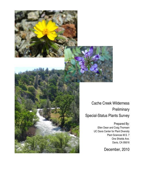
<strong>Cache</strong> <strong>Creek</strong> Wilderness<br />
Preliminary<br />
Special-Status <strong>Plant</strong>s Survey<br />
Prepared By:<br />
Ellen Dean and Craig Thomsen<br />
<strong>UC</strong> <strong>Davis</strong> <strong>Center</strong> <strong>for</strong> <strong>Plant</strong> <strong>Diversity</strong><br />
<strong>Plant</strong> Sciences M.S. 7<br />
One Shields Ave.<br />
<strong>Davis</strong>, CA 95616<br />
December, 2010
TABLE OF CONTENTS<br />
Section Page<br />
Table of Contents ....................................................................................................................................................... i<br />
Introduction ................................................................................................................................................................1<br />
Methods......................................................................................................................................................................1<br />
Pre-field Investigation ............................................................................................................................................1<br />
Field Survey methods.............................................................................................................................................4<br />
Results ........................................................................................................................................................................6<br />
Characterization of Climate, Geologic Features, and Soil Types.......................................................................6<br />
Vegetation Patterns and Alliances......................................................................................................................8<br />
Special-Status <strong>Plant</strong>s Results............................................................................................................................11<br />
Conclusions and Recommendations.........................................................................................................................21<br />
References ................................................................................................................................................................22<br />
Figures<br />
1 Location and Boundaries of the <strong>Cache</strong> <strong>Creek</strong> Wilderness ...............................................................................2<br />
2 Routes Used to Access the <strong>Cache</strong> <strong>Creek</strong> Wilderness <strong>for</strong> 2010 Field Survey ...................................................5<br />
3 Special-Status <strong>Plant</strong>s Encountered in <strong>Cache</strong> <strong>Creek</strong> Wilderness <strong>Area</strong> A .......................................................12<br />
4 Special-Status <strong>Plant</strong>s Encountered in <strong>Cache</strong> <strong>Creek</strong> Wilderness <strong>Area</strong> B ........................................................13<br />
5 Special-Status <strong>Plant</strong>s Encountered in <strong>Cache</strong> <strong>Creek</strong> Wilderness <strong>Area</strong> C ........................................................14<br />
Appendices<br />
A Special-Status <strong>Plant</strong>s Known or with Potential to Occur in the <strong>Cache</strong> <strong>Creek</strong> Wilderness<br />
B <strong>Plant</strong>s Observed at Bear <strong>Creek</strong> Ranch and the <strong>Cache</strong> <strong>Creek</strong> Wilderness 2006-2010<br />
C Representative Photographs of Vegetation and Special-Status <strong>Plant</strong>s Observed in the <strong>Cache</strong> <strong>Creek</strong><br />
Wilderness During the 2010 Survey<br />
D DFG Cali<strong>for</strong>nia Native Species Field Survey Forms<br />
<strong>Cache</strong> <strong>Creek</strong> Wilderness <strong>UC</strong> <strong>Davis</strong> <strong>Center</strong> <strong>for</strong> <strong>Plant</strong> <strong>Diversity</strong><br />
Special-Status <strong>Plant</strong>s Survey i December, 2010
INTROD<strong>UC</strong>TION<br />
This report describes the methods and results of a preliminary special-status plant survey per<strong>for</strong>med <strong>for</strong> the<br />
Bureau of Land Management (BLM) in the <strong>Cache</strong> <strong>Creek</strong> Wilderness (hereafter referred to as “the Wilderness”).<br />
The 27,296 acre Wilderness is adjacent to the confluence of the north and south <strong>for</strong>ks of <strong>Cache</strong> <strong>Creek</strong> within the<br />
upper <strong>Cache</strong> <strong>Creek</strong> watershed, south of State Highway 20, west of the BLM Bear <strong>Creek</strong> Ranch, east of Morgan<br />
Valley Road, and north of the Rieff-Rayhouse Road, in Lake County, Cali<strong>for</strong>nia (Fig. 1). The Wilderness is<br />
adjacent to a patchwork of state, federal, and private rural and natural lands. Walker Ridge and Bear Valley are<br />
present north and northeast of the Wilderness. The University of Cali<strong>for</strong>nia McLaughlin Reserve is located to the<br />
south. Together, the Wilderness and the BLM Bear <strong>Creek</strong> Ranch <strong>for</strong>m the <strong>Cache</strong> <strong>Creek</strong> <strong>Natural</strong> <strong>Area</strong>.<br />
The primary purpose of this survey was to identify and map occurrences of special-status plants within the<br />
Wilderness. In summary, eight Cali<strong>for</strong>nia Rare <strong>Plant</strong> Rank list 1B special-status plants were encountered during<br />
the field survey: adobe lily (Fritillaria pluriflora), Snow Mountain buckwheat (Eriogonum nervulosum), drymary<br />
dwarf-flax (Hesperolinon drymarioides), Hall’s madia (Harmonia hallii), Socrates mine jewelflower<br />
(Streptanthus brachiatus), Colusa tidy-tips (Layia septentrionalis), Jepson’s milkvetch (Astragalus rattanii var.<br />
jepsonianus), and round-leaf stork’s bill (Cali<strong>for</strong>nia macrophyllum). In addition, six Cali<strong>for</strong>nia Rare <strong>Plant</strong> Rank<br />
list 4 special-status plants were encountered: Cleveland’s ragwort (Packera clevelandii), serpentine collomia<br />
(Collomia diversifolia), serpentine milkweed (Asclepias solanoana), bare monkey flower (Mimulus nudatus),<br />
swamp larkspur (Delphinium uliginosum), and Cleveland’s milkvetch (Astragalus clevelandii).<br />
PRE-FIELD INVESTIGATION<br />
METHODS<br />
Be<strong>for</strong>e conducting the survey, a list of special-status plants with potential to occur in the Wilderness was<br />
compiled by per<strong>for</strong>ming database searches of the Cali<strong>for</strong>nia Native <strong>Plant</strong> Society’s (CNPS’) Electronic Inventory<br />
of Rare and Endangered Vascular <strong>Plant</strong>s of Cali<strong>for</strong>nia (CNPS 2010) and the Cali<strong>for</strong>nia Department of Fish and<br />
Game (DFG) Cali<strong>for</strong>nia <strong>Natural</strong> <strong>Diversity</strong> Database (CNDDB 2010). The database searches included the<br />
Benmore Canyon, Wilbur Springs, Salt Canyon, Lower Lake, Wilson Valley, Glascock Mtn., Middletown,<br />
Jericho Valley, and Knoxville U.S. Geological Survey (USGS) 7.5 minute quadrangles. A survey package was<br />
prepared, including photographs of and habitat summaries <strong>for</strong> all special-status plants likely to be encountered.<br />
The survey packets were used to familiarize our field botanists with the characteristics and blooming periods of<br />
special-status plants with potential to occur at the Wilderness.<br />
<strong>Cache</strong> <strong>Creek</strong> Wilderness <strong>UC</strong> <strong>Davis</strong> <strong>Center</strong> <strong>for</strong> <strong>Plant</strong> <strong>Diversity</strong><br />
Special-Status <strong>Plant</strong>s Survey 1 December, 2010
Figure 1. Location and Boundaries of the <strong>Cache</strong> <strong>Creek</strong> Wilderness<br />
(<strong>Area</strong>s A, B, and C are enlarged in Figures 3, 4, and 5 to show the locations of special-status plants<br />
encountered in the Wilderness)<br />
<strong>Cache</strong> <strong>Creek</strong> Wilderness <strong>UC</strong> <strong>Davis</strong> <strong>Center</strong> <strong>for</strong> <strong>Plant</strong> <strong>Diversity</strong><br />
Special-Status <strong>Plant</strong>s Survey 2 December, 2010
The special-status plant habitat summaries indicated that many of the special-status plants with potential to occur<br />
at the Wilderness grow on serpentine soils. There<strong>for</strong>e, we searched aerial photographs and Google Earth images<br />
of the Wilderness <strong>for</strong> the blue signature of serpentine soils. Based on this in<strong>for</strong>mation gathered from aerial<br />
images, as well as previous knowledge of where certain special-status plants are likely to occur, we decided to<br />
target the following areas of the Wilderness <strong>for</strong> visits: 1) the eastern edge of the Wilderness where heavy adobe<br />
clay soils are present; 2) serpentine soil areas surrounding the Rocky <strong>Creek</strong> drainage; and 3) serpentine soil areas<br />
at the southern boundary of the Wilderness at the terminus of the eastern <strong>for</strong>ks of Rocky <strong>Creek</strong> Road (the area<br />
known as Brushy Sky High on some maps). We confirmed our choices by examining soils maps and discussing<br />
the geology of the area with soils experts.<br />
Access to targeted areas in the Wilderness was challenging, because of the need to cross <strong>Cache</strong> <strong>Creek</strong> or private<br />
lands. A preliminary visit to the southern boundary of the Wilderness was made on November 17, 2009 with<br />
Pardee Bardwell of BLM, and we obtained names and phone numbers <strong>for</strong> several land owners in that area. We<br />
then contacted the Lake County Assessor’s Office to obtain the addresses of key land owners on the southern<br />
border of the Wilderness; we wrote letters to the land owners and provided them with our contact in<strong>for</strong>mation. We<br />
were <strong>for</strong>tunate that several land owners granted us permission to use their roads and cross their land. In addition,<br />
Gordon Harrington, a member of our botany team, obtained the contact in<strong>for</strong>mation <strong>for</strong> a land owner on the<br />
northern side of the Wilderness; that land owner allowed us to cross his land, greatly reducing our hiking time on<br />
that side of the Wilderness. The following is a summary of the contacts we made.<br />
Stephen Gilardi, owner of parcels along the eastern <strong>for</strong>k of Rocky <strong>Creek</strong> Road: parcels 5, 6, and 7 in<br />
Section 36, and parcels 49, 50 and 53 in Section 1. The road leading into his residence has a locked gate<br />
that he and a neighbor (Charles Carlisle) control. His residence is often referred to as “Brushy Sky High”<br />
on maps. Address: P.O. Box 1684, Lower Lake, CA 95457. Mr. Gilardi lives in Santa Rosa in the<br />
wintertime. We used Mr. Gilardi’s road to access the Wilderness on the southeastern side twice.<br />
Rick Foltz, owner and resident of parcel near large lake on southern boundary of the Wilderness. His road<br />
is just to the west of Mr. Gilardi’s road. Phone number: 707-994-1584. He has access to an undeveloped<br />
road leading upslope into the Wilderness on the southern side that we never used.<br />
Carol Campbell, owner and resident of parcel near the terminus of the western <strong>for</strong>k of Rocky <strong>Creek</strong> Road<br />
near the headwaters of Rocky <strong>Creek</strong>. The road leading to Ms. Campbell’s house has a locked gate with a<br />
BLM lock on it. Phone number: 707-350-1868. We used Ms. Campbell’s road to access the Rocky <strong>Creek</strong><br />
drainage twice.<br />
<strong>Cache</strong> <strong>Creek</strong> Wilderness <strong>UC</strong> <strong>Davis</strong> <strong>Center</strong> <strong>for</strong> <strong>Plant</strong> <strong>Diversity</strong><br />
Special-Status <strong>Plant</strong>s Survey 3 December, 2010
Nick Buffone, owner of parcels along the north <strong>for</strong>k of <strong>Cache</strong> <strong>Creek</strong> west of the confluence of the north<br />
and south <strong>for</strong>ks, including a well-maintained private road with a locked gate. Mr. Buffone lives in the Bay<br />
<strong>Area</strong>. Work phone number: 510-783-5222. We crossed Mr. Buffone’s property on foot numerous times<br />
but never unlocked the gate.<br />
FIELD SURVEY METHODS<br />
We visited the Wilderness on March 7, April 3 and 24, May 5 and 12, and June 9, 16 and 25, 2010 to per<strong>for</strong>m a<br />
preliminary special-status plant survey. Tracks showing our routes were recorded using a Garmin GPS (Figure 2).<br />
Botanists who participated in the survey included Ellen Dean, Craig Thomsen, Gordon Harrington, Jack<br />
Alderson, Tom Zavortink, Mark Bibbo, Lisa Serafini, John Chau, and Patrick McIntyre. The following areas were<br />
accessed:<br />
March 7: The middle portion of the Rocky <strong>Creek</strong> drainage; we crossed the north <strong>for</strong>k of <strong>Cache</strong> <strong>Creek</strong> twice,<br />
traversed portions of the Redbud Trail, and walked cross-country to Rocky <strong>Creek</strong>.<br />
April 3: Eastern edge of the Wilderness. From the Judge <strong>Davis</strong> Trailhead, we walked south on the Ridge Trail.<br />
April 24: Wilson Valley, the confluence of Rocky and <strong>Cache</strong> <strong>Creek</strong>s, and portions of the lower reaches of Rocky<br />
<strong>Creek</strong>. From the Redbud Trailhead we walked across private and public lands crossing <strong>Cache</strong> <strong>Creek</strong> four times.<br />
May 5: Serpentine areas on the western side of the north <strong>for</strong>k of <strong>Cache</strong> <strong>Creek</strong>. Initially, we were attempting to<br />
resurvey portions of the Wilderness visited in our March 7 hike, but could not cross <strong>Cache</strong> <strong>Creek</strong> (water levels too<br />
high).<br />
May 12: Southern edge of the Wilderness via Steve Gilardi’s property (he accompanied us and showed us trails).<br />
Given the elevation at that end of the Wilderness, it was too early to find most plants in flower, but this visit<br />
prepared us <strong>for</strong> a more fruitful survey on June 25.<br />
June 9: West side of the north <strong>for</strong>k of <strong>Cache</strong> <strong>Creek</strong>. This was another attempt to retrace our March 7 hike, but we<br />
were still unable to cross <strong>Cache</strong> <strong>Creek</strong>, despite data obtained from the Yolo Flood control district.<br />
June 16: Southern edge of the Wilderness via the west <strong>for</strong>ks of Rocky <strong>Creek</strong> Road and gated private road; we<br />
climbed down the Rocky <strong>Creek</strong> drainage from south to north and back.<br />
June 25: Southern edge of the Wilderness via Steve Gilardi’s property. We made a large loop, investigating the<br />
serpentine drainages and slopes northwest of his property.<br />
<strong>Cache</strong> <strong>Creek</strong> Wilderness <strong>UC</strong> <strong>Davis</strong> <strong>Center</strong> <strong>for</strong> <strong>Plant</strong> <strong>Diversity</strong><br />
Special-Status <strong>Plant</strong>s Survey 4 December, 2010
Figure 2. Routes Used to Access the <strong>Cache</strong> <strong>Creek</strong> Wilderness <strong>for</strong> 2010 Field Surveys<br />
Base Map Source: Google Earth, 2010<br />
<strong>Cache</strong> <strong>Creek</strong> Wilderness <strong>UC</strong> <strong>Davis</strong> <strong>Center</strong> <strong>for</strong> <strong>Plant</strong> <strong>Diversity</strong><br />
Special-Status <strong>Plant</strong>s Survey 5 December, 2010
Due to the challenges of needing to hike cross-country quickly in the Wilderness in order to access the areas we<br />
wanted to search, it was difficult to identify and record all plants we passed during our surveys. There<strong>for</strong>e, we<br />
decided to use a recent plant list from the adjacent Bear <strong>Creek</strong> Ranch (Dean et al. 2009) as the basis of a plant list<br />
<strong>for</strong> the Wilderness. Given the proximity, geologic history, and natural communities, it is likely that most of the<br />
plants on the Bear <strong>Creek</strong> Ranch list occur in the Wilderness. We decided to only collect and identify plants that<br />
we believed were new to the list. All plants collected were identified to the highest taxonomic level necessary.<br />
Nomenclature and plant families used in the rare plant table and plant list in Appendices A and B mostly follows<br />
the 1993 edition of the Jepson Manual, Higher <strong>Plant</strong>s of Cali<strong>for</strong>nia (Hickman 1993), however special-status plant<br />
names and some other names were updated to the nomenclature that is being used by the Jepson Flora Project<br />
(available online 2010). Most plants new to the list were pressed, labeled and added to the herbarium at the <strong>UC</strong><br />
<strong>Davis</strong> <strong>Center</strong> <strong>for</strong> <strong>Plant</strong> <strong>Diversity</strong>.<br />
It was difficult to document and classify all vegetation types that we encountered while walking cross country in<br />
the Wilderness. Producing a comprehensive vegetation map was beyond the scope of this project, and no<br />
vegetation plots were sampled. However, photographs and notes were taken in the field to provide a general<br />
description of the Wilderness vegetation. The vegetation of the site was classified using the Manual of Cali<strong>for</strong>nia<br />
Vegetation (Sawyer et al. 2009).<br />
When special-status plants were encountered, their locations were recorded as decimal degrees coordinate points<br />
in the field using a Garmin GPS. With the assistance of James Weigand (BLM), the point files were used to create a<br />
map showing the distribution of special-status plants encountered in the Wilderness.<br />
RESULTS<br />
CHARACTERIZATION OF CLIMATE, GEOLOGIC FEATURES, AND SOIL TYPES<br />
The climate in Lake County is characterized by cool, wet winters and warm, dry summers, with an average annual<br />
temperature (near Clear Lake) of about 56 degrees. The average daily maximum temperature in summer is 91<br />
degrees with an average daily minimum winter temperature of 44 degrees (Lakeport). Average rainfall <strong>for</strong> the<br />
Wilderness region is about 27 inches annually. The first freeze in fall commonly occurs from the middle of<br />
October to the middle of November with the last freeze in spring usually occurring from the last week of April to<br />
the middle of May (Hatfield 1989).<br />
The Wilderness is located at elevations ranging from approximately 850 feet above sea level within the <strong>Cache</strong><br />
<strong>Creek</strong> drainage to more than 2,800 feet near its southern boundary. The geologic features of the Wilderness<br />
include: the <strong>Cache</strong> Formation, <strong>for</strong>ming much of the northern portion, with non-marine Pleistocene lake and<br />
stream bed materials composed of pebbly sandstone, conglomerate, siltstone and tuff, and dating back 10,000 to 6<br />
<strong>Cache</strong> <strong>Creek</strong> Wilderness <strong>UC</strong> <strong>Davis</strong> <strong>Center</strong> <strong>for</strong> <strong>Plant</strong> <strong>Diversity</strong><br />
Special-Status <strong>Plant</strong>s Survey 6 December, 2010
million years; the Coast Range Ophiolite—ultramafic rock that is partly serpentinized—<strong>for</strong>ming most of the<br />
central portion of the Wilderness, dating back about 150 million years (Jurassic); and the Great Valley Sequence,<br />
covering much of the east and southwest portions, with marine mudstones, siltstones, sandstones and<br />
conglomerates from the late Mesozoic age, 140-165 million years old. The Great Valley Sequence comprises both<br />
the Lower Cretaceous Great Valley Sequence, which <strong>for</strong>ms much of the eastern boundary, and the Lower<br />
Cretaceous-Upper Jurassic Great Valley Sequence, which is interspersed within the Wilderness. Soil types<br />
associated with the geologic features in the Wilderness are numerous. There are five soil complexes/associations<br />
that are part of the <strong>Cache</strong> Formation, 15 that are part of the Great Valley sequence, three associated with the<br />
Coast Range Ophiolite, and two that are recent alluvial deposits (Table 1; NRCS 2010; pers. comm. with Dr. R.<br />
Southard).<br />
Table 1. Soils of the <strong>Cache</strong> <strong>Creek</strong> Wilderness<br />
Soils of the <strong>Cache</strong> Formation<br />
Badland; Bally-Phipps complex, 15-30% slopes; Bally-Phipps-Haploxeralfs association, 30-75% slopes;<br />
Phipps complex, 5-15%; Phipps complex, 30-50% slopes<br />
Great Valley Sequence<br />
Bressa-Millsholm loams, 8-15% slopes; Maymen-Etsel-Mayacama complex, 30-75% slopes; Maymen-<br />
Etsel-Snook complex, 15-30%, hills and mountains; Maymen-Etsel-Snook complex, 30-75% slopes;<br />
Maymen-Hopland-Etsel association, 15-50% slopes, mountains; Maymen-Hopland-Mayacama<br />
association, 30-50% slopes; Maymen-Hopland-Mayacama association, 50-75% slopes; Maymen-<br />
Millshom-Bressa complex, 30-50% slopes; Rock-outcrop-Etsel-Snook complex, 50-80% slopes; Skyhigh-<br />
Asbill complex, 15-30%; Skyhigh-Millsholm loams, 15-50% slopes; Skyhigh-Sleeper-Millsholm<br />
association, 15-30% slopes; Skyhigh-Sleeper-Millsholm association, 30-50% slopes; Sleeper Variant-<br />
Sleeper loams, 5-15%; Sleeper Variant-Sleeper loams, 15-30% slopes<br />
Coast Range Ophiolite<br />
Henneke-Montara-Rock outcrop complex, 15-50% slopes; Henneke-Okiota complex, 30-50% slopes;<br />
Okiota-Henneke complex, 5-30% slopes<br />
Recent alluvial deposits<br />
Riverwash. This map unit is in active stream channels, 0-5% slopes; Xerofluvents-Riverwash complex, 0-<br />
2% slopes<br />
Many of the special-status plants that we encountered during the 2010 surveys grow on serpentine soils of the<br />
Henneke-Montara-Rock outcrop complex of the Coast Range Ophiolite. These soils occupy an extensive area in<br />
the southern/central part of the Wilderness, including parts of the Rocky <strong>Creek</strong> drainage and the area known as<br />
Brushy Sky High. The Wilderness’s Henneke-Okiota complex serpentine soils (also Coast Range Ophiolite)<br />
could not be explored this field season but are known to support special-status plants at the adjacent BLM Bear<br />
<strong>Creek</strong> Ranch and elsewhere. The soils of the Phipps complex (<strong>Cache</strong> <strong>Creek</strong> Formation) found on both sides of the<br />
south <strong>for</strong>k of <strong>Cache</strong> <strong>Creek</strong> and the west side of Rocky <strong>Creek</strong>, which are derived from alluvium (including<br />
serpentine-derived alluvium), provide habitat <strong>for</strong> a three special-status plants. Skyhigh-Sleeper-Millsholm soils of<br />
<strong>Cache</strong> <strong>Creek</strong> Wilderness <strong>UC</strong> <strong>Davis</strong> <strong>Center</strong> <strong>for</strong> <strong>Plant</strong> <strong>Diversity</strong><br />
Special-Status <strong>Plant</strong>s Survey 7 December, 2010
the Great Valley Sequence found along the eastern border of the Wilderness adjacent to Bear <strong>Creek</strong> Ranch have<br />
pockets of adobe clay soil that support round-leaf stork’s bill.<br />
VEGETATION PATTERNS AND ALLIANCES<br />
Statewide (and nationwide), there is an ef<strong>for</strong>t to describe vegetation based on the dominance of a single-species<br />
within a given stand, referred to as “alliances” (Sawyer et al. 2009). As stated previously, a vegetation alliance<br />
map <strong>for</strong> the Wilderness was beyond the scope of this project, and we did not do any vegetation sampling.<br />
Nevertheless, to provide a preliminary description of Wilderness vegetation, we developed a provisional list of 25<br />
published and unpublished alliances that we observed along with their rarity rankings (Table 2). We used the<br />
2009 Manual of Cali<strong>for</strong>nia Vegetation to classify the vegetation we encountered, and we had the following usage<br />
problems: 1) there is no minimum mapping unit provided in the classification; 2) we encountered vegetation<br />
assemblages not described in the classification; 3) we encountered assemblages with no clear dominant.<br />
Photographs of many of these alliances are provided in Appendix C. Descriptions of unpublished alliances follow.<br />
Table 2. Provisional Vegetation Alliances Observed in the Wilderness*<br />
Alliance Name<br />
Rarity<br />
Ranking Alliance Name<br />
Woodland alliances<br />
Callitropsis (Hesperocyparis)<br />
Herbaceous alliances<br />
sargentii G3 S3.2 Avena-Bromus<br />
Rarity<br />
Ranking<br />
Pinus attenuata G4 S4 Carex nudata G3 S3<br />
Pinus sabiniana G4 S4 Carex serratodens G3 S3<br />
Populus fremontii G4 S3.2 Centaurea solstitialis<br />
Lasthenia cali<strong>for</strong>nica-<strong>Plant</strong>ago<br />
Quercus chrysolepis G5 S5 erecta<br />
Quercus douglasii G4 S4 Vulpia microstachys G4 S4<br />
Quercus lobata G3 S3<br />
Salix laevigata G3 S3 Unpublished alliances<br />
Shrubland alliances Achyrachaena mollis<br />
Adenostoma fasciculatum G5 S5 Apocynum cannabinum<br />
Arcostaphylos viscida ssp.<br />
pulchella G4 S4 Juncus ensifolius<br />
Baccharis pilularis G5 S5 Micropus cali<strong>for</strong>nicus<br />
Baccharis salicifolia G5 S4 Saccharum ravennae<br />
Ceanothus jepsonii Taeniatherum caput-medusae<br />
Eriogonum wrightii G3 S3<br />
Quercus beberidifolia G4 S4<br />
Quercus durata G4 S4 Mixed assemblages with no clear dominant<br />
Rhus trilobata G4 S3? Mixed serpentine chaparral<br />
Salix breweri G2 S2 Mixed chaparral<br />
Salix exigua G5 S4.2 Native prairie<br />
G1 - G3 code = rare and threatened throughout its range<br />
G4 - G5 with S1 - S3 code = secure through its range outside the state but rare and threatened in Cali<strong>for</strong>nia<br />
G4 - G5 with S4 - S5 = apparently or demonstrably secure throughout its range<br />
*Descriptions of published alliances can be found in Sawyer et al. 2009.<br />
<strong>Cache</strong> <strong>Creek</strong> Wilderness <strong>UC</strong> <strong>Davis</strong> <strong>Center</strong> <strong>for</strong> <strong>Plant</strong> <strong>Diversity</strong><br />
Special-Status <strong>Plant</strong>s Survey 8 December, 2010
UNPUBLISHED ALLIANCES<br />
Native Unpublished Alliances<br />
Achyrachaena mollis and Micropus cali<strong>for</strong>nicus Provisional Alliances<br />
Among the undescribed alliances that we observed were dense stands of the native annual herbaceous plants blow<br />
wives (Achyrachaena mollis) and slender cottonweed (Micropus cali<strong>for</strong>nicus) on non-serpentine soils. These<br />
assemblages may be “unique stands,” i.e., having never <strong>for</strong>med sufficient number of stands or a broad enough<br />
range to be considered their own alliance (Alexander et al. 2007). It is also possible that these stands are remnant<br />
prairie assemblages that were more prevalent prior to the widespread invasion of non-native plants into prairiegrassland<br />
communities, or perhaps they are only variants of larger prairie-grassland types that have mostly<br />
disappeared. Species associated with the Achyrachaena mollis alliance were farewell-to-spring (Clarkia sp.),<br />
miniature lupine (Lupinus bicolor), chick lupine (L. microcarpus var. densiflorus), slender cottonweed, Cali<strong>for</strong>nia<br />
plantain (<strong>Plant</strong>ago erecta), pine bluegrass (Poa secunda), notchleaf clover (Trifolium bifidum), and small fescue<br />
(Vulpia microstachys). Species associated with the Micropus cali<strong>for</strong>nicus alliance included blowwives, yarrow<br />
(Achillea millefolium), jeweled onion (Allium serra), pale western larkspur (Delphinium hesperium), bottlebrush<br />
squirreltail (Elymus elymoides), Cali<strong>for</strong>nia melicgrass (Melica cali<strong>for</strong>nica), small flowered needlegrass (Nassella<br />
lepida), Cali<strong>for</strong>nia plantain, pine bluegrass, wireweed (Rigiopappus leptocladus), and small fescue.<br />
Apocynum cannabinum Provisional Alliance<br />
We observed large stands of Indian hemp (Apocynum cannabinum), an uncommon species with ethnobotanical<br />
significance, along the upper reaches of Rocky <strong>Creek</strong>. Whether these native assemblages were large enough to<br />
constitute an actual alliance is uncertain, but they are clearly important examples of Cali<strong>for</strong>nia’s native vegetation.<br />
Juncus ensifolius Provisional Alliance<br />
In the southern part of the wilderness near Brushy Sky High on serpentine soils, adjacent to a spring within a<br />
Sargent cypress (Hesperocyparis sargentii) woodland, we encountered a monoculture of three-stamened rush<br />
(Juncus ensifolius). Again, it is unclear whether this occurrence was large enough to constitute an alliance.<br />
Nonnative Unpublished Alliances<br />
Two non-native species, Ravenna grass (Saccharum ravennae) and medusahead (Taeniatherum caput-medusae),<br />
reach abundance levels high enough to constitute consideration as alliances. Ravenna grass is a regional weed<br />
problem (Thomsen and Meyer 2007), <strong>for</strong>ming extensive stands along <strong>Cache</strong> <strong>Creek</strong>, including areas of the<br />
Wilderness. Some of the prairie-grassland assemblages within the Wilderness support large stands of<br />
Medusahead. As this species is a common dominant in Cali<strong>for</strong>nia grasslands, it is unclear why Medusahead was<br />
not included as a non-native “semi-natural” alliance within the new 2009 Cali<strong>for</strong>nia Manual of Vegetation.<br />
<strong>Cache</strong> <strong>Creek</strong> Wilderness <strong>UC</strong> <strong>Davis</strong> <strong>Center</strong> <strong>for</strong> <strong>Plant</strong> <strong>Diversity</strong><br />
Special-Status <strong>Plant</strong>s Survey 9 December, 2010
UNCLASSIFIED ASSEMBLAGES AND SIGNIFICANT BOTANICAL FEATURES<br />
Problematic from a classification perspective were the extensive stands of mixed serpentine and non-serpentine<br />
chaparral that we encountered in the Wilderness. Since “membership rules” <strong>for</strong> shrub alliances often require one<br />
species to cover at least 50% of a given stand, the diverse mixtures of species that exist within some observed<br />
stands of mixed chaparral defy classification into discrete single-species alliance units. Mixed serpentine<br />
chaparral in the Wilderness typically included the following assemblage of shrub species: whiteleaf manzanita<br />
(Arctostaphylos viscida), Jepson ceanothus (Ceanothus jepsonii), toyon (Heteromeles arbutifolia), buckthorn and<br />
relatives (Rhamnus spp.), leatheroak (Quercus durata), chamise (Adenostoma fasciculatum), Interior silktassel<br />
(Garrya congdonii), Cali<strong>for</strong>nia bay (Umbellularia cali<strong>for</strong>nica), poison oak (Toxicodendron diversifolium), and, in<br />
places, cypress (Hesperocyparis spp.). Perhaps the extreme example of this was encountered in a two-acre area of<br />
serpentine-influenced soil near Brushy Sky High where we observed 17 different shrub species without any<br />
tendency towards dominance by one or more shrubs (see photo Appendix C). In addition to those already listed<br />
above <strong>for</strong> mixed serpentine chaparral, this area included the following shrubs: redbud, mountain mahogany,<br />
Cali<strong>for</strong>nia ash (Fraxinus dipetala), chaparral pea (Pickeringia montana), shrub oak (Quercus berberidifolia), and<br />
snowdrop bush (Styrax officinalis var. redivivus). Grasses and <strong>for</strong>bs associated with this area included:<br />
bottlebrush squirreltail, Cali<strong>for</strong>nia fescue (Festuca cali<strong>for</strong>nica), golden fairy lantern (Calochortus amabilis), soap<br />
plant (Chlorogalum pomeridianum), peregrine thistle (Cirsium cymosum), red ribbons (Clarkia concinnum),<br />
woolly sunflower (Eriophyllum lanatum), dwarf flax (Hesperolinon spp.), phlox-leaved bedstraw (Galium<br />
andrewsii), lomatium (Lomatium spp.), coyote mint (Monardella villosa), and blue-eyed grass (Sisyrinchium<br />
bellum).<br />
Similarly, a native prairie on serpentine soil just above Rocky <strong>Creek</strong> with nine native grasses and a rich<br />
assortment of <strong>for</strong>bs (see photo Appendix C) is another example of a rare native plant assemblage that doesn’t fall<br />
within any alliance status but warrants recognition as another significant botanical feature within the Wilderness.<br />
Native grasses encountered in this prairie were: woodland brome (Bromus laevipes), blue wildrye (Elymus<br />
glaucus), bottlebrush squirreltail, Roemer’s fescue (Festuca idahoensis var. roemeri), meadow barley (Hordeum<br />
brachyantherum), creeping wildrye (Leymus triticoides), purple needlegrass (Nassella pulchra), pine bluegrass,<br />
and small fescue. Associated <strong>for</strong>bs included: Cali<strong>for</strong>nia dandelion (Agoseris grandiflora), narrow-leaved onion<br />
(Allium amplectens), narrow leaf milkweed (Asclepias fascicularis), harvest brodiaea (Brodiaea elegans), yellow<br />
mariposa (Calochortus superbus), soap plant, peregrine thistle, bird’s beak (Cordylanthus sp.), hayfield tarweed<br />
(Hemizonia congesta ssp. luzulaefolia), little hareleaf (Lagophylla minor), short-podded lotus (Lotus humistratus),<br />
Chilean birdfoot trefoil (Lotus wrangelianus), chick lupine, slender cottonweed, yampah (Perideridia sp.),<br />
buttercup (Ranunculus sp.), fringed checkerbloom (Sidalcea diploscypha), blue-eyed grass, clover species, narrow<br />
leaf mule ears (Wyethia angustifolia), and death camas (Zigadenus sp.).<br />
<strong>Cache</strong> <strong>Creek</strong> Wilderness <strong>UC</strong> <strong>Davis</strong> <strong>Center</strong> <strong>for</strong> <strong>Plant</strong> <strong>Diversity</strong><br />
Special-Status <strong>Plant</strong>s Survey 10 December, 2010
We encountered extensive serpentine barrens with reddish serpentine soils near Brushy Sky High; this was one of<br />
the most significant finds of the survey. The dry slopes of the interior of the eastern side of the barrens were<br />
mostly devoid of vegetation with the exception of two species of jewelflower (Streptanthus brachiatus and S.<br />
breweri) and three species of buckwheat (Eriogonum nervulosum, E. nudum and E. dasyanthemum). Serpentine<br />
milkweed was observed in one area, the only known location in the Wilderness. Some of the drainages within the<br />
barrens have an abundance of water, including several waterfalls. The serpentine riparian flora associated with the<br />
drainages located in the interior and western side of the barrens included the shrubs western azalea<br />
(Rhododendron occidentalis), Brewer’s willow (Salix breweri), spicebush (Calycanthus occidentalis), and<br />
Cali<strong>for</strong>nia buckthorn (Rhamnus tomentella); the mixed herbaceous layer included: angelica (Angelica spp.),<br />
Cleveland’s ragwort, Cleveland’s milkvetch, Van Houtte’s columbine (Aquilegia eximia) , two tooth sedge<br />
(Carex serratodens), stream orchid (Epipactus gigantean), and goldenrod (Solidago). Within parts of this area,<br />
two tree species were co-dominant and represented a previously undocumented alliance association: knobcone<br />
pine (Pinus attenuata)-Sargent cypress (Hesperocyparis sargentii).<br />
SPECIAL-STATUS PLANTS RESULTS<br />
Special-status plants are defined as plants that are legally protected or that are otherwise considered sensitive by<br />
federal, state, or local resource conservation agencies and organizations. Special-status plant taxa are species,<br />
subspecies or varieties that fall into one or more of the following categories, regardless of their legal or protection<br />
status:<br />
► Officially listed by the state of Cali<strong>for</strong>nia or the federal government as Endangered, Threatened or Rare;<br />
► A candidate <strong>for</strong> state or federal listing as Endangered, Threatened or Rare;<br />
► Taxa which meet the criteria <strong>for</strong> listing, even if not currently included on any list, as described in Section<br />
15380 of the Cali<strong>for</strong>nia Environmental Quality Act (CEQA) Guidelines;<br />
► Taxa designated as a special-status, sensitive or declining species by other state or federal agencies or<br />
non-governmental organizations; and<br />
► Taxa considered by the DFG and CNPS to be “presumed extinct” (Cali<strong>for</strong>nia Rare <strong>Plant</strong> Rank [Rare <strong>Plant</strong><br />
Rank] List 1A) or “rare, threatened or endangered in Cali<strong>for</strong>nia” (Rare <strong>Plant</strong> Rank 1B and 2).<br />
The CNPS Inventory includes five lists <strong>for</strong> categorizing plant species of concern, which are summarized below.<br />
All plants listed in the CNPS Electronic Inventory of Rare and Endangered Vascular <strong>Plant</strong>s of Cali<strong>for</strong>nia (CNPS<br />
2010) are considered "special plants" by DFG and are addressed in this report. “Special plants” is a broad term<br />
<strong>Cache</strong> <strong>Creek</strong> Wilderness <strong>UC</strong> <strong>Davis</strong> <strong>Center</strong> <strong>for</strong> <strong>Plant</strong> <strong>Diversity</strong><br />
Special-Status <strong>Plant</strong>s Survey 11 December, 2010
Figure 3. Special-Status <strong>Plant</strong>s Encountered in <strong>Area</strong> A of the <strong>Cache</strong> <strong>Creek</strong> Wilderness<br />
<strong>Cache</strong> <strong>Creek</strong> Wilderness <strong>UC</strong> <strong>Davis</strong> <strong>Center</strong> <strong>for</strong> <strong>Plant</strong> <strong>Diversity</strong><br />
Special-Status <strong>Plant</strong>s Survey 12 December, 2010
Figure 4. Special-Status <strong>Plant</strong>s Encountered in <strong>Area</strong> B of the <strong>Cache</strong> <strong>Creek</strong> Wilderness<br />
<strong>Cache</strong> <strong>Creek</strong> Wilderness <strong>UC</strong> <strong>Davis</strong> <strong>Center</strong> <strong>for</strong> <strong>Plant</strong> <strong>Diversity</strong><br />
Special-Status <strong>Plant</strong>s Survey 13 December, 2010
Figure 5. Special-Status <strong>Plant</strong>s Encountered in <strong>Area</strong> C of the <strong>Cache</strong> <strong>Creek</strong> Wilderness<br />
<strong>Cache</strong> <strong>Creek</strong> Wilderness <strong>UC</strong> <strong>Davis</strong> <strong>Center</strong> <strong>for</strong> <strong>Plant</strong> <strong>Diversity</strong><br />
Special-Status <strong>Plant</strong>s Survey 14 December, 2010
used by DFG to refer to all of the plant taxa inventoried by the CNDDB, regardless of their legal or protection<br />
status. The CNPS/DFG lists are categorized as follows:<br />
► Rare <strong>Plant</strong> Rank 1A - <strong>Plant</strong>s presumed extinct in Cali<strong>for</strong>nia;<br />
► Rare <strong>Plant</strong> Rank 1B - <strong>Plant</strong>s rare, threatened, or endangered in Cali<strong>for</strong>nia and elsewhere;<br />
► Rare <strong>Plant</strong> Rank 2 - <strong>Plant</strong>s rare, threatened, or endangered in Cali<strong>for</strong>nia but more common elsewhere;<br />
► Rare <strong>Plant</strong> Rank 3 - <strong>Plant</strong>s about which we need more in<strong>for</strong>mation - a review list; and<br />
► Rare <strong>Plant</strong> Rank 4 - <strong>Plant</strong>s of limited distribution - a watch list.<br />
Based on the pre-field investigation, 23 special-status plants (Rare <strong>Plant</strong> Rank 1B or state- or federallyendangered)<br />
were identified as having potential to occur in the Wilderness. Appendix A provides a list of these<br />
species along with in<strong>for</strong>mation about their listing status, habitat, distribution, flowering period, and potential to<br />
occur in the Wilderness (CNPS 2010; CNDDB 2010; CCH 2010).<br />
Eight Rare <strong>Plant</strong> Rank 1B special-status plants were encountered during the 2010 field survey (Figs. 3-5):<br />
Jepson’s milkvetch (Astragalus rattanii var. jepsonianus), round-leaf stork’s bill (Cali<strong>for</strong>nia macrophyllum),<br />
Snow Mountain buckwheat (Eriogonum nervulosum), adobe lily (Fritillaria pluriflora), Hall’s layia (Harmonia<br />
hallii), drymary dwarf-flax (Hesperolinon drymarioides), Colusa tidy-tips (Layia septentrionalis), and jewel<br />
flower (Streptanthus brachiatus). In addition six Rare <strong>Plant</strong> Rank 4 plants were documented (Figs. 3-5):<br />
Cleveland’s ragwort (Packera clevelandii), serpentine collomia (Collomia diversifolia), serpentine milkweed<br />
(Asclepias solanoana), bare monkey flower (Mimulus nudatus), swamp larkspur (Delphinium uliginosum), and<br />
Cleveland’s milkvetch (Astragalus clevelandii). The special-status plant occurrences are described below.<br />
Photographs of the List 1B plants encountered are provided in Appendix C. Completed DFG Cali<strong>for</strong>nia Native Species<br />
Field Survey Forms <strong>for</strong> List 1B plants are provided in Appendix D.<br />
RARE PLANT RANK 1B PLANTS:<br />
Jepson’s Milkvetch<br />
Jepson’s milkvetch (Astragalus rattanii var. jepsonianus) is a member of the Fabaceae family and is a Rare <strong>Plant</strong><br />
Rank 1B.2 plant (CNPS 2010). It is an annual plant with a slender, decumbent to erect stem to 30 cm tall,<br />
compound leaves with seven to nine blunt-tipped leaflets, and flowers borne in heads of four to nine flowers. The<br />
hairs on the plant are often blackish. The flowers are purple and white (Hickman 1993), and the plants bloom<br />
from March through June (CNPS 2010). Jepson’s milkvetch is often found on serpentine soils at 350 – 600 m in<br />
elevation within the southern area of the Inner North Coast Ranges of Cali<strong>for</strong>nia (Hickman 1993). It grows in<br />
chaparral, cismontane woodland, and valley and foothill grasslands plant communities (CNPS 2010). It has been<br />
found in Colusa, Glenn, Lake, Napa, Tehama, Yolo and Mendocino counties (CNPS 2010, CCH 2010, CNDDB<br />
2010).<br />
<strong>Cache</strong> <strong>Creek</strong> Wilderness <strong>UC</strong> <strong>Davis</strong> <strong>Center</strong> <strong>for</strong> <strong>Plant</strong> <strong>Diversity</strong><br />
Special-Status <strong>Plant</strong>s Survey 15 December, 2010
We encountered Jepson’s milkvetch during April, May and June, 2010 in several areas of the Wilderness (Figs. 3<br />
and 4). The first occurrence was a diffuse population found April 24 on the serpentine-influenced alluvial deposits<br />
of the lower reaches of Rocky <strong>Creek</strong> at approximately 900 feet. Numerous plants were observed in small clusters<br />
of approximately ten plants along the sides of the creek; all plants were in flower. The second occurrence was a<br />
very small population (three flowering plants) observed on April 24 on a gravel terrace on the south side of <strong>Cache</strong><br />
<strong>Creek</strong> east of the confluence of the north and south <strong>for</strong>ks. The third and fourth occurrences were on serpentine<br />
deposits on east-facing slopes above the north <strong>for</strong>k of <strong>Cache</strong> <strong>Creek</strong> at approximately 1,100 -1,250 feet. The third<br />
occurrence, which consisted of approximately 5,000 flowering plants, was encountered on May 5. The fourth<br />
occurrence, encountered on June 9, consisted of fewer than 100 fruiting plants. The fifth occurrence was located<br />
at approximately 2500 feet on serpentine barrens near the southern boundary of the Wilderness to the west of<br />
Rocky <strong>Creek</strong>; this small population of ca. 50 plants was in flower and fruit.<br />
Where we observed Jepson’s milkvetch in the Wilderness, it grew in areas where vegetation is nearly absent or in<br />
sparse annual grassland assemblages. The first and second occurrences along <strong>Cache</strong> and Rocky <strong>Creek</strong>s suggest<br />
that the seeds were being washed down from upper slopes and deposited at the creek edges. There<strong>for</strong>e, larger<br />
populations probably occur elsewhere in the Wilderness on serpentine influenced slopes above the creeks.<br />
Round-leaf stork’s bill<br />
Round-leaf stork’s bill (Cali<strong>for</strong>nia macrophyllum <strong>for</strong>merly known as Erodium macrophyllum) is a member of the<br />
geranium family (Geraniaceae) and is a Rare <strong>Plant</strong> Rank 1B.1 plant (CNPS 2010). It is an inconspicuous, winter<br />
annual that has simple, kidney-shaped, basal leaves with reddish veins. The stem is less than 5 cm tall and<br />
glandular-puberulent. The small, white flowers self-pollinate and are very short-lived, generally lasting <strong>for</strong> only<br />
one day. The fruits develop quickly and have a distinctive beak (Hickman 1993, Gillespie 2005). Round-leaf<br />
stork’s bill is found on open sites within grassland and shrubland communities at elevations below 1200 m (CNPS<br />
2010) and is restricted to clay soils (Gillespie 2005). The species is broadly distributed, but rarely encountered; in<br />
some cases, county records are based on collections made in the first half of the 20 th century (CCH 2010). Its<br />
current and historical distribution encompasses the Sacramento Valley, northern San Joaquin Valley, central<br />
western Cali<strong>for</strong>nia, the southern coast of Cali<strong>for</strong>nia and the northern Channel Islands (specifically Santa Cruz<br />
Island) (Hickman 1993). It has been documented in Alameda, Butte, Contra Costa, Colusa, Fresno, Glenn, Kings,<br />
Kern, Lake, Lassen, Los Angeles, Merced, Monterey, Napa, Riverside, Santa Barbara, San Benito, Santa Clara,<br />
San Diego, San Joaquin, San Luis Obispo, San Mateo, Solano, Sonoma, Stanislaus, Tehama, Ventura, and Yolo<br />
counties, as well as Baja Cali<strong>for</strong>nia and Oregon (CNPS 2010, CCH 2010, CNDDB 2010). Round-leaf stork’s bill<br />
blooms from March through May.<br />
We encountered Round-leaf stork’s bill in full flower on April 3, 2010 along the eastern boundary of the<br />
Wilderness, adjacent to the BLM Bear <strong>Creek</strong> Ranch. We found four occurrences on the west side of the Ridge<br />
<strong>Cache</strong> <strong>Creek</strong> Wilderness <strong>UC</strong> <strong>Davis</strong> <strong>Center</strong> <strong>for</strong> <strong>Plant</strong> <strong>Diversity</strong><br />
Special-Status <strong>Plant</strong>s Survey 16 December, 2010
Trail and one on the east side (Fig. 5). In all cases, the plants were growing on 5-30% slopes in deep, clay soils<br />
within 50 feet of a drainage. In many cases, very deep cattle hoof prints were visible where the plants were<br />
growing, indicating that the soil had been very wet. In most cases, white mudstone rocks were present on the soil<br />
surface. Surrounding vegetation was either annual grassland or open, blue oak woodland; in all cases ground<br />
cover was less than 50%, with the plants occurring in open soil. Common associates included annual grasses,<br />
especially medusahead, common lomatium (Lomatium utriculatum), redstem filaree (Erodium cicutarium),<br />
shortfruit stork’s bill (Erodium brachycarpum), broad leaf filaree (Erodium botrys), cut leaved geranium<br />
(Geranium disssectum), few flowered evax (Hesperevax sparsiflora), and smooth cat’s ear (Hypochaeris glabra).<br />
Populations ranged from 500 to more than 5000 individuals.<br />
Snow Mountain buckwheat<br />
Snow Mountain buckwheat (Eriogonum nervulosum), a member of the buckwheat family (Polygonaceae), is a<br />
Rare <strong>Plant</strong> Rank 1B.2 plant (CNPS 2010). It is a matted subshrub to 15 cm tall with small leaves (that are woolly<br />
on the underside) arranged in rosettes. The small yellow-to-reddish flowers are arranged in rounded umbellate<br />
clusters (Hickman 1993). The species is found on serpentine barrens or outcrops at 300 – 2100 m in elevation<br />
(Hickman 1993, CNPS 2010). It is known to occur in the North Coast Ranges in Colusa, Glenn, Lake, Napa,<br />
Sonoma, and Yolo counties (CCH 2010, CNPS 2010). Snow Mountain buckwheat blooms from June to<br />
September (CNPS 2010).<br />
We documented Snow Mountain buckwheat on an extensive system of serpentine barrens at 2,200-2,400 feet in<br />
elevation near the southern edge of the Wilderness on June 25, 2010 (Fig. 4). Thousands of plants were present,<br />
occupying numerous hillslopes and ridges. Approximately 30-70% of the plants were in flower, depending on the<br />
subpopulation. Common associates were Socrates Mine jewelflower (Streptanthus brachiatus), naked buckwheat<br />
(Eriogonum nudum) and chaparral buckwheat (E. dasyanthemum); serpentine milkweed (Asclepias solanoana)<br />
was also present in one area.<br />
Adobe Lily<br />
Adobe lily (Fritillaria pluriflora), a member of the lily family (Liliaceae), is a Rare <strong>Plant</strong> Rank 1B.2 plant (CNPS<br />
2010). It is a perennial geophyte that emerges each spring from an underground bulb. The stem is 1.5 – 4.5 dm in<br />
length and has 3 – 10 alternately-arranged leaves that are clustered near the ground. The flowers are nodding and<br />
pinkish purple in color. The species is found on adobe soils of the interior foothills (Hickman 1993) at elevations<br />
of less than 705 m in chaparral, cismontane woodland, and valley grassland vegetation types (CNPS 2010).<br />
Adobe lily’s distribution encompasses the Inner North Coast Ranges, Sierra Nevada Foothills, the perimeter of the<br />
Sacramento Valley, and southern Oregon (Hickman 1993), and it has been documented in eleven Cali<strong>for</strong>nia<br />
<strong>Cache</strong> <strong>Creek</strong> Wilderness <strong>UC</strong> <strong>Davis</strong> <strong>Center</strong> <strong>for</strong> <strong>Plant</strong> <strong>Diversity</strong><br />
Special-Status <strong>Plant</strong>s Survey 17 December, 2010
counties: Butte, Colusa, Glenn, Lake, Napa, Solano, Tehama, Mendocino and Yolo (CNPS 2010, CCH 2010,<br />
CNDDB 2010). Adobe lily blooms from February to April (CNPS 2010).<br />
In the Wilderness, we encountered Adobe lily at 1,300 to 1,400 feet in elevation in a serpentine meadow to the<br />
west of the Rocky <strong>Creek</strong> drainage (Fig. 3). The location had deep clay soils, a flowing stream, and numerous<br />
seeps. Adobe lily was concentrated on the edges of rocky outcrops in gentle (10-30%) slopes within grassland.<br />
Associates included medusa head and other native and nonnative annual grasses, buttercup (Ranunculus sp.), and<br />
larkspur (Delphinium sp.). We accessed this location on March 3, 2010 when the Adobe lily plants were just<br />
beginning to emerge and few were in flower. At that time, we estimated that there were approximately 400 plants<br />
in numerous subpopulations, although this number probably underestimates the population size. We attempted to<br />
return to this site twice to re-estimate the size of the population and search <strong>for</strong> other special-status plants but could<br />
not cross <strong>Cache</strong> <strong>Creek</strong>.<br />
Hall’s Layia (Harmonia hallii)<br />
Hall’s layia (Harmonia hallii or Madia hallii), a member of the tarweed tribe in the daisy family (Asteraceae), is a<br />
Rare <strong>Plant</strong> Rank 1B.2 plant (CNPS 2010). It is a glandular, annual herb to 18 cm with few branches and leaves<br />
crowded into whorl-like clusters. Its yellow flowers are in a small head, and its fruits lack any appendages<br />
(Hickman 1993). Hall’s layia is found on serpentine barrens in open chaparral between 500 and 900 meters in<br />
elevation and has been documented in Colusa, Lake, Napa, and Yolo counties. It blooms from April to June<br />
(CNPS 2010).<br />
Hall’s layia was encountered in only one restricted location at 2,565 feet in elevation in the center of and along<br />
the sides of an unpaved road through serpentine chaparral near the southern boundary of the Wilderness (Fig. 4).<br />
The road on which it was located descends from Stephen Gilardi’s property to <strong>Cache</strong> <strong>Creek</strong>. This segment of the<br />
road had a southeastern exposure and a warmer microclimate than surrounding areas. The chaparral vegetation<br />
included Jepson’s ceanothus (Ceanothus jepsonii), chaparral buckwheat (Eriogonum dasyanthemum), sickleleaf<br />
onion (Allium falcifolium), leather oak (Quercus durata), whiteleaf manzanita (Arctostaphylos viscida), and<br />
drymary dwarf-flax. There were approximately 100 plants in full flower.<br />
Drymary Dwarf-flax<br />
Drymary dwarf-flax (Hesperolinon drymarioides) is a member of the linen family (Linaceae) and a Rare <strong>Plant</strong><br />
Rank 1B.2 plant. It is a delicate, annual herb that grows to 25 cm tall and has whorled leaves. Its small, white<br />
flowers are arranged in a diffuse, <strong>for</strong>king inflorescence. Its distribution is concentrated in the inner North Coast<br />
Ranges. It has been documented in Colusa, Glenn, Lake, Napa, and Yolo counties. It occurs on serpentine soils in<br />
coniferous <strong>for</strong>est, chaparral, cismontane woodland, and valley and foothill grassland at 100 – 1130 m in elevation.<br />
Drymary dwarf-flax blooms from May to August.<br />
<strong>Cache</strong> <strong>Creek</strong> Wilderness <strong>UC</strong> <strong>Davis</strong> <strong>Center</strong> <strong>for</strong> <strong>Plant</strong> <strong>Diversity</strong><br />
Special-Status <strong>Plant</strong>s Survey 18 December, 2010
We encountered Drymary dwarf-flax near the southern Wilderness boundary on May 12 and June 25, 2010 (Fig.<br />
4). It occurs there between 2,500 and 2,600 feet in elevation north and west of Stephen Gilardi’s property. It was<br />
growing on open, disturbed serpentine soils along unpaved roads within chaparral. Chaparral associates are the<br />
same as listed above <strong>for</strong> Hall’s layia. Herbaceous associates included Hall’s layia, sickleleaf onion, chaparral<br />
willowherb (Epilobium minutum), short podded lotus (Lotus humistratus), and four-petaled pussypaws<br />
(Calyptridium quadripetalum). The population was extensive and consisted of thousands of plants. On the May 12<br />
visit, all plants were vegetative. On the June 25 visit, all plants were in flower.<br />
Colusa Tidy-tips<br />
Colusa tidy-tips (Layia septentrionalis) is a member of the tarweed tribe in the daisy family (Asteraceae) and a<br />
Rare <strong>Plant</strong> Rank 1B.2 plant. It is an annual herb that grows to 35 cm tall and has sticky, glandular hairs on its<br />
stem, leaves, and yellow flower heads. An important character that separates it from other species of tarweed is<br />
having woolly hairs at the base of its fruit appendages. Its distribution is concentrated in the North Coast Ranges,<br />
extending east to Sutter County. It has been documented in Colusa, Glenn, Lake, Mendocino, Napa, Sonoma,<br />
Sutter, Tehama, and Yolo counties. It occurs in chaparral, cismontane woodland, valley and foothill grassland on<br />
sandy or serpentine-influenced soils at 100 – 1095 m in elevation. Colusa tidy-tips blooms from April to May.<br />
We encountered Colusa tidy-tips in two areas of the Wilderness. The first occurrence was found on April 24,<br />
2010 at ca. 1,100 ft in elevation in annual grassland within blue oak woodland on a peninsular ridge that protrudes<br />
into the <strong>Cache</strong> <strong>Creek</strong> watershed on the south side of the creek west of the confluence of Rocky and <strong>Cache</strong> <strong>Creek</strong>s<br />
(Fig. 3). The soil type did not appear to be derived from serpentine, but downslope from the occurrence, on the<br />
east side of the ridge, serpentine deposits were evident on the south side of <strong>Cache</strong> <strong>Creek</strong>. The population<br />
consisted of ca. 300 plants with most plants in full flower.<br />
The second occurrence was encountered on May 5, 2010 between 1140 and 1238 feet in elevation on a northeastfacing<br />
slope of a serpentine-influenced ridge on the west side of the north <strong>for</strong>k of <strong>Cache</strong> <strong>Creek</strong> (Fig. 3). The<br />
Colusa tidy-tips plants were growing in the partial shade of a blue oak woodland adjacent to an open serpentine<br />
barrens with sparse annual grasses. The population consisted of at least 10,000 plants and was growing with<br />
jeweled onion (Allium serra), slender tarweed (Madia gracilis), Ithuriel’s spear (Triteleia laxa), succulent lupine<br />
(Lupinus succulentus), and foothill clover (Trifolium ciliolatum).<br />
Socrates Mine Jewelflower<br />
Socrates Mine jewelflower (Streptanthus brachiatus), a member of the mustard family (Brassicaceae), is a Rare<br />
<strong>Plant</strong> Rank 1B.2 plant (CNPS 2010). This species has been broken down into two rare subspecies in the past (both<br />
List 1B.2), but these subspecies are no longer recognized (Jepson Herbarium 2010). Samples of Socrates Mine<br />
<strong>Cache</strong> <strong>Creek</strong> Wilderness <strong>UC</strong> <strong>Davis</strong> <strong>Center</strong> <strong>for</strong> <strong>Plant</strong> <strong>Diversity</strong><br />
Special-Status <strong>Plant</strong>s Survey 19 December, 2010
jewelflower that we encountered in the Wilderness were sent to the taxonomic expert of this group, Ishan Al-<br />
Shebaz, at the Missouri Botanical Garden <strong>for</strong> determination.<br />
Socrates Mine jewelflower is a biennial herb to 60 cm tall that is branched near the base; characteristically, it<br />
produces rosettes of leaves the first year and then produces a flowering stalk the next year. The flowers are urnshaped<br />
with yellowish-purple sepals and white and purple petals. The fruits have constrictions between the seeds<br />
(Jepson Herbarium 2010). The species is found on serpentine barrens or outcrops at 600 – 950 m in elevation<br />
(Jepson Herbarium 2010). It is known to occur in the North Coast Ranges in Lake, Napa, and Sonoma counties<br />
(CCH 2010, CNPS 2010). Socrates mine jewelflower blooms from May to July (CNPS 2010).<br />
Socrates Mine Jewel flower was encountered on an extensive system of serpentine barrens at ca, 2,200-2,500 feet<br />
in elevation near the southern edge of the Wilderness in June, 2010 (Fig. 4). Thousands of plants were present on<br />
numerous hillslopes and ridges. Approximately 30-70% of the plants were in flower, depending on the<br />
subpopulation. Common associates were naked buckwheat (Eriogonum nudum) and chaparral buckwheat (E.<br />
dasyanthemum); in some areas serpentine milkweed (Asclepias solanoana), Brewer's jewelflower (Streptanthus<br />
breweri), and Snow Mountain buckwheat grew with Socrates Mine jewelflower.<br />
RARE PLANT RANK 4 PLANTS<br />
Serpentine Milkweed<br />
Serpentine milkweed (Asclepias solanoana), a perennial herb in the dogbane/milkweed family, Apocynaceae, was<br />
encountered on one slope of the serpentine barrens near Brushy Sky High on June 25, 2010 (Fig. 4). This<br />
prostrate, grey-leaved plant was present in small numbers growing with jewelflower and buckwheat species.<br />
Serpentine milkweed is known to occur in Colusa, Glenn, Lake, Mendocino, Napa, Shasta, Sonoma,<br />
Tehama, Trinity, and Yolo counties, usually on serpentine soils, from 230 – 1860 meters; in the various parts of it<br />
range, serpentine milkweed is known to flower from May to August (CNPS 2010). The plants we observed were<br />
in full flower.<br />
Cleveland’s Milkvetch<br />
Cleveland’s milkvetch (Astragalus clevelandii), a perennial herb in the pea family, Fabaceae, was occasionally<br />
encountered along both Rocky <strong>Creek</strong> and the drainages of the serpentine barrens near Brushy Sky High on June<br />
16 and 25, 2010 (Fig. 4). This erect, pinnately-leaved plant was present in small numbers at the edges of creeks.<br />
Cleveland’s milkvetch is known to occur in Colusa, Lake, Napa, San Benito, Sonoma, Tehama, and Yolo<br />
counties, usually on serpentine soils, from 200 to 1500 meters; in the various parts of it range, Cleveland’s<br />
milkvetch is known to flower from June to September (CNPS 2010). None of the plants we encountered were in<br />
flower.<br />
<strong>Cache</strong> <strong>Creek</strong> Wilderness <strong>UC</strong> <strong>Davis</strong> <strong>Center</strong> <strong>for</strong> <strong>Plant</strong> <strong>Diversity</strong><br />
Special-Status <strong>Plant</strong>s Survey 20 December, 2010
Serpentine Collomia<br />
Serpentine collomia (Collomia diversifolia), in the phlox family, Polemoniaceae, was encountered on June 16 and<br />
25 in small numbers on gravelly, open, serpentine soils along the northern reaches of Rocky <strong>Creek</strong> and in the<br />
barrens area near Brushy Sky High (Fig. 4). This small, compact, pink-flowered, annual herb occurs on serpentine<br />
soils in Contra Costa, Colusa, Glenn, Lake, Mendocino, Napa, Shasta, Stanislaus, and Yolo counties from 300 to<br />
600 meters; in the various parts of its range, serpentine collomia is known to flower from May to June (CNPS<br />
2010). The plants we encountered were in fruit.<br />
Swamp Larkspur<br />
Swamp larkspur (Delphinium uliginosum), in the buttercup family, Ranunculaceae, was encountered on June 16,<br />
2010 in small numbers in a very wet meadow/seep along one small stretch of Rocky <strong>Creek</strong> where a tributary<br />
deposits serpentine alluvium on the eastern side of the creek (Fig. 4). This erect, purple-flowered perennial herb<br />
occurs in Colusa, Lake, Napa, and Siskiyou counties from 340 to 610 meters; swamp larkspur is known to flower<br />
from May to June (CNPS 2010). The plants were in full flower when encountered in June.<br />
Bare Monkey Flower<br />
Bare monkey flower (Mimulus nudatus) in the figwort family, Scrophulariaceae, was encountered in very small<br />
numbers in one serpentine seep within a Sargent cypress woodland near Brushy Sky High on June 25, 2010 (Fig.<br />
4). This small, yellow-flowered, annual herb occurs in Colusa, Lake, Mendocino, and Napa counties from 250 to<br />
700 meters; bare monkey flower is known to flower from May to June (CNPS 2010, and the plants we observed<br />
were in full flower.<br />
Cleveland’s Ragwort<br />
Cleveland’s ragwort (Packera clevelandii or Senecio clevelandii) in the daisy family, Asteraceae, was<br />
encountered in small numbers along drainages in the serpentine barrens area near Brushy Sky High on June 25,<br />
2010 (Fig. 4). This perennial herb with spoon-shaped basal leaves occurs in Colusa, Lake, and Napa counties<br />
from 365 to 900 meters; this species is known to flower from June to July (CNPS 2010), although it was not yet in<br />
flower during our June survey.<br />
CONCLUSIONS AND RECOMMENDATIONS<br />
Although, the 2010 survey was exploratory and limited in scope, we documented eight Rare <strong>Plant</strong> Rank 1B and<br />
six List 4 plants. Due to its remoteness and terrain, access into many areas was difficult, and some routes into the<br />
Wilderness were restricted due to the high water flows released into <strong>Cache</strong> <strong>Creek</strong> in May and June. Beyond what<br />
we observed, we are confident that other special-status plants occur within the Wilderness, or at least, additional<br />
<strong>Cache</strong> <strong>Creek</strong> Wilderness <strong>UC</strong> <strong>Davis</strong> <strong>Center</strong> <strong>for</strong> <strong>Plant</strong> <strong>Diversity</strong><br />
Special-Status <strong>Plant</strong>s Survey 21 December, 2010
populations of the special-status plants reported in this report. And while our vegetation alliance in<strong>for</strong>mation is<br />
provisional, eight of our suspected 25 alliances have either some global or state rarity, and others may constitute<br />
“unique stands” or remnant assemblages of herbaceous native vegetation that have lost ground throughout the<br />
state. The complexity of the geologic substrates, soils, and vegetation of the Wilderness warrants a more in-depth<br />
investigation on alliances, other vegetation assemblages, and rare plants.<br />
Priority areas <strong>for</strong> additional rare plant exploration are the serpentine soils of the Coast Range Ophiolite, such as<br />
those surrounding the Rocky <strong>Creek</strong> drainage, the serpentine barrens near Brushy Sky High, and the soils of<br />
Petrified Canyon. Also, there is a serpentine-influenced meadow with adobe lily on the west side of Rocky <strong>Creek</strong><br />
south of the Redbud Trail that deserves additional visits. At a minimum, we are sure that future investigators<br />
would find pink cream sacs (Castilleja rubicundula ssp. rubicundula) in that location, if the meadow could be<br />
accessed in May. In addition, the serpentine-influenced slopes surrounding the waterfall of Dead Man’s Canyon<br />
look very promising when viewed from across <strong>Cache</strong> <strong>Creek</strong>.<br />
ACKNOWLEDGEMENTS<br />
We thank: Jack Alderson, Gordon Harrington, Mark Bibbo, Thomas Zavortink, Lisa Serafini, John Chau, and<br />
Patrick McIntyre <strong>for</strong> assistance in the field; Pardee Bardwell and the staff of the BLM <strong>for</strong> assistance in applying<br />
<strong>for</strong> funding and logistical help; James Weigand <strong>for</strong> making figures 1, 3, 4 and 5; and Stephen Gilardi, Rick Foltz,<br />
Nick Buffone, and Carol Campbell <strong>for</strong> allowing us access to the Wilderness through their lands. We also thank<br />
Jean Shepard and the student assistants of the <strong>Center</strong> <strong>for</strong> <strong>Plant</strong> <strong>Diversity</strong> <strong>for</strong> curatorial help and the staff of the <strong>UC</strong><br />
<strong>Davis</strong> Department of <strong>Plant</strong> Sciences <strong>for</strong> administrative help.<br />
REFERENCES<br />
Alexander, E.B., R.G. Coleman, T. Keeler-Wolf, and S. Harrington 2007. Serpentine Vegetation of Western<br />
North America. pp. 204-256. In: Serpentine Geoecology of Western North America, Ox<strong>for</strong>d Press.<br />
CalFlora. 2010. CalFlora database. Available at: http://www.calflora.org/. Update in<strong>for</strong>mation not available.<br />
Accessed numerous times in 2010.<br />
Cali<strong>for</strong>nia <strong>Natural</strong> <strong>Diversity</strong> Data Base (CNDDB). 2010. [January]. Results of electronic record search. Cali<strong>for</strong>nia<br />
Department of Fish and Game, Wildlife and Habitat Data Analysis Branch. Sacramento, CA.<br />
Cali<strong>for</strong>nia Native <strong>Plant</strong> Society (CNPS). 2010. Electronic Inventory of Rare and Endangered Vascular <strong>Plant</strong>s of<br />
Cali<strong>for</strong>nia. Available: . Accessed January 29,<br />
2010 <strong>for</strong> special-status plant search as well as numerous times in the fall of 2010 <strong>for</strong> report writing.<br />
<strong>Cache</strong> <strong>Creek</strong> Wilderness <strong>UC</strong> <strong>Davis</strong> <strong>Center</strong> <strong>for</strong> <strong>Plant</strong> <strong>Diversity</strong><br />
Special-Status <strong>Plant</strong>s Survey 22 December, 2010
Consortium of Cali<strong>for</strong>nia Herbaria (CCH). 2010. Consortium of Cali<strong>for</strong>nia Herbaria Data Portal with data<br />
provided by the participants of the Consortium of Cali<strong>for</strong>nia Herbaria. Available:<br />
www.ucjeps.berkeley.edu/consortium/.<br />
Dean, E., C. Thomsen, G. Harrington, and J. Alderson. 2009. <strong>Plant</strong> list <strong>for</strong> BLM Bear <strong>Creek</strong> Ranch, Colusa<br />
County, Cali<strong>for</strong>nia. Available at http://herbarium.ucdavis.edu.<br />
Hatfield 1989. Climate of Lake County. In: Soil Survey of Lake County Cali<strong>for</strong>nia, USDA.<br />
Hickman, J.C. (ed). 1993. The Jepson Manual: Higher <strong>Plant</strong>s of Cali<strong>for</strong>nia. University of Cali<strong>for</strong>nia Press,<br />
Berkeley and Los Angeles Cali<strong>for</strong>nia.<br />
Jepson Herbarium. 2010. On-line key <strong>for</strong> Streptanthus by Ihsan Al-Shehbaz. Jepson Flora Project. Available at:<br />
http://ucjeps.berkeley.edu/tjm2/review/treatments/brassicaceae_all.html#10626.<br />
Moores, E. 2002. Geology of the Bear <strong>Creek</strong> Watershed, Northern Coast Ranges, Cali<strong>for</strong>nia. Unpublished<br />
document. 10 pp.<br />
NRCS. 2010. Soil Survey of Lake County, available from the <strong>Natural</strong> Resources Conservation System at:<br />
http://websoilsurvey.nrcs.usda.gov/app/ WebSoilSurvey.aspx.<br />
Randal Southard. Pers. Com. Soil discussions between Craig Thomsen and Dr. Randal Southard, Dept. of Land<br />
Air and Water Resources, University of Cali<strong>for</strong>nia, <strong>Davis</strong>, August, 2010.<br />
Sawyer, T. Keeler-Wolf, and J. Evens. 2009. Manual of Cali<strong>for</strong>nia Vegetation. Cali<strong>for</strong>nia Native <strong>Plant</strong> Society,<br />
Sacramento, Cali<strong>for</strong>nia.<br />
Thomsen, C. and T. Meyer. 2007. Ravennagrass: a major wildland weed along <strong>Cache</strong> <strong>Creek</strong>. Cal-IPC News<br />
15(3):5-6.<br />
<strong>Cache</strong> <strong>Creek</strong> Wilderness <strong>UC</strong> <strong>Davis</strong> <strong>Center</strong> <strong>for</strong> <strong>Plant</strong> <strong>Diversity</strong><br />
Special-Status <strong>Plant</strong>s Survey 23 December, 2010
APPENDIX A<br />
Special-Status <strong>Plant</strong>s Known or with Potential to Occur<br />
In the <strong>Cache</strong> <strong>Creek</strong> Wilderness
<strong>Cache</strong> <strong>Creek</strong> Wilderness <strong>UC</strong> <strong>Davis</strong> <strong>Center</strong> <strong>for</strong> <strong>Plant</strong> <strong>Diversity</strong><br />
Special-Status <strong>Plant</strong> Survey A-1 December, 2010<br />
Species<br />
Amsinckia lunaris<br />
bent-flowered<br />
fiddleneck<br />
Arctostaphylos<br />
canescens ssp.<br />
sonomensis<br />
Rincon manzanita<br />
Astragalus rattanii var.<br />
jepsonianus<br />
Jepson’s milk-vetch<br />
Atriplex joaquiniana<br />
San Joaquin spearscale<br />
Balsamorhiza<br />
macrolepis var.<br />
macrolepis<br />
big-scale balsamroot<br />
Brodiaea coronaria ssp.<br />
rosea<br />
Indian Valley brodiaea<br />
Appendix A<br />
Special-Status <strong>Plant</strong>s Known or with Potential to Occur in the <strong>Cache</strong> <strong>Creek</strong> Wilderness<br />
Status<br />
Habitat and Blooming Period Distribution Potential <strong>for</strong> Occurrence<br />
USFWS DFG CRPR<br />
-- -- 1B.2 Coastal bluff scrub, cismontane<br />
woodland, valley and foothill grassland;<br />
3 - 500 m. Blooms March – June.<br />
-- -- 1B.2 Chaparral, lower montane coniferous<br />
<strong>for</strong>est/sometimes serpentinite; 180 -<br />
1675 m. Blooms January – June.<br />
-- -- 1B.2 Chaparral, cismontane woodland,<br />
valley and foothill grassland/often<br />
serpentinite; 320 - 700 m. Blooms<br />
March – June.<br />
-- -- 1B.2 Alkali sink, alkali meadows and seeps,<br />
playas, in valley and foothill grassland;<br />
1-835 m. Blooms April – October.<br />
-- -- 1B.2 Chaparral, cismontane woodland,<br />
valley and foothill grassland/sometimes<br />
serpentinite; 90 - 1555 m. Blooms<br />
March – June.<br />
-- E 1B.1 Closed-cone coniferous <strong>for</strong>est,<br />
chaparral, cismontane woodland, valley<br />
and foothill grassland/serpentinite; 335<br />
- 1450 m. Blooms May - June.<br />
Sources: CNDDB 2010, CNPS 2010, Dean et al. 2009, Jepson Herbarium 2010, and Hickman 1993<br />
Alameda, Contra Costa,<br />
Colusa, Lake, Marin, Napa,<br />
San Benito, Santa Clara, Santa<br />
Cruz, San Mateo, Yolo<br />
counties.<br />
Colusa, Humboldt, Lake,<br />
Mendocino, Sonoma, Tehama,<br />
Trinity counties.<br />
Colusa, Glenn, Lake, Napa,<br />
Tehama, Yolo counties.<br />
Alameda, Contra Costa,<br />
Colusa, Fresno, Glenn,<br />
Merced, Monterey, Napa, San<br />
Benito, Santa Clara, San<br />
Joaquin, San Luis Obispo,<br />
Solano, Tulare, Yolo counties.<br />
Alameda, Butte, Colusa, El<br />
Dorado, Lake, Mariposa,<br />
Napa, Placer, Santa Clara,<br />
Solano, Sonoma, Tehama<br />
counties.<br />
Colusa, Glenn, Lake, Tehama<br />
counties.<br />
Likely to occur in Wilderness.<br />
Known to occur on adjacent<br />
Bear <strong>Creek</strong> Ranch.<br />
Could occur.<br />
Encountered in Wilderness in<br />
2010.<br />
Likely to occur in Wilderness.<br />
Known to occur on adjacent<br />
Bear <strong>Creek</strong> Ranch.<br />
Likely to occur in Wilderness.<br />
Known to occur on Walker<br />
Ridge.<br />
Likely to occur in Wilderness.<br />
Known to occur on Walker<br />
Ridge.
<strong>Cache</strong> <strong>Creek</strong> Wilderness <strong>UC</strong> <strong>Davis</strong> <strong>Center</strong> <strong>for</strong> <strong>Plant</strong> <strong>Diversity</strong><br />
Special-Status <strong>Plant</strong> Survey A-1 December, 2010<br />
Species<br />
Cali<strong>for</strong>nia macrophylla<br />
round leaved stork’s bill<br />
Castilleja rubicundula<br />
ssp. rubicundula<br />
pink creamsacs<br />
Centromadia parryi<br />
ssp. parryi<br />
pappose tarplant<br />
Cryptantha excavata<br />
deep scarred cryptantha<br />
Eriogonum nervulosum<br />
Snow Mountain<br />
buckwheat<br />
Appendix A<br />
Special-Status <strong>Plant</strong>s Known or with Potential to Occur in the <strong>Cache</strong> <strong>Creek</strong> Wilderness<br />
Status<br />
Habitat and Blooming Period Distribution Potential <strong>for</strong> Occurrence<br />
USFWS DFG CRPR<br />
-- -- 1B.1 Cismontane woodland, valley and<br />
foothill grassland/clay; 15 - 1200 m.<br />
Blooms March – May.<br />
-- -- 1B.2 Chaparral (openings), cismontane<br />
woodland, meadows and seeps, valley<br />
and foothill grassland/serpentinite; 20 -<br />
900 m. Blooms April – June.<br />
-- -- 1B.2 Chaparral, coastal prairie, meadows and<br />
seeps, marshes and swamps (coastal<br />
salt), valley and foothill grassland<br />
(vernally mesic)/often alkaline; 2 – 420<br />
m. Blooms May –November.<br />
-- -- 1B.3 Cismontane woodland (sandy or<br />
gravelly); 100 - 500 m. Blooms April –<br />
May.<br />
-- -- 1B.2 Chaparral (serpentinite); 300 – 2105 m.<br />
Blooms June – September.<br />
Sources: CNDDB 2010, CNPS 2010, Dean et al. 2009, Jepson Herbarium 2010, and Hickman 1993<br />
Alameda, Butte, Contra Costa,<br />
Colusa, Fresno, Glenn, Kings,<br />
Kern, Lake, Lassen, Los<br />
Angeles, Merced, Monterey,<br />
Napa, Riverside, Santa<br />
Barbara, San Benito, Santa<br />
Clara, Santa Cruz Isl., San<br />
Diego, San Joaquin, San Luis<br />
Obispo, San Mateo, Solano,<br />
Sonoma, Stanislaus, Tehama,<br />
Ventura, and Yolo counties;<br />
Baja Cali<strong>for</strong>nia; Oregon.<br />
Butte, Colusa, Glenn, Lake,<br />
Napa, Santa Clara, and Shasta<br />
counties.<br />
Butte, Colusa, Glenn, Lake,<br />
Napa, San Mateo, Solano, and<br />
Sonoma counties.<br />
Colusa, Lake, Mendocino, and<br />
Yolo counties.<br />
Colusa, Glenn, Lake, Napa,<br />
Sonoma, and Yolo counties.<br />
Encountered in Wilderness in<br />
2010.<br />
High likelihood. Occurs in<br />
large numbers on adjacent<br />
Bear <strong>Creek</strong> Ranch.<br />
Unlikely to occur, unless<br />
saline plains are found. Occurs<br />
on adjacent Bear <strong>Creek</strong> Ranch<br />
along Bear <strong>Creek</strong>.<br />
Could occur. Occurs on<br />
Walker Ridge.<br />
Encountered in Wilderness in<br />
2010.
<strong>Cache</strong> <strong>Creek</strong> Wilderness <strong>UC</strong> <strong>Davis</strong> <strong>Center</strong> <strong>for</strong> <strong>Plant</strong> <strong>Diversity</strong><br />
Special-Status <strong>Plant</strong> Survey A-1 December, 2010<br />
Species<br />
Fritillaria pluriflora<br />
adobe lily<br />
Harmonia hallii<br />
Hall’s madia<br />
Hesperolinon<br />
serpentinum<br />
two carpellate western<br />
flax<br />
Hesperolinon<br />
didymocarpum<br />
Lake County western<br />
flax<br />
Hesperolinon<br />
drymariodies<br />
drymary dwarf-flax<br />
Horkelia bolanderi<br />
Bolander’s horkelia<br />
Layia septentrionalis<br />
Colusa tidy-tips<br />
Appendix A<br />
Special-Status <strong>Plant</strong>s Known or with Potential to Occur in the <strong>Cache</strong> <strong>Creek</strong> Wilderness<br />
Status<br />
Habitat and Blooming Period Distribution Potential <strong>for</strong> Occurrence<br />
USFWS DFG CRPR<br />
-- -- 1B.2 Chaparral, cismontane woodland,<br />
valley and foothill grassland/often<br />
adobe; 60 - 705 m. Blooms February –<br />
April.<br />
-- -- 1B.2 Chaparral (serpentinite); 500 – 900 m.<br />
Blooms April – June.<br />
-- -- 1B.1 Chaparral (serpentinite); 50 – 800 m.<br />
Blooms May – July.<br />
-- E 1B.2 Chaparral, cismontane woodland,<br />
valley and foothill<br />
grassland/serpentinite; 330 – 365 m.<br />
Blooms May – July.<br />
-- -- 1B.2 Closed-cone coniferous <strong>for</strong>est,<br />
chaparral, cismontane woodland, valley<br />
and foothill grassland/serpentinite; 100<br />
– 1130 m. Blooms May – August.<br />
-- -- 1B.2 Chaparral, lower montane coniferous<br />
<strong>for</strong>est, meadows and seeps, valley and<br />
foothill grassland/edges, vernally<br />
mesic areas; 450 – 1100 m. Blooms<br />
June – August.<br />
-- -- 1B.2 Chaparral, cismontane woodland,<br />
valley and foothill grassland/sandy,<br />
serpentinite; 100 – 1095 m. Blooms<br />
April – May.<br />
Sources: CNDDB 20109, CNPS 2010, Dean et al. 2009, and Hickman 1993<br />
Butte, Colusa, Glenn, Lake,<br />
Napa, Solano, Tehama, and<br />
Yolo counties.<br />
Colusa, Lake, Napa, and Yolo<br />
counties.<br />
Alameda, Lake, Napa, and<br />
Stanislaus counties.<br />
Encountered in Wilderness in<br />
2010.<br />
Encountered in Wilderness in<br />
2010.<br />
Could occur.<br />
Lake county. Could occur.<br />
Colusa, Glenn, Lake, Napa,<br />
and Yolo counties.<br />
Colusa, Lake, and Mendocino<br />
counties.<br />
Colusa, Glenn, Lake,<br />
Mendocino, Napa, Sonoma,<br />
Sutter, Tehama, and Yolo<br />
counties.<br />
Encountered in Wilderness in<br />
2010.<br />
Could occur.<br />
Encountered in Wilderness in<br />
2010.
<strong>Cache</strong> <strong>Creek</strong> Wilderness <strong>UC</strong> <strong>Davis</strong> <strong>Center</strong> <strong>for</strong> <strong>Plant</strong> <strong>Diversity</strong><br />
Special-Status <strong>Plant</strong> Survey A-1 December, 2010<br />
Species<br />
Leptosiphon jepsonii<br />
Jepson’s leptosiphon<br />
Sidalcea keckii<br />
Keck’s checkerbloom<br />
Streptanthus brachiatus<br />
Socrates Mine<br />
jewelflower<br />
Streptanthus breweri<br />
var. hesperidus<br />
green jewel flower<br />
Streptanthus morrisonii<br />
ssp. elatus<br />
three peaks jewel<br />
flower<br />
Streptanthus morrisonii<br />
ssp. kruckebergii<br />
Kruckeberg’s jewel<br />
flower<br />
Appendix A<br />
Special-Status <strong>Plant</strong>s Known or with Potential to Occur in the <strong>Cache</strong> <strong>Creek</strong> Wilderness<br />
Status<br />
Habitat and Blooming Period Distribution Potential <strong>for</strong> Occurrence<br />
USFWS DFG CNPS<br />
-- -- 1B.2 Chaparral, cismontane<br />
woodland/usually volcanic; 100 – 500<br />
m. Blooms March – May.<br />
E -- 1B.1 Cismontane woodland, valley and<br />
foothill grassland/serpentinite, clay;<br />
120 – 425 m. Blooms April – May.<br />
-- -- 1B.2 Chaparral. Serpentine barrens or<br />
outcrops; 600 – 950 m. Blooms May –<br />
July.<br />
-- -- 1B.2 Chaparral (openings), cismontane<br />
woodland/serpentinite, rocky; 130 –<br />
760 m. Blooms May – July.<br />
-- -- 1B.2 Chaparral (serpentinite); 90 – 815 m.<br />
Blooms June – September.<br />
-- -- 1B.2 Cismontane woodland (serpentinite);<br />
215 – 1035 m. Blooms April – July.<br />
Sources: CNDDB 2010, CNPS 2010, Dean et al. 2009, Jepson Herbarium 2010, and Hickman 1993<br />
Lake, Napa, and Sonoma<br />
counties.<br />
Colusa, Fresno, Merced, Napa,<br />
Solano, Tulare, and Yolo<br />
counties.<br />
Lake, Napa, and Sonoma<br />
counties.<br />
Glenn, Lake, Napa, and<br />
Sonoma counties.<br />
Lake, Napa, and Sonoma<br />
counties.<br />
Lake, Napa, and Sonoma<br />
counties.<br />
Could occur.<br />
Could occur.<br />
Encountered in Wilderness in<br />
2010.<br />
Could occur.<br />
Could occur.<br />
Could occur.
APPENDIX B<br />
<strong>Plant</strong>s Observed at Bear <strong>Creek</strong> Ranch or the <strong>Cache</strong> <strong>Creek</strong> Wilderness<br />
During 2006-2010
Appendix B<br />
<strong>Plant</strong>s Observed at Bear <strong>Creek</strong> Ranch or <strong>Cache</strong> <strong>Creek</strong> Wilderness between 2006-2010<br />
Scientific Name Common Name 2<br />
Collected<br />
at Bear<br />
<strong>Creek</strong><br />
Ranch 3<br />
Collected<br />
at <strong>Cache</strong><br />
<strong>Creek</strong><br />
Wilderness<br />
ACERACEAE<br />
Acer macrophyllum big leaf maple y y<br />
ALISMATACEAE<br />
Alisma plantago-aquatica water plantain y y<br />
ANACARDIACEAE<br />
Rhus trilobata sour berry y y<br />
Toxicodendron diversilobum poison oak observed y<br />
APIACEAE<br />
Angelica cali<strong>for</strong>nica Cali<strong>for</strong>nia angelica y y<br />
Angelica tomentosa woolly angelica y y<br />
*Conium maculatum poison hemlock y y<br />
Daucus pusillus rattlesnake weed y y<br />
Eryngium aristulatum var.<br />
aristulatum<br />
Jepson's button celery y<br />
Lomatium cali<strong>for</strong>nicum Cali<strong>for</strong>nia lomatium y y<br />
Lomatium ciliolatum var. hooveri 1 Hoover's lomatium y<br />
Lomatium dasycarpum ssp.<br />
dasycarpum<br />
woolly fruited lomatium y<br />
Lomatium macrocarpum bigseed biscuitroot y<br />
Lomatium marginatum tall hog fennel y y<br />
Lomatium utriculatum common lomatium y y<br />
Perideridia kelloggii Kellogg's yampah y<br />
Sanicula bipinnatifida snakeroot y y<br />
Sanicula crassicaulis Pacific sanicle y y<br />
Sanicula tuberosa tuberous sanicle y y<br />
*Torilis arvensis field hedge parsley y y<br />
*Torilis nodosa knotted hedge parsley y y<br />
Yabea microcarpa false carrot y<br />
APOCYNACEAE<br />
Apocynum cannabinum Indian hemp y y y<br />
ASCLEPIADACEAE<br />
Asclepias eriocarpa Kotolo milkweed y y<br />
Asclepias fascicularis narrow leaf milkweed y y<br />
Asclepias solanoana 1 serpentine milkweed y y<br />
Asclepias speciosa showy milkweed y y y<br />
ASTERACEAE<br />
Achillea millefolium common yarrow y y<br />
Observed in<br />
Wilderness
Appendix B<br />
<strong>Plant</strong>s Observed at Bear <strong>Creek</strong> Ranch or <strong>Cache</strong> <strong>Creek</strong> Wilderness between 2006-2010<br />
Scientific Name Common Name 2<br />
Collected<br />
at Bear<br />
<strong>Creek</strong><br />
Ranch 3<br />
Collected<br />
at <strong>Cache</strong><br />
<strong>Creek</strong><br />
Wilderness<br />
Achyrachaena mollis blow wives y y<br />
Agoseris grandiflora Cali<strong>for</strong>nia dandelion y y<br />
Agoseris heterophylla annual mountain dandelion y y<br />
Ambrosia psilostachya western ragweed y<br />
Ancistrocarphus filagineus woolly fishhooks y y y<br />
*Anthemis cotula stinking chamomile y<br />
Artemisia douglasiana Douglas' sagewort y y<br />
Baccharis pilularis dwarf chaparral broom y y<br />
Baccharis salicifolia mulefat y y<br />
Brickellia cali<strong>for</strong>nica brickell bush y y<br />
Calycadenia fremontii Klamath calycadenia y<br />
Calycadenia pauciflora small flowered calycadenia y y<br />
*Carduus pycnocephalus Italian thistle y y<br />
*Centaurea calcitrapa purple star thistle y<br />
*Centaurea melitensis tocalote y y y<br />
*Centaurea solstitialis yellow star thistle y y<br />
Centromadia (Hemizonia) fitchii Fitch's tarweed y<br />
Centromadia (Hemizonia) parryi 1 pappose tarweed y<br />
Centromadia (Hemizonia) parryi<br />
spp. Parryi 1<br />
pappose tarweed y<br />
Centromadia (Hemizonia) pungens common tarweed y<br />
Chaenactis glabriuscula common yellow chaenactis y<br />
*Chamomilla suaveolens pineapple weed y<br />
Cirsium cymosum peregrine thistle y y y<br />
Cirsium occidentale var. venustum Venus thistle y<br />
*Cirsium vulgare bull thistle y<br />
Eriophyllum lanatum common woolly sunflower y y<br />
Eriophyllum lanatum var.<br />
achillaeoides<br />
woolly sunflower y<br />
Euthamia occidentalis western goldentop y y<br />
Filago gallica Cali<strong>for</strong>nia cottonrose y<br />
Gnaphalium palustre western marsh cudweed y<br />
Grindelia camporum var. camporum Great Valley gumweed y<br />
Grindelia hirsutula hairy gumweed y y<br />
Gutierrezia cali<strong>for</strong>nica Cali<strong>for</strong>nia matchweed y<br />
Harmonia hallii 1 Hall’s madia y y<br />
*Hedypnois cretica crete weed y<br />
Helianthus annuus sunflower y<br />
Helianthus bolanderi serpentine sunflower y<br />
Hemizonia congesta ssp. luzulifolia hayfield tarweed y y<br />
Hesperevax sparsiflora var.<br />
sparsiflora<br />
few flowered evax y y<br />
Heterotheca oregona compact Oregon goldenaster y y<br />
Observed in<br />
Wilderness
Appendix B<br />
<strong>Plant</strong>s Observed at Bear <strong>Creek</strong> Ranch or <strong>Cache</strong> <strong>Creek</strong> Wilderness between 2006-2010<br />
Scientific Name Common Name 2<br />
Collected<br />
at Bear<br />
<strong>Creek</strong><br />
Ranch 3<br />
Collected<br />
at <strong>Cache</strong><br />
<strong>Creek</strong><br />
Wilderness<br />
Holocarpha virgata ssp. virgata narrow tarplant y<br />
*Hypochaeris glabra smooth cat's ear y y<br />
Iva axillaris var. robustior poverty weed y<br />
*Lactuca saligna narrow leaved wild lettuce y<br />
*Lactuca serriola prickly lettuce y<br />
Lagophylla minor little hareleaf y<br />
Lagophylla ramosissima common hareleaf y<br />
Lasthenia cali<strong>for</strong>nica Cali<strong>for</strong>nia goldfields y y<br />
Lasthenia gracilis needle goldfields y y<br />
Lasthenia glabrata ssp. glabrata yellowray goldfields y<br />
Layia chrysanthemoides smooth tidy tips y y y<br />
Layia platyglossa common tidy tips y<br />
Layia septentrionalis 1 Colusa tidy-tips y y<br />
*Leontodon taraxacoides ssp.<br />
taraxacoides<br />
lesser hawkbit y<br />
Lessingia nemaclada slender-stemmed Lessingia y<br />
Lessingia ramulosa Sonoma lessingia y<br />
Lessingia ramulosa x L. nemaclada y<br />
Madia citriodora lemon scented tarweed y y<br />
Madia exigua meager tarweed y<br />
Madia gracilis ssp. gracilis slender tarweed y y y<br />
Madia sativa coast tarweed y y<br />
Malacothrix floccifera woolly dandelion y<br />
Micropus cali<strong>for</strong>nicus micropus y y y<br />
Microseris douglasii ssp. tenella short scaled microseris y<br />
Microseris douglasii ssp. douglasii Douglas' silverpuffs y<br />
Monolopia major cupped monolopia y<br />
Packera (Senecio) clevelandii 1 Cleveland's ragwort y y y<br />
Packera (Senecio) greenei flame ragwort y y<br />
Pseudognaphalium (Gnaphalium)<br />
cali<strong>for</strong>nicum<br />
Cali<strong>for</strong>nia cudweed y y<br />
Pseudognaphalium (Gnaphalium) everlasting cudweed y<br />
luteo-album<br />
Psilocarphus tenellus slender woolly marbles y<br />
Rafinesquia cali<strong>for</strong>nica Cali<strong>for</strong>nia plumseed y y<br />
Rigiopappus leptocladus wireweed y y y<br />
*Senecio vulgaris old man in the Spring y y y<br />
Solidago elongata (canadensis ssp.<br />
elongata)<br />
meadow Goldenrod y y<br />
Solidago velutina ssp. cali<strong>for</strong>nica Cali<strong>for</strong>nia goldenrod y y<br />
(cali<strong>for</strong>nica)<br />
*Sonchus asper spiny sowthistle y y<br />
*Sonchus oleraceus sow thistle y<br />
Observed in<br />
Wilderness
Appendix B<br />
<strong>Plant</strong>s Observed at Bear <strong>Creek</strong> Ranch or <strong>Cache</strong> <strong>Creek</strong> Wilderness between 2006-2010<br />
Scientific Name Common Name 2<br />
Collected<br />
at Bear<br />
<strong>Creek</strong><br />
Ranch 3<br />
Collected<br />
at <strong>Cache</strong><br />
<strong>Creek</strong><br />
Wilderness<br />
Stephanomeria virgata ssp.<br />
pleurocarpa<br />
wand wirelettuce y<br />
Symphyotrichum (Aster) chilense Pacific aster y<br />
*Tragopogon dubius yellow salsify y y<br />
*Tragopogon porrifolius salsify y<br />
Uropappus lindleyi uropappus y y<br />
Wyethia angustifolia narrow leaf mule ears y<br />
Wyethia helenioides whitehead wyethia y<br />
Xanthium strumarium rough cockleburr y y<br />
BORAGINACEAE<br />
Amsinckia lunaris 1 bent flowered fiddleneck y<br />
Amsinckia menziesii var. menziesii rigid fiddleneck y<br />
Amsinckia menziesii var. intermedia common fiddleneck y<br />
Cryptantha flaccida flaccid cryptantha y y y<br />
Cryptantha hispidula Napa cryptantha y<br />
Cryptantha intermedia Clearwater cryptantha y<br />
Cynoglossum grande western houndstongue y y y<br />
Heliotropium curassavicum heliotrope y y<br />
Pectocarya pusilla little combseed y<br />
Plagiobothrys bracteatus bracted popcornflower y<br />
Plagiobothrys canescens valley popcorn flower y<br />
Plagiobothrys fulvus common popcorn flower y<br />
Plagiobothrys greenei Greene's popcornflower y<br />
Plagiobothrys humistratus dwarf allocarya y<br />
Plagiobothrys nothofulvus rusty popcornflower y y y<br />
Plagiobothrys stipitatus var.<br />
micranthus<br />
Plagiobothrys stipitatus var.<br />
stipitatus<br />
common vernal pool<br />
allocarya<br />
y<br />
vernal pool allocarya y<br />
BRASSICACEAE<br />
Athysanus pusillus var. pusillus common sandweed y y y<br />
*Brassica nigra black mustard y y<br />
*Brassica rapa field mustard y<br />
*Capsella bursa-pastoris shepherd's purse y y<br />
Cardamine oligosperma bitter cress y<br />
*Cardaria draba hoary cress y<br />
Draba verna spring draba y y<br />
Draba sp. draba observed<br />
Erysimum capitatum western wallflower y y y<br />
Guillenia flavescens yellow mustard y y y<br />
Guillenia lasiophylla Cali<strong>for</strong>nia mustard y<br />
Observed in<br />
Wilderness
Appendix B<br />
<strong>Plant</strong>s Observed at Bear <strong>Creek</strong> Ranch or <strong>Cache</strong> <strong>Creek</strong> Wilderness between 2006-2010<br />
Scientific Name Common Name 2<br />
Collected<br />
at Bear<br />
<strong>Creek</strong><br />
Ranch 3<br />
Collected<br />
at <strong>Cache</strong><br />
<strong>Creek</strong><br />
Wilderness<br />
Heterodraba unilateralis ladiestongue mustard y<br />
*Hirschfeldia incana short pod mustard y<br />
*Lepidium latifolium broad leaved pepper grass y y<br />
Lepidium latipes var. latipes dwarf pepper grass y<br />
Lepidium nitidum peppergrass y y y<br />
Rorippa curvisiliqua western yellowcress y<br />
Rorippa nasturtium-aquaticum watercress y y<br />
*Sinapis arvensis charlock y<br />
*Sisymbrium altissimum tall tumblemustard y<br />
*Sisymbrium irio London rocket y<br />
Streptanthus brachiatus 1 Socrates Mine jewelflower y y<br />
Streptanthus breweri var. breweri Brewer's jewelflower y y y<br />
Thysanocarpus curvipes var.<br />
curvipes<br />
hairy lacepod y y y<br />
CALYCANTHACEAE<br />
Calycanthus occidentalis spice bush y y y<br />
CAMPANULACEAE<br />
Heterocodon rariflorum rareflower heterocodon y y<br />
Nemacladus montanus mountain nemacladus y<br />
CAPRIFOLIACEAE<br />
Lonicera interrupta chaparral honeysuckle y y<br />
Sambucus mexicana blue elderberry y y<br />
Symphoricarpos albus snowberry y y<br />
CARYOPHYLLACEAE<br />
*Cerastium glomeratum sticky chickweed y<br />
Minuartia douglasii sandwort y<br />
*Petrorhagia dubia pink grass y y<br />
*Scleranthus annuus German knotgrass y y<br />
Silene cali<strong>for</strong>nica Cali<strong>for</strong>nia Indian pink y y<br />
Silene campanulata var. glandulosa bell catchfly y<br />
*Spergula arvensis var. arvensis corn spurry y<br />
*Stellaria media common chickweed y<br />
Stellaria nitens shining chickweed y<br />
*Stellaria pallida pale starwort y<br />
*Velezia rigida Velezia y y y<br />
CHENOPODIACEAE<br />
Atriplex argentea silver saltweed y<br />
Atriplex fruticulosa valley saltbush y y<br />
Observed in<br />
Wilderness
Appendix B<br />
<strong>Plant</strong>s Observed at Bear <strong>Creek</strong> Ranch or <strong>Cache</strong> <strong>Creek</strong> Wilderness between 2006-2010<br />
Scientific Name Common Name 2<br />
Collected<br />
at Bear<br />
<strong>Creek</strong><br />
Ranch 3<br />
Collected<br />
at <strong>Cache</strong><br />
<strong>Creek</strong><br />
Wilderness<br />
Atriplex joaquiniana 1 San Joaquin spearscale y<br />
*Chenopodium ambrosioides Mexican tea y y<br />
Chenopodium cali<strong>for</strong>nicum Cali<strong>for</strong>nia goosefoot y y y<br />
CONVOLVULACEAE<br />
Calystegia collina hillside morning glory y<br />
Calystegia collina ssp. collina coast range false bindweed y y y<br />
Calistegia collina ssp. oxyphylla 1 Mount Saint Helena morning<br />
glory<br />
y<br />
*Convolvulus arvensis bindweed y<br />
CORNACEAE<br />
Cornus glabrata brown dogwood y y<br />
CRASSULACEAE<br />
Crassula connata pygmy weed y<br />
Dudleya cymosa canyon dudleya y y<br />
C<strong>UC</strong>URBITACEAE<br />
Marah fabaceus wild cucumber y<br />
Marah watsonii manroot y<br />
CUPRESSACEAE<br />
Hesperocyparis (Cupressus)<br />
macnabiana<br />
Macnab cypress y y<br />
Hesperocyparis (Cupressus)<br />
sargentii<br />
Sargent cypress y y<br />
Juniperus cali<strong>for</strong>nica Cali<strong>for</strong>nia juniper y<br />
CUSCUTACEAE<br />
Cuscuta cali<strong>for</strong>nica var. cali<strong>for</strong>nica chaparral dodder y<br />
CYPERACEAE<br />
Bolboschoenus maritimus alkali bulrush y<br />
Carex praegracilis clustered field sedge y<br />
Carex nudata Dudley's sedge y y y<br />
Carex serratodens two tooth sedge y y y<br />
Cyperus sp. flatsedge observed<br />
Eleocharis macrostachya common spikerush y y<br />
Eleocharis parishii Parish's spikerush y y y<br />
Schoenoplectus acutus var.<br />
occidentalis<br />
hardstem bulrush y y<br />
Schoenoplectus pungens var.<br />
longispicata<br />
common threesquare y<br />
Observed in<br />
Wilderness
Appendix B<br />
<strong>Plant</strong>s Observed at Bear <strong>Creek</strong> Ranch or <strong>Cache</strong> <strong>Creek</strong> Wilderness between 2006-2010<br />
Scientific Name Common Name 2<br />
Collected<br />
at Bear<br />
<strong>Creek</strong><br />
Ranch 3<br />
Collected<br />
at <strong>Cache</strong><br />
<strong>Creek</strong><br />
Wilderness<br />
DATISCACEAE<br />
Datisca glomerata Durango root y y<br />
DIPSACACEAE<br />
*Dipsacus fullonum Fullers' teasel y y<br />
ELATINACEAE<br />
Elatine rubella southwestern waterwort y<br />
EQUISITACEAE<br />
Equisetum arvense Common Horsetail y y<br />
Equisetum telmateia giant horsetail observed<br />
ERICACEAE<br />
Arctostaphylos glandulosa Eastwood's manzanita y y y<br />
Arctostaphylos manzanita Common manzanita y y y<br />
Arctostaphylos viscida whiteleaf manzanita y y y<br />
Arctostaphylos viscida ssp. pulchella whiteleaf manzanita<br />
Rhododendron occidentale western azalea y y<br />
EUPHORBIACEAE<br />
Chamaesyce serpyllifolia thyme leafed spurge y<br />
Eremocarpus setigerus turkey mullein y<br />
Euphorbia crenulata Chinese caps y<br />
Euphorbia spathulata warty spurge y<br />
FABACEAE<br />
Astragalus clevelandii 1 Cleveland's milk vetch y y y<br />
Astragalus gambelianus Gambel's dwarf milk vetch y<br />
Astragalus rattanii var. jepsonianus 1 Jepson's milk vetch y y y<br />
Cercis occidentalis redbud y y<br />
Glycyrrhiza lepidota wild licorice y y<br />
Hoita macrostachya leather root y y<br />
*Lathyrus hirsutus rough pea y y<br />
Lathyrus vestitus Pacific pea y<br />
*Lotus corniculatus broadleaf birdsfoot trefoil y<br />
Lotus denticulatus riverbar bird's foot trefoil y<br />
Lotus humistratus short podded Lotus y y y<br />
Lotus purshianus Spanish clover y y<br />
Lotus scoparius deerweed y<br />
Lotus wrangelianus Chilean bird's foot trefoil y y<br />
Lupinus albifrons var. albifrons silver lupine y y<br />
Observed in<br />
Wilderness
Appendix B<br />
<strong>Plant</strong>s Observed at Bear <strong>Creek</strong> Ranch or <strong>Cache</strong> <strong>Creek</strong> Wilderness between 2006-2010<br />
Scientific Name Common Name 2<br />
Collected<br />
at Bear<br />
<strong>Creek</strong><br />
Ranch 3<br />
Collected<br />
at <strong>Cache</strong><br />
<strong>Creek</strong><br />
Wilderness<br />
Lupinus bicolor miniature lupine y y<br />
Lupinus latifolius broadleaf lupine y y<br />
Lupinus luteolus pale yellow lupine y y<br />
Lupinus microcarpus var. densiflorus chick lupine y y<br />
Lupinus microcarpus var.<br />
microcarpus<br />
valley lupine y<br />
Lupinus succulentus succulent lupine y y<br />
* Medicago minima bur clover y<br />
* Medicago polymorpha bur medic y y<br />
* Melilotus albus white sweetclover y y<br />
* Melilotus indica annual yellow sweetclover y<br />
* Melilotus officinalis yellow sweetclover y y<br />
Pediomelum cali<strong>for</strong>nicum Cali<strong>for</strong>nia Indian breadroot y<br />
Pickeringia montana chaparral pea y y<br />
Thermopsis macrophylla Santa Inez goldenbanner y y<br />
Trifolium albopurpureum var.<br />
albopurpureum<br />
Indian clover y y<br />
Trifolium bifidum var. bifidum notchleaf clover y y<br />
Trifolium ciliolatum foothill clover y y y<br />
Trifolium depauperatum pale sack clover y<br />
Trifolium depauperatum var.<br />
truncatum<br />
dwarf sack clover y<br />
*Trifolium dubium shamrock y<br />
Trifolium fucatum sour clover y y<br />
*Trifolium glomeratum clustered clover y y y<br />
Trifolium gracilentum var.<br />
gracilentum<br />
pinpoint clover observed y y<br />
*Trifolium hirtum rose clover y y<br />
*Trifolium incarnatum crimson clover y<br />
Trifolium microcephalum maiden clover y y y<br />
Trifolium microdon Valparaiso clover y<br />
Trifolium obtusiflorum clammy clover y y y<br />
*Trifolium vesiculosum arrowleaf clover y<br />
Trifolium willdenovii tomcat clover y<br />
*Trifolium subterraneum subterranean clover y<br />
Vicia americana var. americana American vetch y<br />
*Vicia sativa spring vetch y y<br />
*Vicia villosa hairy vetch y y<br />
FAGACEAE<br />
Quercus berberidifolia scrub oak y y y<br />
Quercus chrysolepis canyon live oak y<br />
Quercus douglasii blue oak y y<br />
Quercus durata leather oak y y<br />
Observed in<br />
Wilderness
Appendix B<br />
<strong>Plant</strong>s Observed at Bear <strong>Creek</strong> Ranch or <strong>Cache</strong> <strong>Creek</strong> Wilderness between 2006-2010<br />
Scientific Name Common Name 2<br />
Collected<br />
at Bear<br />
<strong>Creek</strong><br />
Ranch 3<br />
Collected<br />
at <strong>Cache</strong><br />
<strong>Creek</strong><br />
Wilderness<br />
Quercus lobata Valley oak y y<br />
Quercus wislizeni interior live oak y y<br />
Quercus wislizeni var. frutescens bush interior live oak y<br />
FRANKENIACEAE<br />
Frankenia salina alkali heath observed<br />
GARRYACEAE<br />
Garrya congdonii Interior silktassel y y y<br />
GENTIANACEAE<br />
Centaurium muehlenbergii Muhlenberg's centaury y y y<br />
Centaurium trichanthum alkali centaury y<br />
Centaurium venustum canchalagua y<br />
GERANIACEAE<br />
*Erodium botrys broad leaf filaree observed y<br />
* Erodium brachycarpum shortfruit stork's bill y y<br />
* Erodium cicutarium redstem filaree y y<br />
Cali<strong>for</strong>nia/Erodium macrophyllum 1 round-leaf stork’s bill y y<br />
* Erodium moschatum white stemmed filaree y<br />
*Geranium dissectum cut leaved geranium y y<br />
*Geranium molle dovefoot geranium y y<br />
GROSSULARIACEAE<br />
Ribes malvaceum chaparral currant y<br />
HIPPOCASTANACEAE<br />
Aesculus cali<strong>for</strong>nica Cali<strong>for</strong>nia buckeye y y<br />
HYDROCHARITACEAE<br />
*Najas graminea grass leaved water nymph y<br />
HYDROPHYLLACEAE<br />
Emmenanthe penduliflora whispering bells y<br />
Eriodictyon cali<strong>for</strong>nicum yerba santa, y y<br />
Nemophila heterophylla small baby blue eyes y<br />
Nemophila menziesii baby blue eyes y y<br />
Nemophila pedunculata littlefoot nemophila y y<br />
Phacelia divaricata divaricate phacelia y<br />
Phacelia imbricata imbricate phacelia y y<br />
Observed in<br />
Wilderness
Appendix B<br />
<strong>Plant</strong>s Observed at Bear <strong>Creek</strong> Ranch or <strong>Cache</strong> <strong>Creek</strong> Wilderness between 2006-2010<br />
Scientific Name Common Name 2<br />
Collected<br />
at Bear<br />
<strong>Creek</strong><br />
Ranch 3<br />
Collected<br />
at <strong>Cache</strong><br />
<strong>Creek</strong><br />
Wilderness<br />
IRIDACEAE<br />
Iris macrosiphon long tubed iris y y<br />
Sisyrinchium bellum blue eyed grass y y<br />
JUGLANDACEAE<br />
Juglans cali<strong>for</strong>nica var. hindsii 1 Cali<strong>for</strong>nia walnut y y y<br />
JUNCACEAE<br />
Juncus arcticus Arctic rush y y<br />
Juncus arcticus var. balticus Baltic rush y<br />
Juncus arcticus var. mexicanus Mexican rush y<br />
*Juncus bufonius toad rush y<br />
Juncus ensifolius three stamened rush y y<br />
Juncus xiphioides irisleaf rush y y y<br />
LAMIACEAE<br />
*Lamium amplexicaule henbit y y<br />
Lepechinia calycina white pitcher sage y<br />
*Marrubium vulgare horehound y<br />
*Mentha sp. mint y<br />
Monardella villosa coyote mint y y<br />
Salvia columbariae chia y<br />
Scutellaria antirrhinoides snapdragon skullcap y<br />
Scutellaria cali<strong>for</strong>nica Cali<strong>for</strong>nia skullcap y<br />
Scutellaria siphocampyloides curve flowered skullcap y y y<br />
Stachys albens white hedge nettle y y y<br />
Stachys stricta Sonoma hedgenettle y<br />
Trichostema lanceolatum vinegarweed y<br />
Trichostema laxum turpentine weed y<br />
LAURACEAE<br />
Umbellularia cali<strong>for</strong>nica Cali<strong>for</strong>nia laurel y y<br />
LILIACEAE<br />
Allium amplectens narrow leaved onion y<br />
Allium falcifolium scytheleaf onion y y<br />
Allium fimbriatum var. purdyi 1 Purdy's onion y<br />
Allium serra jeweled onion y y<br />
Brodiaea elegans ssp. elegans harvest brodiaea y<br />
Calochortus amabilis golden fairy lantern y y y<br />
Calochortus luteus yellow mariposa lily y y<br />
Calochortus splendens splendid mariposa lily y<br />
Calochortus superbus yellow mariposa y y y<br />
Observed in<br />
Wilderness
Appendix B<br />
<strong>Plant</strong>s Observed at Bear <strong>Creek</strong> Ranch or <strong>Cache</strong> <strong>Creek</strong> Wilderness between 2006-2010<br />
Scientific Name Common Name 2<br />
Collected<br />
at Bear<br />
<strong>Creek</strong><br />
Ranch 3<br />
Collected<br />
at <strong>Cache</strong><br />
<strong>Creek</strong><br />
Wilderness<br />
Chlorogalum pomeridianum var.<br />
pomeridianum<br />
soap plant y y y<br />
Dichelostemma capitatum ssp.<br />
capitatum<br />
blue dicks y y<br />
Dichelostemma congestum ookow y y<br />
Dichelostemma volubile twining snakelily y y<br />
Fritillaria affinis var. affinis checker lily y<br />
Fritillaria pluriflora 1 adobe lily y y<br />
Triteleia hyacinthina white brodiaea y y<br />
Triteleia laxa Ithuriel's spear y y<br />
Triteleia peduncularis long rayed brodiaea y y<br />
Zigadenus fremontii chaparral zygadene y<br />
Zigadenus micranthus var. fontanus fountain death camas y<br />
Zigadenus venenosus var. venenosus death camas y y<br />
LINACEAE<br />
Hesperolinon cali<strong>for</strong>nicum Cali<strong>for</strong>nia dwarf flax y y y<br />
Hesperolinon disjunctum coast range western flax y y y<br />
Hesperolinon drymarioides 1 drymary dwarf-flax y y<br />
Hesperolinon micranthum small flowered dwarf flax y<br />
LOASACEAE<br />
Mentzelia laevicaulis blazing Star y y<br />
LYTHRACEAE<br />
*Lythrum hyssopifolium hyssop loosestrife y<br />
*Lythrum tribracteatum three bracted loosestrife y<br />
MALVACEAE<br />
Malacothamnus fremontii Fremont's bushmallow y<br />
Malvella leprosa alkali mallow y y y<br />
Sidalcea diploscypha fringed checkerbloom y<br />
MARSILEACEAE<br />
Marsilea vestita spp. vestita hairy waterclover y<br />
MOLLUGINACEAE<br />
*Glinus lotoides lotus sweetjuice y<br />
MORACEAE<br />
*Ficus carica edible fig y<br />
OLEACEAE<br />
Forestiera pubescens desert olive y<br />
Observed in<br />
Wilderness
Appendix B<br />
<strong>Plant</strong>s Observed at Bear <strong>Creek</strong> Ranch or <strong>Cache</strong> <strong>Creek</strong> Wilderness between 2006-2010<br />
Scientific Name Common Name 2<br />
Collected<br />
at Bear<br />
<strong>Creek</strong><br />
Ranch 3<br />
Collected<br />
at <strong>Cache</strong><br />
<strong>Creek</strong><br />
Wilderness<br />
Fraxinus dipetala Cali<strong>for</strong>nia ash y y<br />
Fraxinus latifolia Oregon ash y y<br />
ONAGRACEAE<br />
Camissonia graciliflora hill suncup y<br />
Clarkia affinis chaparral clarkia y<br />
Clarkia concinna ssp. concinna red ribbons y y y<br />
Clarkia gracilis ssp. gracilis slender clarkia y<br />
Clarkia gracilis ssp. tracyi 1 Tracy's clarkia y<br />
Clarkia purpurea ssp. quadrivulnera winecup clarkia y<br />
Clarkia rhomboidea rhomboid farewell to spring y y<br />
Epilobium brachycarpum panicled willow herb y y<br />
Epilobium canum Cali<strong>for</strong>nia fuchsia y<br />
Epilobium minutum chaparral willowherb y y<br />
Epilobium pygmaeum smooth spike primrose y<br />
ORCHIDACEAE<br />
Epipactis gigantea stream orchid y y<br />
OROBANCHACEAE<br />
Orobanche bulbosa chaparral broomrape y<br />
PAPAVERACEAE<br />
Dicentra chrysantha golden eardrops y<br />
Eschscholzia caespitosa tufted poppy y y y<br />
Eschscholzia cali<strong>for</strong>nica var.<br />
cali<strong>for</strong>nica<br />
Cali<strong>for</strong>nia poppy y y<br />
Platystemon cali<strong>for</strong>nicus creamcups y y<br />
PINACEAE<br />
Pinus attenuata knobcone pine y y<br />
Pinus ponderosa ponderosa pine y y<br />
Pinus sabiniana foothill pine y y<br />
PLANTAGINACEAE<br />
*<strong>Plant</strong>ago coronopus cut leaf plantain y<br />
<strong>Plant</strong>ago erecta Cali<strong>for</strong>nia plantain y y y<br />
*<strong>Plant</strong>ago lanceolata English plantain y y<br />
Observed in<br />
Wilderness
Appendix B<br />
<strong>Plant</strong>s Observed at Bear <strong>Creek</strong> Ranch or <strong>Cache</strong> <strong>Creek</strong> Wilderness between 2006-2010<br />
Scientific Name Common Name 2<br />
Collected<br />
at Bear<br />
<strong>Creek</strong><br />
Ranch 3<br />
Collected<br />
at <strong>Cache</strong><br />
<strong>Creek</strong><br />
Wilderness<br />
POACEAE<br />
Achnatherum lemmonii y y<br />
*Aegilops triuncialis barbed goatgrass y y<br />
Agrostis exarata spike bentgrass y y y<br />
*Aira caryophyllea silver hairgrass y<br />
*Arundo donax giant reed y<br />
*Avena barbata slender wild oats y y<br />
* Avena fatua wild oats y y<br />
*Bromus arenarius Australian brome y y<br />
Bromus carinatus Cali<strong>for</strong>nia brome y<br />
*Bromus caroli-henrici brome y<br />
*Bromus diandrus ripgut brome y y<br />
*Bromus hordeaceus soft chess y y<br />
*Bromus japonicus Japanese brome y<br />
Bromus laevipes woodland brome y y<br />
*Bromus madritensis ssp.<br />
madritensis<br />
foxtail chess y<br />
*Bromus madritensis ssp. rubens red brome y y y<br />
*Bromus tectorum cheatgrass y<br />
*Crypsis schoenoides swamp pricklegrass y<br />
*Crypsis vaginiflora African pricklegrass y<br />
*Cynodon dactylon bermuda grass y<br />
*Cynosurus echinatus hedgehog dogtail grass y y<br />
*Dactylis glomerata orchard grass y y<br />
Deschampsia danthonioides annual hairgrass y<br />
Distichlis spicata saltgrass y<br />
Elymus elymoides bottlebrush squirreltail y y y<br />
Elymus glaucus ssp. glaucus western rye grass y y<br />
Elymus multisetus big squirreltail y y y<br />
*Festuca arundinacea tall fescue y y<br />
Festuca cali<strong>for</strong>nica Cali<strong>for</strong>nia fescue y y<br />
Festuca idahoensis var. roemeri Roemer’s fescue y y<br />
*Gastridium ventricosum nit grass y<br />
Glyceria? mannagrass y<br />
Hordeum brachyantherum meadow barley y y<br />
Hordeum depressum low barley y<br />
*Hordeum marinum ssp.<br />
gussoneanum<br />
Mediterranean barley y y<br />
*Hordeum murinum ssp glaucum mouse barley y y<br />
Koeleria macrantha junegrass y y y<br />
Leymus triticoides creeping wild rye observed y y<br />
*Lolium multiflorum Italian rye grass y y<br />
*Lolium perenne perennial rye grass y<br />
Melica cali<strong>for</strong>nica Cali<strong>for</strong>nia melicgrass y y<br />
Observed in<br />
Wilderness
Appendix B<br />
<strong>Plant</strong>s Observed at Bear <strong>Creek</strong> Ranch or <strong>Cache</strong> <strong>Creek</strong> Wilderness between 2006-2010<br />
Scientific Name Common Name 2<br />
Collected<br />
at Bear<br />
<strong>Creek</strong><br />
Ranch 3<br />
Collected<br />
at <strong>Cache</strong><br />
<strong>Creek</strong><br />
Wilderness<br />
Melica torreyana Torrey's melicgrass y y<br />
Muhlenbergia asperifolia scratchgrass y<br />
Nassella cernua needle grass y<br />
Nassella lepida small flowered needlegrass y y y<br />
Nassella pulchra purple stipa y y<br />
Panicum capillare witchgrass y<br />
*Paspalum distichum knotgrass y<br />
*Phalaris aquatica bulbous canarygrass y y<br />
*Phalaris arundinacea reed canarygrass y y<br />
*Phalaris paradoxa hood canarygrass y<br />
Phragmites australis common reed y<br />
*Piptatherum miliaceum millet mountain rice y y<br />
*Poa annua annual bluegrass y<br />
* Poa bulbosa bulbous blue grass y y<br />
Poa secunda pine blue grass y y<br />
Poa secunda ssp. secunda pine bluegrass y<br />
*Polypogon maritimus Mediterranean rabbit's foot y<br />
grass<br />
*Polypogon monspeliensis rabbit's foot y y y<br />
*Saccharum ravennae ravennagrass y y<br />
*Taeniatherum caput-medusa Medusa head y y<br />
*Thinopyrum ponticum tall wheatgrass y<br />
Vulpia microstachys var. ciliata small fescue, eastwood<br />
fescue<br />
y y<br />
Vulpia microstachys var.<br />
microstachys<br />
small fescue, desert fescue y<br />
Vulpia microstachys var. pauciflora small fescue, Pacific fescue y y y<br />
*Vulpia myuros foxtail fescue y<br />
*Vulpia myuros var. hirsuta hairy rattail fescue y<br />
POLEMONIACEAE<br />
Collomia diversifolia 1 serpentine collomia y y y<br />
Gilia capitata blue field gilia y y<br />
Gilia tricolor tricolor gilia y y<br />
Linanthus bicolor true babystars y y y<br />
Linanthus ciliatus whiskerbrush y y y<br />
Linanthus dichotomus evening snow y y<br />
Linanthus parviflorus variable linanthus y<br />
Navarretia jepsonii 1 Jepson's navarretia y<br />
Navarretia mellita skunk navarretia y<br />
Navarretia nigelli<strong>for</strong>mis spp.<br />
nigelli<strong>for</strong>mis 1<br />
adobe navarretia y<br />
Navarretia pubescens downy pincushionplant y y<br />
Navarretia tagetina navarretia y<br />
Phlox gracilis slender phlox y y<br />
Observed in<br />
Wilderness
Appendix B<br />
<strong>Plant</strong>s Observed at Bear <strong>Creek</strong> Ranch or <strong>Cache</strong> <strong>Creek</strong> Wilderness between 2006-2010<br />
Scientific Name Common Name 2<br />
Collected<br />
at Bear<br />
<strong>Creek</strong><br />
Ranch 3<br />
Collected<br />
at <strong>Cache</strong><br />
<strong>Creek</strong><br />
Wilderness<br />
POLYGONACEAE<br />
Chorizanthe membranacea pink spineflower y y y<br />
Chorizanthe polygonoides knotweed spineflower y y<br />
Eriogonum compositum arrowleaf buckwheat y y<br />
Eriogonum dasyanthemum chaparral buckwheat y y y<br />
Eriogonum fasciculatum ssp.<br />
fasciculatum<br />
Cali<strong>for</strong>nia buckwheat observed<br />
Eriogonum nervulosum 1 Snow Mountain buckwheat y y<br />
Eriogonum nudum nude buckwheat y y y<br />
Eriogonum wrightii var.<br />
trachygonum<br />
Wright's buckwheat y y y<br />
Polygonum amphibium var.<br />
stipulaceum<br />
water smartweed y y<br />
*Polygonum arenastrum dooryard knotweed y<br />
Pterostegia drymarioides pterostegia y y<br />
*Rumex crispus curly dock y y y<br />
*Rumex pulcher fiddle dock y<br />
PORTULACACEAE<br />
Calandrinia ciliata red maids y y<br />
Calyptridium quadripetalum four petaled pussypaws y y<br />
Claytonia exigua ssp. exigua little spring beauty y<br />
Claytonia parviflora streambank springbeauty y y y<br />
Claytonia perfoliata miner's lettuce y y<br />
Lewisia rediviva bitter root y y<br />
POTOMOGETONACEAE<br />
Potamogeton diversifolius waterthread pondweed y<br />
Potamogeton nodosus longleaf pondweed y<br />
Potamogeton pusillus small pondweed y<br />
PRIMULACEAE<br />
Dodecatheon hendersonii foothill shooting star y y y<br />
PTERIDACEAE<br />
Adiantum jordanii Cali<strong>for</strong>nia maiden hair y y<br />
Aspidotis cali<strong>for</strong>nica Cali<strong>for</strong>nia lace fern y y<br />
Pellaea andromedifolia coffee fern y y y<br />
Pellaea mucronata birdfoot cliffbrake y y<br />
Pentagramma triangularis goldenback fern y y y<br />
RANUNCULACEAE<br />
Aquilegia eximia Van Houtte's columbine y y y<br />
Clematis lasiantha chaparral clematis y<br />
Observed in<br />
Wilderness
Appendix B<br />
<strong>Plant</strong>s Observed at Bear <strong>Creek</strong> Ranch or <strong>Cache</strong> <strong>Creek</strong> Wilderness between 2006-2010<br />
Scientific Name Common Name 2<br />
Collected<br />
at Bear<br />
<strong>Creek</strong><br />
Ranch 3<br />
Collected<br />
at <strong>Cache</strong><br />
<strong>Creek</strong><br />
Wilderness<br />
Clematis ligusticifolia Virgin's bower y y y<br />
Delphinium hesperium ssp.<br />
pallescens<br />
pale western larkspur y y y<br />
Delphinium nudicaule red larkspur y y<br />
Delphinium patens x decorum y<br />
Delphinium uliginosum 1 swamp larkspur y y<br />
Delphinium variegatum royal larkspur y y y<br />
Ranunculus arvensis corn buttercup y<br />
Ranunculus hebecarpus slender annual buttercup y<br />
Ranunculus occidentalis western buttercup y y<br />
RHAMNACEAE<br />
Ceanothus cuneatus buck brush y y<br />
Ceanothus integerrimus deerbrush y y<br />
Ceanothus jepsonii Jepson ceanothus y y y<br />
Ceanothus oliganthus var. sorediatus Jim brush y y<br />
Rhamnus ilicifolia hollyleaf redberry y<br />
Rhamnus tomentella ssp. tomentella Cali<strong>for</strong>nia buckthorn y y y<br />
ROSACEAE<br />
Adenostoma fascicularis chamise observed y<br />
Aphanes occidentalis western lady's mantle y<br />
Cercocarpus betuloides mountain mahogany y y<br />
Heteromeles arbutifolia toyon y y<br />
Potentilla glandulosa sticky cinquefoil y y<br />
*Prunus dulcis sweet almond y y<br />
Rosa cali<strong>for</strong>nica Cali<strong>for</strong>nia wildrose y y<br />
Rubus armeniacus Himalaya blackberry y y<br />
RUBIACEAE<br />
Galium andrewsii ssp. andrewsii phlox leaved bedstraw y y y<br />
Galium aparine common bedstraw y y<br />
*Galium parisiense wall bedstraw y y<br />
Galium porrigens Nuttall's bedstraw y y y<br />
Galium porrigens var. tenue graceful bedstraw y<br />
*Sherardia arvensis blue fieldmadder y y<br />
SALICACEAE<br />
Populus fremontii Fremont cottonwood y y<br />
Salix breweri Brewer's willow y y y<br />
Salix exigua sandbar willow y y y<br />
Salix laevigata red willow y y<br />
Salix lasiolepis arroyo willow y y<br />
Salix melanopsis dusky willow y y<br />
Observed in<br />
Wilderness
Appendix B<br />
<strong>Plant</strong>s Observed at Bear <strong>Creek</strong> Ranch or <strong>Cache</strong> <strong>Creek</strong> Wilderness between 2006-2010<br />
Scientific Name Common Name 2<br />
Collected<br />
at Bear<br />
<strong>Creek</strong><br />
Ranch 3<br />
SAXIFRAGACEAE<br />
Lithophragma affine woodland star y<br />
Lithophragma heterophyllum<br />
Lithophragma parviflorum var.<br />
parviflorum<br />
hillside woodland star y<br />
Collected<br />
at <strong>Cache</strong><br />
<strong>Creek</strong><br />
Wilderness<br />
smallflower woodland star y y<br />
Saxifraga cali<strong>for</strong>nica Cali<strong>for</strong>nia saxifrage y y<br />
SCROPHULARIACEAE<br />
Antirrhinum vexillo-calyculatum sail flower snapdragon y<br />
Castilleja applegatei ssp. martinii wavyleaf Indian paintbrush y<br />
Castilleja attenuata valley tassels y y<br />
Castilleja exserta ssp. exserta pale purple owlclover y y y<br />
Castilleja foliolosa woolly Indian paintbrush y y<br />
Castilleja minor ssp. spiralis lesser paintbrush y<br />
Castilleja rubicundula ssp.<br />
cream sacs y<br />
rubicundula 1<br />
Collinsia greenei 1 Greene's collinsia y<br />
Collinsia heterophylla purple Chinese houses y y<br />
Collinsia sparsiflora few flowered collinsia y y<br />
Collinsia sparsiflora var. arvensis field collinsia y<br />
Collinsia sparsiflora var. collina spinster's blue eyed Mary y<br />
Collinsia sparsiflora var. sparsiflora few flowered collinsia y<br />
Cordylanthus tenuis slender bird's beak y<br />
Keckiella breviflora var.<br />
glabrisepala<br />
hairless gaping keckiella y y<br />
Keckiella lemmonii lemmon beardtongue y<br />
Limosella acaulis Owyhee mudwort y<br />
Mimulus douglasii purple mouse ears y y y<br />
Mimulus guttatus ssp. guttatus seep monkey flower y y<br />
Mimulus nudatus 1 bare monkeyflower y y y<br />
Pedicularis densiflora Indian warrior y y y<br />
Penstemon heterophyllus foothill penstemon y y<br />
Tonella tenella innocence y<br />
Triphysaria eriantha butter and eggs y y<br />
Triphysaria pusilla dwarf owl's clover y<br />
*Verbascum blattaria moth mullein y<br />
*Veronica anagallis-aquatica water speedwell y y y<br />
Veronica peregrina ssp. xalapensis hairy purslane speedwel y<br />
SOLANACEAE<br />
*Lycium barbarum matrimony vine y<br />
Solanum parishii Parish’s nightshade y y<br />
Observed in<br />
Wilderness
Appendix B<br />
<strong>Plant</strong>s Observed at Bear <strong>Creek</strong> Ranch or <strong>Cache</strong> <strong>Creek</strong> Wilderness between 2006-2010<br />
Scientific Name Common Name 2<br />
Collected<br />
at Bear<br />
<strong>Creek</strong><br />
Ranch 3<br />
Collected<br />
at <strong>Cache</strong><br />
<strong>Creek</strong><br />
Wilderness<br />
STYRACACEAE<br />
Styrax officinalis var. redivivus snowdrop bush y y<br />
TAMARICACEAE<br />
*Tamarix parviflora smallflower tamarisk y<br />
TAXACEAE<br />
Torreya cali<strong>for</strong>nica Cali<strong>for</strong>nia nutmeg y<br />
TYPHACEAE<br />
Sparganium sp. bur-reed y y<br />
Typha domingensis southern cattail y<br />
Typha latifolia broadleaf cattail y<br />
VALERIANACEAE<br />
Plectritis brachystemon short spurred plectritis y<br />
Plectritis ciliosa long spurred plectritis y<br />
Plectritis macrocera white Plectritis y<br />
VERBENACEAE<br />
*Phyla nodiflora var. nodiflora common lippia y<br />
Verbena lasiostachys vervain y<br />
VIOLACEAE<br />
Viola douglasii Douglas' violet y<br />
VISCACEAE<br />
Arceuthobium occidentale foothill pine dwarf mistletoe y<br />
Phoradendron densum dense mistletoe y y<br />
Phoradendron villosum Pacific mistletoe y<br />
VITACEAE<br />
Vitis cali<strong>for</strong>nica Cali<strong>for</strong>nia grape y y<br />
SYMBOLS:<br />
(*) Species is not native to Cali<strong>for</strong>nia (CalFlora 2010)<br />
(1) CRPR List 1B or 4 special-status plant (CNPS 2010)<br />
(2) Source <strong>for</strong> common names: CalFlora 2010<br />
(3) Source <strong>for</strong> voucher in<strong>for</strong>mation <strong>for</strong> Bear <strong>Creek</strong> Ranch: Dean et al. 2009<br />
Observed in<br />
Wilderness
APPENDIX C<br />
Representative Photographs of Vegetation and Special-Status <strong>Plant</strong>s<br />
Observed in the <strong>Cache</strong> <strong>Creek</strong> Wilderness During the 2010 Surveys
Above: <strong>Cache</strong> <strong>Creek</strong> Formation to the northeast and above the south <strong>for</strong>k of <strong>Cache</strong> <strong>Creek</strong> near<br />
Redbud Trail crossing, May 5, 2010. Below, April 24, 2010, crossing the north <strong>for</strong>k of <strong>Cache</strong> <strong>Creek</strong><br />
just to the west of its confluence with the south <strong>for</strong>k.
Above: Quercus lobata alliance along the south <strong>for</strong>k of <strong>Cache</strong> <strong>Creek</strong>. Below, Salix exigua alliance along <strong>Cache</strong><br />
<strong>Creek</strong>.
Above left: Achyrachaena mollis unpublished alliance. Above right: Micropus cali<strong>for</strong>nicus unpublished alliance<br />
(both found on nonserpentine soils west of the south <strong>for</strong>k of <strong>Cache</strong> <strong>Creek</strong> on May 5, 2010).<br />
Below left: Lasthenia cali<strong>for</strong>nica alliance W of the confluence of Rocky and <strong>Cache</strong> <strong>Creek</strong>s. Below right: The rare<br />
Eriogonum wrightii alliance on creek terraces E of the confluence of the north and south <strong>for</strong>ks of <strong>Cache</strong> <strong>Creek</strong>.<br />
(both observed April 24, 2010).
Rocky <strong>Creek</strong> Drainage, June 16, 2010. Upper left: prairie with nine native grasses at the southern boundary of<br />
the Wilderness. Upper right: pool above waterfall near southern boundary of Wilderness. Lower left, dry<br />
waterfall. Lower right, Apocynum cannibinum unpublished alliance.
Rocky <strong>Creek</strong> Drainage, June 16, 2010. Upper left: drainage with Carex nudata alliance showing sedge<br />
hummocks. Upper right: middle reaches of Rocky <strong>Creek</strong> drainage with single Sargent cypress tree within the<br />
Salix breweri alliance. Lower left: Eriogonum compositum, a rarely encountered species, growing on the slopes<br />
of the drainage. Below right: the Salix breweri alliance.
Above: Serpentine alluvial deposits at the confluence of Rocky and <strong>Cache</strong> <strong>Creek</strong>s, April 24, 2010. Below, scenes<br />
along the north <strong>for</strong>k of <strong>Cache</strong> <strong>Creek</strong>, May 5, 2010. Left: serpentine soils where Jepson’s milkvetch and Colusa<br />
tidy-tips were encountered. Right: view of Deadman’s Canyon from the west side of <strong>Cache</strong> <strong>Creek</strong>.
Views of dry slopes of serpentine barrens near southern boundary of Wilderness. Below left, habitat of Snow<br />
Mountain buckwheat. Below right: habitat of Socrates Mine jewelflower.
Views of drainages within serpentine barrens with Sargent cypress and knobcone pine near southern boundary<br />
of Wilderness.
Vegetation near southern boundary of Wilderness. Above left: Juncus ensifolius unpublished alliance. Above right:<br />
Carex serratodens alliance. Below left: knobcone pine-sargent cypress association. Below right: serpentine chaparral<br />
with 17 species of shrubs.
List 1B Special-Status <strong>Plant</strong>s Encountered in the Wilderness. Above left: Hall’s madia. Above right: Snow<br />
Mountain buckwheat. Below left: drymary dwarf- flax. Below right: Socrates Mine jewelflower.
List 1B Special-Status <strong>Plant</strong>s Encountered in the Wilderness. Above left: Jepson’s milkvetch. Above right:<br />
Colusa tidy-tips. Below left: adobe lily. Below right: round-leaf storks’bill.
APPENDIX D<br />
DFG Cali<strong>for</strong>nia Native Species Field Survey Forms