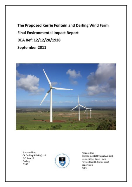
The Proposed Kerrie Fontein and Darling Wind Farm Final ...
The Proposed Kerrie Fontein and Darling Wind Farm Final ...
The Proposed Kerrie Fontein and Darling Wind Farm Final ...

You also want an ePaper? Increase the reach of your titles
YUMPU automatically turns print PDFs into web optimized ePapers that Google loves.
<strong>The</strong> <strong>Proposed</strong> <strong>Kerrie</strong> <strong>Fontein</strong> <strong>and</strong> <strong>Darling</strong> <strong>Wind</strong> <strong>Farm</strong><br />
<strong>Final</strong> Environmental Impact Report<br />
DEA Ref: 12/12/20/1928<br />
September 2011<br />
Prepared for:<br />
CK <strong>Darling</strong> IPP (Pty) Ltd<br />
P.O. Box 13<br />
<strong>Darling</strong><br />
7345<br />
Prepared by:<br />
Environmental Evaluation Unit<br />
University of Cape Town<br />
Private Bag X3, Rondebosch<br />
Cape Town<br />
7701
PROJECT INFORMATION<br />
PROJECT: <strong>Kerrie</strong> <strong>Fontein</strong> <strong>and</strong> <strong>Darling</strong> <strong>Wind</strong> <strong>Farm</strong><br />
REPORT TITLE: <strong>Final</strong> Environmental Impact Report<br />
EEU REPORT REFERENCE: 5/11/312<br />
ENVIRONMENTAL AUTHORITY: <strong>The</strong> Department of Environmental Affairs (DEA)<br />
DEA REFERENCE NO: 12/12/20/1928<br />
APPLICANT: CK <strong>Darling</strong> IPP (Pty) Ltd<br />
ENVIRONMENTAL CONSULTANTS: Environmental Evaluation Unit, University of Cape Town<br />
DATE: 20 September 2011<br />
i
STATEMENT OF INDEPENDENCE<br />
<strong>The</strong> Environmental Evaluation Unit (EEU) has been commissioned by CK <strong>Darling</strong> IPP (Pty) Ltd to<br />
undertake an Environmental Impact Assessment (EIA) in terms of the National Environmental<br />
Management Act (107 of 1998) EIA Regulations (Government Notice (GN) R385, GN R386 <strong>and</strong> GN<br />
R387 of April 2006). <strong>The</strong> EEU has complied with the general requirements for Environmental<br />
Assessment Practitioners (EAPs) as set out below, from Chapter 3 (18):<br />
An EAP appointed in terms of regulation 17(1) must –<br />
(a) be independent;<br />
(b) have expertise in conducting environmental impact assessments, including knowledge of the<br />
Act, these Regulations <strong>and</strong> any guidelines that have relevance to the proposed activity;<br />
(c) perform the work relating to the application in an objective manner, even if this results in<br />
views <strong>and</strong> findings that are not favourable to the applicant;<br />
(d) comply with the Act, these Regulations <strong>and</strong> all other applicable legislation;<br />
(e) take into account, to the extent possible, the matters listed in regulation 8(b) when preparing<br />
the application <strong>and</strong> any report relating to the application; <strong>and</strong><br />
(f) disclose to the applicant <strong>and</strong> the competent authority all material information in the<br />
possession of the EAP that reasonably has or may have the potential of influencing –<br />
(i) any decision to be taken with respect to the application by the competent authority in<br />
terms of these Regulations; or<br />
(ii) the objectivity of any report, plan or document to be prepared by the EAP in terms of<br />
these Regulations for submission to the competent authority.<br />
iii
INTRODUCTION<br />
EXECUTIVE SUMMARY<br />
CK <strong>Darling</strong> IPP (Pty) Ltd is planning to develop the ‘<strong>Kerrie</strong> <strong>Fontein</strong> <strong>and</strong> <strong>Darling</strong> <strong>Wind</strong> <strong>Farm</strong>’ on a site<br />
located at the junctions of the R27 <strong>and</strong> the R315 between Yzerfontein <strong>and</strong> <strong>Darling</strong>, approximately<br />
85km north of Cape Town. It falls within the jurisdiction of the Swartl<strong>and</strong> Local Municipality. <strong>The</strong><br />
Project will be a wind farm with a capacity of 20‐21 MW for national distribution <strong>and</strong> will contribute<br />
to targets for renewable energy generation in South Africa <strong>and</strong> the Province.<br />
<strong>The</strong> proposed Project is located on the farms Slangkop (3/552) <strong>and</strong> <strong>Kerrie</strong> <strong>Fontein</strong> (0/555) <strong>and</strong> will be<br />
an extension of the existing four turbines comprising the <strong>Darling</strong> National Demonstration <strong>Wind</strong><br />
<strong>Farm</strong>. This existing wind farm was conceptualised in 1996 by the Oelsner Group <strong>and</strong> was developed<br />
by the <strong>Darling</strong> Independent Power Producer (Pty) Ltd (known as DARLIPP) <strong>and</strong> operational by 2008.<br />
As the Project will be related to electricity generation where “(i) the electricity output is 20<br />
megawatts or more; <strong>and</strong> (ii) the elements of the facility cover a combined area in excess of 1<br />
hectare”, under the Environmental Impact Assessment (EIA) Regulations, (GN R387) a Scoping <strong>and</strong><br />
EIA are triggered. <strong>The</strong> Environmental Evaluation Unit (EEU) have been commissioned to manage the<br />
Scoping <strong>and</strong> EIA environmental authorisation process.<br />
Scoping was undertaken between June <strong>and</strong> December 2010 <strong>and</strong> concluded with an approval of the<br />
<strong>Final</strong> Scoping Report from the Department of Environmental Affairs. <strong>The</strong> EIA commenced in March<br />
2011 <strong>and</strong> followed the Plan of Study (PoS) which set out the methodology for this Phase. <strong>The</strong> EIA<br />
has been an iterative process involving: botanical; avifaunal; visual; heritage; noise <strong>and</strong> social<br />
specialist studies <strong>and</strong> a Public Participation Process (PPP). <strong>The</strong> key deliverables of the EIA phase are<br />
an Environmental Impact Report (EIR) <strong>and</strong> Environmental Management Programme (EMP). <strong>The</strong> Draft<br />
EIR <strong>and</strong> EMP were made available for public comment to allow the registered I&APs an opportunity<br />
to comment on the findings. I&APs were notified of the review period <strong>and</strong> encouraged to provide<br />
written comment to the EEU. Comments are documented in the IRR <strong>and</strong> recommendations have<br />
been updated in the body of the report where necessary.<br />
ROLEPLAYERS<br />
<strong>The</strong> Applicant<br />
<strong>The</strong> applicant, also referred to as the developer, is CK <strong>Darling</strong> IPP (Pty) Ltd. This entity has been<br />
created for this purpose, by the Oelsner Group (Pty) Ltd, a South African company active in research,<br />
development <strong>and</strong> implementation of new energy projects, in particular technologies from<br />
Renewable Energy sources.<br />
<strong>The</strong> Environmental Assessment Practitioner<br />
<strong>The</strong> Environmental Assessment Practitioner (EAP) is the EEU who will manage the application for<br />
environmental authorisation on behalf of the applicant. <strong>The</strong> EEU is an independent, self‐funded,<br />
research, consulting <strong>and</strong> training unit based at the University of Cape Town (UCT) which focuses on<br />
various aspects of sustainability.<br />
Specialists<br />
Independent Specialists have been commissioned by the EEU to undertake studies specific to their<br />
discipline: botanical; avifaunal; visual; heritage; noise <strong>and</strong> social.<br />
v
Interested <strong>and</strong> Affected Parties<br />
I&APs are any person, group or organisation interested in or affected by the proposed activity; <strong>and</strong><br />
any organ of state that may have jurisdiction over any aspect of the activity. <strong>The</strong> environmental<br />
authorisation process aims to provide opportunities for everyone to contribute to the process.<br />
Commenting Authorities<br />
Commenting authorities are those organisations or bodies whose focus or m<strong>and</strong>ate is relevant to the<br />
Project <strong>and</strong> associated activities. <strong>The</strong>y are required to issue comments <strong>and</strong> recommendations to<br />
ensure the process is robust <strong>and</strong> all aspects are considered.<br />
Competent Authority<br />
<strong>The</strong> competent authority is the decision‐making authority <strong>and</strong> in this case the listed activities require<br />
a decision at the national level. <strong>The</strong> Department of Environmental Affairs (DEA) is therefore the<br />
competent authority for this Project.<br />
PROJECT DESCRIPTION<br />
Background<br />
<strong>The</strong> proposed <strong>Kerrie</strong> <strong>Fontein</strong> <strong>and</strong> <strong>Darling</strong> <strong>Wind</strong> <strong>Farm</strong> will be an extension of the existing <strong>Darling</strong><br />
National Demonstration <strong>Wind</strong> <strong>Farm</strong> which was conceptualised in 1996 by the Oelsner Group. <strong>Darling</strong><br />
Independent Power Producer (Pty) Ltd (known as DARLIPP) was established to develop the wind<br />
farm as an Independent Power Producer (IPP). <strong>The</strong> environmental authorisation process was<br />
contested <strong>and</strong> protracted <strong>and</strong> included appeals. <strong>The</strong> original proposal was for 10 turbines of 1.3MW<br />
output; however only a first phase of four turbines was approved <strong>and</strong> became known officially as the<br />
<strong>Darling</strong> National Demonstration <strong>Wind</strong> <strong>Farm</strong>. <strong>The</strong> Record of Decision (RoD) was issued in February<br />
2005. <strong>The</strong> Danish agency DANIDA, the Central Energy Fund (CEF) <strong>and</strong> the Development Bank of<br />
Southern Africa (DBSA) were funders of the development. A new company, <strong>Darling</strong> <strong>Wind</strong> Power (Pty)<br />
Ltd was then formed to develop the wind farm, equity holders being CEF, DBSA <strong>and</strong> DARLIPP. In<br />
2006, <strong>Darling</strong> <strong>Wind</strong> Power (Pty) Ltd entered into a Power Purchase Agreement with the City of Cape<br />
Town for a term of 20 years <strong>and</strong> contributes towards the City achieving its targets for renewable<br />
energy. <strong>The</strong> applicant for the <strong>Darling</strong> Demonstration <strong>Wind</strong> <strong>Farm</strong> was DARLIPP, while the present<br />
applicant is the CK <strong>Darling</strong> IPP (Pty) Ltd.<br />
Technology<br />
<strong>Wind</strong> turbines are made up of three key components: a steel tower, a nacelle which is positioned on<br />
top of the tower; <strong>and</strong> the rotor which comprises the three blades <strong>and</strong> a hub in the centre. Energy is<br />
produced when wind blows over the turbine blades, causing them to lift <strong>and</strong> rotate. Components in<br />
the nacelle convert this kinetic ‘movement’ energy to electrical energy <strong>and</strong> control the operation of<br />
the machine. <strong>The</strong> electricity that is produced is converted to a voltage that can be fed into the<br />
national electricity grid. <strong>The</strong> capacity of the Project will be 20‐21 MW depending on the technology<br />
<strong>and</strong> the number of turbines used.<br />
Nordex, a German manufacturer of wind turbines, is the preferred supplier <strong>and</strong> the N77 or N60<br />
models have been considered. Depending on the model, either 14 or 16 turbines respectively, will be<br />
erected, each with a nominal power of 1.5 or 1.3 MW each.<br />
vi
Infrastructure<br />
<strong>The</strong>re are two sets of components to the Project as it falls onto two different farm portions, this is<br />
summarised below:<br />
Slangkop (3/552) / ‘<strong>Wind</strong>hoek <strong>Farm</strong>’ <strong>Kerrie</strong> <strong>Fontein</strong> (0/555)<br />
5‐6 Nordex turbines 9‐10 Nordex turbines<br />
Underground cabling linking turbines to Underground cabling linking turbines to<br />
(existing) substation<br />
substation<br />
Internal roads ‐ stabilised dirt tracks to access Internal roads ‐ stabilised dirt tracks to access<br />
each turbine<br />
each turbine<br />
N/A New 66/11kV substation<br />
N/A Direct connection with existing overhead power<br />
lines linking substation to national electricity<br />
grid (no new overhead power lines required)<br />
Construction Phase<br />
Construction is proposed for 6‐9 months commencing first half of 2012, commissioning <strong>and</strong> testing<br />
of the individual turbines will require one month thereafter. Construction will be done in phases,<br />
initially access will need to be established to accommodate the various loads of the materials <strong>and</strong><br />
components. It is proposed that heavy vehicles will enter the site from the existing road off the<br />
R315. A temporary construction compound area is required in support of the staff <strong>and</strong> labour <strong>and</strong><br />
includes offices, storage areas <strong>and</strong> welfare facilities. A temporary laydown area will be required<br />
alongside each proposed turbine, approximately 1,600 m 2 becoming 875 m 2 permanently during<br />
operation. This will support the cranes, allow for blade storage <strong>and</strong> provide an area in which the<br />
parts can be assembled. A storage <strong>and</strong> laydown area is also required for civil engineering<br />
components during construction (2,000m 2 ). <strong>The</strong> turbines will be constructed one at a time,<br />
commencing with the construction of the foundation, the erection of the tower in sections by<br />
cranes, the positioning of the nacelle by cranes, assembly of the rotor on the ground <strong>and</strong> erection of<br />
the nacelle into position by cranes. Trenches will be dug to accommodate the cabling connecting<br />
these turbines with the substation. Where cabling crosses drainage lines, ducting will be installed.<br />
<strong>The</strong> substation will require construction involving civil works <strong>and</strong> assembly of equipment. A direct<br />
connection to the existing overhead transmission lines will be required <strong>and</strong>, therefore, a new<br />
overhead line is not required. Site remediation will ensure that temporary areas are returned to<br />
their original condition <strong>and</strong> improved upon where practical <strong>and</strong> viable. Based on other studies, it is<br />
estimated that between 90‐95 jobs will be generated during this phase.<br />
Operational Phase<br />
Operation is expected from early 2013 for a design life of 25 years. <strong>The</strong>re will be either 14 or 16<br />
turbines erected, each with a nominal power of 1.5 MW or 1.3 MW. At the base of each turbine<br />
there will be an area of permanent hard st<strong>and</strong>ing (875 m 2 ) for servicing, alongside the foundations,<br />
as well as a medium‐voltage transformer (mini‐substation). <strong>The</strong>se are connected to the 11kV to 66kV<br />
substation via underground cabling most likely following the route of the internal roads. <strong>The</strong><br />
substation will be in the ‘West Coast Vernacular’ architectural style to blend in with the character of<br />
the area <strong>and</strong> will be similar to the existing substation. <strong>The</strong> footprint for this substation platform is<br />
840 m², of which the building is 110.5 m 2 . It is proposed that the new substation will be located<br />
along the alignment of the existing overhead transmission line to make use of the connection to the<br />
grid. Stabilised dirt tracks will be 5 m wide <strong>and</strong> will provide access to each turbine <strong>and</strong> the<br />
vii
substation. Access to the turbines will be via the existing road off the R27, or for heavy vehicles, via<br />
the Slangkop (3/552) farm access from the R315.<br />
Maintenance activities include remote monitoring by Nordex. <strong>The</strong> operational office in Langefontein<br />
<strong>Farm</strong> which services the existing turbines will be exp<strong>and</strong>ed to accommodate the team of<br />
mechatronic engineers <strong>and</strong> additional technical equipment. A maintenance schedule usually involves<br />
an initial inspection after commissioning, a semi‐annual inspection, an annual inspection <strong>and</strong> two<br />
<strong>and</strong> five year inspections but this varies between types of turbine. Typical activities during<br />
maintenance include changing of oil, replacement of brake lining <strong>and</strong> cleaning of components.<br />
Traffic during operation is expected to be limited <strong>and</strong> largely light vehicles. Personnel recruited for<br />
the estimated 14‐15 jobs created (based on other studies), are likely to be recruited from the West<br />
Coast area <strong>and</strong> trained by the manufacturer. <strong>The</strong>se would include mechatronic engineers as well as<br />
less skilled services such as safety <strong>and</strong> security, <strong>and</strong> mechatronic assistants. <strong>The</strong> Oelsner Group (Pty)<br />
Ltd plans to develop a training centre on Langefontein <strong>Farm</strong> which would provide various levels of<br />
training relating to the servicing of operational wind energy facilities. After 25 years, the proposed<br />
Project will be extended in use by 5 years or decommissioned by disassembly <strong>and</strong> removal of the<br />
components.<br />
<strong>The</strong> <strong>Proposed</strong> <strong>Darling</strong> Education, Training <strong>and</strong> Visitor Centre<br />
A Visitor Centre is proposed on <strong>Wind</strong>hoek <strong>Farm</strong> (Slangkop 3/552) <strong>and</strong> is subject to a separate<br />
environmental authorisation process. However, the Centre is linked to this Project as it is also a<br />
component of the application for the Kyoto Protocol CDM, see below. <strong>The</strong> aim is that the building<br />
would exemplify sustainability <strong>and</strong> include conference facilities; education <strong>and</strong> training rooms; a<br />
library; exhibition spaces; a restaurant; <strong>and</strong> a shop. Other elements include parking; a village to<br />
accommodate visitors; a demonstration turbine; a demonstration reed filtration bed; rural energy<br />
demonstration; demonstration farm; demonstration gardens; bird hide; picnic sites; <strong>and</strong> a lake <strong>and</strong><br />
river walk. It is intended that the facility will create an awareness of, <strong>and</strong> promote renewable<br />
energy, through the provision of tangible demonstrations of renewable technology applications. An<br />
important component of the Project would be the rehabilitation of the 20 ha site, which is former<br />
agricultural l<strong>and</strong>, to its natural state, as well as providing basic training <strong>and</strong> employment for locals<br />
through the tourism <strong>and</strong> service related trades.<br />
International Carbon Offset Mechanisms <strong>and</strong> Funding<br />
<strong>The</strong> Clean Development Mechanism (CDM) established under the Kyoto Protocol of the United<br />
Nations Framework Convention on Climate Change (UNFCCC) in 1997 allows an industrialised<br />
country to implement an emission‐reduction project in a developing country to earn saleable<br />
certified emission reduction (CER) credits. <strong>The</strong>se CERs can be counted towards a country’s official<br />
emission counts <strong>and</strong> hence towards meeting Kyoto targets. <strong>The</strong> Gold St<strong>and</strong>ard certification is an<br />
independently audited methodology for project development which delivers carbon credits through<br />
a framework more rigorous than the CDM project requirements. Achieving CDM approval <strong>and</strong> the<br />
Gold St<strong>and</strong>ard will allow the Project to qualify for ‘atmosfair gGmbH’ funding. atmosfair is a German<br />
organisation whose key market is providing a voluntary service to travellers who wish to offset the<br />
greenhouse gas emissions of their individual flights through the sale of an atmosfair certificate. <strong>The</strong><br />
donations are invested in climate change projects in developing countries. It is intended that this<br />
Project will be a registered CDM projects <strong>and</strong> adhere to the CDM Gold St<strong>and</strong>ard certification.<br />
viii
PROJECT ALTERNATIVES<br />
Alternatives have been considered <strong>and</strong> assessed in order to identify the most effective way to meet<br />
the need <strong>and</strong> purpose of the Project. <strong>The</strong> No‐Go Option which involves maintaining the Status Quo<br />
has been assessed. In terms of site location alternatives, the Project is the extension of an existing<br />
facility <strong>and</strong> it has been agreed in pre‐application meetings with Department of Environmental <strong>and</strong><br />
Development Planning (DEA&DP) that site alternatives will not be considered on this basis.<br />
Technology <strong>and</strong> site layout has formed the basis of the assessment of alternatives. Two types of<br />
turbines have been considered, the N77 (Option 1) <strong>and</strong> the N60 (Option 2). <strong>The</strong> N77 is slightly larger<br />
having a 70 m high mast, a blade length of ±37.5 m, <strong>and</strong> has a greater output of 1.5 MW, therefore<br />
14 are required to reach the 20 MW capacity. <strong>The</strong> N60 are smaller with a 60 m high mast, a blade<br />
length of 29 m, <strong>and</strong> a lower output of 1.3 MW, requiring 16 turbines to achieve the desired capacity.<br />
<strong>The</strong> positioning of the turbines has been undertaken in collaboration with Nordex, who have<br />
modelled the efficiency of the wind resource for each configuration. This was the starting point;<br />
from here the turbines for both options were rearranged to avoid the areas of botanical sensitivity<br />
identified during the Scoping Phase. <strong>The</strong> preferred option is the N77 model. This is based on<br />
favourable yield performance; reduced footprint; <strong>and</strong> avoidance of highly sensitive vegetation for<br />
the turbine positions. <strong>The</strong> internal access road linking the northern <strong>and</strong> southern rows of turbines<br />
has also been realigned to avoid the medium sensitivity vegetation as far as possible.<br />
NEED AND DESIRABILITY<br />
Need or ‘timing’ of the development can be seen in light of the present global trend towards<br />
renewable energy which is largely based on initiatives to reduce the dependency on fossil fuels, the<br />
emission of greenhouse gases <strong>and</strong> their impacts on climate change. South Africa is actively seeking<br />
to reduce impacts on climate change <strong>and</strong> has made commitments to international initiatives such as<br />
the United Nations Framework Convention on Climate Change (1992), the Kyoto Protocol (1997), the<br />
Johannesburg Declaration (2002), <strong>and</strong> the Copenhagen Accord (2009). This is also reflected in the<br />
national <strong>and</strong> provincial policy framework. <strong>The</strong> promotion of renewable energy is part of this drive to<br />
reduce emissions through diversification of electricity supply <strong>and</strong> energy security. <strong>The</strong> proposed<br />
Project is a wind energy facility that converts kinetic ‘movement’ energy into electricity for<br />
contribution to the national electricity grid. <strong>Wind</strong> energy is one of a number of freely available<br />
sources for renewable power generation <strong>and</strong> considered a mature technology in developed<br />
countries. However, in South Africa, the industry is in its infancy <strong>and</strong> would rely on imported<br />
technology for some time to achieve the full potential of the existing wind resources. This form of<br />
renewable energy technology often has a low impact on the surrounding environment in terms of<br />
l<strong>and</strong> take; emissions; water usage; <strong>and</strong> waste.<br />
Desirability or ‘placing’ of the development is based on the fact that the Project is an extension to an<br />
existing facility, the <strong>Darling</strong> National Demonstration <strong>Wind</strong> <strong>Farm</strong>. At the time (1996), there were no<br />
established criteria on which to guide the siting of wind turbines <strong>and</strong> the reasons for siting the<br />
original Demonstration <strong>Wind</strong> <strong>Farm</strong> relate to the following: wind resources; access; proximity to grid;<br />
potential willing l<strong>and</strong>owner; avoidance of existing <strong>and</strong> planned residential areas; avoidance of<br />
coastal <strong>and</strong> sensitive nature areas by also remaining east of R27. <strong>The</strong> <strong>Wind</strong> <strong>Farm</strong> was also originally<br />
intended to comprise a second phase of six turbines, should the first be considered successful. To<br />
qualify for the REFIT subsidies (see below), a minimum of 20 MW is required <strong>and</strong> this forms the basis<br />
for the proposed capacity of the Project. While the Swartl<strong>and</strong> Municipality <strong>and</strong> the West Coast<br />
ix
District Municipality both realise the importance of tourism in the area, <strong>and</strong> the designation of the<br />
R27 as a regional transport corridor, they also realise the importance of renewable energy <strong>and</strong> list<br />
other important criteria such as protection of biodiversity, agricultural <strong>and</strong> cultural resources. <strong>The</strong><br />
EIA process has therefore aimed to ensure the net benefits from harvesting renewable energy<br />
outweigh the site specific impacts, in order to render this development desirable.<br />
LEGAL, PLANNING AND POLICY CONTEXT<br />
Environmental Management<br />
Various acts, regulations, policies <strong>and</strong> planning documents provide the framework <strong>and</strong> context for<br />
this Project <strong>and</strong> associated activities. In terms of environmental management, compliance with the<br />
provisions in the following Acts will ensure that the environment is not adversely affected through<br />
the development of the Project:<br />
<strong>The</strong> Constitution, Act 108 of 1996;<br />
National Environmental Management Act (107 of 1998) (NEMA);<br />
Environment Conservation Act (73 of 1989) (ECA);<br />
National Heritage Resources Act (25 of 1999) (NHRA);<br />
National Environmental Management: Biodiversity Act (10 of 2004);<br />
National Environmental Management: Protected Areas Act (57 of 2003);<br />
National Water Act (No 36 of 1998);<br />
National Environmental Management: Air Quality Act (39 of 2004);<br />
National Environmental Management: Waste Act (59 of 2008); <strong>and</strong><br />
Conservation of Agricultural Resources Act (43 of 1983) (CARA);<br />
Subdivision of Agricultural L<strong>and</strong> Act (70 of 1970);<br />
National Veld <strong>and</strong> Forest Fire Act (101 of 1998);<br />
Occupational Health <strong>and</strong> Safety Act (85 of 1993; <strong>and</strong><br />
Hazardous Chemical Substances Regulations (1995).<br />
Renewable Energy Generation<br />
Other national legislation <strong>and</strong> policy which is relevant to the renewable energy context are as<br />
follows:<br />
National Energy Act (Act 34 of 2008);<br />
White Paper on the Energy Policy of the Republic of South Africa (1998);<br />
White Paper on Renewable Energy (2003);<br />
NERSA Renewable Energy Feed‐In Tariff (REFIT) Guidelines (2009); <strong>and</strong><br />
National Integrated Resource Plan (IRP) (2011).<br />
Other provincial policy, plans <strong>and</strong> guidelines provide the context for the Project <strong>and</strong> verify the<br />
support for renewable energy <strong>and</strong> serve to guide the implementation thereof.<br />
x
Developmental <strong>and</strong> spatial policy at the provincial <strong>and</strong> municipal level also provides the framework<br />
within which this Project is being proposed. <strong>The</strong> principles <strong>and</strong> objectives behind these documents<br />
have been considered. It is evident that while the Project contributes towards sustainable<br />
development through mitigating climate change, the spatial context of the site indicates that it is<br />
located along a development corridor; within a biodiversity area; <strong>and</strong> on l<strong>and</strong> zoned as agricultural.<br />
<strong>The</strong> tourism potential of the area is also identified <strong>and</strong> taken into account within the EIA.<br />
EIA PROCESS AND METHODOLOGY<br />
<strong>The</strong> NEMA EIA Regulations require a two phased environmental authorisation process comprising<br />
Scoping <strong>and</strong> an EIA.<br />
Scoping Phase<br />
<strong>The</strong> Scoping Phase was conducted between June 2010 <strong>and</strong> December 2010 <strong>and</strong> identified issues<br />
relevant to the Project, potential environmental impacts of the activity; reasonable <strong>and</strong> feasible<br />
alternatives to the Project; <strong>and</strong> proposed an approach to the EIA through a ‘Plan of Study’. During<br />
the Scoping Phase, the Public Participation Process (PPP) commenced <strong>and</strong> included various methods<br />
of notification calling for potential Interested <strong>and</strong> Affected Parties (I&APs) to register <strong>and</strong> /or provide<br />
written comment <strong>and</strong> to invite attendance at a public meeting. A Background Information Document<br />
(BID) was produced to summarise the Project <strong>and</strong> the process <strong>and</strong> to provide a basis for any input.<br />
Specialists in the fields of botany; avifauna; visual; heritage; noise; <strong>and</strong> social, undertook Scoping<br />
studies to identify impacts <strong>and</strong> issues relevant to their discipline <strong>and</strong> proposed the methods for<br />
assessment in the EIA Phase. <strong>The</strong> process <strong>and</strong> findings were documented in the Draft Scoping Report<br />
(DSR) which was made available to the I&APs for a 40 day review period allowing I&APs to comment<br />
on the findings, the proposed methods <strong>and</strong> the process. <strong>The</strong> <strong>Final</strong> Scoping Report (FSR) included<br />
responses to the comments received within this period <strong>and</strong> was submitted to the DEA as the<br />
competent authority for approval, which was then granted in March 2011.<br />
EIA Phase<br />
<strong>The</strong> EIA Phase commenced in March 2011 <strong>and</strong> the aim of this Phase was to address issues that were<br />
raised during the scoping process; assess alternatives to the proposed activity in a comparative<br />
manner; assess all identified impacts <strong>and</strong> determine the significance of each impact; <strong>and</strong> formulate<br />
mitigation measures. Each specialist applied the methodology proposed in the Scoping Report <strong>and</strong> in<br />
general, the assessment of significance took into account the following criteria: nature <strong>and</strong> status;<br />
extent; duration; intensity; probability <strong>and</strong> effect on decision‐making. Further PPP activities included<br />
a public meeting in <strong>Darling</strong>, meetings <strong>and</strong> consultations with neighbouring l<strong>and</strong>owners, <strong>and</strong><br />
telephonic or email communications with other I&APS. <strong>The</strong> findings of the EIA were documented in<br />
the Draft EIR <strong>and</strong> accompanied by a Draft EMP (Ecosense, 2011). I&APs were notified of the review<br />
period which was from 26 July 2011 to 4 September 2011 <strong>and</strong> encouraged to provide written<br />
comment to the EEU. <strong>The</strong>se comments are documented in the Issues <strong>and</strong> Responses Report (IRR)<br />
<strong>and</strong> have been integrated into the report where necessary. This <strong>Final</strong> EIR <strong>and</strong> EMP are for<br />
submission to DEA as the competent authority for approval. <strong>The</strong>reafter it may be accepted, rejected,<br />
referred for review or amendments may be requested. Further to this, environmental authorisation<br />
is either granted or refused.<br />
xi
DESCRIPTION OF THE BASELINE ENVIRONMENT<br />
Geographical <strong>and</strong> Administrative<br />
<strong>The</strong> proposed site for the Project is located approximately 85 km north of Cape Town between the<br />
towns of Yzerfontein <strong>and</strong> <strong>Darling</strong> <strong>and</strong> falls within the Swartl<strong>and</strong> Local Municipality, Western Cape.<br />
<strong>The</strong> study area is located within Ward 5. <strong>The</strong> Project also falls within the jurisdiction of the West<br />
Coast District Municipality.<br />
L<strong>and</strong> Use<br />
<strong>The</strong> study area lies within portions of two different farms: Slangkop (3/552) <strong>and</strong> <strong>Kerrie</strong> <strong>Fontein</strong><br />
(0/555). <strong>The</strong> predominant l<strong>and</strong> use on the site is agriculture. Vegetation is mostly disturbed <strong>and</strong> now<br />
partly rehabilitated, but also includes pristine areas as well as fallow agricultural l<strong>and</strong> of low value.<br />
Agricultural activities on surrounding farms include ostrich camps; cereal farming; beef <strong>and</strong> dairy<br />
farming; sheep farming; <strong>and</strong> wine farming. Adjoining the proposed study area, on the <strong>Wind</strong>hoek<br />
<strong>Farm</strong> between the existing turbines <strong>and</strong> the R315, is an existing open cast s<strong>and</strong> mine.<br />
Topography<br />
Topographical features in the study area includes a prominent hill (Moedmaag Hill) with west facing<br />
slopes, a broad saddle, <strong>and</strong> a lower hill with west <strong>and</strong> north‐western facing slopes, leading into a<br />
s<strong>and</strong>y coastal plain.<br />
Geology <strong>and</strong> Soils<br />
<strong>The</strong> study area is located on the <strong>Darling</strong> Pluton of the Cape Granite Suite. Granite derived clays <strong>and</strong><br />
s<strong>and</strong>y loams are the primary soil type in the central <strong>and</strong> eastern area, but in the western parts these<br />
give way to deep, well leached acid s<strong>and</strong>s of much lower fertility. <strong>The</strong>re are two main granite<br />
outcrops, with various scattered granite exposures of less than 10 m 2 each, but otherwise there is<br />
little outcropping rock on site.<br />
Water Resources<br />
<strong>The</strong>re is a single major drainage line, with four tributaries, plus a vlei area (Segarevlei). <strong>The</strong> seasonal<br />
drainage lines are unlikely to hold surface water for more than six months a year, but the soils are<br />
significantly damper than surrounding areas for extended periods. <strong>The</strong>re is a windmill to the south‐<br />
west of the existing turbines <strong>and</strong> the 2001 EIA (EEU, 2001) has identified the water table on the<br />
vicinity of this windmill being 1.05 m deep.<br />
Climate<br />
This is an area of winter rainfall <strong>and</strong> summer drought. <strong>The</strong> highest average rainfall occurs between<br />
May – August (approximately 65‐84 mm per month). <strong>The</strong>re are on average, 8‐9 rain days in these<br />
months. In the spring <strong>and</strong> summer months, between September <strong>and</strong> April, average monthly rainfall<br />
is between 8‐34 mm. Temperatures in winter range between 7 <strong>and</strong> 19 o C, with summer temperatures<br />
between 12 <strong>and</strong> 28 o C. Fog is a characteristic of the area <strong>and</strong> is usually more prevalent during the<br />
winter months. <strong>Wind</strong> data gathered in 2001 by the CSIR indicates that the wider area experiences<br />
higher wind speeds which are more frequent during the months of October to March; wind<br />
conditions are more moderate during the months of May, June <strong>and</strong> September; the predominant<br />
wind direction is southerly between August <strong>and</strong> April; <strong>and</strong> the average wind speed over a 12 month<br />
period was between 5.8 <strong>and</strong> 6.45 m/s.<br />
xii
Botany<br />
<strong>The</strong>re were originally two vegetation types in the study area, about 40% of the overall study area<br />
supported Swartl<strong>and</strong> Granite Renosterveld, with the s<strong>and</strong>y western parts supporting Hopefield S<strong>and</strong><br />
Fynbos (Mucina <strong>and</strong> Rutherford, 2006). Both are nationally recognised as threatened, with the<br />
former being ‘Critically Endangered’ <strong>and</strong> the latter ‘Endangered’, according to the National Spatial<br />
Biodiversity Assessment (Rouget et al 2004). <strong>The</strong> Draft National List of Threatened Ecosystems lists<br />
Swartl<strong>and</strong> Granite Renosterveld as Critically Endangered <strong>and</strong> Hopefield S<strong>and</strong> Fynbos as Vulnerable<br />
(DEA 2009). Thus all remaining natural vegetation in the study area is of high sensitivity <strong>and</strong><br />
conservation value. About 16% of the study area is essentially fallow agricultural l<strong>and</strong> with very little<br />
natural vegetation, <strong>and</strong> this is the low botanical sensitivity portion of the study area. Natural<br />
vegetation in moderate or good condition covers an estimated 84% of the study area, <strong>and</strong> most of<br />
the vegetation in good condition is either on previously uncultivated small, rocky outcrops, in<br />
drainage lines (wetl<strong>and</strong>s), or in the western parts, dominated by infertile s<strong>and</strong>y soils, which are not<br />
suitable for cultivation. <strong>The</strong> medium sensitivity vegetation occurs in those areas previously disturbed<br />
<strong>and</strong> now partly rehabilitated (about 67%) <strong>and</strong> the high sensitivity vegetation in those areas that are<br />
botanically largely pristine (about 27%, or 125ha). It is possible that upwards of 35 plant species of<br />
conservation concern could occur within the medium <strong>and</strong> high sensitivity areas within the study<br />
area, although only a few would co‐occur in any one 1000 m 2 area. This indicates the sensitivity <strong>and</strong><br />
conservation importance of both the general <strong>Darling</strong> area <strong>and</strong> the natural areas within the study<br />
area. Disturbance includes past <strong>and</strong> current cultivation (mainly for cereals <strong>and</strong> grazing for sheep <strong>and</strong><br />
cattle), heavy grazing <strong>and</strong> trampling by cattle <strong>and</strong> sheep, <strong>and</strong> alien vegetation invasion. <strong>The</strong> most<br />
heavily disturbed areas are those that have been regularly ploughed <strong>and</strong> sown with crops, <strong>and</strong> these<br />
areas generally have very little botanical value. Alien invasive vegetation is most severe in seasonally<br />
<strong>and</strong> permanently damp places, around homesteads, <strong>and</strong> in areas where there has been previous soil<br />
disturbance.<br />
Avifauna<br />
Habitats within the site have been described above, however in terms of potential avifauna, it is<br />
widely accepted that vegetation structure is more critical in determining bird habitat, than the actual<br />
plant species composition. Fynbos is dominated by low shrubs <strong>and</strong> can be divided into two<br />
categories, fynbos proper <strong>and</strong> renosterveld, both of which occur on the study site. Despite having a<br />
high diversity of plant species, fynbos <strong>and</strong> renosterveld has a relatively low diversity of bird species.<br />
Records indicate that 13 priority bird species potentially occur within the site or on adjacent areas of<br />
habitat; eight of these classified as Near Threatened <strong>and</strong> four classified as Vulnerable according to<br />
the Red Data List; <strong>and</strong> one endemic to the area.<br />
Visual<br />
<strong>The</strong> rolling hills constitute a scenic rural l<strong>and</strong>scape in an area famed for its spring wild flowers. This<br />
aspect, together with the recreation activities of the nearby West Coast, mean that the area is an<br />
important visitor <strong>and</strong> tourist destination. <strong>The</strong> following routes <strong>and</strong> protected areas tend to increase<br />
l<strong>and</strong>scape value in visual terms of the site environs, <strong>and</strong> therefore the visual sensitivity:<br />
<strong>The</strong> R27 <strong>and</strong> R315 Routes, which can be considered as scenic corridors, <strong>and</strong> therefore visually<br />
sensitive;<br />
<strong>The</strong> Tienie Versveld Wild Flower Reserve located adjacent to the R315 Route, about 2 km from<br />
the wind farm site;<br />
xiii
<strong>The</strong> Yzerfontein Soutpan <strong>and</strong> Rooipan, which are important wetl<strong>and</strong> <strong>and</strong> bird sites, are 5 to 7<br />
km away from the site;<br />
<strong>The</strong> West Coast National Park, which lies some 5km to the north of the site on the R27, the<br />
entrance gate to the Park being 10 km away; <strong>and</strong><br />
<strong>The</strong> West Coast Biosphere Reserve, which stretches from the Diep River in Cape Town to the<br />
Berg River in the north, <strong>and</strong> therefore includes the entire visual catchment of the Project.<br />
<strong>The</strong> proposed wind farm is visible to a number of farmsteads in the area, as well as to the settlement<br />
of Yzerfontein, about 8 km to the west. Two historic lime kilns are located on the R315 to<br />
Yzerfontein, about 3 km from the wind farm site. <strong>The</strong> wind farm is, however, not visible to the<br />
settlement of <strong>Darling</strong>, which is some 13 km away to the east, <strong>and</strong> in a view shadow.<br />
Heritage<br />
<strong>The</strong> area has a history of agriculture <strong>and</strong> ploughing has transformed much of the natural l<strong>and</strong>scape.<br />
<strong>The</strong> archaeology of the area is not well known. <strong>The</strong> <strong>Darling</strong> Hills would undoubtedly have been used<br />
extensively by the Khoekhoen for grazing their stock <strong>and</strong> their settlements would likely have dotted<br />
the open l<strong>and</strong>scape. <strong>The</strong> local geology is not conducive to the formation of rock shelters <strong>and</strong> none<br />
are known. One does routinely come across stone artefacts of various ages in the wheat l<strong>and</strong>s of the<br />
Cape <strong>and</strong> such finds would be expected here. <strong>The</strong> presence of Stone Age people in the general area<br />
is well documented by the excavations of both Middle <strong>and</strong> Later Stone Age archaeological sites at<br />
Yzerfontein, some 9 km to the south‐west (Avery et al, 2008; Halkett et al, 2003; Klein et al, 2004;<br />
Orton, 2007; in press). Two other surveys in the vicinity of the study area found no heritage<br />
resources (Halkett, 2001; Hart, 2008).<br />
Noise<br />
<strong>The</strong> Project is proposed on the farms Slangkop (3/552) <strong>and</strong> <strong>Kerrie</strong>fontein (0/555), located at the<br />
north‐east corner of the junction of the R27 <strong>and</strong> the R315. <strong>The</strong> site is situated in a rural farming<br />
community. Several homesteads are located on the property where the turbines will be erected as<br />
well as on neighbouring farms. <strong>The</strong> farms <strong>and</strong> much of the surrounding l<strong>and</strong> is zoned agricultural. In<br />
terms of SANS 10103 this is described as a “rural district” with typical outdoor rating levels for noise<br />
of 45 dBA during daytime <strong>and</strong> 35 dBA during night time.<br />
Measurements indicate that the ambient noise is approximately between 41 <strong>and</strong> 45 dB(A) at<br />
between 2 ‐4 m/s wind speed at the farmhouse <strong>and</strong> workers houses on <strong>Wind</strong>hoek <strong>Farm</strong> (Slangkop<br />
(3/552). <strong>The</strong> general ambient noise at each location varies substantially as the ambient sound is<br />
influenced by human activities as well as vehicles <strong>and</strong> animal sounds. It is thus extremely difficult to<br />
isolate just the wind component.<br />
Social<br />
<strong>The</strong> Swartl<strong>and</strong> Municipality is predominantly a rural area with the economy dominated by the<br />
agricultural sector as the key contributor <strong>and</strong> employer. Tourism potential has been recognised<br />
although it is not a significant contributor at present. <strong>The</strong> West Coast District is mostly a destination<br />
in itself with its own attractions, but is also a gateway to the Northern Cape <strong>and</strong> Namibia via the N7<br />
(D. Cornelius, 4/5/2011). <strong>The</strong> area is valued by stakeholders for its rural qualities <strong>and</strong> described as<br />
‘quiet’, ‘unspoilt’, ‘unaffected’ <strong>and</strong> ‘laid back’ with low levels of crime <strong>and</strong> an abundance of natural<br />
beauty (including the flowers <strong>and</strong> cultural heritage). <strong>The</strong> West Coast in general is also appreciated<br />
for its ‘vast openness’ <strong>and</strong> ‘simplicity’ (M. Daiber, 7/6/2011). In <strong>Darling</strong>, the main attraction is the<br />
xiv
wildflowers; culture; wine; <strong>and</strong> events such as the <strong>Darling</strong> Marathon <strong>and</strong> Voorkamer Fest. In<br />
Yzerfontein the attraction is the beach (blue flag) <strong>and</strong> watersports, fishing, whale watching, the<br />
greenbelt <strong>and</strong> ‘fantastic accommodation’ (A. Van Ellewee, W. Badenhorst <strong>and</strong> B. Geel, 3/5/2011).<br />
Recently, the CWCBR has launched Cape West Coast Trails which includes walks, hikes, canoeing <strong>and</strong><br />
cycling through the wider Biosphere Reserve. <strong>The</strong>re is also a current initiative to establish the West<br />
Coast as a ‘place of heritage’ through a network of living heritage, fossils <strong>and</strong> rock art linking places<br />
like the !Khwa ttu San Centre, the Fossil Park, <strong>and</strong> rock art sites. This evidence shows that there is<br />
already a nascent tourism industry in the area which has considerable social, cultural <strong>and</strong><br />
environmental assets, <strong>and</strong> the potential to develop this further.<br />
<strong>The</strong> local population is characterised by low levels of education <strong>and</strong> skills <strong>and</strong> low incomes however<br />
unemployment levels are moderate in comparison to national levels. <strong>The</strong>re is an increasing trend of<br />
out‐migration of white youth for employment elsewhere <strong>and</strong> in‐migration of White mature age<br />
groups for retirement or commuting lifestyle; whilst the black youth are in‐migrating to seek<br />
employment. It is evident that there is an increasing disparity between the rich <strong>and</strong> the poor. <strong>The</strong><br />
town of <strong>Darling</strong> itself is divided by the railway line which also delineates two socio‐economic groups.<br />
On the one side there are predominantly white residents, many of which are retirees. A new trend is<br />
that young people able to work from home, <strong>and</strong> commute on the odd occasion, are moving to<br />
<strong>Darling</strong> (A. Thoma, 4/5/2011). In <strong>Darling</strong> East, on the other side of the tracks is a predominantly<br />
coloured population. Unemployment in the town is a problem <strong>and</strong> a large number of people live in<br />
government housing <strong>and</strong> are reliant on social grants (G. Adams, 21/4/2011). <strong>The</strong> surrounding rural<br />
areas provide seasonal jobs for some residents of <strong>Darling</strong>, such as ploughing, planting, pruning,<br />
spraying <strong>and</strong> harvesting. However, the majority of farm work is provided by the labour stock of the<br />
farm workers <strong>and</strong> their extended families (G. Adams, 21/4/2011 <strong>and</strong> A. Thoma, 4/5/2011).<br />
Yzerfontein is a holiday town with nearly half of all residents being permanent (A. Van Ellewee, W.<br />
Badenhorst, <strong>and</strong> B. Geel, 3/5/2011). It is said to be exp<strong>and</strong>ing <strong>and</strong> developing as is evident by the<br />
number of active building sites within the town. Jacobuskraal is located in the north west quadrant<br />
of the Junction between the R27 <strong>and</strong> the R315 <strong>and</strong> comprises approximately 25 small holding plots<br />
of about 10 ha each.<br />
L<strong>and</strong> uses around the site specifically are mostly rural, however, there are a number of other l<strong>and</strong><br />
uses including the following: Bambe Zonke B&B in Jacobuskraal Estate; the West Coast <strong>Farm</strong> Stall on<br />
the south west quadrant of the junction which also houses a CWCBR information hub; <strong>and</strong> the Tienie<br />
Versveld Wildflower Reserve under the custodianship of SANBI, ±2.5 km south east of the site.<br />
Within a 10 km radius, there are also a number of nature / game reserves such as the !Khwa ttu San<br />
Cultural <strong>and</strong> Education Centre; the West Coast National Park; Buffelsfontein Game <strong>and</strong> Nature<br />
Reserve; Jakkalsfontein Nature Reserve; <strong>and</strong> Rondeberg Nature Reserve.<br />
In the wider area, in terms of infrastructure <strong>and</strong> services, there is considered to be a good transport<br />
network despite a lack of public transport in rural areas. <strong>The</strong>re are relatively high levels of access to<br />
energy <strong>and</strong> piped water, with sanitation less widespread. Human immunodeficiency virus/ Acquired<br />
immune deficiency syndrome (HIV/AIDS) <strong>and</strong> Tuberculosis (TB) are key health concerns, although<br />
not as critical compared to national levels. <strong>The</strong>re is reported that crime linked to alcohol <strong>and</strong><br />
substance abuse is a key social problem.<br />
xv
ASSESSMENT OF POTENTIAL ENVIRONMENTAL IMPACTS<br />
<strong>The</strong> environmental impacts have been assessed by the respective specialists <strong>and</strong> the findings are<br />
summarised below:<br />
Botany<br />
During construction, there will be a loss of natural vegetation which is the primary direct botanical<br />
impact. About half will be permanent, <strong>and</strong> the other half will be temporary, as trampled <strong>and</strong> partly<br />
disturbed areas should eventually recover. A subset of the primary direct impact is loss of portions of<br />
the local populations of some of the plant Species of Conservation Concern. Reduction in often<br />
already small population numbers below a certain (usually unknown) threshold is known to have<br />
negative consequences for that population, <strong>and</strong> may lead to local extinction of that species. Option 1<br />
would require the loss of 3 ha <strong>and</strong> this is assessed as a low‐medium negative impact. Option 2 would<br />
require the loss of 4 ha <strong>and</strong> this is assessed as a medium‐high negative impact. Option 1 is the<br />
preferred development option, <strong>and</strong> may have a low positive overall botanical impact if all mitigation<br />
proposed is enforced.<br />
During operation, indirect negative impacts such as habitat fragmentation; disruption of natural fire<br />
regime; <strong>and</strong> possible introduction <strong>and</strong> spread of alien invasive plants <strong>and</strong> insects, are likely to occur,<br />
but will probably be relatively insignificant, especially in the context of the ongoing farming<br />
operations in the area. For Option 1 this negative impact is assessed as low‐medium without<br />
mitigation, for Option 2 this is assessed as medium‐high without mitigation. Fortunately these<br />
impacts are relatively easily managed.<br />
During decommissioning, disturbance to surrounding natural vegetation <strong>and</strong> associated facilitated<br />
alien plant invasion is assessed as low‐medium significance without mitigation for both Options 1<br />
<strong>and</strong> 2.<br />
Cumulative negative effects are likely to be important (although not critical), given the number of<br />
similar proposed projects in the region.<br />
Potentially positive ecological impacts have been identified, namely the opportunity to formally<br />
conserve significant priority areas of natural habitat in the study area (basically on‐site offsets or<br />
conservation contributions), by registering the medium <strong>and</strong> high sensitivity portions of the property<br />
with CapeNature’s Stewardship Programme for private l<strong>and</strong>owners. <strong>The</strong> Applicant has expressed<br />
their willingness to commit to reasonable <strong>and</strong> feasible conservation measures in partnership with<br />
CapeNature or an alternative organisation that can independently guide <strong>and</strong> monitor the<br />
management of the l<strong>and</strong>. Most of the natural vegetation in the study area is not currently being<br />
adequately or optimally managed in ecological terms.<br />
Another positive impact could arise through the opportunity to fund <strong>and</strong> implement an Operational<br />
Environmental Management Plan (OEMP) throughout the site, focussing on the most important<br />
issues, which are alien vegetation control, fire management, rehabilitation of ecological corridors,<br />
<strong>and</strong> grazing impacts (livestock).<br />
On this basis, the status quo is not positive for the remaining natural vegetation on site, as the alien<br />
vegetation problem in the study area is not being managed, many areas show signs of being heavily<br />
grazed <strong>and</strong> trampled by livestock, fire management is not optimal, <strong>and</strong> there is no guarantee that<br />
the important areas of remaining natural vegetation on site will continue to be conserved. On<br />
balance the status quo is deemed to have a low negative impact on the natural vegetation on site.<br />
xvi
Avifauna<br />
Impacts on avifauna could result from collisions with turbines; displacement of priority species; or<br />
habitat loss which may also result in displacement of priority species due to the footprint of the<br />
Project.<br />
Estimated collision rates have been calculated based on monitoring of priority bird species <strong>and</strong> all<br />
raptor species commuting over the development site. It would seem from analysing the data<br />
collected that the Project will not pose a significant collision mortality risk to priority species, with<br />
Jackal Buzzards emerging as the highest potential risk at an estimated 0.49 mortalities per year. <strong>The</strong><br />
greatest collision risk is posed by the seven turbines on the slope of Moedmaag Hill (i.e. four existing<br />
<strong>and</strong> three proposed), in the following conditions: between 11h00 <strong>and</strong> 17h00; in spring/early summer<br />
i.e. between October <strong>and</strong> December; <strong>and</strong> in moderate to strong winds with a southerly <strong>and</strong> westerly<br />
orientation.<br />
With Jackal Buzzards specifically, the estimated avoidance rate may be more than 98%, as the birds<br />
observed on site are most likely a resident pair. <strong>The</strong>y have not displayed any behaviour to avoid the<br />
moving blades, <strong>and</strong> have clearly become used to the four existing turbines. Whether this would also<br />
be the case with inexperienced, juvenile birds remains to be seen.<br />
Fortunately, the phenomenon of mass migrations involving thous<strong>and</strong>s of birds is not a feature of the<br />
Project site, however, migratory raptors, i.e. Steppe Buzzard Buteo vulpinus <strong>and</strong> Yellow‐billed Kite<br />
Milvus aegyptius were recorded during the summer <strong>and</strong> autumn monitoring period, when the<br />
species are present in southern Africa. This translates into an estimated collision rate of 0.61 <strong>and</strong><br />
0.63 birds per year for kites <strong>and</strong> buzzards respectively.<br />
In terms of existing information, raptors, <strong>and</strong> particularly species constantly migrating over <strong>and</strong><br />
through a turbine string, are particularly prone to collision with the blades. While Yellow‐billed Kite<br />
<strong>and</strong> Steppe Buzzard are not threatened species, if the Project causes high numbers of casualties of<br />
these migrant raptors, this would constitute a significant negative impact of the facility.<br />
<strong>The</strong> potential for collisions with the turbines due to lights is not envisaged to be significant, primarily<br />
because the phenomenon of mass nocturnal passerine migrations is not a feature of the study area.<br />
However, the potential effect on nocturnal flamingo movement is unknown.<br />
Bird mortality due to collisions with the turbine blades is assessed as a negative impact of low<br />
significance to decision‐making, without mitigation. Given the potential inaccuracy of the predicted<br />
collision rates as a rough indicator of risk, <strong>and</strong> the basis on which these assessments have been<br />
made, the only way to verify this would be to conduct carcass searches during the period when the<br />
above birds are present, as described under ‘Conclusions <strong>and</strong> Recommendations’ below.<br />
International studies have been employed to establish the likelihood of displacement of birds due to<br />
the presence of the facility. Although more studies are needed <strong>and</strong> more should be peer‐reviewed in<br />
the public domain, research indicates that, with few exceptions, the displacement effect of wind<br />
developments on raptors is low to negligible (Madders <strong>and</strong> Whitfield, 2008). This trend seems to be<br />
supported by the results of the limited post‐construction monitoring conducted at the existing four<br />
turbines, <strong>and</strong> the significance of the negative impact has been assessed as low.<br />
At the Project site, direct habitat loss is not regarded as a major impact on avifauna, relative to other<br />
potential impacts such as disturbance or collisions. <strong>The</strong> impact is assessed as a negative impact of<br />
low significance to decision‐making, without mitigation.<br />
xvii
It is impossible to say at this stage what the cumulative impact of all the proposed developments<br />
along the West Coast will be on birds, firstly because there is no baseline to measure it against, <strong>and</strong><br />
secondly because the extent of actual impacts will only become known once a few wind farms are<br />
developed. It is therefore imperative that pre‐construction <strong>and</strong> post‐construction monitoring is<br />
implemented at all the new proposed sites.<br />
From a potential bird impact perspective, there is very difference between the two proposed<br />
alternatives. <strong>The</strong> seven turbines on slope of Moedmaag Hill are likely to pose the biggest risk of<br />
collision, <strong>and</strong> the position of these is identical for both lay‐outs. <strong>The</strong> potential displacement footprint<br />
of the two alternative lay‐outs are also very similar, resulting in no clear preference from a bird<br />
impact perspective.<br />
Visual<br />
<strong>The</strong> visual impact assessment focussed on a number of criteria to assess the turbine configurations<br />
for Option 1 <strong>and</strong> 2; the substation; <strong>and</strong> the internal access roads. <strong>The</strong>se are briefly set out below:<br />
Visibility of facilities: Views from the R27 <strong>and</strong> R315 adjacent to the site are the most significant <strong>and</strong><br />
could affect the most receptors including tourists. <strong>The</strong> visibility of the wind turbines is limited from<br />
some viewpoints because of being screened by Moedmaag Hill <strong>and</strong> view shadows created by the<br />
hilly topography generally.<br />
Visibility of navigation <strong>and</strong> security lights at night: Visibility, particularly at night, depends on the<br />
amount of security lighting.<br />
Visual exposure (zone of visual influence or view catchment): <strong>The</strong> Project will be visible for up to<br />
about a 10 km radius. <strong>The</strong> visibility is determined by ridgelines. <strong>The</strong> view catchment is partly<br />
confined by topography <strong>and</strong> includes view shadow areas. However, wind turbines are tall but<br />
slender. <strong>The</strong> view catchment area would only be marginally increased by the addition of 14 to 16<br />
wind turbines over the original four turbines.<br />
Visual sensitivity (l<strong>and</strong>scape features): <strong>The</strong> l<strong>and</strong>scape is open, <strong>and</strong> exposed to the west. Turbines are<br />
visible on the skyline <strong>and</strong> the existing wind farm intrudes on the rural l<strong>and</strong>scape <strong>and</strong> scenic routes.<br />
L<strong>and</strong>scape integrity (effect on character of the area): <strong>The</strong> Project contrasts with the rural l<strong>and</strong>scape.<br />
<strong>The</strong> existing four turbines <strong>and</strong> power lines tend are considered as existing disturbance <strong>and</strong> reduce<br />
the visual significance.<br />
Cultural l<strong>and</strong>scape (Heritage value of the l<strong>and</strong>scape): <strong>The</strong> area is traditionally a farming area <strong>and</strong> the<br />
site contains minimal heritage features.<br />
Visual absorption capacity (VAC) (lack of concealment): <strong>The</strong> open l<strong>and</strong>scape has a moderately low<br />
potential to visually absorb the wind turbines <strong>and</strong> infrastructure. <strong>The</strong>re is some screening by<br />
topography, but little opportunity for screening with trees.<br />
Cumulative visual impact: <strong>The</strong> Project would add to the four existing turbines, but remains a fairly<br />
small facility. An additional facility is proposed nearby at Rheboksfontein.<br />
Overall this results in a visual impact rating of medium‐high for both for both Option 1 <strong>and</strong> 2<br />
turbines; a medium rating for the substation; <strong>and</strong> a medium rating for the internal access roads.<br />
<strong>The</strong> difference between the Option 1 <strong>and</strong> Option 2 layouts are assessed as marginal in terms of<br />
visual impact, the viewsheds <strong>and</strong> visibility as shown in photomontages being similar in both cases.<br />
xviii
However, Option 1 would have fewer turbines <strong>and</strong> be further from the R27 Route, <strong>and</strong> although the<br />
turbines are slightly higher, Option 1 would create marginally less visual clutter on the skyline.<br />
Heritage<br />
No significant issues aside from those related to the visual impacts were noted during the scoping<br />
assessment <strong>and</strong> thus an assessment was scoped out of the process.<br />
Noise<br />
Various types of construction equipment would result in noise impacts at the nearest noise sensitive<br />
receptors. This could typically include overhead <strong>and</strong> mobile cranes; front end loaders; excavators;<br />
bull dozer; <strong>and</strong> piling machine. When a number of pieces of equipment are used simultaneously, the<br />
recorded noise levels for each one can be added logarithmically. Since noise is attenuated by<br />
distance, this has been calculated at various distances from the site to determine the distance at<br />
which the ambient level will be reached. Noise will also be attenuated by topography <strong>and</strong><br />
atmospheric conditions such as temperature, humidity, wind speed <strong>and</strong> direction but is ignored for<br />
this purpose. <strong>The</strong>refore, the distance calculated would be representative of maximum distances to<br />
reach ambient noise levels <strong>and</strong> indicates a worst case scenario. It was calculated that if the ambient<br />
noise level is at 45dB(A), the construction noise will be similar to the ambient level at approximately<br />
1,280 m from the noise source, if the noise characteristics are similar. This indicates that all<br />
receptors within this range are likely experience this temporary noise impact. Beyond this distance,<br />
the noise level will be below the ambient noise <strong>and</strong> will therefore have little impact. This, however,<br />
applies to the construction noise <strong>and</strong> light wind conditions. In all likelihood, the construction noise<br />
will have little impact on the surrounding community as it will most likely occur during the day when<br />
the ambient noise is louder <strong>and</strong> there are unstable atmospheric conditions. <strong>The</strong> impact of<br />
construction noise on the surrounding environment is assessed as having a medium negative<br />
significance without mitigation. This is considered to be the same for decommissioning.<br />
During operation, the effects of low frequency noise (including sleep disturbance, nausea, <strong>and</strong><br />
vertigo) are unlikely to impact upon residents due to the distance between the plant <strong>and</strong> the nearest<br />
communities. Sources of low frequency noise also include wind, train movements <strong>and</strong> vehicular<br />
traffic, which are all sources that are closer to the residential areas.<br />
Ten noise sensitive receptors were identified around the site, ranging from the <strong>Wind</strong>hoek Worker’s<br />
Cottage at 523 m away, to the Droeivlei <strong>Farm</strong> at 4822 m away. For Option 1 <strong>and</strong> 2, it was calculated<br />
that the noise produced by the wind turbines will exceed the 45dB(A) day/night limit only at the<br />
<strong>Wind</strong>hoek <strong>Farm</strong> Workers homes at the 12m/s wind speed which was the maximum speed used. As<br />
the wind speed increases, the ambient noise also increases <strong>and</strong> masks the wind turbine noise. <strong>The</strong><br />
critical wind speeds are thus between 4‐6 m/s when there is a possibility of little masking. At 12m/s<br />
the wind speed is such that it is highly unlikely that the turbine noise will be heard. <strong>The</strong> location of<br />
the Option 1 <strong>and</strong> 2 wind turbine generators all met the recommended 500 m setback distance from<br />
the existing noise sensitive receptors. <strong>The</strong> impact of the operational noise on the surrounding<br />
environment is assessed as having a medium negative significance to decision‐making, without<br />
mitigation.<br />
Social<br />
<strong>The</strong> main benefits during all phases of the Project are the employment training <strong>and</strong> skills<br />
development opportunities with associated benefits to the economy through the multiplier effect.<br />
xix
However, the highly specialised wind energy industry <strong>and</strong> lack of local skills could mean that most<br />
the benefits for locals can not be maximised. <strong>The</strong> significance is assessed as low positive for all<br />
phases of the Project.<br />
During construction, disruption to neighbouring farms as a result of additional farm workers,<br />
introduction of crime <strong>and</strong> other social ills from new workers <strong>and</strong> general construction damage <strong>and</strong><br />
disruption have all been assessed to have a low negative impact. Construction activities are<br />
temporary <strong>and</strong> the small workforce would not be accommodated on site. <strong>The</strong> Visual Impact<br />
Assessment (VIA) has indicated that the visual impact during the construction phase would be<br />
medium (substation <strong>and</strong> roads) to high‐medium (turbines). <strong>The</strong> social impacts arising from<br />
decommissioning are similar <strong>and</strong> have the same significance as those predicted during construction.<br />
Potential negative impacts could include those to property prices; <strong>and</strong> to community cohesion,<br />
however these have both been assessed as neutral <strong>and</strong> therefore no mitigation is proposed. Impacts<br />
on tourism are assessed to be negative low significance. <strong>The</strong> negative impact on noise has been<br />
assessed as having a medium significance. <strong>The</strong> impact on road safety has been assessed as low. <strong>The</strong><br />
VIA has indicated that the visual impact during the construction phase would be medium (substation<br />
<strong>and</strong> roads) to high‐medium (turbines).<br />
<strong>The</strong> cumulative impacts on tourism are negative <strong>and</strong> assessed as medium‐high. <strong>The</strong> cumulative<br />
impacts in terms of renewable energy generation are positive <strong>and</strong> assessed as medium‐high,<br />
similarly the cumulative impacts on employment <strong>and</strong> the economy are positive <strong>and</strong> medium‐high.<br />
In terms of social impacts, the assessment has found no difference in significance of impacts arising<br />
from both Option 1 <strong>and</strong> Option 2. While the majority of stakeholders did express a preference for<br />
Option 1 as it is considered less disruptive in terms of l<strong>and</strong>take <strong>and</strong> number of turbines. <strong>The</strong> No‐Go<br />
Option would benefit to social environment in that it would maintain the status quo <strong>and</strong> not incur<br />
disruption, noise, visual, road safety, <strong>and</strong> tourism impacts. <strong>The</strong> impact is therefore neutral. However,<br />
there would be an opportunity cost in terms of contributing to the renewable energy targets for the<br />
Western Cape Province <strong>and</strong> nationally <strong>and</strong> also terms of job creation, skills development <strong>and</strong> indirect<br />
economic benefits. This is assessed to be a low negative impact because of the scale of the Project<br />
<strong>and</strong> the fairly insignificant permanent employment opportunities.<br />
CONCLUSIONS AND RECOMMENDATIONS<br />
Botany<br />
In order to reduce negative impacts <strong>and</strong> enhance the positive impacts, the detailed mitigation<br />
measures recommended by Helme (2011) have been summarised below. All mitigation<br />
requirements refer to Option 1 as the preferred option.<br />
During construction <strong>and</strong> decommissioning an ECO must be present on‐site.<br />
Prior to development, block burns should be undertaken in the main patches of high <strong>and</strong><br />
medium sensitivity natural vegetation, <strong>and</strong> this should be repeated on a 12 to 15 year cycle.<br />
During construction, <strong>and</strong> prior to development within high or medium sensitivity areas a<br />
major plant Search <strong>and</strong> Rescue programme should be undertaken.<br />
Construction methodology, including trench excavation, <strong>and</strong> location of laydown <strong>and</strong><br />
storage areas, must be done in accordance with the botanists recommendations <strong>and</strong><br />
supervised by the ECO.<br />
xx
Rehabilitation should only commence once all construction related disturbance associated<br />
with the Project has been completed. Compacted areas that are no longer needed after<br />
construction may need to be ripped or scarified to break up the compacted surface. <strong>The</strong><br />
areas should then be sown with seeds indigenous to the site.<br />
It is strongly recommended that the l<strong>and</strong>owners sign an agreement indicating that they<br />
would refrain from grazing livestock in the high <strong>and</strong> medium sensitivity vegetation areas in<br />
the main winter <strong>and</strong> spring growing <strong>and</strong> flowering periods (1 May – end October). This will<br />
facilitate natural rehabilitation.<br />
Ongoing alien plant monitoring <strong>and</strong> removal should be undertaken on all areas of natural<br />
vegetation on an annual basis applying Department of Water Affairs approved methodology.<br />
All high <strong>and</strong> medium sensitivity areas of natural vegetation on site must be fully cleared of<br />
invasive aliens within three years of project approval (for the initial clearing), <strong>and</strong> thereafter<br />
there should support less than 1% alien cover in these areas in all following years. Following<br />
decommissioning, alien plant management should continue for three years.<br />
All feasible (as determined by CapeNature) areas of high <strong>and</strong> medium botanical sensitivity<br />
(estimated to be at least 250ha in extent) must be formally registered as conservation areas<br />
with CapeNature’s Stewardship Programme, within one year of project initiation (subject to<br />
CapeNature capacity, <strong>and</strong> the level of agreement/contract will be at CapeNature’s<br />
discretion). Associated with this contract will be a requirement for an environmental<br />
management plan <strong>and</strong> environmental auditing to ensure that management (the<br />
rehabilitation <strong>and</strong> alien vegetation management) is adequately carried out. In this case all<br />
costs associated with rezoning <strong>and</strong> management of these areas will remain the responsibility<br />
of the applicant <strong>and</strong>/or l<strong>and</strong>owners. <strong>The</strong> Applicant is willing to commit to reasonable <strong>and</strong><br />
feasible conservation measures in partnership with CapeNature or an alternative<br />
organisation that can independently guide <strong>and</strong> monitor the management of the l<strong>and</strong>.<br />
<strong>The</strong> study area presents a viable opportunity for the construction <strong>and</strong> operation of a wind energy<br />
facility that will not have major negative botanical impacts, provided that the important mitigation<br />
requirements identified by the botanist are implemented. Option 1 is the preferred development<br />
option, <strong>and</strong> this is in turn preferable to the No‐Go Option, provided that the important mitigation<br />
requirements detailed by the botanist are adequately implemented.<br />
Avifauna<br />
Bird mortality due to collisions with the turbine blades was assessed as an impact of low negative<br />
significance. However, because the estimated collision rate is merely a rough indicator of risk it, it is<br />
necessary to verify this estimate with actual carcass searches on site. <strong>The</strong>se should be done in<br />
accordance with the ‘Best practice guidelines for avian monitoring <strong>and</strong> impact mitigation at<br />
proposed wind energy development sites in southern Africa – Version 1’ (Jenkins et al, 2011). <strong>The</strong><br />
frequency of these surveys will be informed by assessments of scavenge <strong>and</strong> decomposition rates<br />
conducted in the initial stages of the monitoring period. Subject to the results of the<br />
decomposition/scavenge trials, it is proposed that a site survey is conducted twice a month for an<br />
initial minimum period of 12 months. After the initial 12 month period, the need for further<br />
monitoring will be evaluated again. If the results of the monitoring indicate a significant mortality<br />
rate for priority species, appropriate mitigation measures would need to be implemented. <strong>The</strong>se<br />
could include any or a combination of the following:<br />
xxi
Relocation of turbines responsible for particular collision mortality;<br />
Halting operation during peak flight periods, or reducing rotor speed, to reduce the risk of<br />
collision mortality; <strong>and</strong><br />
Negotiating appropriate off‐set compensation for turbine related collision mortality.<br />
Displacement of priority species by the presence of the turbines was assessed to have a negative<br />
impact of low significance. Due to the relatively minor significance of this impact on priority species,<br />
no specific mitigation measures are recommended.<br />
Habitat loss <strong>and</strong> resulting displacement of priority species was also assessed as a low negative<br />
impact. In order to minimise loss of habitat, the infrastructure footprint must be restricted to the<br />
minimum, in accordance with the botanist’s recommendations.<br />
In terms of cumulative impacts, it is imperative that pre‐construction <strong>and</strong> post‐construction<br />
monitoring is implemented at all the new proposed sites on the West Coast to establish a baseline.<br />
This should be undertaken in accordance with the ‘Best practice guidelines for avian monitoring <strong>and</strong><br />
impact mitigation at proposed wind energy development sites in southern Africa – Version 1’<br />
(Jenkins et al, 2011).<br />
In terms of potential impacts on avifauna resulting from the Project, there is no preference for either<br />
Option 1 or 2 because they both have very similar layouts <strong>and</strong> footprints.<br />
Visual<br />
It is difficult to mitigate the visual effects of the wind turbines, however a number of general<br />
mitigation recommendations for the wind farm infrastructure are set out below:<br />
A visual buffer between the Project <strong>and</strong> the main arterial R27 <strong>and</strong> R315 routes should be<br />
provided, given their scenic value. <strong>The</strong> setback is constrained by farm boundaries <strong>and</strong><br />
spacing between turbines, but should be as large as possible.<br />
<strong>The</strong> light colour of the existing wind turbines shows up strongly in the l<strong>and</strong>scape. Ideally the<br />
turbines should be light grey when seen against the sky, <strong>and</strong> a darker greenish grey colour<br />
on the lower half when seen against a l<strong>and</strong>scape backdrop.<br />
A more me<strong>and</strong>ering alignment for the connecting internal access roads should be<br />
considered so that they follow the curve of the hillslope rather than a straight line against<br />
the grain of the topography. (Re‐alignment should take into account the botanical<br />
constraints).<br />
A visual buffer between the proposed new substation <strong>and</strong> the R27 Route should be<br />
provided. <strong>The</strong> location of the substation is determined by a number of engineering factors,<br />
including the existing Eskom powerline, but should not be nearer to the R27 than the<br />
existing substation. It should also be placed as close to the existing substation as possible to<br />
contain the visual impact. Consideration should be given to combining it with the existing<br />
substation.<br />
<strong>The</strong> architectural character of the substation building should be similar to that of the existing<br />
substation, to be in sympathy with the West Coast architectural idiom. <strong>The</strong> transformer<br />
infrastructure should be placed on the inl<strong>and</strong> side of the substation, away from the R27.<br />
Cables should be located underground as far as possible. Berms <strong>and</strong> planting could be used<br />
to screen transformers <strong>and</strong> other infrastructure.<br />
xxii
Outdoor lighting should be minimised <strong>and</strong> confined to the substation. Lights should be low‐<br />
level <strong>and</strong> fitted with reflectors to minimise light spillage.<br />
Unnecessary signage on the site should be avoided. No corporate signage or billboards<br />
should be permitted, except for discrete signage at the entrance to the site. Where<br />
m<strong>and</strong>atory signage is required, this should be fixed to buildings where possible to avoid free‐<br />
st<strong>and</strong>ing signs in the l<strong>and</strong>scape.<br />
Drainage from the access roads should be led to grassed swales <strong>and</strong> siltation ponds to<br />
prevent unsightly dongas forming on the site. All site disturbance <strong>and</strong> construction areas<br />
should be rehabilitated / revegetated to avoid unsightly scars in the l<strong>and</strong>scape.<br />
<strong>The</strong> significance of the impacts for the turbines in both Option 1 <strong>and</strong> 2 will remain as medium‐high<br />
as they cannot be mitigated. <strong>The</strong> visual impact of the substation would be reduced from medium to<br />
medium‐low through application of the recommendations above, similarly the visual impact from<br />
the internal access roads would be reduced to medium‐low.<br />
In conclusion, it is not anticipated that the proposed Project would have any fatal flaws from a visual<br />
perspective, given that one portion is already a wind farm, <strong>and</strong> provided the recommended<br />
mitigation measures are adopted. Option 1 is preferred to Option 2 However Option 1 would have<br />
fewer turbines <strong>and</strong> be further from the R27 Route, <strong>and</strong> although the turbines are slightly higher,<br />
Option 1 would create marginally less visual clutter on the skyline. Monitoring, especially during the<br />
construction phase, is essential.<br />
Heritage<br />
No significant issues aside from those related to the visual impacts were noted during the scoping<br />
assessment <strong>and</strong> thus an assessment was scoped out of the process.<br />
Noise<br />
To reduce the negative impact of the construction noise (<strong>and</strong> similarly the decommissioning noise)<br />
on the surrounding environment from a medium significance to a low significance, the following<br />
recommendations are made:<br />
All construction operations should only occur during daylight hours if possible.<br />
No construction piling should occur at night. Piling should only occur during the day to take<br />
advantage of unstable atmospheric conditions.<br />
Construction staff should receive “noise sensitivity” training.<br />
An ambient noise survey should be conducted during the construction phase.<br />
<strong>The</strong>re is no preference between the options. To reduce the negative impact of the operational noise<br />
on the surrounding environment from a medium significance to a low significance, the following<br />
recommendations are made:<br />
Social<br />
<strong>The</strong> noise impact from the wind turbine generators should be measured during the<br />
operational phase, to ensure that the impact is within the recommended limits.<br />
<strong>The</strong> employment, training <strong>and</strong> skills development opportunities with associated benefits to the<br />
economy through the multiplier effect, could be enhanced through implementation of local<br />
employment <strong>and</strong> procurement policy. This could increase the benefits construction to low‐medium.<br />
xxiii
During construction, disruption to neighbouring farms as a result of additional farm workers,<br />
introduction of crime <strong>and</strong> other social ills from new workers <strong>and</strong> general construction damage <strong>and</strong><br />
disruption have all been assessed to have a low negative impact. This can be reduced to a negligible<br />
impact in all cases through the implementation of a comprehensive employee induction programme;<br />
measures to control dust <strong>and</strong> noise; a complaints procedure; <strong>and</strong> rehabilitation. <strong>The</strong>se best practice<br />
measures are typically covered in more detail in the CEMP. <strong>The</strong> VIA has indicated that the visual<br />
impact during the construction phase would be medium (substation <strong>and</strong> roads) to high‐medium<br />
(turbines). <strong>The</strong> visual impact of the turbines cannot be mitigated through screening, however, the<br />
substation could be screened by berms <strong>and</strong> access roads could be blended with contours which<br />
would reduce the those impacts to medium‐low. <strong>The</strong> social impacts arising from decommissioning<br />
are similar <strong>and</strong> have the same significance as those predicted during construction.<br />
<strong>The</strong> social benefits during operation have been discussed above, however, there are a number of<br />
potential negative impacts. Impacts on property prices <strong>and</strong> community cohesion have both been<br />
assessed as neutral <strong>and</strong> therefore no mitigation is proposed. Impacts on tourism are assessed to be<br />
negative low significance <strong>and</strong> could be mitigated through site tours <strong>and</strong> publicity, <strong>and</strong> will remain<br />
low. <strong>The</strong> impact on noise has been assessed as having a negative medium significance, which could<br />
be mitigated through noise monitoring to reduce to low significance. <strong>The</strong> impact on road safety has<br />
been assessed as low <strong>and</strong> site tours could assist in reducing driver distraction. <strong>The</strong> VIA has indicated<br />
that the visual impact during the construction phase would be medium (substation <strong>and</strong> roads) to<br />
high‐medium (turbines). <strong>The</strong> visual impact of the turbines cannot be mitigated through screening,<br />
however, the substation could be screened by berms <strong>and</strong> access roads could be blended with<br />
contours which would reduce the those impacts to medium‐low.<br />
<strong>The</strong> cumulative impacts on tourism are negative <strong>and</strong> assessed as medium‐high. <strong>The</strong> cumulative<br />
impacts in terms of renewable energy generation are assessed as medium‐high positive, similarly the<br />
cumulative impacts on employment <strong>and</strong> the economy are medium‐high positive. No mitigation is<br />
proposed.<br />
In terms of social impacts, the assessment has found no difference in significance of impacts arising<br />
from both Option 1 <strong>and</strong> Option 2. While the majority of stakeholders did express a preference for<br />
Option 1 as it is considered less disruptive in terms of l<strong>and</strong>take <strong>and</strong> number of turbines. <strong>The</strong> No‐Go<br />
Option would benefit to social environment in that it would maintain the status quo <strong>and</strong> not incur<br />
disruption, noise, visual, road safety, <strong>and</strong> tourism impacts. <strong>The</strong> impact is therefore neutral. However,<br />
there would be an opportunity cost in terms of contributing to the renewable energy targets for the<br />
Western Cape Province <strong>and</strong> nationally <strong>and</strong> also terms of job creation, skills development <strong>and</strong> indirect<br />
economic benefits. This is assessed to be a low negative impact because of the scale of the Project<br />
<strong>and</strong> the fairly insignificant permanent employment opportunities.<br />
<strong>The</strong> <strong>Kerrie</strong> <strong>Fontein</strong> <strong>and</strong> <strong>Darling</strong> <strong>Wind</strong> <strong>Farm</strong> is to date the smallest wind farm proposed on the Cape<br />
West Coast <strong>and</strong> the extension to an existing facility, the <strong>Darling</strong> National Demonstration Project,<br />
which has not revealed any material social impacts to date. In terms of potential social impacts<br />
arising from the Project, the SIA has found that there is no reason for the competent authority to<br />
reject the application on social grounds.<br />
Impact Statement for the <strong>Kerrie</strong> <strong>Fontein</strong> <strong>and</strong> <strong>Darling</strong> <strong>Wind</strong> <strong>Farm</strong><br />
<strong>The</strong> avoidance of negative environmental impacts, wherever possible, has been adopted as the<br />
approach for this environmental assessment process, with mitigation measures as a secondary<br />
xxiv
eaction to those impacts which cannot be prevented. Residual negative impacts which remain after<br />
mitigation are mostly of low or negligible significance for the avifaunal, social <strong>and</strong> noise impacts.<br />
Those remaining impacts which cannot be mitigated include the permanent loss of sensitive<br />
vegetation; 3 ha for Option 1 (assessed as low‐medium); <strong>and</strong> 4 ha for Option 2 (assessed as medium‐<br />
high), <strong>and</strong> the visual impacts of the turbines (medium‐high), the substation (medium‐low) <strong>and</strong> the<br />
internal access roads (medium‐low).<br />
An important benefit will be the employment, training <strong>and</strong> skills development, <strong>and</strong> associated<br />
indirect benefits for the local economy generated during all phases of the Project, although this is<br />
considered to be of low significance during operation, or low‐medium significance during<br />
construction, because of the limited number of jobs <strong>and</strong> the requirement for skills that may not be<br />
readily available in the area. In comparison to the status quo, the botanical environment would be<br />
enhanced mainly through the management of the existing alien vegetation; control of trampling <strong>and</strong><br />
grazing by livestock; fire management; <strong>and</strong> conservation of remaining natural vegetation.<br />
Option 1 <strong>and</strong> Option 2 were comparatively assessed by the specialists. In most cases it was found<br />
that there was no preference, or that the difference was marginal. However the botanical impact<br />
assessment found that Option 1 was more favourable on the basis that there would be fewer<br />
turbines <strong>and</strong> therefore a smaller footprint, <strong>and</strong> also in terms of turbine location, the highly sensitive<br />
areas could be avoided to a greater extent. <strong>The</strong>re is also a technical preference for Option 1 which<br />
yields a higher energy output based on the locations of N77 turbines in relation to the wind<br />
resources; this is when compared to the efficiency of the N60 turbines used in Option 2.<br />
<strong>The</strong>re are a number of potentially significant cumulative impacts which would arise from the<br />
development when considered in conjunction with the numerous other renewable energy proposals<br />
in the West Coast District Municipality. <strong>The</strong> impacts on botany are assessed as low negative with the<br />
possibility of low positive should Option 1 be pursued <strong>and</strong> the ecological mitigation successful in<br />
conserving remaining natural vegetation. <strong>The</strong> cumulative impacts on avifauna are potentially<br />
significant although a lack of knowledge requires monitoring to confirm this. <strong>The</strong> cumulative impacts<br />
on the economy <strong>and</strong> employment would be a high positive impact for the region with many indirect<br />
socio‐economic benefits. Cumulative visual impacts of the turbines are negative <strong>and</strong> assessed as<br />
medium‐high because of their scale in the l<strong>and</strong>scape.<br />
<strong>The</strong> Project is further supported by the current policy context <strong>and</strong> contributes to climate change<br />
mitigation through the investment in clean, renewable energy generation <strong>and</strong> this cumulative<br />
impact is assessed has being of high significance.<br />
<strong>The</strong> No‐Go Option results in no change to the status quo which would be preferable for avifauna,<br />
noise, <strong>and</strong> some social aspects of the development such as impact on tourism <strong>and</strong> road safety.<br />
However the No‐Go Option may not necessarily be preferable for all disciplines such as botany which<br />
would benefit from the opportunity for management <strong>and</strong> conservation. Social benefits such as the<br />
employment, training <strong>and</strong> business opportunities would not be realised. At a broader level, the No‐<br />
Go Option would represent a lost opportunity for South Africa to supplement its current energy<br />
needs with clean, renewable energy.<br />
On the basis of the information above, the EEU finds no reason or fatal flaw which should prevent<br />
the <strong>Kerrie</strong> <strong>Fontein</strong> <strong>and</strong> <strong>Darling</strong> <strong>Wind</strong> <strong>Farm</strong> from being granted environmental authorisation on the<br />
basis that the recommendations within this EIR are adhered to. Option 1 is supported as the<br />
preferred option.<br />
xxv
xxvi
ACRONYMS<br />
GLOSSARY OF TERMS<br />
TABLE OF CONTENTS<br />
1 INTRODUCTION ............................................................................................................................... 1<br />
1.1 BACKGROUND TO THE PROJECT ............................................................................................. 1<br />
1.2 THE SCOPING PHASE ............................................................................................................... 5<br />
1.3 ASSESSMENT PHASE ................................................................................................................ 5<br />
1.4 PURPOSE OF THE EIR ............................................................................................................... 6<br />
ROLEPLAYERS .......................................................................................................................................... 7<br />
1.5 INTRODUCTION ....................................................................................................................... 7<br />
1.6 APPLICANT .............................................................................................................................. 7<br />
1.7 ENVIRONMENTAL ASSESSMENT PRACTITIONER .................................................................... 7<br />
1.8 INTERESTED AND AFFECTED PARTIES (I&APS) ........................................................................ 8<br />
1.9 COMMENTING AUTHORITIES .................................................................................................. 9<br />
1.10 COMPETENT AUTHORITY ...................................................................................................... 10<br />
2 PROJECT DESCRIPTION .................................................................................................................. 11<br />
2.1 BACKGROUND INFORMATION .............................................................................................. 11<br />
2.2 PROJECT DESCRIPTION .......................................................................................................... 13<br />
2.3 WIND TURBINE TECHNOLOGY .............................................................................................. 13<br />
2.4 CONSTRUCTION .................................................................................................................... 14<br />
2.4.1 Construction Period ...................................................................................................... 14<br />
2.4.2 Construction Activities .................................................................................................. 15<br />
2.4.3 Construction Labour <strong>and</strong> Working Hours ..................................................................... 18<br />
2.5 OPERATION AND MAINTENANCE ......................................................................................... 18<br />
2.5.1 Permanent Infrastructure ............................................................................................. 18<br />
2.5.2 Operational <strong>and</strong> Maintenance Activities ...................................................................... 19<br />
2.5.3 Operational Labour ....................................................................................................... 20<br />
2.5.4 Surrounding L<strong>and</strong> Uses ................................................................................................. 20<br />
2.5.5 Operational Period ........................................................................................................ 20<br />
2.6 DECOMMISSIONING .............................................................................................................. 20<br />
2.7 THE PROPOSED DARLING EDUCATION, TRAINING AND VISITOR CENTRE ............................ 21<br />
2.8 INTERNATIONAL CARBON OFFSET MECHANISMS AND FUNDING ........................................ 22<br />
3 PROJECT ALTERNATIVES ............................................................................................................... 25<br />
3.1 INTRODUCTION ..................................................................................................................... 25<br />
3.2 NO‐GO ALTERNATIVE ............................................................................................................ 25<br />
xxvii
3.3 SITE AND LOCATION ALTERNATIVES ..................................................................................... 26<br />
3.4 TECHNOLOGY ALTERNATIVES ............................................................................................... 26<br />
3.5 SITE LAYOUT ALTERNATIVES ................................................................................................. 27<br />
4 NEED AND DESIRABILITY ............................................................................................................... 29<br />
4.1 INTRODUCTION ..................................................................................................................... 29<br />
4.2 NEED ...................................................................................................................................... 29<br />
4.3 DESIRABILITY ......................................................................................................................... 32<br />
5 LEGAL, PLANNING AND POLICY CONTEXT .................................................................................... 35<br />
5.1 SUMMARY OF LEGAL, PLANNING AND POLICY FRAMEWORK .............................................. 35<br />
5.2 ENVIRONMENTAL LEGAL AND REGULATORY FRAMEWORK................................................. 36<br />
5.2.1 <strong>The</strong> Constitution, Act 108 of 1996 ................................................................................ 36<br />
5.2.2 National Environmental Management Act (107 of 1998) (NEMA) ............................... 37<br />
5.2.3 Environment Conservation Act (73 of 1989) (ECA) ....................................................... 39<br />
5.2.4 National Heritage Resources Act (25 of 1999) (NHRA) ................................................. 39<br />
5.2.5 National Environmental Management: Biodiversity Act (10 of 2004) .......................... 39<br />
5.2.6 National Environmental Management: Protected Areas Act (57 of 2003) ................... 40<br />
5.2.7 National Water Act (36 of 1998) ................................................................................... 40<br />
5.2.8 National Environmental Management: Air Quality Act (39 of 2004)............................ 40<br />
5.2.9 National Environmental Management: Waste Act (59 of 2008) .................................. 41<br />
5.2.10 Conservation of Agricultural Resources Act (43 of 1983) (CARA) ................................. 41<br />
5.2.11 National Veld <strong>and</strong> Forest Fire Act (101 of 1998) ........................................................... 41<br />
5.2.12 Subdivision of Agricultural L<strong>and</strong> Act (70 of 1970) ......................................................... 42<br />
5.2.13 Occupational Health <strong>and</strong> Safety Act (85 of 1993) ......................................................... 42<br />
5.2.14 Hazardous Chemical Substances Regulations (1995) ................................................... 42<br />
5.3 ENERGY LEGAL AND REGULATORY FRAMEWORK ................................................................ 43<br />
5.3.1 National Energy Act (34 of 2008) .................................................................................. 43<br />
5.3.2 White Paper on the Energy Policy of the Republic of South Africa (1998) ................... 43<br />
5.3.3 White Paper on Renewable Energy (2003) ................................................................... 43<br />
5.3.4 Renewable Energy Feed‐In Tariff (REFIT) ...................................................................... 44<br />
5.3.5 Integrated Resources Plan (IRP) 2011 ........................................................................... 44<br />
5.3.6 Climate Change Strategy <strong>and</strong> Action Plan for the Western Cape (2008)...................... 45<br />
5.3.7 White Paper on Sustainable Energy for the Western Cape (2008) ............................... 46<br />
5.3.8 Strategic Initiative to Introduce Commercial L<strong>and</strong> Based <strong>Wind</strong> Energy Development to<br />
the Western Cape (2006) .............................................................................................................. 46<br />
5.4 DEVELOPMENTAL AND SPATIAL POLICY ............................................................................... 49<br />
5.4.1 Western Cape Provincial Spatial Development Plan (2009) ......................................... 49<br />
5.4.2 West Coast District Spatial Development Framework (WCDM‐SDF) (2007) ................ 49<br />
5.4.3 West Coast District Municipality Integrated Development Plan (2010‐2014) ............. 50<br />
5.4.4 West Coast Tourism Implementation Strategy (2010‐2015) ........................................ 50<br />
5.4.5 Swartl<strong>and</strong> Municipality Integrated Development Plan (2007‐2011) ............................ 50<br />
5.4.6 Cape West Coast Biosphere Reserve Spatial Planning .................................................. 51<br />
xxviii
5.5 EIA SPECIFIC GUIDANCE ........................................................................................................ 52<br />
5.5.1 National ......................................................................................................................... 52<br />
5.5.2 Provincial ....................................................................................................................... 52<br />
6 EIA PROCESS AND METHODOLOGY .............................................................................................. 55<br />
6.1 INTRODUCTION ..................................................................................................................... 55<br />
6.2 SCOPING PHASE .................................................................................................................... 56<br />
6.2.1 Public Participation ....................................................................................................... 56<br />
6.2.2 Specialist Studies ........................................................................................................... 58<br />
6.2.3 Draft Scoping Report ..................................................................................................... 59<br />
6.3 EIA PHASE .............................................................................................................................. 59<br />
6.3.1 Public Participation ....................................................................................................... 59<br />
6.3.2 Methodology for Assessing Significance ....................................................................... 60<br />
6.3.3 Specialist’s Detailed Methodologies ............................................................................. 62<br />
6.4 CUMULATIVE IMPACTS ......................................................................................................... 68<br />
7 DESCRIPTION OF THE BASELINE ENVIRONMENT .......................................................................... 71<br />
7.1 INTRODUCTION ..................................................................................................................... 71<br />
7.2 GEOGRAPHICAL AND ADMINISTRATIVE CONTEXT ............................................................... 71<br />
7.3 LAND USE AND OWNERSHIP ................................................................................................. 71<br />
7.4 PHYSICAL ENVIRONMENT ..................................................................................................... 71<br />
7.5 BOTANY ................................................................................................................................. 72<br />
7.5.1 Vegetation Types .......................................................................................................... 72<br />
7.5.2 Main Habitats ................................................................................................................ 74<br />
7.5.3 Ecological Drivers within these Vegetation Types ........................................................ 78<br />
7.5.4 Ecological Corridors ...................................................................................................... 79<br />
7.5.5 Rare Plants <strong>and</strong> Areas of Specific Sensitivity ................................................................ 81<br />
7.6 AVIFAUNA ............................................................................................................................. 84<br />
7.6.1 Vegetation Types <strong>and</strong> Bird Habitats .............................................................................. 84<br />
7.6.2 Avifauna in the Study Area ........................................................................................... 87<br />
7.7 VISUAL ................................................................................................................................... 90<br />
7.8 HERITAGE .............................................................................................................................. 93<br />
7.8.1 <strong>The</strong> Receiving Environment .......................................................................................... 93<br />
7.8.2 Heritage Context ........................................................................................................... 95<br />
7.9 NOISE .................................................................................................................................... 96<br />
7.9.1 Sensitive Receptors ....................................................................................................... 96<br />
7.9.2 Ambient Noise ............................................................................................................... 96<br />
7.10 SOCIAL ................................................................................................................................... 98<br />
7.10.1 Overview of the Area .................................................................................................... 98<br />
7.10.2 Statistical Profile of the Study Area .............................................................................. 99<br />
7.10.3 Social Environment ..................................................................................................... 107<br />
8 IMPACTS ON BOTANY ................................................................................................................. 111<br />
xxix
8.1 CONSTRUCTION PHASE (MOSTLY DIRECT IMPACTS) .......................................................... 111<br />
8.2 OPERATIONAL PHASE (MOSTLY INDIRECT BOTANICAL IMPACTS) ...................................... 114<br />
8.2.1 Habitat Fragmentation ................................................................................................ 114<br />
8.2.2 Fire Regime ................................................................................................................. 114<br />
8.2.3 Alien Invasives ............................................................................................................. 114<br />
8.3 CUMULATIVE IMPACTS ....................................................................................................... 114<br />
8.4 ASSESSMENT OF NO‐GO ALTERNATIVE .............................................................................. 115<br />
8.5 STATEMENT OF IMPACT ...................................................................................................... 115<br />
8.6 MITIGATION ........................................................................................................................ 115<br />
9 IMPACTS ON AVIFAUA ................................................................................................................ 121<br />
9.1 COLLISIONS WITH THE TURBINES ....................................................................................... 121<br />
9.1.1 Analysis of Monitoring Data ........................................................................................ 121<br />
9.1.2 Impact Assessment ..................................................................................................... 127<br />
9.1.3 Mitigation Measures ................................................................................................... 128<br />
9.2 COLLISIONS WITH THE PROPOSED POWER LINE ................................................................ 128<br />
9.2.1 Nature of Impact ......................................................................................................... 128<br />
9.2.2 Impact Assessment ..................................................................................................... 129<br />
9.2.3 Mitigation Measures ................................................................................................... 129<br />
9.3 DISPLACEMENT ................................................................................................................... 129<br />
9.3.1 Nature of impact ......................................................................................................... 129<br />
9.3.2 Impact Assessment ..................................................................................................... 131<br />
9.3.3 Mitigation Measures ................................................................................................... 131<br />
9.4 HABITAT LOSS ..................................................................................................................... 131<br />
9.4.1 Nature of Impact ......................................................................................................... 131<br />
9.4.2 Impact Assessment ..................................................................................................... 131<br />
9.4.3 Recommendations ...................................................................................................... 132<br />
9.5 CUMULATIVE IMPACTS ....................................................................................................... 132<br />
10 VISUAL IMPACT ASSESSMENT ................................................................................................. 135<br />
10.1 POTENTIAL IMPACTS ........................................................................................................... 135<br />
10.2 MITIGATION ........................................................................................................................ 137<br />
11 HERITAGE IMPACT ASSESSMENT ............................................................................................ 141<br />
11.1 PALAEONTOLOGY ................................................................................................................ 141<br />
11.2 STONE AGE ARCHAEOLOGY ................................................................................................ 141<br />
11.3 CULTURAL LANDSCAPES, SCENIC ROUTES AND VISUAL IMPACTS ...................................... 141<br />
11.4 MITIGATION MEASURES ..................................................................................................... 142<br />
12 NOISE IMPACT ASSESSMENT .................................................................................................. 143<br />
12.1 CONSTRUCTION PHASE ....................................................................................................... 143<br />
12.2 OPERATIONAL PHASE .......................................................................................................... 144<br />
12.2.1 Predicted Noise Levels for the <strong>Wind</strong> Turbines ............................................................ 144<br />
xxx
12.3 DECOMMISSIONING ............................................................................................................ 149<br />
12.4 MITIGATION ........................................................................................................................ 149<br />
12.4.1 Construction Activities ................................................................................................ 149<br />
12.4.2 Operational Activities .................................................................................................. 149<br />
12.4.3 Decommissioning Activities ........................................................................................ 149<br />
13 SOCIAL IMPACT ASSESSMENT ................................................................................................. 151<br />
13.1 SUMMARY OF INTERNATIONAL LITERATURE REVIEW ........................................................ 151<br />
13.2 SUMMARY OF CONSULTATIONS ......................................................................................... 153<br />
13.3 CONSTRUCTION PHASE ....................................................................................................... 154<br />
13.3.1 Direct Employment <strong>and</strong> Skills Development ............................................................... 154<br />
13.3.2 Economic Multiplier Effects ........................................................................................ 154<br />
13.3.3 Indirect Effects of Additional Workers on Site ............................................................ 155<br />
13.3.4 Impacts of a non‐local workforce on society .............................................................. 155<br />
13.3.5 L<strong>and</strong>scape <strong>and</strong> Visual Disturbance .............................................................................. 156<br />
13.3.6 Disruption or Damage to Adjacent Properties ............................................................ 156<br />
13.4 OPERATIONAL PHASE .......................................................................................................... 157<br />
13.4.1 Direct Employment <strong>and</strong> Skills Development ............................................................... 157<br />
13.4.2 Economic Multiplier Effects ........................................................................................ 158<br />
13.4.3 L<strong>and</strong>owner Revenue ................................................................................................... 158<br />
13.4.4 Diversification of the Local Economy .......................................................................... 158<br />
13.4.5 Visual Impacts on the Rural Character of the Area ..................................................... 159<br />
13.4.6 Road Safety ................................................................................................................. 159<br />
13.4.7 Noise Impacts on the Quality of Life of Nearby Receptors ......................................... 160<br />
13.4.8 Impact on Property Prices ........................................................................................... 160<br />
13.4.9 Impact on Community Identity <strong>and</strong> Cohesion ............................................................ 161<br />
13.4.10 Impact on Local <strong>and</strong> Regional Tourism as a Result of Visual Intrusion ................... 162<br />
13.4.11 Potential Negative or Positive Cumulative Effects within the Region .................... 163<br />
13.5 DECOMMISSIONING ............................................................................................................ 165<br />
13.6 ASSESSMENT OF ALTERNATIVES ......................................................................................... 165<br />
13.6.1 Assessment of Impacts for Option 1 <strong>and</strong> Option 2 ..................................................... 165<br />
13.6.2 Assessment of Impacts for the No‐Go Option ............................................................ 165<br />
14 CONCLUSIONS AND RECOMMENDATIONS ............................................................................. 171<br />
14.1 BOTANY ............................................................................................................................... 175<br />
14.2 AVIFAUNA ........................................................................................................................... 176<br />
14.3 VISUAL ................................................................................................................................. 178<br />
14.4 HERITAGE ............................................................................................................................ 179<br />
14.5 NOISE .................................................................................................................................. 179<br />
14.6 SOCIAL ................................................................................................................................. 180<br />
14.7 IMPACT STATEMENT FOR THE KERRIE FONTEIN AND DARLING WIND FARM .................... 181<br />
15 REFERENCES ............................................................................................................................ 183<br />
xxxi
LIST OF TABLES<br />
TABLE 0.1: DETAILS OF THE APPLICANT ............................................................................................................................ 7<br />
TABLE 0.2: DETAILS OF THE ENVIRONMENTAL ASSESSMENT PRACTITIONER ............................................................................ 8<br />
TABLE 0.3: INDEPENDENT SPECIALIST CONSULTANTS .......................................................................................................... 8<br />
TABLE 0.4: COMMENTING AUTHORITIES RELEVANT TO THE KERRIE FONTEIN AND DARLING WIND FARM ..................................... 9<br />
TABLE 0.5: DETAILS OF THE COMPETENT AUTHORITY ....................................................................................................... 10<br />
TABLE 2.1: HISTORY OF THE DARLING NATIONAL DEMONSTRATION PROJECT ........................................................................ 11<br />
TABLE 3.1: TURBINE MODELS AND CAPACITY ALTERNATIVES ............................................................................................... 26<br />
TABLE 4.1: SUSTAINABLE ENERGY GOALS ....................................................................................................................... 32<br />
TABLE 5.1: RELEVANT ENVIRONMENTAL AND DEVELOPMENT LEGISLATION AND POLICY ........................................................... 35<br />
TABLE 5.2: RELEVANT ENERGY LEGISLATION AND POLICY ................................................................................................... 36<br />
TABLE 5.3: ACTIVITIES REQUIRING SCOPING AND EIA ....................................................................................................... 38<br />
TABLE 5.4: ACTIVITIES REQUIRING BASIC ASSESSMENT ..................................................................................................... 38<br />
TABLE 5.5: LIST OF REGIONAL CRITERIA FOR WIND FARMS .................................................................................................. 48<br />
TABLE 6.1: RATING OF EXTENT ..................................................................................................................................... 60<br />
TABLE 6.2: RATING OF DURATION ................................................................................................................................. 61<br />
TABLE 6.3: RATING OF INTENSITY ................................................................................................................................. 61<br />
TABLE 6.4: RATING OF PROBABILITY .............................................................................................................................. 61<br />
TABLE 6.5: EFFECT OF SIGNIFICANCE ON DECISION‐MAKING ............................................................................................... 62<br />
TABLE 7.1: SPECIES OF CONSERVATION CONCERN IN THE STUDY AREA ................................................................................. 82<br />
TABLE 7.2: ADDITIONAL SPECIES OF CONSERVATION CONCERN KNOWN FROM NEARBY PROPERTIES .......................................... 84<br />
TABLE 7.3: RED LISTED SPECIES (EXCLUDING MARINE SPECIES) AND OTHER PRIORITY SPECIES RECORDED IN 3318AD AND 3318AC<br />
QDGCS BY SABAP1 AND SABAP2 ..................................................................................................................... 88<br />
TABLE 7.4: LANDSCAPE DESCRIPTION OF THE SITE ............................................................................................................ 90<br />
TABLE 7.5: POTENTIAL VISIBILITY FROM SELECTED VIEW POINTS .......................................................................................... 92<br />
TABLE 7.6: LOCATION OF NOISE SENSITIVE RECEPTORS ...................................................................................................... 96<br />
TABLE 7.7: AMBIENT NOISE RESULTS (DAYTIME) .............................................................................................................. 97<br />
TABLE 7.8: AMBIENT NOISE RESULTS (NIGHT) ................................................................................................................. 97<br />
TABLE 7.9: 2010 PROJECTED POPULATION ‐ RACE ......................................................................................................... 100<br />
TABLE 7.10: GENDER RATIO IN THE SWARTLAND MUNICIPALITY (2001) ............................................................................ 100<br />
TABLE 7.11: POPULATION STRUCTURE IN THE SWARTLAND MUNICIPALITY (2001) .............................................................. 100<br />
TABLE 7.12: EDUCATION LEVELS ATTAINED BY ‘OVER 20 YEAR OLDS’ IN THE SWARTLAND MUNICIPALITY (2001) ....................... 101<br />
TABLE 7.13: EMPLOYMENT STATUS (2001) ................................................................................................................. 101<br />
TABLE 7.14: INDIVIDUAL MONTHLY INCOME IN THE SWARTLAND MUNICIPALITY (2001) ...................................................... 102<br />
TABLE 7.15: INDUSTRY AMONGST THE EMPLOYED IN THE SWARTLAND MUNICIPALITY (2001) ............................................... 103<br />
TABLE 7.16: OCCUPATIONS IN THE SWARTLAND MUNICIPALITY (2001) ............................................................................ 103<br />
TABLE 7.17: TENURE STATUS IN THE SWARTLAND MUNICIPALITY (2001) .......................................................................... 104<br />
TABLE 7.18: MODE OF TRAVEL IN THE SWARTLAND MUNICIPALITY (2001) ........................................................................ 104<br />
TABLE 7.19: ACCESS TO PIPED WATER IN THE SWARTLAND MUNICIPALITY (2001) ............................................................... 105<br />
TABLE 7.20: ACCESS TO ENERGY IN THE SWARTLAND MUNICIPALITY (2001) ...................................................................... 105<br />
TABLE 7.21: TOILET FACILITIES IN THE SWARTLAND MUNICIPALITY (2001) ........................................................................ 106<br />
TABLE 8.1: SIGNIFICANCE OF (PRIMARY) BOTANICAL IMPACTS – OPTION 1 AND OPTION 2 .................................................... 119<br />
TABLE 9.1: SIGNIFICANCE OF AVIFAUNAL IMPACTS ........................................................................................................ 133<br />
TABLE 10.1: ASSESSMENT CRITERIA AND POTENTIAL VISUAL IMPACTS / BENEFITS ................................................................. 136<br />
TABLE 10.2: SUGGESTED CRITERIA FOR VISUAL BUFFERS AT THE KERRIE FONTEIN AND DARLING WIND FARM SITE...................... 138<br />
TABLE 10.3: SIGNIFICANCE OF VISUAL IMPACTS ............................................................................................................ 139<br />
xxxii
TABLE 12.1: TYPICAL CONSTRUCTION NOISE ................................................................................................................. 143<br />
TABLE 12.2: COMBINING DIFFERENT CONSTRUCTION NOISE SOURCES – HIGH IMPACTS (WORST CASE) ..................................... 143<br />
TABLE 12.3: COMBINING DIFFERENT CONSTRUCTION NOISE SOURCES ‐ LOW IMPACTS ........................................................... 143<br />
TABLE 12.4: ATTENUATION BY DISTANCE FOR THE CONSTRUCTION PHASE (WORST CASE) ....................................................... 144<br />
TABLE 12.5: SUMMARY OF NOISE IMPACTS ON NOISE SENSITIVE RECEPTORS AT VARIOUS WIND SPEEDS FOR OPTION 1 ................ 145<br />
TABLE 12.6: SUMMARY OF NOISE IMPACTS ON NOISE SENSITIVE RECEPTORS AT VARIOUS WIND SPEEDS FOR OPTION 2 ................ 147<br />
TABLE 12.7: SIGNIFICANCE OF NOISE IMPACTS ............................................................................................................. 150<br />
TABLE 13.1: SIGNIFICANCE OF SOCIAL IMPACTS ............................................................................................................ 167<br />
TABLE 14.1: SUMMARY OF THE SIGNIFICANCE OF IMPACTS ARISING DURING THE CONSTRUCTION PHASE ................................... 172<br />
TABLE 14.2: SUMMARY OF THE SIGNIFICANCE OF IMPACTS ARISING DURING THE OPERATIONAL PHASE ..................................... 173<br />
TABLE 14.3: SUMMARY OF THE SIGNIFICANCE OF IMPACTS ARISING DURING THE DECOMMISSIONING PHASE ............................. 174<br />
LIST OF FIGURES<br />
FIGURE 1.1: LOCALITY MAP .......................................................................................................................................... 2<br />
FIGURE 1.2: OPTION 1 (14 X N77 TURBINES) .................................................................................................................. 3<br />
FIGURE 1.3: OPTION 2 (16 X N60 TURBINES) .................................................................................................................. 4<br />
FIGURE 2.1: NORDEX TURBINE (ADAPTED FROM NORDEX SE PHOTO) .................................................................................. 14<br />
FIGURE 4.1: ANNUAL AVERAGE WIND SPEEDS AT 10M ABOVE GROUND IN MS‐1 (HAGEMANN, 2008) ...................................... 31<br />
FIGURE 6.1: THE SCOPING AND EIA PROCESS ................................................................................................................. 55<br />
FIGURE 6.2: RENEWABLE ENERGY FACILITY PROPOSALS IN THE WEST COAST DISTRICT MUNICIPALITY, MAY 2011 (SOURCE:<br />
WCDM)......................................................................................................................................................... 69<br />
FIGURE 7.1: EXTRACT OF THE SA VEGETATION MAP (MUCINA AND RUTHERFORD, 2006), SHOWING PATTERN OF ORIGINAL NATURAL<br />
VEGETATION TYPES IN THE AREA. APPROXIMATE STUDY AREA OUTLINED IN YELLOW, CADASTRES AS PURPLE LINES. ............... 73<br />
FIGURE 7.2: MAP OF STUDY AREA SHOWING BOTANICAL SENSITIVITY OF VEGETATION CURRENTLY ON SITE. ALL UNHATCHED AREAS<br />
ARE OF LOW SENSITIVITY, AND ARE MOSTLY CULTIVATED LANDS OR HOMESTEADS. TOTAL WIDTH OF THE STUDY AREA HERE IS<br />
ABOUT 3 KM. ................................................................................................................................................... 80<br />
FIGURE 7.3: OBLIQUE AERIAL IMAGE SHOWING EXISTING TURBINES AND SCHEMATIC BOTANICAL SENSITIVITY MAP. UNHATCHED AREAS<br />
WITHIN STUDY AREA ARE OF LOW SENSITIVITY. ........................................................................................................ 81<br />
FIGURE 7.4: PRIORITY SPECIES RECORDED AT THE SITE DURING 116 HOURS OF MONITORING ................................................... 87<br />
FIGURE 7.5: AERIAL PHOTOGRAPH OF THE STUDY AREA SHOWING THE DIFFERENT STATES OF THE LAND AS WELL AS POSITIONS OF FINDS<br />
AND THE WALK PATHS CREATED DURING THE SURVEY. ............................................................................................... 93<br />
FIGURE 7.6: LOCATION OF NOISE SENSITIVE RECEPTORS .................................................................................................... 97<br />
FIGURE 8.1: OPTION 1 (14 X N77 TURBINES) – BOTANICAL SENSITIVITY ............................................................................ 112<br />
FIGURE 8.2: OPTION 2 (16 X N60 TURBINES) – BOTANICAL SENSITIVITY ............................................................................ 113<br />
FIGURE 9.1: PASSAGE RATE FOR PRIORITY SPECIES FOR DIFFERENT WIND DIRECTIONS ............................................................ 121<br />
FIGURE 9.2: 4: HORIZONTAL ZONING OF SITE ................................................................................................................ 122<br />
FIGURE 9.3: ELEVATION PROFILE OF THE TURBINE AREA .................................................................................................. 122<br />
FIGURE 9.4: RECORDED FLIGHTS RELATIVE TO THE HORIZONTAL ZONING FOR PRIORITY SPECIES (%) ......................................... 122<br />
FIGURE 9.5: RECORDED MEDIUM HEIGHT FLIGHTS RELATIVE TO THE HORIZONTAL ZONING FOR PRIORITY SPECIES (%) .................. 123<br />
FIGURE 9.6: PASSAGE RATE FOR PRIORITY SPECIES RELATIVE TO TIME OF YEAR ..................................................................... 123<br />
FIGURE 9.7: THE PASSAGE RATE OF PRIORITY SPECIES RELATIVE TO TIME OF DAY................................................................... 124<br />
FIGURE 9.8: PASSAGE RATE PER PRIORITY SPECIES, ALL FLIGHTS AND ZONES COMBINED ......................................................... 124<br />
FIGURE 9.9: PERCENTAGE OF FLIGHT TIME SPENT BY EACH PRIORITY SPECIES AT MEDIUM HEIGHT ON THE SLOPE. ........................ 124<br />
FIGURE 9.10: THE ESTIMATED PASSAGE RATE P/H FOR PRIORITY SPECIES AT MEDIUM HEIGHT ON THE SLOPE ............................. 125<br />
FIGURE 9.11: ESTIMATED ANNUAL COLLISION RATE FOR PRIORITY SPECIES .......................................................................... 126<br />
FIGURE 11.1: AN EARLY STONE AGE CORE FOUND NEAR THE TOP OF MOEDMAAG HILL. SCALE = 5 CM. .................................. 142<br />
FIGURE 11.2: LATER STONE AGE ARTEFACTS FOUND ON THE LOWER SLOPES OF MOEDMAAG HILL. SCALE = 3 CM. .................... 142<br />
xxxiii
FIGURE 12.1: RASTER IMAGE OF OPTION 1 (8 M/S WIND SPEED) ..................................................................................... 146<br />
FIGURE 12.2: RASTER IMAGE OF OPTION 2 (8 M/S WIND SPEED) ..................................................................................... 148<br />
LIST OF PLATES<br />
PLATE 7.1: VIEW FROM MOEDMAAG HILL LOOKING WEST, SHOWING DEGRADED (VERY HEAVILY GRAZED) NATURAL VEGETATION IN<br />
FOREGROUND AMONGST GRANITE OUTCROPS, AND CULTIVATED LANDS LEFT OF AND BEYOND THE EXISTING TURBINES. ......... 75<br />
PLATE 7.2: VIEW OF PROMINENT GRANITE OUTCROP IN CENTRE OF SITE, LOOKING EAST TOWARDS MOEDMAAG HILL AND EXISTING<br />
TURBINES. A DENSE COLONY OF ALOE MITRIFORMIS IS PROMINENT ON THESE ROCKS, BUT THE ROCKS ALSO SUPPORT A<br />
DIVERSITY OF OTHER SPECIES NOT GENERALLY FOUND ELSEWHERE ON THE SITE (LACHENALIA ALOOIDES, PAURIDIA MINUTA,<br />
ETC.). ............................................................................................................................................................. 76<br />
PLATE 7.3: ONE OF THE SEASONAL DRAINAGE LINES AND ASSOCIATED WETLAND VEGETATION ON SITE. THE TALL RESTIO IS ELEGIA<br />
ELEPHANTINA. .................................................................................................................................................. 77<br />
PLATE 7.4: LEUCOSPERMUM TOMENTOSUM (FOREGROUND; RED LISTED AS VULNERABLE) GROWING IN PRISTINE HOPEFIELD SAND<br />
FYNBOS, LOOKING TOWARDS SEGAREVLEI AND THE R27. .......................................................................................... 78<br />
PLATE 7.5: GEISSORHIZA RADIANS (KELKIEWYN) IS A SPECTACULAR SPRING BULB FROM SEASONALLY WET CLAY AND LOAMY FLATS IN<br />
THE DARLING AND SWARTLAND AREA. THE SPECIES IS RED LISTED AS ENDANGERED, AND IS KNOWN TO OCCUR IN THE STUDY<br />
AREA ALONG THE DRAINAGE LINES. ....................................................................................................................... 82<br />
PLATE 7.6: LEUCOSPERMUM TOMENTOSUM IS A THREATENED SPECIES COMMON ON THE SANDY PORTIONS OF THE SITE, AND<br />
ESPECIALLY IN LESS DISTURBED SECTIONS OF THE SAND FYNBOS (MAPPED AS HIGH SENSITIVITY IN FIGURE 7.2) .................... 83<br />
PLATE 7.7: PHYLICA PLUMOSA (FOREGROUND; HEAVILY PRUNED BY GRAZING CATTLE) IS A DECLINING SPECIES FAIRLY COMMON ON<br />
THE BETTER REHABILITATED SECTIONS OF PREVIOUSLY CULTIVATED LOAMY SOILS (MAPPED AS MEDIUM SENSITIVITY). ............ 83<br />
PLATE 7.8: VIEW WEST IN THE NORTH‐EASTERN PART OF THE STUDY AREA. ........................................................................... 94<br />
PLATE 7.9: VIEW WEST ALONG THE STREAM THAT TRAVERSES THE SITE. ............................................................................... 94<br />
PLATE 7.10: VIEW SOUTH ACROSS THE NORTH‐EASTERN PART OF THE STUDY AREA. ................................................................ 94<br />
PLATE 7.11: AN UNPLOUGHED OR RECOVERED AREA IN THE CENTRE OF THE STUDY AREA. ........................................................ 94<br />
PLATE 7.12: THE LARGE GRANITE OUTCROP BETWEEN THE TWO TURBINE ROWS. ................................................................... 94<br />
PLATE 7.13: VIEW EAST ALONG THE SOUTHERN ROW SHOWING AGRICULTURAL LAND AND SMALL GRANITE OUTCROPS. ............... 94<br />
PLATE 7.14: VIEW EAST ALONG THE SOUTHERN ROW SHOWING AGRICULTURAL LAND. ............................................................ 95<br />
PLATE 7.15: VIEW WEST ALONG THE CABLE SERVITUDE IN THE SOUTH‐WEST PART OF THE STUDY AREA. ..................................... 95<br />
xxxiv
LIST OF APPENDICES<br />
Appendix 1.1: Constraints Maps<br />
Appendix 1.2: Department of Environmental Affairs’ Letter of Acceptance of the <strong>Final</strong> Scoping Report<br />
Appendix 2.1: CV of EEU staff members:<br />
Merle Sowan<br />
Richard Hill<br />
S<strong>and</strong>ra Rippon<br />
Kirsten Scott<br />
Appendix 2.2: Specialist CV:<br />
Botanical – Nick Helme (Nick Helme Botanical Surveys)<br />
Avifaunal – Chris van Rooyen (Chris van Rooyen Consulting)<br />
Visual – Bernard Oberholzer (independent l<strong>and</strong>scape consultant) <strong>and</strong> Quinton<br />
Lawson (MLB Architects)<br />
Heritage – Jayson Orton (UCT Archaeology Contracts Office)<br />
Noise – Brett Williams (Safetech)<br />
Social – Kirsten Scott (EEU, UCT)<br />
Appendix 2.3: I&AP Database<br />
Appendix 3.1: Nordex Crane Hardst<strong>and</strong>ing<br />
Appendix 3.2: Layout of <strong>Proposed</strong> <strong>Darling</strong> Education, Training <strong>and</strong> Visiting Centre<br />
Appendix 6.1: 2006 <strong>and</strong> 2010 EIA Listed Activities<br />
Appendix 7.1: Site Notices<br />
Appendix 7.2: Newspaper Advertisements<br />
Appendix 7.3: Written Notices<br />
Appendix 7.4: Background Information Document (BID):<br />
BID in English<br />
BID in Afrikaans<br />
Appendix 7.5: Minutes of Stakeholder Meetings<br />
Appendix 7.6: Issues <strong>and</strong> Response Report<br />
Appendix 8.1: Botanical Impact Assessment<br />
Appendix 8.2: Avifaunal Impact Assessment<br />
Appendix 8.3: Visual Impact Assessment<br />
Appendix 8.4: Heritage Scoping Assessment<br />
Appendix 8.5: Noise Impact Assessment<br />
Appendix 8.6: Social Impact Assessment<br />
xxxv
ACRONYMS<br />
ABBREVIATION TERM<br />
ADU Animal Demography Unit<br />
AIDS Acquired Immune Deficiency Syndrome<br />
ARV Antiretroviral<br />
BID Background Information Document<br />
BIRP Birds in Reserves Project<br />
BEE Black Economic Empowerment<br />
CAR Coordinated Avifaunal Roadcounts<br />
CARA Conservation of Agricultural Resources Act<br />
CBA Critical Biodiversity Area<br />
CDM Clean Development Mechanism<br />
CEF Central Energy Fund<br />
CEMP Construction Environmental Management Plan<br />
CER Certified Emission Reduction<br />
CPV Concentrating Photovoltaic<br />
CSP Concentrated Solar Power<br />
CV Curriculum Vitae<br />
CWCBR Cape West Coast Biosphere Reserve<br />
DANCED Danish Cooperation for Environment <strong>and</strong> Development<br />
DANIDA Danish International Development Agency<br />
DARLIPP <strong>Darling</strong> Independent Power producer<br />
DBSA Development Bank of Southern Africa<br />
DEA Department of Environmental Affairs (formerly DEAT)<br />
DEA&DP Department of Environmental Affairs <strong>and</strong> Development Planning (Western Cape)<br />
DEAT Department of Environmental Affairs <strong>and</strong> Tourism<br />
DECAS Department of Cultural Affairs <strong>and</strong> Sport<br />
DNA Designated National Authority<br />
DNDWF <strong>Darling</strong> National Demonstration <strong>Wind</strong> <strong>Farm</strong><br />
DoE Department of Energy<br />
DSM Dem<strong>and</strong>‐Side Management<br />
DSR Draft Scoping Report<br />
DTM Digital Terrain Model<br />
DWA Department of Water Affairs (formerly Department of Water Affairs <strong>and</strong> Forestry)<br />
DWP <strong>Darling</strong> <strong>Wind</strong> Power (Pty) Ltd<br />
EAP Environmental Assessment Practitioner<br />
ECA Environmental Conservation Act (Act No. 73 of 1989)<br />
EEU Environmental Evaluation Unit, University of Cape Town<br />
EIA Environmental Impact Assessment<br />
EIR Environmental Impact Report<br />
EMP Environmental Management Programme<br />
ERC Energy Research Centre, University of Cape Town<br />
ESA Early Stone Age<br />
EWT Endangered Wildlife Trust<br />
FSR <strong>Final</strong> Scoping Report<br />
GEF Global Environmental Facility<br />
GN Government Notice<br />
ha Hectares<br />
HIA Heritage Impact Assessment<br />
xxxvi
ABBREVIATION TERM<br />
HIV Human Immunodeficiency Virus<br />
HWC Heritage Western Cape<br />
I&AP Interested <strong>and</strong> Affected Party<br />
IAIA International Association of Impact Assessment<br />
IBA Important Bird Area<br />
IDP Integrated Development Plan<br />
IEM Integrated Environmental Management<br />
IPP Independent Power Producer<br />
IRP Integrated Resource Plan<br />
IRR Issues <strong>and</strong> Response Report<br />
LED Local Economic Development<br />
LSA Later Stone Age<br />
LUPO L<strong>and</strong> Use Planning Ordinance<br />
MPA Marine Protected Area<br />
MW Megawatts<br />
NEMA National Environmental Management Act (Act No. 107 of 1998)<br />
NERSA National Energy Regulator of South Africa<br />
NFSD National Framework for Sustainable Development<br />
NGO Non‐Governmental Organisation<br />
NHRA National Heritage Resources Act<br />
NIA Noise Impact Assessment<br />
OEMP Operational Environmental Management Plan<br />
PoS Plan of Study<br />
PPA Power Purchase Agreement<br />
PPP Public Participation Process<br />
PSDF Provincial Spatial Development Framework<br />
QDGC Quarter Degree Grid Cell<br />
REFIT Renewable Energy Feed‐In Tariffs<br />
RoD Record of Decision<br />
S&R Search <strong>and</strong> Rescue<br />
SABAP1 Southern African Bird Atlas Project 1<br />
SABAP2 Southern African Bird Atlas Project 2<br />
SAHRA South African Heritage Resources Agency<br />
SANBI South Africa National Biodiversity Institute<br />
SDF Spatial Development Framework<br />
SDIP Sustainable Development Implementation Plan<br />
SEES Sustainable Energy <strong>and</strong> Employment Scheme<br />
SIA Social Impact Assessment<br />
SWOT Strength, Weaknesses, Opportunity <strong>and</strong> Threat Analysis<br />
TB Tuberculosis<br />
UCT University of Cape Town<br />
UNDP United Nations Development Programme<br />
UNFCCC United Nations Framework Convention on Climate Change<br />
VIA Visual Impact Assessment<br />
WCDM West Coast District Municipality<br />
WCNP West Coast National Park<br />
WESSA Wildlife <strong>and</strong> Environment Society of SA<br />
WHO World Health Organisation<br />
WWF Worldwide Fund for Nature<br />
xxxvii
GLOSSARY OF TERMS<br />
TERM DEFINITION<br />
Alien organisms Plants, animals <strong>and</strong> micro‐organisms which do not naturally occur<br />
in an area, <strong>and</strong> which have been deliberately or accidentally<br />
introduced by humans to ecosystems outside of their natural<br />
range.<br />
Alternative <strong>The</strong> different means or possible action course of action that would<br />
meet the same purpose <strong>and</strong> need. Alternatives may include<br />
alternatives to:<br />
∙ <strong>The</strong> property on which or location where it is proposed to<br />
undertake the activity<br />
∙ <strong>The</strong> type of activity to be undertaken<br />
∙ <strong>The</strong> design or layout of the activity<br />
∙ <strong>The</strong> technology to be used in the activity<br />
∙ <strong>The</strong> operational aspects of the activity<br />
Ambient Noise <strong>The</strong> totally encompassing sound in a given situation at a given<br />
time, <strong>and</strong> is usually composed of sound from many sources, both<br />
near <strong>and</strong> far. It includes the noise from the noise source(s) under<br />
investigation.<br />
Applicant <strong>The</strong> person or entity that intends to undertake a listed activity <strong>and</strong><br />
is applying for permission.<br />
A‐weighted intensity level, LIA<br />
(often referred to as sound<br />
level or noise level)<br />
<strong>The</strong> intensity level, in decibels, relative to a reference sound<br />
intensity, <strong>and</strong> incorporating an electrical filter network (A‐<br />
weighted) in the measuring instrument corresponding to the<br />
human ear’s different sensitivity to sound at different frequencies.<br />
Baseline Conditions that currently exist, also called ‘existing conditions’.<br />
Basic Assessment Basic Assessment is the level of environmental assessment applied<br />
to activities in Listing 1. <strong>The</strong>se are smaller scale activities; the<br />
impacts of these activities are generally known <strong>and</strong> can be easily<br />
managed. It is a more concise analysis of the environmental<br />
impacts of the proposed activity than a scoping <strong>and</strong> EIA report.<br />
Biodiversity <strong>The</strong> variability amongst living organisms from all sources including<br />
terrestrial, marine, <strong>and</strong> other aquatic ecosystems <strong>and</strong> the<br />
ecological complexes of which they are part; this includes<br />
biodiversity within <strong>and</strong> between species <strong>and</strong> of ecosystems.<br />
Bonn Convention Convention on the Conservation of Migratory Species of Wild<br />
Animals<br />
Clean Development<br />
Mechanism<br />
<strong>The</strong> Clean Development Mechanism defined in Article 12 of the<br />
Kyoto Protocol allows a country with an emission reduction or<br />
emission limitation commitment under the Protocol to implement<br />
an emission reduction project in developing countries. <strong>The</strong><br />
mechanism stimulates sustainable development <strong>and</strong> emission<br />
reductions, while giving industrialised countries some flexibility in<br />
how they meet their emission reduction or limitation targets.<br />
Climate Change Climate change means a change of climate which is attributed<br />
directly or indirectly to human activity that alters the composition<br />
of the global atmosphere <strong>and</strong> which is in addition to natural<br />
climate variability observed over comparable time periods.<br />
xxxviii
TERM DEFINITION<br />
Copenhagen Accord <strong>The</strong> Copenhagen Accord is an international agreement among 25<br />
nations attending the UN Framework Convention on Climate<br />
Change Conference of the Parties (COP15). <strong>The</strong> 193 countries at<br />
COP15 agreed to take note of the accord. It includes all the major<br />
issues debated in the negotiations leading to the event‐ such as<br />
mitigation, adaption, financing <strong>and</strong> technology‐ but it is not legally<br />
binding like the Kyoto Protocol or other treaties.<br />
Cumulative Impacts <strong>The</strong>se are the impacts which, on their own, may not be significant.<br />
However, when added to many other similar impacts, the<br />
cumulative effect may be significant.<br />
Decommissioning <strong>The</strong> process of removing a facility from service. In the case of a<br />
wind farm this would involve dismantling of the component<br />
infrastructure <strong>and</strong> return of the l<strong>and</strong> to its former state where<br />
feasible.<br />
Distribution <strong>The</strong> electricity network infrastructure operating at nominal voltage<br />
of 132kV or below.<br />
District As referred to in respect to Noise. For example ‘rural district’.<br />
This is related to, but not necessarily equal to, “l<strong>and</strong>‐use zoning”<br />
applied in urban <strong>and</strong> regional planning. For example, mixed‐use<br />
zoning may comprise a central business district <strong>and</strong> a residential<br />
district.<br />
Environment <strong>The</strong> environment has been defined as “<strong>The</strong> external circumstances,<br />
conditions <strong>and</strong> objects that affect the existence <strong>and</strong> development<br />
of an individual, organism or group”. <strong>The</strong>se circumstances include<br />
biophysical, social, economic, historical, cultural <strong>and</strong> political<br />
aspects.<br />
Environment Impact<br />
Assessment<br />
Environmental Assessment<br />
Practitioner<br />
Equivalent continuous A‐<br />
weighted sound level, LAeq,T<br />
Equivalent continuous rating<br />
level, LReq,T<br />
In the NEMA regulations this is defined as the process of collecting,<br />
organising, analysing, interpreting <strong>and</strong> communicating information<br />
that is relevant to the consideration of that application.<br />
Traditionally, however, EIA is defined as the process of predicting<br />
<strong>and</strong> assessing the consequences of a proposed development, <strong>and</strong><br />
identifying measures to minimise negative impacts <strong>and</strong> maximise<br />
benefits. In so doing, it is necessary to collect, analyse, interpret<br />
<strong>and</strong> communicate information.<br />
Person or company, independent of the applicant (developer), that<br />
manages the environmental assessment process of a proposed<br />
project on behalf of the applicant.<br />
A formal definition is contained in SANS 10103. <strong>The</strong> term<br />
“equivalent continuous” may be understood to mean the<br />
“average” A‐weighted sound level measured continuously, or<br />
calculated, over a period of time, T.<br />
<strong>The</strong> equivalent continuous A‐weighted sound level, LAeq,T,<br />
measured or calculated during a specified time interval T, to which<br />
is added adjustments for tonal character, impulsiveness of the<br />
sound <strong>and</strong> the time of day. An adjustment of 5 dB is added for any<br />
tonal character, if present, plus a further 5 dB if the noise is also of<br />
an impulsive nature. Where neither is present, the LReq,T is equal to<br />
the LAeq,T.<br />
Hub Component of a wind turbine, central part onto which the blades<br />
are fixed.<br />
xxxix
TERM DEFINITION<br />
Independent Power Producer Any undertaking by any person or entity, in which the government<br />
of South Africa does not hold a controlling ownership interest<br />
(direct or indirect), of new energy generation capacity at a<br />
generating facility following a determination made by the Minister<br />
in terms of Section 34(1) of the Electricity Regulation Act (4 of<br />
2006).<br />
Integrated Environmental<br />
Management<br />
A philosophy which prescribes a code of practice for ensuring that<br />
environmental considerations are fully integrated into all stages of<br />
the development process in order to achieve a sustainable balance<br />
between conservation <strong>and</strong> development.<br />
Interested <strong>and</strong> Affected Party Any person, group of persons or organisation interested in or<br />
affected by an activity contemplated in an application; or any<br />
organ of state that may have jurisdiction over any aspect of the<br />
activity.<br />
Kyoto Protocol Adopted in December 1997, this protocol to the United Framework<br />
Convention on Climate Change highlights the international<br />
community’s new attitude towards the phenomenon of climate<br />
change. Under the protocol, the industrialised countries have<br />
undertaken to reduce their emissions of six greenhouse gases by at<br />
least 5% during the period 2008‐2012 compared to 1990 levels.<br />
Megawatt Hour 1000 kilowatts or 1 million watts; st<strong>and</strong>ard measure of electric<br />
power plant generating capacity.<br />
Nacelle Component of a wind turbine, an enclosure housing the gearbox,<br />
shafts, generator, controller <strong>and</strong> brake.<br />
National Grid <strong>The</strong> network of high‐voltage power lines from the energy<br />
generating facilities to the areas where the electricity is used. <strong>The</strong><br />
grid is operated by Eskom <strong>and</strong> all electricity generated by Eskom<br />
(<strong>and</strong> other future IPPs) is fed into this grid for national distribution.<br />
No‐Go option This is the option of not proceeding with the activity, implying a<br />
continuation of the current situation/ status quo.<br />
Overhead transmission lines Transmission lines usually consist of overhead conductors<br />
suspended from transmission towers <strong>and</strong> are the main<br />
Public Participation Process<br />
infrastructure used by Eskom for distributing high voltage<br />
electricity (See National grid).<br />
A process in which potential interested <strong>and</strong> affected parties are<br />
given an opportunity to comment on, or raise issues relevant to,<br />
specific matters.<br />
QDGC Quarter Degree Grid Cell Quarter corresponds to the area shown<br />
on a 1:50 000 map (15' x 15') <strong>and</strong> is approximately 27 km long<br />
(north‐south) <strong>and</strong> 23 km wide (east‐west).<br />
Reference Time Interval <strong>The</strong> time interval to which an equivalent continuous A‐weighted<br />
sound level, LAeq,T, or rating level of noise, LReq,T, is referred. Unless<br />
otherwise indicated, the reference time interval is interpreted as<br />
follows:<br />
– Day‐time: 06:00 to 22:00hrs T=16 hours when<br />
LReq,T is denoted LReq,d<br />
– Night‐time: 22:00 to 06:00hrs T=8 hours when<br />
Renewable Energy Feed‐In<br />
Tariff<br />
LReq,T is denoted LReq,n<br />
A tariff approved by NERSA for a renewable energy generator or<br />
cogeneration.<br />
xl
TERM DEFINITION<br />
Residual Noise <strong>The</strong> ambient noise that remains at a given position in a given<br />
situation when one or more specific noises (usually those under<br />
investigation) are suppressed.<br />
Rotor Component of a wind turbine, comprising three blades <strong>and</strong> a hub<br />
in the centre.<br />
Scoping <strong>The</strong> identification of issues <strong>and</strong> alternatives that require<br />
investigation in the EIA. Scoping is therefore the process whereby<br />
the scope of the EIA is determined.<br />
Substation A substation is the part of an electricity transmission <strong>and</strong><br />
distribution system where voltage is transformed from low to high<br />
<strong>and</strong> vice versa using transformers. This project involves the<br />
transformation of electricity from 11kV to 66kV for transmission<br />
purposes as it is more efficient to transmit electricity over long<br />
distances at higher voltages.<br />
Sustainable Development Development that meets the needs of the present generation<br />
without compromising the ability of future generations to meet<br />
their own needs.<br />
Swept area Is the area swept by the wind turbine blades (excluding the hub). It<br />
directly relates to the amount of electrical power the turbine is<br />
capable of converting.<br />
Transformer An electrical device that converts between low <strong>and</strong> high voltages.<br />
Vlei Certain classes of bodies of inl<strong>and</strong> waters<br />
xli
xlii
1 INTRODUCTION<br />
1.1 BACKGROUND TO THE PROJECT<br />
<strong>The</strong> proposed <strong>Kerrie</strong> <strong>Fontein</strong> <strong>and</strong> <strong>Darling</strong> <strong>Wind</strong> <strong>Farm</strong> will be an extension of the existing <strong>Darling</strong><br />
National Demonstration <strong>Wind</strong> <strong>Farm</strong> which was conceptualised in 1996 by the Oelsner Group (Pty)<br />
Ltd. <strong>Darling</strong> Independent Power Producer (Pty) Ltd (known as DARLIPP) was established to develop<br />
the wind farm as an Independent Power Producer (IPP) <strong>and</strong> the Oelsner Group is the controlling<br />
shareholder. Being the first commercial renewable energy facility of its type in South Africa, <strong>and</strong><br />
proposed by an IPP, there were no criteria or planning guidelines against which the Project could be<br />
assessed <strong>and</strong> the environmental authorisation process was contested <strong>and</strong> protracted. <strong>The</strong> original<br />
proposal was phased <strong>and</strong> included four 1.3 MW turbines, followed by an additional 5‐7.8MW of<br />
power comprising no more than 10 turbines in total for both phases. However only the first phase,<br />
known officially as the <strong>Darling</strong> National Demonstration <strong>Wind</strong> <strong>Farm</strong> was approved <strong>and</strong> the Record of<br />
Decision (RoD) was issued in February 2005. DARLIPP was originally the developer <strong>and</strong> part owner of<br />
the wind farm, intended to operate <strong>and</strong> maintain the wind farm. <strong>The</strong> Danish agency DANIDA<br />
(formerly DANCED), the Central Energy Fund (CEF) <strong>and</strong> the Development Bank of Southern Africa<br />
(DBSA) were funders of the development. A new company, <strong>Darling</strong> <strong>Wind</strong> Power (Pty) Ltd was then<br />
formed to develop the wind farm, equity holders being CEF, DBSA <strong>and</strong> DARLIPP. In 2006, <strong>Darling</strong><br />
<strong>Wind</strong> Power (Pty) Ltd entered into a Power Purchase Agreement with the City of Cape Town for a<br />
term of 20 years <strong>and</strong> contributes towards the City achieving its targets for renewable energy. In<br />
2010, the City made Green Electricity Certificates available for purchase which allows electricity<br />
consumers to participate in the generation of ‘green’ electricity <strong>and</strong> the income from the sale of<br />
these certificates covers the premium the City has to pay for the electricity. <strong>The</strong> applicant for the<br />
<strong>Darling</strong> Demonstration <strong>Wind</strong> <strong>Farm</strong> was DARLIPP. Section 3.1 sets out the background of the<br />
previous process in more detail.<br />
<strong>The</strong> applicant for the <strong>Kerrie</strong> <strong>Fontein</strong> <strong>and</strong> <strong>Darling</strong> <strong>Wind</strong> <strong>Farm</strong> is CK <strong>Darling</strong> IPP (Pty) Ltd. <strong>The</strong> current<br />
proposal is for a further 14 to 16 wind turbines which will generate 20‐21 MW of electricity for<br />
national distribution. <strong>The</strong> proposed wind farm is located on the farms Slangkop (3/552) <strong>and</strong> <strong>Kerrie</strong><br />
<strong>Fontein</strong> (0/555) <strong>and</strong> includes associated infrastructure such as underground cabling, internal access<br />
roads <strong>and</strong> a new substation which will be connected to the existing overhead power lines. Figure 1.1<br />
overleaf depicts the locality of the proposed Project <strong>and</strong> Figure 1.2 <strong>and</strong> Figure 1.3 depict the<br />
proposed options for the number of turbines. Additional constraints maps are set out in Appendix<br />
1.1.<br />
<strong>The</strong> Project involves a number of ‘listed activities’ in terms of Section 24(5) of the National<br />
Environmental Management Act (107 of 1998) (NEMA), ‘EIA Regulations’ published in Government<br />
Notice (GN) R385, GN R386 <strong>and</strong> GN R387 of April 21 2006. As the Project will be related to<br />
electricity generation where “(i) the electricity output is 20 megawatts or more; <strong>and</strong> (ii) the elements<br />
of the facility cover a combined area in excess of 1 hectare”, under GN R387, a Scoping <strong>and</strong> EIA are<br />
triggered. This Project also includes a number of activities listed under R386 which collectively form<br />
part of the proposal <strong>and</strong> are listed in detail within Section 6.2.6.<br />
<strong>Kerrie</strong> <strong>Fontein</strong> <strong>and</strong> <strong>Darling</strong> <strong>Wind</strong> <strong>Farm</strong> 1 Prepared by EEU, UCT<br />
CK <strong>Darling</strong> IPP (Pty) Ltd September 2011
Langebaan Lagoon<br />
Dassen<br />
Isl<strong>and</strong><br />
To Saldanha<br />
West Coast National Park<br />
Yzerfontein<br />
Buffelsfontein<br />
Game Reserve<br />
R27<br />
Jacobuskraal<br />
Estate<br />
5<br />
R315<br />
Jakkalsfontein<br />
Private<br />
Nature Reserve<br />
Tienie Versfeld<br />
Wildflower Reserve<br />
!Khwa ttu<br />
San Centre<br />
Figure 1.1: Locality Map<br />
Rondeberg<br />
Private<br />
Nature Reserve<br />
To Cape Town<br />
<strong>Darling</strong><br />
Legend<br />
<strong>Proposed</strong> Site<br />
<strong>Proposed</strong> Rheboksfontein <strong>Wind</strong> Energy Facility<br />
Nature Reserve<br />
Urban Area<br />
Arterial Route<br />
Railway Line<br />
! ! ! Powerline<br />
Project Location<br />
0 1.5 3<br />
Km<br />
6<br />
Scale: 1:64,000<br />
Applicant: Oelsner Group (Pty) Ltd<br />
Date: July 2011<br />
Environmental Evaluation Unit<br />
University of Cape Town<br />
Private Bag X3<br />
Rondebosch 7700<br />
Cape Town<br />
Tel: +27 21 650 2866<br />
Fax: +27 21 650 3971<br />
¯<br />
Projection: GCS WGS 1984<br />
Datum: Geographic (WGS 1984)<br />
Data Source: Department of Surverys <strong>and</strong> Mapping<br />
Cape Town<br />
SANBI 2004 from BGIS website
<strong>Kerrie</strong> <strong>Fontein</strong> <strong>Farm</strong><br />
(0/555)<br />
Jacobuskraal Estate<br />
! ! ! ! ! ! ! ! ! ! ! ! ! ! ! ! ! ! ! ! ! ! ! ! ! ! ! ! ! ! ! ! ! ! ! ! ! ! ! ! ! ! ! ! ! ! ! ! ! ! ! ! ! ! ! ! ! ! ! ! ! !<br />
R27<br />
<strong>Kerrie</strong> <strong>Fontein</strong> <strong>Farm</strong><br />
(0/555)<br />
! ! ! ! ! ! ! ! ! ! ! ! ! !<br />
!<br />
5<br />
! ! ! ! ! ! ! ! ! ! ! ! ! ! ! ! ! ! !<br />
Slangkop <strong>Farm</strong><br />
(3/552)<br />
Figure 1.2: Option 1 (14 x N77 Turbines)<br />
R315<br />
Moedmaag<br />
Hill<br />
Legend<br />
<strong>Proposed</strong> Substation<br />
Existing Substation<br />
Dam<br />
<strong>Proposed</strong> Turbines<br />
Existing Turbines<br />
Cadastral Boundaries<br />
Arterial Route<br />
Other Access Roads<br />
! ! ! Power Line<br />
<strong>Proposed</strong> Internal Access Roads<br />
Seasonal Drainage Line<br />
<strong>Proposed</strong> Water Crossing<br />
Underground Cables<br />
Project Location<br />
0 0.15 0.3<br />
Km<br />
0.6<br />
Scale: 1:6500<br />
Applicant: Oelsner Group (Pty) Ltd<br />
Date: September 2011<br />
Environmental Evaluation Unit<br />
University of Cape Town<br />
Private Bag X3<br />
Rondebosch 7700<br />
Cape Town<br />
Tel: +27 21 650 2866<br />
Fax: +27 21 650 3971<br />
Project Location<br />
¯<br />
Projection: GCS WGS 1984<br />
Datum: Geographic (WGS 1984)<br />
Data Source: Department of Surverys <strong>and</strong> Mapping<br />
Cape Town
<strong>Kerrie</strong> <strong>Fontein</strong> <strong>Farm</strong><br />
(0/555)<br />
Jacobuskraal Estate<br />
! ! ! ! ! ! ! ! ! ! ! ! ! ! ! ! ! ! ! ! ! ! ! ! ! ! ! ! ! ! ! ! ! ! ! ! ! ! ! ! ! ! ! ! ! ! ! ! ! ! ! ! ! ! ! ! ! ! ! ! ! !<br />
R27<br />
<strong>Kerrie</strong> <strong>Fontein</strong> <strong>Farm</strong><br />
(0/555)<br />
! ! ! ! ! ! ! ! ! ! ! ! ! !<br />
!<br />
5<br />
! ! ! ! ! ! ! ! ! ! ! ! ! ! ! ! ! ! !<br />
Slangkop <strong>Farm</strong><br />
(3/552)<br />
Figure 1.3: Option 2 (16 x N60 Turbines)<br />
R315<br />
Moedmaag<br />
Hill<br />
Legend<br />
<strong>Proposed</strong> Substation<br />
Existing Substation<br />
Dam<br />
<strong>Proposed</strong> Turbines<br />
Existing Turbines<br />
Cadastral Boundaries<br />
Arterial Route<br />
Other Access Roads<br />
! ! ! Power Line<br />
<strong>Proposed</strong> Internal Access Roads<br />
Seasonal Drainage Line<br />
<strong>Proposed</strong> Water Crossing<br />
Underground Cables<br />
Project Location<br />
0 0.15 0.3<br />
Km<br />
0.6<br />
Scale: 1:6500<br />
Applicant: Oelsner Group (Pty) Ltd<br />
Date: September 2011<br />
Environmental Evaluation Unit<br />
University of Cape Town<br />
Private Bag X3<br />
Rondebosch 7700<br />
Cape Town<br />
Tel: +27 21 650 2866<br />
Fax: +27 21 650 3971<br />
Project Location<br />
¯<br />
Projection: GCS WGS 1984<br />
Datum: Geographic (WGS 1984)<br />
Data Source: Department of Surverys <strong>and</strong> Mapping<br />
Cape Town
1.2 THE SCOPING PHASE<br />
Scoping was undertaken between June <strong>and</strong> December 2010 <strong>and</strong> involved a number of specialist<br />
studies: botanical; avifaunal; visual; heritage; noise <strong>and</strong> social, <strong>and</strong> the Public Participation Process<br />
(PPP). <strong>The</strong> outcomes of this process were synthesised <strong>and</strong> presented in the Draft Scoping Report<br />
(DSR) which was made available for public comment between 12 October <strong>and</strong> 21 November 2010.<br />
All written comments received in the report, where included in the Issues <strong>and</strong> Responses Report<br />
(IRR). <strong>The</strong> <strong>Final</strong> Scoping Report (FSR) was submitted to Department of Environmental Affairs (DEA)<br />
on 15 December 2010 <strong>and</strong> set out a Plan of Study (PoS) for the EIA Phase based on the main<br />
conclusions set out below:<br />
<strong>The</strong> main constraints include the presence of sensitive vegetation on parts of the site which can<br />
largely be mitigated through avoidance of these areas. Bird mortality <strong>and</strong> displacement is a<br />
potential impact <strong>and</strong> this requires further investigation through monitoring. <strong>The</strong> visual impacts<br />
are an important factor <strong>and</strong> require detailed consideration into site layout <strong>and</strong> configuration of<br />
the turbines <strong>and</strong> other infrastructure. Due to the proximity of the wind turbines <strong>and</strong> both<br />
sensitive receptors <strong>and</strong> neighbouring l<strong>and</strong>, the operational noise impacts are potentially<br />
significant. Key social impacts are expected to be related to visual impacts <strong>and</strong> associated<br />
effects on tourism. As development of wind energy facilities progresses elsewhere along the<br />
West Coast, cumulative impacts are a key issue especially with regards to avifauna, visual <strong>and</strong><br />
tourism impacts. <strong>The</strong> project will make a contribution to renewable energy generation in the<br />
Province <strong>and</strong> is in line with national priorities to mitigate the impacts on climate change.<br />
<strong>The</strong> EEU received a letter of acceptance dated 7 March 2011 that indicated acceptance of the FSR in<br />
accordance with the tasks in the PoS. This letter is attached as Appendix 1.2.<br />
1.3 ASSESSMENT PHASE<br />
<strong>The</strong> purpose of an EIA is as follows:<br />
Consider <strong>and</strong> assess alternatives which would most effectively meet the need <strong>and</strong> purpose<br />
of the Project <strong>and</strong> the goal of sustainable development;<br />
To assess the identified impacts <strong>and</strong> to establish their significance using a specific framework<br />
(see Section 7.3.2 below);<br />
To identify <strong>and</strong> recommend appropriate mitigation measures to reduce the significance of<br />
impacts; <strong>and</strong><br />
To carry out an effective <strong>and</strong> inclusive Public Participation Process.<br />
<strong>Kerrie</strong> <strong>Fontein</strong> <strong>and</strong> <strong>Darling</strong> <strong>Wind</strong> <strong>Farm</strong> 5 Prepared by EEU, UCT<br />
CK <strong>Darling</strong> IPP (Pty) Ltd September 2011
During the EIA Phase, the specialists undertook their studies as set out in the FSR, each assessment<br />
has defined the significance of the potential impacts <strong>and</strong> proposed mitigation measures where<br />
necessary, <strong>and</strong> enhancement if possible. <strong>The</strong> following specialist studies have been undertaken as<br />
part of the impact assessment exercise:<br />
Botanical – Nick Helme (Nick Helme Botanical Surveys);<br />
Avifaunal – Chris van Rooyen (Chris van Rooyen Consulting);<br />
Visual – Bernard Oberholzer (independent l<strong>and</strong>scape consultant) <strong>and</strong> Quinton Lawson (MLB<br />
Architects);<br />
Noise – Brett Williams (Safetech); <strong>and</strong><br />
Social – Kirsten Scott (EEU, UCT).<br />
During Scoping, the Heritage Study found that aside from the visual impacts associated with the<br />
proposed development, no other significant impacts to heritage resources were foreseen (see<br />
Appendix 8.4). It was believed that no further heritage assessments, aside from the Visual Impact<br />
Assessment (VIA) were required. <strong>The</strong>refore the heritage component has not been furthered during<br />
the EIA Phase. Similarly, a bat study has not been undertaken <strong>and</strong> this is justified in Section 7.3.3<br />
below.<br />
During the EIA Phase further public participation events were held including an Open Day on 2 July<br />
2011 <strong>and</strong> meetings with l<strong>and</strong>owners <strong>and</strong> other key I&APs as part of the Social Impact Assessment<br />
(SIA) consultation. <strong>The</strong> site alternatives were refined <strong>and</strong> turbine locations were identified primarily<br />
on the basis of the botanical recommendations <strong>and</strong> the wind modelling exercise undertaken by<br />
Nordex. <strong>The</strong> alternatives are reported on in further detail in Section 4 below. <strong>The</strong> process has been<br />
iterative process <strong>and</strong> accommodated changes to the site layout.<br />
An Environmental Management Programme (EMP) for the construction, operational <strong>and</strong><br />
decommissioning phases has been produced on the basis of the recommendations within the<br />
specialist studies as best practice measures. This should be considered alongside the EIR.<br />
1.4 PURPOSE OF THE EIR<br />
<strong>The</strong>se findings have informed the content of the Environmental Impact Report (EIR). <strong>The</strong> purpose of<br />
the EIR is to integrate the findings of the specialist studies <strong>and</strong> the PPP into a document which will<br />
ultimately form the basis of DEA’s decision when authorising the Project. This is accompanied by an<br />
Environmental Management Programme (EMP) which was produced by Ecosense (2011). A Draft EIR<br />
<strong>and</strong> EMP was made available for public comment to allow the registered I&APs an opportunity to<br />
comment on the findings <strong>and</strong> bring attention to any issues that parties believe are of significance to<br />
the consideration of the application. I&APs were notified of the review period from 26 July 2011 to 4<br />
September 2011 <strong>and</strong> encouraged to provide written comment to the EEU. Comments are<br />
documented in the IRR attached as Appendix 7.6 <strong>and</strong> recommendations have been updated in the<br />
body of the report where necessary.<br />
<strong>Kerrie</strong> <strong>Fontein</strong> <strong>and</strong> <strong>Darling</strong> <strong>Wind</strong> <strong>Farm</strong> 6 Prepared by EEU, UCT<br />
CK <strong>Darling</strong> IPP (Pty) Ltd September 2011
ROLEPLAYERS<br />
1.5 INTRODUCTION<br />
<strong>The</strong>re are a number of roleplayers involved in the environmental application process. <strong>The</strong> details of<br />
each are set out below, based on the definitions <strong>and</strong> requirements within GN 385 2006, Section<br />
24(5) of NEMA (No. 107 of 1998), hereafter referred to as ‘<strong>The</strong> EIA Regulations’.<br />
1.6 APPLICANT<br />
<strong>The</strong> ‘applicant’ is a person or organisation who has submitted or intends to submit an application for<br />
an environmental authorisation in terms of the Regulations, with the intention of developing the<br />
named project. CK <strong>Darling</strong> IPP (Pty) Ltd is the applicant for the proposed wind farm <strong>and</strong> has been set<br />
up for this purpose by the Oelsner Group (Pty) Ltd. <strong>The</strong> Oelsner Group is a shareholder of DARLIPP,<br />
the developer of the <strong>Darling</strong> National Demonstration <strong>Wind</strong> <strong>Farm</strong>. <strong>The</strong> Oelsner Group is active in<br />
research, development <strong>and</strong> implementation of new energy projects especially renewable energy<br />
generation, namely through wind, wave <strong>and</strong> solar. <strong>The</strong> <strong>Darling</strong> Sustainable Energy <strong>and</strong> Employment<br />
Scheme (SEES) has been established by the Oelsner Group to promote employment through<br />
renewable energy generation projects. Oelsner Group’s level of activity stretches beyond the Cape<br />
as they founded AfriWea (African <strong>Wind</strong> Energy Association), a non‐profit organisation to promote<br />
<strong>and</strong> support wind energy projects on the African continent.<br />
Table 0.1: Details of the applicant<br />
Name: CK <strong>Darling</strong> IPP (Pty) Ltd<br />
Contact: Hermann Oelsner<br />
Postal Address: P.O. Box 13, <strong>Darling</strong>, 7345<br />
Telephone Number : + 27 224923095<br />
Fax Number: + 27 224923096<br />
E‐mail Address: oelsnergrp@wcaccess.co.za<br />
1.7 ENVIRONMENTAL ASSESSMENT PRACTITIONER<br />
<strong>The</strong> role of the environmental assessment practitioner (EAP) is “to manage the application for an<br />
environmental authorisation on behalf of the applicant” (NEMA, GN 385 2006).<br />
<strong>The</strong> Environmental Evaluation Unit (EEU) of the University of Cape Town (UCT) has been appointed<br />
by the Applicant to manage the environmental authorisation process as an independent consultant.<br />
<strong>The</strong> EEU is an independent, self‐funded, research, consulting <strong>and</strong> training unit based at UCT.<br />
Founded in 1985, the EEU has established itself as a leader in the fields of integrated environmental<br />
management <strong>and</strong> sustainable development responding to local, regional <strong>and</strong> global environmental<br />
challenges using an interdisciplinary <strong>and</strong> participatory approach. During this time, the EEU has<br />
undertaken work throughout South Africa <strong>and</strong> southern Africa, has participated in global research<br />
<strong>and</strong> policy initiatives, <strong>and</strong> has provided expertise to leading private <strong>and</strong> public corporations, research<br />
<strong>Kerrie</strong> <strong>Fontein</strong> <strong>and</strong> <strong>Darling</strong> <strong>Wind</strong> <strong>Farm</strong> 7 Prepared by EEU, UCT<br />
CK <strong>Darling</strong> IPP (Pty) Ltd September 2011
institutions, planning <strong>and</strong> development organisations, state departments, local authorities <strong>and</strong><br />
communities. Achieving environmental sustainability represents a major challenge, <strong>and</strong> the EEU is<br />
well placed to contribute to achieving this as one of the longest st<strong>and</strong>ing environmental<br />
consultancies <strong>and</strong> research institutions in southern Africa. <strong>The</strong> EEU is involved in environmental<br />
planning, management <strong>and</strong> assessment through both consulting <strong>and</strong> research, which ranges from<br />
policy <strong>and</strong> strategic review through to project‐level assessments. <strong>The</strong> CVs of the EEU project team<br />
are set out in Appendix 2.1.<br />
Table 0.2: Details of the Environmental Assessment Practitioner<br />
Name: Environmental Evaluation Unit (EEU)<br />
Contact: S<strong>and</strong>ra Rippon<br />
Postal Address: University of Cape Town (UCT)<br />
Private Bag X3<br />
Rondebosch, 7701<br />
South Africa<br />
Telephone Number : 021 650 2871<br />
Fax Number: 021 650 3791<br />
E‐mail Address: S<strong>and</strong>ra.Rippon@uct.ac.za<br />
A number of specialists have been appointed as independent consultants to undertake specialist<br />
studies in relation to the disciplines identified as relevant to this Project. <strong>The</strong>se are set out in Table<br />
2.3 below. <strong>The</strong>ir respective Curriculum Vitae (CVs) are attached in Appendix 2.2.<br />
Table 0.3: Independent Specialist Consultants<br />
Discipline Specialist<br />
Botany Nick Helme (Nick Helme Botanical Surveys)<br />
Avifauna Chris van Rooyen (Chris van Rooyen Consulting)<br />
Visual Bernard Oberholzer (independent l<strong>and</strong>scape consultant) <strong>and</strong><br />
Quinton Lawson (MLB Architects)<br />
Heritage Jayson Orton (Dept. of Archaeology, UCT)<br />
Noise Brett Williams (Safetech)<br />
Social Kirsten Scott (EEU, UCT)<br />
1.8 INTERESTED AND AFFECTED PARTIES (I&APS)<br />
<strong>The</strong> NEMA principles aim to ensure an equitable environmental authorisation process through<br />
providing opportunities for all people to express their interests or concerns relating to the Project.<br />
In accordance with the definitions set out in the EIA Regulations, an I&AP may include either:<br />
a) ‘Any person, group of persons or organisation interested in or affected by an activity; <strong>and</strong><br />
b) Any organ of state that may have jurisdiction over any aspect of the activity’.<br />
More details of the principles <strong>and</strong> processes for engagement are set out in Section 7 (EIA Process<br />
<strong>and</strong> Methodology) <strong>and</strong> a database of all I&APs involved in the Scoping Phase thus far is included in<br />
Appendix 2.3.<br />
<strong>Kerrie</strong> <strong>Fontein</strong> <strong>and</strong> <strong>Darling</strong> <strong>Wind</strong> <strong>Farm</strong> 8 Prepared by EEU, UCT<br />
CK <strong>Darling</strong> IPP (Pty) Ltd September 2011
1.9 COMMENTING AUTHORITIES<br />
During the environmental assessment process, the role of commenting authorities is to issue<br />
comments <strong>and</strong> recommendations on environmental authorisation applications.<br />
Each authority will play a different role with regard to the development based on their particular<br />
focus or m<strong>and</strong>ate. <strong>The</strong> following authorities, as listed in Table 0.4 below, have been identified as<br />
relevant to this development <strong>and</strong> hence to the environmental application process.<br />
Table 0.4: Commenting Authorities relevant to the <strong>Kerrie</strong> <strong>Fontein</strong> <strong>and</strong> <strong>Darling</strong> <strong>Wind</strong> <strong>Farm</strong><br />
Commenting Authority Role<br />
Department of Environmental<br />
Affairs <strong>and</strong> Development<br />
Planning Western Cape<br />
Department of Water Affairs<br />
Department of Agriculture:<br />
Western Cape<br />
In most cases, the environmental departments of provincial<br />
government are responsible for evaluating applications that have<br />
been submitted in terms of the NEMA EIA Regulations. However,<br />
the national Department of Environmental Affairs is the competent<br />
authority responsible for taking decisions on this project as it is<br />
considered to be of national importance. In this case provincial<br />
departments such as DEA&DP are required to comment on the<br />
application.<br />
<strong>The</strong> Department of Water Affairs is the custodian of South Africa’s<br />
water resources. It is primarily responsible for the formulation <strong>and</strong><br />
the implementation of policy governing this sector. It also has<br />
overarching responsibility for water services provided by local<br />
government.<br />
<strong>The</strong> Western Cape Department of Agriculture provides a wide range<br />
of development, research <strong>and</strong> support services to the agricultural<br />
community in the Western Cape. Amongst their services, they<br />
provide agricultural advice <strong>and</strong> guidance to the agricultural<br />
community <strong>and</strong> all users of natural resources, <strong>and</strong> they focus on<br />
conservation of natural resources <strong>and</strong> agricultural engineering<br />
services. <strong>The</strong> Department is responsible for enforcing the<br />
Conservation of Agricultural Resources Act (Act 43 of 1983).<br />
CapeNature CapeNature is a public institution with the statutory responsibility<br />
for biodiversity conservation in the Western Cape. It is governed by<br />
the Western Cape Nature Conservation Board Act 15 of 1998 <strong>and</strong><br />
m<strong>and</strong>ated to: promote <strong>and</strong> ensure nature conservation; render<br />
services <strong>and</strong> provide facilities for research <strong>and</strong> training; <strong>and</strong><br />
generate income.<br />
Heritage Western Cape Heritage Western Cape was established in terms of the National<br />
Heritage Resources Act, Act 25 of 1999. It is m<strong>and</strong>ated to promote<br />
co‐operative governance between national, provincial <strong>and</strong> local<br />
authorities for the identification, conservation <strong>and</strong> management of<br />
provincial heritage resources. Since the Project is subject to an EIA,<br />
Heritage Western Cape (HWC) is required to provide comment on<br />
the proposed Project in order to facilitate final decision making by<br />
DEA.<br />
<strong>Kerrie</strong> <strong>Fontein</strong> <strong>and</strong> <strong>Darling</strong> <strong>Wind</strong> <strong>Farm</strong> 9 Prepared by EEU, UCT<br />
CK <strong>Darling</strong> IPP (Pty) Ltd September 2011
Commenting Authority Role<br />
Western Cape: Department of<br />
Transport <strong>and</strong> Public Works<br />
<strong>The</strong> department aims to deliver an integrated, accessible, safe,<br />
reliable, affordable <strong>and</strong> sustainable transport system <strong>and</strong> quality<br />
property infrastructure provision through socially just,<br />
developmental <strong>and</strong> empowering processes, to improve the quality<br />
of life for all.<br />
Swartl<strong>and</strong> Local Municipality <strong>The</strong> Municipality has a review role in the EIA process <strong>and</strong> provides<br />
comment <strong>and</strong> input to the development of project proposals in<br />
order to ensure that they comply with legislative <strong>and</strong> policy<br />
requirements. <strong>The</strong> Municipality is a source of local knowledge <strong>and</strong><br />
expertise <strong>and</strong> is therefore a key commenting authority.<br />
Note: <strong>The</strong> National Department of Energy was removed as a commenting authority because when contacted<br />
they stated they would not comment on environmental matters. Eskom has been included instead to<br />
comment in terms of the grid <strong>and</strong> network planning issues; <strong>and</strong> in terms of l<strong>and</strong> <strong>and</strong> rights.<br />
1.10 COMPETENT AUTHORITY<br />
GN 387 of April 21 2006 in terms of Section 24(5) of NEMA (Act No. 107 of 1998) has identified the<br />
competent authority for listed activities included within this application as DEA. DEA is therefore the<br />
decision‐making authority for this application <strong>and</strong> their details are set out in Table 2.5 below, whilst<br />
their duties are described further in Section 7 (EIA Process <strong>and</strong> Methodology).<br />
Table 0.5: Details of the Competent Authority<br />
Name: Department of Environmental Affairs (DEA)<br />
Contact: Samkelisiwe Dlamini<br />
Postal Address: Private Bag X 447, Pretoria, 0001<br />
Telephone Number : +27 12 395 1783<br />
Fax Number: +27 12 320 7539<br />
E‐mail Address: sdlamini@environment.gov.za<br />
<strong>Kerrie</strong> <strong>Fontein</strong> <strong>and</strong> <strong>Darling</strong> <strong>Wind</strong> <strong>Farm</strong> 10 Prepared by EEU, UCT<br />
CK <strong>Darling</strong> IPP (Pty) Ltd September 2011
2 PROJECT DESCRIPTION<br />
2.1 BACKGROUND INFORMATION<br />
<strong>The</strong> proposed <strong>Kerrie</strong> <strong>Fontein</strong> <strong>and</strong> <strong>Darling</strong> <strong>Wind</strong> <strong>Farm</strong> will be an extension of the existing <strong>Darling</strong><br />
National Demonstration <strong>Wind</strong> <strong>Farm</strong> which was conceptualised in 1996 by the Oelsner Group. <strong>Darling</strong><br />
Independent Power Producer (Pty) Ltd (known as DARLIPP) was established to develop the wind<br />
farm as an Independent Power Producer (IPP) <strong>and</strong> the Oelsner Group is the controlling shareholder.<br />
<strong>The</strong> applicant for the <strong>Darling</strong> Demonstration <strong>Wind</strong> <strong>Farm</strong> was DARLIPP, while the present Applicant is<br />
CK <strong>Darling</strong> IPP (Pty) Ltd.<br />
Being the first commercial renewable energy facility of its type in South Africa proposed by an IPP,<br />
the environmental authorisation process was contested <strong>and</strong> protracted. Table 3.1 below sets out the<br />
history of the process.<br />
Table 2.1: History of the <strong>Darling</strong> National Demonstration Project<br />
Timeframe Activity<br />
July 1996 Mr Hermann Oelsner conceptualises the project <strong>and</strong> begins to search for an<br />
appropriate site.<br />
1997 DARLIPP set up<br />
June 1997 – July 1998 Initial wind measurements are undertaken.<br />
1998 <strong>The</strong> EIA Regulations of September 1997 listed ‘facilities for commercial<br />
electricity generation <strong>and</strong> supply’ as an activity that would trigger the<br />
requirements for a Scoping <strong>and</strong> EIA 1 . <strong>The</strong> EEU was commissioned <strong>and</strong><br />
Scoping undertaken. <strong>The</strong> original proposal was phased <strong>and</strong> included four<br />
1.3 MW turbines, followed by an additional 5‐7.8 MW of power comprising<br />
no more than 10 turbines in total for both phases.<br />
April 1999 Project delays as a result of the failure to secure Power Purchase<br />
Agreement (PPA) with Eskom. Financial modelling indicated the need for<br />
subsidy in order to sell the electricity to local municipalities.<br />
1999 <strong>The</strong> Danish Co‐operation for Environment <strong>and</strong> Development (DANCED), the<br />
United Nations Development Programme (UNDP) <strong>and</strong> the Global<br />
Environmental Facility (GEF) jointly agreed to provide funding to ensure<br />
project viability.<br />
June 2000 Minister for Minerals <strong>and</strong> Energy declared the <strong>Darling</strong> <strong>Wind</strong> <strong>Farm</strong> as a<br />
National Demonstration Project.<br />
July 2001 Funding for the EIA made available by DANCED.<br />
July 2001 – Jan 2002 EIA Phase<br />
July 2002 Positive Record of Decision (RoD) issued by previous Western Cape<br />
Department of Cultural Affairs <strong>and</strong> Sport (DECAS) for four 1.3MW turbines.<br />
1 <strong>The</strong> EIA Regulations were amended in May 2002 <strong>and</strong> the activity was described as ‘the construction, erection<br />
or upgrading of facilities for commercial electricity generation with an output of at least 10megawatts <strong>and</strong><br />
infrastructure for bulk supply’.<br />
<strong>Kerrie</strong> <strong>Fontein</strong> <strong>and</strong> <strong>Darling</strong> <strong>Wind</strong> <strong>Farm</strong> 11 Prepared by EEU, UCT<br />
CK <strong>Darling</strong> IPP (Pty) Ltd September 2011
Timeframe Activity<br />
2002 Appeals by Cape West Coast Biosphere Reserve, ME Halvorsen (private<br />
l<strong>and</strong>owner) <strong>and</strong> Yzerfontein Urban Conservancy. <strong>The</strong> main motivations<br />
were:<br />
No alternatives had been investigated;<br />
Concerns with regard to the potential impact on birds; <strong>and</strong><br />
Concerns with regard to the visual impact of turbines.<br />
Feb 2003 Acting minister of DEA&DP upheld the appeal on the basis of concerns<br />
regarding alternatives <strong>and</strong> impacts on birds. <strong>The</strong> ruling held that the<br />
proponent should lodge a new application with the same department for<br />
authorisation if they wish to proceed.<br />
March 2004 Proponent motivated decision to refer the decision to the national<br />
Department of Environmental Affairs <strong>and</strong> Tourism (DEAT):<br />
<strong>The</strong> project has implications for national environmental policy;<br />
<strong>The</strong> project has the potential to affect the environment across the<br />
borders of provinces (due to the clean production of electricity);<br />
<strong>The</strong> project is taking place in an area of national <strong>and</strong> international<br />
importance, namely the buffer zone of the CWCBR.<br />
March 2004 DEAT was identified as the appropriate authorising agency <strong>and</strong> a Scoping<br />
process was initiated to fulfil legislative <strong>and</strong> DEAT requirements.<br />
Oct 2004 Scoping Report was submitted to DEAT (in conjunction with the findings<br />
from the 2002 EIA).<br />
Feb 2005 RoD was issued for Phase 1 of the project (four 1.3MW turbines).<br />
2006 <strong>Darling</strong> <strong>Wind</strong> Power (Pty) Ltd was set up as a public private partnership<br />
between DARLIPP, CEF <strong>and</strong> DBSA.<br />
2006 <strong>Darling</strong> <strong>Wind</strong> Power (Pty) Ltd entered into a Power Purchase Agreement<br />
with the City of Cape Town. This is a 20 year agreement <strong>and</strong> contributes<br />
towards the City achieving its targets for renewable energy.<br />
Nov 2006 Construction EMP <strong>and</strong> draft Operational EMP completed.<br />
Dec 2006 OEMP <strong>and</strong> draft OEMP submitted to DEAT.<br />
Feb 2007 Construction EMP approved by DEAT. Draft operational EMP approved,<br />
final version to be submitted to DEAT.<br />
Feb 2007 Construction of the project commenced including monitoring as set out in<br />
the CEMP.<br />
March 2008 Environmental closure <strong>and</strong> completion of compliance review of the<br />
construction of the project.<br />
March 2008 Operational Management Plan drafted by Ecosense for the short to<br />
medium term management of the project.<br />
May 2008 Operation of the <strong>Darling</strong> National Demonstration <strong>Wind</strong> <strong>Farm</strong><br />
<strong>Darling</strong> <strong>Wind</strong> Power (Pty) Ltd (DWP) is a public private partnership between the private developer<br />
DARLIPP, CEF (Pty) Ltd which manages renewable energy interests on behalf of the Government <strong>and</strong><br />
the Development Bank of Southern Africa (DBSA). <strong>The</strong> DWP was responsible for providing the<br />
finance for the operation <strong>and</strong> maintenance of the Project. A management services agreement was<br />
signed in terms of which DWP was to pay DARLIPP a fee for the “services in relation to the project on<br />
a day to day <strong>and</strong> continuous basis, which services include all work, functions or tasks in furthering<br />
the project”. Within DWP, DBSA passed financial responsibility to CEF in May 2008.<br />
It is reported by the applicant that due to the funds not being made available by DWP, DARLIPP has<br />
<strong>Kerrie</strong> <strong>Fontein</strong> <strong>and</strong> <strong>Darling</strong> <strong>Wind</strong> <strong>Farm</strong> 12 Prepared by EEU, UCT<br />
CK <strong>Darling</strong> IPP (Pty) Ltd September 2011
een unable to fulfil legal environmental requirements <strong>and</strong> contractual commitments. <strong>The</strong>re is<br />
currently a legal dispute between DARLIPP <strong>and</strong> DWP.<br />
<strong>The</strong>refore although the project achieved compliance with the Record of Decision (Clause 3.2.14 of<br />
RoD), there has been a lack of compliance with respect to certain conditions:<br />
3.2.3 Monitoring programme;<br />
3.2.5 “Develop <strong>and</strong> implement an OEMP”: this was developed <strong>and</strong> approved by DEAT, but not<br />
implemented;<br />
3.2.15 An independent post‐construction audit must be conducted… before operation<br />
commences.<br />
In particular, the monitoring of specific environmental impacts such as those on birds <strong>and</strong> noise<br />
would have proved beneficial in guiding decision‐making with respect to further expansion of a wind<br />
energy facility in this location <strong>and</strong> identifying suitable mitigation measures. However, given that<br />
certain financial agreements were not honoured, monitoring as required by the RoD has not been<br />
undertaken. Determining how to go forward on this issue is complex as the matter is currently being<br />
investigated <strong>and</strong> pending the outcome of a legal dispute.<br />
2.2 PROJECT DESCRIPTION<br />
<strong>The</strong>re are two components to the Project as it falls onto two different farm portions. <strong>The</strong> proposed<br />
infrastructure on Slangkop (3/552), commonly known as <strong>Wind</strong>hoek <strong>Farm</strong>, is as follows:<br />
5‐6 Nordex turbines;<br />
Underground cabling linking turbines to (existing) substation; <strong>and</strong><br />
Internal roads ‐ stabilised dirt tracks to access each turbine.<br />
<strong>The</strong> proposed infrastructure on <strong>Kerrie</strong> <strong>Fontein</strong> (0/555) is as follows:<br />
9‐10 Nordex turbines;<br />
New 66/11kv substation;<br />
Underground cabling linking turbines to substation;<br />
Direct connection with existing overhead power lines linking substation to national<br />
electricity grid, no new overhead power lines required;<br />
Internal roads – stabilised dirt tracks to access each turbine.<br />
2.3 WIND TURBINE TECHNOLOGY<br />
<strong>Wind</strong> turbines are made up of three key components: a steel tower, a nacelle which is positioned on<br />
top of the tower <strong>and</strong> includes the gearbox, shafts, generator, controller <strong>and</strong> brake; <strong>and</strong> the rotor<br />
which comprises the three blades <strong>and</strong> a hub in the middle. See Figure 2.1 below.<br />
Electricity is produced when wind blows over the turbine blades, causing them to lift <strong>and</strong> rotate. <strong>The</strong><br />
rotation of the rotor, which includes the blades <strong>and</strong> the hub, spins the shaft/s in the nacelle, which<br />
connects to the generator to make electricity. <strong>The</strong> gearbox assists in achieving a higher rotational<br />
<strong>Kerrie</strong> <strong>Fontein</strong> <strong>and</strong> <strong>Darling</strong> <strong>Wind</strong> <strong>Farm</strong> 13 Prepared by EEU, UCT<br />
CK <strong>Darling</strong> IPP (Pty) Ltd September 2011
speed through a connection between a low speed <strong>and</strong> high speed shaft. Kinetic “movement” energy<br />
is converted to electrical energy.<br />
<strong>The</strong> controller ensures that the machine only operates between certain wind speeds, <strong>and</strong> the<br />
braking system includes rotor blades <strong>and</strong> hydraulic disc brakes to stop the machine when<br />
maintenance is required or in an emergency. <strong>The</strong> generators are connected to transformers that<br />
change the voltage for distribution purposes. <strong>The</strong> electricity produced can be fed into the national<br />
electricity grid.<br />
<strong>The</strong> capacity of the Project will be 20‐21 MW depending on the technology <strong>and</strong> the number of<br />
turbines used. At this stage Nordex, a German manufacturer of wind turbines, is the preferred<br />
supplier. Depending on the technology alternatives selected in the EIA phase, there will be either 14<br />
or 16 turbines erected, each with a nominal power of 1.5 or 1.3 MW each. Each turbine will have a<br />
hub height of 60‐70 m <strong>and</strong> a blade length between 29 m <strong>and</strong> 37.5 m. See Section 4.4 which describes<br />
the ‘Technology Alternatives’ for the Project.<br />
2.4 CONSTRUCTION<br />
2.4.1 Construction Period<br />
Figure 2.1: Nordex turbine (adapted from Nordex SE photo)<br />
<strong>The</strong> Project is planned for construction commencing first half of 2012, <strong>and</strong> is expected to take<br />
approximately 6‐9 months. Commissioning <strong>and</strong> testing of the individual turbines will require one<br />
month thereafter.<br />
<strong>Kerrie</strong> <strong>Fontein</strong> <strong>and</strong> <strong>Darling</strong> <strong>Wind</strong> <strong>Farm</strong> 14 Prepared by EEU, UCT<br />
CK <strong>Darling</strong> IPP (Pty) Ltd September 2011
2.4.2 Construction Activities<br />
Site Preparation<br />
Prior to any civil works, site preparation is required <strong>and</strong> will involve a survey, soils investigations <strong>and</strong><br />
setting out.<br />
Access Roads<br />
Access within the site needs to be established prior to any other construction activities taking place.<br />
<strong>The</strong> alignment of these roads will depend on the final site layout as they will remain as part of the<br />
operational infrastructure. Access to the site for the construction phase will be via the existing road<br />
off the R315 across <strong>Wind</strong>hoek <strong>Farm</strong>. <strong>The</strong> access roads will be required to accommodate vehicles of<br />
varying loads <strong>and</strong> dimensions transporting heavy machinery including cranes as well as the turbine<br />
components <strong>and</strong> may need upgrading. Long low loaders will be used to transport the components<br />
from Cape Town <strong>and</strong> the largest truck will require a minimum access radius of 15 m <strong>and</strong> a width of 5<br />
m. <strong>The</strong> manoeuvrability of these vehicles has been taken into account when aligning the roads<br />
straight up Moedmaag Hill instead of me<strong>and</strong>ering along the contours. <strong>The</strong> roadworks plant will most<br />
likely require a grader, digger loader, excavator, rollers, a water cart <strong>and</strong> tippers.<br />
Temporary Facilities <strong>and</strong> Laydown Areas<br />
A temporary construction compound will be required to provide support facilities for the staff <strong>and</strong><br />
labour involved in construction. Facilities required will include a site office, stores, <strong>and</strong> welfare<br />
facilities (including facilities such as ablutions <strong>and</strong> change rooms).<br />
A temporary laydown area will be required alongside each proposed turbine, approximately 1,600<br />
m 2 becoming 875 m 2 permanently during operation (see Appendix 3.1). This will support the cranes,<br />
allow for blade storage <strong>and</strong> provide an area in which the parts can be assembled. A storage <strong>and</strong><br />
laydown area is also required for civil engineering components during construction (2,000m 2 ) <strong>and</strong><br />
associated plant is likely to require a dumper, a rough‐ terrain, mobile crane <strong>and</strong> a truck for<br />
transport of materials <strong>and</strong> labour.<br />
Turbines<br />
Prior to turbine assembly, foundations works will be required. <strong>The</strong> foundations would require<br />
excavation, they would be approximately 3.5 ‐ 4 m deep with an average diameter of 21 m<br />
depending on the ground conditions. Each turbine would generate approximately 1,386 m 3 of<br />
excavated material, which along with the other spoil generated, would be used on site to level <strong>and</strong><br />
build up the turbine platforms <strong>and</strong> used in road construction. <strong>The</strong>re are also possibilities to use spoil<br />
to fill erosion dongas <strong>and</strong> old s<strong>and</strong> mining areas elsewhere on the farm which can then be capped<br />
with topsoil for rehabilitation. Any soil removed from site would need to meet the requirements of<br />
the waste management specifications of the EMP. Foundations will be constructed from steel,<br />
gravel <strong>and</strong> concrete. See Plate 3.1 below for a photo during foundation construction of the <strong>Darling</strong><br />
<strong>Wind</strong> <strong>Farm</strong>. Topsoil <strong>and</strong> subsoil will be removed <strong>and</strong> stored during this process <strong>and</strong> will be backfilled<br />
upon completion.<br />
One turbine will be erected at a time. <strong>The</strong> tower will be erected section by section, using two cranes.<br />
<strong>The</strong> nacelle will be lifted into position at the top of the tower. <strong>The</strong> rotor (including the blades <strong>and</strong><br />
the hub) will be assembled on the ground <strong>and</strong> then lifted into position <strong>and</strong> secured using two cranes.<br />
<strong>Kerrie</strong> <strong>Fontein</strong> <strong>and</strong> <strong>Darling</strong> <strong>Wind</strong> <strong>Farm</strong> 15 Prepared by EEU, UCT<br />
CK <strong>Darling</strong> IPP (Pty) Ltd September 2011
Whilst there are no combustible materials stored within the turbines, fire breaks around the base of<br />
each turbine would be required to protect the tower from the risk of fire.<br />
Plate 3.1: Construction of the foundations for the <strong>Darling</strong> <strong>Wind</strong> <strong>Farm</strong> turbines<br />
Plate 3.2: Erection of the turbines for the <strong>Darling</strong> <strong>Wind</strong> <strong>Farm</strong><br />
<strong>Kerrie</strong> <strong>Fontein</strong> <strong>and</strong> <strong>Darling</strong> <strong>Wind</strong> <strong>Farm</strong> 16 Prepared by EEU, UCT<br />
CK <strong>Darling</strong> IPP (Pty) Ltd September 2011
Medium‐voltage transformers (mini‐substations) will be constructed at the base of each turbine to<br />
transform the voltage to 11 kV. See Plate 3.3 below. Underground cabling will be required to link<br />
each mini‐substation with the respective substation <strong>and</strong> is likely to be positioned alongside access<br />
roads to reduce disturbance. Where cabling is required to cross drainage lines, this will be housed in<br />
ducting. Trenches will be dug to an approximate depth of 1‐1.5 m<br />
Plate 3.3: Installation of a mini‐substation for the <strong>Darling</strong> <strong>Wind</strong> <strong>Farm</strong><br />
Electrical Infrastructure <strong>and</strong> Connections<br />
A new electrical 66/11kV substation will be constructed which will be similar to the existing<br />
substation. Construction works will involve site clearance, construction of foundations <strong>and</strong> other<br />
structures, <strong>and</strong> assembly <strong>and</strong> installation of the electrical equipment. <strong>The</strong> construction area for the<br />
substation will be clearly demarcated, with a buffer zone <strong>and</strong> No‐Go zone for protection of the<br />
vegetation surrounding the area. This will be monitored <strong>and</strong> enforced in terms of the EMP.<br />
An existing 66 kV line running parallel to the R27 connects the existing substation to the national<br />
grid. It is proposed that the new substation on the <strong>Kerrie</strong> <strong>Fontein</strong> <strong>Farm</strong> is located along this<br />
alignment to facilitate a new connection.<br />
Site Remediation<br />
Upon completion of construction <strong>and</strong> removal of equipment, the temporary works areas will be<br />
rehabilitated. Those areas that have been degraded by grazing may be restored to a more natural<br />
state <strong>and</strong> therefore improved. For all temporary or permanent areas of l<strong>and</strong> take, a search, rescue<br />
<strong>Kerrie</strong> <strong>Fontein</strong> <strong>and</strong> <strong>Darling</strong> <strong>Wind</strong> <strong>Farm</strong> 17 Prepared by EEU, UCT<br />
CK <strong>Darling</strong> IPP (Pty) Ltd September 2011
<strong>and</strong> replanting of indigenous, valuable <strong>and</strong> protected species will be undertaken, where practical<br />
<strong>and</strong> viable to enhance the integrity of the site.<br />
2.4.3 Construction Labour <strong>and</strong> Working Hours<br />
<strong>The</strong> exact number of construction jobs has not yet been established; however a recent study by<br />
Greenpeace has indicated that in South Africa, construction <strong>and</strong> installation of wind energy facilities<br />
accounts for approximately 4.5 job years per MW (Rutovitz, 2010). This would equate to between<br />
approximately 90‐ 95 job years generated by this Project.<br />
2.5 OPERATION AND MAINTENANCE<br />
2.5.1 Permanent Infrastructure<br />
<strong>The</strong> permanent infrastructure components on the farm portions Slangkop (3/552) <strong>and</strong> <strong>Kerrie</strong> <strong>Fontein</strong><br />
(0/555) has been described in Section 3.4 above <strong>and</strong> is as follows:<br />
Turbines<br />
As described in Section 3.4 above, the number <strong>and</strong> type of turbines has not yet been determined. At<br />
this stage Nordex, a German manufacturer of wind turbines, is the preferred supplier. <strong>The</strong>re will be<br />
either 14 or 16 turbines erected, each with a nominal power of 1.5 or 1.3 MW. Refer to Section 4<br />
which describes the alternatives for the Project. Micro‐siting of the individual turbines will be<br />
undertaken once the preferred technology is confirmed <strong>and</strong> the contractor has been appointed. At<br />
the base of each turbine there will be an area of permanent hard st<strong>and</strong>ing (875 m 2 ) alongside the<br />
foundations for servicing, as well as a medium‐voltage transformer (mini‐substation).<br />
Underground Cabling<br />
Underground 11kV cables will be required to connect the turbines to either the existing or new<br />
substation 66/11kV substation. <strong>The</strong>se are likely to be at a depth of 1‐1.5 m <strong>and</strong> run parallel to the<br />
access roads to reduce disturbance. It is proposed that ducts across the drainage lines for cable<br />
services are installed.<br />
Substation<br />
<strong>The</strong> turbines on the portion of Slangkop <strong>Farm</strong> will be connected to the existing substation on the<br />
same farm <strong>and</strong> the turbines on the <strong>Kerrie</strong> <strong>Fontein</strong> <strong>Farm</strong> will be connected to a new substation on the<br />
<strong>Kerrie</strong> <strong>Fontein</strong> <strong>Farm</strong>. <strong>The</strong> location of the new substation will be along the existing 66 kV line <strong>and</strong> at<br />
the end of the new row of turbines. <strong>The</strong> substation platform would be approximately 36.5 m x 23 m<br />
with an approximate footprint of 840 m² <strong>and</strong> would be bunded. <strong>The</strong> substation would convert the<br />
electricity from 11kV to 66kV <strong>and</strong> would comprise a switchyard <strong>and</strong> building accommodating the<br />
control room/s, battery room <strong>and</strong> ablutions. <strong>The</strong> building would be approximately 6.5 m x 17 m<br />
(110.5 m 2 ) <strong>and</strong> located within the platform footprint. <strong>The</strong> architectural style of the new substation<br />
will be similar to the existing substation, which is built in a ‘West Coast Vernacular’ style, see Plate<br />
3.4 overleaf.<br />
<strong>Kerrie</strong> <strong>Fontein</strong> <strong>and</strong> <strong>Darling</strong> <strong>Wind</strong> <strong>Farm</strong> 18 Prepared by EEU, UCT<br />
CK <strong>Darling</strong> IPP (Pty) Ltd September 2011
Overhead Transmission Lines<br />
Plate 3.4: <strong>The</strong> existing substation for the <strong>Darling</strong> <strong>Wind</strong> <strong>Farm</strong><br />
Eskom overhead transmission lines already exist on the respective portions of Slangkop <strong>and</strong> <strong>Kerrie</strong><br />
<strong>Fontein</strong> farms <strong>and</strong> form part of the national grid. <strong>The</strong> new <strong>Kerrie</strong> <strong>Fontein</strong> substation will be located<br />
along this alignment to make use of the connection direct to the grid.<br />
Internal Roads<br />
As on the portion of the Slangkop <strong>Farm</strong>, stabilised dirt tracks of 5 m width to access each new<br />
turbine will be required, as well as to access the substation. Location of the internal access roads will<br />
also be dependent on the micro‐siting of the turbines.<br />
Site Access<br />
<strong>The</strong> access to turbines located on the <strong>Kerrie</strong> <strong>Fontein</strong> <strong>Farm</strong> will be via the existing access to the site<br />
from the R27, while access to those on Slangkop <strong>Farm</strong> will be via the existing road from R315. Access<br />
for heavy transport <strong>and</strong> construction vehicles during the operational phase will be from the R315 via<br />
the existing road on <strong>Wind</strong>hoek <strong>Farm</strong> (portion of Slangkop 552).<br />
2.5.2 Operational <strong>and</strong> Maintenance Activities<br />
After commissioning, the operation <strong>and</strong> maintenance of the turbines will be monitored remotely by<br />
Nordex. <strong>The</strong>re is an operational office in Langefontein <strong>Farm</strong> servicing the existing turbines <strong>and</strong> this<br />
will be exp<strong>and</strong>ed to accommodate additional technical equipment. See Section 3.5.3 below for the<br />
additional staffing requirements.<br />
Maintenance will be carried out throughout the lifetime of the turbines. A maintenance schedule<br />
usually involves an initial inspection after commissioning, a semi‐annual inspection, an annual<br />
<strong>Kerrie</strong> <strong>Fontein</strong> <strong>and</strong> <strong>Darling</strong> <strong>Wind</strong> <strong>Farm</strong> 19 Prepared by EEU, UCT<br />
CK <strong>Darling</strong> IPP (Pty) Ltd September 2011
inspection <strong>and</strong> two <strong>and</strong> five year inspections but this varies between types of turbine. Typical<br />
activities during maintenance include changing of oil, replacement of brake lining <strong>and</strong> cleaning of<br />
components.<br />
Operational traffic will therefore be limited <strong>and</strong> typically involve light vehicles.<br />
2.5.3 Operational Labour<br />
A recent study commissioned by Greenpeace has indicated that in South Africa, operation <strong>and</strong><br />
maintenance of wind energy facilities accounts for approximately 0.72 jobs per MW (Rutovitz, 2010).<br />
This would equate to between 14 <strong>and</strong> 15 jobs generated by this Project. <strong>The</strong>se include skilled<br />
mechatronics engineers (specialised in both electrical <strong>and</strong> mechanical engineering) likely to be<br />
recruited from the West Coast, <strong>Darling</strong> area <strong>and</strong> trained by the manufacturer, as well as less skilled<br />
services such as safety <strong>and</strong> security, <strong>and</strong> mechatronic assistants.<br />
<strong>The</strong> Oelsner Group is planning on developing a training centre on Langefontein <strong>Farm</strong> which would<br />
provide various levels of training relating to the servicing of operational wind energy facilities. It is<br />
intended that this would increase the local skills base <strong>and</strong> support this Project <strong>and</strong> others of its kind<br />
within the region.<br />
2.5.4 Surrounding L<strong>and</strong> Uses<br />
<strong>The</strong> current agricultural <strong>and</strong> mining activities on <strong>Wind</strong>hoek (the portion of Slangkop) will continue<br />
within the respective areas on the farm, whilst the adjacent areas of the <strong>Kerrie</strong> <strong>Fontein</strong> farm will be<br />
conserved in a natural state <strong>and</strong> managed accordingly. <strong>The</strong> portion of <strong>Kerrie</strong> <strong>Fontein</strong> farm falling east<br />
of the R27 is subject to a Subdivision of Agricultural L<strong>and</strong> Act (Act 70 of 1970) application with the<br />
Department of Agriculture, <strong>and</strong> would be managed separately to the rest of the farm with the aim of<br />
promoting conservation.<br />
2.5.5 Operational Period<br />
<strong>The</strong> Project is expected to be operational from early 2013 <strong>and</strong> a 20 year lease has been signed with<br />
the l<strong>and</strong>owner/s on <strong>Wind</strong>hoek. As described in Section 3.5.4 above, there are plans to subdivide <strong>and</strong><br />
purchase the relevant l<strong>and</strong> areas of the <strong>Kerrie</strong> <strong>Fontein</strong> <strong>Farm</strong>. <strong>The</strong> facility has an estimated lifespan of<br />
25 years after which it will be:<br />
Extended in use for a minimum of five years dependent on a lease extension; or<br />
Decommissioned.<br />
2.6 DECOMMISSIONING<br />
<strong>The</strong> infrastructure has a design life of a minimum of 25 years. At the end of this period, or at the end<br />
of the lease period decommissioning will occur.<br />
Decommissioning involves the removal of all of the component parts of the turbines (towers,<br />
nacelles, rotors <strong>and</strong> transformers). <strong>The</strong> concrete footings will remain in the ground <strong>and</strong> will be<br />
covered with soil of a sufficient depth to allow farming to continue. Only the small centre section will<br />
be visible which is similar to a crop of rock formation. <strong>The</strong> scrap value of the turbines is sufficient to<br />
fund decommissioning. Supporting infrastructure that is no longer required will also be removed<br />
from the site <strong>and</strong> either disposed of or recycled.<br />
<strong>Kerrie</strong> <strong>Fontein</strong> <strong>and</strong> <strong>Darling</strong> <strong>Wind</strong> <strong>Farm</strong> 20 Prepared by EEU, UCT<br />
CK <strong>Darling</strong> IPP (Pty) Ltd September 2011
2.7 THE PROPOSED DARLING EDUCATION, TRAINING AND VISITOR CENTRE<br />
Although not part of this application for the <strong>Kerrie</strong> <strong>Fontein</strong> <strong>and</strong> <strong>Darling</strong> <strong>Wind</strong> <strong>Farm</strong>, a Visitor Centre is<br />
proposed on <strong>Wind</strong>hoek <strong>Farm</strong>. <strong>The</strong> Centre is subject to a separate environmental authorisation<br />
process <strong>and</strong> an amendment application is pending a decision from DEA&DP. <strong>The</strong> Project cost is<br />
estimated as R35 million <strong>and</strong> there has been investment in the design involving various studies by a<br />
consultant team, including: architects, engineers (civil, acoustical engineers, electrical <strong>and</strong><br />
mechanical), l<strong>and</strong>scape design, l<strong>and</strong> surveyors, management consultants, <strong>and</strong> wind technology<br />
consultants.<br />
<strong>The</strong> Visitor Centre conceptualised by the Oelsner Group in 2003 is a component of the application<br />
for the Kyoto Protocol CDM (as described in Section 3.8 below) through the Gold St<strong>and</strong>ard<br />
certification. <strong>The</strong> British High Commission funded a preliminary design produced by Edward Cullinan<br />
Architects (a London based firm) subsequently revised by Fagan <strong>and</strong> Fagan. <strong>The</strong> architects have a<br />
world‐wide reputation for the design of low energy buildings that are responsive to the climate <strong>and</strong><br />
to local conditions. <strong>The</strong> aim is that the building would exemplify sustainability so that it comes to<br />
form part of the exhibition itself. Materials will be largely selected for their durability <strong>and</strong><br />
maintainability as well as ensuring as far as possible that they originate from sustainable <strong>and</strong> local<br />
sources. <strong>The</strong> Centre itself is divided into three principal areas:<br />
Visitor Facilities: entrance area, shop, exhibition space <strong>and</strong> restaurant;<br />
Education <strong>and</strong> Training: seminar rooms for two groups of thirty students <strong>and</strong> library; <strong>and</strong><br />
Conference: main lecture room for up to 100 delegates with break out spaces.<br />
Sustainable Design elements include inter alia thatch rooves, stone floors, natural ventilation, use of<br />
grey water <strong>and</strong> renewable energy generation. An important component of the Project would be the<br />
rehabilitation of the 20 ha site, which is former agricultural l<strong>and</strong>, to its natural state. This would<br />
include measures to eradicate alien vegetation, burning, hydro‐seeding <strong>and</strong> plant propagation<br />
involving local species <strong>and</strong> eventually reintroduction of selected fauna. Other elements include<br />
parking, a village to accommodate visitors, a demonstration turbine, a demonstration reed filtration<br />
bed, rural energy demonstration, demonstration farm, demonstration gardens, bird hide, picnic<br />
sites, lake <strong>and</strong> river walk. See Appendix 3.2 for the proposed layout of the Centre.<br />
<strong>The</strong> site for the Visitor Centre comprises a 20ha portion of the <strong>Wind</strong>hoek <strong>Farm</strong> (Slangkop 3/552). At<br />
present a large area of the site is considered degraded from ploughing <strong>and</strong> grazing; <strong>and</strong> plant<br />
diversity has been largely reduced with many areas having no vegetation cover. Heavy alien<br />
infestation is also an issue for biodiversity. As a key component of the Visitor Centre, it is proposed<br />
that 18 ha of the site would be rehabilitated with local indigenous vegetation which is expected to<br />
take 6‐7 years. R4 million has been allocated towards the rehabilitation programme. <strong>The</strong>re are<br />
synergies in having the <strong>Darling</strong> Demonstration Project <strong>and</strong> potentially the <strong>Kerrie</strong> <strong>Fontein</strong> Project<br />
linked to Centre, namely through the educational initiatives, including the demonstration models<br />
listed above.<br />
In line with the Oelsner Group’s <strong>Darling</strong> Sustainable Energy <strong>and</strong> Employment Scheme (SEES) it is<br />
intended that the Centre would provide basic training <strong>and</strong> employment for local residents<br />
encompassing trades as builders, electricians, plumbers, mechanics, <strong>and</strong> other associated trades.<br />
Furthermore, training will be facilitated through the rehabilitation process with the aim of setting up<br />
local contracting businesses to work on similar developments in the area; <strong>and</strong> the restaurant,<br />
<strong>Kerrie</strong> <strong>Fontein</strong> <strong>and</strong> <strong>Darling</strong> <strong>Wind</strong> <strong>Farm</strong> 21 Prepared by EEU, UCT<br />
CK <strong>Darling</strong> IPP (Pty) Ltd September 2011
kitchen, <strong>and</strong> canteen facility would provide a venue for training for students in the catering <strong>and</strong><br />
tourism business. Estimates of visitor numbers to the Centre range from 30,000 to 50,000 visitors in<br />
the first year of operation <strong>and</strong> it is expected that the Centre would become a key tourist attraction<br />
within the region. In terms of education, it is anticipated that the facility will create an awareness of<br />
<strong>and</strong> promote renewable energy through the provision of tangible demonstrations of renewable<br />
technology applications.<br />
2.8 INTERNATIONAL CARBON OFFSET MECHANISMS AND FUNDING<br />
<strong>The</strong> present global trend towards renewable energy is largely based on initiatives to reduce the<br />
dependency on fossil fuels, the emission of greenhouse gases <strong>and</strong> their impacts on climate change.<br />
One of the mechanisms to reduce the impacts of climate change on an international scale is the<br />
Clean Development Mechanism (CDM) established under the Kyoto Protocol to the United Nations<br />
Framework Convention on Climate Change (UNFCCC) in 1997. <strong>The</strong> CDM allows an industrialised<br />
country to implement an emission‐reduction project in developing countries to earn saleable<br />
certified emission reduction (CER) credits, which can be counted towards a country’s official<br />
emission counts <strong>and</strong> hence towards meeting Kyoto targets (UNFCCC, 2010)<br />
Each host country is required to establish a Designated National Authority (DNA) to evaluate <strong>and</strong><br />
approve the operation of each project through consideration of sustainability criteria <strong>and</strong> indicators<br />
(economic, social, environmental <strong>and</strong> general project acceptability). Further to this, the Project must<br />
qualify for CDM through a “rigorous <strong>and</strong> public registration <strong>and</strong> issuance process designed to ensure<br />
real, measurable <strong>and</strong> verifiable emission reductions that are additional to what would have occurred<br />
without the project” (UNFCCC, 2010)<br />
<strong>The</strong> DME are the South African Designated National Authority for the Clean Development<br />
Mechanism (CDM) of the Kyoto Protocol. <strong>The</strong> Oelsner Group submitted a Project Identification Note<br />
to the DME in April 2009 <strong>and</strong> received a Letter of No Objection in response. <strong>The</strong> documentation<br />
states that the Project will result in an estimated emissions reduction of 63,360 tCO2e per year.<br />
In addition, the Project in combination with the proposed ‘<strong>Darling</strong> Education, Training <strong>and</strong> Visitor<br />
Centre’ (described in Section 3.7 above) is seeking Gold St<strong>and</strong>ard certification which is “an<br />
independently audited, globally applicable best practice methodology for project development that<br />
delivers high quality carbon credits of premium value along with sustainable development co‐benefits<br />
associated with the projects”. <strong>The</strong> certification is issued by the Gold St<strong>and</strong>ard Foundation which was<br />
established in 2003 by non‐governmental organisations (NGOs), including the Worldwide Fund for<br />
Nature (WWF), SouthSouthNorth <strong>and</strong> Helio International. <strong>The</strong> environmental <strong>and</strong> social<br />
requirements of Projects applying for the Gold St<strong>and</strong>ard are higher than those set out in the<br />
framework of the Kyoto Protocol. <strong>The</strong>re has been widespread support of the st<strong>and</strong>ards as evident by<br />
the number of NGOs that have since joined the Gold St<strong>and</strong>ard signifying a general acceptance of the<br />
st<strong>and</strong>ard of the certification process amongst environmental communities. Gold St<strong>and</strong>ard projects<br />
“cut back on emissions from the very beginning by promoting renewable energy <strong>and</strong> energy<br />
efficiency projects that serve to improve environmental, economic <strong>and</strong> social conditions for recipient<br />
communities, while at the same time addressing climate change” (Gold St<strong>and</strong>ard, 2010).<br />
Achieving CDM approval will allow the Project to qualify for funding from ‘atmosfair gGmbH’.<br />
<strong>Kerrie</strong> <strong>Fontein</strong> <strong>and</strong> <strong>Darling</strong> <strong>Wind</strong> <strong>Farm</strong> 22 Prepared by EEU, UCT<br />
CK <strong>Darling</strong> IPP (Pty) Ltd September 2011
atmosfair gGmbH was founded in Germany in 2005 as a joint initiative of ‘forum <strong>and</strong>ers reisen’ 2 <strong>and</strong><br />
the environment <strong>and</strong> development organisation Germanwatch 3 with the support of the German<br />
Federal Environment Agency (atmosfair, 2010). atmosfair provides a voluntary service to travellers<br />
who wish to offset the greenhouse gas emissions of their individual flights through the sale of an<br />
atmosfair certificate. <strong>The</strong> donations are invested in climate change projects in developing countries.<br />
<strong>The</strong>se projects are registered CDM projects <strong>and</strong> adhere to the CDM Gold St<strong>and</strong>ard certification.<br />
atmosfair projects are therefore certified by UN‐accredited monitoring organisations (atmosfair,<br />
2010).<br />
2<br />
‘Forum <strong>and</strong>ers reisen’ is an association of German tour operators promoting sustainable development<br />
www.forum<strong>and</strong>ersreisen.de<br />
3<br />
Germanwatch is a German North‐South initiative that is committed to economic <strong>and</strong> ecological reorientation<br />
in the North. Germanwatch provides the foundation for necessary policy changes in the North which preserve<br />
the interests of people in the South) www.germanwatch.org<br />
<strong>Kerrie</strong> <strong>Fontein</strong> <strong>and</strong> <strong>Darling</strong> <strong>Wind</strong> <strong>Farm</strong> 23 Prepared by EEU, UCT<br />
CK <strong>Darling</strong> IPP (Pty) Ltd September 2011
<strong>Kerrie</strong> <strong>Fontein</strong> <strong>and</strong> <strong>Darling</strong> <strong>Wind</strong> <strong>Farm</strong> 24 Prepared by EEU, UCT<br />
CK <strong>Darling</strong> IPP (Pty) Ltd September 2011
3 PROJECT ALTERNATIVES<br />
3.1 INTRODUCTION<br />
Alternatives are defined in the NEMA EIA Regulations as “different means of meeting the general<br />
purpose <strong>and</strong> requirements of the activity”. It is the duty of the competent authority to consider “any<br />
feasible <strong>and</strong> reasonable alternatives to the activity which is the subject of the application <strong>and</strong> any<br />
feasible <strong>and</strong> reasonable modifications or changes to the activity that may minimise harm to the<br />
environment”. It is also recommended that alternatives should be identified as early on in the<br />
process as possible, although the iterative nature of the process allows new alternatives to be<br />
addressed should they arise through the PPP.<br />
Alternatives may include location or site alternatives, activity alternatives, design layout, technology<br />
alternatives <strong>and</strong> operational aspects. Broadly, there are two types of alternatives:<br />
Discrete alternatives – different means of achieving the general purpose, e.g. wind power<br />
instead of solar power; <strong>and</strong><br />
Incremental alternative – modifications of the proposed activity in terms of design, layout in<br />
order to prevent <strong>and</strong>/or mitigate environmental impacts identified during the assessment<br />
process.<br />
Categorising the 10 types of alternatives presented in DEAT’s (2004) Information Series on<br />
‘Alternatives in EIA’, two of the ten would constitute ‘discrete alternatives’, namely, activity <strong>and</strong><br />
dem<strong>and</strong> alternatives. <strong>The</strong> other eight would fall into the domain of ‘incremental alternatives’,<br />
specifically location, process, scheduling, input, routing, site layout, scale, <strong>and</strong> design alternatives.<br />
With respect to discrete alternatives, these are generally identified in the early pre‐feasibility <strong>and</strong><br />
feasibility stages of a project. <strong>The</strong> strategic level alternatives of the mix <strong>and</strong> contribution of<br />
renewable energy generation types in South Africa has been considered in the draft National<br />
Integrated Resource Plan (IRP) published by the Department of Energy (DoE) in consultation with<br />
National Energy Regulator of South Africa (NERSA) discussed in Section 5 (Need <strong>and</strong> Desirability).<br />
This Scoping process only considers the generation of wind energy.<br />
According to the Guidelines on Alternatives issued by DEA&DP (2006), it is best practice to consider<br />
at least two alternatives against the No‐Go Option. This Scoping <strong>and</strong> EIA will include consideration of<br />
the No‐Go Option, Technology alternatives <strong>and</strong> Design <strong>and</strong> Layout alternatives.<br />
3.2 NO‐GO ALTERNATIVE<br />
<strong>The</strong> No‐Go alternative assumes that the Project is not developed <strong>and</strong> the activity does not go ahead.<br />
This alternative can provide the baseline scenario against which other alternatives can be compared.<br />
In this case the benefits of the Project would be foregone <strong>and</strong> the opportunity to generate<br />
renewable energy for reaching provincial <strong>and</strong> national targets would not be achieved in this instance<br />
<strong>and</strong> the feasibility of the existing wind farm would be compromised. Similarly any direct <strong>and</strong> indirect<br />
socio‐economic benefits for the wider area would not be realised. Although, no negative<br />
environmental or social impacts would arise as a result of the Project, the continued grazing on the<br />
<strong>Kerrie</strong> <strong>Fontein</strong> <strong>and</strong> <strong>Darling</strong> <strong>Wind</strong> <strong>Farm</strong> 25 Prepared by EEU, UCT<br />
CK <strong>Darling</strong> IPP (Pty) Ltd September 2011
<strong>Kerrie</strong> <strong>Fontein</strong> <strong>Farm</strong> east of the R27 would accelerate transformation <strong>and</strong> degradation of the natural<br />
vegetation.<br />
3.3 SITE AND LOCATION ALTERNATIVES<br />
<strong>The</strong> <strong>Darling</strong> Demonstration Project has been operational on the farm Slangkop (3/552) since 2008.<br />
As described in Section 1.1 <strong>and</strong> Section 3.1, the original proposal for this site was a maximum of 10<br />
turbines <strong>and</strong> approval was only granted for four. It is therefore the intention to exp<strong>and</strong> the original<br />
wind farm to its original planned capacity, with an additional number of turbines to match this<br />
capacity proposed on the adjoining farm <strong>Kerrie</strong> <strong>Fontein</strong> (0/555). A pre‐application meeting was held<br />
with DEA&DP (Pre‐application meeting, Feb 2010) <strong>and</strong> it emerged that there will be no other site<br />
location alternatives for consideration in the EIA as the Project is associated with extension of an<br />
existing wind farm.<br />
3.4 TECHNOLOGY ALTERNATIVES<br />
<strong>The</strong> preferred manufacturer <strong>and</strong> supplier for the wind turbines is a German company named<br />
Nordex. Two types of turbines have been considered, the N60 <strong>and</strong> N77. <strong>The</strong> N60 is smaller with a<br />
lower output per turbine which would require more turbines to achieve the desired capacity. <strong>The</strong><br />
N77 is slightly larger with an increased capacity per turbine. Table 3.1 below sets out the two<br />
alternatives, or options, which have been considered <strong>and</strong> assessed. Option 1 is technically preferable<br />
based on technical performance, namely grid stability (Eskom) <strong>and</strong> yield performance. See Figure 1.2<br />
<strong>and</strong> Figure 1.3 which depict the proposed layouts for both options.<br />
Table 3.1: Turbine models <strong>and</strong> capacity alternatives<br />
Option 1 Option 2<br />
Type of Turbine N77 N60<br />
Design configuration Low <strong>and</strong> moderate<br />
wind conditions<br />
High wind conditions<br />
Total No.Turbines 14 16<br />
No. Turbines on Slangkop 5 6<br />
No. Turbines on <strong>Kerrie</strong><br />
<strong>Fontein</strong><br />
9 10<br />
Capacity per Turbine 1.5 MW 1.3 MW<br />
Total Capacity 21 MW 20.8 MW<br />
Rotor speed 9.9/17.3 rpm 12.8 /19.2 rpm<br />
Rotor diameter 77 m 60 m<br />
Swept area 4,657 m 2 2,828 m 2<br />
Blade length ±37.5 m 29 m<br />
Hub height 70 m 60 m<br />
<strong>Kerrie</strong> <strong>Fontein</strong> <strong>and</strong> <strong>Darling</strong> <strong>Wind</strong> <strong>Farm</strong> 26 Prepared by EEU, UCT<br />
CK <strong>Darling</strong> IPP (Pty) Ltd September 2011
3.5 SITE LAYOUT ALTERNATIVES<br />
Site layout alternatives allow for consideration of different spatial configurations of the activity on a<br />
particular site. For this Project, site layout alternatives are directly related to the technology which is<br />
selected. <strong>The</strong> preferred technology has dictated the number of turbines required <strong>and</strong> hence the<br />
potential layout for Option 1 <strong>and</strong> 2. <strong>The</strong> positioning of the turbines has been undertaken in<br />
collaboration with Nordex, who have modelled the efficiency of the wind resource for each<br />
configuration. From there, the turbines for both options were rearranged to avoid the areas of<br />
botanical sensitivity identified during the Scoping Phase by Helme (2010). <strong>The</strong> preferred option is<br />
the N77. This is based on favourable yield performance; reduced footprint; <strong>and</strong> avoidance of highly<br />
sensitive vegetation for the turbine positions. <strong>The</strong> internal access road linking the northern <strong>and</strong><br />
southern rows of turbines has also been realigned to avoid the medium sensitivity vegetation as far<br />
as possible. Although it has been recommended by the visual specialist that the new substation be<br />
located as close as possible to the existing station, or combined with the existing substation, this is<br />
not feasible as the Project falls across two farms with different lease arrangements.<br />
<strong>Kerrie</strong> <strong>Fontein</strong> <strong>and</strong> <strong>Darling</strong> <strong>Wind</strong> <strong>Farm</strong> 27 Prepared by EEU, UCT<br />
CK <strong>Darling</strong> IPP (Pty) Ltd September 2011
<strong>Kerrie</strong> <strong>Fontein</strong> <strong>and</strong> <strong>Darling</strong> <strong>Wind</strong> <strong>Farm</strong> 28 Prepared by EEU, UCT<br />
CK <strong>Darling</strong> IPP (Pty) Ltd September 2011
4 NEED AND DESIRABILITY<br />
4.1 INTRODUCTION<br />
According to the DEA&DP Guideline on Need <strong>and</strong> Desirability (August 2010), the EIA process is<br />
responsible for evaluating whether the Project is justified in terms of environmental, social <strong>and</strong><br />
economic sustainability. Consideration of the strategic context of the proposed Project along with<br />
the broader societal needs <strong>and</strong> the public interest is required. <strong>The</strong> guidelines go further to state that<br />
the need <strong>and</strong> desirability of the Project must be measured against the contents of the current<br />
developmental <strong>and</strong> spatial planning documents, thus aligning with the vision for the area.<br />
Specifically, “the concept of need <strong>and</strong> desirability can be explained in terms of the general meaning<br />
of its two components in which need refers to time <strong>and</strong> desirability to place – i.e. is this the right<br />
time <strong>and</strong> is it the right place for locating the type of l<strong>and</strong>‐use/activity being proposed”(p:9).<br />
4.2 NEED<br />
Need or ‘timing’ of the development can be seen in light of the present global trend towards<br />
renewable energy which is largely based on initiatives to reduce the dependency on fossil fuels, the<br />
emission of greenhouse gases <strong>and</strong> their impacts on climate change. South Africa has made a<br />
commitment to the promotion of renewable energy in the Johannesburg Declaration as part of the<br />
Johannesburg World Summit on Sustainable Development in 2002. Furthermore, South Africa has<br />
already ratified the United Nations Framework Convention on Climate Change (1992) <strong>and</strong> the Kyoto<br />
Protocol (1997), which creates international incentives to invest in emission reduction projects in<br />
developing countries such as South Africa. More recently, South Africa has submitted an emission<br />
mitigation pledge to the UNFCCC under the Copenhagen Accord (2009) which sets out emission<br />
reduction targets.<br />
<strong>The</strong> legislation <strong>and</strong> policy context for energy <strong>and</strong> specifically renewable energy in South Africa is<br />
listed in Table 5.2 <strong>and</strong> also discussed in Section 6.3 (Energy Legal <strong>and</strong> Regulatory Framework). <strong>The</strong><br />
key legislation <strong>and</strong> policy is briefly reiterated here. <strong>The</strong> National Energy Act (Act 34 of 2008) aims to<br />
ensure that diverse energy resources are available, in sustainable quantities <strong>and</strong> at affordable prices,<br />
to the South African economy in support of economic growth <strong>and</strong> poverty alleviation. <strong>The</strong> Act<br />
recognises that environmental management requirements are taken into account in planning <strong>and</strong><br />
that increased generation of renewable energies is required.<br />
<strong>The</strong> White Paper on Renewable Energy (2003) recognises that the potential for renewable energy in<br />
South Africa is significant <strong>and</strong> is a policy setting out how renewable energy will be promoted <strong>and</strong><br />
implemented. <strong>The</strong> White Paper sets a target of 10,000 GWh renewable energy contribution to final<br />
energy consumption by 2013. This renewable energy is to be produced mainly from biomass, wind,<br />
solar <strong>and</strong> small‐scale hydro.<br />
<strong>The</strong> strategic level mix <strong>and</strong> contribution of renewable energy generation types in South Africa has<br />
been considered in the National Integrated Resource Plan (IRP) published by the Department of<br />
Energy (DoE) in consultation with National Energy Regulator of South Africa (NERSA). <strong>The</strong> IRP was<br />
promulgated in May 2011 <strong>and</strong> is a long‐term electricity capacity plan that directs expansion of the<br />
<strong>Kerrie</strong> <strong>Fontein</strong> <strong>and</strong> <strong>Darling</strong> <strong>Wind</strong> <strong>Farm</strong> 29 Prepared by EEU, UCT<br />
CK <strong>Darling</strong> IPP (Pty) Ltd September 2011
electricity supply over the period of 20 years. Its stated objective is to provide a mechanism by which<br />
electricity systems, sustainability <strong>and</strong> government policy requirements are met, <strong>and</strong> more<br />
specifically what the appropriate mix of technologies is to meet the needs of the country.<br />
<strong>The</strong> NERSA Renewable Energy Feed‐In Tariff (REFIT) Guidelines published in 2009 under the<br />
Electricity Regulation Act (Act 4 of 2006) guarantee attractive rates of payment for renewable energy<br />
sold back to the grid, thereby encouraging investment in the various sub‐sectors of renewable<br />
energy. In 2010, NERSA published ‘Rules on Selection Criteria for Renewable Energy Projects under<br />
the REFIT Programme’ which sets out criteria with which Independent Power Producers (IPPs) must<br />
comply in order to qualify for licences. It is the intention for this Project to qualify for REFIT. For<br />
wind energy projects, the preferred size for such a project is ≥ 20 MW <strong>and</strong> this threshold has<br />
provided the justification for the proposed capacity of this Project. However, at present the 2009<br />
rates are under review.<br />
In the Western Cape, the White Paper on Sustainable Energy for the Western Cape Province (2010)<br />
sets out a target for the Province. It is stipulated that 15% of electricity consumed in the Province<br />
will come from renewable energy sources by 2014 (measured against 2006 Provincial consumption).<br />
As this legal <strong>and</strong> policy framework depicts, it has been recognised that in order to fulfil international<br />
commitments to sustainable development <strong>and</strong> climate change, renewable energy is to be promoted<br />
<strong>and</strong> this will ensure a diversification of electricity supply <strong>and</strong> energy security. As stated by Edkins et<br />
al (2010a, p:v), “it seems that the renewable energy market in South Africa is set to go, especially<br />
since the announcement of REFIT”.<br />
More specifically, wind energy is one of a number of freely available sources for renewable power<br />
generation. Hagemann (2008) has produced a <strong>Wind</strong> Atlas for South Africa through modelling the<br />
climatological wind speeds. This is shown in Figure 4.1 overleaf. <strong>The</strong> research has shown that overall<br />
the country’s wind resource “is comparable to some of the windiest markets overseas” (Hagemann,<br />
2008). <strong>The</strong> <strong>Wind</strong> Atlas has also shown that all three Cape Provinces have a significant inl<strong>and</strong> wind<br />
resource. Although Edkins et al (2010b) have asserted that wind power is one of the most mature<br />
new renewable technologies in use throughout the world today, the industry is still in its infancy in<br />
South Africa. Given the wind resources <strong>and</strong> the policy framework above the wind industry has huge<br />
potential.<br />
<strong>The</strong> key environmental benefit of wind energy generation is climate change mitigation. Although<br />
wind energy generation may have a number of potential site specific impacts on the environment, as<br />
assessed within this EIR, other important benefits are as follows:<br />
Very small footprint for turbines <strong>and</strong> associated infrastructure;<br />
Allows for co‐use of l<strong>and</strong> in either agricultural or natural areas;<br />
Minimal water consumption; <strong>and</strong><br />
No direct atmospheric emissions.<br />
In terms of implementation, the technology is mature <strong>and</strong> considered low‐risk in comparison to<br />
other types of renewable energy (Edkins et al, 2010b). Economic benefits are often limited, as<br />
suggested by the findings of a recent publication by Greenpeace Africa (Rutovitz, 2010). <strong>The</strong> study<br />
has shown that in South Africa it is estimated that about 4.5 jobs/MW will be generated during the<br />
construction, manufacture <strong>and</strong> installation of wind turbines which is the lowest of all forms of<br />
energy generation. However, the potential for job creation through manufacturing is significant <strong>and</strong><br />
<strong>Kerrie</strong> <strong>Fontein</strong> <strong>and</strong> <strong>Darling</strong> <strong>Wind</strong> <strong>Farm</strong> 30 Prepared by EEU, UCT<br />
CK <strong>Darling</strong> IPP (Pty) Ltd September 2011
the highest of all energy generation sectors at about 22.5 jobs/MW, with the next highest being PV<br />
at 16.8 jobs/MW. Operational jobs are estimated to be 0.72 jobs/MW which is average over the<br />
range of generation technologies <strong>and</strong> only fractionally superseded by PV at 0.73 jobs/MW.<br />
In South Africa technology <strong>and</strong> skills would be imported initially, however, there would be some<br />
local economic opportunities in the long term, for example, developing the component manufacture<br />
industry would be the first step towards retaining some of these benefits (Edkins et al, 2010b).<br />
Section 13 (Social Impact Assessment) addresses the likely socio‐economic impacts of this Project in<br />
particular <strong>and</strong> the estimated number of jobs per MW.<br />
Figure 4.1: Annual average wind speeds at 10m above ground in ms‐1 (Hagemann, 2008)<br />
Renewable energy production is recognised as a way of meeting sustainability objectives. A number<br />
of sustainable energy goals of the Western Cape are set out Table 4.1 overleaf (as identified in the<br />
Western Cape White Paper on Sustainable Energy, 2010).<br />
<strong>Kerrie</strong> <strong>Fontein</strong> <strong>and</strong> <strong>Darling</strong> <strong>Wind</strong> <strong>Farm</strong> 31 Prepared by EEU, UCT<br />
CK <strong>Darling</strong> IPP (Pty) Ltd September 2011
Table 4.1: Sustainable energy goals<br />
Social sustainability<br />
Goal 1: Alleviate energy poverty. <strong>The</strong> links between energy poverty <strong>and</strong> under‐development clearly exist.<br />
While the poor do have electricity, households either have no or few electrical appliances. If they do these are<br />
typically very inefficient appliances for example old refrigerators or hot plates for heating <strong>and</strong> cooking. Many<br />
of the informal settlements are regularly the scenes of large scale fires caused by the use of paraffin stoves in<br />
unsafe conditions. <strong>The</strong> cost of preparing meals or heating a room is typically higher for the poor than for<br />
people who can afford efficient <strong>and</strong> appropriate technologies. Time spent to access energy also disadvantages<br />
the poor.<br />
Goal 2: Improve the health of the nation. Energy efficiency <strong>and</strong> increased use of renewable energy reduces<br />
the atmospheric emission of harmful substances such as smoke, oxides of sulphur <strong>and</strong> oxides of nitrogen. Such<br />
substances are known to have an adverse effect on health <strong>and</strong> are frequently a primary cause of common<br />
respiratory ailments. <strong>The</strong> health of the nation includes improving the health of the individual through<br />
improved indoor climate as well as the outdoor climate. Poor air quality (pollution) impacts on health <strong>and</strong><br />
contributes to increases in respiratory diseases.<br />
Environmental sustainability<br />
Goal 3: Reduce harmful emissions. Improved energy efficiency <strong>and</strong> increased use of renewable energy are<br />
cost effective methods to reduce greenhouse gas emissions, thereby combating climate change. Addressing<br />
climate change opens the door to utilising additional finance mechanisms such as the Clean Development<br />
Mechanism (CDM) to reduce CO2 emissions<br />
Goal 4: Reduce negative footprints in our environment. <strong>The</strong> use of fossil fuels has a documented negative<br />
impact on the regional <strong>and</strong> local environment <strong>and</strong> biodiversity. <strong>The</strong> negative impact includes but is not limited<br />
to, ground water pollution <strong>and</strong> air pollution. Any reduction in the use of fossil fuels through switching to<br />
cleaner energy sources <strong>and</strong> more efficient energy uses is a success.<br />
Economic sustainability<br />
Goal 5: Enhance Energy Security. <strong>The</strong> South African power black‐outs that started first in the Western Cape in<br />
early 2006 alerted the Province to its energy vulnerability. It is essential that the Western Cape increases its<br />
resilience against external energy supply disruptions <strong>and</strong> the massive price fluctuations caused by national or<br />
international decisions.<br />
Goal 6: Improve economic competitiveness <strong>and</strong> job creation. It has been demonstrated internationally that<br />
one of the ways to improve economic competitiveness is by improving industrial <strong>and</strong> commercial energy<br />
efficiency. Support of industrial best practice energy management as a tool to stay competitive <strong>and</strong> improve<br />
the economy is important.<br />
Source: Western Cape White Paper on Sustainable Energy, 2010<br />
It is therefore evident that the current environment for renewable energy is an enabling one <strong>and</strong><br />
IPPs for wind energy in particular would be able to play a part in providing a more socially,<br />
environmentally <strong>and</strong> economically sustainable form of energy.<br />
4.3 DESIRABILITY<br />
Desirability or ‘placing’ of the development has been assessed on more than one level. It must first<br />
be reiterated that this Project is an extension to an existing facility, the <strong>Darling</strong> National<br />
Demonstration <strong>Wind</strong> <strong>Farm</strong>. At the time (1996), there were no established criteria on which to guide<br />
the siting of wind turbines <strong>and</strong> the reasons for siting the Demonstration <strong>Wind</strong> <strong>Farm</strong> in its current<br />
location are as follows as (EEU, 2004):<br />
<strong>Kerrie</strong> <strong>Fontein</strong> <strong>and</strong> <strong>Darling</strong> <strong>Wind</strong> <strong>Farm</strong> 32 Prepared by EEU, UCT<br />
CK <strong>Darling</strong> IPP (Pty) Ltd September 2011
i. Maximum remoteness from existing <strong>and</strong> planned residential areas;<br />
ii. Maximum remoteness from coastal <strong>and</strong> sensitive nature areas;<br />
iii. Close proximity to the national grid;<br />
iv. Good wind regime of location – determined by observing existing plant <strong>and</strong> tree structures;<br />
v. Elevated terrain with wind pressure <strong>and</strong> wind speed build‐up;<br />
vi. Easy access from public roads;<br />
vii. Preferably east of the R27 for environmental reasons (the area west of the R27 is close to<br />
the coast <strong>and</strong> is currently regarded as a key area for the establishment of conservancies);<br />
<strong>and</strong><br />
viii. Potential to secure an arrangement with the l<strong>and</strong>owner in order to enable development <strong>and</strong><br />
operation of the wind farm.<br />
As described in Section 3.1 (Background Information), the <strong>Darling</strong> National Demonstration Project<br />
was always comprised of two phases, with the second phase to follow should the first be considered<br />
successful. Phase 2 was originally intended to deliver a further six turbines on the same site.<br />
However, the publication of the NERSA ‘Rules on Selection Criteria for Renewable Energy Projects<br />
under the REFIT Programme’ (2010) has stipulated that the minimum size of a wind energy facility is<br />
20 MW. To qualify for these subsidies, the applicant has progressed with a wind farm proposal that<br />
will involve the minimum number of turbines to achieve the required 20 MW. <strong>The</strong> <strong>Kerrie</strong> <strong>Fontein</strong><br />
<strong>and</strong> <strong>Darling</strong> <strong>Wind</strong> <strong>Farm</strong> is therefore considered desirable in order to reach the original capacity<br />
intended for the <strong>Darling</strong> National Demonstration Project.<br />
<strong>The</strong> review of developmental <strong>and</strong> spatial plans <strong>and</strong> their relevance to the Project is documented in<br />
Section 6.4 (Development <strong>and</strong> Spatial Policy). While the Swartl<strong>and</strong> Municipality <strong>and</strong> the West Coast<br />
District Municipality both realise the importance of tourism in the area, <strong>and</strong> the designation of the<br />
R27 as a regional transport corridor, they also realise the importance of renewable energy <strong>and</strong> list<br />
other important criteria such as protection of biodiversity, agricultural <strong>and</strong> cultural resources. For<br />
the Project there is an opportunity to manage the biodiversity of the site which would otherwise be<br />
compromised by alien vegetation, grazing <strong>and</strong> trampling by livestock <strong>and</strong> other activities continuing<br />
on the two farms. With this in mind, it is considered that despite the visual impact of the facility, the<br />
net benefits make the facility desirable, especially since it is currently the smallest renewable energy<br />
proposal in the West Coast District <strong>and</strong> involves the extension of an existing facility.<br />
<strong>Kerrie</strong> <strong>Fontein</strong> <strong>and</strong> <strong>Darling</strong> <strong>Wind</strong> <strong>Farm</strong> 33 Prepared by EEU, UCT<br />
CK <strong>Darling</strong> IPP (Pty) Ltd September 2011
<strong>Kerrie</strong> <strong>Fontein</strong> <strong>and</strong> <strong>Darling</strong> <strong>Wind</strong> <strong>Farm</strong> 34 Prepared by EEU, UCT<br />
CK <strong>Darling</strong> IPP (Pty) Ltd September 2011
5 LEGAL, PLANNING AND POLICY CONTEXT<br />
5.1 SUMMARY OF LEGAL, PLANNING AND POLICY FRAMEWORK<br />
All legislation, plans <strong>and</strong> policies relating to the proposed Project, either in terms of environmental<br />
management, renewable energy or spatial planning, has been included in the tables below. Table 5.1<br />
provides a summary of the relevant environmental legislation <strong>and</strong> policy, <strong>and</strong> spatial planning<br />
documents. Table 5.2 thereafter sets out the relevant energy legislation <strong>and</strong> policy. Only the key<br />
legislation <strong>and</strong> policy, is described in relation to the Project in Sections 6.2, 6.3 <strong>and</strong> 6.4 below.<br />
Guidelines specifically applicable to EIA are referred to in Section 6.5 thereafter.<br />
Table 5.1: Relevant environmental <strong>and</strong> development legislation <strong>and</strong> policy<br />
International<br />
Johannesburg World Summit on Sustainable Development in (2002): Johannesburg Declaration<br />
National<br />
Legislation<br />
Constitution of the Republic of South Africa ( 1996)<br />
National Environmental Management Act (107 of 1998): EIA Regulations, 2006 & 2010<br />
Environment Conservation Act (73 of 1989) (ECA)<br />
National Heritage Resources Act (25 of 1999) (NHRA)<br />
National Environmental Management: Biodiversity Act (10 of 2004)<br />
National Environmental Management: Protected Areas Act (57 of 2003)<br />
National Water Act (36 of 1998)<br />
National Environment Management: Air Quality Act (Act 39 of 2004)<br />
National Environmental Management: Waste Act (59 of 2008)<br />
Conservation of Agricultural Resources Act (43 of 1983)<br />
National Veld <strong>and</strong> Forest Fire Act (101 of 1998)<br />
Occupational Health <strong>and</strong> Safety Act (85 of 1993)<br />
Hazardous Chemical Substances Regulations (1995)<br />
Policy <strong>and</strong> Planning<br />
White Paper on Environmental Management Policy for SA (1997)<br />
White Paper on Conservation <strong>and</strong> Sustainable Utilisation of Biodiversity (1997)<br />
National Framework for Sustainable Development (NFSD) (2008)<br />
Provincial<br />
Legislation<br />
L<strong>and</strong> Use Planning Ordinance (LUPO) (1985)<br />
Western Cape Nature Conservation Board Act (15 of 1998)<br />
Western Cape Planning <strong>and</strong> Development Act (1999)<br />
Western Cape Nature Conservation Laws Amendment Act (3 of 2000)<br />
Western Cape Planning <strong>and</strong> Development Amendment Bill (2002)<br />
Western Cape National Environmental Management Protected Areas Bill (2003)<br />
Western Cape Tourism Act (2004)<br />
Policy <strong>and</strong> Planning<br />
Bioregional Planning Framework for the Western Cape Province (2000)<br />
White Paper on Sustainable Tourism Development <strong>and</strong> Promotion in the Western Cape (2001)<br />
Western Cape Sustainable Development Implementation Plan (SDIP) (2007)<br />
Ikapa Growth <strong>and</strong> Development Strategy (2008)<br />
Western Cape Provincial Spatial Development Framework (PSDF) (2009)<br />
<strong>Kerrie</strong> <strong>Fontein</strong> <strong>and</strong> <strong>Darling</strong> <strong>Wind</strong> <strong>Farm</strong> 35 Prepared by EEU, UCT<br />
CK <strong>Darling</strong> IPP (Pty) Ltd September 2011
Policy <strong>and</strong> Planning<br />
Municipal<br />
West Coast District Spatial Development Framework (Draft, 2007)<br />
West Coast District Integrated Development Plan (IDP) (2010‐2014)<br />
West Coast Tourism Implementation Strategy (2010‐2015)<br />
Swartl<strong>and</strong> Municipality Spatial Development Framework (2002)<br />
Swartl<strong>and</strong> Municipality Integrated Development Plan (IDP) (2007‐2011)<br />
Swartl<strong>and</strong> Municipality Ward 5 Plan (2011)<br />
Table 5.2: Relevant energy legislation <strong>and</strong> policy<br />
International<br />
<strong>The</strong> Copenhagen Accord (2009)<br />
Kyoto Protocol (1997) (Including Clean Development Mechanism 2006)<br />
Johannesburg World Summit on Sustainable Development in (2002): Johannesburg Declaration<br />
United Nations Framework Convention on Climate Change (1992)<br />
National<br />
Electricity Act (41 of 1987)<br />
White Paper on the Energy Policy of the Republic of SA (1998)<br />
Implementation Strategy for Renewable Energy in South Africa (2000)<br />
White Paper on Renewable Energy (2003)<br />
Electricity Regulation Act (4 of 2006)<br />
National Energy Act (34 of 2008)<br />
Energy Security Master Plan – Electricity: 2007‐2025 (2008)<br />
Electricity Regulations on New Generation Capacity (2009)<br />
NERSA, South Africa Renewable Energy Feed‐In Tariff (REFIT): Regulatory Guidelines, 26 March 2009 (Phase 1)<br />
NERSA, South Africa Renewable Energy Feed‐In Tariff (REFIT): 29 October 2009 (Phase 2)<br />
NERSA, Rules on Selection Criteria for Renewable Energy Projects under the REFIT Programme (2010)<br />
NERSA, Consultation Paper, Review of Renewable Energy Feed‐In Tariffs (REFIT) (2011)<br />
<strong>Final</strong> Integrated Resource Plan for Electricity (2011)<br />
Provincial<br />
White Paper on Sustainable Energy for <strong>The</strong> Western Cape Province (2010)<br />
A <strong>Proposed</strong> Renewable Energy Plan of Action for the Western Cape: Resource Assessment, Scenarios,<br />
<strong>Proposed</strong> Objectives <strong>and</strong> Actions (May 2007)<br />
Western Cape Sustainable Development Implementation Plan (August, 2007)<br />
Western Cape Sustainable Energy Strategy <strong>and</strong> Programme of Action (March 2008)<br />
A Climate Change Strategy <strong>and</strong> Action Plan for the Western Cape (March 2008)<br />
Strategic Initiative to Introduce Commercial L<strong>and</strong> Based <strong>Wind</strong> Energy Development to the Western Cape:<br />
Towards a Regional Methodology for <strong>Wind</strong> Energy Site Selection (2006) (Not legislated)<br />
5.2 ENVIRONMENTAL LEGAL AND REGULATORY FRAMEWORK<br />
<strong>The</strong> applicable environmental legislation <strong>and</strong> its relevance to the Project is summarised below.<br />
5.2.1 <strong>The</strong> Constitution, Act 108 of 1996<br />
<strong>The</strong> Constitution of the Republic of South Africa (Act 108 of 1996) has been adopted as the supreme<br />
law of the country <strong>and</strong> forms the foundations for a democratic society in which fundamental human<br />
rights are protected. In terms of the environment, Chapter 2 Section 24 states that everyone has a<br />
right:<br />
<strong>Kerrie</strong> <strong>Fontein</strong> <strong>and</strong> <strong>Darling</strong> <strong>Wind</strong> <strong>Farm</strong> 36 Prepared by EEU, UCT<br />
CK <strong>Darling</strong> IPP (Pty) Ltd September 2011
a) To an environment that is not harmful to their health or well‐being; <strong>and</strong><br />
b) To have the environment protected, for the benefit of present <strong>and</strong> future generations,<br />
through reasonable legislative <strong>and</strong> other measures that ‐<br />
i. prevent pollution <strong>and</strong> ecological degradation;<br />
ii. promote conservation; <strong>and</strong><br />
iii. secure ecologically sustainable development <strong>and</strong> use of natural resources while<br />
promoting justifiable economic <strong>and</strong> social development.<br />
Relevance to the Project<br />
Encouraging investment in the renewable energy sector demonstrates government commitment to<br />
protecting the environment from future resource depletion, as well as conservation of natural<br />
resources while promoting economic development.<br />
5.2.2 National Environmental Management Act (107 of 1998) (NEMA)<br />
NEMA (107 of 1998) is the key legislation setting out the framework for environmental<br />
management in South Africa. <strong>The</strong> Act promotes cooperative environmental governance <strong>and</strong><br />
establishes principles for decision‐making on matters affecting the environment. An overarching<br />
principle in Chapter 1 emphasizes that development must be socially, environmentally <strong>and</strong><br />
economically sustainable. Sustainable development is considered to include the following:<br />
i) That the disturbance of ecosystems <strong>and</strong> loss of biological diversity are avoided, or, where<br />
they cannot be altogether avoided, are minimised <strong>and</strong> remedied;<br />
ii) That pollution <strong>and</strong> degradation of the environment are avoided, or, where they cannot be<br />
altogether avoided, are minimised <strong>and</strong> remedied;<br />
iii) That the disturbance of l<strong>and</strong>scapes <strong>and</strong> sites that constitute the nation’s cultural heritage is<br />
avoided, or where it cannot be altogether avoided, is minimised <strong>and</strong> remedied;<br />
iv) That waste is avoided, or where it cannot be altogether avoided, minimised <strong>and</strong> reused or<br />
recycled where possible <strong>and</strong> otherwise disposed of in a responsible manner;<br />
v) That the use <strong>and</strong> exploitation of non‐renewable natural resources is responsible <strong>and</strong><br />
equitable, <strong>and</strong> takes into account the consequences of the depletion of the resource;<br />
vi) That the development, use <strong>and</strong> exploitation of renewable resources <strong>and</strong> the ecosystems of<br />
which they are part do not exceed the level beyond which their integrity is jeopardised;<br />
vii) That a risk‐averse <strong>and</strong> cautious approach is applied, which takes into account the limits of<br />
current knowledge about the consequences of decisions <strong>and</strong> actions; <strong>and</strong><br />
viii) That negative impacts on the environment <strong>and</strong> on people’s environmental rights be<br />
anticipated <strong>and</strong> prevented, <strong>and</strong> where they cannot be altogether prevented, are minimised<br />
<strong>and</strong> remedied.<br />
Specifically, Chapter 5 deals with Integrated Environmental Management <strong>and</strong> promotes the<br />
application of appropriate tools. <strong>The</strong> ‘EIA Regulations’ published in GN R385 of April 21 2006 in<br />
terms of Section 24(5) of NEMA require that certain activities listed in GN R386 of April 21 2006 will<br />
require a ‘Basic Assessment’, <strong>and</strong> those in <strong>and</strong> GN R387 of April 21 2006 will require a ‘Scoping <strong>and</strong><br />
EIA’ respectively before they can proceed.<br />
<strong>Kerrie</strong> <strong>Fontein</strong> <strong>and</strong> <strong>Darling</strong> <strong>Wind</strong> <strong>Farm</strong> 37 Prepared by EEU, UCT<br />
CK <strong>Darling</strong> IPP (Pty) Ltd September 2011
Relevance to the Project<br />
This Project includes a number of listed activities which collectively form part of the proposal. Those<br />
activities falling under GN R387 trigger the requirement for a Scoping <strong>and</strong> EIA <strong>and</strong> are described in<br />
Table 5.3 whilst those falling under GN R386 are set out in Table 5.4 thereafter.<br />
Table 5.3: Activities requiring Scoping <strong>and</strong> EIA<br />
Government Notice 387, 1 (a)<br />
<strong>The</strong> construction of facilities or infrastructure, including associated structures or infrastructure, for–<br />
(a) the generation of electricity where –<br />
(i) the electricity output is 20 megawatts or more; or<br />
(ii) the elements of the facility cover a combined area in excess of 1 hectare;<br />
Table 5.4: Activities requiring Basic Assessment<br />
Government Notice 386, 1<br />
(l) the transmission <strong>and</strong> distribution of electricity above ground with a capacity of more than 33<br />
kilovolts <strong>and</strong> less than 120 kilovolts;<br />
Government Notice 386, 14<br />
<strong>The</strong> construction of masts of any material or type <strong>and</strong> of any height, including those used<br />
for telecommunication broadcasting <strong>and</strong> radio transmission, but excluding ‐<br />
(a) masts of 15 metres <strong>and</strong> lower exclusively used<br />
(i) by radio amateurs; or<br />
(ii) for lighting purposes<br />
(b) flag poles; <strong>and</strong><br />
(c) lightning conductor poles.<br />
Government Notice 386, 15<br />
<strong>The</strong> construction of a road that is wider than 4 metres or that has a reserve wider than 6 metres,<br />
excluding roads that fall within the ambit of another listed activity or which are access roads of less<br />
than 30 metres long.<br />
Amended EIA Regulations – 2010<br />
<strong>The</strong> NEMA EIA Amendment Regulations of 2010 were promulgated on 18 June 2010 <strong>and</strong> came into<br />
effect on 2 August 2010 to replace the previous EIA Regulations promulgated on 21 April 2006.<br />
<strong>The</strong>se Regulations appear in Government Notice No. R 543, R 544, R 545, R 546 <strong>and</strong> R 547 in<br />
Government Gazette No. 33306 of 18 June 2010. <strong>The</strong> procedure <strong>and</strong> criteria for the submission,<br />
processing <strong>and</strong> consideration of, <strong>and</strong> decision on, applications for environmental authorisations is<br />
set out in GN R543 <strong>and</strong> the three new Listing Notices are set out as follows: Listing Notice 1 (R544),<br />
Listing Notice 2 (R545) <strong>and</strong> Listing Notice 3 (R546).<br />
GN543 (76) makes provision for transitional arrangements in relation to applications that are<br />
pending. If the situation arises whereby the application involves listed activities similar to those set<br />
out in the 2006 EIA Listing Notices, then the competent authority may authorise the application<br />
under the previous 2006 EIA Regulations as if they had not been repealed. If there is an activity not<br />
listed under the previous EIA Regulations, then the application may only be dispensed on the<br />
condition that all impacts of the newly listed activity <strong>and</strong> requirements of these regulations have<br />
also been considered <strong>and</strong> adequately assessed by the applicant.<br />
Appendix 6.1 sets out a comparison of the 2006 Listed Activities relevant to the Project <strong>and</strong><br />
compares the activities to those listed in the 2010 Regulations. All activities are considered <strong>and</strong><br />
adequately assessed as required by the Regulations.<br />
<strong>Kerrie</strong> <strong>Fontein</strong> <strong>and</strong> <strong>Darling</strong> <strong>Wind</strong> <strong>Farm</strong> 38 Prepared by EEU, UCT<br />
CK <strong>Darling</strong> IPP (Pty) Ltd September 2011
5.2.3 Environment Conservation Act (73 of 1989) (ECA)<br />
<strong>The</strong> Environment Conservation Act (ECA) has been partially superseded by the promulgation of<br />
NEMA. <strong>The</strong>re are however some chapters of the Act that remain in force (until specifically repealed<br />
by NEMA) <strong>and</strong> these relate to the protection of the natural environment <strong>and</strong> the control of<br />
environmental pollution.<br />
Relevance to the Project<br />
Section 8 of the ECA refers to national noise regulations with regard to the control of noise, vibration<br />
<strong>and</strong> shock. <strong>The</strong>se regulations define noise, vibration <strong>and</strong> shock <strong>and</strong> make provision for the<br />
prevention, reduction or elimination of them. <strong>The</strong> Western Cape Province has however,<br />
promulgated their own Provincial Noise Control Regulations, adopted in Provincial Notice 627 of<br />
1998 in terms of Section 25 of the ECA.<br />
Section 20 of the ECA sets out waste disposal requirements however most of this has been repealed<br />
by the Waste Act (59 of 2008).<br />
5.2.4 National Heritage Resources Act (25 of 1999) (NHRA)<br />
<strong>The</strong> purpose of the NHRA is to introduce an integrated <strong>and</strong> interactive system for the protection of<br />
South Africa’s heritage resources including paleontological, prehistoric <strong>and</strong> historical material<br />
(including ruins) more than 100 years old (Section 35), human remains (Section 36) <strong>and</strong> non‐ruined<br />
structures older than 60 years (Section 34). L<strong>and</strong>scapes with cultural significance are also protected<br />
under the definition of the National Estate (Section 3 (3.2d)). South African National Heritage<br />
Resources Agency (SAHRA) is the enforcing authority <strong>and</strong> in the Western Cape, the authority has<br />
been delegated to Heritage Western Cape (HWC) for most cases.<br />
Relevance to the Project<br />
In terms of Section 38 of the Act, for certain categories of development, the authority requires<br />
notification of the intent to develop. <strong>The</strong> aim is to provide the necessary information to enable<br />
Heritage Western Cape to decide whether a Heritage Impact Assessment (HIA) will be required, <strong>and</strong><br />
to establish the appropriate scope of <strong>and</strong> range of skills required for the HIA. This form was<br />
submitted to Heritage Western Cape along with the Draft EIR <strong>and</strong> they have commented that no<br />
further studies are required.<br />
5.2.5 National Environmental Management: Biodiversity Act (10 of 2004)<br />
<strong>The</strong> Act provides for the management <strong>and</strong> conservation of South Africa’s biodiversity within the<br />
framework of the NEMA; the protection of species <strong>and</strong> ecosystems that warrant national protection;<br />
the sustainable use of indigenous biological resources; the fair <strong>and</strong> equitable sharing benefits arising<br />
from bio‐prospecting involving indigenous biological resources; <strong>and</strong> the establishment <strong>and</strong> functions<br />
of a South African National Biodiversity Institute.<br />
Relevance to the Project<br />
Chapter 4 in particular relates to threatened <strong>and</strong> protected ecosystems <strong>and</strong> species <strong>and</strong> related<br />
threatening processes <strong>and</strong> restricted activities. <strong>The</strong> EIA has taken into consideration those<br />
indigenous species listed as threatened or protected species in terms of Section 56(1) of the Act.<br />
<strong>Kerrie</strong> <strong>Fontein</strong> <strong>and</strong> <strong>Darling</strong> <strong>Wind</strong> <strong>Farm</strong> 39 Prepared by EEU, UCT<br />
CK <strong>Darling</strong> IPP (Pty) Ltd September 2011
5.2.6 National Environmental Management: Protected Areas Act (57 of 2003)<br />
<strong>The</strong> Protected Areas Act relates to the declaration <strong>and</strong> management of protected areas, nature<br />
reserves <strong>and</strong> World Heritage Sites. In terms of this Act, no person may enter or reside in the reserve<br />
or site without the written permission of the management authority.<br />
Relevance to the Project<br />
Although the proposed site does not fall within a protected area, the West Coast National Park<br />
(WCNP) is within 5 km of the site to the north‐west. <strong>The</strong> WCNP extends west towards the coast <strong>and</strong><br />
northwards to Langebaan <strong>and</strong> is adjacent to the Sixteen Mile Beach Marine Protected Area (MPA)<br />
which falls within 10 km of the Project. <strong>The</strong> Yzerfontein Local Nature Reserve is located<br />
approximately 10 km to the west of the Project. <strong>The</strong> Tienie Versveld Wild Flower Reserve belonging<br />
to the National Botanical Institute adjoins the R315 1‐2 km south of the site. <strong>The</strong> proximity of these<br />
reserves has been taken into account in the EIA where relevant.<br />
5.2.7 National Water Act (36 of 1998)<br />
<strong>The</strong> Act provides the framework for the sustainable management of South Africa’s water resources.<br />
It aims to protect, use, develop, conserve, manage <strong>and</strong> control water resources as a whole,<br />
promoting integrated water resource management that involves participation of all stakeholders.<br />
<strong>The</strong> Act declares the national government to be the public trustee of the nation’s water (<strong>and</strong><br />
groundwater) resources as well as prioritising socio‐economic <strong>and</strong> environmental needs. <strong>The</strong> Act is<br />
administered by the national Department of Water Affairs (DWA) via regional offices.<br />
Relevance to the Project<br />
Section 19 refers to pollution prevention <strong>and</strong> places responsibility on the person who owns, controls<br />
or uses the l<strong>and</strong> to take all reasonable measures to prevent pollution of a water resource from<br />
occurring, continuing to occur or recurring as a result of activities on l<strong>and</strong>. Prescribed waste st<strong>and</strong>ard<br />
or management practices require compliance.<br />
Section 21 classifies ‘water use’ in respect of requiring a license <strong>and</strong> these include (a) taking water<br />
from a water source; (i) altering the bed, banks, course or characteristics of a watercourse <strong>and</strong> (j)<br />
removing, discharging or disposing of water found underground if it is necessary for the efficient<br />
continuation of an activity or for the safety of people. Should the Project require the abstraction of<br />
water through the borehole on the site or require access roads which may require crossings over the<br />
watercourses on the site, the relevant licensing procedures may apply as set out in Sections 40‐42.<br />
5.2.8 National Environmental Management: Air Quality Act (39 of 2004)<br />
<strong>The</strong> Act aims to protect the environment <strong>and</strong> the health <strong>and</strong> well‐being of people, through<br />
prevention of air pollution <strong>and</strong> ecological degradation whilst promoting justifiable economic <strong>and</strong><br />
social development. <strong>The</strong> Act makes provision for national, provincial <strong>and</strong> local ambient air quality<br />
<strong>and</strong> emission st<strong>and</strong>ards.<br />
Relevance to the Project<br />
Although Regulations have not yet been promulgated, Section 32 <strong>and</strong> 34 set out measures relating<br />
to the control of dust <strong>and</strong> noise which would be applicable to the construction phase of the Project.<br />
<strong>Kerrie</strong> <strong>Fontein</strong> <strong>and</strong> <strong>Darling</strong> <strong>Wind</strong> <strong>Farm</strong> 40 Prepared by EEU, UCT<br />
CK <strong>Darling</strong> IPP (Pty) Ltd September 2011
5.2.9 National Environmental Management: Waste Act (59 of 2008)<br />
In order to protect the environment, the Waste Act regulates waste management by providing<br />
reasonable measures for pollution prevention <strong>and</strong> ecological degradation thus securing ecological<br />
sustainable development. Some of its key objectives are listed below:<br />
(a) Minimising the consumption of natural resources;<br />
(b) Avoiding <strong>and</strong> minimising the generation of waste;<br />
(c) Reducing, re‐using, recycling <strong>and</strong> recovering waste;<br />
(d) Preventing pollution <strong>and</strong> ecological degradation; <strong>and</strong><br />
(e) Securing ecologically sustainable development while promoting justifiable economic <strong>and</strong><br />
social development.<br />
Relevance to the Project<br />
Chapter 4 sets out waste management measures. In particular, Part 3 (reduction, re‐use, recycling<br />
<strong>and</strong> recovery of waste) <strong>and</strong> Part 5 (storage, collection <strong>and</strong> transportation of waste) are of relevance<br />
to the construction phase of the Project <strong>and</strong> are referred to in the Draft EMP (Ecosense, 2011).<br />
5.2.10 Conservation of Agricultural Resources Act (43 of 1983) (CARA)<br />
<strong>The</strong> Act provides the framework for control of utilisation of the natural agricultural resources in<br />
South Africa to promote the conservation of soil <strong>and</strong> water resources <strong>and</strong> vegetation (including<br />
wetl<strong>and</strong>s) <strong>and</strong> aims to combat <strong>and</strong> control weeds <strong>and</strong> the elimination of invader plant species.<br />
Relevance to the Project<br />
Section 5 relates to the prohibition of the spreading of weeds <strong>and</strong> invader plants <strong>and</strong> Regulation 15<br />
makes provision for these types of plants. <strong>The</strong> botanical survey identified alien invasive species in<br />
the wider area as classified in the Act. <strong>The</strong> EIA has therefore considered management of alien<br />
species. Section 6 of the Act refers to control measures <strong>and</strong> this is further detailed in the Regulations<br />
R1048, GG9238 of 25 May 1984. Measures relating to conservation of agricultural resources also<br />
related to the management of wetl<strong>and</strong>s <strong>and</strong> water courses; run‐off; vegetation; veld fires; veld<br />
which has been burned; <strong>and</strong> soil erosion, may also be applicable to the Project.<br />
5.2.11 National Veld <strong>and</strong> Forest Fire Act (101 of 1998)<br />
This Act serves a dual purpose being firstly established to prevent <strong>and</strong> combat veld, forest <strong>and</strong><br />
mountain fires throughout South Africa <strong>and</strong> secondly to provide for a variety of institutions,<br />
methods <strong>and</strong> practices for the achieving this. It has numerous implications for fire prevention <strong>and</strong><br />
fire fighting.<br />
Relevance to the Project<br />
Section 12(1) relates to the duty of the l<strong>and</strong>owner to prevent fire from spreading to adjoining<br />
properties. <strong>The</strong> veld on site may be prone to veld fires in the dry summer months, as documented in<br />
the Draft EMP, <strong>and</strong> fire prevention procedures have been set out in the to reduce the risk of fire <strong>and</strong><br />
to respond accordingly during both construction <strong>and</strong> operational phases (Ecosense, 2011).<br />
<strong>Kerrie</strong> <strong>Fontein</strong> <strong>and</strong> <strong>Darling</strong> <strong>Wind</strong> <strong>Farm</strong> 41 Prepared by EEU, UCT<br />
CK <strong>Darling</strong> IPP (Pty) Ltd September 2011
5.2.12 Subdivision of Agricultural L<strong>and</strong> Act (70 of 1970)<br />
<strong>The</strong> original aim of the Act was to prevent the subdivision of agricultural l<strong>and</strong> to the extent where<br />
the new portions created are too small to support economically viable farming. <strong>The</strong> Act requires that<br />
owners of agricultural l<strong>and</strong> obtain consent from the Minister of Agriculture to subdivide agricultural<br />
l<strong>and</strong>. Any sale of a proposed subdivision is invalid if it is entered into before ministerial consent is<br />
granted. <strong>The</strong> Act was repealed by the Subdivision of Agricultural L<strong>and</strong> Repeal Act (64 of 1998) but<br />
that Act has not been put into operation yet.<br />
Relevance to the Project<br />
<strong>The</strong> Project falls within l<strong>and</strong> zoned as Agricultural owned by two separate l<strong>and</strong>owners. A subdivision<br />
<strong>and</strong> rezoning is therefore required. To support <strong>and</strong> inform the L<strong>and</strong> Use Planning Ordinance (15 of<br />
1985) application for subdivision <strong>and</strong> rezoning of agricultural l<strong>and</strong>, the Applicant is commissioning a<br />
study which addresses the potential l<strong>and</strong> value <strong>and</strong> takes into account the potential agricultural<br />
value of the l<strong>and</strong>. Consent from the Minister of Agriculture, Forestry <strong>and</strong> Fisheries will be sought.<br />
5.2.13 Occupational Health <strong>and</strong> Safety Act (85 of 1993)<br />
This Act provides the legal framework for the health <strong>and</strong> safety of persons at work <strong>and</strong> for those in<br />
connection with the use of plant <strong>and</strong> machinery. According to the Act, the ‘health <strong>and</strong> safety<br />
st<strong>and</strong>ard’ is defined as any st<strong>and</strong>ard, irrespective of whether or not the force of the law, which if<br />
applied for the purpose of this act will in the opinion of the Minister promote the attainment of an<br />
object of this Act.<br />
Relevance to the Project<br />
<strong>The</strong> Act is primarily aimed at ensuring the health <strong>and</strong> safety of persons at work <strong>and</strong> visitors <strong>and</strong><br />
specifies the basic systems that need to be in place <strong>and</strong> measures that need to be taken (Ecosense,<br />
2011). Section 9(1) in particular relates to the responsibility of the employers to provide <strong>and</strong><br />
maintain as far as reasonably realistic a safe working environment that is not detrimental to the<br />
health of the employees <strong>and</strong> this would be applicable throughout the lifespan of the Project.<br />
5.2.14 Hazardous Chemical Substances Regulations (1995)<br />
According to regulations, a hazardous chemical substance is defined as “any toxic, harmful,<br />
corrosive, irritant or asphyxiant substance, or a mixture of substances for which:<br />
(a) An occupational exposure limit is prescribed<br />
(b) An occupational exposure is not prescribed, but which creates a hazard to health”<br />
<strong>The</strong> regulations provide guidelines for the employers <strong>and</strong> employees on various ways to prevent<br />
health hazards <strong>and</strong> thus maintain the well‐being of those involved in the proposed development.<br />
Relevance to the Project<br />
Section 9A(1) relates to h<strong>and</strong>ling of hazardous chemical substances <strong>and</strong> in terms of the Project, the<br />
safety of people working with hazardous chemicals (specifically fuels), as well as safe storage, use<br />
<strong>and</strong> disposal of containers needs to be ensured (Ecosense, 2011).<br />
<strong>Kerrie</strong> <strong>Fontein</strong> <strong>and</strong> <strong>Darling</strong> <strong>Wind</strong> <strong>Farm</strong> 42 Prepared by EEU, UCT<br />
CK <strong>Darling</strong> IPP (Pty) Ltd September 2011
5.3 ENERGY LEGAL AND REGULATORY FRAMEWORK<br />
5.3.1 National Energy Act (34 of 2008)<br />
This Act aims to ensure that diverse energy resources are available, in sustainable quantities <strong>and</strong> at<br />
affordable prices, to the South African economy in support of economic growth <strong>and</strong> poverty<br />
alleviation.<br />
Relevance to the Project<br />
<strong>The</strong> Act recognises that environmental management requirements are taken into account in<br />
planning <strong>and</strong> that increased generation of renewable energies is required.<br />
5.3.2 White Paper on the Energy Policy of the Republic of South Africa (1998)<br />
<strong>The</strong> White Paper (national energy policy) aims to ensure that national energy resources will be<br />
efficiently used <strong>and</strong> developed to provide for the needs of the South African people. It was<br />
formulated to address the supply <strong>and</strong> consumption of energy over the following 10 years. <strong>The</strong> policy<br />
lays out a set of Energy Sector Policy Objectives which include: increasing access to affordable<br />
energy services, improving energy governance, stimulating economic development, managing<br />
energy‐related environmental <strong>and</strong> health impacts <strong>and</strong> securing supply through diversity. <strong>The</strong>se<br />
objectives have been formulated to help with the transformation of certain industries <strong>and</strong><br />
governance systems. Energy policy priorities have also been developed to help in achieving these<br />
policy objectives. <strong>The</strong> document identifies the significance of the medium <strong>and</strong> long‐term potential of<br />
renewable energy, with the advantages of minimal environmental impacts <strong>and</strong> higher labour<br />
intensities than conventional energy generation technology.<br />
Relevance to the Project<br />
<strong>The</strong> White Paper is in support of renewable energy as indicated above <strong>and</strong> acknowledges that<br />
Projects such as this one could contribute to sustainable economic growth <strong>and</strong> development.<br />
5.3.3 White Paper on Renewable Energy (2003)<br />
<strong>The</strong> White Paper on Renewable Energy follows on from the White Paper on the Energy Policy of the<br />
Republic of South Africa <strong>and</strong> reinforces South Africa’s commitment to promoting renewable energy<br />
through the Johannesburg Declaration as part of the Johannesburg World Summit on Sustainable<br />
Development (2002). <strong>The</strong> Government’s vision, policy principles, strategic goals <strong>and</strong> objectives for<br />
promoting <strong>and</strong> implementing renewable energy in South Africa are outlined <strong>and</strong> discussed within<br />
this White Paper. <strong>The</strong> White Paper further informs the public <strong>and</strong> international community of the<br />
Government’s vision <strong>and</strong> how it intends to achieve these objectives, <strong>and</strong> ensures that any<br />
Government organisations <strong>and</strong> organs are notified of their roles in attaining these objectives. <strong>The</strong><br />
main purpose of this document is to ensure that the renewable energy resources are used most<br />
effectively. According to Section 5 of the White Paper, the South African government has set a 10‐<br />
year target for renewable energy in order to achieve a sustainable renewable energy industry:<br />
<strong>Kerrie</strong> <strong>Fontein</strong> <strong>and</strong> <strong>Darling</strong> <strong>Wind</strong> <strong>Farm</strong> 43 Prepared by EEU, UCT<br />
CK <strong>Darling</strong> IPP (Pty) Ltd September 2011
“10 000 GWh (0.8 Mtoe) renewable energy contribution to final energy consumption by 2013, to<br />
be produced mainly from biomass, wind, solar <strong>and</strong> small‐scale hydro. <strong>The</strong> renewable energy is to<br />
be utilised for power generation <strong>and</strong> non‐electric technologies such as solar water heating <strong>and</strong><br />
bio‐fuels. This is approximately 4% (1667 MW) of the projected electricity dem<strong>and</strong> for 2013<br />
(41539 MW)” (Executive Summary, ix).<br />
Relevance to the Project<br />
<strong>The</strong> Project has the potential to contribute 20‐21 MW of solar‐generated energy towards the<br />
national renewable energy targets as set out in the Paper.<br />
5.3.4 Renewable Energy Feed‐In Tariff (REFIT)<br />
<strong>The</strong> NERSA Renewable Energy Feed‐In Tariff (REFIT) Guidelines published in 2009 under the<br />
Electricity Regulation Act (Act 4 of 2006) guarantees attractive rates of payment for renewable<br />
energy sold back to the grid, thereby encouraging investment in the various sub‐sectors of<br />
renewable energy <strong>and</strong> supporting the national renewable energy targets for 2013. <strong>The</strong> REFIT Phase I<br />
tariffs include quotas for wind, small hydro, l<strong>and</strong>fill gas <strong>and</strong> concentrated solar power (CSP) <strong>and</strong><br />
following public commentary was exp<strong>and</strong>ed to include additional technologies under REFIT Phase II.<br />
<strong>The</strong> REFIT Phase II tariffs include quotas for CSP: solar trough without storage <strong>and</strong> central tower, <strong>and</strong><br />
photovoltaic systems: large ground or roof based <strong>and</strong> concentrating photovoltaic (CPV), biomass<br />
solid, <strong>and</strong> biogas. <strong>The</strong>se regulations present a barrier to renewable energy deployment in South<br />
Africa as capacity will be capped once the targets are reached (Edkins et al, 2010a).<br />
In March 2011 NERSA published a Consultation Paper on the Review of REFIT Tariffs. It was intended<br />
that rates would be revised ‘on the basis of technological <strong>and</strong> price developments internationally’<br />
would be significantly lower than those rates published in 2009 (Creamer, 2011). In terms of wind<br />
energy, it was proposed that the rate for wind energy set at R1.25/kWh, would be reduced to<br />
R0,95/kWh by 2013. Recently, NERSA failed to meet the mid‐June deadline for releasing the revised<br />
rates <strong>and</strong> at present there is also uncertainty regarding the authority of NERSA <strong>and</strong> the legality of a<br />
fixed price procurement process which has caused doubt within the industry.<br />
Relevance to the Project<br />
REFIT would provide incentives to renewable energy developers, rendering developments<br />
economically feasible, <strong>and</strong> would enable the achievement of national renewable energy targets. It is<br />
understood that the Project would be able to generate power for sale under the R1.25/kWh tariff<br />
(potentially reduced to R0.95/kWh) for wind energy projects.<br />
5.3.5 Integrated Resources Plan (IRP) 2011<br />
<strong>The</strong> strategic level mix <strong>and</strong> contribution of renewable energy generation types in South Africa has<br />
been considered in the draft National Integrated Resource Plan (IRP) published by the Department<br />
of Energy (DoE) in consultation with National Energy Regulator (NERSA). <strong>The</strong> IRP is a long‐term<br />
electricity capacity plan that directs expansion of the electricity supply over the period of 20 years.<br />
Its stated objective is to provide a mechanism by which electricity systems, sustainability <strong>and</strong><br />
government policy requirements are met, <strong>and</strong> more specifically what the appropriate mix of<br />
technologies is to meet the needs of the country. <strong>The</strong> investment strategy includes implications<br />
arising from dem<strong>and</strong>‐side management (DSM) <strong>and</strong> pricing, as well as capacity provided by all<br />
generators (Eskom <strong>and</strong> independent producers).<br />
<strong>Kerrie</strong> <strong>Fontein</strong> <strong>and</strong> <strong>Darling</strong> <strong>Wind</strong> <strong>Farm</strong> 44 Prepared by EEU, UCT<br />
CK <strong>Darling</strong> IPP (Pty) Ltd September 2011
<strong>The</strong> first plan, IRP1, was approved in January 2010; however due to strong debate across many<br />
sectors, IRP2 underwent a public participation process mid 2010. Modelling <strong>and</strong> scenario analysis<br />
was refined <strong>and</strong> the draft IRP2010 was published October 2010 <strong>and</strong> underwent a further extended<br />
period of public consultation, closing late 2010. <strong>The</strong> <strong>Final</strong> IRP2010 was promulgated on 6 May 2011.<br />
In sum, the IRP includes the following with regards to renewable energy:<br />
“<strong>The</strong> construction of Eskom’s 100 MW Sere wind farm;<br />
Phase 1 of the Renewable Energy power purchase programme linked to the NERSA<br />
Renewable Energy Feed‐In Tariff (REFIT1) programme amounting to 1,025 MW (made up<br />
from wind, concentrated solar power (CSP), l<strong>and</strong>fill <strong>and</strong> small hydro options);<br />
A wind programme in addition to the REFIT1 wind capacity, commencing in 2014, of a<br />
minimum 3,8 GW;<br />
A solar programme in addition to the REFIT1 solar capacity, commencing in 2016, of a<br />
minimum 400 MW;<br />
A renewable programme from 2020, incorporating all renewable options, inclusive of wind,<br />
CSP, solar photo‐voltaic, l<strong>and</strong>fill, <strong>and</strong> hydro, amongst others) of an additional 7,2 GW” (Draft<br />
Report, October 2010, p: vii).<br />
Relevance to the Project<br />
<strong>The</strong> IRP2010 recognises renewable energy as a critical component of the energy mix going forward.<br />
<strong>The</strong>re has however been criticism that the build up to renewable energy is slower than anticipated<br />
<strong>and</strong> that there is a reliance on nuclear <strong>and</strong> coal for baseload scenarios (Creamer, 2010).<br />
5.3.6 Climate Change Strategy <strong>and</strong> Action Plan for the Western Cape (2008)<br />
<strong>The</strong> aim of this strategy is to strengthen the Western Cape’s resilience <strong>and</strong> adaptability to climate<br />
change especially within vulnerable economic sectors <strong>and</strong> communities, <strong>and</strong> maintain relatively low<br />
greenhouse gas emissions within the Province. This strategy is divided into two parts, the first part<br />
‘<strong>The</strong> need for a response to climate change in the Western Cape’ considers climate change <strong>and</strong> the<br />
socio‐economic context of the Western Cape <strong>and</strong> sets out the need for a climate change response in<br />
the Province (p:29).<br />
<strong>The</strong> Western Cape is a relatively low emitter compared to other parts of the country. Most of the<br />
electricity produced in South Africa comes from coal‐fired stations in Mpumalanga <strong>and</strong> this<br />
sector contributes significantly to South Africa being the 19th largest global emitter of<br />
greenhouse gases.… <strong>The</strong>re is sufficient evidence that reliance on fossil fuel‐based energy sources<br />
is no longer a solution to the Western Cape’s energy security issues, nor to local air quality<br />
problems.<br />
<strong>The</strong> second part of the strategy ‘<strong>The</strong> response strategy <strong>and</strong> action plan’ sketches the actions<br />
required to implement the Western Cape’s climate response strategy. <strong>The</strong> goals of the strategy are<br />
as follows:<br />
Maximised <strong>and</strong> strengthened provincial resources;<br />
Improved knowledge <strong>and</strong> monitored progress;<br />
Developed <strong>and</strong> managed resources for a vibrant economy: establish clear linkages between<br />
stewardship, livelihoods <strong>and</strong> the economy; <strong>and</strong><br />
Reduced carbon footprint.<br />
<strong>Kerrie</strong> <strong>Fontein</strong> <strong>and</strong> <strong>Darling</strong> <strong>Wind</strong> <strong>Farm</strong> 45 Prepared by EEU, UCT<br />
CK <strong>Darling</strong> IPP (Pty) Ltd September 2011
Relevance to the Project<br />
One of the goals of the Response Strategy <strong>and</strong> Action Plan is to reduce the carbon footprint of the<br />
Province, <strong>and</strong> this includes the support of clean <strong>and</strong> renewable technologies to generate energy.<br />
This Project is a renewable energy facility <strong>and</strong> directly responds to this call for a more sustainable<br />
form of energy generation. Furthermore the creation of jobs will raise community awareness <strong>and</strong><br />
contribute to livelihood goals of the strategy.<br />
5.3.7 White Paper on Sustainable Energy for the Western Cape (2008)<br />
In response to national initiatives <strong>and</strong> a provincial commitment to reducing reliance on fossil fuels,<br />
the White Paper on Sustainable Energy signifies a move towards a more sustainable path of energy<br />
production <strong>and</strong> use. <strong>The</strong> 2014 Sustainable Energy Vision for the Western Cape is as follows (p:8):<br />
“<strong>The</strong> Western Cape has a secure supply of quality, reliable, clean <strong>and</strong> safe energy, which delivers<br />
social, economic <strong>and</strong> environmental benefits to the Province’s citizens, while also addressing the<br />
climate change challenges facing the region <strong>and</strong> the eradication of energy poverty.”<br />
<strong>The</strong> vision of the White Paper is therefore to balance energy use within the three spheres of<br />
sustainability, seeking to reduce the negative impacts of energy usage on human health<br />
development <strong>and</strong> to encompass efficient energy use practices, through promotion of a more<br />
affordable energy use. <strong>The</strong> White Paper supports a mix of renewable <strong>and</strong> clean energy technologies<br />
set out as follows: the “target for renewable energy electricity generation for the Western Cape<br />
must equal 15% of the baseline energy consumption by 2014. This is effectively 9.45 million GJ or<br />
2650 GWh”.<br />
Relevance to the Project<br />
<strong>The</strong> Project has the potential to contribute 20‐21 MW of wind‐generated energy towards the<br />
provincial renewable energy targets as set out in the White Paper.<br />
5.3.8 Strategic Initiative to Introduce Commercial L<strong>and</strong> Based <strong>Wind</strong> Energy Development<br />
to the Western Cape (2006)<br />
<strong>The</strong> PGWC developed the ‘Strategic Initiative to Introduce Commercial L<strong>and</strong> Based <strong>Wind</strong> Energy<br />
Development to the Western Cape: Towards a Regional Methodology for <strong>Wind</strong> Energy Site Selection’<br />
in 2006. This was in response to the increasing wind energy proposals <strong>and</strong> the need to find a balance<br />
between national <strong>and</strong> provincial renewable energy initiatives <strong>and</strong> local planning <strong>and</strong> environmental<br />
considerations. Subsequently, as a follow on from this work, PGWC (DEA&DP) commissioned a<br />
‘Regional Strategic Environmental Assessment of sites suitable for wind farms’ <strong>and</strong> the outcomes are<br />
pending.<br />
As set out in Oberholzer <strong>and</strong> Lawson (2011), the PGWC Report of 2006 provides a broad guiding<br />
framework for the location of wind energy development in both urban <strong>and</strong> rural areas, based on the<br />
sensitivity <strong>and</strong> capacity of l<strong>and</strong>scape types <strong>and</strong> the scale of the Project. <strong>The</strong> Report indicates that, in<br />
the rural context, where most commercial wind farms will be located, large scale ‘open’ l<strong>and</strong>scapes<br />
<strong>and</strong>/or ‘disturbed’ rural l<strong>and</strong>scapes are preferred for the siting of wind farms. <strong>The</strong> Report further<br />
states the following in the Executive Summary:<br />
<strong>Kerrie</strong> <strong>Fontein</strong> <strong>and</strong> <strong>Darling</strong> <strong>Wind</strong> <strong>Farm</strong> 46 Prepared by EEU, UCT<br />
CK <strong>Darling</strong> IPP (Pty) Ltd September 2011
“A. Commercial <strong>Wind</strong> Energy development should be excluded from:<br />
Areas of high aesthetic l<strong>and</strong>scape value, particularly national parks <strong>and</strong> provincial nature<br />
reserves <strong>and</strong> other wilderness areas; <strong>and</strong><br />
Areas where technical <strong>and</strong> safety considerations apply.<br />
B. <strong>Wind</strong> energy should be encouraged:<br />
At strategic locations identified in a Regional <strong>Wind</strong> Plan to be prepared by the relevant<br />
planning authority;<br />
Where they are well located in terms of visual impact, technical <strong>and</strong> safety criteria <strong>and</strong><br />
l<strong>and</strong>scape, environmental <strong>and</strong> planning criteria;<br />
In large concentrated wind farms rather than small dispersed locations where the distance<br />
between large wind farms is at least 30km, <strong>and</strong> ideally exceeding 50km;<br />
In appropriate urban <strong>and</strong> industrial “brownfield” sites;<br />
Where visual disturbance to the l<strong>and</strong>scape has already occurred (e.g. power transmission<br />
lines); <strong>and</strong><br />
At the local scale where individual turbines (not exceeding 50m in total height) could provide<br />
power to small users”.<br />
Table 5.5 overleaf, from the 2006 Report <strong>and</strong> cited in Oberholzer <strong>and</strong> Lawson (2011), provides a list<br />
of regional criteria, including key criteria to be mapped at a local project level, for proposed wind<br />
farms. <strong>The</strong>se criteria have, however, not been legislated <strong>and</strong> only serve as guidelines.<br />
Relevance to the Project<br />
According to Oberholzer <strong>and</strong> Lawson (2011), through application of the above guidelines for wind<br />
farms as a yardstick, the proposed Project meets all of the criteria in Table 5.5 above apart from the<br />
following:<br />
<strong>The</strong> facility is located in proximity to two ‘Local Tourist Routes’ namely the R27 <strong>and</strong> the R315<br />
<strong>and</strong> falls outside the recommended 2.5 km buffer, although this buffer is an assumption<br />
made for local importance <strong>and</strong> can be reduced.<br />
<strong>Kerrie</strong> <strong>Fontein</strong> <strong>and</strong> <strong>Darling</strong> <strong>Wind</strong> <strong>Farm</strong> 47 Prepared by EEU, UCT<br />
CK <strong>Darling</strong> IPP (Pty) Ltd September 2011
Table 5.5: List of regional criteria for wind farms<br />
Criteria Buffer Notes<br />
1 Urban Areas 800 m This distance adequately covers noise <strong>and</strong> flicker criteria at<br />
the local level<br />
2 Residential Areas (including rural *400 m Threshold adequately covers noise <strong>and</strong> flicker at the local<br />
dwellings)<br />
level<br />
3 Transport Routes<br />
3a National Roads 13 km Depends on scenic value of route. Can be reduced.<br />
3b Local Roads *500 m Review if high scenic value<br />
3c Provincial Tourist Routes 4 km Statutory scenic drives<br />
3d Local Tourist Route 2.5 km Assumption made for local importance. Can be reduced.<br />
3e Railway Lines 250 m No distinction drawn between passenger <strong>and</strong> goods lines.<br />
Also, rail corridors usually visually disturbed<br />
4 Transmission Lines<br />
4a Major Power Lines 250 m<br />
4b Cell Phone Masts +<br />
Communication Towers<br />
*500 m To be captured at local scale<br />
4c Radio + Navigation Beacons *250 m Capture at local scale<br />
5 Key Infrastructure/Airports<br />
5a Airport with Primary Radar 25 km Should be eliminated at regional level<br />
5b Local Airfield 2.5 km To be confirmed with agency.<br />
5c National Security Sites (e.g. 15 km To be discussed with agency concerned. Should be eliminated<br />
Koeberg)<br />
at regional level.<br />
6 National Parks + Provincial<br />
Nature Reserves<br />
2 km Should be eliminated at regional level<br />
7 Protected Areas<br />
7a Mountain Catchments *500 m To be captured at local level<br />
7b Protected Natural Environment 2 km Should be eliminated at local level<br />
7c Private Nature Reserves *500 m Could be negotiated at local level<br />
8 Coast <strong>and</strong> Rivers<br />
8a Distance to Coastlines of<br />
Undisturbed Scenic Value<br />
4 km Should be eliminated at regional level<br />
8b Distance to Rivers *500 m Only perennial rivers mapped at regional level‐site level to<br />
account for all hydrology <strong>and</strong> geology<br />
8c Distance to 1:100 Year Floodline *200 m To be mapped at local level<br />
9 Sensitive Areas (Avian)<br />
9a Distance to Major Wetl<strong>and</strong>s<br />
(Ramsar Sites)<br />
2 km Should be eliminated at regional level<br />
9b Distance to Local Wetl<strong>and</strong>s *500 m Map at local level<br />
9c Distance to Bird Habitats or Avian<br />
Flight Paths where known<br />
*1 km Assumed specific breeding sites dealt with at EIA level<br />
10 Topographical<br />
10a Slope <strong>and</strong> elevation * Key considerations at local level; see visual <strong>and</strong> site<br />
assessment criteria<br />
10b Distance from Ridge Lines * Major ridgelines eliminated at regional levels, local level to<br />
identify ridgelines/skyline issues<br />
11 Vegetation *<br />
Distance to Important<br />
Indigenous/Remnant Vegetation<br />
* To be mapped at local scale<br />
(*) Key Criteria to be Mapped at Local Project Level.<br />
Source: Provincial Government of the W. Cape <strong>and</strong> CNdV Africa, 2006.<br />
<strong>Kerrie</strong> <strong>Fontein</strong> <strong>and</strong> <strong>Darling</strong> <strong>Wind</strong> <strong>Farm</strong> 48 Prepared by EEU, UCT<br />
CK <strong>Darling</strong> IPP (Pty) Ltd September 2011
5.4 DEVELOPMENTAL AND SPATIAL POLICY<br />
5.4.1 Western Cape Provincial Spatial Development Plan (2009)<br />
<strong>The</strong> Provincial Spatial Development Plan (PSDF) is a provincial wide structure plan that guides the<br />
spatial development of the Western Cape addressing challenges such as “urban sprawl,<br />
environmental recklessness <strong>and</strong> inequality”. <strong>The</strong> PSDF provides for directives <strong>and</strong> guidelines to aid<br />
decision‐makers in the l<strong>and</strong> use planning <strong>and</strong> environmental sector to consider whether or not the<br />
proposed development would be desirable in terms of economic, social <strong>and</strong> ecological sustainability.<br />
<strong>The</strong> Plan sets out a number of objectives <strong>and</strong> action plans.<br />
Relevance to the Project<br />
Objective 5 aims to conserve <strong>and</strong> strengthen the sense of place of important natural, cultural <strong>and</strong><br />
productive l<strong>and</strong>scapes, artefacts <strong>and</strong> buildings <strong>and</strong> the environmental sustainability. This is of<br />
relevance to the Project as the l<strong>and</strong>scape is valued for its rural / natural characteristics <strong>and</strong> visual<br />
intrusion of the facility may impact this sense of place. This is addressed in the Visual Impact<br />
Assessment.<br />
Objective 8 aims to protect biodiversity <strong>and</strong> agricultural resources which is relevant to the Project<br />
<strong>and</strong> has been addressed through a botanical assessment that has indicated no significant impacts on<br />
these resources, whilst co‐use with existing agricultural activities will be maintained.<br />
Objective 9 sets out to minimise the consumption of scarce environmental resources, particularly<br />
water, fuel, building materials, mineral resources, electricity <strong>and</strong> l<strong>and</strong> are objectives related to<br />
minimising l<strong>and</strong>scape impacts. Although the detail design of the Project is not yet available,<br />
considerations have been set out in the EIR <strong>and</strong> EMP to reduce the impact on environmental<br />
resources.<br />
5.4.2 West Coast District Spatial Development Framework (WCDM‐SDF) (2007)<br />
<strong>The</strong> overarching aim of the West Coast District Spatial Development Framework (WCDM‐SDF) is to<br />
provide a spatial framework within which the sustainable development of the district <strong>and</strong> its specific<br />
resources can be carried out. <strong>The</strong> Framework is intended to be broad‐scaled <strong>and</strong> centred on<br />
principles <strong>and</strong> significant issues to the district as a whole. <strong>The</strong> principle focus of the SDF is on spatial<br />
elements. <strong>The</strong> WCDM‐SDF consists of six main objectives namely: aligning future settlement <strong>and</strong><br />
investment with places of economic <strong>and</strong> resource potential‐ also taking into account efficiency at the<br />
regional level; facilitating job creation, correction of existing negative developmental legacies of the<br />
past; conservation <strong>and</strong> strengthening of a sense of place for all; <strong>and</strong> ensuring the wise use of existing<br />
resources <strong>and</strong> conservation of biodiversity resources.<br />
Relevance to the Project<br />
<strong>The</strong> Saldanha to Cape Town corridor, namely the West Coast Road, has been identified as a<br />
development corridor with important biodiversity areas. It has also been recognised that there are<br />
areas of heritage / palaeontological <strong>and</strong> tourism importance which need to be accounted for in<br />
strategic planning. Particular issues identified which are relevant to this Project are as follows:<br />
Inappropriate location, planning <strong>and</strong> design of developments threaten tourism;<br />
<strong>The</strong>re is a need to harness wind energy;<br />
<strong>Kerrie</strong> <strong>Fontein</strong> <strong>and</strong> <strong>Darling</strong> <strong>Wind</strong> <strong>Farm</strong> 49 Prepared by EEU, UCT<br />
CK <strong>Darling</strong> IPP (Pty) Ltd September 2011
<strong>The</strong> fragmentation of agricultural l<strong>and</strong>, e.g. smallholdings <strong>and</strong> ‘rural living’ has negative<br />
effects;<br />
Integration of biodiversity aspects with planning <strong>and</strong> development exercises;<br />
Inadequate conservation practices, e.g. fire management, harvesting, alien invasion.<br />
All of these issues are considered within the EIR.<br />
5.4.3 West Coast District Municipality Integrated Development Plan (2010‐2014)<br />
<strong>The</strong> integrated planning approach for the West Coast District is documented in the IDP which<br />
focuses on bulk service delivery as well as major <strong>and</strong> future developments in the region <strong>and</strong> the<br />
associated potential to alleviate poverty <strong>and</strong> enhance economic growth. <strong>The</strong> vision of the<br />
Municipality is based on the promotion of social <strong>and</strong> economic development whilst also facilitating a<br />
safe <strong>and</strong> healthy environment.<br />
Relevance to the Project<br />
<strong>The</strong> IDP recognises national targets for renewable energy <strong>and</strong> indicates the possibility of a wind<br />
facility near <strong>Darling</strong>. <strong>The</strong> IDP therefore supports the Project in principle. At a more local level, the<br />
!Khwa ttu Centre is identified as a heritage tourism node which is in proximity to the Project.<br />
Potential impacts have been addressed through the VIA <strong>and</strong> SIA.<br />
5.4.4 West Coast Tourism Implementation Strategy (2010‐2015)<br />
<strong>The</strong> Tourism Implementation Strategy for the West Coast region was drafted with the intent that it<br />
would be implemented by the West Coast District Municipality <strong>and</strong> tourism stakeholders in the West<br />
Coast to help increase the development of the Tourism Industry within the region. <strong>The</strong> strategy<br />
includes a Strength, Weaknesses, Opportunity <strong>and</strong> Threat Analysis (SWOT) analysis, a proposed<br />
shared vision <strong>and</strong> goals, <strong>and</strong> a strategy <strong>and</strong> action plan for implementation.<br />
Relevance to the Project<br />
<strong>The</strong> Strategy identifies the West Coast National Park as one of the core tourism products of the West<br />
Coast <strong>and</strong> the proximity of this Park is a consideration of the Project. Other strengths are based on<br />
the diversity of l<strong>and</strong>scape, topography <strong>and</strong> natural attributes which allow for nature <strong>and</strong> adventure<br />
based tourism. <strong>The</strong> EIR addresses the l<strong>and</strong>scape, visual <strong>and</strong> potential tourism impacts of the Project<br />
through a VIA <strong>and</strong> SIA. Although not directly relevant to this Project but rather relevant to the<br />
associated Visitors Centre proposed on the <strong>Wind</strong>hoek farm, the Strategy has identified a limited<br />
supply of conference <strong>and</strong> meeting venues with accommodation, which this associated proposal<br />
would address.<br />
5.4.5 Swartl<strong>and</strong> Municipality Integrated Development Plan (2007‐2011)<br />
<strong>The</strong> Swartl<strong>and</strong> Municipality Integrated Development Plan (IDP) is the fundamental strategic plan for<br />
the Municipality through which development planning is managed. <strong>The</strong> IDP takes into account the<br />
issues <strong>and</strong> problems unique to the area <strong>and</strong> proposes appropriate strategies <strong>and</strong> projects to address<br />
these in a manner which supports long term sustainable development. <strong>The</strong> long term vision supports<br />
diversification the economy to redirect the focus on secondary <strong>and</strong> tertiary industries in order to<br />
reduce the percentage of people active in elementary occupations <strong>and</strong> to increase the average<br />
<strong>Kerrie</strong> <strong>Fontein</strong> <strong>and</strong> <strong>Darling</strong> <strong>Wind</strong> <strong>Farm</strong> 50 Prepared by EEU, UCT<br />
CK <strong>Darling</strong> IPP (Pty) Ltd September 2011
income. This would also reduce the reliance on agriculture as the dominant sector. <strong>The</strong> town of<br />
<strong>Darling</strong> has been recognised as an increasingly popular tourist <strong>and</strong> retirement village in a rural<br />
setting <strong>and</strong> co‐operation with the tourism assets of Yzerfontein is recommended. <strong>The</strong> R27 is also<br />
identified as a regional transport corridor.<br />
Relevance to the Project<br />
<strong>The</strong> IDP does not address the emerging industry of renewable energy. However, the IDP documents<br />
the key social <strong>and</strong> economic characteristics <strong>and</strong> aspirations for the Municipal area. <strong>The</strong> proposed<br />
Project lies between two recognised tourism nodes, <strong>Darling</strong> <strong>and</strong> Yzerfontein, <strong>and</strong> at the intersection<br />
of the R27 (a regional transport corridor) <strong>and</strong> the R315. It is therefore important that the Project<br />
does not detract from the vision of the Plan to develop this tourism focus. Although not directly<br />
relevant to this Project but rather relevant to the associated Visitors Centre proposed on the<br />
<strong>Wind</strong>hoek farm, there exists the potential to assist with job creation <strong>and</strong> add to the tourism offer<br />
which accords with the vision for the area.<br />
5.4.6 Cape West Coast Biosphere Reserve Spatial Planning<br />
A report by Dennis Moss (1999) sets out the proposed conceptual zoning of the Cape West Coast<br />
Biosphere Reserve (CWCBR) in the application submitted to UNESCO: ‘<strong>Proposed</strong> Cape West Coast<br />
Biosphere Reserve, Application for Nomination’. Transition areas are those areas zoned for<br />
development (ranging from farming to resort to urban (residential, commercial <strong>and</strong> industrial)<br />
development). <strong>The</strong>y are seen as areas for ‘cooperation’ where the area's natural resources are<br />
sustainably developed for the benefit of those who live there. <strong>The</strong> Report stated that renewable<br />
energy enterprises such as the proposed <strong>Darling</strong> <strong>Wind</strong> <strong>Farm</strong> “would in principle, be promoted<br />
strongly in the transition zones of the Biosphere Reserve” (Dennis Moss, 1999:78). <strong>The</strong>se projects<br />
would be supported <strong>and</strong> valued on the basis of reducing emissions from the burning of fossil fuels.<br />
According to CWCBR (2010), the conceptual zonation plan of the CWCBR, which was developed for<br />
the designation will change as planning for conservation within the biosphere develops. At present<br />
there is a Spatial Development Plan underway which may well reconsider the current zonations.<br />
Relevance to the Project<br />
According to the current zoning for the CWCBR, the Project is proposed within a transition area <strong>and</strong><br />
is therefore supported <strong>and</strong> promoted in this location.<br />
<strong>Kerrie</strong> <strong>Fontein</strong> <strong>and</strong> <strong>Darling</strong> <strong>Wind</strong> <strong>Farm</strong> 51 Prepared by EEU, UCT<br />
CK <strong>Darling</strong> IPP (Pty) Ltd September 2011
5.5 EIA SPECIFIC GUIDANCE<br />
5.5.1 National<br />
DEAT has published a series of guidance documents to assist role‐players within the environmental<br />
authorisation process set out in the EIA Regulations (Chapter 5 of NEMA, 2006). This is known as the<br />
Integrated Environmental Management (IEM) Guidelines Series (2002) <strong>and</strong> the following documents<br />
have been chosen based on their relevancy to guide implementation of this EIA:<br />
Information Series 2: Scoping;<br />
Information Series 3: Stakeholder Engagement;<br />
Information Series 4: Specialist Studies;<br />
Information Series 7: Cumulative Effects Assessment;<br />
Information Series 11: Alternatives in EIA;<br />
Information Series 12: Environment Management Plans;<br />
Information Series 13: Review in EIA; <strong>and</strong><br />
Information Series 15: Environment Impact Reporting.<br />
Other DEAT Environmental Management Guidelines (2006) which are more process specific are set<br />
out below:<br />
Guideline 3: General Guide to the EIA Regulations;<br />
Guideline 4: Public Participation;<br />
Guideline 5: Assessment of Alternatives <strong>and</strong> Impacts; <strong>and</strong><br />
Guideline 6: Environmental Management Frameworks.<br />
<strong>The</strong>se guidelines have been referred to during the Scoping <strong>and</strong> EIA Phases where relevant.<br />
5.5.2 Provincial<br />
<strong>The</strong> Western Cape DEA&DP published a set of guidelines which should be taken into account when<br />
undertaking an EIA in line with NEMA. <strong>The</strong>se were published in August 2010 in response to the<br />
NEMA EIA 2010 Regulations <strong>and</strong> are considered applicable even though the EIA is being undertaken<br />
in accordance with the 2006 Regulations:<br />
Guideline on Transitional Arrangements;<br />
Guideline on Public Participation;<br />
Guideline on Alternatives;<br />
Guideline on Need <strong>and</strong> Desirability;<br />
Guideline on Exemptions;<br />
Guideline on Appeals; <strong>and</strong><br />
Guideline on Generic Terms of Reference for EAP’s <strong>and</strong> Project Schedules.<br />
<strong>Kerrie</strong> <strong>Fontein</strong> <strong>and</strong> <strong>Darling</strong> <strong>Wind</strong> <strong>Farm</strong> 52 Prepared by EEU, UCT<br />
CK <strong>Darling</strong> IPP (Pty) Ltd September 2011
<strong>The</strong>re are also a number of guidelines published by DEA&DP (2005) which particularly relate to<br />
specialists involved in EIAs:<br />
Guideline for Determining the Scope of Specialist Involvement in EIA Processes (Munster,<br />
2005);<br />
Guideline for the Review of Specialist Input into the EIA Process (Keatimilwe <strong>and</strong> Ashton,<br />
2005);<br />
Guideline for Involving Biodiversity Specialists in EIA Processes (Brownlie, 2005);<br />
Guideline for Involving Heritage Specialists in EIA Processes (Winter <strong>and</strong> Baumann, 2005);<br />
Guideline for Involving Visual <strong>and</strong> Aesthetic Specialists in EIA Processes (Oberholzer, 2005);<br />
Guideline for Involving Economists in EIA Processes (Van Zyl et al, 2005);<br />
Guideline for Involving Hydrogeologists in EIA Processes (Saayman, 2005);<br />
Guideline for Environmental Management Plans (Lochner, 2005); <strong>and</strong><br />
Guideline for Involving Social Assessment Specialists in EIA Processes (Barbour, 2005).<br />
<strong>The</strong>se guidelines have been applied where necessary in the Scoping <strong>and</strong> EIA Phases of the <strong>Kerrie</strong><br />
<strong>Fontein</strong> <strong>and</strong> <strong>Darling</strong> <strong>Wind</strong> <strong>Farm</strong> environmental authorisation process.<br />
<strong>Kerrie</strong> <strong>Fontein</strong> <strong>and</strong> <strong>Darling</strong> <strong>Wind</strong> <strong>Farm</strong> 53 Prepared by EEU, UCT<br />
CK <strong>Darling</strong> IPP (Pty) Ltd September 2011
<strong>Kerrie</strong> <strong>Fontein</strong> <strong>and</strong> <strong>Darling</strong> <strong>Wind</strong> <strong>Farm</strong> 54 Prepared by EEU, UCT<br />
CK <strong>Darling</strong> IPP (Pty) Ltd September 2011
6 EIA PROCESS AND METHODOLOGY<br />
6.1 INTRODUCTION<br />
<strong>The</strong> nature of activities included in the development proposal under consideration in this report<br />
requires a two phased environmental authorisation process comprising Scoping <strong>and</strong> an EIA. This<br />
Section sets out the aims <strong>and</strong> objectives of each phase <strong>and</strong> the steps required to comply with the<br />
NEMA EIA Regulations. Figure 6.1 below depicts the activities <strong>and</strong> responsibilities of the key<br />
roleplayers throughout the process ‐ more detail is provided in Sections 7.2 <strong>and</strong> 7.3 below.<br />
Figure 6.1: <strong>The</strong> Scoping <strong>and</strong> EIA process<br />
<strong>Kerrie</strong> <strong>Fontein</strong> <strong>and</strong> <strong>Darling</strong> <strong>Wind</strong> <strong>Farm</strong> 55 Prepared by EEU, UCT<br />
CK <strong>Darling</strong> IPP (Pty) Ltd September 2011
6.2 SCOPING PHASE<br />
Prior to Scoping, an application was submitted to DEA including a declaration of interest, written<br />
consent of l<strong>and</strong>owner <strong>and</strong> application fee on 21 May 2010. Acknowledgement thereof was received<br />
on 26 May 2010. As part of the PPP, the public was notified of the proposed development through a<br />
number of channels (see Section 7.2.1) <strong>and</strong> the Scoping Phase officially commenced on 5 June 2010.<br />
<strong>The</strong> aim of the scoping process is to determine the ‘scope’ of the EIA. NEMA Chapter 5(28)(e) states<br />
that following submission of an application, <strong>and</strong> integrated with the PPP, the EAP must:<br />
Subject the application to scoping by identifying:<br />
i) issues that will be relevant for consideration of the application;<br />
ii) the potential environmental impacts of the proposed activity; <strong>and</strong><br />
iii) alternatives to the proposed activity that are feasible <strong>and</strong> reasonable.<br />
<strong>The</strong> parties responsible for input into this process include the EAP, the specialist team of<br />
independent consultants <strong>and</strong> I&APs (persons, organisations or organs of state). <strong>The</strong> PPP is<br />
fundamental to the environmental authorisation process, the channels through which the I&APs<br />
were involved are outlined below.<br />
6.2.1 Public Participation<br />
DEAT’s Public Participation Guidelines (2005:2) introduce public participation as follows:<br />
“Public participation is one of the most important aspects of the environmental authorisation<br />
process… This stems from the requirement that people have a right to be informed about potential<br />
decisions that may affect them <strong>and</strong> that they must be afforded an opportunity to influence those<br />
decisions.”<br />
Public participation is an iterative two way process between the applicant <strong>and</strong> the EAP, <strong>and</strong> the<br />
I&APs, whether these be individuals, organisations, or organs of state. Within the Scoping Phase the<br />
focus as to ensure that all I&APs have been identified <strong>and</strong> informed as early on in the process as<br />
possible, to identify issues based on local or expert knowledge of I&APs, to collect information<br />
relating to public needs, values <strong>and</strong> expectations, <strong>and</strong> to explore alternatives.<br />
<strong>The</strong> following channels of communication were used to initiate response from I&APs.<br />
Site Notices<br />
Two site notices, one in English <strong>and</strong> one in Afrikaans, have been attached to the gate of the portion<br />
of the Slangkop <strong>Farm</strong> (<strong>Wind</strong>hoek) on the R315 to inform the general public using the area of the<br />
proposed activities <strong>and</strong> the environmental authorisation process. Appendix 7.1 contains a copy of<br />
the information displayed on the notice boards.<br />
Advertisements<br />
Advertisements have been placed in local <strong>and</strong> provincial newspapers informing the general public of<br />
the proposed activities <strong>and</strong> the environmental authorisation process (See Appendix 7.2 for the<br />
content of the advertisements). <strong>The</strong> details of publication of these advertisements are listed below:<br />
<strong>Kerrie</strong> <strong>Fontein</strong> <strong>and</strong> <strong>Darling</strong> <strong>Wind</strong> <strong>Farm</strong> 56 Prepared by EEU, UCT<br />
CK <strong>Darling</strong> IPP (Pty) Ltd September 2011
Weekend Argus (English), 5 <strong>and</strong> 6 June 2010;<br />
Die Burger (Afrikaans), 8 June 2010; <strong>and</strong><br />
Swartl<strong>and</strong> Monitor (Afrikaans), 10 June 2010.<br />
Public notices were posted in the Spar retail outlet in <strong>Darling</strong>, as well as other locations including<br />
local shops <strong>and</strong> the library in north <strong>Darling</strong>, <strong>Darling</strong> Library (Church Street) <strong>and</strong> the Yzerfontein<br />
Municipal Offices (Main Road) to notify the local public of the Project <strong>and</strong> the environmental<br />
authorisation process.<br />
Written Notices<br />
Written notices have been distributed by post to the following (See Appendix 7.3):<br />
Owners or occupiers of l<strong>and</strong> adjacent to the property (<strong>and</strong> within 100m of the boundary) on<br />
which the proposed activity is to be sited for which an e‐mail address was not available.<br />
Written notices have been distributed by e‐mail to the following (See Appendix 7.3):<br />
Owners or occupiers of l<strong>and</strong> adjacent to the property (<strong>and</strong> within 100m of the boundary) on<br />
which the proposed activity is to be sited for which an e‐mail address was available; <strong>and</strong><br />
additional l<strong>and</strong>owners in the wider vicinity;<br />
National Government: DEA; Department of Energy (DoE);<br />
Provincial Government of the Western Cape: DEA&DP;<br />
West Coast District Municipality: Planning;<br />
Swartl<strong>and</strong> Local Municipality: Municipal Manager; Planning; Development Services,<br />
Corporate Services; Strategic Manager; Ward 5 Representative;<br />
Other Municipalities: Saldanha Bay Municipality <strong>and</strong> City of Cape Town;<br />
Environmental bodies: West Cape Nature Conservation Board; Cape West Coast Biosphere<br />
Reserve (CWCBR); SANParks (Regional Manager <strong>and</strong> Planning <strong>and</strong> Environmental<br />
Coordination); Wildlife <strong>and</strong> Environment Society of SA (WESSA); Botanical Society of SA;<br />
Birdlife South Africa; West Coast Bird Club; Cape Nature; Endangered Wildlife Trust; West<br />
Coast Fossil Park; South Africa National Biodiversity Institute (SANBI); <strong>Darling</strong> Wildflower<br />
Society;<br />
Tourism organisations: Western Cape Tourism Board; West Coast Tourism; <strong>Darling</strong> Tourism;<br />
Yzerfontein Tourist Bureau;<br />
Residents: Yzerfontein Urban Conservancy; Residents Association for <strong>Darling</strong>;<br />
Other: HWC; Energy Research Centre (ERC, UCT); <strong>and</strong><br />
Local tourism operators (various).<br />
<strong>The</strong> e‐mail notices were sent between 14 June 2010 <strong>and</strong> 21 June 2010 as the process in identifying<br />
further I&APs was iterative. <strong>The</strong> written notices included a copy of the BID which provided all the<br />
key information relating to the proposed development, the process, <strong>and</strong> the opportunities for<br />
involvement.<br />
<strong>Kerrie</strong> <strong>Fontein</strong> <strong>and</strong> <strong>Darling</strong> <strong>Wind</strong> <strong>Farm</strong> 57 Prepared by EEU, UCT<br />
CK <strong>Darling</strong> IPP (Pty) Ltd September 2011
Background Information Document<br />
<strong>The</strong> BID is attached in Appendix 7.4. It includes a Comment Form which encourages I&APs to<br />
register <strong>and</strong> invites initial responses. <strong>The</strong> BID has also been made available to the general public<br />
through deposit in the <strong>Darling</strong> Library (Church Street) <strong>and</strong> the Yzerfontein Municipal Office (Main<br />
Road). <strong>The</strong> BID has also been made available on the EEU website.<br />
Public Open Day<br />
A public open day was held at <strong>Darling</strong> Focus Community Centre on 23 June 2010. Posters were<br />
displayed to provide information on the Project <strong>and</strong> its proposed location. Persons representing the<br />
applicant <strong>and</strong> the EAP team were available to provide further information <strong>and</strong> answer technical or<br />
environmental questions. <strong>The</strong> aim was to provide the I&APs with an opportunity to query aspects of<br />
the development <strong>and</strong> to provide comments <strong>and</strong> responses. BIDs were also made available, as where<br />
comment sheets. <strong>The</strong> meeting minutes <strong>and</strong> attendees are attached as Appendix 7.5.<br />
6.2.2 Specialist Studies<br />
Scoping studies were undertaken by the team of specialists which comprised the following:<br />
Botanical – Nick Helme (Nick Helme Botanical Surveys);<br />
Avifaunal – Chris van Rooyen (Chris van Rooyen Consulting);<br />
Visual – Bernard Oberholzer (independent l<strong>and</strong>scape consultant) <strong>and</strong> Quinton Lawson (MLB<br />
Architects);<br />
Heritage – Jayson Orton (Archaeology Contracts Office, UCT);<br />
Noise – Adrian Jongens (Jongens Keet Associates); <strong>and</strong><br />
Social – Kirsten Scott (EEU, UCT).<br />
Impacts on other fauna (other than bats) was scoped out of the assessment, as it was not considered<br />
as a significant impact on the following basis:<br />
Previous work undertaken on the <strong>Wind</strong>hoek <strong>Farm</strong> for the <strong>Darling</strong> Demonstration Project EIA<br />
states that no medium sized fauna were observed on <strong>Wind</strong>hoek <strong>Farm</strong>, nor evidence thereof<br />
(such as burrows), however the smaller fauna such as rare lizards are most likely confined to<br />
the koppie. It was scoped out of this study, although it is acknowledged that the current<br />
study extends to the neighbouring <strong>Kerrie</strong> <strong>Fontein</strong> <strong>Farm</strong>.<br />
For the current Project, in terms of loss of habitat, the total permanent l<strong>and</strong>take required for<br />
the development is small in comparison to the total site area. In terms of habitats, the<br />
Botanical Scoping Study by Helme (2010) has indicated that the majority of the vegetation<br />
on site (67%) is of moderate sensitivity as it is transformed through previous cultivation.<br />
Furthermore it is recommended that the pristine areas will be avoided for siting of the<br />
infrastructure.<br />
During construction, there will be some temporary disturbance however it is anticipated<br />
that the smaller fauna which could be displaced would reoccupy the site where natural<br />
vegetation remains or is rehabilitated, or remain in similar adjacent natural areas.<br />
Operational activities on the site will be infrequent <strong>and</strong> will result in minimal disruption to<br />
fauna post‐construction. It is therefore expected that there will be no material impacts on<br />
fauna during operation.<br />
Furthermore the issue of faunal impacts has not evoked a strong public opinion through the<br />
PPP undertaken to date.<br />
<strong>Kerrie</strong> <strong>Fontein</strong> <strong>and</strong> <strong>Darling</strong> <strong>Wind</strong> <strong>Farm</strong> 58 Prepared by EEU, UCT<br />
CK <strong>Darling</strong> IPP (Pty) Ltd September 2011
6.2.3 Draft Scoping Report<br />
<strong>The</strong> Draft Scoping Report (DSR) was subject to review by I&APs for a 40 day period (12 October 2010<br />
to 12 November 2010). Comments received were collated within the IRR including the formal<br />
responses issued by the EEU (see Appendix 7.6). <strong>The</strong> <strong>Final</strong> Scoping Report (FSR) was submitted to<br />
DEA for approval on 15 December 2010 <strong>and</strong> received on 3 January 2011. DEA issued a letter of<br />
acceptance of the FSR <strong>and</strong> PoS on 7 March 2011 (see Appendix 1.2).<br />
6.3 EIA PHASE<br />
<strong>The</strong> EIA Guidelines (DEAT, 2005:11) state that the purpose of the EIA is to:<br />
Address issues that have been raised during the scoping phase;<br />
Assess alternatives to the proposed activity in a comparative manner;<br />
Assess all identified impacts <strong>and</strong> determine the significance of each impact; <strong>and</strong><br />
Formulate mitigation measures.<br />
<strong>The</strong> EIA Phase has included a number of detailed specialist studies <strong>and</strong> has provided I&APs with<br />
further opportunities for input. Details are set out below.<br />
6.3.1 Public Participation<br />
A current database of registered I&APs has been compiled <strong>and</strong> attached as Appendix 2.3. <strong>The</strong><br />
database has been updated as further I&APs register with the EAP or provided comments. <strong>The</strong><br />
consultation activities are summarised below:<br />
Meetings<br />
Meetings with the following commenting authorities were held (see Appendix 7.5 for minutes):<br />
CapeNature (8 November 2010)<br />
Specialist Consultations<br />
As part of the Social Impact Assessment (Appendix 8.6), face‐to‐face <strong>and</strong> telephonic interviews were<br />
undertaken with a number key stakeholders described in further detail in Section 14.<br />
Public Open Day<br />
A public open day was held at <strong>The</strong> Marmalade Cat in <strong>Darling</strong> on 2 July 2011. Posters were displayed<br />
to provide information on the Project <strong>and</strong> the findings of the impact assessment. Persons<br />
representing the applicant <strong>and</strong> the EAP team were available to provide further information <strong>and</strong><br />
answer technical or environmental questions. A short presentation was given to provide information<br />
on the Project <strong>and</strong> the findings of the EIA. A consultant representing ‘atmosfair gGmbH’ presented<br />
the Gold St<strong>and</strong>ard accreditation process <strong>and</strong> undertook an exercise to assess the sustainable<br />
development impacts, by using the Sustainable Development Matrix developed by the Gold<br />
St<strong>and</strong>ard. <strong>The</strong> meeting was well attended by members of the local community <strong>and</strong> I&APs. Comment<br />
sheets were made available. <strong>The</strong> meeting minutes <strong>and</strong> attendees are attached as Appendix 7.5.<br />
<strong>Kerrie</strong> <strong>Fontein</strong> <strong>and</strong> <strong>Darling</strong> <strong>Wind</strong> <strong>Farm</strong> 59 Prepared by EEU, UCT<br />
CK <strong>Darling</strong> IPP (Pty) Ltd September 2011
Advertisements<br />
Advertisements were placed in local <strong>and</strong> provincial <strong>and</strong> national newspapers informing the general<br />
public of the public meeting <strong>and</strong> also of the impending comment period for the Draft EIR (see<br />
Appendix 7.2 for the content of the advertisements). <strong>The</strong> details of publication of these<br />
advertisements are listed below:<br />
Swartl<strong>and</strong> Monitor, 16 June 2011, in Afrikaans <strong>and</strong> English; <strong>and</strong><br />
Die Burger, 17 June 2011, in Afrikaans.<br />
Review of Draft EIR<br />
<strong>The</strong> Draft EIR was made available to the public for review between 26 July 2011 to 4 September<br />
2011, in hard copy at the <strong>Darling</strong> Library (Church Street) <strong>and</strong> the Yzerfontein Municipal Office (Main<br />
Road). <strong>The</strong> report was also made available on the EEU website:<br />
http://www.eeu.org.za/thematic‐areas/environmental‐management‐<strong>and</strong>‐sustainability/kerrie‐<br />
fontein‐<strong>and</strong>‐darling‐wind‐farm<br />
All relevant state authorities <strong>and</strong> registered I&APs were notified of the comment period by letter<br />
<strong>and</strong>/or email (see Appendix 7.3). <strong>The</strong> commenting authorities <strong>and</strong> key I&APs were sent a CD of the<br />
report <strong>and</strong> hard copy on request.<br />
Comments received have been included in the IRR (Appendix 7.6) <strong>and</strong> where applicable have been<br />
the basis for revisions to the <strong>Final</strong> EIR for issue to the competent authority. Late comments from<br />
Heritage Western Cape <strong>and</strong> Department of Water Affairs have been included in the IRR but not<br />
responded to.<br />
6.3.2 Methodology for Assessing Significance<br />
<strong>The</strong> specialist studies were undertaken in accordance with the Plan of Study set out in the <strong>Final</strong><br />
Scoping Report. Generic terms of reference were adhered to <strong>and</strong> st<strong>and</strong>ard significance criteria were<br />
adopted in line with the Regulations. <strong>The</strong> methodology for assessing the significance of impacts is<br />
largely guided by the DEAT EIA Regulations Guideline Document (DEAT, 1998). <strong>The</strong> assessment<br />
considers construction, operation <strong>and</strong> decommissioning both before <strong>and</strong> after the proposed<br />
mitigation measures have been implemented according to the following criteria:<br />
Nature <strong>and</strong> Status<br />
<strong>The</strong> ‘nature’ of the impact describes what is being affected <strong>and</strong> how. <strong>The</strong> ‘status’ is based on<br />
whether the impact is positive, negative or neutral.<br />
Extent<br />
‘Extent’ defines the spatial or geographical scale of the impact.<br />
Table 6.1: Rating of extent<br />
Rating Descriptor<br />
Local Specified by specialist studies, limited to site <strong>and</strong>/or immediate<br />
surrounds<br />
District Cape Winel<strong>and</strong>s<br />
Provincial Western Cape<br />
National South Africa<br />
International Outside South Africa<br />
<strong>Kerrie</strong> <strong>Fontein</strong> <strong>and</strong> <strong>Darling</strong> <strong>Wind</strong> <strong>Farm</strong> 60 Prepared by EEU, UCT<br />
CK <strong>Darling</strong> IPP (Pty) Ltd September 2011
Duration<br />
‘Duration’ gives the temporal scale of the impact.<br />
Intensity<br />
Table 6.2: Rating of duration<br />
Rating Descriptor<br />
Temporary 0‐1<br />
Short term 1‐5 years<br />
Medium term 5‐15 years<br />
Long term Where the impact will cease after the operational life of the activity<br />
either because of natural process or by human intervention<br />
Permanent Where mitigation either by natural process or by human intervention<br />
will not occur in such a way or in such a time span that the impact can<br />
be considered as transient<br />
‘Intensity’ defines whether the impact is destructive or benign, in other words the level of impact on<br />
the environment.<br />
Table 6.3: Rating of intensity<br />
Rating Descriptor<br />
Low Where the impact affects the environment in such a way that natural,<br />
cultural <strong>and</strong> social functions <strong>and</strong> processes are not affected.<br />
Medium Where the affected environment is altered in terms of natural, cultural<br />
<strong>and</strong> social functions <strong>and</strong> processes continue albeit in a modified way.<br />
High Where natural, cultural or social functions or processes are altered to<br />
the extent that they will temporarily or permanently cease.<br />
Probability<br />
<strong>The</strong> ‘probability’ describes the likelihood of the impact actually occurring.<br />
Table 6.4: Rating of probability<br />
Rating Descriptor<br />
Improbable Where the possibility of the impact materialising is very low either<br />
because of design or historic experience.<br />
Probable Where there is a distinct possibility that the impact will occur.<br />
Highly Probable Where it is most likely that the impact will occur.<br />
Definite Where the impact will occur regardless of any prevention measures.<br />
<strong>Kerrie</strong> <strong>Fontein</strong> <strong>and</strong> <strong>Darling</strong> <strong>Wind</strong> <strong>Farm</strong> 61 Prepared by EEU, UCT<br />
CK <strong>Darling</strong> IPP (Pty) Ltd September 2011
Effect of Significance on Decision‐making<br />
Table 6.5 will determine whether the significance rating will have an effect on decision‐making or<br />
not.<br />
Mitigation<br />
Table 6.5: Effect of significance on decision‐making<br />
Rating Effect on decision‐making<br />
Low Where it will not have an influence on the decision.<br />
Medium Where it should have an influence on the decision unless it is mitigated.<br />
High Where it would influence the decision regardless of any possible<br />
mitigation.<br />
To avoid or minimise impacts, each of the negative impacts identified includes details of possible<br />
mitigation measures <strong>and</strong> the degree to which these measures would influence the significance <strong>and</strong><br />
status of each impact.<br />
6.3.3 Specialist’s Detailed Methodologies<br />
<strong>The</strong> detailed methodology for each specialist study is set out below <strong>and</strong> extracted from the<br />
respective studies attached as Appendices 8.1 to 8.6.<br />
Bats<br />
Impacts on bats was not identified as a significant issue during Scoping, until CapeNature submitted<br />
a comment on the bat issue in response to the Scoping Report. During the last year, the EEU has<br />
been following the debate amongst the scientific community around the issue of impact on birds<br />
<strong>and</strong> bats from wind energy facilities. <strong>The</strong> EEU was aware of the draft best practice guidelines for<br />
avian monitoring at wind energy facilities produced by the Endangered Wildlife Trust (EWT) <strong>and</strong><br />
Birdlife SA <strong>and</strong> at the time of undertaking the EIA, a similar set of guidelines for bats was not yet<br />
published. <strong>The</strong>re was thus uncertainty as to the methodology <strong>and</strong> the appropriate intensity of bat<br />
studies for the EIA process. While the DEA confirmed to us in response to a letter that these<br />
guidelines were not yet applicable, they have been endorsed in principle by CapeNature. However,<br />
at this late stage in the EIA process, to adopt the protocol for inclusion in the EIA would have<br />
significant time <strong>and</strong> financial implications <strong>and</strong> represent a long term commitment from the applicant<br />
with associated risk given the lack of certainty regarding the potential success in qualifying for the<br />
Phase 1 REFIT.<br />
<strong>The</strong> decision has therefore been taken not to pursue a bat study, given the low significance of the<br />
issue, <strong>and</strong> the risk to the applicant in terms of qualifying for REFIT. If the decision is taken that the<br />
guidelines for bat studies <strong>and</strong> monitoring are a requirement for all wind farm applications then the<br />
applicant would address the need for such a study.<br />
<strong>Kerrie</strong> <strong>Fontein</strong> <strong>and</strong> <strong>Darling</strong> <strong>Wind</strong> <strong>Farm</strong> 62 Prepared by EEU, UCT<br />
CK <strong>Darling</strong> IPP (Pty) Ltd September 2011
Botany<br />
For the purposes of this assessment, study area boundaries are indicated in Figure 7.1, which is an<br />
area of about 450 ha in extent.<br />
A site visit was undertaken on 15 June 2010, <strong>and</strong> the main areas where infrastructure is proposed<br />
were walked, <strong>and</strong> all identifiable plant species were noted, relevant photographs were taken, <strong>and</strong><br />
habitats were mapped directly onto a satellite image. <strong>The</strong> November 2009 Google Earth imagery for<br />
this area was used as a basis for the sensitivity mapping, along with some recent, provided aerial<br />
imagery.<br />
Given that all extant natural vegetation in the study area is classified either as Critically Endangered<br />
or Endangered on a national basis (Rouget et al 2004) it was assumed that all remaining areas of<br />
natural vegetation on site were of high botanical sensitivity <strong>and</strong> conservation value, <strong>and</strong> this<br />
assumption was then tested against on the ground observation. Conservation value <strong>and</strong> sensitivity<br />
of habitats are a product of diversity, rarity of habitat, rarity of species, ecological viability <strong>and</strong><br />
connectivity, vulnerability to impacts, <strong>and</strong> reversibility of threats.<br />
<strong>The</strong> author was able to access the GIS based rare species information (CapeRares database)<br />
maintained by CREW (Custodians of Rare <strong>and</strong> Endangered Wildflowers, based at SANBI,<br />
Kirstenbosch), which helped supplement the species information in this report (to a small degree).<br />
Confidence levels in the botanical sensitivity mapping is regarded as high, except in some areas<br />
where it is difficult to tell the difference between high <strong>and</strong> medium sensitivity areas, where there<br />
has been either light disturbance or particularly good natural rehabilitation<br />
For purposes of this assessment the No‐Go (no development) Option is deemed to mean the<br />
continuance of the status quo, which involves use of the existing cultivated l<strong>and</strong> for cultivation, <strong>and</strong><br />
the use of the extensive areas of natural <strong>and</strong> partly natural vegetation for livestock grazing. In spite<br />
of legislation requiring l<strong>and</strong>owners to manage alien invasive vegetation on their l<strong>and</strong> (Conservation<br />
of Agricultural Resources Act) the invasive vegetation on the site is not currently being managed at<br />
all, <strong>and</strong> this situation is likely to continue.<br />
Note that for purposes of this assessment development layout alteration is not considered a form of<br />
mitigation, as technically that constitutes a different alternative (or option). Mitigation thus refers to<br />
other aspects of the proposed development, such as minimising negative impacts by means of<br />
management, <strong>and</strong> by enhancing positive impacts.<br />
<strong>The</strong> assessment has been undertaken in accordance with the requirements of the NEMA Regulations<br />
as set out 6.3.26.3.2 above.<br />
Avifauna<br />
Sources of Information<br />
<strong>The</strong> following information sources were consulted in the compilation of the report:<br />
Bird distribution data of the Southern African Bird Atlas Project (SABAP – Harrison et al,<br />
1997) obtained from the Animal Demography Unit of the University of Cape Town, as a point<br />
of departure <strong>and</strong> this data was supplemented with the updated SABAP2 data (May 2007).<br />
Additional information on avifaunal habitat use in the Swartl<strong>and</strong> was obtained from the<br />
Coordinated Avifaunal Roadcounts (CAR) <strong>and</strong> Birds in Reserves Project (BIRP) project of the<br />
Animal Demographic Unit (ADU) of the University of Cape Town (UCT). Information on<br />
<strong>Kerrie</strong> <strong>Fontein</strong> <strong>and</strong> <strong>Darling</strong> <strong>Wind</strong> <strong>Farm</strong> 63 Prepared by EEU, UCT<br />
CK <strong>Darling</strong> IPP (Pty) Ltd September 2011
Important Bird Areas such as Dassen Isl<strong>and</strong> <strong>and</strong> the West Coast National Park was obtained<br />
from the Important Bird Areas of Southern Africa (Barnes 1998). <strong>The</strong> national conservation<br />
status of all bird species occurring in the area was determined with the use of Eskom Red<br />
Data Book of Birds of South Africa, Lesotho <strong>and</strong> Swazil<strong>and</strong> (Barnes 2000). A classification of<br />
the vegetation types from an avifaunal perspective was obtained from SABAP1.<br />
An extensive review of relevant international literature on birds <strong>and</strong> wind farm impacts was<br />
conducted in order to contextualise the current proposed development from an<br />
international perspective.<br />
<strong>The</strong> bird impact assessment study completed in February 2003 by Dr. Andrew Jenkins, <strong>and</strong><br />
the subsequent review by Dr. Andre Boshoff, was consulted.<br />
In addition to the 86 hours of avifaunal monitoring done on site by Jenkins (2003), two<br />
additional monitoring periods were implemented in November 2010 <strong>and</strong> February 2011,<br />
totalling 30 hours, using the same protocol as Jenkins.<br />
Information on Black Harrier nesting sites on the West Coast was obtained from Dr. Rob<br />
Simmons at the Percy FitzPatrick Institute at University of Cape Town.<br />
<strong>The</strong> results of observations done by students from the University of Cape Town in 2010<br />
under the guidance of Dr. Rob Simmons at the project site was used as supplementary<br />
information.<br />
Information on power line impacts on avifauna in the vicinity of the Project site was<br />
obtained from the Endangered Wildlife Trust’s central incident register, for the period 1996 ‐<br />
2007.<br />
Assumptions <strong>and</strong> Limitations<br />
<strong>The</strong> study made the basic assumption that the sources of information used are reliable. However, it<br />
must be noted that there are factors that may potentially detract from the accuracy of the<br />
information.<br />
<strong>The</strong> SABAP1 data covers the period 1986 ‐1997. Bird distribution patterns fluctuate continuously<br />
according to availability of food <strong>and</strong> nesting substrate. <strong>The</strong>re are sources of error in the SABAP1<br />
database, particularly inadequate coverage of some areas.<br />
<strong>Wind</strong> facilities are a relatively new development in South Africa <strong>and</strong> thus an extensive body of<br />
knowledge of avian interactions with wind generation facilities has yet to emerge. Some speculation<br />
with regard to how South African birds are likely to interact with the proposed wind facility is<br />
therefore unavoidable.<br />
With certain classes of birds, including cranes <strong>and</strong> bustards, very little research has been conducted<br />
on potential impacts with wind facilities world‐wide. <strong>The</strong> precautionary principle was therefore<br />
applied in assessing the potential impacts on species belonging to these classes.<br />
Jenkins (2003) made the recommendation that further monitoring of impacts both during <strong>and</strong><br />
especially after the construction of the facility should be undertaken. Unfortunately, the recovering<br />
<strong>and</strong> recording all avian casualties at the site did not happen, therefore scientifically verifiable<br />
information on actual casualties that may have occurred at the experimental facility is not available.<br />
<strong>The</strong> monitoring focused primarily on the site itself, specifically with regard to movement through the<br />
site, but the occurrence of important habitat adjacent to the Project site was noted. <strong>The</strong> assumption<br />
was made that birds could be moving through the proposed Project site en route to suitable roosting<br />
<strong>Kerrie</strong> <strong>Fontein</strong> <strong>and</strong> <strong>Darling</strong> <strong>Wind</strong> <strong>Farm</strong> 64 Prepared by EEU, UCT<br />
CK <strong>Darling</strong> IPP (Pty) Ltd September 2011
<strong>and</strong> foraging habitat outside the Project site. e.g. flamingos commuting between Yzerfontein,<br />
Slangkop, Swartwater <strong>and</strong> Droëvlei pans.<br />
In calculating estimated collision rates, an avoidance rate of 98% was assumed, based on the default<br />
recommended by the Scottish Natural Heritage Avoidance Rate Information <strong>and</strong> Guidance Note. It is<br />
recognised that avoidance rates are key to the calculation of estimated collision rates, <strong>and</strong> that<br />
variations of as little as 1% can result in significant variation in estimated collision rates. No<br />
estimated collision rates for southern African bird species exist at this point in time.<br />
Recording <strong>and</strong> Analysis of Data<br />
Up until November 2010, the 86 hours of observations conducted by Jenkins in 2002 – 2003<br />
constituted the only pre‐construction avifaunal data ever recorded in South Africa at a proposed<br />
wind farm site. It was therefore decided to continue with the same monitoring protocol for the<br />
additional 30 hours of monitoring, conducted over four days in November 2010 <strong>and</strong> February 2011,<br />
for the sake of continuity <strong>and</strong> comparison. In total 116 hours of monitoring at the site was<br />
completed between January 2002 <strong>and</strong> February 2011. Counts of priority bird species <strong>and</strong> all raptor<br />
species commuting over the development site were conducted from the crest of Moedmaag Hill,<br />
facing west along the proposed turbine line. Estimated climatic conditions on the site were recorded<br />
at the start of <strong>and</strong> throughout each count period. In 14 counts, details of the mode of flight<br />
(flapping, gliding, soaring), direction of travel, <strong>and</strong> approximate horizontal (crest, slope, plain) <strong>and</strong><br />
vertical zoning of bird flight paths was also recorded.<br />
<strong>The</strong> following analyses were performed to assist in the assessment of collision risk (see results <strong>and</strong><br />
discussion under Section 10 ‐ Avifauna Impact Assessment):<br />
Visual<br />
Total number of individual birds (priority species <strong>and</strong> all raptors)<br />
Passage rate (priority species <strong>and</strong> all raptors)<br />
Passage rate (priority species)<br />
Passage rate vs wind direction (priority species)<br />
Relative use of horizontal <strong>and</strong> vertical zones (priority species)<br />
Percentage of site use for medium height zone only (priority species)<br />
Percentage of site use for medium height zone only vs wind direction (priority species)<br />
Passage rate per season (priority species)<br />
Passage rate vs time of day (priority species)<br />
Passage rate vs wind strength (priority species)<br />
Potential annual collision rate (priority species <strong>and</strong> two species of migratory raptors)<br />
For the purpose of this study, the ‘site’ is defined as the farms <strong>Kerrie</strong> <strong>Fontein</strong> (0/555) <strong>and</strong> Slangkop<br />
(3/552). <strong>The</strong> larger ‘study area’ includes the surrounding area, specifically the view catchment area,<br />
or viewshed, of the proposed wind farm. This is the area from which the proposed Project would be<br />
visible (see Figures 6 <strong>and</strong> 7 in Appendix 8.3).<br />
<strong>The</strong> visual assessment is based on a field trip undertaken on 15 June 2010, <strong>and</strong> on information<br />
provided in the <strong>Final</strong> Scoping Report by the Environmental Evaluation Unit (EEU, 2010). <strong>The</strong> findings<br />
of the earlier visual scoping study, as well as the Botanical <strong>and</strong> the Heritage Scoping Studies, have<br />
also been taken into account.<br />
<strong>Kerrie</strong> <strong>Fontein</strong> <strong>and</strong> <strong>Darling</strong> <strong>Wind</strong> <strong>Farm</strong> 65 Prepared by EEU, UCT<br />
CK <strong>Darling</strong> IPP (Pty) Ltd September 2011
During the field trip a number of critical viewpoints were identified, including those relating to<br />
intersections of major arterial / scenic routes. Panoramic photographs were taken from these<br />
viewpoints as a record, in order to determine the potential visibility of the wind energy facilities.<br />
Two possible layouts for the proposed wind turbines <strong>and</strong> access roads, as well as a new substation,<br />
were provided by the EEU. No alternative sites have been investigated as the Project is an extension<br />
to an existing facility. <strong>The</strong> wind farm facilities are modelled in 3D <strong>and</strong> turned into a montage with the<br />
existing surroundings to give an idea of ‘before’ <strong>and</strong> ‘after’ visual simulations to Interested <strong>and</strong><br />
Affected Parties (I&APs).<br />
Besides the determination of the viewshed, distance circles are mapped with the radii centred on<br />
the wind farm site, as distance is a major factor in determining visibility. L<strong>and</strong>forms, l<strong>and</strong>scape value<br />
<strong>and</strong> protection status are taken into consideration in the visual assessment. <strong>The</strong> guidelines prepared<br />
by the Provincial Government of the Western Cape for wind farms (set out in Table 5.5) are used as a<br />
benchmark for determining thresholds <strong>and</strong> mitigations.<br />
Based on the viewshed mapping <strong>and</strong> photographic montages, a series of both quantitative <strong>and</strong><br />
qualitative criteria are used to determine potential visual impacts. <strong>The</strong>se are rated to determine<br />
both the expected level <strong>and</strong> significance of the visual impacts. <strong>The</strong>se are as follows (<strong>and</strong> described in<br />
more detail in Appendix 8.3):<br />
Viewpoints;<br />
Visibility;<br />
Visual Exposure;<br />
Visual Sensitivity;<br />
L<strong>and</strong>scape Integrity;<br />
Visual Absorption Capacity; <strong>and</strong><br />
Potential Visual Impact.<br />
Heritage<br />
During the Scoping Phase, a survey of the site was conducted on 15 June 2010. Only the<br />
approximate footprint area was examined. Finds were photographed <strong>and</strong> their positions recorded<br />
using a h<strong>and</strong>‐held GPS‐receiver set to the WGS84 datum. Although the Project was only at the<br />
scoping phase, it was felt that a fairly extensive survey could be carried out in the time available.<br />
<strong>The</strong> exact footprints for the new turbines were not yet known so estimates were made. For the<br />
southern row the alignment was simply extended towards the west, while for the northern row an<br />
alignment between about 250 m <strong>and</strong> 350 m north of the existing line was chosen for the survey.<br />
Despite these assumptions, it is felt that the survey will have provided an adequate reflection of<br />
heritage resources present in the study area.<br />
A brief literature review was also conducted so as to inform on aspects of heritage likely to be<br />
encountered within the study area.<br />
No significant issues aside from those related to the visual impacts were noted during the Scoping<br />
Phase <strong>and</strong> a full assessment was not considered necessary during the EIA Phase.<br />
<strong>Kerrie</strong> <strong>Fontein</strong> <strong>and</strong> <strong>Darling</strong> <strong>Wind</strong> <strong>Farm</strong> 66 Prepared by EEU, UCT<br />
CK <strong>Darling</strong> IPP (Pty) Ltd September 2011
Noise<br />
A Noise Impact Assessment (NIA) for the EIA phase has been conducted in accordance with Section 8<br />
of SANS 10328. <strong>The</strong> detailed methodology is set out in Appendix 8.5 <strong>and</strong> the scope is summarised<br />
below:<br />
Social<br />
Determination of the l<strong>and</strong> use zoning on surrounding l<strong>and</strong> <strong>and</strong> identify noise sensitive<br />
receptors that could be impacted upon by activities relating to the construction, operation<br />
<strong>and</strong> decommissioning of the wind farm.<br />
Determination of the existing ambient levels of noise within the study area.<br />
Determination of the typical rating level for noise on surrounding l<strong>and</strong> at identified noise<br />
sensitive receptors.<br />
Identification of all noise sources, relating to the establishment <strong>and</strong> operation of the<br />
proposed wind farm that could potentially result in a noise impact on surrounding l<strong>and</strong> <strong>and</strong><br />
at the identified noise sensitive receptors.<br />
Determination of the sound power emission levels <strong>and</strong> nature of the sound emission from<br />
the identified noise sources.<br />
Calculation of the expected rating level of noise on surrounding l<strong>and</strong> <strong>and</strong> at the identified<br />
noise sensitive receptors from the combined sound power levels emanating from identified<br />
noise sources in accordance with procedures contained in SANS 10357 or similar, see below.<br />
Numerical calculations using EMD <strong>Wind</strong>Pro Software Version 2.7 which is specifically<br />
developed for wind turbine noise. <strong>The</strong> method described in SANS 10357:2004 version 2.1<br />
(<strong>The</strong> calculation of sound propagation by the Concawe method) was used a reference for<br />
further calculations where required. <strong>Wind</strong>Pro uses the methods described in ISO 9613‐2<br />
(Acoustics – Attenuation of sound during propagation outdoors. Part 2 – General method of<br />
calculation). This method is very comparable to SANS 10357:2004.<br />
Calculation <strong>and</strong> assessment of the noise impact on surrounding l<strong>and</strong> <strong>and</strong> at the identified<br />
noise sensitive receptors in terms of SANS 10103; the Noise Control Regulations (1992); <strong>and</strong><br />
the World Health Organisation (WHO, 1999).<br />
Investigation of alternative noise mitigation procedures <strong>and</strong> an estimation of the impact of<br />
noise upon implementation of such procedures.<br />
<strong>The</strong> SIA applied a qualitative methodology which focused on the collection of data <strong>and</strong> included the<br />
following activities:<br />
International literature review relating to wind energy developments;<br />
Integration with the PPP, namely through the written <strong>and</strong> verbal comments from I&APs, <strong>and</strong><br />
communication with adjacent l<strong>and</strong>owners ;<br />
Cross‐reference to other specialist studies, namely NIA <strong>and</strong> VIA;<br />
In depth interviews (face to face <strong>and</strong> telephonic) with stakeholders, namely neighbouring<br />
l<strong>and</strong>owners; tourism operators / local businesses; local <strong>and</strong> district government officials;<br />
recreational groups <strong>and</strong> community representatives; <strong>and</strong> estate agents.<br />
Site visits <strong>and</strong> observations; <strong>and</strong><br />
Using professional judgement, the application of st<strong>and</strong>ard EIA significance criteria to assess<br />
the significance of potential impacts; <strong>and</strong> recommendation of mitigation measures.<br />
<strong>Kerrie</strong> <strong>Fontein</strong> <strong>and</strong> <strong>Darling</strong> <strong>Wind</strong> <strong>Farm</strong> 67 Prepared by EEU, UCT<br />
CK <strong>Darling</strong> IPP (Pty) Ltd September 2011
6.4 CUMULATIVE IMPACTS<br />
<strong>The</strong> EIA Regulations provides the following definition:<br />
‘“cumulative impact”, in relation to an activity, means the impact of an activity that in itself may<br />
not be significant but may become significant when added to the existing <strong>and</strong> potential impacts<br />
eventuating from similar or diverse activities or undertakings in the area’.<br />
<strong>The</strong>re is the potential for cumulative impact as the wind energy industry becomes more established<br />
in South Africa <strong>and</strong> further sites are identified <strong>and</strong> developed, particularly in the regions which have<br />
favourable conditions for wind energy generation, such as the West Coast. As the industry is only<br />
now emerging, no guidance exists which directly relates to the strategic growth of the wind power<br />
industry. However, as set out in Section 5.3.8, the Provincial Government of the Western Cape has<br />
developed a ‘Strategic Initiative to Introduce Commercial L<strong>and</strong> Based Energy Development to the<br />
Western Cape’ (May, 2006) in order to provide a regional methodology for wind energy site<br />
selection. <strong>The</strong> guidelines recognised the <strong>Darling</strong> <strong>Wind</strong> <strong>Farm</strong> as an existing wind farm <strong>and</strong> it was<br />
therefore taken as a point of departure, from which a minimum buffer of 30 km apart was proposed,<br />
<strong>and</strong> up to <strong>and</strong> beyond a preferred margin of 50 km for large wind farms. However, other emerging<br />
proposals have not been aligned with the hypothetical location of preferred sites as is evident in<br />
Figure 6.2 overleaf. <strong>The</strong> assessment of cumulative impacts has been based on this Figure which sets<br />
out the most current information of proposed locations for renewable energy facilities in the<br />
District.<br />
<strong>Kerrie</strong> <strong>Fontein</strong> <strong>and</strong> <strong>Darling</strong> <strong>Wind</strong> <strong>Farm</strong> 68 Prepared by EEU, UCT<br />
CK <strong>Darling</strong> IPP (Pty) Ltd September 2011
Figure 6.2: Renewable Energy Facility Proposals in the West Coast District Municipality, May 2011<br />
(Source: WCDM)<br />
<strong>Kerrie</strong> <strong>Fontein</strong> <strong>and</strong> <strong>Darling</strong> <strong>Wind</strong> <strong>Farm</strong> 69 Prepared by EEU, UCT<br />
CK <strong>Darling</strong> IPP (Pty) Ltd September 2011
<strong>Kerrie</strong> <strong>Fontein</strong> <strong>and</strong> <strong>Darling</strong> <strong>Wind</strong> <strong>Farm</strong> 70 Prepared by EEU, UCT<br />
CK <strong>Darling</strong> IPP (Pty) Ltd September 2011
7 DESCRIPTION OF THE BASELINE ENVIRONMENT<br />
7.1 INTRODUCTION<br />
This Section aims to provide a profile of the existing environment relating to the proposed<br />
development which has provided the context for the Scoping <strong>and</strong> EIA studies, as well as a baseline<br />
against which potential environmental impacts can be assessed.<br />
<strong>The</strong> administrative, l<strong>and</strong> use, physical, ecological <strong>and</strong> socio‐economic environmental conditions are<br />
described <strong>and</strong> have been collated using various desk based sources, field work undertaken between<br />
June 2010 <strong>and</strong> June 2011 <strong>and</strong> the field work <strong>and</strong> information documented within the specialist<br />
studies.<br />
7.2 GEOGRAPHICAL AND ADMINISTRATIVE CONTEXT<br />
<strong>The</strong> Project is located in the Swartl<strong>and</strong> Municipality, in the West Coast District of the Western Cape.<br />
It is located within Ward 5 of the Municipality which includes the towns of <strong>Darling</strong> (the portion west<br />
of Pastorie, Cole, Donkin <strong>and</strong> Smith Streets), Yzerfontein, Jakkalsfontein, Grottobaai, Ganzekraal, as<br />
well as Dassen Isl<strong>and</strong> <strong>and</strong> the rural area surrounding the towns. <strong>The</strong> Project site is located at the<br />
junctions of the R27 <strong>and</strong> the R315 between Yzerfontein <strong>and</strong> <strong>Darling</strong>, <strong>and</strong> is approximately 85 km<br />
north of Cape Town.<br />
7.3 LAND USE AND OWNERSHIP<br />
<strong>The</strong> study area lies within portions of two different farms: Slangkop (3/552) <strong>and</strong> <strong>Kerrie</strong> <strong>Fontein</strong><br />
(0/555). <strong>The</strong>re is no fixed boundary or site area as the turbines will not be fenced <strong>and</strong> will remain in<br />
co‐use with existing activities. <strong>The</strong> respective l<strong>and</strong> portions are owned by Mr H.H. Smit <strong>and</strong> Mr C.<br />
Brendel. <strong>The</strong> four existing wind turbines are owned by <strong>Darling</strong> <strong>Wind</strong> Power <strong>and</strong> operated by<br />
DARLIPP. <strong>The</strong> wider area has been defined in the Botanical Impact Assessment (Appendix 8.1) <strong>and</strong><br />
described in more detail in Section 8.5 below. <strong>The</strong> report states that within the wider study area<br />
there is a portion of totally transformed agricultural l<strong>and</strong> or fallow agricultural l<strong>and</strong> with very little<br />
natural vegetation (about 16% of the area, or 75 ha), to previously disturbed <strong>and</strong> now partly<br />
rehabilitated (about 67%, or 301ha), to largely pristine (about 27%, or 125 ha. Agricultural activities<br />
on surrounding farms include ostrich camps; cereal farming; beef <strong>and</strong> dairy farming; sheep farming;<br />
<strong>and</strong> wine farming (Scott, 2011). Adjoining the proposed study area, on the <strong>Wind</strong>hoek <strong>Farm</strong> between<br />
the existing turbines <strong>and</strong> the R315, is an existing open cast s<strong>and</strong> mine registered as JJJ S<strong>and</strong> Mine<br />
owned by the Sibathathu Mining CC (Infomine, 2010).<br />
7.4 PHYSICAL ENVIRONMENT<br />
<strong>The</strong> study area is topographically a fairly simple area, being a prominent hill (Moedmaag Hill) with<br />
west facing slopes, a broad saddle, <strong>and</strong> a lower hill with west <strong>and</strong> north‐western facing slopes,<br />
<strong>Kerrie</strong> <strong>Fontein</strong> <strong>and</strong> <strong>Darling</strong> <strong>Wind</strong> <strong>Farm</strong> 71 Prepared by EEU, UCT<br />
CK <strong>Darling</strong> IPP (Pty) Ltd September 2011
leading into a s<strong>and</strong>y coastal plain. <strong>The</strong> 2001 EIA for the <strong>Darling</strong> Demonstration Project (EEU, 2001)<br />
has identified that study area is located on the <strong>Darling</strong> Pluton of the Cape Granite Suite. Granite<br />
derived clays <strong>and</strong> s<strong>and</strong>y loams are the primary soil type in the central <strong>and</strong> eastern area, but in the<br />
western parts these give way to deep, well leached acid s<strong>and</strong>s of much lower fertility. <strong>The</strong>re are two<br />
main granite outcrops, with various scattered granite exposures of less than 10 m 2 each, but<br />
otherwise there is little outcropping rock on the site.<br />
In terms of wetl<strong>and</strong>s there is a single major drainage line, with four tributaries, plus a vlei area<br />
(Segarevlei). <strong>The</strong> seasonal drainage lines are unlikely to hold surface water for more than six months<br />
a year, but the soils are significantly damper than surrounding areas for extended periods. Soil<br />
moisture <strong>and</strong> depth differences are a fairly important driver of plant community dynamics on site.<br />
<strong>The</strong> small vlei area is located within the acid s<strong>and</strong>s just south of the Segarevlei farm buildings, <strong>and</strong> is<br />
not very obvious, but is, like all wetl<strong>and</strong>s, ecologically important. <strong>The</strong>re is a windmill to the south‐<br />
west of the existing turbines <strong>and</strong> the 2001 EIA (EEU, 2001) has identified the water table in the<br />
vicinity of this windmill being 1.05 m deep.<br />
This is an area of winter rainfall <strong>and</strong> summer drought. <strong>The</strong> highest average rainfall occurs between<br />
May – August (approximately 65‐84 mm per month). <strong>The</strong>re are on average, 8‐9 rain days in these<br />
months. In the spring <strong>and</strong> summer months, between September <strong>and</strong> April, average monthly rainfall<br />
is between 8‐34 mm. Temperatures in winter range between 7 <strong>and</strong> 19 o C, with summer temperatures<br />
between 12 <strong>and</strong> 28 o C. Fog has been identified as a characteristic of the area (through the PPP <strong>and</strong> in<br />
the IDP) <strong>and</strong> is usually more prevalent during the winter months.<br />
<strong>The</strong> 2001 CSIR information that was published in the 2002 EIA Report summarises the wind patterns<br />
as follows:<br />
Higher wind speeds are more frequent during the months of October to March;<br />
<strong>Wind</strong> conditions are more moderate during the months of May, June <strong>and</strong> September;<br />
<strong>The</strong> predominant wind direction is southerly between August <strong>and</strong> April; <strong>and</strong><br />
<strong>The</strong> average wind speed over a 12 month period was between 5.8 <strong>and</strong> 6.45 m/s.<br />
7.5 BOTANY<br />
<strong>The</strong> botanical baseline information is documented in the Botanical Impact Assessment Report<br />
(Helme, 2011) attached as Appendix 8.1.<br />
7.5.1 Vegetation Types<br />
Figure 7.1 below depicts the original natural vegetation patterns (prior to human influence) in the<br />
study area. It is evident that there were originally two vegetation types in the study area. About 40%<br />
of the overall study area supported Swartl<strong>and</strong> Granite Renosterveld, with the s<strong>and</strong>y western parts<br />
supporting Hopefield S<strong>and</strong> Fynbos (Mucina <strong>and</strong> Rutherford, 2006). <strong>The</strong>se vegetation types are both<br />
still present, although the Renosterveld is severely reduced in extent due to extensive agriculture.<br />
<strong>Kerrie</strong> <strong>Fontein</strong> <strong>and</strong> <strong>Darling</strong> <strong>Wind</strong> <strong>Farm</strong> 72 Prepared by EEU, UCT<br />
CK <strong>Darling</strong> IPP (Pty) Ltd September 2011
Figure 7.1: Extract of the SA Vegetation Map (Mucina <strong>and</strong> Rutherford, 2006), showing pattern of<br />
original natural vegetation types in the area. Approximate study area outlined in yellow,<br />
cadastres as purple lines.<br />
Swartl<strong>and</strong> Granite Renosterveld has been very heavily impacted by agriculture within the region<br />
where it occurs (north‐west of <strong>Darling</strong> to south‐east of Malmesbury) <strong>and</strong> today less than 20% of its<br />
original extent remains (Rouget et al, 2004). <strong>The</strong> vegetation type is regarded as a Critically<br />
Endangered vegetation type, with an unachievable national conservation target of 26%, <strong>and</strong> only 1%<br />
conserved (virtually all of this in private reserves; Rouget et al, 2004). Intact examples of this<br />
vegetation type are typically home to a high number of rare <strong>and</strong> threatened plant species, many of<br />
which are endemic (restricted) or near endemic to the vegetation type. <strong>The</strong> Draft National List of<br />
Threatened Ecosystems (DEA, 2009) has also classified this vegetation type as Critically Endangered<br />
(due to high levels of species endemism <strong>and</strong> due to extent of habitat loss). About 5% of the<br />
remaining vegetation in the study area is of this type, with a further 10% of the remaining vegetation<br />
having elements of this vegetation type.<br />
Hopefield S<strong>and</strong> Fynbos is as its name suggests restricted to s<strong>and</strong>y soils in the Hopefield region,<br />
extending as far south as the study area. Some 41% of the original extent of this vegetation type has<br />
been lost, with a conservation target of 30%. Nothing (0%) is formally conserved (Rouget et al,<br />
2004), although recent acquisitions by the West Coast National Park (WCNP) have incorporated<br />
sections of this habitat, <strong>and</strong> this figure is now probably closer to 5% (pers. obs.). <strong>The</strong> unit is classified<br />
as Endangered on a national basis by the national Spatial Biodiversity Assessment (Rouget et al,<br />
2004). <strong>The</strong> Draft National List of Threatened Ecosystems (DEAT, 2009) has recently classified this<br />
vegetation type as Vulnerable (due to irreversible loss of habitat <strong>and</strong> high levels of species<br />
endemism), <strong>and</strong> this takes precedence over all preceding classifications. About 95% of the remaining<br />
<strong>Kerrie</strong> <strong>Fontein</strong> <strong>and</strong> <strong>Darling</strong> <strong>Wind</strong> <strong>Farm</strong> 73 Prepared by EEU, UCT<br />
CK <strong>Darling</strong> IPP (Pty) Ltd September 2011
vegetation in the study area is of this type, although some 10% of this shows elements of the Granite<br />
Renosterveld as well.<br />
Both vegetation types are shrubl<strong>and</strong>s, typically dominated by low shrubs, herbs <strong>and</strong> grasses, with a<br />
high diversity of bulbs (geophytes) <strong>and</strong> succulents common in the Renosterveld. Small trees <strong>and</strong><br />
larger shrubs often occur in moist gulleys <strong>and</strong> in fire protected areas. Renosterveld is most visually<br />
attractive in the first few years after a fire, especially in spring, when a high percentage of the flora<br />
may be in flower at the same time.<br />
<strong>The</strong> vegetation in the study area ranges in condition from totally transformed agricultural l<strong>and</strong> or<br />
fallow agricultural l<strong>and</strong> (about 16% of the area, or 75 ha), to previously disturbed <strong>and</strong> now partly<br />
rehabilitated (about 67%, or 301ha), to largely pristine (about 27%, or 125 ha).<br />
Alien invasive vegetation is most severe in seasonally <strong>and</strong> permanently damp places, around<br />
homesteads, <strong>and</strong> in areas where there has been previous soil disturbance. <strong>The</strong> density of alien<br />
invasive shrubs <strong>and</strong> trees is generally fairly low across the natural portions of the site, <strong>and</strong> all woody<br />
alien plant invasions are regarded as fully reversible. <strong>The</strong> primary woody invasive aliens in the area<br />
are Acacia saligna (Port Jackson willow) <strong>and</strong> Acacia cyclops (rooikrans). Alien invasive herbs <strong>and</strong><br />
grasses are a significant problem in Renosterveld (arguably more significant than the woody<br />
invasives), <strong>and</strong> can rapidly smother many of the smaller Renosterveld bulbs, succulents <strong>and</strong> annuals.<br />
Amongst the most serious are various commercial cereals such as Lolium (ryegrass varieties,<br />
especially in damp areas) <strong>and</strong> Avena (oats). Invasive alien grasses are difficult to control within<br />
natural vegetation, <strong>and</strong> their spread is facilitated by fire, soil disturbance, grazing, <strong>and</strong> the use of<br />
commercial fertilizers. After loss to agriculture, alien invasive grasses <strong>and</strong> herbs are acknowledged to<br />
be the primary threat to remnant Renosterveld vegetation (Von Hase et al, 2003).<br />
Long term alien invasion degrades the soil structure <strong>and</strong> alters the soil chemistry <strong>and</strong> moisture<br />
regime, making it difficult for many indigenous species to re‐establish, <strong>and</strong> for this reason alone they<br />
should be removed. All woody invasive alien vegetation must legally be controlled by l<strong>and</strong>owners,<br />
according to existing Conservation of Agricultural Resources Act (CARA) legislation, although in<br />
reality most l<strong>and</strong>owners simply choose to ignore this.<br />
7.5.2 Main Habitats<br />
<strong>The</strong> Botanical Impact Assessment has identified the main habitats on site from a botanical<br />
perspective, <strong>and</strong> these are cultivated l<strong>and</strong>s; old ploughed l<strong>and</strong>s that are now partly rehabilitated;<br />
rocky outcrops; wetl<strong>and</strong>s on the loamy (granite derived) soils; Segarevlei (on acid s<strong>and</strong>s); <strong>and</strong><br />
Hopefield S<strong>and</strong> Fynbos on well drained, deep, acid s<strong>and</strong>s. <strong>The</strong>se are briefly outlined below.<br />
Cultivated l<strong>and</strong>s<br />
About 30‐40% of the study area has been recently cultivated (within last ten years), or is currently<br />
cultivated, <strong>and</strong> these areas support negligible indigenous vegetation, <strong>and</strong> are of low botanical<br />
sensitivity (Plate 7.1). <strong>The</strong> dominant vegetation in these areas would originally have been Swartl<strong>and</strong><br />
Granite Renosterveld, but is now cultivated cereals <strong>and</strong> herbs, many of which are invasive in the<br />
adjacent or remnant Renosterveld patches.<br />
<strong>Kerrie</strong> <strong>Fontein</strong> <strong>and</strong> <strong>Darling</strong> <strong>Wind</strong> <strong>Farm</strong> 74 Prepared by EEU, UCT<br />
CK <strong>Darling</strong> IPP (Pty) Ltd September 2011
Old ploughed l<strong>and</strong>s<br />
About 25‐30% of the study area has been previously cultivated, but has lain fallow for at least ten<br />
years (<strong>and</strong> often much longer), <strong>and</strong> has consequently rehabilitated naturally to varying degrees.<br />
Indigenous plant diversity in these areas is significantly lower than in pristine examples of the<br />
original habitat, <strong>and</strong> is typically only 20 to 40% as diverse as the original habitat. However, some<br />
Species of Conservation Concern may be present in these areas (see Plate 7.6 <strong>and</strong> Plate 7.7), <strong>and</strong><br />
these are indicative of the medium levels of conservation value that have been assigned to these<br />
areas. It is likely that over time, all else being equal, these areas will rehabilitate further. One of the<br />
primary constraints on this natural rehabilitation is the presence of livestock, which has a significant<br />
negative impact on the young plants that may move into the area (pers. obs.).<br />
Plate 7.1: View from Moedmaag Hill looking west, showing degraded (very heavily grazed) natural<br />
vegetation in foreground amongst granite outcrops, <strong>and</strong> cultivated l<strong>and</strong>s left of <strong>and</strong> beyond the<br />
existing turbines.<br />
<strong>Kerrie</strong> <strong>Fontein</strong> <strong>and</strong> <strong>Darling</strong> <strong>Wind</strong> <strong>Farm</strong> 75 Prepared by EEU, UCT<br />
CK <strong>Darling</strong> IPP (Pty) Ltd September 2011
Rocky Outcrops<br />
Relatively few rocky outcrops are present on site, <strong>and</strong> only one is of any size (indicated in Plate 7.2<br />
<strong>and</strong> both Figure 7.2 <strong>and</strong> Figure 7.3 overleaf as an isolated area of high sensitivity). <strong>The</strong>se exposed<br />
granites are home to many species not found elsewhere on site, such as Aloe mitriformis, Pauridia<br />
minuta, Lachenalia alooides, Gladiolus priorii, Ornithogalum multifolium, Othonna quercifolia,<br />
Cheiridopsis rostrata <strong>and</strong> Adromischus hemisphaericus.<br />
Plate 7.2: View of prominent granite outcrop in centre of site, looking east towards Moedmaag hill<br />
<strong>and</strong> existing turbines. A dense colony of Aloe mitriformis is prominent on these rocks, but the<br />
rocks also support a diversity of other species not generally found elsewhere on the site<br />
(Lachenalia alooides, Pauridia minuta, etc.).<br />
<strong>Kerrie</strong> <strong>Fontein</strong> <strong>and</strong> <strong>Darling</strong> <strong>Wind</strong> <strong>Farm</strong> 76 Prepared by EEU, UCT<br />
CK <strong>Darling</strong> IPP (Pty) Ltd September 2011
Plate 7.3: One of the seasonal drainage lines <strong>and</strong> associated wetl<strong>and</strong> vegetation on site. <strong>The</strong> tall<br />
restio is Elegia elephantina.<br />
Wetl<strong>and</strong>s on Loamy Soils<br />
This habitat is illustrated in Plate 7.3. <strong>The</strong> habitat is seasonally wet, <strong>and</strong> in places sufficient moisture<br />
accumulates to allow the development of ponds, which support various frogs, such as Strongylopus<br />
grayii (clicking stream frog). Typical plant species include Elegia elephantina, Juncus sp., Conyza<br />
scabrida, Cynodon dactylon (kweekgras), Athanasia crithmifolia, Fuirena coerulescens, <strong>and</strong><br />
Zantedeschia aethiopica (arum lily). This habitat is very likely to support the Endangered kelkiewyn<br />
(Geissorhiza radians; see Plate 8.5). <strong>The</strong> invasive Acacia saligna <strong>and</strong> A. cyclops are easily removed,<br />
<strong>and</strong> have not yet compromised this important habitat<br />
Segarevlei<br />
Segarevlei is the only vlei area within the acid s<strong>and</strong>s on site, <strong>and</strong> thus also supports a number of<br />
species not found elsewhere on site. <strong>The</strong> vlei was unfortunately bisected by the R27, <strong>and</strong> only a<br />
small portion is present east of the R27. Typical species include Leucadendron foedum (Vulnerable),<br />
Elegia elephantina, Berzelia abrotanoides, Serruria decipiens (Vulnerable), Myrica quercifolia <strong>and</strong><br />
Erica hispidula. <strong>The</strong> invasive Acacia saligna <strong>and</strong> A. cyclops are easily removed, <strong>and</strong> have not yet<br />
compromised this important habitat. Various frogs were heard calling in this area.<br />
<strong>Kerrie</strong> <strong>Fontein</strong> <strong>and</strong> <strong>Darling</strong> <strong>Wind</strong> <strong>Farm</strong> 77 Prepared by EEU, UCT<br />
CK <strong>Darling</strong> IPP (Pty) Ltd September 2011
Plate 7.4: Leucospermum tomentosum (foreground; Red Listed as Vulnerable) growing in pristine<br />
Hopefield S<strong>and</strong> Fynbos, looking towards Segarevlei <strong>and</strong> the R27.<br />
Hopefield S<strong>and</strong> Fynbos<br />
This vegetation type occurs on deep, acid s<strong>and</strong>s, <strong>and</strong> is best represented on site in the western areas<br />
(See Plate 7.4). <strong>The</strong> dominant species is usually the restio Thamnochortus punctatus, <strong>and</strong> additional<br />
species include Leucospermum tomentosum, Willdenowia incurvata (zonkwasriet), Willdenowia<br />
sulcata, Phylica cephalanatha, Calopsis impolitus, Diospyros lycioides, Restio quinquefarius,<br />
Leucadendron salignum (geelbos), Trichogyne ambigua, Lachnaea capitata <strong>and</strong> Staavia radiata<br />
(altydbossie). This habitat support significant numbers of Species of Conservation Concern, in spite<br />
of the fact that parts of it have been invaded by light to moderately dense st<strong>and</strong>s of alien Acacia<br />
cyclops (rooikrans) <strong>and</strong> Acacia saligna (Port Jackson). <strong>The</strong>se st<strong>and</strong>s are easily removable, <strong>and</strong> in fact<br />
the l<strong>and</strong>owner is legally obliged to do so.<br />
7.5.3 Ecological Drivers within these Vegetation Types<br />
Fire is acknowledged to be one of the primary drivers of Fynbos <strong>and</strong> Renosterveld ecosystem<br />
dynamics (de Villiers et al, 2005) <strong>and</strong> is one of three extremely important ecological drivers on this<br />
site. <strong>The</strong> other two key drivers are soil moisture, <strong>and</strong> soil type (including rockiness), although these<br />
cannot be easily manipulated.<br />
Optimum fire frequency for Renosterveld in this region is once every ten to fifteen years, whilst in<br />
the Fynbos areas it is probably closer to once every twelve to eighteen years (pers. obs.). Most of the<br />
natural vegetation on site is senescent or nearly so, <strong>and</strong> is thus due or even overdue for a fire<br />
(judging by some of the Leucospermum tomentosum shrubs that are dying of old age, <strong>and</strong> are<br />
probably at least 25 years old).<br />
Fire dynamics <strong>and</strong> the ecological implications thereof are extremely complicated, but a few basic<br />
principles apply, which are outlined as follows.<br />
<strong>Kerrie</strong> <strong>Fontein</strong> <strong>and</strong> <strong>Darling</strong> <strong>Wind</strong> <strong>Farm</strong> 78 Prepared by EEU, UCT<br />
CK <strong>Darling</strong> IPP (Pty) Ltd September 2011
Fire more often than at the optimum frequency will result in certain slow growing species being<br />
eliminated, <strong>and</strong> will change plant community structure. Many Renosterveld <strong>and</strong> Fynbos species<br />
germinate only immediately after a fire, <strong>and</strong> in the absence of fire will not establish young plants.<br />
Lack of fire also means that many bulbs <strong>and</strong> annuals that normally flourish only in the first few years<br />
after a fire, when there is plenty of light <strong>and</strong> open space, struggle to flower <strong>and</strong> hence set seed.<br />
<strong>The</strong>se species can persist for long periods as bulbs <strong>and</strong> seeds underground, but obviously they have<br />
a limited life span, <strong>and</strong> the longer they go without fire the greater the chance that they will succumb<br />
to pathogens or seed or bulb predators (such as mole rats, common on site). Infrastructure<br />
development within natural vegetation that requires fire on a regular basis is thus not usually<br />
advisable or compatible, as the infrastructure owners would prefer to prevent fire, but this is<br />
ecologically problematic in areas of natural vegetation.<br />
Alien Acacia saligna (Port Jackson) <strong>and</strong> Acacia cyclops (rooikrans) have a negative effect on soil<br />
moisture, as the former tends to establish in areas of increased soil moisture (along streams, in<br />
seepage areas, etc.), <strong>and</strong> both use more water than Fynbos species. <strong>The</strong>se moister areas naturally<br />
support an indigenous plant community that is dependent on shallow water tables <strong>and</strong> seasonal<br />
moisture. However, a dense infestation of Acacia can substantially reduce the available water, it can<br />
change the soil chemistry, <strong>and</strong> it also shades out the shorter indigenous vegetation, leading to<br />
substantial indigenous plant die‐off in these sensitive habitats. Once the aliens are cleared the<br />
indigenous species should recover, as light is restored <strong>and</strong> soil moisture levels increase.<br />
Soil (edaphic) interfaces are an important element of ecological process (Von Hase et al, 2003; de<br />
Villiers et al, 2005), <strong>and</strong> are present on site where the acid, s<strong>and</strong>y coastal soils (nutrient poor) meet<br />
the granite‐derived clays <strong>and</strong> loams (nutrient rich). <strong>The</strong> transitional (ecotonal) areas are special<br />
habitats where different floristic elements come together, <strong>and</strong> are often characterised by rare or<br />
localised plant species. On this site this boundary (ecotone) is extremely diffuse, <strong>and</strong> occurs over a<br />
distance of at least 300 m, which roughly corresponds to the boundary between the Hopefield S<strong>and</strong><br />
Fynbos <strong>and</strong> the Granite Renosterveld in Figure 7.1.<br />
7.5.4 Ecological Corridors<br />
Ecological corridors are regarded as key elements of a “living l<strong>and</strong>scape” <strong>and</strong> of ecological process, in<br />
that they allow for animal <strong>and</strong> plant movement across the partly fragmented l<strong>and</strong>scape. Insects <strong>and</strong><br />
birds are key pollinators of many plant species, <strong>and</strong> it is important that they be able to move from<br />
one patch of natural vegetation to the next relatively easily, without having to cross large areas of<br />
hostile, barren terrain with little or no natural vegetation. <strong>The</strong>se corridors also allow for seed<br />
movement, which may be by means of animals or by the wind.<br />
<strong>Kerrie</strong> <strong>Fontein</strong> <strong>and</strong> <strong>Darling</strong> <strong>Wind</strong> <strong>Farm</strong> 79 Prepared by EEU, UCT<br />
CK <strong>Darling</strong> IPP (Pty) Ltd September 2011
Figure 7.2: Map of study area showing botanical sensitivity of vegetation currently on site. All<br />
unhatched areas are of low sensitivity, <strong>and</strong> are mostly cultivated l<strong>and</strong>s or homesteads. Total width<br />
of the study area here is about 3 km.<br />
<strong>Kerrie</strong> <strong>Fontein</strong> <strong>and</strong> <strong>Darling</strong> <strong>Wind</strong> <strong>Farm</strong> 80 Prepared by EEU, UCT<br />
CK <strong>Darling</strong> IPP (Pty) Ltd September 2011
Figure 7.3: Oblique aerial image showing existing turbines <strong>and</strong> schematic botanical sensitivity<br />
map. Unhatched areas within study area are of low sensitivity.<br />
Existing ecological corridors can be inferred wherever there is natural or even partly natural<br />
vegetation, <strong>and</strong> thus one should not take a single line on a map too seriously – in reality it is more<br />
like a web than a corridor, with numerous lateral connections <strong>and</strong> interconnections, <strong>and</strong> it is<br />
important to maintain as many of these as possible, <strong>and</strong> the broader <strong>and</strong> more numerous the links<br />
the better.<br />
In an ecologically highly fragmented l<strong>and</strong>scape, such as the Renosterveld portions of this area, it is<br />
usually desirable to allow <strong>and</strong> plan for rehabilitation of certain key ecological linkages that have been<br />
broken by agriculture, <strong>and</strong> this would indeed be appropriate on this site.<br />
7.5.5 Rare Plants <strong>and</strong> Areas of Specific Sensitivity<br />
As previously noted all Renosterveld <strong>and</strong> Fynbos patches in decent to good condition can be<br />
regarded as being of high sensitivity (See Figure 7.2) <strong>and</strong> all can be expected to support plant Species<br />
of Conservation Concern. Just some of these species are highlighted in this section. No attempt has<br />
been made to plot the known distributions of these species on site at this stage, as all occur within<br />
areas of medium <strong>and</strong> especially within the high sensitivity natural vegetation, <strong>and</strong> provided that all<br />
such areas are avoided by the bulk of the proposed development there should not be a major issue.<br />
Habitats of particular importance include seasonal <strong>and</strong> permanent wetl<strong>and</strong>s (such as vleis, streams,<br />
seeps, <strong>and</strong> pans), rocky outcrops, undisturbed S<strong>and</strong> Fynbos, <strong>and</strong> the interface between acid s<strong>and</strong>s<br />
<strong>and</strong> granite‐derived soils.<br />
Species of Conservation Concern known to occur in the study area (mostly pers. obs., supplemented<br />
by CREW GIS data) include the following thirteen species in Table 7.1. Red List status assessments<br />
are included (Raimondo et al, 2009), <strong>and</strong> the main habitat in which they occur on site is noted.<br />
<strong>Kerrie</strong> <strong>Fontein</strong> <strong>and</strong> <strong>Darling</strong> <strong>Wind</strong> <strong>Farm</strong> 81 Prepared by EEU, UCT<br />
CK <strong>Darling</strong> IPP (Pty) Ltd September 2011
Table 7.1: Species of Conservation Concern in the study area<br />
Scientific Name Red Data Status Habitat<br />
Geissorhiza radians (Plate 7.5) Endangered Loamy wetl<strong>and</strong>s<br />
Leucospermum tomentosum (Plate 7.6) Endangered S<strong>and</strong> Fynbos<br />
Aspalathus albens Vulnerable; S<strong>and</strong> Fynbos<br />
Aspalathus ternata Vulnerable S<strong>and</strong> Fynbos, including old l<strong>and</strong>s<br />
Cotula duckittiae Vulnerable S<strong>and</strong> Fynbos<br />
Calopsis impolitus Vulnerable S<strong>and</strong> Fynbos<br />
Serruria decipiens Vulnerable S<strong>and</strong> Fynbos near Segarevlei<br />
Leucadendron foedum Vulnerable S<strong>and</strong> Fynbos near Segarevlei<br />
Lachnaea capitata Vulnerable S<strong>and</strong> Fynbos<br />
Ruschia firma Data Deficient S<strong>and</strong> Fynbos<br />
Phylica plumose (Plate 8.7) Declining Loamy areas<br />
Otholobium bolusii Near Threatened Loamy areas<br />
Geissorhiza monanthos Near Threatened Loamy areas<br />
Plate 7.5: Geissorhiza radians (kelkiewyn) is a spectacular spring bulb from seasonally wet clay <strong>and</strong><br />
loamy flats in the <strong>Darling</strong> <strong>and</strong> Swartl<strong>and</strong> area. <strong>The</strong> species is Red Listed as Endangered, <strong>and</strong> is<br />
known to occur in the study area along the drainage lines.<br />
<strong>Kerrie</strong> <strong>Fontein</strong> <strong>and</strong> <strong>Darling</strong> <strong>Wind</strong> <strong>Farm</strong> 82 Prepared by EEU, UCT<br />
CK <strong>Darling</strong> IPP (Pty) Ltd September 2011
Plate 7.6: Leucospermum tomentosum is a threatened species common on the s<strong>and</strong>y portions of<br />
the site, <strong>and</strong> especially in less disturbed sections of the S<strong>and</strong> Fynbos (mapped as high sensitivity in<br />
Figure 7.2)<br />
Plate 7.7: Phylica plumosa (foreground; heavily pruned by grazing cattle) is a Declining species<br />
fairly common on the better rehabilitated sections of previously cultivated loamy soils (mapped as<br />
medium sensitivity).<br />
<strong>Kerrie</strong> <strong>Fontein</strong> <strong>and</strong> <strong>Darling</strong> <strong>Wind</strong> <strong>Farm</strong> 83 Prepared by EEU, UCT<br />
CK <strong>Darling</strong> IPP (Pty) Ltd September 2011
Additional Species of Conservation Concern known from adjacent or nearby properties (partly from<br />
CREW GIS data, partly pers. obs.) are set out in Table 7.2 below.<br />
Table 7.2: Additional Species of Conservation Concern known from nearby properties<br />
Scientific Name Red Data Status Notes<br />
Geissorhiza darlingensis Critically Endangered<br />
Only known from the Tienie Versfeld<br />
Reserve <strong>and</strong> one other locality<br />
Babiana pygmaea Critically Endangered Probably not on this site<br />
Lachenalia purpureo‐caerulea Critically Endangered<br />
Only known from the Tienie Versfeld<br />
Reserve <strong>and</strong> one other locality<br />
Xiphotheca reflexa Endangered<br />
Agathosma gl<strong>and</strong>ulosa Endangered<br />
Babiana rubrocyanea Endangered<br />
Disa hallackii Endangered<br />
Macrostylis cassiopoides Endangered<br />
Monsonia speciosa Endangered<br />
Romulea eximia Endangered<br />
Roella arenaria Vulnerable<br />
Lampranthus sociorum Vulnerable<br />
Ixia curta Vulnerable<br />
Lampranthus filicaulis Vulnerable<br />
Isoetes stellenbosiensis Near Threatened<br />
Lampranthus tegens Data Deficient<br />
If even half these additional species are in fact present on site then upwards of twenty Species of<br />
Conservation Concern would occur on site. This is an exceptionally high figure, even for the Fynbos<br />
biome, <strong>and</strong> is indicative of the conservation importance <strong>and</strong> sensitivity of all remaining natural<br />
habitat in the area.<br />
7.6 AVIFAUNA<br />
<strong>The</strong> Avifauna Impact Assessment (van Rooyen, 2011) attached as Appendix 8.2 has identified the<br />
vegetation types in the study area <strong>and</strong> the bird habitats that are represented.<br />
7.6.1 Vegetation Types <strong>and</strong> Bird Habitats<br />
<strong>The</strong> l<strong>and</strong> use in the Swartl<strong>and</strong> is mostly a mixture of wheat <strong>and</strong> pastures <strong>and</strong> it has been that way for<br />
decades. <strong>The</strong> 1999 figures indicate that 61% of the region is under dry‐l<strong>and</strong> cultivation, while<br />
irrigated crops occur on 4%. <strong>The</strong> remaining area is covered by 24% natural vegetation <strong>and</strong> 11% other<br />
(i.e. alien trees, plantations etc.). Wheat is the predominant form of dry‐l<strong>and</strong> cultivation (36%),<br />
followed by old l<strong>and</strong>s (24%), hay <strong>and</strong> silage crops (10%), fallow l<strong>and</strong> (8%), medic pastures (7%), oats<br />
(5%), lupin (4%), barley (3%) <strong>and</strong> canola (2%). Dry‐l<strong>and</strong> cultivation is practised over the whole region<br />
whereas irrigation farming ‐ table grapes <strong>and</strong>, to a lesser degree, deciduous fruit – is confined to the<br />
river valleys <strong>and</strong> the foothills of the mountains. <strong>The</strong> high percentage of old l<strong>and</strong>s (l<strong>and</strong>s left after the<br />
last harvest <strong>and</strong> not cultivated for some time) is indicative of the economic instability of wheat<br />
farming. Along the coast <strong>and</strong> river courses, alien invasive plants (mostly Australian Eucalyptus <strong>and</strong><br />
Acacia species) have become established (Young et al, 2003).<br />
<strong>Kerrie</strong> <strong>Fontein</strong> <strong>and</strong> <strong>Darling</strong> <strong>Wind</strong> <strong>Farm</strong> 84 Prepared by EEU, UCT<br />
CK <strong>Darling</strong> IPP (Pty) Ltd September 2011
About 16% of the Project site is essentially fallow agricultural l<strong>and</strong> with very little natural vegetation.<br />
Natural vegetation in moderate or good condition thus covers an estimated 84% of the study area<br />
defined in the Botanical Impact Assessment Report (Appendix 8.1), <strong>and</strong> most of the vegetation in<br />
good condition is either on previously uncultivated small, rocky outcrops, in drainage lines<br />
(wetl<strong>and</strong>s), or in the western parts, dominated by infertile s<strong>and</strong>y soils, which are not suitable for<br />
cultivation (Helme, 2011).<br />
It is widely accepted that vegetation structure is more critical in determining bird habitat, than the<br />
actual plant species composition (Harrison et al, 1997). <strong>The</strong> description of vegetation presented in<br />
this report therefore concentrates on factors relevant to the bird species present, <strong>and</strong> is not an<br />
exhaustive list of plant species present. <strong>The</strong> description of the vegetation types occurring in the<br />
study area makes extensive use of information presented in SABAP1 (Harrison et al, 1997). <strong>The</strong><br />
criteria used by the SABAP1 authors to amalgamate botanically defined vegetation units, or to keep<br />
them separate were (1) the existence of clear differences in vegetation structure, likely to be<br />
relevant to birds, <strong>and</strong> (2) the results of published community studies on bird/vegetation<br />
associations. <strong>The</strong> natural vegetation in the greater study area where the proposed wind facility is<br />
located is classified as fynbos vegetation (Harrison et al, 1997).<br />
Fynbos is dominated by low shrubs <strong>and</strong> can be divided into two categories, fynbos proper <strong>and</strong><br />
renosterveld, both of which occur on the study site. Despite having a high diversity of plant species,<br />
fynbos <strong>and</strong> renosterveld has a relatively low diversity of bird species. <strong>The</strong> only Red listed priority<br />
species that is closely associated with fynbos in this study area, is the Black Harrier Circus maurus<br />
(which often breeds in fynbos), (Harrison et al 1997). An estimated 5‐10 pairs breed in the West<br />
Coast National Park (Barnes 1998.) At least one breeding pair is located on the edge of the<br />
Yzerfontein Pan (Jenkins 2003; Simmons pers. com). Black Harriers made up 1.2% of priority species<br />
sightings during the 116 hour monitoring period at the site. A Black Harrier was also recorded by Van<br />
Beuningen <strong>and</strong> Retief during their three hour stint of monitoring of the site in September 2010. An<br />
average of 4‐6 pairs of Black Harrier breed annually on Jakkalsfontein Nature Reserve <strong>and</strong><br />
neighbouring Rondeberg Flats, which are situated roughly 5km to the south of the study site (Marais<br />
2010).<br />
Other Red listed species that sometimes use this habitat are Secretarybirds Sagittarius serpentarius<br />
(1.8% of priority species recorded) which are sometimes found in fynbos <strong>and</strong> renosterveld (pers.<br />
obs.), while Martial Eagles Polemaetus bellicosus (3.6% of priority species recorded) on occasion<br />
forage in this habitat. Other priority species which were recorded on site foraging in this habitat are<br />
Lanner Falcon Falco biarmicus (20% of priority species recorded), Jackal Buzzard Buteo rufofuscus<br />
(39% of priority species recorded) <strong>and</strong> Peregrine Falcon Falco peregrines (4.2% of priority species<br />
recorded). Much of the fynbos <strong>and</strong> renosterveld in the Swartl<strong>and</strong> have been transformed for<br />
agriculture. Whilst this obviously resulted in substantial natural habitat being destroyed, several<br />
species have in fact adapted well to this transformation. One such species, which is relevant to this<br />
study, is the Blue Crane Anthropoides paradiseus. This species has thrived on the grain l<strong>and</strong>s <strong>and</strong><br />
pastures in the southern <strong>and</strong> western Cape. This will be further discussed when the micro‐habitats<br />
are discussed below.<br />
In addition to natural vegetation, the following bird micro‐habitats are present at the Project site<br />
<strong>and</strong> within a 5 km radius around the site:<br />
<strong>Kerrie</strong> <strong>Fontein</strong> <strong>and</strong> <strong>Darling</strong> <strong>Wind</strong> <strong>Farm</strong> 85 Prepared by EEU, UCT<br />
CK <strong>Darling</strong> IPP (Pty) Ltd September 2011
Cereal Crops <strong>and</strong> Pastures<br />
<strong>The</strong> natural vegetation at the study area at the Project is surrounded by a typical mosaic of grain<br />
fields interspersed with pastures. It is of specific importance to the endemic, Red listed Blue Crane.<br />
<strong>The</strong> Swartl<strong>and</strong> holds an important population of Blue Cranes (Young et al, 2003), probably second<br />
only in importance to the Overberg Wheatbelt. <strong>The</strong> Blue Crane has relatively recently exp<strong>and</strong>ed its<br />
range into the Swartl<strong>and</strong>, where it feeds on inter alia fallen grain <strong>and</strong> recently germinated crops.<br />
<strong>The</strong>y also feed on supplementary food put out for small stock, <strong>and</strong> can congregate in huge numbers<br />
around these feed lots. <strong>The</strong> Blue Cranes favour agricultural areas above natural vegetation. Blue<br />
Cranes were recorded in pastures <strong>and</strong> fallow fields within a radius of around 5km from the proposed<br />
Project site, mostly to the east of the actual site (Jenkins 2003, Van der Westhuizen 2011, Van<br />
Rooyen pers. obs). According to Jenkins (2003), at least one pair of Blue Cranes breeds very close to<br />
the eastern edge of the site <strong>and</strong> occasionally moves through the area to cropl<strong>and</strong>s below <strong>and</strong> to the<br />
west of Moedmaag. Relatively few Blue Cranes were recorded at the site itself during 116 hours of<br />
monitoring (6.6% of priority species recorded).<br />
During the site visits in June <strong>and</strong> November 2010, the following priority species were recorded in<br />
cropl<strong>and</strong>s <strong>and</strong> pastures adjacent to the study site, to the east behind Moedmaag Hill:<br />
Blue Crane<br />
Jackal Buzzard<br />
Secretarybird<br />
Lanner Falcon<br />
In addition, Jackal Buzzard, African Marsh Harrier Circus ranivorus, Black Harrier <strong>and</strong> Lanner Falcon<br />
were all recorded “quite commonly” foraging in pastures <strong>and</strong> cropl<strong>and</strong>s both east <strong>and</strong> west of the<br />
Project site by Jenkins (2003).<br />
Drainage Lines <strong>and</strong> Wetl<strong>and</strong>s<br />
<strong>The</strong> Swartl<strong>and</strong> contains many drainage lines <strong>and</strong> associated wetl<strong>and</strong>s, some of which are sometimes<br />
used as roosting areas for Blue Cranes, as well as for foraging <strong>and</strong> breeding African Marsh‐Harrier.<br />
Apart from these Red listed species, wetl<strong>and</strong>s are also important for several common species such as<br />
Egyptian Goose Alopochen aegyptiacus, White Stork Ciconia ciconia <strong>and</strong> Spur‐winged Goose<br />
Plectropterus gambensis.<br />
<strong>The</strong>re is a single main seasonal drainage line on the Project site, with four tributaries. A small vlei<br />
area, Segarevlei, is also present south of the homestead adjacent to the R27. None of these are of<br />
particular importance for priority species, with the possible exception of the African Marsh‐harrier,<br />
which may on occasion forage at Segarevlei if conditions are favourable. However, the species was<br />
not recorded at the Project site itself during 116 hours of observation which means that the habitat<br />
is probably not suitable.<br />
Of more importance are the large wetl<strong>and</strong>s adjacent surrounding the study site, namely Yzerfontein,<br />
Slangkop, Swartwater <strong>and</strong> Droëvlei pans. Greater Flamingo is also occasionally observed during<br />
particularly wet winters on pans in the Jakkalsfontein Nature Reserve (Marais, 2010). <strong>The</strong>se pans<br />
hold significant numbers of Great White Pelican Pelecanus onocrotalus <strong>and</strong> both species of flamingo<br />
(Jenkins 2003), <strong>and</strong> movement to <strong>and</strong> fro between these water bodies could be expected,<br />
particularly in winter (see also Section 10 below).<br />
<strong>Kerrie</strong> <strong>Fontein</strong> <strong>and</strong> <strong>Darling</strong> <strong>Wind</strong> <strong>Farm</strong> 86 Prepared by EEU, UCT<br />
CK <strong>Darling</strong> IPP (Pty) Ltd September 2011
7.6.2 Avifauna in the Study Area<br />
<strong>The</strong> proposed wind facility is located within 3318AD <strong>and</strong> 3318AC. Table 7.3 overleaf lists the Red<br />
listed species that have been recorded in these QDGCs. It also states the national conservation<br />
status, habitat preferences as well as whether it was recorded flying over the site during 116 hours<br />
of observation between 2002 <strong>and</strong> 2011. Figure 7.4 below depicts this information graphically.<br />
Jenkins (2003) identified the following priority species potentially occurring at the Project site, or in<br />
suitable habitat adjacent to the site:<br />
White Pelican Pelecanus onocrotalus<br />
Greater Flamingo Phoenicopterus ruber<br />
Lesser Flamingo Phoeniconaias minor<br />
Secretarybird Sagittarius serpentarius<br />
Martial Eagle Polemaetus bellicosus<br />
Jackal Buzzard Buteo rufofuscus<br />
African Marsh Harrier Circus ranivorus<br />
Black Harrier C. maurus<br />
Lanner Falcon Falco biarmicus<br />
Peregrine Falcon F. peregrinus<br />
Lesser Kestrel F. naumanni<br />
Blue Crane Anthropoides paradiseus<br />
Figure 7.4: Priority species recorded at the site during 116 hours of monitoring<br />
<strong>Kerrie</strong> <strong>Fontein</strong> <strong>and</strong> <strong>Darling</strong> <strong>Wind</strong> <strong>Farm</strong> 87 Prepared by EEU, UCT<br />
CK <strong>Darling</strong> IPP (Pty) Ltd September 2011
Table 7.3: Red Listed species (excluding marine species) <strong>and</strong> other priority species recorded in 3318AD <strong>and</strong> 3318AC QDGCs by SABAP1 <strong>and</strong> SABAP2<br />
Common<br />
Name<br />
Secretarybird<br />
African<br />
Marsh‐Harrier<br />
Scientific Name<br />
Sagittarius<br />
serpentarius<br />
National<br />
Conservation<br />
Status<br />
(Barnes, 2000)<br />
NT 1.8% (3)<br />
% of records of<br />
priority species<br />
recorded at site. No.<br />
of individual<br />
sightings in brackets<br />
Circus ranivorus VU Not recorded<br />
Black Harrier Circus maurus NT 1.2% (2)<br />
Peregrine<br />
Falcon<br />
Falco peregrinus NT 4.2% (7)<br />
Lanner Falcon Falco biarmicus NT 20% (33)<br />
Habitat requirements (Barnes, 1998; Barnes, 2000; Hockey et al, 2005; Young et al,<br />
2003; Harrison et al, 1997; personal observations)<br />
Grassl<strong>and</strong>, old l<strong>and</strong>s, open woodl<strong>and</strong>. Most likely to be encountered in pastures <strong>and</strong> old<br />
agricultural areas, but also in degraded fynbos.<br />
Large permanent wetl<strong>and</strong>s with dense reed beds. Sometimes forages over smaller<br />
wetl<strong>and</strong>s <strong>and</strong> grassl<strong>and</strong>. Could be present at wetl<strong>and</strong>s associated with pans adjacent to the<br />
study area. Recorded by Jenkins in cropl<strong>and</strong>s adjacent to the Project site. <strong>The</strong>re is a small<br />
likelihood of the species occurring at Segarevlei when conditions are favourable.<br />
Forages both over fynbos <strong>and</strong> agricultural l<strong>and</strong>. An average of 4‐6 pairs of Black Harrier<br />
breed annually on Jakkalsfontein Nature Reserve <strong>and</strong> neighbouring Rondeberg Flats, which<br />
are situated roughly 5km to the south of the study site.<br />
A wide range of habitats, but cliffs (or tall buildings) are a prerequisite for breeding. May<br />
hunt over agricultural areas <strong>and</strong> to a lesser extent fynbos.<br />
Generally prefers open habitat, but exploits a wide range of habitats. May hunt over<br />
agricultural areas <strong>and</strong> to a lesser extent fynbos.<br />
Lesser Kestrel Falco naumanni VU Not recorded Summer migrant most likely to be encountered hunting over agricultural areas.<br />
Blue Crane<br />
Great White<br />
Pelican<br />
Barlow’s Lark<br />
Greater<br />
Flamingo<br />
Lesser<br />
Flamingo<br />
Anthropoides<br />
paradiseus<br />
Pelecanus<br />
onocrotalus<br />
Calendulauda<br />
barlowi<br />
Phoenicopterus<br />
ruber<br />
Phoenicopterus<br />
minor<br />
VU 6.6% (11) Cereal crops, old l<strong>and</strong>s, pastures, wetl<strong>and</strong>s, dams <strong>and</strong> pans for roosting.<br />
NT 23% (38) Large dams <strong>and</strong> estuaries. Occurs on Dassen Isl<strong>and</strong> <strong>and</strong> at pans adjacent to the Project site.<br />
NT Not recorded Arid scrubl<strong>and</strong> <strong>and</strong> vegetated dunes.<br />
NT<br />
NT<br />
Not recorded at the<br />
site, but recorded in<br />
adjacent wetl<strong>and</strong>s<br />
Not recorded at the<br />
site, but recorded in<br />
adjacent wetl<strong>and</strong>s<br />
<strong>The</strong> species is present at Yzerfontein, Slangkop, Swartwater <strong>and</strong> Droëvlei pans. May<br />
commute over the Project site, but this has to be confirmed.<br />
<strong>The</strong> species is present at Yzerfontein, Slangkop, Swartwater <strong>and</strong> Droëvlei pans. May<br />
commute over the Project site, but this has to be confirmed.<br />
<strong>Kerrie</strong> <strong>Fontein</strong> <strong>and</strong> <strong>Darling</strong> <strong>Wind</strong> <strong>Farm</strong> 88 Prepared by EEU, UCT<br />
CK <strong>Darling</strong> IPP (Pty) Ltd September 2011
Common<br />
Name<br />
Martial Eagle<br />
Scientific Name<br />
Polemaetus<br />
bellicosus<br />
Jackal Buzzard Buteo rufofuscus<br />
National<br />
Conservation<br />
Status<br />
(Barnes, 2000)<br />
V 3.6% (6)<br />
Not<br />
threatened<br />
endemic<br />
% of records of<br />
priority species<br />
recorded at site. No.<br />
of individual<br />
sightings in brackets<br />
39% (65)<br />
Source: (Harrison et al, 1997; http://sabap2.adu.org.za) Notes: VU = Vulnerable; NT = Near threatened<br />
Habitat requirements (Barnes, 1998; Barnes, 2000; Hockey et al, 2005; Young et al,<br />
2003; Harrison et al, 1997; personal observations)<br />
Most likely to be encountered over fynbos <strong>and</strong> old agricultural l<strong>and</strong>s habitat at the Project<br />
site.<br />
Most likely to be encountered over fynbos <strong>and</strong> old agricultural l<strong>and</strong>s habitat at the Project<br />
site.<br />
<strong>Kerrie</strong> <strong>Fontein</strong> <strong>and</strong> <strong>Darling</strong> <strong>Wind</strong> <strong>Farm</strong> 89 Prepared by EEU, UCT<br />
CK <strong>Darling</strong> IPP (Pty) Ltd September 2011
7.7 VISUAL<br />
<strong>The</strong> visual baseline information has been sourced from the Visual Impact Assessment (Oberholzer<br />
<strong>and</strong> Lawson, 2011) in Appendix 8.3. <strong>The</strong> site <strong>and</strong> study area are briefly described in Table 7.4 below,<br />
including the visual/scenic significance, along with visual constraints <strong>and</strong> opportunities in relation to<br />
the siting of wind energy facilities. Viewpoints <strong>and</strong> viewsheds are indicated on Figures 6 <strong>and</strong> 7 (in<br />
Appendix 8.3), <strong>and</strong> a number of panorama photographs from identified viewpoints are shown in<br />
Figures 10 to 13 (in Appendix 8.3).<br />
Table 7.4: L<strong>and</strong>scape description of the site<br />
Location<br />
Geology<br />
Physical<br />
L<strong>and</strong>scape<br />
Vegetation<br />
Cover<br />
Viewshed <strong>and</strong><br />
view corridors<br />
Visual<br />
Significance<br />
<strong>The</strong> site is located on the West Coast of the Western Cape, some 8 km east of the<br />
town of Yzerfontein, <strong>and</strong> at the intersection of the R27 West Coast Road <strong>and</strong> the<br />
R315 between Yzerfontein <strong>and</strong> <strong>Darling</strong>. <strong>The</strong> actual site is composed of two farms,<br />
being Slangkop (3/552) <strong>and</strong> <strong>Kerrie</strong>fontein (0/555).<br />
<strong>The</strong> area is underlain by granite of the Cape Granite Suite, which give rise to the<br />
typical rolling topography ‐ a characteristic feature of the rural l<strong>and</strong>scape around<br />
<strong>Darling</strong>, with granite rock outcrops in places.<br />
<strong>The</strong> study area includes two main l<strong>and</strong>scape types:<br />
1) the relatively flat coastal plain to the west of the R27 Route, consisting of<br />
quaternary s<strong>and</strong> deposits, typical of the West Coast;<br />
2) the hilly topography to the east of the R27 Route, rising to between 160 <strong>and</strong><br />
260m above sea level.<br />
<strong>The</strong> site for the proposed Project straddles the Moedmaag Hill.<br />
In response to the geology <strong>and</strong> soils of the study area, two main vegetation types<br />
occur on the site, being the Swartl<strong>and</strong> Granite Renosterveld <strong>and</strong> the Hopefield<br />
S<strong>and</strong> Fynbos. Much of the natural vegetation of the area has been displaced by<br />
agricultural activities, including dairy farming <strong>and</strong> sheep.<br />
<strong>The</strong> botanical study (Helme, 2011), indicates areas of important biodiversity <strong>and</strong><br />
botanical sensitivity, which add to the l<strong>and</strong>scape value.<br />
<strong>The</strong> granite hills create some visual enclosure, as well as view shadows, from<br />
where the turbines would not be seen, as shown on the viewshed maps (Figures<br />
6 <strong>and</strong> 7 in Appendix 8.3). On the other h<strong>and</strong> the crests of the hills are visually<br />
exposed <strong>and</strong> the proposed wind turbines would tend to st<strong>and</strong> out on the skyline.<br />
<strong>The</strong> sparse vegetation cover means that the turbines tend to be visible over long<br />
distances.<br />
<strong>The</strong> visibility of the proposed wind farm from the R27 <strong>and</strong> R315 visual corridors is<br />
shown on Figure 9 in Appendix 8.3. A section of the R315 Route to <strong>Darling</strong> is in a<br />
view shadow.<br />
<strong>The</strong> rolling hills constitute a scenic rural l<strong>and</strong>scape in an area famed for its spring<br />
wild flowers. This aspect, together with the recreation activities of the nearby<br />
West Coast, <strong>and</strong> the West Coast National Park, mean that the area is an<br />
important visitor <strong>and</strong> tourist destination.<br />
<strong>The</strong> proposed wind farm is visible to a number of farmsteads in the area, as well<br />
as to the settlement of Yzerfontein, about 8 km to the west.<br />
<strong>Kerrie</strong> <strong>Fontein</strong> <strong>and</strong> <strong>Darling</strong> <strong>Wind</strong> <strong>Farm</strong> 90 Prepared by EEU, UCT<br />
CK <strong>Darling</strong> IPP (Pty) Ltd September 2011
Opportunities<br />
<strong>and</strong><br />
Constraints<br />
<strong>The</strong> following routes <strong>and</strong> protected areas tend to increase l<strong>and</strong>scape value in<br />
visual terms, <strong>and</strong> therefore the visual sensitivity:<br />
<strong>The</strong> R27 <strong>and</strong> R315 Routes, which can be considered as scenic corridors,<br />
<strong>and</strong> therefore visually sensitive.<br />
<strong>The</strong> Tienie Versveld Wild Flower Reserve located adjacent to the R315<br />
Route, about 2km from the wind farm site.<br />
<strong>The</strong> Yzerfontein Soutpan <strong>and</strong> Rooipan, which are important wetl<strong>and</strong> <strong>and</strong><br />
bird sites, are 5 to 7km away from the site.<br />
<strong>The</strong> West Coast National Park, which lies some 5km to the north of the<br />
site on the R27, the entrance gate to the Park being 10km away.<br />
<strong>The</strong> West Coast Biosphere Reserve, which stretches from the Diep River<br />
in Cape Town to the Berg River in the north, <strong>and</strong> therefore includes the<br />
entire visual catchment of the Project.<br />
Two historic limekilns are located on the R315 to Yzerfontein, about 3km from<br />
the wind farm site. <strong>The</strong> wind farm is, however, not visible to the settlement of<br />
<strong>Darling</strong>, which is some 13km away to the east, <strong>and</strong> in a view shadow.<br />
Viewpoints were selected based on prominent viewing positions in the area, where uninterrupted<br />
views of the proposed energy facilities could be obtained. <strong>The</strong> proposed facilities would be<br />
potentially visible from the R27 <strong>and</strong> R315 Routes, from Yzerfontein <strong>and</strong> a number of farms. See<br />
Table 7.5 below.<br />
<strong>Kerrie</strong> <strong>Fontein</strong> <strong>and</strong> <strong>Darling</strong> <strong>Wind</strong> <strong>Farm</strong> 91 Prepared by EEU, UCT<br />
CK <strong>Darling</strong> IPP (Pty) Ltd September 2011
Table 7.5: Potential visibility from selected view points<br />
View Pt Location Distance Comments<br />
V1 From Moedmaag Hill looking SW at existing four wind<br />
turbines<br />
207m Existing turbines clearly visible at close range from Moedmaag Hill<br />
within Slangkop <strong>Farm</strong>.<br />
V2 Droevlei <strong>Farm</strong> looking SW 4.2km <strong>Wind</strong> turbines partly visible on skyline, mainly obscured by Moedmaag<br />
Hill.<br />
V3 Slangkop <strong>Farm</strong> looking NW 2.5km Slangkop turbines visible on skyline, <strong>Kerrie</strong> <strong>Fontein</strong> turbines partly<br />
obscured by Moedmaag Hill.<br />
V4 Wildschutsvlei <strong>Farm</strong> looking NW 4.8km Slangkop turbines visible on skyline, <strong>Kerrie</strong> <strong>Fontein</strong> turbines partly<br />
obscured by Moedmaag Hill.<br />
V5 R315 Route to <strong>Darling</strong> 4.4km Slangkop turbines visible on skyline, <strong>Kerrie</strong> <strong>Fontein</strong> turbines partly<br />
obscured by Moedmaag Hill.<br />
V6 R315 Route Tienie Versveld Wildflower Reserve 2.2km Slangkop turbines visible on skyline, <strong>Kerrie</strong> <strong>Fontein</strong> turbines partly<br />
obscured by Moedmaag Hill.<br />
V7 West Coast National Park entrance looking SE 9.4km <strong>Wind</strong> turbines visible on skyline in the far distance.<br />
V8 West Coast National Park access road 9.8km <strong>Wind</strong> turbines visible on skyline in the far distance.<br />
V9 R27 Route at Denneburg <strong>Farm</strong> Gate looking SE 2.8km <strong>Wind</strong> turbines visible on skyline in the middle distance, partly obscured<br />
by foreground topography <strong>and</strong> vegetation.<br />
V10 R27 Route opposite Denneburg <strong>Farm</strong> 2.2km <strong>Wind</strong> turbines visible on skyline in the middle distance.<br />
V11 R27 Route opposite <strong>Kerrie</strong> <strong>Fontein</strong> <strong>Farm</strong> at Segarevlei 884m <strong>Wind</strong> turbines highly visible in the foreground.<br />
V12 R27 Route entrance to existing substation road 1.1km <strong>Wind</strong> turbines highly visible in the foreground.<br />
V13 Yzerfontein residential area looking east 7.5km <strong>Wind</strong> turbines visible in the distance against Moedmaag Hill.<br />
V14 R315 Route opposite de le Rey <strong>Farm</strong> near old lime kilns 2.8km <strong>Wind</strong> turbines clearly visible on Moedmaag Hill.<br />
V15 R27 Route layby picnic site looking NE 4.1km <strong>Wind</strong> turbines clearly visible in the near distance on the skyline.<br />
Note: <strong>The</strong> mapping <strong>and</strong> table have abbreviated the farm names to exclude the portion numbers.<br />
<strong>Kerrie</strong> <strong>Fontein</strong> <strong>and</strong> <strong>Darling</strong> <strong>Wind</strong> <strong>Farm</strong> 92 Prepared by EEU, UCT<br />
CK <strong>Darling</strong> IPP (Pty) Ltd September 2011
7.8 HERITAGE<br />
7.8.1 <strong>The</strong> Receiving Environment<br />
<strong>The</strong> site lies on a westwards‐facing slope between Moedmaag Hill <strong>and</strong> the R27. Much of it is<br />
transformed l<strong>and</strong>, having been ploughed in the past, but some areas may not have been ploughed<br />
<strong>and</strong> still others are in a state of recovery (see Figure 7.5 below). Plate 7.8 to Plate 7.15 show various<br />
views of the study area <strong>and</strong> its vegetation cover.<br />
Figure 7.5: Aerial photograph of the study area showing the different states of the l<strong>and</strong> as well as<br />
positions of finds <strong>and</strong> the walk paths created during the survey.<br />
<strong>Kerrie</strong> <strong>Fontein</strong> <strong>and</strong> <strong>Darling</strong> <strong>Wind</strong> <strong>Farm</strong> 93 Prepared by EEU, UCT<br />
CK <strong>Darling</strong> IPP (Pty) Ltd September 2011
Plate 7.8: View west in the north‐eastern part<br />
of the study area.<br />
Plate 7.10: View south across the north‐<br />
eastern part of the study area.<br />
Plate 7.12: <strong>The</strong> large granite outcrop<br />
between the two turbine rows.<br />
Plate 7.9: View west along the stream that<br />
traverses the site.<br />
Plate 7.11: An unploughed or recovered area<br />
in the centre of the study area.<br />
Plate 7.13: View east along the southern row<br />
showing Agricultural l<strong>and</strong> <strong>and</strong> small granite<br />
outcrops.<br />
<strong>Kerrie</strong> <strong>Fontein</strong> <strong>and</strong> <strong>Darling</strong> <strong>Wind</strong> <strong>Farm</strong> 94 Prepared by EEU, UCT<br />
CK <strong>Darling</strong> IPP (Pty) Ltd September 2011
Plate 7.14: View east along the southern<br />
row showing agricultural l<strong>and</strong>.<br />
7.8.2 Heritage Context<br />
Plate 7.15: View west along the cable<br />
servitude in the south‐west part of the study<br />
area.<br />
This part of the Cape has been farmed for many years <strong>and</strong> is a well established agricultural l<strong>and</strong>scape<br />
revolving primarily around dairy cattle <strong>and</strong> wheat. <strong>The</strong> vast majority of the l<strong>and</strong> area has been<br />
transformed through ploughing such that little remains of the natural environment. <strong>Farm</strong>steads dot<br />
the region, mostly lying towards the east among the <strong>Darling</strong> Hills. <strong>The</strong>se are mostly late 19th century<br />
<strong>and</strong> the nearby town of <strong>Darling</strong> was only established in 1853 (Fransen, 2006). Since the late 1600s,<br />
however, the area was well used as grazing l<strong>and</strong> by the Dutch East India Company. A more extensive<br />
background to the region has already been compiled by Webley <strong>and</strong> Hart, 2010). Two little‐known<br />
aspects of <strong>Darling</strong>’s history are that the town saw action during the Anglo‐Boer War in 1901 <strong>and</strong> an<br />
airforce base operated from the local airfield during World War II (Route 27, n.d.). Since then the<br />
area has become well known for its Spring flowers.<br />
<strong>The</strong> archaeology of the area is not well known. <strong>The</strong> <strong>Darling</strong> Hills would undoubtedly have been used<br />
extensively by the Khoekhoen for grazing their stock <strong>and</strong> their settlements would likely have dotted<br />
the open l<strong>and</strong>scape. <strong>The</strong> local geology is not conducive to the formation of rock shelters <strong>and</strong> none<br />
are known. One does routinely come across stone artefacts of various ages in the wheat l<strong>and</strong>s of the<br />
Cape <strong>and</strong> such finds would be expected here. <strong>The</strong> presence of Stone Age people in the general area<br />
is well documented by the excavations of both Middle <strong>and</strong> Later Stone Age archaeological sites at<br />
Yzerfontein, some 9 km to the south‐west (Avery et al, 2008; Halkett et al, 2003; Klein et al, 2004;<br />
Orton, 2007; in press).<br />
Two other surveys in the vicinity of the study area found no heritage resources (Halkett, 2001; Hart,<br />
2008).<br />
<strong>Kerrie</strong> <strong>Fontein</strong> <strong>and</strong> <strong>Darling</strong> <strong>Wind</strong> <strong>Farm</strong> 95 Prepared by EEU, UCT<br />
CK <strong>Darling</strong> IPP (Pty) Ltd September 2011
7.9 NOISE<br />
<strong>The</strong> noise baseline environment has been sourced from the NIA Report (Williams, 2011) attached as<br />
Appendix 8.5.<br />
<strong>The</strong> Project site is situated is zoned for agricultural l<strong>and</strong> use. <strong>The</strong> potential sensitive receptors are<br />
discussed below. <strong>The</strong> main noise sensitive receptors that could be impacted by noise pollution are<br />
the terrestrial fauna, the avifauna <strong>and</strong> human receptors. <strong>The</strong> NIA Report only deals with the human<br />
receptors.<br />
7.9.1 Sensitive Receptors<br />
Human Sensitive Receptors<br />
<strong>The</strong> site is situated in a rural farming community. Several homesteads are located on the property<br />
where the turbines will be erected as well as on neighbouring farms. <strong>The</strong> farms <strong>and</strong> much of the<br />
surrounding l<strong>and</strong> is zoned agricultural. In terms of SANS 10103 this is described as a “rural district”<br />
with typical outdoor rating levels for noise of 45 dBA during daytime <strong>and</strong> 35 dBA during night time.<br />
<strong>The</strong> locations of the various human sensitive receptors are indicated in Figure 7.6.<br />
Table 7.6: Location of noise sensitive receptors<br />
NSA Longitude (E) Latitude (S)<br />
Distance to<br />
closest WTG (m)<br />
NSA 1 ‐ <strong>Wind</strong>hoek (Main House) 18°15'23.43" 33°19'29.54" 634<br />
NSA 2 – <strong>Wind</strong>hoek (Workers Cottage) 18°15'16.80" 33°19'28.68" 523<br />
NSA 3 – Klein <strong>Wind</strong>hoek 18°14'42.14" 33°19'55.48" 956<br />
NSA 4 – Tumbleweed 18°14'18.39" 33°19'39.75" 844<br />
NSA 5 – Jacobuskraal Estate 18°14'02.42" 33°19'45.91" 1233<br />
NSA 6 – West Coast <strong>Farm</strong> Stall 18°14'19.52" 33°20'04.80" 1821<br />
NSA 7 – Slangkop 18°17'01.98" 33°19'49.64" 2621<br />
NSA 8 – Droevlei 18°18'34.33" 33°17'54.93" 4822<br />
NSA 9 – Swartwater 18°15'49.93" 33°17'01.05" 3120<br />
NSA 10 – Grootberg 18°17'03.00" 33°20'33.48" 3638<br />
Natural Environment Receptors<br />
<strong>The</strong> fauna includes bats, birds, commercial livestock <strong>and</strong> a variety of buck. <strong>The</strong>se impacts are dealt<br />
with in separate studies.<br />
7.9.2 Ambient Noise<br />
<strong>The</strong> ambient noise was measured at two locations <strong>and</strong> results thereof are contained in the tables<br />
overleaf.<br />
<strong>Kerrie</strong> <strong>Fontein</strong> <strong>and</strong> <strong>Darling</strong> <strong>Wind</strong> <strong>Farm</strong> 96 Prepared by EEU, UCT<br />
CK <strong>Darling</strong> IPP (Pty) Ltd September 2011
Table 7.7: Ambient noise results (daytime)<br />
Location<br />
<strong>Wind</strong>hoek<br />
<strong>Farm</strong>workers Houses<br />
<strong>Wind</strong>hoek Main<br />
<strong>Farm</strong> House<br />
Start<br />
Time<br />
Duration<br />
(minutes)<br />
Leq dB(A)<br />
L10<br />
dB(A)<br />
L90<br />
dB(A)<br />
Comments<br />
13:15 15 41.6 44.6 36.4 Music in background<br />
14:00 15 39.9 41.8 34.8<br />
Note: <strong>Wind</strong> from the south at 4m/s Temperature 17 o C<br />
Table 7.8: Ambient noise results (night)<br />
Location<br />
<strong>Wind</strong>hoek<br />
<strong>Farm</strong>workers Houses<br />
<strong>Wind</strong>hoek Main<br />
<strong>Farm</strong> House<br />
Start<br />
Time<br />
Duration<br />
(minutes)<br />
Leq dB(A) L10<br />
dB(A)<br />
L90<br />
dB(A)<br />
22:00 15 41.4 46.0 32.1<br />
22:15 15 44.9 40.8 34.5<br />
Note: <strong>Wind</strong> from the south east at 2m/s Temperature 10 o C<br />
3 turbines running<br />
(not audible)<br />
Comments<br />
Cars on R27 very<br />
audible; Dogs Barking<br />
Cars on R27 very<br />
audible; Dogs<br />
Barking; Turbines not<br />
operational<br />
<strong>The</strong> results indicate that the ambient noise is approximately between 41 <strong>and</strong> 45 dB(A) at between 2‐<br />
4 m/s wind speed. <strong>The</strong> general ambient noise at each location varies substantially as the ambient<br />
sound is influenced by human activities as well as vehicles <strong>and</strong> animal sounds. It is thus extremely<br />
difficult to isolate just the wind component.<br />
Figure 7.6: Location of noise sensitive receptors<br />
<strong>Kerrie</strong> <strong>Fontein</strong> <strong>and</strong> <strong>Darling</strong> <strong>Wind</strong> <strong>Farm</strong> 97 Prepared by EEU, UCT<br />
CK <strong>Darling</strong> IPP (Pty) Ltd September 2011
7.10 SOCIAL<br />
<strong>The</strong> social baseline information has been sourced from the Social Scoping Study (Scott, 2010)<br />
attached as Appendix 8.6.<br />
7.10.1 Overview of the Area<br />
<strong>The</strong> Swartl<strong>and</strong> Municipality is predominantly a rural area with the economy dominated by the<br />
agricultural sector as the key contributor <strong>and</strong> employer. However, Malmesbury as the administrative<br />
centre is the focus of non‐agricultural economic activity in the Municipality. <strong>The</strong> economy is fairly<br />
diversified with other key contributors including the manufacturing, trade <strong>and</strong> services sectors. <strong>The</strong><br />
Swartl<strong>and</strong> economy is both the fastest growing economy in the West Coast District as well as the<br />
main employment area. It is the second highest contributor in terms of GDP (second to Saldanha)<br />
(Swartl<strong>and</strong> Municipality, 2007b).<br />
Agricultural activities in the Swartl<strong>and</strong> are diverse <strong>and</strong> dominated by wheat, grapes, sheep, beef <strong>and</strong><br />
dairy, with olive, canola, <strong>and</strong> legume farming to a smaller degree. It is on this basis that the<br />
agricultural sector is believed to be stable <strong>and</strong> sustainable although individual sectors, such as wheat<br />
can be volatile (Swartl<strong>and</strong> Municipality, 2007b). Manufacturing, as the second largest sector, is<br />
based on a number of light industries <strong>and</strong> manufacturers of agricultural based products found in the<br />
area. <strong>The</strong> category of economic activity classified as trade <strong>and</strong> services, is related to other sectors<br />
such as manufacturing <strong>and</strong> residential development in the Municipality. Although tourism does not<br />
play a major role, the Local Economic Development Strategy has identified the niche potential of<br />
tourism in the coastal zone <strong>and</strong> farm tourism (Swartl<strong>and</strong> Municipality, 2007b). A number of<br />
attributes of the Swartl<strong>and</strong> will allow for growth in this sector:<br />
Its scenic beauty;<br />
Its rural qualities that offer opportunities for relaxation;<br />
Its many tourist attractions (such as game farms, 4x4 trails, bike trails, olive festival, <strong>and</strong><br />
Evita se Perron);<br />
<strong>The</strong> advancement of its reputation as an area with good wines <strong>and</strong> wine farms;<br />
Its coastal beauty along Yzerfontein;<br />
Attractive places of accommodation; <strong>and</strong><br />
Its cultural <strong>and</strong> historical towns such as <strong>Darling</strong>, Koringberg <strong>and</strong> Riebeek Kasteel.<br />
In general, the population of the Swartl<strong>and</strong> is less formally schooled than both the District <strong>and</strong> the<br />
Province respectively <strong>and</strong> this is partly attributed to the high rates of in‐migration which are mostly<br />
unskilled Africans seeking employment (Swartl<strong>and</strong> Municipality, 2005). As of 2005, a mismatch<br />
between labour dem<strong>and</strong> ‐ in terms of both numbers of jobs <strong>and</strong> skills – <strong>and</strong> labour supply was<br />
identified as a potential issue with regards to future trends in the Swartl<strong>and</strong>. <strong>The</strong> implications of this<br />
include a reduced marketability of the labour force both locally <strong>and</strong> to neighbouring areas <strong>and</strong> a<br />
reduced likelihood of entrepreneurship (Swartl<strong>and</strong> Municipality, 2005). <strong>The</strong> trend of in‐migration of<br />
unskilled labour would further exacerbate these problems, driving local employers to seek skills from<br />
outside the Swartl<strong>and</strong>.<br />
<strong>The</strong> white population is characterised by out‐migration of younger age groups <strong>and</strong> in‐migration of<br />
<strong>Kerrie</strong> <strong>Fontein</strong> <strong>and</strong> <strong>Darling</strong> <strong>Wind</strong> <strong>Farm</strong> 98 Prepared by EEU, UCT<br />
CK <strong>Darling</strong> IPP (Pty) Ltd September 2011
‘older professionals, less intensively economically engaged <strong>and</strong> retired people’ (Swartl<strong>and</strong><br />
Municipality, 2005:30). This further dictates the skill set within the local labour force. Yzerfontein in<br />
particular has become a destination for such older, retired residents.<br />
<strong>The</strong> towns of <strong>Darling</strong> <strong>and</strong> Yzerfontein are the closest settlements to the Project. <strong>Darling</strong> was<br />
founded in 1853 <strong>and</strong> named after Charles Henry <strong>Darling</strong>, a Governor of the Cape. <strong>The</strong> town’s main<br />
function has historically been as an agricultural service centre, based on the surrounding rural<br />
activities including wheat, grape, potato <strong>and</strong> dairy farming. However, other activities have since led<br />
to the diversification of the town’s economy. Tourism is a growing sector, <strong>and</strong> is based on<br />
attractions such as the wildflowers, music <strong>and</strong> the arts, wine routes, produce <strong>and</strong> crafts <strong>and</strong><br />
ecotourism. At a broader scale, <strong>Darling</strong> is located within the Cape West Coast Biosphere ‐ the coastal<br />
lowl<strong>and</strong> plains of the West Coast ‐ recognised for its environmental integrity, character, <strong>and</strong><br />
protection value. <strong>Darling</strong>’s strategic location on the West Coast corridor, within easy reach of Cape<br />
Town has also contributed to the recent growth in tourism. As of 2001, the population of <strong>Darling</strong><br />
was 7,544. At present, the population comprises a number of commuters as well as retirees which is<br />
a growing trend (Swartl<strong>and</strong> Municipality, 2007b). <strong>The</strong> Swartl<strong>and</strong> IDP recognises that the availability<br />
of l<strong>and</strong> for industries related to light agricultural services presents a further opportunity to<br />
strengthen the town’s growth potential (Swartl<strong>and</strong> Municipality, 2007a). However, this could<br />
jeopardise the town’s unique rural character.<br />
<strong>The</strong> town of Yzerfontein has always been associated with recreation <strong>and</strong> was originally a farm<br />
popular with local farmers as a holiday location. In 1937 Abraham Katz formally established the town<br />
which became part of Yzerfontein Seaside Estates (‘Yzerfontein Info’ Website, 9 June 2010). With the<br />
construction of the R27, improved access fuelled further growth of the town. Yzerfontein was also<br />
historically linked with maritime activities including whaling, fishing, abalone harvesting <strong>and</strong><br />
crayfishing. Despite limited harbour facilities, at present the town is the main line fishing harbour on<br />
the West Coast. Snoek is the dominant catch <strong>and</strong> the associated fish market is a key source of<br />
economic activity. Currently the fishing industry is playing a smaller role in the local economy<br />
characterised by the reduction in commercial vessel usage <strong>and</strong> the increase in recreational boating<br />
(Swartl<strong>and</strong>, 2007b). In 2001, Yzerfontein had a population of 1,200 <strong>and</strong> has attracted holidaymakers,<br />
tourists <strong>and</strong> retirees with permanent residents accounting for 60% of the population (Swartl<strong>and</strong><br />
Municipality, 2007a <strong>and</strong> 2007b). Tourism is on the increase <strong>and</strong> related business activities include<br />
restaurants, cafes <strong>and</strong> guest houses. <strong>The</strong> LEDS (Swartl<strong>and</strong> Municipality, 2007b) attributes the<br />
tourism potential to the famous scenic unspoilt beaches, proximity to Dassen Isl<strong>and</strong>, flora <strong>and</strong> fauna,<br />
beautiful views <strong>and</strong> whale watching. <strong>The</strong> challenge is to balance the growth in tourism alongside<br />
opportunities relating to fishing.<br />
7.10.2 Statistical Profile of the Study Area<br />
<strong>The</strong> statistical profile documents the demography, the education levels, employment levels <strong>and</strong><br />
labour force, housing, transport, services, health <strong>and</strong> crime to provide an overview of the socio‐<br />
economic context of the study area. Census 2001 is the most recent source of official secondary data<br />
available <strong>and</strong> this has been supplemented with other data where available.<br />
Demography<br />
<strong>The</strong> Swartl<strong>and</strong> Municipality accounts for most of the total population in the West Coast District<br />
(25.5%), followed by the Saldanha Bay local Municipality (24.9%) <strong>and</strong> Matzikama Local Municipality<br />
(17.8%) (West Coast District Municipality, 2006).<br />
<strong>Kerrie</strong> <strong>Fontein</strong> <strong>and</strong> <strong>Darling</strong> <strong>Wind</strong> <strong>Farm</strong> 99 Prepared by EEU, UCT<br />
CK <strong>Darling</strong> IPP (Pty) Ltd September 2011
As set out in Table 7.9 overleaf, the 2010 projected population in the Swartl<strong>and</strong> Municipality is<br />
85,500 people, with approximately 6,500 people residing in Ward 5 which is the ward in which the<br />
Project is located. <strong>The</strong> Swartl<strong>and</strong> Municipality is predominantly comprised of coloured people (72%),<br />
which is slightly lower in Ward 5 at 67.3%. <strong>The</strong> Municipality has equal representation of both black<br />
African <strong>and</strong> white groups which each represent 14% each of the population. Ward 5 has slightly<br />
lower levels of black Africans at 11% <strong>and</strong> a higher population of whites at 21.1%. <strong>The</strong>re is only a very<br />
small representation of Indian or Asian populations within the Municipality <strong>and</strong> the Ward.<br />
Table 7.9: 2010 Projected population ‐ race<br />
Ethnicity Ward 5 Swartl<strong>and</strong> Municipality<br />
Black African 11% 14%<br />
Coloured 67.3% 72%<br />
Indian or Asian 0.6% (< 1%)<br />
White 21.1% 14%<br />
Total 6,459 85,500<br />
Source: Swartl<strong>and</strong> IDP (2007) <strong>and</strong> Ward 5 Profile (May 2010)<br />
Table 7.10 below sets out the most recent gender statistics from 2001. <strong>The</strong>se indicate an even<br />
representation whereby the population was 49.9% male <strong>and</strong> 50.1% female.<br />
Table 7.10: Gender ratio in the Swartl<strong>and</strong> Municipality (2001)<br />
Gender Number % Composition<br />
Male 36,049 49.9%<br />
Female 36,067 50.1%<br />
Total 72,116 100%<br />
Source: Census, 2001<br />
In terms of the population structure in the Swartl<strong>and</strong> Municipality, there is a higher concentration in<br />
the lower age groups which are considered characteristic of a ‘normal’ age profile (Swartl<strong>and</strong><br />
Municipality, 2005). Table 7.11 below indicates that that in 2001 there were 28.7% in the 0‐15 year<br />
group, with 66% in the 15‐64 year group (which is the potential labour force) <strong>and</strong> 5.3% over 65<br />
years. <strong>The</strong>refore, approximately 35% of the population is not part of the potential labour force <strong>and</strong> is<br />
therefore dependant on the remaining 66% of the population.<br />
<strong>The</strong> issue of in‐migration <strong>and</strong> out‐migration of various ethnic groups <strong>and</strong> age groups is discussed in<br />
Section 8.10.1 above.<br />
Table 7.11: Population structure in the Swartl<strong>and</strong> Municipality (2001)<br />
Age Group Number Percentage<br />
0 – 14 20,728 28.7%<br />
15 – 64 47,582 66%<br />
65+ 3,806 5.3%<br />
Total 72,116 100%<br />
Source: Census, 2001<br />
<strong>Kerrie</strong> <strong>Fontein</strong> <strong>and</strong> <strong>Darling</strong> <strong>Wind</strong> <strong>Farm</strong> 100 Prepared by EEU, UCT<br />
CK <strong>Darling</strong> IPP (Pty) Ltd September 2011
Education<br />
Table 7.12 overleaf sets out the level of education in the Swartl<strong>and</strong> Municipality during 2001. Over<br />
30% of the population had either ‘no schooling’ or ‘some primary’ education. This generally poor<br />
level of education can be attributed to limited access to secondary schooling (linked to a high<br />
dropout rate at the secondary level) <strong>and</strong> an exodus of skilled people, coupled with an influx of<br />
unskilled persons (Swartl<strong>and</strong> Municipality, 2007a).<br />
Table 7.12: Education levels attained by ‘over 20 year olds’<br />
in the Swartl<strong>and</strong> Municipality (2001)<br />
Level Number Percentage<br />
No schooling 4,452 10.0%<br />
Some primary 10,318 23.2%<br />
Complete primary 4,439 10.0%<br />
Some secondary 13,674 30.7%<br />
Std 10/Grade 12 8,355 18.8%<br />
Higher 3,319 7.4%<br />
Total 44,557 100<br />
Source: Census, 2001<br />
Employment Levels <strong>and</strong> Labour Force<br />
Table 7.13 below sets out the employment status of the Ward <strong>and</strong> the Municipality in 2001. <strong>The</strong><br />
Municipality had a slightly higher level of employment (57.2%) than the Ward (54.4%), which is also<br />
reflected in the level of unemployment in the Municipality (6.5%) <strong>and</strong> the Ward (6.1%). <strong>The</strong>se levels<br />
of unemployment are, however, relatively lower than national estimates (Swartl<strong>and</strong> Municipality,<br />
2007b). <strong>The</strong>re is a particularly high level of people who are ‘Not Economically Active’, suggesting a<br />
high level of early retirees, or homes characterised by a single breadwinner. <strong>The</strong> Swartl<strong>and</strong> IDP<br />
(2007a) has indicated that the black African population has a much higher unemployment rate than<br />
the other groups <strong>and</strong> this could be largely related to immigration for employment opportunities.<br />
Table 7.13: Employment status (2001)<br />
Status Ward 5 Swartl<strong>and</strong><br />
Employed 54.4% 57.2%<br />
Unemployed 6.1% 6.5%<br />
Not Economically Active* 39.5% 36.3%<br />
Source: Census, 2001<br />
% is a proportion of those of working age (15 – 65 yrs)<br />
* People who are neither in employment nor unemployed <strong>and</strong> therefore not seeking<br />
work. This group includes, for example, all those who were looking after a home,<br />
studying or retired.<br />
<strong>The</strong> individual monthly income of the Swartl<strong>and</strong> population indicates that income levels were fairly<br />
low in 2001 as indicated in Table 7.14 overleaf. Almost 50% of the population earned no income,<br />
while approximately 30% earned only R1,600 or less per month. <strong>The</strong> low incomes in rural areas can<br />
be attributed to the limited value adding potential of primary industries (such as agriculture) <strong>and</strong> the<br />
limited skills required to do this work (Swartl<strong>and</strong> Municipality, 2007a). <strong>The</strong> Swartl<strong>and</strong> IDP (2007a)<br />
has identified the black population as the lowest earners <strong>and</strong> this is indicative of low skills levels,<br />
whilst the white population are the highest earners. This can be quantified through comparison of<br />
<strong>Kerrie</strong> <strong>Fontein</strong> <strong>and</strong> <strong>Darling</strong> <strong>Wind</strong> <strong>Farm</strong> 101 Prepared by EEU, UCT<br />
CK <strong>Darling</strong> IPP (Pty) Ltd September 2011
the 2001 mean income per ethnic group showing that the black population had a mean income of<br />
R1,290 per month; coloureds, R1,655; <strong>and</strong> whites, R 9,720 (Swartl<strong>and</strong> Municipality, 2005).<br />
<strong>The</strong> Swartl<strong>and</strong> Economic Profile (2005) reported that for 2005, social grants were received by 6,000<br />
people which equates to 8% of the estimated Swartl<strong>and</strong> population <strong>and</strong> 12% of the potential labour<br />
force. Although this facilitates additional spend in the local economy, the Swartl<strong>and</strong> Economic<br />
Profile (2005) noted that it was not sustainable <strong>and</strong> may act as a disincentive to engage in the local<br />
economy.<br />
<strong>The</strong> West Coast Poverty Alleviation Strategy (2006) has indicated that the average household in<br />
Swartl<strong>and</strong> spends most of their monthly income on food <strong>and</strong> clothing as well as housing followed by<br />
education. Furthermore, in Swartl<strong>and</strong> 15% of households cannot afford transport, 70% food, <strong>and</strong><br />
10% housing, while 5% indicated that basic services are unaffordable (West Coast District<br />
Municipality, 2006).<br />
Table 7.14: Individual monthly income in the Swartl<strong>and</strong> Municipality (2001)<br />
Income Bracket Persons Percentage<br />
None 35940 49.8%<br />
R1 ‐ 400 3619 5.0%<br />
R401 ‐ 800 13258 18.4%<br />
R801 – 1,600 8358 11.6%<br />
R1,601 – 3,200 5265 7.3%<br />
R3,201 – 6,400 3317 4.6%<br />
R6,401 – 12,800 1542 2.1%<br />
R12,801 – 25,600 463 0.6%<br />
R25,601 – 51,200 176 0.2%<br />
R51,201 – 10,2400 98 0.1%<br />
R10,2401 – 204,800 62 0.1%<br />
Over R204,801 20 0.0%<br />
Source: Census, 2001<br />
Table 7.15 overleaf, sets out the distribution of employment by sector <strong>and</strong> it is evident that the<br />
predominant sector is agriculture (35.3%), followed by community, social <strong>and</strong> personal services<br />
(11.1%), manufacturing (10.8%) <strong>and</strong> wholesale/retail (10.8%). <strong>The</strong> predominance of agriculture has<br />
been discussed in Section 8.10.1 above, while the employment in the community, social <strong>and</strong><br />
personal services relates largely to Government jobs. Wholesale <strong>and</strong> retail trade employment can be<br />
attributed to tourism activities to some degree.<br />
<strong>Kerrie</strong> <strong>Fontein</strong> <strong>and</strong> <strong>Darling</strong> <strong>Wind</strong> <strong>Farm</strong> 102 Prepared by EEU, UCT<br />
CK <strong>Darling</strong> IPP (Pty) Ltd September 2011
Table 7.15: Industry amongst the employed in the Swartl<strong>and</strong> Municipality (2001)<br />
Industry Number Percentage<br />
Agriculture/Forestry/Fishing 9,683 35.3%<br />
Community/Social/Personal 3,052 11.1%<br />
Construction 1,640 6.0%<br />
Electricity/Gas/Water 122 0.4%<br />
Financial/Insurance/Real Estate/Business 1,001 3.7%<br />
Manufacturing 2,970 10.8%<br />
Mining/Quarrying 59 0.2%<br />
Other 0 0.0%<br />
Private Households 1,784 6.5%<br />
Transport/Storage/Communication 569 2.1%<br />
Undetermined 3,564 13.0%<br />
Wholesale/Retail 2,974 10.8%<br />
Total 27,418 100%<br />
Source: Census, 2001; Note: % is a proportion of all of those employed of working age (15 – 65 yrs)<br />
Table 7.16 below sets out the composition of occupations within the Municipality in 2001.<br />
Elementary occupations are dominant (27.3%) which largely comprises labourers in the sectors of<br />
agriculture, fishery, mining, construction, manufacturing <strong>and</strong> transport, <strong>and</strong> other low skilled sales<br />
<strong>and</strong> services occupations such as vendors, domestic workers, <strong>and</strong> garbage collectors. This is followed<br />
by a small percentage of craft <strong>and</strong> related trades workers (4.9%), clerks (4.3%) <strong>and</strong> pant <strong>and</strong> machine<br />
operators <strong>and</strong> assemblers (3.6%). Overall it shows that only a small proportion of the formally<br />
employed population are in remunerative managerial or professional positions. <strong>The</strong>se trends in<br />
occupation are consistent with the low average monthly incomes in the Municipality as well as high<br />
level of employment in the agricultural sector (Swartl<strong>and</strong> Municipality, 2007a).<br />
Table 7.16: Occupations in the Swartl<strong>and</strong> Municipality (2001)<br />
Occupation Number Percentage<br />
Legislators, senior officials <strong>and</strong> managers 1,038 2.2%<br />
Professionals 763 1.6%<br />
Technicians <strong>and</strong> associate professionals 1,348 2.8%<br />
Clerks 2,070 4.3%<br />
Service workers, ship <strong>and</strong> market sales workers 1,566 3.3%<br />
Skilled agricultural <strong>and</strong> fishery workers 1,201 2.5%<br />
Craft <strong>and</strong> related trades workers 2,352 4.9%<br />
Plant <strong>and</strong> machine operators <strong>and</strong> assemblers 1,718 3.6%<br />
Elementary occupations 13,083 27.3%<br />
Undetermined 2,272 4.7%<br />
Total 47,893 100%<br />
Source: Census, 2001; Note: % is a proportion of all of those employed of working age (15 – 65 yrs)<br />
<strong>Kerrie</strong> <strong>Fontein</strong> <strong>and</strong> <strong>Darling</strong> <strong>Wind</strong> <strong>Farm</strong> 103 Prepared by EEU, UCT<br />
CK <strong>Darling</strong> IPP (Pty) Ltd September 2011
Housing<br />
<strong>The</strong> most common type of accommodation in the Swartl<strong>and</strong> in 2001 was a ‘house or brick structure<br />
on a separate st<strong>and</strong> or yard’ which accounted for 76.8% of all households. Table 7.17 overleaf sets<br />
out the tenure status of households in the Swartl<strong>and</strong> Municipality in 2001. According to the data,<br />
39.6% of all households are owned <strong>and</strong> fully paid off. As many as 21.5% are occupied rent free, <strong>and</strong><br />
this was followed by rented accommodation accounting for 18.9% of the households. This indicates<br />
that there is a relatively high level (52.4%) of home ownership in the Swartl<strong>and</strong> Municipality. <strong>The</strong> IDP<br />
indicates that there is a backlog of 7,000 houses to be subsidised within the Municipality. <strong>Darling</strong> has<br />
the second highest need for housing at 908 houses, however, only 400 are proposed within the Plan<br />
period. This has implications for existing infrastructure capacity.<br />
Transport<br />
Table 7.17: Tenure status in the Swartl<strong>and</strong> Municipality (2001)<br />
Tenure Status Number Percentage<br />
Owned <strong>and</strong> fully paid off 7,431 39.6%<br />
Owned but not yet paid off 2,393 12.8%<br />
Rented 3,550 18.9%<br />
Occupied rent‐free 4,029 21.5%<br />
Not applicable 1,355 7.2%<br />
Total 18,758 100%<br />
Source: Census, 2001<br />
Table 7.18 below sets out the mode of transport used by the resident Swartl<strong>and</strong> population in 2001.<br />
According to the data, the predominant mode of travel which individuals use to travel to work <strong>and</strong><br />
school is by foot (34.8%). This is followed by travel by bus (7%), as a passenger in a private vehicle<br />
(6.8%), <strong>and</strong> by car as a driver (6.2%). <strong>The</strong> West Coast Poverty Alleviation Strategy (2006) states that<br />
the transport network in the Swartl<strong>and</strong> Municipal area is fairly well developed in comparison to the<br />
other municipalities in the West Coast District, however, there is still the requirement to upgrade<br />
much of this infrastructure. <strong>The</strong> Strategy highlights that it is difficult to implement public transport<br />
infrastructure <strong>and</strong> services to serve settlements which can only be reached via a dirt road (West<br />
Coast District Municipality, 2006). Transport is therefore a constraint to employment in terms of<br />
access.<br />
Table 7.18: Mode of travel in the Swartl<strong>and</strong> Municipality (2001)<br />
Mode of Travel Number Percentage<br />
On foot 25,087 34.8%<br />
By bicycle 326 0.5%<br />
By motorcycle 138 0.2%<br />
By car as a driver 4,447 6.2%<br />
By car as a passenger 4,887 6.8%<br />
By minibus / taxi 3,077 4.3%<br />
By bus 5,024 7.0%<br />
By train 439 0.6%<br />
Other 1,030 1.4%<br />
Not applicable 27,661 38.4%<br />
Total 72,116 100%<br />
Source: Census, 2001<br />
<strong>Kerrie</strong> <strong>Fontein</strong> <strong>and</strong> <strong>Darling</strong> <strong>Wind</strong> <strong>Farm</strong> 104 Prepared by EEU, UCT<br />
CK <strong>Darling</strong> IPP (Pty) Ltd September 2011
Services<br />
As set out in Table 7.19 overleaf, in 2001, most of the population residing in the Swartl<strong>and</strong> (72.2%)<br />
had access to water in the form of piped water inside their dwellings. This was followed by 15.8% of<br />
individuals who had piped water inside their yards. A further 5.1% of the population had access to<br />
piped water on a community st<strong>and</strong> less than 200 meters away from their dwelling. <strong>The</strong> West Coast<br />
Poverty Alleviation Strategy (2006) indicates that according to the poverty criteria 93.2% of<br />
individuals living in the Swartl<strong>and</strong> Municipal area have access to water <strong>and</strong> are above the poverty<br />
line.<br />
Table 7.19: Access to piped water in the Swartl<strong>and</strong> Municipality (2001)<br />
Level of Access Number Percentage<br />
No access to piped (tap) water 272 1.5%<br />
Piped (tap) water to community st<strong>and</strong>: distance<br />
999<br />
greater than 200m from dwelling<br />
5.3%<br />
Piped (tap) water to community st<strong>and</strong>: distance less<br />
964<br />
than 200m from dwelling<br />
5.1%<br />
Piped (tap) water inside yard 2,966 15.8%<br />
Piped (tap) water inside dwelling 13,539 72.2%<br />
Not applicable 18 0.1%<br />
Total<br />
Source: Census, 2001<br />
18,758 100%<br />
Energy is required for basic needs such as cooking, heating <strong>and</strong> lighting. As set out in Table 7.20<br />
below approximately 91% of the population residing in Swartl<strong>and</strong> have access to electricity for<br />
lighting (<strong>and</strong> therefore energy) <strong>and</strong> are above the poverty line. <strong>The</strong> next most prevalent form of<br />
energy used is c<strong>and</strong>les which are used by 5.7% of the population, followed by paraffin which<br />
accounts for 2.6%. Cooking <strong>and</strong> heating use other sources of energy such as wood, coal, <strong>and</strong> animal<br />
dung. This data indicates that there is a relatively high level of services for basic needs in the<br />
Municipality.<br />
Table 7.20: Access to energy in the Swartl<strong>and</strong> Municipality (2001)<br />
Type of Energy Used for Lighting Number Percentage<br />
Electricity 17,070 91.0%<br />
Gas 36 0.2%<br />
Paraffin 483 2.6%<br />
C<strong>and</strong>les 1,071 5.7%<br />
Solar 15 0.1%<br />
Other 67 0.4%<br />
Not applicable (institutions) 18 0.1%<br />
Total 18,760 100%<br />
Source: Census, 2001<br />
Table 7.21 overleaf sets out the sanitation available to the residents in the Municipality in 2001. Only<br />
73.7% of households had access to a flush toilet connected to a sewerage system <strong>and</strong> the remaining<br />
residents did not have access to a proper sanitation facility.<br />
<strong>Kerrie</strong> <strong>Fontein</strong> <strong>and</strong> <strong>Darling</strong> <strong>Wind</strong> <strong>Farm</strong> 105 Prepared by EEU, UCT<br />
CK <strong>Darling</strong> IPP (Pty) Ltd September 2011
Health<br />
Table 7.21: Toilet facilities in the Swartl<strong>and</strong> Municipality (2001)<br />
Type of Toilet Number Percentage<br />
Flush toilet (connected to sewerage system) 13,824 73.7%<br />
Flush toilet (with septic tank) 2,150 11.5%<br />
Chemical toilet 84 0.4%<br />
Pit latrine with ventilation (VIP) 396 2.1%<br />
Pit latrine without ventilation 358 1.9%<br />
Bucket latrine 983 5.2%<br />
None 945 5.0%<br />
Not applicable 18 0.1%<br />
Total 18,758 100%<br />
Source: Census, 2001<br />
<strong>The</strong> Swartl<strong>and</strong> IDP (2007a) identifies TB <strong>and</strong> HIV/AIDS as the two primary health issues in the area.<br />
<strong>The</strong> Swartl<strong>and</strong> LED Strategy (2007b) identified that there was an estimated 5% HIV prevalence in the<br />
Municipality which was lower than provincial <strong>and</strong> national estimates. This equates to approximately<br />
8,581 people as HIV positive. At present all towns <strong>and</strong> settlements have access to part or full time<br />
clinic services, while Antiretrovirals (ARV) are distributed from the Swartl<strong>and</strong> Hospital. According to<br />
the Swartl<strong>and</strong> LED Strategy (2007b), life expectancy in the area may currently be above the national<br />
average. However, future negative trends may be expected as a result of an increase in HIV <strong>and</strong><br />
crime.<br />
Crime<br />
According to the Swartl<strong>and</strong> LED Strategy (2007b), the number of crimes per 1,000 individuals has<br />
been estimated to be 78, which is the second highest in the West Coast. <strong>The</strong> IDP (2007) links a<br />
number of serious crimes to alcohol <strong>and</strong> substance abuse which is a key social issue in the<br />
Municipality. Other safety issues in the Municipality relate to l<strong>and</strong> invasion <strong>and</strong> road safety.<br />
Summary of the Socio‐Economic Profile<br />
In summary, the Swartl<strong>and</strong> Municipality was found to have the following general characteristics:<br />
Dominant agricultural sector;<br />
Potential for growth in tourism;<br />
Low levels of education <strong>and</strong> skills;<br />
Low incomes;<br />
Moderate levels of unemployment (relative to national levels);<br />
Out‐migration of White youth for employment elsewhere <strong>and</strong> in‐migration of White mature<br />
age groups for retirement or commuting lifestyle;<br />
In‐migration of Black youth seeking employment;<br />
Increasing disparity between the rich <strong>and</strong> the poor;<br />
Good transport network with a lack of public transport in rural areas;<br />
Relatively high levels of access to energy <strong>and</strong> piped water, with sanitation less widespread;<br />
HIV/AIDS <strong>and</strong> TB are key health concerns; <strong>and</strong><br />
Crime linked to alcohol <strong>and</strong> substance abuse is a key social problem.<br />
<strong>Kerrie</strong> <strong>Fontein</strong> <strong>and</strong> <strong>Darling</strong> <strong>Wind</strong> <strong>Farm</strong> 106 Prepared by EEU, UCT<br />
CK <strong>Darling</strong> IPP (Pty) Ltd September 2011
7.10.3 Social Environment<br />
A profile of the character <strong>and</strong> l<strong>and</strong> use of the surrounding area was generated through interviews<br />
with local stakeholders <strong>and</strong> this provides a rich data set which is summarised here. This supplements<br />
the desk based research done through scoping as set out in Section 8.10.2 above. Respondents were<br />
asked what they believed were the attributes of the area; what people liked most about living in the<br />
area; <strong>and</strong> what people would like to change about the area. <strong>The</strong> demographic profile of the area was<br />
discussed, <strong>and</strong> the social context in terms of community facilities; social networks; migration<br />
patterns; <strong>and</strong> trip generators were also considered. In terms of l<strong>and</strong> uses, knowledge of l<strong>and</strong> uses<br />
<strong>and</strong> activities in the area <strong>and</strong> potential changes thereof were explored.<br />
Social issues have the potential to transcend geographical boundaries, <strong>and</strong> the profile for the Project<br />
has been considered at the District, Local <strong>and</strong> settlement level. Respondents were asked to define<br />
the area of potential impact. In particular, the communities within the ‘area of influence’ of the<br />
proposed wind farm were identified by some interviewees as falling into the <strong>Darling</strong>, Yzerfontein <strong>and</strong><br />
Jacobuskraal area. Other respondents felt that <strong>Darling</strong> was outside the zone as it was ±13 km from<br />
the site <strong>and</strong> the wind farm was not visible from the town. However, some respondents felt that<br />
Yzerfontein was also outside the zone of influence at ±8 km distance even though the existing<br />
turbines are visible from some houses <strong>and</strong> from the jetty.<br />
<strong>The</strong> <strong>Darling</strong> <strong>and</strong> Yzerfontein area, within the context of the Swartl<strong>and</strong> Municipality <strong>and</strong> West Coast<br />
District Municipality, is appreciated for its rural qualities <strong>and</strong> described as ‘quiet’, ‘unspoilt’,<br />
‘unaffected’ <strong>and</strong> ‘laid back’ with low levels of crime <strong>and</strong> an abundance of natural beauty (including<br />
the flowers <strong>and</strong> cultural heritage). <strong>The</strong> West Coast in general is also appreciated for its ‘vast<br />
openness’ <strong>and</strong> ‘simplicity’ (M. Daiber, 7/6/2011). Other attributes recognised by the interviewees<br />
include the low population density; proximity to Cape Town; climate; <strong>and</strong> diversity of offer. <strong>The</strong> area<br />
is seen to suffer from unemployment <strong>and</strong> poverty with large disparities between the rich <strong>and</strong> poor.<br />
Improvements recommended in <strong>Darling</strong>, in particular, include improving the limited public transport,<br />
improving access to adequate high schooling <strong>and</strong> a hospital; <strong>and</strong> the need for beautification of the<br />
main road as the central business area. Yzerfontein is a holiday town with a smaller proportion of<br />
permanent residents with the needs of the town mostly orientated towards tourism, see Section<br />
8.10.1 above.<br />
Around the site specifically, the area is predominantly rural <strong>and</strong> the surrounding commercial farms<br />
support wheat, beef <strong>and</strong> dairy cattle, sheep, ostriches, corn <strong>and</strong> wine (C. Basson, J.F Kirsten, E.<br />
Loedolff, 23/5/2011 <strong>and</strong> A. Bosch, 10/6/2011). <strong>The</strong> farms employ between three <strong>and</strong> 20 people<br />
depending on their size <strong>and</strong> some of these also accommodate the families of the employees. See<br />
Appendix A (of Appendix 8.6) for a summary of the neighbouring l<strong>and</strong> uses. Some of the farms, for<br />
example Klein <strong>Wind</strong>hoek, Elsana, <strong>and</strong> Tumbleweed (Jacobuskraal 5/554) although zoned as<br />
agricultural, have no commercial agricultural activities at present.<br />
<strong>The</strong> town of <strong>Darling</strong> is divided by the railway line which also delineates two cultural groups. It was<br />
acknowledged that more integration between these two communities is required (H. Cleophas,<br />
4/5/2011). On the one side there are predominantly white residents, many of which are retirees. A<br />
new trend is that young people able to work from home <strong>and</strong> commute on the odd occasion are<br />
moving to <strong>Darling</strong> (A. Thoma, 4/5/2011). In <strong>Darling</strong> East, on the other side of the tracks is a<br />
predominantly coloured population. Unemployment in the town is a problem (G. Adams, 21/4/2011)<br />
<strong>and</strong> a large number of people live in government housing <strong>and</strong> are reliant on social grants. <strong>The</strong><br />
surrounding rural areas provide seasonal jobs for some residents of <strong>Darling</strong>, such as ploughing,<br />
<strong>Kerrie</strong> <strong>Fontein</strong> <strong>and</strong> <strong>Darling</strong> <strong>Wind</strong> <strong>Farm</strong> 107 Prepared by EEU, UCT<br />
CK <strong>Darling</strong> IPP (Pty) Ltd September 2011
planting, pruning, spraying <strong>and</strong> harvesting. However, the majority of farm work is provided by the<br />
labour stock of the farm workers <strong>and</strong> their extended families (G. Adams, 21/4/2011 <strong>and</strong> A. Thoma,<br />
4/5/2011).<br />
Yzerfontein is a holiday town with nearly half of all residents being permanent (A. Van Ellewee, W.<br />
Badenhorst, <strong>and</strong> B. Geel, 3/5/2011). It is said to be exp<strong>and</strong>ing <strong>and</strong> developing as is evident by the<br />
number of active building sites within the town. Jacobuskraal is located in the north west quadrant<br />
of the Junction between the R27 <strong>and</strong> the R315 <strong>and</strong> comprises approximately 25 small holding plots<br />
of about 10 ha each. Each 10 ha plot is allocated 3 ha for agricultural activities <strong>and</strong> residential<br />
accommodation <strong>and</strong> the remaining 7 ha is conserved in its natural state (J. Pocock, 29/6/2011). Two<br />
of the plots provide tourism accommodation <strong>and</strong> these are the only commercial activities within the<br />
Estate. <strong>The</strong>re are some small scale farming activities, with limited commercial farming ventures.<br />
Only about eight or nine of the plots are occupied, although this is increasing (J. Pocock, 29/6/2011).<br />
Reasons that people travel out of <strong>Darling</strong> include commuting for formal <strong>and</strong> informal employment<br />
(the Yzerfontein workforce is mostly from <strong>Darling</strong>), to attend high schools, shopping , travelling to a<br />
hospital or 24 hour medical facility or to access the services of the Department of Home Affairs in<br />
Malmesbury. Recreationally, residents travel to Yzerfontein for day trips to the beach, or into Cape<br />
Town on occasions. However, it has been noted that the R27 is not the shortest route to Cape Town<br />
<strong>and</strong> therefore not always the preferred route for residents or tourists (G. Adams, 21/4/2011).<br />
L<strong>and</strong> uses around the site are mostly rural, however, there are a number of other l<strong>and</strong> uses. As<br />
already mentioned, there are small holdings in Jacobuskraal which signify residential receptors.<br />
See<br />
<strong>Kerrie</strong> <strong>Fontein</strong> <strong>and</strong> <strong>Darling</strong> <strong>Wind</strong> <strong>Farm</strong> 108 Prepared by EEU, UCT<br />
CK <strong>Darling</strong> IPP (Pty) Ltd September 2011
Figure 1.1. Other l<strong>and</strong> uses <strong>and</strong> activities include the following:<br />
Bambe Zonke B&B in Jacobuskraal Estate<br />
<strong>The</strong> West Coast <strong>Farm</strong> Stall on the south west quadrant of the junction which also houses a<br />
CWCBR information hub<br />
<strong>The</strong> Tienie Versveld Wildflower Reserve under the custodianship of SANBI, ±2.5 km south<br />
east of the site<br />
Further afield are the following nature / game reserves:<br />
<strong>The</strong> !Khwa ttu San Cultural <strong>and</strong> Education Centre, ±4 km south of the side along the R27;<br />
<strong>The</strong> West Coast National Park, located north west of the site, with the closest section being<br />
the coastal strip north of Yzerfontein ±7.5km west of the site;<br />
Buffelsfontein Game <strong>and</strong> Nature Reserve, ±8.5 km north of the site along the R27;<br />
Jakkalsfontein Nature Reserve (8‐10km) south west of the site on the coast; <strong>and</strong><br />
Rondeberg Nature Reserve (10km) south east of the site.<br />
Future development proposals in the vicinity of the site include: garages for fishing boats opposite<br />
the existing West Coast <strong>Farm</strong> Stall, which is said to be more of a longer term proposal, as well as low<br />
cost housing along the R27 which is also not likely to go ahead in the next 15‐20 years (H. Cleophas,<br />
4/5/2011). <strong>The</strong>re were also rumours of a proposed filling station at the junction (H. Jansie,<br />
21/4/2011) but these were not confirmed. <strong>The</strong> farm Elsana at the south east quadrant of the<br />
junction has an approval from the local Municipality for a padstal <strong>and</strong> light farming (H. Louw,<br />
29/6/2011). <strong>The</strong> construction of the cable station at Yzerfontein <strong>and</strong> cable runs for the West African<br />
Cable System from Europe is currently underway. In terms of renewable energy proposals, there is<br />
the 138 MW Rheboksfontein <strong>Wind</strong> Energy Facility which comprises 80 wind turbines <strong>and</strong> associated<br />
infrastructure on seven farm portions farms (39 km 2 ) to the south of the R315, the nearest being<br />
Grootberg 1199 approximately 1.5 km from the site (Savannah Environmental, 2010). This<br />
development has been included in the assessment of cumulative impacts (see Section 14.4.11).<br />
<strong>The</strong> stakeholders provided a range of information on the tourism potential of the area. <strong>The</strong> qualities<br />
of the area that were tourist assets include the following:<br />
In <strong>Darling</strong>, the main attraction is the wildflowers (<strong>and</strong> flower route; culture (such as Evita Perron 4<br />
<strong>and</strong> the arts); wine; <strong>and</strong> events such as the <strong>Darling</strong> Marathon <strong>and</strong> Voorkamer Fest (M. Ashford,<br />
21/4/2011 <strong>and</strong> H. Jansie, 21/4/2011). It was identified that there is the potential for more events<br />
which have significant indirect benefits for the local economy (M. Ashford, 21/4/2011). <strong>The</strong> West<br />
Coast <strong>Farm</strong> Stall near the site has an aviary, nursery <strong>and</strong> lion tours. In Yzerfontein the attraction is<br />
the beach (blue flag) <strong>and</strong> watersports, fishing, whale watching, the greenbelt <strong>and</strong> ‘fantastic<br />
accommodation’ (A. Van Ellewee, W. Badenhorst <strong>and</strong> B. Geel, 3/5/2011). Another attraction is the<br />
Str<strong>and</strong>kombuis which is a restaurant, accommodation <strong>and</strong> wedding venue. <strong>The</strong> potential for tourism<br />
related activities to Dassen Isl<strong>and</strong> is also recognised <strong>and</strong> being pursued by the Yzerfontein Tourism<br />
Committee. <strong>The</strong> lack of a show ground or conference facilities is recognised as a hindrance to<br />
hosting additional events in the area (A. Van Ellewee, W. Badenhorst <strong>and</strong> B. Geel, 3/5/2011). Other<br />
improvements such as roads, public transport <strong>and</strong> events in the wider Swartl<strong>and</strong> <strong>and</strong> West Coast<br />
District were also suggested as a means of increasing the tourism potential of the area (D. Cornelius,<br />
4/5/2011 <strong>and</strong> M. Ashford, 21/4/2011). Recently, the CWCBR has launched Cape West Coast Trails<br />
4 A local theatre based on the persona of Evita Bezuidenhout, a fictional political figure.<br />
<strong>Kerrie</strong> <strong>Fontein</strong> <strong>and</strong> <strong>Darling</strong> <strong>Wind</strong> <strong>Farm</strong> 109 Prepared by EEU, UCT<br />
CK <strong>Darling</strong> IPP (Pty) Ltd September 2011
which includes walks, hikes, canoeing <strong>and</strong> cycling through the wider Biosphere Reserve. <strong>The</strong>re is also<br />
a current initiative to establish the West Coast as a ‘place of heritage’ through a network of living<br />
heritage, fossils <strong>and</strong> rock art linking places like !Khwa ttu, the Fossil Park, <strong>and</strong> rock art sites. It was<br />
also noted that to maintain <strong>and</strong> enhance the tourism potential in the West Coast it is vital to retain<br />
the ‘right aesthetics’ <strong>and</strong> ‘character’ of the area (M. Daiber, 7/6/2011).<br />
It is reported that in the towns <strong>and</strong> the broader Swartl<strong>and</strong> <strong>and</strong> West Coast District, the tourists are<br />
local, national <strong>and</strong> international. <strong>The</strong> international tourists originate mostly from the UK, Germany,<br />
<strong>and</strong> Netherl<strong>and</strong>s, with Yzerfontein reporting Americans as well. National tourists travel to this area<br />
from ‘upcountry’ which includes Gauteng <strong>and</strong> the Free State (H. Jansie, 21/4/2011, A. Van Ellewee,<br />
W. Badenhorst <strong>and</strong> B. Geel, 3/5/2011). Local tourists include residents from the Western Cape, a<br />
large portion travelling north from Cape Town. Tourism peaks include the festive season (November<br />
‐ January) for longer stays especially in Yzerfontein; the Easter break mostly for tourism from within<br />
the Western Cape; the flower season (June‐September) which attracts both local <strong>and</strong> international<br />
tourists for short stays; <strong>and</strong> smaller tourism peaks over long weekends <strong>and</strong> school holidays <strong>and</strong><br />
related to special events (H. Jansie, 21/4/2011, A. Van Ellewee, W. Badenhorst <strong>and</strong> B. Geel,<br />
3/5/2011, M. Ashford, 21/4/2011 <strong>and</strong> D. Cornelius, 4/5/2011). <strong>The</strong> West Coast District is mostly a<br />
destination in itself with its own attractions, but is also a gateway to the Northern Cape <strong>and</strong> Namibia<br />
via the N7 (D. Cornelius, 4/5/2011). This evidence shows that there is already a nascent tourism<br />
industry in the area which has considerable social, cultural <strong>and</strong> environmental assets, <strong>and</strong> the<br />
potential to develop this further. Increasingly the value of natural <strong>and</strong> cultural assets is being<br />
recognised as a means to stimulate the local economy.<br />
<strong>Kerrie</strong> <strong>Fontein</strong> <strong>and</strong> <strong>Darling</strong> <strong>Wind</strong> <strong>Farm</strong> 110 Prepared by EEU, UCT<br />
CK <strong>Darling</strong> IPP (Pty) Ltd September 2011
8 IMPACTS ON BOTANY<br />
<strong>The</strong> Botanical Impact Assessment (Helme, 2011) attached as Appendix 8.1 has set out <strong>and</strong> assessed a<br />
number of potential botanical impacts <strong>and</strong> proposed the necessary mitigation to reduce any<br />
negative impacts <strong>and</strong> enhance the positive impacts. <strong>The</strong>se are summarised in Table 8.1 at the end of<br />
the section. <strong>The</strong> mapping of the botanical sensitivity in relation to the siting of the Project<br />
infrastructure for both Option 1 <strong>and</strong> 2 is depicted overleaf, in Figure 8.1 <strong>and</strong> Figure 8.2.<br />
8.1 CONSTRUCTION PHASE (MOSTLY DIRECT IMPACTS)<br />
Option 1 will result in permanent loss of at least 2.7 ha of medium sensitivity vegetation <strong>and</strong> about<br />
0.4 ha of high sensitivity vegetation, whereas for Option 2 this would also be 2.7 ha of medium<br />
sensitivity vegetation, but with at least 1.1 ha of high sensitivity vegetation. At least 150 ha of high<br />
sensitivity natural vegetation is present on the <strong>Kerrie</strong> <strong>Fontein</strong> property, <strong>and</strong> total loss of high<br />
sensitivity vegetation on the property is thus not more than 1%, even for Option 2.<br />
However, in Option 2 two of the proposed turbines are located right within the seasonal drainage<br />
lines, which could be problematic from an erosion <strong>and</strong> geotechnical perspective, but is also<br />
problematic from an ecological perspective. <strong>The</strong>se drainage lines are seasonal wetl<strong>and</strong>s, <strong>and</strong> all<br />
infrastructure should be located at least 32 m from the outer edge of any wetl<strong>and</strong>, according to<br />
DWA guidelines, <strong>and</strong> st<strong>and</strong>ard best practise. Secondly, these drainage lines can be viewed as<br />
ecological corridors, particularly for moisture dependant species (such as frogs), <strong>and</strong> no<br />
development should thus be located in these areas. Thirdly, the drainage lines are likely to support a<br />
number of rare <strong>and</strong> localised plant species, such as the Endangered Geissorhiza radians (kelkiewyn),<br />
<strong>and</strong> turbine placement in these areas is thus likely to result in loss of an estimated 20% of the local<br />
populations of such species.<br />
Overall, Option 1 will have a lower direct botanical impact than Option 2, as the former does not<br />
have any turbines positioned directly within seasonal drainage lines of high botanical sensitivity,<br />
whereas the latter has two turbines in such areas. Option 1 is likely to have a low to medium<br />
negative direct impact, <strong>and</strong> Option 2 a medium to high negative direct impact, prior to mitigation.<br />
<strong>The</strong> existing natural vegetation will be severely disturbed (but not totally lost) in various areas,<br />
mostly as a result of heavy machinery movement through some sensitive areas, road construction,<br />
cable trench excavation through sensitive areas, <strong>and</strong> the associated piling <strong>and</strong> scraping of soil for<br />
foundations where this is close to or in natural vegetation. Most of these areas should eventually<br />
recover to a significant degree (if natural vegetation is retained in the adjacent areas), but the<br />
crushed <strong>and</strong> dug up vegetation will take at least 12 years (<strong>and</strong> possibly much longer if rainfall is<br />
below normal) in order to recover to a point where at least 80% of the original diversity is once again<br />
present. Certain species may not return for many additional years, due to changes in soil structure<br />
(compaction or chemical changes). <strong>The</strong> impacts in this case thus rate as being long term.<br />
Primary sources of disturbance will be the large crane that is used to put up the machinery, which<br />
has caterpillar tracks <strong>and</strong> a width of 10 m; laydown areas next to the turbines; turning circles for long<br />
trucks; <strong>and</strong> the burying of the underground cabling on site. Areas where most of the on site impacts<br />
are likely to occur are illustrated in Figure 7.3.<br />
<strong>Kerrie</strong> <strong>Fontein</strong> <strong>and</strong> <strong>Darling</strong> <strong>Wind</strong> <strong>Farm</strong> 111 Prepared by EEU, UCT<br />
CK <strong>Darling</strong> IPP (Pty) Ltd September 2011
Jacobuskraal Estate<br />
! ! ! ! ! ! !<br />
! ! ! ! ! ! ! ! ! ! ! ! ! ! ! ! ! ! ! ! ! ! ! ! ! ! ! ! ! ! ! ! ! ! ! ! ! ! ! ! ! ! ! ! ! ! ! ! ! ! ! ! ! ! !<br />
R27<br />
<strong>Kerrie</strong> <strong>Fontein</strong> <strong>Farm</strong><br />
(0/555)<br />
!<br />
! ! ! ! ! ! ! ! ! ! ! ! ! !<br />
!<br />
5<br />
! ! ! ! ! ! ! ! ! ! ! ! ! ! ! ! ! ! !<br />
Figure 8.1: Option 1- Botanical Sensitivity<br />
Slangkop <strong>Farm</strong><br />
(3/552)<br />
R315<br />
Moedmaag<br />
Hill<br />
Legend<br />
Sensitivity Areas<br />
High<br />
Medium<br />
<strong>Proposed</strong> Substation<br />
Existing Substation<br />
Dam<br />
<strong>Proposed</strong> Turbines<br />
Existing Turbines<br />
Cadastral Boundaries<br />
Arterial Route<br />
! ! ! ! Power Line<br />
Other Access Roads<br />
<strong>Proposed</strong> Internal Access Roads<br />
Underground Electrical Lines<br />
Seasonal Drainage Line<br />
20m Contours<br />
Note: Unshaded areas denote areas of low sensitivity<br />
Project Location<br />
0 0.15 0.3<br />
Km<br />
0.6<br />
Scale: 1:6500<br />
Applicant: Oelsner Group (Pty) Ltd<br />
Date: September 2011<br />
Environmental Evaluation Unit<br />
University of Cape Town<br />
Private Bag X3<br />
Rondebosch 7700<br />
Cape Town<br />
Tel: +27 21 650 2866<br />
Fax: +27 21 650 3971<br />
¯<br />
Projection: GCS WGS 1984<br />
Datum: Geographic (WGS 1984)<br />
Data Source: Department of Surverys <strong>and</strong> Mapping<br />
Cape Town
Jacobuskraal Estate<br />
! ! ! ! ! ! ! ! ! ! ! ! ! ! ! ! ! ! ! ! ! ! ! ! ! ! ! ! ! ! ! ! ! ! ! ! ! ! ! ! ! ! ! ! ! ! ! ! ! ! ! ! ! ! ! ! ! ! ! ! ! !<br />
R27<br />
<strong>Kerrie</strong> <strong>Fontein</strong> <strong>Farm</strong><br />
(0/555)<br />
!<br />
! ! ! ! ! ! ! ! ! ! ! ! ! !<br />
!<br />
5<br />
! ! ! ! ! ! ! ! ! ! ! ! ! ! ! ! ! ! !<br />
Figure 8.2: Option 2- Botanical Sensitivity<br />
Slangkop <strong>Farm</strong><br />
(3/552)<br />
R315<br />
Moedmaag<br />
Hill<br />
Legend<br />
Sensitivity Areas<br />
High<br />
Medium<br />
<strong>Proposed</strong> Substation<br />
Existing Substation<br />
Dam<br />
<strong>Proposed</strong> Turbines<br />
Existing Turbines<br />
Cadastral Boundaries<br />
Arterial Route<br />
! ! ! ! Power Line<br />
Other Access Roads<br />
<strong>Proposed</strong> Internal Access Roads<br />
Underground Electrical Lines<br />
Seasonal Drainage Line<br />
20m Contours<br />
Note: Unshaded areas denote areas of low sensitivity<br />
0 0.15 0.3<br />
Km<br />
0.6<br />
Scale: 1:6500<br />
Project Location<br />
Applicant: Oelsner Group (Pty) Ltd<br />
Date: September 2011<br />
Environmental Evaluation Unit<br />
University of Cape Town<br />
Private Bag X3<br />
Rondebosch 7700<br />
Cape Town<br />
Tel: +27 21 650 2866<br />
Fax: +27 21 650 3971<br />
¯<br />
Projection: GCS WGS 1984<br />
Datum: Geographic (WGS 1984)<br />
Data Source: Department of Surverys <strong>and</strong> Mapping<br />
Cape Town
8.2 OPERATIONAL PHASE (MOSTLY INDIRECT BOTANICAL IMPACTS)<br />
8.2.1 Habitat Fragmentation<br />
Habitat fragmentation is likely to be of relatively minor significance, although it will undoubtedly be<br />
higher for Option 2 than for Option 1, as the former includes two turbines within natural wetl<strong>and</strong><br />
corridors.<br />
8.2.2 Fire Regime<br />
<strong>The</strong> impact of the proposed infrastructure on the natural fire regime could be significant, although<br />
with an appropriate management plan that requires fire in areas of natural vegetation once every<br />
12‐15 years this impact could be minimised. <strong>The</strong> developers will naturally want to avoid fires in the<br />
immediate vicinity of any of the new infrastructure, but in reality if a firebreak can be maintained<br />
100 m north of the infrastructure then the bulk of the priority vegetation on site (which lies north of<br />
the infrastructure) can be appropriately managed. In the absence of fire in these natural vegetation<br />
areas many species will become locally extinct, <strong>and</strong> optimal ecological functioning will not be<br />
possible, <strong>and</strong> this would naturally be a significant impact.<br />
8.2.3 Alien Invasives<br />
<strong>The</strong> soil disturbance caused by the proposed development will definitely encourage the spread <strong>and</strong><br />
establishment of invasive alien vegetation, which could potentially have a significant negative<br />
impact. Fortunately this is relatively easily managed, but it does require ongoing adherence to an<br />
appropriate Environmental Management Plan (EMP). In the absence of accurate information on<br />
where the large amount of concrete required for the turbine foundations will come from <strong>and</strong> the<br />
exact environmental impact thereof this cannot be assessed, but is nevertheless noted as a potential<br />
negative indirect impact (the limestone required for cement manufacture often comes from<br />
botanically sensitive areas).<br />
8.3 CUMULATIVE IMPACTS<br />
Cumulative impacts occur at both construction <strong>and</strong> operational phases. To some extent a cumulative<br />
impact is a regional impact, rather than the local site scale impact, i.e. if something has a regional<br />
impact it also has a cumulative impact.<br />
<strong>The</strong> impacts of this type of development will be significantly less than for various existing <strong>and</strong><br />
ongoing agricultural operations in the region, as well as for the many unmanaged <strong>and</strong> exp<strong>and</strong>ing<br />
alien plant invasions on numerous properties.<br />
<strong>The</strong> proposed Project thus has a fairly small but still important low negative cumulative impact in the<br />
region, but this can be mitigated by specifying Option 1 as the preferred layout, <strong>and</strong> by formal<br />
conservation <strong>and</strong> active management of the natural areas on the overall site. If effectively mitigated<br />
(by appropriate <strong>and</strong> successful ecological management of the approximately 150 ha of high <strong>and</strong> 100<br />
ha of medium sensitivity areas on the site), the overall net effect could be low positive, which would<br />
thus mean a slightly positive cumulative impact as well.<br />
<strong>Kerrie</strong> <strong>Fontein</strong> <strong>and</strong> <strong>Darling</strong> <strong>Wind</strong> <strong>Farm</strong> 114 Prepared by EEU, UCT<br />
CK <strong>Darling</strong> IPP (Pty) Ltd September 2011
8.4 ASSESSMENT OF NO‐GO ALTERNATIVE<br />
<strong>The</strong> status quo is not positive for the remaining natural vegetation on site, as the alien vegetation<br />
problem in the study area is not being managed, many areas show signs of being heavily grazed <strong>and</strong><br />
trampled (by livestock), fire management is not optimal, <strong>and</strong> there is no guarantee that the<br />
important areas of remaining natural vegetation on site will continue to be conserved. On balance<br />
the status quo is deemed to have a low negative impact on the natural vegetation on site.<br />
8.5 STATEMENT OF IMPACT<br />
Option 1 is likely to have a low to medium negative botanical impact overall, prior to mitigation,<br />
whereas Option 2 is likely to have a medium to high negative impact, before mitigation. Option 1 is<br />
thus the preferred development option (alternative).<br />
With appropriate environmental management of the development area, as well as of the remaining<br />
areas of natural vegetation on the greater study area (including at least 150 ha of high sensitivity<br />
vegetation <strong>and</strong> at least 100 ha of medium sensitivity vegetation), the overall impact of Option 1<br />
could be reduced to low positive. <strong>The</strong> environmental management of the overall site would have to<br />
be audited by annual monitoring in order to ensure compliance. If not adequately managed then<br />
the preferred development alternative (Option 1) would not necessarily be clearly preferable to the<br />
No‐Go alternative, as the latter is likely to have a low negative impact over time (due mainly to<br />
ongoing alien plant invasion <strong>and</strong> inappropriate fire management).<br />
8.6 MITIGATION<br />
<strong>The</strong> mitigation measures in this section are proposed on the basis that Option 1 will be the preferred<br />
development alternative, <strong>and</strong> that Option 2 will not be authorised or further considered. All<br />
mitigation requirements thus refer to Option 1, <strong>and</strong> are considered feasible, reasonable <strong>and</strong><br />
m<strong>and</strong>atory.<br />
i. <strong>The</strong> proposed internal link road between the two turbine rows should be moved 150m to the<br />
east to minimize the impact on medium sensitivity vegetation in this area.<br />
ii. Prior to any development within high or medium sensitivity areas a major plant Search <strong>and</strong><br />
Rescue programme should be undertaken. Search <strong>and</strong> Rescue (S&R) of certain translocatable,<br />
selected succulents, shrubs <strong>and</strong> bulbs occurring in long term <strong>and</strong> permanent, hard surface<br />
development footprints (i.e. all buildings, new roads <strong>and</strong> tracks, laydown areas, <strong>and</strong> turbine<br />
positions) should take place. All such development footprints must be surveyed <strong>and</strong> pegged out<br />
as soon as possible, with coloured rope strung between the pegs to indicate the approved<br />
development footprints. A horticulturist with West Coast Search <strong>and</strong> Rescue experience should<br />
be appointed to undertake the S&R, in consultation with the specialist botanist. All rescued<br />
species should be bagged (<strong>and</strong> cuttings taken where appropriate) <strong>and</strong> kept in an on‐site shade<br />
nursery (if water can be provided; otherwise off‐site) <strong>and</strong> should be returned to site once all<br />
construction is completed <strong>and</strong> rehabilitation of disturbed areas is required. Replanting should<br />
only occur in autumn or early winter (late April – May), once the first rains have fallen, in order<br />
to facilitate establishment. Genera that can be considered for rescue are all bulbs <strong>and</strong> tuberous<br />
<strong>Kerrie</strong> <strong>Fontein</strong> <strong>and</strong> <strong>Darling</strong> <strong>Wind</strong> <strong>Farm</strong> 115 Prepared by EEU, UCT<br />
CK <strong>Darling</strong> IPP (Pty) Ltd September 2011
species (Haemanthus, Brunsvigia, Babiana, Lachenalia, Trachy<strong>and</strong>ra, Albuca, Veltheimia,<br />
Arctopus, etc.), plus selected specimens of succulents such as Ruschia <strong>and</strong> Lampranthus species,<br />
<strong>and</strong> shrubs <strong>and</strong> restios such as Thamnochortus species.<br />
iii. An ECO must be present during the duration of the construction phase.<br />
iv. Any excavation or road building within designated high sensitivity areas, including those for<br />
cables, must be supervised by the ECO. No excavations may be left open for more than one<br />
week, <strong>and</strong> they should preferably be closed up within one day, using the carefully stockpiled soil<br />
that came out of the trench.<br />
v. All cable trenches, etc,. through sensitive areas should be dug carefully in order to minimise<br />
damage to surrounding areas; all stockpiled s<strong>and</strong> should be replaced within one week of trench<br />
opening; all disturbed areas to be immediately mulched <strong>and</strong> sown with previously stockpiled<br />
local mulch containing indigenous seed.<br />
vi. No dumping or temporary storage of any materials may take place outside designated <strong>and</strong><br />
demarcated laydown areas. Laydown areas may be located only within areas of low botanical<br />
sensitivity.<br />
vii. Compacted areas that are no longer needed after construction (e.g. parts of the laydown areas,<br />
<strong>and</strong> the crane tracks) may need to be ripped or scarified to break up the compacted surface (at<br />
the discretion of the horticultural / rehabilitation contractor). <strong>The</strong> areas should then be sown<br />
with seed mix collected in the patches of indigenous vegetation on site.<br />
viii. ECO should liaise with botanist <strong>and</strong> horticulturist after completion of main construction phase<br />
to identify main areas of compaction in need of ripping <strong>and</strong> discuss best methodology; ripping<br />
may need to be done by tractor, followed by immediate mulching <strong>and</strong> sowing of previously<br />
stockpiled local mulch containing indigenous seed, <strong>and</strong> possibly hydroseeding with selected<br />
local seed.<br />
ix. <strong>The</strong> appointed horticulturist must collect a locally indigenous seed mix from the natural<br />
vegetation on site (preferably by means of vacuum harvesting) <strong>and</strong> must store this for later use<br />
in areas in need of rehabilitation.<br />
x. Only suitable locally indigenous Hopefield S<strong>and</strong> Fynbos or Swartl<strong>and</strong> Granite Renosterveld<br />
species should be used for rehabilitation or planting anywhere on site. This means that no<br />
exotic or invasive species should be used for rehabilitation, <strong>and</strong> this includes commonly used<br />
invasive grass species such as ryegrass (Lolium spp).<br />
xi. Areas requiring rehabilitation will include all areas of natural or partly natural vegetation (i.e.<br />
areas mapped as high or medium sensitivity) disturbed during the construction phase <strong>and</strong> that<br />
are not required for regular maintenance operations, or for cultivation. <strong>The</strong> main areas thus<br />
requiring rehabilitation will be recent disturbance to the edges of roads that pass through<br />
natural vegetation, the crane tracks alongside the permanent 6m roads, <strong>and</strong> any cable routings<br />
where these fall within areas of natural vegetation.<br />
xii. Rehabilitation should only commence once all construction related disturbance associated with<br />
the Project has been completed.<br />
xiii. <strong>The</strong> applicant should appoint an expert environmental manager to plan, coordinate <strong>and</strong> carry<br />
out the required block burns in the main patches of high <strong>and</strong> medium sensitivity natural<br />
<strong>Kerrie</strong> <strong>Fontein</strong> <strong>and</strong> <strong>Darling</strong> <strong>Wind</strong> <strong>Farm</strong> 116 Prepared by EEU, UCT<br />
CK <strong>Darling</strong> IPP (Pty) Ltd September 2011
vegetation on site, which should ideally be undertaken prior to infrastructure development. This<br />
should be done in conjunction with <strong>and</strong> in line with the management plan to be prepared by<br />
CapeNature as part of the Stewardship Programme. All areas of existing natural vegetation<br />
should be burnt on a cycle of once every 12 to 15 years. <strong>The</strong> best time to undertake block<br />
burns is in late autumn, as plant recovery will then be best. All areas to be burnt must be<br />
cleared of alien vegetation at least two years before. Extensive inputs needed from fire<br />
specialist. Local authority fire services should assist, as should local l<strong>and</strong>owners <strong>and</strong><br />
CapeNature. A windless day in March or April is recommended, with no wind predicted for<br />
following two days. Minimum areas burnt at any one time should be 10ha, in order to reduce<br />
edge effects. Site can be burnt sequentially in blocks, over a period of five years.<br />
xiv. It is strongly recommended that the l<strong>and</strong>owners should refrain from grazing livestock in the<br />
high <strong>and</strong> medium sensitivity vegetation areas in the main winter <strong>and</strong> spring growing <strong>and</strong><br />
flowering periods (1 May – end October). <strong>The</strong> best means of securing this would be by requiring<br />
the applicant to sign an agreement to this effect with the l<strong>and</strong>owner, <strong>and</strong> this should be done<br />
within one year of any project approvals. One of the primary reasons for this recommendation<br />
is that removal of livestock grazing pressure will have a beneficial effect on the remaining<br />
natural vegetation, particularly in terms of natural rehabilitation, in that flowering <strong>and</strong> seed set<br />
of the remaining natural plants (especially pioneers such as the annuals) will be significantly<br />
better in the absence of grazing (which removes the flowers). If the nearby annuals <strong>and</strong> other<br />
plants are not grazed this means that natural rehabilitation of the areas disturbed by the Project<br />
will be significantly improved, as there will be much more locally indigenous seed available<br />
nearby for establishment in the disturbed areas, <strong>and</strong> the site may also act as a seed source for<br />
some nearby overgrazed areas.<br />
xv. Ongoing alien plant monitoring <strong>and</strong> removal should be undertaken on all areas of natural<br />
vegetation on an annual basis. Department of Water Affairs (DWA) approved methodology<br />
should be employed for all alien clearing operations. Areas should not be burnt until an area has<br />
been clear for at least two years, in order to prevent coppicing <strong>and</strong> massive seed germination.<br />
Acacia cyclops (rooikrans) <strong>and</strong> Acacia saligna (Port Jackson) are the primary invasive aliens, <strong>and</strong><br />
both provide valuable firewood that can be sold to defray costs. No bulldozing or mechanical<br />
removal is allowed, as this disturbs the soil <strong>and</strong> creates ideal conditions for re‐invasion. All<br />
stems must be cut as close to ground level as possible, using loppers or chainsaws (depending<br />
on size), <strong>and</strong> stumps must be immediately h<strong>and</strong> painted with a suitable Triclopyr herbicide (e.g.<br />
Garlon, Timbrel, with colour dye) to prevent resprouting. If this is not done within five minutes<br />
of being cut Port Jackson will resprout, wasting the original effort. Rooikrantz does not usually<br />
resprout, but it may do so in some situations, <strong>and</strong> it is safer to paint herbicide on all stumps. No<br />
herbicide spraying should be undertaken anywhere within natural vegetation on site, due to the<br />
extensive collateral damage. All cut branches should be stacked into a pyramid (cut ends up)<br />
<strong>and</strong> left to dry – where rodents will eat the available seed under the pile, reducing seed<br />
germination. Annual follow‐ups are required in all areas that have been previously cleared.<br />
Small seedlings may be h<strong>and</strong> pulled. All alien clearing should take place in the period October to<br />
April, to minimize damage to seasonal species.<br />
xvi. All high <strong>and</strong> medium Sensitivity areas of natural vegetation on site must be fully cleared of<br />
invasive aliens within three years of project approval (for the initial clearing), <strong>and</strong> thereafter<br />
there should support less than 1% alien cover in these areas in all following years.<br />
<strong>Kerrie</strong> <strong>Fontein</strong> <strong>and</strong> <strong>Darling</strong> <strong>Wind</strong> <strong>Farm</strong> 117 Prepared by EEU, UCT<br />
CK <strong>Darling</strong> IPP (Pty) Ltd September 2011
xvii. All feasible (as determined by CapeNature) areas of high <strong>and</strong> medium botanical sensitivity<br />
(identified in the Scoping study of Helme, 2010; estimated to be at least 250 ha in extent) must<br />
be formally registered as conservation areas with CapeNature’s Stewardship Programme, within<br />
one year of project initiation (defined as installation of the first project related infrastructure;<br />
subject to CapeNature capacity, <strong>and</strong> the level of agreement/contract will be at CapeNature’s<br />
discretion). This recommendation was one of the primary recommendations of the Scoping<br />
Report (Helme, 2010). This may entail a rezoning of these areas (to Open Space), <strong>and</strong> will<br />
require that a management plan for these areas is drawn up, which should include the clause<br />
that these areas may not be grazed by livestock between 1 May <strong>and</strong> end October. In some cases<br />
small, isolated patches or strips of mapped high sensitivity habitat may not be deemed feasible<br />
or suitable by CapeNature, <strong>and</strong> in this case these areas could then be excluded from the final<br />
conservation area. Associated with this contract will be a requirement for an environmental<br />
management plan <strong>and</strong> environmental auditing to ensure that management is adequately<br />
carried out. In this case all costs associated with rezoning <strong>and</strong> management of these areas will<br />
remain the responsibility of the applicant <strong>and</strong>/or l<strong>and</strong>owners.<br />
xviii. <strong>The</strong> contract between the l<strong>and</strong>owner/s <strong>and</strong> the applicant must include the relevant clauses<br />
concerning the need for CapeNature Stewardship Programme involvement in the identified<br />
priority conservation areas on the site (as outlined in the previous bullet). <strong>The</strong> independent<br />
botanist <strong>and</strong> the CapeNature Stewardship Programme coordinator must both confirm in writing<br />
that these clauses are in the contract, within three months of any authorisation.<br />
xix. Both the botanist <strong>and</strong> the CapeNature Stewardship Coordinator must verify in writing, within<br />
one year of project inception, that the Stewardship Programme commitments involving both<br />
the l<strong>and</strong>owner/s <strong>and</strong> the applicants have in fact been adequately implemented.<br />
xx. A botanist (or CapeNature representative) familiar with the vegetation of the area should<br />
monitor <strong>and</strong> audit the rehabilitation <strong>and</strong> alien vegetation management on an annual basis in<br />
August or September, <strong>and</strong> make recommendations to the applicant (<strong>and</strong> l<strong>and</strong>owners) on how<br />
to improve any problem areas. This monitoring need not take more than two days annually<br />
(one day on site, one day write‐up). <strong>The</strong> applicant should be required to address any problems<br />
identified within six months of the annual audit.<br />
xxi. <strong>The</strong> applicant must ensure that there is sufficient budget to implement all management <strong>and</strong><br />
monitoring requirements.<br />
<strong>The</strong> EEU is in support of the botanical measures as recommended by Helme (2011) above. However<br />
wishes to note two points. With respect to the fire management proposed, the wind regime on the<br />
West Coast <strong>and</strong> the proximity of neighbouring property <strong>and</strong> adjacent infrastructure such as Telkom<br />
<strong>and</strong> Eskom lines, <strong>and</strong> the proposed turbines represents a risk <strong>and</strong> would need to be assessed at the<br />
time with input from the relevant authorities.<br />
Secondly, with regards to the proposed stewardship agreement; the Applicant realises that the<br />
potential for a stewardship agreement is at the discretion of CapeNature <strong>and</strong> does not want to limit<br />
a potential intervention or opportunity for biodiversity conservation to that with CapeNature alone.<br />
<strong>The</strong> Applicant is willing to commit to reasonable <strong>and</strong> feasible conservation measures in partnership<br />
with CapeNature or an alternative organisation that can independently guide <strong>and</strong> monitor the<br />
management of the l<strong>and</strong>. For this reason, the Applicant suggests that at DEA’s discretion, an<br />
alternative management body or intervention can be agreed <strong>and</strong> would become part of the OEMP.<br />
<strong>Kerrie</strong> <strong>Fontein</strong> <strong>and</strong> <strong>Darling</strong> <strong>Wind</strong> <strong>Farm</strong> 118 Prepared by EEU, UCT<br />
CK <strong>Darling</strong> IPP (Pty) Ltd September 2011
Table 8.1: Significance of (primary) botanical impacts – Option 1 <strong>and</strong> Option 2<br />
DESCRIPTION<br />
OF THE IMPACT<br />
Option 1: Loss of up to<br />
3ha of sensitive<br />
vegetation <strong>and</strong> portions<br />
of local populations of<br />
plant Species of<br />
Conservation Concern<br />
Option 1: Loss of up to<br />
4ha of sensitive<br />
vegetation <strong>and</strong> portions<br />
of local populations of<br />
plant Species of<br />
Conservation Concern<br />
Option 1: Habitat<br />
fragmentation; disruption<br />
of optimal fire regime;<br />
alien plant invasion<br />
Option 2: Habitat<br />
fragmentation; disruption<br />
of optimal fire regime;<br />
alien plant invasion<br />
NATURE /<br />
STATUS<br />
Negative<br />
Negative<br />
EXTENT DURATION INTENSITY PROBABILITY<br />
Local <strong>and</strong><br />
regional<br />
Local <strong>and</strong><br />
regional<br />
Negative Local<br />
Negative Local<br />
CONSTRUCTION<br />
SIGNIFICANCE<br />
(WITHOUT<br />
MITIGATION)<br />
Permanent Low ‐Medium Definite Low ‐ Medium<br />
Permanent Medium‐High Definite Medium‐High<br />
Medium term ‐<br />
Permanent<br />
Medium term ‐<br />
Permanent<br />
OPERATION<br />
Low‐Medium Highly probable Low‐Medium<br />
Medium‐High Highly probable Medium‐High<br />
MITIGATION<br />
On site ECO;<br />
possible Search &<br />
Rescue of certain<br />
species; move link<br />
road between<br />
turbine roads<br />
150m east<br />
On site ECO;<br />
possible Search &<br />
Rescue of certain<br />
species; move link<br />
road between<br />
turbine roads<br />
150m east<br />
Adherence to<br />
appropriate EMP;<br />
annual environ.<br />
auditing; priority<br />
areas signed up<br />
with Stewardship<br />
Programme of<br />
CapeNature<br />
Adherence to<br />
appropriate EMP;<br />
annual environ.<br />
auditing; priority<br />
areas signed up<br />
with Stewardship<br />
Programme of<br />
CapeNature<br />
SIGNIFICANCE<br />
(WITH<br />
MITIGATION)<br />
Low – Medium<br />
Negative<br />
Medium–High<br />
Negative<br />
Low Positive<br />
<strong>Kerrie</strong> <strong>Fontein</strong> <strong>and</strong> <strong>Darling</strong> <strong>Wind</strong> <strong>Farm</strong> 119 Prepared by EEU, UCT<br />
CK <strong>Darling</strong> IPP (Pty) Ltd September 2011<br />
Neutral
DESCRIPTION<br />
OF THE IMPACT<br />
Option 1: Disturbance to<br />
surrounding natural<br />
vegetation <strong>and</strong> associated<br />
facilitated alien plant<br />
invasion<br />
Option 2: Disturbance to<br />
surrounding natural<br />
vegetation <strong>and</strong> associated<br />
facilitated alien plant<br />
invasion<br />
NATURE /<br />
STATUS<br />
EXTENT DURATION INTENSITY PROBABILITY<br />
DECOMMISSIONING<br />
SIGNIFICANCE<br />
(WITHOUT<br />
MITIGATION)<br />
Negative Local Medium Term Low‐Medium Highly probable Low‐Medium<br />
Negative Local Medium Term Low‐Medium Highly probable Low‐Medium<br />
MITIGATION<br />
On site ECO;<br />
subsequent alien<br />
vegetation<br />
management for<br />
three years<br />
On site ECO;<br />
subsequent alien<br />
vegetation<br />
management for<br />
three years<br />
SIGNIFICANCE<br />
(WITH<br />
MITIGATION)<br />
Low Negative<br />
Low Negative<br />
<strong>Kerrie</strong> <strong>Fontein</strong> <strong>and</strong> <strong>Darling</strong> <strong>Wind</strong> <strong>Farm</strong> 120 Prepared by EEU, UCT<br />
CK <strong>Darling</strong> IPP (Pty) Ltd September 2011
9 IMPACTS ON AVIFAUA<br />
<strong>The</strong> issues <strong>and</strong> potential impacts have been sourced from the Avifauna Impact Assessment Study<br />
(van Rooyen, 2011) attached as Appendix 8.2. <strong>The</strong>se are broadly the risk of collisions; displacement;<br />
<strong>and</strong> habitat change <strong>and</strong> loss.<br />
9.1 COLLISIONS WITH THE TURBINES<br />
9.1.1 Analysis of Monitoring Data<br />
<strong>The</strong> protocol originally designed by Jenkins (2003) was aimed primarily at assessing the collision risk<br />
posed by the proposed wind farm development. <strong>The</strong> analyses that have been performed on the<br />
dataset gathered during 116 hours of monitoring therefore focus primarily on quantifying this risk.<br />
A total of 513 individual raptors <strong>and</strong> priority species were recorded. <strong>The</strong> passage rate for a number<br />
of classes of birds travelling cross the Project site was also calculated. <strong>The</strong> passage rate for the<br />
priority species <strong>and</strong> all raptors combined is 4.44 birds per hour. <strong>The</strong> rate for priority species only is<br />
1.42 birds per hour. A passage rate for priority species in different wind directions was also<br />
calculated (see Figure 9.1 below).<br />
Figure 9.1: Passage rate for priority species for different wind directions<br />
It is clear from Figure 9.1 above that the Project site is used most by priority species when winds<br />
with a westerly <strong>and</strong> southerly orientation prevail. This is to be expected as these wind conditions<br />
create maximum lift conditions against the slope of Moedmaag Hill.<br />
As mentioned earlier, the turbine area was delineated in horizontal zones for data capture purposes.<br />
<strong>The</strong> zones are as follows:<br />
plain<br />
slope<br />
crest<br />
<strong>Kerrie</strong> <strong>Fontein</strong> <strong>and</strong> <strong>Darling</strong> <strong>Wind</strong> <strong>Farm</strong> 121 Prepared by EEU, UCT<br />
CK <strong>Darling</strong> IPP (Pty) Ltd September 2011
crest<br />
slope<br />
slope<br />
Figure 9.2: 4: Horizontal zoning of site<br />
Figure 9.3: Elevation profile of the turbine area<br />
<strong>The</strong> use of the site relative to the horizontal zoning for priority species was calculated. Most priority<br />
species flights were recorded on the plain <strong>and</strong> slope, with a combined figure of 82% of all recorded<br />
priority species flights. <strong>The</strong> slope is used most with 50% of recorded flights.<br />
Figure 9.4: Recorded flights relative to the horizontal zoning for priority species (%)<br />
<strong>Kerrie</strong> <strong>Fontein</strong> <strong>and</strong> <strong>Darling</strong> <strong>Wind</strong> <strong>Farm</strong> 122 Prepared by EEU, UCT<br />
CK <strong>Darling</strong> IPP (Pty) Ltd September 2011<br />
crest
In order to assess the risk to priority species more accurately, the percentage of priority species<br />
flights recorded at medium height, i.e. potentially within the rotor swept area, was calculated for<br />
each of the horizontal zones. 27% of all priority species flights were at medium height on the plain<br />
<strong>and</strong> slope (slope = 23% <strong>and</strong> plain = 4%). This translates into a passage rate of 0.44 priority species<br />
flights per hour for priority species flights at medium height for the slope <strong>and</strong> plain combined, <strong>and</strong><br />
0.33 <strong>and</strong> 0.06 priority species flights per hour for priority species at medium height for the slope <strong>and</strong><br />
the plain respectively.<br />
Figure 9.5: Recorded medium height flights relative to the horizontal zoning for priority species (%)<br />
<strong>The</strong> passage rate for priority species at different wind strengths was also analysed. <strong>The</strong> passage<br />
rates for moderate <strong>and</strong> strong winds was the highest, namely 1.44 <strong>and</strong> 1.63 birds per hour<br />
respectively.<br />
An analysis of seasonal usage of the site was also done. <strong>The</strong> results showed that most flights of<br />
priority species happen in spring/early summer, followed by late summer/autumn (see Figure 9.6<br />
below).<br />
Figure 9.6: Passage rate for priority species relative to time of year<br />
Lastly, the time of day when most flights of priority species take place was analysed. <strong>The</strong> results are<br />
given in Figure 9.7 overleaf.<br />
<strong>Kerrie</strong> <strong>Fontein</strong> <strong>and</strong> <strong>Darling</strong> <strong>Wind</strong> <strong>Farm</strong> 123 Prepared by EEU, UCT<br />
CK <strong>Darling</strong> IPP (Pty) Ltd September 2011
Figure 9.7: <strong>The</strong> passage rate of priority species relative to time of day<br />
In order to gain an idea of the potential risk to specific priority species, the passage rate for<br />
individual priority species (all flights <strong>and</strong> all horizontal zones combined) was calculated. <strong>The</strong> passage<br />
rates are given below in Figure 9.8:<br />
Figure 9.8: Passage rate per priority species, all flights <strong>and</strong> zones combined<br />
<strong>The</strong> recorded flights for each priority species at medium height on the slope was then calculated as a<br />
percentage of that priority species total flights. This is given in Figure 9.9 below:<br />
Figure 9.9: Percentage of flight time spent by each priority species at medium height on the slope.<br />
<strong>Kerrie</strong> <strong>Fontein</strong> <strong>and</strong> <strong>Darling</strong> <strong>Wind</strong> <strong>Farm</strong> 124 Prepared by EEU, UCT<br />
CK <strong>Darling</strong> IPP (Pty) Ltd September 2011
A passage rate per hour for each species at medium height on the slope was calculated by<br />
multiplying the overall passage rate of the species with the percentage of time that the species<br />
spent at medium height on the slope. This is given in Figure 9.10 below:<br />
Figure 9.10: <strong>The</strong> estimated passage rate p/h for priority species at medium height on the slope<br />
<strong>Final</strong>ly an estimated collision rate for each species per year was calculated in the following manner:<br />
<strong>The</strong> passage rate was multiplied by 12 to arrive at an average passage rate per day, assuming an<br />
average of 12 hours per day potential flight time. This rate was multiplied by 365 to get to an annual<br />
passage rate. <strong>The</strong> surface area of the slope covered by the observer was estimated to be<br />
approximately 100 hectares. Within this slope area, there are four existing turbines, <strong>and</strong> another<br />
three are planned. It was assumed that the blades would cover a radius of 40m around the centre of<br />
the turbine, which is effectively the area in which a bird could be killed through collision with the<br />
blades (the high risk area). <strong>The</strong> surface area covered by the combined high risk areas of the seven<br />
turbines amounts to 7 x 0.5 hectares, i.e 3.5 hectares. This is 3.5% of the total slope area. Based on<br />
this it was assumed that a bird that entered the slope area at medium height, had a 96.5% chance of<br />
finding itself in safe airspace, regardless of whether it took any evasive action to avoid the turbines,<br />
or put differently, 3.5% of birds entering the slope air space at medium height could potentially<br />
collide with one of the turbines. This figure was then multiplied by 0.02, on the assumption that 98%<br />
of all birds will avoid the turbines by taking evasive action (SNH, 2010). <strong>The</strong> results are given in<br />
Figure 9.11 overleaf:<br />
<strong>Kerrie</strong> <strong>Fontein</strong> <strong>and</strong> <strong>Darling</strong> <strong>Wind</strong> <strong>Farm</strong> 125 Prepared by EEU, UCT<br />
CK <strong>Darling</strong> IPP (Pty) Ltd September 2011
Figure 9.11: Estimated annual collision rate for priority species<br />
It is important to note the estimated collision rates should be qualified:<br />
<strong>The</strong> rates do not take into account nocturnal collisions, as no data on nocturnal flights are<br />
available for that at this stage;<br />
<strong>The</strong> rates do not take into account the fact that the turbines may not be operating for 12<br />
hours per day for 365 days per year;<br />
<strong>The</strong> rates do not take into account that different species will have different avoidance rates,<br />
based on different flight characteristics; <strong>and</strong><br />
<strong>The</strong> rates do not take into account that a bird will not be automatically collide if it entered<br />
the high risk zone of a turbine (as defined above).<br />
<strong>The</strong> estimated collision rate as calculated above is therefore a rough indicator <strong>and</strong> should not be<br />
taken as exact figure by any means, but merely as a guideline.<br />
In summary then, it would seem from the analysis above that the wind facility will not pose a<br />
significant collision mortality risk to priority species. <strong>The</strong> greatest collision risk is posed by the seven<br />
turbines on the slope of Moedmaag Hill (i.e. four existing <strong>and</strong> three proposed), in the following<br />
conditions:<br />
Between 11h00 <strong>and</strong> 17h00<br />
In spring/early summer i.e. between October <strong>and</strong> December<br />
In moderate to strong winds with a southerly <strong>and</strong> westerly orientation<br />
With Jackal Buzzards specifically, the estimated avoidance rate may me more than 98%, as the birds<br />
observed on site are most likely a resident pair. <strong>The</strong>se birds have clearly become used to the four<br />
existing turbines <strong>and</strong> are even using them as hunting perches when stationary (pers. obs., Van der<br />
Westhuizen, 2011). During 30 hours of monitoring no instances were observed where Jackal<br />
Buzzards exhibited any “flaring” behaviour i.e. panicky behaviour to avoid the moving blades, they<br />
always seem to be aware of the moving blades <strong>and</strong> avoided them seemingly with ease. Whether this<br />
<strong>Kerrie</strong> <strong>Fontein</strong> <strong>and</strong> <strong>Darling</strong> <strong>Wind</strong> <strong>Farm</strong> 126 Prepared by EEU, UCT<br />
CK <strong>Darling</strong> IPP (Pty) Ltd September 2011
would also be the case with inexperienced, juvenile birds remains to be seen. It is therefore essential<br />
for carcass searches to commence as soon as possible to verify the estimates made in this study.<br />
Fortunately, the phenomenon of mass migrations involving thous<strong>and</strong>s of birds is not a feature of the<br />
Project site, as this can result in significant mortality risks. However, migratory raptors, i.e. Steppe<br />
Buzzard Buteo vulpinus <strong>and</strong> Yellow‐billed Kite Milvus aegyptius were recorded at passage rates of<br />
0.74 <strong>and</strong> 1.39 birds per hour during the summer <strong>and</strong> autumn monitoring period, when the species<br />
are present in southern Africa. This translates into an estimated collision rate of 0.61 <strong>and</strong> 0.63 birds<br />
per year for kites <strong>and</strong> buzzards respectively. In terms of existing information on the impacts of wind<br />
farm developments, raptors, <strong>and</strong> particularly species constantly migrating over <strong>and</strong> through a<br />
turbine string, are particularly prone to collision with the blades (Madders <strong>and</strong> Whitfield, 2006).<br />
While Yellow‐billed Kite <strong>and</strong> Steppe Buzzard are not threatened species, if the Project causes high<br />
numbers of casualties of these migrant raptors, this would constitute a significant negative impact of<br />
the facility. Given the potential inaccuracy of the predicted collision rate, the only way to verify this<br />
would again be to conduct carcass searches during the period when the birds are present.<br />
<strong>The</strong> effects of night‐time illumination on collision risks have not been adequately tested, <strong>and</strong> the<br />
results of studies are contradictory (Gregory et al, 2007). Studies involving lighted objects or towers<br />
indicate that lights may attract birds, rather than disorient or repel them, resulting in collision<br />
mortality (Johnson et al, 2007). This is mostly a problem for nocturnal migrants (primarily<br />
passerines) during poor visibility conditions. Different colour lights vary in their attractiveness to<br />
birds <strong>and</strong> their effect on orientation. Several studies have shown that intermittent lights have less<br />
than an effect on birds than constant lights, with reduced rates of mortality. In addition, some<br />
studies suggest that replacing white lights with red coloured lights may reduce mortality by up to<br />
80%. This may be due to the change in light intensity rather than the change in wavelength (Johnson<br />
et al, 2007). However, Ugoretz (2001) suggest that birds are more sensitive to red lights <strong>and</strong> may be<br />
attracted to them. Quickly flashing white strobe lights appear to be less attractive. <strong>The</strong> issue is<br />
however far from settled ‐ a study at Buffalo Ridge, Minnesota, where most of the collision fatalities<br />
were classified as nocturnal migrants, found little difference between lighted <strong>and</strong> unlighted turbines<br />
(Johnson et al, 2000).<strong>The</strong> consensus among researchers is to avoid lighting the turbines if possible,<br />
but that is against South African civil aviation regulations (Civil Aviation Regulations, 1997). <strong>The</strong><br />
potential for collisions with the wind turbines due to presence of lights is not envisaged to be<br />
significant, primarily because the phenomenon of mass nocturnal passerine migrations is not a<br />
feature of the study area. However, the potential effect on nocturnal flamingo movement is<br />
unknown. Post – construction monitoring (carcass searches) will be required to assess, if possible,<br />
the extent (if any) of nocturnal fatalities that may be linked to the lighting on the turbines.<br />
9.1.2 Impact Assessment<br />
An evaluation of the expected collision impact is provided in summary form below <strong>and</strong> in Table 9.1.<br />
During operation, bird mortality due to collisions with the turbine blades is considered to be a<br />
negative impact, local in extent, long term in duration, medium intensity, probable <strong>and</strong> of low<br />
significance to decision‐making. With the proposed mitigation set out below, the significance of the<br />
negative impact would remain as low.<br />
<strong>Kerrie</strong> <strong>Fontein</strong> <strong>and</strong> <strong>Darling</strong> <strong>Wind</strong> <strong>Farm</strong> 127 Prepared by EEU, UCT<br />
CK <strong>Darling</strong> IPP (Pty) Ltd September 2011
9.1.3 Mitigation Measures<br />
Because the estimated collision rate is merely a rough indicator of risk it, it is necessary to verify this<br />
estimate with actual carcass searches on site. It is particularly important to commence carcass<br />
searches in the winter season to assess whether here are any flamingo casualties due to nocturnal<br />
collisions with the existing turbines. <strong>The</strong>se searches must take place according to the attached<br />
protocol (see Appendix 1 of Appendix 8.2), which is in accordance with the ‘Best practice guidelines<br />
for avian monitoring <strong>and</strong> impact mitigation at proposed wind energy development sites in southern<br />
Africa – Version 1’ (Jenkins et al, 2011). <strong>The</strong> frequency of these surveys will be informed by<br />
assessments of scavenge <strong>and</strong> decomposition rates conducted in the initial stages of the monitoring<br />
period. Subject to the results of the decomposition/scavenge trials, it is proposed that a site survey<br />
is conducted twice a month for an initial minimum period of 12 months. After the initial 12 month<br />
period, the need for further monitoring will be evaluated again. If the results of the monitoring<br />
indicate a significant mortality rate for priority species, appropriate mitigation measures would need<br />
to be implemented. <strong>The</strong>se could include any or a combination of the following (Smallwood, 2008):<br />
Relocation of turbines responsible for particular collision mortality;<br />
Halting operation during peak flight periods, or reducing rotor speed, to reduce the risk of<br />
collision mortality; <strong>and</strong><br />
Negotiating appropriate off‐set compensation for turbine related collision mortality.<br />
9.2 COLLISIONS WITH THE PROPOSED POWER LINE<br />
9.2.1 Nature of Impact<br />
Because of their size <strong>and</strong> prominence, electrical infrastructures constitute an important interface<br />
between wildlife <strong>and</strong> man. Negative interactions between wildlife <strong>and</strong> electricity structures take<br />
many forms, but two common problems in southern Africa are electrocution of birds (<strong>and</strong> other<br />
animals) <strong>and</strong> birds colliding with power lines (Ledger <strong>and</strong> Annegarn 1981; Ledger 1983; Ledger 1984;<br />
Hobbs <strong>and</strong> Ledger 1986a; Hobbs <strong>and</strong> Ledger 1986b; Ledger at el, 1992; Verdoorn 1996; Kruger <strong>and</strong><br />
Van Rooyen 1998; Van Rooyen 1998; Kruger 1999; Van Rooyen 1999; Van Rooyen 2000).<br />
Collisions kill far more birds annually in southern Africa than electrocutions (Van Rooyen 2007). Most<br />
heavily impacted upon are bustards, storks, cranes <strong>and</strong> various species of water birds. <strong>The</strong>se species<br />
are mostly heavy‐bodied birds with limited maneuverability, which makes it difficult for them to take<br />
the necessary evasive action to avoid colliding with power lines (van Rooyen 2004, Anderson 2001).<br />
Unfortunately, many of the collision sensitive species are considered threatened in southern Africa ‐<br />
of the 2369 avian mortalities on distribution lines recorded by the Endangered Wildlife Trust (EWT)<br />
between August 1996 <strong>and</strong> October 2007, 1512 (63.8%) were Red listed species (Van Rooyen 2007).<br />
In the Overberg region of the Western Cape, which has a very similar Red listed species composition<br />
<strong>and</strong> habitat use as the current study area, power line collisions have long been recorded as a major<br />
source of avian mortality (Van Rooyen 2007). Most numerous amongst power line collision victims<br />
are Blue Crane <strong>and</strong> Denham’s Bustard (Shaw 2007). It has been estimated that as many as 10% of<br />
the Blue Crane population in the Overberg are killed annually on power lines, <strong>and</strong> figure for<br />
Denham’s Bustard might be as high as 30% of the Overberg population (Shaw 2009). <strong>The</strong>se figures<br />
are extremely concerning, as it represents a possible unsustainable source of unnatural mortality.<br />
<strong>Kerrie</strong> <strong>Fontein</strong> <strong>and</strong> <strong>Darling</strong> <strong>Wind</strong> <strong>Farm</strong> 128 Prepared by EEU, UCT<br />
CK <strong>Darling</strong> IPP (Pty) Ltd September 2011
Unfortunately, the dynamics of the collision problem is poorly understood. In the most recent study<br />
on this problem in the Overberg, Shaw (2009) identified cultivated l<strong>and</strong> <strong>and</strong> region as the significant<br />
factors influencing power line collision risk. Lines that cross cultivated l<strong>and</strong> pose a higher risk, as<br />
expected, as this is the preferred habitat of Blue Cranes in the Overberg. In the current study area, it<br />
can be postulated that the old l<strong>and</strong>s <strong>and</strong> pastures will be higher risk from a power line collision<br />
perspective, as this constitutes primary habitat for Blue Crane. Collision rates are higher for birds in<br />
flocks, as they may panic, or lack visibility <strong>and</strong> room for maneuver because of the close proximity of<br />
other birds (APLIC, 1994). Other factors, such as proximity to dams, wind direction <strong>and</strong> proximity to<br />
roads <strong>and</strong> dwellings did not emerge as significant factors, but she readily admits that her broad‐scale<br />
analysis may have been too crude to demonstrate their effects. It is for example a well known fact<br />
that cranes are particularly vulnerable to power lines skirting water bodies used as roosts, as they<br />
often arrive there or leave again in low light conditions (pers. obs.).<br />
Flamingos are another group of birds that is particularly vulnerable to collisions with power lines.<br />
Between November 1996 <strong>and</strong> March 1997, at least twenty‐four Greater Flamingos were killed by<br />
collisions with transmission lines running through the large wetl<strong>and</strong>s adjacent to the Project site,<br />
namely Slangkop, Swartwater <strong>and</strong> Droëvlei pans (Van Rooyen, 2007). It is not known what the actual<br />
mortality figures are, but it could be significant as regular monitoring of the site has not taken place<br />
since, but it is likely to be an ongoing cause of mortality.<br />
<strong>The</strong> Project will make use of underground cabling to link each turbine with the respective substation,<br />
therefore no collision risk will be posed by these cables. An existing 66 kV line running parallel to the<br />
R27 connects the existing substation to the national grid. It is proposed that the new substation on<br />
the <strong>Kerrie</strong> <strong>Fontein</strong> <strong>Farm</strong> is located along this alignment to facilitate a new connection. <strong>The</strong> positive<br />
result of this arrangement is that no new overhead power lines will need to be constructed, which<br />
means that this additional potential source of unnatural mortality is effectively negated.<br />
9.2.2 Impact Assessment<br />
This impact is not expected to materialise.<br />
9.2.3 Mitigation Measures<br />
No mitigation will be required for this impact, as it is not expected to materialise.<br />
9.3 DISPLACEMENT<br />
9.3.1 Nature of impact<br />
Although the 116 hours of monitoring at the site was primarily designed to assess the collision risks<br />
to priority species, it also provides an indication of the suitability of the site for foraging <strong>and</strong><br />
breeding purposes. Amongst the priority species, raptors are the birds most likely to be using the<br />
site for foraging purposes, <strong>and</strong> therefore are potentially most susceptible to this impact. No<br />
indication of raptor or other priority species breeding activity was recorded during any of the<br />
monitoring periods. <strong>The</strong> following raptors have been recorded at the site:<br />
<strong>Kerrie</strong> <strong>Fontein</strong> <strong>and</strong> <strong>Darling</strong> <strong>Wind</strong> <strong>Farm</strong> 129 Prepared by EEU, UCT<br />
CK <strong>Darling</strong> IPP (Pty) Ltd September 2011
African Fish Eagle Haliaeetus vocifer<br />
Black‐chested Snake‐eagle Circaetus pectoralis<br />
Booted Eagle Aquila pennatus<br />
Black‐shouldered Kite Elanus caeruleus<br />
Black Sparrowhawk Accipiter melanoleucus<br />
African Harrier‐hawk Polyboroides typus<br />
Jackal Buzzard Buteo rofufuscus<br />
Lanner Falcon Falco biarmicus<br />
Martial Eagle Polemaetus bellicosus<br />
Peregrine Falcon Falco peregrinus<br />
Rock Kestrel Falco rupicolus<br />
Steppe Buzzard Buteo buteo<br />
Secretarybird Sagittarius serpentarius<br />
Yellow‐billed Kite Milvus migrans<br />
Black Harrier Circus maurus<br />
Although more studies are needed <strong>and</strong> more should be peer‐reviewed in the public domain,<br />
research indicates that, with few exceptions, the displacement effect of wind developments on<br />
raptors is low to negligible (Madders <strong>and</strong> Whitfield, 2008). This trend seems to be supported by the<br />
results of the limited post‐construction monitoring conducted at the existing four turbines. <strong>The</strong><br />
following raptor species were recorded at the site during 30 hours of formal post‐construction<br />
monitoring <strong>and</strong> three hours of informal post‐construction monitoring (Van Beuningen <strong>and</strong> Retief,<br />
2010).<br />
Booted Eagle<br />
Black‐shouldered Kite<br />
Jackal Buzzard<br />
Lanner Falcon<br />
Martial Eagle<br />
Peregrine Falcon<br />
Rock Kestrel<br />
Steppe Buzzard<br />
Secretarybird<br />
Yellow‐billed Kite<br />
In the present study area, it can be reasonably postulated that sensitive species such as Blue Crane<br />
could be affected by the noise (<strong>and</strong> the movement) of the construction <strong>and</strong> operation of the<br />
turbines. Morrison (1998) found that the probability of finding Blue Crane nests decrease as the<br />
number of roads in an area increase. She further found that Blue Cranes actively avoided tar <strong>and</strong><br />
gravel roads, houses <strong>and</strong> areas of agricultural activity when selecting a nest site. <strong>The</strong> habitat at the<br />
Project site is not particularly suitable for Blue Cranes as a foraging <strong>and</strong> nesting area, as they prefer<br />
agricultural areas to natural vegetation in the Swartl<strong>and</strong> (Young, 2003). Only 16% of the current<br />
Project site is agricultural l<strong>and</strong>, therefore the displacement effect on Blue Cranes should be relatively<br />
minimal.<br />
A review of the literature suggests that none of the barrier effects identified so far have significant<br />
impacts on populations (Drewitt <strong>and</strong> Langston, 2006). However, there are circumstances where the<br />
barrier effect might lead indirectly to population level impacts; for example where a wind farm<br />
<strong>Kerrie</strong> <strong>Fontein</strong> <strong>and</strong> <strong>Darling</strong> <strong>Wind</strong> <strong>Farm</strong> 130 Prepared by EEU, UCT<br />
CK <strong>Darling</strong> IPP (Pty) Ltd September 2011
effectively blocks a regularly used flight line between nesting <strong>and</strong> foraging areas, or where several<br />
wind farms interact cumulatively to create an extensive barrier which could lead to diversions of<br />
many tens of kilometres, thereby incurring increased energy costs. It has to be assumed that it could<br />
be a factor for several species, including Red listed species such as Blue Crane, Great White Pelican<br />
<strong>and</strong> both species of flamingo, but it is very difficult to measure. As mentioned earlier, raptors <strong>and</strong><br />
vultures may be less prone to displacement <strong>and</strong> avoidance effects (Madders <strong>and</strong> Whitfield, 2006),<br />
which unfortunately put them at a greater risk of collision.<br />
9.3.2 Impact Assessment<br />
An evaluation of the expected displacement impact on priority species is provided in summary form<br />
below <strong>and</strong> in Table 9.1.<br />
During construction, displacement of priority species is considered to be a negative impact, local in<br />
extent, temporary in duration, low intensity, probable <strong>and</strong> of low significance to decision‐making.<br />
During operation, displacement of priority species is considered to be a negative impact, local in<br />
extent, long term in duration, low intensity, improbable <strong>and</strong> of low significance to decision‐making.<br />
During decommissioning, displacement of priority species is considered to be a negative impact,<br />
local in extent, temporary in duration, low intensity, probable <strong>and</strong> of low significance to decision‐<br />
making.<br />
9.3.3 Mitigation Measures<br />
Due to the relatively minor significance of this impact on priority species, no specific mitigation<br />
measures are recommended.<br />
9.4 HABITAT LOSS<br />
9.4.1 Nature of Impact<br />
<strong>The</strong> scale of direct habitat loss resulting from the construction of a wind farm <strong>and</strong> associated<br />
infrastructure depends on the size of the project but, generally speaking, is likely to be small per<br />
turbine base. Typically, actual habitat loss amounts to 2–5% of the total development area (Fox et al,<br />
2006 as cited by Drewitt <strong>and</strong> Langston, 2006), though effects could be more widespread where<br />
developments interfere with hydrological patterns or flows on wetl<strong>and</strong> or peatl<strong>and</strong> sites<br />
(unpublished data). Some changes could also be beneficial. For example, habitat changes following<br />
the development of the Altamont Pass wind farm in California led to increased mammal prey<br />
availability for some species of raptor (for example through greater availability of burrows for Pocket<br />
Gophers Thomomys bottae around turbine bases), though this may also have increased collision risk<br />
(<strong>The</strong>l<strong>and</strong>er et al, 2003 as cited by Drewitt <strong>and</strong> Langston, 2006). At the Project site, direct habitat loss<br />
is not regarded as a major impact on avifauna, relative to other potential impacts such as<br />
disturbance or collisions.<br />
9.4.2 Impact Assessment<br />
An evaluation of the expected impact from habitat loss <strong>and</strong> displacement of priority species due to<br />
footprint of the Project is provided in summary form below <strong>and</strong> in Table 9.1.<br />
<strong>Kerrie</strong> <strong>Fontein</strong> <strong>and</strong> <strong>Darling</strong> <strong>Wind</strong> <strong>Farm</strong> 131 Prepared by EEU, UCT<br />
CK <strong>Darling</strong> IPP (Pty) Ltd September 2011
During construction, displacement of priority species is considered to be a negative impact, local in<br />
extent, long term in duration, low intensity, definite <strong>and</strong> of low significance to decision‐making.<br />
During operation, displacement of priority species is considered to be a negative impact, local in<br />
extent, long term in duration, low intensity, definite <strong>and</strong> of low significance to decision‐making.<br />
During decommissioning, displacement of priority species is considered to be a negative impact,<br />
local in extent, long term in duration, low intensity, definite <strong>and</strong> of low significance to decision‐<br />
making.<br />
9.4.3 Recommendations<br />
<strong>The</strong> infrastructure footprint must be restricted to the minimum, in accordance with the<br />
recommendations in the Botanical Impact Assessment Report (Helme, 2011).<br />
9.5 CUMULATIVE IMPACTS<br />
In his review of the original bird impact assessment study by Jenkins, Boshoff (2004) made the<br />
following comment for the <strong>Darling</strong> National Demonstration <strong>Wind</strong> <strong>Farm</strong> (DNDWF):<br />
“Based on current knowledge, bird mortalities resulting from collisions with wind turbine<br />
blades occur, in general, relatively infrequently. This, taken together with the characteristics of<br />
the proposed DDWF site, strongly suggests that the proposed DDWF will not have a significant<br />
impact on populations of the priority bird species in the vicinity… given the situation described<br />
above, it can be safely assumed that the many hundreds of kilometers of powerlines (from<br />
rural 11kV lines to large 400kV lines) in the Swartl<strong>and</strong>, <strong>and</strong> its adjacent coastal strip, pose a far<br />
greater threat to the priority species (especially pelicans, flamingos <strong>and</strong> cranes) listed by<br />
Jenkins (2003) than will the four wind turbines, affecting a linear area of less than 800 metres,<br />
that will operate during the first phase of the proposed DDWF project.”<br />
Since this statement was made, the wind farm industry has undergone significant changes, <strong>and</strong> the<br />
number of applications for wind farms along the West Coast has increased more than tenfold. Figure<br />
6.2 in the Section 7.4 (Cumulative Impacts) gives an indication of proposed wind farm developments<br />
as at May 2011.<br />
In view of the huge increase in proposed wind farm developments along the West Coast, the<br />
statement by Boshoff (2004) needs to be approached with caution. It is impossible to say at this<br />
stage what the cumulative impact of all these developments will be on birds, firstly because there is<br />
no baseline to measure it against, <strong>and</strong> secondly because the extent of actual impacts will only<br />
become known once a few wind farms are developed. It is therefore imperative that pre‐<br />
construction <strong>and</strong> post‐construction monitoring is implemented at all the new proposed sites, in<br />
accordance with the ‘Best practice guidelines for avian monitoring <strong>and</strong> impact mitigation at<br />
proposed wind energy development sites in southern Africa – Version 1’ (Jenkins et al, 2011), which<br />
was released by the Endangered Wildlife Trust <strong>and</strong> Birdlife South Africa in April 2011. This will<br />
provide the necessary data to better assess the cumulative impact of wind development along the<br />
West Coast.<br />
<strong>Kerrie</strong> <strong>Fontein</strong> <strong>and</strong> <strong>Darling</strong> <strong>Wind</strong> <strong>Farm</strong> 132 Prepared by EEU, UCT<br />
CK <strong>Darling</strong> IPP (Pty) Ltd September 2011
Table 9.1: Significance of avifaunal impacts<br />
DESCRIPTION<br />
OF THE IMPACT<br />
Displacement of priority<br />
species<br />
Habitat loss:<br />
displacement of priority<br />
species due to footprint<br />
of wind farm<br />
Bird mortality due to<br />
collisions with the turbine<br />
blades<br />
NATURE /<br />
STATUS<br />
EXTENT DURATION INTENSITY PROBABILITY<br />
CONSTRUCTION<br />
SIGNIFICANCE<br />
(WITHOUT<br />
MITIGATION)<br />
Negative Local Temporary Low Probable Low<br />
Negative Local Long term Low Definite Low<br />
OPERATION<br />
Negative Local Long term Medium Probable Low<br />
MITIGATION<br />
Due to the<br />
relatively minor<br />
significance of this<br />
impact on priority<br />
species, no specific<br />
mitigation<br />
measures are<br />
recommended.<br />
Apply mitigation as<br />
prescribed in the<br />
Botanical Impact<br />
Assessment Study<br />
Post‐construction<br />
monitoring;<br />
Relocation of<br />
turbines<br />
responsible for<br />
particular collision<br />
mortality;<br />
Halting operation<br />
during peak flight<br />
periods, or<br />
reducing rotor<br />
speed, to reduce<br />
the risk of collision<br />
mortality;<br />
Negotiating<br />
appropriate off‐set<br />
compensation for<br />
turbine related<br />
collision mortality.<br />
SIGNIFICANCE<br />
(WITH<br />
MITIGATION)<br />
<strong>Kerrie</strong> <strong>Fontein</strong> <strong>and</strong> <strong>Darling</strong> <strong>Wind</strong> <strong>Farm</strong> 133 Prepared by EEU, UCT<br />
CK <strong>Darling</strong> IPP (Pty) Ltd September 2011<br />
Low<br />
Low<br />
Low
DESCRIPTION<br />
OF THE IMPACT<br />
Displacement of priority<br />
species<br />
Habitat loss:<br />
displacement of priority<br />
species due to footprint<br />
of wind farm<br />
Displacement of priority<br />
species<br />
Habitat loss:<br />
displacement of priority<br />
species due to footprint<br />
of wind farm<br />
NATURE /<br />
STATUS<br />
EXTENT DURATION INTENSITY PROBABILITY<br />
SIGNIFICANCE<br />
(WITHOUT<br />
MITIGATION)<br />
Negative Local Long term Low Improbable Low<br />
Negative Local Long term Low Definite Low<br />
DECOMMISSIONING<br />
Negative Local Temporary Low Probable Low<br />
Negative Local Long term Low Definite Low<br />
MITIGATION<br />
Due to the<br />
relatively minor<br />
significance of this<br />
impact on priority<br />
species, no specific<br />
mitigation<br />
measures are<br />
recommended.<br />
Apply mitigation as<br />
prescribed in the<br />
Botanical Impact<br />
Assessment Study<br />
Due to the<br />
relatively minor<br />
significance of this<br />
impact on priority<br />
species, no specific<br />
mitigation<br />
measures are<br />
recommended.<br />
Apply mitigation as<br />
prescribed in the<br />
Botanical Impact<br />
Assessment Study<br />
SIGNIFICANCE<br />
(WITH<br />
MITIGATION)<br />
<strong>Kerrie</strong> <strong>Fontein</strong> <strong>and</strong> <strong>Darling</strong> <strong>Wind</strong> <strong>Farm</strong> 134 Prepared by EEU, UCT<br />
CK <strong>Darling</strong> IPP (Pty) Ltd September 2011<br />
Low<br />
Low<br />
Low<br />
Low
10 VISUAL IMPACT ASSESSMENT<br />
<strong>The</strong> Visual Impact Assessment in Appendix 8.3 (Oberholzer <strong>and</strong> Lawson, 2011) sets out sets out the<br />
potential visual impact arising from the Project <strong>and</strong> corresponding mitigatory measures.<br />
10.1 POTENTIAL IMPACTS<br />
During the scoping stage <strong>and</strong> from site visits, the visual specialists identified a number of visual<br />
issues. In addition, the PPP has provided a number of visual issues detailed in Appendix 7.6 <strong>and</strong><br />
summarised below. <strong>The</strong>se issues are not seen as impacts, but more as concerns that have been<br />
addressed in the VIA.<br />
<strong>The</strong> rural character of the surrounding countryside <strong>and</strong> serenity of the open l<strong>and</strong>scape,<br />
including the West Coast National Park, could be potentially affected by the additional wind<br />
turbines.<br />
<strong>The</strong> industrial nature of wind farms could result in the loss of scenic views <strong>and</strong> sense of<br />
place.<br />
Security <strong>and</strong> navigational lights at night from the wind farm could have an effect on the 'dark<br />
skies' of the West Coast.<br />
Construction activities on the Project site, <strong>and</strong> the transport of large components to the site,<br />
could have significant visual effects.<br />
At the decommissioning stage, the remains of foundations <strong>and</strong> roads may remain visible in<br />
the relatively open l<strong>and</strong>scape.<br />
<strong>The</strong> Tourism industry is at risk from the possible proliferation of wind farms.<br />
<strong>The</strong> application for a nearby wind farm site, with up to 80 large turbines, could increase the<br />
cumulative visual impact.<br />
A buffer corridor along all main roads should be considered to mitigate the visual effect on<br />
tourism, motorist safety <strong>and</strong> visual experience of local residents.<br />
Internal service roads should be routed so as to minimise the visual impact on main roads.<br />
Photographic montages showing the proposed wind farm from various viewpoints <strong>and</strong><br />
various distances need to be provided in the EIA process.<br />
Table 10.1 below sets out the assessment criteria <strong>and</strong> potential visual impacts / benefits arising from<br />
the various components of the Project.<br />
<strong>Kerrie</strong> <strong>Fontein</strong> <strong>and</strong> <strong>Darling</strong> <strong>Wind</strong> <strong>Farm</strong> 135 Prepared by EEU, UCT<br />
CK <strong>Darling</strong> IPP (Pty) Ltd September 2011
Table 10.1: Assessment criteria <strong>and</strong> potential visual impacts / benefits<br />
Criteria Comments<br />
Visibility of facilities<br />
Distance from selected<br />
viewpoints<br />
Visibility of navigation<br />
<strong>and</strong> security lights at<br />
night<br />
Visual exposure<br />
Zone of visual influence or<br />
view catchment<br />
Visual sensitivity<br />
L<strong>and</strong>scape features<br />
L<strong>and</strong>scape integrity<br />
Effect on character of the<br />
area<br />
Cultural l<strong>and</strong>scape<br />
Heritage value of the<br />
l<strong>and</strong>scape<br />
Visual absorption<br />
capacity (VAC)<br />
Lack of concealment<br />
Views from the R27 <strong>and</strong> R315 adjacent to the site are the most<br />
significant <strong>and</strong> could affect the most receptors including tourists<br />
(See Table 7.5).<br />
Visibility, particularly at night, depends on amount of security<br />
lighting.<br />
Up to about 10km radius. Determined by ridgelines. View<br />
catchment is partly confined by topography <strong>and</strong> includes view<br />
shadow areas. <strong>Wind</strong> turbines are tall but slender.<br />
Open, exposed l<strong>and</strong>scape to the west. Turbines visible on the<br />
skyline. <strong>Wind</strong> energy facility intrudes on the rural l<strong>and</strong>scape <strong>and</strong><br />
scenic routes.<br />
Contrasts with rural l<strong>and</strong>scape. Present disturbance from existing<br />
four turbines <strong>and</strong> power lines tend to reduce the visual significance.<br />
Traditionally a farming area. <strong>The</strong> site contains minimal heritage<br />
features (see HIA).<br />
Moderately low potential of the open l<strong>and</strong>scape to visually absorb<br />
the wind turbines <strong>and</strong> infrastructure. Some screening by<br />
topography. Little opportunity for screening with trees.<br />
Cumulative visual impact Would add to the four existing turbines, but remains a fairly small<br />
facility. An additional facility proposed nearby at Rheboksfontein.<br />
<strong>Wind</strong> turbines<br />
Alt.1 layout 14<br />
x N77 turbines<br />
High<br />
(particularly from<br />
R27)<br />
Medium<br />
(particularly from<br />
R27)<br />
Medium‐high<br />
(mainly to the<br />
west)<br />
Medium‐High<br />
Medium‐High<br />
<strong>Wind</strong> turbines<br />
Alt.2 layout 16<br />
x N60 turbines<br />
High<br />
(particularly from<br />
R27)<br />
Medium<br />
(particularly from<br />
R27)<br />
Medium‐high<br />
(mainly to the<br />
west)<br />
Medium‐High<br />
Medium‐High<br />
Substation<br />
Moderate<br />
(from R27)<br />
Medium<br />
(particularly from<br />
R27)<br />
Medium‐low<br />
(limited view<br />
catchment)<br />
<strong>Kerrie</strong> <strong>Fontein</strong> <strong>and</strong> <strong>Darling</strong> <strong>Wind</strong> <strong>Farm</strong> 136 Prepared by EEU, UCT<br />
CK <strong>Darling</strong> IPP (Pty) Ltd September 2011<br />
Medium<br />
Internal access<br />
roads<br />
Moderate<br />
(from R27)<br />
n/a<br />
Medium<br />
(visible from a<br />
distance)<br />
Medium<br />
Medium Medium‐High<br />
Medium Medium Low Low<br />
High High High High<br />
Medium‐High Medium‐High Medium Medium‐Low<br />
Overall impact rating Medium‐High Medium‐High Medium Medium
10.2 MITIGATION<br />
No alternative sites are being assessed in the current application. Two alternative layouts within the<br />
site are, however, being considered. <strong>The</strong> alternatives are limited by the alignment of the existing<br />
four wind turbines, optimum air flow between turbines, prevailing wind conditions, property<br />
boundaries <strong>and</strong> the existing Eskom powerline.<br />
<strong>The</strong> fact that an existing wind farm with four wind turbines <strong>and</strong> a substation has been established on<br />
one of the farm portions, is to some extent a mitigating factor, in that the site is already a wind farm.<br />
<strong>The</strong> following guideline recommendations are based on the two options that have been provided.<br />
A visual buffer between the Project <strong>and</strong> the main arterial R27 <strong>and</strong> R315 routes should be<br />
provided, given their scenic value. <strong>The</strong> setback is constrained by farm boundaries <strong>and</strong><br />
spacing between turbines, but should be as large as possible.<br />
<strong>The</strong> light colour of the existing wind turbines shows up strongly in the l<strong>and</strong>scape. Ideally the<br />
turbines should be light grey when seen against the sky, <strong>and</strong> a darker greenish grey colour<br />
on the lower half when seen against a l<strong>and</strong>scape backdrop.<br />
A more me<strong>and</strong>ering alignment for the connecting internal access roads should be<br />
considered so that they follow the curve of the hillslope rather than a straight line against<br />
the grain of the topography. (Re‐alignment should take into account the botanical<br />
constraints).<br />
A visual buffer between the proposed new substation <strong>and</strong> the R27 Route should be<br />
provided. <strong>The</strong> location of the substation is determined by a number of engineering factors,<br />
including the existing Eskom powerline, but should not be nearer to the R27 than the<br />
existing substation. It should also be placed as close to the existing substation as possible to<br />
contain the visual impact. Consideration should be given to combining it with the existing<br />
substation.<br />
<strong>The</strong> architectural character of the substation building should be similar to that of the existing<br />
substation, to be in sympathy with the West Coast architectural idiom. <strong>The</strong> transformer<br />
infrastructure should be placed on the inl<strong>and</strong> side of the substation, away from the R27.<br />
Cables should be located underground as far as possible. Berms <strong>and</strong> planting could be used<br />
to screen transformers <strong>and</strong> other infrastructure.<br />
Outdoor lighting should be minimised <strong>and</strong> confined to the substation. Lights should be low‐<br />
level <strong>and</strong> fitted with reflectors to minimise light spillage.<br />
Unnecessary signage on the site should be avoided. No corporate signage or billboards<br />
should be permitted, except for discrete signage at the entrance to the site. Where<br />
m<strong>and</strong>atory signage is required, this should be fixed to buildings where possible to avoid free‐<br />
st<strong>and</strong>ing signs in the l<strong>and</strong>scape.<br />
Drainage from the access roads should be led to grassed swales <strong>and</strong> siltation ponds to<br />
prevent unsightly dongas forming on the site. All site disturbance <strong>and</strong> construction areas<br />
should be rehabilitated / revegetated to avoid unsightly scars in the l<strong>and</strong>scape.<br />
<strong>The</strong> PGWC criteria have been applied to the Project <strong>and</strong> this is set out in Table 10.2 overleaf.<br />
Table 10.3 thereafter summarises the significance of the visual impacts (before <strong>and</strong> after mitigation)<br />
in accordance with the generic EIA methodology for assessing significance described in Section 7.3.2<br />
<strong>Kerrie</strong> <strong>Fontein</strong> <strong>and</strong> <strong>Darling</strong> <strong>Wind</strong> <strong>Farm</strong> 137 Prepared by EEU, UCT<br />
CK <strong>Darling</strong> IPP (Pty) Ltd September 2011
Table 10.2: Suggested criteria for visual buffers at the <strong>Kerrie</strong> <strong>Fontein</strong> <strong>and</strong> <strong>Darling</strong> <strong>Wind</strong> <strong>Farm</strong> site<br />
Criteria PGWC Regional Level Mapping:<br />
Recommended Buffers for <strong>Wind</strong><br />
<strong>Farm</strong>s (2006)<br />
Urban Areas 800 m Yzerfontein is 8km away.<br />
Residential Areas, including rural<br />
dwellings<br />
National Roads<br />
Local Public Roads<br />
(district roads)<br />
Local Project Level Mapping for <strong>Kerrie</strong> <strong>Fontein</strong> <strong>and</strong> <strong>Darling</strong> site:<br />
suggested buffers<br />
400 m <strong>The</strong> nearest farm buildings on Slangkop (<strong>Wind</strong>hoek <strong>Farm</strong>) are approx 520 m away.<br />
13 km buffer.<br />
Depends on scenic value. Can be reduced.<br />
500 m<br />
Review if high scenic value.<br />
Provincial Tourist Route 4 km buffer. Statutory scenic drives. n/a<br />
Local Tourist Route<br />
2.5 km<br />
Assumption. Can be reduced.<br />
Railway lines 250 m n/a<br />
n/a<br />
n/a<br />
<strong>The</strong> existing wind farm (4 turbines) is 1.6 km from the R315.<br />
<strong>The</strong> proposed <strong>Kerrie</strong>fontein wind farm would be 500 to 700 m from the R27.<br />
Local airfield To be confirmed with agency. <strong>The</strong>re is a l<strong>and</strong>ing strip 5 km to the east of the site, <strong>and</strong> an aerodrome 43km away at<br />
Malmesbury.<br />
National Parks, Provincial Nature<br />
Reserves<br />
2 km<br />
Should be eliminated at regional level.<br />
Private Nature Reserves 500 m<br />
Could be negotiated at local level.<br />
Rivers 500 m<br />
For perennial rivers at regional level.<br />
<strong>The</strong> West Coast National Park is 5 km away.<br />
<strong>The</strong> Tienie Versveld Wild Flower Reserve is 2 km away.<br />
Relates to Botanical Impact Assessment, (see Helme, 2011).<br />
External farm boundaries No indication Relates to safety, noise, <strong>and</strong> tourist facilities.<br />
<strong>Kerrie</strong> <strong>Fontein</strong> <strong>and</strong> <strong>Darling</strong> <strong>Wind</strong> <strong>Farm</strong> 138 Prepared by EEU, UCT<br />
CK <strong>Darling</strong> IPP (Pty) Ltd September 2011
Table 10.3: Significance of visual impacts<br />
DESCRIPTION<br />
OF THE IMPACT<br />
Option 1 layout<br />
14 x N77 turbines<br />
Option 2 layout<br />
16 x N60 turbines<br />
Substation<br />
Internal access roads<br />
Option 1 layout<br />
14 x N77 turbines<br />
Option 2 layout<br />
16 x N60 turbines<br />
Substation<br />
Internal access roads<br />
Option 1 layout<br />
14 x N77 turbines<br />
Option 2 layout<br />
16 x N60 turbines<br />
Substation<br />
Internal access roads<br />
NATURE /<br />
STATUS<br />
EXTENT DURATION INTENSITY PROBABILITY<br />
CONSTRUCTION<br />
SIGNIFICANCE<br />
(WITHOUT<br />
MITIGATION)<br />
Negative Local Short Term Medium‐High Highly probable Medium‐High<br />
Negative Local Short Term Medium‐High Highly probable Medium‐High<br />
Negative Local Short Term Medium Highly probable Medium<br />
Negative Local Short Term Medium Highly probable Medium<br />
OPERATION<br />
Negative Local Long term Medium‐High Highly probable Medium‐High<br />
Negative Local Long term Medium‐High Highly probable Medium‐High<br />
Negative Local Long term Medium Highly probable Medium<br />
Negative Local Long term Medium Highly probable Medium<br />
DECOMMISSIONING<br />
Negative Local Permanent Medium‐Low Probable Medium‐Low<br />
Negative Local Permanent Medium‐Low Probable Medium‐Low<br />
Negative Local Permanent Medium Probable Medium<br />
Negative Local Permanent Medium‐Low Probable Medium‐Low<br />
MITIGATION<br />
Minimal mitigation<br />
possible<br />
Minimal mitigation<br />
possible<br />
Screen with berms<br />
<strong>and</strong> planting<br />
Blend with<br />
contours<br />
Minimal mitigation<br />
possible<br />
Minimal mitigation<br />
possible<br />
Screen with berms<br />
<strong>and</strong> planting<br />
Blend with<br />
contours<br />
Remove structures<br />
<strong>and</strong> re‐vegetate<br />
Remove structures<br />
<strong>and</strong> re‐vegetate<br />
Screen with berms<br />
<strong>and</strong> planting if<br />
retained<br />
Scarify roads <strong>and</strong><br />
re‐vegetate<br />
SIGNIFICANCE<br />
(WITH<br />
MITIGATION)<br />
Medium‐High<br />
Medium‐High<br />
Medium‐Low<br />
Medium‐Low<br />
Medium‐High<br />
Medium‐High<br />
Medium‐Low<br />
Medium‐Low<br />
<strong>Kerrie</strong> <strong>Fontein</strong> <strong>and</strong> <strong>Darling</strong> <strong>Wind</strong> <strong>Farm</strong> 139 Prepared by EEU, UCT<br />
CK <strong>Darling</strong> IPP (Pty) Ltd September 2011<br />
Low<br />
Low<br />
Medium<br />
Low
<strong>Kerrie</strong> <strong>Fontein</strong> <strong>and</strong> <strong>Darling</strong> <strong>Wind</strong> <strong>Farm</strong> 140 Prepared by EEU, UCT<br />
CK <strong>Darling</strong> IPP (Pty) Ltd September 2011
11 HERITAGE IMPACT ASSESSMENT<br />
<strong>The</strong> issues <strong>and</strong> potential impacts have been sourced from the Heritage Scoping Study (Orton, 2010)<br />
attached as Appendix 8.4 <strong>and</strong> no further studies were required as part of the EIA Phase. It has not<br />
been necessary to apply the st<strong>and</strong>ard EIA significance criteria set out in Section 6.3.2 as the impacts<br />
are not considered significant.<br />
11.1 PALAEONTOLOGY<br />
Fossils are completely unknown from the Cape Granite Suite rocks that cover most of the study area,<br />
but in the low‐lying areas to the west important fossils are known from the Cenozoic deposits<br />
(Almond <strong>and</strong> Pether, 2008). Most of the s<strong>and</strong> on the slopes below the granite hills in the study area,<br />
however, is windblown <strong>and</strong> unlikely to contain any significant fossil heritage. Impacts to fossil<br />
resources would take place during the construction phase only.<br />
11.2 STONE AGE ARCHAEOLOGY<br />
Stone artefacts were observed in several areas ranging from the top of Moedmaag Hill to the lower,<br />
s<strong>and</strong>y slopes. With one exception, where three artefacts were encountered, these were isolated<br />
occurrences <strong>and</strong> do not reflect archaeological sites in the conventional sense. <strong>The</strong> distribution of<br />
these artefacts is shown in Figure 7.5. <strong>The</strong>y include an Early Stone Age (ESA) core in silcrete (Figure<br />
11.1), <strong>and</strong> several Later Stone Age (LSA) artefacts, mostly in quartz. One of the latter appeared to be<br />
a formal scraper (right h<strong>and</strong> artefact in Figure 11.2) <strong>and</strong> was accompanied by the only silcrete flake<br />
seen during the survey. An isolated Bullia shell was also found but its age is unknown. None of these<br />
finds is of any significance but they demonstrate the presence of people in the l<strong>and</strong>scape during pre‐<br />
colonial times. Impacts to archaeological resources would take place during the construction phase<br />
only.<br />
11.3 CULTURAL LANDSCAPES, SCENIC ROUTES AND VISUAL IMPACTS<br />
<strong>The</strong> agricultural l<strong>and</strong>scape of the area is well entrenched but a precedent has already been set<br />
through installation of the four original turbines. However, the additional turbines will further<br />
decrease the l<strong>and</strong>scape qualities of the area. In general the visual impacts are likely to be of greatest<br />
concern in this development. Both the R27 <strong>and</strong> the R315 are regarded as scenic routes. <strong>The</strong>se will be<br />
negatively impacted by the proposed development, although the additions should be considered in<br />
light of the fact that four existing wind turbines are already in place. A separate VIA has been<br />
undertaken <strong>and</strong> has assessed these impacts. It should be noted that the existing turbines have in fact<br />
been something of an attraction in the area but this feature will soon diminish as more <strong>and</strong> more<br />
similar projects are implemented across the province. Visual impacts to the l<strong>and</strong>scape would take<br />
place during the construction <strong>and</strong> operational phases of the Project.<br />
<strong>Kerrie</strong> <strong>Fontein</strong> <strong>and</strong> <strong>Darling</strong> <strong>Wind</strong> <strong>Farm</strong> 141 Prepared by EEU, UCT<br />
CK <strong>Darling</strong> IPP (Pty) Ltd September 2011
Figure 11.1: An Early Stone Age core found near the top of Moedmaag Hill. Scale = 5 cm.<br />
Figure 11.2: Later Stone Age artefacts found on the lower slopes of Moedmaag Hill. Scale = 3 cm.<br />
11.4 MITIGATION MEASURES<br />
Aside from the visual impacts associated with the proposed development, no other significant<br />
impacts to heritage resources are foreseen. <strong>The</strong> VIA has quantified the degree of visual impact that<br />
will be experienced.<br />
Subject to the approval of Heritage Western Cape <strong>and</strong> to the outcome of the VIA, the proposed<br />
Project should be allowed to proceed with no further heritage intervention required. It should be<br />
noted, however, that unmarked human burials can occur anywhere, particularly in s<strong>and</strong>y substrates,<br />
<strong>and</strong> that should such a find be made during construction then work in its vicinity should be halted<br />
<strong>and</strong> the find reported to Heritage Western Cape.<br />
<strong>Kerrie</strong> <strong>Fontein</strong> <strong>and</strong> <strong>Darling</strong> <strong>Wind</strong> <strong>Farm</strong> 142 Prepared by EEU, UCT<br />
CK <strong>Darling</strong> IPP (Pty) Ltd September 2011
12 NOISE IMPACT ASSESSMENT<br />
<strong>The</strong> Noise Impact Assessment (NIA) attached as Appendix 8.5 (Williams, 2011) predicts noise levels<br />
for both options <strong>and</strong> assesses the impacts on noise sensitive receptors. This is assessed according to<br />
each phase of the Project <strong>and</strong> summarised in Table 12.7 thereafter.<br />
12.1 CONSTRUCTION PHASE<br />
<strong>The</strong> construction noise at the various sites will have a local impact. Safetech has conducted noise<br />
tests at various construction sites in South Africa <strong>and</strong> have recorded the noise emissions of various<br />
pieces of construction equipment. <strong>The</strong> results are presented in Table 12.1 below.<br />
Table 12.1: Typical construction noise<br />
Type of Equipment LReq.T dB(A)<br />
CAT 320D Excavator measured at approximately 50 m. 67.9<br />
Mobile crane measured at approximately 70 m 69.6<br />
Drilling rig measured at approximately 70 m 72.6<br />
<strong>The</strong> impact of the construction noise that can be expected at the proposed site can be extrapolated<br />
from Table 12.1. As an example, if a number of pieces of equipment are used simultaneously, the<br />
noise levels can be added logarithmically <strong>and</strong> then calculated at various distances from the site to<br />
determine the distance at which the ambient level will be reached.<br />
Table 12.2: Combining different construction noise sources – high impacts (worst case)<br />
Description<br />
Typical Sound<br />
Power Level (dB)<br />
Overhead <strong>and</strong> mobile cranes 109<br />
Front end loaders 100<br />
Excavators 108<br />
Bull Dozer 111<br />
Piling machine (mobile) 115<br />
Total* 117<br />
* <strong>The</strong> total is a logarithmic total <strong>and</strong> not a sum of the values.<br />
Table 12.3: Combining different construction noise sources ‐ low impacts<br />
Description<br />
Typical Sound<br />
Power Level (dB)<br />
Front end loaders 100<br />
Excavators 108<br />
Trucks 95<br />
Total 111<br />
<strong>Kerrie</strong> <strong>Fontein</strong> <strong>and</strong> <strong>Darling</strong> <strong>Wind</strong> <strong>Farm</strong> 143 Prepared by EEU, UCT<br />
CK <strong>Darling</strong> IPP (Pty) Ltd September 2011
<strong>The</strong> information in the tables has been used to calculate the attenuation by distance. Noise will also<br />
be attenuated by topography <strong>and</strong> atmospheric conditions such as temperature, humidity, wind<br />
speed <strong>and</strong> direction but this is ignored for this purpose. <strong>The</strong>refore, the distance calculated in Table<br />
12.4 below would be representative of maximum distances to reach ambient noise levels.<br />
Table 12.4 below gives an illustration of attenuation by distance from a noise of 117dB measured<br />
from the source.<br />
Table 12.4: Attenuation by distance for the construction phase (worst case)<br />
Distance from<br />
noise source (metres)<br />
10 89<br />
20 83<br />
40 77<br />
80 71<br />
160 65<br />
320 59<br />
640 53<br />
1280 47<br />
Sound Pressure Level<br />
dB(A)<br />
What can be inferred from Table 12.4 is that if the ambient noise level is at 45dB(A), the<br />
construction noise will be similar to the ambient level at approximately 1280 m from the noise<br />
source, if the noise characteristics are similar. Beyond this distance, the noise level will be below the<br />
ambient noise <strong>and</strong> will therefore have little impact. <strong>The</strong> above only applies to the construction noise<br />
<strong>and</strong> light wind conditions. In all likelihood, the construction noise will have little impact on the<br />
surrounding community as it will most likely occur during the day when the ambient noise is louder<br />
<strong>and</strong> there are unstable atmospheric conditions.<br />
12.2 OPERATIONAL PHASE<br />
<strong>The</strong> effects of low frequency noise include sleep disturbance, nausea, <strong>and</strong> vertigo. <strong>The</strong>se effects are<br />
unlikely to impact upon residents due to the distance between the plant <strong>and</strong> the nearest<br />
communities. Sources of low frequency noise also include wind, train movements <strong>and</strong> vehicular<br />
traffic, which are all sources that are closer to the residential areas.<br />
12.2.1 Predicted Noise Levels for the <strong>Wind</strong> Turbines<br />
Table 12.5 <strong>and</strong> Table 12.6 overleaf set out the predicted noise generated by the turbines at the<br />
various noise sensitive receptors at wind speeds from 3 m/s to 12 m/s, for each Option. Figure 12.1<br />
<strong>and</strong> Figure 12.2 indicate the isopleths for each option.<br />
<strong>Kerrie</strong> <strong>Fontein</strong> <strong>and</strong> <strong>Darling</strong> <strong>Wind</strong> <strong>Farm</strong> 144 Prepared by EEU, UCT<br />
CK <strong>Darling</strong> IPP (Pty) Ltd September 2011
Table 12.5: Summary of noise impacts on noise sensitive receptors at various wind speeds for<br />
Option 1<br />
NSA 1 – <strong>Wind</strong>hoek<br />
(Main House)<br />
NSA 2 – <strong>Wind</strong>hoek<br />
(Workers Cottage)<br />
NSA 3m/s 4m/s 6m/s 8m/s 10m/s 12m/s<br />
NSA 3 – Klein <strong>Wind</strong>hoek<br />
NSA 4 ‐ Rory Richard<br />
NSA 5 – Jacobuskraal<br />
NSA 6 ‐ Die Padstal<br />
NSA 7 – Slangkop<br />
NSA 8 – Droevlei<br />
NSA 9 – Swartwater<br />
NSA 10 – Grootberg<br />
Option 1<br />
Turbine 500 m<br />
setback distance<br />
criteria met<br />
Yes<br />
X Yes<br />
Yes<br />
Yes<br />
Yes<br />
Yes<br />
Yes<br />
Yes<br />
Yes<br />
Yes<br />
= Within Recommended Noise Limit X = Exceeds 45dB (A) day/night Recommended Limit<br />
<strong>The</strong> noise produced by the wind turbines will exceed the 45dB(A) day/night limit at the <strong>Wind</strong>hoek<br />
<strong>Farm</strong> Workers homes at 12 m/s wind speed.<br />
<strong>The</strong> location of the Option 1 wind turbine generators all met the recommended 500 m setback<br />
distance.<br />
<strong>Kerrie</strong> <strong>Fontein</strong> <strong>and</strong> <strong>Darling</strong> <strong>Wind</strong> <strong>Farm</strong> 145 Prepared by EEU, UCT<br />
CK <strong>Darling</strong> IPP (Pty) Ltd September 2011
Figure 12.1: Raster image of Option 1 (8 m/s wind speed)<br />
<strong>Kerrie</strong> <strong>Fontein</strong> <strong>and</strong> <strong>Darling</strong> <strong>Wind</strong> <strong>Farm</strong> 146 Prepared by EEU, UCT<br />
CK <strong>Darling</strong> IPP (Pty) Ltd September 2011
Table 12.6: Summary of noise impacts on noise sensitive receptors at various wind speeds for<br />
Option 2<br />
NSA 1 – <strong>Wind</strong>hoek<br />
(Main House)<br />
NSA 2 – <strong>Wind</strong>hoek<br />
(Workers Cottage)<br />
NSA 3m/s 4m/s 6m/s 8m/s 10m/s 12m/s<br />
NSA 3 – Klein <strong>Wind</strong>hoek<br />
NSA 4 ‐ Rory Richard<br />
NSA 5 – Jacobuskraal<br />
NSA 6 ‐ Die Padstal<br />
NSA 7 – Slangkop<br />
NSA 8 – Droevlei<br />
NSA 9 – Swartwater<br />
NSA 10 – Grootberg<br />
Option 2<br />
Turbine 500 m<br />
setback distance<br />
criteria met<br />
Yes<br />
X Yes<br />
Yes<br />
Yes<br />
Yes<br />
Yes<br />
Yes<br />
Yes<br />
Yes<br />
Yes<br />
For Option 2, the noise produced by the wind turbines will exceed the 45dB(A) day/night limit at the<br />
<strong>Wind</strong>hoek <strong>Farm</strong> Workers homes at 12 m/s wind speed.<br />
<strong>The</strong> location of the Option 1 wind turbine generators all met the recommended 500 m setback<br />
distance.<br />
As the wind speed increases, the ambient noise also increases <strong>and</strong> masks the wind turbine noise.<br />
<strong>The</strong> critical wind speeds are thus between 4‐6 m/s when there is a possibility of little masking. At 12<br />
m/s the wind speed is such that it is highly unlikely that the turbine noise will be heard.<br />
<strong>Kerrie</strong> <strong>Fontein</strong> <strong>and</strong> <strong>Darling</strong> <strong>Wind</strong> <strong>Farm</strong> 147 Prepared by EEU, UCT<br />
CK <strong>Darling</strong> IPP (Pty) Ltd September 2011
Figure 12.2: Raster image of Option 2 (8 m/s wind speed)<br />
<strong>Kerrie</strong> <strong>Fontein</strong> <strong>and</strong> <strong>Darling</strong> <strong>Wind</strong> <strong>Farm</strong> 148 Prepared by EEU, UCT<br />
CK <strong>Darling</strong> IPP (Pty) Ltd September 2011
12.3 DECOMMISSIONING<br />
<strong>The</strong> decommissioning noise impacts will be the same as for the construction phase.<br />
12.4 MITIGATION<br />
<strong>The</strong> following mitigation measures are recommended, the significance of the impacts are presented<br />
before <strong>and</strong> after mitigation in Table 12.7 overleaf:<br />
12.4.1 Construction Activities<br />
<strong>The</strong> following recommendations are made for the construction phase:<br />
All construction operations should only occur during daylight hours if possible.<br />
No construction piling should occur at night. Piling should only occur during the day to take<br />
advantage of unstable atmospheric conditions.<br />
Construction staff should receive “noise sensitivity” training.<br />
An ambient noise survey should be conducted during the construction phase.<br />
12.4.2 Operational Activities<br />
<strong>The</strong> following general recommendation is made for the operational phase:<br />
<strong>The</strong> noise impact from the wind turbine generators should be measured during the<br />
operational phase, to ensure that the impact is within the recommended limits.<br />
12.4.3 Decommissioning Activities<br />
<strong>The</strong> recommendations for the decommissioning phase are the same as for the construction phase.<br />
<strong>Kerrie</strong> <strong>Fontein</strong> <strong>and</strong> <strong>Darling</strong> <strong>Wind</strong> <strong>Farm</strong> 149 Prepared by EEU, UCT<br />
CK <strong>Darling</strong> IPP (Pty) Ltd September 2011
Table 12.7: Significance of noise impacts<br />
DESCRIPTION<br />
OF THE IMPACT<br />
Impact of the<br />
construction noise on<br />
the surrounding<br />
environment<br />
Impact of the<br />
operational noise on<br />
the surrounding<br />
environment<br />
Impact of the<br />
decommissioning<br />
noise on the<br />
surrounding<br />
environment<br />
NATURE /<br />
STATUS<br />
EXTENT DURATION INTENSITY PROBABILITY<br />
CONSTRUCTION<br />
SIGNIFICANCE<br />
(WITHOUT<br />
MITIGATION)<br />
Negative Local Short Term Medium Probable Medium<br />
OPERATION<br />
MITIGATION<br />
All activities only<br />
during daytime;<br />
No piling at<br />
night; “Noise<br />
sensitivity”<br />
training for staff;<br />
Conduct an<br />
ambient noise<br />
survey.<br />
SIGNIFICANCE<br />
(WITH<br />
MITIGATION)<br />
Negative Local Short Term Medium Probable Medium Monitoring Low<br />
DECOMMISSIONING<br />
Negative Local Short Term Medium Probable Medium<br />
All activities only<br />
during daytime;<br />
No piling at<br />
night; “Noise<br />
sensitivity”<br />
training for staff;<br />
Conduct an<br />
ambient noise<br />
survey.<br />
<strong>Kerrie</strong> <strong>Fontein</strong> <strong>and</strong> <strong>Darling</strong> <strong>Wind</strong> <strong>Farm</strong> 150 Prepared by EEU, UCT<br />
CK <strong>Darling</strong> IPP (Pty) Ltd September 2011<br />
Low<br />
Low
13 SOCIAL IMPACT ASSESSMENT<br />
During the Scoping Phase, the potential issues <strong>and</strong> impacts were identified for the different phases<br />
of development. <strong>The</strong> Social Impact Assessment (see Appendix 8.6) draws on the findings of an<br />
international literature review <strong>and</strong> primary data generated through a number of in depth interviews<br />
which are summarised below. <strong>The</strong>reafter the application of the framework for assessing significance<br />
(see Section 6.3.2) establishes the environmental significance of these potential impacts. <strong>The</strong><br />
impacts are summarised in Table 13.1 at the end of this section.<br />
13.1 SUMMARY OF INTERNATIONAL LITERATURE REVIEW<br />
<strong>The</strong>re are several socio‐economic impacts that can arise from wind farm development, some of<br />
which are negative <strong>and</strong> some positive. However, many of these impacts are also reliant on the<br />
perceptions of the local public. Research indicates that many of these negative perceptions are<br />
actually based on fears rather than experience. Or as Dent <strong>and</strong> Sims (2007) suggest, often it is the<br />
‘threat’ of wind farm development that ‘may have a more significant impact than the actual<br />
presence of one’ (p: 7).<br />
Visual impact is usually the primary impact identified by the public due to the sheer size of wind<br />
turbines. <strong>The</strong>se impacts are both negatively <strong>and</strong> positively perceived <strong>and</strong> influenced by a number of<br />
factors such as the proximity to communities; sensitivity of l<strong>and</strong>scape; magnitude of wind farm; <strong>and</strong><br />
the relative comparison to other infrastructure such as power lines (TNS, 2003; Wolsink, 2007; SEAI,<br />
2003; van der Horst, 2007; Lee et al, 1989). Studies to establish the validity of the NIMBY Hypothesis<br />
(based on increased opposition when close to people’s homes) <strong>and</strong> the Proximity Hypothesis (people<br />
living closest to the developments perceive them more negatively) have had contradictory findings<br />
(Elliot, 1997; BWEA, 2005; Simon, 1996; Hoepman, 1998; Devine‐Wright, 2005; Thayer <strong>and</strong> Freeman,<br />
1987; Anderson et al, cited in Krohn <strong>and</strong> Damborg, 1997; Braunholtz, 2003; TNS, 2003). And more<br />
commonly, people’s experience knowledge <strong>and</strong> social influences has a significant bearing on how<br />
people view wind energy facilities. For example, social processes <strong>and</strong> networks could include the<br />
opinions of friends <strong>and</strong> family, as well was local media exposure (Devine‐Wright, 2005; Boyle, 2004).<br />
Furthermore, people who had greater knowledge of wind energy subsequently are more supportive<br />
of proposals (BWEA, 2005).<br />
<strong>The</strong>se social constructions also affect the way people perceive tourism impacts. Studies have<br />
showed that tourism operators <strong>and</strong> tourists themselves have differing views on whether wind farms<br />
are positive or negative for tourism <strong>and</strong> thus it is difficult to draw conclusions (NFO System Three,<br />
2002; AusWEA, 2003; NFO WorldGroup, 2003; BWEA, 2006; CanWEA, 2008).<br />
Similarly, although noise impacts are quantifiable, the effect on people is often a social construct as<br />
evidenced by the low level of complaints documented in studies in the UK <strong>and</strong> Scotl<strong>and</strong>/Irel<strong>and</strong><br />
(Moorhouse et al, 2007; Warren et al, 2005). <strong>The</strong>se studies suggest that people are concerned with<br />
the ‘threat’ of noise impacts because it is a new technology, but these threats are often not realised<br />
once a wind farm is up <strong>and</strong> running.<br />
Property values are also linked to people’s perceptions <strong>and</strong> the most negative responses have been<br />
documented during the planning phases. <strong>The</strong> few studies that have been conducted reveal<br />
<strong>Kerrie</strong> <strong>Fontein</strong> <strong>and</strong> <strong>Darling</strong> <strong>Wind</strong> <strong>Farm</strong> 151 Prepared by EEU, UCT<br />
CK <strong>Darling</strong> IPP (Pty) Ltd September 2011
conflicting results relating to the extent to which wind farms impact property value (Dent <strong>and</strong> Sims,<br />
2007; BWEA, 2004; Sterzinger et al, 2003). But likewise, to date, there is little evidence to support<br />
that property values will decline if located close to a wind farm (Dent <strong>and</strong> Sims, 2007; Hoen et al,<br />
2009), indicating that there is no conclusive evidence that wind farms reduce property values<br />
International experience shows that there is huge potential for economic growth <strong>and</strong> employment<br />
through the wind industry. For example, currently in Europe, the wind energy industry is considered<br />
one of the highest‐growth industries <strong>and</strong> it is still on the increase (Blanco <strong>and</strong> Rodrigues, 2009).<br />
Other countries such as Canada <strong>and</strong> Australia are similarly benefitting from high levels of job<br />
creation attributed to this industry.<br />
<strong>Wind</strong> farm proposals are often met with organised opposition, much of which is based on the<br />
perception of environmental impacts of wind farms (Klick <strong>and</strong> Smith, 2010). <strong>The</strong> environmental<br />
impacts are therefore, often closely linked to the social impacts as evidenced in many countries.<br />
Specifically, comparisons have been made between local perceptions before construction of the<br />
wind farm <strong>and</strong> afterwards. BWEA (2005) argues that there is a “general shift in attitude towards the<br />
positive <strong>and</strong> that many fears of the potential impact of the development of the wind farm prove<br />
unfounded” (p: 1). Similarly, a Scottish/Irish survey found that the public’s perceived impacts of the<br />
wind farms decreased after construction (Warren et al, 2005). Contradicting results, where<br />
respondents became more negative towards the wind farm after construction have also emerged<br />
(Bishop <strong>and</strong> Proctor, 1994). However, the dominant findings show that there is a decline of negative<br />
perceptions over time, suggesting that many initial concerns of wind farms impacts are not realised<br />
post‐construction.<br />
<strong>The</strong> public is often sceptical of commercial developers, which can often cause resistance towards the<br />
proposed developments (Bell et al, 2005). <strong>The</strong>re is a growing body of research which sheds light on<br />
the importance of generating trust among stakeholders <strong>and</strong> how this mutual trust can be<br />
established (Wolsink, 2007; Aitken, 2010; Walker et al, 2010). Eltham et al (2008) explain that people<br />
often have “a distrust of the planning system or a suspicion of the developer’s intent” (p: 30).<br />
Likewise, Devine‐Wright et al (2001) also maintain that negative perceptions can be generated by a<br />
sense of ‘lack of control’ in the planning process on the part of local people, as well as dissatisfaction<br />
with the planning process. Such dissatisfaction is usually related to whether or not the community<br />
views the process <strong>and</strong> outcomes as ‘fair’ (Gross, 2007).<br />
<strong>The</strong> evidence indicates that it is often difficult to draw conclusions regarding social impacts as they<br />
are closely linked to people’s constructions of reality. Regardless, it is important that local<br />
communities be involved in the planning process from the beginning in order to educate but also<br />
include them in the decision‐making process. <strong>The</strong> more involved the local community is, the greater<br />
the local support for wind energy. And once more positive perceptions <strong>and</strong> local support is<br />
generated, it can aid in the approval <strong>and</strong> implementation of wind farms, ultimately helping many<br />
countries reach their emission targets to combat climate change.<br />
<strong>Kerrie</strong> <strong>Fontein</strong> <strong>and</strong> <strong>Darling</strong> <strong>Wind</strong> <strong>Farm</strong> 152 Prepared by EEU, UCT<br />
CK <strong>Darling</strong> IPP (Pty) Ltd September 2011
13.2 SUMMARY OF CONSULTATIONS<br />
<strong>The</strong> District <strong>and</strong> Local Municipal areas are appreciated for their rural qualities <strong>and</strong> quiet, unaffected<br />
environment with areas of natural beauty. It is therefore not surprising that the potential visual<br />
impact of the proposed <strong>Kerrie</strong> <strong>Fontein</strong> <strong>and</strong> <strong>Darling</strong> <strong>Wind</strong> <strong>Farm</strong> is one of the greatest concerns<br />
amongst some of the stakeholders. Although it is acknowledged that this Project is small by<br />
comparison to other proposals along the West Coast, it is the cumulative effect which causes<br />
concern as the l<strong>and</strong>scape <strong>and</strong> the sense of place would be permanently altered. <strong>The</strong> site has been<br />
chosen as it is the site of an existing wind farm, the <strong>Darling</strong> Demonstration Project, <strong>and</strong> for this<br />
reason the planner from the WCDM stated that she was “not keen on the siting, but since there are<br />
already four turbines there, would rather see this site extended than develop a new one next door”<br />
(Kotze, 2011).<br />
In terms of the general attitude of the public, it appears the community falls into three main groups,<br />
the majority being apathetic, those that do not support the proposal on the basis of the visual<br />
impact <strong>and</strong> associated change to sense of place <strong>and</strong> tourism potential, <strong>and</strong> the final group that<br />
supports the proposal, seeing it as a sign of progress, a solution to the energy crisis <strong>and</strong> a suitable<br />
alternative to nuclear.<br />
While the stakeholders’ opinions on visual impact are clearly divided, the principle of renewable<br />
energy development in South Africa <strong>and</strong> along the West Coast more specifically was largely<br />
supported.<br />
In terms of socio‐economic impacts specifically, employment although minimal, was identified as a<br />
benefit of the Project, <strong>and</strong> impacts on property prices was identified by some as a potential issue<br />
although the majority of estate agents themselves felt that this was not an issue. Road safety at the<br />
junction was raised as an existing problem which could be exacerbated by the Project. <strong>The</strong>re are<br />
perceived to be no planning implications of the development, however, the District recognises the<br />
R27 as a scenic route <strong>and</strong> this could be in conflict with the siting of the Project.<br />
Various suggestions to enhance the opportunities presented by the Project include support for the<br />
associated Visitors <strong>and</strong> Education Centre both in terms of adding to the tourism product mix,<br />
creating jobs <strong>and</strong> providing exposure <strong>and</strong> generating awareness of the benefits of renewable energy.<br />
It was also identified that the establishment of a community trust would allow benefits to filter<br />
down to the grassroots level. Mitigation measures include monitoring of impacts, contribution to<br />
the upgrade of the junction, <strong>and</strong> education as already described. It was acknowledged that there<br />
was no potential to mitigate the visual impacts.<br />
In terms of alternatives, the responses were mixed, however, there was more preference for the<br />
option that was more efficient in terms of wind resources, which has been proven to be Option 1 (14<br />
x N77).<br />
Overall the majority of stakeholders were very supportive of the Project identifying few perceived<br />
social impacts, with the most emphasis being on the permanent change in l<strong>and</strong>scape.<br />
<strong>Kerrie</strong> <strong>Fontein</strong> <strong>and</strong> <strong>Darling</strong> <strong>Wind</strong> <strong>Farm</strong> 153 Prepared by EEU, UCT<br />
CK <strong>Darling</strong> IPP (Pty) Ltd September 2011
13.3 CONSTRUCTION PHASE<br />
<strong>The</strong> potential positive <strong>and</strong> negative impacts which could arise as a result of the construction<br />
activities are assessed as follows.<br />
13.3.1 Direct Employment <strong>and</strong> Skills Development<br />
<strong>The</strong> construction of the Project will require a workforce <strong>and</strong> therefore direct employment will be<br />
generated. Although the exact number of construction jobs has not yet been established; a recent<br />
study by Greenpeace has indicated that in South Africa, construction <strong>and</strong> installation of wind energy<br />
facilities accounts for approximately 4.5 job years per MW (Rutovitz, 2010). This would equate to<br />
between approximately 94 ‐ 95 job years generated by this Project over a period of 6‐10 months.<br />
However, this number is likely to be lower based on other existing wind farm proposals <strong>and</strong> their<br />
estimations. In terms of skills, it is common that highly skilled or skilled labour such as engineers,<br />
technical staff <strong>and</strong> project managers constitute about 20‐25% of the work force; while low skilled<br />
construction <strong>and</strong> security staff constitute the majority of the workforce at around 40‐70%. Semi‐<br />
skilled staff would typically be required to operate machinery <strong>and</strong> these usually comprise 30‐40% of<br />
the work force. It is likely that a general contractor will be appointed by the developer who will hire<br />
the necessary subcontractors with expertise in civil works, electrical work <strong>and</strong> mechanical assembly.<br />
Statistics set out in Section 7.10.2 indicate a poor level of education in the Swartl<strong>and</strong> Municipality<br />
linked to a limited skills base. This is coupled with a high level of unemployment. Although the more<br />
specialised tasks are likely to require skills from outside the Swartl<strong>and</strong> Municipal area, there are<br />
potential opportunities for low skilled local security staff <strong>and</strong> construction workers which would<br />
require associated training. This, however, depends on the policies <strong>and</strong> the location of the<br />
contracting company.<br />
<strong>The</strong> impact is therefore assessed to be positive; local, district <strong>and</strong> provincial in extent; temporary in<br />
duration; low intensity; <strong>and</strong> highly probable. However, the extent to which the local workforce will<br />
benefit will depend on the contractor <strong>and</strong> is assessed with less confidence. <strong>The</strong> impact is assessed to<br />
be of low significance to the decision‐making process.<br />
Mitigation Measures<br />
It is recommended that a local employment policy is adopted by the developer to maximise the<br />
opportunities made available to the local labour force <strong>and</strong> to set recruitment targets. This would<br />
increase the significance to an impact of low‐medium significance to the decision‐making process.<br />
13.3.2 Economic Multiplier Effects<br />
<strong>The</strong>re are likely to be economic multiplier effects from the use of local goods <strong>and</strong> services which<br />
includes, but is not limited to, construction materials <strong>and</strong> equipment <strong>and</strong> workforce essentials such<br />
as food, clothing, safety equipment, <strong>and</strong> other goods. Off site accommodation would also be<br />
required for those construction staff not located in the area, <strong>and</strong> there is a good stock of<br />
accommodation in <strong>Darling</strong> <strong>and</strong> Yzerfontein. Transport services to the site from these urban centres<br />
would also be required as there is a lack of public transport in the area. This additional spend would<br />
provide an indirect boost to the local economy but the extent to which these benefits can be<br />
achieved would also depend on the location of the contractor <strong>and</strong> the subcontractors <strong>and</strong> their<br />
preferred suppliers.<br />
<strong>Kerrie</strong> <strong>Fontein</strong> <strong>and</strong> <strong>Darling</strong> <strong>Wind</strong> <strong>Farm</strong> 154 Prepared by EEU, UCT<br />
CK <strong>Darling</strong> IPP (Pty) Ltd September 2011
<strong>The</strong> impact is therefore assessed to be positive; local, district <strong>and</strong> provincial in extent; temporary in<br />
duration; low intensity; <strong>and</strong> highly probable. However, the extent to which the local economy will<br />
benefit will depend on the contractor <strong>and</strong> is assessed with less confidence. <strong>The</strong> impact is assessed to<br />
be of low significance to the decision‐making process.<br />
Mitigation Measures<br />
It is recommended that a local procurement policy is adopted by the developer to maximise the<br />
benefit to the local economy. <strong>The</strong> general contractor could be responsible for making available to<br />
the sub‐contractors the contact details for all the local businesses offering related good <strong>and</strong> services.<br />
This would increase the significance to an impact of low‐medium significance.<br />
13.3.3 Indirect Effects of Additional Workers on Site<br />
Additional workers on the site during construction may have indirect effects, such as increased<br />
security issues for neighbouring farms <strong>and</strong> damage to property, such as the risk of veld fire;, stock<br />
theft <strong>and</strong> so forth. <strong>The</strong> site would not accommodate construction workers overnight apart from<br />
security staff if necessary <strong>and</strong> is fairly small <strong>and</strong> by no means isolated.<br />
<strong>The</strong> impact is therefore assessed to be negative; local in extent; temporary in duration; low intensity;<br />
<strong>and</strong> improbable. <strong>The</strong> impact is assessed to be of low significance to the decision‐making process.<br />
Mitigation Measures<br />
<strong>The</strong> site should be secured <strong>and</strong> livestock restricted from such areas. A comprehensive employee<br />
induction programme would cover l<strong>and</strong> access protocols, fire management <strong>and</strong> so forth. This would<br />
normally be addressed in the Construction EMP as best practice. <strong>The</strong> impact is assessed to be of<br />
negligible significance to the decision‐making process.<br />
13.3.4 Impacts of a non‐local workforce on society<br />
It was identified that the introduction of a non‐local workforce has the potential to result in social<br />
disruption both physical <strong>and</strong> emotional during construction. Such disruption could result in an<br />
increased dem<strong>and</strong> on social infrastructure such as accommodation, health facilities, transport<br />
facilities <strong>and</strong> so forth. Social ills including the spread of diseases (such as HIV/AIDS), crime <strong>and</strong> social<br />
conflict are also a potential risk. However, the degree to which society is disrupted largely depends<br />
on the level of local employment achievable <strong>and</strong> in the case of this Project a portion of the<br />
workforce is expected to be sourced locally <strong>and</strong> the overall number of outsiders would not be<br />
significant. <strong>The</strong> infrastructure within <strong>Darling</strong> <strong>and</strong> Yzerfontein would have the capacity to absorb the<br />
additional people. In terms of social ills, however, there is an existing alcohol <strong>and</strong> drug problem in<br />
the area which is often linked to crime <strong>and</strong> this has the potential to be exacerbated by newcomers.<br />
<strong>The</strong> impact is therefore assessed to be negative; local in extent; temporary in duration; low intensity;<br />
<strong>and</strong> improbable. <strong>The</strong> impact is assessed to be of low significance to the decision‐making process.<br />
Mitigation Measures<br />
A comprehensive employee induction programme would address issues such as HIV/ AIDS <strong>and</strong> TB as<br />
well as alcohol <strong>and</strong> substance abuse. <strong>The</strong> induction could also address a code of behaviour for<br />
employees that would align with community values. This would reduce the impact to be of negligible<br />
significance to the decision‐making process.<br />
<strong>Kerrie</strong> <strong>Fontein</strong> <strong>and</strong> <strong>Darling</strong> <strong>Wind</strong> <strong>Farm</strong> 155 Prepared by EEU, UCT<br />
CK <strong>Darling</strong> IPP (Pty) Ltd September 2011
13.3.5 L<strong>and</strong>scape <strong>and</strong> Visual Disturbance<br />
<strong>The</strong>re is likely to be some temporary l<strong>and</strong>scape <strong>and</strong> visual disturbance as a result of the presence of<br />
heavy machinery <strong>and</strong> transportation to <strong>and</strong> from, <strong>and</strong> within the site. Temporary l<strong>and</strong> take is also<br />
required for the construction camp <strong>and</strong> the laydown areas; the turbine components themselves are<br />
very large <strong>and</strong> would be conspicuous on the site during assembly. Receptors would include vehicle<br />
drivers along the R27 <strong>and</strong> R315 as well as residents of Jacobuskraal, <strong>and</strong> parts of Yzerfontein.<br />
<strong>The</strong> Visual Impact Assessment (VIA) undertaken by Oberholzer <strong>and</strong> Lawson (2011) has found the<br />
visual impacts of the wind turbines (both Option 1 <strong>and</strong> 2) erected during construction to be medium‐<br />
high. <strong>The</strong> visual impacts of the substation construction is assessed as medium, <strong>and</strong> the construction<br />
of the internal access roads also assessed as medium.<br />
Mitigation Measures<br />
As assessed by the visual impact specialists there is minimal mitigation available to reduce the<br />
impacts from the erection of the wind turbines, however, the visual impact of the substation can be<br />
reduced to medium‐low through screening with berms <strong>and</strong> planting; <strong>and</strong> the impact of the internal<br />
access roads could be reduced to medium‐low through the blending with contours.<br />
13.3.6 Disruption or Damage to Adjacent Properties<br />
Disruption or damage to adjacent properties (including access arrangements) is a potential issue.<br />
This may include a temporary increase in noise <strong>and</strong> dust, or the wear <strong>and</strong> tear on private farm roads<br />
for access to the site. Access during construction will be via the farm access road to <strong>Wind</strong>hoek <strong>Farm</strong><br />
(Slangkop 3/552) <strong>and</strong> this access has been agreed with the l<strong>and</strong>owner, permanent access will also be<br />
constructed on the <strong>Kerrie</strong> <strong>Fontein</strong> <strong>Farm</strong> for light vehicles. No other neighbouring farms will be<br />
required to provide access. It is reported that the road on Tumbleweed <strong>Farm</strong> is still used by Eskom<br />
to access the existing substation <strong>and</strong> this arrangement would need to be reconsidered as it is in<br />
breach of the original agreement. Potential noise impacts from typical construction equipment such<br />
as an excavator, mobile crane or drilling rig would impact on the sensitive receptors especially if<br />
used simultaneously. This has been assessed by Williams (2011) in the NIA <strong>and</strong> predicted to be of<br />
medium negative significance. However, since the activities <strong>and</strong> access arrangements are largely<br />
restricted to the two farms, the works will be somewhat set back from adjacent farms, with very few<br />
receptors being within range of these impacts. During the construction of the <strong>Darling</strong> Demonstration<br />
<strong>Wind</strong> <strong>Farm</strong>, however, an infringement was reported on the farm Klein <strong>Wind</strong>hoek whereby survey<br />
pegs were disrupted.<br />
<strong>The</strong> impact is therefore assessed to be negative; local in extent; temporary in duration; low intensity;<br />
<strong>and</strong> probable. <strong>The</strong> impact is assessed to be of low significance to the decision‐making process.<br />
Mitigation Measures<br />
<strong>The</strong> Construction EMP would typically address noise <strong>and</strong> dust control through best practice<br />
measures. Incidences <strong>and</strong> complaints would be reported via a dedicated phone line to the<br />
contractor or ECO. Any disturbed areas will be reinstated during rehabilitation of the site. <strong>The</strong> EMP<br />
should also contain measures to protect <strong>and</strong> maintain legal survey pegs. Noise impacts would be<br />
reduced to low. Eskom will need to be consulted to establish the access arrangements to the<br />
substations. <strong>The</strong> overall impact from disruption would be reduced to be of negligible significance to<br />
the decision‐making process.<br />
<strong>Kerrie</strong> <strong>Fontein</strong> <strong>and</strong> <strong>Darling</strong> <strong>Wind</strong> <strong>Farm</strong> 156 Prepared by EEU, UCT<br />
CK <strong>Darling</strong> IPP (Pty) Ltd September 2011
13.4 OPERATIONAL PHASE<br />
<strong>The</strong> potential positive <strong>and</strong> negative impacts which could arise as a result of the operation of the<br />
Project include the following:<br />
13.4.1 Direct Employment <strong>and</strong> Skills Development<br />
<strong>The</strong> operation of the Project will require a workforce <strong>and</strong> therefore direct employment will be<br />
generated. Although the exact number of construction jobs has not yet been established; a recent<br />
study by Greenpeace has indicated that in South Africa, the operation <strong>and</strong> maintenance of wind<br />
energy facilities accounts for approximately 0.72 job years per MW (Rutovitz, 2010). This would<br />
equate to between approximately 15 job years generated by this Project during its design life of a<br />
minimum of 25 years. However, based on the estimations of other wind farm proposals, it is likely<br />
to be much lower than this. At present there is an operational office on Langefontein <strong>Farm</strong> servicing<br />
the existing turbines <strong>and</strong> this will be exp<strong>and</strong>ed to accommodate additional technical equipment <strong>and</strong><br />
employees. It is likely that highly skilled personnel would need to be recruited from outside the<br />
Swartl<strong>and</strong> Municipal area. <strong>The</strong> employees would include skilled mechatronics engineers (specialised<br />
in both electrical <strong>and</strong> mechanical engineering) likely to be recruited from the West Coast, <strong>Darling</strong><br />
area <strong>and</strong> trained by the manufacturer, as well as less skilled services such as safety <strong>and</strong> security <strong>and</strong><br />
mechatronic assistants. Maintenance will be carried out throughout the lifetime of the turbines. A<br />
maintenance schedule usually involves an initial inspection after commissioning, a semi‐annual<br />
inspection, an annual inspection <strong>and</strong> two <strong>and</strong> five year inspections but this varies according to the<br />
type of turbine. Typical activities during maintenance include changing of oil, replacement of brake<br />
lining <strong>and</strong> cleaning of components.<br />
Although not part of this application <strong>and</strong> with an unknown probability of implementation, a training<br />
centre on Langefontein <strong>Farm</strong> is planned by the Oelsner Group. This would provide various levels of<br />
training relating to the servicing of operational wind energy facilities. It is intended that this would<br />
increase the local skills base <strong>and</strong> support this Project <strong>and</strong> others of its kind within the region.<br />
During the environmental authorisation process, care has been taken to avoid the local creation of<br />
expectations of employment as this is a potential negative indirect impact that could arise during the<br />
planning stage of the Project.<br />
<strong>The</strong> impact is assessed to be positive; local, district, <strong>and</strong> provincial in extent; long term in duration;<br />
low intensity; <strong>and</strong> probable. <strong>The</strong> impact is assessed to be of low significance to the decision‐making<br />
process.<br />
Mitigation Measures<br />
It is recommended that a local employment policy is adopted by the developer to maximise the<br />
Project opportunities being made available to the local labour force. Due to the small number of<br />
opportunities created <strong>and</strong> the limited skills base, the extent to which these local benefits could be<br />
enhanced is not large, <strong>and</strong> therefore the significance of the impact to the decision‐making process<br />
would remain as low.<br />
<strong>Kerrie</strong> <strong>Fontein</strong> <strong>and</strong> <strong>Darling</strong> <strong>Wind</strong> <strong>Farm</strong> 157 Prepared by EEU, UCT<br />
CK <strong>Darling</strong> IPP (Pty) Ltd September 2011
13.4.2 Economic Multiplier Effects<br />
Economic multiplier effects generated from the supply of local goods <strong>and</strong> services to the Project<br />
during operation would include maintenance tools, supplies <strong>and</strong> equipment which may be<br />
technology specific <strong>and</strong> therefore not necessarily available locally as the manufacturer is based in<br />
Europe. Local requirements, however, could include items such as employee essentials, namely<br />
food, clothing, safety equipment, <strong>and</strong> other goods. Although the number of new employees is small,<br />
the new income earned would result in additional spend within the local economy.<br />
<strong>The</strong> impact is therefore assessed to be positive; local, district <strong>and</strong> provincial in extent; long term; low<br />
intensity; <strong>and</strong> probable. However, the extent to which the local economy will benefit will depend on<br />
how many new positions are created for local residents which would reduce the potential for<br />
leakage. <strong>The</strong> impact is assessed to be of low significance to the decision‐making process.<br />
Mitigation Measures<br />
It is recommended that the developer adopts a local procurement policy which would maximise the<br />
benefit to the local economy <strong>and</strong> minimise leakage. Due to the small number of opportunities<br />
created, the extent to which these local benefits could be enhanced is not large, <strong>and</strong> therefore the<br />
significance of the impact to the decision‐making process would remain as low.<br />
13.4.3 L<strong>and</strong>owner Revenue<br />
<strong>The</strong> Project will increase the profitability of the l<strong>and</strong> leased from farmers <strong>and</strong> will provide an<br />
additional income for the l<strong>and</strong>owners of the two farms Slangkop (3/552), also known as <strong>Wind</strong>hoek,<br />
<strong>and</strong> <strong>Kerrie</strong> <strong>Fontein</strong> (0/555). Although this direct financial benefit is fairly limited as it will only profit<br />
the two l<strong>and</strong>owners in question, this income could be used to upscale the agricultural activities on<br />
these farms with benefits for the local economy, or it could enter the local economy through<br />
additional spend.<br />
<strong>The</strong> impact is therefore assessed to be positive; local in extent; long term; low intensity; <strong>and</strong> highly<br />
probable. <strong>The</strong> impact is assessed to be of low significance to the decision‐making process.<br />
Mitigation Measures<br />
No mitigation measures are recommended.<br />
13.4.4 Diversification of the Local Economy<br />
Increasing the contribution of the renewable energy sector to the Swartl<strong>and</strong> local economy may<br />
contribute to the diversification of the local economy <strong>and</strong> provide greater stability. It is<br />
acknowledged that the economy of the Swartl<strong>and</strong> Municipality is dominated by the agricultural<br />
sector as the main contributor <strong>and</strong> employer. Agricultural activities in the Swartl<strong>and</strong> are diverse <strong>and</strong><br />
dominated by wheat, grapes, sheep, beef <strong>and</strong> dairy, with olive, canola, <strong>and</strong> legume farming to a<br />
lesser degree. Although the sector is believed to be stable <strong>and</strong> sustainable, individual sectors such as<br />
wheat, can be volatile (Swartl<strong>and</strong> Municipality, 2007b). It is also reported that skills are being lost to<br />
areas with greater opportunities, such as to Cape Town. <strong>The</strong> growth in the wind energy sector could<br />
serve to retain some of these skills. <strong>The</strong> development of a wind energy industry could therefore add<br />
to the stability of the economy, <strong>and</strong> even though this Project is small scale in comparison to the<br />
overall potential of the sector, it could contribute to the local economy.<br />
<strong>Kerrie</strong> <strong>Fontein</strong> <strong>and</strong> <strong>Darling</strong> <strong>Wind</strong> <strong>Farm</strong> 158 Prepared by EEU, UCT<br />
CK <strong>Darling</strong> IPP (Pty) Ltd September 2011
<strong>The</strong> impact is therefore assessed to be positive; local <strong>and</strong> district in extent; long term; low intensity;<br />
<strong>and</strong> probable. <strong>The</strong> impact is assessed to be of low significance to the decision‐making process.<br />
Mitigation Measures<br />
No mitigation measures are recommended.<br />
13.4.5 Visual Impacts on the Rural Character of the Area<br />
<strong>The</strong> presence of additional turbines on the site is likely to result in visual intrusion given the rural<br />
nature of the area. This has been assessed in the VIA <strong>and</strong> also reflected in the critical views of the<br />
stakeholders interviewed. <strong>The</strong> area is appreciated for its rural qualities <strong>and</strong> described as having<br />
‘natural beauty’, being ‘quiet’, ‘unspoilt’ <strong>and</strong> ‘unaffected’ <strong>and</strong> is therefore considered to be a<br />
sensitive l<strong>and</strong>scape. <strong>The</strong> wind turbine as an element in the l<strong>and</strong>scape is a subjective topic, with the<br />
stakeholders <strong>and</strong> the general public being divided in their opinions, describing a wind farm as<br />
‘majestic’, a ‘beacon’ <strong>and</strong> a ‘l<strong>and</strong>mark’ with a certain ‘curiosity value’, with others using the term<br />
‘eyesore’ <strong>and</strong> ‘monsters’ to refer to wind turbines. This is also mirrored by the findings of the<br />
international literature review summarised in Section 14.1. With regards to the existing farm it has<br />
been evident that time was a mitigating factor, <strong>and</strong> this was also reflected in the literature when<br />
considering public perceptions.<br />
<strong>The</strong> VIA undertaken by Oberholzer <strong>and</strong> Lawson (2011) has found the significance of the visual<br />
impacts of the wind turbines (both Option 1 <strong>and</strong> 2) during operation to be medium‐high. <strong>The</strong><br />
significance of the visual impacts of the substation <strong>and</strong> the internal access roads during operation<br />
are both assessed as medium.<br />
Mitigation Measures<br />
As assessed by the visual impact specialists there is minimal mitigation available to reduce the<br />
impacts from the erection of the wind turbines, however, the significance of the visual impact of the<br />
substation can be reduced to medium‐low through screening with berms <strong>and</strong> planting <strong>and</strong> the<br />
significance of the impact of the internal access roads could be reduced to medium‐low through the<br />
blending with contours.<br />
13.4.6 Road Safety<br />
Road safety is a potential issue as the l<strong>and</strong>scape feature may create a distraction to drivers<br />
particularly when the facility is new <strong>and</strong> has a ‘curiosity value’ described by the stakeholders. <strong>The</strong><br />
VIA has assessed the visual impact of the turbines as medium‐high. <strong>The</strong> R27 is a regional transport<br />
corridor as recognised by the Swartl<strong>and</strong> IDP <strong>and</strong> it has been identified that this road is ‘notorious for<br />
its high accident frequency’ (Swartl<strong>and</strong> Municipality, 2007a). Furthermore the junction of the R315<br />
<strong>and</strong> the R27 is also believed to be a high accident zone. It has, however, been reported that the<br />
original <strong>Darling</strong> Demonstration <strong>Wind</strong> <strong>Farm</strong> did not have an impact on road safety along this stretch<br />
of road.<br />
<strong>The</strong> impact is therefore assessed to be negative; local in extent; short to medium term; low<br />
intensity; with an unknown level of probability. <strong>The</strong> impact is assessed to be of low significance to<br />
the decision‐making process. This is, however, assessed with a low degree of confidence in the<br />
absence of a specialist traffic impact assessment, <strong>and</strong> therefore the precautionary principle has been<br />
applied.<br />
<strong>Kerrie</strong> <strong>Fontein</strong> <strong>and</strong> <strong>Darling</strong> <strong>Wind</strong> <strong>Farm</strong> 159 Prepared by EEU, UCT<br />
CK <strong>Darling</strong> IPP (Pty) Ltd September 2011
Mitigation Measures<br />
<strong>The</strong> VIA has acknowledged that minimal mitigation is possible to reduce the impacts from the wind<br />
turbines <strong>and</strong> the significance of the impacts remain as medium‐high.<br />
<strong>The</strong> proposed <strong>Darling</strong> Education, Training <strong>and</strong> Visitor Centre which is a current proposal of the<br />
Oelsner Group would provide a platform for the general public to learn more about renewable<br />
energy <strong>and</strong> to explore demonstration technology. Whether this development is approved or not, it<br />
is recommended that the developer provide pre‐arranged tours of the site for the general public <strong>and</strong><br />
interest groups. This would allow people to view the wind farm up close <strong>and</strong> hopefully allay some of<br />
their fears <strong>and</strong> satisfy their curiosity when driving past in the future.<br />
<strong>The</strong> impact would remain with a low significance to the decision‐making process.<br />
13.4.7 Noise Impacts on the Quality of Life of Nearby Receptors<br />
Noise generated from the turbines may reduce the quality of life of receptors in the immediate<br />
vicinity. <strong>The</strong> literature review shows that international studies reveal that the turbines have received<br />
complaints from local residents focusing around health issues due to noise, such as headaches,<br />
dizziness, sleep deprivation, anxiety <strong>and</strong> vertigo (Colby et al, 2009). However, other scientific<br />
evidence reveals that wind farms have no harmful effects on human health (Pedersen <strong>and</strong><br />
Högskolan, 2003; Colby et al, 2009; NHMRC, 2010). <strong>The</strong> <strong>Darling</strong> Demonstration Project has received<br />
no complaints of operational noise <strong>and</strong> the neighbouring farmers confirm that this was their original<br />
perception prior to construction. <strong>The</strong>se farmers have not experienced wind turbine noise as an<br />
impact. Furthermore, there is also anecdotal evidence from these l<strong>and</strong>owners that noise did not<br />
affect their livestock <strong>and</strong> the productivity of their farms. This Project , however, would be larger in<br />
capacity, with bigger turbines <strong>and</strong> this has been modelled in the NIA by Williams (2011). <strong>The</strong> NIA has<br />
assessed the impact at 10 noise sensitive receptors with the two closest receptors (to the nearest<br />
turbine) being the workers cottage at <strong>Wind</strong>hoek <strong>Farm</strong> (523 m distance) <strong>and</strong> the <strong>Wind</strong>hoek <strong>Farm</strong><br />
House (634 m), which are both on the portion of Slangkop (3/552) known as <strong>Wind</strong>hoek. Other<br />
receptors are further afield.<br />
<strong>The</strong> findings of the NIA reveal that for both proposed options, the noise at the workers cottage may<br />
exceed the recommended noise limit of 45 dB(A) during high wind speeds. On this basis the impact<br />
is assessed to be negative; local in extent; short term; medium intensity; <strong>and</strong> probable. <strong>The</strong> impact is<br />
assessed to be of medium significance to the decision‐making process without mitigation.<br />
Mitigation Measures<br />
<strong>The</strong> mitigation measures as recommended in the NIA apply here <strong>and</strong> this includes the measurement<br />
of the wind turbine noise to ensure that the impact is within the recommended limits. <strong>The</strong>se<br />
measures reduce the significance of the noise impact to the decision‐making process, to low.<br />
13.4.8 Impact on Property Prices<br />
<strong>The</strong> potential negative impact on property prices was identified as a potential issue. <strong>The</strong><br />
international literature review reflects conflicting findings. On the one the h<strong>and</strong>, the majority of<br />
estate agents reported that negative impacts would arise, namely during the planning phases which<br />
they predicted would lessen with time (Dent <strong>and</strong> Sims, 2007). Another study based on quantitative<br />
findings from actual property transactions in the United States found no evidence to support the<br />
<strong>Kerrie</strong> <strong>Fontein</strong> <strong>and</strong> <strong>Darling</strong> <strong>Wind</strong> <strong>Farm</strong> 160 Prepared by EEU, UCT<br />
CK <strong>Darling</strong> IPP (Pty) Ltd September 2011
proposed impact on property prices (Sterzinger et al, 2003), such as the more recent study in the US<br />
by Hoen et al (2009). It is therefore difficult to assess the potential impact on property <strong>and</strong> apply<br />
international literature, given that the unique socio‐economic context for each study.<br />
Local estate agents, with experience in the <strong>Darling</strong> <strong>and</strong> Yzerfontein property markets (Yzerfontein<br />
Seaside Estates (Pty) Ltd, Whalescape Properties, Chas Everitt, Yzerfontein <strong>and</strong> Dormehl Property<br />
Group <strong>Darling</strong>) gave their opinion on whether the existing wind farm had affected property prices<br />
<strong>and</strong> whether the new proposal would impact prices. <strong>The</strong>y were unanimous in their opinion, that<br />
there had been no impact. It was also predicted the proposed Project would not impact property<br />
values either <strong>and</strong> would not deter future investors nor cause people to move out of the area.<br />
However, the representative of Jacobuskraal Estate, across the R27, was concerned that the Project<br />
could have an impact on property values. Given that the surrounding l<strong>and</strong> uses are predominantly<br />
agricultural, it is not likely that the proposed wind farm would impact property values as it will not in<br />
any way affect the agricultural activities or productivity on these properties. This was also the view<br />
of the neighbouring l<strong>and</strong>owners themselves.<br />
<strong>The</strong> impact is therefore assessed to be of neutral significance to the decision‐making process.<br />
Mitigation Measures<br />
Not relevant.<br />
13.4.9 Impact on Community Identity <strong>and</strong> Cohesion<br />
Although the Project will most definitely result in a visual impact on the l<strong>and</strong>scape <strong>and</strong> rural<br />
character of the area, an attribute valued by residents, it is not likely to impact on the identity of the<br />
community itself. This is an assumption made on the basis that the community is itself divided. It<br />
was found that there is little cohesions between the two towns of <strong>Darling</strong> <strong>and</strong> Yzerfontein, which<br />
operate as two separate communities with <strong>Darling</strong> itself being divided along socio‐economic lines.<br />
<strong>The</strong> residents of Jacobuskraal Estate <strong>and</strong> the other farmers in the wider area seem to have separate<br />
identities as well. Within these groups themselves, different individuals supported the hypotheses<br />
from the various theories such as ‘NIMBYism’ (they did not want the turbines near them but agreed<br />
with renewable energy), ‘proximity hypothesis’ (those living closer to the project had a more<br />
negative perceptions of them) <strong>and</strong> ‘experience, knowledge <strong>and</strong> social influence’ (those in support of<br />
wind energy had a more positive attitude towards the proposal) as described in Section 14.2. Other<br />
underlying factors influencing perceptions of this particular Project were also detected <strong>and</strong> these<br />
were based on the renewable energy versus nuclear energy debate where stakeholders argued for<br />
renewable energy as they believed it was a more favourable alternative to nuclear energy. While<br />
there seem to be different factions supporting or opposing wind farms for various reasons, basing<br />
their perceptions on various beliefs on their respective worldviews it is not believed that this Project<br />
in particular would undermine the cohesion of the local community.<br />
<strong>The</strong> impact is therefore assessed to be of neutral significance to the decision‐making process.<br />
Mitigation Measures<br />
Not relevant.<br />
<strong>Kerrie</strong> <strong>Fontein</strong> <strong>and</strong> <strong>Darling</strong> <strong>Wind</strong> <strong>Farm</strong> 161 Prepared by EEU, UCT<br />
CK <strong>Darling</strong> IPP (Pty) Ltd September 2011
13.4.10 Impact on Local <strong>and</strong> Regional Tourism as a Result of Visual Intrusion<br />
<strong>The</strong> visual impact of both the turbines <strong>and</strong> associated infrastructure is one of the main<br />
environmental <strong>and</strong> social impacts of the Project <strong>and</strong> linked to this is the potential impact on tourism.<br />
<strong>The</strong> visual impact has already been explored above <strong>and</strong> assessed in the VIA as medium‐high.<br />
However, to identify whether the visual impact <strong>and</strong> the impact on tourism is positive or negative has<br />
been a challenge throughout the SIA as the key stakeholders <strong>and</strong> public in general have been clearly<br />
divided on this matter. Impacts of wind turbines are perception based or socially constructed. <strong>The</strong><br />
terms provided by stakeholders to describe wind turbines, such as ‘majestic’, are opposite in<br />
meaning to terms such as ‘monsters’, This depicts the subjective nature of the issue <strong>and</strong> the<br />
importance to underst<strong>and</strong> that the context, experiences <strong>and</strong> activities of stakeholders will impact on<br />
their underst<strong>and</strong>ings <strong>and</strong> opinions over time (see Sections 14.1 <strong>and</strong> 14.2).<br />
<strong>The</strong> change in the sense of place was considered by some a negative impact which would directly<br />
affect tourism <strong>and</strong> the ‘<strong>Darling</strong> br<strong>and</strong>’ (M. Ashford, 21/4/2011). However, tourism stakeholders at<br />
the District level believed that “because it is new <strong>and</strong> novel it might add to the tourism product mix”<br />
(D. Cornelius, 4/5/2011). International examples, however, also identified the positive impact or<br />
tourism potential of wind farms, building on the notion of ‘green tourism’ <strong>and</strong> as a reflection of<br />
progress within a region or a country (see Section 14.1). Furthermore, it was a critical finding of the<br />
interviews that the Project would not deter visitors from the area <strong>and</strong> in doing so would not affect<br />
the income generated by nearby tourism businesses. In essence, it would not quantitatively impact<br />
the tourism industry as a sector within the local or regional economy. It is also acknowledged that to<br />
begin with the Project would have a positive ‘curiosity value’, which would also decrease <strong>and</strong><br />
probably become neutral over time. <strong>The</strong> knowledge provided in the international literature <strong>and</strong> the<br />
findings of the primary research report a greater emphasis on the positive impact of wind farms on<br />
tourism, However, in this case the impact of wind farms is assessed as a negative impact because of<br />
the potential transformation of the ‘sense of place’ in the immediate vicinity of the site which is<br />
considered a long term impact (over the life span of the Project). This impact is assessed to<br />
potentially erode the natural beauty <strong>and</strong> the remoteness which is an intangible <strong>and</strong> immeasurable<br />
asset of the area.<br />
<strong>The</strong> impact is therefore assessed to be negative; local in extent; long term; low intensity; <strong>and</strong> is<br />
highly probable. <strong>The</strong> impact is assessed to be of low significance to the decision‐making process.<br />
Mitigation Measures<br />
As recommended in Section 14.4.10 above, the tourism <strong>and</strong> educational opportunities <strong>and</strong> benefits<br />
of a ‘green energy’ development in the area should be maximised. Tourism depends on strong<br />
marketing which has the potential to raise awareness <strong>and</strong> education which would in the long term<br />
assist in generating acceptance.<br />
<strong>The</strong> proposed <strong>Darling</strong> Education, Training <strong>and</strong> Visitor Centre, which is a current proposal of the<br />
Oelsner Group, would provide a platform for the general public to learn more about renewable<br />
energy <strong>and</strong> to view the models of wind turbines <strong>and</strong> other renewable energy demonstrations up<br />
close. Whether this development is approved or not, it is recommended that the developer provide<br />
pre‐arranged tours of the site for the general public <strong>and</strong> interest groups. This would allow the public<br />
to realise the benefits of wind energy which would improve perceptions of wind energy<br />
developments in general <strong>and</strong> provide an additional tourist attraction for the area. <strong>The</strong> significance of<br />
the impact to decision‐making would remain low as the visual presence of the turbines will always<br />
<strong>Kerrie</strong> <strong>Fontein</strong> <strong>and</strong> <strong>Darling</strong> <strong>Wind</strong> <strong>Farm</strong> 162 Prepared by EEU, UCT<br />
CK <strong>Darling</strong> IPP (Pty) Ltd September 2011
e a social construction in terms of tourism <strong>and</strong> will remain indefinitely.<br />
13.4.11 Potential Negative or Positive Cumulative Effects within the Region<br />
<strong>The</strong> sudden spate of renewable energy development proposals along the West Coast in particular,<br />
<strong>and</strong> South Africa in general, has been driven by national government as part of global environmental<br />
governance, as a solution to the energy crisis <strong>and</strong> to mitigate climate change. Renewable Energy<br />
Feed‐In Tariffs (REFIT) have been proposed by NERSA <strong>and</strong> the South African Government as an<br />
incentive for Independent Power Producers (IPPs) to develop such facilities. An abundant wind<br />
resource on the West Coast has led to a high concentration of wind farm proposals in this area with<br />
associated concerns regarding the potential cumulative impact on the environment. According to<br />
the DEAT Guidelines on ‘Cumulative Effects Assessment’ (2004, p: 3):<br />
“Cumulative effects are commonly understood as the impacts which combine from different<br />
projects <strong>and</strong> which result in significant change, which is larger than the sum of all the impacts.”<br />
Figure 6.2 indicates the sites of the renewable energy proposals up to May 2011 as mapped by the<br />
West Coast District Municipality. It should be noted the certainty of all of these being developed is<br />
low as each proposal requires a number of approvals <strong>and</strong> authorisations issued by various<br />
governmental bodies.<br />
In terms of cumulative impacts, the visual impact of renewable energy developments on the West<br />
Coast is the major concern of stakeholders <strong>and</strong> linked to this is the potential impact on tourism<br />
especially since the district is known for its remote l<strong>and</strong>scapes <strong>and</strong> is marketed on the basis of its<br />
natural assets. Other potential negative cumulative impacts relate to the effect on birds, bats,<br />
botany, <strong>and</strong> micro‐climate patterns which is outside the scope of this SIA. <strong>The</strong>re are however also<br />
potential positive impacts which may arise from the reduction in dependence on fossil fuels; the<br />
diversification of the regional economy; <strong>and</strong> associated employment <strong>and</strong> multiplier effects.<br />
Tourism <strong>and</strong> Visual Impacts<br />
<strong>The</strong> VIA has assessed the potential cumulative impacts as medium‐high (for the turbines) given the<br />
facility would remain a relatively small facility in comparison to the Rheboksfontein facility which is<br />
the closest proposed development site. As per the findings presented in Section 14.1 <strong>and</strong> 14.2, it is a<br />
common theme that people are adaptable <strong>and</strong> therefore the impact would diminish over time. In<br />
terms of tourism, a number of stakeholders believed that the integrity of the West Coast would be<br />
lost <strong>and</strong> it would become synonymous with wind farms. <strong>The</strong>se sentiments are also consistent with<br />
the findings of a number of international studies particularly by tourism operators in areas offering<br />
outdoor activities <strong>and</strong> known for their natural environments (NFO WorldGroup, 2003 <strong>and</strong> NFO<br />
System Three, 2002). However, other international studies have shown that the majority of tourists<br />
surveyed are not bothered by the presence of wind farms (NFO System Three, 2002; NFO<br />
WorldGroup, 2003; BWEA, 2006).<br />
In the international studies, the sensitive siting of wind farms has been documented as the main<br />
mitigating factor (NFO System Three, 2002); this was also expressed by the stakeholders. It was the<br />
opinion of a number of stakeholders that the wind farms needed to be sited away from tourism<br />
corridors <strong>and</strong> nodes <strong>and</strong> at least a fair distance apart so that visitors would not view a constant<br />
montage of wind turbines when travelling up the coast. Although the proposed Project is a small<br />
facility <strong>and</strong> likely to have a low negative impact on tourism which would be confined to the local<br />
<strong>Kerrie</strong> <strong>Fontein</strong> <strong>and</strong> <strong>Darling</strong> <strong>Wind</strong> <strong>Farm</strong> 163 Prepared by EEU, UCT<br />
CK <strong>Darling</strong> IPP (Pty) Ltd September 2011
area (as assessed in Section 13.4.10 above), in conjunction with the other proposals within the West<br />
Coast District it could well result in a higher cumulative impact especially due to its location on the<br />
R27 which is one of the main coastal routes. <strong>The</strong> impact on tourism cannot be quantified in<br />
economic terms, however, there is no doubt that the presence of a number of wind energy facilities<br />
would result in a negative impact to the ‘sense of place’ of the West Coast, the essence of many<br />
tourism establishments .<br />
<strong>The</strong> cumulative impact on tourism is therefore assessed to be negative; local, district, <strong>and</strong> provincial<br />
in extent; long term to permanent in duration; medium intensity; <strong>and</strong> is highly probable. <strong>The</strong> impact<br />
is assessed to be of medium‐high significance to the decision‐making process.<br />
Not many measures are available at the project level for mitigating cumulative impacts over <strong>and</strong><br />
above the project level recommendations relating to site layout <strong>and</strong> screening. It is more of a<br />
challenge for decision‐makers at the various tiers of government to approve those developments<br />
which are considered more socially <strong>and</strong> environmentally acceptable.<br />
Renewable Energy<br />
As set out in the Integrated Resource Plan for Electricity (IRP) 2010, renewable energy forms an<br />
important component of the energy mix going forward over the next 30 years with wind a significant<br />
component thereof. <strong>The</strong> cabinet approved policy (the ‘policy‐adjusted IRP’) indicates that renewable<br />
energy has a capacity of 17.8 GW out of a total energy capacity of 42.5 GW. Of this, wind comprises<br />
8.4 GW <strong>and</strong> this is proposed to come on stream from 2014 onwards, over <strong>and</strong> above an already<br />
committed 700 MW for 2012 <strong>and</strong> 2013. In particular, the White Paper on Sustainable Energy for the<br />
Western Cape Province (2010) sets out a target for the Province. It is stipulated that 15% of<br />
electricity consumed in the Province will come from renewable energy sources by 2014. <strong>The</strong><br />
potential total capacity of all the proposed wind projects (excluding the wind <strong>and</strong> solar hybrids) in<br />
the West Coast District is roughly calculated to be 2,300‐2,350 MW. This would more than meet the<br />
requirements of the provincial energy targets, over the following 30 years.<br />
<strong>The</strong> cumulative impact on renewable energy development <strong>and</strong> associated climate change mitigation<br />
is therefore assessed to be positive; provincial <strong>and</strong> national in extent; long term to permanent in<br />
duration; medium intensity; <strong>and</strong> is highly probable. <strong>The</strong> impact is assessed to be of medium‐high<br />
significance to the decision‐making process.<br />
No mitigation is recommended.<br />
Economic <strong>and</strong> Employment Impacts<br />
Although the Project itself would yield relatively minor benefits for the local economy, given the<br />
appropriate enabling environment <strong>and</strong> in combination with the projected capacity of renewable<br />
energy generation, the impacts could be significant. Of importance is the fact that the renewable<br />
energy sector would require a wide range of skills to implement the various technologies (Agama<br />
Energy, 2003). Experience from the EU has shown that the wind energy sector creates the following<br />
direct employment: manufacturers (37%); component manufacturers (22%); developers (16%);<br />
installation, repair, operation <strong>and</strong> maintenance (11%); utilities <strong>and</strong> IPPs (9%); consultancy /<br />
engineering (3); research <strong>and</strong> development (1%); financial / insurance (0.3%) <strong>and</strong> other (1%) (EWEA,<br />
2009). This highlights the significant potential in the manufacturing sector (specifically for wind<br />
turbine components) which is not yet established in South Africa <strong>and</strong> would require a high number<br />
of artisans. <strong>The</strong> findings of the a study undertaken by Agama Energy (2003: p.ii) shows that<br />
<strong>Kerrie</strong> <strong>Fontein</strong> <strong>and</strong> <strong>Darling</strong> <strong>Wind</strong> <strong>Farm</strong> 164 Prepared by EEU, UCT<br />
CK <strong>Darling</strong> IPP (Pty) Ltd September 2011
“renewable energy technologies offer a quantifiable potential for creating <strong>and</strong> sustaining new <strong>and</strong><br />
decentralised employment in South Africa, which can offset some of the employment attrition that<br />
is a current trend in the conventional energy sectors”. This has associated economic benefits as well<br />
as skills development <strong>and</strong> training opportunities.<br />
<strong>The</strong> cumulative impact on the economy is therefore assessed to be positive; local, district, provincial<br />
<strong>and</strong> national in extent; long term to permanent in duration; medium intensity; <strong>and</strong> is highly<br />
probable. <strong>The</strong> impact is assessed to be of medium‐high significance to the decision‐making process.<br />
No mitigation is recommended.<br />
13.5 DECOMMISSIONING<br />
Decommissioning <strong>and</strong> restoration activities are likely to have similar impacts as those identified for<br />
the construction phase. <strong>The</strong>re are likely to be fewer skills <strong>and</strong> training opportunities available<br />
because at the end of the projected design life of 25 years, more skills would are likely to be<br />
established. <strong>The</strong> only major difference would be that the removal of infrastructure would have an<br />
overall positive visual impact <strong>and</strong> should some infrastructure remain, it would be a lasting visual<br />
impact.<br />
13.6 ASSESSMENT OF ALTERNATIVES<br />
Three options have been assessed, Option 1 (14 x larger N77 turbines), Option 2 (16 x smaller N60<br />
turbines) <strong>and</strong> the No‐Go Option.<br />
13.6.1 Assessment of Impacts for Option 1 <strong>and</strong> Option 2<br />
Options 1 <strong>and</strong> 2 are assessed to have the same impact for all the identified potential impacts in<br />
Sections 13.3, 13.4 <strong>and</strong> 13.5. <strong>The</strong> only material difference is the size (height) <strong>and</strong> number of turbines<br />
which has been assessed as having the same impact in the VIA; medium‐high during operation.<br />
However the VIA (Oberholzer <strong>and</strong> Lawson, 2011: 23) also concludes that:<br />
<strong>The</strong> difference between the layouts assessed is marginal in terms of visual impact, the<br />
viewsheds <strong>and</strong> visibility as shown in the photomontages being similar in both cases. However<br />
Option 1 would have fewer turbines <strong>and</strong> be further from the R27 Route, <strong>and</strong> although the<br />
turbines are slightly higher, Option 1 would create marginally less visual clutter on the skyline.<br />
Table 13.1 summarises the social impacts which are the same for both Options 1 <strong>and</strong> 2. <strong>The</strong> SIA<br />
indicates no preference for either of these options. Although it must be noted that in terms of social<br />
acceptability, stakeholders interviewed largely preferred the option with the least environmental<br />
impacts which would be Option 1 because of the reduced l<strong>and</strong>take.<br />
13.6.2 Assessment of Impacts for the No‐Go Option<br />
<strong>The</strong> impacts of pursuing the No‐Go Option are both positive <strong>and</strong> negative as follows:<br />
<strong>The</strong> benefits would be that there is no change in status quo in terms of the negative impacts<br />
described above during all project phases which would be experienced by neighbours, society <strong>and</strong><br />
<strong>Kerrie</strong> <strong>Fontein</strong> <strong>and</strong> <strong>Darling</strong> <strong>Wind</strong> <strong>Farm</strong> 165 Prepared by EEU, UCT<br />
CK <strong>Darling</strong> IPP (Pty) Ltd September 2011
the l<strong>and</strong>scape – namely through disruption, noise, visual, road safety, <strong>and</strong> tourism impacts. <strong>The</strong><br />
impact is therefore neutral.<br />
<strong>The</strong>re would be an opportunity loss in terms of contributing to the renewable energy targets for the<br />
Western Cape Province <strong>and</strong> nationally. This is assessed to be a low negative impact because of the<br />
scale of the Project which is considered small in comparison to other renewable energy facilities.<br />
<strong>The</strong>re would also be an opportunity loss in terms of job creation, skills development <strong>and</strong> associated<br />
economic multipliers for the local economy. This is assessed to be a low negative impact because of<br />
the scale of the Project <strong>and</strong> the limited numbers of jobs created.<br />
<strong>Kerrie</strong> <strong>Fontein</strong> <strong>and</strong> <strong>Darling</strong> <strong>Wind</strong> <strong>Farm</strong> 166 Prepared by EEU, UCT<br />
CK <strong>Darling</strong> IPP (Pty) Ltd September 2011
Table 13.1: Significance of social impacts<br />
DESCRIPTION<br />
OF THE IMPACT<br />
Employment, training<br />
<strong>and</strong> skills development<br />
Economic multiplier<br />
effects<br />
Indirect effects of<br />
additional workers on<br />
site – eg. damage or<br />
loss to neighbouring<br />
farms<br />
Impacts of non‐local<br />
workforce on society<br />
(introduction of social<br />
ills such as competition<br />
for services, disease<br />
<strong>and</strong> crime)<br />
NATURE /<br />
STATUS<br />
Positive<br />
Positive<br />
EXTENT DURATION INTENSITY PROBABILITY<br />
Local; District;<br />
Provincial<br />
Local; District;<br />
Provincial<br />
CONSTRUCTION<br />
SIGNIFICANCE<br />
(WITHOUT<br />
MITIGATION)<br />
Temporary Low High Probability Low<br />
Temporary Low High Probability Low<br />
Negative Local Temporary Low Improbable Low<br />
Negative Local Temporary Low Improbable Low<br />
Visual impact* Negative Local Short Term<br />
Disruption <strong>and</strong> damage<br />
to adjacent properties<br />
from construction<br />
activities<br />
Turbines:<br />
Medium‐High;<br />
Substation &<br />
Roads: Medium<br />
Highly Probably<br />
Turbines:<br />
Medium‐High;<br />
Substation &<br />
Roads: Medium<br />
Negative Local Temporary Low Probable Low<br />
MITIGATION<br />
Implement local<br />
employment policy<br />
Implement local<br />
procurement policy<br />
Implement<br />
comprehensive<br />
employee induction<br />
programme<br />
Implement<br />
comprehensive<br />
employee induction<br />
programme<br />
Screening substation<br />
with berms; blend<br />
access roads with<br />
contours<br />
CEMP to address<br />
noise <strong>and</strong> dust<br />
control; complaints<br />
procedure;<br />
rehabilitation<br />
SIGNIFICANCE<br />
(WITH<br />
MITIGATION)<br />
Low‐Medium<br />
Low‐Medium<br />
Negligible<br />
Negligible<br />
Turbines:<br />
Medium‐High;<br />
Substation &<br />
Roads:<br />
Medium‐Low<br />
Negligible<br />
<strong>Kerrie</strong> <strong>Fontein</strong> <strong>and</strong> <strong>Darling</strong> <strong>Wind</strong> <strong>Farm</strong> 167 Prepared by EEU, UCT<br />
CK <strong>Darling</strong> IPP (Pty) Ltd September 2011
DESCRIPTION<br />
OF THE IMPACT<br />
Employment, training<br />
<strong>and</strong> skills development<br />
Economic multiplier<br />
effects<br />
NATURE /<br />
STATUS<br />
Positive<br />
Positive<br />
EXTENT DURATION INTENSITY PROBABILITY<br />
Local; District;<br />
Provincial<br />
Local; District;<br />
Provincial<br />
OPERATION<br />
SIGNIFICANCE<br />
(WITHOUT<br />
MITIGATION)<br />
Long term Low Probable Low<br />
Long term Low Probable Low<br />
MITIGATION<br />
Implement local<br />
employment policy<br />
Implement local<br />
procurement policy<br />
SIGNIFICANCE<br />
(WITH<br />
MITIGATION)<br />
L<strong>and</strong>owner revenue Positive Local Long term Low Highly probable Low None Low<br />
Diversification of local<br />
economy <strong>and</strong> stability<br />
Positive Local; District Long term Low Probable Low None Low<br />
Visual impact* Negative Local Long term<br />
Road safety Negative Local<br />
Short to medium<br />
term<br />
Turbines:<br />
Medium‐High;<br />
Substation &<br />
Roads: Medium<br />
Highly probable<br />
Turbines:<br />
Medium‐High;<br />
Substation &<br />
Roads: Medium<br />
Low Unknown Low<br />
Screening substation<br />
with berms; blend<br />
access roads with<br />
contours<br />
VIA Mitigation;<br />
Site tours<br />
<strong>Kerrie</strong> <strong>Fontein</strong> <strong>and</strong> <strong>Darling</strong> <strong>Wind</strong> <strong>Farm</strong> 168 Prepared by EEU, UCT<br />
CK <strong>Darling</strong> IPP (Pty) Ltd September 2011<br />
Low<br />
Low<br />
Turbines:<br />
Medium‐High;<br />
Substation &<br />
Roads:<br />
Medium‐Low<br />
Noise impacts* Negative Local Short term Medium Probable Medium Noise monitoring Low<br />
Impact on property<br />
prices<br />
Impact on community<br />
identity <strong>and</strong> cohesion<br />
Neutral N/A N/A N/A N/A Neutral N/A Neutral<br />
Neutral N/A N/A N/A N/A Neutral N/A Neutral<br />
Impact on tourism Negative Local Long term Low Highly probable Low Site tours Low<br />
Cumulative impacts:<br />
tourism <strong>and</strong> visual<br />
Cumulative impacts:<br />
renewable energy <strong>and</strong><br />
climate change<br />
Cumulative impacts:<br />
economy <strong>and</strong><br />
employment<br />
Negative<br />
Positive<br />
Positive<br />
Local; District;<br />
Provincial<br />
Provincial;<br />
National<br />
Local; District;<br />
Provincial;<br />
National<br />
Long term to<br />
permanent<br />
Long term to<br />
permanent<br />
Long term to<br />
permanent<br />
Medium Highly probable Medium‐High N/A Medium‐High<br />
Medium Highly probable Medium‐High N/A Medium‐High<br />
Medium Highly probable Medium‐High N/A Medium‐High<br />
Low
DESCRIPTION<br />
OF THE IMPACT<br />
NATURE /<br />
STATUS<br />
Employment Positive<br />
Economic multiplier<br />
effects<br />
Indirect effects of<br />
additional workers on<br />
site – eg. damage or<br />
loss to neighbouring<br />
farms<br />
Introduction of social<br />
ills such as competition<br />
for services, disease<br />
<strong>and</strong> crime<br />
Positive<br />
EXTENT DURATION INTENSITY PROBABILITY<br />
Local; District;<br />
Provincial<br />
Local; District;<br />
Provincial<br />
DECOMMISSIONING<br />
SIGNIFICANCE<br />
(WITHOUT<br />
MITIGATION)<br />
Temporary Low High Probability Low<br />
Temporary Low High Probability Low<br />
Negative Local Temporary Low Improbable Low<br />
Negative Local Temporary Low Improbable Low<br />
Visual impact* Negative Local Short Term<br />
Disruption <strong>and</strong> damage<br />
to adjacent properties<br />
from construction<br />
activities<br />
Turbines &<br />
Roads:<br />
Medium‐Low;<br />
Substation:<br />
Medium<br />
MITIGATION<br />
Implement local<br />
employment policy<br />
Implement local<br />
procurement policy<br />
Implement<br />
comprehensive<br />
employee induction<br />
programme<br />
Implement<br />
comprehensive<br />
employee induction<br />
programme<br />
SIGNIFICANCE<br />
(WITH<br />
MITIGATION)<br />
Low‐Medium<br />
Low‐Medium<br />
Negligible<br />
Negligible<br />
<strong>Kerrie</strong> <strong>Fontein</strong> <strong>and</strong> <strong>Darling</strong> <strong>Wind</strong> <strong>Farm</strong> 169 Prepared by EEU, UCT<br />
CK <strong>Darling</strong> IPP (Pty) Ltd September 2011<br />
Probable<br />
Turbines &<br />
Roads:<br />
Medium‐Low;<br />
Substation:<br />
Medium<br />
Negative Local Temporary Low Probable Low<br />
* Based on the assessments undertaken as part of the VIA (Oberholzer <strong>and</strong> Lawson, 2011) <strong>and</strong> the NIA (Williams, 2011)<br />
Remove structures,<br />
scarify roads <strong>and</strong><br />
revegetate; Screen<br />
substation if<br />
remaining<br />
CEMP to address<br />
noise <strong>and</strong> dust<br />
control; complaints<br />
procedure;<br />
rehabilitation<br />
Turbines &<br />
Roads: Low;<br />
Substation:<br />
Medium<br />
Negligible
<strong>Kerrie</strong> <strong>Fontein</strong> <strong>and</strong> <strong>Darling</strong> <strong>Wind</strong> <strong>Farm</strong> 170 Prepared by EEU, UCT<br />
CK <strong>Darling</strong> IPP (Pty) Ltd September 2011
14 CONCLUSIONS AND RECOMMENDATIONS<br />
<strong>The</strong> Scoping <strong>and</strong> EIA process for the <strong>Kerrie</strong> <strong>Fontein</strong> <strong>and</strong> <strong>Darling</strong> <strong>Wind</strong> <strong>Farm</strong> has been undertaken by<br />
the Environmental Evaluation Unit (EEU) in terms of the National Environmental Management Act<br />
(107 of 1998) EIA Regulations (GN R385, GN R386 <strong>and</strong> GN R387 of April 2006). <strong>The</strong> process has<br />
involved working closely with the relevant specialists, liaising with the commenting authorities,<br />
consulting with the public, as well as iteratively feeding back to the applicant to inform the Project<br />
design.<br />
This Scoping <strong>and</strong> EIA process has assessed the Project at one location only, since this is an existing<br />
wind farm. <strong>The</strong> No‐Go Option which involves maintaining the Status Quo has also been assessed. In<br />
addition, the EIA process has comparatively assessed two layout options. <strong>The</strong> Scoping <strong>and</strong> EIA<br />
process has also considered, although not comparatively assessed, Technology <strong>and</strong> Input<br />
Alternatives.<br />
Through an iterative process the alternatives have been considered, environmental impacts have<br />
been identified <strong>and</strong> assessed, <strong>and</strong> the specialists have recommended mitigation measures to<br />
address these impacts. Table 14.1, Table 14.2, <strong>and</strong> Table 14.3 summarise the impacts identified for<br />
construction, operation <strong>and</strong> decommissioning respectively <strong>and</strong> are followed by the general<br />
conclusions from each specialist study. Note that the Botanical Impact Assessment was the only<br />
study to establish different significance ratings for each Option <strong>and</strong> this is included in the tables to<br />
allow for a comparison.<br />
<strong>Kerrie</strong> <strong>Fontein</strong> <strong>and</strong> <strong>Darling</strong> <strong>Wind</strong> <strong>Farm</strong> 171 Prepared by EEU, UCT<br />
CK <strong>Darling</strong> IPP (Pty) Ltd September 2011
Table 14.1: Summary of the significance of impacts arising during the construction phase<br />
DESCRIPTION<br />
OF THE IMPACT<br />
Loss of up to 3 ha of sensitive vegetation <strong>and</strong><br />
portions of local populations of plant Species<br />
of Conservation Concern<br />
Loss of up to 4 ha of sensitive vegetation <strong>and</strong><br />
portions of local populations of plant Species<br />
of Conservation Concern<br />
BOTANICAL IMPACTS<br />
Option 1 Negative<br />
Option 2 Negative<br />
AVIFAUNAL IMPACTS<br />
WITHOUT MITIGATION WITH MITIGATION<br />
NATURE SIGNIFICANCE NATURE SIGNIFICANCE<br />
Low ‐<br />
Medium<br />
Medium ‐<br />
High<br />
Negative<br />
Negative<br />
Low –<br />
Medium<br />
Medium –<br />
High<br />
Displacement of priority species Negative Low Negative Low<br />
Displacement of priority species due to footprint of wind<br />
farm (habitat loss)<br />
SOCIAL IMPACTS<br />
Negative Low Negative Low<br />
Employment, training <strong>and</strong> skills development Positive Low Positive<br />
Economic multiplier effects Positive Low Positive<br />
Indirect effects of additional workers on site – e.g. damage<br />
or loss to neighbouring farms<br />
Impacts of non‐local workforce on society (introduction of<br />
social ills such as competition for services, disease <strong>and</strong><br />
crime)<br />
Low –<br />
Medium<br />
Low –<br />
Medium<br />
Negative Low Negative Negligible<br />
Negative Low Negative Negligible<br />
Visual impact See Visual Impacts below<br />
Disruption <strong>and</strong> damage to adjacent properties from<br />
construction activities<br />
VISUAL IMPACTS<br />
Turbines Negative<br />
Negative Low Negative Negligible<br />
Medium‐<br />
High<br />
Negative<br />
Substation Negative Medium Negative<br />
Internal access roads Negative Medium Negative<br />
Impact of the construction noise on the surrounding<br />
environment<br />
NOISE IMPACTS<br />
Medium‐<br />
High<br />
Medium‐<br />
Low<br />
Medium‐<br />
Low<br />
Negative Medium Negative Low<br />
<strong>Kerrie</strong> <strong>Fontein</strong> <strong>and</strong> <strong>Darling</strong> <strong>Wind</strong> <strong>Farm</strong> 172 Prepared by EEU, UCT<br />
CK <strong>Darling</strong> IPP (Pty) Ltd September 2011
Table 14.2: Summary of the significance of impacts arising during the operational phase<br />
DESCRIPTION<br />
OF THE IMPACT<br />
Habitat fragmentation; disruption of optimal<br />
fire regime; alien plant invasion<br />
Habitat fragmentation; disruption of optimal<br />
fire regime; alien plant invasion<br />
Cumulative impacts on botany<br />
BOTANICAL IMPACTS<br />
Option 1 Negative<br />
WITHOUT MITIGATION WITH MITIGATION<br />
NATURE SIGNIFICANCE NATURE SIGNIFICANCE<br />
Low ‐<br />
Medium<br />
Positive Low<br />
Medium ‐<br />
Option 2 Negative<br />
Negative Neutral<br />
High<br />
Low negative to low positive impact provided Option 1<br />
pursued <strong>and</strong> ecological mitigation successful<br />
AVIFAUNAL IMPACTS<br />
Bird mortality due to collisions with the turbine blades Negative Low Negative Low<br />
Displacement of priority species Negative Low Negative Low<br />
Displacement of priority species due to footprint of wind<br />
farm (Habitat loss)<br />
Negative Low Negative Low<br />
Cumulative impacts on avifauna Potentially significant, monitoring required to confirm<br />
SOCIAL IMPACTS<br />
Employment, training <strong>and</strong> skills development Positive Low Positive Low<br />
Economic multiplier effects Positive Low Positive Low<br />
L<strong>and</strong>owner revenue Positive Low Positive Low<br />
Diversification of local economy <strong>and</strong> stability Positive Low Positive Low<br />
Visual impact See Visual Impacts below<br />
Road safety Negative Low Negative Low<br />
Noise impacts See Noise Impacts below<br />
Impact on tourism Negative Low Negative Low<br />
Cumulative impacts: tourism <strong>and</strong> visual Negative<br />
Cumulative impacts: renewable energy <strong>and</strong> climate change Positive<br />
Cumulative impacts: economy <strong>and</strong> employment Positive<br />
VISUAL IMPACTS<br />
Turbines Negative<br />
Medium‐<br />
High<br />
Medium‐<br />
High<br />
Medium‐<br />
High<br />
Medium‐<br />
High<br />
Negative<br />
Positive<br />
Positive<br />
Negative<br />
Substation Negative Medium Negative<br />
Internal access roads Negative Medium Negative<br />
Medium‐<br />
High<br />
Medium‐<br />
High<br />
Medium‐<br />
High<br />
Medium‐<br />
High<br />
Medium‐<br />
Low<br />
Medium‐<br />
Low<br />
Cumulative visual impacts Negative <strong>and</strong> Medium High (Based on Turbines)<br />
Impact of the operational noise on the surrounding<br />
environment<br />
NOISE IMPACTS<br />
Negative Medium Negative Low<br />
<strong>Kerrie</strong> <strong>Fontein</strong> <strong>and</strong> <strong>Darling</strong> <strong>Wind</strong> <strong>Farm</strong> 173 Prepared by EEU, UCT<br />
CK <strong>Darling</strong> IPP (Pty) Ltd September 2011
Table 14.3: Summary of the significance of impacts arising during the decommissioning phase<br />
DESCRIPTION<br />
OF THE IMPACT<br />
Disturbance to surrounding natural vegetation<br />
<strong>and</strong> associated facilitated alien plant invasion<br />
Disturbance to surrounding natural vegetation<br />
<strong>and</strong> associated facilitated alien plant invasion<br />
BOTANICAL IMPACTS<br />
Option 1 Negative<br />
Option 2 Negative<br />
AVIFAUNAL IMPACTS<br />
WITHOUT MITIGATION WITH MITIGATION<br />
NATURE SIGNIFICANCE NATURE SIGNIFICANCE<br />
Low ‐<br />
Medium<br />
Low ‐<br />
Medium<br />
Negative Low<br />
Negative Low<br />
Displacement of priority species Negative Low Negative Low<br />
Displacement of priority species due to footprint of wind<br />
farm (habitat loss)<br />
SOCIAL IMPACTS<br />
Negative Low Negative Low<br />
Employment Positive Low Positive<br />
Economic multiplier effects Positive Low Positive<br />
Indirect effects of additional workers on site – eg. damage<br />
or loss to neighbouring farms<br />
Introduction of social ills such as competition for services,<br />
disease <strong>and</strong> crime<br />
Low‐<br />
Medium<br />
Low‐<br />
Medium<br />
Negative Low Negative Negligible<br />
Negative Low Negative Negligible<br />
Visual impact See Visual Impacts below<br />
Disruption <strong>and</strong> damage to adjacent properties from<br />
construction activities<br />
VISUAL IMPACTS<br />
Turbines Negative<br />
Negative Low Negative Negligible<br />
Medium‐<br />
Low<br />
Negative Low<br />
Substation Negative Medium Negative Medium<br />
Internal access roads Negative<br />
Impact of the decommissioning noise on the surrounding<br />
environment<br />
NOISE IMPACTS<br />
Medium‐<br />
Low<br />
Negative Low<br />
Negative Medium Negative Low<br />
<strong>Kerrie</strong> <strong>Fontein</strong> <strong>and</strong> <strong>Darling</strong> <strong>Wind</strong> <strong>Farm</strong> 174 Prepared by EEU, UCT<br />
CK <strong>Darling</strong> IPP (Pty) Ltd September 2011
14.1 BOTANY<br />
<strong>The</strong> study area presents a viable opportunity for the construction <strong>and</strong> operation of a wind energy<br />
facility that will not have major negative botanical impacts, provided that the important mitigation<br />
requirements identified in the report are adequately implemented.<br />
Option 1 is the preferred development option (low ‐ medium negative impact before mitigation, low<br />
positive after mitigation), <strong>and</strong> this is in turn preferable to the No‐Go Option (low negative), provided<br />
that the important mitigation requirements identified in this report are adequately implemented.<br />
With appropriate environmental management of the development area, as well as of the remaining<br />
areas of natural vegetation on the greater study area (including at least 150 ha of high sensitivity<br />
vegetation <strong>and</strong> at least 100 ha of medium sensitivity vegetation), the overall impact of Option 1<br />
could be reduced to low positive. <strong>The</strong> environmental management of the overall site would have to<br />
be audited by annual monitoring in order to ensure compliance. If not adequately managed then<br />
the preferred development alternative (Option 1) would not necessarily be clearly preferable to the<br />
No‐Go Option, as the latter is likely to have a low negative impact over time (due mainly to ongoing<br />
alien plant invasion <strong>and</strong> inappropriate fire management).<br />
Extensive m<strong>and</strong>atory mitigation measures are proposed, including ongoing environmental<br />
management (notably alien vegetation, fire <strong>and</strong> grazing management) of the medium <strong>and</strong> high<br />
sensitivity areas in the study area; signing these areas up with CapeNature’s Stewardship<br />
Programme within one year of project initiation; annual monitoring of the environmental<br />
management; moving the internal access road linking the two turbine roads to the east by 150 m<br />
(which has been undertaken <strong>and</strong> is indicated on Figure 1.2 <strong>and</strong> Figure 1.3) <strong>and</strong> an extensive plant<br />
Search <strong>and</strong> Rescue operation prior to construction.<br />
If the proposed mitigation measures are followed the development may have positive impact on the<br />
natural environment, as current ongoing farming activities continue to result in the degradation of<br />
the area.<br />
<strong>The</strong> EEU is in support of the botanical measures as recommended by Helme (2011) above; however<br />
wishes to note certain points. With respect to the fire management proposed, the wind regime on<br />
the West Coast <strong>and</strong> the proximity of neighbouring property <strong>and</strong> adjacent infrastructure such as<br />
Telkom <strong>and</strong> Eskom lines, <strong>and</strong> the proposed turbines represents a risk <strong>and</strong> would need to be assessed<br />
at the time with input from the relevant authorities.<br />
Secondly, with regards to the proposed stewardship agreement; the Applicant realises that the<br />
potential for a stewardship agreement is at the discretion of CapeNature <strong>and</strong> does not want to limit<br />
a potential intervention or opportunity for biodiversity conservation to that with CapeNature alone.<br />
<strong>The</strong> Applicant is willing to commit to reasonable <strong>and</strong> feasible conservation measures in partnership<br />
with CapeNature or an alternative organisation that can independently guide <strong>and</strong> monitor the<br />
management of the l<strong>and</strong>. For this reason, the Applicant suggests that at DEA’s discretion, an<br />
alternative management body or intervention can be agreed <strong>and</strong> would become part of the OEMP.<br />
Lastly, the l<strong>and</strong>owner/s <strong>and</strong> the Applicant would have responsibility for their respective parts of the<br />
farm/s <strong>and</strong> would be required to comply with the provisions of CARA with respect to alien clearing<br />
<strong>and</strong> other provisions.<br />
<strong>Kerrie</strong> <strong>Fontein</strong> <strong>and</strong> <strong>Darling</strong> <strong>Wind</strong> <strong>Farm</strong> 175 Prepared by EEU, UCT<br />
CK <strong>Darling</strong> IPP (Pty) Ltd September 2011
14.2 AVIFAUNA<br />
In summary, the Avifaunal specialist has found that the wind facility will not pose a significant<br />
collision mortality risk to priority species <strong>and</strong> this negative impact is assessed to have a low<br />
significance to decision‐making. <strong>The</strong> greatest collision risk is posed by the seven turbines on the<br />
slope of Moedmaag Hill (i.e. four existing <strong>and</strong> three proposed), in the following conditions<br />
Between 11h00 <strong>and</strong> 17h00;<br />
In spring/early summer i.e. between October <strong>and</strong> December; <strong>and</strong><br />
In moderate to strong winds with a southerly <strong>and</strong> westerly orientation.<br />
With Jackal Buzzards specifically, the estimated avoidance rate may me more than 98%, as the birds<br />
observed on site are most likely a resident pair. <strong>The</strong>se birds have clearly become used to the four<br />
existing turbines <strong>and</strong> are even using them as hunting perches when stationary (pers. obs., Van der<br />
Westhuizen, 2011). During 30 hours of monitoring no instances were observed where Jackal<br />
Buzzards exhibited any “flaring” behaviour i.e. panicky behaviour to avoid the moving blades, they<br />
always seem to be aware of the moving blades <strong>and</strong> avoided them seemingly with ease. Whether this<br />
would also be the case with inexperienced, juvenile birds remains to be seen. It is therefore essential<br />
for carcass searches to commence as soon as possible to verify the estimates made in this study.<br />
Fortunately, the phenomenon of mass migrations involving thous<strong>and</strong>s of birds is not a feature of the<br />
Project site, as this can result in significant mortality risks. However, migratory raptors, i.e. Steppe<br />
Buzzard Buteo vulpinus <strong>and</strong> Yellow‐billed Kite Milvus aegyptius were recorded at passage rates of<br />
0.74 <strong>and</strong> 1.39 birds per hour during the summer <strong>and</strong> autumn monitoring period, when the species<br />
are present in southern Africa. This translates into an estimated collision rate of 0.61 <strong>and</strong> 0.63 birds<br />
per year for kites <strong>and</strong> buzzards respectively. In terms of existing information on the impacts of wind<br />
farm developments, raptors, <strong>and</strong> particularly species constantly migrating over <strong>and</strong> through a<br />
turbine string, are particularly prone to collision with the blades (Madders <strong>and</strong> Whitfield, 2006).<br />
While Yellow‐billed Kite <strong>and</strong> Steppe Buzzard are not threatened species, if the Project causes high<br />
numbers of casualties of these migrant raptors, this would constitute a significant negative impact of<br />
the facility. Given the potential inaccuracy of the predicted collision rate, the only way to verify this<br />
would again be to conduct carcass searches during the period when the birds are present.<br />
<strong>The</strong> effects of night‐time illumination on collision risks have not been adequately tested, <strong>and</strong> the<br />
results of studies are contradictory (Gregory et al, 2007). Studies involving lighted objects or towers<br />
indicate that lights may attract birds, rather than disorient or repel them, resulting in collision<br />
mortality (Johnson et al, 2007). This is mostly a problem for nocturnal migrants (primarily<br />
passerines) during poor visibility conditions. Different colour lights vary in their attractiveness to<br />
birds <strong>and</strong> their effect on orientation. Several studies have shown that intermittent lights have less<br />
than an effect on birds than constant lights, with reduced rates of mortality. In addition, some<br />
studies suggest that replacing white lights with red coloured lights may reduce mortality by up to<br />
80%. This may be due to the change in light intensity rather than the change in wavelength (Johnson<br />
et al, 2007). However, Ugoretz (2001) suggest that birds are more sensitive to red lights <strong>and</strong> may be<br />
attracted to them. Quickly flashing white strobe lights appear to be less attractive. <strong>The</strong> issue is<br />
however far from settled ‐ a study at Buffalo Ridge, Minnesota, where most of the collision fatalities<br />
were classified as nocturnal migrants, found little difference between lighted <strong>and</strong> unlighted turbines<br />
<strong>Kerrie</strong> <strong>Fontein</strong> <strong>and</strong> <strong>Darling</strong> <strong>Wind</strong> <strong>Farm</strong> 176 Prepared by EEU, UCT<br />
CK <strong>Darling</strong> IPP (Pty) Ltd September 2011
(Johnson et al, 2000).<strong>The</strong> consensus among researchers is to avoid lighting the turbines if possible,<br />
but that is against South African civil aviation regulations (Civil Aviation Regulations, 1997). <strong>The</strong><br />
potential for collisions with the wind turbines due to presence of lights is not envisaged to be<br />
significant, primarily because the phenomenon of mass nocturnal passerine migrations is not a<br />
feature of the study area. However, the potential effect on nocturnal flamingo movement is<br />
unknown. Post – construction monitoring (carcass searches) will be required to assess, if possible,<br />
the extent (if any) of nocturnal fatalities that may be linked to the lighting on the turbines.<br />
Because the estimated collision rate is merely a rough indicator of risk it, it is necessary to verify this<br />
estimate with actual carcass searches on site. It is particularly important to commence carcass<br />
searches in the winter season to assess whether here are any flamingo casualties due to nocturnal<br />
collisions with the existing turbines. <strong>The</strong>se searches must take place according to the recommended<br />
protocol, which is in accordance with the ‘Best practice guidelines for avian monitoring <strong>and</strong> impact<br />
mitigation at proposed wind energy development sites in southern Africa – Version’ (Jenkins et al,<br />
2011). <strong>The</strong> frequency of these surveys will be informed by assessments of scavenge <strong>and</strong><br />
decomposition rates conducted in the initial stages of the monitoring period. Subject to the results<br />
of the decomposition/scavenge trials, it is proposed that a site survey is conducted twice a month<br />
for an initial minimum period of 12 months. After the initial 12 month period, the need for further<br />
monitoring will be evaluated again. If the results of the monitoring indicate a significant mortality<br />
rate for priority species, appropriate mitigation measures would need to be implemented. <strong>The</strong>se<br />
could include any or a combination of the following (Smallwood 2008):<br />
Relocation of turbines responsible for particular collision mortality;<br />
Halting operation during peak flight periods, or reducing rotor speed, to reduce the risk of<br />
collision mortality; <strong>and</strong><br />
Negotiating appropriate off‐set compensation for turbine related collision mortality.<br />
With respect to displacement of avifauna, more studies are needed <strong>and</strong> should be peer‐reviewed in<br />
the public domain. Research indicates that, with few exceptions, the displacement effect of wind<br />
developments on raptors is low to negligible (Madders <strong>and</strong> Whitfield, 2008). This trend seems to be<br />
supported by the results of the limited post‐construction monitoring conducted at the existing four<br />
turbines. <strong>The</strong> significance of this negative impact is assessed as low <strong>and</strong> no specific mitigation<br />
measures are recommended.<br />
At the Project site, direct habitat loss is not regarded as a major impact on avifauna, relative to other<br />
potential impacts such as disturbance or collisions. This negative impact is assessed having a low<br />
significance to decision‐making. However, it is recommended that the infrastructure footprint must<br />
be restricted to the minimum, in accordance with the botanical recommendations.<br />
It is impossible to say at this stage what the cumulative impact of all the proposed developments<br />
along the West Coast will be on birds, firstly because there is no baseline to measure it against, <strong>and</strong><br />
secondly because the extent of actual impacts will only become known once a few wind farms are<br />
developed. It is therefore imperative that pre‐construction <strong>and</strong> post‐construction monitoring is<br />
implemented at all the new proposed sites, in accordance with the ‘Best practice guidelines for avian<br />
monitoring <strong>and</strong> impact mitigation at proposed wind energy development sites in southern Africa –<br />
Version 1’ (Jenkins et al, 2011), which was released by the Endangered Wildlife Trust <strong>and</strong> Birdlife<br />
<strong>Kerrie</strong> <strong>Fontein</strong> <strong>and</strong> <strong>Darling</strong> <strong>Wind</strong> <strong>Farm</strong> 177 Prepared by EEU, UCT<br />
CK <strong>Darling</strong> IPP (Pty) Ltd September 2011
South Africa in April 2011. This will provide the necessary data to better assess the cumulative<br />
impact of wind development along the West Coast.<br />
From a potential bird impact perspective, there is very little to choose between the two proposed<br />
alternatives. <strong>The</strong> seven turbines on slope of Moedmaag Hill are likely to pose the biggest risk of<br />
collision, <strong>and</strong> the position of these is identical for both lay‐outs. <strong>The</strong> potential displacement footprint<br />
of the two alternative lay‐outs are also very similar, resulting in no clear preference from a bird<br />
impact perspective.<br />
14.3 VISUAL<br />
From field surveys it was evident that the scale of the proposed wind turbines tends to make them<br />
visible for more than 10 km away, although there is a drop in the significance of this visibility beyond<br />
10 km because of their slender form.<br />
<strong>The</strong> proposed wind turbines would be visually prominent in the local area, being located on the<br />
skyline of Moedmaag hill, <strong>and</strong> close to two important arterial routes with scenic significance in the<br />
region.<br />
<strong>The</strong>re are a number of important wetl<strong>and</strong>s <strong>and</strong> protected natural areas in the general area.<br />
However, except for the Tienie Versveld Wild Flower Reserve, which is 2 km away, most of the<br />
protected areas are 5 km or more from the proposed wind farm project.<br />
<strong>The</strong> visibility of the wind turbines is limited from some viewpoints because of being screened by<br />
Moedmaag Hill <strong>and</strong> view shadows created by the hilly topography generally.<br />
<strong>The</strong> view catchment area would only be marginally increased by the addition of 14 to 16 wind<br />
turbines over the original four turbines <strong>and</strong> this has been modelled.<br />
An earlier visual impact assessment of the <strong>Darling</strong> Demonstration <strong>Wind</strong> <strong>Farm</strong> was carried out in 2001<br />
<strong>and</strong> included an assessment of 10 wind turbines, with a first phase of four turbines. No fatal flaws<br />
were identified in this visual assessment.<br />
<strong>The</strong> fact that four wind turbines have been established on the site means that the locality has<br />
already become a bona fide wind farm site. Furthermore, a complement of 18 to 20 wind turbines is<br />
not considered large in comparison to wind farms being proposed elsewhere.<br />
<strong>The</strong> difference between the two layouts assessed is marginal in terms of visual impact, the<br />
viewsheds <strong>and</strong> visibility as shown in the photomontages being similar in both cases. However Option<br />
1 would have fewer turbines <strong>and</strong> be further from the R27 Route, <strong>and</strong> although the turbines are<br />
slightly higher, Option 1 would create marginally less visual clutter on the skyline.<br />
<strong>The</strong> prospect of a larger wind farm of some 80 wind turbines at Rheboksfontein, not far from the<br />
site, would increase the cumulative visual impacts on the general area, but at the same time would<br />
reduce the significance of this Project which is smaller.<br />
<strong>The</strong> siting of the proposed second substation close to the R27 Route would add additional visual<br />
impacts of medium significance. <strong>The</strong> combining of the two substations, on the other h<strong>and</strong>, would<br />
result in limited or no additional visual impacts.<br />
It is difficult to mitigate the visual effects of the wind turbines, given their large vertical size, <strong>and</strong> the<br />
<strong>Kerrie</strong> <strong>Fontein</strong> <strong>and</strong> <strong>Darling</strong> <strong>Wind</strong> <strong>Farm</strong> 178 Prepared by EEU, UCT<br />
CK <strong>Darling</strong> IPP (Pty) Ltd September 2011
constraints of the farm boundaries at this particular site, although consideration could be given to<br />
using more muted colours. <strong>The</strong> visual specialists have recommended a number of general mitigation<br />
measures for the wind energy infrastructure.<br />
In conclusion, it is not anticipated that the proposed Project would have any fatal flaws from a visual<br />
perspective, given that one portion is already a wind farm, <strong>and</strong> provided the recommended<br />
mitigation measures are adopted. Option 1 is preferred to Option 2 for reasons given above.<br />
Monitoring, especially during the construction phase, is essential.<br />
14.4 HERITAGE<br />
Aside from the visual impacts associated with the proposed development, no other significant<br />
impacts to heritage resources are foreseen. <strong>The</strong> VIA will need to quantify the degree of visual impact<br />
that will be experienced.<br />
This report was intended to be a scoping assessment, but included a field component. It is believed<br />
that no further heritage assessments (aside from the VIA) are required.<br />
Subject to the approval of Heritage Western Cape <strong>and</strong> to the outcome of the VIA, the proposed<br />
Project should be allowed to proceed with no further heritage intervention required. It should be<br />
noted, however, that unmarked human burials can occur anywhere, particularly in s<strong>and</strong>y substrates,<br />
<strong>and</strong> that should such a find be made during construction then work in its vicinity should be halted<br />
<strong>and</strong> the find reported to Heritage Western Cape.<br />
14.5 NOISE<br />
<strong>The</strong> impact of the noise pollution that can be expected from the site during the construction <strong>and</strong><br />
operational phase will largely depend on the climatic conditions at the site. <strong>The</strong> ambient noise<br />
increases as the wind speed increases.<br />
During the construction phase, there will be an impact on the immediate surrounding environment<br />
from the construction activities, especially if pile driving is to be done. This however will only occur if<br />
the underlying geological structure requires this. <strong>The</strong> area surrounding the construction site will be<br />
affected for short periods of time in all directions, should a number of main pieces of equipment be<br />
used simultaneously. <strong>The</strong> number of construction vehicles that will be used in the Project will add to<br />
the existing ambient levels <strong>and</strong> will most likely cause a disturbing noise.<br />
For the operational phase, Options 1 <strong>and</strong> 2 were assessed. For both options respectively, the noise<br />
produced by the wind turbines will exceed the 45dB(A) day/night limit at the <strong>Wind</strong>hoek <strong>Farm</strong><br />
Workers homes at 12 m/s wind speed. As the wind speed increases, the ambient noise also increases<br />
<strong>and</strong> masks the wind turbine noise. <strong>The</strong> critical wind speeds are thus between 4‐6 m/s when there is<br />
a possibility of little masking. At 12 m/s the wind speed is such that it is highly unlikely that the<br />
turbine noise will be heard. <strong>The</strong> location of the Option 1 <strong>and</strong> Option 2 wind turbine generators all<br />
met the recommended 500 m setback distance.<br />
Recommendations for the construction phase were that all construction operations should only<br />
occur during daylight hours if possible; piling should only occur during the day to take advantage of<br />
unstable atmospheric conditions; construction staff should receive “noise sensitivity” training; <strong>and</strong><br />
<strong>Kerrie</strong> <strong>Fontein</strong> <strong>and</strong> <strong>Darling</strong> <strong>Wind</strong> <strong>Farm</strong> 179 Prepared by EEU, UCT<br />
CK <strong>Darling</strong> IPP (Pty) Ltd September 2011
an ambient noise survey should be conducted during the construction phase.<br />
For the operational phase it is recommended that the noise impact from the wind turbine<br />
generators should be measured to ensure that the impact is within the recommended limits. <strong>The</strong><br />
recommendations for the decommissioning phase are the same as for the construction phase.<br />
14.6 SOCIAL<br />
<strong>The</strong> main benefits during all phases of the Project are the employment training <strong>and</strong> skills<br />
development opportunities with associated benefits to the economy through the multiplier effect.<br />
<strong>The</strong> significance is assessed as low positive for all phases of the Project, while during construction<br />
the implementation of a local employment <strong>and</strong> procurement policy could increase these benefits to<br />
low‐medium.<br />
During construction, disruption to neighbouring farms as a result of additional farm workers,<br />
introduction of crime <strong>and</strong> other social ills from new workers <strong>and</strong> general construction damage <strong>and</strong><br />
disruption have all been assessed to have a low negative impact. This can be reduced to a negligible<br />
impact in all cases through the implementation of a comprehensive employee induction programme;<br />
measures to control dust <strong>and</strong> noise; a complaints procedure; <strong>and</strong> rehabilitation. <strong>The</strong>se best practice<br />
measures are typically covered in more detail in the CEMP. <strong>The</strong> VIA has indicated that the visual<br />
impact during the construction phase would be medium (substation <strong>and</strong> roads) to high‐medium<br />
(turbines). <strong>The</strong> visual impact of the turbines cannot be mitigated through screening, however, the<br />
substation could be screened by berms <strong>and</strong> access roads could be blended with contours which<br />
would reduce the those impacts to medium‐low. <strong>The</strong> social impacts arising from decommissioning<br />
are similar <strong>and</strong> have the same significance as those predicted during construction.<br />
<strong>The</strong> social benefits during operation have been discussed above, however, there are a number of<br />
potential negative impacts. Impacts on property prices <strong>and</strong> community cohesion have both been<br />
assessed as neutral <strong>and</strong> therefore no mitigation is proposed. Impacts on tourism are assessed to be<br />
negative low significance <strong>and</strong> could be mitigated through site tours <strong>and</strong> publicity, <strong>and</strong> will remain<br />
low. <strong>The</strong> impact on noise has been assessed as having a negative medium significance, which could<br />
be mitigated through noise monitoring to reduce to low significance. <strong>The</strong> impact on road safety has<br />
been assessed as low <strong>and</strong> site tours could assist in reducing driver distraction. <strong>The</strong> VIA has indicated<br />
that the visual impact during the construction phase would be medium (substation <strong>and</strong> roads) to<br />
high‐medium (turbines). <strong>The</strong> visual impact of the turbines cannot be mitigated through screening,<br />
however, the substation could be screened by berms <strong>and</strong> access roads could be blended with<br />
contours which would reduce the those impacts to medium‐low.<br />
<strong>The</strong> cumulative impacts on tourism are negative <strong>and</strong> assessed as medium‐high. <strong>The</strong> cumulative<br />
impacts in terms of renewable energy generation are assessed as medium‐high positive, similarly the<br />
cumulative impacts on employment <strong>and</strong> the economy are medium‐high positive. No mitigation is<br />
proposed.<br />
In terms of social impacts, the assessment has found no difference in significance of impacts arising<br />
from both Option 1 <strong>and</strong> Option 2. While the majority of stakeholders did express a preference for<br />
Option 1 as it is considered less disruptive in terms of l<strong>and</strong>take <strong>and</strong> number of turbines. <strong>The</strong> No‐Go<br />
Option would benefit to social environment in that it would maintain the status quo <strong>and</strong> not incur<br />
disruption, noise, visual, road safety, <strong>and</strong> tourism impacts. <strong>The</strong> impact is therefore neutral. However,<br />
<strong>Kerrie</strong> <strong>Fontein</strong> <strong>and</strong> <strong>Darling</strong> <strong>Wind</strong> <strong>Farm</strong> 180 Prepared by EEU, UCT<br />
CK <strong>Darling</strong> IPP (Pty) Ltd September 2011
there would be an opportunity cost in terms of contributing to the renewable energy targets for the<br />
Western Cape Province <strong>and</strong> nationally <strong>and</strong> also terms of job creation, skills development <strong>and</strong> indirect<br />
economic benefits. This is assessed to be a low negative impact because of the scale of the Project<br />
<strong>and</strong> the fairly insignificant permanent employment opportunities.<br />
<strong>The</strong> <strong>Kerrie</strong> <strong>Fontein</strong> <strong>and</strong> <strong>Darling</strong> <strong>Wind</strong> <strong>Farm</strong> is to date the smallest wind farm proposed on the Cape<br />
West Coast <strong>and</strong> the extension to an existing facility, the <strong>Darling</strong> National Demonstration Project,<br />
which has not revealed any material social impacts to date. In terms of potential social impacts<br />
arising from the Project, the SIA has found that there is no reason for the competent authority to<br />
reject the application on social grounds.<br />
14.7 IMPACT STATEMENT FOR THE KERRIE FONTEIN AND DARLING WIND FARM<br />
<strong>The</strong> avoidance of negative environmental impacts, wherever possible, has been adopted as the<br />
approach for this environmental assessment process, with mitigation measures as a secondary<br />
reaction to those impacts which cannot be prevented. Residual negative impacts which remain after<br />
mitigation are mostly of low or negligible significance for the avifaunal, social <strong>and</strong> noise impacts.<br />
Those remaining impacts which cannot be mitigated include the permanent loss of sensitive<br />
vegetation; 3 ha for Option 1 (assessed as low‐medium); <strong>and</strong> 4 ha for Option 2 (assessed as medium‐<br />
high), <strong>and</strong> the visual impacts of the turbines (medium‐high), the substation (medium‐low) <strong>and</strong> the<br />
internal access roads (medium‐low).<br />
An important benefit will be the employment, training <strong>and</strong> skills development, <strong>and</strong> associated<br />
indirect benefits for the local economy generated during all phases of the Project, although this is<br />
considered to be of low significance during operation <strong>and</strong> low‐medium significance during<br />
construction because of the limited number of jobs <strong>and</strong> the requirement for skills that may not be<br />
readily available in the area. In comparison to the status quo, the botanical environment would be<br />
enhanced mainly through the management of the existing alien vegetation; control of trampling <strong>and</strong><br />
grazing by livestock; fire management; <strong>and</strong> conservation of remaining natural vegetation.<br />
Option 1 <strong>and</strong> Option 2 were comparatively assessed by the specialists. In most cases it was found<br />
that there was no preference, or that the difference was marginal. However the botanical impact<br />
assessment found that Option 1 was more favourable on the basis that there would be fewer<br />
turbines <strong>and</strong> therefore a smaller footprint, <strong>and</strong> also in terms of turbine location, the highly sensitive<br />
areas could be avoided to a greater extent. <strong>The</strong>re is also a technical preference for Option 1 which<br />
yields a higher energy output based on the locations of N77 turbines in relation to the wind<br />
resources; this is when compared to the efficiency of the N60 turbines used in Option 2.<br />
<strong>The</strong>re are a number of potentially significant cumulative impacts which would arise from the<br />
development when considered in conjunction with the numerous other renewable energy proposals<br />
in the West Coast District Municipality. <strong>The</strong> impacts on botany are assessed as low negative with the<br />
possibility of low positive should Option 1 be pursued <strong>and</strong> the ecological mitigation successful in<br />
conserving remaining natural vegetation. <strong>The</strong> cumulative impacts on avifauna are potentially<br />
significant although a lack of knowledge requires monitoring to confirm this. <strong>The</strong> cumulative impacts<br />
on the economy <strong>and</strong> employment would be a high positive impact for the region with many indirect<br />
socio‐economic benefits. Cumulative visual impacts of the turbines are negative <strong>and</strong> assessed as<br />
medium‐high because of their scale in the l<strong>and</strong>scape.<br />
<strong>Kerrie</strong> <strong>Fontein</strong> <strong>and</strong> <strong>Darling</strong> <strong>Wind</strong> <strong>Farm</strong> 181 Prepared by EEU, UCT<br />
CK <strong>Darling</strong> IPP (Pty) Ltd September 2011
<strong>The</strong> Project is further supported by the current policy context <strong>and</strong> contributes to climate change<br />
mitigation through the investment in clean, renewable energy generation <strong>and</strong> this cumulative<br />
impact is assessed has being of high significance.<br />
<strong>The</strong> No‐Go Option results in no change to the status quo which would be preferable for avifauna,<br />
noise, <strong>and</strong> some social aspects of the development such as impact on tourism <strong>and</strong> road safety.<br />
However, the No‐Go Option may not necessarily be preferable for all disciplines such as botany<br />
which would benefit from the opportunity for management <strong>and</strong> conservation, instead of being<br />
allowed to degrade further under current management practices. Social benefits such as the<br />
employment, training <strong>and</strong> business opportunities would not be realised. At a broader level, the No‐<br />
Go Option would represent a lost opportunity for South Africa to supplement its current energy<br />
needs with clean, renewable energy.<br />
On the basis of the information above, the EEU finds no reason or fatal flaw which should prevent<br />
the <strong>Kerrie</strong> <strong>Fontein</strong> <strong>and</strong> <strong>Darling</strong> <strong>Wind</strong> <strong>Farm</strong> from being granted environmental authorisation on the<br />
basis that the recommendations within this EIR are adhered to. Option 1 is supported as the<br />
preferred option.<br />
<strong>Kerrie</strong> <strong>Fontein</strong> <strong>and</strong> <strong>Darling</strong> <strong>Wind</strong> <strong>Farm</strong> 182 Prepared by EEU, UCT<br />
CK <strong>Darling</strong> IPP (Pty) Ltd September 2011
15 REFERENCES<br />
General<br />
Atmosfair. 2010. [Online]. Available: www.atmosfair.de/en/home/ [2010, 08].<br />
Barbour, T. 2005. Guideline for involving social assessment specialists in EIA processes. Republic of South<br />
Africa, Provincial Government of the Western Cape, Department of Environmental Affairs & Development<br />
Planning, Cape Town.<br />
Brownlie, S. 2005. Guideline for involving biodiversity specialists in EIA processes: Edition 1. CSIR Report No<br />
ENV‐S‐C 2005 053 C. Republic of South Africa, Provincial Government of the Western Cape, Department of<br />
Environmental Affairs & Development Planning, Cape Town.<br />
Cape West Coast Biosphere Reserve. 2010. Spatial Planning [Online]. Available:<br />
http://www.capebiosphere.co.za/html/Biosphere/spatialplanning.html [2010, 12].<br />
Creamer. 2010. Electricity plan clings to pragmatism over aspiration, 22 October 2010 [Online]. Available:<br />
http://www.polity.org.za/article/electricity‐plan‐clings‐to‐pragmatism‐over‐aspiration‐2010‐10‐22 [2010,<br />
10].<br />
Creamer. 2011. Fresh concern that SA is poised to ab<strong>and</strong>on Refit in favour of competitive bidding [Online].<br />
Available: http://www.engineeringnews.co.za/article/fresh‐concern‐that‐sa‐is‐poised‐to‐ab<strong>and</strong>on‐refit‐in‐<br />
favour‐of‐competitive‐bidding‐2011‐06‐23 [2011, 06].<br />
Dennis Moss. 1999. <strong>Proposed</strong> Cape West Coast Biosphere Reserve, Application for Nomination. Submitted by<br />
Department of Environmental Affairs <strong>and</strong> Tourism, November 1999.<br />
Department of Energy. 2010. Integrated Resource Plan for Electricity [Online]. Available: http://www.doe‐<br />
irp.co.za/content/IRP_for_Electricity.pdf [2010, 07].<br />
Department of Environmental Affairs <strong>and</strong> Development Planning. 2010. 24.06.2010‐last update Environmental<br />
Impact Assessments [Online]. Available:<br />
http://www.capegateway.gov.za/eng/yourgovernment/gsc/406/services/11537/10199#scoping [2010, 07].<br />
Department of Environmental Affairs <strong>and</strong> Development Planning. 2007. Sustainable Energy Strategy <strong>and</strong><br />
Programme of Action for the Western Cape [Online]. Available:<br />
http://www.capegateway.gov.za/Text/2008/3/1.sustenrgstrat_mainsummary_22jan_2008.pdf [2010,07].<br />
Department of Environmental Affairs <strong>and</strong> Development Planning. 2008. A Climate Change Strategy <strong>and</strong> Action<br />
Plan for the Western Cape [Online]. Available:<br />
http://www.capegateway.gov.za/other/2009/1/cc_strategy_<strong>and</strong>_action_plan_finaljanuary_09.pdf<br />
[2010,07].<br />
Department of Environmental Affairs <strong>and</strong> Development Planning. 2009. NEMA Environmental Impact<br />
Assessment Regulations Guideline <strong>and</strong> Information Document Series: Guideline on Public Participation.<br />
Department of Environmental Affairs <strong>and</strong> Tourism. 1998. Guideline Document, EIA Regulations.<br />
Implementation of Sections 21 22 <strong>and</strong> 26 of the Environment Conservation Act. April 1998.<br />
Department of Environmental Affairs <strong>and</strong> Tourism. 2002. Integrated Environmental Management Guidelines<br />
Series. Department of Environmental Affairs <strong>and</strong> Tourism (DEAT). Pretoria.<br />
<strong>Kerrie</strong> <strong>Fontein</strong> <strong>and</strong> <strong>Darling</strong> <strong>Wind</strong> <strong>Farm</strong> 183 Prepared by EEU, UCT<br />
CK <strong>Darling</strong> IPP (Pty) Ltd September 2011
Department of Environmental Affairs <strong>and</strong> Tourism. 2006. General Guide to the Environmental Impact<br />
Assessment Regulations, 2006. Pretoria.<br />
Department of Environmental Affairs <strong>and</strong> Tourism. 2006. Integrated Environmental Management Series, in<br />
support of the EIA Regulations, 2005. Pretoria.<br />
Department of Minerals <strong>and</strong> Energy. 2007. Energy Security Master Plan: Electricity. 2007‐2025 [Online].<br />
Available: http://www.dme.gov.za/pdfs/energy/electricity/energy_sec_msp_elec.pdf [2010,07].<br />
Ecosense. 2011. <strong>Kerrie</strong> <strong>Fontein</strong> <strong>and</strong> <strong>Darling</strong> <strong>Wind</strong> <strong>Farm</strong>. Draft Environmental Management Programme.<br />
Prepared for Oelsner Group.<br />
Edkins, M., Marquard, A. <strong>and</strong> H. Winkler. 2010a. Assessing the effectiveness of national solar <strong>and</strong> wind energy<br />
policies in South Africa. Prepared for the United Nations Environment Programme Research Project<br />
Enhancing information for renewable energy technology deployment in Brazil, China <strong>and</strong> South Africa, by<br />
the Energy Research Centre (UCT). <strong>Final</strong> Report June 2010.<br />
Edkins, M., Marquard, A. <strong>and</strong> H. Winkler. 2010b. South Africa’s renewable energy policy roadmaps. Prepared<br />
for the United Nations Environment Programme Research Project Enhancing information for renewable<br />
energy technology deployment in Brazil, China <strong>and</strong> South Africa, by the Energy Research Centre (UCT). <strong>Final</strong><br />
Report June 2010.<br />
EEU. 2001. EIA for <strong>Darling</strong> National Demonstration <strong>Wind</strong> <strong>Farm</strong>. Dec 2001. Draft for Public Comment.<br />
EEU. 2004. <strong>Final</strong> Scoping Report for <strong>Darling</strong> National Demonstration <strong>Wind</strong> <strong>Farm</strong>. October 2004.<br />
EEU. 2010. <strong>The</strong> <strong>Proposed</strong> <strong>Kerrie</strong> <strong>Fontein</strong> <strong>and</strong> <strong>Darling</strong> <strong>Wind</strong> <strong>Farm</strong>. <strong>Final</strong> Scoping Report. DEA Ref:<br />
12/12/20/1928EEU. University of Cape Town.<br />
Hagemann, K. 2008. Mesoscale <strong>Wind</strong> Atlas of South Africa. PhD <strong>The</strong>sis, UCT. November 2008.<br />
Helme, N. 2010. Botanical scoping assessment of proposed <strong>Kerrie</strong> <strong>Fontein</strong> <strong>and</strong> <strong>Darling</strong> Phase 2 <strong>Wind</strong> <strong>Farm</strong>.<br />
Unpublished report for the EEU, UCT. Nick Helme Botanical Surveys, Scarborough.<br />
Heritage Western Cape 2010. 04/05/2010‐last update. What is the heritage Western Cape? [Online]. Available:<br />
http://www.capegateway.gov.za/eng/directories/public_entities/1063/72512 [2010, 07].<br />
Infomine. 2010. Operating Mines <strong>and</strong> Quarries <strong>and</strong> Mineral Processing Plants in the Republic of South Africa,<br />
2006 [Online]. Available:<br />
http://www.infomine.com/publications/docs/DMESouthAfrica/OperatingMines&Quarries.pdf [2010, 07].<br />
Keatimilwe, K. <strong>and</strong> Ashton, P.J. 2005. Guideline for the review of specialist input in EIA processes: Edition 1.<br />
CSIR Report No ENV‐S‐C 2005 053 B. Republic of South Africa, Provincial Government of the Western Cape,<br />
Department of Environmental Affairs & Development Planning, Cape Town.<br />
Kyoto Protocol on the UN Framework Convention on Climate Change. UN Doc FCCC/CP/1997/Add, 1,<br />
December 10, 1997; 37 ILM 22; 1998.<br />
Lochner, P. 2005. Guideline for Environmental Management Plans. CSIR Report No ENV‐S‐C 2005‐053 H.<br />
Republic of South Africa, Provincial Government of the Western Cape, Department of Environmental Affairs<br />
& Development Planning, Cape Town.<br />
<strong>Kerrie</strong> <strong>Fontein</strong> <strong>and</strong> <strong>Darling</strong> <strong>Wind</strong> <strong>Farm</strong> 184 Prepared by EEU, UCT<br />
CK <strong>Darling</strong> IPP (Pty) Ltd September 2011
Münster, F. 2005. Guideline for determining the scope of specialist involvement in EIA processes: Edition 1.<br />
CSIR Report No ENV‐S‐C 2005 053 A. Republic of South Africa, Provincial Government of the Western Cape,<br />
Department of Environmental Affairs & Development Planning, Cape Town.<br />
National Energy Regulator of South Africa. 2009. South Africa renewable Energy feed‐In Tariff (REFIT) [Online].<br />
Available:<br />
http://www.innovent.com.uy/site/content/legislacion/south_africa_renewable_energy_feed_in_tariff.pdf<br />
[2010,07].<br />
Nordex. 2010. [Homepage of Nordex] [Online]. Available: http://www.nordex‐online.com/en [2010, 08].<br />
Oberholzer, B. 2005. Guideline for involving visual & aesthetic specialists in EIA processes: Edition 1. CSIR<br />
Report No ENV‐S‐C 2005 053 F. Republic of South Africa, Provincial Government of the Western Cape,<br />
Department of Environmental Affairs & Development Planning, Cape Town.<br />
Provincial Government Western Cape. 1998. Western Cape Nature Conservation Board Act (No. 15 of 1998).<br />
Provincial Government Western Cape. 1999. Western Cape Planning <strong>and</strong> Development Act (No. 7 of 1999).<br />
Provincial Government Western Cape. 2000. Bioregional Planning Framework for the Western Cape Province.<br />
Provincial Government Western Cape. 2000. Western Cape Nature Conservation Laws Amendment Act (No. 3<br />
of 2000).<br />
Provincial Government Western Cape. 2001. White Paper on Sustainable Tourism Development <strong>and</strong> Promotion<br />
in the Western Cape.<br />
Provincial Government Western Cape. 2002. Western Cape Planning <strong>and</strong> Development Amendment Bill.<br />
Provincial Government Western Cape. 2004. Western Cape Tourism Act (No. 1 of 2004).<br />
Provincial Government Western Cape. 2007. <strong>The</strong> Western Cape Sustainable Development Implementation<br />
Plan.<br />
Provincial Government Western Cape. 2008. <strong>The</strong> IKAPA Growth <strong>and</strong> Development Strategy.<br />
Republic of S.A. 1998. National Environmental Management Act (No. 107 of 1998).<br />
Republic of S.A. 1998. National Environmental Water Act (No. 36 of 1998).<br />
Republic of S.A. 1998. National Veld <strong>and</strong> Forest Fire Act (No. 101 of 1998).<br />
Republic of S.A. 1998. White Paper on the Energy Policy of the Republic of SA (No. 36 of 1998).<br />
Republic of S.A. 1999. Electricity Act (No.41 of 1987).<br />
Republic of S.A. 1999. National Heritage Resources Act (No.25 of 1999).<br />
Republic of S.A. 2003. National Environmental Management: Protected Areas Act (No. 57 of 2003).<br />
Republic of S.A. 2004. National Environmental Management Biodiversity Act (No.10 of 2004).<br />
Republic of S.A. 2004. National Environmental Management: Air Quality Act (No.39 of 2004).<br />
Republic of S.A. 2006. Electricity Regulation Act (No.4 of 2006).<br />
<strong>Kerrie</strong> <strong>Fontein</strong> <strong>and</strong> <strong>Darling</strong> <strong>Wind</strong> <strong>Farm</strong> 185 Prepared by EEU, UCT<br />
CK <strong>Darling</strong> IPP (Pty) Ltd September 2011
Republic of S.A. 2006. Electricity Regulation Act: Electricity Regulations on New Generation Capacity (No.4 of<br />
2006).<br />
Republic of S.A. 2008. National Environmental Energy Act (No.34 of 2008).<br />
Republic of S.A. 2008. National Environmental Management: Waste Act (No. 59 of 2008).<br />
Rutovitz, J. 2010. South African energy sector jobs to 2030. Prepared for Greenpeace Africa by the Institute for<br />
Sustainable Futures. University of Technology, Sydney, Australia.<br />
Saayman, I. 2005. Guideline for involving hydrogeologists in EIA processes: Edition 1. CSIR Report No ENV‐S‐C<br />
2005 053 D. Republic of South Africa, Provincial Government of the Western Cape, Department of<br />
Environmental Affairs & Development Planning, Cape Town.<br />
<strong>The</strong> Gold St<strong>and</strong>ard: Premium Quality Carbon Credits. [Homepage of <strong>The</strong> Gold St<strong>and</strong>ard] [Online]. Available:<br />
http://www.cdmgoldst<strong>and</strong>ard.org/ [2010, 07].<br />
UNFCCC, 2010. About CDM [Online]. Available: http://cdm.unfccc.int/about/index.html [2010, 08].<br />
Van Zyl, H.W., de Wit, M.P. & Leiman, A. 2005. Guideline for involving economists in EIA processes: Edition 1.<br />
CSIR Report No ENV‐S‐C 2005 053 G. Republic of South Africa, Provincial Government of the Western Cape,<br />
Department of Environmental Affairs & Development Planning, Cape Town.<br />
Winter, S. & Baumann, N. 2005. Guideline for involving heritage specialists in EIA processes: Edition 1. CSIR<br />
Report No ENV‐S‐C 2005 053 E. Republic of South Africa, Provincial Government of the Western Cape,<br />
Department of Environmental Affairs & Development Planning, Cape Town.<br />
Botanical<br />
DEA. 2009. <strong>The</strong> Draft National List of Threatened Ecosystems. Government Gazette Vol. 533: No. 32689.<br />
National Printer, Pretoria.<br />
De Villiers, C., Driver, A., Brownlie, S., Day, E., Euston‐Brown, D., Helme, N., Holmes, P., Job, N., <strong>and</strong> A. Rebelo.<br />
2005. Fynbos Forum Ecosystem Guidelines for Environmental Assessment in the Western Cape. Fynbos<br />
Forum, c/o Botanical Society of South Africa, Conservation Unit, Kirstenbosch, Cape Town.<br />
Mucina, L. <strong>and</strong> M. Rutherford. (eds.) 2006. Vegetation map of South Africa, Lesotho, <strong>and</strong> Swazil<strong>and</strong>. Strelitzia<br />
19. South African National Biodiversity Institute, Pretoria.<br />
Raimondo, D., Von Staden, L., Foden, W., Victor, J.E., Helme, N.A., Turner, R.C., Kamundi, D.A., <strong>and</strong> P.A.<br />
Manyama. (eds.) 2009. Red List of South African Plants 2009. Strelitzia 25. South African National<br />
Biodiversity Institute, Pretoria.<br />
Rouget, M., Reyers, B., Jonas, Z., Desmet, P., Driver, A., Maze, K., Egoh, B. <strong>and</strong> R.M. Cowling. 2004. South<br />
African National Spatial Biodiversity Assessment 2004: Technical Report. Vol. 1: Terrestrial Component.<br />
South African National Biodiversity Institute, Pretoria.<br />
Von Hase, A., Rouget, M., Maze, K. <strong>and</strong> N. Helme. 2003. A fine‐scale conservation plan for Cape Lowl<strong>and</strong>s<br />
Renosterveld: Technical report. CCU Report # 2/03, Botanical Society of South Africa, Kirstenbosch.<br />
<strong>Kerrie</strong> <strong>Fontein</strong> <strong>and</strong> <strong>Darling</strong> <strong>Wind</strong> <strong>Farm</strong> 186 Prepared by EEU, UCT<br />
CK <strong>Darling</strong> IPP (Pty) Ltd September 2011
Avifaunal<br />
Avian Powerline Interation Committee (APLIC). 1994. Mitigating bird collisions with power lines: the state of<br />
the art in 1994. Edison Electric Institute. Washington DC.<br />
Barnes, K.N. (ed.) 2000. <strong>The</strong> Eskom Red Data Book of Birds of South Africa, Lesotho <strong>and</strong> Swazil<strong>and</strong>. BirdLife<br />
South Africa, Johannesburg.<br />
Barnes, K.N. 1998. <strong>The</strong> Important Bird Areas of southern Africa. BirdLife South Africa, Johannesburg.<br />
Boshoff, A. 2004. Commissioned to estimate the potential impact of a demonstration wind farm on the birds of<br />
the <strong>Darling</strong>‐Yzerfontein area, Western Cape Province. Report to Environmental Evaluation Unit (EEU),<br />
University of Cape Town.<br />
Drewitt, A.L. <strong>and</strong> R.H.W. Langston. 2006. ‘Assessing the impacts of wind farms on birds’. Ibis. 148: 29‐42.<br />
Fox, A.D., Desholm, M., Kahlert, J., Christensen, T.K. <strong>and</strong> I.B.K. Petersen. 2006. Information needs to support<br />
environmental impact assessments of the effects of European marine offshore wind farms on birds. In<br />
Special Issue: <strong>Wind</strong>, Fire <strong>and</strong> Water: Renewable Energy <strong>and</strong> Birds. Ibis. 148 (1): 129–144.<br />
Harrison, J.A., Drewitt, D.G., Underhill, L.G., Herremans, M., Tree, A.J., Parker, V. <strong>and</strong> C.J. Brown (eds). 1997.<br />
<strong>The</strong> atlas of southern African birds. Vol. 1&2. BirdLife South Africa, Johannesburg.<br />
Hobbs, J.C.A. <strong>and</strong> J.A. Ledger. 1986a. <strong>The</strong> Environmental Impact of Linear Developments; Power lines <strong>and</strong><br />
Avifauna. Third International Conference on Environmental Quality <strong>and</strong> Ecosystem Stability. Israel, June<br />
1986.<br />
Hobbs, J.C.A. <strong>and</strong> J.A. Ledger. 1986b. Power lines, Birdlife <strong>and</strong> the Golden Mean. Fauna <strong>and</strong> Flora 44:23‐27.<br />
Jenkins, A. 2003. Populations <strong>and</strong> movements of priority bird species in the vicinity of the proposed <strong>Darling</strong><br />
National Demonstration <strong>Wind</strong> <strong>Farm</strong> facility. Results of pre‐construction monitoring supplementary to the<br />
initial EIA, completed on contract to the Environmental Evaluation Unit, UCT.<br />
Jenkins ,A. R., Van Rooyen, C. S., Smallie, J. J., Anderson, M. D. <strong>and</strong> H.A. Smit. 2011. Best practice guidelines for<br />
avian monitoring <strong>and</strong> impact mitigation at proposed wind energy development sites in southern Africa.<br />
Endangered Wildlife Trust <strong>and</strong> Birdlife South Africa.<br />
Kruger, R. <strong>and</strong> C.S. Van Rooyen. 1998. Evaluating the risk that existing power lines pose to large raptors by<br />
using risk assessment methodology: the Molopo Case Study. 5th World Conference on Birds of Prey <strong>and</strong><br />
Owls: 4 ‐ 8 August 1998. Midr<strong>and</strong>, South Africa.<br />
Kruger, R. 1999. Towards solving raptor electrocutions on Eskom Distribution Structures in South Africa. M.<br />
Phil. Mini‐thesis. University of the Orange Free State. Bloemfontein. South Africa.<br />
Ledger, J. 1983. Guidelines for Dealing with Bird Problems of Transmission Lines <strong>and</strong> Towers. Escom Test <strong>and</strong><br />
Research Division Technical Note TRR/N83/005.<br />
Ledger, J.A. <strong>and</strong> H.J. Annegarn. 1981. Electrocution Hazards to the Cape Vulture (Gyps coprotheres) in South<br />
Africa. Biological Conservation. 20:15‐24.<br />
Ledger, J.A. 1984. Engineering Solutions to the problem of Vulture Electrocutions on Electricity Towers. <strong>The</strong><br />
Certificated Engineer. 57:92‐95.<br />
<strong>Kerrie</strong> <strong>Fontein</strong> <strong>and</strong> <strong>Darling</strong> <strong>Wind</strong> <strong>Farm</strong> 187 Prepared by EEU, UCT<br />
CK <strong>Darling</strong> IPP (Pty) Ltd September 2011
Ledger, J.A., Hobbs, J.C.A. <strong>and</strong> T.V. Smith. 1992. Avian Interactions with Utility Structures: Southern African<br />
Experiences. Proceedings of the International Workshop on Avian Interactions with Utility Structures,<br />
Miami, Florida, 13‐15 September 1992. Electric Power Research Institute.<br />
Madders, M. <strong>and</strong> D.P. Whitfield. 2006. ‘Upl<strong>and</strong> raptors <strong>and</strong> the assessment of wind farm impacts’. Ibis. 148: 43<br />
– 56.<br />
Marais, S. 2010. Issues <strong>and</strong> Responses Report (Draft Scoping Comment Period): 12 October – 21 November<br />
2010. Environmental Evaluation Unit. UCT.<br />
Shaw, J.M. 2009. <strong>The</strong> End of the Line for South Africa's National Bird? Modelling power line collision risk for<br />
the Blue Crane. Unpublished MSc <strong>The</strong>sis. Percy FitzPatrick Institute of African Ornithology University of<br />
Cape Town.<br />
Smallwood, S. 2008. Mitigation in US wind farms. In: Documentation of International Workshop on Birds of<br />
Prey <strong>and</strong> <strong>Wind</strong> <strong>Farm</strong>s. 21st <strong>and</strong> 22nd of October 2008, Berlin. Michael Otto Institute in NABU.<br />
Southern African Bird Atlas Project 2. 2010. [Online]. Available. http://sabap2.adu.org.za [2010, 07].<br />
<strong>The</strong>l<strong>and</strong>er, C.G., Smallwood, K.S. <strong>and</strong> L. Rugge. 2003. Bird Risk Behaviours <strong>and</strong> Fatalities at the Altamont Pass<br />
<strong>Wind</strong> Resource Area . Report to the National Renewable Energy Laboratory, Colorado.<br />
Van der Westhuizen, A. 2011. <strong>Proposed</strong> wind farm development: <strong>Kerrie</strong> fontein 555 <strong>and</strong> <strong>Darling</strong> national<br />
demonstration wind farm phase 2 (Slangkop 552) <strong>Darling</strong>, Western Cape. Monitoring Report. Arnwalt<br />
Enviro Watch.<br />
Van Rooyen, C.S. 1998. Raptor mortality on power lines in South Africa. 5th World Conference on Birds of Prey<br />
<strong>and</strong> Owls: 4 ‐ 8 August 1998. Midr<strong>and</strong>, South Africa.<br />
Van Rooyen, C.S. 1999. An overview of the Eskom ‐ EWT Strategic Partnership in South Africa. EPRI Workshop<br />
on Avian Interactions with Utility Structures 2‐3 December 1999, Charleston, South Carolina.<br />
Van Rooyen, C.S. 2000. An overview of Vulture Electrocutions in South Africa. Vulture News 43: 5‐22. Vulture<br />
Study Group, Johannesburg, South Africa.<br />
Van Rooyen, C.S. 2004. <strong>The</strong> Management of Wildlife Interactions with overhead lines. In: <strong>The</strong> Fundamentals<br />
<strong>and</strong> practice of Overhead Line Maintenance (132kV <strong>and</strong> above), pp217‐245. Eskom Technology, Services<br />
International, Johannesburg 2004.<br />
Van Rooyen, C.S. 2007. Eskom‐EWT Strategic Partnership: Progress Report April‐September 2007. Endangered<br />
Wildlife Trust, Johannesburg.<br />
Verdoorn, G.H. 1996. Mortality of Cape Griffons Gyps coprotheres <strong>and</strong> African Whitebacked Vultures<br />
Pseudogyps africanus on 88kV <strong>and</strong> 132kV power lines in Western Transvaal, South Africa, <strong>and</strong> mitigation<br />
measures to prevent future problems. 2nd International Conference on Raptors: 2‐5 October 1996.<br />
Urbino, Italy.<br />
Visual<br />
Orton, J. 2010. Heritage Scoping Assessment for the <strong>Kerrie</strong> <strong>Fontein</strong> <strong>and</strong> <strong>Darling</strong> Phase 2 <strong>Wind</strong> <strong>Farm</strong>,<br />
Malmesbury Managerial District, Western Cape. Archaeology Contracts Office, UCT.<br />
<strong>Kerrie</strong> <strong>Fontein</strong> <strong>and</strong> <strong>Darling</strong> <strong>Wind</strong> <strong>Farm</strong> 188 Prepared by EEU, UCT<br />
CK <strong>Darling</strong> IPP (Pty) Ltd September 2011
Provincial Government of the Western Cape <strong>and</strong> CVdV Africa, 2006. Strategic Initiative to Introduce<br />
Commercial L<strong>and</strong> Based Energy Development to the Western Cape. Issued by provincial Government of the<br />
Western Cape.<br />
Heritage<br />
Almond, J. And J. Pether. 2008. Heritage Western Cape Interim Technical Report (May 2008): Palaeontological<br />
Heritage of the Western Cape. Unpublished report prepared for Heritage Western Cape.<br />
Avery, G, Halkett, D, Orton, J, Steele, T <strong>and</strong> R. Klein. 2008. <strong>The</strong> Ysterfontein 1 Middle Stone Age Rockshelter<br />
<strong>and</strong> the evolution of coastal foraging. South African Archaeological Society Goodwin Series 10:66‐89.<br />
Fransen, H. 2006. Old towns <strong>and</strong> villages of the Cape. Jeppestown: Jonathan Ball Publishers.<br />
Halkett, D. 2001. An assessment of impacts on heritage sites at the <strong>Darling</strong> Demonstration <strong>Wind</strong> <strong>Farm</strong>.<br />
Unpublished report prepared for Environmental Evaluation Unit. University of Cape Town, Archaeology<br />
Contracts Office.<br />
Halkett, D., Hart, T., Yates, R., Volman, T.P., Parkington, J., Orton, J., Klein, R.G., Cruz‐Uribe, K. And G. Avery.<br />
2003. First excavation of intact Middle Stone Age layers at Ysterfontein, Western Cape Province, South<br />
Africa: implications for Middle Stone Age ecology. Journal of Archaeological Science 30: 955‐971.<br />
Hart, T. 2008. Initial Heritage Statement <strong>and</strong> Notification of Intent to Develop <strong>Proposed</strong> development 553/5<br />
Denneberg, Yzerfontein, West Coast District. Unpublished report prepared for Guilaaume Nel<br />
Environmental Consultants. University of Cape Town, Archaeology Contracts Office.<br />
Klein, RG, Avery, G, Cruz‐Uribe, C, Halkett, D, Parkington, JE, Steele, T, Volman, TP <strong>and</strong> R. Yates. 2004. <strong>The</strong><br />
Ysterfontein 1 Middle Stone Age site, South Africa, <strong>and</strong> early human exploitation of coastal resources.<br />
Proceedings of the National Academy of Sciences of the United States of America 101:5708‐5715.<br />
Orton, J 2007. <strong>Final</strong> report on excavations at erven 2149, 2157 <strong>and</strong> 2158 (Bakoond), Yzerfontein, Malmesbury<br />
Magisterial District, Western Cape Province. Unpublished report prepared for Yzerfontein Seaside Estates.<br />
Archaeology Contracts Office, University of Cape Town.<br />
Orton, J. In press. Hunters or herders? Evidence from the cultural assemblages at Bakoond, Western Cape,<br />
South Africa. Before <strong>Farm</strong>ing.<br />
Route 27. 2010. [Online]. Available. http://www.route27sa.com/airfield.html & http://www.route27sa.com/<br />
hildebr<strong>and</strong>.html [2010, 06].<br />
Webley, L. And T. Hart. 2010. Scoping heritage assessment: proposed Rheboksfontein <strong>Wind</strong> Energy Facility on<br />
remaining extent of <strong>Farm</strong> 568 (Rheboksfontein), <strong>Farm</strong> 567 (Nieuwe Plaats), remaining extent of <strong>Farm</strong> 571<br />
(Bonteberg), Portion 1 of <strong>Farm</strong> 574 (Doornfontein), Portion 1 of <strong>Farm</strong> 551 (Plat Klip), <strong>Farm</strong> 1199 (Groot<br />
Berg) <strong>and</strong> Portion 2 of <strong>Farm</strong> 552 (Slang Kop), Malmesbury District, Western Cape. Unpublished report<br />
prepared for Savannah Environmental (Pty) Ltd. University of Cape Town, Archaeology Contracts Office.<br />
Noise<br />
ISO 9613‐2 ‐ Acoustics – Attenuation of sound during propagation outdoors. Part 2 – General method of<br />
calculation.<br />
South Africa Gazette, 1992. GNR.154 of January 1992: Noise control regulations in terms of section 25 of the<br />
Environment Conservation Act (ECA), 1989 (Act No. 73 of 1989).<br />
<strong>Kerrie</strong> <strong>Fontein</strong> <strong>and</strong> <strong>Darling</strong> <strong>Wind</strong> <strong>Farm</strong> 189 Prepared by EEU, UCT<br />
CK <strong>Darling</strong> IPP (Pty) Ltd September 2011
South Africa Gazette, 1992. GNR.155 of 10 January 1992: Application of noise control regulations made under<br />
section 25 of the Environment Conservation Act, 1989 (Act No. 73 of 1989).<br />
South African National St<strong>and</strong>ard 10357. 2004. SANS 10357:2004 Version 2.1 ‐ <strong>The</strong> calculation of sound<br />
propagation by the Concawe method.<br />
South African National St<strong>and</strong>ard 10103. 2008. SANS 10103:2008 Version 6 ‐ <strong>The</strong> measurement <strong>and</strong> rating of<br />
environmental noise with respect to annoyance <strong>and</strong> to speech communication.<br />
Swedish Environmental Protection Agency. 2003. Noise Annoyance from <strong>Wind</strong> Turbines – a Review. Authors:<br />
Eja Pedersen, Högskolan i Halmstad. August 2003.<br />
World Health Organization, 1999. Guidelines for Community Noise.<br />
Social<br />
Agama Energy. 2003. Employment Potential of Renewable Energy in South Africa. Prepared for <strong>The</strong> Sustainable<br />
Energy <strong>and</strong> Climate Change Partnership, Johannesburg.<br />
DEAT, 2004. Cumulative Effects Assessment. Integrated Environmental Management, Information Series 7,<br />
Department of Environmental Affairs <strong>and</strong> Tourism (DEAT), Pretoria.<br />
Pre‐application Meeting, 2010. DEA&DP (Paul Hardcastle; Birgit Moiloa; Marek Kedzieja), Oelsner Group<br />
(Hermann Oelsner) <strong>and</strong> EEU (S<strong>and</strong>ra Rippon), DEA (Apologies), 24 February 2010.<br />
Public Open Day, 23 June 2010. <strong>Kerrie</strong> <strong>Fontein</strong> <strong>and</strong> <strong>Darling</strong> <strong>Wind</strong> <strong>Farm</strong>, Public Open Day: Meeting Minutes,<br />
EEU.<br />
Savannah Environmental Pty Ltd, 2010. Draft Environmental Impact Report, <strong>Proposed</strong> Rheboksfontein <strong>Wind</strong><br />
Energy Facility <strong>and</strong> associated infrastructure on site near <strong>Darling</strong>, September 2010 [Online]. Available:<br />
http://www.savannahsa.com/documents/1155/Rheboksfontein%20DEIR%20%20(Main%20Report).pdf<br />
[2011,05]<br />
Site Visit, 18 May 2010 (Visit to Project site <strong>and</strong> <strong>Darling</strong>); 15 June 2010 (Visit to Project site with specialist<br />
team); <strong>and</strong> 27 June 2010 (Visit to Yzerfontein).<br />
Statistics South Africa, 2010. Census 2001 [Online]. Available: http://www.statssa.gov.za/ [2010, 06].<br />
Swartl<strong>and</strong> Municipality, 2005. Swartl<strong>and</strong> Municipality Economic Profile, University of Stellenbosch in<br />
association with Octagonal Development, August 2005.<br />
Swartl<strong>and</strong> Municipality, 2007a. Swartl<strong>and</strong> Municipality Integrated Development Plan, May 2007.<br />
Swartl<strong>and</strong> Municipality, 2007b. Swartl<strong>and</strong> Municipality Local Economic Development Strategy, Social<br />
Development Resource Centre, May 2007.<br />
West Coast District Municipality, 2006. Poverty Alleviation Strategy, Urban‐Econ, December 2006.<br />
Yzerfontein Info Website. 2010. [Online]. Avaliable:<br />
http://www.yzerfontein.info/history/European_history.html [2010, 06].<br />
Personal Communications<br />
Adams, G. 2011. <strong>Darling</strong> Working Group <strong>and</strong> Ward 4 Committee Member. 21 April.<br />
<strong>Kerrie</strong> <strong>Fontein</strong> <strong>and</strong> <strong>Darling</strong> <strong>Wind</strong> <strong>Farm</strong> 190 Prepared by EEU, UCT<br />
CK <strong>Darling</strong> IPP (Pty) Ltd September 2011
Ashford, M. 2011. Swartl<strong>and</strong> Tourism Representative. 21 April.<br />
Basson, C. 2011. Owner of Swartwater <strong>Farm</strong> (454/2): L<strong>and</strong>owners Meeting. 23 May.<br />
Bosch, A. 2011. Owner Slangkop (552/0): Telephone Conversation. 10 June.<br />
Claassen, J. 2011. Dormehl Property Group, <strong>Darling</strong>: Telephone Conversation. 28 June.<br />
Cleophas, H. 2011. Swartl<strong>and</strong> Ward 5 Councillor. 4 May.<br />
Cornelius, D <strong>and</strong> H. van Rooyen. 2011. West Coast District Municipality, Tourism Officer. 4 May.<br />
Daiber, M. 2011. CEO !Khwa ttu San Education <strong>and</strong> Culture Centre. 7 June.<br />
Jansie, H. 2011. <strong>Darling</strong> Tourism Chair. 21 April.<br />
Kirsten, J.F. 2011. Owner of Grootberg <strong>Farm</strong> (1199): L<strong>and</strong>owners Meeting. 23 May.<br />
Kotze, D. 2011. West Coast District Municipality, Planner. 4 May.<br />
Loedolff, E. 2011. Owner of Denneburg <strong>Farm</strong> (553/3) <strong>and</strong> Suurfontein <strong>Farm</strong>: L<strong>and</strong>owners Meeting. 23 May.<br />
Louw, H. 2011. Owner of Elsana <strong>Farm</strong>: Telephone Conversation. 29 June.<br />
Pocock, J. 2011. Chairman of Jacobuskraal Homeowners Association: Telephone Conversation. 29 June.<br />
Thoma, A. 2011. Committee member of the previous <strong>Darling</strong> Residents Association. 4 May.<br />
Van Ellewee, A, Badenhorst, W <strong>and</strong> B. Geel. 2011. Yzerfontein Tourism Committee Members. 3 May.<br />
Literature Review<br />
Aitken, M. 2010. ‘<strong>Wind</strong> power <strong>and</strong> community benefits: challenges <strong>and</strong> opportunities’. Energy Policy 38: 6066<br />
– 6075.<br />
Anderson et al. (1997), ‘Rapport om hvordan en dansk commune blev selvforsynende med ren vindenergyi og<br />
skabte ny indkomst til kommunens borgere’, Nordvestjysk Folkecenter for Vedvarende Energyi, Cited in:<br />
Krohn, S. <strong>and</strong> Damborg, S. (Eds.) On Public Attitudes to <strong>Wind</strong> Power.<br />
Renewable Energy 1999; 16: 954‐960.<br />
AusWEA (Australian <strong>Wind</strong> Energy Association).2003. <strong>Wind</strong> <strong>Farm</strong>s <strong>and</strong> Tourism [Online]. Available:<br />
http://www.windri.org/survey/references/tourism.pdf [2011, 03].<br />
Bell, D., Gray, T. <strong>and</strong> C. Haggett. 2005. ‘<strong>The</strong> social gap in wind farm siting decisions: explanations <strong>and</strong> policy<br />
responses’, Environmental Politics. 14 (4): 460 – 477.<br />
Bishop, K. <strong>and</strong> A, Proctor. 1994. Love <strong>The</strong>m or Loathe <strong>The</strong>m? Public Attitudes towards <strong>Wind</strong> <strong>Farm</strong>s in Wales.<br />
University of Cardiff: Cardiff.<br />
Blanco, M.I. <strong>and</strong> G. Rodrigues. 2009. ‘Direct employment in the wind energy sector: An EU study’. Energy<br />
Policy. 37: 2847 – 2857.<br />
Boyle, G. 2004. Renewable Energy: Power for a Sustainable Future. Oxford University Press: Oxford.<br />
<strong>Kerrie</strong> <strong>Fontein</strong> <strong>and</strong> <strong>Darling</strong> <strong>Wind</strong> <strong>Farm</strong> 191 Prepared by EEU, UCT<br />
CK <strong>Darling</strong> IPP (Pty) Ltd September 2011
Braunholtz, S. 2003. Public Attitudes to <strong>Wind</strong>farms: A Survey of Local Residents in Scotl<strong>and</strong>, prepared by<br />
Scottish Executive Social Research [Online]. Available.<br />
http://www.scotl<strong>and</strong>.gov.uk/Resource/Doc/47133/0014639.pdf [2011, 04].<br />
BWEA (British <strong>Wind</strong> Energy Association). 2004. New research shows no evidence to limit wind farms <strong>and</strong> house<br />
prices [Online]. Available. http://www.bwea.com/media/news/houseprices.htmL [2011, 04].<br />
BWEA (British <strong>Wind</strong> Energy Association). 2005. Public Attitudes to <strong>Wind</strong> Energy in the UK [Online]. Available.<br />
http://www.bwea.com/pdf/briefings/attitudes‐2005.pdf [2011, 04].<br />
BWEA (British <strong>Wind</strong> Energy Association). 2006. <strong>The</strong> Impact of <strong>Wind</strong> <strong>Farm</strong>s on the Tourist Industry in the UK<br />
[Online]. Available. http://www.bwea.com/pdf/tourism.pdf [2011, 03].<br />
CanWEA (Canadian <strong>Wind</strong> Energy Association). 2008. <strong>Wind</strong> Facts: What are the Benefits? [Online]. Available.<br />
http://www.canwea.ca/wind‐energy/index7_e.php [2011, 04].<br />
Dent, P. <strong>and</strong> S. Sims. 2007. What is the impact of wind farms on house prices? <strong>The</strong> Royal Institutional of<br />
Chartered Surveyors [Online]. Available.<br />
http://www.rics.org/site/download_feed.aspx?fileID=3524&fileExtension=PDF [2011, 04].<br />
Devine‐Wright, P., McAlpine, G. <strong>and</strong> S. Bately‐White (2001), <strong>Wind</strong> turbines in the l<strong>and</strong>scape: an evaluation of<br />
local community involvement <strong>and</strong> other considerations in UK wind farm development. Proceedings of the<br />
32nd Annual Conference of the Environmental Design Research Association. Edinburgh, 133–137.<br />
Devine‐Wright, P. 2005. ‘Beyond NIMBYism: towards an Integrated Framework for Underst<strong>and</strong>ing Public<br />
Perceptions of <strong>Wind</strong> Energy’. <strong>Wind</strong> Energy. 8: 125 – 139.<br />
Elliot, D. 1997. Energy, Society <strong>and</strong> Environment. Routledge: London.<br />
Eltham, D.C., Harrison, G.P. <strong>and</strong> S.J. Allen. 2008. ‘Change in public attitudes towards a Cornish wind farm:<br />
Implications for planning’. Energy Policy. 36: 23 – 33.<br />
European <strong>Wind</strong> Energy Association, 2009. <strong>Wind</strong> at Work: <strong>Wind</strong> Energy <strong>and</strong> Job Creation in the EU, January<br />
2009. [Online]. Available.<br />
http://www.ewea.org/fileadmin/ewea_documents/documents/publications/<strong>Wind</strong>_at_work_FINAL.pdf<br />
[2010, 08].<br />
Gross, C. 2007. ‘Community perspective of wind energy in Australia: the application of a justice community<br />
fairness framework to increase social acceptance’. Energy Policy. 35: 2727 – 2736.<br />
Hoen, B., Wiser, R., Capper, P., Thayer, M. <strong>and</strong> G. Sethi. 2009. <strong>The</strong> Impact of <strong>Wind</strong> Power Projects on<br />
Residential Property Values in the United States: A Multi‐Site Hedonic Analysis [Online]. Available.<br />
http://eetd.lbl.gov/EA/EMP [2011, 04].<br />
Hoepman, N. 1998. Foar de wyn, Provinsje Friesl<strong>and</strong>.<br />
Klick, H. <strong>and</strong> E. Smith. 2010. ‘Public underst<strong>and</strong>ing of <strong>and</strong> support for wind power in the United States’.<br />
Renewable Energy. 35: 1585 – 1591.<br />
Lee, T., Wren, B. <strong>and</strong> M. Hickman. 1989. ‘Public responses to the siting <strong>and</strong> operation of wind turbines’. <strong>Wind</strong><br />
Engineering. 13: 188 – 195.<br />
Moorhouse, A., Hayes, M., von Hünerbein, S., Piper, B. <strong>and</strong> M. Adams. 2007. Research into aerodynamic<br />
modulation of wind turbine noise. Prepared for DEFRA, DBERR <strong>and</strong> DCLG by the University of Salfor.<br />
<strong>Kerrie</strong> <strong>Fontein</strong> <strong>and</strong> <strong>Darling</strong> <strong>Wind</strong> <strong>Farm</strong> 192 Prepared by EEU, UCT<br />
CK <strong>Darling</strong> IPP (Pty) Ltd September 2011
NFO System Three. 2002. Investigation into the Potential Impact of <strong>Wind</strong> <strong>Farm</strong>s on Tourism in Scotl<strong>and</strong>: <strong>Final</strong><br />
Report [Online]. Available.<br />
http://www.viewsofscotl<strong>and</strong>.org/library/docs/VS_Survey_Potential_Impact_of_WF_02.pdf [2011, 03].<br />
NFO WorldGroup. 2003. Investigation into the Potential Impact of <strong>Wind</strong> <strong>Farm</strong>s on Tourism in Wales [Online].<br />
Available. www.ecodyfi.org.uk/tourism/<strong>Wind</strong>farms_research_eng.pdf, [2011, 03].<br />
SEAI (Sustainable Energy Authority of Irel<strong>and</strong>). 2003. Attitudes towards the Development of <strong>Wind</strong> <strong>Farm</strong>s in<br />
Irel<strong>and</strong> [Online]. Available.<br />
http://www.seai.ie/Renewables/<strong>Wind</strong>_Energy/Attitudes_towards_<strong>Wind</strong>_Energy_in_Irel<strong>and</strong>/, [2011, 03].<br />
Simon, A.M. 1996. A Summary of Research Conducted into Attitudes to <strong>Wind</strong> Power from 1990–1996 [Online].<br />
Available. www.bwea.com/ref/survey.html, [2011, 04].<br />
Sterzinger, G., Beck, F. <strong>and</strong> D. Kostiuk. 2003. <strong>The</strong> Effect of <strong>Wind</strong> Development on Local Property Values:<br />
Analytical Report: Renewable Energy Policy Project [Online]. Available.<br />
http://www.repp.org/articles/static/1/binaries/wind_online_final.pdf, [2011, 04].<br />
Thayer, R.L. <strong>and</strong> C.N. Freeman. 1987. ‘Altamont: Public perception of a wind energy l<strong>and</strong>scape’. L<strong>and</strong>scape <strong>and</strong><br />
Urban Planning. 14: 379 – 398.<br />
TNS (Taylor Nelson Sofres). 2003. Attitudes <strong>and</strong> Knowledge of Renewable Energy amongst the General Public:<br />
Report of Findings [Online]. Available.<br />
http://webarchive.nationalarchives.gov.uk/+/http://www.berr.gov.uk/files/file15478.pdf, [2011, 03].<br />
Walker, G., Devine‐Wright, P., Hunster, S., High, H. <strong>and</strong> B. Evans. 2010. ‘Trust <strong>and</strong> community: exploring the<br />
meanings, contexts <strong>and</strong> dynamics of community renewable energy’. Energy Policy. 38 (6): 2655 – 2663.<br />
Warren, C.R., Lumsden, C., O’Dowd, S. <strong>and</strong> R.V. Birnie. 2005. ‘Green On Green: Public perceptions of wind<br />
power in Scotl<strong>and</strong> <strong>and</strong> Irel<strong>and</strong>’. Journal of Environmental Planning <strong>and</strong> Management. 48 (6): 853 – 875.<br />
Wolsink, M. 2007. ‘<strong>Wind</strong> power implementation: the nature of public attitudes: equity <strong>and</strong> fairness instead of<br />
backyard motives’. Renewable <strong>and</strong> Sustainable Energy Reviews. 11: 1188 – 1207.<br />
<strong>Kerrie</strong> <strong>Fontein</strong> <strong>and</strong> <strong>Darling</strong> <strong>Wind</strong> <strong>Farm</strong> 193 Prepared by EEU, UCT<br />
CK <strong>Darling</strong> IPP (Pty) Ltd September 2011