Form 5a - ICP Forests
Form 5a - ICP Forests
Form 5a - ICP Forests

Create successful ePaper yourself
Turn your PDF publications into a flip-book with our unique Google optimized e-Paper software.
Contents<br />
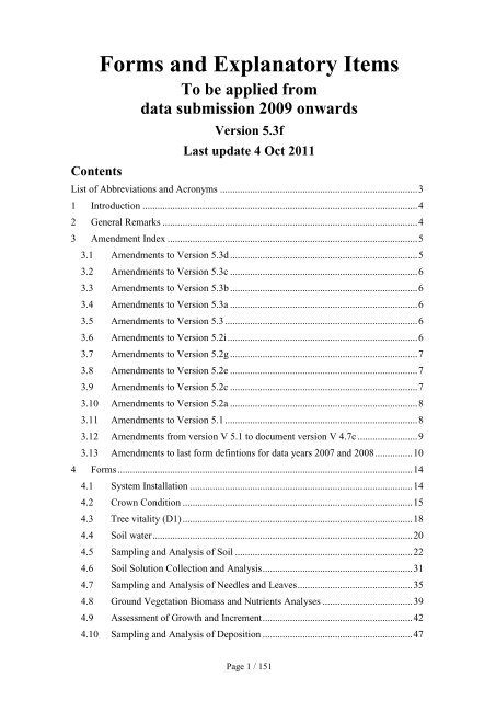
<strong>Form</strong>s and Explanatory Items<br />
To be applied from<br />
data submission 2009 onwards<br />
Version 5.3f<br />
Last update 4 Oct 2011<br />
List of Abbreviations and Acronyms ............................................................................... 3<br />
1 Introduction .............................................................................................................. 4<br />
2 General Remarks ...................................................................................................... 4<br />
3 Amendment Index .................................................................................................... 5<br />
3.1 Amendments to Version 5.3d ........................................................................... 5<br />
3.2 Amendments to Version 5.3c ........................................................................... 6<br />
3.3 Amendments to Version 5.3b ........................................................................... 6<br />
3.4 Amendments to Version 5.3a ........................................................................... 6<br />
3.5 Amendments to Version 5.3 ............................................................................. 6<br />
3.6 Amendments to Version 5.2i ............................................................................ 6<br />
3.7 Amendments to Version 5.2g ........................................................................... 7<br />
3.8 Amendments to Version 5.2e ........................................................................... 7<br />
3.9 Amendments to Version 5.2c ........................................................................... 7<br />
3.10 Amendments to Version 5.2a ........................................................................... 8<br />
3.11 Amendments to Version 5.1 ............................................................................. 8<br />
3.12 Amendments from version V 5.1 to document version V 4.7c ........................ 9<br />
3.13 Amendments to last form defintions for data years 2007 and 2008 ............... 10<br />
4 <strong>Form</strong>s ...................................................................................................................... 14<br />
4.1 System Installation ......................................................................................... 14<br />
4.2 Crown Condition ............................................................................................ 15<br />
4.3 Tree vitality (D1) ............................................................................................ 18<br />
4.4 Soil water ........................................................................................................ 20<br />
4.5 Sampling and Analysis of Soil ....................................................................... 22<br />
4.6 Soil Solution Collection and Analysis ............................................................ 31<br />
4.7 Sampling and Analysis of Needles and Leaves .............................................. 35<br />
4.8 Ground Vegetation Biomass and Nutrients Analyses .................................... 39<br />
4.9 Assessment of Growth and Increment ............................................................ 42<br />
4.10 Sampling and Analysis of Deposition ............................................................ 47<br />
Page 1 / 151
4.11 Meteorological Measurements ....................................................................... 51<br />
4.12 Assessment of Ground Vegetation ................................................................. 54<br />
4.13 Phenological Observations ............................................................................. 56<br />
4.14 Monitoring of Air Quality .............................................................................. 59<br />
4.15 Assessment of Ozone Injury ........................................................................... 64<br />
4.16 Sampling and Analysis of Litterfall ............................................................... 67<br />
4.17 Leaf Area Index (LAI) and Radiation Measurements .................................... 71<br />
5 Explanatory Items ................................................................................................... 75<br />
Page 2 / 151
List of Abbreviations and Acronyms<br />
AAS<br />
BD<br />
BS<br />
CEC<br />
DAR-Q<br />
E c<br />
F<br />
FAO<br />
FES<br />
GPS<br />
H<br />
<strong>ICP</strong><br />
IRM<br />
ISO<br />
JRC<br />
L<br />
LAI<br />
LRM<br />
M<br />
MBD<br />
NFC<br />
NRM<br />
O<br />
OM<br />
QA/QC<br />
SA<br />
SAG<br />
SD<br />
SFC<br />
WRB<br />
Atomic Absorption Spectrometer<br />
Bulk Density<br />
Base Saturation<br />
Cation Exchange Capacity<br />
Data Accompanying Report Questionnaire<br />
Electrical conductivity<br />
Fermentation horizon<br />
Food and Agriculture Organization<br />
Flame Emission Spectrometer<br />
Global Positioning System<br />
Humus horizon<br />
Inductivity Coupled Plasma Spectrometer<br />
International Reference Material<br />
International Organization for Standardization<br />
Joint Research Centre, Ispra, European Commission<br />
Litter horizon<br />
Leaf Area Index<br />
Local Reference Material<br />
Mandatory parameter<br />
Mineral Bulk Density<br />
National Focal Centre of the Intensive Monitoring Programme<br />
National Reference Material<br />
Optional parameter<br />
Organic Matter<br />
Quality Assurance and Quality Control<br />
Soil Analysis method<br />
Scientific Advisory Group of the Intensive Monitoring Programme<br />
Standard Deviation<br />
Standing Forestry Committee<br />
World Reference Base for Soil Resources<br />
Page 3 / 151
1 Introduction<br />
This document concludes all forms which are used for data submission from the year<br />
2009 onwards in the frame of the FutMon programm as well as of the <strong>ICP</strong> <strong>Forests</strong><br />
programme. Changes which are made in comparison with the latest adopted version of<br />
the respective <strong>ICP</strong> <strong>Forests</strong> forms are highlighted by using bold font and blue colour. In<br />
addition all amendments and changes are summarized in the amendment index.<br />
2 General Remarks<br />
Some general remarks are made here in order to allow a high quality data submission:<br />
<br />
<br />
<br />
<br />
<br />
As the combination of parameters which are submitted with a specific form may<br />
vary over time due to manual changes it is necessary to document in the<br />
submission files which fields/parameters are submitted with this file. The<br />
submitting project partners will do so by including a first line into each submission<br />
file which starts with an exclamation mark followed by a comma separated list of<br />
the submitted fields/parameters.<br />
Example for first (comment) line submitted within the file XXGENER.PLT:<br />
!Sequence, country, plot, latitude, longitude, altitude, orientation,<br />
date_installation, plot_size, trees, sub_plot_size, mean_age, tree_species,<br />
yield_abs, yield_relative, other_observations<br />
Those fields which are expected to be continuous and not to change over time are<br />
underlined. Fields which are part of the key of the respective form/table are printed<br />
in bold font. Thus, each line in a submitted file must be identified by its own and<br />
unique combination of the values in those key fields.<br />
Further comments may made before the data specification line but will not be<br />
tested automatically during the validation process. Each comment paragraph or line<br />
has to start with an exclamation mark. The last comment line before the first data<br />
record must be the data specification line which is specified on top of each form (s.<br />
below).<br />
Only in case of the last table fields which are named “other_observations” (or<br />
similar) please use left alignment.<br />
Data submission will be done using the submission module of the FutMon data<br />
base. The data will be submitted survey by survey and year by year. Thus, each<br />
project partner (FutMon partner or <strong>ICP</strong> <strong>Forests</strong> NFC) has to submit a complete set<br />
of a survey of a specific year to the submission module. This set includes in<br />
general a reduced plot file, data files, data accompanying reports (word documents)<br />
and in case of surveys with data from laboratory analyses a laboratory QA file<br />
(.LQA).<br />
The data will be submitted using fixed format ASCII files. The formats are<br />
described in this document including start and end column of each parameter.<br />
During a data submission workshop the FutMon data centre will introduce into<br />
methods for data preparation (e.g. EXPORT of fixed format file from an EXCEL<br />
sheet).<br />
For each parameter the number of digits is defined in the forms below. Metric<br />
values are not defined to have a specific number of decimal units but will be stored<br />
Page 4 / 151
in the database as floating point values. Thus, a parameter with 4 digits could have<br />
values as:<br />
“3456” or “22.4” or “2.63” or “02.6” or “ 2.6” or “2.6 “<br />
The parameter values are separated by blanks. A decimal point is used.<br />
In case that not all digits are needed for data submission the data should be stored<br />
right-aligned. If e.g. a field with 5 digits is defined for a form and the three digit<br />
code "BHI" should be submitted in this specific field it is recommended to insert it<br />
in the data submission file in form of " BHI" instead of "BHI ".<br />
In case of values which are too high to be submitted with the specified number of<br />
digits (e.g. “10243.1” in case of a parameter with only 4 digits “9999” should be<br />
submitted instead and the true value (“10243.1”) should be submitted in the text<br />
field “other observations”. This should be done following the form “VALUE FOR<br />
is ” where is the name of the submitted parameter and<br />
is the value of the parameter.<br />
If values are below the quantification limit a “-1” should be submitted. The<br />
quantification limit for the respective parameters has to be submitted in the<br />
accompanying data report. A “0” (zero) should be used only in case that this is the<br />
assessed or measured value, e.g. “0” for “precipitation” in case that no<br />
precipitation during the respective period. Other parameters could be “Weight of<br />
oranic layer”, “Carbonates” (Soil), or alkalinity (Soil Solution, Depo).<br />
The format of the parameters to be submitted will be given using<br />
I X<br />
for Integer values with X digits,<br />
F X<br />
for floating point values with X digits,<br />
C X for character values with X digits, and<br />
DATE/TIME for date or time values (exact format will be specified in<br />
the respective explanatory item or in the form definition).<br />
Y/N for indicating a “yes” the code “Y” is specified, “N” for “no”<br />
In case that a specification of a parameter (e.g. F 4) is different from the numbers<br />
which are used in the columns specification (e.g. 15 – 17), please, immediately<br />
contact the FutMon data centre in order to allow for a clarification with the next<br />
update of this document and to get a valid decision on how to define the data<br />
submission form.<br />
The column “Ref_Tab” is an index (X) if the respective value of the parameter<br />
must be concluded in a reference table.<br />
The respective explanatory item where some details for the codifying of the<br />
parameter value is explained is specified in the column “Item #”. If a reference<br />
table is indicated (s. point above; column “Ref_Tab”) the reference table is<br />
included in this specific explanatory item.<br />
Make sure that the two letters “ and ; (quotation mark and semicolon) are not<br />
included at any place in the submitted files. Both letters are used by the<br />
system internally during the data validation and dissemination process.<br />
3 Amendment Index<br />
3.1 Amendments to Version 5.3d<br />
a) DP, PLD: for sampler surface in case of stemflow it was clarified in explanatory<br />
item (58) that the basal area of the sampled trees is to be submitted.<br />
Page 5 / 151
) SW, SWC: The format for field bulk density was changed from F4 to I4.<br />
c) LA, LAM: It was clarified, that photo_file is also part of the key. Please, submit<br />
”-9” in case of data which are not related to any photo file.<br />
3.2 Amendments to Version 5.3c<br />
a) LAI, LAM and LAP: Text in forms was revised in order to adapt name<br />
specification for photo files to the format of the explanatory item (125).<br />
3.3 Amendments to Version 5.3b<br />
a) MM, MEO: The unit for Matric Potential in explanatory item (62) was corrected<br />
to hPa (as already stated in explanatory item (64) instead of kPa.<br />
3.4 Amendments to Version 5.3a<br />
a) SO, SOM and LQA: Parameter It was corrected in parameter list in explanatory<br />
item (113) that parameter CaCO3 is specified to be “Carbonates” instead of<br />
C_CO3. In addition, in form SOM carbonates was amended by “CaCO3”:<br />
Carbonates (g/kg CaCO3)<br />
b) LQAs: In all LQA forms the format for the coefficient of variation of the control<br />
charts was changed from I 3 to F 3 in order to allow for submission of values<br />
from .01 to 999. Lower or higher values are to be reported as defined in the<br />
General Remarks section for higher values.<br />
c) FO, FOM and FOO, sample code: In order to allow for a submission of data on<br />
leaves which are older than current year (code “0”) but without the possibility of<br />
distinction between “current year +1” (code “1”) and “oder than current + 1”<br />
(code “2”) an additional code “3” was introduced in explanatory item (38).<br />
3.5 Amendments to Version 5.3<br />
a) MM, Wind direction: Explanatory item (64) was corrected according to<br />
Amendment indes to Version 5.2, point b): 12 sections with 30° instead of 8<br />
sections with 45°. The examples, which were correct already, remain unchanged.<br />
3.6 Amendments to Version 5.2i<br />
a) LA, LAP: The field is part of the key of this form in order to allow<br />
for the submission of more than one parameter per photo file.<br />
b) MM, WD: It was clarified in explanatory item (64) that wind direction has to be<br />
submitted not with 8 but with 12 possible sections, each with 30° range. In any<br />
case, as before, the middle of the range has to be submitted. E.g. “0”, “30”, “60”,<br />
…, “330”.<br />
Page 6 / 151
c) code: Actually, there are codes for tree species higher than 199<br />
in explanatory item (20). Accordingly the wording “001 to 199” was deleted<br />
from all related forms.<br />
d) LQA: If there was no participation in a ring test for a specific parameter the<br />
fields , , and have to<br />
be left blank as described in explanatory item (107).<br />
3.7 Amendments to Version 5.2g<br />
e) SW, SWC and SWA: , a part of the key of SWC table, is not longer<br />
defined in a reference table which would always be incomplete. Instead, the<br />
definition of this key between the tables SWC and SWA and the code for is described in more detail and with examples in explanatory item (71).<br />
3.8 Amendments to Version 5.2e<br />
f) General Remarks: Code Y/N is now defined in the explanatory items; used<br />
already in several forms<br />
g) General Remarks: Hint that neither a semicolon nor a quotation mark shall be<br />
used in the submitted files<br />
h) D1G: some corrections and clarifications to old definitions, air temperature<br />
skipped from the form;<br />
i) Growth, PLI: Total plot parameters (area and number of trees) were skipped<br />
from the form PLI<br />
j) Growth, IPM: according to text in <strong>ICP</strong> <strong>Forests</strong> manual the field <br />
was renamed to . In the description text accordingly:<br />
“Crownlength rounded off to the nearest 0.1 meters” “Height to crown base”<br />
(as was already defined in the manual text).<br />
k) AQ, COL: unit of inlet height is same as in PAC: [m]. Anyhow, the accuracy<br />
should be up to at least 0.1m in both forms.<br />
3.9 Amendments to Version 5.2c<br />
a) The general remarks section was amended by a paragraph at end of the first<br />
bullet point in order to clarify how key fields are designated and what the<br />
meaning and use of key fields is.<br />
b) Soil, layer: Explanatory item (72) was adapted to codes used in BioSoil project.<br />
c) Growth, removal: code for removal_mortality 04 was introduced (tree not longer<br />
in growth sample due to heavy disturbances (e.g. heavy storm damage))<br />
Page 7 / 151
d) Crown, TRD und TRF: the key field names (written in bold font) were adapted<br />
for TRF according to those in TRD<br />
e) Crown, TRD and TRF: field "cause_sc_name" became part of the key<br />
f) Soil Water: SWA “Matric preassure” became part of the key of form SWA<br />
g) In PLM explanatory item (70) was introduced for pit ID<br />
h) Leaf Area Index, LAM: date_analysis, determination, parameter became part of<br />
the key<br />
i) Meteo, explanatory item (64): all specifications concerning the number of digits<br />
were revised according to the general remarks (floating point values instead of<br />
fixed decimal places)<br />
j) Ozone, active sampler, AQA: Unit for ozone has been corrected from ppm to ppb<br />
k) Litterfall, LFM and LFO: field "trap" number has been defined to be of code "-9"<br />
in case of plot averages instead of blank (Null value) which is not appropriate in<br />
a key field.<br />
l) Tree species codes, Explanatory Item (20): Codes 201 to 208 were added for<br />
Anatolian oak species; code 89 for Ceratonia siliqua was deleted, code 75 has to<br />
be used for this species.<br />
m) Deposition, LQA form and Explanatory item (105): pretreatment method codes<br />
for deposition samples were introduced.<br />
3.10 Amendments to Version 5.2a<br />
a) Air quality: Sequence Number in form AQA was widened to 6 digits, all<br />
subsequent fields (columns) were shifted accordingly.<br />
3.11 Amendments to Version 5.1<br />
a) Foliage: sample ID consists of 5 digits first 3 digits is the code for tree species,<br />
digit 4 is a dot (“.”) and digit 5 is the leaves type Examples for valid entries are<br />
introduced in the respective forms.<br />
b) Deposition; form DEO: columns for start_date and end_date were corrected<br />
c) Soil solution, form PSS: <strong>Form</strong>at and reference for “layer” corrected<br />
d) Soil: Expalanatory Items 68 and 69 were removed in order to avoid redundancy.<br />
e) Soil; PFH; Horizon discontinuity: If no discontinuity is detected the value 0<br />
(zero) shall be submitted instead of submitting a blank (for technical reasons)<br />
f) Soil; PFH; Horizon vertical: If no discontinuity is detected the value 0 (zero)<br />
shall be submitted instead of submitting a blank.<br />
g) Soil, LQA, pretreatment: The key has now format C 4 instead of I 4 in order to<br />
allow for the distinction between 3.1 and 3.10<br />
h) Pheno, PHD and LAI, LAP and LAM; file name: field was corrected from C18<br />
to C28!!! All subsequent columns are changed correspondingly!!!<br />
Page 8 / 151
3.12 Amendments from version V 5.1 to document version V<br />
4.7c<br />
Compared to Version 4.7c, which has been provided on the FutMon webpage, (internal<br />
login) some significant changes and amendments were done:<br />
a) In general remarks two new points:<br />
1) comment lines in data files are specified!<br />
2) data fields in data files should be right-aligned<br />
b) XXGENER.PLT: Description of date corrected from DD-MM-YY to<br />
DDMMYY<br />
c) Tree Vitality, D1T: comments on removal and mortality shifted behind the<br />
respective data field, additional "other observations" field added at end of file.<br />
d) Table Score of event , explanatory item (123) was clarified: codes for<br />
flowering are 6, 7, 7.1, 7.2 and 7.3, codes for damage 6 and 7.<br />
e) Soil .PRF: Reference tables for mean highes and lowest ground water table” and<br />
for “water table type” (old explanatory items (137) and (138)) are replaced by<br />
respective tables in which the code 0 is replaced by code 9 (explanatory items<br />
(151) and (152)).; in form SOM “X” added for field “texture class”<br />
f) Soil .SOM: it must be pronounced that from data submission 2009 onwards the<br />
sequence of particle size data fields changed from clay – sand – silt (up to data<br />
submission 2008) to clay – silt – sand!!!<br />
g) Soil solution: SSO: format of water content was corrected to F4<br />
h) Growth forms: Wrong data formats and inconsistent form definition were<br />
corrected<br />
i) Depo, form DEO: seqence of start and end date corrected<br />
j) Meteo data form: columns in MEM were corrected for "other observations";<br />
form PLM: <strong>Form</strong>ats were corrected and completed; Field “Variable” is with<br />
reference table (“X” inserted) in form MEM and MEO<br />
k) Ground Vegetation Biomass: form PGB: <strong>Form</strong>at of sequence number was<br />
corrected; “X” for reference table inserted in form .GBO, field “species code”<br />
and in form .GBH, field “species code”<br />
l) Phenology: In PHD the parameter “event” was included in order to allow for a<br />
respective search for photo documentations in the database.<br />
m) Descriptions for Air quality and Ozone forms were added<br />
n) Inconsistencies on ring test numbers in LQ- forms were solved; format changed<br />
from C 4 to C3<br />
o) LAI: LAM: column numbers had to be changed due to inconsistencies with<br />
format of field parameter code; LAC: 8 digits were needed for X-coordinate =><br />
changes in columns; PLA: columns for Exposition in degree shortened from 36 –<br />
39 to 36 – 38 as only 3 digits needed.<br />
p) OZ: <strong>Form</strong>at was inserted for first four fields and X inserted for field country code<br />
in form LTF<br />
q) AQ: form AQB, AQP: <strong>Form</strong>at was corrected for field "Compound air quality";<br />
form COL: columns for field "Passive sampler manufacturer" was shortened and<br />
Page 9 / 151
consecutive fields where shifted accordingly; form AQA: <strong>Form</strong>ats were<br />
corrected and completed!<br />
3.13 Amendments to last form defintions for data years 2007<br />
and 2008<br />
All changes and amendments which were made compared to the latest adopted version<br />
of the <strong>ICP</strong> <strong>Forests</strong> Manual are highlighted in the text by bold blue font and listed below.<br />
Some amendments which clarify the existing definitions in the explanatory items are<br />
only highlighted in the text but not listed below (e.g. Explanatory item #(3): An example<br />
is made for the values which have to be submitted).<br />
Survey <strong>Form</strong> Description<br />
System<br />
Installation<br />
XXGENER.PLT<br />
„Only information concerning new plots or plots<br />
with information updates have to be submitted.“<br />
Tree vitality .D1T, .D1G The forms D1T and D1G were introduced for the<br />
submission of tree vitality and permanent an<br />
continouos dbh measurements, respectively,<br />
concerning project D1<br />
Soil .PLS, .SOM The exisiting forms are adapted to the BioSoil<br />
project definition as far as possible before getting the<br />
BioSoil data and latest information on the used<br />
coding. A respective update will follow as soon as<br />
BioSoil data will be available to the FutMon project.<br />
Soil .SOM The sequence of data fields in form .SOM was<br />
changed from Clay – Sand – Silt<br />
to Clay – Silt – Sand !!!<br />
Soil .PFH A new file .PFH is introduced in order to submit<br />
information on soil profile horizons description<br />
according to the soil classification under BioSoil.<br />
Soil .PRF A new file .PRF is introduced in order to submit<br />
information on soil profile description according to<br />
the soil classification under BioSoil.<br />
Soil water .SWC, .SWA New forms for data submission on soil water<br />
retention are defined, .SWC for submission of<br />
sample definition and .SWA for submission of<br />
respective (multiple) analysis results. UPDATE in<br />
version 4.7<br />
Foliage<br />
.PLF, .FOM,<br />
.FOO<br />
Other obersvations (text) enlarged to 40 digits.<br />
Foliage .FOM & .FOO Leaves type 2 = older than current + 1 was<br />
introduced in foliage assessments (FOM and FOO<br />
and explanatory item (38)); this code 2 will be of use<br />
only on the D2 plots where the FutMon participants<br />
have to analyse older needles in addition.<br />
Foliage .FOM In order to allow for the submission of further tree<br />
number (only 5 tree number may be submitted with<br />
.FOM yet) it is foreseen that those further tree<br />
numbers will be submitted in a second line with the<br />
Page 10 / 151
same analysis results for nutrients, biomass, etc. as<br />
those in the first respective line.<br />
Foliage XX2009FO.LQA The new form for submission of laboratory QA data<br />
is introduced.<br />
Biomass<br />
.PGB, .GBM,<br />
.GBO, .GBH,<br />
XX2009GB.LQA<br />
For the assessment of biomass and nutrient analyses<br />
of ground vegetation 4 new forms will be used for<br />
the submission of respective data on sample analyses<br />
together with a Laboratory QA file (based on foliage<br />
ring test results).<br />
Deposition .PLD The fields Sampler model, Sampler Height, Sampler<br />
Surface and No of samplers is introduced<br />
Deposition .DEM and .DEO The field V_sampling (assessment/estimation<br />
method) is introduced<br />
Deposition XX2009DP.LQA The new form for submission of laboratory QA data<br />
is introduced.<br />
Phenology .PHE was enlarged to 5 digits => all<br />
following column numbers changed<br />
Phenology .PHE if event code for damage on leaves (“4”) or other<br />
damage (“5”) is indicated, a respective data record is<br />
submitted with the foreseen damage form (.TRD);<br />
fields concerning damage are excluded from the<br />
phenology forms!<br />
Phenology .PHE and are replaced by date<br />
of observation<br />
Phenology .PHE Score of event is amended by scores from 1 (99%); the score is defined by thirds of trees<br />
being involved by the event.<br />
Phenology .PHE Stage of event is amended by codes from 1 (99%);<br />
Phenology .PLP An explanatory Item for was<br />
introduced; no new information, only in order to<br />
avoid misunderstandings<br />
Phenology .PLP An explanatory Item for <br />
was introduced; no new information, only in order to<br />
avoid misunderstandings<br />
Phenology .PLP Code for vertical direction FROM where the<br />
observations were made is introduced including a<br />
respective explanatory item; following column<br />
numbers changed<br />
Phenology .PHI was enlarged to 5 digits => all<br />
following column numbers changed<br />
Phenology .PHI if event code for damage on leaves (“4”) or other<br />
damage (“5”) is indicated, a respective data record is<br />
submitted with the foreseen damage form (.TRD);<br />
fields concerning damage are excluded from the<br />
phenology forms!<br />
Phenology .PHI Score of event at observed tree is introduced by<br />
Page 11 / 151
codes from 1 (99%);<br />
Phenology .PHI Stage of event is amended by codes from 1 (99%);<br />
Phenology .PHI is introduced<br />
Phenology .PHD A new form (.PHD) was introduced for submission<br />
of information on submitted digital photographs and<br />
images.<br />
Meteorology .PLM<br />
Meteorology .MEM<br />
Meteorology .MEO<br />
New column Profile Pit ID was introduced in order<br />
to get the linkage to the soil pit analyses values<br />
which are submitted with the SWC file<br />
Fields Origin and Status were introduced in order to<br />
document origin and status of the submitted data<br />
Fields Origin and Status were introduced in order to<br />
document origin and status of the submitted data<br />
Litterfall .LFM unit of C changed from [mg/g] to [g/100g] in order<br />
to have uniform format with foliage and Ground<br />
vegetation biomass<br />
Litterfall .LFO Al and Na were dropped following <strong>ICP</strong> <strong>Forests</strong> Task<br />
Force meeting 2007; respective columns will be<br />
empty (blanks to be submitted)<br />
Litterfall .LFO Cd introduced with unit [ng/g] in order to have<br />
uniform format with foliage and Ground vegetation<br />
biomass; Cd will be submitted with LFO.<br />
Litterfall .LFO unit of Zn, Mn, Fe, Cu, Pb and B changed from<br />
[mg/g] to [µg/g] in order to have uniform format<br />
with foliage and Ground vegetation biomass<br />
LAI .PLA Reduced plot file for LAI survey was introduced<br />
LAI .LAC <strong>Form</strong> for submission of relative coordinates of<br />
devices and measurement point (LAI and other<br />
surveys) was introduced<br />
LAI .LAP <strong>Form</strong> for submission of data on hemispherical photos<br />
and photos of photo mosaic method was introduced<br />
LAI .LAM <strong>Form</strong> for submission of LAI measurement /<br />
assessment values and additional output was<br />
introduced<br />
SO, SS, FO,<br />
DP, LF, AQ<br />
.LQA<br />
For all surveys with parameters which are analysed<br />
at laboratories so called “Laboratory Quality<br />
Assurance” forms (.LQA) are defined and have to be<br />
submitted with the data of the respective survey.<br />
Air Quality .PAC <strong>Form</strong> was revised in order to assure link between<br />
plot file of active samplers with measurement data<br />
(now in .AQA)<br />
Air Quality .PPS <strong>Form</strong> was revised in order to assure link between<br />
plot file of passive samplers with measurement data<br />
(now in .AQP)<br />
Air Quality .AQM <strong>Form</strong> not longer valid, submission of measurement<br />
Page 12 / 151
data now with .AQA for active sampler and with<br />
.AQP for passive samplers<br />
Air Quality .AQA <strong>Form</strong> introduced for submission of measurement<br />
data from active samplers<br />
Air Quality .AQP <strong>Form</strong> introduced for submission of measurement<br />
data from passive samplers<br />
Air Quality .AQB and .COL <strong>Form</strong>s introduced for documentation of quality<br />
assureance/control measures<br />
Litterfall .LFM and .LFO Explanatory Item (154) will be used instead of<br />
explanatory item (40), thus the new codes are not<br />
listed in explanatory item 40 any longer<br />
Page 13 / 151
4 <strong>Form</strong>s<br />
4.1 System Installation<br />
The file for system instalment has to be submitted if new plots have to be defined or in<br />
case that respective data have to be changed in the data base. Only the information<br />
concerning new plots or plots with information updates has to be submitted. All other<br />
plots may be re-submitted with the XXGENER.PLT file.<br />
4.1.1 XXGENER.PLT<br />
Contents of file with the information on Plot level<br />
Each data file has to start with a comment line. This line starts with an exclamation<br />
mark:<br />
!Sequence, country, plot, latitude, longitude, altitude, orientation, date_installation,<br />
plot_size, trees, sub_plot_size, mean_age, tree_species, yield_abs, yield_relative,<br />
other_observations<br />
Column Description <strong>Form</strong>at Ref_Tab Item #<br />
1 – 4 Sequence number of plots (1 to 9999) I 4<br />
6 – 7 Country Code (France = 01, Belgium = 02, etc.) I 2 X (1)<br />
9 – 12 Observation plotnumber (max. 9999) I 4 (2)<br />
14 – 20 Latitude in +DDMMSS (e.g.+505852) C 7 (4)<br />
22 – 28 Longitude in (+ or -)DDMMSS (e.g. +035531) C 7 (4)<br />
30 – 31 Altitude (in 50 metre classes from 1 to 51) I 2 X (7)<br />
33 Orientation (N =1, NE = 2, etc.) I 1 X (8)<br />
35 – 40 Installation date in DDMMYY Date (3)<br />
42 – 47 Total plot size (in 0.0001 ha) F 6 (16)<br />
49 – 52 Number of trees in total plot I 4 (17)<br />
54 – 59 Size of sub-plot (in 0.0001 ha) F 6 (16)<br />
61 – 62<br />
Mean age of dominant storey<br />
(in 20 year classes from 1 to 8)<br />
I 2 X (9)<br />
64 – 66 Main tree species code I 3 X (20)<br />
68 Yield estimate – absolute I 1 X (18)<br />
70 Yield estimate – relative I 1 X (18)<br />
72 – 111 Other observations (text) C 40 (84)<br />
Page 14 / 151
4.2 Crown Condition<br />
Part II<br />
Visual Assessment of<br />
Crown Condition<br />
4.2.1 XX2009.PLO<br />
Contents of file with the information on Plot level to be used in<br />
combination with the tree vitality inventory Level I<br />
Each data file has to start with a comment line. This line starts with an exclamation mark<br />
!Sequence, country, plot, date, latitude, longitude, water, humus, altitude, orientation,<br />
mean_age, other_observations<br />
Column Description <strong>Form</strong>at Ref_Tab Item #<br />
1 – 4 Sequence number of plots (1 to 9999) I 4<br />
6 – 7 Country code I 2 X (1)<br />
9 – 12 Observation plotnumber (max. 9999) I 4 (2)<br />
14 – 19 Date Date (3)<br />
21 – 27 Latitude C 7 (4)<br />
29 – 35 Longitude C 7 (4)<br />
37 Water availability I 1 X (5)<br />
39 Humus type I 1 X (6)<br />
41 – 42 Altitude I 2 X (7)<br />
44 Orientation I 1 X (8)<br />
46 – 47 Mean age of dominant storey I 2 X (9)<br />
Soil unit (e.g. e.g. Hypercalcaric-<br />
49 – 76 Chromic LUVISOL)<br />
C 27 X<br />
78 – 117 Other observations (text) C 40 (84)<br />
Note<br />
4.2.2 XX2007.TRE<br />
Crown condition parameters Level I<br />
Each data file has to start with a comment line. This line starts with an exclamation<br />
mark:<br />
!Sequence, plot, date, tree, tree_species, defol, discol, fruiting_assess,<br />
other_observations<br />
Column Description <strong>Form</strong>at Ref_Tab Item #<br />
1 – 5 Sequence number of trees (1 to 99999) I 5<br />
7 – 10 Observation plot number (max. 9999) I 4 (2)<br />
12 – 17 Date of survey in DDMMYY (e.g. 220704) Date (3)<br />
19 – 22 Treenumber (as marked during installation) I 4 (19)<br />
24 – 26 Tree Species code I 3 X (20)<br />
Page 15 / 151
Column Description <strong>Form</strong>at Ref_Tab Item #<br />
28 – 30 Defoliation (0,5,10,15 ... 95,99,100%) I 3 X (25)<br />
32 Discolouration (0,1,2,3,4) [optional] I 1 X (26)<br />
34 Fruiting in assessable crown (1,2,3) [optional] I 1 X (29)<br />
36 – 75 Other observations (text) C 40 (84)<br />
4.2.3 XX2007.TRF<br />
Damage parameters Level I<br />
Each data file has to start with a comment line. This line starts with an exclamation<br />
mark:<br />
!Sequence, plot, date, tree, affected_part, symptom, symptom_spec, crown_loc,<br />
damage_age, cause, cause_sc_name, extent, other_observations<br />
Column Description <strong>Form</strong>at Ref_Tab Item #<br />
1 – 5 Sequence number of trees (1 to 99999) I 5<br />
7 – 10 Observation plot number (max. 9999) I 4 (2)<br />
12 – 17<br />
19 – 22<br />
24 – 25<br />
Date of survey in DDMMYY (e.g.<br />
220704)<br />
Treenumber (as marked during<br />
installation)<br />
Specification of affected part (11, ...,<br />
34)<br />
Page 16 / 151<br />
Date (3)<br />
I 4 (19)<br />
I 2 X (32)<br />
27 – 28 Symptom (01,..., 22) I 2 X (33)<br />
30 – 31<br />
Specification of symptom (31, ..., 67)<br />
[optional]<br />
I 2 X (33)<br />
33 Location in crown (1,2,3,4) [optional] I 1 X (32)<br />
35 Age of damage (1,2,3) [optional] I 1 X (34)<br />
37 – 41 Cause (e.g. 81001) I 5 X (35)<br />
43 – 49<br />
Scientific name of cause (e.g.<br />
LOPHSED)<br />
C 7 X (36)<br />
51 Extent (0,1,2,3,4,5,6,7) I 1 X (37)<br />
53 – 92 Other observations (text) C 40 (84)<br />
4.2.4 XX2007.PLT<br />
Contents of file with the information on plot level to be used with<br />
the crown assessment on Level II<br />
Each data file has to start with a comment line. This line starts with an exclamation<br />
mark:<br />
!Sequence, country, plot, date, latitude, longitude, altitude, other_observations<br />
Column Description <strong>Form</strong>at Ref_Tab Item #<br />
1 – 4 Sequence number of plots (1 to 9999) I 4<br />
6 – 7 Country code I 2 X (1)
Column Description <strong>Form</strong>at Ref_Tab Item #<br />
9 – 12 Observation plot # I 4 (2)<br />
14 – 19 Date of assessment (DDMMYY) Date (3)<br />
21 – 27 Latitude in + DDMMSS (e.g. +505852) C 7 (4)<br />
29 – 35<br />
Longitude in (+ or -) DDMMSS<br />
(e.g. -035531)<br />
C 7 (4)<br />
37 – 38<br />
Altitude (in 50 meter classes<br />
from 1 to 51)<br />
I 2 X (7)<br />
40 – 79 Other observations (text) C 40 (84)<br />
4.2.5 XX2007.TRC<br />
Crown condition parameters Level II<br />
Each data file has to start with a comment line. This line starts with an exclamation<br />
mark:<br />
!Sequence, plot, date, tree, tree_species, removal_mortality, social_class,<br />
shading_crown, visibility, defol, discol, flowering_assess, flowering_whole,<br />
fruiting_assess, fruiting_whole, transparency, form_crown, secondary_shoots,<br />
other_observations<br />
Column Description <strong>Form</strong>at Ref_Tab Item #<br />
1 – 5 Sequence number of trees (1 to 99999) I 5<br />
7 – 10 Observation plot number (max. 9999) I 4 (2)<br />
12 – 17 Date of survey in DDMMYY (e.g. 220704) Date (3)<br />
19 – 22 Treenumber (as marked during installation) I 4 (19)<br />
24 – 26 Tree Species code I 3 X (20)<br />
28 – 29 Removals & mortality I 2 X (21)<br />
31 Social class (1,2,3,4) I 1 X (22)<br />
33 Crown shading (1,2,3,4,5,6) I 1 X (23)<br />
35 Visibility (1,2,3,4) I 1 X (24)<br />
37- 39 Defoliation (0,5,10,15 ... 95,99,100%) I 3 X (25)<br />
41 Discolouration (0,1,2,3,4) [optional] I 1 X (26)<br />
43 Flowering in assessable crown (1,2,3) [optional] I 1 X (28)<br />
45 Flowering in whole crown (1,2,3) [optional] I 1 X (28)<br />
47 Fruiting in assessable crown (1,2,3) [optional] I 1 X (29)<br />
49 Fruiting in whole crown (1,2,3) [optional] I 1 X (29)<br />
51 – 53<br />
Foliage transparency (0,5,10,15,...,95,99,100)<br />
[optional]<br />
I 3 X (27)<br />
55 – 56 Crown form (11 to 39) [optional] I 2 X (31)<br />
58 Secondary shoots & epicormics (1,2,3) [optional] I 1 X (30)<br />
60 – 99 Other observations (text) C 40 (84)<br />
Page 17 / 151
4.2.6 XX2007.TRD<br />
Damage parameters Level II<br />
Each data file has to start with a comment line. This line starts with an exclamation<br />
mark:<br />
!Sequence, plot, date, tree, affected_part, symptom, symptom_spec, crown_loc,<br />
damage_age, cause, cause_sc_name, extent, other_observations<br />
Column Description <strong>Form</strong>at Ref_Tab Item #<br />
1 – 5 Sequence number of trees (1 to 99999) I 5<br />
7 – 10 Observation plot number (max. 9999) I 4 (2)<br />
12 – 17 Date of survey in DDMMYY (e.g. 220704) Date (3)<br />
19 – 22 Treenumber (as marked during installation) I 4 (19)<br />
24 – 25 Specification of affected part (11, ..., 34) I 2 X (32)<br />
27 – 28 Symptom (01,..., 22) I 2 X (33)<br />
30 – 31 Specification of symptom (31, ..., 67) I 2 X (33)<br />
33 Location in crown (1,2,3,4) I 1 X (32)<br />
35 Age of damage (1,2,3) [optional] I 1 X (34)<br />
37 – 41 Cause (e.g. 81001) I 5 X (35)<br />
43 – 49 Scientific name of cause (e.g. LOPHSED) C 7 X (36)<br />
51 Extent (0,1,2,3,4,5,6,7) I 1 X (37)<br />
53 – 92 Other observations (text) C 40 (84)<br />
4.3 Tree vitality (D1)<br />
4.3.1 XX2009.D1T<br />
FutMon D1 parameters on tree level (Tree age, Fruiting, CDRD_N,<br />
Apical shoot architecture, Removal/Mortality)<br />
Each data file has to start with a comment line. This line starts with an exclamation<br />
mark:<br />
!Sequence, country, plot, tree, date, tree_age_class, age_tree, age_method,<br />
age_comment, fruiting_assess_ext, fruiting_comment, CDRD_N, CDRD_N_comment,<br />
apical_shoot, apical_shoot_comment, removal _ext, removal_ext_comment,<br />
affected_part, symptom, symptom_spec, cause, cause_sc_name, other_observations<br />
Column Description <strong>Form</strong>at Ref_Tab Item #<br />
1 - 5 Sequence number (1-99999) I 5<br />
7 - 8 Country code I 2 X (1)<br />
10 - 13 Plot Number I 4 (2)<br />
15 - 18 Treenumber<br />
(as marked during installation; same as in<br />
.TRC)<br />
I 4 (19)<br />
20 - 25 Date of Assessment Date (3)<br />
27 - 27 Tree Age class I 1 X (10)<br />
Page 18 / 151
29 - 31 Tree age (years, if exact data of +/- 5 years<br />
available; optional)<br />
33 - 33 method of age assessment I 1 X (11)<br />
35 - 74 comments on age assessment C 40 (84)<br />
76 - 78 Fruiting in assessable crown (1.1, 1.2, 2, 3);<br />
mandatory on Fagus ssp., Picea abies and<br />
Pine ssp.<br />
I 3<br />
F 3 X (12)<br />
80 - 119 comments on fruiting C 40 (84)<br />
121 - 125 Crown related distance to neighbour;<br />
CDRD_N<br />
F 5 (13)<br />
127 - 166 comments on CDRD_N C 40 (84)<br />
168 - 168 Apical shoot architecture (Beech) I 1 X (14)<br />
170 - 209 comments on Crown Architecture C 40 (84)<br />
211 - 211 Removal/Mortality (new) I 1 X (15)<br />
213 - 252 Comments on Removal/Mortality C 40 (84)<br />
Coding accoring to .TRD:<br />
254 - 255 Specification of affected part (11, ..., 34) I 2 X (32)<br />
257 - 258 Symptom (01,..., 22) I 2 X (33)<br />
260 - 261 Specification of symptom (31, ..., 67) I 2 X (33)<br />
263 - 267 Cause (e.g. 81001) I 5 X (35)<br />
269 - 275 Scientific name of cause (e.g. LOPHSED)<br />
(optional)<br />
C 7 X (36)<br />
277 - 316 Other observations C 40 (84)<br />
4.3.2 XX2009.D1G<br />
<strong>Form</strong> to be used for submission of diameter measurements<br />
(girthband or dendrometer)<br />
Each data file has to start with a comment line. This line starts with an exclamation<br />
mark:<br />
!Sequence, country, plot, tree, date, diameter, time, measurement_average,<br />
dendrometer, sensor_exchanged, other_observations<br />
Column Description <strong>Form</strong>at Ref_Tab Item #<br />
1 - 6 Sequence number (1-999999) I 6<br />
8 – 9 Country code I 2 X (1)<br />
11 – 14 Plot Number I 4 (2)<br />
16 – 19 Treenumber (as marked during installation;<br />
same as in .TRC; if not in TRC same as IPMtree<br />
number; if not in IPM same as FOM)<br />
I 4 (19)<br />
21 – 26 Date of Assessment Date (3)<br />
28 – 34 Actual diameter (girthband or dendrometer<br />
measurement) or diameter of period [cm]<br />
F 7<br />
Page 19 / 151
Column Description <strong>Form</strong>at Ref_Tab Item #<br />
36 – 41 Time of diameter measurement or reference time<br />
for which period diameter calculated<br />
[HHMMSS]<br />
(e.g. 094357)<br />
Time<br />
43 Measurement (code 1) or period value (2) I 1 X (157)<br />
45 – 47 Continuous dendrometer (point dentrometer<br />
code: 1.1; circumference dendrometer code: 1.2)<br />
or permanent girthband measurement (code: 2)<br />
49 Sensor was exchanged before this measurement<br />
or girthband adjusted [Yes=Y, No = N]<br />
C 3 X (158)<br />
51 – 90 Comments on diameter measurement C 40 (84)<br />
4.4 Soil water<br />
4.4.1 XX2009.SWC<br />
FutMon D3 Soil water content – sample definition and dry soil<br />
bulk density<br />
one record/line/observation on each sample unit<br />
Each data file has to start with a comment line. This line starts with an exclamation<br />
mark:<br />
!Sequence, country, plot, date, PFH_pit, horizon, SW_pit, depth_layer,<br />
ring_depth_upper, ring_depth_lower, replicate, bulk_density, date_analysis,<br />
other_observations<br />
columns parameter <strong>Form</strong>at Ref_Tab Item#<br />
Y/N<br />
1 - 4 Sequence number (1-9999) I 4<br />
6 - 7 Country code I 2 X (1)<br />
9 - 12 Plot Number I 4 (2)<br />
14 - 19 Sampling date Date (3)<br />
21 – 24 PFH pit ID (maximum 4 characters, same as in C 4 (69)<br />
BioSoil)<br />
26 – 27 Horizon number I 2 (143)<br />
29 - 33 SW pit ID C 5 (70)<br />
35 - 37 Code depth layer C 3 X (71)<br />
39 - 41 Sample ring depth (upper side of ring) in cm below<br />
the top of the mineral soil; negative values for<br />
sampling rings taken in organic layer.<br />
43 - 45 Sample ring depth (lower side of ring) in cm below<br />
the top of the mineral soil; so negative values for<br />
sampling rings taken in organic layer.<br />
47 - 47 Replicate (in case multiple samples are taken<br />
in one SW pit: 1, 2, 3…)<br />
49 – 52 Dry soil bulk density of the fine earth (kg m -3 ) IF 4<br />
I 3 (71)<br />
I 3 (71)<br />
I 1 (71)<br />
54 – 59 Date laboratory analysis (DDMMYY) Date (3)<br />
61 - 100 Other observations (text) C 40 (84)<br />
Page 20 / 151
4.4.2 XX2009.SWA<br />
FutMon D3 Soil water content – sample analysis results on<br />
water retention<br />
Each data file has to start with a comment line. This line starts with an exclamation<br />
mark:<br />
!Sequence, country, plot, date, SW_pit, depth_layer, replicate, water_content,<br />
matric_pressure, date_analysis, other_observations<br />
columns parameter <strong>Form</strong>at Ref_Tab Item#<br />
1 - 5 Sequence number (1-99999) I 5<br />
7 - 8 Country code I 2 X (1)<br />
10 - 13 Plot Number I 4 (2)<br />
15 - 20 Sampling date Date (3)<br />
22 - 25 SW pit ID (maximum 4 characters) C 4 (70)<br />
27 - 29 Code depth layer C 3 X (71)<br />
31 - 31 Replicate (in case multiple samples are taken<br />
in one SW pit: 1, 2, 3…)<br />
33 – 38 Volumetric water content in m 3 .m -3 at matric<br />
pressure specified in field "matric pressure"<br />
40 – 47 Matric pressure [kPa]; e.g. value -5 indicating<br />
-5kPa; mandatory for new calculations under<br />
FutMon: 0kPa, -1kPa, -5kPa, -33kPa, -1500kPa<br />
I 1 (71)<br />
F 6 (130)<br />
F 8 (130)<br />
49 – 54 Date laboratory analysis (DDMMYY) Date (3)<br />
56 – 95 Other observations (text) C 40 (84)<br />
Page 21 / 151
Part IIIa<br />
4.5 Sampling and Analysis of Soil<br />
During the FutMon project we will rely on the BioSoil definitions and<br />
recommendations. Concerning the data submission the forms below will be used for data<br />
on plots which were not already submitted to the BioSoil data base.<br />
Some amendments to BioSoil were made already and highlighted by blue bold font.<br />
4.5.1 XX2009.PLS<br />
Contents of reduced plot file<br />
Each data file has to start with a comment line. This line starts with an exclamation<br />
mark:<br />
!Sequence, country, plot, date, latitude, longitude, altitude, water, humus,<br />
other_observations<br />
Column Description <strong>Form</strong>at Ref_Tab Item #<br />
l – 4 Sequence number of plots (1 to 9999) I 4<br />
6 – 7 Country Code I 2 X (1)<br />
9 – 12 Plot number (max. 9999) I 4 (2)<br />
14 – 19 Date of sampling in DDMMYY (e.g.<br />
220690)<br />
Date (3)<br />
21 – 27 Latitude in +DDMMSS (e.g. + 505852) C 7 (4)<br />
29 – 35 Longitude in (+ or -) DDMMSS (e.g. +<br />
035531)<br />
C 7 (4)<br />
37 – 38 Altitude (in 50 meter classes from 1 to 51) I 2 X (7)<br />
40 – 66 Soil unit C 27 X<br />
68 – 71 Parent material code I 4 X<br />
73 Water availability<br />
(insufficient = 1, sufficient = 2, excessive = 3)<br />
I 1 X (5)<br />
75 Humus type ( Mull = 1, Moder = 2, etc.) I 1 X (6)<br />
77 – 78 ID of soil profile used for the pedological<br />
characterisation (e.g. P04)<br />
81 – 120 Other observations C 40 (84)<br />
I 2<br />
Page 22 / 151
4.5.2 XX2009.prf<br />
Soil profile description<br />
The information on the WR B soil classification name is not longer part of the PLS file. The<br />
same file can be used on Level I and Level II. Mainly based on BioSoil submission forms;<br />
amended parameter in blue bold font; Mandatory/Optional also picked from BioSoil; final<br />
discussion and definition after submission of the BioSoil database to FutMon data centre and<br />
FSCC.<br />
Each data file has to start with a comment line. This line starts with an exclamation<br />
mark:<br />
!Sequence, country, plot, profile_pit, date, latitude, longitude, elevation, soil_group,<br />
qualifier_1, specifier_1, qualifier_2, specifier_2, qualifier_3, specifier_3, qualifier_4,<br />
specifier_4, qualifier_5, specifier_5, qualifier_6, specifier_6, diagnostic_1,<br />
diagnostic_depth_1, diagnostic_2, diagnostic_depth_2, diagnostic_3,<br />
diagnostic_depth_3, diagnostic_4, diagnostic_depth_4, diagnostic_5,<br />
diagnostic_depth_5, diagnostic_6, diagnostic_depth_6, diagnostic_7,<br />
diagnostic_depth_7, diagnostic_8, diagnostic_depth_8, diagnostic_9,<br />
diagnostic_depth_9, diagnostic_10, diagnostic_depth_10, WRB_publication,<br />
parent_material_1, parent_material_2, ground_water_highest, ground_water_lowest,<br />
water_table, rooting_depth, rock_depth, obstacle_depth, other_observations<br />
Column Description <strong>Form</strong>at Ref_Tab Item # M/O<br />
1 - 4 Sequence number of plots (1 to<br />
9999)<br />
6 - 7 Country code I 2 X (1) M<br />
9 - 12 Observation plot number (maximum<br />
9999)<br />
14 - 17 Profile pit ID (maximum 4<br />
characters)<br />
(same as used in BioSoil)<br />
19 - 24 Date profile description<br />
(DDMMYY)<br />
26 - 32 Latitude of profile pit<br />
(in +DDMMSS)<br />
34 - 40 Longitude of profile pit in<br />
(+/-DDMMSS)<br />
42 - 45 Elevation of profile pit in metres<br />
above sea level<br />
I 4<br />
M<br />
I 4 (2) M<br />
C 4 (69) M<br />
Date (3) M<br />
C 7 (4) M<br />
C 7 (4) M<br />
47 - 48 Code of WRB Reference Soil Group C 2 X (131) M<br />
50 - 51 WRB Qualifier 1 (1 = most<br />
important)<br />
I 4<br />
O<br />
C 2 X (132) O<br />
53 - 53 WRB Specifier 1 C 1 X (133) O<br />
55 - 56 WRB Qualifier 2 (2 = second most<br />
important,…)<br />
C 2 X (132) O<br />
58 - 58 WRB Specifier 2 C 1 X (133) O<br />
60 - 61 WRB Qualifier 3 C 2 X (132) O<br />
63 - 63 WRB Specifier 3 C 1 X (133) O<br />
65 - 66 WRB Qualifier 4 C 2 X (132) O<br />
Page 23 / 151
Column Description <strong>Form</strong>at Ref_Tab Item # M/O<br />
68 - 68 WRB Specifier 4 C 1 X (133) O<br />
70 - 71 WRB Qualifier 5 C 2 X (132) O<br />
73 - 73 WRB Specifier 5 C 1 X (133) O<br />
75 - 76 WRB Qualifier 6 C 2 X (132) O<br />
78 - 78 WRB Specifier 6 C 1 X (133) O<br />
80 - 82 Diagnostic 1 C 3 X (134) O<br />
84 - 86 Depth of appearance of diagnostic 1 I 3 (135) O<br />
88 – 90 Diagnostic 2 C 3 X (134) O<br />
92 – 94 Depth diagnostic 2 I 3 (135) O<br />
96 - 98 Diagnostic 3 C 3 X (134) O<br />
100 - 102 Depth diagnostic 3 I 3 (135) O<br />
104 - 106 Diagnostic 4 C 3 X (134) O<br />
108 - 110 Depth diagnostic 4 I 3 (135) O<br />
112 - 114 Diagnostic 5 C 3 X (134) O<br />
116 - 118 Depth diagnostic 5 I 3 (135) O<br />
120 - 122 Diagnostic 6 C 3 X (134) O<br />
124 - 126 Depth diagnostic 6 I 3 (135) O<br />
128 - 130 Diagnostic 7 C 3 X (134) O<br />
132 - 134 Depth diagnostic 7 I 3 (135) O<br />
136 - 138 Diagnostic 8 C 3 X (134) O<br />
140 - 142 Depth diagnostic 8 I 3 (135) O<br />
144 - 146 Diagnostic 9 C 3 X (134) O<br />
148 - 150 Depth diagnostic 9 I 3 (135) O<br />
152 - 154 Diagnostic 10 C 3 X (134) O<br />
156 - 158 Depth diagnostic 10 I 3 (135) O<br />
160 - 163 WRB publication code C 4 X (136) O<br />
165 - 168 Parent Material Code 1 I 4 X (73) M<br />
170 - 173 Parent Material Code 2 I 4 X (73) O<br />
175 - 175 Mean highest ground water level I 1 X (151) M<br />
Page 24 / 151
Column Description <strong>Form</strong>at Ref_Tab Item # M/O<br />
177 - 177 Mean lowest ground water level I 1 X (151) M<br />
179 - 179 Type of water table I 1 X (152) M<br />
181 - 183 Effective rooting depth<br />
(in cm from mineral soil surface)<br />
185 - 187 Rock depth of the soil profile<br />
(in cm from mineral soil surface)<br />
189 - 191 Obstacle depth of the soil profile<br />
(in cm from mineral soil surface)<br />
193 - 232 Other observations (text) C 40 (84) O<br />
I 3<br />
I 3<br />
I 3<br />
M<br />
M<br />
M<br />
4.5.3 XX2009.PFH<br />
Soil profile horizons<br />
Each data file has to start with a comment line. This line starts with an exclamation<br />
mark:<br />
!Sequence, country, plot, profile_pit, horizon, date_analysis, hor_discontinuity,<br />
hor_master, hor_subordinate, hor_vertical, hor_upper, hor_lower, hor_distinctness,<br />
hor_topography, structure, colour_moist, colour_dry, hor_texture_class, hor_clay,<br />
hor_silt, hor_sand, hor_coarse_vol, hor_coarse_weight, hor_organic_carbon,<br />
hor_total_nitrogen, hor_total_CaCO3, hor_gypsum, hor_pH, hor_conductivity,<br />
hor_exchange_Ca, hor_exchange_Mg, hor_exchange_K, hor_exchange_Na,<br />
hor_exchange_cation_cap, hor_porosity, hor_bulk_density_measure,<br />
hor_bulk_density_estimate, roots_very_fine, roots_fine, roots_medium, roots_coarse,<br />
other_observations<br />
Column Description <strong>Form</strong>at Ref_Tab Item # M/O<br />
1 - 4 Sequence number (maximum 9999) I 4 M<br />
6 - 7 Country code I 2 X (1) M<br />
9 - 12 Observation plot number<br />
(maximum 9999)<br />
14 - 17 Profile pit ID (maximum 4 characters)<br />
(same as used in BioSoil)<br />
Page 25 / 151<br />
I 4 (2) M<br />
C 4 (69) M<br />
19 - 20 Horizon number I 2 (143) M<br />
22 - 27 Date laboratory analysis (DDMMYY) Date (3) M<br />
29 Horizon_discontinuity I 1 X (144) M if<br />
exists<br />
31 - 33 Horizon_master C 3 X (144) M<br />
35- 38 Horizon_subordinate C 4 X (144) M if<br />
exists<br />
40 Horizon_vertical I 1 (144) M if<br />
exists<br />
42 - 44 Upper horizon limit (in cm) I 3 (145) M<br />
46 - 48 Lower horizon limit (in cm) I 3 (145) M
Column Description <strong>Form</strong>at Ref_Tab Item # M/O<br />
50 Horizon distinctness I 1 X (146) O<br />
52 Horizon topography I 1 X (147) O<br />
54 - 55 Structure I 2 X (148) M for<br />
mineral<br />
hor.<br />
57 - 69 Moist colour of the soil matrix (Munsell<br />
soil colour charts)<br />
71 - 83 Dry colour of the soil matrix (Munsell<br />
soil colour charts)<br />
Page 26 / 151<br />
C 13<br />
C 13<br />
M for<br />
mineral<br />
hor.<br />
M for<br />
mineral<br />
hor.<br />
85 - 88 Horizon Textural class C 4 X (68) M for<br />
mineral<br />
hor.<br />
90 - 93 Horizon Clay (0 – 2 micrometer fraction)<br />
(%)<br />
95 - 98 Horizon Silt (2 – 63 micrometer fraction)<br />
(%)<br />
100 - 103 Horizon Sand (63 – 2000 micrometer<br />
fraction) (%)<br />
105 Horizon code coarse fragments (code<br />
based on volume %)<br />
107 - 109 Horizon coarse fragments (weight % in<br />
g/100g)<br />
111 - 115 Horizon Total Organic Carbon content<br />
(g/kg)<br />
F 4<br />
F 4<br />
F 4<br />
M for<br />
mineral<br />
hor.<br />
M for<br />
mineral<br />
hor.<br />
M for<br />
mineral<br />
hor.<br />
I 1 X (149) M for<br />
mineral<br />
hor.<br />
I 3<br />
F 5<br />
O for<br />
mineral<br />
hor.<br />
117 - 121 Horizon Total Nitrogen (g/kg) F 5 M<br />
123 - 125 Horizon Total Calcium Carbonate (g/kg) F 3 M if<br />
present<br />
127 - 129 Horizon Gypsum content (g/kg) F 3 O<br />
131 - 134 Horizon pH F 4 M<br />
136 - 139 Horizon Electrical conductivity (dS.m -1 ) F 4 O<br />
141 - 146 Horizon Exchangeable Ca (cmol(+)/kg) F 6 M<br />
148 - 153 Horizon Exchangeable Mg (cmol(+)/kg) F 6 M<br />
155 – 160 Horizon Exchangeable K (cmol(+)/kg) F 6 M<br />
162 - 167 Horizon Exchangeable Na (cmol(+)/kg) F 6 M<br />
169 - 174 Horizon Cation Exchange Capacity<br />
(cmol(+)/kg)<br />
F 6<br />
M<br />
M for<br />
mineral<br />
hor.
Column Description <strong>Form</strong>at Ref_Tab Item # M/O<br />
176 Horizon Code Porosity I 1 X (150) M<br />
178 - 181 Horizon Measured Bulk Density (in<br />
kg/m 3 )<br />
183 - 186 Horizon Estimated Bulk Density (in<br />
kg/m 3 )<br />
F 4<br />
F 4<br />
M<br />
M if not<br />
measur<br />
ed<br />
188 Very fine roots: abundance class I 1 X (153) O<br />
190 Fine roots: abundance class I 1 X (153) O<br />
192 Medium roots: abundance class I 1 X (153) O<br />
194 Coarse roots: abundance class I 1 X (153) O<br />
196 - 245 Other observations C 50 (84) O<br />
4.5.4 XX2006XX2009.SOM<br />
Contents of datafile with soil analysis information (Mandatory<br />
and optional as required by the BioSoil project)<br />
Level I + Level II<br />
Concerning the distinction between mandatory and optional<br />
parameters the definition used in the <strong>ICP</strong> <strong>Forests</strong> manual<br />
(version from 2006, also applied during the BioSoil project) is<br />
still valid. Mandatory data as well as optional data will be<br />
submitted during FutMon using this form .SOM:<br />
Each data file has to start with a comment line. This line starts with an exclamation<br />
mark:<br />
!Sequence, country, plot, layer, repetition, layer_superior, layer_inferior, subsamples,<br />
date_analysis, moisture_content, clay, silt, sand, texture, bulk_density_dry_fine_earth,<br />
coarse_fragments_vol, organic_layer_dry_weight, pH_CaCl, pH_H2O,<br />
total_organic_carbon, total_nitrogen, carbonates, exchange_acidity, exchange_Al,<br />
exchange_Ca, exchange_Fe, exchange_K, exchange_Mg, exchange_Mn, exchange_Na,<br />
Free_H_acidity, extract_Al, extract_Ca, extract_Cd, extract_Cr, extract_Cu,<br />
extract_Fe, extract_Hg, extract_K, extract_Mg, extract_Mn, extract_Na, extract_Ni,<br />
extract_P, extract_Pb, extract_S, extract_Zn, total_Al, total_Ca, total_Fe, total_K,<br />
total_Mg, total_Mn, total_Na, reactive_Al, reactive_Fe, other_observations<br />
Column Description <strong>Form</strong>at Ref_Tab Item #<br />
1 – 5 Sequence number I 5<br />
7 – 8 Country code I 2 X (1)<br />
10 - 13 Observation plot number I 4 (2)<br />
15 - 17 Code layer C 3 X (72)<br />
19 - 20 Repetition (New) I 2 (140)<br />
22 - 25 Layer limit superior F 4 (141)<br />
27 - 30 Layer limit inferior F 4 (141)<br />
32 - 33 Subsamples (N° in the composite) I 2 (142)<br />
35 - 40<br />
Date laboratory analysis (DDMMYY) of most<br />
recent analysis on the concerning sample<br />
Date (3)<br />
Page 27 / 151
Column Description <strong>Form</strong>at Ref_Tab Item #<br />
42 - 45<br />
Moisture content<br />
(difference between air dry and oven dry moisture) F 4<br />
in %<br />
47 - 50 Clay (0 – 2 micrometer fraction) (%) F 4<br />
52 – 55 Silt (2 – 63 micrometer fraction) (%) F 4<br />
57 - 60 Sand (63 – 2000 micrometer fraction) (%) F 4<br />
62 - 65 Texture class C 4 X (68)<br />
67 - 70 Mean dry bulk density of the fine earth in kg/m 3 F 4<br />
72 - 74 Volume coarse fragments (volume %) I 3<br />
76 - 80 Total dry weight of the organic layer (kg/m 2 ) F 5<br />
82 - 85 pH(CaCl 2 ) F 4<br />
87 - 90 pH(H 2 O) F 4<br />
92 - 96 Total Organic Carbon (g/kg) F 5<br />
98 - 102 Total Nitrogen (g/kg) F 5<br />
104 - 106 Carbonates (g/kg CaCO 3 ) F 3<br />
108 - 113 Exchangeable acidity (cmol(+)/kg) F 6<br />
115 - 120 Exchangeable Al (cmol(+)/kg) F 6<br />
122 - 127 Exchangeable Ca (cmol(+)/kg) F 6<br />
129 - 134 Exchangeable Fe (cmol(+)/kg) F 6<br />
136 - 141 Exchangeable K (cmol(+)/kg) F 6<br />
143 - 148 Exchangeable Mg (cmol(+)/kg) F 6<br />
150 - 155 Exchangeable Mn (cmol(+)/kg) F 6<br />
157 - 162 Exchangeable Na (cmol(+)/kg) F 6<br />
164 - 169 Free H+ acidity (cmol(+)/kg) F 6<br />
171 - 178 Extractable Al (mg/kg) F 8<br />
180 - 187 Extractable Ca (mg/kg) F 8<br />
189 - 192 Extractable Cd (mg/kg) F 4<br />
194 - 198 Extractable Cr (mg/kg) F 5<br />
200 - 206 Extractable Cu (mg/kg) F 7<br />
208 - 215 Extractable Fe (mg/kg) F 8<br />
217 - 222 Extractable Hg (mg/kg) F 6<br />
224 - 230 Extractable K (mg/kg) F 7<br />
232 - 239 Extractable Mg (mg/kg) F 8<br />
241 - 247 Extractable Mn (mg/kg) F 7<br />
249 - 254 Extractable Na (mg/kg) F 6<br />
256 - 260 Extractable Ni (mg/kg) F 5<br />
262 - 267 Extractable P (mg/kg) F 6<br />
269 - 274 Extractable Pb (mg/kg) F 6<br />
276 - 281 Extractable S (mg/kg) F 6<br />
283 - 288 Extractable Zn (mg/kg) F 6<br />
290 - 297 Total Al (mg/kg) F 8<br />
299 - 306 Total Ca (mg/kg) F 8<br />
308 - 315 Total Fe (mg/kg) F 8<br />
317 - 324 Total K (mg/kg) F 8<br />
326 - 333 Total Mg (mg/kg) F 8<br />
335 - 342 Total Mn (mg/kg) F 8<br />
344 - 351 Total Na (mg/kg) F 8<br />
353 - 359 Reactive Al (acid oxalate extractable Al) F 7<br />
Page 28 / 151
Column Description <strong>Form</strong>at Ref_Tab Item #<br />
(mg/kg)<br />
361 - 367<br />
Reactive Fe (acid oxalate extractable Fe)<br />
(mg/kg)<br />
F 7<br />
369 - 418 Other observations C 50 (84)<br />
371 – 372<br />
Current interlaboratory comparison test number<br />
(eg. 08)<br />
C 2 (71)<br />
374 – 376<br />
Laboratory codenumber in this test<br />
(eg. 003 or 36a)<br />
C 3 (71)<br />
<br />
Methods and recomputations that have been used shall be described in detail in the<br />
Data Accompanying Report.<br />
4.5.5 XX2009SO.LQA<br />
Soil analysis – Laboratory QA/QC information<br />
Each data file has to start with a comment line. This line starts with an exclamation<br />
mark:<br />
!Sequence, country, plot, date_start, date_end, parameter, extraction, sieving,<br />
removal_compounds, determination, quantification_limit, control_chart_mean,<br />
control_chart_std, ring_test_participation, ring_test_number, Laboratory_ID,<br />
percentage_within, requalification, percentage_within_requal, other_observations<br />
Column Description <strong>Form</strong>at Ref_Tab Item #<br />
01 – 04 Sequence number (1 to 9999) I 4<br />
06 – 07 Country code (France = 01, Belgium = 02, etc.) I 2 X (1)<br />
09 – 12 Observation Plot number (maximum 9999) I 4 (2)<br />
14 – 19 start date Date (117)<br />
21 – 26 end date Date (117)<br />
28 – 36 Parameter Code* (N, S, Ca etc.) C 9 X (113)<br />
38 – 41 Digestion/Extraction method (pretreatment) C 4 X (116)<br />
43 – 45 Sieving/milling method F 3 X (115)<br />
47 – 49 code removal compounds F 3 X (114)<br />
51 – 54 Determination method (see reference list) F 4 X (106)<br />
56 – 61 Quantification limit (unit of parameter) F 6 (107)<br />
63 – 68 Mean of control chart F 6 (107)<br />
70 – 72<br />
Standard deviation [% of mean] =><br />
coefficient of variation<br />
F 3 (107)<br />
74 Participated at ring Test (yes = 1, no = 0) I 1 (107)<br />
76 – 78 <strong>ICP</strong> <strong>Forests</strong> Ring Test Number C 3 (107)<br />
80 – 82 ID of laboratory (e.g. H45, B78, etc.) C 3 (107)<br />
84 – 86<br />
Percentage [%] of the results of the ring tests<br />
within tolerable limits for each ring test<br />
I 3 (107)<br />
Page 29 / 151
Column Description <strong>Form</strong>at Ref_Tab Item #<br />
88 Requalification information (yes = 1, no = 0) I 1 (107)<br />
90 – 92<br />
Percentage [%] of the results of the ring tests<br />
within tolerable limits for each ring test in<br />
requalification<br />
I 3 (107)<br />
94 – 133 Other observations (freetext) C 40 (84)<br />
Page 30 / 151
Part IIIb<br />
4.6 Soil Solution Collection and Analysis<br />
4.6.1 XX2006XX2009.PSS<br />
Contents of reduced plot file to be used in combination with the soil<br />
solution measurements<br />
Each data file has to start with a comment line. This line starts with an exclamation<br />
mark:<br />
!Sequence, country, plot, latitude, longitude, altitude, sampler, sampler_type, layer,<br />
depth, date_monitoring_1st, date_monitoring_last, periods, other_observations<br />
Column Description<br />
<strong>Form</strong>at Ref_Tab Item<br />
#<br />
1 – 4 Sequence number of plots (1 to 9999) I 4<br />
6 – 7 Country Code (France = 01, Belgium = 02, etc.) I 2 X (1)<br />
9 – 12 Observation plot number I 4 (2)<br />
14 – 20 Latitude in +DDMMSS (e.g.+505852) C 7 (4)<br />
22 – 28 Longitude in (+ or -)DDMMSS (e.g. +035531) C 7 (4)<br />
30 – 31 Altitude (in 50 meter classes from 1 to 51) I 2 X (7)<br />
33 – 59<br />
Soil unit code blanks to be submitted from 2009<br />
onwards<br />
C 27<br />
61 – 62 Sampler Number (1 – 99) I 2 (74)<br />
64 Sampler Type (1 = Tension lysimeter, 2 = Zero<br />
tension lysimeter, 3 = Centrifugation, 4 =<br />
Saturation extraction)<br />
X<br />
I 1 X (75)<br />
66 Layer (H, O = Organic, M = Mineral) C 1 X (72)<br />
68 – 72 Sampling depth (in meters below surface) F 5 (76)<br />
74 – 79 1st period start date (DDMMYY) Date (53)<br />
81 – 86 last period final date (DDMMYY) Date (53)<br />
88 – 89 Number of (equal) monitoring periods I 2 (54)<br />
91 – 130 Other observations (text) C 40 (84)<br />
Page 31 / 151
4.6.2 XX20069.SSM<br />
Contents of datafile with soil solution measurements (mandatory)<br />
Each data file has to start with a comment line. This line starts with an exclamation<br />
mark:<br />
!Sequence, plot, date_start, date_end, period, sampler, pH, conductivity, K, Ca, Mg,<br />
N_NO3, S_SO4, alkalinity, Al, DOC, other_observations<br />
Column Description <strong>Form</strong>at Ref_Tab Item #<br />
1 – 5 Sequence number of samples (1 to 99999) I 5<br />
7 – 10 Observation plot number (max. 9999) I 4 (2)<br />
12 – 17 Start date (DDMMYY) Date (53)<br />
19 – 24 End date (DDMMYY) Date (53)<br />
26 – 27 Period number (max. 99) I 2 (55)<br />
29 – 30 Sampler number (see plot file) I 2 (74)<br />
32 – 34 pH F 3<br />
36 – 39 Conductivity (S/cm) F 4<br />
41 – 45 K (mg/l) F 5<br />
47 – 51 Ca (mg/l) F 5<br />
53 – 57 Mg (mg/l) F 5<br />
59 – 63 N-NO 3 (mg/l) F 5<br />
65 – 69 S-SO 4 (mg/l) F 5<br />
71 – 74 Alkalinity (µmolc/l) F 4<br />
76 – 80 Al**) (mg/l) F 5<br />
82 – 86 DOC (mg/l) F 5<br />
88 – 127 Observation Text C 40 (84)<br />
Methods and recomputations that have been used shall be described in detail in an<br />
annex to the Data Accompanying Report on soil solution.<br />
**) Mandatory if pH
19 – 24 End date (DDMMYY) Date (53)<br />
26 – 27 Period number (max. 99) I 2 (55)<br />
29 – 30 Sampler number (see plot file) I 2 (74)<br />
32 – 35 Water content (extraction only) (cm 3 /cm 3 ) F 4<br />
37 – 41 Na (mg/l) F 5<br />
43 – 47 Al-labile (mg/l) F 5<br />
49 – 53 Fe (mg/l) F 5<br />
55 – 59 Mn (mg/l) F 5<br />
61 – 65 P (mg/l) F 5<br />
67 – 71 N-NH 4 (mg/l) F 5<br />
73 – 77 Cl (mg/l) F 5<br />
79 – 83 Cr (µg/l) F 5<br />
85 – 89 Ni (µg/l) F 5<br />
91 – 94 Zn (µg/l) F 4<br />
96 – 99 Cu (µg/l) F 4<br />
101 – 104 Pb (µg/l) F 4<br />
106 – 110 Cd (µg/l) F 5<br />
112 – 116 Si (mg/l) F 5<br />
118 – 119 Current interlaboratory comparison test<br />
number<br />
(eg. 08)<br />
121 – 123 Laboratory codenumber in this test<br />
(eg. 003 or 36a)<br />
C 2 (71)<br />
C 3 (71)<br />
118 – 157 Observations Text C 40 (84)<br />
Methods and recomputations that have been used shall be described in detail in an<br />
annex to the Data Accompanying Report on soil solution.<br />
4.6.4 XX2009SS.LQA<br />
Soil Solution – Laboratory QA/QC information<br />
Each data file has to start with a comment line. This line starts with an exclamation<br />
mark:<br />
!Sequence, country, plot, date_start, date_end, parameter, determination,<br />
quantification_limit, control_chart_mean, control_chart_std, ring_test_participation,<br />
ring_test_number, Laboratory_ID, percentage_within, requalification,<br />
percentage_within_requal, other_observations<br />
Column Description <strong>Form</strong>at Ref_Tab Item #<br />
01 – 04 Sequence number (1 to 9999) I 4<br />
06 – 07 Country code (France = 01, Belgium = 02, etc.) I 2 X (1)<br />
09 – 12 Observation Plot number (maximum 9999) I 4 (2)<br />
14 – 19 start date Date (117)<br />
21 – 26 end date Date (117)<br />
Page 33 / 151
Column Description <strong>Form</strong>at Ref_Tab Item #<br />
28 – 36 Parameter Code (Ca, Mg, etc.) C 9 X (109)<br />
38 – 41 Determination method (see reference list) F 4 X (106)<br />
43 – 48 Quantification limit (unit of parameter) F 6<br />
50 – 55 Mean of control chart F 6 (107)<br />
57 – 59<br />
Standard deviation [% of mean] =><br />
coefficient of variation<br />
F 3<br />
(107)<br />
61 Participated at ring Test (yes = 1, no = 0) I 1 (107)<br />
63 – 65 <strong>ICP</strong> <strong>Forests</strong> Ring Test Number C 3 (107)<br />
67 – 69 ID of laboratory (e.g. H45, B78, etc.) C 3 (107)<br />
71 – 73<br />
Percentage [%] of the results of the ring tests<br />
within tolerable limits for each ring test<br />
I 3<br />
(107)<br />
75 Requalification information (yes = 1, no = 0) I 1 (107)<br />
77 – 79<br />
Percentage [%] of the results of the ring tests<br />
within tolerable limits for each ring test in<br />
requalification<br />
I 3<br />
(107)<br />
81 – 120 Other observations (freetext) C 40 (84)<br />
Page 34 / 151
Part IV<br />
4.7 Sampling and Analysis of Needles and Leaves<br />
4.7.1 XX2005.PLF<br />
Contents of reduced plot file to be used in combination with the<br />
survey of chemical content of needles and leaves<br />
Each data file has to start with a comment line. This line starts with an exclamation<br />
mark:<br />
!Sequence, country, plot, date, latitude, longitude, altitude, other_observations<br />
Column Description <strong>Form</strong>at Ref_Tab Item #<br />
1 – 4 Sequence number of plots (1 to 9999) I 4<br />
6 – 7 Country Code (France = 01, Belgium = 02, etc.) I 2 X (1)<br />
9 – 12 Plotnumber (max. 9999) I 4 (2)<br />
14 – 19 Date of sampling in DDMMYY (e.g. 220690) Date (3)<br />
21 – 27 Latitude in +DDMMSS (e.g.+505852) C 7 (4)<br />
29 – 35 Longitude in (+ or -)DDMMSS (e.g. +035531) C 7 (4)<br />
37 – 38 Altitude (in 50 meter classes from 1 to 51) I 2 X (7)<br />
40 – 79 Other observations (text) C 40 (84)<br />
4.7.2 XX2005XX2009.FOM<br />
Contents of file with foliar analysis information (mandatory)<br />
Each data file has to start with a comment line. This line starts with an exclamation<br />
mark:<br />
!Sequence, plot, sample, date_analysis, tree_1_6, tree_2_7, tree_3_8, tree4_9,<br />
tree_5_10, mass_leaves, mass_needles, N, S, P, Ca, Mg, K, other_observations<br />
Column Description <strong>Form</strong>at Ref_Tab Item<br />
#<br />
1 – 5 Sequence Number (1 to 99999) I 5<br />
7 – 10 Observation Plot number (max. 9999) I 4 (2)<br />
12-16 Sample<br />
number:<br />
Tree species code a dot (“.”) and leaves type<br />
(0 = current, 1 = current + 1,<br />
2 = older than current + 1) digit 4 is a dot (“.”)<br />
Examples: 134.2 or 020.1<br />
18-23 Date of analysis (ddmmyy) Date (3)<br />
25-28 Number of first tree in sample C 4 (39)<br />
30-33 Number of second tree in sample C 4 (39)<br />
C 5<br />
X<br />
X<br />
(20)<br />
(38)<br />
35-38 Number of third tree in sample C 4 (39)<br />
Page 35 / 151
Column Description <strong>Form</strong>at Ref_Tab Item<br />
#<br />
40-43 Number of fourth tree in sample C 4 (39)<br />
45-48 Number of fifth tree in sample C 4 (39)<br />
50-53 Mass of<br />
100<br />
leaves<br />
55-58 Mass of<br />
1000<br />
needles<br />
Dry mass of 100 current year leaves [g]<br />
Dry mass of 1000 current year or 1000<br />
current+1 year needles or 1000 needles<br />
older than current+1 year[g]<br />
By reference at 105° dried material:<br />
60-64 N mg/g (99.99) F 5<br />
66-70 S mg/g (99.99) F 5<br />
72-75 P mg/g (9.99) F 4<br />
77-81 Ca mg/g (99.99) F 5<br />
83-87 Mg mg/g (99.99) F 5<br />
89-93 K mg/g (99.99) F 5<br />
F 4 (41)<br />
F 4 (41)<br />
95 – 134 other observations (text) C 40 (84)<br />
4.7.3 XX2005XX2009.FOO<br />
Contents of file with foliar analysis information (optional)<br />
Each data file has to start with a comment line. This line starts with an exclamation<br />
mark:<br />
!Sequence, plot, sample, date_analysis, C, Zn, Mn, Fe, Cu, Pb, Cd, B,<br />
other_observations<br />
Column Description <strong>Form</strong>at Ref_Tab Item<br />
#<br />
1 – 5 Sequence Number<br />
(1 to 99999) I 5<br />
7 – 10 Observation Plot number<br />
(max. 9999)<br />
12 – 16 Sample number:<br />
Tree species, a dot (“.”) and leaves type (0 = current, 1 =<br />
current + 1, 2 = older than current + 1)) digit 4 is a dot (“.”)<br />
Examples: 134.2 or 020.1<br />
18 – 23 Date of analysis (ddmmyy) Date (3)<br />
By reference at 105° dried material:<br />
25 – 29 C g/100g (99.99) F 5<br />
31 – 35 Zn µg/g (99999) F 5<br />
37 – 42 Mn µg/g (999999) F 6<br />
I 4<br />
C 5<br />
X<br />
X<br />
(2)<br />
(20)<br />
(38)<br />
Page 36 / 151
Column Description <strong>Form</strong>at Ref_Tab Item<br />
#<br />
44 – 48 Fe µg/g (99999) F 5<br />
50 – 54 Cu µg/g (99.99) F 5<br />
56 – 60 Pb µg/g (99.99) F 5<br />
62 – 66 Cd ng/g (99999) F 5<br />
68 – 72 B µg/g (999.9) F 5<br />
74 – 75 Current interlaboratory comparison test number<br />
(e.g. 08)<br />
77 – 79 Laboratory codenumber in this test<br />
(e.g. 003 or 36a)<br />
C 2 (71)<br />
C 3 (71)<br />
74 – 113 other observations (text) C 40 (84)<br />
Page 37 / 151
4.7.4 XX2009FO.LQA<br />
Foliar analysis – Laboratory QA/QC information<br />
Each data file has to start with a comment line. This line starts with an exclamation<br />
mark:<br />
!Sequence, country, plot, date_start, date_end, parameter, pretreatment, determination,<br />
quantification_limit, control_chart_mean, control_chart_std, ring_test_participation,<br />
ring_test_number, Laboratory_ID, percentage_within, requalification,<br />
percentage_within_requal, other_observations<br />
Column Description <strong>Form</strong>at Ref_Tab Item #<br />
01 – 04 Sequence number (1 to 9999) I 4<br />
06 – 07 Country code (France = 01, Belgium = 02, etc.) I 2 X (1)<br />
09 – 12 Observation Plot number (maximum 9999) I 4 (2)<br />
14 – 19 start date Date (117)<br />
21 – 26 end date Date (117)<br />
28 – 29 Parameter Code* (N, S, Ca etc.) C 2 X (108)<br />
31 – 34 Pretreatment method (see reference list) F 4 X (105)<br />
36 – 39 Determination method (see reference list) F 4 X (106)<br />
41 – 46 Quantification limit (unit of parameter) F 6 (107)<br />
48 – 53 Mean of control chart F 6 (107)<br />
55 – 57<br />
Standard deviation [% of mean] =><br />
coefficient of variation<br />
F 3 (107)<br />
59 Participated at ring Test (yes = 1, no = 0) I 1 (107)<br />
61 – 63 <strong>ICP</strong> <strong>Forests</strong> Ring Test Number C 3 (107)<br />
65 – 67 ID of laboratory (e.g. H45, B78, etc.) C 3 (107)<br />
69 – 71<br />
Percentage [%] of the results of the ring tests<br />
within tolerable limits for each ring test<br />
I 3 (107)<br />
73 Requalification information (yes = 1, no = 0) I 1 (107)<br />
75 – 77<br />
Percentage [%] of the results of the ring tests<br />
within tolerable limits for each ring test in<br />
requalification<br />
I 3 (107)<br />
79 – 118 Other observations (text) C 40 (84)<br />
Page 38 / 151
4.8 Ground Vegetation Biomass and Nutrients Analyses<br />
4.8.1 XX2009.PGB<br />
Contents of reduced plot file to be used in combination with the<br />
survey of chemical content of ground vegetation<br />
Each data file has to start with a comment line. This line starts with an exclamation<br />
mark:<br />
!Sequence, country, plot, date, latitude, longitude, altitude, frame_area, frames,<br />
sampled_area, other_observations<br />
Column Description <strong>Form</strong>at Ref_Tab Item #<br />
1 – 4 Sequence number of plots (1 to 9999) I 4<br />
6 – 7 Country Code (France = 01, Belgium = 02, etc.) I 2 X (1)<br />
9 – 12 Plotnumber (max. 9999) I 4 (2)<br />
14 – 19 Date of sampling in DDMMYY (e.g. 220690) Date (3)<br />
21 – 27 Latitude in +DDMMSS (e.g.+505852) C 7 (4)<br />
29 – 35 Longitude in (+ or -)DDMMSS (e.g. +035531) C 7 (4)<br />
37 – 38 Altitude (in 50 meter classes from 1 to 51) I 2 X (7)<br />
40 – 43 Frame area [m²] F 4<br />
45 – 46 No of frames I 2<br />
48 – 52 Sampled area [m²] F 5<br />
54 – 93 Other observations (text) C 40 (84)<br />
4.8.2 XX2009.GBM<br />
Contents of file with ground vegetation analysis information<br />
(mandatory)<br />
Each data file has to start with a comment line. This line starts with an exclamation<br />
mark:<br />
!Sequence, plot, sample, date_analysis, mass, N, S, P, Ca, Mg, K, C, other_observations<br />
Column Description <strong>Form</strong>at Ref_Tab Item #<br />
1 – 5 Sequence Number (1 to 99999) I 5<br />
7 – 10 Observation Plot number (max. 9999) I 4 (2)<br />
12 – 13 Sample number: Functional group C 2 X (155)<br />
15 – 20 Date of analysis (ddmmyy) Date (3)<br />
22 – 26 Mass of the sample [g] F 5<br />
By reference at 105° dried material:<br />
28 – 32 N [mg/g] F 5<br />
34 – 38 S [mg/g] F 5<br />
40 – 43 P [mg/g] F 4<br />
45 – 49 Ca [mg/g] F 5<br />
51 – 55 Mg [mg/g] F 5<br />
Page 39 / 151
Column Description <strong>Form</strong>at Ref_Tab Item #<br />
57 – 61 K [mg/g] F 5<br />
63 – 67 C [g/100g] F 5<br />
69 – 108 other observations (text) C 40 (84)<br />
all parameters by reference at 105° dried material<br />
4.8.3 XX2009.GBO<br />
Contents of file with ground vegetation analysis information<br />
(optional)<br />
Each data file has to start with a comment line. This line starts with an exclamation<br />
mark:<br />
!Sequence, plot, sample, date_analysis, Zn, Mn, Fe, Cu, Pb, Cd, B, other_observations<br />
Column Description <strong>Form</strong>at Ref_Tab Item #<br />
1 – 5 Sequence Number (1 to 99999) I 5<br />
7 – 10 Observation Plot number (max. 9999) I 4 (2)<br />
12 – 13 Sample number: Functional group C 2 X (155)<br />
15 – 20 Date of analysis (ddmmyy) Date (3)<br />
By reference at 105° dried material:<br />
22 – 26 Zn [μg/g] F 5<br />
28 – 32 Mn [μg/g] F 5<br />
34 – 39 Fe [μg/g] F 6<br />
41 – 45 Cu [μg/g] F 5<br />
47 – 51 Pb [μg/g] F 5<br />
53 – 57 Cd [ng/g] F 5<br />
59 – 63 B [μg/g] F 5<br />
65 – 104 other observations (text) C 40 (84)<br />
all parameters by reference at 105° dried material<br />
4.8.4 XX2009.GBH<br />
form to be used for submission of height of sampled species (at<br />
least 5 most abundant) within frames<br />
Each data file has to start with a comment line. This line starts with an exclamation<br />
mark:<br />
!Sequence, plot, sample, date_analysis, species, height, other_observations<br />
Column Description <strong>Form</strong>at Ref_Tab Item #<br />
1 – 5 Sequence Number (1 to 99999) I 5<br />
7 – 10 Observation Plot number (max. 9999) I 4 (2)<br />
12 – 13 Sample number: Functional group C 2 X (155)<br />
15 – 20 Date of analysis (ddmmyy) Date (3)<br />
Page 40 / 151
Column Description <strong>Form</strong>at Ref_Tab Item #<br />
22 – 32 Species code (Ground Vegetation Suvey) C 11 X (82)<br />
34 – 37 Height of species [cm] F 4<br />
39 – 78 Other observations (text) C 40 (84)<br />
4.8.5 XX2009GB.LQA<br />
Ground Vegetation Biomass – Laboratory QA/QC information<br />
Each data file has to start with a comment line. This line starts with an exclamation<br />
mark:<br />
!Sequence, country, plot, date_start, date_end, parameter, pretreatment, determination,<br />
quantification_limit, control_chart_mean, control_chart_std, ring_test_participation,<br />
ring_test_number, Laboratory_ID, percentage_within, requalification,<br />
percentage_within_requal, other_observations<br />
Column Description <strong>Form</strong>at Ref_Tab Item #<br />
01 – 04 Sequence number (1 to 9999) I 4<br />
06 – 07 Country code (France = 01, Belgium = 02, etc.) I 2 X (1)<br />
09 – 12 Observation Plot number (maximum 9999) I 4 (2)<br />
14 – 19 start date Date (117)<br />
21 – 26 end date Date (117)<br />
28 – 29 Parameter Code* (N, S, Ca etc.) C 2 X (108)<br />
31 – 34 Pretreatment method (see reference list) F 4 X (105)<br />
36 – 39 Determination method (see reference list) F 4 X (106)<br />
41 – 46 Quantification limit (unit of parameter) F 6 (107)<br />
48 – 53 Mean of control chart F 6 (107)<br />
55 – 57 Standard deviation [% of mean] =><br />
F 3 (107)<br />
coefficient of variation<br />
59 Participated at ring Test (yes = 1, no = 0) I 1 (107)<br />
61 – 63<br />
<strong>ICP</strong> <strong>Forests</strong> Ring Test Number (Needle/Leaf<br />
Interlaboratory Test)<br />
C 3 (107)<br />
65 – 67 ID of laboratory (e.g. H45, B78, etc.) C 3 (107)<br />
69 – 71<br />
Percentage [%] of the results of the ring tests<br />
within tolerable limits for each ring test<br />
I 3 (107)<br />
73 Requalification information (yes = 1, no = 0) I 1 (107)<br />
75 – 77<br />
Percentage [%] of the results of the ring tests<br />
within tolerable limits for each ring test in<br />
requalification<br />
I 3 (107)<br />
79 – 118 Other observations (freetext) C 40 (84)<br />
Page 41 / 151
Part V<br />
4.9 Assessment of Growth and Increment<br />
4.9.1 XX2009.PLI<br />
Contents of reduced plotfile to be used for increment<br />
Each data file has to start with a comment line. This line starts with an exclamation<br />
mark:<br />
!Sequence, country, plot, date, latitude, longitude, sample_plot_size, trees_growth,<br />
other_observations<br />
Column Description<br />
<strong>Form</strong>at Ref_Tab Item<br />
#<br />
1 – 4 Sequence number of plots (1 to 9999) I 4<br />
6 – 7 Country code (France = 01, Belgium = 02, etc.) I 2 X (1)<br />
9 – 12 Plot number (maximum 9999) I 4 (2)<br />
14 – 19 Date of observation in DDMMYY (e.g. 220694) Date (3)<br />
21 – 27 Latitude in +DDMMSS (e.g. + 501027) C 7 (4)<br />
29 – 35 Longitude in + or –DDMMSS (e.g. – 011532) C 7 (4)<br />
37 – 42<br />
44 – 48<br />
Skipped (please leave those digits empty):<br />
Total plot size in hectares (maximum 9.9999 ha) F 6 (16)<br />
Skipped (please leave those digits empty):<br />
Number of all trees in total plot<br />
Page 42 / 151<br />
I 5 (17)<br />
50 – 55 Growth plot size in hectares F 6 (16)<br />
Number of all standing trees (living and newly I 5<br />
dead trees) in Growth plot. The total number of<br />
trees (shoots in coppice forests) in the growth plot.<br />
All trees (shoots) from 5 (3) cm (DBH) and more<br />
57 – 61 are counted.<br />
63 – 102 Other observations (text) C 40 (84)<br />
4.9.2 XX2009.IPM<br />
Contents of file with increment information – periodic<br />
measurements<br />
Each data file has to start with a comment line. This line starts with an exclamation<br />
mark:<br />
!Sequence, plot, tree, tree_species, diameter, diameter2, bark, height, volume,<br />
crown_base_height, crown_width, removal, other_observations<br />
Item<br />
Column Description<br />
<strong>Form</strong>at Ref_Tab<br />
#<br />
1 – 5 Sequence number records (1 to<br />
99999) I 5<br />
Mandatory<br />
7 – 10 plot number (maximum 9999) I 4 (2) Mandatory
Column Description<br />
<strong>Form</strong>at Ref_Tab<br />
Item<br />
#<br />
12-15 Tree number C 4 (19) Mandatory<br />
17-19 Tree Species code I 3 X (20) Mandatory<br />
21-25 Diameter (maximum 999.9 cm) F 5 (42) Mandatory<br />
27-31 Diameter (maximum 999.9 cm) F 5 (42) Mandatory +)<br />
33-35 Bark (maximum 9.9 cm) F 3 (43) Optional<br />
37-40 Height rounded off to the nearest<br />
0.1 meters (maximum 99.9 m)<br />
42-47 Tree volume<br />
(maximum 99.999 m 3 )<br />
49-52 Height to crown base rounded off to<br />
the nearest 0.1 meters<br />
(maximum 99.9 m)<br />
54-57 Crownwidth rounded off to the<br />
nearest 0.1 meters<br />
(maximum 99.9 m)<br />
59-60 Mortality and removal code<br />
(01, 02, 03)<br />
F 4<br />
(44) Optional<br />
F 6 (45) Optional<br />
F 4 (46) Mandatory<br />
++)<br />
F 4 (47) Optional<br />
I 2 X (88) Mandatory<br />
62-101 Other observations (text) C 40 (84) Optional<br />
+)<br />
++)<br />
when calipers are used<br />
when tree height is measured and the crown base is visible<br />
4.9.3 XX2007.IRA<br />
Contents of file of increment information – ring analysis and<br />
stemdisk analysis (optional)<br />
Each data file has to start with a comment line. This line starts with an exclamation<br />
mark:<br />
!Sequence, plot, tree, tree_species, dbh, diameter, diameter_5, diameter_10,<br />
diameter_15, diameter_20, diameter_25, diameter_30, diameter_35, diameter_40,<br />
diameter_45, diameter_50, other_observations<br />
Column Description <strong>Form</strong>at Ref_Tab Item #<br />
1 – 4 Sequence number (1 to 9999) I 4<br />
6 – 9 Plot number (maximum 9999) I 4 (2)<br />
11-14<br />
Tree number with initial R for Ring<br />
analysis and D for Disk sampling<br />
Page 43 / 151<br />
C 4 (39)<br />
16-18 Tree Species code I 3 X (20)<br />
20-24 Actual DBH over bark F 5 (42)<br />
26-30 Actual diameter under bark F 5 (48)<br />
32-36 Diameter under bark 5 years ago F 5 (48)<br />
38-42 Diameter under bark 10 years ago F 5 (48)<br />
44-48 Diameter under bark 15 years ago F 5 (48)
Column Description <strong>Form</strong>at Ref_Tab Item #<br />
50-54 Diameter under bark 20 years ago F 5 (48)<br />
56-60 Diameter under bark 25 years ago F 5 (48)<br />
62-66 Diameter under bark 30 years ago F 5 (48)<br />
68-72 Diameter under bark 35 years ago F 5 (48)<br />
74-78 Diameter under bark 40 years ago F 5 (48)<br />
80-84 Diameter under bark 45 years ago F 5 (48)<br />
86-90 Diameter under bark 50 years ago F 5 (48)<br />
92-131 Other observations (text) C 40 (84)<br />
4.9.4 XX2007.IEV<br />
Contents of evaluated data on increment (optional)<br />
Each data file has to start with a comment line. This line starts with an exclamation<br />
mark:<br />
!Sequence, plot, trees, basal_plot_per, volume_plot_per, basal_plot, volume_plot,<br />
thinning_5, basal_5, volume_5, thinning_10, basal_10, volume_10, thinning_15,<br />
basal_15, volume_15, thinning_20, basal_20, volume_20, thinning_25, basal_25,<br />
volume_25, other_observations<br />
Column Description <strong>Form</strong>at Ref_Tab Item #<br />
1 – 4 Sequence number I 4<br />
6 – 9 Plot number (maximum 9999) I 4 (2)<br />
data<br />
11 – 14 Number of trees per plot<br />
(maximum 9999 trees per plot)<br />
16 – 20 Basal area per plot<br />
(maximum 999.9 m 2 /plot)<br />
22 – 26 Volume per plot<br />
(maximum 999.9 m 3 /plot)<br />
above: periodic measurements<br />
Page 44 / 151<br />
I 4<br />
F 5<br />
F 5<br />
below: evaluation of ring and stem disk samples<br />
28 – 32 Basal area per plot<br />
(maximum 999.9 m 2 /plot)<br />
34 – 38 Volume per plot<br />
(maximum 999.9 m 3 /plot)<br />
40 Thinning between now and 5 years ago (yes<br />
= 1, no = 0)<br />
42 – 46 Basal area per plot 5 years ago (maximum<br />
999.9 m 2 /plot)<br />
48 – 52 Volume per plot 5 years ago (maximum<br />
999.9 m 3 /plot)<br />
54 Thinning between 5 and 10 years ago (yes =<br />
1, no = 0)<br />
F 5<br />
F 5<br />
I 1<br />
F 5<br />
F 5<br />
I 1<br />
(17)<br />
(49)<br />
(50)<br />
(49)<br />
(50)<br />
(51)<br />
(49)<br />
(50)<br />
(51)
Column Description <strong>Form</strong>at Ref_Tab Item #<br />
56 – 60 Basal area per plot 10 years ago (maximum<br />
999.9 m 2 /plot)<br />
62 – 66 Volume per plot 10 years ago (maximum<br />
999.9 m 3 /plot)<br />
68 Thinning between 10 and 15 years ago (yes<br />
= 1, no = 0)<br />
70 – 74 Basal area per plot 15 years ago (maximum<br />
999.9 m 2 /plot)<br />
76 – 80 Volume per plot 15 years ago (maximum<br />
999.9 m 3 /plot)<br />
82 Thinning between 15 and 20 years ago (yes<br />
= 1, no = 0)<br />
84 – 88 Basal area per plot 20 years ago (maximum<br />
999.9 m 2 /plot)<br />
90 – 94 Volume per plot 20 years ago (maximum<br />
999.9 m 3 /plot)<br />
96 Thinning between 20 and 25 years ago (yes<br />
= 1, no = 0)<br />
98 – 102 Basal area per plot 25 years ago (maximum<br />
999.9 m 2 /plot)<br />
104 – 108 Volume per plot 25 years ago (maximum<br />
999.9 m 3 /plot)<br />
110 – 149 Other observations (text) C 40 (84)<br />
F 5<br />
F 5<br />
I 1<br />
F 5<br />
F 5<br />
I 1<br />
F 5<br />
F 5<br />
I 1<br />
F 5<br />
F 5<br />
(49)<br />
(50)<br />
(51)<br />
(49)<br />
(50)<br />
(51)<br />
(49)<br />
(50)<br />
(51)<br />
(49)<br />
(50)<br />
Page 45 / 151
4.9.5 XX2007.INV<br />
Contents of reduced plot file to be used to report the plot volumes<br />
Each data file has to start with a comment line. This line starts with an exclamation<br />
mark:<br />
!Sequence, country, plot, latitude, longitude, altitude, date,<br />
volume_stemwood_remaining, volume_stemwood_newlydead,<br />
volume_stemwood_removed, other_observations<br />
Column Description <strong>Form</strong>at Ref_Tab<br />
1- 4 Sequence number of plots (1 to 9999) I 4<br />
6 – 7 Country Code (France = 01, Belgium = 02, etc.) I 2 X (1)<br />
9 -12 Plotnumber (max. 9999) I 4 (2)<br />
14 – 20 Latitude in +DDMMSS (e.g.+505852) C 7 (4)<br />
22 – 28 Longitude in (+ or -)DDMMSS (e.g. +035531) C 7 (4)<br />
30 – 31 Altitude (in 50 meter classes from 1 to 51) I 2 X (7)<br />
33 – 38 Date of sampling in DDMMYY (e.g. 221199) Date (3)<br />
40 – 42<br />
Stemwood volume (remaining = alive trees only)<br />
(in m 3 /ha)<br />
44 – 46 Stemwood volume (newly dead) I 3<br />
48 – 50 Stemwood volume (removed = alive in previous<br />
ass. trees missing since last inventory ) (in m 3 /ha)<br />
I 3<br />
Item<br />
#<br />
52 – 91 Other observations (text) C 40 (84)<br />
I 3<br />
Page 46 / 151
Part VI<br />
4.10 Sampling and Analysis of Deposition<br />
4.10.1 XX20062009.PLD<br />
Contents of reduced plot file<br />
to be used in combination with the deposition measurements<br />
Each data file has to start with a comment line. This line starts with an exclamation<br />
mark:<br />
!Sequence, country, plot, sampler, latitude, longitude, altitude, date_monitoring_1st,<br />
date_monitoring_last, periods, sampler_model, sampler_height, sampler_surface,<br />
samplers, other_observations<br />
Column Description <strong>Form</strong>at Ref_Tab Item #<br />
1 – 4 Sequence number of plots (1 to 9999) I 4<br />
6 – 7 Country Code (France = 01, Belgium = 02, etc.) I 2 X (1)<br />
9 – 12 Observation plot number I 4 (2)<br />
14 Sampler code I 1 X (52)<br />
16 – 22 Latitude in +DDMMSS (e.g.+505852) C 7 (4)<br />
24 – 30 Longitude in (+ or -)DDMMSS (e.g. +035531) C 7 (4)<br />
32 – 33 Altitude (in 50 meter classes from 1 to 51) I 2 X (7)<br />
35 – 40 First date of monitoring period Date (53)<br />
42 – 47 Final date of monitoring period Date (53)<br />
49 – 50 Number of (equal) measuring periods I 2 (54)<br />
52 – 52<br />
Sampler model<br />
(1=national sampler, 2=harmonised samplers)<br />
I 1 X (56)<br />
54 – 57 Sampler Height [m] F 4 (57)<br />
59 – 63 Sampler Surface [m²] F 5 (58)<br />
65 – 66 N of samplers (number of used samplers) I 2<br />
68 – 107 Other observations (text) C 40 (84)<br />
4.10.2 XX20062009.DEM<br />
Contents of datafile with deposition measurements (mandatory)<br />
Each data file has to start with a comment line. This line starts with an exclamation<br />
mark:<br />
!Sequence, plot, date_start, date_end, period, sampler, V_sampling, quantity, pH,<br />
conductivity, K, Ca, Mg, Na, N_NH4, Cl, N_NO3, S_SO4, alkalinity, N_total, DOC,<br />
other_observations<br />
Column Description <strong>Form</strong>at Ref_Tab Item #<br />
1 – 5 Sequence number of samples (1 to 99999) I 5<br />
7 – 10 Observation Plot number (max.9999) I 4 (2)<br />
Page 47 / 151
Column Description <strong>Form</strong>at Ref_Tab Item #<br />
12 – 17 Start date (DDMMYY) Date (53)<br />
19 – 24 End date (DDMMYY) Date (53)<br />
26 – 27 Period number (max. 99) I 2 (55)<br />
29 Sampler code I 1 X (52)<br />
31 V_sampling I 1 X (59)<br />
33 – 36 Quantity of the total collected sample expressed in mm<br />
(max. 9999)<br />
38 – 40 pH F 3<br />
42 – 45 Conductivity (µS/cm) F 4<br />
47 – 50 K (mg/l) F 4<br />
52 – 56 Ca (mg/l) F 5<br />
58 – 61 Mg (mg/l) F 4<br />
63 – 67 Na (mg/l) F 5<br />
69 – 73 N-NH 4 (mg/l) F 5<br />
75 – 79 Cl (mg/l) F 5<br />
81 – 85 N-NO 3 (mg/l) F 5<br />
87 – 91 S-SO 4 (mg/l) F 5<br />
93 – 96 Alkalinity (µeq/l) F 4<br />
98 – 102 N (total) (mg/l) F 5<br />
104 – 108 DOC (Dissolved organic carbon) (mg/l) F 5<br />
108 – 109 QA/QC information: current working ring test<br />
number (e.g. 02)<br />
111 – 113 QA/QC information: laboratory code number in<br />
this test (e.g. 033)<br />
F 4 (87)<br />
C 2 (71)<br />
C 3 (71)<br />
110 – 149 Observation text (e.g. orientation, , liming ...) C 40 (84)<br />
*) Methods and recomputations that have been used shall be described in detail in an annex<br />
to the deposition report.<br />
4.10.3 XX20062009.DEO<br />
Contents of datafile with deposition measurements (Optional)<br />
Each data file has to start with a comment line. This line starts with an exclamation<br />
mark:<br />
!Sequence, plot, date_start, date_end, period, sampler, V_sampling, quantity, Al, Mn,<br />
Fe, P_PO4, Cu, Zn, Hg, Pb, Co, Mo, Ni, Cd, S_total, C_total, other_observations<br />
Column Description <strong>Form</strong>at Ref_Tab Item #<br />
1 – 5 Sequence number of samples (1 to 99999) I 5<br />
7 – 10 Observation Plot number (max.9999) I 4 (2)<br />
12 – 17 Start date (DDMMYY) Date (53)<br />
19 – 24 End date (DDMMYY) Date (53)<br />
26 – 27 Period number (max. 99) I 2 (55)<br />
Page 48 / 151
Column Description <strong>Form</strong>at Ref_Tab Item #<br />
29 Sampler code (1 = Throughfall, 2 = Bulk, 3 = Wetonly,<br />
4 = Stemflow, 5= Fog, 6 = Fog frozen )<br />
I 1 X (52)<br />
31 V_sampling I 1 X (59)<br />
33 – 36 Quantity of the total collected sample expressed in<br />
mm (max. 9999) F 4<br />
38 – 41 Al 3+ (µg/l) F 4<br />
43 – 47 Mn 2+ (µg/l) F 5<br />
49 – 53 Fe 3+ (µg/l) F 5<br />
55 – 58 P-PO 4 3- (mg/l) F 4<br />
60 – 63 Cu (µg/l) F 4<br />
65 – 68 Zn (µg/l) F 4<br />
70 – 73 Hg (µg/l) F 4<br />
75 – 78 Pb (µg/l) F 4<br />
80 – 83 Co (µg/l) F 4<br />
85 – 88 Mo (µg/l) F 4<br />
90 – 93 Ni (µg/l) F 4<br />
95 – 98 Cd (µg/l) F 4<br />
100 – 104 S total (mg/l) F 5<br />
106 – 109 C total (mg/l) F 4<br />
122 – 123 QA/QC information: current working ring test<br />
number (e.g. 02) C 2<br />
125 – 127 QA/QC information: laboratory code number in<br />
this test (e.g. 033) C 3<br />
111 – 150 Observation text (e.g. orientation, liming ...) F 40 (84)<br />
*) Methods and recomputations that have been used shall be described in detail in an annex<br />
to the deposition report<br />
(87)<br />
(71)<br />
(71)<br />
4.10.4 XX2009DP.LQA<br />
Deposition – Laboratory QA/QC information<br />
Each data file has to start with a comment line. This line starts with an exclamation<br />
mark:<br />
!Sequence, country, plot, date_start, date_end, parameter, pretreatment, determination,<br />
quantification_limit, control_chart_mean, control_chart_std, ring_test_participation,<br />
ring_test_number, Laboratory_ID, percentage_within, requalification,<br />
percentage_within_requal, other_observations<br />
Column Description <strong>Form</strong>at Ref_Tab Item #<br />
01 – 04 Sequence number (1 to 9999) I 4<br />
06 – 07 Country code (France = 01, Belgium = 02, etc.) I 2 X (1)<br />
09 – 12 Observation Plot number (maximum 9999) I 4 (2)<br />
14 – 19 start date Date (117)<br />
Page 49 / 151
Column Description <strong>Form</strong>at Ref_Tab Item #<br />
21 – 26 end date Date (117)<br />
28 – 34 Parameter Code (K, Ca, etc.) C 7 X (110)<br />
36 – 39 Pretreatment method (see reference list) F 4 X (105)<br />
41 – 44 Determination method (see reference list) F 4 X (106)<br />
46 – 51 Quantification limit (unit of parameter) F 6 (107)<br />
53 – 58 Mean of control chart F 6 (107)<br />
60 – 62<br />
Standard deviation [% of mean] =><br />
coefficient of variation<br />
F 3 (107)<br />
64 Participated at ring Test (yes = 1, no = 0) I 1 (107)<br />
66 – 68 <strong>ICP</strong> <strong>Forests</strong> Ring Test Number C 3 (107)<br />
70 – 72 ID of laboratory (e.g. H45, B78, etc.) C 3 (107)<br />
74 – 76<br />
Percentage [%] of the results of the ring tests<br />
within tolerable limits for each ring test<br />
I 3 (107)<br />
78 Requalification information (yes = 1, no = 0) I 1 (107)<br />
80 – 82<br />
Percentage [%] of the results of the ring tests<br />
within tolerable limits for each ring test in<br />
requalification<br />
I 3 (107)<br />
84 – 123 Other observations (freetext) C 40 (84)<br />
Page 50 / 151
Part VII<br />
4.11 Meteorological Measurements<br />
4.11.1 XX2009.PLM<br />
Contents of reduced plot file<br />
to be used in combination with the meteorological measurements<br />
Each data file has to start with a comment line. This line starts with an exclamation<br />
mark:<br />
!Sequence, country, plot, location, latitude, longitude, altitude, variable,<br />
vertical_position, instrument, scanning, storing, profile_pit, date_monitoring_1st,<br />
date_monitoring_last, measuring_days, instrument_description, other_observations<br />
Column Description <strong>Form</strong>at Ref_Tab Item #<br />
1 – 4 Sequence number of plots (1 to 9999) I 4<br />
6 – 7 Country Code (France = 01, Belgium = 02, etc.) I 2 X (1)<br />
9 – 15 Observation plot/instrument code (the code consists of<br />
the plotnumber and instrument sequence number)<br />
divided by a dot “.”. E.g.: 0156.03<br />
17 Location (S = stand, F = open field in forest area, W =<br />
weather station, O = other)<br />
C 7 (60)<br />
C 1 X (61)<br />
19 – 25 Latitude in +DDMMSS (e.g.+505852) C 7 (4)<br />
27 – 33 Longitude in (+ or -)DDMMSS (e.g. +035531) C 7 (4)<br />
35 – 36 Altitude (in 50 meter classes from 1 to 51) I 2 X (7)<br />
38 – 39 Variable (AT= air temp, ST = soil temp, PR=<br />
precipitation, etc.)<br />
41 – 46 Vertical position (in meters above(+) or below<br />
(-) the ground)<br />
48 – 49 Instrument code (10 = manual reading, 20 = mechanical<br />
recording, 30 = paper recording, etc.)<br />
51 – 53 Scanning interval in seconds<br />
(for automatic stations only)<br />
55 – 58 Storing interval in minutes<br />
(for automatic stations only)<br />
60 – 63 Profile pit ID (maximum 4 characters). Only for soil<br />
moisture measurements; as mentioned in<br />
X2009.SWC<br />
C 2 X (62)<br />
F 6 (63)<br />
I 2 X (63)<br />
F 3 (63)<br />
F 4 (63)<br />
C 4 (70)<br />
65 – 70 First date of monitoring period Date (3)<br />
72 – 77 Final date of monitoring period Date (3)<br />
79 – 81 Number of (measuring) days I 3<br />
83 – 94 Description of instrument C 12 (63)<br />
96 – 135 Other observations (text) C 40 (84)<br />
Page 51 / 151
4.11.2 XX1996XX2009.MEM<br />
Contents of datafile with meteorological measurements<br />
Each data file has to start with a comment line. This line starts with an exclamation<br />
mark:<br />
!Sequence, plot, variable, date, mean_sum, min, max, completeness, origin, status,<br />
other_observations<br />
Column Description <strong>Form</strong>at Ref_Tab Item #<br />
1 – 6 Sequence number of samples (1 to 999999) I 6<br />
8 – 14 Observation Plot/ instrument code<br />
Corresponding plot/instrument number (max. 9999.99)<br />
C 7 (60)<br />
16 – 17 Variable code (PR, AT, RH, WS, WD, or SR) C 2 X (62)<br />
19 – 24 Date (in DDMMYY) Date (3)<br />
26 – 31 Daily mean (e.g. temperature) or sum (precipitation)<br />
values<br />
F 6 (64)<br />
33 – 38 Daily minimum value F 6 (64)<br />
40 – 45 Daily maximum value F 6 (64)<br />
47 – 49 Completeness of measurements over the day (in % of<br />
measurements that should have been recorded)<br />
51 Origin of data; if calculated, method must be<br />
specified in the DAR<br />
I 3 (65)<br />
I 1 X (66)<br />
53 Status of data I 1 X (67)<br />
55 – 94 Observations (text) C 40 (84)<br />
Page 52 / 151
4.11.3 XX1996XX2009.MEO<br />
Contents of datafile with meteorological measurements<br />
Each data file has to start with a comment line. This line starts with an exclamation<br />
mark:<br />
!Sequence, plot, variable, date, mean_sum, min, max, completeness, origin, status,<br />
other_observations<br />
Column Description <strong>Form</strong>at Ref_Tab Item #<br />
1 – 6 Sequence number of samples (1 to 999999) I 6<br />
8 – 14 Observation Plot/ instrument code<br />
Corresponding plot/instrument number (max. 9999.99)<br />
C 7 (60)<br />
16 – 17 Variable code (UR, TF, SF, ST, MP, WC, or others) C 2 X (62)<br />
19 – 24 Date (in DDMMYY) Date (3)<br />
26 – 31 Daily mean (e.g. temperature) or sum (precipitation)<br />
values<br />
F 6 (64)<br />
33 – 38 Daily minimum value F 6 (64)<br />
40 – 45 Daily maximum value F 6 (64)<br />
47 – 49 Completeness of measurements over the day (in % of<br />
measurements that should have been recorded)<br />
51 Origin of data; if calculated, method must be<br />
specified in the DAR<br />
I 3 (65)<br />
I 1 X (66)<br />
53 Status of data I 1 X (67)<br />
55 – 94 Observations (text) C 40 (84)<br />
*) Methods and recomputations that have been used shall be described in detail in an annex<br />
to the Data Accompanying Report on meteorology<br />
Page 53 / 151
Part VIII<br />
4.12 Assessment of Ground Vegetation<br />
4.12.1 XX2007.PLV<br />
Contents of reduced plot file to be used in combination with the<br />
survey of ground vegetation<br />
Each data file has to start with a comment line. This line starts with an exclamation<br />
mark:<br />
!Sequence, country, plot, survey_nr, date, latitude, longitude, altitude, fence,<br />
sampled_area, tree_cover, shrub_height, shrub_cover, herb_height, herb_cover,<br />
mosses_cover, bare_soil_cover, litter_cover, other_observations<br />
Column Description <strong>Form</strong>at Ref_Tab Item #<br />
1 – 4 Sequence number of plots (1 to 9999) I 4<br />
6 – 7 Country Code (France = 01, Belgium = 02, etc.) I 2 X (1)<br />
9 – 12 Plot number (max. 9999) I 4 (2)<br />
14 – 15 Survey number (max 99) I 2 (77)<br />
17 – 22 Date of sampling in DDMMYY (e.g. 220690) Date (3)<br />
24 – 30 Latitude in +DDMMSS (e.g.+505852) C 7 (4)<br />
32 – 38 Longitude in (+ or -)DDMMSS (e.g. +035531) C 7 (4)<br />
40 – 41 Altitude (in 50 meter classes from 1 to 51) I 2 X (7)<br />
43 Fence (Yes = 1, No = 2) I 1 X (78)<br />
45 – 48 Total sampled area (in m 2 ) I 4 (80)<br />
50 – 52 Tree layer cover (in % of total area) I 3 (80)<br />
54 – 57 Shrub layer height (in m) F 4 (80)<br />
59 – 62 Shrub layer cover (in % of total area) F 4 (80)<br />
64 – 67 Herb layer height (in m) F 4 (80)<br />
69 – 72 Herb layer cover (in % of total area) F 4 (80)<br />
74 – 77 Mosses cover (in % of total area) F 4 (80)<br />
79 – 82 Bare soil cover (in % of total area) F 4 (80)<br />
84 – 87 Litter cover (in % of total area) F 4 (80)<br />
89 –128 Other observations (text) C 40 (84)<br />
For covers of shrub, herb, moss bare soil and litter layers: indicate a zero “0” if assessed<br />
but not present and leave a blank if not assessed!<br />
4.12.2 XX2007.VEM<br />
Contents of datafile with ground vegetation assessments<br />
Each data file has to start with a comment line. This line starts with an exclamation<br />
mark:<br />
Page 54 / 151
!Sequence, plot, survey_nr, species, layer, species_cover, other_observations<br />
Column Description <strong>Form</strong>at Ref_Tab Item #<br />
1 – 5 Sequence number of plots (1 to 99999) I 5<br />
7 – 10 Plot number (max. 9999) I 4 (2)<br />
12 – 13 Survey number I 2 (77)<br />
15 – 25 Species code (see codelists in Annex) C 11 X (82)<br />
27 Layer (1 = tree, 2 = shrub, 3 = herb, 4 = moss) I 1 X (81)<br />
29 – 33 Cover of the species in the layer (in %) F 5 (83)<br />
35 – 76 Other observations (text) C 42 (84)<br />
Page 55 / 151
Part IX<br />
4.13 Phenological Observations<br />
4.13.1 XX2009.PHE<br />
Phenological phenomena (plot level – extensive)<br />
Each data file has to start with a comment line. This line starts with an exclamation<br />
mark:<br />
!Sequence, plot, tree_species, event, date, score, other_observations<br />
Column Description <strong>Form</strong>at Ref_Tab Item #<br />
1 – 5 Sequence number record (1 to 99999) I 5<br />
7 – 10 Plot number (maximum 9999) I 4 (2)<br />
12 – 14 Tree species code I 3 X (20)<br />
16 Event code I 1 X (118)<br />
18 – 23 Date of observation Date (3)<br />
25 - 27 Score of the event C 3 X (123)<br />
18 – 23 Date before = last date that the event/phenomena was<br />
not yet visible or had not yet occurred<br />
24 – 29 Date after = first date of observation of completion or<br />
first date after the event had occurred<br />
Columns 31 – 49 only to be completed in case of damaging events<br />
(if event code in column 15 = 4 or 5)<br />
Date (3)<br />
Date (3)<br />
31 Extent of the damage using the codes: I 1 X See left<br />
2 Infrequent or slight<br />
3 Common or moderate<br />
4 Abundant or severe<br />
33 – 34 Symptom (01,..., 22) I 2 X (27)<br />
36 – 41 Cause (e.g. 81001) I 6 X (29)<br />
43 – 49 Scientific name of cause (e.g. LOPHSED) C 7 X (30)<br />
51 – 56 Estimated starting date = estimated date based on<br />
informations outside the plot<br />
58 – 63 Estimated completion date = estimated date based on<br />
informations outside the plot<br />
Date (3)<br />
Date (3)<br />
65 – 104 Other observations (text) C 40 (84)<br />
Page 56 / 151
4.13.2 XX2009.PLP<br />
<strong>Form</strong> for registration of trees selected for intensive phenological<br />
monitoring<br />
Each data file has to start with a comment line. This line starts with an exclamation<br />
mark:<br />
!Sequence, plot, tree_species, date_installation, tree, visible_part, visible_from,<br />
vertical_from, other_observations<br />
Column Description <strong>Form</strong>at Ref_Tab Item #<br />
1 – 5 Sequence number record (1 to 99999) I 5<br />
7 – 10 Plot number (maximum 9999) I 4 (2)<br />
12 – 14 Tree species code I 3 X (20)<br />
16 – 21 Installation date in DDMMYY Date (119)<br />
23 – 26 Tree number is the existing identification number<br />
on tree or newly given number preceeded by an M<br />
Page 57 / 151<br />
C 4 (19)<br />
28 – 29 Codes for visible part crown (during all year): I 2 X (120)<br />
31 Codes for visible direction FROM where the crown<br />
is observed crown<br />
33 Code for vertical direction from where the<br />
observations are made<br />
I 1 X (121)<br />
I 1 X (122)<br />
35 – 74 Other observations (text) C 40 (84)<br />
4.13.3 XX2009.PHI<br />
Recording of phenological phenomena (tree level – intensive)<br />
Each data file has to start with a comment line. This line starts with an exclamation<br />
mark:<br />
!Sequence, plot, tree, event, date, score, method, other_observations<br />
Column Description <strong>Form</strong>at Ref_Tab Item #<br />
1 – 5 Sequence number record (1 to 99999) I 5<br />
7 – 10 Plot number (maximum 9999) I 4 (2)<br />
12 – 15 Tree number C 4 (19)<br />
17 Event code I 1 X (118)<br />
19 – 24 date of the observation Date (3)<br />
26 - 28 score of the event C 3 X (123)<br />
30 Method used for making the observation C 1 X (124)<br />
18 – 23 Starting date = last date that the<br />
event/phenomena was not yet visible or had<br />
not yet occured<br />
25 – 30 Completion date = first date of observation<br />
of completion or first date after the event<br />
had occurred<br />
Date (3)<br />
Date (3)
Column Description <strong>Form</strong>at Ref_Tab Item #<br />
32 – 33 Specification of affected part (11, ..., 34) X (26)<br />
35 – 36 Symptom (01,..., 22) X (27)<br />
38 – 43 Cause (e.g. 81001) X (29)<br />
45 – 51 Scientific name of cause (e.g. LOPHSED) X (30)<br />
53 Extent (0,1,2,3,4,5,6,7) X (31)<br />
56 – 95 Other observations (text) C 40 (84)<br />
4.13.4 XX2009.PHD<br />
Submission of information related to digital images and movies<br />
on phenological observations (tree level – intensive)<br />
Each data file has to start with a comment line. This line starts with an exclamation<br />
mark:<br />
!Sequence, plot, tree, tree_species, event, file, other_observations<br />
Column Description <strong>Form</strong>at Ref_Tab Item #<br />
1 – 5 Sequence number record (1 to 99999) I 5<br />
7 – 10 Plot number (maximum 9999) I 4 (2)<br />
12 – 15 Tree number C 4 (19)<br />
17 – 19 Tree species code I 3 X (20)<br />
21 – 21 Event code I 1 X (118)<br />
23 – 50 File name of image / movie consisting of<br />
country code, plot number, date of<br />
observation, plot and date specific sequence<br />
number<br />
C 28 (125)<br />
52 – 91 other observations C 40 (84)<br />
Page 58 / 151
4.14 Monitoring of Air Quality<br />
Part X<br />
4.14.1 XX2009.PAC<br />
<strong>Form</strong> with plot info on the station with the active sampler(s)<br />
Each data file has to start with a comment line. This line starts with an exclamation<br />
mark:<br />
!Sequence, country, plot, latitude, longitude, altitude, compound, sampler, inlet_height,<br />
date_monitoring_1st, hour_start, date_monitoring_last, hour_end, col, altitude_m,<br />
elevation_lowest2500, elevation_lowest5000, other_observations<br />
Column Description <strong>Form</strong>at Ref_Tab Item #<br />
1 – 4 Sequence number I 4<br />
6 – 7 Country code (France = 01, etc.) I 2 X (1)<br />
9 – 12 Plot number I 4 0<br />
14 – 18<br />
Number of active sampler AS001- AS999 (active sampler =<br />
ASxxx)<br />
20 – 22 Compound air quality (74)<br />
14 – 20 Latitude in +DDMMSS C 7 (4)<br />
22 – 28 Longitude in (+ or -) DDMMSS C 7 (4)<br />
30 – 31 Altitude (in 50 m classes 1-51) I 2 X (7)<br />
33 – 35 Compound air quality C 3 X (89)<br />
37 – 38 Sampler ID I 2 (92)<br />
40 – 43 Inlet height (in m; accuracy 0.1m) F 4<br />
45 – 50 Start date measurements (DDMMYY) Date (3)<br />
52 – 53 Start hour (HH) I 2 (94)<br />
55 – 60 End date measurements (DDMMYY) Date (3)<br />
62 – 63 End hour (HH) I 2 (95)<br />
65-65<br />
Continuous analyzers co-located with<br />
passive samplers (Y/N)<br />
67-70 Altitude (in m)* I 4<br />
72-75<br />
77-80<br />
Lowest elevation in a circular area of 2.5<br />
km radius* (in 9999 m)<br />
Lowest elevation in a circular area of 5.0<br />
km radius* (in 9999 m)<br />
Page 59 / 151<br />
Y/N (96)<br />
I 4 (97)<br />
I 4 (97)<br />
82 – 121 Other observations (text) C 40 (84)<br />
*Only for ozone measurements<br />
Note:<br />
For continuous analyzers: If for a given pollutant and plot measurements are taken with<br />
more than one continuous analyzer, identify them with a different sampler_ID (e.g. with<br />
succesive numbers: 01, 02, 03, ...)
4.14.2 XX2009.PPS<br />
<strong>Form</strong> with information on passive sampler(s) on intensive<br />
monitoring plot and at stations<br />
Each data file has to start with a comment line. This line starts with an exclamation<br />
mark:<br />
!Sequence, country, plot, latitude, longitude, altitude, compound, sampler,<br />
manufacturer, date_monitoring_1st, date_monitoring_last, measurements, col,<br />
altitude_m, elevation_lowest2500, elevation_lowest5000, other_observations<br />
Column Description <strong>Form</strong>at Ref_Tab Item #<br />
1 – 4 Sequence number I 4<br />
6 – 7 Country code (France = 01, etc.) I 2 X (1)<br />
9 – 12 Observation plot number<br />
14 – 18 Number of active sampler AS001- AS999 (active sampler = ASxxx)<br />
20 – 22 Compound air quality (74)<br />
14 – 20 Latitude in +DDMMSS C 7 (4)<br />
22 – 28 Longitude in (+ or -) DDMMSS C 7 (4)<br />
30 – 31 Altitude (in 50 m classes 1-51) I 2 X (7)<br />
33 – 35 Compound air quality C 3 X (89)<br />
37 – 38 Sampler ID I 2 (92)<br />
40-41 Passive sampler manufacturer C 2 X (93)<br />
43-48 Start date measurements (DDMMYY) Date (3)<br />
50-55 End date measurements (DDMMYY) Date (3)<br />
57-58<br />
60-60<br />
Number of measurements with passive<br />
sampler (99)<br />
Passive sampler co-located with continuous<br />
analyzers (Y/N)<br />
62-65 Altitude (in m)* I 4<br />
67-70<br />
72-75<br />
Lowest elevation in a circular area of 2.5 km<br />
radius* (in 9999 m)<br />
Lowest elevation in a circular area of 5.0 km<br />
radius* (in 9999 m)<br />
I 4<br />
I 2<br />
Y/N (96)<br />
I 4 (97)<br />
I 4 (97)<br />
77-116 Observations C 40 (84)<br />
0<br />
*Only for ozone measurements<br />
Note: For continuous analyzers: If for a given pollutant and plot measurements are taken with more<br />
than one continuous analyzer, identify them with a different sampler_ID (e.g. with succesive numbers:<br />
01, 02, 03, ...)Note that each passive sampler has a unique code. This is Country code –<br />
plotnumber – sampler ID<br />
Page 60 / 151
4.14.3 .XX2009.AQA<br />
data file to be used for data from active samplers<br />
Each data file has to start with a comment line. This line starts with an exclamation<br />
mark:<br />
!Sequence, country, plot, sampler, date, hour, O3, SO2, NO2, NH3, other_observations<br />
Column Description <strong>Form</strong>at Ref_Tab Item #<br />
1 – 6 Sequence number I 6<br />
8 – 9 Country code (France = 01, etc.) I 2 X (1)<br />
11 – 14 Plot number I 4 (2)<br />
16 – 17 Sampler ID I 2 (92)<br />
19 – 24 Date (DDMMYY) Date (3)<br />
26 – 27 Hour (HH) I 2 (94)<br />
29 – 34 Hourly O3 concentration (ppb)* F 6<br />
36 – 41 Hourly SO2 concentration (µg SO 2 /m³)* F 6<br />
43 – 48 Hourly NO2 concentration (µg NO 2 /m³)* F 6<br />
50 – 55 Hourly NH3 concentration (µg NH 3 /m³)* F 6<br />
57 – 96 Other observations (text) C 40 (84)<br />
*missing data blank<br />
4.14.4 XX2009.AQP<br />
data file to be used for data from passive samplers<br />
Each data file has to start with a comment line. This line starts with an exclamation<br />
mark:<br />
!Sequence, country, plot, sampler, date_start, date_end, compound, value,<br />
other_observations<br />
Column Description <strong>Form</strong>at Ref_Tab Item #<br />
1 – 4 Sequence number I 4<br />
6 – 7 Country code (France = 01, etc.) I 2 X (1)<br />
9 – 12 Plot number I 4 (2)<br />
14 – 15 Sampler ID I 2 (92)<br />
17 – 22 Start date measurement period (DDMMYY) Date (3)<br />
24 – 29 End date measurement period (DDMMYY) Date (3)<br />
31 – 33 Compound air quality C 3 X (89)<br />
35 – 40 Value F 6<br />
42 – 81 Other observations (text) C 40 (84)<br />
Page 61 / 151
4.14.5 XX2009.COL<br />
Co-located passive samplers and continuous analyzers at intensive<br />
monitoring plots or at air quality station<br />
Each data file has to start with a comment line. This line starts with an exclamation<br />
mark:<br />
!Sequence, country, plot, latitude, longitude, altitude, compound, inlet_height,<br />
date_start, hour_start, date_end, hour_end, manufacturer, replicates, mean, stdev,<br />
mean_cont, percentage_valid, detection_limit, other_observations<br />
Column Description <strong>Form</strong>at Ref_Tab Item #<br />
1 - 4 Sequence number I 4<br />
6 - 7 Country code (France = 01, etc.) (1) I 2 X (1)<br />
9 - 12 Plot number (9999) or Station number (S999) I 4 (2)<br />
14 - 20 Latitude in +DDMMSS C 7 (4)<br />
22 - 28 Longitude in (+ or -) DDMMSS C 7 (4)<br />
30 - 31 Altitude (in 50 m classes 1-51) I 2 X (7)<br />
33 - 35<br />
37 - 40<br />
Compound air quality measured (NH3, NO2,<br />
O3, SO2)<br />
Inlet height (in m; accuracy 0.1m; only for<br />
active samplers)<br />
C 3 X (89)<br />
42 - 47 Start date measurement period (DDMMYY) Date (3)<br />
49 - 50 Start time measurement period (HH) I 2 (94)<br />
52 - 57 End date measurement period (DDMMYY) Date (3)<br />
59 - 60 End time measurement period (HH) I 2 (95)<br />
62 - 63 Passive sampler manufacturer C 2 X (93)<br />
65 - 66<br />
68 - 73<br />
75 - 80<br />
82 - 87<br />
89 - 91<br />
93 - 98<br />
Number of co-located passive samplers<br />
(replicates) used for the measurement<br />
Mean value of replicates of co-located passive<br />
samplers<br />
Standard deviation of replicates of co-located<br />
passive samplers<br />
Related continuous analyzer mean value for the<br />
measurement period<br />
Related continuous analyzer percentage of valid<br />
hourly data for the measurement period (%)<br />
Lowest detection limit of the continuous<br />
analyzer<br />
100 - 139 Observations (text) C 40 (84)<br />
F 4<br />
I 2<br />
F 6<br />
F 6<br />
F 6<br />
I 3<br />
F 6<br />
Page 62 / 151
4.14.6 XX2009.AQB – Submission of Analyses of Blanks (blank passive<br />
samplers)<br />
Each data file has to start with a comment line. This line starts with an exclamation<br />
mark:<br />
!Sequence, country, plot, sampler, date_start, date_end, compound, value,<br />
other_observations<br />
Column Description <strong>Form</strong>at Ref_Tab Item #<br />
1 – 4 Sequence number I 4<br />
6 – 7 Country code (France = 01, etc.) I 2 X (1)<br />
9 – 12 Plot number I 4 (2)<br />
14 – 15 Sampler ID I 2 (92)<br />
17 – 22<br />
24 – 29<br />
Start date of the exposure period of the exposed<br />
samplers for which this is a travel blank<br />
(DDMMYY)<br />
End date of the exposure period of the exposed<br />
samplers for which this is a travel blank<br />
(DDMMYY)<br />
Date (3)<br />
Date (3)<br />
31 – 33 Compound air quality C 3 X (89)<br />
35 – 40 Value F 6<br />
42 – 81 Other observations (text) C 40 (84)<br />
Page 63 / 151
Part X<br />
4.15 Assessment of Ozone Injury<br />
4.15.1 XX2004.PLL<br />
OZONE INJURY ASSESSMENT – reduced plot file<br />
Each data file has to start with a comment line. This line starts with an exclamation<br />
mark:<br />
!Sequence, country, plot, survey_tp, latitude, longitude, altitude, rectangles, precision,<br />
soil_moisture, other_observations<br />
Column Description <strong>Form</strong>at Ref_Tab Item #<br />
1 – 5 Sequence number (1 to 99999) I 5<br />
7 – 8 Country code I 2 X (1)<br />
10 – 13 Plotcode I 4 (2)<br />
15 – 17 Survey type C 3 X (98)<br />
19 – 25 Latitude (+DDMMSS) C 7 (4)<br />
27 – 33 Longitude (+/-DDMMSS) C 7 (4)<br />
35 – 36<br />
38 – 39<br />
Altitude: altitude class code<br />
(50m classes from 1-51 )<br />
Total number of rectangles (quadrats)<br />
established*)<br />
41 – 42 Precision level of the sampling (10 or 20,<br />
corresponding to 10% or 20% error, see Table<br />
4 of submanual) *)<br />
Page 64 / 151<br />
I 2 X (7)<br />
I 2<br />
I 2 X (101)<br />
44 Soil Moisture I 1 X (99)<br />
46 – 85 Other observations (text) C 40 (84)<br />
*) only to be reported if survey type is LSS<br />
4.15.2 XX2004.LTF<br />
OZONE INJURY ASSESSMENT – assessment on main tree<br />
species (foliar trees)<br />
Each data file has to start with a comment line. This line starts with an exclamation<br />
mark:<br />
!Sequence, country, plot, tree, tree_species, tree_species_sc_name, sample, date,<br />
date_analysis, percentage_symptomatic_actual_c, percentage_symptomatic_cl,<br />
validated, validation, other_observations<br />
Column Description <strong>Form</strong>at Ref_Tab Item #<br />
1 – 5 Sequence number of plots (1 to 99999) I 5<br />
7 – 8 Country code C 2 X (1)
Column Description <strong>Form</strong>at Ref_Tab Item #<br />
10 – 13 Plot number I 4 (2)<br />
15 – 18 Tree number (identical to the number in the foliar<br />
assessment, e.g. F003)<br />
C 4<br />
X<br />
(39)<br />
20 – 22 Tree species code I 3 X (20)<br />
24 – 61 Scientific name of tree species C 38 X (20)<br />
63 – 64 Sample number I 2<br />
66 – 71 Date sampling (in DDMMYY) Date (3)<br />
73 – 78 Date analysis (in DDMMYY) Date (3)<br />
80 Percentage of symptomatic leaves for actual year's<br />
leaves or needles (C).<br />
82 Percentage of symptomatic needles of last year (C+1)<br />
in code.<br />
I 1 X (100)<br />
I 1 X (100)<br />
84-85 Validated (Y/N/NR) C 2 X (102)<br />
87-89 Type of validation: The ozone symptom has been<br />
validated by the validation centre based on code<br />
91-130 Other observations (e.g. presence of other biotic or<br />
abiotic factors)<br />
C 3 X (103)<br />
C 40 (84)<br />
4.15.3 XX2004.LSS<br />
OZONE INJURY ASSESSMENT – Less Exposed Sampling Site<br />
(LESS)<br />
Each data file has to start with a comment line. This line starts with an exclamation<br />
mark:<br />
!Sequence, country, plot, rectangle, date, species_sc_name, species, perennial,<br />
symptoms, collected_leaves, collected_seeds, validated, validation, other_observations<br />
Column Description <strong>Form</strong>at Ref_Tab Item #<br />
1 – 5 Sequence number I 5<br />
7 – 8 Country code I 2 X (1)<br />
10 – 13 Plot number O 4 (2)<br />
15 – 16 Rectangle (quadrat) number I 2 (104)<br />
18 – 23 Date sampling (in DDMMYY) Date (3)<br />
25 – 62 Scientific name C 38 X (82)<br />
64 – 75 Species code (code of ground vegetation, Flora<br />
Europaea)<br />
C 12 X (82)<br />
77 Perennial/Annual (P/A) C 1 X (159)<br />
79 Ozone symptoms? (Y/N) Y/N<br />
81 Leaves collected (Y/N) Y/N<br />
83 Seeds collected (Y/N) Y/N<br />
85 – 86 Validated (Y/N/NR) C 2 X (102)<br />
Page 65 / 151
Column Description <strong>Form</strong>at Ref_Tab Item #<br />
88 – 90<br />
Type of validation: The ozone symptom has been<br />
validated by the validation centre based on code<br />
C 3<br />
X<br />
(103)<br />
92-131 Other observations (text) C 40 (84)<br />
4.15.4 XX2004.OTS<br />
OZONE INJURY ASSESSMENT - OTHER SYMPTOMATIC<br />
SPECIES<br />
Each data file has to start with a comment line. This line starts with an exclamation<br />
mark:<br />
!Sequence, country, plot, date, species_sc_name, species, perennial, validated,<br />
validation, other_observations<br />
Column Description <strong>Form</strong>at Ref_Tab Item #<br />
1 – 5 Sequence number I 5<br />
7 – 8 Country code I 2 X (1)<br />
10 – 13 Plot number I 4 (2)<br />
15 – 20 Date sampling (in DDMMYY) Date (3)<br />
22 – 59 Scientific name C 38 X (82)<br />
61 – 72 Species code (code of ground vegetation,<br />
Flora Europaea)<br />
C 12 X (82)<br />
74 Perennial/Annual (P/A) C 1 X (159)<br />
76-77 Validated (Y/N/NR) C 2 X (102)<br />
79 – 81<br />
Type of validation: The ozone symptom has<br />
been validated by the validation centre.<br />
C 3 X (103)<br />
83-122 Other observations (text) C 40 (84)<br />
Page 66 / 151
Part XI<br />
4.16 Sampling and Analysis of Litterfall<br />
4.16.1 XX1996.LFP<br />
Contents of reduced plot file to be used in combination with the<br />
survey on litterfall<br />
Each data file has to start with a comment line. This line starts with an exclamation<br />
mark:<br />
!Sequence, country, plot, latitude, longitude, altitude, traps, collecting_area,<br />
date_monitoring_1st, date_monitoring_last, other_observations<br />
Column Description <strong>Form</strong>at Ref_Tab Item #<br />
1 – 4 Sequence number of plots (1 to 9999) I 4<br />
6 – 7<br />
Country Code (France = 01, Belgium = 02,<br />
etc.)<br />
I 2 X (1)<br />
9 – 12 Plotnumber (max. 9999) I 4 (2)<br />
14 – 20 Latitude in +DDMMSS (e.g.+505852) C 7 (4)<br />
22 – 28<br />
Longitude in (+ or -)DDMMSS (e.g.<br />
+035531)<br />
C 7 (4)<br />
30 – 31 Altitude (in 50 meter classes from 1 to 51) I 2 X (7)<br />
33 – 34 Number of traps I 2<br />
36 – 39 Total Collecting area (in m 2 ) F 4<br />
41 – 46<br />
48 – 53<br />
Active sampling period (from) in<br />
DDMMYY (e.g. 010690)<br />
Active sampling period (till) in DDMMYY<br />
(e.g. 300690)<br />
Date<br />
Date<br />
55 – 94 Other observations (text) C 40 (84)<br />
4.16.2 xx20079.LFM<br />
Contents of data file with litterfall analysis information (mandatory)<br />
Each data file has to start with a comment line. This line starts with an exclamation<br />
mark:<br />
!Sequence, plot, date_start, date_end, trap, tree_species, sample, dry_weight, dry_mass,<br />
area, C, N, S, P, Ca, Mg, K, other_observations<br />
Item<br />
Column Description<br />
<strong>Form</strong>at Ref_Tab<br />
#<br />
1 – 5 Sequence Number (1 to 99999) I 5<br />
7 – 10 Observation Plot number (max. 9999) I 4 (2)<br />
12 – 17 Collection period (from) Date (3)<br />
19 – 24 Collection period (till) Date (3)<br />
(3)<br />
(3)<br />
Page 67 / 151
Column Description<br />
26 – 27 Trap number: "-9" means plot average I 2<br />
29 – 31<br />
Tree species code: dominant or co-dominant<br />
species<br />
<strong>Form</strong>at Ref_Tab<br />
Item<br />
#<br />
I 3 X (20)<br />
33 – 36 Sample code (see below) I 2F 4 X (154)<br />
10 Total<br />
11 Foliar litter<br />
12 Non foliar litter<br />
13 Flowering<br />
14 Fruiting/seeds<br />
15 Budshells<br />
16 Twigs/branches<br />
19 Other biomass<br />
38 – 42 Dry weight per m 2 [kg/m 2 ] F 5<br />
49 – 52 Area of 100 leaves or of 1000 needles [m 2 ] F 4<br />
44 – 47 Dry mass of 100 leaves or of 1000 needles [g] F 4 (41)<br />
Parameters Units **)<br />
54 – 58 C [mg/g g/100g] F 5<br />
60 – 64 N [mg/g] F 5<br />
66 – 70 S [mg/g] F 5<br />
72 – 75 P [mg/g] F 4<br />
77 – 81 Ca [mg/g] F 5<br />
83 – 87 Mg [mg/g] F 5<br />
89 – 93 K [mg/g] F 5<br />
93 – 94 Current interlaboratory comparison test<br />
number<br />
(eg. 08)<br />
96 – 98 Laboratory codenumber in this test<br />
(eg. 003 or 36a)<br />
C 2 (71)<br />
C 3 (71)<br />
95 – 134 Other observations text C 40 (84)<br />
**) By reference at 105° dried material<br />
4.16.3 xx20079.LFO<br />
Contents of data file with litterfall analysis information (Optional)<br />
Each data file has to start with a comment line. This line starts with an exclamation<br />
mark:<br />
!Sequence, plot, date_start, date_end, trap, tree_species, sample, Zn, Mn, Fe, Cu, Pb, B,<br />
Cd, other_observations<br />
Column Description <strong>Form</strong>at Ref_Tab Item #<br />
1 – 5 Sequence Number (1 to 99999) I 5<br />
Page 68 / 151
Column Description <strong>Form</strong>at Ref_Tab Item #<br />
7 – 10 Observation Plot number (max. 9999) I 4 (2)<br />
12 – 17 Collection period (from) Date (3)<br />
19 – 24 Collection period (till) Date (3)<br />
26 – 27 Trap number: "-9" means plot average I 2<br />
29 – 31<br />
Tree species code: dominant or co-dominant<br />
species<br />
I 3 X (20)<br />
33 – 36 Sample code (see below) I2 F 4 X (154)<br />
38 – 42<br />
10 Total<br />
11 Foliar litter<br />
12 Non foliar litter<br />
13 Flowering<br />
14 Fruiting/seeds<br />
15 Budshells<br />
16 Twigs/branches<br />
19 Other biomass<br />
By reference at 105° dried material:<br />
Na mg/g NOT TO BE SUBMITTED FROM 2007<br />
onwards; submit blanks in these columns<br />
44 – 48 Zn μg/g mg/g F 5<br />
50 – 55 Mn μg/g mg/g F 6<br />
57 – 61 Fe μg/g mg/g F 5<br />
63 – 68 Cu μg/g mg/g F 6<br />
70 – 74 Pb μg/g mg/g F 5<br />
76 – 79<br />
Al mg/g NOT TO BE SUBMITTED FROM 2007<br />
onwards; submit blanks in these columns<br />
81 – 85 B μg/g mg/g F 5<br />
87 – 91 Cd ng/g F 5<br />
85 – 86 Current interlaboratory comparison test<br />
number<br />
(eg. 08)<br />
88 – 90 Laboratory codenumber in this test<br />
(eg. 003 or 36a)<br />
F 5<br />
F 4<br />
C 2 (71)<br />
C 3 (71)<br />
93 – 132 Other observations text C 40 (84)<br />
**) By reference at 105° dried material<br />
Page 69 / 151
4.16.4 XX2009LF.LQA<br />
Litterfall – Laboratory QA/QC information<br />
Each data file has to start with a comment line. This line starts with an exclamation<br />
mark:<br />
!Sequence, country, plot, date_start, date_end, parameter, pretreatment, determination,<br />
quantification_limit, control_chart_mean, control_chart_std, ring_test_participation,<br />
ring_test_number, Laboratory_ID, percentage_within, requalification,<br />
percentage_within_requal, other_observations<br />
Column Description <strong>Form</strong>at Ref_Tab Item #<br />
01 – 04 Sequence number (1 to 9999) I 4<br />
06 – 07 Country code (France = 01, Belgium = 02, etc.) I 2 X (1)<br />
09 – 12 Observation Plot number (maximum 9999) I 4 (2)<br />
14 – 19 start date Date (117)<br />
21 – 26 end date Date (117)<br />
28 – 29 Parameter Code (C, N, etc.) C 2 X (111)<br />
31 – 34 Pretreatment method (see reference list) F 4 X (105)<br />
36 – 39 Determination method (see reference list) F 4 X (106)<br />
41 – 46 Quantification limit (unit of parameter) F 6 (107)<br />
48 – 53 Mean of control chart F 6 (107)<br />
55 – 57<br />
Standard deviation [% of mean] =><br />
coefficient of variation<br />
F 3<br />
(107)<br />
59 Participated at ring Test (yes = 1, no = 0) I 1 (107)<br />
61 – 63 <strong>ICP</strong> <strong>Forests</strong> Ring Test Number C 3 (107)<br />
65 – 67 ID of laboratory (e.g. H45, B78, etc.) C 3 (107)<br />
69 – 71<br />
Percentage [%] of the results of the ring tests<br />
within tolerable limits for each ring test<br />
I 3<br />
(107)<br />
73 Requalification information (yes = 1, no = 0) I 1 (107)<br />
75 – 77<br />
Percentage [%] of the results of the ring tests<br />
within tolerable limits for each ring test in<br />
requalification<br />
I 3<br />
(107)<br />
79 – 118 Other observations (freetext) C 40 (84)<br />
Page 70 / 151
4.17 Leaf Area Index (LAI) and Radiation Measurements<br />
4.17.1 XX2009.PLA<br />
reduced plot file on LAI measurements<br />
Each data file has to start with a comment line. This line starts with an exclamation<br />
mark:<br />
!Sequence, country, plot, latitude, longitude, altitude, slope, exposition, tree_cover,<br />
shrub_height, shrub_cover, storey, date_monitoring_1st, date_monitoring_last,<br />
other_observations<br />
Column Description <strong>Form</strong>at Ref_Tab Item #<br />
1 – 4 Sequence number of plots (1 to 9999) I 4<br />
6 – 7<br />
Country Code (France = 01, Belgium = 02,<br />
etc.)<br />
I 2 X (1)<br />
9 – 12 Plotnumber (max. 9999) I 4 (2)<br />
14 – 20 Latitude in +DDMMSS (e.g.+505852) C 7 (4)<br />
22 – 28<br />
Longitude in (+ or -)DDMMSS<br />
(e.g. +035531)<br />
C 7 (4)<br />
30 – 31 Altitude (in 50 meter classes from 1 to 51) I 2 X (7)<br />
33 – 34 Slope in degree I 2<br />
36 – 38 Exposition in degree 1 to 360 I 3<br />
40 – 42 Tree layer cover (in % of LAI survey area) I 3 (80)<br />
44 – 47 Shrub layer height (in m) if above 1.5m F 4 (80)<br />
49 – 52 Shrub layer cover (in % of LAI survey area) F 4 (80)<br />
54 – 56 Storey description C 3 X (126)<br />
58 – 63<br />
Direct method: Active sampling period<br />
(from) in DDMMYY (e.g. 010690)<br />
Date (3)<br />
65 – 70<br />
Direct method: Active sampling period (till)<br />
in DDMMYY (e.g. 300690)<br />
Date (3)<br />
72 – 111 Other observations (text) C 40 (84)<br />
Page 71 / 151
4.17.2 XX2009.LAC<br />
coordinates of LAI measurement points and other surveys<br />
Each data file has to start with a comment line. This line starts with an exclamation<br />
mark:<br />
!Sequence, country, plot, survey, device, x_coordinate, y_coordinate,<br />
other_observations<br />
Column Description <strong>Form</strong>at Ref_Tab Item #<br />
1 – 4 Sequence number of plots (1 to 9999) I 4<br />
6 – 7 Country Code (France = 01, Belgium = 02, etc.) I 2 X (1)<br />
9 – 12 Observation plotnumber (max. 9999) I 4 (2)<br />
14 – 15 survey C 2 X (156)<br />
17 – 19<br />
device ID (e.g. measurement point on LAI, trap number<br />
on Litterfall, sampler on deposition survey)<br />
21 – 28 X coordinate (metric system; relative plot coordinate) F 8<br />
30 – 37 Y coordinate (metric system; relative plot coordinate) F 8<br />
39 – 78 Other observations (text) C 40 (84)<br />
C 3<br />
Page 72 / 151
4.17.3 XX2009.LAP<br />
Leaf Area Index (LAI) photo documentation<br />
Each data file has to start with a comment line. This line starts with an exclamation<br />
mark:<br />
!Sequence, country, plot, date, time, measurement_point, photo_file, parameter, value,<br />
other_observations<br />
Column Description <strong>Form</strong>at Ref_Tab Item #<br />
01 – 04 Sequence number (1 to 9999) I 4<br />
06 – 07 Country code (France = 01, Belgium = 02, etc.) I 2 X (1)<br />
09 – 12 Observation Plot number (maximum 9999) I 4 (2)<br />
14 – 19 Date of field observation (photography) Date (3)<br />
21 – 26<br />
28 – 29<br />
31 – 58<br />
Time of file observation (HHMMSS) (e.g.<br />
095401)<br />
number of measurement point<br />
(99 = plot mean calculated)<br />
photo file name in case of photo documentation<br />
[XXPPPPNNNNDDDDDDTTTTTTSS.jpg]<br />
C 6<br />
I 2<br />
C 28 (125)<br />
60 – 65 Parameter to be specified C 6 X (127)<br />
67 – 106 Specified value C 40<br />
108 – 147 Other observation (text) C 40 (84)<br />
Page 73 / 151
4.17.4 XX2009.LAM<br />
Leaf Area Index (LAI) measurement outcome<br />
Each data file has to start with a comment line. This line starts with an exclamation<br />
mark:<br />
!Sequence, country, plot, date, measurement_point, date_analysis, determination,<br />
parameter, photo_file, value, other_observations<br />
Column Description <strong>Form</strong>at Ref_Tab Item #<br />
01 – 04 Sequence number (1 to 9999) I 4<br />
06 – 07 Country code (France = 01, Belgium = 02, etc.) I 2 X (1)<br />
09 – 12 Observation Plot number (maximum 9999) I 4 (2)<br />
14 – 19 Date of field observation Date (3)<br />
21 – 22<br />
number of measurement point<br />
(99 = plot mean calculated)<br />
24 – 29 Date of data processing / laboratory analysis Date (3)<br />
31 – 32 Method used for determination I 2 X (128)<br />
34 – 36 Parameter Code (100, 110,.) I 3 X (129)<br />
38 – 65<br />
photo file name in case of photo documentation<br />
[XXPPPPNNNNDDDDDDTTTTTTSS.jpg]<br />
67 – 74 Value of parameter F 8<br />
I 2<br />
C 28 (125)<br />
76 – 115 Other observation (text) C 40 (84)<br />
Page 74 / 151
5 Explanatory Items<br />
(1) Country code (France = 01, Belgium = 02, etc.) D_COUNTRY<br />
(all)<br />
Code Country Code Country<br />
1 France 59 Estonia<br />
2 Belgium 60 Slovenia<br />
3 Netherlands 61 Republic of Moldova<br />
4 Germany 62 Russia<br />
5 Italy 63 Bulgaria<br />
6 United Kingdom 64 Latvia<br />
7 Ireland 65 Belarus<br />
8 Denmark 66 Cyprus<br />
9 Greece 67 Serbia<br />
10 Portugal 68 Andorra<br />
11 Spain 69 Malta<br />
12 Luxembourg 70 Monaco<br />
13 Sweden 71 Albania<br />
14 Austria 72 Turkey<br />
15 Finland 73 Liechtenstein<br />
50 Switzerland 74 Ukraine<br />
51 Hungary 75 Iceland<br />
52 Romania 76 Holy See (Vatican City State)<br />
53 Poland 77 San Marino<br />
54 Slovak Republic 78 <strong>Form</strong>er Yugoslavian Republic of Macedonia<br />
55 Norway 79 Bosnia and Herzegovina<br />
56 Lithuania 95 Canaries (Spain)<br />
57 Croatia 96 Azores (Portugal)<br />
58 Czech Republic<br />
Page 75 / 151
(2) Observation plot number (maximum 9999)<br />
(all)<br />
The observation plot number corresponds to a unique number given to the permanent<br />
plot during the selection or installation.<br />
(3) Date of observation, date of assessment, date of analysis<br />
(all)<br />
Dates shall be completed in the following order (day, month and year):<br />
DDMMYY<br />
(4) Latitude-longitude coordinates<br />
(all)<br />
Day Month Year<br />
31 03 09<br />
310309<br />
Fill in the full six figure latitude and longitude coordinates of the centre of the<br />
observation plot, e.g:<br />
+/- Degress Minutes Seconds<br />
— latitude + 5 0 2 0 2 7<br />
— longitude - 0 1 1 5 3 2<br />
the first box/digit is used to indicate a + or – coordinate<br />
+502027 and<br />
-011532 to be submitted<br />
(5) Availability of water to principal species (estimate) D_WATER<br />
(CC, SO)<br />
Code water availability<br />
1 Insufficient<br />
2 Sufficient<br />
3 Excessive<br />
Page 76 / 151
(6) Humus type D_HUMUS<br />
(CC, SO)<br />
Code Humus form<br />
1 Mull<br />
2 Moder<br />
3 Mor<br />
4 Amphi (or Amphihumus)<br />
5 Anmoor<br />
6 Histomull<br />
7 Histomoder<br />
8 Histomor<br />
9 Histoamphi<br />
(7) Altitude D_ALTITUDE<br />
(all)<br />
Code lower upper code lower upper code lower upper code lower upper<br />
1 50 m 14 651 700 m 27 1301 1350 m 40 1951 2000 m<br />
2 51 100 m 15 701 750 m 28 1351 1400 m 41 2001 2050 m<br />
3 101 150 m 16 751 800 m 29 1401 1450 m 42 2051 2100 m<br />
4 151 200 m 17 801 850 m 30 1451 1500 m 43 2101 2150 m<br />
5 201 250 m 18 851 900 m 31 1501 1550 m 44 2151 2200 m<br />
6 251 300 m 19 901 950 m 32 1551 1600 m 45 2201 2250 m<br />
7 301 350 m 20 951 1000 m 33 1601 1650 m 46 2251 2300 m<br />
8 351 400 m 21 1001 1050 m 34 1651 1700 m 47 2301 2350 m<br />
9 401 450 m 22 1051 1100 m 35 1701 1750 m 48 2351 2400 m<br />
10 451 500 m 23 1101 1150 m 36 1751 1800 m 49 2401 2450 m<br />
11 501 550 m 24 1151 1200 m 37 1801 1850 m 50 2451 2500 m<br />
12 551 600 m 25 1201 1250 m 38 1851 1900 m 51 > 2500 m<br />
13 601 650 m 26 1251 1300 m 39 1901 1950 m<br />
(8) Orientation D_ORIENTATION<br />
(SI, C1)<br />
Code orientation<br />
1 N<br />
2 NE<br />
3 E<br />
4 SE<br />
5 S<br />
6 SW<br />
7 W<br />
8 NW<br />
9 flat<br />
Page 77 / 151
(9) Mean age of dominant storey (years) D_MEAN_AGE<br />
(SI, C1)<br />
Code mean age<br />
1 ≤ 20<br />
2 21— 40<br />
3 41— 60<br />
4 61— 80<br />
5 81—100<br />
6 101—120<br />
7 > 120<br />
8 Irregular stands<br />
(10) Tree age (D1) D_TREE_AGE (NEW!)<br />
(TV)<br />
Code tree age<br />
1 ≤ 20<br />
2 21— 40<br />
3 41— 60<br />
4 61— 80<br />
5 81—100<br />
6 101—120<br />
7 121—140<br />
8 141—160<br />
9 >160<br />
(11) Method of age determination (D1) D_AGE_DETERMINATION (NEW<br />
(TV)<br />
Code Tree age determination method<br />
1 assured dates of stand establishment<br />
2 tree stumps<br />
3 age determination of the lowermost twigs (add<br />
estimated time it has taken to grow to that height)<br />
4 increment borer, stem discs (from similar sized<br />
trees/median sized trees) outside the plot<br />
5 assessment (impossible in most cases)<br />
6 estimation without any exact information<br />
(12) Intenstity of Fruiting (D1) D_INTENSITY_FRUITING (NEW!)<br />
(TV)<br />
Code Description<br />
1.1 absent<br />
Fructification is absent or inconsiderable. Even reasonably lengthy<br />
observation of the crown with binoculars yielded no signs of fruiting.<br />
Page 78 / 151
1.2 scarce<br />
2 medium<br />
3 high<br />
Sporadic occurrence of fruiting, not noticeable at first sight. It must be<br />
looked for on purpose with binoculars.<br />
Fructification is such that it can be observed with the naked eye. The<br />
appearance of the tree is influenced but not dominated by<br />
fructification.<br />
Fructification is obvious and immediately meets the eye, determines<br />
the tree's appearance.<br />
(13) Crown diameter related distance to neighbours (D1) D_CDRD_N (NEW!)<br />
(TV)<br />
Calculation:<br />
[Score 1 + Score 2 + Score 3 + Score 4 ] / 4 = CDRD_N<br />
Score for<br />
calculation<br />
Description<br />
1 cramped. Canopies overlap.<br />
2 closed. Crowns touch one another.<br />
3 loose spread. Gap between crowns up to one third of average crown diameter<br />
4 spread.<br />
5 Distant.<br />
Gap between crowns up to two thirds of average crown<br />
diameter<br />
Gap between crowns from two thirds up to one whole of<br />
average crown diameter<br />
6 very distant. Gap between crowns > than 1/1 of average crown diameter<br />
Fig. 3: Example: Crown diameter related distance to neighbours<br />
Example:<br />
[2+2+6+5]/4= 3,75 => 3,75 to be submitted with form.<br />
Page 79 / 151
(14) Apical shoot architecture (D1) D_APICAL_SHOOT (NEW!)<br />
(TV)<br />
Code Description<br />
1 Exploratory phase: Apical shoots and upper side buds form long shoots. Flat,<br />
longitudinal, expansive shoot development.<br />
2 Intermediary form 1/3<br />
3<br />
Degeneration phase: Only apical bud forms long shoot. Shoots of side buds are<br />
stunted. Spear-shaped development of main shoots with<br />
reduced side shoot formation "spear-shaped".<br />
4 Intermediary form 3/5<br />
5 Stagnation phase: Stunted long shoots, claw-like appearance because of<br />
pluriannual short shoot chains.<br />
6 Intermediary form 5/7<br />
7 Resignation phase: Die-back of twigs of the topmost part of the crown or even the<br />
whole crown itself.<br />
(15) Removals and mortality (D1) D_REMOVAL_MORTALITY_TV (NEW!)<br />
(TV)<br />
Removals and mortality will be reported using the following codes:<br />
Code Description<br />
1 tree alive in current and previous inventory<br />
2 new alive tree (ingrowth)<br />
3 alive tree (present but not assessed in previous inventory)<br />
4 dead tree<br />
5 tree is removed<br />
6 tree is present and alive but no assessment could be carried out (e.g. due to crown<br />
breakage)<br />
7 information on this tree is missing for this years inventory (e.g. tree was forgotten<br />
during field work)<br />
(16) Total plot size in hectares<br />
(Chapter 1, 5)<br />
The size of the total plot or sub-plot shall be stated in hectares with 1m² accuracy (e.g.<br />
0.0001 ha).<br />
(17) Number of trees in total plot<br />
(Chapter 1, 5, 10b)<br />
The total number of trees (shoots in coppice forests) in the total plot. All trees (shoots)<br />
from 5 (3) cm (DBH) and more are counted.<br />
Page 80 / 151
(18) Yield estimate D_YIELD_ABS, D_YIELD_REL<br />
(Chapter 1)<br />
The yield estimates consist of an absolute and a relative yield estimate.<br />
The absolute estimate will be the estimated average yield over the total life period of the<br />
stand. The relative yield will indicate whether the absolute yield estimate is considered<br />
to be low, normal or high for the stand. The following codes will be used:<br />
Absolute yield code<br />
Page 81 / 151<br />
Relative yield code<br />
0 = 0.0 — 2.5 m3 per hectare per year 1 = Low<br />
1 = 2.5 — 7.5 m3 per hectare per year 2 = Medium<br />
2 = 7.5 — 12.5 m3 per hectare per year 3 = High<br />
3 = 12.5 — 17.5 m3 per hectare per year<br />
4 = 17.5 — 22.5 m3 per hectare per year<br />
5 = >22.5 m3 per hectare per year<br />
(19) Sample tree number<br />
(Chapter 2, 5, 9, 10b)<br />
The tree number is the number which has been assigned to the tree during the<br />
installation of the plot.<br />
Note: a copy of the numbers of sample trees that were assessed the year before and<br />
which must be included in the assessment in the current year should be provided to the<br />
surveyors each year. Further information should not be supplied as repeated assessments<br />
of, for example, species, will act as a control on the quality of the observations.<br />
(20) Main tree species (Reference Flora Europaea) D_ TREE_SPEC<br />
(Chapter 1, 2, 5, 9, 10b, 11)<br />
Broadleaves (* = species to be used for the foliage inventory)<br />
000: Unknown<br />
001: Acer campestre*<br />
002: Acer monspessulanum*<br />
003: Acer opalus<br />
004: Acer platanoides<br />
005: Acer pseudoplatanus*<br />
006: Alnus cordata*<br />
007: Alnus glutinosa*<br />
008: Alnus incana<br />
009: Alnus viridis<br />
010: Betula pendula*<br />
011: Betula pubescens*<br />
012: Buxus sempervirens<br />
013: Carpinus betulus*<br />
014: Carpinus orientalis<br />
015: Castanea sativa (C. vesca)*<br />
016: Corylus avellana*<br />
017: Eucalyptus sp.*<br />
018: Fagus moesiaca*<br />
019: Fagus orientalis<br />
020: Fagus sylvatica*<br />
021: Fraxinus angustifolia spp. oxycarpa (F.<br />
051: Quercus robur (Q. pedunculata)*<br />
052: Quercus rotundifolia*<br />
053: Quercus rubra*<br />
054: Quercus suber*<br />
055: Quercus trojana<br />
056: Robinia pseudoacacia*<br />
057: Salix alba<br />
058: Salix caprea<br />
059: Salix cinerea<br />
060: Salix eleagnos<br />
061: Salix fragilis<br />
062: Salix sp.<br />
063: Sorbus aria<br />
064: Sorbus aucuparia<br />
065: Sorbus domestica<br />
066: Sorbus torminalis<br />
067: Tamarix africana<br />
068: Tilia cordata<br />
069: Tilia platyphyllos<br />
070: Ulmus glabra (U. scabra, U. scaba, U.<br />
montana)<br />
071: Ulmus laevis (U. effusa)
oxyphylla)*<br />
022: Fraxinus excelsior*<br />
023: Fraxinus ornus*<br />
024: Ilex aquifolium<br />
025: Juglans nigra<br />
026: Juglans regia<br />
027: Malus domestica<br />
028: Olea europaea*<br />
029: Ostrya carpinifolia*<br />
030: Platanus orientalis<br />
031: Populus alba<br />
032: Populus canescens<br />
033: Populus hybrides*<br />
034: Populus nigra*<br />
035: Populus tremula*<br />
036: Prunus avium*<br />
037: Prunus dulcis (Amygdalus communis)<br />
038: Prunus padus<br />
039: Prunus serotina<br />
040: Pyrus coomunis<br />
041: Quercus cerris*<br />
042: Quercus coccifera (Q. calliprinos)*<br />
043: Quercus faginea*<br />
044: Quercus frainetto (Q. conferta)*<br />
045: Quercus fruticosa (Q. lusitanica)<br />
046: Quercus ilex*<br />
047: Quercus macrolepis (Q. aegilops)<br />
048: Quercus petraea*<br />
049: Quercus pubescens*<br />
050: Quercus pyrenaica (Q. toza)*<br />
072: Ulmus minor (U. campestris, U. carpinifolia)<br />
073: Arbutus unedo)<br />
074: Arbutus andrachne<br />
075: Ceratonia siliqua<br />
076: Cercis siliquastrum<br />
077: Erica arborea<br />
078: Erica scoparia<br />
079: Erica manipuliflora<br />
080: Laurus nobilis<br />
081: Myrtus communis<br />
082: Phillyrea latifolia<br />
083: Phyllyrea angustifolia<br />
084: Pistacia lentiscus<br />
085: Pistacia terebinthus<br />
086: Rhamnus oleoides<br />
087: Rhamnus alaternus<br />
088: Betula tortuosa<br />
089: deleted!<br />
090: Crataegus monogyna<br />
091: Ilex canariensis<br />
092: Laurus azorica<br />
093: Myrica faya<br />
098: Quercus petrea_or_robur<br />
099: Other broadleaves<br />
201: Quercus hartwissiana<br />
202: Quercus vulcanica<br />
203: Quercus infectoria<br />
204: Quercus macranthera<br />
205: Quercus libani<br />
206: Quercus brantii<br />
207: Quercus ithaburensis<br />
208: Quercus aucheri<br />
Conifers (* = species to be used for the foliage inventory)<br />
100: Abies alba*<br />
101: Abies borisii-regis*<br />
102: Abies cephalonica*<br />
103: Abies grandis<br />
104: Abies nordmanniana<br />
105: Abies pinsapo<br />
106: Abies procera<br />
107: Cedrus atlantica<br />
108: Cedrus deodara<br />
109: Cupressus lusitanica<br />
110: Cupressus sempervirens<br />
111: Juniperus communis<br />
112: Juniperus oxycedrus*<br />
113: Juniperus phoenicea<br />
114: Juniperus sabina<br />
115: Juniperus thurifera*<br />
116: Larix decidua*<br />
117: Larix kaempferi (L.leptolepis)<br />
118: Picea abies (P. excelsa)*<br />
119: Picea omorika<br />
120: Picea sichensis*<br />
121: Pinus brutia*<br />
122: Pinus canariensis<br />
123: Pinus cembra<br />
124: Pinus contorta*<br />
125: Pinus halepensis*<br />
126: Pinus heldreichii<br />
127: Pinus leucodermis<br />
128: Pinus mugo (P. montana)<br />
129: Pinus nigra*<br />
130: Pinus pinaster*<br />
131: Pinus pinea*<br />
132: Pinus radiata (P.insignis)*<br />
133: Pinus strobus<br />
134: Pinus sylvestris*<br />
135: Pinus uncinata*<br />
136: Pseudotsuga menziesii*<br />
137: Taxus baccata<br />
138: Thuya sp.<br />
139: Tsuga sp.<br />
140: Chamaecyparis lawsonia<br />
141: Cedrus brevifolia<br />
199: Other conifers<br />
(21) Removals and mortality D_REMOVAL_MORTALITY_CCGR; FIELD<br />
“APPLICABLE_CC” = Y<br />
(Chapter 2)<br />
The following classification must be used:<br />
Code 0: tree alive and measurable (new, note this is different than a missing value)<br />
01 tree alive, in current and previous inventory (formerly blanc)<br />
02 new alive tree (ingrowth)<br />
03 alive tree (present but not assessed in previous inventory)<br />
Page 82 / 151
Tree has been cut and removed, only its stump has been left<br />
11 planned utilization, e.g. thinning<br />
12 utilization for biotic reasons, e.g. insect damage<br />
13 utilization for abiotic reasons, e.g. windthrow<br />
14 cut, reason unknown<br />
18 reason for disappearance unknown<br />
Tree is still standing and alive, but crown condition parameters are no longer assessed<br />
21 lop-sided or hanging tree<br />
22 heavy crown break (over 50% of the crown) or broken stem<br />
23 tree is no longer in Kraft classes 1, 2 or 3 (not applicable to the first inventory in<br />
a plot)<br />
29 other reasons (specify)<br />
Standing dead tree<br />
31 biotic reasons, e.g. bark beetle attack<br />
32 abiotic reasons, e.g. drought, lightning<br />
38 unknown cause of death<br />
Trees that have fallen (living or dead)<br />
41 abiotic reasons (e.g. storm)<br />
42 biotic reasons (e.g. beavers)<br />
48 unknown cause<br />
Note: Class 22 is only applicable in those countries that do not record trees with more<br />
than 50% crown damage.<br />
Note: Class 23 is only applicable to those countries that restrict sampling to Kraft classes<br />
1, 2 and 3.<br />
Note: Mortality and the number of dead trees present in a plot are two different issues.<br />
Annual mortality can be calculated from the number of living trees that are dead the<br />
following year. The total number of dead trees in a plot at any one time provides no<br />
information on mortality rates, but provides information on the condition of a stand in<br />
the year of assessment.<br />
Note: If trees in the plot have not been mapped, there may be some difficulty in<br />
identifying the fate of individual trees that have disappeared between surveys.<br />
(22) Social class D_SOCIAL_CLASS (before 2006, at least since 2004 in form<br />
of expl. item)<br />
(Chapter 2)<br />
Four classes are recognized:<br />
1. dominant (including free-standing): Trees with upper crown standing above<br />
the general level of the canopy;<br />
2. codominant: Trees with crowns forming the general level of the canopy;<br />
3. subdominant: Trees extending into the canopy and receiving some light from<br />
above, but shorter than 1 or 2;<br />
4. suppressed: Trees with crowns below the general level of the canopy,<br />
receiving no direct light from above.<br />
5. Dying<br />
Page 83 / 151
Note: The assessment of the social class of a tree is in some cases difficult. Suppressed<br />
trees should not be equated with dying trees as, in a mixed-age stand, they represent<br />
future generations of trees. Classification on steep slopes presents a problem as even<br />
relatively short trees may receive direct light from above. In such cases, classification<br />
should be based on the relative heights of the trees.<br />
(23) Crown shading D_SHADING<br />
(Chapter 2)<br />
Crown shading is assessed on a six-point scale as follows:<br />
1 crown significantly affected (shading or physical interactions) on one side<br />
2 crown significantly affected (shading or physical interactions) on two sides<br />
3 crown significantly affected (shading or physical interactions) on three sides<br />
4 crown significantly affected (shading or physical interactions) on four sides<br />
5 crown open-grown or with no evidence of shading effects<br />
6 suppressed trees<br />
(24) Visibility D_VISIBILITY<br />
(Chapter 2)<br />
The following codes should be used for the assessable crown:<br />
1 Whole crown is visible<br />
2 Crown only partially visible<br />
3 Crown only visible with backlighting (i.e. in outline)<br />
4 Crown not visible<br />
Note: Class 3 is distinguished from Class 4, as some parameters can still be assessed<br />
when only back-lighting is present.<br />
(25) Defoliation D_DEFOLIATION<br />
(Chapter 2)<br />
Defoliation is assessed in 5% steps. These classes are 0, 5 (>0-5%), 10 (>5-10%) and so<br />
on. A tree with between >95% and 100% defoliation, which is still alive, is scored as 99.<br />
The score 100 is reserved for dead trees (EC Regulation). Trees should be reported in<br />
these 5% classes and not in aggregated groupings.<br />
Code<br />
defoliation score<br />
0 0%<br />
5 >0-5%<br />
10 >5-10%<br />
15 >10-15%<br />
20 >15-20%<br />
25 >20-25%<br />
30 >25-30%<br />
35 >30-35%<br />
40 >35-40%<br />
45 >40-45%<br />
50 >45-50%<br />
55 >50-55%<br />
Page 84 / 151
Code defoliation score<br />
60 >55-60%<br />
65 >60-65%<br />
70 >65-70%<br />
75 >70-75%<br />
80 >75-80%<br />
85 >80-85%<br />
90 >85-90%<br />
95 >90-95%<br />
99 >95-10 – 25%<br />
2 moderate >25 – 60%<br />
3 severe >60%<br />
4 dead dead<br />
(27) Foliage transparency D_FOLIAGE_TRANSPARANCY<br />
(Chapter 2)<br />
Estimate foliage transparency in 5% classes based on the live, normally foliated portion<br />
of the crown and branches using the transparency diagram in Fig. A1-2. Dead branches,<br />
crown dieback and missing branches where foliage is expected to be missing are deleted<br />
from the estimate (Fig. A1-3).<br />
(28) Flowering D_FLOWERING<br />
(Chapter 2)<br />
Two assessments are made: of the assessable part of the crown and of the whole crown.<br />
Scoring is:<br />
1 Absent or scarce. The flowers are not seen in a cursory examination.<br />
2 Common. Flowering effect is clearly visible.<br />
3 Abundant. Flowering dominates the appearance of the tree.<br />
(29) Fruiting D_FRUITING<br />
(Chapter 2)<br />
As with flowering, two assessments are made: of the assessable part of the crown and of<br />
the whole crown. Scoring is:<br />
1 Absent or scarce. The fruits are not seen in a cursory examination.<br />
2 Common. Fruiting is clearly visible.<br />
3 Abundant. Fruiting dominates the appearance of the tree.<br />
Page 85 / 151
Note:<br />
Quantitative estimates of both flowering and fruiting can be obtained by the use of litter<br />
traps. However, such data cannot be readily related to individual trees.<br />
(30) Secondary shoots and epicormics D_SHOOT_EPICORMIC<br />
(Chapter 2)<br />
Separate assessments are made of the frequency (3 classes) of epicormics in the<br />
assessable crown and on the stem. The assessment must include all epicormics, not only<br />
the ones of the current year. Scoring is in three classes:<br />
1 None or rare<br />
2 Medium: light development or only present in parts of the crown or stem<br />
3 Abundant: present throughout the majority of the crown or all over the<br />
stem<br />
(31) Crown form/morphology (incl. Roloff) D_CROWN_FORM (at least<br />
since 1996)<br />
(Chapter 2)<br />
Crown form classifications have so far been developed for Picea spp., Fagus sylvatica<br />
and Pinus sylvestris.<br />
Note: the use of the Roloff classification system for species other than Fagus sylvatica<br />
must be undertaken with special care and is not recommended.<br />
Method:<br />
Picea (Fig. A1-4)<br />
11 comb<br />
12 brush<br />
13 plate<br />
14 mix<br />
Fagus sylvatica (Fig. A1-5)<br />
21 trees with vigorous growth both of apical and side shoots<br />
22 reduced apical shoot growth, side shoots are still formed but at lower frequency<br />
(mainly consisting of short shoots)<br />
23 strongly reduced apical shoot growth, no new lateral branches are formed. Shoot<br />
appearance is “claw-like”<br />
24 development of 23, with loss of side shoots<br />
29 other<br />
Pinus<br />
31 pine, vigorous apical dominance with tree growing strongly upwards<br />
32 pine, reduced or no apical dominance with crown showing signs of widening<br />
33 pine, as 32, but lower branches being lost through suppression<br />
34 platform developing, with dominant growth direction no longer upwards,<br />
but crown still with some depth<br />
35 platform fully developed, no vertical growth<br />
39 other (specify)<br />
Page 86 / 151
(32) Affected part of the tree and location in crown D_AFFECTPART (since<br />
2006), D_LOCCROWN<br />
(Chapter 2, 9)<br />
Affected part<br />
Leaves/<br />
Leedles<br />
Branches,<br />
shoots & buds<br />
Stem & collar<br />
Specification of affected part<br />
(mandatory Level I and Level II)<br />
Current needle year<br />
Older needles<br />
Needles of all ages<br />
Broadleaves (incl. evergreen spec.)<br />
Current year shoots<br />
Twigs (diameter < 2 cm)<br />
Branches diameter 2 – < 10 cm<br />
Branches diameter 10 cm<br />
Varying size<br />
Top leader shoot<br />
Buds<br />
Crown stem: main trunk or bole within<br />
the crown<br />
Bole: trunk between the collar and the<br />
crown<br />
Roots (exposed) and collar ( 25 cm<br />
height)<br />
Whole trunk<br />
Code<br />
Dead tree see below 04<br />
No symptoms<br />
on any part of<br />
tree<br />
see below<br />
No assessment see below 09<br />
11<br />
12<br />
13<br />
14<br />
21<br />
22<br />
23<br />
24<br />
25<br />
26<br />
27<br />
31<br />
32<br />
33<br />
34<br />
00<br />
Location in crown<br />
(optional Level I,<br />
mandatory Level II)<br />
Upper crown<br />
Lower crown<br />
Patches<br />
Total crown<br />
Upper crown<br />
Lower crown<br />
Patches<br />
Total crown<br />
Code<br />
1<br />
2<br />
3<br />
4<br />
1<br />
2<br />
3<br />
4<br />
Special cases:<br />
The following codes for special cases shall be reported in the column for ‘specification<br />
of affected part’ of the tree:<br />
a. Dead trees:<br />
Dead trees should be reported using code 04. The cause of death should be reported in<br />
the column for the causal agent / factor.<br />
b. No symptoms at all are observed on any part of the tree:<br />
Page 87 / 151
In order to avoid that the observers have to report that there are no symptoms on the<br />
foliage, nor at the branches and the stem, this case should be reported using code 00.<br />
c. No assessment of damage causes was made<br />
Report code 09 in the column for specification of affected part.<br />
(33) Symptoms and their specification D_SYMPTOM,<br />
D_SPEC_SYMPTOM<br />
(Chapter CC, D1)<br />
Affected part Symptom / sign Code Symptom/sign specification Code<br />
(mandatory Level I and Level II)<br />
(optional Level I, mandatory Level II)<br />
Leaves/needles Partly or totally devoured/missing 01 holes or partly devoured/missing 31<br />
notches (leaf/needle margins affected) 32<br />
totally devoured/missing 33<br />
skeletonised 34<br />
mined 35<br />
Premature falling 36<br />
Light green to yellow discolouration 02 overall 37<br />
Red to brown discolouration (incl. necrosis) 03 flecking, spots 38<br />
Bronzing 04 marginal 39<br />
Other colour 05 banding 40<br />
interveinal 41<br />
tip, apical 42<br />
partial 43<br />
along veins 44<br />
microfilia (small leaves) 06<br />
other abnormal size 07<br />
Deformations 08 curling 45<br />
bending 46<br />
rolling 47<br />
stalk twisting 48<br />
folding 49<br />
Galls 50<br />
wilting 51<br />
other deformations 52<br />
other symptom 09<br />
Signs of insects 10 black coverage on leaves 53<br />
nest 54<br />
adults, larvae, nymph, pupae, egg masses 55<br />
Signs of fungi 11 white coverage on leaves 56<br />
fungal fruiting bodies 57<br />
Other signs 12<br />
Branches devoured / missing 01<br />
shoots& buds Broken 13<br />
Dead / dying 14<br />
Abortion / abscission 15<br />
Necrosis (necrotic parts) 16<br />
Wounds (debarking, cracks etc.) 17 debarking 58<br />
cracks 59<br />
other wounds 60<br />
Resin flow (conifers) 18<br />
Slime flux (broadleaves) 19<br />
Decay/rot 20<br />
Deformations 08 wilting 51<br />
bending, drooping, curving 61<br />
cankers 62<br />
tumors 63<br />
whitches broom 64<br />
other deformations 52<br />
other symptom 09<br />
Signs of insects 10 boring holes, boring dust 65<br />
nest 54<br />
white dots or covers 66<br />
adults, larvae, nymph, pupae, egg masses 55<br />
Signs of fungi 11 fungal fruiting bodies 57<br />
Other signs 12<br />
Page 88 / 151
Table A2-2: Symptoms/signs and specification of symptoms/signs; part I / II<br />
Affected part Symptom / sign Code Symptom/sign specification Code<br />
(mandatory Level I and Level II)<br />
(optional Level I, mandatory Level II)<br />
Stem / collar Wounds (debarking, cracks etc.) 17 debarking 58<br />
cracks (frost cracks, …) 59<br />
other wounds 60<br />
Resin flow (conifers) 18<br />
Slime flux (broadleaves) 19<br />
Decay/rot 20<br />
Deformations 08 cankers 62<br />
tumors 63<br />
Longitudinal ridges (frost ribs, …) 68<br />
other deformations 52<br />
tilted 21<br />
fallen (with roots) 22<br />
broken 13<br />
Necrosis (necrotic parts) 16<br />
other symptom 09<br />
Signs of insects 10 boring holes, boring dust 65<br />
white dots or covers 66<br />
adults, larvae, nymph, pupae, egg masses 55<br />
Signs of fungi 11 fungal fruiting bodies 57<br />
yellow to orange blisters 67<br />
Other signs 12<br />
Table A2-2: Symptoms/signs and specification of symptoms/signs; part II / II<br />
In case that no value for symptom and/or no value for symptom specification was<br />
specified (e.g. when no assessment was done and affected part was submitted with code<br />
09) the code "-9" should be submitted to the database in order to have a value in those<br />
key fields (see first bullet point in section "General Remarks" on key fields).<br />
(34) Age of damage D_DAMAGE_AGE (since manual update 2006)<br />
(CC)<br />
Code Class damage age Description<br />
1 Fresh damage that has begun after the last year’s inventory<br />
2 Old damage that has begun earlier<br />
3 Fresh and old both, fresh and old damage is visible<br />
In case that no value for age of damage was specified (e.g. when no assessment was<br />
done and affected part was submitted with code 09) the code "-9" should be submitted to<br />
the database in order to have a value in this key field (see first bullet point in section<br />
"General Remarks" on key fields).<br />
(35) Causal agents/factor D_CAUSE<br />
(CC)<br />
In case that no value for age of damage was specified (e.g. when no assessment was<br />
done and affected part was submitted with code 09) the code "-9" should be submitted to<br />
the database in order to have a value in this key field (see first bullet point in section<br />
"General Remarks" on key fields).<br />
Agent group<br />
Code<br />
Game and grazing 100<br />
Page 89 / 151
Insects 200<br />
Fungi 300<br />
Abiotic agents 400<br />
Direct action of men 500<br />
FIRE 600<br />
Atmospheric pollutants 700<br />
Other factors 800<br />
(Investigated but) unidentified 999<br />
Table A2-3: Main categories of causal agents / factors<br />
Agent group Code Class Code Type Code<br />
Game and grazing 100 Cervidae 110 Roe deer 111<br />
Red deer 112<br />
Reindeer 113<br />
Elk/Moose (Alces alces ) 114<br />
Other Cervidae 119<br />
Suidae 120 Wild boar 121<br />
Other Suidae 129<br />
Rodentia 130 Rabbit 131<br />
Hare 132<br />
Squirrel etc. 133<br />
Vole 134<br />
Beaver 135<br />
Other Rodentia 139<br />
Aves 140 Tetraonidae 141<br />
Corvidae 142<br />
Picidae 143<br />
Fringillidae 144<br />
Other Aves 149<br />
Domestic animals 150 Cattle 151<br />
Goats 152<br />
Sheeps 153<br />
Other domestic 159<br />
Other vertebrates 190 Bear 191<br />
Other vertebrate 199<br />
Table A2-4: Codes for agent group 100 (game and grazing)<br />
Page 90 / 151
I N S E C T S<br />
Agent<br />
group<br />
CONIFERS<br />
Code Class Code Main species Code Affected genus Symptoms<br />
200<br />
210<br />
Acantholyda sp. Pinus Shelter made of silky threads and frass, on the needles,<br />
Brachonyx pineti<br />
Pinus<br />
surrounded Fine spots with by devoured a central hole older in needles the needles and presence<br />
of small holes in the sheaths<br />
Brachyderes suturalis<br />
Pinus<br />
Devoured needles forming a thick saw edge<br />
Diprion pini<br />
Gelechia senticetella<br />
Pinus<br />
Juniperus, Cupressus<br />
Summer defoliations. False caterpillars, greenish with<br />
brown - orange head. Eggs in the needle margins and<br />
pupas in the soil<br />
Silky threads in dry twigs<br />
Defoliators<br />
Lymantria dispar<br />
Lymantria monacha<br />
Bupalus piniarius<br />
Choristoneura<br />
murinana<br />
Cephalcia abietis<br />
Cephalcia lariciphila<br />
Dendrolimus pini<br />
Larix, Picea, Pinus<br />
Pinus<br />
Pinus<br />
Abies<br />
Picea<br />
Larix<br />
Pinus<br />
Devoured needles; caterpillars with long hairs, variable<br />
yellow to black coloured with characteristic double row of<br />
blue and red spots on the back<br />
Eggs disposed in cracks of the bark. Recently born<br />
caterpillars disposed in lines in the trunk. Summer<br />
defoliations.<br />
220<br />
Dioryctria sylvestrella<br />
Pinus<br />
Boring hole with resin crumb on the trunk along with<br />
sawdust and reddish excrement rests<br />
Hylobius abietis Pinus Shallow bites in thin twigs and young pines<br />
Ips acuminatus<br />
Pinus<br />
Star - shaped system of galleries under the bark . Trees<br />
damaged situated in sparce close groups. Death of trees in<br />
summer.<br />
Ips sexdentatus<br />
Pinus<br />
Star - shaped system of galleries under the bark . Trees<br />
damaged situated in close groups. Death of trees in<br />
summer. Adult is bigger than the adult Ips sexdentatus<br />
Stem, branch<br />
& twig borers<br />
(incl. shoot<br />
miners)<br />
Bud boring<br />
insects<br />
230<br />
Ips typographus Picea Bark beetle, borer, killing red spruce, dangerous for whole<br />
forest<br />
Magdalis sp.<br />
Pinus<br />
Punctures in buds and young twigs. Dry and hollow young<br />
shoots<br />
Orthotomicus sp.<br />
Pinus<br />
Long star - shaped system of galleries under the bark<br />
Adults of very small size.<br />
Phaenops cyanea<br />
Pissodes castaneus<br />
Pityogenes<br />
chalcographus<br />
Pityokteines curvidens<br />
Retinia resinella<br />
Semanotus laurasi<br />
Tomicus destruens<br />
Pinus<br />
Pinus<br />
Picea, Larix, Abies,<br />
Pseudotsuga<br />
Abies<br />
Pinus<br />
Juniperus<br />
Pinus<br />
damage of larvae in part of stem with thick bark, galleries of<br />
older larvae with 'cloudy' boring dust; beetle dark blue with<br />
green glow<br />
Very small holes with resin drop resina in buds and shoots.<br />
Galleries under the bark and pupation chambers with thick<br />
wood chips.<br />
Thick and big resin crumb, hollow inside, along with<br />
excrements, in small branches and/or buds<br />
Galleries and pupation chambers in branches and twigs.<br />
Reddish small areas disperse in the crown.<br />
Dry and hollow apical twigs. Resin crumb in trunk with a<br />
hole for entering. Under bark galleries with shape of fish<br />
thorns. Death of the trees in spring.<br />
Rhyacionia buoliana Pinus Hollow buds and young shoots (bayonet shaped shoots),<br />
Rhyacionia duplana<br />
Pinus<br />
along<br />
Hollow<br />
with<br />
buds<br />
resin<br />
and<br />
crumbs.<br />
young shoots (bayonet shaped shoots),<br />
along without resin crumbs.<br />
Fruit boring<br />
insects<br />
240<br />
Dioryctria mendacella<br />
Pissodes validirostris<br />
Pinus<br />
Pinus<br />
Irregular shaped boring holes filled with resin in the fruit<br />
(pine cones). Presence of galleries with excrements and<br />
silky threads.<br />
Round and clean boring holes in the pine cones. Egg -<br />
layings are covered with a dark stopper and disposed in<br />
the pine cone scales<br />
Suking<br />
insects<br />
250<br />
Haematoloma<br />
dorsatum<br />
Leucaspis pini<br />
Matsucoccus sp.<br />
Pinus, Juniperus<br />
Pinus<br />
Pinus<br />
Eggs - laying in shape of a "spit" over grasses. Reddened<br />
needles.<br />
Adults with eliptic white bodies (like white scales stucked to<br />
the needles).<br />
Breakage and formation of scales in stems. Adults with<br />
eliptic sessile bodies under the bark.<br />
Mining<br />
insects<br />
260<br />
Epinotia subsequana<br />
Abies<br />
Brown and curved needle in part of its length, with a boring<br />
hole.<br />
Gallmakers 270<br />
Other insects 290<br />
Table A2-5: Codes for agent group 200 (insects): Conifers<br />
Page 91 / 151
I N S E C T S<br />
Agent<br />
group<br />
BROADLEAVES<br />
Code Class Code Main species Code Affected genus Symptoms<br />
200<br />
210<br />
Abraxas pantaria Fraxinus It attacks leaves during the summer. Caterpillars let<br />
themselves down from the crown by means of silky threads<br />
Agelastica alni Alnus Leaves are skeletonized and devoured irregularly. Eggs are<br />
yellow and the egg - laying is over the leaf.<br />
Altica quercetorum Quercus Leaves look brown due to the skeletonizing.<br />
Epirrita autumnata Betula leaves devoured<br />
Galerucela linneola Populus, Salix Leaves skeletonized with the veins intact and damages in<br />
buds. Eggs - layings in the back side of the leaf.<br />
Defoliators<br />
(incl. skeletonizers,<br />
leaf rollers etc.)<br />
Gonipterus scutellatus Eucalyptus Leaves devoured, with margins looking as narrow and deep<br />
saw teeth<br />
Leucoma salicis Populus, Salix, Betula White eggs - layings in trunks and branches.<br />
Lymantria dispar<br />
Archips xylosteana<br />
Quercus<br />
Quercus<br />
Attacks the current year leaves and in extreme cases also<br />
the older ones. Eggs - laying look like yellow mass and are<br />
disposed Attacks the in tip sheltered of the current areas of year trunk shoots. and thick Shelter branches. is made<br />
Lymantria monacha<br />
Quercus, Fagus, Betula u.a.<br />
with young leaves tied toghether by means of silk threads.<br />
Greyish caterpillar.<br />
Melolontha spec.<br />
Operophthera brumata<br />
Quercus u.a.<br />
Quercus<br />
Operophthera fagata<br />
Fagus<br />
Thaumetopoea<br />
processionea<br />
Melasoma populi =<br />
Chrysomela populi<br />
Quercus<br />
Populus, Salix<br />
Leaves devoured starting from the margins and /or in holes.<br />
Orange eggs - laying over the leaf. Very typical larvae (easy<br />
to recognise)<br />
Tortrix viridana Quercus Attacks the current year shoot tips. Makes a shelter with<br />
young leaves tied toghether by means of silky threads.<br />
Greenish caterpillar, they let themseves down by means of<br />
silky threads.<br />
Xanthogaleruca luteola Ulmus Leaves look brown due to skeletonizing.<br />
220<br />
Agrilus grandiceps Quercus Death of thin twigs as it is a twig girdler - galleries . Circular<br />
exit holes<br />
Cerambyx sp. Quercus Big eliptic holes at the base of the trunk and thick branches<br />
through which sawdust flows. Big sized galleries<br />
Coroebus florentinus Quercus Death of small and median sized branches. Death of twigs<br />
due to twid girdling (galleries) Tha damage looks like red<br />
flashes distributed all along the crown<br />
Agrilus biguttatus<br />
Quercus<br />
Stem, branch<br />
& twig borers<br />
(incl. shoot<br />
miners)<br />
Agrilus viridis<br />
Crematogaster<br />
scutellaris<br />
Cryptorrhynchus<br />
lapathi<br />
Fagus<br />
Quercus<br />
Populus, Salix<br />
Great number of small holes in the cork. Ants.<br />
Circular holes in the trunk trough which small wood chips<br />
flow. Superficial girdling damages.<br />
Melanophila picta Populus Debarking and eliptic holes with a compact dark brown<br />
coloured detritus at the base of the trunk.<br />
Paranthrene<br />
tabaniformis<br />
Phoracantha<br />
semipunctata<br />
Populus, Salix<br />
Eucalyptus<br />
Circular holes in the trunk through which flows round wood<br />
chips Rests of the chrysalis in the hole. Affects to young<br />
plants Eliptic (10-15 holes in cm the of trunk. dbh) Wide galleries under the bark.<br />
Platipus cylindrus Quercus Circular holes in the trunk through wich flows sawdust ,<br />
which is acumulated at the base of the trunk.<br />
Sesia apiformis Populus, Salix Circular holes at the base of the trunk and chrysalid cocoons<br />
made of sawdust. Affects to trees of more than 10 - 15<br />
centimetres of dbh<br />
Bud boring<br />
insects<br />
Fruit boring<br />
insects<br />
230<br />
240 Curculio glandium Quercus Boring holes in the acorns<br />
Sucking<br />
insects<br />
250<br />
Mining<br />
insects 260<br />
Ctenaritaina eucalypti Eucalyptus Small aphids over young shoots. Bent shoots and sap fluxes<br />
Kermes sp. Quercus Spherical bodies covered by a brilliant black reddish wax<br />
cover, situated in the stalks insertion areas of leaves, buds<br />
or branch axils.<br />
Rhynchaenus fagi Fagus Many small holes in the leaf, it mines the leaf starting from<br />
the central vein to the margins<br />
Gallmakers<br />
270<br />
Cynips tozae Quercus Big spherical greyish - brown galls with a crown of teeth on<br />
the top, in small branches or twigs.<br />
Dryomyia lischtensteini Quercus Hemispheric or irregular shaped swellings at the back side<br />
Mikiola fagi Fagus of Small the pink leaf. galls with a shape like waters drops, on the leaf<br />
Other insects 290<br />
Table A2-6: Codes for agent group 200 (insects): Broadleaves<br />
Page 92 / 151
CONIFERS<br />
Agent Code Class Code Main species Code Affected genus Symptoms<br />
300 Needle casts 301 Lophodermium pini =<br />
Pinus<br />
Long brilliant black carpophores located on the upper needle surface<br />
and needle- rust<br />
Leptostroma pinostri<br />
fungi<br />
Lophodermium sulcigena<br />
Pinus sp.<br />
Cyclaneusma minus =<br />
Naemacyclus minor<br />
Phaeocryptopus gaeumannii<br />
Pinus (Sylvestris,<br />
radiata)<br />
Pseudotsuga<br />
<strong>Form</strong>ation of traverse reddish brown stripes (banding) and presence of elliptic<br />
carpophores (ligth brown or the same colour than the needle)<br />
Rhabdocline pseudotsugae<br />
Pseudotsuga<br />
F<br />
U<br />
N<br />
G<br />
I<br />
Stem and shoot<br />
rusts<br />
Dieback and<br />
canker fungi<br />
302<br />
309<br />
Blight 303<br />
Mycosphaerella laricina<br />
Larix<br />
Naemacyclus nivens Pinus Ligth coloured carpophores. When they come off, they leave holes in the<br />
needles.<br />
Thyriopsis halepensis Pinus Needles with circular black carpophores with brown centre.<br />
Mycospherella pini =<br />
Pinus (radiata,<br />
It is the so called "red banding" in needles<br />
Dothistroma septospora<br />
nigra, halepensis)<br />
Chrysomyxa abietis Picea yellow to orange-brown spots on needles which fall prematurely<br />
Melampsora pinitorqua Pinus Shoots are curved in shape of "C" or "S". To complete its biological cycle<br />
needs host trees pertaining to Populus and/or Pinus genus<br />
Cronartium ribicola<br />
Coleosporium tussilaginis =<br />
Coleosporium senecionis<br />
Cronartium flaccidum =<br />
Peridermium pini<br />
Pinus strobus<br />
Pinus "Blister rust" of the needles. Blisters are orange when full and white when<br />
empty.<br />
Pinus<br />
"Blister rust" of the bark. Girdling of the branches or trunk with abundant resin<br />
flows. Blisters are orange when full and white when empty.<br />
Gremmeniela abietina Pinus Death of branches and buds with black carpophores over the bark. When it<br />
ripens pink pendants with conidia go out.<br />
Cenangium ferruginosum Pinus Death of branches and buds. Black carpophores over the bark<br />
Shaeropsis sapinea =<br />
Diplodia pinea<br />
Pinus<br />
Side shoots are curved, presenting deformations, resin flows and black<br />
carpophores.<br />
Sirococcus conigenus Pinus (halepensis) Death of shoots and reddish brown hanging needles.<br />
Decay & root<br />
rot fungi<br />
304<br />
Fomes pini = Trametes pini Pinus Flat woody carpophores with "horse hoofs" shape, greyish brown<br />
Amillaria mellea many tree species White leather cover visible when debarking roots and root collar, goes up.<br />
<strong>Form</strong>s honey coloured mushrooms with foot, in small groups<br />
Other fungi 390<br />
Heterobasidion annosum<br />
Abies, Pinus, Picea,<br />
Larix, Pseudotsuga<br />
White leather cover but less dense than the one from Armillaria visible when<br />
debarking the root or root collar. Mushrooms are greyish brown with white<br />
margins and they are stuck to the root collar surface<br />
BROADLEAVES<br />
Agent Code Class Code Main species Code Affected genus Symptoms<br />
300 Leaf Spot fungi 305 Drepanopeziza punctiformis =<br />
Populus, Salix Small round spots, with brown margins and greyish white centre.<br />
marssonina brunea<br />
Rhytisma spp Salix, Acer Big black irregularly- shaped scabby spots<br />
Taphrina aurea Populus Yellowish swellings or bumps<br />
Mycosphaerella maculiformis Castanea Chestnut rust. Reddish brown dots distributed all along the leaf<br />
Septoria populi Populus Grey spots limited by a necrotic margin<br />
Harknessia eucalypti Eucalyptus Reddish brown irregular spots<br />
Mycosphaerella eucalypti Eucalyptus Red spots<br />
Anthracnose 306 Apiognomonia spp. Quercus, Juglans Affects to the veins<br />
Powdery 307 Uncinula spp.<br />
Populus, Salix,<br />
Greyish white powder over buds and/or leaves (oidium)<br />
mildew<br />
Microsphaera alphitoides Quercus Ulmus<br />
White powder over the leaves (oidium)<br />
Wilt 308 Ophiostoma novo - ulmi Ulmus Shoots and buds wilt, when cutting the buds and thin branches you can see a<br />
necrotic ring which corresponds to the vascular collapsing<br />
F<br />
U<br />
N<br />
G<br />
I<br />
Rust<br />
Blight<br />
Canker<br />
Decay & Root<br />
rot<br />
302<br />
303<br />
309<br />
304<br />
Ceratocystis fagacearum<br />
Quercus<br />
Venturia populina = Pollaccia<br />
Populus<br />
leaves are brown coloured and curved by the stalk<br />
elegans<br />
Mellampsora allii - populina Populus Yellow to orange dots in the back side of the leaf<br />
Melampsoridium betulinum Betula rapidly multiplying small spots on leaves which fall prematurely<br />
Botryosphaeria stevensii =<br />
Diplodia mutila<br />
Quercus<br />
Dry and curved shoots (dieback) with necrosed bark and longitudinal cracks<br />
where the carpophores appear<br />
Hypoxilon mediterraneum Quercus The bark comes off, showing plates, in trunk and branches<br />
Fusicoccum quercus<br />
Quercus<br />
Dothichiza populea Populus Black carpophores in buds and branches bark<br />
Cryphonectria parasitica =<br />
Castanea Yellowish leather cover (triangle shaped) under the cracks of the bark<br />
Endothiella parasitica<br />
Pezicula cinnamomea<br />
Quercus<br />
Stereum rugosum<br />
Quercus, Fagus<br />
Cytospora crysosperma=<br />
Populus<br />
Orange carpophores over the bark<br />
valsa sordida<br />
Nectria spp. Quercus Red carpophores under the bark cracks<br />
Fomes fomentarius Fagus Flat woody carpophores with a "horse hoofs" shape. The upper part has a<br />
concentric flat area greyish brown coloured<br />
Ganoderma applanatum Fagus Flat woody carpophores with a "horse hoofs" shape. The upper part is<br />
covered by a reddish brown powder<br />
Ungulina marginata Fagus Flat woody carpophores with a "horse hoofs" shape. The upper part is<br />
reddish brown with yellowish margins and the bottom part is yellowish.<br />
Amillaria mellea<br />
Phytophthora spec.<br />
many tree species<br />
Alnus, Castanea,<br />
Quercus, Betula,<br />
Fagus<br />
Black spot with jagged margins under the bark and blackish flows<br />
Deformations 310 Taphrina kruchii Quercus Witches broom, with many buds presenting chlorotic and abnoramlly small<br />
sized leaves<br />
Other fungi 390<br />
Table A2-7: Codes for agent group 300 (fungi)<br />
Page 93 / 151
Agent<br />
group<br />
CONIFERS/BROADLEAVES<br />
Code Class Code Type Code Specific factor Code Symptoms<br />
400<br />
Chemical factors<br />
410<br />
Nutritional disordersnutrient<br />
deficiencies<br />
411<br />
Cu - deficiency<br />
41101<br />
A<br />
B<br />
I<br />
O<br />
T<br />
I<br />
C<br />
marine salt +<br />
surfactants<br />
412<br />
Physical factors 420 Avalanche 421<br />
Drought 422<br />
Flooding /High<br />
water<br />
423<br />
Frost 424<br />
Hail 425<br />
Heat /Sun scald 426<br />
Ligthning 427<br />
Mud/ land slide 429<br />
Snow /Ice 430<br />
Wind/ Tornado 431<br />
Winter injury -<br />
winter desiccation<br />
432<br />
Fe - deficiency 41102<br />
Mg - deficiency 41103<br />
Mn - deficiency 41104<br />
K - deficiency 41105<br />
N - deficiency 41106<br />
B-deficiency 41107<br />
Mn - toxicity 41108<br />
Other 41109<br />
Winter frost 42401<br />
Late frost 42402<br />
Shallow/ poor soil 433<br />
Rock fall 434<br />
Other abiotic factor 490<br />
Table A2-8: Codes for the agent group 400 (abiotic factors).<br />
Agent group Code Class Code Type Code Symptoms<br />
Direct action of 500 Imbedded 510<br />
men<br />
objects<br />
Improper<br />
planting<br />
technique<br />
Land use<br />
conversion<br />
Silvicultural<br />
operations or<br />
forest<br />
harvesting<br />
Mechanical/<br />
vehicle<br />
damage<br />
Road<br />
construction<br />
520<br />
530<br />
540<br />
550<br />
560<br />
Cuts 541<br />
Pruning 542<br />
Resin tapping 543<br />
Cork stripping 544<br />
Silvicultural operations in close trees and other<br />
silvicultural operations<br />
545<br />
Soil<br />
compaction<br />
Improper use<br />
of chemicals<br />
570<br />
580 Pesticides 546, 581<br />
Other direct<br />
action of men<br />
590<br />
Deicing salt 547, 582<br />
Table A2-9: Codes for the agent group 500 (direct action of man).<br />
Page 94 / 151
Agent group Code Class Code<br />
Atmospheric 700<br />
SO 2 701<br />
pollutants<br />
H 2 S 702<br />
O 3 703<br />
PAN 704<br />
F 705<br />
HF 706<br />
Other 790<br />
Table A2-10: Codes for the agent group 700 (atmospheric pollutants).<br />
Agent group Code Class Code Species/Type Code Affected<br />
genus<br />
Other 800 Parasitic/Epiphytic/Cl 810 Viscum album 81001 Pinus<br />
imbing plants<br />
Symptoms<br />
Arceuthobium<br />
oxycedri<br />
81002 Juniperus<br />
Hedera helix 81003 All sps<br />
Lonicera sp 81004 All sps<br />
Clematis sp 81005 All sps<br />
Bacteria 820 Bacillus vuilemini 82001 Pinus<br />
halepensis<br />
Swellings of different sizes in<br />
branches and branchlets<br />
Brenneria quercinea 82002 Quercus Slime flux in fruits<br />
Virus 830<br />
Nematodes 840 Bursaphelenchus<br />
xylophilus<br />
84001 Pinus fast reddening of the crown and<br />
sudden death of the tree<br />
Competition 850<br />
Lack of ligth 85001<br />
Physical interactions 85002<br />
Competition in<br />
general (density)<br />
85003<br />
Other 85004<br />
Somatic mutations 860<br />
Mites 870 Eriophyes ilicis 87001 Quercus Areas with abundant<br />
reddish brown hair at the<br />
back side of the leaf<br />
Other (known cause<br />
but not included in<br />
the list)<br />
890<br />
Table A2-11: Codes for the agent group 800 (other)<br />
(36) Scientific name of cause D_CAUSE_SC_NAME<br />
(Chapter 2, 9)<br />
If the organism involved can be identified the scientific name must be reported, using<br />
the codes of 7 letters. As a general rule the codes consist of the first 4 letters of the<br />
Genus name, followed by the first 3 letters of the species name (e.g. Lophodermium<br />
seditiosum = LOPHSED). If the Genus name has only 3 letters, these are followed by<br />
the first 4 letters of the species name (e.g. Ips typographus = IPSTYPO). Codes for the<br />
most common damaging species are listed in the internet file http://www.icpforests.org/WGbiotic.htm<br />
>> click on annex 3. This table also provides information on<br />
synonyms and tree species on which the damaging agents occur most frequently.<br />
In case that no scientific name of case is specified (e.g. when no assessment was done<br />
and affected part was submitted with code 09) the code "-9" should be submitted to the<br />
database in order to have a value in this key field (see first bullet point in section<br />
"General Remarks" on key fields).<br />
Page 95 / 151
The following sources of information provide information for the field observers to<br />
facilitate the diagnosis:<br />
<br />
<br />
<br />
<br />
Tables A2-3 – A2-11 contain the coding system for damaging agents. Especially<br />
the sheets on insects and fungi provide information about specific symptoms<br />
caused by a selection of relevant organisms.<br />
http://www.icp-forests.org/WGbiotic.htm >> click on Annex 3, provides<br />
codes for the scientific names of causal agents.<br />
http://www.icp-forests.org/WGbiotic.htm >> click on Annex 4, provides<br />
examples, descriptions and photographs of damage caused by important<br />
categories of insects and fungi.<br />
http://www.icp-forests.org/WGbiotic.htm >> click on Annex 5, provides a key<br />
with symptoms linked to frequently occurring damage causes. However keep in<br />
mind that these are possible damage causes, other factors may cause similar<br />
symptoms. Diagnosis should always be confirmed by an expert phytopathologist<br />
whenever possible.<br />
(37) Extent classes D_EXTENT<br />
(Chapter 2, 9)<br />
The damage extent will be reported in the following classes:<br />
Class<br />
Code<br />
0 % 0<br />
1 – 10 % 1<br />
11 – 20 % 2<br />
21- 40 % 3<br />
41 – 60 % 4<br />
61 – 80 % 5<br />
81 – 99 % 6<br />
100 % 7<br />
(38) Sample number as tree species and leaves type D_LEAVES_TYPE<br />
(Chapter 4)<br />
Tree species see explanatory item (20).<br />
The definition of Leaves type:<br />
Leaves type 0 = current = needle set 1<br />
Leaves type 1 = current+1 = needle set 2<br />
Leaves type 2 = older than current + 1<br />
Leaves type 3 = older than current (e.g. for Qu. ilex)<br />
Page 96 / 151
(39) Tree number with initial F for Foliage, R for Ring and D for Disk<br />
sampling<br />
(Chapter 4, 5, 10)<br />
As in some samplings (foliar, increment, ozone injury) trees outside the normal plot (or<br />
sub plot) have to be used, special numbers have to be applied. The number of these trees<br />
will start with a letter (F=Foliage), R=Ring analysis by increment borings, D=Disc<br />
analysis) followed with a sequence number (e.g. F001). The numbers are to be reported.<br />
Ozone injury assessments are carried out on trees with foliar assessments and thus are<br />
numbered like these (e.g. F001). Only if additional trees are sampled specifically for<br />
ozone injury new codes are given (e.g. O001).<br />
(40) Sample code [replaced by explanatory item (154) from 2009 onwards]<br />
D_LITTER_SAMPLE<br />
(Chapter 11)<br />
code description<br />
10 Total<br />
11 Foliar litter<br />
12 Non foliar litter<br />
13 Flowering<br />
14 Fruiting/seeds<br />
15 Budshells<br />
16 Twigs/branches<br />
19 Other biomass<br />
(41) Mass of 100 leaves or of 1000 needles<br />
(Chapter 4, 11)<br />
The mass is determined of 100 leaves or 1000 needles (oven-dry) in grams<br />
(42) Diameter at breast height (DBH)<br />
(Chapter 5)<br />
The diameter at breast height (1.30 m) over bark in 0.1 centimetres.<br />
When a diameter tape is used a single value will be needed. When calipers are used the<br />
maximum and the minimum diameter (over bark) shall be determined and reported<br />
(diameter 1 and diameter 2).<br />
(43) Bark<br />
(Chapter 5)<br />
The thickness of the bark at 1.30 m, expressed in centimetres with one decimal.<br />
(44) Height rounded off to the nearest 0.1 meters<br />
(Chapter 5)<br />
The height of the tree expressed in metres to the nearest 0.1 metres.<br />
Page 97 / 151
(45) Tree volume<br />
(Chapter 5)<br />
Based on the measured diameter(s) and height, the tree volume can be estimated using<br />
locally known form factors or through the use of valid volume tables. The tree volume<br />
shall be expressed in cubic metres (m3) with three decimals. The formula used to<br />
compute tree volume and the minimum diameter used for the volume calculation should<br />
be reported in the data accompanying form.<br />
(46) Crownlength rounded off to the nearest 0.1 meters<br />
(Chapter 5)<br />
The length of the crown to the nearest 0.1 metres is determined from the tip of the stem<br />
to the lowest live branch excluding water shoots.<br />
(47) Crownwidth rounded off to the nearest 0.1 meters<br />
(Chapter 5)<br />
The average crown width is determined by the average of at least four crown radii,<br />
multipled by two, and to the nearest 0.1 metres.<br />
(48) Diameter under bark<br />
(Chapter 5)<br />
The actual diameter under bark is calculated as the diameter over bark deducted with the<br />
width of the bark at the two sides. The diameter under bark of five years ago is<br />
calculated as the actual diameter under bark less the increment of the last five years of<br />
the tree at both sides. The diameter under bark is expressed in 0.1 centimetres.<br />
(49) Basal area per plot<br />
(Chapter 5)<br />
The actual basal area per plot is calculated as the total basal areas of all the trees in the<br />
plot. The basal area per plot of five years ago is calculated on the basis of the estimated<br />
diameter under bark of five years ago of all trees in the plot. Basal area per plot is<br />
expressed in 0.1 m2.<br />
(50) Volume per plot<br />
(Chapter 5)<br />
The actual volume per plot is calculated as the total volume of all the trees in the plot.<br />
The volume per plot of five years ago is calculated on the basis of the estimated<br />
diameter under bark of five years ago of all the trees in the plot. Volume per plot is<br />
expressed in 0.1 m3.<br />
(51) Thinning<br />
(Chapter 5)<br />
If a thinning has taken place in the five-year period between the two years of<br />
determination of diameter, basal area per plot and volume per plot, this will be indicated<br />
(Yes = 1, No = 0). In an additional part the details of this thinning will be described as<br />
Page 98 / 151
detailed as possible (including: thinning method, exact year of thinning, thinning<br />
intensity expressed as number of trees, basal area/ha, volume/ha).<br />
(52) Deposition sampler code D_SAMPLER_DEPOSITION<br />
(Chapter 6)<br />
The following codes shall be used for the samplers for deposition:<br />
Samplers for deposition<br />
Code<br />
Throughfall 1<br />
Bulk deposition 2<br />
Wet-only deposition 3<br />
Stemflow 4<br />
Fog 5<br />
Frozen fog (rime) 6<br />
Air concentration 7<br />
Others 9<br />
(53) First or last date of monitoring period<br />
(Chapter 3b, 6, 7, 10a)<br />
The first and final dates of each monitoring period shall be stated on the forms, using<br />
the same format as the date of observation, assessment and analysis (see item(3)).<br />
A monitoring period shall consist of one or more measuring periods. The measuring<br />
periods within one monitoring period should have the same length. The minimum<br />
length of a measuring period is one week, the maximum one month.<br />
When it is necessary to use different measuring periods during the year (e.g. weekly in<br />
summer and monthly in winter), two separate monitoring periods shall be identified and<br />
the results shall be reported separately on the forms.<br />
(54) Number of measuring periods<br />
(Chapter 3b, 6, 7)<br />
The number of measuring periods in each monitoring period shall be indicated in the<br />
forms.<br />
(55) Period<br />
(Chapter 3b, 6)<br />
The measuring period number in which the sample has been collected shall be stated.<br />
Each year (on or around 1 January) a new set of measuring periods will be stated. When<br />
samples from several measuring periods are combined before analysis, the exact details<br />
of the mixing shall be stated in the Annex to the document with background<br />
information. The number of the first measuring period shall be used to indicate the<br />
period for analysis (e.g. when the samples from period 9, 10, 11, and 12 are combined<br />
into a single sample for the analysis, this sample will be given the period number 9).<br />
Page 99 / 151
(56) Sampler Model – national / harmonised<br />
D_SAMPLER_DEPOSITION_HARMON<br />
(Chapter 6)<br />
Sampler Model<br />
Code<br />
National 1<br />
Harmonised 2<br />
(57) Sampler Height – deposition<br />
(Chapter 6)<br />
The height of the collecting surface above ground level in meters.<br />
(58) Sampler Surface – deposition<br />
(Chapter 6)<br />
The area of the collecting surface for one sampler in m². In case of stemflow submit<br />
the basal area of the sampled trees which is also used for calculation of stemflow<br />
values (see Annex 3 in deposition sub-manual).<br />
(59) V_Sampling – missing/adjusted/estimated samples<br />
D_SAMPLING_DEPOSITION<br />
(Chapter 6)<br />
Code to be used to explain missing/adjusted/estimated samples:<br />
code<br />
description<br />
1 normal sampling<br />
2 contamination<br />
3 sampler destroyed<br />
4 sampling not performed<br />
5 overflow, minimal precipitation derived from sampler<br />
volume given in 'quantity'<br />
6 overflow, estimated precipiation (e.g. from meteorological<br />
station) given in 'quantity', estimation method specified in<br />
column 'Observations' or in the DAR-Q files<br />
7 too little volume for any analyses<br />
8 too little volume for analyses of SOME parameters<br />
9 too little volume for any analyses; sample pooled with<br />
following sample period<br />
(60) Plot/instrument code<br />
(Chapter 7)<br />
All instruments that are installed in or near the plot are given an observation<br />
plot/instrument code. This code consists of the plot number (up to four digits) and a<br />
sequential number for all instruments (up to 99).<br />
Page 100 / 151
When instruments are replaced or added, new codes are applied (e.g. the fifth<br />
instrument in plot 1234 will thus receive code 1234.05).<br />
(61) Location D_LOCATION<br />
(Chapter 7)<br />
The location of the instrument is indicated:<br />
Code<br />
S<br />
F<br />
W<br />
O<br />
Location of the instrument<br />
instrument is located on site, i.e. in (the bufferzone) of the plot. This could be<br />
under the canopy, above the canopy or in the forest soil.<br />
instrument is located in a (nearby) open field in the forest area.<br />
instrument is located at a weather station (in general outside the forest area).<br />
instrument is located somewhere else.<br />
(62) Variable D_VARIABLE<br />
(Chapter 7)<br />
Indication of the variable that is measured with the instrument<br />
Code Variable measured<br />
AT<br />
PR<br />
RH<br />
WS<br />
WD<br />
SR<br />
UR<br />
TF<br />
SF<br />
ST<br />
MP<br />
WC<br />
XX<br />
Air temperature (°C; mean, min and max value)<br />
Precipitation (sum of daily values; total precipitation including<br />
snow, etc.)<br />
Relative humidity (%; mean, min and max value)<br />
Wind speed (m/s; mean and max value)<br />
Wind direction (°; prevailing wind direction, 0 o = North, 270 o =<br />
West)<br />
Solar radiation (W/m²; mean values)<br />
UV b radiation (W/m²; mean values)<br />
Throughfall (mm; sum of daily values)<br />
Stemflow (mm; sum of daily values)<br />
Soil temperature (°C; mean, min and max value)<br />
Matric potential in the soil (khPa; mean, min and max value)<br />
Water content in the soil (m³∙m - ³; mean, min and max value)<br />
Other codes for additional variables my be used, but should be<br />
specified in the DAR-Q; code to be specified with data base<br />
management before submission<br />
(63) Instrument information D_INSTRUMENT<br />
(Chapter 7)<br />
Vertical position<br />
The vertical position (height or depth) of the instruments shall be indicated in meters<br />
with a plus (=height above the ground) or a minus sign (depth below the ground) using<br />
the format of 2 digits and 2 decimals.<br />
Page 101 / 151
Instrument code<br />
The following codes shall be used for the samplers and recording method of data:<br />
Samplers and recording method of data<br />
Code<br />
Manual reading and recording on paper 10<br />
Mechanical recording (manual reading and recording on paper) 20<br />
Direct paper recording 30<br />
Digital recording (in stand alone situation) 40<br />
Digital recording (integrated datalogger) 50<br />
Details on the equipment shall be stated in the Data Accompanying Report.<br />
Scanning interval in seconds (automatic instruments only).<br />
The interval between two consecutive data storage moments shall be stated in minutes.<br />
(64) Variables to be assessed in the meteorological monitoring<br />
(Chapter 7)<br />
Precipitation and throughfall<br />
The precipitation will be stated as the daily sum in mm.<br />
Temperature (air and soil)<br />
The temperature will be stated in o C. The daily mean, daily minimum and daily<br />
maximum are to be submitted.<br />
Relative Humidity<br />
The relative humidity will be stated as the daily mean, the minimum and the maximum<br />
value reached per day.<br />
Wind speed<br />
The wind speed will be stated as the daily mean and the maximum value reached per<br />
day.<br />
Wind direction<br />
The wind direction will be stated as the prevailing wind per day. The windrose will be<br />
split into 12 sections of 30 o starting from 15 o onwards. The most frequent wind<br />
direction is reported by its middle value e.g.: 30 o = the sector 15 o -45 o , 60 o for the<br />
sector 45 o -75 o , 90 o for the sector 75 o -105 o , etc. , 0 ° = the sector 345° - 15°<br />
Solar radiation and UV b radiation<br />
The solar radiation and the UV b radiation will be stated as the daily mean value.<br />
Stemflow<br />
The stemflow will be calculated to mm precipitation and will be stated as the daily sum.<br />
Page 102 / 151
Matric potential in the soil<br />
The matric potential in the soil will be stated in hPa, as the daily mean, the minimum<br />
and the maximum value reached per day.<br />
Water content in the soil<br />
The water content in the soil will be stated in Vol. % as the daily mean, the minimum<br />
and the maximum value reached per day.<br />
(65) Completeness<br />
(Chapter 7)<br />
The completeness is an indicator of the coverage of the scanning and storing procedures<br />
and is stated in % using the format of up to three digits ("100" = 100% = complete).<br />
(66) Origin of data D_ORIGIN_METEO<br />
(Chapter 7, Meteo)<br />
Code<br />
Origin<br />
1 Data measured on plot<br />
2 Data measured on nearby meteo station<br />
3 Modelled data for gap filling<br />
4 Modelled data<br />
9 Missing value (data field must be blank)<br />
(67) Status of data D_STATUS_DATA<br />
(Chapter 7, Meteo)<br />
Code<br />
Status<br />
1 Raw data / not calibrated<br />
2 Validated data, not calibrated<br />
3 Validated data, calibrated<br />
9 Missing value (data field must be blank)<br />
(68) Codes for FAO Texture Classes D_TEXTURE_CLASS<br />
(Chapter 3b)<br />
The FAO Texture Triangle distinguished 12 classes of which the codes are given below<br />
(FAO, 1990):<br />
Texture Class<br />
Clay<br />
Loam<br />
Clay loam<br />
Silt<br />
Silt loam<br />
Silty clay<br />
Code<br />
C<br />
L<br />
CL<br />
Si<br />
SiL<br />
SiC<br />
Page 103 / 151
Texture Class<br />
Silty clay loam<br />
Sandy clay<br />
Sandy clay loam<br />
Sandy loam<br />
Loamy sand<br />
Sand<br />
Code<br />
SiCL<br />
SC<br />
SCL<br />
SL<br />
LS<br />
S<br />
(69) PFH pit ID (same as in BioSoil)<br />
(Soil Water, Soil)<br />
In general, samples from at least 3 pits on each depth with replicates are taken for the<br />
soil water determination. The PFH pit ID is the Pit ID of the main pit on the plot for<br />
which the profile description was made and submitted with the PRF and the PFH file. In<br />
case that the profile description was made already during the BioSoil project or during a<br />
comparable assessment it is the same ID.<br />
The linkage between Soil Water data (SWC form) and Soil Profile description data<br />
(PRF and PFH) is built by a combination of the data fields , , , and .<br />
(70) SW pit ID<br />
(Soil Water)<br />
In general, samples from at least 3 pits on each depth with replicates are taken for the<br />
soil water determination. The Pit ID of the actual Soil Water pit indicates where the soil<br />
water sample was taken. In case that this pit is the one on the plot for which the profile<br />
description was made (submitted with forms .PRF and .PFH) it is the same as the PFH<br />
pit ID (see (69)). In all other cases it is a new one.<br />
Soil Water data from SWC and SWA forms are linked using the combination of the data<br />
fields , , (70), (71), and<br />
.<br />
(71) Code for depth level – Layers Soil Water D_DEPTH_LEVEL_SW<br />
(Soil Water)<br />
The linkage between the SWA and the SWC table is built by the key parameters of<br />
SWC. This means that each observation/line in SWA can be linked to exactly one<br />
observation/line in SWC by the combination of country, plot, date, SW_pit,<br />
depth_layer, and replicate. Each line in SWC is identified by such a specific<br />
combination of the respective values. Each line in SWA is identified by such a specific<br />
combination of the respective values and, in addition, a specific value for matric<br />
pressure.<br />
This data model implies that the depth layer code must be more or less unique. It is not<br />
possible to have to samples (one from 10 to 20 cm and one from 15 to 20cm) at the<br />
same pit with the identic depth layer code „M12“. Only 3 codes are fixed which are the<br />
mandatory depth layers M02, M24, and M48 (see table below). All others have to be<br />
defined by the submitting partner, making sure that each combination of country, plot,<br />
date, SW_pit, depth_layer, and replicate is unique in SWC and each observation in<br />
SWA can be linked to exactly one observation in SWC.<br />
Page 104 / 151
In general, the depth layer code is built by an “O“ in case of organic layers or a “M” in<br />
case of mineral layers. Each succeed by two numbers. The first number is the decimeter<br />
of the upper limit and the second number it the decimeter of the lower limit.<br />
Example:<br />
A mineral layer from 19 cm to 22 cm would be “M12”, the layer below from 22 to<br />
35cm would be “M23”. A layer below from 35 to 38cm would be “M33” and the next<br />
from 38 to 51cm would be “M35”. The depth layer codes M02, M24, and M48 are<br />
exclusively defined for the upper and lower limits in the table below:<br />
Example<br />
for Code<br />
Oxx<br />
Mxx<br />
O10<br />
Upper<br />
limit<br />
Lower<br />
limit<br />
Layers description<br />
Organic layer (Forest floor > 5 cm thick <br />
mandatory)<br />
-10 0 Sample ring depth lower limit is top of mineral<br />
layer (depth is “0”) and upper limit is 10 cm above<br />
(value “-10”)<br />
Mineral layer<br />
M01 0 10 Mineral soil between 0 and 10 cm (optional)<br />
M12 10 20 Mineral soil between 10 and 20 cm (optional)<br />
M02 0 20 Mineral soil between 0 and 20 cm (mandatory)<br />
M24 20 40 Mineral soil between 20 and 40 cm (mandatory)<br />
M48 40 80 Mineral soil between 40 and 80 cm (mandatory)<br />
M81 80 100 Mineral soil below 80cm to 1m (optional)<br />
M82 80 200 Mineral soil below 80cm to 2m (optional)<br />
The code is specified in order to allow for a fast evaluation of mandatory soil water data<br />
classified as foreseen in the above table. The sample ring depths allow a more detailed<br />
description.<br />
Examples for SWC and SWA tables and the linkage of data between them:<br />
!SWC<br />
!Sequence, country, plot, date, PFH_pit, horizon, SW_pit, depth_layer,<br />
ring_depth_upper, ring_depth_lower, replicate, bulk_density, date_analysis,<br />
other_observations<br />
….<br />
1 22 901 010709 901A 1 901A M02 0 20 1 810 010809 testdata<br />
2 22 901 020709 901B 1 901B M02 0 20 1 820 020809 testdata<br />
3 22 901 050709 901B 2 901B M24 20 40 1 850 050809 testdata<br />
The data line below (sequence number 142) is linked by the values for country, plot,<br />
date, SW_pit, depth_layer, and replicate to the second observation in SWC:<br />
Page 105 / 151
!SWA<br />
!Sequence, country, plot, date, SW_pit, depth_layer, replicate, water_content,<br />
matric_pressure, date_analysis, other_observations<br />
….<br />
142 22 901 020709 901B M02 1 0.15 -1 020809 testdata<br />
….<br />
(72) Code for depth level – Layers D_DEPTH_LEVEL_SOIL<br />
(Chapter 3a, 3b)<br />
CODE<br />
OL<br />
OF<br />
OFH<br />
OH<br />
Hf<br />
Hfs<br />
Hs<br />
H05<br />
H51<br />
H01<br />
H12<br />
H24<br />
H48<br />
M05<br />
M51<br />
M01<br />
M12<br />
M24<br />
M48<br />
description<br />
Not saturated organic layer, litter horizon<br />
Not saturated organic layer, fermented horizon<br />
Not saturated organic layer, fermented plus humus horizon (sampled<br />
together if OH horizon is not thicker than 1 cm)<br />
Not saturated organic layer, humus horizon<br />
Saturated organic layer, poorly decomposed<br />
Saturated organic layer, fragmentized and partly oxidized<br />
Saturated organic layer, well decomposed<br />
Organic (peat) soil between 0 and 5 cm<br />
Organic (peat) soil between 5 and 10 cm<br />
Organic (peat) soil between 0 and 10 cm<br />
Organic (peat) soil between 10 and 20 cm<br />
Organic (peat) soil between 20 and 40 cm<br />
Organic (peat) soil between 40 and 80 cm<br />
Mineral soil between 0 and 5 cm<br />
Mineral soil between 5 and 10 cm<br />
Mineral soil between 0 and 10 cm<br />
Mineral soil between 10 and 20 cm<br />
Mineral soil between 20 and 40 cm<br />
Mineral soil between 40 and 80 cm<br />
(73) Code for Parent Material (after Lambert et al., 2003(*)<br />
D_PARENT_MATERIAL<br />
(Chapter 3a)<br />
The parent material code must be selected from the list provided below. It includes four<br />
levels: Major Class, Group, Type and Subtype.<br />
Page 106 / 151
Depending on the level of detail available to describe the dominant and secondary<br />
parent materials, i.e. Major Class or Group or Type or Sub-type, the user will choose<br />
any one of the codes provided in the table.<br />
Whenever possible, it is recommended to identify as precisely as possible the exact type<br />
of parent material, using the full 4 digit code. For example, calcareous sandstone (1211)<br />
is preferable to sandstone (1210) or to psammite (1200). The later should be used either<br />
if the type of sandstone has can precisely been defined, or when more than one type of<br />
sandstone is present in the plot.<br />
Major<br />
Subtype<br />
Group<br />
Type<br />
Class<br />
level<br />
level<br />
level<br />
level<br />
0000 No information 0000 No information 0000 No information 0000 No information<br />
1000 consolidated-clasticsedimentary<br />
rocks<br />
2000 sedimentary rocks<br />
(chemically<br />
precipitated,<br />
evaporated, or<br />
organogenic or<br />
biogenic in origin)<br />
1100 psephite or rudite 1110 conglomerate 1111 pudding stone<br />
1120 breccia<br />
1200 psammite or arenite 1210 sandstone 1211 calcareous sandstone<br />
1212 ferruginous sandstone<br />
1213 clayey sandstone<br />
1214 quartzitic sandstone /<br />
orthoquartzite<br />
1215 micaceous sandstone<br />
1220 arkose<br />
1230 graywacke 1231 feldspathic graywacke<br />
1300 pelite, lutite or 1310 claystone / mudstone 1311 Kaolinite<br />
argilite<br />
1312 Bentonite<br />
1320 siltstone<br />
1400 facies bound rock 1410 flysch 1411 sandy flisch<br />
1412 clayey and silty flysch<br />
1413 conglomeratic flysch<br />
1420 molasse<br />
2100 calcareous rocks 2110 limestone 2111 hard limestone<br />
2112 soft limestone<br />
2113 marly limestone<br />
2114 chalky limestone<br />
2115 detrital limestone<br />
2116 carbonaceous limestone<br />
2117 lacustrine or freshwater<br />
limestone<br />
2118 Travertine/calcareous<br />
sinter<br />
2119 Cavernous limestone<br />
2120 dolomite 2121 Cavernous dolomite<br />
2122 calcareous dolomite<br />
2130 marlstone<br />
2140 marl 2141 chalk marl<br />
2142 gypsiferous marl<br />
2150 chalk<br />
2200 evaporites 2210 gypsum<br />
2220 anhydrite<br />
2230 halite<br />
Page 107 / 151
Major<br />
Class<br />
level<br />
Group<br />
level<br />
Type<br />
level<br />
2300 siliceous rocks 2310 chert, hornstone,<br />
flint<br />
2320 diatomite /<br />
radiolarite<br />
3000 igneous rocks 3100 acid to intermediate<br />
plutonic rocks<br />
3110 granite<br />
3200 basic plutonic rocks 3210 gabbro<br />
3300 ultrabasic plutonic 3310 peridotite<br />
rocks<br />
3400 acid to intermediate<br />
volcanic rocks<br />
3500 basic to ultrabasic<br />
volcanic rocks<br />
3520 diabase<br />
3530 pikrite<br />
3600 dike rocks 3610 aplite<br />
3620 pegmatite<br />
3630 lamprophyre<br />
3700 pyroclastic rocks<br />
(tephra)<br />
4000 metamorphic rocks 4100 weakly metamorphic<br />
rocks<br />
4200 acid regional<br />
metamorphic rocks<br />
4300 basic regional<br />
metamorphic rocks<br />
Subtype<br />
level<br />
3120 granodiorite<br />
3130 diorite 3131 quartz diorite<br />
3132 gabbro diorite<br />
3140 syenite<br />
3320 pyroxenite<br />
3410 rhyolite 3411 Obsidian<br />
3412 quartz porphyrite<br />
3420 dacite<br />
3430 andesite 3431 porphyrite (interm,)<br />
3440 phonolite 3441 tephritic phonolite<br />
3450 trachyte<br />
3510 basalt<br />
3710 tuff/tuffstone 3711 agglomeratic tuff<br />
3712 block tuff<br />
3713 lapilli tuff<br />
3720 tuffite 3721 sandy tuffite<br />
3722 silty tuffite<br />
3723 clayey tuffite<br />
3730 volcanic scoria/<br />
volcanic breccia<br />
3740 volcanic ash<br />
3750 ignimbrite<br />
3760 pumice<br />
4110 (meta-)shale /<br />
argilite<br />
4120 slate 4121 graphitic slate<br />
4210 (meta-)quartzite 4211 quartzite schist<br />
4220 phyllite<br />
4230 micaschist<br />
4240 gneiss<br />
4250 granulite (sensu<br />
stricto)<br />
4260 migmatite<br />
4310 greenschist 4311 Prasinite<br />
4320 amphibolite<br />
4330 eclogite<br />
4312 Chlorite<br />
4313 talc schist<br />
Page 108 / 151
Major<br />
Class<br />
level<br />
5000 unconsolidated<br />
deposits (alluvium,<br />
weathering<br />
residuum and slope<br />
deposits)<br />
Group<br />
level<br />
4400 ultrabasic regional<br />
metamorphic rocks<br />
4500 calcareous regional<br />
metamorphic rocks<br />
4600 rocks formed by<br />
contact<br />
metamorphism<br />
4700 tectogenetic<br />
metamorphism rocks<br />
or cataclasmic<br />
metamorphism<br />
5100 marine and<br />
estuarine sands<br />
5200 marine and<br />
estuarine clays and<br />
silts<br />
5300 fluvial sands and<br />
gravels<br />
5400 fluvial clays, silts<br />
and loams<br />
Type<br />
level<br />
Subtype<br />
level<br />
4410 serpentinite 4411 greenstone<br />
4510 marble<br />
4520 calcschist, skam<br />
4610 contact slate 4611 nodular slate<br />
4620 hornfels<br />
4630 calsilicate rocks<br />
4710 tectonic breccia<br />
4720 cataclasite<br />
4730 mylonite<br />
5110 pre-quaternary<br />
sand<br />
5111 tertiary sand<br />
5120 quaternary sand 5121 holocene coastal sand<br />
with shells<br />
5122 delta sand<br />
5210 pre-quaternary clay 5211 tertiary clay<br />
and silt<br />
5220 quaternary clay and<br />
silt<br />
5310 river terrace sand<br />
or gravel<br />
5320 floodplain sand or<br />
gravel<br />
5212 tertiary silt<br />
5221 Holocene clay<br />
5222 Holocene silt<br />
5311 river terrace sand<br />
5312 river terrace gravel<br />
5321 floodplain sand<br />
5322 floodplain gravel<br />
5410 river clay and silt 5411 terrace clay and silt<br />
5412 floodplain clay and silt<br />
5420 river loam 5421 terrace loam<br />
5430 overbank deposit 5431 floodplain clay and silt<br />
5432 floodplain loam<br />
5500 lake deposits 5510 lake sand and delta<br />
sand<br />
5520 lake marl, bog lime<br />
5530 lake silt<br />
5600 residual and<br />
redeposited loams<br />
from silicate rocks<br />
5610 residual loam 5611 stony loam<br />
5612 clayey loam<br />
5700 residual and<br />
redeposited clays<br />
from calcareous<br />
rocks<br />
5620 redeposited loam 5621 running-ground<br />
5710 residual clay 5711 clay with flints<br />
Page 109 / 151
Major<br />
Class<br />
level<br />
6000 unconsolidated<br />
glacial deposits /<br />
glacial drift<br />
Group<br />
level<br />
Type<br />
level<br />
Subtype<br />
level<br />
5712 ferruginous residual<br />
clay<br />
5713 calcareous clay<br />
5714 non-calcareous clay<br />
5715 marly clay<br />
5720 redeposited clay 5721 stony clay<br />
5800 slope deposits 5810 slope-wash<br />
alluvium<br />
5820 colluvial deposit<br />
5830 talus scree 5831 Stratified slope<br />
deposits<br />
6100 morainic deposits 6110 glacial till 6111 boulder clay<br />
6120 glacial debris<br />
6200 glaciofluvial<br />
deposits<br />
6210 outwash sand,<br />
glacial sand<br />
6220 outwash gravels<br />
glacial gravels<br />
6310 varves<br />
6300 glaciolacustrine<br />
deposits<br />
7000 eolian deposits 7100 loess 7110 loamy loess<br />
7120 sandy loess<br />
7200 eolian sands 7210 dune sand<br />
7220 cover sand<br />
8000 organic materials 8100 peat (mires) 8110 rainwater fed moor<br />
peat (raised bog)<br />
9000 anthropogenic<br />
deposits<br />
8200 slime and ooze<br />
deposits<br />
8300 carbonaceaous<br />
rocks<br />
(caustobiolite)<br />
9100 redeposited natural<br />
materials<br />
8120 groundwater fed<br />
bog peat<br />
8210 gyttja, sapropel<br />
8310 lignite (brown coal)<br />
8320 hard coal<br />
8330 anthracite<br />
9110 sand and gravel fill<br />
9120 loamy fill<br />
9200 dump deposits 9210 rubble/rubbish<br />
9220 industrial ashes and<br />
slag<br />
9230 industrial sludge<br />
9240 industrial waste<br />
9300 anthropogenic<br />
organic materials<br />
8111 folic peat<br />
8112 fibric peat<br />
8113 terric peat<br />
(*) J.J. Lambert, J. Daroussin, M. Eimberck, C. Le Bas, M. Jamagne, D. King and L.<br />
Montanarella. 2003. Soil Geographical Database for Eurasia & The Mediterranean:<br />
Instructions Guide for Elaboration at scale 1:1,000,000, Version 4.0. European Soil<br />
Bureau Research Report N°8. EUR 20422 EN 64 pp. Office for Official Publications of<br />
the European Communities, Luxembourg.<br />
Page 110 / 151
(74) Sampler number<br />
(Chapter 3b)<br />
The samplers in the plot shall be numbered in a permanent way (1-99).<br />
(75) Sampler code D_SAMPLER_SS<br />
(FFPRD_FMD_SOIL_SAMPLER_TYPE)<br />
(Chapter 3b)<br />
The following codes shall be used for the samplers for soil solution:<br />
Code<br />
Samplers for soil solution<br />
1 Tension lysimeter<br />
2 Zero tension lysimeter<br />
3 Centrifugation<br />
4 Saturation extraction<br />
9 Other<br />
(76) Sampling depth<br />
(Chapter 3b)<br />
The sampling depth in metres below the surface of the mineral soil (e.g. -0.40).<br />
(77) Survey number<br />
(Chapter 8)<br />
Each time (day), or situation (inside outside fence), that an assessment of the ground<br />
vegetation is made on a given plot, a survey number is given (identical on both PLV and<br />
VEM forms). By combining the plot number with the survey number a unique<br />
plot/survey number is created.<br />
(78) Fencing D_FENCE<br />
(Chapter 8)<br />
As the vegetation can be very different inside and outside a fence, it was decided that in<br />
principle the ground vegetation is surveyed always outside the fence. In case that also<br />
inside the fence a survey is carried out this should be reported as a separate survey and<br />
the fencing code be indicated:<br />
1 Yes, survey within the fence<br />
2 No, survey was done outside fenced area.<br />
(79) Total sampled area<br />
(Chapter 8)<br />
The total sampled area (CSA) shall be 400 m2. In the Data Accompanying Report the<br />
exact details of the number of repetitions and the location/orientation of the ground<br />
vegetation plots shall be given.<br />
Page 111 / 151
(80) Height and cover of layers<br />
(Chapter 8)<br />
The estimated cover of the tree layer, the shrub layer, the herb layer and the moss layer<br />
shall be submitted as % of the total sampled area.<br />
The estimated cover of bare soil and litter shall be submitted as separate “layers” as %<br />
of the total sampled area (effective surfaces covered by visible mineral soil and rocks<br />
and visible litter (even if under shrubs, herbs or trees). The submission is done using up<br />
to 4 digits for cover values with a floating decimal separator (between 0.01 and 9999).<br />
The average height of the layers shall be given in meters using up to 4 digits<br />
height (in m) cover (in %)<br />
Tree layer ======== x<br />
Shrub layer x x<br />
Herb layer x x<br />
Moss layer ======== x<br />
Bare soil “layer” ======== x<br />
Litter “layer” ======== x<br />
(81) Layers D_LAYER_SURFACE<br />
(Chapter 8)<br />
The following layers are defined.<br />
Code<br />
Layer<br />
1 Tree layer (only ligneous and all climbers) > 5 m height<br />
2 Shrub layer (only ligneous an all climbers) > 0.5 m height<br />
3 Herb layer (all non-ligneous, and ligneous < 0.5m height)<br />
4 Moss layer (i.e. terricolous bryophytes and lichens)<br />
(82) Species code D_SPECIES_LIST NOCH AUSSTEHEND (>OG)<br />
(Chapter 8, 10)<br />
The species code exists of the code for the family (999), the code for the genus (999),<br />
the code for the species (999). Family, genus, and species codes are separated by a dot<br />
(“.”). Determination at Genus level, using ‘999’ as the code for sp/spp (‘species<br />
pluralis’), is the minimal submission requirement; the “Other observations” text field<br />
should be used for additional information (e.g. if there are obvious more than one<br />
unknown species of the same Genus within the plot).<br />
Page 112 / 151
The coded lists for vascular plants and cryptogams are available via the internet page of<br />
the responsible Expert Panel of <strong>ICP</strong> <strong>Forests</strong> (www.icp-forests.org/EPbiodiv.htm). In<br />
case that species will occur that are not included on this list, the National Focal Centre<br />
will take contact with the Expert Panel prior to the formal data submission to the<br />
European data centre. The Expert Panel will assign a new (999.999.999) code and<br />
include it on the list available on the internet. The new species will be submitted to the<br />
European data centre with the new code. An additional list of nationally important or<br />
problematic species can be prepared and maintained by the NFC if regarded necessary.<br />
(83) Cover of plant species<br />
(Chapter 8)<br />
Countries are free in the assessment of the abundance/cover of the plant species. The<br />
submission of this cover is done in % using up to 5 digits with a floating decimal<br />
separator (between 0.01, 99.99 and 100.0). In the DAR the complete assessment<br />
methods, as well as the adopted conversion to % shall be specified.<br />
(84) Other observations<br />
(Chapter 1, 2, 3a, 3b, 4, 5, 6, 7, 8, 9, 10a, 10b, 11)<br />
Any supplementary comments.<br />
(85) Description of instrument<br />
(Chapter 7)<br />
Text format<br />
(86) Quality information from the laboratory<br />
(Chapters 4, 6)<br />
Not longer valid:<br />
Laboratory ringtests are carried out under the responsibility of the Expert<br />
Panels/Working Groups of the <strong>ICP</strong> <strong>Forests</strong>. Expert Panels and the Programme<br />
Coordinating Centre of <strong>ICP</strong> <strong>Forests</strong> maintain lists with ringtest results per laboratory.<br />
These results can be linked to the data sets in the database. If there is no ringtest for the<br />
current year, the ringtest number from the previous test has to be used. If the laboratory<br />
did not participate in the most recent ringtest, a blanc shall be used.<br />
For all surveys with parameters which are measured at laboratories so called<br />
“Laboratory Quality Assurance” <strong>Form</strong>s (.LQA) are defined (s. section 4) and have to be<br />
submitted with the data of the respective survey.<br />
(87) Sample quantity<br />
(Chapter 6)<br />
In the DEM and DEO forms, the submission of with no analysis (e.g. no precipitation,<br />
no analytical results) should be distinguished from periods with missing data:<br />
Page 113 / 151
For periods without precipitation, the start and end date has to be filled in and<br />
the column “sample quantity” has to be filled in with “0”, leaving all the other<br />
columns blank and in the column “Observations” the following remark has to<br />
be made “no precipitation”<br />
For periods with missing data (e.g. lost samples), the start and end date has to<br />
be filled in and the precipitation quantity has to be indicated (if available) and<br />
in the column “Observations” the following remark has to be made “sample<br />
lost”<br />
(88) Removals and mortality D_REMOVAL_MORTALITY_CCGR;<br />
FIELD “APPLICABLE_GROWTH” = Y<br />
(Chapter 5)<br />
Tree alive and diameter or circumference measurable (note this is different than a missing value)<br />
01 tree alive, in current and previous inventory (formerly blank)<br />
02 new alive tree (ingrowth)<br />
03 alive tree (present but not assessed in previous inventory)<br />
04 alive tree but tree not longer in growth sample due to heavy disturbances (e.g.<br />
heavy storm damage)<br />
11 planned utilization (as in CC)<br />
Tree removed, disappeared<br />
12 utilization for biotic reason (as in CC)<br />
13 utilization for abiotic reason (as in CC)<br />
14 cut, reason unknown<br />
18 reason for disappearance unknown (as in CC)<br />
Tree still alive and standing, but no tree crown measurements taken or height measurements<br />
should not be used in stand or growth calculations.<br />
21 lop-sided or hanging tree (as in CC)<br />
22 not applicable, use 24 or 25 instead<br />
23 not applicable<br />
24 breakage of the tip(s) of the tree (shoot)<br />
25 tree not in height growth sample<br />
29 other reasons, specify<br />
Standing dead (at least 1.3 m in height)<br />
31 tree with intact crown, biotic reason (as in CC)<br />
32 tree with intact crown, abiotic reason (as in CC)<br />
33 crown breakage<br />
34 stem breakage, below crown base and above 1.3 m<br />
38 tree with intact crown, unknown cause of death (as in CC)<br />
Fallen alive or dead, (height below 1.3 m or tree stem or crown touches the ground at one place)<br />
41 abiotic reasons (as in CC)<br />
42 biotic reasons (as in CC)<br />
Page 114 / 151
48 unknown cause (as in CC)<br />
In cases that more than two remarks are needed, chose the most important remark and<br />
explain the second remark in the comment column: for example a loop-sided ingrowth<br />
tree without height measurements would receive the code 02 and comments 21: loopsided.<br />
(89) Compound air quality D_COMPOUND_AQ<br />
(Chapter 10)<br />
Code Description Unit<br />
NH3 NH 3 µg NH 3 /m³<br />
NO2 NO 2 µg NO 2 /m³<br />
O3 O 3 ppb<br />
SO2 SO 2 µg SO 2 /m³<br />
(90) Variable codes (not needed from 2009 onwards) D_VARIABLE_AQ<br />
(Chapter 10)<br />
The variable codes are compound specific:<br />
O3 NH3 NO2 SO2<br />
ppb or<br />
ppbh<br />
µg_N/m3 µg_N/m3 µg_S/m3<br />
Mean concentration O3_MC NH3_MC NO2_MC SO2_MC<br />
MC daytime (8 - 20) O3_MCd NH3MCd NO2MCd SO2MCd<br />
MC nighttime (20-8) O3_MCn NH3MCn NO2MCn SO2MCn<br />
Max. Concentration O3_Max NH3Max NO2Max SO2Max<br />
AOT40<br />
AOT60<br />
AOT40<br />
AOT60<br />
(91) Plot number in Air Quality files D_SAMPLER_PASSIVE<br />
(Air Quality)<br />
See also (2) for format of this field. From 2009 onwards plot number is specified<br />
instead of active station ID. Each active sampler device is identified by plot number and<br />
sampler_ID (see (92)). These parameters are also used for link to the data submitted<br />
with form .AQA.<br />
General situation:<br />
Page 115 / 151
In forms PAC, PPS, AQP and AQA passive sampler data (PPS and AQP) and hourly<br />
continuous analyzer data (PAC and AQA) measured at Intensive Monitoring Plots<br />
[IMP] are reported. Besides measurements taken at IMPs, passive samplers can also be<br />
co-located with continuous analyzers at Air Quality Stations [AQ_ST] (e.g. regional or<br />
EMEP Air Quality Stations, but not IMP) for quality control. In this case, for each of<br />
the exposure periods of the passive samplers (typically 2-weeks), both the measured<br />
value and its corresponding mean value measured with continuous analyzers for the<br />
same period have to be reported under form COL. If there are IMP with continuous<br />
analyzers and passive samplers measuring in parallel, then, both forms PAC, PPS, AQP<br />
and AQA, and COL as well have to be filled. In form COL, AQ_STs are identified with<br />
an S before the number (e.g. S004), while IMPs are identified only with plot numbers<br />
(e.g. 102).<br />
(92) Sampler ID<br />
(Air Quality)<br />
For continuous analyzers: If for a given pollutant and plot measurements are taken with<br />
more than one continuous analyzer, identify them with a different sampler_ID (e.g. with<br />
succesive numbers: 01, 02, 03, ...)<br />
For passive samplers: If for a given pollutant and plot, measurements are taken using<br />
several passive samplers (replicates), identify them with a different sampler_ID (e.g.<br />
with succesive numbers: 01, 02,03, ...)<br />
(93) Passive sampler manufacturer<br />
(Air Quality)<br />
Passive sampler manufacturer<br />
CEAM with shelter 01<br />
CEAM without shelter 02<br />
Gradko with shelter 03<br />
Gradko without shelter 04<br />
Gradko combined SO2/NO2 with shelter 05<br />
Gradko combined SO2/NO2 without shelter 06<br />
IVL with shelter 07<br />
IVL without shelter 08<br />
Ogawa with shelter 09<br />
Ogawa without shelter 10<br />
Passam with shelter 11<br />
Passam without shelter 12<br />
Others with shelter (specify in "Observations") 13<br />
Code<br />
Others without shelter (specify in<br />
"Observations") 14<br />
Page 116 / 151
(94) Start Hour air quality measurement<br />
(Air Quality)<br />
First Hour of measurement period (.PAC) or hour of measurement data (form .AQA),<br />
respectively.<br />
“00” to “23”, Hour in UTC, the period between 00:00 and 01:00 hours is referred to<br />
hour “00”, the period between 01:00 and 02:00 to hour “01”, etc.. Value “0“ is not valid<br />
for this data field.<br />
(95) End Hour air quality measurement<br />
(Air Quality)<br />
Last Hour of sampling period.<br />
“00” to “23”, Hour in UTC, the period between 00:00 and 01:00 hours is referred to<br />
hour “00”, the period between 01:00 and 02:00 to hour “01”, etc.. Value “0“ is not valid<br />
for this data field.<br />
(96) Continuos Analysers co-located with passive samplers<br />
(Air Quality)<br />
Y=Continuous analyzers and passive samplers co-located. If Yes, fill in also form COL.<br />
(97) Lowest evaluation in a circular area around ozone measurement<br />
(Air Quality)<br />
Draw a 2.5 km or 5.0 km, respectively, radius circle with the center being the point of<br />
ozone measurements (either with continuous analyzers of with passive samplers), and<br />
provide the lowest altitude in this area.<br />
(98) Survey type D_SURVEY_OZ<br />
(Chapter 10)<br />
Code<br />
LTF<br />
LSS<br />
OTS<br />
Description<br />
Ozone injury assessment on main tree species at Intensive<br />
Monitoring Plot (requires to submit a LTF form)<br />
Ozone injury assessment on LESS plots<br />
(requires to submit a LSS form)<br />
Ozone injury assessment on other symptomatic species outside the<br />
LESS plots (requires to submit a OTS form)<br />
Page 117 / 151
(99) Soil moisture D_SOIL_MOISTURE<br />
(Chapter 10)<br />
Code<br />
Description<br />
1 Wet or damp (riparian zones and wet or damp areas<br />
along a stream, meadow or bottom land)<br />
2 Moderately dry (grassland or meadow, or North or<br />
East facing slopes)<br />
3 Very dry (exposed rocky edges)<br />
(100) Percentage of symptomatic leaves D_SYMP_LEAVES<br />
(Chapter 10)<br />
Percentage of symptomatic leaves for actual year's leaves or needles (C), and the<br />
needles of last year (C+1) in code.<br />
Code Description<br />
0 No injury, none of the leaves or needles injured<br />
1 In broadleaves, 1%-5% of the leaves show ozone<br />
symptoms; in conifers, 1%-5% of the needle<br />
surface is affected<br />
2 In broadleaves, 6%-50% of the leaves show ozone<br />
symptoms; in conifers, 6%-50% of the needle<br />
surface is affected<br />
3 In broadleaves, 51-100% of the leaves show ozone<br />
symptoms; in conifers, 51-100% of the needle<br />
surface is affected.<br />
(101) Sample sizes at specified precision level D_PRECISION_OZ<br />
(Chapter 10)<br />
Precision Level "10" or "20" is to be submitted with form PLL.<br />
Length of the light<br />
exposed forest edge.<br />
Possible 2x1 m non<br />
overlapping<br />
quadrates<br />
Adjusted sample size<br />
(FPC adjusted),<br />
10% error<br />
code: 10<br />
Adjusted sample size<br />
(FPC adjusted),<br />
20% error<br />
code: 20<br />
10 5 5 4<br />
15 8 7 6<br />
20 10 9 7<br />
25 13 11 8<br />
30 15 13 9<br />
35 18 15 10<br />
40 20 17 11<br />
45 23 18 12<br />
50 25 20 12<br />
Page 118 / 151
Length of the light<br />
exposed forest edge.<br />
Possible 2x1 m non<br />
overlapping<br />
quadrates<br />
Adjusted sample size<br />
(FPC adjusted),<br />
10% error<br />
code: 10<br />
Adjusted sample size<br />
(FPC adjusted),<br />
20% error<br />
code: 20<br />
60 30 23 13<br />
70 35 26 14<br />
80 40 28 15<br />
90 45 31 16<br />
100 50 33 16<br />
150 75 42 18<br />
200 100 49 19<br />
250 125 54 20<br />
300 150 59 21<br />
350 175 62 21<br />
400 200 65 21<br />
450 225 67 22<br />
500 250 69 22<br />
600 300 73 22<br />
700 350 75 22<br />
800 400 77 23<br />
900 450 79 23<br />
1000 500 81 23<br />
2000 1000 88 23<br />
(102) Validation status D_VALIDATED<br />
(Chapter 10)<br />
Code<br />
NR<br />
Y<br />
N<br />
Description<br />
Not revised. Material was not sent to the validation center for validation<br />
Sent to the validation centre, which confirmed that the symptoms were<br />
produced by ozone<br />
Sent to the validation centre, which confirmed that the symptoms were<br />
not produced by ozone<br />
Page 119 / 151
(103) Type of validation D_TYPE_VALIDATION<br />
(Chapter 10)<br />
The ozone symptom has been validated by the validation centre based on:<br />
Code<br />
L<br />
M<br />
P<br />
LP<br />
LM<br />
MP<br />
LMP<br />
Leaves<br />
Microscopy<br />
Photos<br />
Leaves and photos<br />
Description<br />
Leaves and microscopy<br />
Microscopy and photos<br />
Leaves, microscopy and photos<br />
(104) Quadrat number<br />
(Chapter 10)<br />
This field is used to identify the assessments of ozone injury at each single rectangle<br />
(quadrat). Number the different rectangles (quadrats) progressively. E.g., if 10<br />
rectangles (quadrats) are assessed, this field is used to identify rectangles 1, 2, 3….10.<br />
(105) Foliage & Litterfall & Ground Vegetation & Deposition– pretreatment<br />
methods D_PRETREATMENT_FOLFGV<br />
(QA forms)<br />
Code Pretreatment methods FO LF GB DP<br />
0 No information X X X X<br />
1 No pretreatment X X X X<br />
2 Extractions X X X<br />
2.3 Extraction aqua regia X X X<br />
2.7 Extraction H2O X X X<br />
2.8 Extraction HNO3 X X X<br />
3 Wet ashings at room pressure (open<br />
system)<br />
X X X<br />
3.1 Wet ashing HNO3 X X X<br />
3.11 Wet ashing HNO3 /H2SO4 X X X<br />
3.12 Wet ashing aqua regia X X X<br />
3.2 Wet ashing HNO3/HF X X X<br />
3.21 Wet ashing HClO4/H2O2 X X X<br />
3.22 Wet ashing HClO4/H2SO4 X X X<br />
3.3 Wet ashing HNO3/HClO4 X X X<br />
3.31 Wet ashing H2SO4/H2O2 X X X<br />
Page 120 / 151
Code Pretreatment methods FO LF GB DP<br />
3.32 Wet ashing H2SO4/K2CrO7 X X X<br />
3.4 Wet ashing HNO3/HClO4/HF X X X<br />
3.5 Wet ashing HNO3/H2O2 X X X<br />
3.51 Kjeldahl H2SO4/ Se-catalyst X X X<br />
3.52 Kjeldahl H2SO4/Cu-catalyst X X X<br />
3.53 Kjeldahl H2SO4/Ti-Cu-catalyst X X X<br />
3.54 Kjeldahl H2SO4/Hg-catalyst X X X<br />
3.6 Wet ashing HNO3/HClO4 /H2SO4 X X X<br />
3.7 Wet ashing HNO3/HClO4/CaCl2 X X X<br />
3.8 Wet ashing HNO3/HClO4/H2O2 X X X<br />
3.9 Wet ashing HNO3,/HClO4/HCl X X X<br />
4 Pressure digestions (closed system) X X X<br />
4.1 Pressure digestion HNO3 X X X<br />
4.2 Pressure digestion HNO3/HF X X X<br />
4.3 Pressure digestion HNO3/HClO4 X X X<br />
4.4 Pressure digestion HNO3/HClO4/HF X X X<br />
4.5 Pressure digestion HNO3/H2O2, X X X<br />
5 Microwave pressure digestions (closed<br />
system)<br />
X X X<br />
5.1 Microwave digestion HNO3 X X X<br />
5.2 Microwave digestion HNO3/HF X X X<br />
5.3 Microwave digestion HNO3/HClO4 X X X<br />
5.4 Microwave digestion HNO3/HClO4/HF X X X<br />
5.5 Microwave digestion HNO3/H2O2 X X X<br />
5.6 Microwave digestion HNO3/H2O2/HF X X X<br />
5.7 Microwave digestion HNO3/H2O2/HCl X X X<br />
5.8 Microwave aqua regia X X X<br />
6 Dry ashings X X X<br />
6.1 Dry ashing dissolution with HNO3 X X X<br />
6.2 Dry ashing dissolution with<br />
HNO3/MgNO3<br />
X X X<br />
6.3 Dry ashing dissolution with HNO3/HF X X X<br />
6.4 Dry ashing dissolution with HNO3/HCl X X X<br />
6.5 Dry ashing dissolution with HCl X X X<br />
Page 121 / 151
Code Pretreatment methods FO LF GB DP<br />
6.6 Dry ashing dissolution with HCl/HF X X X<br />
6.7 Dry ashing dissolution with H2SO4 X X X<br />
7 Oxygen ashings X X X<br />
7.1 Oxygen ashing Schöniger X X X<br />
7.2 Oxygen ashing Wickbold X X X<br />
7.3 Oxygen ashing calorimetric bomb X X X<br />
8.2 Hydrolysis with<br />
K2S2O8 + H3BO3 + NaOH<br />
8.3 Persulfate digestion<br />
(K2S2O8 + H2SO4)<br />
8.4 Persulfate digestion<br />
(K2S2O8 + NaOH)<br />
8.7 Other deposition pretreatment<br />
(please specify per email)<br />
9 X-ray-pretreatments and other<br />
pretreatments<br />
X X X<br />
9.1 Material pressed (pellet) X X X<br />
9.2 Material melted and formed (tablet) X X X<br />
9.5 Melting (NaOH) X X X<br />
(106) Foliage, Soil Solution, Soil, Litterfall, Deposition – determination<br />
methods D_DETERMINATION<br />
(QA forms)<br />
Code Determination method<br />
0 No information x<br />
Foliage/<br />
Litter<br />
1 No detection x x x<br />
10 Elemental-analyzers x x x<br />
11 Kjeldahl-apparatus x x x<br />
11.1 Kjeldahl-apparatus (Tecator) x x x<br />
11.2 Kjeldahl-apparatus (Gerhardt) x x x<br />
11.3 Kjeldahl-apparatus (Büchi) x x x<br />
12 N-Analyzer x x x<br />
12.1 N-Analyzer (Heraeus/Elementar ) x x x<br />
12.2 N-Analyzer (Vario) x x x<br />
12.3 N-Analyzer (Leco) x x x<br />
13 C-Analyzer x x x<br />
Soil<br />
X<br />
X<br />
X<br />
X<br />
Soil Solution,<br />
Deposition<br />
Page 122 / 151
Code Determination method<br />
Foliage/<br />
Litter<br />
13.1 C-Analyzer (Leco) x x x<br />
13.2 TOC Analyzer x x x<br />
13.3 C-Analyzer (Heraeus/Elementar) x x x<br />
14 S-Analyzer x x x<br />
14.1 S-Analyzer (Leco)x x x x<br />
15 C/N-Analyzer x x x<br />
15.1 C/N-Analyzer (Carlo-Erba=CE Instruments) x x x<br />
15.2 C/N-Analyzer (Leco) x x x<br />
15.3 C/N-Analyzer (Heraeus/Elementar) x x x<br />
15.4 C/N-Analyzer (Vario) x x x<br />
15.5 C/N-Analyzer (Hekatech) x x x<br />
16 C/S-Analyzer x x x<br />
16.1 C/S-Analyzer (Leco) x x x<br />
17 C/N/S-Analyzer x x x<br />
17.1 C/N/S-Analyzer (Leco) x x x<br />
17.2 C/N/S-Analyzer (Heraeus/Elementar) x x x<br />
17.3 C/N/S-Analyzer (Thermo Electron) x x x<br />
17.4 C/N/S-Analyzer (Carlo-Erba=CE Instruments) x x x<br />
18 C/N/H-Analyzer x x x<br />
18.1 C/N/H-Analyzer (Leco) x x x<br />
18.2 C/H/N-Analyzer (Heraeus/Elementar) x x x<br />
19 C/H/N/S-Analyzer x x x<br />
20 Mono-Atom-Spectrometry-Techniques x x x<br />
21 AAS-flame technique x x x<br />
21.1 AAS-flame technique (C2H2/Air) x x x<br />
21.2 AAS-flame technique (C2H2/N2O) x x x<br />
22 AAS-flameless (electrothermal technique) x x x<br />
24 AAS-hydride technique x x x<br />
25 AAS-cold vapor technique x x x<br />
25.1 AAS-LECO/ALTEC Mercury Analyzer x x x<br />
26 AFS-hydride-technique x x x<br />
28 AES-Flame photometer x x x<br />
30 Multi-Atom-Spectrometry-techniques x x x<br />
Soil<br />
Soil Solution,<br />
Deposition<br />
Page 123 / 151
Code Determination method<br />
Foliage/<br />
Litter<br />
31 <strong>ICP</strong>-AES without Ultrasonic nebulisation x x x<br />
32 <strong>ICP</strong>-AES with Ultrasonic nebulisation x x x<br />
35 <strong>ICP</strong>-MS x x x<br />
40 Physical techniques x x x<br />
41 X-ray-energy dispersive x x x<br />
42 X-ray-wavelength dispersive x x x<br />
45 Neutron activation analysis (NAA) x x x<br />
47 Gamma-spectroscopy x x x<br />
48 Laser diffraction x x x<br />
50 UV-VIS-spectrophotometry-techniques x x x<br />
51 Colorimetric N-Determination x x x<br />
51.1 Indophenol-blue-method x x x<br />
51.2 Flow Injection (FIAS)-NH3-Membranediffusion<br />
566 nm<br />
Soil<br />
x x x<br />
51.3 Continuous flow method, Indophenol blue x x x<br />
52 Colorimetric S-Determination x x x<br />
52.1 Nephelometry x x x<br />
52.2 Turbidimetry x x x<br />
53 Colorimetric P-Determination x x x<br />
53.1 Molybdene-blue-method x x x<br />
53.2 Vanadium-Mo-blue-method x x x<br />
53.3 Continuous flow method, Molybdene-blue x x x<br />
54 Colorimetric B-Determination x x x<br />
54.1 Azomethin – H x x x<br />
54.2 Carmine x x x<br />
55 Colorimetric C-Determination x x<br />
60 Ion-chromatographic techniques x x x<br />
61.1 Anion-Chromatography w. chemical suppression x x x<br />
61.2 Anion-Chromatography w. electr. suppression x x x<br />
62.1 Kation-Chromatography w. chemical<br />
suppression<br />
x x x<br />
62.2 Kation-Chromatography w. electr. suppression x x x<br />
70 Electrochemical methods x x x<br />
71 Conductimetry x x x<br />
Soil Solution,<br />
Deposition<br />
Page 124 / 151
Code Determination method<br />
Foliage/<br />
Litter<br />
71.1 Conductometric titration x x x<br />
72 Potentiometry x x x<br />
72.1 pH x x<br />
72.2 other ion selective electrodes x x x<br />
73 Potentiometric titrations x x x<br />
74 Stripping potentiometry x x x<br />
75 Voltammetry x x x<br />
76 Polarography x x x<br />
77 Amperometry x x x<br />
78 Electrophoresis x x x<br />
79 Redox potential x x x<br />
80 Classical analytical techniques x x x<br />
81 Gravimetry x x x<br />
81.1 Pipette x x<br />
81.2 Hydrometer x x<br />
82 Titration x x x<br />
82.1 NH4-back titration x x x<br />
82.2 Thiocyanate-titration x x x<br />
82.3 FeNH4SO4-Titration x x x<br />
82.4 Barimetric titration x x x<br />
82.5 AgNO3-Titration x x x<br />
83 Calcimeter (Scheibler unit) x x<br />
84 Carbon determinations x x<br />
84.1 Loss on ignition x x<br />
84.2 Walkley-Black x x<br />
84.3 Tjurin method x x<br />
90 other detections x x x<br />
91 Calculation x x<br />
Soil<br />
Soil Solution,<br />
Deposition<br />
(107) QA parameter<br />
(QA forms)<br />
a) Laboratories<br />
For each parameter the laboratory has to evaluate the quantification limit (in unit of<br />
parameter) and to use a control chart over the year. Then the mean of the control chart<br />
Page 125 / 151
and the standard deviation in [%] (is coefficient of variation = stdev / mean) has to be<br />
evaluated and to be submitted.<br />
b) Ringtests<br />
For each parameter the results from the last ring test have to be submitted. The<br />
participation (yes=1, no =0), the ring test number and the lab ID are the same for all<br />
parameters. The percentage of results within tolerable limit (see your individual ring test<br />
report) for each parameter has to be reported; if the percentage is lower than 50 % the<br />
laboratory has to requalify. In this case success of the requalification (yes=1, no =0) has<br />
to be reported. The percentage of results within tolerable limit after requalification can<br />
be submitted in the last column of the form.<br />
Please fill up with blanks in the fields , , and<br />
in case that there was no participation in a ring test<br />
concerning the respective parameter.<br />
(108) Foliage and Ground Vegetation biomass – parameter<br />
D_PARAMETER_FOGV<br />
(QA forms)<br />
code<br />
Compound Units<br />
N Nitrogen mg/g<br />
S Sulphur mg/g<br />
P Phosphor mg/g<br />
Ca Calcium mg/g<br />
Mg<br />
Magnesium mg/g<br />
K Potassium mg/g<br />
C Carbon g/100g<br />
Zn Zinc μg/g<br />
Mn Manganese μg/g<br />
Fe Iron μg/g<br />
Cu Copper μg/g<br />
Pb Lead μg/g<br />
Cd Cadmium ng/g<br />
B Boron μg/g<br />
(109) Soil Solution – parameter D_PARAMETER_SS<br />
(QA forms)<br />
code parameter unit<br />
pH<br />
pH value<br />
Cond conductivity µS/cm<br />
K Potassium mg/l<br />
Ca Calcium mg/l<br />
Mg Magnesium mg/l<br />
Page 126 / 151
code parameter unit<br />
N_NO3 Nitrate-N mg/l<br />
S_SO4 Suphate-S mg/l<br />
Alkalin Alkalinity µmolc/l<br />
Al Aluminium mg/l<br />
DOC Dissolved Organic Carbon mg/l<br />
Na Sodium mg/l<br />
Al_labile labile Aluminium mg/l<br />
Fe Iron mg/l<br />
Mn Manganese mg/l<br />
P total Phosphor mg/l<br />
N_NH4 Ammonium- N mg/l<br />
Cl Chloride mg/l<br />
Zn Zinc µg/l<br />
Cu Copper µg/l<br />
Cr Chromate µg/l<br />
Ni Nickel µg/l<br />
Pb Lead µg/l<br />
Cd Cadmium µg/l<br />
Si Silicium mg/l<br />
P_PO 4 Phosphate mg/l<br />
(110) Deposition – parameter D_PARAMETER_DP<br />
(QA forms)<br />
code parameter unit<br />
pH<br />
pH value<br />
Cond Conductivity µS/cm<br />
K Potassium mg/l<br />
Ca Calcium mg/l<br />
Mg Magnesium mg/l<br />
Na Sodium mg/l<br />
N_NH4 Ammonium- N<br />
mg/l<br />
Cl Chloride mg/l<br />
N_NO3 Nitrate- N<br />
mg/l<br />
S_SO4 Sulphate- S mg/l<br />
Alkalin Alkalinity μeq/l<br />
N_total total Nitrogen mg/l<br />
DOC<br />
Dissolved Organic Carbon mg/l<br />
Al Aluminium μg/l<br />
Mn Manganese μg/l<br />
Page 127 / 151
code parameter unit<br />
Fe Iron μg/l<br />
P_PO4 Phosphate- P mg/l<br />
Cu Copper μg/l<br />
Zn Zinc μg/l<br />
Hg Mercury μg/l<br />
Pb Lead μg/l<br />
Co Cobalt μg/l<br />
Mo Molybdenum μg/l<br />
Ni Nickel μg/l<br />
Cd Cadmium μg/l<br />
S_total total Sulphur mg/l<br />
C_total total Carbon mg/l<br />
(111) Litterfall – parameter D_PARAMETER_LF<br />
(QA forms)<br />
code parameter<br />
unit<br />
N Nitrogen mg/g<br />
S Sulphur mg/g<br />
P Phophor mg/g<br />
Ca Calcium mg/g<br />
Mg Magnesium mg/g<br />
K Potassium mg/g<br />
C Carbon g/100g<br />
Na Sodium mg/g<br />
Zn Zinc μg/g<br />
Mn Manganese μg/g<br />
Fe Iron μg/g<br />
Cu Copper μg/g<br />
Pb Lead μg/g<br />
Al<br />
Aluminium mg/g<br />
Cd Cadmium ng/g<br />
B Bor μg/g<br />
(112) Air Quality – parameter D_PARAMETER_AQ<br />
(QA foms)<br />
code parameter<br />
O3<br />
Ozone<br />
NH3 Ammonia<br />
NO2 Nitric Oxide<br />
Page 128 / 151
code parameter<br />
NO3 Nitrate<br />
SO2 sulphur dioxide<br />
(113) Soil – parameter D_PARAMETER_SO<br />
(QA forms)<br />
Code<br />
Pclay<br />
Psilt<br />
Psand<br />
pH_CaCl2<br />
pH_H2O<br />
org_C<br />
Total_N<br />
CaCO3<br />
Acid_exch<br />
Al_exch<br />
Ca_exch<br />
Fe_exch<br />
K_exch<br />
Mg_exch<br />
Mn_exch<br />
Na_exch<br />
Free_H+<br />
Al_extr<br />
Ca_extr<br />
Cd_extr<br />
Cr_extr<br />
Cu_extr<br />
Fe_extr<br />
Hg_extr<br />
K_extr<br />
Mg_extr<br />
Mn_extr<br />
Na_extr<br />
Ni_extr<br />
P_extr<br />
Pb_extr<br />
S_extr<br />
parameter<br />
percentage clay<br />
percentage silt<br />
percentage sand<br />
pH in CaCl2<br />
pH in H2O<br />
Organic Carbon<br />
total Nitrogen<br />
Carbonate<br />
Exchangeable Acidity<br />
Exchangeable Aluminium<br />
Exchangeable Calcium<br />
Exchangeable Iron<br />
Exchangeable Potassium<br />
Exchangeable Magnesium<br />
Exchangeable Manganese<br />
Exchangeable Sodium<br />
Free Acidity<br />
Extractable Aluminium<br />
Extractable Calcium<br />
Extractable Cadmium<br />
Extractable Chromium<br />
Extractable Copper<br />
Extractable Iron<br />
Extractable Mercury<br />
Extractable Potassium<br />
Extractable Magnesium<br />
Extractable Manganese<br />
Extractable Sodium<br />
Extractable Nickel<br />
Exctractable Phosphor<br />
Extractable Lead<br />
Extractable Sulphur<br />
Page 129 / 151
Code<br />
Zn_extr<br />
Al_tot<br />
Ca_tot<br />
Fe_tot<br />
K_tot<br />
Mg_tot<br />
Mn_tot<br />
Na_tot<br />
Al_react<br />
Fe_react<br />
parameter<br />
Extractable Zinc<br />
total Aluminium<br />
total Calcium<br />
total Iron<br />
total Potassium<br />
total Magnesium<br />
total Manganese<br />
total Sodium<br />
Reactive Aluminium<br />
Reactive Ferric<br />
(114) Soil – CODE_REMOVAL_COMPOUNDS D_REMOVAL_COMP_SO<br />
(QA forms)<br />
CODE<br />
Description<br />
1 No removal<br />
2 Removal of organic carbon<br />
2.1 Hydrogen peroxide<br />
2.2 Pre-ignition at 850°C<br />
3 Removal of soluble salts and gypsum<br />
3.1 Washing with water<br />
4 Removal of carbonates<br />
4.1 Hydrochloric acid<br />
4.2 Hydrochloric acid/Calcium chloride<br />
5 Removal of OC and carbonates<br />
6 Removal of OC, carbonates, soluble salts and<br />
gypsum<br />
(115) Soil – sieving / milling D_SIEVING_SO<br />
(QA forms)<br />
CODE<br />
soil – sieving/milling<br />
1 Sieving and/or crushing<br />
1.1 mesh size < 2 mm<br />
1.2 other mesh size<br />
2 Milling<br />
2.1 To 150 micrometer<br />
2.2 As fine as possible<br />
9 Other method<br />
Page 130 / 151
(116) Soil – Digestion/Extraction method – pretreatment<br />
D_PRETREATMENT_SO<br />
(QA forms)<br />
code<br />
pretreatment Soil<br />
1 No pretreatment<br />
2 Extractions<br />
2.11 Single BaCl2 extraction<br />
2.12 Triple BaCl2 extraction<br />
2.2 Extraction KCl<br />
2.4 Extraction total with HF/HClO4<br />
2.5 Extraction total with LiBO2<br />
2.6 Extraction with Acid Ammonium<br />
Oxalate<br />
2.7 Extraction H2O<br />
2.8 Extraction HNO3<br />
2.9 Extraction CaCl2<br />
3 Wet ashings at room pressure (open<br />
system)<br />
3.1 Wet ashing HNO3<br />
3.11 Wet ashing HNO3 /H2SO4<br />
3.12 Wet ashing aqua regia<br />
3.2 Wet ashing HNO3/HF<br />
3.21 Wet ashing HClO4/H2O2<br />
3.22 Wet ashing HClO4/H2SO4<br />
3.3 Wet ashing HNO3/HClO4<br />
3.31 Wet ashing H2SO4/H2O2<br />
3.32 Wet ashing H2SO4/K2CrO7<br />
3.4 Wet ashing HNO3/HClO4/HF<br />
3.5 Wet ashing HNO3/H2O2<br />
3.51 Kjeldahl H2SO4/ Se-catalyst<br />
3.52 Kjeldahl H2SO4/Cu-catalyst<br />
3.53 Kjeldahl H2SO4/Ti-Cu-catalyst<br />
3.54 Kjeldahl H2SO4/Hg-catalyst<br />
3.6 Wet ashing HNO3/HClO4 /H2SO4<br />
3.7 Wet ashing HNO3/HClO4/CaCl2<br />
3.8 Wet ashing HNO3/HClO4/H2O2<br />
Page 131 / 151
code<br />
pretreatment Soil<br />
3.9 Wet ashing HNO3,/HClO4/HCl<br />
4 Pressure digestions (closed system)<br />
4.1 Pressure digestion HNO3<br />
4.2 Pressure digestion HNO3/HF<br />
4.3 Pressure digestion HNO3/HClO4<br />
4.4 Pressure digestion HNO3/HClO4/HF<br />
4.5 Pressure digestion HNO3/H2O2,<br />
5 Microwave pressure digestions (closed<br />
system)<br />
5.1 Microwave digestion HNO3<br />
5.2 Microwave digestion HNO3/HF<br />
5.3 Microwave digestion HNO3/HClO4<br />
5.4 Microwave digestion HNO3/HClO4/HF<br />
5.5 Microwave digestion HNO3/H2O2<br />
5.6 Microwave digestion HNO3/H2O2/HF<br />
5.7 Microwave digestion HNO3/H2O2/HCl<br />
5.8 Microwave aqua regia<br />
6 Dry ashings<br />
6.1 Dry ashing dissolution with HNO3<br />
6.2 Dry ashing dissolution with<br />
HNO3/MgNO3<br />
6.3 Dry ashing dissolution with HNO3/HF<br />
6.4 Dry ashing dissolution with HNO3/HCl<br />
6.5 Dry ashing dissolution with HCl<br />
6.6 Dry ashing dissolution with HCl/HF<br />
6.7 Dry ashing dissolution with H2SO4<br />
7 Oxygen ashings<br />
7.1 Oxygen ashing Schöniger<br />
7.2 Oxygen ashing Wickbold<br />
7.3 Oxygen ashing calorimetric bomb<br />
9 X-ray-pretreatments and other<br />
pretreatments<br />
9.1 Material pressed (pellet)<br />
9.2 Material melted and formed (tablet)<br />
9.5 Melting (NaOH)<br />
Page 132 / 151
(117) start_date, end_date<br />
(QA forms)<br />
In order to enable the coding of the change of the analyzing laboratory during a year the<br />
fields start_date and end_date were integrated into the QA forms. The start_date is the<br />
first (analysing) date from which the laboratory analysed the data from the respective<br />
plot, sampler and parameter. The end_date is the last day of the analyses of the<br />
respective plot sampler and parameter combination. Only in case, that a laboratory has<br />
been changed during one monitoring year, it would be nessecary to use an additional<br />
data row with the respecting time period in which the new laboratory has been analysed<br />
the data.<br />
The format of the format is the same as described in explanatory item 3 (DDMMYY).<br />
(118) Event D_EVENT<br />
(Pheno, PHI, PHE)<br />
Code<br />
Description<br />
1 Flushing<br />
2 Colour changes<br />
3 Leaf/needle fall<br />
4 Leaf or crown damage<br />
5 Other damage<br />
6 Lammas shoots / secondary flushing<br />
7 Flowering<br />
(119) Installation date – Pheno tree selection<br />
(Pheno)<br />
Date at which the trees for phenology monitoring were selected and the visible part of<br />
the crown and the observation direction were defined.<br />
(120) Code for visible part of crown D_VISIBLE_CROWN<br />
(Pheno)<br />
code description<br />
1 top of the crown visible<br />
2 middle of the crown visible<br />
3<br />
top and the middle of the crown<br />
visible<br />
Page 133 / 151
(121) Direction FROM where observations are made D_DIRECTION<br />
(Pheno)<br />
Code<br />
1 North<br />
Description<br />
2 North-east<br />
3 East<br />
4 South-east<br />
5 South<br />
6 South-west<br />
7 West<br />
8 North-west<br />
(122) Vertical direction FROM where the observations are made<br />
D_VERTICAL_FROM<br />
(Pheno)<br />
Code<br />
Description<br />
1 From below<br />
2 At crown level<br />
3 From above<br />
(123) Score of event D_EVENT_SCORE<br />
(Pheno)<br />
The score gives the relative share of affected tree compartments of the observed crown<br />
in case of intensive survey. In case of observation on plot level it is the proportion of<br />
the forest crown affected.<br />
Code Description score<br />
1 33 – 66%<br />
4 Abundant or severe >66% – 99%<br />
5 >99%<br />
Codes for flowering and damage events:<br />
6 Flowering / Damage absent<br />
7 Flowering / Damage present<br />
Codes for flowering events:<br />
7.1 Flowering sparse (optional)<br />
Page 134 / 151
Code Description score<br />
7.2 Flowering moderate (optional)<br />
7.3 Flowering abundant or mast (optional)<br />
(124) Method used for making the observation D_METHOD_PH<br />
(Pheno)<br />
Code<br />
Description<br />
1 field observation<br />
2 digital camera<br />
3 both field observation and<br />
digital camera<br />
(125) Name of submitted digital image files<br />
(Pheno, LAI)<br />
The name is built from the code of the country as described in Explanatory item (1),<br />
four digits for the plot number (2), and 6 digits for date of observation (3). In case of a<br />
photo this would read e.g. “040534000114050913541301.jpg”. In case that more than<br />
one tree is observed by a movie, as many records (lines) in the submission file .PHD are<br />
to be submitted as the number of observed trees is (see example below).<br />
name of image will be for submission:<br />
XXPPPPNNNNDDDDDDTTTTTTSS.jpg<br />
XX – country code (<strong>ICP</strong> <strong>Forests</strong> manual, Expl. Item (1))<br />
PPPP – plot number (<strong>ICP</strong> <strong>Forests</strong> manual, Expl. Item (2)); "9" and 3 further letters<br />
for assigning a location not being a <strong>ICP</strong> <strong>Forests</strong> / FutMon plot<br />
NNNN – measurement point number (LAI Field Protocol) or tree number (Pheno;<br />
Expl. Item (19)). Use 9999 in case that plot representative image or image which<br />
is relevant on more than one trees, respectively, is submitted.<br />
DDDDDD – date of image production (DayMonthYear: e.g. 140509)<br />
TTTTTT – time of image production (HHMMSS)<br />
Sequence number (01, 02, 03,.) to indicate which photo in a respective time.<br />
Example: Country Germany, Plot 534, observation from 14 th of May 2009, Trees<br />
number 2, 5, 6, 8, 10, 12, 15, 16, 19, and 20 were observed with a movie in format .m2v<br />
leads to the following name of the movie:<br />
040534000214050913541301.m2v<br />
for file .PHD:<br />
The respective lines in the .PHD should be ("camera type 1" example for :<br />
!Sequence, plot, tree, tree_species, event, file, other_observations<br />
(452 other lines with information preceeding)<br />
00453 0534 02 020 07 040534000214050913541301.m2v camera type 1<br />
00454 0534 05 020 07 040534000514050913541301.m2v camera type 1<br />
00455 0534 06 020 07 040534000614050913541301.m2v camera type 1<br />
00456 0534 08 020 07 040534000814050913541301.m2v camera type 1<br />
Page 135 / 151
00457 0534 10 020 07 040534001014050913541301.m2v camera type 1<br />
00458 0534 12 020 07 040534001214050913541301.m2v camera type 1<br />
00459 0534 15 020 07 040534001514050913541301.m2v camera type 1<br />
00460 0534 16 020 07 040534001614050913541301.m2v camera type 1<br />
00461 0534 19 020 07 040534001914050913541301.m2v camera type 1<br />
00462 0534 20 020 07 040534002014050913541301.m2v camera type 1<br />
… (further records / lines if needed)<br />
(126) storey description - layers (absence or description of more than one storey<br />
layer) D_STOREY<br />
(LAI)<br />
Code Name Description Example<br />
1 single main storey canopy consists of only<br />
one main storey<br />
Climax beech forest<br />
2 second storey canopy consists of two<br />
layers<br />
s. below 2.1 to 2.3<br />
2.1 seed trees above main storey<br />
2.2 main storey with under storey<br />
(e.g. nature regeneration or<br />
underplanting)<br />
2.3 second storey consists of<br />
other tree species than main<br />
storey with deviating height<br />
development / age<br />
3 multi storey more than 2 layers seed trees / main storey /<br />
under storey<br />
4 "plenter" structure canopy is of high vertical<br />
diversity<br />
5 disturbed structure discontinuous canopy<br />
(diameter of holes with at<br />
least one crown diamter<br />
extent) with or without<br />
natural regeneration or<br />
underplanting<br />
6 main storey / -ies<br />
and ground<br />
vegetation above<br />
1,5m<br />
LAI measurement at 1,5m<br />
most probably influenced<br />
by ground vegetation<br />
6.1 single main storey s. 1 and ground veg. ><br />
1.5m<br />
"Plenter" structure<br />
stand disturbed e.g. by wind<br />
throw or insect attacks<br />
Urtica dioica<br />
Page 136 / 151
Code Name Description Example<br />
6.2 second storey s. 2 and ground veg. ><br />
1.5m<br />
6.3 multi storey s. 3 and ground veg. ><br />
1.5m<br />
6.4 "plenter" structure s. 4 and ground veg. ><br />
1.5m<br />
6.5 disturbed s. 5 and ground veg. ><br />
1.5m<br />
(127) Parameter to be specified with photo submission D_PARAMETER_LA<br />
(LAI) (to be updated after first data submission)<br />
Code<br />
Aper<br />
Expo<br />
Camera<br />
Lens<br />
Sun<br />
Description<br />
Aperature of camera<br />
Exposure time<br />
(e.g. -2u is -2 steps below automatic UNDER canopy,<br />
-1a is -1 step below automatic ABOVE canopy )<br />
Brand and model<br />
Canopy analyzer – other<br />
(to be described in detail)<br />
Short description of light condition<br />
Additional parameters may be specified and submitted with up to 6 characters<br />
but must be announced to the data centre at least 1 week before submission for<br />
harmonization issues<br />
(128) Method for LAI determination D_DETERMINATION_LA<br />
(LAI)<br />
According to Field Protocol on LAI measurement:<br />
Code<br />
Description<br />
10 Direct determination (Litterfall)<br />
21 Canopy analyzer – LICOR 2000<br />
22 Canopy analyzer – TRAC<br />
23 Canopy analyzer – other<br />
(to be described in detail)<br />
31 digital camera – WinScanopy<br />
32 digital camera – HemiView<br />
33 digital camera – GLA<br />
34 digital camera – other<br />
(to be described in detail)<br />
Page 137 / 151
Code Description<br />
40 Photo mosaic<br />
99 Other (to be described in detail)<br />
(129) LAI – results D_RESULTS_LA<br />
(LAI)<br />
Code LAI parameter Method for determination<br />
(s. Expl. Item (128)<br />
100 LAI Direct determination (Litterfall)<br />
210 LAI 2000G Canopy analyzer – LICOR 2000<br />
220 LAI<br />
plot mean value indicated by “99“ in<br />
field “number of measurement point”<br />
222 Gap Fraction<br />
plot mean value indicated by “99“ in<br />
field “number of measurement point”<br />
225 PAIe<br />
plot mean value indicated by “99“ in<br />
field “number of measurement point”<br />
Canopy analyzer – TRAC<br />
Canopy analyzer – TRAC<br />
Canopy analyzer – TRAC<br />
230 LAI Canopy analyzer – other<br />
310 LAI 2000G digital camera – WinScanopy<br />
311 Tot. Openess digital camera – WinScanopy<br />
312 Gap Fraction digital camera – WinScanopy<br />
313 LAI 2000G digital camera – WinScanopy<br />
314 ClumpFact(2000G) digital camera – WinScanopy<br />
320 LAI digital camera – HemiView<br />
330 LAI 2000G digital camera – GLA<br />
331 Tot. Openess digital camera – GLA<br />
332 Gap Fraction digital camera – GLA<br />
340 LAI 2000G digital camera – other<br />
(to be described in detail)<br />
341 Tot. Openess digital camera – other<br />
(to be described in detail)<br />
342 Gap Fraction digital camera – other<br />
(to be described in detail)<br />
400 LAI Photo mosaic<br />
999 LAI Other (to be described in detail)<br />
Page 138 / 151
(130) Matric pressure – Volumetric water content<br />
(Soil Water)<br />
Determinations of volumetric water content made in the FutMon project should be done<br />
according to following pre-set matric pressures:<br />
pF kPa volumetric soil water content (m3.m-3)<br />
0.0 0 (= Total Porosity) Mandatory<br />
1.0 -1 Mandatory<br />
1.7 -5 Mandatory<br />
2.0 -10 Optional<br />
2.5 -33 Mandatory<br />
3.0 -100 Optional<br />
3.4 -250 Optional<br />
4.2 -1500 Mandatory<br />
(131) Code of the WRB Reference Soil Group (2006) D_SOIL_GROUP<br />
(Soil)<br />
Code Description Code Description<br />
AC Acrisol KS Kastanozem<br />
AB Albeluvisol LP Leptosol<br />
AL Alisol LX Lixisol<br />
AN Andosol LV Luvisol<br />
AT Anthrosol NT Nitisol<br />
AR Arenosol PH Phaeozem<br />
CL Calcisol PL Planosol<br />
CM Cambisol PT Plinthosol<br />
CH Chernozem PZ Podzol<br />
CR Cryosol RG Regosol<br />
DU Durisol SC Solonchak<br />
FR Ferralsol SN Solonetz<br />
FL Fluvisol ST Stagnosol<br />
GL Gleysol TC Technosol<br />
GY Gypsisol UM Umbrisol<br />
HS Histosol VR Vertisol<br />
(132) Code of the WRB Qualifier (1 till 6) D_SOIL_ADJECTIVE<br />
(Soil)<br />
Code Qualifier Code Qualifier Code Qualifier<br />
ap Abruptic ge Gelic pe Pellic<br />
ae Aceric gt Gelistagnic pt Petric<br />
ac Acric gr Geric pc Petrocalcic<br />
ao Acroxic gi Gibbsic pd Petroduric<br />
ab Albic gc Glacic py Petrogleyic<br />
ax Alcalic gl Gleyic pg Petrogypsic<br />
al Alic gb Glossialbic pp Petroplinthic<br />
aa Aluandic gs Glossic ps Petrosalic<br />
Page 139 / 151
Code Qualifier Code Qualifier Code Qualifier<br />
au Alumic gz Greyic px Pisoplinthic<br />
an Andic gm Grumic pi Placic<br />
aq Anthraquic gy Gypsic pa Plaggic<br />
am Anthric gp Gypsiric pl Plinthic<br />
ar Arenic ha Haplic po Posic<br />
ai Aric hm Hemic pf Profondic<br />
ad Aridic hi Histic pr Protic<br />
az Arzic ht Hortic pu Puffic<br />
br Brunic hu Humic ra Reductaquic<br />
ca Calcaric hg Hydragric rd Reductic<br />
cc Calcic hy Hydric rg Regic<br />
cm Cambic hf Hydrophobic rz Rendzic<br />
cb Carbic hb Hyperalbic * rh Rheic<br />
cn Carbonatic hl Hyperalic ro Rhodic<br />
cl Chloridic hc Hypercalcic ru Rubic<br />
cr Chromic hd Hyperdystric rp Ruptic<br />
ce Clayic he Hypereutric rs Rustic<br />
co Colluvic hp Hypergypsic sz Salic<br />
cy Cryic ho Hyperochric sa Sapric<br />
ct Cutanic hs Hypersalic sn Silandic<br />
dn Densic hk Hyperskeletic sl Siltic<br />
dr Drainic wc Hypocalcic sk Skeletic<br />
du Duric wg Hypogypsic so Sodic<br />
dy Dystric wl Hypoluvic sc Solodic<br />
ek Ekranic ws Hyposalic sm Sombric<br />
nd Endoduric wn Hyposodic sd Spodic<br />
ny Endodystric ir Irragric sp Spolic<br />
ne Endoeutric ll Lamellic st Stagnic<br />
nf Endofluvic la Laxic sq Subaquic<br />
ng Endogleyic le Leptic su Sulphatic<br />
nl Endoleptic lg Lignic ty Takyric<br />
ns Endosalic lm Limnic te Technic<br />
et Entic lc Linic tf Tephric<br />
ed Epidystric li Lithic tr Terric<br />
ee Epieutric lx Lixic ba Taptantic<br />
el Epileptic lv Luvic bv Taptovitric<br />
ea Episalic mg Magnesic ti Thionic<br />
ec Escalic mf Manganiferric tp Thixotropic<br />
eu Eutric mz Mazic td Tidalic<br />
es Eutrosilic ml Melanic tx Toxic<br />
fl Ferralic ms Mesotrophic tn Transportic<br />
fr Ferric mo Mollic tu Turbic<br />
fi Fibric mi Mollicglossic um Umbric<br />
ft Floatic na Natric ug Umbriglossic<br />
fv Fluvic ni Nitic ub Urbic<br />
fo Folic nv Novic vm Vermic<br />
fp Fractipetric nt Nudilithic vr Vertic<br />
fa Fractiplinthic om Ombric vt Vetic<br />
fg Fragic oc Ornithic vi Vitric<br />
fu Fulvic os Ortsteinic vo Voronic<br />
ga Garbic oa Oxyaquic xa Xanthic<br />
Page 140 / 151
Code Qualifier Code Qualifier Code Qualifier<br />
ph Pachic ye Yermic<br />
Page 141 / 151
The following codes are to be used for buried soils only. To use with the specifier Thapto:<br />
Code Description Code Description<br />
AC Acrisolic KS Kastanozemic<br />
AB Albeluvisolic LP Leptosolic<br />
AL Alisolic LX Lixisolic<br />
AN Andosolic LV Luvisolic<br />
AT Anthrosolic NT Nitisolic<br />
AR Arenosolic PH Phaeozemic<br />
CL Calcisolic PL Planosolic<br />
CM Cambisolic PT Plinthosolic<br />
CH Chernozemic PZ Podzolic<br />
CR Cryosolic RG Regosolic<br />
DU Durisolic SC Solonchakic<br />
FR Ferralsolic SN Solonetzic<br />
FL Fluvisolic ST Stagnosolic<br />
GL Gleysolic TC Technosolic<br />
GY Gypsisolic UM Umbrisolic<br />
HS Histosolic VR Vertisolic<br />
(133) Code of the WRB Specifier (1 till 6) D_SOIL_SPECIFIER<br />
(Soil)<br />
Note: if no specifier is needed, this field will have no value.<br />
Code Description Code Description Code Description<br />
d Bathi h Hyper r Para<br />
c Cumuli w Hypo t Proto<br />
n Endo o Ortho b Thapto<br />
p Epi<br />
(134) Code of WRB diagnostics (1 till 10) D_SOIL_DIAGNOSTIC<br />
(Soil)<br />
You may provide information of up till 10 diagnostic horizons, properties or materials. This<br />
field contains the code of the concerning horizon, property or material.<br />
a) Diagnostic horizons<br />
Code Description Code Description Code Description<br />
hab Albic horizon hgy Gypsic horizon hpx Pisoplinthic horizon<br />
haq Anthraquic horizon hhi Histic horizon hpa Plaggic horizon<br />
ham Anthric horizon hht Hortic horizon hpl Plinthic horizon<br />
hlv Argic horizon hhg Hydragric horizon hsz Salic horizon<br />
hcc Calcic horizon hir Irragric horizon hsm Sombric horizon<br />
hcm Cambic horizon hml Melanic horizon hsd Spodic horizon<br />
hcy Cryic horizon hmo Mollic horizon hty Takyric horizon<br />
hdu Duric horizon hna Natric horizon htr Terric horizon<br />
hfl Ferralic horizon hni Nitic horizon hti Thionic horizon<br />
hfr Ferric horizon hpc Petrocalcic horizon hum Umbric horizon<br />
hfo Folic horizon hpd Petroduric horizon hvr Vertic horizon<br />
Page 142 / 151
hfg Fragic horizon hpg Petrogypsic horizon hvo Voronic horizon<br />
hfu Fulvic horizon hpp Petroplinthic horizon hye Yermic horizon<br />
b) Diagnostic properties<br />
Code Description Code Description<br />
pap Abrupt textural change pgl Gleyic colour pattern<br />
pab Albeluvic tonguing prp Lithological discontinuity<br />
pan Andic properties prd Reducing conditions<br />
pad Aridic properties pcc Secondary carbonates<br />
ple Continuous rock pst Stagnic colour pattern<br />
pfl Ferralic properties pvr Vertic properties<br />
pgr Geric properties pvi Vitric properties<br />
c) Diagnostic materials<br />
Code Description Code Description<br />
mte Artefacts mmn Mineral material<br />
mca Calcaric material mhi Organic material<br />
mco Colluvic material moc Ornithogenic material<br />
mfv Fluvic material mti Sulphidic material<br />
mgp Gypsiric material mek Technic hard rock<br />
mlm Limnic material mtf Tephric material<br />
(135) Depth of appearance of diagnostic (1 till 10)<br />
(Soil)<br />
The depth of the upper limit of the diagnostic horizon/property/material in cm from upper limit<br />
of mineral soil is provided in this field. Note that on peat soils thicker than 40 cm, the 0 cm line<br />
is located at the upper limit of the peat layer.<br />
(136) WRB publication code D_WRB_PUB<br />
(Soil)<br />
Several editions of the WRB 2006 soil classification system exist. Here you should put<br />
a code referring the year of publication of the reference document used for the soil<br />
classification.<br />
The version used for Soil Classification has to be submitted with field "WRB publication code"<br />
in form .PRF using the code in the table below:<br />
code WRB publication (URL)<br />
06en<br />
07en<br />
07ge<br />
http://www.fao.org/ag/Agl/agll/wrb/doc/wrb2006final.pdf<br />
http://www.fao.org/ag/agl/agll/wrb/doc/wrb2007_corr.pdf<br />
http://www.bgr.bund.de/cln_101/nn_336362/DE/Themen/Boden/Produkte/Schriften/<br />
Downloads/<br />
WRB__deutsche__Ausgabe,templateId=raw,property=publicationFile.pdf/<br />
WRB_deutsche_Ausgabe.pdf<br />
Page 143 / 151
code<br />
WRB publication (URL)<br />
XX99 other publication; respective link must be submitted in the field "observation text" and<br />
be announced to the FSCC at least 4 weeks before data submission for adoption or<br />
correction.<br />
document specification:<br />
code<br />
06en<br />
07en<br />
07ge<br />
Reference document<br />
IUSS Working Group WRB, 2006. World Reference Base for<br />
soil resources 2006. 2nd edition. World Soil Resource Reports<br />
N°. 103. FAO. Rome.<br />
IUSS Working Group WRB. 2007. World Reference Base for<br />
Soil Resources 2006, first update 2007. World Soil Resources<br />
Reports No. 103. FAO, Rome.<br />
IUSS Working Group WRB. 2007. World Reference Base for<br />
Soil Resources 2006. Erstes Update 2007. Deutsche Ausgabe. –<br />
Übersetzt von Peter Schad. Herausgegeben von der<br />
Bundesanstalt für Geowissenschaften und Rohstoffe,<br />
Hannover.<br />
(137) Mean highest and mean lowest ground water table<br />
D_GROUND_WATER_TABLE<br />
(Soil)<br />
Code<br />
Description<br />
0 No groundwater table<br />
1 Groundwater table between 0 - 50 cm<br />
2 Groundwater table between 50 - 100 cm<br />
3 Groundwater table between 100 - 150 cm<br />
4 Groundwater table between 150 - 200 cm<br />
5 Groundwater table below 200 cm<br />
(138) Type of water table replaced by (151)<br />
(Soil)<br />
Code<br />
Description<br />
0 No water table<br />
1 Perched water table<br />
2 Permanent water table<br />
(139) Land Use type of the soil profile replaced by (152)<br />
(Soil)<br />
Code<br />
Description<br />
311 broad-leaved forest<br />
312 coniferous forest<br />
313 mixed forest<br />
Page 144 / 151
(140) Repetition<br />
(Soil)<br />
This is the order number of the composite when several composites are analysed for the same<br />
plot and depth layer. The first composite is numbered 1, the second composite is numbered 2,<br />
etc.<br />
(141) Layer limit superior/inferior<br />
(Soil)<br />
The upper (lower) limit of the layer depth (in centimetres). The limit between the organic and<br />
mineral layer corresponds to 0 cm. For organic layers (OL, OF, OH, OFH, Hf, Hfs, Hs), the<br />
limits are negative values. For mineral layers (M05, M01, M51, M12, M24, M48) the limits are<br />
positive numbers.<br />
(142) Number of subsamples<br />
(Soil)<br />
Number of subsamples in the composite.<br />
(143) Code horizon (horizon number)<br />
(Soil, Soil Water)<br />
Identification number of the horizon (horizon 1 = 1, horizon 2 = 2, etc.) The horizon is further<br />
indentified by the horizon designation (144) in the xx2009.PFH file.<br />
(144) Horizon designation<br />
(Soil)<br />
The horizon designation is a combination of several symbols:<br />
(144).1 A number that gives information about discontinuities, i.e. the number of materials<br />
in which the soil has formed. This number is stored in the field<br />
HORIZON_DISCONTINUITY.<br />
(144).2 One or two capital letters that designate the type of master horizon (or transitional<br />
horizon). These letters are stored in the field HORIZON_MASTER.<br />
(144).3 Lowercase letters that designate subordinate characteristics of the horizon. These<br />
letters are stored in the field HORIZON_SUBORDINATE.<br />
(144).4 A number that designate vertical subdivisions. This number is stored in the field<br />
HORIZON_VERTICAL.<br />
(144).1 Horizon discontinuity<br />
This field contains a number to indicate a discontinuity in the horizon designation (mandatory if<br />
exists).<br />
• When the soil has formed entirely in one kind of material, a zero (0) is used (the field is<br />
NOT empty).<br />
• When the soil has formed in several materials:<br />
o The upper part of the soil profile (corresponding to the first material) will be<br />
designated without number 1.<br />
o The part of the soil profile corresponding to the second material will be<br />
designated with the number 2.<br />
o The part of the soil profile corresponding to the third material will be<br />
designated with the number 3.<br />
Page 145 / 151
(144).2 Horizon master<br />
This field contains the code of the master horizon, following the descriptions below.<br />
Code<br />
H<br />
O<br />
OL<br />
OF<br />
OH<br />
A<br />
E<br />
B<br />
C<br />
R<br />
I<br />
AB, BA, EB,<br />
BE, BC, CR,<br />
etc.<br />
E/B, B/E, B/C<br />
etc.<br />
Description<br />
H horizon<br />
O horizon<br />
OL horizon<br />
OF horizon<br />
OH horizon<br />
A horizon<br />
E horizon<br />
B horizon<br />
C horizon<br />
R(ock) layer<br />
I(ce) layer<br />
Transitional horizon dominated by properties of one master horizon<br />
(symbolised by the first letter) but having subordinate properties of another<br />
master horizon (symbolized by the second letter).<br />
Transitional horizon in which distinct parts have recognizable properties of<br />
two kinds of master horizons.<br />
(144).3 Horizon subordinate<br />
a<br />
Evidence of cryoturbation<br />
b<br />
c<br />
Buried horizon<br />
Concretions or nodules<br />
d Dense layer (physically root-restrictive, not used in combination with m)<br />
f Frozen soil (not used in combination with l)<br />
g<br />
h<br />
i<br />
j<br />
k<br />
m<br />
n<br />
o<br />
p<br />
Strong gleying<br />
Accumulation of organic matter<br />
Slickensides<br />
Jarosite accumulation<br />
Accumulation of pedogenetic carbonates<br />
Strong cementation or induration (pedogenetic, massive)<br />
Pedogenetic accumulation of exchangeable sodium<br />
Residual accumulation of sesquioxides (pedogenetic)<br />
Ploughing or other artificial disturbance<br />
Page 146 / 151
q<br />
r<br />
s<br />
t<br />
u<br />
v<br />
Accumulation of pedogenetic silica<br />
Strong reduction<br />
Illuvial accumulation of sesquioxides<br />
Illuvial accumulation of clay<br />
Urban and other man-made materials<br />
Plinthite<br />
w Development of colour or structure in B (only used with B)<br />
x<br />
y<br />
z<br />
Fragipan<br />
Pedogenetic accumulation of gypsum<br />
Pedogenetic accumulation of salts more soluble than gypsum<br />
(144).4 Horizon vertical<br />
A number is given to designate the vertical subdivision of a master horizon on the basis of<br />
structure, texture, colour, etc. The number 1 is used to designate the upper part of the master<br />
horizon. The number 2 the part of the master horizon situated below, etc. If there is no vertical<br />
subdivision, a 0 (zero) shall be submitted.<br />
(145) Horizon limit superior/inferior<br />
(Soil)<br />
The upper/lower limit of the horizon depth (in centimetre). The limit between organic and<br />
mineral horizons corresponds to 0 cm. For organic horizons, the limits are negative values. For<br />
mineral horizons, the limits are positive values. Note that on peat soils thicker than 40 cm, the 0<br />
cm line is located at the upper limit of the peat layer.<br />
(146) Horizon distinctness D_HORI_DISTINCT<br />
(Soil)<br />
The distinctness of the lower horizon boundary refers to the thickness of the boundary zone in<br />
between adjacent horizons. The topography of the boundary indicates its shape.<br />
Code Distinctness (cm)<br />
1 Extremely abrupt 0.3 - 1 cm<br />
2 Very abrupt 1 – 2 cm<br />
3 Abrupt 0 - 2 cm<br />
4 Clear 2 - 5 cm<br />
5 Gradual 5 - 15 cm<br />
6 Diffuse >15 cm<br />
Page 147 / 151
(147) Horizon Topography D_HORI_TOPOGRAPHY<br />
(Soil)<br />
The topography of the boundary indicates its shape.<br />
Code<br />
Topography<br />
1 Smooth Nearly plane surface<br />
2 Wavy Pockets shallower than they are wide<br />
3 Irregular Pockets deeper than they are wide<br />
4 Broken Discontinuous<br />
5 Complex<br />
(148) Structure D_SOIL_STRUCTURE<br />
(Soil)<br />
Code<br />
1 Platy<br />
Description<br />
2 Prismatic<br />
3 Columnar<br />
4 Angular blocky<br />
5 Subangular blocky<br />
6 Granular<br />
7 Crumbly<br />
8 Massive<br />
9 Single grain<br />
10 Wedge-shaped (e.g. slickensides)<br />
(149) Code coarse fragments D_SOIL_COARSE_FRAGMENTS<br />
(Soil)<br />
Code<br />
Code Signification<br />
9 No stones or gravel<br />
1 Very few (< 5% by volume)<br />
2 Few (5 -15% by volume)<br />
3 Frequent or many (15 – 40% by volume)<br />
4 Very frequent, very many (40 – 80% by volume)<br />
5 Dominant or skeletal (> 80% by volume)<br />
Page 148 / 151
(150) Code porosity D_SOIL_CODE_POROSITY<br />
(Soil)<br />
Code<br />
Description<br />
1 very low (< 2 % by volume)<br />
2 low (2 – 5 % by volume)<br />
3 medium (5 – 15 % by volume)<br />
4 high (15 – 40 % by volume)<br />
5 very high (> 40 % by volume)<br />
(151) Mean highest and mean lowest ground water table<br />
D_GROUND_WATER_TABLE<br />
(Soil)<br />
Code<br />
Description<br />
0 9 No groundwater table<br />
1 Groundwater table between 0 – 50 cm<br />
2 Groundwater table between 50 – 100 cm<br />
3 Groundwater table between 100 – 150 cm<br />
4 Groundwater table between 150 – 200 cm<br />
5 Groundwater table between below 200 cm<br />
(152) Type of water table D_ WATER_TABLE_TYPE<br />
(Soil)<br />
Code<br />
Description<br />
9 No water table<br />
1 Perched water table<br />
2 Permanent water table<br />
(153) Root abundance D_ROOT_ABUNDANCE<br />
(Soil)<br />
The abundance of roots should be reported for four different size classes, using the codes ‘0, 1,<br />
2, 3 or 4’ based on the frequency as number of roots/dm 2 .<br />
Code Size class: Very fine<br />
Fine<br />
Medium<br />
Coarse<br />
Abundance:<br />
5 mm<br />
9 None 0 0 0 0<br />
1 Very few 1 - 20 1 - 20 1 - 2 1 - 2<br />
2 Few 20 - 50 20 - 50 2 - 5 2 - 5<br />
3 Common 50 - 200 50 - 200 5 - 20 5 - 20<br />
4 Many >200 >200 >20 >20<br />
Page 149 / 151
(154) Sample Code Litter Fractions D_LITTER_SAMPLE<br />
(Litterfall)<br />
code<br />
10 Total<br />
Fraction of Litterfall<br />
11 Foliar litter<br />
11.1 Foliar litter of main tree species<br />
11.2 Foliar litter of other tree species<br />
12 Non foliar litter total<br />
13 Flowering total<br />
13.1 Flowering main tree species<br />
13.2 Other Flowering<br />
14 Fruiting/seeds total<br />
14.1 Fruiting/seeds (main species + green cones)<br />
14.2 Fruit Capsules (main species + empty cones)<br />
14.3 Rest of fruiting<br />
15 Budshells Bud scales<br />
16 Twigs/branches<br />
17 Fines and Frass<br />
19 Other biomass<br />
(155) Functional Group – Ground Vegetation Biomass Analyses<br />
D_FUNCTIONAL_GROUP<br />
(Ground Vegetation Biomass)<br />
code<br />
Functional group<br />
1 Bryophytes<br />
2 Lichens<br />
3 Ferns<br />
4 Grasses<br />
5 Herbs<br />
6 Foliage of deciduous shrubs<br />
6b<br />
Stems of deciduous shrubs<br />
7 Foliage of evergreen shrubs<br />
7b<br />
8 Rest<br />
Stems of evergreen shrubs<br />
(156) Two letter code of Surveys D_SURVEYS<br />
(LAI)<br />
code<br />
SI<br />
Survey<br />
System Instalment<br />
Page 150 / 151
code Survey<br />
CC Crown Condition<br />
SO Soil<br />
SS Soil Solution<br />
FO Foliage<br />
GR Growth and Yield<br />
GV Ground Vegetation<br />
DP Deposition<br />
MM Meteorology<br />
PH Phenology<br />
OZ Ozone<br />
AQ Air Quality<br />
LF Litterfall<br />
LA Leaf Area Index<br />
TV Tree Vitality<br />
SW Soil Water<br />
C1 Cronw Condition Level1<br />
F1 Foliage Level1<br />
S1 Soil Level 1<br />
(157) Measurement or Average Value D_MEASUREMENT_AVERAGE<br />
TV<br />
code<br />
Survey<br />
1 Measurement<br />
2 Average value<br />
(158) Continuous dentrometer or girthband D_DENDROMETER<br />
TV<br />
code<br />
Survey<br />
1.1 Point dendrometer<br />
1.2 Circumference dendrometer<br />
2 Girthband measurement<br />
(159) Perennial D_PERENNIAL<br />
Ozone<br />
code<br />
P<br />
A<br />
Survey<br />
Perennial<br />
Annual<br />
Page 151 / 151