RBI Bukit Tigapuluh - Planet Action
RBI Bukit Tigapuluh - Planet Action
RBI Bukit Tigapuluh - Planet Action

You also want an ePaper? Increase the reach of your titles
YUMPU automatically turns print PDFs into web optimized ePapers that Google loves.
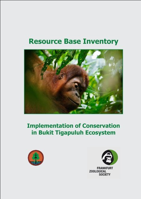
Resource Base Inventory<br />
Implementation of Conservation<br />
in <strong>Bukit</strong> <strong>Tigapuluh</strong> Ecosystem
Resource Base Inventory<br />
Implementation of Conservation in <strong>Bukit</strong> <strong>Tigapuluh</strong> Ecosystem<br />
February 2009<br />
In collaboration between:<br />
<strong>Bukit</strong> <strong>Tigapuluh</strong> National Park dan<br />
Frankfurt Zoological Society<br />
Editors: Arnold Sitompul and Dr. Peter Pratje<br />
Contributors: Ibram Eddy Chandra, Hisan Hasibuan, Johny Santoso,<br />
Fazriyas<br />
Maps and GIS: Hisan Hasibuan<br />
Photo credits: Arnold Sitompul (p: 65), Google (p: 11) , N. Guthier (p:<br />
Page cover, 47, 89, 97, 101) , Peter Pratje (p: 1), Perry van Duijnhoven (p:<br />
57, ), WorldBank/Oka Budhi (p: 29), WorldBank/Curt Carnemark (p: 77).
The Resource Base Inventory Document has been<br />
developed through participatory planning process<br />
and support from Directorate General Forest Protection<br />
and Nature Conservation, <strong>Bukit</strong> <strong>Tigapuluh</strong><br />
National Park<br />
Funding for the planning process and developing<br />
Resource Base Inventory is provide by the Federal<br />
Ministry and Economic Cooperation and Development<br />
Technical support for the planning process and<br />
developing Resource Base Inventory is provided by<br />
the Frankfurt Zoological Society
TABLE OF CONTENT<br />
TABLE OF CONTENTS....................................................................................................... i<br />
TABLES ............................................................................................................................. v<br />
FIGURES ......................................................................................................................... vii<br />
APPENDIX ........................................................................................................................ ix<br />
ACRONYMS ...................................................................................................................... x<br />
1. GENERAL DESCRIPTION OF BUKIT TIGAPULUH NATIONAL PARK...................... 3<br />
1.1. Area Profile and Management ............................................................................... 3<br />
1.2. History of the Establishment of the BTNP............................................................. 4<br />
1.3. Basis for Area Protection ....................................................................................... 6<br />
1.4. Zonation within the BTNP...................................................................................... 7<br />
1.5. Traditional Community .......................................................................................... 8<br />
2. OBSERVATION OF THE PHYSICAL CONDITION AND THE ECOSYSTEM<br />
. OF THE AREA ........................................................................................................... 11<br />
2.1. Topography and Morphology of the Area..............................................................13<br />
2.2. Hydrology Area......................................................................................................14<br />
2.3. Climate..................................................................................................................17<br />
2.4. Land Cover............................................................................................................17<br />
2.4.1. Within the <strong>Bukit</strong> <strong>Tigapuluh</strong> National Park...................................................17<br />
2.4.1.1. Forest Vegetation Changes within the <strong>Bukit</strong> <strong>Tigapuluh</strong><br />
National Park................................................................................18<br />
2.4.1.2. Land Cover Changes in Settlement Concentration Areas<br />
within the Area..............................................................................18<br />
2.4.2. Around BTNP Area.....................................................................................23<br />
2.4.2.1. Inhu District Area..........................................................................23<br />
2.4.2.2. Inhil District Area...........................................................................25<br />
2.4.2.3. Tebo District Area..........................................................................26<br />
2.4.2.4. Tanjung Jabung Barat District Area .............................................26<br />
3. COMMUNITY PROFILE AT MAIN INTERACTION VILLAGE IN BUKIT<br />
TIGAPULUH ECOSYSTEM, RIAU AND JAMBI PROVINCES...................................31<br />
3.1. Demography .........................................................................................................31<br />
3.1.1. Population and Growth ..............................................................................31<br />
3.1.2. Characteristic of population based on gender............................................32<br />
3.1.3. Characteristic of population based on Age Groups....................................33<br />
i
3.2. Social-Economy and Culture.................................................................................33<br />
3.2.1. Source of Income.......................................................................................33<br />
3.2.2. Land Ownership/Use for Agriculture...........................................................35<br />
3.2.3. Average family income...............................................................................36<br />
3.2.4. Culture .......................................................................................................39<br />
3.3. Education .............................................................................................................39<br />
3.4. Health....................................................................................................................41<br />
3.5. Formal Institutions.................................................................................................43<br />
3.6. Community Perception concerning the Existence of the BTNP............................44<br />
4. SUB-VILLAGE COMMUNITY PROFILE WITHIN THE BUKIT TIGAPULUH<br />
NATIONAL PARK........................................................................................................49<br />
4.1. Demography..........................................................................................................49<br />
4.1.1. Population..................................................................................................49<br />
4.1.2. Characteristic of Population based on Gender...........................................49<br />
4.1.3. Characteristic of the population based on the age group...........................49<br />
4.2. Social-Economy and Culture ................................................................................51<br />
4.2.1. Source of Income.......................................................................................51<br />
4.2.2. Land ownership/Utilisation of forest land for agriculture............................51<br />
4.2.3. Average family income, expenditure and savings.....................................52<br />
4.2.4. Culture .......................................................................................................52<br />
4.3. Education .............................................................................................................53<br />
4.4. Health....................................................................................................................54<br />
4.5. Formal Institutions.................................................................................................54<br />
4.6. Community Perception concerning the Existence of the BTNP Area ...................55<br />
5. BIODIVERSITY.............................................................................................................59<br />
5.1. F l o r a..................................................................................................................59<br />
5.2. F a u n a................................................................................................................60<br />
5.2.1 Mammals.....................................................................................................60<br />
5.2.2 Aves.............................................................................................................60<br />
5.2.3 Pisces..........................................................................................................60<br />
5.2.4 Primates......................................................................................................60<br />
5.3. Etnobotany............................................................................................................62<br />
ii
6. KEY SPECIES AND THEIR DISTRIBUTION IN BTNP................................................65<br />
6.1. The Sumatran Tiger (Panthera tigris sumatrae) ...................................................65<br />
6.1.2. Present Condition......................................................................................65<br />
6.1.3. Distribution................................................................................................65<br />
6.1.4. Strategy and <strong>Action</strong> Plan for the Conservation of the Sumatran Tiger<br />
in BTNP....................................................................................................66<br />
6.1.5. Success Indicators....................................................................................67<br />
6.2. Sumatran Elephant (Elephas maximus sumatranus)............................................67<br />
6.2.1. Present Condition.......................................................................................67<br />
6.2.2. Distribution.................................................................................................68<br />
6.2.3. Strategy and <strong>Action</strong> Plan for the Conservation of the Sumatran<br />
Elephant in BTNP.....................................................................................68<br />
6.2.4. Success Indicators.....................................................................................68<br />
6.3. The Sumatran Orangutan (Pongo abelli)..............................................................69<br />
6.3.1. The Present Condition ..............................................................................70<br />
6.3.2. Distribution................................................................................................70<br />
6.3.3. Strategy and <strong>Action</strong> Plan for the Conservation of the Sumatran<br />
Orangutan in BTNP .................................................................................70<br />
6.4. Malayan Tapir (Tapirus indicus).............................................................................72<br />
6.4.1. Present Condition......................................................................................72<br />
6.4.2. Distribution................................................................................................72<br />
6.4.3. Strategy and <strong>Action</strong> Plan for the Conservation of the Malayan Tapir<br />
in BTNP....................................................................................................72<br />
7. THREATS AND DISTURBANCES TO THE BUKIT TIGAPULUH ECOSYSTEM.......77<br />
7.1. The Construction of the South Corridor Road.......................................................77<br />
7.2. Forest Conversion for Plantations and the Exploitation of Natural Mineral<br />
Resources .........................................................................................................77<br />
7.3. Shifting Cultivation ...............................................................................................78<br />
7.4. Illegal logging and Illegal Burning of Land and Forests .......................................78<br />
7.5. Forest Fires...........................................................................................................78<br />
7.5.1. Forest Fire Prevention Management Project (JICA-PHKA<br />
Cooperation Program)..............................................................................79<br />
7.6. Poaching ..............................................................................................................80<br />
7.7. Human-Wildlife Conflicts.......................................................................................82<br />
7.8. Land Use Change around BTNP..........................................................................83<br />
iii
8. CONSERVATION DEVELOPMENT OF BUKIT TIGAPULUH....................................93<br />
8.1. Basis for Conservation Area Management............................................................87<br />
8.2. Agenda for the Conservation of <strong>Bukit</strong> <strong>Tigapuluh</strong> National Park and the<br />
Surrounding Area.................................................................................................87<br />
8.2.1. National Park Management Plan (1997 – 2021).......................................87<br />
8.2.2. Rationalization of BTNP ...........................................................................88<br />
8.2.3. <strong>Bukit</strong> <strong>Tigapuluh</strong> and <strong>Bukit</strong> Batabuh Wildlife Corridors (West Corridor)......90<br />
8.2.4. Strategy and <strong>Action</strong> Plan for BTNP and Buffer Zone Integrated Natural<br />
Resource Management ...........................................................................90<br />
9. SUMMARY & CLOSING REMARKS...........................................................................93<br />
10. APPENDIX.................................................................................................................. 95<br />
iv
Tables<br />
Table 1. Distribution of the <strong>Bukit</strong> <strong>Tigapuluh</strong> National Park area in terms of districts<br />
in the provinces of Riau and Jambi...................................................................... 3<br />
Tabel 2. Size and border length of the BTNP based on resort area management.............. 4<br />
Table 3. Zonation in the <strong>Bukit</strong> Tiga Puluh National Park..................................................... 7<br />
Table 4. Mountains in the BTNP....................................................................................... 15<br />
Table 5. List of Rivers around the BTNP........................................................................... 16<br />
Table 6. Watershed Characteristic around the BTNP....................................................... 17<br />
Table 7. Changes in forest and non-forest vegetation in BTNP........................................ 18<br />
Table 8. Land cover changes along the Gansal river (500 m buffer) in the<br />
period 2002-2006............................................................................................... 19<br />
Table 9. Size of open-land (non-forest) in desa Sanglap................................................. 21<br />
Table 10. Forest opening data for community agricultural activities at<br />
Tanah Datar village........................................................................................... 25<br />
Table 11. Size of land utilisation area at Pengabuan watershed....................................... 27<br />
Table 12. Population in the respective Main Interaction Villages 2006............................. 31<br />
Table 13. Average land owned per family at MIV Riau Province in 2002. ........................ 36<br />
Table 14. Agricultural Land Utilisation by families in MIV in Inhu District in 2006............. 37<br />
Table 15. Educational Facilities in MIV Inhu and Inhil district in 2006............................... 40<br />
Table 16. Health Facilities in MIV in Inhu and Inhil district in 2006 .................................. 41<br />
Table 17. The clarity of the BTNP boundary to the community in MIV in Jambi<br />
Province in 2006............................................................................................. 45<br />
Table 18. Sub-village and settlement within Desa Rantau Langsat located in BTNP...... 49<br />
Table 19. Population and number of families in each sub-village and pusat<br />
sub-village within the BTNP area in 2006......................................................... 50<br />
Table 20. Average land ownership per family at sub-village centre in BTNP area in<br />
2007.................................................................................................................. 52<br />
Table 21. Characteristic of the Culture of the Community in the Sub-village Centres in<br />
BTNP Area in 2007........................................................................................... 54<br />
Table 22. Educational Level of Head of Families in the Sub-Village Centre in the<br />
BTNP area in 2007........................................................................................... 55<br />
Table 23. List of primates in <strong>Bukit</strong> <strong>Tigapuluh</strong> National Parlk............................................. 61<br />
Table 24. List of mammals species (excluding Primates) found in the BTNP and its<br />
buffer zone........................................................................................................ 61<br />
Table 25. Threats to Orangutan in Indonesia.................................................................... 71<br />
Table 26. Recapitulation of Forest and Land Fires in 2008.............................................. 79<br />
v
Table 27. Data on the Poaching of the Sumatran Tiger in BTNP...................................... 82<br />
Table 28. Human-Sumatran Tiger Conflict around BTNP.................................................. 82<br />
Table 29. Several human-elephant conflicts in 2007........................................................ 83<br />
Table 30. Size of Rationalization Area from areas of former companies as proposed<br />
by KKI-Warsi..................................................................................................... 89<br />
vi
Figures<br />
Figure 1. Map of resort work area of the BTNP agency......................................................5<br />
Figure 2. Map of the proposed conservation plan for <strong>Bukit</strong> <strong>Tigapuluh</strong> based<br />
on the national conservation planning document for Indonesia by<br />
UNDP/FAO of 1982 ...........................................................................................6<br />
Figure 3. Zonation of the BTNP.........................................................................................8<br />
Figure 4. Topography map of the BTNP and surrounding area........................................13<br />
Figure 5. The hydrological map of the BTNP...................................................................15<br />
Figure 6. Forest cover change in the BTNP in the year 1996..........................................19<br />
Figure 7. Forest cover change in the BTNP in the year 2002...........................................20<br />
Figure 8. Forest cover change in the BTNP area in the year 2007...................................20<br />
Figure 9. Land cover changes along the Gangsal river (500 m buffer) in the<br />
period 2002-2006............................................................................................21<br />
Figure 10. Land cover analysis along the Gansal river in 2002 (500 meter buffer)..........22<br />
Figure 11. Land cover analysis along the Gansal river in 2006 (500 meter buffer)...........22<br />
Figure 12. Changes to the forest cover at Sanglap village which is included in<br />
the BTNP area in the period 1996-2007.........................................................23<br />
Figure 13. Opening of land in 2002 at Tanah Datar sub-village within <strong>Bukit</strong><br />
<strong>Tigapuluh</strong> National Park.................................................................................24<br />
Figure 14. Opening of land in 2007 at Tanah Datar sub-village within <strong>Bukit</strong> <strong>Tigapuluh</strong><br />
National Park area..........................................................................................24<br />
Figure 15. Course of Riau spatial plan around BTNP; Source: Balai BTNP, 2008...........25<br />
Figure 16. Population at Main Interaction Villages in Riau and Jambi provinces<br />
in 2002 and 2006............................................................................................32<br />
Figure 17. Number of indigenous and non-indigenous families at Main Interaction<br />
Villages in Riau province in 2002...................................................................33<br />
Figure 18. Characteristic of population based on gender in Main Interaction<br />
Villages in Riau and Jambi provinces in 2006................................................34<br />
Figure 19. Characteristic of population based on age group at DIU in Riau province<br />
in 2002 and in Jambi province in 2006...........................................................34<br />
Figure 20. Percentage domination of the main source of the total income of families in<br />
MIV, Inhu district, Riau province, in 2006.......................................................35<br />
Figure 21. Percentage of the domination of total family main income source in MIV Jambi<br />
province in 2006.............................................................................................37<br />
Figure 22. Percentage domination of the source of side income of total families in<br />
MIV Jambi province in 2002 and 2006...........................................................38<br />
Figure 23. Average size of land owned by families in MIV in Jambi province in 2006......38<br />
vii
Figure 25. Average annual family income in MIV Jambi province in 2002 and 2006........40<br />
Figure 26. Percentage of social organisations in MIV in Jambi Province in 2006............42<br />
Figure 27. Formal education level of inhabitants in MIV in Jambi Province in 2006.........42<br />
Figure 28. Percentage of visits by the community in MIV, Jambi Province,<br />
to places for medical treatment in 2006...........................................................43<br />
Figure 29. Source of clean water for the community in MIV in Jambi Province................44<br />
Figure 30. Community knowledge in MIV in Jambi Province concerning the<br />
existence of the BTNP.....................................................................................45<br />
Figure 31. Characteristic of population based on gender in the centre of sub-villages (subvillage)<br />
in BTNP area in 2008..........................................................................50<br />
Figure 32. Population Characteristic based on age group in the sub-village centre in<br />
TNBT area in 2007..........................................................................................51<br />
Figure 33. Average annual family income, expenditure and savings in sub-village<br />
centre in BTNP area in 2007...........................................................................53<br />
Figure 34. Distribution of the Sumatran Tiger in the <strong>Bukit</strong> <strong>Tigapuluh</strong> Ecosystem area.....66<br />
Figure 35. Distribution of the Sumatran Elephant in the <strong>Bukit</strong> <strong>Tigapuluh</strong> Ecosystem.......69<br />
Figure 36. The Orangutan distributions in the <strong>Bukit</strong> <strong>Tigapuluh</strong> Ecosystem......................71<br />
Figure 37. Malayan Tapir distributions in the <strong>Bukit</strong> <strong>Tigapuluh</strong> Ecosystem........................73<br />
Figure 38. Hotspots within the <strong>Bukit</strong> <strong>Tigapuluh</strong> ecosystem in 2006..................................80<br />
Figure 39. Hotspots within the <strong>Bukit</strong> <strong>Tigapuluh</strong> ecosystem in 2007..................................81<br />
Figure 40. Hotspots within the <strong>Bukit</strong> <strong>Tigapuluh</strong> ecosystem in 2008..................................81<br />
Figure 41. Spatial Situation around <strong>Bukit</strong> <strong>Tigapuluh</strong> National Park.................................84<br />
viii
APPENDIX<br />
Appendix 1: Reference.....................................................................................................97<br />
Appendix 2: List of plants species in <strong>Bukit</strong> <strong>Tigapuluh</strong> National Park...............................101<br />
Appendix 3: List of traditional plants medicine used by local tribe of Talang Mamak<br />
in <strong>Bukit</strong> <strong>Tigapuluh</strong> National Park.................................................................105<br />
Appendix 4: List of mushrooms used by local tribe of Talang Mamak in <strong>Bukit</strong><br />
<strong>Tigapuluh</strong> National Park.............................................................................109<br />
Appendix 5: List of traditional plant medicine used by local tribe of Melayu Tua at<br />
<strong>Bukit</strong> <strong>Tigapuluh</strong> National Park....................................................................110<br />
Appendix 6: List of mammals in <strong>Bukit</strong> <strong>Tigapuluh</strong> National Park and surrounding area...116<br />
Appendix 7: List of birds found in <strong>Bukit</strong> <strong>Tigapuluh</strong> National Park....................................119<br />
Appendix 8: List of birds found in rationalisation area of <strong>Bukit</strong> <strong>Tigapuluh</strong> National<br />
Park............................................................................................................123<br />
Appendix 9. List of fish found in <strong>Bukit</strong> <strong>Tigapuluh</strong> National Park and surrounding<br />
areas...........................................................................................................132<br />
ix
ACRONYMS<br />
APL<br />
APP<br />
BMG<br />
CITES<br />
DAS<br />
DHE<br />
FZS<br />
HCVF<br />
HL<br />
HPH<br />
HPT<br />
HTI<br />
IBSAP<br />
IFA<br />
INHI<br />
INHU<br />
IUCN<br />
IUPHHK<br />
IUPHHK-HT<br />
KKI-WARSI<br />
LANDSAT TM<br />
LIPI<br />
MENHUT<br />
NORINDRA<br />
PHKA<br />
PKHS<br />
RAPP<br />
RAU<br />
RePPPROT<br />
RTRW<br />
SDA<br />
SK<br />
SPTN<br />
SWS<br />
: Area for other purposes (non forestry area)<br />
: Asian Pulp and Paper<br />
: Meteorology and Geophysics Agency<br />
: Convention on International Trade of Endangered Species of Fauna<br />
and Flora<br />
: Watershed Area<br />
: Dalek Hutani Esa<br />
: Frankfurt Zoological Society<br />
: High Conservation Value Forest<br />
: Protected Forest<br />
: Forest Logging Concession<br />
: Limited Production Forest<br />
: Industrial Forest Plantation<br />
: Indonesian Biodiversity Strategy and <strong>Action</strong> Plan<br />
: Indonesie Forest et Asiatique<br />
: Indragiri Hilir<br />
: Indragiri Hulu<br />
: International Union for Conservation of Nature<br />
: Timber Forest Product Utilisation Licence<br />
: Timber Forest Product Utilisation Licence-Plantation<br />
: Komunitas Konservasi Indonesia WARSI<br />
: Land Satellite Thematic Mapper<br />
: Indonesian Science Institute<br />
: Ministry of Forestry<br />
: Norwegian Indonesian for Resources Management Project<br />
: Forest Protection and Nature Conservation<br />
: Sumatran Tiger Conservation Program<br />
: Riau Andalan Pulp and Paper<br />
: Regunas Agri Utama<br />
: Regional Planning Program for Transmigration<br />
: Landuse Planning<br />
: Natural Resources<br />
: Letter of Decree<br />
: National Park Management Section<br />
: Seberida Wana Sejahtera<br />
x
TANJABAR<br />
TGHK<br />
BTNP<br />
UPT<br />
WKS<br />
WPU<br />
WWF<br />
ZSL<br />
: Tanjung Jabung Barat<br />
: Tata Guna Hutan Kesapakatan/Forest Used Agreement<br />
: <strong>Bukit</strong> <strong>Tigapuluh</strong> National Park<br />
: Technical Executing Unit<br />
: Wira Karya Sakti<br />
: Wildlife Protection Unit<br />
: World Wildlife Fund<br />
: Zoological Society of London<br />
xi
GENERAL DESCRIPTION OF<br />
BUKIT TIGAPULUH NATIONAL PARK<br />
1
1. General Description of <strong>Bukit</strong> <strong>Tigapuluh</strong> National Park<br />
1. GENERAL DESCRIPTION OF BUKIT TIGAPULUH<br />
NATIONAL PARK<br />
1.1. Area Profile and Management<br />
The <strong>Bukit</strong> <strong>Tigapuluh</strong> National Park (BTNP) is a nature conservation area which is situated<br />
between 0 o 40’ – 1 o 25’ South Latitude and 102 o 30’ – 102 o 50’ East Longitude with an area<br />
of 144,223 ha. This area is administratively located in two provinces, namely in the districts<br />
of Indragiri Hulu and Indragiri Hilir in Riau province and the districts of Tanjung Jabung<br />
Barat and Tebo (Sinaga, 1999) in Jambi province. More than 77% of its area is in Riau<br />
province (Table 1). The total length of the BTNP boundary is approximately 330.76 km of<br />
which approximately 197.0 km is within Riau province and approximately 83 km in Jambi<br />
province (Balai BTNP, 2007; KKI-WARSI, 2007). BTNP is the first conservation area that<br />
was designated by changing the land use function of the active Forest Concession License<br />
(HPH) and protection forest area, which therefore accounted for the lengthy process of<br />
discussions in the process of its establishment and especially in determining the size of the<br />
area (KKI – WARSI, 2007).<br />
Table 1. Distribution of the <strong>Bukit</strong> <strong>Tigapuluh</strong> National Park area in terms of<br />
districts in the provinces of Riau and Jambi.<br />
Province District Size (Ha) Proportion (%)<br />
RIAU<br />
JAMBI<br />
Indragiri Hulu (Inhu) 81.223 58.4<br />
Indragiri Hilir (Inhi) 30.000 20.8<br />
Tebo 23.000 15.9<br />
Tanjung Jabung Barat (Tanjabar) 10.000 6.9<br />
Source: Balai BTNP, 2007.<br />
The objective of designating the <strong>Bukit</strong> <strong>Tigapuluh</strong> National Park is to protect the ecological<br />
process which supports life, preserves the flora and fauna and the existing ecosystem in<br />
the national park area and supports the development of science, education, research,<br />
cultivation and tourism in order to utilise natural resources in a sustainable manner (Sinaga<br />
1999). As a whole, the borders of BTNP are as follows:<br />
1. North (Riau) : adjacent to several villages, namely : Rantau Langsat, Sungai Akar,<br />
Talang Langkat, Siambul and Usul Villages.<br />
2. East (Riau-Jambi) : adjacent to production forest and several villages, namely:<br />
Keritang, Batu Ampar, Selensen, Suban, Labuhan Dagang, Merlung and Kampung<br />
Baru Villages.<br />
3. South (Jambi) : adjacent to production forest and several villages, namely: Kemayuhan,<br />
Sipang, Alim, Batu Papan, Punti Anai, Aur Cina and Pejangki.<br />
The national park is not bounded by local administrative boundaries and it is under the<br />
management authority of the Ministry of Forestry through the Directorate General for<br />
Forest Protection and Nature Conservation (PHKA) with the National Park Agency as the<br />
Technical Implementation Unit (TIU) on the local level. The BTNP was established as the<br />
Technical Implementation Unit (TIU) of the Ministry of Forestry in 1997 with full authority and<br />
responsibility for the protection and management of the BTNP area. In performing this task,<br />
the BTNP agency has a Vision and Mission for management as described in the Strategic<br />
3
Resource Base Inventory:<br />
Implementation of Conservation in <strong>Bukit</strong> <strong>Tigapuluh</strong> Ecosystem<br />
Management Plan (Renstra) as a broad outline of the course for the management of BTNP,<br />
namely “To secure the natural resources and ecosystem of the BTNP, which is managed<br />
in a stable manner and utilised sustainably with strong institutional and partnership support<br />
(Balai BTNP, 2007). It has been outlined in the Strategic Management Plan of BTNP that<br />
to achieve this vision the mission that will be carried out is as follows:<br />
1. Promote the effective management of the BTNP.<br />
2. Promote the preservation of plant and wildlife species and their ecosystem in the<br />
BTNP.<br />
3. Promote the protection of forests, the mitigation of forest fires and law enforcement.<br />
4. Promote the utilisation of tourist resorts, natural tourist attractions and develop nature<br />
lovers groups for communities the BTNP area.<br />
5. Promote the utilisation of wild plants in the BTNP area.<br />
6. Promote the quality and quantity of human resources, facilities and infrastructure.<br />
7. Promote the participation of the community and parties concerned in partnership<br />
management of the BTNP.<br />
For the sake of management, the BTNP agency is divided into 2 (two) National Park<br />
Management Sections (NPMS) namely NPMS Region I Jambi and NPMS Region II<br />
Seberida with six resorts as the smallest management unit area, namely Siambul, Talang<br />
Lakat, Lahai, Keritang, Suo-Suo, and Lubuk Mandarsah resorts (Balai BTNP, 2007; Figure<br />
1, Table 2).<br />
1.2. History of the Establishment of the BTNP<br />
The <strong>Bukit</strong> <strong>Tigapuluh</strong> National Park was officially established in 1995 through a decree of the<br />
Minister of Forestry and was a combination of Protection Forests (PF) in the provinces of<br />
Riau and Jambi and the conversion of a part of the Limited Production Forests (LPF) in Riau<br />
(Minister of Forestry’s Decree No. 539/Kpts-II/1995). The designation and enactment of<br />
the BTNP area to become a national park was actually made after the following process:<br />
• It started with the National Conservation Plan in 1982 which recognized the importance<br />
and the high value of the <strong>Bukit</strong> <strong>Tigapuluh</strong> Ecosystem area. In this plan, it was proposed<br />
that the <strong>Bukit</strong> <strong>Tigapuluh</strong> area would become the <strong>Bukit</strong> Besar Wildlife Sanctuary (200.000<br />
Ha) and the Seberida Nature Sanctuary (120.000 Ha; Figure 2).<br />
Tabel 2. Size and border length of the BTNP based on resort area management<br />
Section Resort Size (Ha) Border Length (Km)<br />
Lubuk madrasah 14.168 64<br />
I Suo-suo 18.832 57<br />
Total 33.000 121<br />
Lahai 34.365 46<br />
Siambul 38.417 38<br />
II Talang Lakat 12.370 28<br />
Keritang 26.071 35<br />
Total 111.223 147<br />
Source: Balai BTNP, 2008<br />
4
1. General Description of <strong>Bukit</strong> <strong>Tigapuluh</strong> National Park<br />
Figure 1. Map of resort work area of the BTNP agency<br />
• In the same year, based on the Forest Land Use Consensus Plan (TGHK), this area<br />
was enacted as a 70,250 hectare protection area in the provinces of Riau and Jambi.<br />
This size was much smaller than that in the national conservation plan.<br />
• In 1988, the Ministry of Transmigration, using the Regional Planning Program for<br />
Transmigration (RePPPROT) as an instrument, classified the <strong>Bukit</strong> <strong>Tigapuluh</strong> ecosystem<br />
as a 250,000 hectare protection area.<br />
• In a letter from the Minister of Forestry, Ref. No. 1289/Menhut-IV/94, addressed to<br />
World Bank, it was stated that there was a plan to sanction <strong>Bukit</strong> <strong>Tigapuluh</strong> to become<br />
a National Park with an area of 250,000 hectares (almost in accordance with the 1988<br />
RePPProt recommendation).<br />
• A team of researchers from Norway and Indonesia under NORINDRA (Norwegian<br />
Indonesian for Resources Management Project) recommended the area to become a<br />
National Park with an area of 250,000 hectares.<br />
• In 1995, this area was designated as a national park based on the Minister of Forestry’s<br />
decree No. 539/Kpts-II/1995 dated 5 October 1995 with an area of 127,698 Ha consisting<br />
of 94,698 ha from the conversion of the Haposipin protection forest (HL) and the Luas<br />
Limited Production Forest (HPT) in Riau province and 33,000 ha from the Sengkati<br />
Batanghari protection forest (HL) in Jambi province.<br />
• The status of the area as a national park was further strengthened by a decree of the<br />
Minister of Forestry No. 6407/Kpts-II/2002 dated 21 June 2002 with an “entire perimeter<br />
connected” (“temu gelang”) size of 144,223 ha.<br />
5
Resource Base Inventory:<br />
Implementation of Conservation in <strong>Bukit</strong> <strong>Tigapuluh</strong> Ecosystem<br />
1.3. Basis for Area Protection<br />
Three main aspects form the basis for the protection of the <strong>Bukit</strong> <strong>Tigapuluh</strong> area, namely the<br />
physical and biological aspects of the area and the socio-cultural aspect of the community<br />
(BBTNP, 2007).<br />
The physical condition (topography) of BTNP and the surrounding area is generally steep<br />
with an average slope of above 40% (18 o ). This area is also the water catchment area of<br />
4 (four) main watershed areas, namely the Batanghari and Pengabuan watershed areas<br />
in Jambi province and the Reteh and Indragiri watershed areas in Riau province (Basuni,<br />
et.al., 1995). This area was recommended to remain as a forest area/protection area<br />
in accordance with Presidential Decree No. 32 of 1990 concerning the management of<br />
protection areas (KKI-WARSI, 2007).<br />
The BTNP area represents a lowland tropical rainforest ecosystem of an extraordinary<br />
value and conservation function with a high rate of biological diversity and the source of<br />
potential germ plasm (Haryono, 2006). This ecosystem is capable of providing sustainable<br />
environmental services such as water, clean air and natural beauty (BBTNP, 2007). This<br />
area is also an integrated ecosystem with the surrounding area which becomes the habitat<br />
of flora and important wildlife species that are endemic in Sumatra including wildlife species<br />
that are threatened by extinction in Sumatra such as the Sumatran tiger, the Sumatran<br />
elephant, the Sumatran orangutan and the Tapir (BBTNP, 2007). These wildlife species<br />
play a very important role in maintaining the balance of the ecosystem.<br />
The BTNP area is also the home and source of livelihood of three traditional community<br />
groups, namely the Talang Mamak, Melayu Tua and Anak Dalam ethnic groups that for<br />
Figure 2. Map of the proposed conservation plan for <strong>Bukit</strong> <strong>Tigapuluh</strong> based<br />
on the national conservation planning document for Indonesia by UNDP/<br />
FAO of 1982<br />
6
1. General Description of <strong>Bukit</strong> <strong>Tigapuluh</strong> National Park<br />
generations have interacted and lived within the national park (BBTNP, 2007). In addition<br />
to the utilisation by the traditional communities, the BTNP and the surrounding forest<br />
areas are also utilised by communities around the BTNP especially for Non Timber Forest<br />
Products (NTFP) such as jernang, raton, honey, petai, medicinal plants and other NTFPs<br />
(KKI-WARSI, 2007).<br />
1.4. Zonation within the BTNP<br />
The objective of dividing the national park into zones is to regulate the area in accordance<br />
with the interest of its management and utilisation (PHKA, 2002). The zonation of the<br />
BTNP according to its criteria is based on the Decision of the Director General for the<br />
Protection and Conservation of Nature No. 17/Kpts/12J-V/2001 (Figure. 3), which divides<br />
the park into 5 zones and an enclave area 1 (Table 3). Through the division of zones it is<br />
known that around 82% of the BTNP forest area belongs to the core zone and the forest<br />
zone which are important zones to be protected in their original condition.<br />
The demarcation of the BTNP area boundary was done by the Pekanbaru and Jambi<br />
Sub Agency for the Inventarisation and Mapping of Forests (Sub Balai Inventarisasi and<br />
Perpetaan Hutan) in 1995 and 1996. The boundary of this national park is the boundary<br />
of the Haposipin protection area and that of the Sengkati Batanghari protection forest area<br />
which have made an entire round at the provincial boundary. As a result of the boundary<br />
demarcation it is known that the length of the BTNP boundary is 330.67 km and the size<br />
of the area after the boundary demarcation becomes 143,143 ha. The enactment of the<br />
zonation of BTNP was awaiting the resubmission of the proposal after it was ascertained<br />
on 21 June 2002 that the BTNP had a size of 144,223 ha. The existing extent of zonation<br />
is no longer relevant to the situation in the field and the current total area.<br />
It is still not possible to carry out the enclave plan for Desa Sanglap because there is no<br />
agreement with the community concerning the village boundary and no clarity about the<br />
Table 3. Zonation in the <strong>Bukit</strong> Tiga Puluh National Park<br />
Work Area<br />
Proposed<br />
Size (Ha)<br />
Definitive<br />
Remarks<br />
Core Zone 72.503 60.000 The potential enclave<br />
Forest Zone 48.900 45.958<br />
area is<br />
Desa Sanglap<br />
Intensive Utilisation Zone 2.300 2.300<br />
located (southwest)<br />
Traditional Utilisation Zone 9.690 9.690 within the BTNP<br />
Rehabilitation Zone 8.700 8.700<br />
area.<br />
Enclave*area 1.050 1.050<br />
TOTAL 143.143** 127.698***<br />
Notes:<br />
*) The size of the enclave area has not been endorsed with a decree of the Director General<br />
for Forest Protection and Nature Conservation (PHKA)<br />
**) The size after an entire round is in accordance with boundary demarcation<br />
***) The decree of the Director General of PKA No. 17/Kpts/DJ-V/2001 dated 6 February 2001<br />
is in accordance with the BTNP designation decree of 1995.<br />
1 Enclave: an area within a conservation area that has been excluded from the conservation<br />
area to limit and accommodate the activities/interests of the community within the area which is still<br />
a part of the overall management of the area.<br />
7
Resource Base Inventory:<br />
Implementation of Conservation in <strong>Bukit</strong> <strong>Tigapuluh</strong> Ecosystem<br />
Figure 3. Zonation of the BTNP<br />
Source: Balai BTNP<br />
BTNP boundary. In the proposal for the rationalisation of the BTNP and the management<br />
policy of the BTNP agency (BBTNP), there is a tendency to exclude this village from the<br />
BTNP area.<br />
There are no physical marks of boundaries between zones within the area in the field. In<br />
several parts, for example the traditional utilisation zone 2 , the zone boundary is no longer<br />
relevant to the situation and condition in the field (BBTNP, 2006). The result of a field survey<br />
conducted by a team from the BTNP agency indicates that shifting cultivation practices by<br />
the community within the area has expanded beyond the designated zone (BBTNP 2006).<br />
Meanwhile, the road used by the former forest concessionaire (HPH) in the area which is a<br />
part of the rehabilitation zone has been covered with vegetation and is no longer a cleared<br />
area. The BTNP agency continues to monitor the condition of zonation to find out about the<br />
land cover and land use condition and the potential of the area relating to the redesigning<br />
of the existing zones.<br />
1.5. Traditional Community<br />
The traditional community living within the area belong to the Talang Mamak, Melayu Tua<br />
and Anak Dalam (Rimba) ethnic groups. In 2004, there were eight Talang Mamak and<br />
Melayu Tua traditional community settlement villages/centres occupied by approximately<br />
345 families within the area in Riau province. Meanwhile, the Anak Dalam ethnic group<br />
2 Area/zone that can be utilized by the indigenous communities who are permanent<br />
residents in BTNP area to support their livelihood on condition that they use traditional methods<br />
(without machinery).<br />
8
1. General Description of <strong>Bukit</strong> <strong>Tigapuluh</strong> National Park<br />
always shift from place to place in groups. The activities of the traditional community living<br />
within the BTNP area include :<br />
• the construction of housing facilities using materials from the BTNP for their own use;<br />
• the clearing of land for hard crops like rubber, nutmeg and crops of the same season<br />
like rice, corn, etc. using the slash and burn and the shifting planting pattern;<br />
• the collection of forest products such as rattan, jernang, damar resin, jelutung, honey,<br />
pandanus, bamboo etc. for trade; and<br />
• the hunting of wildlife by using traditional weapons.<br />
• In general the concentration of settlement and agricultural fields are located along the<br />
river. However, some are also found on the peaks of mountains and on slopes.<br />
9
OBSERVATION OF THE PHYSICAL CONDITION<br />
AND THE ECOSYSTEM OF THE AREA<br />
11
2. Observation of The Physical Condition and The Ecosystem of The Area<br />
2. OBSERVATION OF THE PHYSICAL CONDITION AND<br />
THE ECOSYSTEM OF THE AREA<br />
2.1. Topography and Morphology of the Area<br />
The topography of the BTNP area is generally steep mountain area (Table 4; Figure 4) with<br />
an altitude of ranging from 60 meters to 843 meters above sea level. Geographically, the<br />
topography of this area can be divided into three parts (Wahyunto, 1990 dalam Basuni.<br />
et.al, 1997), namely :<br />
a. Mountains with rather steep to very steep slopes (25 – 75 %)<br />
b. Mountains with very steep slopes (>75 %)<br />
c. Flat land between mountains and small hills (>16 %)<br />
Figure 4. Topography map of the BTNP and surrounding area: Source:<br />
BTNP Agency<br />
Source: Balai BTNP<br />
According to a topography map from the Directorate of Topography of the Indonesian Army<br />
of 1992, the BTNP is divided into 3 types of slopes namely, (KKI-WARSI, 2007):<br />
a. Very Steep Slope (> 40 %)<br />
This type of slope dominates the entire <strong>Bukit</strong> <strong>Tigapuluh</strong> ecosystem. This land system<br />
includes the <strong>Bukit</strong> Pandan (BPD) and Telawi (TWI) land systems of >300 m asl and form<br />
the very steep, lengthy and mountainous spine. This mountainous group stretches till<br />
the outer side of the BTNP and includes a part of its buffer area.<br />
13
Resource Base Inventory:<br />
Implementation of Conservation in <strong>Bukit</strong> <strong>Tigapuluh</strong> Ecosystem<br />
b. Steep Slope (26 – 40 %)<br />
This type includes the Batang Anai (BGA) and Air Hitam systems which have an<br />
altitude of 51 – 300 m asl and form the long and very steep mountain spine, formed of<br />
metamorphic rock with mountainous topography. This type of mountain is found in the<br />
BTNP area from Riau province to the borders of Jambi province.<br />
c. Slight Slope (16 – 25 %)<br />
This type of slope covers a small part of the <strong>Bukit</strong> <strong>Tigapuluh</strong> ecosystem. This slope type<br />
includes the Sungai Aur land system (SAR). This land system is in a sedimentary area<br />
with small mountains 15 – 50 m asl. Most of this land system lies outside the BTNP.<br />
Only a small portion is within the BTNP, namely the Sanglap Valley.<br />
2.2. Hydrology Area<br />
Generally the BTNP influences several Watershed 3 and Sub-Watershed 4 areas namely:<br />
1. The Indragiri watershed which is divided in the sub-watersheds of Cenaku, Indragiri<br />
Hilir, Peranap, Umbilin, and Sinamar.<br />
2. The Reteh watershed which is divided in the sub-watersheds of Gansal Hulu and Reteh<br />
Hulu.<br />
3. The Pengabuan watershed which is divided in the sub-watershed of Tungkal,<br />
4. The Batang Hari watershed which is divided into the sub-watersheds of Tebo, Tembesi,<br />
Batanghari Hulu, Batanghari Hilir, Meragin and Tabir<br />
The main rivers in Riau are the Gansal and the Cinaku Rivers while those in Jambi are the<br />
Rivers Tungkal and Sumai (Table 5; Figure 5).<br />
All watershed areas in the BTNP and the surrounding (Table 6) areas are very much<br />
affected by the condition of the existing forest land cover. Water supply for communities<br />
in 4 districts (Tebo, Tanjabar, Indragiri Hulu and Hilir) will be disturbed if the forest area<br />
in the <strong>Bukit</strong> <strong>Tigapuluh</strong> Ecosystem is converted for other non-forestry uses. Therefore,<br />
development around the <strong>Bukit</strong> <strong>Tigapuluh</strong> Ecosystem must pay attention to the balance of<br />
the existing water use system. The value of the economic loss caused by forest destruction<br />
to the hydrological condition especially in the BTNP area has never been assessed in<br />
detail. This needs to be done immediately and socialized especially on the policy making<br />
level so that every new policy issued by the government will always take into consideration<br />
the hydrological conservation aspect along the watershed area.<br />
At the moment the latest condition of most watershed areas has not been known in detail.<br />
However, some data have indicated that the watershed areas around the BTNP area have<br />
experienced significant changes in their function to maintain a balance in the water use<br />
system with an increase in the flow rate and the size of the critical land in the upper and<br />
lower courses of the main rivers of these watershed areas (BPDAS Indragiri Rokan, 2007).<br />
According to Maryono (2005) the damage to the carrying capacity of watershed areas is<br />
3 Watershed is a certain land area which forms a single unit with a river and its tributaries<br />
that function to contain, retain and flow water originating from rainfall to the lake or river in a natural<br />
manner, wherein the land boundary is the topographic separator and the sea boundary reaches the<br />
waters that are still affected by land activities (UU No. 7 of 2004).<br />
4 Sub-Watershed is a part of the Watershed that receives rain water and flows it through the<br />
tributaries to the main river. Each watershed is divided into Sub-Watersheds (Permenhut No. 26<br />
Year 2006).<br />
14
2. Observation of The Physical Condition and The Ecosystem of The Area<br />
Table 4. Mountains in the BTNP<br />
No Mountain Altitude (m asl) Province<br />
1 Rapat 290 Riau<br />
2 Tebat 377 Riau<br />
3 Sangkar Puyuh 590 Riau<br />
4 Pendam 321 Riau<br />
5 Benuang 495 Riau<br />
6 <strong>Tigapuluh</strong> 414 Riau<br />
7 Kaput 618 Riau<br />
8 Hulu Sipin 843 Riau<br />
9 Cangga Embun 722 Riau<br />
10 Puputan Keling 520 Riau<br />
11 Lancang 425 Riau<br />
12 Pintu Tujuh 396 Riau<br />
13 Rinting 709 Jambi<br />
14 Hulu Ketalo 481 Jambi<br />
15 Janjang Kambing 497 Jambi<br />
16 Gunung Tiga Jerai 763 Jambi<br />
17 Lalang 536 Jambi<br />
Figure 5. The hydrological map of the BTNP<br />
15
Resource Base Inventory:<br />
Implementation of Conservation in <strong>Bukit</strong> <strong>Tigapuluh</strong> Ecosystem<br />
the dominant factor for the cause of drought and floods. The low water carrying capacity<br />
of watershed areas can be noticed by observing the diminishing of forest areas around the<br />
watershed areas, the abandonment of agricultural land, the expansion of settlements and<br />
physical infrastructure and the increase of critical land.<br />
Based on the analysis of the 1989 – 2007 satellite imagery maps, the Pengabuan watershed<br />
area (size: 402,235.3 hectares), whose landscape could be divided into a lower course<br />
area (swamp and peat), a central area (flat dry area) and an upper course area (mountain<br />
area), it was found the land use had changed drastically especially from nature forest and<br />
secondary forest to plantations or forest crops (Maryono, 2008).<br />
The size of the nature forest and the secondary forest in the Pengabuan watershed area<br />
was estimated to be 41.41% in 1989 and only 15.72% was left in 2007. Based on this<br />
decline, it was estimated that the destruction of forests had occurred at the rate of 52.82<br />
km 2 per year. It was further mentioned that the flow rate of the water had increased by<br />
11.62% to 2988.30 m 3 /second in 2007 compared to the condition in 1989 (2677.20 m 3 /<br />
second). If the tendency of the conversion of natural forests remains high, it is predicted<br />
that the peak of the flow rate in the sub-watershed of the upper course area of (Merlung<br />
Table 5. List of Rivers around the BTNP<br />
No River Length (meter) Province<br />
1 Gangsal 40.405 Riau & Jambi<br />
2 Akar 8.915 Riau<br />
3 Tualang N/A Riau<br />
4 Niul N/A Riau<br />
5 Bomban 6.952 Riau<br />
6 Pekon N/A Riau<br />
7 Nunusan 8.011 Riau<br />
8 Nibul N/A Riau<br />
9 Antan 7.337 Riau<br />
10 Cinaku N/A Riau<br />
11 Pejangki N/A Riau<br />
12 Alim 5.699 Riau<br />
13 Saelok 4.512 Riau<br />
14 Peketi N/A Riau<br />
15 Lebung N/A Riau<br />
16 Melonai 18.227 Riau<br />
17 Pancur 10.428 Riau<br />
18 Lemang 15.226 Riau<br />
19 Pekukuran N/A Riau<br />
20 Reteh 21.974 Jambi<br />
21 Ginal N/A Jambi<br />
22 Empating N/A Jambi<br />
23 Ketalo 6.747 Jambi<br />
24 Manggatal 6.283 Jambi<br />
25 Pasungean N/A Jambi<br />
Note : N/A = Data not available<br />
16
2. Observation of The Physical Condition and The Ecosystem of The Area<br />
subdistrict area) would reach 2,.991.30 m 3 /second in 2010 or 3,148.50 m 3 /second in 2015<br />
(Maryono, 2008). Such a high flow rate would be susceptible to floods, especially in the<br />
watershed catchment area.<br />
2.3. Climate<br />
Based on the 1991-1992 climate data obtained from the Rengat Riau Meteorology and<br />
Geophysics (BMG) monitoring station, the climate in the BTNP, according to Koppen,<br />
belongs to the wet climate type (AF) having the characteristics of tropical climate, average<br />
temperature in the coldest month being above 18 o C, hot all the year round and wet all the year<br />
round, with a monthly rainfall of above 60 mm. Meanwhile, according to the classification<br />
by Schmith-Ferguson, it belongs to the A climate type, having the characteristics of high<br />
rainfall (very wet), and tropical rainforest vegetation (Hernidiah, 1999). The average annual<br />
rainfall is 2,577 mm/year, the highest being in October (347 mm) and the lowest in July (83<br />
mm) with a relative humidity of between 50% and 90%. The weather in the BTNP is cool<br />
with a maximum monthly temperature of 33°C in the month of August and a minimum<br />
temperature of 20.8°C in the month of January.<br />
Table 6. Watershed Characteristic around the BTNP<br />
Watershed<br />
Pengabuan<br />
Size (Ha)<br />
402.235,5<br />
(Bagian hulu:<br />
151.489,1 Ha)<br />
Sub<br />
Watershed<br />
9<br />
Name<br />
S. Pengabuan/<br />
S. Tungkal<br />
Main River<br />
Length<br />
(Km)<br />
Flow rate<br />
th<br />
(m 3 /sec)<br />
182 2988,30<br />
Batanghari 5.917.800 Ha 6 S. Batanghari 500 2140<br />
Indragiri<br />
1.804.482 Ha<br />
(Bagian Hulu:<br />
190.411 Ha)<br />
5 S. Indragiri 350 377,86<br />
Reteh 525.035 Ha 2 S. Gansal 70,5 255,45<br />
Source: BPDAS Indragiri -Rokan, 2007; Maryono, 2008. BPDAS Batang Hari, 2007.<br />
2.4. Land Cover<br />
2.4.1. Within the <strong>Bukit</strong> <strong>Tigapuluh</strong> National Park<br />
Physiographically, the BTNP ecosystem is unique as it occupies a hilly area that is quite<br />
steep in the midst of the flat land on the east of Sumatra which is completely separate from<br />
the <strong>Bukit</strong> Barisan mountain cluster. Generally, based on the difference in the structure of<br />
the stand, its type composition and physiognomy, the BTNP ecosystem consists of four<br />
kinds of ecosystem, namely (Basuni, et.al, 1997):<br />
a. Primary Nature Forests (Hutan alam primer): tropical rain forests that are still in their<br />
natural condition undisturbed by logging. The dominant type in this sub-ecosystem<br />
generally originates from the Dipterocarpaceae family such as Meranti (Shorea sp.)<br />
including Shorea abovoidae and Shorea accuminate.<br />
17
Resource Base Inventory:<br />
Implementation of Conservation in <strong>Bukit</strong> <strong>Tigapuluh</strong> Ecosystem<br />
b. Cut-Over Nature Forest (Hutan alam bekas tebangan): logged forest area. In the subecosystem<br />
this is dominated by types originating from the Euphorbiaceace family such<br />
as Elatriospermum tapos and Baccaurea rasemosa.<br />
c. Underbrush (Semak belukar): area cleared for agriculture and left behind for agriculture<br />
in the nest period. This sub-ecosystem is generally dominated by the pioneer types<br />
such as Maccaranga gigantea and Maccaranga triloba.<br />
d. Rubber plantation (Kebun karet): area used by the community in the area for planting<br />
mainly rubber (Havea brasiliensis) that grows with other forest plants.<br />
2.4.1.1. Forest Vegetation Changes within the <strong>Bukit</strong> <strong>Tigapuluh</strong> National Park<br />
The analysis of the 1996 – 2007 satellite imagery map indicates that almost the whole<br />
of the BTNP territory consists of forests except for areas occupied by the concentration<br />
of settlements of traditional groups along the Gansal River 5 and Desa Sanglap 6 (Figure<br />
6). The size of forest vegetation within the BTNP area declined by approximately 6,603<br />
hectares from 137,620.03 hectares in 1996 to 141,976.19 hectares in 2007. In other<br />
words, the forest damage rate is 396 hectares per year, which is caused mostly by shifting<br />
cultivation practices (Table 7).<br />
Table 7. Changes in forest and non-forest vegetation in BTNP<br />
Year Forest (Ha) No-Forest (Ha)<br />
1996 141.976,19 2246,81<br />
2002 138.692,33 5530,67<br />
2006 137.886,22 6336,78<br />
2.4.1.2. Land Cover Changes in Settlement Concentration Areas within the Area<br />
Land cover along the Gangsal River<br />
The result of a land cover change analysis in the area along the Gansal River (500 m buffer;<br />
Figures 9,10,11), using the Geographic Information System indicates that there has been<br />
a significant clearance of forest land which might have been caused by shifting cultivation<br />
activities of the local community (Table 8).<br />
Based on the above table and Figure it is obvious that in the four year period (2002 – 2006)<br />
there was a change of approximately 17.6% in the forest land cover to open land and<br />
underbrush. It is also known that during this period the size of the open land had increased<br />
by approximately 52% which was probably caused by an increase in land opening activities<br />
by the community. A satellite imagery map analysis revealed that a large part of the area<br />
cleared in 2006 was land cover consisting of natural forest stand or thin or dense secondary<br />
forests.<br />
5 The main river cutting through the BTNP at the traditional community settlement and<br />
agriculture areas<br />
6 Desa Sanglap is the only definite village within BTNP where the community agriculture is<br />
more intensive.<br />
18
2. Observation of The Physical Condition and The Ecosystem of The Area<br />
Table 8. Land cover changes along the Gansal river (500 m buffer) in the<br />
period 2002-2006<br />
Landcover Class<br />
Size (Ha)<br />
2002 2006<br />
Average per year<br />
(Ha)<br />
Total Change (%)<br />
Lahan Terbuka 168,86 256,54 21,92 51,9<br />
Belukar Jarang 646,02 817,23 42,8 26,5<br />
Belukar Sedang 971,46 1.213,42 60,49 24,9<br />
Belukar Rapat 408,70 448,60 9,98 9,8<br />
Hutan 3.079,95 2.539,20 (-) 135,19 17,6<br />
Total 5.274,99 5.274,99<br />
Although the land opening along the Gangsal River was not as fast as the rate of land<br />
clearance in the BTNP buffer zone, the empowerment of the local community must be<br />
done immediately. This is to anticipate further land opening activities on an ongoing basis.<br />
If the opening of forest areas goes on at the same rate as that of 2002-2006, then in 10<br />
years time the BTNP area will lose approximately 1300 Ha of forest areas. Therefore,<br />
activities must be started immediately to guide the community in agricultural intensification<br />
and promote family planning to control the population growth.<br />
The Desa Sanglap Enclave Area<br />
The Desa Sanglap enclave is found in the northern part of BTNP. In this area, it was<br />
found that the agricultural activities of the community in a ten year period (1996 – 2007)<br />
Figure 6. Forest cover change in the BTNP in the year 1996<br />
19
Resource Base Inventory:<br />
Implementation of Conservation in <strong>Bukit</strong> <strong>Tigapuluh</strong> Ecosystem<br />
Figure 7. Forest cover change in the BTNP in the year 2002<br />
Figure 8. Forest cover change in the BTNP area in the year 2007<br />
20
2. Observation of The Physical Condition and The Ecosystem of The Area<br />
Figure 9. Land cover changes along the Gangsal river (500 m buffer) in the<br />
period 2002-2006<br />
had increased by approximately 599.55 ha (60 Ha/year, Table 9; Figure 12). It is predicted<br />
that the opening of land for agriculture will continue to increase due to the easy access<br />
to this village. According to KKI-WARSI the land opening in Desa Sanglap will probably<br />
not go too far into the BTNP area because of the steep slope topography of the area.<br />
Although this statement may be true, it is still necessary to monitor land opening activities<br />
at Desa Sanglap enclave area especially in the northern and eastern areas where there is<br />
a significant tendency to open land (Figure 12). Land opening still goes on as there is no<br />
set course and conservation-based management program to manage the Desa Sanglap<br />
enclave area. It is hoped that the future management of the <strong>Bukit</strong> <strong>Tigapuluh</strong> ecosystem will<br />
be able to set the course for the management of Desa Sanglap.<br />
Tanah Datar Sub-village Settlement Area<br />
Tanah Datar sub-village is an area that has risen from Tua Datai sub-village (Datai subvillage),<br />
in the upper course of the Gansal River more precisely in the Melanai River<br />
(Figure 13). From mid-1990 to early 2000, Tanah Datar sub-village was the Talang Mamak<br />
Table 9. Size of open-land (non-forest) in desa Sanglap<br />
Periode<br />
Sizes of Community Land<br />
(Ha)<br />
September 1996 1.503.17<br />
Agustus 2002 1.857.16<br />
Oktober 2006 2.078.48<br />
Remarks<br />
Desa Sanglap was established<br />
in 2006 with a size of 18,000 ha<br />
(Muhammad, 2007)<br />
Mei 2007 2.102.72<br />
21
Resource Base Inventory:<br />
Implementation of Conservation in <strong>Bukit</strong> <strong>Tigapuluh</strong> Ecosystem<br />
Figure 10. Land cover analysis along the Gansal river in 2002 (500 meter<br />
buffer)<br />
Figure 11. Land cover analysis along the Gansal river in 2006 (500 meter<br />
buffer)<br />
22
2. Observation of The Physical Condition and The Ecosystem of The Area<br />
traditional community settlement concentration area. This traditional community generally<br />
lived along the HPH road towards the camps of PT SWS and PT. DHE. The Tanah Datar<br />
sub-village community used this HPH road as an access road to Jambi and Riau areas.<br />
However, after the HPH stopped its activity and the HPH road was cut off in 2000, several<br />
residents of Sub-village Tanah Datar started moving to areas around the Gansal River,<br />
especially Datai sub-village. According to records in 2008 only 8 families were staying at<br />
Tanah Datai sub-village.<br />
The size of the community agricultural land in Tanah Datar sub-village was 1,800 ha until<br />
2007. This was an increase of approximately 357 ha (24%) compared to 2002 (Table 10).<br />
This increase over a five-year period (2002-2007) could be considered to be relatively<br />
small. Nevertheless, the empowerment of the indigenous community within the National<br />
Park need to be done soon to minimize the forest opening rate.<br />
There was no clear description of the community empowerment program for Tanah Datar<br />
sub-village area in the Integrated Natural Resource Management <strong>Action</strong> Plan and Strategy<br />
for the <strong>Bukit</strong> <strong>Tigapuluh</strong> National Park. Hence, there is no optimum allocation for conservation<br />
management in Tanah Datar sub-village area.<br />
2.4.2. Around BTNP Area<br />
The land cover condition in areas around BTNP or in the buffer zone of BTNP is observed<br />
by dividing the areas into four district areas as follows:<br />
2.4.2.1. Inhu District Area<br />
Based on the analysis of the Alos imagery of 2007, it was known that the former HPH areas<br />
around BTNP had experienced a rapid decline in forest land cover. This was because<br />
the former HPH areas were pressured by illegal logging activities allegedly done by the<br />
Figure 12. Changes to the forest cover at Sanglap village which is included<br />
in the BTNP area in the period 1996-2007<br />
1996 2002<br />
2006 2007<br />
23
Resource Base Inventory:<br />
Implementation of Conservation in <strong>Bukit</strong> <strong>Tigapuluh</strong> Ecosystem<br />
Figure 13. Opening of land in 2002 at Tanah Datar sub-village within <strong>Bukit</strong><br />
<strong>Tigapuluh</strong> National Park<br />
Figure 14. Opening of land in 2007 at Tanah Datar sub-village within <strong>Bukit</strong><br />
<strong>Tigapuluh</strong> National Park area<br />
24
2. Observation of The Physical Condition and The Ecosystem of The Area<br />
Table 10. Forest opening data for community agricultural activities at<br />
Tanah Datar village<br />
Year<br />
Size of Field (ha)<br />
2002 1461,63<br />
2007 1818,20<br />
Figure 15. Course of Riau spatial plan around BTNP; Source: Balai BTNP,<br />
2008<br />
community (KKI-WARSI, 2006). According to the Riau Provincial Spatial Plan Draft<br />
(Figure 15), the areas adjacent to BTNP, especially within a distance of 500 to 1000 meters<br />
from the outermost boundary of BTNP, will be designated as the buffer zone of BTNP for<br />
protection.<br />
However, a part of the area has been cleared for plantations by the local community and<br />
non-indigenous settlers, especially in former HPH areas and along the ,routes formerly<br />
used for logging. Based on an analysis of the satellite imagery of 2006, the cleared<br />
land around BTNP was wider compared to the size in 2005. The cleared land area for<br />
plantations in 2007 was 1,294 ha and this would continue to increase (KKI-WARSI, 2007).<br />
2.4.2.2. Inhil District Area<br />
Administratively, the BTNP area is located in the subdistrict of Kemuning, covering three<br />
main villages, namely Desa Keritang, Desa Batu Ampar and Desa Selensen. This area<br />
around BTNP belongs to the Limited Production Forest area. Since 31 January 1997,<br />
this area was included in the operation area of PT. Siberida Wana Sejahtera (SWS) which<br />
stopped operating in 2002 (KKI-WARSI, 2007). After PT. SWS stopped its activity in this<br />
area, the area was under the control of several groups from the local community and<br />
25
Resource Base Inventory:<br />
Implementation of Conservation in <strong>Bukit</strong> <strong>Tigapuluh</strong> Ecosystem<br />
non-indigenous settlers. A part of the area, especially along the cut-over forest area,<br />
was cleared for plantations. Other cut-over areas were covered by underbrush (belukar<br />
bekas sisa penebangan). (KKI-WARSI, 2007). Field conditions indicate that the land<br />
opening by community groups has reached the BTNP boundary (BBTNP, 2008). Intensive<br />
management is needed to stop the land opening to the inner part of BTNP. At the end of<br />
the concession period, the concession holder (HPH), PT. SWS returned the concession<br />
land to the government. The government then auctioned the former HPH area, which<br />
was awarded to PT. Mapala Rafda (RAPP Group) for the development of industrial forests<br />
(Syaf, 2008).<br />
2.4.2.3. Tebo District Area<br />
According to an analysis of the satellite imagery of 2006, the area around BTNP in Tebo<br />
district is relatively forested (KKI-WARSI 2007). A large part of this area were former<br />
concession areas of HPH PT. Dalek Hutani Esa (PT. DHE) and PT. Indonesie et Forest<br />
Asiatique (PT. IFA) with very steep slopes (> 40%). In 2007 and 2008, 12,000 hectares of<br />
the former concession area of PT. DHE were approved by the Bupati of Tebo to become a<br />
part of the rationalization of BTNP. This is very positive in supporting the conservation of<br />
BTNP and the surrounding area. However various forms of threats to destroy the habitat<br />
are still ongoing. The most disturbing threat at the moment is the opening of a road cutting<br />
through the former forest concession area of PT. IFA and PT. DHE. This road opening was<br />
done for the construction of a corridor of APP (Asia Pulp and Paper; Sinar Mas Company<br />
Group) of which 96.2 km have been completed with a width of approximately 40 m<br />
(Investigation Report of 5 NGO, 2007). In addition to that several areas have also been<br />
cleared by the community for oil palm plantations and there is a plan for a 10,000 hectare<br />
plasma plantation by PT. ISA at the former concession area of PT. IFA at Desa Semambu<br />
and Muaro Sekalo (SPTN Wilayah I, 2008).<br />
2.4.2.4. Tanjung Jabung Barat District Area<br />
The land cover in potential rationalisation areas are generally of the secondary forest area<br />
type. According to the interpretation of the 2006 satellite imagery, a large part of the area<br />
around BTNP is forested area except in several spots where approximately 828 hectares of<br />
land have been cleared due to the opening of an access road by PT. Wana Teladan. There<br />
is potential for a large scale land opening (18.000 ha) for Industrial Forests (HTI) by PT.<br />
Wira Karya Sakti in the former HPH area of Hatma Hutani (KKI-WARSI, 2007).<br />
Change to the land cover in Tanjabar is clearly visible at the Pangabuan watershed area.<br />
The widest land utilisation in the Pangabuan watershed in 2007 was for the Acacia Forest<br />
(25.16%) followed by land utilisation for plantations (17.67%; Maryono, 2008). The decline<br />
in the dense secondary forest cover in the period 1989 to 2007 is estimated to be almost<br />
57,000 hectares (Table 11).<br />
26
2. Observation of The Physical Condition and The Ecosystem of The Area<br />
Table 11. Size of land utilisation area at Pengabuan watershed.<br />
No<br />
Land Utilisation<br />
Size of Area (Ha)<br />
1989 2007<br />
1 Young Acacia Forest 0 2.294<br />
2 Medium age Acacia Forest 51 8.835<br />
3 Old Acacia Forest 5.553 473<br />
4 Steep Hilly Natural Forest 10.118 10.148<br />
5 Low Density Lowland Secondary Forest 0 0<br />
6 Medium Density Lowland Secondary Forest 5.807 280<br />
7 High Density Lowland Secondary Forest 56.758 0<br />
8 Hilly Secondary Forest 25.199 22.277<br />
9 Mixed Plantation 45.311 25.575<br />
10 Open Land 2.215 12.073<br />
11 Plantation 0 56.914<br />
12 Settlement 0 0<br />
13 Rice Field 0 0<br />
14 Rice field mixed with hard crops 0 0<br />
15 Underbrush 0 12.142<br />
16 Water Body 478 478<br />
Total 151.490 151.490<br />
Source: Maryono, 2008<br />
27
COMMUNITY PROFILE AT<br />
MAIN INTERACTION VILLAGE<br />
IN BUKIT TIGAPULUH ECOSYSTEM,<br />
RIAU AND JAMBI PROVINCES<br />
29
3. Community Profile at Main Interaction Village in<br />
<strong>Bukit</strong> <strong>Tigapuluh</strong> Ecosystem, Riau and Jambi Provinces<br />
3. COMMUNITY PROFILE AT MAIN INTERACTION<br />
VILLAGE IN BUKIT TIGAPULUH ECOSYSTEM, RIAU<br />
AND JAMBI PROVINCES<br />
3.1 Demography<br />
3.1.1 Population and Growth<br />
In 2006, the population at the Main Interaction Villages (MIV) in Riau and Jambi provinces<br />
was 44,388 individuals (Table 12). The inhabitants were scattered in 4 districts, 7 subdistricts<br />
and 22 villages. 1 desa (village) and 5 sub-village (remote villages) among the MIV were<br />
located within the BTNP area.<br />
Table 12. Population in the respective Main Interaction Villages 2006<br />
MIV in Riau Province<br />
Populations<br />
(Individual)<br />
MIV in Jambi Province<br />
Populations<br />
(Individual)<br />
Sub Dist. Batang Cenaku, Dist. Inhu 1) Sub Dist. Sumay, Dist. Tebo 4)<br />
Sanglap*) 777 Muara Sekalo 520<br />
Lahai Kemuning 1228 Suo-Suo 1572<br />
Sipang 600 Semambu 822<br />
Alim 707 Pemayungan 433<br />
Puntianai 567<br />
Aur Cina 1647 Sub Dist. Tengah Ilir, Dist. Tebo 5)<br />
Pejangki 300 Lubuk Madrasah 8748<br />
Sub Dist. Batang Gansal, Dist. Inhu 2) Sub Dist. Merlung, Dist. Tanjabar 5)<br />
Rantau Langsat**) 1273 Lubuk Kambing 3057<br />
Siambul 1398<br />
Usul 1261<br />
Talang Lakat 2015<br />
i Sungai Akar 6182<br />
Sub Dist. Kemuning, Dist. Inhil 3)<br />
Kec Tungkal Ulu, Dist. Tanjabar<br />
Keritang 4172 Suban 2274<br />
Batu Ampar 2711<br />
Selensen 2124<br />
Total 26962 17426<br />
Source: 1) Nur, 2007; 2) Zulhendra, 2007; 3) Arsyad, 2007; 4) Anonymous, 2007A; 5) Anonymous<br />
2007B; 6)&7) Anonymous 2006C.<br />
Notes: *) located within BTNP in Sungai Sanglap area; **) comprising 5 sub-village located<br />
within BTNP Sungai Gansal area.<br />
31
Resource Base Inventory:<br />
Implementation of Conservation in <strong>Bukit</strong> <strong>Tigapuluh</strong> Ecosystem<br />
In Riau province, the average population growth per year- Main Interaction Villages<br />
(MIV) from 2002 to 2006 was 241 or approximately 21%; in Jambi province it was 232<br />
or approximately 9%. As a whole (in Riau and Jambi provinces), the average population<br />
growth per year- Main Interaction Villages (MIV) was 238 or approximately 17% (Figure<br />
16).<br />
In the Main Interaction Villages (MIV) in Riau province, the average population growth per<br />
year was relatively high in several villages along the East Trans Sumatra Highway, namely<br />
at Desa Talang Lakat and Sungai Akar. This is also believed to be the case in other villages<br />
along the East Trans Sumatra Highway such as Desa Keritang, Batu Ampar and Selensen.<br />
However, this population growth is not reported accurately/transparently by the local village<br />
head (Anonymous, 2006B). Meanwhile, a relative high average yearly population growth<br />
was found in Main Interaction Village (MIV) Desa Lubuk Madrasah, Jambi province.<br />
The relatively high average population growth in the above villages is mainly caused by<br />
the rapid flow of independent non-indigenous settlers/migrants, especially those from Aceh<br />
and North Sumatra provinces. This is triggered by the high accessibility of the village, the<br />
ease and affordability of the non-indigenous settler to own plantation land and the chained<br />
migration pattern. As a basis for consideration, in 2002 the number of non-indigenous<br />
inhabitants in villages along the East Trans Sumatra Highway, especially in Main Interaction<br />
Villages (MIV) in Riau province, had exceeded the number of indigenous families (Figure<br />
17).<br />
3.1.2. Characteristic of population based on gender<br />
In 2006, the number of males and females in a large part of the MIV in Riau and Jambi<br />
provinces were relatively equal, with the average male-female ratio being 1.03 per MIV. The<br />
average male-female ratio per MIV was 1.06 in Riau province and 0.95 in Jambi province.<br />
(Figure 18).<br />
Figure 16. Population at Main Interaction Villages in Riau and Jambi provinces<br />
in 2002 and 2006<br />
32
3. Community Profile at Main Interaction Village in<br />
<strong>Bukit</strong> <strong>Tigapuluh</strong> Ecosystem, Riau and Jambi Provinces<br />
Figure 17. Number of indigenous and non-indigenous families at Main Interaction<br />
Villages in Riau province in 2002<br />
3.1.3. Characteristic of population based on Age Groups<br />
In 2002, the population in a large number of MIV in Riau province was dominated by the<br />
productive age group (18 - 55 years), with an average percentage domination per MIV of<br />
approximately 50%. The average dependency ratio of the non-productive children group<br />
(0 - 17 years) per MIV was approximately 87%, and that of the non-productive old people’s<br />
group (> 55 years) was approximately 17% per MIV (Figure 19).<br />
The population in a large part of the MIV in Jambi province in 2006 was also dominated by<br />
the productive age group (15 - 59 years), with an average percentage domination per MIV<br />
of approximately 55%. The average dependency ratio of the non-productive children group<br />
(0 - 14 years) per MIV was approximately 53%, and that of the non-productive old people’s<br />
group (> 59 years) was approximately 18% per MIV (Figure 19).<br />
3.2. Social-Economy and Culture<br />
3.2.1. Source of Income<br />
In 2006, the main source of the total income of families in MIV in Inhu district, Riau province,<br />
was dominated by farming with a percentage of approximately 82% (Figure 20). In general,<br />
the indigenous people converted forest land to rubber plantations that are not maintained<br />
intensively; while the non-indigenous people, the majority of them having sufficient financial<br />
capital, prefer to establish oil palm plantations.<br />
Several surveys conducted by KKI Warsi in 2006 under the <strong>Bukit</strong> <strong>Tigapuluh</strong> Integrated<br />
Management Program revealed that a large part of the families at MIV in Inhil district, Riau<br />
province, also depended on agricultural activities for their main source of income. A large<br />
33
Resource Base Inventory:<br />
Implementation of Conservation in <strong>Bukit</strong> <strong>Tigapuluh</strong> Ecosystem<br />
Figure 18. Characteristic of population based on gender in Main Interaction<br />
Villages in Riau and Jambi provinces in 2006<br />
Figure 19. Characteristic of population based on age group at DIU in Riau<br />
province in 2002 and in Jambi province in 2006<br />
34
3. Community Profile at Main Interaction Village in<br />
<strong>Bukit</strong> <strong>Tigapuluh</strong> Ecosystem, Riau and Jambi Provinces<br />
Figure 20. Percentage domination of the main source of the total income<br />
of families in MIV, Inhu district, Riau province, in 2006<br />
100<br />
90<br />
80<br />
70<br />
60<br />
% Family<br />
50<br />
40<br />
30<br />
20<br />
10<br />
0<br />
Goverment Employee Army/Police Farmer Trader Craftman Others<br />
Main Interaction Village<br />
number of indigenous and non-indigenous inhabitants operate oil palm plantations as their<br />
main agricultural activity. Only a small number of inhabitants manage rubber plantations.<br />
(Anonymous, 2006B).<br />
In 2006, approximately 69% of the total number of families residing in MIV Jambi province<br />
made their living as owners of their agricultural land and approximately 15% other farmers<br />
made their living on land they did not own. (Figure 21).<br />
Meanwhile a side job that was popular among total families in MIV Jambi province in<br />
2006 was raising animal husbandry (approximately 24%) and providing agricultural labour<br />
(approximately 19%; Figure 22). The logging side job by total families in MIV, Jambi<br />
province, which was extensive in 2002 declined drastically in 2006. This decline was the<br />
result of efforts by the relevant agencies to abolish illegal logging as an implementation of<br />
Presidential Instruction No. 4 of 2005.<br />
3.2.2. Land Ownership/Use for Agriculture<br />
The results of a survey involving several respondents conducted in the purposive sampling<br />
manner in 2002, indicated that each family-MIV, Riau province, owned an average<br />
rubber plantation of 2.5 hectares. Most of these rubber plantations were not maintained<br />
intensively.<br />
Meanwhile, the ownership of oil palm plantations by families in MIV, Riau province, could<br />
be found only along the East Sumatra Trans Highway such as at Talang Lakat, Sungai<br />
Akar, Keritang, Batu Ampar and Selensen, where the average size of oil palm plantation<br />
owned by each family (productive and non-productive) was 1.6 ha (Table 13).<br />
Based on data from BPS of Inhu District, the average size of land utilisation for plantations<br />
by total families per MIV in Kecamatan Batang Gansal Propinsi Riau in the planting year of<br />
35
Resource Base Inventory:<br />
Implementation of Conservation in <strong>Bukit</strong> <strong>Tigapuluh</strong> Ecosystem<br />
2006 was 251 Ha; and the size for unirrigated rice field was 75.4 Ha (Table 14). In MIV of<br />
Kecamatan Batang Cenaku, there was no land utilisation by families for plantation and the<br />
average land utilisation for unirrigated rice field in each MIV was 61 Ha.<br />
In each MIV in Jambi province, families own rubber plantations with the self-managed<br />
and benefit sharing system. On the average, the size of rubber plantations (productive<br />
and non-productive) that were self-managed and generally maintained inextensively by<br />
families per MIV was 2.9 Ha. In the meantime, the average ownership of the productive<br />
rubber plantation managed with the benefit sharing system by families per MIV was 1.7<br />
Ha (Figure 23). Through this benefit sharing system, the management will get 2/3 of the<br />
outcome of the productive rubber plantation if the maintenance, production, rubber printing<br />
and marketing is done by the manager. The manager will obtain ½ of the outcome of the<br />
rubber plantation for doing the production activity only.<br />
Families at the respective MIV in Jambi province also own unproductive land (waste land)<br />
as a reserve with an average size of 3.7 hectares (Figure 23). This land becomes an<br />
investment for the families to develop agriculture and plantation businesses.<br />
3.2.3. Average family income<br />
The results of a survey involving several respondents conducted in the purposive sampling<br />
manner in 2002, indicated that the average monthly family income in several MIV in Riau<br />
province (excluding Desa Sungai Akar and Selensen) ranged from Rp.305,000 to 1,450,000<br />
with an average monthly family income per MIV of Rp. 781,000 (Figure 24).<br />
Table 13. Average land owned per family at MIV Riau Province in 2002.<br />
Main Interaction<br />
Villages<br />
Productive and<br />
Non-productive<br />
Rubber Plantation<br />
(Ha/Family)<br />
Sub Dist. Batang Cenaku, Dist. Inhu<br />
Sipang *)<br />
Alim *)<br />
Puntianai **)<br />
Aur Cina<br />
Pejangki<br />
1.7<br />
3.0<br />
1.7<br />
2.2<br />
4.5<br />
Productive and<br />
Non-productive<br />
Palm oil<br />
Plantation<br />
(Ha/Family)<br />
0<br />
0<br />
0<br />
0<br />
0<br />
Others<br />
(Fruits)<br />
(Ha/Family)<br />
available<br />
0.2<br />
0.2<br />
0.2<br />
0.5<br />
Sub Dist. Batang Gansal, Dist. Inhu<br />
Rantau Langsat<br />
Siambul<br />
Usul<br />
Talang Lakat<br />
Sungai Akar<br />
Sub Dist. Kemuning, Dist. Inhil<br />
Keritang<br />
Batu Ampar<br />
Selensen<br />
Average ownership<br />
Per Family-MIV<br />
2.0<br />
4.3<br />
4.4<br />
2.0<br />
2.0<br />
1.3<br />
1.5<br />
2.0<br />
0<br />
0<br />
0<br />
0<br />
0<br />
1.0<br />
1.0<br />
1.0<br />
2.5 1.6<br />
available<br />
available<br />
available<br />
available<br />
available<br />
available<br />
available<br />
available<br />
Notes: *) =including Desa Lahai Kemuning; **):=including Desa Sanglap. Source: Silalahi,<br />
2002<br />
36
3. Community Profile at Main Interaction Village in<br />
<strong>Bukit</strong> <strong>Tigapuluh</strong> Ecosystem, Riau and Jambi Provinces<br />
Figure 21. Percentage of the domination of total family main income<br />
source in MIV Jambi province in 2006.<br />
100<br />
90<br />
80<br />
70<br />
% Family<br />
60<br />
50<br />
40<br />
30<br />
20<br />
10<br />
0<br />
Land Owner<br />
Temporary Farmer<br />
Breeder<br />
Fish Farmer<br />
Labor Farmer<br />
Labor<br />
Government Employee<br />
Private Employee<br />
Trader<br />
Main Interaction Village<br />
Table 14. Agricultural Land Utilisation by families in MIV in Inhu District in<br />
2006.<br />
Main Interaction Villages<br />
Plantation (Ha)<br />
Unirrigated Rice<br />
Field (Ha)<br />
Sub Total (Ha)<br />
Sub Dist. Batang Cenaku, Dist. Inhu 1)<br />
Lahai Kemuning<br />
Sipang<br />
Alim<br />
Puntianai<br />
Aur Cina<br />
Pejangki<br />
.<br />
.<br />
.<br />
.<br />
.<br />
.<br />
50<br />
70<br />
100<br />
40<br />
50<br />
56<br />
50<br />
70<br />
100<br />
40<br />
50<br />
56<br />
Average land use per<br />
family per MIV<br />
0 61.0 61.0<br />
Sub Dist. Batang Gansal, Dist. Inhu 2)<br />
Rantau Langsat<br />
Siambul<br />
Usul<br />
Talang Lakat<br />
Sungai Akar<br />
Average land use per<br />
family per MIV<br />
Source : 1) Nur, 2007; 2) Zulhendra, 2007<br />
251<br />
192<br />
160<br />
231<br />
421<br />
85<br />
42<br />
70<br />
70<br />
110<br />
336<br />
234<br />
230<br />
301<br />
531<br />
251.0 75.4 326.4<br />
37
Resource Base Inventory:<br />
Implementation of Conservation in <strong>Bukit</strong> <strong>Tigapuluh</strong> Ecosystem<br />
Figure 22. Percentage domination of the source of side income of total<br />
families in MIV Jambi province in 2002 and 2006<br />
60<br />
50<br />
40<br />
% Family<br />
30<br />
20<br />
10<br />
0<br />
Temporary Farmer<br />
Breeder<br />
Fish Farmer<br />
Labor Farmer<br />
Labo<br />
Trader<br />
Motorcycle Taxi<br />
Logger<br />
Main Income Resources<br />
Figure 23. Average size of land owned by families in MIV in Jambi province<br />
in 2006<br />
38
3. Community Profile at Main Interaction Village in<br />
<strong>Bukit</strong> <strong>Tigapuluh</strong> Ecosystem, Riau and Jambi Provinces<br />
Figure 24. Average annual family income in several MIV in Riau province<br />
in 2002.<br />
The average annual family income in MIV in Jambi province is relatively similar, ranging<br />
from Rp.2,115,000 to 2,587,000 in 2002 and from Rp.4,758,750 to 5,820,750 in 2006<br />
(Figure 25). This is caused by the relatively similar source of main family income, namely<br />
the management of approximately 2 hectares of productive rubber plantation.<br />
The average annual family income per MIV in Jambi Province was Rp.2,371,000 in 2002;<br />
and Rp 5,302,000 in 2006 (Appendix 9). The increase in the annual family income was<br />
caused by the increase in the price of rubber latex from Rp 3,000 per kg in 2002 to Rp<br />
7,000 per keg in 2006 (Fazriyas dkk, 2003 and Anonymous 2006C).<br />
3.2.4. Culture<br />
Traditional institutions still existed in a large part of MIV in Riau Province in 2002. However,<br />
the role of this institution has been degraded by government institutions. The cultural<br />
values, especially policies relating to the sustainable utilisation of forest land, were also<br />
eroded by the interests of the government institutions and the commercialisation of the<br />
village community livelihood (Silalahi, 2002).<br />
The family/social bond among the community in MIV Jambi Province in 2006 was based<br />
more on the norms of religion than by culture/tradition. This could be seen by the greater<br />
percentage of existing religious associations compared to that of traditional institutions<br />
(Figure 26). The relatively small percentage of existing traditional institutions is an indication<br />
that traditional norms are being neglected and not considered as a basic requirement in<br />
family/social relationships (Anonymous, 2006C).<br />
3.3. Education<br />
The educational facilities in MIV in Inhu district, Riau Province, (especially Junior and<br />
Senior High School level) in 2006 was relatively limited. School children in several MIV<br />
had to leave their villages and move to other locations to further their education to Junior<br />
High School or Senior High School level. This makes it difficult for families, especially the<br />
needy families, to educate their children.<br />
39
Resource Base Inventory:<br />
Implementation of Conservation in <strong>Bukit</strong> <strong>Tigapuluh</strong> Ecosystem<br />
Figure 25. Average annual family income in MIV Jambi province in 2002<br />
and 2006<br />
Educational facilities in MIV in Inhil district, Riau province, are better than those in Inhu<br />
district. In 2006, there were 13 elementary school buildings, 3 secondary school buildings<br />
and 1 high school building or equivalent (Table 15).<br />
Table 15. Educational Facilities in MIV Inhu and Inhil district in 2006<br />
Main Interaction<br />
Villages<br />
Elementry<br />
School and<br />
Equivalent<br />
Sub Dist. Batang Cenaku, Dist. Inhu 1)<br />
Lahai Kemuning<br />
Sipang<br />
Alim<br />
Puntianai<br />
Aur Cina<br />
Pejangki<br />
2<br />
1<br />
1<br />
2<br />
2<br />
1<br />
Educational Facilities<br />
Junior High<br />
School and<br />
Equivalent<br />
-<br />
1<br />
1<br />
1<br />
-<br />
-<br />
Senior High<br />
School and<br />
Equivalent<br />
-<br />
-<br />
1<br />
-<br />
1<br />
-<br />
University<br />
-<br />
-<br />
-<br />
-<br />
-<br />
-<br />
Sub Dist. Batang Gansal, Dist. Inhu 2)<br />
Rantau Langsat<br />
Siambul<br />
Usul<br />
Talang Lakat<br />
Sungai Akar<br />
Sub Dist. Kemuning, Dist. Inhil 3<br />
Keritang<br />
Batu Ampar<br />
Selensen<br />
Source : 1) Nur, 2007; 2) Zulhendra, 2007; 3 Annonim 2008<br />
3<br />
1<br />
1<br />
2<br />
8<br />
6<br />
4<br />
3<br />
-<br />
-<br />
-<br />
-<br />
1<br />
1<br />
1<br />
1<br />
-<br />
-<br />
-<br />
-<br />
-<br />
-<br />
-<br />
1<br />
-<br />
-<br />
-<br />
-<br />
-<br />
-<br />
-<br />
-<br />
40
3. Community Profile at Main Interaction Village in<br />
<strong>Bukit</strong> <strong>Tigapuluh</strong> Ecosystem, Riau and Jambi Provinces<br />
In the respective MIV in Jambi province, the formal education level in the community<br />
was still relatively low in 2006. A large part of the community (approximately 59% to<br />
74% ; average per MIV approximately 67%) completed elementary school education or<br />
equivalent only and others (approximately 13% - 24%; average per MIV approximately<br />
18%) did not complete elementary or equivalent education (Figure 27). The educational<br />
facility available in the respective MIV was generally Elementary School (SD) and Madrasah<br />
(MTS). Members of the community who wish to continue their study to a higher level have<br />
to leave their villages and stay in the subdistrict or district capital due to the long distance<br />
and the limited transportation facilities available.<br />
3.4. Health<br />
In 2006, the health facility in MIV in Inhu district, Riau Province, was relatively limited. In<br />
several villages there was no community health centre (puskesmas), doctor’s/mid-wife’s<br />
practice, integrated health service post (posyandu) or medical officials. The inhabitants of<br />
these villages had to go to other villages for medical services.<br />
The health facility in MIV in Inhil District, Riau Province, was better than that in Inhu District.<br />
In 2006, every village had a community health centre (puskesmas) and a mid-wife/health<br />
officer’s practice with a sufficient number of health officials (Table 16).<br />
Table 16. Health Facilities in MIV in Inhu and Inhil district in 2006<br />
Medical Facilities and Officials<br />
Main<br />
Interaction<br />
Village<br />
Community<br />
Healh Center<br />
(Unit)<br />
Doctors’<br />
Practice<br />
(Unit)<br />
Practice<br />
by Mid-<br />
Wife/<br />
Health<br />
Officer<br />
Integrated<br />
Health<br />
Service<br />
Post (Unit)<br />
Doctor<br />
(Person)<br />
Mid-Wife/<br />
Health<br />
Officer<br />
(Orang)<br />
Sub Dist. Batang Cenaku, Dist. Inhu 1)<br />
Lahai<br />
Kemuning<br />
Sipang<br />
Alim<br />
Puntianai<br />
Aur Cina<br />
Pejangki<br />
1<br />
-<br />
-<br />
-<br />
1<br />
1<br />
-<br />
-<br />
-<br />
-<br />
-<br />
-<br />
-<br />
-<br />
-<br />
-<br />
-<br />
-<br />
-<br />
1<br />
1<br />
-<br />
5<br />
1<br />
2<br />
-<br />
-<br />
-<br />
1<br />
-<br />
-<br />
-<br />
-<br />
-<br />
1<br />
-<br />
Sub Dist. Batang Gansal, Dist. Inhu 2)<br />
Rantau Langsat<br />
Siambul<br />
Usul<br />
Talang Lakat<br />
Sungai Akar<br />
-<br />
-<br />
-<br />
-<br />
1<br />
-<br />
-<br />
-<br />
-<br />
-<br />
-<br />
-<br />
-<br />
-<br />
-<br />
1<br />
1<br />
-<br />
1<br />
1<br />
-<br />
-<br />
-<br />
2<br />
-<br />
-<br />
1<br />
-<br />
1<br />
-<br />
Sub Dist. Kemuning, Dist. Inhil 3<br />
Keritang<br />
Batu Ampar<br />
Selensen<br />
1<br />
1<br />
1<br />
-<br />
-<br />
-<br />
1<br />
1<br />
1<br />
15<br />
5<br />
10<br />
-<br />
-<br />
-<br />
2<br />
2<br />
6<br />
Source : 1) Nur, 2007; 2) Zulhendra, 2007; 3 Anonim 2008<br />
41
Resource Base Inventory:<br />
Implementation of Conservation in <strong>Bukit</strong> <strong>Tigapuluh</strong> Ecosystem<br />
Figure 26. Percentage of social organisations in MIV in Jambi Province in<br />
2006<br />
60<br />
54<br />
48<br />
42<br />
% of the existance<br />
36<br />
30<br />
24<br />
18<br />
12<br />
6<br />
0<br />
Pray recitation Funeral group Culture Organization Others<br />
Social Organization<br />
Figure 27. Formal education level of inhabitants in MIV in Jambi Province<br />
in 2006<br />
42
3. Community Profile at Main Interaction Village in<br />
<strong>Bukit</strong> <strong>Tigapuluh</strong> Ecosystem, Riau and Jambi Provinces<br />
The health (medical) facilities in MIV in Jambi Province were relatively at the minimum<br />
level. The community health centres and hospitals were located in the capital of subdistricts<br />
and districts, a long distance away from the respective MIV. This condition caused a large<br />
part of the total family (approximately 49%) to seek treatment from witch-doctors around<br />
the villages (Figure 28).<br />
A large number of total families in MIV, Jambi Province (approximately 55%) utilise river<br />
water (Figure 29) to meet the demand for clean water. The community also use the river<br />
for bathing, washing and toilet (MCK).<br />
3.5. Formal Institutions<br />
Generally, the formal institutions existing in MIV, Riau and Jambi Provinces comply with<br />
the Indonesian Government Regulation No. 72 of 2005 concerning Villages (Desa), as<br />
follows:<br />
a. Village government<br />
• Village Head<br />
• Village Secretary<br />
• Technical Implementer: Head of Development, Government and Public Affairs<br />
• Area Implementer: Head of Sub-Village (Sub-village)<br />
b. Village Institution<br />
• Village Deliberation Body (BPD)<br />
• Village Empowerment Institution (LPD)<br />
Figure 28.Percentage of visits by the community in MIV, Jambi Province,<br />
to places for medical treatment in 2006<br />
60<br />
50<br />
40<br />
% Family Visit<br />
30<br />
20<br />
10<br />
0<br />
Clinique<br />
Integrated Health Service Post<br />
Community Health Center<br />
Hospital<br />
Doctor’s Practice<br />
Others/Traditional healer<br />
Medical facilities<br />
43
Resource Base Inventory:<br />
Implementation of Conservation in <strong>Bukit</strong> <strong>Tigapuluh</strong> Ecosystem<br />
Figure 29. Source of clean water for the community in MIV in Jambi Province<br />
60<br />
50<br />
40<br />
% Utilization<br />
30<br />
20<br />
10<br />
0<br />
Gov. Drinking Water Facilities<br />
• Neighbourhood Youth Association<br />
• Family Welfare Empowerment Institution (PKK)<br />
• Traditional Institution<br />
Well<br />
Source of clean water<br />
River<br />
Rain<br />
3.6. Community Perception concerning the Existence of the<br />
BTNP<br />
In 2002, a large number of respondents selected by purposive sampling in MIV in Riau<br />
Province wished the BTNP to remain sustainable. The constraint is that they do not have<br />
other alternative for livelihood except by converting forest land to agricultural land. They<br />
were also were not aware of the BTNP boundary and or the area that could be converted<br />
to agricultural land (Silalahi, 2002).<br />
In 2006, most families (> 70%) in the respective MIV in Jambi Province were already aware<br />
of the existence of the BTNP (Figure 30). Some families gave a positive comment about the<br />
function and existence of the BTNP, including its function (Anonymous, 2006C) as :<br />
a. A protection area for wildlife and plants;<br />
b. A protection area for hydrology and land; and<br />
c. A potential tourist area.<br />
Other families gave some negative comments on the existence of the BTNP (Anonymous,<br />
2006C), such as:<br />
a. It limits timber activities;<br />
b. Their village areas become narrow and limited; and<br />
c. The space for the expansion of their fields becomes limited.<br />
44
3. Community Profile at Main Interaction Village in<br />
<strong>Bukit</strong> <strong>Tigapuluh</strong> Ecosystem, Riau and Jambi Provinces<br />
Figure 30. Community knowledge in MIV in Jambi Province concerning the<br />
existence of the BTNP<br />
The knowledge of total families in MIV in Jambi Province concerning the BTNP boundary<br />
is still very limited. Only 14% of the total families in MIV Jambi Province are aware of the<br />
area boundary (Table 17).<br />
Table 17. The clarity of the BTNP boundary to the community in MIV in<br />
Jambi Province in 2006<br />
Clarity of BTNP Boundary Percentage (%)<br />
Aware 14.00<br />
Not Aware 86.00<br />
Total 100<br />
Source : Anonim 2006C<br />
45
SUB-VILLAGE COMMUNITY PROFILE<br />
WITHIN THE BUKIT TIGAPULUH<br />
NATIONAL PARK<br />
47
4. Sub-Village Community Profile Within The <strong>Bukit</strong> <strong>Tigapuluh</strong> National Park<br />
4. SUB-VILLAGE COMMUNITY PROFILE WITHIN THE<br />
BUKIT TIGAPULUH NATIONAL PARK<br />
4.1. Demography<br />
4.1.1. Population<br />
There are 5 sub-villages (Dusun) within the territory of Desa Rantau Langsat along the<br />
Gansal River in the traditional utilisation zone 7 of the BTNP area, namely (from upper<br />
to lower course) Sub-village Datai, Suit, Air Bomban-Sadan, Nunusan and Siamang subvillages,<br />
occupied by Talang Mamak and Melayu Tua communities (Table 18). These<br />
communities are scattered in 15 settlement areas (pemukiman), where the Datai Tua, Suit,<br />
Air Bomban, Nunusan and Siamang settlements are the centre of the sub-village.<br />
Table 18. Sub-village and settlement within Desa Rantau Langsat located<br />
in BTNP<br />
Sub-village Settlement Keterangan<br />
Datai Datai Tua* dan Datai Atas Dominated by Talang Mamak<br />
community<br />
Suit Suit* Dominated by Talang Mamak<br />
community<br />
Air Bomban-Sadan Air Bomban* dan Sadan Dominated by Melayu Tua<br />
community<br />
Nunusan<br />
Siamang<br />
Nunusan*, Mengketung,<br />
Menyasih dan Tanjung<br />
Lintang<br />
Siamang*, Tebat, Rantau<br />
Dagang, Pengayauan, Air<br />
Buluh dan Air Tabuh<br />
Note: * = Centre of sub-village, Source: Yunus, 2007<br />
Dominated by Melayu Tua<br />
community<br />
Dominated by Talang Mamak<br />
community<br />
The population and number of families in each sub-village and pusat sub-village (excluding<br />
Pemukiman Siamang) in 2006 are shown in Table 19 as follows:<br />
4.1.2. Characteristic of Population based on Gender<br />
In 2007, the population in a large part of the sub-village centre within the BTNP area<br />
(excluding Pemukiman Siamang) are dominated by males with the average male-female<br />
ratio per centre being 1.2 (Figure 31).<br />
4.1.3. Characteristic of the population based on the age group<br />
In 2007, the population in each sub-village centre within the BTNP area (excluding<br />
Pemukiman Siamang) was dominated by the productive age group (10 - 59 years 8 ). The<br />
average domination of productive age group per sub-village centre was approximately<br />
7 Zone where activities may be conducted to meet the basic needs of communities around<br />
the area to protect the core zone and maintain the traditional relationship between the local<br />
communities and the forest.<br />
8 Base on field observations<br />
49
Resource Base Inventory:<br />
Implementation of Conservation in <strong>Bukit</strong> <strong>Tigapuluh</strong> Ecosystem<br />
70%. The average dependency ratio of the non-productive children group (0 - 9 years) per<br />
sub-village centre was approximately 39%, while that of the non-productive old people’s<br />
group (> 59 years) was only approximately 2% (Figure 32).<br />
Table 19. Population and number of families in each sub-village and pusat<br />
sub-village within the BTNP area in 2006<br />
Sub-village/Settlement<br />
Population<br />
(Individuals)<br />
Total Families<br />
(KK)<br />
No. of individuals<br />
per family<br />
(individu/KK)<br />
Sub-village in BTNP area<br />
Datai<br />
Suit<br />
Air Bomban-Sadan<br />
Nunusan<br />
Siamang<br />
249<br />
102<br />
128<br />
131<br />
216<br />
58<br />
19<br />
29<br />
34<br />
53<br />
4<br />
5<br />
4<br />
4<br />
4<br />
Total 826 193 4<br />
Sub-village Center<br />
Datai Tua<br />
Suit<br />
Air Bomban<br />
Nunusan<br />
Source: Yunus 2007<br />
97<br />
102<br />
67<br />
62<br />
22<br />
19<br />
18<br />
13<br />
4<br />
5<br />
4<br />
5<br />
Figure 31. Characteristic of population based on gender in the centre of<br />
sub-villages (sub-village) in BTNP area in 2008<br />
50
4. Sub-Village Community Profile Within The <strong>Bukit</strong> <strong>Tigapuluh</strong> National Park<br />
Figure 32. Population Characteristic based on age group in the sub-village<br />
centre in TNBT area in 2007<br />
80<br />
70<br />
Non-productive - Children<br />
Productive<br />
Non-productive- Adult<br />
60<br />
50<br />
Peoples<br />
40<br />
30<br />
20<br />
10<br />
0<br />
Datai Tua Suit Air Bomban Nunusan<br />
Settlement<br />
The average number of potential man power in each family at the sub-village centre ranged<br />
from 3 to 4 persons per family. However, this number does not reflect the number of family<br />
man power that is always available during the utilisation of forest resources to meet the<br />
demands of livelihood.<br />
4.2. Social-Economy and Culture<br />
4.2.1. Source of Income<br />
The family income per year at the sub-village centre in BTNP area (excluding Pemukiman<br />
Siamang) in 2007 (Santoso, 2008) was derived from :<br />
a. Rubber plantation products (approximately 61% - 86%);<br />
b. The collection of NTFP’s, especially jernang 9 (approximately 7% - 25%); and<br />
c. Other activities such as trade and ecotourism (approximately 3% - 14%).<br />
4.2.2. Land ownership/Utilisation of forest land for agriculture<br />
The average land ownership per family at the sub-village centre in BTNP area until 2007<br />
(excluding Pemukiman Siamang) could be seen in Table 20 as follows :<br />
The average underbrush of former shifting cultivation area owned by families at each subvillage<br />
centre is 3.5 Ha; productive rubber plantation 1.6 Ha and non-productive rubber<br />
plantation 2 Ha.<br />
9 Jernang is the latex from the rattan fruit, Daemonorops spp (usually Daemonorops draco).<br />
It is generally used by industries as a dye for porcelain porselin, marble and paint.<br />
51
Resource Base Inventory:<br />
Implementation of Conservation in <strong>Bukit</strong> <strong>Tigapuluh</strong> Ecosystem<br />
Table 20. Average land ownership per family at sub-village centre in BTNP<br />
area in 2007<br />
Characteristic<br />
Sub-Village Centre (Settlement)<br />
Datai Tua Suit Air Bamban Nunusan<br />
Underbrush in former shifting cultivation area<br />
a. Average size owned per<br />
family (Ha)<br />
4.2 3.5 2.7 3.5<br />
b. Number of families as<br />
owners (KK)<br />
20 11 10 10<br />
Rubber plantation*)<br />
a. Average size owned per<br />
family (Ha)<br />
b. Number of families as<br />
owners (KK)<br />
Productive rubber plantations<br />
a. Average size owned per<br />
family (Ha)<br />
b. Number of families as<br />
owners (KK)<br />
2.4 2.9 3.5 2.5<br />
20 16 12 12<br />
1.2 2.0 2.0 1.2<br />
10 10 10 9<br />
Non-productive rubber plantations<br />
a. Average size owned per<br />
family (Ha)<br />
1.8 2.1 2.2 1.8<br />
b. Number of families as<br />
owners (KK)<br />
20 13 10 11<br />
Notes: *) Not maintained intensively; Source: Santoso, 2008<br />
4.2.3. Average family income, expenditure and savings<br />
In 2007, the average family annual income in the sub-village centres in BTNP area<br />
(excluding Pemukiman Siamang) ranged from approximately 4.4 to 7.0 million Rupiah,<br />
while the average family annual income per sub-village centre was approximately 5.9 million<br />
Rupiah. Meanwhile, the average family annual expenditure for several basic necessities<br />
(food, fuel and clothing) ranged from approximately 3.8 to 5.8 million Rupiah, and the<br />
average family annual expenditure per sub-village centre was approximately 4.8 million<br />
Rupiah. Based on the difference between the annual income and expenditure above, the<br />
average family annual savings ranged from approximately 0.6 to 1.4 million Rupiah, and<br />
the average annual family savings per sub-village centre was approximately 1.1 million<br />
Rupiah. Actually, the community also pay additional expenses for several other necessities<br />
such as bathing and washing equipment, kitchen equipment, work tools etc. Considering<br />
the above, it is concluded that the average annual family income was only enough to meet<br />
the basic necessities.<br />
4.2.4. Culture<br />
Several characteristics of the community culture at the sub-village centres in BTNP area<br />
(excluding Pemukiman Siamang) in 2007 are shown in Table 23 as follows:<br />
52
4. Sub-Village Community Profile Within The <strong>Bukit</strong> <strong>Tigapuluh</strong> National Park<br />
Figure 33. Average annual family income, expenditure and savings in subvillage<br />
centre in BTNP area in 2007<br />
Traditional regulations supporting the conservation of forests exist in the Datai Tua and Suit<br />
Settlement areas only. This is indicated by the presence of forests held sacred around the<br />
settlement areas, which may not be disturbed. However, at the moment, the appreciation<br />
of the community towards the existing traditional regulations and administration is being<br />
pressured by the demands of livelihood. Several members of the community have dared<br />
to clear and manage the sacred forest area (Santoso, 2008).<br />
The Reciprocal Exchange Labour (gotong royong) System is still found within the community.<br />
This system can cope with the shortage of man power in a family especially in the utilisation<br />
of forest resources. However, recently the participants of the Reciprocal Exchange Labour<br />
are often not available at the time they are needed. This is mainly due to the activities<br />
of the respective families and the lack of an organized schedule and good participants<br />
(Santoso, 2008).<br />
4.3. Education<br />
A large number of the families at the sub-village centres in the BTNP area (excluding<br />
Pemukiman Siamang) were illiterate until 2007 (Table 22). As a result of the low educational<br />
background, the head of the families hesitate to accept innovative ideas and choose to stay<br />
at the settlement with their families and rely on the forest resources for their living.<br />
The local government of Indragiri Hulu district built a public elementary school (SDN) at<br />
Pemukiman Datai Tua, which began operation in mid-2007. In addition to this, the Sumatran<br />
Tiger Rescue and Conservation Foundation (PKHS) and the local community had also<br />
built a learning centre equivalent to an elementary school at Pemukiman Sadan. This<br />
settlement was approximately 30 minute walk from Pemukiman Suit or Air Bomban. This<br />
centre had also started to operate since mid-year 2007. Not all school-age children (7 to<br />
18 years of age) were able to benefit from the operation of the Elementary School and the<br />
Learning Centre. Some school age children at Pemukiman Datai Tua, Suit and Air Bomban<br />
(especially those above 10 years of age) had to work in order to assist their parents and<br />
53
Resource Base Inventory:<br />
Implementation of Conservation in <strong>Bukit</strong> <strong>Tigapuluh</strong> Ecosystem<br />
Table 21. Characteristic of the Culture of the Community in the Sub-village<br />
Centres in BTNP Area in 2007<br />
Characteristic<br />
Sub-Village Centre (Settlement)<br />
Datai Tua Suit Air Bamban Nunusan<br />
Traditional Institutions and<br />
their administration Available Available N/A N/A<br />
Community Appreciation<br />
towards Traditional and/or<br />
Village Administration<br />
Traditional Regulations<br />
Supporting the<br />
Conservation of Forests<br />
Community<br />
Appreciation towards<br />
the aboveTraditional<br />
Regulations<br />
Reciprocal Exchange<br />
Labour (Gotong Royong)<br />
System<br />
Source: Santoso, 2008<br />
Low Low Low Low<br />
Available Available N/A N/A<br />
Low Low N/A N/A<br />
Available Available Available Available<br />
did not have enough time to go to school. The teaching and learning process at the Datai<br />
Tua public elementary school did not run smoothly because the teachers did not come to<br />
teach regularly. Meanwhile, school-age children in settlement areas (pemukiman) at Subvillage<br />
Nunusan were not able to study as there were no schools around the area until 2007<br />
(Santoso, 2008).<br />
4.4. Health<br />
Until 2007, there was no health facility or official at the sub-village centres in the BTNP area<br />
(Santoso, 2008).<br />
4.5. Formal Institutions<br />
Generally, the formal institutions existing in sub-villages within the BTNP area in the<br />
provinces of Riau and Jambi also comply with the Indonesian Government Regulation No.<br />
72 of 2005 concerning Villages (Desa), as follows:<br />
a. Village government<br />
• Village Head<br />
• Village Secretary<br />
• Technical Implementer: Head of Development, Government and Public Affairs<br />
• Area Implementer: Head of Sub-Village (Sub-village)<br />
b. Village Institution<br />
• Village Deliberation Body (BPD)<br />
54
4. Sub-Village Community Profile Within The <strong>Bukit</strong> <strong>Tigapuluh</strong> National Park<br />
Table 22. Educational Level of Head of Families in the Sub-Village Centre<br />
in the BTNP area in 2007<br />
Characteristic<br />
No. of illiterate head of<br />
families<br />
Percentage of illiterate head<br />
of families<br />
Sub-Village Centre (Settlement)<br />
Datai Tua Suit Air Bamban Nunusan<br />
19 14 11 9<br />
86.4% 73.7% 61.1% 69.2%<br />
No. of literate head of<br />
families<br />
Percentage of literate head<br />
of families<br />
Source: Santoso, 2008<br />
3 5 7 4<br />
13.6% 26.3% 38.9% 30.8%<br />
• Village Empowerment Institution (LPD)<br />
• Neighbourhood Youth Association<br />
• Family Welfare Empowerment Institution (PKK)<br />
• Traditional Institution<br />
4.6. Community Perception concerning the Existence of the<br />
BTNP Area<br />
The perception of the sub-village community within the BTNP area towards the BTNP<br />
area itself has not been clearly known. No detailed research has eve been made on the<br />
perception of the sub-village community concerning the existence of the BTNP especially<br />
the community living within the BTNP area. Therefore, no secondary data is available<br />
about the perception of the community at the sub-village centres within the BTNP area<br />
towards the existence of the BTNP area around their settlement. It is necessary to<br />
conduct a detailed research about the perception of the community towards the existence<br />
of the BTNP area so that the management of the BTNP and the surrounding area can be<br />
performed to the optimum.<br />
55
iodiversity<br />
57
5. Biodiversity<br />
5. BIODIVERSITY<br />
The observation of the biodiversity in the BTNP area varies based on the condition and<br />
potential of the biodiversity of the flora, fauna and etnobotany.<br />
5.1. F l o r a<br />
More than 1,500 types of flora can be found within the BTNP area and most of them<br />
produce timber, resin, bark, fruits and medicine (Appendix 1; Basuni, et.al 1997). Among<br />
the flora diversity there are unique types believed to be rare such as: Tiger-face mushroom<br />
(Rafflesia hasseltii), Salo (Johannesteijsmannia altifrons), Mapau (Pinanga multiflora),<br />
Jelutong (Dyera costulata), Incense (Styrax benzoin), Pasak bumi (Eurycoma longifolia),<br />
Pinang bacung (Nenga gajah), Kabau tupai (Archidendron bubalinum), Akar mendera<br />
(Phanera kochiana), Keduduk rimba (Baccaurea racemosa), and Silima tahun (Baccaurea<br />
stipulata; Wiradinata, 1994).<br />
Some details relating to these rare plant species among others are as follows (Basuni,<br />
et.al, 1997) :<br />
• Salo ( Johannestesmania altrifons), belongs to the palm family (Arecaceae). It often<br />
grows together with (Licuala spinosa) in the lower layer of tropical rain forests. Until<br />
now, it is found only at Sub-village Sanglap, Desa Puntianai. Its population is declining<br />
because its leaves are used as a material for roofs and its habitat is disturbed by the<br />
clearing of land for agriculture.<br />
• Bunga bangkai ( Amorphophallus.sp) is found in the buffer zone of the <strong>Bukit</strong> <strong>Tigapuluh</strong><br />
National Park. At full blossom it can be 3 meters high with black, brownish and dark<br />
green stripes.<br />
• Jernang ( Draemonorops draco) belongs to the palm family (Arecaceae). It is a type<br />
of rattan that grows in clusters and is becoming scarce. This type has dark red resin<br />
that looks like wax covering the surface of the skin of its fruit. It has a high enough<br />
economic value and is widely sought by the hinterland community to be sold.<br />
• Kayu gaharu ( Aquilaria malaccensis) belongs to the Thimeliaceae family. This type of<br />
plant produces a compound resulting from a micro organism activity on the stem which<br />
has a fragrant smell. Communities from outside the BTNP area usually look for this<br />
species due to its high economic value. Its exploitation is destructive because the trees<br />
considered to be productive are cut down.<br />
• Tiger-face mushroom ( Rafflesia hasseltii) is found at Sub-village Tanah Datar and in<br />
the upper course of the Menggatal River in the <strong>Bukit</strong> Tiga Puluh National Park area<br />
(Hernidiah, 1999; Basuni, et.al, 2007). Its population has declined as the habitat has<br />
been disturbed by the clearing of land by the community for agriculture. Rafflesia<br />
hasseltii grows on a host plant of the liana type (Tetrastigma lanciolarium). This “liana”<br />
type usually climbs on a supporting tree by its side such as Kasai (Pometia pinnata).<br />
The slash and burn method used in cultivation has accounted for the loss or decrease<br />
in number of the supporting trees and the host plant of this (Rafflesia hasseltii).<br />
• Jelutung ( Dyera costulata), is an important type of protected tree producing resin which<br />
has an economic value. At the moment the resin from jelutung is not being tapped any<br />
longer due to its low price. In the natural condition, this type is scarce as a result of<br />
logging or clearing of the land by the community. Some stands still prevail in the core<br />
zone and in forests restricted by the community.<br />
59
Resource Base Inventory:<br />
Implementation of Conservation in <strong>Bukit</strong> <strong>Tigapuluh</strong> Ecosystem<br />
5.2. F a u n a<br />
BTNP is an ideal habitat for a variety of wildlife species especially wildlife endemic in<br />
Sumatra. Among these wildlife species there are species such as the Sumatran tiger<br />
(Panthera tigris sumatrae) and the Sumatran elephant (Elephas maximus sumatranus)<br />
that are currently classified as endangered and specially protected according to Indonesian<br />
law as well as CITES and IUCN.<br />
5.2.1 Mammals<br />
According to Danielson and Heegard in Basuni 1997, there are approximately 59 types<br />
of mammals (including primates) in BTNP. Among them are 5 mammals species that are<br />
threatened by extinction and have the protection status, namely : Otter (Aonyx cinerea),<br />
Clouded leopard (Neofelis nebulosa), Sumatran tiger (Panthera tigris sumatrae), Sumatran<br />
elephant (Elephas maximus sumatranus), and Malayan Tapir (Tapirus indicus). Meanwhile,<br />
there is no report/data on the current existence of the Sumatran rhino (Dicerorhinus<br />
sumatraensis) in BTNP, though it had been recorded in the past to be found in this area.<br />
In addition to that 18 types of bats dominated by the fruit-eating type of the Pteropodidae<br />
family (6 species) were also found.<br />
The Sumatran Tiger Conservation Program (PKHS) in BTNP recorded there were not less<br />
than 32 species of large mammals from 14 families (excluding the primate group) in the<br />
BTNP forest area until 2007 (Appendix 5; Yunus et al, 2007). In addition to this, there are<br />
also domesticated mammals such as Oxen (Bos sp.), Water buffalo (Bubalus sp.), Goats<br />
(Capricornis sp.), Dogs (Canis familiaris) and Cats (Felis sp.) brought up by the community<br />
which they allowed to live in the wild within the BTNP area.<br />
5.2.2 Aves<br />
The <strong>Bukit</strong> <strong>Tigapuluh</strong> National Park area also has approximately 193 species of birds or onethird<br />
of the species of birds in Sumatra (Danielsen and Heegaard, 1993). The rare species<br />
include Storm’s stork (Ciconia stormi), Lesser Adjutant (Leptoptilos javanicus), Oriental<br />
Darter (Anhinga melanogaster), White-winged Duck (Cairina scutulata), Black Partridge<br />
(Melanoperdix nigra), Crestless Fireback (Lophura erythrophthalma), Crested Fireback<br />
(Lophura ignita), Large Frogmouth (Batrachostamus auritius), Helmeted Hornbill (Rhinoplax<br />
vigil), Garnet Pita (Pitta granatina), and Grey-breasted Babbler (Melacopteron albogulare).<br />
The endemic species in Sumatra include White-winged Duck (Cairina scutulata), Great<br />
Pied Hornbill (Buceros bicornis), Black-crested Bulbul (Pycnonotus melanictrus), Buffbreasted<br />
babbler (Trichastoma tickelli), and White-rumped Munia (Lonchura striata).<br />
Other types found are Great Argus (Argusianus argus), Little Green-pigeon (Treron olax),<br />
White-rumped Shama (Copsychus malabaricus), White-bellied Woodpecker (Dryocopus<br />
javensis), Crested Serpent-eagle (Spilornis cheela), Hill Myna (Graucula religiosa) and so<br />
on (Appendix 6).<br />
5.2.3 Pisces<br />
There are diverse species of fish in the BTNP area. A research by Siregar cs (1993) recorded<br />
97 species of fish from 52 genera and 25 families in the waters around BTNP (Siregar,<br />
et.al, 1993 in Basuni, et.al, 1997). The list of the fish species is shown in Appendix 8. No<br />
intensive research has been done on the fish ecology in the <strong>Bukit</strong> <strong>Tigapuluh</strong> ecosystem<br />
area.<br />
5.2.4 Primates<br />
Nine species of primates represented by five families have been recorded in BTNP. (Yunus,<br />
et.al, 2007: Table 23). The Sumatran Orangutan in BTNP and the surrounding area is a<br />
reintroduced species.<br />
60
5. Biodiversity<br />
Table 23. List of primates in <strong>Bukit</strong> <strong>Tigapuluh</strong> National Parlk<br />
Local Name English Name Latin Name Family<br />
Monyet Long-tailed macaque Macaca fascicularis Cercopithecidae<br />
Beruk Pig tailed macaque Macaca nemestrina Cercopithecidae<br />
Lutung Silver leaf monkey Presbytis cristata Cercopithecidae<br />
Simpai Banded leaf monkey Presbytis melalophos Cercopithecidae<br />
Owa Agile gibbon Hylobates agilis Hylobatidae<br />
Siamang Siamang Hylobates syndactylus Hylobatidae<br />
Kukang abu-abu Slow loris Nycticebus coucang Lorisidae<br />
Singapuar Tarsier Tarsius tarsius Tarsiidae<br />
Orang utan Sumatran orang utan Pongo abelli Pongidae<br />
Source: Yunus et al., 2007<br />
The wildlife species found in the buffer zone of BTNP are relatively similar to those in<br />
BTNP (Table 24). However, it is estimated that the buffer zone has a greater number of<br />
several key species (the Sumatran elephant and the Sumatran tiger) than the BTNP area.<br />
This is probably caused by the condition of the topography which is relatively flat and the<br />
abundance of food. The area around Desa Pemayungan and Suo-Suo (Tebo district) and<br />
that around Desa Keritang (Indragiri Hilir district; Basuni et.al, 1995) are considered to be<br />
the important home range of the Sumatran elephant and the Sumatran tiger.<br />
Another reason is that the forest condition here was relatively open and dominated by<br />
secondary forest as a large part of this area was a former forest concession (HPH) area.<br />
This condition was a favourable habitat for the main prey of carnivores in BTNP especially<br />
the Sumatran tiger. The species of these large mammals include wild pigs (Sus scrofa),<br />
Red Muntjac (Muntiacus muntjak) and the sambar deer (Cervus unicolor).<br />
Table 24. List of mammals species (excluding Primates) found in the<br />
BTNP and its buffer zone<br />
Local Name English Name Latin Name Family<br />
Harimau sumatera Sumatran Tiger Panthera tigris sumatrae Felidae<br />
Babi hutan Wild Pig Sus scrofa Suidae<br />
Baning coklat Asian Brown Toresil Maouria emys Emydidae<br />
Beruang madu Sun Bear Helarctos malayanus Ursidae<br />
Gajah Sumatran Elephant Elephas maximus Elephantidae<br />
Kalong Flying Fox Pteropus vampyrus Pteropodidae<br />
Kancil Lesser Mouse Deer Tragulus javanicus Tragulidae<br />
Kijang Red Muntjac Muntiacus muntjak Cervidae<br />
Landak Porcupine Hystrix brachyura Hystricidae<br />
Rusa sambar Sambar Deer Cervus unicolor Cervidae<br />
Tapir Malayan Tapir Tapirus indicus Tapiridae<br />
Bajing Kelapa Plantain Squirrel Callosciurus notatus Sciuridae<br />
Trenggiling Peusing Sunda Pangolin Manis javanica Manidae<br />
Musang belang Banded palm civet Hemigalus derbyanus Viverridae<br />
Musang biasa Small indian civet Viverricula malaccensis Viverridae<br />
Source: Yunus et al., 2007<br />
61
Resource Base Inventory:<br />
Implementation of Conservation in <strong>Bukit</strong> <strong>Tigapuluh</strong> Ecosystem<br />
5.3. Etnobotany<br />
An inventarisation of biotic conducted by NORINDRA in cooperation with LIPI recorded<br />
an addition of 158 species of cultivated forest plants and 486 species of forest plants that<br />
have been utilised. The utilised plants consist of 27 species of ornamental plants, 16<br />
species of plants for cooking flavour/spices, 10 species as sources of carbohydrates, 5<br />
species for producing latex and resin, 26 species for ritual and magical needs, 18 species<br />
for producing wooden boards, 21 species for making strings and 3 others for colouring. It<br />
is estimated that 20% of the 660 plant species used by the local community is obtained<br />
from primary forests. In addition to that about 11 % is obtained from cut-over forest areas,<br />
29% from secondary forests, 15% from rubber forests, 5% from unirrigated agricultural<br />
fields and 19% from yards (Schumacer, 1994). Considering the large proportion of plant<br />
species used from primary and secondary forest areas, it is possible to conclude that the<br />
community around forest areas are very much dependent on the existence of forests to<br />
fulfil their daily needs.<br />
A biomedical expedition conducted by LIPI in cooperation with the Ministry of Health in<br />
1988 produced some notes on the utilisation of the flora diversity for medicinal purposes by<br />
the indigenous tribal communities living within and around BTNP. The Talang Mamak tribal<br />
community use 110 species to treat 56 kinds of diseases (Appendix 2), and use 22 species<br />
of mushrooms to treat 18 kinds of diseases (Appendix 3), while the Malay (Melayu) tribal<br />
community use 182 species to treat 45 kinds of diseases (Appendix 4) and 8 types of<br />
mushrooms to treat 8 kinds of diseases. 51 medicinal plants, 8 medicinal mushrooms and<br />
2 medicinal animals have potential for research and development.<br />
62
KEY SPECIES AND THEIR<br />
DISTRIBUTION IN BUKIT TIGAPULUH<br />
NATIONAL PARK<br />
63
6. Key Species and Their Distribution in <strong>Bukit</strong> <strong>Tigapuluh</strong> National Park<br />
6. KEY SPECIES AND THEIR DISTRIBUTION IN BTNP<br />
The key wildlife species in BTNP consist of the Sumatran tiger, the Sumatran elephant,<br />
tapir, and the Sumatran orangutan. Meanwhile, the presence of another endemic and rare<br />
species, the Sumatran rhino, has not been recorded again in the BTNP and the surrounding<br />
area despite ongoing investigation about the whereabouts of this species. According to<br />
the characteristics and behaviour of the respective species, the distribution of these key<br />
species is not limited to the BTNP area only but extends to the surrounding forest area. The<br />
Sumatran elephant prefers for its habitat areas around or beyond BTNP that are relatively<br />
flat. Data of direct encounters as well as indirect data in the field obtained from monitoring<br />
the species indicate that the BTNP area and the surrounding forest area are part of the<br />
home range or territory of these key species.<br />
6.1. The Sumatran Tiger (Panthera tigris sumatrae)<br />
Since 1996, the Sumatran tiger has been listed as a much endangered species which is<br />
protected by law. It was estimated in 1992 that there were 400 Sumatran tigers in five<br />
national parks and two wildlife sanctuaries (Soehartono, et.al., 2007). Meanwhile, the<br />
number outside the conservation area was estimated to be approximately 100. BTNP itself<br />
is one of the conservation areas in Sumatra where the tiger can be found (Soehartono,<br />
et.al., 2007).<br />
6.1.2. Present Condition<br />
The Sumatran Tiger Conservation Program (PKHS) estimated that there were approximately<br />
30 Sumatran tigers in BTNP and the surrounding area in 2007. To date individual male<br />
and female adult Sumatran tigers and their cubs have been found to exist in the BTNP<br />
area. According to a survey, the traces of a tigress and her cubs were found at 4 sites<br />
in BTNP. (Yunus, et.al., 2008). However, no accurate data is available to explain the<br />
demographical structure and the sex-ratio of the Sumatran tiger in BTNP. The population<br />
of the Sumatran tiger in BTNP is also not clear. Poaching activities by taking advantage of<br />
the local communities are still going on.<br />
6.1.3. Distribution<br />
The distribution of the Sumatran tiger in the central and the northern parts of BTNP (in the<br />
subdistricts of Batang Gansal and Kemuning in Riau province) is concentrated within the<br />
BTNP area. Only a few traces were found outside the area (Figure 34; Yayasan PKHS,<br />
2007; Priatna, D., 2008).<br />
For the western part of BTNP (Sanglap and the surrounding area, Batang Cinaku subdistrict<br />
- Riau), traces of the Sumatran tiger were found not only within the area, namely the forest<br />
zone and the core zone, but also in forest areas designated for other uses (APL) such as<br />
plantations, (PT. RAPP and SML), and community plantations in villages around BTNP,<br />
namely: Desa Lahai, Alim, Sipang, and Anak Talang (Source: Yayasan PKHS, 2007; WWF,<br />
2008, ).<br />
In the southern part of BTNP (Jambi), traces of the existence of the Sumatran tiger were<br />
found in a large part of the Limited Production Forest (HPT) which was the former HPH<br />
area of HPH Dalek Hutani Esa, including the village areas of Semambu, Suo-Suo, Muara<br />
Sekalo and Pemanyungan (Tebo district). The area where the Sumatran tiger was found<br />
was still the forest stand with meMIVm and low vegetation. Meanwhile in the south-eastern<br />
part of BTNP (Tanjabar district) the Sumatran tiger was found in the BTNP area and the<br />
surrounding area adjacent to Desa Lubuk Kambing (Source: FZS, 2007; WWF, 2008;<br />
Priatna, D., 2008).<br />
65
Resource Base Inventory:<br />
Implementation of Conservation in <strong>Bukit</strong> <strong>Tigapuluh</strong> Ecosystem<br />
Figure 34. Distribution of the Sumatran Tiger in the <strong>Bukit</strong> <strong>Tigapuluh</strong> Ecosystem<br />
area<br />
Source: PKHS, WWF, ZSL, FZS<br />
In the forest area which was the former forest concession area of HPH Hatma Hutani no<br />
data of traces were found as there was no intensive monitoring in this area. However,<br />
according to the assessment by KKI-WARSI (2007), traces of the Sumatran tiger were also<br />
found in the area around BTNP especially in the former HPH area of Hatma Hutani.<br />
6.1.4. Strategy and <strong>Action</strong> Plan for the Conservation of the Sumatran Tiger in<br />
BTNP<br />
In 2007, the Ministry of Forestry established the 2007- 2017 Strategy and <strong>Action</strong> Plan for<br />
the Conservation of the Sumatran Tiger (Panthera tigris sumatrae). This document is the<br />
framework for various programs and activities for the conservation of the Sumatran tiger<br />
and must be used as a guideline in the conservation of the Sumatran tiger, which will be<br />
evaluated every 10 years (Soehartono et.al., 2007).<br />
In this National Program for the Conservation of the Sumatran Tiger, it was stipulated that<br />
main priority would be given to the <strong>Bukit</strong> <strong>Tigapuluh</strong> and Kerinci Seblat natural landscape as<br />
a global priority landscape for tiger conservation (Soehartono et.al., 2007). However, the<br />
BTNP Strategic Management Plan does not spell out the Strategy and <strong>Action</strong> Plan for the<br />
Conservation of the Sumatran Tiger.<br />
With reference to the Strategy and <strong>Action</strong> Plan for the Conservation of the Sumatran Tiger<br />
and the results of meetings/discussion with partners, the Sumatran Tiger Conservation<br />
Strategy Plan that need to be done in BTNP is as follows:<br />
1. Conduct surveys on the Sumatran tiger population to find out about the population<br />
and composition consisting of the number of adult male and female and the cubs<br />
within the BTNP area.<br />
66
6. Key Species and Their Distribution in <strong>Bukit</strong> <strong>Tigapuluh</strong> National Park<br />
2.<br />
3.<br />
4.<br />
5.<br />
Promote the capacity of the BTNP agency staff and partners in monitoring the<br />
population and habitat of the Sumatran tiger.<br />
Promote the protection and rescue of the ecosystem of the Sumatran tiger and prey<br />
including the construction of a wildlife corridor.<br />
Pressure and eliminate or abolish poaching of the Sumatran tiger.<br />
The establishment of a program or mechanism for the mitigation of human –Sumatran<br />
tiger conflicts within and around the national park area in line with the conservation<br />
of the Sumatran tiger.<br />
6.1.5. Success Indicators<br />
1.<br />
2.<br />
3.<br />
4.<br />
5.<br />
The size of the Sumatran tiger population for BTNP area can be predicted accurately<br />
within a period.<br />
The ability to monitor effectively the conservation of the Sumatran tiger.<br />
The natural habitat of the Sumatran tiger and its prey can be protected and<br />
sustained.<br />
Law enforcement against poachers and poaching activities including traps and<br />
snares can be abolished.<br />
The possibility of conflict can be minimized and the presence of the best solution in<br />
settling human – Sumatran tiger conflicts.<br />
6.2 Sumatran Elephant (Elephas maximus sumatranus)<br />
The temporary estimate of the elephant population for the whole of Sumatra at the moment<br />
ranges from 2400 to 2800 individuals where 85% of this number is found outside the<br />
conservation area (Soehartono et.al., 2007). This condition actually makes it difficult for the<br />
management to manage the conservation of elephants due to the overlapping of activities<br />
and the differences in the proposed allocation of land use by other parties.<br />
According to data, the population in Riau province was believed to have declined from<br />
1,100 – 1,700 in 1985 to 700 – 800 in 2002 scattered in 18 pockets (Shaleh, 2002). The<br />
BTNP forest and the surrounding area is an important habitat for the Sumatran elephant.<br />
Elephants can be found outside BTNP area, namely in Jambi (Basuni et.al., 1997). A part<br />
of the BTNP forest area is still suitable for the evacuation of elephants (Shaleh, 2002).<br />
Furthermore, based on an analysis of the topography map, it is estimated that 30% of the<br />
area is still feasible for wild elephant habitat with a size of approximately 40,000 ha and a<br />
capacity of approximately 100 elephants (Shaleh, 2002).<br />
6.2.1. Present Condition<br />
Several herds of Sumatran elephants are still found in the southern part of BTNP (Jambi<br />
province), occupying a relatively flat area which was the former concession (HPH) area<br />
of PT. DHE and PT. IFA (WARSI, 2007). This area, which has become the habitat of<br />
elephants, is adjacent to the oil palm plantation of PT. Regunas Agri Utama (RAU) which is<br />
actually the home range territory of elephants, and therefore conflicts often occur between<br />
elephants destroying oil palm trees and the plantation.<br />
During a working group discussion on the <strong>Bukit</strong> <strong>Tigapuluh</strong> ecosystem in Jambi on 21<br />
August 2008, it was made known that the habitat of the Sumatran elephant around BTNP<br />
is under very heavy pressure. This is because there are many Industrial Plantation Forest<br />
concession companies in important areas for the conservation of the Sumatran elephant<br />
especially in the southern area. The presence of these companies pose a threat to the<br />
67
Resource Base Inventory:<br />
Implementation of Conservation in <strong>Bukit</strong> <strong>Tigapuluh</strong> Ecosystem<br />
wildlife habitat through their activities including the opening of the APP corridor. Facts in<br />
the field indicate that two pockets of the existing Sumatran elephant population have been<br />
cut off and it seems too difficult to join them together because of the physical condition of<br />
the cleared area.<br />
6.2.2. Distribution<br />
Elephants are found in the south of BTNP (Jambi Province), namely around the villages of<br />
(Desa) Semambu, Muara Sekalo, Suo-Suo and Pemayungan (Figure 35). Another pocket<br />
of the population lies in the west of BTNP (WWF Riau, 2008). This area is the natural<br />
habitat area for elephants and had previously been proposed to become a part of the <strong>Bukit</strong><br />
Besar Wildlife Sanctuary in Riau Province (KKI-WARSI, 2007).<br />
At the moment no detailed information is available on the elephant population in this area<br />
but according to a WWF report in 2006, the elephant population in each pocket was around<br />
20 to 30 (WWF Riau, 2008). In a report, the WPU FZS team had found and driven 23<br />
elephants in the community plantation area at Desa Suo-Suo in the subdistrict of Sumay.<br />
Elephant surveys are still ongoing, and one of these surveys had started since September<br />
2007 by FZS and ZSL to find out about the elephant population and monitor the elephant<br />
habitat (Pratje & Padang, 2007).<br />
6.2.3. Strategy and <strong>Action</strong> Plan for the Conservation of the Sumatran Elephant<br />
in BTNP<br />
In 2007, the Ministry of Forestry established the 2007- 2017 Strategy and <strong>Action</strong> Plan for the<br />
Conservation of the Sumatran Elephant (Elephas maximus sumatranus). This document<br />
is the framework for various programs and activities for the conservation of the Sumatran<br />
elephant in Indonesia (Soehartono et.al., 2007).<br />
With reference to this matter, the Strategy and <strong>Action</strong> Plan for the Conservation of the<br />
Sumatran Elephant that need to be done in the <strong>Bukit</strong> <strong>Tigapuluh</strong> ecosystem is as follows:<br />
1. Conduct intensive surveys on the elephant population in the Sumatran elephant<br />
population pocket areas around BTNP.<br />
2. Map the natural habitat of the Sumatran elephant in the BTNP and the surrounding<br />
area that need to be protected.<br />
3. Set up a program or mechanism for the mitigation of the human-elephant conflict.<br />
4. Promote support from various parties especially private parties and the communities to<br />
conserve the Sumatran elephant in BTNP and the surrounding area.<br />
6.2.4. Success Indicators<br />
1.<br />
2.<br />
3.<br />
4.<br />
5.<br />
The size of the Sumatran elephant population in the Sumatran elephant pockets within<br />
BTNP and the surrounding areas can be known.<br />
The natural habitat of the Sumatran elephant in its home range in BTNP and the<br />
surrounding area can be protected from changes in function and habitat destruction.<br />
The decline in human-elephant conflicts or company-elephant conflicts and material<br />
loss.<br />
The company can be involved in the mitigation of elephant-community conflicts.<br />
The support from various stakeholders towards the conservation of elephants has<br />
increased.<br />
68
6. Key Species and Their Distribution in <strong>Bukit</strong> <strong>Tigapuluh</strong> National Park<br />
Figure 35. Distribution of the Sumatran Elephant in the <strong>Bukit</strong> <strong>Tigapuluh</strong><br />
Ecosystem<br />
Source: PKHS, WWF, ZSL, FZS<br />
6.3. The Sumatran Orangutan (Pongo abelli)<br />
At the moment, the natural distribution of the orangutan population in Sumatra consists<br />
of only four groups (Rijksen &Meijaard, 1999). These are 1) The population in Aceh<br />
comprising the area to the west of the Alas River and the Wampu River; 2) The Dolok<br />
Sembelin and Batu Ardan population in Dairi district to the west coast of Sibolga; 3) The<br />
population in Southeast Tapanuli between the Asahan River and the Baruman River; and<br />
4) The population in Anggolia, Angkola and Pasaman in the western part of <strong>Bukit</strong> Barisan.<br />
The largest population in Sumatra is found in West Leuser (2,508 individuals) and East<br />
Leuser (1,052 individuals) and in Batang Toru (400 individuals) (Soehartono et.al., 2007).<br />
It is believed that there used to be an orangutan population in the <strong>Bukit</strong> <strong>Tigapuluh</strong> ecosystem<br />
area around the 1830’s (Schlegel & Mueller 1829-1844). This population then became extinct<br />
and there was no natural recolonisation. Around early 2000 the <strong>Bukit</strong> <strong>Tigapuluh</strong> ecosystem<br />
area was proposed by the Sumatran Orangutan Conservation Program (SOCP) to become<br />
an orangutan reintroduction area as this was still considered a very potential orangutan<br />
habitat area (Memorandum for Technical Cooperation between Ministry of Forestry and<br />
Frankfurt Zoological Society, 2001. Pratje et.al., 2000). Moreover, as there was no longer<br />
any natural orangutan population left in the <strong>Bukit</strong> <strong>Tigapuluh</strong> ecosystem area, this area<br />
met the criteria set by the Government of Indonesia in 1995 which forbids the release of<br />
orangutans into the wild in areas having a natural population (Russon,in press).<br />
Habitat destruction caused by the conversion of land on a large scale and poaching are<br />
the main factors contributing to the decline in the Sumatran orangutan population (Table<br />
14). An analysis using the Population Viability Analysis (PVA) method, estimates that the<br />
Minimum Viable Population (MVP) of orangutan is from 250 to 500 individuals to achieve<br />
69
Resource Base Inventory:<br />
Implementation of Conservation in <strong>Bukit</strong> <strong>Tigapuluh</strong> Ecosystem<br />
99% chance of survival in a period of 1000 years (Orangutan PVA, 2004). As the <strong>Bukit</strong><br />
<strong>Tigapuluh</strong> ecosystem is dominated by lowland forests, it is estimated that the area can<br />
accommodate more than 1000 individuals of orangutan (Russon, in press).<br />
A large number of orangutans were found in the swamp and lowland forest areas (Soehartono<br />
et.al. 2007). The BTNP area is considered one of the ideal conservation areas for the<br />
habitat of the Sumatran orangutan.<br />
6.3.1. The Present Condition<br />
The Sumatran Orangutan species in the BTNP and the surrounding area originated from<br />
the re-introduction or relocation of confiscated orangutans (Balai BTNP, 2002). According<br />
to data from the Sumatran Orangutan Re-introduction Program, around 96 orangutans<br />
were relocated (Pratje & Padang, 2007). Three baby orangutans were born during the<br />
re-introduction process and six orangutans died mainly due to illness (Pratje & Padang,<br />
2007). There was also potential for conflict with humans as one of the relocated orangutans<br />
was shot and captured while damaging crops owned by the community. A large number<br />
of communities within and around BTNP were also not aware that the orangutan was a<br />
protected species.<br />
6.3.2. Distribution<br />
At the moment, the distribution is centred in the Limited Production Forest area around<br />
the re-introduction station. Only a few individual orangutans were found within the BTNP<br />
area (Figure 36). So far, a large part of the relocation site is centred around the station,<br />
and monitoring is done continuously around the Pengian River orangutan re-introduction<br />
centre and the relocation site to find out about the progress of the re-introduction program.<br />
In 2007, there was re-contact with 17 orangutans which had been relocated (Pratje &<br />
Padang, 2007).<br />
6.3.3. Strategy and <strong>Action</strong> Plan for the Conservation of the Sumatran Orangutan<br />
in BTNP<br />
In 2007, the Ministry of Forestry established the 2007- 2017 Strategy and <strong>Action</strong> Plan for<br />
the Conservation of the Sumatran Orangutan (Pongo abelli). (Soehartono et.al., 2007).<br />
To support the BTNP area as an ideal alternative habitat area for the re-introduction<br />
species (Sumatran orangutan), it is important to carry out the strategy and action plan for<br />
the conservation of the Sumatran orangutan in BTNP consisting of the following actions:<br />
1. Protecting the orangutan and their natural habitat in BTNP and the surrounding area<br />
from poaching and habitat destruction by conducting socialisation activities and routing<br />
patrol.<br />
2. Monitoring and evaluating the development of the relocated orangutan on an ongoing<br />
basis.<br />
3. Conducting ongoing assessment of other species that may be affected by the relocation<br />
of the orangutan.<br />
4. Preparing the SOP for the management and safeguarding of the orangutan and their<br />
habitat.<br />
5. Promoting the role of partners especially the local government in protecting the<br />
orangutan in BTNP.<br />
70
6. Key Species and Their Distribution in <strong>Bukit</strong> <strong>Tigapuluh</strong> National Park<br />
Figure 36 . The Orangutan distributions in the <strong>Bukit</strong> <strong>Tigapuluh</strong> Ecosystem<br />
Source: FZS<br />
Table 25. Threats to Orangutan in Indonesia<br />
Threat<br />
Pressure from human<br />
population<br />
Changes in land use<br />
arrangements<br />
Forest fire<br />
Level of<br />
Threat<br />
Medium<br />
High<br />
High<br />
Main Impact<br />
Degradation of natural resources,<br />
extinction of species by poaching,<br />
increase in erosion, hydrological cycle<br />
disturbance<br />
Degradation and destruction of<br />
resources, species extinction, loss of<br />
forest functions.<br />
Degradation of habitat, orangutan<br />
mortality<br />
Mining Medium Changes and habitat degradation<br />
Weak law enforcement Medium High rate of forest cutting and poaching<br />
Cutting of forests<br />
High<br />
Orangutan habitat decrease, changes in<br />
vegetation, and decline in population<br />
Poaching / illegal trade High<br />
Species extinction, changes to the<br />
community structure<br />
Source: Strategy and <strong>Action</strong> Plan for the Conservation of the Orangutan (Soehartono et.al,<br />
2007)<br />
71
Resource Base Inventory:<br />
Implementation of Conservation in <strong>Bukit</strong> <strong>Tigapuluh</strong> Ecosystem<br />
6.3.4. Success Indicator<br />
The success indicators of the strategy and action plan step up the conservation in situ as a<br />
main activity to rescue orangutans in their natural habitat and include the following:<br />
1. The orangutan population and their natural habitat can be preserved.<br />
2. The distribution and development of the orangutan in the natural habitat in BTNP is<br />
monitored.<br />
3. The impacts that might rise from the orangutan re-introduction program can be<br />
mapped.<br />
4. The increasing role and participation of the local government in the conservation of the<br />
Sumatran orangutan in BTNP.<br />
6.4. Malayan Tapir (Tapirus indicus)<br />
The Malayan Tapir is a protected mammalian species that is almost extinct. No data<br />
is available on the habitat condition and population of this species. The available data<br />
on direct and indirect encounter to determine the distribution of this species in BTNP is<br />
obtained from camera trapping by PKHS and field surveys by the WPU-FZS team.<br />
6.4.1. Present Condition<br />
The malayan tapir population in BTNP is not known. However, based on the frequency of<br />
encounters by camera trap or tracks, it can be concluded that the tapir population in BTNP<br />
is big enough (Balai BTNP, 2007). Based on PKHS reports, the presence of this species<br />
is detected by cameras at almost every point, thus indicating the almost even distribution<br />
of this species in and around BTNP. Besides being a prey of the Sumatran tiger in BTNP,<br />
the tapir is also known to disturb/damage crops owned by the community (Yunus, et.al.,<br />
2007).<br />
6.4.2. Distribution<br />
A large number of Malayan tapir distribution is found south of BTNP, specifically in the<br />
former HPH (concession) area of PT. DHE and PT. IFA (Figure 16). This area is also the<br />
home range of the Sumatran elephant and the Sumatran orangutan. Others are found in<br />
the BTNP area (Granit camp area) and beside the settlement area within the area along the<br />
Gansal River which has a relatively flat topography.<br />
6.4.3. Strategy and <strong>Action</strong> Plan for the Conservation of the Malayan Tapir in<br />
BTNP<br />
There is still no strategy and action plan for the conservation of the tapir on the national<br />
level. Relating to the conservation of wildlife and their ecosystem, the strategy and action<br />
for the conservation of the tapir in BTNP should include:<br />
1. Conducting surveys and monitoring the Malayan tapir population in the BTNP and the<br />
surrounding area.<br />
2. Socializing and campaigning among the community to promote the Malayan tapir as an<br />
endemic, protected species.<br />
3. Protecting and maintaining the habitat of the Malayan tapir in the BTNP and the<br />
surrounding area.<br />
72
6. Key Species and Their Distribution in <strong>Bukit</strong> <strong>Tigapuluh</strong> National Park<br />
6.4.4. Success Indicator<br />
The expected results of the above activities are as follows:<br />
1. The Malayan tapir population in BTNP and the surrounding area can be known.<br />
2. The killing of the Malayan tapir for disturbing crops or trapping it for consumption can<br />
be prevented.<br />
3. The Malayan tapir habitat around BTNP can be maintained or protected.<br />
Figure 37. Malayan Tapir distributions in the <strong>Bukit</strong> <strong>Tigapuluh</strong> Ecosystem<br />
Source: PKHS, WWF, ZSL and FZS<br />
73
THREATS AND DISTURBANCES<br />
TO THE BUKIT TIGAPULUH ECOSYSTEM<br />
75
7. Threaths and Disturbances to the <strong>Bukit</strong> <strong>Tigapuluh</strong> Ecosystem<br />
7. THREATS AND DISTURBANCES TO THE BUKIT<br />
TIGAPULUH ECOSYSTEM<br />
The BTNP is generally facing a lot of disturbance that threaten its existence. A large<br />
part of this disturbance is the destruction of forest areas as previously a large part of the<br />
area around BTNP were concession areas managed by several HPH companies (HPH;<br />
Basuni et.al, 1997). Not less than 17 HPH companies were operating around BTNP and<br />
these included HPH PT Sura Asia, PT Dalek, PT Partiadi, PT. IFA and PT. Seberida Wana<br />
Sejahtera (PT. SWS) which had legal access to utilise timber as a forest resource (Sinaga,<br />
1999). When many HPH concessions expired in 2000, the surrounding communities began<br />
to encroach the area for plantations (Daulay, 2007). The following are current threats and<br />
disturbances that clearly threaten the integrity of the <strong>Bukit</strong> <strong>Tigapuluh</strong> ecosystem.<br />
7.1. The Construction of the South Corridor Road<br />
The construction of a corridor road was done by a partner of Asia Pulp Paper (APP)/Sinar<br />
Mas Group (SMG) companies. The opening of this road is for use as a company road<br />
between Riau and Jambi provinces. 96.2 km have been opened. The results of investigation<br />
by five conservation institutions in Jambi revealed that the road was directed to areas with<br />
large timber potential to extract timber and chip (KKI-WARSI, 2008). The opening of this<br />
corridor road has a very negative impact on the integrity of the forest in the south of BTNP.<br />
A number of special forest protection areas proposed by conservation institutions to be<br />
preserved have become new logging areas and a thoroughfare for logging as a result of<br />
this corridor road construction.<br />
The opening of this new road will cut off the habitat of key wildlife species such as Sumatra<br />
elephants, tigers and orangutans and thus trigger human-wildlife conflicts. In addition to<br />
that, the opening of the corridor road will provide easy access to poachers and threaten the<br />
conservation of key species in the <strong>Bukit</strong> <strong>Tigapuluh</strong> ecosystem (Laporan investigasi 5 NGO,<br />
2007). Besides threatening the viability of the key species, the opening of this corridor will<br />
damage the system of the High Conservation Value Forest (HCVF) around BTNP.<br />
7.2. Forest Conversion for Plantations and the Exploitation of<br />
Natural Mineral Resources<br />
The conservation of the BTNP is currently under heavy pressure. The clearance or<br />
conversion of forest areas is done on a corporate scale as well as by the surrounding<br />
community. The clearance of forests on the corporate scale is the conversion of natural<br />
forests to Industrial Plantation Forests, palm oil plantations and the exploitation of coal. The<br />
current concessions around BTNP (Riau and Jambi) include companies with IUPHHKHT<br />
(Industrial Timber Plantation License), palm oil plantations, and mining activities (coal mine)<br />
which could be described as follows (KKI-WARSI, 2007):<br />
a. IUPHHK and IUPHHK-HT (HPH/HTI) Concession Companies<br />
Until 2002 there were 5 HPH concessions, and 2 IPHHK licenses (permit from district<br />
level) in Jambi province. In Riau province, there were 2 former HPH concessions<br />
operating around BTNP. At the moment, there are at least 7 active and inactive<br />
Industrial Timber Plantation licenses or IUPHHK-HT (HTI) in forest areas around BTNP<br />
in Riau and Jambi provinces. These concession areas had licenses issued by the<br />
Bupati, the Governor or the Minister of Forestry.<br />
b. Palm oil Plantation Companies<br />
To this moment there are at least 6 active palm oil plantations around BTNP area in<br />
Jambi and 4 others in Riau. In addition to these, there are new companies trying to<br />
obtain concession licences.<br />
77
Resource Base Inventory:<br />
Implementation of Conservation in <strong>Bukit</strong> <strong>Tigapuluh</strong> Ecosystem<br />
c. Mining Companies<br />
There are at least 2 coal mining companies conducting exploitation activities at the<br />
moment and 3 companies have received exploration permits since 2005 (KKI-WARSI,<br />
2007). These companies began their operation after receiving Mining Concessions<br />
(KP) from the Minister, Governor or Bupati concerned. Some new companies have<br />
obtained mining concessions while others are still trying to obtain such licenses. One<br />
of the mining concession holder is Riau Muara Bulian (RMB) operating in the Akar River<br />
area (Inhu district). It is said that many mining concessions are still being processed<br />
in Riau province including approximately 25 concessions in Inhu district and 40 in Inhil<br />
district (Daulay, 2007).<br />
7.3. Shifting Cultivation<br />
Traditional communities within and around BTNP are doing shifting cultivation to collect<br />
forest products. The traditional method uses the slash and burn pattern. There is no<br />
fixed pattern concerning the rotation of shifting cultivation but this is usually influenced by<br />
the availability of land and the demand. Communities around BTNP area have a brief<br />
rotation compared to those within BTNP. However, if the cultivation is combined with rubber<br />
plants, then the traditional rubber plantation will be a source of income to the family and<br />
no rotation is done for this particular land. This shows that shifting cultivation is expansive<br />
and becomes a serious threat especially if there is no control over the population within the<br />
traditional communities. It is found in the field that traditional communities living around<br />
BTNP (participants of the resettlement program) have also opened unirrigated agricultural<br />
fields (ladang) within the area and their capacity to clear forest land has increased.<br />
7.4 Illegal logging and Illegal Burning of Land and Forests<br />
Based on observation and analysis by the BTNP agency, it was found that threats and<br />
disturbances to the area by illegal logging and burning have declined to a large extent.<br />
Some incidents still occur especially in the Limited Production Forest area (former HPH<br />
concession area) in the buffer zone. Several areas within and around the national park<br />
have also been identified as potential areas for illegal logging and land and forest fires and<br />
these areas are given priority in the management, prevention and handling of threats and<br />
disturbances to the area.<br />
7.5 Forest Fires<br />
In anticipating forest fire disasters in BTNP, the BTNP agency has fire prevention and<br />
handling programs which are included in the annual budget of the BTNP agency (Table 26).<br />
These activities are as follows :<br />
a. Forest Fire Prevention Program:<br />
• Integrated extension on fire<br />
• Display signs on the risk of forest fires<br />
• Forest and land fire prevention patrol<br />
• Early detection of forest and land fires<br />
• Train the community on the prevention and handling of forest fires<br />
• Listing of forest fire potential areas<br />
78
7. Threaths and Disturbances to the <strong>Bukit</strong> <strong>Tigapuluh</strong> Ecosystem<br />
b. Mitigation of forest fires:<br />
• Establishment of fire alert command post<br />
• Putting out forest fires in the early stage<br />
• In house training on the handling of forest fires<br />
• Preparation and distribution of extinguishing equipment<br />
• Roll call for fire alert<br />
Table 26. Recapitulation of Forest and Land Fires in 2008<br />
Locations (Desa/<br />
Kec/Kab/Prop)<br />
Keritang/Kemuning/<br />
Indragiri Hilir/Riau<br />
Keritang/Kemuning/<br />
Indragiri Hilir/Riau<br />
Selesen/Kemuning/<br />
Indragiri Hilir/Riau<br />
Talang Lakat/Batang<br />
Gansal/Indragiri<br />
Hilir/Riau<br />
Area Type<br />
Limited Production<br />
Forest + Hutan Hak<br />
Limited Production<br />
Forest + Hutan Hak<br />
Sizes<br />
Burned<br />
Estimated<br />
Loss<br />
20 Ha n.a<br />
30 Ha n.a<br />
National Park 2 Ha n.a<br />
Limited Production<br />
Forest<br />
4 Ha n.a<br />
Notes<br />
Outside <strong>Bukit</strong><br />
<strong>Tigapuluh</strong><br />
National Park<br />
Outside <strong>Bukit</strong><br />
<strong>Tigapuluh</strong><br />
National Park<br />
Outside <strong>Bukit</strong><br />
<strong>Tigapuluh</strong><br />
National Park<br />
Outside <strong>Bukit</strong><br />
<strong>Tigapuluh</strong><br />
National Park<br />
7.5.1. Forest Fire Prevention Management Project (JICA-PHKA Cooperation<br />
Program)<br />
The Government of Japan through JICA (Japan International Cooperation Agency) in<br />
cooperation with the Government of Indonesia through the Ministry of Forestry and the<br />
Directorate General for the Protection of Forests and the Conservation of Nature (PHKA)<br />
developed the Forest Fire Prevention Management Project (FFPMP) in the <strong>Bukit</strong> <strong>Tigapuluh</strong><br />
National Park area in 2002-2006. The objective of this cooperation program is to promote<br />
the quality and quantity of human resources and equipment in the mitigation of forest fires.<br />
The FFPMP consists of the following sectors : 1) Early mitigation of forest fires. 2) Early<br />
detection. 3) Promotion and extension, and 4) Prevention of fire in a participative manner<br />
Activities that have been implemented within the framework of this cooperation include:<br />
1. The early detection of forest fires through NOAA satellite and the daily dissemination<br />
of information on hotspots.<br />
2. The development of a model for the effective and early mitigation of fires.<br />
3. The raising of public concern through discussions with decision-makers, extension and<br />
presentation.<br />
4. Training on forest fires for forest police and local communities.<br />
5. The cooperation with the central and local governments in campaigning for the<br />
prevention of land and forest fires on the local and national levels.<br />
6. The procurement of fire equipment and the construction of facilities.<br />
79
Resource Base Inventory:<br />
Implementation of Conservation in <strong>Bukit</strong> <strong>Tigapuluh</strong> Ecosystem<br />
7.<br />
8.<br />
The construction of a training centre for the mitigation of forest fires in BTNP.<br />
The establishment and the enhancement of the capacity of the forest fire brigade.<br />
9. The development of a conservation education module for Junior High School which is<br />
adopted as a local curriculum content.<br />
10. The promotion of an information network and a human resource development network<br />
for the mitigation of forest fires.<br />
The results of monitoring by the Indonesian Ministry of Forestry (www.dephut.go.id) show<br />
that the number of hotspots in the <strong>Bukit</strong> <strong>Tigapuluh</strong> ecosystem area dropped significantly<br />
from 2006 to 2008. In 2006, it was estimated that there were 234 hotspots (Figure 38) in<br />
the <strong>Bukit</strong> <strong>Tigapuluh</strong> ecosystem. The number of hotspots declined to 166 (Figure 39) in<br />
2007 and 88 in 2008 (Figure 40).<br />
7.6 Poaching<br />
Hunting especially to feed the family is a part of the day to day life of the indigenous<br />
communities within and around BTNP (Yayasan PKHS, 2007). The poaching rate is<br />
considered low at the moment and it is limited to birds especially what is locally known as<br />
White-rumped Shama (Copsychus malabaricus). By looking at photos taken in the field<br />
with the help of camera traps set by the Zoological Society of London (ZSL), it was found<br />
that the poaching of birds was still going on in BTNP area. No data was available on the<br />
number of individual birds caught.<br />
However, as a result of influence from buyers outside the area, several community groups<br />
have conducted poaching activities of rare animals (for example, the Sumatran tiger) that<br />
could sell for a high value. Several cases were uncovered and the perpetrators arrested<br />
Figure 38. Hotspots within the <strong>Bukit</strong> <strong>Tigapuluh</strong> ecosystem in 2006<br />
80
7. Threaths and Disturbances to the <strong>Bukit</strong> <strong>Tigapuluh</strong> Ecosystem<br />
Figure 39. Hotspots within the <strong>Bukit</strong> <strong>Tigapuluh</strong> ecosystem in 2007<br />
Figure 40. Hotspots within the <strong>Bukit</strong> <strong>Tigapuluh</strong> ecosystem in 2008<br />
81
Resource Base Inventory:<br />
Implementation of Conservation in <strong>Bukit</strong> <strong>Tigapuluh</strong> Ecosystem<br />
but usually the animal concerned had been killed. Records indicated that at least five<br />
Sumatran tigers were poached and killed in BTNP area from 1999 to 2006 (Table 27;<br />
BBTNP, 2006).<br />
Table 27. Data on the Poaching of the Sumatran Tiger in BTNP<br />
Wildlife Species Year Place of Incident Quantity Remarks<br />
Sumatran Tiger 1999<br />
Rantau Langsat,<br />
Dist. Inhu<br />
1<br />
Evidance<br />
confiscated<br />
Sumatran Tiger 2001<br />
Rantau Langsat,<br />
Dist. Inhu<br />
1<br />
Evidance<br />
confiscated,<br />
perpetrator<br />
arrested<br />
Sumatran Tiger 2002<br />
Sub-village Air<br />
Bomban<br />
2<br />
Evidance<br />
confiscated,<br />
perpetrator<br />
arrested<br />
Sumatran Tiger 2002<br />
Sub Dist. Batang<br />
Cenaku<br />
1<br />
Evidence not<br />
found<br />
Source: Balai BTNP, 2006<br />
7.7 Human-Wildlife Conflicts<br />
The conflicts are usually between the Sumatran tiger or elephant and human-beings.<br />
Several human-Sumatran tiger conflicts were reported in village/sub-village areas adjacent<br />
to BTNP which resulted in the death of livestock and other domestic animals (Table 28).<br />
The last conflict occurred at Desa Sanglap, in the subdistrict of Batang Cinaku, Inhu district,<br />
where 14 goats were eaten (Balai BTNP, 2008; Laporan Kades Sanglap).<br />
Human-elephant conflict was also believed to have risen around the BTNP area. Data in<br />
2007 indicated that at least 4 elephants had died due to human-wildlife conflict (Table 29).<br />
These elephants were poisoned by some individuals in the community to reduce humanelephant<br />
conflicts.<br />
Table 28. Human-Sumatran Tiger Conflict around BTNP.<br />
District/<br />
Subdistrict<br />
Inhu/Batang<br />
Cenaku<br />
Inhu/Rengat<br />
Barat<br />
Inhu/Pangkalan<br />
Kasai<br />
Village<br />
1. Sipang<br />
2. Sanglap<br />
1. Redang<br />
2. Pematang<br />
Reba<br />
No. of<br />
Conlict<br />
2<br />
1<br />
1<br />
3<br />
Sex<br />
Killed<br />
Victim<br />
Human<br />
Injured<br />
n/a n/a n/a<br />
n/a<br />
1 (Male)<br />
Livestock<br />
4<br />
4<br />
n/a n/a n/a<br />
Kelesa 1 1 (Male) 1 n/a n/a<br />
Source: PKHS, 2008<br />
82
7. Threaths and Disturbances to the <strong>Bukit</strong> <strong>Tigapuluh</strong> Ecosystem<br />
Table 29. Several human-elephant conflicts in 2007<br />
Date Location Event<br />
Januari 2007<br />
Juni 2007<br />
Juni 2007<br />
Mei 2007<br />
September 2007<br />
Sub Dist. Serai<br />
Serumpun Dist. Tebo<br />
PT. WKS – Sungai<br />
Tapah<br />
PT. Inti Starindo<br />
Agro Makmur (ISA),<br />
Semambu Village, Sub<br />
Dist. Serai Serumpun –<br />
Dist. Tebo<br />
PT. Inti Starindo<br />
Agro Makmur (ISA),<br />
Semambu Village, Sub<br />
Dist. Serai Serumpun –<br />
Dist. Tebo<br />
Areal perkebunan<br />
kelapa sawit PT.<br />
Regunas Agri Utama<br />
(RAU), Suo-Suo<br />
Village, Tanjung Dani<br />
Village and Muara<br />
Sekalo Village.<br />
Elephant raid at community plantation<br />
1 elephant found dead<br />
2 female elephants found dead. Tests at<br />
the lab of BPPV Regional I <strong>Bukit</strong> Tinggi<br />
on 2 July 2007 found Bacillus sp and<br />
Serratia sp.<br />
1 female elephant found dead. Tests at<br />
Balai Besar Penelitian Viteriner Bogor on<br />
28 July 2008 revealed that the elephant<br />
had died of ammonia poisoning.<br />
A herd of 23 elephants (including 3<br />
young ones) damaged an area of PT<br />
RAU in an oil palm plasm block owned<br />
by the community.The elephants were<br />
driven away by the Orangutan Protection<br />
Unit team.<br />
Source: Balai KSDA Jambi, 2008, Pratje & Padang, 2007<br />
7.8 Land Use Change around BTNP<br />
The high rate of interest in the area around BTNP (buffer zone) especially for non-conservation<br />
purpose may threaten the sustainability of BTNP (Adisoemarto, et.al, 1997). The lack<br />
of clarity of the Jambi and Riau provincial spatial plans including in four districts around<br />
BTNP has caused deviation in the field condition. The designation of areas for plantations<br />
sometimes overlap with that for mining. For example, one of the blocks designated for<br />
coal mining by PT. Riau Bara Harum overlapped with the BTNP area (this block has been<br />
annulled) (Balai BTNP, 2006). This shows that ecological and environmental concerns as<br />
well as traditional norms have not been properly addressed (KKI-WARSI, 2007).<br />
The forest area around BTNP has evidently been divided for other uses (Figure 41), among<br />
others:<br />
• The former areas of PT. Dalek Hutani Esa and PT.IFA were handed over to the local<br />
government. Many concessions were issued for the IFA area in Jambi (size: 100,000<br />
ha), which was auctioned and awarded to APP (Sinar Mas, for HTI)<br />
• The IFA area in Rengat: 70,000 ha has become the concession area of RAPP for HTI,<br />
where the Puntianai block of approximately 17,000 ha was allocated for the BTNP<br />
corridor to <strong>Bukit</strong> Batabuh.<br />
• The Inhutani IV area in Lubuk Mandarsah, whose license was annulled, was handed<br />
over to PT. WKS for development of HTI.<br />
83
Resource Base Inventory:<br />
Implementation of Conservation in <strong>Bukit</strong> <strong>Tigapuluh</strong> Ecosystem<br />
• In Tanjabar a large part of the existing HPT forest area (formerly PT.Hatma Hutani) is<br />
under the control of APP (Sinar Mas) for the development of HTI through its affiliated<br />
company.<br />
• In Keritang (Riau) the former HPT area of SWS, was auctioned and awarded to APP<br />
(PT. Mapala Rabda) and a mining exploration permit was issued to PT. Citra Tambang<br />
Riau over a large enough area.<br />
Figure 41. Spatial Situation around <strong>Bukit</strong> <strong>Tigapuluh</strong> National Park<br />
Source: WARSI, WWF and FZS<br />
84
CONSERVATION DEVELOPMENT OF<br />
BUKIT TIGAPULUH NATIONAL PARK<br />
85
8. Conservation Development of <strong>Bukit</strong> <strong>Tigapuluh</strong> National Park<br />
8. CONSERVATION DEVELOPMENT OF BUKIT<br />
TIGAPULUH NATIONAL PARK<br />
8.1. Basis for Conservation Area Management<br />
The Conservation Area Management and Development Strategy basically follows the<br />
Minimum Standard for the Management of Conservation Areas which stresses upgrading<br />
the job performance standard and the stability of national park management based on four<br />
principles and eight basic criteria for the management of a conservation area which covers<br />
all aspects, namely (PHKA, 2005):<br />
1. Area Stability: is the principle on how important it is for the recognized National Park<br />
area to exist, considering the dynamic socio-political condition of the communities that<br />
ensure the continuity of the management of the National Park.<br />
a. Criteria for Area stability : stability of the area legally and actually ensured<br />
2. Ecological Function Sustainability : is the principle that describes the measurement<br />
of success based on the ecological and environmental aspects, so as to ensure the<br />
sustainable management of the National Park.<br />
a. Criteria for Sustainable Ecosystem : function of National Park ecosystem ensured<br />
3. Natural Resource Economic Function Sustainability : is the assurance of the National<br />
Park’s function to provide benefits while consistently protecting the life support system<br />
of various indigenous species and germ plasm and the unique ecosystem contained<br />
therein.<br />
a. Criteria for Natural Resource Economic Function Sustainability : availability of<br />
access to economic benefits in regional development, availability of incentive for<br />
conservation activities, and availability of access to the utilisation of germ plasm<br />
sources for cultivation.<br />
4. Social Culture Function Sustainability : is the assurance of the National Park’s function<br />
to provide ongoing social and cultural benefits according to the aspiration, demands<br />
and social order in effect that are acceptable to the local communities.<br />
a. Criteria for Social Culture Function Sustainability : harmonious relationship between<br />
local culture and natural resources, space for management by communities, and<br />
contribution towards education and research on natural and forest resources<br />
ensured.<br />
8.2. Agenda for the Conservation of <strong>Bukit</strong> <strong>Tigapuluh</strong> National<br />
Park and the Surrounding Area<br />
Realizing the significance of the existence of BTNP in an integral and intact ecosystem that<br />
needs to be preserved to support the protection of the life support system, there are several<br />
agenda to conserve the <strong>Bukit</strong> <strong>Tigapuluh</strong> ecosystem which had actually been started even<br />
before the area was designated as a national park.<br />
8.2.1 National Park Management Plan (1997 – 2021)<br />
Though several revisions are needed, this document, which was endorsed by the Director<br />
General of PHKA and the Chairperson of the Riau provincial BAPPEDA, contains the<br />
long term plan or course for the management of <strong>Bukit</strong> <strong>Tigapuluh</strong> National Park. The<br />
conservation aspect is the focus and success indicator in the long term BTNP management<br />
plan (Balai BTNP, 2007) as follows:<br />
87
Resource Base Inventory:<br />
Implementation of Conservation in <strong>Bukit</strong> <strong>Tigapuluh</strong> Ecosystem<br />
1.<br />
2.<br />
3.<br />
4.<br />
Enhance the protection of the life support system through efforts to stabilize the size<br />
and form of the area which is integrated with the management of watershed areas.<br />
Enhance the conservation of the flora and fauna diversity and their ecosystem by<br />
recognizing the quantity and quality of forest and environmental resources.<br />
Enhance the sustainable utilization by looking for potential in the interest of cultivation<br />
(breeding) and looking for resorts/environment for nature tourism.<br />
Enhance the protection and development of indigenous tribes.<br />
8.2.2. Rationalization of BTNP<br />
For the rationalization of BTNP, it is planned to expand the area based on the following<br />
reasons, objectives and criteria (KKI-WARSI, 2007):<br />
Objective of Rationalization :<br />
1. Noting the tendency of natural forest cover loss in the provinces of Jambi and Riau, we<br />
conclude that it has become very urgent to conserve natural tropical lowland forests;<br />
2. Areas that meet the criteria for protection (steep topography areas) must be restored to<br />
their function as protection areas and should become a part of BTNP;<br />
3. The rationalization of BTNP will produce a national park which is solid and capable of<br />
blocking external pressure that could split habitat into small fragments, and will simplify<br />
management (supervision/safeguarding);<br />
4. By protecting the natural forest cover in the <strong>Bukit</strong> <strong>Tigapuluh</strong> area, the water system for<br />
the surrounding area can be protected and the danger of floods mitigated;<br />
5. The <strong>Bukit</strong> <strong>Tigapuluh</strong> area is an important water catchment area for the watersheds of<br />
the Indragiri, Batanghari and Pengabuan Rivers.<br />
Criteria for Rationalization<br />
1. One with BTNP area<br />
2. State Forest area<br />
3. Heavy topography/protection criteria and or high value of biodiversity<br />
4. Not well managed (open access)<br />
5. No/minimum conflict<br />
6. Recommended<br />
The expansion of BTNP area is planned based on the above objectives and criteria with<br />
support from various parties.<br />
The result of a justification study by KKI-WARSI for the rationalization of BTNP on problems<br />
arising in the management of BTNP in the respective management areas of BTNP is as<br />
follows (KKI-WARSI, 2007):<br />
a. Indragiri Hilir District - Riau<br />
• Many rationalization areas have been cleared for shifting cultivation by the<br />
indigenous communities (Talang Mamak and Orang Rimba), especially along rivers<br />
and tributaries.<br />
• A lot of the burning of land and forests in the rationalization area is done by the<br />
indigenous communities.<br />
• The rationalization area is very potential for coal mining. At the moment a mining<br />
license has been issued for PT Citra Tambang.<br />
88
8. Conservation Development of <strong>Bukit</strong> <strong>Tigapuluh</strong> National Park<br />
Table 30. Size of Rationalization Area from areas of former companies as<br />
proposed by KKI-Warsi<br />
Company Name<br />
Size (Ha)<br />
Eks PT. IFA/PT. Dalek Hutani Esa 4.000<br />
Eks PT. Dalek Hutani Esa *12.100<br />
Eks PT. Hatma Hutani **31.300<br />
Total Area 47.400<br />
Source: KKI-WARSI<br />
* Proposed to Directorate General Forest Protection and Nature Conervation, Indonesia<br />
Ministry of Forestry<br />
** Has not been endorsed by Distric Govermnent of Tanjung Jabung Barat<br />
• Many rationalization areas have been utilized by the local communities for agriculture<br />
and plantations and the extraction of non-timber forest products (NTFP).<br />
• In the rationalization area, there is a road network, which has long been used by the<br />
local communities for agriculture and plantations and the extraction of non-timber<br />
forest products (NTFP).<br />
b. Indragiri Hulu District - Riau<br />
• Many rationalization areas have been cleared for shifting cultivation by the<br />
indigenous communities (Talang Mamak and Orang Rimba), especially along rivers<br />
and tributaries.<br />
• A lot of the burning of land and forests in the rationalization area is done by the<br />
indigenous communities.<br />
• The rationalization area is very potential for coal mining. At the moment mining<br />
licenses have been issued for PT. Riau and PT. Citra Tambang.<br />
• There has been overlapping of concessions for HP-HTI issued by the Minister of<br />
Forestry and concessions for oil palm plantations issued by the Governor of Riau<br />
and the Bupati of Indragiri Hulu.<br />
• Desa Sanglap has been excluded from the BTNP area as this village had existed<br />
long before BTNP was established.<br />
c. Tebo District - Jambi<br />
• Many rationalization areas have been cleared for shifting cultivation by the<br />
indigenous communities (Talang Mamak and Orang Rimba), especially along rivers<br />
and tributaries.<br />
• Many rationalization areas have been cleared for plantations (rubber and oil palm)<br />
by local village community farmers’ groups and non-indigenous settlers in the<br />
logging road used by former HPH (forest concession license holders).<br />
d. Tanjung Jabung Barat District - Jambi<br />
• Compared to the three other regions, there are rationalization areas that are<br />
relatively smaller, which have been cleared for shifting cultivation by the indigenous<br />
communities (Talang Mamak and Orang Rimba), especially along rivers and<br />
tributaries.<br />
• Many rationalization areas have been cleared for plantations (rubber and oil palm)<br />
by local village community farmers’ groups and non-indigenous settlers in the<br />
logging road used by former HPH (forest concession license holders).<br />
89
Resource Base Inventory:<br />
Implementation of Conservation in <strong>Bukit</strong> <strong>Tigapuluh</strong> Ecosystem<br />
8.2.3. <strong>Bukit</strong> <strong>Tigapuluh</strong> and <strong>Bukit</strong> Batabuh Wildlife Corridors (West Corridor)<br />
This conservation agenda complies with the National Conservation Plan of 1982 for <strong>Bukit</strong><br />
<strong>Tigapuluh</strong> area as part of the <strong>Bukit</strong> <strong>Tigapuluh</strong> landscape. Based on this national conservation<br />
plan, <strong>Bukit</strong> <strong>Tigapuluh</strong> was originally a part of the proposed <strong>Bukit</strong> Besar Wildlife Sanctuary<br />
(200,000 ha) and Seberida Nature Sanctuary (120.000 ha), so that the size would be<br />
320.000 ha (Basuni, et.al, 1997). In the next development, the BTNP was established with<br />
a size of 144,223 ha.<br />
This conservation agenda was initiated by the Riau WWF in order to conserve the natural<br />
forest area adjacent to BTNP as a habitat area or to maintain the area as a designated<br />
area for the conservation and protection of important BTNP wildlife habitat namely, the<br />
Sumatran elephant and the Sumatran tiger (WWF Riau, 2008). The success to date is the<br />
recognition of the Puntianai block (17,000 ha) by PT. Riau Andalan Pulp and Paper (RAPP)<br />
as an area to be treated as a high conservation value area.<br />
8.2.4. Strategy and <strong>Action</strong> Plan for BTNP and Buffer Zone Integrated Natural<br />
Resource Management<br />
This document is prepared for the following purpose and objectives: 1.) to provide a<br />
reference and set a course for the central government, local government, communities<br />
and other parties in the management (utilization and conservation) of natural resources<br />
in an integrated manner in BTNP and the buffer zone to enhance the livelihood of the<br />
communities and regional development. 2). To provide guidelines for the implementation<br />
of central and local development programs that are promoted in line with the Indonesian<br />
Biodiversity Strategy and <strong>Action</strong> Plan (IBSAP).<br />
All activities and assessments conducted, including the compilation of impact factors in<br />
BTNP and the buffer zone areas, are described in the matrix of the action plan with success<br />
indicators that are divided into:<br />
1. <strong>Action</strong> Plan within BTNP area<br />
2. <strong>Action</strong> Plan within BTNP and buffer zone areas<br />
3. <strong>Action</strong> Plan in the BTNP buffer zone<br />
4. <strong>Action</strong> Plan for the rationalization of BTNP boundary, and<br />
5. <strong>Action</strong> Plan for the creation of alternative income<br />
90
SUMMARY AND CLOSING REMARKS<br />
91
9. Summary and Closing Remarks<br />
9. SUMMARY<br />
BTNP and the surrounding area is a natural conservation area in the lowland forest<br />
ecosystem area with a high potential of biodiversity. As BTNP and the surrounding area is<br />
an integral ecosystem, its management must be done in a sustainable manner. BTNP and<br />
the surrounding area also have a significant role as the provider of environmental services to<br />
the communities. In addition to that, BTNP and the surrounding area is also an ideal habitat<br />
for flora and fauna, especially the endemic and rare species such as the Sumatran tiger,<br />
the Sumatran elephant, Malayan tapir and the Sumatran orangutan. These key species<br />
have a high ecological value in the ecosystem and must, therefore, be protected in order<br />
to maintain a balance in the ecosystem. Besides having a rich collection of species of high<br />
value, the BTNP area is also home of indigenous communities who are highly dependent<br />
on the forest area. Therefore, the protection of the BTNP forest area will also protect the<br />
existence of these local communities and their local culture which has a high value. For<br />
optimum management, a comprehensive strategy and conservation implementation plan is<br />
needed which is agreeable to all parties.<br />
Despite its high conservation value, disturbance to BTNP and the surrounding area<br />
continues to rise and threaten the area. Within the BTNP area itself, disturbance caused by<br />
shifting cultivation remains a main threat. Meanwhile, around BTNP area, the disturbance<br />
to forests is mainly caused by the conversion of forest areas on a large scale to plantations,<br />
the exploitation of mineral resources through mining activities (e.g. coal) and the opening<br />
of the south corridor road. In addition to that, another factor that causes habitat destruction<br />
is the allocation of land uses that are not in synergy with conservation-based development.<br />
Other threats directly affecting the wildlife population are poaching and human-wildlife<br />
conflicts.<br />
Various conservation activities have been done to stop the damage to BTNP and the<br />
surrounding areas. The main conservation activities include rationalization of BTNP area,<br />
a proposal for a wildlife corridor between <strong>Bukit</strong> <strong>Tigapuluh</strong> and <strong>Bukit</strong> Batabuh, and the<br />
compilation of a Strategy and <strong>Action</strong> Plan for the Integrated Management of BTNP area<br />
and its buffer zone. These efforts, however, continue to face constraints and their direct<br />
impact in the field has not been optimum probably due to the lack of a common perception<br />
among the various stakeholders in the management of BTNP and the surrounding area. The<br />
diverse significant interests, the complexity of the problems raised, and vast size of area to<br />
be managed call on all parties concerned to be able to hold a dialogue and determine the<br />
best form of management practice. Equally important is the need for continuous funding in<br />
the management which is also a key factor in determining the success of the management<br />
of BTNP and the surrounding area.<br />
CLOSING REMARKS<br />
The conservation of BTNP and the surrounding area is important not only for the flora and<br />
fauna but also for the interest of people, especially the communities within and around<br />
BTNP area. For this reason, development activities in BTNP and the surrounding areas<br />
must focus on the concept of management for the long term protection and conservation<br />
of BTNP area. It is important to promote understanding and cooperation among various<br />
stakeholders so that the overlapping of interests can be avoided.<br />
This document is a collection of basic information/data concerning BTNP and the surrounding<br />
area for use as a reference in the compilation of the <strong>Bukit</strong> <strong>Tigapuluh</strong> Ecosystem Conservation<br />
Implementation Plan. It is compiled based on literature study and working group discussion<br />
which is done specifically to gather data on the ecological condition and the conservation of<br />
the <strong>Bukit</strong> <strong>Tigapuluh</strong> ecosystem. It is hoped that the data and information in this document<br />
can provide an up-to-date picture on the ecological condition and the conservation in BTNP<br />
and the surrounding area in the interest of a better management.<br />
93
Resource Base Inventory:<br />
Implementation of Conservation in <strong>Bukit</strong> <strong>Tigapuluh</strong> Ecosystem<br />
94
APPENDIX<br />
95
10. Appendix<br />
APPENDIX 1: REFERENCE<br />
Anonim. 2006A. Sebaran Kawasan Konservasi di Indonesia. Direktorat Jenderal<br />
Perlindungan Hutan dan Konservasi Alam. Departemen Kehutanan.<br />
Anonim. 2006B. Laporan Profil Desa di Kecamatan Kemuning. Program Pengelolaan<br />
Terpadu <strong>Bukit</strong> <strong>Tigapuluh</strong>. KKI WARSI. Jambi.<br />
Anonim, 2006C. Program Pengelolan Terpadu Daerah <strong>Bukit</strong> Tiga Puluh. Konsorsium Gita<br />
Buana, Warsi, YASA.<br />
Anonim, 2007A. Laporan Kecamatan Sumay dalam Angka. Kabupaten Tebo. Jambi<br />
Anonim, 2007B. Laporan Kecamatan Tengah Ilir dalam Angka. Kabupaten Tebo. Jambi<br />
Arsyad M. 2005. Kecamatan Kemuning Dalam Angka. Badan Pusat Statistik. Kabupaten<br />
Indragiri Hulir.<br />
Arsyad M. 2007. Kecamatan Kemuning Dalam Angka. Badan Pusat Statistik. Kabupaten<br />
Indragiri Hulir.<br />
Balai Pengelolaan DAS Batang Hari. 2007. Laporan Hasil Penyusunan Urutan DAS Prioritas<br />
SWP DAS Batang Hari Jambi. Departemen Kehutanan. Direktorat Rehabilitasi<br />
Lahan dan Perhutanan Sosial.<br />
Balai Pengelolaan DAS Indragiri Rokan. 2007. Penetapan Urutan DAS Prioritas di Provinsi<br />
Riau dan Kepulauan Riau. Departemen Kehutanan. Direktorat Rehabilitasi Lahan<br />
dan Perhutanan Sosial.<br />
Balai Taman Nasional <strong>Bukit</strong> <strong>Tigapuluh</strong>. 2006. Laporan Akuntabilitas Kinerja Instansi<br />
Pemerintah, Balai Taman Nasional <strong>Bukit</strong> <strong>Tigapuluh</strong> Tahun 2005. Rengat.<br />
Balai Taman Nasional <strong>Bukit</strong> <strong>Tigapuluh</strong>. 2007. Kumpulan Laporan Survey Satwa liar Balai<br />
TNBT tahun 2006 -2007. Balai TN. <strong>Bukit</strong> <strong>Tigapuluh</strong>. Rengat.<br />
Balai Taman Nasional <strong>Bukit</strong> <strong>Tigapuluh</strong>. 2008. Laporan Akuntabilitas Kinerja Instansi<br />
Pemerintah, Balai Taman Nasional <strong>Bukit</strong> <strong>Tigapuluh</strong> Tahun 2007. Rengat.<br />
Balai Taman Nasional <strong>Bukit</strong> <strong>Tigapuluh</strong>. 2008. Laporan Kegiatan Patroli Pencegahan<br />
Kebakaran Hutan Resort Keritang, Kab. Inhil. Rengat.<br />
Basuni, S., I. Hilwan, C. Kusmana, A. H. Mustari, I. Ichwandi, N. Kosmaryandi. 1997.<br />
Rencana Pengelolaan TN. <strong>Bukit</strong> <strong>Tigapuluh</strong> 1997 – 2021. Balai Konservasi<br />
Sumber Daya Alam Riau. Pekanbaru.<br />
Danielsen, F., M. Heegard. 1993. The Impact of Logging dan Forest Conversion on<br />
Lowland Forest Birds and other Wildlife in Seberida, Riau Province, Sumatera.<br />
Proc. of NORINDRA Seminar. Jakarta 25-26 Mei 1993.<br />
Daulay, M. 2007. Laporan: Kondisi dan Permasalahan pada SPTN II. Seksi Pengelolaan<br />
Taman Nasional Wilayah II - TNBT.<br />
Egar. M., A. Azhar, Y. Azhar, M. Aditya. 2008. Laporan Survey Inventarisasi Penggunaan<br />
Lahan Dusun Datai di Dalam Kawasan TNBT. Balai TN. <strong>Bukit</strong> <strong>Tigapuluh</strong>.<br />
Rengat.<br />
Fazriyas dkk. 2003. Kondisi Sosial Ekonomi dan Budaya Masyarakat Sekitar TNBT.<br />
Kerjasama BPDAS Batanghari dengan Pusat Kajian Kehutanan Universitas<br />
Jambi<br />
Haryono, M. 2006. Pencegahan Kebakaran Hutan di Taman Nasional <strong>Bukit</strong> <strong>Tigapuluh</strong>.<br />
Procedding Lokakarya Akhir Proyek Manajemen Pencegahan Kebakaran Hutan<br />
fase 2 PHKA – JICA, Jakarta 23 Februari 2006. Jakarta<br />
97
Resource Base Inventory:<br />
Implementation of Conservation in <strong>Bukit</strong> <strong>Tigapuluh</strong> Ecosystem<br />
Hernidiah. 1999. Pelestarian Rafflesia hasseltii, Suringar di TNBT Riau – Jambi. Media<br />
Konservasi Vol. VI / no. 1. Agustus, 1999<br />
KKI-WARSI. 2006. Studi Keruangan dan Pemanfaatan Lahan di Desa-Desa Penyangga<br />
Taman Nasional <strong>Bukit</strong> <strong>Tigapuluh</strong>. Riau.<br />
KKI-WARSI. 2007. Justifikasi Rasionalisasi TN. <strong>Bukit</strong> <strong>Tigapuluh</strong>. Jambi.<br />
KKI-WARSI. 2008. <strong>Bukit</strong> <strong>Tigapuluh</strong> Ecosystem and Spatial Condition. Makalah pada<br />
working group discussion on conservation and ecology, Global Management<br />
Planning <strong>Bukit</strong> <strong>Tigapuluh</strong> Program di Hotel Ratu, Jambi tanggal 21-22 Agustus<br />
2008.<br />
Maryono, A. 2005. Menangani Banjir, Kekeringan, dan Lingkungan. Gadjah Mada<br />
University Press. Yogyakarta.<br />
Maryono, A. 2008. Kajian Pengaruh Perubahan Penggunaan Lahan Terhadap Daerah<br />
Aliran Sungai (DAS) Pengabuan, Kabupaten Tanjung Jabung Barat, Provinsi<br />
Jambi. Makalah Rapat Koordinasi Pengelolaan Daerah Penyangga TN. <strong>Bukit</strong><br />
<strong>Tigapuluh</strong> di Pekanbaru – Riau tanggal 6-7 Agustus 2008.<br />
Memorandum Kerjasama Teknis Departemen Kehutanan dan Frankfurt Zoological Society,<br />
2001. Sumatran orangutan conservation programme in <strong>Bukit</strong> <strong>Tigapuluh</strong> National<br />
Park and adjacent provinces, Riau and Jambi.<br />
Muhammad, N. 2007. Kecamatan Batang Cenaku Dalam Angka. Badan Pusat Statistik<br />
Kabupaten Indragiri Hulu.<br />
Nur M. 2007. Kecamatan Batang Cenaku Dalam Angka. Badan Pusat Statistik Kabupaten<br />
Indragiri Hulu.<br />
Orangutan Population and Habitat Viability Assessment. 2004. Final Report. Jakarta<br />
Indonesia<br />
Pratje, P dan K. Padang. 2007. Proyek Reintroduksi Orangutan Sumatera Kabupaten<br />
Tebo-Propinsi Jambi. Laporan Tahunan. Jambi<br />
Pratje, P., Rizali, Suramin, Gandhi, dan T. Partomihardjo. 2001. Fruit tree avaliability in<br />
<strong>Bukit</strong> <strong>Tigapuluh</strong> National Park as an estimator of orangutan carrying capacity.<br />
Frankfurt Zoological Society Laporan internal. Tidak dipublikasi.<br />
Priyatna, D. 2008. <strong>Bukit</strong> <strong>Tigapuluh</strong> Ecosystem: Hasil survey harimau ZSL di wilayah TNBT<br />
dan sekitarnya. Makalah pada working group discussion on conservation and<br />
ecology, Global Management Planning <strong>Bukit</strong> <strong>Tigapuluh</strong> Program di Hotel Ratu,<br />
Jambi tanggal 21-22 Agustus 2008.<br />
Russon, A.E. Orangutan rehabilitation and reintroduction. Success, failure and role in<br />
conservation. Dalam Orangutans: Geographic variation in behavioral ecology and<br />
conservation edited by Wich, SA, Utami Atmoko SS, Mitra Setia T, and van Schaik<br />
CP in press, Oxford University Press.<br />
Sambas. 1997. Rencana Pengelolaan Taman Nasional <strong>Bukit</strong> <strong>Tigapuluh</strong> Tahun 1997-2021.<br />
Sub Balai KSDA Riau.<br />
Santoso J. 2008. Rubber Production System by Talang Mamak and Melayu Tua Living in<br />
<strong>Bukit</strong> <strong>Tigapuluh</strong> National Park (BTNP), Indonesia: The correlation between its<br />
contributions to household objectives and its pressure on BTNP sustainability.<br />
Master Thesis. Graduate School of Science and Technology. Niigata University.<br />
Japan.<br />
98
10. Appendix<br />
Schlegel, H & S, Mueller 1829-1844. Bijdragen tot de Natuurlijke Historie van de Orangoetan<br />
(Simia satyrus). In: Verhandelingen over de Natuurlijke geschiedenis der<br />
Nederlandsche Overzeesche Bezittingen, door de Leden der Natuurkundige<br />
Commissie in Indie en andere Schrijvers. C.J. Temminck. Zoologie, 2: 1-28.<br />
Leiden<br />
Schumacher, T. 1994. The Useful Plants of <strong>Bukit</strong> <strong>Tigapuluh</strong> Hills, Riau, Sumatera and<br />
Their Local and Regional Significance. Rain Forest and Resource Management.<br />
Proceeding of the Norindra Seminar (Sandbukt, O. Ed). 25 – 26 May 1993.<br />
Indonesian Institute of Science (LIPI). Jakarta.<br />
Shaleh, F. 2002. Penanganan Konflik Gajah Sumatera di Propinsi Riau. Proceeding<br />
Lokakarya Penegakan Hukum terhadap Perburuan Harimau dan Gajah Sumatera,<br />
PHKA. Cisarua, Bogor.<br />
Silalahi M. 2002. Inventarisasi dan Identifikasi Fisik dan Sosial Ekonomi Budaya Masyarakat<br />
sekitar TNBT. Balai Pengelolaan DAS Indragiri-Rokan.Departemen Kehutanan.<br />
Sinaga, W. 1999. Kondisi dan Permasalahan Taman Nasional <strong>Bukit</strong> <strong>Tigapuluh</strong>. Prosiding<br />
Lokakarya: Melalui Pengelolaan Daerah Penyangga Secara Berkelanjutan Kita<br />
Wujudkan Kelestarian Taman Nasional <strong>Bukit</strong> <strong>Tigapuluh</strong>. Kerjasama Bappeda Tk.<br />
II Kab. Indragiri Hulu, Unit Taman Nasional <strong>Bukit</strong> <strong>Tigapuluh</strong> dan WWF Indonesia<br />
ID 0117. Rengat.<br />
Siregar, S., R.M Putra., Sukendi. 1993. Fauna Ikan di Perairan Sekitar <strong>Bukit</strong> <strong>Tigapuluh</strong><br />
Seberida. Sumatera. Proc. NORINDRA Seminar. Jakarta 25-26 Mei 1993.<br />
Soehartono. T, H.T. Wibisono, Sunarto, D. Martyr, H.D Susilo, T. Maddox, D. Priatna.<br />
2007. Strategi dan Rencana Aksi Konservasi Harimau Sumatera (Panthera tigris<br />
sumatrae) 2007- 2017. Ditjen PHKA, Departemen Kehutanan. Jakarta.<br />
Soehartono. T, H.D. Susilo, N. Andayani, S.S.U. Atmoko, J. Sihite, C. Saleh, A. Sutrisno.<br />
2007. Strategi dan Rencana Aksi Konservasi Orangutan Indonesia 2007- 2017.<br />
Ditjen PHKA, Departemen Kehutanan. Jakarta.<br />
Soehartono. T., H.D. Susilo, A.F. Sitompul, D. Gunaryadi, E.M. Purastuti, W. Azmi, N. Fadhli,<br />
C. Stremme. 2007. Strategi dan Rencana Aksi Konservasi Gajah Sumatera dan<br />
Gajah Kalimantan 2007- 2017. Ditjen PHKA, Departemen Kehutanan. Jakarta.<br />
SPTN Wilayah I. 2008. Laporan Kegiatan Pengamanan Wilayah Kerja SPTN Wilayah I<br />
TN. <strong>Bukit</strong> <strong>Tigapuluh</strong>. Jambi.<br />
Suganda D. 2004. 50 Taman Nasional di Indonesia. Direktorat Jenderal Perlindungan<br />
Hutan dan Konservasi Alam. Departemen Kehutanan<br />
Sumardja, E.A. 2007. Strategi dan Rencana Aksi Pengelolaan Sumberdaya Alam<br />
Terpadu di TN. <strong>Bukit</strong> <strong>Tigapuluh</strong> dan Daerah Penyangga. kerjasama Pengelolaan<br />
Lingkungan Berkelanjutan antara Kementerian Negara Lingkungan Hidup dan<br />
Kerajaan Norwegia dengan nama project “Terrestrial Biodiversity at <strong>Bukit</strong> <strong>Tigapuluh</strong><br />
National Park”. Kementerian Negara Lingkungan Hidup Republik Indonesia.<br />
Surat Keputusan Direktur Jenderal Perlindungan dan Konservasi Alam No. 17. 2001.<br />
Departemen Kehutanan.<br />
Syaf, R. 2008. Gambaran Kondisi Masyarakat di Kawasan TNBT dan Perkembangan<br />
Rasionalisasi TNBT. Rapat Koordinasi Pengelolaan Daerah Penyangga TN.<br />
<strong>Bukit</strong> <strong>Tigapuluh</strong> di Pekanbaru – Riau tanggal 6-7 Agustus 2008.<br />
_______. 2007. Laporan Investigasi: Rangkaian Temuan Investigasi terhadap kegaitan<br />
Asian Pulp and Paper (APP) yang Mengancam Lanskap Hutan <strong>Bukit</strong> <strong>Tigapuluh</strong>.<br />
WWF Indonesia, WARSI, FZS, ZSL dan PKHS. 2007.<br />
99
Resource Base Inventory:<br />
Implementation of Conservation in <strong>Bukit</strong> <strong>Tigapuluh</strong> Ecosystem<br />
_______. 2005. Blueprint Pembangunan Kehutanan Terpadu Berbasis Konservasi<br />
Kawasan dan Standar Minimal Pengelolaan Kawasan Konservasi. Ditjen PHKA,<br />
Departemen Kehutanan. Jakarta.<br />
Tulus H, Ibram E.C., Hisan H. dan Ade R. 2007. Keunikan dan Pesona Alam Perbukitan<br />
Taman Nasional <strong>Bukit</strong> <strong>Tigapuluh</strong>. Balai Taman Nasional <strong>Bukit</strong> <strong>Tigapuluh</strong>.<br />
Departemen Kehutanan.<br />
Undang-Undang Republik Indonesia No. 41. 1999. Tentang Kehutanan<br />
Wahyunto. 1990. Buku Keterangan Satuan Lahan dan Tanah Lembar Medan, Sumatera.<br />
Pusat Penelitian Tanah Indonesia<br />
Wiriadinata, H. 1994. Tumbuhan yang Menarik Secara Taksonomi dan Konservasinya<br />
di Daerah Seberida, Kabupaten Indragiri Hulu, Riau. Rain Forest and Resource<br />
Management. Proceeding of the Norindra Seminar (Sandbukt, O. Ed). 25 – 26<br />
May 1993. Indonesian Institute of Science (LIPI). Jakarta.<br />
WWF Riau. 2008. <strong>Bukit</strong> <strong>Tigapuluh</strong> Ecosystem: Penyebaran spesies dan ancaman.<br />
Makalah pada working group discussion on conservation and ecology, Global<br />
Management Planning <strong>Bukit</strong> <strong>Tigapuluh</strong> Program di Hotel Ratu, Jambi tanggal 21-<br />
22 Agustus 2008<br />
Yayasan PKHS. 2007. Laporan Triwulan dan Laporan Tahunan (Progres Report) Program<br />
Konservasi Harimau Sumatera. Program Konservasi Harimau Sumatera (PKHS)<br />
2007 sampai dengan 2008.<br />
Yunus M. 2007. Laporan Kegiatan Identifikasi Kondisi Sosial Ekonomi Masyarakat di<br />
sepanjang Sungai Gansal dalam Kawasan TNBT. Yayasan Penyelamatan dan<br />
Konservasi Harimau Sumatra. 2007<br />
Yunus. M., Santoso, Hisan. 2008. Mammalia di <strong>Bukit</strong> <strong>Tigapuluh</strong>: Keberadaan, Distribusi<br />
dan Ancamannya. Yayasan Program Konservasi Harimau Sumatera. Tidak<br />
dipublikasikan.<br />
Zulhendra. 2007. Kecamatan Batang Gansal Dalam Angka. Badan Pusat Statistik<br />
Kabupaten Indragiri Hulu.<br />
100
10. Appendix<br />
APPENDIX 2: List of plants species in <strong>Bukit</strong> <strong>Tigapuluh</strong><br />
National Park<br />
No. Scientific Name Local Name<br />
1 Acriopsis indica Sakat<br />
2 Agelaea macrophyilla Akar tanduk<br />
3 Aglaia rubiginosa Bakal, pasra<br />
4 Agrostistachys leptostachya Julong-julong<br />
5 Alpinia javanica Paling-paling<br />
6 Alstonia pneumathophora Basung, pulai putih<br />
7 Alstonia scholaris Pulai<br />
8 Anisoptera marginata Meranti kucing<br />
9 Anisoptera curtisii Mersawa, keruing kucing<br />
10 Aquilaria malaccensis Gaharu<br />
11 Arcangelisia flava Daun bulan, tali kuning<br />
12 Baccaurea bracteata Tampui, rambai hutan<br />
13 Baccaurea motleyana Rambai<br />
14 Baccaurea parviflora Tampui kura-kura<br />
15 Barringtonia lanceolata Putat<br />
16 Bouea oppositifolia Kayu rusun<br />
17 Bromheadia finlaysoniana Anggrek tebu<br />
18 Bulbophyllum limbatum Sakat<br />
19 Bulbophyllum medusae Sakat<br />
20 Calamus manan Rotan manau<br />
21 Calophyllum grandiflorum Mentangur<br />
22 Campnosperma coriaceum Meranti ayer<br />
23 Cantleya corniculata Garu betina,tusam<br />
24 Chisocheton divergens Ikan-ikan<br />
25 Coelogyne foerstermannii Anggrek meteor<br />
26 Combretocarpus rotundatus Garam-garam<br />
27 Cyathea sumatrana Paku tiang<br />
28 Cyrtostachys renda Linau<br />
29 Daemonorops angustifolia Rotan getah<br />
30 Daphniphyllum laurinum Kalimanyo<br />
31 Deehasia caesia Cabe hutan<br />
32 Dialium maingayi Keranji<br />
33 Dillenia reticulata Gawal-gawal<br />
34 Dimocarpus longan Bidara<br />
35 Dipodium pictum Anggrek<br />
36 Dipterocarpus grandiflorus Keruing<br />
Continue<br />
101
Resource Base Inventory:<br />
Implementation of Conservation in <strong>Bukit</strong> <strong>Tigapuluh</strong> Ecosystem<br />
Appendix 2: From previous.<br />
No. Scientific Name Local Name<br />
37 Disssochaeta gracilis Akar sedundok<br />
38 Durio carinatus Durian burung<br />
39 Dyera costulata Labuwai<br />
40 Dysoxylum macrocarpum Kayu kunyit<br />
41 Eleidoxa conferta Asam kelubi<br />
42 Embelia borneensis Akar urut<br />
43 Eugenia incarnatum Komodan<br />
44 Eugenia tetraptera Kayu kepinding<br />
45 Eurycoma longifolia Tongkat ali,pasak bumi<br />
46 Fagraea fragrans Tembesu<br />
47 Fagraea racemosa Kayu bakata<br />
48 Flacourtia rukam Rokam<br />
49 Forrestia mollissima Tebu tikus<br />
50 Galearia fulva Kayu ekor kucing<br />
51 Garcinia bancana Asam gelugu koo<br />
52 Garcinia sizygiifolia Asam kandis<br />
53 Gluta aptera Rengas paya<br />
54 Gluta pubescens Kebau jalang<br />
55 Gluta renghas Rengas<br />
56 Gluta wallichii Rengas manuk<br />
57 Gonystylus macrophyllus Ramin<br />
58 Gordonia excelsa Medang kataping<br />
59 Heritiera javanica Mengkulang jari<br />
60 Hoya imperialis Akar cirik murai<br />
61 Iguanura wallichiana Pinang<br />
62 Irvingia malayana Pauh kijang<br />
63 Ixonanthes ceosandra Pagar anak betina<br />
64 Ixora grandifolia Titi dahan<br />
65 Johannesteijsmannia altifrons Salo<br />
66 Koompasia malaccensis Kempas,benggeris<br />
67 Korthalsia echinometra Rotan udang<br />
68 Korthalsia flagellaris Otan danan<br />
69 Korthalsia paucijuga Otan belindang<br />
70 Labisia pumila Gimban darah<br />
71 Licuala paludosa Palas, palem kipas<br />
72 Litsea lanceolata Lese putih<br />
73 Marumia nemorosa Kalimunting<br />
74 Medinilla crassifolia Asam bongkal<br />
75 Memecylon floribundum Jambu hutan<br />
Continues<br />
102
10. Appendix<br />
Appendix 2: From previous.<br />
No. Scientific Name Local Name<br />
76 Musa salaccensis Pisang karuk<br />
77 Mussaenda frondosa Inggen sikara<br />
78 Myristica iners Laka<br />
79 Nephelium cuspidatum Deket, rambutan kabung<br />
80 Nephelium maingayi Buah sungkit<br />
81 Nephelium ramboutan-ake Arang para<br />
82 Oncosperma horridum Bayas<br />
83 Palaquium burckii Suntai<br />
84 Palaquium ridleyi Balam rambai<br />
85 Parkia timoriana Petai<br />
86 Passiflora foetida Letup-letup<br />
87 Payena acuminate Balam durian<br />
88 Pentaspadon motleyi Pelanjau<br />
89 Pinanga disticha Pinang<br />
90 Piper majusculum Sirih hutan<br />
91 Platycerium coronarium Paku tanduk uncal<br />
92 Plectocomia elongata Rotan<br />
93 Ploiarium alternifolium Iang-iang<br />
94 Polyalthia cauliflora Salai-salai<br />
95 Pometia pinnata Kasai<br />
96 Proiphys amboinensis Babawangan<br />
97 Pterisanthes cissoids Kriat betina<br />
98 Pterisanthes polita Kriat, akar haus<br />
99 Quassia indica Tandang<br />
100 Quercus lucida Mempening<br />
101 Rafflesia hasseltii Cendawan muka rimau<br />
102 Randia anisophylla Randa hutan<br />
103 Rinorea anguifera Ardang<br />
104 Salacia korthalsiana Akar rasau<br />
105 Sapium baccatum Ludai pelanduk<br />
106 Scorodocarpus borneensis Kulim<br />
107 Shorea leprosula Meranti bunga<br />
108 Shorea parvifolia Meranti semut<br />
109 Shorea rugosa Meranti bakau<br />
110 Shorea singkawang Singkawang<br />
111 Sloetia elongate Tapini<br />
112 Solanum mammosum Terung susu<br />
113 Sterculia coccinea Kelumpang burung<br />
Continue<br />
103
Resource Base Inventory:<br />
Implementation of Conservation in <strong>Bukit</strong> <strong>Tigapuluh</strong> Ecosystem<br />
Appendix 2: From previous.<br />
No. Scientific Name Local Name<br />
114 Styrax paralleloneurum Kayu kemenyan<br />
115 Tabernaemontana macrocarpa Simbar badak<br />
116 Taca chantrieri Jangut udang akar<br />
117 Tetramerista glabra Kayu malaka<br />
118 Thottea corymbosa Cambia tempala<br />
119 Uncaria sclerophylla Kait-kait jantan<br />
120 Urophyllum arboreum Lada-lada<br />
121 Vanilla albida Panili<br />
122 Vatica rassak Resak<br />
123 Willughbeia angustifolia Gitan<br />
124 Xantophyllum scortechinii Kayu telor<br />
Source: Balai TNBT, Wiradinata (1994).<br />
104
10. Appendix<br />
APPENDIX 3: List of traditional plants medicine used<br />
by local tribe of Talang Mamak in <strong>Bukit</strong> <strong>Tigapuluh</strong><br />
National Park<br />
No Scientific Name Local Name Purpose<br />
1 Unknown Akar benawa<br />
2 Psychotria sp. Akar cacing<br />
3 Chllocarpus cf. suaveolens Akar cirit mural<br />
4 Smilax zeylanica L. Akar kancil<br />
5 Arcangelisia flava (L.) Merr Akar kuning/akar kunyit Hepatitis<br />
6 Mimosa pigra L. Akar kurau<br />
7 Darns caudata Backer. Akar tuba kangkung<br />
8 Vanilla sp. Alia hutan<br />
9 Tetracera fagifolia BI. Ampelas kucing<br />
10<br />
Mallotus paniculatus Muell<br />
Arg.<br />
Balik angin<br />
11 Amaranthus sp. Bayam tujuan<br />
12<br />
Pterospermum blumeanum<br />
Korth.<br />
Bayur<br />
13<br />
Donax cannaeformis (G.<br />
Forst.) K.Schum<br />
Qomban<br />
14 Antidesma tetrandum BI. Bunai<br />
15 Celosia argentea L. Bunga abang/kuning<br />
Pre childbirth<br />
medication<br />
16 Pternandra cardiphylla Buting-buting<br />
17 Piper mollissimum BI. Cambai harimau<br />
18 Piper menatum BI. Cambai tempala<br />
19<br />
Blumea balsam/fern (L.)<br />
DC.<br />
Capa<br />
20 Arisaema frliforme BI. Capa nogang<br />
21 Didimocarpus crinitus Jack. Capa sidapat<br />
22 Freycinetia sp. Cencangan di kayu<br />
23<br />
Pteriserianthes polita (Miq.)<br />
Laws.<br />
Cerekan<br />
24<br />
Urophyllum corymbosum<br />
Korth.<br />
Coko rimba<br />
25 Lansium domesticum Corr. Duku Diarrhea, Colera<br />
26 Laportea stimulans Miq. Durausi Caugh<br />
27 Durio zibethinus Murr. Durian Fever<br />
28 Barringtonia sp. Gimban darah Pregnancy medicine<br />
29<br />
Sloetia elongata (Miq.)<br />
Koord.<br />
Gintungan<br />
Birth control<br />
30 Korthalsia sp. Ibul Stomacache<br />
Continue<br />
105
Resource Base Inventory:<br />
Implementation of Conservation in <strong>Bukit</strong> <strong>Tigapuluh</strong> Ecosystem<br />
Appendix 3: From previous.<br />
No Scientific Name Local Name Purpose<br />
31 Callicarpa longifolia Lamk. Inggis sikarak Diarrhea<br />
32 Saurauia nudiflora DC. Ingo-Ingo Throat infection<br />
33 Aglaunema simplex BI.<br />
Janggut baung/<br />
sekelupabu<br />
Partus, Fever<br />
34 Unknown Jelatang niru Caugh<br />
35<br />
Symplocos cochinensis<br />
Fumb.& Bonpl.<br />
Jirak<br />
Caugh<br />
36<br />
Uncaria longifolia (Mlig.)<br />
Merr.<br />
Kait-kait<br />
Anti poison<br />
37 Oroxylum indicum (L.) Kurz. Kapung-kapung Kidney infection<br />
38 Litsea noronhae BI. Karisik baning Diarrhea<br />
39 Sauropus androgynus Merr. Katu<br />
Breast feeding<br />
optimation<br />
40 Fragraea racemosa Jack. Kayu gajah<br />
Gait disorder<br />
(Polyneuritis<br />
gallinarum-beriberi)<br />
41 Ficus sp. Kayu ara<br />
Pre-childbirth<br />
medication<br />
42 Ficus sp. Kayu ara terong Menstruation<br />
43 Unknown Kayu bahala Tonikum<br />
44<br />
Ryparosa caesia Kurz. Ex<br />
King<br />
Kayu gula-gula<br />
Aphrodisiac<br />
45 Canangium odoratum Bail. Kayu hangit Skin infection<br />
46 Ardisia zollingeri DC. Ka u hunjam dahan Broken bone<br />
47 Unknown Kayu kumambai Headache<br />
48 Glochidion se. Ka u kura Stomacache<br />
49 Unknown Ka u Iesa Stomachache<br />
50 Unknown Kayu muda lagi Anemia<br />
51 Pleomele eliptica R.E.BI. Kayu sakit kencing Urinating<br />
52 Aporosa sp. Kayu sakit telinga Ear infection<br />
53 Unknown Kayu sampur Fever<br />
54<br />
Costus speciosus (Korn)<br />
J.E. Smith<br />
Siiawar<br />
Caugh<br />
55 Evodia latifolia DC. Kayu silusuh Partus<br />
56 Semecarpus longifolius BI. Kayu tua rimba Anti poison<br />
57<br />
Antidesma cf.<br />
phaneroplebium Merr.<br />
Kayu tulang<br />
Reumatic<br />
58<br />
Anthocephalus indicus A.<br />
Rich.<br />
Kelanjaian<br />
Fever<br />
59 Sterculia longifolia Jack. v Eating appetite<br />
Continue<br />
106
10. Appendix<br />
Appendix 3: From previous.<br />
No Scientific Name Local Name Purpose<br />
60 Unknown Kemulan api Stomachache<br />
61 Unknown Keruru tunggal Partus<br />
62 Unknown Kopor<br />
Pre childbirth<br />
medication<br />
63 Piper muricatum Lagan-lagan Ulser<br />
64 Unknown Lipan-lipan Ulser<br />
65<br />
Macaranga triloba (Reinw.<br />
Ex BI.)<br />
Mahang kuku<br />
Nail infection<br />
66 Leea indica (Burn.f.) Merr. Manya-manya Troath infection<br />
67<br />
Plukeneda comiculata J.E.<br />
Smith<br />
Nilau<br />
Diabetes, Caugh<br />
68<br />
Sphaerostephanos<br />
heterophyllus (Bl.) Holt<br />
Paku kunyit/kuning Hepatitis<br />
69 Davallie solids Paku Ilpan harlmau Tonikum<br />
70 Taenihis blechnoldes Paku Ilpan Anemia<br />
71 Pandanus kurzii Merril Pandan embun Syphilis<br />
72 C/erodendrum sp. Panggil-panggil Stomachache<br />
73 Eurycoma longifolia Jack. Pasak bumi . Malaria<br />
74 Globe pendula Roxb. Pecuka harimau Headache<br />
75 Sida rhombifolia L. Penyupai cino Plasenta anti infection<br />
76<br />
Cratoxylum sumatranum<br />
(Jack.) BI.<br />
Pinggan-pinggan<br />
Muscle treatment<br />
77 Musa salacensis Zoll. Pisang karuk Partus<br />
78 Elettaria speciosa Puar susu<br />
Breat feeding<br />
optimation<br />
79 Alstonia scholaris R.Br. Pulai Stomachache<br />
80 Alstonia sp. Pulai hitam Malaria<br />
81<br />
Rinorea anguifera (Lour)<br />
OK.<br />
Rambutan cacat<br />
Caugh<br />
82 Dillenia excelsa Maretelli Ringin Foot skin infection<br />
83 Hoya densifolia Turcz. Sakit-sakit Mussle stift<br />
84 Eugenia sp. Semak ube Diarhea<br />
85 Bulbopyllum sp. Sehat badan Amnesia<br />
86 Sasamum indicum L. Selasih Jambi Burn wound<br />
87<br />
Anadendrum<br />
microstachyum Back & Ald.<br />
Selusuh sawa<br />
Anti venom, Partus<br />
88 Dianella nemorosa Lamk. Setanggi Sleeping medicine<br />
89 Solaria terretris (L.) Fass. Sialit tajam Diarrhea<br />
90 Scleria sp. Sialit tumpul Stomacache<br />
91 Fordia sp. Sibokal Partus<br />
Continue<br />
107
Resource Base Inventory:<br />
Implementation of Conservation in <strong>Bukit</strong> <strong>Tigapuluh</strong> Ecosystem<br />
Appendix 3: From previous.<br />
No Scientific Name Local Name Purpose<br />
92<br />
Goniotha/amus<br />
macrophyllus Miq.<br />
Siburu<br />
Muscle stift<br />
93 Unknown Sijandak Skin infection<br />
94 AstroniMIVm sp. Sikalupa Eye infection<br />
95 Saprosma arboreum Bl. Sikang kontut Stomachache<br />
96 Dissochaela fallax Bl. Sikeduduk akar Headache<br />
97 Melastoma affine D.Don. Sikeduduk burung Fever, diarrhea,<br />
98 lodes cirrhosa Turcz. Slkoring-koring<br />
Anti bleeding post<br />
partus<br />
99 Litsea sp. Silima jan Eye infection<br />
100 Gironniera subaequalis Silok Caugh<br />
101 Trevesia burckii Boerl. Simantung landak Ulser<br />
102 Begonia isoptera Dryand. Sitampis Stomachache<br />
103 Milletia s lendidissima Bl. Sibokal Hepatits<br />
104<br />
105<br />
Graptophyllum pictum (L.)<br />
Griff.<br />
Cyrtandra insignis C.B.<br />
Clarke<br />
Susuk Fatimah/ Puding<br />
hitan<br />
Tambun parun<br />
Female vertility<br />
Nail infection<br />
106 Baccaurea javanica Bl. Tampui kura-kura Fever<br />
107 Camnosperma sp. Terentang Diarrhea<br />
108 Solanum sp. Terung kecubung Partus<br />
109 Gonocaryum gracile Miq. Tubung-tubung Fever<br />
Source:BTNBT, LIPI, Wiradinata (1994)<br />
108
10. Appendix<br />
APPENDIX 4: List of mushrooms used by local tribe of<br />
Talang Mamak in <strong>Bukit</strong> <strong>Tigapuluh</strong> National Park<br />
No Scientific Name Local Name Purpose<br />
1 Pycnoporus sp. Cendawan senja Fever<br />
2 Diaaldinia sp. Cendawan jantung Fever<br />
3 Unknown Cendawan telur Tonikum<br />
4 Unknown Cendawan kapas Caugh<br />
5 Cookeina sp. Cendawan mangkok<br />
Caugh, Lung<br />
infection, Heart,<br />
Natural birth control<br />
6 Unknown Cendawan batang Lung, heart<br />
7 Unknown Cendawan kalimontang Fever<br />
8 Ganoderma. Cendawan handu Anti venom<br />
9 Stereum sp. Cendawan koring<br />
Gait disorder<br />
(Polyneuritis<br />
gallinarum-beriberi)<br />
10 Unknown Cendawan panjang Fever<br />
11 Calvatia sp. Cendawan tanah Malaria<br />
12 Unknown Cendawan bolang headache<br />
13 Laccaria sp. Cendawan mata kucing Fever<br />
14 Lignosus sp. Cendawan kuku Tick infection<br />
15 Chantharellus. Cendawan puar Skin infection<br />
16 Unknown Cendawan sarap Sprue, canker<br />
17 Cyathus sp. Cendawan uri Partus<br />
18 Unknown Cendawan sabu Fever<br />
19 Unknown Cendawan bunga kuning Disentri<br />
20 Unknown Cendawan kulirih Rib infection<br />
21 Amarauderma sp. Cendawan sendok Hair prolific<br />
22 Pycnoporus sp. Cendawan kunyit Mussle treatment<br />
23<br />
Pteriserianthes polita<br />
(Miq.) Laws.<br />
Cerekan<br />
Post-childbirth<br />
medication<br />
Source: Wiradinata (1994)<br />
109
Resource Base Inventory:<br />
Implementation of Conservation in <strong>Bukit</strong> <strong>Tigapuluh</strong> Ecosystem<br />
APPENDIX 5: List of traditional plant medicine used by<br />
local tribe of Melayu Tua at <strong>Bukit</strong> <strong>Tigapuluh</strong> National<br />
Park<br />
No Scientific Name Local Name Purpose<br />
1.<br />
Mikania cordata (Burm.f.)<br />
B.L. Robinson<br />
Akar beluluh<br />
Pre-birth healing<br />
medication<br />
2. Brucea javanica (L.) Merr Akar bolu Malaria<br />
3. Hibiscus tillaceus L. Akar boru laut Uretra infection<br />
4. Piper canimum Bl. Akar cambal tempalo Tooth infection<br />
5. Chilocarpus suaveolus & Akar cirik mural Pre-partus<br />
6. Unknown Akar duri Kidney infection<br />
7. Fordia sp. Akar kedokai Diarrhea<br />
8. Cassia leschenaultiana DC. Akar kopu Pre-birth medication<br />
9. Taenitis blechinoides L. Akar kumau Skin infection<br />
10.<br />
Orthosiphon anstatus (BI.)<br />
Miq.<br />
Akar kumis kucing Kidney infection<br />
11.<br />
Milletia sericea (Vent.) W. &<br />
A.ex Hassl.<br />
Akar manggul Stomach infection<br />
12. Unknown Akar pecah periuk Eye infection<br />
13. Tetracera scandens (L.) Merr Akar sampait Pre-birth medication<br />
14.<br />
Connarus mimosoides (Vahl.<br />
Pancch) F.<br />
Akar sembelit Dysentery<br />
15. Cnestis plantantha Grit'ith Akar sembolit Dysentery<br />
16.<br />
Tetracera fagifolia Bl. Var<br />
fagifolia<br />
Akar semporit Pre-birth medication<br />
17. Unknown Akar siam Tooth infection<br />
18. Unknown Akar siberirit Dysentery<br />
19. Lasianthus densiflorus Si. Akar tali rakit Fever<br />
20. Lasianthus sp. Akar tali rakit Ik Fever<br />
21. Unknown Akar temboyan Warm infection<br />
22. Unknown Akar tembuai Warm infection<br />
23. Arcangelisia flava (L.) Merr<br />
Akar tiga tali/ sokondo<br />
urat<br />
Aphrodisiac, reumaticism<br />
,broken bone<br />
24.<br />
Plectranthus scutellarioides<br />
(L.) R.Br.<br />
Ati-ati<br />
Stomach infection<br />
25.<br />
Denderocalamus asper<br />
(Schulf f.) B. ex Hy<br />
Aur gading<br />
Cough<br />
26. Unknown Babay Cough<br />
27. Mangifera odorata Griff. Bacang Pre-birth medication<br />
28.<br />
Mallotus paniculatus Muell<br />
Arg.<br />
Balik angin<br />
Fever<br />
Continue<br />
110
10. Appendix<br />
Appendix 5: From previous.<br />
No Scientific Name Local Name Purpose<br />
29.<br />
Eleutherina palmifolia (L.)<br />
Merr.<br />
Bawang sayup Dysentery<br />
30.<br />
Pterospermum blumeanum<br />
Korth.<br />
Bayur<br />
Partus<br />
31. Averrhoa sp. Belimbing tanah Wound<br />
32. Averrhoa sp. Belimbing wuluh Headache<br />
33. Sesanum indicum L. Bijan Dysentery<br />
34.<br />
Donax cannaeformis (G.<br />
Forst.) K.Schum<br />
Bomban<br />
Eye infection, ulcer,<br />
Fever<br />
35. Unknown Buluh jalar Eye infection<br />
36. Antidesma montanum Bl. Bunai Tooth infection<br />
37. Celosia argentea L. Bunga abang/kuning Partus<br />
38. Quisqualis indica L. Bunga dani Eating appetite<br />
39. Allamanda cathartica L. Bunga cino Bronchytis<br />
40. Ptemandra cardiphylla Buting-buting Anti -poison<br />
41. Piper arcuatum Cambai rawang Partus<br />
42. Blumea balsamifera (L.) DC. Capa Partus, Diarrhea<br />
43. Didymocarpus crinita Jack. Capo<br />
Pre-childbirth medication,<br />
esternal wound<br />
44. Kaempferia gai nga L. Coku Fever<br />
45. Eyr thrina orientalis (L.) Murr. Dadap Skin infection<br />
46. Unknown Daun sialahan External wound<br />
47. Unknown Dondang Diarrhea<br />
48. Lansium domesticum Corr. Duku Fever<br />
49. Randia sp. Duri bulangan/B. putih Fever, pusing<br />
50. Durio zibethinus Murr. Durian Mules<br />
51. Aquilaria malacensis Lamk. Gaharu vomit<br />
52. Alpina javenica BI. Gayat Skin infection<br />
53. Garcinia cf. dulcis Kurtz Gelugur Partus<br />
54. Cassia alata L. Galinggang Yellow skin<br />
55.<br />
Geophila repens (L.)<br />
I.M.Johnston<br />
Gumbo<br />
Skin infection<br />
56.<br />
Anisophylla disticha (Jack)<br />
Bail/on<br />
Ibu-Ibu<br />
Partus<br />
57. Unknown Iring-iring Myopic<br />
58. Zingiber officinale Roxb. Jahe Partus<br />
59. Ardisia zollingeri DC. Jambu cocop Arbotinum<br />
60. Aglonema simplex 8L. Janggut baung Dysentery<br />
61. Musa paradisiaca L. Jantung pisang Breast feeding<br />
62. Unknown Jawo Fever<br />
Continue<br />
111
Resource Base Inventory:<br />
Implementation of Conservation in <strong>Bukit</strong> <strong>Tigapuluh</strong> Ecosystem<br />
Appendix 5: From previous.<br />
No Scientific Name Local Name Purpose<br />
63.<br />
Laportea stimulans (L.f.)<br />
Gaud ex Mig<br />
Jelatang<br />
Warm infection<br />
64. Dyera costulata Hook f. Jelutung Dysentery<br />
65.<br />
Pithecellobium jiringa (Jack)<br />
Prain ex King<br />
Jering<br />
Skin fection,<br />
66.<br />
Citrus aurantifolia (Chris &<br />
Panz) Swing<br />
Jeruk nipis<br />
Cough<br />
67. Uncaria glabrata DC. Kait-kait1 Partus<br />
68. Uncaria pedicellata Roxb. Kait-kait2 Partus<br />
69. Unknown Kalakalay Diarrhea<br />
70. Hibiscus suranttensls L. Kapas hantu Kidney infection<br />
71. Oroxylum indicum (J Kurz. Kapung-kapung Malaria, eye infection<br />
72.<br />
Pometia pinnata (Y.R. &<br />
G.Froot<br />
Kasai<br />
Fever<br />
73. Curculigo latifolia Dryand Katari beruk<br />
Eating appetite<br />
optimation<br />
74. Carica papaya L. Kates Headache<br />
75. Phanera sp. Katup-katup Fever<br />
76. Ficus obcura Bl.. Kayu ara Pre-birth medication<br />
77. Antidesma bunius Spreng Kayu gerang Reumatic<br />
78. Smilax zeylanica L. Ka u kancil Aphrodisiac<br />
79. Labisia pumila (Bl.) Vill.<br />
Kayu kura/jambu<br />
cocop2<br />
Partus<br />
80.<br />
Dillenia cf obofata (81.)<br />
Hoogl.<br />
Kayu lid<br />
Aphrodisiac<br />
81. Elaeocarpus longifolius Bl. Kayu ngerit Fever<br />
82. Carallia brachyata Kayu ringgit Fever<br />
83. Antrophyum semicolatum Kayu sampu Diarrhea, Fever<br />
84. Porosa fruteoceus Blume. Kayu sibasah Fever<br />
85. Unknown Kayu singgah Warm infection<br />
86.<br />
Lepisanthes amoena<br />
(Hassk.) Leenh.<br />
Kayu sobu<br />
Fever<br />
87. Galearla fillformis (Bl.) Boer/. Kayu tulang Partus<br />
88. Clidemia hirta D. Don. Kedudu beras Anti poisin, Cough<br />
89. ClibaMIVm surinamense L. Kedudu putlh Pre-birth medication<br />
90. Melastoma affine D. Don Keduduk Cough<br />
91. Koompassia exelsa Maing Kempas Warm infection.<br />
92. Kaempferia sp. Kencur Pre-childbirth medication<br />
93. Pangium edule Reinw. Kepayang Anti tick medicine<br />
94. Pterisanthes cissoidos Bl. Kerapak beruk Kidney infection<br />
Continue<br />
112
10. Appendix<br />
Appendix 5: From previous.<br />
No Scientific Name Local Name Purpose<br />
95. Unknown Ketari balu Warm infection<br />
96. Alllum odorum L. Kucai Fever .<br />
97. AraliMIVm pinnatiridum Miq. Kuhang/kokang Anti bloat, Partus<br />
98. Curcuma domestica Val. Kunyit<br />
Partus, stomachache,<br />
wound<br />
99. Zingiber craasumnar Roxb. Kunyit burgIal Partus<br />
100. Macaranga sp. Labai Anti venom<br />
101. Pongamia sp. Lambat berisuk Headache<br />
102. Unknown Lasau stomachache<br />
103. Selaginella plana Hieron Lengkonai Fever<br />
104. Unknown Lobai Cough<br />
105. Vitex pinnate L. Loban Stomachache, wound<br />
106. Garcinia mangostana Manggis Partus<br />
107. Pavetta mu/tit/ors Brem. Manis mata Fever<br />
108. Rhodemnia cinerea Jack. Merapuyan padi Partus<br />
109.<br />
Cinnamomum subcuneatum<br />
Miq.<br />
Medang cendana Fever<br />
110. Litsea angulata Bl. Medang piawai Reumatic<br />
111.<br />
Elaeocarpus griffithii (Wight)<br />
A. Gray.<br />
Medang siarah Diarrhea<br />
112. Memecylon sp. Merpuyan pahit1 Diarrhea<br />
113.<br />
Pternandra cordata (Korth)<br />
Baill.<br />
Merpuyan pahit2 Partus<br />
114. Anglopter/s cuecta Hoff. Paku gajah Skin infection<br />
115. LycopoMIVm sp. Paku kawat Aphrodisiac<br />
116.<br />
Nep'hrolepis bisserata Ow.)<br />
Schott.<br />
Paku kucibuk Luka<br />
117.<br />
Sphaerostephanos<br />
heterophyllus (Bl.) Holt<br />
Paku kunyit<br />
Hepatitis<br />
118.<br />
Rourea mimosoides (Vahl.)<br />
Ranch.<br />
Paku sembelit Diarrhea<br />
119. Eurycoma longifolia Jack. Pasak bumi Aphrodisiac<br />
120. Parkia speciosa Hassk. Petai Partus<br />
121.<br />
Ochanostachys amentaceae<br />
Mast.<br />
Petaling2<br />
Asthma, Partus<br />
122. Musa sp. Pisang botukal Headache<br />
123. Musa salacensis Zo/l. Pisang karuk Diarrhea<br />
124. Musa sp. Pisang lidi Stomachache<br />
125.<br />
Amomum occineum (Bl.)<br />
K.Schum.<br />
Poah cacing<br />
Warm infection<br />
Continue<br />
113
Resource Base Inventory:<br />
Implementation of Conservation in <strong>Bukit</strong> <strong>Tigapuluh</strong> Ecosystem<br />
Appendix 5: From previous.<br />
No Scientific Name Local Name Purpose<br />
126. Amomum sp. Poah merah Warm infection<br />
127. Amomum sp. Puar sosip External skin infection<br />
128. Unknown Pucuk poru Diarrhea<br />
129. Eugenia polyantha Wight. Pucuk salam Diarrhea<br />
130. Unidentified Pucuk siluluk Cough<br />
131.<br />
Graptophyllum picturn (L.)<br />
Griff.<br />
Puding hitam Female vertility<br />
132. Alstonia scholaris R.Br. Pulai Hair<br />
133. Urena lobata L. Pulut-pulut Diarrhea<br />
134. Unknown Pumpung Urine infection<br />
135. Barringtonia sumatrana Miq. Putat Skin infection<br />
136. Nephellum maingayi Hiem Rambutan Fever<br />
137. Rinorea anguifera (Lour) OK. Rambutan pacat Wound<br />
138. Unknown Ringgit-ringgit Fever<br />
139. Dillenia excelsa (Jack) Gilg. Ringin Tooth infection<br />
140. Unknown Ritang kancil Reumatic<br />
141. Vatica sp. Rosa/resak Partus<br />
142. Rage/lane indica L. Rotan bini Wound<br />
143. Callamus sp. Rotan getah Dysentery<br />
144. Calamus manan Rotan manau Ashma<br />
145. Unknown Rumbai Cough<br />
146. Lophaterum gracile Brongn. Rumput Iihat Cough<br />
147. Unknown Sago manau Warm infection<br />
148. Asp/en/um nidus L. Sakat Cough<br />
149. Glochidion sp. Fever<br />
150.<br />
Kalanchoe pinnata (Lamk)<br />
Pers.<br />
Sedingin ?<br />
151. Diane/la nemorosa Lamk. Setanggi Stomachache<br />
152. Scleria sp. Sialit Headache<br />
153. Scleria terretris (L.) Fass. Sialit tajam Hair<br />
154. Forelia johorensis Sibekal Cough<br />
155. Milletia splendidissima Bl. Sibokal Eye infection<br />
156. Dysoxilum sp. Sicerek Eating appetite<br />
157. Phyllanthus nlrurl L. Sidukung anak Tooth infection<br />
158. Polyalthia rumphil (Bl.) Merr. Sigam Diarrhea<br />
159. Unknown Sigemuruh Kidney infection<br />
160. Physa/is angulata L. Silotop Eye infection<br />
161. Ficus hirta VahL Simantung Cough<br />
Continue<br />
114
10. Appendix<br />
Appendix 5: From previous.<br />
No Scientific Name Local Name Purpose<br />
162.<br />
Dillenia albitlos (RudL)<br />
Hoogl.<br />
Simpo<br />
Malaria<br />
163. Antidesma tetrandum Bl. Sintau Partus<br />
164. Pier betle L. Sirih Partus, Diarrhea<br />
165.<br />
Flamingo strobilifera (L.)<br />
R.Br.<br />
Siringan<br />
Skin infection<br />
166.<br />
Costus speciosus (Korn) J.E.<br />
Smith<br />
Sitawar<br />
Eye infection<br />
167. Mimosa pudica L. Sokejit Aphrodisiac<br />
168.<br />
Scorodocarpus bomeensis<br />
Becc.<br />
Sosasak<br />
Cough, Fever<br />
169. Peronema canescens Jack. Sungkai Fever<br />
170.<br />
Crinum asiati/Crinum<br />
asiaticum L.<br />
Talipuk<br />
Child medicine<br />
171. Unknown Tambual Skin infeciton<br />
172.<br />
Saccharum Saccharum<br />
sp.<br />
Tabu udang<br />
Fever<br />
173.<br />
Curcuma Curcuma<br />
xanthorrhiza Roxb.<br />
Temu lawak<br />
Warm infection<br />
174. Artocarpus sp. Terap Dysentery<br />
175. Solanum toruum Swartz Terong rimbang Partus<br />
176. Solanum Jamaicense Mill. Terong pahit Partus<br />
177.<br />
Forrestia mollissima (Bl.)<br />
Kds.<br />
Tobu limbuan Narcoleptic<br />
178. Gonocaryum gracile Miq. Tubung-tubung Headache<br />
179.<br />
Helminthostachys zeylanica<br />
Hook f.<br />
Tunjuk langit<br />
Swolen<br />
180. Glochidion arborescens Bl. Umang-umang Tooth infection<br />
181. Caryota mitis Lour. Umbut isi Eye infection<br />
182. Piper ungaramense DC. -- Diarrhea<br />
Source: BTNBT, LIPI, Wiradinata (1994)<br />
115
Resource Base Inventory:<br />
Implementation of Conservation in <strong>Bukit</strong> <strong>Tigapuluh</strong> Ecosystem<br />
APPENDIX 6: List of mammals in <strong>Bukit</strong> <strong>Tigapuluh</strong> National Park and surrounding area<br />
No Order/Family Scientific Name Indonesia Name Common Name<br />
I. Artiodactyla<br />
1 Bovidae Capricornis sumatraensis Kambing hutan Serrow<br />
2 Suidae Sus barbatus Babi gunung/Nangui<br />
3 Suidae Sus scrofa Babi hutan Wild pig<br />
4 Cervidae Cervus unicolor Sambar/Ruso Sambar deer<br />
5 Cervidae Muntiacus muntjak kijang Barking deer<br />
6 Tragulidae Tragulus javanicus Kancil/Pelanduk Lesser mouse deer<br />
7 Tragulidae Tragulus napu Napu Greater mouse deer<br />
II. Carnivora<br />
8 Canidae Cuon alpinus Anjing hutan Asian wild dog<br />
9 Felidae Catopuma temincki Kucing mas Golden cat<br />
10 Felidae Neofelis nebulosa Macan dahan Clauded Leopard<br />
11 Felidae Pardofelis marmorata Kucing bulu Marbled cat<br />
12 Felidae Panthera tigris sumatrae Harimau sumatera /Rimau Sumatran tiger<br />
13 Felidae Felis bengalensis Kucing hutan Leopard cat<br />
14 Felidae Felis planiceps Kucing dampak Flat headed cat<br />
15 Felidae Prionailurus viverrinus Kucing air Fishing cat<br />
16 Mustelidae Aonyx cineria Berang-berang Small calwed otter<br />
17 Mustelidae Mustella flavigula Martin/Utu-utu Yellow throated martin<br />
18 Mustelidae Mydaus javanensis Teledu/kuskus Malayan badger<br />
19 Ursidae Helarctos malayanus Beruang Sun bear<br />
Continue<br />
116
10. Appendix<br />
Appendix 6: From previous.<br />
No Order/Family Scientific Name Indonesia Name Common Name<br />
20 Viveridae Artictis binturong Binturong /Musang ijuk Binturong<br />
21 Viveridae Hemigalus derbyanus Musang belang Banded palm civet<br />
22 Viveridae Paguma larvata Musang merah Masked palm civet<br />
23 Viveridae Parodoxurus hermaphrodictus Luak biasa Common palm civet<br />
24 Viveridae Viverricula malaccensis Musang biasa Small indian civet<br />
III. Perrisodactyla<br />
25 Tapiridae Tapirus indicus Tapir Malayan tapir<br />
IV Pholidota<br />
26 Manidae Manis javanica Trenggiling Pangolin<br />
V. Primates<br />
27 Cercopithecidae Macaca fascicularis Monyet Long tailed macaque<br />
28 Cercopithecidae Macaca nemestrina Beruk Pig tailed macaque<br />
29 Cercopithecidae Presytis cristata Lutung/Cigak Silver leaf monkey<br />
30 Cercopithecidae Presbytis melalophos Simpai Mitred leaf monkey<br />
31 Hylobatidae Hylobates agilis Owa Agile gibbon<br />
32 Hylobatidae Hylobates syndactilus Siamang Siamang<br />
33 Lorisidae Nycticebus coucang Kukang abu-abu Slow loris<br />
34 Tarsiidae Tarsius tarsius Singapuar/Beruk buku Tarsier<br />
35 Pongidae Pongo abelli Orang utan Sumatran Orang Utan<br />
VI. Proboscidae<br />
Continue<br />
117
Resource Base Inventory:<br />
Implementation of Conservation in <strong>Bukit</strong> <strong>Tigapuluh</strong> Ecosystem<br />
Appendix 6: From previous.<br />
No Order/Family Scientific Name Indonesia Name Common Name<br />
36 Elepahantidae Elephas maximus sumatranus Gajah Sumatran elephant<br />
VII. Rodentia<br />
37 Hystricidae Hystrix brachiura Landak Malayan Porcupine<br />
38 Hystricidae Atherurus macrourus Landak Bayas Bush-tailed porcupine<br />
39 Sciuridae Aeromys tephomelas Bajing terbang hitam Black flying squirrel<br />
40 Sciuridae Petaurista petaurista Bajing terbang merah Red giant flying squirrel<br />
41 Sciuridae Ratufa bicolor Jelarang Black giant squirrel<br />
Source: PKHS, 2007<br />
118
10. Appendix<br />
APPENDIX 7: List of birds found in <strong>Bukit</strong> <strong>Tigapuluh</strong> National Park.<br />
No Famili Nama Indonesia Nama Ilmiah Nama Inggris<br />
1 Aecipitridae Elang-ular bido Spilornis cheela Crested Serpent-eagle<br />
2 Aecipitridae Elang hitam Ictinactus malayensis Black Eagle<br />
3 Aecipitridae Elang alap jambul Accipiter trivirgatus Crested Goshawk<br />
4 Alcedinidae Pekaka emas Pelargopsis capensis Stork-billed Kingfisher<br />
5 Alcedinidae Cekakak batu Lacedo puchella Banded Kingfisher<br />
6 Alcedinidae Cekakak-hutan melayu Actenoides concretus Rufous-collared Kingfisher<br />
7 Apodidae Walet sapi Collocalia esculenta Glossy Swiftlet<br />
8 Apodidae Kapinis-jarum kecil Rhaphidura leucopygialis Silver-rumped Spinetail<br />
9 Bucerotidae Enggang klihingen Annorhinus galeritus Bushy-crested Hornbill<br />
10 Bucerotidae Julang dompet Aceros corrugatus Wrinkled Hornbill<br />
11 Bucerotidae Rangkong badak Buceros rhinoceros Rhinoceros Hornbill<br />
12 Bucerotidae Kangkareng perut-putih Anthracoceros malayanus Oriental Pied-Hornbill<br />
13 Bucerotidae Rangkong gading Buceros vigil Helmeted Hornbill<br />
14 Campephagidae Kacamata biasa Zosterop palpebrosus Oriental White-eye<br />
15 Campephagidae Jingjing petulak Tephrodornis gularis Large Woodshrike<br />
16 Capitonidae Takur gedang Megalaima chrysopogon Gold-whiskered Barbet<br />
17 Capitonidae Takur topi-emas Megalaima hendricii Yellow-crowned Barbet<br />
18 Capitonidae Takur tenggeret Megalaima australis Blue-eared Barbet<br />
19 Capitonidae Takur ampis Chalorhamphus fuliginosus Brown Barbet<br />
20 Chloropseidae Sepah hutan Pericrocotus flammeus Scarlet Minivet<br />
Continue<br />
119
Resource Base Inventory:<br />
Implementation of Conservation in <strong>Bukit</strong> <strong>Tigapuluh</strong> Ecosystem<br />
Appendix 7: From previous.<br />
No Famili Nama Indonesia Nama Ilmiah Nama Inggris<br />
21 Chloropseidae Cipoh jantung Aegithina viridissima Green Iora<br />
22 Chloropseidae Cica-daun kecil Chloropsiss cyanopogon Lesser Green Leafbird<br />
23 Chloropseidae Cica-daun sayap-biru Chloropsis cochinchinensis Blue-winged Leafbird<br />
24 Columbidae Punai lengguak Treron curvirostra Thick-billed Green Pigeon<br />
25 Columbidae Punai gading Treron vernans Pink-necked Pigeon<br />
26 Columbidae Delimukan zamrud Calcopaps indica Emerald Dove<br />
27 Corvidae Tangkar ongklet Platylophus galericulatus Crested Jay<br />
55 Muscicapidae Sikatan-rimba dada-kelabu Rhynomyias umbratilis Grey-chested Flycatcher<br />
56 Muscicapidae Sikatan hijau-laut Eumyias thalassina Verditer Flycather<br />
57 Muscicapidae Sikatan kepala-abu Culicicapa ceylonensis Grey-headed Flycatcher<br />
58 Muscicapidae Kipasan mutiara Rhipidura perlata Spotted Fantail<br />
59 Nectariniidae Burung-madu polos Anthereptes simplex Plain Sunbird<br />
60 Oriolidae Kepodang hitam Oriolus xanthonothus Dark-throated Oriole<br />
61 Picidae Pelatuk kijang Celeus brachyurus Rufous Woodpecker<br />
62 Picidae Pelatuk sayap-merah Picus puniceus Crimson-winged Woodpecker<br />
63 Picidae Pelatuk merah Picus miniaceus Banded Woodpecker<br />
64 Picidae Kaladi tikotok Hemicircus concretus Grey-and-buff Woodpecker<br />
65 Picidae Pelatuk pangkas Blytipicus rubiginosus Maroon Woodpecker<br />
66 Pittidae Paok delima Pitta granatina Garnet Pitta<br />
67 Nectariniidae Burung-madu belukar Anthreptes singalensis Ruby-cheeked Sunbird<br />
68 Nectariniidae Burung-madu rimba Hypogramma hypogrammicum Purple-naped Sunbird<br />
69 Nectariniidae Pijantung kecil Arachnothera lon,girostra Little Spiderhunter<br />
Continue<br />
120
10. Appendix<br />
Appendix 7: From previous.<br />
No Famili Nama Indonesia Nama Ilmiah Nama Inggris<br />
70 Nectariniidae Pijantung besar Arachnothera robusta Long-billed Spiderhunter<br />
71 Nectariniidae Pijantung gunung Arachnothera affinis Grey-breasted Spiderhunter<br />
72 Estrildidae Bondol tunggir-putih Lonchura striata White-rumped Munia<br />
73 Psittacidae Betet biasa Psittacula alexandri Red-breasted Parakeet<br />
74 Psittacidae Nuri tanau Psittinus cyanurus Blue-rumped Parrot<br />
75 Psittacidae Serindit melayu Loriculus galgulus Blue-crowned Hanging-Parrot<br />
76 Pycnonotidae Cucak sakit-tubuh Pycnonotus melanoleucos Black-and-white Bulbul<br />
77 Pycnonotidae Cucak kuricang Pycnonotus atriceps Black-headed Bulbul<br />
78 Pycnonotidae Cucak kuning Pycnonotus melanicterus Black-creasted Bulbul<br />
79 Pycnonotidae Cucak kelabu Pycnonotus cyaniventris Grey-bellied Bulbul<br />
80 Pycnonotidae Cucak kutilang Pycnonotus aurigaster Sooty-headed Bulbul<br />
81 Pycnonotidae Merbah cerukcuk Pycnonotus goiavier Yellow-vented Bulbul<br />
82 Pycnonotidae Merbah corok-corok Pycnonotus simplex Cream-vented Bulbul<br />
83 Pycnonotidae Merbah mata-merah Pycnonotus brunneus Red-eyed Bulbul<br />
84 Pycnonotidae Merbah kacamata Pycnonotus erythropthalmos Spectacled Bulbul<br />
85 Pycnonotidae Empuloh ragum Criniger ochraceus Ochraceous Bulbul<br />
86 Pycnonotidae Brinji rambut-tunggir Tricolestes cringer Hairy-backed Bulbul<br />
87 Pycnonotidae Brinji bergaris lxos malaccensis Streaked Bulbul<br />
88 Pycnonotidae Brinji kelabu Hypsipetes flavala Ashy Bulbul<br />
89 Sylviidae Cinenen belukar Orthotomus atrogularis Dark-necked Tailorbird<br />
90 Sylviidae Cinenen kelabu Orthotomus ruficeps Ashy Tailorbird<br />
91 Trimaliidae Pelanduk ekor-pendek Malacocincla malaccense Short-tailed Babler<br />
Continue<br />
121
Resource Base Inventory:<br />
Implementation of Conservation in <strong>Bukit</strong> <strong>Tigapuluh</strong> Ecosystem<br />
Appendix 7: From previous.<br />
No Famili Nama Indonesia Nama Ilmiah Nama Inggris<br />
92 Trimaliidae Pelanduk dada-putih Trichactoma rostratum White-chested Babbler<br />
93 Trimaliidae Pelanduk merah Trichactoma bicolor Ferruginous Babbler<br />
94 Trimaliidae Asi kumis Malaceptron magnirostre Moustached Babler<br />
95 Trimaliidae Asi topi-jelaga Malaceptron affine Sooty-capped Babbler<br />
96 Trimaliidae Asi topi-sisik Malaceptron cinerum Scaly-crowned Babbler<br />
97 Trimaliidae Asi besar Malaceptron magnum Rufous-crowned Babbler<br />
98 Trimaliidae Cica-kopi melayu Pomatorhinus montanus Chestnut-backed Scimitar-babbler<br />
99 Trimaliidae Tepu dahi-merah Stachyris rufifrons Rufous-fronted Babbler<br />
100 Trimaliidae Tepus tunggir-merah Stachyris maculata Chestnut-rumped Babbler<br />
101 Trimaliidae Tepus kaban Stachyris nigricolis Black-throated Babbler<br />
102 Trimaliidae Tepus merbah-sampah Stachyris erythroptera Chesnut-winged Babbler<br />
103 Trimaliidae Ciung-air coreng Macronous gularis Striped Tit-babbler<br />
104 Trimaliidae Ciung-air pongpong Macronus ptilosus Fluffy-backked Tit-babbler<br />
105 Trimaliidae Wergan coklat Alcippe brunneicauda Brown Fulvetta<br />
106 Trogonidae Luntur diard Harpectes diardii Diard's Trogon<br />
107 Tumicidae Gemak loreng Turnix suscitator Barred Buttonquail<br />
108 Turtidae Kucica kampung Copsychus saularis Magpie Robin<br />
109 Turtidae Meninting besar Enicurus leschenaulti White-crowned Forktail<br />
110 Turtidae Kucica hutan Copsychus malabaricus White-rumped Shama<br />
111 Turtidae Kucica-ekor kuning Trichixos pyrrhopygus Rufous-tailed Shama<br />
112 Tytonidae Beluk ketupa Ketupa ketupu Buffy Fish-owl<br />
113 Dicaeidae Cabai bunga-api Dicaeum trigonostigma Orange-billed Flowpecker<br />
122
10. Appendix<br />
APPENDIX 8: List of birds found in rationalisation area of <strong>Bukit</strong> <strong>Tigapuluh</strong> National Park.<br />
No Family Scientific Name Common Name Indonesia Name Status<br />
1 Ardeidae Ardea purpurea Purple Heron Cangak merah PP, VU<br />
2 Accipitridae Pernis ptilorhynchus Oriental honey-buzzard Sikep-madu Asia PP, App II<br />
3 Accipitridae Ictinaetus malayensis Black Eagle Elang hitam VU, PP, App II<br />
4 Accipitridae Spilornis cheela Crested Serpent-eagle Elang-ular bido PP, App II<br />
5 Phasianidae Argusianus argus Great Argus Kuau raja NT, PP, App II<br />
6 Phasianidae Lophura ignita Crested Fireback Sempidan biru VU<br />
7 Phasianidae Coturnix chinensis Blue-breasted Quail Puyuh batu Lc<br />
8 Phasianidae Gallus gallus Red Junglefowl Ayam hutan merah<br />
9 Turnicidae Turnix suscitator Barred Buttonquail Gemak loreng<br />
10 Rallidae Amaurornis phoenicurus White-breasted Waterhen Kareo padi<br />
11 Columbidae Ducula aenea Green Imperial-Pigeon Pergam hijau<br />
12 Columbidae Ducula badia Mountain Imperial-Pigeon Pergam gunung<br />
13 Columbidae Treron olax Little Green-Pigeon Punai kecil<br />
14 Columbidae Streptopelia chinensis Spotet Dove Tekukur biasa<br />
15 Psittacidae Loriculus galgulus Blue-crowned Hanging-Parrot Serindit melayu App II<br />
16 Psittacidae Psittacula longicauda Long-tailed Parakeet Betet ekor-panjang NT, App II<br />
17 Psittacidae Psittinus cyanurus Blue-rumped Parrot Nuri tanau NT, App II<br />
18 Psittacidae Cacomantis merulinus Plaintive Cuckoo Wiwik kelabu<br />
19 Cuculidae Cacomantis sonnerati Banded Bay Cuckoo Wiwik lurik<br />
20 Cuculidae Centropus bengalensis Lesser Coucal Bubut alang-alang<br />
21 Cuculidae Centropus sinensis Greater Coucal Bubut besar<br />
Continue<br />
123
Resource Base Inventory:<br />
Implementation of Conservation in <strong>Bukit</strong> <strong>Tigapuluh</strong> Ecosystem<br />
Appendix 8: From previous.<br />
No Family Scientific Name Common Name Indonesia Name Status<br />
22 Cuculidae Chrysococcyx xanthorhynchus Violet Cuckoo Kedasi ungu<br />
23 Cuculidae Phaenicophaeus chloropaheus Raffles's Malkoha Kadalan selaya<br />
24 Cuculidae Phaenicophaeus curvirostris Chestnut-breasted Malkoha Kadalan birah<br />
25 Cuculidae Surniculus lugubris Drongo-Cuckoo Kedasi hitam<br />
26 Striggiformes Phodilus badius Oriental Bay Owl Serak bukit<br />
27 Caprimulgidae Caprimulgus pulchellus Salvadori's Nightjar Cabak gunung Bst<br />
28 Tytonidae Ninox scutulata Brown Hawk Owl Pungguk coklat<br />
29 Strigidae Otus rufescens Reddish Scops-owl Celepuk merah<br />
30 Apodidae Collocalia esculenta Glossy Swiftlet Walet sapi<br />
31 Apodidae Collocalia fuciphaga Edible-nest Sweflet Walet Sarang-putih<br />
32 Apodidae Hirundapus giganteus Brown-backed Needletail Kepinis-jarum gedang<br />
33 Apodidae Rhaphidura leucopygialis Silver-rumped Swift Kepinis-jarum kecil<br />
34 Apodidae Collocalia maxima Black-nest Swiftlet Walet sarang-hitam<br />
35 Hemiprocnidae Hemiprocne comata Whiskered Treeswift Tepekong rangkang<br />
36 Hemiprocnidae Hemiprocne longipennis Grey-rumped Treeswift Tepekong jambul<br />
37 Trogonidae Harpactes diardii Diard's Trogon Luntur diard NT, PP<br />
38 Trogonidae Harpactes kasumba Red-naped Trogon Luntur kasumba NT, PP<br />
39 Alcedinidae Actenoides concretus Rufous-collared Kingfisher Cekakak-utan melayu NT, PP<br />
40 Alcedinidae Todirhamphus chloris Collared kingfisher Cekakak Sungai NT, PP<br />
41 Alcedinidae Halcyon pileata Black-capped Kingfisher Cekakak Cina<br />
42 Alcedinidae Alcedo meninting Blue-eared Kingfisher Raja-udang meninting PP<br />
43 Alcedinidae Ceyx rufidorsa Rufous-backed Kingfisher Udang punggung-merah PP<br />
Continue<br />
124
10. Appendix<br />
Appendix 8: From previous.<br />
No Family Scientific Name Common Name Indonesia Name Status<br />
44 Alcedinidae Lacedo pulchella Banded Kingfisher Cekakak batu PP<br />
45 Alcedinidae Halcyon smyrnensis White-throated Kingfisher Cekakak belukar PP<br />
46 Meropidae Merops viridis Blue-throated Bee-eater Cirik-cirik biru<br />
47 Meropidae Nyctyornis amictus Red-bearded Bee-eater Cirik-cirik kumbang<br />
48 Bucerotidae Aceros corrugatus Wrinkled Hornbill Julang-jambul hitam VU, PP, App II<br />
49 Bucerotidae Aceros undulatus Wreathed Hornbill Julang emas PP, App II<br />
50 Bucerotidae Anorrhinus galeritus Bushy-crested Hornbill Enggang klihingan NT, PP, App II<br />
51 Bucerotidae Anthracoceros malayanus Asian Black Hornbill Kangkareng hitam NT, PP, App II<br />
52 Bucerotidae Buceros bicornis Great Hornbill Rangkong papan NT, PP, App I<br />
53 Bucerotidae Buceros rhinoceros Rhinoceros Hornbill Rangkong badak NT, PP, App II<br />
54 Bucerotidae Buceros vigil Helmeted Hornbill Rangkong gading NT, PP, App I<br />
55 Bucerotidae Anthracoceros albirostris Oriental Pied Hornbill Kangkareng perut-putih PP, App II<br />
56 Capitonidae Calorhamphus fuliginosus Brown Barbet Takur ampis<br />
57 Capitonidae Megalaima australis Blue-eared Barbet Takur tenggeret<br />
58 Capitonidae Megalaima oorti Black-browed Barbet Takur bukit<br />
59 Capitonidae Megalaima chrysopogon Gold-whiskered Barbet Takur gedang<br />
60 Indicatoridae Indicator archipelagicus Malaysian Honeyguide Pemandu-lebah Asia NT<br />
61 Picidae Dendrocopus canicapilus Grey-capped Woodpecker Pelatuk belacan<br />
62 Picidae Dinopium rafflesii Olive-backed Woodpecker Pelatuk Raffles<br />
63 Picidae Dryocopus javensis White-bellied Woodpecker Pelatuk ayam<br />
64 Picidae Dendrocopos mollucensis Brown-capped Woodpecker Caladi tilik<br />
Continue<br />
125
Resource Base Inventory:<br />
Implementation of Conservation in <strong>Bukit</strong> <strong>Tigapuluh</strong> Ecosystem<br />
Appendix 8: From previous.<br />
No Family Scientific Name Common Name Indonesia Name Status<br />
65 Picidae Dinopium javanense<br />
Common Golden-backed<br />
Woodpecker<br />
Pelatuk besi<br />
66 Picidae Hemicircus concretus Grey-and-buff Woodpecker Caladi tikotok<br />
67 Picidae Meiglyptes tukki Buff-necked Woodpecker Caladi badok NT<br />
68 Picidae Picus miniaceus Banded Woodpecker Pelatuk merah<br />
69 Picidae Reinwadtipicus validus Orange-becked Woodpecker Pelatuk kundang<br />
70 Picidae Celeus brachyurus Rufous Woodpecker Pelatuk kijang<br />
71 Eurylaimidae Calyptomena viridis Green Brodbill Madi-hijau kecil NT<br />
72 Eurylaimidae Corydone sumatranus Dusky Broadbill Madi kelam<br />
73 Eurylaimidae Cymbirhynchus macrorhynchos Blacksand-red Broadbill Sempur-hujan sungai<br />
74 Eurylaimidae Eurylaimus javanicus Banded Broadbill Sempur-hujan rimba<br />
75 Eurylaimidae Eurylaimus ochromalus Black-yellow Broadbill Sempur-hujan darat NT<br />
76 Pittidae Pitta granatina Garnet Pitta Paok sintau NT, PP<br />
77 Pittidae Pitta sordida Hooded Pitta Paok hijau PP<br />
78 Pittidae Pitta guajana Banded Pitta Paok pancawarna PP, App III<br />
79 Hirundinidae Hirundo rustica Barn Swallow Layang-layang api<br />
80 Hirundinidae Hirundo tahitica Pasific Swallow Layang-layang batu<br />
81 Hirundinidae Hemipus picatus Bar-winged Flycather-shrike Jingjing bukit<br />
82 Campephagidae Coracina larvata Sunda Cuckoo-shrike Kepudang-sungu gunung<br />
83 Campephagidae Pericrocotus flammeus Scarlet Minivet Sepah hutan<br />
84 Campephagidae Pericrocotus miniatus Sinda Minivet Sepah gunung Bst<br />
85 Chloropseidae Chloropsis venusta Blue-masked Leafbird Cica-daun Sumatera<br />
Continue<br />
126
10. Appendix<br />
Appendix 8: From previous.<br />
No Family Scientific Name Common Name Indonesia Name Status<br />
86 Chloropseidae Aegithina tipia Common Iora Cipoh kacat<br />
87 Chloropseidae Aegithina viridissima Green Iora Cipoh jantung NT<br />
88 Chloropseidae Chloropsis aurifrons Golden-fronted Leafbird Cica-daun Dahi-emas<br />
89 Chloropseidae Chloropsis cyanopogon Lesser Green Leafbird Cica-daun kecil NT<br />
90 Chloropseidae Chloropsis sonnerati Greater Green Leafbird Cica-daun besar<br />
91 Pycnonotidae Alophoixus bres Grey-cheeked Bulbul Empuloh janggut<br />
92 Pycnonotidae Criniger finschii Finsch's Bulbul Empuloh leher-kuning<br />
93 Pycnonotidae Pycnonotus brunneus Red-eyed Bulbul Merbah mata-merah<br />
94 Pycnonotidae Pycnonotus erythrophthalmos Spectecled Bulbul Merbah kacamata<br />
95 Pycnonotidae Pycnonotus simplex Cream-vented Bulbul Merbah corok-corok<br />
96 Pycnonotidae Pycnonotus goiavier Yellow-vented Bulbul Merbah curukcuk<br />
97 Pycnonotidae Pycnonotus atriceps Black-headed Bulbul Cucak kuricang<br />
98 Pycnonotidae Pycnonotus cyaniventris Grey-bellied Bulbul Cucak kelabu NT<br />
99 Pycnonotidae Pycnonotus melanicterus Black-crested Bulbul Cucak kuning<br />
100 Pycnonotidae Pycnonotus tympanistrigus Spot-nekcted Bulbul Cucak mutiara VU,Bst, PP<br />
101 Pycnonotidae Pycnonotus bimaculatus Orange-spotted Bulbul Cucak gunung Bst<br />
102 Pycnonotidae Pycnonotus aurigaster Sooty-headed Bulbul Cucak kutilang<br />
103 Dicruridae Dicrurus remifer Lesser Racket-tailed Drongo Srigunting bukit<br />
104 Dicruridae Dicrurus macrocercus Black Drongo Srigunting Hitam<br />
105 Dicruridae Dicrurus sumatranus Sumatran Dongo Srigunting sumatera Bst<br />
106 Dicruridae Dicrurus paradiseus Greater Racket-tailed Drongo Srigunting batu<br />
107 Oriolidae Irena puella Asian Fairy-Bluebird Kecambang gadung<br />
Continue<br />
127
Resource Base Inventory:<br />
Implementation of Conservation in <strong>Bukit</strong> <strong>Tigapuluh</strong> Ecosystem<br />
Appendix 8: From previous.<br />
No Family Scientific Name Common Name Indonesia Name Status<br />
108 Oriolidae Oriolus xanthonotus Dark-throated Oriole Kepudang hutan<br />
109 Corvidae Corvus enca Slender-belied Crow Gagak hutan<br />
110 Corvidae Platysmurus leucopterus Black Magpie Tangkar kambing NT<br />
111 Corvidae Corvus macrorhynchos Large-billed Crow Gagak kampung<br />
112 Corvidae Cissa chinensis Green Magpie Ekek layongan/Panca Warna<br />
113 Corvidae Dendrocitta occipitalis Sumatran Treepie Tangkar-uli Sumatera<br />
114 Timaliidae Malacocincla abbotti Abbott's Babbler Pelanduk asia<br />
115 Timaliidae Malacocincla malaccense Short-tailed Babbler Pelanduk ekor-pendek<br />
116 Timaliidae Malacocincla sepiarium Horsfield's Babbler Peladuk semak<br />
117 Timaliidae Malacopteron magnirostre Moustached Babbler Asi kumis<br />
118 Timaliidae Malacopteron magnum Rufous-crowned Babbler Asi besar NT<br />
119 Timaliidae Napothera macrodactyla Large-wren-babbler Berencet besar<br />
120 Timaliidae Pellorneum capistratum Black-capped Babbler Pelanduk topi-hitam<br />
121 Timaliidae Pomatorhinus montanus<br />
Chestnud-backedScimitarbabbler<br />
Cica-kopi melayu<br />
122 Timaliidae Stachyris erythroptera Chestnud-winged Babbler Tepus-merbah sampah<br />
123 Timaliidae Stachyris leocotis White-necked Babbler Tepus telinga-putih<br />
124 Timaliidae Stachyris maculata Chestnud-rumped Babbler Tepus Tunggir-merah NT<br />
125 Timaliidae Stachyris nigricollis Black-throated Babbler Tepus kaban NT<br />
126 Timaliidae Stachyris pholiocephala Grey-headed Babbler Tepus kepala-kelabu<br />
127 Timaliidae Stachyris rufifrons Rufous-fronted Babbler Tepus dahi-merah<br />
128 Timaliidae Trichastoma bicolor Ferruginous Babbler Peladuk merah<br />
Continue<br />
128
10. Appendix<br />
Appendix 8: From previous.<br />
No Family Scientific Name Common Name Indonesia Name Status<br />
129 Timaliidae Trichastoma rostratum White-crested Babbler Peladuk dada-putih<br />
130 Turdidae Brachypteryx montana White-browed Shortwing Cingcoang biru<br />
131 Turdidae Erithacus cyane Siberian Blue Robin Berkecet biru<br />
132 Turdidae Copsychus malabaricus White-rumped Shama Kucica hutan<br />
133 Turdidae Copsychus saularis Magpie Robin Kucica kampung<br />
134 Turdidae Clidium diana Sunda Blue Robin Berkecet biru-tua Bst<br />
135 Turdidae Trichixos pyrrhopygus Rufous-tailed Shama Kucica ekor-kuning NT<br />
136 Silviidae Gerygone sulphurea Golden-bellied Gerygone Remetuk laut<br />
137 Silviidae Orthotomus atrogularis Dark-necked Tailorbird Cinenen belukar<br />
138 Silviidae Orthotomus ruficeps Ashy Tailorbird Cinenen kelabu<br />
139 Silviidae Orthotomus sericeus Rufous-tailed Tailor Cinenen Merah<br />
140 Silviidae Phylloscopus inornatus Inornate Walbler Cikrak polos<br />
141 Silviidae Phylloscopus coronatus Eastern Crownwd-Warbler Cikrak mahkota<br />
142 Silviidae Phylloscopus trivirgatus Mountain Leaf-Warbler Cikrak daun<br />
143 Silviidae Prinia flaviventris Yellow-bellied Prinia Perenjak rawa<br />
144 Silviidae Prinia atrogularis Hill Prinia Perenjak gunung<br />
145 Silviidae Cettia vulvanis Sunda Bush-Warbler Ceret gunung<br />
146 Muscicapidae Rhinomyas olivacea (?)<br />
Fulvous-chested Jungle-<br />
Flycatcher<br />
Sikatan-rimba dada-coklat<br />
147 Muscicapidae Ficedula solitaris Rufous-chested Flycatcher Sikatan kerongkongan-putih<br />
148 Muscicapidae Ficedula hyperythra Snowy-browed Flycatcher Sikatan Bodoh<br />
149 Muscicapidae Niltava sumatrana Rufous-vented Niltava Sikatan dada-merah<br />
Continue<br />
129
Resource Base Inventory:<br />
Implementation of Conservation in <strong>Bukit</strong> <strong>Tigapuluh</strong> Ecosystem<br />
Appendix 8: From previous.<br />
No Family Scientific Name Common Name Indonesia Name Status<br />
150 Muscicapidae Cyornis concretus White tailed Blue Flycatcher Sikatan besar VU<br />
151 Muscicapidae Muscicpella hodgsoni Pygmy Blue-Flycatcher Sikatan kerdil<br />
152 Muscicapidae Eumyias thalassina Verditer Flycather Sikatan hijau-laut<br />
153 Muscicapidae Rhipidura albicollis White -throated Fantail Kipasan gunung<br />
154 Muscicapidae Rhipidura perlata Spotted Fantail Kipasan belang<br />
155 Muscicapidae Tersiphone paradisi Asian Paradise-flycather Seriwang Asia<br />
156 Artamidae Artamus leucorhynchus White-breasted Wood-Swallow Kekep babi<br />
157 Laniidae Lanius cristatus Brown Shike Bentet coklat<br />
158 Laniidae Lanius schach Long-tailed Shrike Bentet kelabu<br />
159 Motacillidae Motacilla cinerea Grey Wagtail Kicuit batu<br />
160 Sturnidae Gracula religiosa Hill Myna Tiong emas App III<br />
161 Nectarinidae Anthreptes singalensis Ruby-cheeked Sunbird Burung-madu belukar PP<br />
162 Nectarinidae Anthreptes simplex Pain-sunbird Burung-madu Polos<br />
163 Nectarinidae Anthreptes rhodolaema Red-throad Sunbird Burung-madu Leher-merah<br />
164 Nectarinidae Aethopyga siparaja Crismon Sunbird Burung-madu Merah-jingga<br />
165 Nectarinidae Hypogramma hypogrammicum Purple-naped Sunbird Burung madu-rimba PP<br />
166 Nectarinidae Nectarinia sperata Purple-throated Sunbird Burung-madu pengantin PP<br />
167 Nectarinidae Arachnothera robusta Long-billed Spiderhunter Pijantung Besar<br />
168 Nectarinidae Anthreptes malacensis Plain-throated Sunbird Burung-madu kelapa PP<br />
169 Nectarinidae Arachnothera affinis Grey-breasted Spiderhunter Pijantung gunung PP<br />
170 Nectarinidae Arachnothera chrysogenys Yellow-eared Spiderhunter Pijantung telinga-kuning PP<br />
171 Nectarinidae Arachnothera crassirostris Thick-billed Spiderhunter Pijantung kampung PP<br />
Continue<br />
130
10. Appendix<br />
Appendix 8: From previous.<br />
No Family Scientific Name Common Name Indonesia Name Status<br />
172 Nectarinidae Arachnothera flavigaster Specteclet Spiderhunter Pijantung tasmak PP<br />
173 Nectarinidae Arachnothera longirostra Little Spiderhunter Pijantung kecil PP<br />
174 Dicaedae Dicaeum trigonostigma Orange-bellied Flowerpecker Cabai bunga-api<br />
175 Dicaedae Dicaeum chrysorrheum Ywllow-vented Fowerpecker Cabai rimba<br />
176 Dicaedae Dicaeum ignipectus Fire-breasted Fowerpecker Cabai perut kuning<br />
177 Dicaedae Dicaeum cruentatum Scarlet-backed Fowerpecker Cabai merah<br />
178 Dicaedae Prionochilus maculatus Yellow-breasted Flowerpecker Pentis raja<br />
179 Dicaedae Prionochilus percussus Crimson-breasted Flowerpecker Pentis pelangi<br />
180 Ploceidae Lonchura punctulata Scaly-breasted Munia Bondol Peking<br />
181 Ploceidae Lonchura leucogastra White-bellied Munia Bondol perut-putih<br />
182 Ploceidae Amandava amandava Red Avadavat Pipit benggala<br />
183 Ploceidae Lonchura leucogastroides Javan Munia Bondol jawa<br />
184 Ploceidae Padda oryzivora Java Sparrow Gelatik jawa VU<br />
185 Ploceidae Lonchura maza White-headed Munia Bondol haji<br />
186 Ploceidae Ploceus philippinus Baya Weaver Manyar tempua<br />
187 Ploceidae Ploceus hypoxanthus Asian Golden Weaver Manyar emas<br />
188 Ploceidae Passer montanus Eurasian Tree Sparrow Burung gereja eresia<br />
Source: KKI –WARSI (2007)<br />
Note:<br />
Status<br />
PP : Listed as protected species under Government Regulation of Republic Indonesia, No. 7, 1999.<br />
VU : Listed under category of globally threathened to the extinction with level of Vulnerable<br />
NT : Listed under species category of near threathened to the extinction<br />
Bst : Endemic birds<br />
App I : Listed in Appendix I of CITES<br />
App II : Listed in Appendix II of CITES<br />
Lc : Least concern<br />
131
Resource Base Inventory:<br />
Implementation of Conservation in <strong>Bukit</strong> <strong>Tigapuluh</strong> Ecosystem<br />
APPENDIX 9. List of fish found in <strong>Bukit</strong> <strong>Tigapuluh</strong><br />
National Park and surrounding areas<br />
No Family Genus Spesies<br />
1 Cyprinidae Puntius P. schwanefeldi<br />
2 Cyprinidae Puntius P. lineatus<br />
3 Cyprinidae Puntius P. lateristriga<br />
4 Cyprinidae Puntius P. johorensis<br />
5 Cyprinidae Puntius P. reticulata<br />
6 Cyprinidae Puntius P. tertazona<br />
7 Cyprinidae Puntioplites P. bulu<br />
8 Cyprinidae Cyclocheilich C. apogon<br />
9 Cyprinidae Cyclocheilich C. repasson<br />
10 Cyprinidae Leptobabrbus L. hoeveni<br />
11 Cyprinidae Dangila D. ocellata<br />
12 Cyprinidae Hampala H. macrolepipoda<br />
13 Cyprinidae Labeo L. chrysophekadion<br />
14 Cyprinidae Thynninchthys T. thynnoides<br />
15 Cyprinidae Ostechillus O. hasselti<br />
16 Cyprinidae Ostechillus O .triporos<br />
17 Cyprinidae Ostechillus O. microsephalus<br />
18 Cyprinidae Oxygastroida O. anumalura<br />
19 Cyprinidae Parachela P. axygastroides<br />
20 Cyprinidae Parachela P. hypothalamus<br />
21 Cyprinidae Parachela P. muculicauda<br />
22 Cyprinidae Rasbora R. bankaensis<br />
23 Cyprinidae Rasbora R. trilineata<br />
24 Cyprinidae Rasbora R. Vailanti<br />
25 Cyprinidae Rasbora R. gracilia<br />
26 Cyprinidae Rasbora R. elegans<br />
27 Cyprinidae Rasbora R. dusenonsis<br />
28 Cyprinidae Rasbora R. kalochroma<br />
29 Cyprinidae Rasbora R. einthoveni<br />
30 Cyprinidae Rasbora R. dosiocellta<br />
31 Cyprinidae Crossocheillus C. oblongus<br />
32 Cyprinidae Mystacoleucus M. margianatus<br />
33 Cyprinidae Epalzeorinchus E. Margianatus<br />
34 Clariidae Clarias C. niuehofi<br />
35 Clariidae Clarias C. batrachus<br />
36 Clariidae Clarias C. teisjmanni<br />
37 Bagriidae Macrones M. wyckii<br />
Continue<br />
132
10. Appendix<br />
Appendix 9. From previous.<br />
No Family Genus Spesies<br />
38 Bagriidae Macrones M. plamceps<br />
39 Bagriidae Macrones M. nigriceps<br />
40 Bagriidae Leiochassis L. fucus<br />
41 Bagriidae Leiochassis L .stenomus<br />
42 Bagriidae Bagroides B. macrocanthus<br />
43 Bagriidae Bagroides B. apogon<br />
44 Bagriidae Bagroides B. melanopterus<br />
45 Bagriidae Bagrichthys B. mecropterus<br />
46 Pangasidae Pangasius P. polyurodon<br />
47 Pangasidae Pangasius P. pangasius<br />
48 Siluradae Kryptopterus K. lais<br />
49 Siluradae Kryptopterus K. eryptonema<br />
50 Siluradae Kryptopterus K. mirconema<br />
51 Siluradae Ompok O. hyphothalamus<br />
52 Siluradae Silurchtys S. indragiriensis<br />
53 Siluradae Wallago W. leeri<br />
54 Siluradae Hemisilurus H. heterornchus<br />
55 Anabantidae Anabas A. testudinoides<br />
56 Belontiidae Pristolepis P. grooti<br />
57 Belontiidae Betta B. fusca<br />
58 Belontiidae Betta B. pugnax<br />
59 Belontiidae Betta B. macrostoma<br />
60 Belontiidae Trichogaster T. trichopterus<br />
61 Belontiidae Trichogaster T. leeri<br />
62 Belontiidae Spaerichtys S. osphromenoides<br />
63 Helostomatidae Helostoma H. temminckii<br />
64 Osphronemidae Osphronemus O. gauramy<br />
65 Cobitidae Botia B. hynebophysa<br />
66 Cobitidae Botia B. reversa<br />
67 Cobitidae Botia B. macrocanthus<br />
68 Cobitidae Acanthopsoides A. malobrion<br />
69 Cobitidae Nemacheillus N. selangoricus<br />
70 Cobitidae Nemacheillus N. kapuasensis<br />
71 Cobitidae Nemacheillus N. lactogenus<br />
72 Notopteridae Notopterus N. notopterus(*)<br />
73 Notopteridae Notopterus N. chilata(*)<br />
74 Osteoglossidae Schlerophages S. formosus(*)<br />
75 Channidae Channa C. micropeltes<br />
Continue<br />
133
Resource Base Inventory:<br />
Implementation of Conservation in <strong>Bukit</strong> <strong>Tigapuluh</strong> Ecosystem<br />
Appendix 9. From previous.<br />
No Family Genus Spesies<br />
76 Channidae Channa C. striatus<br />
77 Channidae Channa C. pleuropthalmus<br />
78 Channidae Channa C. lusius<br />
79 Homalopteridae Homalopterus H. wassinki<br />
80 Homalopteridae Homalopterus H. zollingeri<br />
81 Homalopteridae Homalopterus H. ophiolepsis<br />
82 Homalopteridae Homalopterus H. zollingeri<br />
83 Homalopteridae Homalopterus H. ogilviei<br />
84 Eleotridae Oxyeleotris O. marmorata<br />
85 Mastacembelidae Mastacembelus M. maculatus<br />
86 Mastacembelidae Mastacembelus M. pavus<br />
87 Sisoridae Glyptothorax G. platypogon<br />
88 Tetradontidae Tetraodon T. leiurus<br />
89 Synbranchidae Monopterus M. albus<br />
90 Hemiramphidae Hemiramphus H. dussumieri<br />
91 Hemiramphidae Hemiramphus H. pogonognatus<br />
92 Belonidae Xenentodon X. canciloides<br />
93 Syngnathidae Dorychthys D. martensi<br />
94 Lobotidae Datnuides D. microlepis<br />
95 Clupiedae Clupeichthys C. parakensis<br />
96 Poecilidae Poecilia P. reticulata<br />
Note: (*) Protected species, Source: Siregar, dkk, 1993<br />
134