December 2012 Number 1 - Utah Native Plant Society
December 2012 Number 1 - Utah Native Plant Society
December 2012 Number 1 - Utah Native Plant Society

You also want an ePaper? Increase the reach of your titles
YUMPU automatically turns print PDFs into web optimized ePapers that Google loves.
Calochortiana <strong>December</strong> <strong>2012</strong> <strong>Number</strong> 1<br />
<strong>December</strong> <strong>2012</strong><br />
<strong>Number</strong> 1<br />
CONTENTS<br />
Proceedings of the Fifth Southwestern<br />
Rare and Endangered<br />
<strong>Plant</strong> Conference<br />
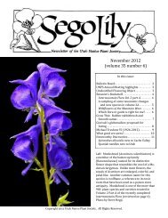
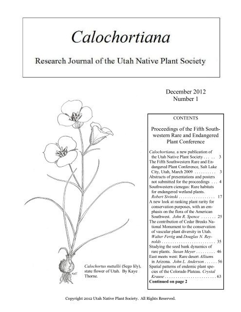
Calochortus nuttallii (Sego lily),<br />
state flower of <strong>Utah</strong>. By Kaye<br />
Thorne.<br />
Calochortiana, a new publication of<br />
the <strong>Utah</strong> <strong>Native</strong> <strong>Plant</strong> <strong>Society</strong> . . . . . 3<br />
The Fifth Southwestern Rare and Endangered<br />
<strong>Plant</strong> Conference, Salt Lake<br />
City, <strong>Utah</strong>, March 2009 . . . . . . . . . . 3<br />
Abstracts of presentations and posters<br />
not submitted for the proceedings . . . 4<br />
Southwestern cienegas: Rare habitats<br />
for endangered wetland plants.<br />
Robert Sivinski . . . . . . . . . . . . . . . . . 17<br />
A new look at ranking plant rarity for<br />
conservation purposes, with an emphasis<br />
on the flora of the American<br />
Southwest. John R. Spence . . . . . . . 25<br />
The contribution of Cedar Breaks National<br />
Monument to the conservation<br />
of vascular plant diversity in <strong>Utah</strong>.<br />
Walter Fertig and Douglas N. Reynolds<br />
. . . . . . . . . . . . . . . . . . . . . . . . . 35<br />
Studying the seed bank dynamics of<br />
rare plants. Susan Meyer . . . . . . . . . 46<br />
East meets west: Rare desert Alliums<br />
in Arizona. John L. Anderson . . . . . . 56<br />
Spatial patterns of endemic plant species<br />
of the Colorado Plateau. Crystal<br />
Krause . . . . . . . . . . . . . . . . . . . . . . . . 63<br />
Continued on page 2<br />
Copyright <strong>2012</strong> <strong>Utah</strong> <strong>Native</strong> <strong>Plant</strong> <strong>Society</strong>. All Rights Reserved.
<strong>Utah</strong> <strong>Native</strong> <strong>Plant</strong> <strong>Society</strong><br />
<strong>Utah</strong> <strong>Native</strong> <strong>Plant</strong> <strong>Society</strong>, PO Box 520041, Salt Lake<br />
City, <strong>Utah</strong>, 84152-0041. www.unps.org<br />
Editor: Walter Fertig (walt@kanab.net),<br />
Editorial Committee: Walter Fertig, Mindy Wheeler,<br />
Leila Shultz, and Susan Meyer<br />
Copyright <strong>2012</strong> <strong>Utah</strong> <strong>Native</strong> <strong>Plant</strong> <strong>Society</strong>. All Rights<br />
Reserved. Calochortiana is a publication of the <strong>Utah</strong><br />
<strong>Native</strong> <strong>Plant</strong> <strong>Society</strong>, a 501(c)(3) not-for-profit organization<br />
dedicated to conserving and promoting stewardship<br />
of our native plants.<br />
CONTENTS, continued<br />
Biogeography of rare plants of the Ash Meadows National Wildlife Refuge, Nevada. Leanna Ballard . . . . . . . . . 77<br />
Assessing vulnerability to climate change among the rarest plants of Nevada’s Great Basin. Steve Caicco . . . . . 91<br />
Sentry milkvetch (Astragalus cremnophylax var. cremnophylax) update. Janice Busco . . . . . . . . . . . . . . . . . . . . 106<br />
A tale of two single mountain alpine endemics: Packera franciscana and Erigeron mancus. James F. Fowler,<br />
Carolyn Hull Sieg, Brian M. Cassavant, and Addie E. Hite . . . . . . . . . . . . . . . . . . . . . . . . . . . . . . . . . . . . . . . . . 110<br />
Long-term population demographics and plant community interactions of Penstemon harringtonii, an endemic<br />
species of Colorado’s western slope. Thomas A. Grant III, Michele E. DePrenger-Levin, and Carol Dawson . . 115<br />
Conservation and restoration research at The Arboretum at Flagstaff. Kristin E. Haskins and Sheila Murray . . . . 120<br />
The digital Atlas of <strong>Utah</strong> <strong>Plant</strong>s: Determining patterns of biodiversity and rarity. Leila M. Shultz, R. Douglas<br />
Ramsey, Wanda Lindquist, and C. Garrard. . . . . . . . . . . . . . . . . . . . . . . . . . . . . . . . . . . . . . . . . . . . . . . . . . . . . . 122<br />
Molecular genetic diversity and differentiation in Clay phacelia (Phacelia argillacea Atwood: Hydrophyllaceae).<br />
Steven Harrison, Susan E. Meyer, and Mikel Stevens . . . . . . . . . . . . . . . . . . . . . . . . . . . . . . . . . . . . . . . . . . . . . 127<br />
A taxonomic revision of Astragalus lentiginosus var. maricopae and Astragalus lentiginosus var. ursinus two<br />
taxa endemic to the southwestern United States. Jason Alexander . . . . . . . . . . . . . . . . . . . . . . . . . . . . . . . . . . . 134<br />
Ecology of Rusby’s milkvetch (Astragalus rusbyi), a rare endemic of northern Arizona ponderosa pine forests.<br />
Judith D. Springer, Michael T. Stoddard, Daniel C. Laughlin, Debra L. Crisp, and Barbara G. Phillips . . . . . . 157<br />
Long-term responses of Penstemon clutei (Sunset Crater beardtongue) to root trenching and prescribed fire:<br />
Clues for population persistence. Judith D. Springer, Peter Z. Fulé, and David W. Huffman . . . . . . . . . . . . . . . . 164<br />
¡Viva thamnophila! Ecology of Zapata bladderpod (Physaria thamnophila), an Endangered plant of the Texas-<br />
Mexico borderlands. Dana M. Price, Christopher F. Best, Norma L. Fowler, and Alice L. Hempel . . . . . . . . . 172<br />
Intraspecific cytotype variation and conservation: An example from Phlox (Polemoniaceae). Shannon D.<br />
Fehlberg and Carolyn J. Ferguson . . . . . . . . . . . . . . . . . . . . . . . . . . . . . . . . . . . . . . . . . . . . . . . . . . . . . . . . . . . . . 189<br />
Prioritizing plant species for conservation in <strong>Utah</strong>: Developing the UNPS rare plant list. Walter Fertig . . . . . . . . 196<br />
2
Calochortiana <strong>December</strong> <strong>2012</strong> <strong>Number</strong> 1<br />
Calochortiana, a New Publication of the <strong>Utah</strong> <strong>Native</strong> <strong>Plant</strong> <strong>Society</strong><br />
Hundreds of scientific journals already exist for the dissemination of research on botany and ecology (including<br />
several fine publications based in <strong>Utah</strong> and the west). Nonetheless, space and financial constraints prevent many useful<br />
papers from being published in first and second-tier journals, relegating such work to the gray literature. In June<br />
<strong>2012</strong>, the board of the <strong>Utah</strong> <strong>Native</strong> <strong>Plant</strong> <strong>Society</strong> (UNPS) recognized the need for a peer-reviewed, electronic journal<br />
for unpublished gray-literature reports that pertain to <strong>Utah</strong> botany and vegetation. The board voted to establish an<br />
annual, technical journal that would complement its bimonthly member’s magazine, the Sego Lily. The objective of<br />
the new publication, named Calochortiana (“of or relating to Calochortus or Sego Lily”, the state floral emblem of<br />
<strong>Utah</strong>), is to provide a forum for professional and amateur scientists to share their findings on <strong>Utah</strong> botany and ecology<br />
with their colleagues. Calochortiana will focus primarily on monitoring or status surveys of rare species, seed<br />
propagation protocols, floristic checklists, genetic studies, vegetation mapping, natural history research, or other topics<br />
that might not otherwise be accepted in existing journals. All submissions will be peer-reviewed and the journal<br />
made available for free on the UNPS website. The journal is put together by an all-volunteer editorial board, though<br />
supported by UNPS. Readers, of course, are encouraged to show their appreciation by becoming members of UNPS!<br />
This first issue of Calochortiana contains papers presented at the 5th Southwestern Rare and Endangered <strong>Plant</strong><br />
Conference, hosted by UNPS in March 2009. These papers were originally intended for publication by the US Forest<br />
Service as part of a proceedings volume. Unfortunately, staff changes, budget shortfalls, and new policy review requirements<br />
greatly delayed publication of the proceedings by the Forest Service. In October <strong>2012</strong>, UNPS assumed<br />
responsibility for disseminating the conference papers to help launch its new journal. The second issue of Calochortiana<br />
will be published on the UNPS website (www.unps.org) in the fall of 2013. Submissions for that issue will be<br />
accepted through 30 April 2013. For more information, please contact me (walt@kanab.net). - Walter Fertig<br />
The Fifth Southwestern Rare and Endangered <strong>Plant</strong> Conference<br />
Salt Lake City, <strong>Utah</strong>, March 2009<br />
In late 2007, botanists in the southwestern United States began discussions about holding a region-wide rare plant<br />
conference modeled after the Fourth Southwestern Rare and Endangered <strong>Plant</strong>s meeting held in Las Cruces, New<br />
Mexico in 2004. It was widely acknowledged through the botanical grapevine that it ought to be <strong>Utah</strong>’s turn to host<br />
the event. Mindy Wheeler, who was chair of the <strong>Utah</strong> <strong>Native</strong> <strong>Plant</strong> <strong>Society</strong> (UNPS) at the time, proposed that the<br />
<strong>Society</strong> take the lead in organizing a conference, slated for early spring 2009. UNPS already had experience with cohosting<br />
the annual state rare plant meeting with Red Butte Garden, so how hard could a regional conference be?<br />
Without going into the gory details, the months of developing an agenda, finding a venue, creating a website, signing<br />
up sponsors, sending out invitations to speakers and attendees, organizing field trips, hiring caterers, and completing<br />
hundreds of other tasks all just seemed to whisk by. On the evening of March 16, 2009, UNPS was proud to host<br />
the first event of the Fifth Southwestern Rare and Endangered <strong>Plant</strong> Conference - an informal mixer at historic Fort<br />
Douglas on the campus of the University of <strong>Utah</strong> in Salt Lake City. Fortified by good food, fine spirits, and excellent<br />
company, the organizers and participants of the conference were off to a good start.<br />
The conference officially began the following morning. Noel Holmgren, curator emeritus of the New York Botanical<br />
Garden, gave the keynote address in which he briefly outlined the history of the Garden’s Intermountain Flora<br />
project and described patterns of species richness and endemism in the Great Basin, Colorado Plateau, and the rest of<br />
the Southwest. UNPS presented Noel and Pat Holmgren with hand-crafted lanyards (for their hand lenses) in appreciation<br />
of their decades of work on the Intermountain Flora.<br />
Over the next three days, 36 additional speakers gave presentations or workshops and an additional 20 posters<br />
were displayed at an evening reception. Presentations covered a variety of topics, ranging from seedling ecology and<br />
rare plant biology to distributional modeling, impacts of climate change, plant biogeography, and fire ecology.<br />
The conference concluded with a Friday field trip to Stansbury Island along the south side of the Great Salt Lake.<br />
Despite the unusually warm temperatures of mid-March, relatively few plants were flowering, though attendees were<br />
treated to a display of violet buttercup (Ranunculus andersonii var. andersonii) in bloom.<br />
3
<strong>Utah</strong> <strong>Native</strong> <strong>Plant</strong> <strong>Society</strong><br />
All told, over 150 botanists attended the week-long conference. Much of the success of the conference could be<br />
attributed to the hard work of the planning and program committees, both chaired by Mindy Wheeler with the able<br />
assistance of Bill Gray, Ann Kelsey, Bill King, Therese and Larry Meyer, Robert and Susan Fitts, Loreen Allphin,<br />
Rita (Dodge) Reisor, and Leila Shultz. A number of volunteers from UNPS and Red Butte Garden helped with registration,<br />
food, and behind the scenes work, including Elise Erler, Tony Frates, Celeste Kennard, Kipp Lee, Bill Nelsen,<br />
Kody Wallace, Sue Budden, Pamela and Robert Hilbert, Allene Keller, Jena Lewinsohn, Marilyn Mead, and Bev<br />
Sudbury. Artist Laura Call Gastinger provided a beautiful painting of Dwarf bearclaw poppy (Arctomecon humilis)<br />
for the conference program and souvenir mug. The following corporate and institutional sponsors assisted financially<br />
or by other means: The Nature Conservancy of <strong>Utah</strong>, US Forest Service Rocky Mountain Research Station, University<br />
of <strong>Utah</strong> Department of Biology, the Flora of North America project, Providia, <strong>Utah</strong> Natural History Museum,<br />
<strong>Utah</strong> Botanical Center, Red Butte Garden and Arboretum, the state of <strong>Utah</strong> Department of Natural Resources, and<br />
Bio-West, Inc.<br />
Twenty presenters at the conference kindly prepared manuscripts for this inaugural issue of Calochortiana, which<br />
will serve as the official proceedings document for the conference. Thanks to all the contributors for their willingness<br />
to share, and for their patience. - Walter Fertig<br />
Abstracts of Presentations and Posters<br />
not Submitted for the Proceedings<br />
Biogeography of the Intermountain Region and<br />
Connections to the Southwestern USA<br />
Noel H. Holmgren, Curator Emeritus, New York Botanical<br />
Garden.<br />
Abstract: The Intermountain Region lies between the<br />
east base of the Sierra-Cascade mountain chain and the<br />
west side of the Rocky Mountains. Its southern boundary<br />
overlooks the warm deserts of the Southwest and the<br />
northern boundary lies along the base of the Oregon and<br />
Idaho batholiths. The Great Basin occupies nearly twothirds<br />
of the Region, and the Wasatch and Uinta Mountains<br />
and the <strong>Utah</strong> segment of the Colorado Plateau occupy<br />
the eastern third. In combination, the plant associations,<br />
vegetation zones, and plant species distinguish the<br />
region as a reasonably natural floristic unit, but there are<br />
many geologic-historical relationships with the Southwest.<br />
With the changing climate, even greater similarities<br />
may be anticipated in the future. The basin and<br />
range topography of the Great Basin offers a perfect<br />
place to monitor possible species migration from south<br />
to north and from valley to mountain.<br />
Flora of the Arizona Strip<br />
Duane Atwood, Brigham Young University, retired<br />
(1870) C.C. Parry (1874-1875); and later by A.L. Siler<br />
and Marcus E. Jones. Generally speaking, most Arizona<br />
botanists have given little attention to this area. The first<br />
concentrated effort of collecting on the Strip was by<br />
Ralph K. Gierisch, a retired Forest Service employee,<br />
who worked primarily as a volunteer for the BLM Arizona<br />
Strip District located in St. George, <strong>Utah</strong>. Ralph<br />
made hundreds of collections, which are deposited at<br />
that office with many duplicates at BYU and NAU. My<br />
interest and first collection from the Strip was made 27<br />
May 1968 1 mile north of Fredonia to secure the type<br />
for Phacelia constancei, while working on a revision of<br />
the crenulatae group of Phacelia (Hydrophyllaceae).<br />
Then later in 1970 while living in Fredonia and working<br />
on the Kaiparowits Environmental Impact Studies with<br />
BYU, thru 1975; and as the first botanist for BLM and<br />
the second one nationally for the Cedar City BLM District<br />
(1975-1977). Collection trips to this unique area<br />
continued through to the present, often with Larry C.<br />
Higgins. An annotated list of vascular plants has been<br />
generated for the entire Strip and the National Parks and<br />
Monuments within its borders. Six new endemic taxa<br />
have been described from the area: Phacelia higginsii,<br />
P. furnisii, P. hughesii, Camissonia dominguezescalantorum,<br />
Physaria arizonica var. andrusensis and<br />
Tetradymia canescens var. thorneae.<br />
Abstract: The "Arizona Strip" is a unique botanical<br />
area isolated from the rest of Arizona by the Colorado<br />
River. Our knowledge of its flora has been slow and<br />
incremental with a few collections from the early botanists<br />
who visited southern <strong>Utah</strong> such as Edward Palmer<br />
4
Calochortiana <strong>December</strong> <strong>2012</strong> <strong>Number</strong> 1<br />
Biogeography and the Evolution of Rare, Endemic<br />
Species: Insights from two Mustard Genera in the<br />
Southwest (Draba and Boechera, Brassicaceae).<br />
Loreen Allphin, Department of <strong>Plant</strong> and Wildlife Sciences,<br />
Brigham Young University, Provo, UT and<br />
Michael D. Windham, Duke University, Durham, NC.<br />
Abstract: With a growing number of plant species in<br />
danger of extinction due to human induced threats,<br />
species-by-species approaches to management are becoming<br />
unrealistic. Conservation of rare plants would<br />
be improved by a clearer understanding of the evolutionary<br />
forces that give rise to rare, endemic species.<br />
These data might facilitate the development of management<br />
strategies applicable to a wide range of rare species.<br />
For this study we conducted a detailed survey of<br />
species within the genera Draba and Boechera from the<br />
Southwest United States (genera and a region with the<br />
high concentrations of endemic species). We collected<br />
data on geographic distribution, degree of endemism,<br />
chromosome number, ploidy level, breeding system,<br />
reproductive fitness and presumed mode of speciation.<br />
The study revealed some interesting evolutionary and<br />
biogeographic patterns. Some rare endemic species in<br />
these genera were primarily diploid, outcrossing, paleoendemic<br />
species with relatively low fecundity. Conversely,<br />
other endemic species in these groups were primarily<br />
polyploid, autogamous or apomictic, neoendemics<br />
with relatively high fecundity. These patterns appear<br />
to reflect both the type of speciation that occurred and<br />
the geologic/biogeographic history of the region. The<br />
geography of rarity and endemism in these genera appears<br />
to be an expression of primary divergence, reticulate<br />
evolution, and evolutionary time.<br />
Physical and Chemical Characteristics of Xeric Soils<br />
in Eastern Great Basin Determines the Natural <strong>Plant</strong><br />
Associations, but Recently Ruderal Species have Become<br />
an Important Factor.<br />
Rodd Hardy, Bureau of Land Management, Salt Lake<br />
City, UT<br />
Abstract: What are major physical and chemical properties<br />
of the soil profiles that are key factors for different<br />
plant associations? What are the major natural plant<br />
associations based on these soil properties? What particular<br />
ruderal species, to what degree, and when did<br />
these invaders become a major role within plant associations<br />
today? What recommendations are needed to mitigate<br />
the impacts of ruderal species to natural plant communities?<br />
This paper will note the ecotone sharpness in<br />
which plant communities in dry climates change from<br />
one type to another for major plant species and the<br />
chemical properties of the soil which determine specific<br />
plant communities. Winterfat and gray molly sites have<br />
particularly been vulnerable to annual grass and goosefoot<br />
forbs, but invasive species effects upon endemic<br />
species such as Pohl’s milkvetch and Small spring parsley<br />
has also been notable.<br />
Predictive Habitat Models for Arctomecon californica<br />
Torrey & Frémont and Eriogonum corymbosum<br />
Bentham var. nilesii Reveal for the Upper Las Vegas<br />
Wash Conservation Transfer Area, Nevada.<br />
Amy A. Croft, Thomas C. Edwards, Jr., Janis L. Boettinger,<br />
Glen Busch, James A. MacMahon, US Geological<br />
Survey and the Ecology Center, <strong>Utah</strong> State University<br />
Abstract: The Upper Las Vegas Wash Conservation<br />
Transfer Area (ULVWCTA), situated northwest of<br />
Las Vegas, Nevada provides habitat for two of the<br />
state’s special status species, Arctomecon californica<br />
Torrey and Frémont and Eriogonum corymbosum Bentham<br />
var. nilesii Reveal. In an effort to aid the Bureau of<br />
Land Management Las Vegas Field Office in conservation<br />
based decision making, we built a family of statistical<br />
models capable of predicting likely locations of each<br />
species in the ULVWCTA. To predict locations of the<br />
plant species, emphasis was placed on sensitivity, the<br />
ability of the models to predict where the species were<br />
located. A. californica sites were characterized by soils<br />
with low shear and compressive strength values, a low<br />
percentage of rock, and a physical soil crust. The most<br />
common soil type and vegetation association occupied<br />
by A. californica was the Las Vegas type (spring deposits)<br />
and the Ambosia dumosa-Atriplex confertifolia<br />
vegetation association. Models for A. californica had<br />
moderate to excellent predictive capabilities, with accuracies<br />
as reflected by sensitivity ranging from 75% to<br />
95%. Small sample sizes precluded construction of any<br />
models for E. corymbosum var. nilesii. Instead, we were<br />
able to successfully predict likely locations of E. corymbosum<br />
var. nilesii with the A. californica models. Overall,<br />
the models had predictive capabilities of sufficient<br />
accuracy to be used in conservation decisions for the<br />
ULVWCTA.<br />
Comprehensive Interactive <strong>Plant</strong> Keys for the Southwest<br />
Bruce S. Barnes, Flora ID Northwest, Pendleton, OR<br />
Abstract: <strong>Plant</strong> conservation and management for any<br />
given locality is a complex process which depends on<br />
reliable and continually updated information regarding<br />
what species are found and where. These critical data<br />
5
<strong>Utah</strong> <strong>Native</strong> <strong>Plant</strong> <strong>Society</strong><br />
often require time-consuming initial and ongoing plant<br />
surveys. Computerized interactive keys produced over<br />
the past 14 years by the author greatly facilitate plant<br />
surveys by reducing the time to key unknown species by<br />
90% or more. This presentation will demonstrate the use<br />
of the plant identification software, to provide the audience<br />
with an understanding of the potential applications<br />
of this resource. The keys include all known vascular<br />
plants, both native and introduced, which grow outside<br />
of cultivation in 16 states and 4 Canadian provinces,<br />
including California, Nevada and <strong>Utah</strong>, with Arizona<br />
and New Mexico to be added in 2010. <strong>Plant</strong> characteristics<br />
may be selected in any order, with no forced<br />
choices. Terms are defined and illustrated, extensive<br />
references are included, and color photos are provided<br />
for over 99% of species. Synonyms and menus of genera<br />
and families are provided to reduce problems of<br />
changing nomenclature. The software is continuously<br />
updated with name changes, new plant finds, and new<br />
photos, with free annual updates available for purchasers.<br />
The keys are available by state or larger region. In<br />
most cases descriptive information is provided for separating<br />
subtaxa when present. These keys are a powerful,<br />
innovative tool to assist in providing timely plant survey<br />
data for plant conservation and management.<br />
The Climate Puzzle of Global Warming: It is not just<br />
about Chilies!<br />
Robert R. Gillies, Director/State Climatologist, <strong>Utah</strong><br />
Climate Center at <strong>Utah</strong> State University<br />
Abstract: In arid and semi-arid Western North America,<br />
observations of climate change point to an increase<br />
in average temperature that is greater than the rest of the<br />
world’s average. In line with such a warming trend in<br />
climate, several studies of the precipitation regime for<br />
the region have documented less snowfall as evidenced<br />
by decreases in snowpack as well as earlier snow melt,<br />
increased winter rain events and reduced summer flows.<br />
An ensemble of global climate model (GCM) projections<br />
for Western North America reflect just such conditions<br />
in that they suggest intensifying drying conditions<br />
to be the norm for the Southwest region due primarily to<br />
Hadley Cell intensification. Regions that lie to the<br />
Northwest, the GCMs have as benefiting from increased<br />
precipitation but in transitional zones, i.e., between the<br />
wetter and drier zones, any gains in projected precipitation<br />
are offset by the likelihood of an increased frequency<br />
of above normal temperatures during the summer<br />
months; such results suggest that an overall deficit<br />
in water resources is on the cards for much of the Intermountain<br />
West.<br />
Long-Term Perspectives on Vegetation: Paleoecology<br />
as a Tool for Conservation and Ecosystem Management<br />
Mitchell J. Power, <strong>Utah</strong> Museum of Natural History,<br />
Department of Geography, University of <strong>Utah</strong><br />
Abstract: Long-term studies on vegetation history have<br />
demonstrated the role of climate in controlling the<br />
composition and distribution of species through time.<br />
Paleoecological studies that use fossil plant and pollen<br />
offer many lessons from the past, including: 1) plant<br />
species respond individualistically to climate change, 2)<br />
vegetation composition during the last Ice Age, 21,000<br />
years ago, was very different than today, and 3) plants<br />
have “migrated” across hundreds to thousands of kilometers<br />
since the last Ice Age in response to changing<br />
climate and disturbance regimes. These lessons from<br />
paleoecology can be used to inform conservation efforts<br />
towards the protection of plant species that face unprecedented<br />
climate change. Traditionally, most “longterm”<br />
conservation studies span less than 50 years and<br />
therefore characterize historical variations in plant communities<br />
within a limited temporal domain. Conservation<br />
efforts aim to restore natural habitats and protect<br />
landscapes, but the question remains; what to restore<br />
things to? Through merging paleoecological knowledge<br />
with conservation objectives, land managers and conservationists<br />
are better positioned to make informed decisions<br />
to protect plant species as we experience the rapidly<br />
changing climate of the 21st century.<br />
The Southwest Region ‘GAP’ Program for Mapping<br />
Vegetation and Species<br />
Doug Ramsey, Department of Geography and Earth Resources,<br />
<strong>Utah</strong> State University, Logan, UT<br />
Abstract: The Southwest Regional Gap Analysis Project<br />
(SWReGAP) is an update of the Gap Analysis<br />
Program’s mapping and assessment of biodiversity for<br />
the five-state region encompassing Arizona, Colorado,<br />
Nevada, New Mexico, and <strong>Utah</strong>. It is a multi-institutional<br />
cooperative effort coordinated by the U.S. Geological<br />
Survey Gap Analysis Program. The primary objective<br />
of the update is to use a coordinated mapping<br />
approach to create detailed, seamless GIS maps of land<br />
cover, all native terrestrial vertebrate species, land stewardship,<br />
and management status, and to analyze this information<br />
to identify those biotic elements that are underrepresented<br />
on lands managed for their long term<br />
conservation or are ‘gaps.’<br />
6
Calochortiana <strong>December</strong> <strong>2012</strong> <strong>Number</strong> 1<br />
Responses of Colorado Plateau Drylands to Climate<br />
Change: Variability due to Land Use and Soil-<br />
Geomorphic Heterogeneity<br />
Mark E. Miller and Jayne Belnap, U.S. Geological Survey,<br />
Southwest Biological Science Center, Moab, UT<br />
Abstract: Dryland ecosystems comprise well over 50<br />
percent of the Colorado Plateau province and are subjected<br />
to land uses such as livestock grazing, recreation,<br />
and energy development. Low and variable amounts of<br />
precipitation constrain dryland resilience to land-use<br />
activities, making drylands particularly susceptible to<br />
persistent changes in structure, function, and capacity<br />
for providing key ecosystem services such as soil stabilization.<br />
Through multiple effects on soil and vegetation<br />
attributes, land use also mediates ecosystem responses<br />
to climate. Ecosystem responses to interactive effects of<br />
land use and climate vary spatially in relation to soil<br />
geomorphic properties such as texture, depth, horizonation,<br />
and topographic setting due to effects of these<br />
properties on water and nutrient availability, soil erodibility,<br />
and site susceptibility to hydrologic alteration by<br />
soil-surface disturbances. We use existing data from<br />
Colorado Plateau drylands to illustrate these concepts<br />
and to develop a set of testable hypotheses about climate-land-use<br />
interactions (i.e., how climate and land use<br />
each affect ecosystem resilience to the other) in relation<br />
to soil-geomorphic properties. For example, we predict<br />
that climate-land-use interactions in Colorado Plateau<br />
drylands will be greater on deep soils than on shallow,<br />
rocky soils because the former support grasslands and<br />
shrub steppe ecosystems that have been most extensively<br />
used and modified by livestock grazing. We also<br />
predict that climate-land-use interactions will be greater<br />
on relatively fine-textured soils than on coarse-textured<br />
soils because the former tend to be more susceptible to<br />
exotic plant invasions and hydrologic alteration following<br />
disturbance, and because they exhibit greater fluctuations<br />
in resource availability in response to precipitation<br />
variability. Variable ecosystem responses to climate<br />
due to land use and soil have implications for scientists’<br />
efforts to predict ecological consequences of climate<br />
change with sufficient detail to inform management decisions,<br />
and for decision makers’ efforts to prioritize and<br />
evaluate risks of different management strategies.<br />
Colorado Rare <strong>Plant</strong> Conservation Initiative, Saving<br />
Colorado’s Wildflowers<br />
tage by improving the stewardship of Colorado’s most<br />
imperiled plants. One hundred thirteen native plant species<br />
in Colorado are considered imperiled or critically<br />
imperiled by the Colorado Natural Heritage Program,<br />
meaning they are at significant risk of extinction. Of<br />
these species, 63 are endemic, growing only in Colorado<br />
and no place else in the world. Nearly 50% of our<br />
state’s imperiled native plants are considered poorly or<br />
weakly conserved. Unlike animals, Colorado has no<br />
state-level recognition or protection for plants. Impacts<br />
to Colorado’s rare plants are at an all-time high due to<br />
our rapidly expanding human population. Primary<br />
threats include habitat loss and fragmentation associated<br />
with resource extraction, motorized recreation, housing<br />
and urban development, and roads. Many rare plants are<br />
also at risk due to a simple lack of awareness regarding<br />
their precarious status. Despite the size and scale of<br />
these threats, we still have a chance to make a difference<br />
through strategic conservation actions, since healthy<br />
populations of many imperiled plants still exist. The<br />
goal of the Rare <strong>Plant</strong> Conservation Initiative is to conserve<br />
Colorado’s most imperiled native plants and their<br />
habitats through collaborative partnerships for the preservation<br />
of our natural heritage and the benefit of future<br />
generations.<br />
Rare <strong>Plant</strong> Management and BLM Policy<br />
Carol Spurrier, Bureau of Land Management, Washington,<br />
DC.<br />
Abstract: Rare plant conservation continues to be part<br />
of the multiple use mission of the Bureau of Land Management<br />
(BLM) in the United States. With continuing<br />
increases in the demand for all types of energy and other<br />
goods provided by the public lands, as well as landscape<br />
scale changes in natural vegetation due to increased<br />
wildfire and climate change, we wondered if the public<br />
lands that have been designated as part of the Natural<br />
Landscape Conservation System (NLCS) hold significance<br />
for protection of rare plant resources in BLM. We<br />
examined 2006 occurrence data on BLM lands from<br />
NatureServe within NLCS unit boundaries to determine<br />
rare plant species occurring in each unit. In this paper<br />
we discuss our findings for the different types of<br />
designations (wilderness, wilderness study areas, National<br />
Monuments and National Conservation Areas)<br />
within the System.<br />
Brian Kurzel, Colorado Natural Areas Program<br />
Abstract: The Colorado Rare <strong>Plant</strong> Conservation Initiative<br />
is a diverse partnership of public and private organizations<br />
dedicated to conserving our state’s natural heri-<br />
7
<strong>Utah</strong> <strong>Native</strong> <strong>Plant</strong> <strong>Society</strong><br />
Thinking and Acting Together to Preserve Uinta<br />
Basin Rare <strong>Plant</strong>s<br />
Joan Degiorgio, Northern Mountains Regional Director,<br />
The Nature Conservancy, Salt Lake City, UT<br />
Abstract: <strong>Utah</strong>’s Uinta Basin is home to dozens of endemic<br />
plant species. Nine of those species are at risk<br />
due to increased levels of energy development. Representatives<br />
from state, federal and local agencies, the Ute<br />
Tribe, private consultants, conservation groups, researchers,<br />
industry and others have come together as the<br />
Uinta Basin Rare <strong>Plant</strong> Forum to collectively address<br />
threats to these plants. Through a transparent, open<br />
planning process key ecological attributes of each plant<br />
were identified and rated for viability, stresses identified<br />
and specific strategies developed. This planning effort<br />
has been an excellent tool to “capture” the collective<br />
wisdom of local experts; and, with this knowledge, develop<br />
comprehensive strategies for the nine species simultaneously.<br />
With an agreed upon strategy, the Forum<br />
will work together implementing the highest leverage<br />
strategies and engaging more partners and dollars because<br />
of the solid foundation built through this planning<br />
process.<br />
Interagency Management Agreement for TES<br />
Species in Central <strong>Utah</strong><br />
David Tait, botanist, Fishlake National Forest, Richfield,<br />
UT.<br />
Abstract: The Bureau of Land Management Richfield<br />
Field Office, Fishlake National Forest, and Capitol Reef<br />
National Park share management responsibilities for<br />
many of the same Threatened, Endangered & Sensitive<br />
plant species (TES). To enable each of these agencies to<br />
better manage their shared TES species, they developed<br />
an interagency agreement in 1999 that enables them to<br />
pool their funding. This funding, which has been minimal<br />
at times, has been used to employ an interagency<br />
botanist and hire seasonals to survey and monitor these<br />
TES species throughout their ranges, regardless of<br />
agency boundaries. The BLM Price Field Office and the<br />
US Fish and Wildlife Service were added in 2007. This<br />
project has allowed us to: (1) conduct intensive surveys<br />
for target species on potential habitat within the project<br />
area, (2) determine potential for impact by visitor, recreational<br />
or livestock use on long-term viability of these<br />
rare plants, and (3) conduct long-term monitoring on<br />
several of the rare species. Between 1999 and 2008 approximately<br />
100,580 acres were surveyed for some 30<br />
TES plants species by the IA team. approximately<br />
27,500 acres on BLM, 37,920 acres on Capitol Reef,<br />
and 35,160 acres on lands administered by the Fishlake.<br />
Conservation Success for a Rare Idaho Endemic:<br />
Conservation Agreement and Botanical Special Interest<br />
Area for Christ’s Paintbrush<br />
Kim Pierson-Motychak, Sawtooth National Forest,<br />
Twin Falls, ID and Jeffrey E. Motychak, Motychak Environmental<br />
Consulting, Twin Falls, ID.<br />
Abstract: Christ’s Indian Paintbrush (Castilleja christii)<br />
is a rare species known from only one population in<br />
Southwestern Idaho, Cassia County. Due to its restricted<br />
distribution and vulnerability to threats, C. christii is<br />
designated as a Candidate species for Federal listing<br />
under the Endangered Species Act (ESA). Conservation<br />
Strategies were completed in 1995 and 2002 for the establishment<br />
of long-term monitoring protocols. These<br />
have been implemented from 1995 to present. In 2003,<br />
the portion of the population not included in the Mount<br />
Harrison Research Natural Area (RNA) was designated<br />
as the Mount Harrison Botanical Special Interest Area<br />
(BSIA). In 2005, a ten year Candidate Conservation<br />
Agreement (CCA) was signed between the US Fish and<br />
Wildlife Service and the USDA Forest Service. This<br />
CCA identified the key threats to the population which<br />
included: 1) non-native plant introduction and establishment,<br />
2) recreational impacts, 3) hybridization, 4) unauthorized<br />
livestock impacts, 5) road construction, maintenance,<br />
and facilities, and 6) natural threats. A total of 42<br />
conservation action items were committed to in the<br />
CCA. Results from the implementation of these conservation<br />
action items include aggressive non-native plant<br />
treatment, increased interpretive education, agency and<br />
public interaction, long-term demographic and reproductive<br />
monitoring, host-specificity determination, and<br />
preliminary pollination ecology. Population trends indicate<br />
that while plant densities within the communities<br />
have declined over the 13-year period, individual reproductive<br />
output (flowering stems/plant) has increased.<br />
Modeling Distributions of Rare <strong>Plant</strong>s in the Southern<br />
Great Basin of <strong>Utah</strong><br />
Marti Aitken, <strong>Utah</strong> State University and US Forest Service<br />
Pacific Northwest Research Station, Portland, OR;<br />
Leila M. Shultz, College of Natural Resources, <strong>Utah</strong><br />
State University, Logan, UT; and David W. Roberts,<br />
Department of Ecology, Montana State University,<br />
Bozeman, MT.<br />
Abstract: Field-validated landscape level predictive<br />
models identify potential plant habitat for rare plants in<br />
the Great Basin of western North America. Four rare<br />
species (Jamesia tetrapetala, Penstemon nanus, Primula<br />
domensis, and Sphaeralcea caespitosa) endemic to the<br />
southern portion of the eastern Great Basin (SW <strong>Utah</strong>)<br />
8
Calochortiana <strong>December</strong> <strong>2012</strong> <strong>Number</strong> 1<br />
were chosen to include a range of environmental variability,<br />
growth form, and plant communities. Herbarium<br />
records of known occurrences were used to identify initial<br />
sample sites. We established multiple field sites to<br />
determine the geographic coordinates, environmental<br />
attributes (slope, aspect, soils, parent material) and<br />
vegetation data (associated species) in order to develop<br />
two predictive models for each species: a field key and a<br />
probability-of-occurrence or predictor map. The field<br />
key was developed from environmental attributes and<br />
associated species data collected at the sites and used<br />
only field data. Predictive maps were developed with a<br />
geographic information system (GIS) containing slope,<br />
elevation, aspect, soils, and geologic data – then randomly<br />
tested. Classification-tree (CT) software was<br />
used to generate dichotomous field keys and the maps of<br />
occurrence probabilities. Predictions from both models<br />
were randomly field-validated during the second phase<br />
of the study, and final models were developed through<br />
an iterative process. Data collected during the field validation<br />
were then incorporated into subsequent predictive<br />
models. The models identified potential habitat by<br />
combining elevation, slope, aspect, rock type, and geologic<br />
process into habitat models for each species. The<br />
cross-validated models were >96% accurate and generally<br />
predicted presence with accuracy >60%.<br />
Ute Ladies’-Tresses in the Diamond Fork Watershed:<br />
An Update<br />
Bridget M. Atkin and Steve R. Ripple, BIO-WEST,<br />
Logan, <strong>Utah</strong><br />
Abstract: Ute ladies’-tresses (Spiranthes diluvialis)<br />
(ULT) was listed as threatened in 1992. The largest<br />
known population is in the watershed of Diamond Fork<br />
Creek and its tributary, Sixth Water Creek. Between<br />
1916 and 2004, these streams were used as canals, and<br />
they conveyed irrigation water diverted from Strawberry<br />
Reservoir to the Wasatch Front. Increased peak flows<br />
altered the stream channel and aquatic ecosystem, creating<br />
unique conditions that allowed the rare orchid to<br />
thrive. In 2004 a system of pipes was installed to divert<br />
water directly into the Spanish Fork River, thereby reducing<br />
the flows in Diamond Fork and Sixth Water<br />
Creeks. Studies of ULT populations have been conducted<br />
since 1992 under the direction of <strong>Utah</strong> Reclamation<br />
Mitigation and Conservation Commission. Results<br />
show that ULT colonies are still maintaining large<br />
numbers. However, monitoring of ULT has been difficult.<br />
The unique life-cycle characteristics of ULT, along<br />
with its dynamic habitat, create many challenges.<br />
Highly variable yearly ULT counts are very difficult to<br />
interpret or correlate with environmental parameters. In<br />
2005 other studies were initiated and more associated<br />
plant species data are now being systematically collected<br />
to track changes that may indicate whether the<br />
decreased flows are impacting ULT habitat. During<br />
2007 ULT numbers showed at least two flushes, in early<br />
August with tiny individual plants. Conversely, in 2008<br />
ULT numbers were highest in mid-September and<br />
plants were large. These observations have wide reaching<br />
implications pertinent to many species, indicating<br />
that unless a population is observed carefully, data could<br />
easily be misinterpreted.<br />
Arizona Cliffrose (Purshia subintegra), An Arizona<br />
Endemic<br />
Debra Crisp, Coconino National Forest, Flagstaff, AZ,<br />
and Barbara G. Phillips, Zone Botanist, Coconino, Kaibab<br />
and Prescott National Forests<br />
Abstract: The Arizona cliffrose is a long-lived shrub,<br />
endemic to white Tertiary (Miocene and Pliocene)<br />
limestone lakebed deposits that are high in lithium, nitrates,<br />
and magnesium and is an Endangered species. It<br />
occurs in four disjunct populations spread across an area<br />
of approximately 200 miles in central Arizona. Threats<br />
to Arizona cliffrose include livestock grazing, mineral<br />
exploration, road and utility corridor development, offhighway<br />
vehicle use, urban development and drought.<br />
In this poster we summarize the results of some longterm<br />
monitoring transects initiated in 1987. These transects<br />
are in the Cottonwood population, which is<br />
thought to be the healthiest and contains the most diverse<br />
age structure of the four known populations. Data<br />
on these transects were collected three times, in 1987,<br />
1996 and in 2008.<br />
Demography and Pollination Biology of Graham's<br />
Penstemon (Penstemon grahamii), a Uinta Basin Endemic;<br />
5-year results.<br />
Rita [Dodge] Reisor and Wendy Yates, Red Butte Garden<br />
and Arboretum, University of <strong>Utah</strong>, Salt Lake City,<br />
<strong>Utah</strong><br />
Abstract: Penstemon grahamii is a Uinta Basin endemic<br />
which grows on oil-shale outcrops of the Green<br />
River Formation. Long-term monitoring plots were established<br />
for P. grahamii to collect basic life history<br />
data, study pollination biology, and survey critical habitat.<br />
Research was conducted over 5 years (2004 to 2008)<br />
during May – June, at the Blue Knoll/Seep Ridge and<br />
Buck Canyon population sites located on BLM land.<br />
Data gathered includes rosette diameter, number of inflorescences,<br />
inflorescence height, flowers per inflorescence,<br />
number of fruiting individuals, and herbivory.<br />
The breeding systems study used the following treat-<br />
9
<strong>Utah</strong> <strong>Native</strong> <strong>Plant</strong> <strong>Society</strong><br />
ments: autogamy, geitonogamy, xenogamy, and vector<br />
pollination as a control group. Surveys were based on<br />
historic Element Occurrence (EO) reports and surrounding<br />
habitat. Demographic data suggest that P. grahamii<br />
population size has remained fairly stable over the study<br />
period. Annual survivorship rates range from 47 – 82%,<br />
and mortality ranging from 6 – 36%. Flowering events<br />
are highly variable annually, ranging from zero flowering<br />
plants in 2006, up to 44% in 2004. As expected for<br />
the breeding systems results, the vector (control) produced<br />
the most fruits, then xenogamy, geitonogamy,<br />
and autogamy with the least fruits produced. Survey<br />
results found existing populations at each historic EO<br />
visited, and expanded the range and size for some occurrences.<br />
Current threats include high rates of herbivory,<br />
habitat loss, and fragmentation due to oil and gas<br />
development. It is unknown how the reproductive success<br />
of P. grahamii may be influenced by other development<br />
related impacts such as dust production and pollinator<br />
disturbance.<br />
Micropropagation Studies in Astragalus holmgreniorum<br />
Aaron R. Fry, Brett A. McGowan, and Julianne<br />
Babaoka, Ally Bench, Renée Van Buren and Olga R.<br />
Kopp, Department of Biology, <strong>Utah</strong> Valley University,<br />
Orem, <strong>Utah</strong>, 84058<br />
Abstract: Astragalus holmgreniorum, a species endemic<br />
to the northern areas of the Mojave Desert is<br />
listed as a federally Endangered species. Threats to the<br />
species stem from habitat destruction arising primarily<br />
from commercial and residential development, overgrazing<br />
by livestock, recreational vehicles, and mining<br />
operations. In an attempt to develop a micropropagation<br />
technique aimed at aiding in recovery efforts for the<br />
species, we report successful induction of shoots from<br />
callus tissue. Explants were taken from leaves (abaxial<br />
and adaxial surfaces) and from petioles. These were incubated<br />
in MS medium amended with 2,-4 D and BA to<br />
induce callus formation. Murashige and Skoog medium<br />
amended with 7 mg/L of 2,-4 D and 2 mg/L of BA induced<br />
the formation of embryos and plantlets. Current<br />
work focuses on the effects of varying concentrations of<br />
NAA, IBA, and IAA on root formation. Following root<br />
induction, we plan to acclimatize plantlets by incubating<br />
them in potting soil. Ultimately, we hope that this research<br />
may be used to aid in recovery efforts of this species.<br />
Geochemical Analysis of Tuffaceous Outcrops Associated<br />
with the Narrow Endemic, Penstemon idahoensis<br />
Welsh & Atwood<br />
Paul R. Grossl, William A. Varga, and Richard M.<br />
Anderson, <strong>Utah</strong> State University, <strong>Plant</strong>, Soils, and Climate<br />
Department and <strong>Utah</strong> Botanical Center, <strong>Utah</strong> State<br />
University.<br />
Abstract: Idaho penstemon (Penstemon idahoensis<br />
Welsh & Atwood) is a Sawtooth National Forest Sensitive<br />
plant species narrowly endemic to the Goose Creek<br />
drainage in northern Box Elder County, <strong>Utah</strong>, and adjacent<br />
southern Cassia County, Idaho. Idaho penstemon is<br />
a short, glandular, perennial forb comprised of several<br />
stems which emerge from a semi-woody caudex and<br />
topped with showy, blue flowers. Its distribution is<br />
restricted to dry, light-colored, sparsely vegetated, tuffaceous<br />
outcrops of Tertiary Salt Lake Formation<br />
sediments. Botanists have long recognized the association<br />
of endemic, often rare, plant species with unusual<br />
soils. Edaphic endemism is prominent among those<br />
plant associations which include ultramafic bedrock,<br />
such as serpentine, or calcareous bedrock such as limestone,<br />
chalk, dolomite, or gypsum. Edaphic endemic<br />
species frequently arouse conservation concern due to<br />
their restricted distributions or small plant population<br />
sizes. The focus of this investigation considered the<br />
question whether Penstemon idahoensis utilizes unusual<br />
soil conditions that exclude other taxa and thus provide<br />
low competition environments. To answer this question<br />
we attempted to ascertain via geochemical analysis any<br />
selective or restrictive constituents or composition including<br />
the presence or absence of gypsum, unusual soil<br />
pH levels, soil texture, salinity (EC), organic matter, or<br />
atypical element distributions associated with common<br />
soil components.<br />
What's Happened to Siler Pincushion Cactus?<br />
Lee E Hughes, Ecologist, Arizona Strip Field Office, St.<br />
George, UT, retired<br />
Abstract: The Siler Pincushion Cactus has, like all<br />
vegetation in the southwest, been under the influence of<br />
a ten year drought. The effects of this drought are evident<br />
in the data gathered on the cactus. The poster will<br />
show the data from the six demographic plots on the<br />
cactus. The data starts in 1986 and goes through to<br />
2008. It summarizes the mortality data. The size structure<br />
for each plot is shown graphically to demonstrate<br />
the affect of the drought on the size composition of the<br />
cactus. In summary the drought has reduced the small<br />
cactus significantly. Also shown, is the effect (or no<br />
effect) from livestock and ATVs being present in the<br />
10
Calochortiana <strong>December</strong> <strong>2012</strong> <strong>Number</strong> 1<br />
plots. The plot data shows a cactus with drought problems,<br />
but in some areas is doing well also.<br />
Clark County (Nevada) Rare <strong>Plant</strong> Modeling and<br />
Inventory<br />
Sonja R. Kokos, Clark County Desert Conservation Program,<br />
Las Vegas, NV; David W. Brickey and Larry R.<br />
Tinney, TerraSpectra Geomatics, Las Vegas, NV; and<br />
Analie R. Barnett and Robert D. Sutter, The Nature<br />
Conservancy, Southeastern Region, Durham, NC<br />
Abstract: To understand the distribution of rare plants<br />
covered under the Clark County Multiple Species Habitat<br />
Conservation Plan, Clark County and Terra-Spectra<br />
Geomatics developed two predictive GIS models. The<br />
models used ASTER Imagery and Landsat ETM+ Imagery,<br />
soils data (NRCS SSURGO), geologic data, and<br />
presence/absence data for eight rare and endemic plant<br />
species. The first model was used to predict the distribution<br />
of three gypsum loving species, the Las Vegas<br />
bearpoppy (Arctomecon californica), Sticky ringstem<br />
(Anulocaulis leiosolenus var. leiosolenus), and Las<br />
Vegas buckwheat (Eriogonum corymbosum var. nilesii).<br />
The second model was used to predict the distribution of<br />
five sand or potentially sand loving species, the Threecorner<br />
milkvetch (Astragalus geyeri var. triquetrus),<br />
Pahrump Valley buckwheat (Eriogonom bifurcatum),<br />
Sticky buckwheat (Eriogonum viscidulum), Beaver Dam<br />
breadroot (Pediomelum castoreum), and Whitemargined<br />
beardtongue (Penstemon albomarginatus).<br />
Using these models, Clark County can now describe the<br />
occurrence of all eight species in terms of high, medium<br />
and low probabilities. During the 2009 and 2010 field<br />
seasons, the county will test both models using a sampling<br />
protocol developed jointly by Clark County and<br />
The Nature Conservancy. Intuitively, we expect these<br />
models to predict the distribution of some species better<br />
than others, and further model refinement will be<br />
needed. However, the results to date have produced<br />
some interesting hypotheses regarding the life history<br />
and biology of these species. We expect the results will<br />
be valuable to Clark County and the federal land management<br />
agencies charged with managing these species.<br />
Post-Fire Monitoring of Erosion Resistance and Dust<br />
Emission on the Milford Flat Fire, West-Central<br />
<strong>Utah</strong><br />
Mark E. Miller, National Park Service, Moab, UT<br />
(formerly U.S. Geological Survey, Southwest Biological<br />
Science Center, Kanab, UT)<br />
Abstract: Soil stabilization is a major objective of postfire<br />
emergency stabilization and rehabilitation (ES&R)<br />
projects, yet monitoring data are rarely sufficient to determine<br />
whether treatments effectively achieve this objective.<br />
To address this information need, the U.S. Geological<br />
Survey and Bureau of Land Management are<br />
collaboratively monitoring effects of ES&R treatments<br />
on soil-surface stability and rates of dust emission in<br />
low-elevation portions of the 147,000-ha Milford Flat<br />
Fire that occurred in west-central <strong>Utah</strong> in July 2007. In<br />
August 2008, monitoring plots were established to<br />
evaluate the effectiveness of three types of ES&R treatments<br />
(aerial seeding and chaining, seeding with a<br />
rangeland drill, and seeding with a rangeland drill after<br />
herbicide application) in areas where field observations<br />
and satellite imagery indicated high rates of dust emission<br />
during spring 2008. Monitoring attributes include<br />
indicators of erosion resistance (soil stability, ground<br />
cover, and sizes of gaps between plant canopies) in addition<br />
to measures of plant cover and community composition.<br />
Seasonal rates of dust emission are currently<br />
monitored with BSNE dust samplers. Sampling in August<br />
2008 indicated that average soil-surface stability<br />
was highest in unburned control plots and in burned<br />
plots that were not treated. Average soil stability was<br />
lowest in burned plots that were seeded with a rangeland<br />
drill following herbicide application. During the August-October<br />
2008 period, rates of wind-driven soil<br />
movement varied over three orders of magnitude and<br />
were greatest in plots that received ESR treatments,<br />
were in exposed landscape settings, and had soils that<br />
were most susceptible to wind erosion.<br />
Using GIS and Remote Sensing to Predict Dominant<br />
<strong>Plant</strong> Species Distributions in Rich County, <strong>Utah</strong><br />
Kate Peterson, Doug Ramsey, Leila Shultz, John Lowry,<br />
Alexander Hernandez, and Lisa Langs-Stoner, Remote<br />
Sensing/GIS Laboratory and Floristics Lab, Dept. of<br />
Wildland Resources, <strong>Utah</strong> State University, Logan, UT<br />
Abstract: This research shows models of the potential<br />
spatial distribution of key upland plant species in Rich<br />
County, <strong>Utah</strong>. We used geospatial data layers of abiotic<br />
factors and remotely sensed (RS) imagery in conjunction<br />
with field-collected vegetation data. <strong>Plant</strong> species<br />
distribution maps are used to objectively and costeffectively<br />
correlate soil maps units with GIS data in the<br />
production of Ecological Site Descriptions (ESD’s).<br />
These were produced for Rich County in accordance<br />
with NRCS (Natural Resources Conservation Service)<br />
standards. Inasmuch as abiotic factors and vegetation<br />
associations can be used to predict the potential distribution<br />
of rare plants, we believe these analyses can be<br />
used to guide field searches for populations of endemic<br />
species.<br />
11
<strong>Utah</strong> <strong>Native</strong> <strong>Plant</strong> <strong>Society</strong><br />
A Newly Discovered Gutierrezia on the Colorado<br />
Plateau<br />
Al Schneider, www.swcoloradowildflowers.com and<br />
Peggy Lyon, Colorado Natural Heritage Program<br />
Abstract: The authors will present information on the<br />
newly discovered species, Gutierrezia elegans or<br />
Lone Mesa Snakeweed. They discovered G. elegans<br />
August 4, 2008 while doing a plant survey in the new<br />
Lone Mesa State Park, 30 miles north of Dolores, Colorado.<br />
See http://www.swcoloradowildflowers.com/<br />
Yellow%20Enlarged%20Photo%20Pages/gutierrezia%<br />
20elegans.htm for details, including the full description<br />
published in the <strong>December</strong>, 2008 issue of the Journal of<br />
the Botanical Research Institute of Texas.<br />
Incorporting Demography, Genetics, and Cytology<br />
into Long-Term Management Plans for a Rare,<br />
Endemic Alpine Species: Draba asterophora<br />
Emily Smith and Loreen Allphin, Department of <strong>Plant</strong><br />
and Wildlife Sciences, Brigham Young University,<br />
Provo, UT.<br />
Abstract: Draba asterophora (Brassicaceae), a rare and<br />
endemic mustard, is known from three population clusters<br />
(North, Southeast, and south) occupying a narrow<br />
range of alpine habitats surrounding Lake Tahoe. The<br />
southern population cluster has been segregated as variety<br />
macrocarpa, whereas the other two clusters have<br />
been assigned to variety asterophora. Because this<br />
small, matted, perennial occurs at alpine sites, the species<br />
faces impending threats to its habitat through ski<br />
run expansion and development as well as from global<br />
climate change. With funding from the USDA Forest<br />
Service and local ski resorts, we are conducting morphological,<br />
ecological, chromosomal, and genetic studies<br />
of both varieties of D. asterophora to provide a<br />
framework upon which future management plans and<br />
mitigation can be developed. Preliminary results suggest<br />
that there are significant differences between the three<br />
population clusters. These include differences in soil<br />
composition, soil chemistry, plant density, demographics<br />
reproductive success, and genetics. Chromosome<br />
counts from the northern populations (Mt. Rose, Nevada)<br />
are tetraploid (n=20). Allozyme banding patterns<br />
support the hypothesis that these have arisen through<br />
autopolyploidy. The southeastern population has shown<br />
both diploid and triploid counts. Because the species<br />
includes more than one ploidy level, it should not be<br />
treated as a single panmictic taxon for purposes of conservation.<br />
Endangered Milkvetches of Washington County,<br />
<strong>Utah</strong><br />
Wendy Yates, Red Butte Garden and Arboretum, University<br />
of <strong>Utah</strong>, Salt Lake City, UT; and Ally Bench<br />
Searle and Renee Van Buren, <strong>Utah</strong> Valley State University,<br />
Orem, UT.<br />
Abstract: Astragalus ampullarioides (Welsh) Welsh<br />
and A. holmgreniorum Barneby are two federally listed<br />
Endangered species endemic to Washington County,<br />
<strong>Utah</strong>. A. ampullarioides is known from only four known<br />
populations, and A. holmgreniorum from only three<br />
populations. Prior research conducted on these species<br />
by Van Buren and Harper (2003) focused on vegetative<br />
and demographic characteristics. There have been no<br />
prior studies on the soil seed bank or seed viability. This<br />
study focused on determining the density of the soil<br />
seed bank and the percent seed viability for both species.<br />
For Astragalus ampullarioides soil was removed<br />
from two of the four known populations. For Astragalus<br />
holmgreniorum soil was removed from ten densely<br />
populated areas. Seeds were sifted from the soil and collected.<br />
The seeds extracted were then tested for viability<br />
by allowing them to germinate. Those seeds that did not<br />
germinate were further tested using the Tetrazolium test.<br />
This study found Astragalus ampullarioides had a soil<br />
seed bank density of 50 seeds/m 2 soil and viability was<br />
68.2%. Astragalus holmgreniorum had a soil seed bank<br />
density of 1.8 seeds/m 2 soil and viability was 87.7%.<br />
Collaborative Conservation for Washington County,<br />
<strong>Utah</strong>’s Federally-Listed <strong>Plant</strong>s<br />
Elaine York and Gen Green, The Nature Conservancy,<br />
Salt Lake City, UT.<br />
Abstract: Washington County, <strong>Utah</strong> is home to fourfederally<br />
listed plants: the Dwarf bear poppy (Arctomecon<br />
humilis), Siler pincushion cactus (Pediocactus<br />
sileri), Holmgren milkvetch (Astragalus holmgreniorum)<br />
and Shivwits milkvetch (Astragalus ampullarioides).<br />
Each faces pressing threats, especially habitat<br />
loss and degradation from urban development, invasive<br />
plants, and off-road vehicle use. Through U.S. Fish<br />
and Wildlife (USFWS) coordination and the efforts of<br />
partners, many conservation actions have been completed<br />
including land acquisition, habitat fencing, habitat<br />
restoration, the establishment of Areas of Critical<br />
Environmental Concern, seed germination and pollinator<br />
research, community education efforts, a habitat<br />
management endowment and more. Conservation actions<br />
have been implemented by USFWS, Bureau of<br />
Land Management, Dr. Renée Van Buren, Dr. Kimball<br />
Harper, Dr. Susan Meyer, U.S. Geological Survey,<br />
12
Calochortiana <strong>December</strong> <strong>2012</strong> <strong>Number</strong> 1<br />
Washington County, Red Cliffs Desert Reserve, the<br />
Shivwits Band of the Paiute Tribe, Zion National Park,<br />
<strong>Utah</strong> <strong>Native</strong> <strong>Plant</strong> <strong>Society</strong>, <strong>Utah</strong> Natural Heritage Program,<br />
School and Institutional Trust Lands Administration,<br />
The Nature Conservancy, and more.<br />
Spatial Landscape Modeling: The Land Manager’s<br />
Tool Box<br />
Elaine York and Louis Provencher, The Nature Conservancy,<br />
Salt Lake City, UT.<br />
Abstract: Facilitated by The Nature Conservancy, the<br />
Spatial Landscape Modeling Project quantitatively modeled<br />
the reference and current conditions for seventeen<br />
major vegetation types in the Grouse Creek Mountains<br />
and Raft River Mountains, a 1.1 million acre landscape<br />
in northwest <strong>Utah</strong>. Partners – including <strong>Utah</strong> Partners<br />
for Conservation and Development, Bureau of Land<br />
Management, Sawtooth National Forest, <strong>Utah</strong> Division<br />
of Wildlife Resources, National Resources Conservation<br />
Service, Quality Resource Management, and private<br />
landowners – shared management data to explore effectiveness<br />
of current management and developed computer-generated<br />
alternative management scenarios to<br />
consider options for optimal land health. Cutting-edge<br />
technology from remote sensing, GIS analysis and partner-informed<br />
computer models produced a number of<br />
tools to assist land managers in their understanding of<br />
large-scale vegetation dynamics, long-term management<br />
options and the importance of management cooperation<br />
across land-ownership borders.<br />
An Update on Ecological Investigations of the<br />
Shivwits Milk-Vetch (Astragalus ampullarioides),<br />
Washington County, <strong>Utah</strong><br />
Mark E. Miller and Rebecca K. Mann, formerly US<br />
Geological Survey, Southwest Biological Science Center,<br />
Kanab, UT; Rebecca Lieberg, Cheryl Decker and,<br />
Kathy Davidson, Zion National Park, and Harland Goldstein<br />
and James D. Yount, U.S. Geological Survey,<br />
Earth Surface Processes Team, Denver, CO<br />
Abstract: The Shivwits milk-vetch (Astragalus ampullarioides)<br />
is one of four federally protected plant species<br />
restricted to particular geologic substrates at the edge of<br />
the Colorado Plateau and Mojave Desert in Washington<br />
County, <strong>Utah</strong>. Since 2006, the U.S. Geological Survey<br />
and National Park Service (Zion National Park, ZNP)<br />
have been studying this species in relation to geology<br />
and soils, herbivory, exotic plants, and mycorrhizal<br />
fungi. Habitat studies in 2006 documented the species<br />
on a new geologic substrate and across a broad range of<br />
soils, expanding the concept of potential habitat. Consumption<br />
of inflorescences by native herbivores reduced<br />
reproductive output in a ZNP subpopulation by 90% in<br />
2006 (low production year) and 75% in 2008 (high production<br />
year). Preliminary analyses indicate no significant<br />
effects of exotic red brome (Bromus rubens) biomass<br />
on growth or reproductive output of established<br />
milk-vetch plants in the same subpopulation during<br />
spring 2008. Effects of brome biomass on seedling recruitment<br />
remain unclear because low precipitation in<br />
2006 and 2007 prevented seed collection required for<br />
experimental studies. In 2007, median soil seed bank<br />
density in plots at ZNP was 45.7 seeds m 2 , with an extremely<br />
high density (2741 seeds m 2 ) in the plot with the<br />
sandiest soil. Coarse textured soils in this plot may reduce<br />
germination frequency, thereby resulting in longterm<br />
seed accumulation. Overall, results to date indicate<br />
that caging to exclude native herbivores may be the least<br />
expensive way to improve the viability of extant populations<br />
by enhancing reproductive output.<br />
Population Genetic Structure of an Endangered<br />
<strong>Utah</strong> Endemic Astragalus ampullarioides (Welsh)<br />
Welsh (Fabaceae)<br />
Jesse W. Breinholt, <strong>Utah</strong> Valley University, Orem, UT<br />
and Brigham Young University, Provo, UT; and Renee<br />
Van Buren, Olga R. Kopp, and Catherine L. Stephen,<br />
<strong>Utah</strong> Valley University, Orem, UT<br />
Abstract: The Shivwits milkvetch, Astragalus ampullarioides<br />
(Welsh) Welsh, is a perennial herbaceous plant<br />
in the family Fabaceae. This <strong>Utah</strong> edaphic endemic was<br />
federally listed as Endangered in 2001 because of high<br />
habitat specificity and low numbers of individuals and<br />
populations. All known occupied habitat for A. ampullarioides<br />
was designated as critical habitat by the US<br />
Fish and Wildlife Service in 2006. We used AFLP<br />
markers to assess genetic differentiation among the<br />
seven extant populations and quantify genetic diversity<br />
in each. Six different AFLP markers resulted in 217 unambiguous<br />
polymorphic loci. We used multiple methods<br />
to examine how population genetic structure in this species<br />
has changed over time. The genetic data indicate<br />
that, relatively recently, A. ampullarioides consisted of a<br />
single large contiguous genetic unit that fragmented<br />
over time into 3 genetic regions. These regions further<br />
fragmented and extant populations have differentiated<br />
through genetic drift. Populations exhibit low levels of<br />
gene flow, even between geographically close populations.<br />
We suggest plans for population establishment or<br />
augmentation carefully consider the genetic makeup of<br />
each of the extant populations.<br />
13
<strong>Utah</strong> <strong>Native</strong> <strong>Plant</strong> <strong>Society</strong><br />
Summary of Sclerocactus Monitoring in the Uinta<br />
Basin<br />
Maria Ulloa, formerly Bureau of Land Management,<br />
Richfield, UT<br />
Abstract: Sclerocactus brevispinus is a small barrel<br />
cactus endemic to the Pariette Draw and S. wetlandicus<br />
is a larger barrel cactus endemic to the Green River<br />
benches. Both geographic locations are in the Uinta Basin.<br />
These species were listed as Threatened with Sclerocactus<br />
glaucus. Currently the species are under review<br />
by USDI-FWS; the agency is working on its final<br />
ruling to make the taxonomic changes to separate these<br />
3 species. In May of 1997, 37 monitoring plots of S.<br />
brevispinus and S. wetlandicus were established in the<br />
Uinta Basin, including 9 plots with transplanted individuals.<br />
Ecosphere Environmental Service (Ecosphere)<br />
entered a Cooperative Agreement with the Vernal Field<br />
Office of the Bureau of Land Management (BLM) to<br />
study the genus Sclerocactus in the Pariette Drainage.<br />
All cacti within a 15m-radius of the plot center point<br />
were mapped and tagged. In 1998, the plots were read<br />
by Ecosphere. Funding to continue the monitoring was<br />
not allocated. During the winter of 2004, BLM decided<br />
to relocate the plots for the 2005 field season to see if<br />
the tagged cacti could be found. The BLM was successful<br />
at relocating the plots and the tagged cacti and decided<br />
to continue the monitoring for 4 years. In addition<br />
to finding the fate of the tagged cacti, all new individuals<br />
have been mapped and tagged. Other information<br />
collected has been number of flowers, number of capsules,<br />
and a small sampling of how many seeds per capsule.<br />
During the field season of 2008, a random sampling<br />
of the distance of cacti from the center of ant’s<br />
nests was measured to determine if ants influenced distribution<br />
and dispersal of seeds.<br />
Demographics of Sclerocactus Species in the Uintah<br />
Basin<br />
Lynda Sperry, SWCA Inc., Salt Lake City, UT<br />
Abstract: Botanical surveys associated with oil and gas<br />
development in the Uintah Basin provide large databases<br />
for listed plant species in compliance with the Endangered<br />
Species Act. We have extensively surveyed<br />
two threatened cacti species over the past three years. A<br />
total of 8,793 individuals were identified in 2008, 4,780<br />
were Sclerocactus wetlandicus, 3,663 were S. brevispinus,<br />
and 350 were identified as possible hybrids. We<br />
found the greatest concentration of S. brevispinus on<br />
north facing slopes (20%), followed by flat surfaces<br />
(15%), and the least amount on east facing slopes (6%).<br />
The aspect was not as significant for S. wetlandicus with<br />
18%, 17%, and 16% on north, south, and flat surfaces<br />
respectively. The aspect with the least number of S. wetlandicus<br />
was northwest-facing with 6% of the individuals<br />
surveyed. Both species were found more often in<br />
communities dominated by Atriplex, including A. confertifolia,<br />
A. canescens, or A. corrugata. Using the<br />
SSURGO data layer, S. wetlandicus was found more<br />
frequently on Motto-Rock outcrop complex, whereas S.<br />
brevispinus was more frequently found on Badland-<br />
Rock outcrop complex. Both soil types are dominated<br />
by clay and have high salinity ratings. Utilizing survey<br />
data collected as part of the permitting process for oil<br />
and gas development provides a unique opportunity to<br />
gain basic ecological and demographic information for<br />
federally listed species.<br />
Breeding System Characterization of a Threatened,<br />
Cliff Dwelling, Narrow Endemic Primula<br />
Jacob B. Davidson and Paul G. Wolf, Biology Department,<br />
<strong>Utah</strong> State University, Logan, UT.<br />
Abstract: The maguire primrose (Primula cusickiana<br />
var. maguirei or Primula maguirei) is a Threatened cliff<br />
dwelling endemic plant found only in northern <strong>Utah</strong>’s<br />
Logan Canyon. Although a small number of populations<br />
are close to one another, these populations have highly<br />
differentiated genetic structure. Maguire primrose, like<br />
most species in the genus Primula, exhibits reciprocal<br />
herkogamy in its morphology. Pin morphs have stigmas<br />
that extend to the opening of the corolla tube and anthers<br />
found near the bottom of the tube. Thrum morphs<br />
have stigmas found near the bottom of the corolla tube<br />
and anthers that are near the mouth of the corolla tube.<br />
Despite the spatial separation of anthers and stigmas,<br />
self fertilization has been observed for a number of Primula<br />
species. In the spring of 2008, I made hand pollinations<br />
using intramorph illegitimate outcrossings, legitimate<br />
intermorph outcrossings, and various autogamy<br />
and geitonogamy tests, while excluding pollinators. Resulting<br />
seed set was examined from each treatment. Several<br />
temperature and relative humidity monitors were<br />
placed near the plants, to see if environmental conditions<br />
affected hand pollination success. Temperature<br />
fluctuations at each study site ranged widely between<br />
freezing temperatures and 20ºC. We share our preliminary<br />
results from this initial field season here.<br />
14
Calochortiana <strong>December</strong> <strong>2012</strong> <strong>Number</strong> 1<br />
The Taxonomic Distinctness of Eriogonum corymbosum<br />
var. nilesii<br />
Mark Ellis, Biology Department, <strong>Utah</strong> State University,<br />
Logan, UT.<br />
Abstract: We examined populations of perennial,<br />
shrubby buckwheats in the Eriogonum corymbosum<br />
complex and related Eriogonum species in the subgenus<br />
Eucycla, to assess genetic affiliations of the recently<br />
named variety E. corymbosum var. nilesii. We compared<br />
AFLP profiles and chloroplast DNA sequences of<br />
plants sampled from Colorado, <strong>Utah</strong>, Nevada, northern<br />
Arizona, and northern New Mexico. We found evidence<br />
of genetic cohesion among Nevada's Clark County<br />
populations as well as their genetic divergence from<br />
populations of other E. corymbosum varieties and<br />
Eriogonum species. The genetic component uncovered<br />
in this study supports the morphological findings upon<br />
which the nomenclatural change was based, attesting to<br />
the taxonomic distinctness of this biological entity.<br />
Drymocallis and Other Generic Segregates from<br />
Potentilla (Rosaceae)<br />
Barbara Ertter, UC Berkeley, Curator of Western North<br />
American Flora<br />
Abstract: Generic delimitation in tribe Potentilleae<br />
(Rosaceae) has historically vacillated between a<br />
broadly circumscribed Potentilla and recognition of<br />
various segregate genera. Recent convergence of morphological<br />
and molecular studies has shown that several<br />
segregates are in fact more closely related to Fragaria<br />
than to core Potentilla. These are accordingly treated as<br />
Comarum palustre, Dasiphora fruticosa, Sibbaldia procumbens,<br />
Sibbaldiopsis tridentata, and multiple species<br />
of Drymocallis in a pending volume of Flora of North<br />
America (FNA). The last genus includes Potentilla arguta,<br />
P. fissa, and P. glandulosa in North America, as<br />
well as 10-20 Eurasian species (e.g., D. rupestris). However,<br />
rather than simply transferring the existing subspecies<br />
or varieties of P. glandulosa into Drymocallis, a<br />
provisional revision was undertaken to more closely<br />
approximate the natural variation that occurs in western<br />
North America. As a result, 15 species of Drymocallis<br />
are recognized in FNA, some with additional varieties:<br />
D. arguta, D. arizonica, D. ashlandica, D. campanulata,<br />
D. convallaria, D. cuneifolia, D. deserertica, D. fissa,<br />
D. glabrata, D. glandulosa, D. hansenii, D. lactea, D.<br />
micropetala, D. pseudorupestris, and D. rhomboidea.<br />
Some species and varieties are newly described, and<br />
additional variation was noted as potentially deserving<br />
taxonomic recognition or conservation attention. This<br />
revision of Drymocallis acknowledges the existence of<br />
wide zones of intergradation and ambiguous populations,<br />
countered by the philosophy that conservation and<br />
other needs are poorly served by too broad taxonomic<br />
circumscriptions that gloss over valid components of<br />
biodiversity in an ecogeographic setting.<br />
Doing Adaptive Management: Improving the Application<br />
of Science to the Restoration of a Rare<br />
Tahoe <strong>Plant</strong><br />
Bruce Pavlik and Alison Stanton, BMP Ecosciences,<br />
South Lake Tahoe, CA<br />
Abstract: Tahoe yellow cress (Rorippa subumbellata),<br />
a plant endemic to the shores of Lake Tahoe, has been a<br />
candidate for protection under the Endangered Species<br />
Act since 1999. In 2002, a conservation strategy that<br />
described an adaptive management process for directing<br />
research, management, and restoration of the species<br />
was adopted by 13 signatory stakeholders. Although the<br />
implementation phase is at least four years from completion,<br />
we believe it provides an operative example of<br />
science-driven decision making. Specifically, we have<br />
found that implementation of adaptive management can<br />
be successful if: 1) the conceptual model of the adaptive<br />
management process is modified to include benefits to<br />
biological resources in situ, 2) all stakeholders are included<br />
upfront in the adaptive management working<br />
group to participate in the strategy and design of the<br />
whole program, 3) key management questions are used<br />
to focus data collection and identify essential management<br />
actions, and 4) information flow and the sequence<br />
of project stages (actions) are designed to facilitate<br />
stakeholder responses. In addition, the chance of success<br />
is greatly increased when agencies carefully choose target<br />
resources that meet several corollary requirements.<br />
A program of experimental reintroductions of Tahoe<br />
yellow cress from 2003 to 2006 not only produced a<br />
wealth of knowledge useful to managers, it also released<br />
1.5 million new seeds and 10,000 new plantlets into appropriate<br />
habitats around Lake Tahoe. Such tangible<br />
benefit to the species prompted the U.S. Fish and Wildlife<br />
Service to downgrade the priority status of the species<br />
under ESA.<br />
15
<strong>Utah</strong> <strong>Native</strong> <strong>Plant</strong> <strong>Society</strong><br />
An Annotated List of the Endemic Species of<br />
Arizona<br />
Andrew Salywon, Wendy Hodgson, Desert Botanical<br />
Garden, Phoenix, AZ; Todd Ontl, Desert Botanical Garden<br />
and Department of Ecology and Evolutionary Biology,<br />
Iowa State University, Ames, IA; and Martin<br />
Wojciechowski, School of Life Sciences, Arizona State<br />
University, Tempe, AZ<br />
Abstract: In the Flora of Arizona, Kearney and Peebles<br />
(1964) estimated that roughly 5% (ca.164 spp.) of the<br />
flora is endemic to the state, and identified southern Arizona<br />
as harboring nearly double the number of endemic<br />
species compared to other parts of the state. However,<br />
no list of endemic taxa was provided. Therefore, in order<br />
to make meaningful comparisons of the endemic<br />
diversity with other states and to identify “hotspots” of<br />
endemicity within Arizona, we are compiling and annotating<br />
a list of the endemic plant taxa in Arizona. The<br />
annotations include taxonomic synonomy, publication<br />
and typification information in addition to distributional,<br />
ecological and evolutionary relationship data. Our working<br />
list is composed of ca. 250 taxa from 43 families<br />
and identifies the northern portion of the state (namely<br />
the Arizona Strip and the Grand Canyon) as harboring<br />
the highest percentage of endemics, in contrast to Kearney<br />
and Peebles analyses. It is hoped that insights into<br />
the relationships between geographical patterns and biological<br />
processes that can be gained from the list, including<br />
comparisons of the timing and mode of evolution<br />
of different groups. For example, Astragalus,<br />
Perityle, Agave, Eriogonum and Penstemon have been<br />
identified as the genera with the most endemic species.<br />
Not surprisingly these genera are composed of mostly<br />
annuals to short-lived perennials, with the exception of<br />
Agave, and are in groups that have undergone rapid and<br />
recent diversification in the Quaternary. In contrast, the<br />
woody endemics Berberis harrisoniana, Rhus kearneyi<br />
ssp. kearneyi, Sophora arizonica (= Calia) & Purshia<br />
subintegra are most likely of Tertiary origin and relictual.<br />
16
Calochortiana <strong>December</strong> <strong>2012</strong> <strong>Number</strong> 1<br />
Southwestern Ciénegas: Rare Habitats<br />
for Endangered Wetland <strong>Plant</strong>s<br />
Robert Sivinski,<br />
New Mexico Forestry Division, Santa Fe, NM, retired<br />
Abstract. Ciénega refugia for rare plants are medium to low elevation wet meadows characterized by stable springs<br />
and seeps in arid regions. Ciénega soils are usually alkaline and highly organic. Several southwestern plant species<br />
are confined to these habitats, making ciénega biotic communities distinct from other riverine or lentic wetlands in<br />
the region. A comprehensive inventory of southwestern ciénegas has not been completed; however, these habitats are<br />
clearly rare and diminishing in extent. Groundwater depletion, erosion, conversion to agriculture or aquaculture, abusive<br />
grazing, and exotic weeds threaten most remaining ciénega habitats and the rare species confined to them. Government<br />
and non-profit conservation agencies are attempting to restore and preserve a few remnant pieces of previously<br />
large ciénegas in Arizona, New Mexico, and Texas. Healthy ciénega habitats require active and continuous<br />
management at great effort and expense, especially for weed control.<br />
DEFINITION AND DESCRIPTION<br />
‘Ciénega’ is Spanish for a swamp, bog, or marsh. It<br />
is also spelled ‘ciénaga’ throughout much of the Spanish-speaking<br />
world – especially South America and the<br />
Caribbean. The ‘ciénega’ spelling is prevalent in the<br />
American southwest and often used in northern México.<br />
The origin of the word ‘ciénega’ is thought to be a contraction<br />
of the Spanish words ‘cien aguas’ meaning ‘a<br />
hundred waters or fountains’ (Crosswhite 1985). This is<br />
an allusion to springs, seeps and wet ground over a large<br />
area instead of a single pool, slough, or stream channel.<br />
Ciénegas gained acceptance as distinct climax communities<br />
of ecological significance when Hendrickson<br />
and Minckley (1985) made a thorough assessment of the<br />
ciénegas of southeastern Arizona. They defined the ciénega<br />
climax community as mid-elevation (1,000-2,000<br />
m) freshwater wetlands with permanently saturated,<br />
highly organic, reducing soils occupied by a lowgrowing<br />
herbaceous cover of mostly sedges and rushes.<br />
Few woody plants occur in the ciénega flora and often<br />
only as riparian tree species around the drier margins.<br />
Ciénegas occur in arid landscapes with high rates of<br />
evaporation, so the soils at the drying wetland margins<br />
usually have surface crusts of alkali or salts that are the<br />
deposited dissolved solids of evaporated or transpired<br />
soil solutions.<br />
Ciénega biotic communities of the southwestern<br />
United States and northern México are almost always<br />
features of springs and spring seeps (Brown 1982, Hendrickson<br />
and Minckley 1985, Dinerstein et al. 2000).<br />
Not all springs support ciénegas, but almost all ciénegas<br />
are supported by springs. These arid-land springs arise<br />
where stable aquifers intercept the ground surface in<br />
artesian basins or along geologic faults and fractures.<br />
They are generally not associated with fluctuating alluvial<br />
aquifers in channels that are flood-scoured, so are<br />
more likely to be found in the upper reaches of small<br />
drainages near geologic faults and igneous extrusions, in<br />
karst topography, and on gentle slopes where waterbearing<br />
strata have been exposed by river erosion or<br />
scarps. Size of individual ciénegas varies greatly from<br />
less than one acre to several hundred acres and is an expression<br />
of spring flow and topography.<br />
Ciénega vegetation is usually highly productive and<br />
dense. A list of plant species for southeastern Arizona<br />
ciénegas was assembled by Hendrickson and Minckley<br />
(1985). Milford and others (2001) and Sivinski and<br />
Bleakly (2004) produced lists of ciénega plants for the<br />
Rio Pecos Basin of eastern New Mexico. Most individual<br />
ciénegas have relatively low plant species diversity,<br />
but contribute a productive and rare subset of wetland<br />
species and habitats to an otherwise arid landscape. The<br />
most common ciénega plants of the southwestern region<br />
are the open water (when present) emergents of bulrush<br />
(Schoenoplectus spp.) and cattail (Typha spp.); sedges<br />
and rushes of water-saturated soils (Eleocharis spp.,<br />
Carex spp., Bolboschoenus maritimus (L.) Palla, Fimbristylis<br />
spp.); salt- and alkali-tolerant inland saltgrass<br />
(Distichlis spicata (L.) Greene), scratchgrass<br />
(Muhlenbergia aperifolia (Nees & Meyer) Parodi), and<br />
Mexican or Baltic rush (Juncus arcticus Willdenow<br />
vars. mexicanus (Willdenow) Balslev or balticus<br />
(Willdenow) Trautvetter) on seasonally saturated and<br />
sub-irrigated soils; and alkali sacaton (Sporobolus airoides<br />
(Torrey) Torrey) on the drier ciénega margins.<br />
Woody plants are usually not a significant part of ciénega<br />
vegetation cover (Figure 1), but patches of shrubby<br />
willows (Salix spp.) or willow-baccharis (Baccharis<br />
salicina Torrey & Gray) may occur and the drier ciénega<br />
margins will often have riparian trees such as cottonwood<br />
(Populus spp.), Arizona ash (Fraxinus velutina<br />
Torrey), and tree willows.<br />
17
<strong>Utah</strong> <strong>Native</strong> <strong>Plant</strong> <strong>Society</strong><br />
Figure 1. Blue Hole Ciénega in Guadalupe County, New Mexico (September 2008) with Wright’s marsh thistle<br />
(right-center) and Pecos sunflower (distant yellow background).<br />
As climax communities associated with aridland<br />
springs of the southwest, ciénega-types of vegetation<br />
associations should be expanded to include more floristic<br />
regions and physical conditions than just the southeastern<br />
Arizona ciénegas described by Hendrickson and<br />
Minckley (1985). Ciénega synonyms in the Great Basin<br />
deserts, Sonoran and Chihuahuan deserts can sometimes<br />
include ‘vega’, ‘wet meadow’, ‘saltgrass meadow’,<br />
‘alkali meadow’ and even ‘oasis’. They are not necessarily<br />
confined to medium elevations and can also occur<br />
around desert springs at low elevations. Water coming<br />
from ciénega springs may be fresh or somewhat salty. In<br />
short, most ciénega-type habitats are the wet meadows<br />
that form around aridland springs and seeps.<br />
It is the relative permanence of the spring features<br />
that make many ciénega habitats biologically distinct<br />
from other types of wetland communities. Ciénegas are<br />
typically positioned in the upper reaches of small drainages<br />
or above river channels where they are protected<br />
from the scouring floods that frequently modify river<br />
marshes and floodplains. Ciénega spring flows may<br />
vary, but are less susceptible to the flooding and drying<br />
than playa basin wetlands during moist and arid cycles<br />
of the climate. Sediment cores from San Bernardino<br />
Ciénega in southeastern Arizona show wetland conditions<br />
for most of the last 7,000 years (Minckley and<br />
Brunelle 2007) and at Cuatro Ciénegas in Coahuila the<br />
fossil pollen in sediments indicate nearly identical ecological<br />
conditions for more than 30,000 years (Meyer<br />
1973). Such springs are refugia for species that may<br />
have been more widespread and common during wetter<br />
periods of the Quaternary. Several fish and invertebrate<br />
species are now confined to only one or a few aridland<br />
springs and the ciénegas they support are small remnants<br />
of stable habitat for some rare and endangered<br />
plants.<br />
LOSING (WET) GROUND<br />
The interaction of humans with aridland springs and<br />
ciénegas is a prehistoric tale of early and prolonged dependence<br />
(Hanes 2008; Rhea 2008) with a more recent<br />
history of almost universal destruction or diminution<br />
during the last two centuries (Unmack and Minckley<br />
2008). Hendrickson and Minckley (1985) documented<br />
the history and demise of many southeastern Arizona<br />
ciénegas – mostly by arroyo cutting that dropped spring<br />
aquifers below the ground surface. The tragic loss of<br />
most large springs and ciénegas by water withdrawals<br />
and aquifer depletion in the Chihuahuan desert of Trans-<br />
Pecos Texas is also well documented by Brune (1981),<br />
El-Hage and Moulton (1998), and Poole and Diamond<br />
(1993). Of all the southwestern states, the ciénegas of<br />
18
Calochortiana <strong>December</strong> <strong>2012</strong> <strong>Number</strong> 1<br />
New Mexico are the least studied and documented in<br />
published literature. The following are a few examples<br />
of some historic and extant New Mexico ciénegas that I<br />
have personally studied.<br />
San Simon Ciénega was one of the wetland jewels in<br />
the crown of the southwest. It was a wet valley bottom<br />
about five miles long and a half mile broad that straddled<br />
the New Mexico/Arizona border in the upper-most<br />
reach of the San Simon Valley of Hidalgo County. The<br />
perennial spring-run creek had emergent marsh vegetation<br />
surrounded by wet meadow bordered with riparian<br />
woodland in sharp contrast to the adjacent Chihuahuan<br />
Desert scrub. When I first visited in 1994, San Simon<br />
Ciénega was dead and being covered with mesquite<br />
(Prosopis glandulosa Torrey). Many decadent cottonwood<br />
and willows trees still survived as reminders of<br />
the former wetland. The situation is the same today, but<br />
a little grimmer as these senescent tree remnants continue<br />
to decline.<br />
The lower part of San Simon Ciénega in Arizona was<br />
destroyed just before the turn of the twentieth century<br />
by regional overgrazing of cattle and an arroyo erosion<br />
cut that lowered the water table (Hendrickson and<br />
Minckley 1985). The arroyo headcut was arrested by a<br />
dam at the New Mexico border and seemed to spare the<br />
New Mexican part of the ciénega. Then irrigated cotton<br />
farming moved into the Arizona side of the valley and<br />
intercepted the spring aquifer emanating from the Chiricahua<br />
Mountains. An anonymous and undated report at<br />
the New Mexico Energy, Minerals and Natural Res-<br />
ources Department, Forestry Division documents most<br />
of the following events. The spring-run creek stopped<br />
flowing in 1952, shortly after irrigated agriculture<br />
started. When the Mexican duck was listed as an Endangered<br />
species, the New Mexico Game and Fish Department<br />
and federal Bureau of Land Management attempted<br />
to create some open-water nesting habitat in the<br />
still wet valley bottom by detonating powerful explosives.<br />
The resulting crater pools were not suitable nesting<br />
habitat, created habitat for weedy plants, and the<br />
valley bottom continued to dry from irrigated farming in<br />
the adjacent uplands. A nesting pond was excavated and<br />
frequently pumped full of water, but was eventually<br />
abandoned after the Mexican duck was removed from<br />
the list of Endangered species for taxonomic reasons.<br />
All permanent wetlands quickly disappeared from the<br />
valley.<br />
Another loss of desert springs and ciénegas occurred<br />
at a cluster of large springs near the dry mouth of the<br />
Rio Mimbres in Grant County. The fates of Apache<br />
Tejo Spring, Cold Spring, Kennecott Warm Spring, and<br />
Kennecott Cold Spring were to be completely captured<br />
by wells to supply water to the copper mill at Hurley in<br />
the early twentieth century. Walking from creosote desert<br />
into these former wetlands to find dusty gray organic<br />
soil supporting only clumpy alkali sacaton and<br />
surrounded by the decades-old carcasses of big cottonwood<br />
trees can only be described as shocking and depressing<br />
(Figure 2). Only two springs in the area remain<br />
wet to this day – Faywood Hotspring on its travertine<br />
Figure 2. Dead riparian woodland surrounding dry ciénega at former Cold Spring in Grant County, New Mexico<br />
(April 1993).<br />
19
<strong>Utah</strong> <strong>Native</strong> <strong>Plant</strong> <strong>Society</strong><br />
hill with much reduced flow and no ciénega, and nearby<br />
Faywood Ciénega, which is supplemented and maintained<br />
by piped-in water from a distant upland spring.<br />
And what might we have lost from these wetlands? The<br />
type collection of Cleome sonorae A. Gray (= Cleome<br />
multicaulis A.P. de Candolle) was made “near the Mimbres”<br />
in 1851 and not seen again in the state. Perhaps<br />
one of these dead spring ciénegas was the habitat for<br />
this rare wetland species that is now likely extirpated<br />
from New Mexico.<br />
Most New Mexicans think of Lake Valley as an<br />
abandoned mining town in Sierra County, but the original<br />
Lake Valley is three miles north of the town at Berrenda<br />
Creek. An igneous extrusion across the broad<br />
Lake Valley segment backed-up a series of seasonal<br />
marshes and a permanent spring and seeps with ciénega<br />
vegetation. Berrenda Creek has only intermittent flow<br />
during wet seasons and storm events, but the runoff captured<br />
in Lake Valley sediments slowly discharged into a<br />
perennial spring run at the base of the valley. A diversion<br />
levee around Lake Valley was constructed about a<br />
century ago that dried the wetlands, which were converted<br />
to irrigated agriculture. The diversion outlet<br />
caused the lower spring run to erode into a deeply incised<br />
channel that still supports riparian woodland, but<br />
has lost its ciénega habitats.<br />
Some of the best remaining examples in New Mexico<br />
of ciénega habitats around aridland springs occur in<br />
the Rio Pecos valley on karst topographies near Santa<br />
Rosa (Guadalupe County) and Roswell (Chaves<br />
County). Even these are degraded and shrinking in size.<br />
Hundreds of acres of seeping ground with spring runs<br />
and sinkhole lakes have become surrounded by the City<br />
of Santa Rosa. About half of the original ciénega habitats<br />
have been damaged or destroyed by excavations for<br />
fish hatchery ponds or public fishing ponds; filling for<br />
sport fields, buildings, roads and parking lots; and dense<br />
infestation by Russian olive (Elaeagnus angustifolia L.)<br />
and salt cedar (Tamarix chinensis Loureiro) forests.<br />
A 25-mile stretch of Rio Pecos valley from Roswell<br />
south to Dexter has sinkhole lakes, resurgent creeks,<br />
spring runs, and seeps – sometimes with extensive ciénegas.<br />
Some of these have also been damaged by fish<br />
hatchery operations (Dexter National Fish Hatchery)<br />
and recreational development (Bottomless Lakes State<br />
Park and Roswell Country Club). Aquifer depletion below<br />
a municipal well completely dried a mile-long ciénega<br />
north of Dexter and other springs and seeps are<br />
likely impaired by the irrigated agriculture that dominates<br />
the landscape on the west side of the river. Fortunately,<br />
large seeps and spring runs from the highly alkaline<br />
Salt Creek aquifer support some ciénega habitats on<br />
Bitter Lake National Wildlife Refuge near Roswell. Unfortunately,<br />
the wildlife focus on this refuge has caused<br />
extensive damage to ciénega habitats with the numerous<br />
dikes, diversions and drains constructed to enhance fish<br />
and waterfowl habitats – although this is recently changing<br />
with more attention being paid to rare wetland<br />
plants.<br />
RARE PLANTS OF SOUTHWESTERN<br />
CIÉNEGAS<br />
While several animal species are endemic to particular<br />
aridland springs or areas of spring features, very few<br />
ciénega plants are so narrowly endemic. Some notable<br />
exceptions include Amargosa niterwort (Nitrophila mohavensis<br />
Munz & Roos), Ash Meadows mousetails<br />
(Ivesia kingii S. Watson var. eremica (Coville) Ertter),<br />
Ash Meadows gumplant (Grindelia fraxinopratensis<br />
Reveal & Beatley), and spring-loving centaury<br />
(Centaurium namophilum Reveal, Broome & Beatley),<br />
which are endemic to Mohave Desert springs around the<br />
Ash Meadows region of southwestern Nevada and adjacent<br />
California. Another very rare ciénega plant with a<br />
very small geographic distribution is reclusive lady's<br />
tresses orchid (Spiranthes delitescens Sheviak). This<br />
Endangered orchid is presently known from only four<br />
ciénegas in close proximity near the international border<br />
of southern Arizona (Coleman 2000).<br />
Most rare ciénega plants have very broad distributions<br />
of several hundred, or sometimes more than a<br />
thousand, miles in length. They are rare species because<br />
their ciénega habitats are very rare. Widespread wetland<br />
species usually do not get much attention from rare<br />
plant botanists because of multiple-state (or country)<br />
distributions and the difficulties of accessing a class of<br />
habitat that is predominantly on private property. A few<br />
widespread ciénega species, however, are starting to get<br />
some much needed scrutiny by botanists and land managers<br />
in southwestern states.<br />
Only three extant populations of Parish’s alkali grass<br />
(Puccinellia parishii A.S. Hitchcock) were known at the<br />
time this species was proposed for inclusion on the Endangered<br />
Species list in 1994. This annual grass occupies<br />
the highly alkaline soils of aridland springs and<br />
ciénegas. The proposal to list gave southwestern field<br />
botanists the incentive (funding) to search for new<br />
populations, which located or confirmed a total of 30<br />
sites at seeps and ciénegas – 17 in New Mexico, 11 in<br />
Arizona, 1 in eastern California, and 1 in southwestern<br />
Colorado (FR Vol. 63, No. 186, 51329-51332, 9/25/98).<br />
USDI-Fish and Wildlife Service withdrew the proposal<br />
to list in 1998, but New Mexico still lists this plant as<br />
state endangered because it is a wetland species with<br />
less than 100 acres of total known occupied habitat<br />
(New Mexico Rare <strong>Plant</strong> Technical Council 1999).<br />
The Pecos sunflower (Helianthus paradoxus Heiser)<br />
is another good example of a widespread ciénega plant<br />
that is a threatened species. It occupies only alkaline<br />
spring ciénegas from western Texas to west-central New<br />
20
Calochortiana <strong>December</strong> <strong>2012</strong> <strong>Number</strong> 1<br />
Mexico. The dramatic and almost complete demise of<br />
aridland ciénegas from aquifer depletion in the Chihuahuan<br />
Desert of Texas left only two populations of Pecos<br />
sunflower in a region that probably contained several.<br />
Some of the New Mexico populations are also damaged<br />
or threatened by aquifer depletion and nearly all are degraded<br />
by exotic tree infestations (USDI-Fish & Wildlife<br />
2008). Pecos sunflower was listed as a federally<br />
threatened species in 1999 and its ciénega habitats are<br />
finally receiving some management attention specific to<br />
the needs of this plant.<br />
Wright’s marsh thistle (Cirsium wrightii A. Gray)<br />
sometimes occurs in the same New Mexican ciénegas<br />
occupied by Pecos sunflower, but there appear to be<br />
fewer thistle populations in the United States. It ranges<br />
from southeastern New Mexico to southeastern Arizona<br />
and northern Chihuahua and Sonora. The type locality<br />
and single Arizona location at San Bernardino Ciénega<br />
has not been seen again since that ciénega was dried by<br />
down-cutting of the adjacent Black Draw. Some New<br />
Mexico populations at Lake Valley, Sacramento Mountain<br />
springs, and the City of Roswell (Country Club)<br />
have also been extirpated (New Mexico Rare <strong>Plant</strong><br />
Technical Council 1999, Sivinski 1995, 2005). This is<br />
clearly a threatened ciénega species in the United States;<br />
however, the status of this plant in México is unknown.<br />
A dismal trend of aridland spring loss in México (Contreras<br />
and Lozano 2002, Unmack and Minckley 2008)<br />
offers little hope that this species is faring better south<br />
of the border. Cirsium mohavense (Greene) Petrak<br />
(synonym = Cirsium virginense Welsh) is a related wetland<br />
thistle that may be occupying the same sinking ship<br />
in the Mojave Desert except that the Mojave thistle is<br />
not exclusively a ciénega plant and also occurs in some<br />
hanging garden and riparian habitats (<strong>Utah</strong> <strong>Native</strong> <strong>Plant</strong><br />
<strong>Society</strong> 2008).<br />
Leoncita false foxglove (Agalinus calycina Pennell)<br />
also co-occurs with Pecos sunflower and Wright’s<br />
marsh thistle in a ciénega at Bitter Lake National Wildlife<br />
Refuge in southeastern New Mexico. It is otherwise<br />
only known from an extant population at the Diamond<br />
Y Spring ciénega in western Texas, another historic and<br />
ambiguous collection in western Texas, and an historic<br />
collection in Coahuila (Poole et al. 2007). This is another<br />
species with almost no data available on its status<br />
in México. It seems to be exceedingly rare, but much<br />
additional research must be accomplished to support the<br />
initial appearance of rarity.<br />
Additional botanical surveys of all ciénegas in the<br />
southwestern United States and northern México will be<br />
needed to fully understand ciénega plant distributions<br />
and the threats to their habitats. Botanists should consult<br />
southwestern ichthyologists, herpetologists and aquatic<br />
invertebrate biologists who have been much more ag-<br />
gressive in locating and gaining access to aridland<br />
springs. They can help determine which springs support<br />
ciénega habitats and may already know many of the<br />
landowners.<br />
MANAGEMENT CHALLENGES<br />
Some remnant southwestern ciénegas have been acquired<br />
by federal and state governments and The Nature<br />
Conservancy as natural preserves or wildlife refuges.<br />
These have usually been protected because of the rare or<br />
endangered animals inhabiting the actual spring features,<br />
but the rare ciénega plants also need to be considered<br />
in preserve management. Ciénegas are productive<br />
and dynamic biotic communities that have attracted use<br />
by large herbivores for millions of years. A protective<br />
fence and hands-off approach for preserve management<br />
may only yield a ciénega that is overgrown, thatchy,<br />
drying, and pest-ridden (Kodric-Brown and Brown<br />
2007, Unmack and Minckley 2008). Needs for grazing<br />
or fire prescriptions, aquifer protection or restoration,<br />
and weed control calls for active management.<br />
Restoration and management of ciénegas affected by<br />
arroyo cuts that have lowered the potentiometric surface<br />
of adjacent springs and seeps will require the very difficult<br />
task of aggrading incised channels (Minckley and<br />
Brunelle 2007, Turner and Fonseca 2008). The ground<br />
water of a dead or damaged ciénega may still be close to<br />
the surface, but requires significant sedimentation and<br />
restoration of sheet flow to bring the potentiometric surface<br />
back to ground level and re-establish a “living” ciénega.<br />
On the other hand, former ciénegas supported by<br />
spring aquifers that have been depleted by groundwater<br />
pumping are unlikely to resume surface flow and become<br />
“living” again for the foreseeable future.<br />
Blue Hole Ciénega in Santa Rosa, New Mexico was<br />
purchased by the State Forestry Division’s Endangered<br />
<strong>Plant</strong> Program in 2005 to preserve critical habitat for the<br />
endangered Pecos sunflower and Wright’s marsh thistle.<br />
This 116-acre ciénega was about one-third infested with<br />
Russian olive trees (plus salt cedar to a lesser extent),<br />
suddenly ungrazed by livestock, and illustrative of some<br />
vegetation management challenges in a ciénega preserve<br />
(Figures 3 and 4).<br />
Weed tree control was an immediate concern because<br />
the entire ciénega was rapidly trending towards Russian<br />
olive woodland. Inmate work crews with chainsaws and<br />
backpack herbicide sprayers spent a total of 3,600 manhours<br />
cutting trees, spraying stumps, and broadcasting<br />
slash during the late summer and autumn months when<br />
the soil surface was dry over much of the ciénega. Winter<br />
to summer was an unsuitable period for weed control<br />
because effective herbicides could not be used while the<br />
soil surface was constantly wet or pooling water. The<br />
initial percent kill for tree stumps was about 80%.<br />
21
Figure 3. Work crew felling Russian olive trees at Blue<br />
Hole Ciénega (September 2007).<br />
<strong>Utah</strong> <strong>Native</strong> <strong>Plant</strong> <strong>Society</strong><br />
wide by October when a work crew spent another 1,000<br />
man-hours treating the resprouts with herbicide.<br />
After almost three years of weed tree control, controlled<br />
fire, and expenditure of $80,000, Blue Hole Ciénega<br />
might be restored to a point where a small crew<br />
can annually destroy new weed tree seedlings within a<br />
few days. The Albuquerque Chapter of the <strong>Native</strong> <strong>Plant</strong><br />
<strong>Society</strong> of New Mexico has volunteered to annually inspect<br />
the ciénega for other weed species that could arrive<br />
and become established, if not quickly detected.<br />
Accumulations of dead, thatchy, native vegetation will<br />
still have to be managed. Since high densities of Pecos<br />
sunflower are desirable at this preserve, intensive livestock<br />
grazing during the growing season is not an option.<br />
Therefore, controlled fires at suitable frequency<br />
(yet to be determined) will be needed for the foreseeable<br />
future.<br />
Most southwestern ciénegas are in private ownership<br />
because the spring features associated with them are<br />
valuable assets in an arid region. Restoration, protection<br />
and management of these rare and unique habitats are<br />
costly and require perpetual effort. Government programs<br />
that acquire ciénegas or assist landowners with<br />
their management are greatly needed in the southwestern<br />
states.<br />
When the slash had dried for three to five months,<br />
the entire ciénega was burned in <strong>December</strong>. Winter is<br />
the only feasible burn period because Pecos sunflowers<br />
set seed and die in October and the seeds begin to germinate<br />
in late February. The burn and mop-up took two<br />
days and was conducted by three State Forestry wildland<br />
fire crews, one USDA-Forest Service wildland fire<br />
crew and a pumper crew from the Santa Rosa Municipal<br />
Fire Department. The fire carried very well through the<br />
thick fine fuel of the grass and rush cover, but was generally<br />
not hot enough to consume tree slash more than<br />
one-inch in diameter.<br />
The bare, open ground of the burned ciénega created<br />
optimum habitat for germination and growth of annual<br />
ciénega plants such as Pecos sunflower and seepweed<br />
(Suaeda calceoliformis (Hooker) Moquin-Tandon)<br />
(Figures 5 and 6). Perennial ciénega plants quickly developed<br />
a lush growth that covered the charred one- to<br />
twelve-inch diameter tree slash lying on the ground.<br />
Most of the Wright’s marsh thistle rosettes that had been<br />
burned made new rosettes and many bolted flower<br />
stalks the following autumn. Unfortunately, about 20%<br />
of the weed tree stumps resprouted, and the still living<br />
roots around each dead stump sprouted one or more new<br />
weed tree saplings. These were three to four feet tall and<br />
Figure 4. Controlled burn of Blue Hole Ciénega<br />
(<strong>December</strong> 2007).<br />
22
Calochortiana <strong>December</strong> <strong>2012</strong> <strong>Number</strong> 1<br />
Figure 5. Photo reference point at Blue Hole Ciénega before treatment (August 2006).<br />
Figure 6. Photo reference point at Blue Hole Ciénega after treatment (September 2008).<br />
23
<strong>Utah</strong> <strong>Native</strong> <strong>Plant</strong> <strong>Society</strong><br />
LITERATURE CITED<br />
Brown, D.E. 1982. Biotic communities of the American<br />
Southwest – United States and México. Desert<br />
<strong>Plant</strong>s 4(1-4): 1-341.<br />
Brune, G. 1981. Springs of Texas. Vol. 1. Branch-<br />
Smith, Inc., Fort Worth, TX. 566 p.<br />
Coleman, R.A. 2000. Orchids at a range limit in Arizona<br />
and New Mexico. North American <strong>Native</strong> Orchid<br />
Journal 6(3): 193-200.<br />
Contreras-Balderas, S. and M. de L. Lozano-Vilano.<br />
1994. Water, endangered fishes, and development perspectives<br />
in arid lands of México. Conservation Biology<br />
8: 379-387.<br />
Crosswhite, F.S. 1985. Editorial introduction to Desert<br />
<strong>Plant</strong>s 6(3).<br />
Dinerstein, E., D. Olson, J. Atchley, C. Loucks, S.<br />
Contreras-Balderas, R. Abell, E. Iñigo, E. Enkerlin, C.<br />
Williams, and G. Castilleja. 2000. Ecoregion-based conservation<br />
in the Chihuahuan Desert: A biological assessment.<br />
World Wildlife Fund. Available: www.worldwild<br />
life.org/what/wherewework/chihuahuandesert/WWF<br />
Binaryitem2757.pdf [27 February 2009].<br />
El-Hage, A. and D.W. Moulton. 1998. Evaluation of<br />
selected natural resources in parts of Loving, Pecos,<br />
Reeves, Ward, and Winkler counties, Texas. Texas<br />
Parks & Wildlife, Resource Protection Division: Water<br />
Resources Team, Austin. 40 p.<br />
Hanes, C.V. 2008. Quaternary cauldron springs as<br />
paleoecological archives. In: L.E. Stevens and V.J. Meretsky<br />
(eds.) Aridland Springs in North America: Ecology<br />
and Conservation. The University of Arizona Press<br />
and The Arizona-Sonora Desert Museum, Tucson. pp.<br />
76-97.<br />
Hendrickson, D.A. and W.L. Minckley. 1985. Ciénegas<br />
– Vanishing climax communities of the American<br />
Southwest. Desert <strong>Plant</strong>s 6(3): 131-175.<br />
Kodric-Brown, A. and J.H. Brown. 2007. <strong>Native</strong><br />
fishes, exotic mammals, and the conservation of desert<br />
springs. Frontiers in Ecology and the Environment 5<br />
(10): 549-553. Available: www.frontiersinecology.org<br />
[27 February 2009].<br />
Meyer, E.R. 1973. Late-Quaternary paleoecology of<br />
the Cuatro Ciénegas Basin, Coahuila, México. Ecology<br />
54(5): 982-995.<br />
Milford, E., E. Muldavin, Y. Chavin and M. Freehling.<br />
2001. Spring vegetation and aquatic invertebrate<br />
survey 2000. Final Report to Bureau of Land Management,<br />
Roswell Field Office. 91 p. Available: http://<br />
nhnm.unm.edu/ [27 February 2009].<br />
Minckley, T.A. and A. Brunelle. 2007. Paleohydrology<br />
and growth of a desert ciénega. Journal of Arid Environments<br />
69: 420-431.<br />
New Mexico Rare <strong>Plant</strong> Technical Council. 1999.<br />
New Mexico Rare <strong>Plant</strong>s. Albuquerque, NM: New Mexico<br />
Rare <strong>Plant</strong>s Home Page. http://nmrareplants.unm.<br />
edu (Latest update: 22 January 2009) [27 February<br />
2009].<br />
Poole, J.M. and D.D. Diamond. 1993. Habitat characterization<br />
and subsequent searches for Helianthus paradoxus<br />
(puzzle sunflower). In: R. Sivinski and K. Lightfoot<br />
(tech. eds.) Southwestern rare and endangered plants. Proceedings<br />
of the Southwestern Rare and Endangered<br />
<strong>Plant</strong> Conference; March 30‐April 2, 1993; Santa Fe,<br />
NM. NM Forestry Division, Miscellaneous Publication<br />
No. 2, Santa Fe. p. 53-66.<br />
Poole, J.M., W.R. Carr, D.M. Price and J.R. Singhurst.<br />
2007. Rare <strong>Plant</strong>s of Texas. Texas A&M University Press,<br />
College Station. 640 p.<br />
Rhea, A.M. 2008. Historic and prehistoric ethnobiology<br />
of desert springs. In: L.E. Stevens and V.J. Meretsky<br />
(eds.) Aridland Springs in North America: Ecology and<br />
Conservation. The University of Arizona Press and The<br />
Arizona-Sonora Desert Museum, Tucson. p. 268-278.<br />
Sivinski, R.C. 1995. Wright’s marsh thistle (Cirsium<br />
wrightii). 1995 Progress Report (Section 6, Segment 10)<br />
to USFWS Region 2 Office, Albuquerque, NM. 8 p.<br />
Sivinski, R.C. 2005. Intermittent monitoring of Parish’s<br />
alkali grass (Puccinellia parishii), Wright’s marsh<br />
thistle (Cirsium wrightii), and Mescalero milkwort<br />
(Polygala rimulicola var. mescalerorum). Section 6,<br />
Segment 19 report to USFWS Region 2 Office, Albuquerque,<br />
NM. 6 p.<br />
Sivinski, R.C. and D. Bleakly. 2004. Vascular plants of<br />
some Santa Rosa wetlands, east-central New Mexico. The<br />
New Mexico Botanist 29: 1-5. Available: http://aces.<br />
nmsu.edu/academics/rangescienceherbarium/ [27 February<br />
2009].<br />
Turner, D. and J. Fonseca. 2008. What is a ciénega?<br />
(and why do we care?). Restoring Connections, Newsletter<br />
of the Sky Island Alliance 11(2): 1-4.<br />
Unmack, P.J. and W.L. Minckley. 2008. The demise<br />
of desert springs. In: L.E. Stevens and V.J. Meretsky<br />
(eds.) Aridland Springs in North America: Ecology and<br />
Conservation. The University of Arizona Press and The<br />
Arizona-Sonora Desert Museum, Tucson. p. 11-34.<br />
<strong>Utah</strong> <strong>Native</strong> <strong>Plant</strong> <strong>Society</strong>. 2008. <strong>Utah</strong> Rare <strong>Plant</strong><br />
Guide. Salt Lake City, UT: <strong>Utah</strong> Rare <strong>Plant</strong> Guide<br />
Home Page. http://www.utahrareplants.org [27 February<br />
2009].<br />
USDI-Fish and Wildlife Service. 2008. Environmental<br />
assessment for designation of critical habitat for<br />
Pecos sunflower. Region 2, Albuquerque, NM. 64 p.<br />
24
Calochortiana <strong>December</strong> <strong>2012</strong> <strong>Number</strong> 1<br />
A New Look at Ranking <strong>Plant</strong> Rarity for Conservation Purposes,<br />
With an Emphasis on the Flora of the American Southwest<br />
John R. Spence,<br />
Glen Canyon National Recreation Area, Page, AZ<br />
Abstract. A new rarity ranking system for prioritizing vascular plants for conservation and research is developed.<br />
This new system, termed the “At-Risk System” (ARS), ranks species using six variables, with each variable scored<br />
from 0-3; rarity type, biology (life-from, breeding system, pollination ecology, and dispersal ecology), population<br />
trend, anthropogenic threats, climate change vulnerability, and number of populations. Scores can range from 0 to<br />
18, with higher numbers indicating greater potential at-risk status. Selected species from the American Southwest are<br />
scored using the new system. Scores range from 2 for Pinus ponderosa to 18 for the critically endangered Arctomecon<br />
humilis. We know little about the biology and status of many rare species in the Southwest. This lack of<br />
knowledge was incorporated by using an automatic 3 score for the variables for which data are not available, which<br />
highlights uncertainty. For many species, the ARS score is not always strongly correlated with other ranking systems<br />
such as its ESA status or NatureServe G rank.<br />
The American Southwest supports one of the richest<br />
floras in North America, with perhaps as many as 6,000<br />
indigenous species distributed among the deserts and<br />
mountains of the region. The area includes six major<br />
arid and semi-arid biomes: the Chihuahuan, Colorado<br />
Plateau, Great Basin, Mohave, and Sonoran Deserts, and<br />
the Madrean region that extends from Mexico into<br />
southern New Mexico and Arizona. A recent compilation<br />
of rare species (Spence unpublished) has put the<br />
number of G1 and G2-ranked species at ca. 700. This<br />
preliminary list does not include the numerous local varieties<br />
of more common and widespread species, nor<br />
those species restricted to the Mexican portions of the<br />
biomes. With scarce resources, relatively few field botanists,<br />
and impending major climate change there is an<br />
urgent need to prioritize these species for conservation<br />
purposes. Unfortunately, very little is known about the<br />
basic ecological and biological characteristics of many<br />
of them. Thus, although there are ca. 260 G1 species in<br />
the American Southwest, we know relatively little about<br />
how to prioritize this list based on the likelihood of<br />
near-term extinction. Any attempt to rank large numbers<br />
of species for conservation funding must thus use a<br />
"triage" approach, based on general biological characteristics<br />
when more detailed quantitative data are not<br />
available. Rarity is also an elusive characteristic that<br />
may not be well reflected in its G rank, as it can change<br />
through time and space, and is not easily defined or<br />
quantified. Thus what defines rarity can vary across<br />
different scales (Harper 1981).<br />
There are three principal ranking systems that exist<br />
for rare plants, two of which have been applied locally.<br />
The California <strong>Native</strong> <strong>Plant</strong> <strong>Society</strong> ranking system has<br />
been developed for the flora of California (California<br />
<strong>Native</strong> <strong>Plant</strong> <strong>Society</strong> 2001). Their system includes four<br />
lists indicating general status inside and outside of California,<br />
combined with a subjective 3-number code indicating<br />
local distribution, rarity and risks. These values<br />
are based on fairly detailed information, which is often<br />
not available for rare plants elsewhere in the Southwest.<br />
The California 1B list of rare endemic species includes<br />
over 1,000 taxa. The Nature Conservancy developed the<br />
G ranking system, which was then applied to state-level<br />
species lists throughout the West. However, the G ranking<br />
is a rather coarse-scale tool given the large number<br />
of species with either a G1 or G2 rank regionally. The<br />
third system, the IUCN threat categorization (Mace<br />
1994; Mace and Lande 1991), has not been applied to<br />
southwestern rare plants. Other more detailed systems<br />
have been developed (e.g., Bond 1994; Kwak and Bekker<br />
2006) but often require detailed information on genetics<br />
and estimates of pollen flow and fecundity. There<br />
remains a need among field biologists, land managers<br />
and conservation planners for a general system that can<br />
quickly rank and prioritize species within the G1-G2-G3<br />
levels.<br />
A significant amount of research has been done in<br />
attempting to correlate species extinction and rarity with<br />
biological traits (see reviews in Brigham and Schwartz<br />
2003; Krupnick and Kress 2005; Kunin and Gaston<br />
1997). In a seminal paper, Rabinowitz (1981) developed<br />
a rarity matrix that was based on geography, habitat specialization,<br />
and local population abundance. This was<br />
further discussed and applied by Kruckeberg and Rabinowitz<br />
(1985). However, this matrix approach to rarity<br />
has been little utilized in rare plant conservation planning.<br />
Kruckeberg and Rabinowitz suggested several<br />
avenues of research to pursue that may provide insight<br />
into rarity, including molecular/genetic, habitat, demographic<br />
and breeding system characteristics. More re-<br />
25
<strong>Utah</strong> <strong>Native</strong> <strong>Plant</strong> <strong>Society</strong><br />
cently, Bevill and Louda (1999) examined the literature<br />
and documented 71 plant variables that had been used in<br />
the study of rarity and extinction. Many of these require<br />
detailed demographic or lab-based genetics research,<br />
and are thus impractical at a scale of the American<br />
Southwest in the near-term. Also, many reviews and<br />
studies have failed to find a strong link between specific<br />
variables and rarity (e.g., Aizen et al. 2002; Lavergne et<br />
al. 2004), although other studies have found such links<br />
(e.g., Sjöström and Gross. 2006). The general consensus<br />
is that demographic and breeding system data and<br />
molecular investigations overlaid with climate envelope<br />
analyses provide the best research approaches to understanding<br />
rarity (Brigham and Schwartz 2003; Gitzendanner<br />
and Soltis1999; Kunin and Schmida 1997). Beyond<br />
these more detailed techniques, some regional surveys<br />
have found traits that are correlated with rarity,<br />
including life-form and longevity (Harper 1979;<br />
Sjöström and Gross 2006;), breeding system (Sakai et<br />
al. 2002; Sjöström and Gross 2006; Sodhi et al. 2008;),<br />
pollination ecology (Robertson et al. 1999; Sakai et al.<br />
2002; Sodhi et al. 2008) and dispersal ecology (Bond<br />
1994).<br />
Any ranking system should be general enough to be<br />
widely applicable, but also provide the ability to rank<br />
species from potentially low to potentially high "at-risk"<br />
status. It should also be based on what is known about<br />
the biology of rarity. I have developed a preliminary<br />
ranking system, with an emphasis on the arid and semiarid<br />
flora of the American Southwest, based on six elements.<br />
This system should be viewed as a draft attempt<br />
to provide an early warning ranking for those species<br />
that potentially may be most at-risk in the Southwest.<br />
The time-frame is the next 50 years, when anthropogenic<br />
threats and climate change are likely to push many<br />
rare plants towards extinction. The elements are rarity<br />
type, biology, population trends, number of populations<br />
(TNC element occurrences), direct anthropogenic<br />
threats, and climate change vulnerability. Each of these<br />
is discussed below, with examples and ranking criteria<br />
in tabular form.<br />
ELEMENTS OF THE RANKING SYSTEM<br />
Each element is scored from 0 (low risk) to 3 (high<br />
risk). The six elements are rarity, biology, population<br />
trends, anthropogenic threats, climate change vulnerability,<br />
and G rank (here called the N rank, see below in<br />
Table 3). The final score is called the at-risk score<br />
(ARS) for each species. Each of the elements is described<br />
below.<br />
1. Rarity Type<br />
Table 1 lists the seven forms of rarity as defined by<br />
Rabinowitz (1981), scored either 0 or 1 for each level of<br />
the three categories. Each of the eight types is also<br />
coded from RI-RVIII. Since the three variables used in<br />
the system are subjective, they need to be defined in the<br />
local context of the American Southwest. Widespread<br />
species are defined as those that are typically found<br />
across one or more provinces (more than one subprovince)<br />
as defined by McLaughlin (2007). Thus a<br />
widespread species could occur in the Southwestern<br />
Region, Sonoran Province, and both the Sonoran and<br />
Mohavian subprovinces. Geographically local species<br />
are defined as those endemic to a single subprovince,<br />
such as the Colorado Plateau or Great Basin. Habitat<br />
specialists are defined as species that are generally restricted<br />
to one or a very few similar soils or substrates,<br />
while habitat generalists occur across a variety of substrates<br />
and soil types. Wetland species are also typically<br />
characterized as habitat specialists. Abundance at local<br />
sites (population or element occurrences) is more difficult<br />
to define, and remains subjective in my system.<br />
Many endemic species can be quite abundant locally (cf.<br />
Lesica et al. 2006; Spence unpublished data), while<br />
other species always seem to be uncommon or sparse<br />
where they are found. A species can have a final score<br />
of 0 for widespread common habitat generalists, to 3 for<br />
local sparse habitat specialists.<br />
2. Biology<br />
Detailed studies have shown that traits most closely<br />
related to rarity include low population size, demo-<br />
Table 1. The Rabinowitz rarity matrix (Rabinowitz 1981) scored from 0-3 for the ranking system.<br />
Abundance at<br />
Sites<br />
Geographic Range Widespread (0) Local (1)<br />
Habitat Specificity Generalist (0) Specialist (1) Generalist (0) Specialist (1)<br />
Common (0) RI 0 RII 1 RIII 1 RIV 2<br />
Sparse (1) RV 1 RVI 2 RVII 2 RVIII 3<br />
26
Calochortiana <strong>December</strong> <strong>2012</strong> <strong>Number</strong> 1<br />
graphic factors, competitive abilities, inbreeding depression,<br />
low pollen/ovule ratios and pollen limitation, or<br />
highly specialized breeding, pollination and dispersal<br />
systems (Brigham and Schwartz 2003; Byers and<br />
Meagher 1997; Cole 2003; Gitzendanner and Soltis<br />
2000; Purdy et al. 1994; Schemske et al. 1994; Walck et<br />
al. 1999). In some cases rarity may also occur due to<br />
extreme and rapid habitat loss in formerly common species<br />
(eg., Ge et al. 1999). In the absence of data on these<br />
variables, proxies are needed that can be linked to the<br />
biological characteristics of rare species. Although the<br />
literature is somewhat ambivalent (e.g., Aizen et al.<br />
2002; Bevill and Louda 1999; Sakai et al 2002), some<br />
studies have suggested that a variety of basic plant characteristics<br />
may be used to provide preliminary indications<br />
of possible vulnerability and general extinction<br />
probabilities.<br />
Thus self-incompatible breeders, species with highly<br />
specialized and rare pollinators, and species that depend<br />
on highly specialized dispersers are often considered to<br />
be more at risk than species with more generalized biology<br />
(Aizen et al. 2002; Bond 1994; Buchmann and Nabhan<br />
1996; Kwak and Bekker 2006). I have developed a<br />
set of four proxy variables based on the literature, with<br />
the caveat that these are only general indicators of potential<br />
at-risk status. Detailed studies are clearly needed<br />
for most species in the Southwest in order to determine<br />
the exact causes of rarity, which are likely to be taxon<br />
(genus, species) specific (Bevill and Louda 1999). The<br />
four proxy variables (traits) are life-form, breeding system,<br />
pollination ecology, and dispersal ecology. Each of<br />
these is discussed with examples in Table 2. This element<br />
is scored for a species by selecting the single highest<br />
score among the four biological traits, rather than<br />
averaging them.<br />
Table 2. The biology element scored using four principal biological traits to characterize the vulnerability<br />
of a species to extinction.<br />
Biological Traits Ranked Explanation Score Examples<br />
Long-lived woody species<br />
Short-lived woody species or<br />
long-lived herbaceous species<br />
Short-lived perennial<br />
herbaceous species<br />
Annual or biennial<br />
Life-form and longevity<br />
Long life buffers against environmental<br />
change (>100 yrs)<br />
Some vulnerability, but generation times<br />
tend to buffer against short-term<br />
changes (>25 yrs)<br />
Vulnerable, short generation time may<br />
not be able to track environmental<br />
changes (3-25 yrs)<br />
Extremely vulnerable, with seed bank<br />
longevity a critical factor in persistence<br />
of populations<br />
Breeding System<br />
0 Conifers, Coleogyne<br />
1 Atriplex, Ericameria,<br />
Pediocactus<br />
2 Astragalus, Eriogonum<br />
Penstemon<br />
3 Cryptantha, Ipomopsis,<br />
Phacelia<br />
Autogamous<br />
Mixed mating<br />
Facultative outcrossing;<br />
some autogamy<br />
Obligate outcrossing; xenogamy,<br />
dioecy, loss of sexual reproduction,<br />
or breeding system<br />
unknown<br />
Can set seed despite small numbers of<br />
individuals through selfing<br />
Flexible system that allows for reproduction<br />
with or without pollinators, selfing<br />
occurs<br />
Generally requires pollen transfer between<br />
individuals, with low selfing rates<br />
often associated with reduced fitness<br />
Requires more than one individual, specialized<br />
pollen transfer<br />
27<br />
0 Many annuals<br />
1 Many generalized insect<br />
pollinated taxa<br />
2 Many insect pollinated taxa<br />
3 Orchidaceae, dioecious species
<strong>Utah</strong> <strong>Native</strong> <strong>Plant</strong> <strong>Society</strong><br />
Table 2. continued<br />
Biological Traits Ranked Explanation Score Examples<br />
Wind, water, self-pollination<br />
Generalized insects and vertebrates<br />
Generalized vertebrates<br />
Specialized animal pollination,<br />
or pollination system unknown<br />
Wind, water<br />
Generalized animal dispersal<br />
No structural or specialized features<br />
Specialized animal dispersal<br />
Pollination Ecology<br />
No requirements for animal vectors, can<br />
pollinate and set seed regularly<br />
Generally can pollinate and set seed<br />
through visitation of many different animal<br />
groups<br />
Generally can pollinate and set seed as<br />
long as hummingbirds, or other bird or<br />
bat species are present<br />
Requires a specialized, and often rare,<br />
insect or vertebrate species for pollination<br />
and seed set<br />
Dispersal Ecology<br />
Can be transported easily by wind or<br />
water<br />
Many bird and mammal species can<br />
disperse fruits<br />
No requirements for animal-mediated<br />
dispersal<br />
Requires a particular specialized animal<br />
vector to disperse seeds, such as Clark's<br />
nutcracker, Red crossbill, some antdispersed<br />
species<br />
0 Betulaceae, Conifers, Populus,<br />
aquatic species, many annuals<br />
1 Asteraceae, other open "dinnerplate"<br />
flowers<br />
2 Bat and hummingbirdpollinated<br />
species<br />
3 Agavaceae, Asclepias,<br />
Orchidaceae<br />
0 Spores, dust seeds, wind dispersed<br />
species<br />
1 Berry-producing species, sticktights,<br />
etc.<br />
2 Smooth seeds, short-distance<br />
dispersal only<br />
3 Fruits/seeds designed for specialized<br />
dispersal; Pinus albicaulis,<br />
Viola sp.<br />
3. Population Trends<br />
Mace (1994) suggested that population declines or<br />
loss of populations could be used to rank rare species.<br />
When data are available, this element can provide an<br />
accurate and straight-forward determination of the atrisk<br />
status of a species, but detailed information on<br />
population size and demographic data are difficult to<br />
collect and such data sets remain rare. General anecdotal<br />
information can be of some use in scoring a species<br />
in this element, however, such as loss of populations or<br />
general observational data showing declining numbers<br />
in populations. It is recommended that if time series,<br />
demographic, or abundance data are not available, that a<br />
species should be scored conservatively (higher), including<br />
a 3 when relevant as "unknown trends" (Table<br />
3).<br />
4. Direct Anthropogenic Threats<br />
Anthropogenic threats can include direct and indirect<br />
threats through climate change. I have separated out<br />
climate change from other more direct anthropogenic<br />
threats as the specific characteristics used to score them<br />
are different. Direct threats include water diversion or<br />
ground water pumping, recreational activity (e.g., OHV<br />
use), domestic livestock grazing, mining, agricultural<br />
development, introduction of invasive exotics, or urbanization.<br />
Threat levels can vary from minimal such<br />
as is found in many protected areas, to severe on lands<br />
around rapidly growing urban centers. This element is<br />
scored based on approximate values for impacts to habitat,<br />
ranging from generally minimal to >90% of a species<br />
habitat impacted. GIS analysis with ground surveys<br />
are often necessary to quantify the extent of impacts, but<br />
generally a rough first approximation can be made<br />
based on the knowledge of researchers familiar with the<br />
species and its habitat and associated threats. Thus the<br />
species scores remain somewhat subjective, based primarily<br />
on levels of degradation or impacts to the species<br />
overall habitat. Often this is not well known or is difficult<br />
to categorize. Especially difficult to quantify is the<br />
magnitude and imminence of these threats, and more<br />
work is needed to develop a more objective set of criteria.<br />
For now, the element is scored based on the presence<br />
of impacts regardless of intensity and timing. Gen-<br />
28
Calochortiana <strong>December</strong> <strong>2012</strong> <strong>Number</strong> 1<br />
erally, when threats are poorly known and hard to quantify<br />
given available information, it is recommended that<br />
a conservative (higher) score be used. This element is<br />
scored range wide in this preliminary analysis (Table 3).<br />
5. Climate Change Vulnerability<br />
The climate envelope of a species can be modeled to<br />
predict distributional changes with global warming (e.g.,<br />
Miles et al. 2004). Although we lack data for many species,<br />
a proxy variable that can provide a first approximation<br />
to the vulnerability of a species to climate change is<br />
its elevation range. If a species has a relatively broad<br />
elevation range, populations along the gradient will be<br />
adapted to local climates, and the species genetic ability<br />
to adapt will likely be greater than in a species with a<br />
very small elevation range exposed to a much smaller<br />
range of climate variability. Elevation ranges from<br />
1000 meters are used to score each species<br />
for climate change vulnerability (Table 3).<br />
6. <strong>Number</strong> of Known Populations<br />
This element in the ranking system is based on the<br />
general concept of element occurrences developed by<br />
the Nature Conservancy and further refined by Nature-<br />
Serve (Faber-Langendoen et al. 2009). The five categories<br />
are the same as the G and S ranks on the various<br />
state and state natural heritage databases, although I<br />
have provided more explicit criteria for the G4 and G5<br />
levels. Species with widespread continuous populations,<br />
such as many conifers, are ranked G4 if found within a<br />
single subprovince, and G5 if they are in more subprovinces.<br />
Thus a widespread species such as Saguaro<br />
(Carnegiea gigantea) is ranked as a G4, despite its large<br />
population size, because of its restriction to the Sonoran<br />
Desert. Since there are slight differences between this<br />
ranking element and the G scale, I have given this element<br />
the letter N for number of known populations. The<br />
scores are inverted from the N rank, thus a N1 is scored<br />
a three, an N2 a two, a N3 a one, and N4N5 a zero.<br />
Table 3. Four additional elements of the scoring system for ranking at-risk species, with scores from 0-3,<br />
and explanations for how each is scored.<br />
Ranking Elements 3-6 Score Explanation<br />
3. Population Trend Historical trends (if known) since approximately 1900, or when the species was<br />
first discovered.<br />
Stable or increasing 0 Populations are secure for the foreseeable future, with trends exhibiting natural<br />
short and long-term variability<br />
Minor declines 1 Data are available to indicate that some declines have occurred, (10% decline in total numbers<br />
per year<br />
4. Direct Anthropogenic<br />
Threats<br />
Scores are typically applied range-wide, although they could be used in a more<br />
narrowly defined region if needed.<br />
No direct threats 0 Few if any impacts from recreation or domestic livestock grazing, no invasive exotics<br />
present, no mining activity, recreational impacts largely absent, etc.;
<strong>Utah</strong> <strong>Native</strong> <strong>Plant</strong> <strong>Society</strong><br />
Table 3. continued.<br />
Ranking Elements 3-6 Score Explanation<br />
5. Climate Change<br />
Vulnerability<br />
6. <strong>Number</strong> of known<br />
populations<br />
Estimate the elevational range based on population locality information.<br />
Low 0 Climate envelope and/or elevation range wide (>1000 m), apparently secure from<br />
climate change for the next 50 yrs<br />
Moderate 1 Climate envelope and/or elevation range moderate (>500 m), some vulnerability<br />
to climate change with moderate declines expected in next 50 yrs, secure for next<br />
10 yrs<br />
High 2 Climate envelope and/or elevation range small (100-500 m), vulnerable to climate<br />
change in the next 10 yrs, long-term (>50 yrs) probability of survival moderately<br />
low, with major population declines<br />
Severe 3 Climate envelope/elevation range very small (50 yrs) very low to none, declines<br />
or local extirpation expected within 10 yrs; or elevation range unknown; or<br />
an obligate wetland species in American Southwest<br />
N0 -- Extinct, at least in wild<br />
N1 3 1-5 known populations, endangered (=G1)<br />
N2 2 6-20 known populations, threatened (=G2)<br />
N3 1 21-100 known populations, vulnerable (=G3)<br />
N4 0 101-300 known populations, or relatively widespread and in more or less continuous<br />
stands, apparently secure (=G4)<br />
N5 0 >300 known populations or widespread and continuous, secure (=G5)<br />
For many species the definition of what constitutes a<br />
discrete population is difficult. In the case of widespread<br />
common species that occur in large continuous<br />
stands, the need to define discrete populations is of less<br />
importance than for rare species with localized scattered<br />
distributions In most cases, G1, G2, and G3 species<br />
tend to occur in scattered populations with gaps, where<br />
they are absent even in suitable habitat. For many of<br />
these species, gene flow and dispersal are likely to be<br />
relatively low, thus isolated populations, even if only a<br />
few hundreds of meters apart, can be effectively considered<br />
discrete and non-interacting populations. In Table<br />
3, those species with larger more continuous species<br />
(G4 or G5) can be scored without reference to the number<br />
of discrete populations.<br />
SCORING SPECIES USING THE SYSTEM<br />
For each species, the at-risk score is the sum of the<br />
scores for each of the six elements: rarity, biology, declines,<br />
anthropogenic threats, climate change vulnerabil-<br />
ity and N populations (see Tables 1-3), thus:<br />
At-risk Score (ARS) = rarity type + biology+ declines +<br />
threats + climate change + N score<br />
A local sparse habitat specialist with only 1-5 known<br />
occurrences would be scored very high. The larger the<br />
score, the more potentially at-risk the species should be<br />
considered as a first approximation. The overall conservation<br />
score can vary from 0 to 18. Examples for selected<br />
species are given in Tables 4 and 5 and are discussed<br />
below.<br />
General information on the status of a species should<br />
always be included for conservation planning (see Table<br />
5). Species should be characterized as part of the ranking<br />
system by at least some basic characteristics such as<br />
life-form, nativity, geographic distribution and protection<br />
status. Nativity would include three categories: indigenous<br />
(native, widespread), endemic (native, restricted<br />
to a subprovince), and paleoendemic (local, may<br />
30
Calochortiana <strong>December</strong> <strong>2012</strong> <strong>Number</strong> 1<br />
be in one or more subprovinces, phylogenetically and<br />
geographically isolated; sensu Stebbins and Major<br />
1965). Geographic distribution is best characterized by<br />
the classification of McLaughlin (2007), who has developed<br />
the most current and detailed analysis of species<br />
distributions and floristic regionalization for the American<br />
Southwest. Protection status (land management<br />
categories) range from highly protected NGO preserves,<br />
many national parks, etc., through general public lands<br />
including wilderness, to state lands, and finally private<br />
lands. The categorization of Scott et al. (1993) provides<br />
a useful approach to categorize species. The percentage<br />
of the total number of populations in each of the land<br />
management categories should be determined, as it will<br />
provide useful additional information to make informed<br />
decisions about which species to prioritize for conservation<br />
funding.<br />
RESULTS<br />
If the system is to be useful, it must accurately reflect<br />
the status of known at-risk species. Results of scoring<br />
and ranking for 20 selected species using the system can<br />
be found in Tables 4 and 5. These scores are based primarily<br />
on species I have some familiarity with, and in<br />
some cases the ranking should be considered tentative.<br />
A variety of species were used as examples, ranging<br />
from critically endangered endemics such as Artomecon<br />
humilis and Ranunculus aestivalis, sparse widespread<br />
specialists such as Epipactis gigantea, and common endemics<br />
such as Chrysothamnus stylosa, to widespread<br />
Table 4. Selected species of the American Southwest tentatively scored with the ranking system.<br />
The final at-risk score (ARS) is listed. Scores in parentheses reflect uncertainty or lack of data about some aspect of<br />
the scoring. The ARS can vary from 0 (low at-risk) to 18 (critically endangered).<br />
Species Rarity Biology Trend Threats<br />
31<br />
Climate<br />
Change N ARS<br />
Arctomecon humilis 3 3 3 3 3 3 18<br />
Ranunculus aestivalis 3 2 3 3 3 3 17<br />
Ipomopsis sancti-spiritus 3 2 (3) 2 3 3 (16)<br />
Astragalus ampullarioides 3 3 2 2 3 3 16<br />
Pediocactus bradyi 3 3 2 2 3 2 15<br />
Puccinellia parishii 2 (3) 2 3 3 2 (15)<br />
Actaea arizonica 3 3 2 2 3 2 15<br />
Penstemon albomarginatus 3 2 2 2 2 2 13<br />
Camissonia atwoodii 3 3 1 1 3 1 12<br />
Ostrya knowltonii 2 (3) (3) 1 2 1 (12)<br />
Spiranthes diluvialis 2 2 2 1 3 1 11<br />
Cycladenia humilis 2 2 1 1 3 1 10<br />
Epipactus gigantea 2 3 1 2 2 0 10<br />
Carnegiea gigantea 1 3 1 2 2 0 9<br />
Cirsium rydbergii 2 2 1 1 2 1 9<br />
Salix gooddingii 1 2 1 2 3 0 9<br />
Erigeron maguirei 3 2 1 0 1 1 8<br />
Chrysothamnus stylosa 1 1 1 2 1 0 6<br />
Quercus gambelii 0 3 0 1 1 0 5<br />
Pinus ponderosa 0 2 0 0 0 0 2
<strong>Utah</strong> <strong>Native</strong> <strong>Plant</strong> <strong>Society</strong><br />
common species like Pinus ponderosa. The conservation<br />
scores range from 18 for A. humilis, 17 for R. aestivalis,<br />
and 9 for E. gigantea, 6 for C. stylosa, and 2 for<br />
P. ponderosa. If the score is in parentheses, this means<br />
that some aspect of its threat status, biology, distribution,<br />
etc., is unknown. Uncertainty resulting from a lack<br />
of data or understanding of the species status and biology<br />
should be included in the ranking system (W. Fertig,<br />
pers. comm. 2009). When an element cannot be<br />
scored due to a lack of data, that element is automatically<br />
scored a 3, thus tending to elevate the species in<br />
the ranking list.<br />
DISCUSSION AND FUTURE WORK<br />
The first aspect of this approach to ranking that<br />
needs to be understood better is how the at-risk score<br />
(ARS) is distributed across a large number of rare taxa.<br />
Are there distinct breaks in the score that reflect underlying<br />
causes of rarity, or are the scores more likely to<br />
exhibit a continuous distribution? If breaks occur, can<br />
they be related to other ranking systems, such as the<br />
IUCN categories of critically endangered, endangered,<br />
and threatened? The significance of a high score is<br />
probably clear in this system as in others, as those species<br />
with high scores are likely to be already endangered.<br />
But we still need to know what kind of vulnerability<br />
to human-caused threats and climate change intermediate<br />
scores might reflect. Ultimately, the system<br />
may need to be refined and altered as ranking of species<br />
is completed and patterns begin to emerge.<br />
Since the ARS reflects a preliminary triage approach<br />
to “potential” vulnerability to near and mid-term threats<br />
(the next 10-50 years), a first use of the system would<br />
be to seek funding for research focused on medium to<br />
high-ranked species to see if in fact they are endangered<br />
or are likely to become endangered. Some previous<br />
work shows that species that initially were considered<br />
rare and in some cases listed under the Endangered<br />
Table 5. General ranking, rarity type, nativity and geographic range for selected species of the American<br />
Southwest. The geographic ranges are derived from McLaughlin (2007; Figure 3).<br />
Species Rarity ARS Score Nativity Geographic Range<br />
Arctomecon humilis RVIII 18 Endemic Mohave Desert<br />
Ranunculus aestivalis RVIII 17 Endemic Colorado Plateau<br />
Ipomopsis sancti-spiritus RVIII (16) Endemic S. Rocky Mountains<br />
Astragalus ampullarioides RVIII 16 Endemic Mohave Desert<br />
Pediocactus bradyi RVIII 15 Endemic Colorado Plateau<br />
Puccinellia parishii RVI (15) Indigenous Southwestern Region<br />
Actaea arizonica RVIII 15 Paleoendemic Colorado Plateau + Madrean<br />
Penstemon albomarginatus RVIII 13 Endemic Mohave Desert<br />
Camissonia atwoodii RVIII 12 Endemic Colorado Plateau<br />
Ostrya knowltonii RVIII (12) Paleoendemic Colorado Plateau + s NM<br />
Spiranthes diluvialis RVI 11 Indigenous Colorado Plateau + Great Plains<br />
Cycladenia humilis RIV 10 Paleoendemic Northern and Southwestern Regions<br />
Epipactis gigantea RVI 10 Indigenous Widespread North American<br />
Carnegiea gigantea RIII 9 Endemic Sonoran Desert<br />
Cirsium rydbergii RIV 9 Endemic Colorado Plateau<br />
Salix gooddingii RII 9 Indigenous Eastern and Southwestern Regions<br />
Erigeron maguirei RVIII 8 Endemic Colorado Plateau<br />
Chrysothamnus stylosa RIII 6 Endemic Colorado Plateau<br />
Quercus gambelii R1 5 Indigenous Southwestern Region<br />
Pinus ponderosa RI 2 Indigenous Northern and Southwestern Regions<br />
32
Calochortiana <strong>December</strong> <strong>2012</strong> <strong>Number</strong> 1<br />
Species Act have after further surveys been found to be<br />
relatively common. A good example of this is the<br />
Maguire Daisy, Erigeron maguirei, which was federally<br />
listed as threatened prior to comprehensive surveys of<br />
potential habitat. It has since been found to be fairly<br />
common and is recommended to be upgraded to G3<br />
status (Clark and Tait 2007). Its ARS score (8) is lower<br />
some other widespread species such as Epipactus gigantea<br />
and Salix goodingii.<br />
There are several future directions that can be taken<br />
with this plant rarity ranking system. First, a workshop<br />
needs to be held where botanists with knowledge of<br />
various rare species get together and test the ranking<br />
system with a species list. Such a workshop is tentatively<br />
planned for 2011 to examine and finalize the<br />
G1G2 list of 700 species in the American Southwest. A<br />
second direction is for individual researchers to use the<br />
ranking system in their own area of expertise and determine<br />
how well it can be applied, how relevant it may be,<br />
and what refinements may be needed. It is hoped that<br />
readers of this paper will be interested in doing this. I<br />
encourage those of you who attempt to use the system to<br />
contact me with comments, criticisms, and suggestions.<br />
Finally, if in the future this ranking system, or some version<br />
of it, is deemed to be useful for conservation planning,<br />
it then needs to be incorporated into future action<br />
plans, regional planning efforts, conservation documents,<br />
and heritage databases.<br />
ACKNOWLEDGEMENTS<br />
I would like to thank Walter Fertig and Steve Caicco<br />
for stimulating discussions on how to rank plant rarity,<br />
and to Walt for reviewing an early draft of the manuscript.<br />
Emily Palmquist, Kyle Christy, and Meredith<br />
Jabis provided help in literature searches and data compilation.<br />
LITERATURE CITED<br />
Aizen, M.A., L. Ashworth and G. Leonardo. 2002.<br />
Reproductive success in fragmented habitats: do compatibility<br />
systems and pollination specialization matter?<br />
Journal of Vegetation Science 13: 885-892.<br />
Bevill, R.I. and S.M. Louda. 1999. Comparisons of<br />
related rare and common species in the study of plant<br />
rarity. Conservation Biology 13: 493-498.<br />
Bond, W.J. 1994. Do mutualisms matter? Assessing<br />
the impact of pollinator and disperser disruption on<br />
plant extinction. Philosophical Transactions of the<br />
Royal <strong>Society</strong> of London, B. 344: 83-90.<br />
Brigham, C.A. and M.W. Schwartz (eds.). 2003.<br />
Population viability in plants. Conservation, management,<br />
and modeling of rare plants. Springer, NewYork.<br />
Buchmann, S.L. and G.P. Nabhan. 1996. The forgotten<br />
pollinators. Island Press, Covello, CA.<br />
Byers, D.L. and T.R. Meagher. 1997. A comparison<br />
of demographic characteristics in a rare and a common<br />
species of Eupatorium. Ecological Applications 7: 519-<br />
530.<br />
California <strong>Native</strong> <strong>Plant</strong> <strong>Society</strong>. 2001. Inventory of<br />
rare and endangered plants of California, 6 th Ed. California<br />
<strong>Native</strong> <strong>Plant</strong> <strong>Society</strong> Special Publication No. 1.<br />
Clark, D.J. and D.A. Tait. 2007. Interagency rare<br />
plant team inventory results – 1998 through 2003. Pp.<br />
32-38 In Barlow-Irick, P., J. Anderson and C. McDonald<br />
(eds.). Southwestern rare and endangered plants.<br />
Proceedings of the 4 th Conference. U.S. Forest Service<br />
Proceedings RMRS-P-48CD. Rocky Mountain research<br />
Station. Fort Collins, CO.<br />
Cole, C.T. 2003. Genetic variation in rare and common<br />
plants. Annual Review of Ecology and Systematics<br />
34: 213-237.<br />
Faber-Langendoen, D., L. Master, J. Nichols, K.<br />
Snow, A. Tomaino, R. Bittman, G. Hammerson, B. Heidel,<br />
L. Ramsay, and B. Young. 2009. NatureServe conservation<br />
status assessments: Methodology for assigning<br />
ranks. NatureServe, Arlington, VA. 42 pp.<br />
Ge, S., K.-Q. Wang, D.-Y. Hong, W.-H. Zhang and<br />
Y.-G. Zu. 1999. Comparisons of genetic diversity in the<br />
endangered Adenophora lobophylla and its widespread<br />
congener, A. potaninii. Conservation Biology 13: 509-<br />
513.<br />
Gitzendanner, M.A. and P.S. Soltis. 2000. Patterns of<br />
genetic variation in rare and widespread plant congeners.<br />
American Journal of Botany 87: 783-792.<br />
Harper, J.L. 1981. The meanings of rarity. Pp. 189-<br />
203 In Synge, H. (ed.). The biological aspects of rare<br />
plant conservation. J. Wiley & Sons, New York.<br />
Harper, K.L. 1979. Some reproductive and life history<br />
characteristics of rare plants and implications of<br />
management. Great Basin Naturalist Memoirs 3: 129-<br />
138.<br />
Krupnick, G.A. and W.J. Kress (eds.). 2005. <strong>Plant</strong><br />
conservation. A natural history approach. University of<br />
Chicago Press, Chicago.<br />
Kunin, W.E. and K.J. Gaston (eds.). 1997. The biology<br />
of rarity: causes and consequences of rare-common<br />
differences. Chapman and Hall, New York.<br />
Kunin, W.E. and A. Schmida. 1997. <strong>Plant</strong> reproductive<br />
traits as a function of local, regional and global<br />
abundance. Conservation Biology 11: 183-192.<br />
Kruckeberg, A.R. and D. Rabinowitz. 1985. Biological<br />
aspects of endemism in higher plants. Annual Review<br />
of Ecology and Systematics 16: 447-479.<br />
Kwak, M.M. and R.M. Bekker. 2006. Ecology of<br />
plant reproduction: extinction risks and restoration perspectives<br />
of rare plant species. Pp. 362-386 In Waser,<br />
N.M. and J. Ollerton (eds.). <strong>Plant</strong>-pollinator interactions:<br />
from specialization to generalization. University<br />
of Chicago Press, Chicago.<br />
33
<strong>Utah</strong> <strong>Native</strong> <strong>Plant</strong> <strong>Society</strong><br />
Lavergne, S., J.D. Thompson, E. Garnier and M. Debussche.<br />
2004. The biology and ecology of narrow endemic<br />
and widespread plants: a comparative study of<br />
trait variation in 20 congeneric pairs. Oikos 107: 505-<br />
518.<br />
Lesica, P. R. Yurkewycz and E.E. Crone. 2006. Rare<br />
plants are common where you find them. American<br />
Journal of Botany 93: 454-459.<br />
Mace, G.M. 1994. Classifying threatened species:<br />
means and ends. Philosophical Transactions of the<br />
Royal <strong>Society</strong> of London, B. 344: 91-97.<br />
Mace, G.M. and R. Lande. 1991. Assessing extinction<br />
threats: toward a reevaluation of IUCN threatened<br />
species categories. Conservation Biology 5: 148-157.<br />
McLaughlin, S.P. 2007. Tundra to tropics: The floristic<br />
plant geography of North America. Sida Botanical<br />
Miscellany No. 30.<br />
Miles, L., A. Grainger and O. Phillips. 2004. The<br />
impact of global climate change on tropical forest biodiversity<br />
in Amazonia. Global Ecology and Biogeography<br />
13: 553-565.<br />
Purdy, B.G., R.J. Bayer and S.E. Macdonald. 1994.<br />
Genetic variation, breeding system evolution, and conservation<br />
of the narrow sand dune endemic Stellaria<br />
arenicola and the widespread S. longipes (Caryophyllaceae).<br />
American Journal of Botany 81: 904-911. et al.<br />
Rabinowitz, D. 1981. Seven forms of rarity. Pp. 205-<br />
217 In Synge, H. (ed.). The biological aspects of rare<br />
plant conservation. J. Wiley & Sons, N.Y.<br />
Robertson, A.W., D. Kelley, J.J. Ladley, and A.D.<br />
Sparrow. 1999. Effects of pollinator loss on endemic<br />
New Zealand mistletoes (Loranthaceae). Conservation<br />
Biology 13: 499-508.<br />
Sakai, A.K., W.L. Wagner and L.A. Mehrhoff. 2002.<br />
Patterns of endangerment in the Hawaiian flora. Systematic<br />
Biology 51: 276-302.<br />
Schemske, D.W., B.C. Husband, M.H. Ruckelhaus,<br />
C. Goodwillie, I.M. Parker and J.G. Bishop. 1994.<br />
Evaluating approaches to the conservation of rare and<br />
endangered plants. Ecology 75: 584-606.<br />
Scott, J.M., F. Davis, B. Csuti, R. Noss, B.<br />
Butterfield, C. Groves, H. Anderson, S. Caicco, F.<br />
D’Erchia, T.C. Edwards, Jr., J. Ulliman and R.G.<br />
Wright. 1993. Gap analysis: a geographic approach to<br />
protection of biological diversity. Wildlife Monographs<br />
No. 123: 3-41.<br />
Sjöström, A. and C.L. Gross. 2006. Life-history<br />
characters and phylogeny are correlated with extinction<br />
risk in the Australian angiosperms. Journal of Biogeography<br />
33: 271-290.<br />
Sodhi, N.S., L.P. Koh, K.S.-H. Peh, H.T.W. Tan,<br />
R.L. Chazdon, R.T. Corlett, T.M. Lee, R.K. Colwell,<br />
B.W. Brook, C.H. Sekercioglu and C.J.A. Bradshaw.<br />
2008. Correlates of extinction proneness in tropical angiosperms.<br />
Diversity and Distributions 14: 1-10.<br />
Stebbins, G.L. and J. Major. 1965. Endemism and<br />
speciation in the California flora. Ecological Monographs<br />
35: 1-34.<br />
Walck, J.L., J.M. Baskin and C.C. Baskin. 1999.<br />
Relative competitive abilities and growth characteristics<br />
of a narrowly endemic and a geographically widespread<br />
Solidago species (Asteraceae). American Journal of<br />
Botany 86: 820-828.<br />
34
Calochortiana <strong>December</strong> <strong>2012</strong> <strong>Number</strong> 1<br />
The Contribution of Cedar Breaks National Monument<br />
to the Conservation of Vascular <strong>Plant</strong> Diversity in <strong>Utah</strong><br />
Walter Fertig and Douglas N. Reynolds,<br />
Moenave Botanical Consulting, Kanab, UT<br />
Abstract. Like most national parks in <strong>Utah</strong>, Cedar Breaks National Monument was initially established to protect its<br />
spectacular scenery rather than to preserve biological diversity. At less than 2500 ha, the monument is one of the<br />
smallest in the region and has a relatively small vascular flora of 354 documented species. Based on conventional<br />
measures of species richness (alpha diversity), Cedar Breaks might not seem like an important component of the protected<br />
area network of <strong>Utah</strong>. However, nearly 10% of the flora of Cedar Breaks is comprised of local or regional endemics<br />
that are mostly restricted to the Claron Formation or volcanic substrates. Many of these are rare species of<br />
high management interest. Our surveys in 2007-2008 documented nearly 1200 point locations for 17 of the monument’s<br />
rarest plants, including first records for Aster welshii and Jamesia americana var. rosea. The monument is<br />
especially significant in terms of beta diversity or complementarity, as it protects 63 plant species that are not otherwise<br />
found in NPS units in the state. As measured by an averaged Jaccard’s Coefficient of Similarity, Cedar Breaks<br />
National Monument has the second most unique flora among the parks in <strong>Utah</strong>.<br />
The Cedar Breaks Amphitheater is a large bowlshaped<br />
valley carved from orange and white limey sandstone<br />
layers of the Eocene Claron Formation on the west<br />
face of Cedar Mountain, about 18 miles east of Cedar<br />
City in southwestern <strong>Utah</strong> (Figure 1). Local Indian<br />
tribes called the area “the circle of painted cliffs” or the<br />
“place where the rocks are sliding down all the time”.<br />
Early Mormon settlers named it Cedar Breaks for the<br />
abundance of juniper (known locally as ‘cedar’) and the<br />
precipitous badland cliffs or breaks. President Franklin<br />
Roosevelt acknowledged the area’s “spectacular cliffs,<br />
canyons, and features of scenic, scientific, and educational<br />
interest” in designating Cedar Breaks as a national<br />
monument under the Antiquities Act in 1933<br />
(Evenden et al. 2002, Fertig 2009b). Administration of<br />
the monument was transferred from Dixie National Forest<br />
to the National Park Service (NPS), to be managed<br />
to “conserve unimpaired” the area’s natural and cultural<br />
resources and values “for the enjoyment of this and future<br />
generations” (NPS 2000).<br />
Protection of native biological diversity was not one<br />
of the rationales for creating Cedar Breaks National<br />
Monument, though this would eventually become an<br />
important part of NPS’s mandate to conserve natural<br />
resources. The botanical significance of the Cedar<br />
Breaks area was just beginning to be discovered in the<br />
early 1930s. Botanists George Goodman and C. Leo<br />
Hitchcock collected the holotypes of Breaks draba<br />
(Draba subalpina) and Cedar Breaks wild buckwheat<br />
(Eriogonum panguicense var. alpestre) from the rim of<br />
the Cedar Breaks Amphitheater in 1930 and Bassett<br />
Maguire added the holotype of Cedar Breaks daisy<br />
(Erigeron proselyticus, or Erigeron sionis var. trilob-<br />
atus) in 1934 (Fertig 2009b). These species are among a<br />
suite of nearly two dozen Claron formation endemics<br />
restricted to the Cedar Breaks area and the vicinity of<br />
Bryce Canyon in south-central <strong>Utah</strong> (Madsen 2001).<br />
Today Cedar Breaks National Monument is part of a<br />
network of highly protected areas that conserve biological<br />
diversity. This network includes other NPS units<br />
(national parks, monuments, recreation areas, and historic<br />
sites), designated wilderness areas, research natural<br />
areas, BLM-managed national monuments, and private<br />
nature preserves such as those managed by The Nature<br />
Conservancy. In <strong>Utah</strong>, these lands cover nearly 14% of<br />
the state (Prior-Magee et al. 2007). Though extensive,<br />
the <strong>Utah</strong> network does not yet capture a representative<br />
sample of the full array of the state’s biological diversity.<br />
Protection remains biased towards common and<br />
widespread species and vegetation types of low economic<br />
use (Fertig 2010a, Prior-Magee et al. 2007).<br />
The purpose of this paper is to examine the contribution<br />
of Cedar Breaks National Monument to the state’s<br />
preserve network by comparing the monument’s floristic<br />
composition, species richness (alpha diversity), degree<br />
of endemism, and number of rare species with that<br />
of other parklands. We hope to demonstrate that despite<br />
the monument’s small size, low alpha diversity, and<br />
relatively homogeneous vegetation, Cedar Breaks is<br />
significant because of its large number of plant species<br />
that are not protected elsewhere (i.e., the monument has<br />
high complementarity or beta diversity). We also hope<br />
to show how comparing annotated species checklists<br />
can be useful for identifying and prioritizing specific<br />
taxa that are missing or under-represented in the preserve<br />
network.<br />
35
<strong>Utah</strong> <strong>Native</strong> <strong>Plant</strong> <strong>Society</strong><br />
METHODS<br />
From 2005-2008 we developed a revised checklist of<br />
the vascular plant flora of Cedar Breaks National Monument<br />
(Fertig 2009b, Fertig et al. 2009c). This entailed<br />
re-examination of over 700 specimens from the Cedar<br />
Breaks herbarium, as well as relevant collections housed<br />
at Brigham Young University, the University of Wyoming,<br />
and the New York Botanical Garden’s Virtual<br />
Herbarium. Additional species records were obtained<br />
through a review of previous park checklists, weed surveys,<br />
and vegetation studies (Buchanan 1992, Dewey<br />
and Andersen 2005, Jean and Palmer 1987, Roberts and<br />
Jean 1989, Springer et al. 2006). Field surveys were also<br />
conducted to corroborate unvouchered reports and in<br />
conjunction with a systematic rare plant inventory<br />
(Fertig and Reynolds 2009). The final checklist was annotated<br />
with information on synonyms, taxonomic problems,<br />
population size, growth form, global distribution,<br />
nativity, flowering period, and habitat.<br />
Eighteen rare local or regionally endemic plant species<br />
from Cedar Breaks National Monument and adjacent<br />
portions of the Ashdown Gorge Wilderness Area of<br />
Dixie National Forest were surveyed in 2007-2008<br />
(Fertig and Reynolds 2009). Populations of target species<br />
were mapped using a Global Positioning System<br />
(GPS) device and data were collected on population<br />
size, associated species, habitat conditions, and potential<br />
threats. Most species were mapped as individual points<br />
representing the centrum of relevé-like plots of approximately<br />
25-30 square meters. Populations of Arizona<br />
willow (Salix arizonica) occurred in sufficiently dense<br />
patches to be mapped as polygons.<br />
We assembled additional species checklists for other<br />
NPS units and the BLM’s Grand Staircase-Escalante<br />
National Monument (Figure 2, see Table 3 for citations).<br />
These checklists and our data for Cedar Breaks<br />
National Monument were compiled into a master statewide<br />
checklist in Microsoft excel format. The checklist<br />
followed the taxonomy and nomenclature of Welsh and<br />
others (2008). Only <strong>Utah</strong>-specific data were entered for<br />
those parks that crossed state lines (Dinosaur and<br />
Hovenweep National Monuments and Glen Canyon National<br />
Recreation Area). Unfortunately, complete species<br />
lists are not available for most wilderness areas,<br />
research natural areas, TNC preserves, and other highly<br />
protected areas, so these were excluded from the analysis.<br />
Simple queries were run in excel to compare overall<br />
species richness between parks. Jaccard’s index of similarity<br />
1 was calculated across pairs of parks to quantify<br />
beta diversity.<br />
1 Jaccard’s Coefficient of Similarity<br />
is calculated by the formula<br />
C/(N 1 + N 2 – C), where C = the<br />
number of taxa shared between two<br />
samples, N 1 = the number of taxa in<br />
sample one, and N 2 = the number of<br />
taxa in sample two.<br />
Figure 1. Cedar Breaks National<br />
Monument and Ashdown Gorge<br />
Wilderness Area, Iron County,<br />
<strong>Utah</strong>. Map courtesy of Zion National<br />
Park Resource Management<br />
& Research GIS.<br />
36
Calochortiana <strong>December</strong> <strong>2012</strong> <strong>Number</strong> 1<br />
RESULTS<br />
Species Richness<br />
Based on our re-examination of herbarium specimens,<br />
review of literature, and new field work, 354 species<br />
and varieties of vascular plants (Table 1) are currently<br />
known from Cedar Breaks National Monument<br />
(Fertig 2009b, Fertig et al. 2009c). At least 74 of these<br />
taxa have been discovered since 2005. Overall, the<br />
monument’s flora has increased by 21% since Roberts<br />
and Jean (1989) reported 277 species for the area. The<br />
Figure 2. National Park Service units and BLMmanaged<br />
national monuments in <strong>Utah</strong>. Park acronyms:<br />
ARCH (Arches National Park), BRCA (Bryce Canyon<br />
National Park), CANY (Canyonlands National Park),<br />
CARE (Capitol Reef National Park), CEBR (Cedar<br />
Breaks National Monument), DINO (Dinosaur National<br />
Monument), GCNRA (Glen Canyon National Recreation<br />
Area), GOSP (Golden Spike National Historic<br />
Site), GSENM (Grand Staircase-Escalante National<br />
Monument), HOVE (Hovenweep National Monument),<br />
NABR (Natural Bridges National Monument), RABR<br />
(Rainbow Bridge National Monument), TICA<br />
(Timpanogos Cave National Monument), ZION (Zion<br />
National Park). Map courtesy of Zion National Park<br />
Resource Management & Research GIS.<br />
flora of Cedar Breaks contains 9.7% of the 3659 native<br />
and naturalized plant species documented in <strong>Utah</strong> by<br />
Welsh and others (2008) and 36% of the 156 reported<br />
families.<br />
<strong>Native</strong> species account for 94.9% of the flora of Cedar<br />
Breaks National Monument (336 species). Nearly<br />
82% of the species range widely across western North<br />
America and are common in <strong>Utah</strong> (Table 1). Eighteen<br />
taxa are categorized as local endemics that occupy a<br />
total area of less than 16,500 square kilometers and are<br />
restricted to the immediate vicinity of Cedar Breaks or<br />
adjacent high plateaus of south-central <strong>Utah</strong> (mostly the<br />
Tushar Range and Paunsaugunt Plateau) (Fertig 2009b).<br />
An additional 20 taxa are found only in the Colorado<br />
Plateau area of southern <strong>Utah</strong>, northeastern Arizona,<br />
northwestern New Mexico, and southwestern Colorado.<br />
Together these 38 local and regional endemics account<br />
for 10.7% of the monument’s flora. Just over 2% of the<br />
flora consists of species that occur sporadically across<br />
<strong>Utah</strong> (sparse taxa) or have populations in Cedar Breaks<br />
that are widely isolated from their main, contiguous<br />
range (disjunct) (Table 1).<br />
Only 18 introduced species (those not historically<br />
native to <strong>Utah</strong> or North America) have become established<br />
in the monument, representing 5.1% of the total<br />
flora (Table 1). The percentage of introduced species at<br />
Cedar Breaks is less than half that reported for the entire<br />
flora of <strong>Utah</strong> (13.5%) (Fertig 2007, Welsh et al.<br />
2008). None of the introduced plant taxa in the monument<br />
are listed by the state of <strong>Utah</strong> as official noxious<br />
weeds.<br />
Rare Species<br />
The Conservation Data Center (CDC) of the <strong>Utah</strong><br />
Division of Wildlife Resources (1998) recognizes 22<br />
species from Cedar Breaks National Monument as species<br />
of concern (Table 2). Most of these are local or<br />
regional endemics restricted to the Claron Formation or<br />
species that are widespread outside of <strong>Utah</strong> but have 10<br />
or fewer extant populations in the state. We consider<br />
two additional species from the monument to be deserving<br />
of recognition by the CDC. Madsen’s daisy<br />
(Erigeron vagus var. madsenii) is a southern <strong>Utah</strong> endemic<br />
that was only described as a new taxon in 2008<br />
(Welsh et al. 2008). Rosy cliff jamesia (Jamesia americana<br />
var. rosea) was not recognized as occurring in the<br />
state of <strong>Utah</strong> until we verified populations in Cedar<br />
Breaks and the Ashdown Gorge Wilderness Area in<br />
2008. Previously, populations of this taxon were<br />
thought to represent var. zionis, a local endemic of<br />
southern <strong>Utah</strong> listed by the CDC as a species of concern<br />
and by the US Forest Service and BLM as sensitive.<br />
Var. rosea was formerly known only from California<br />
and Nevada (Fertig and Reynolds 2009, Holmgren and<br />
Holmgren 1989). In all, seven species from Cedar<br />
37
<strong>Utah</strong> <strong>Native</strong> <strong>Plant</strong> <strong>Society</strong><br />
Table 1. Statistical Summary of the Flora<br />
of Cedar Breaks National Monument*<br />
Category<br />
Taxonomic Diversity<br />
Species &<br />
Varieties<br />
Full Species<br />
Only<br />
No. of Taxa<br />
Confirmed<br />
Present<br />
No. of Taxa<br />
Reported<br />
(not confirmed)<br />
Total<br />
347 7 354<br />
335 5 340<br />
Families 56 0 56<br />
Biogeographic Diversity<br />
Introduced 17 1 18<br />
<strong>Native</strong> 330 6 336<br />
Locally<br />
Endemic<br />
Regionally<br />
Endemic<br />
18 0 18<br />
20 0 20<br />
Disjunct 2 0 2<br />
Peripheral 0 0 0<br />
Sparse 6 0 6<br />
Widespread 284 6 290<br />
The number of taxa and plant families is based on Welsh and<br />
others (2008). Biogeographic diversity categories refer to the<br />
distribution of a species within <strong>Utah</strong> and the state’s contribution<br />
to its overall global range (Fertig 2009b). Introduced taxa<br />
are not native to <strong>Utah</strong> or North America but have become<br />
naturalized (breeding on their own without human assistance).<br />
Local Endemics have their entire global range restricted<br />
to an area of less than 16,500 square km (ca 6370 sq<br />
miles, or 1 degree of latitude x 2 degrees of longitude). Regional<br />
Endemics have global ranges of 16,500-250,000<br />
square km (an area about the size of Wyoming). Disjuncts are<br />
isolated from the contiguous portion of their range by a gap<br />
of more than 800 km (ca 500 miles). Peripherals are widespread<br />
globally but occur at the margin of their contiguous<br />
range in <strong>Utah</strong> and occupy less than 5% of the state’s area<br />
(usually only within a few miles of the state border). Sparse<br />
taxa occur widely across <strong>Utah</strong> or North America but their<br />
range within <strong>Utah</strong> is small and patchy, with populations restricted<br />
to specialized or uncommon habitats. Widespread<br />
taxa have global ranges exceeding 250,000 square km and<br />
occur over at least 10% of the state.<br />
* See Addendum for additional species documented since<br />
2009.<br />
Breaks National Monument are presently listed as sensitive<br />
by the US Forest Service or BLM and 14 were once<br />
candidates for listing as Threatened or Endangered under<br />
the US Endangered Species Act (Table 2).<br />
During 2007-2008 we targeted 16 of Cedar Breaks’<br />
rarest local endemics and CDC species of concern<br />
(Table 2) for survey. The number of target species increased<br />
to 18 with the discovery of extant populations of<br />
Madsen’s daisy and the first records of Welsh’s aster<br />
(Aster welshii) for the monument. We recorded at least<br />
one population of 16 of the target species at 546 different<br />
sampling points within Cedar Breaks National<br />
Monument or the Ashdown Gorge Wilderness Area.<br />
Since more than one target species was often present at<br />
each location, we actually documented 1181 different<br />
sample points for these species. For the clonal species<br />
Salix arizonica we delineated 16 discrete polygons in<br />
three main population clusters that cover a total area of<br />
just over one hectare (Fertig and Reynolds 2009).<br />
Ten of our target species occurred in over 10% of our<br />
samples. These species were found mostly on the red or<br />
white limey-sandstone layers of the Claron Formation<br />
along the rim and slopes of the Cedar Breaks Amphitheater.<br />
Cedar Breaks wild buckwheat (Eriogonum panguicense<br />
var. alpestre) was the most widespread and<br />
abundant of the rare species, being found in 36% of all<br />
samples and having a population estimated at 35,200-<br />
100,000 individuals (Fertig and Reynolds 2009). This<br />
plant also has the smallest geographic range of any<br />
taxon in our study, being known only from the Cedar<br />
Breaks area within the monument and the adjacent<br />
Dixie National Forest and Ashdown Gorge Wilderness.<br />
Only three other species were estimated to have populations<br />
of over 10,000 plants: Least lomatium (Lomatium<br />
minimum), Markagunt aster (Aster wasatchensis var.<br />
wasatchensis), and Least spring-parsley (Cymopterus<br />
minimus). The least abundant and most restricted species<br />
in the study area were Rosy cliff jamesia (known<br />
from only about 100 plants in two main areas; Madsen’s<br />
daisy (approximately 400 plants in three main areas),<br />
Reveal’s paintbrush (Castilleja parvula var. revealii<br />
with 500 plants in two main populations), Podunk<br />
groundsel (Senecio malmstenii with about 1500 individuals<br />
in five sites), and Welsh’s aster (with an estimated<br />
1700 plants scattered along Ashdown and Rattle<br />
creeks in the bottom of the amphitheater).<br />
We were unsuccessful in relocating just one of the 18<br />
target species, the Zion draba (Draba asprella var. zionensis).<br />
This species is known from a single herbarium<br />
specimen (Dickman s.n. CEBR) collected from “Cedar<br />
Breaks National Monument” in 1977. Unfortunately,<br />
nothing more precise is known about the original collection<br />
site. Zion draba occurs commonly in Zion National<br />
Park on Navajo Sandstone cliffs and canyons. Comparable<br />
Navajo Sandstone outcrops are not exposed at Cedar<br />
38
Calochortiana <strong>December</strong> <strong>2012</strong> <strong>Number</strong> 1<br />
Table 2. Vascular <strong>Plant</strong> Species of Concern of Cedar Breaks National Monument<br />
Family<br />
Apiaceae<br />
(Umbelliferae)<br />
Apiaceae<br />
(Umbelliferae)<br />
Asteraceae<br />
(Compositae)<br />
Asteraceae<br />
(Compositae)<br />
Asteraceae<br />
(Compositae)<br />
Asteraceae<br />
(Compositae)<br />
Asteraceae<br />
(Compositae)<br />
Asteraceae<br />
(Compositae)<br />
Asteraceae<br />
(Compositae)<br />
Asteraceae<br />
(Compositae)<br />
Asteraceae<br />
(Compositae)<br />
Asteraceae<br />
(Compositae)<br />
Brassicaceae<br />
(Cruciferae)<br />
Species/<br />
Common Name<br />
Cymopterus minimus<br />
Least spring-parsley<br />
Lomatium minimum<br />
Least lomatium<br />
Agoseris glauca var. agrestis*<br />
Field agoseris<br />
Antennaria pulcherrima*<br />
Showy pussytoes<br />
Aster wasatchensis var.<br />
wasatchensis<br />
Markagunt aster<br />
Aster welshii<br />
Welsh’s aster<br />
Erigeron sionis var. trilobatus<br />
Cedar Breaks daisy<br />
Erigeron vagus var. madsenii<br />
Madsen’s daisy<br />
Haplopappus zionis<br />
Cedar Breaks goldenbush<br />
Machaeranthera commixta*<br />
Bigelow’s aster<br />
Senecio malmstenii<br />
Podunk groundsel<br />
Townsendia montana var.<br />
minima<br />
Bryce Canyon townsendia<br />
Draba asprella var. zionensis<br />
Zion draba<br />
TNC Rank Legal & UTCDC<br />
Status<br />
G1G2Q/<br />
S1S2<br />
G3/S3<br />
USFS: Sensitive<br />
USFWS: former C2<br />
UTCDC: Rare<br />
USFWS: former 3C<br />
UTCDC: Watch<br />
G5T5/S1S2 UTCDC: Taxonomic<br />
Problems<br />
G5?/S1<br />
Abundance in CEBR<br />
Ca 12,500 plants, in<br />
35% of sample plots<br />
Ca 33,600 plants, in<br />
13.2% of sample plots<br />
Not known<br />
UTCDC: Peripheral Not known<br />
G2/S2 UTCDC: Watch Ca 15,100 plants in<br />
17.8% of sample plots<br />
G2/S2 UTCDC: Watch Ca 1700 plants in 4.6%<br />
of sample plots<br />
G2/S2<br />
USFWS: former C2<br />
UTCDC: Watch<br />
Ca 4200 plants in<br />
13.6% of sample plots<br />
G4T?/SNR Ca 4000 plants in 2%<br />
of sample plots<br />
G2/S2<br />
G4G5T3?/<br />
S3?<br />
G1/S1?<br />
G4T3/S3<br />
UT BLM: Sensitive<br />
USFWS: former C2<br />
UTCDC: Watch<br />
UTCDC: Watch<br />
USFS: Sensitive<br />
USFWS: former C2<br />
UTCDC: Rare<br />
USFWS: former C2<br />
UTCDC: Watch<br />
G4T3?/S3? USFWS: former 3C<br />
UTCDC: Watch<br />
Ca 4100 plants in<br />
14.3% of sample plots<br />
Not known<br />
Ca 1500 plants in 4%<br />
of sample plots<br />
Ca 4100 plants in 11%<br />
of sample plots<br />
Not known, may be<br />
falsely reported<br />
Brassicaceae<br />
(Cruciferae)<br />
Draba subalpina<br />
Breaks draba<br />
G3/S3<br />
USFWS: former 3C<br />
UTCDC: Watch<br />
Ca 8700 plants in 22%<br />
of sample plots<br />
Brassicaceae<br />
(Cruciferae)<br />
Caryophyllaceae<br />
Equisetaceae<br />
Physaria rubicundula var.<br />
rubicundula*<br />
Breaks bladderpod<br />
Silene petersonii<br />
Peterson’s campion<br />
Equisetum variegatum*<br />
Northern scouring-rush<br />
G3//S3<br />
USFWS: former 3C<br />
UTCDC: Watch<br />
G2G3/S2S3 USFS: Sensitive;<br />
USFWS: former C2<br />
UTCDC: Watch<br />
G5/S1<br />
Not known<br />
Ca 2900 plants in<br />
12.1% of plots<br />
UTCDC: Peripheral Not known<br />
39
<strong>Utah</strong> <strong>Native</strong> <strong>Plant</strong> <strong>Society</strong><br />
Table 2. continued<br />
Family<br />
Species/<br />
Common Name<br />
TNC Rank Legal & UTCDC<br />
Status<br />
Abundance in CEBR<br />
Fabaceae<br />
(Leguminosae)<br />
Hydrangeaceae<br />
(Saxifragaceae)<br />
Polemoniaceae<br />
Polygonaceae<br />
Pyrolaceae<br />
(Ericaceae)<br />
Salicaceae<br />
Scrophulariaceae<br />
(Orobanchaceae)<br />
Astragalus limnocharis var.<br />
limnocharis<br />
Navajo Lake milkvetch<br />
Jamesia americana var. rosea<br />
Rosy jamesia<br />
Ipomopsis tridactyla<br />
Tushar gilia<br />
Eriogonum panguicense var.<br />
alpestre<br />
Cedar Breaks wild buckwheat<br />
Pyrola picta*<br />
White-veined wintergreen<br />
Salix arizonica<br />
Arizona willow<br />
Castilleja parvula var. revealii<br />
Reveal’s paintbrush<br />
G2T1/S1<br />
USFS: Sensitive<br />
USFWS: former C2<br />
Ca 4100 plants in<br />
15.9% of sample plots<br />
G5T3/SNR Ca 100 plants in 1.1%<br />
of sample plots<br />
G5T2/S2 UTCDC: Rare Ca 2800 plants in 9.3%<br />
of sample plots<br />
G3T2T3Q/<br />
SSYN<br />
G4G5/S1<br />
G2G3/S2<br />
G2/S2<br />
USFWS: former 3C<br />
UTCDC: Taxonomic<br />
Problems<br />
35,200-100,000 plants<br />
estimated, in 36% of<br />
sample plots<br />
UTCDC: Infrequent Not known<br />
USFS: Sensitive<br />
USFWS: former<br />
Candidate<br />
UTCDC: Rare<br />
USFS: Sensitive<br />
USFWS: former C2<br />
16 small to medium<br />
sized clones in 3 main<br />
population clusters<br />
covering 1.06 ha<br />
Ca 500 plants, in 4.8%<br />
of sample plots<br />
*Species not surveyed in 2007-2008.<br />
Derived from <strong>Utah</strong> Department of Wildlife Resources (1998), Fertig (2009b), Fertig and Reynolds (2009), and Fertig and others<br />
(2009c). Codes: TNC rank assesses abundance and conservation priority on a scale of 1-5 (1 being extremely vulnerable and 5<br />
being secure) for full species (G) and varieties or subspecies (T) across their entire range and within each state (S). A “?” indicates<br />
uncertainty in the rank, Q = taxonomic questions, NR = not ranked, and SYN = species is considered a synonym and not<br />
ranked under the given name. Under legal status, USFWS = US Fish and Wildlife Service. C2 = category 2 candidate (a former<br />
category used for taxa that might warrant being proposed for Threatened or Endangered status following additional research). 3C<br />
= category 3 candidates (species dropped from consideration for listing). USFS = US Forest Service. BLM = Bureau of Land<br />
Management. UTCDC status includes conservation categories adopted by the state natural heritage program to prioritize endemic<br />
and rare plant taxa (<strong>Utah</strong> Division of Wildlife Resources 1998). These categories include: Rare (plants with rangewide viability<br />
concerns), Watch (regional endemics without rangewide viability concerns), Peripheral (rare or uncommon in <strong>Utah</strong>, but more<br />
common rangewide), Infrequent (plants occur infrequently over western US), and Taxonomic Problems (validity of species, subspecies,<br />
or variety has been questioned).<br />
Breaks National Monument, though similar sandstone<br />
cliffs of the Straight Cliffs or Wahweap formations are<br />
present in the bottom of Ashdown Canyon. These areas<br />
were searched in 2008, but no populations were found.<br />
It is possible that the label of the specimen is erroneous<br />
and the collection was actually made in Zion National<br />
Park (Fertig and Reynolds 2009).<br />
Similarity to Other Park Floras<br />
Cedar Breaks National Monument ranks tenth out of the<br />
14 NPS and BLM managed parklands considered in this<br />
study in both area and species richness (Table 3). As of<br />
2008, Grand Staircase-Escalante National Monument is<br />
the largest protected area at over 761,000 ha and has the<br />
highest number of vascular plant species with 999 2 . In<br />
general, vascular plant species richness is positively correlated<br />
with total area, with the main exception being<br />
Zion National Park with the second highest number of<br />
species (991) but ranking sixth in total area. When park<br />
2 More than 10 new species were documented in Zion National<br />
Park in 2009, allowing it to pass Grand Staircase-Escalante<br />
National Monument as the <strong>Utah</strong> parkland with the highest<br />
vascular plant species richness. See Fertig and others (<strong>2012</strong>)<br />
for updates on the flora of each NPS unit assessed in this<br />
study.<br />
40
Calochortiana <strong>December</strong> <strong>2012</strong> <strong>Number</strong> 1<br />
Table 3. <strong>Number</strong> of Vascular <strong>Plant</strong> Taxa in National Park Service and Bureau of Land<br />
Management Parks, Monuments, Historic Sites, and Recreation Areas in <strong>Utah</strong><br />
Management Area Size (ha) Total #<br />
of Taxa<br />
# of Rare<br />
Taxa a<br />
# of<br />
Endemic<br />
Taxa<br />
# of<br />
Unique<br />
Taxa b<br />
# of Taxa<br />
per log<br />
(area)<br />
Source<br />
Arches NP 30,966 524 32 82 12 50.7 Fertig et al. 2009a,<br />
2009c<br />
Bryce Canyon NP 14,502 587 51 71 28 61.3 Fertig and Topp<br />
2009<br />
Canyonlands NP 136,610 600 55 107 16 50.8 Fertig et al. 2009b,<br />
2009c<br />
Capitol Reef NP 97,895 888 62 142 90 77.3 Fertig 2009a<br />
Cedar Breaks NM 2,491 354 24 38 63 45.3 Fertig 2009b, Fertig<br />
et al. 2009c<br />
Dinosaur NM 85,096 757 (485<br />
in UT)<br />
Glen Canyon NRA 505,868 889 (863<br />
in UT)<br />
80 76 69 (UT) 66.7 Fertig 2009c, Fertig<br />
et al. 2009c<br />
60 176 73 (UT) 67.7 Hill 2005, Spence<br />
2005<br />
Golden Spike NHS 1,107 149 6 6 20 21.3 Fertig 2009d, Fertig<br />
et al. 2009c<br />
Grand Staircase-<br />
Escalante NM<br />
761,070 999 142 193 68 73.8 Fertig 2005 & unpublished<br />
data<br />
Hovenweep NM 318 340 (240<br />
in UT) c 17 31 6 59.0 Fertig 2009e<br />
Natural Bridges NM 3,009 428 21 72 6 53.4 Fertig 2009f<br />
Rainbow Bridge NM 65 224 12 33 4 53.7 Fertig 2010b<br />
Timpanogos Cave NM 101 235 8 15 39 50.9 Fertig and Atwood<br />
2009<br />
Zion NM 59,900 991 189 133 199 90.1 Fertig and Alexander<br />
2009<br />
a Derived from <strong>Utah</strong> Division of Wildlife Resources (1998)<br />
B<br />
Defined as species found in only one of the 14 parklands considered here<br />
c Erroneously reported as 214 taxa in <strong>Utah</strong> in Fertig (2009e)<br />
41
<strong>Utah</strong> <strong>Native</strong> <strong>Plant</strong> <strong>Society</strong><br />
size is normalized by taking the natural log of area,<br />
Zion National Park emerges as the largest flora in the<br />
study area at 90.1 species/ln(area), followed by Capitol<br />
Reef National Park and Grand Staircase-Escalante<br />
National Monument (Table 3). Cedar Breaks National<br />
Monument drops to thirteenth in alpha diversity at<br />
45.3 species/ln(area) when area is normalized, exceeding<br />
only Golden Spike National Historic Site.<br />
In our sample, Cedar Breaks National Monument<br />
shares the most vascular plant taxa in common with<br />
Bryce Canyon National Park (227 species), Zion National<br />
Park (202 species), and Grand Staircase-<br />
Escalante National Monument (172 species) (Table 4).<br />
Not surprisingly, these are the three parklands closest<br />
in proximity to Cedar Breaks (Figure 2). The monument<br />
shares the fewest species in common with<br />
Golden Spike National Historic Site (29 species),<br />
Rainbow Bridge National Monument (32 species), and<br />
the <strong>Utah</strong> sections of Hovenweep National Monument<br />
(37 species). Factoring in discrepancies in the relative<br />
sizes of different park floras using Jaccard’s Coefficient<br />
of Similarity (JCS), Cedar Breaks National<br />
Monument is still most similar to Bryce Canyon National<br />
Park (JCS = 0.318), but is significantly less<br />
similar to Zion National Park and Grand Staircase-<br />
Escalante National Monument (JCS = 0.177 and<br />
0.146, respectively). Timpanogos Cave National<br />
Monument, which shared only 75 species in common<br />
with Cedar Breaks, has a Jaccard’s coefficient equal to<br />
that of Grand Staircase, despite being much farther<br />
distant. Based on the Jaccard’s Coefficient, Cedar<br />
Breaks National Monument is least similar to Rainbow<br />
Bridge National Monument and Golden Spike<br />
National Historic Site (Table 4). Cedar Break’s average<br />
coefficient of similarity among the other thirteen<br />
parklands in the study is 0.128. This is the second<br />
lowest value among all the parks analyzed, and is<br />
bested only by Golden Spike National Historic Site<br />
(average JCS = 0.121). By comparison, Canyonlands<br />
National Park (average JCS = 0.326) and Grand Staircase-Escalante<br />
National Monument (average JCS =<br />
0.312) share the most species on average with other<br />
<strong>Utah</strong> parklands.<br />
The low Jaccard’s Coefficient value for Cedar<br />
Breaks is a consequence of the area’s low overall species<br />
richness and the relatively high number of plant<br />
taxa that are unique to the monument. Of the 354 taxa<br />
documented for Cedar Breaks National Monument, 63<br />
species (17.8% of the local flora) are not found in any<br />
of the other protected areas in this study (Table 3).<br />
Only Zion National Park has a higher percentage<br />
(19.9%) of its flora that is protected nowhere else in<br />
the state. Ten of the 24 rare species of Cedar Breaks<br />
are protected only in the monument and another ten<br />
occur just in Cedar Breaks and Bryce Canyon National<br />
Park.<br />
DISCUSSION<br />
Creating a protected area network that contains full<br />
representation of the entire array of native biological<br />
diversity is one of the core principles of contemporary<br />
conservation biology (Groves et al. 2002, Margules and<br />
Pressey 2000, Margules and Sarkar 2007, Scott et al.<br />
1993, Stein et al. 2000). The foundation of such a network<br />
already exists in <strong>Utah</strong>, consisting of national<br />
parks, monuments, recreation areas, historic sites, designated<br />
wilderness, research natural areas, national<br />
wildlife refuges, and Nature Conservancy preserves.<br />
Unfortunately, many of the best protected sites in the<br />
state were originally created for their scenic and historic<br />
values or recreation potential rather than the preservation<br />
of biological diversity. Significant gaps remain in<br />
the state’s protected area network, especially for many<br />
rare and endemic species and plants from lowland habitats<br />
that have been largely converted to agriculture or<br />
residential use (Fertig 2010a, Prior-Magee et al. 2007).<br />
Building a modern preserve network is expensive<br />
and difficult, requiring costly land acquisition, changes<br />
in economic or regulatory policy, and expenditure of<br />
political capital. Because of these costs, it is critical that<br />
conservation strategies be both effective and efficient<br />
(Margules and Sarkar 2007, Stein et al. 2000). To maximize<br />
efficiency, conservation biologists often focus<br />
their efforts on preserving hotspots of unusually high<br />
species richness, representative examples of major<br />
vegetation types (that serve as surrogates for all biodiversity),<br />
and areas with high complementarity. Hotspots<br />
and vegetation types are especially useful for capturing<br />
broad swaths of diversity when building networks from<br />
scratch, but can become less efficient as preserve systems<br />
grow and gaps become more obvious (Williams et<br />
al. 1996). With its emphasis on species that tend to be<br />
rare and localized, complementarity can be an effective<br />
alternative to hotspots and vegetation types when filling<br />
specific holes in the network (Margules and Sarkar<br />
2007, Williams et a. 1996).<br />
Cedar Breaks National Monument has been part of<br />
the <strong>Utah</strong> protected area network for over 75 years. But<br />
if Cedar Breaks were not already protected, would it be<br />
a worthy addition to the network? In terms of overall<br />
species richness, the answer at first glance appears to be<br />
no. The monument contains only 354 vascular plant<br />
species, compared to the average of 558 taxa for the<br />
other parklands considered in this study. The area’s low<br />
alpha diversity can be attributed to the monument’s<br />
small size and relatively homogeneous vegetation<br />
(especially compared to larger parks in the Colorado<br />
Plateau portion of the state). Relative to other parks,<br />
42
Calochortiana <strong>December</strong> <strong>2012</strong> <strong>Number</strong> 1<br />
Cedar Breaks also has a fairly low number of endemic<br />
and rare species.<br />
It is in terms of complementarity that Cedar Breaks<br />
makes its primary contribution to the state’s protected<br />
area network. Jaccard’s Coefficient of Similarity is a<br />
useful formula for measuring complementarity as it<br />
weights similarities in floristic composition between<br />
areas by discrepancies in total species richness. With an<br />
average JCS of 0.128, Cedar Breaks National Monument<br />
has the most dissimilar flora of any parkland considered<br />
in this study other than Golden Spike National<br />
Historic Site. The monument’s low JCS score is a consequence<br />
of its relatively high number of unique plant<br />
species (63 taxa or nearly 18% of the local flora) that<br />
are not protected elsewhere in the state. While many of<br />
these unique species are Claron endemics, the majority<br />
are taxa restricted to elevations above 3000 meters. The<br />
average elevation of Cedar Breaks is 2800 meters, a figure<br />
that exceeds the highest elevation of all other parks<br />
in the <strong>Utah</strong> reserve network. The 14 parklands in the<br />
preserve network analyzed here protect 2007 of <strong>Utah</strong>’s<br />
3659 native and naturalized vascular plant species<br />
(54.8% of the total state flora). Cedar Breaks’ unique<br />
contributions account for 3.1% of the total. Ten of the<br />
24 rare plant species recognized for Cedar Breaks and 9<br />
of the 38 local or regional endemics are among the species<br />
protected nowhere else.<br />
The flora of Cedar Breaks is most similar to that of<br />
Bryce Canyon National Park, with the two parks sharing<br />
227 plant taxa. This degree of similarity is not surprising<br />
given the proximity of the areas and their similar<br />
elevation, vegetation, and geology (both parks have extensive<br />
outcrops of reddish-orange Claron Formation<br />
badlands). Although there is redundancy in the protection<br />
of some species in both parks, this is not necessarily<br />
disadvantageous, as having multiple populations in the<br />
protected area network can reduce the risk of catastrophic<br />
loss and enhance the preservation of multiple genotypes<br />
(Noss and Cooperrider 1994, Margules and Sarkar<br />
2007). Similar redundancy occurs among common montane<br />
forest and meadow species found in both Cedar<br />
Breaks and Timpanogos Cave national monuments,<br />
which despite their great distance from each other share<br />
similar vegetation types and a relatively high Jaccard’s<br />
Coefficient of Similarity.<br />
Based on our analysis of vascular plant checklists<br />
from selected parklands, nearly 45% of the native and<br />
naturalized flora of <strong>Utah</strong> is not represented in the state’s<br />
existing preserve network. Some of the omissions may<br />
be an artifact of incomplete sampling or data synthesis,<br />
especially of wilderness areas, research natural areas,<br />
national wildlife refuges, private nature preserves, and<br />
other protected areas that could not be included in this<br />
analysis for lack of data. Other holes will only be filled<br />
by targeting specific plant taxa identified by analyzing<br />
system-wide complementarity. Fortunately, many of the<br />
missing species occur in specific geographic areas or<br />
habitat types which are, themselves, poorly represented<br />
in the current network. Fertig (2010a) identified just 12<br />
geographic areas that, if protected, would capture 70%<br />
of the missing plant species in the preserve network on<br />
<strong>Utah</strong>’s Colorado Plateau. These are mostly “hotspots”<br />
of unprotected endemism and include the La Sal, Abajo,<br />
Henry, Tushar, Boulder, and Pine Valley mountains,<br />
Book Cliffs, Tavaputs, and Fish Lake plateaus, Uinta<br />
Basin, Sevier Valley, and San Rafael Swell. Statewide,<br />
important gaps also exist in the Great Basin, lowland<br />
riparian areas, and the foothills and montane zones of<br />
northern mountains. Future additions to the network<br />
may well be sites like Cedar Breaks that are of relatively<br />
small size or modest species richness but which have<br />
significant beta diversity.<br />
For any reserve network to function, it will be increasingly<br />
important to keep score of what species are<br />
represented, how many populations are captured, and<br />
whether these populations are of sufficient size or quality<br />
to persist. Annotated species lists and databases of<br />
distributions are critical tools for identifying gaps in the<br />
reserve network. Efficient planning and implementation<br />
of a complete reserve system requires that intelligent<br />
choices be made in selecting geographic areas and species<br />
to target for inclusion. Measuring complementarity,<br />
as we have done for Cedar Breaks and other parklands,<br />
is a key step in the prioritization process.<br />
ACKNOWLEDGEMENTS<br />
We would like to thank Paul Roelandt, Superintendent<br />
of Cedar Breaks National Monument, for encouragement<br />
and support; Cynthia Wanschura and Matt Betenson,<br />
formerly of the Zion National Park GIS lab, for<br />
help with maps; and Amy Tendick and Sarah Topp of<br />
the NPS Northern Colorado Plateau Network for sharing<br />
data on new species occurrences. Thanks also to our 2<br />
anonymous reviewers for helpful suggestions.<br />
REFERENCES<br />
Buchanan, H. 1992. Wildflowers of southwestern<br />
<strong>Utah</strong>. Bryce Canyon Natural History Association and<br />
Falcon Press, Helena, MT. 119 pp.<br />
Dewey, S. and K. Andersen. 2005. An inventory of<br />
invasive non-native plants in Cedar Breaks National<br />
Monument (2004): Final report. <strong>Utah</strong> State University.<br />
Weed Science Research Project #SD0515A.<br />
Evenden, A., M. Miller, M. Beer, E. Nance, S. Daw,<br />
A. Wight, M. Estenson, and L. Cudlip. 2002. Northern<br />
Colorado Plateau Vital Signs Network and Prototype<br />
Cluster, Plan for Natural Resources Monitoring: Phase 1<br />
Report, October 1, 2002 [two volumes]. National Park<br />
Service, Northern Colorado Plateau Network, Moab,<br />
UT. 138 pp. + app.<br />
43
<strong>Utah</strong> <strong>Native</strong> <strong>Plant</strong> <strong>Society</strong><br />
Fertig, W. 2005. Annotated checklist of the flora of<br />
Grand Staircase-Escalante National Monument. Moenave<br />
Botanical Consulting, Kanab, UT. 54 pp.<br />
Fertig, W. 2007. Introduced and naturalized plants of<br />
<strong>Utah</strong>. Sego Lily 30(5):7-11.<br />
Fertig, W. 2009a. Annotated checklist of vascular<br />
flora: Capitol Reef National Park. Natural Resource<br />
Technical Report NPS/NCPN/NRTR-2009/154. 172 pp.<br />
Fertig, W. 2009b. Annotated checklist of vascular<br />
flora: Cedar Breaks National Monument. Natural Resource<br />
Technical Report NPS/NCPN/NRTR-2009/173.<br />
92 pp.<br />
Fertig, W. 2009c. Annotated checklist of vascular<br />
flora: Dinosaur National Monument. Natural Resource<br />
Technical Report NPS/NCPN/NRTR-2009/225. 182 pp.<br />
Fertig, W. 2009d. Annotated checklist of vascular<br />
flora: Golden Spike National Historic Site. Natural Resource<br />
Technical Report NPS/NCPN/NRTR-2009/206.<br />
50 pp.<br />
Fertig, W. 2009e. Annotated checklist of vascular<br />
flora: Hovenweep National Monument. Natural Resource<br />
Technical Report NPS/NCPN/NRTR-2009/207.<br />
112 pp.<br />
Fertig, W. 2009f. Annotated checklist of vascular<br />
flora: Natural Bridges National Monument. Natural Resource<br />
Technical Report NPS/NCPN/NRTR-2009/155.<br />
96 pp.<br />
Fertig, W. 2010a. Finding gaps in the protected area<br />
network in the Colorado Plateau: A case study using<br />
vascular plant taxa in <strong>Utah</strong>. In: Van Riper III, C., B.F.<br />
Wakeling, and T.D. Sisk, eds. The Colorado Plateau IV:<br />
Shaping Conservation Through Science and Management.<br />
University of Arizona Press, Tucson, AZ. Pp<br />
109-119.<br />
Fertig, W. 2010b. The flora of Rainbow Bridge National<br />
Monument. Sego Lily 33(6):4-14.<br />
Fertig, W. and J. Alexander. 2009. Annotated checklist<br />
of vascular flora: Zion National Park. Natural Resource<br />
Technical Report NPS/NCPN/NRTR-2009/157.<br />
196 pp.<br />
Fertig, W. and N.D. Atwood. 2009. Annotated<br />
checklist of vascular flora: Timpanogos Cave National<br />
Monument. Natural Resource Technical Report NPS/<br />
NCPN/NRTR-2009/167. 76 pp.<br />
Fertig, W. and D.N. Reynolds. 2009. Survey of rare<br />
plants of Cedar Breaks National Monument: Final report.<br />
CPCESU Cooperative Agreement #H1200-004-<br />
0002. Colorado Plateau Cooperative Ecosystem Studies<br />
Unit and Southern <strong>Utah</strong> University. 93 pp.<br />
Fertig, W. and S. Topp. 2009. Annotated checklist of<br />
vascular flora: Bryce Canyon National Park. Natural<br />
Resource Technical Report NPS/NCPN/NRTR-<br />
2009/153. 130 pp.<br />
Fertig, W., S. Topp, and M. Moran. 2009a. Annotated<br />
checklist of vascular flora: Arches National Park.<br />
Natural Resource Technical Report NPS/NCPN/NRTR-<br />
2009/220. 117 pp.<br />
Fertig, W., S. Topp, and M. Moran. 2009b. Annotated<br />
checklist of vascular flora: Canyonlands National<br />
Park. Natural Resource Technical Report NPS/NCPN/<br />
NRTR-2009/221. 130 pp.<br />
Fertig, W., S. Topp, M. Moran, and R. Weissinger.<br />
2009c. New vascular plant species discoveries in the<br />
Northern Colorado Plateau Network: 2008 update. Moenave<br />
Botanical Consulting, Kanab, UT. 24 pp.<br />
Fertig, W., S. Topp, M. Moran, T. Hildebrand, J. Ott,<br />
and D. Zobell. <strong>2012</strong>. Vascular plant species discoveries<br />
in the Northern Colorado Plateau Network: Update<br />
for 2008-2011. Natural Resources Technical Report<br />
NPS/NCPN/NRTR –<strong>2012</strong>/582.<br />
Groves, C.R., D.B. Jensen, L.L. Valutis, K.H. Redford,<br />
M.L. Shaffer, J.M. Scott, J.V. Baumgartner, J.V.<br />
Higgins, M.W. Beck, and M.G. Anderson. 2002. Planning<br />
for biodiversity conservation: Putting conservation<br />
science into practice. Bioscience 52(6):499-512.<br />
Hill, M. 2005. Vascular flora of Glen Canyon National<br />
Recreation Area, <strong>Utah</strong> and Arizona. Master’s<br />
thesis, Northern Arizona University, Flagstaff, AZ.<br />
Holmgren, N.H. and P.K. Holmgren. 1989. A taxonomic<br />
study of Jamesia (Hydrangeaceae). Brittonia 41<br />
(4):335-350.<br />
Jean, C. and B. Palmer. 1987. Vascular plant species<br />
list, Cedar Breaks National Monument. 8 pp.<br />
Madsen, M. 2001. A floristic study of the Tertiary<br />
Claron Formation in the Paunsaugunt region of southern<br />
<strong>Utah</strong>. Master’s thesis, Department of Botany and Range<br />
Science, Brigham Young University, Provo, UT.<br />
Margules, C.R. and R.L. Pressey. 2000. Systematic<br />
conservation planning. Nature 405:243-253.<br />
Margules, C.R. and S. Sarkar. 2007. Systematic Conservation<br />
Planning. Cambridge University Press, Cambridge,<br />
UK. 270 pp.<br />
National Park Service (NPS). 2000. Management<br />
policies. US Department of Interior, National Park Service,<br />
Washington, DC. Publication # NPS DI416. 137<br />
pp.<br />
Noss, R.F. and A.Y. Cooperrider. 1994. Saving Nature’s<br />
Legacy: Protecting and Restoring Biodiversity.<br />
Island Press, Washington, DC. 416 pp.<br />
Prior-Magee, J.S., K.G. Boykin, D.F. Bradford, W.G.<br />
Kepner. J.H. Lowry, D.L. Schrupp, K.A. Thomas, and<br />
B.C. Thompson, editors. 2007. Southwest Regional Gap<br />
Analysis Project Final Report. US Geological Survey,<br />
Gap Analysis Program, Moscow, ID.<br />
Roberts, D.W. and C. Jean. 1989. <strong>Plant</strong> community<br />
and rare and exotic species distribution and dynamics in<br />
Cedar Breaks National Monument. Department of Forest<br />
Resources and Ecology Center, <strong>Utah</strong> State University,<br />
Logan, UT. 144 pp.<br />
44
Calochortiana <strong>December</strong> <strong>2012</strong> <strong>Number</strong> 1<br />
Scott, J.M., F. Davis, B. Csuti, R. Noss, B.<br />
Butterfield, C. Groves, H. Anderson, S. Caicco, F.<br />
D’Erchia, T.C. Edwards, J. Ulliman, and G. Wright.<br />
1993. Gap analysis: a geographic approach to protection<br />
of biological diversity. Wildlife Monographs 123. 41<br />
pp.<br />
Spence, J.R. 2005. Notes on significant collections<br />
and additions to the flora of Glen Canyon National Recreation<br />
Area, <strong>Utah</strong> and Arizona, between 1992 and<br />
2004. Western North American Naturalist 65(1):103-<br />
111.<br />
Springer, A.E., L.E. Stevens, and R. Harms. 2006.<br />
Inventory and classification of selected National Park<br />
Service springs on the Colorado Plateau. Northern Arizona<br />
University, Flagstaff, AZ. NPS Cooperative<br />
agreement # CA 1200-99-009; Task # NAU-118.<br />
Stein, B.A., L.S. Kutner, and J.S. Adams. 2000. Precious<br />
Heritage, the Status of Biodiversity in the United<br />
States. The Nature Conservancy and Association for<br />
Biodiversity Information, Oxford University Press, New<br />
York. 399 pp.<br />
<strong>Utah</strong> Division of Wildlife Resources. 1998. Inventory<br />
of sensitive species and ecosystems in <strong>Utah</strong>. Endemic<br />
and rare plants of <strong>Utah</strong>: An overview of their distribution<br />
and status. Report prepared for the <strong>Utah</strong> Reclamation<br />
Mitigation and Conservation Commission and<br />
US Department of the Interior. 566 pp. + app.<br />
Welsh, S.L., N.D. Atwood, S. Goodrich, and L.C.<br />
Higgins. 2008. A <strong>Utah</strong> Flora, 2004-2008 summary<br />
monograph, fourth edition, revised. Brigham Young<br />
University Print Services, Provo, UT. 1019 pp.<br />
Williams, P., D. Gibbons, C. Margules, A. Rebelo,<br />
C. Humphries, and R. Pressey. 1996. A comparison of<br />
richness hotspots, rarity hotspots and complementarity<br />
areas for conserving diversity using British birds. Conservation<br />
Biology 10:155-174.<br />
Addendum<br />
Since this paper was written in the summer of 2009, 31 new vascular plant taxa have been collected or reported for<br />
Cedar Breaks National Monument, increasing the flora to 385 species and varieties (Fertig et al. <strong>2012</strong>). Among the<br />
more uncommon or noteworthy additions to the monument's flora are Botrychium lunaria (sparse in <strong>Utah</strong> and the first<br />
species of Ophioglossaceae for Cedar Breaks), Cirsium clavatum var. clavatum (a regional endemic, first collected in<br />
1982 and located in a search of specimens at the Brigham Young University herbarium), and Penstemon caespitosus<br />
var. suffruticosus (a local endemic of southern <strong>Utah</strong>).<br />
In recent years, local political leaders in Iron County, <strong>Utah</strong>, have proposed changing Cedar Breaks from a national<br />
monument to a national park and having the park annex the Ashdown Gorge Wilderness on its western boundary. I<br />
conducted a floristic survey of the Ashdown Gorge Wilderness in the summer of 2009 (Fertig 2009g) and documented<br />
308 vascular plant taxa. Of these species 247 were previously known from Cedar Breaks National Monument,<br />
while 61 were new species for the local area. If the Ashdown Gorge Wilderness Area were added to Cedar<br />
Breaks National Monument the total flora would increase to 426 taxa (Fertig 2009g).<br />
Fertig, W. 2009g. Vascular plant flora of the Ashdown Gorge Wilderness Area and additions to the flora of Cedar<br />
Breaks National Monument. Moenave Botanical Consulting, Kanab, UT. 45 pp.<br />
45
<strong>Utah</strong> <strong>Native</strong> <strong>Plant</strong> <strong>Society</strong><br />
Studying the Seed Bank Dynamics of Rare <strong>Plant</strong>s<br />
Susan E. Meyer,<br />
USDA Forest Service Shrub Lab, Provo, UT<br />
Abstract. Seed bank studies are important for understanding the population biology of rare plants, especially shortlived<br />
species from unpredictable environments. Seed retrieval studies are used to determine how long seeds persist in<br />
the soil and how seed dormancy changes through time. Even short-term studies (three to five years) can help determine<br />
whether the seed bank is transient or persistent and characterize the shape of the seed depletion trajectory. Laboratory<br />
germination studies can provide clues about seed bank persistence, and in situ seed bank studies can quantify<br />
seed bank size, but only retrieval studies provide the information needed to inform population viability analysis.<br />
In order to assess the status of a rare plant population,<br />
botanists need some way to measure and quantify<br />
demographic (life history) variables. This can be as<br />
straightforward as quantifying the number of plants present<br />
in an area using a simple monitoring protocol, or it<br />
can involve classifying the individuals present by age,<br />
size or stage (for example, seedling, juvenile, vegetative<br />
adult, reproductive adult). It can also include an evaluation<br />
of the potential contribution of an individual to the<br />
next generation, that is, its reproductive output in terms<br />
of numbers of seeds or vegetative ramets produced and<br />
the quality of those seeds or ramets. If the plants are<br />
permanently marked and their attributes quantified on<br />
multiple occasions, it becomes possible to perform<br />
quantitative life history analysis (Brigham and Schwartz<br />
2003). One of the goals of life history analysis for plants<br />
of conservation concern is the formal inclusion of life<br />
history information into mathematical models that predict<br />
the probability of population persistence under different<br />
scenarios. The term used for the creation, execution,<br />
and interpretation of such models is population<br />
viability analysis (PVA; Beissinger and McCullough<br />
2002).<br />
Population viability analysis for plants is a relatively<br />
new area of research (Doak et al. 2002). One feature of<br />
plant life history that makes PVA difficult is the presence<br />
of a largely invisible life cycle stage, namely seeds<br />
in the soil seed bank. This paper deals both with assessing<br />
the need for including soil seed bank data in life history<br />
analysis for a particular plant species and tackling<br />
the problem of obtaining seed bank data when necessary.<br />
WHEN ARE SOIL SEED BANKS IMPORTANT?<br />
Doak and others (2002) provide an excellent discussion<br />
of problems associated with assumptions about<br />
seed banks in the context of PVA for plants. They first<br />
present the two extremes for plant life history strategy.<br />
At one extreme is a life history much like that of the<br />
vertebrates for which PVA was first developed. In these<br />
organisms, for example, giant sequoias, newborns are<br />
subject to high and variable mortality, the juvenile phase<br />
lasts a long time and is characterized by slow growth<br />
and increasing annual survival, and adults are longlived.<br />
<strong>Plant</strong>s with this life history usually produce seeds<br />
that have a very short tenure in the seed bank, less than<br />
a year. At the other extreme are plants that have short<br />
and risky juvenile stages and short life spans as adults,<br />
but whose seeds have high dormancy and high survivorship<br />
in the soil, resulting in a large, persistent seed bank.<br />
For plants in the former category, the seed bank can<br />
safely be ignored in PVA, because the transition from<br />
seed production to seedling takes place within a single<br />
year. But for plants that produce long-lived seeds, the<br />
dynamics of the seed bank can play a very important<br />
role in population biology, and false assumptions based<br />
on inadequate data can lead to major problems with the<br />
resulting PVA.<br />
Doak and others (2002) identify two plant life history<br />
attributes most critical for deciding how important accurate<br />
measurement of seed bank dynamics is likely to be.<br />
The first, as implied above, is plant longevity, and the<br />
second is the effect of a variable environment on adult<br />
survival and reproduction. A long and stable mature<br />
stage with multiple opportunities for reproduction is<br />
likely to minimize the importance of a persistent seed<br />
bank. On the other hand, short-lived plants which are at<br />
variable risk of mortality and/or reproductive failure as<br />
adults are likely to be associated with long-lived seeds<br />
and persistent seed banks. Different combinations of<br />
positions along these two gradients (life span and environmental<br />
risk to adults) result in different assessments<br />
of the importance of seed banks. Even relatively longlived<br />
shrubs may have persistent seed banks if there is a<br />
risk of catastrophic mortality to adult plants, for example<br />
through fire or epidemic disease. And even annuals<br />
may have relatively short-lived seeds if the chances of<br />
adult survival to seed production are high.<br />
Another source of clues about the importance of the<br />
persistent seed bank is in the germination behavior of<br />
46
Calochortiana <strong>December</strong> <strong>2012</strong> <strong>Number</strong> 1<br />
the seeds in a laboratory setting. If the seeds are nondormant<br />
at dispersal and cannot readily be induced into<br />
dormancy, it is unlikely that they will be able to form a<br />
persistent seed bank under field conditions. Similarly, if<br />
the seeds are dormant at dispersal but lose dormancy in<br />
response to an environmental cue likely to be encountered<br />
before the optimum germination time within the<br />
year, they are also unlikely to form a persistent seed<br />
bank. This type of dormancy is called cue-responsive or<br />
predictive dormancy. It functions to time germination<br />
optimally within the year following production by allowing<br />
the seeds to sense their environment and respond<br />
appropriately. Many spring-germinating species in the<br />
temperate zone have this type of seed dormancy, with<br />
moist-chilling or cold stratification that simulates winter<br />
conditions as the cue. This prevents precocious germination<br />
the autumn following production but allows complete<br />
germination the following spring.<br />
Not all cue-responsive dormancy is associated with<br />
short-lived seed banks, however. Sometimes the cue is<br />
associated with an episodic event such as fire (Keeley<br />
1987), or tillage that exposes weed seeds to light<br />
(Baskin and Baskin 1985). Such seeds may persist in the<br />
soil for many years, but will germinate synchronously<br />
when the cue is received. These seeds germinate readily<br />
in response to a laboratory-administered cue. The trick<br />
is in recognizing that such a cue is unlikely to be encountered<br />
under field conditions within any particular<br />
year, so that seeds with this kind of cue-responsive dormancy<br />
form a persistent seed bank.<br />
The best laboratory clue that seeds of a species are<br />
likely to form a persistent seed bank under field conditions<br />
is the presence of cue-non-responsive dormancy.<br />
These seeds will germinate to only small percentages no<br />
matter what dormancy-breaking treatment is applied.<br />
Sometimes it is possible to determine what pretreatment<br />
is needed to make the seeds become responsive to a particular<br />
cue, but more often even this is very difficult.<br />
The individual seeds are programmed to come out of<br />
dormancy at different times over a protracted period,<br />
and there seems to be no way to speed or circumvent<br />
this process. Often the only way to break cue-nonresponsive<br />
dormancy is to resort to unnatural treatments<br />
like injuring the seed, and sometimes even these draconian<br />
measures fail to trigger germination.<br />
METHODOLOGIES FOR STUDYING SEED<br />
BANKS<br />
For many people, the most obvious way to begin a<br />
study of seed bank dynamics is to attempt to quantify<br />
the in situ seed bank. This involves taking seed bank<br />
samples from the field and somehow measuring the<br />
number of seeds these samples contain. A common<br />
measuring method involves spreading the soil samples<br />
out in shallow pans, applying water, and counting and<br />
removing germinants as they emerge. Usually the soil<br />
sample is turned multiple times to encourage subsequent<br />
flushes of germination and emergence, and the seed<br />
bank is considered depleted when no further emergence<br />
occurs. Obviously, this methodology involves numerous<br />
assumptions about the dormancy status of the seeds,<br />
because seeds that do not germinate and emerge as seedlings<br />
are not included in the quantification. Sometimes<br />
the seedling emergence methodology includes multiple<br />
cycles of application of dormancy-breaking cues, for<br />
example, moist-chilling, which increases the chances of<br />
complete germination. But for truly cue-non-responsive<br />
species, these methodologies are clearly inadequate.<br />
Another commonly applied method for quantifying<br />
the in situ seed bank involves flotation, usually using a<br />
chemical such as potassium carbonate at high molarity.<br />
This method has been shown to yield more seeds on<br />
average than the emergence (germination) methodology<br />
(Ishikawa-Goto and Tsuyuzaki 2004), but the extracted<br />
seeds are no longer viable. This inability to distinguish<br />
between viable and nonviable seeds and to evaluate seed<br />
dormancy status represents a major disadvantage to this<br />
method.<br />
A third method for quantifying in situ seed banks is<br />
rather labor-intensive, but avoids some of the problems<br />
associated with the previous two methods (Meyer et al.<br />
2007). The samples are dry-screened (or wet-screened,<br />
depending on the soil type) using sieve sizes that eliminate<br />
fine soil and large particles such as gravel and root<br />
chunks. The remaining fraction, which contains the<br />
seeds of interest, is hand-processed to remove the seeds,<br />
which can then be subjected to germination testing and/<br />
or viability evaluation. This method works best for medium<br />
to large seeds. Its accuracy is increased by inclusion<br />
of numerous small samples rather than fewer large<br />
samples, given an equal volume of sampled material.<br />
Sampling regime is a critical aspect of in situ seed<br />
bank evaluation, because the lateral distribution of seeds<br />
in soil is usually extremely heterogeneous. This means<br />
that stratified sampling regimes and often very large<br />
sample sizes are needed to get replicable data. It is<br />
highly advisable before launching into such a study to<br />
make sure that it is well-designed and will yield the desired<br />
information. In order to quantify the persistent<br />
seed bank, it is important to sample after germination is<br />
complete for the year but before any input of seed rain<br />
from current-year production, so that only seeds at least<br />
a year old will be sampled.<br />
Sampling the in situ seed bank cannot provide any<br />
information about seed bank persistence beyond a single<br />
year, because there is no way to know the age of seeds<br />
removed from the samples. Seeds from the previous<br />
production year could be the only ones present prior to<br />
dispersal of current-year seeds, or there could be an accumulation<br />
of seeds from an unknown number of prior<br />
47
<strong>Utah</strong> <strong>Native</strong> <strong>Plant</strong> <strong>Society</strong><br />
production years. In situ sampling provides a quantification<br />
of the seed bank at a given point in time, but does<br />
not directly address seed bank dynamics.<br />
The method of choice for determining how long<br />
seeds can persist in the seed bank is the seed retrieval<br />
(seed burial or artificial seed bank) experiment. In this<br />
method, seeds of known age are introduced into the seed<br />
bank in a form that makes their subsequent retrieval and<br />
evaluation possible. This usually involves placing them<br />
in some sort of mesh bag that allows free passage of<br />
water and air, but not seeds. We usually use nylon mesh<br />
bags made from mosquito netting, which has a fine<br />
enough mesh size to contain even very small seeds. For<br />
larger seeds, fiberglass window screening works well.<br />
The nylon lasts for many years as long as it is covered<br />
with soil so that it cannot photo-degrade, and fiberglass<br />
screening can be placed directly on the surface.<br />
Some have criticized seed retrieval experiments because<br />
they place the seeds in an environment somewhat<br />
different from that experienced by seeds in the natural<br />
seed bank. An alternative method, or one that can be<br />
used in conjunction with a retrieval experiment, is an<br />
emergence experiment, where seeds of known age are<br />
planted in precise locations using a template or field<br />
marking system and monitored for emergence. For both<br />
retrieval and emergence experiments, it is important to<br />
include adequate replication and to use block designs to<br />
avoid localized effects that generate large experimental<br />
error.<br />
The retrieval method involves destructive sampling,<br />
so that it is necessary to include a different set of retrieval<br />
bags for each evaluation date. For rare plants,<br />
this can involve a prohibitively large number of seeds.<br />
But even yearly retrievals for three years, using a few<br />
hundred seeds, can provide valuable information that is<br />
difficult to obtain in any other way.<br />
Processing retrieval bags can be a zen experience,<br />
not suitable for those inclined to attention deficit. Particularly<br />
when the samples are wet after a germination<br />
event, it can take some time to untangle and quantify the<br />
germinants. Remaining ungerminated seeds are then<br />
incubated under controlled conditions and classified as<br />
germinable, dormant, or nonviable. With frequent sampling<br />
and adequate replication, it is possible to get a<br />
very good picture of the phenology of dormancy loss<br />
and germination, and also secondary dormancy induction,<br />
if it occurs.<br />
It is important to distinguish if possible between<br />
seeds that are lost from the seed bank through germination<br />
and those that are lost through pre-germination<br />
mortality. These two processes have potentially very<br />
different demographic consequences. Getting accurate<br />
information on field-germinated seeds requires retrieval<br />
soon after the germination event, and it can be difficult<br />
to anticipate the correct retrieval timing. Laboratory data<br />
can be helpful here. For example, if you know the seeds<br />
can germinate at near-freezing temperatures, it is reasonable<br />
to expect them to germinate during winter in<br />
places where the snow cover is deep enough to insulate<br />
the seed bed from freezing. This is a common strategy<br />
in environments where the soil dries quickly in the<br />
spring.<br />
PATTERNS OF SEED BANK DEPLETION<br />
Seed retrieval data can be examined graphically by<br />
plotting the percentage of initially viable seeds still present<br />
as viable seeds in the seed bank (actually, in the<br />
artificial seed bank) as a function of time in the field.<br />
For any given seed population, this will yield a characteristic<br />
seed depletion trajectory through time (fig. 1).<br />
For species that do not form persistent seed banks, this<br />
trajectory will essentially be a line that goes to a value<br />
of zero within a year of the initiation of the retrieval experiment<br />
(Figure 1a). Species with this type of seed depletion<br />
trajectory are said to have transient seed banks.<br />
In situ seed bank sampling after germination is complete<br />
but before current-year seed rain for species with transient<br />
seed banks is expected to yield no viable seeds.<br />
Basin wildrye (Leymus cinereus) is an example of a<br />
species with nondormant seeds and a transient seed<br />
bank (Meyer et al. 1995; Figure 2). Seed collections<br />
from three populations were placed in retrieval experiments<br />
in early fall at salt desert shrubland, sagebrush<br />
steppe, and mountain meadow sites. Germination did<br />
not take place in autumn, even though seeds were nondormant,<br />
because of their relatively long germination<br />
time. All the seeds germinated by the end of the following<br />
spring, regardless of population of origin or habitat<br />
at the seed retrieval site.<br />
Blackbrush (Coleogyne ramosissima) is another example<br />
of a species with a transient seed bank (Meyer<br />
and Pendleton 2004; Figure 3). Its seeds are dormant at<br />
dispersal in mid-summer but have cue-responsive dormancy,<br />
losing dormancy both in the dry state at high<br />
summer temperatures and during moist chilling. As a<br />
consequence, if winter rainfall is adequate, seeds germinate<br />
to high percentages during early spring. A few<br />
seeds may carry for a year over if the winter is unusually<br />
dry, but this is the exception rather than the rule.<br />
Seeds with cue-responsive dormancy that responds to<br />
a disturbance-associated cue show a similar pattern to<br />
those that form transient seed banks, except that there is<br />
an extended time delay prior to the seed bank-depleting<br />
germination event (Figure 1 b). These species are difficult<br />
to study in retrieval experiments, because the cue,<br />
such as fire or soil disturbance, is not only unpredictable<br />
but also would tend to destroy a retrieval experiment.<br />
Information on this type of seed bank depletion trajectory<br />
generally comes either from emergence experiments<br />
or from in situ seed bank studies that show abrupt<br />
48
Calochortiana <strong>December</strong> <strong>2012</strong> <strong>Number</strong> 1<br />
100<br />
80<br />
A<br />
100<br />
80<br />
B<br />
60<br />
60<br />
Viable Seed Percentage<br />
40<br />
20<br />
0<br />
0 1 2 3 4 5 6 7 8 9 10<br />
100<br />
80<br />
60<br />
40<br />
20<br />
C<br />
40<br />
20<br />
0<br />
0 1 2 3 4 5 6 7 8 9 10<br />
100<br />
80<br />
60<br />
40<br />
20<br />
D<br />
0<br />
0<br />
0 1 2 3 4 5 6 7 8 9 10 0 1 2 3 4 5 6 7 8 9 10<br />
Retrieval Year<br />
Figure 1. Schematic seed bank depletion trajectories for: (A) a species with a transient seed bank and a depletion trajectory<br />
that reaches zero within one year, (B) a species with cue-responsive dormancy and a seed bank that persists<br />
until a specific dormancy-breaking cue is received, (C) a species with a short-persistent seed bank, a constant loss<br />
rate, and a negatively exponential depletion trajectory, and (D) a species with cue-non-responsive seeds and a linear<br />
seed bank depletion trajectory.<br />
decreases in seed density following receipt of the germination<br />
cue.<br />
In many herbaceous perennial species, most of the<br />
seeds are programmed to germinate during the first year<br />
following production, but some possess a mechanism<br />
permitting carryover for at least a year, even when conditions<br />
for dormancy release and germination the first<br />
year are optimal. These species are said to have shortpersistent<br />
seed banks. This germination response pattern<br />
results in a seed depletion trajectory that is essentially<br />
negatively exponential (Figure 1c). If rate of loss of a<br />
cohort of seeds in the seed bank is constant across years,<br />
this is the type of seed depletion trajectory that will be<br />
generated. For example, if 80% of the seeds are lost the<br />
first year, 80% of the remaining 20% are lost the second<br />
year, and 80% of the remaining 4% are lost the third<br />
year, this would generate a negatively exponential loss<br />
trajectory.<br />
Lewis flax (Linum lewisii) is an example of a species<br />
that may exhibit a negatively exponential loss trajectory<br />
(Meyer and Kitchen 1994; Figure 4). Seed dormancy<br />
loss and germination phenology in this species and its<br />
close relative L. perenne (Euopean blue flax) also vary<br />
as a function of both population of origin and habitat at<br />
the seed retrieval site. In a two-year retrieval experiment<br />
at three sites, the “Appar” release of European blue flax<br />
had nondormant seeds that formed only a transient seed<br />
bank, regardless of retrieval site habitat. In contrast, the<br />
montane Strawberry seed collection of Lewis flax was<br />
largely dormant at the initiation of the retrieval experiment<br />
and required chilling to become nondormant<br />
(Figure 4). It lost dormancy and germinated completely<br />
by the end of the first spring at its site of origin in the<br />
mountains, exhibiting the transient seed bank pattern. It<br />
carried over a substantial fraction through the end of the<br />
second year at the foothill and especially the salt desert<br />
site. Seeds placed outside of their environmental context<br />
can show very different germination patterns than those<br />
placed in the habitat of origin. These seeds did not receive<br />
sufficient chilling to break dormancy at the drier<br />
sites and tended to form a persistent seed bank under<br />
those conditions.<br />
The foothill Provo Overlook seed collection of Lewis<br />
flax was nondormant at the initiation of the retrieval<br />
experiment, but contained a fraction that could be induced<br />
into secondary dormancy early during chilling the<br />
first year (Figure 4). This resulted in a divergence of<br />
seed sub-populations, so that a sizeable fraction germi-<br />
49
<strong>Utah</strong> <strong>Native</strong> <strong>Plant</strong> <strong>Society</strong><br />
VIABLE SEED PERCENTAGE<br />
100<br />
80<br />
60<br />
40<br />
20<br />
0<br />
100<br />
80<br />
60<br />
40<br />
20<br />
0<br />
100<br />
80<br />
60<br />
40<br />
20<br />
0<br />
PINTO COLLECTION<br />
9/20 10/2011/<strong>2012</strong>/20 1/20 2/20 3/20 4/20 5/20 6/20<br />
INDIAN CANYON COLLECTION<br />
9/20 10/2011/<strong>2012</strong>/20 1/20 2/20 3/20 4/20 5/20 6/20<br />
STRAWBERRY COLLECTION<br />
9/20 10/2011/<strong>2012</strong>/20 1/20 2/20 3/20 4/20 5/20 6/20<br />
DATE<br />
WHITEROCKS DESERT SITE<br />
POINT OF THE MOUNTANI FOOTHILL SITE<br />
STRAWBERRY MONTANE SITE<br />
Figure 2. Seed bank depletion trajectories for three collections<br />
of basin wildrye (Leymus cinereus) placed in<br />
retrieval experiments at montane, foothill, and salt desert<br />
sites. All seeds germinated within a year of initiation<br />
of retrieval experiments. Adapted from Meyer and<br />
others (1995).<br />
nated the first year in all three habitats, but 20-30% remained<br />
in dormancy through the spring and carried over<br />
to the second year, generating the characteristic negatively<br />
exponential pattern. Three additional years of retrieval<br />
data for the Provo Overlook collection at these<br />
sites showed continued gradual decline in viable seed<br />
numbers each year (Meyer unpublished data).<br />
Seed bank depletion for shadscale (Atriplex confertifolia)<br />
exhibited a pattern somewhat similar to that of<br />
Lewis flax, but in this case the pattern resulted in a more<br />
persistent seed bank (Figure 5). There was no germination<br />
at all during the first year in the field, but a sizeable<br />
germination pulse occurred the second spring after retrieval<br />
initiation. During eight subsequent years in the<br />
field, the size of the remaining viable seed fraction<br />
slowly diminished until it was at or near zero for most<br />
collections (Figure 5; Meyer unpublished data). Laboratory<br />
germination experiments help to explain this pattern.<br />
Shadscale seeds are dormant at dispersal and tend<br />
to be nonresponsive to the chilling cue that triggers<br />
them to emerge at the correct time for establishment in<br />
early spring (Meyer et al. 1998). They must after-ripen<br />
in the dry state to become responsive to the chilling cue,<br />
and the rate of increase in the chilling-responsive fraction<br />
is an exponential function of temperature during<br />
dry storage (Garvin and Meyer 2003). This delays germination<br />
for at least a year, because the high summer<br />
temperatures needed for after-ripening are first experienced<br />
only after the first winter in this autumn-ripening<br />
species. Each summer another fraction becomes chilling-responsive,<br />
and this fraction is able to germinate the<br />
following spring if its chilling requirement is met. The<br />
resulting depletion trajectory is like a slow-motion version<br />
of the negative exponential pattern for species with<br />
short-lived seed banks. Once the first pulse of germination<br />
is complete, the trajectory becomes essentially linear<br />
through time.<br />
In contrast to the slow-exponential depletion trajectory<br />
seen for shadscale, species with truly cue nonresponsive<br />
dormancy tend to exhibit a linear depletion<br />
trajectory, with no large germination pulse in any one<br />
year and certainly not in the early years (Figure 1d).<br />
Hard-seeded legumes like <strong>Utah</strong> ladyfinger milkvetch<br />
(Astragalus utahensis) are typical of this group. Hardseededness<br />
refers to the inability of a seed to imbibe<br />
water because of physical barriers imposed by the seed<br />
coat or endocarp. It is often possible to trigger synchronous<br />
germination in hard-seeded species by injuring the<br />
seed coat, and it has been thought that such scarification<br />
must be a part of the natural dormancy-breaking regimen.<br />
Under field conditions, however, hard-seededness<br />
seems to be very gradually lost through time without<br />
any specific scarification mechanism. Because the seeds<br />
lose hard-seededness at different rates, this functions to<br />
spread germination over many years.<br />
50
Calochortiana <strong>December</strong> <strong>2012</strong> <strong>Number</strong> 1<br />
PERCENTAGE<br />
OF INITIALLY VIABLE SEEDS<br />
100<br />
75<br />
50<br />
25<br />
0<br />
7-91 10-91 1-92 4-92 7-92<br />
RETRIEVAL DATE<br />
% DORMANT SEEDS<br />
% VIABLE UNGERMINATED SEEDS<br />
% VIABLE + GERMINATED SEEDS<br />
Figure 3. Change through time in the dormant seed fraction, the viable seed fraction, and the viable plus germinated<br />
seed fraction for blackbrush (Coleogyne ramosissima) seeds placed in a retrieval experiment in the habitat of origin at<br />
Arches National Park. All seeds germinated within a year of initiation of the experiment soon after dispersal.<br />
Adapted from Meyer and Pendleton (2004).<br />
Figure 4. Change through time during a two-year period for dormant seed percentage, viable ungerminated seed percentage,<br />
and viable plus germinated seed percentage for three collections of Linum placed in retrieval experiments at<br />
montane (Strawberry), foothill (Hobble Creek), and salt desert (Rush Valley) study sites. Adapted from Meyer and<br />
Kitchen (1994).<br />
51
<strong>Utah</strong> <strong>Native</strong> <strong>Plant</strong> <strong>Society</strong><br />
PERCENTAGE (BASED ON INITIALLY VIABLE SEEDS)<br />
100<br />
80<br />
60<br />
40<br />
20<br />
0<br />
100<br />
80<br />
60<br />
40<br />
20<br />
0<br />
100<br />
80<br />
60<br />
40<br />
20<br />
0<br />
A<br />
8-COLLECTION MEAN<br />
11/91 3/92 7/92 11/92 3/93 7/93 11/93 3/94 7/94 11/94 3/95 7/95 11/95 3/96 7/96<br />
B<br />
PIPE<br />
SPRINGS<br />
11/91 3/92 7/92 11/92 3/93 7/93 11/93 3/94 7/94 11/94 3/95 7/95 11/95 3/96 7/96<br />
C<br />
NORTH OF MILFORD<br />
11/91 3/92 7/92 11/92 3/93 7/93 11/93 3/94 7/94 11/94 3/95 7/95 11/95 3/96 7/96<br />
RETRIEVAL DATE<br />
DORMANT NOT CHILL-RESPONSIVE<br />
DORMANT<br />
DORMANT+GERMINABLE<br />
DORMANT+GERMINABLE+FIELD-GERMINATED<br />
Figure 5. Patterns of change in the precentage of non-chill-responsive dormant seeds, chill-responsive dormant<br />
seeds, dormant plus germinable seeds and viable plus germinated seeds over a five-year period for: (A) The mean of<br />
eight seed collections, (B) the Pipe Springs seed collection, and (C) the north of Milford seed collection. Adapted<br />
from Meyer and others (1998).<br />
52
Calochortiana <strong>December</strong> <strong>2012</strong> <strong>Number</strong> 1<br />
Two or three years of retrieval data are usually sufficient<br />
to determine whether a species will show a negatively<br />
exponential or a linear depletion trajectory. When<br />
<strong>Utah</strong> ladyfinger milkvetch seeds were placed into retrieval<br />
experiments at three contrasting sites, depletion<br />
trajectories were clearly linear at all three sites (Figure<br />
6). The slope of the depletion trajectory was quite similar<br />
across habitats and showed no clear pattern as a<br />
function of habitat, indicating that rate of loss of hardseededness<br />
was not tightly tied to environmental conditions.<br />
For A. utahensis, regression equations based on the<br />
first two years of retrieval data at each site were able to<br />
predict the approximate size of the remaining fraction in<br />
the subsequent four years. These equations were also<br />
used to estimate maximum longevity of this seed population<br />
in the seed bank, which was about 14 years at the<br />
montane site, 10 years at the foothill site, and 12 years<br />
at the salt desert site. Including the later retrievals in<br />
these regressions did not change them significantly,<br />
even though the fit of the lines for these later dates was<br />
not as good. This retrieval experiment had only two replications<br />
per retrieval date, resulting in considerable error<br />
in the estimate of hard-seededness, especially in later<br />
years, when values dropped far below 100%. The regression<br />
equation may be the best indicator of actual<br />
rate of seed bank depletion under this scenario.<br />
100<br />
Rush Valley - Desert Study Site<br />
80<br />
60<br />
40<br />
Percentage of Initially Viable Seeds<br />
20<br />
0<br />
100<br />
80<br />
60<br />
40<br />
20<br />
0<br />
100<br />
80<br />
Hard Seeds<br />
Hard + Germinable Seeds<br />
9-90 3-91 9-91 3-92 9-92 3-93 9-93 3-94 9-94 3-95 9-95 3-96 9-96<br />
Hobble Creek - Foothill Study Site<br />
9-90 3-91 9-91 3-92 9-92 3-93 9-93 3-94 9-94 3-95 9-95 3-96 9-96<br />
Strawberry - Montane Study Site<br />
60<br />
40<br />
20<br />
0<br />
9-90 3-91 9-91 3-92 9-92 3-93 9-93 3-94 9-94 3-95 9-95 3-96 9-96<br />
Date<br />
Figure 6. Patterns of change over a six-year period in the percentage of hard seeds and hard plus germinable seeds<br />
(total viable seeds) for a collection of <strong>Utah</strong> ladyfinger milkvetch (Astragalus utahensis) placed in seed retrieval experiments<br />
at three sites. Regression lines are fit to total viable seed percentage values at each site based on the first<br />
two years of retrieval (Rush Valley site: Percentage of viable seeds = -0.022 (days)+100.4, d.f.=13, R 2 = 0.794,<br />
P
<strong>Utah</strong> <strong>Native</strong> <strong>Plant</strong> <strong>Society</strong><br />
All of the species discussed so far are common plants<br />
that were included in seed bank studies in order to understand<br />
their establishment ecology, rather than to provide<br />
seed bank data to inform PVA. There are very few<br />
long-term seed retrieval studies for rare plants. The<br />
Snake River Plains endemic Lepidium papilliferum is<br />
one of the few rare species whose seed bank dynamics<br />
have been included in PVA (Meyer et al. 2005, 2006).<br />
This spring ephemeral species has cue non-responsive<br />
seeds that show the characteristic linear decrease as a<br />
function of time in the proportion of initially viable<br />
seeds remaining in the seed bank (Figure 7; Meyer et al.<br />
2005). There was little or no germination during the first<br />
two years of this eleven-year retrieval study, so that at<br />
least three years of retrieval data would have been<br />
needed to estimate the slope of seed bank depletion. The<br />
maximum longevity in soil for two seed collections in-<br />
cluded in the study was estimated to be 12 years. Seeds<br />
of this species can be induced to germinate by piercing<br />
imbibed seeds and subjecting them to 2-4 weeks of<br />
moist chilling. Development of this technique has facilitated<br />
greenhouse production of seeds for reintroduction<br />
experiments, but seems to shed little light on how the<br />
seeds gradually become nondormant in the field.<br />
Rare plants can be expected to have seeds that run<br />
the gamut of germination response patterns and associated<br />
seed bank depletion trajectories. As discussed<br />
above, it is frequently important to investigate this aspect<br />
of rare plant population biology, especially when<br />
the goal is to understand the likely future status for a<br />
population or species. The information obtained from<br />
seed bank studies can also be critical for planning management<br />
and mitigation activities.<br />
% OF INITIALLY VIABLE SEEDS<br />
100<br />
80<br />
60<br />
40<br />
20<br />
0<br />
100<br />
80<br />
60<br />
40<br />
20<br />
0<br />
1991 SEEDS<br />
8/92 8/93 8/94 8/95 8/96 8/97 8/98 8/99 8/2000 8/2001 8/2002 8/2003<br />
1992 SEEDS<br />
DORMANT<br />
DORMANT PLUS GERMINABLE<br />
DORMANT PLUS GERMINABLE PLUS GERMINATED<br />
TOTAL I NITIALLY VIABLE<br />
8/92 8/93 8/94 8/95 8/96 8/97 8/98 8/99 8/2000 8/2001 8/2002 8/2003<br />
DATE<br />
Figure 7. Patterns of change through time in dormant seed percentage, dormant plus germinable seed percentage, and<br />
viable plus germinated seed percentage over an eleven-year period in a seed retrieval experiment with two collections<br />
of Lepidium papilliferum. The difference between viable plus germinated seed percentage and initially viable seed<br />
percentage represents seeds that lost viability prior to germinating. Adapted from Meyer and others (2005).<br />
54
Calochortiana <strong>December</strong> <strong>2012</strong> <strong>Number</strong> 1<br />
LITERATURE CITED<br />
Baskin, J.M., and C.C. Baskin. 1985. The annual<br />
cycle in buried weed seeds: a continuum. BioScience<br />
35:492-998.<br />
Beissinger, S.R and D.R. McCullough (eds). 2002.<br />
Population Viability Analysis. University of Chicago<br />
Press, Chicago, Illinois. 577 p.<br />
Brigham, C.A, and M.W. Schwartz, eds. 2003. Population<br />
viability in plants. Conservation, management<br />
and modeling of rare plants. Ecological Studies,<br />
Vol.165. Springer, Berlin. 362 p.<br />
Doak, D.F., D. Thompson, and E.S. Jules. 2002.<br />
Population viability analysis for plants: understanding<br />
the demographic consequences of seed banks for population<br />
health. p.312-337. In: Beissinger, S. R and D. R.<br />
McCullough (eds). Population Viability Analysis. University<br />
of Chicago Press, Chicago, Illinois.<br />
Garvin, S.C., and S.E. Meyer. 2003. Multiple mechanisms<br />
of seed dormancy regulation in shadscale<br />
(Atriplex confertifolia: Chenopodiaceae). Canadian<br />
Journal of Botany 81:301-610.<br />
Ishikawa-Goto, M., and S. Tsuyuzaki. 2004. Methods<br />
of estimating seed banks with reference to longterm<br />
seed burial. Journal of <strong>Plant</strong> Research 117: 245-<br />
248.<br />
Keeley, J.E. 1987. Role of fire in seed germination of<br />
woody taxa in California chaparral. Ecology 68: 434-<br />
443.<br />
Meyer, S.E., J. Beckstead, P.S. Allen, and H. Pullman.<br />
1995. Germination ecophysiology of Leymus<br />
cinereus (Poaceae). International Journal of <strong>Plant</strong> Sciences<br />
156: 206-215.<br />
Meyer, S.E., S.L. Carlson, and S.C. Garvin. 1998.<br />
Seed germination regulation and field seed bank carryover<br />
in shadscale (Atriplex confertifolia: Chenopodiaceae).<br />
Journal of Arid Environments 38: 255-267.<br />
Meyer, S.E. and S.G. Kitchen. 1994. Life history<br />
variation in blue flax (Linum perenne: Linaceae): Seed<br />
germination phenology. American Journal of Botany 81:<br />
528-535.<br />
Meyer, S.E. and B.K. Pendleton. 2005. Factors affecting<br />
seed germination and seedling establishment of a<br />
long-lived desert shrub (Coleogyne ramosissima:<br />
Rosaceae). <strong>Plant</strong> Ecology 178:171–187.<br />
Meyer, S.E., D. Quinney, D.L. Nelson, and J.<br />
Weaver. 2007. Impact of the pathogen Pyrenophora<br />
semeniperda on Bromus tectorum seedbank dynamics in<br />
North American cold deserts. Weed Research 47: 54–<br />
62.<br />
Meyer , S.E, D. Quinney, and J. Weaver. 2005. A life<br />
history study of the Snake River Plains endemic<br />
Lepidium papilliferum (Brassicaceae). Western North<br />
American Naturalist 65:11-23.<br />
Meyer, S.E., D. Quinney, and J. Weaver. 2006. A<br />
stochastic population model for Lepidium papilliferum<br />
(Brassicaceae), a rare desert ephemeral with a persistent<br />
seed bank. American Journal of Botany. 93: 891–902.<br />
55
<strong>Utah</strong> <strong>Native</strong> <strong>Plant</strong> <strong>Society</strong><br />
East Meets West: Rare Desert Alliums in Arizona<br />
John L. Anderson,<br />
US Bureau of Land Management, Phoenix, AZ, retired<br />
Abstract. Two previously poorly known desert species of Allium in Arizona, A. bigelovii and A. parishii, were investigated<br />
to determine their actual rarity and conservation status. Each approached Arizona from different deserts<br />
and opposite directions: Allium bigelovii from the Chihuahuan Desert in New Mexico and Allium parishii from the<br />
Mohave Desert in California. The status of Allium bigelovii was made difficult to understand by the many misidentifications<br />
of herbarium specimens. A review of herbarium specimens and field visits determined that Allium bigelovii is<br />
a Chihuahuan Desert species that enters southeastern Arizona and is disjunct farther west into the Sonoran Desert on<br />
unusual lacustrine soils. Allium parishii was only known from historic collections in two mountain ranges in western<br />
Arizona. These historic locations were relocated. Although these two Allium species normally occur nearly 500 km<br />
apart and in different deserts, they approach within less than 100 km in the Sonoran Desert of western Arizona.<br />
There are 96 species of Allium L. in North America<br />
north of Mexico with thirteen species in Arizona<br />
(McNeal and Jacobsen 2002). The taxonomy of Allium<br />
in Arizona is largely unchanged since the monograph of<br />
Ownbey (1947). Three of the species recognized there<br />
are now treated as varieties: Allium nevadense S. Wats.<br />
var. cristatum (S. Wats.) Ownbey as A. atrorubens S.<br />
Wats. var. cristatum (S. Wats.) D. McNeal; A. palmeri<br />
Wats. as A. bisceptrum S. Wats. var. palmeri (Wats.)<br />
Cronquist; and A. rubrum Osterhout as A. geyeri S.<br />
Wats. var. tenerum Jones. The thirteen Arizona species<br />
are rather equally divided through the diverse Arizona<br />
habitats of deserts and mountains, aridlands and wetlands,<br />
low and high elevations, and northern and southern<br />
floristic affinities. Two of the desert species, Allium<br />
bigelovii S. Wats. (Figure 1) and A. parishii S. Wats.<br />
(Figure 2), have been poorly known in Arizona, but for<br />
different reasons. The taxonomic identity of the former,<br />
and consequently its real range and habitat in Arizona,<br />
has been confused by the many misidentifications of<br />
herbarium specimens; and, the geographic status of the<br />
latter in Arizona was made unclear by its few historic<br />
records in the state.<br />
The range of Allium bigelovii was described by Ownbey<br />
(1947) as “…southwestern New Mexico, northwestward<br />
across central Arizona to Mohave County.” In Arizona<br />
he cited five historic collections: (isotype, Palmer<br />
532 NY 1876 (Figure 3); Rusby 839 NY 1883; Crooks<br />
et al ARIZ 1939; Crooks & Darrow ARIZ 1938; and<br />
Benson & Darrow POM 1941), all from central Arizona<br />
(Figure 4). The type collection of A. bigelovii is from<br />
Cook’s Springs (Bigelow s.n.) in southwestern New<br />
Mexico (Watson 1871). Several collections at RSA<br />
(Eastwood 8276, Greene s.n.., Jones s.n.) and at NY<br />
(Greene s.n., Rusby s.n.., and Holmgren 6891) document<br />
its historic occurrence in southwestern New Mexico.<br />
Sivinski (2003) described the habitat and range of<br />
Figure 1. Allium bigelovii.<br />
Figure 2. Allium parishii.<br />
56
Calochortiana <strong>December</strong> <strong>2012</strong> <strong>Number</strong> 1<br />
Figure 4. Map of the Arizona distribution of Allium<br />
bigelovii based on Ownbey (1947).<br />
Figure 3. First collection of Allium bigelovii in Arizona,<br />
Palmer 532 Walnut Grove, Yavapai County.<br />
Allium bigelovii in New Mexico as “…a desert species<br />
of southwestern New Mexico”, therefore, a Chihuahuan<br />
Desert species. At the start of this study twenty six collections<br />
at Arizona herbaria (ARIZ, ASU, ATC, Grand<br />
Canyon National Park (GC), Museum of Northern Arizona<br />
(MNA), and BLM Safford [BLMS]), had been<br />
identified or annotated as A. bigelovii (Table 1). Based<br />
upon these annotations, A. bigelovii was widely variable<br />
in habitat from desert to chaparral, grassland, oak woodland,<br />
pinyon-juniper woodland, and ponderosa pine and<br />
wide ranging geographically from southeastern Arizona<br />
westward beyond Wickenburg into the Sonoran Desert<br />
and northwestward to the Hopi lands and the Grand<br />
Canyon on the Colorado Plateau (Figure 5). This situation<br />
made its identity as a species and its natural habitat<br />
in Arizona puzzling.<br />
By examining these collections, I determined that<br />
over half had been misidentified and only twelve were<br />
actually Allium bigelovii (Table 1). The misidentified<br />
collections were annotated by me to several other species,<br />
the majority (8) as A. bisceptrum var. palmeri,<br />
three as A. macropetalum, two as A. acuminatum, and<br />
one as A. atrorubens var. cristatum (Table 1). The large<br />
number of misidentifications of Allium bigelovii as A.<br />
bisceptrum var. palmeri was due to their pairing in the<br />
key in Kearney and Peebles (1960) and the vague species<br />
differentiation based on qualitative characters there.<br />
To make species determinations I used the two species’<br />
descriptions in Ownbey (1947) that included quantitative<br />
morphological characters as well as information on<br />
herbarium labels of habitat and geographic data. The<br />
basis for species definition was thus an evolutionary<br />
combination of morphology and ecology, a species’<br />
physical characters, and the niche a taxonomic entity<br />
occupies in nature. The refinement of the identity of A.<br />
bigelovii in Arizona combined with a knowledge of its<br />
habitat and range in New Mexico demonstrated that A.<br />
bigelovii is a Chihuahuan Desert species (Figure 6) that<br />
extends from southwestern New Mexico into southeastern<br />
Arizona (Figure 7) (Gunder AZ930-8 ASU; Lunt 6<br />
BLMS).<br />
The localities of the remaining Arizona collections of<br />
Allium bigelovii followed an interesting disjunct pattern<br />
of distribution that extended the range of A. bigelovii<br />
discontinuously on Mid-Late Tertiary lacustrine deposits<br />
across central Arizona. This relictual “steppingstone”<br />
pattern had been documented by me (Anderson<br />
1996) for many species of various floristic affinities including<br />
other Chihuahuan Desert species: Anulocaulis<br />
leisolenus (Torrey) Standl., Polygala scoparioides Chodat.,<br />
and Thamnosma texana (A. Gray) Torrey. The<br />
lacustrine deposits (Nations et al. 1982) containing A.<br />
57
<strong>Utah</strong> <strong>Native</strong> <strong>Plant</strong> <strong>Society</strong><br />
Table 1. Author annotations of specimens at Arizona herbaria: ARIZ, AU, ATC, BLM Safford (BLMS),<br />
Grand Canyon National Park (GC), and Museum of Northern Arizona (MNA), previously identified as Allium<br />
bigelovii .<br />
Allium bigelovii Allium acuminatum Allium atrorubens<br />
var cristatum<br />
ARIZ: Crooks s.n.<br />
1938; Crooks s.n.<br />
1939; Darrow 10906.<br />
ASU: Butterwick<br />
4504, 6165; Gunder<br />
s.n. ATC: Kierstad 80<br />
-1; Morefield 1324;<br />
Llambreschte 30.<br />
BLMS: Lunt s.n.<br />
MNA: Haskell &<br />
Deaver 2449; Wetherill<br />
s.n.<br />
ARIZ: Reichenbacher<br />
1391. ASU: Lehto<br />
21378.<br />
Allium bisceptrum<br />
var. palmeri<br />
GC: Stochert s.n. ARIZ: Fishbein 304;<br />
Warren 248. ATC:<br />
Kasch s.n. 1979, s.n.<br />
1980; Llamphear s.n.;<br />
Reese s.n. BLMS:<br />
Bingham 3225. MNA:<br />
Kewanwytewa s.n.<br />
Allium macropetalum<br />
ARIZ: Wright s.n.<br />
ASU: Duran s.n.;<br />
Toleman 6-N.<br />
Figure 5. Map of the Arizona distribution of Allium<br />
bigelovii based on twenty six collections identified as<br />
Allium bigelovii at Arizona herbaria.<br />
Figure 6. Revised map of Arizona distribution of Allium<br />
bigelovii based on author’s annotations of collections at<br />
Arizona herbaria.<br />
58
Calochortiana <strong>December</strong> <strong>2012</strong> <strong>Number</strong> 1<br />
Figure 7. Chihuahuan Desert habitat of Allium bigelovii<br />
in Greenlee County, Arizona.<br />
bigelovii include, from southeast to northwest, Tonto<br />
Basin (Crooks s.n. 1939 ARIZ); Verde Formation -<br />
Verde Valley (Morefield 1324 ATC; Lambreschte 30<br />
ATC; Haskell & Deaver 2449 MNA; Wetherill s.n.<br />
MNA); Rock Springs beds - Table Mountain (Kierstead<br />
80-1 ATC); Milk Creek beds - Walnut Grove (Palmer<br />
532 NY); Burro Creek (Crooks s.n. 1938 ARIZ; Darrow<br />
10906 ARIZ; Butterwick 4504 ASU; Anderson 2008-07<br />
ASU; and Chapin Wash Formation - Anderson Mine<br />
(Otton 1981) (Butterwick 6165 ASU; Anderson 2008-03<br />
ASU [Appendix 1]). These disjunct localities brought<br />
the Chihuahuan Desert species, Allium bigelovii, into<br />
the Sonoran Desert of west central Arizona as far west<br />
as Burro Creek, Mohave County (Figures 8, 9). Allium<br />
bigelovii is rarer in Arizona than previously thought. It<br />
is now known from approximately eight to ten localities<br />
(some collections from the Verde Valley have vague<br />
locality data on the herbarium labels). Because it occurs<br />
throughout southwestern New Mexico and is “…occasionally<br />
abundant…” there (Sivinski 2003), A. bigelovii<br />
is not a rare species overall.<br />
Allium parishii is a rare Mohave Desert species from<br />
California with peripheral localities in western Arizona<br />
at the eastern edge of its range (Figure 10). The type<br />
collection of A. parishii is from Cushenbury Springs,<br />
San Bernardino County, CA (S. B. Parish 1344 NY)<br />
(Watson 1882). A recent review of Allium parishii by<br />
White (2005) documented its current range and status.<br />
In California it primarily occurs in the San Bernardino<br />
Mountains (San Bernardino County), Little San Bernardino<br />
Mountains (Riverside County) and eastward into<br />
Joshua Tree National Park (JTNP). White (2005) recommends<br />
CNPS List 1B status. Its range in Joshua Tree<br />
National Park has recently been expanded by T. La<br />
Doux, botanist at JTNP (pers. comm. 2008).<br />
In Arizona, Allium parishii was once known only<br />
from an historic collection by Marcus Jones in 1903<br />
Figure 8. Sonoran Desert habitat of Allium bigelovii on<br />
lacustrine habitat at Burro Creek, Mohave County, Arizona,<br />
(westernmost occurrence).<br />
Figure 9. Close up of Allium bigelovii at Burro Creek.<br />
(Jones s.n., POM) from the Chemehuevi Mountains<br />
(Figure 11) which are now identified as the Mohave<br />
Mountains just east of Lake Havasu City, Mohave<br />
County. In 2005, students from Northern Arizona University<br />
made Allium collections in the Mohave Mountains.<br />
These collections were originally labeled as Allium<br />
atrorubens (Aamodt 9 ATC) and A. nevadense<br />
(Dow 13 ATC), but I subsequently identified them as A.<br />
parishii. These collections of Allium parishii were thus<br />
from the same mountain range as the historic Jones collection,<br />
but they included specific GPS locality data. In<br />
2008 I relocated A. parishii in this area (Figure 12) and<br />
recorded habitat data, associated species, and GPS locations<br />
(Anderson 2008-05 ASU [Appendix 1]). Interestingly,<br />
the two sites I recorded were only a mile apart but<br />
the plants grew on soils from different geological substrates:<br />
granite at Scott’s Well (Figure 13) and metamorphic<br />
gneiss near Arrastra Well (Figure 14). Also, the<br />
former site contained a diverse Sonoran/Mohave desert<br />
59
<strong>Utah</strong> <strong>Native</strong> <strong>Plant</strong> <strong>Society</strong><br />
Figure 12. Allium parishii in the Mohave Mountains.<br />
Figure 10. Map of Allium parishii distribution in Arizona.<br />
Figure 13. Mohave Mountains habitat, Mohave County,<br />
Arizona, of Allium parishii with diverse Sonoran/<br />
Mohave Desert shrubs on granitic soils.<br />
Figure 11. Jones s.n. 1903 collection of Allium parishii<br />
from the Chemehuevi Mountains.<br />
Figure 14. Mohave Mountains habitat of Allium parishii<br />
in low diversity burned habitat on metamorphic gneiss<br />
soils.<br />
60
Calochortiana <strong>December</strong> <strong>2012</strong> <strong>Number</strong> 1<br />
shrub community whereas the latter site had much less<br />
shrub diversity and a dense growth of Bromus rubens L.<br />
(red brome) (Figure 15) due to a wildfire as evidenced<br />
by old burn scars on Yucca brevifolia stumps.<br />
More recent collections have been made from the<br />
Kofa Mounains near Quartzite, in La Paz/Yuma Counties,<br />
50 miles south of the Mohave Mountains, beginning<br />
in 1937 (Nichols s.n. ARIZ) and continuing in<br />
1960 (Monson s.n. ARIZ) and 1976 (Irwin 33 ARIZ).<br />
Also in 2005, Allium parishii was relocated in the Kofa<br />
Mountains by Karen Reichhardt from the BLM Yuma<br />
Field Office (Reichhardt 2005-100 ARIZ). The Kofa<br />
Mountains are a well known locality for many relict<br />
species including Washingtonia filifera Wendl. and Berberis<br />
harrisoniana Kearney and Peebles. I visited this<br />
site and recorded the habitat, associated species, and<br />
GPS location (Anderson 2008-04 ASU [Appendix 1]).<br />
In the Kofa Mountains A. parishii occurs on yet another<br />
edaphic habitat: volcanic soils derived from andesite, in<br />
a diverse Sonoran Desert shrub community (Figure 16).<br />
The Kofa Mountains site showed no evidence of wildfire<br />
and contained little Bromus rubens (Figure 17). A.<br />
parishii seems to be a resilient species due to the ecological<br />
variability in its geological and edaphic habitats<br />
and its ability to survive the increasing wildfire frequency<br />
scourging the Sonoran and Mohave Deserts due<br />
to the growing presence of Bromus rubens.<br />
The biogeographical effect of past climatic and geological<br />
history on plant species migrations can result in<br />
unusual patterns of distribution. The research presented<br />
here has demonstrated the surprising geographic proximity<br />
of these two desert species of Allium previously<br />
known primarily from opposite sides of Arizona (Figure<br />
18). The accurate delineation of Allium bigelovii as a<br />
Chihuahuan Desert species with a disjunct population as<br />
far west as Burro Creek and the rediscovery of A.<br />
Figure 16. Kofa Mountains habitat, La Paz County, Arizona,<br />
of Allium parishii on volcanic andesitic soil.<br />
parishii, a California Mohave Desert species, at the<br />
eastern edge of its range in the Mohave Mountains,<br />
brings these two species, usually 500 km apart, to within<br />
less than 100 km of each other in the Sonoran Desert of<br />
Mohave County, Arizona.<br />
ACKNOWLEDGMENTS<br />
I want to thank Edward Gilbert and Elizabeth Makings<br />
from Arizona State University for help in making<br />
maps and J. Mark Porter from Claremont College, Rancho<br />
Santa Ana Botanic Garden, for help in making<br />
Figure 15. Mohave Mountains burned habitat of Allium<br />
parishii with thick cover of Bromus rubens.<br />
Figure 17. Kofa Mountains habitat of Allium parishii<br />
showing lack of Bromus rubens.<br />
61
<strong>Utah</strong> <strong>Native</strong> <strong>Plant</strong> <strong>Society</strong><br />
Sivinski, R.C. 2003. Annotated checklist of the genus<br />
Allium (Liliaceae) in New Mexico. The New Mexico<br />
Botanist 27: 1-6.<br />
Watson, S. 1871, U. S. Geol, Expl. 40 th Par. 487, pl<br />
38, fig 8,9.<br />
Watson, S. 1882. Proc. Amer. Acad. Arts 17: 380.<br />
White, S.D. 2005. Status review: Allium parishii<br />
Watson. Crossosoma 30: 5-16.<br />
APPENDIX 1<br />
All voucher specimens are deposited at Arizona State<br />
University (ASU).<br />
Figure 18. Map of Allium bigelovii and A. parishii<br />
showing distributional proximity in Mohave County,<br />
Arizona.<br />
maps and figures. Christine Bates, Karen Reichhardt,<br />
and Dick Zeller provided field assistance. Dr. D. Mc-<br />
Neal, Dr. D. Pinkava, and Mr. R. Sivinski reviewed the<br />
manuscript.<br />
LITERATURE CITED<br />
Anderson, J.L. 1996. Floristic patterns on late Tertiary<br />
lacustrine deposits in the Arizona Sonoran Desert.<br />
Madrono 43: 255-272.<br />
Kearney, T.H. and R.H. Peebles. 1960. Arizona<br />
Flora, second edition, with supplement, by J.T. Howell<br />
and E. McClintock. Univ. of Calif. Press, Berkeley, CA.<br />
McNeal, D.W. and T.D. Jacobsen. 2002. Allium. In:<br />
Flora of North America Editorial Committee, eds.<br />
1993+. Flora of North America North of Mexico. 12+<br />
vols. New York and Oxford. Vol. 26: 224-261.<br />
Nations, J.D., R.H. Hevley, D.W. Blinn, and J.J.<br />
Landye. 1982. Location and chronology of Tertiary<br />
sedimentary deposits in Arizona: a review. Pp. 107-122<br />
in RV. Ingersoll and M. O. Woodburne (eds.), Cenozoic<br />
nonmarine deposits of California and Arizona. Pacific<br />
Section, <strong>Society</strong> of Economic Paleontologists and<br />
Mineralogists.<br />
Otton, J.K. 1981. Geology and enesis of the Anderson<br />
mine, a carbonaceous lacustrine uranium deposit,<br />
western Arizona: a summary report. U. S. Geological<br />
Survey Open- File Report 81-780.<br />
Ownbey, M. 1947. The genus Allium in Arizona.<br />
Research Studies of the State College of Washington<br />
15:211-232.<br />
Allium bigelovii S. Wats.<br />
Arizona: Yavapai Co.: Anderson Mine site, late Tertiary<br />
lacustrine outcrop; with Canotia holocantha, Ambrosia<br />
dumosus, Fouquieria splendens, Nolina bigelovii, Yucca<br />
brevifolia, Pleuraphis rigida, Calochortus flexuosus;<br />
Tiquilia canescens; Locally common; 12S 0290870<br />
3798207 1945 ft. John L. Anderson 2008-03, Apr 7,<br />
2008.<br />
Arizona: Mohave Co.: Burro Creek Cliffrose site, ca 2<br />
miles above Six Mile Crossing of Burro Creek; late Tertiary<br />
lacustrine outcrop; with Canotia holocantha, Polygala<br />
acanthoclada, Chrysothamnus nauseosus var.<br />
junceus, Ziziphus obtusifolia, Calochortus flexuosus,<br />
Pleuraphis rigida, Aristida purpurea, Dichelostemma<br />
pulchra; Locally common; 12S 0283300 3828471<br />
2436 ft. John L. Anderson 2008-07, Apr 24, 2008.<br />
Allium parishii S. Wats.<br />
Arizona: La Paz Co.: Kofa Mts., High Tank Seven side<br />
canyon off of Burro Canyon; north-facing andesite hillside;<br />
with Simmondsia chinensis, Bernardia incana,<br />
Eriogonum fasciculatum, Fouquieria splendens,<br />
Ephedra aspera, Canotia holocantha, Viguieria deltoides,<br />
Acacia greggii, Krameria grayi, Gallium stellatum,<br />
Xylorhiza tortifolia, Pleuraphis rigida, Stipa speciosa,<br />
Calochortus kennedyi, Dichelostemma pulchra,<br />
Opuntia chlorotica, Agave desertii; uncommon (ca 50<br />
plants on one acre surveyed); 11S 0777891 3698772<br />
2788 ft. John L. Anderson 2008-04, Apr 17, 2008.<br />
Arizona: Mohave Co.: Mohave Mts., side canyon with<br />
Scotts Well, ca ½ miles NE of Scotts Well; north-facing<br />
granite hillside; with Canotia holocantha, Nolina bigelovii,<br />
Eriogonum fasciculatum, Encelia virginensis, Galium<br />
stellatum, Acacia greggii, Viguieria deltoides, Lotus<br />
rigida, Ephedra aspera, Opuntia acanthacarpa, Thamnosma<br />
montana, Janusia gracilis, Xylorhiza tortifolia,<br />
Pleuraphis rigida, Stipa speciosa; uncommon (ca 100<br />
plants on ten acres surveyed); 11S 758164 3829072<br />
3220 ft; T14N R 18W S7 NENW; John L. Anderson<br />
2008-05, Apr 23, 2008.<br />
62
Calochortiana <strong>December</strong> <strong>2012</strong> <strong>Number</strong> 1<br />
Spatial Patterns of Endemic <strong>Plant</strong> Species of the Colorado Plateau<br />
Crystal M. Krause,<br />
Northern Arizona University, Biological Sciences, Flagstaff, AZ<br />
Abstract. The Colorado Plateau region supports one of the highest levels of endemism in the United States. Of the<br />
6,800 vascular plants of the region more than 300 are endemic. Endemic species may have a higher risk of extinction<br />
due to their restricted geographic range. This risk may be increased with climate change. To better understand the risk<br />
to endemics, ecological niche modeling can provide a better understanding of the dynamics of environmental factors<br />
on a species range. For the endemics of the Colorado Plateau, a changing climate may modify species range. But underlying<br />
factors such as substrate and specialized habitat will also play a role in how a species range may change. The<br />
focus of this study is to understand spatial patterns and factors that predict endemism and then model species potential<br />
distribution.<br />
The Colorado Plateau ecoregion supports one of the<br />
highest levels of endemism in North America, ranking<br />
in the top three ecoregions on the continent for the total<br />
number of endemics in all taxonomic groups (Ricketts<br />
et al 1999). The Colorado Plateau also has the highest<br />
rate of endemism in terms of actual numbers of species<br />
(Kartesz and Farsted 1999). The harsh, dry environment<br />
of the Colorado Plateau has historically placed intense<br />
environmental stress on the flora. Factors such as soil,<br />
climate, and water scarcity among others seem to limit<br />
the geographic range of many species. More than 300<br />
species of vascular plants on the Colorado Plateau are<br />
endemic. Many of the endemic plant species are edaphic<br />
endemics restricted to one soil type, but larger geographic<br />
patterns of plant endemism can also be seen in<br />
the Colorado Plateau’s “sky island” habitats. Other important<br />
areas are those below 2000m; these lower elevations<br />
have a greater number of endemics than higher<br />
elevations (Welsh 1978).<br />
The Colorado Plateau contains 122,805,655 acres of<br />
land, of these 3,622,942 acres (3 percent) are protected<br />
lands in National Parks and Monuments, another<br />
64,748,735 acres (52 percent) are federally owned<br />
(Figure 1). Land ownership is also unique for the Plateau<br />
with the third most federally controlled land per<br />
area of all other ecoregions. Protected areas of the Colorado<br />
Plateau have a pivotal role to play in enabling species<br />
and ecosystems to persist. Protected areas can remove<br />
or control many of the threatening processes such<br />
as habitat loss and fragmentation.<br />
The distribution of endemic plants in protected areas<br />
is not fully known and very little work has been completed<br />
in modeling distribution shifts in response to climate<br />
change. To better understand the complexity and<br />
variability climate change may have on the distribution<br />
of plants and animals, ecologists have recently developed<br />
the concept of computationally based Ecological<br />
Niche Models (ENMs) (Peterson, Soberon and Samcjez-<br />
Cordero 1999; Peterson and Vieglais 2001; Stockwell<br />
and Peters 1999). ENMs integrate a wide range of environmental<br />
data (including point location data) to define<br />
potential species habitats. The output of ENMs is a set<br />
of grids of potential habitat based on the co-occurrence<br />
of known species locations and various environmental<br />
conditions. Each grid is assessed for accuracy by comparing<br />
a set of reserved species locations to the predicted<br />
habitat distributions.<br />
The predicted ENM habitats can be projected onto<br />
past, current, and modeled future landscapes thus providing<br />
testable habitat conditions that can be compared<br />
to known conditions to assess model accuracy and improve<br />
environmental predictions (Peterson et al. 2002).<br />
Projection onto the current landscape indicates the present<br />
day geographic distribution of suitable conditions<br />
for these plant species - the species potential habitat.<br />
Comparing these projections to historical and current<br />
location data provides information on the changes that<br />
plants have made in their dispersal in response to disturbances<br />
and environmental changes in the recent past.<br />
Projecting the model onto future landscapes provides<br />
information of how climate change may affect the species<br />
distribution and dispersal ability.<br />
METHODS<br />
MaxEnt<br />
Data collection is the first step in modeling a species<br />
distribution; species location point records and environmental<br />
data are needed for the model. Location point<br />
records used in this study are from herbaria and Natural<br />
Heritage Programs from the Four Corners region, National<br />
Park Service and the Bureau of Land Management.<br />
Species with occurrence points from less than 10<br />
populations were excluded from modeling because prior<br />
studies have demonstrated that fewer than 10 populations<br />
is not meaningful without extensive habitat re-<br />
63
<strong>Utah</strong> <strong>Native</strong> <strong>Plant</strong> <strong>Society</strong><br />
Figure 1: Colorado Plateau Study Area Map<br />
quirement data and climate envelope constraints that<br />
may not be available (Stockwell and Peterson 2002).<br />
Environmental data listed in Table 1 are from www.<br />
worldclim.org and the USGS Hydro1K digital elevation<br />
model data. These variables include precipitation, temperature,<br />
aspect and slope. Geologic layers are from the<br />
USGS 1995 soils data. The geologic layers were converted<br />
from polygon to raster and downscaled to 1 km<br />
to match the climate and elevation layers.<br />
The modeling technique used in this study was Maximum<br />
Entropy or MaxEnt. MaxEnt is a general-purpose<br />
machine learning method of ecological niche modeling<br />
(Phillips, Anderson and Schapire 2006). MaxEnt estimates<br />
a species probability distribution by finding the<br />
probability distribution of maximum entropy, subject to<br />
a set of constraints that represent the information about<br />
the species distribution (Phillips, Anderson and Schapire<br />
2006).<br />
An important factor for choosing MaxEnt was that it<br />
allows for the use of presence-only data and categorical<br />
variables. In addition, MaxEnt has been shown to perform<br />
better than other algorithms for modeling distributions<br />
with limited data points (Elith et al 2006 and Pear-<br />
son et al 2007). MaxEnt provides mechanisms to assess<br />
the relative importance of each independent variable,<br />
which provides a better understanding of range shifts<br />
due to climate change.<br />
To calibrate the models all location points were randomly<br />
divided into training (70 percent) and testing (30<br />
percent) datasets. To evaluate the accuracy of the model<br />
and each variable’s predictive power, the Receiver Operating<br />
Characteristic (ROC) curve (Hanley and McNeil<br />
1982) was used for both training and test data. The ROC<br />
curve represents the relationship between the percentage<br />
of presences correctly predicted (sensitivity) and one<br />
minus the percentage of the absences correctly predicted<br />
(specificity). The Area Under the Curve (AUC) measures<br />
the ability of the model to classify correctly a species<br />
as present or absent. AUC values can be interpreted<br />
as the probability that when a site with the species present<br />
and a site with the species absent are drawn at random,<br />
the former will have a higher predicted value than<br />
the latter. Following Araujo and Guisan (2006), a rough<br />
guide for classifying the model accuracy is: 0.5-<br />
0.6=insufficient, 0.6-0.7=poor, 0.7-0.8=average, 0.8-<br />
0.9=good and 0.9-1=excellent.<br />
64
Calochortiana <strong>December</strong> <strong>2012</strong> <strong>Number</strong> 1<br />
Table 1. Environmental Variables<br />
BIO 1-Annual Mean Temperature<br />
BIO 2-Mean Diurnal Range<br />
BIO 3-Isothermality<br />
BIO 4-Temperature Seasonality<br />
BIO 5-Maximum Temperature of Warmest Month<br />
BIO 6-Minimum Temperature of Coldest Month<br />
BIO 7-Temperature Annual Range<br />
BIO 8-Mean Temperature of Wettest Quarter<br />
BIO 9-Mean Temperature of Driest Quarter<br />
BIO 10-Mean Temperature of Warmest Quarter<br />
BIO 11-Mean Temperature of Coldest Quarter<br />
BIO 12-Annual Precipitation<br />
BIO 13-Precipitation of Wettest Month<br />
BIO 14-Precipitation of Driest Month<br />
BIO 15-Precipitation Seasonality<br />
BIO 16-Precipitation of Wettest Quarter<br />
BIO 17-Precipitation of Driest Quarter<br />
BIO 18-Precipitation of Warmest Quarter<br />
BIO 19-Precipitation of Coldest Quarter<br />
DEM-Digital Elevation Model 1km<br />
Slope Angle-Derived from DEM<br />
Slope Aspect-Derived from DEM<br />
Geology-Landform Description<br />
Alternative Suitability Models<br />
Three final models were built for each species: 1)<br />
full model, 2) pruned model, and 3) topo model. The<br />
full model contained all variables. The pruned model<br />
was based on findings from a jackknife analysis, used to<br />
evaluate individual variable importance in model development.<br />
The jackknife method evaluates variable predictive<br />
strength by excluding each variable and creating<br />
a tentative model with the remaining variables (Phillips,<br />
Anderson and Schapire 2006). Then tentative models<br />
are created using each variable in isolation (Phillips,<br />
Anderson and Schapire 2006). Tentative models are<br />
then compared to the full model. The pruned model is<br />
then produced with only important predictive variables<br />
found during the jackknife analysis. The goal of the<br />
pruned model was to remove redundant variables and<br />
provide a better fit to the most important environmental<br />
predictors, when compared with the full model. The<br />
topo model used only elevation, slope angle and slope<br />
aspect as variables. There is a known correlation between<br />
elevation and climate (precipitation and temperature).<br />
The topo model was used to see how predictions<br />
of current species distributions based on topography<br />
alone (elevation, slope and aspect) compared to models<br />
with climate data (temperature, precipitation, slope and<br />
aspect). All three models are evaluated for accuracy<br />
with an AUC score.<br />
Spatial Comparison of Model Output<br />
The habitat suitability maps produced by the three<br />
models were then compared spatially to identify places<br />
of predictive agreement between models (consistently<br />
predicted present or absent), and places where predicted<br />
area of suitable habitat were in disagreement. A spatially-explicit<br />
(by pixel) comparison was performed following<br />
the methods proposed by Parolo and others<br />
(2008), which produced two output maps. The first map<br />
identifies areas of maximum agreement between the<br />
models and the second map identifies areas of minimum<br />
agreement between models.<br />
RESULTS<br />
Two hundred and eleven endemic plants were identified<br />
to have 10 or more representative location points<br />
for accurate modeling. The least number of points used<br />
for training data were seven with three test points, and<br />
the largest was 168 training points with 71 testing<br />
points. Model accuracy varied across species with AUC<br />
values ranging from 0.6423 to 1. The jackknife analysis<br />
demonstrated that slope aspect was the least predictive<br />
variable for the most species and Precipitation Seasonality<br />
(BIO15) was the highest predictive variable for the<br />
most species (Table 2).<br />
Example of ENM for Sclerocactus mesae-verdae<br />
One example of a rare endemic plant modeled is the<br />
Mesa Verde cactus (Sclerocactus mesae-verdae). Mesa<br />
Verde cactus is listed as Threatened by the US Fish and<br />
Wildlife Service and a recovery plan was written in<br />
1984 (Heil 1984). The recovery plan suggested that<br />
populations should be monitored to determine their stability<br />
(Ladyman 2004). This cactus is restricted to populations<br />
in the Four Corners region of New Mexico and<br />
Colorado. Mesa Verde cactus occurs in salt-desert scrub<br />
communities, typically in the Fruitland and Mancos<br />
shale formations, but has also been found to grow in the<br />
Menefee Formation overlaying Mancos shale (Roth<br />
2001). It is most frequently found on the tops of hills or<br />
benches and along slopes and at elevation ranging from<br />
4900 to 5500 ft (Roth 2001). Annual precipitation varies<br />
from approximately 8 to 20 cm. Average temperatures<br />
65
<strong>Utah</strong> <strong>Native</strong> <strong>Plant</strong> <strong>Society</strong><br />
Table 2. Total number of training and test points used in the model and the overall AUC value for the<br />
model. Predictor variable with the highest AUC value when used in isolation and the variable with the least<br />
predictive power for each species.<br />
Species<br />
# Training<br />
Samples<br />
# Test<br />
Samples<br />
Test<br />
AUC<br />
66<br />
Least Predictive<br />
Variable<br />
AUC<br />
Highest Predictive<br />
Variable<br />
Abronia argillosa 28 12 0.9759 Slope Aspect 0.5681 BIO 9 0.9039<br />
Agave utahensis ssp.<br />
kaibabensis<br />
AUC<br />
12 5 0.9933 BIO 19 0.372 BIO 15 0.9724<br />
Aliciella haydenii 14 5 0.9903 BIO 5 0.4052 BIO 11 0.8754<br />
Amsonia jonesii 47 20 0.9789 Slope Angle 0.6246 BIO 18 0.8829<br />
Amsonia peeblesii 31 12 0.9979 Slope Aspect 0.7798 BIO 14 0.9554<br />
Aquilegia grahamii 8 3 0.9955 BIO 17 0.3579 BIO 15 0.9371<br />
Aquilegia loriae 10 4 0.9994 BIO 10 0.4245 BIO 11 0.9758<br />
Argemone arizonica 8 3 0.9817 BIO 19 0.3105 Slope Angle 0.8387<br />
Argemone corymbosa ssp.<br />
arenicola<br />
7 2 0.9998 BIO 2 0.3846 BIO 16 0.9845<br />
Asclepias cutleri 20 8 0.8857 Geology 0.5897 BIO 14 0.9104<br />
Asclepias welshii 15 6 0.9802 BIO 2 0.649 BIO 11 0.9563<br />
Astragalus ampullarius 26 10 0.9957 Slope Angle 0.5299 BIO 15 0.9392<br />
Astragalus beathii 21 9 0.9994 Slope Angle 0.5269 Geology 0.9521<br />
Astragalus consobrinus 11 4 0.997 Slope Aspect 0.5 BIO 11 0.9555<br />
Astragalus cronquistii 48 20 0.9989 Slope Angle 0.6139 BIO 15 0.9437<br />
Astragalus debequaeus 63 26 0.89 Slope Aspect 0.6442 BIO 9 0.975<br />
Astragalus desperatus var.<br />
conspectus<br />
Astragalus desperatus var.<br />
petrophilus<br />
17 6 0.9989 Slope Aspect 0.4179 BIO 11 0.9945<br />
21 8 0.9991 Slope Angle 0.3093 BIO 12 0.9643<br />
Astragalus deterior 83 35 0.9997 Slope Aspect 0.6219 BIO 8 0.9842<br />
Astragalus detritalis 24 10 0.9075 Slope Aspect 0.4536 BIO 11 0.9654<br />
Astragalus duchesnensis 56 23 0.9981 Slope Angle 0.7779 BIO 7 0.9799<br />
Astragalus eastwoodiae 14 6 0.9851 BIO 10 0.4144 BIO 11 0.906<br />
Astragalus episcopus var.<br />
lancearius<br />
8 3 0.9595 BIO 8 0.4212 BIO 16 0.836<br />
Astragalus hamiltonii 11 4 0.759 Slope Angle 0.4996 BIO 16 0.9884<br />
Astragalus henrimontanensis<br />
10 4 0.9996 Slope Aspect 0.4454 Geology 0.9316<br />
Astragalus humillimus 19 7 0.9988 Slope Aspect 0.6221 BIO 4 0.9775<br />
Astragalus iodopetalus 33 14 0.9985 Slope Aspect 0.7224 BIO 7 0.9746<br />
Astragalus iselyi 16 6 0.999 Slope Aspect 0.7312 BIO 8 0.9718
Species<br />
# Training<br />
Samples<br />
Calochortiana <strong>December</strong> <strong>2012</strong> <strong>Number</strong> 1<br />
# Test<br />
Samples<br />
Table 2. Continued<br />
Test<br />
AUC<br />
Least Predictive<br />
Variable<br />
AUC<br />
Highest Predictive<br />
Variable<br />
Astragalus linifolius 14 6 0.9721 BIO 2 0.5 BIO 8 0.9492<br />
Astragalus malacoides 16 6 0.9887 Slope Aspect 0.4433 BIO 16 0.9338<br />
Astragalus micromerius 10 3 0.9897 BIO 5 0.5042 BIO 11 0.941<br />
Astragalus moencoppensis 52 22 0.9854 Slope Aspect 0.6095 BIO 16 0.9076<br />
Astragalus musiniensis 63 26 0.9868 Slope Aspect 0.4348 BIO 16 0.9137<br />
Astragalus naturitensis 62 26 0.9953 Slope Aspect 0.5935 BIO 8 0.9406<br />
Astragalus nutriosensis 21 8 0.9982 Slope Aspect 0.4817 Geology 0.9908<br />
Astragalus oocalycis 8 3 0.9958 BIO 19 0.4252 BIO 16 0.9727<br />
Astragalus perianus 20 8 0.9749 BIO 2 0.6125 Geology 0.9398<br />
Astragalus piscator 16 6 0.9999 Slope Angle 0.6152 BIO 9 0.9976<br />
Astragalus proximus 12 5 0.9772 BIO 12 0.4203 BIO 16 0.9341<br />
Astragalus rafaelensis 83 35 0.9999 Slope Angle 0.707 BIO 7 0.9709<br />
Astragalus rusbyi 21 9 0.9982 Slope Angle 0.7211 BIO 3 0.9328<br />
Astragalus schmolliae 18 7 0.9996 Slope Angle 0.7367 BIO 11 0.9848<br />
Astragalus serpens 19 7 0.9976 Slope Aspect 0.4439 BIO 8 0.9671<br />
Astragalus sesquiflorus 24 10 0.9983 Slope Aspect 0.491 BIO 6 0.9368<br />
Astragalus sophoroides 28 11 0.9994 BIO 2 0.8478 BIO 12 0.9723<br />
Astragalus striatiflorus 24 10 0.9959 Slope Aspect 0.5023 BIO 15 0.952<br />
Astragalus tortipes 8 3 0.988 Slope Angle 0.4142 Geology 0.9211<br />
Astragalus troglodytus 52 22 0.9989 Slope Angle 0.6131 BIO 3 0.9536<br />
Astragalus welshii 16 6 0.7897 Slope Aspect 0.4063 BIO 15 0.8887<br />
Astragalus wetherillii 12 5 0.9845 BIO 19 0.4486 BIO 15 0.9848<br />
Astragalus xiphoides 45 18 0.9912 Slope Angle 0.5483 BIO 1 0.9824<br />
Camissonia atwoodii 50 21 1 Slope Aspect 0.6725 BIO 12 0.9868<br />
Camissonia eastwoodiae 19 7 0.9848 BIO 17 0.5237 BIO 13 0.8891<br />
Camissonia exilis 38 16 0.9739 Slope Aspect 0.6027 BIO 15 0.948<br />
Carex curatorum 19 7 0.9907 Slope Aspect 0.2923 BIO 15 0.8895<br />
Carex specuicola 77 32 0.9969 Slope Aspect 0.4858 BIO 11 0.9395<br />
Castilleja aquariensis 168 71 0.9999 Slope Aspect 0.6332 Geology 0.9901<br />
Castilleja kaibabensis 24 9 0.9999 Slope Aspect 0.6471 BIO 15 0.9874<br />
Castilleja revealii 14 6 0.9782 Slope Aspect 0.5 Geology 0.9151<br />
Chrysothamnus molestus 35 15 0.9993 Slope Aspect 0.6306 Geology 0.9756<br />
AUC<br />
67
Species<br />
Chrysothamnus viscidiflorus<br />
ssp. planifolius<br />
# Training<br />
Samples<br />
<strong>Utah</strong> <strong>Native</strong> <strong>Plant</strong> <strong>Society</strong><br />
# Test<br />
Samples<br />
Table 2. Continued<br />
Test<br />
AUC<br />
Least Predictive<br />
Variable<br />
AUC<br />
Highest Predictive<br />
Variable<br />
AUC<br />
8 3 0.9916 BIO 2 0.4925 Slope Angle 0.7825<br />
Cirsium chellyense 11 4 0.9864 BIO 10 0.4346 BIO 11 0.9344<br />
Cirsium murdockii 11 4 0.7394 BIO 4 0.2853 BIO 15 0.9444<br />
Cirsium perplexans 50 21 0.9924 Slope Angle 0.6892 Geology 0.9253<br />
Cirsium rydbergii 26 11 0.985 Slope Aspect 0.459 Geology 0.9099<br />
Clematis hirsutissima 19 7 0.9999 Slope Aspect 0.4112 BIO 12 0.9771<br />
Cleomella palmeriana 17 6 0.9784 Slope Angle 0.4802 BIO 13 0.889<br />
Crataegus saligna 19 8 0.9261 Slope Aspect 0.4154 BIO 6 0.9537<br />
Cryptantha atwoodii 22 9 0.9994 Slope Aspect 0.5488 BIO 16 0.9697<br />
Cryptantha capitata 33 14 0.9858 Slope Aspect 0.5139 BIO 15 0.9494<br />
Cryptantha cinerea var.<br />
arenicola<br />
12 4 0.9967 Slope Angle 0.4673 BIO 15 0.9804<br />
Cryptantha creutzfeldtii 33 14 0.9997 Slope Aspect 0.6437 BIO 6 0.9685<br />
Cryptantha elata 10 4 0.9997 BIO 1 0.402 Slope Angle 0.9762<br />
Cryptantha johnstonii 12 4 0.9987 Slope Aspect 0.2564 BIO 6 0.9714<br />
Cryptantha jonesiana 20 8 0.6423 Slope Aspect 0.2748 BIO 9 0.9782<br />
Cryptantha longiflora 17 7 0.8946 BIO 5 0.4916 BIO 15 0.8834<br />
Cryptantha mensana 9 3 0.8785 Slope Angle 0.217 BIO 15 0.9045<br />
Cryptantha osterhoutii 37 15 0.9886 Slope Aspect 0.5552 BIO 13 0.914<br />
Cryptantha paradoxa 11 4 0.9657 BIO 10 0.4083 BIO 7 0.8628<br />
Cryptantha semiglabra 21 9 1 Slope Angle 0.7076 BIO 7 0.9914<br />
Cycladenia humilis var.<br />
jonesii<br />
26 10 0.9978 Slope Aspect 0.491 BIO 13 0.9634<br />
Cymopterus duchesnensis 39 16 0.9988 Slope Aspect 0.7142 BIO 11 0.9706<br />
Cymopterus megacephalus 24 9 0.9492 Slope Aspect 0.5658 BIO 15 0.9087<br />
Cymopterus minimus 34 14 0.9916 Slope Aspect 0.4755 BIO 15 0.933<br />
Dalea flavescens 33 13 0.9489 Slope Aspect 0.5197 BIO 13 0.8887<br />
Draba graminea 10 4 0.9983 Slope Aspect 0.4768 BIO 10 0.9948<br />
Eremocrinum albomarginatum<br />
10 4 0.9826 BIO 9 0.2196 BIO 7 0.9466<br />
Ericameria zionis 8 3 0.7485 BIO 19 0.3877 Slope Aspect 0.839<br />
Erigeron kachinensis 60 25 0.9972 Slope Aspect 0.7543 BIO 15 0.9619<br />
Erigeron maguirei 21 8 0.9926 Slope Aspect 0.397 BIO 9 0.9714<br />
68
Species<br />
# Training<br />
Samples<br />
Calochortiana <strong>December</strong> <strong>2012</strong> <strong>Number</strong> 1<br />
# Test<br />
Samples<br />
Table 2. Continued<br />
Test<br />
AUC<br />
Least Predictive<br />
Variable<br />
AUC<br />
Highest Predictive<br />
Variable<br />
Erigeron mancus 17 6 0.9998 Slope Aspect 0.6755 BIO 15 0.9914<br />
Erigeron proselyticus 10 4 0.9798 BIO 12 0.3529 BIO 10 0.918<br />
Erigeron religiosus 13 5 0.9252 BIO 5 0.3833 BIO 15 0.9528<br />
Erigeron rhizomatus 23 9 0.9999 Slope Aspect 0.6843 BIO 9 0.9796<br />
Erigeron sionis 7 3 0.7639 BIO 19 0.445 BIO 15 0.8189<br />
Erigeron sivinskii 14 6 0.9732 Slope Angle 0.4754 BIO 8 0.9373<br />
Eriogonum aretioides 14 5 0.9821 Slope Angle 0.5789 BIO 15 0.9153<br />
Eriogonum bicolor 19 8 0.995 BIO 2 0.5918 BIO 4 0.9464<br />
Eriogonum clavellatum 45 19 0.9977 Slope Angle 0.6982 BIO 7 0.9668<br />
Eriogonum contortum 14 5 0.9996 BIO 2 0.6408 BIO 13 0.9855<br />
Eriogonum jonesii 26 11 0.9904 Slope Angle 0.5547 Geology 0.9317<br />
Eriogonum leptocladon<br />
var. ramosissimum<br />
AUC<br />
23 9 0.9909 Slope Aspect 0.5519 BIO 1 0.9259<br />
Eriogonum pelinophilum 111 47 0.9999 Slope Angle 0.716 BIO 7 0.9776<br />
Eriogonum ripleyi 31 13 0.9998 Slope Aspect 0.5704 BIO 15 0.9741<br />
Eriogonum scabrellum 12 5 0.9896 BIO 9 0.4757 Geology 0.9042<br />
Eriogonum subreniforme 21 9 0.8827 Slope Aspect 0.4721 BIO 12 0.9149<br />
Eriogonum tumulosum 14 5 0.9914 BIO 5 0.4753 BIO 7 0.9641<br />
Errazurizia rotundata 19 7 0.9991 BIO 3 0.7049 BIO 7 0.9724<br />
Euphorbia aaron-rossii 39 16 0.9991 Slope Aspect 0.5234 BIO 12 0.9537<br />
Euphorbia nephradenia 10 3 0.9928 Slope Aspect 0.4562 BIO 16 0.9519<br />
Gaillardia flava 14 6 0.9975 Slope Angle 0.6717 BIO 6 0.9812<br />
Gilia caespitosa 24 9 1 Slope Aspect 0.817 BIO 18 0.9578<br />
Gilia stenothyrsa 13 5 0.9989 BIO 10 0.496 BIO 9 0.9748<br />
Gilia tenuis 8 3 0.9998 Slope Aspect 0.1882 BIO 12 0.9445<br />
Glaucocarpum suffrutescens<br />
46 19 1 Slope Aspect 0.7096 BIO 9 0.9904<br />
Grindelia fastigiata 10 4 0.9902 Slope Angle 0.2632 BIO 9 0.9077<br />
Grindelia laciniata 12 5 0.9722 BIO 3 0.3623 BIO 17 0.8674<br />
Hackelia gracilenta 21 9 0.9998 Slope Aspect 0.6853 BIO 15 0.9844<br />
Hedeoma diffusa 53 22 0.9998 Slope Aspect 0.6175 BIO 15 0.9649<br />
Hedysarum occidentale<br />
var. canone<br />
21 9 0.9987 Slope Aspect 0.6461 BIO 15 0.9575<br />
69
Species<br />
# Training<br />
Samples<br />
<strong>Utah</strong> <strong>Native</strong> <strong>Plant</strong> <strong>Society</strong><br />
# Test<br />
Samples<br />
Table 2. Continued<br />
Test<br />
AUC<br />
Least Predictive<br />
Variable<br />
AUC<br />
Highest Predictive<br />
Variable<br />
Hesperodoria salicina 28 11 0.9129 Slope Aspect 0.5241 BIO 15 0.9367<br />
Heterotheca jonesii 12 5 0.9941 BIO 2 0.4925 Geology 0.8956<br />
Hymenoxys jamesii 25 10 0.9953 Slope Aspect 0.5684 BIO 11 0.9456<br />
Ipomopsis polyantha 17 6 0.9462 BIO 1 0.4734 BIO 7 0.8384<br />
Lepidium huberi 10 3 0.9728 BIO 17 0.498 BIO 9 0.9058<br />
Lepidium montanum var.<br />
neeseae<br />
AUC<br />
21 9 0.9541 Slope Aspect 0.7261 BIO 13 0.9437<br />
Lesquerella congesta 23 9 1 Slope Aspect 0.6799 BIO 6 0.9971<br />
Lesquerella kaibabensis 10 3 0.8568 Slope Aspect 0.5 Geology 0.9772<br />
Lesquerella navajoensis 12 5 0.9999 Slope Angle 0.5 Geology 0.989<br />
Lesquerella parviflora 86 36 0.9981 Slope Aspect 0.6236 BIO 15 0.9626<br />
Lesquerella pruinosa 13 5 1 Slope Aspect 0.58 BIO 16 0.9931<br />
Lesquerella vicina 24 10 0.9987 Slope Angle 0.6923 BIO 9 0.9722<br />
Lomatium concinnum 129 54 0.9998 Slope Aspect 0.6419 BIO 4 0.9586<br />
Lomatium latilobum 9 3 0.9962 BIO 17 0.4158 BIO 4 0.9019<br />
Lupinus crassus 38 16 0.9863 Slope Aspect 0.5558 BIO 8 0.9477<br />
Lygodesmia doloresensis 32 13 0.9999 Slope Aspect 0.7192 BIO 8 0.9717<br />
Mentzelia marginata 14 5 0.942 Slope Angle 0.3475 BIO 15 0.8468<br />
Mentzelia rhizomata 54 22 0.9999 Slope Aspect 0.716 BIO 15 0.9939<br />
Mentzelia shultziorum 8 3 0.6819 BIO 17 0.4103 BIO 4 0.9093<br />
Mimulus eastwoodiae 41 17 0.979 BIO 5 0.5615 Geology 0.8184<br />
Myosurus nitidus 12 4 0.79 BIO 5 0.435 Geology 0.9316<br />
Nama retrorsum 39 16 0.9892 Slope Aspect 0.5523 BIO 11 0.9098<br />
Oenothera acutissima 57 24 0.9982 Slope Aspect 0.611 BIO 13 0.9686<br />
Opuntia aurea 35 15 0.9957 Slope Aspect 0.5969 BIO 1 0.9615<br />
Oreoxis trotteri 9 3 0.997 BIO 17 0.4995 Slope Angle 0.9762<br />
Packera franciscana 10 4 0.9977 Slope Aspect 0.5 BIO 15 0.9707<br />
Parthenium ligulatum 13 5 0.9637 BIO 8 0.43 BIO 15 0.8352<br />
Pediocactus bradyi 29 12 0.9992 Slope Angle 0.7323 BIO 16 0.9645<br />
Pediocactus despainii 17 7 0.9966 Slope Aspect 0.4568 BIO 8 0.9807<br />
Pediocactus paradinei 28 12 0.9966 Slope Angle 0.7985 BIO 15 0.9701<br />
Pediocactus peeblesianus<br />
var. fickeiseniae<br />
40 17 0.9937 BIO 2 0.6728 BIO 11 0.9523<br />
70
Species<br />
# Training<br />
Samples<br />
Calochortiana <strong>December</strong> <strong>2012</strong> <strong>Number</strong> 1<br />
# Test<br />
Samples<br />
Table 2. Continued<br />
Test<br />
AUC<br />
Least Predictive<br />
Variable<br />
AUC<br />
Highest Predictive<br />
Variable<br />
Pediocactus winkleri 10 4 0.9997 Slope Aspect 0.3578 BIO 9 0.9799<br />
Pediomelum pariense 21 8 0.9839 Slope Aspect 0.4554 BIO 15 0.9679<br />
Penstemon ammophilus 19 7 0.9999 Slope Aspect 0.6623 BIO 15 0.9808<br />
Penstemon atwoodii 15 6 0.9978 Slope Aspect 0.4472 BIO 15 0.9662<br />
Penstemon bracteatus 18 7 0.9893 Slope Aspect 0.7072 BIO 9 0.9267<br />
Penstemon breviculus 9 3 0.6775 Slope Angle 0.2816 BIO 15 0.854<br />
Penstemon clutei 56 24 0.9973 Slope Aspect 0.5949 BIO 15 0.9707<br />
Penstemon distans 16 6 1 BIO 5 0.6628 BIO 1 0.9889<br />
Penstemon flowersii 19 7 1 Slope Aspect 0.7017 BIO 7 0.9976<br />
Penstemon gibbensii 8 3 1 Slope Angle 0.3782 Geology 0.9964<br />
Penstemon goodrichii 17 7 0.9999 Slope Angle 0.762 BIO 16 0.9904<br />
Penstemon grahamii 90 38 0.9996 Slope Aspect 0.69 BIO 9 0.9865<br />
Penstemon lentus var.<br />
albiflorus<br />
AUC<br />
16 6 0.9986 BIO 5 0.625 BIO 15 0.9771<br />
Penstemon marcusii 12 5 0.9991 Slope Angle 0.4632 BIO 18 0.9852<br />
Penstemon nudiflorus 79 33 0.9971 Slope Aspect 0.6484 BIO 15 0.9493<br />
Penstemon pseudoputus 39 16 0.9896 Slope Aspect 0.5151 BIO 15 0.9375<br />
Penstemon strictiformis 9 3 0.7698 Slope Aspect 0.5716 Slope Angle 0.6493<br />
Penstemon uintahensis 13 5 0.808 Slope Aspect 0.4688 BIO 15 0.9571<br />
Perityle specuicola 12 5 0.9926 Slope Angle 0.4812 BIO 8 0.9507<br />
Phacelia cephalotes 31 13 0.9851 Slope Angle 0.6395 BIO 4 0.9068<br />
Phacelia constancei 35 15 0.991 Slope Aspect 0.6325 Geology 0.952<br />
Phacelia crenulata var.<br />
angustifolia<br />
26 10 0.9787 BIO 19 0.5829 BIO 15 0.871<br />
Phacelia glechomifolia 46 19 0.9974 Slope Aspect 0.5353 BIO 15 0.9332<br />
Phacelia rafaelensis 17 7 0.9748 Slope Angle 0.5166 BIO 15 0.9301<br />
Phacelia splendens 17 6 0.9513 BIO 3 0.5761 BIO 8 0.9122<br />
Phacelia welshii 18 7 0.9987 Slope Angle 0.724 Geology 0.9767<br />
Phlox caryophylla 11 4 1 Slope Angle 0.4067 BIO 16 0.9953<br />
Phlox cluteana 23 9 0.9987 Slope Aspect 0.4581 Geology 0.9465<br />
Physaria obcordata 28 12 0.9895 Slope Aspect 0.5847 BIO 15 0.9721<br />
Physaria repanda 11 4 0.9962 Slope Angle 0.5 BIO 15 0.9436<br />
Platanthera zothecina 47 20 0.9555 Slope Aspect 0.6004 BIO 15 0.8757<br />
71
Species<br />
# Training<br />
Samples<br />
<strong>Utah</strong> <strong>Native</strong> <strong>Plant</strong> <strong>Society</strong><br />
# Test<br />
Samples<br />
Table 2. Continued<br />
Test<br />
AUC<br />
Least Predictive<br />
Variable<br />
AUC<br />
Highest Predictive<br />
Variable<br />
Potentilla angelliae 13 5 0.8715 Slope Angle 0.4887 BIO 9 0.9699<br />
Primula specuicola 27 11 0.9925 BIO 3 0.6973 BIO 16 0.8986<br />
Psoralidium junceum 7 3 0.9942 BIO 11 0.5 BIO 12 0.9351<br />
Psorothamnus arborescens<br />
var. pubescens<br />
Psorothamnus thompsoniae<br />
var. whitingii<br />
AUC<br />
10 4 0.9997 BIO 2 0.4595 BIO 16 0.9812<br />
12 4 0.9996 Slope Angle 0.5391 BIO 14 0.984<br />
Rosa stellata ssp. abyssa 15 6 0.999 Slope Aspect 0.5631 Geology 0.9772<br />
Salix arizonica 129 54 0.9961 Slope Aspect 0.7927 Geology 0.9772<br />
Schoenocrambe argillacea 57 24 0.9999 Slope Aspect 0.7184 BIO 9 0.9905<br />
Sclerocactus brevispinus 45 19 1 Geology*** 0.9011 BIO 7 0.9995<br />
Sclerocactus glaucus 10 4 0.9039 BIO 10 0.3434 BIO 15 0.9249<br />
Sclerocactus mesae-verdae 146 62 0.9997 Slope Aspect 0.648 BIO 6 0.9794<br />
Sclerocactus parviflorus<br />
var. intermedius<br />
11 4 0.9914 BIO 3 0.446 BIO 18 0.9473<br />
Sclerocactus sileri 29 12 0.9949 Slope Aspect 0.6299 BIO 15 0.9548<br />
Sclerocactus whipplei 35 14 0.9668 Slope Aspect 0.4761 BIO 15 0.852<br />
Sclerocactus wrightiae 81 34 0.9869 Slope Angle 0.5928 BIO 12 0.9858<br />
Shepherdia rotundifolia 91 38 0.9945 Slope Aspect 0.5764 BIO 15 0.924<br />
Silene petersonii 20 8 0.9766 Slope Aspect 0.5782 BIO 6 0.9093<br />
Silene rectiramea 11 4 1 Slope Aspect 0.5592 BIO 15 0.9866<br />
Sphaeralcea janeae 18 7 0.9984 Slope Angle 0.7861 BIO 13 0.9927<br />
Sphaeralcea psoraloides 40 17 0.9993 Slope Angle 0.5282 BIO 12 0.9812<br />
Talinum thompsonii 10 4 1 Slope Aspect 0.5 BIO 6 0.9978<br />
Thelypodiopsis juniperorum<br />
33 13 0.9989 Slope Aspect 0.6393 BIO 7 0.9586<br />
Townsendia aprica 52 21 0.9934 Slope Aspect 0.6216 BIO 11 0.9343<br />
Townsendia glabella 77 33 0.9767 Slope Angle 0.5305 BIO 15 0.9328<br />
Townsendia rothrockii 36 15 0.9902 BIO 2 0.6204 BIO 15 0.925<br />
Trifolium neurophyllum 20 8 0.9862 Slope Aspect 0.4605 BIO 3 0.9729<br />
Vanclevea stylosa 31 12 0.9924 Slope Aspect 0.6921 BIO 12 0.9618<br />
Xylorhiza glabriuscula var.<br />
linearifolia<br />
7 3 0.9981 BIO 11 0.4973 BIO 4 0.9204<br />
Zigadenus vaginatus 16 6 0.995 Slope Angle 0.5341 Geology 0.9368<br />
72
Calochortiana <strong>December</strong> <strong>2012</strong> <strong>Number</strong> 1<br />
in the town of Shiprock near plant locations range from<br />
a high/low in January (coldest month) of 44.4 o F/17 o F to<br />
a high/low in July (hottest month) of 95 o F/58 o F (Ladyman<br />
2004). The federal listing of Mesa Verde cactus<br />
provides detailed information on habitat, soil and climatic<br />
requirements of the plant, providing great detail to<br />
compare to model data.<br />
Mesa Verde Cactus has 208 species location points.<br />
Models were developed using 146 for model training<br />
and 62 for model test validation points. The full, pruned<br />
and topo models were used to analyze suitable habitat<br />
for Mesa Verde cactus. The AUC score of the full<br />
model, incorporating all of the environmental variables,<br />
was 0.9977. The AUC score of the pruned model, developed<br />
from jackknife analysis, was 0.997. The pruned<br />
model showed geology as the highest predictive vari-<br />
able. In comparison, the topo model AUC score was<br />
0.831. The accuracy of the three niche models measured<br />
by AUC scores, demonstrated that all three models performed<br />
better than random (AUC 0.5). The full and<br />
pruned models were nearly identical in AUC scores<br />
(0.9977, 0.997). The topo model was out performed by<br />
both the full and pruned models.<br />
Variable isolation during jackknife analysis indicated<br />
geology, minimum temperature of coldest month, mean<br />
temperature of coldest quarter and temperature seasonality<br />
were the most predictive variables, with an AUC of<br />
0.9 or above (Table 3). Variable inclusion during jackknife<br />
analysis did not show any significant results; the<br />
AUC scores only changed 0.001 between models. The<br />
least predictive variable was slope aspect.<br />
Table 3: Mesa Verde Cactus model AUC scores.<br />
Sclerocactus mesae-verdae Jackknife Variable Exclusion Jackknife Variable Isolation<br />
#Training samples 146 AUC without Geology 0.997 AUC with only Slope Aspect 0.5824<br />
Iterations 500 AUC without BIO 4 0.9974 AUC with only BIO 2 0.6194<br />
Training AUC 0.9977 AUC without BIO 1 0.9975 AUC with only Slope Angle 0.7073<br />
#Test samples 62 AUC without BIO 10 0.9975 AUC with only BIO 12 0.7626<br />
Test AUC 0.9977 AUC without BIO 11 0.9975 AUC with only BIO 19 0.7773<br />
AUC Standard Deviation 0.0005 AUC without BIO 13 0.9975 AUC with only BIO 17 0.7802<br />
AUC without BIO 16 0.9975 AUC with only BIO 14 0.7907<br />
AUC without BIO 17 0.9975 AUC with only BIO 5 0.8222<br />
AUC without BIO 18 0.9975 AUC with only BIO 18 0.834<br />
AUC without BIO 19 0.9975 AUC with only BIO 13 0.8354<br />
AUC without BIO 8 0.9975 AUC with only BIO 16 0.8423<br />
AUC without BIO 9 0.9975 AUC with only BIO 7 0.8472<br />
AUC without BIO 12 0.9976 AUC with only BIO 3 0.8556<br />
AUC without BIO 14 0.9976 AUC with only BIO 10 0.8608<br />
AUC without BIO 15 0.9976 AUC with only BIO 1 0.8774<br />
AUC without BIO 2 0.9976 AUC with only BIO 9 0.8813<br />
AUC without BIO 3 0.9976 AUC with only BIO 8 0.8919<br />
AUC without BIO 5 0.9976 AUC with only BIO 15 0.8961<br />
AUC without BIO 6 0.9976 AUC with only BIO 4 0.9141<br />
AUC without BIO 7 0.9976 AUC with only BIO 11 0.9169<br />
AUC without Slope Angle 0.9976 AUC with only BIO 6 0.9655<br />
AUC without Slope Aspect 0.9976 AUC with only Geology 0.9888<br />
73
<strong>Utah</strong> <strong>Native</strong> <strong>Plant</strong> <strong>Society</strong><br />
The habitat suitability maps also varied between the<br />
models (Figure 2). The full model (Figure 2a) and the<br />
pruned model (Figure 2b) clearly show a smaller range<br />
than the topo model (Figure 2c). The area of suitable<br />
habitat for the full model was 919,973 acres, the pruned<br />
model 1,386,261 acres and the topo model 47,110,640<br />
acres.<br />
The spatial comparison of models found 571,307<br />
acres of suitable habitat agreement between the models<br />
(Figure 2d). Disagreement analysis of the three models<br />
shows 47,081,482 acres (Figure 2e) and suggests that<br />
the topo model generated the most disagreement between<br />
models.<br />
DISCUSSION<br />
Alternative Suitability Models<br />
The use of alternative models can offer a better understanding<br />
of how environmental variables play a role<br />
in a species distribution. The comparison of the three<br />
models may provide a deeper knowledge of speciesenvironment<br />
relationships and lead to a more rigorous<br />
assessment of potential distributions. The alternative<br />
models may also identify needs in data to further understand<br />
species-environment relationships.<br />
The three models used in this analysis all performed<br />
better than random. The full and pruned models performed<br />
the best (highest AUC scores) while the topo<br />
model over predicted suitable habitat. The jackknife<br />
analysis provided a way to understand variable importance<br />
for the use in the pruned model. This may help<br />
eliminate redundant variables and an overly large<br />
model.<br />
Most pruned models showed a larger area of suitable<br />
habitat when compared with the full models. This suggests<br />
two possible interpretations: 1) the full model may<br />
be over fit, and not predicting all potential suitable habitat,<br />
or 2) the pruned model may be over predicting. Another<br />
interesting aspect of using alternative models was<br />
the use of only topographic variables in the topo model.<br />
Although this model over predicted suitable habitat for<br />
Mesa Verde cactus, other species models show a closer<br />
fit. This model may provide a way to analyze a species<br />
distribution when only elevation data are available, as<br />
Parolo and others (2008) found with Arnica montana.<br />
Spatial Comparison<br />
The spatial comparison of habitat suitability map<br />
output from the three models provides quantification of<br />
uncertainty in the model predictions of suitable habitat.<br />
Levels of uncertainty have important management implications.<br />
Areas with high model agreement that a species<br />
is present but without known occurrences of that<br />
species are target areas for field surveys. Areas of disagreement<br />
may provide insight into variables that con-<br />
tribute to uncertainty that could be better resolved<br />
through additional field work.<br />
Final Habitat Maps and Use<br />
The goal of this project was to identify potential suitable<br />
habitat for species by using alternative models<br />
evaluated with AUC scores and a spatial comparison.<br />
When comparing the three models, the AUC scores<br />
range from good to excellent for Mesa Verde cactus.<br />
The spatial comparison identified the full and pruned<br />
models as having similar predicted areas, while the area<br />
predicted by the topo model was larger. This technique<br />
provides a more rigorous analysis of the potential distribution<br />
of suitable habitat.<br />
The methods described above provide a more<br />
straightforward ecological interpretation of how the environment<br />
affects a species’ distribution. This modeling<br />
technique can also provide a better understanding of<br />
endemic plant distributions. These models can be used<br />
for future field investigations to find new populations<br />
and to identify relationships between climate, geology<br />
and topography with endemics.<br />
ACKNOWLEDGEMENTS<br />
This project was supported by the Gloria Barron Wilderness<br />
<strong>Society</strong> Scholarship and NSF grant 0753163.<br />
Comments from Dr. Deana Pennington and Daniela<br />
Roth greatly improved the manuscript and many thanks<br />
to those who have shared their data and time to improve<br />
this project.<br />
LITERATURE CITED<br />
Araujo, M. and A. Guisan. 2006. Five (or so) challenges<br />
for species distribution modeling. Journal of Biogeography<br />
33: 1677-1688.<br />
Elith, J., C. Graham, R. Anderson, M. Dudik, S. Ferrier,<br />
A. Guisan, R. Hijmans, F. Huettmann, J. Leathwick,<br />
A. Lehmann, J. Lucia, L. Lohmann, B. Loiselle,<br />
G. Manion, C. Moritz, M. Nakamura, Y. Nakazawa, J.<br />
McC Overton, A.T. Peterson, S. Phillips, K. Richardson,<br />
R. Scachetti-Pereira, R. Schapire, J. Soberon, S. Williams,<br />
M. Wisz, and N. Zimmermann, 2006. Novel<br />
methods improve prediction of species’ distributions<br />
from occurrence data. Ecography 29: 129-151.<br />
Hanley, J.A. and B.J. McNeil. 1982. The meaning<br />
and use of the area under a Receiver Operating Characteristic<br />
(ROC) curve. Radiology 29: 773-785.<br />
Heil, K.D. 1984. Mesa Verde cactus (Sclerocactus<br />
mesae-verdae) Recovery plan. U.S. Fish and Wildlife<br />
Service, Region 2, Albuquerque, New Mexico.<br />
Kartesz, J. and A. Farstad. 1999. Multi-scale analysis<br />
of endemism of vascular plant species. In: Terrestrial<br />
ecoregions of North America: A conservation assessment.<br />
Eds. Ricketts, T.H., Dinerstein, E., Olson, D.M.<br />
and C. Loucks. Island Press, Washington, D.C.<br />
74
Calochortiana <strong>December</strong> <strong>2012</strong> <strong>Number</strong> 1<br />
Figure 2. Mesa Verde Cactus distribution maps. Full model with all variables (a), pruned model (b), topo model (c),<br />
Suitable Habitat maps Maximum Agreement (d), Suitable Habitat maps Minimum Agreement (e).<br />
75
<strong>Utah</strong> <strong>Native</strong> <strong>Plant</strong> <strong>Society</strong><br />
Ladyman, J.A.R. 2004. Status Assessment Report for<br />
Sclerocactus mesae-verdae. Prepared for The Navajo<br />
Nation Natural Heritage Program, Window Rock, AZ<br />
by JnJ Associates, LLC. Centennial, CO.<br />
Parolo, G., G. Rossi, and A. Ferrarini. 2008. Toward<br />
improved species niche modeling: Arnica montana in<br />
the Alps as a case study. Journal of Applied Ecology 45:<br />
1410-1418.<br />
Pearson, R.G., C.J. Raxworthy, M. Nakamura, and<br />
A.T. Peterson. 2007. Predicting species distributions<br />
from small numbers of occurrence records: a test case<br />
using cryptic geckos in Madagascar. Journal of Biogeography<br />
34: 102-117.<br />
Peterson, A. T., J. Soberon and V. Samcjez-Cordero.<br />
1999. Conservatism of Ecological Niches in Evolutionary<br />
Time. Science 285(5431): 1265.<br />
Peterson, A. T. and D. A. Vieglais 2001. Predicting<br />
Species Invasions Using Ecological Niche Modeling:<br />
New Approaches from Bioinformatics Attack a Pressing<br />
Problem. BioScience 51(5): 363-371.<br />
Peterson, A. T., M. Ortega-Huerta, V. Sanchez-<br />
Cordero, J. Soberon, R. Buddemeier and D. Stockwell.<br />
2002. Future Projections for Mexican Faunas Under<br />
Global Climate Change Scenarios. Nature (416).<br />
Phillips, S.J., R.P. Anderson, and R.E. Schapire.<br />
2006. Maximum entropy modeling of species geographic<br />
distributions. Ecological Modelling 190: 231-<br />
259.<br />
Ricketts, T.H., E. Dinerstein, D.M. Olson, and C.<br />
Loucks. 1999. Terrestrial ecoregions of North America:<br />
A conservation assessment. Island Press, Washington,<br />
D.C.<br />
Roth, D. 2001. Species account for Sclerocactus mesae-verdae.<br />
Navajo Nation Natural Heritage Program.<br />
Window Rock, AZ<br />
Stockwell, D. and D. Peters. 1999. The GARP Modelling<br />
System: Problems and Solutions to Automated<br />
Spatial Prediction. Intl. Journal of Geographical Information<br />
Science 13.<br />
Stockwell, D. and A.T. Peterson. 2002. Effects of<br />
sample size on accuracy of species distribution models.<br />
Ecological Modelling 148: 1-13.<br />
Welsh, S.L. 1978. Problems in plant endemism on<br />
the Colorado Plateau. Great Basin Naturalist Memoirs<br />
2:191-195.<br />
76
Calochortiana <strong>December</strong> <strong>2012</strong> <strong>Number</strong> 1<br />
Biogeography of Rare <strong>Plant</strong>s of the<br />
Ash Meadows National Wildlife Refuge, Nevada<br />
Leanna Spjut Ballard,<br />
Ballard Ecological Consulting, Millville, UT<br />
Abstract. The Ash Meadows National Wildlife Refuge encompasses more than 23,000 acres of unique desert that<br />
provides habitat for at least 25 plant and wildlife species found nowhere else in the world. Distinctive hydrology sustains<br />
high concentrations of endemic plants on the Refuge. Spring complexes, alkaline desert uplands, and velvet ash,<br />
emergent marsh and wet meadow communities known only to exist within the Refuge provide structure and habitat<br />
for several rare, endemic and endangered plants. Two studies designed to assist the Refuge with large-scale habitat<br />
restoration plans are underway. These studies include mapping all vegetation communities to a fine scale and locating<br />
and mapping the distribution of rare and listed plants on the Refuge. Mapping and classifying the vegetation communities<br />
to the alliance and association scale throughout the entire Refuge will provide a baseline of existing ecological<br />
conditions for monitoring change in the future. The rare plant surveys will also serve as a tool for monitoring the rare<br />
plants and the habitats in which they occur. Initially, vegetation classification standards were based upon community<br />
types derived from multiple earlier published sources. Due to the unique habitats and patterns of co-dominance of<br />
species occurring at the Refuge, several new alliance and association classification descriptions are being written to<br />
accurately describe plant communities.<br />
Description of the Ash Meadows National Wildlife<br />
Refuge<br />
The Ash Meadows National Wildlife Refuge<br />
(AMNWR) encompasses more than 23,000 acres of<br />
unique desert that provides habitat for at least 25 species<br />
found nowhere else in the world. The refuge may support<br />
the largest concentration of endemic species of any<br />
terrestrial landscape in the 48 contiguous United States.<br />
The Devil’s Hole pupfish (Cyprinodon diabolis) and<br />
one plant species, Ash Meadows niterwort (Nitrophila<br />
mohavenis), are listed as federally endangered, and most<br />
of the other endemic species are either listed as threatened<br />
or are managed as sensitive species. Unfortunately,<br />
past human activities in AMNWR have resulted in the<br />
invasion of numerous non-native plant species, several<br />
of which negatively affect native populations and habitats<br />
(Otis Bay and Steven Ecological Consulting 2006).<br />
Ash Meadows is essentially a watered island amidst the<br />
vast Mojave Desert. Groundwater discharging from a<br />
regional carbonate aquifer feeds the numerous springs<br />
that exist at Ash Meadows. Spring discharge maintains<br />
soil moisture in the lowlands while uplands receive water<br />
only from rainfall that averages less than 2.75 inches<br />
annually. Annual evaporation exceeds 98.50 inches.<br />
Ash Meadows is situated at approximately 2,200 feet<br />
elevation in the Mohave Desert, 40 miles east of Death<br />
Valley National Monument headquarters at Furnace<br />
Creek, California, and 90 miles northwest of Las Vegas,<br />
Nevada (Figure 1). It is located in the east-central portion<br />
of the Amargosa Desert. A series of Cambrian<br />
limestone and dolomite ridges form the eastern boundary<br />
of the Refuge near the center of the Amargosa Val-<br />
ley. The northern boundary crosses Quaternary playa<br />
deposits while the southern boundary primarily crosses<br />
Quaternary alluvial fan deposits. The pattern of sand<br />
dunes, badlands, alluvial fans, and broad meadows observed<br />
throughout Ash Meadows is the result of a history<br />
of playa deposition followed by erosion, formation<br />
of alluvial fans adjacent to surrounding ranges, and the<br />
transport of sand by both wind and infrequent flows in<br />
larger washes and drainages.<br />
The distinctive hydrology of Ash Meadows is the<br />
result of an extensive groundwater system and surface<br />
water drainage that culminates in the Carson Slough, a<br />
tributary to the Amargosa River (Otis Bay and Stevens<br />
Ecological Consulting 2006). Carson Slough is the primary<br />
drainage in Ash Meadows and is generally considered<br />
the core of the Ash Meadows ecosystem. The Crystal<br />
Spring drainage and the Jackrabbit/Big Spring drainages<br />
are significant tributaries of Carson Slough and<br />
drain large portions of the Refuge. Two primary aquifers,<br />
a regional carbonate aquifer and a local valley-fill<br />
aquifer, are present. Water is generally retained within<br />
the wetlands and alkali flats that sustain many of the<br />
Refuge’s endemic plants, as well as some endemic fish<br />
and wildlife species (BLM 2007). The persistence of<br />
this water since the late Pliocene/early Pleistocene has<br />
allowed for the continued existence of relict plants and<br />
animals which gained access to the region during pluvial<br />
climates. The isolation of these species in this harsh<br />
environment permitted their differentiation from related<br />
taxa and resulted in the distinctive character of many<br />
present-day occupants (Reveal 1980). The onset of<br />
more xeric conditions isolated Ash Meadows, thereby<br />
77
<strong>Utah</strong> <strong>Native</strong> <strong>Plant</strong> <strong>Society</strong><br />
Figure 1. Location of the Ash Meadows National Wildlife Refuge.<br />
78
Calochortiana <strong>December</strong> <strong>2012</strong> <strong>Number</strong> 1<br />
prohibiting genetic exchange with nearby populations,<br />
leading to progressive differentiation in plant and animal<br />
species now endemic to the area (Reveal 1980).<br />
Reveal (1980) concluded that four of the endemic Ash<br />
Meadows species (Astragalus phoenix, Mentzelia leucophylla,<br />
Grindelia fraxinopratensis and Centarium<br />
namophilum) are most closely related to congeners presently<br />
found in montane portions of the Intermountain<br />
Region. Their persistence to the present day is attributed<br />
to successful adaptation to a more xeric environment,<br />
the local persistence of water, and to relatively cool<br />
temperatures created by cool air drainage from the surrounding<br />
mountains (Beatley 1977, Reveal 1980).<br />
Current-day vegetation at AMNWR is composed of a<br />
typical Mohave creosote shrub vegetation community in<br />
addition to emergent marshes, wet meadows, distinctive<br />
spring complexes, alkaline desert uplands, and velvet<br />
ash community assemblages, several of which are<br />
known to exist only within the Refuge (Figure 2). These<br />
vegetation communities provide habitat for several rare<br />
and endangered plants, including endemic species, as<br />
well as federally-listed fish and wildlife species (Bio-<br />
West 2007).<br />
CREATION OF THE REFUGE<br />
Several legal and management documents led to the<br />
establishment of AMNWR in 1984. Devil’s Hole National<br />
Monument was declared by presidential proclamation<br />
in 1953, and federal water rights for it were adjudicated<br />
by the Supreme Court in 1976. The 1966 National<br />
Wildlife Refuge System Administration Act provided<br />
direction on Refuge management responsibilities<br />
and guidance. The Endangered Species Act of 1973, as<br />
amended, provided authority for appropriate protection<br />
and management of federally listed species. The U.S.<br />
Fish and Wildlife Service (USFWS) prepared a Warm<br />
Springs Pupfish Recovery Plan in 1976, and a Devil’s<br />
Hole Pupfish Recovery Plan in 1980. The Refuge was<br />
established on 18 June, 1984 with the purchase of<br />
12,654 acres of land from The Nature Conservancy.<br />
The Refuge now occupies a total of 23,488 acres in<br />
the Ash Meadows valley. Since designation, several<br />
documents have guided Refuge management. The 1987<br />
Ash Meadows Refuge Management Plan outlined general<br />
principles for management of Refuge ecosystems<br />
and listed species. The 1990 AMNWR Recovery Plan<br />
for the Listed Species of Ash Meadows outlined recovery<br />
needs for 12 listed species, and identified tasks to be<br />
completed to recover and downlist or delist endangered<br />
species (Sada 1990). In addition to the individual threatened<br />
and endangered plants and animals of Ash Meadows,<br />
the plan recognized the need for the recovery of<br />
Ash Meadows habitats, processes and ecosystems. The<br />
plan also included specific guidance on management<br />
objectives (Sada 1990). In 2000, an Environmental Assessment<br />
was completed (Otis Bay and Stevens Ecological<br />
Consulting 2006).<br />
ECOSYSTEM RESTORATION<br />
Managers at AMNWR are seeking to restore impacted<br />
wetland and desert upland habitats to conditions<br />
that existed 100 years ago in an effort to promote endemic<br />
species recovery. Large-scale ecosystem restoration<br />
plans include impacted habitats in the Carson<br />
Slough and Crystal Reservoir areas. Successful restoration<br />
projects have been completed at Kings Pool in the<br />
Point of Rocks area, and at Jackrabbit Spring, where<br />
visitors can view desert pupfish (Bio-West 2008).<br />
While the Refuge still supports a complex system of<br />
important native communities, portions have been significantly<br />
impacted by historic agricultural and mining<br />
activities. Impacts have included peat mining in marshlands<br />
surrounding Carson Slough in the 1960s and alfalfa<br />
farming and cattle grazing in the 1970s. These activities<br />
reduced discharge from all springs, and many<br />
spring outflows were channelized (Sada 1984). A complex<br />
irrigation system was constructed to support farming<br />
efforts, and resulting agricultural impacts included<br />
grading, cutting irrigation trenches, pumping spring<br />
pools, and creating water holding areas such as Crystal<br />
Reservoir (Otis Bay and Stevens Ecological Consulting<br />
2006). Land disturbances created by farming and grazing<br />
activities, as well as severe alteration of an ecosystem’s<br />
hydrology, can cause considerable change in<br />
vegetation community composition and allow for the<br />
encroachment of weedy and non-native species (Fraser<br />
and Martinez 2002).<br />
Two of the most obvious chronic threats to AMNWR<br />
species and ecosystems involve flow modification and<br />
land conversion associated with former agricultural development<br />
and invasive species. The most severe longterm<br />
threat to the Refuge is potential future groundwater<br />
extraction from the regional carbonate aquifer (Otis Bay<br />
and Stevens Ecological Consulting 2006). Currently, the<br />
Refuge is developing large-scale habitat restoration<br />
plans for Carson Slough, Crystal Reservoir, and other<br />
springs and areas around the Refuge. The proposed<br />
plans consider the removal of the remaining irrigation<br />
system and water control structures in an effort to restore<br />
the hydrology and geomorphology of the Refuge<br />
to a natural system. The hydrologic restoration will also<br />
support vegetation community and wildlife habitat restoration<br />
attempts. However, restoring an existing water<br />
system that has supported an area for decades could<br />
have unintended consequences.<br />
Within the Refuge, impacts resulting from the historic<br />
alterations to the landscape are evident both in the<br />
extensive monocultures of salt cedar (Tamarix ramosis-<br />
79
<strong>Utah</strong> <strong>Native</strong> <strong>Plant</strong> <strong>Society</strong><br />
Figure 2. Vegetation community type map of the Ash Meadows National Wildlife Refuge.<br />
80
Calochortiana <strong>December</strong> <strong>2012</strong> <strong>Number</strong> 1<br />
sima) and Russian knapweed (Acroptilon repens) found<br />
throughout Carson Slough, as well as in the parceled<br />
wet meadows created adjacent to Rogers Spring where<br />
spring water once flowed unobstructed into the slough.<br />
The Refuge is in the habitat restoration stage and will<br />
remain so for many years. Goals of the restoration plan<br />
include restoring natural hydrology and native vegetation<br />
communities, establishing a baseline of existing<br />
vegetation communities, and managing and recovering<br />
rare and endangered species occurring on the Refuge<br />
(McKelvey 2007). The U.S. Fish and Wildlife Service<br />
is conducting long-range, strategic management and<br />
restoration planning at AMNWR to accomplish the recovery<br />
goals of ecosystem and species restoration. The<br />
recovery objective for the Refuge is: “delisting for all<br />
species but the Devil’s Hole pupfish, which can only be<br />
downlisted to threatened status” (Sada 1990).<br />
PRELIMINARY VEGETATION MAPPING AND<br />
CLASSIFICATION<br />
The consulting firm BIO-WEST, Inc. undertook two<br />
studies designed to assist the AMNWR with its restoration<br />
efforts. The first study involved mapping all vegetation<br />
communities to a fine scale (0.25 acres), with the<br />
objective of providing a baseline data set for evaluation<br />
of management actions and future vegetation change,<br />
while the second included a comprehensive survey of<br />
distribution and abundance for twelve rare plant species.<br />
Completion of vegetation mapping on the Refuge has<br />
resulted in 6,237 delineated polygons (Figure 2). Of the<br />
delineated polygons, 5,913 (or 95 percent) have been<br />
assigned a preliminary alliance. Alliance assignments<br />
will be referred to as preliminary until classification is<br />
finalized. These classifications are being derived from<br />
multiple sources including Alliances of the Mojave Desert<br />
(USGS 2004), the National Vegetation Classification<br />
System (Grossman et al. 1998), and community<br />
data available on NatureServe (USGS 2004).<br />
As currently assigned, the alliances comprising the<br />
highest total acreage on the Refuge are the Atriplex confertifolia<br />
Shrubland Alliance, the Larrea tridentata-<br />
Ambrosia dumosa Shrubland Alliance, and the Isocoma<br />
acradenia Shrubland Alliance. Several delineated vegetation<br />
communities do not correspond to any previous<br />
classifications. Often this is the result of a Refuge community<br />
that has a typical dominant species occurring<br />
with an atypical co-dominant. An example of this is the<br />
Atriplex confertifolia Shrubland Alliance compared with<br />
the Atriplex confertifolia-Suaeda moquinii Shrubland<br />
Alliance. The first is a common community throughout<br />
the desert southwest. However, communities with both<br />
Atriplex confertifolia and Sueda moquinii occurring as<br />
co-dominants have not been classified. In these cases a<br />
new alliance classification may be written to best represent<br />
the vegetation community. Once final classifica-<br />
tions have been assigned, botanical descriptions will be<br />
developed for each of the newly created alliances.<br />
Association classifications are also currently in the<br />
developmental stage. Many of the common botanical<br />
associations are applicable to communities at the Refuge.<br />
However, a significant number of the delineated<br />
polygons contain associations of plants that are not<br />
commonly recognized in current classifications. These<br />
associations are being thoroughly researched in order to<br />
identify appropriate resources for classification assignments.<br />
As with the alliance classifications, we expect to<br />
develop several new association classifications to accurately<br />
describe the communities at the Refuge (BIO-<br />
WEST 2008).<br />
The vegetation mapping effort has resulted in a<br />
clearer picture of the diverse composition of vegetation<br />
communities that exist within AMNWR (Figure 2).<br />
Common vegetation communities that have been identified<br />
include Alkali Sink (an extensive shrubland community<br />
dominated by succulent shrubs such as Mojave<br />
seablite, [Suaeda moquinii] that occur adjacent to seasonally<br />
flooded wetlands and along desert washes), as<br />
well as a variety of wetland communities. Lowland Riparian<br />
Woodlands are found in the lowest elevations of<br />
the Refuge; they support a variety of canopy species<br />
such as velvet ash (Fraxinus velutina), mesquite<br />
(Prosopis), and narrow-leaf willow (Salix exigua). One<br />
of the more unique community types is the Alkali Playa<br />
community found west of Crystal Reservoir and Lower<br />
Marsh. This community may support the largest populations<br />
of rare and endemic plants on the Refuge.<br />
The western portion of the Refuge also supports<br />
well-established populations of salt cedar, Russian<br />
knapweed, and five-hook bassia (Bassia hyssopifolia).<br />
The salt cedar communities function as riparian woodlands<br />
and in some cases may provide important wildlife<br />
habitat. Several of the abandoned agricultural fields<br />
have been infested with five-hook bassia. However,<br />
these fields currently receive enough seasonal inundation<br />
to sustain recruiting populations of native wetland<br />
vegetation.<br />
Fairly intact transitional Upland and Desert Shrubland<br />
communities are present in the central and eastern<br />
portions of the Refuge. The Alkali Shrub community<br />
type transitions from a mesic phase as the topography<br />
rises in elevation from west to east. A noticeable<br />
change in vegetation composition occurs as whiteflower<br />
rabbitbrush (Chrysothamnus albidus)-dominated communities<br />
become replaced by alkali goldenbush<br />
(Isocoma acradenia) in the higher elevations where the<br />
water table is less accessible. Moving up into the alluvial<br />
fans, what was once classified as part of Creosote<br />
Shrubland is now classified as Salt Desert Shrubland<br />
composed of desert holly (Atriplex hymenelytra), shad-<br />
81
<strong>Utah</strong> <strong>Native</strong> <strong>Plant</strong> <strong>Society</strong><br />
scale saltbush (Atriplex confertifolia), and spiny hopsage<br />
(Grayia spinosa).<br />
Creosote bush-dominated communities tend to persist<br />
in the alluvial fans east of Devil’s Hole and south<br />
along the eastern Refuge boundary in dry uplands and<br />
pavement soils. Approximately 5,000 acres of Creosote<br />
bush Shrubland is found throughout the NE corner of<br />
the refuge. It is dominated by creosote bush (Larrea<br />
tridentata) and white bursage (Ambrosia dumosa) and is<br />
one of the most common vegetation types in the Mojave<br />
Desert (MacMahon 2000).<br />
The central-eastern portions of the Refuge are home<br />
to some of the most extensive old field disturbances and<br />
remnants of agricultural activities conducted prior to the<br />
Refuge’s inception. Many of the non-native old fields<br />
contain Russian knapweed (Acroptilon repens), thistle<br />
spp. (Cirsium spp.) and tamarisk (Tamarix spp.). Old<br />
field non-native vegetation is largely the result of physical<br />
manipulation of land and land cover during agricultural<br />
uses. Old agricultural fields around the dam northeast<br />
of Point of Rocks are largely covered in annual<br />
grasses and forbs but some creosote bush and mesquite<br />
are also recolonizing. The Alkali Seep and transitional<br />
shrubland communities east of the Cold Spring private<br />
property have emerged as an important location for several<br />
endemic species such as Ash Meadows sunray, Ash<br />
Meadows blazingstar, and Ash Meadows ivesia.<br />
Alkali Meadow is a community exclusive to the<br />
Amargosa Valley and Owens Valley ecosystems. The<br />
community is a low-elevation grassland, typically with<br />
moist alkaline soils. Evaporation of surface water often<br />
leaves a crumbled salt crust over the soils. Alkali<br />
Meadow is dominated by inland salt grass (Distichlis<br />
spicata) and alkali sacaton (Sporabolis airoides). Arctic<br />
rush (Juncus arcticus) and whiteflower rabbitbrush are<br />
associated species. The federally listed spring loving<br />
centaury and Ash Meadows ivesia are found in this<br />
community. Alkali meadows are indicative of shallow<br />
water tables. Alkali flats peculiar to Ash Meadows sustain<br />
the highest concentrations of the federally-listed<br />
Amargosa niterwort.<br />
Extensive Alkali Shrubland communities dominated<br />
by Atriplex species (A. lentiformis, A. canescens, and A.<br />
confertifolia) are found in areas where groundwater is<br />
approximately 2-6 meters deep. At AMNWR, Alkali<br />
Shrubland covers 5,000 acres and comprises over 20%<br />
of the area. Alkali Meadow and Alkali Shrubland vegetation<br />
are distributed in close proximity to one another.<br />
In many places, there are raised mounds where the<br />
groundwater may be slightly deeper than surrounding<br />
alkali meadows. In these places, saltgrass, alkali sacaton,<br />
and Atriplex shrub cover increases. Other shrub<br />
species include matchbrush (Gutierrezia sarothrae),<br />
alkali goldenbush, and greasewood (Sarcobatus vermiculatus).<br />
Mesquite bosque vegetation is found pre-<br />
dominantly around spring vents and outflow channels.<br />
The dominant overstory species include mesquite<br />
(Prosopis spp.), Fremont cottonwood (Populus fremontii),<br />
and velvet ash (Fraxinus velutina).<br />
Emergent vegetation is found only at the springs and<br />
along permanent lakes and reservoirs. Emergent vegetation<br />
covers about 130 acres and comprises 0.5% of the<br />
refuge. Common species include Typha spp., spikerush<br />
(Eleocharis) spp., bulrushes, and rush species. Wetlands<br />
associated with the spring complexes include both native<br />
and non-native plant associations.<br />
RARE PLANT SURVEY METHODS<br />
Prior to the establishment of the Refuge, little quantitative<br />
information was available on the life history<br />
strategies, population genetics, demography, community<br />
associations, habitat requirements or abundance of plant<br />
species endemic to Ash Meadows. Implementation of<br />
the recovery plan for the seven listed endemic plant species<br />
will be successful only when these characteristics<br />
are known and disturbed environments are appropriately<br />
managed. Five additional at-risk plant species have been<br />
identified as species of concern at Ash Meadows, bringing<br />
the total to 12 targeted species for rare plant studies<br />
(Tables 1, 2).<br />
Beginning in 2007, BIO-WEST conducted the first<br />
comprehensive inventories of rare, endemic and listed<br />
plant species that occur within Refuge boundaries. The<br />
purpose of the rare plant studies was to obtain a baseline<br />
of existing ecological conditions and rare plant distributions<br />
as a foundation for future monitoring of changes in<br />
the status of rare plant species. The information provided<br />
by these studies will assist with planning future<br />
habitat-restoration activities and can be correlated with<br />
wildlife studies to understand benefits and potential detriments<br />
resulting from these management strategies.<br />
Floristic field surveys were initiated in March 2007<br />
and continued through late October 2008. Survey methods<br />
and intensity depended on the size of the area, investigator<br />
skill, size of the target species, and topography.<br />
Prior to conducting the field surveys, the area was<br />
analyzed to determine potential habitat for each species<br />
of interest. Potential habitat types for each species were<br />
identified in part by literature, background maps provided<br />
by Refuge staff, and observations from field visits<br />
in prior years. An intuitive controlled survey (the most<br />
commonly used and efficient method of surveying for<br />
rare plant abundance), was initially employed in 2007.<br />
The data from these initial surveys were used to design<br />
a more detailed methodology for surveying the distribution<br />
each target species during the 2008 field season.<br />
Surveyors at each population documented the estimated<br />
number of individuals, plant phenology, population distribution<br />
in terms of approximate area, and associated<br />
vegetation. As a general rule plant occurrences less than<br />
82
Calochortiana <strong>December</strong> <strong>2012</strong> <strong>Number</strong> 1<br />
Table 1. Status of Endangered, Threatened, and Sensitive species occurring in Ash Meadows National<br />
Wildlife Refuge<br />
Taxon Name Agency Status NV Heritage<br />
Ranks<br />
Scientific Vernacular FWS BLM FS NV NNPS Global State<br />
Arctomecon merriamii White bearpoppy S S W 3 3<br />
Astragalus phoenix Ash Meadows milkvetch T S F T 2 2<br />
Calochortus striatus Alkali mariposa lily S S W 2 1<br />
Centaurium namophilum Spring-loving centaury T S F T 2Q 2<br />
Cordylanthus tecopensis Tecopa birds’-beak S T 2 2<br />
Enceliopsis nudicaulis var.<br />
corrugata<br />
Ash Meadows sunray T S F T 2 2<br />
Eriogonum concinnum Darin buckwheat W 2 2<br />
Grindelia fraxinopratensis Ash Meadows gumplant T S F T 2 2<br />
Ivesia kingii var. eremica Ash Meadows ivesia T S F T 1-2Q 1-2<br />
Mentzelia leucophylla<br />
Ash Meadows blazingstar<br />
T S F T 1Q 1<br />
Nitrophila mohavensis Amargosa niterwort E S F E 1 1<br />
Phacelia parishii Parish phacelia W 2-3 2-3<br />
Salvia funerea Death Valley sage W 3 1<br />
Sisyrinchium funereum<br />
Death Valley blue-eyed<br />
grass<br />
T 2-3 1<br />
Sisyrinchium halophilum Nevada blue-eyed grass 4-5 4<br />
Sisyrinchium radicatum<br />
Spiranthes infernalis<br />
St. George blue-eyed<br />
grass<br />
Ash Meadows ladiestresses<br />
W 2?Q 1-2<br />
T 1 1<br />
FWS (Endangered Species Act administered by USDI Fish and Wildlife Service): E - endangered; T - threatened<br />
BLM/FS (USDI Bureau of Land Management, USDA Forest Service): S - special status or sensitive; W - watch<br />
NV (state of Nevada): F - fully protected<br />
NNPS (Nevada <strong>Native</strong> <strong>Plant</strong> <strong>Society</strong>): W - watch list; T - threatened; E - endangered<br />
Nevada Heritage Program ranks (Global = worldwide; State = within Nevada): 1 - critically imperiled; 2 - imperiled;<br />
3 - vulnerable; Q - taxonomic status in question; ? - rank uncertain<br />
83
<strong>Utah</strong> <strong>Native</strong> <strong>Plant</strong> <strong>Society</strong><br />
0.25 acres in size were documented as a point feature<br />
and occurrences larger than 0.25 acres were mapped as<br />
polygon features. Specific systematic methods of sampling<br />
for the 12 rare species of interest used during the<br />
2008 field season are shown in Table 2 (Ballard 2008).<br />
RARE PLANT SURVEY RESULTS<br />
Amargosa niterwort (Nitrophila mohavensis):<br />
Listed on May 20, 1985, Amargosa Niterwort is the<br />
only endangered plant at Ash Meadows and is restricted<br />
to the Amargosa River drainage (Knight and Clemmer<br />
1987). This member of the Chenopodiaceae is an extremely<br />
hardy dwarf rhizomatous perennial that is tolerant<br />
of high soil salinity and alkalinity. It occupies the<br />
most localized habitat of any plant species endemic to<br />
Ash Meadows and is often the only species present in its<br />
habitat. N. mohavensis is found in areas with heavy salt<br />
crusts created by evaporation of standing water. These<br />
sites are characterized by barren, moist alkali flats with<br />
sandy loam soils (~57% sand) encrusted with a layer of<br />
salt with a pH near 8.4. Distichlis spicata (inland saltgrass)<br />
is sometimes found either on the periphery, or<br />
occasionally intermixed within Amargosa niterwort<br />
populations (Mozingo and Williams 1980). Without ad-<br />
equate surface water, this habitat may be taken over by<br />
saltgrass. Reveal (1978a) noted that Amargosa niterwort<br />
is sensitive to disturbance and does not reinvade sites<br />
where salt crust overlying the soil has been disturbed.<br />
Additional associated species include Atriplex confertifolia<br />
(shadscale saltbush), Mojave seablite, and a more<br />
widely distributed congener Nitrophila occidentalis<br />
(boraxweed; Soil and Ecology Research Group 2004).<br />
Two other listed species, Ash Meadows ivesia (Ivesia<br />
kingii) and Tecopa birds beak (Cordylanthis tecopensis)<br />
are also found in this type of habitat.<br />
At the time of listing, the only known location for<br />
Amargosa niterwort was Tecopa, California (Otis Bay<br />
and Stevens Ecological Consulting 2006). Since that<br />
time, several populations have been documented at the<br />
Refuge and just outside its western boundary. The Nevada<br />
Natural Heritage Program (NNHP) estimated the<br />
population of this species across its entire range at<br />
13,000 individuals in 1997 (Morefield 2001). According<br />
to the recently published five-year review for the<br />
species, the Crystal Reservoir population was estimated<br />
at 10,000 ramets (above-ground stems), and the West<br />
Refuge Boundary population was estimated at approximately<br />
50 ramets (USFWS 2007b). The two popula-<br />
Table 2. Systematic surveying protocols according to species.<br />
Scientific Name Common Name Sampling Protocol<br />
Arctomecon merriamii White bearpoppy Individual count census and transect method<br />
Astragalus phoenix Ash Meadows milkvetch Transect method<br />
Calochortus striatus Alkali mariposa lily Individual count census<br />
Centaurium namophilum Spring-loving centaury Population census and negative sampling<br />
Cordylanthus tecopensis Tecopa bird’s-beak Population census<br />
Enceliopsis nudicaulis var.<br />
corrugata<br />
Ash Meadows sunray<br />
84<br />
Transect method<br />
Eriogonum concinnum Darin buckwheat Not located<br />
Grindela fraxinopratensis Ash Meadows gumplant Population census<br />
Ivesia kingii var. eremica Ash Meadows ivesia Population census<br />
Mentzelia leucophylla Ash Meadows blazingstar Individual count census and transect method<br />
Nitrophila mohavensis Amargosa niterwort Individual count census<br />
Phacelia parishii Parish phacelia Not located<br />
Salvia funerea Death Valley sage Not located<br />
Sisyrinchium spp.* Blue-eyed grass Population census<br />
Spiranthes infernalis Ash Meadows ladies-tresses Individual count census and population census<br />
*Includes Sisyrinchium funereum, S. halophilum, and S. radicatum.
Calochortiana <strong>December</strong> <strong>2012</strong> <strong>Number</strong> 1<br />
tions mentioned in the five-year review were the only<br />
populations known to occur on the Refuge at that time.<br />
Surveys conducted during 2008 extended the<br />
boundaries of the two known populations and added<br />
new occurrences. Some new populations were surveyed<br />
in the area just north of the outflow canal of Crystal<br />
Reservoir. In addition, occurrences noted during the<br />
2007 reconnaissance that were scattered across the west<br />
shore of Lower Marsh were resurveyed as well as populations<br />
found southwest of Crystal Reservoir. These areas<br />
included the drainage from Crystal Reservoir just<br />
north of the Refuge boundary and the Big Spring and<br />
Jackrabbit Spring drainage complex toward the western<br />
Refuge boundary. Also, a portion of critical habitat located<br />
in the west corner of the Refuge directly west of<br />
the Lower Marsh access road was mapped and inventoried.<br />
This population is referred to as the “Central<br />
Carson Slough” population by USFWS (2007b). The<br />
population was mapped in its entirety, including portions<br />
that fell just outside the Refuge boundary, and the<br />
entire population estimate for this polygon was included<br />
in the 2008 total.<br />
White Bearpoppy (Arctomecon merriamii): White<br />
bearpoppy is a Mohave Desert endemic known from<br />
Clark, Lincoln, and Nye Counties in Nevada, and from<br />
the Death Valley region of California. This species occurs<br />
in salt desert shrub communities on ridges, rocky<br />
slopes, gravelly canyon washes, and old lakebeds de-<br />
rived from carbonate rock sources, often in hard clay<br />
soils or with shadscale saltbush. It is a clump-forming<br />
perennial plant with large white flowers borne individually<br />
on the tips of leafless stems. A. merriamii can be<br />
distinguished from the golden-flowered Las Vegas bearpoppy<br />
(A. californica) by its scapose stems, larger capsules,<br />
and flower color.<br />
The NNHP rare plant fact sheet states that there have<br />
been approximately 129 occurrences documented<br />
throughout its Mojave Desert range. The estimated<br />
range-wide population is > 20,000 individuals (Morefield<br />
2001) (Table 3). While there is no documented<br />
evidence of the number of known individuals within the<br />
Refuge prior to this study, it is believed that the distribution<br />
has remained limited with low abundance of individuals<br />
(H. Hundt, AMNWR, 2007, pers. comm.).<br />
Field crews conducted reconnaissance in areas of<br />
potential habitat for this species between 2,000 and<br />
6,200 feet in elevation and within Salt Desert Scrub<br />
communities on alluvial gravel substrates. These areas<br />
included the northernmost portion of the Refuge just<br />
north and south of the Invite Road, the area surrounding<br />
Devils Hole, the alluvial fans surrounding Point of<br />
Rocks, and the extreme southeast corner of the Refuge.<br />
No plants were found during these searches. However,<br />
several previously undocumented populations were discovered<br />
and surveyed throughout the 2008 field season.<br />
These included the area just south of Peterson Road<br />
Table 3. Population estimates for surveyed plant species at Ash Meadows NWR.<br />
Scientific Name Common Name Most Recent Population<br />
Estimate<br />
85<br />
2008 Survey Population<br />
Estimate AMNWR<br />
Arctomecon merriamii White bearpoppy 20,000* 193<br />
Astragalus phoenix Ash Meadows milkvetch 1800 11,643<br />
Calochortus striatus Alkali mariposa lily unknown 6984<br />
Centaurium namophilum Spring-loving centaury 4290* 4,468,571<br />
Cordylanthus tecopensis Tecopa bird’s-beak 4379* 829,918<br />
Enceliopsis nudicaulis var.<br />
corrugata<br />
Ash Meadows sunray 1849 50,954<br />
Grindela fraxinopratensis Ash Meadows gumplant 81,000 376,632<br />
Ivesia kingii var. eremica Ash Meadows ivesia 3862 486,798<br />
Mentzelia leucophylla Ash Meadows blazingstar 358 3763<br />
Nitrophila mohavensis Amargosa niterwort 10,050 78,406<br />
Sisyrinchium spp.* Blue-eyed grass unknown 99,822<br />
Spiranthes infernalis Ash Meadows ladies-tresses 1107 14,209<br />
* Range-wide estimate
<strong>Utah</strong> <strong>Native</strong> <strong>Plant</strong> <strong>Society</strong><br />
near the Cold Spring private property, just northwest of<br />
Longstreet Road but south of Peterson Road, and near a<br />
large spring drainage between the eastern Refuge border<br />
and Longstreet Road. Many of the occurrences were<br />
found within habitat for species such as Ash Meadows<br />
sunray, Ash Meadows milkvetch, and Ash Meadows<br />
blazingstar. These habitats typically included mesic Alkali<br />
Shrublands with sandy soils and occasional deep<br />
washes. There is some evidence from the NNHP that<br />
occasionally moist sandy soils could serve as potential<br />
habitat indicators for this species (Moorefield 2001).<br />
The broad transect survey methods for the Ash Meadows<br />
sunray and Ash Meadows milkvetch likely contributed<br />
to the discovery of the new populations. The total<br />
population surveyed in 2008 was approximately 193<br />
individuals (Table 3). There is some potential for locating<br />
additional populations as the Ash Meadows sunray<br />
surveys are completed during the 2009 field season.<br />
Ash Meadows Milkvetch (Astragalus phoenix):<br />
Ash Meadows milkvetch is endemic to AMNWR. A<br />
federally protected species, it has been documented<br />
fairly extensively in the past, including studies directed<br />
at recovery of the species. The NNHP documents 13<br />
occurrences for a total estimated population of 1,943<br />
individuals within the Ash Meadows area (Morefield<br />
2001). Previous surveys conducted by the USFWS in<br />
2000 documented several populations within the Refuge<br />
totaling 1,800 individuals (Pavlik and Stanton 2006).<br />
Prior to 2006 populations were known from south of<br />
Rogers Spring and west through the northern portion of<br />
Purgatory, within the Cold Springs private property,<br />
south of Bradford Spring, east and west of Ash Meadows<br />
Road, and north and south of South Spring Meadows<br />
Road. Survey areas included potential habitat consisting<br />
of alkaline soils, desert washes, and barren flats<br />
(Reveal 1978b). Because this is commonly known to<br />
occur in habitats similar to those of Ash Meadows Sunray,<br />
both species could be surveyed together.<br />
Several new populations of Ash Meadows milkvetch<br />
were discovered during the Ash Meadows Sunray transect<br />
surveys. Large populations were discovered adjacent<br />
to the Cold Spring private property. Other notable<br />
populations were inventoried in the area between<br />
Rogers and Longstreet Springs, directly west of the<br />
junction of Ash Meadows Road and South Spring<br />
Meadows Road, and west of Jack Rabbit Spring. The<br />
estimated total population is approximately 11,643 individuals<br />
(Table 3).<br />
Alkali Mariposa Lily (Calochortus striatus):<br />
NNHP reports only four occurrences of alkali mariposa<br />
lily across its entire known range in Clark and Nye<br />
counties, Nevada and adjacent California. Morefield<br />
(2001) lists the estimated population of the species as<br />
“unknown.”<br />
Several populations documented during the 2007<br />
reconnaissance at AMNWR were surveyed in 2008.<br />
These populations included a number of locations immediately<br />
south of Collins Ranch, just west of Warm<br />
Springs and north of the access road to Bole Spring.<br />
Several new populations were located and surveyed including<br />
one at the bend in West Spring Meadows Road.<br />
A large population was surveyed within an Alkali<br />
Shrubland community east of Crystal Reservoir. An additional<br />
population was mapped and surveyed in the<br />
southeast corner of the Refuge. The recorded population<br />
for species surveyed during this study totals 6,984 individuals<br />
(Table 3).<br />
Spring-loving Centaury (Centaurium namophilum):<br />
Spring-loving centaury is an annual plant that<br />
is endemic to AMNWR and its immediate surroundings.<br />
It is currently listed as a threatened species by<br />
the USFWS. The last confirmed survey reported by<br />
NNHP was in 1986 and documented 19 occurrences for<br />
an estimated population in excess of 4,290 individuals<br />
(Morefield 2001). The draft five-year review mentions<br />
six mapped populations within the Refuge totaling over<br />
2,900 acres in comparison to the approximately 29 acres<br />
last reported to the NNHP (Morefield 2001, USFWS<br />
2008). According to the draft five-year review, population<br />
trends are insufficiently documented (USFWS<br />
2008).<br />
Survey area criteria for this species included seeps,<br />
wet meadows, and spring channel banks throughout<br />
AMNWR. In 2008, spring-loving centaury was found<br />
to be very widespread across the Refuge, populating<br />
habitats from seasonally flooded wetlands to seasonally<br />
moist Alkali Meadows and the edges of some Alkali<br />
Shrubland communities. It appeared that nearly any location<br />
on the Refuge containing surface or sub-surface<br />
water at any time during the year would produce a<br />
population. As surveys continued, a blooming trend for<br />
certain populations became apparent. Blooms were seen<br />
in “waves” for individual populations and subpopulations,<br />
or different parts of a single population would<br />
bloom at different times during the season.<br />
In the Peterson Reservoir area, extensive populations<br />
extended throughout surrounding drainages. As in the<br />
Rogers Spring and Carson Slough drainages, populations<br />
extend until they encounter what may be hydrologic<br />
barriers. Observed occurrences were so extensive<br />
that it became necessary to map areas of nonoccurrence.<br />
The total population from the 2008 surveys<br />
has been estimated at 4,468,571 individuals.<br />
Clearly the current population estimates are a significant<br />
increase from the last confirmed survey data provided<br />
to the NNHP (USGS 2004). It is clear that populations<br />
of this annual plant fluctuate widely from season<br />
to season; however, the likelihood that the number of<br />
86
Calochortiana <strong>December</strong> <strong>2012</strong> <strong>Number</strong> 1<br />
individuals would dip as low as previously recorded<br />
estimates seems doubtful.<br />
Tecopa Bird’s-Beak (Cordylanthus tecopensis):<br />
Tecopa bird’s-beak is a hemiparasitic summer annual<br />
plant that is a Nevada Sensitive Species. It is known<br />
from approximately ten extant occurrences across a narrow<br />
range in California (Death Valley) and Nevada<br />
(AMNWR) (Morefield 2001). Its habitat includes Mohave<br />
Desert scrub and alkali flats and meadows below<br />
2,700 feet. It always grows with Distichlis spicata,<br />
which may be its principal host. Tecopa bird’s-beak is<br />
also a known associate of the spring-loving centaury<br />
and often occurs within the same habitat types (Otis Bay<br />
and Stevens Ecological Consulting 2006). Population<br />
estimates provided by the NNHP document >4,379 total<br />
individuals.<br />
Because of their similar habitat requirements, populations<br />
of Tecopa bird’s-beak were mapped and surveyed<br />
in conjunction with spring-loving centaury in<br />
2008. New occurrences were discovered along the<br />
shores of lower Crystal Marsh as well as on the west<br />
side of the marsh within old agricultural fields. The agricultural<br />
field population extended intermittently to the<br />
western Refuge boundary. In addition, a significant<br />
population was found associated with a new springloving<br />
centaury population in a narrow band of velvet<br />
ash located northwest and southeast of Collins Ranch.<br />
This area appears to be an important site for multiple<br />
rare and endemic species at the Refuge. The total population<br />
of Tecopa bird’s beak documented in the 2008<br />
field season is approximately 829,918 individuals.<br />
Ash Meadows Sunray (Enceliopsis nudicaulis var.<br />
corrugata): Ash Meadows sunray is an endemic variety<br />
of a widely distributed species that has been listed as<br />
threatened by the USFWS. The variety is almost strictly<br />
endemic to Ash Meadows with a few individuals reported<br />
from outside the Refuge in eastern California. It<br />
is largely restricted to strongly alkaline, poorly drained,<br />
saline soils associated with springs and dry washes but<br />
with the water table some distance below the surface.<br />
Lower elevation alkali clay soils in Ash Meadows have<br />
a shallow underlying water table that makes the habitat<br />
unsuitable. This species is associated with Ash Meadows<br />
milkvetch, shadscale saltbush, matchbrush, alkali<br />
goldenbush, basin yellow cryptantha (Cryptantha confertifolia)<br />
and white bearpoppy at elevations from 2,100<br />
to 2600 feet. It is generally found on dry to sometimes<br />
moist sites that are on open, hard, white clay hills with<br />
calcareous hardpans. Populations on the Refuge are<br />
found in occasionally moist alkaline soils, spring and<br />
seepage areas, and dry desert washes. The plants can<br />
also occasionally be found in salt desert shrubland and<br />
desert pavement habitats (Morefield 2001; Otis Bay and<br />
Stevens Ecological Consulting 2006). The last con-<br />
firmed population estimates for this plant were reported<br />
following its listing as a threatened species.<br />
The 2008 survey was directed at locating the plants<br />
throughout all potential habitat types occurring within<br />
the Refuge. Cruise transects 40 meters apart were used<br />
to survey large tracts of Ash Meadows. Of the more<br />
than 9,000-acres of potential habitat, nearly 6,000 acres<br />
have been surveyed to date. Ash Meadows sunray has<br />
been found throughout the areas mapped by the Refuge<br />
in 2006. In several cases known populations have been<br />
extended beyond previous distribution boundaries. New<br />
occurrences were documented west of known populations<br />
mapped along Ash Meadows Road, as well as on<br />
the alluvial fans east of Point of Rocks and south of<br />
Jackrabbit Spring. A single occurrence was also documented<br />
adjacent to Lower Crystal Marsh. The preliminary<br />
population estimate, calculated with approximately<br />
two-thirds of the survey complete, is 50,954 individuals.<br />
The remaining survey area includes habitat within the<br />
central portion of the Refuge that has long been known<br />
to support this plant. It is likely that upon completion of<br />
the surveys, the final population estimate will increase<br />
by several thousand.<br />
Ash Meadows Gumplant (Grindelia fraxinopratensis):<br />
Ash Meadows gumplant was listed as threatened<br />
by the USFWS in 1985. The plant is considered an<br />
endemic species primarily occurring within AMNWR<br />
with a limited distribution in neighboring Inyo County,<br />
California. NNHP documented 16 occurrences across<br />
the known range for the species and estimated a population<br />
of more than 13,000 individuals in 1986 (Morefield<br />
2001). The USFWS estimated the Refuge’s population<br />
at approximately 81,000 individuals following a 1998<br />
survey (USFWS 2007a).<br />
Distribution data provided by the USFWS in 2000<br />
and Refuge staff in 2006 indicate that populations of G.<br />
fraxinopratensis occur in spring drainages and marsh<br />
habitats throughout the Refuge. Notably, both data sets<br />
show a significant presence of this species along the<br />
Fairbanks and Rogers Spring drainages. However, BIO-<br />
WEST botanists involved with the 2007 reconnaissance<br />
and the 2008 surveys indicate that plants found at these<br />
locations are actually not members of this species. At<br />
this time BIO-WEST has been unable to confirm occurrences<br />
north or west of the Warm Springs complex.<br />
The Alkali Meadows south of Crystal Reservoir contain<br />
very large populations of Ash Meadows gumplant.<br />
Known populations were also documented in the Alkali<br />
Meadows of the Big Spring/Jackrabbit Spring drainage<br />
complex both east and west of South Spring Meadows<br />
Road. Another known population was inventoried south<br />
of Ash Meadows Road as it intersects South Spring<br />
Meadows Road. New populations were surveyed between<br />
the Warm Springs Complex and West Spring<br />
87
<strong>Utah</strong> <strong>Native</strong> <strong>Plant</strong> <strong>Society</strong><br />
Meadows Road, as well as just north of Devils Hole<br />
Road in the Collins Ranch area, east of Crystal Reservoir<br />
and between the south end of Lower Crystal Marsh<br />
and the Refuge boundary. Due to a short bloom time,<br />
several occurrences west of the Refuge office were not<br />
surveyed in 2008. The total estimated population at this<br />
time is 376,632 individuals, a number that will likely<br />
increase upon completion of surveys.<br />
Ash Meadows Ivesia (Ivesia kingii): Endemic to the<br />
Refuge, Ash Meadows ivesia is a federally-listed threatened<br />
species. It is a perennial plant with a prostrate<br />
growth form. As is the case with many of the endemic<br />
Refuge plants, there is little current information regarding<br />
its abundance. According to the USFWS, the distribution<br />
of this species is limited to Nye County, Nevada,<br />
and likely limited to within AMNWR boundaries. Population<br />
estimates by the NNHP in the 1980s indicated<br />
there were as many as nine occurrences; these areas<br />
contained an estimated 3,862 individuals (Morefield<br />
2001).<br />
The majority of the 2008 surveys confirmed populations<br />
occurring within historic distribution areas on the<br />
Refuge. However, field crew members were unable to<br />
locate plants within several previously documented areas<br />
believed to contain populations and extant populations<br />
appeared significantly smaller. However, a visit in<br />
the Jackrabbit Spring area led to the discovery of several<br />
new populations. New populations, fairly large in size,<br />
were also surveyed in close proximity to West Spring<br />
Meadows Road where it makes a sharp turn to the west.<br />
Also, multiple, substantial populations were located and<br />
surveyed between Crystal Reservoir and West Spring<br />
Meadows Road. Another population was documented in<br />
a seepage area interrupting an upland habitat just east of<br />
the Cold Spring private property. Finally, populations<br />
occurring just north and south of Big Springs Road were<br />
surveyed. The current estimated population of Ash<br />
Meadows ivesia is 486,798 individuals (Table 3).<br />
Ash Meadows Blazingstar (Mentzelia leucophylla):<br />
This endemic biennial herb was listed as a threatened<br />
species in 1985. The plant’s distribution appears to be<br />
strictly limited to areas within the Refuge (Morefield<br />
2001; Otis Bay and Stevens Ecological Consulting<br />
2006). Recent information regarding species abundance<br />
is limited. Surveys in 1986 documented M. leucophylla<br />
from 8 locations with an estimated population of 358<br />
individuals (Morefield 2001). Distribution maps provided<br />
by the Refuge from 2006 internal surveys show<br />
confirmed populations at Purgatory, the Warm Springs<br />
Complex, and along West Spring Meadows Road.<br />
Additional populations of Ash Meadows blazingstar<br />
were discovered during surveys for Ash Meadows sunray<br />
and Ash Meadows milkvetch. Because of its biennial<br />
life form, M. leucophhylla was observed in rosette<br />
as well as in flower. Starting in mid-March, BIOWEST<br />
field crews began recording populations south of Peterson<br />
Road near the Cold Spring private property boundary.<br />
In addition, new blazingstar populations were documented<br />
just south of Rogers Spring and west of Longstreet<br />
Road, intermixed with a large white bearpoppy<br />
population southeast of the Warm Springs Complex access<br />
road and directly north of the “T” junction of South<br />
Spring Meadows Road and West Spring Meadows<br />
Road. These populations were surveyed and their<br />
boundaries extended. The estimated population is 3,763<br />
individuals (Table 3).<br />
Blue-Eyed Grass Species (Sisyrinchium species):<br />
Previously, three species of blue-eyed grass were<br />
thought to occur at the Refuge: Death Valley blue-eyed<br />
grass (Sisyrinchium funereum), Nevada blue-eyed grass<br />
(S. halophilum), and St. George blue-eyed grass (S.<br />
radicatum) (C. Baldino 2007 pers. comm.). However,<br />
Cholewa (in letter, 2003) suggested that S. halophilum<br />
probably does not extend as far south as the refuge. She<br />
based her statement on the discovery that many herbarium<br />
specimens that had been identified as that species<br />
were incorrect. Blue-eyed grass species are extremely<br />
difficult to differentiate, so there is ongoing debate and<br />
confusion as to exactly which species actually exist on<br />
the Refuge.<br />
Such problems are not new in Sisyrinchium. Specieslevel<br />
taxonomy of Sisyrinchium has long been disputed.<br />
Recent molecular work has clarified the limits of the<br />
genus and helped identify important morphological<br />
characters delineating it from closely related genera<br />
(Karst, unpublished). However, much more phylogenetic<br />
work, based on cladistic analysis of molecular<br />
data, is needed to understand species relationships<br />
within the genus (Cholewa and Henderson 2002).<br />
Species of Sisyrinchium are not easily distinguished.<br />
White flowers may occur in otherwise blue-flowered<br />
species, and vivipary occasionally occurs, where plants<br />
produce seeds that germinate before they detach from<br />
the parent. Furthermore, vegetative characteristics,<br />
while distinctive in some species, may overlap greatly in<br />
wide-ranging species. Writers of past floras sometimes<br />
were unaware of such phenotypic plasticity, or were<br />
inconsistent in their use of terminology. Some taxonomists<br />
have thought differences too subtle and chosen to<br />
lump species (Cholewa and Henderson 1984, 2002).<br />
Because of the taxonomic confusion surrounding the<br />
blue-eyed grass plants growing within refuge boundaries,<br />
the BIO-WEST 2008 field surveys combined all<br />
occurrences of blue-eyed grass into a Sisyrinchium spp.<br />
category.<br />
As documented by Cholewa and Henderson (2002),<br />
Sisyrinchium funereum populations occur mostly within<br />
Death Valley. These populations contain numerous individuals.<br />
Sisyrinchium radicatum is more widely distributed,<br />
growing in Clark, Nye, and Lincoln Counties,<br />
88
Calochortiana <strong>December</strong> <strong>2012</strong> <strong>Number</strong> 1<br />
Nevada, and Washington County, <strong>Utah</strong>. In Clark<br />
County, it occurs in Pine Canyon and Ash Spring and is<br />
also known from Pine Creek and Red Rock Canyon-<br />
Calico Basin in the Spring Mountains. In Nye County, it<br />
is known from Big Springs in Ash Meadows, and Pahrump<br />
Valley. In Lincoln County, it is known from Pahranagat<br />
lakes and Pahranagat Valley – Ash Springs. The<br />
threats to these populations are currently unknown. Sisyrinchium<br />
demissum is a closely related species that<br />
overlaps the known range of the two species known to<br />
occur on AMNWR.<br />
Known populations of blue-eyed grass were visited<br />
and surveyed throughout the Refuge. Several previously<br />
undiscovered populations were documented including<br />
occurrences just south and east of Jackrabbit Spring.<br />
Large populations were surveyed in the area directly<br />
south of Crystal Reservoir, expanding habitat from the<br />
2007 findings. New populations were also located adjacent<br />
to the Cold Springs private property, with the large<br />
Ash Meadows ladies-tresses population northeast of<br />
Rogers Spring but south of Longstreet Road, and in a<br />
spring drainage leading from the eastern Refuge border<br />
in the north section of the Refuge. The estimated blueeyed<br />
grasses population is 99,822 individuals (Table 3).<br />
Ash Meadows ladies-tresses (Spiranthes infernalis):<br />
A Refuge endemic, Ash Meadows ladies- tresses<br />
is currently being considered for Federal listing (Otis<br />
Bay and Stevens Ecological Consulting 2006). NNHP<br />
survey records from 1998 show 15 locations with an<br />
estimated population of 1107 individuals (Morefield<br />
2001).<br />
New populations documented during the 2008 survey<br />
were found in several seep habitats The population was<br />
estimated at 14,209 individuals. Several occurrences<br />
were observed late in the field season when the plants<br />
had passed the flowering period and will be revisited<br />
during 2009. Because there can be significant variability<br />
in the number of individuals that bloom from season to<br />
season, it may be necessary to revisit surveyed locations<br />
to determine an accurate population estimate after new<br />
locations are added.<br />
The 2008 rare plant surveys of the twelve sensitive<br />
and endemic species that exist at AMNWR revealed<br />
larger populations and new locations of additional populations<br />
of these species than had been previously documented<br />
and aided in determining clearer population estimates,<br />
population location boundaries, and the associated<br />
vegetation communities these species exist in. Additional<br />
planned surveys in 2009 may aid in more accurately<br />
determining the biogeography of the rare, endemic<br />
and listed <strong>Plant</strong>s of the Ash Meadows National<br />
Wildlife Refuge.<br />
REFERENCES<br />
Ballard, L.S. 2008. Sampling protocols for rare<br />
plants at Ash Meadows National Wildlife Refuge. BIO-<br />
WEST, Inc.<br />
Beatley, J.C. 1977. Threatened plant species of the<br />
Nevada Test Site, Ash Meadows, and central-southern<br />
Nevada. 66 pps.<br />
BIO-WEST, Inc. 2007. Ash Meadows National<br />
Wildlife Refuge. 2007 Draft Progress Report. Logan,<br />
<strong>Utah</strong>.<br />
BIO-WEST, Inc. 2008. Ash Meadows National<br />
Wildlife Refuge. 2008 Draft Progress Report. Logan,<br />
<strong>Utah</strong>.<br />
[BLM] U.S. Bureau of Land Management. 2007.<br />
Amargosa River Area of Critical Environmental Concern<br />
Implementation Plan. Barstow (CA): BLM. 19 p.<br />
plus appendices and maps.<br />
Cholewa, A. F. and D.M. Henderson. 1984. Biosystematics<br />
of Sisyrinchium Section Bermudiana<br />
(Iridadeae) of the Rocky Mountains. Brittonia 36: 342-<br />
364.<br />
Cholewa, A.F. and D.M. Henderson. 2002. Sisyrinchium.<br />
Pp 351-371. In: Flora of North America Editorial<br />
Committee. Flora of North America North of<br />
Mexico. Volume 26. Magnoliophyta: Liliidae: Liliales<br />
and Orchidales.<br />
Fraser J. and C. Martinez C. 2002. Restoring a desert<br />
oasis. Endangered Species Bulletin 27:18–19.<br />
Grossman, D.H., D. Faber-Landgendoen, A.S.<br />
Weakley, M. Anderson, P. Bourgeron, R. Crawford, K.<br />
Gooding, S. Landaal, K. Metzler, K. Patterson, M. Pyne,<br />
M. Reid, and L. Sneddon. 1998. International classification<br />
of ecological communities: Terrestrial vegetation of<br />
the United States. Volume I: The national Vegetation<br />
Classification Standard. The Nature Conservancy, Arlingon,<br />
Va.<br />
Knight, T.A., and G.H. Clemmer. 1987. Status of<br />
Populations of the Endemic <strong>Plant</strong>s of Ash Meadows,<br />
Nye County, Nevada. Reno, NV: U.S. Fish and Wildlife<br />
Service, Great Basin Complex. Also available online at<br />
http://heritage.nv.gov/reports/ashmtext.pdf<br />
MacMahon, J.A. 2000. Warm Deserts. Pages 285-<br />
322 in North American Terrestrial Vegetation. M.G.<br />
Barbour and W.D. Billings eds. 2 nd edition. Cambridge<br />
University Press, Cambridge, UK.<br />
McKelvey S. 2007. The feasibility of restoring historic<br />
Carson Slough. Las Vegas: U.S. Fish and Wildlife<br />
Service. 16 p.<br />
Morefield, J.D., ed. 2001. Nevada Rare <strong>Plant</strong> Atlas.<br />
Compiled by the Nevada Natural Heritage Program.<br />
Portland, OR: Fish and Wildlife Service, U.S. Department<br />
of the Interior, Fish and Wildlife Service, Portland,<br />
Oregon and Reno, Nevada. http://heritage.nv.gov/atlas/<br />
atlastxt.pdf.<br />
89
<strong>Utah</strong> <strong>Native</strong> <strong>Plant</strong> <strong>Society</strong><br />
Mozingo, H.N. and M. Williams, 1980. Threatened<br />
and endangered plants of Nevada. An illustrated manual.<br />
U.S. Fish and Wildlife Service, Portland, OR, and<br />
U.S. Bureau of Land Management, Reno, NV.<br />
Otis Bay and Stevens Ecological Consulting. 2006.<br />
Ash Meadows geomorphic assessment and biological<br />
assessment: final report. Las Vegas: U.S. Fish and<br />
Wildlife Service. 149 p. plus appendices.<br />
Pavlik, B.M. and A.E. Stanton. 2006. Managing<br />
populations of rare plants at Ash Meadows National<br />
Wildlife Refuge. I. Demographic Survey and Habitat<br />
Quality Assessment to Recover Astragalus phoenix.<br />
Draft. San Francisco: BMP Ecosciences. 33 p. including<br />
appendices.<br />
Reveal, J.L. 1978a. Status report on Nitrophila mohavensis<br />
Munz and Roos. US Fish and Wildlife Service,<br />
Portland, OR.<br />
Reveal, J.L. 1978b. Status report on Astragalus<br />
phoenix. US Fish and Wildlife Service, Portland, OR.<br />
Reveal, J.L. 1980. Biogeography of the Intermountain<br />
Region. A speculative appraisal. Mentzelia 4: 1-92.<br />
Sada, D.W. 1990. Recovery Plan for the Endangered<br />
and Threatened Species of Ash Meadows, Nevada. U.S.<br />
Fish and Wildlife Service. Reno, Nevada.<br />
Soil Ecology and Research Group. 2004. Demographics<br />
and ecology of the Amargosa niterwort<br />
(Nitrophila mohavensis) and Ash Meadows gumplant<br />
(Grendelia fraxinopratensis) of the Carson Slough area.<br />
16 pps. Webpage: http://www.serg.sdsu.edu/SERG/<br />
restorationproj/mojave%20desert/deathvalleyfinal.htm<br />
[USFWS]. U.S. Fish and Wildlife Service. 2007a.<br />
Ash Meadows gumplant (Grindelia fraxinopratensis)<br />
five-year review: summary and evaluation. Las Vegas:<br />
Nevada Fish and Wildlife Office, Southern Nevada<br />
Field Office. Pp. 5-7.<br />
[USFWS]. U.S. Fish and Wildlife Service. 2007b.<br />
Amargosa niterwort (Nitrophila mohavensis) five-year<br />
review: summary and evaluation. Las Vegas: Nevada<br />
Fish and Wildlife Office, Southern Nevada Field Office.<br />
Pp. 5-7.<br />
[USFWS]. 2008. Spring loving centaury (Centaurium<br />
nomophilum) draft five-year review: summary and<br />
evaluation. Las Vegas: Nevada Fish and Wildlife Office,<br />
Southern Nevada field office. Pp. 6-7.<br />
[USGS] U.S. Geological Survey. 2004. Mojave Desert<br />
ecosystem program: central Mojave vegetation database.<br />
Final report. Flagstaff (AZ): Colorado Plateau<br />
Field Station, USGS Southwest Biological Science Center.<br />
251 p.<br />
90
Calochortiana <strong>December</strong> <strong>2012</strong> <strong>Number</strong> 1<br />
Assessing Vulnerability to Climate Change Among the<br />
Rarest <strong>Plant</strong>s of Nevada’s Great Basin<br />
Steve Caicco,<br />
Conservation Planner, Planning Branch, National Wildlife Refuge System,<br />
Portland, OR<br />
,<br />
Abstract. The Great Basin of Nevada provides habitat for many narrowly distributed endemic plant species. To assess<br />
the vulnerability of 33 of the rarest of these plants to climate change, I used the elevation range of all reported<br />
locations as a surrogate measure of their bioclimatic envelopes. The results show that 14 of these taxa occur on or<br />
near the valley floors, nine taxa occur in montane habitats, and 10 taxa occur at high elevations. While the majority of<br />
the 33 taxa are restricted to highly specialized edaphic habitats, valley endemics are distributed through a smaller elevation<br />
span than montane or high elevation endemics. In addition, valley habitats have less variability in slope and<br />
aspect and their highly specialized habitats do not occur above the valley floor. These habitat restrictions are likely to<br />
constrain migration in response to climate change. Montane and high elevation habitats are more diverse topographically<br />
and, although often specialized, are more common both locally and regionally. This imposes fewer constraints<br />
on natural migration and offers more conservation options in the face of climate change. Our inability to accurately<br />
predict the actual parameters of climate change and its effects at a scale relevant to rare species will require a comprehensive<br />
inventory and monitoring effort to identify those species affected by climate change. An integrated long-term<br />
seed storage program will ensure adequate representation for genetic conservation.<br />
Pollen, woodrat midden, tree-ring, and lake level<br />
data spanning the past 50,000 years has demonstrated<br />
that the Great Basin is highly sensitive to climatic<br />
change (Wharton et al. 1990). During the 20 th Century,<br />
an average annual warming of 0.3 to 0.6 °C occurred<br />
and projections for the next century are for an additional<br />
rise of 2 to 5 °C (Cubashi et al. 2001; Wagner 2003).<br />
Alterations to the precipitation regimes are harder to<br />
predict, but seem likely to include a greater proportion<br />
falling as rain, decreasing winter snowpack, and earlier<br />
arrival of spring conditions, thereby affecting runoff and<br />
plant phenology (Mote et al. 2005; Snyder and Sloan<br />
2005).<br />
The basin-and-range topography that characterizes<br />
the Great Basin of Nevada has generated much interest<br />
among biogeographers and numerous seminal works<br />
have been published focused on the distribution and relationship<br />
of its vascular flora or specific aspects of<br />
plant endemism in this region (Billings 1978; Charlet<br />
1996; Harper and Reveal 1978; Holmgren 1972a; Pavlik<br />
1989; Reveal 1979; Shreve 1942; Wells 1983). A published<br />
proceedings of a symposium on intermountain<br />
geography includes numerous papers on many aspects<br />
of biogeography in the Great Basin (Harper and Reveal<br />
1978). Several sources of information are available on<br />
the rare plants of Nevada (Morefield 2001; Mozingo<br />
and Williams 1980) or parts of Nevada (Anderson et al.<br />
1991; Spahr et al. 1991; Weixelman and Atwood undated).<br />
A conservation blueprint for the Great Basin has<br />
been prepared that includes general discussions of the<br />
ecological systems represented and their associated species<br />
conservation targets and identifies a portfolio of 20<br />
priority landscape scale conservation sites; climate<br />
change and adaptation options are also discussed but no<br />
explicit assessment of species vulnerability was conducted<br />
(Nachlinger et al. 2001).<br />
Narrowly endemic plants are expected to be at far<br />
greater risk of extinction from climate change than are<br />
more widespread plants because of their limited range,<br />
small populations, and genetic isolation (Committee on<br />
Environment and Natural Resources 2008; Peters and<br />
Darling 1985). Alpine plants are often identified as at<br />
particular risk due to isolation and lack of an “escape<br />
route” (Grabherr et al. 1995; Halloy and Mark 2003).<br />
Among the observed and predicted effects of climate<br />
change on plant species are phenological changes, trophic<br />
level disruptions, range shifts and contractions, and<br />
extinctions (Parmesan 2006). Documented effects include<br />
an accelerated trend in upward shift of alpine<br />
plants in the Swiss Alps over the last few decades<br />
(Walther et al. 2005), a significant upward shift in optimum<br />
elevation of forest plants in Europe in the 20 th century<br />
(Lenoir et al. 2008), a decline of arctic-alpine plants<br />
from 1989-2002 in Glacier National Park (Lesica and<br />
McCune 2004), and an advance in the mean flowering<br />
dates of lilac and honeysuckle in the western United<br />
States of 2 and 3.8 days per decade, respectively (Cayan<br />
et al. 2001).<br />
Extinction is predicted for 3–21 percent of the flora<br />
in Europe, 38–45 percent in the Cerrado of Brazil, 32–<br />
91
<strong>Utah</strong> <strong>Native</strong> <strong>Plant</strong> <strong>Society</strong><br />
63 percent in the alpine flora of New Zealand, and 41–<br />
51 percent of endemics in South Africa and Namibia<br />
(Fischlin et al. 2007). In the Great Basin, range contractions<br />
or extinctions have been predicted for higher elevation<br />
mammals, butterflies, birds and plants (Murphy<br />
and Weiss 1992; Van de Ven et al. 2007; Wagner 2003).<br />
Populations of pika (Ochotona princeps) have already<br />
been reduced by 28 percent compared to the number of<br />
populations known earlier in the 20 th century (Beever et<br />
al. 2003). Grayson (2000) has posited that during the<br />
Middle Holocene (5,000–8,000 years before present), a<br />
period characterized by a decrease in summer precipitation<br />
and an increase in temperatures, the small mammal<br />
fauna of the Great Basin decreased in species richness<br />
and evenness as a result of a series of local extinctions<br />
and near-extinctions coupled with an increase in taxa<br />
well-adapted to xeric conditions.<br />
The objective of this study was to conduct an initial<br />
assessment of the vulnerability of the rarest plants of the<br />
Great Basin of Nevada to climate change based on geographical<br />
and ecological data from the literature, stored<br />
in data bases and files maintained by the Nevada Natural<br />
Heritage Program, Carson City, Nevada, and stored<br />
in files maintained by the U.S. Fish and Wildlife Service<br />
at the Nevada Fish and Wildlife Office, Reno, Nevada.<br />
STUDY AREA<br />
The study area encompassed the Great Basin within<br />
the State of Nevada. The term “Great Basin” was first<br />
used in 1844 by the explorer John Fremont in reference<br />
to the large closed hydrologic basin lying between the<br />
Sierra Nevada of California and Nevada to the west and<br />
the Wasatch Front of <strong>Utah</strong> to the east with slight extensions<br />
into Oregon and Idaho (Tingley and Pizarro 2000).<br />
This analysis focuses on the floristic Great Basin within<br />
Nevada (Holmgren 1972a), an area of roughly 54,741<br />
km 2 that includes all of Nevada north of the Mojave Desert<br />
with the exception of the Carson Range along the<br />
eastern side of Lake Tahoe (Figure 1).<br />
In general, precipitation increases and temperature<br />
decreases with elevation in the Great Basin, although<br />
physiographic factors can exacerbate temporal and spatial<br />
variation in climatic patterns. The complex terrain,<br />
with its large differences in altitude and the consequent<br />
distortion of air currents creates high variability in local<br />
precipitation and short periods of intense rainfall followed<br />
by very long periods without precipitation (Hidy<br />
and Kleiforth 1990). Rapid heat loss at night results in<br />
cool air descending to valley floors where pooling in<br />
closed basins creates diurnal temperature inversions<br />
(Beatley 1975). Along the southern boundary of the<br />
study area, air and soil temperature regimes on two valley<br />
floor sites, separated by only 90 m horizontally and<br />
1.5 m vertically, were found to influence the distribution<br />
of dominant shrub species. The composition of herb-<br />
Figure 1. Location of the study area in the Great Basin<br />
of Nevada, an area of about 54,741 km 2 ; the larger<br />
dark outline is the boundary of the Great Basin Restoration<br />
Initiative as delineated by the U.S. Bureau of<br />
Land Management based primarily on floristic similarity.<br />
aceous perennials and winter annuals on the same two<br />
sites was similar, although temperature influenced the<br />
initiation of vegetative growth in herbaceous perennials<br />
and the germination success of winter annuals (Beatley<br />
1969, 1975). Predicting local climates and the climatic<br />
responses of highly localized endemic plant populations,<br />
therefore, is at best a challenging approximation.<br />
METHODS<br />
I used ecologic and geographic data stored by the<br />
Nevada Natural Heritage Program and the U.S. Fish and<br />
Wildlife Service, including various status assessment<br />
reports prepared for many of the rare plant taxa, to determine<br />
the reported minimum and maximum elevations<br />
of all known populations of the rarest plants within the<br />
study area. All taxa ranked as G1, G1G2, or T1 were<br />
included in this study. G1 ranked species are considered<br />
critically imperiled based on a very high risk of extinction<br />
due to extreme rarity (often five or fewer populations),<br />
very steep declines, or other factors; T1 ranks are<br />
applied to infraspecific taxa that meet the same criteria<br />
as for the G1 ranks (Natureserve 2009). I assessed a total<br />
of 167 reported locations of 33 taxa with ranks of<br />
G1, G1G2, or T1 ranks (Table 1).<br />
I used the reported minimum and maximum elevation<br />
of all known locations for each of the 33 taxa as a<br />
surrogate for the combined effects of temperature and<br />
92
Calochortiana <strong>December</strong> <strong>2012</strong> <strong>Number</strong> 1<br />
precipitation, the principal climatic factors affecting<br />
plant distribution in the Great Basin (Billings 1949;<br />
Comstock and Ehleringer 1992; Fautin 1946). Van de<br />
Ven and others (2007) used actual temperature and precipitation<br />
data to construct bioclimatic models of potential<br />
climatic change in the White Mountains of California<br />
and Nevada at the western edge of the Great Basin,<br />
but such data are relatively sparse for the interior Great<br />
Basin. Climate stations are typically clustered near<br />
towns and skewed toward lower elevations; there are<br />
few climate stations above 2500 m. Moreover, due to<br />
the complex topography of the Western United States<br />
and the coarse resolution of most climate models, even<br />
the best climate models display biases at regional scales<br />
(Bonfils et al. 2008). All 33 taxa are highly localized<br />
endemics with geographic ranges that are considerably<br />
smaller than could be predicted by the best regional climate<br />
models.<br />
While approaches that incorporate additional factors<br />
such as slope, aspect, and geologic substrate have been<br />
used with some success to develop predictive models of<br />
potential habitat for a few rare plants in the Great Basin<br />
of <strong>Utah</strong> (Aitken and others 2007), field surveys conducted<br />
by experienced botanists for many of these 33<br />
taxa have consistently found that only a small portion of<br />
their predicted range contains suitable habitat. Therefore,<br />
the objective of this study was to compare the climatic<br />
niches of rare plants, rather than to develop predictive<br />
distribution models.<br />
RESULTS<br />
The rarest plants of the Great Basin of Nevada (i.e.,<br />
those with a G1, G1G2, or T1 rank) can be placed into<br />
three broad elevation bands. Those bands reflect occurrence:<br />
1) below the lower limits of tree distribution on<br />
or near valley floors; 2) within a narrow montane zone<br />
dominated by pinyon-juniper woodlands and associated<br />
shrublands or subalpine; or 3) near or above timberline<br />
(Figure 2, Table 1).<br />
The lowest elevation group is comprised of 14 taxa<br />
that have a median population altitude below 2000 m.<br />
All but one of these taxa are endemic to Nevada (Figure<br />
2). Eleven taxa, Eriogonum tiehmii, E. argophyllum,<br />
E. ovalifolium var. williamsiae, E. diatomaceum, Castilleja<br />
salsuginosa, Johanneshowellia crateriorum,<br />
Boechera falcifructa, Mentzelia argillicola, M. tiehmii,<br />
Frasera gypsicola, and Potentilla basaltica have a reported<br />
elevational amplitude of less than 244 m, with<br />
nine of these distributed across less than 129 m of elevation<br />
(Figure 2). Two additional species, Sclerocactus<br />
blainei and Mimulus ovatus, are reported from an elevational<br />
amplitude of less than 50 m. The lone anomaly to<br />
the general pattern of restricted elevational range among<br />
the lowest elevation group was Penstemon floribundus,<br />
with populations spanning 1,009 m.<br />
The middle elevation group is comprised of nine<br />
taxa, all but one of which are thought to occur only in<br />
Nevada (Figure 2). The median altitudes of all known<br />
populations of these taxa fell between 2,000 m and<br />
2,746 m, although three taxa have some populations<br />
near or above 3,000 m. Six of these taxa, Tonestus graniticus,<br />
Lewisia maguirei, Collomia renacta, Eriogonum<br />
microthecum var. arceuthinum, E. douglasii var.<br />
elkoense, and Trifolium andinum var. podocephalum<br />
had elevational amplitudes of less than 280 m. This relatively<br />
narrow elevation span is comparable to those<br />
typical of the valley taxa, and an argument could be<br />
made to make only two groupings based on a division at<br />
2,500 m (Figure 2). Such a division would, however,<br />
mask an ecological distinction based on a notable difference<br />
between valley and montane endemics in their edaphic<br />
specialization, discussed in more detail in the following<br />
section. The remaining three taxa, Penstemon<br />
tiehmii, P. pudicus, and P. moriahensis had reported<br />
elevational amplitudes of 640 m, 782 m, and 1,128 m,<br />
respectively.<br />
The highest elevation group is comprised of ten taxa,<br />
seven of which are considered endemic to Nevada. Only<br />
three of the ten taxa, Draba serpentina, Boechera<br />
ophira, and Ipomopsis congesta var. nevadensis had<br />
reported elevational amplitudes of less than 200 m. Two<br />
taxa, Primula capillaris and Penstemon rhizomatosus,<br />
had reported elevational amplitudes of 381 m and 366<br />
m, respectively. The remaining five taxa, Viola lithion,<br />
Eriogonum holmgrenii, Potentilla cottami, Polemonium<br />
chartaceum, and Cymopterus goodrichii had reported<br />
elevational amplitudes between 747 m and 1,158 m.<br />
Only three, Polemonium chartaceum, Eriogonum holmgrenii,<br />
and Draba serpentina, were restricted to sites<br />
above treeline (Figure 2).<br />
DISCUSSION<br />
Overview<br />
Many of the rarest plant taxa in the Great Basin of<br />
Nevada are found below the lower limits of tree distribution.<br />
These low elevation taxa (median elevation below<br />
2,000 m) had the narrowest bioclimatic envelope, as<br />
estimated from their reported elevational amplitudes,<br />
with 11 of 14 (79 percent) spanning less than 244 m. If<br />
other elevation bands are considered, 17 of the 20 taxa<br />
(85 percent) with an elevational span of less than 280 m<br />
have a median elevation below 2,377 m (Figure 2).<br />
Among the ten highest elevation taxa, only three (30<br />
percent) have a reported elevational amplitude of less<br />
than 200 m (one of these is likely more widely distributed<br />
as discussed below), and four of them (40 percent)<br />
are known to occur over more than 700 m of elevation.<br />
These results oppose the prediction that alpine species<br />
are at particular risk due to isolation and lack of an<br />
93
<strong>Utah</strong> <strong>Native</strong> <strong>Plant</strong> <strong>Society</strong><br />
“escape route” (Grabherr et al. 1995; Halloy and Mark<br />
2003). Perhaps this can be attributed to unusual features<br />
of plant endemism in the western United States in general<br />
and, more specifically, in the Intermountain West.<br />
Kruckeberg (1986) reformulated earlier works characterizing<br />
the processes of soil formation and vegetation<br />
development (Jenny 1941; Major 1951) to account for<br />
plant diversity in any region. He noted that topography,<br />
parent material, and the timing of geological processes<br />
or events created a patchiness or discontinuity of edaphic<br />
phenomena that creates additional opportunity for<br />
biological discontinuity. i.e., speciation. He termed endemic<br />
taxa that result from this process “geoedaphics”<br />
(Kruckeberg 1986). Rajakaruna (2004) provided a<br />
review that emphasized the role that unusual soil conditions<br />
play in the diversification of plant species.<br />
Although Kruckeberg (1986) emphasized the role of<br />
bedrock (and especially serpentine) outcrops in the evolution<br />
of geoedaphics, in an earlier paper Kruckeberg<br />
and Rabinowitz (1985), cast a broader net with respect<br />
to narrowly distributed endemics (sensu Mason<br />
1946a,b), noting that unique taxa associated with<br />
“gypsum, serpentine, limestone, alkaline and heavy<br />
metal soils are well known to field botanists in many<br />
parts of the world.” While few, if any, serpentine outcrops<br />
are known from the Great Basin in Nevada, the<br />
Calcareous Mountains Section of the Intermountain region,<br />
which lies primarily in the eastern half of Nevada<br />
and adjacent southwestern <strong>Utah</strong>, is recognized as the<br />
richest area of the Great Basin for plant endemism<br />
(Holmgren1972a). Elsewhere, examples of Great Basin<br />
plants restricted to exposures of carbonate bedrock are<br />
Figure 2. Elevation ranges of reported localities of the 33 rarest plants (NatureServe G1, G1G2, and T1 ranks) in the<br />
Great Basin of Nevada. The rectangles in each box-and-whisker plot show the 50 percent of the populations that occur<br />
between the 25 th and 75 th percentiles and the median elevation. Species are ranked by median elevation. Circles<br />
indicate plants known from only a single site. Shading shows plants endemic to Nevada.<br />
94
Calochortiana <strong>December</strong> <strong>2012</strong> <strong>Number</strong> 1<br />
Table 1. Rare <strong>Plant</strong> Taxa in the Great Basin of Nevada Assessed<br />
for Vulnerability to Climate Change.<br />
Taxon<br />
No. of<br />
Pop’s a<br />
95<br />
Life<br />
Form b<br />
High Elevation Endemics (n=9)<br />
Habitat(s)<br />
Polemonium chartaceum H. Mason 1 (6) pf Rocky slopes, talus, fellfields<br />
Eriogonum holmgrenii Reveal 4 pf Quartzite/limestone outcrops, slopes, ridges<br />
Draba serpentina (Tiehm & P. Holmgren) Al-<br />
Shehbaz & Windham<br />
4 pf Quartzite slopes and cliffs<br />
Penstemon rhizomatosus N.H. Holmgren 6 pf Limestone talus and cliffs<br />
Cymopterus goodrichii Welsh & Neese 7 pf Quartzite and limestone talus<br />
Boechera ophira (Rollins) Al-Shehbaz 13 pf Steep slate or limestone scree/talus<br />
Ipomopsis congesta (Hook.) V.E. Grant var.<br />
nevadensis (Tidestr.) Tiehm<br />
1 pf Carbonate-derived soils or scree?<br />
Potentilla cottamii N.H. Holmgren 2 (2) pf Quartzite cracks and crevices<br />
Primula capillaris N.H. Holmgren & A. Holmgren<br />
4 pf Moist meadows in glacial till<br />
Montane Endemics (n=10)<br />
Viola lithion N.H. Holmgren & P.K. Holmgren 5 pf Limestone/dolomite cracks, crevices,<br />
ledges<br />
Penstemon moriahensis N.H. Holmgren 8 pf Gravelly and/or silty carbonate soils<br />
Penstemon tiehmii N.H. Holmgren 3 pf Soil pockets on steep volcanic talus/scree<br />
Penstemon pudicus Reveal & Beatley 6 pf Volcanic rocky soils, crevices, boulder<br />
piles<br />
Lewisia maguirei A.H. Holmgren 8 ge Carbonate scree/shallow soils steep slopes/<br />
ridges<br />
Tonestus graniticus (Tiehm & L.M. Shultz) G.L.<br />
Nesom & D. Morgan<br />
1 pf Granite cliffs and outcrops<br />
Collomia renacta E. Joyal 2 an Volcanic lithosols<br />
Eriogonum microthecum Nutt. var. arceuthinum<br />
Reveal<br />
Trifolium andinum Nutt. var. podocephalum<br />
Barneby<br />
2 pf Tuffaceous knolls, bluffs, and rocky flats<br />
1 pf Tuffaceous bluffs and soils<br />
Eriogonum douglasii Benth. var. elkoense Reveal 1 pf Sandy to gravelly flats and slopes<br />
Valley Endemics (n=14)<br />
Eriogonum tiehmii Reveal 6 pf Rocky clays derived from mixed sedimentary<br />
rock<br />
Castilleja salsuginosa N.H. Holmgren 2 pf Seasonally moist alkaline clays/siliceous<br />
geothermal sinter<br />
Penstemon floribundus D. Danley 8 pf Volcanic talus, slopes, or colluvium<br />
Johanneshowellii crateriorum Reveal 7 an Sandy pumice flats and slopes
Taxon<br />
<strong>Utah</strong> <strong>Native</strong> <strong>Plant</strong> <strong>Society</strong><br />
Table 1. continued<br />
No. of<br />
Pop’s a<br />
Life<br />
Form b<br />
Habitat(s)<br />
Boechera falcifructa (Rollins) Al-Shehbaz 9 pf Zonal soils with big sagebrush zone<br />
Mentzelia argillicola N.H. Holmgren & P.K.<br />
Holmgren<br />
5 pf Alkaline clays/silts of Pliocene lake beds<br />
Frasera gypsicola (Barneby) D.M. Post 10 pf Alkaline clays/silts of Pliocene lake bed;<br />
spring mounds<br />
Mentzelia tiehmii N.H. Holmgren & P.K. Holmgren<br />
7 pf Alkaline clays/silts of Pliocene lake beds<br />
Eriogonum argophyllum Reveal 1 an Siliceous geothermal sinter<br />
Sclerocactus blainei S.L. Welsh & Thorne 3 ps Alkaline volcanic and calcareous clay soils<br />
Mimulus ”ovatus” c 9 pf Sandy to gravelly flats and slopes<br />
Eriogonum ovalifolium Nutt. var. williamsiae<br />
Reveal<br />
Eriogonum diatomaceum Reveal, J. Reynolds &<br />
Picciani<br />
1 pf Siliceous geothermal sinter<br />
11 pf Diatomaceous earth deposits<br />
Potentilla basaltica Tiehm & Ertter 9 pf Moist alkaline meadows<br />
a <strong>Number</strong> of reported populations in Nevada included in study; populations outside of Nevada included are shown in<br />
parentheses.<br />
b pf = perennial forb; ge = geophyte; an = annual; ps = perennial succulent.<br />
C Recent taxonomic revisions have left this western Nevada endemic, formerly included in Mimulus ovatus, without a<br />
name.<br />
well-documented in the White Mountains of California<br />
and Nevada (Marchand 1973; Mooney 1966; Mooney et<br />
al. 1962; Morefield 1992; Wright and Mooney 1965)<br />
and on altered andesites in western Nevada (Billings<br />
1950). In an analysis of plant distributions in the Mojave-Intermountain<br />
transition zone, Meyer (1978) found<br />
that endemic plants showed a high degree of habitat specialization<br />
and that edaphically restricted species were<br />
much better represented in xeric, than in mesic, community<br />
types.<br />
Kruckeberg and Rabinowitz (1986) also provided<br />
case histories of Astragalus phoenix and Mentzelia leucophylla,<br />
both narrow edaphic endemics known from<br />
flats, washes, and knolls of calcareous alkaline soils at<br />
Ash Meadows National Wildlife Refuge in Nye County,<br />
Nevada. Ash Meadows lies on the periphery of, and<br />
shares many ecological features with, the adjacent Great<br />
Basin; paleosoils on which these two species occur are<br />
the partially dissected remnants of a large Pleistocene<br />
playa. Numerous examples also exist of endemism or<br />
rarity in Great Basin plants associated with soils derived<br />
from volcanic ash (Grimes 1984), sand dunes (Holm-<br />
gren 1979; Pavlik 1989a), geothermal features (Holmgren<br />
1972b; Reveal 1972, 1981), Pliocene and Pleistocene<br />
lake and playa sediments, including gypsum<br />
mounds, (Forbis 2007; Holmgren and Holmgren 2002;<br />
Reveal 1972), diatomaceous earth deposits (Reveal et al.<br />
2002), and pumice deposits (Reveal 2004a). A detailed<br />
discussion of examples of edaphic endemism among the<br />
rarest plants of the valley, montane, and high elevation<br />
habitats of the study area is presented in subsequent sections.<br />
In most cases, the specialized habitats of these taxa<br />
are more properly characterized as a substrate rather<br />
than a well-developed soil. Sand deposits, shallow<br />
gravel sinters, pumice fields, and volcanic ash exposures<br />
in the valleys and the scree and talus slopes of the<br />
mountains are typically dynamic, unstable substrates<br />
shaped by erosional processes. Mineral material dominates<br />
the soil profile, little organic material is present,<br />
and soil horizons are poorly differentiated, if they are<br />
even present. In a few cases, such as paleosoils developed<br />
on ancient lake beds, moist alkaline clays, or playa<br />
edges, the soils are better developed, although in the<br />
96
case of the former lake beds a duripan is common within<br />
a short distance of the surface and the surface itself<br />
may be armored with desert pavement. The marked<br />
aridity of the Great Basin also slows the rate of soil development.<br />
While the degree of soil development has a<br />
substantial influence on the floristic composition and<br />
structure of more common, widespread plant communities,<br />
it appears to be less important in specialized edaphic<br />
endemics. In these habitats, physical soil factors<br />
(or perhaps, in some cases, soil chemistry) may have<br />
greater influence on the ability of species to establish<br />
and persist.<br />
Valley Endemics<br />
The 14 rarest plants below 2000 m all occur on valley<br />
floors within a matrix of zonal vegetation dominated<br />
by Artemisia tridentata ssp. wyomingensis or various<br />
salt desert shrubs (Figure 2, Table 1). Most occur on<br />
azonal soils developed from surficial deposits that overlie<br />
the underlying bedrock, in some cases by thousands<br />
of meters (Table 1). Eriogonum diatomaceum, for example,<br />
is restricted to diatomaceous earth deposits<br />
(Reveal et al. 2002). Mentzelia argillicola, M. tiehmii,<br />
and Frasera gypsicola are typically found on sediments<br />
comprised of calcareous silts, clays, and air-deposited<br />
ash beds that accumulated in Middle Pliocene-Early<br />
Pleistocene lakes (Tschanz and Pampeyan 1970), although<br />
the latter two species also occur on Pliocene<br />
spring mounds with high gypsum content (Forbis 2007).<br />
Frasera gypsicola is also rarely found in saline bottomlands<br />
(Smith 1994). Johanneshowellia crateriorum is<br />
known only from sandy pumice flats and slopes (Reveal<br />
2004a) associated with the Quaternary Lunar Crater volcanic<br />
field (Kleinhampl and Ziony 1985). The habitats<br />
of Sclerocactus blainei and Mimulus ovatus have been<br />
described as igneous or calcareous gravels with a clay<br />
matrix (Heil and Porter 1994; Welsh and Thorne 1985)<br />
and sandy to gravelly slopes derived from siliceous<br />
sinter or hydrothermally-altered andesite (Morefield<br />
2001), respectively. Eriogonum argophyllum, E. ovalifolium<br />
var. williamsiae, and Castilleja salsuginosa are<br />
all associated with geothermal features, either growing<br />
in siliceous sinter gravels (Erigonum spp.), or in moist<br />
alkaline clays or weathered travertine (Castilleja)<br />
(Holmgren 1972b; Reveal 1972, 1981). Potentilla basaltica<br />
is also restricted to alkaline wet meadows<br />
(Tiehm and Ertter 1984).<br />
The remaining low elevation species do not fit the<br />
same pattern of adaptation to azonal soils in the valleys.<br />
Boechera falcifructa appears to be the only lower elevation<br />
species that occurs on zonal soils; the association of<br />
known populations with cryptogammic soils crusts<br />
within the Artemisia tridentata ssp. wyomingensis zone<br />
suggests that it may once have been more widely distributed<br />
but subsequently reduced by livestock tramp-<br />
Calochortiana <strong>December</strong> <strong>2012</strong> <strong>Number</strong> 1<br />
97<br />
ling (Morefield 1997). The only plant among the lowest<br />
elevation group to grow only on soils directly weathered<br />
from bedrock is Eriogonum tiehmii, which occurs on<br />
rocky clay soils derived from interbedded sedimentary<br />
rocks, including claystones, shales, tuffaceous sandstones<br />
and limestones (Morefield 1995; Reveal 1985).<br />
Penstemon floribundus is unique among the lower elevation<br />
taxa for the breadth of its altitudinal distribution<br />
(Figure 2); it is reported to occur on a wide variety of<br />
substrates derived from volcanic rocks (Danley 1985;<br />
Knight 1988). Extensive inventories for P. floribundus,<br />
endemic to the remote Jackson Range in northwestern<br />
Nevada, have not been conducted and the species may<br />
be more common*.<br />
Montane Endemics<br />
The nine plant species in this group occur within the<br />
narrow montane zone dominated by various species of<br />
Artemisia or the extensive woodlands of Pinus monophllya<br />
and Juniperus osteosperma typical of mountain<br />
ranges in the central Great Basin (Figure 2, Table 1). In<br />
higher mountains, these forests may be comprised of<br />
other conifers, including Abies concolor, P. flexilis, and<br />
less commonly, P. longaeva (Charlet 1996). In contrast<br />
to the valley endemics, eight of the nine montane taxa<br />
occur either on poorly developed soils directly weathered<br />
from underlying bedrock, or in scree, talus, or bedrock<br />
ledges, cliffs, and crevices (Table 1). The exception<br />
is Eriogonum douglasii var. elkoense reported from<br />
sandy to gravelly flats and slopes with Artemisia nova<br />
and mixed grasses (Reveal 2004b). The primary substrate<br />
affinities of the other eight taxa include tuffaceous<br />
volcanic sediments (Trifolium andinum var. podocephalum<br />
(Barneby 1989) and Eriogonum microthecum var.<br />
arceuthinum (Reveal 2004b)), volcanics (Collomia renacta<br />
(Joyal 1986), Penstemon pudicus (Reveal and<br />
Beatley 1971), and P. tiehmii (Holmgren 1998)), granite<br />
(Tonestus graniticus (Tiehm and Shultz 1985)), and carbonates<br />
(P. moriahensis (Holmgren 1979), Lewisia<br />
maguirei (Holmgren 1954; Williams 1981), and Viola<br />
lithion (Holmgren 1992)). In general, these substrates<br />
are common regionally and locally and the presumed<br />
rarity of these taxa is most likely determined by other<br />
ecological or historical factors.<br />
High Elevation Endemics<br />
Five of the nine high elevation endemics show a<br />
preference toward a particular geologic substrate (Table<br />
1). Those reported to occur only on quartzite or other<br />
siliceous substrates include Draba serpentina (Al-<br />
*Surveys conducted subsequent to the preparation of this<br />
manuscript have confirmed P. floribundus to be more common<br />
and to occur on the highest peaks of the Jackson Range<br />
(A. Tiehm, personal communication).
<strong>Utah</strong> <strong>Native</strong> <strong>Plant</strong> <strong>Society</strong><br />
Shehbaz and Windham 2007; Tiehm and Holmgren<br />
1991), Boechera ophira (Morefield 2003) and Potentilla<br />
cottamii (Holmgren 1987). Penstemon rhizomatosus is<br />
reported only from carbonate substrates (Holmgren<br />
1998) while Cymopterus goodrichii is known from slate<br />
and limestone sedimentary rocks (Welsh and Neese<br />
1980). Ipomopsis congesta var. nevadensis may also<br />
occur on carbonate substrates but no systematic surveys<br />
have been completed (Morefield 2001). Eriogonum<br />
holmgrenii is reported from quartzitic, carbonate, and<br />
granitic substrates (Goodrich 1979; Reveal 1965), while<br />
Polemonium chartaceum occurs on rhyolite in the<br />
Sweetwater Range of California (Hunter and Johnson<br />
1983), on open slopes of metavolcanics and nonbasic<br />
rocks at the summit of White Mountain Peak in the<br />
White Mountains of California (Crowder and Sheridan<br />
1972; Morefield 1992; Rundel et al. 2008; Van de Ven<br />
et al. 2007), and on granitic rocks in the Boundary Peak<br />
area of the White Mountains in California and Nevada<br />
(Kartesz 1987; Pritchett and Paterson 1998). Similar to<br />
their montane counterparts, these taxa are typically<br />
found on poorly developed soils derived directly from<br />
weathered bedrock or in association with scree, talus, or<br />
bedrock ledges, cliffs, and crevices. These substrates<br />
and habitats are common regionally and locally and the<br />
presumed rarity of these taxa is most likely determined<br />
by other ecological or historical factors. The sole exception<br />
to this among the high elevation species is Primula<br />
capillaris, which occurs on moist meadow soils derived<br />
from glacial till (Holland 1995; Holmgren and Holmgren<br />
1974).<br />
Vulnerability to Climate Change<br />
The vulnerability of any plant species or population<br />
to climate change is influenced by many factors in addition<br />
to climate and substrate, including physiological<br />
tolerances, life-history strategies, phenological plasticity,<br />
relative probabilities of extinctions and colonizations,<br />
dispersal abilities, and disruptions in plantpollinator<br />
or herbivorous insect-host plant interactions<br />
(Parmesan 2006). Unfortunately, few data exist on most<br />
of these factors for any plants, including the 33 plants<br />
examined herein. This analysis, therefore, provides preliminary<br />
predictions that will be tested as climate<br />
change progresses over the coming decades.<br />
Previous studies have concluded that with progressive<br />
climate change we can expect ongoing upward<br />
shifts in both forest and alpine plant species and subsequent<br />
declines in arctic-alpine plants at the southern<br />
margin of their range (Lenoir et al. 2008; Lesica and<br />
McCune 2004; Walther et al. 2005). The results reported<br />
here suggest that losses of endemic plants in the<br />
Great Basin may be highest within the lower elevation<br />
sagebrush and salt desert zones. This is consistent with<br />
similar results reported from <strong>Utah</strong> where the highest<br />
levels of plant endemism were found between 1000 m<br />
and 2000 m (Ramsey and Shultz 2004). Meyer (1978)<br />
also found that the percentage of edaphically restricted<br />
species in the Mojave-Intermountain transition zone<br />
dropped sharply with an increase in altitude. This may<br />
be because xeric environments tend to be more heterogeneous<br />
than mesic habitats in response to variables<br />
other than moisture and heterogeneous environments<br />
tend to restrict the migration of specialized plant species,<br />
thus reinforcing endemism.<br />
Previously published studies of climate change in the<br />
Great Basin have largely focused on the montane biogeography<br />
of birds and mammals (e.g., Beever 2003;<br />
Brown 1971, 1978; Lawlor 1998), phytogeography<br />
(Billings 1978; Harper et al. 1978) or dominant tree and<br />
shrub distributions (Wells 1983; West et al. 1978). Most<br />
often these studies have applied colonization-extinction<br />
models (sensu MacArthur and Wilson 1967) to mountain<br />
ranges as “sky islands” within an homogenous<br />
“sagebrush sea” rather than actual landscape patterns of<br />
local plant endemism. While such imagery has popular<br />
appeal, it can mask the reality that low elevation ”sea”<br />
contains many distinctive ecological islands supporting<br />
edaphic plant endemics, contributing significantly to the<br />
overall biodiversity of the Great Basin.<br />
This is not simply a matter of scale because ecological<br />
islands in the valleys are more-or-less equivalent<br />
counterparts in both area and isolation to subalpine and<br />
alpine habitats on ridges and peaks. The principal difference<br />
with respect to vulnerability to climate change is<br />
that montane and higher elevation habitats possess a<br />
nearly continuous array of microclimates produced by<br />
variations in slope and aspect across a wide range of<br />
elevation. In contrast, valley habitats have much less<br />
variation in either slope or aspect within a much narrower<br />
elevation range. Thus, lower elevation plant endemics<br />
are likely to have fewer ecological options as<br />
their bioclimatic envelope shifts. This greater vulnerability<br />
to climate change is compounded by the fact that<br />
valley habitats are also more susceptible to invasion by<br />
non-native plants and habitat modification or destruction<br />
by human activities (e.g. transportation or energy<br />
corridors and off-road recreation).<br />
Conceptual Model<br />
Based on the foregoing analysis, I am proposing a<br />
conceptual model for assessing the potential effects of<br />
climate change on rare plants in the Great Basin of Nevada;<br />
this model also may have general application<br />
throughout areas of the west with similar “basin-andrange”<br />
topography (Figure 3a). The model begins with a<br />
generic Great Basin landscape of playas, sand dunes,<br />
and terraces comprised of older lake sediments on valley<br />
fill. At the base of the bounding range, the valley fill<br />
is overlain by alluvial fan deposits. The bounding range<br />
98
Calochortiana <strong>December</strong> <strong>2012</strong> <strong>Number</strong> 1<br />
in this model is comprised of bedded carbonates overlain<br />
by more erosion-resistant quartzite, a typical landscape<br />
throughout much of eastern Nevada. In other parts<br />
of the Great Basin, the ranges may be comprised of volcanic<br />
rocks or, locally, intrusive granitic rocks.<br />
The valley currently provides suitable habitat for<br />
endemic plants that are typically restricted to specialized<br />
edaphic conditions, such as playa edges, the periphery<br />
of sand dunes, or specific microhabitats within older<br />
lake sediments. Montane endemics are restricted to carbonate<br />
or siliceous rock types or, in some cases, are<br />
more restricted to habitats characterized by coarse materials<br />
weathered from various substrates, such as gravels,<br />
angular slates, talus, or scree. At the highest elevations<br />
are the mountaintop endemics in subalpine-alpine habitats<br />
or, in the lower mountain ranges, on ridge tops<br />
within lower vegetation zones (Figure 3b).<br />
As climate changes, populations of those endemic<br />
plants with the most restrictive and least common habitat<br />
constraints are likely to shrink in areal extent and<br />
become more isolated from one another. This is most<br />
likely to happen in the valleys, where many of the rarest<br />
endemics occur. But all plants restricted to highly specialized<br />
habitats, such as mountain tops or carbonate<br />
substrates, are vulnerable when physiological limits are<br />
exceeded as their bioclimatic envelope shifts to unsuitable<br />
habitats. Less specialized endemics may be less<br />
susceptible to habitat shifts but are still likely to decrease<br />
in extent since less area is available at higher elevation<br />
(Figure 3c). The eventual outcome of this scenario<br />
is likely to be extirpation of populations and eventual<br />
species extinctions throughout the landscape, with<br />
the highest rates likely in the valleys where the greatest<br />
edaphic specializations occur (Figure 3d). As noted<br />
3a.<br />
3b.<br />
3c. 3d.<br />
Figure 3. Conceptual model of the effects of climate change on endemic plants in the Great Basin. a) Generalized<br />
landscape typical of the Great Basin in eastern Nevada showing a playa lake, sand dunes, and Pliocene-Pleistocene<br />
lake sediments on the valley floor, overlain by alluvial, and a fault-block mountain range comprised of a band of<br />
carbonate sediments overlain by erosion resistant quartzite that forms the ridge; b) the current landscape occupied<br />
by endemic plant populations restricted to playa edges, sand dunes, carbonate rocks, montane plants that occur on<br />
both carbonates and quartzite, and higher elevation plants; c) as climate change progresses, populations of plants<br />
restricted to specialized habitats contract in place, while those less specialized migrate upward or onto more suitable<br />
aspects as their bioclimatic envelope shifts; d) eventually, populations of plants on highly specialized habitats<br />
are extirpated and the taxa go extinct while other species continue to migrate upward where less habitat area is<br />
available.<br />
99
<strong>Utah</strong> <strong>Native</strong> <strong>Plant</strong> <strong>Society</strong><br />
earlier, however, the physiological limits of most species<br />
are unknown and may not be exceeded. Or species<br />
may be able to adapt at a pace commensurate with the<br />
rate of climate change. Alternatively, climate change<br />
may facilitate the migration of competitors into the specialized<br />
habitats of these species. Many uncertainties<br />
remain not only about the parameters of climate change<br />
itself, but also about its potential effects on rare plant<br />
species.<br />
Conservation Strategies<br />
We cannot predict with any certainty which of these<br />
33 plant taxa, or for that matter the roughly 150 additional<br />
G2 taxa (those with fewer than 20 known occurrences),<br />
will be most affected by climate change. Nevertheless,<br />
several conservation actions can be identified to<br />
better ensure the long-term conservation of plant diversity<br />
in the Great Basin. Julius and others (2008) identified<br />
adaptation options with an overall goal of maximizing<br />
resilience to climate change and noted that establishing<br />
current baselines, identifying thresholds, and monitoring<br />
for changes will be essential elements of any adaptation<br />
approach.<br />
Clearly, inventory and monitoring are critical elements<br />
of a conservation strategy for these rare plants<br />
Yet only 23 percent of the 167 reported populations of<br />
the 33 rarest taxa have even been visited in the past decade,<br />
and population estimates are available for fewer<br />
than half of these populations (USFWS, unpublished<br />
data). Quantitative monitoring programs are in place, or<br />
in progress, for only five of the taxa. Without a concerted<br />
effort to establish baselines and a commitment to<br />
long-term monitoring, many populations could vanish<br />
without our knowledge, potentially compromising the<br />
long-term viability of species and certainly resulting in a<br />
loss of genetic resources.<br />
To inventory and monitoring, we can add ex situ approaches<br />
as an, admittedly less than ideal, but necessary<br />
element at least for genetic conservation. Ex situ conservation<br />
has long been regarded as an option of last resort<br />
among plant conservationists, in part, because of concern<br />
that it might be viewed as an acceptable alternative<br />
to the conservation of wild habitats. In the face of climate<br />
change, however, many botanists now recognize<br />
that ex situ conservation has a place among a portfolio<br />
of scientifically based techniques that support the primary<br />
objective of retaining plant diversity in the wild.<br />
Such techniques are requisite for restoration and relocation<br />
actions, especially when integrated with regional<br />
conservation for both ecosystems and suites of species<br />
(Guerrant and Pavlik 1997; Maunder et al. 2004; Pavlik<br />
1996).<br />
Fortunately, both the infrastructure and successful<br />
models for comprehensive and integrated approaches<br />
for ex situ conservation of plant genetic resources exist.<br />
The Center for <strong>Plant</strong> Conservation (CPC; www.center<br />
for plantconservation.org), is dedicated solely to preventing<br />
the extinction of America’s imperiled native<br />
flora. Hosted at the Missouri Botanical Garden in St.<br />
Louis, Missouri, CPC coordinates a network of 33 participating<br />
institutions throughout the country which<br />
maintain plant material (seeds, cuttings, etc.) of the most<br />
imperiled plant species in their region as part of the National<br />
Collection of Endangered <strong>Plant</strong>s, totaling some<br />
700 species.<br />
Representation of the rarest plants of the Great Basin<br />
in the National Collection, however, is poor. Seeds of<br />
only two of the 33 taxa in this study, Eriogonum argophyllum<br />
and Eriogonum ovalifolium var. williamsiae,<br />
are in long-term conservation storage at participating<br />
institutions at the Red Butte Garden in Salt Lake City,<br />
<strong>Utah</strong>, and the Berry Botanical Garden in Portland, Oregon,<br />
respectively. Among the 11 participating institutions<br />
in the western United States, the Berry Botanical<br />
Garden has the most comprehensive collection with 53<br />
taxa conserved, although only a few of these are from<br />
the Great Basin, as delineated here, and it is uncertain<br />
how representative these samples are of the full range of<br />
genetic diversity among these few taxa. The Red Butte<br />
Garden, the designated primary seed repository for the<br />
Great Basin has 22 taxa conserved, most of which are<br />
plants endemic to <strong>Utah</strong>.<br />
Seed collection and long-term storage is also coordinated<br />
by the Bureau of Land Management’s Seeds of<br />
Success project established in 2001 in partnership with<br />
the Royal Botanic Gardens, Kew (http://www.nps.gov/<br />
plants/sos/) to collect, conserve, and develop native<br />
plant materials for stabilizing, rehabilitating and restoring<br />
lands in the United States. This partnership has now<br />
grown to include many partners who have collected<br />
over 6,689 seed accessions. While the focus of Seeds of<br />
Success is on common species, it nevertheless provides<br />
a useful model for a comprehensive, landscape-based<br />
program of targeted seed collection.<br />
CONCLUSIONS<br />
While climate change poses ecosystemic challenges<br />
to many species, narrowly distributed and highly specialized<br />
taxa are particularly at risk. Among the rarest<br />
plants in Great Basin of Nevada, the majority of those<br />
likely to be at greatest risk are restricted to azonal edaphic<br />
habitats in the valleys. A comprehensive and integrated<br />
program of adaptation options is essential to<br />
maximize the resilience of their ecosystems to change.<br />
In particular, inventory, monitoring, and ex situ conservation<br />
are needed to ensure that baseline data are available<br />
against which demographic changes in these taxa<br />
can be evaluated and to ensure that genetic resources<br />
representative of the diversity within these taxa are conserved.<br />
Conservation of the full range of genetic diver-<br />
100
Calochortiana <strong>December</strong> <strong>2012</strong> <strong>Number</strong> 1<br />
sity will enhance the capability of future botanists to<br />
conserve these species in the wild, whether through<br />
population enhancement or translocation to new suitable<br />
sites.<br />
ACKNOWLEDGMENTS<br />
This analysis would not have been possible without<br />
the extended efforts over the past half-century to document<br />
the flora of the Great Basin. The contributors to<br />
this effort are too numerous to list but their names reappear<br />
through the citations herein and in many of the<br />
specific epithets. The Nevada Natural Heritage Program<br />
plays an indispensable role in maintaining data on rare<br />
plant species. Thanks especially to my reviewers, Dr.<br />
Alan de Queiroz, Dr. Bruce Pavlik, and Dr. James<br />
Morefield; their comments helped clarify my thinking<br />
and made a substantial improvement in the manuscript.<br />
Finally, thanks to the Nevada Fish and Wildlife Office<br />
of the U.S. Fish and Wildlife Office for allowing me<br />
time to complete this work. The findings and conclusions<br />
in this article are those of the author and do not<br />
necessarily represent the views of the U.S. Fish and<br />
Wildlife Service.<br />
REFERENCES<br />
Aitken, M., D.W. Roberts, and L.M. Shultz. 2007.<br />
Modeling distributions of rare plants in the Great Basin,<br />
western North America. Western North American Naturalist.<br />
67(1):26–38.<br />
Al-Shehbaz, I.A. and M.D. Windham. 2007. New or<br />
noteworthy North American Draba (Brassicaceae). Harvard<br />
Papers in Botany. 12(2):409–419.<br />
Anderson, S., M. White, and D. Atwood. 1991.<br />
Humboldt National Forest sensitive plant field guide.<br />
Ogden, UT: Department of Agriculture, U.S. Forest Service:<br />
unpaginated.<br />
Barneby, R.C. 1989. Trifolium andinum var. podocephalum.<br />
In: Cronquist, A.; Holmgren, A.H.; Holmgren,<br />
N.H.; Reveal, J.L.; Holmgren, P.K. Intermountain<br />
Flora: vascular plants of the Intermountain West, U.S.A.<br />
Volume Three, Part II (Fabales). Bronx, NY: The New<br />
York Botanical Garden: 217–218.<br />
Beatley, J. 1969. Biomass of desert winter annual<br />
plant populations in southern Nevada. Oikos. 20(2):<br />
261–273.<br />
Beatley, J. 1975. Climates and vegetation pattern<br />
across the Mojave/Great Basin Desert transition of<br />
southern Nevada. American Midland Naturalist. 93:<br />
53–70.<br />
Beever, E., P.F. Brussard, and J. Berger. 2003. Patterns<br />
of apparent extirpation among isolated populations<br />
of pikas (Ochotona princeps) in the Great Basin. Journal<br />
of Mammalogy. 84:37–54.<br />
Billings, W.D. 1949. The shadscale vegetation zone<br />
of Nevada and eastern California in relation to climate<br />
and soils. American Midland Naturalist. 42(1):87–109.<br />
Billings, W.D. 1950. Vegetation and plant growth as<br />
affected by chemically altered rocks in the western<br />
Great Basin. Ecology. 31:62–74.<br />
Billings, W.D. 1978. Alpine phytogeography across<br />
the Great Basin. In: Harper, K.T.; Reveal, J.L. Intermountain<br />
biogeography: a symposium. Great Basin<br />
Naturalist Memoirs 2, Provo, UT: Brigham Young University<br />
Printing Service: 105–118.<br />
Bonfils, C., B.D. Santer, D,W, Pierce, H.G. Hidaloo,<br />
B. Govindasamy, T. Das, T.P. Barnett, D.R. Cayan, C.<br />
Doutriaux, A.W. Wood, A. Mirin, and T. Nozawa.<br />
2008. Detection and attribution of temperature changes<br />
in the mountainous Western United States. Journal of<br />
Climate. 21:6404–6424.<br />
Brown, J.H. 1971. Mammals on mountaintops: nonequilibrium<br />
insular biogeography. American Naturalist.<br />
105:467–478.<br />
Brown, J.H. 1978. The theory of insular biogeography<br />
and the distribution of boreal birds and mammals.<br />
In: Harper, K.T.; Reveal, J.L. Intermountain biogeography:<br />
a symposium. Great Basin Naturalist Memoirs 2,<br />
Provo, UT: Brigham Young University Printing Service:<br />
209–227.<br />
Cayan, D.R., S.A. Kammerdiener, M.D. Dettinger, J.<br />
M. Caprio, and D.H. Peterson. 2001. Changes in the<br />
onset of spring in the western United States. Bulletin of<br />
the American Meteorological <strong>Society</strong>. 82:399–415.<br />
Charlet, D. 1996. Atlas of Nevada conifers: a phytogeographic<br />
reference. Reno, NV. University of Nevada<br />
Press: 320 p.<br />
Committee on Environment and Natural Resources.<br />
2008. Scientific assessment of global change on the<br />
United States. Washington, D.C., U.S. Climate Change<br />
Science Program, National Science and Technology<br />
Council: 261 p.<br />
Comstock, J.P. and J.R. Ehleringer. 1992. <strong>Plant</strong> adaptation<br />
in the Great Basin and Colorado Plateau. Great<br />
Basin Naturalist. 52(3):195–215.<br />
Crowder, D.F. and M.F. Sheridan. 1972. Geologic<br />
map of the White Mountain Peak Quadrangle, Mono<br />
County, California. U.S. Geologic Survey Report GQ–<br />
1012.<br />
Cubashi, U, G.A. Meehl, and G.J. Boer. 2001. Projections<br />
of future climate change. In: Houghten, J.T.,<br />
Ding, Y.; Griggs, D.J.; Noguer, M.; van der Linden,<br />
P.J.; Da, X.; Maskell, K.; Johnson, C.A., eds. Climate<br />
change 2001: the scientific basis. Contributions of<br />
Working Group I to the Third Assessment Report of the<br />
Intergovernmental Panel on Climate Change. Cambridge,<br />
Cambridge University Press: [Online] Available:<br />
http://www.grida.no/publications/other/ipcc%5Ftar/?<br />
src=/CLIMATE/IPCC_TAR/wg1/109.htm. [March 13,<br />
2009].<br />
101
<strong>Utah</strong> <strong>Native</strong> <strong>Plant</strong> <strong>Society</strong><br />
Danley, D.M. 1985. A new Penstemon (Scrophulariaceae)<br />
from northwestern Nevada. Brittonia. 37:<br />
321–324.<br />
Fautin, R.W. 1946. Biotic communities of the northern<br />
desert shrub biome in western <strong>Utah</strong>. Ecological<br />
Monographs. 16(4):251–310.<br />
Fischlin, A., G.F. Midgley, J.T. Price, R. Leemans,<br />
B. Bopal, C. Turley, M.D.A. Rounsevell, O.P. Dube, J.<br />
Tarazona, and A.A. Velichko. 2007. Ecosystems, their<br />
properties, goods, and services. In: Parry, M.L.; Canziani,<br />
O.F., Palutikof, J.P.; van der Linden, P.J.; and<br />
Hanson, C.E., eds. Climate change 2007: Impacts, adaptation<br />
and vulnerability. Contributions of Working<br />
Group II to the Fourth Assessment Report of the Intergovernmental<br />
Panel of Climate Change. Cambridge,<br />
Cambridge University Press: [Online] Available:<br />
http://www.ipcc.ch/ipccreports/ar4-wg2.htm. [May 26,<br />
2009]<br />
Forbis, T. 2007. White River rare plant conservation<br />
strategy. Unpublished report prepared by The Nature<br />
Conservancy, Reno, Nevada. On file at Nevada Fish and<br />
Wildlife Office, U.S. Fish and Wildlife Service, Reno,<br />
NV. 20 p.<br />
Goodrich, S. 1979. Status report on Eriogonum<br />
holmgrenii. Unpublished report prepared for the U.S.<br />
Fish and Wildlife Service, Portland, OR. On file at Nevada<br />
Fish and Wildlife Office, U.S. Fish and Wildlife<br />
Service, Reno, NV. 5 p.<br />
Grabherr, G., M. Gottfried, A. Gruber, and H. Pauli.<br />
1995. Patterns and current changes in alpine plant diversity.<br />
In: Chapin, F.S.; Körner, C., eds. Arctic and Alpine<br />
Biodiversity. Berlin, Heidelberg: Springer Verlag. p.<br />
167–181.<br />
Grayson, D.K. 2000. Mammalian responses to Middle<br />
Holocene climatic change in the Great Basin of the<br />
western United States. Journal of Biogeography.<br />
27:181–192.<br />
Grimes, J.W. 1984. Notes on the flora of Leslie<br />
Gulch, Malheur County, Oregon. Madroño 31:69–85.<br />
Guerrant, E.O., Jr. and B.M. Pavlik. 1997. Reintroduction<br />
of rare plants: genetics, demography, and the<br />
role of ex situ methods. In: Fiedler, P.L.; Jain, S.K.,<br />
eds. Conservation Biology: the theory and practice of<br />
nature conservation, preservation, and management.<br />
Second Edition. London: Chapman and Hall:80–108.<br />
Halloy, S.R.P. and A.F. Mark. 2003. Climate-change<br />
effects on alpine plant biodiversity: a New Zealand perspective<br />
on quantifying threat. Arctic, Antarctic, and<br />
Alpine Research. 35(2):248–254.<br />
Harper, K.T. and J.L. Reveal. 1978. Intermountain<br />
biogeography: a symposium. Great Basin Naturalist<br />
Memoirs 2, Provo, UT: Brigham Young University<br />
Printing Service: 268 pp.<br />
Heil, K.D. and J.M. Porter. 1994. Sclerocactus<br />
(Cactaceae): a revision. Haseltonia. 2:20–46.<br />
Hidy, G.M. and H.E. Klieforth. 1990. Atmospheric<br />
processes affecting the climate of the Great Basin. In:<br />
Osmond, C.B.; Pitelka, L.F.; Hidy, G.M., eds. <strong>Plant</strong><br />
biology of the Basin and Range. Ecological Studies 80,<br />
Springer-Verlag, Berlin. 19–45.<br />
Holland, R.F. 1995. Current knowledge and conservation<br />
status of Primula capillaris Holmgren & Holmgren<br />
(Primulaceae), Ruby Mountains primrose, in Nevada.<br />
Unpublished report prepared for Nevada Natural<br />
Heritage Program, Carson City, Nevada, and Nevada<br />
Fish and Wildlife Office, U.S. Fish and Wildlife Service,<br />
Reno, Nevada. On file at Nevada Fish and Wildlife<br />
Office, U.S. Fish and Wildlife Service, Reno, NV. 19 p.,<br />
plus appendices.<br />
Holmgren, A.H. 1954. A new Lewisia from Nevada.<br />
Leaflets of Western Botany. 7:135–137.<br />
Holmgren, N.H. 1972a. <strong>Plant</strong> geography of the Intermountain<br />
Region. In: Cronquist, A.; Holmgren, A.H.;<br />
Holmgren, N.H.; Reveal, J.L. Intermountain Flora: vascular<br />
plants of the Intermountain West, U.S.A. Volume<br />
One. Bronx, NY: The New York Botanical Garden: 77–<br />
161.<br />
Holmgren, N.H. 1972b. Five new species of Castilleja<br />
(Scrophulariaceae) from the Intermountain Region.<br />
Bulletin of the Torrey Botanical Club. 100(2):83–<br />
93.<br />
Holmgren, N.H. 1979. New penstemons (Scrophulariaceae)<br />
from the intermountain region. Brittonia. 31:<br />
217–242.<br />
Holmgren, N.H. 1987. Two new species of Potentilla<br />
(Rosaceae) from the Intermountain Region of western<br />
U.S.A. Brittonia. 39(3):340–344.<br />
Holmgren, N.H. 1992. Two new species of Viola<br />
(Violaceae) from the Intermountain West, U.S.A. Brittonia.<br />
44(3):300–305.<br />
Holmgren, N.H. 1998. Two new species of Penstemon<br />
(Scrophulariaceae: Sect. Saccanthera) from Nevada,<br />
U.S.A. Brittonia. 50(2):159–164.<br />
Holmgren, N.H. and A.H. Holmgren. 1974. Three<br />
new species from the Great Basin. Brittonia. 26(3):309–<br />
315.<br />
Holmgren, N.H. and P.K. Holmgren. 2002. New<br />
Mentzelias (Loasaceae) from the Intermountain Region<br />
of the western United States. Systematic Botany. 27<br />
(4):747-762.<br />
Hunter, K.B. and R.E. Johnson. 1983. Alpine flora of<br />
the Sweetwater Mountains, Mono County, California.<br />
Madroño 30(4):89–105.<br />
Jenny. 1941. Factors of soil formation. New York:<br />
McGraw-Hill. 109 pp<br />
Joyal, E. 1986. A new species of Collomia<br />
(Polemoniaceae) from the Great Basin. Brittonia. 38<br />
(3):243–248.<br />
Julius; S.H., J.M. West, G.M. Blate, J.S. Baron, B.<br />
Griffith, L.A. Joyce, P. Kareiva, B.D. Keller, M.A.<br />
102
Calochortiana <strong>December</strong> <strong>2012</strong> <strong>Number</strong> 1<br />
Palmer, C.H. Peterson, and J.M. Scott. 2008. Executive<br />
Summary. In: Julius, S.H.; West, J.M. eds. Preliminary<br />
review of adaptation options for climate-sensitive ecosystems<br />
and resources. A report by the U.S. Climate<br />
Change Science Program and the Subcommittee on<br />
Global Change Research. Washington, D.C., U.S. Environmental<br />
Protection Agency: p. 1–1 to 1–6.<br />
Kartesz, J.T. 1987. A flora of Nevada. Reno, NV:<br />
University of Nevada, Reno. 1,729 p. Dissertation.<br />
Kleinhampl, F.J. and J.L. Ziony. 1985. Geology of<br />
northern Nye County, Nevada. Bulletin 93a. Reno, NV:<br />
University of Nevada, Reno, Nevada Bureau of Mines,<br />
Mackay School of Mines. 172 p.<br />
Knight, T. 1988. Status report for Penstemon floribundus<br />
Danley. Unpublished report prepared by the Nevada<br />
Natural Heritage Program for the Winnemucca<br />
District, Bureau of Land Management, Winnemucca,<br />
NV. On file at Nevada Fish and Wildlife Office, U.S.<br />
Fish and Wildlife Service, Reno, NV. 23 p., plus appendices.<br />
Kruckeberg, A.R. 1986. An essay: The stimulus of<br />
unusual geologies for plant speciation. Systematic Botany.<br />
11:455–463.<br />
Kruckeberg, A.R. and D. Rabinowitz. 1985. Biological<br />
aspects of endemism in higher plants. Annual Review<br />
of Ecology and Systematics. 16:447–479.<br />
Lawlor, T.E. 1998. Biogeography of Great Basin<br />
mammals: paradigm lost? Journal of Mammalogy<br />
79:1111–1130.<br />
Lenoir, J., J.C. Gégout, P.A. Marquet, P. de Ruffray,<br />
and H. Brisse. 2008. A significant upward shift in plants<br />
species optimum elevation during the 20 th century. Science.<br />
320:1768–1771.<br />
Lesica, P. and B. McCune. 2004. Decline of arcticalpine<br />
plants at the southern margin of their range following<br />
a decade of climatic warming. Journal of Vegetation<br />
Science. 15:679–690.<br />
MacArthur, R.H. and E.O. Wilson. 1967. The theory<br />
of island biogeography. Princeton, NJ. Princeton University<br />
Press: 203 p.<br />
Major, J. 1951. A functional, factorial approach to<br />
plant ecology. Ecology. 32(3):392–412.<br />
Marchand, D.E. 1973. Edaphic control of plant distribution<br />
in the White Mountains, eastern California.<br />
Ecology, 54:233–250.<br />
Mason, H.L. 1946a. The edaphic factor in narrow<br />
endemism. I. The nature of environmental differences.<br />
Madroño 8:209–226.<br />
Mason, H.L. 1946b. The edaphic factor in narrow<br />
endemism. II. The geographic occurrence of plants of<br />
highly restricted patterns of distribution. Madroño 8:<br />
241–272.<br />
Maunder, M., E.O. Guerrant, Jr., K. Havens, and<br />
K.W. Dixon. 2004. Realizing the full potential of Ex<br />
Situ contributions to global plant conservation. In:<br />
Guerrant, E.O., Jr.; Havens, K., Maunder, M., eds. Exsitu<br />
<strong>Plant</strong> Conservation. Washington: Island Press:<br />
389–418.<br />
Meyer, S. 1978. Some factors governing plant distributions<br />
in the Mojave-Intermountain transition zone. In:<br />
Harper, K.T.; Reveal, J.L. 1978. Intermountain biogeography:<br />
a symposium. Great Basin Naturalist Memoirs 2,<br />
Provo, UT: Brigham Young University Printing Service:<br />
197–207.<br />
Mooney, H.A. 1966. Influence of soil type on the<br />
distribution of two closely related species of Erigeron.<br />
Ecology, 47:950–958.<br />
Mooney, H.A., G. St. Andre, and R.D. Wright. 1962.<br />
Alpine and subalpine vegetation patterns in the White<br />
Mountains of California. American Midland Naturalist.<br />
68:257–273.<br />
Morefield, J.D. 1992. Spatial and ecologic segregation<br />
of phytogeographic elements in the White Mountains<br />
of California and Nevada. Journal of Biogeography.<br />
19(1):33–50.<br />
Morefield, J.D. 1995. Current knowledge and conservation<br />
status of Eriogonum tiehmii Reveal (Polygonaceae),<br />
Tiehm buckwheat. Unpublished report prepared<br />
by the Nevada Natural Heritage Program, Carson City,<br />
Nevada. On file at Nevada Fish and Wildlife Office,<br />
U.S. Fish and Wildlife Service, Reno, NV. 21 p., plus<br />
appendices.<br />
Morefield, J.D. 1997. Current knowledge and conservation<br />
status of Arabis falcifructa Rollins (Brassicaceae),<br />
the Elko rockcress. Unpublished report prepared<br />
by the Nevada Natural Heritage Program, Carson City,<br />
Nevada, for the Bureau of Land Management, Reno,<br />
Nevada. On file at Nevada Fish and Wildlife Office,<br />
U.S. Fish and Wildlife Service, Reno, NV. 28 p., plus<br />
appendices.<br />
Morefield, J.D., ed. 2001. Nevada rare plant atlas.<br />
Unpublished report compiled by the Nevada Natural<br />
Heritage Program, Carson City, Nevada, for the U.S.<br />
Fish and Wildlife Service, Portland, OR, and Reno, NV.<br />
[Online]. Available: http://heritage.nv.gov/atlas/<br />
atlas.html). [March 12, 2009].<br />
Morefield, J.D. 2003. Current knowledge and conservation<br />
status of Arabis ophira Rollins (Brassicaceae),<br />
the Ophir rockcress. Unpublished status report prepared<br />
by the Nevada Natural Heritage Program, Carson City,<br />
NV. On file at Nevada Fish and Wildlife Office, U.S.<br />
Fish and Wildlife Service, Reno, NV. 25 p., plus appendices.<br />
Mote, P.W., A.F. Hamlet, M.P. Clark., and D.P. Lettermaier.<br />
2005. Declining mountain snowpack in western<br />
North America. Bulletin of the American Meteorological<br />
<strong>Society</strong>. 86:39–49.<br />
Mozingo, H.M and M. Williams. 1980. Threatened<br />
and endangered plants of Nevada: an illustrated manual.<br />
Portland, OR, U.S. Fish and Wildlife Service, and U.S.<br />
103
<strong>Utah</strong> <strong>Native</strong> <strong>Plant</strong> <strong>Society</strong><br />
Bureau of Land Management, Reno, NV: 268 p.<br />
Murphy, D.D. and S.B. Weiss. 1992. Effects of climate<br />
change on biological diversity in western North<br />
America: species losses and mechanisms. In: Peters,<br />
R.L.; Lovejoy, T.E., eds. Global warming and biological<br />
diversity. Castleton, NY: Hamilton Printing: Chapter 26.<br />
Nachlinger, J., K. Sochi, P. Comer, G. Kittel, and D.<br />
Dorfman. 2001. Great Basin: an ecoregion-based conservation<br />
blueprint. Reno, Nevada: The Nature Conservancy.<br />
159 p., plus appendices.<br />
NatureServe. 2009. NatureServe Explorer. [Online]<br />
Available: http://www.natureserve.org/explorer/<br />
ranking.htm. [May 26, 2009]<br />
Parmesan, C. 2006. Ecological and evolutionary responses<br />
to recent climate change. Annual Review of<br />
Ecology and Systematics. 37:637–669.<br />
Pavlik, B.M. 1989. Phytogeography of sand dunes<br />
in the Great Basin and Mojave Deserts. Journal of Biogeography.<br />
16(3):227–238.<br />
Pavlik, B.M. 1996. A framework for defining and<br />
measuring success during reintroduction of endangered<br />
plants. In: Falk, D; Millar, C.; Olwell, P., eds. Restoring<br />
diversity: strategies for reintroduction of endangered<br />
plants. Washington: Island Press:127–156.<br />
Peters, R.L. and J.D.S. Darling. 1985. The greenhouse<br />
effect and nature reserves. BioScience. 35<br />
(11):707–717.<br />
Pritchett, D.W. and R. Patterson. 1998. Morphological<br />
variation in California alpine Polemonium species.<br />
Madroño 45(3):200–209.<br />
Rajakaruna, N. 2004. The edaphic factor in the origin<br />
of plant species. International Geology Review. 46:471–<br />
478.<br />
Ramsey, D. and L. Shultz. 2004. Evaluating the geographic<br />
distribution of plants in <strong>Utah</strong> from the Atlas of<br />
Vascular <strong>Plant</strong>s in <strong>Utah</strong>. Western North American<br />
Naturalist. 64(4):421–432.<br />
Reveal, J.L. 1965. A new alpine Eriogonum from<br />
Nevada. Leaflets of Western Botany. 10:183–186.<br />
Reveal, J.L. 1972. New species and combinations in<br />
Eriogonum. Phytologia. 23(1):168–172.<br />
Reveal, J.L. 1979. Distribution and phylogeny of<br />
Eriogonoideae (Polygonaceae). In: Harper, K.T.; Reveal,<br />
J.L. 1978. Intermountain biogeography: a symposium.<br />
Great Basin Naturalist Memoirs 2, Provo, UT:<br />
Brigham Young University Printing Service: 169–190.<br />
Reveal, J.L. 1981. Notes on endangered buckwheats<br />
(Eriogonum: Polygonaceae) with three newly described<br />
from the United States. Brittonia. 33(3):441–448.<br />
Reveal, J.L. 1985. New Nevada entities and combinations<br />
in Eriogonum (Polygonaceae). Great Basin<br />
Naturalist. 45(2):276–280.<br />
Reveal, J.L. 2004a. Johanneshowellia (Polygonaceae:<br />
Eriogonoideae), a new genus from the Intermountain<br />
West. Brittonia. 56(4):299–306.<br />
Reveal, J.L. 2004b. New entities in Eriogonum<br />
(Polygonaceae: Eriogonoideae). Phytologia. 86(3):121–<br />
159.<br />
Reveal, J.L. and J. Beatley. 1971. A new Penstemon<br />
(Scrophulariaceae) and Grindelia (Asteraceae) from<br />
southern Nye County, Nevada. Bulletin of the Torrey<br />
Botanical Club. 98:332–335.<br />
Reveal, J.L., J. Reynolds, and J. Picciani. 2002.<br />
Eriogonum diatomaceum (Polygonaceae: Eriogonoideae),<br />
a New Species from Western Nevada, U.S.A.<br />
Novon. 12:87–89.<br />
Rundel, P.W., A.C. Gibson, and M.R. Sharifi. 2008.<br />
The alpine flora of the White Mountains, California.<br />
Madroño 55(3):202–215.<br />
Shreve, F. 1942. The desert vegetation of North<br />
America. The Botanical Review. 8(4):195–247.<br />
Smith, F. 1994. Status report for Frasera gypsicola<br />
(Barneby 1942) D. Post. Unpublished report prepared<br />
for Nevada Natural Heritage Program, Carson City, Nevada,<br />
and Nevada Fish and Wildlife Office, U.S. Fish<br />
and Wildlife Service, Reno, Nevada. On file at Nevada<br />
Fish and Wildlife Office, U.S. Fish and Wildlife Service,<br />
Reno, NV. 12 p., plus appendices.<br />
Snyder, M.A. and L.C. Sloan. 2005. Transient future<br />
climate over the western United States using a regional<br />
climate model. Earth Interactions 9, Paper No. 11:1-21.<br />
[Online]. Available: http://EarthInteractions.org. [March<br />
12, 2009].<br />
Spahr, R., L. Armstrong, D. Atwood, and M. Rath.<br />
1991. Atwood. Threatened, Endangered, and Sensitive<br />
Species of the Intermountain Region. Ogden, UT: Department<br />
of Agriculture, U.S. Forest Service: unpaginated.<br />
Tiehm, A. and B. Ertter. 1984. Potentilla basaltica<br />
(Rosaceae), a new species from Nevada. Brittonia. 36<br />
(3):228–231.<br />
Tiehm, A. and P.K. Holmgren. 1991. A new variety<br />
of Draba oreibata (Brassicaceae) from Nevada, U.S.A.<br />
Brittonia. 43(1):20–23.<br />
Tiehm, A. and L. Shultz. 1985. A new Haplopappus<br />
(Asteraceae: Astereae) from Nevada. Brittonia. 37<br />
(2):165–168.<br />
Tingley, J.V. and K.A. Pizarro. 2000. Traveling<br />
America’s loneliest road: a geologic and natural history<br />
tour through Nevada along U.S. Highway 50. Nevada<br />
Bureau of Mines and Geology, Special Publication<br />
26, Mackay School of Mines, University of Nevada,<br />
Reno.<br />
Tschanz, C.M. and E.H. Pampeyan. 1970. Geology<br />
and mineral resources of Lincoln County, Nevada. Bulletin<br />
73. Reno, NV: University of Nevada, Reno, Nevada<br />
Bureau of Mines, Mackay School of Mines. 187 p.<br />
Van de Ven, C.M., S.B. Weiss, and W.G. Ernst.<br />
2007. <strong>Plant</strong> species distributions under present conditions<br />
and forecasted for warmer climates in an arid<br />
104
Calochortiana <strong>December</strong> <strong>2012</strong> <strong>Number</strong> 1<br />
mountain range. Earth Interactions. 11:1-33. [Online].<br />
Available: http://EarthInteractions.org. [March 12,<br />
2009].<br />
Wagner, F.H., ed. 2003. Preparing for a changing<br />
climate – the potential consequences of climate variability<br />
and change. Rocky Mountain/Great Basin regional<br />
climate-change assessment. A report of the Rocky<br />
Mountain/Great Basin Regional Assessment Team for<br />
the U.S. Global Change Research Program. Logan, UT.<br />
<strong>Utah</strong> State University. 240 p.<br />
Walther, G., S. Beißner, and C.A. Burga. 2005.<br />
Trends in the upward shift of alpine plants. Journal of<br />
Vegetation Science. 16:541–548.<br />
Weixelman, D. and N.D. Atwood. Undated. Toiyabe<br />
National Forest sensitive plant field guide. Ogden, UT.<br />
U.S. Department of Agriculture, U.S. Forest Service:<br />
123 p.<br />
Wells, P.V. 1983. Paleobiogeography of montane<br />
islands in the Great Basin since the last glaciopluvial.<br />
Ecological Monographs. 53(4):341–382.<br />
Welsh, S.L. and E. Neese. 1980. A new species of<br />
Cymopterus (Umbelliferae) from the Toiyabe Range,<br />
Lander County, Nevada. Madroño. 27(2):97–100.<br />
Welsh, S.L. and K.H. Thorne. 1985. New Sclerocactus<br />
(Cactaceae) from Nevada. Great Basin Naturalist. 45<br />
(3):553–555.<br />
West, N.E., R.J. Tausch, K.H. Rea, and P.T. Tueller.<br />
1978. In: Harper, K.T.; Reveal, J.L. Intermountain biogeography:<br />
a symposium. Great Basin Naturalist Memoirs<br />
2, Provo, UT: Brigham Young University Printing<br />
Service: 119–136<br />
Wharton, R.A., P.E. Wigand, M.R. Rose, R.L.<br />
Reinhardt, D.A. Mouat, H.E. Kleiforth, N.L. Ingraham,<br />
J.O. Davis, C.A. Fox, and J.T. Ball. 1990. The North<br />
American Great Basin: a sensitive indicator of climatic<br />
change. In: Osmond C.B.; Pitelka, L.F.; Hidy, G.M.,<br />
eds. <strong>Plant</strong> biology of the Basin and Range. Ecological<br />
Studies 80. New York, NY: Springer-Verlag: 323–359.<br />
Williams, M.J. 1981. Status report on Lewisia<br />
maguirei. Unpublished report prepared for the U.S. Fish<br />
and Wildlife Service, Portland, OR. On file at the Nevada<br />
Fish and Wildlife Office, U.S. Fish and Wildlife<br />
Service, Reno, NV. 19 p.<br />
Wright, R.D. and H.A. Mooney. 1965. Substrateoriented<br />
distribution of Bristlecone pine in the White<br />
Mountains of California. American Midland Naturalist.<br />
73(2):257–284.<br />
105
<strong>Utah</strong> <strong>Native</strong> <strong>Plant</strong> <strong>Society</strong><br />
Sentry Milkvetch (Astragalus cremnophylax<br />
var. cremnophylax) Update<br />
Janice Busco<br />
Grand Canyon National Park, Grand Canyon, AZ<br />
Abstract. The Grand Canyon endemic Astragalus cremnophylax var. cremnophylax (Sentry milkvetch) was listed as<br />
an endangered species in 1990. There are 725 plants within three populations on the South Rim, all found in shallow<br />
soils upon large flat Kaibab limestone platforms. Habitat specificity and reduced number of plants make Sentry milkvetch<br />
vulnerable to extinction. Recovery plan actions completed in 2008 include seed collection and parking lot removal<br />
to allow habitat restoration and population expansion. Planned recovery plan actions include establishment of<br />
an ex situ population, seed production, and development of techniques for population augmentation and creation of<br />
artificial populations.<br />
The Grand Canyon National Park endemic Astragalus<br />
cremnophylax Barneby var. cremnophylax (Sentry<br />
milkvetch) was listed as an endangered species by the<br />
US Fish and Wildlife Service and protected from trampling<br />
by South Rim sightseers in 1990. There are approximately<br />
725 individuals known in three locations,<br />
all on the South Rim of Grand Canyon. Sentry milkvetch<br />
occurs in shallow, well-drained soils or porous<br />
limestone pavement in crevices and depressions in large<br />
flat Kaibab limestone platforms in unshaded openings in<br />
the pinyon-juniper woodland along the canyon edge.<br />
The underlying bedrock limestone stores water and is<br />
critical to its growth and development (USFWS 2006).<br />
Sentry milkvetch is a small, mat-forming perennial<br />
plant (Figure 1) and has a thick taproot and woody caudex.<br />
Pale purple flowers appear from late April to early<br />
May, with seed set in late May to June. Its tiny seeds<br />
tend to fall in the mat of the plant; therefore the plant<br />
does not spread and remains isolated.<br />
Threats to Sentry milkvetch include small population<br />
size, vulnerability to drought and stochastic events, digging<br />
by ground squirrels and bighorn sheep (Figure 2),<br />
low reproductive capacity, limited seed dispersal, limited<br />
habitat, and reduced genetic diversity and vigor<br />
(Allphin et al. 2005).<br />
Figure 1. A mature Sentry milkvetch with a quarter for<br />
scale.<br />
RECOVERY CRITERIA AND OBJECTIVES<br />
In order to downlist the species, the Sentry Milkvetch<br />
Recovery Plan (USFWS 2006) requires achievement,<br />
maintenance and long-term protection of at least<br />
four viable Sentry milkvetch populations of at least<br />
1,000 individuals each, for a total of at least 4,000 individuals<br />
in the wild. Recovery will be attained when<br />
there are eight viable Sentry milkvetch populations of<br />
1,000 individuals each, with long-term protection.<br />
Figure 2. Bighorn sheep damage to Sentry milkvetch.<br />
106
Calochortiana <strong>December</strong> <strong>2012</strong> <strong>Number</strong> 1<br />
RECOVERY PLAN ACTIONS<br />
Completed Actions 2006-2008<br />
In 2006, recovery plan actions for the species began.<br />
Grand Canyon NP has completed annual monitoring of<br />
the Maricopa Point population each year (2006-2008)<br />
and performed a complete census of the Maricopa Point<br />
population in 2008. We installed permanent photopoints<br />
in all three populations in summer 2008. Grand<br />
Canyon NP and the Arboretum at Flagstaff collected<br />
2600 seeds from 74 individuals in the summer of 2008<br />
(Figure 3). The Arboretum at Flagstaff completed seed<br />
germination studies, initiated greenhouse seed production.<br />
established an ex situ population, and conducted<br />
mycorrhizal studies of the species. Grand Canyon NP<br />
completed parking lot removal, trail rerouting and shuttle<br />
bus stop relocation from Sentry milk-vetch habitat<br />
adjacent to the Maricopa Point population to allow habitat<br />
restoration and population augmentation and expansion<br />
(Figure 4). In addition, two suitable areas for artificial<br />
population establishment were selected in Spring<br />
2008.<br />
Planned Actions 2009-2013<br />
Recovery plan actions planned for 2009-2013 include<br />
restoration of disturbed habitat and completion of<br />
seeding and planting trials at Maricopa Point. Acquisition<br />
of a passive solar greenhouse in 2009 will provide a<br />
dedicated facility for seeding trials, seed and plant production<br />
for introduction trials at Maricopa Point, and<br />
will create an ex situ Sentry milkvetch population.<br />
Through these trials we plan to develop techniques for<br />
creation of artificial populations, increase the number of<br />
individuals at Maricopa Point, and establish new pilot<br />
populations in suitable areas near Maricopa Point<br />
(Figure 5). A discovery survey of the westernmost portions<br />
of the south rim will be completed in 2009. Soil<br />
seed bank studies and ecological observations to determine<br />
pollinators will be conducted in 2009-2010. Additionally,<br />
interpretative materials will be developed and<br />
displayed at the Grand Canyon Visitor Center. Cooperating<br />
agencies in planned recovery actions include<br />
Grand Canyon National Park, US Fish and Wildlife Service,<br />
The Arboretum at Flagstaff, Grand Canyon Association,<br />
National Park Service, Center for <strong>Plant</strong> Conservation,<br />
Northern Arizona University Environmental<br />
Monitoring and Assessment (EMA) and Coconino National<br />
Forest.<br />
LITERATURE CITED<br />
Allphin, L., N. Brian, and T. Matheson. 2005. Reproductive<br />
success and genetic divergence among varieties<br />
of the rare and endangered Astragalus cremnophylax<br />
(Fabaceae) from Arizona, USA. Conservation Genetics<br />
6: 803-821.<br />
Figure 3. Seed collection, summer 2008.<br />
Figure 4. Parking lot removal adjacent to population,<br />
September 2008, readied the site for restoration to be<br />
completed in 2010-<strong>2012</strong>.<br />
Figure 5. Suitable area selected for Sentry milkvetch<br />
artificial population.<br />
107
<strong>Utah</strong> <strong>Native</strong> <strong>Plant</strong> <strong>Society</strong><br />
Figure 7. A Mason bee (Osmia ribifloris ribifloris) pollinating<br />
Sentry milkvetch.<br />
Figure 6. A Painted lady butterfly visits Sentry milkvetch.<br />
USFWS 2006. Sentry Milk-vetch (Astragalus<br />
cremnophylax Barneby var. cremnophylax Barneby)<br />
Recovery Plan. U.S. Fish and Wildlife Service, Albuquerque,<br />
New Mexico, i-vii + 44pp.<br />
ADDENDUM<br />
This paper reported on the earliest efforts of Grand<br />
Canyon National Park to begin implementation of the<br />
2006 USFWS recovery plan for Sentry milkvetch.<br />
Since my presentation at the University of <strong>Utah</strong> in<br />
2009, four years of intensive work to recover this species<br />
has been completed. Some of this work is documented<br />
in Falk and others (2011) and Busco and others<br />
(2011).<br />
Preliminary pollination studies in spring 2010 established<br />
the identity of three pollinators - two mason<br />
bee (Osmia ribifloris and O. ribifloris ribifloris, Figure<br />
7) and a hoverfly (Syrphidae) (Busco et al. 2011).<br />
We have confirmed the presence of these generalist<br />
pollinators throughout Sentry milkvetch populations<br />
in repeat studies in 2011 and <strong>2012</strong>.<br />
At the time of my presentation in 2009, only 725<br />
individuals of Sentry milkvetch were known. Today<br />
there are an estimated 3552 known naturally-occurring<br />
individuals in wild populations, and 425 plants in<br />
reintroduction areas. The increase in numbers within<br />
wild populations is largely the result of the discovery<br />
of new groups of Sentry milkvetch plants on limestone<br />
fingers above the rim and on lower limestone<br />
levels below the rim during revisits to these populations<br />
in 2010-<strong>2012</strong> (Figure 8), as well as the result of<br />
continued protection of the Maricopa Point population.<br />
While two of the three populations are apparently<br />
stable or increasing in number, the third small<br />
population is increasingly threatened. The area below<br />
the rim of this population has crumbled away and<br />
fallen into the canyon; the few remaining individuals on<br />
a solitary boulder above may likely follow.<br />
<strong>Plant</strong> reintroductions at Maricopa Point began in July<br />
2010 and continue to this date (Figure 9). The first<br />
small planting trial was completed in July 2010 – 5 Sentry<br />
milkvetch plants that were planted from greenhousegrown<br />
plants at that time are all alive today. Seeds were<br />
less successful in that reintroduction - 10 groups of three<br />
seeds each were sown in April 2011 and today one seedling<br />
from this cohort is alive and has reached reproductive<br />
maturity. Of eighty greenhouse-grown plants and<br />
Figure 8. Newly discovered Sentry milkvetch population<br />
in Grand Canyon National Park.<br />
108
Calochortiana <strong>December</strong> <strong>2012</strong> <strong>Number</strong> 1<br />
Figure 9. First large-scale reintroduction site for Sentry<br />
milkvetch.<br />
240 seeds sown in the restored parking lot area adjacent<br />
to the Maricopa Point population in July 2011, 51% survive.<br />
Fourteen have set seed on site and produced 58<br />
seedlings. In addition, another 44 milkvetch seedlings<br />
have become established from seed that either washed<br />
in from the adjacent Sentry milkvetch population or<br />
were present in the soil seed bank and germinated. Of<br />
seeds planted in 2011, 15.8% produced seedling plants<br />
that are now alive. In total, there are now 181 sentry<br />
milk-vetch plants growing in this reintroduction site<br />
where habitat beneath a parking lot removed in 2008<br />
was uncovered and restored.<br />
We seeded a second reintroduction area at Maricopa<br />
Point in <strong>2012</strong>. Two additional seeding trials were carried<br />
out at the Maricopa Point reintroduction areas in<br />
July <strong>2012</strong> with 518 seeds. We also tested seeding techniques<br />
and watering regimens for this species that will<br />
provide information for continued large-scare reintroduction<br />
efforts.<br />
Finally, we have received a three-year National Park<br />
Service grant to complete installation and establishment<br />
of two new reintroduction plantings. This funding will<br />
continue the momentum of successful reintroduction<br />
efforts. If we can successfully establish these two new<br />
populations and maintain the two large naturally-occurring<br />
sentry milk-vetch populations, Grand Canyon National<br />
Park will be well on its way to downlisting the<br />
species within the next ten years.<br />
Additional References<br />
Busco, J., E. Douglas, and J. Kapp. 2011. Preliminary<br />
pollination study on Sentry milk-vetch (Astragalus<br />
cremnophylax Barneby var. cremnophylax), Grand Canyon<br />
National Park’s only Endangered plant species.<br />
The <strong>Plant</strong> Press 35(1):11-12.<br />
Falk, M., J. Busco, L. Makarick, and A. Mathis.<br />
2011. The return of the “Watchman of the Gorge.” Endangered<br />
Species Bulletin, Summer 2011. Pp. 40-41.<br />
109
<strong>Utah</strong> <strong>Native</strong> <strong>Plant</strong> <strong>Society</strong><br />
A Tale of Two Single Mountain Alpine Endemics:<br />
Packera franciscana and Erigeron mancus<br />
James F. Fowler, Carolyn Hull Sieg, Brian M. Casavant, and Addie E. Hite<br />
USFS Rocky Mountain Research Station, Flagstaff, AZ<br />
Abstract. Both the San Francisco Peaks ragwort, Packera franciscana and the La Sal daisy, Erigeron mancus are<br />
endemic to treeline/alpine habitats of the single mountain they inhabit. There is little habitat available for these plant<br />
species to migrate upward in a warming climate scenario. For P. franciscana, 2008 estimates indicate over 18,000<br />
ramets in a 4 m band along a recreational trail in the Arizona San Francisco Peaks, a trail-side population centroid of<br />
3667 m, and that the population is producing and dispersing seed. We also mapped the 2008 distribution of E.<br />
mancus patches along the La Sal Mountain crestline in <strong>Utah</strong>.<br />
Both the San Francisco Peaks ragwort, Packera franciscana<br />
(Greene) W.A. Weber and A. Löve, and the La<br />
Sal daisy, Erigeron mancus Rydberg, are endemic to<br />
treeline and alpine habitats of the single mountain they<br />
inhabit. Packera franciscana is known only from the<br />
San Francisco Peaks in Arizona (Greenman 1917, Trock<br />
2006) (Figure 1) where it has been reported to mostly<br />
occur between 3525 m and 3605 m elevation (Dexter<br />
2007) or more generally 3200-3800 m (Trock 2006)<br />
with a range size of 85 ha (Dexter 2007). Since the elevation<br />
of the highest peak on the mountain is 3851 m,<br />
there is little habitat available for the plant to migrate<br />
upward in a warming climate scenario, and it has been<br />
widely speculated that the species is vulnerable to extinction<br />
due to climate change. In 1985 the distribution<br />
of P. franciscana on the San Francisco Peaks was<br />
mapped (Dexter 2007), but prior to our study, no published<br />
data were available on species abundance. Erigeron<br />
mancus only inhabits the La Sal Mountains in <strong>Utah</strong><br />
(Cronquist 1947) (Figure 1) where it occurs in alpine<br />
meadows between 3000-3800 m elevation (Nesom<br />
2006). In sharp contrast to P. franciscana which predominately<br />
inhabits loose talus slopes (USFWS 1983),<br />
E. mancus occupies stable substrates, which greatly facilitates<br />
field measurements. No published information<br />
about the population biology of these species is available.<br />
Consequently, P. franciscana was listed as a<br />
Threatened species under the Endangered Species Act<br />
by the U.S. Fish and Wildlife Service (1983) and E.<br />
mancus is on the Forest Service Region Four Sensitive<br />
<strong>Plant</strong> List.<br />
Kruckeberg and Rabinowitz (1985) note that narrow<br />
endemics can be locally abundant in specific habitats<br />
but geographically restricted, a description that may fit<br />
both species. Biologists have noted that P. franciscana<br />
is fairly abundant locally (Trock 2006, USFWS 1983)<br />
and our observations concur. We know of no density or<br />
Figure 1. Map of the two study areas as isolated single<br />
mountains on the Colorado Plateau.<br />
population size data to support this observation, yet such<br />
data are critical for recovery of the species under the<br />
Endangered Species Act. In a changing climate scenario<br />
with increased temperatures and changes in<br />
amount, type, and patterns of precipitation, it becomes<br />
difficult to predict population trends. Our study will<br />
110
Calochortiana <strong>December</strong> <strong>2012</strong> <strong>Number</strong> 1<br />
define baseline population densities along permanent<br />
transects under the current climate and allow the detection<br />
of future population trends. Specifically, our objectives<br />
are to: 1) establish a statistically robust sampling<br />
protocol for long-term population density trends; 2) determine<br />
the elevation of patch centroids along these<br />
transects to allow early detection of altitudinal migration<br />
driven by climate change; and 3) provide data for ongoing<br />
formal species assessments, management responses,<br />
and, in the case of P. franciscana, revision of the 20-<br />
year old Species Recovery Plan (Phillips and Phillips<br />
1987).<br />
METHODS<br />
In September 2008 (after the monsoon rains), we<br />
established an elevational transect along a designated<br />
recreational trail through Packera franciscana habitat to<br />
estimate the density of P. franciscana ramets, mid-September<br />
flowering/fruiting phenology, and the population<br />
centroid elevation as it intersects the trail (Figure 2).<br />
Sample points were established at 25 m intervals along a<br />
transect starting at 3550 m elevation and extending 1425<br />
m along the trail to an elevation of 3798 m. At each<br />
sample point we counted P. franciscana ramets (upright<br />
stems) within 12 individual 1 m 2 frames arranged to<br />
Figure 2. Location of the Packera franciscana trailside transect on the outslope of the volcanic caldera at and above<br />
treeline.<br />
111
<strong>Utah</strong> <strong>Native</strong> <strong>Plant</strong> <strong>Society</strong><br />
allow flexibility for trail curvature (Figure 3). Sampling<br />
frames were omitted when they overlapped previously<br />
counted frames, covered recent trail maintenance areas,<br />
or covered vertical drop-off > 5 m. Counts of ramets<br />
with flower, fruit, or both were also made within each<br />
frame. Coordinates for latitude, longitude, and elevation<br />
were made for each sample point with a Trimble®<br />
Geo XT 2005 Series GPS. Descriptive statistics were<br />
calculated with SAS/STAT 9.1 (2002-2003). Population<br />
centroid was calculated as the mean elevation of<br />
occurrence weighted by the number of ramets / sample<br />
point.<br />
In July 2008, we mapped polygons of E. mancus<br />
patches with the Trimble® Geo XT 2005 Series GPS in<br />
three areas near and within Mt. Peale Research Natural<br />
Area, which is located in the Middle Group of peaks on<br />
La Sal Mountain. These polygons were plotted on a<br />
topographic map with ArcMap 9.2.<br />
RESULTS<br />
The September 2008 density estimate for P. franciscana<br />
along the recreational trail was 3.19 ramets / m 2<br />
ramets in the 4 m band along the transect. A population<br />
centroid was located at 3667 m elevation. We counted a<br />
total of 1881 ramets of which 91 percent were vegetative,<br />
eight percent were in fruit, and one percent were<br />
flowering. Only seven ramets were in both flower and<br />
fruit.<br />
Figure 3. Arrangement and sampling sequence of 1 m 2<br />
frames to measure ramet density.<br />
Erigeron mancus mapping work in July 2008 revealed<br />
a relatively continuous series of E. mancus<br />
patches along the west ridge up to Mt. Laurel in the La<br />
Sal Middle Group of peaks, from the talus field at 3725<br />
m down to 3475 m just above treeline, as well as along<br />
the La Sal Middle Group crestline at 3650 m (Figure 4).<br />
Our observations indicate that it can be abundant within<br />
its microhabitat niche on dry, windy ridgelines but less<br />
abundant to absent on nearby more mesic midslopes<br />
DISCUSSION<br />
Phillips and Peterson (1980) reported a P. franciscana<br />
population density range of 50-370 plants per 100<br />
m 2 on the San Francisco Peaks but did not clearly define<br />
plants as ramets or genets (clumps or clones) (Figure 5).<br />
However, later references to clump size would indicate<br />
that they were using the latter concept. On a per 100 m 2<br />
basis, our density measurements are similar at the upper<br />
end of their density range (319 vs. 370), which is probably<br />
a reflection of the different “plant” definitions.<br />
Given the difficulty of defining and counting clumps<br />
and clones in the field, ramets provide a more accurate<br />
way to assess population density. Even though ramet<br />
density may inflate the number of functional plants, it is<br />
an accurate reflection of photosynthetic and reproductive<br />
potential. Phillips and Peterson (1980) also reported<br />
that 13% of the P. franciscana plants were adult<br />
(sexually reproducing) which again is comparable to the<br />
9% of ramets we sampled which were flowering and/or<br />
fruiting. These results and our estimate of >18,000 P.<br />
franciscana ramets in a very small portion of its range<br />
would indicate that the species is persisting and reproducing.<br />
We interpret the successful production of fruit, which<br />
we observed actively dispersing by upslope winds in<br />
mid-September, as an indication that P. franciscana can<br />
sexually reproduce on the San Francisco Peaks. Seed<br />
viability studies may provide additional support for this<br />
interpretation. Examination of plant root systems would<br />
be necessary to determine if ramets originate from seed<br />
or from existing perennial rhizotamous clones. Rhizomes<br />
can produce large patches of ramets which may<br />
be the primary method of reproduction (USFWS 1983)<br />
but we also found single isolated ramets during our sampling<br />
which could be the result of seed dispersal or rhizome<br />
fragments moving downslope in the talus substrate<br />
P. franciscana inhabits. <strong>Plant</strong>s inhabiting the upper<br />
portions of talus slopes would seem to be the result<br />
of seed dispersal since avalanches and downslope creep<br />
of talus fields would carry existing P. franciscana plants<br />
downslope. We noted dead P. franciscana plants at the<br />
base of some avalanche chutes. The population centroid<br />
of 3667 m we measured is above the 3525-3605 m elevation<br />
range for most P. franciscana noted by Dexter<br />
(2007) and near the upper end of the 3350-3750 m main<br />
112
Calochortiana <strong>December</strong> <strong>2012</strong> <strong>Number</strong> 1<br />
Figure 4. Erigeron mancus<br />
patches along the ridge up to<br />
Laurel Mt. and along the crestline<br />
of the Middle Group of La<br />
Sal mountain.<br />
occurrence range in earlier reports (Phillips and Peterson<br />
1980, U.S. Fish and Wildlife Service 1983). However,<br />
our transect is located on a drier west-southwest<br />
slope which may account for the higher occurrence elevation.<br />
More mesic slopes may have lower patch centroids;<br />
a hypothesis we intend to test by establishing a<br />
northeast aspect, trail-side transect in 2009.<br />
We plan the second trail-side transect and annual<br />
measurements of both transects to detect P. franciscana<br />
population trends. Sampling in subsequent years may<br />
indicate trends in population density, changes in September<br />
phenology, or elevational migration within its<br />
habitat. We also plan to measure the change in E.<br />
mancus density along an elevational transect through the<br />
E. mancus patches shown in Figure 4. By measuring<br />
patch widths along this elevational transect, we can cal-<br />
culate patch size and, using our density measurements,<br />
can then estimate population size for this area. Changes<br />
in population density and the elevation of population<br />
centroids over time for both species may allow detection<br />
of climate change effects as well as provide managers<br />
with accurate data on which to base land and recreation<br />
use decisions.<br />
ACKNOWLEDGEMENTS<br />
Thanks to Amanda Kuenzi and Suzy Neal for help<br />
with fieldwork and to the Coconino and Manti-La Sal<br />
National Forests for funding support. Thanks also to<br />
Shaula Hedwall and Barb Phillips who reviewed the<br />
previous version of this manuscript and provided access<br />
to internal reports.<br />
113
<strong>Utah</strong> <strong>Native</strong> <strong>Plant</strong> <strong>Society</strong><br />
Figure 5. Clonal habit of Packera franciscana.<br />
LITERATURE CITED<br />
Cronquist, A. 1947. Revision of the North American<br />
species of Erigeron, north of Mexico. Brittonia 6(2):<br />
121-302.<br />
Dexter, L.R. 2007. Mapping impacts related to the<br />
Senecio franciscanus Greene. Final Report FS Agreement<br />
<strong>Number</strong>: 06-CR-11030416-777.<br />
Greenman, J.M.. 1917. Monograph of the North and<br />
Central American species of the Genus Senecio, Part II.<br />
Annals of the Missouri Botanical Garden. 4: 15-36.<br />
Kruckeberg, A.R. and D. Rabinowitz. 1985. Biological<br />
aspects of endemism in higher plants. Annual<br />
Reviews in Ecology and Systematics. 16: 447-479.<br />
Nesom, G.L. 2006. Erigeron. In: Flora of North<br />
America north of Mexico, Volume 20, Magnoliophyta:<br />
Asteridae, part 7: Asteraceae, part 2. Oxford University<br />
Press: 256-348.<br />
Phillips, A.M. III and E.M. Peterson. 1980. Status<br />
report: Senecio franciscanus. Office of Endangered<br />
Species, U.S. Fish and Wildlife Service, Albuquerque,<br />
NM. 13 p.<br />
Phillips, B.G. and A.M. Phillips III. 1987. San Francisco<br />
groundsel (Senecio franciscanus) recovery plan.<br />
U.S. Fish and Wildlife Service, Albuquerque, NM.<br />
SAS/STAT. 2002-2003. SAS/STAT® software, version<br />
9.1 of the SAS System for Windows 2000. SAS<br />
Institute Inc., Cary, NC.<br />
Trock, D.K. 2006. Packera. In: Flora of North<br />
America north of Mexico, Volume 20, Magnoliophyta:<br />
Asteridae, part 7: Asteraceae, part 2. Oxford University<br />
Press: 570-602.<br />
United States Fish and Wildlife Service. 1983. Endangered<br />
and threatened wildlife and plants; final rule to<br />
determine Senecio franciscanus (San Francisco Peaks<br />
groundsel) to be a threatened species and determination<br />
of its critical habitat. Federal Register 48: 52743-<br />
52747.<br />
Addendum<br />
The planned population size and density estimates<br />
for E. mancus were completed in summer 2009 and<br />
published in 2010 (Fowler and Smith 2010). We also<br />
added the second trailside transect for P. franciscana in<br />
2009 and published the 2008-2009 results in Fowler and<br />
Sieg (2010). A second P. franciscana manuscript covering<br />
the 2010-<strong>2012</strong> time frame is in preparation.<br />
Fowler, J.F. and C.H. Sieg. 2010. Density and elevational<br />
distribution of the San Francisco Peaks ragwort,<br />
Packera franciscana (Asteraceae), a threatened<br />
single-mountain endemic. Madroño 57(4):213-219.<br />
Fowler, J.F. and B. Smith. 2010. Erigeron mancus<br />
(Asteraceae) density as a baseline to detect future climate<br />
change in La Sal Mountain habitats. Journal Botanical<br />
Research Institute Texas 4(2):747-753.<br />
114
Calochortiana <strong>December</strong> <strong>2012</strong> <strong>Number</strong> 1<br />
Long-term Population Demographics and <strong>Plant</strong> Community Interactions<br />
of Penstemon harringtonii, an Endemic Species<br />
of Colorado’s Western Slope<br />
Thomas A. Grant III<br />
Program in Ecology, Colorado State University, Fort Collins, CO<br />
Michelle E. DePrenger-Levin,<br />
Denver Botanic Gardens Research and Conservation Dept, Denver, CO<br />
and Carol Dawson<br />
Bureau of Land Management Colorado State Office, Lakewood, CO<br />
Abstract. Penstemon harringtonii is an endemic species of Colorado’s western slope. Known from only six counties,<br />
Harrington’s penstemon is threatened primarily by habitat degradation and destruction in rural areas that are experiencing<br />
relatively rapid development and recreational pressure. Annual demographic monitoring since 1996 has<br />
not identified statistically significant changes in the overall number of rosettes, although significant inter-annual<br />
variation occurs at the two study sites. Additional research has focused upon the interactions of P. harringtonii with<br />
Artemisia tridentata (big sagebrush) and local plant species richness, and competition for soil moisture. Weak negative<br />
correlations between P. harringtonii and A. tridentata have been documented at both study sites, although the<br />
two sites have opposite trends in the correlation of P. harringtonii and species richness. Ordination techniques (nonmetric<br />
multi-dimensional scaling, NMS) are being explored as a means to find patterns that could increase our understanding<br />
of the rare species’ interactions with the dominant shrub (A. tridentata), local plant species diversity, and<br />
soil moisture. NMS found a positive correlation between species richness and the higher density P. harringtonii<br />
quadrats, although no strong relationships were identified between the rare species and soil moisture. Additional sites<br />
will be sampled in 2009 and 2010 to test hypotheses concerning the potential drivers of P. harringtonii density and<br />
provide guidance in the development of appropriate management and restoration methods.<br />
Long-term monitoring of Penstemon harringtonii<br />
Penland (Scrophulariaceae) was initiated in 1996 to determine<br />
population trends of this rare species. The penstemon<br />
is threatened by land development for homes<br />
and ski areas, oil and natural gas development, overgrazing,<br />
and off-road vehicle use (CoNPS 1997, Panjabi<br />
and Anderson 2006). Formerly a Category 2 candidate<br />
for listing under the Endangered Species Act (ESA), P.<br />
harringtonii is endemic to western Colorado (USDA<br />
NRCS 2009) and populations have been documented<br />
from six counties within the state (Eagle, Garfield,<br />
Grand, Pitkin, Routt, and Summit)(Panjabi and Anderson<br />
2006, Spackman et al. 1997). Currently, P. harringtonii<br />
is listed as a sensitive species by the U.S. Bureau<br />
of Land Management Colorado State Office and the<br />
USDA Forest Service Region 2. The species is ranked<br />
G3/S3 by The Nature Conservancy Natural Heritage<br />
ranking system (Spackman et al. 1997). Based upon the<br />
S3 ranking, the species is considered vulnerable to extirpation<br />
in the state and only 74 occurrences have been<br />
documented (Panjabi and Anderson 2006).<br />
The majority of populations occur in habitats dominated<br />
by Artemisia tridentata (big sagebrush), a hyd-<br />
raulic lifting species (Caldwell et al. 1998). The interaction<br />
between A. tridentata and growth of herbaceous<br />
plants such as P. harringtonii is unclear, although soil<br />
moisture and precipitation are acknowledged as limiting<br />
factors for primary production in semiarid sagebrush<br />
steppe ecosystems (Horton and Hart 1998).<br />
Initial goals of the project were to document population<br />
trends at two study sites, although this has been<br />
expanded into understanding the species’ relationship to<br />
A. tridentata density, soil moisture, and plant community<br />
composition with the ultimate goal of improving<br />
our management of the species and its habitat. We hypothesized<br />
that areas with lower densities of A. tridentata<br />
will have higher densities of P. harringtonii and<br />
greater species richness due to reduced competition for<br />
water. Although destruction or degradation of P. harringtonii’s<br />
habitat is the greatest threat, an understanding<br />
of the species’ interactions with big sagebrush and<br />
soil moisture may augment management of extant populations<br />
and restoration of degraded areas. Additionally,<br />
an understanding of the relationships between sagebrush,<br />
soil moisture and species richness may assist our<br />
ability to manage for diverse ecosystems.<br />
115
<strong>Utah</strong> <strong>Native</strong> <strong>Plant</strong> <strong>Society</strong><br />
METHODS<br />
<strong>Plant</strong> Species<br />
Penstemon harringtonii is a potentially long-lived<br />
perennial forb in the Scrophulariaceae. A distinctive<br />
characteristic of the species is the exsertion of the two<br />
lower stamens from the blue to pink/lavender corollas<br />
(Figure 1). Flower production and seedling recruitment<br />
are thought to be episodic and probably related to seasonal<br />
precipitation and available soil moisture (Panjabi<br />
and Anderson 2006). The species is found in open sagebrush<br />
(A. tridentata) and less commonly in pinyonjuniper<br />
plant communities between 1951 and 2865m<br />
elevation. All major threats are based on increased human<br />
use and development in the region for housing, ski<br />
areas, resource extraction, grazing, and recreation<br />
(CoNPS 1997, Spackman et al 1997).<br />
Study Sites<br />
Two geographically and ecologically diverse populations<br />
of P. harringtonii have been monitored since<br />
1996. The Eagle study site is a sagebrush-steppe community<br />
near the town of Eagle, CO and is at an elevation<br />
of 2100m (Buckner and Bunin 1992). The site was<br />
roller-chopped in the 1980s (BLM personal communication)<br />
to decrease shrub cover and promote graminoid<br />
forage for cattle grazing and has relatively low sagebrush<br />
cover (6.99%). The Gypsum study area is located<br />
near the town of Gypsum, CO at an elevation of 2200m<br />
(Buckner and Bunin 1992). Relative to the Eagle site,<br />
this area has much higher cover of sagebrush (25.57%)<br />
and lower densities of P. harringtonii. Sagebrush cover<br />
was determined using the line-intercept method on the<br />
aerial cover of the shrubs and consisted of ten 60m transects<br />
per site. Based on a two-sample t-test, the amount<br />
of sagebrush cover was significantly different between<br />
the two study sites (P < 0.0001, alpha = 0.05, n = 10).<br />
Long-term Demographic Study<br />
At each site a 40 x 60m macroplot was installed at a<br />
location containing P. harringtonii and 1 x 60m quadrats<br />
were sampled within the macroplot based on a<br />
stratified random sampling method. The goal of the<br />
monitoring was to be statistically capable of detecting a<br />
20% change in the populations of P. harringtonii and<br />
was designed with the analysis having a power of 95%<br />
with a 1% chance of making a false-change error (Type<br />
I). Sample size and power analyses were conducted on<br />
the two initial years of data (1996 and 1997) to determine<br />
the appropriate number of quadrats for each site<br />
(Elzinga et al. 1998). The eight quadrats sampled at the<br />
Eagle site and 12 at Gypsum were sufficient to meet the<br />
desired power of the study. Within each quadrat the following<br />
data were collected: x and y coordinates, number<br />
of rosettes, and presence or absence of flowers, fruits<br />
Figure 1. Penstemon harringtonii (Photo by Carol Dawson).<br />
and herbivory. The quadrats were censused annually in<br />
early to mid-June. Repeated measures Analysis of Variance<br />
(ANOVA) and paired t-tests were utilized to determine<br />
statistically significant differences in rosette numbers<br />
over time or between years, respectively. Data were<br />
log transformed for statistical analysis.<br />
<strong>Plant</strong> Community Analysis<br />
In the summer of 2005 additional sampling of the<br />
macroplots was conducted as part of a Denver Botanic<br />
Garden internship investigating the relationship between<br />
A. tridentata density, soil moisture and the rare penstemon.<br />
Species richness and the density of sagebrush and<br />
Harrington’s penstemon were determined for 4 x 2m<br />
plots randomly located within the existing macroplots at<br />
the Eagle and Gypsum study sites. Sample size and<br />
power analysis determined that 17 and 20 plots were<br />
necessary for the Eagle and Gypsum study areas, respectively<br />
(Elzinga et al. 1998). Sample size was estimated<br />
using the 2005 data and a confidence level of<br />
90%. Analysis of the plant community data was conducted<br />
using Non-metric Multi-dimensional Scaling<br />
(NMS), a non-parametric multivariate ordination technique<br />
capable of detecting and describing vegetation<br />
patterns between the sites and correlating this inform-<br />
116
Calochortiana <strong>December</strong> <strong>2012</strong> <strong>Number</strong> 1<br />
ation to species richness, soil moisture, and sagebrush<br />
density. The NMS used a Sorenson distance matrix and<br />
the presence or absence of plant species for the primary<br />
data matrix. The secondary matrix consisted of species<br />
richness per plot, categorical values for the ratio of Penstemon<br />
to Artemisia densities, and a dummy variable<br />
designating within which site the data are associated.<br />
Multi-Response Permutation Procedures (MRPP) provided<br />
a non-parametric statistical method to test for differences<br />
between groups (study sites) by comparing the<br />
heterogeneity within groups against the probability of<br />
occurrence by random chance. This type of randomization<br />
or permutation test provides an ‘A’ statistic and a<br />
‘P’ value that is used to determine if the two study sites<br />
are statistically significant from each other based on<br />
species compositions. Both NMS and MRPP were conducted<br />
in PC-Ord version 5.0 software (MjM Software<br />
1999). Linear regression and correlation coefficients<br />
(R 2 ) were determined between penstemon and sagebrush<br />
densities, soil moisture, and species richness using Microsoft<br />
Excel.<br />
RESULTS<br />
Long-term Demographic Study<br />
The 13 years of monitoring documented statistically<br />
significant variation in the number of rosettes per quadrat<br />
using a repeated measures ANOVA (Between subjects:<br />
P
<strong>Utah</strong> <strong>Native</strong> <strong>Plant</strong> <strong>Society</strong><br />
Figure 4. Non-metric Multi-dimensional Scaling (NMS) of the plant species composition at the two study sites (Eagle<br />
and Gypsum). Triangles represent quadrats and plus signs are plant species with species codes as labels. Red vectors<br />
represent correlation coefficients with R 2 > 0.20 and are directionally aligned to plant species to which the vector<br />
variables are positively correlated. The length of the vector represents the magnitude of the correlation.<br />
data from the primary matrix. The vector for ‘species<br />
richness’ is oriented towards the sample space primarily<br />
occupied by the Eagle plots and represents a positive<br />
correlation between the Eagle samples and plots with<br />
higher species richness. The ‘dominance’ vector represents<br />
a ratio of P. harringtonii and A. tridentata densities<br />
and documents the positive correlation of the higher<br />
penstemon ratios with the Eagle samples. ‘Site’ is a<br />
categorical or ‘dummy’ variable necessary to code the<br />
sites and distinctly segregates the two study sites. Ordination<br />
analysis of soil moisture data and densities of<br />
Harrington’s penstemon or sagebrush did not determine<br />
any significant relationships or strong correlations. Although<br />
simple linear regressions determined that the<br />
Gypsum site had a weak negative relationship (R 2 =<br />
0.15) between the penstemon and sagebrush densities.<br />
Using linear regression to compare species richness with<br />
penstemon or sagebrush density, the two study sites had<br />
weak R 2 values, but the general trends were always<br />
opposite between the sites. At the Eagle site, species<br />
richness was positively related to penstemon density (R 2<br />
= 0.0856) or sagebrush density (R 2 = 0.0857). Conversely,<br />
at the Gypsum location the densities of penstemon<br />
and sagebrush were negatively correlated to species<br />
richness (R 2 = 0.108 and R 2 = 0.125, respectively).<br />
DISCUSSION<br />
The monitoring data documents that the P. harringtonii<br />
populations at Eagle and Gypsum are stable over<br />
the 13 years of monitoring (Figures 2 and 3), although<br />
they fluctuated greatly and reached the lowest population<br />
sizes during the droughts of the early 2000s. Increasing<br />
drought severity or frequency could have negative<br />
consequences for this species, especially if its habitat<br />
becomes more fragmented by development or degraded<br />
due to overuse. These results cannot be extrapolated<br />
to all populations of Harrington’s penstemon, but<br />
provide quantitative data concerning the population<br />
118
Calochortiana <strong>December</strong> <strong>2012</strong> <strong>Number</strong> 1<br />
trends and supports the idea that the species is reproductive<br />
(data not presented) and recruitment is probably<br />
occurring at these locations. This monitoring project<br />
provided minimal data to inquire into the interactions of<br />
the plant community and resource use within the ecosystem.<br />
The multivariate ordination (NMS) analysis<br />
found interesting relationships between species richness<br />
and penstemon density (Figure 4), although linear regressions<br />
had weak results. We hypothesized that water<br />
is a driving resource in the system and that higher sagebrush<br />
density indirectly reduces species richness and<br />
penstemon density due to its control over the soil moisture<br />
and possibly space and nutrients. Our current data<br />
cannot support this hypothesis, but the initial analysis of<br />
the plant community data found interesting and relevant<br />
interactions that could lead to a better understanding of<br />
the rare species’ population and community dynamics.<br />
Sampling of additional sites and increased measuring of<br />
soil moisture will assist in the development of theories<br />
that relate sagebrush and penstemon densities to the<br />
availability of water and the effects of inter-specific<br />
competition.<br />
The Eagle study site was roller-chopped in the 1980s<br />
to reduce sagebrush cover and improve the system for<br />
grazing. This disturbance may have reduced sagebrush’s<br />
control over soil moisture and provided an appropriate<br />
disturbance for increased recruitment and establishment<br />
of P. harringtonii. An understanding of this ecosystem’s<br />
plant community dynamics and competition for water<br />
may provide clues to improving habitat of the rare penstemon,<br />
especially if the rate of habitat loss continues to<br />
accelerate in this rapidly developing region. If we improve<br />
our knowledge of the resources (water) and processes<br />
(disturbance) that regulate P. harringtonii it may<br />
be possible to develop management and restoration<br />
practices that promote higher density populations of the<br />
species by the manipulation of sagebrush cover and surface<br />
disturbance.<br />
REFERENCES<br />
Buckner, D.L. and J.E. Bunin. 1992. Final report:<br />
1990/91 status report for Penstemon harringtonii<br />
Penland. Unpublished report prepared for the Colorado<br />
Natural Areas Program, Denver, CO by Esco Associates,<br />
Inc., Boulder, CO.<br />
Caldwell, M.M., T.E. Dawson, and J.H. Richards.<br />
1998. Hydraulic lift: Consequences of water efflux from<br />
the roots of plants. Oecologia 113:151-161.<br />
Colorado <strong>Native</strong> <strong>Plant</strong> <strong>Society</strong>. 1997. Rare <strong>Plant</strong>s of<br />
Colorado. 2nd Edition. Falcon Press. Helena, MT.<br />
Elzinga, C.L., D.W. Salzer and J.W. Willoughby.<br />
1998. Measuring and Monitoring <strong>Plant</strong> Populations.<br />
BLM Technical Reference 1730-1 (BLM/RS/ST-<br />
98/005+1730).<br />
Horton, J.L. and S.C. Hart. 1998. Hydraulic lift: a<br />
potentially important ecosystem process. TREE 13(6):<br />
232-235.<br />
Panjabi, S.S. and D.G. Anderson. (2006, June 30).<br />
Penstemon harringtonii Penland (Harrington’s beardtongue):<br />
a technical conservation assessment. [Online].<br />
USDA Forest Service, Rocky Mountain Region. Available:<br />
http://www.fs.fed.us/r2/projects/scp/assessments/<br />
penstemonharringtonii.pdf [1/7/09].<br />
PC-ORD Version 5.0. 2005. MjM Software, Gleneden<br />
Beach, OR, USA.<br />
Spackman, S., B. Jennings, J. Coles, C. Dawson, M.<br />
Minton, A. Kratz, and C. Spurrier. 1997. Colorado Rare<br />
<strong>Plant</strong> Field Guide. Prepared for the Bureau of Land<br />
Management, the U.S. Forest Service and the U.S. Fish<br />
and Wildlife Service by the Colorado Natural Heritage<br />
Program.<br />
USDA, NRCS. 2009. The PLANTS Database (http://<br />
plants.usda.gov, 27 May 2009). National <strong>Plant</strong> Data<br />
Center, Baton Rouge, LA 70874-4490 USA.<br />
119
<strong>Utah</strong> <strong>Native</strong> <strong>Plant</strong> <strong>Society</strong><br />
Conservation and Restoration Research<br />
at The Arboretum at Flagstaff<br />
Kristin E. Haskins and Sheila Murray<br />
The Arboretum at Flagstaff, Flagstaff, AZ<br />
Abstract. The Colorado Plateau is experiencing increased climate change effects and population expansion. Many<br />
native plant species are at risk for becoming rare or threatened, and it is challenging to secure local, native plant seed<br />
for use in restoration. Here we highlight two examples of our conservation efforts for Astragalus cremnophylax var.<br />
cremnophylax in the Grand Canyon and Purshia subintegra in the Verde Valley of central Arizona, and discuss our<br />
involvement in a local native plant propagation movement conducted by the US Forest Service and the Museum of<br />
Northern Arizona. The Arboretum has been working toward rare plant conservation and restoration efforts for over<br />
25 years.<br />
SENTRY MILK-VETCH CONSERVATION<br />
Astragalus cremnophylax var. cremnophylax (Figure<br />
1) was listed as a species of concern in 1980 and was<br />
bumped up to endangered species status in 1990. This<br />
tiny legume is found only at Grand Canyon National<br />
Park (GCNP) in limestone outcrops. Threats to this species<br />
include development of the park and climate<br />
change.<br />
In 2005, The Arboretum began working with GCNP<br />
and The U.S. Fish and Wildlife Service to conserve this<br />
rare species. The initial task was to increase seed availability<br />
through ex-situ propagation. Typically, seeds are<br />
propagated in sterile potting mix that can provide mixed<br />
results in terms of seed germination and growth. In an<br />
effort to improve seedling performance, we examined<br />
the effects of different soil treatments: 1) potting soil<br />
with Rhizobium added and 2) potting soil with a native<br />
Figure 2. Astragalus cremnophylax var. cremnophylax<br />
grown with a native soil inoculum (left) and in standard,<br />
sterile potting soil (right). Photo by Sheila Murray.<br />
inoculum added versus traditional potting soil. After<br />
five months of growth, seedlings propagated with a native<br />
soil inoculum had significantly greater aboveground<br />
volume than seedlings grown in either of the other two<br />
treatments (Figure 2). We are currently tracking these<br />
plants to determine if these differences will translate<br />
into increased seed production. Ultimately, we aim to<br />
conserve Sentry Milk-vetch by expanding established<br />
and adding new populations at GCNP.<br />
Figure 1. Astragalus cremnophylax var. cremnophylax<br />
in bloom. Photo by Julie Crawford.<br />
ARIZONA CLIFFROSE RESTORATION<br />
Purshia subintegra, or Arizona cliffrose, is known<br />
from four populations in central Arizona, with the largest<br />
population occurring in the Verde Valley. This xeric,<br />
evergreen member of the Rosaceae was listed as endangered<br />
in 1984. Major threats include development, overgrazing<br />
and climate change. The Arizona Department of<br />
Transportation funded work by The Arboretum from<br />
120
Calochortiana <strong>December</strong> <strong>2012</strong> <strong>Number</strong> 1<br />
1996-2000 in response to road construction that would<br />
result in a loss of Arizona cliffrose habitat. The Arboretum<br />
developed a protocol for propagating Arizona cliffrose<br />
via cuttings (Figure 3), as recent droughts had prevented<br />
the species from producing seed. Additionally,<br />
The Arboretum examined ways in which the propagated<br />
cuttings (Figure 4) could be put back in the field onto<br />
protected sites. Since out-planting in 2001, the Research<br />
Department has been involved in monitoring the new<br />
populations. We are happy to report that the new populations<br />
are doing well.<br />
ARIZONA NATIVE PLANT PROPAGATION<br />
In 2007, The Arboretum began a collaborative project<br />
with the U.S. Forest Service and The Museum of<br />
Northern Arizona to collect and propagate native seeds<br />
for use in local restoration efforts (Figure 5). This project<br />
arose in response to a high demand and lack of supply<br />
of local seed genotypes that were crucially needed<br />
after large scale forest fires hit the area in 2002.<br />
The first phase of the project is to collect and propagate<br />
seeds of native species that appeal to land managers<br />
for use in re-vegetation projects. <strong>Plant</strong> species are being<br />
chosen for their wildlife forage quality and likelihood of<br />
propagation success. We are also focusing on species<br />
that are not already in commercial production. Our goal<br />
is to start small, but eventually produce a reliable source<br />
for local seed genotypes that can be used by local land<br />
managers.<br />
ACKNOWLEDGEMENTS<br />
The Research Department at The Arboretum at Flagstaff<br />
(a.k.a. Kris and Sheila) would like to thank all of<br />
our wonderful volunteers and the following groups for<br />
financial support: The U.S. Fish and Wildlife Service,<br />
Arizona Department of Transportation, and The U.S.<br />
Forest Service.<br />
Figure 4. An Arboretum volunteer helps re-pot Purshia<br />
subintegra in the research greenhouse. Photo by K.<br />
Haskins.<br />
Figure 3. Sheila Murray collects cuttings of Purshia<br />
subintegra in the Verde Valley, AZ. Photo by Joyce<br />
Maschinski.<br />
Figure 5. The research greenhouse at The Arboretum;<br />
where plant propagation will take place. Photo by K.<br />
Haskins.<br />
121
<strong>Utah</strong> <strong>Native</strong> <strong>Plant</strong> <strong>Society</strong><br />
The Digital Atlas of <strong>Utah</strong> <strong>Plant</strong>s:<br />
Determining Patterns of Biodiversity and Rarity<br />
Leila M. Shultz, R. Douglas Ramsey, Wanda Lindquist, and C. Garrard<br />
Floristics Lab and Remote Sensing/GIS Lab, <strong>Utah</strong> State University, Logan, UT<br />
Abstract. The digital Atlas of <strong>Utah</strong> <strong>Plant</strong>s is a web-based revision of the Atlas of the Vascular <strong>Plant</strong>s of <strong>Utah</strong> by B.<br />
Albee, L. Shultz, and S. Goodrich, published in 1988 by the University of <strong>Utah</strong> Museum of Natural History. The hard<br />
copy version provided distribution maps for 2,438 native or naturalized plant species and an appendix with generalized<br />
locations for 399 additional species that are either extremely rare, recently introduced, or at the edges of their<br />
ranges – and known from one population. The new digitized version allows analysis of original data from pre-1988<br />
herbarium collections (mapped at coarse level, resolution at approximately 10 km 2 ) and brings in herbarium records<br />
for post-1988 collections (most of which are mapped at high resolution with global positioning devices) as well as<br />
more than 6,000 observations and records of rare species from the database for the <strong>Utah</strong> Natural Heritage program.<br />
While specific location sites for rare species are not displayed on the web-based version, the presence of rare species<br />
is highlighted on the grid map displayed for each species. The digital version provides a tool for tracking reports of<br />
new records as well as a tool for analyzing patterns of diversity. Open access to these records is currently available<br />
and species lists have been compiled for each major ecoregion in the state.<br />
The on-line version of the Atlas of <strong>Utah</strong> <strong>Plant</strong>s by<br />
Leila Shultz, R. Douglas Ramsey, and Wanda Lindquist<br />
is a revision of the Atlas of the Vascular <strong>Plant</strong>s of <strong>Utah</strong><br />
(Albee et al.1988). The new digital version displays a<br />
source code for each mapped point, new records, general<br />
locations for rare species, and nomenclatural updates.<br />
The original Atlas was based on the authors’ examination<br />
of approximately 400,000 herbarium specimens<br />
of <strong>Utah</strong> plants housed within the natural history collections<br />
of Brigham Young University (BRY), University<br />
of <strong>Utah</strong> (UT), <strong>Utah</strong> State University (UTC), the Forest<br />
Service Herbarium in Ogden (OGDF), and several Bureau<br />
of Land Management and Park Service herbaria.<br />
Although the original maps were hand-plotted on a gridded<br />
base map from specimens that were not entered in a<br />
database, the herbarium location for each voucher was<br />
color-coded on the map. These original maps are archived<br />
at the University of <strong>Utah</strong> Museum of Natural<br />
History’s Garrett Herbarium (Shultz et al. 1998; Ramsey<br />
and Shultz 2004).<br />
METHODS<br />
Technicians at the Remote Sensing/Geographic Information<br />
System laboratory of <strong>Utah</strong> State University<br />
hand-digitized the original maps. The first on-line version<br />
was sorted by family name with access through a<br />
web site. Development of GIS layers follows the methodology<br />
reported in Ramsey and Shultz (2004). The<br />
1992 version remained unchanged until the development<br />
of the digital version (Shultz et al. 2007).<br />
Voucher specimens on which the atlas is based represent<br />
more than 150 years of work by scores of dedicated<br />
professionals and amateurs, many of whom devoted<br />
their lives to tracking down unusual plants in some of<br />
the most isolated and physically challenging areas in<br />
North America. Authors of the original atlas (Beverly<br />
Albee, Leila Shultz, and Sherel Goodrich) spent approximately<br />
seven years critically examining and mapping<br />
locations for these approximately 400,000 collections<br />
that are housed primarily in <strong>Utah</strong> herbaria. Each<br />
point on the original maps is color-coded to show which<br />
herbarium houses the voucher for a particular record.<br />
Original maps are archived at the University of <strong>Utah</strong>’s<br />
Garrett Herbarium (UT). While the lack of specific<br />
voucher data is somewhat of a handicap, this problem<br />
will be corrected as on-line retrieval systems are developed<br />
through the developing consortium of herbaria in<br />
<strong>Utah</strong>. Once these data are available, users should be able<br />
to retrieve specific location records through the internet<br />
links to individual herbaria, or a consortium of herbaria<br />
(see the Intermountain Herbarium website for new reports,<br />
at http://herbarium.usu.edu/holdings_ specimen _<br />
database.htm).<br />
RESULTS<br />
Digitized version. The digital version allows for<br />
analysis of distribution patterns and patterns of diversity<br />
within the state. The composite geographic information<br />
system for 2,840 plant species provides approximately<br />
77,000 locations (some with multiple records) in 10 X<br />
10 km grids (roughly equal to a township). The digital<br />
122
Calochortiana <strong>December</strong> <strong>2012</strong> <strong>Number</strong> 1<br />
version displays new geographic records, new species,<br />
and the more than 500 nomenclatural changes that have<br />
taken place since publication of the hard copy in 1988<br />
(Figure 1). Additions include approximately 8,000 new<br />
location records (including 6,000 locality records from<br />
the <strong>Utah</strong> Natural Heritage program data files that are<br />
mapped at the resolution of township and range), and<br />
new entries for more than 400 rare species that were not<br />
included in the 1988 publication (including new reports<br />
in Welsh et al. 2003). It is based on a real-time mapping<br />
system that draws from numerous data layers and displays<br />
records on a map of <strong>Utah</strong> with a choice of backgrounds<br />
(satellite image, state map with county boundaries,<br />
or one with Nature Conservancy ecoregion boundaries).<br />
When viewing the distribution map, clicking on a<br />
point allows one to see the source of the information<br />
(see explanations below) as well as the elevation of the<br />
specific location.<br />
Nomenclatural updates and addition of rare species.<br />
Name changes resulting from nomenclatural revisions<br />
(Flora of North America 1993 – 2006) involve approximately<br />
16% of the names in the <strong>Utah</strong> flora. We worked<br />
to make the transition to new names as painless as possible:<br />
"old names" are retained, but shown in italics.<br />
When you click on an italicized name, you will be taken<br />
to the accepted "new name". Common names and nomenclatural<br />
changes are based on the USDA <strong>Plant</strong>s Database<br />
(2009). Rare plants are highlighted in red letters,<br />
with the species taken from the state sensitive plant list<br />
(based on the <strong>Utah</strong> <strong>Native</strong> <strong>Plant</strong> <strong>Society</strong> [2009] and Bureau<br />
of Land Management Sensitive Species List).<br />
Species checklists. Species checklists for each of the<br />
major ecoregions in the state are provided on the web<br />
page. The checklists are found by clicking on the name<br />
of an eco-region on the right side of the web page. Information<br />
for each species listed includes the common<br />
Figure 1. Sample Page from the Digital Atlas of <strong>Utah</strong> <strong>Plant</strong>s (http://earth.gis.usu.edu/plants) showing distribution of<br />
Abies concolor (White fir). A color-corrected satellite image is chosen as the background (note other choices available,<br />
including ecoregions), courtesy of the Remote Sensing/GIS Lab at <strong>Utah</strong> State University.<br />
123
<strong>Utah</strong> <strong>Native</strong> <strong>Plant</strong> <strong>Society</strong><br />
Figure 2. Species richness patterns based on voucher specimens (Albee et al. 1988), relative to a hexagonal grid sampling<br />
frame (EPA 649 km 2 sampling frame). Areas highest in species richness are shown in red, with lowest species<br />
richness shown in blue. Patterns of species richness generally correlate with elevation: the higher the richness, the<br />
higher the elevation (Ramsey and Shultz 2004).<br />
name, family name, growth form (tree, shrub, grass, or<br />
forb), known elevational range within <strong>Utah</strong>, acronym<br />
code (USDA PLANTS database), and notation as to<br />
whether the species is native or introduced. Rare plants<br />
are also highlighted in red on these checklists.<br />
Analysis of biodiversity patterns. The digital version<br />
allows reports of total species richness by ecoregion as<br />
well as diversity within a uniform grid system (Figure<br />
2). The layers also can be manipulated to analyze patterns<br />
of species diversity between ecoregions. For comparisons<br />
of ecoregions within the state, see Shultz and<br />
others (2000).<br />
DISCUSSION<br />
Anyone attempting to represent the distribution of a<br />
biological organism knows that distributions are not<br />
124<br />
static and that maps can do no better than represent the<br />
distribution of a species at a specified point in time.<br />
Changing landscapes have a profound effect on the distribution<br />
of a species. In addition, the development of<br />
an atlas of plants contains a number of inherent problems<br />
-- primarily regarding accurate identification and<br />
scale. Due to the diversity of the vascular plants (with<br />
more than 20,000 species in North America according to<br />
the Flora of North America Editorial Committee 1992--<br />
2006), reports of plant species generally cannot be<br />
trusted unless accompanied by a voucher specimen.<br />
That constraint severely limits the sample size and<br />
skews the kind of species represented by vouchers. In<br />
general, common species are under-represented in herbarium<br />
collections. However, rare occurrences are usually<br />
well-represented in herbarium collections and con-
Calochortiana <strong>December</strong> <strong>2012</strong> <strong>Number</strong> 1<br />
sequently, distribution maps of rare species are highly<br />
reliable as to the total range of a species.<br />
When mapping from herbarium vouchers, botanists<br />
have the advantage of having a verifiable report that can<br />
be re-examined (and re-mapped) if the distribution is<br />
questionable. There is much biological and climatically<br />
important information to be gained from the mapping of<br />
a species distribution, but the user of a map should understand<br />
how the data are collected in order to understand<br />
what kinds of analyses can be performed. The<br />
first thing a user should understand is that a dot on a<br />
map will not guide the user to a specific spot on the<br />
ground. Imprecise location data for older herbarium<br />
specimens makes it impossible to map most reported<br />
plant distributions at a fine scale. New herbarium records,<br />
however, generally provide location data collected<br />
by global positioning systems. While these readings<br />
might be off by a hundred meters or so, the level of<br />
accuracy represents a considerable improvement over<br />
the older records. In order to understand how to interpret<br />
the reported distributions, one must first understand<br />
that the maps represent ranges of species rather than<br />
precise locations on the landscape.<br />
In developing the first atlas for <strong>Utah</strong> plants (Albee et<br />
al. 1988), the authors were fully aware that development<br />
of a collection database would be preferable to simply<br />
creating dot maps. However, constraints of time, cost of<br />
equipment, and limits of available technology in the<br />
“early days” of computers made it impossible to consider<br />
the development of a collection database. By our<br />
rough estimate, we calculated that such an undertaking<br />
would take at least twenty years. In addition, we knew<br />
that we would be overwhelmed by the problems inherent<br />
in mapping from a literal translation of herbarium<br />
data. We chose instead to spend our time checking the<br />
identification of each specimen, using the most current<br />
monographic or floristic treatments available. If a collection<br />
could not be mapped to the accuracy of township<br />
and range, we did not represent it with a dot. We could<br />
not map between twenty and thirty percent of all collections,<br />
and specimens from locations that were already<br />
mapped were not mapped again. We did, however,<br />
color-code each dot as to the herbarium from which the<br />
record was obtained. A questionable distribution, or<br />
one of particular interest, can thus be traced by consulting<br />
the archived maps at the University of <strong>Utah</strong>. A correction<br />
of distribution maps thus requires re-examination<br />
of specimens – a procedure that is highly recommended<br />
in the event of new studies or generic revisions.<br />
The lack of database-generated maps is not a great<br />
handicap at this time, but there should be considerable<br />
improvement in the future. If we (the authors) had access<br />
to a graphics tablet or a system for creating bar<br />
codes when we initiated the project, we would have<br />
simply placed a bar code on the specimen and linked it<br />
to a dot on a base map underlain by a graphics tablet.<br />
That kind of system would have been time-efficient,<br />
allowing later linkage to a database. Undoubtedly, new<br />
maps will be generated as collection databases are developed,<br />
and we can only hope that they will represent<br />
greater scale as well as a better way to track species distributions<br />
through time.<br />
For the present, the digitized atlas provides good estimates<br />
of species ranges within <strong>Utah</strong>, a mechanism for<br />
generating species lists for any specified area, relatively<br />
current nomenclature, and highly accurate estimates as<br />
to the number and distribution of rare species in the<br />
state. The authors of this paper encourage the use of the<br />
digitized atlas and invite readers to visit the “Virtual<br />
<strong>Utah</strong>” website at http://earth.gis.usu.edu/utah/.<br />
ACKNOWLEDGEMENTS<br />
A grant from the Bureau of Land Management made<br />
this modern (post-2005) digital revision possible. Curators<br />
of the S.L. Welsh Herbarium of Brigham Young<br />
University (BRY), the Garrett Herbarium of University<br />
of <strong>Utah</strong> (UT), and the Intermountain Herbarium of <strong>Utah</strong><br />
State University (UTC), provided enormous support<br />
throughout the years of examination of specimens.<br />
Since 2004, digital records from UTC and <strong>Utah</strong> Valley<br />
University (UVSC) have been added, for which we<br />
thank Michael Piep and Renee Van Buren. Staff associated<br />
with collections housed with various National<br />
Parks, Forests, and Bureau of Land Management offices<br />
in the state helped by providing access to collections. R.<br />
Douglas Ramsey had the vision to see the potential in<br />
developing the geospatial format and provided the technical<br />
support that made the project happen. Ben Franklin<br />
of the Division of Wildlife Resources sent records of<br />
rare species collections and observations in buffered,<br />
digitized format--a contribution of inestimable value.<br />
Walt Fertig provided his voucher data for Grand Staircase<br />
Escalante Monument, specimens deposited at BRY<br />
and UTC. Bonnie Banner, Thad Tilton, Tom Van Neil,<br />
Kent Braddy, and Chris Garrard of the Remote Sensing<br />
Lab of USU helped develop the geo-referenced database<br />
and create the original digital interface. Wanda<br />
Lindquist provided the programming expertise that allowed<br />
us to incorporate nomenclatural revisions, link to<br />
new data layers, and create species checklists. She designed<br />
the new web interface and integrated the complex<br />
system of new data layers.<br />
LITERATURE CITED<br />
Albee, B.A., L.M. Shultz, and S. Goodrich. 1988.<br />
Atlas of the Vascular <strong>Plant</strong>s of <strong>Utah</strong>. Univ. of <strong>Utah</strong> Museum<br />
of Nat. History, Occasional Publ. no.7. 670 p.<br />
Flora of North America Editorial Committee,<br />
eds. 1993+. Flora of North America North of Mexico.<br />
12+ vols. New York and Oxford. (Vol. 1, 1993;<br />
125
<strong>Utah</strong> <strong>Native</strong> <strong>Plant</strong> <strong>Society</strong><br />
vol. 2, 1993; vol. 3, 1997; vol. 4, 2003; vol. 5, 2005;<br />
vol. 19, 2006; vol. 20, 2006; vol. 21, 2006; vol. 22,<br />
2000; vol. 23, 2002; vol. 25, 2003; vol. 26, 2002.)<br />
Ramsey, R.D. and L. Shultz. 2004. Evaluating the<br />
Geographic Distribution of <strong>Plant</strong>s in <strong>Utah</strong> from the Vascular<br />
Atlas of <strong>Utah</strong> <strong>Plant</strong>s. W. N. Amer. Nat. 64: 421-<br />
432.<br />
Shultz, L.M., N. Morin, and R.D. Ramsey. 1998.<br />
Floristics in North America: Tracking Rare Species<br />
Electronically. In C.I. Peng & P. P. Lowrey II, eds., Institute<br />
of Botany, Academia Sinica Monograph 16:<br />
259—273.<br />
Shultz, L.M., R.D. Ramsey, W. Lindquist. 2007.<br />
Digital Atlas of <strong>Utah</strong> <strong>Plant</strong>s: http://earth.gis.usu.edu/<br />
plants [revision ongoing, when citing, please give date<br />
of access]<br />
Shultz, L.M., R.D. Ramsey, and P. Terletzky. 2000.<br />
Using an atlas of vascular plants to determine patterns<br />
of biodiversity in <strong>Utah</strong>. Ecological <strong>Society</strong> of America<br />
85 th Annual Meetings August 6—10. ESA Abstracts:<br />
337.<br />
USDA, NRCS. 2009. The PLANTS Database (http://<br />
plants.usda.gov, Accessed May 2007). National <strong>Plant</strong><br />
Data Center, Baton Rouge, LA 70874-4490 USA.<br />
<strong>Utah</strong> <strong>Native</strong> <strong>Plant</strong> <strong>Society</strong>. 2009. <strong>Utah</strong> Rare <strong>Plant</strong><br />
Guide (http://www.utahrareplants.org/rpg_species.<br />
html#All)<br />
Welsh, S.L., N.D. Atwood, S. Goodrich, and L.C.<br />
Higgins. 2003. A <strong>Utah</strong> Flora, third edition. Brigham<br />
Young University, Provo, UT.<br />
Addendum<br />
A tool that allows users to extract species lists in database form, with accompanying information about species,<br />
has been added to the Digital Database website. Users can draw a polygon of any size within the <strong>Utah</strong> borders (using<br />
the ‘limit area’ command) and download a species list in .dbf format (using the ‘get list’ command). The list will be<br />
accompanied by information that includes common names, currently accepted acronyms, growth form, elevational<br />
range, nativity, etc. in an electronic format that can be incorporated into spreadsheets or database programs. The<br />
reference for the site is:<br />
Shultz, L.M., R.D. Ramsey, W. Lindquist, and C. Garrard. <strong>Utah</strong> State University, Logan, UT. (http://earth.gis.usu.<br />
edu/plants/).<br />
126
Calochortiana <strong>December</strong> <strong>2012</strong> <strong>Number</strong> 1<br />
Molecular Genetic Diversity and Differentiation in Clay Phacelia<br />
(Phacelia argillacea Atwood: Hydrophyllaceae)<br />
Steven Harrison<br />
Brigham Young University, Provo, UT<br />
Susan E. Meyer,<br />
US Forest Service Rocky Mountain Research Station, Shrub Sciences Laboratory, Provo UT<br />
and Mikel Stevens,<br />
Brigham Young University, Provo, UT<br />
Abstract. Clay phacelia (Phacelia argillacea Atwood) was listed as federally endangered in 1978. It is known from<br />
only two populations in Spanish Fork Canyon, <strong>Utah</strong>. Samples were taken in each of three years from each of these<br />
two populations. We used AFLP markers to assess the genetic relatedness between the two populations and degree of<br />
differentiation between P. argillacea and three of its congeners. Six AFLP primer combinations resulted in 535 reliable<br />
marker loci of which 124 were polymorphic. Phacelia argillacea is genetically distinct from both its close and<br />
distant congeners. The two P. argillacea populations were not strongly differentiated, suggesting that gene flow between<br />
these populations probably occurred historically. In contrast, cohorts establishing in different years within a<br />
population were often genetically differentiated. Sampling in a single year would seriously underestimate genetic<br />
diversity in this species.<br />
Phacelia argillacea Atwood (clay phacelia) is a narrow<br />
endemic presently known from two locations approximately<br />
8 kilometers apart in the Spanish Fork Canyon,<br />
<strong>Utah</strong> County, <strong>Utah</strong> (Figure 1). The genus Phacelia<br />
is the largest in the Hydrophyllaceae. Phacelia argillacea<br />
is a member of the Crenulatae group of section Phacelia,<br />
subgenus Phacelia and is thought to be most<br />
closely allied to P. glandulosa Nutt., a species of wide<br />
distribution in extreme eastern <strong>Utah</strong>, western Colorado,<br />
Wyoming, eastern Idaho, and Montana (Atwood 1975).<br />
Another apparently closely allied species is the recently<br />
described P. argylensis Atwood (Welsh et al. 2003),<br />
known only from the type location in Argyle Canyon,<br />
Carbon County, <strong>Utah</strong> (Figure 1). The Crenulatae group<br />
(which consists of approximately 35 species) differs<br />
from other species of Phacelia in producing four-seeded<br />
capsules, faveolate seeds with a central ridge on the<br />
ventral side, and have a chromosome number of n=11<br />
(Atwood 1975).<br />
Recent taxonomic work in the genus Phacelia has<br />
confirmed the placement of P. glandulosa within the<br />
Crenulatae but has not included either P. argillacea or<br />
P. argylensis (Garrison 2007, Gilbert et al. 2005). Our<br />
goal was to examine molecular genetic diversity within<br />
and among the two known populations of P. argillacea<br />
as a necessary step in designing strategies for introducing<br />
new populations of this species on public land. We<br />
also wanted to make a preliminary assessment of the<br />
degree of differentiation between P. argillacea and its<br />
close congeners P. glandulosa and P. argylensis. We<br />
included the more distant congener P. crenulata Torr.<br />
ex S. Wats. as an out group in the analysis.<br />
Phacelia argillacea is an annual or biennial and has<br />
years when few or no actively growing plants are present.<br />
Its seeds germinate from spring to late summer or<br />
early fall and produce a rosette of leaves which grows<br />
during the winter months and bolts in the spring to produce<br />
a flowering shoot (Armstrong 1992, Meyer personal<br />
observation). The species is an edaphic endemic<br />
that is confined to steep hillsides of the Green River<br />
shale formation. Because of its restricted habitat and<br />
small and widely fluctuating population size, P. argillacea<br />
was declared an endangered species in 1978 (US<br />
Fish and Wildlife Service 1978, 1989).<br />
In 1990, The Nature Conservancy purchased the<br />
Tucker site, which at the time was the only known extant<br />
population for P. argillacea, and fenced it to prevent<br />
damage from grazing and trampling by deer and<br />
sheep and from disturbance caused by highway and railroad<br />
construction (Armstrong 1992). The plant was<br />
later rediscovered at the Railroad site, further down the<br />
canyon (Figure 1, inset). This population is on private<br />
land and is not fenced or managed for conservation.<br />
Known impacts to the Railroad site are highway widening<br />
coupled with the construction of a retaining wall,<br />
subsequent erosion, and trailing and grazing of domestic<br />
and native ungulates. P. argillacea may also be threatened<br />
by invasive weeds and drought.<br />
127
<strong>Utah</strong> <strong>Native</strong> <strong>Plant</strong> <strong>Society</strong><br />
Figure 1. Collection sites for four species of Phacelia included in the AFLP (Amplified Fragment Length Polymorphism)<br />
study. Tissue samples were field-collected or greenhouse-grown tissue for P. argillacea and P. glandulosa<br />
for Site 2, while samples from the other P. glandulosa sites and for P. argylensis were obtained from specimens in<br />
the Brigham Young University herbarium. (Inset shows Spanish Fork Canyon, <strong>Utah</strong>, with extant P. argillacea subpopulations<br />
in black, reintroduction sites in green).<br />
Through U.S. Fish and Wildlife funding, a working<br />
group was organized in 2004 to focus on the introduction<br />
of P. argillacea into suitable and presumably previously<br />
occupied habitat on public land in Spanish Fork<br />
Canyon, an action recommended in the recovery plan<br />
for this species (US Fish and Wildlife Service 1989).<br />
Because many endangered plants with small population<br />
sizes and fragmented populations, such as P. argillacea,<br />
suffer higher risk of extinction due to genetic drift and<br />
inbreeding as well as stochastic environmental effects,<br />
an introduction program is almost essential for rare<br />
plants like P. argillacea (Kang et al. 2005). In 2007,<br />
seeds produced from greenhouse-grown individuals<br />
from the Tucker site were introduced at two new sites<br />
on US Forest Service land. The inset in Figure 1 depicts<br />
the location of the reintroduction sites (Mill Fork and<br />
Tie Fork) with reference to the extant P. argillacea<br />
populations.<br />
Analysis of the genetic diversity within and between<br />
the P. argillacea populations was also necessary because<br />
the species had never been studied at the molecular<br />
level. Analysis of the genetic diversity of an endan-<br />
gered plant species is a key element in the estimation of<br />
the viability of a population and can assist in conservation<br />
programs (Ronikier 2002, Kang et al. 2005). Data<br />
were also needed to address the question of whether P.<br />
argillacea was truly a distinct species or simply a disjunct<br />
population of P. glandulosa. Amplified Fragment<br />
Length Polymorphism (AFLP) was the molecular<br />
marker chosen to quantify genetic diversity. AFLPs<br />
were chosen because they have the potential to resolve<br />
genetic differences for individual identification and require<br />
no prior sequence knowledge of the organism. In<br />
this study AFLP analysis was used to address the following<br />
questions with regard to reintroduction of P. argillacea:<br />
(a) What is the level of genetic diversity in the<br />
two populations? (b) Is there genetic differentiation between<br />
the two populations? (c) Do samples collected<br />
within a population within a single year represent a random<br />
sample of genetic variation, or is there genetic differentiation<br />
between years? (d) Is P. argillacea genetically<br />
distinct from its close congeners P. argylensis and<br />
P. glandulosa? The answers to these questions should<br />
help to inform reintroduction efforts for this organism.<br />
128
Calochortiana <strong>December</strong> <strong>2012</strong> <strong>Number</strong> 1<br />
MATERIALS AND METHODS<br />
Sample Collection<br />
Phacelia argillacea leaf tissue samples were collected<br />
from Tucker in the 2006 and 2008 field seasons<br />
and from Railroad in the 2006, 2007, and 2008 field<br />
seasons. A single basal leaf was removed nondestructively<br />
from each individual. The 2004 Tucker samples<br />
represent half-sibling progeny from wild-collected seeds<br />
of 15 maternal individuals (a total of 53 plants) in the<br />
2004 field season. These individuals were grown for<br />
seed production. Phacelia crenulata samples represented<br />
individuals greenhouse-grown from seeds of a<br />
bulk wild collection. Phacelia argylensis and some P.<br />
glandulosa samples were collected from Brigham<br />
Young University Herbarium; specimens were annotated<br />
as sampled for this study. The remaining P. glandulosa<br />
samples represent bulk population samples from<br />
two closely adjacent populations collected by Frank<br />
Smith in 2007 (Figure 1).<br />
DNA Extraction and AFLP Analysis<br />
Fresh leaf tissue samples for DNA extraction were<br />
dried over silica gel, lypophilized, or frozen at -80C immediately<br />
after collection. DNA was extracted from<br />
tissue samples using a Qiagen <strong>Plant</strong> Mini Kit (QIAGEN,<br />
Inc., Valencia, CA) with minor modifications in the protocol<br />
to achieve a higher concentration of DNA.<br />
AFLP analysis was carried out following Vos et al<br />
(1995) with minor modifications. The enzymes EcoRI<br />
and MseI were used for DNA digestion. Each plant<br />
sample was fingerprinted with six primer combinations.<br />
The primer extensions used were EcoAA/MseA,<br />
EcoAA/MseG, EcoAA/MseT, EcoAC/MseA, EcoAC/<br />
MseG, and EcoAC/MseT. Fragment separation and detection<br />
was carried out on a LI-COR 4300 DNA Analysis<br />
System (LI-COR Biosciences, Lincoln, NE) on a<br />
6.5% polyacrylamide gel. Only unambiguous bands<br />
(50 – 350 bp) were scored for presence or absence.<br />
Bands that were monomorphic among all samples were<br />
discarded from analysis of polymorphic bands. Principal<br />
components analysis was performed on the complete<br />
data set, on data from the three close congeners alone,<br />
on data from P. argillacea alone, and on data from the<br />
Tucker half-sib families alone. We used SAS software<br />
(SAS Institute, Cary, NC) for the analysis.<br />
RESULTS<br />
AFLP analysis produced a total of 535 reliably reproducible<br />
bands, 124 of which were polymorphic. Seventy-five<br />
of these bands were polymorphic only between<br />
P. crenulata and the other Phacelia species (P. glandulosa,<br />
P. argylensis, and P. argillacea; Table 1). This<br />
clearly demonstrated that the P. glandulosa group is<br />
strongly genetically differentiated from P. crenulata, the<br />
putative distant congener in the study. The three close<br />
congeners were much more genetically similar. Phacelia<br />
argillacea exhibited nine bands that were polymorphic<br />
with P. argylensis, seven polymorphic bands<br />
within P. glandulosa from herbarium material, and<br />
seven polymorphic bands within P. glandulosa collected<br />
by Frank Smith in western Colorado. An unexpected<br />
result was that the Smith collections were even more<br />
differentiated from other P. glandulosa than was P. argillacea,<br />
with 15 bands polymorphic between the two<br />
groups. In contrast, P. argylensis was closely similar to<br />
the herbarium-collected P. glandulosa group, with only<br />
3 polymorphic bands. Within P. argillacea, we observed<br />
a total of 30 polymorphic bands, however no polymorphic<br />
bands were found between the Tucker and<br />
Railroad populations, suggesting low genetic differentiation.<br />
When we analyzed data from all four Phacelia species<br />
included in the study, the first principal component<br />
represented 79% of the total variation and clearly separated<br />
P. crenulata form the other three species, reflect-<br />
Table 1. <strong>Number</strong> of polymorphisms identified using the AFLP (amplified fragment length polymorphism)<br />
technique between or within pairs of species or, in the case of P. glandulosa, within-species groups.<br />
P. argylensis P. glandulosa (H) P. glandulosa (F) P. crenulata<br />
P. argillacea 9 7 7 78<br />
P. argylensis 3 18 93<br />
P. glandulosa (H) 15 87<br />
P. glandulosa (F) 83<br />
(H) Herbarium-collected samples from individual herbarium specimens.<br />
(F) Field-collected bulk samples from two closely adjacent populations.<br />
129
<strong>Utah</strong> <strong>Native</strong> <strong>Plant</strong> <strong>Society</strong><br />
ing the distant relationship between it and the other<br />
Phacelia samples. This was a consequence of the large<br />
number of AFLP bands that were polymorphic between<br />
P. crenulata and the other three species (Table 1).<br />
PCA was then used to analyze the relationships between<br />
P. argylensis, P. glandulosa, and P. argillacea.<br />
The first two principal components represented 9.2 and<br />
7.2% of the total variation. The P. argillacea samples<br />
clearly grouped separately from samples of the other<br />
two species (Figure 2). In contrast, P. argylensis<br />
grouped closely with the herbarium-collected P. glandulosa<br />
group, calling its status as a separate species into<br />
question. The field-collected western Colorado P. glandulosa<br />
was most distant from the herbarium-collected P.<br />
glandulosa group, as was also indicated by the large<br />
number of polymorphic bands between these two sets of<br />
collections, suggesting that it perhaps represents an undescribed<br />
taxon within the group (Table 1).<br />
When PCA was applied to data from the P. argillacea<br />
samples from both populations and among different<br />
years, the first two principal components, which explained<br />
7.5 and 2.9% of the total variation, provided<br />
enough separation to compare populations and years<br />
(Figure 3). The resulting data grouped each sample with<br />
cohorts from the same year more closely than by population.<br />
For example, there was no overlap between<br />
Tucker 2006 samples and the 2004 and 2008 samples<br />
from the same population. Similarly, there was no overlap<br />
between Railroad 2008 samples and the 2006 and<br />
2007 samples of the same population. In addition, individuals<br />
from the Railroad population were surrounded<br />
Figure 2. Scores on the first two axes from Principal Components Analysis of AFLP (amplified fragment length<br />
polymorphism) data for three species of Phacelia. The P. glandulosa point near the lower left hand corner of the<br />
graph represents two bulked field-collected samples from closely adjacent populations; all other points represent individual<br />
plants, or multiple individuals with identical genotypes.<br />
130
Calochortiana <strong>December</strong> <strong>2012</strong> <strong>Number</strong> 1<br />
Figure 3. Scores on the first two axes from Principal Components Analysis of AFLP (amplified fragment length<br />
polymorphism) data for P. argillacea individuals collected from each of two populations in each of three years.<br />
by Tucker individuals on the plot, showing no clear genetic<br />
differentiation between the two populations.<br />
PCA was also used to differentiate the greenhousegrown<br />
half-sib individuals from Tucker 2004. The first<br />
two principal components, even though they explained<br />
only 3.4 and 1.7% of the total variation, generally separated<br />
the samples into their respective families (Figure<br />
4). The graphs indicate that members of half-sib families<br />
tend to resemble each other more closely than samples<br />
belonging to different half-sib families.<br />
DISCUSSION<br />
Although the AFLP marker system is not well suited<br />
for phylogenetic analysis per se, it is useful for examining<br />
the degree of genetic distinctness among closely<br />
related populations and species. In this study, PCA<br />
analysis of the AFLP bands suggests that P. argillacea<br />
is distinct from both its closest congeners (P. argylensis<br />
and P. glandulosa). Additionally, these results indic-<br />
ated that P. argylensis is more closely related to P. glandulosa<br />
than is P. argillacea, and may not be distinct<br />
from P. glandulosa. Our analysis also suggests that the<br />
differences within P. glandulosa as presently described<br />
may be greater than the differences between P. glandulosa<br />
and P. argillacea. A close examination of the population<br />
that was the source of the field-collected P. glandulosa<br />
samples from western Colorado may reveal that<br />
these samples represent a distinct and previously undescribed<br />
taxon.<br />
The AFLP analysis revealed that P. argillacea appears<br />
to have a surprising amount of genetic diversity<br />
for a species of such limited distribution. Of the total<br />
polymorphic bands encountered, 24%, or 30 bands,<br />
were polymorphic just within P. argillacea. These<br />
polymorphisms were distributed within populations, as<br />
there were no polymorphic bands between the Tucker<br />
and Railroad populations, and the PCA showed no distinct<br />
pattern by population. Instead, the PCA of P.<br />
131
<strong>Utah</strong> <strong>Native</strong> <strong>Plant</strong> <strong>Society</strong><br />
4<br />
Family 7<br />
4<br />
Family 11<br />
4<br />
Family 14<br />
4<br />
Family 16<br />
2<br />
2<br />
2<br />
2<br />
0<br />
0<br />
0<br />
0<br />
-2<br />
-2<br />
-2<br />
-2<br />
-4<br />
-6 -4 -2 0 2 4<br />
4<br />
2<br />
Family 17<br />
-4<br />
-6 -4 -2 0 2 4<br />
4<br />
2<br />
Family 21<br />
-4<br />
-6 -4 -2 0 2 4<br />
4<br />
2<br />
Family 24<br />
-4<br />
-6 -4 -2 0 2 4<br />
4<br />
2<br />
Family 26<br />
PRINCIPAL COMPONENT 2<br />
0<br />
-2<br />
-4<br />
-6 -4 -2 0 2 4<br />
4<br />
2<br />
0<br />
-2<br />
4<br />
2<br />
0<br />
-2<br />
Family 27<br />
-4<br />
-4<br />
-6 -4 -2 0 2 4 -6 -4 -2 0 2 4<br />
Family 39<br />
-4<br />
-6 -4 -2 0 2 4<br />
0<br />
-2<br />
-4<br />
-6 -4 -2 0 2 4<br />
4<br />
2<br />
0<br />
-2<br />
4<br />
2<br />
0<br />
-2<br />
Family 33<br />
Family 41<br />
-4<br />
-6 -4 -2 0 2 4<br />
0<br />
-2<br />
-4<br />
-6 -4 -2 0 2 4<br />
4<br />
2<br />
0<br />
-2<br />
Family 35<br />
-4<br />
-6 -4 -2 0 2 4<br />
4<br />
2<br />
0<br />
-2<br />
Family 42<br />
-4<br />
-6 -4 -2 0 2 4<br />
PCA 2<br />
0<br />
-2<br />
-4<br />
-6 -4 -2 0 2 4<br />
4<br />
2<br />
0<br />
-2<br />
Family 37<br />
-4<br />
-6 -4 -2 0 2 4<br />
One Individual<br />
Two Individuals<br />
Three Individuals<br />
Four Individuals<br />
Five Individuals<br />
PRINCIPAL COMPONENT 1<br />
Figure 4. Scores on the first two axes from Principal Components Analysis of AFLP (amplified fragment length<br />
polymorphism) data for greenhouse-grown individuals belonging to 15 half-sib familes collected from the P. argillacea<br />
Tucker population in 2004. Point size reflects number of individuals with identical AFLP genotypes.<br />
argillacea indicated that individuals tended to group<br />
together by year much more than by population. These<br />
data suggest a persistent seed bank, which means a fraction<br />
of the seeds not only remain in the soil, but are viable<br />
for at least one year after production (Thompson<br />
and Grime 1979). A site characterization study of P.<br />
argillacea supported this hypothesis by suggesting that<br />
the seed bank reservoir contains an accumulation of<br />
seeds from many different years (Armstrong 1992).<br />
Preliminary results from a long term seed retrieval study<br />
with P. argillacea also support the existence of a longlived<br />
seed bank in this species. Few or no seeds have<br />
germinated in the field during the first two years, and<br />
most are still in a state of primary dormancy (Meyer<br />
unpublished data). This type of seed bank structure has<br />
also been reported in Phacelia secunda. Seeds from P.<br />
secunda were collected and allowed to germinate, and<br />
after three years a considerable fraction of the seeds remained<br />
viable but ungerminated (Cavieres 2001).<br />
PCA also suggests that collections from a single year<br />
and population of P. argillacea would depict a very narrow<br />
genetic diversity within the organism. A persistent<br />
seed bank can function as a genetic memory by accumulating<br />
seed genotypes from different years (Cabin et al.<br />
1998). In the case of the rare annual Clarkia springvillensis,<br />
analysis of seed bank samples illustrated significantly<br />
higher within-seed bank genetic diversity when<br />
compared to the adult population (McCue and Holtsford<br />
1998). The same could be true for P. argillacea, as evidenced<br />
by the pattern seen in the PCA (Figure 3). The<br />
seed bank must have a higher genetic diversity than the<br />
established plants in any one year, because of the wide<br />
range of diversity seen when comparing years. A similar<br />
situation was found in Phacelia dubia, which has small<br />
132
Calochortiana <strong>December</strong> <strong>2012</strong> <strong>Number</strong> 1<br />
population size and was thought to suffer from genetic<br />
drift and bottlenecking. However, analysis of the seed<br />
bank and adult plants from different years showed that<br />
no alleles were lost. The seed bank was found to store<br />
the full range of different genotypes (del Castillo 1994).<br />
Our study suggests that P. argillacea exhibits this type<br />
of age-structured seed bank and genetic pattern. In addition,<br />
the age and genotype of a seed may play a part in<br />
permitting it to germinate and establish in a particular<br />
kind of year. Allowing only certain genotypes to germinate<br />
each year would produce a pattern similar to the<br />
one found in Figure 3, with little or no overlap in genotypes<br />
between years.<br />
CONCLUSIONS<br />
In the current reintroduction efforts with P. argillacea,<br />
by selecting seeds collected in just one year we<br />
may be severely limiting the genetic base of this species.<br />
As the data from this study and similar studies suggest,<br />
in cases of a persistent seed bank, the parents of<br />
each year’s crop can differ from the seedling cohorts<br />
found in the years before and after (Figure 4). By using<br />
only greenhouse-grown seeds produced from the Tucker<br />
2004 seed collection, we were inadvertently selecting<br />
for only a few specific genotypes. With individuals from<br />
just one year, the reintroduction program will almost<br />
surely suffer from inbreeding and genetic bottlenecks.<br />
To broaden the genetic base of this organism and allow<br />
for establishment of successful new populations of P.<br />
argillacea, the reintroduction program needs to include<br />
collections from several years and from both populations.<br />
ACKNOWLEDGMENTS<br />
This work was carried out with the aid of funding<br />
from the US Fish and Wildlife Service Preventing Extinction<br />
Program. We thank Heather Barnes (USFWS),<br />
Denise Van Keuren (formerly of the Uinta National Forest),<br />
Renee Van Buren and Kimball Harper (<strong>Utah</strong> Valley<br />
University), Katie Temus Merill and Ben Brulotte<br />
(Brigham Young University), Wendy Yates, Jennifer<br />
Lewinsohn, and Rita Dodge (Red Butte Gardens), Frank<br />
Smith (Western Ecological Services), and Bitsy Shultz<br />
and Susan Garvin Fitts (<strong>Utah</strong> <strong>Native</strong> <strong>Plant</strong> <strong>Society</strong>) for<br />
logistical assistance. Permission to collect tissue samples<br />
from specimens at the Brigham Young University<br />
Herbarium is also gratefully acknowledged.<br />
LITERATURE CITED<br />
Armstrong, V.R. 1992. Site characteristics and habitat<br />
requirements of the endangered Clay Phacelia<br />
(Phacelia argillacea Atwood, Hydrophyllaceae). M.S.<br />
thesis. Brigham Young University.<br />
Atwood, N.D. 1975. A revision of the Phacelia<br />
Crenulatae group (Hydrophyllaceae) for North America.<br />
Great Basin Naturalist 35: 1-190.<br />
Cabin, R.J., R.J. Mitchell, and D.L. Marshall. 1998.<br />
Do surface plant and soil seed bank populations differ<br />
genetically? A multipopulation study of the desert mustard<br />
Lesquerella fendleri (Brassicaceae). American<br />
Journal of Botany 85(9): 1098-1109.<br />
Cavieres, L.A. and M.T.K. Arroyo. 2001. Persistent<br />
soil seed banks in Phacelia secunda (Hydrophyllaceae):<br />
experimental detection of variation along an altitude<br />
gradient in the Andes of central Chile (33°S). Journal of<br />
Ecology 89: 31-39.<br />
del Castillo, R.F. 1994. Factors influencing the genetic<br />
structure of Phacelia dubia, a species with a seedbank<br />
and large fluctuations in population size. Heredity<br />
72: 446-458.<br />
Garrison, L. 2007. Phylogenetic relationships in Phacelia<br />
(Boraginaceae) inferred from nrITS sequence data.<br />
M.S. thesis. San Francisco State University.<br />
Gilbert, C., J. Dempcy, C. Ganong, R. Patterson, and<br />
G.S. Spicer. 2005. Phylogenetic relationships within<br />
Phacelia subgenus Phacelia (Hydrophyllaceae) inferred<br />
from nuclear rDNA ITS sequence data. Systematic Botany<br />
30: 627-634.<br />
Kang, M., Q. Ye, and H. Huang. 2005. Genetic consequence<br />
of restricted habitat and population decline in<br />
endangered Isoetes sinensis (Isoetaceae). Annals of Botany<br />
96: 1265-1274.<br />
McCue, K.A. and T.P. Holtsford. 1998. Seed bank<br />
influences on genetic diversity in the rare annual Clarkia<br />
springvillensis (Onagraceae). American Journal of<br />
Botany 85: 30-36.<br />
Ronikier, M. 2002. The use of AFLP markers in conservation<br />
genetics – a case study on Pulsatilla vernalis<br />
in the Polish Lowlands. Cellular and Molecular Biology<br />
Letters 7: 677-684.<br />
Thompson, K and J.P. Grime. 1979. Seasonal variation<br />
in the seed banks of herbaceous species in ten contrasting<br />
habitats. Journal of Ecology 67: 893-921.<br />
U.S. Fish and Wildlife Service. 1978. Determination<br />
of five plants as endangered species. Federal Register<br />
43: 44809-44812.<br />
U.S. Fish and Wildlife Service. 1989. Clay phacelia,<br />
Phacelia argillacea Atwood, recovery plan. USFWS<br />
Region 6, Denver Colorado. iii + 19 pp.<br />
Vos, P. et al. 1995. AFLP: a new technique for DNA<br />
fingerprinting. Nucleic Acids Research. 23: 4407-4414.<br />
Welsh, S.L., N.D. Atwood, S. Goodrich, and L.C.<br />
Higgins. 2003. A <strong>Utah</strong> Flora, third edition. Brigham<br />
Young University, Provo, UT.<br />
133
<strong>Utah</strong> <strong>Native</strong> <strong>Plant</strong> <strong>Society</strong><br />
A Taxonomic Revision of Astragalus lentiginosus var. maricopae<br />
and Astragalus lentiginosus var. ursinus<br />
Two Taxa Endemic to the Southwestern United States<br />
Jason A. Alexander, curator<br />
<strong>Utah</strong> Valley University Herbarium, <strong>Utah</strong> Valley University, Orem, UT<br />
and research associate, Wesley E. Niles Herbarium, University of Nevada, Las Vegas<br />
Abstract. Two taxa in the Astragalus lentiginosus complex of Section Diphysi, Astragalus lentiginosus var. maricopae<br />
and A. lentiginosus var. ursinus, have been historically overlooked by taxonomists and have had an uncertain<br />
taxonomic status. Astragalus lentiginosus var. maricopae is a highly endangered endemic (likely totaling less than<br />
5,000 individuals primarily due to habitat loss from development) and confined to a small region of igneous and granitic<br />
alluvial fans in the vicinity of Scottsdale and the Verde River drainage in northern Maricopa Co., Arizona. The<br />
second variety, A. lentiginosus var. ursinus, is a highly restricted limestone talus endemic (totaling less than 5,000<br />
individuals) and is confined to a small region of the Beaver Dam Mountains in Mohave Co., Arizona and Washington<br />
Co., <strong>Utah</strong>. Two morphological principal coordinates analyses (PCoA) were used on vouchers of these two varieties<br />
and nearly 150 specimens from related taxa in Section Diphysi. The results of the first PCoA showed that the floral<br />
and pod morphology of A. lentiginosus var. maricopae contributed highly to its distinctiveness when compared to<br />
other varieties, especially A. lentiginosus var. wilsonii (its geographically closest relative ). These results combined<br />
with field observations indicate that A. lentiginosus var. maricopae is a morphologically unique and highly endangered<br />
taxon that is threatened by disturbance and development throughout its known range. Based on the second<br />
PCoA, A. lentiginosus var. ursinus trends toward smaller pods and flowers than its geographically nearest relative (A.<br />
lentiginosus var. mokiacensis) and is herein recognized at the varietal level. Astragalus lentiginosus var. ursinus is<br />
more ecologically specialized than A. lentiginosus var. maricopae. However, most of the population is in a wilderness<br />
area and is threatened by recreational activities, not extirpation by suburban development.<br />
Marcus E. Jones (1923) was one of the first taxonomists<br />
to attempt to write a comprehensive treatment of<br />
species previously considered related to Astragalus lentiginosus<br />
Douglas ex Hook., a species described almost<br />
a century earlier by Hooker (1831). After Hooker's publication,<br />
new species were added to this complex by Asa<br />
Gray (1849, 1865) and Sereno Watson (1871), but the<br />
complex remained poorly known until the late 19th century.<br />
In 1898, Jones proposed a set of new combinations,<br />
placing some species from Section Diphysi A.<br />
Gray (sensu Gray 1863) as varieties within a greatly<br />
expanded concept of Astragalus lentiginosus (Jones<br />
1898). Jones' concept of A. lentiginosus remained relatively<br />
unchanged and culminated in his Revision of<br />
North-American Species of Astragalus (Jones 1923)<br />
which was ignored by taxonomists for two decades<br />
(Barneby 1964). Jones' core varietal concepts in Astragalus<br />
lentiginosus are largely accepted today, mainly due<br />
to the eloquence and precision of Rupert C. Barneby in<br />
his 1945 and 1964 monographs.<br />
Barneby (1945) was the first to make explicit and<br />
unambiguous the relationships between the 40 varieties<br />
of Astragalus lentiginosus and their placement into Astragalus<br />
Section Diphysi. Although many new varieties<br />
would be described and old ones further refined over the<br />
next 60 years (see Barneby 1956, 1989, Isely 1998,<br />
134<br />
Kearney & Peebles 1960, Munz & Keck 1959, Welsh<br />
1978, 1993, 2003), the recognition of 42 varieties remains<br />
even in the latest monograph (Welsh 2007). Despite<br />
the many revisions of this complex, the best description<br />
of the extremes of the diversity within the A.<br />
lentiginosus complex was published by Barneby in his<br />
first monograph:<br />
"The varieties of A. lentiginosus, as known at<br />
present, are not of equal stature: some, indeed,<br />
are doubtfully distinct, while others appear to<br />
be isolated and might, in another group of the<br />
genus, pass as species of the first rank. It is noticeable,<br />
however, that every example of the latter<br />
type is comparatively little known, whereas<br />
all those represented by extensive collections<br />
are found to intergrade at some point with a<br />
related variety" (1945: 70).<br />
The Astragalus lentiginosus complex can be divided<br />
into two major groups based on pod morphology. The<br />
first group, comprising the majority of the varieties of<br />
this complex, is distinguished by the presence of a deciduous,<br />
bladdery inflated, biloculate, ovoid to orbicular<br />
pod. These characters were viewed as the most representative<br />
by Barneby (1964) and used to distinguish
Calochortiana <strong>December</strong> <strong>2012</strong> <strong>Number</strong> 1<br />
Section Diphysi from other putatively related sections.<br />
The thickness or texture of the valve walls, the type and<br />
distribution of pubescence on the valves, and the degree<br />
of closure of the locules by the septum (if it is complete<br />
and fused to the funicular flange throughout or just<br />
within a portion of the body of the pod) is highly variable<br />
throughout the range of this species.<br />
The second group within this complex is characterized<br />
by having scarcely inflated (cylindrical to ventricose<br />
in shape and slightly inflated dorsally, if at all),<br />
thick papery to leathery, elliptic, narrowly oblong, to<br />
linear pods. The septum is generally incomplete in this<br />
group, either semi-bilocular (the septum partially divides<br />
the two locules) or sub-unilocular (the septum is<br />
less than half the width of the locule). Unlike the first<br />
group, the pods are either deciduous or long-persistent.<br />
These scarcely inflated taxa were first comprehensively<br />
described by Rydberg (1929) as Section Palantia<br />
Rydb. within the genus Tium Medik., based on the similarity<br />
of the pod morphology. The remaining members<br />
of Section Diphysi were split and included in the old<br />
world genus Cystium Steven. The degree to which these<br />
characteristics define a section or species is a major<br />
source of disagreement among all monographs of this<br />
complex (Barneby 1945, 1964, Isely 1998, Jones 1923,<br />
Rydberg 1929, Welsh 2007). The long-persistent pods<br />
in one taxon, A. lentiginosus var. mokiacensis (A. Gray)<br />
M.E. Jones, was the primary character that lead Barneby<br />
(1989) to retain it within the Section Preussiani M.E.<br />
Jones, a section distantly related to Section Diphysi.<br />
Vastly different interpretations of the significance of<br />
this character have led to often disparate views of the<br />
species boundaries and delimitations surrounding these<br />
taxa (Alexander 2005, Barneby 1964, 1989, Welsh<br />
2007). When the taxa with persistent pods are delimited<br />
as varieties, Astragalus lentiginosus becomes the only<br />
documented North American species of Astragalus to<br />
have forms with both persistent and deciduous pods.<br />
All other examples proposed by taxonomists have been<br />
split at the species or the sub-sectional level in recent<br />
monographs.<br />
In the most recent revision, Alexander (2008) considered<br />
all of the scarcely inflated varieties of A. lentiginosus<br />
to be a single evolutionary lineage and referred to<br />
them collectively as the Palantia, based on Rydberg's<br />
sectional name. The Palantia consists of A. lentiginosus<br />
var. bryantii (Barneby) J.A. Alexander, A. lentiginosus<br />
var. iodanthus (S. Watson) J.A. Alexander, A. lentiginosus<br />
var. maricopae Barneby, A. lentiginosus var.<br />
mokiacensis (including A. lentiginosus var. trumbullensis<br />
S.L. Welsh & Atwood), A. lentiginosus var. palans<br />
(M.E. Jones) M.E. Jones, A. lentiginosus var. pseudiodanthus<br />
(Barneby) J.A. Alexander, A. lentiginosus var.<br />
ursinus (A. Gray) Barneby, and A. lentiginosus var. wilsonii<br />
(Greene) Barneby. The name, Palantia, is not used<br />
herein in a nomenclatural sense as a sub-generic or sectional<br />
name. It is unusual in botany for a collective<br />
name to be required for clarity when referring to groups<br />
of morphologically similar varieties. However, with<br />
over 40 varieties and 4 or 5 lineages that are similar<br />
morphologically, a collective naming convention for A.<br />
lentiginosus is necessary to refer to these groups. As<br />
such, the Palantia is used as a convenient, informal<br />
name for the varietal group with scarcely inflated pods<br />
and is italicized following the common literary convention<br />
for unfamiliar Latin words.<br />
Within the Palantia, two taxa, Astragalus lentiginosus<br />
var. maricopae and A. lentiginosus var. ursinus have<br />
been historically overlooked by taxonomists and have<br />
an uncertain taxonomic status. Astragalus ursinus A.<br />
Gray (first reduced to a variety of A. lentiginosus by<br />
Barneby 1964) was the first to be described in 1878,<br />
along with A. mokiacensis A. Gray (Gray 1878). Gray<br />
was the first to propose a close relationship between<br />
these taxa and A. lentiginosus var. iodanthus (at that<br />
time, and until only recently, this taxon was delimited as<br />
a species). The affinity of the types of A. ursinus to extant<br />
populations has been controversial since the taxon<br />
was first described (Alexander 2005, 2008, Barneby<br />
1964, Jones 1923, Welsh 1978, 2007, Welsh & Atwood<br />
2001). In some recent taxonomic treatments (Barneby<br />
1989, Welsh 1993), the types have been regarded as an<br />
insignificant variant of A. lentiginosus var. palans.<br />
However, in others A. lentiginosus var. ursinus is recognized<br />
as an insignificant variant of A. lentiginosus var.<br />
mokiacensis (Alexander 2005, Welsh 2007, Welsh &<br />
Atwood 2001).<br />
Based on a combination of field surveys, morphometric<br />
analyses and chloroplast haplotype analyses, Astragalus<br />
lentiginosus var. ursinus was found to be genetically<br />
distinct from its geographically closest relative,<br />
A. lentiginosus var. mokiacensis (Alexander 2008, Alexander<br />
& Liston, in prep). In addition, Astragalus lentiginosus<br />
var. ursinus is a highly restricted limestone talus<br />
endemic (totaling less than 5,000 individuals), and is<br />
confined to a small region of the Beaver Dam Mountains<br />
in Mohave County, Arizona and Washington<br />
County, <strong>Utah</strong> (Alexander 2008).<br />
The second species, Astragalus lentiginosus var.<br />
maricopae, was first described in Barneby's (1945)<br />
monograph. It is often confused with A. lentiginosus<br />
var. yuccanus due to similar floral morphology (size and<br />
color) and has remained poorly known since it was first<br />
described. The floral and pod morphology are highly<br />
distinct when compared to the other members of the<br />
Palantia. If it were placed within any other section of<br />
the genus, it would be recognized at the species-level. It<br />
has universally been recognized as a variety of A. lentiginosus<br />
in all major monographs, but has only recently<br />
been found to be a restricted endemic (Alexander 2008).<br />
135
<strong>Utah</strong> <strong>Native</strong> <strong>Plant</strong> <strong>Society</strong><br />
Though A. lentiginosus var. maricopae is morphologically<br />
distinct from its geographically closest relative, A.<br />
lentiginosus var. wilsonii, it is not as genetically differentiated<br />
as A. lentiginosus var. ursinus is from A. lentiginosus<br />
var. mokiacensis (Alexander 2008, Alexander<br />
& Liston, in prep). Alexander (2008) also found that A.<br />
lentiginosus var. maricopae is a highly endangered endemic<br />
(likely totaling less than 5,000 individuals primarily<br />
due to habitat loss from suburban development)<br />
and confined to a small region of igneous and granitic<br />
alluvial fans in the vicinity of Scottsdale and the Verde<br />
River drainage in northern Maricopa County, Arizona.<br />
In this study, morphological principal coordinates<br />
analyses (PCoA), cluster analyses, and cladistic analyses<br />
are used to detect the degree of morphological differentiation<br />
between Astragalus lentiginosus var. maricopae,<br />
A. lentiginosus var. ursinus and the remaining<br />
taxa of the Palantia and whether this differentiation corresponds<br />
to species or varietal delimitations in preparation<br />
for monographic revision of the A. lentiginosus<br />
complex.<br />
MATERIALS AND METHODS<br />
Field observations and voucher specimens were<br />
made from spring 2001 to summer 2004 throughout the<br />
range of the Palantia. Most populations were visited<br />
several times and were observed during early flower,<br />
maturity, and senescence. Vouchers for this study are<br />
deposited at NY, OSC, RSA, UNLV, and UVSC.<br />
Herbarium specimens were examined at UC in <strong>December</strong><br />
of 1999, BRY in August of 2000, GH in August<br />
of 2002, NY in October of 2003, and UNLV in July of<br />
2002 and 2003. Additional herbarium specimens were<br />
obtained on loan from BRY, CAS, DS, K, POM, RM,<br />
and RSA.<br />
Specimens from taxa in Astragalus Section Diphysi<br />
were examined for two morphological PCoA studies.<br />
The first, the 153 specimen Palantia PCoA, focused on<br />
heavily sampling all members of the group and was designed<br />
to evaluate the morphological distinctiveness of<br />
A. lentiginosus var. maricopae. 103 specimens of A.<br />
lentiginosus var. palans were used representing all major<br />
regions of its range, including the type population.<br />
Also included were multiple specimens of A. lentiginosus<br />
var. bryantii (10), A. lentiginosus var. ursinus (10),<br />
and A. lentiginosus var. wilsonii (15). Due to the poor<br />
nature of most herbarium specimens of A. lentiginosus<br />
var. maricopae, 5 specimens were collected in the field<br />
in 2005 for the morphological analysis. To ensure that<br />
the range of regional variation was present in the PCoA,<br />
representative specimens (one except where noted) were<br />
included from these morphologically similar and geographically<br />
proximal varieties: A. lentiginosus var. ambiguus<br />
Barneby (the type specimen); A. lentiginosus var.<br />
araneosus (Sheld.) Barneby; a population of a A. lent-<br />
iginosus (from Chloride, Mohave County, Arizona, interpreted<br />
herein as an intermediate to A. lentiginosus<br />
var. yuccanus M.E. Jones) considered part of A. lentiginosus<br />
var. ambiguus in Barneby (1964); A. lentiginosus<br />
var. iodanthus; A. lentiginosus var. mokiacensis (2 type<br />
specimens); A. lentiginosus var. pseudiodanthus; A. lentiginosus<br />
var. stramineus (Rydb.) Barneby (the type<br />
specimen); A. lentiginosus var. vitreus Barneby (the<br />
type specimen); and A. lentiginosus var. yuccanus (the<br />
type specimen).<br />
The second, the 43 specimen Astragalus lentiginosus<br />
var. mokiacensis PCoA, focused on further evaluating<br />
the morphological distinctiveness of A. lentiginosus var.<br />
ursinus. Fifteen specimens from throughout the range<br />
of A. lentiginosus var. ursinus were examined, including<br />
the type specimens. For comparison, 28 specimens from<br />
throughout the range of A. lentiginosus var. mokiacensis<br />
(including the type specimens) were examined. Multiple<br />
specimens and types of the synonym, A. lentiginosus<br />
var. trumbullensis S.L. Welsh & N.D. Atwood were<br />
included in this study. These data are a modified version<br />
of the data used in Alexander (2005).<br />
In both PCoA's, duplicate specimens or specimens<br />
from the same locality were used to determine the character<br />
states of missing data. Qualitative characters that<br />
were found to be polymorphic within a single individual<br />
were excluded.<br />
The morphological matrices for both studies were<br />
transformed into a Gower (1971) similarity matrix, a<br />
process that is not sensitive to data sets with mixed ordinal,<br />
nominal, continuous, and ratio data types. The matrix<br />
was then used in the PCoA. A Kendall's tau correlation<br />
between the PCoA axes and all morphological characters<br />
was used to determine the magnitude of the contribution<br />
of characters to the overall analysis (Easdale et<br />
al. 2007, Hammer et al. 2001). All correlations and<br />
PCoA analyses were performed using Paleontological<br />
Statistics (PAST) version 1.76 (Hammer et al. 2001). A<br />
Euclidean distance dendrogram was also created using<br />
PAST for the cluster analysis.<br />
PAUP* for Windows version 4.0 beta 10 (Swofford,<br />
2002) was used to assess the relationships among 30<br />
specimens of the Palantia and Section Diphysi using<br />
cladistic methodologies.<br />
The PCoA, cluster, and parsimony analyses were<br />
used to address the following questions:<br />
1) Do populations of A. lentiginosus var. maricopae and<br />
A. lentiginosus var. ursinus form groups discrete from<br />
the other members of the Palantia ?<br />
2) Which morphological characters contribute to the<br />
observed groups?<br />
3) Are these groups morphologically differentiated from<br />
the closely related and geographically proximal varieties<br />
of A. lentiginosus?<br />
136
Calochortiana <strong>December</strong> <strong>2012</strong> <strong>Number</strong> 1<br />
RESULTS<br />
Distribution maps (Figures 1, 2) show the localities<br />
of specimens of Astragalus lentiginosus var. maricopae<br />
and A. lentiginosus var. ursinus examined for this study.<br />
Specific vouchers labeled in figures are shown in Table<br />
1. A detailed list of the vouchers examined can be found<br />
in the Taxonomic Treatment and in Appendix 1.<br />
Of the 24 morphological characters examined for the<br />
153 specimen Palantia PCoA, two were constant and<br />
not used (Table 2), one was discarded due to character<br />
state scoring issues, and 22 were variable. The first<br />
component of the PCoA explained 22.1% of the total<br />
variance (Table 3). The largest correlations to the first<br />
axis were from pod raceme orientation (podro), degree<br />
of pod incurve (podpi), pod pedicel orientation (podpo),<br />
banner color (bannc), and pod persistence (poddp). The<br />
second component of the PCoA explained 11.8% of the<br />
total variance. The largest correlations to the second<br />
axis were from pod pubescence (podpu), leaf abaxial<br />
pubescence (leafab), pod shape in cross section (podsc),<br />
and pod inflation (podin). All other components of the<br />
PCoA explained less than 10% of the total variance. The<br />
scatterplot of the first two components of the PCoA is<br />
shown in Figure 3.<br />
Of the 24 morphological characters examined for the<br />
43 specimen Astragalus lentiginosus var. mokiacensis<br />
PCoA, 12 were found to be variable in this subset of the<br />
data (Table 4). The first component of the PCoA explained<br />
48.4% of the total variation (Table 5). The largest<br />
correlations to the first axis were from pod shape in<br />
Figure 1. Distribution map of Astragalus lentiginosus<br />
var. maricopae in Arizona. The distributions of Astragalus<br />
lentiginosus var. bryantii and A. lentiginosus var.<br />
wilsonii are shown for reference. Table one contains the<br />
legend of letter codes used for specific vouchers shown.<br />
Vouchers and major populations are labeled as follows:<br />
(caret), A. lentiginosus var. bryantii; (upward triangle),<br />
A. lentiginosus var. maricopae; (circle), A. lentiginosus<br />
var. wilsonii; (X), Cameron population of A. lentiginosus<br />
var. wilsonii putatively intermediate to A. lentiginosus<br />
var. palans.<br />
Figure 2. Distribution map of Astragalus<br />
lentiginosus var. ursinus. The distribution<br />
of A. lentiginosus var. mokiacensis<br />
is shown for reference. Table 1 contains<br />
the legend of letter codes used for<br />
specific vouchers shown. Taxa are labeled<br />
as follows: (X) A. lentiginosus var.<br />
ursinus; (upward triangle) A. lentiginosus<br />
var. mokiacensis, mokiacensis minor<br />
variant; (diamond) A. lentiginosus var.<br />
mokiacensis, Gold Butte minor variant;<br />
(caret) A. lentiginosus var. mokiacensis,<br />
trumbullensis minor variant. For a taxonomic<br />
treatment for the morphological<br />
variants shown herein for A. lentiginosus<br />
var. mokiacensis, see Alexander<br />
(2005, 2008).<br />
137
<strong>Utah</strong> <strong>Native</strong> <strong>Plant</strong> <strong>Society</strong><br />
Table 1. Specific vouchers identified in the PCoA, cluster analysis, and parsimony figures.<br />
The Map Code column identifies vouchers on the distribution maps and PCoA figures. Label data for vouchers of A.<br />
lentiginosus var. maricopae and A. lentiginosus var. ursinus can be found in the Taxonomic Treatment and the data<br />
for all other varieties can be found in Appendix 1. Vouchers collected by Alexander with letters in brackets (i.e. Alexander<br />
2367 [A]) are specific individuals on vouchers measured for the morphological analyses. Type: H=Holotype,<br />
L=Lectotype, I=Isotype, IL=Isolectotype, P=Paratype, v=type vicinity<br />
Taxon Type Map<br />
Code<br />
Herbarium<br />
Voucher<br />
A. lentiginosus var. ambiguus H, I B RSA, CAS Ripley & Barneby 3403<br />
A. lentiginosus var. ambiguus<br />
(intermediate to var. yuccanus)<br />
D OSC, UNLV Alexander 2325<br />
A. lentiginosus var. araneosus I A NY, ORE, GH Jones s.n. from June 1880;<br />
Jones 1807 from June 1880<br />
A. lentiginosus var. bryantii H N CAS Bryant s.n. 15 Dec. 1939<br />
A. lentiginosus var. bryantii N 2 GH Holmgren et al. 15609<br />
A. lentiginosus var. iodanthus v J NY, ORE Jones s.n. from May 1882;<br />
Jones 3837 from May 1882<br />
A. lentiginosus var. maricopae v S OSC, UNLV Alexander 1621 [A]<br />
A. lentiginosus var. maricopae v S 1 OSC, UNLV Alexander 1621 [C]<br />
A. lentiginosus var. maricopae H S 2 US Harrison 1790<br />
A. lentiginosus var. mokiacensis<br />
(putative type locality)<br />
A. lentiginosus var. mokiacensis<br />
(published type locality)<br />
L, IL L GH, NY Palmer 105<br />
L,IL L 2 GH, NY Palmer 105<br />
A. lentiginosus var. mokiacensis Q NY, POM Jones 5058<br />
A. lentiginosus var. palans H,I E POM, GH Eastwood s.n. June 1892<br />
A. lentiginosus var. palans<br />
(type of A. amplexus)<br />
H,I F RM, GH Payson 335<br />
A. lentiginosus var. palans P G GH Eastwood s.n. May 1892<br />
A. lentiginosus var. palans H NY Barneby 13104<br />
A. lentiginosus var. palans H 1 NY Demaree 43807b<br />
A. lentiginosus var. palans H 2 NY Holmgren & Holmgren 12796<br />
A. lentiginosus var. palans H 3 NY, POM,<br />
BRY<br />
Jones 5218<br />
A. lentiginosus var. palans H 4 NY Jones 5218a<br />
A. lentiginosus var. palans H 5 NY Raven 13079<br />
A. lentiginosus var. palans H 6 NY Ripley & Barneby 8662<br />
A. lentiginosus var. palans H 7 NY Weber 4735<br />
A. lentiginosus var. pseudiodanthus v K OSC, UNLV Alexander 1631<br />
A. lentiginosus var. stramineus H,I T NY, GH Palmer s.n. in 1870<br />
138
A. lentiginosus var. ursinus<br />
(published type locality)<br />
Calochortiana <strong>December</strong> <strong>2012</strong> <strong>Number</strong> 1<br />
Table 1, continued<br />
Taxon Type Map<br />
Code<br />
Herbarium<br />
Voucher<br />
L,IL M GH, NY Palmer s.n. 1877<br />
A. lentiginosus var. ursinus M 1 OSC, UNLV Alexander 2120 [A]<br />
A. lentiginosus var. ursinus<br />
(Mokiak Pass elements mounted with the<br />
type by Gray)<br />
M 2 GH Palmer s.n. 1877<br />
A. lentiginosus var. vitreus H,I U POM, NY Maguire & Blood 4413<br />
A. lentiginosus var. wilsonii v R OSC, UNLV Alexander 2367 [A]<br />
A. lentiginosus var. wilsonii v R 2 OSC, UNLV Alexander 2334 [D]<br />
A. lentiginosus var. wilsonii (type locality) H,I R 3 ND Wilson s.n. from May 1893<br />
A. lentiginosus var. wilsonii<br />
(population intermediate with var. bryantii,<br />
var. mokiacensis, or var. ursinus)<br />
A. lentiginosus var. wilsonii<br />
(population putatively intermediate to var.<br />
palans)<br />
P CAS Eastwood 5748<br />
P 2 NY Demaree 43807<br />
A. lentiginosus var. yuccanus H C POM Jones 3886<br />
cross section (podsc), pod shape in longitudinal section<br />
(podsl), pod pedicel orientation (podpo), leaf abaxial<br />
pubescence (leafab), keel length (keell), calyx teeth<br />
shape (calyxs), and pod orientation on raceme. The second<br />
axis of the PCoA explained 11.7% of the total variation.<br />
The largest correlation to the second axis was<br />
from leaf adaxial pubescence (leafad). Moderate correlations<br />
were obtained for pod stipe length (pods), calyx<br />
teeth shape (calyxs), and wing color (wingc). A scatterplot<br />
of the first two coordinates of the PCoA is shown in<br />
Figure 4.<br />
In PAUP*, an heuristic search of 100 random addition<br />
sequences with TBR branch swapping was started<br />
with the data set of 21 morphological characters from 30<br />
specimens of the Palantia and related members of A.<br />
lentiginosus. All 21 characters were parsimony informative.<br />
Sixteen most parsimonious trees of length 110<br />
were recovered (HI = 0.5636; RI = 0.6416; CI = 0.4364;<br />
RC= 0.2800). Figures 5-8 are the strict consensus of<br />
trees of length 110 with major characters state changes<br />
mapped on the clades. The clades in this analysis have<br />
low support. A bootstrap analysis of 10,000 replicates<br />
resulted in only five clades having 70% or higher support<br />
(pseudiodanthus & iodanthus, clade A, 73%;<br />
vitreus 4413 to yuccanus 3886, clade B, 73%; yuccanus<br />
3886 & ambiguus 2325, clade C, 87%; wilsonii 2367A<br />
& 2334D clade, 75%; maricopae 1621A & 1621C,<br />
clade E, 95%). Only banner color (Figure 5), pod persistence<br />
(excluding the reversal to a deciduous pod in A.<br />
lentiginosus var. wilsonii, Eastwood 5748; Figure 6),<br />
pod raceme orientation (Figure 7) and degree of pod<br />
incurve (not shown) had a high consistency with little or<br />
no character state reversals.<br />
A dendrogram (Figure 9) of a Euclidean similarity<br />
matrix obtained from a cluster analysis showed nearly<br />
the same topology as the tree obtained from the parsimony<br />
analysis.<br />
DISCUSSION<br />
Outgroup selection in this study proved to be problematic.<br />
Barneby (1964) proposed that a plant similar to<br />
the small flowered Astragalus lentiginosus var. salinus<br />
(a taxon with bladdery inflated pods) was the ancestor to<br />
the members of the A. lentiginosus complex and that<br />
this complex was closely related to Section Inflati A.<br />
Gray, a large species complex with unilocular, bladdery<br />
inflated pods. Nuclear inter-transcribed spacer (ITS)<br />
DNA sequence data have shown that A. lentiginosus has<br />
an identical sequence to that of A. purshii Douglas ex<br />
Hook. (and an almost identical sequence to that of A.<br />
utahensis (Torr.) Torr. & A. Gray) of Section Argophylli<br />
A. Gray (a section composed primarily of taxa with<br />
139
<strong>Utah</strong> <strong>Native</strong> <strong>Plant</strong> <strong>Society</strong><br />
Table 2. List of 24 morphological characters and<br />
their abbreviations used in the 153 specimen<br />
Palantia PCoA. Two were constant (C: calyxd, calyxo)<br />
and not used in the PCoA, parsimony or cluster<br />
analysis. One (O: calyxs) was not used due to the finding<br />
that it was variable on the same plant (and within<br />
most calyces). For a list of character states for the characters<br />
below, see Appendix 2. Characters were coded as<br />
multistate continuous variation (R), binary state (B), or<br />
multistate (M).<br />
1. Adaxial leaflet pubescence (Leafad) M<br />
2. Abaxial leaflet pubescence (Leafab) M<br />
3. Leaf and stem hair length (leafh) R<br />
4. Leaflet number (leafn) M<br />
5. Inflorescence length in flower (inflw) R<br />
6. Calyx tube length (calyxl) R<br />
7. Calyx pubescence density (calyxd) M, C<br />
8. Calyx teeth shape (calyxs) M, O<br />
9. Calyx teeth orientation (calyxo) M, C<br />
10. Keel length (keell) R<br />
11. Keel color (keelc) M<br />
12. Banner color (bannc) M<br />
13. Inflorescence length in fruit (infr) R<br />
14. Pod pedicel orientation (podpo) M<br />
15. Pod length X width ratio (podr) R<br />
16. Pod deciduous or persistent (poddp) B<br />
17. Pod shape, longitudinal section (podsl) M<br />
18. Pod shape, cross section (podsc) M<br />
19. Pod orientation on raceme (podro) M<br />
20. Pod orientation, degree of pod incurve (podpi) R<br />
21. Pod inflation (podin) M<br />
22. Pod valve texture (podt) M<br />
23. Pod pubescence (podpu) M<br />
24. Pod valve color (podvc) M<br />
scarcely inflated, unilocular, leathery, deciduous pods),<br />
and not to members of Section Inflati (4-6 base pair divergence;<br />
Alexander, unpublished data, Wojciechowski<br />
et al. 1993, 1999). The ITS sequence data suggest that a<br />
deciduous, unilocular, leathery, scarcely inflated pod is<br />
the putative ancestral state in this complex. Based, in<br />
part, on these data, members of Section Argophylli were<br />
used as outgroups for chloroplast haplotype analyses in<br />
Knaus (2008). Taxa in other putatively closely related<br />
sections (Section Monoenses Barneby, Section Cystiella<br />
Barneby, Section Circumdati (M.E. Jones) Barneby, or<br />
Section Platytropides Barneby; all of which have taxa<br />
with inflated pods) have not been fully investigated in<br />
molecular analyses. The selection of any member of<br />
Section Argophylli as an outgroup automatically polarizes<br />
the ancestral state of the group as a unilocular or<br />
partially bilocular, scarcely inflated, deciduous pod. In<br />
addition, haplotypes within the Argophylli sampled by<br />
Knaus (2008) were found to be nearly twenty steps<br />
more distant from the haplotypes examined in the<br />
Palantia. Finding that A. lentiginosus var. iodanthus and<br />
A. lentiginosus var. pseudiodanthus (both of which have<br />
been universally delimited as species until Alexander<br />
2009), are not highly genetically or morphologically<br />
distinct from A. lentiginosus is a problem for outgroup<br />
selection in this study, primarily with the parsimony<br />
analysis and the genetic analyses (Alexander & Liston,<br />
in prep). The terminal taxa in this study are also not recognized<br />
at the species level, which violates assumptions<br />
in parsimony analyses. As a result, robust phylogenetic<br />
conclusions cannot be made with these data.<br />
Instead, the cladistic analyses were used to investigate<br />
patterns of character state changes within the<br />
Palantia. Astragalus lentiginosus var. iodanthus, and A.<br />
lentiginosus var. pseudiodanthus were selected as outgroups<br />
based on their relatively greater genetic and morphologic<br />
distance from the Palantia based on the results<br />
from Alexander (2008), Knaus (2008), and Alexander &<br />
Liston (in prep). Even if the inflated varieties related to<br />
A. lentiginosus var. yuccanus were used as outgroups<br />
for the Palantia, the morphological trends discussed<br />
herein would not change (see Figures 5-8) since the major<br />
clades of the Palantia would still be split in two<br />
clades. More thorough molecular analyses of species<br />
potentially closely related to Section Diphysi (with both<br />
inflated and scarcely inflated pods) are needed before a<br />
robust molecular and morphological phylogenetic study,<br />
with a satisfactory outgroup, can be attempted.<br />
Despite this, conclusions of the taxonomic status of<br />
Astragalus lentiginosus var. maricopae and A. lentiginosus<br />
var. ursinus can be made. The results of the PCoA<br />
analyses and the genetic analyses (Alexander & Liston,<br />
in prep) indicate that species level delimitations for<br />
many of the Palantia have much weaker support than<br />
previously thought by Alexander (2005). Astragalus<br />
140
Calochortiana <strong>December</strong> <strong>2012</strong> <strong>Number</strong> 1<br />
Table 3. Results of the 153 specimen Palantia PCoA. This analysis used 21 variable characters. Each is<br />
listed in the Kendall rank correlations below.<br />
Eigenvalues<br />
1 2<br />
1.36 0.72<br />
Percent of Total Variance Explained<br />
22.06 11.75<br />
Kendall rank correlations and probabilities<br />
(between PCoA coordinates and morphological characters, significance of p
<strong>Utah</strong> <strong>Native</strong> <strong>Plant</strong> <strong>Society</strong><br />
Figure 3. Scatterplot of the 153 specimens Palantia PCoA using 21 variable, morphological characters. The first and<br />
second axes represent 33.5% of the variation. Taxa are labeled as: (circle), Astragalus lentiginosus var. palans including<br />
the Cameron, Arizona specimens; (caret), A. lentiginosus var. bryantii; (upward triangle), A. lentiginosus var.<br />
maricopae; (X), A. lentiginosus var. ursinus; (+), A. lentiginosus var. wilsonii including South Rim, Arizona specimens.<br />
Relevant specimens of these and other taxa (diamonds) are labeled with letters. Table one contains the legend<br />
of letter codes used for specific vouchers shown.<br />
Table 4. List of 12 morphological characters from<br />
the 43 specimen Astragalus lentiginosus var.<br />
mokiacensis PCoA. This analysis used a modified version<br />
of the data used in Alexander (2005). For a list of<br />
character states for character below, see Appendix 2.<br />
Characters were coded as multistate continuous variation<br />
(R), binary state (B), or multistate (M).<br />
1. Adaxial leaflet pubescence (leafad) M<br />
2. Abaxial leaflet pubescence (leafab) M<br />
3. Calyx tube length (calyxl) R<br />
4. Calyx teeth shape (calyxs) M<br />
5. Keel length (keell) R<br />
6. Wing color (wingc) M<br />
7. Pod length X width ratio (podr) R<br />
8. Pod pedicel orientation (podpo) M<br />
9. Pod shape, longitudinal section (podsl) M<br />
10. Pod shape, cross section (podsc) M<br />
11. Pod orientation on raceme (podro) M<br />
12. Pod stipe length (pods) R<br />
lentiginosus var. maricopae, A. lentiginosus var.<br />
mokiacensis, and A. lentiginosus var. ursinus, all with<br />
persistent pods (an otherwise dependable species-level<br />
character in Astragalus according to Barneby 1964),<br />
were confirmed to be closely related to varieties of A.<br />
lentiginosus with deciduous pods (A. lentiginosus var.<br />
palans and A. lentiginosus var. wilsonii). A haplotype<br />
network derived from an analysis of chloroplast microsatellites<br />
(Alexander & Liston, in prep) shows A. lentiginosus<br />
var. maricopae is neither highly genetically<br />
differentiated from A. lentiginosus var. palans, A. lentiginosus<br />
var. wilsonii, nor A. lentiginosus var. ursinus.<br />
Astragalus lentiginosus var. ursinus was found to be<br />
more genetically similar to the long distance disjunct, A.<br />
lentiginosus var. wilsonii, than to its geographically<br />
proximal relative, A. lentiginosus var. mokiacensis<br />
(Alexander 2008, Alexander & Liston, in prep).<br />
Though Astragalus lentiginosus var. maricopae is<br />
not highly genetically differentiated from its geographically<br />
nearest relative, A. lentiginosus var. wilsonii, it is<br />
distinct morphologically. The PCoA analysis shows that<br />
the specimens of A. lentiginosus var. maricopae form a<br />
morphologically distinct group away from A. lentiginosus<br />
var. mokiacensis, A. lentiginosus var. wilsonii, and<br />
A. lentiginosus var. ursinus. The distance is not farther<br />
than A. lentiginosus var. pseudiodanthus is from the lar-<br />
142
Calochortiana <strong>December</strong> <strong>2012</strong> <strong>Number</strong> 1<br />
ger cluster of A. lentiginosus var. palans. Also, the inflated<br />
members of A. lentiginosus sampled (see Figure<br />
3: A. lentiginosus var. araneosus, A; versus A. lentiginosus<br />
var. stramineus, T) in this study are also spread an<br />
equivalent distance apart. The presence of a yellow<br />
flower and cylindrical pods contributed highly to the A.<br />
lentiginosus var. maricopae group. Though the flower<br />
color of A. lentiginosus var. maricopae was reported by<br />
Barneby (1964) to be ochroleucous in the type description,<br />
field observations in 2005 and 2006 revealed that<br />
the flower is yellow to light yellow in color, but not as<br />
deep a yellow as that found in European Astragalus,<br />
Thermopsis, or Trifolium. Ochroleucous flowers in Astragalus<br />
tend to have a cream tint and dry a whitish-tan,<br />
or tend to be distinctly white, basally, and grade to a<br />
yellowish tint, apically, especially in age. The flower<br />
color, the distinctiveness of the pod morphology, and<br />
the range disjunction could be utilized as support for a<br />
species-level delimitation for this taxon. However, A.<br />
lentiginosus var. maricopae is not the only variety in<br />
this complex with yellowish flowers. Though some individuals<br />
of the southern California endemic, A. lentiginosus<br />
var. nigricalycis M.E. Jones, seem to have creamish<br />
to greenish-white flowers, most have yellow flowers<br />
that dry to a darker yellow in age. Also, A. lentiginosus<br />
var. bryantii has pods that are narrower, longer, and<br />
more tubular than those in A. lentiginosus var. maricopae<br />
(see the taxonomic treatment below for more specific<br />
morphological differences). When considering<br />
both the genetic and morphological data, A. lentiginosus<br />
var. maricopae is just one of several taxa at the extreme<br />
edge of the range of variation in A. lentiginosus and one<br />
of the most morphologically distinct varieties in the<br />
Palantia.<br />
In contrast, Astragalus lentiginosus var. ursinus is<br />
genetically distinct from its nearest relative, A. lentiginosus<br />
var. mokiacensis (Alexander 2008, Alexander &<br />
Liston, in prep). The two are, however, much more sim-<br />
Table 5. Results of 43 specimen Astragalus lentiginosus var. mokiacensis PCoA. This analysis used 12<br />
variable characters. Each is listed in the Kendall rank correlations below.<br />
Eigenvalues<br />
1 2<br />
1.78 0.43<br />
Percent of Total Variance Explained<br />
48.4 11.69<br />
Kendall rank correlations and probabilities<br />
(between PCoA coordinates and morphological characters, significance of p
<strong>Utah</strong> <strong>Native</strong> <strong>Plant</strong> <strong>Society</strong><br />
Figure 4. Scatterplot of the 43 specimen, A. lentiginosus var. mokiacensis PCoA using 12 variable, morphological<br />
characters. The first and second axes represent 60.1 % of the variation. Taxa and variants are labeled as: (circle)<br />
mokiacensis minor variant; (X) trumbullensis minor variant; (diamond) Gold Butte minor variant; (+) A. lentiginosus<br />
var. ursinus (See Table 1 for the legend of letter codes used for specific vouchers shown). For a taxonomic treatment<br />
of the morphological variants shown herein for A. lentiginosus var. mokiacensis, see Alexander (2005, 2008).<br />
Figure 5. Strict consensus of 16 most<br />
parsimonious trees of length 110<br />
showing banner color (bannc) character<br />
state changes. The letters above<br />
branches are the only highly supported<br />
clades in the tree (above 70% bootstrap<br />
support; see the results section<br />
for values for each of these lettered<br />
clades). Table 1 contains the legend of<br />
letter codes used for specific vouchers<br />
shown to the right of the taxon labels.<br />
144
Calochortiana <strong>December</strong> <strong>2012</strong> <strong>Number</strong> 1<br />
Figure 6. Strict consensus of 16 most<br />
parsimonious trees of length 110<br />
showing pod deciduous or persistent<br />
(podpd) character state changes. The<br />
letters above branches are the only<br />
highly supported clades in the tree<br />
(above 70% bootstrap support; see the<br />
results section for values for each of<br />
these lettered clades). Table one contains<br />
the legend of letter codes used for<br />
specific vouchers shown to the right of<br />
the taxon labels.<br />
Figure 7. Strict consensus of 16 most<br />
parsimonious trees of length 110<br />
showing pod raceme orientation<br />
(podro) character state changes. The<br />
letters above branches are the only<br />
highly supported clades in the tree<br />
(above 70% bootstrap support; see<br />
the results section for values for each<br />
of these lettered clades). Table one<br />
contains the legend of letter codes<br />
used for specific vouchers shown to<br />
the right of the taxon labels.<br />
145
<strong>Utah</strong> <strong>Native</strong> <strong>Plant</strong> <strong>Society</strong><br />
Figure 8. Strict consensus of 16<br />
most parsimonious trees of length<br />
110 showing pod inflation (podin)<br />
character state changes. The letters<br />
above branches are the only<br />
highly supported clades in the tree<br />
(above 70% bootstrap support; see<br />
the results section for values for<br />
each of these lettered clades). Table<br />
one contains the legend of letter<br />
codes used for specific vouchers<br />
shown to the right of the taxon<br />
labels.<br />
Figure 9. Cluster analysis<br />
dendrogram of the morphological<br />
data from 30 specimens<br />
of the Palantia based on<br />
a Euclidean distance matrix<br />
calculated by PAST ver. 1.76.<br />
Table one contains the legend<br />
of letter codes used for specific<br />
vouchers shown to the<br />
right of the taxon labels.<br />
146
Calochortiana <strong>December</strong> <strong>2012</strong> <strong>Number</strong> 1<br />
ilar morphologically than A. lentiginosus var. maricopae<br />
is to A. lentiginosus var. wilsonii. The morphological<br />
similarity and geographic proximity of A. lentiginosus<br />
var. mokiacensis and A. lentiginosus var. ursinus (the<br />
nearest populations are at least 20 km apart in adjacent<br />
mountain ranges) has been the primary evidence for<br />
placing them into the same taxon in the latest monograph<br />
(Welsh 2007). The morphological distinctiveness<br />
of A. lentiginosus var. ursinus is subtle, but it is, nevertheless,<br />
present. In the A. lentiginosus var. mokiacensis<br />
PCoA analysis, specimens of A. lentiginosus var. ursinus<br />
appear to grade into the specimens of A. lentiginosus<br />
var. mokiacensis (including the type specimens of A.<br />
lentiginosus var. trumbullensis). The parsimony and<br />
cluster analyses also show A. lentiginosus var. ursinus<br />
in the same region of the tree as A. lentiginosus var.<br />
mokiacensis. However, A. lentiginosus var. ursinus does<br />
not share haplotypes with A. lentiginosus var. mokiacensis.<br />
It shares the most haplotypes with A. lentiginosus<br />
var. wilsonii (Alexander & Liston, in prep). Based on<br />
the lack of shared haplotypes with A. lentiginosus var.<br />
mokiacensis and a trend toward smaller pods and flowers<br />
(see the taxonomic treatment below for more specific<br />
morphological differences), A. lentiginosus var.<br />
ursinus is recognized herein at the varietal level following<br />
the delimitation proposed by Barneby (1945, 1964).<br />
Taxonomic Treatment<br />
The taxonomic revision herein is a first step in a full<br />
monograph of the Astragalus lentiginosus complex. As<br />
such, the specimens used in the morphological analysis<br />
are labeled in a separate voucher list. Where applicable,<br />
a list of specimens examined by the author but not yet<br />
included in morphological analyses is also included.<br />
Species delimitations in the taxonomic revision follow a<br />
phenetic species concept (Sokal, 1973; Luckow 1995).<br />
The original goal of this study was to apply a phylogenetic<br />
species concept, however, the genetic and morphologic<br />
data obtained could not be analyzed robustly<br />
using cladistic methodologies. Primarily, population<br />
level data are largely ignored since the smallest taxonomic<br />
units of phylogenetic analyses are species (Nixon<br />
& Wheeler 1990, Cracraft 1983, Luckow 1995). Table 1<br />
is a list of notable specimens identified in maps in this<br />
revision. Following the key are complete taxonomic<br />
treatments for A. lentiginosus var. maricopae and A.<br />
lentiginosus var. ursinus. Treatments for the other taxa<br />
in the key can be found in Alexander (2008).<br />
Key to the Palantia and related varieties of Astragalus lentiginosus<br />
1. Pod, in longitudinal section, linear, lanceolate, oblong, or elliptic, the shape cylindrical and not inflated or ventricose<br />
and scarcely inflated dorsally or laterally, the valves stiffly papery to coriaceous, bilocular, semibilocular,<br />
or sub-unilocular, the septum to 2.5 mm wide and not fused to the funicular flange.<br />
2. Pods long-persistent, sessile on a minute boss on the receptacle or contracted at the base into an incipient stipe<br />
0.4 to 0.7 (1.0) mm long.<br />
3. Banner light yellow, without a central white or striped spot (immaculate); keel slightly darker than the banner,<br />
drying yellowish brown and immaculate; wings slightly darker than the banner, drying yellowish brown.<br />
…………………………………………………………………………………..A. lentiginosus var. maricopae<br />
3. Banner light to dark purple with a white & purple striate central spot; keel light purple & dark purple maculate;<br />
wings light to dark purple, sometimes with white tips.<br />
4. Pods straight or slightly incurved, 20-28 (-32) mm long, 4-7.1x longer than wide, the pedicel ascending or<br />
spreading, straight or curved; leaflets glabrous to moderately pubescent adaxially, at least sparsely<br />
pubescent abaxially; [=A. mokiacensis, A. lentiginosus var. trumbullensis]………………………………<br />
………………………………………………………………………………….A. lentiginosus var. mokiacensis<br />
4. Pods incurved, 13-20 (-23) mm long, 2.4-4.7x longer than wide; the pedicel ascending or erect, straight<br />
or curved; leaflets glabrous adaxially, glabrous or sparsely pubescent abaxially; [=A. ursinus] ……….<br />
………………………………………………………………………………………A. lentiginosus var. ursinus<br />
2. Pods deciduous (sometimes tardily so) by a cellular abscission layer between the receptacle and gynoecium,<br />
sessile on a minute boss on the receptacle or contracted at the base into an incipient stipe or gynophore 0.3 to<br />
0.5 (0.7) mm long.<br />
5. Pods semi-bilocular to nearly bilocular, the septum 1-2.5 mm wide, the body incurved 120-180°, incurved<br />
less than 90°, or straight, the valves in cross section cordate, obcordate, or terete, in longitudinal section<br />
elliptic, linear, or oblong.<br />
6. Pods falcate to hamate (nearly circular), occasionally lunate, incurved to 120-180°, the pedicel deflexed<br />
or declined…………………………………………………………………. A. lentiginosus var. palans<br />
6. Pods lunate to falcate, incurved less than 90° to nearly straight, the pedicel erect, ascending, or spreading.<br />
147
<strong>Utah</strong> <strong>Native</strong> <strong>Plant</strong> <strong>Society</strong><br />
7. Pods spreading, 6-8.8 times longer than wide, incurved less than 90°, the valves stiff papery, in longitudinal<br />
section linear or narrowly oblong…………………………………A. lentiginosus var. bryantii<br />
7. Pods ascending to erect, 4-6 times longer than wide, incurved less than 90° or nearly straight, the<br />
valves leathery to thick leathery (subligneous), often with prominent reticulate veins, in longitudinal<br />
section narrowly elliptic or oblong ……………………………………….A. lentiginosus var. wilsonii<br />
5. Pods semi-bilocular to sub-unilocular, the septum to 1.5 mm wide, the body incurved to 180° (in most individuals<br />
nearly circular), the valves in cross section oblong, obcordate, or triangular, in longitudinal section<br />
narrowly elliptic, lanceolate, or linear.<br />
8. Stems arising from a superficial root-crown; herbage glabrous to strigulose, rarely villosulous with hairs<br />
to 1.0 mm long; habitat various; [=A. iodanthus] ………………………A. lentiginosus var. iodanthus<br />
8. Stems arising from a subterranean root-crown; herbage densely villous to villosulous with hairs 0.7-1.2<br />
mm long; habitat sandy pockets of alluvial fans and stabilized dunes; [=A. pseudiodanthus] ………..<br />
………………………………..………………………………….. A. lentiginosus var. pseudiodanthus<br />
1. Pod, in longitudinal section, ovoid to globose, the shape terete to didymous, bladdery inflated, the inflation dorsiventrally<br />
and laterally, or bladdery-ventricose and the inflation greater dorsally and laterally than ventrally,<br />
the valves papery membranous to stiffly papery (occasionally coriaceous), bilocular, the septum over 2 mm<br />
wide and weakly fused to the<br />
1. Astragalus lentiginosus var. maricopae<br />
Astragalus lentiginosus var. maricopae Barneby, Leafl.<br />
W. Bot. 4:140. 1945.<br />
TYPE: U.S.A. ARIZONA: MARICOPA CO.: roadside<br />
near Tempe, 4 May 1926, G.J. Harrison 1790<br />
(HOLOTYPE: US!). Map: Figure 1.<br />
Short lived perennial herbs, 3-8 dm tall; stems ascending,<br />
single or several in clumps from a superficial root<br />
crown; herbage glabrous to sparsely strigulose with basifixed<br />
hairs; stipules 3-8 mm long, ovate-, lance- or deltoid-acuminate,<br />
mostly recurved, partially or fully amplexicaul-decurrent,<br />
none connate; leaves 6-16 cm long;<br />
leaflets 15-23 (25), ovate, suborbicular, or obovate, the<br />
apex obtuse or emarginate, 5-22 mm long; peduncles<br />
erect, 5-14 cm long; racemes 13-30 (35) flowered, early<br />
elongating, flowers ascending to spreading, the axis becoming<br />
(3) 5-12 (20) cm long in fruit; calyx 7-9 mm<br />
long, white-, black-strigulose or mixed, the campanulate<br />
or cylindric tube 4.5-5.5 (6.5) mm long, the teeth, subulate<br />
to lance-acuminate, 1-2.5 mm long; petals light<br />
lemon yellow, drying ochroleucous to brownish; banner<br />
14-16.5 mm long; keel (10) 11-13 mm long, immaculate;<br />
wings 12-15 mm long, whitish with light lemon<br />
yellow tip; ovary glabrous; ovules 22-26; fruiting pedicels<br />
persistent, ascending or spreading, straight or<br />
curved; pod persistent, ascending or spreading, straight<br />
or incurved less than 90, in longitudinal section linear or<br />
narrowly oblong, in cross section cordate or terete, (17)<br />
19-23 x 3-4 mm, 5-6 (6.2)x longer than wide, sessile on<br />
a minute boss on the receptacle or contracted at the base<br />
into an incipient stipe to 0.5 mm long, the valves thinly<br />
fleshy, becoming coriaceous, stramineous, semibiloculate<br />
to nearly biloculate (but not fused to the funicular<br />
flange), the septum 1.5-2 mm wide, the beak<br />
unilocular; dehiscence apical, through the beak while<br />
still attached to the raceme.<br />
Habitat. In mixed shrub communities, in sandy,<br />
gravely washes (sometimes among boulders) derived<br />
from Precambrian granites and Tertiary volcanic rocks.<br />
Distribution. In northern Maricopa County, found in<br />
the foothills and alluvial fans in vicinity of Cave Creek,<br />
Fish Creek, Scottsdale, and Tempe; to be expected in<br />
the foothills and alluvial fans from Scottsdale and<br />
Tempe east to the mountains along both sides of the<br />
Verde River drainage, southward to its confluence with<br />
the Salt River, and west to the alluvial fans in the vicinity<br />
of Saguaro Lake (see Lehto 510 from 1962 below).<br />
Phenology. Flowering from February - April; fruiting<br />
from April - June.<br />
Astragalus lentiginosus var. maricopae has been<br />
largely overlooked by most botanists since it was first<br />
described in 1945. Based on similar floral morphology,<br />
is has been confused with A. lentiginosus var. yuccanus.<br />
On the valley floor and alluvial fans northeast of Phoenix,<br />
Scottsdale, and Tempe, this taxon has become very<br />
rare (and nearly extirpated throughout its historically<br />
known range) due to extensive suburban housing and<br />
golf course development. The population sampled for<br />
molecular analysis in the vicinity of Scottsdale has already<br />
been developed, since home construction was<br />
well underway when the samples were collected. This<br />
variety is the most unique morphologically, and the<br />
most endangered of all the Palantia.<br />
Voucher specimens examined for the morphologic<br />
analysis. USA. ARIZONA: MARICOPA CO.:<br />
west of intersection of Westland Drive and Pima Rd,<br />
Scottsdale, February 2005 (fl, fr), Alexander 1621<br />
[individuals A, C, D, E] (OSC, UNLV); along Horseshoe<br />
Dam Rd, 0.5 mi below dam, 02 March 1989 (fl),<br />
C.L. Jones 5, (GH, NY, RSA)<br />
Voucher specimens examined (to be included in<br />
future morphological analyses). U.S.A. ARIZONA:<br />
148
Calochortiana <strong>December</strong> <strong>2012</strong> <strong>Number</strong> 1<br />
MARICOPA CO.: 10 mi E of Scottsdale rd, 27 mi NE<br />
of Scottsdale, 24 March 1960 (fl, imm fr), Crosswhite et<br />
al 496 (NY); Scottsdale rd, between Bell Rd & Carefree,<br />
27 April 1974 (fl, fr), Engard et al. 203 (NY); 26<br />
mi NE of Scottsdale along Hwy 87, 28 March 1973 (fl),<br />
Higgins 6445 (NY); Hwy 87, 2.7 mi SW of Saguaro<br />
Lake, 14 April 1962 (fl, fr), Lehto 510 (NY); Cave<br />
Creek, 23 April 1977 (fl, fr), Lehto 21306 (NY); Carefree,<br />
23 April 1977 (fl, fr), Lehto 21308 (NY).<br />
2. Astragalus lentiginosus var. ursinus<br />
Astragalus lentiginosus var. ursinus (A. Gray) Barneby,<br />
Leafl. West. Bot. 4: 133. 1945. Astragalus ursinus A.<br />
Gray, Proc. Am. Acad. Arts Sci. 13: 367. 1878. Tium<br />
ursinum (A. Gray) Rydb., N. Amer. Fl. 24: 398. 1929.<br />
TYPE: U.S.A. ARIZONA OR UTAH: MOHAVE CO.<br />
OR WASHINGTON CO.: Beaver Dams [west slope of<br />
Beaver Dam Mountains, the type locality was erroneously<br />
published by Gray as Bear Valley, Iron Co.,<br />
<strong>Utah</strong>], 20-28 Apr 1877, E. Palmer s.n. (LECTOTYPE:<br />
GH, designated by Alexander, in prep; ISOLECTO-<br />
TYPE: K). Map: Figure 2.<br />
Perennial herbs, 2-4 dm tall; stems erect and ascending<br />
in clumps from a superficial root crown; herbage<br />
glabrous to sparsely strigulose with basifixed hairs; stipules<br />
3-8 mm long, triangular- or deltate-acuminate,<br />
mostly reflexed, partially or fully amplexicauldecurrent,<br />
none connate; leaves 2-9 cm long; leaflets 11-<br />
17 (19), suborbicular, obovate, or oblong, the apex obtuse<br />
or emarginate, 5-11 mm long; peduncles erect, 4-10<br />
cm long; racemes 7-15 (20) flowered, early elongating,<br />
flowers ascending, the axis becoming 3-9 (-11) cm long<br />
in fruit; calyx 4-8 mm long, white-, black-strigulose or<br />
mixed, the campanulate or cylindric tube 3-6 mm long,<br />
the teeth deltate, subulate to lance-acuminate, 0.8-3 mm<br />
long; petals pink purple, drying violet; banner 12-16<br />
mm long, purple with a white, purple striate spot; keel<br />
8.5-13 mm long, light to dark purple maculate; wings<br />
10.5-16 mm long, purple with dark purple tip or purple<br />
with a white tip; ovary glabrous or sparsely strigulose;<br />
ovules 22-24; fruiting pedicels persistent, erect or ascending,<br />
straight or curved; pod long-persistent, erect or<br />
ascending, in longitudinal section oblong or narrowly<br />
elliptic, in cross section cordate or terete, straight or incurved<br />
less than 90°, 10-23 x 4-5 mm, 2.4-4.7x longer<br />
than wide, sessile on a minute boss on the receptacle or<br />
contracted at the base into an incipient stipe to 0.7 (1.0)<br />
mm long, the valves thinly fleshy, becoming coriaceous,<br />
stramineous to reddish, semi-biloculate to nearly biloculate<br />
(but not fused to the funicular flange), the septum 2-<br />
2.5 mm wide, not extended into the beak, the ventral<br />
suture sometimes prominent, the beak unilocular; dehiscence<br />
apical, through the beak while still attached to the<br />
raceme.<br />
Habitat. In mixed shrub communities with Larrea and<br />
Yucca brevifolia, in gravely washes and talus slopes<br />
derived from the Permian Kaibab Formation (limestone),<br />
Toroweap Formation (limestones and sandstones),<br />
Hermit Formation (sandstones and siltstones),<br />
Queantoweap Sandstone, Permian-Pennsylvanian Callville<br />
Limestone, and Mississippian Redwall Limestone;<br />
with Penstemon petiolatus and other limestone crevice<br />
species on limestone cliffs of various Paleozoic limestones,<br />
especially the Kaibab Formation and Callville<br />
Limestone.<br />
Distribution. Washington Co., <strong>Utah</strong>, in the southern<br />
end of the Beaver Dam Mountains in the vicinity of<br />
Bulldog Knolls and Bulldog Canyon, north to Cedar<br />
Pockets Wash on the slopes of the peak south of Jarvis<br />
Peak; in adjacent Mohave Co., Arizona, south to the<br />
mouth of the Virgin River Gorge, and Hedricks Canyon<br />
in the Virgin Mountains; to be looked for in the vicinity<br />
of Mokaac Mountain, Wolf Hole Mountain, Quail Canyon<br />
or Quail Hill on the northern edge of the Shivwits<br />
Plateau, Mohave Co., Arizona.<br />
Phenology. Flowering from March - April; fruiting<br />
from April - May.<br />
The type collections of Astragalus ursinus are a<br />
drought depauperate, limestone crevice form of A. lentiginosus<br />
var. ursinus. The depauperate morphology of<br />
the types, especially with respect to the small flower<br />
size, has contributed to a perennial fog of confusion surrounding<br />
this variety's taxonomic relationships. It is<br />
only slightly differentiated morphologically from A.<br />
lentiginosus var. mokiacensis and imperfectly distinguished<br />
from some A. lentiginosus var. mokiacensis<br />
populations in habitat preference (with respect to the<br />
small number of plants per population growing within<br />
limestone crevices only). Both varieties have populations<br />
that inhabit limestone talus slopes below cliff<br />
faces. The genetic analysis (Alexander 2008, Alexander<br />
& Liston, in prep) shows that A. lentiginosus var. ursinus<br />
is distinct from A. lentiginosus var. mokiacensis and<br />
more closely related to A. lentiginosus var. palans and<br />
A. lentiginosus var. wilsonii. Additionally, Astragalus<br />
lentiginosus var. ursinus and A. lentiginosus var. wilsonii<br />
are the only two members of the Palantia with<br />
erect to ascending fruiting pedicels and erect to ascending,<br />
incurved to nearly straight pods.<br />
Of further note, Alexander (2005) cites the lectotypifications<br />
for Astragalus mokiacensis and A. ursinus as<br />
being published in Taxon. However, these two lectotypifications<br />
have not yet been published due to technical<br />
circumstances beyond the author's control. The citation<br />
of the lectotype above should not be considered the<br />
formal lectotypification of Astragalus ursinus.<br />
Voucher specimens examined for the morphological<br />
analysis. U.S.A. ARIZONA OR UTAH: MOHAVE<br />
CO. OR WASHINGTON CO.: Beaver Dams [Beaver<br />
149
<strong>Utah</strong> <strong>Native</strong> <strong>Plant</strong> <strong>Society</strong><br />
Dam Mountains, mislabeled as Bear Valley and Beaver<br />
Valley by Gray], 20-28 Apr 1877 (fl, fr), Palmer s.n.<br />
(GH, K). ARIZONA: MOHAVE CO.: Virgin Narrows<br />
about 5 mi NE of Littlefield, 2 Jun 1977 (fl, fr),<br />
Gierisch 3954 (BRY, NY); Hedricks Canyon [Virgin<br />
Mountains], T40N R15W S23, 2 Apr 1981 (fl, imm fr),<br />
Gierisch & Morgart 4824 (BRY, NY). UTAH: WASH-<br />
INGTON CO.: Beaver Dam Mountains, Bull Dog Canyon,<br />
25 Apr 2003 (fr), Alexander 1388 (OSC, UNLV), 6<br />
May 2005 (fl,fr), Alexander 2120 (OSC,UNLV), 6 May<br />
2005 (fl, fr), Alexander 2121 (OSC,UNLV), 6 May<br />
2005 (fl, fr), Alexander 2127 (OSC,UNLV); Bulldog<br />
Knolls, 6 May 2006 (fl, fr), Alexander 2132<br />
(OSC,UNLV), 6 May 2006, Alexander 2134<br />
[individuals A,B,C] (OSC, UNLV), 6 May 2006 (fl, fr),<br />
Alexander 2135 (OSC, UNLV); Bull Dog Knolls, S<br />
slope of S knoll, T43S R18W S28, 1097 m, 21 Apr<br />
1986 (fl, fr), Baird 2324 (BRY); Bulldog Knolls, north<br />
knoll, T43S R18W S21, 341 m, 28 Mar 1986 (fl, imm<br />
fr), Higgins & Barnum 16267 (BRY, NY); Bulldog<br />
Canyon, Beaver Dam Mountains, W slope, T43S R18W<br />
S26, 381 m, 15 Apr 1983 (fl, fr), Neese & Welsh 13062<br />
(BRY, NY); Cedar Pockets wash, along a sequential<br />
drainage, T43S R17W S20, 1219 m, 5 May 1986 (fr),<br />
Welsh & Atwood 23742 (BRY).<br />
ACKNOWLEDGMENTS<br />
Numerous individuals provided advice, funding and<br />
encouragement during various stages of this project including:<br />
Wesley E. Niles; Aaron Liston, my thesis advisor;<br />
Richard Halse of the OSC Herbarium; Kathryn<br />
Birgy of the UNLV Herbarium; Arnold Tiehm and the<br />
Nevada <strong>Native</strong> <strong>Plant</strong> <strong>Society</strong> (and the NNPS Small<br />
Grants Program); Lisa Decesare of the Library of the<br />
Gray Herbarium, Harvard University; the Moldenke<br />
Fund for <strong>Plant</strong> Systematics and the Hardman Fund at<br />
Oregon State University; and my committee members,<br />
Mary Santelmann, David Lytle, Rich Cronn, and Paul<br />
Farber. Additional thanks go to the late R.C. Barneby<br />
and the Barneby Fund for Research in Legume Systematics,<br />
which funded a month of research at NY. The<br />
following herbaria's online databases were consulted for<br />
this project: CAS, DS, GH, JEPS, K, MO, NY, OSC,<br />
ORE, RSA, UC, UNLV, US, WILLU. I thank the curators<br />
and staff of the following herbaria for access to<br />
their collections or loans of their specimens: BRY,<br />
CAS, DS, GH, JEPS, K, NY, OSC, ORE, RM, RSA,<br />
UC, UNLV, US, WILLU.<br />
LITERATURE CITED<br />
Alexander, J.A. 2005. The taxonomic status of Astragalus<br />
mokiacensis (Fabaceae), a species endemic to the<br />
Southwestern United States. Brittonia 57:320-333.<br />
Alexander, J.A. 2008. A taxonomic revision of Astragalus<br />
mokiacensis and allied taxa within the Astragalus<br />
lentiginosus complex of Section Diphysi. Ph.D.<br />
dissertation. Oregon State University, Corvallis, OR.<br />
Alexander, J.A. 2009. The types of Astragalus Section<br />
Diphysi (Fabaceae), a complex endemic to Western<br />
North America, Part I: lectotypifications, epitypifications,<br />
and new combinations of several taxa. Journal of<br />
the Botanical Research Institute of Texas 3:211-218.<br />
Barneby, R.C. 1945. Pugillus Astragalorum - IV: the<br />
section Diplocystium. Leaflets of Western Botany 4: 65-<br />
147.<br />
Barneby, R.C. 1956. Pugillus Astragalorum - XVII:<br />
four new species and one variety. Leaflets of Western<br />
Botany 8: 14-23.<br />
Barneby, R.C. 1964. Atlas of North American Astragalus.<br />
(2 volumes). Memoirs of the New York Botanical<br />
Garden. 13:1-1188.<br />
Barneby, R.C. 1989. Intermountain Flora. Volume<br />
III Part B. Eds. A. Cronquist, A.H. Holmgren, N.H.<br />
Holmgren, J.L. Reveal, P.K. Holmgren. The New York<br />
Botanical Garden. Bronx, New York. 279 pp.<br />
Cracraft, J. 1983. Species concepts and speciation<br />
analysis. Current Ornithology 1: 159-187.<br />
Easdale, T.A., Gurvich, D.E., Sersic, A.N. & Healey,<br />
J.R. 2007. Tree morphology in seasonally dry montane<br />
forest in Argentina: Relationships with shade tolerance<br />
and nutrient shortage. Journal of Vegetation Science 18:<br />
313-326.<br />
Gower, J.C. 1971. A General Coefficient of Similarity<br />
and Some of Its Properties. Biometrics 27:857-871.<br />
Gray, A. 1849. <strong>Plant</strong>ae Fendlerianae Novi-Mexicanae.<br />
Memoirs of the American Academy of Arts and<br />
Sciences. Series 2. 1:1-116.<br />
Gray, A. 1863. A Revision and Arrangement (mainly<br />
by the fruit) of the North American species of Astragalus<br />
and Oxytropis. Proceedings of the American Academy<br />
of Arts and Sciences. 6:188-237.<br />
Gray, A. 1865. Characters of some new plants of<br />
California and Nevada, chiefly from the collections of<br />
Professor William H. Brewer, botanist of the State Geological<br />
Survey of California, and of Dr. Charles L.<br />
Anderson, with revisions of certain genera or groups.<br />
Proceedings of the American Academy of Arts and Sciences.<br />
6:519-556.<br />
Gray, A. 1878. Contributions to the botany of North<br />
America. Proceedings of the American Academy of<br />
Arts and Sciences. 13:361-374.<br />
Hammer, O., Harper, D.A.T., and P.D. Ryan. 2001.<br />
PAST: Palaeontological Statistics software package for<br />
education and data analysis. Palaeontological Electronica<br />
4:9 pp.<br />
Hooker, W.J. 1831. Flora Borelli-American or the<br />
botany of the northern parts of British America. 2<br />
(12):97-160.<br />
150
Calochortiana <strong>December</strong> <strong>2012</strong> <strong>Number</strong> 1<br />
Isely, D. 1998. <strong>Native</strong> and naturalized Leguminosae<br />
(Fabaceae) of the United States. Brigham Young University.<br />
Provo, <strong>Utah</strong>. 1007 pp.<br />
Jones, M.E. 1898. Contributions to Western Botany<br />
8. Contributions to Western Botany. 8:1-43.<br />
Jones, M.E. 1923. Revision of North American species<br />
of Astragalus. Text distributed Feb. 15, 1923;<br />
Plates, June 20, 1923. Salt Lake City, <strong>Utah</strong>. 288 pp.<br />
Kearney, T.H. and R.H. Peebles. 1960. Arizona<br />
Flora. University of California Press. Berkeley, California.<br />
1079 pp.<br />
Knaus, B.J. 2008. A Fistful of Astragalus: phenotypic<br />
and genotypic basis of the most taxon rich species<br />
in the North American Flora. Ph.D. dissertation. Oregon<br />
State University, Corvallis, OR.<br />
Luckow, M. 1995. Species Concepts: assumptions,<br />
methods, and applications. Systematic Botany. 20:589-<br />
605.<br />
Munz, P.A. and D.D. Keck. 1959. A California flora.<br />
University of California Press. Berkeley, California.<br />
Nixon, K.C., and Q.D. Wheeler. 1990. An amplification<br />
of the phylogenetic species concept. Cladistics 6:<br />
211-223.<br />
Rydberg, P.A. 1929. Astragalinae. North American<br />
Flora 24(5): 251-462.<br />
Sokal, R. R. 1973. The species problem reconsidered.<br />
Systematic Zoology. 22: 360-374.<br />
Swofford, D. L. 2002. PAUP*: phylogenetic analysis<br />
using parsimony. ver. 4 beta 10. Sinauer Associates,<br />
Inc., Sunderland, Massachusetts.<br />
Watson, S. 1871. Botany. In C. King, Report of the<br />
geological exploration of the fortieth parallel, Vol. 5.<br />
Washington: Government Printing Office. 525 pp.<br />
Welsh, S.L. 1978. <strong>Utah</strong> flora: Fabaceae (Leguminosae).<br />
Great Basin Naturalist. 38:225-367<br />
Welsh, S.L. 1993. Leguminosae (Fabaceae). Pp 379-<br />
463 in S. L . Welsh, N. D. Atwood, S. Goodrich, and L.<br />
C. Higgins, eds., A <strong>Utah</strong> Flora. 2nd ed. Monte L. Bean<br />
Life Science Museum, Provo, <strong>Utah</strong>.<br />
Welsh, S.L. 2003. Leguminosae (Fabaceae). Pp 350-<br />
427 in S. L . Welsh, N. D. Atwood, S. Goodrich, and L.<br />
C. Higgins, eds., A <strong>Utah</strong> Flora. 3rd ed. Monte L. Bean<br />
Life Science Museum, Provo, <strong>Utah</strong>.<br />
Welsh, S.L. 2007. North American species of Astragalus<br />
(Leguminosae): A taxonomic review. Monte L.<br />
Bean Life Science Museum. Provo, <strong>Utah</strong>. 932 pp.<br />
Welsh, S.L., and N.D. Atwood. 2001. New taxa and<br />
nomenclatural proposals in miscellaneous families-<br />
<strong>Utah</strong> and Arizona. Rhodora. 103: 71-95.<br />
Wojciechowski, M. F., M. J. Sanderson, B. G. Baldwin,<br />
& M. J. Donoghue. 1993. Monophyly of aneuploid<br />
Astragalus (Fabaceae): evidence from nuclear ribosomal<br />
DNA internal transcribed spacer sequences. American<br />
Journal of Botany. 80: 711-722.<br />
Wojciechowski, M.F., M.J. Sanderson, J.-M. Hu.<br />
1999. Evidence on the monophyly of Astragalus<br />
(Fabaceae), and its major subgroups based on nuclear<br />
ribosomal DNA ITS and chloroplast DNA trnL intron<br />
data. Systematic Botany. 24: 409-437.<br />
APPENDIX 1<br />
List of vouchers used in morphometric analyses not<br />
cited in the Taxonomic Revision<br />
Note: All vouchers listed herein have been seen by<br />
the author. The "!" designation is not used herein as a<br />
result.<br />
Astragalus lentiginosus var. ambiguus Barneby<br />
U.S.A. ARIZONA: MOHAVE CO.: Peach Springs, 11<br />
May 1941, Ripley & Barneby 3403 (RSA).<br />
Astragalus lentiginosus var. araneosus (Sheld.)<br />
Barneby U.S.A. UTAH: MILLARD CO.: Frisco, June<br />
1880, Jones 1807 [June 1880, Jones s.n., interpreted<br />
herein as an isotype] (NY, ORE, GH).<br />
Astragalus lentiginosus var. bryantii (Barneby)<br />
J.A. Alexander U.S.A. ARIZONA: COCONINO CO.:<br />
head of Phantom Canyon in Grand Canyon, 15 <strong>December</strong><br />
1939, Bryant s.n. (CAS); 10 yds N of Colorado<br />
River, 11 mi S of Phantom Ranch, directly N of Grand<br />
Canyon Village, 11 April 1960, Crosswhite 642 (NY);<br />
at mouth of Hermit Creek, in sand, Grand Canyon of the<br />
Colorado River, 10 April 1917, Eastwood 5991 (GH);<br />
"<strong>Utah</strong> Flat", Grand Canyon N.P., ca. 0.83 mi NW of<br />
Phantom Ranch and Bright Angel Creek, 09 April 1993,<br />
Hodgson & Anderson 2085 (NY); Colorado River, Bass<br />
Rapids, 108 miles below Lees Ferry, 01 May 1971,<br />
Holmgren, et al. 15502 (NY); Colorado River, Grand<br />
Canyon near confluence of Clear Creek, 3.5 miles upriver<br />
from Kaibab Suspension Bridge (near Phantom<br />
Ranch), 1 mile up Clear Creek Canyon, 08 May 1971,<br />
Holmgren, et al. 15609 (GH, NY); Colorado River,<br />
Grand Canyon, Shinumo Creek, 108.5 river mi below<br />
Lees Ferry, 17 air mi NW of Grand Canyon Village, 10<br />
May 1971, Holmgren, et al. 15615 (NY); Grand Canyon<br />
N.P., at confluence of Bright Angel Creek and Colorado<br />
River, 20 March 1968, Spellenberg 1826.<br />
Astragalus lentiginosus var. iodanthus (S. Watson)<br />
J.A. Alexander U.S.A. NEVADA: CARSON CITY<br />
(ORMSBY) CO.: Empire City [Carson City vicinity],<br />
19 May 1882, Jones 3837 [May 1882, Jones s.n., interpreted<br />
herein as a duplicate] (NY, ORE).<br />
151
<strong>Utah</strong> <strong>Native</strong> <strong>Plant</strong> <strong>Society</strong><br />
Astragalus lentiginosus var. mokiacensis (A. Gray)<br />
M. E. Jones U.S.A. ARIZONA: MOHAVE CO.: Hidden<br />
Canyon, ca. 0.5 mi W of corral, 36.5366°N<br />
113.7388°W, 1159 m, 25 May 2002 (fr), Alexander<br />
1304 (OSC, UVSC), 02 May 2003 (fl, fr), Alexander<br />
1398 (NY, OSC, UNLV, UVSC); Hidden Canyon wash,<br />
36.5291°N 113.7283°W, 1189 m, 02 May 2003 (fl, fr),<br />
Alexander 1500 (OSC, UNLV); Whitmore Canyon, below<br />
Kinney Point, 02 May 2003 (fl, fr), Alexander 1502<br />
(OSC, UNLV, UVSC); on the N slope of Garnet Mountain<br />
[Iron Mountain], 20 Apr 1997 (fl, fr), Alexander et<br />
al. 846 (UNLV); 11 mi S of Mt. Trumbull village,<br />
Parashant (Trail) Canyon, 26 Apr 1974 (fl, fr), Atwood<br />
6029 (BRY, NY); 30 mi S of Mt. Trumbull village,<br />
Andrus Canyon, 28 Apr 1974 (fl, imm fr), Atwood 6056<br />
(NY); 9 mi S of Mt. Trumbull village, head of Parashant<br />
(Trail) Canyon, 28 Apr 1974 (fl, imm fr), Atwood 6087<br />
(BRY, NY); Andrus Canyon, 3 mi W of Andrus Point,<br />
T32N R10W S6, 26 Apr 1999 (fr), Atwood & Furniss<br />
24293 (BRY, NY, RM, UNLV, US); Andrus Canyon, 3<br />
mi W of Andrus Point, T32N R10W S6, 26 Apr 1999<br />
(fl, imm fr), Atwood & Furniss 24300 (BRY, NY);<br />
Andrus Canyon, 1 mi W of Andrus Point, T32N R10W<br />
S10, 26 Apr 1999 (fl, fr), Atwood & Furniss 24302<br />
(BRY, NY); drainage below Andrus Spring, T33N<br />
R12W S20, 19 Apr 2000 (fl, imm fr), Atwood et al.<br />
25058 (BRY, NY); 1 mi S of Trail Canyon summit,<br />
Parashant-Andrus rd, T33N R10W S2, 19 Apr 2000 (fl,<br />
fr), Atwood et al. 25095 (BRY, NY); 2 mi S of Mt.<br />
Trumbull school house, near Griffiths Knoll, T34N<br />
R10W S1-S2, 1600 m, 21 Apr 2000 (fl, fr), Higgins et<br />
al. 20277 (BRY, NY); Bar Ten Ranch [Hells Hollow],<br />
T33N R9W S14, 21 Apr 2000 (fl, fr), Higgins et al.<br />
21171 (BRY, NY, OSC); 12.5 km (7.8 miles) south of<br />
Mt. Trumbull, Whitmore Canyon, T34N R9W S29,<br />
1600 m, 25 May 1979 (fl, fr), Holmgren et al. 9172<br />
(BRY, NY); Shivwits Plateau, wash 0.5 mi W of Cupe<br />
Spring [Cupe Seep], Grassy Point, Lake Mead National<br />
Recreation Area, 21 May 1977 (fl, fr), Leary 1646<br />
(UNLV); Grand Canyon of the Colorado River near<br />
Peach Springs [erroneously labeled as “Fort Mohave”],<br />
May 1884 [Apr 27] (fr), Lemmon 3116 (GH); Peach<br />
Spring, on hills, Grand Canyon of the Colorado River,<br />
Jun 1884 (fr), Lemmon 3326 (GH, UC); Mokiak Pass,<br />
[Palmer's “Juniper Mountains” in the vicinity of Grand<br />
Wash], 28 Apr-2 May or 2-4 Jun 1877 (fl, fr), Palmer<br />
105 (GH, K, NY, MO, POM, US); top of Grand Wash<br />
Cliffs above Vulture Canyon [Andrus Canyon vicinity],<br />
at lowermost end of Grand Canyon, T32N R10W S6,<br />
1280 m, 19 Mar 1977 (fl, imm fr), Phillips III 77-1<br />
(NY); [Whitmore Canyon vicinity], T34N R9W S18,<br />
1585 m, 2 Jun 1978 (fl, fr), Smith & Gierisch 1091<br />
(BRY, NY, 2 sheets); Cottonwood Wash, sandy wash<br />
bottom, T37N R15W S28, 1539 m, 20 May 1987 (fl, fr),<br />
Thorne & Atwood 5256 BRY); NEVADA: CLARK<br />
CO.: Gold Butte, NW edge, Granite Spring vicinity,<br />
36.2847°N 114.1920°W, 10 Apr 2001 (fl, fr), Alexander<br />
1147 (OSC, UNLV); Gold Butte, southwest foothills,<br />
36.2712°N 114.2137° (W, 10 Apr 2001 (fl, fr), Alexander<br />
1148 (OSC, UNLV); Quail Springs Wash, Gold<br />
Butte area, 36.2585°N 114.2028°W, 1220 m, 3 May<br />
2003 (fl, fr), Alexander 1503 (OSC); Grapevine Spring,<br />
Gold Butte area, 36.23990°N 114.1742°W, 4200 ft<br />
(1280 m), 3 May 2003 (fl, fr), Alexander 1505 (OSC,<br />
UNLV); Twin Springs Wash, 36.1819°N 114.2222°W,<br />
976 m, 17 May 2003 (fl, fr), Alexander 1510 (OSC,<br />
UNLV); Black Mountains, northwest slope, on a ridge E<br />
of Pinto Valley, Lake Mead National Recreation Area,<br />
Z11 723894 m E 4012957 m N, 900 m, 13 Apr 1997 (fl,<br />
fr), Alexander & Birgy 795 (UNLV); E of Gold Butte,<br />
ca. 1.6 mi S of Summit Pass, in gravely wash, 31 May<br />
2001 (fr), Alexander & Carlson 1160 (OSC); Mica<br />
Spring [Gold Butte area], 1219 m, 13 Apr 1894 (fl, fr),<br />
Jones 5058 (BRY, NY, UC, US); 3.1 mi S of Gold<br />
Butte in Cataract Wash, 20 May 1977 (fl, imm fr),<br />
Leary & Niles 1910 (NY, UNLV); Grapevine Spring<br />
Creek, near Jumbo Peak, near reservoir, Gold Butte<br />
area, T19S R70E S3, 1280 m, 26 May 1977 (fl, fr),<br />
Leary & Niles 1947 (UNLV); Quail Spring Wash, about<br />
1.3 mi SW of Gold Butte, 25 Apr 1997 (fl, fr), Niles et<br />
al. 4806 (UNLV); Garden Spring area, 3 mi NE of Gold<br />
Butte, T19S R70E S11, 1150 m, 19 Apr 1997 (fl, fr),<br />
Niles et al. 4932 (NY, UNLV); Garnet Valley, north<br />
base of Bonelli Peak, T20S R69E S25, 9 May 1997 (fl,<br />
fr), Niles et al. 4988 (UNLV); New Spring Wash, ca 1<br />
rd mi S of Summit Pass, 1128 m, 15 Apr 1986 (fr), Pinzl<br />
7032 (NY, UNLV).<br />
Astragalus lentiginosus var. palans (M.E. Jones)<br />
M.E. Jones U.S.A. ARIZONA: COCONINO CO.: ca<br />
0.5 mi S of Page, 01 May 2000, Atwood & Welsh<br />
25360 (NY, RM); E abutment of Glen Canyon Dam, S<br />
of hwy, 5 May 1998, Atwood & Welsh 26924 (NY);<br />
Glen Canyon damsite, 7 June 1961, Barneby 13114<br />
(CAS, NY, RSA); ca 2 rd mi S of Page, along AZ 89, 11<br />
May 1991, Christy 493 (NY); Navajo Power <strong>Plant</strong> pipeline,<br />
4 mi SE of Page, 15 April 1972, Davey s.n. (NY);<br />
base of Leche-E Rock, 15 April 1973, Hevly & Jenness<br />
s.n. (NY); Lake Powell, NW of Page, ca 0.5 mi NE of<br />
Glen Canyon Dam, 3 May 1996, Hufford 1130 (NY);<br />
Bitter Springs on rd to Page, 19 May 1973, LeDoux et<br />
al. 753 (NY), LeDoux et al. 781 (NY); US Hwy 89, ca 8<br />
mi SW of Page, 22 May 1973, Spellenberg et al. 3228<br />
(NY); NE part of Antelope Island, ca 5 mi NNE of<br />
Page, 14 April 1987, Tuhy & Holland 2927 (NY); NA-<br />
VAJO CO.: 12 mi N of Kayenta, 6 June 1961, Barneby<br />
13104 (CAS, NY, RSA); Mystery Valley, in region of<br />
Monument Valley, 16 April 1963, McClintock s.n.<br />
(CAS), 11 April 1963, McClintock s.n. (CAS); 4 mi W<br />
of Kayenta, 30 April 1981, Welsh 20381 (NY, RSA);<br />
152
Calochortiana <strong>December</strong> <strong>2012</strong> <strong>Number</strong> 1<br />
COLORADO: DELTA CO.: Dominguez Creek, W of<br />
the Gunnison River below Bridgeport, 0-1.5 mi up<br />
Dominguez Canyon, 19 May 1982, Atwood & Thompson<br />
8773 (NY); MESA CO.: NW end of Sinbad Valley<br />
at head of Salt Creek Canyon, 26 May 1983, Atwood<br />
9262 (CAS, NY); 2 mi E of Bedrock, Paradox Valley,<br />
23 May 1984, Atwood et al. 9728 (NY); 6 mi SSW of<br />
Grand Junction, Rough Canyon, base of sandstone wall,<br />
18 May 1988, Dorn 4886 (NY, RM); open slope 10 mi<br />
S of Gateway, 11 June 1949, Harrington 4423 (RM);<br />
Grand Junction, Colorado Monument Park, 03 June<br />
1921, Osterhout 6142 (RM, RSA); Colorado N.M., west<br />
entrance, white hills, 17 May 1982, Siplivinsky 3273<br />
(RM); Colorado N.M., head of Ute Canyon, within park<br />
boundary, 25 May 1982, Siplivinsky 3379 (RM); near<br />
hq. Colorado N.M., 6 mi S of Fruita, mesa summit, 21<br />
May 1948, Weber 3840 (CAS, DUD, RM, US); MON-<br />
TROSE CO.: La Sal Creek, 4 mi S of Paradox, near cliff<br />
dwellers mine, 20 May 1982, Atwood & Thompson<br />
8798 (NY, RM); Monogram Mesa, 6 mi W of Vancorum,<br />
3 June 1961, Barneby 13046 (CAS, NY, RSA);<br />
Paradox Valley, N slope, 25 April 1986, Franklin 2838<br />
(NY, RM); ca 18 air mi NW of Naturita, ca 2.5 air mi S<br />
of Bedrock, E side Dolores River Canyon, E facing<br />
slope on W side canyon, 17 June 1995, Moore 5502<br />
(RM); Slick Rock Canyon, Dolores River, ca 18 air mi<br />
W of Naturita, at mouth and surrounding area of Leach<br />
Creek, SW facing wash, 05 July 1995, Moore 6334<br />
(RM); Slick Rock Canyon, Dolores River, ca 18 air mi<br />
W of Naturita, at mouth and surrounding area of Leach<br />
Creek, SW facing wash, 05 July 1995, Moore 6335<br />
(RM); near Naturita, SW Colorado, dry hills, 22 May<br />
1914, Payson 335 (RM); SAN MIGUEL CO.: Colorado<br />
side of Island Mesa, 27 May 1998, Atwood & Trotter<br />
23617 (NY); roadside, rocky cedar breaks,1 mi S of<br />
Gladel, 09 June 1951, Penland & Hartwell 4178 (RM);<br />
W end Gypsum Valley, rocky mouth of Hamm Canyon,<br />
09 June 1949, Weber 4735 (CAS, DUD, RM, RSA, UC,<br />
US); UTAH: CARBON CO.: ca 1.5 mi N of Emery Co.<br />
line along US Hwy 50-6, 29 April 1965, Welsh 3875<br />
(NY); EMERY CO.: San Rafael Swell, Chimney Rock<br />
flats, 17 May 1979, Harris 116 (RM); near junction of<br />
Lower Black Box Rd to Swazys Leap and Sulphur<br />
Spring, 19 May 1992, Heil & Hyder 7132 (RSA); San<br />
Rafael Swell, near Temple Mtn, 30 April 1968, Higgins<br />
& Reveal 1277 (NY, RM); San Rafael Swell, 18 May<br />
1915, Jones s.n. (UC), 12 May 1914, Jones s.n. (POM);<br />
Red Plateau, SW of Woodside, along rd to Castledale,<br />
6.9 mi W of US 50, 5 June 1958, Raven 13079 (CAS,<br />
GH, NY); Red Plateau, SE of Woodside, 13 June 1947,<br />
Ripley & Barneby 8675 (RSA); rocky draw, San Rafael<br />
Swell, 22 mi W of Green River on I-70, 1mi E of rest<br />
area just below Rattlesnake Bench, 28 April 1979,<br />
Shultz et al. 3113 (NY, RM, RSA); Summerville<br />
[Wash], at Woodside, 27 April 1977, Welsh & Taylor<br />
14624 (NY); GARFIELD CO.: upper E end of Choprock<br />
Bench, ca 30 mi ESE of Escalante, 6 May 1987,<br />
Tuhy & Holland 3127 (NY, RSA); head of North Wash,<br />
28 April 1981, Welsh 20368 (NY, RSA); GRAND CO.:<br />
Kane Springs Rd, 13 mi S of Moab, [no date], Atwood<br />
7478 (NY); Sandflat Rd, E of Moab 12 mi., ca 0.25 mi<br />
W of Forest Service boundary, 20 May 1982, Atwood &<br />
Thompson 8787 (NY,RM); Arches N.M., 5 mi NW of<br />
Moab, 21 May 1984, Atwood et al. 9695 (NY); 11 mi N<br />
of Moab, 18 May 1955, Barneby 12753 (CAS, NY,<br />
RSA); 1 mi N of Moab, 14 April 1940, Beath 48 (RM);<br />
Arches road, 04 May 1947, Beath s.n. (RM); near<br />
Moab, 17 May 1940, Beath & Goodding 6-373 (RM); 8<br />
mi NW of Moab, along UT Hwy 160, 28 April 1961,<br />
Bright 135 (NY); between Moab and bridge, 13 May<br />
1933, Cottam 5623 (RM); hillside in the Colorado River<br />
Canyon, a little below Salt Wash, NE of Moab, 9 May<br />
1961, Cronquist 8974 (GH, NY, RSA); slope E above<br />
Hwy 128, 0.15 mi N of Pole Canyon, 05 May 1985,<br />
Franklin 1391 (NY, RM); Red Hills SE above White<br />
Ranch along Colorado River, 07 May 1985, Franklin<br />
1421 (NY, RM); 3.7 mi due E of Moab, sand flats<br />
among sandstone fins, 17 April 1986, Franklin 2679<br />
(RM); Mat Martin Point, sand pockets on slickrock, 12<br />
May 1986, Franklin 2933 (RM); Sevenmile Mesa, point<br />
W of confluence of Dolores River and Fisher Cr., ca 25<br />
mi due NE of Moab, 18 May 1986, Franklin 3104<br />
(RM); Onion Creek, 22 May 1984, Goodrich et al.<br />
20398 (NY); N end of La Sal Mountains, Fisher Valley,<br />
22 May 1984, Goodrich et al. 20414 (NY); 1 mi NE of<br />
Moab, 0.5 mi along UT Hwy 128, along Colorado<br />
River, 30 April 1961, Hanson 148 (NY); on edge of<br />
Colorado River, Moab, clay buttes, 09 May 1933, Harrison<br />
5945 (RM); cliffs above headquarters, S edge of<br />
Arches N.M., sandy terraces among rocks, 25 April<br />
1947, Harrison 11123 (RSA, US), Harrison s.n. (UC);<br />
south of Courthouse Towers, Arches N.M., sandy flat,<br />
17 May 1950, Harrison 11383 (US, UC); The 'Neck" 13<br />
miles due WSW of Moab, sand rock ridge, 11 June<br />
1941, Harrison et al. 10286 (US); Arches N.M., 29 June<br />
1948, Howell 24752 (CAS,RSA); near Skyline Arch,<br />
Arches N.M., 7 September 1968, Howell & True 44906<br />
(CAS,NY); 10 mi N of Moab, sandy plain, 17 June<br />
1955, Isely 6460 (RSA, US); Castle Valley, May 1931,<br />
Jones s.n. (POM); red sandstone banks just north of<br />
Kane Springs, ca. 15 miles south of Moab, 21 April<br />
1966, Ledingham 4694 (UC); 5 mi N of Moab, 08 June<br />
1939, Porter 1796 (RM), Porter 1797 (RM); San Sige<br />
[illegible] Hollow, Grand River Canon [Grand River<br />
Canyon near Moab, June 1899], 1899, Purpus s.n. (UC);<br />
sandy slopes near headquarters, Arches N.M., near<br />
Moab, 6 June 1962, Rever & Belcher 73 (NY); W of<br />
Thompson, 13 June 1947, Ripley & Barneby 8662<br />
(RSA); Spanish Valley, 4.5 mi E of Moab, along roadside<br />
in town, 03 May 2000, Spencer 1487 (NY, RM);<br />
153
<strong>Utah</strong> <strong>Native</strong> <strong>Plant</strong> <strong>Society</strong><br />
Ida Gulch, 2.5 mi SE of Hwy 128 along Colorado River,<br />
E of Castle Valley Rd, slopes below Priests and Nuns,<br />
11 May 1986, Thorne et al. 4614 (RM); Sego, 2 mi N of<br />
Thompson, 30 April 1965, Welsh 3881 (NY); Castle<br />
Valley, ca 4.5 mi E of junction with UT Hwy 128, 3<br />
May 1968, Welsh 7018 (NY); Castle Valley, ca 4.5 mi E<br />
of junction with UT Hwy 128, 29 May 1968, Welsh &<br />
Moore 7170 (NY); KANE CO.: 5 mi S of Glen Canyon<br />
N.R.A. boundary, along Hole-in-the-Rock Rd., 23 April<br />
1996, Atwood & Furniss 20795 (NY); Willow Tank, 41<br />
mi SE of Escalante, 8 June 1961, Barneby 13127 (CAS,<br />
NY, RSA); abandoned "Pareah" townsite near the Paria<br />
River, 3 May 1986, Shultz & Shultz 9931 (NY); Willow<br />
Tank, ca 17 mi S of Garfield Co. line, along road to<br />
Hole-in-the-Rock, 04 May 1962, Welsh 1687 (NY, US);<br />
Lake Powell, Driftwood Canyon, Driftwood Garden, 27<br />
May 1986, Welsh 22102 (NY); Paria townsite, 5 May<br />
1970, Welsh & Atwood 9727 (NY); SAN JUAN CO.:<br />
south of Mexican Hat along Hwy 63, 14 May 1970, Atwood<br />
2486 (NY); Navajo Twins, N side of Bluff, 20<br />
May 1985, Atwood & Furniss 11009 (NY); E of Monticello,<br />
28 April 1998, Atwood & Trotter 23411 (NY); ca<br />
15 mi W of Mexican Hat, along bench above San Juan<br />
River, 28 April 1998, Atwood & Trotter 23423 (NY); E<br />
slope of Navajo Mountain, 23 June 1973, Atwood &<br />
Trotter 5334 (NY); Copper Canyon, S of Monitor Mesa,<br />
22 May 1985, Atwood et al. 11057 (NY); 14 mi W of<br />
Blanding, 19 May 1955, Barneby 12785 (CAS, NY,<br />
RSA); 10 mi W of Blanding on US Hwy 95, 30 April<br />
1961, Bright 83 (NY); Goose Necks, 01 May 1935, Cottam<br />
5837 (RM); between Blanding and Bluff, hillsides,<br />
17 April 1928, Cottam 6693 (RM, 2 sheets), Cottam<br />
6703 (RM); Goosenecks of San Juan River, 12 April<br />
1938, Cronquist 1104 (RM); Montezuma Canyon, 29<br />
May 1892, Eastwood s.n. (GH); Montezuma Canon, 01<br />
June 1892, Eastwood s.n. (RM, POM, UC); 25 mi W of<br />
Hanksville, 14 May 1940, Goodding & Beath 48 (RM);<br />
8 mi E of Halls Crossing, 23 May 1983, Higgins &<br />
Welsh 13216 (NY); ca 5 mi E of Mexican Hat, 24 May<br />
1983, Higgins & Welsh 13291 (NY); slopes above<br />
Gretchen Bar, 54 mi below Hite on the Colorado River,<br />
04 May 1954, Holmgren & Goddard 9980 (CAS); black<br />
streak cliffs, vicinity of Bluff, 24 June 1944, Holmgren<br />
& Hansen 3439 (NY); Mendenhall Loop, riverside below<br />
the Mendenhall Stone Cabin, ca mi 31, 2.5 km W of<br />
Mexican Hat, 11 June 1997, Holmgren & Holmgren<br />
12796 (NY); Bluff, 24 May 1919, Jones s.n. (POM); 14<br />
mi due SW of La Sal summit of Rone Bailey Mesa, 4<br />
June 1985, Neese & Welsh 16993 (NY); Bluff, south<br />
exposure, 03 April 1966, Pederson 12 (GH); W of<br />
Bluff, 22 May 1943, Ripley & Barneby 5603 (RSA);<br />
along San Juan River, near Bluffs, 25-29 August 1911,<br />
Rydberg & Garrett 9914 (NY, RM, US); 12.2 mi S of<br />
Moab, 22 May 1976, Shultz 2151 (RSA), Shultz &<br />
Bolander 2151 (NY); Bluff area, 1 mi E of Needles<br />
Overlook, along roadsides in sand, 22 May 1976, Shultz<br />
& Shultz 1854 (NY,US); Rone Bailey Mesa ca 22 mi<br />
NNW of Monticello, 01 July 1984, Tuhy 1581 (RM);<br />
head of Red Canyon, ca 12 mi SW of Natural Bridges<br />
N.M., 29 April 1981, Welsh 20374 (RSA); Bluff, 29<br />
April 1961, Welsh 1501 (NY); Comb Reef, 17 mi W of<br />
Blanding, 1 mi from Perkins Ranch, 30 April 1961,<br />
Welsh 1510 (NY); head of Red Canyon, ca 12 mi SW of<br />
Natural Bridges N.M., 29 April 1981, Welsh 20374<br />
(NY); Whirlwind Draw, Clay Hills Divide, 30 April<br />
1966, Welsh 5206 (NY); W of Grand View Point, top of<br />
Murphy's Ridge, 18 May 1968, Welsh 7076 (NY); S Six<br />
Shooter Peak platform, Davis Canyon, 11 May 1982,<br />
Welsh et al. 21100 (NY); between Natural Bridges N.M.<br />
and Blanding along UT Hwy 95, 22 April 1967, Wetherell<br />
& Finzel 633 (NY); WASHINGTON CO.: 2 mi W<br />
of Springdale, 15 April 1938, Cronquist & Gaupin 1106<br />
(BRY); Hurricane, 4 mi due SW of Rockville, 22 May<br />
1977, Foster 3766 (NY); Coalpits Wash, 5 May 1988,<br />
Franklin & Thorne 5930 (BRY); 9 mi E of Hurricane<br />
along Hwy 59, 20 May 1971, Higgins & Welsh 4227<br />
(NY); sandy desert, 5 miles east of Virgin, 11 May<br />
1937, Hitchcock 3025 (GH); Virgin, 14 May 1894,<br />
Jones 5215e (US); Rockville, 14 May 1894, Jones<br />
5215e (DUD, 3 sheets, NY, UC); Rockville, 15 May<br />
1894, Jones 5218 (DUD, GH, NY, RM), 14 May 1894,<br />
Jones 5218 (RM, US, UC); Virgen City, 14 May 1894,<br />
Jones 5218a (US); Rockville, 15 May 1894, Jones<br />
5218a (DUD, POM); Zion N.P, Petrified Forest, 13<br />
April 1972, R.A. Nelson 9930 (RM); Zion N.P, Petrified<br />
Forest, 13 April 1972, R.A. Nelson 9937 (RM); 2 mi N<br />
of Hurricane, 10 April 1966, Stevens 140 (BRY); Petrified<br />
Forest sector, 2 mi N of Rockville, 06 May 1988,<br />
Welsh & Clark 23986 (BRY, RM); WAYNE CO.: Capitol<br />
Reef entrance to Grand Wash, 24 May 1975, Harrison<br />
1688 (RM); Horseshoe Canyon, ca 1 mi up Horseshoe<br />
Canyon, Canyonlands N.P., 20 May 1990, Heil et<br />
al. 5895 (RSA); Capitol Reef entrance to Grand Wash,<br />
24 May 1975, K. Harrison 1688 (NY); canyon bed of<br />
Fremont Canyon, N of Fruita, 05 May 1940, Maguire<br />
18115 (RM); 23.8 mi W of Loa, 3 May 1977, Neese &<br />
White 2752 (NY); Barrier (Horseshoe) Canyon, 19 April<br />
1970, Welsh 9593 (NY); road to North Point ca 1 mi NE<br />
of French Spring above Orange Cliffs, 30 May 1970,<br />
Welsh & Atwood 9870 (NY).<br />
The following voucher specimens examined for the<br />
morphological analysis from the vicinity of Cameron<br />
are putative populations of A. lentiginosus var. palans<br />
intermediate to A. lentiginosus var. wilsonii.<br />
U.S.A. ARIZONA: COCONINO CO.: roadside, 6 mi W<br />
of Cameron, 08 April 1938, Cronquist & Gaupin 1105<br />
(RM); Painted Desert, Cameron, low areas and roadsides,<br />
22 April 1961, Demaree 43807 (DUD, NY, US);<br />
ca 5 mi W of Cameron, 8 April 1978, Gierisch 4183<br />
154
Calochortiana <strong>December</strong> <strong>2012</strong> <strong>Number</strong> 1<br />
(NY); 4 mi W of Cameron on Hwy 64, 18 March 1968,<br />
Hitchcock 25614 (NY, OSC); Rainbow Lodge, south<br />
end of Navajo Mountain, 11 June 1938, Peebles &<br />
Smith 13939 (GH, NY, US); 10 mi SW of Cameron,<br />
Hwy 64, 7 April 1957, Strickland 21 (NY).<br />
Astragalus lentiginosus var. pseudiodanthus<br />
(Barneby) J.A. Alexander U.S.A. NEVADA: NYE<br />
CO.: sand dunes N of Tonopah, May 2003 (fl,fr), Alexander<br />
1631 (OSC, UNLV).<br />
Astragalus lentiginosus var. stramineus (Rydb.)<br />
Barneby U.S.A. ARIZONA: MOHAVE CO.:<br />
"southeastern <strong>Utah</strong>" [southwestern slope Beaver Dam<br />
Mountains, near Littlefield], June 1870, Palmer s.n.<br />
(NY, US).<br />
Astragalus lentiginosus var. vitreus Barneby<br />
U.S.A. UTAH: WASHINGTON CO.: 5 mi W of Leeds,<br />
19 May 1933, Maguire & Blood 4413. (POM, CAS).<br />
Astragalus lentiginosus var. wilsonii (Greene)<br />
Barneby U.S.A. ARIZONA: YAVAPAI CO.: sandy<br />
washes north of Cottonwood, 1 June 2005 (fl, fr), Alexander<br />
2334 [individuals B, E, J, K] (NY, OSC, UNLV,<br />
UVSC); south of the boundary of Montezuma Castle<br />
National Monument, 2 June 2005 (fr), Alexander 2339<br />
[individual F] (OSC, UNLV), 2 June 2005 (fl, fr), Alexander<br />
2340 [individuals A, D]; in scrubland 1.3 mi west<br />
of I-17, near junction of FR 9204F and AZ Hwy 179 2<br />
June 2005 (fr), Alexander 2367 [individuals A, B] (NY,<br />
OSC, UNLV, UVSC); on roadcut 0.1 mi west of I-17,<br />
along AZ Hwy 179, 02 June 2005 (fr), Alexander 2368<br />
(OSC, UNLV).<br />
The following vouchers specimens examined for the<br />
morphological analysis are putative populations of A.<br />
lentiginosus var. wilsonii along the South Rim of the<br />
Grand Canyon that are intermediate to A. lentiginosus<br />
var. bryantii, A. lentiginosus var. mokiacensis, or A. lentiginosus<br />
var. ursinus. U.S.A. COCONINO CO.: Kaibab<br />
Trail, 10 May 1940 (fl, fr), Collom KT24 (US);<br />
Grand View Trail, Grand Canyon of the Colorado<br />
River, 16 June 1916 (fl, fr), Eastwood 5748 (CAS, GH,<br />
UC); Grand Canyon [Bright Angel Trail vicinity], June<br />
1915 (fr), Macbride & Payson 945 (GH, RM); Kaibab<br />
Trail, Grand Canyon N.P., 23 May 1938 (fl, fr), Nelson<br />
& Nelson 2799 (RM); near El Tovar, South Rim Grand<br />
Canyon, 3 June 1947 (fr), Ripley & Barneby 8472<br />
(RSA).<br />
Astragalus lentiginosus var. yuccanus M.E. Jones<br />
U.S.A. ARIZONA: MOHAVE CO. : Yucca, 13 May<br />
1884, Jones 3886 (POM, GH, NY, US).<br />
Appendix II<br />
List of morphological characters and character<br />
states used in the morphometric analyses<br />
Adaxial leaflet pubescence (leafad): 1. densely<br />
pubescent (surface obscured, overlap); 2. moderately<br />
pubescent (some hair overlap, gap less than 0.2 mm); 3.<br />
sparsely pubescent to subglabrate (uneven to evenly<br />
across surface with no overlap, or just confined to midrib<br />
& base); 4. entirely glabrous (or just a few hairs at<br />
base)<br />
Abaxial (lower) leaflet pubescence (leafab): 1.<br />
densely pubescent (surface obscured, overlap); 2. moderately<br />
pubescent (some hair overlap, gap less than 0.2<br />
mm); 3. sparsely pubescent to subglabrate (uneven to<br />
evenly across surface with no overlap, or just confined<br />
to midrib & base); 4. entirely glabrous (or just a few<br />
hairs at base)<br />
Leaf and stem hair length (leafh): average of 3, in<br />
mm.<br />
Leaflet number (leafn): average of 3, in mm.<br />
Inflorescence length in flower (inflw): average of<br />
3, in mm.<br />
Calyx tube length (calyxl): average of 3, in mm.<br />
Calyx pubescence density (calyxd): 1. densely<br />
strigulose (surface obscured, overlap); 2. moderately<br />
strigulose (some hair overlap); 3. evenly & sparsely<br />
strigulose; 4. entirely glabrous (or just a few scattered<br />
hairs).<br />
Calyx teeth shape (calyxs): 1. deltoid; 2. lancesubulate,<br />
subulate; 3. subulate-setaceous; 4. lanceattentuate;<br />
5. lance-acuminate.<br />
Calyx teeth orientation (calyxo): 1. erect to spreading<br />
; 2. loosely long recurving.<br />
Keel length (keell): average of 3, in mm.<br />
Keel color (keelc): 1. light to dark purple maculate;<br />
2. tan to pink maculate tipped; 3. ochroleucous, not<br />
maculate; 4. yellow.<br />
Wing color (wingc): 1. purple, dark purple tipped; 2.<br />
purple, white tipped; 3. white, pink-purple tipped; 4.<br />
ochroleucous; 5. yellow.<br />
Banner color (bannc): 1. purple & white with purple<br />
striate central spot; 2. whitish to ochroleucous &<br />
pink tinged; 3. tan ochroleucous to whitish; 4. yellow.<br />
Inflorescence length in fruit (infr): average of 3, in<br />
mm.<br />
Pod pedicel orientation (podpo): 1. ascending to<br />
spreading, straight; 2. ascending to spreading, arched; 3.<br />
appressed to erect, straight; 4. recurved, arched<br />
Pod length & width ratio (podr): average of 3, in<br />
mm.<br />
Pod deciduous or persistent (poddp): 1. deciduous;<br />
2. persistent.<br />
155
<strong>Utah</strong> <strong>Native</strong> <strong>Plant</strong> <strong>Society</strong><br />
Pod shape, longitudinal section (podsl): 1. seculate<br />
& abruptly acute apically; 2. seculate & attenuate apically;<br />
3. elliptic, narrowly elliptic, lunate & acute apically;<br />
4. oblong, narrowly oblong & attenuate apically;<br />
5. linear; 6. lanceolate, widest at base & attenuate apically;<br />
7. oval, ovoid, broadly ovoid; 8. obovoid, broadly<br />
obovoid; 9. subglobose; 10. clavate-oblanceolate.<br />
Pod shape, cross section (podsc): 1. subterete, dorsiventrally<br />
compressed, when obcordate, the suture shallowly<br />
sulcate; 2. obcordate & laterally compressed,<br />
broadly to narrowly (obcompressed), suture deeply sulcate;<br />
3. didymous & dorsi-ventrally compressed,<br />
broadly to narrowly; 4. cordate & dorsi-ventrally compressed,<br />
broadly to narrowly; 5. cordate & laterally<br />
compressed, broadly to narrowly.<br />
Pod orientation on raceme (podro): 1. ascending,<br />
erect & beak & 1/2 pod curved inward; 2. ascending to<br />
spreading, straight; 3. spreading, declined & beak to 1/2<br />
pod recurved; 4. spreading & slightly curved inward<br />
from middle (lunate, falcate); 5. spreading & beak to 1/2<br />
pod incurved to 180° (hamate).<br />
Pod orientation, degree of pod incurve, coded<br />
range (podpi): 1.
Calochortiana <strong>December</strong> <strong>2012</strong> <strong>Number</strong> 1<br />
Ecology of Rusby’s Milkvetch (Astragalus rusbyi),<br />
a Rare Endemic of Northern Arizona Ponderosa Pine Forests<br />
Judith D. Springer, Michael T. Stoddard, and Daniel C. Laughlin,<br />
Ecological Restoration Institute, Northern Arizona University, Flagstaff, AZ<br />
Debra L. Crisp and Barbara G. Phillips,<br />
Coconino National Forest, Flagstaff, AZ<br />
Abstract. Rusby’s milkvetch (Astragalus rusbyi Greene) is endemic to basaltic soils northwest and west of Flagstaff,<br />
Arizona. Recent interest in this species is due in part to its addition to the U.S. Forest Service Region 3 sensitive species<br />
list in 1999 and its occurrence in ecological restoration projects and proposed fuels reduction projects that involve<br />
tree thinning and prescribed burning. Some of its habitat has been subjected to large wildfires over the last few<br />
decades, and other areas have undergone ecological restoration treatments, while much of its range in ponderosa pine<br />
forest is slated to undergo such treatments in the near future. In a ponderosa pine restoration study area northwest of<br />
Flagstaff, A. rusbyi was an indicator species of remnant grass patches and increased following tree thinning and prescribed<br />
burning. However, in an area less than 3 km away, there appeared to be no relationship to restoration treatments,<br />
trees per ha, pine basal area, or canopy cover, but A. rusbyi did appear to be sensitive to an extreme drought<br />
event in 2002 and may have remained dormant in that year, a pattern that has been observed in other rare Astragalus<br />
species. A. rusbyi has a foliar nitrogen content of 4.4% and a foliar C:N mass ratio of 11. It is classified as a competitive<br />
ruderal species, meaning it is able to compete well with other understory species, but is not very tolerant of<br />
stresses, such as deep shade. We currently do not have a thorough understanding of the ecology of this species, or the<br />
effects of ecological restoration or fuels reduction treatments. In this paper we will discuss ecology of other members<br />
of the genus Astragalus and explore the relationships of A. rusbyi to moisture, vegetation treatments and overstory<br />
mortality.<br />
Astragalus is believed to be the largest genus of<br />
flowering plants in the world, with over 2500 species<br />
worldwide and over 400 species in North America<br />
alone, primarily in arid regions of the western U.S. The<br />
highest diversity in North America is centered in the<br />
Great Basin and on the Colorado Plateau (Barneby<br />
1989, Sanderson 1991). Astragalus species are often<br />
found in marginal habitats or on specialized soil types,<br />
and their geographic ranges are strongly skewed towards<br />
narrow endemism (Barneby 1964, 1989; Sanderson<br />
1991). Along with a limited dispersal ability possessed<br />
by many members of the genus, there is widespread<br />
local differentiation and geographic speciation,<br />
particularly in the areas of the western U.S. where it<br />
achieves the highest levels of diversity (Sanderson<br />
1991, Lesica et al. 2006). However, due to restricted<br />
ranges and habitats, some Astragalus species may exhibit<br />
low genetic variability and reduced fitness from<br />
inbreeding depression (Karron et al. 1988, Allphin et al.<br />
2005, Breinholt et al. 2009). Neoendemism is common<br />
in the intermountain regions of North America where<br />
there are large numbers of both widespread, recently<br />
evolved species, as well as narrowly endemic species,<br />
which are often associated with extreme edaphic conditions<br />
and reduced competition from dominant species<br />
(Lesica et al. 2006). Lesica and his co-authors suggest<br />
that restricted ranges and high local abundances of<br />
neoendemic species may be due more to patterns and<br />
processes of speciation than to ecological tolerance. The<br />
small ranges exhibited by many Astragalus species in<br />
the western U.S. may be due to recent speciation and an<br />
insufficient amount of time for these species to have<br />
increased their ranges significantly (Lesica et al. 2006).<br />
Reticulate evolution may not be widespread in the Astragalus<br />
genus, for many members of the genus appear<br />
to exhibit allopatry (geographic isolation) along with<br />
high levels of local endemism and little hybridization<br />
(Sanderson 1991).<br />
The type specimen of A. rusbyi was collected by<br />
Henry Hurd Rusby on July 2, 1883 on Mt. Humphreys,<br />
near Flagstaff Arizona (Welsh 2007) and was first described<br />
by Edward Lee Greene in 1884 (Greene 1884).<br />
A. rusbyi is a slender perennial averaging 15-40 cm in<br />
height. It also has a fairly deep taproot (D.C. Laughlin,<br />
personal communication, 2008). It grows primarily in<br />
meadows in ponderosa pine forests and in aspen groves<br />
(Barneby 1964, Welsh 2007), but it also may be found<br />
in moderately dense ponderosa pine forests. Populations<br />
are mainly concentrated on basaltic soils in two areas in<br />
northern Arizona: around the San Francisco Peaks<br />
157
<strong>Utah</strong> <strong>Native</strong> <strong>Plant</strong> <strong>Society</strong><br />
(primarily on the southern and western sides of the<br />
Peaks) and also the vicinity of Kendrick Mountain<br />
(Figure 1). Collections from areas to the south, including<br />
Oak Creek Canyon and Yavapai County are of uncertain<br />
validity. It is ranked G3 (vulnerable) by Nature-<br />
Serve (2009) and is on the U.S. Forest Service sensitive<br />
species list for Region 3 (Southwestern Region).<br />
A. rusbyi has been placed in the section Strigulosi,<br />
which contains approximately 35 species found mainly<br />
in the Mexican highlands north to Arizona and New<br />
Mexico and generally associated with oak and pine forests<br />
(Barneby 1964, Spellenberg 1974). Section Strigulosi<br />
is thought by some authors to be the most primitive<br />
group of Astragalus species in North America. The majority<br />
of the evidence, including research on chromosome<br />
numbers and more recent molecular phylogenetic<br />
data, currently points to an Old World origin for Astragalus,<br />
presumably in the steppes and mountains of<br />
southwestern and south-central Asia and the Himalayan<br />
Plateau (Spellenberg 1976, Wojciechowski 2005).<br />
Astragalus rusbyi has a chromosome number of 11<br />
(2n=22) (Spellenberg 1974). Morphologically, it appears<br />
to be most closely related to two other members of<br />
section Strigulosi, A. egglestonii and A. longissimus,<br />
with which it shares technical features (Barneby 1964).<br />
Like most members of Strigulosi, A. rusbyi flowers<br />
from mid-summer onward into the fall, varying in abundance<br />
in response to the amount and timing of summer<br />
rains. Astragalus rusbyi is differentiated from these<br />
species of Astragalus by minor differences in characters<br />
of its pendulous, stipitate, bilocular, trigonously compressed<br />
pods (Barneby 1964). However, the ranges of<br />
these three species do not overlap and they maintain<br />
geographic isolation from one another with no observed<br />
intermediate populations.<br />
ECOLOGY OF ENDEMIC WESTERN SPECIES<br />
Astragalus is a very large genus with little ecological<br />
information available for the vast majority of species.<br />
However, many uncommon and rare species share characteristics<br />
with each other that may directly affect monitoring<br />
and conservation planning for A. rusbyi. For example,<br />
some species exhibit prolonged vegetative dormancy,<br />
such as A. scaphoides (Bitterroot milkvetch) and<br />
A. sinuatus (Whited’s milkvetch) of the sagebrush<br />
steppe of the Pacific Northwest, or dormancy during dry<br />
years, as demonstrated by A. schmolliae (Schmoll’s<br />
milkvetch) of Mesa Verde National Park, in southwestern<br />
Colorado (Anderson 2004, Gamon 1995, Lesica and<br />
Steele 1994). A. scaphoides plants may utilize prolonged<br />
vegetative dormancy as a bet-hedging strategy in<br />
an effort to conserve resources while avoiding the risk<br />
inherent in funneling resources into aboveground<br />
growth (Gremer et al. <strong>2012</strong>). Lesica (1995) found that<br />
A. scaphoides plants may remain dormant belowground<br />
for as long as five years before reappearing. Dormancy<br />
may be inferred in other species, such as A. ripleyi, due<br />
to an increased number of visible plants in years of<br />
above average precipitation (Ladyman 2003). Barneby<br />
(1964) notes that A. rusbyi, like most members of section<br />
Strigulosi varies in “vigor and abundance in proportion<br />
to amount and timing of summer rains,” but prolonged<br />
vegetative dormancy has not been established.<br />
Many Astragalus species exhibit large underground<br />
storage organs (A. scaphoides), a vigorous creeping root<br />
system (A. cicer – chickpea milkvetch), or long taproots<br />
(A. ampullarioides – Shivwits milkvetch) (Jennifer Gremer,<br />
unpublished data; Mark Miller, personal observation;<br />
Horvath 2002). These extensive rooting systems<br />
exhibited in the genus may be linked to observed patterns<br />
of vegetative dormancy. A. ripleyi (Ripley’s milk-<br />
Figure 1. Known range of Astragalus rusbyi in northern Arizona based on herbarium collections and research studies<br />
(figure compiled by J.E. Crouse and D. L. Crisp).<br />
158
Calochortiana <strong>December</strong> <strong>2012</strong> <strong>Number</strong> 1<br />
vetch), a species of ponderosa pine forests in northcentral<br />
New Mexico and south-central Colorado, reproduces<br />
by seed, but plants tend to allocate resources toward<br />
survival of individual plants, and it is believed to<br />
build up root stock reserves when aboveground parts are<br />
consumed (Ladyman 2003). Direct evidence supports an<br />
ability to lie dormant for two years, but monitoring has<br />
not yet been used to establish if it can remain dormant<br />
for a longer period.<br />
Although a number of Astragalus species contain<br />
toxins (such as miserotoxin or swainsonine) or accumulate<br />
selenium, thus making them poisonous to livestock,<br />
there are also many species that are highly desirable to<br />
herbivores. Lesica (1995) found fecundity losses in A.<br />
scaphoides due to livestock and insect herbivory ranging<br />
from 14-90% at two sites. Observations have confirmed<br />
that inflorescences are consumed by ants and<br />
moth larvae. Loss of seeds to weevil predation ranged<br />
from 0-33%. Sugars such as those found in flower nectar<br />
may increase palatability. Lesica also found very low<br />
recruitment, accounting for less than 17% of population<br />
growth. However, despite heavy losses in reproductive<br />
output and low recruitment, populations can continue to<br />
persist and increase in size. He suspects that persistence<br />
of many populations of long-lived plants may be more<br />
reliant on growth and survival of established plants than<br />
on recruitment from seed. Herbivory by cattle and game<br />
has also been observed in A. terminalis (railhead milkvetch),<br />
and seed predation in A. ripleyi may be the cause<br />
of significant seed loss (Heidel and Vanderhorst 1996,<br />
Ladyman 2003). Apparently, like A. scaphoides, this<br />
species has low recruitment rates and allocates a significant<br />
amount of resources toward maintenance of the<br />
root system. A. ripleyi is also consumed by a number of<br />
arthropods (aphids, treehoppers, carpenter ants), rodents<br />
and large mammals, including cattle, elk, deer, sheep<br />
and goats. A ninety percent reduction in fruit production<br />
due to herbivory was observed in A. ampullarioides<br />
(Shivwits milkvetch), which the authors suggest could<br />
have a significant impact on reproductive output (Miller<br />
et al. 2007). The toxicity of A. rusbyi is unknown.<br />
The effects of disturbances, such as tree thinning or<br />
burning, on Astragalus species vary widely. A. ripleyi is<br />
thought to be a “fire evader” rather than a stress tolerator<br />
(Ladyman 2003). Following fire, plants have been<br />
observed in areas where they have not been detected<br />
before, presumably emerging from dormant root systems<br />
underground. However, the stress-tolerator category<br />
may be appropriate, for a pattern of rapid colonization<br />
following fire and drought has also been observed<br />
in this species (Ladyman 2003).<br />
Thinning activities in pinyon-juniper woodlands at<br />
Mesa Verde National Park appeared to cause an increase<br />
in Poa fendleriana (muttongrass) that could result in<br />
undesirable competition impacts on A. schmolliae<br />
(Anderson 2004). Grass seeding post-fire also has the<br />
potential to cause negative impacts on this species.<br />
Drought is deleterious, but it is likely tolerant of fire<br />
because of a deep taproot. However, monitoring indicates<br />
that while fire may confer short-term benefits, it<br />
may also have long-term detrimental impacts (Anderson<br />
2004).<br />
OBSERVATIONS FROM FIELD STUDIES<br />
A. rusbyi has a very small range in northern Arizona,<br />
with the bulk of its population limited to a band approximately<br />
18 x 7 km (11 x 4.5 mi) in size to the west<br />
and north of the San Francisco Peaks and a few scattered<br />
populations to the west (Figure 1). Some of its<br />
habitat has been subjected to large wildfires over the last<br />
few decades; other areas have undergone ecological restoration<br />
treatments (tree thinning and prescribed burning);<br />
and much of its range in ponderosa pine forest is<br />
slated to undergo such treatments in the near future. Increasing<br />
tree densities of ponderosa pine, and a cessation<br />
of frequent fires in ponderosa pine forests since<br />
Euro-American settlement of this area of the Southwest<br />
have been well documented (Covington and Moore<br />
1994, Fulé et al. 1997).<br />
We currently do not have a thorough understanding<br />
of the basic ecology of this species. Additionally, we<br />
have insufficient knowledge of the effects of increased<br />
tree densities, tree thinning, or fire on the population<br />
dynamics. However, some limited information is available<br />
from large landscape scale studies within its range.<br />
Fisher and Fulé (2004) installed 121 20x50 m permanent<br />
monitoring plots on the south side of the San Francisco<br />
Peaks (specifically Agassiz Peak). Plots were established<br />
in five forest types: ponderosa pine, mixed<br />
conifer, aspen, spruce/fir and bristlecone pine. Overstory<br />
measurements and plant community data were<br />
collected between 2000 and 2003. A. rusbyi was found<br />
to be an indicator species for ponderosa pine forest, with<br />
an indicator value of 36.5 (p
<strong>Utah</strong> <strong>Native</strong> <strong>Plant</strong> <strong>Society</strong><br />
Figure 2. Frequency of Astragalus rusbyi by treatment over time at G.A. Pearson Natural Area near Flagstaff, AZ.<br />
treatments (G.A. Pearson Natural Area), Laughlin and<br />
others (2008) found A. rusbyi to be an indicator species<br />
of both thinned treatments and treatments that involved<br />
thinning plus burning (mean indicator value of 25.0;<br />
p
Calochortiana <strong>December</strong> <strong>2012</strong> <strong>Number</strong> 1<br />
D.C. Laughlin (personal communication, 2009) collected<br />
trait data on 137 ponderosa pine understory species,<br />
including A. rusbyi, and found that, on average, it<br />
has a higher specific leaf area (24 mm 2 /mg) and higher<br />
nitrogen and phosphorous concentrations in its foliar<br />
tissue (4.4% and 0.18%, respectively) (Figure 4). Because<br />
of the high nitrogen content, it has a relatively<br />
high net photosynthetic rate. On average, it also has a<br />
lower leaf dry matter content (0.19 mg/mg) and foliar<br />
C:N mass ratio (10.7). Combined with its high photosynthetic<br />
rate and comparatively tall stature (with an<br />
average height of 31 cm), it is able to compete well with<br />
other understory species, but is not very tolerant of<br />
stresses such as deep shade. The combined trait data<br />
place it in the category of a competitive ruderal species<br />
(Hodgson et al. 1999).<br />
CONCLUSIONS<br />
As previously mentioned, little is known of the ecology<br />
of this locally abundant but narrowly endemic species,<br />
and much of its known range is slated to undergo<br />
various thinning and prescribed burning activities<br />
in the very near future. Many Astragalus species are<br />
long-lived, recruit slowly by seed, and maintain longlived<br />
seeds in the soil seed bank. Whether A. rusbyi utilizes<br />
a similar strategy is unknown but could be determined<br />
from additional research. We currently do not<br />
have a thorough understanding of the population dynamics<br />
of this species over time. Rigorous long-term<br />
demographic monitoring would be valuable in determining<br />
population baselines and is essential for understanding<br />
the ecology and conservation and habitat needs of<br />
this species. Such monitoring can also reveal patterns<br />
that might be caused by precipitation fluctuations. From<br />
the information available, it appears to have a large taproot,<br />
which should give some resistance to the impacts<br />
of drought and fire, but high-intensity fire or burning at<br />
peak growth times could be detrimental. It has shown<br />
positive to no effects from tree thinning and prescribed<br />
burning operations in ecological restoration research<br />
studies, but additional research that specifically targets<br />
this species would be useful before we can draw firm<br />
conclusions.<br />
Figure 3. Proportion of permanent monitoring plots through time containing Astragalus rusbyi at an ecological restoration<br />
study area near Flagstaff, AZ. Treatments were randomly assigned within each block and included (a) no thinning,<br />
no burning (control), (b) 1.5-3 tree replacement (high-intensity thinning), (c) 2-4 tree replacement (mediumintensity<br />
thinning), and (d) 3-6 tree replacement (low-intensity thinning). All treatment units were thinned in 1999<br />
and subsequently treated with prescribed fire in spring 2000 (Block 3) and spring 2001 (Blocks 1 and 2).<br />
161
<strong>Utah</strong> <strong>Native</strong> <strong>Plant</strong> <strong>Society</strong><br />
Figure 4. Astragalus rusbyi is located at the positive end of the ‘leaf economic spectrum’ because of its high specific<br />
leaf area and tissue nitrogen concentration. This scatterplot illustrates the results of a principal components analysis<br />
of 133 plant species and 10 functional traits (adapted from Laughlin 2009) that occur in southwestern USA ponderosa<br />
pine forests. Species symbols are coded by plant functional types. A few species names are highlighted: ARPU =<br />
Aristida purpurea, BLTR = Blepharoneuron tricholepis, CAGE = Carex geophila, HECO = Hesperostipa comata,<br />
IRMI = Iris missouriensis, LUAR = Lupinus argenteus, MUMO = Muhlenbergia montana, OXLA = Oxytropis lambertii,<br />
PIPO = Pinus ponderosa, QUGA = Quercus gambelii.<br />
ACKNOWLEDGEMENTS<br />
We would like to thank Wally Covington, Margaret<br />
Moore, Pete Fulé, Marta Fisher, Julie Korb, Mark<br />
Daniels, Jon Bakker, and Cheryl Casey and the staff and<br />
students of the Northern Arizona University Ecological<br />
Restoration Institute and School of Forestry who assisted<br />
with data collection. We would also like to thank<br />
Martin Wojciechowski and Jill Craig for their reviews<br />
of the paper and the U.S. Forest Service for providing<br />
funding to carry out the majority of the research described<br />
in this paper.<br />
REFERENCES<br />
Allphin, L., N. Brian and T. Matheson. 2005. Reproductive<br />
success and genetic divergence among varieties<br />
of the rare and endangered Astragalus cremnophylax<br />
(Fabaceae) from Arizona, USA. Conservation Genetics.<br />
6: 803-821.<br />
Anderson, D.G. 2004. Populations Status Survey of<br />
Schmoll’s Milkvetch (Astragalus schmolliae C.L. Porter).<br />
Prepared for National Park Service Mesa Verde<br />
National Park. Colorado Natural Heritage Program. Fort<br />
Collins, CO. 81 pp.<br />
Barneby, R.C. 1964. Atlas of North American Astragalus.<br />
Memoirs of The New York Botanical Garden.<br />
13:1–1188.<br />
162
Calochortiana <strong>December</strong> <strong>2012</strong> <strong>Number</strong> 1<br />
Barneby, R.C. 1989. Fabales. Intermountain Flora,<br />
vol. 3, part B. A. Cronquist et al. (editors). The New<br />
York Botanical Garden, New York.<br />
Breinholt, J.W., R.Van Buren, O.R. Kopp, and C.L.<br />
Stephen. 2009. Population genetic structure of an endangered<br />
<strong>Utah</strong> endemic, Astragalus ampullarioides (Fabaceae).<br />
American Journal of Botany. 96(3):661-667.<br />
Covington, W.W. and M.M. Moore. 1994. Southwestern<br />
ponderosa pine forest structure: changes since<br />
Euro-American settlement. Journal of Forestry. 92: 39-<br />
47.<br />
Fisher, M.A. and P.Z. Fulé. 2004. Changes in forest<br />
vegetation and arbuscular mycorrhizae along a steep<br />
elevation gradient in Arizona. Forest Ecology and Management.<br />
200: 293–311.<br />
Fulé, P.Z, W. W. Covington and M.M. Moore. 1997.<br />
Determining reference conditions for ecosystem management<br />
of southwestern ponderosa pine forests. Ecological<br />
Applications.7: 895-908.<br />
Gamon, J.G. 1995. Report on the status of Astragalus<br />
sinuatus Piper. Olympia, WA: Washington Natural<br />
Heritage Program, Washington Department of Natural<br />
Resources.<br />
Greene, H.L. 1884. New plants of the Pacific Coast.<br />
Bulletin of the California Academy of Sciences. 1(1 –<br />
Feb. 1884): 8.<br />
Gremer, J.R., E.E. Crone, and P. Lesica. <strong>2012</strong>. Are<br />
dormant plants hedging their bets? Demographic consequences<br />
of prolonged dormancy in variable environments.<br />
The American Naturalist 179(3):315-327.<br />
Heidel, B.L. and J. Vanderhorst. 1996. Sensitive<br />
plant surveys in Beaverhead and Madison counties, MT.<br />
Unpublished report to the Bureau of Land Management.<br />
Montana Natural Heritage Program, Helena. 85 pp. plus<br />
appendices.<br />
Hodgson, J.G., P.J. Wilson, R. Hunt, J.P. Grime, and<br />
K. Thompson. 1999. Allocating C-S-R plant functional<br />
types: a soft approach to a hard problem. Oikos. 85:282-<br />
294.<br />
Horvath, J. 2002. Factsheet Astragalus cicer (Cicer<br />
milkvetch). University of Saskatchewan, Rangeland<br />
Ecosystems and <strong>Plant</strong>s, PL EC 434.3.<br />
Karron, J.D., Y.B. Linhart, C.A. Chaulk, and C.A.<br />
Robertson. 1988. Genetic structure of populations of<br />
geographically restricted and widespread species of Astragalus<br />
(Fabaceae). American Journal of Botany. 75<br />
(8): 1114-1119.<br />
Ladyman, J.A.R. 2003. Astragalus ripleyi Barneby<br />
(Ripley’s milkvetch): A technical conservation assessment.<br />
Prepared for the USDA Forest Service, Rocky<br />
Mountain Region, Species Conservation Project. 48 pp.<br />
Laughlin, D.C., J.D. Bakker, M.L. Daniels, M.M.<br />
Moore, C.A. Casey, J.D. Springer. 2008. Restoring plant<br />
species diversity and community composition in a ponderosa<br />
pine-bunchgrass ecosystem. <strong>Plant</strong> Ecology.<br />
197:139-151.<br />
Lesica, P. 1995. Demography of Astragalus scaphoides<br />
and effects of herbivory on population growth.<br />
Great Basin Naturalist. 55(2): 142-150.<br />
Lesica, P. and B.M. Steele. 1994. Prolonged dormancy<br />
in vascular plants and implications for monitoring<br />
studies. Natural Areas Journal. 14(3): 209-212.<br />
Lesica, P., R. Yurkewycz, and E.E. Crone. 2006.<br />
Rare plants are common where you find them. American<br />
Journal of Botany. 93(3): 454-459.<br />
Miller, M.E., R.K. Mann and J.D. Yount. 2007. Ecological<br />
Investigations of the Federally Endangered<br />
Shivwits Milk-Vetch (Astragalus ampullarioides) –<br />
2006 Annual Report. U.S. Department of the Interior,<br />
U.S. Geological Survey, in cooperation with the National<br />
Park Service, Zion National Park. Open-File Report<br />
2007-1050. 34 pp.<br />
NatureServe. 2009. NatureServe Explorer: An online<br />
encyclopedia of life [web application]. Version 7.1.<br />
NatureServe, Arlington, Virginia. Available http://<br />
www.natureserve.org/explorer. (Accessed: May 27,<br />
2009 ).<br />
Sanderson, M.J. 1991. Phylogenetic Relationships<br />
within North American Astragalus L. (Fabaceae). Systematic<br />
Botany. 16(3): 414-430.<br />
Spellenberg, R. 1974. Chromosome number as an<br />
indication of relationships of Astragalus, section Strigulosi<br />
(Leguminosae), with descriptive notes on A. altus.<br />
The Southwestern Naturalist. 18(4): 393-396.<br />
Spellenberg, R. 1976. Chromosome numbers and<br />
their cytotaxonomic significance for North American<br />
Astragalus (Fabaceae). Taxon. 25(4): 463-476.<br />
Welsh, S.L. 2007. North American Species of Astragalus<br />
Linnaeus (Leguminosae): A Taxonomic Revision.<br />
Brigham Young University, Provo, UT. 932 pp.<br />
Wojciechowski, M.F. 2005. Astragalus (Fabaceae):<br />
A molecular phylogenetic perspective. Brittonia. 57(4):<br />
382-396.<br />
163
<strong>Utah</strong> <strong>Native</strong> <strong>Plant</strong> <strong>Society</strong><br />
Long-term Responses of Penstemon clutei (Sunset Crater Beardtongue)<br />
to Root Trenching and Prescribed Fire: Clues for Population Persistence<br />
Judith D. Springer 1 , Peter Z. Fulé 2 , and David W. Huffman 1<br />
1 Ecological Restoration Institute, Northern Arizona University, Flagstaff, AZ, and<br />
2 School of Forestry, Northern Arizona University, Flagstaff, AZ<br />
Abstract. Penstemon clutei A. Nelson (Sunset Crater beardtongue) is narrowly endemic to the cinder hills and volcanic<br />
fields northeast of Flagstaff, Arizona. Disturbances such as wildfire, tornadoes, logging activity, and tree mortality<br />
from bark beetle outbreaks appear to stimulate regeneration of this species, but the manner in which populations<br />
persist between events is still largely unknown. From 1994-2000, we examined P. clutei responses to prescribed<br />
burning and root trenching treatments that were experimentally implemented as proxies for surface fire and reduced<br />
tree densities that might be observed following natural disturbance. We revisited this experiment in 2008 to assess<br />
long-term effects of the treatments. We also collected soil samples at this time to evaluate the importance of a persistent<br />
seed bank in population dynamics. In 2008, the mean number of P. clutei plants on trenched plots had declined<br />
with time, but was still significantly higher than on the control plots (mean density of 7.4 plants in trenched plots vs.<br />
0.6 plants in control plots). There was no significant difference in density between burned and unburned plots. Only<br />
21 P. clutei seedlings emerged from 176 soil seed bank samples, and we found no correlation between the number of<br />
P. clutei plants aboveground and the number of emergents from the samples. A targeted study to obtain samples near<br />
the base of reproductively mature plants produced 9 emergents from 30 samples. Results from this work suggest that<br />
disturbances that reduce competition for soil resources may be associated with long-term population persistence. Latent<br />
seed banks appear to be of only minor importance in recovery after disturbance; however, additional research<br />
with larger sample sizes would allow for greater confidence in this conclusion. We also recommend that additional<br />
long-term research be conducted on the response of this species to specific disturbances and stressors such as wildfire,<br />
tree mortality from bark beetle outbreaks, and water limitations.<br />
Penstemon clutei (Sunset Crater beardtongue) is a<br />
narrow endemic that occurs on volcanic soils to the<br />
northeast of Flagstaff in northern Arizona. The species<br />
is primarily restricted to tephra deposits from the Sunset<br />
Crater eruption (estimated dates of eruption vary from<br />
approximately 1040-1100 AD) at an elevation of approximately<br />
2135 m (7000 ft), but a disjunct population<br />
is also present on older cinder cones about 20 km to the<br />
northwest of Sunset Crater (Figure 1). P. clutei is typically<br />
found in open ponderosa pine forests and pinyonjuniper<br />
woodlands in areas containing a sparse understory,<br />
commonly on fairly coarse and dry, cindery soils<br />
that lie over a series of finer textured sandy or silty<br />
bands, which may alternate with coarse layers of cinders<br />
(Abella and Covington 2006, Phillips et al. 1992). The<br />
type specimen was collected by Willard Clute in July<br />
1923 north of the San Francisco Peaks in “lava sand,”<br />
and was described and named by Aven Nelson from the<br />
University of Wyoming (Nelson 1927). Growing to<br />
about 50-75 cm (20-30 in) in height, P. clutei has bluish-green<br />
glaucous leaves with serrated margins and<br />
gradually inflated, deep pink corollas. It is a very showy<br />
and attractive specimen plant and is readily available to<br />
gardeners through the horticultural trade. Flowering<br />
times vary by year, but it has been observed to flower<br />
from April through early September. It is ranked G2<br />
(imperiled) by NatureServe (2009) and is on the U.S.<br />
Forest Service sensitive species list for Region 3<br />
(Southwestern Region) (Arizona Game and Fish Department<br />
2003; D. C. Crisp, personal communication,<br />
2009).<br />
There is speculation that P. clutei is descended from<br />
P. pseudospectabilis (desert penstemon) and that geographic<br />
isolation occurred following the Sunset Crater<br />
eruption (Bateman 1980), or it may be intermediate between<br />
P. pseudospectabilis and P. palmeri (Palmer’s<br />
penstemon) (Clokey and Keck 1939). Phylogeny reconstruction<br />
of the genus Penstemon using nuclear and<br />
chloroplast sequence data and parsimony analysis produced<br />
incongruent results (Wolfe et al. 2006). Strict<br />
consensus trees generated from ITS (Internal Transcribed<br />
Spacers) placed P. clutei in a polytomy with P.<br />
bicolor (pinto beardtongue), P. floridus (Panamint<br />
beardtongue), P. palmeri, and P. rubicundus (Wassuk<br />
Range beardtongue). In contrast, strict consensus trees<br />
generated from chloroplast sequence data placed P. clutei<br />
as sister to P. centranthifolius (scarlet bugler) (Wolfe<br />
et al. 2006). With both methods (ITS and chloroplast<br />
sequence), the genera within the tribe Cheloneae had<br />
high bootstrap values. However, few terminal line-<br />
164
Calochortiana <strong>December</strong> <strong>2012</strong> <strong>Number</strong> 1<br />
Figure 1. Range of Penstemon clutei (Sunset Crater beardtongue) in northern Arizona.<br />
ages of sister taxa within the Penstemon clade had bootstrap<br />
values above 70%, which is the generally accepted<br />
value for moderate to strong support. The contradictory<br />
results are likely due to hybridization and/or rapid speciation<br />
among penstemons. Wolfe and her co-authors<br />
(1998) have documented hybridization among some<br />
Penstemon species and have also demonstrated that pollen-mediated<br />
gene flow occurs via hummingbird vectors.<br />
Many narrow endemics are found in extreme edaphic<br />
conditions, including recent volcanic soils (Lesica et al.<br />
2006). Characteristic of many of these species are high<br />
population growth rates but poor dispersal rates. Their<br />
restricted ranges may in some cases be due more to recent<br />
evolution than to ecological tolerance: it may simply<br />
be the case that some species have not yet had time<br />
to spread across the landscape and may therefore be<br />
relatively young (neoendemics) (Lesica et al. 2006).<br />
Neoendemism is common in intermountain regions of<br />
western North America, and P. clutei is likely a fairly<br />
recently evolved species.<br />
Little is currently known about the ecology of P. clutei,<br />
and information in the scientific literature is sparse.<br />
It is believed to be a short-lived perennial like many<br />
other taxa in the genus Penstemon, perhaps living five<br />
to seven years on average. No long-term population<br />
studies following individual plants have been conducted<br />
to date in its natural habitat, so estimates of its longevity<br />
are purely speculative at this time. Observations in the<br />
field have suggested a link to disturbances. Prolific<br />
growth was observed following the Burnt Fire in 1973<br />
(Goodwin 1979) and the Hochderffer Fire in 1996 (Fulé<br />
et al. 2001). It has also been observed growing in large<br />
numbers in the path left by a tornado (Crisp 1996) as<br />
well as surrounding Pinus edulis (pinyon pine) trees that<br />
were killed by drought and bark beetles in 2002-2003<br />
(J.D. Springer, personal observations, 2008 and 2009).<br />
Phillips and others (1992) noted vigorous plants and<br />
high seedling numbers in areas of past disturbance, especially<br />
from logging operations. <strong>Plant</strong>s were particularly<br />
prevalent near decaying logs and stumps. Large<br />
numbers of reproductively mature plants are also sometimes<br />
found in a ring surrounding recent Pinus ponderosa<br />
(ponderosa pine) snags (Fulé et al. 2001).<br />
Because plants had been noted to emerge in abundance<br />
following wildfire, two prescribed burning studies<br />
165
<strong>Utah</strong> <strong>Native</strong> <strong>Plant</strong> <strong>Society</strong><br />
were established by the U.S. Forest Service, but results<br />
were inconclusive (Nagiller 1992). We initiated a study<br />
in 1992 to test the hypothesis that restoration of historic<br />
ecosystem conditions may enhance the sustainability of<br />
this species (Fulé et al. 2001). This study encompassed<br />
several components, including seed germination studies,<br />
a field seeding trial, a prescribed burning study and a<br />
trenching experiment. We initiated the prescribed burning<br />
component in 1994 to test the hypothesis that prescribed<br />
fire would increase P. clutei density by removing<br />
litter and competing vegetation. The results suggest<br />
that prescribed burning caused a significant decline in<br />
density by as much as 75%. However, density also declined<br />
in two of the three control areas (in one area also<br />
by as much as 75%). So, while prescribed burning appears<br />
to be responsible for the death of mature plants,<br />
natural population declines may also occur in the absence<br />
of disturbance.<br />
After evaluating results from the prescribed burning<br />
experiment, we investigated the possibility that vigorous<br />
responses following fires were a result of mortality of<br />
overstory trees and removal of root competition (Fulé et<br />
al. 2001). We initiated a study in 1998 to test the hypothesis<br />
that cutting root competition through trenching<br />
would increase P. clutei density. In 1999, one year following<br />
the trenching, there was a significant difference<br />
in density between trenched (mean of 104.9 plants/plot)<br />
and control plots (14.0 plants/plot), mostly in the form<br />
of seedlings. By 2000, densities had declined to an average<br />
of 30.6 vs. 1.5 plants in the trenched and control<br />
plots, respectively, mostly due to the death of seedlings.<br />
Two preliminary conclusions were drawn from the<br />
trenching study: 1) trenching had a positive effect on P.<br />
clutei reproduction, and this trend was still evident a<br />
year later, and 2) increases in P. clutei were likely due<br />
to reduced root competition with overstory trees. Although<br />
our earlier germination experiments indicated<br />
that P. clutei did not exhibit innate seed dormancy under<br />
laboratory conditions (see Fulé et al. 2001), we were<br />
puzzled over the dramatic field response to root trenching.<br />
A field seeding trial of P. clutei showed very poor<br />
rates of establishment (0.1-0.6%), with no seedlings establishing<br />
after an April seeding, and only a minimal<br />
number establishing following an October seeding (Fulé<br />
et al. 2001). Determining whether P. clutei maintains a<br />
persistent soil seed bank is crucial for conservation and<br />
management efforts. The combined results from our<br />
previous studies suggest that it does not form a persistent<br />
seed bank, that there may be dissimilarities in germination<br />
rates between plants from different habitats,<br />
and that field emergence is extremely low and/or seedling<br />
mortality is high. Collecting P. clutei seeds from<br />
additional habitats could yield new information on<br />
whether this species exhibits cyclic dormancy patterns<br />
or dormancy that differs in contrasting habitats.<br />
It remains largely unknown, then, how long populations<br />
of P. clutei plants persist on the landscape following<br />
disturbance, what mechanism this species employs<br />
to colonize an area following disturbance, or how it is<br />
able to disperse across the landscape. In an effort to gain<br />
answers to some of these questions, we revisited the<br />
study area ten years after root trenching and 13-14 years<br />
following prescribed burning. Our objectives were to<br />
assess the long-term effects of the prescribed burning<br />
and trenching treatments and to evaluate the importance<br />
of a persistent seed bank in population dynamics.<br />
METHODS<br />
Fulé and others (2001) described methods of our previous<br />
prescribed burning and root trenching studies in<br />
detail, but we will also summarize them here. The experimental<br />
studies described in this and the 2001 paper<br />
were established in 1992-1994 and conducted on Coconino<br />
National Forest lands in the vicinity of O'Leary<br />
Peak, adjacent to Sunset Crater National Monument<br />
(Figure 1). The elevation of the study area is approximately<br />
2100-2300 m (6890-7550 ft). Soils are cindery<br />
and deep, well-drained Vitrandic Ustochrepts and Typic<br />
Ustorthents (Miller et al. 1995). Weather records from<br />
Sunset Crater National Monument, 1 km south of the<br />
study area, include an annual precipitation average of<br />
42.7 cm (16.8 in) (1969-2008), with most precipitation<br />
occurring in winter and during the summer monsoon<br />
(July-September). However, annual precipitation has<br />
varied widely in recent decades from a low of 23.6 cm<br />
(9.3 in) in 1989 to 66 cm (26.0 in) in 1992. The average<br />
minimum temperature in January is -11 o C and the average<br />
maximum temperature in July is 29 o C.<br />
We established an experiment to study the effects of<br />
prescribed burning on the P. clutei community in 1994.<br />
Forty P. clutei plant-centered plots were established,<br />
each with a 2.5 m radius circle (area = 19.6 m 2 ) centered<br />
0.3 m northwest of an existing plant. P. clutei was tallied<br />
in four categories: seedling, second-year plant, mature<br />
plant, and dead. Field experience indicated that the<br />
distinctions between the living plant categories were<br />
approximate. Plots were randomly selected for burn or<br />
control treatments, and burning was conducted in September<br />
1994. Burn season effects were tested on a second<br />
experimental site immediately north of the fall<br />
burning site, and twenty randomly selected plots were<br />
burned in April 1995. The fall burn plots were re-measured<br />
in July 1995. All 80 plots, including spring and fall<br />
burns, were re-measured in August/September 1996;<br />
August 1997; August 1998; and August/September<br />
2008. Changes in P. clutei density were analyzed with<br />
repeated measures analysis of variance (Systat 8.0,<br />
SPSS Science, Chicago). Data were square-root transformed<br />
to meet ANOVA assumptions. In 2008, data<br />
166
Calochortiana <strong>December</strong> <strong>2012</strong> <strong>Number</strong> 1<br />
were cube-root transformed, and the software used was<br />
JMP 8.0 (SAS, Cary, NC).<br />
In October 1997 we established ten new experimental<br />
plots for root trenching within the low-elevation<br />
burning study area. Each plot was paired with a nearby<br />
control plot from the original burn experiment. The<br />
number of trenched plots was eventually dropped to<br />
eight due to off-road vehicle damage and other factors.<br />
The below ground effects of tree removal were simulated<br />
by digging a narrow trench approximately 1 m<br />
deep around each plot. Trenches were located 50 cm<br />
outside the plot boundary to avoid physical disturbance<br />
within the measured area and were lined with plastic<br />
sheeting to minimize tree root regrowth (Milne 1979).<br />
Trenches were backfilled immediately after lining, and<br />
plots were re-measured in August 1998, September<br />
1999, August 2000 and August/September 2008. P. clutei<br />
density was analyzed as described for the prescribed<br />
burning study above.<br />
In 2008, we collected two soil seed bank samples<br />
from each of the 80 prescribed burning study plots and<br />
also from the trenched plots (176 total). Samples were<br />
collected to a depth of 5 cm, approximately 15 cm away<br />
from the original plot center to the east and west, and<br />
each core was approximately 70 cm 3 in volume. We also<br />
collected 30 targeted seed bank samples 15 cm to the<br />
east and west of reproductively mature individuals that<br />
were located outside of plots. Seeds are dispersed in the<br />
fall and winter, and germination is thought to occur during<br />
late spring and early summer rains, so we collected<br />
soil seed bank samples in late August and early September,<br />
presumably after germination occurred, but before<br />
new seeds were dispersed, in an effort to capture seeds<br />
in the persistent soil seed bank. We sieved samples to<br />
remove large cinders and placed the soil samples on potting<br />
soil in gallon-sized pots. Samples were placed in<br />
the greenhouse in September 2008 and received artificial<br />
light, one application of Miracle Gro® and daily<br />
watering for five months, using the seed emergence<br />
method (Ter Heedt et al. 1996).<br />
RESULTS<br />
In 2008, thirteen and fourteen years after spring and<br />
fall burning, respectively, there was no significant difference<br />
in P. clutei density between burned and unburned<br />
plots (Figure 2). Mean density in burned plots<br />
(combined spring and fall burns) was 0.9 live plants,<br />
and mean density in control plots was 0.6 live plants.<br />
Over the course of this study, there has been a general<br />
decline in P. clutei in both burned and control plots.<br />
However, there was still a significant difference in mean<br />
density between trenched and control plots ten years<br />
Figure 2. Mean density of Penstemon clutei plants following a prescribed burn study near Sunset Crater National<br />
Monument in northern Arizona. Pre-treatment data were collected in 1994 and 1995. Bars indicate standard error.<br />
167
<strong>Utah</strong> <strong>Native</strong> <strong>Plant</strong> <strong>Society</strong><br />
Figure 3. Mean density of Penstemon clutei plants following a root trenching experiment near Sunset Crater National<br />
Monument in northern Arizona . Pre-treatment data were collected in 1997. Bars indicate standard error (each plot<br />
was 19.6 m 2 ; n=80; p value in 2008 was
Calochortiana <strong>December</strong> <strong>2012</strong> <strong>Number</strong> 1<br />
point to a number of studies showing that root trenching<br />
can lead to an increase in the availability of mineral nitrogen.<br />
Research by Selmants and Hart (2008) indicates<br />
that there are large carbon and nitrogen pools and fluxes<br />
under the canopies of one-seed juniper (Juniperus<br />
monosperma) in soils around Sunset Crater. Soils under<br />
juniper and pinyon pine canopies are generally higher in<br />
both carbon and nitrogen than are intercanopy sites, but<br />
these levels vary according to the age of the soils, which<br />
are of volcanic origin in this region.<br />
Abella and Covington (2006) obtained samples from<br />
a number of soil types across the Coconino National<br />
Forest, including black and red cinder soils in the vicinity<br />
of Sunset Crater, and determined that black cinder<br />
soils contain the driest surface soils among those tested.<br />
These soils are very sandy (>90% concentration at 0-15<br />
cm depth), and contained the fewest plant species per<br />
plot. Red cinder soils are also quite sandy (averaging<br />
63% concentration at 0-15 cm depth). Soil samples<br />
taken from red cinders contained no calcium carbonate,<br />
but these soils had higher organic carbon and total nitrogen<br />
than the black cinder soils, and they also had higher<br />
soil moisture. P. clutei populations in pinyon-juniper<br />
woodlands are typically found on these older, red cinder<br />
soils.<br />
The soils on which P. clutei grows, then, are arguably<br />
some of the harshest in northern Arizona and are<br />
susceptible to extreme environmental fluctuations.<br />
Seedling mortality is high, but once plants reach maturity,<br />
they have adapted to the harsh, arid environment by<br />
means of a large taproot or thick lateral roots (D.W.<br />
Huffman, personal observations, 2008) and thick leaves.<br />
The species also must have developed adaptations to be<br />
able to rapidly colonize following disturbance, perhaps<br />
through longevity, rapid dispersal, high germinability,<br />
or a persistent soil seed bank. Soil seed banks buffer<br />
populations against environmental variation, and seed<br />
dormancy is a mechanism of escape from unfavorable<br />
conditions in time (compared to dispersal, which is an<br />
escape in space) (Doak et al. 2002). Short-lived perennials<br />
in areas of high environmental variation, which includes<br />
most rare plants in the Southwest, often rely on<br />
the soil seed bank for recruitment (Doak et al. 2002). P.<br />
lemhiensis (Lemhi penstemon) and P. palmeri have<br />
been documented to buffer populations against environmental<br />
fluctuations by maintaining a persistent soil seed<br />
bank (Heidel and Shelly 2001, Meyer and Kitchen<br />
1992). Conversely, long-lived perennials are often more<br />
reliant on growth and survival of established plants than<br />
on recruitment from seed or soil seed banks (Lesica<br />
1995). If a species does not exhibit innate dormancy, it<br />
is unlikely that it forms a soil seed bank. Because P.<br />
clutei plants have been observed to appear in large numbers<br />
following a disturbance such as the Hochderffer<br />
Fire (P.Z. Fulé, personal observation, 1997 and 1998),<br />
conventional thinking is that this species forms a persistent<br />
soil seed bank (Phillips et al. 1992), but it may also<br />
maintain genetic diversity through existing reproductively<br />
mature plants scattered across the landscape, or<br />
exhibit rapid dispersal rates following disturbance.<br />
While it does seem from our study that P. clutei may<br />
form a minor persistent seed bank, the degree of its importance<br />
in recovery following disturbance is unknown,<br />
and larger sample sizes from additional habitats are necessary<br />
in order to make inferences about its significance<br />
for recruitment following disturbance.<br />
Meyer et al. (1995) found a diversity of germination<br />
timing mechanisms in 38 Intermountain West Penstemon<br />
species. Seeds of many of these species diverge<br />
into two fractions. One fraction does not exhibit dormancy<br />
and will germinate readily under optimal conditions<br />
in the first year. The other fraction may respond to<br />
chilling cues and become nongerminable, allowing for<br />
between-year carryover in the soil seed bank. Meyer and<br />
her co-authors (1995) found this strategy to be especially<br />
common in populations of penstemons from middle<br />
elevation areas that have unpredictable winters.<br />
Meyer and Kitchen (1992) discovered that P. palmeri<br />
seeds undergo cyclic dormancy changes in the field.<br />
Moist chilling induces secondary dormancy in about<br />
half of the seeds, while moisture combined with summer<br />
temperatures removes secondary dormancy. These<br />
mechanisms allow for a persistent soil seed bank and for<br />
seeds that can persist from year to year without burial.<br />
The result is that some seeds germinate in the spring,<br />
while those seeds that are rendered dormant by chilling<br />
are carried over in the soil seed bank. Another fruitful<br />
area of research for this species could include seed augmentation<br />
studies to determine if a paucity of viable<br />
seeds may be limiting establishment. Abella (2008) conducted<br />
such a study with P. virgatus (upright blue<br />
beardtongue) in a ponderosa pine forest not far from our<br />
study site and found that under particular experimental<br />
conditions, the site environment (e.g., tree overstory)<br />
apparently was more limiting to recruitment than either<br />
leaf litter thickness or seed availability.<br />
Our results also indicate that prescribed burning<br />
alone does not seem to be a useful management tool for<br />
this species, as it appears to kill reproductively mature<br />
individuals leading to potential decreases in available<br />
seeds for future recruitment. An experiment involving<br />
use of prescribed fire as a management tool for P. lemhiensis<br />
returned variable results (Heidel and Shelly<br />
2001). Fire appeared to cause mortality of adult plants<br />
ranging from 25-75%. However, the burning caused<br />
an increased recruitment rate of 4600-6400%. As we<br />
pointed out in our previous paper (Fulé et al. 2001),<br />
patchy tree mortality does appear to benefit P. clutei.<br />
Tree mortality from the 2002-2003 bark beetle outbreak<br />
among pinyon pines appears to be correlated with dra-<br />
169
<strong>Utah</strong> <strong>Native</strong> <strong>Plant</strong> <strong>Society</strong><br />
matic increases in the number of reproductively mature<br />
individuals on the south-facing slopes of cinder cones in<br />
the vicinity of Sunset Crater and Indian Flat (J.D.<br />
Springer, personal observations, 2008 and 2009).<br />
Although some P. clutei populations contain hundreds<br />
or thousands of individuals, populations are often<br />
widely dispersed, and there are a few major threats that<br />
could jeopardize this species in the future. The entire<br />
range of P. clutei has not yet been mapped; however, a<br />
large portion of its known range falls within the Cinder<br />
Hills OHV (off-highway vehicle) area (Figure 1). Most<br />
of this area is not fenced and OHV use spills outside the<br />
boundaries shown in the map. Although P. clutei appears<br />
to benefit from disturbance, whether disturbance<br />
is beneficial or detrimental depends on the type of disturbance<br />
and the amount of impact. No quantifiable data<br />
has yet been collected on the impacts of OHV activity<br />
on this species, but anecdotal evidence points to OHVs<br />
as a direct factor in adult P. clutei mortality (J.D.<br />
Springer, personal observations, 2008). OHV activity<br />
causes above- and belowground soil impacts, resulting<br />
in decreased soil moisture, increased soil bulk density,<br />
and increased water infiltration time, which have been<br />
shown to negatively impact plant species in the area,<br />
such as ponderosa pine (Kennedy 2005).<br />
While OHV use and impacts can be controlled, potential<br />
negative changes to P. clutei habitat from climate<br />
change cannot. Climate models predict a more arid climate<br />
in the southwestern U.S. in the coming decades<br />
(Seager et al. 2007). This species already lives in a<br />
harsh environment, and any major decreases in available<br />
soil moisture could significantly impact its long-term<br />
viability. Additional threats include potential hybridization<br />
with other Penstemon species brought to the area<br />
for horticulture or highway revegetation purposes, herbivory,<br />
insect damage and urban expansion.<br />
Determining the long-term population dynamics of<br />
this species is integral to future conservation management<br />
planning and points out the direct need for longterm<br />
monitoring, particularly in the face of potential<br />
climate change and unmanaged OHV use in the center<br />
of its habitat. Teasing out whether P. clutei population<br />
declines occur from disturbance, absence of disturbance,<br />
senescence, competition, drought, climate change, interactive<br />
effects, or other as yet undetermined factors will<br />
be critical for understanding future conservation and<br />
management needs for this species.<br />
ACKNOWLDEGMENTS<br />
We thank Deb Crisp, Barb Phillips, and Frank Thomas<br />
(Coconino National Forest), Steve Rosenstock<br />
(Arizona Game and Fish Department), Paul Whitefield<br />
(National Park Service), and Susie Smith (Northern Arizona<br />
University) for their assistance in gathering locations<br />
and for their input on ecology and experimental<br />
design; Scott Abella (UNLV and Public Lands Institute)<br />
and Nancy Brian (National Park Service) for their review<br />
of the manuscript; and Joe Crouse, Mark Daniels,<br />
Chris McGlone, Mike Stoddard, Chelsea Green, Cat<br />
McGowan, Don Normandin and students and staff of<br />
the Ecological Restoration Institute at Northern Arizona<br />
University for assistance with data collection, mapping,<br />
greenhouse study maintenance and statistical analysis.<br />
LITERATURE CITED<br />
Abella, S.R. 2008. <strong>Plant</strong> recruitment in a northern<br />
Arizona ponderosa pine forest: testing seed- and leaf<br />
litter-limitation hypotheses. Pp. 119-127 in Olberding,<br />
Susan D., and Moore, Margaret M., tech coords. 2008.<br />
Fort Valley Experimental Forest—A Century of Research<br />
1908-2008. Proceedings RMRS-P-53CD. Fort<br />
Collins, CO: U.S. Department of Agriculture, Forest<br />
Service, Rocky Mountain Research Station. 408 p.<br />
Abella, S.R. and W.W. Covington. 2006. Forest ecosystems<br />
of an Arizona Pinus ponderosa landscape: multifactor<br />
classification and implications for ecological<br />
restoration. Journal of Biogeography. 33: 1368-1383.<br />
Arizona Game and Fish Department. 2003. Penstemon<br />
clutei. Unpublished abstract compiled and edited<br />
by the Heritage Data Management System, Arizona<br />
Game and Fish Department, Phoenix, AZ. 5 pp.<br />
Bateman, Gary C. 1980. Natural Resource Survey and<br />
Analysis of Sunset Crater and Wupatki National Monuments.<br />
Final Report (Phase III). Prepared for the Office<br />
of Natural Resources Management, Southwest Region,<br />
National Park Service.<br />
Clokey, I.W. and D.D. Keck. 1939. Reconsideration<br />
of certain members of Penstemon subsection spectabilis.<br />
Bulletin of the Southern California Academy of Science.<br />
38: 8-13.<br />
Coomes, D.A. and P.J. Grubb. 2000. Impacts of Root<br />
Competition in Forests and Woodlands: A Theoretical<br />
Framework and Review of Experiments. Ecological<br />
Monographs. 70(2): 171-207.<br />
Crisp, D.L. 1996. Monitoring of Penstemon clutei A.<br />
Nels. on tornado salvage. In USDA Forest Service General<br />
Technical Report RM-GTR-283, pp. 243-246.<br />
Rocky Mountain Forest and Range Experiment Station,<br />
Fort Collins, Colorado.<br />
Doak, D.F., D. Thomson, and E.S. Jules. 2002. Population<br />
Viability Analysis for <strong>Plant</strong>s: Understanding the<br />
Demographic Consequence of Seed Banks for Population<br />
Health. In: Steven R. Beissinger and Dale R.<br />
McCullough, Eds. Population Viability Analysis. University<br />
of Chicago Press.<br />
Fulé, P.Z., J.D. Springer, D.W. Huffman, and W.W.<br />
Covington. 2001. Response of a rare endemic, Penstemon<br />
clutei, to burning and reduced belowground competition.<br />
Pp 139-152 in Maschinski. J., and L. Holter<br />
170
Calochortiana <strong>December</strong> <strong>2012</strong> <strong>Number</strong> 1<br />
(tech. coords.), Proceedings: Third Rare and Endangered<br />
<strong>Plant</strong> Conference. Proceedings RMRS-P-23.<br />
Goodwin, G. 1979. Observations on Penstemon clutei<br />
on the Coconino National Forest. Unpublished report<br />
on file at Supervisor's Office, Coconino National Forest,<br />
Flagstaff, AZ. 7 pp.<br />
Heidel, B. and J.S. Shelly. 2001. The Effects of Fire<br />
on Lemhi Penstemon (Penstemon lemhiensis) – Final<br />
Monitoring Report 1995-2000. Montana Natural Heritage<br />
Program. Prepared for Beaverhead-Deerlodge National<br />
Forest and Dillon Field Office – Bureau of Land<br />
Management.<br />
Kennedy, K.J. 2005. Above- and belowground impacts<br />
of off-road vehicles negatively affect establishment<br />
of a dominant forest tree. Master’s thesis, Northern<br />
Arizona University, Flagstaff. 39 pp.<br />
Lesica, P. 1995. Demography of Astragalus scaphoides<br />
and effects of herbivory on population growth.<br />
Great Basin Naturalist. 55(2): 142-150.<br />
Lesica, P., R. Yurkewycz, and E.E. Crone. 2006.<br />
Rare plants are common where you find them. American<br />
Journal of Botany. 93(3): 454-459.<br />
Meyer, S.E., and S.G. Kitchen. 1992. Cyclic seed<br />
dormancy in the short-lived perennial Penstemon<br />
palmeri. Journal of Ecology 80: 115-122.<br />
Meyer, S.E., S.G. Kitchen and S.L. Carlson. 1995.<br />
Seed germination timing patterns in intermountain Penstemon<br />
(Scrophulariaceae). American Journal of Botany.<br />
82(3): 377-389.<br />
Miller, G., N. Ambos, P. Boness, D. Reyher, G.<br />
Robertson, K. Scalzone, R. Steinke and T. Subirge.<br />
1995. Terrestrial ecosystems survey of the Coconino<br />
National Forest. USDA Forest Service, Southwestern<br />
Region.<br />
Milne, M.M. 1979. The effects of burning, root<br />
trenching, and shading on mineral soil nutrients in<br />
southwestern ponderosa pine. Master’s thesis, Northern<br />
Arizona University, Flagstaff.<br />
Nagiller, S. 1992. Untitled report of prescribed burning<br />
results on file at Elden Ranger District, Coconino<br />
National Forest, Flagstaff, AZ. 2 pp.<br />
NatureServe. 2009. NatureServe Explorer: An online<br />
encyclopedia of life [web application]. Version 7.1.<br />
NatureServe, Arlington, Virginia. Available http://<br />
www.natureserve.org/explorer. (Accessed: May 27,<br />
2009 ).<br />
Nelson, A. 1927. A new Penstemon from Arizona.<br />
American Botanist. 33: 109-110.<br />
Phillips, A. M. III, M. B. Murov, and R. J. van Ommeren.<br />
1992. Distribution and ecology of Sunset Crater<br />
beard tongue (Penstemon clutei) in the Cinder Hills<br />
area, Coconino National Forest, Arizona. Unpublished<br />
report on file at the Supervisor's Office, Coconino National<br />
Forest, Flagstaff, Arizona. 11 pp.<br />
Seager, R., M. Ting, I. Held, Y. Kushnir, J. Lu, G.<br />
Vecchi, H. Huang, N. Harnik, A. Leetmaa, N. Lau, C.<br />
Li, J. Velez, and N. Naik. 2007. Model Projections of an<br />
Imminent Transition to a More Arid Climate in Southwestern<br />
North America. Science. 316(5828): 1181-<br />
1184.<br />
Selmants, P.C. and S.C. Hart. 2008. Substrate age<br />
and tree islands influence carbon and nitrogen dynamics<br />
across a retrogressive semiarid chronosequence. Global<br />
Biogeochemical Cycles. 22, GB1021, doi:<br />
10.1029/2007GB003062, 2008.<br />
Ter Heedt, G.N.J., G.L. Verwiej, R.M. Bekker and<br />
J.P. Bakker. 1996. An improved method for seed-bank<br />
analysis: seedling emergence after removing the soil by<br />
sieving. Functional Ecology. 10(1): 144-151.<br />
Wolfe, A.D., Q. Ziang and S.R. Kephart. 1998. Assessing<br />
hybridization in natural populations of Penstemon<br />
(Scrophulariaceae) using hypervariable intersimple<br />
sequence repeat (ISSR) bands. Molecular Ecology.<br />
7:1107-1125.<br />
Wolfe, A.D., C.P. Randle, S.L. Datwyler, J.J.<br />
Morawetz, N. Arguedas and J. Diaz. 2006. Phylogeny,<br />
taxonomic affinities and biogeography of Penstemon<br />
(<strong>Plant</strong>aginaceae) based on ITS and cpDNA sequence<br />
data. American Journal of Botany. 93(11): 1699-1713.<br />
171
<strong>Utah</strong> <strong>Native</strong> <strong>Plant</strong> <strong>Society</strong><br />
¡Viva thamnophila! Ecology of Zapata Bladderpod<br />
(Physaria thamnophila), an Endangered <strong>Plant</strong> of the<br />
Texas-Mexico Borderlands<br />
Dana M. Price,<br />
US Army Corps of Engineers, Albuquerque District<br />
Christopher F. Best,<br />
US Fish and Wildlife Service, Austin Ecological Services Field Office<br />
Norma L. Fowler,<br />
Section of Integrative Biology, University of Texas at Austin,<br />
and Alice L. Hempel,<br />
Department of Biology and Health Sciences, Texas A&M University- Kingsville<br />
Abstract. Conserving rare plants is dependent upon our ability to identify, manage and restore their habitat. We examined<br />
the plant community associates and habitat requirements of Physaria thamnophila, an endangered herbaceous<br />
perennial of the Tamaulipan shrubland of south Texas, at four sites from 2003 to 2007. At each site, vegetation<br />
height structure and species composition were sampled concurrently with intermittent censuses of P. thamnophila.<br />
We found significant and interesting differences among sites and years, as well as between our quantitative results<br />
and previous descriptions of P. thamnophila’s community and habitat. Existing plant community descriptions and<br />
mapped soil types do not provide a close match with our field observations. Finally, we discuss the application of<br />
these results to conservation of P. thamnophila and restoration of its community.<br />
An endangered plant that is a member of a fragmented<br />
and altered remnant plant community poses<br />
many challenges to conservation workers. In addition to<br />
threats to its (usually) few and small known populations,<br />
two additional challenges are faced. One, the detection<br />
of additional populations is often hampered by uncertainty<br />
in identifying its habitat; and two, uncertainty<br />
about its habitat requirements hampers management and<br />
restoration efforts. Physaria thamnophila (Zapata bladderpod;<br />
Brassicaceae) is one such plant. This endangered<br />
herbaceous perennial of south Texas grows in<br />
remnants of Tamaulipan thornscrub, likely on a specific<br />
but as yet poorly defined soil type and geologic substrate.<br />
Prior to the present study, the structure and composition<br />
of the specific plant community in which Zapata<br />
bladderpod occurs had been examined quantitatively<br />
for only one site (Sternberg 2005).<br />
The U.S. Fish and Wildlife Service (USFWS) Recovery<br />
Plan (USFWS 2004) highlights the need for better<br />
knowledge of the habitat and community in which P.<br />
thamnophila lives for several purposes, including discovering<br />
additional populations, locating sites for establishing<br />
new populations, and restoring and managing its<br />
habitat. This study addresses these goals by providing a<br />
detailed, quantitative description of the habitat and<br />
community of four sites with persistent (as defined by<br />
NatureServe 2002) P. thamnophila populations. The<br />
results will not only be useful for P. thamnophila conservation,<br />
but can improve our ability to manage and<br />
restore one of the communities that comprise the<br />
Tamaulipan thornscrub ecosystem.<br />
SPECIES<br />
Physaria thamnophila (Rollins and E.A. Shaw)<br />
O’Kane and Al-Shehbaz (formerly Lesquerella thamnophila)<br />
is a federally listed endangered species (USFWS<br />
2004) with a global conservation ranking of G1<br />
(critically imperiled; NatureServe 2009). It is a shortlived<br />
perennial with a rosette of silvery- or gray-green<br />
leaves covered with stellate trichomes (Figure 1) and<br />
one to several flexuous, sprawling to ascending flowering<br />
stems. The yellow flowers give rise to subglobose<br />
silicles on recurved pedicels (Rollins and Shaw 1973)<br />
(Figure 2). It usually flowers in spring (February to<br />
April), but can flower during midsummer or as late as<br />
September in response to rain (Poole et al. 2007; Sternberg<br />
2005). Germination has not been observed, but<br />
probably occurs in response to rainfall in cool weather.<br />
Under prolonged dry conditions, all of the plant’s leaves<br />
may die, making some surviving plants very difficult to<br />
locate.<br />
172
Calochortiana <strong>December</strong> <strong>2012</strong> <strong>Number</strong> 1<br />
Figure 1. Physaria thamnophila rosette leaves.<br />
SITES<br />
All known populations of P. thamnophila (eight verifiably<br />
extant, one not accessible, and one historic population;<br />
data on file, Natural Diversity Database, Texas<br />
Parks and Wildlife Department, Austin, TX) are in Starr<br />
and Zapata Counties, Texas, between Zapata and Roma,<br />
a distance of 69 km (Figure 3). All populations occur in<br />
remnant Tamaulipan thornscrub vegetation (Poole et al.<br />
2007). For this study, we examined all sites with at least<br />
100 plants to which we had access. Other sites were excluded<br />
due to small populations, lack of access to private<br />
land, or discovery too late to include in the study.<br />
Three of the four sites in this study (Arroyo Ramirez,<br />
Arroyo Morteros, and Cuellar) were in the Lower Rio<br />
Grande Valley National Wildlife Refuge. The fourth<br />
study site, Santa Margarita, was on private land. All<br />
four sites were within 18 km of each other in Starr<br />
County, Texas, between Falcon Dam (26° 33’ N, 99°<br />
09’W) and Roma (26° 24’N, 99° 01’W).<br />
The climate in this region is hot and often dry. At<br />
Falcon Dam, the nearest station in the National Oceanic<br />
and Atmospheric Administration (NOAA) data base, the<br />
months of July and August have the highest means of<br />
daily maximum temperatures (37.6 o C and 37.5 o C, respectively)<br />
and January has the lowest mean daily minimum<br />
temperature (7.7 o C) (NOAA 2009). Between<br />
1963 and 2007, average annual precipitation at Falcon<br />
Dam was 515 mm. However, annual precipitation varied<br />
widely, as during those 45 years, there were 7 years<br />
with more than 600 mm and 9 years with less than 400<br />
mm annual precipitation. During our study, 2003 and<br />
2004 were wet (804 mm and 671 mm, respectively) and<br />
2005 was dry (353 mm). However, precipitation in the<br />
area occurs largely as isolated thunderstorms, and likely<br />
varied among sites.<br />
Most known populations occur on the edges of terraces<br />
above the Rio Grande flood plain. Physaria thamnophila<br />
populations have been found on the Jackson,<br />
173<br />
Figure 2. Physaria thamnophila fruiting stem.<br />
Yegua and Laredo formations (Bureau of Economic Geology<br />
1976; Poole et al. 2007; USFWS 2004), all of<br />
which are Eocene calcareous sandstones and clays. All<br />
four study sites were on Eocene sandstones: Cuellar and<br />
Arroyo Morteros on the Yegua Formation, and Arroyo<br />
Ramirez and Santa Margarita on the Jackson Group<br />
(Bureau of Economic Geology 1976). Arroyo Morteros,<br />
Arroyo Ramirez, and Santa Margarita were located<br />
along the edge of the cliff that marks the edge of the<br />
flood plain of the Rio Grande; Cuellar was ~ 3000 m<br />
from the flood plain in an area without a cliff.<br />
Known P. thamnophila populations occur on shallow,<br />
well-drained sandy loam soil. Soils at known sites<br />
are mapped as members of the Zapata, Maverick, Catarina,<br />
or Copita series as described by the Natural Resources<br />
Conservation Service (NRCS) (Poole et al.<br />
2007; USFWS 2004). These highly calcareous soils are<br />
derived from Eocene sandstone, clay and shale. Catarina<br />
soils are derived from Frio and Yegua formation parent<br />
material; these and Maverick soils contain up to 15 percent<br />
gypsum. Copita soil is derived from weakly consolidated<br />
calcareous sandstone of the Jackson Formation<br />
and is only slightly (2 percent) gypsiferous (NRCS<br />
2009; Thompson et al. 1972). The soils at our study<br />
sites have been described as follows: Arroyo Morteros:<br />
Copita, Zapata and Catarina; Arroyo Ramirez: Jimenez-
<strong>Utah</strong> <strong>Native</strong> <strong>Plant</strong> <strong>Society</strong><br />
Figure 3: Physaria thamnophila distribution, Starr and Zapata Counties, Texas.<br />
174
Calochortiana <strong>December</strong> <strong>2012</strong> <strong>Number</strong> 1<br />
Quemado; Cuellar: Catarina; Santa Margarita: Maverick,<br />
eroded and Jimenez-Quemado (NRCS 2009). However,<br />
soils maps for these areas lack precision and the<br />
inclusion of P. thamnophila sites within Jimenez-<br />
Quemado soil polygons is incorrect (see Discussion). In<br />
some sites, fossil oyster shells or gypsum crystals were<br />
conspicuous.<br />
METHODS<br />
Vegetation Data Collection<br />
Vegetation data were collected once at Arroyo Ramirez,<br />
Arroyo Morteros, and Santa Margarita and twice at<br />
Cuellar in conjunction with intermittent censuses of the<br />
study sites (Fowler et al. 2011). Cuellar vegetation was<br />
sampled in 2002 and 2007, Arroyo Ramirez in 2003,<br />
Santa Margarita in 2004, and Arroyo Morteros in 2007.<br />
Due to limitations of time and personnel, we set up<br />
study plots at one site each year in 2002-2005. In each<br />
site, permanent circular plots marked with rebar were<br />
located randomly along transects. Some of the Cuellar<br />
census plots did not have vegetation data collected in<br />
one or both years and were dropped from analyses.<br />
At Cuellar, 30 plots were located in an uncleared<br />
area and 30 plots in an area that had been brush-cleared<br />
using a ‘Woodgator©’ (roller-chopper) in <strong>December</strong><br />
2000. This decreased shrub canopy (see Results) and<br />
significantly increased herbaceous species richness and<br />
grass abundance in the cleared area (Fowler et al. 2011).<br />
A transect ran along the margin between the two areas,<br />
with the plots on either side. In each of the other three<br />
sites, transects were located to sample the entire Physaria<br />
thamnophila population. The full extent of the<br />
Santa Margarita population was unknown at the beginning<br />
of this study, and the Arroyo Ramirez and Arroyo<br />
Morteros populations were discovered in fall 2002 and<br />
summer 2004, respectively. Therefore, we first conducted<br />
reconnaissance surveys to map the populations’<br />
extents using GPS. The two roughly linear populations<br />
that followed rocky outcrops, Arroyo Ramirez and<br />
Santa Margarita, were each sampled by running a discontinuous<br />
transect (excluding unoccupied habitat)<br />
along the long axis, through the approximate midline of<br />
the population. The transect length was then divided<br />
into 30 strata, with plots located within each stratum at<br />
random distances either side of the transect line. There<br />
were 30 plots at Santa Margarita (Figure 4) and 34 plots<br />
at Arroyo Ramirez. At Arroyo Morteros, where the<br />
population occupied a large, irregular polygon, we<br />
placed 58 plots along ten parallel transects of different<br />
lengths, spaced 38m apart. The initial plot in each transect<br />
was located a random distance between 0.1 m to 10<br />
m along the transect, with successive plots spaced 13.8<br />
m apart.<br />
By 2007, the cleared portion of Cuellar was quite<br />
similar to the other three sites in herbaceous species<br />
richness and grass abundance (Fowler et al. 2011). Arroyo<br />
Morteros had on average somewhat greater herbaceous<br />
species richness than the other sites (12 species<br />
per plot, on average, versus 6 to 10 in the other sites;<br />
Fowler et al. 2011).<br />
Vegetation data from each plot were collected in five<br />
circular subplots. Each subplot was 0.25m in radius.<br />
One of these subplots was centered on the plot’s central<br />
point, and the other four were centered around points<br />
located on the circumference of the circle at the distal<br />
ends of four radial lines emanating from the central<br />
point (two parallel and two perpendicular to the transect).<br />
In each subplot, the presence/absence of each species<br />
was recorded in each of 4 height categories. These<br />
categories were 0.0 to 0.5 m, 0.5 to 1.0 m, 1.0 to 2.0 m,<br />
and 2.0 to 3.0 m above ground. No plants were taller<br />
than 3 m. Species names follow USDA PLANTS database<br />
(<strong>2012</strong>) with the exception of Physaria and Paysonia,<br />
for which we follow the treatment of Al-Shehbaz<br />
and O’Kane (2002). Most common species, particularly<br />
woody dominants, were identified in the field. We collected<br />
voucher specimens when species were encountered<br />
in flower; specimens are being prepared for deposit<br />
at the University of Texas herbarium (TEX-LL).<br />
It was not always possible to definitively identify<br />
species at the time when they were first observed. As a<br />
result, in a few cases the interim identifications used for<br />
unknown species were not consistent between years.<br />
Therefore, for analysis we pooled (a) the two Chamaesyce<br />
(Euphorbiaceae) species; (b) Chaetopappa bellioides<br />
and Aphanostephus skirrhobasis (Asteraceae);<br />
and (c) Chamaesaracha sordida and Physalis cinerascens<br />
(Solanaceae). This reduced the number of 'species'<br />
in the analyses from 150 to 147. For simplicity, each of<br />
these three pairs of species is referred to simply as a<br />
species. ‘Bare ground’ was recorded as a 148 th ‘species’.<br />
A few plants could never be identified; almost all of<br />
these were without fruits or flowers and many were<br />
grasses. These have been left as unknown species 1,<br />
unknown grass, etc. in Table 1.<br />
The number of subplots in each plot in which the<br />
species occurred was used to quantify the abundance of<br />
each species. The abundance of a given species in a plot<br />
therefore had a value between 0 and 5. For P. thamnophila<br />
only, counts of numbers of individuals in each plot<br />
were also available. However, censuses of P. thamnophila<br />
were conducted in all sites in 2006 and 2007 only.<br />
We calculated the density of P. thamnophila in each<br />
plot by dividing the number of individuals in the plot by<br />
the plot’s area, for each plot separately. P. thamnophila<br />
densities in 2006 and in 2007 were then averaged, for<br />
each census plot separately.<br />
175
<strong>Utah</strong> <strong>Native</strong> <strong>Plant</strong> <strong>Society</strong><br />
Figure 4. Sampling design for discontinuous sites.<br />
176
Calochortiana <strong>December</strong> <strong>2012</strong> <strong>Number</strong> 1<br />
Table 1. Species composition in Physaria thamnophila study plots by site<br />
Scientific Name Family >1<br />
m<br />
tall?<br />
#<br />
Sites<br />
w/sp a<br />
CL02<br />
cl<br />
% of Subplots Occupied in Each Site b<br />
CL02<br />
un<br />
CL07<br />
cl<br />
CL07<br />
un<br />
AM07 AR03 SM04<br />
Abutilon fruticosum Malvaceae 1 - - 0.74 - - - -<br />
Acacia berlandieri Fabaceae 1 - - - - - - 0.67<br />
Acacia rigidula Fabaceae X 5 47.20 33.06 60.00 39.26 46.55 24.12 18.00<br />
Acalypha monostachya Euphorbiaceae 2 - - - - - 1.18 9.33<br />
Acleisanthes obtusa Nyctaginaceae 2 - - 2.22 - - 2.35 -<br />
Acourtia runcinata Asteraceae 1 - - - - - - 0.67<br />
Allionia incarnata Nyctaginaceae 3 - - - - 0.34 8.82 3.33<br />
Aloysia macrostachya Verbenaceae X 3 - 2.42 - 13.33 - 0.59 3.33<br />
Argythamnia humilis var.<br />
humilis<br />
Euphorbiaceae 5 0.80 - 0.74 2.22 0.69 1.18 0.67<br />
Aristida purpurea Poaceae 5 17.60 1.61 28.89 4.44 11.72 42.94 66.67<br />
Aristolochia sp. Aristolochiaceae 1 - - - - - - 0.67<br />
Astragalus nuttallianus Fabaceae 2 - - 0.74 2.22 - - -<br />
Astragalus sp. 2 Fabaceae 1 - - - - 0.34 - -<br />
Ayenia pilosa Sterculiaceae 5 - - 2.96 2.22 0.34 4.12 2.67<br />
Bahia absinthifolia Asteraceae 1 - - - - 0.69 - -<br />
Bothriochloa laguroides<br />
ssp. torreyana<br />
Poaceae 1 - - - - - 1.18 -<br />
Bouteloua repens Poaceae 1 - - - - - - 0.67<br />
Bouteloua trifida Poaceae 5 16.80 - 8.15 1.48 9.66 8.24 2.67<br />
Cardiospermum dissectum<br />
Sapindaceae 1 - - - - - 16.47 -<br />
Celtis ehrenbergiana Ulmaceae X 2 - - 0.74 - 1.03 - -<br />
Celtis laevigata Ulmaceae 1 - - - - - 0.59 -<br />
Cenchrus spinifex Poaceae 2 - - 2.22 - 0.69 - -<br />
Cevallia sinuata Loasaceae 1 - - - - 3.45 - -<br />
Chaetopappa bellioides<br />
and Aphanostephus skirrhobasis<br />
var. kidderi<br />
Chamaesaracha sordida<br />
and Physalis cinerascens<br />
Asteraceae 5 1.60 - 19.26 3.70 50.00 4.12 14.67<br />
Solanaceae 3 - - - 4.44 26.55 - 8.67<br />
177
<strong>Utah</strong> <strong>Native</strong> <strong>Plant</strong> <strong>Society</strong><br />
Table 1. continued<br />
Scientific Name Family >1<br />
m<br />
tall?<br />
#<br />
Sites<br />
w/sp a<br />
CL02<br />
cl<br />
% of Subplots Occupied in Each Site b<br />
CL02<br />
un<br />
CL07<br />
cl<br />
CL07<br />
un<br />
AM07 AR03 SM04<br />
Chamaesyce laredana and<br />
C. cinerascens<br />
Euphorbiaceae 4 24.00 14.52 5.93 11.85 6.55 - 6.00<br />
Cissus trifoliata Vitaceae 2 - - - 0.74 0.69 - -<br />
Citharexylum brachyanthum<br />
Verbenaceae X 4 0.80 0.81 1.48 2.96 2.07 0.59 -<br />
Commelina erecta Commelinaceae 4 - - - 1.48 0.69 0.59 2.67<br />
Condalia spathulata Rhamnaceae 1 - - - - 0.34 - -<br />
Convolvulus equitans Convolvulaceae 3 - - 0.74 0.74 0.69 - -<br />
Cooperia sp. Liliaceae 2 - - - - - 1.76 1.33<br />
Croton incanus Euphorbiaceae X 1 - - - - - 12.94 -<br />
Cynanchum barbigerum Asclepiadaceae X 4 - - 1.48 2.96 1.72 2.94 -<br />
Cyperus sp. Cyperaceae 5 0.80 - 2.96 0.74 6.21 1.18 1.33<br />
Dalea nana Fabaceae 2 4.00 - 8.89 - - 0.59 -<br />
Dalea pogonathera Fabaceae 1 - - - - 0.34 - -<br />
Digitaria cognata Poaceae 4 - - 2.96 - 0.34 7.65 16.00<br />
Diospyros texana Ebenaceae X 4 0.80 - 0.74 - 3.45 2.35 4.00<br />
Echinocactus texensis Cactaceae 1 - - - - - 0.59 -<br />
Echinocereus enneacanthus<br />
Cactaceae 3 - - - - 0.34 1.76 0.67<br />
Echinocereus poselgeri Cactaceae 4 - 0.81 - 1.48 0.34 1.76 0.67<br />
Echinocereus reichenbachii<br />
ssp. fitchii<br />
Cactaceae 1 - - - - - - 0.67<br />
Ephedra antisyphilitica Ephedraceae X 3 0.80 - 0.74 - - 18.24 4.00<br />
Eragrostis curtipedicellata<br />
Poaeae 3 - - 0.74 0.74 3.79 - -<br />
Eriogonum greggii Polygonaceae 1 - - - - - - 26.67<br />
Erioneuron pilosum Poaceae 2 - - - - - 4.12 0.67<br />
Escobaria emskoetteriana Cactaceae 2 - - - - - 0.59 0.67<br />
Evolvulus alsinoides Convolvulaceae 3 - - 8.15 9.63 8.97 - -<br />
Eysenhardtia texana Fabaceae X 5 - - 2.22 1.48 6.21 7.65 4.67<br />
178
Calochortiana <strong>December</strong> <strong>2012</strong> <strong>Number</strong> 1<br />
Table 1. continued<br />
Scientific Name Family >1<br />
m<br />
tall?<br />
#<br />
Sites<br />
w/sp a<br />
CL02<br />
cl<br />
% of Subplots Occupied in Each Site b<br />
CL02<br />
un<br />
CL07<br />
cl<br />
CL07<br />
un<br />
AM07 AR03 SM04<br />
Ferocactus hamatacanthus<br />
var. sinuatus<br />
Cactaceae 2 - - - - - 0.59 2.00<br />
Fleischmannia incarnata Asteraceae 1 - - - - 0.34 - -<br />
Florestina tripteris Asteraceae 1 - - - - 0.34 - -<br />
Forestiera angustifolia Oleaceae X 5 0.80 8.06 2.22 8.15 23.10 4.71 6.00<br />
Galium sp. Rubiaceae 4 - - 5.93 4.44 1.38 - 9.33<br />
Galphimia angustifolia Malphigiaceae 4 - - 2.22 1.48 3.79 - 2.00<br />
Gamochaeta pensylvanica Asteraceae 1 - - - - 1.03 - -<br />
Gilia incisa Polemoniaceae 1 - - 2.22 - - - -<br />
Grusonia schottii Cactaceae 1 0.80 - - - - - -<br />
Guaiacum angustifolium Zygophyllaceae 4 3.20 2.42 2.96 1.48 - 3.53 1.33<br />
Heliotropium confertifolium<br />
Heliotropium curassavicum<br />
Boraginaceae 2 - - - - 1.03 - 3.33<br />
Boraginaceae 1 - - - - 0.34 - -<br />
Herissantia crispa Malvaceae 2 - - - - 0.69 1.18 -<br />
Heterotheca sp. Asteraceae 1 - - - - 0.34 - -<br />
Hibiscus martianus Malvaceae 3 - - 0.74 0.74 - 0.59 -<br />
Ibervillea lindheimeri Cucurbitaceae 2 - - - - 0.34 - 0.67<br />
Jatropha dioica Eupohorbiaceae X 5 4.80 3.23 5.93 7.41 11.38 5.88 3.33<br />
Jefea brevifolia Asteraceae 2 0.80 - - - - - 1.33<br />
Justicia pilosella Acanthaceae 2 - - - - 0.34 1.18 -<br />
Karwinskia humboldtiana Rhamnaceae X 5 1.60 5.65 4.44 9.63 7.93 12.35 16.00<br />
Koeberlinia spinosa Capparaceae X 1 - 0.81 - - - - -<br />
Krameria ramosissima Krameriaceae 5 8.00 4.84 7.41 7.41 3.45 16.47 10.00<br />
Lantana achyranthifolia Verbenaceae 1 - - - - 6.90 - -<br />
Lantana urticoides Verbenaceae 2 - - - 1.48 1.72 - -<br />
Lepidium lasiocarpum<br />
var. wrightii<br />
Brassicaceae 1 - - - - 2.76 - -<br />
Leucophyllum frutescens Scrophulariaceae X 5 30.40 52.42 62.96 72.59 13.79 11.76 11.33<br />
179
<strong>Utah</strong> <strong>Native</strong> <strong>Plant</strong> <strong>Society</strong><br />
Table 1. continued<br />
Scientific Name Family >1<br />
m<br />
tall?<br />
#<br />
Sites<br />
w/sp a<br />
CL02<br />
cl<br />
% of Subplots Occupied in Each Site b<br />
CL02<br />
un<br />
CL07<br />
cl<br />
CL07<br />
un<br />
AM07 AR03 SM04<br />
Linum lundellii Linaceae 5 - - 14.07 10.37 2.07 1.18 2.67<br />
Lippia graveolens Verbenaceae X 5 6.40 12.10 13.33 19.26 3.10 22.94 8.00<br />
Lupinus texensis Fabaceae 1 - - - - - - 1.33<br />
Lycium berlandieri Solanaceae 2 - - - - 0.34 0.59 -<br />
Macrosiphonia lanuginosa<br />
Apocynaceae 1 - - - - - - 0.67<br />
Mammillaria heyderi Cactaceae 1 - - - - - 2.35 -<br />
Mammillaria sphaerica Cactaceae 1 - - - - - 0.59 -<br />
Manfreda longiflora Agavaceae 1 - - - - - 0.59 -<br />
Maurandya antirrhiniflora<br />
Scrophulariaceae X 1 - - - - 6.55 - -<br />
Melampodium cinereum Asteraceae 5 25.60 9.68 29.63 27.41 23.79 3.53 4.67<br />
Melinis repens Poaceae 1 - - - - 0.34 - -<br />
Mimosa texana<br />
(M. wherryana)<br />
Fabaceae X 5 8.80 13.71 13.33 13.33 11.72 5.29 12.67<br />
Nama hispidum Hydrophyllaceae 4 - - 20.74 28.89 41.38 - 1.33<br />
Oenothera laciniata Onagraceae 3 - - 8.89 7.41 10.34 - -<br />
Opuntia engelmannii Cactaceae X 4 0.80 - 1.48 0.74 2.41 2.94 -<br />
Opuntia leptocaulis Cactaceae X 4 - 1.61 - 1.48 0.34 1.18 0.67<br />
Opuntia sp. Cactaceae 1 - - - - - 0.59 -<br />
Oxalis dichondrifolia Oxalidaceae 3 - - 5.19 2.22 1.38 - -<br />
Palafoxia texana Asteraceae 2 - - 1.48 - 7.24 - -<br />
Panicum hallii Poaceae 1 - - - - 0.69 - -<br />
Parietaria pensylvanica Urticaceae 4 - - 3.70 1.48 9.66 - 1.33<br />
Parkinsonia texana var.<br />
texana (Cercidium texanum)<br />
Fabaceae X 4 1.60 3.23 4.44 2.96 3.10 0.59 -<br />
Parthenium confertum Asteraceae 3 4.00 2.42 2.96 3.70 22.76 - -<br />
Paspalum setaceum Poaceae 1 - - - - 0.34 - -<br />
Passiflora tenuiloba Passifloraceae 2 - - - - 0.34 2.35 -<br />
180
Calochortiana <strong>December</strong> <strong>2012</strong> <strong>Number</strong> 1<br />
Table 1. continued<br />
Scientific Name Family >1<br />
m<br />
tall?<br />
#<br />
Sites<br />
w/sp a<br />
CL02<br />
cl<br />
% of Subplots Occupied in Each Site b<br />
CL02<br />
un<br />
CL07<br />
cl<br />
CL07<br />
un<br />
AM07 AR03 SM04<br />
Paysonia lasiocarpa Brassicaceae 1 - - - - 1.72 -<br />
Pennisetum ciliare Poaceae 3 - - 0.74 - 11.38 9.41 -<br />
Phacelia congesta Hydrophyllaceae 1 - - - - 2.07 - -<br />
Phemeranthus aurantiacus<br />
Portulacaceae 2 - - - 0.74 0.34 - -<br />
Phyllanthus polygonoides Euphorbiaceae 5 - - 21.48 9.63 8.97 7.06 4.67<br />
Physaria thamnophila Brassicaceae 5 20.80 1.61 22.22 5.93 24.14 25.29 17.33<br />
<strong>Plant</strong>ago hookeriana <strong>Plant</strong>aginaceae 3 - 0.81 2.96 2.22 9.66 - -<br />
Polygala lindheimeri Polygalaceae 5 30.40 50.00 24.44 48.15 5.52 20.59 14.67<br />
Portulaca sp. Portulaceae 1 - - - - 1.72 - -<br />
Rivina humilis Phytolaceae 1 - - - - - 1.76 -<br />
Salvia ballotiflora Lamiaceae 1 - - - - 0.69 - -<br />
Schaefferia cuneifolia Celastraceae X 3 2.40 0.81 2.22 - 0.34 - -<br />
Senna bauhinioides Fabaceae 3 - - 1.48 2.96 0.69 - -<br />
Setaria leucopila Poaceae 4 0.80 - - - 1.03 1.76 0.67<br />
Setaria ramiseta Poaceae 2 - - 6.67 4.44 - - -<br />
Setaria texana Poaceae 1 - - - - 7.93 - -<br />
Sida abutifolia Malvaceae 3 - - 7.41 6.67 4.48 - -<br />
Sideroxylon celastrinum Sapotaceae X 3 - - - - 0.34 11.76 4.67<br />
Sonchus oleraceus Asteraceae 2 - - 1.48 0.74 - - -<br />
Spermolepis echinata Apiaceae 1 - - - - 2.07 - -<br />
Sporobolus cryptandrus Poaceae 5 6.40 - 5.19 1.48 1.72 5.88 3.33<br />
Synthlipsis greggii Brassicaceae 3 - - - - 4.14 2.94 10.00<br />
Tetraclea coulteri Verbenaceae 3 - - 2.96 0.74 2.41 - -<br />
Thamnosma texana Rutaceae 5 28.80 11.29 39.26 28.15 6.90 10.00 7.33<br />
Thymophylla pentachaeta Asteraceae 5 38.40 3.23 71.11 54.07 50.00 11.18 5.33<br />
Tiquilia canescens Boraginaceae 4 21.60 6.45 13.33 11.85 6.55 0.59 -<br />
Tridens muticus Poaceae 5 18.40 1.61 7.41 0.74 2.07 12.94 14.67<br />
Turnera diffusa Turneraceae 1 - - - - - 58.82 -<br />
181
<strong>Utah</strong> <strong>Native</strong> <strong>Plant</strong> <strong>Society</strong><br />
Table 1. continued<br />
Scientific Name Family >1<br />
m<br />
tall?<br />
#<br />
Sites<br />
w/sp a<br />
CL02<br />
cl<br />
% of Subplots Occupied in Each Site b<br />
CL02<br />
un<br />
CL07<br />
cl<br />
CL07<br />
un<br />
AM07 AR03 SM04<br />
Unidentified cactus seedling<br />
Cactaceae 1 - - - - - - 0.67<br />
Unknown grass Poaceae 5 8.00 0.81 25.93 24.44 21.03 11.18 1.33<br />
Unknown legume Fabaceae 1 - - - 0.74 - - -<br />
Unknown 1 1 1.60 - - - - - -<br />
Unknown 2 2 3.20 2.42 0.74 1.48 - - -<br />
Unknown 3 1 1.60 - - - - - -<br />
Unknown 4 1 0.80 - - - - - -<br />
Unknown 5 5 2.40 1.61 4.44 7.41 0.69 5.29 0.67<br />
Unknown 6 1 - - - - - - 1.33<br />
Unknown 7 1 - - - - - 1.76 -<br />
Urochloa ciliatissima Poaceae 1 - - - - 1.03 - -<br />
Urochloa texana Poaceae 1 - - 0.74 - - - -<br />
Verbena sp 1. Verbenaceae 2 - - 2.22 - 2.76 - -<br />
Verbena sp 2. Verbenaceae 3 - - 2.22 0.74 1.72 - -<br />
Wedelia texana (A. Gray)<br />
B.L. Turner<br />
Asteraceae 5 2.40 - 19.26 0.74 4.48 0.59 0.67<br />
Yucca treculeana Agavaceae X 2 - - - 0.74 0.34 - -<br />
Zanthoxylum fagara Rutaceae X 1 - - - - 1.03 - -<br />
Ziziphus obtusifolia Rhamnaceae 4 - - 0.74 - 0.69 0.59 0.67<br />
Bare ground (no plants in<br />
subplot)<br />
5 0.80 7.26 - - 0.34 4.12 3.33<br />
a<br />
<strong>Number</strong> of sites with this species: Cuellar cleared and uncleared counted as different ‘sites’ due to<br />
treatment difference<br />
b Site codes: CL cl = Cuellar cleared; CL un = Cuellar uncleared; AM = Arroyo Morteros; AR = Arroyo<br />
Ramirez; SM = Santa Margarita. <strong>Number</strong>s 02-07 refer to year of vegetation data collection.<br />
182
Calochortiana <strong>December</strong> <strong>2012</strong> <strong>Number</strong> 1<br />
RESULTS<br />
Differences in Vegetation Among Sites<br />
A total of 150 vascular plant species occurred in at<br />
least one vegetation plot in a least one site (Table 1).<br />
Sixty-six of these species occurred in only one of the<br />
four sites (pooling Cuellar treatments). While the vegetation<br />
of the four sites was similar in many ways, the<br />
relative abundances of species differed among sites<br />
(Table 1). In Arroyo Morteros, Thymophylla pentachaeta,<br />
Acacia rigidula, and Chaetopappa bellioides/<br />
Aphanostephus skirrhobasis var. kidderi were most<br />
abundant; in Arroyo Ramirez, Aristida purpurea,<br />
Turnera diffusa, Acacia rigidula, and Polygala lindheimeri;<br />
in Santa Margarita, Aristida purpurea and<br />
Eriogonum greggii; and in Cuellar, Acacia rigidula,<br />
Leucophyllum frutescens, Polygala lindheimeri, and<br />
Melampodium cinereum. Sites also differed in the abundances<br />
of less common species (Table 1). A MANOVA<br />
(multivariate analysis of variance) comparing the abundances<br />
of all species (except P. thamnophila and ‘bare<br />
ground’, for a total of 146 ‘species’ after the pooling<br />
described in the Methods) among the five site x treatment<br />
combinations (Cuellar treatments not pooled) was<br />
highly significant (Cuellar 2007 vegetation data used;<br />
Hotelling-Lawley Trace, F = 9.44, df = 548, 114.71,<br />
P < 0.0001).<br />
The four sites also differed in vegetation structure<br />
(Figure 5). The lack of vegetation above 1m in the<br />
cleared portion of Cuellar in 2002 was due to its treatment,<br />
while the uncleared portion of Cuellar had the<br />
densest canopies. The regrowth in the Cuellar cleared<br />
portion is apparent in a comparison of the 2002 and<br />
2007 graphs (Figure 5). Among uncleared sites, Arroyo<br />
Ramirez had the most open canopies, and Arroyo<br />
Morteros the tallest.<br />
Relationships Between P. thamnophila Presence and<br />
Neighboring Species<br />
Twenty-nine species, including P. thamnophila, were<br />
present in 25 percent or more of the subplots. These species,<br />
except for P. thamnophila, were used as the dependent<br />
variables in a MANOVA. In this MANOVA,<br />
site and P. thamnophila presence/absence in the 2007<br />
census were the independent variables. Cuellar 2007<br />
vegetation data were used in this analysis and the two<br />
Cuellar treatments were considered to be 2 different<br />
‘sites’, for a total of 5 site-treatment combinations. Both<br />
of the independent variables were highly significant<br />
(site-treatment combination: Hotelling-Lawley Trace F<br />
= 20.67; df = 112,476; P < 0.0001; presence/absence:<br />
Hotelling-Lawley Trace F = 1.93; df = 28,143; P =<br />
0.0066).<br />
Because the MANOVA found significant effects of<br />
P. thamnophila presence we followed it with ANOVAs<br />
(univariate analyses of variance). Six of 28 ANOVAs on<br />
the same 28 species had P-values less than 0.05 associated<br />
with the effect of P. thamnophila presence/absence.<br />
In each of these ANOVAs, presence/absence, df = 1,<br />
was the second factor in a hierarchical sums of squares<br />
table that had site, df = 3, as the first factor. Thus these<br />
P-values reflect the amount of variation that presence/<br />
absence accounted for above-and-beyond the variation<br />
accounted for by site-year combination. Plots that had<br />
P. thamnophila had on average more Diospyros texana<br />
(P = 0.0424), Acacia rigidula (P = 0.0043), unidentified<br />
seedling grasses (P = 0.0068), Mimosa texana (P =<br />
0.0012), and Chamaesaracha sordida + Physalis cinerascens<br />
(P = 0.0293), and less Tiquilia canescens (P =<br />
0.0293), than plots without P. thamnophila. These positive<br />
and negative associations with P. thamnophila<br />
should be regarded as tentative, due to multiple testing<br />
issues, deviations from the multivariate normal assumption,<br />
and correlations among abundances of the different<br />
species. Only Mimosa texana meets the Bonferroni criterion<br />
for significance (for 28 tests, P < 0.00183 to give<br />
an overall P < 0.05).<br />
Relationships Between P. thamnophila Density and<br />
Neighboring Species<br />
A stepwise regression was used (SAS PROC REG)<br />
with the average 2006/2007 density of P. thamnophila<br />
as the dependent variable. Site was included as a class<br />
variable (df = 3). All 148 ‘species’ except bare ground<br />
and P. thamnophila were available to the regression procedure.<br />
A criterion of P < 0.05 was used to retain variables<br />
in the model. Eighteen taxa met this criterion.<br />
Thirteen of them were negatively associated with P.<br />
thamnophila: Acleisanthes obtusa, Acourtia runcinata,<br />
Citharexylum brachyanthum, Thymophylla pentachaeta,<br />
Echinocactus texensis, Echinocereus reichenbachii ssp.<br />
fitchii, Galphimia angustifolia, Nama hispidum, Oenothera<br />
laciniata, Portulaca sp., Sideroxylon celastrinum,<br />
Synthlipsis greggii, and Tridens muticus. Five were<br />
positively associated with P. thamnophila: Acacia rigidula,<br />
Cyperus sp., Evolvulus alsinoides, Melampodium<br />
cinereum, and Passiflora tenuiloba.<br />
DISCUSSION<br />
Community Composition: General<br />
Each of the study sites had a rich plant community<br />
that contained shrubs, forbs, graminoids, and cacti<br />
(Table 1). The shrubs Acacia rigidula and Leucophyllum<br />
frutescens dominated all four sites. While all four<br />
study sites were similar enough to be described as having<br />
the same plant community, there were some interesting<br />
differences among them. These include Turnera diffusa,<br />
found in 59 percent of samples at Arroyo Ramirez<br />
but absent from other sites; Eriogonum greggii, itself a<br />
183
<strong>Utah</strong> <strong>Native</strong> <strong>Plant</strong> <strong>Society</strong><br />
Figure 5: Canopy height structure at Physaria thamnophila<br />
sites.<br />
184
Calochortiana <strong>December</strong> <strong>2012</strong> <strong>Number</strong> 1<br />
somewhat rare plant, found in 27 percent of subplots at<br />
Santa Margarita only; and the shrub Forestiera angustifolia,<br />
which occurred in 23 percent of subplots at Arroyo<br />
Morteros, but was infrequent at other sites. Since<br />
there was no evidence that P. thamnophila was declining<br />
at any of the sites, each of these slightly different<br />
plant communities is evidently suitable for P. thamnophila.<br />
Community Composition: Comparisons with Other<br />
Studies<br />
The plant community of our study sites, quantified in<br />
Table 1, does not match previously identified plant communities<br />
of the region. It also differs in some important<br />
details from previously published lists of the plant species<br />
associated with Physaria thamnophila. These differences<br />
may be attributed to site selection, scale of observation,<br />
method of community description (sampling<br />
vs. observation of visual dominants), and, for herbaceous<br />
species, year effects.<br />
The Recovery Plan (USFWS 2004) stated that P.<br />
thamnophila occurs in “an open Leucophyllum frutescens<br />
(cenizo) - Acacia berlandieri (guajillo) shrubland<br />
alliance” (Acacia rigidula - Leucophyllum frutescens -<br />
Acacia berlandieri Shrubland Alliance; NatureServe<br />
2009). The plant community we observed may be a<br />
component association of this alliance. However, A.<br />
berlanderi was rarely encountered in our study. Among<br />
the plant associations described by NatureServe (2009),<br />
the best match to the community we observed is the<br />
Acacia rigidula - Leucophyllum frutescens - Acacia berlandieri<br />
Shrubland Association (CEGL007759). However,<br />
this “broadly defined type” is not described in sufficient<br />
detail to make it useful in defining P. thamnophila<br />
habitat. Our sites somewhat resembled the Acacia<br />
rigidula - Leucophyllum frutescens - Hechtia glomerata<br />
Shrubland Association (CEGL007760; NatureServe<br />
2009). However, this association occurs on saline clay<br />
soils. Furthermore, Hechtia glomerata, while observed<br />
in the vicinity of P. thamnophila sites, was not encountered<br />
in study plots. The more general Acacia rigidula<br />
Shrubland Association (CEGL003874) is too broadly<br />
defined to be useful in identifying P. thamnophila habitat.<br />
Jahrsdoerfer and Leslie (1988) described a “Chihuahuan<br />
(or Falcon) thorn forest” community in this<br />
area, but listed only two dominant species: A. rigidula<br />
and Mimosa biuncifera. M. biuncifera does not occur in<br />
this area, but the name has been misapplied to M. texana;<br />
and thus, it is likely they were referring to M. texana.<br />
Other plant community classifications for South<br />
Texas, including McLendon (1991) and Bezanson<br />
(2000), describe associations similar to NatureServe’s.<br />
These communities include species that were not important<br />
in our study, and occur on different substrates.<br />
NRCS Ecological Site Descriptions also list different<br />
species mixes than those we encountered. Copita soils<br />
belong to the Gray Sandy Loam Ecological Site; Catarina,<br />
to the Saline Clay Ecological Site, and Mavericks<br />
to the Rolling Hardland Ecological Site. The plant communities<br />
of these ecological sites are described as having<br />
more mid-grasses and different forbs than our study<br />
sites, as well as a different mix of dominant shrubs.<br />
Jimenez and Quemado soils belong to the undescribed<br />
Gravelly Ridge Ecological Site, while their associated<br />
“unnamed, minor components” have not been assigned<br />
to an ecological site. Zapata soils are in the undescribed<br />
Shallow Ridge Ecological Site (NRCS 2009)<br />
Wu and Smeins (1999) listed sixteen woody species<br />
associated with P. thamnophila, including A. rigidula,<br />
L. frutescens, Karwinskia humboldtiana, Krameria<br />
ramosissima, and Jatropha dioica, all of which were<br />
frequently encountered in our plots. However, they also<br />
listed species that we did not find to be closely associated<br />
with Zapata bladderpod, including Prosopis glandulosa,<br />
Hechtia glomerata, Acacia berlandieri, and A.<br />
greggii. They noted a diverse herbaceous understory but<br />
did not list species. Although their report does not describe<br />
the method for characterizing vegetation, we suspect<br />
that this study reported visual dominants or species<br />
common in the general area, but not necessarily associated<br />
with P. thamnophila at a finer scale.<br />
Sternberg (2005) listed 22 woody and herbaceous<br />
species associated with P. thamnophila at Cuellar. Even<br />
though his sampling method covered the entire population<br />
area and ours focused on the cleared area and adjacent<br />
uncleared habitat, most of the frequently encountered<br />
species were important in both studies. However,<br />
there were some notable differences. For example,<br />
Sternberg did not report the woody species Mimosa texana,<br />
nor did he encounter several herbaceous species<br />
that we observed in 10 percent or more of subplots.<br />
Among the important herbaceous species that Sternberg<br />
did not observe, a few were most abundant in the<br />
cleared portion of Cuellar (Tridens muticus, Aristida<br />
purpurea), while others were only identified in 2007,<br />
following a relatively wet winter (for example, Phyllanthus<br />
polygonoides and the annuals Nama hispidum and<br />
Linum lundellii).<br />
Relationships Between P. thamnophila and Individual<br />
<strong>Plant</strong> Species<br />
A number of species that were common on upland<br />
soils in the region were absent or uncommon in our<br />
study sites. Acacia berlandieri, Prosopis glandulosa,<br />
Ziziphus obtusifolia, Zanthoxylum fagara, Cordia boissieri,<br />
and Lycium berlandieri are common members of<br />
upland plant communities in the region (Bezanson 2000;<br />
NatureServe 2009; NRCS 2009; USFWS 2004), but<br />
were absent or uncommon in our study sites. A. ber-<br />
185
landeri, cited as a community dominant in the Recovery<br />
Plan (USFWS 2004), appeared in the vegetation data in<br />
only one of our four study sites. This species is a dominant<br />
at Santa Margarita immediately upslope of the P.<br />
thamnophila population that is on a different soil type.<br />
Prosopis glandulosa never occurred within our study<br />
plots. The inclusion of Prosopis in the Recovery Plan<br />
was based on a site that we did not study, an abandoned<br />
trailer park which has subsequently been overtaken by<br />
invasive buffelgrass (Pennisetum ciliare), leaving only a<br />
small remnant on highway right-of-way (J.M. Poole,<br />
Texas Parks and Wildlife Department, personal communication<br />
20 July 2009). Other species mentioned in the<br />
Recovery Plan that we encountered infrequently include<br />
Celtis ehrenbergiana, Yucca treculeana, Ziziphus obtusifolia,<br />
and Guaiacum angustifolium, which are common<br />
visual dominants in the region that were not closely<br />
associated with P. thamnophila at our sites. These species<br />
may be better suited to sites with deeper soils or<br />
more favorable soil chemistry.<br />
Two common invasive grasses of the area, buffelgrass<br />
(Pennisetum ciliare (L.) Link) and Kleberg bluestem<br />
(Dichanthium annulatum (Forssk.) Stapf), are also<br />
conspicuous by their absences or low abundances in the<br />
four study sites. It seems likely that P. thamnophila, like<br />
other native grasses and forbs of south Texas (Sands et<br />
al. 2009), is out-competed by these invasive grasses.<br />
The plots in which P. ciliare was encountered should be<br />
monitored to determine its effect on P. thamnophila.<br />
Associated species’ negative or positive correlation<br />
with P. thamnophila may have a number of explanations.<br />
Some of the negative correlations may reflect very<br />
localized competition. For example, a plot in which<br />
Thymophylla pentachaeta or Nama hispidum were very<br />
abundant (especially in 2007) may have been colonized<br />
by these species in response to winter rain, and they in<br />
turn excluded P. thamnophila. Some negative correlations<br />
may reflect microsites not suitable for P. thamnophila,<br />
such as hardpan, where Tiquilia canescens was<br />
relatively common. Synthlipsis greggii seems to use different<br />
microsites and topographic positions than P.<br />
thamnophila; however, we did not quantify this observation.<br />
Acacia rigidula’s positive correlation with P. thamnophila<br />
may indicate facilitation, probably because as a<br />
legume it may create a soil patch with relatively high<br />
nitrogen content. Alternatively, its presence may indicate<br />
that the plot is not bare hardpan, but rather is favorable<br />
to vegetation in general. The other shrub that was<br />
positively correlated with P. thamnophila was the legume<br />
Mimosa texana. This shrub, although not rare, has<br />
a restricted range and may be more indicative of P.<br />
thamnophila habitat. A “characteristic species of the<br />
arid, sandy-soil Falcon Woodlands, which cover a small<br />
upland part of Starr and Zapata Counties” (Ideker 1999),<br />
<strong>Utah</strong> <strong>Native</strong> <strong>Plant</strong> <strong>Society</strong><br />
186<br />
M. texana was present at all study sites in 5 to14 percent<br />
of subplots.<br />
The positive correlation of P. thamnophila with perennial<br />
herbaceous species such as Melampodium<br />
cinereum and Evolvulus alsinoides is probably related to<br />
its similar microhabitat requirements and response to<br />
precipitation and shrubs. Other species with significant<br />
correlations were present in low frequency and are inconclusive.<br />
Edaphic Requirements of P. thamnophila<br />
Although P. thamnophila populations are mapped on<br />
several soil series, our observations in the field indicate<br />
very similar soils and geologic substrates at all sites. All<br />
four populations of P. thamnophila occur on a sandstone<br />
substrate (Figure 6), on yellowish, highly erodible,<br />
highly calcareous soils. All other Texas populations to<br />
which we and other observers have had access have<br />
similar yellowish sandy soils and occur on sandstone.<br />
Wu and Smeins (1999) report Copita and Zapata sandy<br />
loam soils as the substrate for P. thamnophila, and clarified<br />
that sites mapped as Catarina soils (saline, gypsiferous<br />
clay) are actually on sandy inclusions. Their analyses<br />
of soil from four P. thamnophila sites found very<br />
high calcium, high sulfur, and very low nitrogen levels.<br />
We believe that use of NRCS digital soil maps at a<br />
level of detail beyond which they were intended has led<br />
to confusion about the soils on which P. thamnophila<br />
occurs. P. thamnophila has never been found on<br />
Jimenez-Quemado soils (contra Poole 1989 and<br />
USFWS 2004). The parent material of these soils is<br />
gravelly alluvium, deposited by ancient, high-velocity<br />
streams on the high terraces over the Rio Grande<br />
(Thompson et al. 1972). The Jimenez-Quemado soil<br />
polygons contain inclusions of “unnamed, minor components”<br />
and rock outcrops. These outcrops, rather than<br />
Jimenez or Quemado soils, are likely habitat for P.<br />
thamnophila.<br />
Figure 6: Sandstone substrate with Physaria thamnophila<br />
plant.
Calochortiana <strong>December</strong> <strong>2012</strong> <strong>Number</strong> 1<br />
The underlying geology at the sites is complex. The<br />
Yegua and Jackson Formations were deposited in part<br />
of the Gulf Coast geosyncline known as the Rio Grande<br />
Embayment during Eocene cycles of sedimentation.<br />
Land subsidence and marine transgressions and regressions<br />
produced fluctuating sea levels and deposition of<br />
“complexly interbedded sands, silts, and clays” as well<br />
as marine shales (Preston 2009). Dumble (1902) provided<br />
a detailed site-specific description of this complex<br />
stratigraphy. Reporting on outcrops of “buff sandstone”<br />
near Roma (in the vicinity of our study sites), he describes<br />
sections of “greenish-yellow clays” with gypsum,<br />
oyster beds, buff clays, sandy clays, and indurated<br />
sandstone.<br />
At two of our study sites that were on bluffs along<br />
the Rio Grande, two layers of buff to yellowish sandstone<br />
were interspersed with other substrates or oyster<br />
shell deposits. Fossil oyster shell beds occurred upslope<br />
from all four study sites. Gypsum crystals occurred on<br />
the soil surface in many places. The alternating layers of<br />
sandstone with fossil oyster shell, shale and clay may<br />
explain the presence of gypsum at the sites, even though<br />
the sandy soils (Copita and Zapata) are only weakly<br />
gypsiferous. The layers of different substrates may create<br />
microsites where water is more available due to<br />
seepage from relatively permeable layers located over<br />
impermeable or less permeable layers. Several species<br />
we encountered in this study are members of genera that<br />
are documented as tolerating gypsum, particularly<br />
Tiquilia, but also Nama, Eriogonum, and Acleisanthes<br />
(Moore and Jansen 2007). We have no evidence that P.<br />
thamnophila is a gypsum endemic; however, it tolerates<br />
gypsum.<br />
All four sites were undergoing active gully erosion<br />
to the degree that some slopes could be called badlands.<br />
All four sites also appeared to have high rates of sheet<br />
erosion as well, especially in the bare areas between<br />
shrubs. While erosion probably does not directly benefit<br />
P. thamnophila, high erosion rates likely reduce the<br />
number of competing species that can live in the site,<br />
and perhaps their densities. High erosion rates may be<br />
one factor contributing to the positive association between<br />
shrubs and P. thamnophila, especially P. thamnophila<br />
seedlings within our sites (Fowler et al. 2011). By<br />
slowing the rate of erosion in their immediate vicinity,<br />
shrubs may increase seedling survival there. High erosion<br />
rates may also explain why roller-chopping part of<br />
Cuellar increased the density of P. thamnophila there<br />
(Fowler et al. 2011), as the woody debris left by this<br />
treatment may also have reduced the erosion rate. However,<br />
we cannot exclude other positive effects that<br />
shrubs may have upon P. thamnophila.<br />
These edaphic features (high erosion rates, highly<br />
calcareous soils, perhaps the presence of gypsum) could<br />
be used to search for sites where additional populations<br />
might occur. They also provide some guidance for identifying<br />
sites suitable for introduction or reintroduction.<br />
Although we do not believe that P. thamnophila requires<br />
high soil erosion rates, the presence of gypsum,<br />
or even calcareous soils, all of these probably reduce the<br />
number and density of competing species. Ecologically,<br />
P. thamnophila is apparently a stress-tolerator (sensu<br />
Grime 1977, 2001), rather than a strong competitor or a<br />
ruderal species. This may also be true of many of its<br />
associates.<br />
Conservation Applications<br />
The Recovery Plan (USFWS 2004) called for (a)<br />
identification of sites where additional populations<br />
might occur; (b) identification of sites most suitable for<br />
attempts to establish new populations; (c) identification<br />
of tracts most appropriate for mitigation purposes,<br />
should that be necessary; (d) development of management<br />
plans; and (e) development of habitat restoration<br />
objectives. The vegetation structure and composition<br />
data presented here, especially that of Table 1 and Figure<br />
5, provide quantitative objectives for each of these<br />
tasks. Whereas visually dominant species mentioned in<br />
previous work can still be used to search for general<br />
areas of suitable native thornscrub vegetation, the species<br />
composition presented here provides a finer scale<br />
focus for identification of suitable habitat. The qualitative<br />
description of likely soil types provided above<br />
could be used to guide searches for new populations and<br />
identify sites for introduction or reintroduction. It would<br />
also be helpful to know the gypsum content of the soils.<br />
Management and restoration projects can use Table 1<br />
and Figure 5 to help set quantitative objectives.<br />
It should be noted that this study was not designed to<br />
compare sites with and without P. thamnophila, so results<br />
do not definitively identify what it is about these<br />
four sites that made them different from similar sites in<br />
the region. Additionally, we did not attempt to characterize<br />
small, remnant, disturbed sites, which are also<br />
important to the species’ conservation. In any case, with<br />
so few P. thamnophila populations, the absence of P.<br />
thamnophila from any particular site is hard to interpret.<br />
P. thamnophila may be absent from suitable sites due to<br />
chance, poor dispersal, disease, herbivory, or other factors,<br />
which is often a problem in studying endangered<br />
species (Hanski and Ovaskainen 2002). Experienced<br />
biologists will no doubt make their own judgments from<br />
the data we provide.<br />
ACKNOWLEDGEMENTS<br />
We thank the Lower Rio Grande Wildlife Refuge<br />
staff for their assistance; landowner Jorge Gonzales and<br />
family for access to Santa Margarita Ranch; and Tom<br />
and Elena Patterson, Thomas Adams, Robyn Cobb,<br />
Loretta Pressley, Jim Manhart, and Alan Pepper for<br />
187
<strong>Utah</strong> <strong>Native</strong> <strong>Plant</strong> <strong>Society</strong><br />
assistance with field work. Cullen Hanks reviewed the<br />
status of Physaria populations and the map, and Alan<br />
Pepper, Karen Clary, Jackie Poole, and Martin Terry<br />
reviewed the manuscript. Their comments have greatly<br />
improved this work.<br />
LITERATURE CITED<br />
Al-Shehbaz, I.A. and S.L. O’Kane Jr. 2002.<br />
Lesquerella is united with Physaria (Brassicaceae). Novon<br />
12:319-329.<br />
Bezanson, D. 2000. Natural vegetation types of<br />
Texas and their representation in conservation areas.<br />
M.A. thesis, University of Texas, Austin. [Online].<br />
Available: http://abisw.org/bezanson/ [June 1, 2009].<br />
Bureau of Economic Geology. 1976. Geologic atlas<br />
of Texas, McAllen-Brownsville sheet. University of<br />
Texas, Austin, TX.<br />
Dumble, E.T. 1902. Geology of southwestern Texas.<br />
Transactions of the American Institute of Mining Engineers<br />
33:913-987.<br />
Fowler, N.L., C.F. Best, D.M. Price, and A.L. Hempel.<br />
2011. Ecological requirements of the Zapata bladderpod<br />
Physaria thamnophila, an endangered<br />
Tamaulipan thornscrub plant. Southwestern Naturalist<br />
56(3):341-352.<br />
Grime, J. P. 1977. Evidence for the existence of three<br />
primary strategies in plants and its relevance to ecological<br />
and evolutionary theory. American Naturalist<br />
111:1169-1194.<br />
Grime, J. P. 2001. <strong>Plant</strong> strategies, vegetation processes,<br />
and ecosystem properties, 2nd ed. John Wiley and<br />
Sons, New York, NY. 456 p.<br />
Hanski, I., and O. Ovaskainen. 2002. Extinction debt<br />
at extinction thresholds. Conservation Biology 16:666-<br />
673.<br />
Ideker, J. 1999. Wherry mimosa and black mangrove:<br />
<strong>Native</strong>s. <strong>Native</strong> <strong>Plant</strong> <strong>Society</strong> of Texas News 17<br />
(5):8 [Online]. Available: http://www.npsot.org/<br />
NPSOTNews/ [June 8, 2009].<br />
Jahrsdoerfer, S. E. & D. M. Leslie. 1988. Tamaulipan<br />
brushland of the Rio Grande Valley of south Texas:<br />
Description, human impacts, and management options.<br />
U.S. Fish and Wildlife Service, Biol. Rep. 88(36), xiii +<br />
63 p.<br />
McLendon, T. 1991. Preliminary description of the<br />
vegetation of south Texas exclusive of coastal saline<br />
zones. Texas Journal of Science 43:13-32.<br />
Moore, M. J. and R. K. Jansen. 2007. Origins and<br />
biogeography of gypsophily in the Chihuahuan Desert<br />
plant group Tiquilia subg. Eddya (Boraginaceae). Systematic<br />
Botany 32(2): 392–414.<br />
NatureServe. 2002. NatureServe Element Occurrence<br />
data standard. Version published February 6, 2002<br />
[Online]. Available: http://www.natureserve.org/<br />
prodServices/eodata.jsp [June 5, 2009].<br />
NatureServe. 2009. NatureServe Explorer: An online<br />
encyclopedia of life. Version 7.0. NatureServe, Arlington,<br />
Virginia. [Online]. Available: http://www.nature<br />
serve.org/explorer [June 5, 2009].<br />
NOAA (National Oceanic and Atmospheric Administration).<br />
2009. National Climatic Data Center, Asheville,<br />
NC [Online]. Available: http://www.ncdc.noaa.<br />
gov/oa/ncdc.html [June 5, 2009].<br />
NRCS (Natural Resources Conservation Service)<br />
Soil Survey Staff. 2009. United States Department of<br />
Agriculture. Web Soil Survey. [Online]. Available:<br />
http://websoilsurvey.nrcs.usda.gov/ [April 30, 2009].<br />
Poole, J. M. 1989. Status report on Lesquerella thamnophila.<br />
Report prepared for U.S. Fish & Wildlife Service,<br />
Albuquerque. 21p. + figs.<br />
Poole, J. M., W. R. Carr, D. M. Price, and J. R.<br />
Singhurst. 2007. Rare <strong>Plant</strong>s of Texas. Texas A&M<br />
University Press, College Station, Texas. 640p.<br />
Preston, R.D. 2009. The Yegua-Jackson aquifer.<br />
Chapter 3, p. 51-59 in: Mace, R.E. et al., eds. Aquifers<br />
of the Gulf Coast of Texas. Texas Water Development<br />
Board Report 365, Austin, Texas. [Online]. Available:<br />
http://www.twdb.state.tx.us/publications/reports/<br />
GroundWaterReports/GWReports/GWreports.asp [June<br />
9, 2009].<br />
Rollins, R.C. and E.A. Shaw. 1973. The genus<br />
Lesquerella (Cruciferae) in North America. Harvard<br />
University Press, Cambridge, Mass.<br />
Sands, J. P., L. A Brennan, F. Hernández, W. P.<br />
Kuvlesky, J. F. Gallagher, D. C. Ruthven, and J.E.<br />
Pittman. 2009. Impacts of buffelgrass (Pennisetum<br />
ciliare) on a forb community in South Texas. Invasive<br />
<strong>Plant</strong> Science and Management, 2(2):130-140.<br />
Sternberg, M. A. 2005. Zapata bladderpod<br />
(Lesquerella thamnophila Roll. & Shaw): its status and<br />
association with other plants. Texas Journal of Science<br />
57(1):75-86.<br />
Thompson, C.M., R.R. Sanders, and D. Williams.<br />
1972. Soil survey of Starr County, Texas. Soil Conservation<br />
Service, United States Department of Agriculture,<br />
in cooperation with the Texas Agricultural Experiment<br />
Station. 88pp. + figs.<br />
USDA NRCS. <strong>2012</strong>. The PLANTS Database (http://<br />
plants.usda.gov, 21 February <strong>2012</strong>). National <strong>Plant</strong><br />
Data Team, Greensboro, NC.<br />
USFWS (U.S. Fish and Wildlife Service). 2004. Zapata<br />
Bladderpod (Lesquerella thamnophila) Recovery<br />
Plan. U.S. Fish and Wildlife Service, Albuquerque, New<br />
Mexico. i-vii + 30 pp., Appendices A-B. [Online].<br />
Available: http://ecos.fws.gov/speciesProfile/profile/<br />
speciesProfile.action?spcode=Q13L [May 27, 2009].<br />
Wu, X.B. and F.E. Smeins. 1999. Multiple-Scale<br />
Habitat Models of Rare <strong>Plant</strong>s: Model Development and<br />
Evaluation. Report Submitted to Texas Department of<br />
Transportation, Pharr and Austin, TX.<br />
188
Calochortiana <strong>December</strong> <strong>2012</strong> <strong>Number</strong> 1<br />
Intraspecific Cytotype Variation and Conservation:<br />
An Example from Phlox (Polemoniaceae)<br />
Shannon D. Fehlberg<br />
Desert Botanical Garden, Phoenix, AZ<br />
and Carolyn J. Ferguson,<br />
Herbarium and Division of Biology, Kansas State University, Manhattan, KS<br />
Abstract. Information on genetic structure in rare plants, such as patterns of genetic diversity, differentiation and<br />
gene flow, is useful when planning management strategies for conservation. However, few studies of genetic structure<br />
in rare plants include an investigation of intraspecific cytotype variation. A number of reviews have suggested<br />
that cytotype variation, or variation in chromosome structure or number, may be more widespread in natural populations<br />
than previously thought. A recent review of federally listed plant species found that 75% of species belonged to<br />
genera exhibiting both interspecific and intraspecific cytotype variation. Cytotype variation among populations of<br />
rare plants raises intriguing questions about the origin(s), extent, evolutionary relationships, and ecological differentiation<br />
of various cytotypes. While traditional cytological methods may not be feasible for population level sampling,<br />
advances in the accuracy and cost of flow cytometry now make examination of intraspecific cytotype variation possible.<br />
We initiated an investigation of cytotype variation in the genus Phlox (Polemoniaceae) using flow cytometry.<br />
Phlox comprises ca. 65 species in North America and includes many poorly studied endemic taxa in the western<br />
United States. Our results indicate noteworthy variation in chromosome numbers (ploidy level) across a subset of<br />
western taxa. A detailed study of two endemic species of conservation concern, P. amabilis and P. woodhousei, revealed<br />
that these species are made up of diploid, tetraploid and hexaploid populations. Ongoing analyses suggest that<br />
these populations are spatially, ecologically, and genetically differentiated. These results caution against the common<br />
assumption of homoploidy of species based on limited data and indicate the value of incorporating an understanding<br />
of cytotype variation into conservation biology studies.<br />
The interdisciplinary field of conservation biology<br />
aims to provide the knowledge and tools necessary for<br />
the long-term preservation of biodiversity. Studies of<br />
population genetics are one important source of information<br />
for conservation biology. These studies can provide<br />
basic information about populations of rare plants<br />
such as levels of genetic variation, the distribution of<br />
genetic variation within and among populations, the degree<br />
of population fragmentation and isolation, the patterns<br />
of historical and contemporary gene flow, the levels<br />
of inbreeding, the effective population size, the presence<br />
of taxonomic distinctiveness, and the occurrence of<br />
hybridization (Booy et al. 2000; Ellis and Burke 2007;<br />
Murray and Young 2001). Ultimately, this basic information<br />
can be combined with other sources of data to<br />
form more effective conservation strategies.<br />
One component of genetic variation that is often<br />
overlooked in studies of rare plants is intraspecific cytotype<br />
variation (De Lange et al. 2008; Severns and Liston<br />
2008). Intraspecific cytotype variation ranges from<br />
chromosomal inversions and translocations to variation<br />
in the number of whole genomes present (polyploidy).<br />
Recent reviews have suggested that intraspecific cytotype<br />
variation may be more widespread in natural plant<br />
populations than previously thought (Soltis et al. 2007;<br />
Suda et al. 2007). It may also be widespread in populations<br />
of rare, threatened and endangered plants. A survey<br />
of cytotype variation in 416 US federally listed<br />
plant taxa found that cytotype data were available for<br />
only 182 of these taxa (44%). Of these 182 taxa, 158<br />
belonged to genera with interspecific cytotype variation<br />
(87%; New World congeners with aneuploidy or polyploidy),<br />
and 121 belonged to genera with at least one<br />
taxon showing intraspecific cytotype variation (66%;<br />
Severns and Liston 2008). Intraspecific cytotype variation<br />
can be important when planning conservation<br />
strategies because it has the potential to affect patterns<br />
of genetic diversity and gene flow. Knowledge of such<br />
variation may also be important for clarifying taxonomy,<br />
identifying unique evolutionary lineages (perhaps<br />
accompanied by ecological differentiation), and determining<br />
appropriate populations for reintroduction or<br />
augmentation (De Lange et al. 2008; Murray and Young<br />
2001; Severns and Liston 2008).<br />
Recent advances in the application of flow cytometry<br />
to evolutionary and population biology studies now<br />
make the assessment of cytotype variation across large<br />
taxonomic and spatial scales possible (Kron et al. 2007).<br />
189
<strong>Utah</strong> <strong>Native</strong> <strong>Plant</strong> <strong>Society</strong><br />
Flow cytometry is a method that quantifies nuclear<br />
DNA content by measuring the relative fluorescence of<br />
isolated nuclei that have been stained with a fluorescent<br />
dye. This method offers several advantages over traditional<br />
cytological methods including: 1) sample preparation<br />
and processing is relatively easy and rapid (allowing<br />
for large sample sizes), 2) sample material does not<br />
need to be actively dividing (a variety of tissues can be<br />
used, including dried and frozen material), and 3) sampling<br />
is relatively non-destructive (enabling studies of<br />
sensitive plants; Kron et al. 2007; Suda et al. 2007).<br />
Thus, flow cytometry provides a practical means by<br />
which intraspecific population level cytotype data can<br />
be gathered.<br />
The genus Phlox has been an important system for<br />
plant evolutionary studies of polyploidy, hybridization,<br />
and ecology (Ferguson and Jansen 2002; Ferguson et al.<br />
1999; Grant 1959; Levin and Schaal 1970; Levin and<br />
Smith 1966; Wherry 1955). Phlox comprises ca. 65 species<br />
of annual and perennial herbs distributed predominantly<br />
in North America with a center of diversity in the<br />
western United States. We are using flow cytometry to<br />
study cytotype variation across this genus. The present<br />
study focuses on a broad sample of western, upright perennial<br />
Phlox species with special emphasis on two endemic<br />
species of conservation concern found in coniferous<br />
forests in Arizona and New Mexico, P. amabilis and<br />
P. woodhousei. These two species are closely related<br />
(Ferguson et al. <strong>2012</strong>) and very similar based on gross<br />
morphology, sharing a characteristic woody-based upright<br />
perennial growth form, thick linear leaves and<br />
notched petals. However, their geographic distributions<br />
do not overlap, and they are readily distinguished by<br />
differences in style length and stigma placement relative<br />
to anther position. These taxa have been variously classified<br />
as distinct species or conspecifics (Cronquist et al.<br />
1984; Wherry 1955). Our objectives for the present<br />
study were to examine 1) taxonomic and large-scale<br />
spatial patterns of cytotype variation across a subset of<br />
western Phlox taxa and 2) fine-scale spatial patterns of<br />
cytotype variation within and among populations of P.<br />
amabilis and P. woodhousei.<br />
METHODS<br />
The present study includes samples from seven species<br />
of upright, perennial Phlox from Arizona, California,<br />
Colorado, Idaho, Montana, Nevada, <strong>Utah</strong> and Wyoming<br />
(Table 1). For determination of cytotype, several<br />
leaves were collected from one to five individual plants<br />
at each sampling location for each taxon and stored on<br />
ice until nuclear extraction. Voucher specimens for each<br />
population were deposited at the Kansas State University<br />
Herbarium (KSC).<br />
We determined the cytotype of each sample of Phlox<br />
using flow cytometry. Flow cytometry measures nuclear<br />
DNA content, which can then be interpreted in terms of<br />
ploidy level, especially when closely related taxa are<br />
studied and when knowledge of ploidy level is independently<br />
assessed through conventional chromosome<br />
counts (Suda et al. 2007; Halverson et al. 2008). For<br />
each sample of Phlox, we placed 100-300 mg of chilled<br />
leaf tissue into a petri dish with 1.5 ml of chopping<br />
buffer, modified from Bino and others (1993) as described<br />
by Davison and others (2007). We chopped the<br />
leaves finely with a new razor blade and filtered the resulting<br />
liquid through a 30 µm filter into a microcentrifuge<br />
tube. Tubes were centrifuged at 500 x g for 7 min,<br />
the supernatant removed, the pellet re-suspended in 700<br />
µl propidium iodide staining solution (50 mg/ml;<br />
BioSure), and 2µl of chicken erythrocyte nuclei singlets<br />
added (CEN internal standard; BioSure). Samples were<br />
protected from light and stored on ice for at least 30 min<br />
before analysis on a Becton Dickinson FACS Calibur<br />
flow cytometer at the Kansas State University Flow Cytometry<br />
Facility. The amount of fluorescence was measured<br />
for ~10,000 nuclei per sample. Resulting histograms<br />
were visually inspected for the presence of clear<br />
nuclear populations from the Phlox sample and the CEN<br />
internal standard, and mean peak values were calculated<br />
using the program Cell Quest (Becton Dickinson). Nuclear<br />
DNA content was calculated as the Phlox sample<br />
mean peak value divided by the CEN internal standard<br />
mean peak value multiplied by the 2C-value of the CEN<br />
internal standard (2.5 pg; Dolezel and Bartos 2005).<br />
Ploidy level was inferred for each sample based on the<br />
calculated DNA content. Inferred ploidy level was<br />
linked with chromosome count data for several samples.<br />
RESULTS AND DISCUSSION<br />
A total of 140 samples from seven species of Phlox<br />
collected from 63 locations were assessed for cytotype<br />
variation (Table 1). When cytotype was measured in<br />
multiple individuals from a single location, average nuclear<br />
DNA content was calculated. We did not detect<br />
any cytotype variation within populations based on our<br />
limited sampling. The results from flow cytometry were<br />
interpreted as measures of ploidy level rather than absolute<br />
measures of DNA content (see Suda et al. 2007).<br />
Results from chromosome counts confirmed ploidy levels<br />
of 2x, 4x, and 6x (for five samples; Table 1).<br />
Cytotype varied throughout the species studied and<br />
appeared to reflect both taxonomy and geography<br />
(Table 1). Populations of P. caryophylla and P. cluteana<br />
were diploid, while populations of P. aculeata were<br />
tetraploid; all of these taxa are fairly narrow endemics.<br />
In general, populations of the wide-ranging P. longifolia<br />
and P. stansburyi were geographically structured, with<br />
190
Calochortiana <strong>December</strong> <strong>2012</strong> <strong>Number</strong> 1<br />
Table 1. Samples included in this study. Voucher information, collection locality, number of individuals<br />
cytotyped (N), DNA content and inferred cytotype are noted. Taxon recognition for P. stansburyi follows<br />
Ferguson and others (<strong>2012</strong>); intraspecific classification for P. longifolia (including P. longifolia and P. viridis<br />
sensu Wherry [1955]) is under ongoing investigation and is not proposed here.<br />
Taxon Voucher County State Location Detail<br />
N<br />
DNA content<br />
(pg)<br />
P. aculeata Sidells 116 Twin Falls Co. ID 1 14.65 4X<br />
P. aculeata CF 789 Butte Co. ID 3 15.43 4X<br />
P. aculeata CF 787 Bonneville Co. ID 2 18.67 4X<br />
P. caryophylla CF 653 Archuleta Co. CO 1 7.61 2X<br />
P. cluteana CF 651 Apache Co. AZ 1 8.14 2X<br />
P. cluteana SDF 51008-2 Apache Co. AZ 3 8.84 2X<br />
P. longifolia SDF 42908-3 Navajo Co. AZ 3 8.37 2X<br />
P. longifolia SDF 43008-1 Coconino Co. AZ 3 8.60 2X<br />
P. longifolia SDF 42908-1 Navajo Co. AZ 3 8.74 2X<br />
P. longifolia SDF 51008-1 Apache Co. AZ 3 8.88 2X<br />
P. longifolia SDF 50408-1 Coconino Co. AZ 3 8.89 2X<br />
P. longifolia SDF 50908-1 Coconino Co. AZ 3 9.17 2X<br />
P. longifolia SDF 50708-1 Mojave Co. AZ 3 9.27 2X<br />
P. longifolia SDF 50808-1 Mojave Co. AZ 3 16.79 4X<br />
P. longifolia SDF 50808-2 Mojave Co. AZ 4 17.28 4X<br />
P. longifolia CF 728 Eagle Co. CO 1 15.25 4X<br />
P. longifolia CF 727 Mesa Co. CO 1 16.71 4X<br />
P. longifolia CF 788 Butte Co. ID 3 7.60 2X<br />
P. longifolia CF 806 Lemhi Co. ID 1 14.27 4X<br />
P. longifolia CF 603 Clark Co. ID 1 14.67 4X<br />
P. longifolia CF 792 Butte Co. ID 3 15.25 4X<br />
P. longifolia CF 589 Custer Co. ID 1 15.41 4X<br />
P. longifolia CF 794 Custer Co. ID 3 15.67 4X<br />
P. longifolia CF 786 Jefferson Co. ID 2 18.67 4X<br />
P. longifolia CF 601 Beaverhead Co. MT 1 13.63 4X<br />
P. longifolia CF 710 White Pine Co. NV 1 17.11 4X<br />
P. longifolia CF 724 Beaver Co. UT 1 8.38 2X<br />
P. longifolia CF 702 Sevier Co. UT 1 15.00 4X<br />
P. longifolia CF 611 Summit Co. UT 1 21.90 4X<br />
P. longifolia CF 734 Carbon Co. WY 1 13.98 4X a<br />
P. longifolia CF 215 Sublette Co. WY 1 14.65 4X<br />
Cytotype<br />
191
<strong>Utah</strong> <strong>Native</strong> <strong>Plant</strong> <strong>Society</strong><br />
Table 1. continued<br />
Taxon Voucher County State Location Detail<br />
192<br />
N<br />
DNA content<br />
(pg)<br />
P. longifolia CF 617 Beaver Co. UT 1 15.25 4X<br />
P. longifolia CF 606 Lincoln Co. WY 1 14.51 4X<br />
P. stansburyi var.<br />
brevifolia<br />
P. stansburyi var.<br />
brevifolia<br />
P. stansburyi var.<br />
brevifolia<br />
P. stansburyi var.<br />
brevifolia<br />
P. stansburyi var.<br />
brevifolia<br />
P. stansburyi ssp.<br />
stansburyi<br />
P. stansburyi ssp.<br />
stansburyi<br />
SDF 50208-2 Yavapi Co. AZ 4 8.60 2X<br />
SDF 50308-2 Yavapi Co. AZ 3 9.18 2X<br />
SDF 50508-3 Coconino Co. AZ 4 9.63 2X<br />
CF 630 Mono Co. CA 1 8.31 2X<br />
CF 718 Kane Co. UT 1 10.49 2X<br />
SDF 42808-1 Cochise Co. AZ 3 8.18 2X<br />
SCS 18 Lander Co. NV 1 15.85 4X<br />
P. stansburyi ssp. superba SDF 50908-2 Coconino Co. AZ 3 18.86 4X<br />
P. stansburyi ssp. superba CF 634 Inyo Co. CA 1 10.54 2X<br />
P. stansburyi ssp. superba CF 704 Nye Co. NV 1 7.31 2X<br />
P. stansburyi ssp. superba CF 705 Nye Co. NV 1 12.01 2X<br />
P. stansburyi ssp. superba CF 713 Nye Co. NV 1 15.69 4X<br />
P. stansburyi ssp. superba CF 707 White Pine Co. NV 1 18.87 4X<br />
P. amabilis CF 780 Yavapai Co. AZ Camp Woods 1 8.28 2X<br />
P. amabilis CF 775 / SDF<br />
51507-2<br />
Yavapai Co. AZ Thumb Butte 3 8.41 2X b<br />
P. amabilis SDF 51707-1 Mojave Co. AZ Black Rock 1 8.81 2X<br />
P. amabilis SDF 51807-2 /<br />
50708-4<br />
Mojave Co. AZ Death Valley<br />
Spring<br />
5 16.92 4X<br />
P. amabilis SDF 50208-4 Yavapai Co. AZ Watson Lake 2 17.58 4X<br />
P. amabilis SDF 50308-1 Yavapai Co. AZ Mingus Mtn 4 24.52 6X b<br />
P. amabilis SDF 51407-2 Coconino Co. AZ Hobble Mtn 3 24.54 6X<br />
P. amabilis SDF 50508-1 Coconino Co. AZ Kaibab Lake 3 26.36 6X<br />
P. woodhousei CF 770 Coconino Co. AZ Oakcreek 1 8.81 2X<br />
P. woodhousei SDF 50108-3 Coconino Co. AZ Stoneman 3 8.89 2X b<br />
P. woodhousei SDF 51407-1 Coconino Co. AZ Bill Williams 1 9.02 2X<br />
P. woodhousei SDF 50807-1 Catron Co. NM Reserve 1 16.50 4X<br />
P. woodhousei SDF 50108-1 Gila Co. AZ McFadden<br />
Peak<br />
5 16.89 4X<br />
Cytotype
Calochortiana <strong>December</strong> <strong>2012</strong> <strong>Number</strong> 1<br />
Table 1. continued<br />
Taxon Voucher County State Location Detail<br />
N<br />
DNA content<br />
(pg)<br />
P. woodhousei SDF 42908-2 Navajo Co. AZ Showlow 3 17.76 4X<br />
P. woodhousei SDF 50108-2 Coconino Co. AZ Strawberry 6 18.13 4X b<br />
P. woodhousei SDF 43008-2 Gila Co. AZ Sharp Creek 8 20.06 4X<br />
P. woodhousei SDF 51107-2 Gila Co. AZ Sierra Ancha 1 27.16 6X<br />
a inferred ploidy level supported by published mitotic chromosome count from the same population (Löve, 1971; counted by<br />
Daniel J. Crawford; a voucher specimen from New York Botanical Garden [Crawford 76, June 1970] was also consulted).<br />
b inferred ploidy level supported by meitoic chromosome counts conducted in laboratories of the authors.<br />
Cytotype<br />
tetraploid populations located in the northern portion of<br />
the range and diploid populations located in the southern<br />
portion of the range. Cytotype in some populations<br />
of P. stansburyi subsp. superba could not be reliably<br />
determined due to wide variation in DNA content, and<br />
further study of this taxon is needed. This preliminary<br />
survey indicates that cytotype variation may be a useful<br />
character for clarifying historically complicated tax-<br />
onomic divisions (as suggested by Kron et al. 2007)<br />
among these Phlox species.<br />
An in-depth survey of cytotype variation in P.<br />
amabilis and P. woodhousei revealed that these species<br />
were made up of diploid, tetraploid and hexaploid populations<br />
and that some cytotypes were restricted to specific<br />
portions of the range (Table 1; Figure 1). For example,<br />
most populations of P. woodhousei were associ-<br />
Figure 1. Map showing the locations and ploidy levels of 18 populations of Phlox amabilis and P. woodhousei sampled<br />
for this study.<br />
193
<strong>Utah</strong> <strong>Native</strong> <strong>Plant</strong> <strong>Society</strong><br />
ated with the Mogollon Rim formation, but diploid<br />
populations appeared to be restricted to the western end<br />
of the rim. Hexaploid populations of P. amabilis were<br />
restricted to the easternmost portion of the range and<br />
appeared to be associated with magnesium rich igneous<br />
rock formations (data not shown). It is possible that<br />
such differences in distribution among cytotypes within<br />
species reflect ecological differentiation, which could<br />
result in local adaptation (Schonswetter et al. 2007;<br />
Buggs and Pannell 2007; Paun et al. 2007). Preliminary<br />
analysis of genetic variation in P. amabilis and P. woodhousei<br />
also supports differentiation among cytotypes<br />
(data not shown). We are continuing to investigate this<br />
unexpected variation in cytotype in both species using<br />
insights from genetics and ecology.<br />
CONCLUSIONS<br />
The results of this survey of cytotype variation<br />
among these western Phlox taxa demonstrate the value<br />
of such knowledge for the study of plant diversity, evolution,<br />
and conservation. The use of flow cytometry allowed<br />
us to gather data easily and rapidly on cytotype<br />
variation across expanded sample sizes that included<br />
multiple species from multiple locations throughout<br />
their ranges as well as population level sampling in species<br />
of conservation interest. We found that cytotype<br />
was variable not only among species but also among<br />
populations within species. This variation appears to be<br />
related to taxonomy, geography, and possibly ecology.<br />
Continued studies of cytotype variation in Phlox will<br />
provide valuable data for resolving taxonomic divisions<br />
as well as insight into the evolutionary diversification of<br />
this group. The detailed analysis of cytotype variation in<br />
P. amabilis and P. woodhousei, combined with results<br />
from ongoing population genetic work, suggest the presence<br />
of unique evolutionary lineages and ecological differentiation,<br />
both of which are important when planning<br />
conservation strategies. Taken together with recent reviews,<br />
these results emphasize the value of incorporating<br />
an understanding of cytotype variation into conservation<br />
biology studies.<br />
ACKNOWLEDGEMENTS<br />
We gratefully acknowledge support from the KSU<br />
Ecological Genomics Institute, the KSU Center for the<br />
Understanding of Origins and NSF DEB-0089656. We<br />
thank Thelma Green and Maureen Ty for technical assistance,<br />
Jerry Davison and Suzi Strakosh for assistance<br />
with the initial stages of flow cytometry, and Mark<br />
Mayfield and Ed Turcotte for unpublished chromosome<br />
count data. We thank the New York Botanical Garden<br />
(NY) for a loan of herbarium specimens. We thank<br />
Montezuma Castle National Monument (MOCA-2008-<br />
SCI-0004), Grand Canyon National Park (GRCA-2008-<br />
SCI-0015), the National Forest Service (various permits,<br />
Regions 1-6), the California BLM, and the Navajo Nation<br />
(Permits 414 and 051402-062) for permission to<br />
collect plants. This is publication 09-372-A of the Kansas<br />
Agricultural Experiment Station.<br />
LITERATURE CITED<br />
Bino, R.J., S. Lanteri, H.A. Verhoeven, and H.L.<br />
Kraak. 1993. Flow cytometric determination of nuclear<br />
replication stages in seed tissues. Annals of Botany 72:<br />
181-187.<br />
Booy, G., R.J.J. Hendriks, M.J.M. Smulders, J.M.<br />
Van Groenendael, and B. Vosman. 2000. Genetic diversity<br />
and the survival of populations. <strong>Plant</strong> Biology 2:<br />
379-395.<br />
Buggs, R.J.A. and J.R. Pannell. 2007. Ecological<br />
differentiation and diploid superiority across a moving<br />
ploidy contact zone. Evolution 61: 125-140.<br />
Cronquist A., A.H. Holmgren, N.H. Holmgren, J.L.<br />
Reveal, and P.K. Holmgren. 1984. Intermountain Flora,<br />
Vol. 4. New York Botanical Garden, Bronx, New York.<br />
Davison, J., A. Tyagi, and L. Comai. 2007. Largescale<br />
polymorphism of heterochromatic repeats in the<br />
DNA of Arabidopsis thaliana. BMC <strong>Plant</strong> Biology 7:<br />
44.<br />
De Lange, P.J., P.B. Heenan, D.J. Keeling, B.G.<br />
Murray, R. Smissen, and W.R. Sykes. 2008. Biosystematics<br />
and conservation: a case study with two enigmatic<br />
and uncommon species of Crassula from New<br />
Zealand. Annals of Botany 101: 881-99.<br />
Dolezel, J. and J. Bartos. 2005. <strong>Plant</strong> DNA flow cytometry<br />
and estimation of nuclear genome size. Annals<br />
of Botany 95: 99-110.<br />
Ellis, J.R. and J.M. Burke. 2007. EST-SSRs as a resource<br />
for population genetic analyses. Heredity 99:<br />
125-132.<br />
Ferguson, C.J. and R.K. Jansen. 2002. A chloroplast<br />
DNA phylogeny of eastern Phlox (Polemoniaceae): implications<br />
of congruence and incongruence with the ITS<br />
phylogeny. American Journal of Botany 89: 1324-1335.<br />
Ferguson, C.J., F. Krämer, and R.K. Jansen. 1999.<br />
Relationships of eastern North American Phlox<br />
(Polemoniaceae) based on ITS sequence data. Systematic<br />
Botany 24: 616-631.<br />
Ferguson, C.J., S.C. Strakosh, and R. Patterson.<br />
<strong>2012</strong>. Phlox. Pp. 1068-1071 In: B. G. Baldwin, D.H.<br />
Goldman, D.J. Keil, R. Patterson, T.J. Rosatti, and D.H.<br />
Wilken, eds. The Jepson Manual, Vascular <strong>Plant</strong>s of<br />
California, second edition. University of California<br />
Press, Berkeley.<br />
Grant, V. 1959. Natural history of the Phlox family:<br />
systematic botany. Martinus Nijhoff, The Hague, Netherlands.<br />
Halverson, K., S.B. Heard, J.D. Nason, and J.O.<br />
Stireman III. 2008. Origins, distribution, and local cooccurrence<br />
of polyploidy cytotypes in Solidago altis-<br />
194
Calochortiana <strong>December</strong> <strong>2012</strong> <strong>Number</strong> 1<br />
sima (Asteraceae). American Journal of Botany 95: 50-<br />
58.<br />
Kron, P., J. Suda, and B.C. Husband. 2007. Applications<br />
of flow cytometry to evolutionary and population<br />
biology. Annual Review of Ecology, Evolution, and<br />
Systematics 38: 847-876.<br />
Levin, D.A. and B.A. Schaal. 1970. Reticulate evolution<br />
in Phlox as seen through protein electrophoresis.<br />
American Journal of Botany 57: 977-987.<br />
Levin, D.A. and D.M. Smith. 1966. Hybridization<br />
and evolution in the Phlox pilosa complex. The American<br />
Naturalist 100: 289-301.<br />
Löve, A. 1971. IOPB chromosome number reports<br />
XXXI. Taxon 20:157-160.<br />
Murray, B.G. and A.G. Young. 2001. Widespread<br />
chromosome variation in the endangered grassland forb<br />
Rutidosis leptorrhynchoides F. Muell. (Asteraceae: Gnaphalieae).<br />
Annals of Botany 87: 83-90.<br />
Paun, O., F.M. Fay, D.E. Soltis, and M.W. Chase.<br />
2007. Genetic and epigenetic alterations after hybridization<br />
and genome doubling. Taxon 56: 649-656.<br />
Schonswetter, P., M. Lachmayer, C. Lettner, D. Prehsler,<br />
S. Rechnitzer, D.S. Reich, M. Sonnleitner, I.<br />
Wagner, K. Huelber, G.M. Schneeweiss, P. Travnicek,<br />
and J. Suda. 2007. Sympatric diploid and hexaploid cytotypes<br />
of Senecio carniolicus (Asteraceae) in the Eastern<br />
Alps are separated along an altitudinal gradient.<br />
Journal of <strong>Plant</strong> Research 120: 721-725.<br />
Severns, P.M. and A. Liston. 2008. Intraspecific<br />
chromosome number variation: a neglected threat to the<br />
conservation of rare plants. Conservation Biology 22:<br />
1641-1647.<br />
Soltis, D.E., P.S. Soltis, D.W. Schemske, J.F. Hancock,<br />
J.N. Thompson, B.C. Husband, and W.S. Judd.<br />
2007. Autopolyploidy in angiosperms: have we grossly<br />
underestimated the number of species? Taxon 56: 13-<br />
30.<br />
Suda, J., P. Kron, B.C. Husband, P. Travnicek. 2007.<br />
Flow cytometry and ploidy: applications in plant systematics,<br />
ecology and evolutionary biology. In: J.<br />
Dolezel, J. Greilhuber, and J. Suda, eds. Flow Cytometry<br />
with <strong>Plant</strong> Cells: Analysis of Genes, Chromosomes<br />
and Genomes. Wiley-VCH, Weinheim. Pp. 103-130.<br />
Wherry, E.T. 1955. The genus Phlox. Morris Arboretum<br />
Monographs 3. Philadelphia, Pennsylvania.<br />
195
<strong>Utah</strong> <strong>Native</strong> <strong>Plant</strong> <strong>Society</strong><br />
Prioritizing <strong>Plant</strong> Species for Conservation in <strong>Utah</strong>:<br />
Developing the UNPS Rare <strong>Plant</strong> List<br />
Walter Fertig, Chair, <strong>Utah</strong> <strong>Native</strong> <strong>Plant</strong> <strong>Society</strong> Rare <strong>Plant</strong> Committee<br />
Abstract. Rare plant lists are an important tool for identifying and prioritizing species for conservation attention.<br />
Over a dozen systems have been derived for ranking the rarity and conservation priority of plant and animal species,<br />
each differing in emphasis, methods, and biological and anthropogenic criteria. In 2007 I developed a new ranking<br />
protocol for the flora of Wyoming that combines aspects of the NatureServe, International Union for Conservation of<br />
Nature (IUCN), and US Fish and Wildlife Service systems and the classic paper “Seven forms of Rarity” by Deborah<br />
Rabinowitz. The so-called “Wyoming protocol” was adopted by the <strong>Utah</strong> <strong>Native</strong> <strong>Plant</strong> <strong>Society</strong>’s Rare <strong>Plant</strong> Committee<br />
to develop an updated rare plant list for <strong>Utah</strong>. In this protocol, species or varieties are assessed using seven qualitative<br />
criteria: <strong>Utah</strong>’s contribution to global distribution, number of populations in the state, number of individuals,<br />
habitat specificity, intrinsic rarity, magnitude of threats, and population trend. Individual criteria are rated on a binary<br />
scale (0 for unthreatened, 1 for at risk) based on expert opinion. Species for which no data are available are scored<br />
“unknown”. The values for each criterion are summed to derive a minimum and maximum potential score for each<br />
taxon. The minimum score is calculated by summing each individual score and treating any unknown criteria as 0.<br />
The maximum score is derived in the same way, except that unknown criteria are given a value of 1. The two summary<br />
scores are averaged to determine a conservation priority rank. Those taxa that are at risk for a large number of<br />
criteria have higher conservation priority ranks than those species that are at risk for only a few criteria. This simple<br />
method allows practitioners to rapidly identify the relatively small subset of species of high or extremely high conservation<br />
priority (those with limited ranges, few populations, low numbers, high habitat specificity, high intrinsic rarity,<br />
high threats, and downward trends) and those species with significant data gaps in need of additional study. Being<br />
able to differentiate among species based on their priority score enables conservationists and managers to better allocate<br />
limited resources to those taxa most in need. The UNPS <strong>Utah</strong> rare plant list developed by the Rare <strong>Plant</strong> Committee<br />
and attendees of a breakout ranking session at the Fifth Southwestern Rare <strong>Plant</strong> Conference is presented in<br />
Appendices 1-4, with modifications adopted at subsequent <strong>Utah</strong> Rare <strong>Plant</strong> meetings from 2010-<strong>2012</strong>.<br />
Experts predict that one-fifth to one-third of all vascular<br />
plant species in the United States are threatened<br />
with local or range-wide extinction (Center for <strong>Plant</strong><br />
Conservation 2000). This number is only likely to increase<br />
as plant habitat becomes increasingly fragmented<br />
and disturbed by development, climate change, or invasion<br />
by non-native weeds. Not all plant species, however,<br />
are equally imperiled. Some species are naturally<br />
rare due to their limited range, high habitat specificity,<br />
or low population size (Rabinowitz 1981), but may not<br />
be in imminent danger because their population trends<br />
are stable or threats are presently low. Because so many<br />
species are potentially vulnerable and conservation resources<br />
(time, funding, and personnel) are nearly always<br />
inadequate, conservation biologists have a dilemma determining<br />
which species should be the highest priority<br />
for attention (Noss and Cooperrider 1994; Regan 2005).<br />
Rare species lists can be an important tool for identifying<br />
and prioritizing those taxa (species, subspecies,<br />
and varieties) most vulnerable to extinction. Over the<br />
past 40 years conservation biologists have proposed<br />
more than a dozen ranking systems for creating state or<br />
national rare species lists (Andelman et al. 2004).<br />
Ranking schemes often differ widely in their emphasis<br />
on inherent rarity, degree of threat, vulnerability of extinction<br />
as well as their scoring methods and overall<br />
complexity and transparency (Akcakaya et al. 2000;<br />
Faber-Langendoen et al. 2009; IUCN 2001; O’Grady et<br />
al. 2004; Rabinowitz 1981; Regan et al. 2004; Spence<br />
<strong>2012</strong>, US Fish and Wildlife Service 1983). These systems<br />
also utilize different criteria for ranking, including<br />
abundance, number of populations, geographic range,<br />
area of occupancy, population trend, intrinsic rarity,<br />
taxonomic distinctiveness, ecological significance,<br />
population viability, habitat condition or degree of fragmentation,<br />
magnitude and imminence of threats, and<br />
number of protected populations (Andelmann et al.<br />
2004; Beissinger et al. 2000; Breininger et al. 1998;<br />
Holsinger 1992; IUCN 2001; Keith 1998; Mace et al.<br />
2008; Millsap et al. 1990; Panjabi et al. 2005; Rabinowitz<br />
1981; Regan et al. 2004; Spence <strong>2012</strong>; US Fish<br />
and Wildlife Service 1983).<br />
Ideally, a ranking system should have a strong biological<br />
basis, recognize the significance of threats and<br />
trends, be easy to apply and update with available information<br />
(while recognizing the importance of data gaps),<br />
and be transparent (Fertig 2011). Each ranking system<br />
has its merits, but none meet all of these criteria. For<br />
196
Calochortiana <strong>December</strong> <strong>2012</strong> <strong>Number</strong> 1<br />
example, the US Fish and Wildlife Service (1983) system<br />
for listing species under the US Endangered Species<br />
Act is heavily weighted towards threats and taxonomic<br />
distinctiveness at the expense of other aspects of rarity<br />
(Master et al. 2000). The IUCN (2001) protocol focuses<br />
chiefly on population size, trends, and likelihood of extinction<br />
but is dependent on quantitative viability data<br />
that are not always available for vascular plants. One<br />
advantage of the IUCN protocol, however, is its recognition<br />
of “data deficient” species (Akçakaya et al. 2000).<br />
Rabinowitz (1981) introduced a simple, but elegant,<br />
binary ranking system using just three components of<br />
rarity: geographic range, abundance, and habitat specificity.<br />
But several additional biological and anthropogenic<br />
criteria (such as threat) were not incorporated,<br />
which limits the suitability of the Rabinowitz system for<br />
prioritizing among different kinds of rare species.<br />
The most widely used ranking protocol today is the<br />
natural heritage system, first developed by The Nature<br />
Conservancy in the 1970s (Master 1991) and now administered<br />
by NatureServe. In this system, full species<br />
or varieties are assigned a conservation rank on a scale<br />
of 1 (critically imperiled) to 5 (demonstrably secure)<br />
across their entire global range (G rank) and at a subregional<br />
scale (state/province, or S rank). Traditionally, G<br />
and S ranks were based on the number of occurrences<br />
(discrete biological populations), abundance, or risk of<br />
extinction as determined by expert opinion (Master et al.<br />
2000). In the past decade, NatureServe protocols have<br />
become more quantitative and consider additional ranking<br />
criteria, including long and short-term trends, area<br />
of occupancy, condition of occurrences, intrinsic rarity,<br />
and threat (Faber-Langendoen et al. 2009; Regan et al.<br />
2004). Unfortunately, the revised NatureServe ranking<br />
protocol has become more complex and less transparent.<br />
Individual ratings are weighted differently, some criteria<br />
are used only conditionally, and scores are tallied by a<br />
“black box” computer algorithim (Faber-Langendoen et<br />
al. 2009).<br />
As part of my doctoral dissertation on plant conservation<br />
in Wyoming (Fertig 2011), I developed a hybrid<br />
ranking protocol by borrowing components of each of<br />
the preceding systems. As a starting point, I adopted<br />
most of the rarity factors from NatureServe (Regan et al.<br />
2004), added the uncertainty components of IUCN<br />
(2001), and included an emphasis on threats from the<br />
US Fish and Wildlife Service (1983). The ranking system<br />
itself is a modification of the qualitative, binary<br />
scoring employed by Rabinowitz (1981), expanded to<br />
include additional criteria. I added a simple scoring<br />
component to classify plant species into six different<br />
rarity classes reflecting each taxon’s overall conservation<br />
priority (Fertig 2009, 2011).<br />
In 2007, I beta-tested the “Wyoming protocol” at the<br />
annual <strong>Utah</strong> rare plant meeting sponsored by the <strong>Utah</strong><br />
<strong>Native</strong> <strong>Plant</strong> <strong>Society</strong> (UNPS) and Red Butte Garden.<br />
Following the meeting, the UNPS state board voted to<br />
reestablish a rare plant committee and charged it with<br />
applying this ranking system to the entire <strong>Utah</strong> vascular<br />
plant flora in order to create a new, prioritized list of<br />
rare plant species for the state. A draft version of the<br />
list was presented at a special session of the Fifth Southwestern<br />
Rare and Endangered <strong>Plant</strong> Conference, held at<br />
the University of <strong>Utah</strong> in March 2009. Based on feedback<br />
from meeting participants and other experts, the<br />
list was revised and published in November 2009<br />
(Fertig 2009). The list has since been updated twice<br />
(Fertig 2010a, <strong>2012</strong>) based on additional input from the<br />
UNPS Rare <strong>Plant</strong> Committee, attendees of the <strong>Society</strong>’s<br />
annual rare plant meeting, and review of new literature.<br />
The purpose of this paper is to briefly describe the<br />
Wyoming ranking protocol and its application to the<br />
flora of <strong>Utah</strong>. Appendices 1-4 include the current lists<br />
of <strong>Utah</strong> plants on the Extremely High Priority, High<br />
Priority, Watch, and Need Data lists. The paper concludes<br />
with a comparison of the current list to previous<br />
rare plant lists for <strong>Utah</strong> and a discussion of additional<br />
applications and future directions.<br />
METHODS<br />
Ranking Criteria<br />
The Wyoming protocol is based on seven biological<br />
and anthropogenic factors that influence the conservation<br />
priority of a vascular plant species. These criteria<br />
are:<br />
1. Geographic range. Geographic range takes into<br />
account the state’s contribution to the total global distribution<br />
of a species. Six geographic range categories are<br />
recognized (Table 1). Local and regional endemics<br />
have highly restricted global distributions, ranging from<br />
single populations covering a few acres to less than<br />
250,000 km 2 (an area about the size of the state of Wyoming).<br />
Widespread species, defined as occupying a<br />
global range in excess of 250,000 km 2 , can still be considered<br />
rare if state populations are widely isolated from<br />
the core of the species’ range (disjunct) or are at its very<br />
edge (peripheral). A small number of plant species may<br />
occur widely but are limited to small, often scattered or<br />
discontinuous habitats and occupy less than 5% of the<br />
state (sparse). Species that are introduced to the state are<br />
not included in the rankings.<br />
2. <strong>Number</strong> of Populations. This criterion is based on<br />
the number of extant populations of a species within<br />
<strong>Utah</strong> (occurrences outside the state are not considered).<br />
Populations are defined as aggregations of individual<br />
plants within a specific geographic area that are separated<br />
from other populations by a physical barrier, extensive<br />
area of unsuitable habitat, or sufficient distance<br />
to prevent gene flow (usually about 1-2 km). The num-<br />
197
<strong>Utah</strong> <strong>Native</strong> <strong>Plant</strong> <strong>Society</strong><br />
Table 1. Scores for Ranking Factors.<br />
Ranking Factor Category or Condition Points<br />
1. Geographic Range<br />
(only taxa native to the<br />
state are scored)<br />
2. <strong>Number</strong> of<br />
Populations<br />
3. Abundance<br />
Local endemic (global range less than 16,500 km 2 or about 1 degree of latitude x 2<br />
degrees of longitude)<br />
Regional endemic (global range covering 16,501-250,000 km 2 or an area about the<br />
size of Wyoming)<br />
Disjunct (globally widespread but state population is isolated from the main contiguous<br />
range of the species by a gap of more than 800 km)<br />
Peripheral (globally widespread but state population is at the margin of its continuous<br />
range and occupies less than 5% of the state’s area near state boundary)<br />
Sparse (globally widespread, but distribution patchy and discontinuous in the state<br />
and covering less than 5% of the state’s area)<br />
Widespread (occurs widely across North America [covering more than 250,000<br />
km 2 ] and across the state [occupying well over 5% of the area])<br />
Unknown 0-1<br />
Low (fewer than 25 extant populations in state) 1<br />
Medium to High (25 or more extant populations in state) 0<br />
Unknown 0-1<br />
Low (depends on life history of species, but typically less than 30,000 individuals<br />
for perennials [higher numbers allowable for annuals] or occupying an area of less<br />
than 3000 acres in state)<br />
Medium to High (known from well over 30,000 individuals for perennials or occupying<br />
an area greater than 3000 acres in state)<br />
Unknown 0-1<br />
4. Habitat Specificity High (“Specialist” restricted to one or a few specialized geologic substrates, soil<br />
types, or vegetation types)<br />
Medium to Low (“Generalist” found in numerous geologic substrates, soil types, or<br />
vegetation types)<br />
Unknown 0-1<br />
5. Intrinsic Rarity High (unusual life history, dependence on rare or specialized pollinators, poor dispersal,<br />
low fecundity, poor seedling survival, etc.)<br />
6. Magnitude and<br />
Imminence of Threats<br />
Medium to Low (no unusual life history or biological attributes limiting establishment<br />
or persistence<br />
Unknown 0-1<br />
High (current or foreseeable threats significant or broad in scale or scope 1<br />
Medium to Low (threats minimal or limited to small percentage of populations<br />
now or in the foreseeable future)<br />
Unknown 0-1<br />
7. Population Trend Decreasing (short to long-term decline in number, size, or vigor of populations) 1<br />
Increasing, stable, or oscillating around a mean 0<br />
Unknown 0-1<br />
198<br />
2<br />
1<br />
1<br />
1<br />
1<br />
0<br />
1<br />
0<br />
1<br />
0<br />
1<br />
0<br />
0
Calochortiana <strong>December</strong> <strong>2012</strong> <strong>Number</strong> 1<br />
ber of populations is not necessarily equivalent to the<br />
number of collections of a species, especially if these<br />
collections are from the same general area.<br />
3. Abundance. Abundance refers to the number of<br />
individual plants known statewide. If census data are<br />
lacking, abundance can be approximated from the relative<br />
dominance of a species within its area of occupied<br />
habitat.<br />
4. Habitat Specificity. This factor assesses the degree<br />
to which a species is a habitat specialist restricted<br />
to a particular soil or geologic substrate (edaphic endemics)<br />
or vegetation type, or is a generalist found in a<br />
wide variety of substrates or plant communities.<br />
5. Intrinsic Rarity. Analogous to habitat specificity,<br />
intrinsic rarity addresses those attributes of a species’<br />
life history that may limit its establishment or persistence.<br />
Examples include low fecundity, poor dispersal,<br />
low seedling survival, low genetic diversity, or dependence<br />
on specialized pollinators.<br />
6. Magnitude and Imminence of Threats. This criterion<br />
assesses the scope, severity, and immediacy of current<br />
or future negative impacts on a species. Potential<br />
threats include habitat destruction, over-collection, herbivory,<br />
trampling or soil compaction from recreation, or<br />
competition from invasive plants.<br />
7. Population Trend. Trend is the change in population<br />
size, extent, and vigor over time.<br />
Assigning scores to each criterion<br />
Following the model of Rabinowitz (1981), six of the<br />
seven preceding criteria are scored using a binary rating<br />
(high/low or increasing/decreasing). A score of 1 is assigned<br />
to those conditions that make a species highly<br />
vulnerable to extinction or extirpation, while a score of<br />
0 is given for conditions that only moderately impact or<br />
do not adversely affect a species’ persistence in the<br />
state. The only exception is geographic range in which<br />
three scores are possible (0, 1, or 2) to allow greater<br />
weighting of locally endemic species. If there is insufficient<br />
data to rate a specific criterion, or available information<br />
is inconclusive, a value of “U” (unknown) may<br />
be assigned. Scores for individual criteria are shown in<br />
Table 1.<br />
Scoring is based on a review of pertinent literature,<br />
specimen databases, and expert knowledge and should<br />
be supported by corroborating data. Scores can be tabulated<br />
in a spreadsheet or in a simple data form (see Table<br />
2 for an example).<br />
Determining conservation priority<br />
Once the ranking form or table is completed, the individual<br />
scores for each of the seven ranking factors are<br />
summed to derive both a minimum and potential (maximum)<br />
score (Table 2). These scores can range from 0<br />
to 8. The minimum score includes only those factors for<br />
which information is available, with any unknowns<br />
scored as 0. The potential score includes the same values<br />
but with unknowns given a “worst case” score of 1.<br />
The minimum and potential scores are then averaged<br />
(with the sum rounded down) to derive an overall score<br />
(Table 2).<br />
The final score can be used to assign each species to<br />
one of the following six conservation priority categories:<br />
Extremely High (7 or 8 points): species at extreme<br />
risk of extirpation across its range due to all seven of the<br />
following conditions: limited geographic range, small<br />
number of populations, low number of individuals, high<br />
habitat specificity, high intrinsic rarity, high threats, and<br />
downward population trend.<br />
High (6 points): species at high risk of extirpation<br />
rangewide or in the state. High priority species are<br />
scored as vulnerable for at least six of the seven ranking<br />
criteria.<br />
Watch (5 points): species currently secure but vulnerable<br />
to downward changes in status. These taxa are<br />
scored as vulnerable for at least five of the seven ranking<br />
criteria.<br />
Medium (4 points): species secure rangewide but<br />
vulnerable to extirpation in the state. Medium priority<br />
species are scored as vulnerable for at least four of the<br />
seven ranking criteria.<br />
Low (0-3 points): species secure rangewide and in<br />
the state. These species are scored as vulnerable for<br />
three or less of the seven ranking criteria.<br />
Need Data: insufficient data available to score species<br />
for at least three of the seven ranking criteria. If<br />
information were available. these species would likely<br />
be ranked as Extremely High, High, Watch, or Medium<br />
priority rather than Low priority.<br />
An example of ranking a <strong>Utah</strong> species<br />
The following example demonstrates the application<br />
of the Wyoming protocol. Penstemon gibbensii is a narrow<br />
endemic of extreme NE <strong>Utah</strong> (Daggett County),<br />
adjacent NW Colorado, and SC Wyoming, earning it 2<br />
points for geographic range. In <strong>Utah</strong>, it is known from a<br />
single occurrence in the Browns Park area (1 point for<br />
low number of populations) containing approximately<br />
700 plants (1 point for low number of individuals) (<strong>Utah</strong><br />
Division of Wildlife Resources 1998). It is restricted to<br />
barren white shales of the Browns Park Formation (1<br />
point for high habitat specificity). Little is known about<br />
the pollination biology or life history of P. gibbensii<br />
(Heidel 2009), suggesting an “unknown” score is appropriate<br />
for intrinsic rarity. Threats from trampling, soil<br />
erosion, and over-collection by gardeners are high<br />
throughout its range (1 point for threats). Trends in<br />
<strong>Utah</strong> are unknown, although some populations in Wyoming<br />
appear to be declining (Heidel 2009). The mini-<br />
199
<strong>Utah</strong> <strong>Native</strong> <strong>Plant</strong> <strong>Society</strong><br />
mum score for P. gibbensii is 6 points, while the potential<br />
score is 8. The average of the two scores is 7, earning<br />
P. gibbensii a place on the UNPS Extremely High<br />
priority list.<br />
RESULTS<br />
The UNPS Rare <strong>Plant</strong> Committee met in January<br />
2009 to apply the Wyoming protocol to the entire flora<br />
of <strong>Utah</strong>. Based on the fourth edition of A <strong>Utah</strong> Flora<br />
(Welsh et al. 2008) and other recent literature (such as<br />
The Flora of North America and Intermountain Flora)<br />
we started with a pool of 4273 taxa* of vascular plants<br />
known to be native or introduced in <strong>Utah</strong>. We immediately<br />
removed 1017 cultivated and naturalized (nonnative)<br />
taxa, as we deemed these not to be of conservation<br />
importance in the state. Of the 3160 species native<br />
to <strong>Utah</strong>, we eliminated another 1421 common and widespread<br />
taxa (mostly ranked S4 or S5 by NatureServe) of<br />
*Taxa include full species and unique subspecies and varieties,<br />
treated here in the phylogenetic sense of Cracraft (1987)<br />
as the smallest evolutionary units that are diagnosably distinct.<br />
Table 2. Sample Ranking Form<br />
Species<br />
Date Scored<br />
Ranking Factors<br />
Evaluators<br />
Scores<br />
Select one score per ranking factor in either column A or B<br />
Column A<br />
1. Geographic Range Local Endemic (2) ____<br />
Regional Endemic,<br />
Disjunct, Peripheral,<br />
or Sparse (1) ____<br />
Widespread (0) ____<br />
2. <strong>Number</strong> of Populations Low (1) ____<br />
Medium to High (0) ____<br />
3. Abundance Low (1) ____<br />
Medium to High (0) ____<br />
4. Habitat Specificity High (1) ____<br />
Medium to Low (0) ____<br />
5. Intrinsic Rarity High (1) ____<br />
Medium to Low (0) ____<br />
6. Magnitude and Imminence<br />
of Threats<br />
High (1)<br />
Medium to Low (0)<br />
____<br />
____<br />
7. Population Trend Downward (1) ____<br />
Stable, Oscillating<br />
or Upward (0) ____<br />
TOTALS<br />
Conservation Priority*<br />
_____________________<br />
Sum of scores in<br />
Column A<br />
____<br />
Minimum<br />
(based on total score in<br />
Column A) ____<br />
Unknown (1)<br />
Unknown (1)<br />
Unknown (1)<br />
Unknown (1)<br />
Unknown (1)<br />
Unknown (1)<br />
Unknown (1)<br />
Column B<br />
Sum of scores in<br />
Column B<br />
____<br />
____<br />
____<br />
____<br />
____<br />
____<br />
____<br />
____<br />
Potential<br />
(based on sum of scores<br />
in Columns A + B) ____<br />
Comments<br />
Sum of scores in<br />
Column A + B<br />
____<br />
Averaged<br />
(based on average of<br />
scores in Columns<br />
A + B rounded down) ____<br />
*Conservation Priority is based on the averaged point total: Extremely high priority = total score of 7 or 8 points,<br />
High priority = total score of 6 points, Watch list = total score of 5, Medium priority = total score of 4 points, Low<br />
priority = total score of 0-3 points.<br />
200
Calochortiana <strong>December</strong> <strong>2012</strong> <strong>Number</strong> 1<br />
low conservation priority. The remaining 1739 taxa<br />
were then ranked by the committee using the Wyoming<br />
protocol. At this point another 927 taxa were assigned<br />
to the Low Priority list, leaving 812 species among the<br />
other categories (Extremely High, High, Watch, Medium,<br />
and Need Data). These remaining taxa comprised<br />
the first draft of the UNPS rare plant list, presented at<br />
the 2009 Southwest Rare <strong>Plant</strong> Conference.<br />
Revisions suggested by the conference attendees and<br />
other specialists resulted in changes to the final score for<br />
over 100 taxa. These changes were reflected in the final<br />
UNPS rare plant list, published in the <strong>Society</strong>’s membership<br />
publication, the Sego Lily, in November 2009<br />
(Fertig 2009). The list has been revised twice since<br />
then. Twenty taxa were changed in rank due to new<br />
data and 11 newly described or discovered species were<br />
added (Fertig 2010, <strong>2012</strong>).<br />
Extremely High Priority At present, 31 <strong>Utah</strong> plant<br />
taxa are recognized as species of Extremely High conservation<br />
priority (Table 3, Appendix 1). This group<br />
represents just 1% of the entire flora of the state. To<br />
qualify as Extremely High priority, a species must have<br />
a limited geographic range, few populations, low number<br />
of individuals, high habitat specificity and intrinsic<br />
rarity, high threats, and a downward population trend.<br />
Nearly half (15 taxa) of these species are presently listed<br />
as Threatened or Endangered under the ESA, and another<br />
four species are candidates or proposed for listing.<br />
Another 14 of these species are designated as Sensitive<br />
by the BLM or Forest Service. Just two of the 31 Extremely<br />
High priority plant taxa lack any formal designation:<br />
Iris pariensis (a species with taxonomic questions<br />
that may be extinct) and Viola clauseniana<br />
(endemic to Zion National Park and increasingly threatened<br />
by competition from exotic plants and possible<br />
over-collection; Fertig 2010b). Since the initial UNPS<br />
list was published one species has been dropped from<br />
the Extremely High priority list (Sclerocactus wetlandicus,<br />
changed to High priority) and one species has<br />
been added (Carex specuicola, upgraded from the High<br />
priority list).<br />
High Priority The High priority list presently contains<br />
119 taxa, up from 114 recognized in 2009 (Table<br />
3, Appendix 2). This group consists of only 3.8% of the<br />
native flora of <strong>Utah</strong>. High priority plant species generally<br />
have limited geographic ranges, low population<br />
size, few known occurrences, and high habitat specificity,<br />
but have lower intrinsic rarity, fewer threats, or stable<br />
trends (or these factors are unknown) compared to<br />
Extremely High priority taxa. Eight of the state’s 24<br />
federally listed Threatened or Endangered species are<br />
ranked High priority by UNPS, and two other species<br />
from this group are currently candidates for potential<br />
listing. Half of the High priority taxa (60 species) are<br />
listed as Sensitive by the BLM or Forest Service. The<br />
remaining 51 species have no status and consist mostly<br />
of species that were once considered for listing under<br />
the ESA (41 former Category 2 or 3C taxa), or are recently<br />
described (Atwood et al, 1991; Welsh and Atwood<br />
2009).<br />
Watch List The UNPS Watch list currently contains<br />
264 taxa (Table 3, Appendix 3), or 8.4% of the native<br />
<strong>Utah</strong> flora. This category contains local or regional<br />
endemics with high habitat specificity or intrinsic rarity,<br />
but which are either locally abundant or apparently secure<br />
at present. If current conditions were to change<br />
significantly, however, these species could easily trend<br />
downward and become species of greater concern (and<br />
be rescored as Extremely High or High priority). At<br />
least 115 species in the Watch category were initially<br />
considered for potential listing under the ESA (Atwood<br />
et al. 1991, Ayensu and DeFilipps 1978; Greenwalt<br />
1975, Welsh 1978, Welsh et al. 1975, Welsh and Chatterley<br />
1985) in the 1970s and 1980s, but were subsequently<br />
dropped from consideration after better survey<br />
data found them to be less imminently threatened or<br />
rare. Astragalus montii is the only species currently<br />
listed under the ESA that is categorized on the Watch<br />
list (Erigeron maguirei, recently delisted, is also on the<br />
Watch list). Another 70 species in the Watch category<br />
are presently listed as Sensitive by the BLM or Forest<br />
Service. Over one-third of the changes to the UNPS list<br />
since 2009 have involved additions or status changes<br />
affecting the Watch category.<br />
Medium Priority Another 329 plant species in <strong>Utah</strong><br />
are currently ranked as Medium priority for conservation<br />
attention (Table 3)*. Species in this category are<br />
usually widespread globally but rare within the state,<br />
with few known occurrences, low numbers, or potentially<br />
high threats. A small subset of Medium priority<br />
species (including 13 listed as Sensitive by the BLM or<br />
Forest Service) are locally common regional endemics<br />
with stable trends and low threats that might otherwise<br />
be treated on the Watch list. Medium priority taxa account<br />
for 10.4% of the native flora of <strong>Utah</strong>.<br />
Need Data A total of 115 taxa are presently on the<br />
UNPS Need Data list (Table 3, Appendix 4), or 3.6% of<br />
the state’s native flora. This is the fastest growing category,<br />
as it tends to be the repository for newly described<br />
species or those discovered for the first time within<br />
<strong>Utah</strong>. Recent additions include Astragalus kelseyae,<br />
Eremogone loisiae, Eriogonum domitum, and Navarretia<br />
furnissii, all named as new species since 2009<br />
(Corbin 2011, Grady and Reveal 2011; Holmgren and<br />
Holmgren 2011, Johnson et al. <strong>2012</strong>). The Need Data<br />
list also includes species with unresolved taxonomic<br />
questions and those that have been reported for the state<br />
*In the interests of space, the Medium priority list is not included<br />
in this paper, but is available by request from UNPS.<br />
201
<strong>Utah</strong> <strong>Native</strong> <strong>Plant</strong> <strong>Society</strong><br />
Figure 1. <strong>Utah</strong> Counties with three-letter codes used in<br />
Table 3 and Appendix 1-4.<br />
Figure 2. TNC Ecoregions of <strong>Utah</strong>, used in Table 3, as<br />
defined by Stein et al. (2000).<br />
Table 3. Summary of UNPS Rare <strong>Plant</strong> List, 2009-<strong>2012</strong><br />
See text for explanation and scoring of each of the ranking categories. Counties are depicted in Figure 1. Ecoregions<br />
are defined as geographic regions with similar climate, topography, and vegetation, as defined by The Nature Conservancy<br />
(Stein et al. 2000) and are shown in Figure 2.<br />
State/County/TNC Ecoregion<br />
Extremely<br />
High<br />
202<br />
High Watch Need<br />
Data<br />
Medium<br />
State <strong>Utah</strong> Statewide 31 119 264 115 329 858<br />
County<br />
Beaver County (Bvr) 0 8 13 8 24 53<br />
Box Elder County (Box) 1 2 10 6 28 47<br />
Cache County (Cch) 0 3 7 4 28 42<br />
Carbon County (Crb) 1 1 9 5 3 19<br />
Daggett County (Dag) 1 2 13 3 16 35<br />
Davis County (Dav) 0 0 2 2 6 10<br />
Duchesne County (Dch) 4 14 28 9 24 79<br />
Emery County (Emr) 5 8 24 17 23 77<br />
Garfield County (Grf) 1 17 49 17 49 133<br />
Grand County (Grn) 1 12 26 17 29 85<br />
Iron County (Irn) 0 5 18 7 23 53<br />
Juab County (Jub) 1 6 13 12 17 49<br />
Kane County (Kan) 3 25 52 12 67 159<br />
Millard County (Mil) 0 6 21 17 21 65<br />
Total
Calochortiana <strong>December</strong> <strong>2012</strong> <strong>Number</strong> 1<br />
Table 3. Continued<br />
County<br />
TNC<br />
Ecoregion<br />
State/County/TNC Ecoregion<br />
Extremely<br />
High<br />
High Watch Need<br />
Data<br />
Medium<br />
Morgan County (Mor) 0 0 2 0 1 3<br />
Piute County (Piu) 0 9 13 3 14 39<br />
Rich County (Rch) 0 1 4 5 9 19<br />
Salt Lake County (Slt) 0 8 12 2 20 42<br />
San Juan County (Snj) 2 13 39 15 63 132<br />
Sanpete County (Snp) 2 7 12 4 8 33<br />
Sevier County (Sev) 3 13 18 6 21 61<br />
Summit County (Sum) 0 1 5 3 15 24<br />
Tooele County (Toe) 1 3 13 5 13 35<br />
Uintah County (Uin) 6 15 36 10 23 90<br />
<strong>Utah</strong> County (Uta) 1 9 14 12 14 50<br />
Wasatch County (Was) 0 3 8 4 8 23<br />
Washington County (Wsh) 6 18 76 17 115 232<br />
Wayne County (Way) 6 12 13 11 22 64<br />
Weber County (Web) 0 3 6 4 9 22<br />
Colorado Plateau (CP) 13 47 98 41 124 323<br />
Columbia River Basin (CRB) 1 1 2 2 19 25<br />
Great Basin (GB) 2 16 43 28 63 152<br />
Mohave Desert (MD) 4 11 44 12 67 138<br />
<strong>Utah</strong> High Plateaus (UHP) 9 36 69 28 63 205<br />
<strong>Utah</strong>-Wyoming Rocky Mtns<br />
(UWRM)<br />
Total<br />
0 17 50 16 65 148<br />
Wyoming Basins (WyB) 7 12 21 11 19 70<br />
in the literature with ambiguous supporting data. The<br />
majority of taxa in this category need additional information<br />
on trend, threats, and abundance. At least 15 of<br />
these species are designated as BLM or Forest Service<br />
Sensitive. Eriogonum corymbosum var. nilesii is a candidate<br />
for potential listing under the ESA, although a<br />
recent monograph questions the veracity of <strong>Utah</strong> reports<br />
(Reveal in Holmgren et al. <strong>2012</strong>).<br />
Low Priority The remaining 2302 native plant taxa of<br />
<strong>Utah</strong> are presently scored as Low conservation priority<br />
(72.8% of the total native flora). These species are usually<br />
widespread rangewide and within <strong>Utah</strong>, have numerous<br />
populations in the state, low habitat specificity<br />
and intrinsic rarity, stable to increasing trends, and few<br />
threats. These species are still important for the sake of<br />
conserving overall biodiversity, but rarely warrant individualized<br />
attention.<br />
All told, 858 of <strong>Utah</strong>’s 3160 native plant taxa (27.2%)<br />
have been identified as Extremely High, High, Watch,<br />
or Medium priority, or are on the UNPS need data list<br />
using the Wyoming protocol system. The distribution<br />
of these species across the state is not random. With<br />
232 taxa of conservation concern (27% of the state total),<br />
Washington County has the highest number of species<br />
of conservation concern of any county in <strong>Utah</strong><br />
(Figure 1, Table 3). This high richness can be explained<br />
in part by Washington County’s location at the confluence<br />
of four major floristic regions: the Mojave Desert,<br />
203
Great Basin, Colorado Plateau, and Rocky Mountains.<br />
The next three counties with the greatest number of<br />
species of conservation concern (Kane, Garfield, and<br />
San Juan) are all, like Washington County, located on or<br />
near the southern boundary of the state. Additional<br />
counties with a high number of species of concern include<br />
Uintah, Duchesne, Grand, and Emery counties<br />
near the eastern border of <strong>Utah</strong>. By contrast, the number<br />
of rare species is relatively low in the northern and<br />
western tier of counties. Surprisingly few plant species<br />
of conservation concern occur in the greater Salt Lake<br />
City area, though this may be an artifact of undersampling<br />
or reflect significant habitat losses over the<br />
last 150 years of settlement (Fertig 2009).<br />
Ecoregions are defined as geographic areas with a<br />
similar climate, topography, and vegetation. The Nature<br />
Conservancy has developed a national ecoregional classification<br />
(Stein et al. 2000) that recognizes seven ecoregions<br />
in <strong>Utah</strong> (Figure 2*). Of these, the Colorado Plateau<br />
ecoregion has the highest number of plant species<br />
of conservation concern with 323 taxa, or 37.6% of the<br />
state total (Table 3). This region, which includes the<br />
canyon country and La Sal and Abajo mountains of<br />
southeast <strong>Utah</strong>, also has the highest number of endemic<br />
species in the state (Welsh and Atwood 2009). Although<br />
comparable in area to the Colorado Plateau, the<br />
Great Basin ecoregion has less than half as many species<br />
of concern (152 taxa). The Mohave Desert ecoregion<br />
of extreme southwestern <strong>Utah</strong> is the second smallest<br />
in area in the state (after the Columbia River Basin<br />
in the Grouse Creek and Raft River mountains of northwest<br />
<strong>Utah</strong>) but has the highest concentration of species<br />
of concern per unit area (138 taxa in all). The <strong>Utah</strong><br />
High Plateaus, which extends from the Tavaputs Plateau<br />
and Book Cliffs of eastern <strong>Utah</strong> to the Wasatch Plateau,<br />
and Markagunt and Paunsaugunt plateaus of southcentral<br />
<strong>Utah</strong>, has the second highest concentration of<br />
endemics and taxa of conservation concern (205 species,<br />
or 23.9% of the state total) (Table 3).<br />
DISCUSSION<br />
The UNPS rare plant list is just the latest in a long<br />
series of comparable publications dating back to the<br />
passage of the Endangered Species Act (ESA) of 1973.<br />
No plants were included in the very first official list of<br />
species protected under the ESA, but Congress directed<br />
the Smithsonian Institution to develop the first national<br />
list of vascular plants that might qualify for listing as<br />
*Welsh and Atwood (2009) have developed a similar system<br />
of “geoendemic areas” to identify floristic regions of <strong>Utah</strong>.<br />
Their map depicts 12 subregions and differs from the TNC<br />
system in lumping the Columbia River Basin with the Great<br />
Basin and in more finely subdividing the <strong>Utah</strong>-Wyoming<br />
Rocky Mountains, <strong>Utah</strong> High Plateaus, Colorado Plateau, and<br />
Mohave Desert ecoregions.<br />
<strong>Utah</strong> <strong>Native</strong> <strong>Plant</strong> <strong>Society</strong><br />
204<br />
Threatened or Endangered. That list appeared in 1975<br />
and was based on the best available information at the<br />
time (Ayensu and DeFilipps 1978, Greenwalt 1975).<br />
The Smithsonian Institution cited 761 plant taxa as potentially<br />
Endangered, 1238 as Threatened, and 100 as<br />
extinct in the continental United States (another 1088<br />
endangered, threatened, and extinct species were reported<br />
for Hawaii). Of these, 156 species were from<br />
<strong>Utah</strong>, including 56 listed as endangered, 91 threatened,<br />
and 9 extinct (Greenwalt 1975).<br />
Welsh and others (1975) reviewed the Smithsonian<br />
publication and developed the first <strong>Utah</strong>-specific compilation<br />
of endangered, threatened, extinct, endemic, and<br />
rare plant species in 1975. Welsh and his co-authors<br />
recognized 66 <strong>Utah</strong> plant taxa as possibly endangered,<br />
198 as threatened, 7 as extinct, and 20 as extirpated<br />
(extinct in <strong>Utah</strong>, but extant elsewhere). Most of the recommendations<br />
by Welsh and others (1975) were incorporated<br />
into a revised Smithsonian list (Ayensu and De-<br />
Filipps 1978) that became part of a proposal to list<br />
nearly 1700 plant species as Threatened or Endangered<br />
in 1976 (the proposal was ultimately dismissed).<br />
These initial rare species lists were plagued by incomplete<br />
data and taxonomic problems. Of the 156<br />
<strong>Utah</strong> species considered endangered, threatened, or extinct<br />
by the Smithsonian Institution in 1975, only 39<br />
(25%) are still considered taxa of Extremely High or<br />
High conservation priority today. At least 13 of these<br />
species (8.3%) are no longer recognized as legitimate<br />
taxa. Another 28 species (18%) are now known to be<br />
much more common or less threatened and are classified<br />
as Low priority by UNPS. Eight of the nine species<br />
considered extinct in 1975 have been rediscovered (only<br />
Cuscuta warneri is still thought to be extirpated in<br />
<strong>Utah</strong>). Among the additional 225 state endemics and<br />
other potentially rare species evaluated by Welsh and<br />
others (1975), one half (112 taxa) are now scored as<br />
Low priority and 26 (11.5%) are no longer recognized<br />
taxonomically.<br />
Over the next two decades new <strong>Utah</strong> rare plant lists<br />
were developed by the US Fish and Wildlife Service,<br />
Bureau of Land Management, US Forest Service, and<br />
non-governmental organizations (such as The Nature<br />
Conservancy and <strong>Utah</strong> <strong>Native</strong> <strong>Plant</strong> <strong>Society</strong>). The composition<br />
of these lists continued to evolve to reflect<br />
ever-improving knowledge of the distribution, abundance,<br />
and status of the state’s flora (Atwood et al.<br />
1991; <strong>Utah</strong> Division of Wildlife Resources 1998; <strong>Utah</strong><br />
<strong>Native</strong> <strong>Plant</strong> <strong>Society</strong> 1980, 1982; Welsh 1978; Welsh<br />
and Chatterley 1985; Welsh and Thorne 1979). Threat<br />
of potential listings under the ESA prompted a large<br />
scale effort to survey rare species and remote corners of<br />
the nation for new taxa. During the period from 1975 to<br />
1994 nearly 1200 new vascular plant taxa were described<br />
across North America, or approximately 60 new
Calochortiana <strong>December</strong> <strong>2012</strong> <strong>Number</strong> 1<br />
species per year (Hartman and Nelson 1998). In <strong>Utah</strong><br />
alone, over 250 new plant taxa have been named since<br />
the early 1970s (Welsh et al. 2008). Not surprisingly,<br />
most of these newly discovered species are narrow endemics<br />
with few or small populations and specialized<br />
habitat requirements, making them potential candidates<br />
for rare plant lists. Fifty-five percent of the current<br />
UNPS Extremely High priority list (17 species) and<br />
52% of the High priority list (62 species) have only<br />
been named since 1978.<br />
In the years since 1975, field surveys and taxonomic<br />
research have resulted in many plant taxa being removed<br />
from consideration as species of concern due to<br />
lack of threat, stable trends, or documented abundance.<br />
At least 772 of the current 2302 <strong>Utah</strong> plant taxa scored<br />
as Low priority by UNPS (33.5%) have been listed as<br />
potentially Endangered, Threatened, extinct, or otherwise<br />
rare at one time. Of the 28 <strong>Utah</strong> species that have<br />
been listed as Threatened or Endangered by the US Fish<br />
and Wildlife Service since 1978, four have subsequently<br />
been delisted (Astragalus perianus, Erigeron maguirei,<br />
Echinocereus engelmannii var. purpureus, and Echinocereus<br />
triglochidiatus var. inermis) because surveys<br />
have found them to be much more common, or the taxa<br />
are no longer recognized.<br />
Future Applications<br />
Rare plant lists have a short shelf life. The UNPS list<br />
has already been revised twice since it first appeared in<br />
2009 and will need to be updated again in the coming<br />
year. With the publication of the final volume of the<br />
Intermountain Flora (Holmgren et al. <strong>2012</strong>) at least 36<br />
new native plant species have been documented in <strong>Utah</strong><br />
which have not been evaluated by the UNPS Rare <strong>Plant</strong><br />
Committee. Several of these species are narrow endemics<br />
that are likely to be ranked as Extremely High, High,<br />
or Watch list species when sufficient data are available<br />
for review. Other species currently on the Need Data<br />
list will also likely be placed in higher priority categories<br />
in the near future. Undoubtedly, there are more rare<br />
species still awaiting discovery in the years ahead. Results<br />
of on-going monitoring studies and field inventories<br />
will also improve our understanding of many species<br />
and result in shifts in their conservation priority.<br />
In addition to <strong>Utah</strong>, the Wyoming protocol has been<br />
recently applied to the entire flora of Wyoming (Fertig<br />
2011) and to Zion National Park (Fertig 2010b). In<br />
Zion, the park’s initial list of over 200 species of concern<br />
was streamlined to 51 taxa, of which only 13 were<br />
deemed Extremely High or High priority. Some species<br />
were given a slightly different rank in the park compared<br />
to the state as a whole, reflecting differences in<br />
scale and data sufficiency (Fertig 2010b). The Idaho<br />
and Arizona native plant societies have also expressed<br />
interest in using this methodology to rank rare plants in<br />
their respective states. As it is used more frequently, the<br />
protocol will hopefully be strengthened and improved.<br />
It is important to remember that the UNPS rare plant<br />
list has no binding legal authority and is only as<br />
accurate as the information used for ranking. The list<br />
and the listing process remain useful, however, because<br />
they provide a simple, repeatable, and transparent<br />
method to prioritize conservation action among hundreds<br />
of rare species. With conservation resources<br />
stretched thin and time running out, this form of triage<br />
may be critical to preserving <strong>Utah</strong>’s most vulnerable<br />
botanical treasures.<br />
ACKNOWLEDGMENTS<br />
These lists were developed with the input of my fellow<br />
members of the <strong>Utah</strong> <strong>Native</strong> <strong>Plant</strong> <strong>Society</strong> Rare<br />
<strong>Plant</strong> Committee: Duane Atwood (BYU herbarium, retured),<br />
Rita [Dodge] Reisor (Red Butte Garden), Robert<br />
Fitts (UT Conservation Data Center), Ben Franklin (UT<br />
Conservation Data Center, retired), and Jason Alexander<br />
(<strong>Utah</strong> Valley University). The original list benefited<br />
from input from more than 40 participants in the <strong>Utah</strong><br />
rare plant breakout session at the 2009 Southwest Rare<br />
<strong>Plant</strong> Conference. Additional helpful comments and<br />
suggestions have been provided by attendees of the annual<br />
<strong>Utah</strong> Rare <strong>Plant</strong> meetings from 2010 to <strong>2012</strong>. Special<br />
thanks to the following for their input on various<br />
iterations of the UNPS list: Ron Bolander (BLM state<br />
botanist), Jessie Brunson (USFWS), Debi Clark<br />
(Canyon De Chelley NM), Cheryl Decker (NPS SE<br />
<strong>Utah</strong> Group), Larry England (USFWS, retired), Tony<br />
Frates (UNPS Conservation Committee and webmaster),<br />
Kipp Lee (UNPS), Kezia Nielson (Zion NP),<br />
Teresa Prendusi (USFS regional botanist), Gary Reese<br />
(consultant), Daniela Roth (formerly USFWS), Jim<br />
Spencer (NRCS, Roosevelt UT), Blake Wellard<br />
(University of <strong>Utah</strong> grad student) and Dorde Woodruff<br />
(<strong>Utah</strong> cactus expert). My apologies (and thanks) to<br />
other contributors whom I have omitted inadvertently.<br />
LITERATURE CITED<br />
Akçakaya, H.R., S. Ferson, M.A. Burgman, D.A.<br />
Keith, G.M. Mace, and C.R. Todd. 2000. Making consistent<br />
IUCN classifications under uncertainty. Conservation<br />
Biology 14 (4):1001-1013.<br />
Andelman, S.J., C. Groves, and H.M. Regan. 2004.<br />
A review of protocols for selecting species at risk in the<br />
context of US Forest Service viability assessments.<br />
Acta Oecologica 26:75-83.<br />
Atwood, D., J. Holland. R. Bolander, B. Franklin,<br />
D.E. House, L. Armstrong, K. Thorne, and L. England.<br />
1991. <strong>Utah</strong> Threatened, Endangered, and Sensitive<br />
<strong>Plant</strong> Field Guide. US Forest Service Intermountain<br />
Region, National Park Service, Bureau of Land Management,<br />
<strong>Utah</strong> Natural Heritage Program, US Fish and<br />
205
<strong>Utah</strong> <strong>Native</strong> <strong>Plant</strong> <strong>Society</strong><br />
Wildlife Service, Environmental Protection Agency,<br />
Navajo Nation, and Skull Valley Goshute Tribe.<br />
Ayensu, E.S. and R.A. DeFilipps. 1978. Endangered<br />
and Threatened <strong>Plant</strong>s of the United States. Smithsonian<br />
Institution and World Wildlife Fund, Washington,<br />
DC. 403 pp.<br />
Beissinger, S.R., J.M. Reed, J.M. Wunderle Jr., S.K.<br />
Robinson, and D.M. Finch. 2000. Report of the AOU<br />
conservation committee on the Partners in Flight species<br />
prioritization plan. The Auk 117:549-561.<br />
Breininger, D.R., M. Barkaszi, R.B. Smith, D.M.<br />
Oddy, and J.A. Provancha. 1998. Prioritizing wildlife<br />
taxa for biological diversity conservation at the local<br />
scale. Environmental Management 22:315-321.<br />
Center for <strong>Plant</strong> Conservation. 2000. America’s<br />
Vanishing Flora, Stories of Endangered <strong>Plant</strong>s from the<br />
Fifty States and Efforts to Save Them. Center for <strong>Plant</strong><br />
Conservation, St. Louis, MO. 59 pp.<br />
Corbin, B.L. 2011. A new species of Astragalus<br />
(Fabaceae) from the Wasatch Mountains of <strong>Utah</strong>.<br />
Madroño 58(3):185-189.<br />
Cracraft, J. 1987. Species concepts and the ontology<br />
of evolution. Biology and Philosophy 2:329-346.<br />
Faber-Langendoen, D., L. Master, J. Nichols, K.<br />
Snow, A. Tomaino, R. Bittman, G. Hammerson, B. Heidel,<br />
L. Ramsay, and B. Young. 2009. NatureServe conservation<br />
status assessments: Methodology for assigning<br />
ranks. NatureServe, Arlington, VA. 42 pp.<br />
Fertig, W. 2009. Developing a <strong>Utah</strong> rare plant list.<br />
Sego Lily 32(6):1-17.<br />
Fertig, W. 2010a. Updates to UNPS rare plant list.<br />
Sego Lily 33(6):15.<br />
Fertig, W. 2010b. Rare plants of Zion National<br />
Park. Moenave Botanical Consulting, Kanab, UT. 95<br />
pp.<br />
Fertig, W. 2011. Strategies for plant conservation in<br />
Wyoming: Distributional modeling, gap analysis, and<br />
identifying species at risk. Doctoral dissertation, Department<br />
of Botany, University of Wyoming, Laramie,<br />
WY. 451 pp.<br />
Fertig, W. <strong>2012</strong>. Rare plant committee updates<br />
UNPS rare plant list. Sego Lily 35(3):7.<br />
Grady, B.R. and J.L. Reveal. 2011. New combinations<br />
and a new species of Eriogonum (Polygonaceae:<br />
Eriogonoideae) from the Great Basin Desert, United<br />
States. Phytotaxa 24:33-38.<br />
Greenwalt, L.A. 1975. Endangered and threatened<br />
wildlife and plants. Federal Register 40:44412-44429.<br />
Hartman, R.L. and B.E. Nelson. 1998. Taxonomic<br />
novelties from North America north of Mexico: A 20-<br />
year vascular plant diversity baseline. Monographs in<br />
Systematic Botany from the Missouri Botanical Garden<br />
67:1-59.<br />
Heidel, B. 2009. Survey and monitoring of Gibbens’<br />
penstemon (Penstemon gibbensii) in south-central<br />
Wyoming. Report prepared for the Bureau of Land<br />
Management. Wyoming Natural Diversity Database,<br />
Laramie, WY. 36 pp.<br />
Holmgren, N.H. and P.K. Holmgren. 2011. A new<br />
species of Eremogone (Caryophyllaceae) from northern<br />
<strong>Utah</strong> and southeastern Idaho, U.S.A. Brittonia 63(1):1-<br />
6.<br />
Holmgren, N.H., P.K. Holmgren, J.L. Reveal, and<br />
collaborators. <strong>2012</strong>. Intermountain Flora, Vascular<br />
<strong>Plant</strong>s of the Intermountain U.S.A. Volume two, part A,<br />
subclasses Magnoliidae-Caryophyllidae. New York Botanical<br />
Garden, Bronx, NY. 731 pp.<br />
Holsinger, K.E. 1992. Setting priorities for regional<br />
plant conservation programs. Rhodora 94 (879):243-<br />
257.<br />
IUCN. 2001. IUCN Red List Categories and Criteria<br />
Version 3.1. IUCN Species Survival Commission.<br />
IUCN, Gland, Switzerland and Cambridge, UK. 30 pp.<br />
Johnson, L.A., L.M. Chan, K. Burr, and D. Hendrickson.<br />
<strong>2012</strong>. Navarretia furnissii (Polemoniaceae),<br />
a new diploid species from the intermountain western<br />
United States distinguished from tetraploid Navarretia<br />
saximontana. Phytotaxa 42:51-61.<br />
Keith, D.A. 1998. An evaluation and modification<br />
of World Conservation Union red list criteria for classification<br />
of extinction risk in vascular plants. Conservation<br />
Biology 12 (5):1076-1090.<br />
Mace, G.M., N.J. Collar, K.J. Gaston, C. Hilton-<br />
Taylor, H.R. Akçakaya, N. Leader-Williams, E.J.<br />
Milner-Gulland, and S.N. Stuart. 2008. Quantification<br />
of extinction risk: IUCN’s system for classifying threatened<br />
species. Conservation Biology 22(6):1424-1442.<br />
Master, L.L. 1991. Assessing threats and setting<br />
priorities for conservation. Conservation Biology 5:<br />
148-157.<br />
Master, L.L., B.A. Stein, L.S. Kutner, and G.A.<br />
Hammerson. 2000. Vanishing assets, conservation<br />
status of U.S. species. Pp. 93-118. In: Stein, B.A., L.S.<br />
Kutner, and J.S. Adams, eds. Precious Heritage, the<br />
Status of Biodiversity in the United States. The Nature<br />
Conservancy and Association for Biodiversity Information,<br />
Oxford University Press, New York.<br />
Millsap, B.A., J.A. Gore, D.E. Runde, and S.L. Cerulean.<br />
1990. Setting priorities for the conservation of<br />
fish and wildlife species in Florida. Wildlife Monographs<br />
111:1-57.<br />
Noss, R.F. and A.Y. Cooperrider. 1994. Saving Nature’s<br />
Legacy, Protecting and Restoring Biodiversity.<br />
Island Press, Washington, DC. 416 pp.<br />
O’Grady, J.J., M.A. Burgman, D.A. Keith, L.L. Master,<br />
S.J. Andelman, B.W. Brook, G.A. Hammerson, T.<br />
Regan, and R. Franklin. 2004. Correlations among extinction<br />
risks assessed by different systems of threatened<br />
species categorization. Conservation Biology 18<br />
(6):1624-1635.<br />
206
Calochortiana <strong>December</strong> <strong>2012</strong> <strong>Number</strong> 1<br />
Panjabi, A.O., E.H. Dunn, P.J. Blancher, W.C.<br />
Hunter, B. Altman, J. Bart, C.J. Beardmore, H. Berlanga,<br />
G.S. Butcher, S.K. Davis, D.W. Demarest, R.<br />
Dettmers, W. Easton, H. Gomez de Silva Garza, E.E.<br />
Iñigo-Elias, D.N. Pashley, C.J. Ralph, T.D. Rich, K.V.<br />
Rosenberg, C.M. Rustay, J.M. Ruth, J.S. Wendt, and<br />
T.C. Will. 2005. The Partners in Flight handbook on<br />
species assessment. Version 2005. Partners in Flight<br />
Technical Series No. 3. Rocky Mountain Bird Observatory<br />
website: http://www.rmbo.org/downloads/<br />
Handbook2005.pdf.<br />
Rabinowitz, D. 1981. Seven forms of rarity. Pp.<br />
205-217. In: Synge, H. (ed.). The Biological Aspects of<br />
Rare <strong>Plant</strong> Conservation. John Wiley and Sons, Ltd.<br />
Regan, T.J., M.A. Burgman, M.A. McCarthy, L.L.<br />
Master, D.A. Keith, G.M. Mace, and S.J. Andelman.<br />
2005. The consistency of extinction risk classification<br />
protocols. Conservation Biology 19 (6):1969-1977.<br />
Regan, T.J., L.L. Master, and G.A. Hammerson.<br />
2004. Capturing expert knowledge for threatened species<br />
assessments: a case study using NatureServe conservation<br />
status rank. Acta Oecologica 26:95-107.<br />
Spence, J. <strong>2012</strong>. A new look at ranking plant rarity<br />
for conservation purposes, with an emphasis on the flora<br />
of the American Southwest. Calochortiana 1:25-34.<br />
Stein, B.A., L.S. Kutner, and J.S. Adams. 2000.<br />
Precious Heritage, the Status of Biodiversity in the<br />
United States. The Nature Conservancy and Association<br />
for Biodiversity Information, Oxford University<br />
Press, New York. 399 pp.<br />
US Fish and Wildlife Service. 1983. Endangered<br />
and Threatened species listing and recovery priority<br />
guidelines. Federal Register 48 (184):43098-43105.<br />
<strong>Utah</strong> Division of Wildlife Resources. 1998. Inventory<br />
of sensitive species and ecosystems in <strong>Utah</strong>. Endemic<br />
and rare plants of <strong>Utah</strong>: an overview of their distribution<br />
and status. Report prepared for <strong>Utah</strong> Reclamation<br />
Mitigation and Conservation Commission and US<br />
Department of Interior. 566 pp. + app.<br />
<strong>Utah</strong> <strong>Native</strong> <strong>Plant</strong> <strong>Society</strong>. 1980. <strong>Utah</strong> threatened<br />
and endangered plants. <strong>Utah</strong> <strong>Native</strong> <strong>Plant</strong> <strong>Society</strong><br />
Newsletter 3(1):1-4.<br />
<strong>Utah</strong> <strong>Native</strong> <strong>Plant</strong> <strong>Society</strong>. 1982. Report on <strong>Utah</strong><br />
rare/threatened/endangered plant conference. Sego Lily<br />
5(1):5-9.<br />
Welsh, S.L. 1978. Endangered and threatened plants<br />
of <strong>Utah</strong>: a reevaluation. Great Basin Naturalist 38:1-18.<br />
Welsh, S.L. and N.D. Atwood. 2009. <strong>Plant</strong> Endemism<br />
and Geoendemic Areas of <strong>Utah</strong>. Privately published.<br />
97 pp.<br />
Welsh, S.L., N.D. Atwood, S. Goodrich, and L.C.<br />
Higgins. 2008. A <strong>Utah</strong> Flora, 2004-2008 summary<br />
monograph, fourth edition, revised. Brigham Young<br />
University, Provo, UT. 1019 pp.<br />
Welsh, S.L., N.D. Atwood, and J.L. Reveal. 1975.<br />
Endangered, threatened, extinct, endemic, and rare or<br />
restricted <strong>Utah</strong> vascular plants. Great Basin Naturalist<br />
35:327-376.<br />
Welsh, S.L. and L.M. Chatterley. 1985. <strong>Utah</strong>’s rare<br />
plants revisited. Great Basin Naturalist 45:173-236.<br />
Welsh, S.L. and K.H. Thorne. 1979. Illustrated<br />
Manual of Proposed Endangered and Threatened <strong>Plant</strong>s<br />
of <strong>Utah</strong>. US Fish and Wildlife Service, Bureau of Land<br />
Management, and US Forest Service. 316 pp.<br />
207
Pot Score<br />
Min Score<br />
Trend<br />
Threat<br />
Intrin Rar<br />
Hab Spec<br />
# Indiv<br />
# Pops<br />
Range<br />
<strong>Utah</strong> <strong>Native</strong> <strong>Plant</strong> <strong>Society</strong><br />
Appendix 1. UNPS Rare <strong>Plant</strong> List: Extremely High Priority Species<br />
The following table lists 31 species scored as Extremely High priority for conservation attention in <strong>Utah</strong> based on the<br />
Wyoming protocol ranking system. Species are listed alphabetically by family and scientific name. Synonyms for<br />
family and species names are included in parentheses. See text for an explanation of the seven ranking criteria and<br />
scoring methods used to derive the minimum and potential scores. County codes are explained in Table 3. Legal<br />
Status: Bureau of Land Management (BLM) and US Forest Service (USFS) Sensitive = S; US Fish and Wildlife Service<br />
(USFWS) Candidate = C, Endangered = E, Proposed = P; Threatened = T.<br />
Family Species Common Name<br />
County Dist.<br />
& Legal Status<br />
Agavaceae<br />
Yucca sterilis<br />
(Y. harrimaniae var. s.)<br />
Creeping yucca 2 1 1 U 1 1 U 6 8 Dch?, Uin;<br />
BLM:S<br />
Asteraceae<br />
(Compositae)<br />
Townsendia aprica<br />
Last Chance townsendia<br />
2 1 1 1 0 1 1 7 7 Emr, Sev, Way;<br />
USFWS: T<br />
Brassicaceae<br />
(Cruciferae)<br />
Lepidium barnebyanum<br />
Schoenocrambe<br />
argillacea<br />
(Hesperidanthus a.)<br />
Schoenocrambe<br />
barnebyi<br />
(Hesperidanthus b.)<br />
Schoenocrambe<br />
suffrutescens<br />
(Hesperidanthus s.)<br />
Barneby’s pepperwort<br />
2 1 1 1 U 1 U 6 8 Dch; USFWS: E<br />
Clay reed-mustard 2 1 1 1 U 1 U 6 8 Uin; USFWS: T<br />
Barneby’s reedmustard<br />
Shrubby reedmustard<br />
Cactaceae Pediocactus despainii Despain’s pincushion<br />
cactus<br />
2 1 1 1 U 1 U 6 8 Emr, Way;<br />
USFWS: E<br />
2 1 1 1 U 1 1 7 8 Dch, Uin;<br />
USFWS: E<br />
2 1 1 1 1 1 1 8 8 Emr, Way;<br />
USFWS: E<br />
Pediocactus winkleri<br />
Sclerocactus brevispinus<br />
(S. whipplei var. ilseae)<br />
Sclerocactus wrightiae<br />
Winkler’s pincushion<br />
cactus<br />
Pariette hookless<br />
cactus<br />
Wright’s fishhook<br />
cactus<br />
2 1 1 1 1 1 1 8 8 Way; USFWS: T<br />
2 1 1 1 1 1 U 7 8 Dch, Uin;<br />
USFWS: T<br />
2 0 1 1 1 1 1 7 7 Emr, Way;<br />
USFWS: E<br />
Chenopodiaceae Atriplex canescens var.<br />
gigantea<br />
(Not recognized by<br />
Holmgren et al. <strong>2012</strong>)<br />
Giant fourwing<br />
saltbush<br />
2 1 1 1 U 1 U 6 8 Jub; BLM: S<br />
Cyperaceae Carex specuicola Navajo sedge 1 1 1 1 1 1 1 7 7 Snj; USFWS:T<br />
Originally on<br />
High priority list<br />
Fabaceae<br />
(Leguminosae)<br />
Astragalus<br />
ampullarioides<br />
Shivwits milkvetch<br />
2 1 1 1 1 1 1 8 8 Wsh; USFWS: E<br />
Astragalus anserinus<br />
Goose Creek milkvetch<br />
2 1 1 1 0 1 1 7 7 Box; BLM: S;<br />
USFS: S;<br />
USFWS: C<br />
208
Pot Score<br />
Min Score<br />
Trend<br />
Threat<br />
Intrin Rar<br />
Hab Spec<br />
# Indiv<br />
# Pops<br />
Range<br />
Calochortiana <strong>December</strong> <strong>2012</strong> <strong>Number</strong> 1<br />
Appendix 1. UNPS Rare <strong>Plant</strong> List: Extremely High Priority Species, continued<br />
Family Species Common Name<br />
County Dist.<br />
& Legal Status<br />
Fabaceae<br />
(Leguminosae)<br />
Astragalus holmgreniorum<br />
Holmgren’s milkvetch<br />
2 1 1 1 1 1 1 8 8 Wsh; USFWS: E<br />
Astragalus iselyi Isely’s milkvetch 2 1 1 1 0 1 1 7 7 Grn, Snj;<br />
BLM:S; USFS:S<br />
Astragalus lentiginosus<br />
var. pohlii<br />
Pohl’s milkvetch 2 1 1 1 1 1 U 7 8 Toe; BLM: S<br />
Trifolium variegatum<br />
var. parunuweapensis<br />
Parunuweap<br />
clover<br />
2 1 1 1 U 1 U 6 8 Kan; BLM: S<br />
Hydrophyllaceae Phacelia argillacea Clay phacelia 2 1 1 1 0 1 1 7 7 <strong>Utah</strong>; USFWS: E<br />
Iridaceae<br />
Lamiaceae<br />
(Labiatae)<br />
Phacelia utahensis <strong>Utah</strong> phacelia 2 1 1 1 U 1 1 7 8 Snp, Sev;<br />
BLM:S<br />
Iris pariensis<br />
(Included in Iris missouriensis<br />
in FNA)<br />
Salvia columbariae var.<br />
argillacea<br />
Paria iris 2 1 1 U U 1 1 6 8 Kan<br />
Chinle chia 2 1 1 1 1 1 1 8 8 Kan, Wsh; BLM:<br />
S<br />
Loasaceae Mentzelia argillosa Arapien stickleaf 2 1 1 1 0 1 1 7 7 Snp, Sev; BLM:<br />
S<br />
Malvaceae Sphaeralcea gierischii Gierisch’s globemallow<br />
2 1 1 1 U 1 1 7 8 Wsh; BLM: S;<br />
USFWS:C<br />
Papaveraceae Arctomecon humilis Dwarf bearclaw<br />
poppy<br />
2 1 1 1 1 1 1 8 8 Wsh; USFWS:E<br />
Polemoniaceae<br />
Gilia caespitosa<br />
(Aliciella c.)<br />
Rabbit Valley<br />
gilia<br />
2 1 1 1 0 1 1 7 7 Way; BLM: S;<br />
USFS: S<br />
Ranunculaceae<br />
Ranunculus aestivalis<br />
(R. acris var. aestivalis)<br />
Autumn buttercup 2 1 1 1 1 1 1 8 8 Grf; USFWS:E<br />
Gibbens’ beardtongue<br />
Scrophulariaceae<br />
Penstemon gibbensii<br />
2 1 1 1 U 1 U 6 8 Dag; BLM: S<br />
Penstemon grahamii<br />
Graham’s penstemon<br />
2 1 1 1 1 1 1 8 8 Crb, Uin; BLM:<br />
S; USFWS:P<br />
Penstemon scariosus<br />
var. albifluvis<br />
White River penstemon<br />
2 1 1 1 0 1 1 7 7 Uin; BLM: S;<br />
USFWS: C<br />
Violaceae Viola clauseniana Clausen’s violet 2 1 1 1 1 U 1 7 8 Wsh<br />
209
Pot Score<br />
Min Score<br />
Trend<br />
Threat<br />
Intrin Rar<br />
Hab Spec<br />
# Indiv<br />
# Pops<br />
Range<br />
<strong>Utah</strong> <strong>Native</strong> <strong>Plant</strong> <strong>Society</strong><br />
Appendix 2. UNPS Rare <strong>Plant</strong> List: High Priority Species<br />
The following table lists 119 species scored as High Priority for conservation attention in <strong>Utah</strong> based on the Wyoming<br />
protocol ranking system. Species are listed alphabetically by family and scientific name, with synonyms in parentheses.<br />
See text for an explanation of the seven ranking criteria and scoring methods used to derive the minimum<br />
and potential scores. County codes are explained in Table 3. Legal Status: Bureau of Land Management (BLM) and<br />
US Forest Service (USFS) Sensitive = S; US Fish and Wildlife Service (USFWS) Candidate = C, Endangered = E,<br />
Proposed = P; Threatened = T.<br />
Family Species Common Name<br />
County Dist.<br />
& Legal Status<br />
Apiaceae<br />
(Umbelliferae)<br />
Cymopterus coulteri<br />
Two-leaf springparsley<br />
2 1 U 1 0 1 U 5 7 Jub, Snp, Sev,<br />
Toe<br />
Cymopterus higginsii<br />
Higgins’ springparsley<br />
2 1 1 1 0 1 0 6 6 Kan<br />
Lomatium latilobum<br />
Canyonlands<br />
lomatium<br />
2 1 1 1 0 1 U 6 7 Grn, Snj; BLM:<br />
S; USFS: S<br />
Lomatium scabrum var.<br />
tripinnatum<br />
Virgin lomatium 2 1 U 1 0 1 U 5 7 Wsh<br />
Apocynaceae<br />
Cycladenia humilis var.<br />
jonesii<br />
(C. jonesii)<br />
Jones’ cycladenia 1 1 1 1 1 1 0 6 6 Emr, Grf, Grn,<br />
Kan; USFWS:T<br />
Asclepiadaceae Asclepias welshii Welsh’s milkweed 2 1 1 1 0 1 0 6 6 Kan; USFWS:T<br />
Asteraceae<br />
(Compositae)<br />
Ambrosia x sandersonii<br />
(Hymenoclea s.)<br />
Chrysothamnus nauseosus<br />
var. glareosus<br />
(Ericameria nauseosa<br />
var. glareosa)<br />
Cirsium virginense<br />
(included in C. mohavense<br />
in FNA)<br />
Enceliopsis nudicaulis<br />
var. bairdii<br />
Sanderson’s bursage<br />
Marysvale rabbitbrush<br />
2 1 1 0 1 1 U 6 7 Wsh<br />
2 1 1 1 0 U 1 6 7 Piu<br />
Virgin thistle 1 1 1 1 0 1 1 6 6 Wsh; BLM: S<br />
Baird’s nakedstem 2 1 1 1 0 1 1 7 7 Wsh<br />
Erigeron higginsii<br />
(included in E. canaani<br />
in FNA)<br />
Higgins’ daisy 2 1 1 1 0 1 U 6 7 Wsh<br />
Erigeron kachinensis Kachina daisy 2 1 1 1 0 1 U 6 7 Snj; BLM: S;<br />
USFS: S; originally<br />
on Watch<br />
list<br />
Erigeon vagus var.<br />
madsenii<br />
Madsen’s daisy 2 1 1 1 1 0 U 6 7 Grf, Irn, Kan<br />
Haplopappus armerioides<br />
var. gramineus<br />
(Stenotus a. var. g.)<br />
Grass goldenweed 2 1 U 1 0 1 U 5 7 Dch, Uit<br />
210
Pot Score<br />
Min Score<br />
Trend<br />
Threat<br />
Intrin Rar<br />
Hab Spec<br />
# Indiv<br />
# Pops<br />
Range<br />
Calochortiana <strong>December</strong> <strong>2012</strong> <strong>Number</strong> 1<br />
Appendix 2. UNPS Rare <strong>Plant</strong> List: High Priority Species, continued<br />
Family Species Common Name<br />
County Dist.<br />
& Legal Status<br />
Asteraceae<br />
(Compositae)<br />
Haplopappus lignumviridis<br />
(Ericameria l.)<br />
Haplopappus scopulorum<br />
var. canonis<br />
Senecio castoreus<br />
(Packera c.)<br />
Senecio malmstenii<br />
(Packera m.)<br />
Senecio musiniensis<br />
(Packera m.)<br />
Thelesperma subnudum<br />
var. maliterrimum<br />
(T. pubescens)<br />
Townsendia goodrichii<br />
Townsendia jonesii var.<br />
lutea (included in T.<br />
aprica by some authors)<br />
Townsendia strigosa var.<br />
prolixa<br />
Viguiera soliceps<br />
(Heliomeris soliceps)<br />
Xylorhiza cronquistii<br />
Greenwood<br />
goldenbush<br />
Canyon spindly<br />
goldenbush<br />
Beaver Mountain<br />
groundsel<br />
2 1 1 1 1 0 U 6 7 Sev; BLM: S<br />
2 1 1 1 0 U U 5 7 Snj<br />
2 1 1 1 0 1 U 6 7 Bvr, Piu; USFS:<br />
S<br />
Podunk groundsel 2 1 1 1 1 0 U 6 7 Grf, Irn, Kan;<br />
USFS: S<br />
Musinea groundsel 2 1 1 1 U 0 U 5 7 Snp; USFS: S<br />
Uinta greenthread 2 1 1 1 0 U U 5 7 Dch, Uin; BLM:<br />
S; USFS: S<br />
Goodrich’s townsendia<br />
2 1 1 1 0 U U 5 7 Dch, Uin<br />
Sigurd townsendia 2 1 1 1 0 1 U 6 7 Jub, Piu, Sev;<br />
BLM: S; USFS:<br />
S<br />
Strigose townsendia<br />
2 1 U 1 0 1 U 5 7 Dch, Grn; BLM:<br />
S<br />
Tropic goldeneye 2 1 0 1 1 1 0 6 6 Kan<br />
Cronquist’s woodyaster<br />
2 1 1 1 1 0 U 6 7 Grf, Kan<br />
Xylorhiza glabriuscula<br />
var. linearifolia<br />
Boraginaceae Cryptantha grahamii Graham’s<br />
cryptanth<br />
Cryptantha semiglabra<br />
Moab woodyaster 2 1 U 1 0 1 U 5 7 Grf, Grn, Snj,<br />
Way<br />
Pipe Spring<br />
cryptanth<br />
2 1 U 1 0 1 U 5 7 Dch, Uin; BLM:<br />
S<br />
2 1 1 1 0 1 U 6 7 Wsh?<br />
Brassicaceae<br />
(Cruciferae)<br />
Arabis falcatoria<br />
(Boechera falcatoria)<br />
Arabis harrisonii<br />
(Boechera harrisonii)<br />
Draba ramulosa<br />
Falcate rockcress 2 1 1 1 0 U U 5 7 Box, Jub; USFS:<br />
S<br />
Harrison’s rockcress<br />
Belknap Peak<br />
draba<br />
2 1 1 1 0 U U 5 7 Uta<br />
2 1 1 1 0 1 U 6 7 Bvr, Piu; USFS:<br />
S<br />
Draba sobolifera Creeping draba 2 1 1 1 0 1 U 6 7 Bvr, Piu; USFS:<br />
S<br />
Lepidium integrifolium<br />
Entire-leaf pepperwort<br />
1 1 1 1 0 1 1 6 6 Bvr, Rch, Snp,<br />
Sev, Uin<br />
211
Pot Score<br />
Min Score<br />
Trend<br />
Threat<br />
Intrin Rar<br />
Hab Spec<br />
# Indiv<br />
# Pops<br />
Range<br />
<strong>Utah</strong> <strong>Native</strong> <strong>Plant</strong> <strong>Society</strong><br />
Appendix 2. UNPS Rare <strong>Plant</strong> List: High Priority Species, continued<br />
Family Species Common Name<br />
County Dist.<br />
& Legal Status<br />
Brassicaceae<br />
(Cruciferae)<br />
Cactaceae<br />
Capparaceae<br />
(Cleomaceae)<br />
Lepidium montanum var.<br />
alpinum<br />
Lepidium montanum var.<br />
stellae<br />
Lepidium ostleri<br />
Physaria chambersii var.<br />
canaanii<br />
Physaria grahamii<br />
(some authors include P.<br />
acutifolia vars. repanda<br />
& purpurea)<br />
Physaria rubicundula<br />
var. tumulosa<br />
(P. t., Lesquerella t.)<br />
Ferocactus acanthodes<br />
(F. cylindraceus)<br />
Pediocactus sileri<br />
Sclerocactus<br />
wetlandicus<br />
(S. whipplei var.<br />
glaucus)<br />
Cleomella hillmanii var.<br />
goodrichii<br />
(C. palmeriana var. g.)<br />
Chenopodiaceae Krascheninnikovia<br />
lanata var. ruinina<br />
Crassulaceae<br />
Dudleya pulverulenta<br />
var. arizonica<br />
(D. arizonica)<br />
Wasatch pepperwort<br />
Stella’s pepperwort<br />
Ostler’s pepperwort<br />
Canaan Peak twinpod<br />
2 1 1 1 0 U U 5 7 Slt; USFS: S<br />
1 1 1 1 1 1 U 6 7 Grf, Kan<br />
2 1 1 1 0 1 U 6 7 Bvr; BLM: S;<br />
USFWS: C<br />
2 1 1 1 0 U U 5 7 Grf<br />
Graham’s twinpod 2 1 1 1 0 U U 5 7 Dch, Grn, Uin,<br />
Uta, Was<br />
Kodachrome bladderpod<br />
Desert barrel cactus<br />
Siler’s pincushion<br />
cactus<br />
Uinta Basin hookless<br />
cactus<br />
Goodrich’s stinkweed<br />
Ruin Park winterfat<br />
Arizona liveforever<br />
2 1 1 1 0 1 U 6 7 Kan; USFWS:E<br />
1 1 1 1 0 1 1 6 6 Wsh; originally<br />
on Watch list<br />
1 1 1 1 0 1 1 6 6 Kan, Wsh;<br />
USFWS:T<br />
2 0 1 1 0 1 1 6 6 Dch, Uin;<br />
USFWS:T<br />
(formerly on<br />
ExH list)<br />
2 1 1 1 0 1 U 6 7 Uin; BLM: S<br />
2 1 1 1 0 1 U 6 7 Grn, Snj<br />
1 1 1 1 0 1 1 6 6 Wsh<br />
Cuscutaceae Cuscuta warneri Warner’s dodder 1 1 1 U 1 1 1 6 7 Mil; may be extirpated<br />
in UT<br />
Cyperaceae<br />
Fabaceae<br />
(Leguminosae)<br />
Carex haysii<br />
(included in C. curatorum<br />
by some authors)<br />
Hays’ sedge 2 1 1 1 0 1 U 6 7 Wsh; originally<br />
on Watch list<br />
Astragalus ampullarius Gumbo milkvetch 1 1 1 1 1 1 U 6 7 Kan, Wsh; BLM:<br />
S<br />
Astragalus cronquistii<br />
Cronquist’s milkvetch<br />
2 1 1 1 0 1 0 6 6 Snj; BLM: S<br />
Astragalus cutleri Cutler’s milkvetch 2 1 1 1 0 U U 5 7 Snj<br />
Astragalus desereticus Deseret milkvetch 2 1 1 1 U 1 0 6 7 Uta; USFWS:T<br />
212
Pot Score<br />
Min Score<br />
Trend<br />
Threat<br />
Intrin Rar<br />
Hab Spec<br />
# Indiv<br />
# Pops<br />
Range<br />
Calochortiana <strong>December</strong> <strong>2012</strong> <strong>Number</strong> 1<br />
Appendix 2. UNPS Rare <strong>Plant</strong> List: High Priority Species, continued<br />
Family Species Common Name<br />
County Dist.<br />
& Legal Status<br />
Fabaceae<br />
(Leguminosae)<br />
Astragalus diversifolius<br />
Meadow milkvetch<br />
1 1 1 1 0 1 1 6 6 Jub, Toe; USFS:<br />
S<br />
Astragalus equisolensis<br />
(A. desperatus var.<br />
neeseae)<br />
Horseshoe milkvetch<br />
2 1 1 1 0 1 U 6 7 Uin; BLM: S<br />
Astragalus hamiltonii<br />
Hamilton’s milkvetch<br />
2 1 1 1 0 1 U 6 7 Uin; BLM: S<br />
Astragalus harrisonii<br />
Harrison’s milkvetch<br />
2 1 1 1 0 1 U 6 7 Grf, Way<br />
Astragalus loanus<br />
Glenwood milkvetch<br />
2 1 1 1 0 U U 5 7 Sev; BLM: S<br />
Astragalus sabulosus<br />
var. sabulosus<br />
Astragalus sabulosus<br />
var. vehiculus<br />
Cisco milkvetch 2 1 1 1 0 1 U 6 7 Grn; BLM: S<br />
Stage milkvetch 2 1 1 1 0 1 U 6 7 Grn; BLM: S<br />
Astragalus serpens Plateau milkvetch 2 1 1 1 0 U U 5 7 Piu, Sev, Way<br />
Astragalus striatiflorus<br />
Escarpment milkvetch<br />
2 1 1 1 0 1 U 6 7 Kan, Wsh; BLM:<br />
S<br />
Astragalus welshii Welsh’s milkvetch 2 1 1 1 0 U U 5 7 Grf, Irn, Kan,<br />
Mill Piu, Way;<br />
BLM: S<br />
Trifolium friscanum<br />
(T. andersonii var. f.)<br />
Frisco clover 2 1 1 1 0 1 U 6 7 Bvr; BLM: S;<br />
USFWS: C<br />
Fagaceae<br />
Quercus gambelii var.<br />
bonina<br />
Goodhope oak 2 1 1 0 1 1 U 6 7 Snj<br />
Fumariaceae<br />
Corydalis caseana var.<br />
brachycarpa<br />
Gentianaceae Frasera ackermaniae Ackerman’s frasera<br />
Hydrangeaceae<br />
(Saxifragaceae)<br />
Jamesia americana var.<br />
macrocalyx<br />
Hydrophyllaceae Phacelia argylensis<br />
Case’s corydalis 2 1 1 0 0 1 1 6 6 Slt, Uta, Was,<br />
Web; USFS: S<br />
2 1 1 1 U 0 U 5 7 Uin; BLM: S<br />
Wasatch jamesia 2 1 1 1 0 U U 5 7 Jub, Slt, Uta,<br />
Was; USFS: S<br />
Argyle Canyon<br />
phacelia<br />
2 1 1 1 0 1 U 6 7 Dch; BLM: S<br />
Phacelia cephalotes Chinle phacelia 1 1 1 1 1 1 U 6 7 Kan, Snj, Wsh<br />
Phacelia cronquistiana<br />
Cronquist’s phacelia<br />
1 1 1 1 1 1 U 6 7 Kan; BLM: S<br />
Phacelia demissa var.<br />
heterotricha<br />
Brittle phacelia 2 1 0 1 1 1 U 6 7 Piu, Sev, Way<br />
213
Pot Score<br />
Min Score<br />
Trend<br />
Threat<br />
Intrin Rar<br />
Hab Spec<br />
# Indiv<br />
# Pops<br />
Range<br />
<strong>Utah</strong> <strong>Native</strong> <strong>Plant</strong> <strong>Society</strong><br />
Appendix 2. UNPS Rare <strong>Plant</strong> List: High Priority Species, continued<br />
Family Species Common Name<br />
County Dist.<br />
& Legal Status<br />
Hydrophyllaceae<br />
Phacelia demissa var.<br />
minor<br />
Brittle phacelia 2 1 0 1 1 1 U 6 7 Dch, Uin<br />
Phacelia indecora Bluff phacelia 2 1 1 1 0 1 U 6 7 Snj; BLM: S;<br />
originally on<br />
Watch list<br />
Phacelia pulchella var.<br />
atwoodii<br />
Phacelia pulchella var.<br />
gooddingii<br />
Phacelia sabulonum<br />
(P. pulchella var.<br />
sabulonum)<br />
Atwood’s pretty<br />
phacelia<br />
Goodding’s pretty<br />
phacelia<br />
2 1 0 1 1 1 0 6 6 Kan; BLM: S<br />
1 1 1 1 1 1 U 6 7 Wsh<br />
Tompkins phacelia 2 1 0 1 1 1 U 6 7 Grf, Kan<br />
Loasaceae Mentzelia shultziorum Shultz’s stickleaf 2 1 1 1 0 1 U 6 7 Grn; BLM: S<br />
Malvaceae<br />
Petalonyx parryi<br />
Sphaeralcea fumariensis<br />
(S. grossulariifolia var.<br />
fumariensis)<br />
Sphaeralcea janeae<br />
Parry’s sandpaperplant<br />
Smoky Mountain<br />
globemallow<br />
Jane’s globemallow<br />
Sphaeralcea psoraloides Scurfpea globemallow<br />
Onagraceae Camissonia exilis Meager camissonia<br />
Oenothera caespitosa<br />
var. stellae<br />
Stella’s eveningprimrose<br />
1 1 1 1 0 1 1 6 6 Wsh; BLM: S<br />
2 1 1 1 0 1 U 6 7 Kan: BLM: S<br />
2 1 1 1 0 U U 5 7 Grn, Snj, Way;<br />
BLM: S<br />
2 1 1 1 0 U U 5 7 Emr, Grn, Way;<br />
BLM: S<br />
1 1 1 1 1 1 U 6 7 Kan<br />
2 1 1 1 0 1 U 6 7 Emr, Grf, Kan,<br />
Snp<br />
Oenothera murdockii<br />
Murdock’s evening-primrose<br />
2 1 1 1 0 1 U 6 7 Kan, Wsh; BLM:<br />
S<br />
Ophioglossaceae Botrychium lineare Slender moonwort 1 1 1 U 1 1 U 5 7 Slt; USFS: S<br />
Orchidaceae<br />
Cypripedium calceolus<br />
var. parviflorum<br />
Spiranthes diluvialis<br />
(S. romanzoffiana var.<br />
d.)<br />
Large yellow ladies-slipper<br />
1 1 1 0 1 1 1 6 6 Cch, Grn, Slt,<br />
Sum, Uta, Web;<br />
USFS: S<br />
Ute ladies-tresses 1 1 0 1 1 1 1 6 6 Cch, Dag, Dch,<br />
Grf, Slt, Toe,<br />
Uin, Uta, Way,<br />
Web; USFWS:T<br />
Poaceae Elymus simplex Alkali wildrye 1 1 1 1 U 1 1 6 7 Dag<br />
Polemoniaceae<br />
Gilia imperialis<br />
(G. latifolia var. i.)<br />
Cataract gilia 2 1 1 1 0 U U 5 7 Emr, Grf, Kan,<br />
Snj, Way<br />
214
Pot Score<br />
Min Score<br />
Trend<br />
Threat<br />
Intrin Rar<br />
Hab Spec<br />
# Indiv<br />
# Pops<br />
Range<br />
Calochortiana <strong>December</strong> <strong>2012</strong> <strong>Number</strong> 1<br />
Appendix 2. UNPS Rare <strong>Plant</strong> List: High Priority Species, continued<br />
Family Species Common Name<br />
County Dist.<br />
& Legal Status<br />
Polemoniaceae<br />
Polygonaceae<br />
Gilia tenuis<br />
(Aliciella t.)<br />
Ipomopsis congesta var.<br />
ochroleuca<br />
Phlox hoodii var.<br />
madsenii<br />
Eriogonum brevicaule<br />
var. huberi<br />
(included in var. laxifolium<br />
by Holmgren et<br />
al. <strong>2012</strong>)<br />
Eriogonum brevicaule<br />
var. mitophyllum<br />
(E. mitophyllum)<br />
Eriogonum brevicaule<br />
var. promiscuum<br />
(included in var. laxifolium<br />
by Holmgren et<br />
al. <strong>2012</strong>)<br />
Eriogonum corymbosum<br />
var. cronquistii<br />
(E. cronquistii)<br />
Eriogonum corymbosum<br />
var. heilii<br />
Eriogonum corymbosum<br />
var. matthewsiae<br />
(included in var. albiflorum<br />
by Holmgren et al.<br />
<strong>2012</strong>)<br />
Eriogonum corymbosum<br />
var. smithii<br />
(E. smithii)<br />
Mussentuchit gilia 2 1 1 1 0 U U 5 7 Emr, Sev; BLM:<br />
S<br />
Arapien gilia 2 1 U 1 0 1 U 5 7 Snp, Sev<br />
Madsen’s carpet<br />
phlox<br />
Huber’s wild<br />
buckwheat<br />
Lost Creek wild<br />
buckwheat<br />
Mount Bartles<br />
wild buckwheat<br />
Cronqist’s wild<br />
buckwheat<br />
Heil’s wild buckwheat<br />
Springdale wild<br />
buckwheat<br />
Flat top wild buckwheat<br />
2 1 1 1 0 U U 5 7 Way<br />
2 1 1 1 0 U U 5 7 Dch<br />
2 1 1 1 0 1 U 6 7 Sev; BLM: S<br />
2 1 1 1 0 U U 5 7 Crb<br />
2 1 1 1 0 U U 5 7 Grf<br />
2 1 1 1 0 1 U 6 7 Way<br />
2 1 1 1 0 1 U 6 7 Wsh<br />
2 1 1 1 0 U U 5 7 Emr, Way;<br />
BLM: S<br />
Eriogonum esmeraldense<br />
var. tayei<br />
(Included in var. esmeraldense<br />
by Holmgren et<br />
al. <strong>2012</strong>)<br />
Eriogonum nummulare<br />
var. ammophilum<br />
(E. ammophilum)<br />
Eriogonum racemosum<br />
var. nobilis<br />
(included in E. zionis by<br />
Holmgren et al. <strong>2012</strong>)<br />
Taye’s wild buckwheat<br />
Ibex wild buckwheat<br />
Bluff wild buckwheat<br />
2 1 1 1 0 U U 5 7 Sev<br />
2 1 1 1 0 U U 5 7 Mil; BLM: S<br />
2 1 1 1 0 U U 5 7 Kan, Snj; BLM:<br />
S<br />
215
Pot Score<br />
Min Score<br />
Trend<br />
Threat<br />
Intrin Rar<br />
Hab Spec<br />
# Indiv<br />
# Pops<br />
Range<br />
<strong>Utah</strong> <strong>Native</strong> <strong>Plant</strong> <strong>Society</strong><br />
Appendix 2. UNPS Rare <strong>Plant</strong> List: High Priority Species, continued<br />
Family Species Common Name<br />
County Dist.<br />
& Legal Status<br />
Polygonaceae Eriogonum soredium Frisco wild buckwheat<br />
Portulacaceae<br />
(Montiaceae)<br />
Primulaceae<br />
Talinum thompsonii<br />
(Phemeranthus validulus)<br />
Dodecatheon dentatum<br />
var. utahense<br />
(D. utahense)<br />
Primula domensis<br />
Thompson’s<br />
talinum<br />
Hooker’s shooting-star<br />
House Range<br />
primrose<br />
2 1 1 1 0 1 U 6 7 Bvr; BLM: S<br />
2 1 1 1 0 U U 5 7 Emr; BLM: S<br />
2 1 1 1 1 0 0 6 6 Slt; USFS: S<br />
2 1 1 1 0 U U 5 7 Mil; BLM: S<br />
Primula maguirei<br />
Maguire’s primrose<br />
2 1 1 1 1 0 U 6 7 Cch; USFWS:T<br />
Ranunculaceae<br />
Aquilegia holmgrenii<br />
(formerly included in A.<br />
elegantula)<br />
Holmgren’s columbine<br />
2 1 1 1 0 U U 5 7 Grf<br />
Aquilegia rubicunda<br />
Link Trail columbine<br />
2 1 1 1 0 U U 5 7 Emr, Sev; USFS:<br />
S<br />
Aquilegia scopulorum<br />
var. goodrichii<br />
Goodrich’s columbine<br />
2 1 1 1 0 U U 5 7 Dch; BLM: S<br />
Rosaceae<br />
Ivesia shockleyi var.<br />
ostleri<br />
Shockley’s ivesia 2 1 1 1 0 U U 5 7 Bvr; BLM: S<br />
Aquarius paintbrush<br />
Scrophulariaceae<br />
Castilleja aquariensis<br />
Castilleja parvula var.<br />
revealii<br />
Penstemon flowersii<br />
Penstemon goodrichii<br />
Penstemon x jonesii<br />
Reveal’s paintbrush<br />
Flowers’ penstemon<br />
Goodrich’s penstemon<br />
Fuchsia penstemon<br />
2 1 0 1 1 1 0 6 6 Grf; USFS: S<br />
2 1 1 1 1 0 U 6 7 Grf, Irn, Kan;<br />
USFS: S<br />
2 1 1 1 0 1 U 6 7 Dch, Uin<br />
2 1 1 1 0 1 U 6 7 Dch, Uin; BLM:<br />
S<br />
2 1 1 0 1 U U 5 7 Kan, Wsh<br />
Penstemon pinorum Pinyon penstemon 2 1 1 1 0 1 U 6 7 Irn; BLM: S;<br />
USFS: S<br />
Penstemon tidestromii<br />
(includes P. leptanthus)<br />
Tidestrom’s penstemon<br />
2 1 1 1 0 1 U 6 7 Jub, Snp, Uta<br />
Penstemon wardii Ward’s penstemon 2 1 1 1 0 1 U 6 7 Mil, Piu, Snp,<br />
Sev; BLM: S;<br />
USFS: S<br />
Violaceae Viola beckwithii Beckwith’s violet 1 1 1 U U 1 1 5 7 Box, Cch, Slt,<br />
Uta<br />
216
Pot Score<br />
Min Score<br />
Trend<br />
Threat<br />
Intrin Rar<br />
Hab Spec<br />
# Indiv<br />
# Pops<br />
Range<br />
Calochortiana <strong>December</strong> <strong>2012</strong> <strong>Number</strong> 1<br />
Appendix 3. UNPS Rare <strong>Plant</strong> List: Watch List<br />
The following table lists 264 species on the Watch List for potential conservation attention in <strong>Utah</strong> based on the<br />
Wyoming protocol ranking system. Species are listed alphabetically by family and scientific name, with synonyms in<br />
parentheses. See text for an explanation of the seven ranking criteria and scoring methods used to derive the minimum<br />
and potential scores. County codes are explained in Table 3. Legal Status: Bureau of Land Management<br />
(BLM) and US Forest Service (USFS) Sensitive = S; US Fish and Wildlife Service (USFWS) Candidate = C, Endangered<br />
= E, Proposed = P; Threatened = T.<br />
Family Species Common Name<br />
County Dist.<br />
& Legal Status<br />
Adoxaceae Adoxa moschatellina Moschatel 1 1 1 1 0 U 1 5 6 Snj<br />
Agavaceae<br />
Apiaceae<br />
(Umbelliferae)<br />
Agave utahensis var.<br />
utahensis<br />
<strong>Utah</strong> century plant 1 1 1 1 0 1 U 5 6 Wsh<br />
Nolina microcarpa Beargrass 1 1 1 0 0 1 1 5 5 Wsh<br />
Yucca kanabensis<br />
(Y. angustissima var. k.)<br />
Kanab yucca 1 1 1 1 1 0 U 5 6 Kan, Wsh<br />
Yucca schidigera Splinter yucca 1 1 1 0 0 1 1 5 5 Wsh; originally<br />
High priority<br />
Yucca toftiae<br />
(Y. angustissima var.<br />
toftiae)<br />
Toft’s yucca 2 1 1 1 0 0 U 5 6 Grf, Kan, Snj;<br />
originally High<br />
priority<br />
Angelica wheeleri <strong>Utah</strong> angelica 1 1 1 0 0 1 1 5 5 Cch, Jub, Piu,<br />
Slt, Sev, Uta;<br />
USFS:S<br />
Cymopterus acaulis var.<br />
parvus<br />
Cymopterus beckii<br />
Cymopterus evertii<br />
Cymopterus minimus<br />
Cymopterus trotteri<br />
(Oreoxis trotteri)<br />
Lomatium graveolens<br />
var. clarkii<br />
Small springparsley<br />
Beck’s springparsley<br />
Evert’s springparsley<br />
Least springparsley<br />
Trotter’s springparsley<br />
2 1 U 1 0 0 U 4 6 Mil, Toe<br />
1 1 0 1 0 1 1 5 5 Kan, Snj, Way;<br />
BLM: S; USFS:<br />
S<br />
1 1 1 1 0 U U 4 6 Uin<br />
2 1 1 1 0 0 U 5 6 Grf, Irn, Kan;<br />
USFS: S<br />
2 1 1 1 0 0 U 5 6 Grn; BLM: S<br />
Clark’s lomatium 2 1 1 1 0 0 0 5 5 Wsh<br />
Lomatium junceum Rush lomatium 2 1 1 0 0 U U 4 6 Emr, Grf, Sev,<br />
Way<br />
Musineon lineare <strong>Utah</strong> musineon 2 1 1 1 0 0 U 5 6 Box, Cch<br />
Asclepiadaceae<br />
Asclepias cutleri Cutler’s milkweed 1 1 1 1 0 1 U 5 6 Grn, Snj<br />
Cynanchum utahense Swallow-wort 1 1 1 0 0 1 1 5 5 Wsh<br />
Asteraceae<br />
(Compositae)<br />
Artemisia campestris<br />
var. petiolata<br />
Petiolate wormwood<br />
2 1 1 0 0 U U 4 6 Dch; USFS: S<br />
217
Pot Score<br />
Min Score<br />
Trend<br />
Threat<br />
Intrin Rar<br />
Hab Spec<br />
# Indiv<br />
# Pops<br />
Range<br />
<strong>Utah</strong> <strong>Native</strong> <strong>Plant</strong> <strong>Society</strong><br />
Appendix 3. UNPS Rare <strong>Plant</strong> List: Watch List, continued<br />
Family Species Common Name<br />
County Dist.<br />
& Legal Status<br />
Asteraceae<br />
(Compositae)<br />
Artemisia nova var.<br />
duchesnicola<br />
Aster kingii var.<br />
barnebyana<br />
(Tonestus k. var. b., Herrickia<br />
k. var. b.)<br />
Aster kingii var. kingii<br />
(Tonestus k. var. k., Herrickia<br />
k. var. k.)<br />
Aster welshii<br />
(Symphyotrichum w.)<br />
Baccharis viminea var.<br />
atwoodii<br />
Chrysopsis jonesii<br />
(Heterotheca jonesii)<br />
Chrysothamnus nauseosus<br />
var. iridis<br />
(Ericameria nauseosa<br />
var. i.)<br />
Chrysothamnus nauseosus<br />
var. psilocarpus<br />
(Ericameria nauseosa<br />
var. psilocarpa)<br />
Cirsium eatonii var.<br />
harrisonii<br />
Duchesne sagebrush<br />
2 1 1 1 0 0 U 5 6 Uin<br />
Barneby’s aster 2 1 1 1 0 0 U 5 6 Jub, Mil; USFS:<br />
S<br />
King’s aster 2 1 1 1 0 0 U 5 6 Slt, Uta; USFS:<br />
S<br />
Welsh’s aster 1 1 1 1 0 1 U 5 6 Bvr, Dch, Grf,<br />
Irn, Kan, Piu,<br />
Sum, Uta, Wsh,<br />
Way<br />
Atwood’s seepwillow<br />
Jones’ goldenaster<br />
Rainbow rabbitbrush<br />
Huntington rabbitbrush<br />
2 1 U 0 0 1 U 4 6 Emr, Grn, Snj<br />
2 1 1 1 0 0 0 5 5 Grf, Kan, Wsh;<br />
USFS: S<br />
2 1 0 1 0 1 U 5 6 Snp, Sev<br />
2 1 1 0 0 U U 4 6 Crb, Dch, Emr,<br />
Sev, Was<br />
Harrison’s thistle 2 1 U 1 0 0 U 4 6 Bvr, Piu<br />
Cirsium joannae Joanna’s thistle 2 1 1 1 0 0 U 5 6 Kan, Wsh<br />
Cirsium murdockii<br />
(C. eatonii var. m.)<br />
Murdock’s thistle 2 1 0 1 0 U U 4 6 Dag, Dch, Uin<br />
Cirsium ownbeyi Ownbey’s thistle 1 1 1 1 0 1 U 5 6 Dag, Uin<br />
Enceliopsis argophylla<br />
Silverleaf enceliopsis<br />
1 U U 1 0 1 1 4 6 Wsh<br />
Erigeron arenarioides Wasatch daisy 2 1 1 1 0 0 0 5 5 Box, Slt, Toe,<br />
Uta, Web<br />
Erigeron canaani Canaan daisy 2 1 1 1 0 0 0 5 5 Kan, Wsh<br />
Erigeron carringtoniae<br />
(included in E. untermannii<br />
in FNA)<br />
Carrington’s daisy 2 1 1 1 0 0 U 5 6 Emr, Snp; USFS:<br />
S<br />
Erigeron cronquistii Cronquist’s daisy 2 1 1 1 0 0 U 5 6 Cch; BLM: S;<br />
USFS: S<br />
218
Pot Score<br />
Min Score<br />
Trend<br />
Threat<br />
Intrin Rar<br />
Hab Spec<br />
# Indiv<br />
# Pops<br />
Range<br />
Calochortiana <strong>December</strong> <strong>2012</strong> <strong>Number</strong> 1<br />
Appendix 3. UNPS Rare <strong>Plant</strong> List: Watch List, continued<br />
Family Species Common Name<br />
County Dist.<br />
& Legal Status<br />
Asteraceae<br />
(Compositae)<br />
Erigeron garrettii Garrett’s daisy 2 1 1 1 0 0 U 5 6 Slt, Uta, Was;<br />
USFS:S<br />
Erigeron goodrichii Goodrich’s daisy 2 1 U 1 0 0 U 4 6 Dag, Dch, Sum?,<br />
Uin, Uta<br />
Erigeron huberi<br />
(included in E. radicatus<br />
in FNA)<br />
Erigeron maguirei<br />
(includes var. harrisonii)<br />
Huber’s daisy 2 1 U 1 0 0 U 4 6 Dch<br />
Maguire’s daisy 2 1 1 1 0 0 0 5 5 Emr, Way;<br />
BLM: S;<br />
USFWS former<br />
T<br />
Erigeron religiosus Religious daisy 2 0 1 1 0 1 0 5 5 Grf, Kan, Snj,<br />
Wsh<br />
Erigeron sionis<br />
(includes vars. sionis &<br />
trilobatus)<br />
Zion daisy 2 1 1 1 0 0 0 5 5 Grf, Irn, Kan,<br />
Wsh<br />
Erigeron untermannii Untermann’s daisy 2 1 0 1 0 U U 4 6 Dch; BLM: S;<br />
USFS: S<br />
Erigeron ursinus var.<br />
meyerae<br />
Meyer’s daisy 2 1 1 0 U 0 U 4 6 Wsh<br />
Erigeron zothecinus Alcove daisy 2 1 1 1 0 0 U 5 6 Grf, Grn, Kan,<br />
Snj<br />
Geraea canescens Desert sunflower 1 1 1 0 0 1 1 5 5 Wsh<br />
Gutierrezia pomariensis Orchard snakeweed<br />
Haplopappus racemosus<br />
var. sessiliflorus<br />
(Pyrrocoma racemosa<br />
var. sessiliflora)<br />
Haplopappus zionis<br />
(Ericameria z.)<br />
Hymenoxys helenioides<br />
(Picradenia helenioides)<br />
Racemose goldenweed<br />
Cedar Breaks<br />
goldenweed<br />
Sneezeweed hymenoxys<br />
2 1 U 1 0 0 U 4 6 Dch, Uin<br />
1 1 1 1 0 U U 4 6 Mil<br />
2 1 1 1 0 0 U 5 6 Grf, Irn, Kan;<br />
BLM: S<br />
1 1 1 0 1 U U 4 6 Crb, Emr, Grf,<br />
Snp, Sev, Way<br />
Hymenoxys lapidicola Rock hymenoxys 2 1 1 1 0 0 0 5 5 Uin; BLM: S<br />
Hymenoxys lemmonii Alkali hymenoxys 1 1 1 1 0 U U 4 6 Uin<br />
Layia platyglossa var.<br />
breviseta<br />
Lepidospartum latisquamum<br />
Perityle emoryi<br />
Coastal tidytips 1 1 1 1 0 U 1 5 6 Snj<br />
Nevada broom 1 1 U 1 0 1 U 4 6 Mil<br />
Emory’s rockdaisy<br />
1 1 1 0 0 1 1 5 5 Wsh<br />
219
Pot Score<br />
Min Score<br />
Trend<br />
Threat<br />
Intrin Rar<br />
Hab Spec<br />
# Indiv<br />
# Pops<br />
Range<br />
<strong>Utah</strong> <strong>Native</strong> <strong>Plant</strong> <strong>Society</strong><br />
Appendix 3. UNPS Rare <strong>Plant</strong> List: Watch List, continued<br />
Family Species Common Name<br />
County Dist.<br />
& Legal Status<br />
Asteraceae<br />
(Compositae)<br />
Perityle specuicola Alcove rock-daisy 2 1 1 1 0 0 U 5 6 Grn, Snj; BLM:<br />
S<br />
Peucephyllum schottii Pygmy-cedar 1 1 1 1 0 1 U 5 6 Wsh<br />
Platyschkuhria integrifolia<br />
var. oblongifolia<br />
Senecio dimorphophyllus<br />
var. intermedius<br />
(Packera dimorphophylla<br />
var. intermedia)<br />
Senecio fremontii var.<br />
inexpectans<br />
San Juan bahia 1 1 1 1 0 U U 4 6 Snj<br />
La Sal groundsel 2 1 1 0 0 U U 4 6 Dch, Grn, Snj,<br />
Snp, Sum<br />
Unexpected<br />
groundsel<br />
2 1 1 1 0 0 U 5 6 Grn, Snj<br />
Senecio werneriifolius<br />
var. barkleyi<br />
Barkley’s groundsel<br />
220<br />
2 1 1 1 0 0 U 5 6 Grf, Kan<br />
Solidago spectabilis Nevada goldenrod 1 1 U 1 0 1 U 4 6 Mil, Wsh<br />
Sphaeromeria ruthiae<br />
(Artmeisia ruthiae)<br />
Stephanomeria tenuifolia<br />
var. myrioclada<br />
(S. minor var. myrioclada)<br />
Stephanomeria tenuifolia<br />
var. uintahensis<br />
(S. minor var. u.)<br />
Townsendia beamanii<br />
Ruth’s chickensage<br />
Slender wirelettuce<br />
2 1 1 1 0 0 0 5 5 Kan, Wsh<br />
1 1 1 1 0 U U 4 6 Box<br />
Uinta wire-lettuce 2 1 1 0 0 U U 4 6 Uin<br />
Beaman’s townsendia<br />
Townsendia condensata Cushion townsendia<br />
Townsendia mensana<br />
Townsendia montana<br />
var. caelilinesis<br />
Townsendia montana<br />
var. minima<br />
Xylorhiza confertifolia<br />
Plateau townsendia<br />
Skyline townsendia<br />
Bryce Canyon<br />
townsendia<br />
Henrieville<br />
woody-aster<br />
Boraginaceae Cryptantha barnebyi Barneby’s cryptanth<br />
2 1 1 0 U 0 U 4 6 Snj; BLM: S<br />
1 1 1 1 0 U U 4 6 Bvr, Piu<br />
2 0 U 1 0 1 U 4 6 Dch, Uin<br />
2 1 0 1 0 U U 4 6 Dch, Snp, Was<br />
2 1 1 1 0 0 U 5 6 Grf, Irn, Kan,<br />
Wsh<br />
2 1 0 1 0 1 U 5 6 Grf, Kan, Way<br />
2 1 0 1 0 1 U 5 6 Uin; BLM: S<br />
Cryptantha compacta Mound cryptanth 2 1 0 1 0 U U 4 6 Bvr, Mil, Toe;<br />
BLM: S<br />
Cryptantha creutzfeldtii<br />
Creutzfeldt’s<br />
cryptanth<br />
2 1 0 1 0 1 U 5 6 Crb, Emr; BLM:<br />
S; USFS: S
Pot Score<br />
Min Score<br />
Trend<br />
Threat<br />
Intrin Rar<br />
Hab Spec<br />
# Indiv<br />
# Pops<br />
Range<br />
Calochortiana <strong>December</strong> <strong>2012</strong> <strong>Number</strong> 1<br />
Appendix 3. UNPS Rare <strong>Plant</strong> List: Watch List, continued<br />
Family Species Common Name<br />
County Dist.<br />
& Legal Status<br />
Boraginaceae Cryptantha elata Tall cryptanth 1 1 1 1 0 U U 4 6 Grn<br />
Brassicaceae<br />
(Cruciferae)<br />
Cryptantha johnstonii<br />
Cryptantha jonesiana<br />
Cryptantha ochroleuca<br />
(included in C. compacta<br />
by some authors)<br />
Hackelia ibapensis<br />
Arabis shockleyi<br />
(Boechera s.)<br />
Arabis vivariensis<br />
(Boechera. fernaldiana<br />
ssp. v.)<br />
Descurainia pinnata var.<br />
paysonii<br />
(D. incisa var. p.)<br />
Johnston’s cryptanth<br />
San Rafael cryptanth<br />
Yellowish cryptanth<br />
Deep Creek stickseed<br />
Shockley’s rockcress<br />
2 1 1 0 0 1 U 5 6 Emr<br />
2 1 0 1 0 U U 4 6 Emr<br />
2 1 1 1 0 0 0 5 5 Grf; USFS: S<br />
2 1 1 1 0 0 U 5 6 Jub<br />
1 1 1 1 0 U U 4 6 Bvr, Jub, Mil,<br />
Toe<br />
Park rockcress 2 1 1 1 0 0 U 5 6 Uin; BLM: S<br />
Payson’s tansymustard<br />
1 1 1 1 0 U U 4 6 Grn, Snj, Uin<br />
Draba kassii Kass’ draba 2 1 1 1 0 0 U 5 6 Toe<br />
Draba maguirei var.<br />
burkei<br />
(D. burkei)<br />
Draba maguirei var.<br />
maguirei<br />
Lepidium huberi<br />
Lepidium montanum var.<br />
claronense<br />
Lepidium montanum var.<br />
heterophyllum<br />
Lepidium montanum var.<br />
neeseae<br />
Burke’s draba 2 1 1 1 0 0 U 5 6 Box, Mor, Web;<br />
USFS: S<br />
Maguire’s draba 2 1 U 1 0 0 U 4 6 Box, Cch, Web;<br />
USFS: S<br />
Huber’s pepperwort<br />
1 1 1 1 0 U U 4 6 Uin; BLM: S<br />
Claron pepperwort 2 1 1 1 0 0 U 5 6 Grf, Kan, Piu<br />
Cedar Canyon<br />
pepperwort<br />
Neese’s pepperwort<br />
2 1 1 0 0 1 U 5 6 Irn, Mil, Piu, Sev<br />
2 1 1 1 0 0 U 5 6 Grf; USFS: S<br />
Lepidium nanum Low pepperwort 1 1 1 1 0 U U 4 6 Toe<br />
Physaria acutifiolia var.<br />
purpurea (included in<br />
P. grahamii in FNA)<br />
Physaria arizonica<br />
(Lesquerella arizonica)<br />
Physaria chambersii var.<br />
sobolifera<br />
Purple twinpod 2 1 1 1 0 0 U 5 6 Emr, Grn, Sev,<br />
Way<br />
Arizona bladderpod<br />
1 1 1 1 0 U U 4 6 Grf, Kan, Wsh<br />
Claron twinpod 2 1 1 1 0 0 U 5 6 Grf<br />
Physaria floribunda Mesa twinpod 1 1 1 1 0 U U 4 6 Grn<br />
221
Pot Score<br />
Min Score<br />
Trend<br />
Threat<br />
Intrin Rar<br />
Hab Spec<br />
# Indiv<br />
# Pops<br />
Range<br />
<strong>Utah</strong> <strong>Native</strong> <strong>Plant</strong> <strong>Society</strong><br />
Appendix 3. UNPS Rare <strong>Plant</strong> List: Watch List, continued<br />
Family Species Common Name<br />
County Dist.<br />
& Legal Status<br />
Brassicaceae<br />
(Cruciferae)<br />
Physaria garrettii<br />
(Lesquerella garrettii)<br />
Thelypodiopsis ambigua<br />
var. erecta<br />
Thelypodiopsis sagittata<br />
var. ovalifolia<br />
(Thelypodium sagittatum<br />
var. ovalifolium)<br />
Garrett’s twinpod 2 1 1 1 0 0 U 5 6 Dav, Slt, Uta,<br />
Was; USFS: S<br />
Kanab thelypody 1 1 1 1 0 1 U 5 6 Kan, Wsh?;<br />
BLM: S<br />
Palmer’s thelypody<br />
1 1 1 1 0 U U 4 6 Grf, Irn, Jub,<br />
Kan, Mil<br />
Thelypodium flexuosum Zigzag thelypody 1 1 1 1 0 U U 4 6 Bvr, Toe<br />
Buddlejaceae Buddleja utahensis <strong>Utah</strong> butterflybush 1 1 1 1 0 1 0 5 5 Wsh<br />
Cactaceae<br />
Echinocereus triglochidiatus<br />
var. mojavensis<br />
(E. mojavensis)<br />
Mohave claretcup 1 1 1 0 0 1 1 5 5 Bvr, Mil, Wsh<br />
Mamillaria tetrancistra Pincushion cactus 1 1 1 0 0 1 1 5 5 Wsh<br />
Neolloydia johnsonii<br />
(Echinomastus j.)<br />
Opuntia echinocarpa<br />
(Cylindropuntia echinocarpa)<br />
Opuntia pulchella<br />
(Grusonia p.)<br />
Sclerocactus blainei<br />
Johnson’s neolloydia<br />
222<br />
1 1 1 0 0 1 1 5 5 Wsh<br />
Pale cholla 1 1 1 0 0 1 1 5 5 Bvr?, Wsh<br />
Sand cholla 1 1 U 1 0 1 U 4 6 Box, Jub, Mil,<br />
Toe, Wsh?<br />
Blaine’s fishhook<br />
cactus<br />
1 1 U 1 0 1 1 5 6 Irn<br />
Caryophyllaceae Silene nachlingerae Jan’s catchfly 1 1 1 1 0 U U 4 6 Bvr; USFS: S<br />
Chenopodiaceae Atriplex gardneri var.<br />
bonnevillensis<br />
(A. bonnevillensis)<br />
Cuscutaceae<br />
Atriplex obovata<br />
Atriplex pleiantha<br />
(Proatriplex p.)<br />
Atriplex wolfii var.<br />
tenuissima<br />
Bonneville saltbush<br />
New Mexico saltbush<br />
Four Corners<br />
orach<br />
1 1 U 1 0 1 U 4 6 Jub, Mil<br />
1 1 U 1 0 1 U 4 6 Snj<br />
1 1 1 1 0 U U 4 6 Snj<br />
Slender orach 1 1 1 1 0 U U 4 6 Crb, Dch, Emr,<br />
Grf, Piu, Snp,<br />
Sev, Uin<br />
Corispermum welshii Welsh’s bugseed 1 1 U 1 0 1 U 4 6 Grf, Kan, Mil,<br />
Snj?<br />
Cuscuta applanata Winged dodder 1 1 1 0 1 U U 4 6 Wsh<br />
Cuscuta cuspidata Toothed dodder 1 1 1 0 1 U U 4 6 Slt, Uta, Web<br />
Cyperaceae Carex crawei Crawe’s sedge 1 1 1 1 0 U U 4 6 Kan<br />
Carex curatorum<br />
(C. scirpoidea var. c.)<br />
Canyonlands<br />
sedge<br />
1 1 1 1 0 U U 4 6 Kan, Snj, Uin
Pot Score<br />
Min Score<br />
Trend<br />
Threat<br />
Intrin Rar<br />
Hab Spec<br />
# Indiv<br />
# Pops<br />
Range<br />
Calochortiana <strong>December</strong> <strong>2012</strong> <strong>Number</strong> 1<br />
Appendix 3. UNPS Rare <strong>Plant</strong> List: Watch List, continued<br />
Family Species Common Name<br />
County Dist.<br />
& Legal Status<br />
Cyperaceae Carex diandra Lesser panicled<br />
sedge<br />
1 1 1 1 0 U U 4 6 Dch, Grf?<br />
Carex lasiocarpa Slender sedge 1 1 1 1 0 U U 4 6 Dag, Sev?, Uin<br />
Carex leptalea Bristly-stalk sedge 1 1 1 1 0 U U 4 6 Dag, Dch, Uin<br />
Carex livida Pale sedge 1 1 1 1 0 U U 4 6 Dch, Uin<br />
Carex microglochin Subulate sedge 1 1 1 1 0 U U 4 6 Dag, Dch, Emr<br />
Cladium californicum Saw-grass 1 1 U 1 0 U 1 4 6 Kan, Snj<br />
Lipocarpha aristulata<br />
(L. drummondii, Hemicarpha<br />
micrantha)<br />
Scirpus nevadensis<br />
(Amphiscirpus n.)<br />
Slender-rush 1 1 1 1 0 1 U 5 6 Kan<br />
Nevada bulrush 1 1 1 1 0 U U 4 6 Jub, Rch<br />
Euphorbiaceae Euphorbia nephradenia <strong>Utah</strong> spurge 1 1 1 1 0 1 U 5 6 Emr, Grf, Kan,<br />
Way; BLM: S<br />
Fabaceae<br />
(Leguminosae)<br />
Astragalus calycosus<br />
var. monophyllidus<br />
One-leaf milkvetch<br />
1 1 1 1 0 U U 4 6 Sev<br />
Astragalus chloodes Grass milkvetch 2 1 0 1 0 U U 4 6 Uin<br />
Astragalus concordius<br />
(formerly included in A.<br />
piutensis)<br />
Hairy-pod milkvetch<br />
2 1 U 0 0 1 U 4 6 Irn, Wsh<br />
Astragalus detritalis Debris milkvetch 1 1 1 1 0 1 U 5 6 Dch, Uin<br />
Astragalus henrimontanensis<br />
(A. argophyllus<br />
var. stocksii)<br />
Dana’s milkvetch 2 1 1 0 0 U U 4 6 Grf; USFS: S<br />
Astragalus jejunus<br />
Astragalus lentiginosus<br />
var. mokiacensis<br />
(A. m.; some authors<br />
include var. ursinus)<br />
Astragalus limnocharis<br />
var. limnocharis<br />
Astragalus limnocharis<br />
var. tabulaeus<br />
(included in A. montii by<br />
some authors)<br />
Starveling milkvetch<br />
1 1 1 1 0 U U 4 6 Rch; USFS: S<br />
Mokiak milkvetch 1 1 1 1 0 1 0 5 5 Wsh<br />
Navajo Lake milkvetch<br />
Table Cliff milkvetch<br />
2 1 1 1 0 0 U 5 6 Irn, Kan; USFS:<br />
S<br />
2 1 1 1 0 0 U 5 6 Grf; USFS: S<br />
Astragalus lutosus Dragon milkvetch 1 1 1 1 0 1 U 5 6 Dch, Uin, Uta,<br />
Was<br />
Astragalus malacoides<br />
Kaiparowits milkvetch<br />
2 1 1 1 0 0 U 5 6 Grf, Kan<br />
223
Pot Score<br />
Min Score<br />
Trend<br />
Threat<br />
Intrin Rar<br />
Hab Spec<br />
# Indiv<br />
# Pops<br />
Range<br />
<strong>Utah</strong> <strong>Native</strong> <strong>Plant</strong> <strong>Society</strong><br />
Appendix 3. UNPS Rare <strong>Plant</strong> List: Watch List, continued<br />
Family Species Common Name<br />
County Dist.<br />
& Legal Status<br />
Fabaceae<br />
(Leguminosae)<br />
Astragalus montii<br />
Astragalus monumentalis<br />
Heliotrope milkvetch<br />
Monument milkvetch<br />
2 1 0 1 0 U U 4 6 Snp, Sev;<br />
USFWS: T<br />
2 1 0 1 0 U U 4 6 Grf, Snj<br />
Astragalus naturitensis Naturita milkvetch 1 1 1 1 0 U U 4 6 Snj<br />
Astragalus piscator Fisher milkvetch 2 1 1 1 0 0 U 5 6 Grn, Snj, Way<br />
Astragalus saurinus<br />
Dinosaur milkvetch<br />
2 1 0 1 0 U U 4 6 Uin<br />
Astragalus uncialis Currant milkvetch 2 1 1 0 0 1 U 5 6 Mil; USFS: S<br />
Astragalus wetherillii<br />
Astragalus zionis var.<br />
vigulus (“A. tephrodes”)<br />
Hedysarum boreale var.<br />
gremiale<br />
Hedysarum occidentale<br />
var. canone<br />
Oxytropis besseyi var.<br />
obnapiformis<br />
Oxytropis oreophila var.<br />
jonesii<br />
Pediomelum aromaticum<br />
var. aromaticum<br />
Pediomelum aromaticum<br />
var. barnebyi<br />
Pediomelum aromaticum<br />
var. tuhyi<br />
Wetherill’s milkvetch<br />
224<br />
1 1 1 0 U U 1 4 6 Grn<br />
Guard milkvetch 2 1 1 0 0 1 U 5 6 Wsh; USFS: S<br />
Rollins’ sweetvetch<br />
Coal Cliffs sweetvetch<br />
2 1 1 0 0 U U 4 6 Uin<br />
2 1 1 0 0 U U 4 6 Crb, Dch, Emr;<br />
USFS: S<br />
Maybell locoweed 1 1 U 1 0 1 U 4 6 Dag<br />
Jones’ locoweed 2 1 U 1 0 0 U 4 6 Emr, Grf, Grn,<br />
Irn, Snp, Uin<br />
Aromatic breadroot<br />
Barneby’s breadroot<br />
1 1 U 1 0 1 1 5 6 Emr?, Grn<br />
1 1 1 1 0 1 U 5 6 Kan, Wsh; BLM:<br />
S<br />
Tuhy’s breadroot 2 1 0 1 0 U U 4 6 SnJ; BLM: S<br />
Pediomelum epipsilum Kane breadroot 2 1 0 1 0 1 U 5 6 Kan; BLM:S<br />
Pediomelum mephiticum Skunk breadroot 1 1 1 0 0 1 1 5 5 Wsh<br />
Pediomelum pariense Paria breadroot 2 1 1 1 0 0 U 5 6 Grf, Kan; USFS:<br />
S<br />
Pediomelum retrorsum<br />
(P. megalanthum var. r.)<br />
Psoralidium lanceolatum<br />
var. stenostachys<br />
Psorothamnus arborescens<br />
var. pubescens<br />
Psorothamnus nummularius<br />
(P. polydenius<br />
var. jonesii)<br />
Peach Springs<br />
breadroot<br />
Rydberg’s scurfpea<br />
Beauty indigobush<br />
1 1 U 1 0 1 U 4 6 Wsh<br />
2 1 U 1 0 0 U 4 6 Dav, Jub, Mil,<br />
Slt, Toe, Web<br />
1 1 1 1 0 U U 4 6 Kan<br />
Jones’ indigo-bush 2 1 0 1 0 U U 4 6 Emr; BLM: S
Pot Score<br />
Min Score<br />
Trend<br />
Threat<br />
Intrin Rar<br />
Hab Spec<br />
# Indiv<br />
# Pops<br />
Range<br />
Calochortiana <strong>December</strong> <strong>2012</strong> <strong>Number</strong> 1<br />
Appendix 3. UNPS Rare <strong>Plant</strong> List: Watch List, continued<br />
Family Species Common Name<br />
County Dist.<br />
& Legal Status<br />
Fabaceae<br />
(Leguminosae)<br />
Psorothamnus polydenius<br />
var. polydenius<br />
Glandular indigobush<br />
1 1 U 1 0 1 U 4 6 Wsh<br />
Trifolium beckwithii Beckwith’s clover 1 1 1 0 0 1 1 5 5 Piu?, Sev<br />
Gentianaceae<br />
Hydrangeaceae<br />
(Saxifragaceae)<br />
Swertia gypsicola<br />
(Frasera gypsicola)<br />
Jamesia americana var.<br />
zionis<br />
White River swertia<br />
1 1 1 1 0 1 U 5 6 Mil; BLM: S<br />
Zion jamesia 2 1 1 1 0 0 0 5 5 Kan, Wsh;<br />
USFS: S<br />
Jamesia tetrapetala Basin jamesia 1 1 1 1 0 U U 4 6 Mil; BLM: S;<br />
USFS: S<br />
Hydrophyllaceae Phacelia austromontana Southern phacelia 1 1 1 0 0 1 1 5 5 Wsh<br />
Phacelia cottamii Cottam’s phacelia 2 1 0 1 0 1 U 5 6 Crb, Emr, Sev<br />
Phacelia glandulosa<br />
Phacelia mammillarensis<br />
Glandular scorpion-weed<br />
Nipple Bench phacelia<br />
1 1 U 1 0 1 U 4 6 Grn, Uin<br />
2 1 0 1 0 1 U 5 6 Grf, Kan<br />
Phacelia palmeri Palmer’s phacelia 1 1 1 1 0 1 0 5 5 Wsh<br />
Phacelia perityloides<br />
var. laxiflora<br />
Crevice phacelia 1 1 1 1 0 1 0 5 5 Wsh<br />
Phacelia salina<br />
Phacelia splendens<br />
Bitter Creek scorpion-weed<br />
Eastwood’s phacelia<br />
1 1 1 1 0 U U 4 6 Snp, Toe<br />
1 1 U 1 0 1 U 4 6 Gra<br />
Iridaceae<br />
Juncaceae<br />
Lamiaceae<br />
(Labiatae)<br />
Liliaceae<br />
Phacelia tetramera<br />
Four-parted phacelia<br />
1 1 1 0 1 U U 4 6 Web<br />
Tricardia watsonii Three hearts 1 1 1 0 U 1 1 5 6 Wsh<br />
Sisyrinchium douglasii<br />
(Olsynium d.)<br />
Juncus tweedyi<br />
(J. brevicaudatus)<br />
Stachys rothrockii<br />
Allium geyeri var. chatterleyi<br />
Purple-eyed grass 1 1 1 U 0 1 U 4 6 Toe<br />
Tweedy’s rush 1 1 1 0 0 1 1 5 5 Box<br />
Rothrock’s hedgenettle<br />
1 1 U 1 0 1 U 4 6 Kan<br />
Chatterley’s onion 2 1 1 0 0 U U 4 6 Snj; USFS: S<br />
Allium passeyi Passey’s onion 2 1 0 1 0 U U 4 6 Box<br />
Loasaceae Eucnide urens Desert rock-nettle 1 1 1 1 0 1 U 5 6 Wsh<br />
Mentzelia goodrichii<br />
Goodrich’s<br />
stickleaf<br />
2 1 1 1 0 0 U 5 6 Dch; BLM: S;<br />
USFS: S<br />
225
Pot Score<br />
Min Score<br />
Trend<br />
Threat<br />
Intrin Rar<br />
Hab Spec<br />
# Indiv<br />
# Pops<br />
Range<br />
<strong>Utah</strong> <strong>Native</strong> <strong>Plant</strong> <strong>Society</strong><br />
Appendix 3. UNPS Rare <strong>Plant</strong> List: Watch List, continued<br />
Family Species Common Name<br />
County Dist.<br />
& Legal Status<br />
Loasaceae<br />
Malvaceae<br />
Najadaceae<br />
Mentzelia multicaulis<br />
var. flumensevera<br />
Mentzelia multicaulis<br />
var. uintahensis<br />
Sphaeralcea caespitosa<br />
var. caespitosa<br />
Najas caespitosa<br />
(included in N. flexilis<br />
by most authors)<br />
Sevier Canyon<br />
stickleaf<br />
Uinta Basin<br />
stickleaf<br />
Jones’ globemallow<br />
2 1 1 1 0 0 U 5 6 Piu, Sev<br />
1 1 U 1 0 1 U 4 6 Dch, Uin<br />
2 1 0 1 0 1 0 5 5 Bvr, Mil; BLM:<br />
S<br />
Fish Lake naiad 1 1 1 0 U 1 1 5 6 Sev; USFS: S<br />
Oleaceae Menodora spinescens Spiny menodora 1 1 1 1 0 1 0 5 5 Wsh<br />
Onagraceae Camissonia atwoodii Atwood’s camissonia<br />
2 1 0 1 0 1 U 5 6 Kan<br />
Camissonia bairdii Baird’s camissonia 1 1 1 1 0 1 U 5 6 Wsh; BLM: S<br />
Camissonia claviformis<br />
var. aurantiaca<br />
Camissonia claviformis<br />
var. claviformis<br />
Camissonia claviformis<br />
var. cruciformis<br />
Camissonia gouldlii<br />
Clubpod camissonia<br />
Clubpod camissonia<br />
Clubpod camissonia<br />
Gould’s camissonia<br />
1 1 1 0 0 1 1 5 5 Wsh<br />
1 1 1 0 0 1 1 5 5 Wsh<br />
1 1 1 0 0 1 1 5 5 Wsh<br />
1 1 1 1 0 1 U 5 6 Mil, Wsh; BLM:<br />
S<br />
Epilobium nevadense<br />
Oenothera deltoides var.<br />
decumbens<br />
Ophioglossaceae Botrychium multifidum<br />
Orchidaceae<br />
Papaveraceae<br />
Habenaria zothecina<br />
(Platanthera z.)<br />
Eschscholzia mexicana<br />
(E. californica var. m.)<br />
Nevada willowherb<br />
St. George<br />
evening-primrose<br />
Leathery grape<br />
fern<br />
1 1 1 1 0 U U 4 6 Irn, Mil, Wsh;<br />
BLM: S; USFS:<br />
S<br />
1 1 U 1 0 1 U 4 6 Wsh<br />
1 1 1 0 1 U U 4 6 Dch<br />
Alcove bog-orchid 1 1 1 1 0 1 U 5 6 Emr, Grf, Grn,<br />
Snj, Uin<br />
Mexican goldenpoppy<br />
1 1 1 0 0 1 1 5 5 Wsh<br />
Papaver coloradense<br />
(P. uintanense, P.<br />
kluanense, P. radicatum)<br />
Alpine Rocky<br />
Mountain poppy<br />
1 1 1 1 0 U U 4 6 Dag, Dch, Sum;<br />
USFS: S<br />
Platystemon californicus Creamcups 1 1 1 0 0 1 1 5 5 Wsh<br />
Poaceae<br />
(Gramineae)<br />
Andropogon glomeratus Bushy bluestem 1 1 1 1 0 U U 4 6 Grf, Kan, Snj,<br />
Way<br />
Festuca dasyclada <strong>Utah</strong> fescue 1 1 1 1 0 1 U 5 6 Emr, Grf, Snp<br />
226
Pot Score<br />
Min Score<br />
Trend<br />
Threat<br />
Intrin Rar<br />
Hab Spec<br />
# Indiv<br />
# Pops<br />
Range<br />
Calochortiana <strong>December</strong> <strong>2012</strong> <strong>Number</strong> 1<br />
Appendix 3. UNPS Rare <strong>Plant</strong> List: Watch List, continued<br />
Family Species Common Name<br />
County Dist.<br />
& Legal Status<br />
Poaceae<br />
(Gramineae)<br />
Polemoniaceae<br />
Imperata brevifolia Satintail 1 1 1 1 0 U U 4 6 Kan, Snj<br />
Panicum hallii Hall’s panicgrass 1 1 1 0 U U 1 4 6 Bvr<br />
Stipa arnowiae Arnow’s ricegrass 1 1 1 0 1 U U 4 6 Grf, Grn, Irn,<br />
Jub, Kan, Uin,<br />
Wsh<br />
Ipomopsis spicata var.<br />
spicata<br />
(Gilia s. var. s.)<br />
Ipomopsis tridactyla<br />
(I. spicata ssp. t., Gilia<br />
tridactyla)<br />
Phlox lutescens<br />
(P. austromontana var.<br />
lutescens)<br />
Spike gilia 1 1 1 1 0 U U 4 6 Dag<br />
Cedar Breaks gilia 2 1 1 1 0 0 U 5 6 Irn, Piu<br />
Yellowish phlox 2 1 1 0 0 U U 4 6 Grf, Grn, Snj<br />
Phlox opalensis Opal phlox 1 1 1 1 0 1 U 5 6 Dag<br />
Polygonaceae Eriogonum acaule Stemless wild<br />
buckwheat<br />
Eriogonum aretioides<br />
Eriogonum brevicaule<br />
var. loganum<br />
(E. loganum)<br />
Eriogonum cernuum var.<br />
psammophilum<br />
(var. not recognized by<br />
Holmgren et al. <strong>2012</strong>)<br />
Eriogonum corymbosum<br />
var. albiflorum<br />
(E. thompsoniae var. a.)<br />
Widtsoe wild<br />
buckwheat<br />
Logan wild buckwheat<br />
Sand Dune nodding<br />
wild buckwheat<br />
Virgin wild buckwheat<br />
1 1 1 1 0 U U 4 6 Rch<br />
2 1 1 1 0 0 U 5 6 Emr, Grf; USFS:<br />
S<br />
2 1 1 0 0 U U 4 6 Cch, Mor, Rch;<br />
USFS: S<br />
2 1 U 1 0 0 U 4 6 Grf, Kan, Snj;<br />
var. not recognized<br />
by Holmgren<br />
et al. (<strong>2012</strong>)<br />
1 1 U 1 0 1 U 4 6 Wsh<br />
Eriogonum corymbosum<br />
var. aureum (sensu<br />
stricto)<br />
Eriogonum ephedroides<br />
(E. brevicaule var.<br />
ephedroides)<br />
Eriogonum exaltatum<br />
(E. insigne)<br />
Eriogonum heermannii<br />
var. subspinosum<br />
Eriogonum mortonianum<br />
Eriogonum scabrellum<br />
Golden buckwheat 2 1 U 1 0 0 U 4 6 Wsh; does not<br />
include ‘var.<br />
glutinosum’<br />
Ephedra wild<br />
buckwheat<br />
Ladder wild buckwheat<br />
Tabeau Peak wild<br />
buckwheat<br />
Morton’s wild<br />
buckwheat<br />
Westwater wild<br />
buckwheat<br />
2 1 0 1 0 1 U 5 6 Uin<br />
1 1 1 1 0 1 0 5 5 Irn, Kan, Wsh<br />
1 1 1 1 0 1 0 5 5 Wsh<br />
2 1 1 0 0 U U 4 6 Kan<br />
1 1 1 1 0 U U 4 6 Emr, Grf, Grn,<br />
Kan, Snj<br />
227
Pot Score<br />
Min Score<br />
Trend<br />
Threat<br />
Intrin Rar<br />
Hab Spec<br />
# Indiv<br />
# Pops<br />
Range<br />
<strong>Utah</strong> <strong>Native</strong> <strong>Plant</strong> <strong>Society</strong><br />
Appendix 3. UNPS Rare <strong>Plant</strong> List: Watch List, continued<br />
Family Species Common Name<br />
County Dist.<br />
& Legal Status<br />
Polygonaceae<br />
Polypodiaceae<br />
Primulaceae<br />
Ranunculaceae<br />
Eriogonum wrightii var.<br />
wrightii<br />
Wright’s wild<br />
buckwheat<br />
1 1 U 1 0 1 U 4 6 Wsh<br />
Koenigia islandica Koenigia 1 1 1 1 0 U U 4 6 Dch<br />
Pterostegia drymarioides<br />
Adiantum pedatum var.<br />
aleuticum<br />
Pterostegia 1 1 U 1 0 1 U 4 6 Wsh<br />
Northern maidenhair<br />
fern<br />
1 1 1 1 1 0 U 5 6 Grf, Slt, Wsh<br />
Cheilanthes wootonii Wooton’s lip-fern 1 1 1 1 0 1 0 5 5 Wsh<br />
Cystopteris bulbifera<br />
Gymnocarpium dryopteris<br />
Dodecatheon pulchellum<br />
var. zionense<br />
(includes subvar. huberi)<br />
Bulblet bladder<br />
fern<br />
1 1 1 1 0 U U 4 6 Slt, Snj, Wsh<br />
Oak fern 1 1 1 1 0 U U 4 6 Piu<br />
Zion shooting-star 1 1 1 1 0 0 1 5 5 Crb, Grn, Kan,<br />
Snj?, Wsh<br />
Primula specuicola Cave primrose 1 1 1 1 0 1 U 5 6 Grf, Grn, Kan,<br />
Snj, Way<br />
Aquilegia atwoodii<br />
(included in A. fosteri by<br />
Holmgren et al. <strong>2012</strong>)<br />
Atwood’s columbine<br />
2 1 1 1 0 0 U 5 6 Uin; BLM: S<br />
Aquilegia barnebyi Shale columbine 1 1 1 1 0 1 U 5 6 Dch, Uin<br />
Aquilegia desolaticola<br />
Aquilegia fosteri<br />
(A. formosa var. fosteri,<br />
A. desertorum; may include<br />
A. atwoodii)<br />
Aquilegia grahamii<br />
(A. micrantha var. g.)<br />
Desolation Canyon<br />
columbine<br />
Foster’s columbine<br />
Graham’s columbine<br />
2 1 1 1 0 0 U 5 6 Grn; BLM: S<br />
2 1 1 1 0 0 0 5 5 Wsh<br />
2 1 1 1 0 0 U 5 6 Uin; USFS: S<br />
Rhamnaceae<br />
Rosaceae<br />
Aquilegia loriae<br />
(A. micrantha var. l.)<br />
Trautvetteria caroliniensis<br />
Ceanothus greggii var.<br />
franklinii<br />
Crataegus douglasii var.<br />
duchesnensis<br />
Lori’s columbine 2 1 1 1 0 0 0 5 5 Kan<br />
Carolina tassel-rue 1 1 1 1 0 U U 4 6 Snj<br />
Franklin’s desertlilac<br />
Duchesne hawthorn<br />
2 1 1 0 0 U U 4 6 Grf?, Grn, Snj<br />
2 1 1 0 0 U U 4 6 Dch, Uin, Was<br />
Ivesia utahensis <strong>Utah</strong> ivesia 2 1 1 0 0 1 U 5 6 Slt, Sum, Uta,<br />
Was; USFS: S<br />
Potentilla angelliae<br />
Angell’s cinquefoil<br />
228<br />
2 1 1 0 0 1 U 5 6 Way; USFS: S
Pot Score<br />
Min Score<br />
Trend<br />
Threat<br />
Intrin Rar<br />
Hab Spec<br />
# Indiv<br />
# Pops<br />
Range<br />
Calochortiana <strong>December</strong> <strong>2012</strong> <strong>Number</strong> 1<br />
Appendix 3. UNPS Rare <strong>Plant</strong> List: Watch List, continued<br />
Family Species Common Name<br />
County Dist.<br />
& Legal Status<br />
Rosaceae Rubus neomexicanus New Mexico<br />
thimbleberry<br />
Rutaceae<br />
Ptelea trifoliata var.<br />
lutescens<br />
1 1 1 1 0 U U 4 6 Grf, Snj<br />
Hoptree 1 1 1 1 0 U 1 5 6 Grf?, Kan, Wsh<br />
Salicaceae Salix arizonica Arizona willow 1 1 1 1 0 1 U 5 6 Grf, Irn, Snp,<br />
Sev; USFS: S<br />
Saururaceae Anemopsis californica Yerba mansa 1 1 1 1 0 U U 4 6 Uta, Wsh<br />
Scrophulariaceae<br />
Castilleja parvula var.<br />
parvula<br />
Maurandya antirrhiniflora<br />
Mimulus bigelovii var.<br />
cuspidatus<br />
Tushar paintbrush 2 1 1 1 0 0 U 5 6 Bvr, Grf, Piu;<br />
USFS: S<br />
Maurandya 1 1 1 0 0 1 1 5 5 Wsh<br />
Bigelow’s monkeyflower<br />
1 1 1 0 0 1 1 5 5 Wsh<br />
Mohavea breviflora Desert snapdragon 1 1 1 0 0 1 1 5 5 Wsh<br />
Penstemon abietinus Firleaf penstemon 2 1 1 0 0 U U 4 6 Sev, Uta<br />
Penstemon acaulis var.<br />
acaulis<br />
Penstemon ammophilus<br />
Penstemon angustifolius<br />
var. vernalensis<br />
Penstemon atwoodii<br />
Penstemon barbatus var.<br />
trichander<br />
Penstemon bracteatus<br />
Penstemon compactus<br />
Penstemon duchesnensis<br />
(P. dolius var. duchesnensis)<br />
Penstemon franklinii<br />
Stemless penstemon<br />
Sandloving penstemon<br />
2 1 0 1 0 1 U 5 6 Dag; BLM: S;<br />
USFS: S<br />
2 1 1 1 0 0 U 5 6 Grf, Kan, Wsh<br />
Vernal penstemon 2 1 1 0 0 1 U 5 6 Dag, Uin<br />
Atwood’s penstemon<br />
2 1 1 1 0 0 U 5 6 Grf, Kan<br />
Scarlet penstemon 1 1 1 1 0 U U 4 6 Snj<br />
Red Canyon penstemon<br />
Bear River penstemon<br />
Duchesne penstemon<br />
Franklin’s penstemon<br />
2 1 1 1 0 0 U 5 6 Grf; USFS: S<br />
2 1 1 1 0 0 U 5 6 Cch; USFS: S<br />
2 1 0 1 0 1 U 5 6 Dch<br />
2 1 1 0 0 1 U 5 6 Irn; BLM: S<br />
Penstemon idahoensis Idaho penstemon 1 1 1 1 0 U U 4 6 Box; BLM: S;<br />
USFS: S<br />
Penstemon marcusii<br />
Penstemon navajoa<br />
Marcus Jones’<br />
penstemon<br />
Navajo Mountain<br />
penstemon<br />
2 1 U 1 0 1 U 5 7 Crb, Emr<br />
2 1 1 0 0 1 U 5 6 Snj<br />
229
Pot Score<br />
Min Score<br />
Trend<br />
Threat<br />
Intrin Rar<br />
Hab Spec<br />
# Indiv<br />
# Pops<br />
Range<br />
<strong>Utah</strong> <strong>Native</strong> <strong>Plant</strong> <strong>Society</strong><br />
Appendix 3. UNPS Rare <strong>Plant</strong> List: Watch List, continued<br />
Family Species Common Name<br />
County Dist.<br />
& Legal Status<br />
Scrophulariaceae<br />
Penstemon petiolatus<br />
Penstemon scariosus<br />
var. cyanomontanus<br />
Penstemon sepalulus<br />
Crevice penstemon<br />
Blue Mountain<br />
penstemon<br />
Littlecup penstemon<br />
1 1 1 1 0 1 0 5 5 Wsh<br />
2 1 1 1 0 0 U 5 6 Uin<br />
2 1 U 1 0 0 U 4 6 Jub, Uta, Wsh?<br />
Selaginellaceae Selaginella utahensis <strong>Utah</strong> spike-moss 2 1 1 1 0 0 0 5 5 Kan, Wsh<br />
Violaceae<br />
Viola frank-smithii<br />
Viola purpurea var.<br />
charlestonensis (V.<br />
charlestonensis)<br />
Bear River Range<br />
violet<br />
Charleston Mountain<br />
violet<br />
2 1 1 1 0 0 U 5 6 Cch; USFS: S<br />
1 1 1 1 0 1 0 5 5 Kan, Wsh;<br />
USFS: S<br />
Zygophyllaceae Fagonia laevis Fagonia 1 1 1 1 0 1 U 5 6 Wsh<br />
230
Calochortiana <strong>December</strong> <strong>2012</strong> <strong>Number</strong> 1<br />
Appendix 4. UNPS Rare <strong>Plant</strong> List: Need Data List<br />
The following table includes 115 species with three or more ranking criteria scored as “unknown”. A large number<br />
of these species have only recently been named or discovered within <strong>Utah</strong>, and additional field surveys are needed to<br />
confirm their abundance, distribution, habitat needs, life history patterns, potential threats, and trends. Some species<br />
on the list have taxonomic questions that still need to be resolved. All of the plants included here have the potential<br />
to be ranked as extremely high or high priority, or as watch species, once needed studies are completed. Species are<br />
arranged alphabetically by family and species. Additional information is provided on county-level distribution (see<br />
Table 3 for codes) and data needs. Legal Status: Bureau of Land Management (BLM) and US Forest Service (USFS)<br />
Sensitive = S; US Fish and Wildlife Service (USFWS) Candidate = C.<br />
Family Species Common Name County Dist. &<br />
Legal Status<br />
Information Needed<br />
Apiaceae<br />
(Umbelliferae)<br />
Asteraceae<br />
(Compositae)<br />
Cymopterus basalticus<br />
Cymopterus crawfordensis<br />
Artemisia biennis var.<br />
diffusa<br />
Artemisia parryi<br />
Artemisia tridentata var.<br />
parishii<br />
Chrysothamnus nauseosus<br />
var. uintahensis<br />
(Ericameria x u.)<br />
Crepis runcinata var.<br />
aculeolata<br />
Shadscale springparsley<br />
Crawford Mountain<br />
spring-parsley<br />
Mystery wormwood<br />
Parry’s wormwood<br />
Parish’s big sagebrush<br />
Bvr, Mil<br />
Rch<br />
Grf<br />
Grn, Snj<br />
SW UT<br />
Info needed on # of indiviuals, threats, &<br />
trends<br />
Recently named, info needed on # of individuals,<br />
habitat specificity, threats, trends<br />
Taxonomic questions, info needed on # of<br />
populations, intrinsic rarity, threats, trends<br />
Info needed on # of individuals, threats, &<br />
trends<br />
Info needed on distribution in UT, # of<br />
individuals, # of populations, threats, trends<br />
Uinta rabbitbrush Dag, Uin Info needed on # of individuals, threats, &<br />
trends<br />
<strong>Utah</strong> hawksbeard Kan Taxonomic questions, info needed on habitat<br />
specificity, threats, & trends<br />
Erigeron katiae Katie’s daisy Rch Newly described, info needed on habitat<br />
specificity, threats, & trends<br />
Erigeron mancus La Sal daisy Grn, Snj Recent research needs to be reviewed relating<br />
to # of populations, threats, & trends;<br />
USFS: S<br />
Erigeron watsonii Watson’s daisy Reported Info needed on # of individuals, habitat<br />
specificity, threats, & trends<br />
Haplopappus acaulis<br />
var. atwoodii<br />
(not recognized in FNA)<br />
Haplopappus crispus<br />
(Ericameria crispa)<br />
Haplopappus leverichii<br />
(Isocoma leverichii, I.<br />
humilis)<br />
Haplopappus racemosus<br />
var. paniculatus<br />
(Pyrrocoma racemosa<br />
var. paniculata)<br />
Haplopappus racemous<br />
var. prionophyllus<br />
(Pyrrocoma racemosa<br />
var. prionophylla)<br />
Atwood’s goldenweed<br />
Pine Valley<br />
goldenbush<br />
Canyon goldenweed<br />
Racemose goldenweed<br />
Racemose goldenweed<br />
Jub<br />
Mil?, Wsh;<br />
Wsh<br />
Mil<br />
Cch, Dch, Uta<br />
Treated as var. glabratus by Welsh et al.<br />
(2008); info needed on # of individuals,<br />
habitat specificity, threats, & trends<br />
Info needed on # of individuals, threats, &<br />
trends; BLM: S; USFS: S<br />
Taxonomic questions, info needed on intrinsic<br />
rarity, threats, & trends; not seen<br />
since 1971<br />
Info needed on # of individuals, threats, &<br />
trends<br />
Info needed on # of individuals, threats, &<br />
trends<br />
231
<strong>Utah</strong> <strong>Native</strong> <strong>Plant</strong> <strong>Society</strong><br />
Appendix 4. UNPS Rare <strong>Plant</strong> List: Need Data List, continued<br />
Family Species Common Name County Dist. &<br />
Legal Status<br />
Information Needed<br />
Asteraceae<br />
(Compositae)<br />
Brassicaceae<br />
(Cruciferae)<br />
Hofmeisteria pluriseta<br />
(Pleurocoronis p.)<br />
Lygodesmia grandiflora<br />
var. doloresensis<br />
(L. doloresensis)<br />
Arrowleaf Wsh? Info needed on # of individuals, threats, &<br />
trends<br />
Dolores River<br />
skeletonplant<br />
Grn?<br />
Confirmation needed whether this species<br />
is in UT; info needed on intrinsic rarity,<br />
threats, & trends; BLM: S<br />
Senecio bairdii Baird’s groundsel Box Newly described, info needed on habitat<br />
specificity, intrinsic rarity, threats, trends<br />
Senecio streptanthifolius<br />
var. platylobus<br />
Senecio werneriifolius<br />
var. malmstenoides<br />
Arabis goodrichii<br />
(Boechera g.)<br />
Arabis holboellii var.<br />
derensis<br />
(Boechera inyoensis,<br />
included in A. beckwithii<br />
by some authors)<br />
Arabis lasiocarpa<br />
(Boechera l.)<br />
Arabis perennans var.<br />
thorneae<br />
(Boechera selbyi var. t.)<br />
Arabis pulchra var.<br />
duchesnensis<br />
(Boechera duchesnensis)<br />
Arabis thompsonii<br />
(Boechera t., B. pallidifolia)<br />
Boechera glareosa<br />
(“Arabis glareosa”)<br />
Draba abajoensis<br />
(D. spectabilis var. glabrescens)<br />
Draba pedicellata var.<br />
pedicellata<br />
Wasatch groundsel Uta, Web<br />
Mt. Nebo groundsel<br />
Goodrich’s rockcress<br />
Desert Experimental<br />
Range rockcress<br />
Jub, Uta<br />
Mil<br />
Mil<br />
Wasatch rockcress Box, Cch, Rch,<br />
Slt, Uta<br />
Thorne’s rockcress Uin<br />
Duchesne rockcress<br />
Thompson’s rockcress<br />
Dch<br />
Snj<br />
Newly described, info needed on # of individuals,<br />
habitat specificity, threats, trends<br />
Newly described, info needed on # of individuals,<br />
threats, & trends<br />
Newly described, info needed on habitat<br />
specificity, threats, & trends; BLM: S<br />
Taxonomic questions, info needed on # of<br />
individuals, threats, & trends<br />
Info needed on habitat specificity, threats,<br />
& trends<br />
Recently described, info needed on habitat<br />
specificity, threats, & trends<br />
Taxonomic questions; info needed on # of<br />
individuals, habitat specificity, & trends<br />
Newly described, info needed on habitat<br />
specificity, threats, & trends<br />
Dorn’s rockcress Uin Recently described narrow endemic of CO<br />
& UT (holotype from S side of Blue Mountain),<br />
info needed on # of individuals, habitat<br />
specificity, number of populations,<br />
threats, & trends<br />
Abajo Peak draba Grn, Snj Recently described, info needed on # of<br />
individuals, intrinsic rarity, threats, &<br />
trends; USFS:S<br />
Cusick’s draba Toe Recently documented in UT, info needed<br />
on # of individuals, threats, and trends<br />
Draba pennellii Schell Creek draba Jub Recently documented in UT, info needed<br />
on # of individuals, threats, & trends;<br />
USFS: S<br />
Draba santaquinensis Santaquin draba Uta Recently described narrow endemic from<br />
southern Wasatch Range, info needed on #<br />
of individuals, habitat specificity, # of<br />
populations, threats, & trends; USFS: S<br />
232
Calochortiana <strong>December</strong> <strong>2012</strong> <strong>Number</strong> 1<br />
Appendix 4. UNPS Rare <strong>Plant</strong> List: Need Data List, continued<br />
Family Species Common Name County Dist. &<br />
Legal Status<br />
Information Needed<br />
Brassicaceae<br />
(Cruciferae)<br />
Lepidium moabense<br />
(included in L. eastwoodiae<br />
by some authors)<br />
Physaria acutifolia var.<br />
repanda (included in P.<br />
grahamii in FNA)<br />
Physaria hemiphysaria<br />
var. hemiphysaria<br />
Moab pepperplant Grf, Grn, Kan, Snj Taxonomic questions, info needed on #<br />
of populations, intrinsic rarity, & trends<br />
Indian Canyon<br />
twinpod<br />
Skyline bladderpod<br />
Crb, Dch, Emr, Sev,<br />
Uin, Uta, Was<br />
Dch, Emr, Snp, Uta,<br />
Was<br />
Info needed on # of individuals, threats,<br />
& trends<br />
Info needed on # of individuals, threats,<br />
& trends<br />
Physaria hemiphysaria<br />
var. lucens<br />
Physaria navajoensis<br />
(Lesquerella navajoensis)<br />
Tavaputs bladderpod<br />
Crb<br />
Info needed on # of individuals, threats,<br />
& trends<br />
Navajo bladderpod Kan? Taxonomic questions; info needed on #<br />
of individuals, intrinsic rarity, threats, &<br />
trends<br />
Physaria neeseae Neese’s twinpod Grf, Wsh? Newly described, info needed on # of<br />
individuals, threats, & trends<br />
Thelypodiopsis aurea Golden thelypody Snj Info needed on # of individuals, threats,<br />
& trends<br />
Thelypodiopsis vermicularis<br />
Wormwood thelypody<br />
Box, Irn, Jub, Mil,<br />
Snp, Sev, Toe, Uta<br />
Info needed on # of individuals, threats,<br />
& trends<br />
Thelypodium rollinsii<br />
Rollins’ thelypody Bvr, Crb, Jub,<br />
Mil, Piu, Snp, Sev<br />
Info needed on # of individuals, threats,<br />
& trends<br />
Cactaceae<br />
Coryphantha vivipara<br />
var. deserti<br />
Mohave pincushion<br />
cactus<br />
Irn, Wsh<br />
Info needed on # of individuals, number<br />
of populations, & trends<br />
Echinocactus polycephalus<br />
var. polycephalus<br />
Echinocactus polycephalus<br />
var. xeranthemoides<br />
(E. xeranthemoides)<br />
Opuntia pinkavae<br />
(O. basilaris var. woodburyi)<br />
Sclerocactus pubispinus<br />
var. pubispinus<br />
Manyhead barrel<br />
cactus<br />
Manyhead barrel<br />
cactus<br />
Pinkava’s pricklypear<br />
Great Basin fishhook<br />
Wsh?<br />
Kan?<br />
Kan, Wsh<br />
Bvr, Box, Irn, Jub,<br />
Mil, Toe<br />
Reports from UT need confirmation;<br />
info needed on # of individuals, # of<br />
populations, & trends<br />
Reports from UT need confirmation;<br />
info needed on # of individuals, # of<br />
populations, & trends<br />
May be represented by two forms in<br />
<strong>Utah</strong>; frequently hybridizes with other<br />
taxa; taxonomic problems; info needed<br />
on # of individuals, # of populations, &<br />
trends<br />
Info needed on # of individuals, # of<br />
populations, & trends<br />
Sclerocactus spinosior<br />
(S. pubispinus var. s.)<br />
Desert valley fishhook<br />
Jub, Mil, Sev<br />
Info needed on # of individuals, # of<br />
populations, & trends<br />
Caryophyllaceae Eremogone loisiae Lois’ sandwort Box, Cch, Dav, Jub,<br />
Rch, Slt, Snp, Toe,<br />
Uta, Web<br />
Recently named, info needed on # of<br />
individuals, threats, and trends<br />
233
<strong>Utah</strong> <strong>Native</strong> <strong>Plant</strong> <strong>Society</strong><br />
Appendix 4. UNPS Rare <strong>Plant</strong> List: Need Data List, continued<br />
Family Species Common Name County Dist. &<br />
Legal Status<br />
Information Needed<br />
Chenopodiaceae Atriplex gardneri var.<br />
welshii (A. welshii)<br />
Fabaceae<br />
(Leguminosae)<br />
Atriplex powellii var.<br />
minuticarpa<br />
(A. minuticarpa)<br />
Astragalus brandegei<br />
Welsh’s saltbush Grn Taxonomic questions; info needed on #<br />
of individuals, threats, & trends<br />
Green River orach Emr, Gra, Way<br />
Brandegee’s milkvetch<br />
Emr, Grf, Irn, Piu,<br />
Sev, Way<br />
Info needed on # of individuals, threats,<br />
& trends<br />
Info needed on # of individuals, threats,<br />
& trends<br />
Astragalus callithrix<br />
Callaway milkvetch<br />
Mil<br />
Info needed on # of individuals, threats,<br />
& trends<br />
Astragalus desperatus<br />
var. petrophilus<br />
Rock-loving milkvetch<br />
Emr<br />
Info needed on # of individuals, threats,<br />
& trends<br />
Astragalus eastwoodiae<br />
Eastwood’s milkvetch<br />
Emr, Grf, Grn, Snj,<br />
Way<br />
Info needed on # of individuals, threats,<br />
& trends<br />
Astragalus hornii Horn’s milkvetch Wsh? Reports for UT need confirmation; info<br />
needed on # of individuals, # of populations,<br />
& trends<br />
Astragalus kelseyae<br />
Astragalus laccoliticus<br />
(A. chamaeleuce var.<br />
laccoliticus)<br />
Astragalus lentiginosus<br />
var. negundo<br />
Astragalus lentiginosus<br />
var. stramineus<br />
Kelsey’s milkvetch<br />
Laccolite milkvetch<br />
Box Elder freckled<br />
milkvetch<br />
Web<br />
Grf, Way<br />
Box<br />
Newly described narrow endemic, info<br />
needed on # of individuals, habitat<br />
specificity, intrinsic rarity, & trends<br />
Info needed on # of individuals, threats,<br />
& trends<br />
Newly described, info needed on # of<br />
individuals, threats, & trends<br />
Straw milkvetch Wsh? Reports from UT need confirmation;<br />
info needed on # of individuals, # of<br />
populations, & trends<br />
Astragalus pardalinus Panther milkvetch Emr, Grf, Grn, Way Info needed on # of individuals, threats,<br />
& trends<br />
Astragalus pattersonii<br />
Patterson’s milkvetch<br />
Crb, Emr, Grf, Snj,<br />
Sev, Uin, Way<br />
Info needed on # of individuals, threats,<br />
& trends<br />
Astragalus pinonis Pinyon milkvetch Bvr, Jub Info needed on habitat specificity,<br />
threats, & trends<br />
Astragalus preussii var.<br />
laxiflorus<br />
Littlefield milkvetch<br />
Wsh?<br />
Reports for UT need confirmation; info<br />
needed on # of individuals, # of populations,<br />
& trends<br />
Astragalus pubentissimus<br />
var. peabodianus<br />
Astragalus rafaelensis<br />
Peabody’s milkvetch<br />
San Rafael milkvetch<br />
Emr, Grn Taxonomic questions, info needed on #<br />
of individuals, threats, & trends; BLM:<br />
S<br />
Emr, Grn<br />
Info needed on # of individuals, threats,<br />
& trends<br />
Astragalus woodruffii<br />
Woodruff’s milkvetch<br />
Emr, Grf, Way<br />
Info needed on # of individuals, threats,<br />
& trends<br />
234
Calochortiana <strong>December</strong> <strong>2012</strong> <strong>Number</strong> 1<br />
Appendix 4. UNPS Rare <strong>Plant</strong> List: Need Data List, continued<br />
Family Species Common Name County Dist. &<br />
Legal Status<br />
Information Needed<br />
Fabaceae<br />
(Leguminosae)<br />
Dalea flavescens var.<br />
epica (D. epica)<br />
Hole-in-the-Rock<br />
prairie-clover<br />
Grf, Snj<br />
Taxonomic questions; info needed on # of<br />
individuals, threats, & trends; BLM: S<br />
Lupinus flavoculatus Yellow-eye lupine Wsh Info needed on # of individuals, intrinsic<br />
rarity, & trends<br />
Pediomelum castoreum<br />
Trifolium andinum var.<br />
canone<br />
Beaver Dam<br />
breadroot<br />
Canyon Mountains<br />
clover<br />
Wsh?<br />
Mil<br />
Reports for UT need confirmation; info<br />
needed on # of individuals, # of populations,<br />
& trends<br />
Newly described, info needed on # of individuals,<br />
threats, & trends<br />
Trifolium andinum var.<br />
navajoense<br />
Trifolium andinum var.<br />
wahwahense<br />
Vicia americana var.<br />
lathyroides<br />
Navajo clover Snj Newly described, info needed on habitat<br />
specificity, threats, & trends<br />
Wah Wah clover Bvr Newly described, info needed on # of individuals,<br />
threats, & trends<br />
Pavant vetch Mil Newly described, info needed on habitat<br />
specificity, threats, & trends<br />
Gentianaceae Lomatogonium rotatum Marsh felwort Dag Info needed on # of individuals, threats, &<br />
trends<br />
Hydrangeaceae<br />
(Saxifragaceae)<br />
Jamesia americana var.<br />
rosea<br />
Hydrophyllaceae Phacelia crenulata var.<br />
orbicularis<br />
Rosy cliff jamesia Irn<br />
Henry Mountains<br />
phacelia<br />
Grf, Way<br />
Taxonomic questions, info needed on # of<br />
populations, intrinsic rarity, threats, trends<br />
Info needed on # of individuals, threats, &<br />
trends<br />
Phacelia petrosa Forgotten phacelia Grf, Snj Info needed on # of individuals, threats, &<br />
trends<br />
Liliaceae Calochortus ciscoensis Cisco mariposa Dch, Grn, Uin Newly described, info needed on # of individuals,<br />
threats, & trends<br />
Loasaceae<br />
Mentzelia multicaulis<br />
var. librina<br />
Horse Canyon<br />
stickleaf<br />
Crb, Emr<br />
Info needed on # of individuals, threats, &<br />
trends; BLM: S<br />
Mentzelia thompsonii<br />
Thompson’s<br />
stickleaf<br />
Grn, Uin<br />
Info needed on # of individuals, threats, &<br />
trends<br />
Petalonyx nitidus<br />
Shiny-leaf sandpaper-plant<br />
Wsh?<br />
Reports from UT need confirmation; info<br />
needed on # of individuals, # of populations,<br />
& trends<br />
Nyctaginaceae<br />
Abronia fragrans var.<br />
harrisii<br />
Harris’ fragrant<br />
sand-verbena<br />
Emr, Grf, Uin<br />
Taxonomic questions; info needed on # of<br />
populations, threats, & trends<br />
Onagraceae Camissonia bolanderi Bolander’s camissonia<br />
Emr, Way?<br />
Newly described, info needed on # of individuals,<br />
threats, & trends; BLM: S<br />
Ophioglossaceae Botrychium boreale<br />
(B. pinnatum)<br />
Northern grapefern<br />
Sum<br />
Taxonomic questions; info needed on habitat<br />
specificity, intrinsic rarity, threats, &<br />
trends<br />
Botrychium crenulatum Dainty moonwort Was Info needed on # of individuals, # of populations,<br />
threats, & trends; USFS: S<br />
235
<strong>Utah</strong> <strong>Native</strong> <strong>Plant</strong> <strong>Society</strong><br />
Appendix 4. UNPS Rare <strong>Plant</strong> List: Need Data List, continued<br />
Family Species Common Name County Dist. &<br />
Legal Status<br />
Information Needed<br />
Ophioglossaceae Botrychium hesperium<br />
Papaveraceae<br />
Poaceae<br />
(Gramineae)<br />
Western moonwort<br />
Botrychium lanceolatum Lance-leaf grapefern<br />
Jub, Sum<br />
Jub<br />
Confirmation needed, info needed on # of<br />
individuals, # of populations, threats, &<br />
trends<br />
Info needed on habitat specificity, intrinsic<br />
rarity, threats, & trends<br />
Botrychium paradoxum Paradox moonwort Grf Confirmation needed; info needed on # of<br />
individuals, # of populations, threats, &<br />
trends; USFS: S<br />
Argemone corymbosa<br />
var. parva (A. parva)<br />
Bouteloua uniflora<br />
San Rafael<br />
prickly-poppy<br />
Grf, Grn, Snj,<br />
One-flower grama Reported, Zion<br />
NP<br />
Recently described; info needed on # of<br />
individuals, threats, & trends<br />
Confirmation needed; info needed on # of<br />
individuals, habitat specificity, # of populations,<br />
threats, & trends<br />
Leersia oryzoides Rice cutgrass Dav, Uta, Web Info needed on # of individuals, threats, &<br />
trends<br />
Stipa scribneri<br />
(Achnatherum s.)<br />
Scribner needlegrass<br />
Way<br />
Info needed on # of populations, threats, &<br />
trends<br />
Polemoniaceae<br />
Ipomopsis congesta var.<br />
goodrichii<br />
Goodrich gilia Dch Info needed on # of individuals, threats, &<br />
trends<br />
Langloisia schottii<br />
(Loeseliastrum s.)<br />
Navarretia furnissii<br />
Schott’s langloisia Wsh<br />
Furniss’s navarettia<br />
Cch, Sum, Was<br />
Info needed on # of individuals, threats, &<br />
trends<br />
Recently named, info needed on # of individuals,<br />
intrinsic rarity, threats, & trends<br />
Phlox albomarginata<br />
White-margined<br />
phlox<br />
Rch<br />
Info needed on # of individuals, habitat<br />
specificity, threats, & trends<br />
Phlox austromontana<br />
var. jonesii<br />
(P. jonesii)<br />
Phlox austromontana<br />
var. prostrata<br />
Jones’ phlox Kan, Wsh Taxonomic questions; info needed on # of<br />
individuals, threats, & trends<br />
Silver Reef phlox Kan, Wsh Taxonomic questions; info needed on # of<br />
individuals, threats, & trends<br />
Polygonaceae<br />
Eriogonum brevicaule<br />
var. viridulum<br />
(E. viridulum)<br />
Duchesne wild<br />
buckwheat<br />
Dch, Uin<br />
Info needed on # of individuals, threats, &<br />
trends<br />
Eriogonum contortum<br />
Grand Valley wild<br />
buckwheat<br />
Emr, Grn<br />
Info needed on # of individuals, threats, &<br />
trends<br />
Eriogonum corymbosum<br />
var. hylophilum<br />
(E. hylophilum)<br />
Gate Canyon wild<br />
buckwheat<br />
Dch<br />
Info needed on # of individuals, threats, &<br />
trends<br />
Eriogonum corymbosum<br />
var. nilesii<br />
Las Vegas wild<br />
buckwheat<br />
Kan?<br />
Authenticity of UT reports has been questioned<br />
by James Reveal (Holmgren et<br />
al.<strong>2012</strong>); info needed on # of individuals,<br />
habitat specificity, # of populations, &<br />
trends; BLM: S; USFWS: C<br />
236
Calochortiana <strong>December</strong> <strong>2012</strong> <strong>Number</strong> 1<br />
Appendix 4. UNPS Rare <strong>Plant</strong> List: Need Data List, continued<br />
Family Species Common Name County Dist. &<br />
Legal Status<br />
Information Needed<br />
Polygonaceae<br />
Rosaceae<br />
Scrophulariaceae<br />
Eriogonum corymbosum<br />
var. revealianum<br />
Eriogonum domitum<br />
Reveal’s wild<br />
buckwheat<br />
House Range wild<br />
buckwheat<br />
Eriogonum howellianum Howell’s wild<br />
buckwheat<br />
Eriogonum jamesii var.<br />
higginsii<br />
(E. arcuatum)<br />
Eriogonum lonchophyllum<br />
var. lonchophyllum<br />
Eriogonum microthecum<br />
var. tegetiforme<br />
(Lumped with var. lapidicola<br />
by Holmgren et<br />
al. <strong>2012</strong>)<br />
Eriogonum panguicense<br />
var. alpestre<br />
Eriogonum spathulatum<br />
var. kayeae<br />
(included in var. spathulatum<br />
by Holmgren et al.<br />
<strong>2012</strong>), Welsh et al.<br />
(2008) include E. artificis.<br />
Eriogonum spathulatum<br />
var. natum<br />
(E. natum)<br />
Potentilla diversifolia<br />
var. madsenii<br />
Penstemon acaulis var.<br />
yampaensis<br />
(P. yampaensis)<br />
Penstemon cyananthus<br />
var. judyae<br />
Higgins’ wild<br />
buckwheat<br />
Longleaf wild<br />
buckwheat<br />
Grf, Kan, Piu,<br />
Way<br />
Mil<br />
Jub, Mil, Toe<br />
Snj<br />
Emr, Grn, Snj,<br />
Uin<br />
Slender buckwheat Jub?, Mil, Wsh<br />
Cedar Breaks wild<br />
buckwheat<br />
Kaye’s wild buckwheat<br />
Son’s wild buckwheat<br />
Madsen’s cinquefoil<br />
Irn<br />
Bvr<br />
Mil<br />
Kan<br />
Yampa penstemon Dag<br />
Judy’s penstemon Uta<br />
var. heilii recently pulled out, updated<br />
status info needed on remaining pops, including<br />
# of individuals, threats, trends<br />
Described in 2011, endemic to House<br />
Range; info needed on # of individuals,<br />
habitat specificity, threats, & trends<br />
Info needed on # of individuals, threats, &<br />
trends<br />
Variety not recognized by Reveal in Holmgren<br />
et al. (<strong>2012</strong>); info needed on # of individuals,<br />
threats, & trends<br />
Vars not recognized by Holmgren et al.<br />
(<strong>2012</strong>), including var. saurinum; info<br />
needed on # of individuals, threats, trends<br />
Taxonomic questions; info needed on # of<br />
individuals, threats, & trends<br />
Taxonomic questions; info needed on<br />
threats & trends (move to Watch list in<br />
future)<br />
Taxonomic questions. E. artificis considered<br />
a separate species by Reveal in Holmgren<br />
et al. (<strong>2012</strong>); info needed on # of individuals,<br />
threats, & trends; BLM: S<br />
Info needed on # of individuals, threats, &<br />
trends<br />
Newly described, info needed on # of individuals,<br />
threats, & trends<br />
Info needed on # of individuals, threats, &<br />
trends<br />
Recently described, info needed on # of<br />
individuals, threats, & trends<br />
Penstemon moffatii<br />
Mofatt penstemon Dch, Emr, Grf,<br />
Grn, Snj, Uta,<br />
Way<br />
Info needed on # of individuals, threats, &<br />
trends<br />
Penstemon nanus Dwarf penstemon Bvr, Irn?, Mil Info needed on # of individuals, threats, &<br />
trends<br />
237
<strong>Utah</strong> <strong>Native</strong> <strong>Plant</strong> <strong>Society</strong><br />
<strong>Utah</strong> <strong>Native</strong> <strong>Plant</strong> <strong>Society</strong><br />
PO Box 520041<br />
Salt Lake City, UT 84152-0041<br />
The <strong>Utah</strong> <strong>Native</strong> <strong>Plant</strong> <strong>Society</strong> was founded in 1978<br />
with a mission to promote the conservation, appreciation,<br />
and stewardship of native plants in the wild and in<br />
home cultivation. Through its publications, annual<br />
member meeting/dinner, field trips, and chapter meetings,<br />
UNPS is active in connecting citizens of <strong>Utah</strong> and<br />
the west with the native flora that makes the Beehive<br />
State so special. UNPS also funds an annual scholarship<br />
and small grants program using proceeds from its<br />
on-line store and generous contributions from members.<br />
Members of UNPS receive the <strong>Society</strong>’s bimonthly<br />
newsletter, the Sego Lily, discounts on posters, cds, and<br />
other merchandise at the UNPS store (www.unps.org),<br />
and are enrolled in their local chapter.<br />
Join hundreds of other <strong>Utah</strong> plant lovers (or plant<br />
lovers from other states or countries) in becoming a<br />
member of UNPS by submitting the form below or going<br />
online (www.unps.org).<br />
<strong>Utah</strong> <strong>Native</strong> <strong>Plant</strong> <strong>Society</strong> Membership<br />
__ New Member<br />
__ Renewal<br />
__ Gift Membership<br />
Membership Category<br />
__ Student $9.00<br />
__ Senior $12.00<br />
__ Individual $15.00<br />
__ Household $25.00<br />
__ Sustaining $40.00<br />
__ Supporting Organization $55.00<br />
__ Corporate $500.00<br />
__ Lifetime $250.00<br />
Mailing<br />
___ US Mail<br />
___ Electronic<br />
Contribution to UNPS scholarship fund ____ $<br />
Name _________________________________<br />
Street _________________________________<br />
City ______________________ State ________<br />
Zip ___________<br />
Email ___________________<br />
Chapter _______________________________<br />
__ Please send a complimentary copy of the Sego Lily to<br />
the above individual.<br />
Please enclose a check, payable to <strong>Utah</strong> <strong>Native</strong> <strong>Plant</strong> <strong>Society</strong><br />
and send to:<br />
<strong>Utah</strong> <strong>Native</strong> <strong>Plant</strong> <strong>Society</strong><br />
PO Box 520041<br />
Salt Lake City, UT 84152-0041<br />
Join or renew on-line at unps.org<br />
238