Part I
Part I
Part I

You also want an ePaper? Increase the reach of your titles
YUMPU automatically turns print PDFs into web optimized ePapers that Google loves.
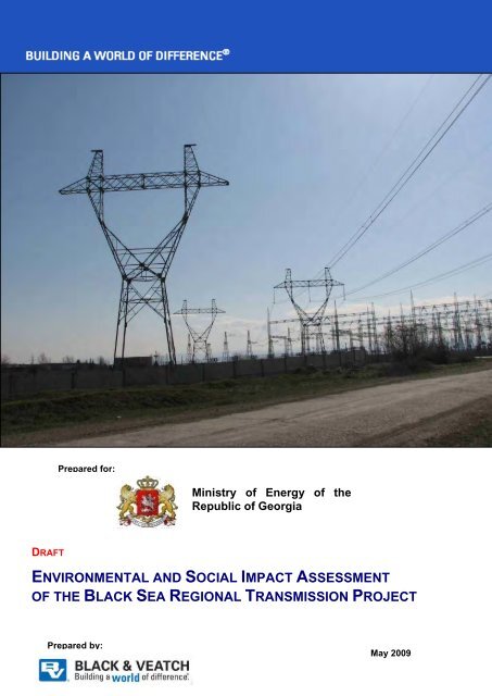
Draft Black Sea Regional Transmission Project ESIA<br />
Prepared for:<br />
Ministry of Energy of the<br />
Republic of Georgia<br />
DRAFT<br />
ENVIRONMENTAL AND SOCIAL IMPACT ASSESSMENT<br />
OF THE BLACK SEA REGIONAL TRANSMISSION PROJECT<br />
Prepared by:<br />
May 2009
Draft Black Sea Regional Transmission Project ESIA<br />
TITLE PAGE<br />
Project Title:<br />
Contract:<br />
Document Title:<br />
Prepared by:<br />
Environmental and Social Impact Assessment for the Black<br />
Sea Regional Transmission Project -- Georgia<br />
D18507<br />
Draft Environmental and Social Impact Assessment for the<br />
Black Sea Regional Transmission Project<br />
Black & Veatch Special Projects Corp.<br />
Date Prepared: May 2009<br />
Principal authors:<br />
B&V Project Manager:<br />
Ministry of Energy of<br />
Georgia Project Manager:<br />
Jemal Gabechava, Giorgi Ghambashidze, David Girgvliani,<br />
Vakhtang GvakhariaMike Johnsen, Andrei Kandaurov,<br />
Mariam Kimeridze, Mary Matthews, Ivan Maximov, Jack<br />
Mozingo, Maia Ochigava, Dane Pehrman, Manana<br />
Petashvili, Maka Stamateli, Nika Tsirghiladze<br />
Jack Mozingo<br />
Mariam Valishvili<br />
i
Draft Black Sea Regional Transmission Project ESIA<br />
TABLE OF CONTENTS<br />
Title Page.................................................................................................................................. i<br />
Table of Contents......................................................................................................................ii<br />
Appendices .............................................................................................................................. iii<br />
List of Tables............................................................................................................................ iii<br />
List of Figures .......................................................................................................................... iv<br />
1.0 Introduction and Background ...........................................................................................1<br />
1.1 Introduction..............................................................................................................1<br />
1.2 Purpose and Need for the Project ...........................................................................1<br />
1.3 Scope of the ESIA ...................................................................................................2<br />
1.4 Methodology for the ESIA .......................................................................................4<br />
1.4.1 Scoping......................................................................................................5<br />
1.4.2 Baseline Data Collection ...........................................................................7<br />
1.4.3 Assessment of Impacts .............................................................................7<br />
1.4.4 Environmental Mitigation and Enhancement ............................................10<br />
1.4.5 Environmental Monitoring.........................................................................10<br />
1.5 Organization of this Report.....................................................................................10<br />
2.0 The Proposed Project Line and Alternatives...................................................................12<br />
2.1 Alternative 1: Black Sea Regional Transmission Project ......................................12<br />
2.1.1 Substations...............................................................................................13<br />
2.1.2 Transmission Lines...................................................................................14<br />
2.1.3 Proposed Maintenance Techniques .........................................................19<br />
2.2 Alternative 2 – Modified Route Near Ktsia-Tabatskuri Managed Reserve<br />
and through Borjomi-Kharagauli National Park......................................................20<br />
2.3 Alternative 3 – Modified Route in Near Ktsia-Tabatskuri Managed Reserve<br />
and around Borjomi-Kharagauli National Park .......................................................21<br />
2.4 Alternative 4: No Action Alternative........................................................................21<br />
3.0 Legal and Institutional Framework ..................................................................................24<br />
3.1 National Legal and Regulatory framework .............................................................24<br />
3.1.1 Administrative framework .........................................................................24<br />
3.1.2 Environmental legal framework ................................................................25<br />
3.1.3 Environmental permit issuance procedure ...............................................28<br />
3.1.4 Land use and labor laws applicable to the project....................................28<br />
3.1.5 Other relevant national strategies and plans ............................................30<br />
3.2 International requirements......................................................................................30<br />
3.2.1 Requirements of International Finance Institutions ..................................30<br />
3.2.2 International conventions and agreements...............................................31<br />
4.0 Baseline Environmental and Socioeconomic Conditions ................................................33<br />
4.1 Environmental Baseline..........................................................................................33<br />
4.1.1 Meteorology and Climate..........................................................................33<br />
4.1.2 Major Landscapes and Ecosystems.........................................................37<br />
4.1.3 Geology/geomorphology ..........................................................................46<br />
4.1.4 Hydrology/Hydrogeology ..........................................................................51<br />
4.1.5 Geohazards ..............................................................................................54<br />
4.1.6 Flora and vegetation.................................................................................57<br />
4.1.7 Fauna .......................................................................................................79<br />
4.1.8 Environmental pollution along the line route.............................................85<br />
4.2 Baseline Socioeconomic Conditions ......................................................................91<br />
4.2.1 Demographics .........................................................................................92<br />
4.2.3 Infrastructure ............................................................................................96<br />
4.2.4 Economic conditions.................................................................................97<br />
4.2.5 Health ......................................................................................................100<br />
4.2.6 Cultural Resources ..................................................................................101<br />
4.2.7 Tourism....................................................................................................103<br />
ii
Draft Black Sea Regional Transmission Project ESIA<br />
5.0 Potential Environmental and Socioeconomic Impacts ...................................................104<br />
5.1 Potential environmental impacts ...........................................................................104<br />
5.1.1 Potential impacts on land use..................................................................104<br />
5.1.2 Potential impacts on air quality................................................................109<br />
5.1.3 Potential impacts on geology, soils, and geohazards..............................113<br />
5.1.4 Potential impacts on surface water and groundwater..............................120<br />
5.1.5 Potential impacts on ecosystems, animals, and plants ...........................124<br />
5.1.6 Potential effects on landscape appearance.............................................134<br />
5.1.7 Potential impacts to soil...........................................................................147<br />
5.2 Potential socioeconomic impacts ..........................................................................152<br />
5.2.1 Number of communities and people potentially affected.........................153<br />
5.2.2 Demographics and economics ................................................................156<br />
5.2.3 Infrastructure ...........................................................................................158<br />
5.2.4 Community ..............................................................................................158<br />
5.2.5 Cultural resources ...................................................................................159<br />
5.2.6 Public and occupational health and safety ..............................................160<br />
5.2.8 Order of Magnitude Cost Evaluation .......................................................164<br />
5.3 Summary of potential impacts and preferred alternative.......................................165<br />
5.3.1 Summary of potential impacts .................................................................165<br />
5.3.2 Preferred alternative ................................................................................166<br />
6.0 Environmental and Social Management and Monitoring Plan .......................................175<br />
6.1 Environmental and Social Management Plan .......................................................175<br />
6.2 Environmental and Social Monitoring Program .....................................................175<br />
7.0 References Cited ...........................................................................................................210<br />
APPENDICES<br />
Appendix A<br />
Appendix B<br />
Appendix C<br />
Appendix D<br />
Appendix E<br />
List of Preparers<br />
Milestones and Schedule for Preparation and Completion of ESIA<br />
Public Consultation and Disclosure Plan<br />
Report on Literature Review and Field Survey of Flora and Vegetation along<br />
the Black Sea Regional Transmission Project Route<br />
Feasibility study from animal biodiversity conservation standpoint<br />
LIST OF TABLES<br />
Table 1-1 Determination of Environmental Impact Significance<br />
Table 1-2 Duration of Impacts<br />
Table 1-3 Determination of Social Impact Significance<br />
Table 2-1 Current Status of Foundations and Towers Constructed before 1992<br />
Table 3-1 Environmental Laws and Regulations in Georgia<br />
Table 4.1-1 Geologic structure of Gardabani region<br />
Table 4.1-2 Most important areas for biodiversity preservation along the transmission line<br />
corridor<br />
Table 4.1-3 Likely occurrence of Red List fauna along the transmission line corridor<br />
Table 4.1-4 Baseline air quality<br />
Table 4.1-5 Benchmark values of pollutant concentrations based on population<br />
Table 4.1-6 Concentrations of air pollutants in Rustavi, 1999 to 2002<br />
Table 4.2-1 Population of Regions and Districts along the proposed transmission corridor<br />
Table 4.2-2 Population of communities within three kilometers of the proposed<br />
transmission line corridor<br />
Table 4.2-3 Ethnicity of Georgia and of Districts along the transmission line corridor<br />
Table 4.2-4 Georgia economic and employment contributions by sector<br />
Table 4.2-5 Unemployment rates by administrative region/district near transmission line<br />
Table 4.2-6 Principal income sources in selected communities near transmission line<br />
iii
Draft Black Sea Regional Transmission Project ESIA<br />
Table 4.2-7 Distances of the proposed line from national monuments and the direction of<br />
nearest approach<br />
Table 5.1-1 Land use sensitivity to change<br />
Table 5.1-2 Land uses affected by the transmission line route<br />
Table 5.1.3 Land affected in protected areas<br />
Table 5.1-4 Summary of Significance of Potential Impacts to Land Use<br />
Table 5.1-5 Air Quality Sensitivity to Change<br />
Table 5.1-6 Summary of Significance of Potential Impacts to Land Use<br />
Table 5.1-7 Mitigation of potential air quality impacts<br />
Table 5.1-8 Impacted Soil Types and the Areal Extent of Impact<br />
Table 5.1-9 Significance of Potential Impacts on Soils<br />
Table 5.1-10 Examples of General Sensitivity of the Water Environment<br />
Table 5.1-11 Significance of Environmental Impact: Surface Water and Groundwater<br />
Quality<br />
Table 5-1-12 Sensitivity of Ecological Receptors<br />
Table 5.1-13 Ecosystem impacts<br />
Table 5.1-14 Magnitude of Change – Ecosystems<br />
Table 5.1-15 Significance of potential impacts to ecosystems, flora, and fauna<br />
Table 5.1-17 Lands within protected areas from which project may be seen<br />
Table 5.1-18 Significance of potential effects on landscape appearance<br />
Table 5.1-19. Types of soil and area that could be affected<br />
Table 5.1-20 Significance of Potential Impact: Soils<br />
Table 5.2-1 Buildings within 100 Meters of the Transmission Line<br />
Table 5.2-2 Comparative cost evaluation of project alternatives<br />
Table 5-3-1 Summary of Potential Impacts<br />
Table 6-1 Environmental Management Plan: Mitigation and Enhancement Measures to<br />
Prevent or Reduce Potential Impacts<br />
Table 6-2 Social Management Plan: Mitigation and Enhancement Measures to Prevent<br />
or Reduce Potential Impacts<br />
Table 6-3. Environmental and Social Monitoring Program for Black Sea Regional<br />
Transmission Project<br />
LIST OF FIGURES<br />
Figure 1-1 Black Sea Regional Transmission Project: Project Overview<br />
Figure 1-2 ESIA Process<br />
Figure 1-3 Leaders and citizens in village Ilmazlo receiving and giving information during<br />
a visit by the ESIA social team<br />
Figure 2-1 Alternative 1: Black Sea Regional Transmission Project - Original<br />
Transmission Line Route and Regional Grid Connection<br />
Figure 2-2 Vegetation clearing of a narrow corridor<br />
Figure 2-3 Typical installation of foundations and setting towers<br />
Figure 2-4 Raising tower in mountainous terrain<br />
Figure 2-5 Types of towers<br />
Figure 2-6 Ground-based conductoring<br />
Figure 2-7 Example of vegetation clearing for corridor maintenance in forested terrain<br />
Figure 2-8 Alternative 2: Black Sea Regional Transmission Project - Modified route near<br />
Ktsia-Tabatskuri Managed Reserve and through Borjomi-Kharagauli National<br />
Park<br />
Figure 2-9 Alternative 3: Black Sea Regional Transmission Project - Modified route near<br />
Ktsia-Tabatskuri Managed Reserve and around Borjomi-Kharagauli National<br />
Park<br />
Figure 4.1-1. Air Temperature Profile along Transmission Line<br />
Figure 4.1-2 Multiyear Average Annual Soil Temperature<br />
Figure 4.1-3. Precipitation Profile along Transmission Line<br />
Figure 4.1-4 Average Annual and Maximum Wind Speed<br />
iv
Draft Black Sea Regional Transmission Project ESIA<br />
Figure 4.1.5 Marneuli area<br />
Figure 4.1.6 Tetritskaro region mountains and foothills<br />
Figure 4.1.7 Typical view in Tsalka area<br />
Figure 4.1.8 Winter in Tabatskuri Lake area<br />
Figure 4.1-9 Unmaintained road through Gardabani Managed Reserve<br />
Figure 4.1-10 Wetlands along river meander near Nariani<br />
Figure 4.1-11 Montane forest in Borjomi-Kharagauli National Park<br />
Figure 4.1-12 Khrami River gorge<br />
Figure 4.1-13 Tugai forest in Gardabani Managed Reserve<br />
Figure 4.1-14 Altered steppe near Marneuli<br />
Figure 4.1-15 Tetritskaro upper edge forest<br />
Figure 2.1-16 Tabatskuri east<br />
Figure 4.1-17 Nariani veli wetland in September<br />
Figure 4.1-18 Subalpine meadow near Samsari Ridge<br />
Figure 4.1-19 Wet meadow in Borjomi-Kharagauli National Park<br />
Figure 4.1-20 Concentrations of major air pollutants in Zestaphoni, 2001 to 2006<br />
Figure 4.2-1 Population density of the Republic of Georgia<br />
Figure 4.2-2 Typical secondary road along the transmission line route<br />
Figure 4.2-3 Cultivated land under proposed line near Ilmazlo<br />
Figure 4.2-4 Cultivated land near proposed corridor<br />
Figure 4.2-5 Basalt processing plant near proposed transmission line<br />
Figure 4.2-6 Old Muslim cemetery under proposed transmission line near Ilmazlo<br />
Figure 4.2-7 Visitors to protected areas of Georgia<br />
Figures located after Chapter 4<br />
Figure 4-1<br />
Relief map<br />
Figure 4-2a to 4-2h Ecosystems map<br />
Figure 4-3a to 4-3h Land use<br />
Figure 4-4a to 4-4i Geological map<br />
Figure 4-5a to 4-h5 Soil map<br />
Figure 4-6a to 4-6i Agrobotany map<br />
Figure 4-7<br />
Map of landslide hazard<br />
Figure 4-8<br />
Map of mudflow hazard<br />
Figure 4-9<br />
Map of seismic hazard<br />
Figure 4-10a to 4-10e Groundwater map<br />
Fgiure 4-11a to 4-11h Floral sensitivity map<br />
Figure 4-12<br />
Risk areas for terrestrial animals<br />
Figure 4-13<br />
Risk areas for migrating birds and bird wintering areas<br />
Figure 4-14<br />
Risk areas for terrestrial animals<br />
Figure 4-15<br />
Risk areas for biodiversity<br />
Figure 4-16<br />
Spring migration routes for birds<br />
Figure 4-17<br />
Autumn migration routes for birds<br />
Figure 4-18<br />
Protected areas<br />
Figures 4-19a to 4-19g Cultural heritage sites<br />
Figure 5.0-1 Political boundaries, population centers, and other major features along the<br />
proposed transmission line corridor<br />
Figure 5.1-1 Area showing impacted soil from off-road traffic adjacent to paved roadway.<br />
Figure 5.1-2 View of rolling grasslands typical of the eastern portion of the transmission<br />
line corridor<br />
Figure 5.1-3 Arid grasslands and terraced slopes typical of the environs near Akhaltsikhe<br />
Figure 5.1-4 Alternative 1 Viewshed<br />
Figure 5.1-5 Alternative 1 and 2 Viewsheds, Borjomi-Kharagauli National Park<br />
Figure 5.1-6 Alternative 1 and 3 Viewsheds, Borjomi-Kharagauli National Park<br />
Figure 5.1-7 Alternative 1, 2, and 3 Viewsheds, Ktsia-Tabatskuri Managed Reserve<br />
Figure 5.1-8 Akhaltsikhe Substation Viewshed<br />
Figure 5.2-1 Ilmazlo is the village that lies closest to the line<br />
Figure 5.2-2 Greenhouse and foundation for new house near the line in Ilmazlo<br />
v
Draft Black Sea Regional Transmission Project ESIA<br />
1.0 INTRODUCTION AND BACKGROUND<br />
1.1 Introduction<br />
The Ministry of Energy of the Republic of Georgia intends to expand and upgrade country’s<br />
electricity grid, and as part of this process has decided to complete a high-voltage<br />
transmission line across southern Georgia that connects Gardabani and Zestaphoni and that<br />
runs from near Akhaltsikhe to the Turkish border, where it would connect to a line on the<br />
Turkish grid. The Ministry has approached the European Bank for Reconstruction and<br />
Development (EBRD) and other lenders for financing, possibly including the European<br />
Investment Bank (EIB) and Kreditanstalt für Wiederaufbau (KfW). Under Georgian law, the<br />
potential environmental impacts of the project must be evaluated in an Environmental Impact<br />
Assessment. As part of their decisionmaking process, EBRD and other international lenders<br />
require that the proposed project be evaluated in an Environmental and Social Impact<br />
Assessment (ESIA) that meets EBRD and other international guidelines. The draft ESIA is<br />
being disclosed to project stakeholders and the public in compliance with Georgian law and<br />
EBRD guidelines. All stakeholder and public comments on the draft ESIA will be considered<br />
in developing the final ESIA, and will be considered in the final decisions made by the<br />
Ministry of Energy and then by EBRD and other lenders.<br />
1.2 Purpose and Need for the Project<br />
Power generation potential in the Republic of Georgia comes from both renewable sources<br />
of energy such as hydro and wind power and from thermal generating capacity. The<br />
country’s hydropower potential is estimated at up to 80 billion kWh per year, of which up to<br />
40 billion kWh may be economically attractive. The current system consists of about 60<br />
hydropower stations with a maximum output capability of 6.8 billion kWh annually (that is,<br />
about 17 percent of the economically feasible potential) plus about 650 MW of thermal<br />
capacity at Gardabani, southeast of Tbilisi. In addition, the construction of two units (150-<br />
160 MW) of Combined Cycle Gas Turbine power plants is envisaged. Thermal generation is<br />
mostly used in winter to balance low water availability, but it would also be available for<br />
export in off-peak demand season (spring-summer).<br />
Georgia has one 500 kilovolt (kV) transmission line that runs east to west, connecting<br />
Gardabani in the east to Ksani (northeast of Tbilisi) to Zestaphoni in the west. In the 1980s,<br />
another line was designed and partly constructed, this one connecting Gardabani and<br />
Zestaphoni by way of Alkaktsikhe, which is far south of the existing line. Over half of the<br />
foundations and towers for the new line were constructed between 1989 and 1991, when the<br />
project was abandoned.<br />
There is a significant generation-load imbalance in the Georgian power system: two-thirds of<br />
Georgia’s energy resource is located in the northwest of the country, while two thirds of<br />
domestic demand is located in eastern Georgia, and most of the potential export market is<br />
located in countries south of Georgia (for example, Turkey, Iran, and Iraq, all of which are<br />
experiencing rapid economic development and growth in electricity demand). Power<br />
delivery to any of these markets requires a reliable high voltage transmission network. At<br />
present, only one strong line connects West and East Georgia, the 500kV transmission line<br />
“Imereti” – “Kartli-II” – “Kartli-I”. Any fault on this line, especially during autumn and winter,<br />
causes a large power deficit in the East, and this has resulted in frequent total system<br />
blackouts. Apart from reducing domestic grid reliability, this also limits existing and future<br />
power swap or export potential. In addition to being an exporter of electricity, Georgia<br />
wishes to seize an opportunity for acting as a transit country, notably for electricity exports<br />
from Azerbaijan to Turkey.<br />
In recent years, the Ministry of Energy has examined the need to integrate the national grid<br />
into the regional system, both for economic and national security reasons. Fichtner (2007)<br />
1
Draft Black Sea Regional Transmission Project ESIA<br />
completed a study for the Ministry that evaluated the concept of developing an extremely<br />
high-voltage interconnected system in Caucasus nations. The intent would be to allow easy<br />
and efficient cross-border exchanges and make better use of regional energy resources.<br />
The study considered Georgia, Armenia, Azerbaijan, Iran, and Turkey. The study<br />
recommended going forward with the two projects studied in detail, which were to develop<br />
lines to connect Armenia and Georgia, and to connect Turkey and Georgia. The study<br />
concluded that Georgia (and Armenia) would profit from and share in development<br />
momentum that would be gained by Turkey, Iran, Azerbaijan, and Russia.<br />
The Ministry of Energy also commissioned a study (Ministry of Energy of Georgia, undated)<br />
to determine whether there is adequate demand in Turkey for electricity exported from<br />
Georgia and Azerbaijan and whether there is sufficient existing and feasible electricity<br />
generation projects in Azerbaijan and Georgia to supply the Turkish markets using a newly<br />
constructed transmission line. The study determined that this was feasible, given a<br />
competitive price and additional investment in hydropower generation facilities in Georgia.<br />
The study also noted that the hydropower investment would likely depend on there being a<br />
firm commitment to the transmission line, whereas financing for the transmission line would<br />
depend on commitments to generation projects.<br />
Finally, the Ministry of Energy sponsored a feasibility study funded by the United States<br />
Trade and Development Agency to determine the least-cost technical options to make power<br />
transmission more reliable in Georgia (Kuljian, 2008). Specifically, the study examined the<br />
construction of a new 500kV line that would further integrate the west and east Georgian<br />
Power System and operate in parallel with the existing Zestaphoni – Ksani – Gardabani<br />
500kV transmission line. The study also examined the feasibility of having this new line,<br />
which would be a completion of the old Soviet-era planned line, also have a new high<br />
voltage interconnection to Turkey by way of a new substation at Akhaltsikhe. Although there<br />
has been some deterioration and scavenging, much of the constructed route remains<br />
suitable for use after some rehabilitation.<br />
Subsequently, the Ministry of Energy made a decision to go forward with completion of the<br />
line and approached lenders for financing. The Project Execution Agency for the project is<br />
the Georgia State Electrosystem (GSE), which will be responsible for designing and<br />
constructing the line together with the Technical Consultant hired through international<br />
tender specifically for the Black Sea Transmission Project. As the project progresses, GSE<br />
may pass along responsibility as the execution agency to EnergoTrans, the daughter<br />
company (100 percent ownership), which is the legal entity that owns portions of the line that<br />
have already been acquired and will own the entire line once the right-of-way is fully<br />
acquired.<br />
1.3 Scope of the ESIA<br />
This Environmental and Social Impact Assessment (ESIA) evaluates the following project<br />
components, as shown on Figure 1-1:<br />
<br />
<br />
<br />
<br />
Rehabilitation and reconstruction of foundations and/or towers that have<br />
deteriorated or been damaged along the 260-kilometer route from Gardabani to<br />
Zestaphoni.<br />
Construction of foundations and towers for sections of the line that were not built<br />
on the Gardabani to Zestaphoni route and on the 30-kilometer route from<br />
Akhaltsikhe to the Turkish border.<br />
Conductoring (that is, placing lines to conduct electricity) the entire line.<br />
Slight expansions of existing 500kV substations near Gardabani and Zestaphoni.<br />
2
Ajameti<br />
Managed<br />
Reserve<br />
!(<br />
!H<br />
Baghdati<br />
IMERETI<br />
TURKEY<br />
Terjola<br />
!H<br />
!(<br />
!H<br />
!H<br />
Akhaltsikhe<br />
Zestaphoni 500 kV<br />
Substation (existing)<br />
Zestaphoni<br />
!H<br />
Borjomi-Kharagauli<br />
National Park<br />
!(<br />
Kharagauli<br />
Borjomi<br />
Nature<br />
Reserve<br />
!H<br />
Aspindza<br />
!H<br />
Borjomi<br />
Akhaltsikhe 500/400 kV<br />
Substation (new)<br />
Tetrobi<br />
Managed<br />
Reserve<br />
SAMTSKHE-JAVAKHETI<br />
Akhalkalaki<br />
!H<br />
!H<br />
Khashuri<br />
Ktsia-Tabatskuri<br />
Managed Reserve<br />
!H<br />
Kareli<br />
Tskhinvali<br />
!H<br />
SHIDA KARTLI<br />
!H<br />
Gori<br />
Tsalka<br />
KVEMO KARTLI<br />
!H<br />
Kaspi<br />
!H<br />
AlgeTi<br />
National Park<br />
Tetri Tskaro<br />
!H<br />
Akhalgori Black<br />
Sea<br />
!H<br />
Bolnisi<br />
!H<br />
Dusheti<br />
Akhaltsikhe<br />
!H<br />
TBILISI<br />
!H<br />
TBILISI<br />
!H<br />
Marneuli<br />
TBILISI !H<br />
^_<br />
MTSKHETA-MTIANETI<br />
Mtskheta<br />
GEORGIA<br />
TURKEY<br />
Zestaphoni<br />
!(<br />
!H<br />
!(<br />
!H<br />
!(<br />
Proposed<br />
transmission line<br />
RUSSIA<br />
Tianeti<br />
Gardabani<br />
!( !H<br />
ARMENIA AZERBAIJAN<br />
Tbilisi<br />
National Park<br />
!H<br />
Rustavi<br />
Gardabani<br />
!(<br />
!H<br />
!H<br />
Dmanisi<br />
Gardabani<br />
Managed Reserve<br />
o<br />
0<br />
5 10 15 20<br />
Kilometers<br />
WGS 1984 UTM Zone 38N<br />
!H<br />
Ninotsminda<br />
!H District<br />
Capital<br />
Regions<br />
Districts<br />
National Protected Areas<br />
National Park<br />
Managed Reserve<br />
Strict Nature Reserve<br />
AZERBAIJAN<br />
Black Sea Regional Transmission Project Figure<br />
Project Overview 1-1<br />
!H<br />
New 500 kV Line (partly constructed)<br />
New 400 kV Line<br />
New 500 kV Line (partly constructed)<br />
400 kV Connection<br />
to Turkish Line<br />
Gardabani 500 kV<br />
Substation (existing)<br />
PROJECTS\Georgia\MapDocs\Figure1-1_Schematic_042909.mxd April 29, 2009
Draft Black Sea Regional Transmission Project ESIA<br />
<br />
Construction of a new 500/400/220kV substation near Akhaltsikhe<br />
In the future, additional lines may be constructed from Azerbaijan to connect to the<br />
substation at Gardabani, and from the Georgia border to a substation near Borchka, Turkey.<br />
Any potential impacts from construction and operation of these lines would be covered in<br />
future impact assessments.<br />
This ESIA is intended to meet the requirements of Georgian law, as described in section 3,<br />
and also will have to meet requirements established by the European Bank for<br />
Reconstruction and Development and other lenders for Category A projects. Prior to making<br />
a funding decision, the lenders and the Georgian Ministry of Environment Protection and<br />
Natural Resources have to be satisfied that:<br />
<br />
<br />
<br />
The elements of the investment program they have been asked to help finance<br />
would meet Georgian national requirements and existing European Union,<br />
EBRD, and international financial institution standards, as described in section 3.<br />
The project includes all necessary mitigation measures to minimize any<br />
significant adverse change in environmental, health and safety, and<br />
socioeconomic conditions.<br />
Appropriate public consultation and disclosure are undertaken in line with<br />
Georgian national law as well as EBRD Environmental Policy (EBRD, 2003), thus<br />
ensuring all reasonable public opinions are adequately considered prior to a<br />
commitment for financing.<br />
In keeping with Georgian law and EBRD requirements, the overall scope of the ESIA will<br />
include:<br />
<br />
<br />
<br />
<br />
<br />
<br />
Scoping and identification of key environmental and socioeconomic issues.<br />
Definition of baseline conditions of key environmental and social resources that could<br />
be affected by the project.<br />
Assessment of positive and negative impacts of the proposed project on<br />
environmental and socioeconomic resources.<br />
Consultation with people who may be affected by the project and other stakeholders.<br />
Development of design and operating practices that are sufficient to avoid, reduce, or<br />
compensate for significant adverse environmental and social impacts.<br />
Development of such monitoring programs as are necessary to verify mitigation is<br />
effective in accomplishing its goals, and to develop and refine the effectiveness of<br />
mitigation measures.<br />
1.4 Methodology for the ESIA<br />
This section describes the ESIA process in the context of the Black Sea Regional<br />
Transmission Project. The overall approach for the ESIA and reporting used the following<br />
sources of guidance<br />
Law of Georgia on Protection of Environment (enacted 1996, amended 2000,<br />
2003, 2007).<br />
Law of Georgia on Environmental Impact Permit (adopted October 15, 1996,<br />
replaced by the law adopted in 2007).<br />
<br />
European Union Council Directive 85/337/EEC on the assessment of the effects<br />
of certain public and private projects on the environment, as amended by Council<br />
4
Draft Black Sea Regional Transmission Project ESIA<br />
directive 97/11/EC (Council<br />
of the European Union,<br />
1985; 1997).<br />
EBRD policies, including<br />
Environmental Policy<br />
(EBRD, 2003) and Public<br />
Information Policy (EBRD,<br />
2006).<br />
EIB’s environmental and<br />
social requirements in their<br />
Environmental and Social<br />
Practices Handbook<br />
(http://www.eib.org/about/p<br />
ublications/environmentaland-social-practiceshandbook.htmEIB,<br />
2007)<br />
KfW’s requirements<br />
contained in Financial<br />
Cooperation<br />
with<br />
Development Countries<br />
(KfW, 2003) and<br />
Environmental Guideline for<br />
Investment Finance by KfW<br />
(KfW, 2002).<br />
The overall ESIA process is shown<br />
in Figure 1-2.<br />
1.4.1 Scoping<br />
Scoping –<br />
identification of key<br />
issues and impacts<br />
Baseline data<br />
collection/compilation<br />
Impact Assessment –<br />
prediction, analysis<br />
and determination of<br />
significance<br />
Mitigation – avoid,<br />
reduce, compensate,<br />
remediate, enhance<br />
Environmental<br />
Action/Management<br />
Plan and Monitoring<br />
Plan– feeds into<br />
project construction<br />
Production of the EIA<br />
Report<br />
Figure 1-2. The ESIA Process<br />
Consultation<br />
The method used for scoping the potentially significant impacts of this project comprised:<br />
<br />
<br />
<br />
<br />
Visits by the social team in February 2009 to western sections of the line (from<br />
Marneuli to the west), to the Borjomi-Kharagauli National Park and Akhaltsikhe<br />
areas, and to the new corridor between Akhaltsikhe and the Turkish border.<br />
Visits by the environmental team to as much of the line as was accessible during<br />
visits in February and March 2009. These consisted of several days of observing<br />
constructed foundations and towers along the entire route, including damaged or<br />
destroyed ones, as well as observing the land and resources where the line has<br />
yet to be completed.<br />
Detailed reviews of other studies conducted in the areas where the line will run,<br />
including the BTC Pipeline ESIA (BTC Co., 2002) and the Samtskhe – Javakheti<br />
Roads Rehabilitation Project EIA (x xx, 2006).<br />
Meetings with officials in the Ministry of Environment Protection and Natural<br />
Resources, including representatives of the Agency for Protected Areas and the<br />
EIA department, as well as inquiries to the Ministry of Culture.<br />
5
Draft Black Sea Regional Transmission Project ESIA<br />
Scoping meeting held in Gudauri on 27-28 March, which was attended by the<br />
Ministry of Energy, the Ministry of Environment Protection and Natural<br />
Resources, and three NonGovernmental Organizations (NGOs), including the<br />
Caucasus Environmental NGO.Network, the Informational Center of Kvemo<br />
Kartli, Geo Information Laboratory, LTD, and the Green Movement.<br />
Followup meetings in Tbilisi with various NGOs, including the Green Movement of<br />
Georgia and Green Alternative.<br />
Visits by the social<br />
team to a total of 16<br />
villages along the<br />
transmission line<br />
corridor. These visits<br />
included presentations<br />
to 400 people as well<br />
as interviews and<br />
discussions with<br />
several dozen people.<br />
In most cases,<br />
municipal authorities<br />
were notified of the<br />
meetings but could not<br />
attend. Figure 1-3<br />
shows discussions<br />
during a visit to a<br />
village near Gardabani.<br />
Figure 1-3. Leaders and citizens in Ilmazlo village receiving<br />
and giving information during a visit by the ESIA social team<br />
Government officials, NGOs,<br />
and citizens were very<br />
interested in hearing about the project, and were generally supportive, although there were<br />
some concerns. The major concerns that were raised during scoping, positive and negative,<br />
fell into several major categories:<br />
<br />
<br />
<br />
Environmental:<br />
- Concern about impacts on flora and/or fauna in Borjomi-Kharagauli National<br />
Park.<br />
- Concerns about the potential impacts of crossing the Kura River.<br />
Social:<br />
- Concern about potential health effects of high-voltage transmission lines on<br />
residents who live in houses near the line or other people who spend time near<br />
the lines.<br />
- Concern about having to relocate to a house farther away from the line.<br />
- Concern about damage to existing houses from derelict towers.<br />
Economic:<br />
- Concern that construction and maintenance of the line could damage crops or<br />
interfere with grazing.<br />
- Concern about loss of land to foundations and towers and to access roads.<br />
- A desire that local workers be hired for rehabilitation and construction of the<br />
foundations and towers (some people who were interviewed had worked on the<br />
original construction).<br />
- Concern about impacts on recreation in Borjomi-Kharagauli National Park.<br />
6
Draft Black Sea Regional Transmission Project ESIA<br />
<br />
<br />
Cultural:<br />
- Concerns about impacts on the Ilmazlo cemetery, including damages to graves.<br />
Other:<br />
- Surprise that the line would be completed and placed into service, since some<br />
people had thought it had been abandoned permanently.<br />
- Concern that the Government will do whatever it wants without considering other<br />
opinions.<br />
- Appreciation of the benefit of linking Georgia powers grid to Turkey (a key NATO<br />
ally) and reducing the importance of linkage to the Russian grid.<br />
- Hope and appreciation that electricity might become more reliable and/or more<br />
affordable.<br />
1.4.2 Baseline Data Collection<br />
The study area was defined initially by the originally designed transmission line corridor, for<br />
which GSE provided GPS coordinates for all the foundations and towers that had already<br />
been constructed and the approximate corridor where new foundations and towers would<br />
need to be constructed. Baseline data collection for the project included a combination of<br />
desk studies and site visits. Desk studies used existing sources of information, including<br />
data available on the internet; reports and the scientific literature; recent ESIAs/EIAs for<br />
projects in areas near the corridor; data provided by the Ministry of Energy, the Ministry of<br />
Environment and Natural Resources, and the Ministry of Culture. Site visits were made<br />
from February through April 2009 to supplement and verify information provided by desk<br />
studies.<br />
Chapter 4 of this ESIA provides information on the baseline environment, including natural<br />
processes that may affect the baseline over the course of project development. Where there<br />
are gaps or uncertainties with the baseline data, or where assumptions have been made,<br />
this is stated in the text.<br />
1.4.3 Assessment of Impacts<br />
Chapter 5 of this ESIA identifies potential socioeconomic impacts, determines whether the<br />
potential impact is likely to be significant, and compares the potential impacts for various<br />
alternatives. A number of criteria were used to determine whether or not a potential impact<br />
of the proposed scheme could be considered “significant.” These are outlined with reference<br />
to specific environmental and social issues in the subsequent topic sections of this ESIA.<br />
Wherever possible, a quantitative assessment of the impacts was undertaken. Where this<br />
was not possible, a qualitative assessment of impacts was undertaken, based on existing<br />
information available for the corridor, and experience with other transmission line projects.<br />
The ESIA covers the direct impacts and any indirect, secondary, cumulative, short-, mediumand<br />
long-term, permanent and temporary, reversible and irreversible, beneficial and adverse<br />
impacts of the proposed scheme.<br />
Where relevant, the anticipated impact was compared against appropriate legal<br />
requirements and standards. Where no such standards exist, assessment methods<br />
involving interpretation and the application of professional judgement were employed. The<br />
assessment of significance in all cases took into account the impact’s deviation from the<br />
established baseline conditions and the sensitivity of the environment.<br />
7
1.4.3.1 Methodology for Assessing Environmental Impacts<br />
Draft Black Sea Regional Transmission Project ESIA<br />
A general method for grading the significance of environmental impacts was adopted to<br />
ensure consistency in the terminology of significance, whether for a beneficial or an adverse<br />
impact. The two principal criteria determining significance are the sensitivity of the receptor<br />
and the magnitude of the change arising from the scheme, as shown in Table 1-1.<br />
Table 1-1 shows that the significance of impacts was classed as major, moderate, minor or<br />
none; and either positive (beneficial) or negative (adverse). This categorization is widely<br />
recognized and accepted in the field of environmental impact assessment. Where<br />
appropriate, topic-specific assessment methods and criteria for determining significance are<br />
described in Chapter 5.<br />
Table 1-1. Determination of Environmental Impact Significance<br />
Magnitude of<br />
change<br />
High<br />
(e.g. >75% of<br />
area or receptor<br />
affected)<br />
Medium<br />
(e.g. 25-75% of<br />
area or receptor<br />
affected)<br />
Low<br />
(e.g. 5 to 25% of<br />
area or receptor<br />
affected)<br />
Very Low<br />
(e.g. >0, but<br />
Draft Black Sea Regional Transmission Project ESIA<br />
intended and unintended, positive and negative. For significant impacts, the developer would<br />
implement a variety of mitigation measures, and these are discussed in Chapter 6.<br />
Nature of<br />
change<br />
Temporary<br />
Table 1-2. Duration of Impacts<br />
Duration<br />
Short-term<br />
Medium-term<br />
Long-term<br />
Permanent -<br />
Definition/ Description<br />
Impact continues during construction (1-2 yrs)<br />
and up to 1 year following construction<br />
Impact continues 1-5 years following<br />
construction<br />
Impact continues 5-10 years after construction<br />
Due to the length of time period for human<br />
beings, impacts over 10 years can subjectively<br />
be defined as permanent.<br />
Generally, the social impact assessment process involves the following major tasks:<br />
<br />
<br />
<br />
<br />
Identifying types of adverse and beneficial impacts of the proposed action.<br />
Assessing the level of socioeconomic risks in terms of frequency (how likely is<br />
it to happen) and consequences.<br />
Assessing the acceptability of the risks.<br />
Introducing mitigation measures to reduce risks to acceptable level.<br />
The social impact assessment typically addresses the following issues:<br />
Demographics, including changes in local population size,<br />
emigration/immigration in the area, migration of people in search of work, and<br />
other issues.<br />
Economic issues, including supply chain impacts, local sourcing<br />
opportunities, potential impacts on local markets for goods and services,<br />
employment opportunities for construction, operation and decommissioning<br />
phases of the project.<br />
<br />
<br />
<br />
<br />
<br />
Health issues, including risks of new diseases to indigenous communities,<br />
impacts on health of operations personnel and local communities, impact of<br />
local diseases on workers.<br />
Social infrastructure, including adequacy of health care and education<br />
facilities, transport and roads, power supply, fresh water supply to support<br />
project activities and personnel as well as the local communities.<br />
Resources, including land use changes, increased access to rural or remote<br />
areas, use of natural resources.<br />
Cultural, including issues associated with sites that have archaeological,<br />
historical, religious, cultural, or aesthetic values.<br />
Social equity, including local social groups who will gain or lose as a result of<br />
the project or operation.<br />
As with environmental impacts, a general method for grading the significance of<br />
socioeconomic impacts was adopted to ensure consistency in the terminology of<br />
significance, whether for a beneficial or an adverse impact. The two principal criteria used<br />
9
Draft Black Sea Regional Transmission Project ESIA<br />
were the nature of the impact and the magnitude of the change arising from the scheme, as<br />
shown in Table 1-3.<br />
1.4.4 Environmental Mitigation and Enhancement<br />
Where potential impacts could be significant, mitigation measures were developed. These<br />
measures are intended to avoid, reduce, compensate, and/or remediate adverse impacts, or<br />
to enhance potentially beneficial impacts. Wherever possible, this is undertaken as part of<br />
the project design, so the measures will feed back into impact assessment. An example of<br />
this would be to include erosion control measures into the design of roads.<br />
The mitigation and enhancement which should be undertaken as part of the project are set<br />
out as an Environmental and Social Management Plan which can then be applied in order to<br />
manage different phases of the project. For this project, the plan presented in Chapter 6.<br />
Table 1-3. Determination of Social Impact Significance<br />
Magnitude of<br />
Nature of impact<br />
change Avoidance Disruption/Habituation Permanence<br />
Negligible<br />
No<br />
needed<br />
avoidance<br />
No noticeable under<br />
normal conditions<br />
Not noticeable<br />
Minor<br />
Mitigation or design<br />
change prevents<br />
Impact(s)<br />
No effect on daily life or<br />
routine of affected party<br />
Ephemeral:
Draft Black Sea Regional Transmission Project ESIA<br />
<br />
<br />
<br />
<br />
<br />
<br />
<br />
<br />
Chapter 4 describes the environmental setting of the transmission line corridor and<br />
the baseline environmental and socioeconomic conditions of the area.<br />
Chapter 5 describes the potential impacts that may result from construction,<br />
operation, and maintenance of the transmission line.<br />
Chapter 6 is the Environmental and Social Action Plan that will be implemented,<br />
which includes measures that are needed to prevent, mitigate, or otherwise address<br />
potentially significant impacts.<br />
Chapter 7 is the monitoring program that will be implemented to verify the<br />
conclusions of this ESIA and to allow refinement of future mitigation efforts.<br />
Chapter 8 provides references used in preparing the ESIA.<br />
Appendix A identifies the people who prepared the ESIA and summarizes their<br />
qualifications.<br />
Appendix B shows the milestones and schedule for completing the ESIA process.<br />
Appendix C is the Public Consultation and Disclosure Plan that was used to ensure<br />
the involvement of stakeholders in the ESIA process.<br />
11
Draft Black Sea Regional Transmission Project ESIA<br />
2.0 THE PROPOSED PROJECT LINE AND ALTERNATIVES<br />
This chapter describes the proposed transmission line and several alternatives. The action<br />
alternatives include the regional project as described in Chapter 1 and also modified corridor<br />
routes to reduce impacts on protected areas. The alternatives considered include three<br />
action alternatives and the no action alternative:<br />
<br />
<br />
<br />
<br />
Alternative 1: completion of the 500kV line as proposed in the late 1980s and partly<br />
constructed through 1991, plus a new substation at Akhaltsikhe and a new 400kV<br />
line to the Turkish border. Construction would begin in 2010 and last through 2012.<br />
Alternative 2: the same as Alternative 1 except a modified route near Ktsia-<br />
Tabatskuri Managed Reserve and through Borjomi-Kharagauli National Park.<br />
Alternative 3: the same as Alternative 2 except a modified route that does not cross<br />
Borjomi-Kharagauli National Park.<br />
Alternative 4: No action. This alternative would involve not completing the line but<br />
instead leaving the foundations and towers as they are, and not completing the Black<br />
Sea Regional Transmission Project described in Chapter 1.<br />
2.1 Alternative 1: Black Sea Regional Transmission Project<br />
This alternative includes the following key elements as shown on Figure 1-1 in Chapter 1:<br />
<br />
<br />
<br />
<br />
Rehabilitation and/or construction of approximately 260 kilometers of 500kV<br />
transmission line connecting the existing 500kV substations at Zestaphoni and<br />
Gardabani.<br />
Construction of a new 500/400 kV and 400 kV substation at Akhaltsikhe.<br />
Approximately 30 kilometers of 400 kV transmission line from the new substation<br />
at Akhaltsikhe to the Turkish border (to be connected to the Borchka substation in<br />
Turkey at a later date).<br />
Expansion of the substations at Zestaphoni and Gardabani to accommodate the<br />
new 500kV circuit.<br />
Work on strengthening the transmission network in the Caucasus began in the 1980s. The<br />
proposed 500 kV line that is the subject of this ESIA was originally designed as part of a<br />
larger plan to connect the electricity systems of Russia and all three Trans-Caucasian<br />
Republics, and to improve reliability of the Georgian power system. Construction of the<br />
section from Gardabani to Zestaphoni started in 1989 and continued until 1991. However,<br />
after 1992 further construction became impossible due to political events in Georgia, and<br />
sections of the line whose foundations and towers had been constructed were left<br />
unenergized and unprotected. The project that was partly constructed at that time is now<br />
proposed to be completed and extended. The proposed project would extend Georgia’s<br />
main 500kV system by adding two new 500kV links from Gardabani and Zestaphoni to<br />
a new substation near Akhaltsikhe. The new Akhaltsikhe substation will be connected to<br />
the Turkish grid at Borchka using a 400kV overhead line. The 400kV line from the Georgian<br />
border to Borchka in Turkey has not yet been designed or constructed. A companion project<br />
to facilitate the transit element is the completion of a new 500kV connection between<br />
Georgia and Azerbaijan, which is also to be completed at a later date.<br />
Before construction was ended in 1991, a total of 554 foundations and towers were<br />
constructed over the 283-kilometer corridor. Table 2-1 shows the status of the existing<br />
towers. Of these, slightly over half will need rehabilitation of some sort, ranging from<br />
complete replacement to repairs to existing tower components. The proposed project will<br />
12
Draft Black Sea Regional Transmission Project ESIA<br />
include construction of an additional 309 foundations and towers (assuming that towers are<br />
placed 400 meters apart), and conductoring of high-voltage lines between all the towers.<br />
Figure 2-1 shows the portions of the line that have been constructed and that have not yet<br />
been constructed, and also shows the locations of the individual towers that have been<br />
constructed. Table 2-2 shows the length of the line and the numbers of towers that will be<br />
used for this alternatives and also Alternatives 2 and 3.<br />
Table 2-1. Current Status of Foundations and Towers<br />
Constructed before 1991<br />
Status<br />
Number<br />
Existing tower/foundation sites<br />
554<br />
Towers missing<br />
118<br />
Severely damaged, major repair required<br />
99<br />
Minor damage, relatively simple rehabilitation<br />
74<br />
Good condition, minor or no repairs needed<br />
263<br />
Source: Information received from GSE<br />
Table 2-2. Corridor length and tower status for all alternatives<br />
(all distances in kilometers)<br />
Alternative<br />
1 2 3 4<br />
Total length of line 283.1 294.3 315.2 0<br />
Total constructed length 161.4 156.6 135 161.4<br />
Total length not constructed 121.7 137.7 180.2 0<br />
Number of constructed towers used 554 514 366 0<br />
Number of towers to be abandoned 0 40 188 554<br />
Length of Ktsia-Tabatskuri crossing 12.1 10 10 0<br />
Length of Borjomi-Kharagauli crossing 11.5 4.7 0 0<br />
Length of Gardabani crossing 3.1 3.1 3.1 0<br />
2.1.1 Substations<br />
The new Akhaltsikhe substation will include construction of new 500kV and 400kV outdoor<br />
conventional air-insulated (AIS) substations at a single site on approximately six hectares of<br />
land approximately 15 kilometers northeast of Akhaltsikhe along the existing 500kV route.<br />
The main elements of this substation will include:<br />
<br />
<br />
<br />
<br />
500kV substation.<br />
400kV substation.<br />
Back-to-back HVDC 500/400 Converter Station.<br />
Control and monitoring equipment (SCADA).<br />
The civil works that will be completed as part of substation design, procurement, and<br />
construction include:<br />
<br />
Subsoil investigation, topographical & contour survey, as required.<br />
13
Draft Black Sea Regional Transmission Project ESIA<br />
<br />
<br />
<br />
<br />
Earthworks and rock excavation including dewatering if required, filling and<br />
grading and paving as needed.<br />
Steel structures.<br />
Foundations for substation control building and structures.<br />
Infrastructure works such as perimeter fencing, access and service roads and<br />
paths, water supply, storm drainage, cable ducts/trenches, doors and windows,<br />
and finishing work including masonry, plastering, filing, and painting.<br />
Design and execution will be based on applicable international regulations and standards in<br />
conjunction with Georgia norms and standards. The existing substations at Zestaphoni and<br />
Gardabani will be extended slightly to accommodate the new 500kV circuits at each location.<br />
This will require minimal additional land space since most of the new equipment will be<br />
installed within the existing substations.<br />
2.1.2 Transmission Lines<br />
As mentioned previously, a transmission line has been planned on the same proposed route<br />
from Gardabani to Zestaphoni since the late 1980s. Activities including right-of-way<br />
acquisition, land clearing, construction of foundations and construction of towers were<br />
conducted between 1989 and 1991 along about 65 percent of this route. As noted above,<br />
many of these towers have been damaged or completely removed by scavengers and many<br />
foundations are in precarious condition.<br />
The segments of the transmission line include:<br />
<br />
<br />
<br />
Segment 1 - Gardabani to Akhaltsikhe. Right-of-way acquisition, land-clearing, and<br />
tower construction were completed along 114.8 kilometers of this 187.5-kilometer<br />
route (61 percent) in three main areas as shown on Figure 2-1: from kilometer 0 at<br />
Gardabani to kilometer 40.4 west of Marneuli (40.4 kilometers); from kilometer 53.9<br />
east of Tetri-Tskaro to kilometer 99.5 near Tsalka (45.6 kilometers); and from<br />
kilometer 158.9 near Alastani to kilometer 187.5 (28.8 kilometers) at the proposed<br />
Akhaltsikhe substation. 1<br />
Segment 2 – Akhaltsikhe to Zestaphoni. Right-of-way acquisition, land-clearing, and<br />
tower construction were completed along 48.0 of this 61.1-kilometer route (79<br />
percent) in two main areas as shown on Figure 2-1: from kilometer 187.5 at the<br />
proposed Akhaltsikhe substation to kilometer 197.8 (10.3 kilometers) just inside the<br />
southern boundary of what is now Borjomi-Karagauli National Park; and from<br />
kilometer 210.9 just outside the northern boundary of the Borjomi-Karagauli National<br />
Park to kilometer 248.6 at the Zestaphoni substation (37.7 kilometers). Additionally,<br />
the right-of-way that connects these two segments through the National Park was<br />
initially cleared but has since largely re-grown. Remnants of some of the access<br />
roads are still present through these areas and are used as a local access route for<br />
recreational activities such as hiking and horseback riding.<br />
Segment 3 - Akhaltsikhe to Borchka (terminating near Vale on the Turkish Border).<br />
No activities have previously occurred on this segment, so this will be all new<br />
construction.<br />
1 The distance in kilometers is measured from the origin at the Gardabani substation.<br />
14
Baghdati<br />
Ajameti<br />
Managed<br />
Reserve<br />
!H<br />
!<br />
! !!!<br />
! !<br />
!!!!! ! !!! !!!!!!!!<br />
!H<br />
! ! !H<br />
!<br />
!<br />
!<br />
!<br />
!H<br />
! !<br />
! !<br />
!H<br />
!H<br />
!H<br />
Abastumani<br />
!<br />
!H<br />
!!<br />
! Tsinubani<br />
! !<br />
!! !<br />
!H<br />
Persa<br />
!!!!<br />
! !!!!!!!!!!!!!!!!!!!!!!<br />
Substation<br />
Bakurianis<br />
(new)<br />
Andeziti<br />
!H<br />
Mugareti<br />
!H<br />
!H !H<br />
Tsakhani<br />
!H !H<br />
!H<br />
!H<br />
Ktsia-Tabatskuri<br />
!H Tskruti<br />
Agara<br />
Tarsoni<br />
Varkhani<br />
!H !H Tkemlana<br />
Managed Reserve Tabatskuri<br />
!H<br />
!H<br />
Klde Sakuneti<br />
!H<br />
!<br />
Benara<br />
!!!!!!!!!!!!<br />
Tetrobi<br />
Moliti<br />
!H !H !H Gumbati<br />
!H<br />
!H<br />
!!!!!!!!!!!!!<br />
!H<br />
!H<br />
!H<br />
Managed<br />
!H<br />
Chikharula<br />
Kizilkilisa Ashkala<br />
Akhaltsikhe<br />
Santa<br />
Indusa !H Oshora Reserve Modega<br />
Avranlo<br />
! !!<br />
!H !H<br />
Vale<br />
!!!!<br />
!H<br />
!!!!!!!<br />
Azavreti<br />
New 400 kV Line<br />
!!! ! !!<br />
!!! !!<br />
!H !H !H Bezhano New 500 kV Line<br />
!H !H<br />
!H<br />
! Aspindza Damala<br />
!! ! !!!! ! !!!!! ! !!<br />
!H<br />
!!!!<br />
Gokio Ghado Alatumani<br />
Kochio (partly constructed)<br />
!H Alastani<br />
TURKEY<br />
!H<br />
Venakhchala<br />
Pirveli Sviri<br />
Zeda Zegani<br />
IMERETI<br />
!H<br />
Khani<br />
Terjola<br />
!H<br />
!H<br />
Argveta<br />
!H<br />
Shua Kvaliti<br />
Sakraula<br />
Zestaphoni<br />
Borjomi-Kharagauli<br />
National Park<br />
Borjomi<br />
Nature Reserve<br />
!H<br />
!H<br />
!H<br />
Surami<br />
!H<br />
!H<br />
!H<br />
!H<br />
!H<br />
!H<br />
!H<br />
! !!!!!!!! !! !!!! ! !!<br />
! ! !!!! !<br />
!<br />
!<br />
!<br />
!H<br />
!H<br />
Kariaki Bashkoi<br />
!H<br />
!H<br />
Beshtasheni<br />
!H<br />
Imera<br />
!H<br />
!! !!!!!!!!!!!!!!!!!!!!!!!!!!!!!!!!!!!!!!!!!<br />
!H<br />
Shipiaki<br />
!H<br />
Bediani !H<br />
!H<br />
AlgeTi<br />
National<br />
Park<br />
!H<br />
! !<br />
!!!!!!!!!!!!!!!!!!!!!!!!!!!!!!!!<br />
!!<br />
SAMTSKHE-JAVAKHETI KVEMO KARTLI<br />
Ninotsminda<br />
Agara<br />
Kareli<br />
SHIDA KARTLI<br />
!!<br />
!! !<br />
!<br />
! !<br />
! !<br />
!! !!!!! !!!!!<br />
!H<br />
!H<br />
!H<br />
!H<br />
!H<br />
!!!!!!!!!!! !!!!!!!!!!!!!<br />
!H<br />
Dagheti<br />
!H<br />
!H<br />
!H<br />
!H<br />
!H<br />
! !!!<br />
!<br />
!<br />
!!!<br />
!!!!!!!<br />
!!!<br />
!H !! !!!!!!!!!!!!!!<br />
!!!!!!! !H<br />
!H<br />
!H<br />
!H<br />
!H<br />
MTSKHETA-MTIANETI<br />
!H<br />
!H<br />
!! !<br />
!<br />
TBILISI<br />
!!<br />
!!!!! !!!!!<br />
!! !!!!!!<br />
! ! !<br />
!! !!!!!!!!!<br />
!! !!<br />
! !!!<br />
!H<br />
!H<br />
!H<br />
!!!!!!!! !!!!!!!!!!!!!!!!!!!!!<br />
!H<br />
!H<br />
Tbilisi<br />
National<br />
Park<br />
!H<br />
!H<br />
!! !!! !!!! !! !!!!<br />
!<br />
!<br />
!<br />
Gardabani<br />
Managed<br />
Reserve<br />
!H<br />
AZERBAIJAN<br />
!<br />
!<br />
!<br />
!<br />
!<br />
!!<br />
!<br />
!<br />
!<br />
!<br />
!<br />
!<br />
!<br />
!<br />
!<br />
! !<br />
!<br />
!<br />
!<br />
!<br />
!<br />
!<br />
! !<br />
!<br />
! !<br />
!<br />
!<br />
!<br />
!<br />
!<br />
!<br />
!<br />
!<br />
!!<br />
!<br />
!<br />
!<br />
!<br />
!<br />
!<br />
!<br />
!<br />
! !<br />
!<br />
!<br />
! !!!!<br />
!!!!<br />
!!!!<br />
!!!!!!<br />
!!!!<br />
!!!!<br />
! !!!!!!<br />
Kvirila<br />
Mtkvari (Kura)<br />
Borjomi<br />
Akhaldaba<br />
Khashuri<br />
Tsaghveri<br />
Kornisi<br />
Gori<br />
Kaspi<br />
Zahesi<br />
Sioni<br />
Mtkvari<br />
Tsinubanistskali<br />
Ku<br />
rikhana<br />
Beiukchai<br />
Baratkhevi<br />
Ktsia<br />
Kojori<br />
Oshiristskali<br />
Kldeisi<br />
Mtkvari<br />
Tsalka<br />
Dusheti<br />
Algeti<br />
Trialeti<br />
ibareti<br />
Ch<br />
Kura<br />
400 kV Connection<br />
to Turkish Line<br />
Zestaphoni 500 kV<br />
Substation (existing)<br />
Kharagauli<br />
New 500 kV Line<br />
(partly constructed)<br />
Tskhinvali<br />
Jandari<br />
TBILISI<br />
Tianeti<br />
TBILISI<br />
Paravani<br />
Keshalo<br />
Khrami<br />
Mashavera<br />
o<br />
0<br />
Akhaltsikhe 500/400 kV<br />
Akhalkalaki<br />
Status Segments unique<br />
Constructed Not Constructed to Alternative 1<br />
(other portions of the<br />
line are shared with<br />
!<br />
Existing Towers<br />
another alternative)<br />
5 10 15<br />
Kilometers<br />
WGS 1984 UTM Zone 38N<br />
Settlements<br />
!H City<br />
!H Town<br />
!H Village<br />
National Protected Areas<br />
National Park<br />
Managed Reserve<br />
Strict Nature Reserve<br />
Regions<br />
Districts<br />
Rivers<br />
Lakes<br />
Dmanisi<br />
Manglisi<br />
Tetri Tskaro<br />
Kazreti<br />
Chkhikvta<br />
Black<br />
Akhalgori Sea<br />
Bolnisi<br />
Matsevani<br />
Kosalari<br />
Mtskheta<br />
Tamarisi<br />
GEORGIA<br />
Zestaphoni<br />
!H<br />
Zhinvali<br />
Akhaltsikhe<br />
TURKEY<br />
Marneuli<br />
Shaumiani<br />
Alternative 1: Black Sea Regional Transmission Project<br />
!H<br />
Proposed<br />
transmission line<br />
RUSSIA<br />
^_<br />
Gardabani 500 kV<br />
Substation (existing)<br />
Gardabani<br />
!H<br />
ARMENIA AZERBAIJAN<br />
Didi Lilo<br />
Ilmazo<br />
Kapanachkhi<br />
Rustavi<br />
Gardabani<br />
Figure<br />
2-1<br />
PROJECTS\Georgia\MapDocs\Figure2-1_Alt1_050509.mxd May 5, 2009
Draft Black Sea Regional Transmission Project ESIA<br />
2.1.2.1 Routing for New Construction<br />
Detailed planning for routes and construction of transmissions line towers and lines will be<br />
required at two sections of the Gardabani to Akhaltsikhe segment, one section of the<br />
Akhaltsikhe to Zestaphoni segment, and the entire Akhaltsikhe to Turkey segment. An<br />
additional 300 or more new towers will be required. A total of about 300 new foundations and<br />
towers will need to be designed and constructed, in addition to the 554 existing ones. The<br />
route runs 11.5 kilometers through Borjomi-Kharagauli National Park, most of which will be<br />
new construction, and 12.1 kilometers through Ktsia-Tabatskuri Managed Reserve, all of<br />
which will be new.<br />
2.1.2.2 Access Roads<br />
Access roads will be needed to obtain access to the existing and new tower locations.<br />
During construction of the line from 1989 through 1991, access roads were used to bring<br />
workers and materials to the tower sites to conduct tree-cutting operations (where needed),<br />
construct foundations, and assemble and raise the towers. Since 1991, many of these<br />
access roads have grown over and are now not visible. Other access roads have been used<br />
by the local population and are now well-established. Some of the access roads into<br />
Borjomi-Kharagauli National Park are now used by hikers. Where needed, clearing for<br />
access roads will be 4 to 5 meters wide; in general, vehicles and equipment will travel across<br />
unprepared ground, with no preparation or road construction unless efforts are needed to<br />
control erosion or excess land disturbance.<br />
2.1.2.3 Restoration of Previously Installed Foundations and Towers<br />
As noted previously, foundations and towers have recently been evaluated by GSE to<br />
determine their current condition. The results were shown in Table 2-1. The existing towers<br />
are generally in areas that are largely accessible without the need for significant clearing or<br />
access roads. Where necessary, foundations and towers will be demolished or rehabilitated<br />
to meet design performance standards.<br />
2.1.2.4 Installation of New Foundations and Towers<br />
Clearing of trees and removal of other<br />
obstructions, where present, will occur within<br />
about 50 meters of the transmission line,<br />
forming a clear corridor about 100 meters<br />
wide. 2 Figure 2-2 shows typical vegetation<br />
clearing. Debris will be removed or burned<br />
(where allowed by authorities) so it does not<br />
present a fire hazard. In some cases, where<br />
the line traverses a valley, vegetation clearing<br />
may be limited or even unnecessary since the<br />
line may pass over existing vegetation with<br />
sufficient clearance and the towers can be<br />
accessed independently. Where the route<br />
crosses agricultural land, clearance<br />
requirements are expected to be maintained<br />
Figure 2-2. Vegetation clearing of a narrow<br />
corridor<br />
2 The actual width of the corridor in which trees will be cleared will governed by a complex formula in<br />
Rules of Installation of Electric Equipment-, Annexes 1 and 2 (Ministry of Energy, undated-2).<br />
The formula is based on the distance between the outermost lines, the distance between a line and<br />
the tops of trees, the possible horizontal movement of slack lines, and tree crown radius after 25<br />
years of growth.<br />
16
Draft Black Sea Regional Transmission Project ESIA<br />
easily, so there should be no restrictions on ongoing agricultural activities. In general,<br />
construction will follow the Georgia norms specified in Ministry of Energy (undated-2).<br />
New steel towers will be placed at intervals ranging from 400 to 1500 meters depending on<br />
topography; towers will be closer when there is little or no relief and farther apart in hilly or<br />
mountainous terrain. The interval will be determined during the design in order to ensure the<br />
line will maintain a minimum clearance of eight meters from ground obstructions, roads, or<br />
trees. In-line towers will be 35 meters high and corner towers will be 30 meters high. At the<br />
minimum interval of 400 meters, a total of 309 new towers would need to be constructed<br />
(current intervals average 290 meters, but improved methods will allow a larger average<br />
interval.) In many locations, blasting will be needed to prepare sites for installation of<br />
foundations. Figures 2-3 and 2-4 shows typical foundation and tower construction activities.<br />
Four different types of towers<br />
may be used, depending on<br />
location, function, and<br />
availability of the towers. The<br />
types of towers are shown in<br />
Figure 2-5 and include:<br />
<br />
<br />
<br />
Corner towers have a<br />
triple lattice tower<br />
arrangement with 12<br />
points of ground contact<br />
(that is, three fourlegged<br />
towers), anchor<br />
wires, and a<br />
requirement of 741<br />
square meters of area.<br />
Two types of H-frame<br />
structures (that is,<br />
shaped like an “H”) with<br />
two points of ground<br />
contact (two “legs”),<br />
anchor wires, and a<br />
requirement of 228<br />
square meters of area.<br />
A single lattice tower<br />
structure with four<br />
points of ground contact<br />
(that is, a single fourlegged<br />
tower), anchor<br />
wires, and a<br />
requirement of up to<br />
440 square meters of<br />
area.<br />
Figure 2-3. Typical installation of foundations<br />
and setting towers<br />
Access to tower locations will<br />
be made by driving on<br />
unimproved access “roads”<br />
from existing road crossings<br />
over the ground to the right-ofway.<br />
Neither permanent nor<br />
temporary paved/gravel access<br />
roads are proposed in the right-<br />
Figure 2-4. Raising tower in mountainous terrain<br />
17
H-Frame 2-point contact steel<br />
lattice tower. Used primarily for<br />
in-line conductors.<br />
Single 4-point contact steel<br />
lattice tower. Used primarily for<br />
in-line conductors<br />
H-Frame 2-point contact tower.<br />
Used primarily for in-line<br />
conductors.<br />
Triple 4-point contact steel<br />
lattice towers. Used primarily<br />
for direction changes and high<br />
conductor stress situations.<br />
Types of Towers<br />
Black Sea Regional Transmission Project<br />
Figure<br />
2-5
Draft Black Sea Regional Transmission Project ESIA<br />
of-way. Helicopter landing/staging pads may need to be constructed in rugged terrain where<br />
helicopters may be used for construction activities.<br />
2.1.2.5 Installation of Conductors (Transmission Lines)<br />
In most locations, there are no line conductors between the existing towers; however, line<br />
conductors and ground conductors are present in some locations. GSE will evaluate<br />
existing conductors to determine if they are still usable. It is anticipated that most, if not all,<br />
of the line and ground conductors used will be new.<br />
Based on the type and size of conductors used in existing 400kV and 500kV systems in<br />
Georgia, the following conductor sizes will be used to maintain uniformity in operation and<br />
maintenance practices, including maintaining optimum spare parts inventory:<br />
<br />
<br />
<br />
3xAC 400/51, 3XAC 500/64 aluminum conductor steel reinforced (ACSR) line<br />
conductors per phase for 500kV transmission line.<br />
Two (2) 380/50 square millimeter DIN48204 rated ACSR line conductors for 400kV<br />
transmission line per phase.<br />
Two (2) ground conductors will be provided. One composite fiber-optic overhead<br />
ground wire will be used to serve dual function; optical fiber telecom link and<br />
ground wire on overhead transmission lines and the other will be ACSR. The<br />
optical fiber telecom link are designed with mechanical and electrical<br />
characteristics similar to conventional ground wires.<br />
The ground wires are constructed to protect the electrical line from the effects of short<br />
circuits on the power system and lightning strikes.<br />
Line conductor installations will be accomplished<br />
using two basic techniques. In drivable terrain, the<br />
conductors will be on rollers at the end of a section.<br />
The line conductor will be played out between the<br />
towers using a four-wheel drive vehicle with a<br />
specialized pole that will pull the line conductor<br />
from tower to tower while driving along the right-ofway.<br />
In highly rugged terrain, it is anticipated that<br />
vegetation clearing will be minimal and helicopters<br />
will be used the run the line conductor between<br />
towers. Once the line conductor is played out, it<br />
will be pulled to the required tension to maintain a<br />
minimum clearance requirement of eight meters<br />
over the highest vegetation. Figure 2-6 shows<br />
typical ground-based conductoring. In rugged<br />
terrain where vehicle access is difficult or<br />
impossible, helicopters may be used to place<br />
conductor lines.<br />
2.1.3 Proposed Maintenance Techniques<br />
2.1.3.1 Substations<br />
Figure 2-6. Ground-based<br />
conductoring<br />
Ongoing operations and maintenance at substations will primarily include accessing the<br />
substations by truck or car to monitor and occasionally service equipment and the facilities.<br />
Additional maintenance activities would include landscaping activities such as grass mowing<br />
and regular mechanical weed control around the fences.<br />
19
Draft Black Sea Regional Transmission Project ESIA<br />
2.1.3.2 Transmission Lines<br />
In forested areas, the right-of-way will require vegetation control measures to maintain<br />
clearance for transmission lines and to maintain access to the towers. Vegetation control<br />
will be conducted mechanically, with cutting<br />
activities occurring every 6 to 8 years.<br />
Herbicides will not be used for vegetation<br />
control. An example of a cleared corridor in<br />
forested terrain is shown in Figure 2-7.<br />
Access to towers locations will be achieved by<br />
driving to existing road crossings and entering<br />
the right-of-way by driving over the ground or<br />
by driving along dirt access roads (where they<br />
exist along the existing sections of the line).<br />
Neither permanent nor temporary<br />
paved/gravel access roads will be established<br />
and maintained in the right-of-way.<br />
In some locations (including that portion of the<br />
route traversing the Borjomi-Karagauli<br />
National Park), construction and maintenance<br />
access is will be by helicopter. Vegetation<br />
Figure 2-7. Example of vegetation clearing<br />
for corridor maintenance in forested terrain<br />
control at the tower locations will be conducted manually by workers every six to eight years.<br />
Because of the placement of the towers on high points, vegetation control in these areas of<br />
the right-of-way may not always be required in order to maintain adequate clearance<br />
between vegetation and lines.<br />
2.2 Alternative 2 – Modified Route Near Ktsia-Tabatskuri Managed Reserve and<br />
through Borjomi-Kharagauli National Park<br />
Alternative 2 uses most of the original project route described in Alternative 1. However,<br />
Alternative 2 involves a realignment of the route near Ktsia-Tabatskuri Managed Reserve in<br />
order to reduce potential impacts to that protected area. It also involves crossing Borjomi-<br />
Kharagauli National Park at its narrowest point and at areas quite distant from recreational<br />
traffic. This alternative can also include some technological alternatives to minimize landclearing<br />
in the National Park, which would further mitigate potential impacts. This alternative<br />
is shown in Figure 2-8.<br />
The modified route is 294 kilometers long, about 11 kilometers longer than Alternative 1, and<br />
would involve constructing 350 or more new towers in addition to using 514 of the existing<br />
towers. It also would involve abandoning 40 existing towers. The crossing of Borjomi-<br />
Kharagauli would be 4.7 kilometers long, compared to 11.5 kilometers in Alternative 1. The<br />
crossing of Ktsia-Tabatskuri would be 10 kilometers long, compared to 12.1 kilometers in<br />
Alternative 1.<br />
This alternative was developed based on consultations with the Agency for Protected Areas<br />
in the Ministry of Environment Protection and Natural Resources In a series of meetings, the<br />
Agency expressed concern over visual impacts to recreational bird-watching and impacts to<br />
bird species near Tabatskuri Lake, an alpine lake. As a result, this alternative creates a new<br />
alignment that roughly parallels the recently installed BTC pipeline and avoids the areas of<br />
concern to the Agency for Protected Areas. In addition, the Agency expressed concern over<br />
potential impacts in Borjomi-Kharagauli National Park, so the route was modified so it would<br />
cross the park at its narrowest point.<br />
20
Draft Black Sea Regional Transmission Project ESIA<br />
2.3 Alternative 3 – Modified Route in Near Ktsia-Tabatskuri Managed Reserve and<br />
around Borjomi-Kharagauli National Park<br />
Alternative 3 uses most of the original project route in Alternative 1. However, Alternative 3<br />
involves the same realignment of the route near Ktsia-Tabatskuri Managed Reserve as in<br />
Alternative 2. It also involves a realignment that completely avoids crossing Borjomi-<br />
Kharagauli National Park. This alternative is shown in Figure 2-9.<br />
The modified route is 315 kilometers long, about 32 kilometers longer than Alternative 1 and<br />
21 kilometers longer than Alternative 2. This alternative would involve constructing 400 or<br />
more new towers in addition to using 366 of the existing towers. It also would involve<br />
abandoning about 188 existing towers. There would be no crossing of Borjomi-Kharagauli<br />
since the line would go around the western edge of the park. The crossing of Ktsia-<br />
Tabatskuri would be 10 kilometers long, compared to 12.1 kilometers in Alternative 1.<br />
Similar to Alternative 2, this alternative was developed based on consultations with the<br />
Agency for Protected Areas in the Ministry of Environment Protection and Natural Resources<br />
and based on the same concerns. As does Alternative 2, this alternative creates a new<br />
alignment that roughly parallels the recently installed BTC pipeline and avoids the areas of<br />
concern to the Agency for Protected Areas. In addition, the route was modified so it would<br />
not cross Borjomi-Kharagauli National Park at all.<br />
2.4 Alternative 4: No Action Alternative<br />
The “no action” alternative does not include any additional transmission line construction and<br />
leaves the existing towers and rights-of-way as they currently exist. The “no action”<br />
alternative is a required alternative that should be considered in the development of any EIA.<br />
21
Baghdati<br />
!H<br />
!<br />
! !!!<br />
! !<br />
!!!!! ! !!! !!!!!!!!<br />
!H<br />
! ! !H<br />
!<br />
!<br />
!<br />
!<br />
!H<br />
! !<br />
! !<br />
!H<br />
!H<br />
!H<br />
Abastumani<br />
!<br />
!H<br />
!!<br />
! Tsinubani<br />
! !<br />
!! !<br />
!H<br />
Persa<br />
!!!!<br />
! !!!!!!!!!!!!!!!!!!!!!!<br />
Substation<br />
Bakurianis<br />
(new)<br />
Andeziti<br />
!H<br />
Mugareti<br />
!H<br />
!H !H<br />
Tsakhani<br />
!H !H<br />
!H<br />
!H<br />
Ktsia-Tabatskuri<br />
!H Tskruti<br />
Agara<br />
Tarsoni<br />
Varkhani<br />
!H !H Tkemlana<br />
Managed Reserve Tabatskuri<br />
!H<br />
!H<br />
Klde Sakuneti<br />
!H<br />
!<br />
Benara<br />
!!!!!!!!!!!!<br />
Tetrobi<br />
Moliti<br />
!H !H !H Gumbati<br />
!H<br />
!H<br />
!!!!!!!!!!!!!<br />
!H<br />
!H<br />
!H<br />
Managed<br />
!H<br />
Chikharula<br />
Kizilkilisa Ashkala<br />
Akhaltsikhe<br />
Santa<br />
Indusa !H Oshora Reserve Modega<br />
!H !H<br />
Alternative 1<br />
Avranlo<br />
Vale<br />
!H Route<br />
New 500 kV Line<br />
Gokio Ghado<br />
TURKEY<br />
Ajameti<br />
Managed<br />
Reserve<br />
!H<br />
Venakhchala<br />
Pirveli Sviri<br />
Zeda Zegani<br />
IMERETI<br />
!H<br />
!H<br />
Khani<br />
Terjola<br />
!H<br />
Argveta<br />
!H<br />
Shua Kvaliti<br />
Sakraula<br />
Alternative 1<br />
Route<br />
Borjomi-Kharagauli<br />
National Park<br />
Borjomi<br />
Nature Reserve<br />
!H<br />
!! !!!!!!!!!!!!!!!!!!!!!!!!!!!!!!!!!!!!!!!!!<br />
!!!!!!!!!!!!!<br />
! !!<br />
!!!!!!!!!!!!!!!!!!!!!!!!!!!!!!!! ! !!!! !! !<br />
!!!!!!!<br />
Azavreti<br />
New 400 kV Line<br />
!!! ! !!<br />
!!! !!<br />
!H Bezhano<br />
!H !H<br />
Shipiaki<br />
! !<br />
!H !H<br />
!H Alatumani<br />
Tsalka<br />
! ! !!<br />
Aspindza Damala ! !!!!<br />
!<br />
! !!!!! ! !!<br />
!H<br />
Kochio (partly constructed)<br />
Chkhikvta<br />
!!!!<br />
!! !!!!! !H<br />
!!!!! !!!!!!!!!!! Gardabani 500 kV<br />
!H<br />
!H<br />
!H<br />
!H<br />
!H<br />
!H<br />
!H<br />
Ninotsminda<br />
!H<br />
!H<br />
!H<br />
SHIDA KARTLI<br />
! !!!!!!!! !! !!!! ! !!<br />
! ! !!!! !<br />
!<br />
!<br />
!<br />
!H<br />
!H<br />
Kariaki Bashkoi<br />
!H<br />
!H<br />
Beshtasheni<br />
!H<br />
Imera<br />
!H<br />
!H<br />
!H<br />
Bediani !H<br />
!H<br />
AlgeTi<br />
National<br />
Park<br />
KVEMO KARTLI<br />
!H<br />
!H<br />
!H<br />
!H<br />
!H<br />
!H<br />
Dagheti<br />
!H<br />
!H<br />
!H<br />
!H<br />
!H<br />
! !!!<br />
!<br />
!<br />
!!!<br />
!!!!!!!<br />
!!!<br />
!H !! !!!!!!!!!!!!!!<br />
!!!!!!! !H<br />
!H<br />
!H<br />
!H<br />
!H<br />
MTSKHETA-MTIANETI<br />
!H<br />
!H<br />
!! !<br />
!<br />
TBILISI<br />
!!<br />
!!!!! !!!!!<br />
!! !!!!!!<br />
! ! !<br />
!! !!!!!!!!!<br />
!! !!<br />
! !!!<br />
!H<br />
!H<br />
!!!!!!!! !!!!!!!!!!!!!!!!!!!!!<br />
!H<br />
!H<br />
!H<br />
Tbilisi<br />
National<br />
Park<br />
!H<br />
!H<br />
!! !!! !!!! !! !!!!<br />
!<br />
!<br />
!<br />
Gardabani<br />
Managed<br />
Reserve<br />
!H<br />
AZERBAIJAN<br />
!<br />
!<br />
!<br />
!<br />
!<br />
!!<br />
!<br />
!<br />
!<br />
!<br />
!<br />
!<br />
!<br />
!<br />
!<br />
! !<br />
!<br />
!<br />
!<br />
!<br />
!<br />
!<br />
! !<br />
!<br />
! !<br />
!<br />
!<br />
!<br />
!<br />
!<br />
!<br />
!<br />
!<br />
!!<br />
!<br />
!<br />
!<br />
!<br />
!<br />
!<br />
!<br />
!!<br />
!<br />
! !<br />
!<br />
!<br />
! !!!!<br />
!!!!<br />
!!!!<br />
!!!!!!<br />
!!!!<br />
!!!!<br />
! !!!!!!<br />
Kvirila<br />
Mtkvari (Kura)<br />
Borjomi<br />
Mtkvari<br />
Tsinubanistskali<br />
Ku<br />
rikhana<br />
Beiukchai<br />
Baratkhevi<br />
Ktsia<br />
Oshiristskali<br />
Kldeisi<br />
Mtkvari<br />
Algeti<br />
Alastani<br />
ibareti<br />
Ch<br />
Kura<br />
400 kV Connection<br />
to Turkish Line<br />
Zestaphoni 500 kV<br />
Substation (existing)<br />
Zestaphoni<br />
Kharagauli<br />
New 500 kV Line<br />
(partly constructed)<br />
Akhaldaba<br />
Paravani<br />
SAMTSKHE-JAVAKHETI<br />
Surami<br />
Khashuri<br />
Tsaghveri<br />
Kornisi<br />
Agara<br />
Kareli<br />
Tskhinvali<br />
Trialeti<br />
Gori<br />
Kaspi<br />
Dusheti<br />
Kojori<br />
Zahesi<br />
Jandari<br />
TBILISI<br />
Tianeti<br />
TBILISI<br />
Keshalo<br />
Sioni<br />
Khrami<br />
Mashavera<br />
o<br />
0<br />
Akhaltsikhe 500/400 kV<br />
Akhalkalaki<br />
Status Segment unique<br />
Constructed Not Constructed to Alternative 2<br />
(other portions of the<br />
line are shared with<br />
!<br />
Existing Towers<br />
another alternative)<br />
5 10 15<br />
Kilometers<br />
WGS 1984 UTM Zone 38N<br />
Settlements National Protected Areas Regions<br />
!H City<br />
!H Town !H Village National Park<br />
Managed Reserve Strict Nature Reserve Districts<br />
Rivers<br />
Lakes<br />
Dmanisi<br />
Manglisi<br />
Tetri Tskaro<br />
Kazreti<br />
Black<br />
Akhalgori Sea<br />
Bolnisi<br />
Matsevani<br />
Kosalari<br />
Mtskheta<br />
Tamarisi<br />
GEORGIA<br />
Zestaphoni<br />
!H<br />
Zhinvali<br />
Akhaltsikhe<br />
TURKEY<br />
Marneuli<br />
Shaumiani<br />
Alternative 2: Black Sea Regional Transmission Project<br />
Modified route near Ktsia-Tabatskuri Managed Reserve<br />
and through Borjomi-Kharagauli National Park<br />
!H<br />
Proposed<br />
transmission line<br />
RUSSIA<br />
^_<br />
Substation (existing)<br />
Gardabani<br />
!H<br />
ARMENIA AZERBAIJAN<br />
Didi Lilo<br />
Ilmazo<br />
Kapanachkhi<br />
Rustavi<br />
Gardabani<br />
Figure<br />
2-8<br />
PROJECTS\Georgia\MapDocs\Figure2-8_Alt2_050609.mxd May 6, 2009
Baghdati<br />
Ajameti<br />
Managed<br />
Reserve<br />
!H<br />
IMERETI<br />
!<br />
! !!!<br />
! !<br />
!!!!! ! !!! !!!!!!!!<br />
!H<br />
! ! !H<br />
!<br />
!<br />
!<br />
!<br />
!H<br />
! !<br />
! !<br />
!H<br />
!H<br />
!H<br />
Abastumani<br />
!<br />
!H<br />
!!<br />
! Tsinubani<br />
! !<br />
!! !<br />
!H<br />
Persa<br />
!!!!<br />
! !!!!!!!!!!!!!!!!!!!!!!<br />
Substation<br />
Bakurianis<br />
(new)<br />
Andeziti<br />
!H<br />
Mugareti<br />
!H<br />
!H !H<br />
!H<br />
!H Tsakhani<br />
!H !H<br />
Ktsia-Tabatskuri<br />
Agara<br />
Tarsoni<br />
Varkhani !H Tskruti<br />
!H !H Tkemlana<br />
Managed Reserve Tabatskuri<br />
!H<br />
!H<br />
Klde Sakuneti<br />
!H<br />
!<br />
Benara<br />
!!!!!!!!!!!!<br />
Tetrobi<br />
Moliti<br />
!H !H !H Gumbati<br />
!H<br />
!H<br />
!!!!!!!!!!!!!<br />
!H<br />
!H<br />
!H<br />
Managed<br />
!H<br />
Chikharula<br />
Kizilkilisa Ashkala<br />
Akhaltsikhe<br />
Santa<br />
Indusa !H Oshora Reserve Modega<br />
!H !H<br />
Alternative 1<br />
Avranlo<br />
Vale<br />
!H Route<br />
New 500 kV Line<br />
Gokio Ghado<br />
TURKEY<br />
Pirveli Sviri<br />
Zeda Zegani<br />
!H<br />
!H<br />
!H<br />
Khani<br />
Venakhchala<br />
Terjola<br />
!H<br />
Argveta<br />
!H<br />
Shua Kvaliti<br />
Sakraula<br />
Alternative 1<br />
Route<br />
Borjomi-Kharagauli<br />
National Park<br />
Borjomi<br />
Nature Reserve<br />
!H<br />
!! !!!!!!!!!!!!!!!!!!!!!!!!!!!!!!!!!!!!!!!!!<br />
!!!!!!!!!!!!!<br />
! !!<br />
!!!!!!!!!!!!!!!!!!!!!!!!!!!!!!!! ! !!!! !! !<br />
!!!!!!!<br />
Azavreti<br />
New 400 kV Line<br />
!!! ! !!<br />
!!! !!<br />
!H Bezhano<br />
!H !H<br />
Shipiaki<br />
! !<br />
!H !H<br />
!H Alatumani<br />
Tsalka<br />
! ! !!<br />
Aspindza Damala ! !!!!<br />
!<br />
! !!!!! ! !!<br />
!H<br />
Kochio (partly constructed)<br />
Chkhikvta<br />
!!!!<br />
!! !!!!! !H<br />
!!!!! !!!!!!!!!!! Gardabani 500 kV<br />
!H<br />
!H<br />
!H<br />
!H<br />
!H<br />
!H<br />
!H<br />
Ninotsminda<br />
!H<br />
!H<br />
!H<br />
SHIDA KARTLI<br />
! !!!!!!!! !! !!!! ! !!<br />
! ! !!!! !<br />
!<br />
!<br />
!<br />
!H<br />
!H<br />
Kariaki Bashkoi<br />
!H<br />
!H<br />
Beshtasheni<br />
!H<br />
Imera<br />
!H<br />
!H<br />
!H<br />
Bediani !H<br />
!H<br />
AlgeTi<br />
National<br />
Park<br />
KVEMO KARTLI<br />
!H<br />
!H<br />
!H<br />
!H<br />
!H<br />
!H<br />
Dagheti<br />
!H<br />
!H<br />
!H<br />
!H<br />
!H<br />
! !!!<br />
!<br />
!<br />
!!!<br />
!!!!!!!<br />
!!!<br />
!H !! !!!!!!!!!!!!!!<br />
!!!!!!! !H<br />
!H<br />
!H<br />
!H<br />
!H<br />
MTSKHETA-MTIANETI<br />
!H<br />
!H<br />
!! !<br />
!<br />
TBILISI<br />
!!<br />
!! !!!!!!<br />
! ! !<br />
!!!!! !!!!!<br />
!! !!!!!!!!!<br />
!! !!<br />
! !!!<br />
!H<br />
!H<br />
!H<br />
!!!!!!!! !!!!!!!!!!!!!!!!!!!!!<br />
!H<br />
!H<br />
Tbilisi<br />
National<br />
Park<br />
!H<br />
!H<br />
!! !!! !!!! !! !!!!<br />
!<br />
!<br />
!<br />
Gardabani<br />
Managed<br />
Reserve<br />
!H<br />
AZERBAIJAN<br />
!<br />
!<br />
!<br />
!<br />
!<br />
!!<br />
!<br />
!<br />
!<br />
!<br />
!<br />
!<br />
!<br />
!<br />
!<br />
! !<br />
!<br />
!<br />
!<br />
!<br />
!<br />
!<br />
! !<br />
!<br />
! !<br />
!<br />
!<br />
!<br />
!<br />
!<br />
!<br />
!<br />
!<br />
!!<br />
!<br />
!<br />
!<br />
!<br />
!<br />
!<br />
!<br />
!!<br />
!<br />
! !<br />
!<br />
!<br />
! !!!!<br />
!!!!<br />
!!!!<br />
!!!!!!<br />
!!!!<br />
!!!!<br />
! !!!!!!<br />
Kvirila<br />
Mtkvari (Kura)<br />
Borjomi<br />
Mtkvari<br />
Tsinubanistskali<br />
Ku<br />
rikhana<br />
Beiukchai<br />
Baratkhevi<br />
Ktsia<br />
Oshiristskali<br />
Kldeisi<br />
Mtkvari<br />
Algeti<br />
Alastani<br />
ibareti<br />
Ch<br />
Kura<br />
400 kV Connection<br />
to Turkish Line<br />
Zestaphoni 500 kV<br />
Substation (existing)<br />
Zestaphoni<br />
Kharagauli<br />
New 500 kV Line<br />
(partly constructed)<br />
Akhaldaba<br />
Paravani<br />
SAMTSKHE-JAVAKHETI<br />
Surami<br />
Khashuri<br />
Tsaghveri<br />
Kornisi<br />
Agara<br />
Kareli<br />
Tskhinvali<br />
Trialeti<br />
Gori<br />
Kaspi<br />
Dusheti<br />
Kojori<br />
Zahesi<br />
Jandari<br />
TBILISI<br />
Tianeti<br />
TBILISI<br />
Keshalo<br />
Sioni<br />
Khrami<br />
Mashavera<br />
o<br />
0<br />
Akhaltsikhe 500/400 kV<br />
Akhalkalaki<br />
Status Segment unique<br />
Constructed Not Constructed to Alternative 3<br />
(other portions of the<br />
line are shared with<br />
!<br />
Existing Towers<br />
another alternative)<br />
5 10 15<br />
Kilometers<br />
WGS 1984 UTM Zone 38N<br />
Settlements National Protected Areas Regions<br />
!H City<br />
!H Town !H Village National Park<br />
Managed Reserve Strict Nature Reserve Districts<br />
Rivers<br />
Lakes<br />
Dmanisi<br />
Manglisi<br />
Tetri Tskaro<br />
Kazreti<br />
Black<br />
Akhalgori Sea<br />
Bolnisi<br />
Matsevani<br />
Kosalari<br />
Mtskheta<br />
Tamarisi<br />
GEORGIA<br />
Zestaphoni<br />
!H<br />
Zhinvali<br />
Akhaltsikhe<br />
TURKEY<br />
Marneuli<br />
Shaumiani<br />
Alternative 3: Black Sea Regional Transmission Project<br />
Modified route near Ktsia-Tabatskuri Managed Reserve<br />
and around Borjomi-Kharagauli National Park<br />
!H<br />
Proposed<br />
transmission line<br />
RUSSIA<br />
^_<br />
Substation (existing)<br />
Gardabani<br />
!H<br />
ARMENIA AZERBAIJAN<br />
Didi Lilo<br />
Ilmazo<br />
Kapanachkhi<br />
Rustavi<br />
Gardabani<br />
Figure<br />
2-9<br />
PROJECTS\Georgia\MapDocs\Figure2-9_Alt3_050609.mxd May 6, 2009
Draft Black Sea Regional Transmission Project ESIA<br />
3.0 LEGAL AND INSTITUTIONAL FRAMEWORK<br />
This chapter describes the national and international legal framework of the Black Sea<br />
Regional Transmission Project, including standards and policies applicable to the Project.<br />
3.1 National Legal and Regulatory framework<br />
The legal framework for environmental protection is based on the Constitution of Georgia.<br />
Though the Constitution does not directly address environmental matters, it does confirm the<br />
right of any person to live in a healthy environment, use the natural and cultural environment,<br />
at the same time obliging any person to take care of the natural and cultural environment<br />
(Article 37, <strong>Part</strong> 3). The Constitution also down the legal framework that guarantees public<br />
access to information, stating that an individual has the right to obtain full, unbiased, and<br />
timely information regarding his working and living environment (Article 37, <strong>Part</strong> 5).<br />
3.1.1 Administrative framework<br />
The Ministry of Environment Protection and Natural Resources is responsible for all<br />
environmental protection issues in Georgia. Their activities are implemented through a<br />
central office and six regional units: east central, west central, Kakheti, Kvemo Kartli,<br />
Samtskhe-Javakheti, Samegrelo and Zemo Svaneti.<br />
The responsibilities of the Ministry as the competent authority are:<br />
<br />
<br />
<br />
<br />
To intermit, limit or stop any activity having or likely to have adverse impact on the<br />
environment, as well as unreasonable use of natural resources.<br />
To issue a series of licenses and permits (including for environmental impact).<br />
To control the execution of mitigation measures by the developer (in this case,<br />
GSE, the Project Execution Agency).<br />
To receive free and unrestricted information from the developer about the<br />
utilization of natural resources, monitoring systems, waste management etc. and<br />
explanations from authorities concerned by the Project.<br />
The regional executive bodies perform the main administrative functions in each district.<br />
There are several key agencies within the Ministry of Environment Protection and Natural<br />
Resources.<br />
<br />
<br />
Agency of Protected Areas. This Agency is responsible for state reserves,<br />
national parks, natural monuments, managed reserves, protected landscapes,<br />
biosphere reserves, world heritage districts and wetlands of international<br />
importance. The main tasks of the agency are to control territories of multilateral<br />
usage, to implement activities of looking after protected areas, to supervise,<br />
preserve, rehabilitate and protect them.<br />
National Environmental Agency (established 29 August 2008) is responsible for<br />
preparing informational documents, forecasts and warnings regarding to existing<br />
and expected hydro-meteorological and geodynamic processes, also<br />
environment pollution conditions in order to provide state security, existing and<br />
expected hydro meteorological forecasting of rivers, water reserves and the Black<br />
Sea territorial waters, to assess conditions of geodynamic processes, engineering<br />
and geo-ecological conditions of environment and to prepare and spread<br />
information on environmental conditions, to create database of engineering<br />
infrastructure of coastal zone, to manage united state fund information on<br />
24
Draft Black Sea Regional Transmission Project ESIA<br />
<br />
<br />
minerals, to establish and manage informational fund in geological, geodesic,<br />
cartographic and land resources state fund, to create and manage informational<br />
database on Georgian forest resources, to inventor and register industrial and<br />
scientific geological activities, to create and renew state balance and cadastre<br />
database on mineral deposits and exposures, to create environmental<br />
information database, to monitor coastal zone, to provide civil aviation with<br />
meteorological information.<br />
Inspectorate of Environmental Protection (established 20 September 2005). This<br />
Agency It replaced the ecological police that previously functioned under the<br />
Ministry of Internal Affairs as an agency of the Ministry of the Environment<br />
Protection and Natural Resources. The Inspectorate monitors and enforces<br />
environmental laws and permit requirements, reviews reports submitted by<br />
permittees/licensees, and plans and coordinates state control and oversight of<br />
permittees/licensees. The Inspectorate periodically issues reports on its activities.<br />
Each of the seven regional bureaus of Inspection holds a ‘Division of Early<br />
Response’ and a ‘Division of Inspection’. The Inspectorate also controls the<br />
implementation of international commitments related to environment protection<br />
The Parliamentary Committee on Environment is in charge of legislative activities.<br />
Other departments within the Ministry of Environment Protection and Natural Resources and<br />
other Ministries that will play a role in the approval/agreement process for the Project,<br />
include but are not limited to:<br />
<br />
<br />
<br />
<br />
<br />
<br />
<br />
<br />
<br />
Department of Forestry, within the Ministry of Environment Protection and Natural<br />
Resources.<br />
Department of Protected Area, within the Ministry of Environment Protection and<br />
Natural Resources.<br />
Service of Land Us, within the Ministry of Environment Protection and Natural<br />
Resources.<br />
Service of Geology, within the Ministry of Environment Protection and Natural<br />
Resources.<br />
Department of Cultural Heritage Preservation, within the Ministry of Culture.<br />
Department of Urbanization and Construction, within the Ministry of Economy.<br />
Ministry of Economic Development.<br />
Ministry of Labor, Health and Social Affairs.<br />
Ministry of Agriculture.<br />
3.1.2 Environmental legal framework<br />
Key environmental laws and regulations in Georgia are listed in Table 3-1.<br />
Table 3-1. Environmental Laws and Regulations in Georgia<br />
(as of March 2008)<br />
Year<br />
Law / Regulation<br />
1994 Law on Soil Protection (amend.1997, 2002)<br />
1994 Law on Protection of Plants from Harmful Organisms (amend. 1999)<br />
1996 Law on System of Protected Areas (amend.2003, 2004, 2005, 2006, 2007)<br />
1996 Law on Natural Resources<br />
1996 Law on Protection of Environment (amend. 2000, 2003, 2007)<br />
25
Draft Black Sea Regional Transmission Project ESIA<br />
Table 3-1. Environmental Laws and Regulations in Georgia<br />
(as of March 2008)<br />
Year<br />
Law / Regulation<br />
1997 Law on Wildlife (amend. 2001, 2003, 2004)<br />
1997 Law on Tourism and Recreation<br />
1997 Law on Water (amend.2003, 2004, 2005, 2006)<br />
1997 Law on State Ecological Expertise<br />
1998 Law on Sanitary Protection Zones and Resort Areas<br />
1998 Law on Regulation of Forest Use<br />
1998 Law on Hazardous Chemicals (amend. 2006,2007)<br />
1998 Law on Pesticides and Agrochemicals<br />
1998 Law on Establishment and Management of Kolkheti Protected Areas<br />
1999 Law on State Complex Expertise and Approval of Construction Projects<br />
1999 Law on Protection of Ambient Air (amend. 2000, 2007)<br />
1999 Forest Code<br />
1999 Law on Protection of Cultural Heritage (amend.2006)<br />
1999 Law on Compensation of Damage from Hazardous Substances (amend 2002,<br />
2003)<br />
1999 Law on Licensing Design-Construction Activities<br />
2000 National Environmental Action Plan of Georgia<br />
2000 Law on Regulating and Engineering Protection of Coastline and River Banks<br />
2000 Law on Special Protection of Vegetation in the Boundaries of Tbilisi and the<br />
Forest Fund (amended 2005, 2007)<br />
2000 Law on Melioration of Lands<br />
2001 Law on Expanding Borjomi-Kharagauli Natural Park Area<br />
2002 Law on Environmental Impact Assessment<br />
2003 Law on Red List and Red Book of Georgia (amend.2006)<br />
2003 Law on Establishment and Management of Tusheti, Batsara-Babaneuri,<br />
Lagodekhi and Vashlovani Protected Areas<br />
2003 Law on Soil Conservation and Improvement of Fertility<br />
2005 Law on Licences and Permits<br />
2005 Law on State Control of Nature Protection<br />
2006 Law on Biological Reproduction<br />
2006 Law on Mtirala National Park<br />
2006 Law on Protection of New Species of Plants<br />
2007 Law on Tbilisi National Park<br />
2007 Law on Status of Protected Areas<br />
2007 Law on Ecological Examination<br />
2007 Law on Service of Environmental Protection<br />
2007 Law on Environmental Impact Permit<br />
2007 Law on Establishment and Management of Borjomi-Kharagauli National Park<br />
26
Draft Black Sea Regional Transmission Project ESIA<br />
Table 3-1. Environmental Laws and Regulations in Georgia<br />
(as of March 2008)<br />
Year<br />
Law / Regulation<br />
2008 Ministry of Environment Protection and Natural Resources Order 96 On<br />
Approval of Regulation of Protected Areas Agency<br />
2008 Ministry of Environment Protection and Natural Resources Order 97 On<br />
approval of Typical Regulation of the Territorial Administration of the Protected<br />
Areas Agency<br />
Environmental considerations for the Black Sea Regional Transmission project will primarily<br />
be guided by the following key laws:<br />
Law of Georgia on Protection of Environment (enacted 1996, amended 2000,<br />
2003, 2007). This law regulates the legal relationship between the bodies of the<br />
state authority and the physical persons or legal entities (without distinction-legal<br />
form) in the scope of environmental protection and in the use of nature on all<br />
Georgia’s territory, including its territorial waters, airspace, continental shelf and<br />
special economic zone. The law deals with education and scientific research in<br />
the scope of environment, environmental management aspects, economic<br />
mechanisms, licensing, standards, EIA, and related issues. The law considers<br />
different aspects on protection of ecosystems, protected areas, issues of global<br />
and regional management, protection of ozone layer, biodiversity, protection of<br />
the Black Sea and international cooperation aspects.<br />
Law of Georgia on Environmental Impact Permit (adopted October 15, 1996,<br />
replaced by the law adopted in 2007). The law gives a complete list of activities<br />
subject to obligatory ecological examination. The law sets the legal basis for<br />
issuance of an environmental permit, implementation of ecological examination,<br />
as well as public awareness and public participation in these processes. In this<br />
law, an Environmental Impact Permit is defined as perpetual authorization for<br />
implementation of the planned development. A permit is issued by the Ministry of<br />
Environment Protection and Natural Resources after review and evaluation of the<br />
documents and application presented by developer, which would include review<br />
of this ESIA.<br />
Law of Georgia on Ecological Examination (adopted on October 18, 1996,<br />
replaced by the law adopted in 2007). This law makes ecological assessment an<br />
obligatory step in the impact permit or permit issuance process. The objective of<br />
an ecological assessment is to preserve an ecological balance with consideration<br />
of environmental requirements, sound use of natural resources, and sustainable<br />
development principles. A positive conclusion of the ecological assessment is<br />
mandatory to obtain an environmental permit. Ecological assessments are the<br />
responsibility of the Ministry of Environment Protection and Natural Resources.<br />
<br />
Law of Georgia on Licenses and Permits (adopted 23 June, 2005) and<br />
subordinate legislation. The law regulates the issuance of licenses or permits,<br />
gives an exhaustive list of licenses and permits, and sets the rules for issuing,<br />
amending, and cancelling permits. The law defines three new principles for<br />
issuance of the license:<br />
- “One-window” principle (“one-shop stop”) – this was a new concept<br />
established by this law and means that the administrative body issuing the<br />
license must ensure the approval of additional licensing conditions by the<br />
other administrative bodies.<br />
- “Silence gives consent” – the administrative body issuing the license is<br />
obliged to make a decision in due term after the submission of the application.<br />
27
Draft Black Sea Regional Transmission Project ESIA<br />
Otherwise, the license is deemed issued if a decision is not made in the<br />
determined time period.<br />
- An “umbrella principle” – the holder of the general license is not obliged to<br />
apply for a specialized license.<br />
In compliance with this law, the license or permit issued by a foreign country under<br />
an international agreement or law is recognized by Georgia and has a status<br />
similar to that granted to the documents issued in Georgia.<br />
3.1.3 Environmental permit issuance procedure<br />
The permit application/issuance procedure, including EIA coordination and establishment of<br />
the timeframes for information disclosure and public review and discussion under Georgian<br />
Law, will include the following steps for the Black Sea Regional Transmission Project:<br />
Step 1. The GSE publishes information on the project in central and regional newspapers.<br />
The advertisement will include the project title, location, place, and deadline of the<br />
activities. It will also identify locations where the ESIA can be reviewed and where<br />
comments may be submitted.<br />
Step 2. Within one week after publishing the information in the newspaper(s), The GSE will<br />
submit the ESIA report (paper and electronic copies) to the Ministry of Environment<br />
Protection and Natural Resources. For 45 days after publishing the information,<br />
GSE will receive public comments on the ESIA. Between 50 and 60 days after<br />
publication, GSE will hold a series of meetings to receive comments from any<br />
stakeholder, which may include government agencies, local authorities,<br />
nongovernmental organizations, or citizens. There will be a meeting in each of the<br />
three regions the line crosses (Kvemo Kartli, Samtskhe-Javakheti, and Imereti), and<br />
a meeting in Tbilisi. Within five days of the meetings, GSE will submit to the<br />
Ministry of Environment Protection and Natural Resources a summary of all<br />
comments and discussions during the meetings.<br />
Step 3. All comments received in writing or at the meetings will be reviewed and considered<br />
in the final ESIA. GSE will prepare a document that shows every comment and the<br />
response that was taken, including whether there has been a change in the final<br />
ESIA. If a requested change is not accepted, the comment-response document will<br />
explain the reason, and the person who made the comment will be notified in<br />
writing. A draft of this comment-response document will be submitted to the Ministry<br />
of Environment Protection and Natural Resources. A copy of all written comments,<br />
the meeting summary, and the comment-response document will be included in the<br />
final ESIA as an appendix. Finally, the final ESIA will be submitted to the Ministry of<br />
Environment Protection and Natural Resources and made available to the public,<br />
along with a project location map, an executive summary, of the planned<br />
development, reports on emissions and allowable limits. The permit will then be<br />
issued or denied within 20 days from registration of the submission.<br />
3.1.4 Land use and labor laws applicable to the project<br />
3.1.4.1 Land use legislation<br />
Several laws govern the use of land, including:<br />
Law on Land Registration of 1996.<br />
Law on Agricultural Ownership of 1996.<br />
Law on Privatization of State-Owned Agricultural Lands of 2005.<br />
28
Draft Black Sea Regional Transmission Project ESIA<br />
Law on Soil Protection of 1994.<br />
Two key laws could have direct implications for the project:<br />
<br />
<br />
Law of Georgia on the Procedure for Expropriation of Property for Necessary<br />
Public Needs (adopted 23 July 1999. The Republic of Georgia has the<br />
constitutional power to seize any property by means of expropriation for projects<br />
of imminent public necessity. The decision is made only through a Regional Court<br />
that must be preceded by a Presidential Decree justifying the imminent nature of<br />
the public necessity. The decision must include a description of the property to be<br />
expropriated and an instruction on the necessity to pay due compensation. The<br />
expropriator has to make every reasonable effort to acquire property by<br />
negotiation and is required to value the property in accordance with the fair<br />
market value before negotiations (and at its own expense). The Ministry of<br />
Energy and GSE do not intend to use this law to expropriate any lands, but will<br />
instead use other means to acquire rights-of-way that it does not already hold.<br />
Law of Georgia on Payment of Substitute Land Reclamation Cost and Damages<br />
in Allocating Farm Land for Non-Farming Purposes (adopted 2 October 1997).<br />
This law specifies requirements for compensating the government (a land<br />
replacement fee, which is fixed and variable according to location and quality of<br />
land) and affected private landowners and users for property loss, plus lost profits<br />
by the beneficiary, of an allocation of agricultural land for nonagricultural<br />
purposes. In the event that agricultural land is taken out of agricultural use, the<br />
law requires that a land replacement fee be paid to cover costs of cultivating a<br />
parcel of agricultural land of equivalent size and quality, and that the owner/user<br />
of such land be fully compensated for damages. This law could apply if GSE<br />
intends to place foundations and towers on agricultural lands, and also if<br />
agricultural land or crops are damaged during construction or maintenance<br />
activities.<br />
3.1.4.2 Labor legislation<br />
Two laws would apply to project-related labor and employment:<br />
<br />
<br />
Labor Code of Georgia (adopted 28 June 1973, amended in 2006) regulates<br />
labor relations between all workers and employees working in Georgia in all<br />
enterprises, institutions, and organizations, regardless of their ownership and<br />
organizational form. It supports the realization of human rights and freedoms<br />
through fair reimbursement and the creation of safe and healthy working<br />
conditions. Several provisions are stipulated in the law, including employment<br />
guarantees, working time, health and safety conditions, government social<br />
insurance, benefits and pensions. In general, foreign citizens and stateless<br />
persons living in Georgia have the rights and obligations equal to the rights and<br />
obligations of citizens of Georgia.<br />
Law of Georgia on Employment (adopted 28 September 2001) also governs<br />
employment policy. This law includes the economic, social, organizational and<br />
legal fundamentals for protecting the unemployed. The law extends to all the<br />
citizens of Georgia and stateless persons who are deemed to be on equal footing<br />
with citizens of foreign states in obtaining jobs in Georgia. Under the law, State<br />
authorities are to establish employment programs (special, local, regional and<br />
national) which give priority to “less competitive human resources” (including the<br />
unemployed, large families and single parents). The law sets forth policy on the<br />
free choice of work regardless of color, race, sex, religion, political and social<br />
status, etc.<br />
29
Draft Black Sea Regional Transmission Project ESIA<br />
The Ministry of Energy, the Georgian State Electrosystem (GSE), GSE’s state-owned power<br />
company “Energotrans Ltd.”, and any contractors who are involved in project construction or<br />
operation will comply with all Georgia labor laws.<br />
3.1.5 Other relevant national strategies and plans<br />
Other relevant strategies and plans include two related to environmental issues and one to<br />
energy issues. Those related to environmental issues include:<br />
<br />
<br />
Establishing a National Biodiversity Strategy and Action Plan is an obligation<br />
under the Convention on Biological Diversity (see section 3.2 below), which aims<br />
to protect its biodiversity, to ensure its sustainable use and to enable fair access<br />
to benefits of biodiversity. The Action Plan was adopted by the Cabinet of<br />
Ministers in 2005 (resolution # 27, 19.02.05). The Plan puts forward a set of<br />
national policies and plans which will be needed to meet Georgia’s<br />
responsibilities under the CBD, as well as providing a framework through which to<br />
coordinate priority conservation activities, and to share information on biodiversity<br />
and key threats on the natural environment.<br />
The new Georgian Red List was approved in May 2006 and is legally enforceable.<br />
The new GRL has been organized in accordance with the guidelines and principles<br />
of the International Union for the Conservation of Nature.<br />
The Black Sea Regional Transmission Project is part of the broader Energy Strategy of<br />
Georgia (Ministry of Energy, 2009), whose key goals include:<br />
<br />
<br />
<br />
<br />
<br />
<br />
<br />
<br />
Develop local generation sources to replace current imports.<br />
Replace all current thermal generation with hydropower, with the ultimate goal of<br />
having 100 percent of Georgia’s electricity generated with this renewable source.<br />
Develop a reserve capacity of at least 10 percent.<br />
Provide further deregulation.<br />
Expand the high-voltage network. The Black Sea Energy Transmission Project<br />
will contribute to this goal.<br />
Increase exports of electricity. The Black Sea Energy Transmission Project will<br />
help achieve this goal.<br />
Rehabilitate energy infrastructure.<br />
<strong>Part</strong>icipate in regional transmission and transit projects. The Black Sea Energy<br />
Transmission Project is an important part of this goal.<br />
3.2 International requirements<br />
3.2.1 Requirements of International Finance Institutions<br />
As noted above, the Government of Georgia, through the Ministry of Energy, is negotiating<br />
financing of the Black Sea Regional Transmission Project with a number of international<br />
finance institutions (IFIs). International lenders, including the European Bank for<br />
Reconstruction and Development (EBRD), the European Investment Bank (EIB), and<br />
Kreditanstalt für Wiederaufbau Bankengruppe (KfW) all require that projects they finance be<br />
in compliance with both national standards as well as environmental and social policies and<br />
guidelines adopted by the lenders.<br />
30
Draft Black Sea Regional Transmission Project ESIA<br />
EBRD has adopted a comprehensive set of specific Performance Requirements that clients<br />
are expected to meet, covering a range of key areas of environmental and social impacts,<br />
occupational and public health and safety, resettlement and other issues and actions<br />
involved in the project development and operation. The policies that will apply to the project<br />
will be set out in an Environmental and Social Action Plan (ESAP) that will be included as<br />
part of the Environmental and Social Impact Assessment and in the project loan<br />
documentation.<br />
Therefore, in addition to strictly complying with Georgian legal requirements, the project will<br />
also need to meet a number of international guidelines, regulations and policies:<br />
<br />
EBRD 2003 Environmental Procedures (EBRD, 2003). The project was screened<br />
before November 2008, so this 2003 policy applies.<br />
EBRD’s 2008 Environmental and Social Policy (EBRD, 2008). Although the 2003<br />
policy applies, the Performance Requirements in the 2008 policy will be used as<br />
benchmarks for resettlement and social engagement.<br />
<br />
EBRD Public Information Policy (EBRD, 2008a).<br />
The EU Environmental Impact Assessment Directive (1997).<br />
EBRD Energy Operations Policy (EBRD, 2006).<br />
EBRD Strategy for Georgia (November, 21, 2006)<br />
<br />
<br />
KfW Bankengruppe Environmental Guideline for Investment Finance by KfW<br />
(KfW 2002).<br />
KfW Bankengruppe. Financial Cooperation with Development Countries (KfW,<br />
2003).<br />
European Investment Bank Environmental and Social Practices (EIB, 2007).<br />
These are all specific policies, procedures, strategies and regulations designed for<br />
promoting sustainable development. These procedures include a detailed environmental<br />
review process prior to final approval of financing for the project, detailed environmental<br />
guidelines, detailed health and safety requirements, procedures for social impact<br />
assessment and public consultation and information disclosure and many other issues,<br />
associated with project construction and operation.<br />
3.2.2 International conventions and agreements<br />
Environmental agreements and conventions to which Georgia is party include:<br />
<br />
United Nations Framework Convention on Climate Change (acceded by the<br />
Resolution #302 of the Cabinet of Ministers of Georgia).<br />
Convention on Biological Diversity (acceded 1994).<br />
<br />
Convention on the Conservation of Migratory Species of Wild Animals (date of entry<br />
into force 01/06/2000).<br />
Agreement on the Conservation of Bats in Europe (EUROBATS) (ratified 2001).<br />
<br />
Agreement on the Conservation of African-Eurasian Migratory Waterbirds (ratified<br />
2001).<br />
Kyoto Protocol to UNFCCC (acceded by the Parliamentary Resolution #1995).<br />
<br />
Montreal Protocol on Substances That Deplete the Ozone Layer (and it’s London,<br />
Copenhagen and Montreal Amendments) (acceded by Resolution #711 of the<br />
Cabinet of Ministers of Georgia, acceded to London, Copenhagen and Montreal<br />
amendments by Parliamentary Resolutions #376, 377, 378).<br />
31
Draft Black Sea Regional Transmission Project ESIA<br />
Vienna Convention on the Protection of the Ozone Layer (acceded by the Resolution<br />
#711 of the Cabinet of Ministers of Georgia).<br />
Geneva Convention on Long-Range Transboundary Air Pollution (acceded by the<br />
Presidential Decree #8).<br />
Ramsar Convention on Wetlands of International Importance Especially as<br />
Wildfowl Habitat (acceded by the Parliamentary Resolution #201, as amended by<br />
the Parliamentary Resolution #1039).<br />
UN (Rio) Convention on Biological Diversity (ratified by Parliamentary<br />
Resolution).<br />
Convention on International Trade in Endangered Species of Wild Flora and<br />
Fauna (CITES) (acceded by Presidential Decree #524).<br />
Paris Convention on the Protection of the World Cultural and Natural Heritage<br />
(acceded by Parliamentary Resolution).<br />
European Convention on the Protection of the Archaeological Heritage .<br />
<br />
<br />
Convention for the Protection of the Architectural Heritage of Europe.<br />
Aarhus Convention on Access to Information, Public <strong>Part</strong>icipation in Decision-<br />
Making and Access to Justice in Environmental Matters. Georgia was an original<br />
signature to the Convention in 1998 and ratified it on 11 April 2000.<br />
NonGovernmental Organizations are very active in using the Aarhus Convention<br />
to protect their rights to access information and the decisionmaking process.<br />
There are several Aarhus Centers in the towns and provinces crossed by the<br />
proposed line, including Gardabani, Rustavi, and Marneuli in the Kvemo Kartli<br />
province.<br />
32
Draft Black Sea Regional Transmission Project ESIA<br />
4.0 BASELINE ENVIRONMENTAL AND SOCIOECONOMIC CONDITIONS<br />
This chapter describes existing conditions in the districts along the transmission line route.<br />
Section 4.1 describes various environmental conditions, and section 4.2 describes<br />
socioeconomic conditions. Figure 4.0-1 provides an overview of major features along the<br />
transmission line route.<br />
4.1 Environmental Baseline<br />
4.1.1 Meteorology and Climate<br />
Overview. The climate in Georgia is diverse, with two distinctive climatic zones: humid<br />
subtropical in the west of the country and dry subtropical transiting to continental in the east.<br />
The Greater Caucasus Range plays an important role in the climatic regime, preventing<br />
intrusion of cold air from the north and producing a warmer regime with a small number of<br />
extreme meteorological events. Another significant factor in climate formation is the Black<br />
Sea in the west, which contributes to increased humidity in western Georgia. This influence<br />
is softened toward eastern Georgia by the natural barrier of the Surami and the Adjara-<br />
Traleti Ranges. Since humid air masses predominantly transfer from west to east,<br />
orographic lifting makes excessive moisture precipitate on the west slopes of these<br />
mountains. Consequently, the eastern side of the mountain ranges experience lower<br />
precipitation and lower relative humidity, resulting in a transition to a dry-subtropical climate<br />
eastwards, which are also affected by the dry plains of Azerbaijan.<br />
Climate along the route may be further sub-divided into several climatic regions, mainly<br />
owing to the different relief features, large variation of altitude, and proximity to the Black<br />
Sea. These subregions, beginning from the east at Gardabani, include:<br />
<br />
<br />
<br />
<br />
<br />
Dry-subtropical climate with warm summers (> 22°C) and mild winters<br />
(approximately 0 to -3°C) in the west near the Azerbaijan-Georgia border. It is<br />
characterized by a notably warmer and drier climate compared to the rest of the<br />
route. The climate becomes increasingly humid as the pipeline route approaches<br />
the Bedeni Plateau.<br />
A transitional climate between the dry-subtropical in the east, and the humidsubtropical<br />
mountainous steppe climate to the west, over the area spreading from<br />
the Bedeni Plateau to the feet of the Trialeti Range. Altitude gradually increases<br />
by approximately 800 meters over a short distance, which causes lower<br />
temperatures and higher wind speeds. Generally, the region experiences cold<br />
and occasionally snowy winters, and long mild summers. Precipitation along this<br />
section is the highest along the route.<br />
The humid-subtropical mountainous climate with cold winter ( 20°C). The climate is similar to the transient<br />
climatic zone, spread over the area between the Trialeti and the Samsari<br />
Mountain Ranges, though more moderate due to lower elevation and proximity to<br />
the Black Sea.<br />
A very humid subtropical warmer climate after crossing the Meskheti Range to<br />
Zestaphoni, when the route transits to the Western Georgia. The climate of the<br />
region is dominated by influences of the Black Sea and mountainous relief.<br />
33
Baghdati<br />
Ajameti<br />
Managed<br />
Reserve<br />
!H<br />
IMERETI<br />
Pirveli Sviri<br />
!<br />
! !!!<br />
Zeda Zegani<br />
!H<br />
! !<br />
!!!!! ! !! !!!!!!!!!!<br />
!H<br />
!H<br />
! ! !H<br />
!<br />
!<br />
!<br />
!<br />
!H<br />
Khani<br />
!H<br />
! !<br />
!H<br />
Argveta<br />
!H<br />
Shua Kvaliti<br />
Zestaphoni<br />
substation<br />
(existing)<br />
!H<br />
Sakraula<br />
!H<br />
Borjomi-Kharagauli<br />
National Park<br />
!H<br />
!H<br />
!H<br />
!H<br />
!H<br />
!H<br />
!H<br />
!H<br />
!H<br />
!H<br />
!H<br />
!H<br />
!H<br />
!H<br />
!H<br />
!H<br />
!H<br />
TURKEY<br />
!H<br />
!H<br />
!H<br />
!H<br />
! !<br />
!H<br />
Klde<br />
!<br />
!<br />
!<br />
!<br />
! !<br />
Persa<br />
!H<br />
!H<br />
Agara<br />
!! ! !! ! ! !!<br />
!H<br />
! !!!!!!<br />
!H<br />
!H<br />
!H<br />
! !!!!!!!!!!!!<br />
!! !!!!<br />
!!!!!!!<br />
!H !!!!!<br />
! !!!!!<br />
Borjomi<br />
Nature Reserve<br />
Akhaltsikhe<br />
substation<br />
(new)<br />
Indusa !H Oshora<br />
! !!<br />
!!!!<br />
!!!!!!! ! !! !<br />
! !!<br />
!!!! !!<br />
!H<br />
!H<br />
Damala<br />
!H<br />
! !! ! !!!! ! !!!!! ! !! !!!!<br />
Tetrobi<br />
Managed<br />
Reserve<br />
!H<br />
!H<br />
!H<br />
!H<br />
!H<br />
!H<br />
Ktsia-Tabatskuri<br />
Managed Reserve<br />
!H<br />
Moliti<br />
!H<br />
Modega<br />
!H !H Chikharula<br />
!H<br />
!H !H Bezhano<br />
!H Alatumani<br />
Ghado<br />
Kochio<br />
!H<br />
!H<br />
Tarsoni<br />
!H<br />
!H !H !H Gumbati<br />
!H<br />
!H<br />
Ashkala Santa<br />
Avranlo<br />
Kariaki<br />
!H<br />
!! !!!!! ! !!!!!<br />
!!! ! ! ! !!! !<br />
! ! !<br />
!<br />
!H<br />
Beshtasheni<br />
!H<br />
!H<br />
Imera<br />
!H<br />
! !!!!!!!!!!!!!!!!!!!!!!!! !!!!<br />
!! !!!!!!!!!!!!<br />
!H<br />
Shipiaki<br />
!H Bediani !H<br />
!H<br />
AlgeTi<br />
National<br />
Park<br />
!H<br />
!!!!!!!!!!!!!!!!!!!!!!!!!!!!!!!!! !<br />
!!<br />
!! !<br />
!<br />
! !!<br />
!<br />
!H<br />
!! !!!!!<br />
!<br />
! !!!!<br />
!H<br />
!H<br />
!! !!!!!!!!!!!!!!!!!!!!!!<br />
!H<br />
Dagheti<br />
!H<br />
!H<br />
!H<br />
!H<br />
!H<br />
! !!!<br />
!<br />
!<br />
!<br />
!! !!!<br />
!<br />
!!!!!! !!!!!!!<br />
!! !!!<br />
! !!! !!!!!!!!! !! !!! !<br />
!!<br />
!H<br />
!H<br />
!H !H<br />
Kosalari<br />
Jandari<br />
!H<br />
!H Marneuli<br />
Tamarisi<br />
! !<br />
!!!! !!!!!!!<br />
!! !!!!!!<br />
! ! !<br />
!! ! !! !<br />
! !!!!!!<br />
!!! !!! !<br />
!!!! !!!!!!<br />
! !<br />
!H<br />
!H<br />
!H<br />
!H<br />
!H<br />
!! !! !!!!!!!!!!!!!!!<br />
!<br />
!<br />
!<br />
!<br />
Tbilisi<br />
National<br />
Park<br />
Gardabani<br />
Managed<br />
Reserve<br />
Gardabani<br />
substation<br />
(existing)<br />
!H<br />
AZERBAIJAN<br />
!<br />
!<br />
!<br />
!<br />
!<br />
!! !<br />
!<br />
!<br />
!<br />
!<br />
!<br />
!<br />
!<br />
!<br />
!<br />
!<br />
!<br />
!<br />
!<br />
!<br />
!<br />
!<br />
!<br />
!!<br />
!<br />
!<br />
!<br />
!<br />
!<br />
!!<br />
!<br />
!<br />
!<br />
!<br />
!<br />
!<br />
!!<br />
!<br />
!<br />
!<br />
!<br />
!<br />
!<br />
!!<br />
!<br />
!<br />
!<br />
!!<br />
! ! !<br />
! !!!!<br />
!<br />
!!!!<br />
!!!!<br />
!!!<br />
!!!<br />
!!!<br />
!!!<br />
!!!<br />
! !!!!!!<br />
!!!!<br />
Kv<br />
irila<br />
Mtkvari (Kura)<br />
Alternative 3<br />
Route<br />
Venakhchala<br />
Terjola<br />
Zestaphoni<br />
Kharagauli<br />
Surami<br />
Akhaldaba<br />
Khashuri<br />
Kornisi<br />
Agara<br />
Kareli<br />
Tskhinvali<br />
SHIDA KARTLI<br />
Gori<br />
Kaspi<br />
Black<br />
Akhalgori Sea<br />
Alternative<br />
2 and 3 routes<br />
Dusheti<br />
GEORGIA<br />
Zhinvali<br />
Akhaltsikhe<br />
TURKEY<br />
Zestaphoni<br />
!H<br />
!H<br />
MTSKHETA-MTIANETI<br />
RUSSIA<br />
Proposed<br />
transmission line<br />
Tianeti<br />
TBILISI<br />
^_<br />
Gardabani<br />
!H<br />
ARMENIA AZERBAIJAN<br />
Sioni<br />
Alternative 2<br />
Route<br />
Mtkvari<br />
Tsinubanistskali<br />
K u<br />
rikhana<br />
Mugareti<br />
Alternative 1<br />
Route<br />
Alternatives<br />
2 and 3 Route<br />
Beiukchai<br />
Baratkhevi<br />
Ktsia<br />
Tabatskuri<br />
Oshiristskali<br />
Benara<br />
Abastumani<br />
Varkhani<br />
Tsakhani<br />
Vale<br />
Tskruti<br />
Akhaltsikhe<br />
Tsinubani<br />
Sakuneti<br />
Tkemlana<br />
Borjomi<br />
Azavreti<br />
Tsalkis<br />
Tskalsatsavi<br />
Mtkva ri<br />
Kldeisi<br />
Aspindza<br />
Algeti<br />
Gokio<br />
Alastani<br />
Tsaghveri<br />
Bakuriani<br />
Tabatskuri<br />
Paravani<br />
Paravani<br />
Bareti<br />
Kumisi<br />
ibareti<br />
Ch<br />
Kura<br />
Khrami<br />
Mash avera<br />
Status (all routes)<br />
Constructed<br />
Not Constructed<br />
!<br />
Existing Towers<br />
o<br />
0<br />
Bakurianis Andeziti<br />
Ninotsminda<br />
Alternative 1<br />
Route<br />
SAMTSKHE-JAVAKHETI KVEMO KARTLI<br />
Alternative Routes<br />
Akhalkalaki<br />
Alternative 1<br />
Alternative 2<br />
Alternative 3<br />
5 10 15<br />
WGS 1984 UTM Zone 38N<br />
Kizilkilisa<br />
Settlements National Protected Areas Regions<br />
!H City<br />
!H Town<br />
Managed Reserve<br />
!H Village Strict Nature Reserve<br />
Tsalka<br />
Trialeti<br />
Bashkoi<br />
Dmanisi<br />
Manglisi<br />
Tetri Tskaro<br />
Kazreti<br />
Chkhikvta<br />
Bolnisi<br />
Matsevani<br />
Mtskheta<br />
Kojori<br />
Shaumiani<br />
Zahesi<br />
TBILISI<br />
TBILISI<br />
National Park<br />
Districts<br />
Kilometers Black Sea Regional Transmission Project<br />
Rivers<br />
Lakes<br />
Didi Lilo<br />
Keshalo<br />
Rustavi<br />
Ilmazo<br />
Kapanachkhi<br />
Gardabani<br />
Figure<br />
4.0-1<br />
PROJECTS\Georgia\MapDocs\Figure4.0-1_Overview_050509.mxd May 5, 2009
Draft Black Sea Regional Transmission Project ESIA<br />
A more detailed description of the climate along the proposed transmission corridor is<br />
provided below. The climate is characterized in terms of historical data on ambient air and<br />
soil temperature, wind speed and direction, relative humidity and precipitation.<br />
Temperature. Temperatures on the transmission route are strongly affected by the elevation,<br />
which ranges from 280 to 2500 meters, and by local relief features and prevailing flow of air<br />
masses.<br />
The eastern end of the transmission route is relatively low elevation and is influenced by<br />
Azerbaijan dry plains due to mainly north-west winds (Chart 6). These factors lead to<br />
generally warmer temperatures and low precipitation throughout the year. Average air<br />
temperature ranges from 25.3°C in July to 0.3°C in January in the lowlands, and from 10°C<br />
in July and -50C in January in mountainous areas. Mean annual air temperature is 13°C for<br />
lowlands and 5-60C for uplands. Average annual precipitation reaches 400 mm.<br />
The next zone extends from the Bedeni Plateau to the eastern slope of the Javaketi and<br />
Samsari range. Here, the route gradually rises to approximately 2,300 meters above sea<br />
level. High elevation and air masses moving from south and east make this a transition zone<br />
between the semi-dry subtropical climate in the east and the cold mountainous climate to the<br />
west. Summers are temperate and winters are long and harsh. Mean temperature is<br />
estimated at 12°C, with a maximum monthly average of 20-23°C in August, and a minimum<br />
monthly average of -5/-9°C in January; with an absolute minimum of -34°C and maximum of<br />
+33°C in Tsalka Plateau. This route section is relatively humid, with about 700 millimeters of<br />
precipitation, compared to the eastern zone.<br />
Further west, the proposed line enters the high-mountain region of the Javaketi, Samsari,<br />
and Trialeti Range, with the highest point along the route reaching 2,900 meters in the<br />
Samsari Range. The high-mountain profile of the area accounts for its extreme climatic<br />
conditions. The estimated mean annual temperature for the area is about 5°C, with an<br />
estimated average of –11.8°C in January and 23.8°C in August.<br />
After the Samsari Range to the Erusheti Range, up to Georgia-Turkey border and the<br />
Meskheti Range, relief of the corridor is relatively low. This section may be called a<br />
transitional climatic zone as the climate changes from semi-dry sub-tropical to the east<br />
(Aspindza) to semi-continental (Akhaltsikhe). The temperature gradually increases, owing to<br />
lower altitude and increasing proximity to the Black Sea. The temperature is estimated to be<br />
similar to those experienced in the transitional climate zones: average annual air<br />
temperature is approximately 9°C, with an average winter temperature of – -6°C and<br />
average summer temperature – 26-28°C.<br />
Approaching the Mestkheti Range and especially after crossing it, the route passes through<br />
a zone of excessively humid sub-tropical climate. Average annual precipitation is 1100-1300<br />
millimeters and has almost uniform seasonal distribution. Despite high mountainous relief,<br />
temperatures are warmer, with an average annual temperature of about 14°C and annual<br />
average maximum of 30°C in August and average minimum of 1°C in January.<br />
Figure 4.1-1 shows temperature profiles along the proposed transmission line. Although<br />
approximate, it shows the clear transition between various climatic sub-zones and seasonal<br />
variation of air temperature.<br />
Soil Temperature. Soil temperature along the transmission corridor generally correlates with<br />
air temperature, as shown by comparing Figures 4.1-2 and 4.1-1. .Annual average ground<br />
surface temperature in the east (on the left of Figure 4.1-2) is 15°C, and ranges from 6°C in<br />
winter to 32°C in summer .<br />
35
Draft Black Sea Regional Transmission Project ESIA<br />
1500 20<br />
1300<br />
15<br />
1100<br />
900<br />
10<br />
700<br />
500 5<br />
300<br />
0<br />
-5<br />
Gardabani Gardabani<br />
Marneuli Margneuli<br />
Tetritskaro Tetritskaro<br />
Tsalka Tsalka<br />
Akhalkalaki Akhalkalaki<br />
Aspindza Aspindza<br />
Akhaltsikhe<br />
Akhaltsikhe<br />
Baghdati<br />
Baghdati<br />
Zestafoni<br />
Zestafoni<br />
500<br />
45025<br />
400<br />
35020<br />
300<br />
25015<br />
200<br />
150 10<br />
10 0<br />
505<br />
0<br />
0<br />
-5<br />
-10<br />
Annual Average Precipitation (mm)<br />
Seasonal Precipitation (mm)<br />
Aver. Wint Aver. Spring<br />
Aver. Annual<br />
Aver. Min<br />
Aver. Max<br />
Aver. Summer Aver. Autumn<br />
Figure 4.1-3. Precipitation Profile along Transmission Line<br />
Multiyear Average Annual Temperature, (east °C to west Multiyear = left to Seasonal right) Average Temperature, °C<br />
Gardabani Gardabani<br />
Margneuli Margneuli<br />
Tetritskaro Tetritskaro<br />
Tsalka Tsalka<br />
Akhalkalaki Akhalkalaki<br />
Aspindza<br />
Aspindza<br />
Akhaltsikhe<br />
Akhaltsikhe<br />
Baghdati<br />
Baghdati<br />
Zestafoni<br />
Zestafoni<br />
Winter Spring Summer Autumn<br />
Figure 4.1-1. Air Temperature Profile along Transmission Line<br />
For the transitional section of<br />
the pipeline route between east<br />
and west, where the area<br />
between the Bedeni plateau<br />
and the Javaketi Range lies,<br />
the annual mean ground<br />
surface temperature is 13.2°C.<br />
The annual mean ground<br />
surface temperature farther<br />
west decreases to 7-8°C,<br />
owing to generally cooler air<br />
temperatures in these climatic<br />
regions. Then, soil temperature<br />
rises further to the west.<br />
35<br />
30<br />
25<br />
20<br />
15<br />
10<br />
5<br />
0<br />
-5<br />
Gardabani<br />
Precipitation. There is a<br />
distinct increase in the amount<br />
Aver. Annual Aver. Max<br />
of annual precipitation from the<br />
Aver. Min<br />
east to the west of the country,<br />
as shown in Figure 4.1-3. At Figure 4.1-2: Multiyear Average Annual Soil Temperature, °C<br />
the Azerbaijan-Georgia border<br />
average monthly rainfall is 35<br />
mm, which is well distributed round the year. Winter, with 16-17 millimeters, is the driest<br />
period. Average annual precipitation is below 400 millimeters.<br />
Mean annual precipitation in the transitional climate region is approximately 700 millimeters,<br />
with a maximum in spring and summer. Further to the west (to the right of figure 4.1-3),<br />
precipitation decreases to abut 500 mm until the corridor reaches higher elevations in the<br />
west, where it abruptly increases to 1300 millimeters annually. Compared to the east,<br />
where maximum precipitation falls in spring and summer, in the western Georgia major<br />
precipitation occurs in autumn and winter.<br />
In general, wind speeds along corridor range vary between an average minimum of 1 meters<br />
per second (m/sec) to an average maximum of 3.8 m/sec. Akhaltsikhe district has the<br />
36<br />
Margneuli<br />
Tetritskaro<br />
Tsalka<br />
Akhalkalaki<br />
Aspindza<br />
Akhaltsikhe<br />
Baghdati<br />
Zestafoni
Draft Black Sea Regional Transmission Project ESIA<br />
lowest winds, with an average speed of 1.6 meters per second (m/sec). Akhalkalaki and<br />
Baghdati districts are the windiest, with average speeds of 3 m/sec and 2.8 m/sec<br />
respectively. Along the eastern section of the route, winds are more intensive in spring and<br />
summer, while the remainder of the route is windiest in winter and spring (see the right chart<br />
in Figure 4.1.1-4)..<br />
Maximum wind rates are 10-15 times the average speed: maximum wind rates of 17-20<br />
m/sec (left chart in Figure 4.1-5) may occur along the route perhaps once a year, while much<br />
higher wind speeds, up to 33 m/sec, may occur at much longer intervals.<br />
35<br />
4<br />
30<br />
3.5<br />
25<br />
3<br />
20<br />
15<br />
2.5<br />
2<br />
1.5<br />
10<br />
1<br />
5<br />
0.5<br />
0<br />
Gardabani<br />
Margneuli<br />
Tetritskaro<br />
Tsalka<br />
Akhalkalaki<br />
Aspindza<br />
Akhaltsikhe<br />
Baghdati<br />
Zestafoni<br />
0<br />
Gardabani<br />
Margneuli<br />
Tetritskaro<br />
Tsalka<br />
Akhalkalaki<br />
Aspindza<br />
Akhaltsikhe<br />
Baghdati<br />
Zestafoni<br />
Av er. Annual<br />
Per 5 Years<br />
Per 15 Years<br />
Per 1 Year<br />
Per 10 Years<br />
Per 20 Year<br />
Av er. Annual<br />
Spring<br />
Autumn<br />
Winter<br />
Summer<br />
Maximum Wind Rate in Expectance Period<br />
Average Annual and Average Seasonal Wind Rate<br />
Figure 4.1.1-4. Average Annual and Maximum Wind Speed (m/sec)<br />
4.1.2 Major Landscapes and Ecosystems<br />
The ecosystems of the entire Caucasus area are highly diverse and include a broad range of<br />
landscapes, from semi-deserts and arid shrublands to mesophylic relict broadleaf forests<br />
and alpine grasslands. These landscapes and ecosystems harbor a variety of plant and<br />
animal species representing a mixture of Mediterranean, Eastern European, and Near<br />
Eastern floras and faunas, combined with a high proportion of regional endemics (reaching<br />
20-30 percent of the total species number in certain taxonomic groups) (UNDP, 2007)<br />
The Caucasus Ecoregion has been identified by Conservation International as one of the<br />
world’s 25 biodiversity hotspots due to high species diversity and significantly threatened<br />
local ecosystems (UNDP, 2007). This demonstrates the ecological importance and fragility<br />
of this area. This diversity of the ecoregion is well-reflected over the corridor of the<br />
transmission line which passes through three administrative regions and nine administrative<br />
district as it covers 283 kilometers as it runs from semi-arid Gardabani lowland through highmountainous<br />
Javakheti until it reaches the humid subtropical mountains of Baghdati and<br />
Zestaphoni in western Georgia.<br />
The first subsection below describes many of the ecosystems and sensitive sites along the<br />
transmission line route, from east to west 3 . The second subsection (4.1.2.2) describes the<br />
three protected areas crossed by the line.<br />
3 This section relies heavily upon BTC Co. (2002) for details of ecosystem and plant assemblages in<br />
each District.<br />
37
Draft Black Sea Regional Transmission Project ESIA<br />
4.1.2.1 Overview of the transmission line route<br />
The principle landscapes and ecosystems of the Gardabani district, are dry subtropical and<br />
relatively low zone, which are characteristic of subtropical plains, moderately dry plateaus,<br />
and moderately humid mountainous forests. Among them are landscapes of:<br />
<br />
<br />
<br />
<br />
Semi-deserts and dry steppes spread over plains (including Gardabani plain) and<br />
plateaus. They are sparsely covered by xerophytes (plants that can tolerate dry<br />
periods).<br />
Foothills mainly covered by shrubs and sparse woods.<br />
Sparse mountain forests characterized by oak (Quercus spp.), oak-hornbeam<br />
(Quercus- Carpinus), and hornbeam (Carpinus) communities that grow on<br />
hillsides. Also present are beech (Fagus spp.), ash (Fraxinus spp.), maples (Acer<br />
spp.), and other hardwoods. In addition, the Mtkvari valley accommodates<br />
riparian (tugai) forest.<br />
Mountain meadows containing marshes around lakes where grow wetland maple,<br />
lime-tree, and oak with shrub substory.<br />
The easternmost part of the route begins at the edge of Gardabani Managed Reserve in the<br />
floodplain of the Kura River. The Reserve is known for its riparian forests that provides<br />
habitat to many floral and faunal<br />
species with conservation value. As<br />
the line runs west, it passes to semidesert<br />
and arid steppes landscapes,<br />
which at higher elevations<br />
interchange with mountainous-forest<br />
and mountainous meadows, covered<br />
with shrubby, sparse woods and<br />
other arid and semi-arid natural<br />
landscapes.<br />
Most relief around Marneuli is<br />
characterized by higher land at 270-<br />
400 meters above sea level that lies<br />
between the valleys of the Algeti,<br />
Khrami and Debedi Rivers. North of<br />
Figure 4.1-5. Marneuli area<br />
the plain is the Ialguja Range, which<br />
rises to 760 meters. The primary landscapes of the district are related to the dry subtropical<br />
plain and moderately humid mountains (Figure 4.1-5). They are similar to Gardabani and<br />
include:<br />
<br />
<br />
<br />
<br />
Dry steppes and semi-deserts formed by a complex of brown and salty soils that<br />
support xerophytes and ephemeral formations.<br />
Foothills covered hornbeams-oak groves and meadow shrubberies, grown over<br />
brown forest soils.<br />
Mountain landscapes presented by hornbeam-oak in lower zone and beech in<br />
upper.<br />
Remnants of riparian (tugai) forest on the river banks.<br />
Sensitive sites that fall within the transmission corridor includes the environs of Kumisi Lake,<br />
with beard-grass steppes rich in biodiversity, and in the vicinity of village Jandari, which has<br />
high-value and high-density natural riparian forests of White willow (Salix alba), Black poplar<br />
38
Draft Black Sea Regional Transmission Project ESIA<br />
(Populus nigra) Gray poplar (Populus canescens), Common Sea-buckthorn (Hippophaë<br />
rhamnoides).<br />
The relief of Tetritskaro district is mainly hilly<br />
and mountainous (Figure 4.1-6). Elevations<br />
there range between 1400-1900 meters. The<br />
primary landscapes are to dry and<br />
moderately humid subtropical plains and<br />
foothills, upland steppes, and temperately<br />
humid mountainous forests, including:<br />
<br />
<br />
<br />
<br />
<br />
Dry steppe plain with shrubbery and<br />
thorns.<br />
Foothills covered by shrubbery and<br />
forests of oak, hornbeam, etc.<br />
Hilly plateau with shrubbery, oak,<br />
thorns and steppe grasses.<br />
Mountain forest of oriental oak, beech<br />
and coniferous (fir, pine) groves.<br />
Figure 4.1-6. Typical view of Tetritskaro region<br />
mountains and foothills<br />
Mountainous steppe-meadows and subalpine meadows with forests and<br />
xerophytes.<br />
In the outskirts of Tetritskaro, the<br />
forests of oak, oak-hornbeam and<br />
beech have medium and high value;<br />
they are continuous in sections and<br />
supports faunal diversity including<br />
endangered species of large mammals<br />
such as the brown bear.<br />
The Tsalka district (Figure 4.1-7) is<br />
characterized by high mountains,<br />
mainly characterized by mountain<br />
steppes and meadows, including:<br />
<br />
<br />
Figure 4.1-7. Typical view in Tsalka Area<br />
<br />
Lava plateau with mountain<br />
steppe vegetation.<br />
Foothills with steppe<br />
meadows.<br />
Mid-mountain zone with mixed forests, mostly beech mixed with oak, hornbeam,<br />
and maple. The forests are mostly found in the valley of the Khrami River.<br />
Subalpine and alpine meadows.<br />
There are several sensitive and high-value habitats along this section of the transmission<br />
corridor. The Bedeni plateau has high mountain meadows of high conservation value that<br />
support abundant floral biodiversity. The areas around the lakes of Cherepanovskoe and<br />
Bedeni are characterized by tussock sedge and aquatic plant communities, including several<br />
rare plants of Georgia, such as Lesser bladderwort (Utricularia minor) and bogbean<br />
(Menyanthes trifoliata). The area around Tsalka reservoir and the nearby villages Shipiaki,<br />
Kariaki and Santa supports middle-density artificial pine forest that are important for soil<br />
protection and water regulation. Finally, the area around villages Kariaki, Shua Kharaba, and<br />
Santa, including the area near Lake Baretskoe, supports mountainous sedge wetlands.<br />
39
Draft Black Sea Regional Transmission Project ESIA<br />
Akhalkalaki district occupies volcanic plateau of Javakheti, having wavy surface and<br />
containing hills and canyon-like gorges. Most of the area has only grassy vegetation. Major<br />
landscapes include:<br />
<br />
<br />
<br />
<br />
<br />
Canyon-like gorges.<br />
Lava plateaus with mountainous steppe vegetation.<br />
Foothills with steppe-meadows.<br />
Complex of wetlands and meadows on the banks of lakes, or former lakes, with<br />
water and wetland vegetation.<br />
Subalpine and alpine meadows with grass located over 2200 meters.<br />
Along this section important<br />
landscapes include Ktsia-Tabatskuri<br />
Managed Reserve, which<br />
encompasses Lake Tabatskuri<br />
(Figure 4.1-8.), wetlands of highconservation<br />
value (Nariani Veli and<br />
Ktsia wetlands), and Mt. Tavkvetili.<br />
These areas provide habitat to rich<br />
biodiversity and endemic species of<br />
flora and fauna, including many<br />
important nestling and migratory<br />
birds. This section also includes<br />
Tetrobi Managed Reserve, which<br />
supports ecosystems and<br />
biodiversity similar to those of Ktsia-<br />
Tabatskuri. The areas around the<br />
lakes of Panishgel and Jamushgel,<br />
Figure 4.1-8. Winter in Tabatskuri Lake area<br />
and near the nearby village<br />
Kizilkilsa, are characterized by high-mountain sedge-dominated wetlands. Finally, there are<br />
a few groves of artificial pine forest intended for soil protection and water regulation near<br />
village Kizilkilsa.<br />
The rugged relief of Aspindza district is richly vegetated by tree and grass plants, forming the<br />
following landscapes:<br />
<br />
<br />
<br />
Terrace bottom of river valleys with mountain steppes and shrubs.<br />
Middle-mountains with oak-hornbeam, beech, mixed deciduous-coniferous (pinebeech-dark<br />
coniferous) and pine forests. Oak and beech characterize the lower<br />
forests, pines the upper forest.<br />
Subalpine and alpine meadows with steppe grasses.<br />
Sensitive sites in this section in Aspindza district include the outskirts of the villages of<br />
Damala and Oshora, where the line crosses forested areas.<br />
The main landscapes of Akhaltsikhe district are moderately dry sub-tropical plains, humid<br />
and moderately humid mountain forest, mountain steppe, and subalpine zones. These<br />
include:<br />
<br />
<br />
<br />
River floodplains with riparian (tugai) forests.<br />
Terraced river valleys, with mountain steppe and phryganoid vegetation.<br />
Middle mountains with hornbeam-oak and beech forests.<br />
40
Draft Black Sea Regional Transmission Project ESIA<br />
<br />
<br />
Volcanic mountains with beech-coniferous and pine forest<br />
Subalpine meadows.<br />
In Akhaltsikhe district the route crosses the expansion zone of Borjomi-Kharagauli National<br />
Park, inhabited by arboreal plant communities of high conservation value.<br />
Other important ecosystems include an area south of Atskuri, which has a high abundance<br />
of populations of Sea buckthorn (Hippophae rhamnoides), which is listed in the Georgian<br />
Red Data Book. IN addition, the surroundings of village. Klde support riparian natural forests<br />
of Tamarisk, or Salt cedar (Tamarix ramosissima) White willow (Salix alba), Sea buckthorn,<br />
Black poplar, and Gray poplar. The Akhaltsikhe (Meskheti) Depression near Skhvilisi is an<br />
area of high endemism that is regarded as the local centre for species formation; it supports<br />
numerous endemic and relict species and communities. Finally, the area near Vale town<br />
has riparian forest of black poplar, willow, salt cedar, white willow, and other species. In<br />
addition, Globe Daisy (Globularia trichosantha), a Georgian Red Data Book species, and<br />
Eastern thorn (Crataegus orientalis), a regionally rare species, both occur here.<br />
The Baghdati district occupies high, middle and low mountainous areas, including the<br />
Meskheti Range. The primary landscapes are of subtropical plains, humid mountainous<br />
forests and mountainous meadows, including:<br />
<br />
<br />
<br />
<br />
<br />
<br />
Low plain with Colchic vegetation and oak forests.<br />
Foothills with Colchic vegetation.<br />
Colchic middle mountains with beech, beech-dark coniferous forests, with<br />
evergreen understorey.<br />
Caucasian upper-mountain landscape with beech and pine forests.<br />
Caucasian sub-alpine landscapes with combination of meadows, high-herb<br />
communities, elfin woods and thickets.<br />
Alpine meadows.<br />
Zestaphoni district is characterized by humid subtropical plains, foothills, and mountains, in<br />
particular:<br />
<br />
<br />
<br />
<br />
Humid subtropical floodplains with meadow-forest vegetation (alder tree)<br />
Sloped terraced low-plain and foothills with polydominant Colchic forests of<br />
hornbeam, oak, beech, zelkova, chestnut, alder-tree with evergreen and<br />
deciduous substorey (ilex, nut, hawthorn, lianas)<br />
Humid subtropical hilly plateau with oak-hornbeam forests<br />
Humid low mountains with beech forests.<br />
4.1.2.2 Protected areas<br />
The corridor of the proposed transmission line passes through three protected areas:<br />
Borjomi-Kharagauli National Park and two managed reserves, Gardabani and Ktsia-<br />
Tabatskuri. Each is described below, again from east to west.<br />
4.1.2.2.1 Gardabani Managed Nature Reserve<br />
Managed reserves are defined by the Law of Georgia on Protected Areas System (see<br />
Chapter 3). The law gives details regarding their management plans and activities permitted<br />
in protected areas. According to the law, activities permitted within Managed Reserves<br />
comprise manipulative management to maintain or improve the value. Non-permissible<br />
41
Draft Black Sea Regional Transmission Project ESIA<br />
activities are those negatively altering the environment, exploitation of natural resources,<br />
damaging via contamination, introduction of exotic species, transportation of explosive or<br />
toxic material into the area, and any other activities prohibited by the Management Plan.<br />
Under the Law on Protected Area Systems, designated Managed Reserves correspond to<br />
IUCN Category IV Habitat/Species Management Areas (that is, protected area managed<br />
mainly for conservation through management intervention).<br />
Established in 1996, Gardabani<br />
Managed Nature Reserve covers an<br />
area up to 3,484 hectares. The Reserve<br />
is located in Gardabani and Marneuli<br />
districts, Kvemo Kartli Region, near the<br />
Azerbaijan border. Gardabani Managed<br />
Nature Reserve (Figure 4.1-9) was<br />
designated in order to protect and<br />
improve forest, groves and their<br />
inhabitants. As described in section<br />
4.1.6, the main floral value of<br />
Gardabani Managed Reserve is riparian<br />
forests, where generally grow Gray<br />
poplar (Populus hybrida), Black poplar<br />
(Populus nigra), White willow (Salix<br />
alba), Aspen (Populus tremula), riparian Figure 4.1-9. Unmaintained road through<br />
long-stalk oak (Quercus longipes),<br />
Gardabani Managed Reserve<br />
Wych elm (Ulmus glabra) and Field elm (Ulmus minor). In sub-forests grow the hawthorn,<br />
tamarisk, cornel-elder and Butcher's broom; among lianas there are Clematis, Silk vine and<br />
Common hop. Adjacent to the riparian forests are steppe plants, mainly fragments of<br />
nipplewort.<br />
As described in more detail in section 4.1.7, many vertebrates inhabit Gardabani Managed<br />
Nature Reserve, including:<br />
<br />
<br />
<br />
<br />
26 species of mammals, including wild boar, hare, jackal, Red fox, Jungle cat,<br />
badger, marten and Red deer (Cervus elaphus); the latter is included in the Red<br />
List of Georgia;<br />
135 species of birds, including Hoopoe, Magpie, Blackbird, Chafffinch, Goldfinch<br />
and Nightingale. Among Georgia’s Red List species are White-tailed eagle<br />
(Haliaeetus albicilla), Imperial eagle (Aquila heliaca), Egyptian vulture (Neophron<br />
percnopterus), Greater spotted eagle (Aquila clanga), Levant sparrow hawk<br />
(Accipiter brevipes) and Saker falcon (Falco cherrug).<br />
21 species of fish, including Silver bream (Blicca bjoerkna transcaucasica Berg),<br />
carps (Cyprinus carpio) breams (Abramis brama), Wels catfishes (Silurus glanis),<br />
Caucasian goby (Gobius cephalarges constructo Nordmann), barbell (Barbus<br />
barbus); as well, Georgian Red List entries: Wels catfishes (Silurus glanis), Black<br />
Sea Roach (Rutilus frisii) and Aral Spined loach (Cobitis aurata).<br />
4 species of reptiles, including lizards, Greek tortoise, viper, Grass snake, Fourstriped<br />
snake (Elaphe quatuorlineata).<br />
4.1.2.2.2 Ktsia-Tabatskuri Nature Managed Reserve<br />
Ktsia Valley, Lake Tabatskuri and the associated wetlands are all part of the proposed Ktsia-<br />
Tabatskuri Managed Reserve. The Reserve is situated in Borjomi and Akhalkalaki districts,<br />
in Samtskhe-Javakheti Region. It is part of the Support Zone of Borjomi-Kharagauli National<br />
42
Draft Black Sea Regional Transmission Project ESIA<br />
Park. The Reserve was proposed by the resolution (No. 447, 1995) of Georgian Cabinet of<br />
Ministers on Creation of Borjomi-Kharagauli National Park and Activities Facilitating<br />
Establishment of Protected Areas System.<br />
The site is currently not listed on the IUCN international list of protected areas although the<br />
Ministry of Environment Protection and Natural Resources states that it is intended to be<br />
included on the IUCN list. BirdLife International puts Lake Tabatsuri on the list of Important<br />
Bird Areas. Some areas of the Reserve may also be proposed as a Wetland Site of<br />
International Importance under the Ramsar Convention due to their high-conservation value<br />
wetland ecosystems. A number of the species recorded for the site are noted on the Red<br />
Lists of endangered/rare species of IUCN and Georgia.<br />
Resolution No. 447 allowed for the definition of temporary boundaries for the proposed<br />
Reserve with the expectation that the boundary would be formally defined following the<br />
elaboration of a Management Plan. In 2006-2008, BTC Company provided funding for<br />
development of the management plan and a draft was prepared in 2008 (IUCN et al., 2008).<br />
The proposed area covers 22,000 hectares and includes high-mountainous wetlands in the<br />
vicinity of Lake Tabatskuri (Narianis Veli wetlands) and headwaters of the River Ktsia (Ktsia<br />
Valley wetlands) at 2,000 to 2,800 meters above sea level. Lake Tabatskuri, at 1991 meters<br />
above sea level, is the largest waterbody in the area, with an area of 14.2 square kilometers.<br />
The Ktsia-Nariani wetlands system is severely modified and only a few fragments of seminatural<br />
wetland remain there due to heavy anthropogenic impacts.<br />
The wetlands of Narianis Veli and Ktsia have high protection value because they provide<br />
important habitats for breeding waterfowl and serve as a staging post to migratory birds. The<br />
management objectives for the site are:<br />
<br />
<br />
<br />
Protection of unique high-mountainous wetlands located in the vicinity of the<br />
River Ktsia (Figure 4.1-10).<br />
Protection of fresh water ecosystem of Lake Tabatskuri, which provides refuge to<br />
migratory birds.<br />
Protection of bird species (black stork (Ciconia nigra), white stork (Ciconia<br />
ciconia), grey crane (Grus grus), mute swan (Cygnus olor), whooper swan<br />
(Cygnus cygnus), great white egret (Egretta alba)) and their habitats, including<br />
the unique mountain wetlands along the headwaters of the River Ktsia and<br />
around Lake Tabatskuri.<br />
Figure 4.1-10. Wetlands along river meander near<br />
Nariani<br />
Vegetation of the Reserve is unusual<br />
and differs from floristic species of<br />
other Georgian regions, as described<br />
in more detail in section 4.1.7. There<br />
grow plant communities characteristic<br />
to wetland, upland steps and<br />
meadows, as well as shrubs and<br />
remnants of relict forest. Forests are<br />
composed of sub-alpine crooked<br />
beech, aspen, and mountain oak. The<br />
latter is on the Red List of Georgia.<br />
Shrubby plants include rhododendron<br />
(Rhododendron caucasicum) and<br />
cowberry, over large areas.<br />
Rhododendron and fragments of<br />
mountain oak forest have especially<br />
high conservation value.<br />
43
Draft Black Sea Regional Transmission Project ESIA<br />
Wetland landscapes are common in the Managed Reserve. These wetlands mostly<br />
associate with Lake Tabatskuri and Ktsia-Nariani hydrographic system. Special attention<br />
should be given to the wetlands dominated by Carex wiluica, as belonging to rare cenoses of<br />
the Caucasus and spreading only in Javakheti upland.<br />
Caucasian endemic vegetation of the Reserve include Squill (Scilla rosenii) and Chervil<br />
(Chaerophyllum humile), highly ornamental Fritillary (Fritillaria lutea) and Saffron (Colchicum<br />
speciosum), and representatives of the orchid family - Coeloglossum viride and Dactylorhiza<br />
urvilleana.<br />
As described in more detail in section 4.1.7, animal populations are especially abundant,<br />
including:<br />
<br />
<br />
<br />
45 species of mammals, including Brown Bear (Ursus arctes), Lynx (Linx linx),<br />
Wild Cat (Felis silvestris), Wolf (Canis lupus), Red Fox (Vulpes vulpes),<br />
European Hare (Lepus europaeus), as well as different species of voles and<br />
moles. Seven of these 45 species are on the Red List of Georgia, including<br />
Brown Bear and Marbled Polecat (Vormela peregusna), both of which are<br />
classified as endangered); Common Otter (Lutra lutra), Nehring’s Mole Rat<br />
(Nannospalax nehringi), Brandt’s Hamster (Mesocricetus brandti) and Grey<br />
Hamster (Cricetulus migratorius), classified as vulnerable; and Lynx (Linx lynx),<br />
classified as Critically Endangered.<br />
Nearly 150 species of birds, with waterfowl and birds of prey especially abundant.<br />
Nearly 150 species can be found there seasonally. These include Corn Crake<br />
(Crex crex), Caucasian Black Grouse (Tetrao mlokosiewiczi), Common Quail<br />
(Coturnix coturnix), Grey <strong>Part</strong>ridge (Perdix perdix), Great White Pelican<br />
(Pelecanus onocrotalus), Dalmatian Pelican (Pelecanus crispus), Imperial Eagle<br />
(Aquila heliaca), Greater Spotted Eagle (Aquila clanga), the above mentioned<br />
black stork (Ciconia nigra), white stork (Ciconia ciconia), crane (Grus grus), mute<br />
swan (Cygnus olor), whooper swan (Cygnus cygnus), great white egret (Egretta<br />
alba), etc. Imperial Eagle, Caucasian Black Grouse and Greater Spotted Eagle<br />
are on the Georgian Red List as well as the IUCN Red List of Threatened<br />
Species.<br />
Six amphibian and ten reptile species, with amphibians represented by Southern<br />
Crested Newt (Tryturus karelini), Caucasian Parsley Frog (Pelodytes caucasicus),<br />
Green Toad (Bufo viridis), European Tree Frog (Hyla arborea), Eurasian Marsh Frog<br />
(Rana ridibunda) and Long-legged Wood Frog (Rana macrocnemis). Out of these<br />
Caucasian Parsley Frog (Pelodytes caucasicus) is endemic. Two reptile species -<br />
Adjar Lizard (Darevskia mixta) and Giant Green Lizard (Lacerta media) - are on the<br />
Red List of Georgia.<br />
4.1.2.2.3 Borjomi-Kharagauli National Park<br />
Borjomi-Kharagauli National Park was designated in 1995 under Resolution No. 447 of<br />
Georgian Cabinet of Ministers. At present its area comprises some 50,400 hectares and is<br />
supplemented with more 150,000 hectares of the so-called Support Zone. In 2007 the<br />
Borjomi-Kharagauli National Park became a member of European network of Protected<br />
Areas – PAN Park.<br />
In December 1998, the governments of Germany and Georgia signed a bilateral agreement<br />
regarding financial co-operation for the project concerning “Environment and Protection of<br />
44
Draft Black Sea Regional Transmission Project ESIA<br />
Natural Resources Borjomi-Kharagauli National Park”4. The German government provides<br />
funds for three programs in the Park: implementation of infrastructure, training/education,<br />
and a Support Zone development program.<br />
The main purpose of the designation is the conservation of existing ecosystems; restoration<br />
of degraded areas; facilitation and control of sustainable use of renewable resources; public<br />
awareness / educational activities and ecotourism. Based on the level of protection and<br />
purpose, the Park is divided into a number of zones, including: natural strict protection zone,<br />
natural managed protection zone, visitors’ zone, restoration zone, historical and cultural<br />
zone, administrative zone, and traditional use zone. There is a support zone that reaches<br />
into the five districts sharing common boundaries with the Park. The transmission line would<br />
run through the natural managed protection zone.<br />
The National Park occupies the central part of the Lesser Caucasus, namely the central subzone<br />
of Achara-Trialeti range. The area is mainly formed with what is known as Borjomi<br />
flysch sediments of lower Eocene (marl clays, marls, limestone sandstones and marl<br />
limestones). Formations also include Oligocene and Neogene deposits and volcanic rocks.<br />
Borjomi-Kharagauli contains primary<br />
forest and sub-alpine meadows typical of<br />
the central region of the Lesser<br />
Caucasus and supports a good variety of<br />
flora and fauna including several rare,<br />
endangered, relict, and endemic species.<br />
The National Park contains dark<br />
coniferous, deciduous and mixed forests.<br />
Mixed deciduous forests (Figure 4.1-11)<br />
are characterized by chestnut (Castanea<br />
sativa), beech (Fagus orientalis),<br />
hornbeam (Carpinus orientalis),<br />
Caucasian lime (Tilia begoniifolia),<br />
Colchis oak (Quercus hartwissiana),<br />
Caucasian<br />
rhododendron<br />
(Rhododendron caucasica) and ash<br />
(Fraxinus excelsior). Highland forests of<br />
Figure 4.1-11. Montane forest in<br />
Borjomi-Kharagauli National Park<br />
the park are mainly formed by dark coniferous groves of spruce and silver fir, in particular<br />
Oriental spruce (Picea orientalis), Nordmann fir (Abies nordmanniana) and pine (Pinus<br />
sosnowskyi). The sub-alpine zone is presented by sub-alpine forests, shrubberies and<br />
meadows vegetated by abundant sub-alpine high grasses.<br />
Between vegetation of the Park distinguished are chestnut (Castanea sativa), Colchis oak<br />
(Quercus hartwissiana), yew (Taxus baccata), Steven’s peony (Paeonia steveniana) and<br />
Vinogradov’s iris (Iridodictyum winogradowii), as put on Georgia’s Red Data Book because<br />
of their rarity and endemicity.<br />
Fauna of Borjomi-Kharagauli is diverse as well. Large mammals include Gray wolf (Canis<br />
lupus), lynx (Lynx lynx) and Brown bear (Ursus arctos), Roe deer (Capreolus capreolus),<br />
Caucasian Red deer (Cervus elaphus) and Wild boar (Sus scrofa). Most of the large<br />
mammals of the Park are Georgian Red List entries. Among small mammals several<br />
species of mice, dormouse, weasel, Pine marten, Stone marten, Caucasian squirrel. Nearly<br />
everywhere can be found Red fox (Vulpes vulpes) and hare (Lepus europaeus).<br />
4 Details may be found in the Decree of the President of Georgia (13 th July 2001) on “Coordinated<br />
Planning and Implementation of Ongoing and Prospective Programs of Borjomi-Kharagauli National<br />
Park and Support Zone”.<br />
45
Draft Black Sea Regional Transmission Project ESIA<br />
Many reptiles are found in the National Park, including the Caucasian agama (Laudakia<br />
caucasica) and Greek Tortoise (Testudo graeca). Birds include the rare species of Golden<br />
eagle (Aquila chrysaetos), Griffon vulture (Gyps fulvus), Black vulture (Aegypius monachus)<br />
and Caucasian Black grouse (Tetrao mlokosiewiczi).<br />
The Support Zone includes all districts that border the National Park and is considered for<br />
various land uses and accommodates agricultural, industrial, and infra-structural lands and<br />
natural and semi-natural habitat. Land and resource use in the Support Zone needs to be<br />
compatible with the conservation objectives for the Park. The rationale for the establishment<br />
of the Support Zone is to ensure the sustainable protection of the Park. To achieve this,<br />
economic support and assistance is delivered to the Park’s neighbors, sacrificing certain<br />
user rights for areas converted to the National Park. In addition, the neighbors, are involved<br />
in the Park’s planning and management processes. The Support Zone does not correspond<br />
to an IUCN category and as such is not listed on the IUCN international list of protected<br />
areas.<br />
4.1.3 Geology/geomorphology<br />
This section describes the geology and geomorphology of the districts the line crosses, from<br />
east to west. Map 4-4 shows the geology of the various areas. Topographical relief is shown<br />
in Figure 4-1 (at the end of the chapter). Geological formations along the route are shown<br />
on Figures 4.1-4a through 4.1-4i (also at the end of hte chapter.<br />
4.1.3.1 Gardabani district<br />
Stratigraphy. The geological structure of this region is represented by rock complexes from<br />
Upper Jurassic to Quaternary sediments. Characteristics of them are given in Table 4.1-1.<br />
Tectonics. This region belongs to the East immersion zone of Georgian lump and includes<br />
tectonic substage of Gare-Kakheti. The substage is characterized by narrow, south-inverted<br />
and tectonically transgressed anticlines and suppressed plate-shaped synclines. Structures<br />
are aligned in deep and received monocline shapes.<br />
The folds of the subject region and nearby regions include the Faldo syncline, Katar-Kali<br />
anticline, Ole syncline, Naomari syncline and other.<br />
Geomorphology. The north part of the region is represented by the Tsivgombori ridge, which<br />
is directed from north-west to southeast and reaches steppe of Didi Shiraki. To the south is a<br />
denudation plateau at elevation of 800-900 meters. Relief decreases to the southeast. The<br />
Table 4.1-1. Geological structure of Gardabani region<br />
# Age Index Lithology and spreading<br />
1<br />
2<br />
3<br />
4<br />
Upper Jurassic I 3 limestones, coarse and fine Breccias<br />
Cretaceous K Terrigenous and carbonate facies<br />
limestones, marls, rarely clays<br />
Oligocene-Lower<br />
Miocene-Upper Eocene<br />
N 1 1 +P 2<br />
3<br />
Miopliocene N 2 1-N 1<br />
3<br />
Dark, gray, brownish clays with<br />
sandstone stuff, rarely marly clays with<br />
concretions of carbonate sandstones<br />
Sandy-Clayey sediments with<br />
conglomerate stuff, conglomerates (at<br />
south part and right bank of Iori River)<br />
Depth<br />
(m)<br />
400-500<br />
450<br />
600-<br />
1000<br />
1600-<br />
1900<br />
46
Draft Black Sea Regional Transmission Project ESIA<br />
Table 4.1-1. Geological structure of Gardabani region<br />
# Age Index Lithology and spreading<br />
5<br />
6<br />
7<br />
Apsheron-Aghchagil<br />
stage<br />
N 2 3 ak-ap<br />
Gray sandstone clays, boulder, boulderpebbles,<br />
coarse-grained conglomerates<br />
Non-parted Quaternary alQ 1+3 Alternate of clays, sands, boulders and<br />
conglomerates (south of Mughanlo village<br />
and Iori River bank)<br />
Recent Quaternary alQ 4 Alluvial sediments – pebbles, rarely with<br />
sands and sand lenses;<br />
Deluvial-Proluvial sediments – clay soil<br />
and clays with boulder stuff and lenses;<br />
Deluvial-Eluvial sediments - clay soil with<br />
sandy and gravel stuffs.<br />
Depth<br />
(m)<br />
700-900<br />
5-100<br />
3-7<br />
10-60<br />
2-5<br />
Sagarejo syncline is sharply marked out by morphology and is crossed by Iori River. The<br />
lowland width is 10 kilometers and length is 20 kilometers and it is constructed with the<br />
Shiraki layer, Sarmat and Aghchagil-Apsheron sediments.<br />
4.1.4.2 Marneuli district<br />
The larger part of the center part of this area is occupied by the Marneuli accumulated plain,<br />
which ranges in altitude from 270-400 meters and is constructed by quadruple sediments,<br />
conglomerates, sand, and clay. Recent alluvium -- pebbles and sands -- are observed along<br />
the river valley. On the same area there is the tail of volcanic rocks flown from Javakheti<br />
plateau. The surface of the plain is flat and is divided by the valleys of the Algeti, Khrami,<br />
and Debedi rivers. Erosive necks and natural bridges are formed in some places in clayey<br />
soil.<br />
The northern part of the region is occupied by the Iagluja highland, which is 17 kilometers<br />
long, 10-11 kilometers wide and at an elevation that averages 300-400 meters. The northern<br />
part of the highland forms Iagluja Peak. A plateau bisected by dry ravines is located in the<br />
southern part. The southern and eastern slopes of the Iagluja highlands are also bisected by<br />
dry gorges.<br />
Loki ridge and Babakari peak are located in the southern part of Marneuli region. A part of<br />
the northern slope of the Loki ridge is also located within the region territory (Shulaveri river<br />
basin). The altitude of the ridge is under 1400 meters above sea level. It is constructed with<br />
Cretaceous age limestone, tuff-breccias, tuff-sandstone and porphyry. The lower part is<br />
partitioned by the valleys of Shulaveri River tributaries. The eastern part from River Debeda<br />
is also presented by Cretaceous limestones and volcanic rock formations; the southern<br />
slope is very fractured and cut with gorges, and typical badlands can be observed here. An<br />
important natural resource of the Marneuli region is Sadakhlo marble.<br />
4.1.4.3 Tetritskaro district<br />
The Tetritskaro region is mostly mountainous. The part of corrugated Trialeti ridge of middle<br />
height is located in the northern part of the region, which is constructed by middle Eocene<br />
volcanogenic rock. The flattened landscape of the southern pediment of the region is located<br />
in the Tetritskaro region. The middle southern part is occupied by the Kvemo Kartli plateau,<br />
which consists of upper Pliocene dolerites. The height of the plateau increases from east<br />
(450 meters above sea level) to west (1400 meters) and is crossed by the canyon of the<br />
Khrami River.<br />
47
Draft Black Sea Regional Transmission Project ESIA<br />
Upper Cretaceous volcanic and sedimentary formations are located in the southwestern part<br />
of the Tetritskaro region as well as the Shua Khrami mountain complex formed by old<br />
crystalline rocks. Bedeni massive is the biggest with branches spreading to the south and<br />
west, including Gelindagi, Tavshishvela and Gomeri. The Iragi grotto is located between<br />
Tavshishvela ridge and Kvemo Kartli lava plateau. The bottom of the Irago grotto is formed<br />
by argillaceous soil and gravels.<br />
4.1.4.4 Tsalka region<br />
This regions has diverse landscape, ranging from mountains, high ridges, volcanic cones,<br />
grotto, flatlands, canyon-type ravines, and other landscape types. The asic orthographic unit<br />
is the Samsari (abul-samsari) meridian volcanic ridge, which is constructed from neogenic<br />
quadruple effusive rock, lava of multiple composition, tuff-breccias and tuffs. Peaks include<br />
Tavkvetili (2583 meters), Shavnabada (2930 meters), and Samsar (3285 meters).<br />
The southern part of the Javakheti meridian volcanic ridge is located in this region. Volcanic<br />
peaks located on the ridge include Dalidalo (2661 meters), Biketi (2277 meters), Chochiani<br />
(2417 meters). Tikmatashi pass is located in the lowest part of the ridge (2178 meters)<br />
Another large orthographic unit is Tsalka grotto (plateau), which is surrounded by the Trialeti<br />
ridge from the south and by Samsari and Javakheti ridge from the west. Its upper level is at<br />
1500-1800 meters range and is divided into several small grottos, of which Beshtasheni is<br />
the larges and is used as Tsalka water reservoir. The Chochiani plateau-grotto is located on<br />
the eastern pediment of Javakheti ridge. The eastern part of the region is occupied mostly by<br />
the southern pediment of Trialeti ridge which is fractured with ravines of the following rivers<br />
and their tributaries: Beshtashenis Tskali and Gumbati (Khrami basin). Noteworthy<br />
landscape forms are canyon-type ravines, including Avranlo canyon.<br />
4.1.4.5 Ktsia-Tabatskuri area<br />
The Ktsia-Tabatskuri Managed Reserve is located in the south, partly central subzone of the<br />
Lesser Caucasus. Notable features include Samsari ridge, Tavkvetili cone, Savnabada<br />
volcanic massif, patara Shavnabada, Shuamta, volcanic cones of Mshrali Mta, and Trialeti<br />
ridge.<br />
The east periphery of the reserve is represented by crest and west slopes of the Samsari<br />
ridge. The area also includes the north part of the ridge. The ridge is 42 kilometers long in<br />
meridianal directionm with a total area of 920 square kilometers. Volcanoes of the ridge form<br />
22 massifs with elevations from 2500 to 3300 meters. The heighest (3301 meters) is Didi<br />
Abuli peak.<br />
North to the Samsari ridge is Tavkvetili massif. The massif is located between the west end<br />
of Kamechi meadow and the Ktsia River gorge and the saddle. The massif consists of two<br />
peaks: Didi Tavkvetili on the east at 2587 meters, and Patara Tavkvetili cone to the west at<br />
2340 meters.<br />
North of the Patara Tavkvetili is the Nariani lowland, which divides Samsari and Trialeti<br />
ridges. South to the Tavkvetili is Shavnabada volcano massif, separated from the Tavkvetili<br />
by the Kamechi Meadow depression. The massif consists of two base-joint cones sited on<br />
one the same meridian line. The basis of the north, the Didi Sahvnabada cone (absolute<br />
height 2929 meters, relative height 950 meters, basis diameter 3 kilometers) is composed of<br />
Goderdzi suite dacites. Its north and west slopes is gullies , inclination 30-35 0 .<br />
Patara Shavnabada (2798 meters above sea level) is a flat, truncated cone with a ctaret-like<br />
hollow. Northeast of Savnabada massif and close to the study area is Beberdagi (Egeisari)<br />
volcanic massif. It consists of three extrusive domes with elevations from 2400 to 2513<br />
meters. North and north-east of Lake Tabatskuri are volcanic cones (Shuamta at 2381<br />
48
Draft Black Sea Regional Transmission Project ESIA<br />
meters and Mshrali mta at 2405 meters) with the Ktsia river in between, with some<br />
waterlogged areas.<br />
Trialeti ridge forms the east part of the Adjara-Trialeti system. The higest peak of the Trialeti<br />
ridge is Shavi Klde (2853 meters) belonging to the Tsikhisjvari branch (the peak is located<br />
near village Tsihisjvari). Other peaks are 2500-2800 meters high, including Arjevani,<br />
Sakvelosmta, Kodiana, Oshora, Tskhratskaro, Ortavi.<br />
The main watershed of the Trialeti ridge starts in the Mtkvari River gorge (village Minadze).<br />
In this section it is directed east-south-west, and farther out it turns and becomes<br />
transversal. The north slope of the Trialeti ridge is divided by the rivers Toseli, Dviri,<br />
Chobiskhevi, Borjomula and Gujaretis Tskali.<br />
4.1.4.6 Adigeni district<br />
Adigeni district is located at the west part of the Akhaltsikhe cavity. The region is crossed by<br />
the Kvabliani River, whose tributaries are the Otskhe, Ghadzvi and Dzindze. The Akhaltsikhe<br />
cavity (Samtskhe cavity) represents a tectonic erosive intermountain cavity in the upper<br />
basin of the Mtkvari River. From the north it is limited by Meskheti ridge, from the south by<br />
Erusheti ridge, on the west by Arsiani ridge slopes, and from the east bounded by the wester<br />
edge of Trialeti ridge. The bottom of the cavity are at 900 to 1000 meters above sea level.<br />
Cavity slopes are formed with Mid Eocene volcanogenic sediments; and the central part is<br />
formed with Upper Eocene gypsum sandy-clayey layer, Oligocene clays and sandy-clayey<br />
sediments and also Mio-Pliocene Tuffogenic (Goderdzi) layer. Quaternary sediments are<br />
distributed at the bottoms of Mtkvari River and its tributary valleys.<br />
In the center of the cavity a flat terrace is located. On the rocks (1200-1300 m above sea<br />
level) hilly erosion landscape is developed mainly with soft relief forms; relief is rocky on<br />
volcanogenic layers. Above 1200-1300 m sufficiently breaking up mountain-valley relief of<br />
Meskheti, Erusheti and Arsiani ridge slopes is developed.<br />
The Meskheti ridge is mainly formed with Eocene volcanogenic layers. Western part of the<br />
ridge is limited by more recent rocks; to the south with Neogene lavas. Slopes are jagged<br />
with deep valleys of Khanistskali, Suloria, Sufsa, Natanebi, Kintrishi, Chakvistskali and other<br />
rivers.<br />
The Arsiani ridge is formed with shales, sandstones, Upper Tertiary Goderdzi layers and<br />
Eocene volcanogenic sediments. Slopes of the ridge are deeply incised with valleys of<br />
Chorokhi, Adjaristskali, Kvabliani, Potskhovi and other rivers. At the top there are signs of<br />
old glaciation.<br />
4.1.4.7 Akhaltsikhe district<br />
Middle and Upper Eocene sediments are the most distributed in Akhaltsikhe district. Middle<br />
Eocene (P 2 2 b) is represented with massive rough fragmented volcanic breccias, tuff, lava<br />
layers, mostly sub-alkaline, alkaline and limy base basaltoides, rarely andesites and<br />
andesite basaltoides, dolerites, trachytes, tuff conglomerates, olistostromes, tephrite and<br />
sandy-aleuritic turbidites and also dellenites.<br />
Upper Eocene (P 2 3 ) is represented by foraminiferal and lirelepic marl, rough grained quartzarkose<br />
and graywacke sandstones, clay (carbonized, bituminized, shale), conglomerate<br />
middle layers, conglomerate-breccias, marl, andesite basalt, limestone, sub-alkaline basalt,<br />
tracyites, lava and pyroclastolites.<br />
49
Draft Black Sea Regional Transmission Project ESIA<br />
Quaternary sediments are represented mostly by boulder-pebbles and are characterized by<br />
high water content. The Uraveli River basin is formed mostly with recent Quaternary and<br />
Eocene age so-called Kisatibi (Goderdzi) layers and lava and tuff formations. These<br />
sediments are presented by (form bottom to top):<br />
<br />
<br />
<br />
<br />
<br />
Psammite tuffs with insertions of red conglomerate lenses.<br />
Andesite-basalt and basalt layers.<br />
Conglomerates, andesite-dacite tuffs.<br />
Thick layers of tuff-breccias, tuff-conglomerates and tuff ashes.<br />
Thick layers of andesites and andesite-dacites.<br />
4.1.4.8 Baghdati district<br />
Stratigraphy. The geological structure of this area is represented by meso-Cainozoic and<br />
Quaternary thick terrigenous, carbonaceous and effusive formations. The Quaternary and<br />
Cainozoic sediments have the widest distribution. Lower Cretaceous (K 1 ) rocks have<br />
transgressive overlapping over the Jurassic sediments and they are represented with<br />
dolomites, limestones, marls, and clays over 600 meters deep. Upper Cretaceous (K 2 )<br />
sediments outcrop in foothills and mountainside banks of Adjara-Trialeti ridge. They are<br />
represented with limestones, guffogenes and others to a depth of 500-600 meters.<br />
Paleocene (P) system is represented with Paleocene-Lower Miocene (P 1 -P 2 ), Mid Eocene<br />
(P 2 1 ), Upper Eocene (P 2 3 ) and Oligocene-Lower Miocene (P 3 -N 1 1 ) rocks. First three stages<br />
are represented with Clayey Limestones, Marls, Tuffs and Clays in general, with overall<br />
depths about 1500 m; and the Oligocene-Lower Miocene – with non-carbonaceous layered<br />
Clays with depths of 600 meters.<br />
The Neogene (N) system is represented with all stages of Eocene and partly with Pliocene.<br />
These layers are formed with compact sandstones, calcareous sandstones, clays and<br />
limestones with an overall depth of 1000 meters.<br />
Quaternary sediments (Q) have a wide distribution in the region and represent continental<br />
formations. They are described with facial changes and miscellaneous geological-structural<br />
and geomorphologic features.<br />
The depth of Quaternary sediments decreases from west to east and ranges from several<br />
meters to 300 meters. Recent sediments are divided into River, Alluvial, Prolluvial and<br />
Delluvial formations by genetic features.<br />
Recent Quaternary sediments (aQ IV ) are distributed in river valleys and represented with<br />
riverbed and floodplain facieses; their depth is changing within 2-20 m limits. These<br />
decrease from east to west. Delluvial-Prolluvial sediments (d-aQ IV ) are distributed at the<br />
bottoms of banks and represented with pebbles-detritus clays and clayey soil. Finally,<br />
Elluvial-Delluvial sediments (e-aQ IV ) are distributed in watersheds and hillock banks and<br />
clays and sandstones one to two meters deep.<br />
Tectonics. This region belongs to Georgian lump and Adjara-Trialeti fold system contact<br />
zone. In the territory of Georgian lump, the Kolkheti lowland and Imereti submountain bend<br />
are delineated. The Kolkheti lowland is the most submerged structure of Georgian lump,<br />
which is filled with thick Quaternary formations. Its fundament is parted with deep tectonic<br />
fractures. The Adjara-Imereti submountain bend is the south sequential of Kolkheti lowland.<br />
It includes sediments from Upper Cretaceous to post Pliocene. It is characterized by linearly<br />
extended brachyfolds and arch boosts.<br />
50
Draft Black Sea Regional Transmission Project ESIA<br />
Geomorphology. This region belongs to the Kolkheti sector of the Georgian intermountain<br />
immersion zone. Here, Kolkheti accumulative (Alluvial) lowland area and South Kolkheti hilly<br />
line region are marked out. The Kolkheti accumulative lowland covers a wide area, relief is<br />
plain and its elevation is less than 200 meters above sea level.<br />
4.1.4.9 Zestaphoni district<br />
Four orographic zones are represented in the Zestaphoni district. The Kolkheti lowland<br />
includes the Kvirila river adjacent zone from the railway station Adjameti to the west. The<br />
elevation of this area ranges from 90 to 200 meters. To the south and east, the hilly zone<br />
has elevations of 200 to 250 metres. The upper Imereti plateau is located to the west and to<br />
the south the watershed ridge separates the water basins of Kvirila-Sakreula rivers (peaks<br />
include Safishlis tavi at 1088 meters and Kvitsqnari at 1013 meters). The north slope of the<br />
ridge is in Zestaphoni region.<br />
Alluvial sediments are presented primarily on the lowland territory, which is generated by<br />
River Kvirila as shallow terraces. The relief is crossed by large number of gorges and river<br />
channels. Oligocene and Miocene clays, sandstones, and marls are present on the hilly<br />
zone. The surfaces are crossed by the tributaries of the Kvirila River. Many landslides are<br />
present on the slopes of hills. The plateau is developed on the crystalloid massif of the<br />
Dzirula River, which is presented on the right bank of Kvirila River until the river Dzusa. The<br />
plateau within the borders of Zestaphoni region is present by crystalline slates and granite<br />
type rocks of Cambrian and Paleozoic age. The south part of the plateau is represented by<br />
Liace age volcanogenic rocks and sediments, porphyries, tuffs, and tuff-breccias.<br />
The top layer of crystalline and Jurassic sediments is cut by narrow rocky gorges 250 to 300<br />
meters deep, narrow. The watershed ridge is mainly presented by Eocene age tuff-breccias<br />
and marvels. The geology of the region is mainly represented by early and recent<br />
Quaternary rocks. The early Quaternary sediments are present as sand, gravel, and clays<br />
and are found on the upper terraces of the Kvirila River. Old terraces of Kvirila River are<br />
present up to an elevation of 300 meters, and are about 10 to 15 meters deep.<br />
4.1.4 Hydrology/Hydrogeology<br />
The transmission line will cross many of Georgia’s rivers. In summary, the number of<br />
crossings will include:<br />
<br />
<br />
<br />
For Alternative 1, 12 river crossings, including Kvirila, unknown name, Mtkvari (Kura),<br />
Oshiristskali, Chibareti, Ktsia, Beiukchai, Kldeisi, Algeti, Mtkvari (Kura),<br />
Tsinubanistskali, Koblianichai.<br />
For alternative 2, 14 river crossings, including Kvirila, unknown name, Baratkhevi,<br />
Tsinubanistskali, Mtkvari (Kura), Oshiristskali, Chibareti, Ktsia, Beiukchai, Kldeisi,<br />
Algeti, Mtkvari (Kura), Tsinubanistskali, Koblianichai.<br />
For Alternative 3, 18 river crossings, including Kvirila, unknown name, unknown<br />
name, Kurikhana (3 time), Baratkhevi, Tsinubanistskali, Mtkvari (Kura), Oshiristskali,<br />
Chibareti, Ktsia, Beiukchai, Kldeisi, Algeti, Mtkvari (Kura), Tsinubanistskali,<br />
Koblianichai.<br />
4.1.4.1 Gardabani district<br />
A shallow aquifer in this area comprises floodplain alluvial sediments (pebbles, sand, and<br />
clay) of the Iori River and its outfall. Most springs flow at 0.2 to 2 liters per second, although<br />
a group of springs on the left bank of the river 15 kilometers southeast of Sagarejo have a<br />
total flow of over more than 200 liters per second. Alluvial sediments of the Lakbe River<br />
valley are characterized with water-rich flows and represented with pebbles with sand. Flows<br />
51
Draft Black Sea Regional Transmission Project ESIA<br />
of springs range from 8 to 10 liters per second.. Both these aquifers recharge from<br />
precipitation and river flows.<br />
Another aquifer in Quaternary<br />
sediments is widely distributed in the<br />
region. It ranges from 5 to 100 meters<br />
deep and represent river terraces and<br />
valley trains. Again, recharge is<br />
primarily from precipitation.<br />
Between the Shibliani and<br />
Dedoplistskaro meridians at the south<br />
bank of Kakheti ridge are sporadically<br />
productive Apsheron-Aghchagil<br />
marine sediments that are largely<br />
unconfined. There are a large number<br />
of downstream springs that are not too<br />
productive, at 0.1 to 0.4 liters per<br />
second.<br />
Figure 4.1-12. Khrami River gorge<br />
Another limited aquifer is in Lower<br />
Miocene-Oligocene waterproof rocks in a line from the Krasnogorski village to the south part<br />
of Ialno ridge. This aquifer reaches 300 meters deep and flows up to 0.2 liters per second.<br />
An aquifer used widely as drinking water is in upper Jurassic carbonate sediments.<br />
Withdrawal rates can reach 2 to 10 liters per second.<br />
4.1.4.2 Marneuli district<br />
The Marneuli district is rich with rivers, the biggest being Mtkvari and Khrami rivers. River<br />
Khrami forms some islands on its way, while the Debeda river, which is the right tributary of<br />
the Khrami, is a typical ravine river. The Marneuli plateau is also crossed by Algeti River<br />
(the right tributary of Mtkvari), the Shulaveri River (the right tributary of Khrami), and<br />
Banoshistskali River (the right tributary of the Debedi). Flooding is observed during the<br />
spring while low water levels occur mostly during summer and winter. The rivers supply<br />
water for irrigation.<br />
4.1.4.3 Tetritskaro district<br />
Underground waters in this district are seen in the Eluvial zone of denuded rock. Eluvial<br />
sediments of upper cretaceous carbonate rocks are characterized with high water content.<br />
Groundwaters useful for drinking water are also widely spread in the sand-gravel sediments<br />
of river groves. These waters are characterized by good drinking properties. Deeper<br />
groundwaters are mostly in middle Eocene and upper cretaceous sediments.<br />
In the places, where upper cretaceous rocks are close to the surface, mostly in natural<br />
landscape depression areas, artesian springs that flow from 4 to 5 liters per second. The<br />
springs are related with groundwater from above mentioned rocks, they have artesian<br />
pressures and flows in the range of 4-5 liters per sec and is often carbonated.<br />
4.1.4.4 Tsalka District<br />
This area is rich with water resources. The Khrami is the main river, and is known as Qtsia<br />
River in its upper part (Figure 4.1-12). Its right tributaries are the Chochiani, Beiukderesi,<br />
Mirzaoglikhrami, Aiazmidere, and Nardevani, among others. Left tributaries are the Tarsoni,<br />
52
Draft Black Sea Regional Transmission Project ESIA<br />
Sulakhi, Gumbati, and Tusrebi. The Beshtashentskali and Korsu rivers flow directly into the<br />
Tsalka water reservoir.<br />
There are a few lakes in this region, including Bashkoi, Uzungioli, Janmushgioli, Khadiki,<br />
Leliani, Grdzeli, and others. Floods occur mostly during spring and early summer. Low<br />
water levels are observed during the winter. Rivers in this region are widely used for<br />
hydropower energy generation.<br />
4.1.4.5 Ktsia-Tabatskuri area<br />
The primary water feature in this region is Lake Tabatskuri. The lake covers 14.2 square<br />
kilometers and reaches a depth of 40.2 meters, with an average depth of 15.5 meters.<br />
Lowest water levelis are seen from Jabuary to March. The increase in water level in spring<br />
coincides with spring thaw and snowmelt, with highest inflows in June. Tabatskuri is a<br />
young oligotrophic lake that is oxygen-rich and nutrient-poor, and is used for drinking water<br />
and irrigation. The lake is a major tourist attraction, and it is reported to be at risk from<br />
uncontrolled activities of local communities.<br />
4.1.4.6 Adigeni area<br />
The Akhaltsikhe cavity is traversed by the Mtkvari River and its tributaries: Potskhovi (with<br />
Kvabliani tributary), Uraveli, Tsinubnistskali and other rivers. In addition, there are Tsunda<br />
and Satakhve lakes. Mineral springs have been developed in Abastumani (Otskhe),<br />
Akhaltsikhe, Aspindza, Uraveli and other places.<br />
4.1.4.7 Akhaltsikhe district<br />
This basin is located in structure-morphological depression of the same name and is<br />
surrounded by Meskheti, Trialeti and Arsiani ridges. The region is not rich with underground<br />
waters due to low humidity and the small amount of precipitation. Slightly more resources<br />
are concentrated in recent Quaternary sediments, andesite-basalt depleted upper zone and<br />
eluvial formations of volcanogenic rock.<br />
4.1.4.8 Baghdati district<br />
This area is within the southern periphery of the Tskaltubo artesian water basin. By the<br />
stratigraphical-genetic signs, chemical composition and circulation type of groundwater<br />
divides into several aquifer and complex. Aquifers include recent alluvia sediments, recent<br />
deluvial proluvial sediments, and non-parted Quaternary alluvial sediments.<br />
Comparatively high mineralized water is found in a complicated circulation zone. Upper<br />
Cretaceous sediments with carbonic and thermal waters show mineralization up to 17 g/l.<br />
Chemical composition of water in this zone is various, but chloride-sodium, chloride-hydro<br />
carbonate-sodium and hydro carbonate-chloride-sodium are common.<br />
4.1.4.9 Zestaphoni district<br />
This district is part of the River Kvirila crystalline massive fractured and fractured-cavern type<br />
groundwater region. The region also is rich with rivers, with the principal ones being the<br />
Kvirila, Dzirula, Cholaburi, Chkherimela, and their tributaries. River flow is highest in spring,<br />
with flooding occurring mostly in summer and autumn periods. Most groundwater is in<br />
shallow alluvial sediments less than 2 meters deep.<br />
53
Draft Black Sea Regional Transmission Project ESIA<br />
4.1.5 Geohazards<br />
4.1.5.1 Types of geohazards<br />
Geohazards identified along the proposed corridor include: processes caused by gravity<br />
transport of weathering products (slope erosion (gullying), mudflows, debris flows, scree or<br />
rock avalanches and landslides caused by the mass movements of unstable materials) and<br />
seismic hazards. Other potential geohazards such as solifluction, swamping and salinisation<br />
have been noted in the area, but owing to their limited importance they are not consider to<br />
be a significant concern.<br />
Gullying is caused when surface runoff of unconsolidated materials such as silt rich soils,<br />
shales, and marls occurs in concentrated flow paths. The runoff in these paths may cause<br />
erosion (washes and wash outs) and finally form channels that collapse to form gullies. This<br />
gullying process occurs mainly in alluvial-proluvial and alluvial-lacustrine deposits. Gullying<br />
has been noted to occur in the vicinity of Lake Jandari to Akhali Samgori, where the depths<br />
of gullies reach 3 to 5 meters in some places.<br />
Mud & debris flows occur when large quantities of water disrupt the soil or clay to water ratio,<br />
causing the mud or rock to flow. These flows usually occur suddenly, have a high velocity,<br />
and are highly efficient eroding agents that may transport large boulders considerable<br />
distances before settling and forming a cohesive deposit. Mudflows have been noted in dry<br />
gorges along the proposed route. Well-defined mudflows are noted in the vicinity of Samgori<br />
and Gamarjveba, on the slopes of Ialghuja and in the vicinity of Krtsanisi. Figure 4-8 shows<br />
areas that are susceptible to mudflows.<br />
Rock /scree slides & falls occur following the de-stabilising of a mass of rock or scree<br />
fragments, generally as a result of gravity or a sudden excess of water. The rate of<br />
displacement will vary from slow creep to rapid movements (for example, mudslides) to<br />
sudden collapses (for example, rockfalls). Volcanogenic, carbonaceous and terrigenous<br />
formations are vulnerable to destabilisation primarily owing to mechanical weathering<br />
caused by freezing and thawing of interstitial water weakening the rocks internal structure.<br />
Chemical weathering is common in volcanic rocks along the pipeline corridor where<br />
hydrothermal changes result in deposits become more clayey in character. Loose rock and<br />
scree is noted on slopes along the pipeline route and rock falls have been observed on the<br />
western slopes of Ialghuja Ridge, the Trialeti range and on the slopes of the Javakheti<br />
volcanic mountainous massif.<br />
Landslides that cause ground displacement form when a sliding movement of a mass of rock<br />
or soil takes place on a definite plane. This displacement may occur along a structural plane<br />
such as bedding, joints or schistosity or along a curved shear plane causing rotation, heave<br />
or slumping of the ground. Landslides commonly occur following movement along a<br />
lubricated bedding plane, often at the interface of permeable and impermeable rock types.<br />
Slumping in clays involves a rotary movement along a curved shear surface. The ground<br />
movement may be initiated by gravity; tectonic effects or water and the rate of displacement<br />
may vary from slow creep to a sudden event. Landslide processes are particularly frequent<br />
in the areas where the geological underground is formed by Eocene and Oligocene clay<br />
layers, which are specifically sensitive to the interaction between high precipitation rates,<br />
frost and unsuitable anthropogenic land-use.<br />
Landslides are common in rock deposits that are fairly unstable, on slopes such as<br />
lacustrine alluvial deposits, scree slopes, and eroded slopes. Numerous landslides occur in<br />
areas of outcrop with visible landslides observed on the right bank of the River Mtkvari, and<br />
in the middle reaches of the Rivers Khrami and Mtkvari. Landslides also occur on the banks<br />
of the River Algeti and on the left bank of the River Khrami. The landslides are observed in<br />
54
Draft Black Sea Regional Transmission Project ESIA<br />
proximity to Tabatskuri, Vest to Vale, in some sections along the Algeti. Figure 4-7 (at the<br />
end of this chapter) shows areas most at risk of landslides.<br />
4.1.5.2 Gravity processes<br />
The transmission line crosses Imereti, Samtskhe-Javakheti, Shida and Kvemo Kartli regions<br />
of Georgia. Geohazards from gravity process in each region are characterized in this<br />
subsection.<br />
Kvemo Kartli region in southeast Georgia includes Tetritskaro, Marneuli, and Tsalka districts<br />
along the transmission line corridor. In this region erosion, landslide and mudflow processes,<br />
rock and scree avalanches and floods are not common, although risk is uneven across the<br />
region. There is active erosion along rivers. Development of hazardous geological processes<br />
in the region is not uniform. Hillsides and mountains, as well as agricultural and pasture<br />
lands, are subject to severe erosion and gullying. In addition, wind erosion can be severe<br />
around Bolnisi district.<br />
In the middle zone of the Kvemo Kartli erosion-gravitation processes are observed. In the<br />
mountain and high mountain zones - dominating are Scree and rockfalls occur along<br />
Bolnisi-Kazreti and Manglisi-Tsalka roads and in river headwaters. Landslides in the area<br />
are triggered by heavy precipitation, with peaks in early spring and summer. Erosion is seen<br />
along the riverbeds of the Mtkvari tributaries, Algeti river (Akhalsopeli khevi, Enegeti khevi)<br />
and Khrami river basins, and the south slopes of Iagluja mountain.<br />
The area has zero to medium mudflow risk area (risk category 0; medium 0.3-0.1) and zero<br />
to low risk of landslides (risk category 0; low 01-0.01).<br />
Samtskhe-Javakheti region includes three districts cross by the line, including Aspindza,<br />
Akhalkalaki, and Akhaltsikhe. In Akhaltsikhe and Aspindza districts there have been<br />
observed hazardous geological processes including landslides, mudflows, erosion, flooding,<br />
scree and rock avalanches, and gullying. The diversity and widespread nature of the risks is<br />
the result of the complex geological - tectonic composition of the region and<br />
geomorphological conditions in the area. The geological processes that dominate the area<br />
include landslides, which are mainly observed in the river gorges. In addition, within<br />
riverbeds there are frequent mudflow, erosion ,and flooding processes. In the Velikhevi,<br />
Kvibiststskali, Likanistskali, Borjomula, Gujaretistskali, Chobiskhevi and Oshora ravines<br />
there is accumulating a large amount of material, which is creating a risk of mudflow<br />
processes occurring. In addition, riverbanks are actively eroding, with erosion of banks<br />
observed in practically all riverbeds.<br />
Jabvakheti is less hazardous in terms of geological processes and related damage, again<br />
the result of morphology, stability of rocks, and climate in the region. Here, risks are mainly<br />
related to earthquakes, since the area belongs is an 8-9 seismic risk zone. Earthquakes<br />
activate scree and rock avalanches, and other kinds of soil surface deformation. Other<br />
processes include slope erosion and flooding, with flooding causing the most significant<br />
impact on the region.<br />
The area belongs to mudflow risk area from significant to very low (risk category significant<br />
0.5-0.30; medium 0.3-0.1; very low
Draft Black Sea Regional Transmission Project ESIA<br />
lowland zone, scouring, flooding-accumulation dominate, while landslide and gullying<br />
processes are negligible. In the hilly foothills the major processes are landslide and erosion.<br />
In the low and medium mountains a zone-wide spectrum of geodynamic processes can be<br />
observed.<br />
The risk of earthquakes is high in this region, with seismic activity in the 7-8 magnitude zone<br />
(Dzirula crystalline massif, Adjara-Imereti ridge, Okriba mountain massif). Landslides poses<br />
serious risks to industrial and economical activities in the region, with the landslide damage<br />
coefficient for Imereti estimated as 0.7-0.9.<br />
Bank erosion (scouring) is observed in 229 areas in the region, with a total length of<br />
527kilometers. Erosion affects arable lands, roads, bridges, irrigation hydrotechnical and<br />
bank protection facilities, oil and gas pipelines, and cause damages to some. Gullying is<br />
registered in 484 areas, with a total length of 257.3 kilometers.<br />
Rock and scree avalanches (16 and 254 units respectively), are mainly concentrated in the<br />
mountain regions in river headwaters and rocky areas of the ravines, as well as along the<br />
slopes cut during road construction. Mudflows are less frequent, with 136 mudflow gullies<br />
having been observed. Activation of the mudflow processes endangers some residential<br />
areas including Chiatura and Sachkhere, as well as Baghdati, Sairme, Baghdadi- Sakreula,<br />
Bagdati-Khani , Shorapan-Salieti, Sestaphoni-Rikoti, Khvani, Sachkhere road sections,<br />
Tsipa-Lashi, Shorapan-Chiatura individual sections of the railroad, where stone-mud flows<br />
hinder traffic.<br />
Flooding and accumulation processes (spring-autumn) are observed in separate sections of<br />
Sachkherte, Kolkheti and Akhalsopeli lowlands. There are 32 sections subject to flooding in<br />
the region,. Floods damage arable lands, irrigation and hydrotechnical facilities, pipelines,<br />
roads, protective engineering constrictions, industrial objects, settlements (including<br />
Sachkhere, Zestaphoni, Kutaisi, Vani, and Samytredia residential areas and infrastructure).<br />
In total flooded areas may reach hundreds of hectares.<br />
In areas with carbonate rocks, karst processes are observed, with 121 units with different<br />
forms of karst processes being registered in Khoni, Tskhaltubo, Terjola, Tkibuli, Chiatura,<br />
Sachkhere and Kharagauli. They are rare in Vani and Samtredia areas.<br />
Avalanches are occasionally observed in unpopulated high mountain areas of Kharagauli,<br />
Badati, Vani, Tkibuli, Chiatura and Sachkhere regions. The area belongs to medium<br />
mudflow risk (risk category 0.3-0.1) and high risk of landslides (risk category 0.9-0.7).<br />
4.1.5.3 Seismic hazards<br />
The Greater and Lesser Caucasus form the central Asian segment of the ‘Alpine-Himalayan<br />
Fault and Fold Belt’Akhaltsikhe Basin. This belt extends from the Swiss Alps in southern<br />
Europe to the Himalayan ranges of India and Nepal. The region is actively being deformed<br />
by the collision of the African, Arabian, and Indian tectonic plates with the southern margin of<br />
the Eurasian continent. The east-west trending faults are characterized by compressive<br />
thrust movements. The north-east or north-west trending faults generally exhibit lateral<br />
strike-slip movements.<br />
Two types of fault movement are commonly observed along the study area, namely Reverse<br />
and Thrust Faulting. Both are compressive styles of faulting and involve one fault block<br />
pushing up and over the second fault block. The ‘thrust’ and ‘reverse’ designations are<br />
distinguished by the dip angle of the fault plane. Thrust faults are characterized by dip<br />
angles of less than 45 degrees, and Reverse faults exhibit dip angles of greater than 45<br />
degrees.<br />
56
Draft Black Sea Regional Transmission Project ESIA<br />
The proposed route crosses several tectonic faults. The faults that are deemed active based<br />
on the interpretation of existing literature, topographic maps and aerial photos include:<br />
<br />
<br />
<br />
<br />
Rustavi fault: a reverse fault with NNW-ESE surface orientation and an estimated<br />
potential vertical displacement during a seismic event of 0.9 meters.<br />
Manglisi fault: a reverse fault with a NNW-ESE surface orientation and an<br />
estimated potential displacement of 0.6 meters.<br />
Tsalka-Bedeni fault: a reverse fault with W-E orientation and an estimated<br />
potential displacement of 0.9 meters.<br />
Vale fault: a reverse fault with a W-E surface orientation and an estimated<br />
potential displacement of 2.0 meters.<br />
According to the seismic zoning map of the Georgia the line will be located in 7-8 magnitude<br />
zone. Seismic zones are shown in Figure 4-9 (at the end of this chapter).<br />
4.1.6 Flora and vegetation<br />
This section describes flora and vegetation within a corridor that extends within about five<br />
kilometers on either side of the transmission line corridor, with particular attention to the area<br />
within 250 meters of the route, to allow sensitive communities and habitats to be identified.<br />
The section is based on literature review and field surveys. It is noted that published<br />
materials concerning the immediate corridor were scarce or nonexistent in some cases, so<br />
several brief field visits were made to ensure full coverage of the route<br />
The transmission line corridor crosses a number of different botanic-geographic regions<br />
(Gardabani, Kvemo (Lower) Kartli, Trialeti , Javakheti, Kartli, Meskheti and Imereti) with a<br />
great diversity of flora and vegetation due to geological, geomorphological, hydrological,<br />
climate and soil conditions. In particular, the corridor steppes, semideserts, spiny-shrubwood<br />
steppes, low mountain broadleaved forests, middle mountain broadleaved forests, mountain<br />
broadleaved forests, mountain mixed forests, subalpine forests (park forests), subalpine tall<br />
herbaceous vegetation, mountain steppes of southern Georgia, high mountain grasslands<br />
and shrubs, subalpine meadows, sedge and grasses marshes (bogs), agricultural lands, and<br />
many other more or less transformed areas.<br />
Along the transmission line corridor, there are many communities and species of different<br />
conservation value (designated herein as Georgian Red List-GRL, RDB, endemic, rare) as<br />
well as economic plants (medicinal, aromatic, wild fruits, fibers, rootcrops, ornamental,<br />
beverages, timber, fuel wood, forage (fodder) and pasture, wild relatives of crop species,<br />
etc.). In addition, there are several orchids that are CITES species: Corallorhiza trifida,<br />
Dactylorhiza euxina, Gymnadenia conopsea, Neotia nidus-avis, as well as Dactylorhiza<br />
urvilleana; Dactylorhiza latifolia.<br />
Figures 4-6a through 4-6h (at the end of Chapter 4) show the various types of agricultural<br />
and other vegetation zones that are crossed by the line, from east to west. In addition,<br />
Figures 4-11a through 4-11h (also at the end of Chapter 4) show areas of medium and high<br />
sensitivity as a result of their vegetation and ecosystems. Finally, Figures 4-2a through 4-2h<br />
(also at the end of the chapter) show the different types of ecosystems in the vicinity of the<br />
transmission line corridor.<br />
4.1.6.1 Gardabani plain to Jandari Lake-Jagluja Hills<br />
Three figures show aspects of vegetation and flora in this section: Figure 4-2a shows<br />
ecosystems, Figure 4-6ba shows various types of agricultural and other vegetation zones,<br />
and Figure 4-11a shows areas of medium and high sensitivity. All these figures are at the<br />
end of Chapter 4.<br />
57
Draft Black Sea Regional Transmission Project ESIA<br />
4.1.6.1.1 Gardabani Managed Reserve<br />
The transmission line crosses a narrow part of Gardabani Management Reserve very near<br />
the line’s origin at the Gardabani substation. The zone of significant ecological risk is<br />
associated with the floodplain forests in the Managed Reserve, which include relict mature<br />
floodplain forests formed either by floodplain oak (Quercus pedunculiflora), poplar (Populus<br />
hybrida), or both species. Associated components of the forests are comprised of<br />
approximately 30 species of trees and shrubs including many relict species, such as ivy<br />
(Hedera helix, H. pastuchowii), wild vine (Vitis sylvestris), greenbrier (Smilax excelsa),<br />
common privet (Ligusrrum vulgare), etc. Figure 4.1-13 shows an example of this forest.<br />
Such relict floodplain forests are very<br />
rare in Georgia. As a result, the forest<br />
in Gardabani Managed Reserve has<br />
the highest conservation value in the<br />
entire lowland. Apart from main<br />
components forming the forest being<br />
relicts (upper layer - Quercus<br />
pedunculiflora, Populus hybrida P.<br />
nigra, Ulmus minor, Salix<br />
wilhelmsiana, Crataegus curvisepala,<br />
C. pentagyna; lower layer - Hedera<br />
pastuchowii, H. helyx, Smilax excelsa,<br />
Vitis sylvestris, Clematis vitalba,<br />
Tamarix ramosissima, Cornus mas,<br />
Prunus spinosa, Ligustrum vulgare,<br />
Lonicera caprifolium, Elaeagnus<br />
angustifolia), the forest itself is unique<br />
in phytocoenological terms.<br />
Figure 4.1-13. Tugai forest in<br />
Gardabani Managed Reserve<br />
It is important to note that foundations for the line in the Managed Reserve were constructed<br />
from 1989 to 1991, so foundations should already exist in this area, and possibly towers as<br />
well. The Reserve is considered to be of high sensitivity (Figure 4-11a at the end of this<br />
chapter), but no other areas in this section are considered to be high or medium sensitive.<br />
4.1.6.1.2 Other lowland and foothill areas<br />
The lowland areas of Gardabani and Kvemo Kartli section of the Project Corridor are<br />
represented mainly by agricultural lands and their associated irrigation systems (canals-<br />
Marini canal).<br />
The natural vegetation in these areas is very changed and reduced due to agricultural<br />
activities. The semidesert wormwood (Artemisia fragrans) communities are dominant here.<br />
Together with pure and mixed variants of worm-wood communities there also occur<br />
intermediate types mixed diffusely or completely with the variants of saltwort (Salsola spp.)<br />
desert. From other components one can see here Agropyron cristatum, Alhagi pseudalhagi,<br />
Bothriochloa ischaemum, Kochia prostrata, Limonium meyeri, Salicornia europaea, Salsola<br />
dendroides, etc.<br />
Wormwood communities with ephemers are found in Gardabani and Marneuli districts. They<br />
are dominated by the following ephemers: Adonis aestivalis, Astragalus brachyceras,<br />
Koelpinia linearis, Medicago minima, Queria hispanica (Minuartia hamata), etc. The foothill<br />
landscapes of Rustavi and Marneuli environs as well as eastern part of Trialeti region are<br />
characterized by semidesert, steppe vegetation and partly fragments of open woodlands<br />
(“light forests”). Present-day expansion of steppes is due to the anthropogenic influence on<br />
58
Draft Black Sea Regional Transmission Project ESIA<br />
forests arid light forest and even on secondary shrubwoods (Sakhokia, 1961). The dominant<br />
species of steppe vegetation is beard-grass, Bothriochloa ischaemum (Andropogon<br />
ischaemum)..<br />
Beard-grass steppes are composed of 150-200 species of higher plants (Ketskhoveli, 1960;<br />
Gagnidze et al., 1996) and they are typologically very diverse. In pure beard-grass steppes<br />
the co-dominant positions are occupied by Eryngium campestre, Festuca valesiaca (F.<br />
sulcata), Cynodon dactylon, Glycyrrhiza glabra, Teucrium chamaedris, Teucrium polium,<br />
Thymus tiflisiensis, Galium verum, etc.<br />
The Gardabani plain foothill areas are<br />
Bothriochlota–Festuceta steppe,<br />
distinguished with greater species<br />
diversity (figure 4.1-14). In this<br />
community the co-dominant species<br />
are Festuca valesiaca, Medicago<br />
caucasica, Teucrium polium. There<br />
also occur Scorzonera eriosperma,<br />
Eryngium campestre, Thymus<br />
tiflisiensis, Onobrychis radiata,<br />
Medicago minima, Sideritis montana,<br />
etc. Undulate plain near Kvemo<br />
Samgoris Arkhi (Kvemo Samgori<br />
Canal) are represented by beard-grass<br />
(Bothriochloa ischaemum) – speargrass<br />
(Stipa capillata, S. lessingiana)<br />
Figure 4.1-14. Altered steppe near Marnueli<br />
steppe and Shibliak. Besides, there<br />
are fragments of hemixerophilic shrubwoods dominated by the single trees and shrubs<br />
(Celtis caucasica (GRL, RDB), Pyrus salicifolia, Rhamnus pallasii, Ulmus carpinifolia,<br />
Spiraea hypericifolia, etc.). From herbaceous components there are also Festuca valesiaca,<br />
Stipa lessingiana, S. stenophylla, Astragalus microcephalus, Gypsophila acutiloba, etc.<br />
Together with Celtis caucasica are found single GRL, RDB plants, viz. Pistacia mutica,<br />
Celtis glabrata and Astragalus caucasicus. Fragments of Festuceto (Festuca sulcata) –<br />
Bothriochlota communities, which are restricted to the slopes of hills, remain only at Jagluja<br />
(Nakhutsrishvili, 1999). In addition, hemixerophilic shrubwoods (like shibliak) fragments and<br />
almost semidesert wormwood (Artemisia fragrans) communities occur here. Leading species<br />
in these communities, Artemisia fragnans, is associated by the following perennials: Salsola<br />
dendroides, Bothriochloa ischaemum, Elytrigia repens, Agropyron cristatum, Glycyrrhiza<br />
glabra, Cynodon dactylon, Petrosimonia brachiata, Daucus carota, Falcaria vulgaris,<br />
Limonium meyeri, etc. The geophytes are represented by the species of Iris, Tulipa, Gagea,<br />
Allium. Among the RDB plants, Iris iberica and Tulipa biebersteiniana are notable.<br />
The components of the xerophilic and hemixerophilic shrubwoods include such droughtresistant<br />
species as Paliurus spina-christi, Spiraea hypericifolia, Rhamnus pallasii,<br />
Astragalus microcephalus, Lonicera iberica, Caragana grandiflora.<br />
4.1.6.2 Jagluja Hills – Tetritskaro<br />
In this section, the corridor passes from steppe vegetation influenced by humans to oakhornbeam<br />
broadleaved forests. Three figures show aspects of vegetation and flora in this<br />
section: Figure 4-2b shows ecosystems, Figure 6b shows various types of agricultural and<br />
other vegetation zones, and Figure 4-11b shows areas of medium and high sensitivity. All<br />
these figures are at the end of Chapter 4. As can be seen, a small length of the corridor east<br />
of Tetritskaro passes through an area considered to be of medium sensitivity.<br />
59
Draft Black Sea Regional Transmission Project ESIA<br />
4.1.6.2.1 Fragments of steppe vegetation and arid open woodlands<br />
Isolated fragments of steppe<br />
vegetation here, with some thorn<br />
steppe and arid open woodlands<br />
(Figure 4.1-15), are found up to near<br />
Tetritskaro and particularly on the<br />
Disveli watershed plateau, between<br />
the Ktsia and Algeti rivers, where more<br />
notable are GRL, RDB species: Acer<br />
ibericum, Celtis caucasica and single<br />
individuals of Pistacia mutica<br />
(Ketskhoveli, 1960).<br />
4.1.6.2.2 Thorne steppe with forest<br />
elements<br />
These communities are considered to Figure 4.1-15. Tetritskaro upper edge forest<br />
be derivative of forests. They are<br />
developed on the area between the<br />
foothills north-west of Kumisi village to near Tetritskaro (Durnuki plateau). Paliurus spinachisti<br />
is the dominant species. Other components of this vegetation are Acer ibericum, Celtis<br />
caucasica, Pistacia mutica, Crataegus pontica, Amygdalus georgica (GRL, RDB species),<br />
Rhamnus pallasii, Crataegus monogyna, Spiraea hypericifolia, Catoneaster spp., Cerasus<br />
incana, Carpinus orientalis, Quercus iberica, etc. Herbaceous plants include Bothriochloa<br />
ischaemum, Festuca sulcata, Stipa capillata, Thymus tiflisiensis, Artemisia fragrans and<br />
other steppe species.<br />
4.1.6.2.3 Oak and hornbeam forests<br />
Oak forests, dominated by Georgian oak, Quercus iberica from about Tsintskaro village to<br />
the Tetritskaro section, the area with significant indications of the anthropogenic impact.<br />
According to Ketskhoveli (1960), floristic composition of one of the variants of oak forests<br />
(Tetritskaro environs, Nachivchavebi, 1100 meters above seal level) includes Quercus<br />
iberica, Carpinus caucasica, Carpinus orientalis, Fraxinus excelsior, Acer campestre, Pyrus<br />
caucasica, Malus orientalis, Sorbus torminalis, Cerasus avium, Prunus divaricata, Prunus<br />
spinosa, Grossularia reclinata, Cornus mas, Swida (Cornus) australis. Northeast of<br />
Tetritskaro between villages Bogvi and Chkhikvta, at 800 meters above sea level, the same<br />
author described oak forest stand as being very changed by man’s intervention. As a result<br />
of degradation of this natural stand the components of arid open woodlands, viz. Paliurus<br />
spina-christi, Rhamnus pallasii, Spiraea hypericifolia, etc. were admixed.<br />
In this area there are also well developed oak-hornbeam forests. As an example the<br />
following floristic composition can be shown (Korkhrami, left tributary of the Ktsia river):<br />
Carpinus caucasica, Quercus iberica, Acer campestre, Fraxinus excelsior, Acer ibericum,<br />
Sorbus graeca, Pyrus caucasica, Malus orientalis, Celtis caucasica, Crataegus curvisepala,<br />
(as C. kyrtostyla,) Crataegus pentagyna, Cornus mas, Cornus (Swida) australis, Rosa<br />
canina, Prunus divaricata.<br />
In the area of the upper Korkhrami River, where climate conditions are more humid, oriental<br />
beech (Fagus orientalis) appears. The floristic composition of this forest includes Carpinus<br />
caucasica, Fagus orientalis, Quercus iberica, Fraxinus excelsior, Acer campestre, Acer<br />
platanoides, Sorbus graeca, Pyrus caucasica, Malus orientalis, Sorbus aucuparia (as S.<br />
caucasigena), Corylus avellana, Tilia begoniifolia (as T. caucasica), Sambucus nigra, Salix<br />
caprea, Ostrya carpinifolia, Ulmus scabra, Crataegus monogyna, Crataegus pentagyna,<br />
60
Draft Black Sea Regional Transmission Project ESIA<br />
Cerasus avium, Lonicera caprifolium, Lonicera iberica, Philadelphus caucasicus, Cornus<br />
mas, Euonymus europaea, Swida australis, Crossularia reclinata, Mespilus germanica, etc.<br />
Hornbeam forests of the territory under review differ from other types of Georgian hornbeam<br />
forest in having in its floristic composition such GRL, RDB trees as Celtis caucasica and<br />
Acer ibericum. The following is the original variant of hornbeam forest described in the<br />
environs of Samshvilde village situated in the Ktsia river gorge: Carpinus caucasica, Acer<br />
campestre, Acer ibericum, Celtis caucasica, Fraxinus excelsior, Rhus coriaria, Cornus mas,<br />
Crataegus pentagyna (as C. melanocarpa), Crataegus monogyna, Swida (Cornus) australis,<br />
Mespilus germanica, etc.<br />
There are also hornbeam forests that have been changed due to man’s activity. As a result<br />
of such changes, oriental hornbeam (Carpinus orientalis), Georgian oak (Quercus iberica),<br />
as well as Christis thorn (Paliurus spina-christi) and other xerophilic shrub species appear.<br />
4.1.6.2.4 Oriental oak mixed broadleaf forests<br />
Northwest of Tetritskaro town the transmission line corridor passes through mixed broadleaved<br />
oak forest massif covering the area from Tetritskaro-Tsalka road north side to Bedeni<br />
plateau at altitudes of about 1150-1700 meters.<br />
GRL, RDB species include oriental or high mountain oak, with Quercus macranthera<br />
dominant. Other GRL, RDB species are elms, Ulmus glabra, Ulmus elliptica. Iberian hazelnut,<br />
Corylus iberica may also be found here.<br />
In addition to Quercus macranthera, the main woody species of the areas include hornbeam,<br />
Carpinus caucasica, oriental beech, Fagus orientalis, oriental hornbeam, Carpinus orientalis,<br />
Georgian (Iberian) oak, Quercus iberica (sometimes referred to as Q. petraea subsp. iberica<br />
(Karagöz, 2001)). Other broad leaved species include cer campestre, Acer laetum, Acer<br />
trautvetteri, Fraxinus excelsior, Betula pendula, Populus tremula. Some others have<br />
scattered distribution but are nevertheless valuable for their structural-functional role in the<br />
species-mixed forest ecosystem.<br />
Flora in this forest area is also remarkably rich in biodiversity and contributes to an<br />
ecosystem of high conservation value. The transmission line route follows the bank of the<br />
gorge of river Chiv-chavi from Tetritskaro to Bedeni plateau. The upper vertical zone of the<br />
Chiv-chavi gorge (800-1,300 meters above sea level) supports middle mountainous zone<br />
forests, which are dependent on microrelief and slope exposure and are comprised of<br />
Georgian oak (Quercus iberica), hornbeam (Carpinus caucasica), field maple (Acer<br />
campestre), etc. In floodplain forests, white willow (Salix alba) communities have a<br />
fragmentary distribution although typical floodplain forests are not developed in this gorge.<br />
4.1.6.3 Bedeni Plateau to Ktsia upper reaches<br />
Several figures show aspects of vegetation and flora in this section: Figures 4-2b and 4-2c<br />
show ecosystems, Figures 4-6b and 4-6c show various types of agricultural and other<br />
vegetation zones, and Figures 4-11b and 4-11c show areas of medium and high sensitivity.<br />
All these figures are at the end of Chapter 4. As can be seen, an area just west of Tetritskaro<br />
is considered to be highly sensitive, as are areas farther west, near Tsalka Reservoir.<br />
4.1.6.3.1 Bedeni Plateau wetland area<br />
As the corridor reaches Bedeni plateau at altitudes 1690-1730 meters, orchid species<br />
distinguish about 5 hectares of sensitive wetlands of high conservative value. Dactylorhiza<br />
urvilleana (In soviet botanical sources (Flora, 1941; Identification guide, 1969; Cherepanov,<br />
1981), Dactylorhiza urvilleana is referred to as D. triphylla, Orchis amblyoloba (O.<br />
61
Draft Black Sea Regional Transmission Project ESIA<br />
carthaliniae), O. triphylla) occurring in this area in large population are unique in Georgia.<br />
Single individuals of another orchid, Orchis coriophora also occurs here.<br />
From the Chiv-chavi gorge the corridor ascends Bedeni volcanic plateau, passing in the<br />
vicinity of Cherepanov, Bedeni, Barevskoe lakes, and enters the Tsalka basin. Sedge<br />
(including tussock sedge) and aquatic plant communities characteristic of the southern<br />
volcanic plateau are developed on the shores of these lakes. Carex dichroandra is a<br />
dominant species of the tussock sedge wetlands. In addition, the following species occur:<br />
Carex diandra, Carex disticha, Carex vesicaria. Apart from the sedges, the following species<br />
are present: Poa palustris, Valeriana officinalis, Calamagrostis neglecta, Polygonum<br />
amphibium, Alopecurus aequalis, Ranunculus flammula, Triglochin palustre, etc. Lemna<br />
trisulca is found in some places between the tussocks.<br />
Relatively dry types of the lacustrine wetlands support mesophilious meadow and wetland<br />
species such as Luzula spicata, Polygonum carneum, Geum rivale, Ranunculus lingua,<br />
Caltha palustris, Epilobium palustre, etc.<br />
Bedeni plateau vegetation cover is mostly represented by secondary meadows such as<br />
meadows with Lady's mantle and brome (Brometum variegatal Alchemillosum), grass forb<br />
meadows with Lady's mantle (Alchimilletum-graminoso-mixtoherbosum), sedge meadows<br />
with Lady's mantle and brome (Brometum-alchemilloso-caricosum), etc.<br />
4.1.6.3.2 Bedeni Plateau to Tsalka Reservoir mountain steppes and secondary meadows<br />
Mountain steppes are found only in south Georgia. They cover the high volcanic plateau of<br />
Trialeti, Gomareti, Dmanisi and Bedeni. Steppe vegetation in this extensive area develops<br />
mainly on chernozems and chernozems-like soils and is distinguished by its phytocenotic<br />
diversity. The polydominant grass-forb steppes prevail here. More characteristic species of<br />
these communities are: Festuca ovina, F. sulcata, Stipa tirsa, S. pulcherrima, Bothriochloa<br />
ischaemum, Filipendula hexapetala, Falcaria vulgaris, Galium cruciatum, Koeleria<br />
macrantha, Medicago hemicycla, Phleum phleoides, Polygala anatolica, Thymus<br />
caucasicus, etc.<br />
In addition, there are secondary meadows, in some cases overgrazed, that have developed<br />
mainly on sites once occupied by primary forests. Like previous communities these<br />
meadows are mainly composed of variants of polydominant grass-forb vegetation with<br />
participation of Agrostis planifolia, Alchemilla erythropoda, Brachypodium sylvaticum,<br />
Bromopsis variegata, Calamagrostis arundinacea, Centaurea salicifolia, Dactylis glomerata,<br />
Lotus caucasicus, Trifolium ambiguum, T. canescens, etc. From monodominant meadows<br />
can be mentioned communities (variants) with such dominant species as Nardus<br />
glabriculmis (dzigviani in Georgian), Anemone fasciculata (frintiani), Agrostis planifolia<br />
(namikrephiani), Brachypodium sylvaticum (barseliani), Bromo psis variegata (shvrieliani),<br />
etc. (Kvachakidze, 1996).<br />
4.1.6.3.3 Tsalka Reservoir to Khando village<br />
This section of the corridor is primarily agricultural. The natural herbaceous vegetation of<br />
Tsalka depression and adjacent areas has been transformed and is represented by various<br />
modifications of secondary steppe meadows and mountainous polidominants steppes.<br />
Steppefied meadows are comprised of Carex humilis, Festuca valesiaca, F. ovina,<br />
Filipendula hexapetala, Polygala anatolica, Stipa tirsa, etc. Secondary post-forest meadows<br />
are dominated by Agrostis planifolia, Alchemilla erythropoda, Bromopsis variegata,<br />
Calamagrostis arundinacea, Dactylis glomerata, Geranium sylvaticum, Lotus caucasicus,<br />
Ranunculus caucasicus, Trifolium canescens, etc. The southern slopes are occupied by<br />
polydominant steppes mainly formed by grasses Festuca ovina, F. valesiaca, Stipa<br />
62
Draft Black Sea Regional Transmission Project ESIA<br />
pulcherrima, Stipa tirsa, Koeleria macrantha, Phleum phleoides. Forbs are represented by<br />
Filipendula hexapetala, Cruciata laevipes, Medicago hemicycla, Thymus rariflorus, etc.<br />
From Bedeni plateau to Ktsia-Tabatskuri Managed Reserve the secondary herbaceous<br />
vegetation comprises communities dominated by Lady's mantle (Alchemilla erythropoda, A.<br />
sericata, A. caucasica, etc), brome (Bromus variegatus), sedge (Carex huetiana, C. humilis,<br />
C. dacica, etc), fescue (Festuca valesiaca, F. woronowii), koeleria (Koeleria cristata, K.<br />
caucasica), mat nardusgrass (Nardus stricta), false hellebore (Veratrum lobelianum),<br />
anemone (Anemone fasciculata), clover (Trifolium), alfalfa (Medicago). The characteristic<br />
plant communities of this zone are described below:<br />
Bedeni plateau, flat mesorelief, 1,600 meters above sea level, coverage is 95<br />
percent meadow with Lady's mantle, koeleria and brome (Brometum koeleriosoalchemilosum)<br />
<br />
<br />
<br />
<br />
<br />
<br />
<br />
Vicinity of Tsalka, right bank of river Ktsia, 1,700 meters above sea level, western<br />
exposure, coverage is 90-95 percent grass forb meadow with sedge and Lady's<br />
mantle (Alchemilletum-caricoso-mixtoherbosum)<br />
Vicinity of Tsalka, right bank of river Ktsia, 1,700 meters above sea level, western<br />
exposure, coverage is 85-95 percent grass forb meadow with sedge (Caricetummixtoherboso-<br />
graminosum)<br />
Vicinity of Tsalka, right bank of river Ktsia, subalpine zone, vicinity of<br />
Tikmatasheni pass, northern-eastern exposure, coverage is 95 percent grass forb<br />
meadow with bentgrass (Graminetum-mixtoherbosum)<br />
Mt. Dali Daghi (Tsalka area), northern-eastern slope, coverage is 95 percent,<br />
grass forb subalpine meadow (Graminetum-mixtoherbosum)<br />
Upper reaches of Ktsia river, vicinity of Tabatskuri (Mt. Mtirala), northern<br />
mesoslope, 1,900 m AMSL, coverage is 90 percent forb meadow with koeleria<br />
(Koelerietum-mixtoherbosum)<br />
Northern slope of Mt. Mtirala, coverage is 90 percent grass forb subalpine<br />
meadow with false hellebore (Veratrumetam-graminoso-mixtoherbosum)<br />
Northern shore of Tabatskuri lake, eastern slope, coverage is 95 percent subalpine<br />
grass forb meadow (Latifolio mixtoherbetum -graminosum)<br />
The transmission line corridor route passes in the vicinity of forests only in a few locations<br />
along this section. West of Tsalka forest vegetation is entirely comprised of pine (Pinus<br />
kochiana) plantations (average age 25-30 years).<br />
Javakheti upland was formerly covered by forests, but only minor fragments of these<br />
subalpine forests survive, mostly on northern slopes of high mountainous areas. These<br />
fragments are formed by species typical for Caucasian subalpine forests: Litvinov's birch<br />
(Betula litwinowii), mountain ash (Sorbus caucasigena), goat willow (Salix caprea),<br />
Bieberstein's rock currant (Ribes biebersteinii), alpine currant (Ribes alpinum), in some<br />
areas - European aspen (Populus tremula), etc. Litvinov's birch and mountain ash form<br />
communities over small areas in the rocky relief of the Ktsia lower reaches. Rhododendron<br />
scrub (Rhododendron caucasicum) is frequent in southern Caucasus, but is declining.<br />
The Tsalka area is rich in small lakes of volcanic origin (Bashkoi, Uzungel, Jamushgel,<br />
Khadiki, Karagel, Tba, tec). The shores of the lakes support wetland vegetation associations.<br />
The corridor passes through the Imera, Bareti, Kariaki, Santa environs wetlands, which are<br />
be considered as of high conservation value.<br />
According to K. Kimeridze (1966, 1975) wetland vegetation is of highest significance on the<br />
Javakheti volcanic upland. Tussock sedge (Cariceta) formation communities are found on<br />
63
Draft Black Sea Regional Transmission Project ESIA<br />
silty or coarse-peat wet substrata, which are frequently waterlogged. The surface water level<br />
changes considerably by seasons and years. Peat formation process is fairly intensive in<br />
most tussock sedge formations. This process is characterized by certain peculiarities in<br />
wetlands located in Javakheti volcanic upland, namely - at the early stages of wetland<br />
formation of this type organic mass is mostly accumulated at the roots of evenly distributed<br />
main coenotype (sedge - Carex), gradually forming tussocks. Tussock height is dependent<br />
on the duration of swamping and maximum waterlogging level of the surface. Having<br />
reached this level, tussock height does not increase and organogenic material is mainly<br />
accumulated between the tussocks. Tussock sedge communities are characterized by<br />
mosaic structure due to formation of microrelief. This demonstrates the uniqueness of the<br />
natural properties idiosyncratic to the eutrophic and oligotrophic wetlands developed on<br />
Javakheti volcanic upland. Javakheti wetlands are unique ecosystems.<br />
4.1.6.4 Ktsia-Tabatskuri Managed Reserve<br />
Several habitat types encompassing various plant communities are found in the Ktsia-<br />
Tabatskuri reserve. In some cases a habitat type coincides with a high rank syntaxon, for<br />
example, habitat of Rhododendron caucasicum refers to the scrub community comprised of<br />
Caucasian rhododendron. Two general habitat categories were defined for the purposes of<br />
this ESIA, aquatic and terrestrial and, which include qualitatively different habitat types.<br />
Section 4.1.6.4.1 describes aquatic habitats and 4.1.6.4.2 through 4.1.6.4.4 describes<br />
terrestrial habitats.<br />
Three figures show aspects of vegetation and flora in this section: Figure 4-2d shows<br />
ecosystems, Figure 6d shows various types of agricultural and other vegetation zones, and<br />
Figure 4-11d shows areas of medium and high sensitivity. All these figures are at the end of<br />
Chapter 4. Much of this area is considered to be of high sensitivity.<br />
4.1.6.4.1 Aquatic habitat<br />
There are extensive as well as fragmented wetlands with associated mosaic plant<br />
communities in this area. For the purposes of this ESIA, plant communities associated with<br />
shallow water and moist substrate are considered within these habitat types along with<br />
hyper-humid habitats proper. In general, the swamps existing within the study zone are not<br />
diverse typologically, although peat lands, sedge dominated wetland communities, horsetail<br />
dominated wetland communities and other swamp complexes can nevertheless be<br />
distinguished.<br />
Meadow vegetation, which is entirely of secondary origin and represented by diverse<br />
modifications, occupies the largest area on the studied territory. The following meadow types<br />
have the principal structural-functional importance: communities of lady’s mantle (Alchemilla<br />
erythropoda), sheep’s fescue (Festuca ovina), mat-grass (Nardus stricta), tufted hair-grass<br />
(Deschampsia cespitosa), bent<br />
(Agrostis planifolia, Agrostis tenuifolia),<br />
sibbaldia (Sibbaldia semiglabra),<br />
broad-leaved herbaceous plant and<br />
forbs (Latifoliomixtohorbosa). In most<br />
cases these species form meadows<br />
jointly where they are present in a<br />
great number of syntaxonomic variants<br />
(Figure 4.1-16).<br />
Lady’s mantle meadows are found on<br />
almost all the exposures and relief<br />
forms. These meadows are one of the<br />
most widespread formations. They are<br />
Figure 2.1-16. Tabatskuri east<br />
64
Draft Black Sea Regional Transmission Project ESIA<br />
of secondary origin and have been for an extended period of time The main cenotype of the<br />
formation – cenoses of lady’s mantle (Alchemilla erythropoda) -- mostly occurs on smooth<br />
relief forms. Often the principal species shares its leading role with flat-leaved bent (Agrostis<br />
planifolia), variegated brome (Bromopsis variegata), sheep’s fescue (Festuca ovina),<br />
sibbaldia (Sibbaldia semiglabra), mat-grass (Nardus stricta), and with cowberry (Vaccinium<br />
vitis-idaea) in mesophilous variants; frequently it forms cenoses with green mosses. The<br />
Lady’s mantle meadows are spatially best pronounced on the south-facing macro-slope of<br />
the Trialeti range: on Tskhratskaro and Sakvelo mountain massifs as well as on slopes of<br />
Mts. Shuana Mta, Tavkvetili, Shavnabada, etc. These meadows are found between 2100<br />
and 2700 meters above sea level on relief that is often slightly undulating or flat. Although of<br />
secondary original, they can be significant in aspects of both agriculture and biodiversity,<br />
and they have a positive function in soil protection against erosion.<br />
Sheep’s fescue meadows are found mostly on dry south-facing slopes between volcanic<br />
boulders. They are fragmentarily distributed in the form of patches all along this section of<br />
the corridor, mainly eastwards of Tabatskuri Lake, from slopes of Mt. Shavnabada to the<br />
abandoned village Merenia. The vertical distribution profile of the sheep’s fescue meadows<br />
covers an area between 2200 and 2500 meters above sea level. The communities usually<br />
develop on hilly relief, on east- and south-facing micro-relief forms. Slope inclination is<br />
different and varies from 10 to 40°.<br />
Mat-grass meadow is one of the more widespread formations, occurring in fragmentarily<br />
distributed patches throughout this section of the corridor. The largest occurrences are<br />
formed on Tskhratskaro and Sakvelo mountain massifs: from the foothills of Mt. Chareli<br />
(southwards from Tskhratskaro Pass) to the meridian of Mt. Tavkvetili and on the southwestfacing<br />
slopes of Mt. Tavkvetili itself. Mat-grass meadows are found from 2000 to 2400<br />
meters above sea level. Smooth relief forms and plain places are characteristic to the<br />
distribution area of the community. The closed-canopied mat-grass cenoses cover large<br />
areas at the sources of the river Ktsia. The communities are fragmentarily distributed on the<br />
eastern side of Tabatskuri Lake.<br />
Wide distribution of mat-grass meadows within the proposed Managed Reserve and<br />
generally in the southern mountainous region of Georgia has been caused by century-old<br />
anthropogenic press; however, this plant community has a significant role in erosion<br />
prevention in high mountainous regions of the Caucasus.<br />
Bentgrass meadows occupy fairly large areas, especially in humid habitats. They occur on<br />
almost all vertical steps of this section of the corridor, but form independent cenoses only on<br />
the lowlands and at slope bases. Bentgrass is one of the important constituents of shrub<br />
communities. The bent meadows are characteristic of northern and western exposures.<br />
They mostly dominate on plain and concave relief forms between 2000 and 2500 meters<br />
above sea level. The meadows have high agricultural value as both pastures and hay-fields.<br />
The bent meadows are mostly of secondary origin and develop well in areas formerly<br />
occupied by woody plants. They are dominated by Agrostis tenuifolia. A community similar<br />
to these Bentgrass meadows is characterized by another species of bentgrass, Agrostis<br />
planifolia.<br />
Sibbaldia cenoses occur on the upper vertical step of this section of the study areas,<br />
primarily on mountain ridges and upper part of adjacent slopes at 2500 to 2700 meters<br />
above sea level. They can be found on flat as well as undulating relief forms on almost all<br />
exposures. Sibbaldia is a constant component of alpine carpets, but in mountainous regions<br />
where the vegetation structure is severely disturbed due to long-term anthropogenic impact,<br />
the species occupies even uncharacteristic habitats at the lower vertical step (for example,<br />
occurs in patches even in the complexes of tall herbaceous vegetation). A similar<br />
phenomenon is observed on the studied territory of Ktsia-Tabatskuri: fragments of sibbaldia<br />
cenoses are found at the slope bases and even in depressions.<br />
65
Draft Black Sea Regional Transmission Project ESIA<br />
The sibbaldia formation is most pronounced on the Trialeti range: massifs of Mts. Chareli,<br />
Tskhratskaro and Sakvelo. It is fragmentarily distributed in degraded and eroded habitats<br />
throughout this section of the corridor. Due to strong root system, sibbaldia has a special<br />
role in prevention of erosive processes in the high mountains.<br />
Subalpine broad-leaved forb meadows are found in the northwestern parts of Mts.Tavkvetili<br />
and Sakvelo. They are fragmentarily distributed in complexes of volcanogenic boulders and<br />
skeleton substrate at 2100 to 2400 meters above sea level, usually on the western and<br />
northern exposures and develop on downhill (25-35°) as well as undulating and concave<br />
relief forms.<br />
4.1.6.4.2 Terrestrial habitats<br />
Terrestrial habitats are widespread on the territory of the Ktsia-Tabatskuri reserve. The<br />
following terrestrial habitats are found on the study area: meadows/grasslands and mountain<br />
steppes; shrubbery; and forest.<br />
In addition to the above habitat types, subalpine tall herbaceous vegetation, volcanogenic<br />
boulders and scree and man-made habitats are found in the Ktsia-Tabatskuri reserve;<br />
however, they have no landscape value and are represented only by isolated fragments. For<br />
the purposes of Ktsia-Tabatskuri reserve management planning only those habitats are<br />
objects of studies that cover more or less large areas on the study area and/or have high<br />
conservation value.<br />
4.1.6.4.3 Mountain steppes<br />
Mountain steppes occur in fragments in this section, mainly on the south- and east-facing<br />
micro-relief forms, on downhill and rocky ecotopes, soil weathering crust and complexes of<br />
volcanogenic boulders. Volga fescue (Festuca valesiaca) is the dominant species. Feather<br />
grass (Stipa), which is the edificator of the mountain steppe in the southern part of the<br />
Javakheti upland, does not occur here.<br />
Fragments comprising Volga fescue can be found on slopes of Mts. Tavkvetili and<br />
Shavnabada and east of Tabatskuri Lake, at 2200 to 2600 meters, on complex relief forms<br />
and frequently inaccessible exposed rocks. Volga fescue mountain steppe has insignificant<br />
distribution in this section of the corridor.<br />
4.1.6.4.4 Shrub communities<br />
Caucasian rhododendron communities are found on north- and west-facing slopes of Mt.<br />
Tavkvetili as well as the plateau of this mountain (in a complex of volcanic basalt<br />
“avalanches” on relatively smooth relief forms) and Trialeti range, Mt. Sakvelo massif, and<br />
sources of the left tributary of the river Ktsia. The community occupies a comparatively small<br />
area on the right bank of the river Ktsia, on a slope of Mt. Shuana Mta. Caucasian<br />
rhododendron communities are usually formed on the northern and northwestern exposures<br />
between 2200 and 2400 meters, on undulating meso-relief. Rowan-birch communities with a<br />
Caucasian rhododendron sub-layer form complexes with pure Caucasian rhododendron<br />
communities over large areas. Pure Caucasian rhododendron communities with floristic<br />
composition similar to the above occur on relatively large areas.<br />
Cowberry communities occupy large areas, in complex with Caucasian rhododendron<br />
communities as well as independently. Cowberry forms cenoses principally with lady’s<br />
mantle (Alchemilla erythropoda) and mosses on north-facing slopes between 2200 and 2500<br />
meters, mainly on smooth relief forms (inclination 20-30°). Within this section of the corridor,<br />
cowberry communities are pronounced on massifs of Mts. Tavkvetili and Sakvelo as well as<br />
66
Draft Black Sea Regional Transmission Project ESIA<br />
the north-facing slope of Mt. Shuana Mta. Cowberry fruitage is robust, yielding a rich harvest<br />
of berries.<br />
Other shrub communities are also fragmentarily distributed on volcanogenic boulders and<br />
skeleton scree. The communities are mostly xerophytic and comprise different floristic<br />
components such as wayfaring-tree (Viburnum lantana), Georgian barberry (Berberis<br />
iberica), raspberry (Rubus idaeus), dog-rose (Rosa pimpinellifolia), mountain currant (Ribes<br />
alpinum), juniper (Juniperus hemisphaerica), wild cherry (Cerasus avium), bridewort<br />
(Spiraea hypericifolia), honeysuckle (Lonicera caucasica), etc.<br />
4.1.6.4.5 Forest ecosystem<br />
Fragments of the subalpine forest vegetation still survive in this area, and they be regarded<br />
as remnants of forests once widespread in the southern mountainous region of Georgia. As<br />
a result, they are considered to be of high conservation value.<br />
Subalpine crooked beech forests occur at the sources of river Ktsia and on the north-facing<br />
slope of Mt. Tavkvetili. It borders onto volcanic boulders and Caucasian rhododendron<br />
communities. Tall herbaceous vegetation that grows at the forest edges include Inula<br />
orientalis, Veratrum lobelianum, Vicia balansae, Heracleum asperum, Chamerion<br />
angustifolium, Aconitum orientale, Symphytum caucasicum, Polygonum carneum, Rumex<br />
alpinus, etc.<br />
High mountainous oak forests are found in three stands in this section. A field survey<br />
conducted for this ESIA found for the first time that regeneration of oak is satisfactory<br />
(saplings as well as seedlings were found) between Tabatskuri Lake and Mt. Tavkvetili, in<br />
the complex of volcanic boulders, at 2100 meters above sea level. The species is included<br />
in the Red List of Georgia and all three fragmentary habitats of the oak forest have a high<br />
conservation value.<br />
Fragments of the subalpine forest can also be found on the southern side of Tabatskuri Lake<br />
and the slope of Mt. Shavnabada. The forests mainly comprise high mountain maple (Acer<br />
trautvetteri), sallow (Salix caprea), birch (Betula litwinowii) and rowan (Sorbus aucuparia)<br />
with understorey formed by currant (Ribes biebersteinii), raspberry (Rubus idaeus),<br />
wayfaring-tree (Viburnum lantana), wild cherry (Cerasus avium), etc.<br />
A large poplar stand occurs (80 X 20 meters) in the surroundings of the Bezhano swamp, on<br />
southwestern exposure of the elevated terrain. Regeneration was observed to be<br />
satisfactory, with seedlings of different age present.<br />
4.1.6.4.6 Wetand vegetation 5<br />
Hyper-humid landscapes comprised of mosaic plant communities are widespread on the<br />
territory of Ktsia-Tabatskuri Managed Reserve. They are mostly associated with Tabatskuri<br />
Lake and Ktsia-Nariani hydrographic system.<br />
The Northern and northwestern sides of Tabatskuri Lake are swamp: the wetland ecosystem<br />
occupies a large area between dry land and lakeside dune. Pure communities of Equisetum<br />
heleocharis as well as Caricetum vesicariae purum are formed within the shoreline of the<br />
wetland ecosystem. The species that constitute the communities include Alisma plantagoaquatica,<br />
Heleocharis eupalustris, Utricularia vulgaris, Scolochloa festucacea, Lemna<br />
trisulca, Potamogeton heterophyllus, etc.<br />
5 Wetland vegetation survey is based on unpublished data of Dr. Kukuri Kimeridze, late Georgian<br />
botanist, outstanding expert in the wetland flora and vegetation, the data were kindly provided by his<br />
daughter Dr. Mariam Kimeridze, Candidate of Biology.<br />
67
Draft Black Sea Regional Transmission Project ESIA<br />
Cariceta dichroandrae predominates in the wetland. Caricetum dichroandrae purum, in<br />
association with large hillocks, is more common in this complex. It is accompanied by<br />
Caricetum dichroandrae equisetoso-caricosum vesicariae. Both associations are floristically<br />
and structurally similar. Horsetail and Carex vesicaria mostly occur between hillocks.<br />
Thickets of Digraphis arundinacea skirt the lakeside dune in a narrow line, while horsetail<br />
community predominates with admixture of fairly abundant Scolochloa festucacea and Carex<br />
vesicaria in places. Scolochloa festucacea forms pure thickets or is accompanied by<br />
admixture of horsetail, Carex vesicaria, C. dichroandra, Alisma plantago-aquatica, etc.<br />
In the northwestern part of the hyper-humid complex, pure horsetail association and<br />
Scolochloetum festucaceae purum are found over the large area. In places with deeper<br />
water the associations are substituted by two species of the genus Potamogetonetum;<br />
Polygonum amphibium is admixed to the community.<br />
In the eastern part of the lake, pure common reedbed community is found on a small area of<br />
one hectare. In the shoreline Carex vesicaria is admixed to the community from the wetland<br />
site. Scolochloetum festucaceae purum, Equisetetum heleochariae purum and<br />
Heleocharietum eupalustre purum are developed on a fairly large area on the eastern side.<br />
Potamogetonetum natansae purum with admixed Polygonum amphibium occupies large<br />
area. Scolochloetum festucaceae potamogetonosum and Equisetetum heleocharis<br />
potamogetonosum can also be found in some areas.<br />
East of Tabatskuri lake, the wetland encroaches between mountains in a form of a narrow<br />
line (~400 meters wide), where Scolochloetum festucaceae purum, horsetail dominated<br />
wetland community and spike-rush dominated community are mainly formed. The surface<br />
water is deep, about one meter. In places, pondweed (Potamogeton) groupings are found in<br />
the deep-water part.<br />
In the swampy southern-western bay of Tabatskuri Lake, Caricetum elatae purum is formed<br />
in the shoreline part of the wetland. The sedge community covers a fairly large area and is<br />
topologically associated with Caricetum elatae caricosum vesicariae and Caricetum<br />
vesicariae purum. pure sedge community with hillocks predominated by Carex wiluica,<br />
afairly rare community for Georgia and, in general for the Caucasus, is developed on peat<br />
inside the wetland area.<br />
In the deep-water part of the bay, opposite the village Moliti, a pure common reed<br />
community (with predominance of Phragmites communis) is developed on a small area of<br />
about 0,5 hectare. The water depth is about one meter on average. The plot adjoins<br />
Potamogetonetum comprised of Potamogeton perfoliatus. The species is also admixed in<br />
low abundance to the common reed community. In this part of the lake another type of<br />
Potamogetonetum is also developed, which is made up of Potamogeton heterophyllus, P.<br />
gramineus. Potamogeton lucens, Batrachium trichopyyllum are admixed. Equisetetum<br />
heleochariae purum is also developed there.<br />
The above horsetail association is replaced by Caricetum elatae purum on one side and<br />
Scolochloetum festucaceae purum on the other. Potamogetonetum perfoliatus purum is<br />
developed towards the lake.<br />
Nariani valley wetlands (Figure 4.1-17) are used to grow hay. Ground water is observed on<br />
the surface seasonally in the southern-western part of the wetlands.<br />
68
Sedge dominated community with<br />
hillocks is found on a fairly large area<br />
southwest of the Nariani valley wetland<br />
complex. Ligularia sibirica is quite<br />
abundant (Cop 1 -Sp 3 ) in the community.<br />
Height of the hillocks is 70 centimeters<br />
on average and they are entirely formed<br />
by sedge. Sphagnum platyphyllum,<br />
Calliergonella cuspidata occur in low<br />
abundance between hillocks.<br />
Calamagrostietum glaucae caricosum<br />
(C. glauca, Carex wiluica) is directly<br />
associated with the sedge dominated<br />
community; the former association is<br />
hillocky and structurally similar to the<br />
pure sedge community. Geranium<br />
Draft Black Sea Regional Transmission Project ESIA<br />
palustre is abundant there. Festuca rubra, Aconitum nasutum are present in lower numbers.<br />
Herbage is quite dense. The hillocks are narrow at base and open in the upper part. There is<br />
no water between the hillocks. Deschampsia cespitosa, Sanguisorba officinalis, atc. are also<br />
constituents of the described sedge dominated community. The described sedge<br />
communities are usually floristically poor.<br />
In the vicinity of the associations described above Caricetum-inflatae purum occurs in the<br />
deep-water part of the wetland with abundant herbage. Lemna minor – Cop 2 , Utricularia<br />
vulgaris – Sp 1 are among the constituents. This sedge dominated community adjoins<br />
Caricetum dichroae purum. Surface water level is 3-5 cm on average. The surface is almost<br />
completely covered by Lemna minor. Deschampsia cespitosa, Festuca rubra, Carex elata,<br />
etc. are present in low numbers. Both associations are floristically poor. Height of herbage is<br />
50 cm and coverage 85% in the latter association, which includes a sub-layer.<br />
Similar to the above sedge-dominated comunities, Caricetum elatae purum, struclurally and<br />
floristically similar to the described ones, is fairly widespread in the same part of the wetland.<br />
Caricetum vesicariae purum occupies much more limited area and is fragmentarily<br />
distributed in lower depressions, where surface water persists for the major part of the<br />
vegetation period. This is indicated by participation of Potamogeton heterophyllus and<br />
Potamogeton lucens in the association.<br />
A horsetail-dominated community made up of Equisetum heleocharis occupying minor areas<br />
are frequent on the bank terraces of the river Ktsia. At the base of the east- and northeastfacing<br />
slopes of Mt. Tavkvetili, in the place of a former lake, a peatbog is developed at 2370<br />
meters above sea level. Sphagnetum polytrichosum occupies the major part of this peatbog.<br />
In places only moss cover is developed with the predominant synusia of Vaccinium vitisidaea.<br />
Sphagnum (Sphagnum papillosum), a mat-grass community covering the entire<br />
surface, forms a complex with the above association. In places, fescue (Festuca supina)–<br />
polytrichum–sphagnum community is formed with a similar floristic composition. Sedge<br />
(Carex canescens) -sphagnum (with admixed Sphagnum centrale) can also be found. All the<br />
associations are floristically similar.<br />
Sphagnetum eriophorosum vaginatae occurs in the complex with Sphagnum cuspidatum<br />
forming moss cover. Taraxacum stevenii, Ranunculus oreophilus, Carum caucasisum,<br />
Alchimilla sp., are present in low abundance.<br />
On minor areas, mainly depressed reief, sphagnum (Sphagnum platyphyllum)–sedge (Carex<br />
inflata) association and Caricetum inflatae drepanocladiosum (Drepanocladus exannulatus,<br />
with participation of Dicranum bonjeanii, Sphagnum papillosum) are developed. Comarum<br />
69<br />
Figure 4.1-17. Nariani veli wetland in September
Draft Black Sea Regional Transmission Project ESIA<br />
palustre is present in all the associations in different abundance. Wetland elements are<br />
found in higher abundance in sedge-dominated communities occurring in places of former<br />
wetlands.<br />
Flat hills mainly covered by fescue (Festuca supina) are located around the wetland. Other<br />
elements of the alpine meadows such as lady’s mantle, caraway, etc. occur between the<br />
hills. Mosses, including Polytrichum gracile, Aulacomnium palustre and sometimes lichens<br />
are also found on the hills. Caucasian rhododendron occurs at the hill bases in some areas.<br />
This type of the peatbogs is rare not only in the Minor Caucasus, but also the Greater<br />
Caucasus.<br />
In slow-flowing sections of river Ktsia Batrachietum purum (Batrachium divaricatum) is<br />
abundant with admixed groups of Potamogeton lucens. The latter species forms pure<br />
community in places or is admixed to Potamogetonetum natansae purum in quite high<br />
abundance or in groups. Equisetetum heleochariae purum (Equisetum heleocharis) is also<br />
frequent on silty substrate of the shoreline. The association is characterized by tall herbage<br />
and fairly closed canopy. Carex inflata, Polygonum amphibium are admixed in low<br />
abundance.<br />
The above associations, as well as Caricetum inflatae purum fragmentarily distributed along<br />
the shoreline, are floristically and structurally fairly simple. Heleocharietum eupalustrae<br />
purum also occurs in patches on the lake shores. All the associations are formed on silty<br />
substrate characterized by presence of surface water over the majority of the vegetation<br />
period.<br />
A sedge-dominated complex occupying about 2 hectares is developed on the second order<br />
terrace of the left bank of river Ktsia. Substrate is made up of silt-coarse peat and is<br />
seasonally covered by surface water. The following two associations are found: Caricetum<br />
dichroandrae purum and Caricetum vesicariae purum. Both associations are characterized<br />
by ample herbage: they form monotypic associations, but mix with each other at low extent.<br />
Potamogeton heterophyllus, Equisetum heleocharis, etc. are admixed to the above<br />
association in low numbers. Thin water layer remains in places, while surface of the first<br />
association is almost dry. meadowsweet (Filipendula ulmaria) is admixed in fairly low<br />
abundance (Sol). Groups of rush (Juncus filiformis) can be found in some places. Mosses:<br />
Calliergonella cuspidata, Drepanocladus aduncus occur on elevated micro-relief.<br />
The above described associations are typologically related to prairieficated wetland and<br />
meadows developed on moist soils.<br />
A small (about 1,5 hectares) sedge swamp is found in the place of a former lake on Nariani<br />
valley, on the third order terrace of the left bank of river Ktsia at 2100 meters above sea<br />
level. It has a horseshoe shape. Cariceta inflatae predominates in the swamp with Caricetum<br />
inflatae drepanocladosum (Drepanocladus aduncus, Dr. exannulatus) being dominant from<br />
this formation. Caricetum inflatae purum, Caricetum inflatae sphagnosum (Sphagnum<br />
platyphyllum) are fragmentarily distributed. Carex canescens is fairly abundant (Sp 3 ) in the<br />
latter. Caricetum caespitosae hypnosum can be found in some places along the shoreline.<br />
The wetland is surrounded by a narrow strip of mat-grass comminity, which adjoins the<br />
subalpine meadow with sphagnum. Sphagnum, Comarum palustre, Carex caespitosa and<br />
other mosses occur between the mat-grass comminity and swamp.<br />
Caricetum diandrae hypnosum (Calliergon richardsonii, Drepanocladus sendtneri) covers<br />
small areas in the shoreline zone. Caricetum wiluicae hypnosum is also present on a small<br />
area. Sedge tussocks are usually low here, while fairly high hillocks can be found in some<br />
parts of the shoreline. The moss synusia of this association is comprised of the following<br />
species: Hypnum lindbergii, Fissidens adiantoides, Cratoneurum decipiens, Drepanocladus<br />
70
Draft Black Sea Regional Transmission Project ESIA<br />
sendtneri. Aulacomnium palustre, Climacium dendroides, Drepanocladus aduncus can be<br />
found in lower abundance.<br />
Caricetum canescenti sphagnosum platyphyllum occurs on a fairly limited area in the<br />
described wetland complex. Calliergom richardsonii participates in low abundance in the<br />
moss synusia along with sphagnum. The association is two-layered. The herbage synusia is<br />
comprised of the following species: Comarum palustre, Carex diandra, Carex inflata,<br />
Nardus glabriculmis, Calamagrostis neglecta, Filipendula ulmaria, etc.<br />
Cariceta inflatae appears to be substituted by Carex lasiocarpae in the process of peat<br />
accumulation. Swertia iberica occurs at the wetland developed in the vicinity of the ground<br />
water outlet on the shoreline of the swamp found in the place of the former lake.<br />
A circular wetland with Caricetum inflatae drepanocladiosum (Dr. exannulatus, Dr. aduncus)<br />
occupying the major part is developed in the place of a former lake. The substrate is coarse<br />
peat-silty of over one meter thickness. Caricetum inflatae sphagnosum platyphyllum<br />
(Sphagnum platyphyllum) covers smaller area. Mat-grass also participates in the herbage<br />
synusia. Caricetum inflatae purum and is present in the deep-water part of the wetland. The<br />
association is replaced by those of hypnosa order, which are in turn substituted by<br />
sphagnum-sedge associations. This wetland is located on the second order terrace of the<br />
left bank of river Ktsia near the river. It is formed in the peripheral part of Nariani valley,<br />
where river Ktsia flows in a narrow gorge. Communities of Deschampsia and meadows<br />
developed in the place of former wetlands are found on the second order terrace of the left<br />
bank of river Ktsia.<br />
4.1.6.4.5 Summary for Ktsia-Tabatskuri Managed Reserve<br />
The natural vegetation of Ktsia-Tabatskuri Managed Reserve area is severely modified due<br />
to the influence of both anthropogenic and natural factors, which makes it especially<br />
important to identify and preserve areas where natural and near-natural vegetation survives.<br />
The ecosystems in the basin of the Ktsia River are unique in Georgia in terms of scale and<br />
structure.<br />
4.1.6.5 Ktsia-Tabatskuri Managed Reserve to Tkemlan<br />
The corridor passes through the Samtskhe-Javakheti region, which is a distinct<br />
geomorphological formation, as described in section 4.1.3. It represents a crossroads of<br />
geographical-genetic elements characteristic to the Mediterranean, Iran-Turkish and<br />
northern hemispheric ancient flora. This landscape-geobotanical zone comprises wetlands,<br />
unique lakes and marshes, various modifications of mountainous steppes, mountainous<br />
xerophyte shrublands, dry and mesophillous meadows and relict remnants of forests once<br />
common in Javakheti upland, etc. (Sosnovski, 1933, Ketskhoveli, 1959). Sensitive zones<br />
are shown in Figures 4.1-11d, 4.1-11e, and 4.1-11f (all at the end of this chapter). .<br />
Two floristically distinct regions have been described in Samtskhe-Javakheti by A.<br />
Doluchanov (1989): Adigeni-Borjomi region and Javakheti upland. The first includes northwest<br />
slopes of Trialeti range, southern slopes of Meskheti range, Akhaltsikhe depression<br />
and river Kvabliani gorge. River Mtkvari above v. Khashuri divides Adjara-Trialeti mountain<br />
system into two ranges, Trialeti and Meskheti. Elevation in this section ranges from 750-800<br />
meters above sea level to 2700 (2900) meters above sea level Most prominent part of<br />
Mtkvari valley represents Akhaltsikhe depression. Elevation at the base of the depression<br />
near Akhaltsikhe is 950 to 1000 meters above sea level. It increases to the south to Turkish<br />
border.<br />
The following biomes are distinguished in Samtskhe-Javakheti: Riparian forests in<br />
floodplains (800-1150 meters above sea level), xerophytic shrublands and semi-deserts<br />
71
Draft Black Sea Regional Transmission Project ESIA<br />
(800-1200 meters above sea level),<br />
Oak–Oriental Hornbeam and Oak-<br />
Hornbeam forests (900-1200 meters<br />
above sea level), Beech-coniferous<br />
forest (1100-2050 meters above sea<br />
level), treeline ecotone (2050-2200<br />
meters above sea level), tall<br />
herbaceous vegetation and subalpine<br />
meadows (2100-2500 meters above<br />
sea level) in the subalpine zone<br />
(Figure 4.1-18); azonal rock<br />
vegetation, and alpine meadows<br />
(2500-2900 meters above sea level)<br />
and snowbed communities in the<br />
alpine zone. The boundaries of biomes Figure 4.1-18. Subalpine meadow near Samsari<br />
and vegetation zones vary<br />
Ridge<br />
considerably depending on precipitation and slope exposition.<br />
The Javakheti volcanic upland supports the following biomes: pine forests, xerophytic<br />
shrublands, high-mountain steppes of South Georgia, subalpine and alpine meadows, rock<br />
vegetation and wetlands. A small area of subnival vegetation above 2900 meters is<br />
characteristic of high peaks of Abul-Samsari range (Nakhutsrishvili, 1966).<br />
4.1.6.5.1 Mountain xerophytic shrublands and arid vegetation<br />
Mountain xerophytic vegetation is widely distributed in Samtskhe-Javakheti region from 900<br />
up to 2200 meters above sea level. It mainly occurs in the River Mtkvari gorge and other<br />
gorges of Meskheti. They are characteristics of limestone Plateau Tetrobi in Javakheti.<br />
There are tragacanthic, phryganoid, shibliak and semi-desert communities (Khintibidze,<br />
1990). Tragacanthic community is represented by edificator species: Astracantha<br />
microcephalus, Acantholimon armenum, A. glumaceum, and elements of shibliak: Paliurus<br />
spina-christi, Rhamnus pallasii, Cotinus coggygria, Berberis vulgaris, Atraphaxis caucasica,<br />
Cotoneaster integerrimus, Crataegus orientalis, Amelanchier ovalis, Lonicera iberica etc.<br />
(Ivanishvili, 1973; Khintibidze, 1990).<br />
Middle montane and upper montane types of tragacanthic communities are distinguished<br />
(Khintibidze, 1990). The first with 199 species of vascular plants is spread along the Mtkvari<br />
River (900-1300 meters above sea level) and in gorges of rivers Uraveli, Otskhe, Potskhovi,<br />
Kvabliani and Tsinubnistskhali. Tragacanthic vegetation enters pine forest in vicinity of v.<br />
Damala. This plant community contains rare species Astragalus arguricus, A. raddeanus,<br />
Onobrychis sosnowskyi, Vicia akhmaganica, Salvia compar, Scutellaria sosnowskyi,<br />
Psephellus meskheticus etc. In some places tragacanths enter oak forest. The following rare<br />
species occur in this community: Dianthus calocephalus, Silene brotherana, Erysimum<br />
caucasicum, Coronilla orientalis, Satureja spicigera, S. laxiflora, Teucrium polium, T.<br />
nuchense, T. orientale, Sideritis comosa, Bupleurum exaltatum, Convolvulus lineatus,<br />
Campanula hohenackeri, etc.<br />
Phryganoid communities support species Ephedra procera and Tanacetum argyrophyllum<br />
and are spread in eastern part of Akhaltsikhe depression. Peculiar population of Ephedra<br />
procera occurs in the vicinity of village Khertvisi. Other characteristic species of this<br />
community are Cytisus caucasicus, Caragana grandiflora, Dianthus calocephalus,<br />
Hedysarum turkewiczii, Onobrychis meskhetica, Teucrium polium, Thymus sosnowskyi,<br />
Stachys atherocalyx, S. iberica, Festuca valesiaca, Campanula hohenackeri, C. raddeana,<br />
C. alliariifolia, Artemisia sosnowskyi, Stipa capillata, S. pulcherrima, Koeleria cristata,<br />
Elytrigia elongatiformis, E. trychophora, E. caespitosa, Agropyron repens var. subulatus,<br />
Valerianella plagiostephana.<br />
72
Draft Black Sea Regional Transmission Project ESIA<br />
Semi-desert plant communities are present in R. Mtkvari gorge near v. Rustavi and v.<br />
Aspindza. Outstanding species in this community is GRL, RDB species Nitraria schoberi<br />
with other 39 species of the community Reaumuria kuznetzovii, Astragalus cyri, A.<br />
kozlowskyi, Caccinia rauwolfii var. meskhetica, Ceratocarpus arenarius, Ceratoides<br />
papposa, Gamanthus pilosus, Kochia prostrata, Camphorosma monspeliaca, Limonium<br />
meyeri, Picnomon acarna, Sterigmostemum torulosum, S. tomentosum, Tragopogon<br />
meskheticus, Stizolophus coronopifolius, Callicephalus nitens, Crepis pannonica etc.<br />
(Bobrov, 1946; Kikodze, 1967; Khintibidze, 1990). Many species of the genus Artemisia are<br />
characteristics for this type of vegetation.<br />
Shibliak is widespread in middle montane zone mixed with tragacantic vegetation. Dominant<br />
species are Cotinus coggygria, Atraphaxis caucasica, Rhamnus pallasii, Cytisus caucasicus,<br />
Paliurus spina-christi, etc.<br />
Yellow blue-stem grass (Bothriochloa ischaemum) community presents mainly secondary<br />
vegetation developed in disturbed areas replacing natural vegetation. Associated species<br />
are Veronica orientalis, Galium verum, Achillea micrantha, A. millefolium, Cleistogenes<br />
bulgarica, Elytrigia repens, Festuca valesiaca, Koeleria macrantha, Poa pratensis etc.<br />
4.1.6.5.2 Forests<br />
Riparian forests. The habitat along the rivers Mtkvari, Potskhovi, Kvabliani, Tsinubnistskali<br />
and Otskhe is characterized by a primary riparian forest and partly by relict tugai forest<br />
(Kikodze, 2002). These forests are extensively fragmented and do not constitute a<br />
continuous habitat. They are significantly degraded and not particularly vulnerable to<br />
additional anthropogenic activities given the existing level of disturbance. In addition large<br />
areas of forest have been cleared for orchard or agricultural crops. Dominant species in<br />
riparian forest is Alnus barbata associated with Quercus pedunculiflora, Populus hybrida, P.<br />
nigra, Crataegus monogyna, C. pentagyna, Cornus mas, Prunus spinosa, Ligustrum vulgare,<br />
Lonicera caprifolium, etc. (Gvritishvili, Kimeridze, 2001).<br />
4.1.6.5.3 Oak and Hornbeam Forests<br />
Oak forests, dominated by Georgian oak (Quercus iberica) occupy western and northern<br />
slopes of middle montane zone (Dolukhanov, 1989; Khintibidze, 1990). It occurs in slopes of<br />
Meskheti range, in R. Uraveli and R. Kvabliani gorges. Oak in some areas is mixed with<br />
Hornbeam (Carpinus betulus) and in others mainly occurs with Oriental Hornbeam Carpinus<br />
orientalis. The other characteristic species are Acer platanoides, Cornus mas, Corylus<br />
avellana, Crataegus pentagyna, C. monogyna, Malus orientalis, Pinus kochiana, Pyrus<br />
caucasica, Swida australis, Ulmus glabra, etc. Outstanding peculiarity of oak forests in<br />
Samtskhe is the fact that in upper boundary of this type of forests hornbeam is substituted by<br />
European Hop hornbeam – Ostrya carpinifolia, such forest occupies considerable territory in<br />
R. Uraveli and R. Kvabliani gorges. The components of shibliak, such as Paliurus spinachristi,<br />
Rhamnus pallasii, Spiraea hypericifolia etc., are admixed on lower boundary of the<br />
oak forest, as a result of degradation of this natural stand. Lonicera iberica is rarely found in<br />
the oak forest.<br />
4.1.6.5.4 Beech-coniferous forests<br />
Beach forests (Fagus orientalis) with elements of Kolkhic flora are well developed in the west<br />
of Meskheti in upper areas of River Kvabliani gorge of the Arsiani range and on the eastern<br />
slopes of Meskheti range. It forms subalpine krummholz in Goderzi Pass reaching elevation<br />
of 2100 meters above sea level (Khintibidze, 1990). A small population is found on Oshora<br />
range above v. Damala (Mukbaniani, 1976). Western and northwestern regions of Meskheti<br />
are characterized by dark coniferous forests (Dolukhanov, 1989) in upper montane zone<br />
73
Draft Black Sea Regional Transmission Project ESIA<br />
representing by Picea orientalis and Abies nordmanniana mixed with beech. Almost virgin<br />
dark coniferous forest occurs in Abastumani along the road to the observatory.<br />
Pine forests (Pinus kochiana) are usually developed on southern slopes of Meskheti, Adjara-<br />
Imereti and Trialeti ranges (Khintibidze, 1990). Pine forest has more limited distribution than<br />
spruce forests, although, pine frequently occurs in spruce forests on the northern slopes<br />
(Khintibidze, 1990). Pine forests on Erusheti and Tetrobi-Chobareti ranges (1800-2000<br />
meters above sea level) have little distinguished composition.<br />
Mountain steppes are peculiar to South Georgia, and cover the Javakheti volcanic plateau.<br />
Steppe vegetation is represented by different plant communities. Most characteristic species<br />
of polydominant grass-forb steppes are: Festuca ovina, F. sulcata, Stipa tirsa, S.<br />
pulcherrima, Bothriochloa ischaemum, Filipendula vulgaris, Falcaria vulgaris, Cruciata<br />
laevipes, Koeleria cristata, Medicago hemicycla, Phleum phleoides, Polygala anatolica,<br />
Thymus caucasicus, etc.<br />
There are also secondary meadows, principally on sites once occupied by primary forests.<br />
Like previous communities, these meadows are composed by the variants of polydominant<br />
grass-forb vegetation with participation of Agrostis planifolia, Alchemilla erythropoda,<br />
Brachypodium sylvaticum, Bromopsis variegata, Calamagrostis arundinacea, Centaurea<br />
salicifolia, Dactylis glomerata, Lotus caucasicus, Trifolium ambiguum, T. canescens, etc.<br />
From monodominant meadows can be mentioned communities with such dominant species<br />
as Nardus stricta (dzigviani in Georgian), Anemone fasciculata (frintiani), Agrostis planifolia<br />
(namikrefiani), Brachypodium sylvaticum (berseliani), Bromopsis variegata (shvrieliani), etc.<br />
(Kvachakidze, 1996).<br />
Subalpine Vegetation. The zubalpine zone is represented by krummholz, subalpine<br />
shrublands, tall herbaceous vegetation and polydominant subalpine meadows. Subalpine<br />
krummholz is represented by Betula litwinowii and B. pendula, Acer trautvetteri, Sorbus<br />
caucasigena, Salix caprea etc. Shrubland is composed of Caucasian Rhododendron -<br />
Rhododendron caucasicum, Vaccinium myrtillus, Empetrum caucasicum etc. Subalpine<br />
birch and maple forests are found on the northern slopes while pine forests are developed<br />
on the southern slopes at about 1800 to 1900 meters above sea level<br />
Only minor fragments of the former Javakheti subalpine forests survive, mostly on northern<br />
slopes of the high mountainous areas. These fragments are formed by species typical for the<br />
Caucasian subalpine forests, including Litvinov's birch (Betula litwinowii), mountain ash<br />
(Sorbus caucasigena), goat willow (Salix caprea), Bieberstein's rock currant (Ribes<br />
biebersteinii), alpine currant (Ribes alpinum), and in some areas European aspen (Populus<br />
tremula) and others. Litvinov's birch and mountain ash form communities that cover areas of<br />
rocky relief.<br />
Tall herbaceous vegetation is composed of 3-4 meter-high herbs, mainly dicots<br />
(Nakhutsrishvili, 1999). Typical species forming subalpine tall herbaceous vegetation are as<br />
follows: Anemone fasciculata, Geranium ibericum, G. platypetalum, G. psilostemon, G.<br />
ruprechtii, Scabiosa caucasica, Senecio rhombifolius, Stachys macrantha, Campunala<br />
latifolia, Cephalaria gigantea, Doronicum macrophyllum, Aconitum nasutum, Gadellia<br />
lactiflora, Delphinium flexuosum, Heracleum wilhelmsii, Grossheimia macrocephala, Lilium<br />
szovitsianum, etc.<br />
Subalpine grass and grass forb meadows are found in the subalpine forest complexes.<br />
Grass meadows are formed by Festuca ovina, F. woronowii, Bromopsis variegata,<br />
Calamagrostis arundinacea. These species form coenoses both independently and in codominance.<br />
The subalpine meadows occur above the subalpine forest zone, at the altitudes<br />
of 2100 to 2200 meters above sea level<br />
74
Draft Black Sea Regional Transmission Project ESIA<br />
Alpine vegetation is composed of Festuca valesiaca, F. ovina, F. woronowii, Alchemilla<br />
erythropoda, A. caucasica, Sibbaldia semiglabra, Cirsium arvense, sedge - Carex tristis, mat<br />
nardus grass - Nardus stricta, and various grasses. Snowbed communities support Carex<br />
meinshauseniana, Festuca supina, F. woronowii, Minuartia circassica, Corydalis alpestris,<br />
Senecio taraxacifolius, Matricaria caucasica etc.<br />
Rock – scree vegetation in Samtskhe-Javakheti reveals properties of xerophytic vegetation.<br />
It is found in Akhaltsikhe depression (900 to 1500 meters above sea level) and in Tetrobi<br />
Plateau (1800 to 2000 meters). A total of 80 species are present in this biome, including<br />
Erysimum szowitzianum, Campanula crispa, Veronica livanensis, Centaurea bella, Minuartia<br />
micrantha, Jurinea carthaliniana, Matricaria rupestris etc.<br />
4.1.6.6 Borjomi-Kharagauli National Park<br />
Three figures (all at the end of the chapter) show aspects of vegetation and flora in this<br />
section: Figure 4-2g shows ecosystems, Figure 4-6g shows various types of agricultural and<br />
other vegetation zones, and Figure 4-11g shows areas of medium and high sensitivity. All<br />
these figures are at the end of Chapter 4. As shown on Figure 4-11g, the entire corridor<br />
through the National Park is considered to be highly sensitive.<br />
The transmission line corridor passes<br />
through subalpine polydominant<br />
meadows, subalpine bushes (thickets)<br />
of Caucasian rhododendron,<br />
Rhododendron caucasicum. Also<br />
present are crowberry, Empetrum<br />
hermaphroditum and single individuals<br />
or groups of mountain ash, (Sorbus<br />
aucuparia) scattered between<br />
subalpine meadows vegetation (Figure<br />
4.1-19).<br />
The areas at lower altitudes are<br />
covered by subalpine tall herbaceous<br />
vegetation and park forests with<br />
significant participation of species of<br />
meadow and tall herbaceous<br />
Figure 4.1-19. Wet meadow in Borjomi-Kharagauli<br />
National Park<br />
vegetation. Woody species are represented by high mountain maple (Acer trautvetteri) birch<br />
(Betula litwinowii, Betula pendula), goat willow (Salix caprea), and wild rose (Rosa sp.).<br />
The area is occupied by subalpine forest and broadleaf and broadleaf-coniferous mixed<br />
forests composed of Fagus orientalis, Betula litwinowii, Acer trautvertteri, Populus tremula,<br />
Quercus iberica, Pinus kochiana, Pyrus caucasica, Corylus avellana, Salix spp., etc. This<br />
forest is considered to be of high conservation value.<br />
The mixed forest may be the most environmentally, and main woody species include Fagus<br />
orientalis, Picea orientalis, Pinus kochiana (Pinus sosnowskyi), Abies nordmanniana,<br />
Carpinus caucasica, Quercus macranthera, Acer trautvetteri. Other trees and shrubs include<br />
Acer campestre, Acer platanoides, Acer laetum, Cerasus avium, Corylus avellana,<br />
Euonymus latifolia, Ligustrum vulgare, Lonicera caucasica, Malus orientalis, Populus<br />
tremula, Pyrus caucasica, Prunus divaricata, Ribes sp., Rosa canina, Salix caprea,<br />
Sambucus nigra, Viburnum opulus, and Viburnum orientale. In addition to Quereus<br />
macranthera, another GRL, RDB species, Ulmus glabra, is noteworthy.<br />
The upper limit of this forest massif is represented by the fragments of subalpine forests<br />
(Acer trautvetteri, Betula litwinowii, Betula pendula, Salix caprea) together with subalpine tall<br />
75
Draft Black Sea Regional Transmission Project ESIA<br />
herbaceous vegetation and subalpine meadow that is intended for mowing and grazing<br />
combined use and is rich in biodiverrsity.<br />
4.1.6.7 Sakire vicinity to Mtkvari River crossing<br />
Three figures show aspects of vegetation and flora in this section: Figure 4-2e shows<br />
ecosystems, Figure 4-6e shows various types of agricultural and other vegetation zones,<br />
and Figure 4-11e shows areas of medium and high sensitivity. All these figures are at the<br />
end of Chapter 4. More than half of this section crosses areas considered to be highly<br />
sensitive.<br />
The area from Kodiani mountain to Sakire village is occupied by coniferous forest with<br />
oriental spruce (Picea orientalis) and pine (Pinus kochiana, Pinus sosnowskyi), coniferousbroadleaf<br />
mixed forests with such broadleaf components as Acer trautvetteri, Betula<br />
pendula, Pyrus caucasica, Malus orientalis, Corylus avellana, Ulmus glabra, etc.<br />
West of Sakire village up to a nameless pass the corridor an agricultural landscape, after<br />
which coniferous (spruce and pine) and coniferous- broadleaf forests occur southwest of<br />
Tiseli village. Broadleaf species include Fagus orientalis, Carpinus caucasica, Quercus<br />
macranthera, Quercus iberica, Acer campestre, Fraxinus excelsior, Cerasus avium, Corylus<br />
avellana, Euonymus europaea, Crataegus orientalis, Swida australis, Prunus divaricata,<br />
Lonicera caucasica, etc.<br />
After this forested area are intermittent agricultural lands with scattered fragments of forests<br />
and single trees and shrubs. An area of high conservation value is at the Mtkvari (Kura) river<br />
gorge southwest of Atskuri village between Tkemlana and Tiseli villages. This is the edge of<br />
the forest on the north slope, with significant concentrations of such GRL, RDB woody<br />
species as high mountain oak (Quercus macranthera), in the lower point of its distribution,<br />
and sea-buckthorn (Hippopha rhamnoides). Other trees and shrub species include Acer<br />
campeste, Berberis vulgaris, Cornus mas, Corylus avellana, Crataegus sp., Fraxinus<br />
excelsior, Ligustrum vulgare, Picea orientalis, Prunus divaricata, Prunus spinosa, Pyrus<br />
caucasica (Pyrus communis), Rosa canina, Salix caprea, Viburnum opulus (rare species).<br />
4.1.6.8 Mtkvari River crossing near Tsnisi to Turkey border<br />
Three figures show aspects of vegetation and flora in this section: Figure 4-2f shows<br />
ecosystems, Figure 4-6f shows various types of agricultural and other vegetation zones, and<br />
Figure 4-11f shows areas of medium and high sensitivity. All these figures are at the end of<br />
Chapter 4. Figure 4-11f shows that over 15 kilometers of this section of the corridor crosses<br />
areas considered to be highly sensitive.<br />
Within this section the corridor passes through hemixerophilic and xerophilic complexes of<br />
vegetation, viz. steppes, xerophilic shrubwoods, fragments of arid open woodlands,<br />
tragacanthic communities. Agricultural landscapes cover much of this area.<br />
The eastern slope of a foothill close to the irrigation canal west of Vale supports a sensitive<br />
habitat of high conservative value. This area is populated by the GRL, RDB sea-buckthorn,<br />
(Hippopha rhamnoides) in association with rare species Ceratoides papposa as well as<br />
Berberis vulgaris, Rhamnus spathulifolia, Rhamnus cathartica, Crataegus sp., Cotoneaster<br />
sp., Pyrus salicifolia, Rosa canina, Ligustrum vulgare, Glycyrrhiza glabra, etc.<br />
Another two sensitive sites in this section are noteworthy. The first is at the Potskhovi river<br />
crossing north of Vale town and the second is the Potskhovi river crossing near Naokhrebi<br />
village. Both areas have floodplain forest fragments dominated by poplar-willow and willow<br />
communities (Populus spp., Salix spp.). It should be noted that these communities are<br />
distinguished by occurrence of GRL, RDB species, sea-buckthorn (Hippopha rhamnoides).<br />
76
Draft Black Sea Regional Transmission Project ESIA<br />
4.1.6.9 Zemo Imereti plateau<br />
This area has two main parts, the Dzirula crystal massif with the Surami ridge and the<br />
Chiatura plateau with a maximum elevation of 1,200 meters on the Surami Ridge. The<br />
primary vegetation is broad-leaf forest, although most of the area, particularly in the west, it<br />
is reduced due to settlements, agricultural activities, and the development of secondary<br />
scrub and meadows. The area is known to be rich in relict and rare species.<br />
A total of six figures show aspects of vegetation and flora in this section: Figures 4-2g and<br />
4-2-h show ecosystems, Figures 4-6g and 4-6h show various types of agricultural and other<br />
vegetation zones, and Figures 4-11g and 4-11h show areas of medium and high sensitivity.<br />
All these figures are at the end of Chapter 4. The line crosses one areas of medium<br />
sensitivity, as shown on Figure 4-11g.<br />
Fagus orientalis forest is mainly on the Surami ridge. The forests of the plateau are a<br />
mixture of C. caucasica with Cytisus hirsutissimus with Hypericum orientale understories and<br />
Q. iberica, with some Q. imeretina (Red List of Georgia, RDB) and, on limestone, azalea<br />
Rhododendron luteum understory.<br />
On the Chiatura plateau, in the Nigozeti limestone canyons, the rare Imeretian calciphytes<br />
and endemics Delphinium colchicum, Potentilla imerethica and Symphyandra pendula are<br />
found.<br />
On the left bank of the river Budja there is a forest area consisting of C. caucasica with<br />
chestnut (Castanea sativa) (Red List of Georgia, RDB Georgia) and R. luteum. There are<br />
also areas of red-soil oakwood with Q. imeretina (Red List of Georgia, RDB Georgia),<br />
Dorycnium graecum, D. herbaceum, Ruscus ponticus and Pteridium tauricum.<br />
The pimary understory plants of dry ecotopes in the area are Corylus avellana, R. luteum,<br />
Crataegus spp. and Staphylea spp. In humid areas these are replaced by Laurocerasus<br />
officinalis, Ilex colchica and Frangula alnus.<br />
The gorges located within the Borjomi- Kharagauli zone also lie within the impact zone. In<br />
addition to the presence of coniferous and mixed coniferous-deciduous forests of high<br />
conservation value, this area supports numerous endemic, rare and relict taxa.<br />
4.1.6.10 Kolkheti foothills and lowlands (Zestaphoni vicinity)<br />
Here, the south Imereti foothills join with the northern slopes of the Achara-Imereti ridge and<br />
the Guria and Imereti hills. Humidity is lower and the seasonal distribution of precipitation is<br />
more Mediterranean. The railway corridor passes through the Kolkheti lowland and Rioni<br />
basin. Along the railway corridor there are patches of natural vegetation, including<br />
fragments of secondary Carpinus spp. woodland, mixed broad-leaf woodland and Q.<br />
imeretina (Red List of Georgia, RDB) and Zelkova carpinifolia (Red List of Georgia, RDB<br />
Georgia) forests. There are large areas of forest preserved on the left bank of the river<br />
Rioni.<br />
Three figures show aspects of vegetation and flora in this section: Figure 4-2h shows<br />
ecosystems, Figure 6h shows various types of agricultural and other vegetation zones, and<br />
Figure 4-11h shows areas of medium and high sensitivity. All these figures are at the end of<br />
Chapter 4. Only one small area (about two kilometers) is considered to be of medium<br />
sensitivity, and it is located just south of Zestaphoni substation near the river Rioni.<br />
77
Draft Black Sea Regional Transmission Project ESIA<br />
4.1.6.11 Summary of sensitive areas<br />
On the base of literature review and field survey, several areas that would be particularly<br />
sensitive to disturbance were identified. Figures 4-11a through 4-11h show the areas of<br />
medium and high sensitivity, from east to west. Areas considered to be highly sensitive<br />
include:<br />
<br />
<br />
<br />
<br />
<br />
<br />
<br />
<br />
Gardabani Managed Reserve: Relict mature floodplain forests formed by<br />
floodplain oak (Quercus pedunculiflora) or poplar (Populus hybrida).<br />
Tetritskaro-Bedeni plateau forest massif. Forest ecosystem of high conservative<br />
value, with GRL, RDB species high mountain oak (Quercus macranthera), elms<br />
(Ulmus glabra and U. elliptica). Herbaceous cover in this forest area is also rich in<br />
biodiversity.<br />
Bedeni plateau wetland habitat. Sensitive wetland area rich in rich in biodiversity<br />
(about 150 species), with orchid species (Dactylorhiza urvilleana and Orchis<br />
coriophora) occurring in numbers unique in Georgia.<br />
Tsalka reservoir environs. Highly sensitive area due to its importance as water<br />
reservoir. High mountain wetland ecosystem with sedge grasses marshes and<br />
peat-bog communities.<br />
Nariani valley (Narianis veli). Wetlands with sedge and grass marshes and<br />
subalpine wet meadow. Vegetation over large areas of Ktsia-Nariani massif are<br />
typologically very diverse and rich in species biodiversity (150-200 species).<br />
Tabatskuri lake environs. Water and bog marsh vegetation. A pure sedge<br />
community dominated by Carex juncella (C. wiluica) has developed in the inner<br />
part of the peat-bog<br />
Borjomi-Kharagauli National Park. Polydominant meadows, subalpine bushes, tall<br />
herbaceous vegetation, park forest and mountain forest ecosystem with GRL,<br />
RDB species high mountain oak (Quercus macranthera) and elm (Ulmus glabra)<br />
West of Vale town. GRL, RDB sea-buckthorn (Hippophaë rhamnoides) in<br />
association with rare species Ceratoides papposa.<br />
Damala environs. Tragacanthic vegetation enters pine forest in vicinity of v.<br />
Damala, with rare species Astragalus arguricus, A. raddeanus, Onobrychis<br />
sosnowskyi, Vicia akhmaganica, Salvia compar, Scutellaria sosnowskyi,<br />
Psephellus meskheticus, etc.<br />
<br />
<br />
<br />
<br />
<br />
Idumala-Oshora area<br />
Indusa (from Idumala up to Sakuneti) environs<br />
Xanistskali (xani) section.<br />
Zekari environs, section.<br />
Zemo Imereti plateau. Forests are a mixture of C. caucasica with Cytisus<br />
hirsutissimus with Hypericum orientale understories and Q. iberica with some Q.<br />
imeretina (Red List of Georgia, RDB) and Rhododendron luteum understory.<br />
Areas of moderate sensitivity include:<br />
<br />
<br />
<br />
<br />
Banks of Algeti River banks. Floodplain forest fragments and meadows.<br />
Tsintskaro-Khando villages environs. Oak and hornbeam forests, with GRL, RDB<br />
woody species Celtis caucasica and Acer ibericum.<br />
Bedeni plateau. High mountain steppes and meadows.<br />
Mtkvari river crossing near Tsnisi.(near Agara). Floodplain trees.<br />
78
Draft Black Sea Regional Transmission Project ESIA<br />
<br />
<br />
<br />
Potskhovi river banks. Floodplain forest fragments and agricultural lands.<br />
Sakraula river crossing. Floodplain forest fragments.<br />
Kvirila river crossing. Floodplain forest fragments.<br />
4.1.7 Fauna<br />
This section describes animals and birds in Georgia, and their habitats, with emphasis on<br />
species of special concern that could be affected by the transmission line.<br />
Many natural habitats provide important environmental services such as improving water<br />
availability for irrigated agriculture, industry, or human consumption; reducing sedimentation<br />
of reservoirs, harbors, and irrigation works; minimizing floods, landslides, coastal erosion,<br />
and droughts; improving water quality; filtering excess nutrients; and providing essential<br />
natural habitat for economically important aquatic species. Although such environmental<br />
services are important to humans and thus economically valuable, they are often<br />
undervalued and overlooked. Maintaining such environmental services is almost always<br />
much less expensive than replacing them with remedial measures after natural habitat<br />
conversion. It is also important to note that natural habitats can also provide important<br />
environmental products, including fish and other wildlife, wild foods, forest products, or<br />
grazing lands.” Finally, it is an axiom all endangered species that are protected by Georgian<br />
law or international conventions should be considered without regard to taxonomy, size, or<br />
other features.<br />
A total of 135 species and 4 subspecies of animals are protected by Georgia law (Red data<br />
list of Georgia, 2006). If those protected by international agreements are considered, the<br />
total number of protected species could up to 200. Perhaps 75 percent of those can be<br />
found along the transmission line.<br />
From the physical-geographic point of view, the transmission line starts in the<br />
Transcaucasian depression. This area is located between mountain ridges of the Great<br />
Caucasus and the Lesser Caucasus that are bordering from the North the large region of<br />
Middle East Uplands (Museibov et al., 1986; Devdariani, 1986).<br />
Georgian territory spreads on almost all biogeographic regions represented throughout the<br />
Caucasus isthmus. Borders between faunistic regions represented throughout Georgia<br />
cannot be clearly delineated because of the mutual penetration of species among them. A<br />
complicated and sometimes a mosaic-like spatial structure of biological communities that<br />
represent different biogeographic regions is common in the Caucasus, which makes<br />
accuracy of range maps within the country problematic.<br />
In contract to other Caucasian countries, a significant part of Georgia is occupied by<br />
communities of mixed origin which cannot be delineated within a specific area. Relief causes<br />
relatively clear borders between some biogeographic districts, but these borders remain<br />
conditional.<br />
The transmission line crosses many different regions, as described in sections 4.1.2 and<br />
4.1.6. The characteristics of these regions affect the creatures that live, breed, or pass<br />
through these regions. The following paragraphs describe main types of ecosystems along<br />
the transmission line route.<br />
Rural and agricultural landscapes (“open lowland”) cover a large part of the territory crossed<br />
by the transmission line route. The largest tracts of arable lands are located in Lower Kartli<br />
and on Tsalka Plateau in South Georgia. There are some orchards and kitchen-gardens on<br />
this section, as well as pasturelands. The towers of the transmission line are generally not<br />
located directly in the cultivated lands, but in the ecotone ecosystems located between<br />
79
Draft Black Sea Regional Transmission Project ESIA<br />
agrocoenosis and natural landscape. In such ecosystems, there is often a high diversity and<br />
density of animal species. In this area, the transmission line route crosses the home range of<br />
several rare and threatened species that dwell mostly on mostly on cultivated lands (for<br />
example, Brandt's hamster (Mesocricetus brandti) and Common Tortoise (Testudo graeca)).<br />
Brandt's hamster lives in a colonial mode of life. It is everywhere rare and very sensitive to<br />
human impact, since a colony may occupy an area no larger than a single tower.<br />
Cultivated lands are a feeding place for many animals, especially for birds nesting in forest<br />
strips and migrating birds. These areas are not diverse and numerous, but they provide<br />
constant support.<br />
Even on pastures and measures that are mown there can be protected species (including<br />
species in reduced numbers). Species on the Javakheti upland, for example, are everywhere<br />
sensitive, because of strong human impact<br />
Also, pastures and arable lands are important for birds of prey. These areas often support<br />
small birds and mammals which serve as prey for these larger birds. They also attract<br />
migrating raptors for feeding and for thermals they use for soaring. Migrating and resident<br />
raptors in these areas would use towers as roosts and hunting perches, and resident birds<br />
may nest on towers.<br />
As noted in section 4.1.6, the transmission corridor passes and/or crosses wetlands in<br />
several areas, including forest swamps in Gardabani district, swampy lake in Tsalka district,<br />
and peat bogs near Tabatskuri Lake. All wetlands contain a number of rare and endemic<br />
vertebrate and invertebrate species and coexist with a very vulnerable community of<br />
animals. They are important for many species as shelter, feeding places, and stopover sites<br />
during migration and wintering.<br />
Ecosystems of mountain and foothill deciduous and mixed (coniferous with deciduous)<br />
forests These ecosystems cover a large portion of the Trialeti ridge that is twice crossed by<br />
the transmission corridor, mainly in the eastern part, in the Tetritskaro district (“Tetritskaro<br />
forest”), in the crossing of Borjomi-Kharagauli National Park, and up to village Argveta in the<br />
Zestaphoni district (both “Mountain forest”).. Mountain forest is the richest ecosystem with<br />
high diversity and a large number of endemic game and endangered species. At the same<br />
time, animal communities of these ecosystems are very sensitive for human impact.<br />
Foothills and hills covered with xerophytic bush vegetation. Ecosystems of this type are quite<br />
diverse with regard to bush vegetation and species composition of plants and animals, and<br />
cover a significant part of territory crossed by the transmission line route in the Gardabani<br />
district on the slopes of Yagluja mountain and between Marneuli and Tetritskaro (see also<br />
section 4.1.6). They are important for many species as shelter and feeding places in the<br />
surrounded steppes, but less sensitive to the impact of the transmission line construction.<br />
Animal communities of these ecosystems can be significantly affected only if large areas of<br />
shrub will be destroyed (for example, from an accidental fire).<br />
Freshwater ecosystems: ecosystems of current waters and freshwater lake ecosystems.<br />
Invertebrate species and amphibian species occur in floodplains and surface water. These<br />
species are especially sensitive in eastern Georgia in semiarid and arid habitats but also can<br />
be sensitive at nearly any river crossing or lake edge.<br />
River bank ecosystems are usually different from their surrounding landscapes by the higher<br />
humidity, less developed soil layer, higher density of shelters, more developed bush<br />
vegetation, and less covered with agricultural landscapes. These ecosystems usually form<br />
narrow belts along rivers up to several hundred meters wide. The most important riverbank<br />
ecosystems are the tugai forests, located in valleys of large rivers surrounded with arid or<br />
80
Draft Black Sea Regional Transmission Project ESIA<br />
semiarid landscapes; one such ecosystem is crossed by the (already-constructed)<br />
transmission line corridor at Gardabani Managed Reserve. In this forest live 31 species of<br />
mammals, of which six are endemic to the Caucasus and five are endangered (Red deer,<br />
Wild boar, breeding Pheasant, Black stork and White-tailed eagle). The well-being of all of<br />
them depends on the stability of this forest. In addition, small remnants of tugai vegetation<br />
remain on the Algeti river near the corridor, close to the village Agara on Mtkvari river and on<br />
the river Potskhovichay close to the village Arali. .<br />
Open grassy habitats in mountain areas (“Mountain open landscape”), mountain steppes,<br />
meadows, wetlands, xerophilous bushes and pine wind-breaking strips between the easternmost<br />
edge of Bedeni plateau and edge of forest in Borjomi-Kharagauli National Park (Kp Z-<br />
5) are on the mail route of the transmission line. The entire 400 kV line, from the Akhaltsikhe<br />
substation to the Turkish border, and part of Alternative route 2, from the starting point to the<br />
forest edge in the vicinity of the Abastumani, are situated within the range of this complex.<br />
Overall, the areas along the transmission line corridor that are most important for general<br />
biodiversity are shown on Table 4.1-2 and Figure 4-15 (the figures are at the end of this<br />
chapter)<br />
Table 4.1-2 Most important areas for biodiversity preservation along the transmission line<br />
corridor<br />
Location<br />
number<br />
Locations and environmental receptors<br />
(Figure<br />
4-15)<br />
1 Floodplain forest in Gardabani Managed Reserve (natural tugai<br />
forest, about 3000 hectares). Habitat of Red Deer (Cervus elaphus -<br />
RDB of Georgia), the Black Stork (Ciconia nigra - RDB ) and many<br />
other species.<br />
2 Open lowland in Lower Kartli from Yagluja Mountain up to<br />
Tetritskaro area of migration and wintering of many vulnerable to<br />
electro power line bird species. Habitat of the Brant’s hamster<br />
3 Tetritskaro vicinity. Territory covered with forest. Sensitive complex<br />
of mammals and birds.<br />
4 Samsari Rodge – mountain open landscape, area of nesting and<br />
migration of many protected bird. Alpine meadows and<br />
Rhododendron shrubs on mountains. A sensitive complex of the<br />
alpine species. Habitat of the Caucasian Black Grouse (Tetrao<br />
mlokosiewiczi).<br />
5 The shore and the bay of the Tabatskuri Lake. Water is partly is<br />
covered with sage and other water plants. Resting spot for migrating<br />
waterfowl. The Red-crested Pochard (Netta rufina) and Ferruginous<br />
Duck (Aythya nyroca) are nesting here. A trout species (Salmo<br />
trutta) species is proposed to be included on the Red List of<br />
Georgia. The Narianis Veli. Very sensitive wetland in upper course<br />
of the river Ktsia - a subalpine bog in the flood-land of the river. This<br />
territory is a home range of the Otter (Lutra lutra) and the Common<br />
Crane (Grus grus).<br />
Level of<br />
importance<br />
(see note)<br />
6 Forest edge close to Tetrobi Managed Reserve. II<br />
I<br />
I<br />
II<br />
I<br />
I<br />
81
Draft Black Sea Regional Transmission Project ESIA<br />
Table 4.1-2 Most important areas for biodiversity preservation along the transmission line<br />
corridor<br />
Location<br />
number<br />
Locations and environmental receptors<br />
(Figure<br />
4-15)<br />
7 The Borjomi-Kharagauli NP and forest behind border of the park.<br />
The subalpine landscapes forests, meadows and rhododendron<br />
shrubs; the alpine meadow. The summer pastures. Habitat of large<br />
mammals: Roe Deer (Capreolus capreolus), Brown Bear (Ursus<br />
arctos), Red Deer (Cervus elaphus ) and Chamois (Rupicapra<br />
rupicapra). The home range of the Caucasian Black Grouse (Tetrao<br />
mlokosiewiczi). Includes habitat of the endemic Rock Lizards (genus<br />
Darevskia), having narrow ranges).<br />
Category of importance for biodiversity preservation:<br />
I = most important<br />
II = important on the local level<br />
4.1.7.1 General Characteristics of Animal Species Composition<br />
Level of<br />
importance<br />
(see note)<br />
Mammals. 108 species of mammals occur in Georgia. These species are associated in 64<br />
genera of 28 families that belong to 7 orders. Perhaps four are no longer found in Georgia.<br />
Seven species were acclimatized in Georgia or came to the country after acclimatization on<br />
adjacent territories. (Bukhnikashvili, Kandaurov 1997, 2002; Gurielidze, 1997). Significant<br />
parts of key habitats of several endangered species lie along the corridor: Ursus arctos,<br />
Lutra lutra, Mesocricetus brandti and several species of bats that are included the Red Data<br />
List of Georgia. During the last decades, habitat range and population substantially<br />
decreased for all the following species: Lynx lynx, Cervus elaphus, Capreolus capreolus,<br />
Rupicapra rupicapra, Sciurus anomalus, Cricetulus migratorius, Mesocricetus brandti, and<br />
Meriones libycus. (Badridze 1995). It should be noted that all bats that occur in Georgia are<br />
included in the Appendix II of Bonn Convention and protected under EUROBATS<br />
Agreement.<br />
Birds. There are approximately 390 bird species recorded for Georgian avifauna. (Boehme<br />
Et Al., 1987; Abuladze, 1997, Zhordania R.G., 1979). More than 220 of these species breed<br />
regularly or incidentally in Georgia, others appear in the country only during migrations or in<br />
wintertime (Abuladze 1997). Among the larger birds are raptors, storks, and other wading<br />
birds.<br />
The most important places for breeding birds along the transmission line are:<br />
I<br />
<br />
<br />
<br />
<br />
<br />
Tugai forest on Gardabani lowland.<br />
Mountain deciduous forest on the Trialeti ridge nearby of Tetritskaro.<br />
Mountain forest on the Meskheti ridge, especially in Borjomi-Kharagauli National<br />
Park.<br />
Open landscapes (bogs, swamps and meadows) on Javakheti Upland, especially<br />
in Ktsia Tabatskuri Managed Reserve.<br />
Southern endpoint of the Trialeti ridge.<br />
Georgia is important to Western Palaearctic birds, particularly for raptors, passerines,<br />
wading birds, waterfowl, gulls, terns, as well as for the Common Quail and the Black Stork,<br />
etc. either as a stopover site on passage and as wintering habitat.<br />
82
Draft Black Sea Regional Transmission Project ESIA<br />
The south-eastern coast of the Black Sea is one of the most important pathways of Western<br />
Palaearctic birds' migration. Area includes the south-western part of the Colchic Lowland,<br />
seacoast, coastal lowland from Paliastomi Lake and left bank of Rioni River, in north, to<br />
Chorokhi River Valley, in south, foothills and pre-mountain area of the western slopes of the<br />
Meskheti Ridge. The corridor does not run through this area.<br />
Another migration pathway runs from Kakheti across Iori Tableland, along the Mtkvari river<br />
valley and the slopes of Trialeti and Surami ridges to South Georgia and Javakheti Highland.<br />
This pathway is important for raptors (including scavengers, waterfowl, cranes, and<br />
bustards, especially in the spring. The corridor does cross this pathway.<br />
The entire east-west transmission line corridor crosses the predominantly north-to-south<br />
(autumn) and south-to-north (spring) pathways that most migrating birds follow, as can be<br />
seen by Figure 4-13, which shows risk to migrating along most of the route. Although the<br />
entire east-west sections will present some risk for birds, the most important migration<br />
pathways crossed by the transmission line corridor include the following:<br />
<br />
<br />
<br />
<br />
Wetlands and meadows in the upper reaches of the Ktsia River and Tabatskuri<br />
Lake<br />
Vicinities of Tsalka reservoir and wet meadows on Bedeni plateau<br />
Mtkvari river valley near Gardabani and near villages Sakuneti and Agara.<br />
Rivers Khrami and Algheti valley and southern slopes of the mountain Yagluja<br />
from village Dagheti.<br />
Reptiles. A total of 54 species of reptiles were recorded for Georgia (Bakradze &<br />
Chkhikvadze, 1992; Tarkhnishvili et al., in press for the most recent review) and 38 reptiles<br />
occur along the transmission line corridor. Among them are five rare species (Elaphe<br />
longissima, Malpolon monspessulanus, Eirenis collaris, Vipera kaznakovi and Vipera<br />
erivanensis), which have not been documented in the corridor are but could be expected<br />
from the distribution of appropriate landscapes (Bakradze, 1969, 1975; Muskhelishvili, 1970;<br />
Tarkhnishvili & GokhelashvilI, 1999). The other species have been recorded throughout the<br />
corridor (Darevsky, 1967; Muskhelishvili, 1970; Bakradze et al., 1987; Chatwin et al., 1996;<br />
Tarkhnishvili & Gokhelashvili, 1999; Tarkhnishvili et al., in press). However, the importance<br />
of populations that are found throughout the Corridor strongly differs between the species.<br />
Most reptile species are restricted in their distribution to southeastern in the vicinity of<br />
Gardabani and some distance west. Some have very restricted habitat, particularly in rocky<br />
areas, and the range of several has been reduced in recent decades (Tarkhnishvili et al.<br />
2002). Areas of high reptile diversity include the slopes of Yagluja Mountain and the eastern<br />
shore of Lake Tabatskuri and adjacent parts of Samsari mountains.<br />
Amphibians. There are 12 species of amphibians found in Georgia (Tarkhnishvili, 1995,<br />
1996). Eleven of them are in the districts crossed by the transmission line corridor . Three of<br />
these species (Mertensiella caucasica, Pelodytes caucasicus, Bufo verrucosissimus) are<br />
endemic to the Caucasus and most of their habitat ranges lay in Georgia. One local<br />
endemic species (Mertensiella caucasica) is found exclusively in the central part of Georgia<br />
(Meskheti ridge, Borjomi gorge area). There are three notable species from the corridor of<br />
interest that are represented in Georgia by narrow-ranged subspecies. In particular,<br />
subspecies Triturus vulgaris lantzi and Hyla arborea schelkownikowi are regional endemic of<br />
the Caucasus. Especially high concentrations of Caucasian and Mediterranean endemic<br />
species are observed around the Lower Kartli (two species) and on the Trialeti Ridge (six<br />
species).<br />
Of particular interest is one amphibian species, the Caucasian salamander (Mertensiella<br />
caucasica Waga, 1876). The range of this species is the most severely fragmented and<br />
83
Draft Black Sea Regional Transmission Project ESIA<br />
narrowest among Caucasian amphibians. This species is distributed in the humid and warm<br />
forests along Meskheti and Shavsheti ridges in Georgia, as well as western foothills of<br />
Trialeti ridge (easternmost local population in the Borjomi Gorge) and in north-eastern<br />
Turkey (Nikolsky, 1913; Bannikov et al., 1977; Atatur & Budak, 1982; Tarkhnishvili, 1994;<br />
Tarkhnishvili, in press). The main reason for decline is the cutting of trees along the stream<br />
bank and destroying of habitat as a result of logging. The transmission line corridor crosses<br />
the area of its habitat.<br />
The two areas with the most diverse amphibian fauna include:<br />
<br />
<br />
Lake Tabatskuri and adjacent parts of Samsari mountains that provide important<br />
habitats for the endemic frog Rana macrocnemis camerani.<br />
Forested areas on Meskheti ridge that provides important habitats for large<br />
populations of Mertensiella caucasica, Triturus vittatus, T. vulgaris, T. karelinii,<br />
Pelodytes caucasicus, Bufo verrucosissimus, Hyla arborea schelkownikowi, and<br />
Rana macrocnemis macrocnemis.<br />
Freshwater Fish. The present ichthyofauna of Georgia comprises 167 species, 109 genera,<br />
57 families, 25 orders and 3 classes. Among them 61 are freshwater inhabitants, 76 live in<br />
marine water and 30 species are anadromous (Ninua N., Japoshvili B., 2008). Although the<br />
corridor will cross several rivers (section 4.1.4) and pass by several lakes, no towers will be<br />
placed in water bodies.<br />
Invertebrates. Invertebrates, particularly insects, are a new group that has been included in<br />
the Red Data Books in last decades. Thousands of invertebrates species occur in Georgia<br />
and most of them are very poorly studied. There is only fragmented bibliography on most of<br />
them. Even taxons such as a classes or orders are not entirely investigated in Georgia.<br />
Among poorly studied taxons are free-living flat-worms (Plathelminthes), other aquatic freeliving<br />
worms, Miriapoda (Myriapoda), aquatic snails. Conservation status of the most of<br />
species can be characterised as DD, except narrow-ranged forms, which are a priori<br />
threatened.<br />
4.1.7.2 Species of most concern<br />
The Caucasus region has very high concentrations of endemic species, exceeding those in<br />
nearly all other non-tropical regions. The total number of regional endemic species varies<br />
between 20-30 percent for fish, amphibians, reptiles, and mammals (Tarkhnishvili & Kikodze,<br />
1986; Chatwin et al., 1986) and is possibly even higher for some groups of invertebrates.<br />
This is explained largely, by the presence of Pliocene forest refugia in the western<br />
Caucasus, where many species that are currently absent from elsewhere in the world<br />
survived both the sharp decrease of humidity five million years ago and the Ice Age<br />
(Tuniyev, 1990; Tarkhnishvili, 1996, 2004; Tarkhnishvili et al., 2000, 2001).<br />
The westernmost section of the transmission line corridor lies in the Western Lesser<br />
Caucasus. This region, with its extremely high humidity level and landscapes similar to the<br />
North American temperate rainforests, has the highest diversity of forest plants and animals<br />
in the ecoregion and harbors a high proportion of the regional endemics, including Pliocene<br />
relict species. Those include 11 endemic species of insectivores and rodents, 1 bird, 11 to<br />
14 reptiles, 3 amphibians, and 4 fish. This is nearly 50 percent of the vertebrate species<br />
endemic to the Caucasus ecoregion. The list of the Caucasian endemics found in the<br />
Western Lesser Caucasus includes 12 species enumerated in the IUCN Red List.<br />
Of the 73 Red List species recorded within the districts along the transmission line route,<br />
there are 15 mammals: two are Critical Endangered (CR), three Endangered (EN) and ten<br />
Vulnerable (VU). Among 23 birds, there are one CR, seven EN, and 15 VU. One reptile is<br />
EN and seven VU. One amphibian is VU. There are two VU fish species and finally there are<br />
84
Draft Black Sea Regional Transmission Project ESIA<br />
five EN and 19 VU invertebrate species. Table 4.1-3 lists the name of each species (Latin,<br />
English, and Georgian), the Red List status, and its occurrence in the major habitats.<br />
4.1.8 Environmental pollution along the line route<br />
4.1.8.1 Introduction<br />
In general, the transmission line corridor runs through rural and lightly populated areas of<br />
southern and western Georgia, where existing environmental pollution is very limited. In<br />
southeast Georgia, however, the line passes near a few villages and populated areas.<br />
4.1.8.2 Ambient air quality<br />
Data are very limited regarding ambient air quality along the corridor. Three stations monitor<br />
meteorological variables (temperature, precipitation, wind): in Marneuli, close to Gardabani,<br />
in the east; in Tsalka, about midway between Gardabani and Akhaltsikhe; and in<br />
Akhaltsikhe. There were also stations that historically measured air quality: in Rustavi,<br />
Akhaltsikhe and Zestaphoni, the most industrially developed cities near the corridor. The<br />
historical data cover from 1988 and 1994, and data show relatively poor air quality at the<br />
time. Although data are very limited, air quality has clearly improved since 1991, with<br />
reduction in industrial activity and in vehicle traffic. Reliable measurements of air quality after<br />
1994 are not currently available.<br />
A series of air quality studies were conducted for the BTC ESIA to characterize baseline air<br />
quality conditions across the pipeline route, which roughly runs parallel to the transmission<br />
line corridor. At that time, measurements at different sections of the route showed the values<br />
in Table 4.1-4, which represent very good air quality (that is, very low concentrations of<br />
pollutants.<br />
Table 4.1-4 Baseline air quality, c. 2001<br />
Range of measured values,<br />
Polllutant<br />
micro g/m3<br />
NO2 1-6<br />
SO2 2-4<br />
Benzene (ppb) 0.1 -1.5<br />
Source: BTC Co., 2002<br />
The Ministry of Environment Protection and Natural Resources approved a methodology for<br />
assessing baseline air pollution in rural areas where monitoring data are not available. The<br />
manual for calculation permissible limits for emissions to atmosphere air (ministry of<br />
Environment protection and Natural resources of Georgia. The suggested methodology is<br />
used for calculation atmosphere air baseline pollution levels based on number of population.<br />
Table 4.1-5 gives suggested benchmark values in case of different population.<br />
Table 4.1-5. Benchmark values of for pollutant concentrations<br />
based on population<br />
Population,<br />
Background concentration, mg/m3<br />
(1,000<br />
inhabitants) NO2 SO2 CO PM<br />
250-125 0 .03 0 .05 1 .5 0 .2<br />
125-50 0 .015 0 .05 0 .8 0 .15<br />
85
Draft Black Sea Regional Transmission Project ESIA<br />
50-10 0 .008 0 .02 0 .4 0 .1<br />
Draft Black Sea Regional Transmission Project ESIA<br />
# Latin name English name<br />
Table 4.1-3. Likely occurrence of Red List fauna along the transmission line corridor<br />
Habitat type<br />
Georgian name<br />
(qarTuli dasaxeleba)<br />
87<br />
National<br />
status Tugai<br />
Open<br />
lowland<br />
Tetritskaro<br />
forest<br />
Mountain<br />
grasslands<br />
Mammals (ZuZumwovrebi)<br />
1 Myotis bechsteinii Bechstein's Bat. grZelyura mRamiobi VU V<br />
2 Barbastella<br />
Western Barbastelle evropului maCqaTela<br />
barbastellus<br />
VU R R<br />
3 Sciurus anomalus Persian Squirrel kavkasiuri ciyvi VU R C<br />
4 Nannospalax nehringi Nehring's Mole Rat bruca VU R<br />
5 Cricetulus migratorius Grey Hamster nacrisferi zazunela VU R U R<br />
6 Mesocricetus brandti Brandt’s Hamster Amierkavkasiuri zazuna VU R R<br />
7 Prometheomys schaposchnikovi<br />
Long-Clawed Mole-Vole promeTes memindvria<br />
VU V<br />
8 Clethrionomys glareolus ponticus<br />
Pontian Bank Vole wiTuri memindvria<br />
EN V<br />
9 Meriones tristrami Turkish Jird mcireaziuri meqviSia VU V<br />
10 Felis chaus Jungle Cat Lelianis kata VU R<br />
11 Lynx lynx Lynx focxveri CR ? R<br />
12 Lutra lutra Otter wavi VU R R R<br />
13 Ursus arctos Brown Bear muri daTTvi EN V V C<br />
14 Cervus elaphus Red Deer iremi CR R R<br />
15 Rupicapra rupicapra Chamois arCvi EN R<br />
Birds (frinvelebi)<br />
16 Podiceps grisegaena Red-necked Grebe ruxloyela murtala VU VN VN<br />
17 Pelecanus<br />
Great White Pelican vardisferi varxvi<br />
onocrotalus<br />
VU RN<br />
18 Pelecanus crispus Dalmatian Pelican qoCora EN VN<br />
19 Ciconia ciconia White Stork laklaki VU CB<br />
Mountain<br />
forest
Draft Black Sea Regional Transmission Project ESIA<br />
# Latin name English name<br />
Table 4.1-3. Likely occurrence of Red List fauna along the transmission line corridor<br />
Georgian name<br />
(qarTuli dasaxeleba)<br />
National<br />
status Tugai<br />
Open<br />
lowland<br />
Habitat type<br />
Tetritskaro<br />
forest<br />
Mountain<br />
grasslands<br />
Mountain<br />
forest<br />
20 Ciconia nigra Black Stork yaryati VU VB V? RB RB<br />
21 Anser erythropus Lesser White-fronted patara RerReti<br />
Goose<br />
EN<br />
VN VM<br />
22 Tadorna ferruginea Rudy Duck Witeli ixvi VU VN RB<br />
23 Melanitta fusca White-winged Scoter garieli RB<br />
24 Haliaeetus albicilla White-tailed Eagle Tetrkuda fsovi EN RN VN VN<br />
25 Accipiter brevipes Levant Sparrowhawk qorcqviTa VU RM VB<br />
26 Buteo rufinus Long-legged Buzzard velis kakaCa VU UB UB RB,CM UM VB,UM<br />
27 Aquila heliaca Imperial Eagle begobis arwivi VU VB VB VM UM<br />
28 Aquila chrysaetos Golden Eagle mTis arwivi VU VM RM VN RB,RM VB<br />
29 Neophron<br />
Egyptian Vulture faskunji<br />
percnopterus<br />
VU RN RB,RM RN RB, RM RB<br />
30 Gypaetus barbatus Lammergeyer batkanZeri VU VN VN VN<br />
31 Aegypius monachus Black Vulture svavi EN VN RN,RM VN RN,RM RN,RM<br />
32 Gyps fulvus Griffon Vulture Orbi VU VN RN,RM VN RN,RM RN,RM<br />
33 Falco cherrug Saker Falcon Gavazi CR VW VW VM VM VM<br />
34 Falco vespertinus Red-footed Falcon TvalSava EN VM VM VM RB VM<br />
35 Aegolius funereus Boreal Owl Woti VU UB UB<br />
36 Tetrao mlokosiewiczi Caucasian Black kavkasiuri roWo<br />
Grouse<br />
VU RB CB<br />
37 Grus grus Common Crane Ruxi wero EN RM UM RN,CM ?<br />
38 Panurus biarmicus Bearded Parrotbill ulvaSa wivwiva VU VB<br />
Reptiles (Qvewarmavlebi)<br />
39 Testudo graeca Mediterranean tortoise. xmelTaSuazRveTis ku VU C C U R R<br />
40 Ophisops elegans Snake-eyed Lizard koxta gvelTava VU R<br />
41 Darevskia dahli Dahli’s Rock Lizard dalis xvliki VU R<br />
88
Draft Black Sea Regional Transmission Project ESIA<br />
# Latin name English name<br />
Table 4.1-3. Likely occurrence of Red List fauna along the transmission line corridor<br />
Georgian name<br />
(qarTuli dasaxeleba)<br />
89<br />
National<br />
status Tugai<br />
Open<br />
lowland<br />
Habitat type<br />
Tetritskaro<br />
forest<br />
Mountain<br />
grasslands<br />
42 Darevskia mixta Adzharian Rock Lizard aWaruli xvliki VU R C<br />
43 Eryx jaculus Western Sand Boa dasavluri maxrCobela VU V R<br />
44 Eirenis collaris Collared Dwarf Racer sayeloiani eirenisi VU R R<br />
45 Malpolon<br />
Montpellier Snake xvlikiWamia gveli<br />
monspessulanus<br />
VU V<br />
46 Vipera kaznakovi Caucasian viper kavkasiuri gvelgesla EN R<br />
Amphibians (amfibiebi)<br />
47 Mertensiella<br />
Caucasian Salamander Kavkasiuri salamandra<br />
caucasica<br />
VU R<br />
Fish (Zvliani Tevzebi)<br />
48 Salmo fario Brook Trout mdinaris kalmis VU V C C<br />
49 Sabanejewia aurata Golden Spined Loach winaaziuri gvelana VU R R<br />
Invertebrates (Uxerxemloebi)<br />
50 Phassus shamil Schamyl’s Ghost Moth Kavkasiuri<br />
wmindadgaxviara<br />
51 Eudia pavonia Small Night Peacock<br />
Butterfly<br />
52 Perisomena<br />
coecigena<br />
Ramis mcire<br />
farSevangTvala<br />
Rose Peacock Butterfly mkraTvalebiani<br />
farSevangTvala<br />
Mountain<br />
forest<br />
EN R<br />
VU R<br />
VU R<br />
53 Manduca atropos Death’s Head Sphinx sfinqsi mkvdarTava EN R R ?<br />
54 Rethera komarovi Komarov’s Sphinx komarovis sfinqsi VU V V ?<br />
55 Deilephila nerii Oleander Sphinx oleandris sfinqsi EN R<br />
56 Callimorpha dominula Tiger Moth daTunela hera VU R V R<br />
57 Parnassius apollo Appolo apoloni VU R<br />
58 Parnassius<br />
Nordmann’s Appolo kavkasiuri apoloni<br />
nordmanni<br />
EN R<br />
59 Anthocharis damone Eastern Orange Tip amierkavkasiuri aisi VU R R
Draft Black Sea Regional Transmission Project ESIA<br />
# Latin name English name<br />
Table 4.1-3. Likely occurrence of Red List fauna along the transmission line corridor<br />
Georgian name<br />
(qarTuli dasaxeleba)<br />
National<br />
status Tugai<br />
Open<br />
lowland<br />
Habitat type<br />
Tetritskaro<br />
forest<br />
Mountain<br />
grasslands<br />
60 Erebia hewistonii Hewistoni’s Mountain hevistonis xaverdula VU R R<br />
61 Erebia iranica Iranian Brassy Ringlet iranuli xaverdula VU V<br />
62 Tomares romanovi Romanoff’s Tomares romanovis cisfera VU V V<br />
63 Polyommates daphnis Meleager’s Blue cisfera meleagri VU V V<br />
64 Apocolotois smirnovi Smirnov’s Looper Moth smirnovis mbogela VU R<br />
65 Bombus fragrans Big Steppe Humble-bee velis didi bazi VU V ?<br />
66 Bombus eriophorus Stone Humble-bee bazi erioforusi VU R R R<br />
67 Bombus alpigenus - (B.wurflenii)<br />
Wurfleni Humble-bee alpuri bazi<br />
VU R R<br />
68 Bombus persicus Persian Humble-bee iranuli bazi VU R<br />
69 Xylocopa violaceae Violet Carpenter bee iisferi qsilokopa VU R R<br />
70 Rosalia alpina Rosalia Longicorn alpuri xarabuza EN R<br />
71 Onychogomphus Dark pincertail msgavsi nemsiylapia<br />
assimilis<br />
VU R R R R R<br />
72 Calopteryx mingrelica Banded Agrion samegrelos turfa VU R R R R R<br />
73 Helix buchi Beech Snail buxis lokokina VU R<br />
Mountain<br />
forest<br />
Notes:<br />
Red List status: CR - Critical Endangered, EN - Endangered and VU - Vulnerable<br />
Status on the corridor: V – very rare; R - rare; U – uncommon; C – common; A – abundant; ? – status unknown. In addition character of occurrence for<br />
birds: B – breeding bird (bird breeds within the site); M – migratory species; W – wintering species; N – nomadic visitor or vagrant; National status<br />
according to the Criteria of Red Data List of Georgia:<br />
90
Draft Black Sea Regional Transmission Project ESIA<br />
10<br />
8<br />
9.3<br />
8.5<br />
5.6<br />
6<br />
4.6<br />
4<br />
4<br />
3.33<br />
3.53<br />
3.33 3.33<br />
2.66<br />
2.4<br />
2 2.2<br />
2.2<br />
2.2<br />
2.2<br />
0.9<br />
1<br />
1<br />
1.15 1.25<br />
0<br />
2 0 01 2 0 02 2 0 03 2 0 05 2 0 06<br />
PM MnO2 NO2 SO2<br />
Figure 4.1-20. Concentrations of major air pollutants in Zestaphoni, 2001 to 2006<br />
4.1.8.4 Soil and groundwater pollution<br />
There are no known areas where soil or groundwater have been contaminated. The may not<br />
be the case at gasoline stations or other fuel storage facilities, but the lack of industrial<br />
activity in the largely rural transmission corridor suggests there are no contamination issues<br />
along the route.<br />
4.2 Baseline Socioeconomic Conditions<br />
The area along the route of the transmission line ranges from pastoral lowlands to high<br />
mountains. The human settlements along the route are relatively sparse with small<br />
agricultural communities that have an average population of 1150 people. The population is<br />
a mix of ethnicities, including Azeris, Georgians, Armenians, Meskht, and Greek. Some of<br />
the communities were settled more than 600 years ago, others were settled as recently as<br />
1944. Agricultural activities range from cattle, sheep, and goats to short crops such as<br />
tomatoes, cucumbers and eggplant, to cereals such as wheat and maize, to more deeprooted<br />
crops such as fruit trees and vineyards. Most agriculture is subsistence, with<br />
additional sales at local, and regional markets. Much of the area is economically<br />
disadvantaged, with basic infrastructure in need of repair. Many in the younger generations<br />
have often migrated to the cities, primarily Tbilisi or abroad, in search of more economic<br />
opportunities.<br />
The administrative regions that are crossed by the line are Kvemo Karli, which includes the<br />
districts of Marneuli, Tetriskaro, and Tsalka; Samtshke-Javakheti, which includes the districts<br />
of Borjomi and Akhaltsikhe; and the Imereti Region, which includes the Zestaphoni district.<br />
Information for this baseline characterization draws primarily on the following sources:<br />
<br />
Visits to a range of communities along the route. Communities were selected based<br />
on proximity to the line, representative ethnicity, geographic location and<br />
characteristics and community size.<br />
UN Human Development Report 2008 (UN 2008)<br />
<br />
National Statistical Office, Ministry of Economic Development of Georgia<br />
Baku Tbilisi Ceyhan Pipeline ESIA (BTC Co., 2002)<br />
<br />
<br />
Ministry of Culture<br />
Supplemental information from the Ministry of Energy.<br />
91
Draft Black Sea Regional Transmission Project ESIA<br />
The following sections will describe demographics, social infrastructure, health, and<br />
economics.<br />
4.2.1 Demographics<br />
Demographic data described here include population, age distribution, ethnic makeup,<br />
literacy and education rates, and migration rates.<br />
Population. The transmission line route tends to avoid more densely populated areas, and<br />
as a result, the population density of the districts along the transmission line route is<br />
relatively low, as shown in Figure 4.2-1. The area along the line is overwhelmingly rural in<br />
nature, and the total population of districts along the route is about 323,700, just over seven<br />
percent of the approximately 4,382,100 people in Georgia for 2008 (Table 4.2-1).<br />
Georgia<br />
Marneuli<br />
(District)<br />
Table 4.2-1. Population of Regions and Districts<br />
along the proposed transmission Corridor<br />
Kvemo Kartli Region Samtskhe-Javakheti Region Imereti Region<br />
Tetritskaro<br />
(District)<br />
Tsalka<br />
(District)<br />
Borjomi<br />
(District)<br />
Akhaltsikhe<br />
(District)<br />
Zestaphoni<br />
(District)<br />
4,382,100 122,500 25,800 21,700 31,700 46,800 75,200<br />
Source: Ministry of Economic Development of Georgia, 2009<br />
The communities that lie closest to the line are listed in Table 4.2-2. The table also shows<br />
the distance from the center of the community to the centerline of the transmission line<br />
corridor. Shaded communities are those that were visited during scoping.<br />
Table 4.2-2. Population of communities within<br />
three kilometers of the transmission line corridor<br />
Settlement Distance population<br />
Agara 0.30 350<br />
Alastani 2.31 1,133<br />
Alatumani 1.22 606<br />
Argveta 1.82 1,692<br />
Ashkala 1.40 2,043<br />
Aspindza 2.60 1,941<br />
Avranlo 1.02 717<br />
Azavreti 0.79 1,491<br />
Bashkoi 2.25 207<br />
Beshtasheni 2.17 373<br />
Bezhano 0.72 997<br />
Chikharula 1.81 299<br />
Chkhikvta 2.47 221<br />
Dagheti 1.35 235<br />
Damala 1.24 1,984<br />
Ghado 1.07 1,491<br />
Gokio 0.63 549<br />
Gumbati 1.39 471<br />
92
Draft Black Sea Regional Transmission Project ESIA<br />
Table 4.2-2. Population of communities within<br />
three kilometers of the transmission line corridor<br />
Settlement Distance population<br />
Ilmazlo 0.13 1,033<br />
Imera 1.05 72<br />
Indusa 1.49 0<br />
Jandari/Marneuli 1.99 20,065<br />
Kapanachkhi 1.60 1,283<br />
Kariaki 1.88 152<br />
Keshalo 2.02 3,322<br />
Khani 2.28 817<br />
Kizilkilisa 1.58 1,848<br />
Kochio 2.02 540<br />
Kosalari 0.67 860<br />
Matsevani 2.38 110<br />
Modega 1.76 259<br />
Oshora 1.63 637<br />
Pirveli Sviri 1.53 3,068<br />
Sakraula 2.07 433<br />
Sakuneti 1.40 593<br />
Santa 1.54 84<br />
Shipiaki 2.29 35<br />
Shua Kvaliti 0.51 3,500<br />
Tamarisi 2.40 434<br />
Tarsoni 2.03 9<br />
Tetritskaro 2.54 4,041<br />
Tkemlana 2.24 Not determined<br />
Tsinubani 0.32 425<br />
Zeda Zegani 2.09 146<br />
Source: Ministry of Economic Development of Georgia, 2009<br />
Age Distribution. The 2008 UN Human Development Report states the age distribution for<br />
Georgia as a whole is trending upward, with a decline in birthrates since 2000. Some 17.5<br />
percent of the population is under 15 years of age, 67.9 percent is from 15 to 64 years, and<br />
14.7 percent is over 64 years As of 2007, the average life expectancy at birth is 70.8 years,<br />
with life expectancy of 75.5 years for women and 67.0 years for men. The probability of not<br />
surviving past age 40 is 7.9 percent, according to the UN Human Development Report.<br />
(UNDP, 2009)<br />
The population across the region spanned by the transmission line is also aging, according<br />
to extensive surveys conducted for the BTC ESIA (BTC Co., 2002). Data show an aging<br />
population in Marneuli and Akhaltsikhe districts, 30 percent above retirement age in<br />
Tetriskaro, and Tsalka. The number of live births per woman is 1.5 for Georgia as a whole,<br />
which is contributing to the aging demographic of the country. The replacement rate is 2.2<br />
live births per couple, so the population is aging rapidly (UNDP, 2009). Across the<br />
transmission line corridor area, the only area where population is believed to be increasing is<br />
in the Marneuli district, which has 25 percent of the population under the age of 15. It is<br />
believed that the overall aging is due to migration by younger people combined with (and<br />
contributing to) lower birthrates. (BTC Co. 2002) Therefore the population in the<br />
93
o<br />
Terjola<br />
(5489)<br />
!H<br />
!H<br />
Zestaponi<br />
(24158)<br />
Vale<br />
(5031)<br />
(1081679)<br />
!H !H !H<br />
Akhaltsikhe<br />
(18452)<br />
!H<br />
Aspindza<br />
(3243)<br />
Tsalka<br />
(1741)<br />
!H<br />
Tetri Tskaro<br />
(4041)<br />
TBILISI<br />
!H<br />
Bolnisi<br />
(2333)<br />
!H<br />
Marneuli<br />
(20065)<br />
!H<br />
Rustavi<br />
(116384)<br />
!H<br />
Gardabani<br />
(11858)<br />
Source: UNEP, undated<br />
0 20 40 60<br />
WGS 1984 UTM Zone 38N<br />
Proposed transmission line<br />
!H City (population)<br />
Kilometers Lake and reservoir River<br />
International boundary<br />
Population Density<br />
1to10<br />
10 to 50<br />
50 to 100<br />
500 to 5000<br />
more than 5000<br />
No data<br />
Black Sea Regional Transmission Project<br />
Population Density of Georgia<br />
Figure<br />
4.2-1<br />
!H<br />
PROJECTS\Georgia\MapDocs\Figure4.2-1_PopDensity_042909.mxd April 29, 2009
Draft Black Sea Regional Transmission Project ESIA<br />
communities near the transmission line is older, in general, and would be familiar with more<br />
traditional styles of decision making and government interventions in daily life, including<br />
disturbances for infrastructure projects.<br />
Ethnicity. The ethnicities of the communities along the transmission line corridor reflect the<br />
complexity of the Caucasus. Areas along the eastern portion of the line are inhabited by<br />
predominantly ethnic Azeris who speak the Azeri language, with Georgian and Russian as<br />
second languages. This includes the communities of Ilmazlo, Algetis Meurneoba, and<br />
Kosalari, and the larger communities of Marneuli and Gardabani. These populations are<br />
predominantly Muslim and tend to adhere to more traditional social norms. The middle and<br />
northern portions of the lines are predominantly ethnic Georgians. This includes areas<br />
around Zestaphoni, Pirveli, and Kvaliti. They speak Georgian as a first language and older<br />
populations may speak Russian. The Georgians are Georgian Orthodox. Communities in the<br />
southernmost areas along the central portion of the route are ethnic Armenian. This includes<br />
the community of Tskurti, and portions on Militi and Tabatskuri. They speak Armenian as<br />
their primary language, with Georgian and Russian as second languages. They adhere to<br />
the Armenian Orthodox religion and tend, like the Azeris, to adhere closely to their own<br />
ethnic traditions and social norms. In the communities of Persa the people are Meskhs who<br />
were forcibly settled there in 1944 during the Stalinist period, after being moved from the<br />
Georgian coast of the Black Sea near Turkey. They have Turkish roots, speak Georgian and<br />
Turkish, and are Sunni Muslim (Conquest, 1991).<br />
Literacy rates/education rates. One legacy of the Soviet system is that literacy rates for<br />
Georgia are exceptionally high, with official rates are set as high as 99.8 percent nationally,<br />
and even lower estimates do not range much below 95 percent (UNDP, 2009).<br />
Migration. As in the rest of the world, the urbanization of Georgia is occurring as many<br />
people from the countryside come to the larger towns in search of economic opportunities.<br />
Currently, the percent of population living in urban areas is 52.2 percent, and it is expected<br />
to rise to 53.8 percent by 2015 (UNDP, 2009). There is significant migration to the cities from<br />
the areas along the route of the transmission line. The BTC ESIA surveys indicate that<br />
approximately 30 percent of surveyed households along the BTC route (which runs parallel<br />
to a sizeable part of the transmission line corridor) have had at least one member of the<br />
household leave to settle elsewhere. The reasons for leaving are to find employment in<br />
another country (48 percent), to get married (40 percent), to work in Tbilisi or another part of<br />
Georgia (15 percent), and for educational opportunities for themselves and their children (9<br />
percent) (BTC Co. 2002).<br />
95
Draft Black Sea Regional Transmission Project ESIA<br />
Georgia total<br />
Georgian -83.8%,<br />
Abkhaz – 0.1%,<br />
Ossetian – 0.9%,<br />
Russian – 1.5%,<br />
Ukrainian – 0.2,<br />
Azerbaijanian – 6.5%,<br />
Armenian – 5.7%,<br />
Jewish – 0.1%,<br />
Greek – 0.3%,<br />
Kurd – 0.5<br />
Table 4.2-3. Ethnicity of Georgia and of Districts along the<br />
transmission line corridor<br />
Marneuli<br />
(District)<br />
Azeri -<br />
100%<br />
Kvemo Kartli<br />
Tetritskaro<br />
(District)<br />
Georgian –<br />
34%,<br />
Armenian -<br />
34% and<br />
other<br />
ethnicity<br />
Tsalka<br />
(District)<br />
Greek -<br />
43%,<br />
Georgian<br />
and<br />
Armenian<br />
– 56%<br />
Samtskhe-Javakheti<br />
Borjomi<br />
(District)<br />
Georgian -<br />
70%,<br />
Armenian and<br />
Greek – 30%<br />
Akhaltsikhe<br />
(District)<br />
Georgian –<br />
60%,<br />
Armenian –<br />
40%<br />
Sources: BTC Co., 2002 and Ministry of Economic Development of Georgia, 2009<br />
Imereti<br />
Region<br />
Zestap<br />
honi<br />
(District<br />
)<br />
Georgia<br />
n –<br />
100%<br />
4.2.3 Infrastructure<br />
Roads. Secondary roads in the area along the route are generally in poor condition, with<br />
better-maintained and more traveled primary roads crossing the line near larger towns and<br />
where the line crosses routes between major towns. The roads that parallel the lines<br />
themselves are rarely paved and are generally in poor condition. If the secondary roads<br />
have been asphalted in the past, they have not been well-maintained and have been<br />
degraded by weather and excessive use. Often the asphalt has become so degraded that<br />
vehicles travel on paths along the road. This creates erosion and wear on the terrain, and<br />
additional subsequent paths are taken, resulting in large barren swaths of land up to 500<br />
meters wide that consists of vehicle tracks that are no longer suitable for any other types of<br />
use. (See figure 4.2-2). In several cases, in fact, attempts to visit communities were<br />
hindered by poor road conditions, and this was exacerbated by bad weather.<br />
Additional roads are being built<br />
in the southern portion of<br />
Georgia, funded by the U.S.<br />
through Millennium Challenge<br />
Georgia. The Samtskhe-<br />
Javakheti Road Rehabilitation<br />
Project aims at restoring the<br />
road and transport network in<br />
the region. With a total budget<br />
of USD 183,6 million, the<br />
project envisages rehabilitation<br />
of the 223.9 kilometer road in<br />
Kvemo Kartli and Samtskhe-<br />
Javakheti<br />
regions.<br />
(Bochorishvili, 2009) The<br />
transmission line will cross this<br />
road around Tsalka. (MCG,<br />
2007)<br />
Other main roads and railways<br />
that will be crossed by the line<br />
Figure 4.2-2. Typical secondary road along the<br />
transmission line route. Original paved route has been<br />
abandoned for successive unpaved tracks.<br />
96
Draft Black Sea Regional Transmission Project ESIA<br />
include the Tbilisi Baku Road near Ilmazlo, Tbilisi Yerevan Road and the Tbilisi Yerevan<br />
railway line north of Marneuli, the railway line from Tbilisi to Akhalkalaki near Tsalka, the<br />
Borjomi to Akhaltsikhe to Yerevan road at Aspindza and again near Agara. It will also cross<br />
the Tbilisi to Vale railway near Agara. Gokhelashvili, Ramaz, 2008<br />
Access to energy. People who were interviewed during scoping reported they generally have<br />
regular energy supplies. Though there is concern among some residents that the towers are<br />
worn, and often vulnerable to falling due to storms and high winds. In several communities,<br />
existing power lines (not the towers constructed for the line being studied here) were<br />
precariously leaning over homes and other structures. Additionally, residents have voiced<br />
concern about the condition of existing towers for this line that have been scavenged and<br />
are not in workable condition at the moment.<br />
While energy is officially available in 99 percent of households in Georgia (UNDP 2009) the<br />
main source of heating in many rural areas is firewood, according to those interviewed<br />
during scoping for this ESIA. Both gas and electricity are felt to be too expensive to heat<br />
with. It is noteworthy that there are environmental impacts associated with heating with<br />
wood due to deforestation, which leads in turn to land and mud slides and long term soil<br />
degradation. It is also noteworthy that the interview subjects did not foresee using electricity<br />
for heating in the future.<br />
Hospitals. There are no hospitals within 5 kilometers of the corridor of the transmission line<br />
corridor. According to the BTC ESIA, hospitals are in larger towns and cities, with medium<br />
sized towns having clinics. The smaller communities that are located closest to the line may<br />
have clinics, and some may be served by mobile clinics (BTC Co. 2002 ).<br />
Schools. The survey of the communities nearest the transmission line did not identify any<br />
school buildings near the corridor. School buildings were built in accordance with Soviet<br />
standards and not near high voltage lines. Additionally, efforts were apparently made to<br />
avoid locating lines near school facilities.<br />
4.2.4 Economic conditions<br />
The overall economic conditions in Georgia are improving (UNDP 2009) but largely<br />
vulnerable to fluctuations in the world market (UNDP, 2009). Since the August 2008 conflict<br />
with Russia, significant amounts of foreign assistance have come into the country to restore<br />
and improve infrastructure and provide support to internally displaced people. The resulting<br />
economic “boom” has been fueled by construction and foreign investment, combined with<br />
increased government spending and improved tax collection mechanisms.(US Central<br />
Intelligence Agency, 2009)<br />
Gross domestic product (GDP) and employment. The GDP rose by close to 10 percent in<br />
both 2006 and 2007 before slowing to less than 7 percent in 2008, with an anticipated<br />
decline in 2009 due to the global economic conditions. The growth rate in the economy is<br />
reflected in the increase in per capita GDP, adjusted for Purchasing Power Parity which<br />
climbed from US$4000 in 2006 to US$4700 in 2008 (US Central Intelligence Agency, 2009).<br />
GDP sectoral composition in 2008 was weighted heavily toward the service sector, with 58.8<br />
percent of GDP being derived from services. Agriculture accounted for 12.8 percent and<br />
industry for 28.4 percent. This contrasts with sectoral employment, which is 53.4 percent in<br />
agriculture, 10.5 percent in industry, and 36.1 percent in the services sector. This is<br />
presented in Table 4.2.4. Each sector is described below.<br />
97
Draft Black Sea Regional Transmission Project ESIA<br />
Table 4.2-4. Georgia economic and employment contributions by<br />
sector<br />
Sector Percent of GDP Percent of total<br />
employment<br />
Agriculture 12.8 53.4<br />
Industry 28.4 10.5<br />
Services 58.8 36.1<br />
Sources: Ministry of Economic Development of Georgia, 2009 and U.S.<br />
Central Intelligence Agency, 2009<br />
The discrepancy of the agricultural sector accounting for 53.4 percent of the employment,<br />
but contributing only 12.8 percent of the GDP reflects the prevalence of subsistence farming.<br />
This probably contributes to what was reported in the UN Human Development Reports,<br />
which is that 54.5 percent of the population was living below the poverty line in Georgia<br />
between 1990-2004. (UNDP 2009)<br />
The national employment rate is 86.7 percent of which 31.8 percent are hired workers and<br />
54.9 percent are self-employed. The rates of unemployment in the rural areas are much<br />
higher. The national unemployment rate is 13.3 percent, whereas in the areas impacted by<br />
the transmission line, the unemployment rates range from 30 percent to 39 percent, as<br />
shown in Table 4.2-5. (Ministry of Economic Development , 2009)<br />
Table 4.2-5. Unemployment rates by administrative<br />
region/district near transmission line<br />
District<br />
Unemployment rate<br />
Georgia 13.3%<br />
Kvemo Kartli<br />
Marneuli 36%<br />
Tetritskaro 35%<br />
Tsalka 34%<br />
Samtskhe-Javakheti<br />
Borjomi 39%<br />
Akhaltsikhe 30%<br />
Imereti Region<br />
Zestaphoni<br />
N/A<br />
BTC Co. 2002 and Ministry of Economic Development of Georgia, 2009.<br />
Communities along the transmission line route where scoping interviews were held were<br />
dependent almost wholly on agricultural activities and on income sent from family members<br />
working in cities or abroad. Agricultural activities included farming short crops such as<br />
vegetables and melons, livestock breeding and herding, cereals production, vineyards, and<br />
fruit orchards. Livestock included cattle, sheep and goats. Horses and donkeys are used as<br />
beasts of burden, and bred as well. The lands directly under the planned route of the<br />
completed transmission line were often cultivated near communities, and nearly all land near<br />
communities were heavily grazed. A significant portion of the farming appeared to be<br />
subsistence level, with some crops grown for sale in the neighboring towns and cities.<br />
98
Draft Black Sea Regional Transmission Project ESIA<br />
Ilmazlo<br />
Table 4.2-6. Principal income sources in selected<br />
communities near transmission line<br />
Community<br />
Algetis Meurneoba<br />
Kosalari<br />
Jandari area<br />
Tetritskaro<br />
Azavreti<br />
Aspindza (Damala)<br />
Pirveli Sviri<br />
Kvaliti<br />
Moliti<br />
Tabatskuri<br />
Persa<br />
Klde<br />
Tskruti<br />
Benara<br />
Agara<br />
Source: scoping interviews<br />
Main economic activities<br />
Field crops<br />
livestock<br />
livestock<br />
farming and livestock<br />
Farming; livestock<br />
livestock<br />
livestock<br />
maise wheat and soy<br />
Vineyards and wheat<br />
livestock<br />
livestock<br />
cultivation<br />
cultivation<br />
cultivation<br />
farming; cultivation<br />
Vineyards and wheat/ livestock<br />
The cultivation of arable lands near and beneath the proposed line is illustrated in Figures<br />
4.2-3 and 4.2-4. Figure 4.2-4 shows how some towers have been scavenged.<br />
The southeastern portion of the proposed route runs through the Kvemo Kartli region. The<br />
towns of Gardabani, Marneuli, and Bolnisi are all within a few kilometers of but not directly<br />
on the proposed transmission line corridor. Between 2005 and 2007, there was a marked<br />
increase in the economic productivity of Kvemo Kartli, as measured in output by region,<br />
including subsidies. Industrial employment has remained constant, but overall employment<br />
levels dropped by 16 percent between 2005 and mid-2008 (Ministry of Economic<br />
Development of Georgia, 2009).<br />
The northwest portion of the route is in the Imereti Region, with Zestaphoni being the main<br />
town. Between 2005 and 2007, there was a slight decrease in the economic productivity of<br />
this region. Industrial employment dropped slightly, and overall employment dropped by 11<br />
percent between 2005 and mid-2008.(Ministry of Economic Development of Georgia, 2009).<br />
The southwestern portion of the route is in the Samtskhe-Javakheti region. It includes the<br />
towns of Borjomi, Alkhalkalaki, and the province capital of Akhaltsikhe. The poverty rate is<br />
estimated to be 60 percent. Between 2005 and 2007, there was a marked decrease in the<br />
economic productivity of Samtskhe-Javakheti, and industrial employment declined by almost<br />
99
Draft Black Sea Regional Transmission Project ESIA<br />
Figure 4.2-3. Cultivated land under<br />
proposed line near Ilmazlo. Towers at<br />
left are for the proposed line, towers on<br />
right support existing lines.<br />
Figure 4.2-4. Cultivated land near proposed corridor.<br />
Debris in left foreground is vandalized/scavenged<br />
remains of foundation/tower for proposed line.<br />
Existing tower and line in rear are not part of the<br />
proposed line.<br />
one-third. In this region employment levels dropped by 33 percent between 2005 and mid<br />
2008. Statistical data by towns shows populations have declined from 1989 to 2008 in most<br />
of the towns along the route, decreasing by up to a third This is believed to be due to<br />
emigration of workers and in some cases their families. (Ministry of Economic Development<br />
of Georgia, 2009)<br />
In the area near Jandari, there is a newly constructed basalt processing plant. This plant is<br />
located approximately 75 meters from the centerline of the transmission line corridor. The<br />
ownership of the plant is not known, and it is possible that some areas of the plant are closer<br />
to the line. The ESIA team was not permitted to enter the area near the plant, which is<br />
shown in Figure 4.2-5.<br />
Plant<br />
Figure 4.2-5. Basalt processing plant near proposed transmission line<br />
(plant is at left center, tower for proposed line visible at right)<br />
The services sector in the area along the route includes traders and merchants,<br />
shopkeepers, mechanics, teachers, administrators, etc. The services sector in Georgia is<br />
predominantly centered in Tbilisi and larger towns.<br />
4.2.5 Health<br />
The health of the population of Georgia is improving based on global standards set by the<br />
United Nations Development Programme. Overall, the major threat to public health is<br />
poverty rates. Health care is increasingly expensive, especially when compared to the Soviet<br />
100
Draft Black Sea Regional Transmission Project ESIA<br />
era. Private expenditures on health care (as percent of GDP) are now almost 2.5 times the<br />
public expenditures. Despite this, 95 percent of one-year-olds are fully immunized against<br />
tuberculosis, and 92 percent against measles. The population that is undernourished has<br />
dropped significantly, from 44 percent in 1990-1992 to nine percent in 2002-2004. This is<br />
mainly due to increased economic and political stability in the region. (UNDP, 2009)<br />
Average life expectancy at birth is 70.7 years, which is high for a medium-developed<br />
country. There are 409 physicians per 100,000 people. Birthrates have dropped to 1.5 per<br />
woman. Married women are using contraception at the rate of 47 percent, and 92 percent of<br />
births are attended by skilled health professionals. The HIV rate for the population aged 15-<br />
49 years is 0.2 percent for 2005 (UNDP, 2009).<br />
4.2.6 Cultural Resources<br />
Figures 4.1-19a through 4.1-19h show various types of cultural resources along the<br />
transmission line corridor. Cultural resources near the transmission line corridor include<br />
historic sites, churches, prehistoric and historic archaeological sites, caves, and other sites.<br />
There are 30 such sites within 0.5 kilometer of the centerline of the transmission line corridor<br />
(that is, within a one-kilometer corridor centered on the transmission line). These sites are<br />
shown in Table 4.2-7. There are an additional 33 sites, for a total of 63, within one kilometer<br />
of the centerline.<br />
Table 4.2-7. Cultural resources within 0.5 kilometer of transmission line corridor<br />
centerline<br />
Distance to<br />
Cultural resource at risk centerline Which alternative(s)? Nearest settlement<br />
(meters)<br />
Muslim cemetery 9 Main powerline 500KV Ilmazlo<br />
Medieval settlement 15 Main powerline 500KV Kizil-ajlo<br />
2 smal burial mounds 57 Alternatives 2 and 3 mt. Mshrali Mta. Moliti<br />
Burials 61 Main powerline 500KV Ksovreti<br />
Burials 70 Main powerline 500KV Shua Khareba<br />
cyclopean castle 77 Main powerline 500KV Avranlo north west<br />
Medieval settlement 80 Main powerline 500KV Dageti<br />
Church and tower 80 Main powerline 500KV Kosalari<br />
Graves, burials 100 Main powerline 500KV Shua Khareba<br />
Antic period settlement<br />
remains<br />
117 Alternatives 2 and 3 Tabatskuri<br />
Church and caves 141 Main powerline 500KV Avranlo north<br />
Medieval settlement 216 Main powerline 500KV Jandari<br />
Transfiguration chrurch 250 Main powerline 500KV Avranlo north<br />
Ruins of Cyclopean fortification 253 Main powerline 500KV<br />
mt. Aia-Ilia,<br />
Beshtasheni<br />
Burial 256 Main powerline 500KV Tetritskaro<br />
Bieti Church 290 Alternative 3 Tsinubani<br />
Bronze Age agricultural fields 303 Main powerline 500KV<br />
mt. Aia-Ilia,<br />
Beshtasheni<br />
Middle bronze age structure<br />
remains<br />
310 Main powerline 500KV Shua Khareba<br />
St. Nicholas church 329 Main powerline 500KV Shua-Kharaba east<br />
Burial Mound, Stone Piles 346 Main powerline 500KV mt. Bedeni, Iragi<br />
101
Draft Black Sea Regional Transmission Project ESIA<br />
Table 4.2-7. Cultural resources within 0.5 kilometer of transmission line corridor<br />
centerline<br />
Cultural resource at risk<br />
Distance to<br />
centerline<br />
(meters)<br />
Which alternative(s)?<br />
Nearest settlement<br />
Monument (N/A) 379 Main powerline 500KV TetriTskaro north west<br />
Cave 415 Main powerline 500KV Sakuneti south east<br />
Two minor caves (Boordza) 425 Main powerline 500KV Bolordza<br />
Aqueduct 460 Alternatives 1, 2, and 3 Tskurti<br />
Church 486 Alternatives 1, 2, and 3 Agara north<br />
Church 487 Main powerline 500KV Kosalari<br />
Ascension church 489 Main powerline 500KV Shua-Kharaba<br />
St. Peter and Paul church 491 Main powerline 500KV Santa north<br />
Church 501 Main powerline 500KV Ksovreti<br />
Church 508 Main powerline 500KV Gumbati north<br />
Source: shapefiles received from Geo Information Laboratory Ltd.<br />
During scoping, the ESIA team identified three cemeteries close to the line, only one of<br />
which was on the list of cultural resources shown in Table 4.2-7.<br />
One cemetery that is on the list lies directly under the line near the Azeri village of llmazlo.<br />
This cemetery lies on an eroding bluff above the Kura River and was reported by nearby<br />
residents to be over 200 years old. One corner of the cemetery is being eroded into the<br />
floodplain, and some graves<br />
have already been eroded<br />
away. However, there are<br />
approximately 50 marked<br />
graves remaining which are in<br />
the area that will be directly<br />
under the line. The cemetery is<br />
reported to be over 200 years<br />
old and is not used for new<br />
graves. Figure 4.2-6 shows<br />
headstones in the foreground<br />
and towers in the background.<br />
The second community with a<br />
cemetery close to the corridor<br />
is Kosalari. This cemetery was<br />
not on the list of cultural<br />
resources, however. It is also<br />
an Azeri community, though<br />
Figure 4.2-6. Old Muslim cemetery under proposed<br />
the cemetery has been used<br />
transmission line near Ilmazlo. The three towers on the left,<br />
more recently. The conditions<br />
and the double towers in the distance behind those, are part<br />
of the towers in this community of the proposed line. Towers and lines on right<br />
are so poor that residents feel<br />
are a different line.<br />
it would be advisable to build<br />
new lines around the village so<br />
it is not clear if the lines will actually cross this cemetery.<br />
The third community where it appears there may be an impacted cemetery is Azavreti. This<br />
is estimated from aerial photographs; the cemetery does not appear on the list. It was not<br />
102
Draft Black Sea Regional Transmission Project ESIA<br />
possible to confirm its location or distance because travel to this Armenian community during<br />
scoping was not possible due to bad weather.<br />
4.2.7 Tourism<br />
The system of protected areas in Georgia is relatively new. The Borjomi-Kharagauli National<br />
Park was established in 1995, with the formal opening in 2001. It has been described as<br />
one of the best Protected Areas of Europe.( Ministry of Environment Protection and Natural<br />
Resources, 2009) In 2007, the Borjomi-Kharagauli National Park became a member of the<br />
European network of Protected Areas – Pan Park, which is a guarantee of the highest level<br />
protection of these Protected Areas and focuses on the sustainable development of tourism,<br />
according to the Georgian Agency for Protected Areas (Ministry of Environment Protection<br />
and Natural Resources, 2009).<br />
The Agency for Protected Areas within the Ministry of Environment Protection and Natural<br />
Resources actively promotes development of protected territories. Tourist infrastructure<br />
within the park system is best developed in the Borjomi-Kharagauli National Park, with<br />
comfortable shelters to host visitors in its different sectors, including Merelisi (Imereti sector),<br />
Atskuri (Samtskhe area), Likani and Kvabiskhevi (Borjomi area).<br />
As described previously, the corridor will also cross two other protected areas, the Ktsia-<br />
Tabatskuri Managed Reserve and the Gardabani Managed Reserve. Both of these have<br />
visitor centers/offices, and are open to the public. They are listed as Manages Natures<br />
Reserves to protect areas for conservation through management intervention.<br />
(Gokhelashvili, Ramaz, 2008).<br />
Public enjoyment of protected areas has been increasing since the establishment of the park<br />
and managed reserve system. The tracking of visitors to protected area (Figure 4.2-7)<br />
demonstrates an almost tenfold increase in attendance rates for all areas in Georgia.<br />
The majority of visitors to protected areas are Georgian citizens, according to tracked<br />
information available for 2009 (Ministry of Environment Protection and Natural Resources,<br />
2009). Prime visitation periods to parks are expected to be in summer.<br />
Figure 4.2-7. Visitors to protected areas of Georgia<br />
Source: http://www.dpa.gov.ge/?site-id=15&page=1&id=278<br />
103