

VEGETATION MANAGEMENT PLAN for Bidjigal Reserve - Land
VEGETATION MANAGEMENT PLAN for Bidjigal Reserve - Land
VEGETATION MANAGEMENT PLAN for Bidjigal Reserve - Land

You also want an ePaper? Increase the reach of your titles
YUMPU automatically turns print PDFs into web optimized ePapers that Google loves.
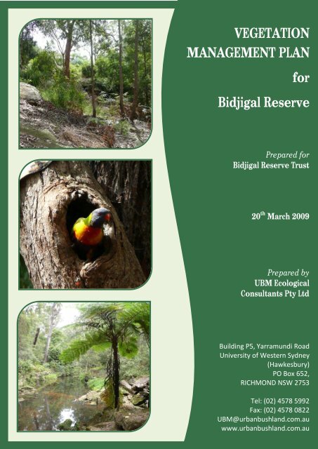
<strong>VEGETATION</strong><strong>MANAGEMENT</strong> <strong>PLAN</strong><strong>for</strong><strong>Bidjigal</strong> <strong>Reserve</strong>Prepared <strong>for</strong><strong>Bidjigal</strong> <strong>Reserve</strong> Trust20 th March 2009Prepared byUBM EcologicalConsultants Pty LtdBuilding P5, Yarramundi RoadUniversity of Western Sydney(Hawkesbury)PO Box 652,RICHMOND NSW 2753Tel: (02) 4578 5992Fax: (02) 4578 0822UBM@urbanbushland.com.auwww.urbanbushland.com.au
Vegetation Management Plan - <strong>Bidjigal</strong> <strong>Reserve</strong>Executive SummaryUBM Ecological Consultants 1 Pty Ltd has been engaged by the <strong>Bidjigal</strong> <strong>Reserve</strong> Trust to prepare aVegetation Management Plan <strong>for</strong> native bushland in <strong>Bidjigal</strong> <strong>Reserve</strong>, which is located in theBaulkham Hills Local Government Area, north-western Sydney.Excelsior Park was first created in 1958 when 160 hectares of Crown <strong>Land</strong> was transferred toBaulkham Hills Shire Council and zoned <strong>for</strong> recreation. Subsequently the Park became known asExcelsior <strong>Reserve</strong>. For the purposes of this VMP, the term Excelsior <strong>Reserve</strong> will be used throughout.The <strong>Bidjigal</strong> <strong>Reserve</strong> Trust Board has recently resolved to commission a Vegetation ManagementPlan <strong>for</strong> <strong>Bidjigal</strong> <strong>Reserve</strong> as a first step towards the preparation of a more comprehensive <strong>Reserve</strong>Management Plan. <strong>Bidjigal</strong> <strong>Reserve</strong> was previously managed by Baulkham Hills Shire Council andState Forests of NSW, but since December 2003, the care and management of the <strong>Reserve</strong> has beendeeded in the <strong>Bidjigal</strong> <strong>Reserve</strong> Trust (‘the Trust’).Flora & FaunaFour (4) different vegetation communities occur in the <strong>Reserve</strong>: these being Sandstone RiparianScrub, Hinterland Sandstone Gully Forest, Coastal Sandstone Ridgetop Woodland, and SydneyHinterland Transition Woodland. None of these communities is recognised as ‘endangered’ undercurrent State (Threatened Species Conservation Act 1995) or Commonwealth (EnvironmentalProtection & Biodiversity Conservation Act 1999) environmental legislation.Two (2) threatened flora species – Epacris purpurascens var. purpurascens and Hibbertia superans– and three (3) fauna species - the Eastern Bentwing-bat (Miniopterus schreibersii oceanensis),Powerful Owl (Ninox strenua), and Grey-headed Flying-fox (Pteropus poliocephalus) - were recordedin the <strong>Reserve</strong> during field investigations undertaken in November and December 2008. All of theabove-named species have been listed under the Schedules of the NSW TSC Act, while the GreyheadedFlying-fox has also been listed as an endangered species under the Commonwealth EPBCAct.Aims & ObjectivesThis Vegetation Management Plan provides important baseline in<strong>for</strong>mation on the <strong>Reserve</strong>’s naturalconservation values; identifies threats and impacts to those values; and recommends a morestrategic approach to bushland management.This Report (the VMP) will also assist the Trust to more effectively allocate resources through theemployment of professional contractors and supervision of Community Bushcare volunteers. It isanticipated that the findings of the VMP will be used to prioritise sites <strong>for</strong> future bushlandregeneration and other related works within the <strong>Reserve</strong>.1 Previously trading as Urban Bushland Management Consultants (‘UBM’)UBM Ecological Consultants Pty Ltdi
Vegetation Management Plan - <strong>Bidjigal</strong> <strong>Reserve</strong>As part of this VMP, a general field survey was undertaken to provide an overview of the <strong>Reserve</strong>bushland and to identify broad impacts and other management issues. Selected sites were targeted<strong>for</strong> detailed field survey after discussions with Trust Board member Wendy Goonan, a review ofprevious studies and investigations, and consultation of vegetation and topographic maps.For the purpose of this VMP, and to allow <strong>for</strong> priority ranking of worksites in the future, the <strong>Reserve</strong>was divided into smaller units that could be more easily defined and managed, and thus targeted inany future bush regeneration program.At a broad scale, <strong>Bidjigal</strong> <strong>Reserve</strong> was first divided into four (4) main Sections, based on theirlocations within the <strong>Reserve</strong>. These Sections were: Northern Section; Central Section; EasternSection; and Southern Section.Each Section was then divided into 10 smaller Management Zones based on homogeneity oftopographical features, vegetation communities and/or physical boundaries (i.e. tracks, fences).In order to rank the health or condition of bushland within each of these Management Zones, and tocreate smaller, more manageable areas <strong>for</strong> weed control and bushland regeneration works, anumber of Management Units were identified within each Management Zone. Where Riparian andTrail Management Units occurred adjacent to each other, these were dealt with as a single Unit.The four (4) types of Management Units were as follows: Core Bushland; Tracks and Trails; RiparianZones; and the Urban-bushland InterfaceManagement IssuesThe following threats and impacts to bushland and other significant management issues were noted.• Protection and management of threatened species;• Drainage, particularly stormwater runoff which changes soil structure and soil chemistry,thereby encouraging the establishment of weeds and introduced plants;• Soil issues, including sedimentation and existing or potential <strong>for</strong> soil erosion;• Weed invasion as a result of garden dumping and encroachments into the APZs;• Inappropriate activities, including vandalism;• Management of edges sites, including the urban-bushland interface, tracks and trails;• Maintenance of service corridors – powerlines, sewer and water supply infrastructure,including impact of service vehicles;• Feral animals control;• Impact of adjoining land use, including sporting fields; and• Maintenance of the APZs, impact of hazard reduction burns and variable fire regimes.Data gathered during field surveys was used to develop a condition of bushland map (commonlyknown as a ‘weed map’), and then to record priority ranking values.UBM Ecological Consultants Pty Ltdii
Vegetation Management Plan - <strong>Bidjigal</strong> <strong>Reserve</strong>Priority Ranking of Sites <strong>for</strong> Bushland Restoration WorkPriority ranking was determined by adapting a method previously used by UBM <strong>for</strong> an Assessmentof Bushland Condition Report prepared <strong>for</strong> Hornsby City Council (UBM 2007); which in turn wasadapted from a pro <strong>for</strong>ma first developed by UBM and Wodolots & Wetlands <strong>for</strong> the SydneyCatchment Authority (2001).The priority ranking table below has been prepared after due consideration of the above-listed itemsand ranked according to an agreed set of criteria (see Section 4.4). The table lists the priorityranking (from highest to lowest) <strong>for</strong> future bushland regeneration and related bushlandmanagement works in <strong>Bidjigal</strong> <strong>Reserve</strong>.Table 1.1: Priority Ranking ResultsPRIORITYRANKINGSECTIONMGMTZONEMGMTUNIT1 Southern 3 31 Southern 1 21 Eastern 1 3LOCATIONWilliam Street & Sophia Crescent Urban-Bushland InterfaceTed Horwood <strong>Reserve</strong> & Renown RoadUrban-Bushland InterfaceUrban-Bushland Interface, end of MerelynneAvenueTOTALWEIGHTINGSCORE1 Eastern 2 5 Blue Gum Creek Riparian and Trail 162Urban-Bushland Interface at end of1 Eastern 2 10 162Merelynne Avenue2 Central 2 4 Darling Mills Creek Riparian and Trail 1582 Central 1 22 Northern 2 72 Northern 1 62 Northern 2 9Blacks Road Urban-Bushland Interface(includes Burraga Trail)Candowrie Cr. Urban/ bushland Interfaceand access trailGrangewood Place Urban-BushlandInterfaceUrban-Bushland Interface at end of JacanaPlace and Grangewood Place2 Northern 2 8 Excelsior Ck. Riparian and Trail 1452 Central 1 52 Northern 1 23 Central 1 33 Central 3 23 Eastern 2 3Roma Garden Court Urban-BushlandInterfaceCandlebush Crescent, Urban-BushlandInterfaceBell Bird Creek Riparian & Trail (includesunnamed tributary)Sanctuary Point Road & Glenfern Close,Urban-Bushland InterfaceWestmore Avenue & Range Road, Urban-Bushland Interface3 Eastern 2 6 Darling Mills Creek Riparian & Trail 134189165162156154150150142140138134134UBM Ecological Consultants Pty Ltdiii
Vegetation Management Plan - <strong>Bidjigal</strong> <strong>Reserve</strong>PRIORITYRANKINGSECTIONMGMTZONEMGMTUNIT5 Eastern 2 2LOCATIONManagement Zone 1 boundary & RangeRoadCore Bushland 2 between M2 & WestmoreDriveTOTALWEIGHTINGSCORE5 Southern 3 4 Rifle Range Creek Riparian 755 Northern 2 1 Core Bushland 745 Central 1 1 Core Bushland 735 Northern 1 1 Core Bushland 725 Central 3 1 Core Bushland 685 Southern 3 1 Core Bushland 685 Southern 1 1 Core Bushland 665 Eastern 1 1 Core Bushland 645 Southern 2 1 Core Bushland 62In addition to vegetation mapping and ranking of priority worksites, the VMP has identified a list ofkeystone or primary target weed species. These target weeds are recommended <strong>for</strong> priority actionin any future bush regeneration works. A range of weed control methods are presented.Generic guidelines <strong>for</strong> indigenous revegetation (i.e. bushland restoration) are provided in the VMP,and a simple method of monitoring success in bush regeneration program has also been included.76UBM Ecological Consultants Pty Ltdv
Vegetation Management Plan - <strong>Bidjigal</strong> <strong>Reserve</strong>6.1 Threatened Species Management..................................................................................... 1186.2 Drainage Patterns & Changes to Local Hydrology .............................................................. 1196.3 Soils Profiles – Erosion & Sedimentation ........................................................................... 1196.4 Weed Invasion & Garden Escapes ..................................................................................... 1206.5 Edge Effects ...................................................................................................................... 1216.6 Creation of Buffers and Interface Zones ............................................................................ 1216.7 Routine Management & Maintenance of Service Corridors............................................... 1226.8 Management of Asset Protection Zones............................................................................ 1236.9 Retention of Corridor Values - Fragmentation & Genetic Isolation .................................... 1246.10 Bush Fire & Vegetation Management in the <strong>Reserve</strong>....................................................... 1256.11 Others Issues <strong>for</strong> Consideration ...................................................................................... 1266.11.1 Feral Animal Control................................................................................................. 1266.11.2 Preservation of Cultural Artefacts............................................................................. 1276.11.3 Maintenance of Walking Tracks and Trails................................................................ 1286.12 Limitations to Bushland Rehabilitation & Viability ........................................................... 1286.12.1 Impacts of Past & Current <strong>Land</strong> Uses........................................................................ 1286.12.2 Alterations to Ecological Processes - Fire Regime...................................................... 1296.12.3 Loss of Pollination Vectors & Seed Dispersal Agents ................................................. 1306.12.4 Loss of Ecosystem Resilience .................................................................................... 1307 BASIS FOR <strong>MANAGEMENT</strong> ..................................................................................................... 1327.1 Native Vegetation in the Urban <strong>Land</strong>scape........................................................................ 1327.2 Guiding Principles ............................................................................................................. 1327.3 Definitions ........................................................................................................................ 1337.4 Bush Regeneration............................................................................................................ 1337.4.1 Bush Regeneration Strategies..................................................................................... 1347.5 Potential <strong>for</strong> Regeneration – Ecosystem Resilience ........................................................... 1357.6 Choosing the Most Effective Strategy................................................................................ 1367.7 Weed Ecology ................................................................................................................... 1367.7.1 Definition................................................................................................................... 1367.7.2 Keystone (Primary Target) Weeds .............................................................................. 1367.7.3 Secondary Weeds....................................................................................................... 1377.7.4 Priority of Weed Control Works.................................................................................. 1377.7.5 Weed Control Methods.............................................................................................. 138UBM Ecological Consultants Pty Ltdviii
Vegetation Management Plan - <strong>Bidjigal</strong> <strong>Reserve</strong>7.8 Indigenous Revegetation .................................................................................................. 1407.8.1 Site Preparation ......................................................................................................... 1407.8.2 Selection of Appropriate Flora Species ....................................................................... 1417.8.3 Seed Collection .......................................................................................................... 1427.8.4 Densities and Spatial Arrangement............................................................................. 1427.8.5 Planting Aids .............................................................................................................. 1437.8.6 Irrigation.................................................................................................................... 1447.9 Revegetation Methods...................................................................................................... 1447.9.1 Tubestock Planting..................................................................................................... 1447.9.2 Hand Sowing .............................................................................................................. 1447.9.3 Brush Layering (Brush Matting) .................................................................................. 1458 IMPLEMENTATION & REVIEW ................................................................................................ 1498.1 Policy & Per<strong>for</strong>mance ....................................................................................................... 1498.2 Review.............................................................................................................................. 1498.3 Works Program................................................................................................................. 1498.3.1 Licences and Permits Required................................................................................... 1498.3.2 Implementation and Timing of Works ........................................................................ 1508.3.3 Site Maintenance ....................................................................................................... 1508.4 Labour and Resources....................................................................................................... 1518.4.1 Contractors ................................................................................................................ 1518.4.2 Bushcare Volunteers .................................................................................................. 1518.4.3 On-Site Supervision/Project Management.................................................................. 1518.5 Monitoring and Assessment.............................................................................................. 1528.6 Per<strong>for</strong>mance Indicators..................................................................................................... 1528.7 Indicative Timetable <strong>for</strong> Bushland Management ............................................................... 1549 REFERENCES .......................................................................................................................... 15810 APPENDICES .......................................................................................................................... 162List of FiguresFigure 1.1: Regional Positioning of <strong>Bidjigal</strong> <strong>Reserve</strong> ........................................................................... 3Figure 1.2: Site Details....................................................................................................................... 6Figure 2.1: Soil <strong>Land</strong>scape Groupings (DLWC) .................................................................................. 18Figure 3.1: Diagrammatic representation of Sections, Management Zones and Management Units <strong>for</strong><strong>Bidjigal</strong> <strong>Reserve</strong> ............................................................................................................................... 30Figure 3.2: Study Area showing Different Sections and their Respective Management Zones........... 31UBM Ecological Consultants Pty Ltdix
Vegetation Management Plan - <strong>Bidjigal</strong> <strong>Reserve</strong>Figure 3.3: Survey Ef<strong>for</strong>t and Location (UBM 2008) .............................................................................36Figure 4.1: Vegetation Mapping (Tozer et al. 2006) .............................................................................50Figure 4.2: Vegetation Mapping (UBM 2008).......................................................................................51Figure 4.3: Fauna Habitat Mapping ......................................................................................................59Figure 4.4: Location of Threatened Flora and Fauna within <strong>Bidjigal</strong> <strong>Reserve</strong> ......................................65Figure 4.5: Wildlife Corridors and Connectivity at a Regional Scale.....................................................67Figure 4.6: Bushland Condition Overview Map <strong>for</strong> <strong>Bidjigal</strong> <strong>Reserve</strong> ....................................................71Figure 4.7: Priority Ranking Map <strong>for</strong> <strong>Bidjigal</strong> <strong>Reserve</strong> ..........................................................................75Figure 5.1: Location of Management Zones and Units within the Northern Section...........................77Figure 5.2: Location of Management Zones and Units within the Central Section..............................87Figure 5.3: Location of Management Zones and Units in the Eastern Section.....................................98Figure 5.4: Location of Management Zones and Units within the Southern Section.........................108Figure 8.1: Indicative Timetable of Works ..........................................................................................155List of TablesTable 1.1: Priority Ranking Results ........................................................................................................ iiiTable 1.1: Summary of Environmental Policies, Planning & Legislative Requirements .........................8Table 2.1: Site Definition <strong>for</strong> <strong>Bidjigal</strong> <strong>Reserve</strong>.......................................................................................13Table 2.2: Summary of the Services, Infrastructure and Facilities <strong>for</strong> the Study Area.........................14Table 2.3: Geophysical Setting of the Subject Site ...............................................................................16Table 3.1: Location of Management Sections, Zones and Units within <strong>Bidjigal</strong> <strong>Reserve</strong> .....................28Table 3.2: Criteria <strong>for</strong> Priority Ranking of Sites <strong>for</strong> Bushland Regeneration & Associated Works .......39Table 3.3: Score & Weightings of Criteria used to Determine Priority Ranking <strong>for</strong> Management Units..............................................................................................................................................................43Table 4.1: Comparison of Different Vegetation Community Names....................................................45Table 4.2: Results of Analysis of Survey Plot Data (data source DECC 2008 & UBM 2008)..................47Table 4.3: Table of Locations <strong>for</strong> Threatened Species ..........................................................................52Table 4.4: Threats and Recovery Strategies <strong>for</strong> the Powerful Owl known to Occur within <strong>Bidjigal</strong><strong>Reserve</strong>, Baulkham Hills LGA (Sourced from DECC 2008b)...................................................................61Table 4.5: Threats and Recovery Strategies <strong>for</strong> the Eastern Bentwing-bat known to Occur within<strong>Bidjigal</strong> <strong>Reserve</strong>, Baulkham Hills LGA (Sourced from DECC 2008b)......................................................62Table 4.6: Threats and Recovery Strategies <strong>for</strong> the Grey-headed Flying-fox known to Occur within<strong>Bidjigal</strong> <strong>Reserve</strong>, Baulkham Hills LGA (Sourced from DECC 2008b)......................................................63Table 4.7: Priority Ranking Results .......................................................................................................73Table 5.1: Summary of Northern Section <strong>Land</strong>scape & Ecology ..........................................................76Table 5.2: Significant Weeds in Management Unit 2: Candlebush Cres. Urban-Bushland Interface ..78Table 5.3: Significant Weeds in Management Unit 3: Excelsior Creek Riparian & Trail to TheHermitage Access..................................................................................................................................79Table 5.4: Significant Weeds occurring in Management Unit 4: Trail to Candlebush Crescent ...........79Table 5.5: Significant Weeds in Management Unit 5: Coachwood Creek Riparian..............................79Table 5.6: Significant Weeds in Management Unit 6: Grangewood Place Urban-Bushland Interface.80Table 5.7: Significant Weeds in Management Unit 2: Eric Mobbs <strong>Reserve</strong> Urban-Bushland Interface..............................................................................................................................................................82UBM Ecological Consultants Pty Ltdx
Vegetation Management Plan - <strong>Bidjigal</strong> <strong>Reserve</strong>Table 5.8: Significant Weeds in Management Unit 4: Sawmill Creek Riparian.................................. 82Table 5.9: Significant Weeds occurring in Management Unit 5: Platypus Trail ................................. 83Table 5.10: Significant Weeds in Management Unit 6: Eric Mobbs Trails......................................... 83Table 5.11: Significant Weeds in Management Unit 7: Candowie Crescent Urban-Bushland Interface& Access Trail .................................................................................................................................. 83Table 5.12: Significant Weeds in Management Unit 8: Excelsior Creek Riparian and Trial................ 84Table 5.13: Significant Weeds in Management Unit 9: Urban-Bushland Interface, end of Jacana Place........................................................................................................................................................ 85Table 5.14: Summary of Central Section <strong>Land</strong>scape and Ecology...................................................... 86Table 5.15: Significant Weeds in Management Unit 2: Blacks Road. Urban-Bushland Interface(includes Burraga Trail).................................................................................................................... 89Table 5.16: Significant Weeds in Management Unit 3: Bellbird Creek Riparian & Black Trail to DarlingMills Creek ...................................................................................................................................... 89Table 5.17: Significant Weeds in Management Unit 4: Garden Court Urban-Bushland Interface...... 90Table 5.18: Significant Weeds in Management Unit 5: Roma Garden Court Urban-Bushland Interface........................................................................................................................................................ 90Table 5.19: Significant Weeds in Management Unit 2: Governor Phillip Place Urban-BushlandInterface.......................................................................................................................................... 92Table 5.20: Significant Weeds in Management Unit 3: Burraga Trail................................................ 92Table 5.21: Significant Weeds in Management Unit 4: Darling Mills Creek Riparian & Trail ............. 92Table 5.22: Significant Weeds in Management Unit 2: Sanctuary Point Road & Glenfern Close Urban-Bushland Interface .......................................................................................................................... 94Table 5.23: Significant Weeds in Management Unit 3: Barraga Trail & Urban-Bushland Interface (endof Sanctuary Point Road) ................................................................................................................. 95Table 5.24: Significant Weeds in Management Unit 4: Excelsior Creek Riparian & Trail ................... 95Table 5.25: Significant Weeds in Management Unit 5: Angophora Creek Riparian........................... 96Table 5.26: Summary of Eastern Section <strong>Land</strong>scape and Ecology ..................................................... 97Table 5.27: Significant Weeds in Management Unit 2: Darling Mills Creek Riparian &Trail ............ 100Table 5.28: Significant Weeds in Management Unit 3: Urban-Bushland Interface, end of MerelynneAvenue.......................................................................................................................................... 100Table 5.29: Significant Weeds in Management Unit 4: In<strong>for</strong>mal trail from slopes above Darling MillsCreek to the Merelynne Urban-Bushland Interface........................................................................ 101Table 5.30: Significant Weeds in Management Unit 3: Westmore Avenue & Range Road Urban-Bushland Interface ........................................................................................................................ 103Table 5.31: Significant Weeds occurring in Management Unit 4: Trail from below Westmore AvenueUrban-Bushland Interface to Eastern Boundary of Management Zone E1...................................... 103Table 5.32: Significant Weeds occurring in Management Unit 5: Blue Gum Creek Riparian & Trail 104Table 5.33: Significant Weeds in Management Unit 6: Darling Mills Creek Riparian & Trail ........... 104Table 5.34: Significant Weeds occurring in Management Unit 7: Banksia Creek Riparian &Trail ..... 105Table 5.35: Significant Weeds in Management Unit 8: Trail Below Range Road Urban-BushlandInterface........................................................................................................................................ 105Table 5.36: Significant Weeds in Management Unit 9: Unnamed Tributary of Blue Gum Creek...... 105Table 5.37: Significant Weeds in Management Unit 10: Urban-Bushland Interface, end of MerelynneAvenue.......................................................................................................................................... 106UBM Ecological Consultants Pty Ltdxi
Vegetation Management Plan - <strong>Bidjigal</strong> <strong>Reserve</strong>Table 5.38: Summary of Southern Section <strong>Land</strong>scape and Ecology................................................. 107Table 5.39: Significant Weeds in Management Unit 2: Ted Horwood <strong>Reserve</strong> & Renown Road Urban-Bushland Interface ........................................................................................................................ 110Table 5.40: Significant Weeds in Management Unit 3: Darling Mills Creek Riparian & Trail ............ 110Table 5.41: Significant Weeds in Management Unit 4: Larra Crescent Urban-Bushland Interface ... 111Table 5.42: Significant Weeds in Management Unit 6: Excelsior Creek Riparian & Trail (includesChristmas Bush Creek)................................................................................................................... 111Table 5.43: Significant Weeds in Management Unit 7: Creda Place Urban-Bushland Interface ....... 112Table 5.44: Significant Weeds in Management Unit 2: Renown Road Urban-Bushland Interface ... 114Table 5.45: Significant Weeds in Management Unit 3: Darling Mills Creek Riparian & Trail ........... 114Table 5.46: Significant Weeds occurring in Management Unit 1: Core Bushland ........................... 115Table 5.47: Significant Weeds in Management Unit 2: Randal Crescent Urban-Bushland Interface 116Table 5.48: Significant Weeds in Management Unit 3: William Street & Sophia Crescent Urban-Bushland Interface ........................................................................................................................ 116Table 5.49: Significant Weeds in Management Unit 4: Rifle Range Creek Riparian & Trail ............. 117Table 5.50: Significant Weeds in Management Unit 5: Darling Mills Creek Riparian....................... 117Table 7.1: Explanation and Justification of Commonly Used Bushland Weed Control Methods ...... 139Table 7.2: Summery of Management Issues, Recommended Strategies, Actions, Roles &Responsibilities ............................................................................................................................. 146List of AppendicesAppendix 1: Final DeterminationsAppendix 2: List of Indigenous Flora Species Recorded in <strong>Bidjigal</strong> <strong>Reserve</strong>Appendix 3: Threatened Flora Species & Their Habitat RequirementsAppendix 4: Fauna species recorded in <strong>Bidjigal</strong> <strong>Reserve</strong>, or known to occur in the LocalityAppendix 5: Threatened Fauna Species & Their Habitat RequirementsAppendix 6: List of Keystone Weed Species <strong>for</strong> Western Sydney Bushland (UBM 2008)Appendix 7: Noxious Weeds Recorded <strong>for</strong> <strong>Bidjigal</strong> <strong>Reserve</strong> (listed in Hawkesbury River Local ControlArea)Appendix 8: Total Number of Introduced Flora Species Recorded within Each Management Unit TypeAppendix 9: Weighted Values <strong>for</strong> Priority RankingAppendix 10: Commonly Occurring Weeds Recorded in <strong>Bidjigal</strong> <strong>Reserve</strong> & Recommended ControlMethodsAppendix 11: Ku-ring-gai Weed Mapping MethodAppendix 12: A Guide to Monitoring Progress of Works in Bushland Rehabilitation ProgramsAppendix 13: AHIMS Search (DECC January 2008)Appendix 14: Curricula Vitae <strong>for</strong> Core Team MembersUBM Ecological Consultants Pty Ltdxii
Vegetation Management Plan - <strong>Bidjigal</strong> <strong>Reserve</strong>CertificationI, Judith Rawling Managing Director of UBM Ecological Consultants Pty Ltd (‘UBM’) hereby state thatthe Vegetation Management Plan <strong>for</strong> <strong>Bidjigal</strong> <strong>Reserve</strong> in Baulkham Hills Shire, has been prepared inaccordance with the NSW Department of Water & Energy’s Urban Bushland Management Guidelinesand other guidelines entitled ‘How to Prepare a Vegetation Management Plan, Version 4’.In preparing this Plan, consideration was also given to a number of other plans and policies,including Baulkham Hills Shire Council’s Biodiversity Strategy (May 2006) and its generic BushlandManagement Plan.The UBM project team charged with preparing the Vegetation Management Plan were:• Judith Rawling (BA,DipEd,DipEnv.Stud.MEnvSt)• Belinda Pellow (Dip. App. SC. Ag.)• Kylie Reed (B.Env.Sc.[Hons])• Gabriel Wardenburg (BEnvMgt)• Rebecca McCue (B. Env. Sci.)Judith RawlingManaging Director UBM Ecological ConsultantsMember AIB, MESA, MEIANZ, Vice-president ECA (NSW), Member Noxious Weeds Advisory Committee to theMinister Department of Primary Industries20 th March 2009UBM Ecological Consultants Pty Ltdxiii
Vegetation Management Plan - <strong>Bidjigal</strong> <strong>Reserve</strong>This Vegetation Management Plan (hereafter ‘the VMP’) will provide important baseline in<strong>for</strong>mationon the <strong>Reserve</strong>’s natural conservation values: identify threats and impacts to those values; andrecommend a more strategic approach to bushland management.The VMP will also assist the Trust to more effectively allocate resources through the employment ofprofessional contractors and supervision of Community Bushcare volunteers. It is anticipated thatthe findings of the VMP will be used to prioritise sites <strong>for</strong> future bushland regeneration and otherrelated works within the <strong>Reserve</strong>.The regional positioning of <strong>Bidjigal</strong> <strong>Reserve</strong> is shown in Figure 1.1.UBM Ecological Consultants Pty Ltd 2
Vegetation Management Plan - <strong>Bidjigal</strong> <strong>Reserve</strong>1.2 Report Purpose & Scope of WorksThe <strong>Bidjigal</strong> <strong>Reserve</strong> Trust Board has recently resolved to commission a Vegetation ManagementPlan <strong>for</strong> <strong>Bidjigal</strong> <strong>Reserve</strong> as a first step towards the preparation of a more comprehensive <strong>Reserve</strong>Management Plan.The current Report (the VMP) is being undertaken on behalf of the Trust in order to satisfy thefollowing objectives, and to meet the listed outcomes.In summary, the VMP <strong>for</strong> <strong>Bidjigal</strong> <strong>Reserve</strong> will:• Review existing flora and fauna lists and databases and update existing knowledge;• Identify the various vegetation communities within the <strong>Reserve</strong>;• Address all existing and potential future management issues and site impacts;• Provide a strategy <strong>for</strong> the conservation of significant flora and fauna habitats in associationwith the current land uses of the <strong>Reserve</strong>;• Identify opportunities <strong>for</strong> the use of fire as a management tool, while taking the guidelinesand legal requirements of the NSW Rural Fires Act into consideration;• Identify priority weed species (i.e. noxious and keystone environmental weeds) and provide adetailed and scaled weed map;• Identify appropriate weed control methods, as well as the optimal season <strong>for</strong> species-specificcontrol programs;• Include consideration of appropriate plantings to increase the <strong>for</strong>aging and shelteringrequirements of native fauna;• Identify a series of tasks to be carried out by a range of stakeholders, including professionalbush regeneration contractors; Community Bushcare groups, and casual (unskilled) labourwhich may become available from time to time (e.g. scouts, service clubs);• Provide a benefit-cost table to prioritise worksites;• Provide an indicative timetable of works required over a five (5)-year period (in Gantt Chart<strong>for</strong>mat); and• Provide an indicative costing <strong>for</strong> future bushland management works (i.e. bushregeneration).UBM Ecological Consultants Pty Ltd 4
Vegetation Management Plan - <strong>Bidjigal</strong> <strong>Reserve</strong>1.3 Area to which the Vegetation Management Plan AppliesTo facilitate field survey and <strong>for</strong> ease of future management, the <strong>Reserve</strong> has been divided into four(4) main Sections, and each Section has been further subdivided into Management Zones. TheseZones have in turn been divided into different Units according to their primary physicalcharacteristics and position in the landscape. This approach is detailed in Section 3.2 of the VMP.Two (2) adjoining areas which <strong>for</strong>med part of the <strong>for</strong>mer Excelsior <strong>Reserve</strong> – Ted Horwood and EricMobbs <strong>Reserve</strong> – have been developed <strong>for</strong> sporting and recreational purposes, and have beenexcluded from <strong>Bidjigal</strong> <strong>Reserve</strong>. These areas do not there<strong>for</strong>e <strong>for</strong>m part of the current study. Bothareas are zoned as 6(a) Public Open Space under Baulkham Hills LEP 2005.Figure 1.2 maps the area to which the Vegetation Management Plan applies.UBM Ecological Consultants Pty Ltd 5
specific regulations to improve the situation of the victims. The amendment to theCriminal Code was introduced to the Parliament and subsequently dismissed; it wouldhave upheld current regulations and introduced more restrictive sanctions. In additionto the questionable institution of requiring the victim’s consent <strong>for</strong> criminal prosecutionof domestic violence, the substantive draft of the amendment to the Code of CriminalProcedure also included the institution of a so-called “application” criminal act(prosecutable only when the victim applies, not prosecutable ex officio), whichcontradicts all previous experience in regard to domestic violence victims. Such a legalregulation would put an even heavier burden on the victim to seek punishment of theperpetrator, which is not an appropriate position in which to place the victim.2.1.4 The Probation and Mediation Service, an organ responsible to the Ministry ofJustice, is preparing the accreditation of therapeutic programmes <strong>for</strong> adultperpetrators of domestic violence as well as programmes <strong>for</strong> victims. This is abreakthrough development in policies concerning domestic violence, which so far havefocused only on the victims. This task was assigned to the Ministry of Justice andMinistry of Health with a deadline of 31 December 2005. The Ministry of Justiceadopted no measures during this period save <strong>for</strong> assigning this task to the Probation andMediation Service, which did not consider this task a priority and did not have adequatehuman and financial resources to address it. The deadline <strong>for</strong> establishing an accreditedtherapeutic program <strong>for</strong> perpetrators is there<strong>for</strong>e uncertain.2.1.5 The Ministry of Interior has issued Methodological Guidelines <strong>for</strong> the Director ofthe Office of the Criminal Police Service of the Police Directorate of the CzechRepublic to regulate police practices of reporting, screening, and investigating domesticviolence. The Guidelines are binding on all policemen, but compliance andeffectiveness in practice has not been supported by training of police officers (whoare in most cases men) at all levels. In some regions police have been trained incooperation with non-governmental organizations, but this training has not beensystematic. The role of the police is crucial, because they are often the first authoritiessummoned to address instances of domestic violence, often in very acute situations, andthe calibre and quality of the response of the particular officer involved is of paramountimportance. Although police practices have improved, the police still often secondarilytraumatise victims. The statutory obligation of the police is to ensure the safety of thevictim and to investigate the perpetrator, but domestic violence is still often perceivedas a private matter and the police do not generally use their power to detain theaggressor <strong>for</strong> 24 hours. Detention <strong>for</strong> such a period would give the victim thepossibility to deal with immediate problems, to escape the aggressor’s reach togetherwith the child/ren, and to find temporary, safe shelter.2.1.6 An exceptional project did begin in May 2005 whereby the Municipal PoliceDirectorate in Brno established a Working Group on domestic violence. This is theonly such police-initiated group in the Czech Republic and, thanks to the openness andcompetence of the police officers involved, interdisciplinary cooperation on cases ofdomestic violence is possible, which has brought about positive changes.2.1.7 After the evaluation of a project entitled “An interdisciplinary approach to domesticviolence in Ostrava”, the practice of interdisciplinary teams spread to the cities ofBrno, Ústí nad Labem and, in 2006, to Kutná Hora. For now all these cities are usingthe methodology developed by the NGO “Bílý kruh bezepčí” (White Circle of Safety).In future it will be necessary to establish the interdisciplinary teams moresystematically and develop a new methodology suitable <strong>for</strong> such teams in smaller cities.So far the establishment of these interdisciplinary teams has been initiated thanks to thepersonal initiative of committed people and NGO pressure, rather than due to anysystematic or coordinated process; such voluntariness is a weak point of these21
Vegetation Management Plan - <strong>Bidjigal</strong> <strong>Reserve</strong>1.5 Legal & Planning FrameworkA number of local government planning policies, State and Commonwealth Acts and Policies apply tothe management of native vegetation (bushland) in Baulkham Hills Shire. Whilst this list is notexhaustive, the most relevant of these are listed in Table 1.1, below.Table 1.1: Summary of Environmental Policies, Planning & Legislative RequirementsGOVERNMENTLEVELLocalNSW StateRELEVANT POLICY /LEGISLATIONBaulkham Hills Local EnvironmentalPlan 2005 4Tree Preservation OrderBHSC Biodiversity Strategy May 2006Local Government Act 1993,incorporating Community <strong>Land</strong>s(Amendment) Act 1998RELEVANCE TO <strong>MANAGEMENT</strong> IN BIDJIGAL RESERVEProvides <strong>for</strong> the zoning and ultimate use of all land withinthe Shire.Under Baulkham Hills LEP 2005 <strong>Bidjigal</strong> <strong>Reserve</strong> is zoned6(a) Public Open Space (i.e. community land) and SpecialUses Forestry.Prohibits the cutting down, lopping or ringbarking oftrees on private or public property within the Shirewithout Council permission.The Strategy is a key element assisting Council in its pathtowards sustainability. The Strategy serves as an‘umbrella document’ that brings together a wide range ofin<strong>for</strong>mation on the biodiversity of the Shire. It aims toconserve both terrestrial and aquatic biodiversity, theirhabitats and ecological processes that support them.The VMP <strong>for</strong> <strong>Bidjigal</strong> <strong>Reserve</strong> has as one of its primaryobjectives the conservation and enhancement of localand regional biodiversity.Part of <strong>Bidjigal</strong> <strong>Reserve</strong> is zoned as 6(a) Public OpenSpace and part is zoned Special Uses Forestry. Thebushland is protected as a ‘bushland reserve’ under LEP2005, and is further categorised as Natural Area(Bushland) under the Local Government Act. The Actrequires management of Natural Areas according to aprescribed set of core objectives.Section 36 of the Act requires all local councils to preparedraft plans of management <strong>for</strong> Community <strong>Land</strong> under itscare, control and management. A generic bushlandmanagement plan has been developed by BHSC.Bush regeneration activities (utilising both Bushcarevolunteers and contractors) have been carried out in<strong>Bidjigal</strong> <strong>Reserve</strong> and in nearby Ted Horwood and EricMobbs <strong>Reserve</strong>s <strong>for</strong> many years.4 While this Report recognises the ownership and management of the <strong>Bidjigal</strong> <strong>Reserve</strong> Trust, the <strong>Reserve</strong> is zoned under BHLEP 2005 and its management must generally comply with the policies and procedures set down by Council.BH LEP 2005 will shortly be replaced by BH LEP 2010.UBM Ecological Consultants Pty Ltd 8
Vegetation Management Plan - <strong>Bidjigal</strong> <strong>Reserve</strong>GOVERNMENTLEVELRELEVANT POLICY /LEGISLATIONLocal Government Act 1993,incorporating Community <strong>Land</strong>s(Amendment) Act 1998Fisheries Management Act 1994National Parks & Wildlife Act 1974Threatened Species Conservation Act1995 & Amendment Act 2005RELEVANCE TO <strong>MANAGEMENT</strong> IN BIDJIGAL RESERVEThe larger part of <strong>Bidjigal</strong> <strong>Reserve</strong> is zoned as 6(a) PublicOpen Space. The remainder of the <strong>Reserve</strong> is zoned 5 (a)Forestry.The FM Act generally applies to all waters that arewithin the State of NSW and has the primary objectiveof conserving, developing and sharing the fisheryresources of the State <strong>for</strong> the benefit of present andfuture generations.The Act also endeavours to, amongst other things,conserve fish stocks and key fish habitats, protectthreatened species, populations and ecologicalcommunities and promote ecologically sustainabledevelopment.There are a number of creeks within <strong>Bidjigal</strong> <strong>Reserve</strong>known to contain fish species, populations and/orhabitats, including the Striped Gudgeon(Gobionmorphus australis) in Darling Mills Creek.Although this Act does apply, the current investigationsdid not include an aquatic fauna survey.Statutory responsibilities on Council arising from the Actrelate specifically to the protection of relicts of Aboriginalarchaeological significance, and the protection of nativeflora and fauna.The <strong>for</strong>mer National Parks and Wildlife Service (now partof DECC) has responsibility <strong>for</strong> management of the Act.DECC maintains a comprehensive database of allrecorded Aboriginal sites in Sydney District.A number of indigenous archaeological sites, items andartefacts occur in the <strong>Reserve</strong> and in the Catchmentgenerally. These are listed on the AHIMS database heldby DECC (see Section 2.7.1). Other sites and artefacts yetto be identified may also be present in <strong>Bidjigal</strong> <strong>Reserve</strong>.The TSC Act aims to conserve threatened species,populations and ecological communities; to promotetheir recovery; and manage the processes that threatenor endanger them. The NSW Scientific Committeeestablished under the Act has listed a number ofthreatened species, populations and communities (floraand fauna).No endangered ecological communities occur in the<strong>Reserve</strong>, although Turpentine Ironbark Forest occurs onnearby land.Two (2) listed flora species occur within the <strong>Reserve</strong>:Epacris purpurascens var. purpurascens and Hibbertiasuperans.Three (3) listed fauna species occur: Grey-headed Flying-UBM Ecological Consultants Pty Ltd 9
Vegetation Management Plan - <strong>Bidjigal</strong> <strong>Reserve</strong>GOVERNMENTLEVELRELEVANT POLICY /LEGISLATIONNoxious Weeds Act 1993Rural Fires Act 1997 /Amendment Act 2002State Environmental Planning PolicyNo. 44 – Koala Habitat ProtectionState Environmental Planning PolicyRELEVANCE TO <strong>MANAGEMENT</strong> IN BIDJIGAL RESERVEfox, Eastern Bentwing-bat and Powerful OwlThe Act (as Amended 2006) aims to streamlineadministration and improve the implementation ofnoxious weed control. It has a strong emphasis on urbanand environmental weeds. The NW Act allows <strong>for</strong> thedeclaration of noxious plants in five (5) classes – thesebeing grouped according to the control actions required(see Appendix 7).Where noxious plants (as identified by the Act) arepresent on private land, the landholder has a legalresponsibility to control them and to prevent theirspread to adjoining land.Similarly, noxious plants occurring on public land mustalso be controlled, with local and State governments alsorequired to comply with the Act.10 noxious weeds were recorded in <strong>Bidjigal</strong> <strong>Reserve</strong>during the current survey. Of these, three (3) are Weedsof National Significance (‘WONS’) – Lantana, Blackberry,and Bridal Creeper.Section 50 of the Act requires a Bushfire RiskManagement Committee (BRMC) to develop a firemanagement plan <strong>for</strong> the district in which it isconstituted. Section 52 of the Act requires that thesebush fire management plans must include a plan ofoperations and a bush fire risk management plan.The local BRMC has prepared a Bushfire Risk AssessmentMap <strong>for</strong> its area of operations. Bushland in the <strong>Reserve</strong> amapped in BHSC Bushfire Prone <strong>Land</strong> Map Sheet 04(11/7/2004) as Bushfire Prone <strong>Land</strong> Category 1.Where residential development occurs within Category 1or 2 lands (as mapped), including their buffers,landowners (including developers) must comply with theguidelines set out in Planning <strong>for</strong> Bushfire Protection(NSW Rural Fire Service, 2001).Section 63 of the Act requires owners, occupiers, orpublic authorities managing lands, to take practicablesteps to prevent the occurrence of bushfires, and tominimise the danger of the spread of bushfires. TheTrust is the body responsible <strong>for</strong> the management of thebushfire hazard in the <strong>Reserve</strong>.Baulkham Hills Shire is not listed under Schedule 1 of theSEPP. There<strong>for</strong>e, SEPP 44 does not apply to land withinthe Shire.SEPP-19 aims to protect and preserve bushland withinUBM Ecological Consultants Pty Ltd 10
Vegetation Management Plan - <strong>Bidjigal</strong> <strong>Reserve</strong>GOVERNMENTLEVELCommonwealthRELEVANT POLICY /LEGISLATIONNo 19 – Bushland in Urban AreaEnvironment Protection andBiodiversity Conservation Act 1999RELEVANCE TO <strong>MANAGEMENT</strong> IN BIDJIGAL RESERVEthe Sydney Metropolitan area, and in other areas of theState that nominate <strong>for</strong> the inclusion under the terms ofthe Policy.The Policy only protects bushland on land zoned orreserved <strong>for</strong> public open space (i.e. community land).Most Council-managed reserves are so classified.As Community <strong>Land</strong>/Natural Area (Bushland), the aims,objectives and requirements of SEPP-19 apply to thenative bushland in <strong>Bidjigal</strong> <strong>Reserve</strong>.Clause 9 of the Policy also requires Council to becognisant of the aims of SEPP-19 when consideringdevelopment on adjoining land.The EPBC Act includes mechanisms <strong>for</strong> the protectionand recovery of ecological communities and speciesthreatened with extinction.There are no threatened flora species, populations orecological communities listed under the EPBC Act known<strong>for</strong> <strong>Bidjigal</strong> <strong>Reserve</strong>.The Grey-headed Flying-fox is the only fauna speciesfound in the <strong>Reserve</strong> which is listed under the EPBC Act.UBM Ecological Consultants Pty Ltd 11
Vegetation Management Plan - <strong>Bidjigal</strong> <strong>Reserve</strong>2 SITE DESCRIPTIONThis chapter provides a brief description of the physical, biological and cultural environments whichoccur within <strong>Bidjigal</strong> <strong>Reserve</strong>. This in<strong>for</strong>mation has been gathered from a range of sources, includingprevious surveys and investigations, in<strong>for</strong>mation held by BHSC and the Trust, from previous bushregeneration reports, UBM files, and the authors’ local knowledge.2.1 Location & Setting<strong>Bidjigal</strong> <strong>Reserve</strong> is a 186 hectare Crown <strong>Reserve</strong> which <strong>for</strong>ms a broad bushland corridor between theresidential suburbs of Northmead and Baulkham Hills (west), Castle Hill (north, north-east), WestPennant Hills and North Rocks (east).<strong>Bidjigal</strong> <strong>Reserve</strong> is located in the Upper Parramatta River Catchment, which drains an area of about30 sq kilometres. Excelsior Creek flows into the <strong>Reserve</strong> from the north, be<strong>for</strong>e joining into DarlingMills Creek. Together the waters of these creek <strong>for</strong>ms the central axis of the <strong>Reserve</strong>. Darling MillsCreek flows south to Lake Parramatta, and enters the Parramatta River at North Rocks. Majortributaries include Blue Gum Creek (flowing from the east); Bellbird Creek (north) and Rifle RangeCreek (east) (see Figure 1.2).The <strong>Reserve</strong> bushland is located primarily in narrow gullies and on the steep slopes around DarlingMills Creek and its tributaries, while the surrounding ridgetops have over the last 30-40 yearsprogressively been developed <strong>for</strong> housing. In order to provide services to those suburbs,powerlines, sewer lines and water mains have been constructed through the <strong>Reserve</strong>, generallyfollowing or transecting the main valley floor, and extending through most of the larger gullies.2.2 <strong>Land</strong> Uses & ZoningPart of <strong>Bidjigal</strong> <strong>Reserve</strong> is zoned 6(a) Public Open Space and part is zoned Special Uses Forestryunder Baulkham Hills Local Environmental Plan 2005, and they are both classified under the LocalGovernment Act 1993 as Community <strong>Land</strong>.Restrictions on the use of Community <strong>Land</strong> accord with Chapter 6, Part 2 of the Act, which states:Community land must not be sold, leased or licensed <strong>for</strong> more than 21 years and may onlybe leased or licensed <strong>for</strong> more than five (5) years if public notice of the proposed lease orlicence is given and, in the event that an objection is made to the proposed lease orlicence, the Minister’s consent is obtained.Further, the Act states that use of community land <strong>for</strong> which a plan of management has beendeveloped must not change until the management plan is adopted, and its use and managementmust be in accordance with:• The plan of management adopted by Council; andUBM Ecological Consultants Pty Ltd 12
Vegetation Management Plan - <strong>Bidjigal</strong> <strong>Reserve</strong>• Provisions of any relevant law.Restrictions on the sale or lease of Community <strong>Land</strong> <strong>for</strong> which a plan of management has beenadopted are as set out <strong>for</strong> Community <strong>Land</strong> above. Council has developed a ‘generic’ plan ofmanagement <strong>for</strong> its bushland reserves, but this Plan does not apply to land within <strong>Bidjigal</strong> <strong>Reserve</strong>,which is managed by the Trust. It is understood that the Trust is planning to prepare acomprehensive Plan of Management Plan in the near future, with the findings of this Report (theVMP) <strong>for</strong>ming a major part of the proposed Plan. The Plan of Management will generally complywith Council’s generic Plan of Management <strong>for</strong> Natural Area in the Shire.2.3 Site DefinitionTable 2.1 below, summarises the legal definition provided <strong>for</strong> <strong>Bidjigal</strong> <strong>Reserve</strong>Table 2.1: Site Definition <strong>for</strong> <strong>Bidjigal</strong> <strong>Reserve</strong>TITLE INFORMATION<strong>Bidjigal</strong> (B1010489) <strong>Reserve</strong> (<strong>for</strong>merly part of Excelsior <strong>Reserve</strong> andDarling Mills State Forest)LOCATION The <strong>Reserve</strong> is located across the suburbs of North Rocks,Northmead, Baulkham Hills, Castle Hill, West Pennant Hills, andCarling<strong>for</strong>d.TOTAL AREA~186 hectaresTOPOGRAPHIC MAP Parramatta River 1: 25 000CATCHMENTUpper Parramatta RiverCOORDINATES E 316,229.07 N 6,262,944.38 (MGA Zone 56)OWNERSHIPLOCAL GOVERNMENT AREAZONING (BAULKHAM HILLS LEP 2005)Crown <strong>Land</strong> under the care, control and management of the <strong>Bidjigal</strong>(B1010489) <strong>Reserve</strong> Trust. The NSW Department of <strong>Land</strong>s is thelandowner on behalf of the Crown.The Hills Shire (<strong>for</strong>merly Baulkham Hills Shire)Open Space 6(a) (Existing & Proposed Public Recreation) – Northern,Central, and Southern Sections.Special Uses 5(a) Forestry (Existing & Proposed) – Eastern Section.CURRENT LAND USEBushland <strong>Reserve</strong> – managed <strong>for</strong> public recreation compatible withthe conservation of its natural and cultural conservation values,especially Aboriginal Heritage.UBM Ecological Consultants Pty Ltd 13
Vegetation Management Plan - <strong>Bidjigal</strong> <strong>Reserve</strong>2.4 Services, Infrastructure & FacilitiesTable 2.2 provides an overview of the services, infrastructure, and facilities in <strong>Bidjigal</strong> <strong>Reserve</strong>.Table 2.2: Summary of the Services, Infrastructure and Facilities <strong>for</strong> the Study AreaACCESS & RIGHTS OF WAYTRACKS & WALKING TRAILS(SEE FIGURE 1.2)LIGHTING & SOLAR ACCESSSIGNAGEFENCINGRECREATIONAL FACILITIESLANDSCAPING<strong>MANAGEMENT</strong> CONTEXTCURRENT <strong>MANAGEMENT</strong>From Eric Mobbs <strong>Reserve</strong> and the public car park off Ferguson Avenue,the Platypus Trail to Christmas Bush Creek (south), with a spur joininginto the Murri-yanna Track in <strong>Bidjigal</strong> <strong>Reserve</strong>. Parallels CoachwoodCreek <strong>for</strong> most of its length (1.7 km loop).<strong>Bidjigal</strong> <strong>Reserve</strong> – the Murri-yanna Trail from Speers Road <strong>Reserve</strong>(south) to Richard Webb <strong>Reserve</strong> (north-east), crossing under theRenown Road Bridge and running parallel to Darling Mills Creek (8 km)Burraga Trail – accessible from various points and linking with othertracks in the northern part of the <strong>Reserve</strong> (4.7 km loop).Other minor tracks also occur, with most tributaries also having foottracks running parallel to the watercourse.A vehicular track runs <strong>for</strong> some of the length of Darling Mills Creek, onits western side as far south as the stormwater detention basin atLoyalty Road, but a recent bridge collapse means that this road is notpassable <strong>for</strong> its entire length.No lighting is installed in the <strong>Reserve</strong>. Lighting is installed at both TedHorwood and Eric Mobbs <strong>Reserve</strong>s.Official ‘<strong>Bidjigal</strong> <strong>Reserve</strong>’ and detailed map signage has been erected byBHSC at a limited number of <strong>Reserve</strong> entrances.Some directive signage is located along <strong>for</strong>mal walking trails, i.e. TheBurraga Trail, Platypus Trail and the Murri-yanna Trail.Restricted activities signage (i.e. dogs on leashes only, no motorvehicles etc) is located at the beginning of <strong>for</strong>mal trails and reserveentrances.Notification signs are also located at some entrances identifying worksbeing undertaken within the <strong>Reserve</strong>, <strong>for</strong> example ‘No Dogs’, ‘FoxBaiting’ and ‘Bush Regeneration’.There is no fencing in the <strong>Reserve</strong>, although sporting fields on adjacentland are fenced, as is most private land abutting the <strong>Reserve</strong>.There are no active recreational facilities in the <strong>Reserve</strong> per se,although two (2) sporting ovals adjoin <strong>Reserve</strong> land –Ted Horwood andEric Mobbs <strong>Reserve</strong>s.Picnic facilities and parking areas are available at both Ted Horwoodand Eric Mobbs <strong>Reserve</strong>s, and there are picnic tables at the start of thewalking track at Grangewood Place, on Council-owned land.No <strong>for</strong>mal landscaping has been carried out in the <strong>Reserve</strong>, although aconsiderable amount of indigenous revegetation has been undertakenover the years.Crown <strong>Land</strong> under the care, control and management of the <strong>Bidjigal</strong><strong>Reserve</strong> TrustThe <strong>Bidjigal</strong> <strong>Reserve</strong> Trust is responsible <strong>for</strong> the care and managementof the <strong>Reserve</strong>. Management includes (but is not confined to) noxiousUBM Ecological Consultants Pty Ltd 14
Vegetation Management Plan - <strong>Bidjigal</strong> <strong>Reserve</strong>ACCESS & RIGHTS OF WAYweed control, maintenance of trails, tracks, bridges and the variousAsset Protection Zones (‘APZs’) established at the urban-bushlandinterface.Bushland in Eric Mobbs, Ted Horwood and <strong>Bidjigal</strong> <strong>Reserve</strong>s have in thepast been worked by a number of community Bushcare groups. Thereare no such groups working in the <strong>Reserve</strong> at this time, although somegroups are understood to be working on adjacent land.Bush regeneration contractors have also worked in the <strong>Reserve</strong> in thepast (see Section 2.8). No contract bush regeneration work isunderway at this time.UBM Ecological Consultants Pty Ltd 15
Vegetation Management Plan - <strong>Bidjigal</strong> <strong>Reserve</strong>2.5 Physical EnvironmentThe geophysical characteristics of the <strong>Reserve</strong> and environs are set out in Table 2.3, below.Table 2.3: Geophysical Setting of the Subject SiteFEATURETOPOGRAPHYGEOLOGY & SOILSSOIL LANDSCAPESSUBJECT SITE DESCRIPTIONThe topography of <strong>Bidjigal</strong> <strong>Reserve</strong> is dominated by a broad central gully <strong>for</strong>med byDarling Mills Creek, which reaches a maximum depth of approximately 30 metresASL. Slopes vary from moderate to very steep. A major ridgeline is present aroundthe boundaries of the <strong>Reserve</strong>, reaching heights of 125 metres ASL in parts.Hawkesbury Sandstone occurs in <strong>Bidjigal</strong> <strong>Reserve</strong> and along Darling Mills Creek,while Wianamatta Shales occur on the upper western ridges, including part of TedHorwood and Eric Mobbs <strong>Reserve</strong>s (Figure 2.1).Hawkesbury Soils are the shallow (
Vegetation Management Plan - <strong>Bidjigal</strong> <strong>Reserve</strong>2.6 Biological Environment2.6.1 Flora<strong>Bidjigal</strong> <strong>Reserve</strong> constitutes a corridor of native vegetation linking significant areas of nativevegetation in the Catchment upstream of the M2 Motorway with extensive areas of nativevegetation downstream of the <strong>Reserve</strong> concurrent with riparian vegetation on Hunts Creek, aroundLake Parramatta, and ultimately, with the mangroves along the Parramatta River.The <strong>Reserve</strong> supports a number of vegetation communities in a variety of topographic situations.Along the creeklines, the vegetation is predominantly riparian scrub dominated by Syncarpiaglomulifera (Turpentine), Ceratopetalum apetalum (Coachwood), Eucalyptus pilularis (Blackbutt),and occasionally, Eucalyptus saligna (Sydney Blue Gum).On the slopes above the creeklines is an open, dry sclerophyll <strong>for</strong>est association which is dominatedby Angophora costata (Smooth-barked Apple) and Corymbia gummifera (Red Bloodwood), withSyncarpia glomulifera (Turpentine) occurring towards the tops of the slopes.In a few areas, which generally sit at the top of ridgelines, open sandstone woodland occurs. Thiscommunity is dominated by Allocasuarina littoralis (Black She-oak) and Eucalyptus piperita (SydneyPeppermint). Small patches of transitional vegetation occur in areas along ridge tops where thesandstone and shale soil landscapes meet. Natural drainage lines, small boggy sites, and shelteredrock ledges support a variety of ferns, herbs and ground orchids.The <strong>Reserve</strong> also supports a large number of weeds and garden escapes, which are particularlywidespread along riparian corridors, tracks and trails, and on the edges of the bushland at the urbanbushlandinterface. Species such as Ligustrum sinense (Small-leaf Privet), Lantana camara (Lantana),and Acer negundo (Box Elder) tend to dominate in these disturbed areas.2.6.2 Fauna<strong>Bidjigal</strong> <strong>Reserve</strong> is known <strong>for</strong> its great diversity of fauna species. The three (3) distinct habitat typesoccurring within the <strong>Reserve</strong> – rocky eucalypt woodland, Allocasuarina (She-oak) <strong>for</strong>est and ariparian environment – <strong>for</strong>m a habitat large and healthy enough to support a great number of frogs,mammals, birds, reptiles and aquatic species.<strong>Bidjigal</strong> is known <strong>for</strong> its great diversity of Birds; 180 have been recorded within the Region, includingmany of the increasingly rare insectivorous species such as wrens and Thornbills. Three (3)individuals of Australia’s largest owl, the threatened Powerful Owl (Ninox strenua), were recordedwithin the <strong>Reserve</strong> during the current survey.Mammals including Sugar Gliders, Swamp Wallabies, Echidnas and Bandicoots are known to reside inthe Rocky Eucalypt Woodland habitat. The threatened Eastern Bentwing-bat (Miniopterusschreibersii oceanensis) has a known over-winter roost in the <strong>Reserve</strong>, under the M2. Sandstoneoutcrops also provide basking sites and shelter <strong>for</strong> a range of reptiles, including the Leaf-tailed Geckoand Eastern Water Dragon.UBM Ecological Consultants Pty Ltd 19
Vegetation Management Plan - <strong>Bidjigal</strong> <strong>Reserve</strong>There are also a number of introduced pest species occurring within the <strong>Reserve</strong> including theEuropean Rabbit, European Red Fox and a number of non-indigenous bird species.2.7 Heritage & Cultural Environment2.7.1 Aboriginal HeritageA search of the Aboriginal Heritage In<strong>for</strong>mation Management System (‘AHIMS’) held by the CulturalHeritage Division of the NSW Department of Environment and Climate Change (‘DECC’) wasundertaken on 02 January 2008 in association with a review of environmental factors <strong>for</strong> theproposed upgrading of the Renown Road Bridge at North Rocks.The AHIMS Search (see Appendix 13) indicates that seven (7) Aboriginal objects and Aboriginalplaces registered with DECC have been recorded in the general locality. The search area wasapproximately one (1) sq kilometre. One of these items occurs in the nearby Cumberland StateForest, and the remaining items occur along Darling Mills Creek.2.7.2 European HeritageA review of Council’s Heritage Database (Schedule 1, LEP 2005) indicates that here are no knownitems of European cultural heritage in the immediate locality. It is however, likely that some areaswithin the <strong>for</strong>mer Excelsior <strong>Reserve</strong> (now contained within <strong>Bidjigal</strong> <strong>Reserve</strong>) <strong>for</strong>med part of an earlyland grant used <strong>for</strong> agricultural purposes (probably orcharding).Council’s Heritage Register does not record historical land use <strong>for</strong> this site; however, the author’slocal knowledge has provided in<strong>for</strong>mation on earlier land uses <strong>for</strong> land now in <strong>Bidjigal</strong> <strong>Reserve</strong>. Forexample, the old Rifle Range (c 1904) is located north-east of the junction of Rifle Range Creek andDarling Mills Creek within the <strong>Reserve</strong>. Other items of local historic significance are known to occuraround the area known as <strong>Bidjigal</strong> <strong>Reserve</strong>, although these may not be considered significant enoughto be entered into the local Heritage Register.UBM Ecological Consultants Pty Ltd 20
Vegetation Management Plan - <strong>Bidjigal</strong> <strong>Reserve</strong>2.8 History of <strong>Bidjigal</strong> <strong>Reserve</strong> – a chronologyThe history of <strong>Bidjigal</strong> <strong>Reserve</strong> has been well-documented <strong>for</strong> many centuries, from rock paintingsand middens dating back to 10,150 bp; to modern day ecological surveys and managementpractices. This in<strong>for</strong>mation has been provided in this VMP to highlight the processes which haveshaped the modern-day landscape of <strong>Bidjigal</strong> <strong>Reserve</strong>.A brief summary of the <strong>Reserve</strong> history has been sourced from “The bushland of <strong>Bidjigal</strong> <strong>Reserve</strong> andadjoining reserves” (BHSC 2004).“The bushland of <strong>Bidjigal</strong> <strong>Reserve</strong> and adjoining reserves”40,000 years be<strong>for</strong>e present: Aboriginal people used the resources of the district to sustain ahunter-gatherer lifestyle.1790s Europeans arrive: Aboriginal populations in the Region are decimated by diseases likesmallpox; their traditional way of like, including hunting and burning practices, changes<strong>for</strong>ever. The new arrivals begin to affect local bushland in a new and dramatic way.1804: 3,400 acres set aside by Governor King as the Baulkham Hills Common: this areaincluding the present- day <strong>Bidjigal</strong> <strong>Reserve</strong>1818: The Common is revoked and much of the land within the Shire is deeded to privateindividuals as land grants, resulting in the clearing of the Blue Gum and Turpentine-IronbarkForests and establishment of farms.1820 – 1950s: <strong>Reserve</strong>’s natural resources are exploited by local landowners. Local industriesincluded timber getting, quarrying (e.g. Quarries at the end of Excelsior Avenue), and a steamflour mill is built at the corner of Windsor & North Rocks Road. Non-native flora and faunaarrive in the Baulkham Hills district, and local waterways are gradually polluted. Decline innative fauna species becomes evident.1955: Cumberland Native Forest Extension ‘3’ is declared, covering most of the parkland westof Bellbird Creek: becomes Darling Mills State Forest in 1984.1958: Excelsior Park (later <strong>Reserve</strong>) created when 160 hectares of Crown <strong>Land</strong> transferred toBaulkham Hills Shire Council and zoned <strong>for</strong> recreation.1965-74: Urban era begins with subdivision of land adjoining the <strong>Reserve</strong> <strong>for</strong> residentialdevelopment.Early 1970s: Direct and indirect impact of sports fields and residential subdivisions created inthe 1960s now evident; with high sediment loads in creeks and increasing weed invasion dueto clearing on <strong>Reserve</strong> boundaries and sewer main construction through the bushland, thelatter resulting in considerable damage to the native vegetation.UBM Ecological Consultants Pty Ltd 21
Vegetation Management Plan - <strong>Bidjigal</strong> <strong>Reserve</strong>1978: First bush regeneration project commences. Excelsior Park Bushland Society volunteersworked monthly <strong>for</strong> several years; removing Privet, Blackberry and other weeds fromCandowie Crescent to Loch Bruce.1983: Sewer mains installed along the top of Excelsior Creek with minimal damage occurring.1984-85: First planned recreational walking track network constructed as part of theCommonwealth Employment Program.1989: Excelsior <strong>Reserve</strong> nominated by the National Trust <strong>for</strong> inclusion in the Water Board’sSpecial Environmental Levy (SEL) Bushland Rehabilitation Program. The first <strong>for</strong>mal Councilassistedcommunity Bushcare program commences at the corner of Cross and Cary Street.1990-94: Water Board 5 provides $470.00 from the SEL program to repair bushland damagedby sewer installation. Bush regeneration undertaken by professional contractors over a four(4) year period. About 18,000 hours of bush regeneration were completed and over 4000locally collected native plants were planted.1994: Unilever provides funds <strong>for</strong> contract bush regeneration work on their property on NorthRocks Road and the adjoining section of Excelsior <strong>Reserve</strong>.1996: Upper Parramatta River Catchment Trust builds a flood-retarding (detention) basin onDarling Mills Creek; near Loyalty Road.1997: M2 Motorway is opened. The construction required the removal of a large area of localbushland. Bush regeneration works undertaken in the adjoining parts of the <strong>Reserve</strong> <strong>for</strong> aperiod of several years, funded by Hills Motorway 6 .2001: In an ef<strong>for</strong>t to prevent more local wildlife extinction, BHSC and Cumberland State Forestcommenced a 1080 fox baiting program.2004: A large portion of Excelsior <strong>Reserve</strong>, including most of the area north of Rifle RangeCreek, and including Darling Mills State Forest, is amalgamated and renamed <strong>Bidjigal</strong> <strong>Reserve</strong>.Ted Horwood and Eric Mobbs <strong>Reserve</strong>s are excised from the new <strong>Reserve</strong> and developed <strong>for</strong>active recreational purposes (i.e. sporting fields).The <strong>Reserve</strong> is now managed by the <strong>Bidjigal</strong> <strong>Reserve</strong> Trust Board, which is a Body consisting ofHonorary Trustees and ex-officio members drawn from the community. In 2007, BHSC resigned itsmembership of the Board, and relocated local volunteer Bushcare groups to other Council-managedproperties. Since this time, no <strong>for</strong>mal bush regeneration work has been conducted within the<strong>Reserve</strong>. However, it is understood that several groups of local volunteers continue to work on landadjoining the <strong>Reserve</strong>.5 Now Sydney Water Corporation6 J. Rawling (UBM) nominated Excelsior <strong>Reserve</strong> <strong>for</strong> funding under the SEL levy, and also managed the bush regenerationwork undertaken under that program. The M2 bushland regeneration work was also managed by J. Rawling.UBM Ecological Consultants Pty Ltd 22
Vegetation Management Plan - <strong>Bidjigal</strong> <strong>Reserve</strong>2.9 Bush Regeneration HistoryThe Carling<strong>for</strong>d North Rocks Bushland Trust was <strong>for</strong>med in the early 1970s, advocating propermanagement <strong>for</strong> local bushland. In 1978, the Excelsior Park Bushland Society was <strong>for</strong>med to assistwith the protection and rehabilitation of the <strong>Reserve</strong> bushland, with local residents serving ashonorary rangers and assisting with track building and weed control.The first Council-supported Bushcare project commenced in 1989, with monthly weeding carried outat the head of Christmas Bush Creek, at Cross and Carey Streets. From these small beginning,interest in community-based bush regeneration projects has spread to other sites in the Catchment.The <strong>Reserve</strong> (then Excelsior <strong>Reserve</strong>) was the focus of intensive bush regeneration and revegetationworks between March 1990 and June 1994, this work funded through the Sydney Water SpecialEnvironmental Levy Program. Work was undertaken by contract bush regenerators from theCatchment headwaters at Castle Hill to the lower Catchment, ending just above the wall of thestormwater detention basin constructed at Loyalty Road. Work was undertaken on all majorwatercourses and along most of the tributary creeks – an area estimated to be ~15 linear kilometres- (UBM 1995), as well as in some parts of the urban-bushland interface. At the conclusion of the SELProgram, some 18,000 hours of bush regeneration and revegetation work had been completed 7 .Following the conclusion of the SEL program, <strong>for</strong> several years BHSC employed bush regenerationcontractors to carry out follow-up and maintenance weeding throughout the earlier area ofoperations. Further short-term bush regeneration works were undertaken by contactors inassociation with the construction of the detention basin designed to protect Parramatta CBD fromfurther flooding. This work was funded by the Upper Parramatta River Catchment Trust.Other bush regeneration works have been funded from 1994 by Unilever – a private company whoseproperty in North Rocks backs onto Rifle Range Creek bordering <strong>Bidjigal</strong> <strong>Reserve</strong>.The construction of the M2 Motorway in 1997 also provided funding <strong>for</strong> bush regeneration work inthose parts of the <strong>Reserve</strong> impacted by road construction. This work was funded by The HillsMotorway Group and continued <strong>for</strong> several years.Maintenance of the Asset Protection Zones (‘APZs’) at the urban-bushland interface has from timeto time also been assigned to contract bush regenerators, funded by BHSC.Bush regeneration works have also been carried out by groups of community Bushcare volunteers;supported originally by professional bush regenerators employed by BHSC, but in more recent times,by Council’s own Bushcare staff. In 2004-2005 professional training and support was provided tofive (8) Bushcare groups: Mills Drive, Upper Darling Mills Creek, Winton Avenue, Christmas BushCreek, Pyes Avenue, Sawmill Creek Eric Mobbs, and Rutherglen Avenue (UBM June 2005).7 Stage 1 1990 National Trust: Stages 2 and 3 1991-1994 Urban Bushland ManagementUBM Ecological Consultants Pty Ltd 23
Vegetation Management Plan - <strong>Bidjigal</strong> <strong>Reserve</strong>These volunteers have generally focused on the upper slopes, behind private property, althoughsome groups have worked in bushland reserves adjoining <strong>Bidjigal</strong>. It is understood that since itswithdrawal from the Trust Board, BHSC has suspended its support <strong>for</strong> Bushcare groups in <strong>Bidjigal</strong><strong>Reserve</strong>. This responsibility has now been assumed by the Trust.UBM Ecological Consultants Pty Ltd 24
Vegetation Management Plan - <strong>Bidjigal</strong> <strong>Reserve</strong>3 <strong>PLAN</strong> PREPARATION & METHODOLOGY3.1 Literature Review and Compilation of Existing DataPrevious ecological studies conducted in the Baulkham Hills Shire and general references <strong>for</strong> theRegion were searched <strong>for</strong> descriptions of similar habitats, and <strong>for</strong> recordings of flora and faunaspecies, populations or communities of conservation significance known to occur in the area.With reference to previous ecological studies conducted in the Region, the main documentsreferenced <strong>for</strong> the VMP were:• Western Sydney Urban Bushland Biodiversity Survey (NSW NPWS 1997);• Bushland of <strong>Bidjigal</strong> <strong>Reserve</strong> and adjoining <strong>Reserve</strong>s (Baulkham Hills Shire Council 2004);• Plan of Management <strong>for</strong> Natural Areas: a strategy <strong>for</strong> the Bushland of Baulkham Hills Shire.Baulkham Hills Shire Council 2008;• Native vegetation of southeast NSW: a revised classification and map <strong>for</strong> the coast andeastern tablelands. Version 1.0 (‘SCIVI’) (Tozer et al. 2006).In addition, the Environment Protection and Biodiversity Conservation Act Online Database (DEWHA2008; search area five [5] km radius around the Study Area), the NPWS Atlas of New South WalesWildlife Database (DECC 2008a; search area 10 km x 10 km centred on the Study Area), and BioNetDatabase (BioNet 2008; search area 10 km x 10 km centred on the Study Area) were accessed toidentify previous recordings of flora and fauna species of conservation significance within theLocality and Region.A range of other reports and databases were reviewed and drawn upon as required (see Section 9References). Particular attention was paid to records of species listed under the Schedules of theCommonwealth Environment Protection & Biodiversity Conservation Act 1999 (‘EPBC Act’) and theNSW Threatened Species Conservation Act 1995 (‘TSC Act’) previously recorded in the Region.Plant identifications were made according to nomenclature in Harden (2007). Stands of vegetationwere described by their structural and floristic characteristics according to Specht (1981) and Tozeret al. (2006). Threatened ecological communities were classified and named according to NSWScientific Committee’s Preliminary and Final Determinations (various dates). Collected floraspecimens will be lodged with the Janet Cosh Herbarium, University of Wollongong.Field guides and standard texts used during the fauna fieldwork were:• Cogger (1992) – reptiles and amphibians;• Slater et al (2005) – birds;• Strahan (1995) – mammals;• Churchill (1998) – insectivorous bats;• Triggs (2004) – identification of scats, tracks and markings; and• Bayley and Brouwer (2004) – habitat type and structure.UBM Ecological Consultants Pty Ltd 25
Vegetation Management Plan - <strong>Bidjigal</strong> <strong>Reserve</strong>The naming of those fauna species recorded within, or surrounding the <strong>Reserve</strong> follows thenomenclature presented in these texts, or as described on the Schedules to the EPBC and TSC Acts.By identifying those species likely to occur, particularly any threatened fauna, the most appropriatespecies-specific survey techniques are then selected should their associated habitats be present inthe nominated Study Area.The literature search also ensures that the results from surveys conducted during different climatic,seasonal and date periods are considered and drawn upon as required, thereby avoiding any issuesinherent with a one-off “snap shot” study. This approach increases the probability of consideringthe presence of, and possible impacts on, all known and likely native fauna species, particularly anyspecies of regional, State and/or National conservation concern.The conservation significance of those plants and animals recorded is made with reference to:• The EPBC and TSC Acts (National and State context); and• The NPWS Western Sydney Urban Bushland Biodiversity Survey 1997 (local and regionalcontext).3.1.1 Additional Sources of In<strong>for</strong>mationThe National Parks & Wildlife Unit of DECC has conducted a number of field surveys within or closeto <strong>Bidjigal</strong> <strong>Reserve</strong>. This data was been used in determining the type and extent of the differentvegetation communities occurring in the <strong>Reserve</strong>.Anecdotal records of fauna species observed within the <strong>Reserve</strong> have been incorporated into thisreport, with appropriate notation. Such in<strong>for</strong>mation has been provided by <strong>Bidjigal</strong> Trust Boardmember Jennifer Farrer (Boronia Tours), and by local residents.Data from previous fauna investigations conducted within <strong>Bidjigal</strong> <strong>Reserve</strong> itself has also beenincorporated into this report (C. Threlfall pers. comm. 2008, and P. Burcher 2003).UBM Ecological Consultants Pty Ltd 26
Vegetation Management Plan - <strong>Bidjigal</strong> <strong>Reserve</strong>3.2 Determination of <strong>Reserve</strong> Sections, Management Zones & ManagementUnitsA general field survey was undertaken to provide the survey team with an overview of the <strong>Reserve</strong>bushland and in order to identify impacts and general management issues. Selected sites weretargeted <strong>for</strong> detailed field survey after discussions with Trust Board member Wendy Goonan, andafter consultation of vegetation and topographic maps.For the purpose of this VMP and to allow <strong>for</strong> priority ranking of worksites in the future, the <strong>Reserve</strong>was divided into smaller units that could be more easily defined, and thus targeted in any futurebush regeneration program.At a broad scale, <strong>Bidjigal</strong> <strong>Reserve</strong> was first divided into four (4) main Sections, based on theirlocations within the <strong>Reserve</strong> (Figure 3.1). These Sections were:• Northern Section;• Central Section;• Eastern Section; and• Southern Section.Each Section was then divided into 10 smaller Management Zones based on homogeneity oftopographical features, vegetation communities and/or physical boundaries (i.e. tracks, fences).These 10 Management Zones were:• Northern Section - Northern Management Zone 1 and Northern Management Zone 2;• Central Section - Central Management Zone 1, Central Management Zone 2 and CentralManagement Zone 3;• Eastern Section - Eastern Management Zone 1 and Eastern Management Zone 2; and• Southern Section - Southern Management Zone 1, Southern Management Zone 2 andSouthern Management Zone 3.In order to rank the health or condition of bushland within each of these 10 Management Zones, andto create smaller, more manageable areas <strong>for</strong> weed control and bushland regeneration works, anumber of Management Units were identified within each Management Zone (Table 3.1).Where Riparian and Trail Management Units occurred adjacent to each other, these were dealt withas a single Unit.The four (4) types of Management Units were as follows:• Core Bushland;• Tracks and Trails;• Riparian Zones; and• Urban-bushland InterfaceUBM Ecological Consultants Pty Ltd 27
Vegetation Management Plan - <strong>Bidjigal</strong> <strong>Reserve</strong>Table 3.1: Location of Management Sections, Zones and Units within <strong>Bidjigal</strong> <strong>Reserve</strong>SECTIONMGMTZONEMGMTUNITLOCATIONCentral 1 1 Core BushlandCentral 1 2 Blacks Road Urban-Bushland Interface (includes Burraga Trail)Central 1 3 Bellbird Creek Riparian & Trail (includes unnamed tributary)Central 1 4 Garden Court, Urban-Bushland InterfaceCentral 1 5 Roma Garden Court Urban-Bushland InterfaceCentral 2 1 Core BushlandCentral 2 2 Governor Phillip Place, Urban-Bushland Interface (Includes fire trail)Central 2 3 Burraga TrailCentral 2 4 Darling Mills Creek Riparian and TrailCentral 3 1 Core BushlandCentral 3 2 Sanctuary Point Road & Glenfern Close, Urban-Bushland InterfaceCentral 3 3Central 3 4 Excelsior Creek Riparian & TrailCentral 3 5 Angophora Creek RiparianEastern 1 1 Core BushlandBurraga Trail and Urban-Bushland Interface, (end of Sanctuary PointRoad)Eastern 1 2 Darling Mills Creek Riparian & TrailEastern 1 3 Urban-Bushland Interface, end of Merelynne AvenueEastern 1 4Eastern 2 1In<strong>for</strong>mal trail from above Darling Mills Creek to Merelynne, Urban -Bushland Interface (including powerlines)Core Bushland 1 between Eastern Management Zone 1 boundary &Range RoadEastern 2 2 Core Bushland 2 between M2 & Westmore DriveEastern 2 3 Westmore Drive& Range Road, Urban-Bushland InterfaceEastern 2 4Trail below Westmore Drive, Urban-bushland Interface to easternboundary of Management Zone E1Eastern 2 5 Blue Gum Creek Riparian and TrailEastern 2 6 Darling Mills Creek Riparian & TrailEastern 2 7 Banksia Creek Riparian & TrailEastern 2 8 Trail below Range Road, Urban-Bushland InterfaceEastern 2 9 Unnamed tributary off Blue Gum CreekEastern 2 10Northern 1 1 Core BushlandNorthern 1 2 Candlebush Crescent, Urban-Bushland InterfaceNorthern 1 3 Excelsior Creek Riparian & Trail to The Hermitage AccessNorthern 1 4 Trail to Candlebush CrescentNorthern 1 5 Coachwood Creek RiparianUrban-Bushland Interface at end of Merelynne AvenueNorthern 1 6 Grangewood Place Urban-Bushland InterfaceUBM Ecological Consultants Pty Ltd 28
Vegetation Management Plan - <strong>Bidjigal</strong> <strong>Reserve</strong>SECTIONMGMTZONEMGMTUNITLOCATIONNorthern 2 1 Core BushlandNorthern 2 2 Eric Mobbs <strong>Reserve</strong>, Urban-Bushland InterfaceNorthern 2 3 Burraga TrailNorthern 2 4 Sawmill Creek RiparianNorthern 2 5 Platypus TrailNorthern 2 6 Eric Mobbs TrailsNorthern 2 7 Candowie Cr. Urban/ bushland Interface and access trailNorthern 2 8 Excelsior Ck. Riparian and TrailNorthern 2 9Southern 1 1 Core BushlandUrban-Bushland Interface at end of Jacana Place and GrangewoodPlaceSouthern 1 2 Ted Horwood <strong>Reserve</strong> & Renown Road Urban-Bushland InterfaceSouthern 1 3 Darling Mills Creek Riparian & TrailSouthern 1 4 Larra Crescent, Urban-Bushland InterfaceSouthern 1 5 Access trail from Park RoadSouthern 1 6 Excelsior Creek Riparian & Trail (includes Christmas Bush Creek)Southern 1 7 Creda Place, Urban-Bushland InterfaceSouthern 2 1 Core BushlandSouthern 2 2 Renown Road, Urban-Bushland InterfaceSouthern 2 3 Darling Mills Creek Riparian & TrailSouthern 3 1 Core BushlandSouthern 3 2 Randal Crescent, Urban-Bushland InterfaceSouthern 3 3 Williams Road & Sophia Crescent Urban-Bushland InterfaceSouthern 3 4 Rifle Range Creek RiparianSouthern 3 5 Darling Mills Creek RiparianSee Figure 3.1 <strong>for</strong> location of Sections, Management Zones and Units described in this Report.UBM Ecological Consultants Pty Ltd 29
Vegetation Management Plan - <strong>Bidjigal</strong> <strong>Reserve</strong>Figure 3.1: Diagrammatic representation of Sections, Management Zones and ManagementUnits <strong>for</strong> <strong>Bidjigal</strong> <strong>Reserve</strong><strong>Bidjigal</strong> <strong>Reserve</strong>NorthernSectionCentralSectionSouthernSectionEasternSectionNorthernManagementZone 1NorthernManagementZone 2CentralManagementZone 1SouthernManagementZone 1EasternManagementZone 1RiparianUrban/bushlandinterfaceAccess trailsCorebushlandCentralManagementZone 2CentralManagementZone 3SouthernManagementZone 2SouthernManagementZone 3EasternManagementZone 2Note: : Units shown <strong>for</strong> Northern Management Zone only but applies to all Management ZonesUBM Ecological Consultants Pty Ltd30
Vegetation Management Plan - <strong>Bidjigal</strong> <strong>Reserve</strong>3.3 Field InvestigationsField survey and weed mapping was undertaken by Belinda Pellow (Dip.App.Sc.[Ag]) , Kylie Reed (B. Env.Sc[Hons]) and Rebecca McCue (B. Env. Sci) on 29 th and 31 st October and 5 th and 7 th November 2008.Supplementary investigations were undertaken by Belinda Pellow and Judith Rawling(BA,DipEd,DipEnvStud,MEnvStud) on a number of occasions in early December.3.3.1 Flora Field SurveyIn order to provide an indication of bushland condition (health), field investigations were undertakento determine the significant weed species 8 occurring within the <strong>Reserve</strong> bushland; their abundance,and extent of distribution. Vegetation communities were identified and described; and theircondition (or health) was assessed.Any threatened species or populations located during the weed mapping exercise were recordedusing a GPS. Known locations of threatened species (provided by database and literature searches)were surveyed to confirm the presence of these entities, and to identify impacts which mightthreaten the species’ on-going viability (e.g. weeds and garden escapes, drains and urban runoff,dumping, and evidence of spot fires).Due to the large size of the Study Area and the sometimes difficult terrain encountered, field surveyswere generally restricted to those areas close to vehicle tracks, to walking trails along creeklines inthe Core Bushland; and to Asset Protection Zones at the urban-bushland Interface.All introduced species observed in each Management Unit were recorded, and an estimate of %weed vs. native cover in each of the upper, middle and groundcover strata (layers) was determined.The dominant native species in each stratum were used to confirm the identification of thevegetation community present, using community descriptions by Tozer et al. 2006. Whenidentification was unclear, quadrat data was gathered by surveying a 20 x 20 metre area; recordingall species observed, and then estimating the % cover <strong>for</strong> each species occurring. The location oftest plots was determined using a random selection procedure and has been mapped in Figure 3.3.All vascular plant species with stems rooted within or overhanging the search area were recorded.A shortlist of possible vegetation community types was compiled by comparing the vegetationstructure and physical characteristics of the site with the vegetation descriptions contained in Tozeret al. 2006 and the mapping provided <strong>for</strong> the subject site from the relevant maps. The speciescomposition of the test plot was compared with each of these possible vegetation communities.Only the number of native species occurring within the test plot was counted. A minimum speciescount has been specified by Tozer et al. <strong>for</strong> each vegetation community and this is given in thediagnostic species list <strong>for</strong> each.8 ‘Significant’ being listed noxious weeds in the Shire and keystone environmental weeds, as identified by BHSCUBM Ecological Consultants Pty Ltd 32
Vegetation Management Plan - <strong>Bidjigal</strong> <strong>Reserve</strong>The minimum expected number of positive diagnostic species is specified <strong>for</strong> each of the vegetationcommunity. If the test plot contains the minimum number of positive diagnostic species (i.e. a ‘pass’result) then it is a plausible match <strong>for</strong> that map unit.It is possible to obtain a ‘pass’ result <strong>for</strong> more than one of the candidate communities. In such cases,the number of species by which the minimum was exceeded may be used to assess the closeness ofthe match to each of the possible candidates. A ‘fail’ result (the test plot contains fewer diagnosticspecies than the expected minimum) does not exclude the possibility that the test plot is a match.However, the fewer positive species recorded, the less likely it is that the map unit is a match.3.3.2 Fauna Field SurveyThe diurnal fauna surveys were undertaken by field biologists Kylie Reed (B. Env.Sc [Hons]) and RebeccaMcCue (B. Env.Sc) on 29 th and 31 st October and 4 th and 7 th November 2008. The weather conditionswere variable over the four (4) days of survey, ranging from light rain to clear skies and moderate tohot temperatures (21˚C to 36˚C).Nocturnal fauna surveys were undertaken by the same field biologists on the evenings of 4 th and 6 thNovember 2008. Weather conditions consisted of clear skies and cool to moderate temperatures(10˚C to 17˚C).Fauna field surveys were aimed at assessing the species richness of the site, to investigate the rangefauna habitats present, and the potential <strong>for</strong> local threatened fauna species to occur. The faunasurvey incorporated a range of techniques designed to target species from all fauna groups,including mammals, birds, reptiles and amphibians. These techniques included several diurnal birdcensuses, ultrasonic call detection <strong>for</strong> microchiropteran bats, nocturnal census (spotlighting, owl callplayback and frog searches), searches <strong>for</strong> active herpetofauna (reptiles and amphibians), andrecording of indirect evidence of fauna presence (e.g. tracks, scats, nests, diggings, bones and othertraces). In addition, all opportunistic sightings of fauna were recorded.All relevant previous reports and databases were reviewed and drawn upon. A list of fauna speciesrecorded in the <strong>Reserve</strong> in previous (BHSC 2004, 2006) and current (UBM 2008) surveys has beenprovided in Appendix 4. Particular attention was paid to records of species listed under theSchedules of the EPBC or TSC Acts previously been recorded in the Region (see Appendix 5).As previously stated, the large size of the Study Area and sometimes difficult terrain meant that fieldsurveys had to be restricted to those areas close to tracks and trails in the Core Bushland, and tocleared areas in and around the Asset Protection Zones at the urban-bushland interface.While walking through these areas, the condition and structure of the fauna habitats present wereidentified, and a consideration of their potential to support locally-occurring populations ofthreatened fauna was determined. Potential threats or impacts of weed management, bushfirereduction clearing or burning, and bush regeneration works (clearing weed thickets etc) onsignificant fauna habitats were also noted.UBM Ecological Consultants Pty Ltd 33
Vegetation Management Plan - <strong>Bidjigal</strong> <strong>Reserve</strong>Diurnal BirdsA <strong>for</strong>mal bird census was conducted in each of the three (3) fauna habitat types present; this beingin addition to the opportunistic bird census conducted over the remaining areas of the <strong>Reserve</strong>.Formal census involved ‘point counts’ made along designated transects (along tracks/trails wherepossible to minimise disturbance) (Figure 3.3). Approximately 15-20 minutes was spent at eachtransect point during early morning or late afternoon sessions, where birds were identified on thebasis of visual identification and by their characteristic calls. All opportunistic observations of birdspecies were recorded while undertaking general field survey activities.Herpetofauna CensusReptiles and amphibians were surveyed using hand-searches in suitable habitat, and by spotlighting<strong>for</strong> nocturnal species. For reptiles, hand searches concentrated on the hill-slopes and mid-slopes,near watercourses and around dead trees; and this included techniques such as carefully turningover rocks or logs wherever these were encountered. These were replaced in situ after inspection.All opportunistic sightings of active herpetofauna were noted. A nocturnal search was conductedaround pooling creeks using a head torch to survey <strong>for</strong> active frogs. Frogs were identified on thebasis of their characteristic calls, and wherever possible, by direct observation.MammalsSpotlighting was undertaken <strong>for</strong> all terrestrial and arboreal mammals and <strong>for</strong> nocturnal birds, by two(2) observers over two (2) nights using a Light<strong>for</strong>ce 100 Watt hand-held spotlight. The locations ofall fauna sightings were recorded during the spotlighting surveys (See Figure 3.3). The spotlightingsessions lasted <strong>for</strong> approximately three (3) hours each evening, and were carried out during andafter dusk.BatsA mobile ultrasonic bat call detector (Anabat II, Titley Electronics) connected to a PDA was used torecord bat calls, particularly targeting <strong>for</strong>ested areas along narrow corridors created by creeks,gullies and vehicle tracks, as such locations are generally associated with natural flyways <strong>for</strong>microchiropteran bats (Figure 3.3). Calls were continuously recorded over the duration of bothspotlighting sessions. Recorded calls were later identified to genus and wherever possible, tospecies level, using computer frequency analysis software (Analook V4.8f).A stationary ultrasonic bat call detector (Anabat II, Titley Electronics) with a storage ZCAIM unit wasused to record bat calls at two (2) sites over 10 nights by a University of New South Wales PhDCandidate, Caragh Threlfall (School of Biological, Earth & Environmental Sciences). The datacollected in this survey period has also been included in this Report.Spotlighting and listening <strong>for</strong> calls of megachiropteran bats (Pteropus spp) was conducted during thespotlighting activities.UBM Ecological Consultants Pty Ltd 34
Vegetation Management Plan - <strong>Bidjigal</strong> <strong>Reserve</strong>Nocturnal BirdsNocturnal birds were surveyed using playback of pre-recorded calls of threatened owl species.Calls were played at the start of the spotlighting surveys (See Figure 3.3). These surveys involvedinitial listening periods at dusk <strong>for</strong> 15 minutes; followed by playing the species’ recorded call <strong>for</strong>about five (5) minutes duration. Each call was followed by a 10 minute listening period <strong>for</strong> anaudible response be<strong>for</strong>e commencing with the next species’ call. The end of the last call wasfollowed by a five (5) minute listening period <strong>for</strong> any audible response, then spotlighting <strong>for</strong>approximately 10-minutes. The pre-recorded calls were played through a portable MP3 player andbroadcast via a megaphone. Species targeted included the Powerful Owl (Ninox strenua), MaskedOwl (Tyto novaehollandiae) and Barking Owl (Ninox connivens).Searches and listening <strong>for</strong> the calls of other nocturnal birds was undertaken during the spotlightingsurveys.Searches <strong>for</strong> Evidence of Species PresenceSearches were conducted <strong>for</strong> animal scats of both predatory and non-predatory species. Wherethese were encountered, scats were identified in situ, to genus and then to species level, whereverpossible. The search concentrated on the ground area beneath trees, as well as around hollow logs,in and around caves and rock overhangs, and around tracks and trails.Searches were also made <strong>for</strong> other characteristic signs of fauna species’ presence; including tracks,bones, hair, shed skins and animal remains, as well as nests, diggings, chew marks, scratchings andpellets (indicative of birds of prey).3.3.3 Limitations to Field SurveysThe diversity of the fauna species recorded during the current field surveys is expected to beinfluenced by seasonal factors, with some species likely to be inconspicuous, or absent from theabove-ground populations during particular times of the year. For these reasons, survey results canalways be improved by extending the time allowed to provide an investigation in all seasons.The list of fauna species recorded by the current field surveys should not be regarded as being fullycomprehensive, but rather as providing an indication of the species present at the time of the survey(October/November 2008). Surveys carried across all seasons over a period of several years areneeded to identify all of the species present in an area, especially as some species are only presentat certain times of the year (e.g. migratory birds), while others may require specific weather patternsand seasonal conditions <strong>for</strong> optimum levels of detection, e.g. amphibians.There<strong>for</strong>e, when establishing the suite of resident native species occurring or potentially occurring inan area by utilising the habitat requirements and associations of these animals, the diversity of othernative species that could occur on occasion can be determined. For example, if a hollow-associatedowl is detected, then there is the potential that, if previously recorded in the vicinity of the StudyArea, other species of owls with similar nesting requirements may also be present. By using thosespecies recorded to predict the full range of fauna potentially present in the Study Area helps toovercome some of the limitations associated with seasonal constraints and of surveys of limitedduration.UBM Ecological Consultants Pty Ltd 35
Vegetation Management Plan - <strong>Bidjigal</strong> <strong>Reserve</strong>3.3.4 GPS MethodologyA Thales MobileMapper GPS unit was used to log data in the field, with locations being recorded inthree (3) second increments. The MobileMapper is a hand-held unit, accurate of 3.5 metres, andallowing <strong>for</strong> rapid translation of data into a Geographical In<strong>for</strong>mation System (GIS).Note that the GPS unit used provides an average accuracy of 3.5 metres under favourableconditions. However, due to the challenging terrain, areas of very dense canopy vegetation whichblocks satellite detection, and at times overcast or unfavourable weather conditions, the accuracy ofsome readings may have been affected. As a precaution, all data derived from GPS records providedin this Report should be regarded as indicative only.3.3.5 Bushland Condition MappingThe bushland condition mapping system used is an adaptation of the quantitative weed mappingmethod first developed by Ku-ring-gai Municipal Council (1995). This simple mapping approachdetermines the degree of weed invasion in each stratum (or layer) of a plant community – i.e. thecanopy, shrub and groundcover strata by measuring the percentage cover of weeds compared tonative species in each stratum. Each area is assigned a ‘weed class’, which is calculated from therecorded value <strong>for</strong> each stratum, and this ‘class’ is then be assigned a colour code to provide a visualrepresentation of bushland condition or health.This approach was first developed <strong>for</strong> community Bushcare volunteers and has the advantage thatbotanical expertise is not required. The observer has only to recognise the difference between anative and an introduced species, and to be consistent in their approach (see Appendix 11 <strong>for</strong> anexplanation of the Ku-ring-gai Method).However, the Ku-ring-gai Method is not particularly accurate when one or more stratum is absent –<strong>for</strong> example, in open grasslands which lack shrubs or tree cover. For the purposes of this study, theKu-ring-gai Method was modified to overcome this limitation in those Management Units where onestratum was missing. This modification assigned the missing stratum/strata weight to the remainingstratum/strata value, while maintaining the ratio value between the strata. Vines (climbers orscramblers) were assigned to the ground cover stratum <strong>for</strong> consistency.Detailed investigation of survey sites was necessarily limited by the time available, by inaccessibleterrain in some areas, and in some instances, by restricted safe access to the <strong>Reserve</strong> interior.Mapping priority was there<strong>for</strong>e given to areas where weed infestations were known to occur, orwhere they were considered most likely to occur. These included areas of known or predicted highlevels of on-going disturbance, <strong>for</strong> example, areas adjacent to tracks and trails, below stormwateroutlets, and along creeklines (particularly areas downstream from known weed sources), the urbanbushlandinterface (particularly those areas where an Asset Protection Zone was present), andareas/sites suspected of being weedy as detected from aerial photograph interpretation.Data gathered during field surveys was used to develop a condition of bushland map (commonlyknown as a ‘weed map’), and then to record priority ranking values (see Section 3.3.5 <strong>for</strong>Methodology). All impacts and management issues relevant to the spread and control of weedswere also recorded. These management issues are discussed in more detail in Section 6.UBM Ecological Consultants Pty Ltd 37
Vegetation Management Plan - <strong>Bidjigal</strong> <strong>Reserve</strong>Priority Ranking of Sites <strong>for</strong> Bushland Restoration WorkPriority ranking was determined by adapting a method previously used by UBM <strong>for</strong> an Assessmentof Bushland Condition Report prepared <strong>for</strong> Hornsby City Council (UBM 2007); which in turn wasadapted from a pro <strong>for</strong>ma first developed by UBM and Woodlots & Wetlands <strong>for</strong> the SydneyCatchment Authority (2001).Note some of the ranking criteria used in these earlier studies have been omitted or amended asthese criteria were developed to assess and rank a large number of sites, rather than a single areasuch as <strong>Bidjigal</strong> <strong>Reserve</strong>. Only those criteria relevant to the <strong>Reserve</strong> Management Zones or Unitshave been included in the priority ranking assessment.For each Zone and Management Unit, a series of weighted values <strong>for</strong> the selected criteria wasassigned – those criteria being relevant to <strong>Bidjigal</strong> <strong>Reserve</strong>. The weightings were analysed and usedto rank, in order of priority <strong>for</strong> future works, Management Zones <strong>for</strong> large areas with significantmanagement issues, or Management Units <strong>for</strong> localised or smaller restoration and rehabilitationprojects.The criteria used to develop the priority ranking have been listed in Table 3.2. Location maps <strong>for</strong>each Management Zone and associated Units have been provided in Section 5. The outcomes of thepriority ranking process will help the <strong>Bidjigal</strong> <strong>Reserve</strong> Trust to more effectively prioritise resources<strong>for</strong> future bushland regeneration works and <strong>for</strong> other <strong>Reserve</strong> management projects.This ranking system used in this VMP is a <strong>for</strong>m of cost/benefit analysis, which identifies the mostappropriate allocation of resources in order to achieve optimal outcomes <strong>for</strong> monies spent.Table 3.3 indicates the weighting allocated to each criterion, which places an emphasis not only onecological issues; such as the threats posed by noxious weeds or presence of threatened species, butit also considers other aspects of bushland management such as suitability of the task to a range ofstakeholders, location, topography and ease of access, and, <strong>for</strong> the weed species involved, thelikeness of success in maintaining the site over time (i.e. sustainability).UBM Ecological Consultants Pty Ltd 38
Vegetation Management Plan - <strong>Bidjigal</strong> <strong>Reserve</strong>Table 3.2: Criteria <strong>for</strong> Priority Ranking of Sites <strong>for</strong> Bushland Regeneration & Associated WorksCRITERION BACKGROUND METHODOLOGY FOR FIELD RANKING LIMITATIONSConservation of Core BushlandSize of Core Bushland(hectares)Level of Management Assessment: ZonePriority should be given to protecting and rehabilitating the largest, intactand there<strong>for</strong>e most robust stands of bushland. There<strong>for</strong>e, the priorityranking gives the highest score to the largest sites.For each site, the area was calculated using a GIS within the siteboundaries shown in Figures 3.2. The areas were allocated a ranking <strong>for</strong>priority assessment (see below). The threshold areas <strong>for</strong> each score weredetermined to <strong>for</strong>m a fairly even spread of the sites over the scores,thereby creating a high level of score differentiation between the sites.1) < 5 ha,2) 5-10 ha3) 10-15 ha4) 15 – 20 ha5) > 20 haThe area was calculated independently of any adjoining bushland.The threshold areas were arbitrary and were based on providing scoredifferentiation rather than ecological principals.Length of Urban-Bushland InterfaceLevel of Management Assessment: ZonePriority should be given to protecting and rehabilitating stands of bushlandwith the shortest urban-bushland interface (thereby preserving a relativelyintact core of bushland).Management Zones with a shortest urban-bushland interface are expectedto have a lower level of edge disturbance, arising from human activities,weed invasion and influx of urban stormwater. These Zones are typicallymore cost-efficient to maintain due to the relatively smaller extent of edgeimpacts. There<strong>for</strong>e, a higher value has been given to Zones with a shorterurban-bushland interface.The length of urban-bushland interface <strong>for</strong> each Management Zone wascalculated in metres (m) using a GIS package.These lengths were allocated a ranking <strong>for</strong> priority assessment (see Table3.3). The threshold areas <strong>for</strong> each score were determined to <strong>for</strong>m a fairlyeven spread of the sites over the scores, thereby creating a high level ofscore differentiation between the sites.The length was calculated independently of any adjoining bushlandAssumed that the higher the longer the Urban-bushland interface the moreintense the edge effects. Ignored the type and likely severity of edgeeffect. Field analysis partially overcame this limitation by the addition ofthe interface disturbance criterion.Disturbances onBoundaryLevel of Management Assessment: ZoneThe ef<strong>for</strong>t and level of resources required to rehabilitate and maintain aZone with a high level of disturbance is correspondingly high, and there<strong>for</strong>eit is far more cost efficient to undertaken work in less disturbed sites.There<strong>for</strong>e, the priority ranking gave the highest score to Zones with theleast amount of disturbance.Disturbances on the boundary were taken to be those within 10 metres ofthe edge of the Zones. This threshold was loosely assigned prior to thefield survey through desktop analysis, and investigated <strong>for</strong> reliabilitythroughout the field component. It was observed during the fieldworkthat most edge impacts such as easements, edge maintenance such asfencing, and elevated light levels are generally within 10 m of reserveedge.Where disturbances such as recent burning or large amounts of mulchingand clearing <strong>for</strong> bush regeneration works were noted, these were notincorporated into these criteria as they were considered to be ‘beneficial’disturbances.A 10% threshold was assigned to the area impacted upon by a disturbancebecause it was observed that most zones had at least a small amount(
Vegetation Management Plan - <strong>Bidjigal</strong> <strong>Reserve</strong>CRITERION BACKGROUND METHODOLOGY FOR FIELD RANKING LIMITATIONSThe following disturbance types were recorded if they occurred in at least10% of the boundary:• Physical disturbance of soil• Imported fill soils• Dumped garden refuse• Physical disturbance of vegetation• Stormwater runoff/drainage impactsDisturbances in CoreLevel of Management Assessment: ZoneThis criterion is discussed in the previous section (disturbance onedges/boundaries). However, as core disturbance has serious implications<strong>for</strong> resource allocation and <strong>for</strong> on-going management, core disturbance hasbeen weighted accordingly.As above, but in remainder of zone (i.e. all areas not within 10 metres ofthe boundary)As aboveWeed Population CharacteristicsNoxious WeedsLevel of Management Assessment: UnitAs a public authority, the land manager (the Trust) has a legal obligation tocontrol noxious weeds on lands under its care and control.There<strong>for</strong>e, high priority was given to sites with a large number and/ordistribution of noxious weeds.The occurrence and density of weeds listed as noxious in the HawkesburyCounty Council (listed in Appendix 6 and 7) was recorded <strong>for</strong> eachManagement Unit during the field survey.Environmental WeedsLevel of Management Assessment: UnitEnvironmental 9 weeds threaten the health of bushland (including those inadjacent privately owned bushland) because of their propensity to spreadwidely and rapidly in bushland.There<strong>for</strong>e, high priority was given to sites with a higher number and/ordistribution of environmental weeds.The cover (High, Medium or Low) of species considered to beenvironmental weeds was estimated <strong>for</strong> each Management Unit duringthe field survey.Noxious weeds and Weeds of National Significance (WONS) are alsoconsidered environmental weeds and there<strong>for</strong>e they have beenincorporated into this criterion.The estimates of cover were given an individual weighting <strong>for</strong> priorityassessment (see below):• Number present with a low percentage cover = 1• Number present with a medium percentage cover = 2• Number present with a high percentage cover = 3Difficulty in estimating cover, particularly in large sites, and sites with morethan one (1) environmental weed species.The cover of environmental weed was highly variable within sites, whichprobably caused some errors in estimates. Large ranges of percentages <strong>for</strong>each score limited the implications of such errors. However sites with acover estimated to be close to a percentage threshold may have beenassigned an inaccurate score.Observer bias may have caused errors in score designation as this criterionwas based on a visual estimate only. However, this error was expected tohave been largely overcome by the same observer consistently recordingdata <strong>for</strong> all field survey sites.Condition of BushlandLevel of Management Assessment: UnitCondition (or health) of bushland is an important factor to consider whendetermining works priorities as site resilience (as determined by the numberof native plants remaining on a site) will determine the likelihood of success.Priority is generally given to areas in good condition because of factors suchas ease of restoration (i.e. natural regeneration vs. planting) which impactson the cost effectiveness of the program, and the obvious need to protectthe healthiest, most diverse areas of bushland.The condition of bushland was determined from the mapping componentof this project. This is shown in Figures 3.2. Management Units wereassessed using the Ku-ring-gai Municipal Council (KMC) method andsubsequent weightings used to indicate the bushland condition. Thesefigures were allocated a ranking <strong>for</strong> priority assessment (see below).Figures in brackets represent KMC calculated weed class value.1) No weed management issues (1)2) Low infestation - mostly confined to lower layer and moderatepercentage in mid layer. No weeds in upper layer (1.3)Ku-ring-gai Municipal Council (KMC) Condition of bushland assessment isbased on a ‘three-layer’ vegetation structure which sometimes does notcon<strong>for</strong>m with structure of the vegetation being assessed.9 An environmental weed is a non-indigenous plant which is capable of modifying the ecosystem which it invades, usually to the detriment of the native flora and fauna.UBM Ecological Consultants Pty Ltd 40
Vegetation Management Plan - <strong>Bidjigal</strong> <strong>Reserve</strong>CRITERION BACKGROUND METHODOLOGY FOR FIELD RANKING LIMITATIONSEcological and Heritage Conservation Significance3) Moderate infestation - high percentage of weeds in ground layer andmoderate percentage in mid. No weeds in upper layer (1.6)4) High infestation - high percentage of weeds in lower and mid layers(1.8)5) High-extreme infestation, high percentage of weeds in lower and midlayers, moderate percentage in upper layer (2.3)6) Extreme infestation in all layers, severe management issue (2.8)Threatened Flora andFauna SpeciesLevel of Management Assessment: UnitPriority was given to the sites with the highest number of listed threatenedspecies (TSC Act, EPBC Act) recorded in the site/locality to ensure that anylocal populations of these threatened species are protected and maintained.However, it should be noted that the removal of dense weed thickets suchas those created by Lantana will need to be undertaken progressively, asthese provide habitat <strong>for</strong> some native fauna, particularly small birds. Broadscale clearance may result in the displacement of threatened and otherfauna if it is not undertaken in a staged manner, which allows thereinstatement of habitat (through natural regeneration or planting).In order to retain populations of small birds in Lantana-infested habitats(which generally are slow to regenerate because the chemical compositionof the underlying soils have been altered), the removal of the vegetationshould be carried out in small (< 20 sq metres) patches and these thicketsreplaced with native plantings of similar structure and <strong>for</strong>m.This criterion analysis was based on threatened species records providedby DECC and records made in the field survey. The occurrence of athreatened species within each Management Unit was recorded.Records of the number of individuals were not used in the priorityranking assessment.A ranking of priority was given <strong>for</strong> categories of threatened speciesoccurrence (see below). The threshold number of sightings <strong>for</strong> eachscore were determined to <strong>for</strong>m a fairly even spread of the sites over thescores, thereby creating a high level of score differentiation between thesites.1) Known occurrence of 1 threatened species2) --3) Known occurrence of 2 threatened species4) --5) Known occurrence of >3 threatened speciesNote: the Powerful Owl is known to occur or very likely along allcreeklines within the <strong>Reserve</strong> and there<strong>for</strong>e was included in everyRiparian Management Unit. Other sightings of the Powerful Owl werealso included where UBM has been in<strong>for</strong>med by members of the Trust.Highly mobile threatened fauna species are likely to utilise all of theManagement Units within <strong>Bidjigal</strong> <strong>Reserve</strong> however only those units wherethreatened species have been previously observed or were recorded duringthe current survey were included in this assessment.Threatened EcologicalCommunitiesLevel of Management Assessment: UnitThe presence of a threatened plant community determines a high priority<strong>for</strong> protection, rehabilitation and maintenance. Left untreated, over time,weed invasion may alter the habitat to such an extent that the survival ofthe significant plant community is unlikely.There<strong>for</strong>e, the highest priority was given to sites where a threatenedecological community occurred.This criterion was based on Tozer et al. (2006) and follow-up groundtruthing during surveys. The area of any of the following communitieswithin the Management Unit were calculated: Sydney Turpentine-Ironbark Forest and Cumberland Shale/Sandstone Transition Forest;1) Threatened communities occupy < 1 ha of site2) Threatened communities occupy 1 - 1.5 ha of siteThe level of rarity/threat to threatened ecological communities was notconsidered. All threatened ecological communities were considered equally<strong>for</strong> this criterion.Catchment ManagementPosition on Slope/<strong>Land</strong>scapeLevel of Management Assessment: UnitSites that are located on ridges are generally given priority <strong>for</strong> weed controlas weeds spread from their origin downslope and/or downstream. If weedysites lower in the landscape are worked first, they are more likely to bereinfested from upslope sources. Working from ‘top to bottom’ is oftendescribed as the Total Catchment approach to bushland rehabilitation.A visual assessment was made during the field survey which was thenchecked against contour data. The following list identifies the criteria <strong>for</strong>priority assessment:1) Gully2) --3) SlopeEach position in slope category was not quantifiably defined, which mayhave caused errors in the assigned score.Some sites filled the entire range of categories (i.e. gully to ridge).Did not give an accurate measure of what sites occur upslope from others(e.g. if 2 sites occurred in the same gully, it did not give priority to theUBM Ecological Consultants Pty Ltd 41
Vegetation Management Plan - <strong>Bidjigal</strong> <strong>Reserve</strong>CRITERION BACKGROUND METHODOLOGY FOR FIELD RANKING LIMITATIONS4) --upstream site). This would require complex modelling/analysis.5) RidgePresence of Drainage LineLevel of Management Assessment: ZoneSites that contain watercourses or drainage lines should be given highpriority <strong>for</strong> weed control, as the potential <strong>for</strong> dispersal of weed propagulesby water is high.Watercourses and drainage lines serve as ‘fingers of infection’, allowingweeds to penetrate deep into core bushland. Capillary action in the soils onslopes along a watercourse usually impacts an area about 10 metres inwidth, thereby altering soil moisture and nutrient levels and encouragingthe establishment of weeds.The presence of drainage lines was through visual assessment, and theuse of topographic maps.Drainage lines were only recorded as permanent waterbodies if theywere flowing at the time of the survey, or were indicated on thetopographic map by a thin blue line.1) No drainage line present2) Ephemeral drainage line/s present3) 1 permanent drainage line present4) 2 permanent drainage line present5) 3 or more permanent drainage lines presentNo consideration of how major the permanent drainage lines are, and wherethe drainage lines flow to below the site (e.g. bushland vs. urban areas).Inherent errors in source data.All field sites had at least one (1) permanent drainage line.Additional Factors Affecting Cost EfficiencyAccessLevel of Management Assessment: UnitThe ease of access to rehabilitation sites can impact on costs and on thepotential <strong>for</strong> Bushcare programs. Those Units which could be accessed byvehicles rated higher than those with no or limited access.Units which are easier to access were given higher priority than Units whichare difficult to access.Management Units were assessed during field survey and withtopographic maps to determine what level of access was available. Siteswhich were surrounded by urban areas were rated higher than those inisolated areas. The following criteria were used:1) Difficult (no <strong>for</strong>mal trail)2) --3) Moderate (<strong>for</strong>mal walking trail)4) --5) Easy (road access or adjacent to urban area)Possible errors in trails layer – i.e. trails no longer present but indicated inGIS layer, or trails present but never been included into GIS layer.Giving priority to units with road access may increase vehicle traffic withinthe <strong>Reserve</strong> which may lead to further weed introductions along tracks.Bush RegenerationInvestmentLevel of Management Assessment: UnitAreas within and adjacent to <strong>Bidjigal</strong> <strong>Reserve</strong> have previously been the focusof bush regeneration work by contractors and community volunteers.Highest scores were given to sites where bush regeneration programs hadbeen carried out (as far as could be determined). Bush regeneration workcarried out on land adjacent to each Management Unit (i/a) was included inthe assessment as this work will have positive outcomes <strong>for</strong> the respectiveUnit in terms of weed spread/infestation from external sources.Members of <strong>Bidjigal</strong> <strong>Reserve</strong> Trust were consulted to determine thelocation of Bush Restoration Programs within each management Unit,and on adjoining land. The following criteria were used in priority rankingassessment:1) Ongoing Bushland Restoration Programs on land adjacent toManagement Unit2) Ongoing Bushland Restoration Programs within the Management UnitAll <strong>for</strong>mal Bushland Restoration Programs have been relocated to Councilowned land adjacent to the <strong>Reserve</strong>. There<strong>for</strong>e, there were no ManagementUnits given the highest score rating.UBM Ecological Consultants Pty Ltd 42
Vegetation Management Plan - <strong>Bidjigal</strong> <strong>Reserve</strong>Table 3.3: Score & Weightings of Criteria used to Determine Priority Ranking <strong>for</strong> ManagementUnitsCRITERIA SCORES WEIGHTINGCONSERVATION OF CORE BUSHLANDSize of Core BushlandLength of Urban-Bushland InterfaceDisturbances on BoundaryDisturbances in CoreWEED POPULATION CHARACTERISTICS1) < 5 ha2) 5-10 ha3) 10-15 ha4) 15 – 20 ha5) > 20 ha1) > 1200 metres2) 900 - 1200 metres3) 600 - 900 metres4) 300 - 600 metres5) < 300 metres1) 4 - 5 disturbance types2) 3 disturbance types3) 2 disturbance types4) 1 disturbance types5) None1) 4 - 5 disturbance types2) 3 disturbance types3) 2 disturbance types4) 1 disturbance types5) None4314Noxious Weeds Number of Noxious Weeds Present 5Keystone Environmental WeedsCondition of BushlandNumber present with a highpercentage coverNumber present with a mediumpercentage coverNumber present with a lowpercentage cover1) No weed management issues2) Low infestation3) Moderate4) High infestation5) High-extreme infestation6) Extreme infestation3215ECOLOGICAL AND HERITAGE CONSERVATION SIGNIFICANCEThreatened Flora and Fauna Species1) Known occurrence of one (1)threatened species2) --3) Known occurrence of two (2)threatened species4) --5UBM Ecological Consultants Pty Ltd 43
Vegetation Management Plan - <strong>Bidjigal</strong> <strong>Reserve</strong>CRITERIA SCORES WEIGHTING5) Known occurrence of > three (3)threatened speciesThreatened Ecological CommunitiesCATCHMENT <strong>MANAGEMENT</strong>Position in SlopePresence of Drainage LinePUBLIC ACCESS AND CONTRIBUTION1) Threatened communities occupy 4 years55Note: bush regeneration investment has been difficult to quantify given the erratic nature of <strong>for</strong>malbush regeneration works in the <strong>Reserve</strong> since the conclusion of the Sydney Water SEL Program.UBM Ecological Consultants Pty Ltd 44
Vegetation Management Plan - <strong>Bidjigal</strong> <strong>Reserve</strong>4 SURVEY RESULTS4.1 Flora4.1.1 Vegetation CommunitiesUBM has used the maps series prepared by Tozer et al. 2006 (see Figure 4.1) to classify thevegetation communities present in <strong>Bidjigal</strong> <strong>Reserve</strong>. These maps, drawn at a scale of 1:25,000, arenow recommended by DECC <strong>for</strong> determining the type of vegetation community extant on a site.Accompanying this mapping series is a report which provides vegetation community descriptions, amethod <strong>for</strong> field assessment using a standard 0.4 hectare test plot area, and a set of diagnosticspecies.Descriptions <strong>for</strong> each vegetation community type described by Tozer include notes on habitat andstructural characteristics, a floristic summary and a list of positive diagnostic species. Thediagnostic species <strong>for</strong> the respective vegetation communities include all the flora species occurringmore frequently among the samples assigned to a single community than they do among all theother possible communities listed in the Report. Using this method, and data from plots surveyed byDECC as well as those established by UBM, the flora of <strong>Bidjigal</strong> <strong>Reserve</strong> has been ground-truthed andthe identity of the extant vegetation communities confirmed.A number of other vegetation mapping projects have been undertaken <strong>for</strong> the <strong>Reserve</strong>, includingtwo (2) surveys undertaken by BHSC (1989 and 2004). A summary is provided in Table 4.1, alongwith the community descriptive used in these survey reports.Table 4.1: Comparison of Different Vegetation Community NamesSCIVI* (2006)Sydney Hinterland GullyForestCoastal SandstoneRidgetop WoodlandSydney TurpentineIronbark ForestSandstone Riparian ScrubSydney HinterlandTransition WoodlandCumberlandShale/SandstoneTransition WoodlandBIDJIGAL RESERVE &SURROUNDINGBUSHLAND (BHSC 2004)Sydney Sandstone GullyForestSydney SandstoneRidgetop WoodlandSydney TurpentineIronbark ForestSydney Sandstone GullyForestSydney SandstoneScrub/HeathBAULKHAM HILLS SHIRECOUNCIL (2006)Sydney Sandstone GullyForest ComplexSydney SandstoneRidgetop ComplexSydney TurpentineIronbark ForestSydney Sandstone GullyForest ComplexShale/SandstoneTransition ForestShale/SandstoneTransition ForestSydney Sandstone HeathUBM (2008) *after Tozeret al 2006Sydney Hinterland GullyForestCoastal SandstoneRidgetop WoodlandNot PresentSandstone Riparian ScrubSydney HinterlandTransition WoodlandNot PresentNot present*SCIVI = Native vegetation of southeast NSW: a revised classification and map <strong>for</strong> the coast and easterntablelands. Version 1.0 (Tozer et al. 2006)UBM Ecological Consultants Pty Ltd 45
Vegetation Management Plan - <strong>Bidjigal</strong> <strong>Reserve</strong>Four (4) vegetation communities were confirmed in the <strong>Reserve</strong>: Sandstone Riparian Scrub (‘SRS’);Hinterland Sandstone Gully Forest (‘HSGF’); Coastal Sandstone Ridgetop Woodland (‘CSRW’), andSydney Hinterland Transition Woodland (‘SHTW’).It is possible that another transitional community - Cumberland Shale Sandstone Transition Forest(‘CSSTF’) (as shown in Figure 4.1) also occurs; but the distinction between this community and SHTWis difficult to determine because CSSTF is highly variable in floristic composition. Two (2) smallremnants of this community have been mapped by Tozer et al. (2006) on the margins of the <strong>Reserve</strong>in Zones N2 and E2, immediately adjacent to SHTW. Analysis of data from two (2) survey plots in theN2 site indicate that this site shows a maximum number of diagnostic species <strong>for</strong> SHTW (see Table4.2). As well, the site is dominated by species consistent with the SHTW community (e.g. Corymbiagummifera, Angophora costata and Syncarpia glomulifera), and not by species considered to bedominant in CSSTF (e.g. Eucalyptus crebra, Eucalyptus fibrosa and Eucalyptus punctata).Previous mapping (BHSC 2004, Tozer et al. 2006) indicates that Sydney Turpentine Ironbark Forest(‘STIF) occurs within the <strong>Reserve</strong>, <strong>for</strong> example on the edge of Eric Mobbs <strong>Reserve</strong> in Zone N2.Ground-truthing and data analysis <strong>for</strong> the two (2) survey plots established by UBM indicates that thisis not the case, although Syncarpia glomulifera (Turpentine) - an indicative species of this community- does occur in many parts of the <strong>Reserve</strong>. The occurrence of Turpentine in the <strong>Reserve</strong> isconsidered to be either in association with (i.e. <strong>for</strong>ming a component of) other communities, orrepresenting a zone of transition into the STIF community which occurred widely outside the<strong>Reserve</strong> prior to urbanisation. Most of the STIF in the Locality has now been cleared <strong>for</strong> urbandevelopment. In either case, there is not a significant proportion of diagnostic species present in thesurvey plots to identify Zone N2 as the STIF ecological community.The vegetation on Bald Hill has previously been mapped either as Sydney Sandstone Heath (BHSC2004), or as STIF (Tozer et al. 2006). Analysis of site data collected during the UBM study indicatesthat this area supports a stand of Coastal Sandstone Ridgetop Woodland (‘CSRW’). A series offires/hazard reduction burns in the Bald Hill area has provided a mosaic of vegetation at differingstages of regeneration after fire. This provides a unique opportunity to observe the response ofCSRW at differing intervals after fire. This would make an ideal study <strong>for</strong> tertiary students in theecological field.A distinction has been made between the vegetation occurring on the gully slopes, and vegetationwhich occurs lower in the landscape next to the creeklines, these <strong>for</strong>ming the true ‘ripariancorridors’. This vegetation community, Sandstone Riparian Scrub (‘SRS’) has been described andmapped by Tozer et al. (2006), and the UBM survey confirms its presence in these areas.See Table 4.2 <strong>for</strong> the results of the analysis of survey plot data.4.1.2 Conservation Value of the Vegetation Communities OccurringAlthough there are no endangered plant communities occurring within the <strong>Reserve</strong>, its large size(~186 ha), which is unique in the urban environment, generally intact core bushland, andconnectivity through a network of creeks and watercourses to other bushland in the Locality andRegion makes this an extremely valuable natural resource.UBM Ecological Consultants Pty Ltd 46
Vegetation Management Plan - <strong>Bidjigal</strong> <strong>Reserve</strong>Several endangered ecological communities occur in close proximity of <strong>Bidjigal</strong> <strong>Reserve</strong> – Blue GumHigh Forest and Turpentine Ironbark Forest, and the <strong>Reserve</strong> itself provides habitat <strong>for</strong> at least two(2) endangered flora species – Epacris purpurascens var. purpurascens and Hibbertia superans –listed under the NSW TSC Act. Other threatened species are known to occur in the Locality, and it ispossible that some of these also occur in the <strong>Reserve</strong>, but due to the difficult terrain and accessproblems such occurrences may have gone unrecorded.See Table 4.2 <strong>for</strong> the results of the analysis of survey plot data.Table 4.2: Results of Analysis of Survey Plot Data (data source DECC 2008 & UBM 2008)SURVEY SITETOTALNATIVES TOTAL DIAGNOSTIC SPECIES FOR EACH COMMUNITY TYPERECORDEDHSGF SRS SHTW CSRW CSSTF STIFBHSC41 68 35 2 50 33 19 19BHSC42 50 24 3 29 15 16 21BHSC43 57 20 1 32 12 25 27BHSC44 54 32 3 40 25 18 22BHSC57 49 33 4 28 24 7 14BHSC58 54 31 4 25 17 12 19BHSC60 37 21 5 10 9 8 19BR01 51 21 2 34 36 10 7BR02 38 18 1 24 13 13 17Indicative Community Descriptions (as per Tozer et al. 2006)Sandstone Riparian Scrub (SRS)This vegetation community is a scrub or low <strong>for</strong>est <strong>for</strong>m with clumped shrubs and a clumpedgroundcover dominated by sedges and ferns. SRS is generally found on disturbed sites around theedges of the Sydney Basin, occurring along the streams draining Hawkesbury and NarrabeenSandstone. Within its current distribution, it is restricted to shallow sand and gravel alluvium overrocks found on the bed and banks of streams subjected to occasional high-velocity floods. Severalexamples are represented within conservation reserves, although these are susceptible to pollutedrun-off waters and weed invasion from urban areas higher in the catchments. Typical floristicspecies may include: Tristaniopsis laurina (Water Gum), Ceratopetalum apetalum (Coachwood),Lomatia myricoides, Tristania neriifolia (Water Gum), Lomandra longifolia (Spiny Mat-rush), andEntolasia stricta (Wiry Panic Grass).Hinterland Sandstone Gully Forest (HSGF)Hinterland Sandstone Gully Forest is an open eucalypt <strong>for</strong>est <strong>for</strong>m with an abundant sclerophyllshrub stratum and a groundcover dominated by sedges. Within its distribution, HSGF occurs on thelower slopes of dry sandstone gullies. It grades into Sandstone Riparian Scrub immediately adjacentto creeklines, and is replaced by Coastal Sandstone Ridgetop Woodland on upper slopes and inUBM Ecological Consultants Pty Ltd 47
Vegetation Management Plan - <strong>Bidjigal</strong> <strong>Reserve</strong>exposed positions. About one third of its original extent has been supplanted by urbandevelopment. Large areas remain, including examples in conservation reserves, although edgeeffects such as weed invasion and high fire frequency are evident in some locations. Typical floristicspecies may include: Angophora costata (Smooth-barked Apple), Corymbia gummifera (RedBloodwood), Banksia serrata (Old Man Banksia), Eucalyptus piperita (Sydney Peppermint), Persoonialinearis (Narrow-leaved Geebung), Leptospermum trinervium (Paperbark Tea-tree), and Entolasiastricta (Wiry Panic Grass).Coastal Sandstone Ridgetop Woodland (CSRW)Coastal Sandstone Ridgetop Woodland is a low eucalypt <strong>for</strong>est <strong>for</strong>m with a diverse sclerophyll shrublayer and open groundcover of sedges. It is extensively disturbed on the Hawkesbury Sandstoneplateaux surrounding the Sydney Basin. SSRW grades into heath where soils become shallower, orinto upland swamps in areas of impeded drainage. CSRW is replaced by Coastal Sandstone GullyForest in the deeply incised drainage lines dissecting the plateaux. About one-quarter of its area hadbeen cleared <strong>for</strong> urban development, but large areas are represented in conservation reserves.Typical floristic species may include: Corymbia gummifera (Red Bloodwood), Eucalyptus sieberi(Silver-top Ash), E. racemosa (Snappy Gum), Leptospermum trinervium (Paperbark Tea-tree),Lambertia <strong>for</strong>mosa (Mountain Devil), Persoonia levis (Broad-leaved Geebung), Banksia serrata (OldMan Banksia), Caustis flexuosa (Old Man’s Beard), and Lomandra obliqua.Sydney Hinterland Transition Woodland (SHTW)Sydney Hinterland Transition Woodland is a eucalypt woodland <strong>for</strong>m with an open understorey ofsclerophyll shrubs, sedges, <strong>for</strong>bs and grasses. This ‘transition’ woodland encircles the CumberlandPlain rain shadow on loamy soil typically derived from sediments belonging to the Hawkesbury orMittagong <strong>for</strong>mations. About one-third of its original distribution has been cleared, and clearingcontinues on localised areas of suburban expansion. However, considerable areas are representedwithin conservation reserves. Typical floristic species may include: Corymbia gummifera (ReBloodwood), Eucalyptus punctata (Grey Gum), Angophora costata (Smooth-barked Apple), Syncarpiaglomulifera (Turpentine), Phyllanthus hirtellus, Persoonia linearis (Narrow-leafed Geebung),Entolasia stricta (Wiry Panic Grass), and Lomandra multiflora.Cumberland Shale Sandstone Transition Forest (CSSTF)Cumberland Shale Sandstone Transition Forest is typically a eucalypt <strong>for</strong>est or woodland <strong>for</strong>m with amixed understorey of sclerophyll shrubs and grasses. It occurs on clay soils derived fromWianamatta Shale, predominately where the underlying sandstone strata are near the surface. CSTFis highly variable in floristic composition, and varies as a function of the degree of sandstoneinfluence in the soil.Cumberland Shale Sandstone Transition Forest is listed on Schedule 1 of the NSW ThreatenedSpecies Conservation Act (1995) as ‘Sydney Shale Sandstone Transition Forest’. It continues to bethreatened by suburban expansion, weed invasion and high frequency fires. Typical floristic speciesinclude: Eucalyptus crebra (Narrow-leaved Ironbark), Eucalyptus fibrosa (Broad-leaved Ironbark),Allocasuarina littoralis (Black She-oak), E. punctata (Grey Gum), Persoonia linearis (Narrow-leavedGeebung), Bursaria spinosa (Blackthorn), and Lepidosperma laterale (Flat Sword-sedge).UBM Ecological Consultants Pty Ltd 48
Vegetation Management Plan - <strong>Bidjigal</strong> <strong>Reserve</strong>Condition of Bushland<strong>Bidjigal</strong> <strong>Reserve</strong> retains some very large areas of core bushland which on the whole remain in verygood condition. Apart from areas at the urban-bushland interface, there has been very little weedinvasion away from areas of on-going disturbance along creeklines, tracks or trails, and servicecorridors. As a result, the Hinterland Sandstone Gully Forest communities in the <strong>Reserve</strong> are wellrepresented by a suite of native species indicative of this community.Sandstone Riparian Scrub however is under threat from the large number of weeds which havecolonised the creeklines throughout the <strong>Reserve</strong>. In particular, the smaller herbs and shrubs whichwould once have dominated the ground and shrub layers are potentially lower in numbers,especially along the riparian corridors <strong>for</strong>med by Excelsior, Blue Gum and Darling Mills Creeks as aresult of weed invasion and displacement, and increases in soil moisture and soil nutrient levels(brought about by urban runoff).Those communities which occur on ridge tops - i.e. Coastal Sandstone Ridgetop Woodland andSydney Hinterland Transition Forest - which are less well represented in the <strong>Reserve</strong> - are alsounder pressure from on-going disturbance, adjoining land uses and recreational pressures, weedinvasion and increased soil nutrient levels as a result of urban development.UBM Ecological Consultants Pty Ltd 49
Vegetation Management Plan - <strong>Bidjigal</strong> <strong>Reserve</strong>4.1.3 Indigenous Flora SpeciesA list of indigenous flora recorded is provided <strong>for</strong> those plots surveyed by DECC (various dates) andby UBM (2008) (see Appendix 2). Random Meander flora lists were not compiled during this surveyas numerous other flora lists have been made in the past (UBM 1994, Burcher 2003, BHSC 2004 &2006, bush regeneration reports, various dates).4.1.4 Threatened Flora SpeciesThe locations of all threatened species observed during the UBM survey were recorded, and theseare shown in Figure 4.4 Two (2) threatened species were located during the survey - Epacrispurpurascens var. purpurascens and Hibbertia superans.Epacris purpurascens var. purpurascens was located in a number of the Management Zones and iswell represented in the <strong>Reserve</strong> (see Figure 4.4). Most of these populations were in good health andmany displayed a range of age classes, from seedlings to mature plants. Note that this species istypical of recovering bushland, and may establish in the future where disturbance such as fireoccurs.It should also be noted that the species Epacris pulchella (NSW Coral Heath) often occurred nearby,sometimes growing amongst the E. purpurascens. Larger <strong>for</strong>ms of E. pulchella can often be confusedwith E. purpurascens var. purpurascens, and careful identification is required, especially if flowersand fruit are not available. The located populations of the threatened species in the <strong>Reserve</strong> are notcurrently under threat from weed invasion, except <strong>for</strong> the population occurring in the SophiaCrescent urban-bushland Management Unit of Zone South 3, and the Larra Crescent ManagementUnit of Zone South 1. It is likely that many other populations occur throughout the <strong>Reserve</strong> awayfrom tracks and trails, e.g. the population located along Angophora Creek in Management ZoneCentral 1.Hibbertia superans was located in only one (1) site; adjacent to Renown Road in Management ZoneSouth 2, between the road cutting and a high wire fence. One (1) individual was found on the insideof the fence. 10 A total of 10 individuals were observed. None of these individuals occurred withinthe boundary of the <strong>Reserve</strong>, and all are under threat from weed invasion and other disturbancesfrom the roadway (e.g. runoff).Table 4.3: Table of Locations <strong>for</strong> Threatened SpeciesSCIENTIFIC NAMECO-ORDINATES (MGA ZONE 56)EASTNORTHEpacris purpurascens var. purpurascens 315623.74 6261627.93Epacris purpurascens var. purpurascens 315915.81 6261463.73Epacris purpurascens var. purpurascens 317537.28 6262307.05Epacris purpurascens var. purpurascens 317469.13 6262277.42Epacris purpurascens var. purpurascens 317464.44 6262273.60Epacris purpurascens var. purpurascens 315685.80 6263328.80Epacris purpurascens var. purpurascens 316535.49 6263151.2410 This individual was not recorded in the early survey carried out <strong>for</strong> the REF <strong>for</strong> the widening of the Renown Road bridge.UBM Ecological Consultants Pty Ltd 52
Vegetation Management Plan - <strong>Bidjigal</strong> <strong>Reserve</strong>SCIENTIFIC NAMECO-ORDINATES (MGA ZONE 56)EASTNORTHEpacris purpurascens var. purpurascens 316547.87 6263174.64Epacris purpurascens var. purpurascens 316659.40 6263303.93Epacris purpurascens var. purpurascens 317388.19 6262480.30Epacris purpurascens var. purpurascens 317352.78 6262504.35Epacris purpurascens var. purpurascens 317253.57 6262515.55Hibbertia superans 315278.17 6262255.94Hibbertia superans 315267.05 6262262.11Hibbertia superans 315277.34 6262247.75Hibbertia superans 315275.98 6262247.34Hibbertia superans 315277.48 6262248.33Hibbertia superans 315276.34 6262247.64Note: Multiple individuals were recorded at most locations.A number of other threatened flora species are known to occur within the Locality, but as yet thesespecies have not been recorded in <strong>Bidjigal</strong> <strong>Reserve</strong>. A list of these threatened species and theirpotential habitat is provided in Appendix 3.4.1.5 Weed and Introduced Flora SpeciesWeed DefinitionInvasion by unwanted plants is a major constraint on the conservation and management of habitat<strong>for</strong> native flora and fauna. Unwanted plants in a natural or man-made environment are generallycalled 'weeds’.This generic term includes such diverse groups as:• Plants harmful to agriculture, human health and the community (‘noxious weeds’);• Horticultural escapes from gardens and amenity plantings (‘environmental weeds’);• Plants introduced from other parts of Australia, or local native plants growing out of theirnormal range (‘alien’ or ‘non-indigenous native plants’);• Plants commonly found in crops and pasture land (‘agricultural weeds’); and• Plants that commonly grow in wasteland, on roadsides and in other disturbed areas(‘ruderal weeds’).Across the entire <strong>Reserve</strong>, 123 weed species were recorded. Generally speaking, weeds wereconcentrated along tracks and trails, along creeklines, and at the urban-bushland interface (SeeAppendix 7 <strong>for</strong> number of Non-indigenous flora species recorded within each Management Unittype). Core bushland at some distance from urban impacts were relatively free of weeds. A list ofthe dominant weeds occurring in each Management Unit has been provided in Section 5, SectionResults.UBM Ecological Consultants Pty Ltd 53
Vegetation Management Plan - <strong>Bidjigal</strong> <strong>Reserve</strong>Noxious WeedsWeeds that are declared as ‘noxious plants’ are those species that have potential to cause harm tothe community and individuals, can be controlled by reasonable means and most importantly, havethe potential to spread within an area and to other areas. A weed is declared noxious because itscontrol will provide a benefit to the community over and above the cost of implementing controlprograms.In New South Wales the administration of noxious weed control is the responsibility of the Minister<strong>for</strong> Primary Industries under the Noxious Weeds Act 1993 and Amendment 2005. The Act isimplemented and en<strong>for</strong>ced by the Local Control Authority (LCA) <strong>for</strong> the area, usually localgovernment. For Baulkham Hills Shire, the Hawkesbury River County Council (‘HRCC’) is the relevantweed control authority. HRCC is a single purpose LCA with four (4) constituent councils: BaulkhamHills, Hawkesbury, Blacktown and Penrith. HRCC is funded by Primary Industries and by itsconstituent Councils to undertaken noxious weed control on public land (only).There were 10 noxious weeds recorded during the current survey of <strong>Bidjigal</strong> <strong>Reserve</strong> (see Appendix7). Of these, two (2) are Weeds of National Significance (‘WONS’) – Lantana camara and Asparagusasparagoides (Bridal Creeper).Keystone (Target) WeedsSome introduced species pose serious and immediate threats to the vegetation community theyinvade, eventually modifying the ecosystem to such a degree, that many native plants are unable tosurvive. These ecosystem modifiers are called 'keystone weeds' or 'primary target weeds', and theymust be given priority in any weed control program.A keystone weed may have a legal designation as a 'noxious plant' (Noxious Weeds Act 1993, asAmended 2005), or the species may be recognised as ‘an environmental weed’ in the local area.Because of their propensity to spread rapidly and affect water quality and aquatic fauna,waterweeds such as Salvinia (Salvinia molesta), Ludwigia (Ludwigia peruviana) and Alligator Weed(Alternanthera philoxeroides) are always designed as 'keystone weeds’.Typical keystone weeds represented in the <strong>Reserve</strong> include: Ligustrum spp (Privets); Senna pendula(Senna); Lantana camera (Lantana); Rubus fruticosus (Blackberry), and in the understorey Asparagusaethiopicus (Asparagus ‘fern’); Tradescantia fluminensis (Wandering Jew), Anredera cordifolia(Madeira vine), and Lonicera japonica (Japanese Honeysuckle).Many of the keystone weeds listed above are also declared as 'noxious plants' in the Sydney Region.A list of keystone weeds compiled <strong>for</strong> Western Sydney, and <strong>for</strong> the most part representing speciespresent in the <strong>Reserve</strong> has been included in Appendix 6.Secondary WeedsNot all weeds constitute a threat to the plant communities they invade. Some annual weeds orherbaceous perennials have naturalised in bushland, and many are hardy pioneer species thatestablish in the early stages of recovery (‘succession’). They are usually short-lived, and althoughthey produce a copious amount of seed, these pioneering species will not survive once a shadingcanopy is re-established.UBM Ecological Consultants Pty Ltd 54
Vegetation Management Plan - <strong>Bidjigal</strong> <strong>Reserve</strong>Because they are highly visible, often grow in dense thickets, and give an ‘untidy’ appearance to arehabilitation site, secondary weeds are often targeted first – un<strong>for</strong>tunately, to little long-termbenefit, as they quickly recolonise bare soil sites created by weeding. Unless unlimited resources areavailable, secondary weeds do not warrant early treatment in the weeding schedule, as there areother, far more environmentally damaging weeds to contend with, especially when resources arelimited.Secondary weeds in the <strong>Reserve</strong> include (primarily) herbaceous species such as Plantago lanceolata(Ribwort), Conyza spp (Fleabanes), Verbena bonariensis (Purpletop), and introduced grasses such asEhrharta erecta (Panic Veldt Grass), Paspalum spp (Paspalum), and Setaria spp (Pigeon Grasses).UBM Ecological Consultants Pty Ltd 55
Vegetation Management Plan - <strong>Bidjigal</strong> <strong>Reserve</strong>4.2 Fauna4.2.1 Broad-scale Fauna HabitatsRocky Eucalypt WoodlandDominant vegetation Type: Hinterland Sandstone Gully ForestTotal Area: ~148ha (1481313m 2 )The Rocky Eucalypt Woodland is the dominant fauna habitat type throughout <strong>Bidjigal</strong> <strong>Reserve</strong>. Thishabitat extends beyond the <strong>Reserve</strong> into adjoining land owned variously by Department of Planning,RTA, BHSC, the Commonwealth, and Bankstown District Sports Club: this bushland <strong>for</strong>ming part of alocal wildlife corridor <strong>for</strong> any animals <strong>for</strong>aging or moving through this area. In some areas, mainlyalong the urban-bushland interface, the Rocky Eucalypt Woodland has been heavily modified,leaving cleared, Asset Protection Zones and often dense weed thickets at the bushland edges wherelight levels are highest.The groundcover within the Rocky Eucalypt Woodland habitat consists of mostly native grasses and<strong>for</strong>bs, these being of a moderate to high density and 0.25–0.5 metres in height. Native grassesprovide an important <strong>for</strong>aging habitat <strong>for</strong> a range of ground-<strong>for</strong>aging birds and the Swamp Wallaby,which is known to occur within the <strong>Reserve</strong>. Ground debris, leaf litter and fallen logs are all presentwithin the Rocky Eucalypt Woodland in high densities.Due to the moderately undisturbed nature of the core bushland in the <strong>Reserve</strong>, there are scatteredareas of accumulated logs and fallen timbers. Such areas <strong>for</strong>m sub-habitats within the RockyEucalypt Woodland, and are of high value to reptiles, small mammals and invertebrates.Associated with the Rocky Eucalypt Woodland is a series of sandstone outcrops, overhangs andbenches, all containing a number of suitable sheltering crevices, caves and ledges suitable <strong>for</strong> smallbats, mammals and reptiles. These species are also likely to shelter under the large vehicular bridgesprovided by the Hills Motorway (M2) and Renown Road, which intersect the <strong>Reserve</strong>.The canopy layer consists mostly of native species and is of moderate density, up to 25 metres inheight. Trees in this habitat are generally widely spaced with the canopy foliage cover blocking outbetween 40-60% of the light. This fairly open canopy allows light to filter to the groundcover speciesand provides basking areas <strong>for</strong> reptiles.Angophora costata (Sydney Red Gum), Syncarpia glomulifera (Turpentine) and Eucalyptus pilularis(Blackbutt) are the three (3) commonly-occurring canopy trees within <strong>Bidjigal</strong> <strong>Reserve</strong>. These treesare used by a large number of bird and mammal species <strong>for</strong> nesting, perching and roosting. A largepopulation of White-throated Treecreepers (Cormobates leucophaeus) occurs within the <strong>Reserve</strong>,particularly in those areas dominated by Syncarpia glomulifera (Turpentine), where this bird wasobserved searching <strong>for</strong> insects in the rough bark.The Rocky Eucalypt Woodland takes on a heath-like structure in the Central Section, ManagementZone 2; supporting a number of Banksia and Grevillea species. Due to the large sources of nectarproducingplants, this habitat attracts Honeyeaters such as the New Holland Honeyeater(Phylidonyris novae-hollandiae), Red Wattlebird (Anthochaera carnunculata) and Eastern SpinebillUBM Ecological Consultants Pty Ltd 56
Vegetation Management Plan - <strong>Bidjigal</strong> <strong>Reserve</strong>(Acanthorhynchus tenuirostris). This particular area of the Rocky Eucalypt Woodland is alsosuspected of hosting a population of Bandicoots; most likely the Long-nosed Bandicoot which hascommonly been recorded within the Sydney Region. A Long-nosed Bandicoot has also beenrecorded within <strong>Bidjigal</strong> <strong>Reserve</strong>, near Mill Drive (Anecdotal data recorded by Boronia Tours, 2008).Allocasuarina ForestDominant vegetation Type: Coastal Sandstone Ridgetop Woodland dominated by AllocasuarinalittoralisTotal Area: ~12ha (122298m 2 )The Allocasuarina Forest is located in the Central Section, Management Zone 2, known as Bald Hill.This habitat type is composed of dense stands of Allocasuarina species (She-oaks), which are thepreferred food tree <strong>for</strong> the threatened Glossy Black Cockatoo (Calyptorhynchus lathami). The GlossyBlack-Cockatoo is highly dependent on the distribution of Allocasuarina species, and is found inwoodland dominated by Allocasuarina, and in other open <strong>for</strong>ests where it <strong>for</strong>ms a substantial subcanopylayer.The Allocasuarina Forest is also known to support the Common Ringtail Possum (Peteruspoliocephalus), which has been observed <strong>for</strong>aging in this area at night. By day, the Ringtail Possumsleeps in spherical nests or 'dreys' made from grass, shredded bark or twigs placed into hollows, tree<strong>for</strong>ks or dense vegetation. Several individuals have been known to share a single drey.Although this habitat type does not support hollow-bearing trees suitable <strong>for</strong> large <strong>for</strong>est owls, theymay use this as a <strong>for</strong>aging habitat <strong>for</strong> species such as the Ringtail Possum.Individual trees and small patches of Allocasuarina littoralis (Black She-oak) and Allocasuarinatorulosa (Forest Oak) are also located throughout the <strong>Reserve</strong>.Riparian EnvironmentDominant vegetation Type: Sandstone Riparian ScrubTotal Area: ~16ha (160816m 2 )Riparian Woodland is located along the permanent creeklines and is found in each Section of the<strong>Reserve</strong>. These creeklines and their associated vegetation provide refuge, habitat and <strong>for</strong>agingresources <strong>for</strong> amphibians, birds, reptiles, fish, mammals, crabs and invertebrates.The Riparian Woodland contains very large, hollow-bearing Eucalypts and Angophora species, beinglocated on either side of the permanent creeklines. Trees with multiple hollows and dead branchesin the crown are in general, preferentially selected <strong>for</strong> occupancy by hollow-using fauna (Gibbons etal. 2002). The mature trees along the bank of Darling Mills Creek and Excelsior Creek are ofparticularly high conservation value, providing nesting and <strong>for</strong>aging habitat <strong>for</strong> the threatenedPowerful Owl (Ninox strenua), and potentially the Masked and Barking Owls (Tyto novaehollandiaeand Ninox connivens).As well as large hollow-bearing trees, the Riparian Environment also contains large specimens ofCeratopetalum apetalum (Coachwood), reaching up to 25 metres in height. This species is also a keyUBM Ecological Consultants Pty Ltd 57
Vegetation Management Plan - <strong>Bidjigal</strong> <strong>Reserve</strong>habitat feature <strong>for</strong> the Powerful Owl, which roosts in the dense foliage of the Coachwoods duringthe day.The middle and understory of the Riparian Woodland is largely dominated by exotic flora species,predominately woody weeds such as Ligustrum sinense (Small-leaf Privet) and Lantana camera. Atthe time of field investigation (November/December 2008), large stands of Small-leaf Privet wereflowering; attracting pollen-feeding insects and subsequently, a range of insectivorous birds such asSuperb Fairy Wrens (Malurus cyaneus), White-browed Scrubwrens (Sericornis frontalis) andthornbills. Privet berries are known to be eaten by birds including currawongs, silver-eyes andeastern rosellas, which are all commonly occurring birds in the <strong>Reserve</strong> (DPI 2004).UBM Ecological Consultants Pty Ltd 58
Vegetation Management Plan - <strong>Bidjigal</strong> <strong>Reserve</strong>4.2.2 Indigenous Fauna SpeciesFauna surveys and compilation lists prepared <strong>for</strong> the Region have identified 45 mammals, 180 birds,30 reptiles, and 15 frogs (see Appendix 4). A number of these fauna species have been introducedto the area.By the completion of the current field survey; seven (7) mammals, 50 birds, seven (7) reptiles, andthree (3) amphibians had been recorded in <strong>Bidjigal</strong> <strong>Reserve</strong> (see Appendix 4).4.2.3 Threatened Fauna SpeciesA total of 31 species listed under the Schedules to the EPBC and/or TSC Acts have been recorded asoccurring within a ten (10) kilometre radius of <strong>Bidjigal</strong> <strong>Reserve</strong>.Based on the author’s knowledge of the diversity of fauna habitats present within the <strong>Reserve</strong>,combined with a review of the findings of the previous ecological studies, it is concluded that thereis potential <strong>for</strong> 22 of those State and /or Commonwealth listed species (both threatened and/ormigratory) previously recorded in the vicinity of the <strong>Reserve</strong> to be present (see Appendix 5). Assuch, targeted surveys <strong>for</strong> these species, or their necessary habitats, were undertaken during thecurrent field investigations.Of the 22 listed fauna species targeted during the field survey, only three (3) species - the PowerfulOwl (Ninox strenua), the Eastern Bentwing-bat (Miniopterus schreibersii oceanensis) and the GreyheadedFlying-fox (Pteropus poliocephalus) - were recorded.Due to the structure of the woodlands and the presence of unique habitat, such as large hollowbearingtrees, sandstone caves and crevices and vegetation along a number of the smallercreeklines, it is likely that a number of other threatened species may inhabit, or at least utilise theresources, within the <strong>Reserve</strong> from time to time.Powerful Owl (Ninox strenua)<strong>Bidjigal</strong> <strong>Reserve</strong> is known to host a population of Powerful Owls (Ninox strenua). During the fieldinvestigations, call playbacks were used just after dusk to stimulate a response from this species (seeSection 3.3.2 <strong>for</strong> Methodology). A number of answering calls were heard throughout the gullysystem along Darling Mills, Excelsior and Coachwood Creeks, where Powerful Owls have previouslybeen seen roosting in Coachwood trees by bush regeneration groups and members of the <strong>Bidjigal</strong><strong>Reserve</strong> Trust.After the call playback session, spotlighting identified three (3) individuals which had physicallyresponded to the calls. Another individual was recorded during the spotlighting session undertakenalong Darling Mills Creek, near the Renown Road Bridge.The Powerful Owl is listed as ‘vulnerable’ on the schedules of the NSW Threatened SpeciesConservation Act. This species is so listed because:• Its distribution has been reduced;• Its population is suspected to be reduced;• It faces moderate threatening processes;• It is an ecological specialist (it depends on particular types of diet or habitat); andUBM Ecological Consultants Pty Ltd 60
Vegetation Management Plan - <strong>Bidjigal</strong> <strong>Reserve</strong>• It has poor recovery potential.The Powerful Owl is the largest owl in Australasia (DECC 2008b). As a result of its size and ecology,the Powerful Owl requires large tracts of <strong>for</strong>est or woodland habitat; however, it is known to occurin fragmented landscapes as well. The species typically breeds and hunts in open or closedsclerophyll <strong>for</strong>est or woodlands mainly on medium-sized arboreal marsupials, particularly theGreater Glider, Common Ringtail Possum and Sugar Glider. Powerful Owls nest in large tree hollows(at least 0.5 m deep), and in large eucalypts that are at least 150 years old. They are monogamousand mate <strong>for</strong> life. Nesting occurs from late autumn to mid-winter.DECC (2008b) have listed a number of threats known to the Powerful Owl, and provides a list ofmeasures land owners with Powerful Owl populations can employ to assist in the recovery of thisspecies. This in<strong>for</strong>mation has been summarised in Table 4.4.Table 4.4: Threats and Recovery Strategies <strong>for</strong> the Powerful Owl known to Occur within <strong>Bidjigal</strong><strong>Reserve</strong>, Baulkham Hills LGA (Sourced from DECC 2008b)THREATS• Loss and fragmentation of suitable <strong>for</strong>est andwoodland habitat from land clearing <strong>for</strong>residential and agricultural development. This lossalso affects the populations of arboreal preyspecies which reduces food availability <strong>for</strong> thePowerful Owl.• Loss of hollow-bearing trees reduces theavailability of suitable nest sites and prey habitat.• Sensitive to disturbance around the nest site,particularly during pre-laying, laying and downychick stages. Disturbance during the breedingperiod may affect breeding success.• High frequency hazard reduction burning mayalso reduce the longevity of individuals byaffecting prey availability.• Road kills.• Secondary poisoning.• Predation of fledglings by foxes, dogs and cats.RECOVERY• Retain large stands of native vegetation,especially those containing hollow-bearing trees.• Protect hollow-bearing trees <strong>for</strong> nest sites.Younger recruitment trees should also be retainedto replace older trees in the long-term.• Minimise visits to nests and other disturbances,including surveys using call playback, when owlsare breeding.• Apply low-intensity, mosaic pattern fuel reductionregimes.• Retain at least a 200 metre buffer of nativevegetation around known nesting sites.• Protect riparian vegetation to preserve roostingareas.Eastern Bentwing-bat (Miniopterus schreibersii oceanensis)Although the Eastern Bentwing-bat (Miniopterus schreibersii oceanensis) was not recorded in thecurrent field investigations, a population is known to roost in a tunnel along Banksia Creek, underthe M2 Motorway (Caragh Threlfall, pers. comm.). According to data collected in a separate studyundertaken by UNSW (2008), the roost is 600 individuals strong, and has been recently (winter 2008)used as an over wintering habitatWhen re-visited in September (2008), only a few individuals were present, as the population hadmoved to the maternity roost, most likely located in the Blue Mountains (Caragh Threlfall, pers.comm.). No individuals were observed in the current field investigations (October/early November).The Eastern Bentwing-bat is listed as ‘vulnerable’ on the schedules of the NSW TSC Act.UBM Ecological Consultants Pty Ltd 61
Vegetation Management Plan - <strong>Bidjigal</strong> <strong>Reserve</strong>The species was so listed because:• Its population has been reduced to a critical level, but is suspected to be stable;• It faces severe threatening processes;• It is an ecological specialist (it depends on particular types of diet or habitat); and• It concentrates (individuals within populations of the species congregate or aggregate atspecific locations).Eastern Bentwing-bats occur along the east and north-west coasts of Australia. Caves are theprimary roosting habitat, but also use derelict mines, storm-water tunnels, buildings and other manmadestructures. They <strong>for</strong>m discrete populations centred on a maternity cave that is used annuallyin spring and summer <strong>for</strong> the birth and rearing of young. At other times of the year, populationsdisperse within about 300 km range of maternity caves. Eastern Bentwing-bats hunt in <strong>for</strong>estedareas, catching moths and other flying insects above the tree tops.DECC (2008a) have listed a number of threats to the Eastern Bentwing-bat and measures that landowners with Eastern Bentwing-bat populations can employ to assist in the recovery of this species.This in<strong>for</strong>mation has been summarised in Table 4.5.Table 4.5: Threats and Recovery Strategies <strong>for</strong> the Eastern Bentwing-bat known to Occur within<strong>Bidjigal</strong> <strong>Reserve</strong>, Baulkham Hills LGA (Sourced from DECC 2008b)THREATS• Damage to or disturbance of roosting caves,particularly during winter or breeding.• Loss of <strong>for</strong>aging habitat.• Application of pesticides in or adjacent to <strong>for</strong>agingareas.• Predation by feral cats and foxes.RECOVERY• Control foxes and feral cats around roosting sites,particularly maternity caves.• Retain native vegetation around roost sites,particularly within 300 m of maternity caves.• Minimise the use of pesticides in <strong>for</strong>aging areas.• Protect roosting sites from damage or disturbance.Grey-headed Flying-fox (Pteropus poliocephalus)The Grey-headed Flying-fox (Pteropus poliocephalus) is a canopy-feeding frugivore, blossom-eaterand nectarivore of rain<strong>for</strong>ests, open <strong>for</strong>ests, woodlands, Melaleuca swamps and Banksia woodlands.Foraging occurs opportunistically, often at distances up to 30 kilometres from camps, andoccasionally up to 60-70 kilometres per night, in response to patchy food resources (NSW ScientificCommittee 2008). This species was observed <strong>for</strong>aging in the eucalypts along the Platypus Trackduring the nocturnal surveys.No Grey-headed Flying-fox camps were recorded within the <strong>Reserve</strong>, indicating that this speciesroots elsewhere, and that its presence in <strong>Bidjigal</strong> is primarily <strong>for</strong> <strong>for</strong>aging purposes.Due to declining numbers in populations, the Grey-headed Flying-fox is listed as vulnerable underboth the NSW TSC Act and the Commonwealth EPBC Act. DECC (2008b) have listed a number ofthreats to the Grey-headed Flying-fox and measures that land owners with Grey-headed Flying-foxpopulations can employ to assist in the recovery of this species. This in<strong>for</strong>mation has beensummarised in Table 4.6.UBM Ecological Consultants Pty Ltd 62
Vegetation Management Plan - <strong>Bidjigal</strong> <strong>Reserve</strong>Table 4.6: Threats and Recovery Strategies <strong>for</strong> the Grey-headed Flying-fox known to Occur within<strong>Bidjigal</strong> <strong>Reserve</strong>, Baulkham Hills LGA (Sourced from DECC 2008b)THREATS• Unregulated shooting.• Loss of <strong>for</strong>aging habitat.• Disturbance of roosting sites.• Electrocution on power lines.RECOVERY• Protect roost sites, particularly avoid disturbanceSeptember through November.• Identify and protect key <strong>for</strong>aging areas.• Manage and en<strong>for</strong>ce licensed shooting.• Investigate and promote alternative non-lethal cropprotection mechanisms.• Identify power line ‘blackspots’ and implement measuresto reduce deaths.4.2.4 Introduced Fauna SpeciesFeral animal invasion and competition with native species is well recognised as a risk to native fauna,and depending on the habitat type invaded, may present either a minor or a significant‘environmental problem’. For example, in sensitive habitats such as wetlands, feral animals willpredate on amphibians and other small animals, destroy vegetation and contribute to the spread ofweeds.There is a known population of the European Red Fox (Vulpes vulpes) in the <strong>Reserve</strong>. Predation bythe Red Fox was listed as a ‘key threatening process’ under the NSW TSC Act in March 1998. Sincetheir introduction to Australia in the 1870s, foxes have contributed to significant declines in thedistribution and abundance of a suite of native fauna, particularly among medium-sized grounddwellingand semi-arboreal mammals, and ground-nesting birds. Of particular relevance to <strong>Bidjigal</strong><strong>Reserve</strong>, which contains populations of threatened fauna species, the Red Fox is known to prey uponPowerful Owl fledglings and the Eastern Bentwing-bat.A fox control program was conducted in the <strong>Reserve</strong> (10-21 st November 2008) by <strong>Bidjigal</strong> <strong>Reserve</strong>Trust and BHSC. It was anticipated that the program would target both adult and young fox cubs inan attempt to prevent a further increase in the current population size, however no fox baitscontaining 1080 poison were taken (pers. comm. Wendy Goonan).Feral European Rabbits (Oryctolagus cuniculus) were observed grazing in the urban-bushlandinterface zones of the <strong>Reserve</strong>. It is possible that the individuals observed (three [3] in total) hadbeen released or were escaped pets. Grazing and burrowing by rabbits is known to cause erosionproblems, reduce recruitment and survival of native plants, and modify the landscape. Rabbits alsothreaten the survival of a number of native animal species by altering habitat, reducing native foodsources, displacing small animals from burrows, and attracting introduced predators such as foxes.It is recommended that this population be targeted in trapping or poison programs to controlpopulation size be<strong>for</strong>e the problem escalates. Additionally, the population should be monitored toidentify any changes in size or location.Two (2) introduced birds were observed within the <strong>Reserve</strong>. The introduced Common Myna(Acridotheres tristis) was frequently recorded at the urban-bushland interface, probably a result oftheir ability to adapt well to environments modified by humans. There may be some competitionwith native species <strong>for</strong> resources, in particular <strong>for</strong> tree hollows, however this species is usuallyassociated with urban environments and rarely ventures into core bushland. The Red-whiskeredUBM Ecological Consultants Pty Ltd 63
Vegetation Management Plan - <strong>Bidjigal</strong> <strong>Reserve</strong>Bulbul (Pycnonotus jocosus) was however found in the central area of the <strong>Reserve</strong>, predominatelyalong the creeklines, <strong>for</strong>aging in dense weed thickets. The impact of this species is generally poorlyknown, however the main impact is most likely that the bird eats and thus help to spread seeds ofwoody weeds with soft, fleshy fruits such as African Olive, Bitou Bush, Privet, Blackberry, Camphorlaurel, and Lantana.Other non-native fauna known or likely to occur in local bushland reserves include the Domestic Cat(Felis catus), Domestic Dog (Canis familiaris), European Honeybee (Apis mellifera) and Black Rat(Rattus rattus).UBM Ecological Consultants Pty Ltd 64
Vegetation Management Plan - <strong>Bidjigal</strong> <strong>Reserve</strong>4.3 Connectivity and CorridorsA review of aerial photography that covers the surrounding Region clearly shows the bushlandwithin <strong>Bidjigal</strong> <strong>Reserve</strong> would be a locally and regionally significant wildlife corridor. This bushlandprovides a linkage between other stands of similar vegetation, thereby providing opportunities <strong>for</strong>the dispersal and interbreeding needs of native species.<strong>Bidjigal</strong> is directly connected to a number of other bushland reserves including Ted Horwood andEric Mobbs <strong>Reserve</strong>s to the west, Richard Webb <strong>Reserve</strong> to the north-east and Speers Road <strong>Reserve</strong>to the south. This remnant vegetation is unique within the Western Suburbs landscape, providinghabitat linkage, and allows <strong>for</strong> the movement of fauna species within the fragmented urbanlandscape.The presence of surrounding houses and urban development may limit the corridor value furtherbeyond those areas of bushland directly connected to <strong>Bidjigal</strong> <strong>Reserve</strong>, bar the most urban tolerantand mobile of native animals – primarily birds and arboreal mammals. Such animals are expected toeasily negotiate open spaces and urban infrastructure.The Powerful Owl (Ninox strenua) is known to breed in the Cumberland State Forest locatedapproximately 1.2 kilometres from <strong>Bidjigal</strong> <strong>Reserve</strong>. It is assumed that the owl travels betweenthese two locations <strong>for</strong> <strong>for</strong>aging in <strong>Bidjigal</strong> <strong>Reserve</strong> (pers. comm. Carol Isaacs).The closest areas (reserves) of native bushland to <strong>Bidjigal</strong> <strong>Reserve</strong> include:• Cumberland State Forest (~ 1200 metres north east);• Lake Parramatta <strong>Reserve</strong> (~1150 metres south);• Berowra Valley Regional Park (~ 3200 metres north east); and• Lane Cove National Park (~4300 metres east north east).The locations of these areas are illustrated in Figure 4.5.UBM Ecological Consultants Pty Ltd 66
Vegetation Management Plan - <strong>Bidjigal</strong> <strong>Reserve</strong>4.4 Bushland Condition and Priority Ranking4.4.1 Bushland Condition Weed MappingTen (10) Management Zones were established <strong>for</strong> the <strong>Bidjigal</strong> <strong>Reserve</strong> bushland. In each of theseZones four (4) types of Management Units were designated: Riparian Corridor, Track/Trail, Urban-Bushland Interface, and Core Bushland.Riparian CorridorsThe riparian corridors in the <strong>Reserve</strong> are in most cases a major reservoir of weeds. Small ephemeralcreeks and stormwater outlets feed into the larger creeks; the latter being located at the end ofmost suburban streets, bringing weed propagules into the bushland. Weeds are well establishedwhere sediments washed down from higher in the catchment settle and provide a rich substrate <strong>for</strong>weeds to colonise. Privet is particularly adapted to growing in such silt ‘slugs’, which eventuallycreate islands or lateral benches in the creekbed; thus accelerating soil erosion as the water divertstowards the creek banks in an attempt to bypass these obstructions.On steeper, rockier land; and in areas where the creek is broader (and where silt slugs are absent)and intensity of water flow decreases there are fewer riparian weeds present. However, wheremajor disturbance has taken place (e.g. as a result of earlier drainage works – sewer and watermains) weed densities remain high – possibly as the result of weedy fill soil important at the time ofconstruction, and it must be acknowledged, because of periodic overflows from sewer mains afterheavy rain.Note that the construction <strong>for</strong> the installation of the sewer line through the <strong>Reserve</strong> in the 1970sutilised a great deal of clay fill, and no site rehabilitation was undertaken at the time, so that thepipeline corridors which were located on ‘benches’ on the lower sideslopes eventually becamenuclei of weeds which eventually spread into adjacent bushland.Weeds in the riparian corridors were targeted in the early 1990s by Sydney Water through its SpecialEnvironmental Levy Program. This Program, which continued <strong>for</strong> four (4) years, was successful inachieving its objectives, but a general lack of follow-up and regular maintenance by Council insubsequent years has allowed weeds to again establish in these areas of on-going disturbance.A list of the weed species associated with this Management Unit is presented in Section 5 of theVMP.Tracks & TrailsThere are two (2) types of tracks in the <strong>Reserve</strong>: narrow foot tracks/trails, and wider vehicle tracks.In general, weeds are more extensive and occur in higher densities on the vehicle tracks (e.g. trackdown to Excelsior Creek from Candowie Crescent). This is because most tracks are subject to regulardisturbance events (most of which cannot be avoided), and it is also likely that service vehiclesentering the reserve <strong>for</strong> routine maintenance will transport soil and weed propagules fromcontaminated sites elsewhere into the bushland. On the other hand, the bushland along the narrowwalking trails generally display fewer weeds except in those places where they cross highly disturbedareas (e.g. power lines corridors, stormwater outlets). A list of the weed species associated with thisManagement Unit is presented in Section 5 of the VMP.UBM Ecological Consultants Pty Ltd 68
Vegetation Management Plan - <strong>Bidjigal</strong> <strong>Reserve</strong>Urban-Bushland InterfaceMost of this Management Zone comprised cleared Asset Protection Zones (‘APZs’), these beingcreated to protect adjoining residential properties from bushfire. The condition of the bushlandadjoining the urban-bushland interface is highly variable, depending largely on its accessibility andtopography, but of course also being dependent on level of care undertaken by the adjoiningresidents.Where the ground is relatively level, these generally-grassed areas are mown by residents, althoughat times private gardens have been extended into the <strong>Reserve</strong>. In steeper areas, where the use ofmowers is more difficult, weeds are more prevalent, with weedy bushland at times extending intothe APZs, up to rear property fences. Illegal connections from roof runoff or from swimming poolsalso occurs, as does dumping of garden waste – the latter being a regular occurrence and providingand on-going problem. Major weed infestations occur in a number of locations in this ManagementZone (e.g. western end of Westmore Drive).The extent of weed invasion into core bushland is at times associated with some <strong>for</strong>m of disturbancedownslope (service corridors, vehicle tracks), but where the urban-bushland interface meetsundisturbed bushland, weed invasion is greatly reduced. Weed invasion is also reduced in bushlandupslope from an urban area as weeds are not able to invade areas uphill from infestations asefficiently as in downhill situations. A list of the weed species associated with this Management Unitis in Section 5 of the VMP.Core BushlandThe Core Bushland is generally in good condition and free of most significant weed species.Disturbance and increases in the soil moisture and soil nutrient levels provide optimal habitat <strong>for</strong>most of our urban weeds. Such impacts occur more frequently along riparian corridors; at theurban-bushland interface; and in disturbed areas in service corridors and on major tracks, especiallywhere fill soils have been imported. The Core Bushland is generally isolated from such impacts(unless of course, where trails or vehicular tracks provide a ‘wick effect’ from external weedy areasinto the core).It is a commonly held belief that weeds do not invade undisturbed bushland, and that core bushlandis relatively immune to weed invasion. While this generally holds true, it is important <strong>for</strong> landmanagers to understand that some weeds – especially those species whose seeds are spread bybirds or other animals – are able to establish in undisturbed core bushland if a suitable niche occurs(e.g. a gap created by a tree fall, animal digging or bushfire). Weed species that are commonlyfound in ‘undisturbed’ bushland and where soils are unaffected by urban runoff include (amongothers) Cinnamomum camphora (Camphor laurel), Ochna serrulata, Senna pendula (Cassia) andAsparagus aethiopicus (Ground or Fern Asparagus).The greatest potential threat to the Core Bushland Management Unit is fragmentation, which wouldresult if new trails, vehicular tracks or new service corridors are created through the core bushland.Any proposal to create new tracks or trails through Core Bushland should seriously consider theimpacts of fragmentation. Where such disturbance is unavoidable (e.g. where new services arerequired to support residential development), a pre-construction weed control program should bean integral part of the construction process; and weeding should be a permanent feature of anyUBM Ecological Consultants Pty Ltd 69
Vegetation Management Plan - <strong>Bidjigal</strong> <strong>Reserve</strong>post-construction management. A list of the weed species associated with this Management Unit ispresented in Section 5 of the VMP.4.4.2 OverviewThe condition of bushland maps prepared by UBM (later UBM Projects) <strong>for</strong> 1990 and 1995 werereviewed to provide a point of comparison with mapping undertaken in late 2008 (this Report). It isan unavoidable fact that the condition of bushland overall has declined since contract bushregeneration works <strong>for</strong>mally ended sometime after 1995.UBM Ecological Consultants Pty Ltd 70
Vegetation Management Plan - <strong>Bidjigal</strong> <strong>Reserve</strong>4.4.3 Overview of Management IssuesDuring the field investigations, the following impacts to bushland and/or other significantmanagement issues were noted.• Protection and management of threatened species;• Drainage, particularly stormwater runoff which changes soil structure and soil chemistry,thereby encouraging the establishment of weeds and introduced plants;• Soil issues, including sedimentation and existing or potential <strong>for</strong> soil erosion;• Weed invasion as a result of garden dumping and encroachments into the APZs;• Inappropriate activities, including vandalism;• Management of edges sites, including the urban-bushland interface, tracks and trails;• Maintenance of service corridors – powerlines, sewer and water supply infrastructure,including impact of service vehicles;• Feral animals control;• Impact of adjoining land use, including sporting fields; and• Maintenance of the APZs, impact of hazard reduction burns and variable fire regimes.These and other important management issues have been discussed more fully in Section 6 of theVMP.4.4.4 Priority Rankings <strong>for</strong> Management UnitsTable 4.7 lists the priority ranking (from highest to lowest) <strong>for</strong> future bushland regeneration andrelated bushland management works in <strong>Bidjigal</strong> <strong>Reserve</strong>. This priority ranking was determined inaccordance with the methodology outlined in Section 4.4.The analysis of data collected during field survey is provided in Appendix 9.UBM Ecological Consultants Pty Ltd 72
Vegetation Management Plan - <strong>Bidjigal</strong> <strong>Reserve</strong>Table 4.7: Priority Ranking ResultsPRIORITYRANKING SECTION MGMTZONEMGMTUNIT1 Southern 3 31 Southern 1 21 Eastern 1 3LOCATIONWilliam Street & Sophia Crescent Urban-Bushland InterfaceTed Horwood <strong>Reserve</strong> & Renown Road Urban-Bushland InterfaceUrban-Bushland Interface, end of MerelynneAvenueTOTALWEIGHTINGSCORE1 Eastern 2 5 Blue Gum Creek Riparian and Trail 1622 Central 2 4 Darling Mills Creek Riparian and Trail 1582 Central 1 22 Northern 2 7Blacks Road Urban-Bushland Interface (includesBurraga Trail)Candowie Cr. Urban/ bushland Interface andaccess trail2 Northern 1 6 Grangewood Place Urban-Bushland Interface 1502 Northern 2 9Urban-Bushland Interface at end of Jacana Placeand Grangewood Place2 Northern 2 8 Excelsior Ck. Riparian and Trail 1452 Central 1 5 Roma Garden Court Urban-Bushland Interface 1422 Northern 1 2 Candlebush Crescent, Urban-Bushland Interface 1403 Central 1 33 Central 3 23 Eastern 2 3Bell Bird Creek Riparian & Trail (includesunnamed tributary)Sanctuary Point Road & Glenfern Close, Urban-Bushland InterfaceWestmore Avenue & Range Road, Urban-Bushland Interface3 Eastern 2 6 Darling Mills Creek Riparian & Trail 1343 Eastern 2 8Trail below Range Road, Urban-BushlandInterface3 Northern 2 5 Platypus Trail 1333 Central 1 4 Garden Court, Urban-Bushland Interface 1323 Central 3 33 Central 2 2Burraga Trail and Urban-Bushland Interface,(adjacent to Sanctuary Point Road)Governor Phillip Place, Urban-BushlandInterface (Includes fire trail)3 Northern 1 5 Coachwood Creek Riparian 1303 Northern 2 3 Burraga Trail 1304 Eastern 1 2 Darling Mills Creek Riparian & Trail 1284 Eastern 2 4Trail below Westmore Avenue, Urban-bushlandInterface to eastern boundary of Management 127Zone E14 Southern 2 2 Renown Road, Urban-Bushland Interface 1264 Northern 2 2 Eric Mobbs <strong>Reserve</strong>, Urban-Bushland Interface 1264 Southern 1 7 Creda Place, Urban-Bushland Interface 123UBM Ecological Consultants Pty Ltd 73189165162156154150138134134133132131
Vegetation Management Plan - <strong>Bidjigal</strong> <strong>Reserve</strong>PRIORITYRANKING SECTION MGMTZONEMGMTUNITLOCATIONTOTALWEIGHTINGSCORE4 Central 2 3 Burraga Trail 1184 Eastern 2 7 Banksia Creek Riparian & Trail 1154 Central 3 5 Angophora Creek Riparian 1114 Southern 1 3 Darling Mills Creek Riparian & Trail 1094 Central 3 4 Excelsior Creek Riparian & Trail 1064 Southern 1 4 Larra Crescent, Urban-Bushland Interface 1054 Eastern 1 4In<strong>for</strong>mal trail from above Darling Mills Creek toMerelynne, Urban-Bushland Interface (including 103powerlines)4 Southern 2 3 Darling Mills Creek Riparian & Trail 1034 Northern 2 4 Sawmill Creek Riparian 1014 Southern 1 6Excelsior Creek Riparian & Trail (includesChristmas Bush Creek)1014 Southern 3 2 Randal Crescent, Urban-Bushland Interface 1015 Central 2 1 Core Bushland 955 Northern 2 6 Eric Mobbs Trails 915 Southern 3 5 Darling Mills Creek Riparian 885 Eastern 2 9 Unnamed tributary off Blue Gum Creek 855 Northern 1 4 Trail to Candlebush Crescent 835 Southern 1 5 Access trail from Park Road 835 Northern 1 3Excelsior Creek Riparian & Trail to TheHermitage Access815 Eastern 2 1Core Bushland 1 between Eastern ManagementZone 1 boundary & Range Road765 Eastern 2 2Core Bushland 2 between M2 & WestmoreDrive765 Southern 3 4 Rifle Range Creek Riparian 755 Northern 2 1 Core Bushland 745 Central 1 1 Core Bushland 735 Northern 1 1 Core Bushland 725 Central 3 1 Core Bushland 685 Southern 3 1 Core Bushland 685 Southern 1 1 Core Bushland 665 Eastern 1 1 Core Bushland 645 Southern 2 1 Core Bushland 62UBM Ecological Consultants Pty Ltd 74
Vegetation Management Plan - <strong>Bidjigal</strong> <strong>Reserve</strong>5 SECTION RESULTS5.1 Northern SectionTable 5.1: Summary of Northern Section <strong>Land</strong>scape & EcologySIZE OF NORTHERN SECTION:WATER BODIES AND DRAINAGELINES:LANDUSE HISTORY:<strong>VEGETATION</strong> COMMUNITIES:CONDITION OF SITE:38.8 haFour (4) permanent creeklines are located in the Northern Section ofthe <strong>Reserve</strong>. Three (3) tributaries, Coachwood, Gahnia, and SawMill Creeks converge with Excelsior Creek.Urban stormwater feeds via tributary creeks into the major drainagelines. Stormwater outlets are located at the end of most suburbanstreets. Overland flow also occurs.Remnant bushlandWalking tracks/trailsSandstone Riparian Scrub, Hinterland Sandstone Gully Forest,Sydney Hinterland Transition ForestCore Bushland: No significant weed infestationRiparian Zones: Moderate to high weed infestationTrack/trails: low to moderate weed infestation except when trailassociated with riparian unit in which case will most likely bemoderate to high weed infestation.Urban/bushland Interface: Moderate to high weed infestationHABITAT TYPES:SIGNIFICANT HABITAT FEATURES:Rocky Eucalypt WoodlandRiparian EnvironmentLarge hollow-bearing trees located along watercoursesStands of Coachwood along creeklines (roosting <strong>for</strong> Powerful Owls)Sandstone outcropsCaves and crevicesTHREATENEDSPECIES/COMMUNITIESCONSIDERATIONS:Powerful Owl, Epacris purpurascens var. purpurascensUBM Ecological Consultants Pty Ltd 76
Vegetation Management Plan - <strong>Bidjigal</strong> <strong>Reserve</strong>5.1.1 Northern Management Zone 1Plate 1: (a) Coachwood Creek gully below Eric Mobbs <strong>Reserve</strong> (b) Powerful Owl observedduring the Call Playback Session along the Platypus Track (c) Coachwood CreekManagement Unit 1: Core BushlandPriority Rank: 5Additional Comments: No significant weed presence.Management Unit 2: Candlebush Crescent Urban Bushland InterfacePriority Rank: 2Additional Comments: Weed infestations are patchy with Lantana and Privet at times in high densityand Kikuyu Grass prevalent in mown areas.Table 5.2: Significant Weeds in Management Unit 2: Candlebush Cres. Urban-Bushland InterfaceSPECIES COMMON NAME OCCURRENCENOXIOUSWEEDSWONSKEYSTONEWEEDSAsparagus aethiopicus Asparagus 'fern' L ×Asparagus asparagoides Bridal Creeper L × × ×Lantana camara Lantana H × × ×Ligustrum sinense Small-leaf Privet M × ×Pennisetum clandestinum Kikuyu Grass H ×UBM Ecological Consultants Pty Ltd 78
Vegetation Management Plan - <strong>Bidjigal</strong> <strong>Reserve</strong>Management Unit 3: Excelsior Creek Riparian and Trail to the Hermitage AccessPriority Rank: 5Additional Comments: This unit is relatively free of weeds however there are pockets of weeds atpoints where stormwater drains into this Unit and along the creekline.Table 5.3: Significant Weeds in Management Unit 3: Excelsior Creek Riparian & Trail to TheHermitage AccessSPECIES COMMON NAME OCCURRENCENOXIOUSWEEDSWONSKEYSTONEWEEDSAsparagus aethiopicus Asparagus 'Fern' L ×Nephrolepis cordifolia Fishbone Fern L ×Senna pendula Cassia L xManagement Unit 4: Trail to Candlebush CrescentPriority Rank: 5Additional Comments: Very few weeds present.Table 5.4: Significant Weeds occurring in Management Unit 4: Trail to Candlebush CrescentSPECIES COMMON NAME OCCURRENCENOXIOUSWEEDSWONSKEYSTONEWEEDSAsparagus aethiopicus Asparagus 'fern' L ×Management Unit 5: Coachwood Creek RiparianPriority Rank: 3Additional Comments: This Unit is highly disturbed by weed infestation and by deposition of land fill.Many weeds from this Unit are supplying propagules <strong>for</strong> the spread of the infestation further downthe creekline into Excelsior Creek. This Unit’s priority ranking is high <strong>for</strong> weed presence, but rankingis reduced by existence of difficult terrain and limited access.Table 5.5: Significant Weeds in Management Unit 5: Coachwood Creek RiparianSPECIES COMMON NAME OCCURRENCENOXIOUSWEEDSWONSKEYSTONEWEEDSAgeratina adenophora Crofton Weed H × ×Ageratina riparia Mist Flower H ×Araujia sericifera L ×Asparagus aethiopicus Asparagus 'fern' L ×Asparagus asparagoides Bridal Creeper L × × ×Chlorophytum comosum Spider Lily L ×Lantana camara Lantana H × × ×Ligustrum sinense Small-leaf Privet M × ×UBM Ecological Consultants Pty Ltd 79
Vegetation Management Plan - <strong>Bidjigal</strong> <strong>Reserve</strong>SPECIES COMMON NAME OCCURRENCENOXIOUSWEEDSWONSKEYSTONEWEEDSLonicera japonica Japanese Honeysuckle L ×Rubus discolor (part offruiticosus aggregate)BlackberryL × × ×Senna pendula Cassia L ×Management Unit 6: Grangewood Place Urban-Bushland InterfacePriority Rank: 2Additional Comments: This unit has patches of significant weed infestations with stormwaterdrainage aiding the movement of weeds from the interface into the core bushland.Table 5.6: Significant Weeds in Management Unit 6: Grangewood Place Urban-Bushland InterfaceSPECIES COMMON NAME OCCURRENCENOXIOUSWEEDSWONSKEYSTONEWEEDSAgeratina adenophora L x xLantana camara Lantana L x x xLigustrum sinense Small-leaf Privet L x xLonicera japonica Japanese Honeysuckle L xSenna pendula Cassia L xUBM Ecological Consultants Pty Ltd 80
Vegetation Management Plan - <strong>Bidjigal</strong> <strong>Reserve</strong>5.1.2 Northern Management Zone 2Plate 2: (a) Hinterland Sandstone Gully Forest (b) Fruit of Dianella caerulea (c) Spider’s web (d)Pultenaea mollis in Management Unit 2, Eric Mobbs <strong>Reserve</strong> Urban/Bushland InterfaceManagement Unit 1: Core BushlandPriority Rank: 5Additional Comments: This unit has no significant weeds presence.Management Unit 2: Eric Mobbs <strong>Reserve</strong> Urban-Bushland InterfacePriority Rank: 4Additional Comments: This Unit has a small number of significant weeds present, which areobserved to be moving into the good bushland. Previously considered to support a stand of SydneyTurpentine Ironbark Forest (BHSC 2004) or Cumberland Shale Sandstone Transition Woodland (Tozeret al. 2006), analysis of recent (UBM 2008) survey data confirms this community to be SydneyUBM Ecological Consultants Pty Ltd 81
Vegetation Management Plan - <strong>Bidjigal</strong> <strong>Reserve</strong>Hinterland Transition Woodland; a community which is still moderately well represented in theSydney area but it is not listed as a threatened community.Table 5.7: Significant Weeds in Management Unit 2:InterfaceEric Mobbs <strong>Reserve</strong> Urban-BushlandSPECIES COMMON NAME OCCURRENCENOXIOUSWEEDSWONSKEYSTONEWEEDSLantana camara Lantana L × × ×Ligustrum sinense Small-leaf Privet L × ×Ochna serrulata Ochna L ×Olea europaea subsp. cuspidata African Olive L ×Management Unit 3: Burraga TrailPriority Rank: 3Additional Comments: Trail in fairly good condition. No significant weeds present. Epacrispurpurascens var. Purpurascens occurs in this Unit.Management Unit 4: Sawmill Creek RiparianPriority Rank: 4Additional Comments: Weed infestation is worst where sedimentation has occurred along the creekline (e.g. silt slugs present).Table 5.8: Significant Weeds in Management Unit 4: Sawmill Creek RiparianSPECIES COMMON NAME OCCURRENCENOXIOUSWEEDSWONSKEYSTONEWEEDSCardiospermum grandiflorum Balloon Vine H ×Ligustrum sinense Small-leaf Privet H × ×Senna pendula Cassia L ×Tradescantia fluminensis Wandering Jew H ×Management Unit 5: Platypus TrailPriority Rank: 3Additional Comments: Major weed problem at the beginning of Platypus Trail in gully below EricMobbs <strong>Reserve</strong>. This area is not yet included in the <strong>Reserve</strong> but should be managed appropriately,as it is a source of weeds <strong>for</strong> Excelsior Creek.UBM Ecological Consultants Pty Ltd 82
Vegetation Management Plan - <strong>Bidjigal</strong> <strong>Reserve</strong>Table 5.9: Significant Weeds occurring in Management Unit 5: Platypus TrailSPECIES COMMON NAME OCCURRENCENOXIOUSWEEDSWONSKEYSTONEWEEDSAgeratina adenophora Crofton Weed H × ×Ageratina riparia Mistflower H ×Chlorophytum comosum Spider Lily L ×Ligustrum lucidum Large-leaf Privet H × ×Ligustrum sinense Small-leaf Privet H × ×Lonicera japonica Japanese Honeysuckle M ×Tradescantia fluminensis Wandering Jew H ×Watsonia sp. Pink Bugle Lily L ×Management Unit 6: Eric Mobbs TrailsPriority Rank: 5Additional Comments: Trails are in good conditionTable 5.10: Significant Weeds in Management Unit 6: Eric Mobbs TrailsSPECIES COMMON NAME OCCURRENCENOXIOUSWEEDSWONSKEYSTONEWEEDSLonicera japonica Japanese Honeysuckle L ×Senna pendula Cassia L ×Management Unit 7: Candowie Crescent Urban-Bushland Interface and Access TrailPriority Rank: 2Additional Comments: Trail from Candowie Crescent has significant weed populations on either sideof the vehicle trail. Weed problems are worst along vehicular tracks, but bush along walking trackshas far fewer weeds.Table 5.11: Significant Weeds in Management Unit 7:Interface & Access TrailCandowie Crescent Urban-BushlandSPECIES COMMON NAME OCCURRENCENOXIOUSWEEDSWONSKEYSTONEWEEDSAraujia sericifera White Moth Plant M ×Asparagus aethiopicus Asparagus 'fern' L ×Asparagus asparagoides Bridal Creeper L × × ×Lantana camara Lantana H × × ×Ligustrum lucidum Large –leaf Privet M × ×Ligustrum sinense Small-leaf Privet H × ×UBM Ecological Consultants Pty Ltd 83
Vegetation Management Plan - <strong>Bidjigal</strong> <strong>Reserve</strong>SPECIES COMMON NAME OCCURRENCENOXIOUSWEEDSWONSKEYSTONEWEEDSRubus discolor 11 Blackberry M × × ×Senna pendula Cassia M ×Thunbergia alata Black-eyed Susan M ×Tradescantia fluminensis Wandering Jew M ×Management Unit 8: Excelsior Creek Riparian and TrailPriority Rank: 2Additional Comments: Condition of trail improves after trail to Candlebush Crescent, but there arestill some isolated Privet patches. Condition deteriorates again after access trail to Black. Weedproblems are worst where sedimentation has occurred in the creekbed (e.g. silt slugs).Table 5.12: Significant Weeds in Management Unit 8: Excelsior Creek Riparian and TrialSPECIES COMMON NAME OCCURRENCENOXIOUSWEEDSWONSKEYSTONEWEEDSAgeratina adenophora Crofton Weed H × ×Ageratina riparia Mistflower H ×Araujia sericifera White Moth Plant L ×Asparagus aethiopicus Asparagus 'fern' L ×Asparagus asparagoides Bridal Creeper L × × ×Chlorophytum comosum Spider Lily L ×Ligustrum sinense Small-leaf Privet L × ×Lonicera japonica Japanese Honeysuckle L ×Rubus discolor Blackberry L × × ×Senna pendula Cassia L ×11 R. discolor is part of the R. fruiticosus aggregateUBM Ecological Consultants Pty Ltd 84
Vegetation Management Plan - <strong>Bidjigal</strong> <strong>Reserve</strong>Management Unit 9: Urban-Bushland Interface at end of Jacana Place and Grangewood PlacePriority Rank: 2Additional comments: Garden refuse dumping and disposal of lawn clippings after mowing by localresidents have encouraged weed invasion in this area.Table 5.13: Significant Weeds in Management Unit 9: Urban-Bushland Interface, end of JacanaPlaceSPECIES COMMON NAME OCCURRENCENOXIOUSWEEDSWONSKEYSTONE WEEDSLantana camara Lantana H × × ×Ligustrum lucidum Large- Leaf Privet H × ×Ligustrum sinense Small- Leaf Privet H × ×Rubus discolor Blackberry H × × ×Stenotaphrum secundatum Buffalo Grass L ×UBM Ecological Consultants Pty Ltd 85
Vegetation Management Plan - <strong>Bidjigal</strong> <strong>Reserve</strong>5.2 Central SectionTable 5.14: Summary of Central Section <strong>Land</strong>scape and EcologySIZE OF CENTRAL SECTION:WATER BODIES AND DRAINAGE LINES:LANDUSE HISTORY:<strong>VEGETATION</strong> COMMUNITIES:CONDITION OF SITE:HABITAT TYPES:SIGNIFICANT HABITAT FEATURES:THREATENED SPECIES/COMMUNITIESCONSIDERATIONS:45.5 haFour (4) permanent creeklines are located in the Central Section of the<strong>Reserve</strong>. Three (3) tributaries, Angophora, Christmas Bush, andBellbird Creeks converge with Darling Mills Creek.Urban stormwater feeds via tributary creeks into the major drainagelines. Stormwater outlets are located at the end of most suburbanstreets. Overland flow also occurs.Remnant bushlandWalking tracks/trailsSandstone Riparian Scrub, Hinterland Sandstone Gully Forest, SydneyHinterland Transition Forest, Coastal Sandstone Ridgetop WoodlandCore Bushland: No significant weed infestationRiparian Zones: Moderate to high weed infestationTrack/trails: low to moderate weed infestation except when trailassociated with riparian unit in which case will most likely bemoderate to high weed infestation.Urban/bushland Interface: Moderate to high weed infestationRocky Eucalypt WoodlandAllocasuarina ForestRiparian EnvironmentLarge hollow-bearing trees located along watercoursesCoachwood thickets along creeklines (roosting <strong>for</strong> Powerful Owls)Sandstone outcropsCaves and crevicesPowerful Owl and Epacris purpurascens var. purpurascens.UBM Ecological Consultants Pty Ltd 86
Vegetation Management Plan - <strong>Bidjigal</strong> <strong>Reserve</strong>5.2.1 Central Management Zone 1Plate 3: (a) Laughing Kookaburra (b) Sandstone outcrops associated with the Rocky EucalyptWoodland habitat (c) Weeds located along Bellbird Creek and Burraga Walking TrailManagement Unit 1: Core BushlandPriority Rank: 5Additional Comments: No significant weeds presentManagement Unit 2: Blacks Rd. Urban/ Bushland Interface (includes Burraga Trail)Priority Rank: 2Additional Comments: This area is in poor condition due to its close proximity to the urban-bushlandinterface, a stormwater drain, a power line corridor, and disturbance where Bellbird Creek entersthe <strong>Reserve</strong>. The Burraga Trail has been included, as this trail follows the urban-bushland interface.Epacris purpurascens var. purpurascens occurs within this Unit.UBM Ecological Consultants Pty Ltd 88
Vegetation Management Plan - <strong>Bidjigal</strong> <strong>Reserve</strong>Table 5.15: Significant Weeds in Management Unit 2: Blacks Road. Urban-Bushland Interface(includes Burraga Trail)SPECIES COMMON NAME OCCURENCE NOXIOUSWEEDSWONSKEYSTONE WEEDSAgeratina adenophora* Crofton Weed L × ×Lantana camara* Lantana M × × ×Ligustrum lucidum* Large-leaf Privet M × ×Ligustrum sinense* Small-leaf Privet H × ×Oxalis sp.* Oxalis L × ?Rubus discolor* Blackberry M × × ×Tradescantia fluminensis* Wandering Jew M ×Management Unit 3: Bellbird Creek Riparian and Trail (includes unnamed tributary).Priority Rank: 3Additional Comments: Weed infestation is worst where sedimentation has occurred in the creekbed(e.g. silt slugs). A significant weed problem also occurs on land outside the <strong>Reserve</strong>, immediately tothe north.Table 5.16: Significant Weeds in Management Unit 3: Bellbird Creek Riparian & Black Trail toDarling Mills CreekSPECIES COMMON NAME OCCURRENCENOXIOUSWEEDS WONSKEYSTONEWEEDSAgeratina adenophora* Crofton Weed L × ×Lantana camara* Lantana M × × ×Ligustrum lucidum* Large-leaf Privet M × ×Ligustrum sinense* Small-leaf Privet H × ×Oxalis sp.* Oxalis L × ?Rubus discolor* Blackberry M × × ×Tradescantia fluminensis* Wandering Jew M ×Management Unit 4: Garden Court Urban-Bushland InterfacePriority Rank: 3Additional comments: Weeds and garden escapes are encroaching into the bushland from thisinterface.UBM Ecological Consultants Pty Ltd 89
Vegetation Management Plan - <strong>Bidjigal</strong> <strong>Reserve</strong>Table 5.17: Significant Weeds in Management Unit 4: Garden Court Urban-Bushland InterfaceSPECIES COMMON NAME OCCURRENCENOXIOUSWEEDSWONSKEYSTONEWEEDSAgeratina adenophora* Crofton Weed M × ×Araujia sericifera* White Moth Vine M ×Asparagus aethiopicus* Asparagus ‘fern’ M ×Lantana camara* Lantana H × × ×Ligustrum sinense* Small- leaf Privet M × ×Ochna serrulata* Mickey Mouse Plant L ×Pennisetum clandestinum* Kikuyu Grass M ×Senna pendula* Cassia H ×Stenotaphrum secundatum* Buffalo Grass L ×Thunbergia alata* Black-eyed Susan M ×Management Unit 5: Roma Garden Court Urban-Bushland InterfacePriority Rank: 2Additional comments: There is a major weed infestation at Bellbird Creek, below the adjoiningproperties.Table 5.18: Significant Weeds in Management Unit 5:InterfaceRoma Garden Court Urban-BushlandSPECIES COMMON NAME OCCURENCENOXIOUSWEEDS WONSKEYSTONEWEEDSAgeratina adenophora* Crofton Weed M × ×Araujia sericifera* White Moth Vine M ×Asparagus aethiopicus* Asparagus ‘fern’ M ×Lantana camara* Lantana H × × ×Ligustrum sinense* Small-leaf Privet M × ×Ochna serrulata* Mickey Mouse Plant L ×Pennisetum clandestinum* Kikuyu Grass M ×Senna pendula* Cassia H ×Thunbergia alata* Black-eyed Susan M ×UBM Ecological Consultants Pty Ltd 90
Vegetation Management Plan - <strong>Bidjigal</strong> <strong>Reserve</strong>5.2.2 Central Management Zone 2Plate 4: (a) Coastal Sandstone Ridgetop Woodland on Bald Hill (b) Power line Easement (c) Epacrispurpurascens var. purpurascens located either side of the Burraga Walking TrailManagement Unit 1: Core BushlandPriority Rank: 5Additional Comments: No significant weeds presentUBM Ecological Consultants Pty Ltd 91
Vegetation Management Plan - <strong>Bidjigal</strong> <strong>Reserve</strong>Management Unit 2: Governor Phillip Place Urban-Bushland Interface (includes Fire Trail)Priority Rank: 3Additional Comments: Disturbances such as mowing, garden refuse dumping and stormwateroutlets are contributing to the weed problems in this Management UnitTable 5.19: Significant Weeds in Management Unit 2: Governor Phillip Place Urban-BushlandInterfaceSPECIESCOMMON NAMEOCCURRENCENOXIOUSWEEDSWONSKEYSTONEWEEDSRubus discolor* Blackberry L × × ×Management Unit 3: Burraga TrailPriority Rank: 4Additional Comments: Maintenance of power line easement and impact by service vehicles iscontributing to the weed problem in this Management UnitTable 5.20: Significant Weeds in Management Unit 3: Burraga TrailSPECIES COMMON NAME OCCURRENCENOXIOUSWEEDSWONSKEYSTONEWEEDSAgeratina adenophora* Crofton Weed M × ×Asparagusasparagoides* Bridal Creeper M× × ×Ligustrum sinense* Small-leaf Privet M × ×Management Unit 4: Darling Mills Creek Riparian and TrailPriority Rank: 2Additional Comments: This management unit has a severe weed problem caused by the movementof weeds out of urban areas and spread along the creekline by water and vehicles. Majordisturbance during the laying of pipelines and other construction has exacerbated the problem.Table 5.21: Significant Weeds in Management Unit 4: Darling Mills Creek Riparian & TrailSPECIES COMMON NAME OCCURRENCENOXIOUSWEEDSWONSKEYSTONEWEEDSAcetosa sagittata*Rambling Dock,Turkey RhubarbM×Ageratina adenophora* Crofton Weed M × ×Ageratina riparia* Mistflower H ×Cardiospermumgrandiflorum* Balloon Vine L×UBM Ecological Consultants Pty Ltd 92
Vegetation Management Plan - <strong>Bidjigal</strong> <strong>Reserve</strong>SPECIES COMMON NAME OCCURRENCENOXIOUSWEEDSWONSKEYSTONEWEEDSCinnamomum camphora * Camphor laurel L ×Delairea odorata* Cape Ivy M ×Lantana camara* Lantana L × × ×Ligustrum lucidum* Large-leaf Privet M × ×Ligustrum sinense* Small-leaf Privet H × ×Lonicera japonica* Japanese Honeysuckle M ×Tradescantia fluminensis* Wandering Jew H ×Watsonia sp.* Pink Bugle Lily L ×Zanteceschia aethiopica* Arum Lily L ×UBM Ecological Consultants Pty Ltd 93
Vegetation Management Plan - <strong>Bidjigal</strong> <strong>Reserve</strong>5.2.3 Central Management Zone 3Plate 5: (a) Sulphur Crested Cockatoo guarding nest hollow (b) Excelsior CreekManagement Unit 1: Core BushlandPriority Rank: 5Additional Comments: No significant weeds presentManagement Unit 2: Sanctuary Point Road and Glenfern Close Urban-Bushland InterfacePriority Rank: 3Additional Comments: Stormwater outlets, which maintain unnaturally high soil moisture andnutrient levels, are encouraging weeds to move into the bushland in a number of locations.Table 5.22: Significant Weeds in Management Unit 2: Sanctuary Point Road & Glenfern CloseUrban-Bushland InterfaceSPECIES COMMON NAME OCCURRENCENOXIOUSWEEDSWONSKEYSTONEWEEDSAsparagus aethiopicus* Asparagus 'fern' L ×Lantana camara* Lantana L × × ×Ligustrum sinense* Small-leaf Privet L × ×Pennisetum clandestinum* Kikuyu Grass H ×UBM Ecological Consultants Pty Ltd 94
Vegetation Management Plan - <strong>Bidjigal</strong> <strong>Reserve</strong>Management Unit 3: Barraga Trail (Adjacent to Sanctuary Point Road)Priority Rank: 3Additional Comments: Stormwater outlets, which maintain unnaturally high soil moisture andnutrient levels, are encouraging weeds to move into the bushland in a number of locations withinthis Management Unit.Table 5.23: Significant Weeds in Management Unit 3: Barraga Trail & Urban-Bushland Interface(end of Sanctuary Point Road)SPECIES COMMON NAME OCCURRENCENOXIOUS WEEDSWONSKEYSTONEWEEDSAgeratina adenophora* Crofton Weed M × ×Asparagus asparagoides* Bridal Creeper M × × ×Cinnamomum camphora* Camphor laurel M ×Lantana camara* Lantana H × × ×Ligustrum lucidum* Large-leaf Privet M × ×Ligustrum sinense* Small-leaf Privet H × ×Management Unit 4: Excelsior Creek Riparian & TrailPriority Rank: 4Additional Comments: Weed infestation is worst where sedimentation is occurred in the creekbed(e.g. silt slugs).Table 5.24: Significant Weeds in Management Unit 4: Excelsior Creek Riparian & TrailSPECIES COMMON NAME OCCURRENCENOXIOUSWEEDSWONSKEYSTONEWEEDSAgeratina adenophora* Crofton Weed L × ×Cinnamomumcamphora* Camphor Laurel L ×Lantana camara* Lantana L × × ×Ligustrum lucidum* Large-leaf Privet L × ×Ligustrum sinense* Small-leaf Privet M × ×UBM Ecological Consultants Pty Ltd 95
Vegetation Management Plan - <strong>Bidjigal</strong> <strong>Reserve</strong>Management Unit 5: Angophora Creek RiparianPriority Rank: 4Additional Comments: There is a major weed infestation at the point where Angophora Creekenters the <strong>Reserve</strong>. This weed problem continues down the creek <strong>for</strong> approximately 100 metres,and then becomes intermittent. Epacris purpurascens var. purpurascens occurs on sandstoneoutcrops above the Creek.Table 5.25: Significant Weeds in Management Unit 5: Angophora Creek RiparianSPECIES COMMON NAME OCCURENCENOXIOUSWEEDSWONSKEYSTONE WEEDSAgeratina adenophora* Crofton Weed H × ×Cinnamomum camphora* Camphor Laurel H ×Lantana camara* Lantana H × × ×Ligustrum sinense* Small-leaf Privet H × ×Ochna serrulata* Mickey Mouse Plant H ×Rubus discolor* Blackberry H × × ×UBM Ecological Consultants Pty Ltd 96
Vegetation Management Plan - <strong>Bidjigal</strong> <strong>Reserve</strong>5.3 Eastern Section5.3.1 Summary of Eastern Section <strong>Land</strong>scape and EcologyTable 5.26: Summary of Eastern Section <strong>Land</strong>scape and EcologySIZE OF EASTERN SECTION:WATER BODIES AND DRAINAGELINES:LANDUSE HISTORY:<strong>VEGETATION</strong> COMMUNITIES:CONDITION OF SITE:HABITAT TYPES:SIGNIFICANT HABITAT FEATURES:THREATENED SPECIES/COMMUNITIESCONSIDERATIONS:43.4 haFour (4) permanent creeklines are located in the Eastern Section ofthe <strong>Reserve</strong>. Three (3) tributaries, Blue Gum, Banksia, and PimeleaCreeks converge with Darling Mills Creek.Urban stormwater feeds via tributary creeks into the major drainagelines. Stormwater outlets are located at the end of most suburbanstreets. Overland flow also occurs.Remnant bushlandWalking tracks/trailsSandstone Riparian Scrub, Hinterland Sandstone Gully Forest, SydneyHinterland Transition ForestCore Bushland: No significant weed infestationRiparian Zones: Moderate to high weed infestationTrack/trails: low to moderate weed infestation except when trailassociated with riparian unit in which case will most likely bemoderate to high weed infestation.Urban/bushland Interface: Moderate to extreme weed infestationRocky Eucalypt WoodlandRiparian EnvironmentLarge hollow-bearing trees located along watercoursesCoachwood thickets along creeklines (roosting <strong>for</strong> Powerful Owls)Sandstone outcropsCaves and crevicesPowerful Owl and Epacris purpurascens var. purpurascens.UBM Ecological Consultants Pty Ltd 97
Vegetation Management Plan - <strong>Bidjigal</strong> <strong>Reserve</strong>5.3.2 Eastern Management Zone 1Plate 6: (a) Rainbow lorikeet using artificial hollow behind Westmore Drive (b) Ceratopetalumgummiferum (Christmas Bush) on in<strong>for</strong>mal trail from Darling Mills Creek to Merelynne U/BInterface (c) Weed infested banks of Darling Mills Creek (d) Regeneration after recent fire onin<strong>for</strong>mal trail from Darling Mills Creek to Merelynne U/B InterfaceManagement Unit 1: Core BushlandPriority Rank: 5Additional Comments: No significant weeds presentUBM Ecological Consultants Pty Ltd 99
Vegetation Management Plan - <strong>Bidjigal</strong> <strong>Reserve</strong>Management Unit 2: Darling Mills Creek Riparian and TrailPriority Rank: 4Additional Comments: Weed infestation is worst where sedimentation is able to occur along thecreek line.Table 5.27: Significant Weeds in Management Unit 2: Darling Mills Creek Riparian &TrailSPECIES COMMON NAME OCCURRENCENOXIOUSWEEDSWONSKEYSTONEWEEDSLigustrum lucidum* Large -leaved Privet L × ×Ligustrum sinense* Small-leaf Privet H × ×Pyracantha sp.* Firethorn L ×Rubus discolor Blackberry M × × ×Management Unit 3: Urban-Bushland Interface at end of Merelynne AvenuePriority Rank: 1Additional Comments: Disturbance from power line easement and garden refuse dumping hasencouraged weed spread into the bushland. This zone extends into Eastern Management Zone 2,Management Unit 10.Table 5.28: Significant Weeds in Management Unit 3: Urban-Bushland Interface, end ofMerelynne AvenueSPECIES COMMON NAME OCCURRENCENOXIOUSWEEDSWONSKEYSTONE WEEDSAsparagus aethiopicus* Asparagus 'Fern' M ×Asparagus asparagoides* Bridal Creeper H × × ×Chlorophytum comosum* Spider Lily L ×Cortaderia selloana* Pampas Grass L × ×Cotoneaster sp.* Cotoneaster L ×Lantana camara* Lantana H × × ×Ligustrum lucidum* Large-leaf Privet L × ×Ligustrum sinense* Small-leaf Privet M × ×Nephrolepis cordifolia * Fishbone Fern M ×Ochna serrulata* Mickey Mouse Plant L ×Pennisetum clandestinum* Kikuyu Grass M ×Rubus discolor * Blackberry M × × ×Senna pendula* Cassia M ×Tradescantia fluminensis* Wandering Jew M ×UBM Ecological Consultants Pty Ltd 100
Vegetation Management Plan - <strong>Bidjigal</strong> <strong>Reserve</strong>Management Unit 4: In<strong>for</strong>mal trail from above Darling Mills Creek to Merelynne Urban BushlandInterface (Including power lines)Priority Rank: 4Additional Comments: Small number of weeds at top of trail under the power line only: section toDarling Mills Creek is in good condition.Table 5.29: Significant Weeds in Management Unit 4: In<strong>for</strong>mal trail from slopes above DarlingMills Creek to the Merelynne Urban-Bushland InterfaceSPECIES COMMON NAME OCCURRENCENOXIOUSWEEDSWONSKEYSTONEWEEDSRubus discolor * Blackberry L × × ×UBM Ecological Consultants Pty Ltd 101
Vegetation Management Plan - <strong>Bidjigal</strong> <strong>Reserve</strong>5.3.3 Eastern Management Zone 2Plate 7: (a) Weed infestation under powerlines on adjoining RTA land east of ManagementZone 2 (b) Road collapse over Darling Mills Creek (c) Tawny Frogmouth located duringSpotlighting SessionManagement Unit 1: Core Bushland 1 between Eastern Management Zone 1 Boundary and RangeRoadPriority Rank: 5Additional Comments: No significant weeds presentManagement Unit 2: Core Bushland 2, between M2 and Westmore AvenuePriority Rank: 5Additional Comments: No significant weeds presentUBM Ecological Consultants Pty Ltd 102
Vegetation Management Plan - <strong>Bidjigal</strong> <strong>Reserve</strong>Management Unit 3: Westmore Avenue and Range Road Urban-Bushland InterfacePriority Rank: 3Additional Comments: This interface slopes steeply away from the urban area. Eastern end of thiszone is adjacent to a power line easement outside the <strong>Reserve</strong> which is heavily infested with weeds.Table 5.30: Significant Weeds in Management Unit 3: Westmore Avenue & Range Road Urban-Bushland InterfaceSPECIES COMMON NAME OCCURRENCENOXIOUSWEEDSWONSKEYSTONEWEEDSAsparagus aethiopicus* Asparagus 'Fern' L ×Asparagus plumosus Climbing Asparagus L ×Lantana camara* Lantana L × × ×Ligustrum sinense* Small-leaf Privet M × ×Ochna serrulata* Mickey Mouse Plant L ×Oxalis sp.* Oxalis L × ?Senna pendula* Cassia L ×Tradescantia fluminensis* Wandering Jew M ×Management Unit 4: Trail from below Westmore Avenue Urban Bushland Interface to EasternBoundary of Management Zone E1Priority Rank: 4Additional Comments: Trail entrance weedy then in fairly good condition until it gets close to thepower line easement at the eastern end of this zone. Epacris purpurascens var. purpurascens occurswithin this Unit.Table 5.31: Significant Weeds occurring in Management Unit 4: Trail from below WestmoreAvenue Urban-Bushland Interface to Eastern Boundary of Management Zone E1SPECIES COMMON NAME OCCURRENCENOXIOUSWEEDSWONSKEYSTONE WEEDSAsparagus asparagoides* Bridal Creeper L × × ×Lantana camara* Lantana M × × ×Ligustrum sinense* Small-leaf Privet M × ×Lonicera japonica* Japanese Honeysuckle L ×Rubus discolor * Blackberry M × × ×Senna pendula* Cassia M ×Tradescantia fluminensis* Wandering Jew L ×UBM Ecological Consultants Pty Ltd 103
Vegetation Management Plan - <strong>Bidjigal</strong> <strong>Reserve</strong>Management Unit 5: Blue Gum Creek Riparian and TrailPriority Rank: 1Additional Comments: This unit is very badly infested with weeds.Table 5.32: Significant Weeds occurring in Management Unit 5: Blue Gum Creek Riparian & TrailSPECIES COMMON NAME OCCURRENCENOXIOUSWEEDSWONSKEYSTONEWEEDSAcetosa sagittata*Rambling Dock,Turkey Rhubarb M ×Ageratina adenophora* Crofton Weed L × ×Cardiospermum grandiflorum* Balloon Vine H ×Delairea odorata* Cape Ivy H ×Hypericum per<strong>for</strong>atum* St. John’s Wort L × ×Lantana camara* Lantana H × × ×Ligustrum sinense* Small-leaf Privet H × ×Lonicera japonica* Japanese Honeysuckle H ×Oxalis sp.* Oxalis × ?Pennisetum clandestinum* Kikuyu Grass L ×Rubus discolor * Blackberry M × × ×Tradescantia fluminensis* Wandering Jew M ×Management Unit 6: Darling Mills Creek Riparian and TrailPriority Rank: 3Additional Comments: This unit is very badly infested with weeds.purpurascens occurs within this Unit.Epacris purpurascens var.Table 5.33: Significant Weeds in Management Unit 6: Darling Mills Creek Riparian & TrailSPECIES COMMON NAME OCCURRENCENOXIOUSWEEDSWONSKEYSTONEWEEDSAgeratina adenophora* Crofton Weed L × ×Ligustrum sinense* Small-leaf Privet H × ×Rubus discolor * Blackberry M × × ×UBM Ecological Consultants Pty Ltd 104
Vegetation Management Plan - <strong>Bidjigal</strong> <strong>Reserve</strong>Management Unit 7: Banksia Creek Riparian & TrailPriority Rank: 4Additional Comments: This Unit occurs upstream from Blue Gum Creek, and is not too heavilyinfested with weeds. Epacris purpurascens var. purpurascens occurs within this Unit.Table 5.34: Significant Weeds occurring in Management Unit 7: Banksia Creek Riparian &TrailSPECIES COMMON NAME OCCURRENCENOXIOUSWEEDSWONSKEYSTONEWEEDSLigustrum sinense* Small-leaf Privet L × ×Tradescantia fluminensis* Wandering Jew L ×Management Unit 8: Trail below Range Road U/B InterfacePriority Rank: 3Additional Comments: This unit has a heavy infestation of weeds at a point where stormwaterrunoff enters the <strong>Reserve</strong> from the urban area upslope.Table 5.35: Significant Weeds in Management Unit 8: Trail Below Range Road Urban-BushlandInterfaceSPECIES COMMON NAME OCCURRENCENOXIOUSWEEDSWONSKEYSTONEWEEDSAraujia sericifera* White Moth Plant L ×Asparagus aethiopicus* Asparagus 'Fern' M ×Chlorophytum comosum* Spider Lily L ×Cinnamomum camphora * Camphor laurel L ×Lantana camara* Lantana M × × ×Lonicera japonica* Japanese Honeysuckle L ×Management Unit 9: Unnamed Tributary off Blue Gum CreekPriority Rank: 5Additional Comments: This unit has few significant weeds present.Table 5.36: Significant Weeds in Management Unit 9: Unnamed Tributary of Blue Gum CreekSPECIES COMMON NAME OCCURRENCENOXIOUSWEEDSWONSKEYSTONEWEEDSLigustrum sinense* Small-leaf Privet L × ×Tradescantia fluminensis* Wandering Jew L ×UBM Ecological Consultants Pty Ltd 105
Vegetation Management Plan - <strong>Bidjigal</strong> <strong>Reserve</strong>Management Unit 10: Urban-Bushland Interface at end of Merelynne AvenuePriority Rank: 1Additional Comments: Disturbance from power line easement and garden refuse dumping hasencouraged weed spread into the bushland. This zone extends into Eastern Management Zone 1,Management Unit 3.Table 5.37: Significant Weeds in Management Unit 10: Urban-Bushland Interface, end ofMerelynne AvenueSPECIES COMMON NAME OCCURRENCE NOXIOUSWEEDSWONSAsparagus aethiopicus* Asparagus 'Fern' M ×Asparagus asparagoides* Bridal Creeper H × × ×Chlorophytum comosum* Spider Lily L ×Cortaderia selloana* Pampas Grass L × ×Cotoneaster sp.* Cotoneaster L ×Lantana camara* Lantana H × × ×Ligustrum lucidum* Large-leaf Privet L × ×Ligustrum sinense* Small-leaf Privet M × ×Nephrolepis cordifolia * Fishbone Fern M ×Ochna serrulata* Mickey Mouse Plant L ×Pennisetum clandestinum* Kikuyu Grass M ×Rubus discolor * Blackberry M × × ×Senna pendula* Cassia M ×Tradescantia fluminensis* Wandering Jew M ×KEYSTONEWEEDSUBM Ecological Consultants Pty Ltd 106
Vegetation Management Plan - <strong>Bidjigal</strong> <strong>Reserve</strong>5.4 Southern SectionTable 5.38: Summary of Southern Section <strong>Land</strong>scape and EcologySIZE OF NORTHERN SECTION:WATER BODIES AND DRAINAGE LINES:LANDUSE HISTORY:<strong>VEGETATION</strong> COMMUNITIES:CONDITION OF SITE:HABITAT TYPES:SIGNIFICANT HABITAT FEATURES:THREATENED SPECIES/COMMUNITIESCONSIDERATIONS:48.7 haThree (3) permanent creeklines are located in the Southern Section ofthe <strong>Reserve</strong>. Two (2) tributaries, Rifle Range and Stephenson Creeksconverge with Darling Mills Creek.Urban stormwater feeds via tributary creeks into the major drainagelines. Stormwater outlets are located at the end of most suburbanstreets. Overland flow also occurs.Remnant bushlandWalking tracks/trailsSandstone Riparian Scrub, Hinterland Sandstone Gully Forest, SydneyHinterland Transition Forest.Core Bushland: No significant weed infestationRiparian Zones: Moderate to high weed infestation and soil erosionTrack/trails: low to moderate weed infestation except when trailassociated with riparian units in which case will most likely bemoderate to high weed infestation.Urban/bushland Interface: Moderate to extreme weed infestationRocky Eucalypt WoodlandRiparian EnvironmentLarge hollow-bearing trees located along watercoursesCoachwood thickets along creeklines (roosting <strong>for</strong> Powerful Owls)Sandstone outcropsCaves and crevicesPowerful Owl and Epacris purpurascens var. purpurascens.Hibbertia superans was located outside the study area boundary fenceon the northern side of Renown Road.UBM Ecological Consultants Pty Ltd 107
Vegetation Management Plan - <strong>Bidjigal</strong> <strong>Reserve</strong>5.4.1 Southern Management Zone 1Plate 8: (a) Intersection of Excelsior and Darling Mills Creek showing Sandstone Riparian Scrubvegetation (b) Severe weed infestation below Ted Horwood <strong>Reserve</strong> and BidjiwongCommunity Nursery (c) Fill associated Ted Horwood <strong>Reserve</strong> (d) Hibbertia superans located inan area between Renown Road and <strong>Bidjigal</strong> <strong>Reserve</strong>Management Unit 1: Core BushlandPriority Rank: 5Additional Comments: No significant weeds presentManagement Unit 2: Ted Horwood <strong>Reserve</strong> and Renown Road Urban-Bushland InterfacePriority Rank: 1Additional Comments: This Management Unit has a serious weed problem, with weeds invadingdown a steep slope behind the Bidjiwong Community Nursery and Ted Horwood <strong>Reserve</strong>. Fill andUBM Ecological Consultants Pty Ltd 109
Vegetation Management Plan - <strong>Bidjigal</strong> <strong>Reserve</strong>dumping of garden refuse and other garbage are major disturbances (some of this from the nurseryoperations). At this point, the weed problem has not extended down to Darling Mills Creek.The threatened species Hibbertia superans is located in close proximity to this Unit, along the edgeof Renown Road.Table 5.39: Significant Weeds in Management Unit 2: Ted Horwood <strong>Reserve</strong> & Renown RoadUrban-Bushland InterfaceSPECIES COMMON NAME OCCURENCENOXIOUSWEEDSWONSKEYSTONEWEEDSAgeratina adenophora* Crofton Weed L × ×Anredera cordifolia* Madeira vine M ×Asparagus aethiopicus* Asparagus 'fern' L ×Cotoneaster sp.* Cotoneaster L ×Delairea odorata* Cape Ivy H ×Lantana camara* Lantana H × × ×Ligustrum sinense* Small-leaf Privet H × ×Lonicera japonica* Japanese Honeysuckle L ×Nephrolepis cordifolia * Fishbone Fern M ×Ochna serrulata* Mickey Mouse Plant L ×Pennisetum clandestinum* Kikuyu Grass H ×Ricinus communis* Castor Oil Plant L ×Rubus discolor * Blackberry L × × ×Senna pendula* Cassia L ×Tradescantia fluminensis* Wandering Jew L ×Management Unit 3: Darling Mills Creek Riparian and TrailPriority Rank: 4Additional Comments: Weed infestation is worst where sedimentation has occurred in the creekbed(e.g. silt slugs).Table 5.40: Significant Weeds in Management Unit 3: Darling Mills Creek Riparian & TrailSPECIES COMMON NAME OCCURENCENOXIOUSWEEDSWONSKEYSTONEWEEDSDelairea odorata* Cape Ivy M ×Lantana camara* Lantana M × × ×Ligustrum sinense* Small-leaf Privet H × ×Lonicera japonica* Japanese Honeysuckle L ×Tradescantia fluminensis* Wandering Jew H ×UBM Ecological Consultants Pty Ltd 110
Vegetation Management Plan - <strong>Bidjigal</strong> <strong>Reserve</strong>Management Unit 4: Larra Crescent Urban-Bushland InterfacePriority Rank: 4Additional comments: APZ is mown in many places, and a number of in<strong>for</strong>mal trails lead into thegully below. The threatened plant Epacris purpurascens var. purpurascens is located here.Table 5.41: Significant Weeds in Management Unit 4: Larra Crescent Urban-Bushland InterfaceSPECIES COMMON NAME OCCURENECENOXIOUSWEEDSWONSAsparagus aethiopicus* Asparagus 'Fern' L ×Pennisetum clandestinum* Kikuyu Grass L ×Stenotaphrum secundatum* Buffalo Grass H ×Tradescantia fluminensis* Wandering Jew L ×KEYSTONEWEEDSManagement Unit 5: Access Trail from Park RoadPriority Rank: 5Additional comments: No significant weeds present here. However, weeds do occur immediatelyoutside the <strong>Reserve</strong> boundary.Management Unit 6: Excelsior Creek Riparian and Trail (includes Christmas Bush Creek)Priority Rank: 4Additional comments: Few significant weeds occur in this unit.Table 5.42: Significant Weeds in Management Unit 6: Excelsior Creek Riparian & Trail (includesChristmas Bush Creek)SPECIES COMMON NAME OCCURRENCENOXIOUSWEEDSWONSKEYSTONEWEEDSAgeratina adenophora* Crofton Weed L × ×Lantana camara* Lantana L × × ×Ligustrum sinense* Small-leaf Privet L × ×UBM Ecological Consultants Pty Ltd 111
Vegetation Management Plan - <strong>Bidjigal</strong> <strong>Reserve</strong>Management Unit 7: Creda Place Urban-Bushland InterfacePriority Rank: 4Additional comments: This unit is located behind the houses along Cross Road, at end of Creda Place.The terrain is very steep with weeds invading down slope.Table 5.43: Significant Weeds in Management Unit 7: Creda Place Urban-Bushland InterfaceSPECIES COMMON NAME OCCURRENCENOXIOUSWEEDSWONSKEYSTONEWEEDSBryophyllum delagoense* Mother of Millions M × ×Cinnamomum camphora * Camphor Laurel L ×Lantana camara* Lantana H × × ×Ligustrum lucidum* Large-leaf Privet H × ×Ligustrum sinense* Small-leaf Privet H × ×Lilium <strong>for</strong>mosanum* Formosan Lily L ×Nephrolepis cordifolia * Fishbone Fern H ×Rubus discolor * Blackberry H × × ×Senna pendula* Cassia H ×UBM Ecological Consultants Pty Ltd 112
Vegetation Management Plan - <strong>Bidjigal</strong> <strong>Reserve</strong>5.4.2 Southern Management Zone 2Plate 9: (a) Dodonaea triquetra in Hinterland Sandstone Gully Forest (b) Termite mound (c)Heavily littered and weed infested drainage line (d) Dumped car partsManagement Unit 1: Core BushlandPriority Rank: 5Additional comments: No significant weeds present.Management Unit 2: Renown Road Urban-Bushland InterfacePriority Rank: 4Additional comments: Weed problems close to Renown Road and increasing towards Darling MillsCreek. Note storm water drain flows into the bushland at this point. This Management Unit has ahigh occurrence of significant weed species, but access is difficult and this reduces its overall priorityranking.UBM Ecological Consultants Pty Ltd 113
Vegetation Management Plan - <strong>Bidjigal</strong> <strong>Reserve</strong>Table 5.44: Significant Weeds in Management Unit 2: Renown Road Urban-Bushland InterfaceSPECIES COMMON NAME OCCURRENCENOXIOUSWEEDSWONSKEYSTONEWEEDSAgeratina adenophora* Crofton Weed M × ×Cotoneaster sp.* Cotoneaster L ×Genista monspessulana* Montpellier Broom H ×Hypericum per<strong>for</strong>atum* St. John’s Wort M × ×Lantana camara* Lantana M × × ×Ligustrum lucidum* Large-leaf Privet L × ×Ligustrum sinense* Small-leaf Privet M × ×Lilium <strong>for</strong>mosanum* Formosan Lily M ×Tradescantia fluminensis* Wandering Jew L ×Management Unit 3: Darling Mills Creek Riparian & TrailPriority Rank: 4Additional comments: Weed infestation is worst where sedimentation has occurred in the creekbed(e.g. silt slugs). There is also a significant weed problem outside the <strong>Reserve</strong>, under the M2Motorway (note this area was subject to bush regeneration works <strong>for</strong> several years).Table 5.45: Significant Weeds in Management Unit 3: Darling Mills Creek Riparian & TrailSPECIES COMMON NAME OCCURRENCENOXIOUSWEEDS WONSKEYSTONEWEEDSAgeratina adenophora* Crofton Weed L × ×Cotoneaster sp.* Cotoneaster L ×Delairea odorata* Cape Ivy L ×Lantana camara* Lantana M × × ×Ligustrum lucidum* Large-leaf Privet M × ×Tradescantia fluminensis* Wandering Jew M ×UBM Ecological Consultants Pty Ltd 114
Vegetation Management Plan - <strong>Bidjigal</strong> <strong>Reserve</strong>5.4.3 Southern Management Zone 3Plate 10: (a) Large hollow-bearing habitat tree (b) Powerful Owl located after observing anindividual in the spotlighting session (c) Epacris purpurascens var. purpurascens (d) BlueTongue located on Winton Road adjacent to Management Zone 3 in the Southern SectionManagement Unit 1: Core BushlandPriority Rank: 5Additional comments: Few significant weeds present.Table 5.46: Significant Weeds occurring in Management Unit 1: Core BushlandSPECIESCOMMON NAMEOCCURRENCENOXIOUSWEEDSWONSKEYSTONEWEEDSAsparagus aethiopicus* Asparagus 'Fern' l ×UBM Ecological Consultants Pty Ltd 115
Vegetation Management Plan - <strong>Bidjigal</strong> <strong>Reserve</strong>Management Unit 2: Randal Crescent Urban-Bushland InterfacePriority Rank: 4Additional comments: Few significant weeds present.Table 5.47: Significant Weeds in Management Unit 2: Randal Crescent Urban-Bushland InterfaceSPECIES COMMON NAME OCCURRENCENOXIOUSWEEDSWONSKEYSTONEWEEDSAgeratina adenophora* Crofton Weed M × ×Asparagus aethiopicus* Asparagus 'fern' L ×Ligustrum sinense* Small-leaf Privet L × ×Management Unit 3: William Street & Sophia Crescent Urban-Bushland InterfacePriority Rank: 1Additional comments: Mowing and dumping of garden refuse and soil has encouraged a largenumber of weed species to invade this Unit. These weeds are spreading from the APZ downslope,particularly along in<strong>for</strong>mal trails.Epacris purpurascens var. purpurascens occurs in this Unit. It is under threat from weed invasion,and a number of plants appear to have been damaged during clearing of the APZ.Table 5.48: Significant Weeds in Management Unit 3: William Street & Sophia Crescent Urban-Bushland InterfaceSPECIES COMMON NAME OCCURRENCENOXIOUSWEEDSWONSKEYSTONEWEEDSAgeratina adenophora* Crofton Weed L × ×Araujia sericifera* White Moth Vine, L ×Asparagus aethiopicus* Asparagus 'Fern', M ×Chrysanthemoides monilifera* Bitou Bush, Boneseed L ×Cotoneaster sp.* Cotoneaster L ×Crocosmia x crocosmiiflora* Montbretia L ×Genista monspessulana* Montpellier Broom H ×Lantana camara* Lantana M × × ×Ligustrum lucidum* Large-leaf Privet L × ×Ligustrum sinense* Small-leaf Privet M × ×Nephrolepis cordifolia * Fishbone Fern H ×Ochna serrulata* Mickey Mouse Plant L ×Oxalis sp.* Oxalis L ×Pennisetum clandestinum* Kikuyu Grass L ×Rubus discolor * Blackberry H × × ×Senna pendula* Cassia M ×Tradescantia fluminensis* Wandering Jew M ×UBM Ecological Consultants Pty Ltd 116
Vegetation Management Plan - <strong>Bidjigal</strong> <strong>Reserve</strong>SPECIES COMMON NAME OCCURRENCENOXIOUSWEEDSWONSKEYSTONEWEEDSWatsonia sp.* Pink Bugle Lily L ×Management Unit 4: Rifle Range Creek Riparian and TrailPriority Rank: 5Additional comments: Few significant weeds present.outside the <strong>Reserve</strong>, mainly along Rifle Range Creek.A significant weed problem occurs on landTable 5.49: Significant Weeds in Management Unit 4: Rifle Range Creek Riparian & TrailSPECIES COMMON NAME OCCURRENCENOXIOUSWEEDSWONSKEYSTONEWEEDSTradescantiafluminensis* Wandering Jew L ×Management Unit 5: Darling Mills Creek RiparianPriority Rank: 5Additional comments: Few significant weeds present. Weed infestation is worst wheresedimentation is able to occur along the creek line. A significant weed problem occurs outside the<strong>Reserve</strong> under the M2 Motor way.Table 5.50: Significant Weeds in Management Unit 5: Darling Mills Creek RiparianSPECIES COMMON NAME OCCURENCENOXIOUSWEEDSWONSKEYSTONEWEEDSAgeratina riparia* Mistflower L ×Chrysanthemoides monilifera* Bitou Bush, Boneseed L ×Ligustrum lucidum* Large-leaf Privet M × ×UBM Ecological Consultants Pty Ltd 117
Vegetation Management Plan - <strong>Bidjigal</strong> <strong>Reserve</strong>6 BUSHLAND <strong>MANAGEMENT</strong> ISSUES & IMPACTSA short discussion of management issues and impacts common to bushland reserves in the urban andperi-urban landscapes is presented below. Although this section is largely ‘generic’ in nature, it isoffered as an aid to the effective management of native bushland in <strong>Bidjigal</strong> <strong>Reserve</strong>. Whereappropriate, recommendations have been made <strong>for</strong> the amelioration of impacts.6.1 Threatened Species ManagementTwo (2) threatened flora species - Epacris purpurascens var. purpurascens and Hibbertia superans –and three (3) threatened fauna species – Powerful Owl (Ninox strenua), Eastern Bentwing-bat(Miniopterus schreibersii oceanensis), and Grey-headed Flying-fox (Peterus poliocephalus) - havebeen recorded <strong>for</strong> the <strong>Bidjigal</strong> <strong>Reserve</strong> bushland. Each of the above-named species is listed underthe Schedules of the NSW TSC Act, while the Grey-headed Flying Fox is also listed under theCommonwealth EPBC Act.The requirements of Commonwealth (EPBC Act) and State (TSC Act) legislation and of regionalconservation policies are summarised in Section 1.5 of the VMP.Under the terms of the NSW environmental legislation, the land manager must assess the impacts ofany proposed activity which might adversely impact on the endangered ecological community or anythreatened species or populations therein, and where these are likely to occur, it must identifystrategies to minimise any such impacts. In requiring the protection and rehabilitation of threatenedflora and fauna species occurring in <strong>Bidjigal</strong> <strong>Reserve</strong> and in preparing a special VegetationManagement Plan, the Trust is acting to fulfil its legal obligations under the terms of the TSC Act.These legislative requirements must also be taken into account when planning and implementingbushland restoration or weed control programs on public land. Such activities must take thepresence of significant species, populations and ecological communities into account, and damage tosignificant habitat must be avoided. It is there<strong>for</strong>e essential that the location of any threatenedspecies, populations or significant areas of habitat known <strong>for</strong> the <strong>Reserve</strong> are identified prior to anyon-ground works being carried out.All personnel undertaking on-grounds works (whether professional contractors or communityvolunteers) must be provided with relevant in<strong>for</strong>mation (species description, location maps) at apreliminary site induction. It will be the Trust’s responsibility to ensure that all personnel workingon-site are kept fully in<strong>for</strong>med.Prior to undertaking any activity which might impact on the threatened species or its habitat, atargeted search must be carried out, and where such occurrences are identified, protectivemeasures must be set in place prior to on-ground works proceeding. Any works likely to result indamage to threatened species, populations or their habitats must not be undertaken withoutwritten permission from the Trust Board. However, prior to giving such permission, the Trust mustobtain concurrence from the Threatened Species Unit of DECC to carry out works that may damage athreatened species or its habitat.UBM Ecological Consultants Pty Ltd 118
Vegetation Management Plan - <strong>Bidjigal</strong> <strong>Reserve</strong>Further, when considering its planning decisions and development approvals on adjacent land, theconsent authority (usually Council) is bound by the threatened species legislation to consider therecommendations of any Recovery Plan, Threat Abatement Plan or Priority Action Statements (asintroduced by the Threatened Species Legislation Amendment Act 2004) which may be in place.6.2 Drainage Patterns & Changes to Local HydrologyAlterations to the natural flow regimes of rivers, streams, floodplains and wetlands have beenidentified as a ‘key threatening process’ under the NSW TSC Act (Final Determination 31.05.2002).The ‘natural’ flow regime in developed areas has been significantly altered by piping, creation ofartificial wetlands and by the placement of stormwater culverts, many outlets discharging directlyinto bushland.Where new developments are proposed adjacent to bushland, as the consent authority BHSC shouldencourage the proponent to incorporate ‘water sensitive urban design’ features, which aims to limitthe area of impervious material used and manage run-off volumes and quality using techniques suchas the construction of off-line water quality control ponds and installation of Gross Pollutant Traps.The design should also incorporate the rehabilitation of vegetation to maximise both slope and creekbank stability.Of particular relevance to the objectives of Council’s Bushland Biodiversity Strategy are thoseelements of water sensitive urban design that control the runoff of urban stormwater, maintain orimprove water quality, manage ground water flows, and impact on environmental flows to the creeksystem.6.3 Soils Profiles – Erosion & SedimentationMany stormwater drains flow directly onto bushland slopes and polluted stormwater eventually findits way into local creeks, which may have carried water only intermittently prior to development.These ephemeral drainage lines are now permanently or semi-permanently wet, with receivingcreeks carrying a much greater volume of water at increased velocities. Creekbanks are frequentlyundercut, bank slump and tree fall are common, with blockages and snags <strong>for</strong>ming ‘silt slugs’ or‘islands’ –which are then colonised by Privet and other weeds.Further, changes in soil moisture can permanently impact on soil structure. For example, onceintermittently dry soil profiles may ‘collapse’ when they are permanently saturated. Changes in soilstructure and concurrently in soil chemistry bring about changes in infiltration rates and the soil’sabsorption capabilities.The control of surface scour and erosion is particularly important in areas that contain soils based onclay bedrock (e.g. Wianamatta Shales). Clay soils are highly dispersive once the vegetation cover isremoved, so that surface exposure through slumping or clearing higher in the Catchment serve tocreate point source erosion, resulting in sedimentation spreading throughout many local creeksystems. In extreme cases, salination may result in visible salt scalds on the soil surface.UBM Ecological Consultants Pty Ltd 119
Vegetation Management Plan - <strong>Bidjigal</strong> <strong>Reserve</strong>This scenario has serious implications <strong>for</strong> bushland restoration, where over-clearing of vegetation orclearing without using some <strong>for</strong>m of soil cover (planting, mulching, hydroseeding, use of geofabric)can have serious consequences.There are a number of sites within the <strong>Reserve</strong> where point source erosion occurs, and others wherescour and erosion of creekbanks (resulting in bank slumping and siltation of the watercourse) hasoccurred. Local hydrology and the impacts of urban stormwater on soil stability and water qualityare issues which should be addressed in any future reserve management plan.6.4 Weed Invasion & Garden EscapesThe impact of introduced (exotic) vegetation on native bushland is well documented, and the controlof unwanted flora and restoration of habitat through weed control is the central tenet of the BushRegeneration Movement (see Section 7.4).Weeds of National Significance (‘WONS’) - three (3) WONS are known to occur in <strong>Bidjigal</strong> <strong>Reserve</strong> –Asparagus asparagoides (Bridal Creeper), Lantana camara and Rubus discolour (Blackberry) 12 .Noxious Weeds –10 noxious plants, including a number of genera, are listed <strong>for</strong> <strong>Bidjigal</strong> <strong>Reserve</strong> (seeAppendix 7). En<strong>for</strong>cement of the provisions of the Noxious Weeds Amendment Act 2005 is a localgovernment responsibility.Environmental Weeds - comprising numerous species of agricultural and horticultural origin,including non-indigenous natives such as Queensland Brush Box (Lophostemon confertus) SilverWattle (Acacia podalyriifolia), and Lemon-scented Gum (Corymbia citriodora), and introductionssuch as White Moth Vine (Araujia sericifera), Camphor laurel (Cinnamomum camphora) andJapanese Honeysuckle (Lonicera japonica). In response to community concerns about bushlandconservation, many environmental weeds have also been declared as ‘noxious plants’, as identifiedin the Noxious Weeds Amendment Act 2005.Many environmental weeds are garden plants that have escaped from cultivation and naturalised inthe bushland. Seeds and other propagules are spread by birds and other animals, and by theinappropriate disposal of garden waste. As a ‘rule of thumb’, any plant which seeds freely in thegarden, regenerates from offshoots or broken fragments, is tolerant of a wide range of conditions,and/or has succulent berries/fruit is likely to be invasive in bushland. Consequently, maintenanceweeding at the urban-bushland interface will always remain high (see Sections 6.5 and 6.6).Similarly, where invasive horticultural species have been used in landscaped garden beds in publicreserves or parks, steps should be taken to replace such plants rather than persist with highmaintenance weeding in nearby bush regeneration areas. Replacement plants in managed parklandneed not necessarily be local native species as long as they are known to be non-invasive.However, it must be recognised that not all introduced species naturalising in bushland pose asignificant threat to the bushland ecosystem, while at the same time recognising that there are12 Identified during recent field investigationsUBM Ecological Consultants Pty Ltd 120
Vegetation Management Plan - <strong>Bidjigal</strong> <strong>Reserve</strong>other invaders that are capable of rapidly displacing native species and destroying habitat, evenwhere the bushland has not been disturbed or unduly impacted. The latter are described as‘ecosystem modifiers’ and <strong>for</strong> the purposes of this Report are termed ‘keystone’ or ‘primary target’weeds (see Section 7.7 Weed Ecology).Survey results set out in Section 5 of the VMP provides a list of keystone weeds <strong>for</strong> the individualManagement Units surveyed, while Appendix 10 provides species-specific recommendations <strong>for</strong>control techniques.6.5 Edge EffectsSmall urban remnants are often linear in shape and with extended edge sites, and are usually badlyimpacted by weeds and other disturbances, and the more extensive the edge, the higher theimpacts are likely to be (see Table 3.2). Fragmentation of bushland by tracks and trails or servicecorridors produces much the same effect – i.e. a high edge to core ratio. Degradation at thebushland edge may result from inappropriate recreational activities, planting on neighbouringproperties, encroachments <strong>for</strong> gardens, storage or vehicle parking or access, dumping, disposal oflawn clippings and garden debris, as well as overzealous under-scrubbing or clearing <strong>for</strong> bushfirehazard purposes.Where grassed parkland meets bushland (e.g. around sporting ovals or managed parkland), mowercreep - where the operator moves progressively, and usually unintentionally, further into thebushland over time - is another common cause of degradation on edge sites. This is of particularconcern as regenerating seedlings of shrubs and trees are continually destroyed, and communitystructure is altered over time. The shading canopy is gradually lost and the ground layer is subject toincreasing light levels. This encourages the invasion of light-tolerant grasses and herbs.Fragmentation of bushland and the resultant increase in edge to core ratio also has implications <strong>for</strong>native fauna. In suburban areas, species such as Noisy Miners (Manorina melanocephala), Magpies(Gymnorhina tibicen) and Pied Currawongs (Strepera graculina) are common. These aggressive birdsexploit disturbed sites, and may exclude other bird species. Other urban tolerant species such assome of the bat species and the Brushtail and Ringtail Possums (Trichosaurus vulpecular &Pseudocheirus peregrinus) increase in numbers as the availability of habitat sites increases, so thatthey often congregating in residential areas and (<strong>for</strong> some residents at least) cause a nuisanceand/or damage the urban amenity.Apart from this direct impact on avifauna biodiversity (as well as other interdependent species), treehealth can also be affected, as the smaller birds are effective controllers of insects (e.g. leaf lerp).There<strong>for</strong>e, attenuation of fragmentation and edge effects and the restoration of habitat complexityshould be one of the principle objectives of any bushland restoration.6.6 Creation of Buffers and Interface ZonesThe establishment of vegetated buffers at the interface between bushland and managed open space(e.g. parks/recreational or sporting fields) is strongly recommended. Such buffers are proposed inUBM Ecological Consultants Pty Ltd 121
Vegetation Management Plan - <strong>Bidjigal</strong> <strong>Reserve</strong>order to absorb physical impacts (e.g. mowing, tracking) and to serve as ‘filters’ <strong>for</strong> weed invasion,stormwater runoff and other direct and indirect impacts of development.To guard against ‘mower creep’, the erection of a hard permanent barrier such as treated logs,bollards, concrete edging, or a gravelled pathway (which also provides a ‘spray edge’) isrecommended wherever managed parkland abuts bushland. This type of physical barrier should beadequate to prevent mower creep, although a wider physical barrier (1-2 metres wide) may beuseful in controlling grass rhizomes which can grow under the log barriers.Locating walking tracks, or mulched planting beds at the interface is one way to lessen impacts onvulnerable edge sites, and ultimately the core bushland. Wherever practical, introduced turf grasseson edge sites should be eradicated, and replaced with suitable native grasses or groundcovers andincorporating a mulched strip or pathway. Such pathways should be graded so that water drains tothe adjoining grassland, not into the bushland.However, it must be recognised that buffers are not de facto bushland, and as a higher level ofdisturbance is acceptable in such areas, management regimes will be different to those applied toconservation areas/bushland reserves. For example, in some situations buffers may be partlycleared, under-scrubbed or slashed as a bushfire protection measure (see Section 6.8), or they maybe simplified floristically (e.g. planted with a small palette of hardy trees and shrub species).Where intensive recreational activity poses a potential threat to bushland, buffers should be fenced(although it may serve to establish a simple bollard or low barrier to prevent vehicular access).Regeneration of some native species on the bushland edge may be expected over time. Theinterface between the buffer and the bushland edge will require regular maintenance usingherbicide application and/or hand weeding. The remaining areas may be maintained by regularmowing/slashing and weed control.Planting in buffer and in areas reserved <strong>for</strong> public recreation should utilise indigenous specieswherever possible (within the requirements of the bushfire legislation), although non-indigenousnatives or horticultural cultivars may be used provided that they are not ‘environmental weeds’ (i.e.species which readily naturalise in bushland). In general, the use of non-indigenous species is theleast preferred option <strong>for</strong> landscape design.6.7 Routine Management & Maintenance of Service CorridorsVehicles entering the <strong>Reserve</strong> to undertaken routine maintenance will unavoidably bring in weedseeds, which are contained in soil clinging to the undercarriage or to tyres. If vehicles have comefrom a weedy area, or one with polluted soils, this seemingly innocent activity can cause seriousproblems, not just weed problems.In recent years, there has been some concern about the spread of a root fungus Phytopthoracinnamoni in Sydney bushland, and this soil pathogen has been detected by plant pathologist B.Summerall of the Royal Botanic Gardens Sydney, as being implicated in widespread tree death in avariety of vegetation communities, especially bushland on sandstone communities. Phytophthora isa ‘natural’ component of local soils, but it usually lies dormant unless activated by as yet unknownfactors. Changes in local hydrology, disturbance via excavation or dredging, and the lack of cleansingUBM Ecological Consultants Pty Ltd 122
Vegetation Management Plan - <strong>Bidjigal</strong> <strong>Reserve</strong>fire have all been suggested as causal factors in what have generally been discrete localisedoutbreaks of Phytophthora and subsequent tree death..The Sydney Harbour Federal Trust and some of the councils around Sydney Harbour have instigatedPhytophthora Protocols <strong>for</strong> all workers entering the bushland, which include disinfecting shoes andtools used by bush regenerators, prohibiting vehicular incursion along internal tracks, anddramatically restricting access to walkers.To the author’s knowledge, there has been no testing <strong>for</strong> the presence of Phytophthora in <strong>Bidjigal</strong><strong>Reserve</strong>. This is possibly not appropriate at this time unless trees in a discrete area start to die <strong>for</strong>no apparent reason. However, the actual and potential impacts of vehicles entering the <strong>Reserve</strong>,and especially those which necessarily traverse core bushland should be understood.Unless ‘wash down’ facilities are provided (which is unlikely), this <strong>for</strong>m of weed invasion willcontinue, which makes it important to constantly monitor vehicular tracks and service corridors <strong>for</strong>new weed incursions.6.8 Management of Asset Protection ZonesIn June 2005, BHSC engaged bush regeneration contractors 13 to establish fire breaks (‘APZs’) in two(2) locations close to the <strong>Reserve</strong>. These APZs were constructed at an average 10 metre width(minimum five (5) metres). At that time APZs were constructed at:• Rutherglen Avenue to Ventura Road; and• Venture Road to Winton Avenue.It is noted that these two APZs are not actually within <strong>Bidjigal</strong> <strong>Reserve</strong>.Works carried out included the removal or slashing of vegetation (shrubs, vines, small trees and tallground covers) while leaving large trees in situ. Ground covers were reduced to
Vegetation Management Plan - <strong>Bidjigal</strong> <strong>Reserve</strong>behind their properties. Others use the bushland edge <strong>for</strong> the disposal of garden waste and grassclippings – thereby increasing the fuel load in what is already fire prone vegetation, while in othersites, dense bushland occurs at the rear of property fences, and no particular attempt has beenmade to reduce the bushfire hazard. Of particular concern is the use of ‘brush fencing’ by someresidents – which significantly adds to the bushfire hazard.Similarly, fire trail maintenance would seem to be somewhat infrequent, so that in some areas thebush has grown back strongly (often a year or so after a hazard reduction burn has taken place).Erosion and washouts occurring on the trails themselves are issues which must be resolved in thenear future. For such a large area of fire-prone bushland almost totally surrounded by residentialdevelopment, it is imperative that all adjoining properties are adequately protected by a network ofwell useable fire trails and well-maintained APZs.The Trust, in consultation with the NSW Rural Fire Service (‘RFS’), is responsible <strong>for</strong> the maintenanceand upkeep of both the fire trails and APZs in <strong>Bidjigal</strong> <strong>Reserve</strong>. It is however, understood that BHSCmay be willing to resume some of its previous maintenance operations by slashing establishedfirebreaks.However, having determined the Trust’s responsibility in this regard, it must be stressed thatresidents living adjacent to the <strong>Reserve</strong> have to take some responsibility <strong>for</strong> their own safety.Residents must be made aware – and reminded on a regular basis – of the hazards inherent in livingnext to a large bushland reserve, and they should be provided with a set of ‘safe housekeeping’ rulesto ensure that all measures are taken to reduce those hazards.The RFS publishes an excellent series of guidelines designed to assist residents living in fire-proneenvironments, which the author understands are provided free of charge. It is strongly suggestedthat the Trust develop a yearly letter to local residents (i.e. a letter drop) which can be deliveredalong with material provided by the RFS. An in<strong>for</strong>mation evening, which includes a speaker from theRFS or one of the local Brigades, would also be of benefit, especially to new residents.6.9 Retention of Corridor Values - Fragmentation & Genetic Isolation<strong>Bidjigal</strong> <strong>Reserve</strong> <strong>for</strong>ms a major part of an important local and regional wildlife corridor (See Section4.3). While larger bushland areas such as <strong>Bidjigal</strong> <strong>Reserve</strong> are (at least partly) self-sustaining, smallerreserves surrounded by suburban development and major roads are unlikely to be viable unlessactively managed. Links to regional bushland via vegetated wildlife corridors may not exist, or theymay be fragmented or so simplified that they cannot function effectively.Between such isolated bushland ‘pockets’, there is often little potential <strong>for</strong> the movement of plantmaterial or fauna species, and <strong>for</strong> the exchange of genetic material required to sustain a viableecosystem. Consequently, over time many floristic and faunal communities in the urban areasbecome increasingly simplified; often dominated by a few relatively disturbance-tolerant species.Where this occurs, maintenance of biodiversity values may have to be ‘manipulated’ viatranslocation, indigenous planting, re-introductions, or by other means.UBM Ecological Consultants Pty Ltd 124
Vegetation Management Plan - <strong>Bidjigal</strong> <strong>Reserve</strong>Fauna movement between bushland reserves with limited connectivity may be similarly restricted tothose urban tolerant species able to negotiate urban spaces. The simplification (or removal) of thenative understorey vegetation (through displacement by weeds or clearing <strong>for</strong> bushfire hazard) hasimplications <strong>for</strong> the population dynamics of many species. For example, the removal of understoreyvs. retention of urban trees favours resource utilisation by aggressive birds to the detriment of lessaggressive bird species. Native fauna may also be impacted by the presence of faunal introductionssuch as Honeybees (Apis mellifera), European Red Fox (Vulpes vulpes), European Rabbit (Oryctolaguscuniculus) and Feral Cat (Felis catus).However, some urban tolerant fauna may visit local bushland more frequently as additional sheltersites (as nest boxes) and additional food sources are restored (via bush regeneration and/orselective replanting of habitat). There is also potential <strong>for</strong> the restoration of habitat where Councilretains native vegetation (or instigates planting) in urban parks or where local native trees are usedin streetscapes. Depending on their floristic integrity and proximity to the nearest large area ofbushland, these sites may serve as ‘stepping stones’ through suburbia, assisting movement <strong>for</strong>arboreal or other mobile species.6.10 Bush Fire & Vegetation Management in the <strong>Reserve</strong>Dry sclerophyll <strong>for</strong>est dominates the vegetation of <strong>Bidjigal</strong> <strong>Reserve</strong> and regular fire is integral to thiscommunity’s life cycle requirements. The understanding of the role of fire in the function ofecosystems has increased in recent times, but there is still much which is not fully understood. Theindividual species which make up the complexity of vegetation communities all differ in theirresponse to fire intervals and intensities (i.e. the fire regime). However, biodiversity will not bemaintained if fire management addresses the needs of single species in isolation of others.Single species management does take on unwarranted importance in some instances – especiallywhere a threatened species is involved - and at times, single species management has beenpromoted by agencies or council staff with a poor understanding of plant community dynamics: thissingle-minded approach is of great concern to ecologists. For example, in some instancesinappropriate fire regimes applied <strong>for</strong> the wrong reasons have been implicated in the loss of obligateseeding plant species from ecosystems (Bradstock et al. 2002).The amount of time that passes between fires is critical in determining how a vegetation communitywill respond to any particular fire; the length of this interval also determines which species willpersist If fires occur repeatedly at short intervals, they may interrupt vital life-cycle processes, suchas flowering and the production of seeds. Conversely, if fires are separated by long intervals theymay be too infrequent to stimulate the production or release of seeds to replace plants that diefrom old age or other causes (Keith 2004). Similarly, little is known about the affect of fire on faunahabitat; <strong>for</strong> example the complex interplay of fire, vegetation and land use has been implicated inthe decline of some bird species (Bradstock et al. 2002).In the urban and peri-urban environment, the use of fire to minimise loss of property and life and,and as a tool to manage biodiversity, presents a significant challenge <strong>for</strong> land managers. In somecases, fire has been used successfully to manage weed invasion; but in other situations theindiscriminate use of fire can provide the very disturbance required to facilitate weed invasion.UBM Ecological Consultants Pty Ltd 125
Vegetation Management Plan - <strong>Bidjigal</strong> <strong>Reserve</strong>Fire regimes which are expected to benefit the vegetation community present on a site may notaddress the neighbouring residents need <strong>for</strong> asset protection. Detailed planning and research willbe required to address the obligation of the Trust to manage fire in the <strong>Reserve</strong> <strong>for</strong> both assetprotection and biodiversity. It is certainly possible to present such in<strong>for</strong>mation in a comprehensiveBushfire Management Plan, prepared jointly by fully qualified and experienced experts in bushfiremanagement and plant ecology.Much scientific literature on this topic is now available. The text Flammable Australia edited by RossA. Bradstock, Jann E. Williams and A. Malcolm Gill gives a valuable synthesis of much of this workover the past 50 years. The impact of fire on dry sclerophyll <strong>for</strong>est communities in western Sydneyby Penny Watson’s PhD thesis (UWS 1995) provides valuable in<strong>for</strong>mation <strong>for</strong> the management ofnative bushland in the urban environment. Both texts are highly recommended <strong>for</strong> further study.Changes to the ‘natural’ fire regime in urban bushland, and the resultant floristic impacts have beendiscussed more fully in Section 6.12.2 of the VMP.A Bushfire Management Plan has been prepared <strong>for</strong> the whole of Baulkham Hills Shire by Rod Rose(2003 & 2005). The Rose Report focused primarily on APZ design, and did not identify the location,width or indeed, the on-going management of individual APZs in <strong>Bidjigal</strong> <strong>Reserve</strong>. Further, as thisPlan was prepared some time ago, it needs to be updated, or revised in light of the comments madeabove about marrying bushfire management to plant community dynamics.A comprehensive and user friendly bushfire management plan will provide recommendations on asite by site basis; determining the location and width of APZs in a particular site or area; prescribingthe extent of clearing or under-scrubbing required; and providing a timetable <strong>for</strong> maintenance. Theplan should also take account of ecological issues, such as the presence of threatened ecologicalcommunities and their optimal fire regimes, and <strong>for</strong> flora species, its fire sensitivity (if known).The bushfire plan should include a visual representation of each APZ, trails and tracks - possiblybeing colour-coded to provide priority ranking of their importance to bushfire management in the<strong>Reserve</strong>. This ranking should then be compared with the condition of existing breaks and tracks,there<strong>for</strong>e allowing <strong>for</strong> maintenance planning and upgrading (as required).6.11 Others Issues <strong>for</strong> Consideration6.11.1 Feral Animal ControlRabbits (Oryctolagus cuniculus) are a particular problem in bushland because of their burrowinghabit, which threatens the integrity of a range of land<strong>for</strong>ms and also of constructions such asfootpaths and footbridges. Other non-native fauna likely to occur in local bushland reserves includethe domestic cat (Felis catus), domestic dog (Canis familiaris), European Red Fox (Vulpes vulpes) 14and Black Rat (Rattus rattus).14 Note predation by the European Red Fox has been declared as a ‘Key Threatening Process’ under the Schedules of theNSW TSC ActUBM Ecological Consultants Pty Ltd 126
Vegetation Management Plan - <strong>Bidjigal</strong> <strong>Reserve</strong>The problem of domestic pets being allowed to roam unsupervised in bushland is a difficult one tosolve, and one which polarises many members of the community. There is no question thatunsupervised pets can cause a great deal of damage, particularly to ground-dwelling native fauna.The Companion Animals Act (1998) is available to Council should it wish to en<strong>for</strong>ce the requirementsof the Act, but this has negative public relations connotations and would require regular patrollingby a ranger. Possibly community education is the only answer.The control of feral animals should be fully integrated into the Trust’s management program <strong>for</strong><strong>Bidjigal</strong> <strong>Reserve</strong>. At the present time, rabbit control programs are carried out in conjunction withprograms undertaken by BHSC. This co-operative ef<strong>for</strong>t should be continued.Contractors carrying out bush regeneration and/or planting programs should also be aware ofpotential herbivory by rabbits, hares and macropods. When undertaking planting projects,protective measures such as perimeter fencing and/or the installation of one (1) metre high, rigidtree guards and sturdy stakes should be costed into the works program. Failure to consider nativeherbivory has in the past resulted in the failure – in whole or in part – of many otherwise wellplanned and executed planting programs.6.11.2 Preservation of Cultural ArtefactsA search of the Aboriginal Heritage In<strong>for</strong>mation Management System (‘AHIMS’) held by the CulturalHeritage Division of the NSW Department of DECC was undertaken (see Appendix 13) has shown anumber of sites of cultural significance in, or in close proximity to, the <strong>Reserve</strong>. However, in order toprevent vandalism, the locations of such sites are generally not published, but site co-ordinates maygenerally be obtained on application to DECC.In order to provide safeguards <strong>for</strong> items of Aboriginal Heritage it is recommended that:1. The Trust take note of the location(s) of all items of cultural significance known <strong>for</strong> the<strong>Reserve</strong>, and ensure that any proposed works do not impact on or otherwise threatened anyculturally significant item. Contractors working in areas known to contain such artefacts tobe made aware of their locations, and instructed to avoid works in the immediate area.2. If any other item of heritage or cultural significance becomes known during the course of theworks, all work is to cease; the contractor is to notify the Project Manager, who will in turnin<strong>for</strong>m the Trust and the Cultural Heritage Division DECC (Parramatta Office). Work is not toresume until written permission is provided to the Trust by DECC.Undertaking of the above-listed actions will ensure that impact on any items of Aboriginal culturalheritage value discovered during the project will be avoided.There are no known items of European Heritage known <strong>for</strong> <strong>Bidjigal</strong> <strong>Reserve</strong> – at least no artefactsthat could be inadvertently damaged by any on-ground works. However, should such artefacts bediscovered in the course of bush regeneration or other works, the procedure outlined in #2 (above)should be followed. However, the authors understand that a Cultural Heritage Survey wasundertaken <strong>for</strong> the Great North Walk some time ago. This documentation was not made availableand consequently its findings were not incorporated into this VMP.UBM Ecological Consultants Pty Ltd 127
Vegetation Management Plan - <strong>Bidjigal</strong> <strong>Reserve</strong>6.11.3 Maintenance of Walking Tracks and TrailsIt is understood that the Trust has not as yet prepared a Policy or adopted Guidelines <strong>for</strong> the upkeepof tracks and trails. It is also understood that BHSC does have such a policy, although possiblymaintenance in the <strong>Reserve</strong> has not been as regular or consistent as might be hoped <strong>for</strong>.It is recommended that in the short-term, the Trust adopt the policy used by BHSC, and that theyshould allocate resources to undertake urgent maintenance tasks as required. Sites needing trackrepair in varying degrees were noted during the field survey, and it was also noted that the bridgeclose to the junction of the two (2) main creeks is now impassable. This could have seriousconsequences in a bushfire situation.The need to ensure public safety <strong>for</strong> visitors using the network of tracks and trails in the <strong>Reserve</strong> isvery important, and all public liability insurance policies must be kept up to date as a matter orpriority.6.12 Limitations to Bushland Rehabilitation & Viability6.12.1 Impacts of Past & Current <strong>Land</strong> UsesAlmost 200 years of settlement have impacted heavily on native vegetation in the Shire. Theseinclude:• Fragmentation and isolation of bushland through urban development, road construction,drainage works, creation of service corridors and the like;• Changes to local drainage patterns and site hydrology as the result of urban development,particularly the direction of stormwater into bushland;• Disturbance to soil profiles and soil chemistry (via excavation, introduction of fill soils,pollution and contamination);• Clearing of native vegetation, particularly the removal of understorey/groundcover speciesand its replacement with introduced grasses (as turf);• Weed invasion, from past and current agricultural land uses, garden escapes and dumping ofunwanted garden waste, and• The suspension of ‘natural’ (pre-settlement) ecological processes such as the fire regime.All of the impacts listed above contribute in some degree to the decrease of species diversity andsimplification of ecosystems, both floristically and structurally.These long-term standing impacts cannot but militate against the bushland restoration process,particularly if this is to be achieved through purely ‘natural’ means, i.e. using traditional bushregeneration methods as opposed to the restoration of the vegetation community by planting withlocal species. A short discussion is presented below.UBM Ecological Consultants Pty Ltd 128
Vegetation Management Plan - <strong>Bidjigal</strong> <strong>Reserve</strong>6.12.2 Alterations to Ecological Processes - Fire RegimeOne of the most important ecological processes determining the nature of indigenous vegetation isthe ‘fire regime’ – a term which incorporates the frequency, intensity and seasonality of fire events.Suppression of the ‘natural’ or pre-European fire regime is inevitable in developed areas, but it mustbe recognised that such changes have resulted in damage to bushland ecology: which in many cases,cannot be reversed.Bushfires destroy the standing biomass, reduce soil nutrient levels (Williams et al, 1994, Cheal 1996in Watson 2001), and open up the canopy, thereby creating opportunities <strong>for</strong> the naturalregeneration of the light demanding species typical of the open woodlands and <strong>for</strong>ests.Fire also limits the establishment of large trees, which if allowed to persist, promote a floristic shiftfrom shrubland to woodland. Burrell 1981 (in Watson 2001), states that long-unburnt heath can bevulnerable to the proliferation (and eventual dominance) of shrubs such as Leptospermum, Kunzeaand Melaleuca.It has been suggested by many authors (Specht et al. 1958, Benson 1985, Coops & Catling 2000) thatfiring over frequently may alter floristics and community structure by eliminating some species whileencouraging others. For example, rhizomatous species such as Blady Grass (Imperata cylindrica) andBracken Fern (Pteridium esculentum) are well adapted to frequent disturbance, including fire, andwill proliferate where fires regularly occur.Too frequent burning also causes problems <strong>for</strong> obligate seeders that shed seed after fire (such assome Hakea species), as these do not have soil-stored seed. As the adult plants are usuallydestroyed by fire, a second fire within a few years will destroy new seedlings and may result in localextinction (Siddiqi et al. 1976, Nieuwenhuis 1987 & Bradstock et al. 1997).Similarly, ‘resprouters’ such as Melaleuca decora, Callistemon citrinus, and Hardenbergia violaceawill also decline in vigour if burnt too often, and may be lost over time (Watson 1991).Conversely, suppression of fire over a long period of time may alter the community by encouraging amesic shift. The impacts of the native tree Sweet Pittosporum (Pittosporum undulatum) in longunburntvegetation in the Sydney Region have been documented by a number of workers, includingBenson (1989) and Rose (1997), and in Victoria by Gleadow & Ashton (1981), quoted in Watson(2001)Regeneration or ‘ecological’ burns are designed to promote the re-establishment of the indigenousplant community in areas where plant species regenerate following fire, such as in dry sclerophyll<strong>for</strong>ests and coastal heaths. Rain<strong>for</strong>est communities and riparian woodlands are generally poorlyadapted to fire and may remain unburnt <strong>for</strong> long periods, although episodic burns may occur‘naturally’ at widely spaced intervals.Establishing fire regimes <strong>for</strong> a range of ecosystems or vegetation types is a complex process.Nevertheless, the preparation of ecologically-based bushfire management plans, which address theoptimal fire regime <strong>for</strong> the range of vegetation communities in the Shire, should be an integral partof both BHSC and the <strong>Bidjigal</strong> Trust’s bushland management program.UBM Ecological Consultants Pty Ltd 129
Vegetation Management Plan - <strong>Bidjigal</strong> <strong>Reserve</strong>6.12.3 Loss of Pollination Vectors & Seed Dispersal AgentsSome of the effects of inappropriate fire regimes on native fauna and their habitats have beendescribed above. Too much or too little fire may result in a loss of species and/or populations, and ifthe bushland is a small, simplified remnant, isolated from other bushland areas, local extinction ofsome fauna species is possible. This is particularly true of those species that depend on theavailability of a specific habitat type or food source.It is generally accepted that there has been an incremental loss of many birds, reptiles and nonarborealmammals from urban bushland remnants as habitat values decline and these remnants arefragmented and degraded by a range of impacts.A decline in vigour and/or the loss of fire-adapted species in long-unburnt bushland will generallylimit opportunities <strong>for</strong> flowering and fruiting. Where this is the case, there is likely to be a decline inpollinating insects and birds. As many of the larger fauna responsible <strong>for</strong> seed dispersal have alreadyleft the smaller remnants, or are thought to visit only infrequently, this would have seriousimplications <strong>for</strong> the viability of the bushland as a self-sustaining ecological unit.When considering rehabilitation strategies <strong>for</strong> small, fragmented or isolated bushland remnants, itmust be recognised that the full range of flora and/or fauna species once known <strong>for</strong> the area/localitymay never be restored. Certainly planting programs can re-establish the floristic component of thehabitat (within reason), but unless (faunal) pollination vectors and seed dispersal agents are present(or can be re-established), the system will not be self-sustaining.It must also be acknowledged that very few faunal re-introductions carried out in the past beenwholly successful, even in wilderness areas, so that the prognosis <strong>for</strong> such a strategy in the urbanenvironment is poor. However, <strong>for</strong> bushland remnants close or adjacent to larger bushland areas, or<strong>for</strong> those sites where connectivity can be re-established to encourage faunal migration, theprognosis <strong>for</strong> re-establishing a functional habitat is much greater (see Section 6.9).6.12.4 Loss of Ecosystem ResilienceEcosystem resilience is defined as “the degree, manner and pace of restoration of the structure andfunction of the original ecosystem after disturbance” (Westman 1978).When assessing ecosystem resilience, key indicators will include the diversity and abundance of thestanding biomass, the potential reservoir of propagative material (seeds, spores, rhizomes) in thesoil seed bank (although this is difficult to assess without extensive trials), and the vicinity to otherbushland. Although site resilience is more correctly defined as in situ potential, in practice thepotential <strong>for</strong> recruitment of plant material from nearby bushland must also be considered.A fundamental tenet of the Bush Regeneration Movement (Bradley 1988) is the ability of thebushland to heal itself through a process of natural regeneration. In practice, this approach dependson the sites resilience. Various techniques, including scarification of the soil surface and pile burnsare used to stimulate this seed reservoir; with varying degrees of success.The resilience of bushland remnants in the Shire will be highly variable. For small, isolated orfragmented reserves, site resilience may be low as a result of past land uses, changes to the soilprofile and soil chemistry, suppression of the natural fire regime, dominance of the understorey byUBM Ecological Consultants Pty Ltd 130
Vegetation Management Plan - <strong>Bidjigal</strong> <strong>Reserve</strong>weeds, and the incremental loss of viability in the soil seed bank. Isolation from other bushlandareas is also a major constraint to bushland rehabilitation, as gene flow and recruitment is no longerpossible (see Section 6.9).<strong>Reserve</strong>s set aside on <strong>for</strong>mer agricultural or <strong>for</strong>estry land (<strong>for</strong> example) may initially have a lowresilience potential, but this may be increased by ‘scalping’ the weedy topsoil to expose the nativeseed-bearing sub-soil below. Similarly, the use of fire to remove unwanted biomass, of cropping toremove unwanted soil nutrients, and the application of other (largely experimental) techniques suchas the use of smoke water may also serve to increase resilience potential.For larger remnants such as <strong>Bidjigal</strong> <strong>Reserve</strong>, and those with connectivity to intact stands ofbushland resilience will almost certainly be moderate (in disturbed locations) to very high (in corebushland), as both in-situ regeneration from the soil seed bank, and recruitment from outsidesources will act to re-establish the plant community, and subsequently to encourage the return of arange of native fauna.UBM Ecological Consultants Pty Ltd 131
Vegetation Management Plan - <strong>Bidjigal</strong> <strong>Reserve</strong>7 BASIS FOR <strong>MANAGEMENT</strong>The following section Basis <strong>for</strong> Management; is also largely generic in nature. It has been included inthis VMP in order to provide important background in<strong>for</strong>mation, and to create a framework <strong>for</strong> therehabilitation and restoration of native vegetation in <strong>Bidjigal</strong> <strong>Reserve</strong>. Protocols <strong>for</strong> indigenousrevegetation (planting) and weed control have also been included.7.1 Native Vegetation in the Urban <strong>Land</strong>scape“To be successful in terms of providing the greatest benefit <strong>for</strong> the least cost, themanagement of vegetation in the urban landscape - whether it involves contrived(landscaped), semi-natural or natural vegetation - needs to be cognisant of a numberof principles which define both what can be done, and how it is to be done. Suchprinciples are the aesthetic, the functional, the socio-political, and the scientific”(Hitchmough 1994).Much of the bushland in Baulkham Hills Shire is surrounded by established residential development,while incremental development in new suburbs means that bushland which has hitherto been freeof urban impacts will soon be subject to the pressures that open space/parkland in a denselypopulated area incurs. The challenge <strong>for</strong> the land manager is to provide on-going management ofthese important bushland reserves in accordance with each of the principles listed above.7.2 Guiding PrinciplesThe management of any natural area should be guided by the following broad principles:• To protect bushland remnants from further loss and the effects of existing and futurethreatening processes;• To identify all biodiversity and geo-diversity elements;• To conserve significant items/areas by mitigating or removing threatening process andpromoting those natural processes required to ensure long-term viability;• To enhance species diversity in highly simplified or degraded remnants not capable ofrestoration and in non-remnant areas;• To provide corridors and linkages between remnants to facilitate movement and toencourage the flow of genetic material; and• To provide opportunities <strong>for</strong> passive recreation in a controlled manner consistent with itsecological values.The potential <strong>for</strong> natural waterbodies or man-made features such as farm dams, detention basins orconstructed wetlands created to facilitate more effective stormwater management, and to createhabitat <strong>for</strong> native flora and fauna should also be recognised.UBM Ecological Consultants Pty Ltd 132
Vegetation Management Plan - <strong>Bidjigal</strong> <strong>Reserve</strong>7.3 DefinitionsState Environmental Planning Policy No 19 - Bushland in Urban Areas (‘SEPP-19’) defines'bushland' as:<strong>Land</strong> on which there is vegetation, which is either a remainder of the naturalvegetation of the land, or if altered, is still representative of the structure andfloristics of the natural vegetation.In order to determine whether a stand of vegetation may be regarded as ‘bushland’ in terms ofSEPP-19, it should exhibit all of the attributes set out below:1. Indigenous native species should comprise the canopy (i.e. the upper stratum);2. The understorey stratum (a natural characteristic of the bushland type), and the groundcover stratum, should comprise indigenous native species, or if disturbed, will retainsufficient resources (i.e. seed or standing biomass) to re-establish those strata whendisturbance is arrested or ameliorated; and3. The structure of the vegetation should be recognisably a remnant of a natural bushlandtype; OR is a regrowth <strong>for</strong>m which has achieved a near natural structure; OR is a seral stagetowards that structure 15 .This definition makes it clear that individual or stands of native trees over an introducedgroundcover (e.g. lawns) is not ‘bushland’ within the accepted meaning the term, although theremay be some potential <strong>for</strong> natural regeneration if current land uses and management practices werechanged dramatically.7.4 Bush RegenerationThe most commonly used approach to the rehabilitation and on-going management of nativevegetation communities is ‘Bush Regeneration’, which is described as:…the practice of restoring bushland by focusing on reinstating and rein<strong>for</strong>cing thesystem’s on-going natural regeneration process (Australian Association of BushRegenerators, unpublished).Effective bushland management must first take into consideration the processes affecting weedspread, and subsequently, any bush regeneration programs initiated must incorporate site-specificstrategies and actions that aim to prevent and/or reduce these degrading influences.The Bush Regeneration approach (basically removing weeds and encouraging native plantregeneration from in situ seed sources) is suitable only <strong>for</strong> those sites where the soil seed bank isintact, where mature native plants occur in sufficient numbers to provide source material, andwhere there is sufficient species diversity to restore the major structural components of thevegetation community (i.e. each stratum).15 ‘Structure’ refers to the height and density of each stratum; the number and relationship of these strataUBM Ecological Consultants Pty Ltd 133
Vegetation Management Plan - <strong>Bidjigal</strong> <strong>Reserve</strong>Representative species of each stratum – i.e. the canopy, shrub and groundcover – must be presentor (potentially) be present in the soil seed bank <strong>for</strong> natural regeneration to function as the primaryrehabilitation process. Such bushland is described as ‘structurally intact’, and con<strong>for</strong>ms to thedefinition provided by State Environmental Planning Policy No-19 – Bushland in Urban Areas.Regeneration of the native plant community from existing seed sources cannot occur where thepotential <strong>for</strong> regeneration (i.e. site resilience) is absent.7.4.1 Bush Regeneration StrategiesThe bush regeneration approach to the rehabilitation of degraded bushland incorporates a numberof different methodologies, or strategies: the most commonly used are summarised below.Natural Regeneration – which involves removing weeds; using a combination of hand weedingmethods and the application of selective herbicides; then caring <strong>for</strong> the native seedlings whichsubsequently colonise the site.Assisted Natural Regeneration – which combines traditional bush regeneration methods (e.g.weeding) with seed collection, propagation and planting of locally indigenous tubestock tosupplement natural (unassisted) regeneration.Restoration or Reconstruction – which is used where a native plant community has been completelylost, but where the biophysical attributes of the site (e.g. soil type, soil nutrient status, hydrologicalregime) are still within levels which remain tolerable to local native species. Reconstructiontechniques centre on the planting of locally indigenous species in the proportions, range anddensities similar to those present in the original (pre-disturbance) plant community.Fabrication – which is used where the original native plant community is no longer present, andwhere the site’s biophysical attributes have changed to the point where the original plantcommunity cannot be reconstructed or recreated (i.e. where site conditions have changed sodramatically that simply replanting with local native species is impractical). Fabrication of a newplant community will necessarily take place over a long period of time (up to or more than 10-years).The timeframe <strong>for</strong> fabrication will depend on the feasibility of ameliorating site impacts and ofcourse, resources available <strong>for</strong> on-ground works.Each of the bush regeneration methods described above will have some application to therehabilitation of native vegetation communities and fauna habitats in <strong>Bidjigal</strong> <strong>Reserve</strong>. These aredescribed in more detail in Sections 7.7 and 7.8 Protocols <strong>for</strong> Weed Control and IndigenousRevegetation.UBM Ecological Consultants Pty Ltd 134
Vegetation Management Plan - <strong>Bidjigal</strong> <strong>Reserve</strong>7.5 Potential <strong>for</strong> Regeneration – Ecosystem ResilienceEcosystem resilience is defined as “the degree, manner and pace of restoration of the structure andfunction of the original ecosystem after disturbance” (Westman 1978), or put more simply, as theability of an ecosystem to recover from disturbance.When assessing site resilience, key indicators are the standing biomass of remaining native plants(particularly naturally regenerating seedlings), and the potential reservoir of propagative material(seeds, spores, rhizomes) in the soil seed bank, although the latter is difficult to assess accuratelywithout extensive trials.Resilience in some parts of the <strong>Reserve</strong> is expected to be ‘low’ or possibly ‘absent’ because of theimpact of past land uses, including stripping of native topsoil, excavation and/or deposition of fill,enrichment of the parent soils through the incorporation of compost and garden topsoil,replacement of native understorey with horticultural specimens and introduced turf grasses,changes to local drainage patterns, long-term weed invasion, and of particular importance, thesuppression of the ‘natural’ fire regime, with a consequent reduction of vigour in older plants andloss of viability in the soil seed bank. Such areas occur below sporting fields such as Eric Mobbs<strong>Reserve</strong> where fill soils have spilled over into the <strong>Reserve</strong>, along the sewer line emplacements whichwere similarly filled with imported soils, where previous lands uses and activities have impacted onbushland soils (e.g. old quarry site near Excelsior Avenue, M2 bushland)m around the stormwaterdetention basin).However, <strong>for</strong> those areas where past disturbance events have been arrested, and where parent soilshave not been overly disturbed, site resilience is expected to be ‘moderate’, with some sites ofincreased resilience in more open areas where native understorey plants have managed to reestablishin the absence of dense weed thickets or planted shrubs.Where site resilience is ‘low’ or ‘absent’, reconstruction of the native vegetation community throughthe clearing of weeds and other unwanted vegetation, followed by broad-scale replacement plantingwill be required.In areas with more potential <strong>for</strong> natural regeneration (i.e. where some site resilience is anticipated),if after a period of (say) 12 months, natural regeneration is sparse (or absent), enrichment plantingmay be necessary to stabilise soils and to provide a native understorey to serve as habitat <strong>for</strong> nativeflora and fauna.Note: It must be stressed that the natural regeneration of a few shrubs or native ground covers in adegraded site does not indicate that the site is capable of regenerating naturally (i.e. withoutplanting) to a floristically and structurally intact bushland habitat. The presence of disturbancetolerant,commonly-occurring species (e.g. Acacia spp, Pittosporum undulatum or Commelinacyanea) is at times used to support an oversimplified approach to bushland rehabilitation, whichsuggests that all degraded sites retain some resilience, and can, if given enough time and resources,be regenerated to a diverse and fully functioning ecosystem.UBM Ecological Consultants Pty Ltd 135
Vegetation Management Plan - <strong>Bidjigal</strong> <strong>Reserve</strong>7.6 Choosing the Most Effective StrategyThe Bush Regeneration approach usually applies to the rehabilitation of sites assessed as having‘high to moderate’ resilience, relying on natural regeneration from in situ sources (existing nativeplants and seeds/root or rhizome fragments in the soil). Bushland in these categories will likelyretain sufficient regenerative potential to re-establish the native vegetation community once weedsand other plantings have been removed.Even in sites identified as ‘poor quality’ or ‘degraded’, on fill soils, or where the native vegetation hasbeen cleared <strong>for</strong> many years, there are usually a few native plants remaining. Even so, in such areasit is likely that the soil seed bank has been severely depleted (or is absent) – thereby greatly reducingthe potential <strong>for</strong> natural regeneration. For such areas, other rehabilitation methods must be used.In chronically degraded or cleared areas, the vegetation community must be ‘reconstructed’ (orrestored), not regenerated. This will involve a broad scale and often expensive, planting programusing locally indigenous species – some of which may have been lost to the site and Locality.There<strong>for</strong>e, as a matter of economics if nothing else, every attempt should be made to stimulatenatural in situ regeneration prior to undertaking a bushland reconstruction program.7.7 Weed EcologyThe in<strong>for</strong>mation provided in the following section, while again largely generic in nature, has beenincluded in the VMP in order to provide guidelines <strong>for</strong> the prioritisation of weed control tasks and ongoingsite maintenance in the <strong>Reserve</strong> bushland.7.7.1 DefinitionA plant is only a weed where it interferes with a man's use of the land <strong>for</strong> particularpurposes, with his well being, or with the quality of his environment (Moore 1975).Invasion by unwanted plants is a major constraint on the conservation and management of habitat<strong>for</strong> native flora and fauna. Unwanted plants in a natural or man-made environment are generallycalled 'weeds’. This generic term includes such diverse groups as:• Plants harmful to agriculture, human health and the community (‘noxious weeds’);• Horticultural escapes from gardens and amenity plantings (‘environmental weeds’);• Plants introduced from other parts of Australia, or local native plants growing out of theirnormal range (‘alien’ or ‘non-indigenous native plants’);• Plants commonly found in crops and pasture land (‘agricultural weeds’); and• Plants that commonly grow in wasteland, on roadsides and in other disturbed areas(‘ruderal weeds’).7.7.2 Keystone (Primary Target) WeedsSome introduced species pose serious and immediate threats to the vegetation community theyinvade, eventually modifying the ecosystem to such a degree that many native plants are unable toUBM Ecological Consultants Pty Ltd 136
Vegetation Management Plan - <strong>Bidjigal</strong> <strong>Reserve</strong>survive. These ecosystem modifies are called 'Keystone’ or 'Primary Target Weeds', and they mustbe given priority in weed control program.Note: A keystone weed may have a legal designation as a 'Noxious Plant' (Noxious Weeds Act 1993,as Amended 2005), or the species may be recognised as ‘an environmental weed’ in the Locality orRegion – i.e. a plant which naturalises readily in bushland to the detriment of the native flora.Typical keystone weeds in Sydney bushland, and represented in the <strong>Bidjigal</strong> <strong>Reserve</strong> includeLigustrum spp (Privets), Lantana camera, Olea europaea ssp cuspidata (African Olive), Asparagusaethiopicus (Asparagus ‘fern’), Tradescantia fluminensis (Wandering Jew), Cardiospermumgrandiflorum (Balloon vine), and Anredera cordifolia (Madeira vine).7.7.3 Secondary WeedsNot all weeds constitute a threat to the plant communities they invade. Some annual weeds orherbaceous perennials may be naturalised in the vegetation community, and many are hardypioneer species that establish in the early stages of recovery (i.e. ‘succession’). These weeds areusually short-lived, and although they produce a copious amount of seed, these pioneering specieswill not survive once a shading canopy is re-established.Because they are highly visible, often grow in dense thickets, and present an ‘untidy’ appearance,secondary weeds are often treated first – un<strong>for</strong>tunately providing little benefit, as they quicklyrecolonise bare soil sites created by weeding. Unless unlimited resources are available, secondaryweeds do not warrant early treatment in the weeding schedule, as there are other, far moreenvironmentally damaging weeds to contend with, especially when resources are limited.Secondary weeds in the <strong>Reserve</strong> include (primarily) herbaceous species such as Plantain Plantagolanceolata (Plantain), Fleabane Conyza spp (Fleabanes), Bidens pilosa (Cobblers Pegs), andintroduced grasses such as Pennisetum clandestinum (Kikuyu), and Ehrharta erecta (Perennial VeldtGrass).Non-indigenous natives such as Lophostemon confertus (Queensland Brush Box), Corymbiacitriodora (Lemon-scented Gum) and Cootamundra Wattle Acacia baileyana (Cootamundra Wattle),and exotic introductions such as Jacaranda mimosifolia (Jacaranda) are also considered to besecondary weeds in bushland unless they proliferate to such an extent that they threatened tosuppress or displace native species.7.7.4 Priority of Weed Control WorksPriority of works is to be determined according to the status of weeds present in each infestation.The following hierarchy is given to target weed infestations:1. Weeds of National Significance (‘WONS’); then2. Noxious Weeds in Hawkesbury River Local Control Area (‘HRCC’); then3. Environmental Weeds – keystone species only.A list of keystone (primary target) weeds present is provided in Appendix 6; while Appendix 10provides recommended methods <strong>for</strong> the control <strong>for</strong> each species.UBM Ecological Consultants Pty Ltd 137
Vegetation Management Plan - <strong>Bidjigal</strong> <strong>Reserve</strong>7.7.5 Weed Control MethodsWeed control is only one of a number of strategies required to achieve the goals of conserving,rehabilitating and managing native bushland. Weed control is only the first step to the recovery (orrehabilitation) of a more desirable plant community (whether native bushland or a plantation).Of primary importance is the potential <strong>for</strong> the site to recover after disturbance (‘site resilience’). Insites with low to moderate weed density and/or those surrounded by good quality native bushland,the potential <strong>for</strong> recovery is good, with natural regeneration of natives species occurring from in situsources (i.e. the soil seed bank) or volunteering from neighbouring bushland.However, <strong>for</strong> badly degraded sites or sites which have suffered long-term/extensive disturbance, siteresilience will usually be low to absent, so that attempts to achieve rehabilitation to an acceptablevegetation type will usually involve broad-scale and expensive revegetation programs.While Bush Regeneration is generally associated with the restoration of bushland remnants in theurban environment, there is some scope <strong>for</strong> some use of its low-impact methods in the ruralenvironment, which historically has relied on grazing, slashing, burning, or the broad-scaleapplication of herbicides to control weeds.In areas of bushland or where significant numbers of native plants remain in situ, Bush Regeneration– an approach that includes hand weeding, the careful use of selective herbicides, and planting – hasbecome accepted practice. However, the use of machinery to scalp weedy topsoil, broad-scaleapplication of herbicides (boom or aerial spraying), regular slashing or grazing, or the use of fire ismore appropriate on cleared or badly degraded land, or in rural and semi-rural situations.The most commonly used methods of weed control are:• Hand weeding (or minimal impact);• Herbicide application;• Mowing and slashing;• Mechanical clearing;• Burning;• Weed matting and mulching; and• Biological control….or more realistically, a combination of one or more of the above.Each of the above-listed methods will have some application in the <strong>Reserve</strong>’s Bushland RestorationProgram. Bushland rehabilitation and weed management is best achieved through ‘integrated weedmanagement’; an approach that incorporates a range of methods and techniques.When planning a weed control program, site-specific factors that must be considered when selectingmanagement strategies include:• The type, extent or degree of weed infestation;• The length of time since weed establishment;• The substrate (fill or natural soils);• Soil stability and the potential <strong>for</strong> slippage or erosion;UBM Ecological Consultants Pty Ltd 138
Vegetation Management Plan - <strong>Bidjigal</strong> <strong>Reserve</strong>• Site and local drainage conditions (hydrology);• The condition of native vegetation, which will provide propagules <strong>for</strong> natural regenerationand possibly be adversely affected by some weed control methods; and• The resources allocated <strong>for</strong> primary weed clearing and of prime importance, <strong>for</strong> on-goingsite maintenance.Bushland weed control methods are summarised in Table 7.1, below.Table 7.1: Explanation and Justification of Commonly Used Bushland Weed Control MethodsTECHNIQUE DESCRIPTION JUSTIFICATIONHandweedingLow volumeSpot-sprayHigh volumesprayCut/paintScrape/paint/poisonFrillingSlash/sprayMechanicalclearingMulchErosionPlus…..RevegetationHand-removal of juveniles and species that donot respond to herbicides, includesdigging/grubbing outSpray application of herbicide to isolated anddiscrete occurrences of weed speciesHigh volume spray application of herbicide tolarge areas of weed species, generally free ofdesirable speciesApplication of concentrated herbicide by handapplicator to the cut stump of a weedApplication of concentrated herbicide by handapplicator to the phloem layerApplication of concentrated herbicide toexposed sapwood by injection or into notchescut through outer barkSlashing of weed vegetation and follow-upspraying of regrowthRemoval of weed using machinery (Bobcat,excavator, spider etc)Covering of exposed ground with a layer ofcompostable chipped litter (native vegetation)Treatment of exposed soils to prevent erosionor sediment movementInstallation of locally indigenous plant speciesSize, stage of plant development, proximity tonative vegetation, lack of response to othertechniquesResponse to chemical controls, efficiency oftreatment, proximity to native vegetationResponse to chemical control, efficiency oftreatment, occurrence as a mono-culture oflarge weed mass, paucity of off-target speciesSize, stage of plant development, proximity tonative vegetation, response of plant to thisapplication, low impact treatmentSize, proximity to native vegetation, responseof plant to other techniques, low impacttreatmentSize of plant (generally >100mm diam),efficiency, effectiveness of treatment, slowerrate of response to treatment requiredJuvenile plants usually respond to herbicide,provides new & vigorous plant growth,reduces weed mass, opens up area to betreated to visual inspection, timely removal ofseed heads to prevent seed setLarge, varied weed mass, allows removal ofsoil seed bank, rapid means of removing largevolumes of weedSuppresses weed (& native) regeneration,retains soil moisture, reduced weedmaintenance, can reduce weed waste disposalcostsStabilise site, prevent further deterioration ordamage to site soils, prevent migration ofsoils, seed and sediment into water coursesSupplement existing or regenerationvegetation cover, provide rapid replacementof lost vegetation (weed mass), replace losthabitat, stabilise soilsUBM Ecological Consultants Pty Ltd 139
Vegetation Management Plan - <strong>Bidjigal</strong> <strong>Reserve</strong>7.8 Indigenous RevegetationThe following in<strong>for</strong>mation, while brief in nature, is offered as a general aid to planting programsundertaken in bushland areas.Revegetation in bushland restoration and rehabilitation projects usually comprises ‘enrichment’ orsupplementary planting in areas of low species diversity; and ‘bush landscaping’ on edge sites andbuffer zones, or in landscaped garden beds to create an extended native habitat.Occasionally, where a native landscape is to be recreated (or reconstructed) on totally cleared landor land with very few native plants remaining, weed control followed by thorough site preparationand a broad-scale but staged indigenous planting program must be employed.Enrichment Planting is carried out to increase existing species diversity by planting small shrubs,herbs, grasses and occasionally, new canopy trees. Enrichment planting can also be used to increasehabitat <strong>for</strong> native fauna, and/or to re-introduce species which are known to have once been part ofthe local plant community, but <strong>for</strong> some reason have now been lost.Bush <strong>Land</strong>scaping refers to the placement of new plants to in-fill clearings or gaps and linkremnants, to establish buffer zones at the interface between bushland and developed areas, and tocreate complementary native gardens on adjoining sites.Indigenous Revegetation refers to the partial or total reconstruction of a selected vegetationcommunity by sourcing seed from local sources and propagation of tubestock (or similar); and toplanting, seeding and/or brush matting with local plant material. This is the most difficult <strong>for</strong>m ofindigenous revegetation not only because must the correct species be chosen in the right numbersand placed in appropriate micro-sites, but because (over time), the new community must evolve todisplay a similar structural <strong>for</strong>m and floristic composition to the community being replicated.Indigenous Revegetation – whether enrichment planting, bush landscaping or broad-scale planting –should endeavour to use plant material grown from local sources (i.e. indigenous species) in order tomaintain the genetic integrity of the local bushland, and also to maintain ‘local character’.7.8.1 Site PreparationSoil ConditionsThe success of any planting program will be dictated by site conditions, and particularly the structureand chemical composition of the site soils. Prior to planting, a series of basic soil tests should becarried out by a reputable chemical laboratory and should comprise:• Emerson Aggregate Test (clay fill soils only);• Available phosphorus (not total P);• Soil pH;• Soil salinity;• Soil texture; and• Cation Exchange capacity, especially Aluminium, Sodium, Magnesium, Calcium andPotassium.UBM Ecological Consultants Pty Ltd 140
Vegetation Management Plan - <strong>Bidjigal</strong> <strong>Reserve</strong>Other than basic pH tests (which are readily available commercially) a professional soil scientistshould interpret test results, as the soil chemistry and structural traits required <strong>for</strong> plantestablishment are quite different to those required <strong>for</strong> construction purposes or the protection ofhuman health. Soil tests <strong>for</strong> the latter usually focus on the presence of soil contaminants (heavymetals, organophosphates etc), and do not consider the interaction between soil pH, traceelements, soil moisture and nutrient availability, or soil texture.Indicative costs at time of writing are about $145/sample, plus GST. Enough samples should betaken to provide a clear picture of soil conditions across the site. Should results indicate that soilremediation is required to sustain native vegetation; this should be carried out prior to sign-off.Should the soil prove unsuitable <strong>for</strong> revegetation purposes in some way, weed free topsoil (or asterile re-constituted soil product) should be incorporated.Despite the costs involved in carrying out basic soil tests on the sites recommended <strong>for</strong> planting, thewhole program could fail if the substrate is unsuitable <strong>for</strong> revegetation.7.8.2 Selection of Appropriate Flora SpeciesIn selecting plants <strong>for</strong> enrichment planting or <strong>for</strong> bush landscaping, the following guidelines mustapply. The species selected must be:• Representative of the locally occurring native plant community (i.e. locally indigenous);• Readily obtainable from a reputable plant nursery, or easily propagated by seed collectedfrom existing local material;• Hardy and tolerant of variable soil conditions (which must remain within the limits oftolerance <strong>for</strong> local species);• Easy to establish under field conditions; and• Of appropriate size (height/breadth) to achieve an appropriate balance in the proportion oftrees and shrubs and groundcovers used to ‘recreate’ the desired ecological community.It is not uncommon to see planting lists prepared by landscape architects (as one example) whichrecommend that a wide range of species be planted in a single operation (i.e. landscaping); thesenot infrequently includes small/delicate ground covers placed into exposed or ‘Greenfield’ sites; theuse of locally vulnerable or threatened species, or species which are difficult to propagate and/orobtain commercially.When a planting program in bushland is proposed, it must to be recognised that a native vegetationcommunity cannot be re-created in a single stroke, and/or within a short period of time(notwithstanding the usually short maintenance period imposed by Councils in their conditions ofdevelopment consent).Successful planting in bushland is an incremental process, carried out over a period of 3-5 years (at aminimum); first by establishing a shading canopy of quick growing tree/large shrubs, and thenplacing smaller shrubs and ground covers when soil and micro-climate conditions are morefavourable. Enrichment planting (to increase species diversity and/or improve habitat conditions)may be carried out in the middle to latter stages of the planting program, and may well continuewell into the future.UBM Ecological Consultants Pty Ltd 141
Vegetation Management Plan - <strong>Bidjigal</strong> <strong>Reserve</strong>7.8.3 Seed CollectionCollection SitesIn many urban bushland reserves, especially those which have been degraded <strong>for</strong> some years, therewill be few native plants remaining in the mid-storey or understorey to provide seed or otherpropagules. Trees and/or large shrubs are more likely to remain in situ, and as this seed is relativelyeasy to collect, these components of the plant community tend to be over-represented in thecollector’s seed bank, and subsequently in the tubestock supplied <strong>for</strong> revegetation programs. It isthere<strong>for</strong>e important to allow adequate lead-time <strong>for</strong> seed collection and propagation of tubestock inorder to ensure a wide diversity of both plant <strong>for</strong>ms and species is obtained.For indigenous planting programs, seed collection from bushland within a 10-kilometre radius of therestoration site is recommended 16 . Seed should be collected from a number of individuals andbulked in order to avoid creating a ‘genetic bottleneck’.Where local seed sources are inadequate, seeds may be collected from further afield, provided thatthey are sourced from similar plant communities, growing on similar soils and parent geology, andwithin the same climatic range.Seed Collection GuidelinesSeed collection, processing and storage should follow the Flora Bank Seed Collection Guidelines(National Heritage Trust/Bushcare/Greening Australia 2002), which can be found atwww.florabank.org.au.7.8.4 Densities and Spatial ArrangementPlanting densities will depend very much on the number and type of native plants remaining in situand/or regenerating on the subject site after weeds are removed. If the site is effectively denudedafter weed removal, and it is unlikely that natural regeneration will provide the desirable result,tubestock can be planted to replicate the pre-disturbance community structure.Planting density should be based on the final size of the relevant species used. For example, smallsizedplants (generally less than 500 millimetres in height) should be planted in groups at a density ofapproximately three (3) to five (5) units per square metre.Larger species should also be planted in groups of three (3) to seven (7), but should be placedsufficiently close together to enable a dense cover to <strong>for</strong>m (as appropriate), but not so densely as tosuppress light-demanding groundcovers.16 Note: seed collection in council-managed reserves may only be undertaken with written permission, while collection inparks or reserves managed by the NPWS/DECC may only be carried out under a Section 91 Licence (<strong>for</strong>ms available on linefrom the DECC website).UBM Ecological Consultants Pty Ltd 142
Vegetation Management Plan - <strong>Bidjigal</strong> <strong>Reserve</strong>7.8.5 Planting AidsPlant FertilisersA specially <strong>for</strong>mulated native plant fertiliser (low in phosphorus) should be used when plantingnative tubestock on cleared or disturbed land. Regular applications of dilute fertiliser should beused twice yearly (spring and early autumn), or when plants show signs of yellowing or spindlygrowth (at least until the plants become established and drought hardy).The use of a plant fertiliser will promote plant establishment in the first 6-12 months of the plantingprogram. As the vegetation cover is re-established and organic matter is re-cycled into the topsoil,there will be less need <strong>for</strong> supplementary nutrient input.Complete native plant fertilisers are available in granular <strong>for</strong>m or as tree tablets. Soluble fertilisersare preferable to granular <strong>for</strong>ms, although tree tablets (or pellets) are useful at planting time.Water Retaining GranulesSoil wetters (e.g. Debco, Saturaid or Terracottem) should always be used in harsh conditions and/orwhere post-planting watering may be a problem, and they are particularly useful in free-drainingsandy soils. These products are inert, and do not react with fertilisers or herbicides. If used atplanting time, watering times can be reduced by up to 50%. Experience using such granules in bushregeneration sites has allowed a greater survival rate than previously achieved.Mulching and Weed MattingMulch is crucial to the success of most planting projects as it keeps the soil cool and moist andsuppresses weed growth. Mulching around planted tubestock can utilise chipped eucalypt mulch (ifthis is available), or if costs allow, commercial 'leaf mulch' may be used.Chipped or mulch from woody weed sources are never acceptable. All imported mulch must be ofknown provenance and free of weeds. Alternately, it is possible to foliar spray dense weed grasseswith a selective herbicide (e.g. Fusilade) and to leave the dead thatch in place as mulch.Mulch must be applied at the time of planting, after thorough soil wetting. When planting in largeopen areas, plants should be grouped to allow mulch to be applied around each 'planting island' orcluster. This reduces the edge effect (weed invasion, drying) and makes plant maintenance easier.Weed Matting (e.g. Jutemaster, Enviromat) is also useful <strong>for</strong> retaining soil moisture and suppressingweed growth. Individual weed mats may be used around each plant at planting time, or broad-scaleweed matting can be placed over a large area. If the latter approach is used, the matting must befirmly anchored with long metal pins.Note that weeds will grow well in most types of mulch and on the surface of weed matting, butseeds beneath are prevented from germinating.Note also that some grasses and bulb species have sharp leading shoots (new growth) that canpierce loosely spun weed mats and grow through the matting.UBM Ecological Consultants Pty Ltd 143
Vegetation Management Plan - <strong>Bidjigal</strong> <strong>Reserve</strong>7.8.6 IrrigationIt may not be possible to water the planting sites over a long period, there<strong>for</strong>e the planting programshould be planned to coincide with the period of maximum (and regular) rainfall. In the SydneyBasin, the optimal planting time is mid to late autumn.It is also important to ensure adequate watering at planting, applying 1-1.5 litres of water to eachnew plant. Additionally, the use of a water-retaining compound and some <strong>for</strong>m of surface mulch arestrongly recommended to retain soil moisture and decrease the need <strong>for</strong> on-going watering.Plants should be soaked <strong>for</strong> at least 30 minutes prior to planting (be<strong>for</strong>e being removed from theirpots), watered thoroughly at planting and thereafter, watered once each week <strong>for</strong> a period of 4weeks (weather conditions dictating frequency). After this period, watering comprising 1 litre ofwater / plant each month will be required until the plants have established.If drought conditions prevail, the watering period may have to be extended to ensure plant survival.Watering is best carried out in the early morning as watering at dusk encourages fungal attack inmany species.7.9 Revegetation Methods7.9.1 Tubestock PlantingPlanting '<strong>for</strong>estry tubes', hykos (small tubes) and/or advanced tubestock is the most reliable methodof establishing woody native plants (trees, shrubs) and may also be useful in establishing tussockgrasses (e.g. Themeda australis, Echinopogon spp, Poa spp.).Bushland rehabilitation in degraded areas, in large clearings, and on fill soil sites will generally relyon the placement of tubestock, supplemented by other methods of revegetation. Other methodsthat can be used include hand broadcasting of seed, brush matting, and transplanting seedlings.Such methods may be used to 'fill in the gaps' between planted tubestock.Tubestock planting of sedges and rushes in boggy areas and areas of ‘ponded’ water along degradedwatercourses or drainage lines or below stormwater outlets is strongly recommended. These ‘miniwetlands’(sometimes described as biological filters), will help to increase habitat value <strong>for</strong> faunaspecies utilising these riparian areas, and will assist with the filtering or cleansing of runoff waterfrom upslope development.7.9.2 Hand SowingSeed of hardy pioneer species such as the Acacia Family or Trema aspera (Poison Peach) may becollected from local bushland and scattered on bare (prepared) soil between tubestock plantings 17 .As hand sowing (or direct seeding) is wasteful of seed, seed collected from most other speciesshould be propagated as tubestock.17 Acacia seed must be treated prior to sowing. ~50% of the seed should be treated with boiling water. Seeds should besoaked <strong>for</strong> 1-2 minutes, drained and allowed to dry.UBM Ecological Consultants Pty Ltd 144
Vegetation Management Plan - <strong>Bidjigal</strong> <strong>Reserve</strong>If native grass seed is available, hand sowing between tubestock planting may also be used. Grassessuch as Imperata cylindrica (Blady Grass), Dichelachne crinita (Long-hair Plumegrass), (Entolasiamarginata (Bordered Panic), and sedges such as Juncus usitatus (Soft Tussock Rush) andLepidosperma laterale (Flat Sword-sedge) would be suitable <strong>for</strong> hand sowing. However, grasses withmore precise germination requirements such as Themeda australis (Kangaroo Grass) are bestestablished via tubestock or transplanting.7.9.3 Brush Layering (Brush Matting)The use of mulched timber as a soil cover and to provide microhabitat is a cheap and effective wayof re-establishing vegetation if sufficient source material is available. If brush layering is to be usedas a method of revegetation, then plants must bear ripe fruit/cones, and the branches must be cutand spread over bare (prepared) soil be<strong>for</strong>e the seed drops. The stress of cutting will release seed,so that cut brush cannot be stored <strong>for</strong> long period of time.Brush is best spread on the day it is cut. If <strong>for</strong> some reason this cannot be done, brush should bepiled on tarpaulins so that seed is caught when it falls. This should then be transferred to therecipient site when it is ready.UBM Ecological Consultants Pty Ltd 145
Vegetation Management Plan - <strong>Bidjigal</strong> <strong>Reserve</strong>Table 7.2: Summery of Management Issues, Recommended Strategies, Actions, Roles & Responsibilities*Timeframe Key: ST – 0-2 years MT – 2 – 5 years LT – 5 – 10 years<strong>MANAGEMENT</strong> ISSUES RECOMMENDED STRATEGIES & ACTIONS RESPONSIBILITY TIMEFRAME FOR ACTION*Threatened Species ManagementProtect all endangered ecological communities (i/a)and threatened flora and fauna species (as per TSC &EPBC Acts) (see Section 2.6)<strong>Bidjigal</strong> <strong>Reserve</strong> TrustOn-goingImplement recommendations of VMP <strong>for</strong> bushlandrehabilitation and on-going management.ST to LTNote: do not plant any species listed as ‘threatened’under State and/or Clth government legislationPotential Impacts of Development &Damage to Bushland during Construction onAdjoining <strong>Land</strong>e.g. runoff & drainage, incursions intobushlandIdentify and fence off all areas of significant HabitatSite induction <strong>for</strong> all personnelAppoint a Project Manager/qualified EcologicalRestoration Consultant to oversee implementation ofecological safeguardsTrust Board, advised byConsulting Restoration EcologistConstruction / Site ManagerBHSC building inspectorsST (prior tocommencement of works)On-going, as requiredSTPrepare and implement a soil and water managementplan prior to commencement of worksAs aboveEnsure local drainage patterns are not changed.FragmentationRetain canopy and sub-canopy native trees whereverpossible to provide linkages.Trust, advised by ConsultingRestoration EcologistST to MTReplant and/or reconstruct Habitat where gaps occurthrough an indigenous planting program, incorporatingsome shrubs and a high number of native groundcovers.Where impacts of development remove such trees,replant with same species in order to retain linkagesthrough the site and to adjacent stands of treesMT to LTMTAvoid cutting new tracks/trails through core bushland:UBM Ecological Consultants Pty Ltd 146
Vegetation Management Plan - <strong>Bidjigal</strong> <strong>Reserve</strong><strong>MANAGEMENT</strong> ISSUES RECOMMENDED STRATEGIES & ACTIONS RESPONSIBILITY TIMEFRAME FOR ACTION*skirt edges wherever possible.On-goingWeed InvasionTarget WONS & declared noxious weeds in firstinstance – remove all main infestations: monitor <strong>for</strong>regrowthBush Regeneration Contractor,monitored by Consulting RestorationEcologistST - LTRemove weeds listed in Appendix 10 from all Habitatareas (noxious and keystone environmental weeds)On-goingRestoring/Rehabilitation of HabitatWeed Control followed by monitoring of native plantregenerationAssessment of progress at 12 & 18 monthsBush Regeneration Contractorreporting to Trust Board, and advisedby Consulting Restoration EcologistMT to LTDecision to plant to increase biodiversity and faunahabitat to be undertaken at this time, depending onresults of monitoring programMTWeed Control As above As above On-goingImpacts of Maintenance of Service Corridors,Vehicular Tracks etcEstablish protocols in consultation with main serviceproviders (SWC, Electricity Authority)Trust BoardSTProtection of Culturally Significant Sites andArtefactsIdentify significant sites/artefacts to be protected.GPS locations and identify on site map: induct allpersonnelBush Regeneration Contractor,advised by Consulting RestorationEcologistAs requiredErect temporary fencing if on-ground works are beingundertaken close byEnrichment PlantingUse only locally occurring native species (i.e.characteristic of relevant vegetation community) whenreplantingAs aboveMT - LTEnsure density con<strong>for</strong>ms to near-natural communitystructure (all strata to be represented)Fauna Habitat - Management & Retain linkages thorough the canopy and sub-canopy Bush Regeneration Contractor ST to LTUBM Ecological Consultants Pty Ltd 147
Vegetation Management Plan - <strong>Bidjigal</strong> <strong>Reserve</strong><strong>MANAGEMENT</strong> ISSUES RECOMMENDED STRATEGIES & ACTIONS RESPONSIBILITY TIMEFRAME FOR ACTION*EnhancementRemove weeds in mosaic fashion to ensure protectionof exiting habitat provided by weed thicketsReinstate some areas of dense shrubbery: some areasof open grassland to provide diverse habitat nichesEnsure weeding techniques do not impactunnecessarily on fauna habitat and fauna needs.with advise from ConsultingRestoration EcologistOn-goingMT – LTOn-goingMonitoring, Assessment & ReportingInstall transects/quadrats & photo-points <strong>for</strong>monitoring programMonitoring and reporting to be an integral part of anybush regeneration or rehabilitation program.Consulting Restoration Ecologist,with assistance from BushRegeneration ContractorEstablish atcommencement of worksto MTOn goingUBM Ecological Consultants Pty Ltd 148
Vegetation Management Plan - <strong>Bidjigal</strong> <strong>Reserve</strong>8 IMPLEMENTATION & REVIEW8.1 Policy & Per<strong>for</strong>manceThe priorities set out in this Report provide a management framework consistent with the individualsite’s potential <strong>for</strong> rehabilitation and restoration, the availability of resources necessary <strong>for</strong> ongroundand related works, and within stakeholder and community expectations.The ranking process used to establish priorities <strong>for</strong> future bushland restoration works has beencompiled using an agreed set of criteria (see Table 3.2), which in turn reflect the aims and objectivesof Baulkham Hills Council’s Bushland Biodiversity Strategy (see Section 1.5).The priority tasks outlined in this VMP are subject to the availability of funds to employ trained bushregenerators, and may require modification should resources be curtailed (or conversely, enhanced).Unless adequate resources are available, some of the objectives listed in this document may not beachieved.Per<strong>for</strong>mance ‘on the ground’ will be measured against a series of Per<strong>for</strong>mance Indicators (‘PIs’). Asample of PI’s relevant to monitoring per<strong>for</strong>mance in bushland restoration projects has beenincluded in Section 8.6.8.2 ReviewThis VMP is designed to cover an initial five (5) year period. After this time, the Plan should bereviewed, outcomes of the bushland restoration and rehabilitation program assessed using thePer<strong>for</strong>mance Indicators outlined in Section 8.6, and changes or adjustments made as necessary.An updated flora survey should be commissioned, with the emphasis on identifying biodiversityvalues, with species densities and distribution evaluated over the site, and if applicable, actual orpotential shifts in the floristic composition or structural integrity of the plant community identifiedor any obvious trends flagged.A comprehensive fauna survey and evaluation of existing fauna habitats should also be undertakenat the end of the five (5) year timeframe. Analysis of survey results should be used to confirm oradjust the bushland management strategies set in place by the VMP.8.3 Works Program8.3.1 Licences and Permits RequiredThe undertaking of works in an endangered ecological community (weed control, seed collection,planting or other works) requires the issuing of a Section 132C licence from the NPWS Division of theUBM Ecological Consultants Pty Ltd 149
Vegetation Management Plan - <strong>Bidjigal</strong> <strong>Reserve</strong>NSW Department of Environment & Climate Change. This is not relevant to <strong>Bidjigal</strong> at this time asthere are no such communities present. There are however, a number of threatened species in the<strong>Reserve</strong>, so that all care must be taken when considering bush regeneration or associated works.However, it should be noted that research or related studies which potentially impact on athreatened species, population or ecological community or their habitats (TSC Act), or on anyprotected species listed under the National Parks & Wildlife Act (1974) may only be carried out bysuitably qualified workers holding a current Section 132C Scientific Licence from the DECC. Theobtaining of a Scientific Licence is the responsibility of the individual worker.Workers seeking to trap, capture or collect native fauna are also required to obtain an Ethics Licencefrom Department of Primary Industry. This also applies to students wishing to undertake work in the<strong>Reserve</strong>.8.3.2 Implementation and Timing of WorksThe long-term nature of a bush regeneration project is strongly emphasised. Priority actions set outin the VMP have been limited to a five (5) year timeframe, with a recommendation <strong>for</strong> review (andadjustment) at this time. However, after this period of time the bushland should continue to bemanaged in accordance with the principles and guidelines set out in this VMP.Suggested timing of planning procedures on-ground works have been summarised in Figure 8.1(Gantt chart). This provides an indication of both the sequencing and duration of each task listedwithin the initial five (5) year bushland management program.8.3.3 Site MaintenanceA regular maintenance program will be required <strong>for</strong> all weeded and/or planted areas after thecompletion of initial work. Actions embedded within the maintenance program are:• Attention to the requirements of the bushfire legislation and any bushfire hazardassessment plan prepared <strong>for</strong> the <strong>Reserve</strong>;• Regular weeding to remove horticultural introductions and weeds – with special attention toedge sites, <strong>for</strong>merly highly disturbed sites and drainage lines;• Care of planted areas (including watering, disease control, application of native plantfertilisers and replacement of lost or failed plants);• Maintenance of plant bags and stakes (remove once plants overtop the bags); and• Rubbish removal and on-going care of edges and buffer zones.Monitoring, evaluation and reporting are integral parts of the site maintenance program (seeSection 8.5 and Appendix 11).UBM Ecological Consultants Pty Ltd 150
Vegetation Management Plan - <strong>Bidjigal</strong> <strong>Reserve</strong>8.4 Labour and Resources8.4.1 ContractorsTrained bush regenerators should be engaged to work in environmentally sensitive areas wherethreatened species or remnant native vegetation could be harmed. A trained bush regenerator isone who has successfully completed the accredited Bushland Weed Control Certificate courseoffered by NSW TAFE (or interstate equivalent), and who has completed at least 350 hours in thefield. Membership of any special interest group or non-professional association does not necessarilyguarantee that members are either appropriately trained and/or experienced in bush regenerationmethods and techniques.Long-term bush regeneration programs are usually carried out on a yearly contract basis. There areseveral dozen professional contractors operating in Sydney and the Blue Mountains. It is anticipatedthat sections of this VMP will be used as source material to prepare tenders to implement therecommendation of the Plan.8.4.2 Bushcare VolunteersCommunity volunteers are playing an increasingly important role in bushland management, andmany councils and government agencies successfully use a combined contractor/volunteer approachto bush regeneration. The joint ef<strong>for</strong>t undertaken by these groups have frequently achieveddramatic results within a relatively short time. Assistance in training and supervision werepreviously available free of charge through BHSC’s Bushcare Unit, but since the Council has resignedfrom the Trust Board, this responsibility will necessarily devolve onto the Board.If new Bushcare groups are recruited in the future, using a professional bush regeneration supervisorto train and co-ordinate the work of volunteers improves the quality of work, and allows the job tomove <strong>for</strong>ward far more quickly than would be the case if only untrained or unskilled workers areused.8.4.3 On-Site Supervision/Project ManagementFor all bush regeneration programs undertaken in the <strong>Reserve</strong>, the appointment of a supervisingProject Manager with experience in rehabilitating native landscapes is strongly recommended. TheProject Manager will be the first point of contact <strong>for</strong> the matters relating to bushland issues.The Project Manager will be responsible to the Trust (and if required to <strong>Land</strong>s) <strong>for</strong> implementation ofeach element of the VMP <strong>for</strong> the review and assessment of methods and techniques employed, andwill be responsible <strong>for</strong> ‘sign off’ at each stage (milestone) of the program.UBM Ecological Consultants Pty Ltd 151
Vegetation Management Plan - <strong>Bidjigal</strong> <strong>Reserve</strong>8.5 Monitoring and AssessmentA simple monitoring program is recommended to assess the success of the bushland restorationprogram. The bush regeneration contractor employed to carry out on-ground works shouldundertake monitoring, to the direction of the Project Manager.Monitoring should continue <strong>for</strong> a period at least equal to the lifespan of the current VMP. However,if reliable and useful quantitative data is to be gained from the monitoring program, it shouldcontinue <strong>for</strong> a period of at least 10 years. The long-term monitoring of bushland health – especiallythose areas adjacent to development and subject to a VMP - would be suited to studentsundertaking environmental studies or ecology and studying at TAFE or a local university.Monitoring procedures should be simple and straight<strong>for</strong>ward, as well as inexpensive to implement.Monitoring should provide both qualitative (visual/photographs) and quantitative(statistical/quadrats) assessment. Reports should provide findings in a manner that is readilyinterpreted by all stakeholders.Monitoring procedures, frequency and duration of survey, and reporting <strong>for</strong>mat should be agreedbetween the contractor and the client at the outset of the restoration project. Should therehabilitation project itself extend beyond an initial five (5) year lifetime of the VMP, proceduresshould be reviewed and updated as required.Assessments should preferably be quantitative in nature (although photo-points will also <strong>for</strong>m partof the monitoring process) and these must be measured against the Per<strong>for</strong>mance Indicators set outin Section 8.6. Should monitoring and review indicate that the per<strong>for</strong>mance measures are not beingmet in a timely fashion, the strategies set out in the VMP should be reviewed, and the strategies setout in the Plan amended as necessary.A simple generic guide to Monitoring Progress in Bushland Restoration Projects has been included asAppendix 12.8.6 Per<strong>for</strong>mance IndicatorsPer<strong>for</strong>mance indicators and milestones (‘PIs’ or ‘targets’) are used to demonstrate that the programof implementation <strong>for</strong> the strategies outlined has been achieved.Any bushland regeneration (or management plan must have as its primary goals, the maintenanceand enhancement of species diversity and the restoration of functionality. To achieve these goals, aquantitative assessment of site floristics and structural integrity will be required at the outset toprovide baseline data to compare with measurable and quantifiable in<strong>for</strong>mation gathered.Site-specific (Zone or Unit focused) PIs should be set out in a detailed Action Plan, prepared at thetendering time by the bush regeneration contractor(s). The Action Plan will set out the various tasksrequired <strong>for</strong> each part of the bushland reserve, provide a timetable of works, and identify indicativeUBM Ecological Consultants Pty Ltd 152
Vegetation Management Plan - <strong>Bidjigal</strong> <strong>Reserve</strong>costs. Weeds in each Section, Management Zone and Management Unit of the <strong>Reserve</strong> have beenpresented in Section 5 of the VMP.The bush regeneration contractor appointed to carry out on-ground works generally prepares theAction Plan in consultation with the Project Manager and the client. This will include a basicmonitoring program. In the meantime, the following ‘PIs’ have been developed to serve as a generalguide to monitoring the progress of the bushland rehabilitation program.The following PIs have been developed to serve as a generic guide to the monitoring the progress ofworks.Note that the PIs listed below are not inclusive, as there may be other PIs more suitable to individualareas or special work sites.A) Bushland Regeneration/Restoration: In order to assess changes in plant community structure,floristics and species diversity, a series of transects with nested quadrats should be established.Measurements may include:• An increase in the % cover of indigenous plant species (measured by quadrat assessment);• An increase in diversity of indigenous plant species (measured by quadrat assessment);• A reduction in the % cover of keystone (target) weeds (measured by quadrat assessment);and• 90%+ eradication of all mature (seed-bearing) noxious weeds and 70% control of keystoneenvironmental weeds by the end of a specified time period (to be determined via follow-upweed mapping) (%s chosen are indicative only, and are open to consideration)B) Fauna Habitat: In order to monitor restoration of fauna habitat(s), follow-up fauna surveys at theend of Years 2 and 5 (of a typical 5-year program) are strongly recommended. Measurements andassessments may include:• Maintenance or increase in number of native fauna species present utilising the <strong>Reserve</strong>bushland;• An increase in the area (extent) of significant fauna habitats available throughout the<strong>Reserve</strong>; and• An increase in connectivity (i.e. corridors or linkages) to other bushland areas, with emphasison the reinstatement of mid-storey and understorey vegetation to provide protective coverand habitat <strong>for</strong> native fauna.C) Riparian Zones: In order to monitor restoration and functionality of the restored riparianvegetation along watercourses/drainage lines, commission a specialist monitoring program, withperiodic review of bank stability, siltation of watercourses, and water quality improvements.• Bank slumping and undercutting of trees in the riparian zone arrested or under control;• Reduction in siltation of watercourses and <strong>for</strong>mation of ‘silt slugs’ and sand bars; and• Improvement in water quality in watercourses/drainage lines (as determined by baselineand thereafter, periodic water quality testing).UBM Ecological Consultants Pty Ltd 153
Vegetation Management Plan - <strong>Bidjigal</strong> <strong>Reserve</strong>D) Seed Bank Trials – if trials are set up in selected areas to determine site resilience prior toplanting, regular quadrat monitoring will also be required.E) General Assessment of Progress - the following PIs are suggested as a way of monitoring progressof bush regeneration and rehabilitation works:• An increase in the cover of indigenous vegetation in each Management Zone/Unit (to bedetermined via quadrat sampling –see Appendix 12);• An increase in the number of indigenous plant species recorded in each Management Zone/Unit;• No net loss of any indigenous plant species recorded in any Management Zone/Unit.• A decrease in the number of hours per<strong>for</strong>ming follow-up weed control recorded within eachManagement Zone/Unit;• Natural regeneration of seedlings of each indigenous plant species recorded in eachManagement Zone, Unit;• Flowering and fruiting of each indigenous plant species recorded in each Management Zone,Unit;• Increase in the number of native fauna species recorded within the site overall (optimumlevels to be determined);• No net loss of any native fauna species recorded within the <strong>Reserve</strong> overall, consideringsome species are migratory and some are dependent on water being present; and• Decrease in the effect of each threatening process recorded within the <strong>Reserve</strong> overall(optimum levels to be determined).8.7 Indicative Timetable <strong>for</strong> Bushland ManagementTable 8.1 provides an indicative timetable of works <strong>for</strong> the next five (5) years. Regeneration andrestoration of bushland will occur over a medium to long-term timeframe, being up to 20 years <strong>for</strong>large sites, with distinct areas being worked in series (or sequence).After completion of initial primary weeding, it must be recognised that regular follow-up andmaintenance weeding are vital to the success of the bush regeneration program. Weed control andthe management of bushfire hazard will necessarily be on-going.Priority ranking <strong>for</strong> worksites has been provided in Section 4, Table 4.7. However, sequence andduration of on-ground works in each site will very much depend on the resources available, on thesupport provided by community volunteers and others, and most particularly on site response.UBM Ecological Consultants Pty Ltd 154
Vegetation Management Plan - <strong>Bidjigal</strong> <strong>Reserve</strong>Figure 8.1: Indicative Timetable of WorksITEM / TASK YEAR 1 YEAR 2 YEAR 3 YEAR 4 YEAR 5VMP Approved & Adopted by<strong>Bidjigal</strong> <strong>Reserve</strong> Trust<strong>PLAN</strong>NING & ADMINISTRATIONResources Allocated <strong>for</strong> a 5-yearProgram (Implement VMP)Liaison with Neighbours (includingBHSC) & Co-operative Weed ControlProgram AgreedAppoint Project Manager/Restoration Ecologist to OverseeOn-ground Works ProgramsBushland Management PlanningCall tenders: Appoint BushRegeneration ContractorOrganise Indigenous Seed Collection(let contract) (12-18 months leadtime required)ASAPContractor to prepare Action Plan(sites chosen as per VMP)Site inductions: protection <strong>for</strong> allthreatened speciesRepeata/rRepeata/rRepeata/rRepeat a/rRepeata/rUBM Ecological Consultants Pty Ltd 155
Vegetation Management Plan - <strong>Bidjigal</strong> <strong>Reserve</strong>ITEM / TASK YEAR 1 YEAR 2 YEAR 3 YEAR 4 YEAR 5Re-establish Bushcare groups afterconsultation with BHSCBushfire ManagementCommission updated Bushfire RiskAssessment Report (BRAR):identify/confirm APZs as requiredPeer review of BRAR by qualifiedecologist: seek concurrence fromDECC (i/r)Undertake regular maintenance ofAPZs (as determined by BRAR)Bush Regeneration ProgramPrimary Weeding / Target Weeding(work sites as per VMP)Secondary/Maintenance Weeding (asper Action Plan)concurrent concurrent concurrent concurrentPlanting Program (as required)Planting as required (sites to bedetermined by contractor afteryearly assessment)Plant Maintenance Program (care ofplants, watering, weeding,replacement planting)On-going On-going On-goingOngoingOn-going On-going On-going On-goingUBM Ecological Consultants Pty Ltd 156
Vegetation Management Plan - <strong>Bidjigal</strong> <strong>Reserve</strong>ITEM / TASK YEAR 1 YEAR 2 YEAR 3 YEAR 4 YEAR 5MONITORING PROGRAM & REPORTING6-monthly Monitoring Sessions(contractor responsibility)Yearly Progress Reports to <strong>Bidjigal</strong><strong>Reserve</strong> Trust Board (contractor withproject manager)1 2 3 4 5 6 7 8 FINAL1 2 3 4 5Review of VMP & Revision/Extensionof Program (a/r) (Trust Board)Note: each year is divided into 6-monthly increments. Times are indicative onlyUBM Ecological Consultants Pty Ltd 157
Vegetation Management Plan - <strong>Bidjigal</strong> <strong>Reserve</strong>9 REFERENCESBannerman , S.M. and Hazelton, P.A. (1990). Soil <strong>Land</strong>scapes of the Penrith 1:100000 Sheet. SoilConservation Service of NSW, Sydney.Baulkham Hills Shire Council (2004). Bush Fire Prone <strong>Land</strong> Map.http://www.baulkhamhills.nsw.gov.au/pdf/bushfirepronemaps/BFPLSheet3internet.pdf [AccessedAugust 2008].Baulkham Hills Shire Council (1989). Excelsior <strong>Reserve</strong> Plan of Management. Unpublished reportprepared by Manidis-Roberts Consultants, Surry HillsBaulkham Hills Shire Council (2004). The Bushland of <strong>Bidjigal</strong> <strong>Reserve</strong> and adjoining reserves.Published by BHSC, Castle HillBayley, D & Brouwer (2004) Vegetation Survey and Assessment: A practical guide <strong>for</strong> themanagement of native vegetation. NSW Agriculture TOCAL.Benson, D.H. & McDougall, L. (1991). Rare Bushland Plants of Western Sydney. Royal BotanicGardens, Sydney.Benson, D.H. & Howell, J. (1994). The Natural Vegetation of the Sydney 1:100 000 Map Sheet, inCunninghamia 3(4) 679-787.Benson D. and Howell J. (1994). Taken <strong>for</strong> Granted: the bushland of Sydney and its Suburbs. RoyalBotanic Gardens Sydney, Kangaroo Press, Kenthurst, NSW.Bionet (2008) Bionet http://www.bionet.nsw.gov.au/BioNet.cfm?is_ie5up/ [Accessed December2008]Bradley, J. (1988). Bringing Back the Bush. Eds Larking, J. Lenning, A. & Walker, J. Lansdowne Press,Sydney.Briggs, J. and Leigh, J. (1996). Rare or Threatened Australian Plants. CSIRO Publishing, Collingwood.Buchanan, R.A. (1989). Bush Regeneration – Recovering Australian <strong>Land</strong>scapes, NSW TAFE StudentLearning Publications, Sydney.Bradstock, R.A., Williams, J.E , Gill, A.M (2002). Flammable Australia. Cambridge University Press,United KingdomBriggs, J. and Leigh, J. (1996). Rare or Threatened Australian Plants. CSIRO Publishing, Collingwood.Catling, P.C. (1994). Bushfires and prescribed burning: protecting native fauna, in Search 25: 37-40.Catterall, C. P., Green, P. J. & Jones, N. (1991). Nature Conservation 2: The Role of Corridors. (D.A.Saunders and R.J. Hobbs, eds). Surry Beatty and Sons, Chipping Norton, NSW.UBM Ecological Consultants Pty Ltd 158
Vegetation Management Plan - <strong>Bidjigal</strong> <strong>Reserve</strong>Cheal, D.C. (1996). Fire succession in heathlands and implications <strong>for</strong> Vegetation Management, inFire & Biodiversity: the Effects and Effectiveness of Fire Management. J. R. Merrick (ed), BiodiversityUnit, Department of the Environment, Sport and Territories, Canberra.Churchill, S., (1998). Australian Bats. Reed New Holland, Frenchs Forest.Clark, N.R. & Jones, D.C. (1991). Penrith 1:100 000 Geological Sheet 9030. NSW Geological Survey,Sydney.Cogger, H., (1992). Reptiles and Amphibians of Australia. Reed Books, Chatswood.Commonwealth Bureau of Meteorology Records. Available online at http//www:bom.gov.au[Accessed October 2008].Coops, N.C. & Catling, P.C. (2000). Estimating <strong>for</strong>est habitat complexity in relation to time since fire,in Autral Geographer 17: 101-12Cropper, S. (1993). Management of Endangered Plants. CSIRO, Melbourne.Department of Environment and Climate Change (2008a).http://wildlifeatlas.npws.gov.au. [Accessed July 2008].Atlas of NSW Wildlife Database.Department of Environment and Climate Change (2008b). Threatened species in<strong>for</strong>mation.http://www.threatenedspecies.environment.nsw.gov.au/index.aspx [Accessed August 2008]. (nowDECC).Department of the Environment and Heritage (2005). Environment Protection and BiodiversityConservation Act Online Databases. http://www.environment.gov.au/epbc/db/index.html[Accessed October 2008].Department of Primary Industries (2004). Privet (Agfact P7.6.8)http://www.dpi.nsw.gov.au/agriculture/pests-weeds/weeds/profiles/privet/privet-agfact [AccessedJuly 2008].Frith, H.J. (Ed), (1997). Complete Book of Australian Birds. Readers Digest, Surry Hills.Gill, A.M. & Bradstock, R. (1995). Extinction of biota by fires, in Conserving Biodiversity: Threats andSolutions (eds J. Williams & J. Worinarski). Cambridge University Press, United Kingdom.Gleadow, R.J. & Ashton D.H (1981). Invasion by Pittosporum undulatum of the <strong>for</strong>ests of centralVictoria. I. Invasion patterns and morphology, in Australian Journal of Botany 29: 705-720Harden, G.J. (2007). PlantNET - The Plant In<strong>for</strong>mation Network System of Botanic Gardens Trust,Sydney, Australia (Version 2.0). Available at http://plantnet.rbgsyd.nsw.gov.au/Hazelton, P.A., Bannerman, S.M.& Tillie, P.J (1989). Soil <strong>Land</strong>scapes of the Penrith 1:100 000 Sheet.Department of Conservation & <strong>Land</strong> Management, Sydney.Hitchmough, J.D. (1994). Urban <strong>Land</strong>scape Management. Inkata Press, Melbourne, Vic.UBM Ecological Consultants Pty Ltd 159
Vegetation Management Plan - <strong>Bidjigal</strong> <strong>Reserve</strong>Keith, D.A. (2004). Ocean Shores to Desert Dunes: the Native Vegetation of New South Wales andthe ACT. Department of Environment and Conservation. HurstvilleKu-ring-gai Municipal Council (1995). Bushland Weed Assessment Guidelines. Parks & <strong>Land</strong>scapeServices, Ku-ring-gai M. Council, Gordon NSWMoore, P.D. & Chapman S.B. (1986). Methods in Plant Ecology. Blackwell Scientific Publications,MelbourneNieuwenhuis, A. (1987). The effect of fire frequency on the sclerophyll vegetation of West Head.NSW, in Australian Journal of Ecology 12: 373-85.NSW Heritage Office Website. Listing Heritage Items – State Heritage Register @www.heritage.nsw.gov.au/07_subnav_02_2.cfm?itemid=50-54842. Accessed October 2008.NSW National Parks and Wildlife Service (1997) Western Sydney Urban Bushland Biodiversity Study.National Parks and Wildlife Service, Hurstville, NSW.NSW National Parks and Wildlife Service (2005). Atlas of NSW Wildlife Database.http://wildlifeatlas.npws.gov.au [Accessed December 2008].NSW Scientific Committee (various dates). Final Determinations @www.nationalparks.nsw.gov.au/npws.nsfNSW Department of Primary Industries. Noxious Weeds Declarations online athttp://ww.dpi.nsw.gov.au/agriculture (Accessed December 2008)NSW Heritage Office Website. Listing Heritage Items – State Heritage Register @www.heritage.nsw.gov.au/07_subnav_02_2.cfm?itemid=50-54842. Accessed December 2008.National Parks and Wildlife Service (1997) Western Sydney Urban Bushland Biodiversity Study.National Parks and Wildlife Service, Hurstville, NSW.NSW National Parks and Wildlife Service (2005). Atlas of NSW Wildlife Database.http://wildlifeatlas.npws.gov.au [Accessed December 2008].NSW Scientific Committee (various dates). Final Determinations @www.nationalparks.nsw.gov.au/npws.nsfRobinson, L. (1991). A Field Guide to the Native Plants of Sydney. Kangaroo Press, Sydney.Siddiqui, M.Y., Carolin, R.C. & Mysercough, P.J. (1976). Studies on the ecology of coastal heath inNew South Wales. III Regrowth of vegetation after fire, in Proceedings of the Linnean Society of NewSouth Wales 101: 53-63.Slater, P., Slater, P. and Slater. R. (2005). The Slater Field Guide to Australian Birds: revised andupdated. Reed New Holland, Sydney.Specht, R.L., Rayson, P. & Jackman, M.E. (1958). Dark Island Heath (90-mile Plain, South Australia).VI. Pyric succession: changes in composition, coverage, dry eight and mineral nutrient status, inAustralian Journal of Botany 6: 59-88.UBM Ecological Consultants Pty Ltd 160
Vegetation Management Plan - <strong>Bidjigal</strong> <strong>Reserve</strong>Specht, R.L. (1981). Major Vegetation Formations in Australia, in: Ecological Biogeography ofAustralia (A. Keast [Ed.]) Dr. W. Junk bv Publishers, The Hague, pp. 163-297.Strahan, R., (Ed) (1995). The Mammals of Australia. Reed Books, Chatswood.Tozer, M. G., Turner, K., Simpson, C., Keith, D.A., Beukers, P., MacKenzie, B., Tindall, D. & Pennay,C. (2006). ‘SCIVI’ - native vegetation of southeast NSW: a revised classification and map <strong>for</strong> thecoast and eastern tableland (Version 1.0). NSW Department of Environment and Conservation, NSWDepartment of Natural Resources, SydneyTriggs, B., (2004). Tracks, Scats and Other Traces: A Field Guide to Australian Mammals. Ox<strong>for</strong>dUniversity Press, Melbourne.Watson, Penny (July 2001). The role and use of fire <strong>for</strong> biodiversity conservation in SoutheastQueensland: fire management guidelines derived from ecological research. SEQ Fire & BiodiversityConsortium, Published by Logan City Council & Natural Heritage Trust.Watson, Penny (June 2005). Fire Frequencies <strong>for</strong> Western Sydney Woodlands; indications fromvegetation dynamics. PhD thesis available at http://library.uws.edu.au/adt-NUWS/public/adt-NUWS20060706.152023/index.html. University of Western Sydney (Hawkesbury).Westman, W. E. (1978). Measuring the inertia and resilience of ecosystems, in Bioscience 28: 705-710Williams, J. E., Whelan, R.J. & Gill, A.M. (1994). Fire and environmental heterogeneity in southerntemperate <strong>for</strong>est ecosystems: implications <strong>for</strong> management, in Australian Journal of Botany 42: 125-37Urban Bushland Management (1994). Final Report <strong>for</strong> Excelsior <strong>Reserve</strong> Urban BushlandRestoration [SEL] Program. Unpublished report prepared <strong>for</strong> Sydney Water Corporation.Urban Bushland Management Consultants (2001). Bushland Management Plans <strong>for</strong> NattaiTownship and Adjacent Mining Affected Sites – Warragamba Species Area, with Woodlots &Wetlands. Unpublished report prepared <strong>for</strong> Sydney Catchment Authority.Urban Bushland Management Consultants (2007). Bushland Condition and Priority Ranking <strong>for</strong>Bushland Restoration Projects in Hornsby Shire. Unpublished report prepared <strong>for</strong> Hornsby ShireCouncil.UBM Projects (July 2005). Annual Report <strong>for</strong> Bush Regeneration Work in <strong>Bidjigal</strong> <strong>Reserve</strong>.Unpublished report prepared <strong>for</strong> Baulkham Hills Shire Council.UBM Ecological Consultants Pty Ltd 161
Vegetation Management Plan - <strong>Bidjigal</strong> <strong>Reserve</strong>10 APPENDICESAppendix 1: Final DeterminationsUBM Ecological Consultants Pty Ltd
Epacris purpurascens var. purpurascens (a shrub) – TSC Act vulnerable specieslistingNSW Scientific Committee - final determinationThe Scientific Committee, established by the Threatened Species Conservation Act, has made a FinalDetermination to list the shrubEpacris purpurascens var.purpurascens R. Br. as a VULNERABLE SPECIESon Schedule 2 of the Act. Listing of vulnerable species is provided <strong>for</strong> by Part 2 of the Act.The Scientific Committee has found that:1. Epacris purpurascens var.purpurascens is an erect shrub 50-150 cm high. It is described in Harden,1992 (Flora of NSW Vol. 3) as follows: stems with prominent short, broad, leaf scars and villousbranchlets; leaves with an aristate tip to 1.4 mm long, margins entire, and petiole glabrous; corolla tubeshorter than, to as long as the sepals, 4.3-6 mm long, lobes 4.6-5 mm long; style 5.5-6.8 mm long;fruiting capsule about 2 mm long. Epacris purpurascens var. purpurascens occurs in sclerophyll <strong>for</strong>est,scrubs and swamps, from Gos<strong>for</strong>d and Sydney districts in the Central Coast botanical subdivision. It islisted under the ROTAP scheme (Briggs and Leigh 1995, Rare or Threatened Australian Plants, CSIRO,Canberra) as 2KC- (poorly known), occurring in NSW in region 57C-, Brisbane Water National Park.2. The species is currently known from about 30 locations. The size of populations, where known, variesfrom very small (1-5 plants) to greater than 1000 individuals.3. A number of the known sites are reserved, with populations recorded from several reserves includingKu-ring-gai Chase National Park, Muogamarra Nature <strong>Reserve</strong>, Brisbane Water National Park, BerowraValley Regional Park and Bents Basin State Conservation Area. However, most of these populations arevery small, with the largest known populations occurring within Sydney Catchment Authority areas, westof Wollongong.4. The main threats toEpacris purpurascens var.purpurascens are clearing and too frequent fire,particularly in areas north of Sydney. Due to the fragmented nature of the northern populations, andtheir small size, the species is susceptible to localised extinctions.5. In view of 2, 3 & 4 above the Scientific Committee is of the opinion that the species is likely to becomeendangered unless the circumstances and factors threatening its survival or evolutionary developmentcease to operate, and is there<strong>for</strong>e eligible <strong>for</strong> listing as a vulnerable species.Proposed Gazettal date: 24/12/99Exhibition period: 24/12/99 - 4/2/00
Hibbertia superans (a low spreading shrub) - TSC Act endangered species listingNSW Scientific Committee - final determinationThe Scientific Committee, established by the Threatened Species Conservation Act, has made a FinalDetermination to list the low spreading shrub, Hibbertia superans Toelken as an ENDANGERED SPECIESon Part 1 of Schedule 1 of the Act and, as a consequence, to omit reference to a population of Hibbertiaincana (Lindley) Toelken in the Local Government Area of Baulkham Hills as an ENDANGEREDPOPULATION on Part 2 of Schedule 1 of the Act. Listing is provided <strong>for</strong> by Part 2 of the Act.The Scientific Committee has found that:1. Hibbertia superans (Dilleniaceae), has been newly described by Toelken (2000), Notes on Hibbertia(Dilleniaceae) 3. H. sericea and associated species. J. Adelaide Bot. Gard. 19: 1-54. It is a 'low spreadingshrub to 0.3 m high, with few to many, weak twisted stems and branches, villous when young, becomingtomentose with longer hairs more or less wearing off. Vestiture on all parts consisting of more or lesslong silky over a dense layer of usually short stiffly erect simple hairs, but particularly on the branchesand the undersurface of leaves there are often some scattered stellate hairs with 2-3 (-5) equal erectbranches (cf. variation below). Leaves (none modified into hypsophylloids) with axillary hair tuft belowflowers 1-1.2 mm long; petiole 0-0.2 mm long; lamina linear, rarely linear-elliptic, (5.6- )7.5-10 (-12.3) x0.9-1.2(-1.4) mm, acute, often becoming obtuse, scarcely constricted into petiole, slightly broadenedcentral vein usually raised to same level as revolute margins and continued (0.4-0.6 mm wide in themiddle) into the apex, with undersurface not visible, villous over or becoming tomentose above andbelow. Flowers single, sessile to slightly stalked, terminal on main branches or rarely on short shoot,younger ones freely overtopping older ones; bracts linear, 8.3-9.5 x 1.0-1.3 mm, like leaves with distinctcentral vein, villous sometimes becoming tomentose. Calyx not accrescent; outer calyx lobes linearlanceolate,acute, with slender central vein and recurved margins in upper third, (6.8-) 7.5-9 (9.8) x 1.5-1.6 mm, much longer than inner ones, outside villous over or becoming tomentose, inside at least upperhalf like outside; inner calyx lobes oblong- elliptic to -obovate, obtuse to rounded, 4.2-6.5 (-7.6) x 1.9-2.7mm, outside villous over more or less appressed pubescent, inside rarely with a few appressed hairstowards the apex. Petals broadly obovate, 5.5-6.7 mm long, emarginate. Stamens 6-9, subequal;filaments basally connate, but often some more than others; anthers narrowly oblong, (1.4-) 1.6-1.8 mmlong, dehiscing mainly by lateral slits. Pistils 2; ovaries laterally compressed, each with 4 ovules; stylefrom outer apex of ovary, curved outwards and around the cluster of stamens to end at the apex of theouter anthers. Fruit villous with very dense erect simple hairs. Seeds oblong-obovoid, often oblique, 1.5-1.7 x 1.1-1.4 mm, fleshy aril expanding into a scarcely lobed sheath adpressed to the base of seed, oftento one side of base of seed. Flowering: July-Dec'.2. Hibbertia superans is part of the H. sericea complex as published in the Flora of NSW. (Harden &Everett in Harden, G.J. (ed.) 1990, Flora of New South Wales Vol. 1, pp. 302-303, University of NSWPress, Kensington). It includes the population of H. incana occurring in Baulkham Hills Shire and listed asan endangered population in Part 2 of Schedule 1 of the Threatened Species Conservation Act.3. Hibbertia superans grows in ridgetop woodlands. The species occurs from Castle Hill to SouthMaroota in the northern outskirts of Sydney, where there are some 14 currently known sites, and at onelocality at Mt Boss, inland from Kempsey. The largest known population has been estimated to haveabout 400 plants. No populations are known from a <strong>for</strong>mal conservation reserve.
4. Most occurrences are in or near Shale/Sandstone Transition Forest and are often associated withother threatened flora including Pimelea curviflora var. curviflora, Darwinia biflora, Epacris purpurascensvar. purpurascens, Leucopogon fletcheri subsp. fletcheri, Acacia bynoeana, Eucalyptus sp. Cattai andPersoonia hirsuta. These plants tend to be very strongly associated due to their habitat requirementsand restricted distribution.5. Hibbertia superans is threatened by clearing <strong>for</strong> urban and rural residential development,disturbances to its habitat, weed invasion and road and rail maintenance.6. In view of 3, 4 and 5 above the Scientific Committee is of the opinion that Hibbertia superans is likelyto become extinct in nature in NSW unless the circumstances and factors threatening its survival orevolutionary development cease to operate.Proposed Gazettal date: 05/10/01Exhibition period: 05/10/01 - 0911/01
Grey-headed flying fox - vulnerable species listing under TSC and EPBC ActsEPBC Policy Statement 3.2Nationally Threatened Species and Ecological Communities GuidelinesDepartment of the Environment and Heritage, November 2003ISBN 0 6425 4892 7About this policy statementDue to declining numbers, and based on the best available scientific advice, the Grey-headed Flying-foxhas been listed as vulnerable under the Environment Protection and Biodiversity Conservation Act 1999(EPBC Act).While the Australian Government seeks to ensure the conservation of this nationally threatened species,it also recognises that flying foxes can damage crops and that in certain circumstances orchardists inparticular may need to take measures to protect their livelihood. This booklet discusses controlmeasures that seek to balance this need with the protection and recovery of the species.This policy statement should be read in conjunction with Significant Impact Guidelines 1.1 - Matters ofNational Environmental SignificanceThere may be other EPBC Act Policy Statements available which provide further guidance.NSW Scientific Committee - final determinationThe Scientific Committee, established by the Threatened Species Conservation Act, has made a FinalDetermination to list the Grey-headed Flying-fox, Pteropus poliocephalus Temminck 1825, as aVULNERABLE SPECIES on Schedule 2 of the Act. Listing of Vulnerable species is provided <strong>for</strong> by Part 2 ofthe Act.The Scientific Committee has found that:1. The Grey-headed Flying-fox occurs primarily along the eastern coastal plain from Bundaberg inQueensland, through NSW and south to eastern Victoria. A colony has also established in Melbourne(FFG SAC 2001). Small numbers may occur as far west as Warrnambool (Menkhorst 1995). Regularmovements are made over the Great Dividing Range to the western slopes of NSW and Queensland.2. This species is a canopy-feeding frugivore, blossom-eater and nectarivore of rain<strong>for</strong>ests, open <strong>for</strong>ests,woodlands, Melaleuca swamps and Banksia woodlands. As such, it plays an important ecosystemfunction by providing a means of seed dispersal and pollination <strong>for</strong> many indigenous tree species (Eby1996; Pallin 2000). Grey-headed Flying-foxes also feed on introduced trees including commercial fruitcrops.3. Grey-headed Flying-foxes are relatively long-lived mammals, with the average age of reproductiveanimals being between six and 10 years. They have a low rate of recruitment as sexual maturity isreached after at least two to three years and generally only one offspring is produced each year (Martinet al. 1996).
4. Grey-headed Flying-foxes congregate in large numbers at roosting sites (camps) that may be found inrain<strong>for</strong>est patches, Melaleuca stands, mangroves, riparian woodland or modified vegetation in urbanareas. Individuals generally exhibit a high fidelity to traditional camps and return annually to give birthand rear offspring (Lunney and Moon 1997; Augee and Ford 1999). They <strong>for</strong>age opportunistically, oftenat distances up to 30 km from camps, and occasionally up to 60-70 km per night, in response to patchyfood resources (Augee and Ford 1999; Tidemann 1999).5. Grey-headed Flying-foxes show a regular pattern of seasonal movement. Much of the populationconcentrates in May and June in northern NSW and Queensland where animals exploit winter-floweringtrees such as Swamp Mahogany Eucalyptus robusta, Forest Red Gum E. tereticornis and PaperbarkMelaleuca quinquenervia (Eby et al. 1999; P. Birt and L. Hall, pers. comm.). Food availability, particularlynectar flow from flowering gums, varies between places and from year to year.6. Historically, Grey-headed Flying-foxes had a greater range in Australia and numbers were estimatedas being in the "many millions" (Ratcliffe 1932). Counts of flying foxes over the past decade suggest thatthe national population may have declined by up to 30% (Birt 2000; Richards 2000). Regular visits toflying-fox camps during this period have shown a marked decline in the numbers of animals usingseveral camps (reductions of 31% to 94% have been recorded at five camps, Eby 2000; Hall 2000; Parry-Jones; P.Eby pers. comm.). It has also been estimated that the population will continue to decrease by atleast 20% in the next three generations given the continuation of the current rate of habitat loss andculling (Martin 2000).7. The main threat to Grey-headed Flying-foxes in NSW is clearing or modification of native vegetation.This removes appropriate camp habitat and limits the availability of natural food resources, particularlywinter-spring feeding habitat in north-eastern NSW. The urbanisation of the coastal plains of southeasternQueensland and northern NSW has seen the removal of annually-reliable winter feeding sites,and this threatening process continues (Catterall et al. 1997; Pressey and Griffith 1992; P. Clarke,unpublished data). In N.S.W less than 15% of potentially suitable <strong>for</strong>est <strong>for</strong> the Grey-headed Flying-foxoccurs in conservation reserves; only 5% of roost sites are similarly reserved (Hall and Richards 2000).8. The use of non-destructive deterrents, such as netting and noise generators, to limit flying-foxdamage to fruit crops is not universal in the horticultural industry. While licences are issued to culllimited numbers of Grey-headed Flying-foxes, uncontrolled culling using destructive methods such asshooting and electrocution occurs and large numbers of bats are culled (Vardon and Tidemann 1995;Richards 2000). The impact of destructive methods has not been measured but is likely to be greatest inthose years when natural food is scarce. Also, culling has a disproportionate impact on lactating andpregnant females (Parry-Jones 1993).9. The species is also threatened by direct harassment via shooting at roosts, the destruction of campsand by being possible carriers <strong>for</strong> viral pathogens (Lunney and Moon 1997; Tidemann 1999).10. Grey-headed Flying-foxes face potential competition and hybridisation from Black Flying-foxes,Pteropus alecto, as this species is extending its range south into northern NSW (Webb and Tidemann1995). Colonisation of northern NSW may be assisted by the flexible reproduction of P. alecto anddispersal from largely intact northern habitats (Vardon and Tidemann 2000) into more fragmentedhabitat in the south.
11. In view of the above points, the Scientific Committee is of the opinion that the Grey-headed Flyingfox,Pteropuspoliocephalus, is likely to become endangered unless the circumstances and factorsthreatening its survival or evolutionary development cease to operate, and is there<strong>for</strong>e eligible <strong>for</strong>listing as a Vulnerable species.Proposed Gazettal date: 4/05/01Exhibition period: 4/05/01 - 8/06/01ReferencesAugee, M.L. and Ford, D. (1999). Radio-tracking studies of Grey-headed Flying-foxes, Pteropuspoliocephalus, from the Gordon colony, Sydney. Proceedings of the Linnaean Society of New SouthWales 121, 61-70.Birt, P. (2000) Summary in<strong>for</strong>mation on the status of the Grey-headed (Pteropus poliocephalus) andBlack (P. alecto) In '*Proceedings of a Workshop to Assess the Status of the Grey-headed Flying Fox'.(Eds G. Richards and L. Hall.). (Australasian Bat Society: Canberra.)Catterall, C.P., Storey, R.J. and Kingston, M.B. (1997). Reality versus rhetoric: a case study monitoringregional de<strong>for</strong>estation. In 'Conservation Outside Nature <strong>Reserve</strong>s.' (Eds P. Hale and D. Lamb.) pp. 367-377. (Centre <strong>for</strong> Conservation Biology, University of Queensland: Brisbane.)Eby, P. (1996). Interactions between the Grey-headed Flying Fox Pteropus poliocephalus (Chiroptera:Pteropodidae) and its diet plants - seasonal movements and seed dispersal. Ph.D. Thesis, University ofNew England, Armidale.Eby, P. (2000). The results of four synchronous assessments of relative distribution and abundance ofGrey-headed Flying-fox Pteropus poliocephalus. In '*Proceedings of a Workshop to Assess the Status ofthe Grey-headed Flying Fox'. (Eds G. Richards and L. Hall.) (Australasian Bat Society: Canberra.)Eby, P., Collins, L., Richards, G. and Parry-Jones, K. (1999.) The distribution, abundance and vulnerabilityto population reduction of a nomadic nectarivore, Pteropus poliocephalus during a period of resourceconcentration. Australian Zoologist 31, 240-253.Flora and Fauna Guarantee - Scientific Advisory Committee (2001). Final recommendation on anomination <strong>for</strong> listing - Pteropus poliocephalus Temminck 1825 - Grey-headed Flying-fox. Department ofNatural Resources and Environment, Melbourne.Hall, L.S. (2000) In '*Proceedings of a Workshop to Assess the Status of the Grey-headed Flying Fox'. (EdsG. Richards and L. Hall.) (Australasian Bat Society: Canberra.)Hall, L.S. and Richards, G. (2000). 'Flying Foxes: Fruit and Blossom Bats of Australia.' (UNSW Press:Sydney.)Lunney, D. and Moon, C. (1997). Flying-foxes and their camps in the remnant rain<strong>for</strong>ests of north-eastNew South Wales. In 'Australia's Ever-Changing Forests III: Proceedings of the Third National Conference
on Australian Forest History'. (Ed. J. Dargavel.) pp. 247-277. (Centre <strong>for</strong> Resource and EnvironmentalStudies, Australian National University: Canberra.)Martin, L., Kennedy, J.H., Little, L., Luckhoff, H., O'Brien, G.M., Pow, C.S.T., Towers, P.A., Waldon, A.K.and Wang, D.Y. (1996). The reproductive biology of Australian flying-foxes (genus Pteropus). Symposiumof the Zoological Society of London 67, 167-184.Martin, L. (2000). In '*Proceedings of a Workshop to Assess the Status of the Grey-headed Flying Fox'.(Eds G. Richards and L. Hall.) (Australasian Bat Society: Canberra.)Menkhorst, P.W. (1995). Grey-headed Flying-fox Pteropus poliocephalus Temminck, 1825. In 'Mammalsof Victoria'. (Ed. P.W. Menkhorst). pp. 156-158. (Ox<strong>for</strong>d University Press: Ox<strong>for</strong>d.)Pallin, N. (2000). Ku-ring-gai Flying-fox reserve: habitat restoration project, 15 years on. EcologicalManagement and Restoration 1, 10-20.Parry-Jones, K.A. (1993). The movements of Pteropus poliocephalus in New South Wales. Ph.D. Thesis,University of New South Wales, Sydney.Parry-Jones, K.A. (2000). In '*Proceedings of a Workshop to Assess the Status of the Grey-headed FlyingFox'. (Eds G. Richards and L. Hall.) (Australasian Bat Society: Canberra.)Pressey, R.L. and Griffith, S.J. (1992). Vegetation of the coastal lowlands of Tweed Shire, Northern NewSouth Wales: plant communities, species and conservation. Proceedings of the Linnaean Society of NewSouth Wales 113, 203-243.Ratcliffe, F.N. (1932). Notes on the fruit bats (Pteropus spp.) of Australia. Journal of Animal Ecology 1,32-57.Richards, G. (2000). In '*Proceedings of a Workshop to Assess the Status of the Grey-headed Flying Fox'.(Eds G. Richards and L. Hall.) (Australasian Bat Society: Canberra.)Tidemann, C.R. (1999). Biology and management of the Grey-headed Flying-fox, Pteropuspoloiocephalus. Acta Chiropterologica 1, 151-164.Vardon, M.J. and Tidemann, C.R. (1995). Harvesting of Flying-foxes (Pteropus spp.) in Australia: could itpromote the conservation of endangered Pacific Island species? In 'Conservation Through theSustainable Use of Wildlife.' (Eds G. Grigg, P. Hale and D. Lunney.) pp. 82-85. (University of Queensland:Brisbane.)Vardon, M.J. and Tidemann, C.R. (2000). The black flying-fox (Pteropus alecto) in north Australia:juvenile mortality and longevity. Australian Journal of Zoology, 48, 91-97.Webb, N. and Tidemann, C.R. (1995). Hybridisation between Black (Pteropus alecto) and Grey-headed(P. poliocephalus) Flying-foxes (Megachiroptera: Pteropodidae). Australian Mammalogy 18, 19-26.
Vegetation Management Plan - <strong>Bidjigal</strong> <strong>Reserve</strong>Appendix 2: List of Indigenous Flora Species Recorded in <strong>Bidjigal</strong> <strong>Reserve</strong>DECC SURVEY SITESUBM SURVEY SITESFAMILY SCIENTIFIC NAME COMMON NAME BHSC41 BHSC42 BHSC43 BHSC44 BHSC57 BHSC58 BHSC60 BR01 BR02PTERIDOPHYTESAdiantaceaeCheilanthes sieberisubsp. sieberiRock Felt Fern X XDennstaedtiaceaePteridiumesculentumBracken X X X X X XDicksoniaceaeCalochlaena dubiaCommon GroundFernX XLindsaeaceae Lindsaea linearis Screw Fern X X XLindsaeaceae Lindsaea microphylla Lacy Wedge Fern X X XSchizaeaceae Schizaea bifida Forked Comb Fern XSchizaeaceaeSchizaea dichotomaBranched CombFernXDICOTYLEDONSAcanthaceae Brunoniella pumilio Dwarf Blue Trumpet X XAcanthaceaePseuderanthemumvariabilePastel FlowerXApiaceae Platysace lanceolata Carrot Tops XApiaceae Xanthosia pilosa Woolly Xanthosia X XApiaceae Xanthosia tridentata Rock Xanthosia X XApocynaceae Parsonsia straminea Common Silkpod XApocynaceaeMarsdeniasuaveolensScented MarsdeniaXApocynaceae Tylophora barbata Bearded Tylophora X X XUBM Ecological Consultants Pty Ltd
Vegetation Management Plan - <strong>Bidjigal</strong> <strong>Reserve</strong>DECC SURVEY SITESUBM SURVEY SITESFAMILY SCIENTIFIC NAME COMMON NAME BHSC41 BHSC42 BHSC43 BHSC44 BHSC57 BHSC58 BHSC60 BR01 BR02AraliaceaePolysciassambucifoliaElderberry Panax X X X X X X XAsteraceae Cassinia sp. Everlasting XAsteraceaeHelichrysumscorpioidesButton EverlastingXAsteraceae Lagenophora gracilis XAsteraceae Olearia microphylla Native Daisy X XAsteraceaeOzothamnusdiosmifoliusWhite Dogwood X X X XAsteraceaeSolenogynebellioidesXXBignoniaceaePandorea pandoranasubsp. pandoranaPandora Vine X X XCasuarinaceaeAllocasuarinalittoralisBlack Sheoak X X X X XCasuarinaceaeAllocasuarinatorulosaForest Oak X X XCelastraceaeMaytenus silvestrisNarrow-leavedOrangebarkXClusiaceaeHypericumgramineumSmall St John's WortXConvolvulaceae Dichondra repens Kidney Weed XCunoniaceaeCeratopetalumgummiferumChristmas BushXDilleniaceae Hibbertia aspera Rough Guinea X X X XUBM Ecological Consultants Pty Ltd
Vegetation Management Plan - <strong>Bidjigal</strong> <strong>Reserve</strong>DECC SURVEY SITESUBM SURVEY SITESFAMILY SCIENTIFIC NAME COMMON NAME BHSC41 BHSC42 BHSC43 BHSC44 BHSC57 BHSC58 BHSC60 BR01 BR02subsp. asperaFlowerDilleniaceaeHibbertia dentataTwining GuineaFlowerXHibbertiaDilleniaceaeempetrifolia subsp.XempetrifoliaDilleniaceae Hibbertia linearis X XDroseraceae Drosera auriculata A sundew X XElaeocarpaceaeElaeocarpusreticulatusBlueberry Ash X X X X XEricaceae Epacris pulchella Swamp Heath X X XEricaceaeLeucopogonjuniperinusPrickly Beard-heath X X X X X XEricaceaeLeucopogonlanceolatus var.lanceolatusLance-leaved BeardheathX X XEricaceae Monotoca scoparia Monotoca X XEuphorbiaceae Amperea xiphoclada A mistletoe XEuphorbiaceae Breynia oblongifolia Coffee Bush X X X X X XEuphorbiaceaeGlochidionferdinandiCheese TreeXEuphorbiaceaeHomalanthuspopulifoliusXEuphorbiaceaeMicrantheumericoidesXXUBM Ecological Consultants Pty Ltd
Vegetation Management Plan - <strong>Bidjigal</strong> <strong>Reserve</strong>DECC SURVEY SITESUBM SURVEY SITESFAMILY SCIENTIFIC NAME COMMON NAME BHSC41 BHSC42 BHSC43 BHSC44 BHSC57 BHSC58 BHSC60 BR01 BR02Euphorbiaceae Phyllanthus hirtellus X X X X X X XFabaceae Acacia terminalis Sunshine Wattle XFabaceaeBossiaeaheterophyllaVariable Bossiaea X XFabaceae Bossiaea obcordata Spiny Bossiaea X X XFabaceae Glycine clandestina A love creeper X XFabaceae Glycine microphylla A love creeper X X XFabaceaeGompholobiumglabratumDainty Wedge Pea XFabaceaeGompholobiuminconspicuumXFabaceaeHardenbergiaviolaceaFalse Sarsaparilla X X XFabaceae Hovea linearis X X XFabaceae Kennedia rubicunda Red Kennedy Pea X XFabaceae Phyllota phylicoides Heath Phyllota XPlatylobiumFabaceae<strong>for</strong>mosum subsp. Hansom Flat-pea X X X X X X<strong>for</strong>mosumPlatylobiumFabaceae<strong>for</strong>mosum subsp.XparviflorumFabaceaePultenaeadaphnoidesWedge-leaf PeaXFabaceae Pultenaea mollis X XUBM Ecological Consultants Pty Ltd
Vegetation Management Plan - <strong>Bidjigal</strong> <strong>Reserve</strong>DECC SURVEY SITESUBM SURVEY SITESFAMILY SCIENTIFIC NAME COMMON NAME BHSC41 BHSC42 BHSC43 BHSC44 BHSC57 BHSC58 BHSC60 BR01 BR02Fabaceae Acacia linifolia Flax-leaved Wattle X X X X X XFabaceaeAcacia longifoliaSydney GoldenWattleXXFabaceaeAcacia myrtifoliaRed-stemmedWattleX X XFabaceae Acacia obtusifolia XFabaceae Acacia suaveolens Sweet Wattle X XFabaceae Acacia ulicifolia Prickly Moses X X X XGoodeniaceae Dampiera stricta Blue Dampiera XGoodeniaceaeGoodenia hederaceasubsp. hederaceaX X X X XGoodeniaceae Goodenia paniculata XHaloragaceaeGonocarpustetragynusRaspwort X XHaloragaceaeGonocarpusteucrioidesRaspwort X XLauraceae Cassytha pubescens A dodder X X X X X XLobeliaceae Lobelia dentata XLobeliaceae Pratia purpurascens Whiteroot X X X XLoganiaceaeMitrasacmepolymorphaXMyrsinaceae Myrsine variabilis X XMyrtaceaeAngophora costataSydney Red/RustyGumX X X X X XUBM Ecological Consultants Pty Ltd
Vegetation Management Plan - <strong>Bidjigal</strong> <strong>Reserve</strong>DECC SURVEY SITESUBM SURVEY SITESFAMILY SCIENTIFIC NAME COMMON NAME BHSC41 BHSC42 BHSC43 BHSC44 BHSC57 BHSC58 BHSC60 BR01 BR02MyrtaceaeAngophora hispidaSydney Red/RustyGumXMyrtaceae Corymbia gummifera Red Bloodwood X X X X X X XMyrtaceae Eucalyptus globoidea White Stringybark X XMyrtaceae Eucalyptus pilularis Blackbutt X X X X XMyrtaceae Eucalyptus piperita Sydney Peppermint XMyrtaceaeEucalyptus resiniferasubsp. resiniferaRed Mahogany X XMyrtaceaeLeptospermumtrinerviumSlender Tea-tree X X X X X XSyncarpiaMyrtaceaeglomulifera subsp. Turpentine X X X X X X XglomuliferaOleaceae Notelaea longifolia Large Mock-olive X X X XPittosporaceae Billardiera scandens Appleberry X X X X X X XPittosporaceaePittosporaceaePolygalaceaePittosporumrevolutumPittosporumundulatumComespermasphaerocarpumRough FruitPittosporumX X X XSweet Pittosporum X X X X X X XConestocksProteaceae Banksia serrata Old-man Banksia XProteaceae Banksia spinulosa Hairpin Banksia X X X X XProteaceae Grevillea buxifolia Grey Spider Flower XProteaceae Hakea dactyloides Finger Hakea, XXUBM Ecological Consultants Pty Ltd
Vegetation Management Plan - <strong>Bidjigal</strong> <strong>Reserve</strong>DECC SURVEY SITESUBM SURVEY SITESFAMILY SCIENTIFIC NAME COMMON NAME BHSC41 BHSC42 BHSC43 BHSC44 BHSC57 BHSC58 BHSC60 BR01 BR02Broad-leaved HakeaProteaceaeHakea laevipesFinger Hakea,Broad-leaved HakeaProteaceae Hakea sericea Needlebush X X X X XProteaceaeIsopogonanemonifoliusBroad-leafDrumsticksXProteaceae Lambertia <strong>for</strong>mosa Mountain Devil X X X XProteaceae Lomatia silaifolia Crinkle Bush X X X X X X XProteaceaePersoonia levisBroad-leavedGeebungX X X XProteaceaePersoonia linearisNarrow-leavedGeebungX X X X XProteaceae Petrophile pulchella Conesticks X X XProteaceaeXylomelumpyri<strong>for</strong>meWoody Pear X X X XRanunculaceae Clematis aristata Old Man's Beard XRubiaceae Opercularia diphylla Stinkwort X XRubiaceae Opercularia varia Variable Stinkweed XRubiaceae Pomax umbellata Pomax X XRutaceaeBoronia pinnataNarrow-leavedBoroniaXRutaceae Correa reflexa Native Fuchsia XRutaceaeEriostemonaustralasiusX X X XXUBM Ecological Consultants Pty Ltd
Vegetation Management Plan - <strong>Bidjigal</strong> <strong>Reserve</strong>DECC SURVEY SITESUBM SURVEY SITESFAMILY SCIENTIFIC NAME COMMON NAME BHSC41 BHSC42 BHSC43 BHSC44 BHSC57 BHSC58 BHSC60 BR01 BR02Rutaceae Zieria smithii Sandfly Zieria X X XSapindaceaeSterculiaceaeStylidiaceaeThymelaeaceaeViolaceaeMONOCOTYLEDONSDodonaea triquetraLasiopetalumferrugineum var.ferrugineumStylidiumgraminifoliumPimelea linifoliaHybanthusmonopetalusLarge-leaf HopbushRusty Petals X X XGrass Trigger PlantFlax-leaf RiceFlowerFairy ApronsXX X X X X X X XAnthericaceae X XColchicaceaeBurchardiaumbellataXCyperaceaeCyathochaetadiandraXXCyperaceae Lepidosperma gunnii X X X X XCyperaceaeLepidospermalateraleFlat Sword-sedge X X X X X X XCyperaceae Lepidosperma spp. XCyperaceaeLepidospermaurophorumXCyperaceae Ptilothrix deusta XXXXUBM Ecological Consultants Pty Ltd
Vegetation Management Plan - <strong>Bidjigal</strong> <strong>Reserve</strong>DECC SURVEY SITESUBM SURVEY SITESFAMILY SCIENTIFIC NAME COMMON NAME BHSC41 BHSC42 BHSC43 BHSC44 BHSC57 BHSC58 BHSC60 BR01 BR02CyperaceaeSchoenusmelanostachysX XCyperaceae Schoenus moorei XCyperaceae Schoenus spp. XHaemodoraceaeHaemodorumcorymbosumBloodrootXHypoxidaceaeHypoxis pratensisvar. pratensisXIridaceaePatersonia glabrataLeafy Purple-flag,Bugulbi (Cadigal)X X X X XIridaceae Patersonia sericea Silky Purple-Flag X X XLaxmanniaceae Laxmannia gracilis XLomandraceae Lomandra cylindrica XLomandraceae Lomandra fili<strong>for</strong>mis Wattle Matt-rush XLomandraceaeLomandra fili<strong>for</strong>missubsp. fili<strong>for</strong>misXXLomandraceae Lomandra glauca Pale Mat-rush X XLomandraceaeLomandra longifoliaSpiny-headed MatrushX X X X XLomandraceae Lomandra obliqua X X X X X X XLuzuriagaceae Eustrephus latifolius Wombat Berry XOrchidaceae Acianthus exsertus Mosquito Orchid X XOrchidaceae Acianthus pusillus Gnat Orchid XOrchidaceae Acianthus spp. XUBM Ecological Consultants Pty Ltd
Vegetation Management Plan - <strong>Bidjigal</strong> <strong>Reserve</strong>DECC SURVEY SITESUBM SURVEY SITESFAMILY SCIENTIFIC NAME COMMON NAME BHSC41 BHSC42 BHSC43 BHSC44 BHSC57 BHSC58 BHSC60 BR01 BR02Orchidaceae Cymbidium suave Snake Orchid XOrchidaceaePterostylisacuminataPointed Greenhood X X XOrchidaceaePterostylis spp.NoddingGreenhood OrchidXOrchidaceae Thelymitra pauciflora Sun Orchid XOxalidaceae Oxalis spp. Native Oxalis XPhormiaceae Dianella caerulea Blue Flax-lily X X X X X X X XHaemodoraceae Dianella prunina XPhormiaceaeDianella revoluta var.revolutaBlue Paroo LilyXPoaceaeAnisopogonavenaceusXXPoaceaeAristida vagansThree-awnSpeargrassX X XPoaceaeAustrostipapubescensX X X X XPoaceaePoaceaeDichelachnemicranthaDichelachne parvaShorthairPlumegrassSmallflowerPlumegrassPoaceae Digitaria breviglumis XPoaceaeEchinopogoncaespitosus var.caespitosusTufted HedgehogGrassXXX X XUBM Ecological Consultants Pty Ltd
Vegetation Management Plan - <strong>Bidjigal</strong> <strong>Reserve</strong>DECC SURVEY SITESUBM SURVEY SITESFAMILY SCIENTIFIC NAME COMMON NAME BHSC41 BHSC42 BHSC43 BHSC44 BHSC57 BHSC58 BHSC60 BR01 BR02PoaceaeEchinopogon ovatusForest HedgehogGrassXPoaceae Entolasia marginata Bordered Panic X X X X X XPoaceae Entolasia stricta Wiry Panic X X X X X X X X XPoaceae Eragrostis brownii Brown's Lovegrass X XPoaceaeImperata cylindricavar. majorBlady Grass X X XPoaceaeMicrolaena stipoidesvar. stipoidesWeeping MeadowGrassXPoaceae Oplismenus aemulus Basket Grass X XPoaceae Panicum simile Two-colour Panic X XPoaceae Paspalidium distans XPoaceae Poa affinis A Tussock Grass X XPoaceae Themeda australis Kangaroo Grass X X X XSmilacaceae Smilax glyciphylla Sweet Sarsaparilla X X X XXanthorrhoeaceaeXanthorrhoeaconcavaA grass tree X XXanthorrhoeaceae Xanthorrhoea spp.1 X X X X XXanthorrhoeaceae Xanthorrhoea spp.2 XXNote: this list represents only those species recorded by DECC in its quadrats, and those recorded during vegetation mapping undertaken by UBM in the current(2008) survey. We acknowledge that other species may have been recorded by other workers, but this in<strong>for</strong>mation has not been available to the authors.UBM Ecological Consultants Pty Ltd
Vegetation Management Plan - <strong>Bidjigal</strong> <strong>Reserve</strong>Appendix 3: Threatened Flora Species & Their Habitat RequirementsSPECIES COMMON NAME LEGISLATION HABITAT REQUIREMENTSHibbertia superans NSW TSC Act Occurs on sandstone ridgetops, often near the shale/sandstone boundary. Occurs in both open woodlandand heathland, and appears to prefer open disturbed areas, such as track sides.Vegetation community types include: Cumberland Shale Sandstone Transition Forest, Hinterland SandstoneGully Forest, Coastal Sandstone Ridgetop Woodland, and Sydney Hinterland Transition Woodland.TetrathecaglandulosaEpacris purpurascensvar. purpurascensBlack-eyed SusanClth EPBC andNSW TSC ActsNSW TSC ActAcacia bynoeana Bynoe's Wattle Clth EPBC andNSW TSC ActAssociated with shale-sandstone transition habitat where shale-capping occurs over sandstone, withassociated soil landscapes. Topographically, the plant occupies ridgetops, upper-slopes and to a lesserextent mid-slope sandstone benches.Soils are generally shallow, consisting of a yellow, clayey/sandy loam. Stony lateritic fragments are alsocommon in the soil profile on many of these ridgetops. Vegetation structure varies from heaths and scrub towoodlands/open woodlands, and open <strong>for</strong>est.Vegetation community types include: Cumberland Shale Sandstone Transition Forest, Sydney TurpentineIronbark Forest, Coastal Sandstone Ridgetop Woodland, Hinterland Sandstone Gully Forest, SandstoneRiparian Scrub, Sydney Hinterland Transition Woodland, Coastal Sandstone Plateau Heath, Blue Gum HighForest, Lower Blue Mountains Wet Forest.Found in a range of habitat types, most of which have a strong shale soil influence.Vegetation community types include: Cumberland Shale Sandstone Transition Forest, Sydney Shale-Ironstone Cap Forest, Sydney Turpentine Ironbark Forest, Coastal Sandstone Ridgetop Woodland, HinterlandSandstone Gully Forest, Sandstone Riparian Scrub, Sandstone Riparian Scrub, Sydney Hinterland TransitionWoodland, and Nepean Shale Cap Forest.Occurs in heath or dry sclerophyll <strong>for</strong>est on sandy soils. Seems to prefer open, sometimes slightly disturbedsites such as trail margins, edges of roadside spoil mounds and in recently burnt patches.Associated overstorey species include Red Bloodwood, Scribbly Gum, Parramatta Red Gum, Saw Banksia andNarrow-leafed Apple. Vegetation community types include: Cumberland Shale Sandstone Transition Forest,Sydney Hinterland Transition Woodland, Sydney Turpentine Ironbark Forest, Hinterland Sandstone GullyForest, and Coastal Sandstone Ridgetop Woodland.UBM Ecological Consultants Pty Ltd
Vegetation Management Plan - <strong>Bidjigal</strong> <strong>Reserve</strong>SPECIES COMMON NAME LEGISLATION HABITAT REQUIREMENTSAcacia gordonii NSW TSC Act Grows in dry sclerophyll <strong>for</strong>est and heathlands amongst or within rock plat<strong>for</strong>ms on sandstone outcrops,often with clay influence.Vegetation community types include: Sydney Turpentine Ironbark Forest, Coastal Sandstone RidgetopWoodland, Hinterland Sandstone Gully Forest, and Sydney Hinterland Transition Woodland.Acacia pubescens Downy Wattle NSW TSC Act Occurs on alluviums, shales and at the intergrade between shales and sandstones. The soils arecharacteristically gravely soils, often with ironstone.Occurs in open woodland and <strong>for</strong>est, in a variety of plant communities, including Cooks River/ CastlereaghIronbark Forest, Shale/ Gravel Transition Forest and Cumberland Plain Woodland.Vegetation community types include: Cumberland Shale Sandstone Transition Forest, Sydney TurpentineIronbark Forest, Coastal Sandstone Ridgetop Woodland, Hinterland Sandstone Gully Forest, and SydneyHinterland Transition Woodland.GrammitisstenophyllaNarrow-leafFinger FernNSW TSC ActMoist places, usually near streams, on rocks or in trees, in rain<strong>for</strong>est and moist eucalypt <strong>for</strong>est.Vegetation community types include: Coastal Sandstone Ridgetop Woodland, Hinterland Sandstone GullyForest, and Lower Blue Mountains Wet Forest.CallistemonlinearifoliusNetted BottleBrushNSW TSC ActGrows in dry sclerophyll <strong>for</strong>est on the coast and adjacent ranges. Occurs on sandy alluvial soils or sandstone.Vegetation community types include: Coastal Sandstone Plateau Heath, Coastal Sandstone RidgetopWoodland, Cumberland Shale Sandstone Transition Forest, Hinterland Sandstone Gully Forest, SandstoneRiparian Scrub, Sydney Hinterland Transition Woodland, and Sydney Turpentine Ironbark Forest.Occurs on the edges of weathered shale-capped ridges, where these intergrade with Hawkesbury Sandstone.Associated overstorey species include Eucalyptus haemastoma, Corymbia gummifera and/or E. squamosa.The vegetation structure is usually woodland, open <strong>for</strong>est or scrub-heath. Vegetation community typesinclude: Cumberland Shale Sandstone Transition Forest, Hinterland Sandstone Gully Forest, CoastalSandstone Ridgetop Woodland, Sydney Hinterland Transition Woodland, and Coastal Sandstone PlateauHeath.Poor coastal country in shallow sandy soils overlying Hawkesbury sandstone. Coastal heath mostly onexposed sandy ridges. Occurs mostly in small scattered stands near the boundary of tall coastal heaths andlow open woodland of the slightly more fertile inland areas.Vegetation community types include: Coastal Sandstone Plateau Heath.The species grows in heath, preferring dry ridges with sandy soils.Vegetation community types include: Coastal Sandstone Ridgetop Woodland, Hinterland Sandstone GullyForest, Coastal Sandstone Ridgetop Woodland, Sydney Hinterland Transition Woodland, and CoastalDarwinia bifloraClth EPBC andNSW TSC ActEucalyptus camfieldiiHeart-leavedStringybarkClth EPBC andNSW TSC ActMelaleuca deaneiDeane'sPaperbarkClth EPBC andNSW TSC ActUBM Ecological Consultants Pty Ltd
Vegetation Management Plan - <strong>Bidjigal</strong> <strong>Reserve</strong>SPECIES COMMON NAME LEGISLATION HABITAT REQUIREMENTSSandstone Plateau Heath.SyzygiumpaniculatumMagenta Lilly Pilly NSW TSC Act On the south coast the Magenta Lilly Pilly occurs on grey soils over sandstone, restricted mainly to remnantstands of littoral (coastal) rain<strong>for</strong>est. On the central coast Magenta Lilly Pilly occurs on gravels, sands, siltsand clays in riverside gallery rain<strong>for</strong>ests and remnant littoral rain<strong>for</strong>est communities.Vegetation community types include: Hinterland Sandstone Gully Forest, Blue Gum High Forest, and LowerBlue Mountains Wet Forest.Triplarina imbricata Creek Triplarina NSW TSC Act Along watercourses in low open <strong>for</strong>est with Water Gum (Tristaniopsis laurina).CryptostylishunterianaGrevillea parviflorasubsp. parvifloraLeafless TongueorchidNSW TSC ActNSW TSC ActPersoonia hirsuta Hairy Geebung Clth EPBC andNSW TSC ActDoes not appear to have well defined habitat preferences and is known from a range of communities,including swamp-heath and woodland.The larger populations typically occur in woodland dominated by Scribbly Gum (Eucalyptus sclerophylla),Silvertop Ash (E. sieberi), Red Bloodwood (Corymbia gummifera) and Black She-oak (Allocasuarina littoralis);appears to prefer open areas in the understorey of this community, and is often found in association withthe Large-tongue Orchid (C. subulata) and the Tartan-tongue Orchid (C. erecta).Vegetation community types include: Coastal Sandstone Ridgetop Woodland, Coastal Sandstone PlateauHeath, Hinterland Sandstone Gully Forest, Sandstone Riparian Scrub, and Sydney Hinterland TransitionWoodland.Found over a range of altitudes from flat, low-lying areas to upper slopes and ridge crests. Found in lightclayey or sandy soils in woodland. Often occurs in open, slightly disturbed sites such as along tracks.Vegetation community types include: Cumberland Shale Sandstone Transition Forest, Sydney TurpentineIronbark Forest, Coastal Sandstone Ridgetop Woodland, and Sydney Hinterland Transition Woodland.The Hairy Geebung is found in sandy soils in dry sclerophyll open <strong>for</strong>est, woodland and heath on sandstone.Vegetation community types include: Coastal Sandstone Ridgetop Woodland, Hinterland Sandstone GullyForest, Coastal Sandstone Ridgetop Woodland, and Sydney Hinterland Transition Woodland.Persoonia nutans Nodding Geebung NSW TSC Act Confined to Aeolian and alluvial sediments and occurs in a range of sclerophyll <strong>for</strong>est and woodlandvegetation communities, with the majority of individuals occurring within Agnes Banks Woodland orCastlereagh Scribbly Gum Woodland.Vegetation community types include: Cumberland Shale Sandstone Transition Forest, Sydney TurpentineIronbark Forest, Coastal Sandstone Ridgetop Woodland, and Sydney Hinterland Transition Woodland.UBM Ecological Consultants Pty Ltd
Vegetation Management Plan - <strong>Bidjigal</strong> <strong>Reserve</strong>SPECIES COMMON NAME LEGISLATION HABITAT REQUIREMENTSPimelea curvifloravar. curvifloraPimelea spicataSpiked RiceflowerClth EPBC andNSW TSC ActNSW TSC ActOccurs on shaley/lateritic soils over sandstone and shale/sandstone transition soils on ridgetops and upperslopes amongst woodlands.Vegetation community types include: Cumberland Shale Sandstone Transition Forest, Sydney TurpentineIronbark Forest, Coastal Sandstone Ridgetop Woodland, and Sydney Hinterland Transition Woodland.In both the Cumberland Plain and Illawarra environments this species is found on well-structured clay soils.On the inland Cumberland Plain sites it is associated with Grey Box and Ironbark.UBM Ecological Consultants Pty Ltd
Vegetation Management Plan - <strong>Bidjigal</strong> <strong>Reserve</strong>Appendix 4: Fauna species recorded in <strong>Bidjigal</strong> <strong>Reserve</strong>, or known to occur in the LocalityKEY1 - UBM Current Survey ( UBM 2008)2 - Anecdotal records of species in <strong>Bidjigal</strong> <strong>Reserve</strong> (Provided by Boronia Tours and BHSC)3 - DECC Search4 - DEWHA Search5 - P. Burcher 2003V - Species listed as Vulnerable under the EPBC or TSC ActsE - Species listed as Endangered under the EPBC or TSC ActsEP - Population listed as Endangered under the EPBC or TSC ActsEPBC TSC SCIENTIFIC NAME COMMON NAME 1 2 3 4 5ACTINOPTERYGIIEleotridaeGobionmorphus australis Striped Gudgeon ×AMPHIBIAHylidaeV Litoria aurea Green and Golden Bell Frog ×Litoria caurulea Green Tree Frog ×Litoria dentata Bleating Tree Frog × ×Litoria fallax Eastern Dwarf Tree Frog × ×Litoria jervisiensis Jervis Bay Tree Frog ×V Litoria littlejohni Littlejohn's Tree Frog, Heath Frog ×Litoria peronii Peron's Tree Frog × × × ×Litoria phyllochroa Leaf-green Tree Frog × ×Litoria verreauxii Verreaux's Frog ×MYOBATRACHIDAECrinia signifera Common Eastern Froglet × × ×Limnodynastes indica Pobblebonk ×Limnodynastes peronii Brown-striped Frog × × ×Limnodynastes tasmaniensis Spotted Grass Frog × ×V Pseudophryne australis Red-crowned Toadlet ×Pseudophryne bibroni Brown Frog ×AVESAcanthizidaeAcanthiza lineata Striated Thornbill × × ×Acanthiza nana Yellow Thornbill ×Acanthiza pusilla Brown Thornbill × × ×Gerygone mouki Brown Gerygone × ×Gerygone olivacea White-throated Gerygone ×Origma solitaria Rockwarbler ×Sericornis frontalis White-browed Scrubwren × ×AccipitridaeAccipiter fasciatus Brown Goshawk ×Accipiter novaehollandiae Grey Goshawk × × ×Aviceda subcristata Pacific Baza × ×Elanus axillaris Black-shouldered Kite ×Haliaeetus leucogaster White-bellied Sea-Eagle × ×Milvus migrans Black Kite ×AegothelidaeUBM Ecological Consultants Pty Ltd
Vegetation Management Plan - <strong>Bidjigal</strong> <strong>Reserve</strong>EPBC TSC SCIENTIFIC NAME COMMON NAME 1 2 3 4 5Aegotheles cristatus Australian Owlet-nightjar ×AnatidaeAnas castanea Chestnut Teal × ×Anas platyrhynchos* Mallard × ×Anas superciliosa Pacific Black Duck × ×Aythya australis Hardhead ×Chenonetta jubata Australian Wood Duck × ×AnhingidaeAnhinga melanogaster Darter ×ApodidaeHirundapus caudacutus White-throated Needletail × × ×Apus pacificus Fork-tailed Swift × ×ArdeidaeArdea alba Great Egret, White Egret ×Ardea ibis Cattle Egret ×Ardea pacifica White-necked Heron × ×Bubulcus ibis Cattle Egret ×Butorides striatus Striated Heron ×Egretta novaehollandiae White-faced Heron × ×V Ixobrychus flavicollis Black Bittern ×ArtamidaeArtamus cinereus Black-faced Woodswallow ×Artamus cyanopterus Dusky Woodswallow × ×Artamus superciliosus White-browed Woodswallow ×Cracticus nigrogularis Pied Butcher Bird ×Cracticus torquatus Grey Butcherbird × ×Gymnorhina tibicen Australian Magpie × × ×Strepera graculina Pied Currawong × × ×CacatuidaeCacatua galerita Sulphur-crested Cockatoo × × ×Cacatua sanguinea Little Corella × ×Cacatua tenuirostris Long-billed Corella × × ×Gang-gang Cockatoo population inthe Hornsby and Ku-ring-gai LocalEPCallocephalon fimbriatumGovernment Areas ×V Callocephalon fimbriatum Gang-gang Cockatoo × ×Calyptorhynchus funereus Yellow-tailed Black-Cockatoo × ×V Calyptorhynchus lathami Glossy Black-Cockatoo × ×Eolophus roseicapillus Galah × × ×CampephagidaeCoracina novaehollandiae Black-faced Cuckoo-shrike × × ×Coracina papuensis White-bellied Cuckoo-shrike ×Coracina tenuirostris Cicadabird × ×Caprimulgi<strong>for</strong>mesCamprimulgus mysticalis White-throated Nightjar ×CharadriidaeVanellus miles Masked Lapwing × ×CinclosomatidaeUBM Ecological Consultants Pty Ltd
Vegetation Management Plan - <strong>Bidjigal</strong> <strong>Reserve</strong>EPBC TSC SCIENTIFIC NAME COMMON NAME 1 2 3 4 5Psophodes olivaceus Eastern Whipbird × × ×CisticolidaeCisticola exilis Golden-headed Cisticola ×ClimacteridaeCormobates leucophaea White-throated Treecreeper × × ×ColumbidaeChalocophaps indica Emerald Dove ×Columba leucomela White-headed Pigeon × ×Columba livia* Rock Dove × ×Geopelia cuneata Diamond Dove ×Leucosarcia melanoleuca Wonga Pigeon ×Lopholaimus antarcticus Topknot Pigeon ×Macropygia amboinensis Brown Cuckoo-Dove × × ×Ocyphaps lophotes Crested Pigeon × × ×Phaps elegans Brush Bronzewing ×Streptopelia chinensis* Spotted Turtle-Dove × ×CoraciidaeEurystomus orientalis Dollarbird × ×CorcoracidaeCorcorax melanorhamphos White-winged Chough ×CorvidaeCorvus coronoides Australian Raven × × ×CuculidaeCacomantis flabelli<strong>for</strong>mis Fan-tailed Cuckoo × ×Cacomantis variolosus Brush Cuckoo × ×Chalcites basalis Horsfield's Bronze-Cuckoo ×Chalcites lucidus Shining Bronze-Cuckoo × ×Chalcites osculans Black-eared Cuckoo ×Cuculus pallidus Pallid Cuckoo ×Eudynamys orientalis Pacific Koel × ×Scythrops novaehollandiae Channel-billed Cuckoo × ×DicaeidaeDicaeum hirundinaceum Mistletoebird ×DicruridaeDicrurus bracteatus Spangled Drongo ×Grallina cyanoleuca Magpie-lark × × ×Monarcha melanopsis Black-faced Monarch × × ×Monarcha trivirgatus Spectacled Monarch ×Myiagra cyanoleuca Satin Flycatcher × × ×Myiagra inquieta Restless Flycatcher ×Myiagra rubecula Leaden Flycatcher × ×Rhipidura albiscapa Grey Fantail × × ×Rhipidura leucophrys Willie Wagtail × × ×Rhipidura rufifrons Rufous Fantail × × ×EstrildidaeLonchura punctulata* Nutmeg Mannikin ×Taeniopygia guttata Zebra Finch ×FalconidaeUBM Ecological Consultants Pty Ltd
Vegetation Management Plan - <strong>Bidjigal</strong> <strong>Reserve</strong>EPBC TSC SCIENTIFIC NAME COMMON NAME 1 2 3 4 5Falco berigora Brown Falcon ×Falco cenchroides Nankeen Kestrel ×Falco longipennis Australian Hobby ×Falco peregrinus Peregrine Falcon × ×FringillidaeCarduelis carduelis* European Goldfinch ×HalcyonidaeDacelo novaeguineae Laughing Kookaburra × × ×Todiramphus sanctus Sacred Kingfisher × ×HirundinidaeCecropis ariel Fairy Martin ×Cheramoeca leucosterna White-backed Swallow ×Hirundo neoxena Welcome Swallow × × ×Petrochelidon nigricans Tree Martin ×LaridaeLarus novaehollandiae Silver Gull ×Sterna bergii Crested Tern ×MaluridaeMalurus cyaneus Superb Fairy-wren × × ×Malurus lamberti Variegated Fairy-wren × × ×Stipiturus malachurus Southern Emu-wren ×MegapodiidaeAlectra lathami Brush Turkey ×MeliphagidaeAcanthorhynchus tenuirostris Eastern Spinebill × × ×Anthochaera carunculata Red Wattlebird × × ×Anthochaera chrysoptera Little Wattlebird × × ×Entomyzon cyanotis Blue Face Honeyeater ×Lichenostomus chrysops Yellow-faced Honeyeater × ×Lichenostomus fuscus Fuscous Honeyeater ×Lichenostomus leucotis White-eared Honeyeater ×Lichenostomus melanops Yellow-tufted Honeyeater × ×Lichenostomus penicillatus White-plumed Honeyeater × × ×Manorina melanocephala Noisy Miner × × ×Manorina melanophrys Bell Miner × ×Meliphaga lewinii Lewin's Honeyeater × × ×Melithreptus lunatus White-naped Honeyeater × ×Myzomela sanguinolenta Scarlet Honeyeater × × ×Philemon corniculatus Noisy Friarbird × × ×Lichmera indistincta Brown Honeyeater ×Phylidonyris niger White-cheeked Honeyeater × ×Phylidonyris novaehollandiae New Holland Honeyeater × × × ×E E Xanthomyza phrygia Regent Honeyeater × × ×MenuridaeMenura novaehollandiae Rainbow Bee-eater ×MeropidaeMerops ornatus Superb Lyrebird ×MotacillidaeUBM Ecological Consultants Pty Ltd
Vegetation Management Plan - <strong>Bidjigal</strong> <strong>Reserve</strong>EPBC TSC SCIENTIFIC NAME COMMON NAME 1 2 3 4 5Anthus australis Australian Pipit ×MuscicapidaeTurdus merula* Eurasian Blackbird × ×Zoothera sp. unidentified ground thrush ×NeosittidaeDaphoenositta chrysoptera Varied Sittella × ×OriolidaeOriolus sagittatus Olive-backed Oriole × ×Sphecotheres vieilloti Australasian Figbird ×PachycephalidaeColluricincla harmonica Grey Shrike-thrush × ×Falcunculus frontatus Eastern Shrike-tit × ×Pachycephala pectoralis Golden Whistler × × ×Pachycephala rufiventris Rufous Whistler × ×PardalotidaePardalotus punctatus Spotted Pardalote × × ×Pardalotus striatus Striated Pardalote ×Sericornis frontalis White-browed Scrubwren ×Smicrornis brevirostris Weebill ×PasseridaeNeochmia temporalis Red-browed Finch × × ×Passer domesticus* House Sparrow ×PetroicidaeEopsaltria australis Eastern Yellow Robin × × ×Petroica boodang Scarlet Robin ×Petroica goodenovii Red-capped Robin ×Petroica phoenicea Flame Robin ×V Petroica rodinogaster Pink Robin VPetroica rosea Rose Robin × ×PhalacrocoracidaePhalacrocorax carbo Great Cormorant × ×Phalacrocorax melanoleucos Little Pied Cormorant × ×Phalacrocorax sulcirostris Little Black Cormorant × ×Phalacrocorax varius Pied Cormorant × ×PhasianidaeCoturnix ypsilophora Brown Quail × × ×PodargidaePodargus strigoides Tawny Frogmouth × × × ×PodicipedidaeTachybaptus novaehollandiae Australasian Grebe ×PsittacidaeAlisterus scapularis Australian King-Parrot × × ×Barnardius zonarius Australian Ringneck ×Barnardius zonarius barnardi [Mallee Ringneck] ×Glossopsitta concinna Musk Lorikeet ×Glossopsitta pusilla Little Lorikeet ×E Lathamus discolor Swift Parrot × ×Northiella haematogaster Blue Bonnet ×UBM Ecological Consultants Pty Ltd
Vegetation Management Plan - <strong>Bidjigal</strong> <strong>Reserve</strong>EPBC TSC SCIENTIFIC NAME COMMON NAME 1 2 3 4 5Platycercus adscitus eximius Eastern Rosella × × ×Platycercus elegans Crimson Rosella × × ×V Polytelis swainsonii Superb Parrot ×Psephotus haematonotus Red-rumped Parrot ×Trichoglossus chlorolepidotus Scaly-breasted Lorikeet × ×Trichoglossus haematodus Rainbow Lorikeet × × ×PtilonorhynchidaePtilonorhynchus violaceus Satin Bowerbird × × × ×PycnonotidaePycnonotus jocosus* Red-whiskered Bulbul × × ×RallidaeGallinula tenebrosa Dusky Moorhen ×Porphyrio porphyrio Purple Swamphen × ×RostratulidaeV Rostratula australis Australian Painted Snipe ×Rostratula benghalensis s. lat. Painted Snipe ×ScolopacidaeGallinago hardwickii Latham's Snipe, Japanese Snipe ×Porzana tabuensis Spotless Crake ×StrigidaeNinox boobook Southern Boobook × × ×V Ninox connivens Barking Owl ×V Ninox strenua Powerful Owl × × × ×SturnidaeAcridotheres tristis* Common Myna × ×Sturnus vulgaris* Common Starling ×ThreskiornithidaePlatalea regia Royal Spoonbill ×Threskiornis spinicollis Straw-necked Ibis ×TytonidaeTyto alba Barn Owl ×ZosteropidaeZosterops lateralis Silvereye × × ×MAMMALIAAcrobatidaeAcrobates pygmaeus Feathertail Glider ×CanidaeCanis lupus familiaris* Dog × ×Canis lupus* Dingo, domestic dog × ×Vulpes vulpes* Fox × × ×DasyuridaeAntechinus stuartii Brown Antechinus ×Antechinus swainsonii Dusky Antechinus ×V EEquidaeDasyurus maculatus maculatus (SEmainland population) Spotted-tailed Quoll × ×Equus caballus* Horse ×UBM Ecological Consultants Pty Ltd
Vegetation Management Plan - <strong>Bidjigal</strong> <strong>Reserve</strong>EPBC TSC SCIENTIFIC NAME COMMON NAME 1 2 3 4 5FelidaeFelis catus* Cat × ×LeporidaeV Petrogale penicillata Brush-tailed Rock-wallaby ×Oryctolagus cuniculus* Rabbit × ×MacropodidaeMacropus rufogriseus Red-necked Wallaby ×Wallabia bicolor Swamp Wallaby × ×MolossidaeMormopterus "Species 2" Undescribed Freetail Bat ×Mormopterus loriae Little Northern Freetail-bat ×V Mormopterus norfolkensis Eastern Freetail-bat × ×Mormopterus norfolkensis/sp 1 Unidentified Mastiff-bat × ×Tadarida australis White-striped Freetail-bat × ×MuridaeHydromys chrysogaster Water Rat ×Mus musculus* House Mouse × ×Rattus fuscipes Bush Rat × ×Rattus rattus* Black Rat × ×OrnithorhynchidaeOrnithorhynchus anatinus Platypus ×PeramelidaePerameles nasuta Long-nosed Bandicoot × ×PetauridaePetaurus breviceps Sugar Glider × × ×PhalangeridaeTrichosurus caninus Short-eared Possum ×Trichosurus vulpecula Common Brushtail Possum × × ×PseudocheiridaePetauroides volans Greater Glider ×Pseudocheirus peregrinus Common Ringtail Possum × × ×PteropodidaeV V Pteropus poliocephalus Grey-headed Flying-fox × × × ×TachyglossidaeTachyglossus aculeatus Echidna × × ×VespertilionidaeVLarge-eared Pied Bat, Large PiedChalinolobus dwyeriBat ×Chalinolobus gouldii Gould's Wattled Bat ×Chalinolobus morio Chocolate Wattled Bat × ×V Falsistrellus tasmaniensis Eastern False Pipistrelle ×V Miniopterus schreibersii oceanensis Eastern Bentwing-bat × × ×V Myotis adversus Large-footed Myotis ×Nyctophilus geoffroyi Lesser Long-eared Bat × ×Nyctophilus gouldi Gould's Long-eared Bat × ×Nyctophilus sp. long-eared bat ×V Scoteanax rueppellii Greater Broad-nosed Bat × ×UBM Ecological Consultants Pty Ltd
Vegetation Management Plan - <strong>Bidjigal</strong> <strong>Reserve</strong>EPBC TSC SCIENTIFIC NAME COMMON NAME 1 2 3 4 5REPTILIAScotorepens orion Eastern Broad-nosed Bat ×Vespadelus darlingtoni Large Forest Bat ×Vespadelus regulus Southern Forest Bat ×Vespadelus vulturnus Little Forest Bat × ×VombatidaeVombatus ursinus Common Wombat ×AgamidaeAmphibolurus muricatus Jacky Lizard × × ×Physignathus lesueurii Eastern Water Dragon × × × ×Pogona barbata Bearded Dragon ×CalubridaeDendrelaphis punctulatus Gree Tree Snake ×ChelidaeChelodina longicollis Eastern Snake-necked Turtle × ×ElapidaeCacophis squamulosus Golden-crowned Snake × ×Demansia psammophis Yellow-faced Whip Snake × × ×Furina diadema Red-naped Snake × ×V Hoplocephalus bungaroides Broad-headed Snake ×Pseudechis porphyriacus Red-bellied Black Snake × × ×Pseudonaja textilis Eastern Brown Snake × ×Vermicella annulata Bandy-bandy × ×GekkonidaeDiplodactylus vittatus Wood Gecko × ×Oedura lesueurii Lesueur's Velvet Gecko × ×Phyllurus platurus Southern Leaf-tailed Gecko × × ×Underwoodisaurus milii Thick-tailed Gecko × ×PygopodidaePygopus lepidopodus Common Scaly-foot × ×ScincidaeCryptoblepharus virgatus Cream-striped Shinning-skink ×Ctenotus robustus Robust Ctenotus × ×Ctenotus taeniolatus Copper-tailed Skink × ×Egernia cunninghami Cunningham's Skink ×Eulamprus quoyii Eastern Water-skink × ×Eulamprus tenuis Barred-sided Skink ×Lampropholis delicata Dark-flecked Garden Sunskink × × ×Lampropholis guichenoti Pale-flecked Garden Sunskink × × ×Saiphos equalis Three-toed Skink ×Saproscincus mustelinus Weasel Skink ×Tiliqua scincoides Eastern Blue-tongue × × ×TyphlopidaeRamphotyphlops nigrescens Blackish Blind Snake × ×VaranidaeVaranus varius Lace Monitor × ×UBM Ecological Consultants Pty Ltd
Vegetation Management Plan - <strong>Bidjigal</strong> <strong>Reserve</strong>Appendix 5: Threatened Fauna Species & Their Habitat Requirements* - habitat requirements were generally extracted from Frith (1997), Cogger (2000), Strahan (2008), Hall and Richards (1979), NPWS (1999) and the NSW Scientific Committee(2008), with other texts used being identified in the References.SPECIES COMMON NAME LEGISLATION HABITAT REQUIREMENTS*AMPHIBIAHeleioporus australiacus Giant Burrowing Frog Clth EPBC Act Mostly restricted to areas of Hawkesbury Sandstone. This species lives in small semipermanentto slightly flowing streams, breeding in sandy river bank burrows.Litoria littlejohniLittlejohn's Tree Frog,Heath FrogClth EPBC ActOccurs along permanent rocky sandstone outcrop streams with thick fringingvegetation associated with eucalypt woodlands and heaths. Hunts either in shrubs oron the ground. Eggs and tadpoles are mostly found in slow flowing pools.Pseudophryne australis Red-crowned Toadlet NSW TSC Act Found specifically in areas that have sandstone geology, including: open woodland,eucalypt <strong>for</strong>est and heath. They are found under flat sandstone bush rock, andsometimes logs beneath thick ground litter. When breeding they reside near thecreeks, particularly those within high ridge tops.Mixophyes iteratusMixophyes balbusAVESSouthern Barred Frog,Giant Barred FrogStuttering Frog,Southern Barred Frog(in Victoria)Clth EPBC ActClth EPBC ActThe Giant Barred Frog is a terrestrial inhabitant of warm temperate open <strong>for</strong>est.Usually found near permanently running water, where eggs are laid along the creek orstream bank. This species feeds on insects and smaller frogs.Found in rain<strong>for</strong>est and wet, tall open <strong>for</strong>est in the foothills and escarpment on theeastern side of the Great Dividing Range. Outside the breeding season, adults live indeep leaf litter and thick understory vegetation on the <strong>for</strong>est floor. The species feed oninsects and smaller frogs. Eggs are laid on rock shelves or shallow riffles in small,flowing streams.Ninox connivens Barking Owl NSW TSC Act Usually inhabits the edge of timbered hills, <strong>for</strong>ests and savannah woodlands, often inassociation with hydrological features such as rivers and swamps. Prey species aretaken from the air, and include: birds, rabbits, insects and arboreal mammals.UBM Ecological Consultants Pty Ltd
Vegetation Management Plan - <strong>Bidjigal</strong> <strong>Reserve</strong>SPECIES COMMON NAME LEGISLATION HABITAT REQUIREMENTS*Ixobrychus flavicollis Black Bittern NSW TSC Act Inhabits both terrestrial and estuarine wetlands, generally in areas of permanent waterand dense vegetation, favouring the Casuarina-lined watercourses. Feeds usually atdusk on frogs, reptiles, fish and invertebrates. Migratory.Callocephalon fimbriatum Gang-gang Cockatoo NSW TSC Act In summer, generally found in tall mountain <strong>for</strong>ests and woodlands, particularly inheavily timbered and mature wet sclerophyll <strong>for</strong>ests. In winter, may occur at loweraltitudes in drier more open eucalypt <strong>for</strong>ests, woodlands, and occasionally temperaterain<strong>for</strong>ests.Calyptorhynchus lathami Glossy Black-Cockatoo NSW TSC Act This species inhabits eucalypt woodlands, nesting and roosting within hollows of largeeucalypt trees. It can spend up to 88% of each day <strong>for</strong>aging, feeding almost exclusivelyon Casuarina.Ninox strenua Powerful Owl NSW TSC Act Favours wet to dry eucalypt <strong>for</strong>ests with a dense understory. It nests in large hollows,mostly in the trunk or top of a mature eucalypt. Normally feeds on smaller animals,commonly the Ringtail Possum.Polytelis swainsonii Superb Parrot Clth EPBC andNSW TSC ActMAMMALIAPetrogale penicillataMiniopterus schreibersiioceanensisFalsistrellus tasmaniensisBrush-tailed RockwallabyClth EPBC ActInhabit Box-Gum, Box-Cypress-pine and Boree Woodlands and River Red Gum Forest.Found throughout eastern inland NSW – typically west of the Divide. Nests in thehollows of large trees.Occupies rocky escarpments, outcrops and cliffs, with a preference <strong>for</strong> complexstructures with fissures, caves and ledges facing north. Browses on vegetation, eatinggrasses and <strong>for</strong>bs, as well as foliage and fruits of shrubs and trees. Most active at night.Eastern Bentwing-bat NSW TSC Act Colonies can number from 100 to 150,000 individuals. Caves are the primary roostinghabitat, but they also use derelict mines, storm water tunnels, buildings and other manmadestructures. They hunt in <strong>for</strong>ested areas, catching moths and other flying insects.Eastern FalsePipistrelleNSW TSC ActPrefers moist habitats, with trees taller than 20 m; roosting in the hollows or under thebark. Forages mainly above the <strong>for</strong>est canopy in open woodland, or above the water.Mormopterus norfolkensis Eastern Freetail-bat NSW TSC Act Occurs in dry sclerophyll <strong>for</strong>est and woodland east of the Great Dividing Range. Roostmainly in tree hollows but will also roost under bark or in man-made structures.UBM Ecological Consultants Pty Ltd
Vegetation Management Plan - <strong>Bidjigal</strong> <strong>Reserve</strong>SPECIES COMMON NAME LEGISLATION HABITAT REQUIREMENTS*Scoteanax rueppelliiGreater Broad-nosedBatNSW TSC ActThe Great Broad-nosed Bat occurs in a variety of habitats, roosting in caves, stormwater channels, mines and houses.It feeds on insects caught on the wing.Pteropus poliocephalus Grey-headed Flying-fox NSW TSC Act A canopy-feeding frugivore, blossom-eater and nectarivore which inhabits a variety ofhabitats. Usually roosts in eucalypt hollows in 'camps' from between 500 and 5,000individuals.Chalinolobus dwyeriLarge-eared Pied Bat,Large Pied BatClth EPBC ActRoosts in caves, crevices in cliffs, old mine workings, and in the disused nests of theFairy Martin, frequenting low to mid-elevation dry open <strong>for</strong>est and woodland close tothese features. Probably <strong>for</strong>ages <strong>for</strong> small, flying insects below the <strong>for</strong>est canopy.Myotis adversus Large-footed Myotis NSW TSC Act Found where there is permanent and/or flowing water.Roosting in caves, disused tunnels, old buildings, tree hollows and dense riparianfoliage. The species emerges at dusk to feed on aquatic insects.Potorous tridactylustridactylusDasyurus maculatusmaculatus (SE mainlandpopulation)REPTILLIAHoplocephalusbungaroidesLong-nosed Potoroo(SE mainland)Spotted-tailed QuollClth EPBC ActClth EPBC andNSW TSC ActOccurs across a range of vegetation types, requiring thick groundcover <strong>for</strong> protectionand nesting material. They are mainly nocturnal, feeding on underground fruitingbodies of fungi, and also, fruit flowers, seeds and insects.Occurs in a variety of habitat types, including wet and dry sclerophyll <strong>for</strong>ests through torain<strong>for</strong>ests. The quoll is nocturnal, and preys on a wide variety of terrestrial andaboreal vertebrates, including rabbits, brush- tails and ringtails.Broad-headed Snake Clth EPBC Act This species is largely confined to the Hawkesbury Sandstone <strong>for</strong>mations within thewider Sydney basin. It Shelters under exfoliated material, in rock crevices and cavesduring the day. Hunts at night, usually feeding on small lizards, geckos and frogs.UBM Ecological Consultants Pty Ltd
Vegetation Management Plan - <strong>Bidjigal</strong> <strong>Reserve</strong>Appendix 6: List of Keystone Weed Species <strong>for</strong> Western Sydney Bushland (UBM 2008)N = plants declared as noxious weeds in Hawkesbury River County Council area.Terminology:Some introduced species pose serious and immediate threats to bushland areas. These are called'keystone weeds' or 'primary target weeds', and they must be given priority in any bushlandmanagement strategy.A keystone weed may have a legal designation as a 'noxious plant' (Noxious Weeds Act 1993), or thespecies may be considered to be an 'environmental weed' in the local area - that is, a plant whichnaturalises readily in native bushland and which is detrimental to the native flora.The species listed below are those commonly found in local bushland reserves. Species marked ‘N’are declared as noxious plants in Baulkham Hills Shire (part of Hawkesbury River County Council –see Appendix 7).Table A6: List of Keystone or Primary Target Weeds Commonly Found in Sydney’s BushlandWOODY WEEDSTrees:Acer negundoCinnamomum camphoraErythryina sykesiiLigustrum lucidumRhus succedaneaSalix spp.Shrubs:Acacia salignaCestrum parquiChrysanthemoides monilifera & C. var. moniliferaCotoneaster glycophylla & C. pannosusGenista monspessulanaLantana camaraLigustrum sinenseLycium ferocissimumOchna serrulataOlea europaea subsp cuspitataPyracantha spp.Ricinus communisRubus fruticosusSenna pendulaHERBACEOUS WEEDSFlowering Herbs:Ageratina adenophoraAgeratina ripariaCenchrus incertus, C. longispinusChlorophytum comosumBox ElderCamphor laurelIndian Coral TreeLarge-leaf Privet (N)Rhus/Wax Tree (N)Willows (not Weeping Willow) (N)Sickle-leaved WattleGreen Cestrum (N)Bitou Bush / Boneseed (N)CotoneasterCape BroomLantana (N)Small-leaf Privet (N)African Boxthorn (N)OchnaAfrican OliveFirethornCastor Oil PlantBlackberry (N)Cassia /Arsenic BushCrofton Weed (N)Mist FlowerSpiny Burr Grass (N)Spider LilyUBM Ecological Consultants Pty Ltd
Vegetation Management Plan - <strong>Bidjigal</strong> <strong>Reserve</strong>Hedychium gardneranumCrocosmia x crocosmiilfloraFoeniculum vulgareHypericum per<strong>for</strong>atumLilium <strong>for</strong>mosumParietaria junceaWatsonia angustaTradescantia fluminensisGrasses:Arundo donaxCortaderia selloanaPennisetum clandestinumPhyllostachys leptomorph var. aureaSetaria palmifoliaStenotaphrum secundatumSucculents:Bryophyllum delogoenseCoreopsis lanceolataOpuntia spp.Vines and Scramblers:Acetosa sagittataAnredera cordifoliaAraujia sericiferaAsparagus densiflorus var. aethiopicusAsparagus plumosusCardiospermum grandiflorumDelairea odorataIpomoea indicaLonicera japonicaMacfadyena unguis-catiAsparagus asparagoidesThungberia alataWater Plants:Alternanthera philoxeroidesCanna indicaEichhornia crassipesEquisteum spp.Ludwigia longifoliaLudwigia peruvianaSalvinia molestaZantedeschia aethiopicaFerns:Nephrolepis cordifoliaGinger PlantMontbretiaFennelSt John’s Wort (N)Formosa LilyPellitory/Asthma Weed (N)Watsonia / Pink Bugle LilyWandering JewGiant ReedPampas Grass (N)Kikuyu GrassGolden Bamboo (N)Palm GrassBuffalo GrassMother of Millions (N)Black-eyed SusanPrickly Pears (N)Turkey RhubarbMadeira VineWhite Moth PlantGround or Fern AsparagusClimbing AsparagusBalloon VineCape IvyMorning GloryHoneysuckleCat’s Claw CreeperBridal Creeper (N)Black-eyed SusanAlligator Weed (N)Canna LilyWater Hyacinth (N)Horsetail (N)Long-leaved Ludwigia (N)Cape Primrose/Ludwigia (N)Salvinia (N)Arum LilyFishbone FernUBM Ecological Consultants Pty Ltd
Vegetation Management Plan - <strong>Bidjigal</strong> <strong>Reserve</strong>Appendix 7: Noxious Weeds Recorded <strong>for</strong> <strong>Bidjigal</strong> <strong>Reserve</strong> (listed in Hawkesbury River LocalControl Area)WEED COMMON NAME CLASS LEGAL REQUIREMENTSAgeratina adenophora* Crofton Weed 4The growth and spread of the plant must be controlledaccording to the measures specified in a managementplan published by the local control authorityAsparagusasparagoides*Bridal Creeper,Florist's Smilax5The requirements in the Noxious Weeds Act 1993 <strong>for</strong> anotifiable weed must be complied withThis is an All of NSW declarationBryophyllumdelagoense*Mother-ofmillions3The plant must be fully and continuously suppressed anddestroyed and the plant may not be sold, propagated orknowingly distributedCortaderia selloana* Pampas Grass 3Hypericum per<strong>for</strong>atum* St. John's wort 4Lantana camara* Lantana 5Ligustrum lucidum* Large-leaf Privet 4Ligustrum sinense* Small-leaf Privet 4Oxalis sp.* 5The plant must be fully and continuously suppressed anddestroyedThe growth and spread of the plant must be controlledaccording to the measures specified in a managementplan published by the local control authorityThe requirements in the Noxious Weeds Act 1993 <strong>for</strong> anotifiable weed must be complied withThis is an All of NSW declarationThe growth and spread of the plant must be controlledaccording to the measures specified in a managementplan published by the local control authority and theplant may not be sold, propagated or knowinglydistributedThe growth and spread of the plant must be controlledaccording to the measures specified in a managementplan published by the local control authority and theplant may not be sold, propagated or knowinglydistributedThe requirements in the Noxious Weeds Act 1993 <strong>for</strong> anotifiable weed must be complied withThis is an All of NSW declarationRubus discolor (part offruiticosus aggregate)*Blackberry 4The growth and spread of the plant must be controlledaccording to the measures specified in a managementplan published by the local control authority and theplant may not be sold, propagated or knowinglydistributedThis is an All of NSW declarationUBM Ecological Consultants Pty Ltd
Vegetation Management Plan - <strong>Bidjigal</strong> <strong>Reserve</strong>Appendix 8: Total Number of Introduced Flora Species Recorded within Each Management Unit TypeSPECIESCOMMON NAMENOXIOUSWEEDWONSKEYSTONEWEEDSURBAN/ BUSHLANDINTERFACEMANAGAMENT UNITSTRAILRIPARIANCOREBUSHLANDAcacia podalyriifolia*Queensland Silver Wattle, MountMorgan Wattle2Acer negundo*Box-elder Maple, Box Elder, AshleavedMaple1 4 5Acetosa sagittata* Rambling Dock, Turkey Rhubarb × 2 2Agapanthus sp.* Agapanthus 3Ageratina adenophora* Crofton Weed × × 10 7 9Ageratina riparia* Mistflower × 1 6Anagallis arvensis* Scarlet Pimpernel 6 2 5Andropogon virginicus* Whisky Grass, Broomsedge 5 2 1Anredera cordifolia*Madeira Vine, Lamb's Tail, Jalap,Potato Vine× 1Araujia sericifera* White Moth Vine, Mothplant × 4 3Asparagus aethiopicus* Asparagus 'Fern’ × 11 2 4Asparagus asparagoides* Bridal Creeper, Florist's Smilax × × × 4 4 2Asparagus plumosus Climbing Asparagus Fern × 1Avena sativa* Wild Oats 1UBM Ecological Consultants Pty Ltd
Vegetation Management Plan - <strong>Bidjigal</strong> <strong>Reserve</strong>SPECIESCOMMON NAMENOXIOUSWEEDWONSKEYSTONEWEEDSURBAN/ BUSHLANDINTERFACEMANAGAMENT UNITSTRAILRIPARIANCOREBUSHLANDBidens pilosa* Cobblers Pegs, Pitch-<strong>for</strong>ks, Teasers 13 8 10Briza maxima* Quaking Grass, Giant Shivery Grass 6 5 6Briza subaristata * 3 3 4Bromus catharticus* Prairie Grass 8 2 4Bryophyllum delagoense* Mother of Millions × × 1Calystegia silvatica* Bindweed 3 2 3Cardamine flexuosa* Wood Bittercress 1Cardiospermum grandiflorum* Ballooon Vine × 1 3Celtis sinensis* Japanese Hackberry 2Centaurium erythraea* Common Centaury 2 1 1Cestrum parqui* Green Cestrum × 1Chlorophytum comosum* Spider Plant, Ribbon Plant × 1 1 3Chrysanthemoides monilifera* Bitou Bush, Boneseed × × 1 1Cinnamomum camphora * Camphor laurel × 2 2 4Cirsium vulgare * Spear Thistle 2 1Conyza bonariensis * Flaxleaf Fleabane 17 12 12 1Conyza parva* Smallleaf Fleabane 1UBM Ecological Consultants Pty Ltd
Vegetation Management Plan - <strong>Bidjigal</strong> <strong>Reserve</strong>SPECIESCOMMON NAMENOXIOUSWEEDWONSKEYSTONEWEEDSURBAN/ BUSHLANDINTERFACEMANAGAMENT UNITSTRAILRIPARIANCOREBUSHLANDCortaderia selloana* Pampas Grass × × 1Cotoneaster sp.* Cotoneaster × 4 1Crocosmia x crocosmiiflora* Montbretia × 1Cyclospermum leptophyllum* 10 2 4Cynodon dactylon* Couch, Bermudagrass 5 1 2Cyperus eragrostis* Umbrella Sedge 5 6 7Cyperus papyrus* Papyrus 1Delairea odorata* Cape Ivy × 1 2 5Ehrharta erecta* Panic Veldtgrass 16 10 16Eragrostis curvula* African Lovegrass 5 2 2Erigeron karvinskianus* Bony-tip Fleabane, Seaside Daisy 1 6 6Erythrina sykesii* Indian Coral Tree × 1Euphorbia peplus* Petty Spurge, Radium Plant 2 1 2Euryops abrotanifolius* Winter Euryops 1 1Foeniculum vulgare* Fennel × 2Fumaria sp.* Fumitory 1 2Galium aparine* Goosegrass, Cleavers 1UBM Ecological Consultants Pty Ltd
Vegetation Management Plan - <strong>Bidjigal</strong> <strong>Reserve</strong>SPECIESCOMMON NAMENOXIOUSWEEDWONSKEYSTONEWEEDSURBAN/ BUSHLANDINTERFACEMANAGAMENT UNITSTRAILRIPARIANCOREBUSHLANDGamochaeta americana* Cudweed 9 9 12Genista monspessulana* Montpellier Broom × 2Grevillea robusta* Silky Oak 1 2Hedera helix* English Ivy 2 1Hypericum per<strong>for</strong>atum* St. John’s Wort × × 1 1Hypochaeris glabra* Smooth Catsear 1Hypochaeris radicata* Catsear, Flatweed 1Juncus acutus* Sharp Rush 1Lactuca serriola* Prickly Lettuce 2 1Lantana camara* Lantana × × × 15 6 11Ligustrum lucidum* Large-leaf Privet × × 8 5 5Ligustrum sinense* Small-leaf Privet × × 15 11 14Lilium <strong>for</strong>mosanum* Formosan Lily × 2Lolium perenne* Perennial Ryegrass 4 2 2Lonicera japonica* Japanese Honeysuckle × 2 5 6Lotus angustissimus* Slender Birds-foot Trefoil 1 1 1Malva sp.* Mallow 4 1 1UBM Ecological Consultants Pty Ltd
Vegetation Management Plan - <strong>Bidjigal</strong> <strong>Reserve</strong>SPECIESCOMMON NAMENOXIOUSWEEDWONSKEYSTONEWEEDSURBAN/ BUSHLANDINTERFACEMANAGAMENT UNITSTRAILRIPARIANCOREBUSHLANDMelilotus officinalis* Common Melilot 1 1Melilotus sp.* 2 1 1Modiola caroliniana* Red-flowered Mallow 2 3Morus alba* White Mulberry 3 1 1Myriophyllum aquatiam Parrot Feathers 1 1Nandina domestica* Japanese Sacred Bamboo, Nanten 1Nephrolepis cordifolia *Fishbone Fern, Herringbone Fern,Sword Fern× 4 1 1Nothoscordum borbonicum* Onion Weed 4 1 2 1Ochna serrulata* Mickey Mouse Plant × 6 1Olea europaea subsp.cuspidata*African OliveOsteospermum ecklonis* Cape Daisy 1Oxalis sp.* Oxalis × 2 1 1Paspalum sp.* Paspalum Grass 10 1 1Passiflora edulis* Common Passionflower 3 1 1Pavonia hastata* Hibiscus 1 2Pennisetum clandestinum* Kikuyu Grass × 7 1UBM Ecological Consultants Pty Ltd
Vegetation Management Plan - <strong>Bidjigal</strong> <strong>Reserve</strong>SPECIESCOMMON NAMENOXIOUSWEEDWONSKEYSTONEWEEDSURBAN/ BUSHLANDINTERFACEMANAGAMENT UNITSTRAILRIPARIANCOREBUSHLANDPersicaria sp.* Knotweed 1Phoenix canariensis* Canary Island Date Palm 2 2 1Plantago lanceolata* Lamb's Tongues, Plantain 13 4 8Plantago major* Large Plantain 1 5 6Poa annua* Winter Grass, Annual Poa 1Polygala virgata* 1Prunella vulgaris* Self Heal 1 1Prunus sp.* A fruit tree 1 1 2Pyracantha sp.* Firethorn × 2 1Ranunculus repens* Creeping Buttercup 2 1Ricinus communis* Castor Oil Plant × 1 1 1Rubus discolor* Blackberry × × × 8 5 6Rumex conglomeratus* Clustered Dock 1 2 3Salix babylonica* Weeping Willow 1Senecio madagascariensis* Fireweed 2Senna pendula* × 9 3 3Sida rhombifolia* Paddy's Lucerne 10 5 6UBM Ecological Consultants Pty Ltd
Vegetation Management Plan - <strong>Bidjigal</strong> <strong>Reserve</strong>SPECIESCOMMON NAMENOXIOUSWEEDWONSKEYSTONEWEEDSURBAN/ BUSHLANDINTERFACEMANAGAMENT UNITSTRAILRIPARIANCOREBUSHLANDSolanum americanum* Glossy Nightshade 1 2Solanum mauritianum* Wild Tobacco Bush 2 2Solanum nigrum* Black-berry Nightshade 3 4 3Soliva sessilis* Jo-jo, Bindyi, Lawn Burweed 1Sonchus oleraceus* Common Sowthistle 7 3 4 1Sporobolus africanus* Parramatta Grass 3 6 4Stellaria media* Common Chickweed 1Stenotaphrum secundatum* Buffalo Grass × 6Strelitzia reginae* Bird-of-Paradise 1Taraxacum officinale* Dandelion, Pissabed 12 10 14Thunbergia alata* Black-eyed Susan × 4Tradescantia fluminensis* Wandering Jew × 8 5 9Trifolium repens* White Clover 6 3 3Tropaeolum majus Nasturtium 1Verbena bonariensis* Purpletop 13 7 5Verbena littoralis* Verbena 1 3 4Veronica anagallis-aquatica* Blue Water Speedwell 2 2UBM Ecological Consultants Pty Ltd
Vegetation Management Plan - <strong>Bidjigal</strong> <strong>Reserve</strong>SPECIESCOMMON NAMENOXIOUSWEEDWONSKEYSTONEWEEDSURBAN/ BUSHLANDINTERFACEMANAGAMENT UNITSTRAILRIPARIANCOREBUSHLANDVeronica persica* Creeping Speedwell 1 3Vicia hirsuta* Hairy Vetch 1 1 1Vicia sativa* Common Vetch 1 1Vinca major * Greater Periwinkle 1Viola odorata* Sweet Violet 1 1Watsonia sp.* Watsonia, Pink Bugle Lily × 1 2 1Yucca sp.* 1Zantedeschia aethiopica* Arum Lily × 1 1UBM Ecological Consultants Pty Ltd
Vegetation Management Plan - <strong>Bidjigal</strong> <strong>Reserve</strong>Appendix 9: Weighted Values <strong>for</strong> Priority Ranking1 - Size Of Core Bushland (Ha) 9 - Med Presence Environmental Weeds2 - Length Of Urban/Bushland Interface (M) 10 - Low Presence Environmental Weeds3 - Disturbances On Boundary 11 - Threatened Flora And Fauna Species4 - Disturbances In Core 12 - Threatened Ecological Communities5 - Presence Of Drainage Line 13 - Position On Slope6 - Condition Of Bushland Rank 14 - Access7 - No. Noxious Weeds 15 - Bush Regeneration Investment8 - High Presence Environmental WeedsMGMT MGMTSECTIONLOCATION 1 2 3 4 5 6 7 8 9 10 11 12 13 14 15 TOTALSZONE UNITCentral 1 1 Core Bushland 8 12 3 16 12 5 0 0 0 0 0 0 12 5 0 73Central 12 Blacks Road Urban/Bushland Interface (includes Burraga Trail)8 12 3 16 12 20 30 3 8 2 5 0 12 25 0 156Central 13 Bell Bird Creek Riparian & Trail (includes unnamed tributary)8 12 3 16 12 20 30 3 8 2 5 0 4 15 0 138Central 1 4 Garden Court Urban/Bushland Interface 8 12 3 16 12 15 15 6 6 2 0 0 12 25 0 132Central 1 5 Roma Garden Court Urban/Bushland Interface 8 12 3 16 12 25 25 6 6 2 o 0 12 15 0 142Central 2 1 Core Bushland 16 15 4 16 9 5 0 0 0 0 5 0 20 5 0 95Central 22 Governor Phillip Place Urban/Bushland Interface (Includes fire trail)16 15 4 16 9 20 5 0 0 1 0 0 20 25 0 131Central 2 3 Burraga Trail 16 15 4 16 9 10 15 0 6 0 0 0 12 15 0 118Central 2 4 Darling Mills Creek Riparian and Trail 16 15 4 16 9 25 20 9 10 5 5 0 4 15 5 158Central 3 1 Core Bushland 8 9 5 12 12 5 0 0 0 0 0 0 12 5 0 68Central 32 Sanctuary Point Road and Glenfern Close Urban/Bushland Interface8 9 5 12 12 20 15 3 0 5 0 0 20 25 0 134Central 3Burraga Trail and Urban/Bushland Interface (at end of Sanctuary Point3 Road)8 9 5 12 12 20 25 6 8 0 0 0 12 15 0 132Central 3 4 Excelsior Creek Riparian and Trail 8 9 5 12 12 10 20 0 2 4 5 0 4 15 0 106Central 3 5 Angophora Creek Riparian 8 9 5 12 12 15 20 16 0 0 5 0 4 5 0 111Eastern 1 1 Core Bushland 12 12 5 4 9 5 0 0 0 0 0 0 12 5 0 64Eastern 1 2 Darling Mills Creek Riparian and Trail 12 12 5 4 9 25 15 3 2 2 5 0 4 25 5 128Eastern 1 3 Urban/Bushland Interface at end of Merelynne Avenue 12 12 5 4 9 20 30 6 16 3 0 0 20 25 0 162Eastern 1In<strong>for</strong>mal trail from above Daling Mills Creek to Merelynne U/B Interface4 (including powerlines)12 12 5 4 9 10 5 0 0 1 0 0 20 25 0 103Eastern 2Core Bushland 1 between Eastern Management Zone 1 boundary and1 Range Road20 6 5 8 15 5 0 0 0 0 0 0 12 5 0 76Eastern 2 2 Core Bushland 2 between M2 and Westmore Drive 20 6 5 8 15 5 0 0 0 0 0 0 12 5 0 76Eastern 220 6 5 8 15 10 15 0 4 6 0 0 20 25 0 1343 Westmore Avenue and Range Road Urban/Bushland InterfaceTrail below Westmore Avenue U/B Interface to eastern boundary ofEastern 220 6 5 8 15 10 20 0 8 3 5 0 12 15 0 1274 managment zone E1Eastern 2 5 Blue Gum Creek Riparian and Trail 20 6 5 8 15 25 25 15 6 3 5 0 4 25 0 162UBM Ecological Consultants Pty Ltd 200
Vegetation Management Plan - <strong>Bidjigal</strong> <strong>Reserve</strong>SECTIONMGMTZONEMGMTUNITLOCATION 1 2 3 4 5 6 7 8 9 10 11 12 13 14 15 TOTALSEastern 2 6 Darling Mills Creek Riparian and Trail 20 6 5 8 15 25 15 3 2 1 15 0 4 15 0 134Eastern 2 7 Banksia Creek Riparian and Trail 20 6 5 8 15 10 10 0 0 2 15 0 4 15 5 115Eastern 2 8 Trail below Range Road U/B Interface 20 6 5 8 15 20 5 0 6 3 0 0 20 25 0 133Eastern 2 9 Unnamed tributary off Blue Gum Creek 20 6 5 8 15 10 10 0 0 2 0 0 4 5 0 85Northern 1 1 Core Bushland 12 9 4 16 9 5 0 0 0 0 0 0 12 5 0 72Northern 1 2 Candle Bush Crescent Urban/Bushland Interface 12 9 4 16 9 20 15 6 2 2 0 0 20 25 0 140Northern 1 3 Excelsior Creek Riparian & Trail to The Hermitage Access 12 9 4 16 9 10 0 0 0 2 0 0 4 15 0 81Northern 1 4 Trail to Candle Bush Crescent 12 9 4 16 9 5 0 0 0 1 0 0 12 15 0 83Northern 1 5 Coachwood Creek Riparian 12 9 4 16 9 25 25 3 2 1 15 0 4 5 0 130Northern 1 6 Grangewood Place Urban/Bushland Interface 12 6 3 16 15 20 20 12 0 1 0 0 20 25 0 150Northern 2 1 Core Bushland 12 6 3 16 15 5 0 0 0 0 0 0 12 5 0 74Northern 2 2 Eric Mobbs <strong>Reserve</strong> Urban/Bushland Interface 12 6 3 16 15 10 15 0 0 4 0 0 20 25 0 126Northern 2 3 Burraga Trail 12 6 3 16 15 5 25 6 8 2 5 0 12 15 0 130Northern 2 4 Sawmill Ck. Riparian 12 6 3 16 15 15 5 9 0 1 0 0 4 15 0 101Northern 2 5 Platypus Trail 12 6 3 16 15 20 15 15 2 2 0 0 12 15 0 133Northern 2 6 Eric Mobbs Trails 12 6 3 16 15 10 0 0 0 2 0 0 12 15 0 91Northern 27 Candowrie Cr. Urban/ bushland Interface and access trail12 6 3 16 15 15 25 6 12 2 0 0 12 25 5 154Northern 2 8 Excelsior Ck. Riparian and Trail 12 6 3 16 15 25 20 6 0 8 15 0 4 15 0 145Northern 2 9 Urban/Bushland Interface at end of Jacana Place 12 6 3 16 15 20 20 12 0 1 0 0 20 25 0 150Southern 1 1 Core Bushland 20 3 5 4 12 5 0 0 0 0 0 0 12 5 0 66Southern 12 Ted Horwood <strong>Reserve</strong> and Renown Road Urban/Bushland Interface20 3 5 4 12 30 20 15 4 10 5 0 12 25 0 165Southern 1 3 Darling Mills Creek Riparian and Trail 20 3 5 4 12 20 10 6 4 1 5 0 4 15 0 109Southern 1 4 Larra Crescent Urban/bushland Interface 20 3 5 4 12 15 0 3 0 3 5 0 20 15 0 105Southern 1 5 Access trail from Park Road 20 3 5 4 12 10 0 0 0 0 0 0 4 25 0 83Southern 16 Excelsior Creek Riparian and Trail (inclues Christmas Bush Creek)20 3 5 4 12 10 15 0 0 3 5 0 4 15 5 101Southern 1 7 Creda Place Urban/Bushland Interface 20 3 5 4 12 20 25 15 0 2 0 0 12 5 0 123Southern 2 1 Core Bushland 4 15 4 8 9 5 0 0 0 0 0 0 12 5 0 62Southern 2 2 Renown Road Urban/Bushland Interface 4 15 4 8 9 20 25 3 10 3 0 0 20 5 0 126Southern 2 3 Darling Mills Creek Riparian and Trail 4 15 4 8 9 15 15 0 6 3 5 0 4 15 0 103Southern 3 1 Core Bushland 8 9 5 8 15 5 0 0 0 1 0 0 12 5 0 68Southern 3 2 Randal Crescent Urban/Bushland Interface 8 9 5 8 15 15 10 0 2 2 0 0 12 15 0 101Southern 33 William Street and Sophia Crescent Urban/Bushland Interface8 9 5 8 15 25 30 9 10 10 15 0 20 25 0 189Southern 3 4 Rifle Range Creek Riparian 8 9 5 8 15 10 0 0 0 1 0 0 4 15 0 75Southern 3 5 Darling Mills Creek Riparian 8 9 5 8 15 15 5 0 2 2 5 0 4 5 5 88UBM Ecological Consultants Pty Ltd 201
Vegetation Management Plan - <strong>Bidjigal</strong> <strong>Reserve</strong>Appendix 10: Commonly Occurring Weeds Recorded in <strong>Bidjigal</strong> <strong>Reserve</strong> & Recommended Control MethodsSPECIES COMMON NAME STATUS /COMMENTSWOODY WEEDS / GARDEN TREES & SHRUBSRECOMMENDED METHODS OF CONTROLHAND WEEDING HERBICIDE APPLICATION COMMENT / OTHERHANDREMOVALAcer negundo Box-leaf Maple Garden escape (seedlings< 5 cm)CinnamomumcamphoraCamphor laurel Environmental (seedlings< 5 cm)Cotoneaster spp. Cotoneaster Environmental (seedlings< 5 cm)Ligustrum lucidum Broad-leaf Privet Noxious in LGA (seedlings< 5 cm)Ligustrum sinense Small-leaf Privet Noxious in LGA (seedlings< 5 cm)Olea europaea subspcuspidataAfrican OliveEnvironmental:noxiouselsewhere(seedlings< 5 cm)RAKE &PILEDIG OUT(saplings< 0.5 m)(saplings< 0.5 m)(saplings< 1 m)(saplings1m)(saplings0.05 - 1m)(saplings0.05 - 1m) (seedlings< 5 cm) (seedlings< 5 cm) (seedlings< 5 cm)Noxious and highlyallergenicDo not spray when fruit isripe (treat be<strong>for</strong>e latesummer)Noxious and highlyallergenicTolerates dry conditionsUBM Ecological Consultants Pty Ltd
Vegetation Management Plan - <strong>Bidjigal</strong> <strong>Reserve</strong>SPECIES COMMON NAME STATUS /COMMENTSRECOMMENDED METHODS OF CONTROLHAND WEEDING HERBICIDE APPLICATION COMMENT / OTHERHANDREMOVALMorus alba Mulberry (seedlings< 5 cm)Ochna serrulata Ochna Environmental :noxiouselsewhereRAKE &PILEDIG OUT(saplings
Vegetation Management Plan - <strong>Bidjigal</strong> <strong>Reserve</strong>SPECIES COMMON NAME STATUS /COMMENTSRECOMMENDED METHODS OF CONTROLHAND WEEDING HERBICIDE APPLICATION COMMENT / OTHERHANDREMOVALRAKE &PILEDIG OUTCUTSTUMP &POISONDRILL &POISONSCRAPE &POISONSPOT SPRAYConyza spp. Fleabanes Ruderal Ehrharta erecta Perennial Veldt Grass Environmental (seedlings)Over plant or mulch thickly.Persistent weed.Lilium <strong>for</strong>mosanum Formosa/Easter Lily Garden escape,Environmentalin bush (surfactant)Large underground bulb:difficult to get enoughherbicide into bulbNephrolepis cordifolia Fishbone Fern Garden escape.Environmental(surfactant)Dig out with surroundingsoil to remove ‘bubbles’with rhizomes attachedPaspalum dilatatum Paspalum Ruderal PennisetumclandestinumKikuyu Grass Turf grass –Environmentalin bushland Scalp soil after foliarherbicide or burn individualtussocksSolanum nigrum Deadly Nightshade Ruderal (seedlings)Sonchus oleraceus Sow Thistle Ruderal Berries are poisonousSporobolus virginicus Parramatta Grass Ruderal (seedlings)VINES / SCRAMBLERSAraujia sericifera White Moth Plant Environmental (surfactant)UBM Ecological Consultants Pty LtdUse surfactant when foliarspraying: avoid acrid sap toskin
Vegetation Management Plan - <strong>Bidjigal</strong> <strong>Reserve</strong>SPECIES COMMON NAME STATUS /COMMENTSLonicera japonica Honeysuckle Garden escape.EnvironmentalThunbergia alata Black-eyed Susan Garden escape.EnvironmentalTradescantiafluminensisRECOMMENDED METHODS OF CONTROLHAND WEEDING HERBICIDE APPLICATION COMMENT / OTHERHANDREMOVALWandering Jew Environmental (smallplants)RAKE &PILEDIG OUT(treatnodes)CUTSTUMP &POISONDRILL &POISON (oldstems)SCRAPE &POISONSPOT SPRAY (Starane)Runners will root if lefttouching the ground (Starane) Foliar spray – useglyphosate early springwhen leaf growth is newand soft. Alternatively, useStarane any season.Note: not all weeds recorded are listed above. Some secondary and/or insignificant weeds have not been targeted <strong>for</strong> control. However, keystone and major secondaryweeds are listed <strong>for</strong> targeted control actions. Note also that it is entirely possible that other weeds will regenerate after clearing provides additional growing sites.UBM Ecological Consultants Pty Ltd
Vegetation Management Plan - <strong>Bidjigal</strong> <strong>Reserve</strong>Appendix 11: Ku-ring-gai Weed Mapping MethodUBM Ecological Consultants Pty Ltd
Parks & <strong>Land</strong>scape ServicesBushland Weed Assessment GuidelinesKu-ring-gai Municipal Council4067
ContentsPage1. Introduction 12. Weed Classification Procedure 22.1 Step 1 Determining the Vegetation Structure Divisions 32.2 Step 2 Estimating the Weed Cover 42.3 Step 3 Calculating the Weed Class 52.4 Step 4 Indicating the Cause 62.5 Step 5 Reporting the Weed Classification 7AppendicesA. Weed Percentage Keys 8B. Mapping Example 9Figures2.1 Procedure <strong>for</strong> Classifying Weed Infestations 22.2 Vegetation Structure Divisions 3Tables2.1 Major Categories <strong>for</strong> the Causes of Weed Invasion 6KMC Bushland Weed Assessment Guidelines (2)
1. IntroductionThese guidelines have been developed <strong>for</strong> the purposes of making quantitativeassessments of the level of weeds in bushland areas. This method has been<strong>for</strong>mulated to assist Council staff, contract bush regenerators and Bushcarevolunteers who are involved in site assessment and rehabilitation strategieswithin the Ku-ring-gai Municipal Council area.The following weed classification provides an indication of the level and type ofweed invasion. Basically, it measures the percentage cover of weeds compared tonative species. In doing this, the reporting also indicates the position of weedswithin the vegetation community and their impact on the native vegetation.This in<strong>for</strong>mation can assist rehabilitation by enabling areas to be prioritised <strong>for</strong>treatment. For example, it is common practice <strong>for</strong> strategies to commence workin areas of low weed infestation and progressively move towards those of highinfestation. In addition, those weeds which are present in the canopy pose a moreimmediate threat to the community than weeds in other stratums.Weed assessment can also provide in<strong>for</strong>mation on the rate of weed invasion, theresponse after treatment or the regeneration over time. This in<strong>for</strong>mation isextremely useful <strong>for</strong> the monitoring and evaluation of programs.This method of weed classification has been designed so as to minimiseindividual interpretation by persons carrying out weed surveys, and to enable thesurveys to be carried out in the field using basic skills.The method is applicable to all types of native vegetation communities found inKu-ring-gai which range from tall <strong>for</strong>ests to low woodland and heath.KMC Bushland Weed Assessment Guidelines 3
2. Weed Classification ProcedureThe weed classification procedure outlined in Sections 2.1 to 2.5 produces a"weed class" ranging from 1 to 4 (low to high). This method can be applied to allareas of bushland with varying levels of weed. Figure 2.1 below demonstratesthe five steps involved in calculating and recording the weed class of an area.Step 1. Determine the divisions in the vegetation structure(refer Section 2.1)Step 2. Estimate the weed cover in each division(refer Section 2.2)Step 3. Calculate the weed class(refer Section 2.3)Step 4. Indicate the cause where evident(refer Section 2.4)Step 5. Report the weed classification(refer Section 2.5)Figure 2.1 Procedure <strong>for</strong> Classifying Weed InfestationsKMC Bushland Weed Assessment Guidelines 4
2.1 Step 1. Determine the Vegetation Structure DivisionsThis step provides an indication to the position of weeds within the structure ofthe vegetation community. The vegetation community is visually divided intothree structural divisions, namely upper, middle and lower, as demonstratedbelow in Figure 2.2.Figure 2.2 Vegetation Structure DivisionsKMC Bushland Weed Assessment Guidelines 5
2.2 Step 2. Estimate the Weed Cover in Each DivisionAfter visually dividing the vegetation community (Step 1), estimate thepercentage of weeds compared to native species within each division. For eachdivision, record the corresponding scale (1- 4). The keys in Section 3.0Appendix can be referred to <strong>for</strong> assistance in this calculation.Structural Division Weed Cover % Scale< 10% 1Upper 10%-30% 231%-60% 3> 60% 4< 10% 1Middle 10%-30% 231%-60% 3> 60% 4Lower < 10% 111%-30% 231%-60% 3> 60% 4The scale should be recorded <strong>for</strong> each structural division as:"Upper Scale / Middle Scale / Lower Scale ".For example: "1/3/2"KMC Bushland Weed Assessment Guidelines 6
2.3 Step 3. Calculate the Weed ClassThe weed class is calculated from the recorded scales of each division (Step 2),to give an overall rating.This calculation takes into account the impact the weeds have on the vegetationcommunity. Weeds in the upper division can strangle and destroy the dominantnative species. Weeds in the middle division generally compete with nativespecies whilst weeds in the lower division can significantly alter the groundconditions, preventing the regeneration of native species. There<strong>for</strong>e a weightingfactor is applied to each division to represent the relative impact on thevegetation community.The equation:Division Scale Weighting FactorUpper x 0.5 = +Middle x 0.2 = +Lower x 0.3 = +Calculated(total)ClassTo determine the Weed Class, round off the Calculated class to the nearestinteger, (eg.1.5 = 2).For example:A weed cover scale of 1/3/2 is calculated as demonstrated below.Division Scale Weighting FactorUpper 1.00 x 0.5 = 0.5+Middle 3.00 x 0.2 = 0.6+Lower 2.00 x 0.3 = 0.6+1.70Weed Class = 2When recording the weed class, each scale should also be indicated:"(Upper Scale / Middle Scale / Lower Scale) Weed Class".For example: "(1/3/2) 2."KMC Bushland Weed Assessment Guidelines 7
2.4 Step 4. Indicate the Cause (where evident)Where the major cause of weed infestation is evident, one of the categories givenin Table 2.1 should be chosen. This in<strong>for</strong>mation can prove useful in addressingthe causes of weed invasion and in determining the most appropriate methods ofrehabilitation. This step is optional as it is recognised that the cause of weedinfestation is not always obvious and can be a combination of causes.Table 2.1 Major Categories <strong>for</strong> the Causes of Weed InvasionCAUSE DESCRIPTION CRITERIAs Physical disturbance of soil Weeds established on natural bare soilresulting from physical disturbance.f Imported soil fill Weeds established on imported soil, oftencontaining weed seed and altered nutrientstatus.d Dumped garden refuse Weeds established by dumped gardenrefuse containing weed seed and/orpropagules.v Physical disturbance of vegetation Weeds established by physicaldisturbance of native vegetation (<strong>for</strong>example mowing, trampling, fire).r Impacts from stormwater run off Weeds established in areas of increasedsoil nutrients and/or moisture.The Indicated Cause category should be recorded in the following manner:(Upper Scale / Middle Scale / Lower Scale) Weed Class. Indicated CauseFor example: "(1/3/2) 2.r"KMC Bushland Weed Assessment Guidelines 8
2.5 Step 5. Report the Weed ClassificationThe weed classification procedure encompasses all of the previous steps.However, depending on the use or purpose of the in<strong>for</strong>mation, often not all thecriteria need to be shown.Surveys and detailed maps should report all the criteria in the following <strong>for</strong>m:(Upper Scale / Middle Scale / Lower Scale) Weed Class. Indicated CauseFor example: "(1/3/2) 2.r"Appendix B provides a mapped example using this technique.Management plans or rehabilitation procedures may not need to refer to all thecriteria. When this is the case they may exhibit only:Weed Class. Indicated CauseFor example: "2.r" or "2"If the latter is the case, then a reference to the determination of the weedclassification is necessary. This reference will be indicated as WAG (WeedAssessment Guidelines).Where colour mapping and reproducing is available, the standard industrycolours given below should be used.Weed Class 1 - greenWeed Class 2 - blueWeed Class 3 - yellowWeed Class 4 - redKMC Bushland Weed Assessment Guidelines 9
Appendix A. Weed Percentage KeysThe following keys are designed to assist in estimating the percentages of weedsto native species.Percentage of Weeds to Natives:KMC Bushland Weed Assessment Guidelines 10
Appendix B. Mapping ExampleKMC Bushland Weed Assessment Guidelines 11
Vegetation Management Plan - <strong>Bidjigal</strong> <strong>Reserve</strong>Appendix 12: A Guide to Monitoring Progress of Works in Bushland Rehabilitation ProgramsThe setting up of a simple monitoring program at the outset of the restoration project is of highimportance. Monitoring will provide an objective measurement of progress and record the slow andoften subtle changes. A monitoring program will enable the project manager and bush regenerationcontractor to assess the per<strong>for</strong>mance indicators listed in this report.As many changes are not readily visible in the short-term, it is recommended that monitoring eventsbe carried out every six (6) months. However data should be collected over a number of years sothat trends can be determined. A simple generic guide to monitoring the progress of bushlandrehabilitation projects has been included below.Note that a site-specific monitoring program should be designed <strong>for</strong> each bush regeneration andrehabilitation site prior to commencement of work.Establishing Permanent Transects and QuadratsThis method is the traditional way to measure changes in vegetation community structure anddiversity. The simplest way to record changes is to count the numbers and types of seedlingsregenerating in a measured plot over a period of time.In the absence of more specific guidelines in Recovery Plans, <strong>for</strong> all Management Units, at least onepermanent quadrat will be established (as per Threatened Species Survey & Assessment GuidelinesNPWS). Sampling is to occur on at least once a year (but monthly <strong>for</strong> the first six (6) months aftertreatment).In addition to the NPWS guidelines, in<strong>for</strong>mation recorded will include indigenous plant speciesincluding the number of naturally regenerating seedlings and cover (using the Braun- Blanquettemethod).Baseline data will be collected in each quadrat be<strong>for</strong>e the commencement of any ecologicalrestoration works. Sampling will allow <strong>for</strong> comparison between areas with different soil seedbanktreatments, including areas that have not been treated.Recording of all ecological restoration works will use standard NPWS/DEC recording sheets, and willinclude hours of weed control per<strong>for</strong>med per bushland management zone or sub-zones.Choosing the Plot SizeThis is often the hardest decision to make: the area has to be large enough to take in the major life<strong>for</strong>ms and small enough to be manageable. In grassland a plot of one (1) m 2 is adequate to gain arepresentative sample; <strong>for</strong> shrubs – three (3) m 2 is adequate, but in a treed area, plots of 10 m 2 orlarger may be necessary.UBM Ecological Consultants Pty Ltd
Vegetation Management Plan - <strong>Bidjigal</strong> <strong>Reserve</strong>Assembling Flora ListsThe assembly of flora lists is basic to all bushland projects. The purpose of the bush regenerationproject is not to accumulate an ever-increasing list of new species, but rather to record the diversityand abundance of the existing vegetation community and to monitor any changes that take place asthe project proceeds.Flora lists should be updated regularly and the location(s) of any unusual, rare or threatened speciesshould be marked on the base map and the relevant authorities should be in<strong>for</strong>med (eg. NationalHerbarium, DECC/NPWS).In addition to the in<strong>for</strong>mation recorded in permanent quadrats, comprehensive lists of plant specieswill be maintained and updated <strong>for</strong> each management zone. This will be per<strong>for</strong>med as perThreatened Species Survey & Assessment Guidelines NPWS.Assembling Fauna ListsThe recording of fauna follows the same guidelines as <strong>for</strong> flora and is of equal importance. In thefirst instance a simple list of fauna sighted (or evidence of) can be used.Ultimately, comprehensive (both exotic and native) fauna lists will be compiled and maintained.Data will be collected as per NPWS Wildlife Atlas Format.Assembling a List of Flowering and Fruiting TimesFor the native species, a long-term project will be useful since this project calls <strong>for</strong> local seedcollection and propagation.Adapting weed-clearing activities to coincide with natural seeding times and germination patterns ofdesirable natives is advised, as clearing weed growth increases germination sites and increasesseedling survival chances.For each indigenous plant species, the flowering and fruiting period will be recorded each year as aweek of year figure (i.e. 1 to 52). This is to monitor <strong>for</strong> pollination and seed set.Keeping a record of flowering and fruiting times <strong>for</strong> local weed species can make weed controleasier. For example, if it is known that Pampas Grass flowers and as the seed ripens locally betweenMarch and May; plan to treat Pampas Grass well be<strong>for</strong>e that time. If berry-fruited weeds likeCotoneaster, Lantana or Privet are present, remove the plants be<strong>for</strong>e the berries are ripe andattractive to birds.It is recommended that quantitative measurement be used within each management zone in orderto provide in<strong>for</strong>mation relating to:• Type and % cover of weed species be<strong>for</strong>e and after bush regeneration work;• Type and % cover of native plant species be<strong>for</strong>e and after weed removal; and• Type and % cover of native plants species regenerating after regeneration.UBM Ecological Consultants Pty Ltd
Vegetation Management Plan - <strong>Bidjigal</strong> <strong>Reserve</strong>Monitoring Soil Seed Bank TrialsThese trials will allow the testing of a range of strategies designed to stimulate native plantregeneration.Quadrats will be monitored every three (3) months <strong>for</strong> 12 months. Results will be quantified bymeasuring % cover using Braun-Blanquet (see Moore & Chapman 1986), visual analysis andphotographs taken from a series of fixed photo-points.Threatening ProcessesAll Threatening Processes operating within the BGHF Habitat areas, including those listed as KeyThreatening Processes under the State relevant legislation (TSC Act) must be noted; and relevantdata collected.Monitoring of any Threatening Processes that occur will be consistent with the relevant ThreatAbatement Plans.PhotographsTaking photographs is an easy way to record changes in vegetation structure. A photographcaptures the subtle changes that are often missed when working closely on a site over time.Photographs are useful in recording sequence shots at various stages in the project to illustrate thetechniques used and the results obtained, and are also valuable teaching tools.Photography in the bushland environment is not particularly easy <strong>for</strong> amateurs, as plants castshadows and without the correct lens filters, everything looks ‘green’. Obtain professional adviceabout ASA ratings and take photographs early in the morning or when conditions are overcast.A number of permanent photo-points will be selected and marked with a short wooden stake. Thelocation of these photo-points will be recorded on a base map. Photographs will be taken from thesame spot every six (6) months.Other Monitoring VariablesOther useful variables recommended include:Temperatures - these can be recorded using a wet-dry bulb thermometer. Data may be graphed toshow that as the canopy re-<strong>for</strong>ms (regardless of height above the ground) fluctuations oftemperature become less extreme. Changes in temperature can be related to the type and numbersof native plants regenerating.Recording sites (marked and recorded on a base map) can be selected and regular soil temperaturereadings taken with the bulb just under the soil surface (e.g. 2-4 mm) and air temperature readingstaken about two (2) metres above the ground.Light readings - these may be taken using a light meter, first at ground level, and again at a height oftwo (2) m. Relate the light intensity to the type and number of native plants regenerating and/or tothose already growing on the site.UBM Ecological Consultants Pty Ltd
Vegetation Management Plan - <strong>Bidjigal</strong> <strong>Reserve</strong>The lowering of the light levels in a rain<strong>for</strong>est/closed <strong>for</strong>est (by re<strong>for</strong>ming the canopy) promotes theregeneration of rain<strong>for</strong>est canopy species, but reducing light levels in dry sclerophyll woodland orheath decreases the diversity and numbers of indigenous species and promotes the growth of wetgully species and frequently of exotic moisture-loving weeds.Light readings can be taken in correlation with the soil temperature readings set out above.Readings should be taken both in clearings or light gaps and under the tree canopy.The health of the litter layer - this can be recorded by observing the cyclical build-up andbreakdown of the fallen leaves, the appearance of the soil (whether compacted or friable), thepresence of small animals in the litter layer and the production of soil fungi, as indicated by fruitingbodies on the surface and thread-like mycelia in the soil. Simple measurements such as the depth oflitter or percentage of groundcover are important. This in<strong>for</strong>mation will provide clues to otherprocesses occurring on the site over time.Rainfall readings - these can be obtained from the local meteorological station or taken on site.Determine the local rainfall pattern. Avoid weeding in hot weather when the soil is hard or in thewet season when the ground is so boggy that mud is churned up. Very dry periods are reflected inthe survival rate of seedlings, so if tubestock planting is planned, defer planting until regular rainsare expectedUBM Ecological Consultants Pty Ltd
Vegetation Management Plan - <strong>Bidjigal</strong> <strong>Reserve</strong>Appendix 13: AHIMS Search (DECC January 2008)UBM Ecological Consultants Pty Ltd
Vegetation Management Plan - <strong>Bidjigal</strong> <strong>Reserve</strong>Appendix 14: Curricula Vitae <strong>for</strong> Core Team MembersJUDITH LOUISE RAWLINGBA • DipEd• Dip EnvStud.• MEnvStud • MAIBiol • MEIA •MESA • Vice President ECA (NSW)PERSONAL DETAILSName: Judith Louise RawlingCitizenship: Australian/CanadianHealth: ExcellentAddress: Business: Building P5, Yarramundi Road,University of Western Sydney,RICHMOND NSW 2753Home: “St Clements”, 1238 Bells Line of RoadKURRAJONG HEIGHTS NSW 2758Telephone: Home: (02) 4567 7979Business: (02) 4578 5992Mobile: 0414 886 219Fax: Home: (02) 4566 7979Business: (02) 4578 0822CURRENT POSITION• 1990 – present Managing Director – Urban Bushland Management Consultants Pty Ltd and• Principal – Urban Bushland Management Projects Pty Ltd.• Set up Urban Bushland Management Consultants in 1990 – a company specialising in planningand consultancy in the field of natural resource management along with “hands–on” contractualwork rehabilitating degraded bushland remnants in the urban environment.• Management of consultancy and contracting services.• 2000 Winner of Hills Excellence in Business Award <strong>for</strong> Excellence in Environmental Management& Contribution.• Provision of consultancy services on bushland management. This includes survey design andimplementation, mapping, report writing, advice on the impact of government policies, etc.• Planning and supervision of the work of 60 field staff, on an average of 30 concurrent projects inSydney/Wollongong/Central Coast/Blue Mountains.• Liaison and negotiation with municipal and shire councils and other landholders on contractsand continuing work.• Preparation and implementation of project budgets, including salaries, equipment purchase,costing of special tasks, etc.• Course design, field exercise planning and teaching, and other participation in training courses<strong>for</strong> bush regenerators.• Publicity activities – preparation of newsletter and other publications, displays, speeches tocommunity groups.UBM Ecological Consultants Pty Ltd
Vegetation Management Plan - <strong>Bidjigal</strong> <strong>Reserve</strong>• Nominee <strong>for</strong> the Eureka Prizes (Excellence in Scientific Research), an honor which recognisescontribution to the field of Restoration Ecology.• Extensive experience teaching biology and environmental studies in Australia, Canada andBritain and part–time lecturing at a number of universities in Australia.• Author of numerous publications and conference papers.• Employed as a specialist associate–consultant <strong>for</strong> a number of large firms, including<strong>Land</strong>scan/DEM, EDAW (Australia), Hyder Consulting, Gutteridge Haskins & Davey, AMBS andPittenridgh, Shinkfield and Bruce, Colin Ging & Partners, Carson Group, Murlan Consulting.COMMITTEE AND OTHER MEMBERSHIPSProfessional Memberships• Member, Environment Institute of Australia, 1993 – present• Member, Australian Institute of Biology, 1991 – present• Member, Municipal Conservation Association, 1995 – present• Member, Weed Society (NSW) 1986 – present• Member, National Trust of Australia (NSW) 1986 – 1995, 1999 – present• Member, Australian Garden History Society 2000-present• Ecological Consultants Association (NSW), Council Member 1999–present, Member of theExecutive 2003 -2008. Current 2008/09 Vice-presidentCommittee Memberships• Member, Hawkesbury–Nepean Catchment Trust: Revegetation Steering Committee 1994 – 1996• Member, Lane Cove Catchment Management Committee – 1990 – 1996• Member Cattai Catchment Management Committee 1998 – 2000• Discovering Alternatives to Garden Escapes (‘Grow Me Instead’) Steering Committee, <strong>for</strong> Nursery& Garden Industry Association 2003 - present• Member, Hawkesbury Rain<strong>for</strong>est Network – Executive Member 2001-2004• Member, NSW Noxious Weeds Advisory Committee to the Minister, Department PrimaryIndustries, 1993 – presentEMPLOYMENT HISTORY1989 – Present Various TAFE collegesGuest Lecturer1995 University of Western SydneyPart Time Teacher1993 – 1995 University of SydneyPart–time Teacher, Continuing Education1986 – 1990 National Trust of Australia (NSW Division)UBM Ecological Consultants Pty Ltd
Vegetation Management Plan - <strong>Bidjigal</strong> <strong>Reserve</strong>Bush Management Officer• Responsible <strong>for</strong> the planning and management of the Trust's Bush Management Program B.A.,Business Administration and Computer Science.1989 University of Technology, SydneyGuest Lecturer, School of Biological Sciences1985–86 and 1988–89 Macquarie UniversityPart–time Tutor Environmental Studies.1964–1985 Sydney, Canberra, Ox<strong>for</strong>d, London and MontrealTeacher, Senior Biology and Science• Design and implementation of new courses in the ACT secondary system, including those <strong>for</strong>tertiary accreditation• Environmental education field trips throughout the ACT and the Sydney region, and to theBarrier Reef, the Snowy Mountains area, and Central Australia• Supervision of graduate teacher trainees. Mentor program.EDUCATIONAL QUALIFICATIONS1989 Macquarie University Sydney• Master of Environmental Studies• Thesis title: The Ecology and Distribution of Pampas Grass (Cortaderia selloana) in SydneyBushland• Concurrently with Masters Degree studies (1984–87) undergraduate courses at MacquarieUniversity: Introductory Statistics, Plant Structure and Function, Introductory Ecology.1982 – 1983 Macquarie University Sydney• Diploma in Environmental Studies• Courses completed: Principles of Environments, Chemicals in the Environment, Aspects of UrbanEcology, Natural and Managed Ecosystems, Environmental Impact Assessment, EnvironmentalPolicy and Law, Social Impact on Environments, Australian Ecosystems1971–72 Canberra College of Advanced Education Canberra• Graduate Diploma in Education1969–70 and 1976 Australian National University Canberra• Courses completed: Vertebrate Ecology, Animal Ecology, Theoretical Zoology, Animal Behaviour,Human Ecology.(NOTE: All the above studies were completed part–time while in full–time employment)1961 – 1964 University of Ottawa Canada• Bachelor of Arts• Studies in English, French, Philosophy, Biology, Classics, MathematicsUBM Ecological Consultants Pty Ltd
Vegetation Management Plan - <strong>Bidjigal</strong> <strong>Reserve</strong>LICENSES• National Parks & Wildlife Scientific License Section 132C, NP Act 1974. Licence No. S10411• Class A Drivers LicenseADDITIONAL TRAINING• Bush Fire Personnel Basic Training Program – ACT Bush Fire Council• Alpine Ecology Course – Department of Conservation and Natural Resources, Falls Creek, Victoria• Human Resource Management – University of Sydney, Centre <strong>for</strong> Continuing Education, 1991• Botany and Ecology of the Sydney Region – University of Sydney, Centre <strong>for</strong> ContinuingEducation, 1991• Chainsaw Use and Maintenance• Seed Collection Workshop, Ku–ring–gai Municipal Council• Grasses and Sedges Identification WorkshopUBM Ecological Consultants Pty Ltd
Vegetation Management Plan - <strong>Bidjigal</strong> <strong>Reserve</strong>BELINDA PELLOWPERSONAL INFORMATIONName Belinda PellowCitizenship AustralianHealth ExcellentAddress Building P5 Yarramundi RoadUniversity of Western Sydney (Hawkesbury)RICHMOND NSW 2753Telephone (02) 4578 5992Fax (02) 4578 0822Email bpellow@urbanbushland.com.auMembershipsMember, Australian Systematic Botany SocietyMember, Ecological Society of AustraliaCURRENT POSITIONMarch 2007 – Present Sydney• Senior Botanist – Urban Bushland Management Ecological Consultants• Conducting botanical surveys and assessments throughout the Sydney Region, includingcommunity descriptions, compiling inventories, targeted searches <strong>for</strong> threatened ecologicalcommunities and species.• Report preparation including assessment of conservation significance and opportunities andconstraints; vegetation management strategies; plans of management; 7–part tests andSpecies Impact Statements.• Background research, database searches, literature reviews• Preparation of maps and other graphics, and compilation of reports.EDUCATIONAL QUALIFICATIONS1990 South Australian College of Advanced Education AustraliaAssociate Diploma of Arts (Aboriginal Studies)1977 Riverina College of Advanced Education AustraliaDiploma in Applied Science (Agriculture)EMPLOYMENT HISTORY2000 – PresentCurator - Janet Cosh Herbarium, University of Wollongong (Part-Time)2007Contract Botanist - Federal Department of Environment and WaterPreparation of weed species profiles <strong>for</strong> the FDEW webpage.UBM Ecological Consultants Pty Ltd
Vegetation Management Plan - <strong>Bidjigal</strong> <strong>Reserve</strong>2005 - 2007BotanistConducted a full revision of the ‘Flora of the Sydney Region’ (Carolin and Tindale 1994), andpreparation <strong>for</strong> publication and presentation on the web.2005 to 2007Botanist - John Ray Herbarium, University of SydneyCuration of specimen collection2004 to 2005University of Western SydneyInitiated and co-organized Symposium on the Cumberland Plain Woodlands held at University ofWestern Sydney, February 20052003BotanistNomenclatural proofing, compilation of index <strong>for</strong> scientific and common plant names, compilation ofbibliography <strong>for</strong> the publication ‘Ocean Shores to Desert Dunes: Vegetation of NSW’ Keith, D. 20042003 to 2005Australian Plants Society, Sutherland GroupContributions to the production of the plant identification CD ‘Coastal Plants of the Royal NationalPark’ (2006).2002Contract Ecologist - University of MelbournePreparation of species profiles <strong>for</strong> analysis of extinction risk to test threatened species assessmentprotocols.2001Contract EcologistDetermination of selected plant species range sizes <strong>for</strong> research into IUCN assessment procedures.1998 to 1999Technical Officer - Tasmanian HerbariumRevision of the Cunoniaceae.1997Technical Officer - Parks and Wildlife Service, TasmaniaSurveys of threatened plant species.1996Volunteer - Tasmanian Herbarium.1992-1995Herbarium Officer - Janet Cosh Herbarium, University of Wollongong.1983-1989Joint Convener - Centre <strong>for</strong> Continuing Education, Sydney University.Teaching and administration <strong>for</strong> a course entitled "Botany and Ecology of the Sydney Region."1980-1990Technical Officer - John Ray Herbarium, Botany Department, Sydney University.UBM Ecological Consultants Pty Ltd
Vegetation Management Plan - <strong>Bidjigal</strong> <strong>Reserve</strong>PUBLICATIONSPellow, B., Henwood, M. & Brownlee, R. (2007). eFlora of the Sydney Region: ‘Shortening thedistance between discovery and delivery’ (GTI 1998). Australian Systematic Botany SocietyNewsletter. In Press.Henwood, M., Hanfling, S., Brownlee, R., Gutsche, T. & Pellow, B. (2006). Sowing seeds in the digitalgarden.Proceedings of Sustainable data from digital fieldwork Conference; December 2006. Ed. Barwick, L. &Thieberger, N. Sydney University Press: Sydney. 147 – 156.Pellow, B. (2005). A Woman’s Legacy to Botany. WISNET Journal 69: 16 -17.Pellow, B. &. Porter, J. L. (2005) A new species of Goodenia (Goodeniaceae) from Nocoleche Nature<strong>Reserve</strong>, Far Western Plains, New South Wales Telopea 11(1): 35–41Keith, D & Pellow, B. (2005). Effects of Javan Rusa Deer (Cervus timorensis) on Native Plant Species inthe Jibbon-Bundeena Area, Royal National Park, New South Wales. Proc. Linn. Soc. NSW. 126: 99 –110Keith, D. A., McCarthy, M. A, Regan, H., Regan, T., Bowles, C., Drill, C., Craig, C., Pellow, B., Burgman,M.A., Master, L. L., Ruckelshaus, M., Mackenzie, B., Andelman, S. J. & Wade, P. R. (2004). Protocols<strong>for</strong> listing threatened species can <strong>for</strong>ecast extinction. Ecology Letters 7: 1101 – 1108Rozefelds, A. C., Barnes, R. W. & Pellow, B. (2001). A new species and comparative morphology ofVesselowskya (Cunoniaceae). Australian Systematic Botany 14: 175 – 192French, K. Pellow, B. & Henderson, M. (2000). Vegetation of the Holsworthy Military Area.Cunninghamia 7(3): 983 – 939Rosefelds, A. C. & Pellow, B. (2000). A new species of Gilbeea (Cunoniaceae) from north-easternQueensland, Australia. Nordic Journal Of Botany 20(4): 435 – 442.Keith, D. A. & Pellow. B. J. (1990). Temperate moorland vegetation: a comparative study of Tasmaniaand the Australian mainland. Report on a Wilderness Ecosystems Baseline Study to the TasmanianDepartment of Parks Wildlife and Heritage.INTERESTS• Plant identification and systematic.• Vegetation surveys of urban bushland.• Botanical education and training.• Curation and management of herbarium specimens and associated historical material.UBM Ecological Consultants Pty Ltd
Vegetation Management Plan - <strong>Bidjigal</strong> <strong>Reserve</strong>KYLIE REEDPERSONAL INFORMATIONNameCitizenshipHealthAddressKylie ReedAustralianExcellentBuilding P5 Yarramundi RoadUniversity of Western Sydney (Hawkesbury)RICHMOND NSW 2753Telephone (02) 4578 5992Fax (02) 4578 0822Emailkylie@urbanbushland.com.auMEMBERSHIPSAssociate Member - Ecological Society of AustraliaCURRENT POSITIONApril 2008 – PresentSydney• Field Ecologist (Zoology) – UBM Ecological Consultants• Conducting fauna surveys and assessments throughout the Sydney Region, includingcommunity descriptions, compiling inventories, targeted searches <strong>for</strong> threatened speciesand populations.• Assisting in botanical surveys and assessments throughout the Sydney Region, includingcommunity descriptions, compiling inventories, targeted searches <strong>for</strong> threatened ecologicalcommunities and species.• Report preparation including assessment of conservation significance and opportunities andconstraints; vegetation management strategies; plans of management; 7–part tests andSpecies Impact Statements.• Background research, database searches, literature reviews• Preparation of maps and other graphics, and compilation of reports.EDUCATIONAL QUALIFICATIONS2007 University of WollongongBachelor of Environmental Science (Advanced) with 1 st Class Honours in Life SciencesHonours Thesis with High Distinction as requested by Shoalhaven City and Kiama Municipalitycouncils with the topic “Impact and habitat of Indian Myna birds in the south coast region”.UBM Ecological Consultants Pty Ltd
Vegetation Management Plan - <strong>Bidjigal</strong> <strong>Reserve</strong>EMPLOYMENT HISTORYFebruary 2008 – September 2008Project Support Officer – Omega Environmental (Casual basis)Compiling data inventories in ICLEI software <strong>for</strong> councils participating in the Cities <strong>for</strong> ClimateProtection program. Report preparation including data analysis and interpretation.RELEVANT EXPERIENCE2008Environmental Project Officer – Kiama Municipal CouncilWork Experience ProgramUpdating Common Myna in<strong>for</strong>mation on the Council Website. Educating local community groups onthe ecology and breeding habits of the Common Myna. Onsite visits to proposed regeneration siteswithin the municipality. Brainstorming ideas <strong>for</strong> ‘Sustainable Living in Kiama’ scheme.2005NPWS Officer – Booderee National ParkWork Experience ProgramRe-vegetation of native species in areas once affected by Bitou Bush. Counting and sorting of insects<strong>for</strong> mammal research. Daily park inspections and work. Plotting and locating areas of bushfire andendangered species using Excel and GIS.2005Bushcare Coordinator - Bushcare Volunteers ProgramWork Experience ProgramOrganising Conjola Bushcare group <strong>for</strong> the spray of Bitou Bush in <strong>for</strong>edune and hinddune locations.Meeting up with National parks and locating Bitou sites around Swan Lake by boat.2001Threatened Species Officer – Shoalhaven City CouncilWork Experience ProgramTargeted searches <strong>for</strong> threatened ecological communities, populations and species in theShoalhaven LGA. Identification of flora species to be placed in a personal herbarium of nativevegetation in South-eastern NSW. Preparation of maps and other graphics, and compilation ofreports and letters.SKILLS AND ATTRIBUTESExcellent understanding of Environmental sciences, issues and systems.Excellent collaboration and communication skills with professional and university peers.UBM Ecological Consultants Pty Ltd
Vegetation Management Plan - <strong>Bidjigal</strong> <strong>Reserve</strong>High per<strong>for</strong>mance in oral presentation and written reporting.Flexible; able to work well independently and as part of a team in high stress environments..Practical experience in flora and fauna field surveys.Excellent time management and organisational skills in problem-solving, incorporating criticalthinking and creativity.Excellent verbal public communication skills.Proficient in Microsoft word, Excel, PowerPoint and GIS.OTHER QUALIFICATIONS• Senior First Aid Training (2007)• Class C Drivers License• The Queen’s Scout Award• PADI Scuba diving certification• Leadership Course - Scouts Australia• Initiative Course – Scouts AustraliaUBM Ecological Consultants Pty Ltd
Vegetation Management Plan - <strong>Bidjigal</strong> <strong>Reserve</strong>GABRIEL WARDENBURGPERSONAL INFORMATIONCitizenship AustralianHealth ExcellentAddress Building P5 Yarramundi DriveUniversity of Western Sydney (Hawkesbury)RICHMOND NSW 2753Telephone (02) 4578 5992Fax (02) 4578 0822Email gabriel@urbanbushland.com.auCURRENT POSITION2008 - PresentGIS Officer – Urban Bushland Management Ecological Consultants Design and preparation of maps and photos using GIS software (MapInfo); Field Investigations - GPS mapping of vegetation communities, habitat mapping,management issues, soils, topography and surrounding land uses. Background research including literature reviews and database searches. Various office administrative tasks (as required).EDUCATIONAL QUALIFICATIONS2005 - 2007 Macquarie University AustraliaBachelor of Environmental Management2004 Kings College London AustraliaBachelor of Arts (Geography)EMPLOYMENT HISTORY2004-2006 Market Research – Colmar BruntonAssistant Field Project Leader (Temporary)Co-ordinating with Project LeaderReporting on Daily ProgressManaging Respondent QuotasDistributing Respondent Re-imbursementsWorking AutonomouslyBriefing StaffInterviewer (Casual)Data EntryGroup Discussion ModeratorUBM Ecological Consultants Pty Ltd
Vegetation Management Plan - <strong>Bidjigal</strong> <strong>Reserve</strong>In-Depth InterviewerComputer Assisted Telephone InterviewerRecruiting from PanelProduct Testing InterviewerSKILLS AND ATTRIBUTESLanguagesFluent in GermanSOFTWARE LITERACYArcGIS 9.1 (ESRI)MapInfo 9.0 (MapInfo)SPSS 15.1 (SPSS Inc.)Office 2007 (Microsoft)Acrobat CS3 (Adobe)Photoshop CS3 (Adobe)Flash CS3 (Adobe)ACHIEVEMENTSVienna Boys ChoirGained entrance in 1993Toured in America, Taiwan, Germany and EnglandPer<strong>for</strong>med at The White House, Royal Albert Hall, Royal Carnegie Hall, Vienna State Opera Houseand other high profile venuesMUSICAL ACHIEVEMENTSGrade 8 Clarinet1st Clarinet – College OrchestraEXTRA-CURRICULAR ACTIVITIES2007 Voluntary Work - Planet Ark/Ryde CouncilBush Regeneration ProjectsAssisting with tree planting ef<strong>for</strong>tsUBM Ecological Consultants Pty Ltd
Vegetation Management Plan - <strong>Bidjigal</strong> <strong>Reserve</strong>REBECCA MCCUEPERSONAL INFORMATIONCitizenship AustralianHealth ExcellentAddress Building P5 Yarramundi DriveUniversity of Western Sydney (Hawkesbury)RICHMOND NSW 2753Telephone (02) 4578 5992Fax (02) 4578 0822Email rebecca@urbanbushland.com.auCURRENT POSITION2008 - PresentField Ecologist – Urban Bushland Management Ecological ConsultantsEDUCATIONAL QUALIFICATIONS2006 - Present University of New England AustraliaBachelor of Environmental ScienceEMPLOYMENT HISTORY2005 - 2008Residential Support worker – Department of Ageing Disabilities and Home CareTo assist people with intellectual disabilities with everyday activities. Extensive organizational skills<strong>for</strong> coordinating household duties and client activities. Ability to manage client behavioural andmedical issues. Administrational duties, including responsibility of individual client profiles. Abilityto communicate clearly with colleagues, including writing a shift report on individual clients. Workas a part of a team.RELEVENT EXPERIENCE2008Catchment Management Authority, Wollongong.Work Experience ProgramSurveying designated re-generation properties. Learning the botanical names of various rain<strong>for</strong>estspecies. Entering data into the computer system. Keying out plant specimens, and using aherbarium to clarify.2007Environmental and Agricultural Systems, Armidale.UBM Ecological Consultants Pty Ltd
Vegetation Management Plan - <strong>Bidjigal</strong> <strong>Reserve</strong>Work Experience ProgramSurveying designated plots in the Hunter Valley region. Entering botanical and surveyed data intothe computer system. Tagging and preparing plant collections from each site.SOFTWARE LITERACYArcGIS 9.1 (ESRI)Office 2007 (Microsoft)Photoshop CS3 (Adobe)SKILLS AND ATTRIBUTES• Quick learner• Enjoy working within a team environment• Helpful, courteous and friendly• A responsible and reliable worker• Organised• Excellent understanding of Environmental science related issues and systems.EXTRA-CURRICULAR ACTIVITIES2008 – 2009FABS (field botanists association)Improving plant identification skills. Consultation with expert botanists.UBM Ecological Consultants Pty Ltd


