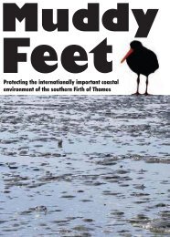
MUDDY FEET - Auckland Regional Council
MUDDY FEET - Auckland Regional Council
MUDDY FEET - Auckland Regional Council

Create successful ePaper yourself
Turn your PDF publications into a flip-book with our unique Google optimized e-Paper software.
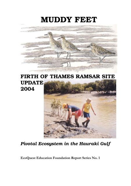
<strong>MUDDY</strong> <strong>FEET</strong><br />
FIRTH OF THAMES RAMSAR SITE<br />
UPDATE<br />
2004<br />
Pivotal Ecosystem in the Hauraki Gulf<br />
EcoQuest Education Foundation Report Series No. 1
Frontispiece<br />
Chart of the Hauraki Gulf (1827)<br />
From Dumont d’Urville – Voyage de l’Astrolabe<br />
Showing the Waihou River and the “Ware-kawa” Miranda-Kaiaua Coast<br />
(present Ramsar Site)
<strong>MUDDY</strong> <strong>FEET</strong><br />
FIRTH OF THAMES RAMSAR SITE<br />
UPDATE 2004<br />
Bill Brownell, Editor<br />
Dedicated<br />
to<br />
Stella Frances<br />
Published by<br />
EcoQuest Education Foundation<br />
East Coast Road, Kaiaua<br />
RD 3, Pokeno, New Zealand
A report prepared for Environment Waikato<br />
(an Environmental Initiatives Project)<br />
and<br />
Hauraki District <strong>Council</strong><br />
Thames Coromandel District <strong>Council</strong><br />
Copyright December 2004, EcoQuest Education Foundation<br />
ISBN 0-9582329-1-1<br />
Cover<br />
Drawing of Pacific Golden Plover (Pluvialis fulva) by Keith Woodley<br />
Photo of Deb Kast and Becca Hanson (Homo sapiens) on bank of Karito Canal by Bill Brownell
Contents<br />
List of Figures<br />
List of Tables<br />
Memory of Tikapa Moana<br />
Acknowledgements<br />
Preface<br />
1 INTRODUCTION................................................................................................. 1<br />
1.1 Wetlands in New Zealand ............................................................................. 1<br />
1.2 The Ramsar Convention................................................................................ 1<br />
1.3 General Description of the Firth of Thames.................................................. 2<br />
1.4 Catchment...................................................................................................... 8<br />
1.5 The Firth of Thames Ramsar Site.................................................................. 8<br />
1.6 Brief History of Hauraki Plains Reclamation Works and Drainage ............. 9<br />
2 HYDROLOGY.................................................................................................... 13<br />
2.1 Hauraki sediments ....................................................................................... 13<br />
2.2 Summary of Cheatley (2000) ...................................................................... 15<br />
3 VEGETATION.................................................................................................... 17<br />
3.1 Miranda – Kaiaua foreshore........................................................................ 17<br />
3.2 Survey of the foreshore between Tararu and Hot Springs Drain ................ 20<br />
3.3 Grazing ........................................................................................................ 23<br />
3.4 Threatened plants of Miranda...................................................................... 24<br />
3.5 Threatened plants inside the stopbank......................................................... 25<br />
3.6 Exotic invaders – Adventive plant species.................................................. 26<br />
4 TERRESTRIAL INVERTEBRATES & MAMMALIAN PREDATORS.......... 31<br />
4.1 Mammalian Predators.................................................................................. 31<br />
4.2 Invertebrates ................................................................................................ 32<br />
4.3 Brown Garden Snail .................................................................................... 32<br />
4.4 Mangroves................................................................................................... 32<br />
5 MANGROVES: THE CORNERSTONE OF A DYNAMIC COASTAL<br />
ENVIRONMENT........................................................................................................ 34<br />
5.1 History......................................................................................................... 34<br />
5.2 Ecology........................................................................................................ 34<br />
5.3 Accretion of Sediments and Advancement of Mangroves.......................... 38<br />
5.4 Karito Canal Field Studies .......................................................................... 44<br />
5.5 Dredging in the Mangroves......................................................................... 44<br />
5.6 Revegetation of the Spoils Area.................................................................. 49<br />
5.7 Recovery of the Dieback Area .................................................................... 49<br />
5.8 Effects of Frost ............................................................................................ 51<br />
5.9 Conclusions ................................................................................................. 52<br />
6 BIRDS OF THE MIRANDA COAST ................................................................ 54<br />
6.1 Introduction ................................................................................................. 54<br />
6.2 Birds of Miranda and the Firth of Thames .................................................. 54<br />
6.3 Survey of the foreshore between Tararu and Hot Springs Drain ................ 59<br />
6.4 Principal Waders ......................................................................................... 60
6.5 Other Wader Species................................................................................... 65<br />
6.6 Wetland Birds and Waterfowl..................................................................... 66<br />
6.7 Oceanic and Sea-birds................................................................................. 68<br />
6.8 Terrestrial Species ....................................................................................... 71<br />
7 ESTUARINE FISH, FISHERIES AND MARINE FARMING.......................... 77<br />
7.1 Introduction ................................................................................................. 77<br />
7.2 Recent Biological Phenomena in the Firth of Thames................................ 78<br />
7.3 Marine Farming in the Firth of Thames ...................................................... 80<br />
7.4 Fishing Activity in the Firth of Thames ...................................................... 81<br />
7.5 Stream fish surveys ..................................................................................... 87<br />
7.6 Fisheries Research....................................................................................... 87<br />
7.7 Conclusions ................................................................................................. 88<br />
8 BENTHIC ECOLOGY........................................................................................ 91<br />
8.1 Introduction ................................................................................................. 91<br />
8.2 Methodology ............................................................................................... 91<br />
8.3 Results ......................................................................................................... 93<br />
8.4 Summary & Conclusions............................................................................. 98<br />
8.5 Recommendations ..................................................................................... 100<br />
8.6 Introduction ............................................................................................... 102<br />
8.7 Study site ................................................................................................... 103<br />
8.8 Sampling Methods..................................................................................... 103<br />
8.9 Results ....................................................................................................... 103<br />
8.10 Discussion ................................................................................................. 106<br />
8.11 Continuation of the study .......................................................................... 106<br />
9 LAND TENURE / STATUTORY MANAGEMENT....................................... 108<br />
9.1 Introduction ............................................................................................... 108<br />
9.2 Land Tenure .............................................................................................. 108<br />
9.3 Legislation................................................................................................. 108<br />
9.4 Statutory Management .............................................................................. 109<br />
9.5 Functions, Policies and Plans .................................................................... 110<br />
9.6 Treaty of Waitangi matters........................................................................ 118<br />
9.7 Strategies, Policies and Plans .................................................................... 119<br />
9.8 Resource Management Act Policies and Plans ......................................... 120<br />
9.9 Discussion ................................................................................................. 121<br />
10 RAISING CONSERVATION AWARENESS ................................................. 123<br />
10.1 Introduction ............................................................................................... 123<br />
10.2 Department of Conservation ..................................................................... 123<br />
10.3 Ramsar Convention Work Plan, 2000-2002.............................................. 127<br />
10.4 Other Initiatives......................................................................................... 127<br />
10.5 Miranda Naturalists’ Trust ........................................................................ 127<br />
10.6 Improving Interpretation, Access and Advocacy...................................... 128<br />
10.7 Support for Research and Advocacy......................................................... 129<br />
11 RISKS, THREATS AND CURRENT RESEARCH......................................... 130<br />
11.1 Summary of the Issues .............................................................................. 130<br />
11.2 Specific concerns about the immediate catchment: .................................. 133<br />
11.3 From outside the catchment: ..................................................................... 134<br />
11.4 Uses of the Firth of Thames and Hauraki Gulf ......................................... 134<br />
11.5 Cross-boundary issues............................................................................... 135<br />
11.6 Global links ............................................................................................... 135
11.7 Current Research in the Firth of Thames .................................................. 136<br />
11.8 Pertinent Research in Neighbouring Areas ............................................... 139<br />
12 FIRTH OF THAMES RAMSAR SITE WORKSHOP REPORT MIRANDA<br />
SHOREBIRD CENTRE, NOVEMBER 16, 2001 ....................................................... 141<br />
12.1 Introduction ............................................................................................... 141<br />
12.2 Land use, water quality and sedimentation ............................................... 141<br />
12.3 Coastal Vegetation .................................................................................... 143<br />
12.4 Benthic Ecology ........................................................................................ 146<br />
12.5 Fish, fisheries and aquaculture .................................................................. 147<br />
12.6 Birds .......................................................................................................... 149<br />
12.7 Enhancement of community participation, recreation and natural<br />
history education in the area...................................................................... 151<br />
12.8 Achieving sustainability of the Ramsar site in the context of the Firth<br />
of Thames ecosystem, and protection of ecosystem values, cultural<br />
heritage and historical features.................................................................. 153<br />
12.9 How to move forward with issues-focussed research requirements<br />
identified by the EcoQuest report, today’s discussions and the May 24<br />
DoC workshop........................................................................................... 155<br />
13 CONCLUSIONS AND RECOMMENDATIONS............................................ 160<br />
13.1 General Conclusions.................................................................................. 160<br />
13.2 Recommendations ..................................................................................... 163<br />
14 BIBLIOGRAPHY ............................................................................................. 165<br />
Muddy knees, too... Dick Veitch (photo K. Woodley)
List of Figures<br />
Figure 1-1 Southern Hauraki Gulf and the Firth of Thames. The Ramsar Site sits<br />
between the low tide mark and the coast, extending from the Waihou River<br />
to Kaiaua. The five political districts and two regions bordering the Firth<br />
are shown ................................................................................................................3<br />
Figure 1-2 Aerial view of the eastern end of the Ramsar Site, showing the<br />
Waihou and Piako river mouths, the stopbanks, farmland and the band of<br />
coastal mangroves. ..................................................................................................4<br />
Figure 1-3 Aerial composite of the Firth of Thames, with a close-up of one point<br />
along the stop bank near the Piako River mouth.....................................................6<br />
Figure - 5-1 June, 1963 aerial photo of Waitakaruru River to Karito Canal area,<br />
showing minimal coastal mangrove coverage. .....................................................41<br />
Figure - 5-2 Waitakaruru-Karito area in 1996, showing mangrove advancement. .........42<br />
Figure - 5-3: Waitakaruru River to Karito Canal - February 2002.....................................43<br />
Figure - 5-4 Three time series photos of the dredge spoils strip along the Karito<br />
Canal .....................................................................................................................45<br />
Figure - 5-5 Photo of Karito Canal before dredging, and 2 time series photos of<br />
the Karito mangrove dieback area.........................................................................47<br />
Figure 5-6 December 2004 updated mangroves photos ...................................................48<br />
Figure 6-1 Important Sites for waders and shorebirds in New Zealand (indicated<br />
by bold italics).......................................................................................................55<br />
Figure 6-2 Wader habitats at Firth of Thames Ramsar Site .............................................56<br />
Figure 6-3 Changing habitats at Miranda (adapted from Veitch and Habraken<br />
1999, by permission).............................................................................................57<br />
Figure 6-4 Wader watchers: a common sight at Miranda and Taramaire from<br />
October to April (photo K. Woodley)...................................................................73<br />
Figure 8-1 Study area and location of 10 transects (sites) and 30 sampling stations<br />
at 3 approximate tidal elevations within the Firth of Thames Ramsar Site<br />
and nearby Thames Coast. Note: The Miranda near-shore sampling station<br />
(see section 2) is approximately beneath the letter ‘a’ of station 9a. ....................92<br />
Figure 8-2 Scale approximation of size and density of M. ovata tristis as recorded<br />
in one core sample station (6a)..............................................................................96<br />
Figure 8-3 Estimated abundances/m2 of main benthic faunal groups at each site:<br />
Polychaeta, Decapoda, Crustacea and Bivalvia. Note: Capitellidae<br />
abundances have been omitted because they were only scored on a<br />
present/absent basis, n = 9 cores.........................................................................96<br />
Figure 8-4 Estimated abundance/m2 of the six most prevalent bivalve species<br />
recorded per transect from 9 × 15 cm dia. cores (3 samples × 3 sites). ................97<br />
Figure 8-5 Estimated abundances (m2) of four main benthic faunal groups for each<br />
tidal elevation. Sites ‘A’ » MHW, sites ‘B’ » mid tide, sites ‘C’ » MLWS.<br />
Note: Oligochaete abundances have been omitted because they were only<br />
scored on a present/absent basis............................................................................97<br />
Figure 8-6 Estimated abundance (m2) of four most prevalent bivalve species<br />
recorded for each tidal elevation. Note: 9 × 15 cm dia. cores (3 samples × 3<br />
sites). Sites ‘A’ » MHW, sites ‘B’ » mid tide, sites ‘C’ » MLWS.......................98<br />
Figure 8-7 Dominant taxa divided into functional feeding groups for stations A-C........99<br />
Figure 9-1 Zoning map of Thames-Kopu area showing Waihou River, Firth of<br />
Thames and coastal land uses .............................................................................115<br />
Figure 9-2 Zoning map of Kaiaua-Miranda Coast showing designation and land<br />
status (Dept. of Conservation and Franklin District <strong>Council</strong> jurisdictions)........117<br />
Figure 9-3 Planning Framework of the Resource Management Act ..............................120
List of Tables<br />
Table 5-1 Comparative Widths in metres of Firth of Thames Ramsar Site<br />
Mangrove Forest – 1977 and 2002 - at selected points around the coast,<br />
starting from the outer edges of the stopbanks and extending out to the<br />
edge of the highest density zone...................................................................... 40<br />
Table 8-1 Summary of raw data indicating total number of species recorded at<br />
each site (numbers represent a composite of three replicate core<br />
samples)........................................................................................................... 94<br />
Table 8-2 Berger-Parker dominance measures for the composite data (30 cores<br />
each) of the three stations (A-C), plus some selected extreme examples<br />
from individual stations (three cores each)...................................................... 95<br />
Table 8-3 Mean size parameters taken from sub-sample of typical adult<br />
specimens......................................................................................................... 96<br />
Table 8-4 Description, sampling technique and sample volume associated with<br />
each sampling device..................................................................................... 103<br />
Table 8-5 Comparison of sampling devices when plots were exposed and<br />
submerged. Standardized to 1 litre of sediment [Organisms are totals of<br />
ten samples, collected in March 2001.] ......................................................... 104<br />
Table 8-6 Two way ANOVA comparing variance associated different methods<br />
and sampling tides (exposed and covered) on day 1 ..................................... 104<br />
Table 8-7 Two way ANOVA comparing variance associated different methods<br />
and sampling tides (exposed and covered) for day 2..................................... 104<br />
Table 8-8 Total for organisms collected in ten Coff-Kyd samples in Plot A -<br />
March and May 2001. Volume standardized to 1 litre of sediment. ............. 105<br />
Table 8-9 List of Taxa found in Benthic Fauna Samples at Miranda....................... 105<br />
Table 9-1 Resource Management Responsibilities ................................................... 119
Early morning light …<br />
shadows shaping<br />
movement making<br />
a flat flight<br />
to land upon rounded washed<br />
stones<br />
held as islands between tides.<br />
Kotare<br />
Kotare the kingfisher …<br />
staunch<br />
expectant<br />
a keenness stilled<br />
pregnant with silence, waiting<br />
Kotaretare tapu<br />
the one looking over<br />
that which is sacred.<br />
Kotare converses with old Moki<br />
talking the language of Manawa<br />
Manawa … heartseed of mangrove<br />
Together they speak,<br />
as elders they listen.<br />
‘Whakarongo’ … listen here<br />
Kia ora, e hoa<br />
I watch you, Moki …<br />
tides of movement,<br />
kelped wavebent shore of Hauraki<br />
guarding these waters<br />
with your trusting love.<br />
Old eyes …<br />
you leave me<br />
with feelings<br />
on the edge of unease<br />
that ‘they’ may know not ever<br />
until their time<br />
to swim beside you nears.<br />
The Memory of Tikapa Moana<br />
Aue, Manawa<br />
Old mangrove …<br />
by this breath, this heart<br />
I lament.<br />
What have they done to the land,<br />
what do they do to the sea …<br />
Manawa …<br />
ancient mind<br />
to remind them<br />
privilege given.<br />
Incredulous<br />
they behave<br />
this only about them.<br />
Are elders not placed<br />
by circumspect<br />
to respect<br />
to listen …<br />
Mana<br />
Manawa<br />
Mana whenua<br />
For whose pulse is this<br />
that lies in rhythm<br />
to this primordial<br />
mother’s heart …<br />
Listen to the land<br />
Listen to the sea<br />
Mana whenua<br />
Mana moana<br />
Whakarongo<br />
Listen.<br />
Mike O’ Donnell<br />
Paeroa
Acknowledgements<br />
This report was made possible by a grant from Environment Waikato’s Environmental<br />
Initiatives Fund. Substantial additional funding was provided by the Hauraki District <strong>Council</strong><br />
and the Thames Coromandel District <strong>Council</strong>. The Waikato District <strong>Council</strong> donated a full<br />
set of 1996 colour aerial photographs of the area. The Department of Conservation<br />
(<strong>Auckland</strong> and Waikato Conservancies) provided valuable support services and advice.<br />
The 2001 draft of Muddy Feet was printed and circulated to 80 collaborators and interested<br />
parties in November 2001. My most profound appreciation goes to my principal EcoQuest<br />
collaborators, in particular the co-editor of that edition, Ria Brejaart. Jono Clark has played a<br />
major role in the organisation, layout and formatting of both editions. Marie Buchler made<br />
major editing and content contributions to this 2004 edition, including the transcription of the<br />
proceedings of the 2001 Workshop at the Miranda Shorebird Centre.<br />
I am grateful to all who assisted us with their valuable editorial comment on the draft of this<br />
document, particularly to Malene Felsing and her predecessor Stephanie Turner at<br />
Environment Waikato, and Marina Van Steenbergen at Hauraki District <strong>Council</strong>. Those who<br />
reviewed specific parts of it for us were: Rex Smith of Waitakaruru; Chris Paulin of the<br />
National Museum; David Medway of New Plymouth; Bev Clarkson and Bruce Burns of<br />
Landcare Research; Bec Stanley, Rosalie Stamp and Kala Sivaguru of DoC <strong>Auckland</strong>; Jan<br />
Simmons, Andrea Brandon and Tony Roxburgh of DoC Waikato; Larry Paul and Simon<br />
Thrush of NIWA; Keith Woodley of the Miranda Shorebird Centre. Nathan Kennedy of<br />
TCDC produced the special Thames area map.<br />
During the more than six years of planning and execution of this study, we received valuable<br />
information, advice and/or moral support from the following individuals:<br />
Peter Singleton, Robin Britten, Kathy Brightwell, Beat Huser, Gill Lawrence, Rick Liefting,<br />
Bill Vant, Sherilynn Hinton, Tony Fenton, Rosalind Wilton and Evan Penny (Environment<br />
Waikato-Hamilton),<br />
Ian Sara, Owen Passau, Kevin Campbell and Mark Soulsby (Environment Waikato-Paeroa),<br />
Alan Turner (Waikato District <strong>Council</strong>),<br />
Peter Wishart, Gary Deadman and Rowena Buchanan (Thames Coromandel DC),<br />
Mike Maguire, Steve Clark, Morgan Davison and Langley Cavers (Hauraki DC),<br />
Alan Moore, Dominic McCarthy, Neil Olsen and the librarians (<strong>Auckland</strong> <strong>Regional</strong> <strong>Council</strong>),<br />
Keith Woodley, David Lawrie, John Gale, Adrian Riegen, Dick Vietch, Tony Habraken, Phil<br />
Battley and Warwick Sandler (Miranda Naturalists’ Trust),<br />
Liane Ngamene (Hauraki Maori Trust Board) and David Taipari (Ngati Maru),<br />
Andy Andrews, Polly Wilson, Lucy Tukua, Amy Thompson and Tu Andrews (Ngati Paoa),<br />
Mal Green, Mark Morrison, John Zeldis and Simon Thrush (NIWA),<br />
Maggie Lawton, Bruce Burns and Bev Clarkson (Landcare Research, Hamilton),<br />
Jan Simmons, Tony Roxburgh, John Gumbley, Vicki Carruthers, Des Williams, Tracie Dean,<br />
Lisette Collins, Joe Harawira, Dave West and Fiona Edwards (DoC Waikato, Hamilton),<br />
Jason Roxburgh, John Gaukrodger and Fin Buchanan (DoC Waikato, Hauraki),
Stella Frances, Jan Coates, Warwick Murray, Bec Stanley, Annie Wheeler, Rau Kapa, Ian<br />
Bradley, Marie Alpe, Linda Bercusson, Roger Grace and Marilyn Fullam (DoC <strong>Auckland</strong>),<br />
Chris Hendy, Conrad Pilditch, Brendan Hicks, Catherine Beard, Rebecca Cheatley, Hilke<br />
Giles and Willem de Lange (Waikato University),<br />
Marjorie van Roon, Bob Creese and Bert Mom (<strong>Auckland</strong> University),<br />
Kathy Walsh (Kaiaua Citizens’ and Ratepayers’ Association, <strong>Auckland</strong> Conservation Board)<br />
Rex Smith, Mark Aislabie, Bert Laing, Ted Howard, Stephen Lane, Jocelyn Lane, Peter<br />
Thorburn, Doug Pulford and Jagindar Singh (local residents),<br />
David Medway (NZ Ornithological Society),<br />
Eric Souchon (H.G. Leach, Paeroa),<br />
Mike Tuohy and his students of remote sensing (Massey University)<br />
The EcoQuest team, all of whom assisted in various ways in the field and at the EcoQuest<br />
headquarters: Holly Bogle, Scott Bogle, Brian Coffey, Tony Cummings, Donna Dowal, Nigel<br />
Keeley, John Longden, Peter Maddison, Elizabeth Jones, Rob Ruzicka, Patrick Stewart, Jae<br />
Strommer, Stephanie Todd, Bruce and Meg Wildblood-Crawford, and numerous students<br />
who contributed to the ecological studies of wader birds, mudflats and mangroves.<br />
And, most of all, to John Clark, an immense and persistant source of inspiration and<br />
encouragement to so many of us who are passionate about the whenua of Hauraki and the<br />
moana of Tikapa, and who was the principal kaitiaki of the wairua of this and many other<br />
similar initiatives over the past 14 years.<br />
Appropriately muddy feet of the Summer Bird Course - Miranda Naturalists’ Trust<br />
(photo K. Woodley)
Preface<br />
Muddy feet. All resident and visiting species (plant, animal and human) in the Firth of<br />
Thames Ramsar Site have them, except for the ones that only swim. This vast intertidal area<br />
at the southern (hereafter referred to as ‘upper’) end of the Firth of Thames (Tikapa Moana) is<br />
mainly composed of muddy sediments that have built up there over time. Many species (such<br />
as mangrove, ducks, herons, flounders, eels, mud crabs, oysters and mud snails) thrive in the<br />
mud. The original flood plain forests and savannah of the Hauraki and Hunua coastal plains<br />
used to absorb it and replenish it. Adjoining ocean and riparian systems depend on it in many<br />
ways. Stop banks now defend against it. Humans tend to avoid it, unless they are shellfish<br />
gatherers, fishers, ornithologists, estuarine ecologists, duck hunters, farmers rescuing stray<br />
cattle, mud castle-building children or those passing through it by boat at high tide on their<br />
way to somewhere else.<br />
In spite of having been extremely modified by human activity, particularly over the past 130<br />
years, the upper end of the Firth of Thames remains an exceptionally productive ecosystem<br />
that provides quality shelter and abundant food for a great diversity of estuarine, coastal and<br />
avian species. Land use in the catchment is predominantly agricultural.<br />
Since the late 1970s, the intertidal zone of the upper Firth had been seriously considered for<br />
specific national protective status. Although a significant portion of this coast, extending<br />
from Kaiaua in the west around to the Waihou River in the southeast, was officially<br />
recognized as an internationally important wetland habitat by its designation as a Ramsar site<br />
in January 1990, no integrated ecosystem research was carried out in the area either before or<br />
after the designation, and no specific national protective status has been granted.<br />
There have been a number of isolated studies on the ecology, natural history and hydrology of<br />
the area. The primary focus of specific biological and ecological studies of the Ramsar site<br />
has been on the waders and their habitat. The goals of the present study were to gather and<br />
review existing information about the southern Firth of Thames ecosystem, and about the<br />
Ramsar Site in particular. Selected field investigations into aspects of the current state of the<br />
Ramsar Site were carried out. Findings of the literature review, local knowledge and field<br />
investigations, including the appraisal of conservation issues and increased pressures for<br />
development in the surrounding area are presented in this report. In addition, gaps in existing<br />
knowledge have been highlighted.<br />
Research for the Hauraki Customary Indicators Report (1999) was underway when our study<br />
of the Ramsar Site began. In parts, the Customary Indicators Report and Muddy Feet are<br />
complementary. A workshop on “Biological Investigations of the Firth of Thames”,<br />
organized by the Waikato Conservancy of the Department of Conservation, was held in May<br />
2001 at the Miranda Shorebird Centre, followed closely by the Ramsar Site Workshop at the<br />
same venue in November (proceedings reported here as chapter 12). Management issues,<br />
current risks and priorities for further research and policy development that were identified at<br />
these workshops have been incorporated in this report.<br />
We have drawn ideas and inspiration from many residents, visiting naturalists and researchers<br />
who collectively have a wealth of experience and vision about this upper Firth of Thames<br />
environment. All who have hands-on involvement with this area (and the inevitable muddy<br />
feet) recognise that this ecosystem is evolving very rapidly, and the changes are profound.<br />
These changes are begging to be documented and evaluated in terms of ecosystem evolution,<br />
and the existing and potential human impacts. We hope that this work will encourage all<br />
concerned Ramsar Site stakeholders to contribute to a greater collective understanding of how<br />
it functions, and how to achieve integrated and sustainable management of it.<br />
Bill Brownell – December 2004
Mouth of the Miranda Stream: start of the coastal band of mangroves (background) looking SW<br />
toward location 1 in table 5.1 (photo K. Woodley)<br />
New shellbank at Miranda: slow evolution since 1996: rapid expansion in 2004<br />
(photo K. Woodley)
1 Introduction<br />
by Ria Brejaart and Bill Brownell<br />
(with contributions by Holly Bogle and Nigel Keeley)<br />
1.1 Wetlands in New Zealand<br />
The mountains, plains, plateaus and rough coastlines of New Zealand, and the variety of<br />
physical processes acting upon them – wind and rain, rivers and streams, waves and tides,<br />
floods, earthquakes, glacial and volcanic activity – have combined to form an extensive<br />
network of coastal and interior wetlands. These important wildlife habitats, repositories of<br />
nutrients for recycling and buffers against flooding have gained prominence in recent years,<br />
after many years of being considered a nuisance.<br />
In the Waikato Region in 1865 there were fewer, but much larger wetlands. Today, after 150<br />
years of drainage, the large wetlands like the Hauraki flood plain adjacent to the Firth of<br />
Thames have been lost or split into small fragments, and most are now smaller than 50 ha.<br />
The National Wetland Trust was established in 1999 to increase the appreciation of wetlands<br />
and their values by all New Zealanders. The Trust plans to build a state-of-the-art wetland<br />
interpretation centre near Lake Kopuera, in the northern Waikato Region.<br />
Wetlands have been used, altered and drained by both Maori and Europeans. It is estimated<br />
that only 10% of New Zealand’s former wetlands remain (Cromarty and Scott, 1996).<br />
Wetlands in the Waikato Region include peat bogs, shallow lakes, extensive freshwater bogs,<br />
and river flats, as well as vast estuarine wetlands, of which the lower Firth of Thames is the<br />
largest. Extraction of sand and gravel, land reclamation, drainage, run-off, residential<br />
developments, and the spread of mangroves and exotic weeds are some of the processes that<br />
bring about ongoing changes to New Zealand’s wetlands today (Cromarty and Scott, 1996).<br />
The coastal wetland and mudflats that constitute the present Firth of Thames Ramsar Site is a<br />
result of perhaps the most severe wetland modification ever undertaken in New Zealand: the<br />
conversion of over 200,000 acres of the original Piako Swamp into fully drained, prime<br />
agricultural land. The mangrove forests that today cover 1100 hectares of coastal margin in<br />
the southern Firth barely existed in 1952, mainly as a few small patches at the mouths of the<br />
Piako and Waihou rivers.<br />
1.2 The Ramsar Convention<br />
The Convention on Wetlands of International Importance Especially as Waterfowl Habitat is<br />
an intergovernmental treaty, adopted on 2 February 1971 in the Iranian city of Ramsar, and is<br />
commonly known and referred to as the Ramsar Convention. Although the emphasis<br />
originally was on the provision of habitat for waterfowl and waders, the Convention has in<br />
recent years broadened its scope, recognizing the importance of wetland ecosystems for<br />
biodiversity conservation and for the well-being of human communities. By July 2000, the<br />
Convention had 122 Contracting Parties in all parts of the world, with 1031 wetlands that had<br />
been designated for inclusion in the List of Wetlands of International Importance, covering<br />
78.2 million hectares.<br />
Upon joining, contracting parties must fulfil four major obligations:<br />
• Designation of at least one wetland for inclusion in the List of Wetlands of International<br />
Importance, and promotion of its conservation, and where appropriate, its wise use.<br />
• Inclusion of wetland conservation considerations in planning at a national level.<br />
EcoQuest Education Foundation EQRS/1 12/04<br />
1
2<br />
• Establishment of nature reserves in wetlands, and promotion of training in the fields of<br />
wetland research and management.<br />
• Consultation with other Contracting Parties about implementation of the Convention.<br />
The first Oceania regional meeting of the Ramsar Convention was held in Hamilton, New<br />
Zealand in December 1998. New Zealand has designated five wetlands for inclusion in the<br />
List of Wetlands of International Importance, three of which are in the Waikato Region.<br />
Chronologically, from date of designation, these are:<br />
• Farewell Spit and the Waituna Wetland (both August 1976) – South Island<br />
• Whangamarino and Kopuatai Peat Dome (both December 1989) – Waikato<br />
• Firth of Thames (January 1990) – a short distance NE of Whangamarino and Kopuatai<br />
The April 2001 report from the Auditor General of New Zealand on Meeting International<br />
Environmental Obligations points to some weaknesses in our wetlands standards, citing the<br />
“…. lack of a coherent national policy framework on wetlands.” and, “There is also evidence<br />
that wetland degradation in New Zealand is worse than it ought to have been. To an extent<br />
this may have been inevitable. But it is probable that the cause lies, in part, in the lack of<br />
guidance – both in legislative and policy terms – on where the balance should lie between<br />
development and wetland protection. We believe the variability and differing values of<br />
wetlands lead directly to difficulties in application and implementation of the Ramsar<br />
Convention. And these difficulties reinforce the need to develop a national wetlands planning<br />
framework to set priorities, targets, standards, and so on within an agreed understanding of<br />
the Convention obligation of as far as possible the wise use of wetlands.”<br />
1.3 General Description of the Firth of Thames<br />
The Firth of Thames, or Tikapa Moana, is a shallow marine embayment, which lies in the<br />
northern part of the Hauraki Rift, bounded by fault lines along the Hunua and Coromandel<br />
ranges (see 1.6). The Firth’s northern boundary, merging into the greater Hauraki Gulf, is<br />
situated due east of <strong>Auckland</strong>, running from Thumb Point (NE Waiheke Island) to<br />
Coromandel Harbour, approximately following the line of 36º44' S latitude, between 175º11'<br />
and 175º31' E longitude (Figure 1-1). The Firth is between eleven and fourteen nautical miles<br />
wide and reaches a maximum depth of 35 metres near its northern limits. About 95% of the<br />
Firth is less than 30 metres deep.<br />
The Firth of Thames is the primary receiving environment for the ~3600 km 2 Hauraki<br />
Catchment. The inner half of the Firth (south of a line drawn between Tararu in the east and<br />
Kaiaua in the west) is very shallow (Figure 8-1), with a maximum depth of five metres<br />
(mainly in the middle) at mean low water spring tides (MLWS). For nearly all of the coastal<br />
area covered by the Ramsar designation, the intertidal zone is between one and two<br />
kilometres wide, with no more than a 1.5m change in altitude between its inner and outer<br />
margins.<br />
EcoQuest Education Foundation EQRS/1 12/04
Figure 1-1 Southern Hauraki Gulf and the Firth of Thames. The Ramsar Site sits between the<br />
low tide mark and the coast, extending from the Waihou River to Kaiaua. The five political<br />
districts and two regions bordering the Firth are shown<br />
EcoQuest Education Foundation EQRS/1 12/04<br />
3
Figure 1-2 Aerial view of the eastern end of the Ramsar Site, showing the Waihou and Piako river mouths, the stopbanks, farmland and the band of coastal<br />
mangroves.
Wind and tidal currents cause a net retention of a great volume of sediments brought into the<br />
southern half of the Firth by rivers and streams. By one estimate, the basin is infilling at the<br />
average rate of 0.8-1.0 mm per year at the centre and 1.8-2.0 mm near shore, mainly from<br />
sediments brought in by the Waihou and Piako Rivers (Naish et al.1990) (see Figure 1-2).<br />
Distribution of the entrained sediments entering the Firth of Thames varies with the changing<br />
circulation systems that dominate the movement of its waters. The three major influences that<br />
control the circulation systems present in the Firth are the East <strong>Auckland</strong> Current, the M2 tide,<br />
and prevailing winds. Residual water movement from the tide is found to be almost zero, with<br />
weak ebb and flow currents in the upper Firth of less than 1cm/s. Wind induced currents have<br />
been modelled by Proctor and Greig (1989), and show clockwise and anticlockwise circular<br />
gyres throughout the water column within the Firth of Thames. The East <strong>Auckland</strong> Current<br />
(flowing south-easterly from North Cape past Great Barrier Island), and the north-westerly<br />
winds of El Nin�o both act as partial barriers to the movement of sediments out of the Firth of<br />
Thames, resulting in deposition and accretion in the Firth itself and particularly along its<br />
southern and western margins (van Leeuwe 1991) (map, Figure 8-1).<br />
The mean annual air temperature is about 13ºC, and the average annual rainfall approx.<br />
1,200mm (Young and Harvey, 1996). Surface temperatures in the open waters of the Firth<br />
range from 14 o C. to 24 o C. in a “warm” year, 11 o C. to 22 o C. in a “cold” year (depending on<br />
the phase of the El Nin�o cycle) and there is usually less than one degree difference between<br />
top and bottom temperatures in depths of 10-12 m off Waimangu Point (M. Aislabie, pers.<br />
comm.).<br />
The Hauraki Catchment is a significant source of nutrients for the fertile waters and mudflats<br />
of the entire Hauraki Gulf, though the up welling of deep ocean waters at the north-eastern<br />
margin of the Gulf is by far the greatest source of nutrient supply, particularly when the northwesterly<br />
winds of El Niño blow consistently along the coast (Zeldis et al., 2000). The high<br />
plankton productivity resulting from these elevated levels of deep-water nutrients (along with<br />
those coming in as runoff from the catchment, and the decomposition of detritus mainly in the<br />
mangroves) supports abundant fish and littoral invertebrate populations (especially shellfish)<br />
in the Firth of Thames.<br />
The Firth of Thames has been recognised since the early settlement of Hauraki Maori for its<br />
immense life-supporting capacities, and in more recent times for its unique conservation and<br />
wildlife habitat values. It is still an important shared resource for various iwi, as well as non-<br />
Maori local residents and visitors. Two species of flounder are the foundation of a small local<br />
commercial fishery. Recreational fishing – based mainly on snapper (Pagrus auratus),<br />
kahawai (Arripis trutta), flounder (Rhombosolea leporina and R. plebeia) and trevally<br />
(Pseudocaranx dentex) – yields consistently good results. Shellfish farming, particularly<br />
greenshell mussels (Perna canaliculus), has expanded on both sides of the Firth and to the<br />
north at Waiheke and Great Barrier Islands.<br />
The Firth of Thames shoreline is scenically attractive. The road follows the coastline, giving<br />
excellent views of the Firth and the Coromandel Ranges. South of Kaiaua the shell banks<br />
present a spectacular sight, particularly in fine weather when their brilliant white reflects the<br />
sunlight. This natural beauty makes the Firth an important recreational resource for<br />
swimming, boating, fishing, shellfish gathering, camping, tramping, and horse riding (Bacon,<br />
1973). The number of casual visitors to the coast, especially during the summer months, is<br />
increasing rapidly. The Shorebird Centre of the Miranda Naturalists’ Trust provides for local<br />
bird-watching and environmental education activities. The Miranda Hot Springs and attached<br />
holiday park have become a major attraction for visitors to the area, as well as the locals.<br />
EcoQuest Education Foundation EQRS/1 12/04<br />
5
6<br />
Figure 1-3 Aerial composite of the Firth of Thames, with a close-up of one point along the stop<br />
bank near the Piako River mouth.<br />
EcoQuest Education Foundation EQRS/1 12/04
Figure 1-4 continued.<br />
EcoQuest Education Foundation EQRS/1 12/04<br />
7
8<br />
The Firth’s geographical position makes it vulnerable to changes induced by natural events<br />
and human developments. The extent of impact arising from such events has, over the years,<br />
attracted considerable attention from numerous scientists and amateur naturalists. Land use in<br />
the catchment is predominantly agricultural, and recent years have seen intensified agriculture<br />
on the Hauraki Plains, accelerated growth of the <strong>Auckland</strong> and Waikato Regions, and the<br />
establishment of the Pacific Coast Highway around the perimeter of the Firth of Thames. This<br />
has resulted in ever increasing pressure on the environmental quality of this ecosystem. The<br />
Firth’s role as the receiving environment for the run-off from most of these areas also makes<br />
it a potentially very important site for monitoring of critical environmental indicators<br />
(Ministry for the Environment, 1997).<br />
1.4 Catchment<br />
The Firth receives freshwater influence directly from two main rivers: the Waihou and the<br />
Piako (Figures 1-2 and 1-3), the smaller Waitakaruru River, the Miranda Stream, Karito<br />
Canal, and a few lesser streams and drains in the west. The Waihou catchment extends back<br />
as far as Putaruru and together with the Piako drains nearly all of the Hauraki Plains.<br />
Historically this was covered with a vast kahikatea forest but is now developed for farming<br />
and a small amount of forestry. Within Hauraki District 67% of land is in primary<br />
production. The Waihou and Piako together contribute most of the sediments and nutrients<br />
that run off the land into the Firth of Thames. Much of the remainder of the catchment in<br />
Hauraki District lies within the Kopuatai peat dome - itself a Ramsar site and a major<br />
component of the Hauraki Plains Flood Control Scheme. There are also other small areas of<br />
peat bog and kahikatea forest under conservation management in the Waihou and Piako<br />
catchments.<br />
The wider Firth of Thames receives freshwater runoff from the Hunua and Coromandel<br />
Ranges - both largely vegetated in indigenous forest. Much of the Hunua water is diverted<br />
into large water supply dams serving <strong>Auckland</strong>, but flood flows from Coromandel rivers (in<br />
particular from the Kauaeranga, Te Puru, Waiomu, Tapu and Te Mata Rivers) can have a<br />
strong (if temporary) influence contributing to flooding of coastal settlements and sediment<br />
loading in the Firth.<br />
1.5 The Firth of Thames Ramsar Site<br />
The Firth of Thames Ramsar Site is comprised of intertidal area of the southern and western<br />
shores of the Firth of Thames between the west bank of the Waihou River and Kaiaua (Figure<br />
1-1and Figure 1-3). The intertidal area is defined by the extremes of mean low water spring<br />
tides (MLWS), and mean high water springs (MHWS), and covers about 8,500 ha (Veitch &<br />
Habraken, 1999). The vast, open inter-tidal mudflats, the mangrove communities that now<br />
cover much of the upper reaches of the intertidal zone, and the terrestrial areas adjacent to the<br />
mudflats are built on varying proportions of marine and land-derived sediments, old shell<br />
banks and vegetative debris.<br />
The graded shell banks of the coast between Miranda and Whakatiwai (Figure 1-1, Figure 6-3<br />
and Figure 9-2) are mainly derived from an active Chenier Plain, gradually pushed up on the<br />
shores by northeasterly storms and high tides. The Miranda Chenier Plain (course sediment<br />
and/or shell banks over-laying finer sediments) is unique in New Zealand, and one of the<br />
world’s finest examples of this rare coastal landform (Woodroffe, et al, 1983). A series of<br />
true Chenier ridges exist on the stretch of foreshore between Miranda and Kaiaua on the west<br />
coast of the Firth. This site has been the focus for a number of national and international<br />
EcoQuest Education Foundation EQRS/1 12/04
studies, some of which use the Chenier Plains to determine the timings and extent of past sea<br />
level changes.<br />
The most recognised conservation feature of the Firth of Thames Ramsar Site is that it is a<br />
major stopover and over-wintering area for migrating water birds on the Australasian Flyway.<br />
The expansive wetlands and mudflats provide feeding and loafing grounds for over 80<br />
different species of shorebirds and water birds. Of these, 49 are migratory (12 indigenous<br />
species and 37 international migrants) including several rare and endangered species<br />
(Galbraith, 1992). These have been documented by various avian researchers (R.B. Sibson,<br />
R. Hay, N. Macdonald, H.R. McKenzie, and C.R. Veitch) over the years and have been under<br />
the close watch of the Miranda Naturalists’ Trust since 1973.<br />
The Ramsar Site also supports an extremely successful mangrove forest, mudflat invertebrate<br />
communities and salt marsh vegetation communities, constituting a vulnerable estuarine<br />
ecosystem that has settled into a new state of naturalness (though considerably different today<br />
from what it was prior to human settlement).<br />
The Ramsar Site is Crown land, managed by the Department of Conservation (DoC). The<br />
majority of the land adjoining the Ramsar Site is in private ownership, and much of it is<br />
grazed, to the benefit of the birds that use the area for roosting. A small, but significant area<br />
(27.7 ha) is covenanted under the Queen Elizabeth II Trust, and is managed jointly by the<br />
landowners and the Miranda Naturalists’ Trust. Also there is the 30 ha. Taramaire Coastal<br />
Reserve (managed by DoC), and a smaller one managed by Franklin District <strong>Council</strong>. In early<br />
2003 a consortium of conservation entities led by the Nature Heritage Fund, the Miranda<br />
Naturalists’ Trust and Environment Waikato achieved the purchase of 11 hectares of pastoral<br />
land near the Miranda Shorebird Centre for protection as a prime roosting area for waders.<br />
Some of the remaining private land at Miranda is designated for purchase by the Crown on a<br />
willing-seller basis.<br />
The Firth of Thames Ramsar Site has no status at all under the Conservation Act, the<br />
Reserves Act or the RMA. It does fall under the general protective measures of the Hauraki<br />
Gulf Marine Park, but this has proven (in the nearly five years since the inception of the<br />
HGMPA) to be one of New Zealand’s weakest conservation policy tools.<br />
1.6 Brief History of Hauraki Plains Reclamation Works and<br />
Drainage<br />
1.6.1 Maori settlement and influences on the sea and the land<br />
Tikapa Moana (Firth of Thames) is a central component of the Hauraki tribal territory.<br />
Historically Hauraki Maori lived predominantly on the fertile lowlands along the coast or<br />
waterways, which provided food resources and transport routes. It is possible that the<br />
shoreline and the seabed of the Firth of Thames today are superficially similar to that of pre-<br />
European times (Hauraki Maori Trust Board 1999).<br />
During the period of earliest Maori occupation in New Zealand (approximately 1000 years<br />
ago) the river courses were very different from what they are today. Phillips (2000) noted<br />
that settlements from the early period have not been found along the Waihou, and it is<br />
unknown whether Maori actually lived on the Hauraki Plains at this time, although they could<br />
well have used the resources. During the time of early settlement, the Waihou River provided<br />
only limited numbers of places favourable for Maori occupation or cultivation.<br />
The main effect of Maori occupation on the landscape of the Hauraki Plains was the clearance<br />
of the forest along the river and stream banks. Maori also cleared some of the hill country,<br />
EcoQuest Education Foundation EQRS/1 12/04<br />
9
10<br />
which probably resulted in erosion and an increased sediment load in rivers (Phillips 2000).<br />
Inter-tribal wars, land sales and European development all contributed to a re-orientation of<br />
lifestyle in the 1800s, and along with this a new Hauraki social order emerged (Hauraki Maori<br />
Trust Board 1999).<br />
1.6.2 Hauraki Plains at time of first European explorers and settlers<br />
At the time of first contact between Maori and Europeans, much of the land between the river<br />
and the foothills, on the eastern bank of the Waihou River, was cleared. A narrow strip of<br />
land along the western bank of the Waihou River (100-600 m wide) was cleared. Kahikatea<br />
(Dacrycarpus dacrydioides) forest was dominant. On both sides of the river there were large<br />
areas of raupo (Typha orientalis) and flax (Phormium tenax) swamp (Phillips 2000). The<br />
extensive coastal plains of the southern Firth of Thames (of which the current Ramsar Site<br />
occupies a small fraction) were recognized by Captain Cook and Joseph Banks in 1769 as “a<br />
garden and a pasture in which the best elements of British society might grow into an ideal<br />
nation”, in spite of being blanketed at the time by a vast Kahikatea forest containing the<br />
biggest trees they had ever seen (Park 1995).<br />
Cook and Banks (Beaglehole 1955 and 1963) also commented on the swamps and mangroves<br />
at the river mouth, and the mudflats and mangroves appeared on the early maps by Captain<br />
Cook and Captain Wilson (Phillips 2000).<br />
Cook and Banks considered the “Thames” (Waihou) River to be the best site for the<br />
establishment of a new colony (in terms of protected anchorage, fertile soil, huge expanse of<br />
flat land, vast quantities of fine timber and abundant fishery resources).<br />
An area of approximately 200,000 acres constituting the Hauraki Plains, originally known to<br />
Europeans as the Piako Swamp, was historically prone to regular flooding, and thus limited<br />
the possibilities for human habitation. All of the Maori settlements of the extensive Waihou<br />
and Piako river systems were on the highest bits of ground (including old raised shorelines) to<br />
minimize the risks of flooding, and for defensive purposes (Phillips 2000, Park 1995).<br />
Several early accounts mention that the lower reaches of the trees of the forest were<br />
perpetually clothed with films of mud and hanging debris from regular washings by the siltladen<br />
tides and floods. The early people grew vegetables in small plots of rich alluvial soil,<br />
fished, hunted, gathered shellfish from the water and collected fruits (particularly Kahikatea<br />
berries) and flax and raupo reeds from the land (Hauraki Maori Trust Board 1999).<br />
1.6.3 European settlement<br />
The swamp-growing Kahikatea proved unsuitable for the timber trade, but it still was<br />
extensively harvested for various uses (such as butter boxes) in the 2 nd half of the 19 th century.<br />
Most of the kahikatea used in that era was milled on the banks of the Waihou. The great<br />
expanses of flax and raupo swamp were highly valued by Maori as a source of fibre for<br />
clothing, cordage and roofing (Phillips 2000). Flax was also used by the European colonists<br />
who built many mills on the plains for processing it.<br />
Dairy farming was initiated on a very small scale by the early colonists on the west bank of<br />
the Waihou in the 1880s. The cream was churned into butter at home, and the skim milk fed<br />
to fattening pigs. Extensive drainage of the Hauraki Plains has been undertaken since early<br />
settlement. Some of the drains were cut by the first farmers in the 19th century, and drainage<br />
works as well as flood protection works continue up to the present day (Phillips 2000).<br />
The first organized land surveys and initial drainage efforts began in 1905, the same year the<br />
first creamery was established at Netherton. The Hauraki Plains Act was passed in 1908,<br />
EcoQuest Education Foundation EQRS/1 12/04
providing for the drainage and settlement of up to 90,000 acres of what had become Crown<br />
land through “compulsory acquisition” from the Maori inhabitants, with a total of 160,000<br />
acres targeted for future benefits from the scheme (Tye, 1974). The Act provided for:<br />
• Improvements to the Piako River<br />
• Construction of the Maukoro Canal for drainage of the south-western region of the<br />
Plains (between the present Waitakaruru and Tahuna)<br />
• Construction of stop banks along the foreshore of the Firth and the Piako River to<br />
prevent tidal and flood overflows<br />
• An internal drainage system with floodgates<br />
• Construction of roads, bridges and wharves.<br />
The first land ballots were held in Thames in 1910, and 5,200 acres of surveyed, drained and<br />
burnt land was made available in 1911 for settlement by European farmers along the<br />
foreshore of the Firth between Waitakaruru and the Piako, and for 10 miles up the western<br />
bank of the Piako (Tye, 1974, Park, 1995). The first flood protection works began after the<br />
floods of 1907 and 1910 (Phillips 2000).<br />
The Waihou and Ohinemuri Rivers Act was passed in 1910, and drainage works of the<br />
Waihou and Ohinemuri River Improvement Scheme commenced in 1914 (Tye, 1974).<br />
Between 1913 and 1919 a stop bank was built along both sides of the Waihou and the lower<br />
Ohinemuri, as well as around the coast. By then, the great quantities of sludge released over<br />
the years by gold mining in the Ohinemuri Catchment had become a major contributor to the<br />
considerable build-up of sediments in the Waihou and the Firth itself (Tye, 1974).<br />
By 1920, 40,000 acres of Crown land had been settled, and there were 15 major wharves on<br />
the Piako alone that serviced the needs of the new farmers (Tye, 1974). The total<br />
transformation of the Piako Swamp was complete by the mid-1930s, after 25 years of major<br />
engineering works involving all sorts of mechanical dredges and barges, horse scoops and<br />
armies of labourers. Major alterations to the coastal and estuarine ecosystems were already<br />
underway. When all waterways were channelled and floodgated, and great stop bank barriers<br />
built, natural floodplain sediment absorption processes were virtually eliminated.<br />
These initiatives soon proved to be inadequate. Two new schemes were subsequently devised<br />
to assist natural drainage and to alleviate the serious flooding that continued to occur<br />
(especially in 1952-53 and 1960-61). Works on the Piako River Scheme commenced in 1961,<br />
and were completed in 1974. Following more disastrous floods in 1977, the Waihou Valley<br />
Scheme was formulated. This involved raising and realigning stop banks, straightening<br />
streams and cutting toe drains on the landward side of the stop bank, and in some areas the<br />
creation of floodways (Phillips 2000). The Waihou Valley Scheme works were completed in<br />
the early 1980s.<br />
Tye (1974) estimated that 17,500,000 cubic yards of earth were shifted during the combined<br />
works on the Waihou and Piako systems, and that there were 319 miles of channels; 255<br />
miles of stop banks, 155 floodgated culverts, and 50 pump stations.<br />
The straightening and banking of the Karito Canal was carried out in the 1930s.<br />
Construction of the stopbank along the 4 km stretch between the Canal and Waitakaruru<br />
began in 1945. Work on the approximately 2.5 km stopbank north from the Canal to the<br />
Miranda Hot Springs Drain began once the link with the Plains schemes at the Maukoro<br />
Canal (Waitakaruru) was completed. From the Hot Springs Drain north to Kaiaua, the coast<br />
EcoQuest Education Foundation EQRS/1 12/04<br />
11
12<br />
road has served as a low “stopbank”, with some natural assistance from the inland Chenier<br />
shell ridges, and the numerous banks built by farmers over the years with spoils from the<br />
dredging of drains. The original road was built with great quantities of shell from the Chenier<br />
ridges, which, together with the Miranda Limeworks that operated between 1932 and 1952,<br />
significantly changed the landscape of the Chenier Plain.<br />
Continuing heavy sediment loads building up in the catchments, compounded by periodic<br />
intensive storms (of particular note in recent times: the storms of 1981, 1987, 1993, 1995,<br />
1997) require regular maintenance dredging of the drainage canals. The Pouarua Canal<br />
sustained regular clogging from peat mining in the area, but the mining has now finished.<br />
The stop banks sustain breaches at low points during some extremes of wind, tide and rain,<br />
particularly in combination with very low barometric pressure. In most parts of the system the<br />
stop banks are slowly getting lower, settling into the old sediments under them.<br />
In the period 2002 to 2004, the heights of various sections of stop bank were increased,<br />
especially from the Maukoro Canal to the Hot Springs (including a short extension northward<br />
from the Hot Springs Drain). This was done by dredging a channel along the outer edge of<br />
the stopbank and depositing the spoils on top of the existing bank (or on the new ground to<br />
serve as a foundation for further bank development once the spoils stabilise.<br />
Dredging is a permitted activity, under the planning and supervision of the Waikato <strong>Regional</strong><br />
<strong>Council</strong> and/or the Hauraki District <strong>Council</strong>. It and has typically been performed on a 3-6<br />
year cycle, as required, on most drains and canals in the system ever since the first major<br />
schemes were completed in the 1930s.<br />
The need for maintenance dredging is increasing throughout Hauraki District and parts of<br />
Matamata-Piako, Thames Coromandel and Waikato Districts. As an example, until 3 years<br />
ago dredging was performed only as far inland as Ngatea, on a bi-annual basis, and now it is<br />
required as far upstream as Patetonga, with a frequency of 1-3 times per year (Steve Clark,<br />
personal communication 2004).<br />
The bars outside the mouths of the Waihou, Piako and Waitakaruru Rivers are another<br />
indication of increasing sedimentation in the Upper Firth. These have always been in a state<br />
of flux, and of variable size and location. All three bars showed an increasing tendency by<br />
late 2004 to become larger and less variable, causing greater restrictions of the water flows<br />
out of the rivers, and contributing to the more permanent establishment of mangroves around<br />
them.<br />
EcoQuest Education Foundation EQRS/1 12/04
2 Hydrology<br />
by Ria Brejaart, Bill Brownell and Rebecca Cheatley<br />
2.1 Hauraki sediments<br />
The Hauraki Plains and adjacent ranges had their origins in the early Miocene, approximately<br />
20 million years ago, which marked a time of great upheaval. In this period a rift valley<br />
developed in the Hauraki area. The Hauraki Rift is 25 km wide and 200 km long, and extends<br />
from the Hauraki Gulf in the north, through the Firth of Thames and the Hauraki Plains south<br />
into the Matamata lowlands. Within the Hauraki Rift are two depressions, separated by a<br />
median ridge (Phillips 2000, Hochstein & Nixon 1979). The rift is still active, and at least 5<br />
earthquakes in the last 9000 years have resulted in the subsidence of the western depression<br />
by a total of 2.1m. The western Hunua and Hapuakohe ranges, which reach a height of 500<br />
m, are of a predominantly sedimentary formation. In contrast to the subsidence of the<br />
Hauraki rift, the Hunua Ranges have been rising at approximately 10 cm every 1000 years.<br />
The eastern ranges (the Coromandel and Kaimai ranges) are of predominantly volcanic<br />
origins. They form steep hill country rising to 800 m above the eastern margin of the Hauraki<br />
Plains (Phillips 2000).<br />
Geographically, the Firth of Thames occupies the northern part of the Hauraki rift.<br />
Quaternary and Tertiary sediments that fill the geologic depressions in the Firth reach a<br />
maximum thickness of about 3 km (Grieg 1982). Most of the sub-tidal floor in the<br />
embayment is overlain by fine clay, green-grey silts and sand sediments, derived<br />
predominantly from the rivers (Hochstein & Nixon 1979).<br />
For the last 20,000 years the Waihou River has flowed down the Hauraki Plains. Although<br />
changing course from time to time, the river has kept mostly to the eastern depression<br />
(Phillips 2000). The coastline has also altered significantly, as evidenced by the old coastal<br />
beach ridges which are now far inland (Phillips 2000). Phillips (2000) documented deposits<br />
of subfossil shell and former shorelines on the Hauraki Plains. She suggested that the<br />
sediments deposited between the shorelines identified as those from 6500 and 1250 years ago,<br />
consist principally of ash (brought down by the rivers) from the Taupo eruption of 1850 years<br />
ago. The sediments between the shorelines of 1250 and 200 years ago principally contain<br />
Kaharoa ash that erupted from Mt Tarawera some 600 years ago.<br />
Extensive land clearance following European settlement has resulted in an increase in<br />
sedimentation throughout New Zealand. Major sediment inputs into the Firth of Thames are<br />
from the Kauaeranga, Waihou, Piako and Waitakaruru rivers, which drain the Kaimai Range<br />
and the Hauraki Plains. Additional inputs come from the smaller streams draining the Hunua<br />
Ranges to the west, and the Coromandel Range to the east (Phillips 2000, Scott 1995).<br />
The sheer volume of sediment brought down by the Waihou River alone is illustrated by<br />
Phillips (2000). She documented the silting up of the eastern channel around Tuitahi Island<br />
(in the northern reaches of the Waihou River): “In 1769 the depth of the channel was<br />
reported to be 2 fathoms (3.6 m); in 1794 it was still the main channel; soon after 1830 it was<br />
no longer navigable; by 1873 only the northern section was partly open and this too has now<br />
become silted up. It is estimated that a total of 2 million cubic metres of silt must have been<br />
deposited to account for the difference between the depth of the channel in 1769 and its<br />
present level”.<br />
EcoQuest Education Foundation EQRS/1 12/04<br />
13
14<br />
Griffiths and Glasby (1985) estimated the annual contribution of sediment volume from the<br />
Waihou River to the open ocean (based on a sediment yield of 174 tonnes/km 2 /yr from a<br />
basin area of 1969 km 2 ) to be 343 000 tonnes per year (66 % of the total contribution of the<br />
Firth of Thames Catchment). The second largest sediment input to the ocean (82 000 tonnes<br />
per year) comes from the Piako River (15%). The Coromandel Coast contributes 8%, and the<br />
Miranda Coast, 7%. The Waitakaruru River makes up the remaining 4%.<br />
2.1.1 Impact of Land Use<br />
The predominant land use of the coastal marginal strip of the western shores of the Firth of<br />
Thames is dairy farming, where in some cases stock graze below the high tide mark with the<br />
possibility that the land use practices may have a detrimental effect on the ecology of the<br />
coastal margin. Two surveys of the shallow groundwater geochemistry and nutrient processes<br />
of the coastal marginal strip have been undertaken.<br />
Analysis conducted by Bryce (1997) of the shallow groundwaters at Miranda revealed high<br />
nutrient levels draining into adjacent salt marsh and mangrove systems. The flora in these<br />
environments typically survives with low nutrient inputs (Bryce 1997).<br />
Farm management practices, local hydrology and substrate type were important determinants<br />
in the level of groundwater contamination by nutrients (Cheatley 2000). Cheatley sampled<br />
the groundwater at both grazed and non-grazed sites at Miranda and found 1) that the<br />
concentrations of nitrogen and phosphorus in groundwater for grazed sites were greater than<br />
those of non-grazed sites and 2) that the rate of fertilizer applications was a determinant in the<br />
concentrations. Both nutrients are ineffectively used by dairy cattle, with the majority of the<br />
nitrate and phosphate ingested being excreted as urine and faeces.<br />
High levels of nutrients, especially nitrates, may alter the growth patterns of the local flora<br />
(Bryce 1997). Leaching of nutrients was enhanced at the Firth of Thames, due to the high<br />
water table and the porous substrate (shell layers). As the direction of groundwater flow is<br />
toward the sea, the high concentrations of nutrients are eventually transported into the Firth of<br />
Thames (Cheatley 2000).<br />
Cheatley (2000) recommended that excess use of nitrogen and phosphorous (in the form of<br />
fertilizer) close to the estuarine marginal strip should be avoided, since the application of<br />
fertilizer has greatly influenced the concentrations of nutrients in the coastal ground waters.<br />
Vant (1999) calculated average mass flows of nitrogen and phosphorus in Hauraki rivers<br />
during 1993-1997. He then did comparative calculations for the period 1998-2002 (B. Vant<br />
personal communication 2004). The following summary shows that all values have decreased<br />
over that time period, most of them significantly. This could be a result of improved farm<br />
management practices in the Waikato Region in recent years:<br />
Location Nitrogen (g/s) Phosphorus (g/s)<br />
93-97 98-02 93-97 98-02<br />
Piako @ Paeroa-Tahuna Rd. 32.8 22.5 2.55 2.02<br />
Waitoa @ Mellon Rd. 22.6 15.3 6.34 2.50<br />
Waihou @ Okauia 38.1 32.5 3.41 2.55<br />
Waihou @ Te Aroha 52.7 50.5 4.36 4.05<br />
Ohinemuri @ Karangahake 10.4 6.4 0.81 0.18<br />
EcoQuest Education Foundation EQRS/1 12/04
2.2 Summary of Cheatley (2000)<br />
Ground water samples were collected at six weekly intervals (April to November 1999) from<br />
six sampling sites spanning the coastline of the Firth of Thames. Of the six sites, three grazed<br />
sites were compared to three non-grazed sites to establish the relationship between land use<br />
and shallow ground water geochemistry. At each site a number of shallow bores were<br />
installed. Geochemical processes in ground waters were determined by analysing<br />
concentrations of major anions and cations and the abundance of the stable isotopes of<br />
carbon.<br />
Porous shell layers with an abundance of organic matter and a high water table generate<br />
anaerobic conditions which govern the concentrations of constituents found in ground waters<br />
at the Firth of Thames. The geochemical processes which dominated this estuarine<br />
environment were; mixing of sea water with ground water, weathering reactions,<br />
oxidation/reduction mechanisms, chemical precipitation, ion exchange reactions and the input<br />
of fertiliser.<br />
Seawater provided the dominant source of chloride, sodium, boron and magnesium resulting<br />
in constant ratios of the conservative elements as they were diluted with rain derived ground<br />
water. Carbonate dissolution was the dominant weathering reaction in sample waters<br />
resulting in increased concentrations of calcium, bicarbonate, and a decrease in the ratio of<br />
strontium to calcium in ground waters. The concentrations of zinc, aluminium and silica were<br />
enriched relative to seawater as a result of the weathering of parent rock material,<br />
predominantly silicate minerals.<br />
Sulphate reducing bacteria were identified and the products of sulphate reduction (sulphides,<br />
mercaptans, loss of sulphate), were apparent from the analysis of the ground waters.<br />
Although reducing conditions were such that ferric iron would have been reduced to ferrous,<br />
this species was unable to become a major ionic component of the ground water solutions due<br />
to the precipitation of iron sulphides. However, with pH values of 7.5 to 8 the stable form of<br />
manganese is Mn 2+ , resulting in mobilisation of manganese and reprecipitation of iron.<br />
Ground waters with Mn 2+ /Fe 2+ ratios as high as 5 were observed in Firth of Thames ground<br />
waters. On discharge to surface waters these solutions will be oxidised forcing the<br />
precipitation of ferric and manganese oxides. Elevated concentrations of potassium in sample<br />
waters were attributed to ion exchange reactions driven by the high concentrations of<br />
(strongly absorbed) divalent cations such as calcium derived from the dissolution of shell<br />
carbonate.<br />
The isotopic composition of ground waters is a reflection of their history. The δ 13 C values of<br />
the DIC (-10‰ to -15‰) reflected values typical for those derived by soil atmosphere (-25‰)<br />
with a major contribution from the dissolution of calcium carbonate(-1‰ to +2‰). Two of<br />
the reducing grazed sites showed enrichment in 13 C (+1‰ to +5‰) with the most likely cause<br />
being methanogenesis.<br />
Farm management practices influenced the concentrations of nitrate, ammonia and phosphate<br />
in ground waters. Concentrations of nitrogen and phosphorus in ground water for grazed sites<br />
were greater (P
16<br />
were not observed at sampling sites. The concentration of phosphorus was highly elevated in<br />
ground water. The potential sources for phosphate in ground waters were complex. Most of<br />
the nutrients originated as fertilisers applied to intensely grazed pasture, but high populations<br />
of roosting birds were also likely to contribute to the high concentrations of nutrients<br />
(particularly phosphorus) leached into the coastal margin of the Firth of Thames. A<br />
comparison between grazed versus non grazed sites indicates that the contribution from birds<br />
is of minor significance to fertiliser input at Firth of Thames sampling sites. As the direction<br />
of ground water flow is towards the sea, the high concentrations of nutrients will eventually<br />
be transported into the Firth of Thames estuary which has been designated an area of<br />
international significance.<br />
EcoQuest Education Foundation EQRS/1 12/04
3 Vegetation<br />
by Peter Maddison and Ria Brejaart<br />
(with contributions by Bill Brownell, John Longden, Patrick Stewart and Bec Stanley)<br />
The vegetation of the coastal zone of the Miranda-Kaiaua area has recently been the subject<br />
of in-depth research (Merrett & Clarkson, 1997, and Strahan, 1997), and this research has<br />
been summarized in detail in 3.1 below.<br />
For the purpose of this study, a pilot survey of the foreshore vegetation of the southern part of<br />
the Firth of Thames (Tararu to Hot Springs Drain) was carried out in 1998 and 1999. The<br />
findings of this are described in 3.2.<br />
3.1 Miranda – Kaiaua foreshore<br />
The Miranda-Kaiaua Coast is typically an area of deposition and accretion. It is best known<br />
for its large shell banks and Chenier plain. The extensive boulder beaches north of Kaiaua are<br />
a less spectacular, but equally significant geological feature of the area.<br />
Compared with the relatively large body of literature on the birds of the Miranda coast, there<br />
has been little work done on the vegetation of the area. Bacon (1973) summarised the<br />
vegetation types of the area from Kawakawa Bay to Miranda and Morton (1983) produced<br />
“The shore and salt marsh plants of Miranda” (Miranda Nature Notes No.1). The foreshore<br />
area was surveyed and the vegetation mapped in 1997 by the Waikato Botanical Society<br />
(Merrett & Clarkson 1997). In the same year, Strahan (1997) completed his thesis for Master<br />
of Science in Biology at the University of Waikato titled “The plant ecology of Miranda<br />
Wetland: restoration options”. Since 1999 a number of vegetation studies of this coastal area<br />
have been made by students at EcoQuest. Our own observations from initial investigations<br />
are also included here.<br />
A summary of plant species found at Miranda is presented in Appendix 3.1. Analysis of these<br />
records shows the prevalence of exotic species:<br />
Native 34 20.1%<br />
Native (planted) 4 2.3%<br />
Exotic weeds + plants 133 78.6%<br />
Doubtful records 2 ( not included in total)<br />
TOTAL 169<br />
Merrett & Clarkson (1997) recognized seven distinct communities:<br />
1. Mangrove (Avicennia marina var. australasica [= resinifera])<br />
2. Young shell banks (with sparse introduced herbs)<br />
3. Glasswort Salt Marsh (Sarcocornia)<br />
4. Bachelor’s Button (Cotula) – Maori Musk (Mimulus) area<br />
5. Sedge (Carex divisa – introduced) areas<br />
6. Ryegrass (Lolium) – Bur Medic (Medicago) short grassland<br />
7. Salt marsh Ribbonwood (Plagianthus divaricatus) – Mingimingi (Coprosma) shrub<br />
EcoQuest Education Foundation EQRS/1 12/04<br />
17
18<br />
3.1.1 Mangrove<br />
The mangrove dominates situations with muddy substrates that are subject to tidal inundation,<br />
particularly along streamsides and nearby mudflats. The dredged drainage channels that are<br />
subject to tidal inundation are also colonised. Few other vascular plants occur amongst the<br />
mangroves but in slightly better drained mangrove sites salt marsh ribbonwood may occur.<br />
Aerial photographs also show that slightly raised, cleared areas amongst the mangrove may<br />
be invaded by Spartina grass (Thomson 2000).<br />
There are a number of management issues associated with mangroves throughout the Ramsar<br />
Site, particularly along the Miranda – Kaiaua Coast. North of the Miranda Stream mangrove<br />
zones are now established along the stream channels and coastal lagoons, with occasional<br />
small patches in the coastal mud. Chapter 4 addresses mangroves in detail.<br />
In summary, mangroves provide several valuable functions:-<br />
• Consolidation of muddy foreshore areas, resulting in less erosion and protecting<br />
coastal areas from wave and some storm damage. (Note: Powerful storms of rare<br />
occurrence can erode the coast and wash away whole plants.)<br />
• Because of the stability of the mangrove habitat and the number of stems and<br />
pneumatophores for animals and plants to settle on, these areas provide protected<br />
habitats for invertebrates and fish, particularly for spawning. A food chain develops,<br />
the apex of which are predators such as fish and birds.<br />
• The shade provided by the mangrove trees prevents the mud drying out – a factor<br />
which can be important for the fauna, especially in prolonged periods of dry weather.<br />
3.1.2 Recent Shellbanks<br />
The large shell banks forming the spits into the sea and the eastern edge of the coastal Chenier<br />
plain are comparatively “young”. Plants colonising this habitat are generally ruderal weeds<br />
such as bur medick (Medicago nigra), pink bindweed (Calystegia sepium), viper’s bugloss<br />
(Echium vulgare), oxtongue (Picris echioides) and ribwort (Plantago lanceolata). Plants<br />
growing on these banks have to cope with exposure to desiccation from the wind and sun, and<br />
a lack of soil in the surface layer. Though most of these plants have wind-blown seeds, it is<br />
possible that some species may be dispersed by birds, as the shell spits and coastal meadows<br />
are favourite roosting places of the waders, and nesting sites of at least three bird species. On<br />
this western shore of the Firth these shell banks may abut salt marsh wetlands and grade into<br />
more weathered older shellbanks that have been modified by shell extraction and grazing of<br />
cattle.<br />
Other plants recorded colonising these areas are herb Robert (Geranium robertianum), beet<br />
(Beta vulgaris), stonecrop (Sedum acre), prickly sowthistle (Sonchus asper) and grasses such<br />
as Lolium perenne, Bromus diandrus, B. hordeaceus and Parapholis incurva. Occasional<br />
Scotch thistle (Cirsium arvense) with large taproots are found on these shellbanks.<br />
3.1.3 Glasswort Salt Marsh<br />
Salt marshes are generally located in the intertidal zone. They are flooded by the high tide<br />
and are exposed at low tide. Mitsch & Gosselink (1993) defined two broad categories of salt<br />
marshes as those formed from reworked marine sediments, and those formed by river<br />
sediments in deltaic areas. The salt marshes along the Miranda-Kaiaua coastline are marine<br />
dominated marshes. Salt marshes depend on a sufficient rate of sedimentation and avoidance<br />
of areas of coastal erosion. In the Miranda area, coastal erosion is avoided due to the band of<br />
EcoQuest Education Foundation EQRS/1 12/04
mangroves positioned between the marsh and the estuary. This particular habitat is further<br />
sheltered by the outer shellbanks, which form a protective lee. The chemistry of the salt<br />
marsh system (salinity, nutrient availability and anaerobic status) determines the type of<br />
vegetation (Bryce 1998).<br />
Glasswort (Sarcocornia quinqueflora) forms extensive areas of salt marsh or ‘salt meadow’,<br />
west of the seaward shellbank. Sarcocornia has a high salt tolerance and can live on mudflats<br />
that are submerged with each tide. Besides its singular occurrence close to the shoreline, it<br />
was also present in association with other plants in the muddy brackish water hollows and<br />
drainage channels inshore from the stop banks.<br />
Four types of assemblage were recognised by Merrett and Clarkson (1997):<br />
• Sarcocornia – Sea blite (Suaeda novae-zelandiae)<br />
In muddy hollows, etc. Also with Spergularia media and curved sea hard-grass (Parapholis<br />
incurva).<br />
• Sarcocornia – Sea primrose (Samolus repens)<br />
Other species associated were Carex divisa (frequent), small salt marsh ribbonwood, plantains<br />
(Plantago coronopus and P. lanceolatus), the creeping Selliera radicans, the grass Stipa<br />
stipoides and arrow-grass, Triglochin striata.<br />
• Selliera radicans – Sea primrose (Samolus repens)<br />
Small communities of these two plants were present in wet muddy substrates in parts of the<br />
salt marsh. The presence of Selliera generally indicates some freshwater seepage.<br />
Sometimes the rush, Juncus kraussii var. australiensis and straggling stems of glasswort were<br />
present. Merrett and Clarkson (1997) indicated that this vegetation type was found in one<br />
area which formerly supported mangrove forest.<br />
• Curved sea hard-grass (Parapholis incurva) – Plantago coronopus<br />
This type of vegetation was often present around the edges of the salt marsh on drier shellmud<br />
substrates – also possibly associated with trampling by cattle. This area was generally<br />
transitional from salt marsh to well-drained areas of the older Chenier shellbanks. Other<br />
plants recorded were glasswort, sea primrose, bur medick (Medicago nigra) and grasses<br />
(Bromus diandrus and Cynodon dactylon). This type of salt marsh is very susceptible to<br />
trampling by cattle (and humans). Some well-formed tracks may be seen across these areas.<br />
3.1.4 Bachelor’s Button (Cotula) – Maori Musk (Mimulus) area<br />
A distinct community of bachelor’s button and Maori musk is found in small, isolated areas<br />
of wet mud, usually in hollows, depressions or the sides of small ditches. Mimulus grows on<br />
wetter sites, whereas Cotula is found on both wet and dry mud. Other plants were sea<br />
primrose (Samolus) and Bolboschoenus caldwellii. In the transition area between this Cotula-<br />
Mimulus area and dryland sites, sea hard-grass (Parapholis strigosa) and tall fescue<br />
(Schedonurus phoenix) are frequently observed. [See separate section about Mimulus<br />
repens.]<br />
3.1.5 Sedge (Carex divisa) areas<br />
The introduced divided sedge (Carex invisa) is an important component of the vegetation at<br />
Miranda. It occurs in both wet and dry areas.<br />
EcoQuest Education Foundation EQRS/1 12/04<br />
19
20<br />
Wet Carex divisa<br />
This sedge may dominate the edge of the various water bodies, at times covering 70-90% of<br />
these areas, with occasional grasses (Cynodon, Schedonurus.)<br />
Dry Carex divisa<br />
Carex divisa forms scattered patches on dry shell-mud ridges. Other plants in this association<br />
are prickly sowthistle (Sonchus asper), tarweed (Parentucellia vicosa), buck’shorn plantain<br />
(Plantago coronopus) and perennial ryegrass (Lolium perenne).<br />
The impact of the introduced divided sedge (Carex invisa) on the salt marsh ecology was part<br />
of the study by Strahan (1997). Strahan studied the salinity tolerance of this sedge and the<br />
competition between this and other species in the salt marsh. [See section 3.3 Grazing.]<br />
3.1.6 Ryegrass (Lolium)– Bur Medic (Medicago) short grassland<br />
This grassland community is the most abundant over the old shellbanks of the Chenier plain<br />
at Miranda. It occurs on the drier shell/soil substrates, further from the sea but adjacent to the<br />
salt marsh and has the coastal highway going through it. The vegetation is more diverse than<br />
elsewhere but is dominated by introduced species, principally legumes and grasses.<br />
Important elements are sea primrose (Samolus), ox-tongue (Picris), stonecrop (Sedum acre),<br />
viper’s bugloss (Echium), chickweed (Stellaria), dove’s foot (Geranium), plantains<br />
(Plantago), divided sedge (Carex divisa), legumes (Medicago, Trifolium) and grasses (Briza,<br />
Bromus, Catapodium, Cynodon, Hordeum, Lolium, Parapholis, Pennisetum, Polypogon,<br />
Vulpia.)<br />
This is the main area grazed by cattle, which in wetter places is subject to trampling and<br />
pugging. It forms an important part of the Miranda area both for human access and as the<br />
habitat for several introduced birds such as the skylark, which nests in depressions in this<br />
grassland, and seed-eating birds, such as finches.<br />
3.1.7 Saltmarsh Ribbonwood (Plagianthus)– Mingimingi (Coprosma) shrub<br />
This association is only found in a few isolated areas at Miranda but more extensive areas are<br />
found in other parts of the Coast. The salt marsh ribbonwood is a common constituent of salt<br />
marsh and old shellbank vegetation throughout New Zealand. In an area near the Miranda<br />
Stream it is associated with planted tamarisk (Tamarix sp.), but there is also a small roadside<br />
community north of the Shorebird Centre, where it is associated with mingimingi (Coprosma<br />
propinqua) and pohuehue (Muehlenbeckia complexa).<br />
This latter community is also the site for the endangered green mistletoe (Ileostylus<br />
micranthus.) [See section 3.4 Threatened plants of Miranda]<br />
3.2 Survey of the foreshore between Tararu and Hot Springs Drain<br />
Pilot surveys of the foreshore vegetation of the southern part of the Firth of Thames (Tararu<br />
to Hot Springs Drain) were carried out in 1998 and 1999 (6 days total). The observers<br />
travelled mainly along the stop banks, on foot and by quad, from Tararu (north of Thames) to<br />
the Hot Springs Drain at Miranda, and along the beach from Taramaire to Kaiaua. Similar<br />
work was done by kayak in the Piako River, and from Waitakaruru to the Miranda Stream at<br />
high to mid tide. Observations were made for comparison with, and clarification of, colour<br />
aerial photographs (December 1996 series, Figure 1-2, Figure 1-3 and Figure -5-2) from<br />
Tararu to Kaiaua (Figure 1-1). General characteristics and predominant land uses are<br />
described for each of the sections surveyed. The main focus was on broad vegetation types<br />
EcoQuest Education Foundation EQRS/1 12/04
and available habitat types for waders and shorebirds. Bird observations made during this<br />
survey are included in Chapter 5.<br />
3.2.1 Tararu Creek – Kopu Bridge (January, 1999)<br />
The starting point for this section was next to the mouth of the Tararu Stream, 2 km north of<br />
Thames. The west coast of Coromandel Peninsula is prone to erosion by wave action and<br />
flooding of the creeks and rivers, during and following storm events. Flat land between the<br />
Coromandel Range and the sea is minimal or absent, especially north of Thames. Generally,<br />
residential and commercial development comes right out to MHWS level along the foreshore<br />
of Tararu and most of Thames. South of the Kauaeranga River, the stopbank forms a barrier<br />
between the Waihou River/Firth of Thames and the low-lying land of the coastal zone. The<br />
Goldfields Mall and Moanataiari (a residential development at the northern end of Thames)<br />
are situated on reclaimed land, and protrude into the Firth beyond the shoreline. A seawall<br />
was constructed at Moanataiari in the early and mid 1990s and there is no exposed beachfront<br />
along here at high tide. At the mouth of the Kauaeranga River there are permanent moorings<br />
and a jetty. South of the Kauaeranga River, landuse in the coastal zone includes the airport,<br />
sewage treatment plant, residential development at Totara and commercial/industrial<br />
development at Kopu.<br />
Major vegetation types<br />
Extensive areas of mangroves occur from the west bank of the Waihou to Thames. Although<br />
increasingly sparse toward Tararu, mangroves were found along the entire foreshore area<br />
surveyed. They penetrate all creeks and rivers that flow into the Firth along this section of the<br />
Thames Coast. On either side of the Kauaeranga River, self-seeded Phoenix palms (Phoenix<br />
canariensis) were observed in the mangals. Between the Kauaeranga River and Kopu the<br />
mangroves are interspersed with patches of Sarcocornia quinqueflora, and kukuraho, or<br />
marsh clubrush (Bolboschoenus fluviatilis). A small planting adjacent to the mangroves<br />
includes pohutukawa (Metrosideros excelsa), ngaio (Myoporum laetum) and flax (Phormium<br />
tenax).<br />
The mangroves are tallest (2 m), and the area occupied by them is widest, between the<br />
Kauaeranga River and Kopu. Introduced grasses and weeds are present along most of the<br />
Thames foreshore, and they encroach on the beach and into the mangroves in many places.<br />
3.2.2 West bank of the Waihou River to Waitakaruru River – surveyed<br />
from the stopbank (September 1998)<br />
Land use behind the stopbank is agricultural. A canal (from the original dredging) runs<br />
parallel to the stopbank along the seaward side for most of this stretch. Stock has access to<br />
this strip in most places, as well as to some areas of salt marsh on the seaward side of the<br />
canal amongst the mangroves.<br />
The area immediately north of the Kopu Bridge (left bank of the Waihou River, heading<br />
toward the Firth) is characterised by a relatively narrow (10-40 m) strip of tall (2-3 m)<br />
mangroves. Immediately behind the mangroves is a wetland area (between the river and the<br />
stopbank canal) which is dominated by annual grasses and kukuraho. This continues for<br />
about 2-3 kilometres, and large patches of batchelor’s button are locally common. Coprosma<br />
propinqua and salt marsh ribbonwood are present as well.<br />
The area of mangroves at the mouth of the Waihou River is at least 500 metres wide, and<br />
access on foot into the mangroves was not possible due to the very soft mud in the canal and<br />
throughout the mangal.<br />
EcoQuest Education Foundation EQRS/1 12/04<br />
21
22<br />
Continuing west toward the Piako River, the vegetation between the mangal and the stopbank<br />
changes little, but Glasswort Salt Marsh becomes increasingly dominant. About five<br />
kilometres east of the Piako River, the salt marsh is about 500 metres wide. Closer to the<br />
Piako River, Sarcocornia is patchy, and kukuraho is present. Within one kilometre of the<br />
Piako River, Coprosma propinqua and C.x cunninghamii, salt marsh ribbonwood and<br />
kukuraho are common. At the mouth of the Piako, the mangal is narrow, but the mangroves<br />
are tall (up to 4 m).<br />
Dense and even aged stands of mangroves line the mouth of the Piako River. Beginning<br />
approximately four kilometres west of the Piako River on the fringes of the stopbank canal<br />
there is extensive mangrove recruitment. There are large areas of Sarcocornia salt marsh.<br />
Approximately five kilometres east of Waitakaruru there is considerable new growth of<br />
mangroves, an area browsed by stock in the mid-1990s). Kukuraho is established throughout<br />
the salt marsh close to the Waitakaruru River. Mud crabs (Helice crassa) and mud whelks<br />
were abundant.<br />
Major vegetation types<br />
Extensive and near continuous mangals occur, up to 500 metres wide, at the mouth of the<br />
Waihou River. Mangroves near the Piako River are tall and occur in dense stands.<br />
The Glasswort Salt Marsh is dominated by Sarcocornia and interspersed with batchelor’s<br />
button and occasional salt marsh ribbonwood, Coprosma and pohuehue. Adventive species in<br />
this area include Cortaderia selloana and Scotch thistle (Cirsium vulgare). Although we did<br />
not see any Spartina, a subsequent aerial survey (Thomson, 2000) established that Spartina is<br />
present in the salt marsh. Phragmites australis and Paspalum distichum were also noted.<br />
3.2.3 Hot Springs Drain to Waitakaruru (November 1998)<br />
At the mouth of the Hot Springs Drain (on the western shore of the Firth, south of Miranda)<br />
considerable build up of shells was noted. The area is characterised by near-continuous<br />
mangroves, and extensive Sarcocornia salt marsh with dense swathes of bachelor's button.<br />
Kukuraho is present along with annuals and introduced grasses. Salt marsh ribbonwood is<br />
common in the vicinity of the Hot Springs Drain. Large areas of mangrove dieback were<br />
recorded adjacent to, and south of, the Karito Canal (see chapter 4).<br />
Major vegetation types<br />
There is extensive and nearly continuous cover of mangals along this coast from the Miranda<br />
Stream south to the Waitakaruru River. Glasswort-dominated salt marsh is interspersed with<br />
batchelor’s button and salt marsh ribbonwood. Coprosma propinqua, C.x cunninghamii and<br />
pohuehue were present, but occasional.<br />
During an additional survey along the southern margin of the Karito Canal (26 July 2001) the<br />
following plants were found seaward of the stopbank floodgate:<br />
Family Juncaceae<br />
Juncus maritimus Lamarck var. australiensis Buchenau (Sea Rush)<br />
Family Poaceae<br />
*Agrostis stolonifera L. (Creeping Bent)<br />
*Polypogon monspeliensis (L.) Desf. (Beard Grass)<br />
*Schedonorus phoenix (Scop.) Holub (Tall Fescue)<br />
Family Polygonaceae<br />
Muehlenbeckia complexa (Cunningham) Meissner (Pohuehue)<br />
EcoQuest Education Foundation EQRS/1 12/04
Family Asteraceae<br />
*Aster subulatus Michaux (Sea Aster)<br />
Family Chenopodiaceae<br />
*Atriplex patula L. (Orache)<br />
(* = introduced)<br />
3.3 Grazing<br />
The winter grazing of grassy patches within the coastal vegetation of the Miranda-Kaiaua<br />
foreshore has been a regular practice for many years. Signs of the effects of cattle grazing,<br />
such as paths worn by the cattle and deep pugging, are particularly obvious in those areas<br />
subject to waterlogging. Strahan (1997) studied the effects of grazing and compared these<br />
with the effects of mowing and herbicide control in the Miranda area. He concludes,<br />
“Leaving the salt marsh ungrazed to revert to its natural state is not possible due to well<br />
established exotics, poor native seed sources … and an altered hydrology”. A 2003 survey by<br />
EcoQuest students of the distribution of native and exotic species at the Miranda Reserve<br />
showed that in the grazed area, introduced species were dominant. In the salt marsh and<br />
mangrove areas, native species predominate (Peter Maddison, personal communication).<br />
Among the recommendations in Strahan’s thesis are:<br />
• Grazing should be maintained to stop Carex divisa from developing a closed canopy<br />
and reducing species diversity.<br />
• Protection of some of the larger salt-marsh communities by fencing to prevent<br />
trampling and pugging.<br />
• Work to help re-establish oioi (Apodasmia similis) [see 3.4]<br />
• Changing the hydrology by opening flapgates<br />
• Enhanced planting of Plagianthus, Muehlenbeckia and Coprosma at the sites near the<br />
Shorebird Centre, which will also serve to help the restoration of the mistletoe<br />
(Ileostylus). A number of these shrubs have been planted – Strahan recommended<br />
mowing around these shrubs until a dense canopy is achieved. [See 3.4 Threatened<br />
plants of Miranda]<br />
Strahan also suggested the establishment of long term plots to compare the effects of grazing<br />
and mowing with ungrazed areas and to monitor these plots over at least a five year period for<br />
changes in community composition. He advocates establishing a “restoration team”<br />
involving all the stakeholders involved.<br />
The restoration of the ecology of the Miranda area is further complicated by factors such as:<br />
• The ownership of the land and farming practices<br />
• The desires of the Miranda Naturalists’ Trust (= the birdwatchers) for maintenance of<br />
habitat suitable for the wader birds and other bird species<br />
• Public access to the area<br />
• Natural changes in the Chenier plain, particularly those caused by storm events<br />
• Incursion by mangrove seedlings and “new” weeds (e.g. Spartina)<br />
Elsewhere in the Ramsar area, considerable change in the coastal vegetation has occurred<br />
because of hydrological and other engineering works (drainage canals, stop banks, road<br />
EcoQuest Education Foundation EQRS/1 12/04<br />
23
24<br />
construction). The advance of the mangroves is recorded in Chapter 4. Both human<br />
interference and natural forces can be seen to have significant effects on the coastal<br />
vegetation of this area.<br />
3.4 Threatened plants of Miranda<br />
3.4.1 Pirita, Papauma, Green Mistletoe – Ileostylus micranthus<br />
Pirita occurs in a small roadside clump of trees north of the Shorebird Centre. There it<br />
parasitises salt marsh ribbonwood, Plagianthus divaricatus, mingimingi, Coprosma<br />
propinqua and pohuehue, Muehlenbeckia complexa. Pirita was formerly widespread<br />
throughout New Zealand but in many parts of its range this mistletoe has been substantially<br />
reduced, mainly through habitat loss and a reduction in the number of birds active in seed<br />
distribution (Rebecca Stanley, personal communication). Host plants also include species of<br />
Carmichaelia (native broom), other Coprosma, Hoheria (lacebark), Leptospermum (manuka),<br />
Leucopogon (mingimingi), Lophomyrtus (ramarama, etc.) and Podocarpus. It has also been<br />
recorded on introduced plants of the genera Crataegus (hawthorn), Cytisus (broom), Pinus<br />
(pine), Platanus (plane tree), Pyrus (pear) and Rosa (rose) (Allan 1982). Cameron (2000)<br />
lists the host species in the Kaiaua - Miranda area as being Plagianthus divaricatus,<br />
Muehlenbeckia australis, Cupressus macrocarpa, Ulex europea (gorse), and Coprosma<br />
propinqua.<br />
Pirita is currently classified as “<strong>Regional</strong>ly Critical” (meaning
Though creeping musk is of widespread distribution in both North and South Islands, it is<br />
regarded as “<strong>Regional</strong>ly Endangered” in the <strong>Auckland</strong> Region (Stanley 1998) and in the<br />
Waikato Region (Brandon and Collins, 2004).<br />
Future Work:<br />
The present status of creeping musk at the Miranda site should be assessed and<br />
recommendations made regarding the preservation of this species at the Miranda site.<br />
3.4.3 Oioi, Jointed Wire Rush – Apodasmia similis<br />
Though figured and mentioned by Morton (1983), as Leptocarpus simplex, oioi was not<br />
reported at Miranda by Merrett and Clarkson (1997). Strahan (1997) reported two isolated<br />
populations, one in freshwater near the road and the other “in a clump hemmed by a dense<br />
clump of Juncus kraussii”.<br />
Oioi is a widespread plant bordering estuaries and in salt marshes throughout New Zealand.<br />
It is also found around some inland lakes and freshwater marshes (Johnson 1989), and is not<br />
threatened on a national scale (Clarkson, pers. comm.)<br />
Strahan (1997) suggested that its apparent rarity at Miranda is associated with grazing and<br />
trampling by cattle.<br />
Future Work:<br />
Strahan (1997) discussed the potential for revegetation with this species at Miranda, noting<br />
“its height will not negatively impact open views of the coast from the road”. He also<br />
reported on methods of propagation and that “transplants would require protection from<br />
stock” and “weeding until canopy closure is achieved”. The divided sedge, Carex divisa<br />
(native to Europe and southern Africa), has invaded much of the potential habitat of oioi and<br />
would have to be suppressed to allow the oioi to establish.<br />
3.5 Threatened plants inside the stopbank<br />
3.5.1 Pale-flowered Kumarahou – Pomaderris hamiltonii<br />
Of the seven indigenous species of Pomaderris in New Zealand, the pale-flowered<br />
kumarahou, P. hamiltonii, is “Naturally uncommon – sparse” (de Lange, et al. 1999).<br />
This species closely resembles the widespread bright yellow-flowered kumarahou, P.<br />
kumarahou, differing in having masses of creamy-coloured flowers.<br />
The known distribution of pale-flowered kumarahou is Great Barrier Island, the Warkworth-<br />
Omaha area and the Kaiaua-Miranda area.<br />
Kaiaua-Miranda area.<br />
Plants are only known from seven sites, six of these being roadside cutting populations and<br />
only one on private land – Thompson’s Bush. In recent years there is evidence of a decline in<br />
the roadside populations. This has been caused by road widening and verge maintenance<br />
practices (herbicide applications and flail-mowing).<br />
Future work:<br />
It is suggested that the long-term conservation of this species requires:<br />
• Further work to indicate the extent of populations.<br />
EcoQuest Education Foundation EQRS/1 12/04<br />
25
26<br />
• Approaches to Franklin District <strong>Council</strong> regarding the preservation of roadside<br />
colonies from verge maintenance activities. [Note: Waitakere City <strong>Council</strong> has<br />
introduced measures to protect its endemic roadside Hebe bishopiana.]<br />
• Conservation measures and possible covenants on Thompson’s Bush.<br />
• Further propagation of this species. Work is currently underway at Unitec.<br />
3.6 Exotic invaders – Adventive plant species<br />
3.6.1 Spartina<br />
The estuarine grasses of the genus Spartina are vigorous invaders of coastal mangrove and<br />
salt marsh, estuarine areas and mudflats, rapidly colonising suitable bare ground. They are<br />
tolerant of immersion in saltwater.<br />
Three taxonomic entities are possible, Spartina anglica, S. alterniflora and S. x townsendii.<br />
Of these, only S. anglica has been identified from the Firth of Thames, though this area is<br />
within the known range of S. alterniflora, (Partridge 1987). The <strong>Auckland</strong> and Waikato<br />
<strong>Regional</strong> <strong>Council</strong>s have the responsibility for control of Spartina and other weeds in the<br />
Ramsar Site (in accordance with lines of jurisdiction).<br />
Spartina anglica can form dense stands. This grass has vigorously growing rhizomes and<br />
roots that form a dense mat near the surface of the mud or sand. Anchor roots penetrating a<br />
metre or more down into the mud secure the plants, which can grow to more than a metre<br />
high. This species spreads both by seed and by pieces of the rhizome breaking off the parent.<br />
Distribution.<br />
Spartina anglica, a native of Britain, was deliberately introduced to New Zealand in the<br />
1920s to stabilise mudflats and provide food for stock. It is now found in coastal regions<br />
throughout much of New Zealand (Partridge 1987). Within the Firth of Thames it is found in<br />
most of the mudflat areas and estuaries of the Coromandel Peninsula and along the Miranda-<br />
Kaiaua Coast. Nineteen sites were identified in the mangrove zone from the Waihou to the<br />
Waitakaruru River during a 2000 aerial survey (P. Thomson, personal communication 2000).<br />
Some of the Spartina patches covered areas of nearly one hectare. Much of the Spartina was<br />
sprayed and eliminated by late 2004, but there were still numerous small patches of it<br />
remaining in difficult to access areas (S. Clark, personal communication 2004).<br />
Significance.<br />
Spartina prefers deep, soft fertile mud with a sandy loam texture, (Environment Waikato<br />
1998). The dense mats of Spartina bind the mudflat and help to trap sediment. The vigorous<br />
growth habit, which can outgrow most of the native reeds and other plants on the mudflat<br />
edge, result in colonies extending over these flats. The plants trap silt, thereby altering the<br />
conditions for shellfish, particularly the cockle, Austrovenus stutchburyi. Some cockle beds<br />
have been wiped out by Spartina invasions (Department of Conservation 1998).<br />
Considerable areas may be colonized. Simpson (1995) reports on one such invasion in<br />
Victoria, Australia: “In the 1980s the mudflats off Nolans Bluff, situated on the landward side<br />
of the Inlet, were a prime habitat for migratory waders, significant both in numbers and<br />
diversity of species reported. Today, completely colonized by Spartina, the area has been<br />
deserted by waders, to the extent that Nolans Bluff is no longer included as a count<br />
location…”<br />
EcoQuest Education Foundation EQRS/1 12/04
Future Work:<br />
Spartina is a recognised pest plant, restricted from national sale, propagation and distribution.<br />
It is declared a total control pest plant for the entire Waikato Region. The plan is for the<br />
Department of Conservation to assist Environment Waikato in the control and eventual<br />
eradication of it. Although the Waikato <strong>Regional</strong> Coastal Plan prohibits the discharge of any<br />
“toxic substance” into the coastal environment, Environment Waikato has amended the plan<br />
to permit the use of herbicides to control pest plants such as Spartina within estuarine areas.<br />
EcoQuest Education Foundation EQRS/1 12/04<br />
27
28<br />
Appendix 3.1 Plants Recorded at Miranda<br />
This list is largely based on the publication Vegetation Study of the Foreshore from Miranda<br />
to Kaiaua (Merrett & Clarkson 1997). A few corrections, additions and comments are added.<br />
Key: * = non–native + = native, but planted<br />
LICHENS<br />
Parmelia sp. (Strahan 1997)<br />
Ramalina sp. (Strahan 1997)<br />
Ramalina myrioclada (Maddison 2003)<br />
Teloschistes sp. (Strahan 1997)<br />
Usnea sp. (Strahan 1997)<br />
Xanthoria sp. (Strahan 1997)<br />
Xanthoria parietina (Maddison 2003)<br />
Sub-class: ANGIOSPERMAE<br />
Group: DICOTYLEDONES<br />
Family: APIACEAE<br />
*Apium nodiflorum – water celery<br />
? also recorded as Apium prostratum (Strahan<br />
1997).<br />
*Daucus carota – wild carrot<br />
*Foeniculum vulgare – fennel<br />
Lilaeopsis novae-zelandiae<br />
*Torilis arvensis – spreading hedge parsley<br />
Family: ASTERACEAE<br />
*Anthemis cotula – stinking mayweed<br />
*Aster subulatus – sea aster<br />
*Bellis perennis – daisy<br />
*Bidens sp. (Strahan 1997)<br />
*Carduus tenuiflorus – winged thistle<br />
Carduus pycnocephalus - slender-winged<br />
thistle (Maddison 2003)<br />
Cichorium intybus - chicory<br />
(Maddison 2003)<br />
*Cirsium vulgare – scotch thistle<br />
*Conyza albida – fleabane<br />
Cotula coronopifolia – bachelor’s button<br />
*Crepis capillaris – hawkbeard<br />
*Hypochoeris radicata –catsear<br />
*Leontodon taraxacoides - hawkbit<br />
*+Olearia lineata – shrub daisy<br />
*+Olearia traversii – Chatham Islands shrub<br />
daisy<br />
*Picris [=Helminotheca] echioides – oxtongue<br />
Pseudognaphalium luteoalbum – Jersey<br />
cudweed<br />
*Senecio bipinnatisectus – Australian fireweed<br />
*Senecio glomeratus - fireweed<br />
*Senecio jacobaea – ragwort<br />
*Senecio vulgaris – groundsel<br />
*Sonchus asper – prickly sowthistle<br />
*Sonchus oleraceus – sowthistle<br />
*Taraxacum officinale agg. - dandelion<br />
Family: AVICENNIACEAE<br />
Avicennia marina – mangrove, manawa<br />
Family: BORAGINACEAE<br />
*Echium plantagineum – Paterson’s curse<br />
*Echium vulgare – viper’s bugloss<br />
Family: BRASSICACEAE<br />
*Capsella bursa-pastoris – shepherd’s purse<br />
*Coronopus didymus - twin cress<br />
*Lepidium africanum – peppercress<br />
*Lepidium bonariense – Argentine cress<br />
*Lepidium pseudotasmanicum – narrowleaved<br />
cress<br />
*Raphanus raphanistrum – wild radish<br />
*Sisymbrium officinale – hedge mustard<br />
Family: CARYOPHYLLACEAE<br />
*Arenaria serpyllifolia – sandwort<br />
*Cerastium glomeratum – annual mouse-ear<br />
chickweed<br />
Spergularia media – sea spurrey<br />
*Stellaria media - chickweed<br />
Family: CASUARINACEAE<br />
*+Casuarina sp. – she-oak<br />
Family: CHENOPODIACEAE<br />
*Atriplex prostrata – orache<br />
*Atriplex sp. – orache<br />
*Beta vulgaris – beet<br />
*Chenopodium pumilio – clammy goosefoot<br />
Sarcocornia quinqueflora – glasswort<br />
Suaeda novae-zelandiae –sea blite<br />
Family: CONVOLVULACEAE<br />
*Calystegia sepium – pink bindweed<br />
*Calystegia soldanella – shore bindweed<br />
Calystegia silvatica - great bindweed<br />
(Maddison 2003)<br />
Family: CRASSULACEAE<br />
*Sedum acre - stonecrop<br />
Family: EUPHORBIACEAE<br />
*Euphorbia lathyris – caper spurge<br />
*Euphorbia peplus - milkweed<br />
Family: FABACEAE<br />
*Lotus pedunculatus – lotus major<br />
*Lotus suaveolens – hairy lotus<br />
*Medicago arabica – spotted bur medick<br />
*Medicago lupulina – black medick<br />
*Medicago nigra – bur medick<br />
*Melilotus indicus – King Island melilot<br />
*Melilotus officinalis – yellow sweet clover<br />
Trifolium cernuum - drooping-flowered clover<br />
(Maddison, 2003)<br />
*Trifolium dubium – suckling clover<br />
*Trifolium fragiferum – strawberry clover<br />
EcoQuest Education Foundation EQRS/1 12/04
*Trifolium glomeratum – clustered clover<br />
*Trifolium pratense – red clover<br />
*Trifolium repens – white clover<br />
*Trifolium resupinatum – reversed clover<br />
*Trifolium scabrum – rough clover<br />
*Ulex europaeus – gorse<br />
*Vicia sp. – “vetch”<br />
Family: GENTIANACEAE<br />
*Centaurium erythraea – centaury<br />
Family: GERANIACEAE<br />
*Erodium cicutarium - storksbill<br />
*Erodium sp. – storksbill<br />
*Geranium molle – dove’s foot cranesbill<br />
*Geranium purpureum – lesser herb robert<br />
*Geranium robertianum – herb robert<br />
Family: GOODENIACEAE<br />
Selliera radicans -remuremu<br />
Family: HALORAGACEAE<br />
Haloragis erecta<br />
Family: LAMIACEAE<br />
*Mentha pulegium –pennyroyal<br />
*Prunella vulgaris – self-heal<br />
Family: LINACEAE<br />
*Linum bienne – pale flax<br />
Family: LORANTHACEAE<br />
Ileostylus micranthus – pirita, papauma<br />
Family: LYTHRACEAE<br />
*Lythrum hyssopifolia – hyssop loosestrife<br />
Family: MALVACEAE<br />
*Malva neglecta – dwarf mallow<br />
*Modiola caroliniana – creeping mallow<br />
Plagianthus divaricatus – salt marsh<br />
ribbonwood<br />
Family: MORACEAE<br />
*+Ficus carica – fig<br />
Family: MYOPORACEAE<br />
*+Myoporum insulare – Tasmanian ngaio<br />
Family: MYRTACEAE<br />
Leptospermum scoparium - manuka<br />
Family: OROBANCHACEAE<br />
*Orobanche minor – broomrape<br />
Family: PHYTOLACCACEAE<br />
*Phytolacca octandra – inkweed<br />
Family: PLANTAGINACEAE<br />
*Plantago australis – swamp plantain<br />
*Plantago coronopus – buck’s horn plantain<br />
*Plantago lanceolata – ribwort, narrow-leaved<br />
plantain<br />
*Plantago major – broad-leaved plantain<br />
Family: POLYGONACEAE<br />
Muehlenbeckia complexa – pohuehue<br />
*Polygonum aviculare – wireweed<br />
*Rumex crispus – curled dock<br />
Rumex conglomeratus - clustered dock<br />
(Maddison, 2003)<br />
Rumex obtusifolius - broad-leaved dock<br />
(Maddison, 2003)<br />
*Rumex pulcher – fiddle dock<br />
*Rumex sp. (Strahan 1997)<br />
Family: PORTULACACEAE<br />
*Portulaca oleracea – pigweed, purslane<br />
Family: PRIMULACEAE<br />
*Anagallis arvensis ssp. arvensis – scarlet<br />
pimpernel<br />
Samolus repens – sea primrose<br />
Family: RANUNCULACEAE<br />
*Ranunculus repens – creeping buttercup<br />
Family: ROSACEAE<br />
*Aphanes inexspectata – parsley piert<br />
*+Eriobotrya japonica – loquat<br />
*Rosa rubiginosa – sweet briar<br />
Family: RUBIACEAE<br />
+Coprosma x cunninghamii<br />
Coprosma propinqua – mingimingi<br />
*Galium aparine – cleavers, goosegrass<br />
*Galium divaricatum – slender bedstraw<br />
Galium propinquum – mawe<br />
*Galium sp. – bedstraw<br />
*Sherardia arvensis – field madder<br />
Family: SCROPHULARIACEAE<br />
*Linaria arvensis – Field Linaria<br />
Linaria purpurea - purple linaria<br />
(Maddison 2003)<br />
Mimulus repens –creeping musk<br />
*Parentucellia viscosa – tarweed<br />
*Verbascum virgatum – moth mullein<br />
*Veronica arvensis – field speedwell<br />
*Veronica persica – scrambling speedwell<br />
Family: TAMARICACEAE<br />
*+Tamarix sp. – tamarisk<br />
Family: VERBENACEAE<br />
*Verbena officinalis - vervain<br />
Family: VIOLACEAE<br />
+Melicytus obovatus<br />
EcoQuest Education Foundation EQRS/1 12/04<br />
29
30<br />
Group: MONOCOTYLEDONES<br />
Family: ALLIACEAE<br />
*Allium vineale var. compactum – wild onion<br />
Family: CYPERACEAE<br />
Avena barbata - Slender Oats (Maddison 2003<br />
[Baumea juncea – Reported and figured by<br />
Morton (undated), but not mentioned in<br />
Merrett and Clarkson (1997) and mentioned as<br />
not at Miranda by Strahan (1997).]<br />
Bolboschoenus caldwelli<br />
Bolboschoenus medianus<br />
*Carex divisa –divided sedge<br />
Carex divulsa – grey sedge<br />
*Cyperus eragrostis – umbrella sedge<br />
Cyperus ustulatus – giant umbrella sedge,<br />
Purua ‘grass’<br />
Isolepis cernua – slender clubrush<br />
Isolepis nodosa – knobby clubrush<br />
Isolepis sepulcralis (Maddison 2003)<br />
Lepidosperma australe – square sedge<br />
Phalaris aquatica – Phalaris (Maddison 2003)<br />
Poa trivialis - Rough Meadow Grass<br />
(Maddison 2003)<br />
Vulpia myuros - Vulpia Hair Grass<br />
(Maddison 2003)<br />
Family: JUNCACEAE<br />
*Juncus bufonius – toad rush<br />
*Juncus gerardii – salt marsh rush<br />
Juncus maritimus var. australiensis – sea rush<br />
Juncus sp(p.) - rush<br />
Family: JUNCAGINACEAE<br />
Triglochin striata – arrow grass<br />
Family: PHORMIACEAE<br />
Phormium tenax – harakeke, NZ flax<br />
ALGAE<br />
Enteromorpha sp.<br />
Catenella nipae (Maddison 2003)<br />
Family: POACEAE<br />
*Agrostis stolonifera – creeping bent<br />
*Arrhenatherum elatius – tall oat grass<br />
*Avena fatua – wild oats<br />
*Briza maxima – quaking grass<br />
*Briza minor – shivery grass<br />
*Bromus diandrus – ripgut brome<br />
*Bromus sterilis – barren brome<br />
*Bromus hordeaceus – soft brome<br />
*Bromus willdenowii – prairie grass<br />
*Catapodium rigidum – feather grass<br />
*Cynodon dactylon – Indian doab<br />
*Dactylis glomerata – cocksfoot<br />
Dichelachne crinita<br />
*Holcus lanatus – Yorkshire fog<br />
*Critesion marinum – salt barley grass<br />
*Critesion murinum – barley grass<br />
*Lagurus ovatus – harestail<br />
*Lolium perenne – perennial ryegrass<br />
*Parapholis incurva – curved sea hard-grass<br />
*Parapholis strigosa – sea hard grass<br />
*Paspalum dilatatum – paspalum<br />
*Paspalum distichum – Mercer grass<br />
*Pennisetum clandestinum – Kikuyu<br />
*Poa annua – annual meadow grass<br />
*Poa pratensis – smooth meadow grass<br />
*Polypogon monspeliensis – beard grass<br />
Puccinellia stricta<br />
Rytidosperma sp.<br />
*Schedonurus phoenix – tall fescue<br />
*Sporobolus africanus – ratstail<br />
Austrostipa stipoides<br />
*Vulpia bromoides –vulpia hair grass<br />
Family: RESTIONACEAE<br />
Apodasmia similis – oioi<br />
EcoQuest Education Foundation EQRS/1 12/04
4 Terrestrial Invertebrates & Mammalian Predators<br />
by Peter Maddison<br />
4.1 Mammalian Predators<br />
In 2003, a joint study on the mammalian predators at Miranda-Taramaire was commenced by<br />
the Department of Conservation, Miranda Shorebird Centre and EcoQuest Education<br />
Foundation. The study used Fenn traps and Black Trakka (Connovation) tracking tunnels<br />
in the Wildlife Reserve, Taramaire and surrounding areas. EcoQuest students looked at<br />
factors relevant to the siting of tracks/tracking tunnels, including vegetation type and height,<br />
and invertebrate fauna (in pitfall traps) in the immediate area of the traps. They found that<br />
there was considerable damage to the surface of the tracking cards caused by the Brown<br />
Garden Snail, Cornu aspersum. This introduced snail is common in the Miranda coastal area.<br />
Tracking and trapping results confirm the presence of the following mammalian predators and<br />
other mammals in the coastal area :<br />
Cat (Felis catus)<br />
Ferret (Mustela fero)<br />
Hedgehog (Erinaceus europaeus)<br />
House Mouse (Mus musculus)<br />
Rabbit (Oryctolagus cuniculus)<br />
Rats (Rattus sp(p.))<br />
Stoat (Mustela erminea)<br />
Weasel (Mustela nivalis)<br />
There has been little direct observation of predators killing birds at Miranda. However these<br />
predators constitute a threat to ground-nesting birds, such as New Zealand Dotterel, Pied Stilt,<br />
Variable Oystercatcher and terns. Sick and injured birds are likely prey of these mammalian<br />
predators.<br />
Student Project References:<br />
Baker, H.A. (2003) Predator tracking at Miranda Reserve and Taramaire Conservation<br />
Reserve. EcoQuest Education Foundation, New Zealand. Unpublished.<br />
Behrmann, M.J. (2003) Mammalian predator tracking and trapping at the Robert Findlay<br />
Wildlife Area. EcoQuest Education Foundation, New Zealand. Unpublished.<br />
David, K. (2003) Tracking of mammalian predators. EcoQuest Education Foundation, New<br />
Zealand. Unpublished.<br />
Hall, J.L. (2002) The effects of cattle grazing on mangrove community structure at Miranda<br />
Ramsar Site, Spring 2002, Firth of Thames, New Zealand. EcoQuest Education Foundation,<br />
New Zealand. Unpublished.<br />
EcoQuest Education Foundation EQRS/1 12/04<br />
31
32<br />
4.2 Invertebrates<br />
Studies of the invertebrate fauna of the Miranda coastal area include the pitfall trap (ground)<br />
invertebrate studies by Flynn (2003) and Walls (2003). This method of trapping produced<br />
specimens of about 100 types of invertebrates. Most of these were only identified to family<br />
or group level. Walls (2003) also looked at the invertebrate fauna associated with native,<br />
compared with introduced, plant species at the Miranda Reserve. Other survey work at the<br />
Reserve includes collections by Chris Green of the <strong>Auckland</strong> Conservancy (DoC) and Peter<br />
Maddison of EcoQuest.<br />
4.3 Brown Garden Snail<br />
The introduced Brown Garden Snail, Cornu [= Cantareus] aspersum, is frequent under<br />
driftwood and debris in the coastal area. Gasowski (2003) and Sherwonit (2003) studied the<br />
biology and ecology of the snail in relation to climate, distance from the shore and vegetation<br />
type, etc. This snail caused significant damage by rasping the surface of the tracking tunnel<br />
cards.<br />
4.4 Mangroves<br />
Motta (2002) studied the invertebrate fauna on mangrove trees at 5 different sites along the<br />
Miranda Stream and found differences in the distribution and abundance of mites (Acari),<br />
spiders (Araneae) and bark lice (Psocoptera)<br />
Appendix 4.1 Preliminary List of Invertebrates (identified to species)<br />
Phylum : ARTHROPODA<br />
Class : ARACHNIDA<br />
Order : ACARI<br />
Family : ERIOPHYIDAE<br />
Acalitus avicenniae (Lamb)<br />
Erineum on mangrove, Avicennia<br />
Order : ARANEAE<br />
Family : ARANEIDAE<br />
*Eriophora pustulosa (Walckenaer) – Garden Orbweb Spider<br />
Family : PISAURIDAE<br />
Dolomedes minor (Koch) – Nurseryweb Spider<br />
Family : THERIDIDIIDAE<br />
Achaearanea veruculata Urquhart – New Zealand Cobweb Spider<br />
Steatoda capensis Hann – False Katipo<br />
Class : INSECTA<br />
Order : COCCINELLIDAE<br />
Coccinella undecimpuncata L. – Elevenspotted Ladybird<br />
Family : CURCULIONIDAE<br />
Gymnetron pascuorum (Gyllenhal)<br />
Family : SCARABAEIDAE<br />
EcoQuest Education Foundation EQRS/1 12/04
Heteronychus arator (Fabricius) – Black Beetle<br />
Family : SILVANIDAE<br />
Cryptamorpha desjardinsi (Guerin) – Desjardin’s Flat Beetle<br />
Order : HYMENOPTERA<br />
Family : APIDAE<br />
*Apis mellifera L. – Honeybee<br />
Order : LEPIDOPTERA<br />
Family : ARCTIIDAE<br />
Utetheisa pulchelloides Hampson Heliotrope Moth<br />
Family : TINEIDAE<br />
Opogona omoscopa (Meyrick)<br />
Phylum : MOLLUSCA<br />
Class : GASTROPODA<br />
Family : HELICIDAE<br />
Cornu aspersum (L.) [= Cantareus aspersus] Brown Garden Snail<br />
Family : HYDROBIIDAE<br />
Potamopyrgus antipodarum (Gray)<br />
Family : HYGROMIIDAE<br />
Prietocella barbara (L.) Banded Conical Snail<br />
Student Project References:<br />
Flynn, B.B. (2003) Invertebrates at the Robert Findlay Wildlife Reserve at Miranda : Their<br />
abundance and distribution. EcoQuest Education Foundation, New Zealand. Unpublished.<br />
Gasowski, C.W. (2003) The brown garden snail at Miranda. A study of Cantareus aspersus<br />
population densities, distributions and behaviours. EcoQuest Education Foundation, New<br />
Zealand. Unpublished.<br />
Sherwonit, L.E. (2003) The coastal habitat preferences of Cantareus aspersus based on<br />
microclimate. EcoQuest Education Foundation, New Zealand. Unpublished.<br />
Walls, R.J. (2003) Native and exotic invertebrate types found associated with native and<br />
exotic vegetation in the Robert Findlay Wildlife Reserve. EcoQuest Education Foundation,<br />
New Zealand. Unpublished.<br />
EcoQuest Education Foundation EQRS/1 12/04<br />
33
34<br />
5 Mangroves: The Cornerstone of a Dynamic<br />
Coastal Environment<br />
by Bill Brownell<br />
(with contributions from Marie Buchler, Ria Brejaart, Bruce Burns and Steve Clark)<br />
5.1 History<br />
Writing in 1769, Captain Cook comments on his discovery of the “River Thames” (meaning<br />
the current Firth of Thames and the Waihou River combined), “About the entrance to the<br />
narrow [Waihou] part of the River the land is mostly cover’d with Mangroves and other<br />
Shrubs, but further in are immence (sic) woods of as stout lofty timber as is to be found<br />
perhaps in any other part of the world: in many places the woods grow close upon the very<br />
banks of the River but where it doth not the land is Marchey (sic) …” (Beaglehole 1968).<br />
Mangroves were seldom mentioned in subsequent accounts, such as the Hauraki Minute<br />
Books of the Maori Land Court records (Phillips 2000) and the history of the Hauraki Plains<br />
(Tye 1974), mainly because they were not a dominant vegetation type in the area at the time,<br />
and were considered by both Maori and Europeans to be of little value.<br />
The aerial photography series of the southern Firth of Thames coast and Hauraki Plains from<br />
1944 indicate mangroves growing only at the mouths of the Waihou and Piako rivers. In<br />
1952, mangroves extended out slightly more into the tide from the river mouths (including the<br />
Waitakaruru), and they already had achieved quite dense coverage along the banks of the<br />
lower 2-3 kilometres of the Piako. A smattering of them were evident in small groupings on<br />
the coast extending away from the river mouths, with most of the intervening coastline still<br />
showing as apparently shelly/sandy beaches with no mangroves. By 1963 the whole coast<br />
from the Miranda Stream right around to the Waihou had limited coverage of fringing<br />
mangroves, with increasingly extended groupings around the river mouths. Subsequent aerial<br />
photographic records (1977, 1983, 1992, 1993, 1996 and 2002) provide a chronology of<br />
mangrove advancement in the upper Firth of Thames over the past 40 years. According to<br />
veteran local fishermen, the greatest rate of advancement has occurred over the past 3 years<br />
(2002-2004), mainly since the last aerial photos were taken in February 2002 (R. Smith and<br />
Peter Thorburn, personal communications 2004).<br />
5.2 Ecology<br />
The mangroves, or manawa, of the Firth of Thames, and indeed throughout their range in<br />
northern New Zealand, are of a single species originally called Avicennia marina var.<br />
resinifera, more recently referred to as A. marina var. australasica (Duke 1991, Young and<br />
Harvey 1996 and Burns 1998), and now simply identified as A. marina in both New Zealand<br />
and southern Australia (A-M Schwarz, personal communication 2004)<br />
Mangroves have been in New Zealand for at least 9,800 years, and most likely arrived here<br />
considerably before that in the form of propagules drifting over from Australia in the middle<br />
tertiary period (Crisp, et al. 1990). A. marina is the most cold tolerant of all the numerous<br />
mangrove species found mainly between the tropics of Cancer and Capricorn around the<br />
world, and currently exists at a latitude of 38 o 54’ on the south coast of Australia. The<br />
southern margin of the Firth of Thames and associated tidal rivers sustains (at 37 o 14’) one of<br />
the most southerly occurrences of mangroves in New Zealand, and by far the most abundant<br />
population found near the current limits of its range. There are also substantial mangrove<br />
populations at nearby Tauranga and Ohiwa Harbours southeast of the Firth of Thames.<br />
EcoQuest Education Foundation EQRS/1 12/04
The extensive mangrove community that defines the coastline of most of the Ramsar Site<br />
from the Miranda Stream in the west around to the mouth of the Kauaeranga River next to<br />
Thames in the east (map, Figure 1-1) covered approximately 900 ha. in 1997 (Burns 1998).<br />
From the early 2002 photos, Hauraki District <strong>Council</strong> calculated the total coverage to be 1084<br />
ha., exclusive of the small stretch of typically mangrove-lined coast between the Waihou and<br />
Kauaeranga river mouths.<br />
This is the only mangrove population of any size and permanence found on an open coast in<br />
New Zealand. This is due to a combination of favourable conditions there: very shallow<br />
water, normally low wave energy, extensive deposition of sediments, high nutrient levels and<br />
regular re-oxygenation of the water through a high ratio of atmospheric contact to water<br />
volume in the shallows at high tide (Nature Conservation <strong>Council</strong> 1984). It also offers a<br />
desirable salinity, which normally in this area oscillates within the 15 to 24 parts per thousand<br />
preferred range of A. marina, and a high level of total available sunlight throughout the year.<br />
The slope of the mangrove-dominated mudflats (the active progradation zone of young trees)<br />
just west of the Piako River mouth was calculated by Young and Harvey (1996) to be a<br />
minimal 1 in 470. From this 200-300 m wide mudflat band (now further out to sea than it<br />
was in 1996) that gets washed to varying degrees on all high tides, the mature mangrove<br />
forests extending back for 500-600 metres of perfectly flat ground toward the stop bank only<br />
get a light bathing of sea water on spring tides.<br />
All along the 9 km of coast between the mouths of the Piako and the Waitakaruru, the sloping<br />
mudflat zone of vigorous mangrove advancement is backed up by very stable mature forest<br />
(on the now flat ground that was built up in the progradation process of the past 40-50 years).<br />
In 2004 this forest is showing some signs of weakness (yellowing leaves, stunted growth,<br />
partial and total die-off), particularly in some of the more landward positions where<br />
characteristic saltmarsh vegetation is becoming more dominant and mangroves are dying out.<br />
Avicennia marina prefers a substrate that is rich in organic silt/clay/ muds (with not too high a<br />
percentage of sand) of combined marine and terrestrial origin that overlay compacted anoxic<br />
sediments dominated by black hydrogen sulphide. For establishment, and stability in the face<br />
of storms, they seem to do best on pockets or banks of shell dominated by the three abundant<br />
species of bivalve in the upper Firth of Thames (Mactra ovata, Austrovenus stutchburyi and<br />
Macomona liliana).<br />
These are the same intertidal deposits of dead shells that are the precursors of the Chenier<br />
ridges that develop at the edge of the tide from the Miranda Stream northward to Whakatiwai,<br />
where most of the sporadic and narrow coastal mangrove cover is a remnant of populations<br />
that earlier evolved in the coastal lagoons behind the frontal Chenier ridges (Woodroffe et al.,<br />
1983). As the Chenier is driven inland, mainly by northeasterly storms and very high tides, it<br />
migrates through the mangroves, partially burying them, and eventually killing them. The<br />
many elongated coastal lagoons (part of the Chenier plain development process) and the<br />
banks of streams and drains of the Miranda-Kaiaua coast currently support small populations<br />
of healthy mangroves at their margins.<br />
The entire west coast from the Miranda Stream south to the Waitakaruru River is now<br />
occupied by bands of mangroves up to 700 m wide (south of the Karito Canal), of moderate<br />
to heavy densities, anchored in rich sediments originally trapped by the accumulations of<br />
shell in the upper intertidal.<br />
Mangrove habitat along the Waihou and Piako Rivers has been totally modified over the<br />
years by timber harvesting, heavy boat and barge traffic, dredging, channelling, stopbank<br />
EcoQuest Education Foundation EQRS/1 12/04<br />
35
36<br />
construction and intensive farming, but A. marina is still found at considerable distances<br />
upstream. In the Piako, there is measurable saltwater penetration 50 km upriver, and<br />
mangroves extend 5-6 km inland (Young & Harvey, 1996).<br />
The average height of A. marina at its southern limits is less than one metre, though there are<br />
extensive groupings of mangroves throughout the Ramsar site made up of trees in the 2-3 m<br />
range (particularly at the margins of the tidal creeks), and those lining the Piako River mouth<br />
are mostly in the 3-6 m range. Many of the Ramsar Site trees of 1 m or less have trunks with<br />
a diameter at the base of 80 mm or more, and a canopy of up to 5.5 m. Many stands of A.<br />
marina in the Far North (Kerikeri to Parengarenga) contain trees that are predominantly in the<br />
6-9 m range. The average height of established populations at the margins of tidal creeks in<br />
Whangarei Harbour is five metres, while those inhabiting poorly drained (=low in oxygen) or<br />
less tidally washed areas may have a mean height of less than 1 m.<br />
B. Burns (personal communication 2001) reports that, “The difference in tree size and shape<br />
both within and between populations is also related to differences in productivity". Tall<br />
mangroves are more productive than stunted trees (Woodroffe 1982). Differences in tree<br />
form are often spatially distributed in a population with tall mangroves of several metres<br />
height occurring at the front edge of a mangrove forest or around tidal drainage channels, and<br />
stunted mangroves often less than 1 metre tall occurring at the back of the forest and in<br />
interfluves between drainage channels. There is often a gradation of tree form between these<br />
extremes of size. De Lange and de Lange (1994) suggest that differences in tree form are<br />
related to sediment textural differences, with taller trees growing on finer sediments (which<br />
are richer in available phosphates than coarse sediments). Passioura et al (1992) hypothesise<br />
that the difference in growth form is a result of differences in the build-up of salts as a byproduct<br />
of transpiration, and that greater flushing of soil water near the drainage channels<br />
limits the salinity of these areas, allowing taller mangroves to grow. In contrast, stunted<br />
mangroves are formed in areas where flushing is inadequate to prevent salinity build-up.”<br />
Very few other vascular plants occur amongst the mangroves, but in the better drained sites<br />
(slightly higher ground) salt marsh ribbonwood (Plagianthus divaricatus), mingimingi<br />
(Coprosma propinqua) and pohuehue (Muehlenbeckia complexa) may establish, mainly near<br />
the essentially dry margins of the stopbanks, amongst the old (and stunted) mangroves.<br />
There are some areas of “salt marsh savannah” within the extensive new mangrove forests<br />
between the Waitakaruru and Waihou rivers where these 3 shrubs are well established<br />
(especially mingimingi), usually in association with glasswort (Sarcocornia quinqueflora).<br />
One such Sarcocornia-dominated savannah occurs as vast patches in the vicinity of the<br />
Appletree Pump (midway between the Piako and the Waitakaruru), extending as much as 200<br />
m from the stopbank to the edge of the dense mangrove forest between it and the sea (photo 1,<br />
Figure 5.6). As little as a 5-10 cm difference in elevation in these areas can be the<br />
determining factor as to whether the ground is occupied by stunted mangrove trees or<br />
glasswort (and eventually by one or more of the saltmarsh shrubs).<br />
Aerial photographs also show that these marginally higher, cleared (naturally, or by grazing)<br />
areas amongst the mangrove may be invaded by the introduced and noxious Spartina grass<br />
(Thomson 2000).<br />
There is no competition from any other native plant that prefers muddy intertidal brackish<br />
water habitats within the mangrove’s range in New Zealand, and there are no devastating<br />
pests or diseases that place regular stresses upon them. Thus, A. marina is capable of<br />
EcoQuest Education Foundation EQRS/1 12/04
establishing in areas where temperatures may occasionally drop below their normal tolerance<br />
limits, or in semi-exposed locations where they could be uprooted.<br />
During our seven years of observation (1998-2004) in the Waitakaruru and the Karito,<br />
individuals and groups of seedlings have been killed by frosts of –2 ºC to –3 ºC, many plants<br />
at the outer edges of mangrove forests (including some that were several years old) have been<br />
uprooted by storms, and some significant die-offs have occurred (often involving very mature<br />
plants).<br />
In spite of these sporadic and localized knock-backs, the Firth of Thames population has been<br />
in steady expansion over at least the past 40 years. Burns and Ogden (1985) report that the<br />
extensive Ohiwa Harbour population (at about the same latitude) has been increasing<br />
exponentially since about 1905, and similar rates of increase are happening in Tauranga<br />
Harbour. De Lange and de Lange (1994) show that the mangroves at this latitude are not<br />
necessarily at their southern climatic limit. The vigorous Firth of Thames population forms<br />
vast expanses of dense forest that in some areas of the coast extends out 600 metres or more<br />
into the intertidal zone. Seed production was observed to be extensive along the Miranda<br />
Coast in 2000 and 2001. After the summer propagule drop from the trees (January –<br />
February) there was widespread establishment of seedlings, especially in 2001, and blankets<br />
of seeds and propagules being carried by the tides up and down the coast.<br />
Well-established mangroves have extensive root systems that anchor the plant in soft<br />
sediments, with pneumatophores extending upwards for essential aerial respiration (as the<br />
mud is usually low in oxygen, or totally anoxic). The root systems of an individual mature<br />
mangrove may cover up to 10 m 2 and form a network, together with the pneumatophores, that<br />
is effective in stabilising the mud and trapping more sediments. This may, in fact, work to the<br />
detriment of the plants, especially in the denser forests like the ones around the lower Piako.<br />
Young and Harvey (1996) found that sediment accretion rates increase with greater<br />
pneumatophore density, and suggest that the most successful plants find a balance between<br />
the need for more respiration capacity and the need to offer less surface area for the<br />
accumulation of sediments around them.<br />
Fruits of the mangrove start to germinate while still on the plant, so that the seed when it falls<br />
has two large, green cotyledons that are ready to grow. The seeds float in the sea and may be<br />
carried for many kilometres to new locations, though there appears to be no natural transfer of<br />
propagules around Cape Reinga, and thus there is significant genetic difference between east<br />
and west coast populations (Crisp et al. 1990). Propagules that have the good fortune of<br />
being carried by the tide onto a well-drained, nearly flat, sulphide-rich muddy substrate that<br />
offers a high nutrient content, low current and wave action, will germinate rapidly and soon<br />
establish a fresh colony. If they have not found a suitable place to take root within 4-5 days,<br />
they will probably lose their viability (de Lange & de Lange, 1994). Due to the virtual<br />
isolation of the southern Firth of Thames population, an abundance of appropriate substrate<br />
for germination, and quite variable tidal flushing rates, it is likely that a high percentage of the<br />
young plants establishing there are of a neighbouring provenance.<br />
Mangroves in New Zealand produce an average of eight tonnes of dry leaf litter/hectare/year,<br />
which is four times the biomass production of good quality pasture, and 20x that of the open<br />
ocean (Woodroffe, 1982). Leaf fall happens mainly between December and April, and<br />
decomposition proceeds rapidly in the warm autumn water. This mangrove leaf litter, and<br />
lesser amounts of other organic matter from the land (mainly grasses and upland forest litter)<br />
and sea (mainly algae), is the third significant nutrient source (after upwelling and agricultural<br />
runoff) that yields exceptionally high plankton productivity in the Firth of Thames. This litter<br />
EcoQuest Education Foundation EQRS/1 12/04<br />
37
38<br />
also provides a direct source of energy for detritus feeders like polychaete worms, crabs and<br />
snails (many of which use the mangrove roots for shelter), and a significant substrate for<br />
nitrogen fixation.<br />
Currently there are persistent mangrove incursions into shallow coastal lagoons of the<br />
Chenier plain at Miranda, particularly the ones that are used mainly by stilts for roosting and<br />
feeding. Eventually these areas will be taken over by the mangroves.<br />
A. marina is a very resilient plant, coping with tidal inundation twice daily and with<br />
alternating sea-water and brackish water around its roots, with its lower stems and leaves<br />
regularly being covered by muddy water, and its tender leaves often succumbing to frost.<br />
Caterpillars of the mangrove leafroller moth, Planotortrix avicenniae, attack the young leaves<br />
and leaf buds. Infestations of this moth can occasionally cause severe damage to young<br />
growth, and eventually defoliation and dieback of the trees, but such extreme reactions appear<br />
to happen when the plants are suffering some particular stress, e.g. frost damage, soil nutrient<br />
depletion, presence of pollutants, smothering by sediments, etc.<br />
An eriophyid mite, Aceria avicenniae, causes pustule-type swellings on the undersides of the<br />
leaves, but these do not seem to result in leaf mortality, even when coverage is extensive.<br />
The lower stems of the mangrove are often covered with lichens, e.g. Ramalina, and algae<br />
e.g. Catenella, Rhizoclonium and Neptune’s necklace, Hormosira. The stems and<br />
pneumatophores also provide firm-settling surfaces for the same species of algae, barnacles<br />
(Elminius modestus) and molluscs such as mussels and oysters. The burrowing mud crab,<br />
Helice crassa, and the mudsnail, Amphibola crenata, are particularly common in mud<br />
amongst the mangroves. The burrowing Nereid worm, Nicon aestuariensis, forms U-shaped<br />
burrows which penetrate down into the black, anoxic mud lying not far below (5-10- cm.) the<br />
surface layer (see Chapter 7, Benthic Fauna). The stable mangrove environment also<br />
provides habitat for spawning, nurseries and prey species for invertebrates, fish and birds.<br />
5.3 Accretion of Sediments and Advancement of Mangroves<br />
The Firth of Thames Ramsar Site is an outstanding example of the interrelationship of three<br />
key estuarine forces:<br />
• A semi-protected embayment (though fully exposed to northerlies) with an extensive<br />
area of shallow water around its broad margins due to the interplay of<br />
geomorphology, weak littoral currents (mainly tidal) and the build-up of sediments,<br />
• Continued accretion of mainly land-derived sediments, primarily at the southern and<br />
western margins of the upper Firth (from Kauaeranga to Kaiaua),<br />
• Steady advancement of mangroves further into the tide along these margins, as both a<br />
cause and an effect of the sedimentation.<br />
Young and Harvey (1996), in their study of the mangroves at the mouth of the Piako River<br />
(western edge), found through comparisons of five principal series of aerial photographs from<br />
1944 to 1993 (and by running two transects for ground truthing) that the mangroves advanced<br />
by about 200 metres over those 50 years. This was attributed to an estimated total vertical<br />
sediment accretion of 32 cm in that period, creating favourable depths and desirable substrate<br />
for mangrove establishment extending considerably beyond their previous margins. Sea<br />
levels in the Firth have remained constant for the past 1200 years. Young and Harvey (1996)<br />
also found that the maximum accretion rate, as measured by transect stakes in the Piako<br />
mangroves in 1993, was 16 mm in five months. This would translate into a maximum<br />
potential rate of 38 mm in a year, or 38 cm in ten years.<br />
EcoQuest Education Foundation EQRS/1 12/04
It appears from our observations and the experience of some local residents and Steve Clark<br />
(personal communication 2001) that the accretion rate has been much faster in the past 20<br />
years, with an even greater rate since the 2002 photos. Table 5.1 compares the widths of the<br />
mangrove band in 1977 and 2002 at selected points from Miranda Stream to the Waihou.<br />
Woodroffe et al. (1983) note that the mangroves of the southern shore of the Firth “have<br />
prograded into the open waters from isolated stands in 1961 to a nearly continuous fringe up<br />
to 300 m wide since 1977”.<br />
One approximate measure of the change is the differential of land level between the landward<br />
and seaward sides of the stopbanks. The land outside the stopbank has increased to a level 1-<br />
2 metres higher than on the inland side, even along the western shore, where the stopbank was<br />
constructed more recently, in 1946 (S. Clark, personal communication 2001). Another<br />
indication is the accretion that has occurred around the post and tyre retaining wall that was<br />
built in 1988 to protect the southeastern edge of the Karito Canal mouth slightly east of the<br />
westerly bend in the stopbank, to follow the southern margin of the Canal. Over thirteen<br />
years, the level of the land surrounding the posts had steadily increased by 60 centimetres (S.<br />
Clark, personal communication 2001).<br />
In terms of mangrove advancement, there were only sparsely scattered young mangrove trees<br />
and saplings to the seaward side of the Karito retaining wall when it was built. Now, in 2004,<br />
the mangrove forest extends out more than 600 m beyond the remains of this wall (Figure<br />
-5-2), most of which has apparently occurred since 1988. The trees inhabiting the coastal<br />
band of about 100 m closest to the stopbank are dying out due to diminishing exposure to the<br />
tides.<br />
At the eastern side of the Waitakaruru River mouth, the advancement of mangroves has been<br />
between 250 and 300 m in 21 years since three posts were placed at the mouth in 1980 (R.<br />
Smith, personal communication 2001). The posts are still standing, but now far back in dense<br />
mangrove forest lining the river entrance. In the three years from 2002 to 2004, a new band<br />
of dense young mangrove trees has advanced 50-100 m beyond the 2001 line.<br />
Aerial photographs from 1963, 1996 and 2002 (Figures 5.1, 5.2, 5.3) indicate a mangrove<br />
advancement at the western side of the river mouth of over 600 m in the intervening 38 years.<br />
EcoQuest Education Foundation EQRS/1 12/04<br />
39
Table 5-1 Comparative Widths in metres of Firth of Thames Ramsar Site Mangrove Forest – 1977 and 2002 - at selected points around the coast, starting from the<br />
outer edges of the stopbanks and extending out to the edge of the highest density zone.<br />
Land base point on stop<br />
bank for start of transect<br />
Location description<br />
And distance(s) to neighbouring point(s)<br />
1. Miranda Stream S (near bridge) 1st easterly bulge in stopbank just S of stream mouth, 2752 m N of Hot Springs Drain and<br />
5673 m N of Karito Canal<br />
EcoQuest Education Foundation EQRS/1 12/04<br />
Bearing<br />
(degrees)<br />
Width<br />
1977<br />
(metres)<br />
2002<br />
88 85 218<br />
2. Miranda Stream S 2 nd bulge (S end of stopbank embayment) – 414 m S of point 1 73 215 438<br />
3. Hot Springs Drain South bank<br />
4. Karito Canal N bank<br />
Easternmost point of stopbank just S of Drain (note: recent build-up of mud/shell bank out<br />
beyond leading edge of mangroves … potential area for more extensive advancement)<br />
From easternmost point of small bulge in stopbank, 98 m N of canal margin (Note: variable<br />
medium to high densities in this band)<br />
30 325 422<br />
24 433 490<br />
5. Karito Canal S bank From start of 1988 post & tyre erosion control wall near stopbank elbow 60 0 785<br />
6. Waitakaruru River W (north)<br />
7. Waitakaruru River E<br />
Direct line out from race on Gavin Singh’s farm (parallel to river) (Note: variable medium<br />
to high densities in this band)<br />
Just E of stopbank triangle on Laing’s farm, 1635 m E of Waitakaruru R. margin<br />
(continuing northerly line of old boundary hedge and bridge over foreshore canal)<br />
30 615 847<br />
344 373 636<br />
8. Appletree Pump Terminus of farm track that starts 292 m W of Pipiroa Rd. , 3067 m further E from point 7 338 560 904<br />
9. Piako River W<br />
10. Piako River E<br />
11. Waihou River W<br />
From big bend in stopbank just beyond Buchanan Rd. terminus, parallel to Piako River,<br />
4422 m from Appletree Pump<br />
Direct line N from McGaffin farm race off Shelly Beach Rd., 362 m E of Piako River<br />
margin<br />
Direct line N from Orongo Rd. terminus (following stopbank), 565 m W of Waihou R.<br />
margin, 2424 m E of point 10<br />
350 520 632<br />
322 627 740<br />
324 - 742
41<br />
Figure -5-1 June, 1963 aerial photo of Waitakaruru River to Karito Canal area, showing<br />
minimal coastal mangrove coverage.<br />
EcoQuest Education Foundation EQRS/1 12/04
42<br />
Figure -5-2 Waitakaruru-Karito area in 1996, showing mangrove advancement.<br />
EcoQuest Education Foundation EQRS/1 12/04
43<br />
Figure -5-3: Waitakaruru River to Karito Canal - February 2002.<br />
EcoQuest Education Foundation EQRS/1 12/04
44<br />
5.4 Karito Canal Field Studies<br />
We carried out ten field investigations of the mangrove community of the Karito Canal<br />
between the open sea and the bridge over the Coast Road from November 8, 1998 to July 26,<br />
2001. Among these were five field investigations carried out by EcoQuest university students<br />
and staff for the collection of data from random plots and quadrats in three zones: the dieback<br />
area, the dredge spoils area and in the dense forest beside the spoils area (EcoQuest Education<br />
Foundation Student Research Reports, October 1999, March 2000, October 2000, March<br />
2001, June 2001.)<br />
From our initial two exploratory visits by kayak at high tide in November 1998, two principal<br />
observations were recorded:<br />
• The entrance to the Canal from the Firth of Thames was a long, slightly curving channel<br />
lined on each side by extremely dense and healthy looking mangrove forests composed<br />
mainly of trees 2-3 metres high, extending approximately 400 metres inward (westerly)<br />
to the first significant bend. At the mouth of the channel, particularly on the northern<br />
side, the mangrove zone was poorly defined, just like the outer fringes of the mangroves<br />
all along this coast, with saplings and young trees in scattered clumps or as solitary<br />
individuals occupying a band 30-70 metres wide, more or less spanning the mid-tide<br />
zone. The forest was denser on the south side for about 40 metres before the coverage<br />
on the north thickened up. At this point the width of the channel was 7-10 metres.<br />
Upstream from there, heading into the left-hand bend that forms an oxbow angling back<br />
to the right in front of the stopbank, the channel was 4-5 metres wide (Figs. 5.4, 5.5, 5.6).<br />
Except for the outer area of newly established scattered mangroves, the channel was<br />
formed by steep-sided stable banks for a distance of over 450 metres up to the right-hand<br />
bend at the stopbank, demonstrating only minimal erosion (mainly by numerous rivulets<br />
moving the waters of an ebbing spring tide off the flats).<br />
• One of the several significant patches (0.3 hectare or more) of mature mangrove dieback<br />
that we had observed along this coast from Waitakaruru to the Hot Springs Drain was<br />
just behind the dense fringe of mangroves at the south side of the mouth, extending E-W<br />
for about 100 m. In the main part of the dieback area, as seen from the outer perimeter<br />
of scattered young mangroves south of the Canal mouth, there appeared to be nothing<br />
but dead mangrove trunks and branches covered in lichen.<br />
5.5 Dredging in the Mangroves<br />
On January 28, 1999, we did a survey of the Canal on foot (starting at the East Coast Road<br />
bridge) to appraise the effects of dredging that had been carried out in early December 1998,<br />
about six weeks before. The dredging commenced at the flood control gate about 300 metres<br />
downstream from the bridge. The tracked dredge had worked its way along the south bank,<br />
out to a point about 100 metres from the Canal mouth (finishing just beside the inner part of<br />
the dieback area described above). Here it was forced to discontinue due to very soft mud on<br />
the bank.<br />
EcoQuest Education Foundation EQRS/1 12/04
45<br />
1 Upstream view about 100m from the mouth. Future dredge spoils strip all along south<br />
bank (left) – 8 November 1998.<br />
2 Students studying dieback area – 7 March 2000.<br />
3 Dieback area regeneration – 26 July 2001 (looking south, away from dredge spoils).<br />
Figure -5-4 Three time series photos of the dredge spoils strip along the Karito Canal<br />
EcoQuest Education Foundation EQRS/1 12/04
46<br />
The movement of the machine along the right (south) bank, and the deposition of dredge<br />
spoils in its path, created a swath 5-8 metres wide in which there was no living vegetation<br />
(Figure 5.5). The spoils were made up of mud (mixture of blue clay, black silt and sand, still<br />
with a strong smell of hydrogen sulphide). There had been two very heavy rains since the<br />
dredging was done, and the rough edges of the dredge mounds had been smoothed down,<br />
exposing great quantities of shellfish that had been excavated, the majority of them alive at<br />
the time. About 95% of the shells were Mactra ovata, and there were about six large piles of<br />
Pacific oyster (Crassostrea gigas). The remaining (approx. 1% of the shells) were<br />
Austrovenus stutchburyi and Macomona liliana.<br />
Along the edge of the bank there were scattered remains of mangrove trees that had been only<br />
partly flattened, and still had some green leaves on them (Figure 5.5). The trees of the<br />
remaining forest along the edge of the dredging were shorter by ½ to 1 m and of a less intense<br />
green than those which had previously lined the channel, but were of a similar density. All<br />
mature mangroves, from the youngest to the oldest, all along the Canal, were covered in<br />
flower buds (unseasonable, and unusually heavy). Some of the new season’s propagules were<br />
just developing into seedlings in areas not affected by the dredging.<br />
This dredging was part of a permitted activity under Waikato <strong>Regional</strong> <strong>Council</strong> policy, with<br />
management of operations by Hauraki District <strong>Council</strong> in response to a need expressed by the<br />
West Piako Drainage Committee. It had happened that flows had been sluggish in the upper<br />
reaches of farmlands drained by the Karito, and it was determined that this had been caused<br />
mainly by the build-up of sediments in the lower reaches of the Canal, beginning at the edge<br />
of the stopbank. The oysters, in particular, had accumulated in several locations (starting at<br />
the floodgate), and were a major force in the build-up of sediments.<br />
It was already evident at this stage that some of the oyster beds still remained in the Canal six<br />
weeks after the dredging, and that spoils were starting to wash back into it. The termination<br />
of the dredging, 100 metres short of the Canal mouth, created a barrier which appeared to be<br />
an impediment to the free flow of water outward, and a possible cause of further sediment<br />
build-up upriver of it.<br />
The area of the strip that was affected by the dredging was greater than expected, as the<br />
machine slipped into the canal on several occasions, and had to move further into the<br />
mangroves for stability. It is now difficult to know how the destruction of all of the biggest<br />
and healthiest trees along the right bank will affect the remaining forest (and the now<br />
completely exposed dieback area) in the long run. So far we have observed no apparent<br />
adverse effects in terms of the remaining mangroves. In December, 2004, regeneration of this<br />
area was extensive (photo 2, Figure 5.6), though remaining mounds of dredge spoils 25 to 40<br />
cm high close to the established trees next to the spoils area showed virtually no regeneration.<br />
In the course of seven subsequent surveys of the area, finishing on July 26, 2001, the extent of<br />
the four main oyster beds in the Canal increased significantly and the right bank eroded away<br />
into the Canal (becoming a gentle slope rather than a nearly vertical bank), though this has<br />
stabilised by 2004 with the re-establishment of the mangroves at the edge of the Canal. The<br />
mounds of dredging spoils gradually eroded (but to a lesser degree at the inner edge) and the<br />
Canal in 2004 is heavily silted with deep soft sediments. Drainage is, indeed, becoming a big<br />
problem again, due not only to the filling in of the lower Canal, but also to more sediments<br />
being brought inland on spring tides, more sediments washing off the farms, and a scarcity of<br />
big storms to help flush out the system, leading to the need for more maintenance dredging at<br />
all levels (S. Clark, personal communication 2004).<br />
EcoQuest Education Foundation EQRS/1 12/04
47<br />
Looking west:<br />
1 Dredge spoils after 6 weeks, showing almost the same view as 8 November 1998<br />
photo prior to dredging. 28 January, 1999.<br />
Looking east to Coromandel:<br />
2 Eroded dredge spoils, 7 March, 2000.<br />
3 Revegetation underway 26 July, 2001.<br />
Figure -5-5 Photo of Karito Canal before dredging, and 2 time series photos of the Karito<br />
mangrove dieback area<br />
EcoQuest Education Foundation EQRS/1 12/04
48<br />
1 Karito Canal: nearly six years after photo 1, Figure 5.5, showing near total recovery, with many of<br />
the oldest mangroves in flower and/or seed.<br />
2 Revisiting photo 2, Figure 5.5, nearly five years later.<br />
3 200 m N of stopbank (Appletree Pump Station) between Piako and Waitakaruru, looking NW over<br />
the Firth of Thames (obscured) to the Hunua Range.<br />
Figure 5-6 December 2004 updated mangroves photos<br />
EcoQuest Education Foundation EQRS/1 12/04
49<br />
5.6 Revegetation of the Spoils Area<br />
In order to chart the progress of revegetation in the dredging spoils area along the Canal, five<br />
data sets were taken between October 1999 and June 2001 from five plots (each of 5m 2 ), 100<br />
m apart. From visual observations in January 1999 (six weeks after the dredging) no<br />
propagules had established in the area (Figure 5.5). Later on October 8, there were signs of<br />
natural revegetation, with the plots yielding an average of 0.4 seedling (of20 cm,
50<br />
Waitakaruru area, as well as at several locations north of there (as far as the mouth of the<br />
Miranda Hot Springs Drain).<br />
It was very difficult to define the precise areas of dieback, as it occurred in patches of varying<br />
size and intensity, and often one or more branches would be sporting a full set of green leaves<br />
while the rest of the tree was decidedly dead. In fact, our October 2000 data from 4 x 4m 2<br />
plots in the control zone (healthy mature mangrove forest) at the Karito Canal, collected three<br />
years after the major dieback event, revealed a total of 316 trees, of which 56 were dead, an<br />
average of 16.2 and 3.5 per m 2 , respectively.<br />
Over 2 ½ years, we did not observe any indications of poor health in this control zone, other<br />
than the fact that the trees are shorter, with leaves not quite as green as those on the original<br />
trees lining the Canal beside them, and that they showed slight signs of mite and leafroller<br />
caterpillar parasitisation. As 29 of the dead trees (52%) were under 100 cm in height, and<br />
none were over 172 cm, they could have died as a result of overcrowding.<br />
Burns (1998) noted that in the Waitakaruru dieback area, the leaves below the high tide mark<br />
on trees were unaffected by defoliation, and that many of the attached leaves (higher up) had<br />
been “rolled” to encase insect larvae, which he identified as that of the leafroller moth,<br />
Planotortrix avicenniae. This species is only found on New Zealand mangroves. Bert Laing<br />
(personal communication, 2001) recalls that the 1997 dieback, which affected a large area<br />
adjacent to the stopbank in front of his farm, coincided with repeated heavy (probably –1ºC to<br />
–2ºC) winter frosts, and with the heaviest mangrove leaf infestations of leafroller caterpillars<br />
in the spring that he had ever seen.<br />
Burns (personal communication 2001) relates that there were some episodes of heavy<br />
mangrove defoliation caused by the same species of moth around Matakana Island (Tauranga)<br />
in the 1960s, and that there are several published reports from other parts of the world<br />
implicating Lepidopteran larvae in the defoliation of mangroves. Burns (personal<br />
communication 2001) postulates that the apparent 1997 population explosion of P.<br />
avicenniae could have been due to changes in the foliar chemistry of mangroves leading to<br />
increased leaf palatability, or a decline in predation or parasitism on P. avicenniae, leading to<br />
increased survival.<br />
There has been speculation that some source of pollution may have caused soil toxicity or<br />
otherwise stressed the mangroves, making them less resistant to caterpillar attack. Studies<br />
were proposed for addressing this possibility, but they were not initiated due to signs of<br />
mangrove recovery that were reported in February 1998 (Burns, personal communication<br />
2001). In fact, the now documented widespread and patchy nature of the dieback, often<br />
occurring inside healthy stands of trees at the water’s edge, suggest that water-borne toxicity<br />
is not a likely cause. The only possible point sources of pollution anywhere near the areas<br />
affected are the small piggery and the village sewage treatment plant at Waitakaruru. Local<br />
residents have reported that there were no noxious odors or evidence in the water of any<br />
pollution event during the winter of 1997, nor any malfunctions of the sewage plant.<br />
Several local observers have noted that an unusual widespread yellowing-off of mangrove<br />
leaves occurred over a wide area starting at the east bank of the Waitakaruru River in March<br />
of 1997, leading to the progressive defoliation and dieback in the winter of 1997 (Rex Smith,<br />
personal communication, 2001). The only environmental event of note that happened<br />
immediately prior to this was strong back-to back cyclones that hit the area over a 10-day<br />
period in early January 1997.<br />
EcoQuest Education Foundation EQRS/1 12/04
51<br />
The five field investigations of the Karito Canal dieback zone, covering a 20-month period,<br />
showed a steady recovery of some almost totally defoliated (and partially dead) mangroves,<br />
as well as considerable revegetation (photos 2 and 3, Figure 5.4).<br />
In October 1999, there were a combined total of 25 live trees and 96 dead trees, and no<br />
seedlings, from three random 2 x 2 metre plots. This gave an average of 2.1/m 2 and 8.0/ m 2 ,<br />
respectively. All of the “live” trees were either saplings less than one metre in height or<br />
partially dead trees with many brittle branches. About 40% of the surface area of the upper<br />
half of all the trees – alive, dead, and partially alive – was covered in lichen. There were no<br />
obvious crab (Helice crassa) holes, but this may be due to persistent heavy rain at the time,<br />
falling onto the exposed holes and collapsing them (Kala Sivaguru, personal communication,<br />
2001). Neighbouring plots in the healthy mangrove zone had an average of 76 crab holes per<br />
m 2 , and the average for the dredge spoils area (also receiving direct heavy rain) was 18 per<br />
m 2 . This may be an indication that some characteristic of the soil in the dieback area was<br />
undesirable for both mangroves and crabs.<br />
In October 2000, six randomly chosen 2 x 2 m plots within the main dieback area (about 50 x<br />
60 m) yielded 54 live trees (including saplings), or 2.25/m 2 , with an average height of 108<br />
cm. Of these 54, fifteen were in recovery (heights of greater than 135 cm). There was an<br />
equal number of dead trees (53). There were 26 seedlings, an average of slightly more than<br />
one per m 2 . Perhaps the most striking information from this data set is the density of crab<br />
holes: 212.3 per m 2 , counted from 24 x ¼ m 2 quadrats.<br />
By July 2001 (photo 3, Figure 5.4), the number of saplings and seedlings had greatly<br />
increased, most of the severely affected trees that showed minimal sign of life in October,<br />
1999 had recovered (though many dead branches remained), and the crabs had placed their<br />
stamp of approval on the habitat. Many of the dead trees and branches had broken up through<br />
wind, and wave action and disturbance by keen young scientists.<br />
It is particularly significant that, while there was some new leaf growth on the trees in the<br />
dieback zone in October 1999, the process of recovery was very slow. It started to pick up<br />
speed by March 2000 (photo 2, Figure 5.4), with the appearance of some seedlings, crab<br />
holes, and more regrowth on the stressed trees, but it was not until October (about 34 months<br />
after the dieback event was documented) that recovery seemed to be assured (and confirmed<br />
during the July 2001 visit). By December 2004 the dieback area had mangrove coverage that<br />
was equal to the high density of the unaffected area just beside it (photo 2, Figure 5-6, to the<br />
right of the lower trees covering the spoils area).<br />
Evidence of the extensive 1997 dieback area on the right bank near the mouth of the<br />
Waitakaruru River was almost non-existent in December, 2004. Only a few dead stems<br />
remained in an area of very dense regeneration consisting mainly of mature trees 1.0 – 2.5 m<br />
high.<br />
A significant new die-off area just W of the Piako River mouth was noticed at a distance from<br />
the sea in December, 2004. These were mainly tall trees about 100 m inland from the current<br />
leading edge of young mangrove forest, and one large grouping of them still were covered in<br />
dead leaves.<br />
5.8 Effects of Frost<br />
There has been considerable discussion about both the frequency and intensity of frosts as<br />
limiting factors to the survival of mangroves in places where they are close to the apparent<br />
limits of their range, and –2.2°C is frequently cited as a lower limit for their survival (de<br />
EcoQuest Education Foundation EQRS/1 12/04
52<br />
Lange and de Lange, 1994). However, frosts of this magnitude do occur throughout the<br />
Ramsar Site, and several occurred in the winters of 1997 and 2001.<br />
Keeping in mind the possibility that such frost, particularly over a prolonged period (such as<br />
the estimated eight that occurred over a three week period in 2001), might be a significant<br />
stress factor for mangroves, we surveyed the Karito Canal on July 26 just after the heaviest of<br />
the 2001 frosts. We found some small groupings of seedlings (especially those more than<br />
three metres distant from the water’s edge) were completely dead from recent frostbite. One<br />
grouping of 15-30 cm seedlings in an area of 1.5 m 2 opposite the floodgate contained 22<br />
completely dead individuals, 47 severely browned, and 22 that were ensconced amongst some<br />
dense Sarcocornia and unaffected by the frost.<br />
In the same area, at the top of the bank of the Canal, there were six young trees about 1 m in<br />
height that had a few new leaves that were browned around the edges, but otherwise showed<br />
no signs of stress. Lower leaves of trees, and seedlings that had been bathed by the tide and<br />
had a coating of mud on them, were unaffected. Most of the fully mature trees throughout the<br />
system were not damaged at all, except by browning of the edges of the tenderest leaves, and<br />
by some brown spots that appeared to be where water droplets had been sitting when the frost<br />
hit.<br />
There were some mangrove shrubs (1-2 year-olds), particularly those out in the open in slight<br />
hollows away from the Canal, that had serious frost damage to the majority of their leaves,<br />
but these cases were represented by only about twelve plants.<br />
It appears that frost on the order of -2 ºC does not kill mature mangroves, even when it<br />
happens on successive nights. However, it may weaken their resistance to other<br />
environmental factors such as the leafroller caterpillar, seen in small sizes and numbers on<br />
this visit. There were no caterpillars in evidence on our June 20 visit.<br />
5.9 Conclusions<br />
Mangroves in the Firth of Thames provide a valuable buffer to the entire coastline of the Firth<br />
of Thames Ramsar Site, except for the part between the Miranda Stream and Kaiaua, which is<br />
protected by the continuing formation of Chenier ridges. In fact, mangroves are accelerating<br />
the filling-in process of the upper Firth through the entrapment of sediments by their<br />
pneumatophores, roots, and the algae and debris that collect around them. The rate of<br />
acceleration seems to be increasing, due to elevated levels of sediments still being produced<br />
mainly through agricultural, drainage maintenance and housing development activity in the<br />
catchment, and the rapidly expanding amount of mangrove surface area at or near the<br />
substrate of the intertidal zone.<br />
Mangroves are effective in maintaining channels of rivers and drains that flow through the<br />
intertidal area. They create an outlet, with heavily vegetated banks, that flushes naturally,<br />
except when there is a build-up of shell, live oysters and/or debris barriers within them. The<br />
Piako River, historically the second swiftest and deepest of Firth of Thames tributaries (and<br />
thus highly navigable) is now experiencing extensive build-ups of oyster beds in the river<br />
mouth that already impede the movement of small boats at lower levels of the tide (P.<br />
Thorburn, personal communication 2004).<br />
Occasionally some maintenance dredging needs to be applied to parts of the channel system,<br />
particularly after long periods without flushing by severe storms and floods. When dredging<br />
is considered necessary in intertidal channels, it could alternatively be done by barge-mounted<br />
suction dredges, and the spoils barged away. This is a very costly process, and still leaves the<br />
EcoQuest Education Foundation EQRS/1 12/04
53<br />
issue of proper disposal, whether at sea or on land to be resolved, since the rate of sediment<br />
build-up in the drainage systems is increasing (S. Clark, personal communication 2004).<br />
In Whangamata and a few other enclosed harbours, some residents and visiting boating<br />
people are worried that the natural expansion of mangroves (and few limiting factors to hold<br />
them back) are intercepting more and more of the sediments coming off the land, and turning<br />
places habitually used by people for recreation and sheltering their boats into naturallyproduced<br />
landfills. This is not yet a serious problem in the area of the Ramsar Site, as tidal<br />
and freshwater flushing (assisted by the straightening works of the 1920s and 30s) in the three<br />
rivers active with boating traffic has protected them from significant sediment build-up so far.<br />
The Firth of Thames mangroves are a cornerstone of the ecosystem, particularly as habitat for<br />
a diversity of marine and avian species, and as a source of food and nutrients for the estuarine<br />
food web. In the case of the expansion of lagoon fringe mangroves in vital shorebird roosting<br />
areas at Miranda, it may be necessary to find a means control them.<br />
Now, at the end of 2004, there is increasing evidence that this is truly a new ecosystem in the<br />
making, with potentially significant implications for the ecology of the entire Firth of<br />
Thames. Valuable new habitat is being created. Old and new marine species experiencing<br />
increased survivability due to vital sheltering, food supply and reproductive success factors<br />
are thriving.<br />
While there are some small harbours in areas of heavy use by humans in which mangroves<br />
may need to be controlled, it must be understood that the advancement of mangroves is a<br />
natural ecological response to changing environmental conditions, most of them precipitated<br />
by humans. As long as we continue to cause excessive amounts of sedimentation in the<br />
coastal zone, mangroves will continue to march into it. Burns (2003) cites the endemic<br />
organisms that depend on Avicennia, and the ecosystem services and biodiversity values that<br />
mangroves provide in calling for objective and informed management decisions.<br />
An apparent decrease in biodiversity caused by the great increase in sedimentation over the<br />
past 50 years may now be on the increase again as the system adjusts to the new dominance<br />
by mangroves. This may, in fact, prove to be of long-term value to the Firth of Thames<br />
ecosystem. It is imperative to redouble our efforts to assign protective status to this area, and<br />
to carry out regular scientific observations to document the whole process before we make<br />
any hasty judgments about an ecosystem in the making.<br />
EcoQuest Education Foundation EQRS/1 12/04
54<br />
6 Birds of the Miranda Coast<br />
by Ria Brejaart, Peter Maddison and Phil Battley<br />
At the height of migration they arrive in flocks that at times seem to fill the sky. They spread<br />
out as they land, bills probing almost before their feet touch the ground. They stitch the mud<br />
again and again at low tide, turning the seemingly inexhaustible invertebrate inventory into<br />
shorebird tissue. They refuel for some days and then, swaddled in sustaining fat, are on their<br />
way again to north or south. - Dennis Paulson (quoted in Barter, 2002).<br />
6.1 Introduction<br />
New Zealand has a number of important estuarine feeding and roosting grounds frequented by<br />
migrant waders and shorebirds (Fig. 6.1). Along with Kaipara Harbour, Manukau Harbour,<br />
Farewell Spit and Lake Ellesmere, the Firth of Thames is one of the localities for waders and<br />
shorebirds considered to be of outstanding importance in the New Zealand context (Medway<br />
2000).<br />
The Firth of Thames hosts significant numbers of various indigenous New Zealand migrants.<br />
It is also one of the terminal points of the East Asian-Australasian Flyway used by about five<br />
million shorebirds that migrate annually (between July and October) from Siberia and Alaska<br />
for summer in the southern hemisphere, and return between March and June to their northern<br />
breeding grounds (Barter 2002).<br />
Many estuaries around the world of critical importance to these birds are already severely<br />
encroached upon by urban development, and/or face increasing pressures from human<br />
activities and land use in the surrounding catchments. Twice a year the international migrants<br />
using the East Asian-Australasian Flyway pass over some of the densest human populations<br />
in the world, and the wetlands and estuaries in East Asia that they habitually use along the<br />
way for feeding and resting are increasingly threatened by human occupation and use.<br />
6.2 Birds of Miranda and the Firth of Thames<br />
The stretch of coast between Taramaire and the Pukorokoro (=Miranda) Stream (Figures 6.2<br />
and 6.3) is the most important shore bird area of the Firth of Thames. The Stilt Ponds,<br />
situated at the southern end of the area, are part of the Robert Findlay Wildlife Reserve,<br />
which is private property, subject to a Queen Elizabeth II National Trust covenant. The Stilt<br />
Ponds provide food for many waders, particularly pied stilts (Himantopus himantopus),<br />
banded dotterels (Charadrius bicinctus), wrybills (Anarhynchus frontalis) and sharp-tailed<br />
and pectoral sandpipers (Calidris acuminata & C. melanotus). These pools are also attractive<br />
as a high-tide roosting site for many bar-tailed godwits (Limosa lapponica) and lesser knots<br />
(C. canutus). Large flocks of wrybills frequently roost along the Stilt Pond margins and the<br />
shellbanks adjacent to the Robert Findlay Wildlife Refuge and the Taramaire Stream mouth,<br />
and at times roost elsewhere along the Miranda Coast as far north as Kaiaua. A shellbank just<br />
offshore from the Robert Findlay Wildlife Refuge is an important roost site for waders, gulls<br />
and terns on neap tides. A large area of mudflats near the old limeworks site is periodically<br />
an important roosting place for flocks of bar-tailed godwits, lesser knots, South Island pied<br />
oystercatchers (Haematopus finschi) and pied stilts (Hay 1983).<br />
Important roost sites for birds on the eastern shores of the Firth of Thames are located at the<br />
mouth of the Waihou River (South Island pied oystercatcher, wrybill, bar-tailed godwit and<br />
lesser knot) and north of Thames at Tararu (pied oystercatcher).<br />
EcoQuest Education Foundation EQRS/1 12/04
55<br />
Figure 6-1 Important Sites for waders and shorebirds in New Zealand (indicated by bold<br />
italics)<br />
Taken from: Medway 2000. Reprinted by permission<br />
EcoQuest Education Foundation EQRS/1 12/04
56<br />
Several species of Arctic wader were first recorded in New Zealand on the Miranda coast or<br />
the Firth of Thames. Amongst the impressive list of ‘first occurrences’ are grey plover<br />
(Pluvialis squatarola) (1948), terek sandpiper (Tringa terek) (1951-2) and eastern broadbilled<br />
sandpiper (Limicola falcinelus sibericus) (1960). The first certain Asiatic black-tailed<br />
godwits (L. limosa) recognized in New Zealand were seen in 1955-6. The second Asiatic<br />
dowitcher (Limnodromus semipalmatus) to be recorded in New Zealand was seen associated<br />
with a flock of bar-tailed godwits on the Miranda coast in 1987 (Medway 2000).<br />
Figure 6-2 Wader habitats at Firth of Thames Ramsar Site<br />
Adapted from: Veitch, C.R. and A.M. Habraken. 1999. Waders of the Manukau Harbour and<br />
Firth of Thames. Notornis 46:45-70. Modified and reprinted by permission.<br />
EcoQuest Education Foundation EQRS/1 12/04
57<br />
Figure 6-3 Changing habitats at Miranda<br />
(adapted from Veitch and Habraken 1999, reprinted by permission).<br />
EcoQuest Education Foundation EQRS/1 12/04
58<br />
The value of the coastal area as a site for waders along the East Asian/Australasian Flyway is<br />
now well documented. The Ramsar Site provides not only habitat for the waders, but an array<br />
of wetland and estuarine habitats for many other coastal birds. The shellbanks of this area<br />
provide vital roosting sites for large numbers of shore birds, but are also important as<br />
breeding sites for up to 1000 pairs of white-fronted terns (Sterna striata) at Taramaire, blackbilled<br />
gulls (Larus novaehollandiae) and a few pairs of the endangered northern New Zealand<br />
dotterel (C. obscurus aquilonius). The "dryland" habitats, with the marshy hollows and<br />
weedy inland shell banks, provide a further series of habitats for birds of open habitats. Some<br />
grassy coastal areas, which have formed as a result of mangrove advancement, are now used<br />
as nesting sites for black-backed gulls (Larus dominicanus).<br />
Bird census data in New Zealand have been well documented since 1960, giving New<br />
Zealand a good ranking internationally in terms of the extent of historic data on bird<br />
populations. An excellent selection of research papers on waders is given in “Wader Studies<br />
in New Zealand”, a special memorial issue of Notornis (Volume 46, Part 1, 1999).<br />
Twice yearly (summer & winter) wader counts between 1960 and 1998 (38 x 2) confirm the<br />
importance of the Firth of Thames habitat, and particularly the Ramsar Site (Sagar et al. 1999,<br />
Veitch & Habraken 1999, Medway 2000). Irregular counts were also carried out in the period<br />
1951-59, but these data are not accurate for comparative purposes, and have not been<br />
included. The cycle continues without interruption, and an updated analysis will be achieved<br />
in 2005.<br />
The winter counts were done between 17 May and August 1 st , and the summer ones between<br />
18 October and 22 December (variable from year to year). Counts were coordinated among<br />
observer groups to assure that multiple countings of the same birds did not occur. Data was<br />
analysed by using the Mann-Whitney U test or Kruskal-Wallace one-way analysis of<br />
variance, supplemented by Dunn’s method of multiple comparison between decades (Veitch<br />
& Habraken 1999). Average numbers of birds per period are presented as a mean ± standard<br />
deviation (SD).<br />
The Firth is particularly notable for the following:<br />
• Over this period, the Firth of Thames supported a larger winter population of wrybills<br />
than any other locality. Each winter the population averages 2140 birds. This has<br />
been estimated as 58.5 % of the New Zealand (= world) population<br />
• The Firth of Thames was one of the top two sites in the country (along with the<br />
Manukau Harbour) for pied stilts in winter. From 1990 to 1998, average winter<br />
population in the Firth of Thames was 4134 ± 1326 birds. Summer numbers of pied<br />
stilt averaged about 700 (1983-1994)<br />
• Winter numbers of South Island pied oystercatcher for 1990-98 were 17,834 ± 6610<br />
birds, second only to the Manukau Harbour and similar to the population in the<br />
Kaipara Harbour<br />
• From 1983 to 1994, the Firth of Thames was one of the top five sites in New Zealand<br />
for lesser knot in summer (with 1900-5200 birds recorded). In winter, the Firth<br />
ranked third in the country (on average 506 birds, or 10% of the national population).<br />
• From 1983 to 1994, the summer counts of curlew sandpiper (C. ferruginea) averaged<br />
fifteen, equivalent to the Parengarenga Harbour and second only to Lake Ellesmere as<br />
a site for this wader.<br />
EcoQuest Education Foundation EQRS/1 12/04
59<br />
• Over 1983-1994, rarer waders that favoured the Firth of Thames during summer were<br />
sharp-tailed sandpipers (average 13/year) and whimbrels (Numenius phaeopus)<br />
(average 19/year).<br />
Waders have been banded in New Zealand since the 1970s, under a regular schedule by the<br />
New Zealand Wader Study Group since the late 1980s. In the 1990s, the addition of regional<br />
coloured leg-flags to the banding work greatly increased the number of international<br />
resightings of migratory waders. New Zealand-banded lesser knots have been seen in<br />
Australia, Irian Jaya, Taiwan, South Korea, China and Russia, while birds seen in New<br />
Zealand have included birds caught in Australia, China, South Korea and Japan. Bar-tailed<br />
Godwits have been seen in China, South Korea, Japan, Russia and Alaska; resightings or<br />
recaptures the opposite direction have come from Australia, China and Alaska.<br />
A summary of relevant information about the more common species, and brief notes, by<br />
family, on the less common species is given in sections 6.3 –6.4.<br />
6.3 Survey of the foreshore between Tararu and Hot Springs Drain<br />
Historically, shorebirds were recorded roosting at high tide across much of the southern Firth<br />
of Thames (OSNZ surveys, unpubl. data). However, habitat changes over recent years have<br />
greatly modified the nearshore landforms and vegetation across the southern edge of the Firth.<br />
Accordingly, a pilot survey of the foreshore of the southern Firth of Thames (Tararu to Hot<br />
Springs Drain) was carried out in 1998 and 1999. The main focus was on broad vegetation<br />
types previously described in this report (Chapter 3) and available habitat types for waders<br />
and shorebirds. Observations on birds made during this survey are summarized below<br />
(abundant = found at several locations in large numbers; common = frequently sighted, but in<br />
lesser numbers; ( ) = actual numbers seen.<br />
6.3.1 Tararu Creek – Kopu Bridge (January 1999)<br />
Just north of Tararu are breeding colonies of pied shags (Phalacrocorax varius), white<br />
fronted terns and red-billed gulls (Larus novaehollandiae scopulinus).<br />
At the northern end of Tararu, there is a small reserve with large pohutukawa and grassed<br />
areas. South Island pied oystercatchers (SIPO), and mallards (Anas platyrhyncos) were<br />
observed roosting there in small numbers. At high tide, there is no beach habitat for roosting<br />
or feeding along the Tararu foreshore. The only open habitat adjacent to the beach is at<br />
Moanataiari. The area is used intensively as a high tide roost by large flocks of SIPO. At the<br />
old wharf at Moanataiari white-fronted tern (100), pied shag (4), and black-backed gull<br />
(Larus dominicanus) (4) were seen roosting and feeding.<br />
At low tide, the exposed mud (and to a lesser degree the fringes of the mangroves) affords<br />
feeding habitat for a number of wader species and shorebirds. Species observed include<br />
white-faced heron (Ardea novaehollandiae) (2), bar-tailed godwit (abundant), black-backed<br />
gull (6), pied stilt (common), mallard (common), red-billed gull (abundant) and SIPO<br />
(abundant).<br />
Birds observed utilising the mangrove areas included numerous house sparrows (Passer<br />
domesticus), and low numbers of welcome swallow (Hirundo tahitica neoxena), blackbird<br />
(Turdus merula), myna (Acridotheres tristis) and mallard.<br />
Large open spaces such as a building site in Thames and paddocks south of Thames attracted<br />
several hundred SIPO at high tide.<br />
EcoQuest Education Foundation EQRS/1 12/04
60<br />
South of the Kauearanga River, pukeko (Porphyrio porphyrio melanotus) and paradise ducks<br />
(Tadorna variegata) were common. The sandbank at the mouth of the Waihou River was<br />
used as a roost site by black-backed gull, white-fronted tern and bar-tailed godwit. SIPO,<br />
wrybill, pied stilts and lesser knot are also known to roost there, while black-billed gull, New<br />
Zealand dotterel, variable oystercatcher (Haematopus unicolor), white-fronted tern and<br />
Caspian tern (Sterna caspia) all nest there.<br />
6.3.2 West bank of the Waihou River to East bank of the Waitakaruru<br />
River (September 1998)<br />
This section of the coast is characterised by extensive and near continuous areas of<br />
mangroves (up to 500 m wide at the mouth of the Waihou River) and glasswort salt marsh.<br />
Bird species seen on this section included:<br />
Spur-winged plover (Vanellus miles novaehollandiae) (1); black shag (Phalacrocorax carbo<br />
novaehollandiae) (12); Australasian harrier (Circus approximans) (3); pukeko (3); mallard<br />
(5); paradise duck (6); cattle egret (Bubulcus ibis) (45); black-backed gull (4); house sparrow<br />
(7); yellowhammer (Emberiza citronella) (5), white-faced heron (1). Birds heard: chaffinch<br />
(Fringilla coelebs); grey warbler (Gerygone igata).<br />
Dense stands of mature mangroves (mainly 3-5 m in height) line the mouth of the Piako<br />
River, starting just north of the Pipiroa Bridge and continuing along the coast in either<br />
direction (see Chapter 3). Birds observed included: pied stilt (5); white-faced heron (3); SIPO<br />
(6); kingfisher (Halcyon sancta) (2); mallard (6 fledglings); welcome swallow, spur-wing<br />
plover, Australasian harrier, myna, magpie (Gymnorhina tibicen), yellowhammer, black shag,<br />
black-backed gull and paradise duck (all occasional); pukeko (abundant). Two pukeko nests<br />
were seen, but they were not in use.<br />
6.3.3 Hot Springs Drain to Waitakaruru (November 1998)<br />
Extensive and near continuous mangals occur along this coast. Sarcocornia salt marsh<br />
interspersed with bachelor's button and salt marsh ribbonwood dominates large areas<br />
landward of the mangal. Black-backed gulls were the most abundant bird in this area.<br />
Thrity-eight individuals were seen, and seven nests (five nests with three eggs, and two with<br />
two eggs in them) were found between the pump station and the Karito Canal. White-faced<br />
herons were also abundant, and pied stilts were common.<br />
6.4 Principal Waders<br />
Family: SCOLOPACIDAE<br />
Lesser knot, red knot – Calidris canutus<br />
Knots are the second-most numerous Arctic-breeding wader in New Zealand, with a<br />
population of around 59,000 estimated from annual OSNZ summer censuses (Sagar et al.<br />
1999). Numbers have declined gradually in the Firth of Thames from 5758 (±2355) in 1960-<br />
69 to 3672 (± 1712) in 1990-98 (Veitch & Habraken 1999). Over-wintering numbers<br />
averaged 447 birds in the period 1990-98 (Veitch & Habraken 1999), but the SD of ± 592<br />
makes this figure questionable .<br />
Lesser knot feed in large, dense flocks, often close to the tideline. They feed with a<br />
characteristic ‘sewing’ action that uses a pressure-sense to detect buried objects (Piersma et<br />
al. 1998). The diet of knots almost invariably is dominated by bivalves (e.g. Piersma et al.<br />
1993, Zwarts and Blomert 1992), and this is true for New Zealand too. In the Firth of<br />
EcoQuest Education Foundation EQRS/1 12/04
61<br />
Thames, knots have been recorded feeding on the small bivalves Austrovenus stutchburyi,<br />
Nucula hartvigiana, Macomona lilliana and Myadora boltoni (Piersma 1991, P.F. Battley,<br />
unpubl. data). On Farewell Spit, a more thorough examination of the diet recorded mostly<br />
small bivalves (particularly Paphies australis in sandy areas and Nucula hartvigiana and<br />
Austrovenus stutchburyi in Zostera (eelgrass) beds) but also small gastropods and, where prey<br />
densities were high enough, small amphipods and isopods (Battley 1996). Because the sizes<br />
of bivalve prey can be reconstructed from measurements of hinge remains in droppings<br />
(Dekinga and Piersma 1993), the size-distribution fed upon taken can be determined far more<br />
accurately than for birds feeding on soft-bodied prey. On Farewell Spit, knots fed upon<br />
Paphies australis
62<br />
Family: RECURVIROSTRIDAE<br />
Pied stilt, black-winged stilt – Himantopus himantopus<br />
The New Zealand populations of this widespread wader bird belong to the subspecies<br />
leucocephalus. There is some hybridisation with the endangered endemic black stilt,<br />
Himantopus novaezelandiae. Pied stilts breed throughout New Zealand in loose colonies of<br />
three to twenty pairs and, occasionally, up to 100 pairs. They nest on mounds, often<br />
surrounded by water, in wetlands, muddy pasture and at the edges of ponds, streams and<br />
estuaries. Summer counts have varied from 1126 ± 777 birds in 1970-79 to 629 ± 453 for<br />
1990-98. Corresponding winter counts were 2837 ± 1242 and 4134 ± 1326 birds.<br />
Stilts are found in areas of shallow water (such as the Miranda Stilt Ponds) and in ploughed<br />
paddocks and grassland. The most favoured paddocks are those where cattle are present,<br />
disturbing the ground. The stilt’s long beak is used to skilfully probe for food in shallow<br />
water or soft ground. On ponds and rivers, insects make up much of the diet (see below);<br />
nothing is known of what stilts feed upon in soft mud in the intertidal zone such as in the Firth<br />
of Thames.<br />
A study in Manawatu identified the following invertebrates as food: Potamopyrgus<br />
(Gastropoda) and other molluscs; ostracods (Crustacea) and many insects – larvae of Odonata<br />
(damselflies), Diptera (flies) - principally Chironomidae (midges), Trichoptera (caddis-flies),<br />
and adults of Coleoptera (beetles) and Hemiptera (bugs) (McConkey 1971).<br />
A study of faecal samples and of stomach contents from birds in the Cass River Valley<br />
recorded Oligochaeta (worms), molluscs (including Potamopyrgus), Hydracarina (watermites),<br />
Corixidae and Notonectidae (water-boatmen), Diptera and Hymenoptera (wasps)<br />
adults and a large number of larvae of Chironomidae (midges) (Pierce 1982).<br />
Family: CHARADRIIDAE<br />
Northern New Zealand dotterel – Charadrius obscurus aquilonius<br />
This is an endemic species, which nests on sand spits, beaches, shellbanks and similar areas,<br />
with little vegetation. Numbers from the OSNZ censuses (1990-98) are 10 ± 6.6 (summer)<br />
and 21 ± 12 birds (winter) (Veitch & Habraken 1999). Birds forage over a range of habitats<br />
and are commonly seen in tidal estuaries, feeding on the mudflats, and on sandy beaches. The<br />
feeding behaviour is that of a typical plover: short runs interspersed with ‘walk-stop-peck’<br />
sessions. The diet consists mainly of invertebrates, including crabs and sandhoppers, and<br />
occasionally small fish, (Heather and Robertson 1996). They also feed on insects and were<br />
reported “eating the tips of glasswort [Sarcocornia] plants” (Medway 2000).<br />
Banded dotterel – Charadrius bicinctus<br />
This species is endemic to New Zealand as a breeding species but much of the population<br />
migrates to Australia in the winter (Pierce 1999). There are also regular records from Norfolk<br />
and Lord Howe Islands, and vagrants have reached Fiji, Vanuatu and New Caledonia<br />
(Marchant & Higgins 1993). The OSNZ censuses record 89 ± 66 (winter) and 2 ± 2.1<br />
(summer) for the years 1990-98. The birds in winter are found in a range of habitats from<br />
pasture and arable land to estuarine mud flats. Their feeding activity is described as ‘run-<br />
EcoQuest Education Foundation EQRS/1 12/04
63<br />
stop-peck’. On pasture they feed on earthworms and beetles; in marshes and similar<br />
freshwater muddy areas (e.g. the Miranda Stilt Ponds), they feed on insects (such as<br />
Chironomid midge larvae) while on the tidal mud flats they eat annelid worms (Heather &<br />
Robertson 1996). They are reported to eat the berries of prostrate plants (Medway 2000).<br />
Banded Dotterels formerly bred along the shores of the Firth of Thames but no longer do so.<br />
Wrybill – Anarhynchus frontalis<br />
This endemic plover nests in Canterbury and inland Otago on the upper reaches of the braided<br />
rivers. After breeding the majority of the population flies north to winter on the large tidal<br />
harbours around the <strong>Auckland</strong> region (Kaipara Harbour, Manukau Harbour and the Firth of<br />
Thames). The Firth of Thames is the traditional wintering site for the species, with winter<br />
census counts of 3342 ± 1705 from 1960-69)and 2230 ± 1509 birds from 1990-98. The total<br />
population over those periods was estimated at 5000 to 7000 birds, so around one third to a<br />
half of the wrybill population occurred in the Firth. In recent years numbers at the Firth have<br />
declined slightly while numbers in the Manukau Harbour have increased; it is not known why<br />
this change has happened. Recent estimates put the total population at 4500-5000 birds<br />
(Riegen & Dowding 2003). Few birds remain in the Firth over summer; comparative summer<br />
census figures are 97 ± 68 and 48 ± 26 birds.<br />
Wrybills roost gregariously on shellbanks, sandbanks and in the shallow water of the Miranda<br />
Stilt Ponds. They feed actively on soft mud at the edge of the receding tide and over the soft<br />
“green” mud areas at Miranda. Birds hunt across the mud, probing for worms and catching<br />
“small crustaceans by scything the wet mud, the bill dabbing slightly from left to right.”<br />
(Heather and Robertson 1996). The diet on the mudflats has been little studied: Turbott<br />
(1970) and Keeley (1985) both noted annelids.<br />
Wrybill resting near shellbank by Miranda Stream (photo K. Woodley)<br />
Spur-winged Plover, Masked Lapwing– Vanellus miles novaehollandiae<br />
This plover is distributed widely in Australasia (from Australia, Papua New Guinea and New<br />
Zealand). Its colonisation of New Zealand is relatively recent, the first pair nesting in<br />
Invercargill in 1932. Since then, it has spread throughout New Zealand, colonising the Firth<br />
of Thames area in the late 1980s. It is noteworthy that Bacon’s (1975) report on coastal<br />
EcoQuest Education Foundation EQRS/1 12/04
64<br />
ecology does not mention this bird. This plover has become a common resident of arable and<br />
pasture habitats. It is common in the Miranda coastal strip, recognised by its staccato ‘rattle’<br />
call (by day or night) – a call that alerts other birds to the presence of visitors (and<br />
consequently an annoyance to serious birdwatchers).<br />
These plovers walk slowly over the ground; they feed on earthworms, insect larvae and<br />
adults, seeds and other plant material. In coastal and tidal areas, they feed on crustaceans and<br />
molluscs (Heather and Robertson 1996).<br />
Family: HAEMATOPODIDAE<br />
SIPO (South Island Pied Oystercatcher) – Haematopus ostralegus<br />
This oystercatcher has an almost worldwide distribution; however, some authors treat the<br />
New Zealand subspecies, ssp. finschi as a distinct species. This oystercatcher breeds on the<br />
braided riverbeds, farmland and lake margins of the South Island and at a few North Island<br />
sites. After breeding, some birds go to South Island estuaries, but in summer most birds<br />
migrate to North Island estuaries and sandy beaches. Results of OSNZ censuses have<br />
demonstrated a significant increase in oystercatcher numbers. Winter counts have been 1523<br />
± 927 (1960-69) and 17834 ± 6610 birds (1990-98). Comparable summer numbers are 244 ±<br />
147 and 3027 ± 1309 birds (Veitch & Habraken 1999). This increase is also evident in<br />
national censuses or estimates: in 1970/71 the population was estimated at 49 000 birds, while<br />
in 1994 112 000 were estimated (Sagar et al. 1999).<br />
Oystercatchers feed on sandy shores and on exposed mud in estuaries, and in ploughed or<br />
grazed paddocks, particularly in winter paddocks. Birds may leave the tidal flats as the tide<br />
comes in and move to paddocks over the high tide period when fields are wet, returning to the<br />
tidal flats once the tide has receded. Birds may also continue to feed on paddocks throughout<br />
the low tide period if conditions are good. Being large birds that feed on large prey,<br />
oystercatchers typically feed for shorter periods than other waders (Battley 1996), so may not<br />
start to feed until the low to mid-tidal shore is exposed. They feed by surface picking or<br />
probing deep into the mud. Their diet consists mainly of molluscs (especially bivalves),<br />
annelids, sea anemones and, occasionally, small fish; on shore, earthworms and insect larvae<br />
are taken. Amongst the species recorded as prey are Glycera americana, Nicon aestuariensis,<br />
Abarenicola affinis and Maldanid bamboo worms (Polychaeta), the mud snail, Amphibola<br />
crenata, the common mud whelk, Cominella glandiformis, cockle (Austrovenus stutchburyi),<br />
pipi (Paphies australis), tuatua (Paphies subtriangulatum), large wedge shell (Macomona<br />
liliana), small black mussel Xenostrobus pulex, sandhoppers (Talorchestia), burrowing mud<br />
crab (Helice crassa), shrimp (Palaemon) and juvenile sand flounder (Rhombosolea plebeia)<br />
(Marchant & Higgins 1993, Battley 1996).<br />
Variable Oystercatcher – Haematopus unicolor<br />
An endemic New Zealand species, which breeds in the northern part of the Firth of Thames<br />
and at Taramaire and near the mouth of the Waihou River. Numbers in OSNZ censuses<br />
indicate an increase from 2.44 ± 3.52 (1960-92) to 33.67 ± 22.55 (1993-98) (Veitch &<br />
Habraken 1999). The birds feed mainly on rocky shores, so are commonest in the Firth<br />
around Kaiaua, though they are also found on sandy shores or estuaries. The diet consists of<br />
mainly molluscs, especially bivalves, crabs and annelid worms. Other small invertebrates and<br />
occasionally small fish are eaten (Heather & Robertson 1996).<br />
EcoQuest Education Foundation EQRS/1 12/04
65<br />
6.5 Other Wader Species<br />
As in other major bird areas, there is a large list of other species infrequently seen or present<br />
in small numbers in the Firth of Thames. None are likely to have a major impact on the<br />
ecology. These are listed in Appendix Table 3.1. Their occurrence is summarized below.<br />
Information is chiefly from OSNZ censuses, summarized by Veitch and Habraken (1999).<br />
Family : SCOLOPACIDAE<br />
Asiatic black-tailed godwit - Limosa limosa Highest counts from the census are 11<br />
(summer) and 2 (winter).<br />
Hudsonian godwit - Limosa haemastica Very rare vagrant.<br />
Little curlew, Little whimbrel - Numenius minutes Very rare vagrant.<br />
Whimbrel - Numenius phaeopus Uncommon and irregular migrant. Census counts are 14 ±<br />
10.2 (summer) and 1 ± 1.3 (winter) (1990-98).<br />
Eastern curlew - Numenius madagascariensis Uncommon but regular migrant. Census<br />
counts are 15 ± 8.8 (summer) and 4 ± 3.2 (winter) (1960-69).<br />
Marsh sandpiper - Tringa stagnatalis Highest census counts are 3 (summer) and 4 (winter).<br />
Common greenshank - Tringa nebularia Very rare vagrant.<br />
Terek sandpiper - Xenus cinereus Highest census counts are 3 (summer) and 2 (winter),<br />
Common sandpiper - Actitis hypoleucos Very rare vagrant.<br />
Siberian tattler, Grey-tailed tattler - Heteroscelus brevipes Very rare vagrant.<br />
Wandering tattler - Heteroscelus incanus Very rare vagrant.<br />
Asiatic dowitcher - Limnodromus semipalmatus Very rare vagrant.<br />
Great knot - Calidris tenuirostris Very rare vagrant.<br />
Sanderling - Calidris alba Very rare vagrant.<br />
Western sandpiper - Calidris mauri Very rare vagrant.<br />
Little stint - Calidris minuta Very rare vagrant.<br />
Red-necked stint - Calidris ruficollis Uncommon and irregular migrant; numbers<br />
apparently declining in recent years. Census counts are 9 ± 5.9 (summer) and 2 ± 3.8 (winter)<br />
(1960-69).<br />
Bard’s sandpiper - Calidris bairdii Very rare vagrant.<br />
Pectoral sandpiper - Calidris melanotos Very rare vagrant.<br />
Sharp-tailed sandpiper - Calidris acuminata Highest census counts are 40 (summer) and<br />
12 (winter).<br />
Dunlin - Calidris alpina Very rare vagrant.<br />
Curlew sandpiper - Calidris ferruginea Uncommon but regular migrant. Census counts<br />
are 16 ± 10 (summer) and 3 ± 10 (winter) (1980-89).<br />
Broad-billed sandpiper - Limicola falcinellus Very rare vagrant.<br />
Red-necked pharalope - Phalaropus lobatus Very rare vagrant.<br />
Family : RECURVIROSTRIDAE<br />
Black stilt - Himantopus novaezelandiae Very few black stilts (an endangered New<br />
Zealand endemic species) have been recorded in the Firth of Thames. The average number for<br />
winter (1990-98) was 1.3 ± 1.2.<br />
Family : CHARADRIIDAE<br />
Black-fronted dotterel - Charadrius melanops Very rare vagrant.<br />
Ringed plover - Charadrius hiaticula Very rare vagrant.<br />
Large sand dotterel - Charadrius leschenaultii Very rare vagrant.<br />
EcoQuest Education Foundation EQRS/1 12/04
66<br />
Mongolian dotterel - Charadrius mongolus Very rare vagrant.<br />
Oriental dotterel - Charadrius veredus Very rare vagrant.<br />
Pacific golden plover, lesser golden plover - Pluvialis fulva Numbers of this summer<br />
visitor vary from year to year with a decline from 46 ± 45 (1960-69) to 3 ± 4.7 (1990-98)<br />
(Veitch & Habraken 1999).<br />
Grey plover - Pluvialis squatarola Very rare vagrant.<br />
6.6 Wetland Birds and Waterfowl<br />
Family : ARDEIDAE<br />
White-faced heron - Ardea novaehollandiae<br />
This is a widespread Australasian species, migrating to New Zealand between 1865 and the<br />
1930s and then establishing itself. These herons nest high up in trees, such as pines or<br />
macrocarpas.<br />
This heron forms loose flocks or may feed alone on the mud flats and across the shell banks<br />
and small tidal creeks. The diet includes fish, frogs, pasture and aquatic insects and<br />
earthworms, (Heather & Robertson 1996).<br />
White heron - Egretta alba<br />
This species has a worldwide distribution, but in New Zealand it is a rare species, nesting<br />
only at Okarito in Westland. In recent years, one to a few birds have been seen at Miranda,<br />
frequenting the mud flats and tidal estuaries. The food includes fish (including eels), frogs,<br />
shrimps and freshwater aquatic insects, (Heather & Robertson 1996).<br />
Little egret - Egretta garzetta<br />
An occasional migrant, found in tidal estuaries and wetlands. They actively feed on fish.<br />
Reef heron - Egretta sacra<br />
This heron is found along rocky shores and tidal estuaries with mangroves. They feed on fish,<br />
crabs and molluscs, (Heather & Robertson 1996).<br />
Cattle egret - Bubulcus ibis<br />
This egret is a winter visitor, which visits swamps and pasture, and is often associated with<br />
cattle or sheep. They feed on earthworms, insect larvae, crickets, grasshoppers and flies.<br />
Australasian bittern, Matuku - Botaurus poiciloptilus<br />
This is a rare indigenous wetland bird, inhabiting swamps and other coastal waterway areas,<br />
with tall vegetation. They feed on fish, frogs and freshwater insects and crustaceans.<br />
Family : THRESKIORNITHIDAE<br />
Glossy ibis - Plegadis falcinellus Very rare vagrant<br />
Royal spoonbill - Platalea regia A regular winter visitor in small numbers - often parties of<br />
5-6 are seen in winter months.<br />
Family : ANATIDAE<br />
Mallard - Anas platyrhynchos<br />
This introduced duck is common in wet grassy areas, wetlands and estuaries. Occasional<br />
groups occur in the intertidal area along the Miranda-Kaiaua coast. Numbers of mallard have<br />
declined in recent years through habitat loss; it is believed that hybridization and competition<br />
with the grey duck has resulted in serious decline of the latter species. Mallards nest in tall<br />
grass or dense vegetation near water. The nest may be in a hollow tree or in a depression in<br />
the grass. The usual size of the clutch is 10-16 eggs, laid from late July through to October,<br />
with re-nesting up until the end of December or even later. The diet consists principally of<br />
aquatic vegetation from shallow water - either by dabbling or by "up-ending". On land they<br />
EcoQuest Education Foundation EQRS/1 12/04
67<br />
graze on grass and other low-growing plants, showing a preference for seeds (grain) and<br />
fruits. Young birds and pregnant female ducks also feed on invertebrates, particularly small<br />
snails, water beetles and insect larvae. After floods, they feed on drowned earthworms, etc.<br />
In May 1998 over 200 mallards were observed (on two occasions) along a 2 km. stretch of<br />
mangroves on both sides of the Waitakaruru River. Many of these birds were dead or dying.<br />
At about the same time, a local farmer and a DoC field officer counted over 1000 dead ducks<br />
in the general area of the Waitakaruru River mouth, and another 300 in the mangroves beyond<br />
the stop bank, 1 km. east of the River (Bert Laing, pers. comm.). This event occurred soon<br />
after an extremely dry summer and autumn - the cause was determined to be botulism (Tony<br />
Roxburgh, pers. comm.).<br />
Grey Duck - Anas superciliosa<br />
This indigenous duck has declined in the past few decades. The reasons for this decline have<br />
been attributed to habitat loss and to loss through hybridization and competition with the<br />
mallard. Grey ducks are found near small lakes, in tidal waters and along slow flowing rivers.<br />
Few "pure" grey duck (i.e. not hybrids) are now seen in the Miranda area. Like the mallards,<br />
they feed on aquatic vegetation and seeds. Grass along wetland margins is grazed. Pregnant<br />
female ducks and ducklings feed on many freshwater or marine invertebrates, such as snails,<br />
insect larvae and adults and crustaceans.<br />
Black swan - Cygnus atratus An occasional visitor in small numbers.<br />
Canada goose - Branta canadensis An occasional visitor in small numbers.<br />
Paradise shelduck - Tadorna variegata<br />
A resident in the coastal grassland and wetland areas, this duck is fairly common in areas<br />
slightly removed from the coast. They nest in areas of farm ponds, banks of rivers and canals<br />
and wetlands with rushes. Nests are often placed in a hole in a tree or in the ground.<br />
Brown teal - Anas aucklandica<br />
This duck is now regarded as endangered. Its stronghold is on Great Barrier Island.<br />
Occasional birds have been seen at Miranda.<br />
Australasian shoveler - Anas rhynchotis<br />
This duck occurs regularly at Miranda, generally in small numbers. Shovelers frequent<br />
freshwater lakes and other fertile shallow wetlands (including sewage ponds), particularly in<br />
areas fringed in raupo. They nest in dense rank pastures or areas of sedge, often some way<br />
from water. Shovelers feed on small aquatic plants, such as duckweed, by dabbling in<br />
shallow water or in wet mud. They also feed on small invertebrates such as snails and water<br />
insects.<br />
New Zealand scaup - Aythya novaeseelandiae<br />
This duck is an occasional visitor (sometimes in flocks) to estuaries and tidal areas. They<br />
feed by diving and eating aquatic plants and invertebrates such as freshwater snails.<br />
Family : RALLIDAE<br />
Banded rail - Rallus philippensis<br />
This indigenous rail is secretive in its habits. A few inhabit the mangrove swamps, salt<br />
marshes and coastal freshwater wetlands. Nests are well hidden in rushes or thick grassland.<br />
The diet consists chiefly of gastropod snails (Potamopyrgus, Amphibola), crabs, worms,<br />
spiders and insects; they also feed on seeds and fruits, and on succulent leaves.<br />
Pukeko - Porphyrio porphyrio<br />
Pukeko frequent damp pasture, lake and river margins, but are rarely seen on tidal mud flats.<br />
They are very common in the upper intertidal band adjacent to the stop banks between the<br />
Waihou and Waitakaruru Rivers. This band was “reclaimed” by mangrove advancement in<br />
EcoQuest Education Foundation EQRS/1 12/04
68<br />
the area. They nest on platforms in tall grass or rush clumps, which generally are standing in<br />
water. Quite frequently groups of birds combine in nesting activities. Pukeko mainly feed on<br />
plant material, often stripping seed heads, in pastures and swamps.<br />
Spotless crake - Porzana tabuensis<br />
This indigenous rail is widely distributed in Australasia and the Pacific Islands, inhabiting<br />
raupo swamps and flax and sedge-dominated wetlands. It is a very secretive species and<br />
appears to be uncommon at Miranda.<br />
A number of oceanic or coastal birds have been seen in the Miranda coastal area. Some of<br />
these nest locally and may have important impacts in the Ramsar Site. Other species, that are<br />
considered rare vagrants, are included at the end of this section.<br />
Family : PHALACROCORACIDAE<br />
Black shag - Phalacrocorax carbo<br />
These shags frequent coastal waters, estuaries, streams, etc. They nest in colonies in large<br />
trees overhanging the water, but generally feed alone. The diet is mainly small fish (
69<br />
Little black shag - Phalacrocorax sulcirostris<br />
This shag is common in coastal waters. It nests in large colonies in trees, such as willows,<br />
that overhang freshwater. They feed on freshwater crayfish and fish such as bullies, whitebait<br />
and smelt<br />
Little shag - Phalacrocorax melanoleucos<br />
Little shags are found in estuaries, rivers, lakes and in sheltered coastal waters. They nest in<br />
large colonies in large trees overhanging freshwater or estuaries. They feed on freshwater<br />
crayfish and small fish (
70<br />
Family : LARIDAE<br />
Black-backed gull - Larus dominicanus<br />
Black-backed gulls are common in estuaries, wet and freshly ploughed pasture and arable<br />
land, as well as urban parks and rubbish dumps. These gulls nest, in spring, in small to large<br />
colonies on sandspits, coastal dunes and grassy areas, salt marshes, etc. The diet consists of a<br />
wide variety of foods, from offal and carrion to algae, fish, molluscs, annelids and<br />
echinoderms in coastal waters which they often obtain through plunge diving. On land this<br />
gull feeds on earthworms, insects, lizards, young birds and, in lambing paddocks, they will<br />
feed on placentas and dead lambs. Black-backed gulls breed on the Miranda-Kaiaua Coast.<br />
On November 5, 1998 there were seven Black-backed gull nests, containing 2-3 eggs, in the<br />
grassy savannah area to the east of the stopbank between the Hot Springs pump station and<br />
the Karito Canal.<br />
Red-billed gull - Larus novaehollandiae<br />
This gull is common in coastal as well as inland in wet paddocks and urban areas. Red-billed<br />
gulls nest in large, dense colonies on shell banks, sandspits, rocky headlands, etc. In summer,<br />
the diet consists of marine invertebrates and small fish. On land they feed on earthworms and<br />
insects, particularly in damp pastures. A few birds steal the eggs of other red-billed gulls or<br />
of White-fronted terns. In autumn and winter they feed on offal, carrion, marine<br />
invertebrates, molluscs and fish. Red-billed gulls breed on the Thames Coast.<br />
Black-billed gull - Larus bulleri<br />
The black-billed gull has breeding colonies in the Firth of Thames. It has previously nested at<br />
Miranda (from 1968) and in the 1990s has nested near the mouth of the Waihou River<br />
(Woodley, 2001, pers. comm.). They nest on sandspits, boulder banks and shellbanks in the<br />
North Island. During the breeding season, they feed on fish and small invertebrates in<br />
streams and lakes, and on insects and their larvae in wet pastures. During winter they<br />
frequent estuaries, harbours, lakes and parks of coastal towns, feeding mainly on freshwater<br />
and marine invertebrates, small fish, etc. (Medway 2000).<br />
Caspian tern - Sterna caspia<br />
This tern roosts in small flocks, but usually feeds singly. They nest in loose colonies, on<br />
sandy beaches, estuarine shell banks and sandspits. Their diet consists mainly of small,<br />
surface-swimming fish, such as smelt, piper, small flounder, stargazer and yellow-eyed<br />
mullet. Inland they feed on whitebait, smelt, bullies, trout and small eels, and on worms.<br />
White-fronted tern - Sterna striata<br />
This tern is the species most common tern in New Zealand waters. They nest in large<br />
colonies on shell banks, sandspits, sandy beaches, as well as on rocky islets and cliffs. This<br />
tern is gregarious and may form joint colonies with red-billed gulls. The diet include small,<br />
surface-shoaling fish - smelt and pilchards. They also feed on small fish amongst shoals of<br />
kahawai and kingfish. They may sometimes be seen resting on floating debris, and in ones<br />
and twos on the floats of mussel farms.<br />
White-winged black tern - Chlidonias leucopterus A rare vagrant<br />
Black-fronted tern - Sterna albostriata A rare vagrant<br />
Fairy tern - Sterna nereis A rare vagrant<br />
Little tern - Sterna albifrons An irregular visitor<br />
Arctic tern - Sterna paradisaea A rare, but regular visitor<br />
Crested tern - Sterna bergii A rare vagrant<br />
EcoQuest Education Foundation EQRS/1 12/04
71<br />
6.8 Terrestrial Species<br />
A few of the terrestrial birds found at Miranda are listed here - the full list is in Appendix 6.1.<br />
These species have been highlighted because of their particular association with the Miranda<br />
Wildlife Sanctuary area:<br />
Family : ACCIPITRIDAE<br />
Australasian harrier, Kahu - Circus approximans<br />
This harrier is common in the coastal area of Miranda-Kaiaua, frequently hawking over the<br />
pastures, swampland and old shell banks.<br />
Generally the nest is made in rank grass, bracken fern, areas of rushes and on the ground in<br />
swamps. This bird feeds on carrion and live prey, such as rabbits, hedgehogs, rats and mice,<br />
small birds (including ducks), frogs, lizards, fish and large insects (crickets, grasshoppers).<br />
The carrion includes dead possums and hedgehogs (on roads) and dead sheep (on farms).<br />
Family : ALCEDINIDAE<br />
Kingfisher, Sacred Kingfisher, Kotare - Halcyon sancta<br />
Kingfishers are frequently to be seen in the coastal area - in tidal estuaries, mangrove swamps<br />
and along stream edges. They also frequent forest edges. Kingfishers nest in hollow<br />
branches or tree-trunks, in riverbanks and coastal cliffs. On the tidal mud flats, their principal<br />
food is crabs, particularly the burrowing mud crab, Helice crassa. In freshwater streams, they<br />
eat tadpoles, crayfish and small fish. In open country and forest edges, they feed on<br />
earthworms, large insects, such as stick insects, cicadas, wetas, chafers, dragonflies, etc.,<br />
spiders, lizards, mice and small birds.<br />
Family : ALAUDIDAE<br />
Skylark - Alauda arvensis<br />
This introduced bird is frequently seen (and heard) in open country - along the shellbanks and<br />
in the pastures. They were frequently seen during the 1998 coastal survey between the<br />
Waitakaruru and Kauaeranga Rivers. The nest is a grass-lined cup in a depression in the<br />
ground, such as a hoofprint, and is often hidden by clumps of rush or grass. Skylarks feed on<br />
the seeds and seedlings of low-growing plants, such as grasses and sedges. They also eat<br />
invertebrates such as spiders, insect larvae and adults (flies, bugs, beetles, and moths).<br />
Family : HIRUNDINIDAE<br />
Welcome Swallow - Hirundo tahitica<br />
The Welcome Swallow is self-established in New Zealand (from Australia), with the first<br />
report of breeding in 1958. It is now common in the Ramsar Site and throughout open<br />
country such as lowland farmland with streams and wetlands. The nest is built on rough<br />
vertical surfaces - on or in houses, sheds, bridges or jetties, etc.. Swallows collect all their<br />
food whilst on the wing; the diet consists of spiders and insects (flies, beetles, moths, etc).<br />
Family : MOTACILLIDAE<br />
New Zealand Pipit, Pihoihoi - Anthus novaeseelandiae<br />
This is a frequent bird of open spaces - sandy beaches, rough grassland and coastal<br />
marshland. The pipit has decline in numbers at Miranda in recent years. The nest is a deep<br />
cup typically concealed in clumps of grass, bracken fern or small bushes. Pipits feed on small<br />
invertebrates, such as spiders, larvae and adult insects (beetles, moths, bugs, crickets, etc).<br />
and sandhoppers (Crustacea). They feed, to a small extent, on the seeds of grass and weeds.<br />
EcoQuest Education Foundation EQRS/1 12/04
72<br />
Family : SYLVIIDAE<br />
Fernbird, Matata - Bowdleria punctata<br />
Fernbirds are found in low, dense ground vegetation with emergent shrubs in coastal<br />
wetlands, estuaries, salt marshes and mangrove swamps. They are rarely reported at Miranda<br />
but are present on other parts of the Ramsar coastal area. The nest consists of a deep cup of<br />
dry grass, rush and sedges, generally lined with feathers. The main food of fernbirds consists<br />
of invertebrates - caterpillars, spiders, insect larvae and adults (beetles, moths, flies, etc).<br />
Family : FRINGILLIDAE<br />
Goldfinch - Carduelis carduelis<br />
This introduced finch is common in farmland, orchards and open spaces. Goldfinches make a<br />
small nest of dry grass, moss, wool and fine twigs, etc.; it is generally placed near the top or<br />
outside of a tree, such as a conifer, apple or peach tree. Goldfinches feed on a variety of weed<br />
seeds (thistle, grass, redroot, storksbill, etc). In the Spring particularly, invertebrates such as<br />
spiders, caterpillars, beetles, bugs, flies, etc., form an important part of the diet.<br />
Family : STURNIDAE<br />
Starling - Sturnus vulgaris<br />
This introduced bird is common in lowland agricultural areas; it is gregarious in autumn and<br />
winter, forming large flocks. Starling nest in holes in trees, etc. - the nest is a loose cup of dry<br />
grass, leaves and twigs. The diet of starlings is mixed, with invertebrates, fruit and nectar<br />
(from flax and pohutukawa) being important. The invertebrates include grass grubs<br />
(Coleoptera), larvae of porina moths, snails, spiders and worms from pasture or crop stubble.<br />
Starlings visit mudflats, feeding on worms, etc. Starlings also feed on fruit, both fallen and<br />
on the tree.<br />
Myna - Acridotheres tristis<br />
An introduced bird, common in farmland and open country. The nest is a cup of dry grass,<br />
leaves and twigs, usually in a hole in a tree or cliff. Mynas are omnivorous, feeding on fruit,<br />
food scraps, and many invertebrates, such as insect larvae and adults (caterpillars, bugs,<br />
beetles, etc), spiders and snails. They also eat lizards and birds' eggs and chicks.<br />
Family : CRACTIDAE<br />
Australian Magpie - Gymnorhina tibicen<br />
This introduced bird is common in arable farmland areas, with large trees, such as<br />
macrocarpa, pine or eucalypt. The nest is generally high up in tall trees; it consists of a<br />
platform of twigs, lined with small twigs, leaves, dry grass and wool. The nest site is fiercely<br />
defended from intrusion by other animals and people. Magpies feed principally on<br />
invertebrates, such as worms, spiders, snails and insect larvae and adults. They also eat grain<br />
and seeds and occasionally birds' eggs and chicks, small birds, lizards, mice and carrion,<br />
including dead lambs and sheep.<br />
EcoQuest Education Foundation EQRS/1 12/04
73<br />
Figure 6-4 Wader watchers: a common sight at Miranda and Taramaire from October to April<br />
(photo K. Woodley).<br />
EcoQuest Education Foundation EQRS/1 12/04
74<br />
Appendix 6.1 The Birds of Miranda and the Firth of Thames<br />
Common names Local names Scientific names<br />
NZ dabchick Weweia Poliocephalus rufopectus<br />
Royal albatross Toroa Diomedea epomophora<br />
Light-mantled sooty albatross Phoebetria palpebrata<br />
Cape Pigeon, pintado Petrel Daption capense<br />
Flesh-footed shearwater Toanui Puffinus carneipes<br />
Buller’s shearwater Puffinus bulleri<br />
Fluttering shearwater Pakaha Puffinus gavia<br />
Northern giant petrel, Nelly Macronectes halli<br />
Kerguelen petrel Lugensa brevirostris<br />
Black petrel Taiko Procellaria parkinsoni<br />
Little blue penguin Korora Eudyptula minor<br />
Masked booby, blue-faced booby Sula dactylatra<br />
Australasian gannet Takapu Morus serrator<br />
Black shag, great cormorant Kawau Phalacrocorax carbo<br />
Pied shag Karuhiruhi Phalacrocorax varius<br />
Little black shag Phalacrocorax sulcirostris<br />
Little pied shag, little shag Kawaupaka Phalacrocorax<br />
melanoleucos<br />
Spotted shag Parekareka Stictocarbo punctatus<br />
Lesser frigatebird Fregata ariel<br />
White-faced heron, blue heron Ardea novaehollandiae<br />
White heron Kotuku Egretta alba<br />
Little egret Egretta garzetta<br />
Reef heron Matuku moana Egretta sacra<br />
Cattle egret Bubulcus ibis<br />
Australasian bittern Matuku Botaurus poiciloptilus<br />
Glossy ibis Plegadis falcinellus<br />
Royal spoonbill Kotuku-ngutupapa Platalea regia<br />
Black swan Cygnus atratus<br />
Canada goose Branta canadensis<br />
Paradise shelduck Putangitangi Tadorna variegata<br />
Mallard Anas platyrhynchos<br />
Grey duck Parera Anas superciliosa<br />
Grey teal Tete Anas gracilis<br />
Brown teal Pateke Anas aucklandica<br />
Australasian shoveler Kuruwhengi Anas rhynchotis<br />
NZ scaup Papango Aythya australis<br />
Australasian harrier Kahu Circus approximans<br />
Red-legged partridge Alectoris rufa<br />
Brown quail Synoicus ypsilophorus<br />
Pheasant, ring-necked pheasant Phasianus colchicus<br />
California quail Callipepla californica<br />
Banded rail Moho-pereru Rallus philippensis<br />
Spotless crake Puweto Porzana tabuensis<br />
Pukeko Pukeko Porphyrio porphyrio<br />
EcoQuest Education Foundation EQRS/1 12/04
75<br />
S. I. pied oystercatcher Torea Haematopus ostralegus<br />
Variable oystercatcher Toreapango Haematopus unicolor<br />
Pied stilt Poaka Himantopus himantopus<br />
Black stilt Kaki Himantopus novaezelandiae<br />
NZ dotterel Tuturiwhatu Charadrius obscurus<br />
Banded dotterel Tuturiwhatu Charadrius bicinctus<br />
Large sand dotterel Charadrius leschenaultii<br />
Mongolian dotterel Charadrius mongolus<br />
Oriental dotterel Charadrius veredus<br />
Black-fronted dotterel Charadrius melanops<br />
Ringed plover Charadrius hiaticula<br />
Wrybill Ngutuparore Anarhynchus frontalis<br />
Lesser (Pacific) golden plover Pluvialis fulva<br />
Grey plover Pluvialis squatarola<br />
Spur-winged plover, masked lapwing Vanellus miles<br />
Turnstone, ruddy turnstone Arenaria interpres<br />
Lesser knot, red knot Huahou Calidris canutus<br />
Great knot Calidris tenuirostris<br />
Sanderling Calidris alba<br />
Dunlin Calidris alpina<br />
Curlew sandpiper Calidris ferruginea<br />
Sharp-tailed sandpiper Calidris acuminata<br />
Pectoral sandpiper Calidris melanotos<br />
Baird’s sandpiper Calidris bairdii<br />
Red-necked stint Calidris ruficollis<br />
Western sandpiper Calidris mauri<br />
Broad-billed sandpiper Limicola falcinellus<br />
Asiatic dowitcher Limnodromus semipalmatus<br />
Eastern curlew Numenius madagascariensis<br />
Whimbrel Numenius phaeopus<br />
Little whimbrel, little curlew Numenius minutus<br />
Bar-tailed godwit Kuaka Limosa lapponica<br />
Black-tailed godwit Limosa limosa<br />
Hudsonian godwit Limosa haemastica<br />
Siberian tattler Tringa brevipes<br />
Wandering tattler Tringa incana<br />
Common sandpiper Tringa hypoleucos<br />
Greenshank Tringa nebularia<br />
Marsh sandpiper Tringa stagnatalis<br />
Terek sandpiper Tringa terek<br />
Red-necked phalarope Phalaropus lobatus<br />
Pomarine skua Stercorarius pomarinus<br />
Arctic skua Stercorarius parasiticus<br />
Long-tailed skua Stercorarius longicaudus<br />
Black-backed gull Karori Larus dominicanus<br />
Red-billed gull Tarapunga Larus novaehollandiae<br />
Black-billed gull Larus bulleri<br />
White-winged black tern Chlidonias leucopterus<br />
EcoQuest Education Foundation EQRS/1 12/04
76<br />
Black-fronted tern Tarapiroe Sterna albostriata<br />
Caspian tern Taranui Sterna caspia<br />
White-fronted tern Tara Sterna striata<br />
NZ fairy tern Sterna nereis<br />
Little tern Sterna albifrons<br />
Arctic tern Sterna paradisaea<br />
Crested tern Sterna bergii<br />
NZ pigeon Kereru, Kukupa Hemiphaga novaeseelandiae<br />
Spotted dove Streptopelia chinensis<br />
Sulphur-crested cockatoo Cacatua galerita<br />
Eastern rosella Platycercus eximius<br />
Rainbow lorikeet Trichoglossus haematodus<br />
Shining cuckoo Pipiwharauroa Chrysococcyx lucidus<br />
Long-tailed cuckoo Koekoea Eudynamys taitensis<br />
Kingfisher Kotare Halcyon sancta<br />
Skylark Alauda arvensis<br />
Welcome swallow Hirundo tahitica<br />
Tree martin Hirundo nigricans<br />
NZ pipit Pihoihoi Anthus novaeseelandiae<br />
Hedge sparrow, dunnock Prunella modularis<br />
Song thrush Turdus philomelos<br />
Blackbird Turdus merula<br />
Fernbird Matata Bowdleria punctata<br />
Grey warbler Riroriro Gerygone igata<br />
Fantail Piwakawaka Rhipidura fuliginosa<br />
North Island tomtit, pied tit Miromiro Petroica macrocephala<br />
Silvereye, whiteye Tauhou Zosterops lateralis<br />
Bellbird Korimako, Makomako Anthornis melanura<br />
Tui, parson bird Tui Prosthemadera novaeseelandiae<br />
Yellowhammer Emberiza citrinella<br />
Chaffinch Fringilla coelebs<br />
Goldfinch Carduelis carduelis<br />
Greenfinch Carduelis chloris<br />
Redpoll Carduelis flammea<br />
House sparrow Passer domesticus<br />
Starling Sturnus vulgaris<br />
Myna Acridotheres tristis<br />
White-browed woodswallow Artamus superciliosus<br />
White-backed magpie Gymnorhina tibicen<br />
Rook Corvus frugilegus<br />
EcoQuest Education Foundation EQRS/1 12/04
77<br />
7 Estuarine Fish, Fisheries and Marine Farming<br />
by Bill Brownell and Marie Buchler<br />
With contributions by: commercial fishermen Rex Smith, Ted Howard, Doug Pulford and<br />
Dick Teklenberg; Mussel farmer Mark Aislabie; NIWA fisheries scientists Larry Paul,<br />
Malcolm Francis and Peter Smith.<br />
7.1 Introduction<br />
The vast shallows of the intertidal portion of the Ramsar Site and the adjoining subtidal zone<br />
are of critical ecological importance to many fish and shellfish species, particularly as a<br />
feeding ground, and also as spawning and/or nursery areas for some species.<br />
The upper (southern) part of the Firth of Thames is generally considered by fishermen to<br />
include all of the water south of a line between Kaiaua on the western shore and Thames in<br />
the east. This includes all of the waterways and the extensive intertidal area of the Ramsar<br />
Site. It is estuarine, with surface salinity ranging from close to 0 parts per thousand (ppt) in a<br />
heavy rain at low tide, to over 30 ppt with a flood tide on a dry summer day (Young &<br />
Harvey, 1996) There are also extremes of desiccation, flooding, heavy (and shifting)<br />
sedimentation rates, anoxic mud often as close as five centimetres below the surface (greatly<br />
limiting the available habitat for most burrowing organisms), high water turbidity levels, slow<br />
flushing rates (on calm days and neap tides), and heavy wave action during occasional strong<br />
northerly winds. Midsummer surface water temperatures in the shallows on a calm sunny day<br />
often reach 27 o C which can be lethal to the juveniles of some species, such as flounder.<br />
Resident and transitory aquatic species must be able to tolerate these extremes, or evade them<br />
when they occur.<br />
There is a diverse and abundant fish fauna in the shallows of the upper Firth. This is mainly<br />
due to the high productivity of the system and the abundance of prey species such as jellyfish,<br />
crabs, shellfish, polychaete worms, smelt, anchovy, pilchards, whitebait, yelloweyed mullet,<br />
glass eel stage of Anguilla spp., speckled (harbour) sole (Peltorphamphus latus), and<br />
yellowbelly flounder (Rhombosolea leporina).<br />
Most of these prey species also figure in the diets of one or more of the sea birds and waders<br />
that come to the upper reaches of the Firth in search of food (especially gulls and terns,<br />
gannets, herons, shags, and spoonbills). Appendix 6.1 provides a list of the species of fish that<br />
have been reliably reported from the area.<br />
A number of other species of vertebrate marine animals are regular visitors to the Firth of<br />
Thames, sometimes venturing into the southern shallows. These include killer whales<br />
(Orcinus orca), which appear in the Firth as far south as Thames and Miranda nearly every<br />
year. Brydes, minke, southern beaked and possibly pilot whales occasionally venture into the<br />
area, mainly for feeding (T. Howard, personal communication, 2001).<br />
Two very tropical species of sea turtle, the leatherback (Dermochelys coriacea) and the<br />
hawksbill (Eretmochelys imbricata) have been reported in the upper Firth (T. Howard,<br />
personal communication 2001), and green turtles (Chelonia mydas), particularly juveniles,<br />
have been seen further out in the Firth. Common dolphins are occasionally seen in the<br />
shallows by fishermen (T. Howard, personal communication 2001). There has been a leopard<br />
seal temporally in residence around the mouth of the Waitakaruru River in December 2000<br />
(R. Smith, personal communication 2001).<br />
EcoQuest Education Foundation EQRS/1 12/04
78<br />
Customary fisheries in the Ramsar Site and environs (especially in the Waihou River) remain<br />
a taonga for Hauraki iwi. The principal target species have historically been eels, inanga,<br />
smelt, yelloweyed mullet, grey mullet, flounder, snapper, rig, bronze whaler shark, and<br />
kahawai (Hauraki Maori Trust Board, 1999). Both the abundance of and the accessibility to<br />
these species and others have been altered by human impact through deforestation (from both<br />
burning and logging) of the Coromandel, Kaimai and Hunua Ranges, the effects of many<br />
drainage schemes, mining in the Ohinemuri Catchment and the Thames area, intensive<br />
agriculture (mainly dairy farming), and commercial fishing (which has only been seriously<br />
regulated since the late 1970s). Through the practice of Tikanga Maori harvest controls, and<br />
the relatively low levels of human habitation and fishing technology, most of the natural<br />
fisheries stocks remained strong until the beginning of the 1940s and the onset of the Second<br />
World War.<br />
Commercial fisheries in the Firth of Thames, as elsewhere, escalated during that war and<br />
expanded steadily (with only minimal controls) until the 1970s. There was some dredging for<br />
greenshell mussels between the late 1920s and late 1930s). But the dredge fishery for this<br />
species began in earnest in 1943, reached peak production of 40,910 sacks (21-25 kg/sack) in<br />
1961, and rapidly petered out to only 384 sacks in 1967 (Reid, 1969). The most productive<br />
beds in that fishery were between Orere Point and New Brighton (now known as Kaiaua-<br />
Miranda), some of which were within the present boundary of the Ramsar site. After 37 years<br />
of “rest” from commercial fishing, the natural mussel resource in the Firth of Thames has<br />
failed to recover (Morrison et al 2002). Possible causes of this are habitat destruction from<br />
overfishing, siltation, lack of any established adult populations (to help stimulate juvenile<br />
settlement) and absence of algae cover to encourage spat settlement.<br />
Dredging for mussels and scallops is very destructive on marine habitats (Thrush, Hewitt,<br />
Cummings, & Dayton, 1995), especially on soft substrates like the upper Firth. There are now<br />
only limited patches of suitable substrate for scallops, oysters and mussels in the area.<br />
Trawling for fish, once carried out in the Firth (mainly targeting snapper) is also particularly<br />
harmful to soft bottoms. These two practices, combined with heavy sedimentation, have<br />
reduced the amount of bottom habitat available to species that either attach to, or burrow into,<br />
firmer substrates.<br />
7.2 Recent Biological Phenomena in the Firth of Thames<br />
The 1990s brought along other environmental changes. These include a number of recognized<br />
national marine biosecurity concerns (Cranfield, et al., 1998). The carpet mussel or Asian date<br />
mussel (Musculista senhousia), probably introduced as larvae in ballast water, started<br />
spreading over moderately stable muddy bottoms in the Hauraki Gulf in the late 1980s<br />
(Creese, Hooker, De Luca & Wharton, 1997). This is now a dominant species in the Firth of<br />
Thames benthos.<br />
Blister worms (or mud worms, Polydora spp.) have become a serious problem, affecting<br />
scallops, mussels and oysters throughout and beyond the Firth of Thames in recent years.<br />
These greatly weaken the shellfish, and can lead to significant mortalities (Handley, 1998).<br />
The worst offender, Polydora haswelli, is now well established in the Firth of Thames even<br />
though it was not even known in New Zealand (Mahurangi Harbour) until 1996 (Read and<br />
Handley, 2004).<br />
Since 1997, the parchment worm (Chaetopterus sp), a polychaete tubeworm, also probably<br />
introduced, has taken over vast areas of benthic habitat in the Gulf. It was first noticed in the<br />
upper Firth in 2000, growing on mussel culture lines at Waimangu Point and on slightly<br />
EcoQuest Education Foundation EQRS/1 12/04
79<br />
firmer patches of bottom near the Ramsar Site. In July and August 2001 it was heavily fouling<br />
the mussel droppers and disrupting the harvesting process (M. Aislabie, personal<br />
communication, 2001). In 2003 and 2004 parchment worms were much less abundant in the<br />
Firth. In late 2004 they were not a problem anywhere in the Hauraki Gulf (S. Hooker, NIWA,<br />
personal communication 2004).<br />
“Black gill disease” played a major role in the die-offs of scallops in the Firth (and<br />
throughout the Gulf) in 1997-98. A NIWA study (Diggles, 1999) concluded that this poorly<br />
understood disease was caused by a prokaryote-like organism, and was a result of<br />
“environmental changes”. The physical manifestation of the disease is “severe deterioration<br />
of condition” and necrosis of the gills and mantle.<br />
The Hauraki Gulf contains several species of scavenging flatworms (Platyhelminthes), at least<br />
one of which has predatory tendencies (S. Handley, NIWA, personal communication 2000).<br />
One unidentified species was abundant in the Firth in 1998, and may have contributed to<br />
heavy mortalities of scallops, mussels and oysters that year. It appears that the shellfish were<br />
already in a weakened condition from one or more of the above factors. (M. Aislabie,<br />
personal communication, 2000).<br />
The recent increase in marine farming structures (mainly for mussels and oysters) in the Firth<br />
of Thames, and the major push by industry for exponential growth of aquaculture in the years<br />
to come, has led to the creation of significant new habitat, particularly in the form of mussel<br />
buoys, backbone lines and dropper lines. This is creating a steady increase in the availability<br />
of suitable substrate for sessile invertebrates (such as hydroids, ascidians and fouling mussels)<br />
which arrive in their mobile larval forms and mature in situ to produce greatly increased<br />
quantities of larvae that, in turn, have even greater opportunities for finding suitable substrates<br />
for attachment.<br />
Widespread mortalities of pilchards (Sardinops pilchardus) occurred throughout the Firth of<br />
Thames from June to August 1995 (Smith, et al., 1996). While there have been several reports<br />
of pilchard die-offs from around New Zealand during the twentieth century, the 1995 event<br />
was perhaps the worst, especially in the Firth: 180-200 tonnes of dead pilchards were<br />
estimated to have washed up on the beaches of the Thames Coast. Based on subsequent<br />
Australian research, the direct cause of the 1995 event was most likely a virus (P. Smith<br />
NIWA, personal communication 2001), probably exacerbated by other environmental factors.<br />
Dinoflagellates (motile microscopic algae) in the plankton, causing the production of toxins in<br />
shellfish, produced unusually large blooms in the Firth in 1994, shutting down all shellfish<br />
harvesting there and elsewhere for several months. The blooms of 2000-2001, mainly on the<br />
West Coast of the North Island, did not reach the Hauraki Gulf, but it remains a potential<br />
threat.<br />
Another biosecurity issue is the flora and fauna brought in on wet, poorly picked nets by<br />
fishers from further afield such as the Kaipara Harbour, Whangarei or the Bay of Plenty, thus<br />
risking introductions of non-resident species and/or pathogens (R. Smith, personal<br />
communication, 2001).<br />
The introduced Pacific oyster (Crassostrea gigas) replaced the native rock oyster (C.<br />
glomerata) in the 1970s as the dominant species throughout the region including the Ramsar<br />
Site. Oysters are particularly abundant in the lower parts of the rivers and canals, and around<br />
the margins of the shellbanks.<br />
EcoQuest Education Foundation EQRS/1 12/04
80<br />
High levels of nutrients from offshore upwelling, runoff from the surrounding catchment, and<br />
the decomposition of vast amounts of vegetative matter produced in the coastal zone,<br />
combined with relatively high water temperatures in the Firth of Thames, precipitate the<br />
periodic appearance of dense blooms of phytoplankton. This is the cornerstone of the<br />
enormous biomass production of the Firth. This phenomenon has been a focus of<br />
oceanographic research by NIWA, particularly over the past ten years, and the work is<br />
continuing, especially driven by the growing economic interest in aquaculture.<br />
The availability of nutrients is now known to be extremely variable as a result of the<br />
oscillation between El Ni o and La Ni a cycles (Zeldis, Sharples, Uddstrom & Pickmere,<br />
1998; Zeldis, Gall, Uddstrom & Grieg, 2000), considerably affecting productivity. The<br />
significant variations in mean monthly surface water temperatures in the Firth (closely tied to<br />
the El Ni o cycle) can greatly affect species composition, abundance and growth rates of<br />
organisms, and their susceptibility to pathogens.<br />
Besides the natural changes in the physical environment and the history of human-induced<br />
environmental impacts on the Firth of Thames (particularly from the catchment and from<br />
marine biosecurity breaches), the many contemporary human influences around <strong>Auckland</strong> and<br />
the Hauraki Gulf threaten the natural balance of this fragile estuarine ecosystem. These<br />
include: extensive stormwater runoff, erosion from roading and subdivision construction,<br />
inadequate municipal sewage management, dredging of ports and channels (including marine<br />
disposal of the spoils), heavy shipping activity and sand mining.<br />
7.3 Marine Farming in the Firth of Thames<br />
There is no marine farming in the upper Firth of Thames because of its extreme shallowness,<br />
muddiness and lack of accessibility. However, mussel farming occurs just north of Thames at<br />
Wilson’s Bay and north of Kaiaua at Matingarahi. Both these areas, and others between and<br />
beyond, have recently been targeted by the mussel farming industry as the next major national<br />
area to be developed. This is logical, as these waters are among the most productive in the<br />
New Zealand coastal marine environment, and they are also very sheltered.<br />
The Firth has been a major producer of shellfish for at least 12 000 years, as witnessed by the<br />
massive Miranda shellbanks. Cockles are still abundant, even with heavy sedimentation that<br />
sometimes suffocates them. Pacific oysters grow wherever there is something to attach to,<br />
most often on the shells of their dead predecessors buried in the mud, particularly in and<br />
around the mouths of streams and rivers. Dredge fisheries for mussels and scallops have<br />
come and gone, and the shellfish keep coming back.<br />
Larval settlement of significant numbers of mussels and scallops happens periodically (M.<br />
Aislabie, personal communication, 2000). This has been demonstrated by collector bags and<br />
ropes placed by marine farmers at numerous locations around the Firth ever since the first<br />
large-scale attempts in 1987-89 by Bartrom (1989). Despite these positive indications for<br />
filter-feeding shellfish, we have yet to establish the carrying capacity of the phytoplankton<br />
production of the system to determine the biomass of shellfish it can sustain in the years of<br />
highest and lowest nutrient delivery from the three main sources of enrichment (NIWA,<br />
2002). A recently completed modelling study (Broekhuizen et.al. 2003) concludes that an<br />
additional 4,300 hectares of mussel farming in the Firth would not significantly deplete the<br />
natural stocks of phytoplankton. As at December, 2004 this had not been adequately verified.<br />
As of November 2002 there were applications pending for a total of 6000 additional hectares<br />
of water for mussel spat collection (and eventually farming) centred at the Matingarahi site<br />
EcoQuest Education Foundation EQRS/1 12/04
81<br />
(between Kaiaua and Orere Point). Such magnitude of marine development would have<br />
implications in all areas of resource use allocation in the Hauraki Gulf involving recreation,<br />
agriculture, fisheries, coastal subdivision, conservation, natural history education and tourism.<br />
Marine farming is here to stay, decided in early 2001 during the extensive aquaculture<br />
development deliberations in relation to the proposed Waikato <strong>Regional</strong> Coastal Plan. As a<br />
precautionary approach, EW decided to provide for an additional staged development of 1000<br />
hectares of marine farming at Wilson’s Bay, subject to the results of intensive monitoring of<br />
farming activities (starting with an initial development of 250 hectares).<br />
It is yet to be established what sort of scale would be sustainable. More research is needed on<br />
the demands placed on this estuarine ecosystem by its resident fauna, migratory and seasonal<br />
birds and fishes, and the present harvesting of wild stocks by humans before large areas of<br />
water are committed to monocultures of marine farming.<br />
7.4 Fishing Activity in the Firth of Thames<br />
Commercial fishing in the Firth of Thames declined over the past decade, through the scarcity<br />
of snapper for several years during the period of the late 1970s through to the 1990s, and the<br />
resulting restrictions on commercial activity, including a total ban on Danish seining. There<br />
is still a robust local commercial fishery for rig and flounder, and some continued snapper<br />
effort, involving small, local (usually trailer-launched) boats.<br />
The muddy environment, shallow tidal water, and limited access, keeps the number of<br />
recreational fishers small. However, increased abundance of snapper “keepers” in the area<br />
over the past three years led to greater recreational fishing, especially between Thames and<br />
the Waihou River mouth, and offshore between Miranda and Kaiaua. But the greatest<br />
recreational effort is in the “lower” (outer) Firth, particularly around the mussel farms on both<br />
coasts.<br />
Currently, there are 23 locally based small boats (of lengths less than 9 m) operated by full- to<br />
half-time commercial fishermen: twelve located in Thames, two at Waihou River (Turua),<br />
two at the Piako River (Pipiroa), six at Waitakaruru, and one at Kaiaua (see map, Figure 1.1).<br />
About six of these focus on snapper, one on eels, and the rest on flounders (principally<br />
yellowbelly). Many also fish for rig during the short spring season. Depending on mesh sizes<br />
and depth of the nets employed, the location fished, and the time of year, other commercial<br />
species may be landed as incidental catch. These include kahawai (Arripis trutta), trevally<br />
(Pseudocaranx dentex), kingfish (Seriola lalandi), jack mackerel (Trachurus<br />
novaezelandiae), John dory (Zeus faber), grey mullet (Mugil cephalus) and occasionally rays.<br />
Commercial fishermen with trailer-launched boats based in other locations (mainly in the<br />
<strong>Auckland</strong> Region) frequently use the five landing points mentioned above for fishing the<br />
upper Firth (and down the Thames and Matingarahi coasts), especially during the peak<br />
spring-early summer flounder season. Outside of these recognised landing points there are<br />
few locations on the entire Ramsar coast where boats can be launched, moored, or wharfed.<br />
The old New Brighton limeworks wharf (beside the current Miranda Stream bridge) has long<br />
been silted in and abandoned. The Wharekawa Quarry just north of Kaiaua currently shelters<br />
one fully operational mussel barge and has a launch ramp for a private boating club. There<br />
are occasional launchings at various locations in the Kauaeranga, Waihou and Piako Rivers,<br />
mainly from private land.<br />
EcoQuest Education Foundation EQRS/1 12/04
82<br />
7.4.1 Eels<br />
The thick, soft mud of the southern Firth of Thames, and the vast marshlands and tidal creeks<br />
of the Hauraki Plains provide ideal habitat and food supply for eel. The major catch is the<br />
shortfinned eel (Anguilla australis). The longfinned eel (A. dieffenbachia) may occur further<br />
inland, though small numbers were recorded in the estuarine lower reaches of the Miranda<br />
Stream in 2002 (Sukeforth, 2002).<br />
According to veteran eel fisherman Dick Teklenburg of Te Kauwhata, eels were historically<br />
abundant throughout the extensive marshlands of the Hauraki Plains before the stopbanks<br />
were constructed along the rivers, drainage canals and coast of the Firth. (The stopbanks<br />
reduced the area of the original marshlands by over 80%). Eels have been found in great<br />
concentrations in the peat bogs more than 20 kilometres from the coast, having come in on a<br />
flood tide, and often remaining in hibernation in the peat until the next flood tide arrives.<br />
Shortfinned eels thrive in the highly productive estuarine environment of the Ramsar site and<br />
its environs. They devour great quantities of the small and abundant harbour or speckled sole<br />
(Peltorhamphus latus), crabs (the three species of mud crabs found in the area, Hemigrapsus<br />
crenulatus, Macropthalmus hirtipes and Helice crassa), juvenile Rhombosolea spp. flounders,<br />
and small schooling “baitfish” species (R. Smith, personal communication, 2001).<br />
Fishers consider that the shortfinned eels of the Firth of Thames estuary grow particularly<br />
fast, and to be of exceptional quality, due to the abundance and diversity of food species and<br />
the quality of the water. One major pollutant in the eels’ environment is agricultural runoff.<br />
This may be largely positive, contributing nutrients to the ecosystem. However, little is<br />
known about the effects of agricultural chemicals used in the catchment, especially pesticides,<br />
fungicides, growth hormones, antibiotics and herbicides. It is also known that heavy metals<br />
such as zinc, and other pollutants leaching from coastal and inland rubbish dumps and road<br />
runoff have deleterious effects on marine organisms at specified concentrations.<br />
However, Environment Waikato did some analysis for a suite of metals at five sites in the<br />
Firth of Thames (including one at Miranda) and found no levels of concern in relation to<br />
ANZECC recommendations (M. Felsing, personal communication 2004). Also, there are<br />
various studies available on runoff composition and environmental impacts at specific sites<br />
that have been carried out by such entities as the <strong>Auckland</strong> <strong>Regional</strong> <strong>Council</strong>, Tonkin and<br />
Taylor and NIWA.<br />
Eels living in and around the Ramsar site may prefer the present muddier habitat in open<br />
water which has occurred through the increase in sedimentation throughout the past century.<br />
But less marshland habitat now exists because of the vast reclamation of the Hauraki Plains.<br />
Juveniles appear to be abundant. The question is whether their concentration into the<br />
restricted waterways of today leads to more predation by various species of shags, juvenile<br />
sharks, snapper and kahawai than in earlier times.<br />
Eel fishing has been practiced since the earliest human habitations of these shores, probably<br />
since the mid 15th century. Principal fishing methods were hand lining, netting, trapping<br />
(hinaki), weirs, hand capture from mud holes and spearing (usually with torches at night).<br />
Eels were the most valuable fishery to the local people of the Waihou River until recent times,<br />
and they were regularly used for trading (Hauraki Maori Trust Board, 1999).<br />
Commercial eeling began in the early 1960s. Small mesh nets were set, mainly along the<br />
southern margin of the Firth on the vast mudflats between the mouth of the Waihou and the<br />
Indian Floodgate north of Waitakaruru. These nets must be used judiciously, as they can trap<br />
EcoQuest Education Foundation EQRS/1 12/04
83<br />
large quantities of unwanted harbour sole, yelloweyed mullet, juvenile grey mullet,<br />
jellyfishes, cockle shells and even pilchards if set in the wrong spot, or at the wrong time of<br />
year (or tide). The nets are pulled as soon as they have fish in them, any bycatch is released<br />
immediately, and only eels that are well over the minimum legal size are kept. Larger eels<br />
have greater market value per kilo.<br />
Fyke nets were employed by some fishers from the mid 1960s, especially in the Waihou and<br />
Piako Rivers, and are still used there fairly regularly. The only regular commercial eel catches<br />
today are landed by Ian Dunlop from autumn through spring. He is the only fisher currently<br />
licensed to fish for eels with set nets in the southern Firth. (Note: the QMS defines<br />
shortfinned eels as a freshwater species, even though they are commercially caught in salt<br />
water, and spawn in tropical ocean waters.) Eels are not taken when they set off on their<br />
spawning migrations. This fishery appears to be sustainable at current levels of exploitation.<br />
Mature females swim out of the Firth of Thames in autumn. Elvers (“glass eels”) return to<br />
the Firth of Thames estuary in spring. It would be difficult to quantify the elvers coming into<br />
the system each year, as they are seldom seen in the very muddy water, but recruitment is<br />
considered by local fishers (T. Howard, R. Smith, R. Tecklenberg, personal communications<br />
2001) to be consistently strong.<br />
When temperatures drop below normal in winter, or if they rise markedly during low tides in<br />
the middle of a sunny summer day, eels hibernate/aestivate deep down in the mud. They<br />
readily burrow into black (anoxic) mud. In heavy rain they may become active when water<br />
temperatures return to normal, salinities are lowered and more food organisms are present.<br />
7.4.2 Flounder<br />
Two species of flounder, the yellowbelly (Rhombosolea leporina) and the dab (R. plebeia)<br />
form the backbone of a small-scale fishery in the upper Firth of Thames. It is estimated that<br />
total commercial flounder landings at Thames, Waihou, Piako, Waitakaruru and Kaiaua<br />
average around 150 tonnes per annum from 23 boats. Approximately 40% of this catch comes<br />
from the Thames Coast north of the Ramsar Site. There is no available estimate of how much<br />
more is taken from the waters of the Ramsar site by non-local commercial and recreational<br />
fishers.<br />
The early commercial flounder fishery started in the 1940s and was based in Thames. In the<br />
early 1960s Peter Ashby started the fishery on the Kaiaua-Miranda coast. Flounder came<br />
under quota in the mid 1980s. The current flounder quota for Area 1, which includes the area<br />
from East Cape to Kawhia in the west, is 1100 tons. This fishery, along with the rig fishery,<br />
are two of the few left in which most of the quota is in the hands of small-scale fishers. The<br />
lease price is reasonable – about 30 cents per kilo. Effort is dispersed throughout the vast<br />
Area 1, and the annual catch usually falls 300 or more tonnes short of the quota.<br />
Flounder fishers commonly work with “strings” of 70-100 metre nets joined together at<br />
anchor points to give a total length of 700-1000 metres. The nets are usually only 50-70 cm<br />
deep, as the fish do not venture far off the bottom. Mesh size ranges from 115 to 137 mm<br />
(stretch). A typical “dinghy” fisherman will fish 800 metres of net on the incoming or<br />
outgoing tide and catch up to 240 kg/day, with an average catch of 70-100 kg/day over 110-<br />
140 fishing days/year. The best catches tend to be made near freshwater outfalls around the<br />
coastline.<br />
The best floundering is from spring to early summer (September to January) when the<br />
predominant species is the slightly larger yellowbelly (minimum size: 25 cm), and the<br />
EcoQuest Education Foundation EQRS/1 12/04
84<br />
average monthly commercial catch/boat is around 1,500 kg. Fishing can often be thwarted by<br />
“netloads” of jellyfish (up to 5 species and often in great abundance) that come into the area<br />
most years for about six weeks between late August and early October. By late January the<br />
fishing usually starts to drop off, mainly due to high water temperatures that cause the fish to<br />
move out into deeper water. Lowest catches are from May to August, and are predominantly<br />
dabs (minimum size: 23 cm). The 1995-96 season yielded a total local catch of less than half<br />
of the yearly average for the past 20 years, but otherwise the yearly catch per effort has been<br />
steady.<br />
Both flounder species mature early, and the bulk of the fish caught appear to be two-year<br />
olds. Size-wise, the biggest “sockers” that is, greater than 400 g for yellowbelly and greater<br />
than 350 g for dab) tend to be three-year (occasionally four-year) olds. The biggest<br />
yellowbellies may reach 1200 g, although these are now extremely rare. Today it is<br />
uncommon to catch fish weighing over 800 g (Rex Smith, personal communication, 2001).<br />
Both species feed mainly in the intertidal area when the tide is in, primarily on mudcrabs (the<br />
same three common species that the eels take) and the siphons of bivalves.<br />
In both species, females grow faster than males: at two years yellowbelly females average 29<br />
cm, and the males 24 cm, while dabs of the same age average 23 cm for females and only 11<br />
for males (Colman, 1974b). Males of both species reach sexual maturity well before attaining<br />
the minimum size for capture, while 95% of dabs and 15% of yellowbelly females are mature<br />
by the time they reach 23 and 25.4 cm, respectively (Colman, 1972). The only migrations<br />
these species make are for spawning (June to November for dabs and September to November<br />
for yellowbellies), a relatively short distance away in the middle of the Firth between Ponui<br />
and Waiheke in the west and Tapu on the Coromandel side (Colman, 1973).<br />
Seine netting carried out in November 2001 and April 2002 in the lower reaches of the<br />
Miranda Stream by EcoQuest Education Foundation showed juvenile yellowbelly flounders<br />
to be the most abundant of three species of flatfish caught (yellowbelly and sand flounders,<br />
and speckled sole), and far more abundant in November. In November 2001, 400 yellowbelly<br />
comprised 42% of the total fish catch, most between 20-49 mm (range 20 – 106 mm) in<br />
length. Most were caught where the stream channel cuts through the tidal flats near the<br />
stream mouth. In contrast, only 31 yellowbelly flounder were caught in April seining,<br />
predominantly in the size range 60 – 69 mm (range 25 – 184mm). (Crowley, 2001; Deimezis,<br />
2001; Horigan, 2002; Ledwin, 2002; Model, 2002.)<br />
7.4.3 Snapper<br />
Snapper (Pagrus auratus) fishing in the Firth of Thames has been a big industry in the recent<br />
past, though subject to great fluctuations in export prices, size of the resource and the fishing<br />
gear technology. In the years of big harvests by Danish seiners and longliners a lot of money<br />
was made by Coromandel and Thames-based fishers and packing sheds.<br />
After some disastrous years of overfishing by both commercial and recreational fishers<br />
(especially in the late 1970s to the mid-1980s, and the mid 1990s), consensus among local<br />
fishermen is that there have been more adult fish in the area over the past three years. The<br />
Ministry of Fisheries and the Snapper Working Group, in conjunction with on-going Hauraki<br />
Gulf trawl surveys and a NIWA tagging programme, have been studying snapper recruitment,<br />
growth and survival for many years, especially since 1981. Results are still inconclusive.<br />
Very little sampling has been done in the Firth of Thames itself, but it is known that<br />
recruitment throughout northern New Zealand is highly cyclic.<br />
EcoQuest Education Foundation EQRS/1 12/04
85<br />
Only four or five of the small boats in the upper Firth fish for snapper now. Most of the quota<br />
is owned by big companies, and the quota lease price of over $4/kg is often only slightly<br />
below the price paid for landed fish. The bigger boats tend to fish further out in the Firth and<br />
in the Gulf beyond.<br />
It is the recreational fishers that are currently benefiting most from the snapper resource in the<br />
upper Firth. Most of the “weekenders” who know where to go, manage to catch their limit<br />
easily around the shellbanks and shoals, especially around the mouths of the Waihou and the<br />
Kauaeranga, and along the coasts northward from Thames and Kaiaua. The mussel farms<br />
several kilometres north of Kaiaua off Waimangu Point are favourite spots for recreational<br />
fishers, as the snapper are attracted to the mussel lines for food and shelter.<br />
In summer, juvenile snapper (probably mainly 2-year olds) move into the Firth in large<br />
schools to feed. One of their main targets is freshly seeded (30-50 mm) greenshell mussels<br />
(Perna canaliculus) on marine farms opposite Wilson’s Bay in the east, and off Waimangu<br />
Point in the west. Past fisheries research indicated that the upper Firth (south of Orere Point)<br />
was not a nursery ground for snapper (L. Paul, personal communication, 2000), but kahawai<br />
caught at Thames have had guts full of 35 mm snapper (D. Pulford, personal communication,<br />
2001).<br />
Snapper caught in the upper Firth usually don’t have such vibrant colouring as those caught in<br />
less muddy areas, and therefore don’t fetch such a high price in export markets as those from<br />
clearer water. They are often called “pipi snapper” because they feed heavily on bivalve<br />
shellfish in this area. They tend to be in excellent condition. In summer these fish have a<br />
short shelf life (unless gutted right away) due to the rapidly fermenting food in their<br />
stomachs.<br />
7.4.4 Kahawai<br />
Recreational catches of Kahawai near the coasts of northeastern New Zealand (including the<br />
Firth of Thames) have declined since the recreational catch sampling programme began in<br />
2000 (Ministry of Fisheries 2004). Mature adults rarely penetrate very far into the Firth, and<br />
the population there is mainly 2-3 year olds (B. Hartill, NIWA, personal communication<br />
2004).<br />
Surface schools of kahawai may be important in making small pelagic fishes available to<br />
feeding seabirds. In terms of the Fisheries Act, the interdependence of stocks may be an<br />
important determinant in setting a target level above that which will produce MSY for prey<br />
species such as kahawai to allow for predation and ecosystem functioning (Ministry of<br />
Fisheries 2004).<br />
Kahawai feed mainly on fishes but also on pelagic crustaceans, especially krill (Nyctiphanes<br />
australis), while individuals smaller than 100 mm eat mainly copepods (Ministry of Fisheries<br />
2004). Although kahawai are principally pelagic feeders, they will also take food from the<br />
seabed. They spawn on the seabed (60–100 m deep) in open water.<br />
Kahawai entered the QMS in October 2004. The annual quotas set for Area 1 (Cape Reinga to<br />
East Cape) are: Customary 550 t, Recreational 1865 t, and Commercial 1195 t. The 2002-03<br />
commercial catch was 933 t, none of it from the Firth of Thames.<br />
EcoQuest Education Foundation EQRS/1 12/04
86<br />
7.4.5 Pilchard (Sardinops neopilchardus), Yelloweyed mullet (Aldrichetta<br />
forsteri), Ahuru (Auchenoceros punctatus), Grey mullet (Mugil cephalus)<br />
These four species of small schooling fishes have been variously targeted by commercial,<br />
recreational and customary fishers in the area for at least a century, and as incidental catch<br />
(often along with harbour sole) in the small mesh eel nets. They are mostly used for local<br />
consumption, pickled, smoked (kippers), or fried whole. They are marketed further afield as<br />
bait for linefishing (especially pilchards and yelloweyed mullet). Today these species are<br />
most commonly caught in recreational beach seines. Occasional commercial efforts may<br />
yield up to 2-300 kg per set for yelloweyed mullet, especially in the Waihou, (usually<br />
targeting fish at the upper end of the size scale that have greater market value).<br />
Larger grey mullet (30-60 cm) are not as commonly caught in the upper Firth as they are in<br />
many less turbid estuaries, but are taken with 90 mm stretch mesh nets occasionally and<br />
smoked for sale in fish shops. Pilchards continue to be abundant in the area and are<br />
particularly popular as a baitfish, both with recreational fishers and longliners. It appears that<br />
ahuru stocks have diminished since the 1960s, possibly due to their preference for cooler<br />
waters than has been the norm in the Firth in recent years (L. Paul, personal communication<br />
2001).<br />
Pilchard (S. neopilchardus) entered the QMS in October 2002, with Area 1 quotas set at:<br />
Customary 10 t, Recreational 20 t, and Commercial 2000 t (Ministry of Fisheries 2004).<br />
7.4.6 Sharks<br />
Several species of shark come into the upper Firth at various times of the year to feed or give<br />
birth. Female hammerheads (Sphyrna zygaena), bronze whalers (Carcharhinus brachyurus)<br />
and school sharks (Galeorhinus galeus) come in spring to give birth to their young, who use<br />
the shallows as a nursery before heading out for a life in the more open coastal waters. The<br />
big brood females of these species have limited value in today’s market, except for the fins of<br />
the school sharks, and wreak havoc with the nets of fishers. T. Howard (personal<br />
communication, 2001) reports sighting a white pointer (Carcharodon carcharias) in 1.5 m of<br />
water off Miranda in 1972. Another was killed by a fisherman in the lower Firth east of<br />
Waiheke Island in 2004.<br />
Rig, or lemonfish (Mustelus lenticulatus) is the only shark species in the area that is a regular<br />
target of commercial fishers. The main food items that constitute their diet in the upper Firth<br />
are pilchard (Sardinops pilchardus), crabs, squid, jellyfish and sprats. Rig can bring $6/kg or<br />
more (mainly for export to Australia), and many fishers own their own small amount of quota.<br />
The fishery lasts just from mid-September to early November, but can be profitable for smallscale<br />
fishers.<br />
The nets used for rig are 125 mm stretch mesh, 15-20 meshes deep (usually set within a metre<br />
or so off the bottom). The majority of the fishers in the area are involved in this small fishery<br />
for about six weeks a year.<br />
7.4.7 Whitebait<br />
Inanga (Galaxias spp.) and smelt (Retropinna retropinna) make up the whitebait fishery, in<br />
the Waihou and to a lesser extent the Piako. They have been important as a local food source<br />
since the early days of settlement. Adults migrate downstream to spawn in the lower<br />
(brackish) reaches of the river systems. Juvenile whitebait are traditionally caught with dip<br />
nets and scrim nets as they migrate back into the streams after about a six months nursery<br />
EcoQuest Education Foundation EQRS/1 12/04
87<br />
stage in the sea. These species are also components of the diets of some sea birds frequenting<br />
the area, such as terns and shags.<br />
7.5 Stream fish surveys<br />
Fish in the lower catchment of the Miranda Stream have been periodically monitored since<br />
November 2001 by undergraduate students of EcoQuest Education Foundation as part of their<br />
Directed Research Projects. Most interesting was the utilisation of the lower reaches of the<br />
stream by post-larval yellowbelly flounder in early summer. [See section 6.4.2]. These<br />
studies are ongoing and part of EcoQuest’s aim to understand changes in the species<br />
composition and abundance, and habitat utilisation by fish at different times of the year and<br />
the tidal cycle, as well as in different parts of the catchment.<br />
Profiles of the Miranda Stream have been taken at sites extending 700m upstream from the<br />
mouth (Beckley 2002, Glatt 2002). They found differences in salinity, substrate and<br />
vegetation throughout this lower part of the catchment, with seawater incursion being<br />
recorded throughout the sampling area to 700 m upstream from the mouth. These differences<br />
affected the distribution and abundance of benthic organisms in the bottom substrate. The<br />
Polychaete worm Nicon was found at all sites. The Tunneling Mud Crab, Helice crassa, was<br />
found up to 500m from the mouth. The freshwater Gastropod Potamopyrgus antipodarum<br />
was found at sites from the upper stream to near the East Coast Road bridge (100 m from the<br />
mouth). Other studies by Adams (2002) and Rivard (2002) looked at the distribution of fish<br />
in this same area.<br />
Student Project References:<br />
Adams, D. (2002) A comparison of three surveys of fish composition, distribution and<br />
abundance in the lower catchment of the Miranda Stream EcoQuest Education Foundation,<br />
New Zealand. Unpublished.<br />
Beckley, J. (2002) Longitudinal variations in available instream habitat in Miranda Stream,<br />
Spring 2002, Firth of Thames, New Zealand. EcoQuest Education Foundation, New Zealand.<br />
Unpublished.<br />
Glatt, S. (2002) Longitudinal variation in the composition of benthic fauna communities in<br />
the Miranda Stream, Spring 2002, Firth of Thames, New Zealand. EcoQuest Education<br />
Foundation, New Zealand. Unpublished.<br />
Rivard, B. (2002) A survey of eel community composition in Miranda Stream, Kaiaua, New<br />
Zealand : In comparison with November 2001 and April 2002. EcoQuest Education<br />
Foundation, New Zealand. Unpublished.<br />
7.6 Fisheries Research<br />
MAF carried out considerable research between 1960 and 1980 in the Hauraki Gulf,<br />
periodically sampling stations in the upper Firth. The “Ikatere” carried out trawl surveys at<br />
three locations in the area (though two of them were slightly north of the Ramsar Site) in the<br />
1960s, recording data on 26 species (with some follow-up work in the 1970s). The<br />
“Kaharoa” did similar work from the mid 1980s onward, with a focus on snapper. The earlier<br />
work has recently been revisited by NIWA, but the data are insufficient for drawing any<br />
conclusions about fish stocks in the upper Firth (M. Morrison, NIWA, personal<br />
communication 2004).<br />
EcoQuest Education Foundation EQRS/1 12/04
88<br />
7.7 Conclusions<br />
It has been suggested that past fishery research records should be reviewed in depth to see if<br />
some useful baseline data will materialize regarding the fisheries ecology of the Ramsar<br />
marine environment. In the spirit of the ecosystem approach to fisheries research that has<br />
been mandated by the Fisheries Act (1996) and the National Biodiversity Strategy (2000), and<br />
the integrated approaches to marine resource management that are set down in the Hauraki<br />
Gulf Marine Park Act (2000), an integrated research programme (including the whole Firth of<br />
Thames marine, estuarine and coastal environment) should be encouraged.<br />
EcoQuest Education Foundation EQRS/1 12/04
89<br />
Appendix 7.1 Fishes of the Southern (“Upper”) Firth of Thames<br />
Family Latin Name Common Name(s)<br />
CARTILAGINOUS FISHES<br />
Triakidae Galeorhinus galeus School shark<br />
Mustelus lenticulatus Rig, spotted dogfish<br />
Carcharhinidae Carcharhinus brachyurus Bronze whaler<br />
Sphyrinidae Sphyrna zygaena Hammerhead shark<br />
Dasyatidae Dasyatis brevicaudatus Short tailed stingray<br />
Dasyatis thetidis Long tailed stingray<br />
Myliobatidae Myliobatis tenuicaudatus Eagle ray<br />
BONY FISHES<br />
Anguillidae Anguilla australis Shortfinned eel<br />
Anguilla dieffenbachi Longfinned eel<br />
Clupeidae Sardinops neopilchardus Pilchard<br />
Engraulidae Engraulis australis Anchovy<br />
Retropinnidae Retropinna retropinna Smelt<br />
Galaxiidae Galaxias maculatus<br />
Galaxias spp.<br />
Whitebait<br />
Moridae Auchenoceros punctatus Ahuru<br />
Hemiramphidae Hyporhamphus ihi Piper, Halfbeak, Garfish<br />
EcoQuest Education Foundation EQRS/1 12/04
90<br />
Zeidae Zeus faber John dory<br />
Triglidae Chelidonichthys kumu Red gurnard<br />
Carangidae Seriola lalandi Kingfish, Yellowtail<br />
Pseudocaranx dentex Trevally<br />
Trachurus novaezelandiae Jack mackerel<br />
Arripidae Arripis trutta Kahawai, austral. salmon<br />
Sparidae Pagrus auratus Snapper<br />
Kyphosidae Girella tricuspidata Parore, blackfish<br />
Mugilidae Mugil cephalus Grey mullet<br />
Aldrichetta forsteri Yelloweyed mullet<br />
Pinguipedidae Cheimarrichthys fosteri Torrent fish<br />
Tripterygiidae Forsterygion sp. Estuarine triplefin<br />
Eleotrididae Grahamichthys radiata Graham’s gudgeon<br />
Gobiomorphus cotidianus Common bully<br />
Gobiidae Favonigobius lateralis Goby<br />
Favonigobius exquisitus Exquisite goby<br />
Pleuronectidae Peltorhamphus latus Speckled sole<br />
Rhombosolea leporina Yellowbelly flounder<br />
Rhombosolea plebeia Dab, Sand flounder<br />
Tetraodontidae Contusus richei Pufferfish, globefish<br />
EcoQuest Education Foundation EQRS/1 12/04
91<br />
8 Benthic Ecology<br />
Part 1 - A preliminary survey of the intertidal bivalves and<br />
other benthic fauna in the Firth of Thames Ramsar Site.<br />
by Nigel Keeley<br />
8.1 Introduction<br />
Despite being an internationally recognised Ramsar site and an important over-wintering site<br />
for up to 30,000 actively feeding migratory birds each year (see Chapter 6), the upper Firth of<br />
Thames and its extensive benthic communities have been poorly studied (Morrison, et. al.<br />
2002). It is well known that shallow, muddy, highly productive estuaries such as the Firth of<br />
Thames are important sources of food not only for wader birds, but also for a diversity of<br />
resident, migratory and juvenile fishes. Competition for these invertebrate food items among<br />
the various members of the two main groups of higher-level consumers can be intense, and<br />
often has a high impact on the population densities of both predator and prey.<br />
This lack of research is due in part to the many physical difficulties that are encountered when<br />
working in this challenging environment. The vast intertidal mudflats that comprise the upper<br />
Firth are soft, sticky and virtually inaccessible on foot, and boat access is greatly restricted by<br />
depth. To overcome these problems a special corer was designed that could be operated from<br />
a small boat in shallow water. Consequently, this study constitutes the first broad scale look<br />
at the distribution and abundances of large (>2 mm) macrobenthos in the Firth of Thames<br />
(FoT) Ramsar Site.<br />
The primary objective of this study was to provide an insight into the dominant invertebrate<br />
communities that are present, and to serve as a foundation for making informed<br />
recommendations regarding the directions of future work (e.g. identifying significant habitats<br />
and species for ongoing monitoring, and to provide a cursory look at the impacts of wader<br />
bird feeding and intensity). Additionally, the study was intended to create the beginnings of a<br />
baseline for measuring effects of acute environmental perturbations (e.g. storm induced<br />
sedimentation events). To achieve these objectives a total of 30 sites were sampled within the<br />
Ramsar site at three tidal elevations, yielding a total of 85 shallow core samples (Figure 8-1).<br />
8.2 Methodology<br />
8.2.1 Site Selection<br />
The study area spanned the intertidal region of the lower Firth of Thames, from as far north as<br />
Kaiaua on the western side and Tararu on the eastern side. Within this area, ten sites were<br />
chosen around the foreshore according to the following considerations: maintaining an even<br />
spatial distribution, proximity to the major rivers (Waihou, Piako and Waitakaruru),<br />
proximity to known wader bird feeding areas, and proximity to relocatable landmarks (from a<br />
boat). Given the typically featureless nature of much of the coastline, and for the sake of ease<br />
of repeatability, it was often the latter that dictated the position for the start point of the<br />
transect.<br />
Each transect was a theoretical line that ran perpendicular to the shore that was sampled at<br />
three approximate tidal elevations: just below mean high water (MHW), mid tide, and mean<br />
low water spring (MLWS). The positions of the sites along the transects were determined<br />
from the water depth beneath the boat at or near high tide (±1:00 h) using an acoustic depth<br />
EcoQuest Education Foundation EQRS/1 12/04
92<br />
sounder, where depth at MHW ≈ 0.6-0.8 m, mid ≈ 1.2-1.5 m and MLWS ≈ 2.3-2.5 m. All<br />
sampling was carried out at approximately midway through the cycle of spring and neap tides.<br />
Once established, the depth (± 0.1 m) and time was noted and co-ordinates were recorded<br />
from a hand held GPS (±10 m). At sites “a”, a photograph of the shoreline and additional<br />
notes were taken to help with relocation for follow up work (Figure 8-1).<br />
Whakatiwai Stream<br />
Key<br />
Wharekawa<br />
Wkakatiwai<br />
Kaiaua<br />
Depth contours in<br />
meters.<br />
Matingarahi Pt<br />
Waihihi Bay<br />
Miranda<br />
10<br />
5<br />
2<br />
N TN 1999<br />
1<br />
10<br />
2<br />
Waitakaruru<br />
FIRTH OF THAMES<br />
5<br />
Boat channel<br />
10<br />
15’ o 25’ 175 20’<br />
30’ 35’<br />
EcoQuest Education Foundation EQRS/1 12/04<br />
2<br />
5<br />
1<br />
Pipiroa<br />
Waihou River<br />
Piako River<br />
Thornton Bay<br />
2<br />
Windy Pt<br />
Rocky Pt<br />
Ramp<br />
Ramp<br />
1<br />
Opani point<br />
Waiomu<br />
Te Puru<br />
Tararu<br />
THAMES<br />
Tur ua<br />
Kauaeranga River<br />
Figure 8-1 Study area and location of 10 transects (sites) and 30 sampling stations at 3<br />
approximate tidal elevations within the Firth of Thames Ramsar Site and nearby Thames Coast.<br />
Note: The Miranda near-shore sampling station (see section 2) is approximately beneath the<br />
letter ‘a’ of station 9a.<br />
8.2.2 Sampling protocol<br />
Triplicate samples were collected from all sites on transects 1-2 and 4-9 using a purpose built<br />
corer. At some stations in transects 10 and 11, only 2 replicate samples were taken because a<br />
change in sediment composition (hard bottom or coarse sand) made sampling difficult,<br />
bringing the total number of cores to 85. Each sample represented a surface area of 176.7 cm 2<br />
(15 cm dia.) and a volume of between 1,767 – 3,534 cm 3 (10-20 cm deep). This discrepancy<br />
of volume occurred only at six stations where the corer was incapable of penetrating hard<br />
substrates underlying the soft surface layer.<br />
In most cases anoxic sediment was encountered within 5 cm of the surface, and frequently in<br />
the top 1-2 cm. The samples were sieved (0.77 mm aperture) either over the side of the boat<br />
or back on land, and the large (>2 mm) invertebrates (mainly consisting of bivalves) were<br />
picked from the sample residue, preserved in 5 % formalin and taken to the laboratory for<br />
sorting and identification. At most stations there were few polychaete worms, most frequently<br />
Shell bank<br />
Kopu
93<br />
at a size that would have allowed some to pass through the sieve and some to be retained.<br />
Numbers of individuals were recorded and notes were taken on the composition of the sample<br />
and, in some instances, the sizes of particular bivalves.<br />
8.2.3 Statistical analysis<br />
As was expected, the data on the whole are highly variable and not conducive to doing<br />
meaningful statistical tests. Even on a subset of data from the most consistently scored<br />
bivalves, sample variation (SD) exceeds the mean value for each station (i.e. CV > 100%).<br />
As a result, abundance estimates are drawn from totals of organisms per station.<br />
8.3 Results<br />
In total 492 organisms representing 23 different species were recorded (Table 8-1).<br />
Generally, the total number of taxa (> 2 mm) recorded from each site was low (3-10) but the<br />
total abundance was often high (up to 250 m 2 ). The biomass extracted from most of the ‘true<br />
muddy’ sites was also typically very low due to the absence of large bodied species. So at<br />
sites where bivalves were found, they were easily the most dominant group in terms of<br />
biomass (e.g. Mactra ovata tristis, station 6a; and Austrovenus stutchburyi, station 8c).<br />
Bivalves were also the most dominant large-invertebrate grouping by number, with 2-4<br />
species recorded at all sites except on transect 11, where only two bivalves and three crabs<br />
were recorded, and on transect 4 where the number of polychaetes (Perineries spp.)<br />
approached bivalve abundances. However, this statistic is likely to be distorted by the fact<br />
that small invertebrates (i.e. annelids and amphipods) were not well sampled.<br />
Live benthic fauna was recorded at all sites except for at 5a and 11b. A notable anomaly<br />
among the abundances is the uncommonly large (284) number of individuals that were<br />
recorded at site 12b, located just north of 11b. This was due to the presence of a mat of Asian<br />
date mussels (Musculista senhousia), which were in densities as high as 6903 to 9166/m 2 .<br />
Not surprisingly, these abundances correspond to an extremely high Berger-Parker dominance<br />
measure of 0.97 (Table 8-2). To avoid de-emphasizing the importance of other, less abundant<br />
species, this recording has been omitted from some figures and diversity indices.<br />
Although many of the sites revealed very low organic biomasses, densities in some of the<br />
bivalve-dominated areas (e.g. M. ovata tristis at station 6a) were very high to the point that<br />
they may be space limited. A scaled representation of the area occupied by the maximumrecorded<br />
density of M. ovata tristis based on the average size is presented in Figure 8-2 and<br />
Table 8-3. In these areas there are potentially up to four hundred M. ovata tristis animals per<br />
30 cm 3 occupying the depth stratum of between 100 and 300 mm.<br />
8.3.1 Along-shore trends<br />
Total abundance of animals by transect (3 elevations combined) ranged between 25 and<br />
245/m 2 (not including M. senhousia on transect 12). Animal abundance peaked at the<br />
northern-most point on the eastern shore (site 1, Bay south of Tararu, Figure 8-3) and on the<br />
south-western side of the Firth (sites 7-9) near the Waitakaruru River outlet. Transects 5 and<br />
11 scored the lowest total abundances (Figure 8-4).<br />
The cockle (A. stutchburyi) was most common in the central-western upper Firth (transects 7,<br />
8, and 9, Figure 8-4) and in the channel at the mouth of the Waihou River (transects 2 and 4).<br />
M. ovata tristis, on the other hand, was only dominant in the central upper Firth (transects 6, 7<br />
and 8), and Macomona liliana was more prevalent along the western transects (10, 9 and 12).<br />
EcoQuest Education Foundation EQRS/1 12/04
94<br />
Table 8-1 Summary of raw data indicating total number of species recorded at each site (numbers represent a composite of three replicate core samples).<br />
Transect 1 2 4 5 6 7 8 9 10 11 12<br />
Site A B C A B C A B C A B C A B C A B C A B C A B C A B C A B C A B C<br />
MOLLUSCA<br />
Pelecypoda<br />
Austrovenus stutchburyi 7 2 12 2 3 1 2 1 10 26 1 10 1 3<br />
Nucula hartvigiana 7 8 1 1 2 1<br />
Mactra ovata tristis 1 2 1 8 2 2 6 3 5 2 1<br />
Mactra ordinaria 1 1 1 1<br />
Macomona (Tellina) liliana 1 1 3 1 1 2 1 1 2 5 3 1 5 1 4<br />
Saccostrea glomerata 1 1<br />
Musculista senhousia<br />
Gastropoda<br />
332<br />
Cominella glandiformis<br />
ARTHROPODA<br />
Decapoda<br />
1 1<br />
Macrophthalmus hirtipes 1 3 1 1<br />
Helice crassa 2<br />
Paratya curvirostris 1<br />
Elminius modestus p<br />
Shrimp<br />
ANNELIDA<br />
Polychaeta<br />
1 1<br />
Perinereis natia var. vallata 1 1 1 4 1<br />
Perinereis spp. 3 1 2 1 1<br />
Nephytidae sp. (Aglaophanius macroura?) 1<br />
Unidentified Polychaete A 1<br />
Unidentified Polychaete B 1<br />
Capitellidae p p p p p p p p p p p<br />
Small Nematode 1<br />
Nemertine worm (Cerebratulus spp.) 1<br />
EcoQuest Education Foundation EQRS/1 12/04
95<br />
8.3.2 Across-shore trends<br />
Similar abundances were recorded between shore elevations (stations), with high tide areas<br />
(stations “a”) recording on average slightly fewer animals than lower elevations (Figure 8-5).<br />
Stations “b” and “c” recorded exactly the same total densities of organisms (41.4/m 2 ), and<br />
demonstrate similar group compositions within these totals (both recorded approximately 36<br />
bivalves/m 2 ).<br />
The consistently common taxa found in Environment Waikato’s shore sampling programme are<br />
polychaetes Aonides oxycephala and Capitellidae, and the bivalves Austrovenus stuchburyi,<br />
Macomona liliana, Nucula hartvigiana and Paphies australis (Turner and Carter 2004).<br />
Abundances in the lower elevations (stations “c”) were generally higher due to the presence of<br />
cockle (A. stutchburyi) beds (Figure 8-6). Conversely, the high tide elevations (stations “a”)<br />
were dominated by populations of the large bivalve M. ovata tristis. M. liliana showed a<br />
preference for the mid-tidal levels, but was also common in stations “a”. Mactra ordinaria was<br />
found in low abundances in the mid and upper stations on the western side of the Gulf. Shifts in<br />
the dominant bivalve species corresponded to a shift in functional feeding groups, from deposit<br />
feeders in the middle and upper regions, to suspension feeders toward the low tide mark (Figure<br />
8-7).<br />
A Berger-Parker dominance measure (Table 8-2) highlights the homogeneous nature of the<br />
community at some sites, where 36 % of the individuals recorded at stations “a” were M. ovata<br />
tristis and 74 % at station “c” were A. stutchburyi. This was even more pronounced at<br />
individual stations (the composite of three cores), where the dominance measures were as high<br />
as 0.92 for the cockle and 0.87 for M. ovata tristis.<br />
Table 8-2 Berger-Parker dominance measures for the composite data (30 cores each) of the three<br />
stations (A-C), plus some selected extreme examples from individual stations (three cores each).<br />
Nmax N (d) Dominant species<br />
Station A 24 66 0.36 Mactra ovata tristis<br />
Station B 25 71 0.35* A. stutchburyi<br />
Station C 53 71 0.74 A. stutchburyi<br />
Select examples:<br />
Station 12b 284 291 0.97 Musculista senhousia<br />
Station 1a 7 8 0.87 Mactra ovata tristis<br />
Station 8c 26 28 0.92 A. stutchburyi<br />
Note: Nmax = number of individuals of most abundant species and N = total number of individuals.<br />
Therefore: 1 = complete (100%) dominance by one species and near 0 = no dominance by any species.<br />
Capitellid abundances are not incorporated in this measure.<br />
*The dominating presence of M. senhousia is omitted from this measure: its dominance is highlighted separately in a selected<br />
example for its individual station.<br />
The generally low diversity among the large invertebrates corresponds to very little variation<br />
between the three tidal elevations. Stations “a” recorded a total of 13 different taxa, and stations<br />
“b” and “c” both recorded 12. From the 32-33 cores taken at each elevation (11 stations × 2-3<br />
replicates), only four different bivalve taxa were recorded at the high tide level (stations “a”), 6<br />
at mid tide (stations “b”), and five at MLWS. Both species of Nematodes (round worms) were<br />
recorded in the high tide fringes (though comparisons cannot be made due to a sampling regime<br />
that was not effective for these worms). Densities of crustacean and gastropod species were<br />
uniform across the three levels. Diversity among polychaetes was lowest in the mid ranges (two<br />
species) and highest at low tide level (four species).<br />
EcoQuest Education Foundation EQRS/1 12/04
96<br />
Table 8-3 Mean size parameters taken from sub-sample of typical adult specimens.<br />
Displacement Length Depth Width<br />
n volume (cc) SD (cm) SD (cm) SD (cm) SD<br />
Mactra ovata tristis 5 28.6 5.0 58.8 4.8 47.6 2.4 24.5 1.8<br />
Austrovenus stutchburyi 5 1.1 0.4 21.9 2.5 19.0 2.1 12.7 1.5<br />
15cm∅<br />
Figure 8-2 Scale approximation of size and density of M. ovata tristis as recorded in one core<br />
sample station (6a).<br />
Abundance/m2<br />
300<br />
250<br />
200<br />
150<br />
100<br />
50<br />
0<br />
Polychaetes<br />
Decapods<br />
Crustacea<br />
Bivalves<br />
1 2 4 5 6 7<br />
Site<br />
8 9 10 11 12<br />
Figure 8-3 Estimated abundances/m 2 of main benthic faunal groups at each site: Polychaeta,<br />
Decapoda, Crustacea and Bivalvia. Note: Capitellidae abundances have been omitted because they<br />
were only scored on a present/absent basis, n = 9 cores<br />
EcoQuest Education Foundation EQRS/1 12/04
97<br />
Relative abundances m 2<br />
30<br />
25<br />
20<br />
15<br />
10<br />
5<br />
0<br />
Figure 8-4 Estimated abundance/m2 of the six most prevalent bivalve species recorded per transect<br />
from 9 × 15 cm dia. cores (3 samples × 3 sites).<br />
Abundance<br />
45<br />
40<br />
35<br />
30<br />
25<br />
20<br />
15<br />
10<br />
5<br />
0<br />
Austrovenus stutchburyi<br />
Nucula hartvigiana<br />
Mactra ovata<br />
Macomona (Tellina) liliana<br />
Saccostrea glomerata<br />
Mactra ordinaria<br />
1 2 4 5 6 7 8 9 10 11 12<br />
Site<br />
A B<br />
Station (Tidal contour)<br />
C<br />
Polychaetes<br />
Crustaceans<br />
Gastropods<br />
Bivalves<br />
Figure 8-5 Estimated abundances (m2) of four main benthic faunal groups for each tidal elevation.<br />
Sites ‘A’ » MHW, sites ‘B’ » mid tide, sites ‘C’ » MLWS. Note: Oligochaete abundances have been<br />
omitted because they were only scored on a present/absent basis.<br />
EcoQuest Education Foundation EQRS/1 12/04
98<br />
Abundance<br />
35<br />
30<br />
25<br />
20<br />
15<br />
10<br />
5<br />
0<br />
Figure 8-6 Estimated abundance (m2) of four most prevalent bivalve species recorded for each<br />
tidal elevation. Note: 9 × 15 cm dia. cores (3 samples × 3 sites). Sites ‘A’ » MHW, sites ‘B’ » mid<br />
tide, sites ‘C’ » MLWS.<br />
8.4 Summary & Conclusions<br />
A B C<br />
Station (Tidal contour)<br />
Austrovenus<br />
stutchburyi<br />
Mactra ovata<br />
Macomona<br />
(Tellina) liliana<br />
Mactra<br />
ordinaria<br />
8.4.1 Community structures<br />
Though the diversity, and frequently the abundances, of benthic macrofauna (>2 mm) in the<br />
samples were low, this is predictable considering the sediment type and oxygen limitations.<br />
Oxygenated sediments in the shallow coastal waters rarely penetrate further than 1-2 cm into the<br />
mud, thus greatly restricting habitat for oxygen-dependent infauna.<br />
In some areas however, densities were high and showed some interesting spatial patterns. This<br />
was mainly due to healthy, almost homogeneous bivalve beds, which exhibited strong<br />
compositional shifts between tidal elevations. Such spatial patterns were particularly apparent<br />
at sites 6-10, where the different tidal elevations were heavily dominated by different bivalve<br />
species. The high tide level (stations “a”) was typically dominated by M. ovata tristis, whereas<br />
the low tide elevation was dominated by A. stutchburyi. M. liliana was common in the upper<br />
levels, but most abundant in the mid tide area, and not present at low tide. This is consistent<br />
with the classical tidally oriented distributions described by Morton & Miller (1972) for these<br />
species inside of a harbour.<br />
In the upper Firth, such community composition transformations occur over large distances due<br />
to the very gentle sloping foreshore. The very large intertidal distances (i.e. between stations<br />
“a” and “c”), of as great as 2 km, is indeed characteristic of harbour mud flats. It is likely that<br />
the gradually sloping shore serves to dissipate much of the wave energy a long way out, creating<br />
estuary-like conditions at the base of the bay, without it being enclosed by a barrier or<br />
headlands.<br />
The distribution of species can be described in relation to a number of variables, e.g. tide,<br />
sediment type, wave exposure and morphological adaptations of the species. M. ovata tristis is<br />
a suspension feeder that can tolerate fine muds and silts (Morton & Miller 1972, Grange 1977).<br />
A. stutchburyi, to the contrary, is better suited to cleaner sand. These trends are evident<br />
inFigure 8-7, which divides into functional feeding groups the majority of the organisms found.<br />
This pattern is consistent with the findings of previous studies by Larcombe (1971), Dobbinson<br />
(1989) and Peterson (1991), who identified the low tide areas on enclosed soft shores as the<br />
preferred habitat for A. stutchburyi. It is therefore possible that a shift in sediment composition<br />
EcoQuest Education Foundation EQRS/1 12/04
99<br />
from fine silts to sandy mud in deeper water (2 m+) is largely responsible for the observed<br />
change in species composition. Sediment grain size analysis is needed in order to confirm this<br />
relationship.<br />
Total abundance<br />
70<br />
60<br />
50<br />
40<br />
30<br />
20<br />
10<br />
0<br />
A B<br />
Station (Tidal contour)<br />
C<br />
Figure 8-7 Dominant taxa divided into functional feeding groups for stations A-C.<br />
Deposit<br />
feeders<br />
Filter feeders<br />
Scavengers<br />
Cockle beds (A. stutchburyi) in the lower Firth were typically dominated by a single, small size<br />
class, suggesting one of three things: age stratification along the shore, recent mass settlement,<br />
and/or recent mass mortality of adults. Furthermore, many of the sites were primarily<br />
comprised of small dead shells, also in a single size class. The idea of different cohorts<br />
occupying different zones on the foreshore is not a new one (Larcombe 1971, Dobbinson 1989,<br />
Peterson 1991), but it is interesting to note that similar distributions may be present on such a<br />
gradually sloping mudflat. How these age groups were distributed along the shore was not<br />
apparent from this survey. If the large quantity of small dead shells is related to a mass<br />
mortality event as opposed to expiry through old age, it is hypothesised that it may be due to<br />
rapid shore accretion during large sedimentation events (i.e. they were smothered during a<br />
storm). Other possible explanations include pulses of pollutants being discharged from<br />
surrounding streams, or natural environmental extremes such as desiccation from a spring low<br />
tide occurring in the middle of the day in summer.<br />
Although the communities were not sampled in full (i.e. individuals of >2mm), it is worth<br />
noting that the highest species diversity was recorded at sites 4 & 5, which were closest to the<br />
outlet of the Waihou River. The animals responsible for the elevated diversity were primarily<br />
polychaetes, an oyster, Saccostrea glomerata, and the shrimp Paratya curviostris. This is likely<br />
due to a number of factors, such as: a wider array of physical and chemical water properties<br />
(e.g. salinity, temperature and turbidity) catering for a greater diversity of fauna, advection of<br />
brackish or even terrestrial organisms from the river mouth, and the presence of varying<br />
substrates allowing points of attachment for sessile organisms and shelter for others.<br />
Although the Asian date mussel (M. senhousia) was only recorded at one out of the 11 sample<br />
sites, its presence this far south is of some concern. It has previously been recorded in high<br />
abundances slightly further north in the Hauraki Gulf (Tamaki Estuary, at up to 16,000/m 2 ) in<br />
1997 (Creese et. al. 1997), but apparently has not been reported this far south into the Firth of<br />
Thames. Since this survey, mats of M. senhousia have been observed washed up on shore at<br />
several locations near Kaiaua in 1999 following a northeasterly storm, engulfing portions of<br />
EcoQuest Education Foundation EQRS/1 12/04
100<br />
mussel dropper lines that have been in contact with the seabed, and densely colonising the<br />
seabed beneath a mussel farm near Waimangu Point (October 1999, pers. obsv.).<br />
8.4.2 Study limitations<br />
On the whole, the shallow water boat-operated (SWBC) core sampler proved effective,<br />
providing a fast and relatively efficient means of extracting small samples. However, there<br />
were some areas where the sampler did not work well. This was primarily due to harder<br />
bottoms preventing the sampler from penetrating the bottom, or coarser (shell and gravel)<br />
sediments which were not well retained when the corer was lifted. Sampling at high tide was<br />
limited, as the length of the corer (200 mm, plus the 2 m pole extension for manually driving it<br />
into the sediments from the boat)) dictated the maximum sampling depth.<br />
As there is usually more diversity in the coarser sediments (S. Thrush, NIWA, personal<br />
communication 2001), the failure of the sampler to perform in that medium means that the<br />
results reported here can only apply to the fine sediment habitats. Ideally, a Coff-Kyd-like<br />
sampler (see next section) could be operated from very light shallow draft boats at the margins<br />
of the tide for sampling the full range of sediment types.<br />
There were two main types of associations that seemed to be linked to the hard sediment areas.<br />
The first involved sites directly out from river mouths, particularly those that drain mountainous<br />
catchments such as the Kauaeranga River. The coarser substrates are likely due to storm-related<br />
discharge of sediments from the hills. The other extensive patch of firm substrate was in the<br />
vicinity of the Miranda Chenier ridges (described by Curtis [1981], Woodroffe et. al. [1983] and<br />
Liefting [1988]), where historic shell banks are layered within the sediments.<br />
As the main objective was to survey the macrobenthos that serve as food organisms for waders,<br />
animals smaller than about 2 mm were only occasionally sampled in this study. As a result, the<br />
abundances of some organisms at the lower end of the size scale were most certainly<br />
underestimated. This was particularly the case with a small, red Capitellid polychaete worm,<br />
which was abundant at some sites, and in places may have been the dominant species by<br />
number. Also nematodes and oligochaetes are unlikely to have been fully sampled. A follow-up<br />
study should be conducted which would sample everything >0.5 mm in order to properly<br />
quantify the significance of fauna in this size class.<br />
8.5 Recommendations<br />
It is recommended that a more comprehensive survey be conducted in the shallow waters of the<br />
Firth of Thames Ramsar Site to provide a clearer picture of the composition and relative<br />
abundances of the keystone in-faunal communities that were recognised by this survey and the<br />
following study (Section 2). Some insights into the relationships between these mudflat<br />
invertebrates and the waders at Miranda were provided in a 1999 study undertaken by the<br />
Miranda Naturalists’ Trust (unpublished), and by Anderson (2003). The Farewell Spit study<br />
(Battley, et.al. 2004) contributed valuable information about the infauna of a similar habitat,<br />
some improved sampling methodology, and some useful interrelationships between the<br />
invertebrates and their wader predators. A more systematic study, using widely accepted<br />
methodologies and designed for making comparisons with other similar environments, would<br />
prove particularly useful with regard to future state of the environment monitoring in the<br />
Waikato and <strong>Auckland</strong> Regions.<br />
The area’s role as the primary receiving environment for most of what goes down in the vast<br />
(3600 km 2 ) Hauraki Catchment suggests that it is an ideal location for monitoring the<br />
EcoQuest Education Foundation EQRS/1 12/04
101<br />
cumulative downstream effects from wider activities and natural events. The study should<br />
include:<br />
• a corresponding sediment analysis study, including information about grain size, ash-free<br />
dry weight content (AFDW) and redox-discontinuity layer depths,<br />
• more samples from the hard substrate areas where the SWBC corer was only partially<br />
effective,<br />
• an increased number of strategically placed sites around the foreshore,<br />
• detailed information on Capitellid abundances throughout the area,<br />
• sampling and recording all individuals >0.5 mm, and more focus on taxonomy<br />
• a revised number of replicates (or replicate strategy) with a view to obtaining some useful<br />
statistics on abundances (to give more meaningful average density figures),<br />
• include some size and weight information on the dominant species (to allow biomass<br />
assessments and comparisons),<br />
• a fourth ‘station’ (subtidal) should be incorporated in order to gain information on how the<br />
communities change as they benefit from full tidal immersion,<br />
• more integration with related studies is needed, particularly some that address the feeding<br />
behaviour of the principal Miranda wader species in other parts of the world.<br />
Ideas for useful related studies include:<br />
1. Work on the distributions of the exotic, mat-forming date mussel, M.senhousia, in the Firth<br />
of Thames (an extremely effective competitor with some of the principal invertebrate<br />
species). Does it exhibit the previously described boom and bust type existence as in the<br />
Hauraki Gulf? Where was the likely source, and what was the likely mechanism of<br />
introduction? What impacts does it have? Initial works could focus on:<br />
• studies on distribution, abundance and population dynamics,<br />
• a study on the abundance of associated con-specific bivalves inside and outside<br />
the matted areas (con-specific bivalve abundances can be reduced by its presence),<br />
• a study comparing biodiversity inside and outside of matted areas, and<br />
investigation into the potential impacts to the natural character of the area and to the<br />
existing endemic flora and fauna,<br />
• an investigation into the potential impacts of aquaculture in the neighbouring<br />
areas (Waimangu Pt., Coromandel, Wilson’s Bay)<br />
2. Localised intensive studies to gain estimates of average densities and biomass of all or part<br />
of a faunal assemblage (dominant bivalves and worms) in designated areas of interest (this<br />
would mainly correspond with known wader feeding sites),<br />
3. Application of a standard sampling approach formulated by Ministry for the Environment,<br />
EW, ARC and NIWA for the study of benthic communities in this region,<br />
4. Note: Both ARC and EW in their long term monitoring programmes use 13 cm diameter<br />
PVC cores, 15 cm deep, for all benthic sampling (sieve 0.5 mm). This approach should be<br />
considered for any further studies, as these organisations are unlikely to change their<br />
methodologies for existing sampling programmes. Alternatively, the Ministry of Fisheries'<br />
EcoQuest Education Foundation EQRS/1 12/04
102<br />
approach is transects and quadrats for monitoring shellfish populations. They are also<br />
unlikely to change their long-established approaches. And, the highly relevant Farewell<br />
Spit study (Battley et.al. 2004) employed a 10 cm. corer, 25 cm. deep, and a sieve size of<br />
1.0 mm (results from different corer diameters can be adjusted, but the corer depth and<br />
sieve size needs to be standardised),<br />
5. Following on from the intensive study, to conduct predator exclusion studies in an attempt<br />
to determine the food supply for migratory birds on the Miranda foreshore and to assess the<br />
effects and grazing rates of wading birds on the supporting benthic communities,<br />
6. An intensive study over an across-shore gradient to determine spatial relationships of the<br />
three most dominant bivalves: M. ovata tristis, A. stutchburyi, and M. liliana with distance<br />
off shore,<br />
7. Size-frequency distributions of one or more of the dominant bivalve species down the shore<br />
and along the shore, possibly combined with some age verification work. Also, establish a<br />
similar monitoring regime on a known cockle bed. These would aim to determine the<br />
survival rates of key invertebrate species in the face of predation by birds and fish, and<br />
natural mortalities due to sedimentation, physical events and disease.<br />
Section 2 - Miranda near-shore benthic fauna studies<br />
by Peter Maddison and Nigel Keeley<br />
8.6 Introduction<br />
Like the greater lower Firth of Thames, the benthic fauna of the intertidal mudflats at Miranda<br />
(Figure 8-1) has remained largely unstudied. EW monitors this area on quarterly basis, but so<br />
far only one report summarising the research results from 2001 to 2002 is available (Turner and<br />
Carter 2004). One study (Sandler 1999) was conducted in the bird wading areas in this region,<br />
with the intention of examining the animals associated with certain substrate types. . However,<br />
this work is incomplete and the results are not likely to be formalized. A preliminary broad<br />
scale investigation into the benthic communities of the lower Firth of Thames Ramsar site also<br />
included some sites near to Miranda (see Section 1). However, firmer substrates encountered<br />
over the bird wadding areas prevented effective sampling of those communities. Two of the<br />
recommendations that came from this work were for:<br />
• localised intensive studies to gain estimates of average densities and biomass of all or part<br />
of a faunal assemblage (dominant bivalves and worms) in a designated area of interest,<br />
potentially corresponding to known wading bird feeding sites,<br />
• to standardise benthic sampling techniques<br />
A sampling programme was developed to begin to address these two aspects. Accordingly, the<br />
concise objectives were twofold; firstly, to compare the efficiency and effectiveness of different<br />
sampling methods and at different sampling times (i.e. exposed at low tide versus covered at<br />
high tide) to determine the best technique for future studies, and secondly, to better describe the<br />
principal animals present in the intertidal mudflat community opposite the Findlay Reserve (just<br />
north of the mouth of the Miranda Stream).<br />
EcoQuest Education Foundation EQRS/1 12/04
103<br />
8.7 Study site<br />
Sampling took place in the upper to mid-tidal region of the Miranda foreshore, in an area<br />
exposed by the tide 2.5-3 hours after high tide. The site was selected based on observations of<br />
the areas used by the wader species (godwit, knot, oyster-catcher). The area was also close to<br />
the site used by Sandler in 1999 for comparative purposes: 215 m in an easterly direction from<br />
the bird hide (see map, Figure 8-1). Plots of 10 m ×10 m were marked out using bamboo poles.<br />
8.8 Sampling Methods<br />
Field work commenced in March 2001. The first experiment was aimed at testing different<br />
sampling equipment (Table 8-4):<br />
Table 8-4 Description, sampling technique and sample volume associated with each sampling<br />
device.<br />
Sampler<br />
Description<br />
Technique<br />
Eckman-Birge Dredge Grab dredge Drop and grab<br />
Corer 1 (13.5 cm. diameter, metal) Pushed into mud<br />
Corer 2 (13 cm. diameter, PVC) Pushed into mud<br />
Coff-Kyd Scooper (metal rectangular box, 30 cm.<br />
× 15 cm.)<br />
Pulled horizontally through<br />
the substrate<br />
Volume<br />
(l)<br />
4.8<br />
Ten samples were collected with each device from the marked plots. The first series was taken<br />
at low tide when the plots were exposed. Disturbances were minimised by using planed routes<br />
to and from the sampling plots. Samples were removed from the device and put straight into<br />
double thickness plastic bags and transported to the research site within the hour for processing.<br />
To test the efficacy of the sampling devices when the plots were covered by water, samples<br />
were also taken approximately 2.5 hours after high tide. In this situation the plots were covered<br />
by c. 30 cm of water at the commencement of sampling.<br />
Each sample was put through in a 45 cm dia. sieve (mesh size 1 mm) inside a container with<br />
rainwater to a depth of c. 4 cm (note: this may have caused swelling of some estuarine species).<br />
The residue was examined for organisms. Living molluscs and crabs were collected and<br />
measured - their epizootic fauna and that on empty shells (sponges, Bryozoa, barnacles,<br />
anemones) was noted. The empty shells and other large debris were examined for the presence<br />
of organisms, such as annelid worms. These plus organisms from the surface of the sieve were<br />
transferred directly to tubes with 70% ethanol.<br />
Samples were examined in the laboratory and were sorted into different taxa. Some organisms<br />
were identified to species level; others were characterized according to their family, order, class<br />
or phylum. Estimates of organism and taxa abundances were then standardized to 1 litre of<br />
sediment, according the approximate sampler volumes (Table 8-4). Note: these were not<br />
analysed in terms of depth categories.<br />
8.9 Results<br />
8.9.1 Method comparison<br />
Total numbers of organisms and taxa recorded by each sampling device is shown in Table 8-5.<br />
EcoQuest Education Foundation EQRS/1 12/04<br />
1.9<br />
2.1<br />
5.7
104<br />
Table 8-5 Comparison of sampling devices when plots were exposed and submerged. Standardized<br />
to 1 litre of sediment [Organisms are totals of ten samples, collected in March 2001.]<br />
Device Vol.* (l) Total Organisms No. of Taxa<br />
Substrate: exposed submerged exposed submerged<br />
Dredge 4.8 218 395 16 14<br />
Metal Corer 1.9 188 246 14 17<br />
PVC Corer 2.1 173 189 17 14<br />
Coff-Kyd(1) 5.7 486 1313 16 18<br />
Coff-Kyd(2)+ 5.7 936 839 25 23<br />
* The volume figure relates to the available volume if the device was "full". In practice this is<br />
rarely achieved. + A second series of samples was taken with the Coff-Kyd sampler.<br />
The Coff-Kyd Scooper sampled the highest numbers of organisms, and recorded the highest<br />
biodiversity (Table 8-6).<br />
Day 1<br />
Table 8-6 Two way ANOVA comparing variance associated different methods and sampling tides<br />
(exposed and covered) on day 1<br />
df MS F Sig.<br />
Tide 1 97526.017 26.153
105<br />
Table 8-8 Total for organisms collected in ten Coff-Kyd samples in Plot A – March, June and<br />
September 2001. Volume standardized to 1 litre of sediment.<br />
Organism March 2001 June 2001 September 2001<br />
Macomona liliana 120 127 136<br />
Austrovenus stutchburyi 10 9 64<br />
Helice crassa 32 2 35<br />
Elminius modestus 26 22 7<br />
Orbinia papillosa 165 89 70<br />
Magelona papillicornis 7 9 35<br />
Nicon aestuariensis 16 67 32<br />
Glycera lamellipodia 0 16 342<br />
Capitellidae - - 176<br />
Total individuals 427 411 958<br />
Some changes in abundance are noteworthy - particularly for the Burrowing Mud Crab, Helice<br />
crassa. Table 8-9 lists the taxa recorded to date.<br />
Table 8-9 List of Taxa found in Benthic Fauna Samples at Miranda.<br />
Phylum Class or Family Species<br />
PROTOZOA Actinopoda 1 species<br />
COELENTERATA Hydrozoa Amphisbetia bispinosa<br />
Anthozoa Anthopleura aureoradiata<br />
Edwardsia tricolor<br />
1 indet. species<br />
ASCHELMINTHES Nematoda 2 species<br />
ANNELIDA Oligochaeta 1 species<br />
Echiuroidea 1 species (?)<br />
Polychaeta Orbinia papillosa<br />
Glycera lamellipodia<br />
Magelona papillicornis<br />
Nicon aestuariensis<br />
Pectinaria australis<br />
Capitellidae 1 species<br />
Spionidae 2 indet. species<br />
Nereidae 1 indet. species<br />
Sipunculidae 1 indet. species<br />
BRYOZOA Hippelozoon novaezelandiae<br />
ARTHROPODA Crustacea Elminius modestus<br />
Amphipoda Caprella sp.<br />
1 indet. species<br />
Isopoda 1 species<br />
Decapoda Helice crassa<br />
Halicarcinus whitei<br />
ECHINODERMATA Holothuroidea Trochodota sp.<br />
MOLLUSCA Bivalvia Austrovenus stutchburyi<br />
Macomona liliana<br />
Gastropoda Cominella glandiformis<br />
CHORDATA Ascidiacea 1 species<br />
Hemichordata (Acorn worm)<br />
EcoQuest Education Foundation EQRS/1 12/04
106<br />
8.10 Discussion<br />
Of the four devices tested, the Coff-Kyd scooper was found to yield the most consistent results,<br />
and also the greatest number of organisms. However, as the Coff-Kyd sampler functions as a<br />
scoop, its results are skewed: it samples more animals because it mainly collects surface<br />
sediments, with a diminishing representation of deeper sediments. Thus, the device is less<br />
accurate because it doesn't sample a standard surface area with depth, and extrapolations to<br />
abundance / m 2 are therefore not possible. Likewise, comparisons with other studies are not very<br />
feasible.<br />
A recent quantitative survey by Battley et al. (2004) of the benthic fauna of Farewell Spit,<br />
Golden Bay, has shown several similarities with the Miranda mudflat fauna. This survey was far<br />
more extensive and covered grid-sampling of approximately 10,000 hectares in March 2004.<br />
Ninety-one taxa of invertebrates and fish were recorded. The dominant species was the Cockle,<br />
Austrovenus stutchburyi. Amongst the Polychaeta, Spionidae and Capitellidae were frequent,<br />
though it would seem that numbers of Orbinia and Nicon were far less than at Miranda. This<br />
could be due to the limited time frame in which this Farewell Spit survey was conducted (15-28<br />
March 2004). This study however suggests several possible areas where research at Miranda<br />
could prove useful, particularly in the study of invertebrate/bird interactions.<br />
8.11 Continuation of the study<br />
Initial studies – refining the methodology:<br />
• Define situations in which the Coff-Kyd sampler would be the preferred methodology,<br />
• Take a series of benthic samples at different states of the tidal cycle to identify best<br />
and/or easiest/most efficient sampling time,<br />
• Determine sampling regime – numbers of samples/effort to reduce variability.<br />
• Conduct vertical ‘belt’ transects across the mudflats at Miranda – record physical<br />
features, bird activity, times of exposure, etc. [Ideally this should be designed to show<br />
changes in benthic fauna but the terrain with its channels and shell banks overlay the<br />
vertical gradients.] Determine interval of sampling that shows variations in faunal<br />
groups – the normal method of doing this is to start with the sampling points widely<br />
separated and then infill details.<br />
• Re-check identifications of Miranda material against Farewell Spit/Leigh specimens.<br />
• Analyse and dissect any dead wader birds for gut contents, condition of organs,<br />
parasites, etc.<br />
Field Work:<br />
• Set up a series of sites that will be monitored on a two-monthly basis for fauna. Record<br />
abundances and size frequencies over time,<br />
• Include more intensive sampling periods at times just before and just after wader bird<br />
arrival and departure.<br />
• Set up a survey grid (as in the Farewell Spit study) to map distribution of organisms<br />
over a sample segment of mudflats – this will depend on other studies above, but ideally<br />
should encompass the shore out from established mangroves and shell banks, and<br />
include at least one coastal stream habitat. In this survey grid, the following features<br />
EcoQuest Education Foundation EQRS/1 12/04
107<br />
should be mapped :physical and human-related features, vegetation, stream channels,<br />
sediment type and depth of anoxic layer, bird activity zones, fish activity over the area,<br />
benthic fauna.<br />
• Set up small comparison sites at sites within Firth of Thames, and sites further afield<br />
(e.g. Kaipara, Manukau, Tahuna Torea, Tauranga Harbour, Foxton Estuary and<br />
Farewell Spit) to get a picture of whether what is happening in the Firth of Thames is<br />
being matched elsewhere.<br />
• Develop an educational kit to provide students with simple methodology and keys, to<br />
assist with undertaking safe soft shore biological studies.<br />
Summation:<br />
The long term goal of this work is to develop a synoptic focus for the study of benthic fauna in<br />
New Zealand, with particular emphasis on their interactions with birds and fish. The wader<br />
birds feeding on the mudflats are key indicator species of the health of coastal environments.<br />
Internationally many species are migratory – and five New Zealand sites, including the Firth of<br />
Thames, form part of the Australasian-East Asian Flyway. Nationally, these coastal areas<br />
include habitats for unique native birds such as the Wrybill and New Zealand Dotterel. In order<br />
to achieve effective long-term management of these species, a much deeper understanding of<br />
the dynamics of the benthic fauna communities is required.<br />
EcoQuest Education Foundation EQRS/1 12/04
108<br />
9 Land Tenure / Statutory Management<br />
by Bill Brownell, Scott Bogle, Rosalind Wilton and Stella Frances<br />
9.1 Introduction<br />
This chapter outlines the land tenure status of the Firth of Thames Ramsar Site and the<br />
framework which governs the statutory management of the designated 8,500 hectare area and<br />
the adjoining land and sea. It also identifies the principal land management considerations<br />
relating to it and comments on the adequacy of existing policies and plans to provide the<br />
“protection in perpetuity” envisaged by Section 32 of the Hauraki Gulf Marine Park Act 2000.<br />
9.2 Land Tenure<br />
The Ramsar Site lies within the Coastal Marine Area (CMA). The Resource Management Act<br />
defines the CMA as extending from the line of mean high water springs out to the 12-mile limit<br />
of coastal waters. The CMA of the Firth of Thames also includes the tidal first kilometre of the<br />
Waihou River (measured from the top of the stopbank at the margin of the Firth, and proceeding<br />
upstream from there), and a distance upstream from the mouths of the Piako and Waitakaruru<br />
Rivers that equals five times their respective widths at the mouth. The CMA is vested in the<br />
public of New Zealand and therefore ‘owned’ by the Crown (New Zealand Government) as<br />
asserted by section 13 of the Foreshore and Seabed Act 2004.<br />
All of the land in the band between the coast road and the seaward edge of the stopbank is<br />
owned by private farmers. For the entirety of this Ramsar Site the limits to the coastal<br />
environment are clearly defined by a physical barrier: the stopbank that runs from the<br />
Kauaeranga River at Thames in the east right around to the Hot Springs Drain in the west, and<br />
then defined by the coast road continuing on to Kaiaua.<br />
9.3 Legislation<br />
The principal legislation governing activities within the Ramsar site are the Resource<br />
Management Act (RMA) 1991, the Hauraki Gulf Marine Park Act (HGMPA) 2000, the Local<br />
Government Act (LGA) 2002, the Fisheries Act 1996, the Crown Minerals Act (CMA) 1991,<br />
the Biosecurity Act 1993 and the Wildlife Act 1953. Management of conservation and reserve<br />
land in the catchment is governed by the Conservation Act 1987 and the Reserves Act 1977. A<br />
brief outline of principal legislation (excluding the HGMPA and LGA) is provided in the State<br />
of the Environment Report (1997).<br />
9.3.1 Hauraki Gulf Marine Park Act 2000 (HGMPA)<br />
The HGMPA recognises the national significance of the Hauraki Gulf, and is a separate NZCPS<br />
established to facilitate more effective integration of all of the policies, management tools and<br />
cultural values that are collectively meant to control the use, development and conservation<br />
within the Hauraki Gulf Marine Park and its catchment.<br />
The purposes of the Hauraki Gulf Marine Park (Section 32) are particularly relevant to the<br />
Firth of Thames Ramsar Site. They are as follows:<br />
• to recognize and protect in perpetuity the international and national significance of the land<br />
and the natural and historic resources within the Park;<br />
• to protect in perpetuity and for the benefit, use, and enjoyment of the people and<br />
communities of the Gulf and New Zealand, the natural and historic resources of the Park<br />
EcoQuest Education Foundation EQRS/1 12/04
109<br />
including scenery, ecological systems, or natural features that are so beautiful, unique, or<br />
scientifically important to be of national significance for their intrinsic worth;<br />
• to recognize and have particular regard to the historic, traditional, cultural, and spiritual<br />
relationship of tangata whenua with the Hauraki Gulf, its islands and coastal areas, and the<br />
natural and historic resources of the Park;<br />
• to sustain the life-supporting capacity of the soil, air, water, and ecosystems of the Gulf in<br />
the Park.<br />
The Act also establishes the Hauraki Gulf Forum, of which the objectives are:<br />
• to integrate the management, and where appropriate, to promote the conservation and<br />
management in a sustainable manner, the resources of the Gulf, its islands, and catchments;<br />
• to facilitate communication, co-operation, and co-ordination between management<br />
agencies;<br />
• to recognise the relationship of tangata whenua within the Hauraki Gulf<br />
An interim performance review of the Forum’s first four years of operation was completed in<br />
September 2004 (Willis, 2004). The general conclusion of this review is that the Forum has<br />
fallen far short of expectations, and it lists a number of improvements that need to be made if<br />
the Forum is to realise its promise.<br />
The Hauraki Gulf State of the Environment Report draft released in September, 2004<br />
(Moore, Willis and Dickie 2004) is a third pillar of the HGMPA: an attempt to define the<br />
physical, social and biological nature of the Gulf, plus the threats to its sustainability and<br />
measures that can be applied to manage these. A final version is due out in 2005.<br />
9.4 Statutory Management<br />
At least eight different central and local government agencies have either direct jurisdiction or<br />
significant influence on the administration of public activities and regulation of private activities<br />
in the site under the legislation identified above.<br />
This section describes the jurisdictional area and functions of each agency, and the legislation,<br />
policies and plans which guide decision making on undertaking public works and services and<br />
regulating private activities. The map, Figure 1.1, shows the jurisdictional boundaries of the<br />
government agencies involved. Table 9.1 lists the strategic, policy and planning documents<br />
which apply within the different administrative areas. Figure 9.3 shows the relationship between<br />
plans and policies developed under the RMA.<br />
The responsibility of Government agencies relating to resource management can be seen as two<br />
main roles:<br />
• Firstly they decide how to spend public money gathered through taxes and rates to<br />
undertake or provide for public works and services for the community,<br />
• Secondly, they regulate the activities of private individuals on behalf of the public to<br />
ensure that activities do not adversely affect the environment and the social and<br />
economic well-being of the wider community.<br />
The principal agencies of Central Government responsible for coastal policy development and<br />
implementation are the Department of Conservation, the Ministry for the Environment and the<br />
Ministry of Fisheries. The New Zealand Coastal Policy Statement (NZCPS) provides the<br />
principal framework for decision making, with the HGMPA serving as a specific NZCPS for the<br />
Ramsar Site (as a key component of the wider Hauraki Gulf that is dealt with under this Act).<br />
EcoQuest Education Foundation EQRS/1 12/04
110<br />
The New Zealand Biodiversity Strategy, the Oceans Policy development process and the<br />
National Environmental Performance Indicators project are key points of reference in defining<br />
the issues and pointing to appropriate management approaches.<br />
The Department of Conservation regulates activities in the conservation estate under the<br />
Reserves Act, for example by issuing concessions for commercial activities. Also, the Minister<br />
of Conservation, under the Resource Management Act, is the decision maker for resource<br />
consents in the CMA which are classed as Restricted Coastal Activities (RCA). Restricted<br />
Coastal Activities are identified in the NZCPS as those considered likely to have a significant or<br />
irreversible adverse effect on the CMA.<br />
Both <strong>Regional</strong> and Local Government undertake this decision making in accordance with the<br />
Local Government Act 2002 (LGA). Activities and expenditure of the <strong>Council</strong>s are set through<br />
the Long Term <strong>Council</strong> Community Plan (LTCCP) after community consultation. The LGA<br />
encourages a partnership approach between <strong>Regional</strong> and Local Government, tangata whenua<br />
and local communities. The types of works and services which may be undertaken may also be<br />
indicated in the policies and plans developed under the Resource Management Act such as a<br />
<strong>Regional</strong> Policy Statement (RPS) and <strong>Regional</strong> Coastal Plan (RCP) and District Plan.<br />
Local and <strong>Regional</strong> Government regulate private activities through the Resource Management<br />
Act, primarily through the issuing of resource consents for activities and then monitoring the<br />
activity where needed. The RPS, RCP and District Plans, provide guidance for this decision<br />
making by identifying objectives, policies and rules. <strong>Regional</strong> Government also regulates<br />
peoples’ use of the water for navigation safety under the Navigation Safety Bylaw. It also<br />
requires landowners to manage pests and weeds under the <strong>Regional</strong> Pest Management Strategy.<br />
District <strong>Council</strong>s may have bylaws which regulate public safety and nuisance issues (such as<br />
litter, fires, control of dogs etc.) under bylaws made under the Local Government Act 2002.<br />
The sections below provide further detail on the functions, policies and plans of Government<br />
agencies which are relevant to the Ramsar site.<br />
9.5 Functions, Policies and Plans<br />
9.5.1 Central Government<br />
The Minister of Conservation administers the CMA as an agent for the Crown. (S)he also has<br />
responsibility for the approval of the Waikato <strong>Regional</strong> Coastal Plan (which has jurisdiction<br />
over the Ramsar site), as well as decisions regarding Restricted Coastal Activities.<br />
The Minister of Conservation administers the NZCPS, which provides national guidance to<br />
achieve the sustainable management of natural and physical resources within the CMA, and<br />
sections 7 and 8 of the Hauraki Gulf Marine Park Act (2000) which are also an NZCPS in their<br />
own right.<br />
The Minister also administers the New Zealand Biodiversity Strategy which was launched by<br />
the Government in February 2000. Key actions to protect coastal biodiversity relevant to the<br />
Ramsar Site identified in the Biodiversity Strategy include:<br />
• improving knowledge of marine and coastal biodiversity and the threats to it;<br />
• better coordinating management of activities that affect the coastal environment,<br />
including land-use practices, coastal recreation, fisheries, and pollution;<br />
• expanding the network of marine protected areas to maintain and restore the character<br />
of priority sites.<br />
EcoQuest Education Foundation EQRS/1 12/04
111<br />
Important resource management actions include providing information to land users and local<br />
authorities on measures to mitigate adverse impacts of land use on coastal biodiversity; and<br />
implementing ecosystem-based sustainable management of commercial, recreational, and<br />
customary fisheries. The Biodiversity Strategy is being implemented through the activities of<br />
central and local government, iwi, NGOs (non- governmental organizations), communities and<br />
individuals.<br />
9.5.2 New Zealand Coastal Policy Statement (NZCPS)<br />
The NZCPS has been under review in 2003-4 as mandated by the initial version in 1994 (Rosier<br />
2004), with the objectives of:<br />
• Summarising the emerging issues in coastal management and assessing the adequacy of<br />
NZCPS policies in addressing these;<br />
• Examining how NZCPS policies have been implemented through plans and resource<br />
consents;<br />
• Consulting with users from government, industry and other organisations about<br />
implementation of the NZCPS;<br />
• Making recommendations to the Minister of Conservation for the need, if any, to review,<br />
change or revoke any policies of the NZCPS.<br />
In light of the new Aquaculture Reform Act 2004, the Foreshore and Seabed Act 2004, the<br />
recent changes to fisheries allocations and rights under Te Ohu Kai Moana, and the pending<br />
RMA Amendment Bill and Marine Reserve Amendment Bill, there will most certainly be some<br />
significant changes to the NZCPS. The new policy is targeted to be finalised in mid-2005.<br />
9.5.3 Conservation Management Strategies<br />
The Department of Conservation is divided into 14 <strong>Regional</strong> Conservancies which administer<br />
Conservation Management Strategies (CMS) prepared under the Conservation Act 1987. The<br />
<strong>Auckland</strong> and Waikato Conservancies meet in the Ramsar site at the Miranda Stream.<br />
The <strong>Auckland</strong> CMS identifies the coastal reserves adjoining the Ramsar Site collectively as one<br />
of 26 key areas for conservation management within the <strong>Auckland</strong> Conservancy. Objectives for<br />
Miranda (Taramaire) Key Area target protection of interests of tangata whenua, protection of<br />
wader habitat, important geological and geomorphological values including the Miranda<br />
Chenier plain and Whakatiwai gravel ridges, and opportunities for people to appreciate and<br />
learn about the wildlife and unique natural features of the Miranda coast. The <strong>Auckland</strong> CMS<br />
notes that “while the Miranda//Kaiaua coastline is well recognized for its habitat values….only<br />
a relatively small area is formally protected. The coastline adjoining this area is worthy of<br />
assessment for potential marine reserve status.”<br />
The Waikato CMS does not specifically address the Ramsar Site, however the possibility of<br />
some type of marine protection for the area is under active consideration by the conservancy. In<br />
a recent NIWA report commissioned by the Waikato Conservancy (Lundquist, et al 2004), only<br />
the area of the Ramsar site between Miranda and Kaiaua (which sustains the vast majority of<br />
migrant waders) is recommended for specific protection. However, DoC is also considering the<br />
importance of the rapidly evolving mangrove ecosystem between Miranda and the Waihou for<br />
its unique biological and physical qualities.<br />
EcoQuest Education Foundation EQRS/1 12/04
112<br />
9.5.4 Plans under the Fisheries Act<br />
The Ministry of Fisheries is responsible for sustainably managing the biological resources of the<br />
Firth of Thames aquatic ecosystem and the commercial, recreational and customary fisheries<br />
that depend on them. This includes the coordination of research on the status of key fish and<br />
shellfish resources, their critical ecological parameters (growth, recruitment, feeding habits,<br />
food availability and interactions with other species) and environmental effects on estuarine<br />
biota. Information from this research and catch data is used to implement the fisheries<br />
management system, including the setting of quota for individual species and the development<br />
of geographically-based management plans for individual quota species. Fisheries plans<br />
affecting the Ramsar site are those involving snapper, rig, eels, flounder and kahawai.<br />
9.5.5 <strong>Regional</strong> Government<br />
The Ramsar site is situated within the <strong>Regional</strong> authority of the Waikato <strong>Regional</strong> <strong>Council</strong><br />
which goes by the name of Environment Waikato. The boundary between Waikato and<br />
<strong>Auckland</strong> Regions coincides with the northwestern limit of the Ramsar Site.<br />
Under the Resource Management Act - Section 30, the functions of Environment Waikato<br />
include (in conjunction with the Minister of Conservation) the control of:<br />
• land and associated natural and physical resources (land in this context means the<br />
foreshore and seabed of the CMA)<br />
• occupation of space of foreshore and seabed<br />
• extraction of sand, shingle, shell or other natural material<br />
• taking, use, damming and diversion of water<br />
• Discharges of contaminants into or onto land, air or water, and discharges of water into<br />
water<br />
• dumping and incineration of waste or other matter, including ships, aircraft and offshore<br />
installations<br />
• Effects of the use, development or protection of land (land in this context means the<br />
foreshore and seabed of the CMA)<br />
• Avoidance or mitigation of natural hazards<br />
• Prevention or mitigation of adverse effects of storage, use, disposal or transportation of<br />
hazardous substances<br />
• Noise and water surface activities.<br />
Section 12 of the Resource Management Act prevents anyone reclaiming, draining, disturbing,<br />
depositing occupying, placing a structure, destroying habitat, plants or animals, introducing<br />
exotic plants, adversely affecting historic heritage, removing sand shingle, shell or other natural<br />
material in the CMA, unless it is allowed by a rule in the <strong>Regional</strong> Coastal Plan, or they have a<br />
resource consent issued by the regional council to undertake the activity.<br />
Environment Waikato issues coastal permits for activities which are not permitted in the coastal<br />
marine area. In making decisions about issuing a permit in the Ramsar site, Environment<br />
Waikato must have regard to:<br />
• The overall purpose of the Resource Management Act to promote the sustainable<br />
management of natural and physical resources, and principles contained in Part 2 of the<br />
Act;<br />
• Any actual and potential effects of allowing the activity; and,<br />
EcoQuest Education Foundation EQRS/1 12/04
113<br />
• Relevant provisions of the New Zealand Coastal Policy Statement, Waikato <strong>Regional</strong><br />
Policy Statement and the Waikato <strong>Regional</strong> Coastal Plan.<br />
The Waikato <strong>Regional</strong> Policy Statement (RPS) sets a framework for management of the coastal<br />
environment and decision making on resource consents. It identifies significant coastal resource<br />
management issues which relate to the Ramsar site as:<br />
1. Inappropriate subdivision, use and development within the coastal environment<br />
resulting in loss of natural character<br />
2. Any decline in coastal water quality that reduces its life supporting capacity, and/or<br />
results in decreased cultural, recreational, and commercial value.<br />
3. Failure to consider the interconnected nature of coastal processes and interagency<br />
responsibilities may result in unforeseen adverse effects<br />
4. Conflict between the demand for public access to and along the coastal marine area, and<br />
the need to restrict access for conservation, safety, security or defence purposes<br />
5. The emission of excessive noise from within the coastal environment can adversely<br />
affect amenity and conservation values.<br />
The proposed <strong>Auckland</strong> and Waikato <strong>Regional</strong> Coastal Plans identify policies, rules and other<br />
methods which guide <strong>Council</strong> decision making to manage the significant resource management<br />
issues identified in each RPS.<br />
The Ramsar site is identified in the Waikato <strong>Regional</strong> Coastal Plan (RCP) as an Area of<br />
Significant Conservation Value (ASCV) in terms of natural character, habitat, and coastal<br />
processes. Most of the activities restricted by section 12 (listed above) within the Ramsar site<br />
are prohibited activities, for which no resource consents can be sought.<br />
The Waikato RCP identifies the Firth coastline as a <strong>Regional</strong>ly Significant Coastal Landscape.<br />
It provides for a staged development of marine farming (mainly mussels and oysters) with a<br />
focus on the Wilson’s Bay area north of Thames. The Waikato RCP describes a strong<br />
commitment to the establishment of marine (including inshore) protected areas and community<br />
care groups. It also sets as an objective the establishment of more effective “cross boundary and<br />
interagency management of critical environments within the region” such as the Firth of<br />
Thames.<br />
The <strong>Auckland</strong> <strong>Regional</strong> Plan: Coastal identifies the coastal marine area as the largest public<br />
open space in the <strong>Auckland</strong> Region and advocates a precautionary approach where there is<br />
doubt about the effects of any proposal for subdivision use or development. As was the case<br />
with the Waikato RCP in 2000, the <strong>Auckland</strong> RCP is still under deliberation with regard to<br />
marine farming policy. The mussel farming industry has recently targeted an area of over 5000<br />
hectares in the Firth of Thames just north of Kaiaua for intensive development, with various<br />
possible implications for the marine ecosystem of which the Ramsar Site is a part.<br />
9.5.6 <strong>Regional</strong> Pest Management Strategies<br />
The two regional <strong>Council</strong>s are each responsible for preparing <strong>Regional</strong> Pest Management<br />
Strategies (RPMS) under the Biosecurity Act. Strategies identify landowner obligations to<br />
eliminate or control animal and plant pests. The introduced estuarine grass Spartina is the only<br />
pest species within the Ramsar site requiring management under the Waikato RPMS. This<br />
issue has been covered in Chapter 3.<br />
EcoQuest Education Foundation EQRS/1 12/04
114<br />
9.5.7 Territorial Local Government<br />
Three Territorial Local Authorities (TLA), also known as District <strong>Council</strong>s, have resource<br />
management jurisdiction for the landward side of the Mean High Water Springs (outside of the<br />
CMA), adjacent to the Ramsar Site. These are the Hauraki District <strong>Council</strong> (HDC), Waikato<br />
District <strong>Council</strong> (WDC) and Franklin District <strong>Council</strong> (FDC).<br />
Under the RMA their functions include the control of any actual or potential effects of the use,<br />
development or protection of land, including for the avoidance or mitigation of natural hazards<br />
and the maintenance of indigenous biological diversity, as well as the control of noise.<br />
Therefore they have jurisdiction to regulate land use on the private lands immediately adjacent<br />
to the Ramsar Site (including periodic “spillover effects” into the coastal environment,<br />
particularly grazing and drain clogging). This includes flood control and drainage matters<br />
(which mainly occur as a result of agricultural activities).<br />
The HDC extends from the Waihou River mouth to the boundary with Waikato District at<br />
Miranda. The WDC manages a relatively small coastal strip near Miranda. The FDC manages<br />
the strip of coastal environment from the coast road to the edge of the sea (MHWS) for the<br />
stretch between Miranda Stream and Kaiaua, with the exception of two small, uncovenanted<br />
private holdings there.<br />
The Thames Coromandel District <strong>Council</strong> has responsibility for the densely settled coastal<br />
environment immediately adjacent to the Ramsar Site between Kopu and Tararu (Figure 9-1),<br />
including the east bank of the Waihou River.<br />
The Franklin District Plan identifies the Miranda foreshore as an internationally important<br />
habitat for birds, and designates all land adjoining the coast as Recreation Reserve.<br />
The Hauraki District Plan identifies the site as an internationally designated wetland and the<br />
importance of the area for wading birds. It also notes its value as a recreation resource for<br />
people involved in ornithology, and as a fish breeding ground supporting commercial and<br />
recreational fishing in the Firth of Thames. All property bordering the Firth within Hauraki<br />
District carries a Rural zoning designation.<br />
A range of non-agricultural uses are considered permitted activities in Rural zones in the<br />
Hauraki District Plan, including construction of up to two dwelling units per lot, drainage<br />
works, produce stalls, and limited excavation and prospecting. Discretionary activities subject to<br />
fairly extensive <strong>Council</strong> review (i.e. resource consent) include subdivision, certain commercial<br />
services, industrial activities, and community facilities. Provisions for Rural zones in the<br />
Franklin, Waikato, and Thames-Coromandel Districts are generally similar to those in the<br />
Hauraki District.<br />
A limited amount of land near the coast zoned for residential and business use is clustered<br />
around the settlements of Waharau, Whakatiwai, Kaiaua, Miranda, Waitakaruru, and Thames.<br />
Thames is by far the largest urban centre and only centre of light industrial activity in the<br />
vicinity of the Ramsar Site. Other industrial activities include a gravel quarrying operation in<br />
Whakatiwai, a piggery on the Waitakaruru River and two large opencast gold mines upstream<br />
on the Waihou River system near Waihi.<br />
EcoQuest Education Foundation EQRS/1 12/04
115<br />
Figure 9-1 Zoning map of Thames-Kopu area showing Waihou River, Firth of Thames and<br />
coastal land uses<br />
EcoQuest Education Foundation EQRS/1 12/04
116<br />
A land use survey undertaken in the Hauraki District in 1999 by Worley Consultants found that<br />
of 78 sites zoned for Heavy Industrial Use, 11 were used for residential purposes, 20 were either<br />
vacant or occupied by vacant buildings, and the remainder were occupied by a range of mainly<br />
light industrial and non-industrial operations. Only two heavy industrial operations, both well<br />
upstream from the Ramsar site (involving noxious, hazardous, or offensive processes and/or<br />
substances) were recorded.<br />
In the Hauraki District Plan the area within the CMA carries an overlay designation as a Coastal<br />
Environment Policy Area, providing for additional assessment and control of proposed<br />
development. The two objectives for the Coastal Environment Policy Area (CEPA) are drawn<br />
from the priorities enumerated in the RMA:<br />
• To preserve the natural character of the coastal environment and ensure its protection<br />
from inappropriate subdivision, use, and development<br />
• The maintenance and enhancement of public access to and along the coastal marine<br />
area, lakes, and rivers<br />
Activities that are permitted in the underlying Rural zone are also permitted in the CEPA<br />
overlay provided that they meet the same set of performance standards required of any activity<br />
in a Rural zone. Activities considered discretionary in the Rural zone (subdivision, commercial<br />
or industrial development, large scale extraction or excavation, etc.) are subject to a set of<br />
assessment criteria described below:<br />
• Whether the natural character of the coastal environment is preserved. Particular aspects<br />
include: Dunes – Foreshore – Headlands - Coastal vegetation including bush - Streams,<br />
lagoons, estuaries - Visual backdrop including fields, forest areas, ridges, skylines,<br />
prominent geographic features - Habitat values - Quietness and peacefulness.<br />
• Whether the subdivision, use or development is appropriate having regard to the<br />
objectives of the policy area<br />
• Whether public access to and along the coastal marine area is maintained and enhanced<br />
• In the case of proposals to develop forestry, whether activities including land<br />
preparation, planting, management, silviculture, and harvesting that are to be<br />
undertaken ensure the visual amenity of the area is not significantly affected. Important<br />
in this regard are:<br />
1. The retention of the existing landform<br />
2. The need to retain existing indigenous vegetation<br />
3. The need to ensure that areas are planted immediately following ground<br />
preparation<br />
4. That harvesting is carried out in sections of a scale such that the visual impact is<br />
minimized and the land areas so cleared are replanted or otherwise rehabilitated<br />
within one year of harvesting.<br />
9.5.8 Reserves<br />
The Department of Conservation (DoC), <strong>Auckland</strong> Conservancy, and the Franklin District<br />
<strong>Council</strong> share responsibility for managing the strip of coastal environment from the coast road<br />
to the edge of the sea (MHWS) for the stretch between Miranda Stream and Kaiaua. This is<br />
mainly a series of reserves, with the exception of two small, uncovenanted private holdings<br />
there (Figure 9-2). The ecological features are outlined in the <strong>Auckland</strong> Conservation<br />
Management Strategy (1996) and in the present chapters 3,4,5 and 7. Immediately north of the<br />
Miranda bridge, between the coast road and the sea, a 27.7 hectare piece of private farmland has<br />
EcoQuest Education Foundation EQRS/1 12/04
117<br />
Figure 9-2 Zoning map of Kaiaua-Miranda Coast showing designation and land status (Dept. of<br />
Conservation and Franklin District <strong>Council</strong> jurisdictions).<br />
EcoQuest Education Foundation EQRS/1 12/04
118<br />
been placed with the Queen Elizabeth II Trust under a conservation covenant (Robert Findlay<br />
Wildlife Reserve) to ensure continued protection of the migratory shorebird habitat contained in<br />
and around the property. The covenant restricts any development or change in the management<br />
of the land that would adversely affect the birds or other key features such as the shell and<br />
gravel ridges of the Chenier plain. There are no reserves or covenants currently covering or<br />
bordering any of the remainder of the Ramsar Site.<br />
9.5.9 Drainage Committees<br />
The West of Piako and East of Piako Drainage Committees are composed of local<br />
farmers, who make regular recommendations to EW and the HDC about works that<br />
need to be undertaken, particularly the clearance of drains, and the maintenance of<br />
pump stations and stopbanks. Such works are permitted activities under the Waikato<br />
<strong>Regional</strong> Plan.<br />
9.6 Treaty of Waitangi matters<br />
The Ramsar Site is within the rohe of Hauraki and other Tainui iwi and hapu and is an integral<br />
part of Tikapa Moana. Ancestors of the current tangata whenua lived in close relationship with<br />
Tikapa Moana since about the 16 th century. The area is part of a claim brought by the Hauraki<br />
Maori Trust Board under the Treaty of Waitangi, which is currently under consideration by the<br />
Waitangi Tribunal. Ownership of the Hauraki Gulf foreshore and seabed is also being contested<br />
in the Maori Land Court. Another claim before the Waitangi Tribunal (Wai 728), challenges<br />
the Hauraki Gulf Marine Park Act on several counts: first, that the Act fails to give adequate<br />
recognition to the interests of Hauraki Iwi; and second, that it implements a management regime<br />
that is inconsistent with the kaitiakitanga responsibilities and the exercise of tino<br />
rangatiratanga by the various Hauraki Iwi.<br />
Recent legislation including the Conservation Act, RMA and Fisheries Act set out the statutory<br />
obligations of central and local government in relation to the principles of the Treaty. Protocols<br />
for consultation are set out in all district and regional plans. The iwi and hapu of Hauraki<br />
individually, and through Trust Boards, have developed systems, structures and processes to<br />
fulfil their kaitiaki responsibilities for taonga within their rohe, including participation in<br />
processes set out in current legislation. Many of these processes are outlined and discussed in<br />
the report “Kaitiakitanga and Local Government: Tangata Whenua Participation in<br />
Environmental Management” (Parliamentary Commissioner for the Environment, June, 1998)<br />
and the Kaupapa Atawhai strategy of the Department of Conservation (1997).<br />
The relation of Maori to Tikapa Moana, traditional concepts and management practices, and<br />
indicators of customary fisheries used by Hauraki Maori were set forth in the “Hauraki<br />
Customary Indicators Report” (Hauraki Maori Trust Board, 1999). The report stresses the<br />
integrated and holistic nature of Te Ao Maori, which recognizes the interconnectedness and<br />
interdependence of all living and non-living elements, or taonga, of the environment. These are<br />
bound together by mauri, the vital energy or life force that gives being and form to all things in<br />
the universe. Traditional resource management was based on the idea of sustaining the mauri to<br />
ensure that the balance was maintained between people and the natural and spiritual worlds.<br />
The Maori environmental ethic was expressed through the laws of tapu, which involved<br />
imposing a prohibition or ban on any activity when it was apparent that that activity was<br />
contributing to a devitalisation of the mauri. The tapu gave time for the mauri to be revitalized<br />
and restored. The laws of tapu engendered the notion of community responsibility and<br />
reciprocity toward the natural environment.<br />
EcoQuest Education Foundation EQRS/1 12/04
119<br />
The decision to impose a tapu is made through the process of rahui (closed season) a<br />
participatory process exercised by local communities – in particular the tangata whenua, or the<br />
iwi or hapu with responsibility for a given local area.<br />
The report defines customary indicators from an analysis of a number of themes, including<br />
fisheries abundance and use, tikanga Maori (Maori customary practices), seasonal calendars,<br />
observation, and inherited knowledge. The identification of these indicators is intended to be the<br />
first step in a three-stage plan by the Hauraki Maori Trust Board to develop an iwi/hapu-based<br />
monitoring capability for the Hauraki Gulf. Stages two and three will involve defining<br />
indicators for remaining fisheries not addressed in stage one; defining indicators for freshwater,<br />
harbour, and coastal fisheries; and designing and implementing a trial project for testing the<br />
indictors alongside complementary conventional indicators.<br />
9.7 Strategies, Policies and Plans<br />
The table below lists the strategic, policy and planning documents which apply within the<br />
different administrative areas. The key policies and plans directly governing activities in the<br />
Ramsar site are highlighted with an asterisk. Private land adjacent to the Ramsar site is<br />
managed in accordance with the relevant <strong>Regional</strong> Policy Statement, <strong>Regional</strong> Plan and the<br />
District Plan zoning that applies.<br />
Table 9-1 Resource Management Responsibilities<br />
Policy or Plan Area of application<br />
Ramsar Convention* Ramsar Site<br />
New Zealand Biodiversity*<br />
Strategy 2000<br />
All biological resources: in particular<br />
indigenous fauna and flora at ecosystem,<br />
species, and genetic level on land of all<br />
tenure, and all of the territorial sea<br />
New Zealand Coastal Policy Statement* Ramsar Site, surrounding coastal marine area<br />
and coastal environment<br />
<strong>Auckland</strong> Conservation Management Plan<br />
(CMS)*<br />
Conservation land within <strong>Auckland</strong><br />
Conservancy<br />
Waikato CMS Conservation land in Waikato Conservancy<br />
Fisheries Plans for individual species under<br />
quota management*<br />
<strong>Auckland</strong> <strong>Regional</strong> Pest Management<br />
Strategy<br />
Ramsar Site and designated areas of sea<br />
(varies with species)<br />
<strong>Auckland</strong> Region<br />
Waikato RPMS* Waikato Region<br />
<strong>Auckland</strong> <strong>Regional</strong> Policy Statement (RPS) <strong>Auckland</strong> Region<br />
Waikato RPS* Waikato Region<br />
<strong>Auckland</strong> <strong>Regional</strong> Plan Coastal <strong>Auckland</strong> Region below MHWS<br />
Waikato <strong>Regional</strong> Coastal Plan* Waikato Region below MHWS<br />
<strong>Auckland</strong> <strong>Regional</strong> Plan <strong>Auckland</strong> Region<br />
Waikato <strong>Regional</strong> Plan* Waikato Region<br />
EcoQuest Education Foundation EQRS/1 12/04
120<br />
Franklin District Plan* Franklin District above MHWS<br />
Waikato District Plan* Waikato District above MHWS<br />
Hauraki District Plan* Hauraki District above MWHS<br />
Thames Coromandel District Plan Foreshore activities around Thames and<br />
Kopu bordering the Ramsar site<br />
9.8 Resource Management Act Policies and Plans<br />
Figure 9-3 Planning Framework of the Resource Management Act<br />
EcoQuest Education Foundation EQRS/1 12/04
121<br />
9.9 Discussion<br />
The coast road that runs close to the shores of the Firth of Thames from Orere Point to<br />
Coromandel was designated the “Pacific Coast Highway” in 1996, and has since become a<br />
major tourist route for visitors and New Zealanders heading south and east into the country from<br />
<strong>Auckland</strong>. The Miranda migratory bird sanctuary has already become one of the principal<br />
attractions of that route.<br />
The Kaiaua-Orere Point coast (Fig. 1.1) of the Firth of Thames bordering the Ramsar Site in the<br />
southeastern corner of the <strong>Auckland</strong> Region is less than 75 minutes from downtown <strong>Auckland</strong>.<br />
The <strong>Auckland</strong> Region is the fastest growing in the country, containing over 30% of New<br />
Zealand’s population, and is currently increasing by about 3 % (over 30,000 people) annually.<br />
Population is now expected to reach 2 million by 2031.<br />
The remainder of the coast of the Firth is also one of the fastest growing areas in the Waikato<br />
Region. Thames-Coromandel has experienced the highest growth rate of any district in the<br />
region, having grown 14.1% between 1991 and 1996. The second highest growth rate, at 12.1%,<br />
is found in the part of the Franklin District (including the coast between Kaiaua and Miranda)<br />
within the Waikato Region. The Franklin District as a whole grew 14.5% between 1991 and<br />
1996, reflecting the growth of the <strong>Auckland</strong> metro area discussed above. Rapid growth in these<br />
districts will put pressure on the coastal environment of the Firth of Thames through direct loss<br />
of habitat and natural character brought by physical development (roads, housing subdivisions),<br />
as well as indirect impacts such as non-point source water pollution.<br />
Growth directly along the Miranda – Orere Point and Coromandel coasts has largely come in<br />
the form of holiday and retirement homes in subdivisions, and larger (4-5 ha.) ‘lifestyle blocks’<br />
attracting ‘downshifting’ professionals or <strong>Auckland</strong> commuters. Thames-Coromandel has<br />
become a settlement destination particularly for retirees, with 19 percent of the district’s<br />
population aged 65 and over as compared with 11 percent in that age range for the region as a<br />
whole. The popularity of the coast for holidaymakers brings with it significant impacts as well.<br />
The Coromandel receives over 800,000 visitors per year, swelling the population up to ten times<br />
during the peak summer season. This brings increased traffic, as well as periodic overload on<br />
sewage systems, which discharge into the Firth. Construction will soon begin on two major<br />
Waihou River developments at Kopu: a wharf for commercial barges, and a new Coromandel<br />
Peninsula “gateway” bridge.<br />
Based on these existing statutes and trends, proposed planning provisions and pending permit<br />
applications, a number of current and potential threats to coastal and marine ecosystems of the<br />
Firth of Thames have been recognized:<br />
• High sediment and nutrient loading, mainly derived from inland farming operations on<br />
the Waihou, Piako, and Waitakaruru River systems (in spite of considerable progress<br />
made in recent years by farmers and EW in managing runoff from farms).<br />
• Demands for wider and straighter roads as facilities designed to handle limited traffic<br />
from a small rural population become inadequate, potentially causing encroachment<br />
upon, and redistribution and accretion of sediments within, the intertidal zone.<br />
• Increased recreational and educational visits by people to key shorebird habitat areas<br />
and the waters adjacent to them.<br />
• Effluent outfall from stormwater, sewage, industrial operations, and refuse dumping.<br />
(largely in Thames and Kopu, and to a lesser degree in Waitakaruru)<br />
EcoQuest Education Foundation EQRS/1 12/04
122<br />
• Increased marine farming and commercial and recreational fishing pressures, including<br />
the possible need for quite extensive facilities to support these activities (most likely in<br />
Thames-Kopu).<br />
• Intended further drainage, flood control, shore protection, stopbank and riverbed<br />
improvement works (some of which is on-going, and others in the planning stages).<br />
• An expanded Thames sewage treatment facility at the mouth of the Waihou.<br />
Strahan (1997) has noted a number of difficulties in implementing regional and district plans in<br />
the coastal zone. In particular he identified the difficulty of developing consistent and<br />
comprehensive planning approaches for the coastal margin and adjoining estuarine and riparian<br />
areas, as these overlap district and regional council boundaries. While regional coastal plans<br />
regulate activity up to the mean high water spring tide line, coastal ecosystems may be highly<br />
impacted by activities well inland that affect water quality in streams and drains feeding into<br />
coastal waters. Froude (1997) found that relatively few district and regional councils take the<br />
opportunity to work closely together to coordinate policies for catchment and coastal areas<br />
(cited in Strahan 1997).<br />
Froude (1997) also noted that consultation between landowners and district councils has to date<br />
often been limited and inadequate, as it tends to be time-consuming, costly, and potentially<br />
confrontational. At regional level, EW has implemented in recent years numerous workshops,<br />
community care groups, environmental education programmes, technical support in the field<br />
and direct consultations that have served to increase levels of understanding and information<br />
sharing with farmers, visitors and other resource users.<br />
The Hauraki District Plan notes that “other than in the Coastal Marine Area, land use<br />
management within the coastal environment is the responsibility of the District <strong>Council</strong> through<br />
the District Plan” (Section 6.1.1.2). The Plan defines the Coastal Environment as extending no<br />
further inland than the CMA: “The flat, developed farmland on the landward side of the stop<br />
bank and Miranda Road does not exhibit any of the characteristics specified in the definition of<br />
the Coastal Environment in the Proposed Waikato <strong>Regional</strong> Coastal Plan, nor does it form a<br />
back-drop to the coastal environment” (Section 6.1.1.3). The Waikato <strong>Regional</strong> Coastal Plan<br />
notes that “the coastal environment covers a wider area, and includes the CMA as well as<br />
landward features” (EW 1997), though apparently not in this case. Thus any development on the<br />
landward side of the stop bank is not subject to review under the goals, objectives, and criteria<br />
defined for the Coastal Environment Policy Area.<br />
EcoQuest Education Foundation EQRS/1 12/04
123<br />
10 Raising Conservation Awareness<br />
by Bill Brownell, Jan Simmons and Linda Bercusson<br />
10.1 Introduction<br />
Conservation awareness, education and community initiative activities involve a broad spectrum<br />
of public and private organizations in the Firth of Thames catchment. The two <strong>Regional</strong><br />
<strong>Council</strong>s (<strong>Auckland</strong> [ARC] and Waikato [EW]) have various environmental education<br />
programmes in place in the surrounding area. The Department of Conservation (DoC) has<br />
recently placed a particular focus on the Miranda coast. The Miranda Naturalists’ Trust is the<br />
most prominent locally-based private group that promotes conservation awareness in the<br />
Ramsar Site. The EcoQuest Education Foundation operates regular university field studies and<br />
research programmes in ecology and resource management in the area.<br />
On the national level, the Ornithological Society (and its closely linked Wader Study Group),<br />
the Royal Forest and Bird Protection Society, and the Fish and Game <strong>Council</strong> actively promote<br />
the conservation values of the area. The Hauraki Maori Trust Board has actively supported<br />
conservation awareness, research and monitoring in Tikapa Moana (Firth of Thames) and the<br />
associated rivers and lowlands.<br />
Thames High School, Hauraki Plains College, and the Consortium of four South <strong>Auckland</strong><br />
colleges (that regularly use the area through the Waharau Education Camp) are all using the<br />
special conservation status of the Ramsar site as effective educational tools. The Kaiaua<br />
Citizens and Ratepayers group and the Thames Coast Protection Society are just two of many<br />
local groups that work toward increasing public awareness of the importance of this particular<br />
Ramsar wetland and the wider Firth of Thames.<br />
10.2 Department of Conservation<br />
The Department of Conservation’s mission is “to conserve New Zealand’s natural and historic<br />
heritage for all to enjoy now and in the future”. Nationwide, DoC is developing new methods<br />
of getting its message out.<br />
10.2.1 <strong>Auckland</strong> Conservancy (general comments)<br />
Throughout the country DoC conservancies are generally associated with an outstanding<br />
feature, such as a national park. There are no national parks in the <strong>Auckland</strong> Conservancy … for<br />
<strong>Auckland</strong> the main issue is people and their environment The population of the <strong>Auckland</strong><br />
Region is expected to reach 2 million by 2031, and it will be strongly multicultural. Europeans<br />
are predicted to make up less than 50% of the population by 2050, with the largest growth<br />
among Asians and Pacific Islanders. <strong>Auckland</strong>’s Asian community already exceeds the entire<br />
population of Hamilton. This population growth and the diversity of peoples’ lifestyle priorities<br />
will place even greater emphasis on the importance of open spaces and special conservation<br />
areas.<br />
In September 2000 DoC received special funding to run an urban conservation awareness<br />
programme in the <strong>Auckland</strong> Conservancy. The money was provided from a Vote Conservation<br />
fund allocated through the Minister of Conservation and the Green Party.<br />
In all, six initiatives were approved, including:<br />
EcoQuest Education Foundation EQRS/1 12/04
124<br />
• Conservation Awareness Initiatives and relationship-building with ‘new’ New Zealanders -<br />
the Asian and Pacific Island communities of <strong>Auckland</strong><br />
• Public awareness initiatives at key conservation sites to raise awareness of the department<br />
and its work<br />
• Preparation of conservation site-based teacher resources and networking with <strong>Auckland</strong><br />
educators<br />
The overall goals of the programme are to:<br />
• Increase community involvement in conservation<br />
• Raise public awareness of conservation values and the role of the Department<br />
This special funding, which has recently been extended for another three years, has allowed the<br />
Department to develop new approaches to delivering its conservation message.<br />
The Miranda Wildlife Refuge (Taramaire, the land on the Miranda Coast under jurisdiction of<br />
DoC) and nearby wetlands play a key role in two conservation awareness initiatives which have<br />
led to several useful working partnerships:<br />
10.2.2 Initiatives with <strong>Auckland</strong>’s Asian communities<br />
The special conservation awareness funding created many opportunities for working with<br />
communities new to DoC and the concept of conservation. It provided the means to show, rather<br />
than tell, why places like Miranda are special and worth preserving. This, in turn, provided the<br />
stimulus for sustained coverage in a variety of media.<br />
To launch the campaign the <strong>Auckland</strong> Conservancy invited influential members of the Chinese<br />
and Taiwanese communities and media to visit Miranda. For many it was their first<br />
conservation experience and was made even more meaningful by the connections between Asia<br />
and New Zealand through the links and active collaborations being established among the<br />
countries along the Australasian Flyway. As one visitor said: “You cannot underestimate the<br />
ripple effect of an outing like this. It seems like such a small thing, yet we will all talk about this<br />
here and when we go back to our home countries.” Miranda is integral to this campaign<br />
because of these links, as well as the refuge’s proximity to <strong>Auckland</strong>.<br />
10.2.3 Conservation Super Sites – Miranda teacher resource kit<br />
The <strong>Auckland</strong> Conservancy has produced a series of teacher resource kits to promote<br />
environmental education at public conservation sites. These are places where young people can<br />
not only learn about and experience New Zealand’s special natural and historic heritage, but<br />
also be inspired to take action to help look after it. The kits include site information,<br />
suggestions for class- and site-based activities and student activity sheets, and provide<br />
references and links to other information.<br />
The kits are aimed at primary, intermediate and secondary schools (levels 1-5). They follow the<br />
Ministry of Education’s Environmental Education Guidelines and take an action-oriented, crosscurricula<br />
approach. Miranda Shorebird Centre manager Keith Woodley and former Kaiaua<br />
School principal Sue Reid wrote and illustrated the Miranda kit, in partnership with the<br />
Conservation Awareness team. Some of the material is suitable for use at other wetland sites in<br />
New Zealand.<br />
The first training workshop was held in November, 2001, and will be held regularly to support<br />
the kit. Teaching material is available online on the DoC website www.doc.govt.nz.<br />
EcoQuest Education Foundation EQRS/1 12/04
125<br />
10.2.4 Waikato Conservancy<br />
In 2000, the Waikato Conservancy prepared a Learning Strategy, which charts the<br />
Conservancy’s future direction in conservation education. So far, six site-based teacher<br />
resource kits have been produced. In addition, conservation awareness materials and resources<br />
with a focus on the three Waikato Ramsar sites are in preparation.<br />
The “Community Conservation Infokit (A practical guide for community conservation<br />
projects)” provides useful information and methodologies for organising and educating<br />
community groups through specific projects.<br />
In line with the Learning Strategy, the Conservancy developed another two resource kits and<br />
facilitated eight teacher workshops (one for each kit) during 2001-2002. One kit is based on a<br />
wetland theme and explores different types of wetlands, including peat domes, peat lakes,<br />
kahikatea swamps, riverine and estuarine wetlands, non-peat lakes and swamps. Teachers and<br />
students have the opportunity to visit a range of sites throughout the Waikato. Assistance is<br />
provided by the National Wetland Trust, which also coordinates educational events such as<br />
World Wetlands Day each year in February.<br />
The second kit is a reserve ecosystem monitoring kit. It includes a variety of monitoring<br />
techniques that can be easily adapted to local reserves near a school. Ideally, a class or school<br />
would adopt a reserve and undertake regular monitoring and plan and/or partake in management<br />
and restoration.<br />
10.2.5 Partnerships and Communication<br />
The conservation awareness initiatives have led DoC into several partnerships, including the<br />
ARC (very active promoters of environmental education), members of the Asian community<br />
(who have volunteered their time and expertise for tree planting and other hands-on activities),<br />
as well as prompting discussions with potential sponsors to promote the Miranda Shorebird<br />
Centre and its work. DoC considers that conservation awareness and education initiatives<br />
should become an integral part of any biodiversity programme. People are far more likely to<br />
enjoy (and care for) the environment if they have had positive experiences with / in, and<br />
sufficient information about the environment.<br />
The Kaupapa Atawhai Strategy (Department of Conservation, 1997) describes the working<br />
partnership of Maori and DoC, in the spirit of the Treaty of Waitangi, that particularly applies to<br />
areas like the Firth of Thames Ramsar Site, which contain important elements of biodiversity<br />
conservation, customary fishing and historic heritage of concern to Maori.<br />
10.2.6 Scoping an Integrated, Strategic Approach to Visitor Facilities and<br />
Services for the south-western Firth of Thames<br />
Representatives of the Miranda Naturalists Trust, Waikato Conservation Board, Environment<br />
Waikato and the <strong>Auckland</strong> and Waikato Conservancies of the Department of Conservation, met<br />
at Miranda on 11 February 2003 “to explore the potential for working together to provide<br />
facilities and services for visitors, through a strategic approach to management.” The focus<br />
was on the south-western corner of the Firth of Thames between Miranda and Waitakaruru.<br />
It was recognised that various activities are already happening in the area or being planned for<br />
visitors, including development of a wetland habitat with board-walking and interpretation,<br />
open days for visitors at Miranda Shorebird Centre as well as day visits by groups/schools, a<br />
shorebird migration education kit, tourist brochure and signage. Scope was seen for an even<br />
greater range of activities such as walkway/cycle routes, viewing tower, interpretation of pa site<br />
EcoQuest Education Foundation EQRS/1 12/04
126<br />
and possibly a marine reserve. But there also needs to be a balance between visitor use and the<br />
protection and enhancement of the natural and historic features of the area.<br />
Numerous organisations have a variety of statutory roles and responsibilities over the land and<br />
waters of the area in addition to the community groups, user groups, businesses, individuals and<br />
iwi that have a collective or personal interest in what happens in ‘their patch’. Various planning<br />
documents exists e.g. <strong>Regional</strong> Plans, District Plans and Conservation Management Strategies<br />
but by themselves, they do not ensure a co-ordinated or integrated approach to the development<br />
and protection of resources. This can only come from a collaborative and participatory style of<br />
working, with good communication and understanding between all parties involved.<br />
Benefits of an integrated approach:<br />
• Co-ordination of activities/programmes between the various organisations.<br />
• Agreement on future directions for visitor management.<br />
• Increased understanding leading to mutual agreement on the features and values that<br />
need to be protected.<br />
• Identification of opportunities for joint initiatives in catering for visitors.<br />
• Potential to share information and combine resources, especially for research and<br />
promotion.<br />
• Increased likelihood of maximising visitor satisfaction and minimising visitor impact.<br />
• Effective use of limited resources and avoiding duplication of services and facilities.<br />
• Ensuring consistency with planning frameworks.<br />
• Community participation and buy-in.<br />
The next step:<br />
Discuss an appropriate process for achieving a more collaborative, integrated approach to<br />
managing, developing and promoting visitor opportunities in the area.<br />
Scope the need to prepare an integrated strategy for visitor facilities and services. Main<br />
considerations:<br />
• Who needs to be involved, how can they best input and where should the boundaries of<br />
the area of interest be i.e. the wider Firth of Thames inter-tidal area or just the southwestern<br />
corner?<br />
• How to protect natural, historic and cultural values while providing for their<br />
appreciation and recreational enjoyment? (This includes natural ecosystems; threatened<br />
plants; shorebirds, migratory species and forest birds; marine communities; wetlands<br />
and freshwater habitats; historic sites; cultural connections with the Firth of Thames).<br />
• How to maximise visitor satisfaction and minimise visitor impact? (This could cover<br />
the range of opportunities, both current and potential; visitor facilities and access,<br />
including boardwalks, walkways and cycle tracks; possible use of stopbanks;<br />
interpretation of natural, historic and cultural values; educational material; resource<br />
constraints).<br />
EcoQuest Education Foundation EQRS/1 12/04
127<br />
• Is there a need for more effective promotion/marketing? (Consider brand recognition of<br />
‘shorebird coast’, target markets; promotional themes; special interest tours or special<br />
events; research and funding).<br />
• What options are there for partnerships or possible joint initiatives?<br />
Recommended Action:<br />
Miranda Naturalists’ Trust to convene a forum to bring together representatives from various<br />
agencies and groups with an interest in the area to consider the next steps and how an integrated<br />
strategic approach to visitor facilities and services could be best achieved. Invitations should be<br />
extended (but not confined) to local iwi, government agencies, local government, drainage<br />
board, community groups, tourism industry, tourist providers, recreational users, educational<br />
organisations and other interested individuals in the local community.<br />
10.3 Ramsar Convention Work Plan, 2000-2002<br />
One of the objectives of the work plan was to “To encourage active and informed participation<br />
of local communities, including indigenous people, and in particular, women, in the<br />
conservation and wise use of wetlands.” This can be achieved “by establishing wetland<br />
management committees, especially at Ramsar sites, on which local stakeholders, landowners,<br />
managers, developers and community interest groups are represented”. No further action has<br />
been taken on this so far.<br />
10.4 Other Initiatives<br />
Many local and national groups publish very informative newsletters about local issues and<br />
points of interest in the natural world. Four publications of particular note that provide<br />
coverage of the Firth of Thames Ramsar Site and environs are: Miranda Naturalists’ Trust<br />
News (41 quarterly issues published to date), Vision Hauraki (the quarterly Hauraki Gulf<br />
Marine Park newsletter published by the <strong>Auckland</strong> City <strong>Council</strong> – 19 issues to date), Policy<br />
Update (published by Environment Waikato) and DoC’s new <strong>Auckland</strong> Urban Conservation<br />
News.<br />
The Kaiaua Beautification Society has been very active in recent years in planting trees,<br />
particularly pohutukawa, along the coast between Miranda and Whakatiwai. Many Kaiaua-<br />
Miranda locals, particularly school children, have turned out on several occasions for tree<br />
planting exercises (such as the establishment of host plants for mistletoe) on reserves adjacent to<br />
the Ramsar Site.<br />
One active Kaiaua-based whanau group, the Pingao Trust, is working on more sustainable ways<br />
of using and managing collective land holdings, such as organic farming and permaculture.<br />
There is a particular interest in educating the children in the proper use of the land for the<br />
benefit of the community and for improving the health and nutrition of individuals.<br />
10.5 Miranda Naturalists’ Trust<br />
The Miranda Naturalists’ Trust began with the idea that a birder’s lodge should be established<br />
near a wading bird roost at Miranda. Members of the <strong>Auckland</strong> branch of the New Zealand<br />
Ornithological Society had put forth this idea in 1973, and in the next year a committee was<br />
convened to study it and take it a stage further. The <strong>Auckland</strong> Ornithological Society members<br />
agreed that the establishment of a charitable trust was a good starting point, and ultimately the<br />
South <strong>Auckland</strong> Ornithological Society and the Wildlife Service of the Department of Internal<br />
Affairs joined the initiative to establish the Miranda Naturalists’ Trust.<br />
EcoQuest Education Foundation EQRS/1 12/04
128<br />
Discussions with Allan Lane, the landowner of the historic lime-works site at Miranda, were<br />
held in 1975, and a lease was drawn up to allow the newly formed Trust access to and usage of<br />
the lime-works land, as well as the right to place a hide on the land. The Trust subsequently<br />
purchased land from another nearby landowner to build the Miranda Shorebird Centre, which is<br />
located close to where the greatest congregation of migratory shorebirds occurs. This facility<br />
functions as an information and education centre, and has accommodation for up to 30 people.<br />
Principal aims of the trust are to promote awareness of ecological values in general, and those of<br />
the Firth of Thames in particular. The centre features displays and dioramas highlighting the<br />
area’s significant fauna and flora, and a natural history library. Revenue from accommodation,<br />
sales of books and other souvenirs, and donations are its main sources of income.<br />
The Firth of Thames is listed as a Reserve site on the East Asian - Australasian Shorebird Site<br />
Network. The Miranda Naturalists' Trust is a recognised non-governmental organisation partner<br />
in this network.<br />
The Trust is actively involved with education programmes for schools and other learning<br />
groups. In the period 1993 to 1998 over 9,000 school children visited the Shorebird Centre.<br />
10.6 Improving Interpretation, Access and Advocacy<br />
The only existing facility dedicated to providing visitor information and access to any part of<br />
the Ramsar Site is the Shorebird Centre of the Miranda Naturalists’ Trust, and the emphasis<br />
there is strongly on wader birds.<br />
A National Wetland Centre is being developed at Rangiriri near Te Kauwhata in the heart of the<br />
extensive Waikato Wetlands southwest of the Firth of Thames. This initiative is sponsored<br />
jointly by the National Wetland Trust, the <strong>Auckland</strong>/Waikato Fish and Game <strong>Council</strong> and the<br />
Department of Conservation. One proposal associated with it is a wetlands walkway that would<br />
extend out from the Whangamarino and Kopuatai Wetlands (both are also Ramsar sites) and<br />
follow the Firth of Thames coastline eventually as far north as Kaiaua.<br />
A small foreshore walkway in the Thames township (so far extending from the boatyard at the<br />
“port” north to Albert St. has been jointly developed by TCDC, Forest and Bird and DoC. There<br />
is a bird hide with interpretation panels set up by Forest and Bird. It is heavily used by the<br />
public. It is proposed that this walkway will eventually be extended north to Tararu and south to<br />
the Waihou River.<br />
Other potential locations for walkways, hides and interpretation panels to provide the public<br />
with outdoor recreation and education about the Ramsar Site and its features are:<br />
• Orongo Road – the historic west bank of the Waihou<br />
• Shelly Beach Road – east bank of the Piako<br />
• Buchanan Road – west bank of the Piako (used currently by many recreational fishers<br />
and duck hunters)<br />
• Appletree Pump – long, relatively dry access to 800 m wide mangrove forest through a<br />
salt marsh that is slowly evolving into the next stage of succession<br />
• The stop banks on either side of the Waitakaruru River<br />
• Karito Canal south bank (the 1998 dredging spoils allow for relatively firm walking)<br />
EcoQuest Education Foundation EQRS/1 12/04
129<br />
The Kaiaua Citizens’ and Ratepayers’ Association (in conjunction with DoC, EW, FDC,<br />
EcoQuest and the Miranda Naturalists’ Trust) will be making application in 2005 for the<br />
establishment of an upper Firth of Thames Environment Centre at Kaiaua.<br />
10.7 Support for Research and Advocacy<br />
Both the Miranda Naturalists’ Trust and its close neighbour, EcoQuest Education Foundation,<br />
have a strong interest in promoting further scientific research on the Firth of Thames,<br />
particularly under an ecosystem approach which aims to put a global perspective on the<br />
numerous physical and biological forces at work throughout the catchment … an ambition fully<br />
supported by the Department of Conservation.<br />
Funding is a limiting factor, particularly with regard to work that can be most effectively carried<br />
out at the local level. Most research funding goes to commercial contractors, who usually take<br />
little account of local issues and knowledge. When they do, it often involves picking the brains<br />
of local individuals and the knowledge base of local organisations, and then getting paid<br />
handsomely for recycling this information. Some funding has been granted by MfE and DoC to<br />
local Iwi groups for research into cultural history and customary indicators.<br />
Various discretionary funds are available through the two regional councils, TCDC, HDC and<br />
the Ministry for the Environment for a range of environmental initiatives with a focus on<br />
education, and some scope for carrying out local research and documentation of significant<br />
local knowledge.<br />
The main constraint is the limited availability of local leadership and initiative to build effective<br />
(essentially voluntary) organisations, mainly because in today’s world people can’t afford to<br />
donate the huge amounts of time and expertise required to organise people and systems, to carry<br />
out constructive action, and to identify (and prepare applications for) sources of funding. On top<br />
of it all, once an interest group exists, there is a never-ending flow of requests from public<br />
bodies for consultation, submissions and participation in hearings on environmental issues.<br />
The Environmental Legal Assistance Fund administered by the Ministry for the Environment<br />
helps environmental, community, iwi and hapu groups to prepare, mediate and/or present<br />
Resource Management Act cases to the Environment Court.<br />
The Community Organisation Grants Scheme at grantsonline@dia.co.nz (administered by the<br />
Department of Internal Affairs) helps community groups to provide essential social services,<br />
including environmental education, to disadvantaged people. salaries and expenses of social<br />
service workers volunteer expenses project development costs some running costs. COGS made<br />
grants totalling $236,000 in the 2004 financial year. The Kaiaua Citizens’ and Ratepayers’<br />
Association received a COGS grant in October 2004, mainly in support of its community<br />
information and advocacy services.<br />
The Lottery Grants Board (www.cdgo.govt.nz/Public/AvailableGrants.aspx) have two options<br />
for funding of community initiatives that focus on the environment:<br />
Lottery community makes grants for projects that encourage or enable community selfreliance,<br />
capacity building and stability, or opportunities for social, civil or cultural participation<br />
and reducing or overcoming barriers to such participation.<br />
Lottery Environment and Heritage makes grants for projects that promote, protect and<br />
conserve New Zealand's natural, physical and cultural heritage.<br />
EcoQuest Education Foundation EQRS/1 12/04
130<br />
11 Risks, Threats and Current Research<br />
11.1 Summary of the Issues<br />
11.1.1 Land use, water quality and sedimentation:<br />
• Is increasing sedimentation a problem, and can it be better managed?<br />
• Need for review and integration of the various existing reports on the history of Hauraki<br />
Catchment sedimentation patterns and the types and quantities of toxins that are<br />
contained within, plus further appraisal of work that still needs to be done.<br />
• Is the current regional council management (Environment Waikato) of agricultural<br />
runoff appropriate/adequate? EW commissioned further research on this in 2004.<br />
• What are the impacts of effluents from municipal sewage treatment and coastal septic<br />
tanks?<br />
• How are the impacts from coastal subdivision, forest harvesting, drainage, roading, etc.<br />
to be managed (focus on four district councils and two regional councils)?<br />
• What are the future outlooks for farming, forestry, and mining in the catchment? (Note:<br />
the decision in 2004 by Thames Coromandel Dictrict <strong>Council</strong> to open up the possibility<br />
of further mining in the Coromandel has raised another potential threat to the water<br />
quality in the Firth and its catchment.<br />
11.1.2 Coastal vegetation<br />
• Is the current protection & enhancement of keystone native species adequate?<br />
• Is the grazing of stock outside the stop bank a problem?<br />
• Clarification of which introduced species are acceptable/desired (for what purposes)<br />
• How to effectively achieve eradication/control of undesirable adventive species<br />
• How do we achieve representative inventories of the vegetation throughout the Ramsar<br />
Site, and Kopu-Tararu coast? (Note: The only adequate existing information is for<br />
Kaiaua-Miranda, but EW are planning vegetation mapping of the Firth of Thames in<br />
2005/2006).<br />
• What is the heritage value of this mangrove forest?<br />
• Is the current rate of advancement of coastal mangroves a cause for concern?<br />
• How important are these mangroves for ecosystem integrity, erosion control, coastal<br />
protection?<br />
• How serious are the dieback events, and can or should they be controlled?<br />
• What are the effects of intertidal channel dredging through mangrove forests?<br />
11.1.3 Benthic ecology<br />
• Benthic community is the principal food source for both fish and shore birds, and the<br />
main determinant of diversity and abundance of the resident and migratory species<br />
EcoQuest Education Foundation EQRS/1 12/04
131<br />
• What are the causes of the decline in cockle (and possibly other shellfish species)<br />
populations over the past century (compared to the quantities found in the Chenier<br />
ridges)? To what extent are key populations fluctuating? Are these the result of natural<br />
cycles, or are they cause for concern?<br />
• Need for coordinated research objectives, methodology and collection of data to arrive<br />
at reliable estimates of species diversity/abundance and better definition of the benthic<br />
communities.<br />
• Which are the appropriate indicator organisms for measuring different aspects of<br />
environmental health in the upper Firth? (Note: EW already use 26 indicator taxa for the<br />
<strong>Regional</strong> Estuarine Monitoring Programme).<br />
• Possible limiting factors<br />
a) physical factors (contaminants, nutrient enrichment, smothering by sediments,<br />
salinity & temperature extremes, storm disturbance, grain size, oxygen,<br />
substrate stability)<br />
b) biological (predation, competition, food availability, spawning success)<br />
11.1.4 Fish, fisheries and aquaculture<br />
• Dependent on high levels of plankton and detritus production in the area<br />
• How to seriously implement the mandate for ecosystem focus to new fishery research?<br />
• Need to review the Firth of Thames components of the 1960s to 1990s Hauraki Gulf<br />
fisheries research, and work with the Ministry of Fisheries to determine what further<br />
baseline research is needed (particularly with regard to the importance of the Upper<br />
Firth as a nursery ground for some species)<br />
• Equitable access to stocks for small-scale commercial & recreational fishers<br />
• How real is the potential for significant expansion of mussel farming (and possibly cage<br />
culture) along the Kaiaua-Matingarahi coast), and how might this affect the Firth of<br />
Thames Ramsar Site?<br />
11.1.5 Birds<br />
• What are the factors limiting wader populations in the Firth of Thames?<br />
• Need for more precise information about relationships between wader bird predators<br />
and principal benthic invertebrate food species … how to obtain without killing birds?<br />
a) preferred food species (benthic invertebrates) and annual yields required<br />
b) baseline invertebrate population estimates (key species), yearly monitoring<br />
• Concerns about roosting: open coast habitat protection, interaction with coastal grazing<br />
• Are greater numbers of birds of certain species (especially ducks, herons and<br />
cormorants) using the rapidly expanding area of coastal mangrove forest?<br />
• How to manage, inform and engage the increasing numbers of bird watchers?<br />
• How can work on migratory birds in the Miranda area help to strengthen international<br />
flyway research, communication, habitat conservation?<br />
EcoQuest Education Foundation EQRS/1 12/04
132<br />
11.1.6 Enhancement of community participation, recreation and natural<br />
history education in the area<br />
• How to encourage more community involvement within the area (other than farming,<br />
fishing, drainage works and duck hunting), especially through clubs and schools<br />
• How to attract a “manageable number” of visitors to the area and to increase their<br />
awareness of its ecological importance and recreational potential?<br />
• What plans are there for construction of better visitor access to key areas through rights<br />
of way, car parks, boardwalks, bird hides, interpretive signage?<br />
• What sorts of community-focused workshops, field trips, teacher training, etc. should be<br />
offered (expansion of current DoC and EW initiatives)?<br />
11.1.7 Achieving sustainability of the Ramsar Site in the context of the Firth<br />
of Thames ecosystem, and protection of ecosystem values, cultural heritage<br />
and historical features?<br />
• Are we meeting our obligations under the Treaty of Waitangi?<br />
• Are we meeting our Ramsar Convention obligations? How is this managed and coordinated<br />
between agencies? Who should be responsible for what? Is this being<br />
debated; are any decisions being made?<br />
• To what extent are the agencies meeting the expectations of the New Zealand<br />
Biodiversity Strategy?<br />
• To what extent does the Hauraki Gulf Marine Park Act promote protection? How do<br />
we engage the Hauraki Gulf Forum in meaningful ways? One idea is that the Forum<br />
could organise/facilitate a workshop on Ramsar Site and Marine Protected Areas issues<br />
in the Firth of Thames<br />
• What are the options for increasing ecosystem protection of the area?<br />
• How do we control mining of the Chenier Plain and shell banks?<br />
• How do we effectively recognize and protect aspects of cultural and spiritual<br />
significance to Iwi?<br />
• What key historic features require further attention or protection?<br />
11.1.8 Defining the sorts of actions that may be necessary in response to the<br />
issues raised in this report and in the November 16 Workshop following the<br />
report’s release:<br />
• Further compilation of essential references and relevant existing information<br />
• Should the Hauraki Gulf Forum facilitate the development of a definitive “big picture”<br />
research strategy with clear objectives, and an effective regular progress reporting<br />
mechanism? How to achieve effective co-ordination of such a strategy and the projects<br />
and the investigators and other stakeholders attached to it?<br />
• Focus on the National Biodiversity Strategy and ecosystem approach to research: asking<br />
the right questions about the principal issues (and identifying the gaps in essential<br />
background knowledge)<br />
EcoQuest Education Foundation EQRS/1 12/04
133<br />
• Formation of a better picture of Firth of Thames oceanography, especially primary<br />
productivity patterns/limitations and the dynamics of muddy bottom communities<br />
• Giving greater impetus to GIS and remote sensing work in Ramsar Site and environs<br />
• Need for a coordinated effort to uncover the many bits of information from various<br />
Firth of Thames core sampling (focusing on benthic organisms and sediment structure/<br />
content, and new research to complete the picture)<br />
• How to make the jobs of both statutory bodies and interest/stakeholder groups easier, by<br />
defining the goals in practical terms, determining who is responsible for what, and<br />
providing solid scientific background information.<br />
11.2 Specific concerns about the immediate catchment:<br />
11.2.1 Silting in<br />
This is happening, though the rate is still a subject for debate. Is the measurable ‘advance’ of<br />
mangroves along the Hauraki Plains and Miranda Coast a direct cause of runoff (silt and/or<br />
nutrients) from the catchment? NIWA and others are researching mangroves elsewhere, and the<br />
Mangrove Steering Committee is proving to be a strong coordinating force in collating and<br />
redirecting information as it is gathered from numerous sources. It is now known that<br />
mangroves play a significant role in trapping silt, especially where they are grouped in dense<br />
coastal forests. Can we build a picture of the influence of the stop bank on the current<br />
distribution of mangroves?<br />
Questions:<br />
• Is it time for a review of all the data on amounts of sediment entering the Firth via the<br />
various streams and rivers over time, and doing a new time series to see if the rate of<br />
sedimentation is changing?<br />
• Where in the catchment are the main origins of the sediment?<br />
• What are the types and quantities of the principal nutrients and toxins coming through with<br />
the sediments from the various origins?<br />
• Does the sediment contain toxic chemicals and/or heavy metals from agriculture and<br />
[mainly past] mining operations? EW are commissioning a scoping study to establish<br />
where in the Waikato Region contaminants from urban and rural runoff are likely to form<br />
the greatest risk (in terms of the sensitivity of the receiving environment as well), and any<br />
future monitoring will be based on that study (which will be completed in financial year<br />
2005).<br />
• What toxins and heavy metals are currently locked up in normally stable bottom sediments<br />
(particularly from past gold mining)? What would be the result of a major sedimentstirring<br />
event like a big storm, tsunami, earthquake (or mining of the Coromandel Harbour<br />
sediments)?<br />
• What is the impact of sediment / runoff on the benthic fauna, and therefore on the fish and<br />
birds in the area? Excess sediment loading is likely to be detrimental to filter feeders.<br />
According to some locals, the flounder fishery has been affected by loss of sandy substrate<br />
in the intertidal and subtidal zone (though the 2004-2005 season so far has yielded one of<br />
the best catch per effort rates ever).<br />
EcoQuest Education Foundation EQRS/1 12/04
134<br />
11.2.2 Development pressures<br />
The Kaiaua-Miranda Coast is within commuting distance of <strong>Auckland</strong>, and residential demand<br />
is growing. The Thames-Kopu area is experiencing greater demand for residential subdivision<br />
and light industry. Waitakaruru even has a new subdivision.<br />
Questions:<br />
• What are the current provisions in the District Plans for protection of the coastal zone?<br />
(Note: Seabird Coast Management Area approach in the Proposed Franklin District Rural<br />
Plan Change – puts potentially stronger zoning constraints on coastal zone development.<br />
However, the FDC approved in 2004 a major coastal subdivision at Matingarahi that many<br />
local residents consider to be contravening the proposed Rural Plan Change).<br />
• How do we determine the human residential carrying capacity on this low-lying coast?<br />
• What is the impact of the Pacific Coast Highway (particularly the ‘feral campervans’)?<br />
• Are ‘low impact’ activities such as scenic drives and bird watching really low impact, or<br />
only when they occur in low numbers, at low frequencies)?<br />
• What is the impact of septic tanks in porous substrates such as the Miranda-Kaiaua Coast,<br />
or along the dynamic Thames Coast?<br />
• What about long-term plans such as the alternative route to <strong>Auckland</strong>, and the ideas of<br />
canal housing and/or marina once the Kaiaua Quarry has been exhausted (which may<br />
happen as early as 2007)?<br />
11.3 From outside the catchment:<br />
11.3.1 Import of sediment / nutrients from the wider Hauraki Gulf /<br />
<strong>Auckland</strong>.<br />
• Significant upwelling from the northeast<br />
• Possible entrainment of <strong>Auckland</strong> dredging spoils (as of December 2004 there were no<br />
specific threats)<br />
11.3.2 Habitat quality of the <strong>Auckland</strong> harbours and beaches for wader birds<br />
Questions:<br />
• How much silt, nutrients, chemicals, heavy metals enter the Firth from the north?<br />
• How much of the biota migrates into the Firth from the north?<br />
• Do changes in habitat quality elsewhere impact on the use of the Firth by waders?<br />
11.4 Uses of the Firth of Thames and Hauraki Gulf<br />
11.4.1 Commercial and recreational fisheries<br />
Commercially, there is not too much to worry about, as trawling and seining are prohibited, and<br />
snapper catches are tightly managed by quotas. Recreational fishing (mainly for snapper) is<br />
more of an issue, and on-going NIWA studies (contracted by the Ministry of Fisheries) indicate<br />
a steady increase in the amount of recreational fishing activity in the Firth of Thames.<br />
EcoQuest Education Foundation EQRS/1 12/04
135<br />
11.4.2 Marine farming<br />
Mussels and oysters are the only species that have been cultured in this environment, however<br />
with a plan change finfish and other organisms could also be cultured there. Indeed, the Firth<br />
offers an ideal habitat and food supply for the greenshell mussel, as well as acceptable<br />
physical conditions for the farmers to work in. Scallop enhancement has shown some positive<br />
signs (both for spat collection and for growing on), but there is neither the expanse of water, the<br />
firm substrate, nor the water quality required for scallops to be grown sustainably (as in the<br />
South Island’s Tasman and Golden Bays).<br />
The only foreseeable impact (other than plankton drawdown) from mussel farming between<br />
Kaiaua and Waimangu Point or at Wilson's Bay (the closest points to the upper Firth where<br />
marine farming is to be allowed by the two <strong>Regional</strong> <strong>Council</strong>s) would be the effects of a major<br />
northerly storm that could, in an extreme case, tear off droppers and even whole backbone lines<br />
and buoys and whip them further south in the Firth.<br />
Questions:<br />
• Will marine farming have detrimental effects on the biota of the upper Firth by increasing<br />
detritus levels or decreasing plankton levels in the water, or by creating major increases in<br />
surface area for the establishment of unwanted invertebrates such as colonial ascidians and<br />
hydroids?<br />
• Is there enough flushing action in the lower Firth of Thames to avoid build-up of detritus?<br />
11.5 Cross-boundary issues<br />
Questions:<br />
• Are policies and management strategies consistent between the Waikato and <strong>Auckland</strong><br />
<strong>Regional</strong> <strong>Council</strong>s (e.g. <strong>Regional</strong> Coastal Plans, marine farming development policy, etc)?<br />
11.6 Global links<br />
11.6.1 State of the Environment of the wetlands and coastal areas like the<br />
Firth of Thames Ramsar Site that are part of the East Asian Australasian<br />
Flyway (Note: the September 2004 preliminary draft of the State of the Hauraki<br />
Gulf Environment, prepared under the HGMPA, has provided a first step).<br />
11.6.2 Adventive marine organisms<br />
There are four species of invertebrates that have shown up on and around Firth of Thames<br />
mussel farms in significant quantities over the past 3 years. These are either adventive species<br />
or ones that existed in the past in negligible quantities (and thus not reported in previous<br />
studies): Chaetopterus polychaete tube worms, Musculista Asian date mussel, Ciona sea squirt<br />
(tunicate), and predaceous/scavenger flatworms. There was also an unknown prokaryote-like<br />
organism that contributed to massive die-offs of scallops in 1998-99, and apparently<br />
unprecedented population explosions of blister worms (or mud worm, a type of polychaete) in<br />
shellfish at the same time. Cranfield, et al. (1998) report that there are many adventive species<br />
now in our marine environment, many of them waiting for the right conditions in which to<br />
multiply.<br />
Question:<br />
EcoQuest Education Foundation EQRS/1 12/04
136<br />
• Can we prevent the arrival of adventive marine organisms, given the extent of international<br />
boat traffic and possible changes in conditions due to global warming?<br />
11.7 Current Research in the Firth of Thames<br />
11.7.1 NIWA/EW investigation into sedimentation rates in relation to<br />
mangrove progradation (start Dec. 2004)<br />
The rates of sediment inputs to the Firth of Thames and the resulting accumulation rates<br />
(particularly in relation to the influence of mangroves) has been a topic of much debate in recent<br />
years, but there has been limited investigation on this to date (see Griffiths and Glasby 1985,<br />
van Leeuwe 1991, Young and Harvey 1996). Both the sediment inputs from runoff and the rate<br />
of accumulation in the upper Firth appear to be increasing.<br />
This study is the first step in increasing the accuracy of predicting sediment accumulation rates<br />
in the Firth of Thames, and will increase our understanding of the physical processes that drive<br />
it. One hypothesis is that mangroves are a potential hazard mitigater with respect to climate<br />
change impacts. It is also important to begin the process of determining the degree of<br />
ecosystem change being driven by the mangrove progradation/sediment accumulation process<br />
in the upper Firth (particularly regarding the benthic ecology and its implications for the<br />
estuarine food chain that is vital to numerous marine and avian predators).<br />
11.7.2 Coastal Metadatabase (start Jan. 2003)<br />
The "Coastal Information Database" project was initiated in the 2002/03 financial year, and was<br />
available in draft form as of the end of 2005. Environment Waikato (EW) holds a large amount<br />
of information on the physical and biological features of the Waikato Region’s coastal<br />
environment. This work has been undertaken directly by EW, or contracted out in order to meet<br />
<strong>Council</strong>’s environmental monitoring and information gathering requirements. Numerous<br />
research organizations, such as the University of Waikato (UoW), Department of Conservation<br />
(DoC) and the National Institute of Water and Atmosphere (NIWA) undertake a range of<br />
studies that produce information that has the potential to be used more effectively by EW in<br />
management of the coast. The database will consist of meta-data (data about data) so that the<br />
existence of all data can be searched. The actual data will need to be sought from the<br />
organisations that produced it.<br />
The final form of the completed "database" is not yet decided. Early discussions suggested that<br />
a map-based tool would be the easiest and most effective way to display and locate the<br />
information required. Most users of the data agreed that the most common data search was for<br />
a range of information in an area rather than a Region-wide search for information based on a<br />
theme or topic. The inclusion of key word information in the metadata sheets (based on a<br />
consistent list) will still allow data sets relevant to a particular topic to be relatively easily<br />
extracted.<br />
11.7.3 Environment Waikato <strong>Regional</strong> Estuary Monitoring Programme:<br />
Benthic Macrofauna Communities and Sediment Characteristics (Southern<br />
Firth of Thames and Raglan Harbour) – Start April 2001 and continuing in<br />
2005<br />
This study provides on-going monitoring of the temporal changes in intertidal sediment<br />
characteristics and benthic macrofauna communities which may occur as a direct or indirect<br />
consequence of catchment activity and/or estuary development (Turner and Carter 2004).<br />
EcoQuest Education Foundation EQRS/1 12/04
137<br />
Five permanent sites in the upper Firth of Thames (Kaiaua, Miranda, Thames [opposite the Gun<br />
Club], Kuranui Bay and Te Puru) have been regularly sampled (12 randomly located core<br />
samples at each site, sampled quarterly or six-monthly). The sediment samples are analysed for<br />
grain size, total organic carbon, total nitrogen, chlorophyll a, and phaeophytin.<br />
Changes in the assemblages of monitored benthic macrofauna species/taxa over time have been<br />
graphed and further examined by multivariate statistical analysis. The consistently common taxa<br />
found in the upper Firth sediments are polychaetes Aonides oxycephala and Capitellidae, and<br />
the bivalves Austrovenus stuchburyi, Macomona liliana, Nucula hartvigiana and Paphies<br />
australis.<br />
The next report of this project will be submitted in July 2005, and this will include a review of<br />
the objectives and future directions.<br />
11.7.4 Department of Conservation<br />
DoC funded two major investigations of the marine habitats of the Firth of Thames in 2001-02.<br />
The first of these was a marine reserve investigation by Waikato Conservancy funded through<br />
the Biodiversity Package - Marine Reserves. Planning for this investigation included a meeting<br />
of conservancy, regional and head office staff, environmental groups, Iwi and Environment<br />
Waikato (EW) technical staff at the Miranda Naturalists Trust on 24 May 2001. The area of<br />
focus extends south from a line between Waiheke Island and Coromandel Harbour to the head<br />
of the Firth. It reviewed existing information on the biological and physical environment of the<br />
Firth and the threats to it. A major information gap identified was existing knowledge of the<br />
subtidal benthic habitats and biological communities present in the area. It was therefore agreed<br />
that a survey of these habitats should be undertaken as the first stage of the Conservancy’s<br />
investigation into the Firth.<br />
The second project involved the development of a national marine environment classification<br />
(analogous to terrestrial environmental domains). This project was initiated and managed by<br />
MfE under the Environmental Indicators Project, with technical support from DoC’s Science<br />
and Research Unit and funding from the Biodiversity Package - Marine Reserves.<br />
While most of the funding available for the marine environment classification is required for<br />
development of an EEZ-level classification, there is also a focus on developing a higher<br />
resolution, regional-level classification. The Hauraki Gulf/Firth of Thames was chosen as one of<br />
two sites to develop and trial the regional classification. While this area has one of the largest<br />
collections of biological data sets nationally, their spatial coverages are generally inadequate,<br />
and a sampling programme providing systematic coverage of the entire area was essential (T.<br />
Snelder, NIWA, personal communication 2001). The study, which was completed in July, 2002<br />
(Morrison et al 2002), involved:<br />
• A large-scale subtidal habitat survey of the Firth of Thames (i.e. the area south of 36 o<br />
45’S, excluding Tamaki Strait, Waiheke Channel, Coromandel and Manaia Harbours).<br />
• Initial mapping of benthic habitats using systematically placed digital side-scan sonar<br />
and QTC View, and using this information to carry out video and grab-sample ground<br />
truthing to describe the major biological communities associated with each habitat.<br />
• Priority to identify areas of high benthic biodiversity such as any remaining mussel<br />
(Perna canaliculus) reefs, horse mussel beds, beds of benthic macroalgae and rocky<br />
reefs.<br />
EcoQuest Education Foundation EQRS/1 12/04
138<br />
• Identification of the need to establish better co-ordination internally (including<br />
<strong>Auckland</strong> Conservancy), with the provider (NIWA) and with the other biodiversity<br />
agencies (MfE, MFish) and groups undertaking research in the Firth (e.g. EW, tangata<br />
whenua, EcoQuest, NIWA, University of <strong>Auckland</strong>, University of Waikato).<br />
Waikato Conservancy contracted (under Marine Biodiversity Funding) a new Technical Support<br />
Officer, Marine (Sietse Bouma), in late 2004 to begin work in January 2005 on the<br />
implementation of some of the findings of the Lundquist et al (2004) and Morrison et al (2002)<br />
reports, with particular interest in the various significant Firth of Thames Biodiversity issues<br />
and the threats posed by increasing catchment-derived sedimentation, aquaculture development,<br />
boating traffic and coastal development.<br />
11.7.5 Dispersal and Remineralisation of Biodeposits: Ecosystem Impacts of<br />
Aquaculture (start April 2002)<br />
This PhD research of Hilke Giles (Waikato University) assesses the impacts of mussel farming<br />
on sediment nutrient dynamics and the spatial extent of these effects. The main objectives are:<br />
• To examine the factors regulating the dispersal of biodeposits<br />
• To investigate the seasonal variation in the flux of biodeposits to the benthos from a<br />
mussel farm<br />
• To qualify the impact of biodeposits on the rates of benthic nutrient regeneration<br />
• To construct models of biodeposit dispersal and sedimentary biogeochemical cycling<br />
around a mussel farm<br />
This study will be completed in 2005, and will contribute greatly to the understanding of Firth<br />
of Thames benthic ecology and some of the more significant impacts on it.<br />
11.7.6 Summary of other projects currently being undertaken or proposed in<br />
the Firth:<br />
• Aerial photography of the Ramsar site – HDC (scheduled for late January 2005)<br />
• Marine farm environmental assessment and monitoring – EW, ARC, marine farm<br />
applicants and research organisations<br />
• Hydrology – EW, NIWA (Including a long-term study of the oceanography of the Firth<br />
of Thames and how the current patterns, temperature profiles and chlorophyll a<br />
productivity is influenced by the cyclic phenomena of El Ni o and La Ni a).<br />
Permanent stations for the monitoring of multiple parameters in place at Coromandel<br />
and Thames.<br />
• 25 Harbours Project, inshore trawl surveys – FRST, MFish, NIWA<br />
• Geology of slumps and delta fans – Willem DeLange, University of Waikato<br />
• Ecology of intertidal sand flat fauna, including interactions with wading birds – Dianne<br />
Brunton, Mary Sewell, University of <strong>Auckland</strong><br />
• Management of intertidal shellfish beds – MFish, Hauraki Maori Trust Board<br />
• Research into the use of traditional knowledge and customary indicators to measure<br />
changes in biota in the Firth of Thames – Hauraki Maori Trust Board, MFish and MfE<br />
EcoQuest Education Foundation EQRS/1 12/04
139<br />
• Uptake of nutrients by mussel aquaculture – EW, NIWA – estimating the proportion of<br />
nitrogen and carbon entering the Firth of Thames which is harvested as mussel biomass.<br />
To be completed before end of June 2005.<br />
• Impacts of land-use changes on algal dynamics in the inner FoT – EW, NIWA –<br />
investigating the impacts (in terms of nutrient release to the FoT) of different land-use<br />
scenarios on algal dynamics for different seasonal scenarios. To be completed before<br />
end of June 2005.<br />
• Water quality review – EW - including compilation of results from, and methods used<br />
in, all known water quality monitoring in the Waikato region, including the Firth of<br />
Thames. Will lead to recommendations for water quality monitoring programmes in the<br />
future.<br />
• Species reference collection currently being prepared at EW from the <strong>Regional</strong><br />
Estuarine Monitoring Programme, which will include complete identification (to<br />
species level) of all invertebrates sampled at FoT sites. On-going in 2005, expected<br />
completion toward the end of 2005 (with rare species being added in the future as they<br />
are found).<br />
• Vegetation survey in the FoT (Waikato Region part only) – EW – expected completion<br />
in 2005 / 2006 financial year.<br />
11.7.7 <strong>Auckland</strong> University<br />
Department of Geography, University of <strong>Auckland</strong><br />
Student: Raewyn Railey-Rearic<br />
Academic Supervisor - Dr Scott Nichol<br />
Topic: Coastal processes and sediments in the intertidal zone, southern Firth of Thames.<br />
The primary objective of the study is to document and model the natural processes of sediment<br />
transport that lead to the formation of shell ridges (Cheniers) along the western shoreline of the<br />
Firth of Thames. Key mechanisms that are being measured for the study include tidal currents<br />
(velocity and direction) and wave-induced currents in the intertidal zone. In addition, the spatial<br />
distribution of surface sediment types is being mapped and sampled using GPS, and detailed<br />
topographic surveys of bed shape are being conducted. A model describing the transfer of<br />
sediment alongshore and cross-shore will be produced to account for the concentration of shell<br />
in ridges.<br />
11.8 Pertinent Research in Neighbouring Areas<br />
11.8.1 Mark Morrison, NIWA: Fish in mangroves sampling project Feb 2005.<br />
Information on utilisation of mangroves by fish is limited for New Zealand’s estuaries. In<br />
particular we are largely unaware of which juvenile fish may directly utilise mangroves, and<br />
how this varies across different estuaries, regions and coasts. Our aim is to collect information<br />
on the role of mangrove stands with different characteristics as fish habitat in New Zealand, and<br />
use to this information to help underpin more factual debate on estuarine mangrove habitats.<br />
Most estuaries have been subjected to sedimentation impacts and associated changes in water<br />
clarity. Based on sampling of other estuarine habitats (channels, seagrass and horse mussel<br />
beds), we believe that the value of mangroves to juvenile fish will change depending on the<br />
environment in which the mangroves occur. For instance, in fairly healthy estuaries such as<br />
Rangaunu and Whangapoua (Coromandel), mangroves are found in relatively clear water<br />
EcoQuest Education Foundation EQRS/1 12/04
140<br />
conditions, often directly adjacent to seagrass beds, and with firm seafloor habitats. In less<br />
pristine estuaries (such as Tamaki) seagrass beds adjacent to mangroves have disappeared, the<br />
water is very turbid, and the seafloor composed of deep mud. Fish assemblages are very<br />
different in these two types of habitats. We suspect that similar patterns will hold for fish in<br />
mangrove forests. Thus, the value of mangroves to small fishes is likely to be strongly related to<br />
the general environmental ‘health’ of an estuary.<br />
We propose undertaking a detailed fish in mangroves sampling project in February 2005 by:<br />
Sampling along an environmental gradient; ranging from clear waters and firm substrates,<br />
through to turbid waters and heavy mud substrates and by; sampling along the latitudinal<br />
decline in mangrove forest heights from north to south. Estuaries that we have identified as<br />
being suitable to sample within this framework are:<br />
West Coast – Hokianga, Kaipara (eastern side), Manukau (Weymouth Arm)<br />
East Coast – Parengarenga, Rangaunu, Mangawhai, Mahurangi, Upper Waitemata, Tamaki,<br />
Whangapoua (Coromandel), Tauranga (Waikaraka)<br />
Within an estuary, we propose sampling eight sites down an environmental gradient (generally<br />
down one estuary arm, where mangroves occur). At each site, we will collect one fyke-net fish<br />
sample, along with environmental information including water turbidity, dissolved oxygen and<br />
salinity levels, sediment particle size, mud content, tree height, tree density, and tree trunk size.<br />
Fish will be sorted to species, counted and measured, and released alive back into the sea where<br />
possible.<br />
Across estuaries, we will repeat this approach in a standardised way so that all sampling sites,<br />
both within and between estuaries, are directly comparable.<br />
The findings will be publicly available in the form of written reports and papers, so that iwi and<br />
local communities, regional councils, and other regulatory agencies can use this information for<br />
improved management of estuarine systems and their associated fish resources.<br />
Ed. Note: Though this project does not include the Firth of Thames, it is likely that some quite<br />
strong correlations will be made between the conditions of the upper Firth and what is found in<br />
similar environments in the study areas. Once the current goals are achieved, a replicate of the<br />
study could be undertaken in the upper Firth.<br />
11.8.2 Estimating Recreational Catches of Snapper and Kahawai<br />
Surveys of recreational boating activity in the Hauraki Gulf have been carried out by NIWA<br />
(contact Bruce Hartill, <strong>Auckland</strong>) in 2001-03, with a continuation in 2004-05. Calculations for<br />
specific Firth of Thames activity have not yet been done.<br />
Surveys of landings (Recreational Catch Sampling) are being carried out for the Ministry of<br />
Fisheries by NIWA on snapper (contact Peter Todd, MoF, Nelson) and Kahawai (contact<br />
Neville Smith, MoF, Wellington).<br />
EcoQuest Education Foundation EQRS/1 12/04
141<br />
12 Firth of Thames Ramsar Site Workshop Report<br />
Miranda Shorebird Centre, November 16, 2001<br />
by Marie Buchler<br />
12.1 Introduction<br />
The purpose of this meeting was to introduce the draft EcoQuest Firth of Thames Ramsar Site<br />
Report and to discuss with the wider community the issues that have emerged from it.<br />
Participants were encouraged to consider the development of an action framework for integrated<br />
management of the Ramsar Site. Emphasis was placed on research initiatives originally<br />
identified at a workshop held by the Department of Conservation on 24 May 2001 in order to<br />
better understand how the ecosystem functions. We identified key interest groups, local bodies,<br />
research units and agencies whose roles are integral to one or more of the issues. The timeframe<br />
and extent to which resolution of the issue has been addressed in existing strategies and research<br />
plans were to be noted.<br />
Contributions from the meeting are grouped as far as possible under the key issues identified by<br />
the report. Research priorities are addressed within the relevant workshop sessions. Major<br />
recommendations within each workshop session are underlined.<br />
12.2 Land use, water quality and sedimentation<br />
Panel: Sarah Chapman (Chair) (LCC), Steve Clark (HDC), Tony Roxburgh (DoC Waikato),<br />
Nathan Kennedy (TCDC, Ngati Whanaunga), Marjorie van Roon (AU). Further discussion from<br />
the floor.<br />
Is increasing sedimentation a problem and can it be better managed?<br />
Sediment runoff from the land as a consequence of deforestation and the development of<br />
agriculture was identified as a primary factor affecting the Firth of Thames ecosystem.<br />
Management strategies. It was noted that in current practice the management of the littoral<br />
marine environment is far less stringent than land-based management systems. Most of the<br />
catchment is dedicated to primary production (principally pastoral farming, some forestry and<br />
some cropping. Many of the producers working the land distant from the Firth find it difficult to<br />
appreciate how runoff from their land contributes to problems in the Firth.<br />
Changed patterns of agricultural land ownership. Many short-term occupants (< 10 years) and<br />
‘weekend’ farmers may have less concern for stewardship. Because the Hauraki Plains have<br />
become a ‘food basket for <strong>Auckland</strong>’, the development of market gardens and other cropping<br />
activities has precipitated the constructions of more drains, especially in peaty soil. Major<br />
sediment movement has become a problem in drainage systems like the Maukoro Canal and the<br />
Karito Canal.<br />
Steve Clark commented that fourteen years ago sediments were being cleaned from floodgates<br />
no more than 2-3 kilometres upriver in the Piako. Now they are being cleaned 15 – 18<br />
kilometres upriver (as far as places like Pataetonga). The physical effects of sedimentation on<br />
the ecosystem in the Ramsar site were considered more significant than nutrient runoff.<br />
It was noted, however, that more nutrients are entering the ecosystem than 20 years ago mainly<br />
through the increased application of chemical fertilisers.<br />
EcoQuest Education Foundation EQRS/1 12/04
142<br />
It was noted that Hauraki Gulf oceanographic research carried out by NIWA over the past seven<br />
years integrates the effects of both land runoff and offshore nutrient upwelling, though NIWA’s<br />
principal focus has been on the latter.<br />
The effects of this region on climate change was raised. The area has rich organic soils and<br />
sediments going into the estuary through drainage. CO2 is being lost from the soil. In future,<br />
monitoring of greenhouse gas emissions of different land management practices will need to be<br />
carried out.<br />
Is the current regional council management (Environment Waikato) of<br />
agricultural runoff appropriate/adequate?<br />
Environment Waikato works with local communities to help farmers understand the need to<br />
reduce runoff, and encourages fencing waterways and riparian planting through economic<br />
assistance and advice.<br />
Riparian Planting Fund: EW has budgeted $10 million over the next ten years has been<br />
designated. EW are currently considering the allocation of these funds. Criteria apply for the<br />
selection of sites to be revegetated.<br />
Educational/advisory initiatives and economic incentives are needed for changing landowners’<br />
attitudes toward sediment runoff. Political will is needed to understand the problems caused<br />
and to implement measures to reduce them.<br />
Recommendation: The establishment of a total catchment plan (regional).<br />
What are the impacts of effluents from municipal sewage treatment and<br />
coastal septic tanks? It was noted that there are ongoing issues about the<br />
expansion of the Thames municipal facility.<br />
There is a need to further monitor stream quality. Black sludge had been observed in the<br />
Whakatiwai Stream, and the question was raised if its origin was illegal discharge from septic<br />
tanks upstream. <strong>Regional</strong> <strong>Council</strong>s can teach, provide testing kits and fund local communities to<br />
monitor the water quality of their streams.<br />
How are the impacts from coastal subdivision, forest harvesting, drainage,<br />
roading, etc to be managed (focus on four district councils and two regional<br />
councils)? What are the future outlooks for farming, forestry, and mining in<br />
the catchment?<br />
Coastal subdivision and short-term land ownership are problems highlighted by tangata whenua.<br />
Integrated management of consent process. It was noted that TCDC, HDC, EW, and FDC need<br />
to reach consensus on definitions and about ways of measuring impact and growth in activities<br />
such as coastal subdivision, forest harvesting, drainage, roading, mining, etc. Following this<br />
there will be more effective integration of the policymaking and consents process. [See<br />
recommendation 1.2.2 ]<br />
Recommendations:<br />
1) Mapping of shoreline and subtidal substrate profiles. This has particular bearing on the<br />
seaward extension of mangroves. [NIWA and the Mangrove Steering Group are doing work on<br />
this]<br />
2) Investigating the distribution and movement of sediments of different particle size to<br />
determine where are the areas and magnitudes of sediment buildups (especially relevant with<br />
EcoQuest Education Foundation EQRS/1 12/04
143<br />
regard to substrates that normally host significant populations of benthic invertebrates as lifesustaining<br />
systems for wader birds and fishes).<br />
3) Mapping the dispersal of sediment particles coming from different catchments, so that it is<br />
possible to see where these sediments move. [included in NIWA hydrodynamic modelling?]<br />
4) Continuing NIWA examination of the effects on the inner Firth of offshore currents and<br />
upwelling in the outer Hauraki Gulf.<br />
5) Continuation of mangrove-focused research to determine the effects of siltation on mangrove<br />
propagule selection of habitat, establishment and development. Do mangroves prefer sediments<br />
of particular particle size? It was suggested that this is not a primary factor.<br />
6) Collation and integration of available recorded and anecdotal information to determine where<br />
mangroves had grown in historical times over different parts of the Ramsar site. Noted that<br />
coastal mangrove forest had increased since the stopbank was constructed. In the past 38 years,<br />
they were thought to have advanced 500 metres in places. Increase in sediments in the past 50<br />
years was noted. Observations during severe storm and floods showed that the mangroves have<br />
acted as an important flood barrier and protection for the stopbanks.<br />
7) More focus on research into phytoplankton production in the Firth to ascertain the effects of<br />
the reduced photic zone in silty waters over the Ramsar site.<br />
12.3 Coastal Vegetation<br />
Panel: Bruce Burns (Chair), Bert Laing (Waitakaruru farmer), Leslie Haines (UNITEC), Brian<br />
Coffey (BTC Associates, EcoQuest), Bill Brownell (EcoQuest)<br />
Is the current protection and enhancement of keystone native species<br />
adequate?<br />
Mangroves: In this workshop session the keystone species considered was the mangrove. Some<br />
of the issues identified prior to the workshop and listed below were addressed more fully than<br />
others.<br />
What is the heritage value of this mangrove forest? And is the current rate of<br />
advancement of coastal mangroves a cause for concern?<br />
Mangrove advancement in the Southern Firth of Thames estimated at between 4 and 15 metres<br />
per year. Is this rate going to `change? At what point does the accretion of mangroves become a<br />
problem?<br />
Stella Frances noted that mangrove expansion would cease to be an issue if adequate saltmarsh<br />
restoration work were undertaken, both in terms of culling mangroves from existing areas of<br />
saltmarsh, and by enhancing the development of saltmarsh landward of the mangroves<br />
(particularly where original mangroves are dying out due to rising land levels.<br />
Are mangroves reducing the diversity of the salt meadows?<br />
Recommendation: Need for collation of recorded and anecdotal historical information about the<br />
distribution and abundance of mangroves and the extent of salt marsh “islands” in the<br />
mangroves. Note: there is a full series of aerial photographs beginning in 1944 and continuing<br />
every 5-10 years after that. These can be used to describe changes in the Ramsar site. Rick<br />
Liefting at EW is collating this information (in late 2004) for facilitating comparisons of<br />
mangrove coverage over the years.<br />
EcoQuest Education Foundation EQRS/1 12/04
144<br />
How important are these mangroves for ecosystem integrity, erosion control,<br />
and coastal protection? What are the mangroves contributing?<br />
Mangroves act as a buffer, diminishing the impact of storm driven waves, and they protect the<br />
stopbanks. Mangroves have facilitated the appearance of islands of other species on the slightly<br />
higher ground that develops between them (e.g. Coprosma propinqua, Plagianthus divaricatus,<br />
and Muhlenbeckia complexa). This is somewhat similar to what developed through the<br />
influence of kahikatea on the flood plain before deforestation and before the stopbank was built.<br />
Are the expanding mangroves acting as an ecological equivalent of the (previous) kahikatea<br />
vegetation?<br />
What is the amount of detritus entering the system and how is this affecting<br />
the fishery?<br />
There is a wide range of estimates, but detritus entering the system is probably on the<br />
increase.<br />
What ways are the mangroves tying up nutrients in a more refractory form so<br />
that they become available in a better way for the ecosystem?<br />
It was noted that vegetative matter becomes trapped between the aerial roots (pneumatophores).<br />
It is available to grazing invertebrates, or decomposes and contributes nutrients to the<br />
ecosystem.<br />
In the most intensely turbid parts of the Firth of Thames (especially at the<br />
Ramsar site), is plankton productivity significantly reduced, and does this<br />
influence the productivity of the mangroves?<br />
Note: Research to date (2001) had not considered this.<br />
How serious are the dieback events, and can or should they be controlled?<br />
A major dieback occurred in 1997 on either side of the Waitakaruru Canal, and the effects were<br />
still in evidence in 2001. Dieback events may be related to upsurge in the mangrove leaf roller<br />
caterpillar; or the population increases of leaf roller may be a symptom of mangroves that are<br />
stressed through other factors.<br />
In the 1997 dieback, those trees that did not recover were bigger trees distant from the creek.<br />
Those that did recover had foliage below water level that was not subject to caterpillar foraging.<br />
Regeneration began from lower parts of the plant. It was noted that recovery has been<br />
widespread and it was felt that dieback was not a major issue. Frost as a stress factor needs<br />
further study. The shock effect of several –3C to –5C frosts this year (winter, 2001) could have<br />
precipitated dieback, depending on other ecological conditions.<br />
What are the effects of intertidal channel dredging through mangrove forests?<br />
The meeting did not deal with this issue since there were no Hauraki District <strong>Council</strong> policy<br />
people present.<br />
Threatened habitats<br />
The reduction of salt marsh areas in the Ramsar site and their associated communities was<br />
identified as a problem. The question was raised if it would be feasible to breach the shell bank<br />
in certain places around Miranda, in order to bring in tidal waters to be able to re-establish salt<br />
flats in some coastal areas that have been modified by farming.<br />
EcoQuest Education Foundation EQRS/1 12/04
145<br />
The construction of the stop bank truncated the original sequence (and natural successions) of<br />
plant communities. It was suggested that perhaps a reserve could be established within the<br />
Ramsar site for the re-establishment of historic plant communities as determined by the<br />
Landcare Research environmental domains programme.<br />
Is the grazing of stock outside the stopbank a problem?<br />
Control of grazing on what is privately owned land within the Ramsar site requires individual<br />
negotiation. HDC have been actively seeking agreements with farmers in the Waitakaruru to<br />
Hot Springs area to control grazing and stock roaming. Stock trampling and stock grazing<br />
seaward of Kaiaua Road impacts on the salt marsh vegetation. In some areas stock may have a<br />
role in weed control. There is a need to identify the weed species so that if stock were removed,<br />
changes could be monitored.<br />
Recommendation: Clarification of the processes through which an introduced species is<br />
classified as acceptable, desirable or undesirable needed. Are there any introduced species that<br />
are acceptable or desired?<br />
How are undesirable adventive species controlled or eradicated?<br />
Process DoC: A plant must first be declared a pest, its priority established, a pest management<br />
strategy described and funding determined. Spartina (Cord Grass), for example, is a species for<br />
which there is a pest management strategy. It has become a pest through its ability to colonise<br />
shallow harbours at the expense of native species.<br />
[Note: The Waikato <strong>Regional</strong> Pest Management strategy became operative in 2002. Spartina is<br />
considered to have a major adverse or unintended effect; the benefits are considered to outweigh<br />
the costs if the conservation values protected (through the eradication of this species) exceed<br />
$30/ha. Environment Waikato is the lead agency responsible for implementation of the<br />
strategy, with technical support from DoC. It was also noted that different pest weed policies are<br />
held by different <strong>Regional</strong> <strong>Council</strong>s.]<br />
Exotic Pampas Grass has been identified as a problem in some parts of the Ramsar site. A good<br />
example of this is a thick stand of pampas that covers an area around the Whakatiwai Stream<br />
mouth adjacent to where there is a stand of native vegetation. It was stated that pampas is<br />
considered a pest species by Environment Waikato, but not by <strong>Auckland</strong> <strong>Regional</strong> <strong>Council</strong> who<br />
manages the catchment area around Whakatiwai (ARC have since changed this policy, but the<br />
pampas have not been eliminated due to local differences of opinion). The ARC Pestfacts 47<br />
(1999) states, “The objective is to prevent its further spread by land activities. Land occupiers<br />
are encouraged to remove or control this plant growing on their land, but without legal<br />
obligation.” “Pampas grass is no longer permitted to be sold, propagated, distributed or<br />
commercially displayed.<br />
In the EW Pest Management Strategy, the common and purple pampas grass is considered to<br />
have major adverse or unintended effects but total control region-wide does not meet<br />
requirements that the benefits outweigh the costs. “Targeted control in parts of the region may<br />
achieve the objectives at lower cost.” The benefits would outweigh the costs “if conservation<br />
values protected exceed $850/ha.” The objective/standard of EW is that it is a “‘Containment<br />
Pest’ with control being discretionary in many areas. The objective is to “prevent the spread of,<br />
and, where practicable, reduce infestations of pampas in the Waikato Region for the duration of<br />
the Strategy.”<br />
EcoQuest Education Foundation EQRS/1 12/04
146<br />
How do we achieve representative inventories of the vegetation throughout the Ramsar Site,<br />
and the Kopu-Tararu coast? (Note: the only adequate existing information is for Kaiaua –<br />
Miranda.)<br />
Gathering of historical information about the vegetation<br />
The valuable historical knowledge about the region and its vegetation was stressed by Lucy<br />
Tukua (Unitec–tangata whenua). She expressed a willingness to act as an interface between the<br />
local community and elders.<br />
The workshop concluded that revegetation of the catchment and the coast are critically<br />
important. The biggest difference would be made by the establishment of more vegetation on<br />
private land, particularly along riparian strips. Because the character of the land has changed<br />
greatly, it may be necessary and useful to establish other species than those that were originally<br />
there.<br />
Threatened Species<br />
Mistletoe (Ileostylus). The few remaining populations at Miranda are growing on salt marsh<br />
ribbonwood and sparse shrub growth at the edge of the road where they are vulnerable to road<br />
verge and weed control. DoC is currently trying to restore shrub and scrub vegetation. Host<br />
species were plants opposite the Shorebird Centre in 2000. Introduction of suitable host plants<br />
on the reserve land opposite the Wharekawa Marae was suggested.<br />
Recommendations<br />
1) That a re-vegetation plan for the entire Ramsar Site and catchment should be established.<br />
2) That representative inventories of the vegetation throughout the Ramsar Site, and the Kopu-<br />
Tararu coast, should be compiled, including historical information.<br />
12.4 Benthic Ecology<br />
Brian Coffey (Chair) (BTC Associates, EcoQuest), Mark Morrison (NIWA), Rex Smith<br />
(Waitakaruru fisherman), Ria Brejaart (EcoQuest).<br />
The benthic community is the principal food source for both fish and<br />
shorebirds, and the main determinant of diversity and abundance of the<br />
resident and migratory species.<br />
Rex Smith noted that flounder caught on the flooding tide have empty stomachs where as when<br />
caught on the receding tide stomachs are full<br />
What are the causes of major shifts in shellfish resources here over the past 60 years? To what<br />
extent are key populations fluctuating? Are these the results of natural cycles, or are they cause<br />
for concern? There has been a historic mussel dredge fishery and sporadic scallop dredging.<br />
There is evidence that the extreme sedimentation affects cockle and pipi recruitment and<br />
growth.<br />
Which are the appropriate indicator organisms for measuring different aspects of environmental<br />
health in the upper Firth? Cockles, pipi, mussels, mud crab were suggested. More consultation<br />
on this issue is necessary. Many questions need to be urgently answered.<br />
Possible limiting factors are:<br />
EcoQuest Education Foundation EQRS/1 12/04
147<br />
Physical (toxic chemicals, nutrient enrichment, smothering by sediments, salinity and<br />
temperature extremes, storm disturbance, grain size, oxygen, hydrogen sulphides, substrate<br />
stability<br />
Biological (predation, competition, food availability, spawning success)<br />
Recommendation: There is a need for coordinated research objectives, methodology and<br />
collection of data to arrive at reliable estimates of species diversity/abundance and definition of<br />
the benthic food web. Reports on the diversity of benthic organisms vary, and are mainly the<br />
result of different sampling methods.<br />
Research questions:<br />
1) What do the birds eat from the benthic community?<br />
2) What do fish eat from the benthic community?<br />
3) How does the benthic community feed or support fish nurseries?<br />
4) What are the food supplies for the benthic organisms present and where are the origins<br />
of these?<br />
5) How can a high quality bird habitat be sustained?<br />
6) What does the benthic community around and under mangroves consist of?<br />
7) What effect does mussel farming have on the benthic community under/near it?<br />
8) Are noxious invasive benthic organisms present? A threat? How can they be managed?<br />
9) How has the Asian date mussel affected both the benthic organisms and the fish and<br />
birds that feed on them?<br />
Asian date mussels need a fairly firm bottom, but still are very thick in some areas sub tidally.<br />
Doug Pulford noted that the Asian date mussel has changed the fishery, providing a feast for<br />
snapper and trevally, which have increased in number recently. However it has smothered<br />
native mussels and crab habitats which supported another species of fish, Ahuru (Auchenoceros<br />
punctatus), which is no longer present in fishable numbers.<br />
DoC Waikato Conservancy contracted NIWA to carry out a QTC and sonar sidescan survey in<br />
the Firth from the Waihou River to Coromandel and Waiheke Island. Further funding from the<br />
DoC Science and Research Fund was allocated for a northward extension of this survey (see<br />
Morrison et. al. 2002).<br />
12.5 Fish, fisheries and aquaculture<br />
Mark Morrison (Chair) (NIWA), Doug Pulford (Thames fisherman), Rex Smith (Waitakaruru<br />
fisherman), Clive Monds (ECO), Bill Brownell (EcoQuest).<br />
Fish, fisheries and aquaculture are dependent on high levels of plankton and<br />
detritus production in the area<br />
How can the policy mandate for an ecosystem focus to new fishery research (Fisheries Act,<br />
1996) be implemented?<br />
What is the effect of factors such as sedimentation and mangrove advancement on the use of the<br />
area as a nursery by various fish species? No systematic ecosystem research, and no baseline<br />
studies were carried out prior to the expansion of the mangroves to determine their role in the<br />
use of the area by fish as a nursery<br />
EcoQuest Education Foundation EQRS/1 12/04
148<br />
Would there be value in extracting and analysing the Firth of Thames component of the 1970s<br />
Hauraki Gulf fisheries research? This is not a priority for the current Ministry of Fisheries<br />
funding round (2001).<br />
Equitable access to stocks for small-scale commercial and recreational fishers<br />
The flounder quota for the area between East Cape and Kawhia is 1100 tonnes. The actual catch<br />
is between 600 –800 tonnes. -Rex Smith.<br />
Ministry of Fisheries catch records: Every fisherman fills in a catch book that records the size,<br />
composition and location of the catch. Each area fished is marked on a grid. Fishermen coming<br />
from other areas are sometimes a problem.<br />
What does the Ministry of Fisheries do with this information?<br />
Although under the present system it is not possible to have a localised quota, it was considered<br />
that localised fisheries management was important.<br />
Fisheries liaison meetings can be set up under the Act. There are also proposals to establish<br />
localised fisheries management plans. The Firth of Thames would be a logical area for this.<br />
An instance was described where a fisherman from another area cleaning nets within the Firth<br />
introduced a red alga (Manukau Gracilaria) not previously found in the Firth. Complaints had<br />
been made to the Ministry but no action had been taken.<br />
Gaps noted in the regulation and enforcement of problems in spite of there being a ‘hotline’ to<br />
the Ministry.<br />
It was noted that a lot of small fishermen lease quota (particularly snapper) from companies and<br />
a lot more people travel round the country with trailer-drawn boats looking for fish to catch.<br />
Many biosecurity and territorial issues are raised over this.<br />
Jurisdictions are difficult to define and manage at sea, as the boundaries are usually arbitrary.<br />
Management of the Firth of Thames open water area should be integrated, and the division<br />
between EW and ARC removed.<br />
Taiapure was suggested as a more effective management tool for local control. As described in<br />
the Fisheries Act 1996, Taiapure has a Maori origin, but applies to any situation where deemed<br />
appropriate.<br />
Fluctuations in the abundance commercial fish species<br />
Information from Rex Smith suggests that there has not been significant fluctuation in flounder<br />
populations over 25 years, other than short-term changes.<br />
Flounder only live about three years. Most of the catch comprises 2-3 year olds. There is a<br />
premium for these bigger, older fish. Flounder are sexually mature before they reach the legal<br />
catch limit.<br />
Doug Pulford uses set nets and handlining in the Firth. Set nets are on the bottom or within a<br />
metre of the bottom. Catch is snapper, flounder, trevally and kahawai. In the 1970’s and early<br />
80’s there was a problem with snapper stocks but there has been a big increase in the last 2-3<br />
years – especially in the upper Firth.<br />
How real is the potential for exponential growth of mussel farming (Kaiaua-<br />
Matingarahi coast), and how might this affect the Firth of Thames Ramsar<br />
Site?<br />
EcoQuest Education Foundation EQRS/1 12/04
149<br />
The jurisdictional boundary (between ARC and EW) down the middle of the Firth was raised.<br />
Environment Waikato made the decision to limit further aquaculture development to prescribed<br />
areas, and produced a Variation to the <strong>Regional</strong> Coastal Plan establishing a new development of<br />
up to 1000 hectares at Wilson’s Bay (to be established in stages).<br />
The Kaiaua Citizens and Ratepayers wish to persuade ARC to consider applications on the basis<br />
of a proper policy process. Only one further application (by Thames Mussels) has been publicly<br />
notified (Note: this was put on hold, along with all other attempts, by the enactment of the<br />
national Aquaculture Moratorium on November 28, 2001, due to be lifted on December 31,<br />
2004). Kaiaua Citizens and Ratepayers have written to the ARC to challenge their decision to<br />
process the application. The developers have stated that their application is for spat catching.<br />
But it was noted that spat farms easily become mussel farms once the spat settles on the lines<br />
and begin to be cultured.<br />
Mussel farms create artificial reefs. Their shadow may attract big predatory fish – stingrays and<br />
sharks. Hammerhead sharks and big stingrays are quite common in the Firth.<br />
How frequent were they in the past? Anecdote related that in earlier times scythes were used to<br />
cut these large fishes out of the nets.<br />
The debris from the mussel farms might affect the movement of bottom swimming fishes. The<br />
example was given of flounder that migrate to spawn off Waiheke Island. They do not like to<br />
travel over a rough bottom. The debris below the mussel lines might create a barrier to their<br />
natural progression.<br />
The mussel dredge fishery in the Upper Firth of Thames impacted on stocks of scallops.<br />
The Upper Firth used to sustain exceptionally strong stocks of mussels and patches of scallops,<br />
particularly in the middle and on the western side. A very productive mussel dredge fishery<br />
existed in the Firth from the late 1920s to the mid 1960s.<br />
Disturbance (from activities like dredging) can cause problems of diseases and the increase of<br />
adventive and predator species.<br />
Noted that scallops are not found in the Ramsar site since they don’t like turbid conditions.<br />
Mussels and oysters do better than scallops in such conditions. Excessive draw down of the<br />
phytoplankton by filter-feeding bivalves, fallout from the farms and changes in the benthic<br />
community were considered to be potential problems if mussel farms expand.<br />
What are the effects of mussel poachers and increasing numbers of recreational fishers<br />
targeting marine farms?<br />
Do we expect changes in the composition or abundances of fish populations, or more fish<br />
coming into such an area?<br />
It was noted that water temperature played a part in the increase in stocks of snapper.<br />
12.6 Birds<br />
David Medway (Chair) (NZOS), David Lawrie (MNT), Adrian Riegen (MNT), Sarah Gibbs<br />
(Forest and Bird – Northern), Ria Brejaart (EcoQuest).<br />
What are the factors limiting wader populations in the Firth of Thames?<br />
Habitat changes (general)<br />
Birds don’t feel secure in open areas surrounded by vegetation<br />
EcoQuest Education Foundation EQRS/1 12/04
150<br />
Waders need open tidal flats to feed, and open roost sites with good visibility<br />
Whimbrels and golden plovers have larger flight range. It was thought that these are probably<br />
not found here anymore because there might not be enough secluded open spots, but the<br />
suggestion was made that they may be roosting unnoticed in the mangroves during the day. This<br />
is what has been observed in Asia.<br />
Loss of roost sites to mangroves – forcing concentration to fewer sites.<br />
Will mangroves reach out and take over current roost sites north of Miranda stream, possibly<br />
forcing some species out?<br />
Habitat Changes in New Zealand<br />
Predator pressures – stoats in South Island on braided rivers and breeding grounds. Wrybills<br />
have decreased in abundance in the last few years. There is some evidence to suggest that the<br />
introduction of RCD virus to control rabbits in the South Island has resulted in the stoats—<br />
which normally would prey on the rabbits—switching to take wrybill. Stoats have been<br />
observed crossing the road in the FoT Ramsar site<br />
Habitat loss in Australasian flyway in East Asia has affected populations of New Zealand<br />
migrants.<br />
Examples given of long haul migrant waders such as the godwit and the lesser knot. The godwit<br />
flies direct to the east coast of Asia, the lesser knot may stop once in the Gulf of Carpentaria.<br />
Both require good food sources at their Asian stopovers.<br />
Interspecies relationships<br />
Noted that the South Island pied oystercatcher population has increased enormously (1965: 600-<br />
2500; present: 27 000).<br />
Will the increase of oystercatcher populations force other birds out? – e.g. godwits<br />
What caused the South Island pied oystercatcher population explosion here?<br />
Effects of sewerage discharge, parasites and diseases on dense populations.<br />
How can the effect of interference or disruption on the birds by people be<br />
managed, and negative effects prevented?<br />
Low flying aircraft are sometimes a problem.<br />
Miranda Naturalists Trust has written to CAA. Minimum fly height is 500 feet. MNT would like<br />
to have a no-fly zone as there is a danger to birds and the planes themselves.<br />
Supersonic disturbance by air force – disturb mating<br />
Noted that in the recent applications for the establishment of a spat farm, use of both the water<br />
column and airspace are included.<br />
How to manage, inform and engage increasing numbers of bird watchers?<br />
Noted that the Shorebird Centre plays a significant role in the management of visitors to the<br />
area. (See Workshop 6)<br />
Need for more precise information about relationships between wader bird predators and<br />
principal benthic invertebrate food species. How can this information be obtained without<br />
killing birds?<br />
EcoQuest Education Foundation EQRS/1 12/04
151<br />
What are the preferred food species of different species.<br />
Baseline invertebrate population estimates (key species), yearly monitoring needed.<br />
A map of the distribution of preferred food species needs to be made.<br />
What are the possible effects on the birds of shellfish diseases?<br />
What are the consequences of expanding oyster populations in some areas of the shore<br />
Concerns about roosting: coastal habitat protection, interaction with coastal<br />
grazing<br />
Roosts needed within 2-3 kilometres of their open tidal mudflat roost sites. Only two main,<br />
perhaps a third, high tide shell spits remain where the birds can roost at high tide. These are<br />
around the stilt pools and at the mouth of the Piako River This is particularly a problem nearer<br />
the time of migration when the birds are trying to double their body weight.<br />
Miranda Naturalists Trust were hoping to buy land in order to manage another roost for the<br />
birds just south of the Shorebird Centre (achieved),<br />
How can work in the Miranda area help strengthen international flyway<br />
research, communication, habitat conservation?<br />
There are only five RAMSAR sites in New Zealand. This is very underrepresented in<br />
comparison to bird populations and habitats and other nations (160 in UK).<br />
When a Ramsar site is created, international obligations follow.<br />
Concern was expressed that only the local (interested) people seem to be working to meet these<br />
obligations to care for the migratory waders (What about DoC and the various national and<br />
regional bird protection societies?)<br />
The Miranda Shorebird Centre is a pivotal link in the international shorebird reserve network.<br />
(www.miranda-shorebird.org.nz)<br />
12.7 Enhancement of community participation, recreation and natural<br />
history education in the area<br />
Jan Simmons (Chair) (DoC Waikato), Keith Woodley (MNT), Mel Galbraith (UNITECH,<br />
<strong>Auckland</strong> Conservation Board), Annie Wilson (Seabird Coast Promotions, Miranda<br />
orchardist)<br />
How can more community interest and involvement (other than farming,<br />
fishing, drainage works and duck-hunting), be encouraged, especially through<br />
clubs. associations and schools?<br />
Increased understanding in the community of the significance of the Ramsar site particularly<br />
with reference to the migratory waders in their national, international and local context is<br />
needed. How could this be affected?<br />
Information about the seabird coast and the Ramsar site can be distributed to the businesses in<br />
the area.<br />
The sustainable use of the environment, environmentally sound farming options can be<br />
promoted.<br />
EcoQuest Education Foundation EQRS/1 12/04
152<br />
Some of the beautiful posters at the Shorebird Centre could go in the medical centre, the hotel,<br />
and the fish and chip shop. Noted that there were people in the community who had never been<br />
to the Shorebird Centre<br />
In management of the Seabird Coast a useful link with FDC could be developed. (Note: This<br />
has evolved significantly since Phillippa Wilson became Chief Executive in 2002, and Raewyn<br />
Sendles has represented FDC in regular consultations with the Seabird Coast community and<br />
Environment Waikato during the last half of 2004)<br />
Noted that Citizens and Ratepayers Association have found the FDC very helpful.<br />
The way in which the Raglan Community had been involved in sedimentation problems and the<br />
many issues around marine and coastal ecology was mentioned as a useful model, particularly<br />
in terms of getting the community involved in local environmental issues and riparian<br />
revegetation initiatives. The Whaingaroa Environment Community Group has two active<br />
operating arms: Whaingaroa Harbour Care and Whaingaroa Environment Centre (website:<br />
www.converge.org.nz/nbio/catchments/whaingaroa Contact: Fiona Edwards, Whaingaroa<br />
Harbour Care, ph: 07-825 8569 or fionaedwards@internet.co.nz See also: van Roon and<br />
Knight, 2001.<br />
The Trees for Survival programme was mentioned. Kits are supplied to schools and there is<br />
funding available. [Note: the Rotary Club of Pakuranga instigated this programme. It is now the<br />
responsibility of ARC in this region. Liaison person is Kylie Falconer. ARC field officers<br />
collect native seed that are then grown to approx. 2.5cm height in nurseries before they are<br />
distributed to schools who wish to participate in the programme. Schools need to establish a<br />
‘plant growing unit.’ Steel framed, with shade curtains and benches, and irrigation, it costs<br />
$3500. Schools are sometimes sponsored to purchase such a unit or they are constructed by<br />
people in the community. An interested teacher usually carries the growing programme, but<br />
they are sometimes assisted by a volunteer field officer, who may be a retired person in the<br />
community, for instance. Children prick out the small seedlings, and transplant them into<br />
planter bags. When the young trees are sturdy enough to plant out, then ARC will find predator<br />
free areas where they can be established. Further information is available from ARC.]<br />
Role of local volunteers<br />
Landcare Trusts. Where a community group wants to work on a particular issue, Landcare<br />
provides support. Noted that Landcare are the co-sponsors of the Mystery Creek field-days in<br />
2002.<br />
Needs, interest and participation of community groups and organisations:<br />
All Hauraki Iwi are under the umbrella of the Hauraki Maori Trust Board. [Note: New Ngati<br />
Paoa Iwi Trust formed as independent body in late 2004]<br />
Miranda Naturalists’ Trust (Shorebird Centre)<br />
Seabird Coast Promotions Group<br />
Kaiaua Citizens and Ratepayers’ Association<br />
Kaiaua Boating Club<br />
Kaiaua Beautification Society<br />
Kaiaua, Waitakaruru, Kopuarahi Schools, Hauraki Plains College<br />
EcoQuest Education Foundation<br />
EcoQuest Education Foundation EQRS/1 12/04
153<br />
How to attract a “manageable number” of visitors to the area and to increase<br />
their awareness of its ecological importance and recreational potential?<br />
An increasing number of visitors to the Shore Bird Centre has been noted over the past ten<br />
years, due to publicity, and more school day groups and camps:<br />
• The Shore Bird Centre is often the entry point for visitors to the region and because of<br />
this there is an opportunity for visitors to be directed on to marked trails that have been<br />
developed.<br />
• The Centre has an advocate role for promoting conservation issues. It has a good<br />
relationship with the DoC <strong>Auckland</strong> Conservancy. Schools are now making use of the<br />
Resource kit on Shorebird migration that was produced with DoC funding.<br />
• It was noted that there is considerable community interest in protecting and enhancing<br />
the ecology of the area, but that this energy is not being nurtured. Community<br />
participation is currently minimal, and needs to be facilitated and developed to a much<br />
greater degree. The logical entity to take the lead in this is the Miranda Naturalists’<br />
Trust, with active support solicited from the principal local residents’ groups. There is<br />
a clear need for serious dialogue among community parties. One important starting<br />
point is with local iwi, who currently feature only minimally in the MNT sphere, even<br />
though they played a key role in the opening of the Trust Centre. Their advice and<br />
participation in activities concerning the conservation of the Ramsar Site needs to be<br />
actively encouraged. It was also noted that there is a local perception that MNT<br />
represents <strong>Auckland</strong> people coming into the Firth and influencing local management,<br />
with little regard for local concerns.<br />
What indicators exist to show the impact of visitors? Is there a need for<br />
baseline studies? Should the impact be monitored?<br />
NZ Tourism Research Institute website could be useful to visit.<br />
What plans are there for construction of better visitor access to key areas<br />
through rights of way, car parks, boardwalks, bird-hides and interpretative<br />
signage?<br />
Both DoC and the Shorebird Centre are active in this regard in the area between Miranda and<br />
Kaiaua, and the TCDC (in collaboration with DoC and EW) is promoting the development of a<br />
coastal walkway from Tararu to the Kauaeranga, and perhaps eventually to the Waihou.<br />
The Shorebird Centre sees that it has an important role in explaining the importance of the<br />
Ramsar site to school pupils and teachers. They are looking at ways funding the buses that bring<br />
school pupils to Miranda since bus costs reduce school visits.<br />
12.8 Achieving sustainability of the Ramsar site in the context of the<br />
Firth of Thames ecosystem, and protection of ecosystem values,<br />
cultural heritage and historical features<br />
Panel: Simon Berry (Chair) (Rudd Watts and Stone), Dave West (DoC Waikato), Sarah<br />
Chapman, David Melville (OSNZ), Bill Brownell (EcoQuest)<br />
Significance of Ramsar site: perceptions vs. realities Ramsar designation does<br />
NOT imply regulation/ management of impacts on site through, for example,<br />
EcoQuest Education Foundation EQRS/1 12/04
154<br />
mussel farming or recreational activities. It only provides framework and<br />
guidelines for integrated management<br />
Are we meeting our Ramsar Convention mandates at the Firth of Thames Site?<br />
Panel members consider that we are not meeting the obligations placed upon Ramsar<br />
signatories.<br />
Article 3.2 of the Convention concerns the occurrence of change<br />
There is a need for ongoing monitoring of the site to see what ecological changes are occurring.<br />
If we could recognize the international importance, not just local importance, this would be an<br />
accomplishment.<br />
Ramsar’s principle of “wise-use” encourages management beyond boundaries of the Ramsar<br />
site.<br />
Integrated catchment management is very appropriate here.<br />
“Wise-use” for all wetlands in the country, not just Ramsar sites<br />
Does the Firth of Thames Ramsar status satisfy Treaty of Waitangi<br />
requirements?<br />
To what extent are the agencies meeting the expectations of the New Zealand<br />
Biodiversity Strategy? Who/What agencies should manage Ramsar site?<br />
Several stakeholders involved<br />
Government agencies/organizations control what happens “on the ground,” thus, very important<br />
to management of site<br />
<strong>Regional</strong> <strong>Council</strong>s: The discrepancies between the regional coastal plans of EW<br />
and ARC need to be addressed<br />
Environment Waikato is involved on their “side of the line”. They see their primary issue in the<br />
area of the Ramsar site as sedimentation runoff and its control through riparian planting.<br />
ARC plans need revision/reassessment. The meeting recommended that ARC be urged to act in<br />
line with the HGMPA and the international obligations implied by the Ramsar Convention.<br />
District <strong>Council</strong>s:<br />
Franklin District, Thames Coromandel District, Waikato District, Hauraki District<br />
DoC: <strong>Auckland</strong> and Waikato Conservancies<br />
HGMPA This Act includes mechanism for integrated management. This is the only Act that<br />
brings all mandates/agencies together<br />
Treaty of Waitangi—Iwi<br />
Need consultation. Must and want to participate in action—concerned about the issues<br />
Fisheries Act 1996<br />
Ministry of Fisheries – have so far not responded to the invitation to be involved. Challenged by<br />
the meeting to get involved with the <strong>Regional</strong> <strong>Council</strong>s and to a lesser extent the District<br />
<strong>Council</strong>s.<br />
EcoQuest Education Foundation EQRS/1 12/04
155<br />
Local involvement<br />
It was noted that there are obvious benefits of extensive on-going dialogue between community<br />
partners, possibly through an annual hui that brings locals up-to-date with scientific advances<br />
and management proposals, and exposes biological interests to local sentiment. Regular<br />
dialogue among responsible interested parties would facilitate conservation awareness and<br />
empower locals (and others) to initiate and manage conservation projects. The MNT should be<br />
pro-active in initiating this dialogue. [Note: Such a process was initiated by Environment<br />
Waikato in 2004 in the form of two meetings with the community and Franklin District, with<br />
plans to continue the process in 2005].<br />
To what extent does the Hauraki Gulf Marine Park Act promote protection?<br />
Section 7—concerns sustainability<br />
Section 8—concerns the management of Hauraki Gulf<br />
Culture, environment, tangata whenua…<br />
HGMPA Forum. This was set up to:<br />
• Integrate management<br />
• Promote sustainable management<br />
• Coordinate Efforts - the “let’s talk”/cooperation between stakeholders<br />
• Prepare lists of issues & monitor progress<br />
• Report and share information with other jurisdictions: It is vital to the protection and<br />
management of Ramsar, and representation by regional councils is disappointing<br />
How do we engage the Hauraki Gulf Forum in meaningful ways?<br />
The Forum is still a new body. The meeting was reminded that there is a long lag time between<br />
recommendations made and funding decisions. [Note: See Willis, 2004]<br />
We need to use the Act. It is pointless if not put to use. Suggestion that a request be made for<br />
representatives of this workshop to meet with the Forum.<br />
The Forum needs to be more fully representative of local bodies and <strong>Regional</strong> <strong>Council</strong>s<br />
What are the options for increasing ecosystem protection of the area?<br />
How do we control mining of the Chenier plain and shellbanks?<br />
How do we effectively recognize and protect aspects of cultural & spiritual significance to iwi?<br />
What key historic features require further attention or protection?<br />
12.9 How to move forward with issues-focussed research requirements<br />
identified by the EcoQuest report, today’s discussions and the<br />
May 24 DoC workshop.<br />
Chair: Margaret Lawton (Landcare) assisted by session discussion leaders.<br />
Key Issues:<br />
Further compilation of essential references, relevant existing information, and<br />
up-to-date summaries of ongoing investigation.<br />
EcoQuest Education Foundation EQRS/1 12/04
156<br />
What scope is there for development of a definitive “big picture” research<br />
strategy with clear objectives, and an effective regular process reporting<br />
mechanism?<br />
How to achieve effective coordination of projects and investigators?<br />
Focus on Biodiversity Strategy and ecosystem approach to research: asking<br />
the right questions about the principal issues (and identifying the gaps in<br />
essential background knowledge)<br />
Formation of a better picture of Firth of Thames oceanography, especially<br />
primary productivity patterns/limitations and the dynamics of muddy bottom<br />
communities<br />
Giving greater impetus to GIS and remote sensing work in Ramsar site and<br />
environs<br />
Need for coordinated effort to uncover the many bits of information from<br />
various Firth of Thames core sampling exercises, and new research to<br />
complete the picture<br />
How to make the jobs of the statutory bodies and interest groups easier, by<br />
defining the goals in practical terms, and providing solid scientific<br />
background information<br />
Research Projects: identification and implementation<br />
Integration of the large amount of information that has been gathered may be most effectively<br />
done through Integrated Catchment Research methods leading to Integrated Catchment<br />
Management plans. How do you decide when you have enough vineyards, farms, marine farms<br />
in an area? How is this to be determined? In this case you have to consult the local people.<br />
Methods need to be applied where the results of research can be in a form where it can be used<br />
effectively.<br />
The Internet is a good tool here, as it is easy to update information and plans.<br />
Projects and Approaches<br />
Sediment research, for example, using aerial photos and remote sensing. These can be the focus<br />
of ‘Desk-top studies’ of defined areas undertaken by Landcare.<br />
Tools/databases on soil/climate/are available. Recording the results of remote sensing every five<br />
years in the National Land Cover database would enable people to see changes in their home<br />
catchments.<br />
Constructing food webs of the ecosystem<br />
Need to link cause and effect so that people distant from the effect can appreciate it<br />
Need a research plan so people can tack into it.<br />
Needs a way of integrating information gained into it<br />
Need to capture historical information<br />
Need to work in partnerships with other agencies<br />
EcoQuest Education Foundation EQRS/1 12/04
157<br />
Sedimentation: particle size distribution research. Determine whether it has a bearing on the<br />
selection of habitat by mangroves<br />
Basic understanding of beach profiles, since this influences the seaward extension of the<br />
mangroves (NIWA is doing some of this)<br />
Particle size of materials coming from different catchments to determine where the sediments<br />
end up (NIWA and EW – hydrodynamic modelling – some has already been done – desk top<br />
studies. See Stephens, 2003)<br />
University link useful – offers students a practical research topic<br />
Vegetation research<br />
Palynology to learn historical distribution<br />
Determine relevant revegetation (defining “environmental domains”)<br />
Mangrove research<br />
Exposure may be more significant than particle size<br />
EW are looking at why mangrove coverage is expanding (past research by S. Turner; new<br />
project under R. Liefting, NIWA contract in 2005)<br />
Predictions of further mangrove distribution and impacts on the bird populations<br />
Bird research<br />
Ascertain whether Ramsar values are being sustained<br />
OSNZ have offered their records for use by the group (Medway)<br />
Determine what key bird species and habitats should be protected –identify and understand the<br />
habitat<br />
Research the quality of the food the birds are eating (Ref: NIWA research in <strong>Auckland</strong> Harbour<br />
on heavy metals and toxins). This is part of the food web analysis.<br />
Public Awareness<br />
Raising public awareness of Ramsar generally<br />
How to involve people who are remote from the effects of environmental problems<br />
Cultural aspects of the Ramsar site<br />
Fisheries<br />
Impact of mussel farming<br />
Cumulative effects of marine farming and fisheries activities<br />
Identifying area of the consents process, not ad hoc consents (recent AMA establishment<br />
process)<br />
Precautionary Approach<br />
Water testing (Kathy Walsh) 3 monthly water testing of the fresh water flow into little streams –<br />
especially in dry years when people take water illegally.<br />
Need to standardise methodology for monitoring in aquatic environments (Stella Frances).<br />
EcoQuest Education Foundation EQRS/1 12/04
158<br />
Appendix 12.1 Firth of Thames Ramsar Site Workshop Participants<br />
Surname First Name Affiliation Phone No. Address E-mail<br />
Aislabie Mark Ambush Marine Farms (09) 232-2641 East Coast Rd., R.D. 3 Pokeno aislb@xtra.co.nz<br />
Andrews Miria Ngati Paoa (09) 270-6176 23 Gray Ave, Mangere East mandrews@middlemore.co.nz<br />
Bahler Kris DoC, EcoQuest graduate (09) 299-6064 3 Chantal Place, Papakura kbahler@doc.govt.nz<br />
Berry Simon Minter, Ellison Rudd & Watts (09) 353-9964 BNZ Tower, 125 Queen St., <strong>Auckland</strong> simon.berry@ruddwatts.com<br />
Buchler Marie EcoQuest (09) 232-2552 East Coast Rd., R.D. 3, Pokeno m.buchler@clear.net.nz<br />
Butcher Jan Forest and Bird (09) 236-9722 P.O. Box 187, Tuakau jjbutcher@ps.gen.nz<br />
Brejaart Ria EcoQuest (09) 232-2950 25 Pukekereru Lane, RD 3 Pokeno ria@ecoquest.co.nz<br />
Brownell Bill EcoQuest (09) 232-2550 30 Pukekereru Lane, RD 3 Pokeno bill@ecoquest.co.nz<br />
Burns Bruce Landcare Research (07) 858-3728 Landcare, Private Bag 3127 Hamilton burnsb@landcare.cri.nz<br />
Chapman Sarah Lawrence, Cross & Chapman (07) 868-3315 P.O. Box 533, Thames sarahc.lcc@wave.co.nz<br />
Clark Steve Hauraki District <strong>Council</strong> (025) 961-726 P.O. Box 17, Paeroa stevenc@hauraki-dc.govt.nz<br />
Coffey Brian B.Coffey & Assoc., EcoQuest (07) 865-6671 417 Given Ave, Whangamata bricoff@wave.co.nz<br />
Cummings Tony EcoQuest (09) 232-2501 East Coast Rd., RD 3 Pokeno tony@ecoquest.co.nz<br />
Frances Stella Dept. of Conservation (09) 232-2550 23 Pukekeru Lane, RD 3 Pokeno stella@ecoquest.co.nz<br />
Fullam Marilyn DoC <strong>Auckland</strong> (09) 307-9279 Private Bag 68908, Newton mfullam@doc.govt.nz<br />
Galbraith Mel UNITEC, Auck. Conservation Bd. (09) 815-4321 62 Holyoake Place, Birkenhead mgalbraith@unitec.ac.nz<br />
Gibbs Sarah Forest and Bird (09) 303-3079 P.O. Box 106085, <strong>Auckland</strong> office@ak.forest-bird.org.nz<br />
Gordon Cherry Forest and Bird (09) 537-1097 115 Levant Place, Bucklands Beach inf4nz@voyager.co.nz<br />
Haines Leslie UNITEC-Landscape & Plant Sci. (09) 815-4321 Priv.Bag 92025, Mt.Albert lhaines@unitec.ac.nz<br />
Hodgson Vance Franklin District <strong>Council</strong> (09)237-1300 Manakau Building, Pukekohe vance_hodgson@franklin.govt.n<br />
Kennedy Nathan Thames Coromandel DC (07) 868-6025 Private Bag, Thames nathan.kennedy@tcdc.govt.nz<br />
Laing Bert Waitakaruru Farmer (07) 867-3252 R.D. 6, Thames liz.bet@actrix.co.nz<br />
Lawrie David Miranda Naturalists' Trust (09) 238-8407 52 Mill Road, RD 2 Pukekohe lawrie@pg.gen.nz<br />
Lawton Maggie Landcare Research (025) 446-080 198 Dunn Road, Rd 3 Drury lawtonm@landcare.cri.nz<br />
Litchfield Natasha EcoQuest (09) 232-2501 East Coast Rd., RD 3 Pokeno staff@ecoquest.conz<br />
Medway David Ornithological Soc. NZ (06) 758-0370 25A Norman Street, New Plymouth dmedway@voyager.co.nz<br />
EcoQuest Education Foundation EQRS/1 12/04
159<br />
Melville David Ornithological Soc. NZ (03) 543-3628 Dovedale, RD 2 Wakefield, Nelson david.melville@xtra.co.nz<br />
Monds Clive ECO, Snapper & Shellfish W.G. (07) 868-6641 Pakaraka, K Valley RD 2 Thames cmonds@wave.co.nz<br />
Morrison Mark NIWA Marine Sci., <strong>Auckland</strong> (09) 375-2050 NIWA, P.O. Box 109695, Newmarket mmorrison@niwa.cri.nz<br />
Payne Marian Kaiaua Citizens & Ratepayers (09) 232-2991 1845 East Coast Road, RD 3 Pokeno marian.h@zfree<br />
Pulford Doug Thames Fisherman (07) 868-2882 Springfield Av., Ngarimu Bay, Thames<br />
Riegen Adrien Miranda Naturalists' Trust (09) 814-9741 231 Forest Hill Rd, Waiatarua (Auklnd) riegen@xtra.co.nz<br />
Roxburgh Tony DoC Waikato - Area Manager (07) 838-3363 Te Rapa Area Office troxburgh@doc.govt.nz<br />
Ruzicka Rob EcoQuest (025) 750-993 1718 East Coast Road, Kaiaua rob@ecoquest.co.nz<br />
Simmons Jan DoC Waikato (07) 838-3363 Private Bag 3072, Hamilton jsimmons@doc.govt.nz<br />
Smith Rex Waitakaruru Fisherman (07) 867-3359 113 Back Miranda Rd., RD 6 Thames dream.time@xtra.co.nz<br />
Smith Barb Waitakaruru Farmer (07) 867-3359 113 Back Miranda Rd., RD 6 Thames dream.time@xtra.co.nz<br />
Stamp Rosalie DoC <strong>Auckland</strong> (09) 307-9279 Private Bag 68908, Newton rstamp@doc.govt.nz<br />
Strommer Jae EcoQuest (025) 750-993 1718 East Coast Road, Kaiaua jae@ecoquest.co.nz<br />
Tukua Lucy UNITEC, Ngati Paoa 18 Eastburn St. Papakura lucy.t@xtra.co.nz<br />
vanSteenbergen Marina Hauraki District <strong>Council</strong> (07) 862-8609 P.O. Box 17, Paeroa marina@hauraki-dc.govt.nz<br />
vanRoon Marjorie <strong>Auckland</strong> University (09) 373-7999 Planning Dept., Priv.Bag 42019, Aklnd. m.vanroon@auckland.ac.nz<br />
Vaughan Gillian Miranda Naturalists' Trust (09) 817-9262 103 Huia Road, Titirangi <strong>Auckland</strong> gillia@pimadelite.co.nz<br />
Walsh Kathy Kaiaua Citizens & Ratepayers (09) 232-2679 12 Pohutukawa Av., Kaiaua kjwalsh@xtra.co.nz<br />
West Dave DoC Waikato (07) 838-3363 Private Bag 3072, Hamilton dwest@doc.govt.nz<br />
Wilson Annie Seabird Coast Promotions (09) 232-7933 Miranda Orchards, RD 1 Pokeno annie_wilson@xtra.co.nz<br />
Wilton Rosalind Environment Waikato (07) 856-7184 Grey St, Hamilton East rosalind.wilton@ew.govt.nz<br />
Woodley Keith Miranda Naturalists' Trust (07) 232-2781 East Coast Rd., RD 3 Pokeno shorebird@xtra.co.nz<br />
Crowley Chris EcoQuest Student (09) 232-2501 255 Marlborough St., Boston MA, USA c_crowley@coloradocollege.edu<br />
Deimezis Emilia EcoQuest Student (09) 232-2501 51 Halifax St., Boston MA 02130, USA ed47@cornell.edu<br />
Hollingsworth Spring EcoQuest Student (09) 232-2501 6324 Springmeyer Dr., Cincinatti, OH<br />
Munro Tom EcoQuest Student (09) 232-2501 1305 W. Clearbrook, Bellingham, WA tommy44boy@hotmail.com<br />
Timpano Melanie EcoQuest Student (09) 232-2501 255 Evelyn, Pleasant Hill 94523, USA melliegirl12@hotmail.com<br />
Topping Brian EcoQuest Student (09) 232-2501 734 Fire Ln. Bethlehem PA 18015, USA greentopper@yahoo.com<br />
EcoQuest Education Foundation EQRS/1 12/04
160<br />
13 Conclusions and Recommendations<br />
by Bill Brownell<br />
13.1 General Conclusions<br />
The Firth of Thames Ramsar Site and a large portion of the vast 3600 km 2 Hauraki Gulf<br />
catchment that surrounds and interacts with it has been totally altered by human activity,<br />
particularly in the past 130 years. An entirely new ecosystem has been engineered on the<br />
Hauraki Plains, retaining few of the original swamp/salt marsh habitats and species other than in<br />
remnant form, except for some of the marine species adapted to brackish water which still have<br />
the ability to come and go in the rivers and marsh creeks that have not been too severely<br />
modified.<br />
There are four features of this nearly 9000 hectare area that make it highly distinctive and<br />
worthy of special protection in perpetuity:<br />
• The migratory waders and the intertidal feeding grounds and coastal roosting areas that<br />
sustain them (particularly, the internationally significant numbers of wrybill, bar-tailed<br />
godwit, knot and SIPO)<br />
• The high primary productivity of the waters, leading to robust benthic invertebrate<br />
communities and pelagic food chain, benefiting a great diversity of fish, shellfish and<br />
bird species,<br />
• The Chenier Plain, a unique geological feature that causes coastal land building over<br />
time through advancing stone/gravel and shell banks,<br />
• The rapid progradation of the coastal mangrove forest and associated sediment<br />
deposition, causing the emergence of a new ecosystem that is providing steady habitat<br />
creation and nutrient supply to an apparently increasing diversity and abundance of<br />
invertebrate and vertebrate species.<br />
The physical nature of the Plains has been irrevocably changed. The dominant vegetation types<br />
of kahikatea, swamp scrub, raupo, flax and others have given way to introduced pasture grasses,<br />
weeds, shelter belts, forage and food crops. The stopbanks that now define the shoreward<br />
boundary of the Ramsar Site from the Waihou to the Miranda Stream have put paid to the vast<br />
flood plain that originally received regular washing by spring and storm-driven tides.<br />
Those same stopbanks, in tandem with the vast network of canals and drains that service the<br />
new farmer-controlled Plains ecosystem, have caused a buildup of sediments all around the<br />
southern coast of the Firth. This is proving to be an ideal medium for the establishment of<br />
mangroves, which started to spread out in the early 1950s from their historical refuges in the<br />
mouths of the rivers. Mangroves covered about 1100 hectares of the intertidal area of the upper<br />
Firth in 2002, and the well-established and dense outer ring of one- and two-year old trees at the<br />
margins of the 400-900 m wide mangrove fringe appear to account for over 100 hectares more<br />
of established plants in late 2004.<br />
The progradation of mangroves is causing the development of a soft bottom (mud) habitat and a<br />
root system/pneumatophore habitat that is replacing the historical harder-bottom shelly-sandyslightly<br />
silty environment that still prevails in the intertidal zone of the Miranda-Kaiaua coast<br />
north of the principal area of mangrove forest. The limited studies available to date (including<br />
the present chapter 8) indicate a shift in species diversity of intertidal organisms in the upper<br />
EcoQuest Education Foundation EQRS/1 12/04
161<br />
Firth toward a few species that are well adapted to muddy estuaries and/or mangrove roots.<br />
This could lead to a changing ecology in various aspects, such as the types and abundances of<br />
avian and marine predators, the changing conditions of habitat (as shelter, feeding and spawning<br />
grounds, and nurseries for juveniles), and species either repulsed or attracted to the evolving<br />
situation.<br />
White faced herons and pied shags are increasing in numbers amongst the mangroves of the<br />
upper Firth, and we know that flounder and eels are still thriving in this environment, but it is<br />
not known how the changing near-shore benthic habitat is affecting other fish species.<br />
Whatever the changes (and the information we begin to acquire about them), the immensely rich<br />
mudflats and shell banks of the Firth of Thames Ramsar Site have continued to sustain an<br />
abundance of invertebrate life, especially shellfish, worms, crabs and shrimps. This coastal<br />
estuarine community thrives on an exceptionally high level of primary productivity dependent<br />
on recycled nutrients delivered to the system by offshore upwelling, catchment runoff and<br />
decomposing vegetative matter (now dominated by mangrove leaves).<br />
The Firth of Thames Ramsar Site is unique: it is not clear just where it fits in our national policy<br />
and planning structures (and our historical, heritage and biodiversity values) for two main<br />
reasons:<br />
1. The extreme modifications that have been made to the vast wetland that originally<br />
occupied the surrounding land, and the continuing effects of that ecosystem engineering<br />
on the coastal environment now covered by the Ramsar Site,<br />
2. The complexity of overlapping statutory management structures and ownership/<br />
custodianship issues.<br />
The Ramsar Site is composed of two largely overlapping intertidal communities:<br />
1. the classic sand/shell/silt habitat hosting a diversity and abundance of invertebrate fauna<br />
that attracts great numbers of feeding shorebirds and fish,<br />
2. the opportunistic coastal mangrove community that is steadily moving out onto the<br />
mudflats, aided by the dynamic sedimentation process occurring along the southern and<br />
south-western coasts of the Firth (with limited, but perhaps increasing, biodiversity).<br />
The mangroves are a “buffer”, protecting the land from erosion by the sea, and absorbing,<br />
redistributing and/or digesting a portion of the nutrients, sediments and toxic chemicals<br />
delivered by the runoff that courses through it.<br />
In its entirety, the Ramsar Site provides a balance among three major forces: economic<br />
(agriculture, fisheries, marine farming, forestry, mining and tourism), cultural (underscoring the<br />
importance of the relationship between people and the environment, in a tradition-based, but<br />
modern context), and the recognised need to protect New Zealand’s natural areas and<br />
biodiversity, even when they have been altered.<br />
The international ecological importance of the Firth of Thames Ramsar Site has been clearly<br />
established, and recognised by the government of New Zealand. Due to the vast ecological and<br />
land use changes that have occurred in and around it, the complexity of cross-boundary<br />
management issues and a vague national policy concerning it, there needs to be a clearer<br />
framework for managing it locally and nationally. This should preferably happen in an<br />
integrated manner, under the coordination of one body (such as the Department of<br />
Conservation, Waikato <strong>Regional</strong> <strong>Council</strong> or an empowered Hauraki Gulf Forum-like entity)<br />
with a clear mandate, a practical working plan, and adequate resources for maintenance and<br />
EcoQuest Education Foundation EQRS/1 12/04
162<br />
development. All of the stakeholders and responsible concerned parties must be fairly<br />
represented in the planning and decision-making process.<br />
Nomination of the Firth of Thames Ramsar Site for inclusion on the New Zealand Tentative List<br />
for World Heritage Site designation would be a strong step beyond the Ramsar status in terms<br />
of gaining significant recognition of the natural and cultural values of the coastal marine area of<br />
the Firth of Thames. Even if the actual designation didn’t come through for a few years, a first<br />
step would provide the necessary encouragement for regional and national government to<br />
tighten the legal status of the present Ramsar Site in the New Zealand context.<br />
Current policy and planning structures at both national and local level are limited not so much<br />
by a lack of vision as by the scarcity of knowledge of the physical, chemical and biological<br />
processes at work in this highly dynamic ecosystem. There needs to be a re-focusing of<br />
research, with the express purpose of using solid and integrated scientific analysis to establish<br />
what is physically happening (particularly with regard to sedimentation), what is ecologically<br />
significant, and how the two can best be managed through improved policy and planning tools<br />
to fairly serve the cultural, economic and conservation interests involved.<br />
Our knowledge of the marine resources of the area is fragmented, and what little we know<br />
comes from the traditional individual species approach to fisheries research. This had led to a<br />
poorly defined marine policy that deals only with stocks of commercially significant species of<br />
fish that happen to pass through the area. Marine policy and management in the entire Hauraki<br />
Gulf needs to be based on an ecosystem approach, and all of the isolated marine research<br />
initiatives need to be integrated.<br />
Scallops and mussels both were abundant on the more stable substrates in the past, but the<br />
combination of past over-fishing and the heavy build-up of sediments in recent history have led<br />
to severe reductions in the populations of these two species. Favourable habitat for the highly<br />
successful cockles is much less extensive now than in the past. There have been no studies to<br />
quantify what is happening with these three keystone species.<br />
Integration is clearly mandated in the enabling legislation of the Hauraki Gulf Marine Park Act,<br />
which the Auditor General (2001) recognizes as a key element in fulfilling our international<br />
obligations regarding Ramsar. This Act provides a policy framework that could precipitate an<br />
effective coordination among the many government entities, iwi and other stakeholders, to focus<br />
on an understanding of this ecosystem through the interrelationships of its many components,<br />
and a full appraisal of its strategic importance to the entire Hauraki Gulf (catchment included).<br />
At the end of 2004, nearly five years into the HGMPA, very little has been achieved. The most<br />
significant progress of all has been the submission, in September 2004, of the Hauraki Gulf<br />
Forum Performance Review and the State of the Environment Report. Both of these documents<br />
have the potential to precipitate more sustainable environmental management for the wider<br />
Hauraki Gulf ecosystem, but they could also die a slow death on the shelf if the political will<br />
does not materialise.<br />
It is imperative to develop an integrated management plan for the entire Hauraki Catchment and<br />
associated marine areas, including the Ramsar Site. Such a plan would recognise the ecosystem<br />
changes that have occurred, particularly over the past 160 years, and provide for solid scientific<br />
research that would document the evolution of the changes. It would also give definition to the<br />
management and policy tools that will be needed for assuring sustainability in the face of all the<br />
pressures for recreational and commercial use of this environment.<br />
EcoQuest Education Foundation EQRS/1 12/04
163<br />
A clear, consistent definition of the term “Coastal Environment” as it applies to management<br />
responsibilities of <strong>Regional</strong> and District <strong>Council</strong>s should be adopted. While the NZCPS and<br />
regional coastal plans indicate that the Coastal Environment includes the CMA, there is a varied<br />
interpretation of what other landward features or areas are included in the Coastal Environment.<br />
Inland activities can have a very significant impact on coastal morphology and water quality<br />
through nutrient transport in ground water and sediment transport in surface water.<br />
Much of the day-to-day management of the Ramsar area is actually done by the local farmers<br />
and fishers in terms of their grazing and harvesting practices. This has worked reasonably well<br />
under present regimes of relatively low use, but future policy and management will need to take<br />
into account the continuing concerns about drainage and flood control problems on the Miranda<br />
and Hauraki Plains, and the growth that is happening all around the Firth of Thames.<br />
13.2 Recommendations<br />
• The new policy initiative by the Department of Conservation (in the 3 months from<br />
Jan. to Mar. 2005) to identify potential World Heritage Sites in New Zealand provides<br />
an opportunity to formulate a proposal for the Firth of Thames Ramsar Site to be<br />
included. This could satisfy the urgent need for protection, research and education of<br />
this vital and unique ecosystem, particularly the intertidal and coastal habitats and the<br />
migratory waders and marine species that use them. It is especially necessary to have<br />
such a high level of protection in terms of priority funding for research into the major<br />
ecosystem changes that are occurring in the upper Firth, and the ever increasing human<br />
impacts.<br />
• An integrated research programme including the whole Firth of Thames marine,<br />
estuarine and coastal environment. The objective is to effectively track the changes that<br />
are occurring to the flora and fauna in this vital ecosystem as a result of global<br />
warming, fishing practices, coastal development, agriculture, forestry, marine farming,<br />
the El Ni o phenomenon, habitat destruction and other environmental impacts … and<br />
then to effectively apply the appropriate policies and resource management tools in the<br />
interest of achieving sustainability. This project could be used as a model for NIWA<br />
and Landcare and other applied research institutions to develop integrated approaches to<br />
the broader environmental issues.<br />
• There is a pressing need for an ecosystem approach to fisheries research throughout the<br />
territorial seas of New Zealand. The scallop fishery and mussel farming could prove to<br />
be appropriate test cases in the Hauraki Gulf, with all of their associated resource use<br />
and species competition issues.<br />
• Much more information is needed about both the historic and the current sedimentation<br />
patterns, composition, volumes over time, rates of retention (accretion), contributions to<br />
the wider Hauraki Gulf, and effects on key organisms. This is the most pertinent global<br />
question facing the Firth of Thames Ramsar Site and the whole Hauraki Gulf<br />
ecosystem, and should be a focal point of research in the immediate future.<br />
• Consider the coastal lagoons used for roosting at Miranda, and the possibility that<br />
mangroves will eventually take over this habitat. It may prove to be necessary to<br />
control small quantities of lagoon-fringing mangroves in order to keep these crucial<br />
habitats open.<br />
EcoQuest Education Foundation EQRS/1 12/04
164<br />
• Undertake a comprehensive study of the Ramsar Site coastal mangrove forest, which<br />
now covers over 1100 hectares, and appears to be expanding at an accelerated rate<br />
(adding greater coverage and detail to the joint EW/NIWA project currently underway).<br />
Ask the key questions: what is the true rate of expansion (and what forces control it),<br />
what are the natural controls (such as dieback, storms and frost), and what are the<br />
ecosystem implications in terms of benthic fauna, terrestrial fauna, coastal accretion and<br />
bird habitat?<br />
• Do a repeat in the Firth of Thames (with any indicated refinements) of Morrison’s 2005<br />
study of fishes in coastal mangrove ecosystems.<br />
• Investigate the feasibility of establishing a prototype coastal salt water impoundment for<br />
the culture of mullet (as a possible alternative land use to the current low value grazing<br />
by livestock).<br />
• Establish walkways, hides and all-weather interpretation panels at strategic points<br />
around the Ramsar Site.<br />
• As the number of visitors grows (with their desire to get as close as possible to the birds<br />
…a desire shared by the cats and dogs that some bring with them), so grows the need<br />
for an effective long-term people management plan for the whole Ramsar Site (and<br />
particularly the main bird roosting area between Kaiaua and the Miranda Stream).<br />
• Build on the combined momentum of this project, the informal but effective<br />
consultation group of EW, DoC, FDC, Iwi and community, and the presence of three<br />
broad-based and proactive education/advocacy organisations in the Kaiaua/Miranda<br />
community (Kaiaua Citizens’ & Ratepayers’ Association, EcoQuest and Miranda<br />
Naturalists’ Trust) to develop a 5-year management plan for the Ramsar Site and the<br />
coastal lands around it. This would include the proposed strategic approach to visitor<br />
facilities and services (see section 10.2.6).<br />
• Continue to keep a close watch (and involvement in the decision making with the two<br />
regional councils) with regard to proposed aquaculture development in the Firth (and its<br />
many potential ramifications for this vital ecosystem).<br />
• Carry out a Customary Indicators project (with the Paoa-Whanaunga Marae taking the<br />
lead) to document the early history and cultural and resource use practices of tangata<br />
whenua on the western shore of the Firth (see Hauraki Maori Trust Board 1999).<br />
• Establish an environment centre for the upper Firth of Thames at Kaiaua or Miranda,<br />
and eventually a branch at Kopu or Thames, to educate the public about the<br />
environmental issues of the coastal marine area and to establish effective advocacy for<br />
sustainable management through close liaison with national and regional agencies,<br />
territorial authorities and resource user entities.<br />
EcoQuest Education Foundation EQRS/1 12/04
165<br />
14 Bibliography<br />
By Marie Buchler, Ria Brejaart and Nigel Keeley<br />
[A key to institutional and personal abbreviations used in the location of documents follows<br />
bibliographic entries]<br />
Agget, J. & Simpson, J.D. (1986). Copper, chromium, and lead in Manukau Harbour sediments.<br />
New Zealand Journal of Marine and Freshwater Research 20, 661-663.<br />
Subject: Heavy metals in estuarine sediments<br />
Keywords: sedimentation, heavy metals<br />
Copy held: University of Waikato<br />
Allan, H.H. (1982). Flora of New Zealand: Volume I. Wellington, New Zealand: Government<br />
Printer.<br />
Subject: Vegetation<br />
Keywords: plant taxonomy<br />
Copy held: EQ<br />
Anderson, F.E. & Meyer, M.M. (1986). The interaction of tidal currents on a disturbed<br />
intertidal bottom with resulting change in particulate matter quantity, texture and food<br />
quality. Estuarine, Ocean and Shelf Science 22, 19-29<br />
Subject: Benthic ecology, oceanography<br />
Keywords: benthic fauna, scallops.<br />
Copy held: EQ (NK)<br />
Anderson, M.G. (2003). Investigations into shorebird community ecology:<br />
interrelations between morphology, behaviour, habitat and abiotic factors.<br />
Unpublished master’s dissertation, University of <strong>Auckland</strong>, <strong>Auckland</strong>, NZ.<br />
Keywords: foraging methods, lesser knot, bar-tailed godwit, pied oystercatcher, wrybill,<br />
tidal effects, abiotic factors, metabolism, weight gain, bill length.<br />
Anutha, K. & O’Sullivan, D. (Eds.). (1994). Aquaculture and coastal zone management in<br />
Australia and New Zealand: a new framework for resource allocation. Launceston,<br />
Tasmania: Turtle Press.<br />
Subject: Marine farming<br />
Copy held: University of Waikato SH131.A72 1994 (NZ Collection)<br />
Ashby, G. (1985). Geological controls on landsliding in the Kauaeranga Valley, Coromandel<br />
Ranges, and sources of sediment in stream channels. Unpublished master’s dissertation,<br />
University of Waikato, Hamilton, New Zealand.<br />
Subject: Geology<br />
Copy held: University of Waikato, QE599.N45A84 1985<br />
Ashby, H. (1964). The history and legends of the western coast of the Hauraki Gulf: from<br />
Kawakawa Bay to Kaiaua, centred mostly around Orere. New Zealand: Franklin Times<br />
Print.<br />
Subject: History<br />
Keywords: Firth of Thames, Hauraki Gulf, human history<br />
Copy held: University of Waikato DU436.A82A823 1963 (NZ Collection). EQ (BB)<br />
EcoQuest Education Foundation EQRS/1 12/04
166<br />
<strong>Auckland</strong> Acclimatisation Society. (1986). Fisheries information and wildlife values of<br />
tributaries of the Waihou River and selected streams of the western Coromandel. [s.1].<br />
New Zealand: <strong>Auckland</strong> Acclimatisation Society.<br />
Subject: Fish, birds<br />
Copy held: University of <strong>Auckland</strong>, NZ<br />
<strong>Auckland</strong> <strong>Regional</strong> Authority. (1987a). Landforms of the Firth of Thames: 1. The Chenier<br />
plain at Miranda. Planning Department, <strong>Auckland</strong> <strong>Regional</strong> Authority, <strong>Auckland</strong>, NZ.<br />
Subject: Geology<br />
<strong>Auckland</strong> <strong>Regional</strong> Authority. (1987b). Landforms of the Firth of Thames: 2. Gravel Ridges<br />
at Whakatiwai. Planning Department, <strong>Auckland</strong> <strong>Regional</strong> Authority.<br />
Subject: Geology<br />
<strong>Auckland</strong> <strong>Regional</strong> <strong>Council</strong>. (1999). Proposed <strong>Auckland</strong> <strong>Regional</strong> Plan: Coastal<br />
(Note: Final version delayed due to new aquaculture variation and stormwater issues – due to<br />
become operational in 2005)<br />
Subject: Policy and planning<br />
Keywords: marine farming, natural character, habitat, coastal processes, water quality,<br />
foreshore, seabed, natural hazards, public access, cross-boundary management, monitoring<br />
Copy held: EQ<br />
Auditor General of New Zealand. (April 2001). Meeting international environmental<br />
obligations.Part 3: The Ramsar Convention on Wetlands of International Importance.<br />
Wellington, NZ: Report of the Controller and Auditor General.<br />
Subject: Policy and planning<br />
Keywords: establishing a framework, obligations, agencies responsible, obstacles to<br />
implementation, reporting to Parliament.<br />
Copy held: EQ (BB)<br />
Augustinus, P.G.E.F. (1989). Chenier and Chenier plains: A general introduction. Marine<br />
Geology 90, 219-229.<br />
Subject: Geology<br />
Bacon, M.R., & Bradbourne, A. (1976). The inner Hauraki Gulf: A resource study. <strong>Auckland</strong>,<br />
New Zealand: <strong>Auckland</strong> <strong>Regional</strong> Authority, Planning Division.115pp.<br />
Subject: Policy and planning<br />
Copy held: ARC<br />
Bacon, M. R. (1975). The coastal ecology of a recreational resource area: Kawakawa Bay to<br />
Miranda. 2 nd edition. Special Report to the <strong>Auckland</strong> <strong>Regional</strong> Authority: Department<br />
of Education, Wellington, NZ.<br />
Subject: Birds, Benthic ecology<br />
Keywords: Firth of Thames, intertidal ecology, invertebrates, shellfish, zonation of coastal zone<br />
flora and fauna, Kaiaua Point, Kaiaua Stream, distribution and abundance of birds, roosting<br />
areas, shore profiles, sediments, siltation<br />
Copy held: EQ, <strong>Auckland</strong> University<br />
Barrier, R.F.G. (1994). Biological resources of the Waihou River. Hamilton, New Zealand:<br />
Environment Waikato #9982.<br />
Focuses on Waihou and tributaries downstream of Te Aroha. Covers a large area of catchment,<br />
including in-river values and species.<br />
Subject: Benthic ecology<br />
EcoQuest Education Foundation EQRS/1 12/04
167<br />
Keywords: Waihou and tributaries, biological, resources.<br />
Copy held: Environment Waikato<br />
Barter, M. (2002). Shorebirds of the Yellow Sea: Importance, threats and conservation status.<br />
Wetlands International Global Series 9, International Wader Studies 12. Wetlands<br />
International – Oceania, GPO Box 787, Canberra.<br />
Copy held: Miranda Shorebird Centre<br />
Bartrom, A.A. (1989). The Coromandel scallop enhancement project 1987 to<br />
1989.Unpublished report of the joint programme between the Overseas Fishery<br />
Cooperation Foundation of Japan and the Ministry of Agriculture and Fisheries, New<br />
Zealand. <strong>Auckland</strong>: MAF Fisheries North.<br />
Subject: Marine farming, shellfish<br />
Keywords: scallop and mussel spat, settlement and growth rates, Firth of Thames, survival,<br />
fouling, serial spawning, spat collection, and release<br />
Copy held: EQ<br />
Bartrum, J.A. (1926). The west of the Firth of Thames. Transactions of the New Zealand<br />
Institute 57, 245-253.<br />
Subject: Geology<br />
Keywords: geology, sedimentology, Miranda fault.<br />
Copy held: EQ<br />
Battley, P. F. (1996). Ecology of migrant shorebirds in New Zealand, focusing on<br />
Farewell Spit, North-West Nelson. Unpublished master’s dissertation, Massey<br />
University, Palmerston North, New Zealand.<br />
Battley, P.F., Melville, D.S., Schuckard, R., & Balance, P.F. (2004). Quantitative<br />
survey of the intertidal benthos of Farewell Spit, Golden Bay. Ministry of<br />
Fisheries Biodiversity Fund Contract ZBD2002-18, Wellington, NZ.<br />
Baylis, G.T.S. (1935). Some observations on Avicennia officinalis L. in New Zealand.<br />
Unpublished master’s dissertation, University of <strong>Auckland</strong>, New Zealand.<br />
Subject: Vegetation<br />
Beaglehole, J.C. (Ed.). (1963). The Endeavour Journal of Joseph Banks 1768-1771: Volumes 1<br />
& 2. NSW, Australia: Public Library of New South Wales/ Angus and Robertson Ltd.<br />
Subject: History<br />
Keywords: Waihou River, mangroves, kahikatea, flax, Maori settlement.<br />
Copy held: EQ<br />
Beaglehole, J.C. (Ed.). (1968). The Journals of Captain James Cook on his voyages of<br />
discovery. The Voyage of the Endeavour 1768-1771. UK: Cambridge University Press.<br />
Subject: History<br />
Keywords: Waihou River, mangroves, kahikatea, flax, Maori settlement.<br />
Copy held: EQ (part only)<br />
Bisset, B. (2000). Catch that spat. Vision Hauraki Gulf Newsletter 18, 7.<br />
Subject: Marine Farming<br />
Keywords: spat collection, plankton bloom<br />
Copy held: EQ<br />
EcoQuest Education Foundation EQRS/1 12/04
168<br />
Black, K.P., Bell, R.G., Oldman, J.W., Carter, G.S., & Hume, T.M. (2000). Features of 3dimensional<br />
baratropic and baroclinic circulation in the Hauraki Gulf, New Zealand.<br />
New Zealand Journal of Marine & Freshwater Research 34, 1-28.<br />
Subject: Oceanography<br />
Keywords: north-east shelf, upwelling, tidal currents, internal tide, winds, oceanography<br />
Copy held: EQ (NK)<br />
Blackwell, R.G. (1984). Aspects of population dynamics of Austrovenus stutchburyi in Ohiwa<br />
Harbour. Unpublished master’s dissertation, University of <strong>Auckland</strong>, New Zealand.<br />
Subject: Benthic ecology<br />
Keywords: Austrovenus stutchburyi, cockle, benthic fauna, estuaries<br />
Copy held: <strong>Auckland</strong> University, EQ (NK)<br />
Blomert, A.M. (1996). Oystercatchers and their estuarine food supplies. Zeist, Netherlands:<br />
Netherlands’ Ornithological Union.<br />
Subject: Birds<br />
Copy held: University of Waikato QL671.A67 v.84A. Hamilton, New Zealand.<br />
Booth, W.E. & Sondergaard, M. (1989). Picophytoplankton in the Hauraki Gulf, New Zealand.<br />
New Zealand Journal of Marine & Freshwater Research 23, 69-78.<br />
Subject: Oceanography<br />
Keywords: marine picophytoplankton, plankton, Hauraki Gulf, qualitative data, quantitative.<br />
Copy held: EQ<br />
Bowling, F.M. (1989). Volcanic geology of ignimbrites on the western margin of the Hauraki<br />
Depression in the Mangatangi Area. Unpublished master’s dissertation, University of<br />
Waikato, Hamilton, New Zealand.<br />
Subject: Geology<br />
Copy held: University of Waikato QE462.I35B68 1989<br />
Bowman, M.J., & Chiswell, S.M. (1982). Numerical tidal simulations within the Hauraki Gulf,<br />
New Zealand. In: Nihoul, J.C.J. (Ed). Hydrodynamics of semi-enclosed seas (pp.349-<br />
384). Amsterdam, The Netherlands: Elsevier.<br />
Subject: Oceanography<br />
Bradshaw, B.E. (1991). Nearshore and inner shelf sedimentation on the East Coromandel<br />
coast, New Zealand. Unpublished doctoral dissertation, University of Waikato,<br />
Hamilton, New Zealand.<br />
Subject: Sedimentation<br />
Brandon, A., & Collins, L. (2004). Plant Conservation Strategy Waikato Conservancy.<br />
Department of Conservation.<br />
Brodie, J.W. (1960). Coastal surface currents around New Zealand. New Zealand Journal of<br />
Geology and Geophysics 3, 235-252.<br />
Subject: Oceanography<br />
Keywords: oceanography, surface currents<br />
Broekhuizen, N., Ren, J., Zeldis, J., & Stephens, S. (2003). Ecological sustainability<br />
assessment for Firth of Thames shellfish aquaculture: Tasks 2-4 – Biological<br />
Modelling. NIWA Client Report: HAM2003-120, December 2003.<br />
EcoQuest Education Foundation EQRS/1 12/04
169<br />
Copy held and available from the clients: Western Firth Consortium; <strong>Auckland</strong> <strong>Regional</strong><br />
<strong>Council</strong>; Environment Waikato).<br />
Brown, D.A. (1942). Geology of the West Coast of the Firth of Thames. Transactions and<br />
Proceedings of the Royal Society of New Zealand. 72,69-84.<br />
Subject: Geology<br />
Keywords: sedimentation<br />
Bryce, A. (1998). The chemistry of shallow groundwaters at Miranda, Firth of Thames.<br />
Unpublished master’s dissertation, University of Waikato, Hamilton, New Zealand.<br />
Subject: Hydrology<br />
Keywords: cations, anions, nutrients, shallow groundwater, seawater, nitrate, phosphate, sulfate,<br />
fertiliser runoff, leaching of animal wastes, stock numbers.<br />
Copy held: EQ<br />
Buchanan, S. (1994). The settlement behaviour and recruitment of Perna canaliculus.<br />
Unpublished master’s dissertation, University of <strong>Auckland</strong>, <strong>Auckland</strong>, New Zealand.<br />
Subject: Shellfish<br />
Keywords: marine farming, migration<br />
Copy held: EQ<br />
Bulloch, B.T. (1974). Land use recommendations based on vegetation assessment for two<br />
stands of indigenous bush, Findlays Road, Miranda. Department of Biological<br />
Sciences, University of Waikato, Hamilton, New Zealand.<br />
Subject: Land use<br />
Keywords: land use in the catchment, botany, ecology<br />
Copy held: University of Waikato QH1U58 no.2. (NZ collection, outsize)<br />
Burns, B.R. (1982). Population biology of Avicennia marina var. resinifera. Unpublished<br />
master’s dissertation, University of <strong>Auckland</strong>, <strong>Auckland</strong>, New Zealand.<br />
Subject: Mangroves<br />
Keywords: mangrove, population biology<br />
Copy held: EQ<br />
Burns, B.R. (June 1998). Mangrove dieback at Waitakaruru. Waikato Botanical Society<br />
Newsletter.<br />
Subject: Mangroves. Brief note on possible causes of defoliation and dieback of mangroves at<br />
the Waitakaruru River mouth in December 1997. It is suggested that an outbreak of the<br />
mangrove leaf-roller (Planotortrix avicenniae) - a moth endemic to the New Zealand<br />
mangroves - was the cause of the observed dieback.<br />
Keywords: Avicennia marina, dieback, defoliation, mangrove leaf-roller (Planotortrix<br />
avicenniae), Firth of Thames.<br />
Copy held: EQ<br />
Burns, B.R. (2003). Comments on “LaBonte, A.W., LaBonte, R.R., Farnsworth, M.C. 2003:<br />
The New Zealand Mangrove: monoculture vs. mangal” Unpublished paper, Landcare<br />
Research, Hamilton<br />
Burns, B.R.& Ogden, J. (1985). The demography of temperate mangrove [Avicennia marina<br />
(Forsk.) Vierh.] at its southern limit in New Zealand. Australian Journal of Ecology<br />
10:125-33.<br />
EcoQuest Education Foundation EQRS/1 12/04
170<br />
Subject: Mangroves. The Ohiwa harbour population of Avicennia marina var. resinifera has<br />
been increasing significantly since about 1905. Similar expanding populations are found<br />
elsewhere in the southern part of Tauranga Harbour and in the Firth of Thames. The Ohiwa<br />
population was analysed using a Leslie matrix model. The modelling indicated that<br />
survivorship of the young tree size classes is the main determinant of the population growth<br />
rate, while annual seed production was relatively unimportant<br />
Keywords: vegetation, Leslie matrix, population modelling<br />
Copy held: EQ<br />
Burns, N.M., Hume, T.M., Roper, D.S., & Smith, R.K. (1990). Climatic change: Impacts on<br />
New Zealand estuaries. Wellington, NZ: Ministry for the Environment. Pp. 81-84.<br />
Subject: Mangroves<br />
Keywords: general ecology, climate change, estuaries, global warming, sea level rise.<br />
Copy held: EQ<br />
Cameron, E.K. (2000). An update of the distribution and discovery of Ileostylus micranthus in<br />
the <strong>Auckland</strong> Region. <strong>Auckland</strong> Botanical Society Journal 55(1), 39-44.<br />
Subject: Plants<br />
Keywords: mistletoe hosts, green mistletoe, Podocarpus totara, Coprosma propinqua, roadside<br />
activity, Kaiaua-Miranda<br />
Copy held: EQ, Department of Conservation, <strong>Auckland</strong><br />
Carter, D. A. (1981). Preliminary baseline water quality (Waihou and Ohinemuri rivers):<br />
Interim report. Hauraki Catchment Board. Report no. 108.<br />
Subject: Hydrology<br />
Keywords: water quality, Waihou, Ohinemuri, Hauraki, inputs, discharges.<br />
Copy held: Environment Waikato<br />
Carter, L., & Heath, R.A. (1975). Role of mean circulation, tides and waves in the transport of<br />
bottom sediment on the New Zealand continental shelf. New Zealand Journal of<br />
Marine and Freshwater Research 9, 423-448.<br />
Subject: Oceanography<br />
Keywords: water circulation, tides, waves, currents<br />
Carter, L., & Eade, J.V. (1980). Hauraki Sediments. NZ Oceanographic Institute Coastal Chart<br />
Series 1:200 000. Wellington, NZ.<br />
Subject: Sedimentation<br />
Chapman, V.J., & Ronaldson, J.W. (1958). The mangrove and salt marsh flats of the <strong>Auckland</strong><br />
isthmus. DSIR Bulletin 125. Wellington, NZ: Government Printer.<br />
Subject: Vegetation<br />
Keywords: mangrove, Avicennia marina<br />
Churchman, G.J., Hunt, J.L., Glasby, G.P., Renner, R.M., & Griffiths, G.A. (1988). Input of<br />
river-derived sediment to the New Zealand continental shelf. II: Mineralogy<br />
composition. Estuarine, Coastal and Shelf Science 27, 397-411.<br />
Subject: Sedimentation<br />
Keywords: river discharges, sediment sources, continental shelf, chemical composition, clay<br />
mineralogy<br />
Copy held: EQ<br />
Cochrane, G.R. (1981). Landsat images of New Zealand. Christchurch, New Zealand: Action<br />
Publications.<br />
EcoQuest Education Foundation EQRS/1 12/04
171<br />
Subject: Vegetation<br />
Keywords: Landsat, remote sensing<br />
Cody, R. (1999). Observations of wader distribution in a tidal mangrove salt marsh, Miranda,<br />
NewZealand. Unpublished Independent Research Project, EcoQuest Education<br />
Foundation, Kaiaua, New Zealand.<br />
Subject: Birds<br />
Keywords: Chenier plain, tidal mangrove salt marsh, Sarcocornia, channel margin zone,<br />
Charadriiformes, wader ecology, habitat preferences<br />
Coffey, B.T. (1994a). Commentary on a proposed shellfish monitoring programme, Coastal<br />
Marine Area: Waikato Region. Brian T.Coffey & Associates, Hamilton. MRD<br />
/Shellfish /01 Environment Waikato, February 1994.<br />
Subject: Marine farming<br />
Keywords: Environmental management, mussel, monitoring, shellfish, heavy metals,<br />
bioaccumulation<br />
Copy held: EQ<br />
Coffey, B.T. (1994b). Shellfish monitoring programme, Coastal Marine Area - Waikato Region.<br />
Brian T. Coffey & Associates, Hamilton. CMRD / Shellfish / 01 Environment Waikato,<br />
February, 1994.<br />
Subject: Marine Farming<br />
Copy held: Brian T. Coffey & Associates; Environment Waikato<br />
Coffey, B.T. (1995). Coromandel Mussel Farms: Proposed coastal permit applications,<br />
technical evaluation of assessments of environmental effects. AEE / Mussel Farms /<br />
Coromandel, 06 Worleys 1995. Report to Environment Waikato. Hamilton, NZ: Brian<br />
T. Coffey & Associates.<br />
Subject: Marine farming<br />
Copy held: Brian T. Coffey and Associates; Environment Waikato<br />
Coffey, B.T. (1995). State of the environment monitoring proposal: Coastal habitat quality,<br />
1995/96 mussel programme. Proposal for heavy metal baseline. Coastal SEM /<br />
Environment Waikato, December 1995. Report for Environment Waikato. Hamilton,<br />
NZ: Brian T. Coffey & Associates.<br />
Subject: Marine farming<br />
Copy held: Brian T. Coffey & Associates, Environment Waikato<br />
Coffey, B.T. (1996). Marine farming study: for the Coastal Marine Area between Kaiaua and<br />
Colville Bay, Firth of Thames, Western Coromandel Peninsula. Part I: Ecological and<br />
navigational considerations Environment.Waikato; CMA. W.Coromandel, September,<br />
1996. Report for Worley Consultants. Hamilton, NZ: Brian T. Coffey & Associates.<br />
Subject: Marine farming<br />
Copy held: Brian T. Coffey and Associates; EQ<br />
Coffey, B.T. (1996). State of the environment monitoring proposal: Coastal habitat quality:<br />
heavy metal content of Perna canaliculus. Coastal SEM / Environment Waikato, April<br />
1996. Report for Environment Waikato. Hamilton, NZ: Brian T. Coffey & Associates.<br />
Subject: Marine farming. Concerns levels of various heavy metals in mussels at a range of<br />
coastal points encompassing the Waikato region. Includes site in the Firth of Thames.<br />
Keywords: mussels, Perna canaliculus, SOE, heavy metal<br />
Copy held: Brian T. Coffey and Associates<br />
EcoQuest Education Foundation EQRS/1 12/04
172<br />
Coffey, B.T. (1997). Analysis of submissions received in response to Environment Waikato<br />
Marine Farming Study, west coast of the Coromandel Peninsula: Discussion paper for<br />
consultation purposes. A report prepared for Environment Waikato by a task force<br />
convened by Worley Consultants Limited, June 1997. Hamilton, NZ: Brian T. Coffey &<br />
Associates.<br />
Subject: Marine farming<br />
Copy held: Brian T. Coffey and Associates; Environment Waikato, EQ<br />
Collins, L., & Merrett, M. (1988). Ecology of the ‘rare’ small tree Pomaderris hamiltonii.<br />
Waikato Conservancy. Landcare Research, 1-27.<br />
Subject: Vegetation<br />
Keywords: Warkworth, Miranda, endemic tree<br />
Copy held: EQ<br />
Subject: Plants<br />
Colman, J.A. (1972a). Food of snapper, Chrysophrys auratus (Forster), in the Hauraki Gulf,<br />
New Zealand. New Zealand Journal of Marine and Freshwater Research 6(3), 221-39.<br />
Subject: Fish<br />
Keywords: snapper (no evidence for two races), no seasonal or gender differences in diet,<br />
crustaceans, polychaetes, echinoderms, molluscs, Chrysophrys auratus, Hauraki Gulf<br />
Copy held: EQ<br />
Colman, J.A. (1972b). Size at first maturity of two species of flounders in the Hauraki Gulf,<br />
New Zealand. New Zealand Journal of Marine and Freshwater Research 6(3), 240-5.<br />
Subject: Fish<br />
Keywords: Rhombosolea plebeia, R. leporina, spawning, Hauraki Gulf, size, maturity, sand<br />
flounder, yellow belly flounder, minimum size, protection of immature fish<br />
Copy held: EQ<br />
Colman, J.A. (1973). Spawning and fecundity of two flounder species in the Hauraki Gulf,<br />
New Zealand. New Zealand Journal of Marine and Freshwater Research 7, 21-43.<br />
Subject: Fish<br />
Keywords: Rhombosolea plebeia, R. leporina, spawning between Tapu and Ponui, Hauraki<br />
Gulf, eggs in the plankton, changes in ovary weight<br />
Copy held: EQ<br />
Colman, J.A. (1974a). Growth of two species of flounders in the Hauraki Gulf, New Zealand.<br />
NZ Journal of Marine and Freshwater Research 8(2), 351-70.<br />
Subject: Fish<br />
Keywords: Rhombosolea plebeia, R. leporina, faster-growing females, otoliths, Hauraki Gulf<br />
Copy held: EQ<br />
Colman, J.A. (1974b). Movements of flounders in the Hauraki Gulf, New Zealand. New<br />
Zealand Journal of Marine & Freshwater Research 8(1), 79-93.<br />
Subject: Fish<br />
Keywords: Rhombosolea plebeia, R. leporina, local movements offshore to spawn in winter &<br />
spring, onshore in summer, Thames set-net fishery, tagging, trawling surveys, landings.<br />
Copy held: EQ<br />
Cox, G.J. (1977). Utilisation of New Zealand mangrove swamps by birds. Unpublished master’s<br />
dissertation, University of <strong>Auckland</strong>, <strong>Auckland</strong>, New Zealand.<br />
EcoQuest Education Foundation EQRS/1 12/04
173<br />
Subject: Birds, mangroves<br />
Cox, S.H. (1877). Report on Waikato District, New Zealand: Geological Survey. Geological<br />
Exploration 10, 11-26.<br />
Subject: Geology<br />
Cranfield, H.J., Gordon, D.P., Willan, R.C., Marshall, B.A., Battershill, C.N., et al. (1998).<br />
Adventive marine species in New Zealand. NIWA Technical Report 34. [ISSN 1174-<br />
2631]<br />
Subject: Benthic ecology, oceanography<br />
Copy held: EQ<br />
Creese, R., Hooker, S., De Luca, S., & Wharton, Y. (1997). Ecology and environmental impact<br />
of Musculista senhousia (Mollusca: Bivalvia: Mytilidae) in Tamaki estuary, <strong>Auckland</strong>,<br />
New Zealand. New Zealand Journal of Marine and Freshwater Research 31, 225-236.<br />
Subject: Benthic fauna. Similar beds of Musculista found in the Miranda Ramsar area need<br />
more investigation<br />
Keywords: benthic fauna, Asian date mussel, Musculista senhousia, environmental impact,<br />
ecology, distribution.<br />
Copy held: EQ<br />
Crisp, P., Daniel, L., & Tortell, P. (1990). Mangroves in New Zealand: Trees in the tide.<br />
Wellington, NZ: GP Books.<br />
Subject: Vegetation<br />
Keywords: mangrove, Avicennia marina, ecology<br />
Copy held: EQ<br />
Cromarty, P., & Scott, D.A. (1996). A directory of wetlands in New Zealand. Wellington, NZ:<br />
Department of Conservation.<br />
Subject: Wetlands<br />
Crosby, A., & Loughlin, S. (1991). Site Survey Report West Bank of the Waihou River.<br />
Hamilton, NZ: A.Crosby.<br />
Subject: Archaeological survey prehistoric and early historic Waihou River settlement.<br />
Copy held: University of Waikato GN875.N45A82C76 1991 (NZ Collection, outsize)<br />
Crossland, J. (1980a). The number of snapper (C. auratus) in the Hauraki Gulf, New Zealand,<br />
based on egg surveys in 1974-75; 1975-76. Wellington, New Zealand: Fisheries<br />
Research Division, MAF.<br />
Subject: Fish<br />
Keywords: snapper, Chrysophrys auratus<br />
Copy held: University of Waikato SH318.5.A1N43 no.22 (NZ Collection)<br />
Crossland, J. (1980b). Population size and exploitation rate of snapper, Chrysophrys auratus, in<br />
the Hauraki Gulf from tagging experiments, 1975-76. New Zealand Journal of Marine<br />
and Freshwater Research 14(3), 255-61.<br />
Subject: Fish<br />
Keywords: fishery survey<br />
Copy held: EQ<br />
Crossland, J. (1981). Fish eggs and larvae of the Hauraki Gulf, New Zealand. Wellington, NZ:<br />
Fisheries Research Division, MAF.<br />
Subject: Fish<br />
EcoQuest Education Foundation EQRS/1 12/04
174<br />
Copy held: University of Waikato SH318.5.A1N43 no.23 (NZ Collection)<br />
Crossland, J. (1982). Movements of tagged snapper in the Hauraki Gulf, New Zealand.<br />
Wellington, New Zealand Fisheries Research Division, MAF.<br />
Subject: Fish<br />
Copy held: University of Waikato SH318.5.A1N42 no.35 (NZ Collection)<br />
Crowley, C.L. (2001). A preliminary survey of fish composition in the Miranda Stream, New<br />
Zealand. Unpublished Directed Research Project. EcoQuest Education Foundation,<br />
New Zealand.<br />
Subject: Fish<br />
Copy held: EQ<br />
Curtis, R.J. (1981). Interpretation of a Chenier plain, Firth of Thames. Unpublished master’s<br />
dissertation, <strong>Auckland</strong> University, <strong>Auckland</strong>, New Zealand.<br />
Radiocarbon dates of inter tidal shelf established that the base of the Miranda Chenier plain is<br />
4,000 years old and suggests that there has been an absence of tectonic uplift since that time.<br />
Subject: Geology<br />
Keywords: geology, Miranda<br />
Cuthbertson, A.S. (1981) The Hinuera Formation in the southern Hauraki lowland, central<br />
North Island. Unpublished master’s dissertation, University of Waikato, New Zealand.<br />
Subject: Geology<br />
Davidson, R. J., & Brown, D.A. (1999). Ecological report of potential marine farm areas<br />
located offshore of the west coast of Coromandel Peninsula. Research, Survey and<br />
Monitoring Report Number 177. Prepared for Environment Waikato by Davidson<br />
Environmental.<br />
Subject: Marine farming<br />
Keywords: benthic fauna, marine farming, benthic survey, mussels, monitoring report<br />
Copy held: EQ<br />
Deimezis, E. (2002). Assessment of four fish sampling methods in an estuarine stream in the<br />
Firth of Thames. Unpublished Directed Research Project. EcoQuest Education<br />
Foundation, New Zealand.<br />
Subject: Fish<br />
Copy held: EQ<br />
Dekinga, A. & Piersma, T. (1993). Reconstructing diet composition on the basis of<br />
faeces in a mollusc-eating wader, the Knot Calidris canutus. Bird Study 40, 144-<br />
156.<br />
de Lange, P.J. (1989). Late quaternary developments of the Kopouatai peat bog, Hauraki<br />
lowland, and some paleo environmental inferences. Unpublished master’s dissertation,<br />
University of Waikato, Hamilton, New Zealand.<br />
Subject: Geology<br />
de Lange, P.J., & Cameron, E.K. (1997). <strong>Auckland</strong> regional threatened plant list. <strong>Auckland</strong><br />
Botanical Society Journal 52.<br />
Subject: Plants<br />
de Lange, P.J., Heenan, P.B., Given, D.R., Norton, D.A., Ogle, C.C., Johnson, P.N., &<br />
Cameron, E.K. (1999). Threatened and uncommon plants of New Zealand. New<br />
Zealand Journal of Botany. 37, 603-628.<br />
Subject: Plants<br />
EcoQuest Education Foundation EQRS/1 12/04
175<br />
de Lange, P.J., & Lowe, D.J. (1990). History of vertical displacement of Kerepehi Fault at<br />
Kopouatai bog, Hauraki lowlands, New Zealand since c.10, 700 years ago. New<br />
Zealand Journal of Geology and Geophysics 33(2), 277-285.<br />
Subject: Geology<br />
de Lange, W.P., & de Lange, P.J. (1994). An appraisal of factors controlling the latitudinal<br />
distribution of mangrove (Avicennia marina var. resinifera) in New Zealand. Journal of<br />
Coastal Research 10(3), 539-548.<br />
Subject: Mangroves<br />
Keywords: mangroves, Avicennia marina<br />
Copy held: EQ (reprint), University of Waikato LG741.5.W3R4 no2773 (in storage)<br />
de Lange, P.J., Norton, D.A., Heenan, P.B., Courtney, S.P., Molloy, B.P., Ogle, C.C., Rance,<br />
B.D., Johnson, P.N., & Hitchmough, R. (2004).Threatened and uncommon plants of<br />
New Zealand. New Zealand Journal of Botany 42, 45-76.<br />
Dellow, U.V. (1954). Marine algal ecology of the Hauraki Gulf, New Zealand. Volume 1.<br />
Unpublished doctoral dissertation, University of <strong>Auckland</strong>, <strong>Auckland</strong>, New Zealand.<br />
Subject: Benthic ecology<br />
Keywords: marine algae, ecology, Hauraki Gulf, intertidal zones<br />
Copy held: EQ<br />
Department of Conservation. (1997). Kaupapa Atawhai Strategy: Atawhai Ruamano<br />
2000.Wellington.<br />
Subject: Policy and planning<br />
Keywords: Treaty of Waitangi, biodiversity conservation, relationships with Maori, cultural<br />
heritage, visitor services, public awareness, Maori perspectives<br />
Copy held: EQ<br />
Dewes, E.R.. (1991). Volcanic geology of Miranda. Unpublished master’s dissertation,<br />
University of Waikato, Hamilton, New Zealand.<br />
Subject: Geology. Presents and discusses the variety of volcanic rock types of the Miranda<br />
Formation. Inferences with regard to origins and tectonics. Geological map (1:25,000) of the<br />
area included.<br />
“Miranda lies within the central portion of the Kiwitahi Volcanic Zone, one of the three<br />
provinces which make up the Hauraki Volcanic Region.” ... “The Kiwitahi Volcanics form a<br />
late Miocene (12.97Ma to 5.52Ma) chain of volcanic fields aligned along the NNW tending<br />
margin of the Hauraki Rift.”<br />
“...The Kiwitahi eruptives and Miranda Formation lie in a region which is considered to be<br />
tectonically active, with tectonic uplift along the western Firth of Thames coastline and<br />
subsidence in the Firth of Thames. Terraces in the field area expose some 20 m of the Kiwitahi<br />
eruptives, Miranda Formation. Pocknell et al., (1986) contend that the terraces are marine in<br />
origin, owing to their proximity to the present coastline and were formed during interglacial<br />
high sea levels.”<br />
Keywords: volcanic geology, tectonics, Miranda Volcanic Region, Kiwitahi volcanics, Hauraki<br />
Rift<br />
Copy held: University of Waikato QE527. D48 1991<br />
Diggles, B.K., Chang, H., Smith, P., Uddstrom, M., & Zeldis, J. (2000). A discolouration<br />
syndrome of commercial bivalve molluscs in the waters surrounding the Coromandel<br />
Peninsula. Final Research Report for Ministry of Fisheries Research Project, MOF<br />
199/04B NIWA, Wellington. NZ.<br />
Subject: Shellfish<br />
EcoQuest Education Foundation EQRS/1 12/04
176<br />
Keywords: scallops, oysters, mussels, mantle and gill discolouration, scallop fishery, Hauraki<br />
Gulf<br />
Copy held: EQ<br />
Dravitzki, M.L. (1987). Littoral drift of mixed sand and gravel sediment on four gravel delta<br />
fans, western Coromandel, New Zealand. Unpublished master’s dissertation, University<br />
of Waikato, New Zealand.<br />
Subject: Geology<br />
Copy held: University of Waikato GB458.55.D7 1987<br />
Duke, N.C. (1991). A systematic revision of the mangrove genus Avicennia (Avicenniaceae) in<br />
Australasia. Australian Systematic Botany 4, 299-324.<br />
Subject: Mangroves<br />
Duncan, L. (1982). <strong>Auckland</strong> commercial fishermen and the Hauraki Gulf snapper fishery.<br />
Department of Sociology, University of <strong>Auckland</strong>.<br />
Subject: Fish<br />
Copy held: University of Waikato HM48.W6. No.10 (NZ Collection).<br />
EcoQuest Education Foundation. October 1999, March 2000, October 2000, March 2001, June<br />
2001. Unpublished Directed Research Projects. <strong>Auckland</strong>, New Zealand: EcoQuest Education<br />
Foundation.<br />
Edwards, F. (1991). The Hauraki Gulf: <strong>Auckland</strong>’s dumping ground. Forest and Bird, 22(4),<br />
16-20.<br />
Subject: Pollution<br />
Keywords: pollution<br />
Copy held: EQ<br />
Elder, R.D. (1976). Studies on age and growth, reproduction and population dynamics of red<br />
gurnard (Chelidonichtyhys kumu [Lesson & Garnot]) in the Hauraki Gulf, New<br />
Zealand. Fisheries and Research Division / MAF, Wellington.<br />
Subject: Fish<br />
Copy held: University of Waikato. SH318.5.A1N43 No.12 (NZ Collection).<br />
Environment Waikato. (1992). Local planning issues Waikato Region: Waikato River, Piako<br />
Catchment, Taupo Basin, Hamilton Basin,Coromandel Peninsula. Environment<br />
Waikato, Hamilton, New Zealand.<br />
Subject: Policy and planning<br />
Copy held: University of Waikato TC522.6.W3L62 1992 (NZ Collection, outsize).<br />
Environment Waikato. (1997). Proposed <strong>Regional</strong> Coastal Plan. Hamilton, New Zealand:<br />
Waikato <strong>Regional</strong> <strong>Council</strong>.<br />
Subject: Policy and planning<br />
Keywords: marine farming, natural character, habitat, coastal processes, water quality,<br />
foreshore, seabed, natural hazards, public access, cross-boundary management, monitoring<br />
Copy held: EQ<br />
Environment Waikato. (2000). Proposed Variation – Marine Farming.<strong>Regional</strong> Coastal Plan.<br />
Subject: Marine farming<br />
Keywords: benthic ecology, structures, onshore facilities, noise, water quality, organic waste,<br />
seabed disturbance, navigation, development<br />
Copy held: EQ<br />
EcoQuest Education Foundation EQRS/1 12/04
177<br />
Estcourt, I.N. (1976). Bibliography of scientific studies of New Zealand mainland estuaries,<br />
inlets, lagoons, harbours and fiords. Miscellaneous Publications of NZOI No 75.<br />
Wellington, NZ: New Zealand Oceanographic Institute, DSIR.<br />
Subject: Oceanography<br />
Keywords: estuaries, harbours, bibliography<br />
Flint, S.B. (1998). Sediment trapping in the near-shore coastal environment. Unpublished<br />
master’s dissertation, University of Waikato, Hamilton, New Zealand. 196pp.<br />
Subject: Sedimentation: Useful reference with respect to methodology, particularly if suspended<br />
particulate matter is to be collected at several places along the river-mouths / inshore. Location<br />
not directly relevant to Ramsar site.<br />
“Sediment trapping experiments undertaken to investigate the use of traps in wave-dominated<br />
turbulent environments at locations ranging from the surf zone to the shoreface/inner shelf. In<br />
conjunction, trap calibration experiments and investigations of the flow around a trap were<br />
undertaken in conditions similar to those encountered during the trapping studies.”<br />
Keywords: sediment trapping<br />
Copy held: University of Waikato QD79.S4F55. 1998<br />
Fox, M.E., Roper, D.S., & Thrush, S.F. (1988). Organochlorine contaminants in the surficial<br />
sediments of Manukau Harbour, New Zealand. Marine Pollution Bulletin 19, 333-336.<br />
Subject: Pollution, sedimentation<br />
Keywords: pollution, organochlorides, sediments, Manukau Harbour, contaminants<br />
Copy held: University of <strong>Auckland</strong><br />
Francis, M.P. (1995). Spatial and seasonal variation in the abundance of juvenile snapper in the<br />
north-western Hauraki Gulf. New Zealand Journal of Marine and Freshwater Research<br />
29, 565-579.<br />
Subject: Fish<br />
Keywords: Pagrus auratus abundance, sediments<br />
Copy held: University of Waikato<br />
Frazer, L. & Adams, J.H. (1907). Geology of the Coromandel Subdivision, Hauraki, New<br />
Zealand. New Zealand Geological Survey Bulletin 4, 154.<br />
Subject: Geology<br />
Frazier, S. (1996). An overview of the world’s Ramsar sites. Wetlands International, Publ.39.<br />
58pp.<br />
Subject: Policy and planning. Introduction to the Ramsar Convention and the<br />
number/distribution/size of Ramsar sites. Discussion centres on different wetland types and<br />
their importance, human uses of the sites, and changes in ecological character at Ramsar sites.<br />
Keywords: RAMSAR, wetlands, biodiversity, human impacts, ecological character<br />
Copy held: Department of Conservation, Hamilton.<br />
Frazier, S. (Ed.). (1999). A Directory of Wetlands of International Importance designated<br />
under the convention on wetlands of international importance especially as waterfowl<br />
habitat (Ramsar, 1971). Compiled by Wetlands International for the Seventh Meeting<br />
of the Compilation of United Kingdom Ramsar site accounts. Coordinated by the Joint<br />
Nature Conservation Committee on behalf of the statutory nature conservation bodies<br />
and territorial government departments in the UK.<br />
Galbraith, M.P. (1992). A new centre for environmental education. Nature Notes 4. Miranda<br />
Naturalists’ Trust.<br />
Subject: Birds<br />
EcoQuest Education Foundation EQRS/1 12/04
178<br />
Copy held: Miranda Shorebird Centre, EQ<br />
Gibb, G. (1986). A New Zealand <strong>Regional</strong> Holocene eustatic sea-level curve and its implication<br />
to determination of vertical tectonic movements. Royal Society of New Zealand Bulletin<br />
24, 377-395.<br />
Subject: Geology<br />
Gibb, J.C. (1979). Late Quarternary shoreline movements in New Zealand. Unpublished<br />
doctoral dissertation, Victoria University, Wellington, New Zealand.<br />
Subject: Geology. Greig (1982) notes: “Gibb stated that sea level reached its present stand 6,500<br />
years BP and has varied less than 1 m since then. He considers the level recorded by Schofield<br />
in the Firth of Thames to represent tectonic uplift causing a relative sea level fall.”<br />
Gibbs, M.M., & Vant, W.N. (1997). Seasonal changes in factors controlling phytoplankton<br />
growth in Beatrix Bay, New Zealand. New Zealand Journal of Marine and Freshwater<br />
Research 31, 237-48.<br />
Subject: Oceanography<br />
Keywords: marine farming<br />
Glasby, G.P., Stoffers, P., Walter, P., & Renner, R.M. (1988). Heavy metal pollution in<br />
Manukau and Waitemata Harbours, New Zealand. New Zealand Journal of Marine and<br />
Freshwater Research 22, 595-611.<br />
Subject: Pollution<br />
Keywords: pollution, heavy metal, Manukau Harbour, Waitemata Harbour<br />
Copy held: University of Waikato<br />
Godfriaux, B.L. (1969). Food of predatory demersal fish in Hauraki Gulf. 1: Food and feeding<br />
habits of snapper. New Zealand Journal of Marine and Freshwater Research 3, 518-<br />
544.<br />
Subject: Fish<br />
Keywords: predatory, feeding habits, snapper<br />
Copy held: EQ<br />
Godfriaux, B.L. (1970). Food of predatory demersal fish in Hauraki Gulf. 2: Five fish species<br />
associated with snapper. New Zealand Journal of Marine and Freshwater Research<br />
4(3), 248-266.<br />
Subject: Fish<br />
Keywords: fish associated with snapper, trevally, gurnard<br />
Copy held: EQ<br />
Godfriaux, B.L. (1970). Food of predatory demersal fish in Hauraki Gulf.3: Feeding<br />
relationships. New Zealand Journal of Marine and Freshwater Research 4(4), 325-336.<br />
Subject: Fish<br />
Copy held: University of Waikato<br />
Gordon, D. (Ed.) (2001). New fish species invade our estuaries. Biodiversity Update 4: 6.<br />
Subject: Fish<br />
Keywords: exotic marine organisms, goby, NIWA<br />
Copy held: EQ<br />
Gordon, D. (Ed.). (2002). Finned bio-invader surfaces in the Coromandel. Biodiversity Update<br />
1:5.<br />
EcoQuest Education Foundation EQRS/1 12/04
179<br />
Subject: Fish<br />
Keywords: new goby species, NIWA, biodiversity hotspots<br />
Copy held: EQ<br />
Grange, K.R. (1977). Littoral benthos-sediment relationships in Manukau Harbour, New<br />
Zealand. New Zealand Journal of Marine and Freshwater Research, 11, 111-23.<br />
Subject: Sedimentation<br />
Keywords: plankton, benthic ecology<br />
Copy held: EQ (NK)<br />
Grange, K.R. (1979). Soft-bottom macrobenthic communities of Manukau Harbour, New<br />
Zealand. New Zealand Journal of Marine and Freshwater Research 13, 315-329.<br />
Subject: Benthic ecology<br />
Keywords: benthic fauna<br />
Copy held: EQ<br />
Grant-Mackie, J.A. (1979). Ancient life of the <strong>Auckland</strong> area. In: Brock, P.F.(Ed.). Natural<br />
History of <strong>Auckland</strong>. <strong>Auckland</strong> War Memorial Museum handbook. <strong>Auckland</strong>, NZ.<br />
Subject: History, vegetation<br />
Keywords: plankton<br />
Copy held: EQ (NK)<br />
Greenway, J.P.C. (1969). Surveys of mussels (Mollusca: Lamellibranchia) in the Firth of<br />
Thames, 1961-67. New Zealand Journal of Marine and Freshwater Research 3, 304-<br />
317.<br />
Subject: Shellfish<br />
Keywords: distribution, relative density, Matingarahi Point, settlement, regeneration, declining<br />
yields.<br />
Copy held: EQ<br />
Greig, D.A. (1982). Sediments and recent geological history of the Hauraki Gulf, Firth of<br />
Thames and Colville Channel, North Island, New Zealand. Unpublished master’s<br />
dissertation, University of Waikato. Hamilton, New Zealand. 138pp.<br />
Subject: Geology. Greig used available echograms, sub-bottom profiler records, side-scan sonar<br />
records, sample grabs and short cores (collected during a cruise of the RV Tangaroa in 1980)<br />
and previously collected data from a cruise by the HMNZS Tui (1975) to: map and describe<br />
sediment distribution patterns in the Colville Channel, Hauraki Gulf and Firth of Thames;<br />
describe mineralogy of the sediments with the view to identifying provenance; and to develop<br />
an understanding of the geological history of the study area through the Pleistocene to present<br />
times.<br />
Abstract: “Three sedimentary facies are recognised in the modern marine sediments flooring the<br />
Hauraki Gulf, Firth of Thames and Colville Channel. 1) Colville Channel Facies; a coarse,<br />
skeletal, carbonate-rich, gravely sand body, which is palimpsest in character and restricted to<br />
the Colville Channel. 2) Central Gulf Facies; a gravel carbonate, muddy sand extending<br />
southwards from the outer Hauraki Gulf, as a central belt, into the Firth of Thames. These<br />
sediments, which were deposited at a slightly lower sea level than the present level, are being<br />
actively covered by modern marine muds in the Firth of Thames and Inner Hauraki Gulf, and<br />
are partially covered by the Colville Channel Facies in the eastern outer Hauraki Gulf. 3) Inner<br />
Gulf/Firth of Thames Facies; a modern terrigenous sandy mud-mud blanket actively infilling<br />
the Firth of Thames and Inner Hauraki Gulf, and prograding northwards.<br />
The terrigenous component of these sediments is dominantly feldspar, rhyolithic rock fragments<br />
and quartz, and derived from the rhyolitic lavas of the Central North Island. Material of local<br />
EcoQuest Education Foundation EQRS/1 12/04
180<br />
origin occurs in lesser quantities. Recent phosphatic casts and aggregates in sediments of the<br />
Central Gulf Facies in the northern Firth of Thames are considered to have formed<br />
authigenically. A strong, fine pumiceous glass component in the sediments, particularly those of<br />
the Hauraki Gulf, may be of air-fall origin.<br />
Palynological analysis of a peat-horizon collected from sub-bottom sediments of the northern<br />
Firth of Thames indicates that mangrove (Avicennia) swamps and Northland-type rainforests<br />
surrounded the Firth of Thames and Hauraki Gulf during the last interglacial period. This is the<br />
first reported occurrence of the mangrove (Avicennia) pollen in Quarternary sediments of the<br />
region, and in particular the Firth of Thames and Hauraki Gulf.<br />
Pumiceous alluvial sands, comparable to the Hinuera Formation underlie the northern Firth of<br />
Thames. Echograms in the vicinity of these sediments, and to the south, show sub-bottom<br />
horizons are constantly tilted up to ten degrees toward the east between two linear depressions<br />
considered fault traces of the Kerepehi and Hauraki Faults. This suggests tectonic deformation<br />
of the area has been active in the recent past.”<br />
Keywords: marine sediments, sedimentology, detrital mineralogy, geology, Hauraki Gulf, Firth<br />
of Thames, Colville Channel.<br />
Copy held: University of Waikato GC399.G74 1982<br />
Greig, M.J. 1988 Circulation in the Hauraki Gulf, New Zealand. New Zealand Journal of<br />
Marine and Freshwater Research 24, 141-150.<br />
Subject: Hydrology<br />
Keywords: currents, circulation, tides, Hauraki Gulf<br />
Copy held: EQ (NK)<br />
Greig, M.J. & Proctor, R. (1988). A numerical model of the Hauraki Gulf, New Zealand. New<br />
Zealand Journal of Marine and Freshwater Research 22, 379-390.<br />
Subject: Oceanography<br />
Copy cited in: Liefting, (1997)<br />
Griffiths, G.A. & Glasby, G.P. (1985). Input of river-derived sediment to the New Zealand<br />
Continental Shelf. I. Mass. Estuarine, Coastal and Shelf Science 21, 773-787.<br />
(See also: Estuarine, Coastal and Shelf Science 27, 397-411).<br />
Subject: Sedimentation<br />
Hackwell, K.R. (1989). New Zealand Mangroves: State-of-the-Art-Report. Wellington NZ:<br />
Department of Conservation for the Nature Conservation <strong>Council</strong>.<br />
Subject: Mangroves<br />
Keywords: mangroves, Avicennia marina<br />
Copy held: EQ<br />
Hadfield, J.C. (1990). Preliminary evaluation of the Piako Catchment hydrology. Waikato<br />
<strong>Regional</strong> <strong>Council</strong>.<br />
Subject: Hydrology<br />
Copy held: University of Waikato S625. N45W23 no.1990/24 (NZ Collection, outsize).<br />
Handley, S.J. (1998). Power to the oyster: Do spionid-induced shell blisters affect conditions in<br />
subtidal oysters? J. Shellfish Research 17(4), 1093-1099.<br />
Hannah, J. (1988). Analysis of mean sea level trends in New Zealand from historical data. NZ:<br />
Department of Survey and Land Information Report No.2.<br />
Subject: Oceanography<br />
EcoQuest Education Foundation EQRS/1 12/04
181<br />
Harris, R.W. (1975). Summary of water quality results from January 1973 to March 1975 for<br />
the Waihou River, its southern tributaries and the harbours of the Coromandel<br />
Peninsula.Te Aroha: Hauraki Catchment Board and <strong>Regional</strong> Water Board.<br />
Subject: Water quality<br />
Keywords: Waihou River, water quality testing<br />
Copy held: Environment Waikato<br />
Harrison Grierson Consultants, Ltd. (1988). Proposed barge loading conveyor, Kaiaua –<br />
environmental impact assessment supporting documentation for town planning and<br />
Harbours Act applications. Report prepared for W. Stevenson & Sons, Ltd., <strong>Auckland</strong>.<br />
Subject: Oceanography<br />
Keywords: intertidal zone, harbour dredging and maintenance, pier construction, sight lines,<br />
visual impacts, navigation hazards, sedimentation<br />
Copy held: Environment Waikato, <strong>Auckland</strong> <strong>Regional</strong> <strong>Council</strong>, Department of Conservation<br />
Hauraki Maori Trust Board. (1999). Hauraki Customary Indicators Report. Ministry for the<br />
Environment, Technical Paper No.57. Wellington.<br />
Subject: Policy and planning<br />
Keywords: Hauraki Maori society, Te Ao Maori o Hauraki, Waihou River, fisheries abundance<br />
and use, Tikanga Maori, sustainability, environmental performance indicators<br />
Copy held: EQ<br />
Hauraki Whanui. (2004). Whaia te Mahere Taiao a Hauraki (Hauraki Iwi Environmental<br />
Plan). In collaboration with Ministry for the Environment, Department of Conservation<br />
and Environment Waikato<br />
Copies held: Ministry for the Environment; Department of Conservation; and Hauraki Maori<br />
Trust Board, Paeroa)<br />
Healy, T.R. (1996). Sea level rise and impacts on nearshore sedimentation: an overview.<br />
Subject: Oceanography. Reprinted from Geol Runsch,1996.<br />
Copy held: University of Waikato LG741.5.W3R4 no. 4431<br />
Healy, T.R., Dell, P.M., Willoughby, A.J. (1982). Coromandel coastal survey. Volumes 1&2.<br />
Te Aroha, NZ: Hauraki Catchment Board.<br />
Subject: Sedimentation<br />
Keywords: beach erosion<br />
Copy held: University of Waikato T522.6.H3R425, 114, 115 (NZ Collection, outsize).<br />
Healy, T.R. and Harada, K. (1991). Enclosed and semi-enclosed seas. Journal of Coastal<br />
Research 7(1), 1-6.<br />
Subject: Oceanography<br />
Heath, R.A. (1977). Phase distribution of tidal constituents around New Zealand. New Zealand<br />
Journal of Marine and Freshwater Research 11: 383-392.<br />
Subject: Oceanography<br />
Henderson, J. (1918). Notes on the geology of the Waikato Valley near Maungatautiri. New<br />
Zealand Journal of Science and Technology 1,56-60.<br />
Subject: Geology<br />
EcoQuest Education Foundation EQRS/1 12/04
182<br />
Henriques, P.R. (1980). Faunal community structure of eight soft shore, intertidal habitats in<br />
the Manukau Harbour. New Zealand Journal of Ecology 3, 97-103.<br />
Subject: Benthic ecology<br />
Keywords: benthic fauna, Manukau Harbour<br />
Copy held: EQ<br />
Henshaw, G.S. (1989). Sorption of trace metals on suspended sediments in the Waihou River.<br />
Unpublished master’s dissertation, <strong>Auckland</strong> University, <strong>Auckland</strong>, New Zealand.<br />
Subject: Sedimentation<br />
Hochstein, M.P., Tearney, K., Rawson, S., Davey, F., Davidge, S., Henry, S., & Blackshall, D.<br />
(1986). Geophysical structure of the Hauraki Rift (New Zealand). Royal Society of New<br />
Zealand Bulletin 24, 332-348.<br />
Subject: Geology<br />
Hochstein, M.P., & Nixon, I.M. (1979). Geophysical study of the Hauraki Depression, North<br />
Island, New Zealand. New Zealand Journal of Geology and Geophysics 22(1), 1-19.<br />
Subject: Geology<br />
Copy: Reference cited in Greig (1982) and Liefting (1997)<br />
Horigan, C. (2002). Fishing in the mud: A survey of the fishes of Miranda Stream, Firth of<br />
Thames. Unpublished Directed Research Project. EcoQuest Education Foundation, New<br />
Zealand.<br />
Subject: Fish<br />
Keywords: estuaries, juvenile fish, Firth of Thames, Miranda Stream<br />
Copy held: EQ<br />
Hume, T.M., and Dahm, J. (1992). An investigation of the effects of Polynesian and European<br />
landuse on sedimentation in Coromandel estuaries. Consultancy report prepared for<br />
Department of Conservation, Northern <strong>Regional</strong> Office. 56pp.<br />
Subject: Sedimentation<br />
Iglesias, J.I.P., Urrutia, M.B., Navarro, E., & Ibarrola, I. (1998). Measuring suspension feeding<br />
and absorption in suspension-feeding bivalves: an appraisal of the biodeposition<br />
method. Journal of Experimental Marine Biology and Ecology 219, 71-86.<br />
Subject: Shellfish<br />
Keywords: aquaculture<br />
Copy held: EQ (NK)<br />
Ika Consultants Ltd. (June 1990). Proposed mussel farm development in the Firth of Thames:<br />
Environmental evaluation. Hauraki Maori Trust Board.<br />
Subject: Marine farming<br />
Ika Consultants Ltd. (June 1990). Mussel farm license application in the Firth of Thames:<br />
Environmental Evaluation.<br />
Subject: Marine farming<br />
Jasperse, J.A. (1993). Marine toxins and New Zealand shellfish: Proceedings of a workshop on<br />
research issues, 10-11 June 1993. Royal Society of New Zealand, Wellington.<br />
Subject: Marine farming<br />
Keywords: marine toxins<br />
Copy held: Environment Waikato<br />
EcoQuest Education Foundation EQRS/1 12/04
183<br />
Jillett, J.B. (1966). Plankton of the Hauraki Gulf. Unpublished doctoral dissertation, University<br />
of <strong>Auckland</strong>, <strong>Auckland</strong>, New Zealand.<br />
Subject: Oceanography<br />
Keywords: plankton, Hauraki Gulf, pelagic organisms<br />
Copy held: EQ<br />
Jillett, J.B. (1971). Zooplankton and Hydrology of Hauraki Gulf, New Zealand. DSIR Bulletin<br />
204. New Zealand Oceanographic Institute Memoir no.53.<br />
Subject: Oceanography. Detailed account of near shore plankton populations in northern waters,<br />
and their variability with respect to changes in environment and season. Although Firth of<br />
Thames recognised as part of the Gulf, no samples for this publication were taken south of<br />
Waitemata Harbour. Some references and details regarding general climatic conditions and<br />
water temperatures/salinity may be applicable. Good picture of surface currents around NZ,<br />
bathymetry and land catchments of Gulf/Firth of Thames.<br />
Jones, C.G. (1995). Recreational boating and conservation islands in the Hauraki Guilf.<br />
Unpublished master’s dissertation, University of <strong>Auckland</strong>, <strong>Auckland</strong>, New Zealand.<br />
Subject: Policy and planning<br />
Keywords: planning<br />
Copy held: EQ (abstract)<br />
Katz, W. (1999). Wading birds at Miranda: A study of human and environmental impacts.<br />
Observations of eastern bar-tailed godwits [Limosa lapponica] on a Miranda intertidal<br />
mudflat and Chenier. Unpublished Individual Research Project. <strong>Auckland</strong>, NZ:<br />
EcoQuest Education Foundation.<br />
Subject: Birds<br />
Keywords: Chenier plain, agricultural impacts, wader habitat, mudflats, sodium<br />
Copy held:EQ<br />
Kiwi Gold Exploration Co. Ltd. (1987). Preliminary geological assessment, E.L. 33 290 Firth<br />
of Thames, New Zealand. Prepared by the Applied Geology Association Ltd.<br />
Subject: Geology<br />
Kuchler, A.W. (1972). The mangrove in New Zealand. New Zealand Geographic 28: 113- 127<br />
Subject: Mangroves<br />
Lang, R.J. (1974). Planning for marine farming with particular reference to the west coast of<br />
the Cormandel Peninsula. A report to the Hauraki Gulf Maritime Park Board. Lands<br />
and Survey, <strong>Auckland</strong>. 31pp.<br />
A report investigating the management options for coastal waters suitable for marine farming<br />
and in particular the cultivation of mussels, the effects of marine farming on the safety, health<br />
use, benefit and enjoyment of the water by other users and effects of land use in the catchment<br />
on marine farming, interaction of competing interests<br />
Subject: Marine farming<br />
Keywords: Effects of marine farming, mussel cultivation<br />
Copy held: EQ<br />
Larcombe, M. (2001). Assessment of effects of a gravel seep diffuse disposal system (Thames<br />
Sewage Treatment Plant). Unpublished report prepared for the Thames Coromandel<br />
District <strong>Council</strong>, August 2001. 11 pp.<br />
Leathwick, J.R. (1998). Defining ecosystems for biodiversity and environmental management.<br />
Information: Landcare Research Newsletter 10 November.<br />
Subject: Vegetation, policy and planning<br />
EcoQuest Education Foundation EQRS/1 12/04
184<br />
Keywords: environmental domains, indigenous biodiversity, ecosystem remnants<br />
Copy held: EQ<br />
Leathwick, J.R., Clarkson, B.D., & Whaley, P.T. (1995). Vegetation of the Waikato Region:<br />
Current and historical perspectives. Unpublished Landcare Research contract report:<br />
LC9596/022. Manaaki Whenua - Landcare Research, Hamilton.<br />
Subject: Vegetation. This report maps the current composition and extent of natural vegetation<br />
in the Waikato Region at a scale of 1:50 000 using both published and unpublished information,<br />
updated with recent aerial photography. To facilitate comparison of current vegetation with that<br />
present at the time of European settlement, vegetation cover likely to have occurred in 1840 is<br />
mapped. In addition, the extent of both 1840 and current vegetation in relation to bioclimatic<br />
zones, Ecological Districts and local authorities is mapped.<br />
Key findings documented in this report include:<br />
� Substantial areas of vegetation were already modified at the time of European settlement.<br />
� At the time of European settlement, primary forest was still the predominant vegetation<br />
cover in approximately two-thirds of the Ecological Districts.<br />
� Since European settlement indigenous vegetation has been steadily reduced in extent, and<br />
now covers approximately 25% of its former total area; only 18% remains in the lowlands.<br />
� Approximately 30% remains of the area once in forest, and logging has modified 40% of<br />
this. Only 6% of the former lowland and coastal forests remain unmodified.<br />
� Removal of primary forest has been almost complete in some Ecological Districts.<br />
� Secondary forest, scrub, and shrubland have together been reduced to less than 20% of their<br />
former extent.<br />
� Wetlands have been reduced to approximately 25% of their former extent, but in the<br />
Hamilton and Waipa Ecological Districts they have been almost entirely drained for<br />
agriculture, with less than 1% now remaining.<br />
Keywords: Waikato Region, vegetation changes, bioclimatic zones, planning<br />
Copy held: Department of Conservation, Hamilton<br />
Ledwin, S. (2002). Muddy waters: a comparative interpretation of temporal variance in the<br />
estuarine fish community at Miranda Stream. Unpublished Directed Research Project.<br />
<strong>Auckland</strong>, NZ: EcoQuest Education Foundation.<br />
Subject: Fish<br />
Copy held: EQ<br />
Liefting, H.C.C. (1988). Development of the Kaiaua-Miranda Chenier plain. Unpublished<br />
master’s dissertation, University of Waikato, Hamilton, N.Z. 112pp.<br />
Subject: Geology. Abstract: “ A conceptual model of Chenier ridge formation has been<br />
developed for the Kaiaua-Miranda Chenier plain on the western coastline of the Firth of<br />
Thames, North Island, New Zealand. The conceptual model associates fair weather and storm<br />
induced sediment transport with different phases of Chenier ridge building process” (fair<br />
weather is associated with vertical building of the Chenier ridges, while storm events are<br />
associated with horizontal building of the ridges). “A numerical model comparing current<br />
patterns during fair weather and storm conditions has been utilised to help understand surficial<br />
sediment distribution in the Firth of Thames, which influences sediment flux for the prograding<br />
Chenier plain”... “Coastal erosion encroaching on public infrastructure and private property<br />
along parts of the Kaiaua-Miranda coastline is a short term problem associated with storm<br />
events. The long-term trend of the Kaiaua-Miranda coastline is progradation, as evidenced by<br />
the continuing development of Cheniers. Existing coastal protection measures (groins) along the<br />
coastline are recommended to be removed as along-shore transport is negligible during fair<br />
weather conditions. The groins also exacerbate storm effects, and result in the loss of natural<br />
character along the Kaiaua-Miranda coastline. The Kaiaua-Miranda Chenier plain is a unique<br />
EcoQuest Education Foundation EQRS/1 12/04
185<br />
landform which holds valuable information for present and future generations and must be<br />
allowed to continue to form naturally.” This thesis deals with surficial sediments of the Firth of<br />
Thames, formation of the Chenier plain - detailing sediment composistion and sediment<br />
sources, and current and sediment flow.<br />
Keywords: New Zealand, Firth of Thames, sedimentation, deposition, geology<br />
Copy held: University of Waikato GC399.L54 1998<br />
Liefting, R., de Lange, W., & Dahm, J. (1997). Development of the Miranda-Kaiaua Chenier<br />
plain, Firth of Thames, New Zealand, and implications for coastal hazard management.<br />
Combined Australasian Coastal Engineering and Ports Conference. Christchurch, New<br />
Zealand, 1997.<br />
Subject: Geology. Abstract: “This paper examines the hypothesis that Chenier ridges between<br />
Kaiaua and Miranda may provide useful design information on the hazard risk posed by coastal<br />
inundation. The ridges have been dated and display distinct variations in Chenier width and<br />
height with age. These changes have been attributed to a ~1m drop of mean sea level during the<br />
last 3600 years. However, modern coastal dynamics sediment composition of the ridges and<br />
historic storm surge all suggest that the Chenier ridge elevations are primarily determined by<br />
wave action and elevated water levels. Numerical simulations of storm surges and wave<br />
propagation in the Firth of Thames are being undertaken to further develop understanding of the<br />
relationship between wave action and elevated water levels and Chenier ridge formation and<br />
development.”<br />
Keywords: Chenier ridge formation, Chenier ridge morphology, storm surges and coastal<br />
erosion / accretion processes, coastal hazard risk, hydrodynamic numerical model 3DD<br />
Copy held: University of Waikato (reprint.)<br />
Livingston, M.E. (Ed.). (1987). Preliminary studies on the effects of past mining on the aquatic<br />
environment, Coromandel Peninsula.<br />
Subject: Sedimentation, pollution<br />
Copy held: EQ (BB) University of Waikato S622.W324 no.104 (NZ Collection, outsize)<br />
Lundquist, C., Chiaroni, L., Halliday, J., & Williston, T. (2004). Identifying areas of<br />
conservation value in the Waikato coastal marine environment. NIWA Client Report:<br />
HAM2004-039, June 2004.<br />
Copy held: Waikato Conservancy, Department of Conservation)<br />
Lyons, R.R. (1932). Notes on the geology of the Mangatangi and Mangatawhiri District,<br />
<strong>Auckland</strong>, New Zealand. New Zealand Journal of Science and Technology 13(5), 276-<br />
277.<br />
Subject: Geology<br />
Macdonald, N. (1953). Curlew at Miranda. Notornis 5(6),195.<br />
Subject: Birds. “The first curlew (Numenius madagascariensis) to be observed at the Firth of<br />
Thames for some years were seen feeding on a muddy lagoon near the Miranda limeworks on<br />
6/6/53...”<br />
Keywords: Curlew, Numenius madagascariensis, Miranda.<br />
Copy held: EQ<br />
Male, A.G.R., & Cochrane, G.R. (1978). Analysis of suspended sediment patterns in the Firth<br />
of Thames. In Ellis, P.J. & Thomas. L.L. (Eds.) Landsat II over New Zealand. DSIR<br />
Bulletin 221, 411-413.<br />
Subject: Sedimentation. Greig (1982): “suspended sediment distribution in the Firth of Thames<br />
show the greatest concentrations are along the eastern coastal areas, while suspended mud is<br />
deposited predominantly along the southern and western foreshores. Here they form extensive,<br />
EcoQuest Education Foundation EQRS/1 12/04
186<br />
gently graded mudflats where coastal progradation is evident, particularly in the development of<br />
the Miranda Chenier plain.”<br />
Keywords: suspended sediment mapping, deposited beach material, sediment matrix, circulation<br />
patterns, mixing characteristics of the water<br />
Marchant, S., & Higgins, P. J. (Eds.). (1993). Handbook of Australian, New Zealand and<br />
Antarctic Birds. Volume 2. Raptors to Lapwings. Melbourne, Australia: Oxford<br />
University Press.<br />
Maxwell, G.S. (1971). Mangrove mortality at Piako:Final report, July 14 1971. Botany<br />
Department, University of <strong>Auckland</strong>, <strong>Auckland</strong>.<br />
Subject: Mangroves<br />
Keywords: mangrove, Avicennia marina, Piako, die-back<br />
Maxwell, G.S. (1971). A Phytophthora sp. in mangrove communities at Piako, N.Z.<br />
Unpublished master’s dissertation, University of <strong>Auckland</strong>, <strong>Auckland</strong>, New Zealand.<br />
Subject: Mangroves<br />
Maxwell, G.S. (1984). The Okahuiti mangrove ecosystem, Waiheke Island. Unpublished Report<br />
for the City <strong>Council</strong>, <strong>Auckland</strong>, N.Z.<br />
Subject: Mangroves<br />
McGlone, M., Nelson, M.S., & Hume, T.M. (1978). Palynology, age and environmental<br />
significance of some peat beds in the upper Pleistocene Hinuera formation, South<br />
<strong>Auckland</strong>, New Zealand. Journal of the Royal Society of New Zealand 8, 385-393.<br />
Subject: Geology<br />
Keywords: Hinuera formation, sediments, peat beds, upper Pleistocene<br />
Copy held: EQ<br />
McKenzie, H.R. (1965). Broad-billed sandpiper in the Firth of Thames in winter. Notornis<br />
12(1), 55.<br />
A broad-billed sandpiper (Limicola falcinellus) spent most of 1964 in association with other<br />
small waders, especially wrybills (A.frontalis) on the western shore of the Firth of Thames.<br />
Subject: Birds<br />
Keywords: broad-billed sandpiper, Limicola falcinellus, waders, Firth of Thames.<br />
Copy held: EQ<br />
McKenzie, H.R. (1965). Little whimbrel at Miranda. Notornis 12(2), 110-111.<br />
Subject: Birds<br />
Keywords: little whimbrel, Numenius minutus, Miranda.<br />
Copy held: EQ<br />
McKenzie, H.R. (1967). Census records of godwit for Firth of Thames and Manukau harbour.<br />
Notornis 14(1), 18-21.<br />
Subject: Birds<br />
Keywords: godwit, Firth of Thames, Manukau harbour<br />
Copy held: EQ<br />
McKenzie, H.R. (1967). Census records of Pacific golden plover for Firth of Thames and<br />
Manukau harbour. Notornis 14, 215.<br />
Subject: Birds<br />
Keywords: Pacific golden plover, Firth of Thames, Manukau harbour<br />
EcoQuest Education Foundation EQRS/1 12/04
187<br />
Copy held: EQ<br />
McKenzie, H.R. (1967). The spotted shags of the Coromandel Coast. Notornis 14, 37.<br />
Subject: Birds<br />
Keywords: spotted shag, Coromandel<br />
Copy held: EQ<br />
McKenzie, H.R. (1968). Census records of the turnstone for Firth of Thames and Manukau<br />
harbour. Notornis 15, 238-241.<br />
Subject: Birds<br />
Keywords: turnstone, Firth of Thames, Manukau harbour<br />
Copy held: EQ<br />
Mead, A.P. (1930). Physiography and Geology of the upland west of the Firth of Thames. New<br />
Zealand Journal of Science and Technology 11(5), 314-317.<br />
Subject: Geology<br />
Medway, D.G. (2000). The Reed field guide to common New Zealand shorebirds. <strong>Auckland</strong>,<br />
NZ: Reed Books.<br />
Subject: Birds. Expert summary and description of shorebird localities in New Zealand,<br />
background on the East Asian-Australasian Shorebird Reserve Network, description, photos and<br />
details on ecology of shorebirds and waders<br />
Keywords: shorebirds, shorebird localities, New Zealand shorebirds, arctic shorebirds<br />
Copy held: EQ (RB)<br />
Meredith, A. (1990). Piako/Waitoa fisheries: Executive summary. Hamilton, NZ: Environment<br />
Waikato<br />
Subject: Fish<br />
Merrett, M., & Clarkson, B. (1997). Vegetation survey of the foreshore from Miranda to<br />
Kaiaua. Report by the Waikato Botanical Society, prepared for the Department of<br />
Conservation, <strong>Auckland</strong> Conservancy, <strong>Auckland</strong>, New Zealand. 28pp.<br />
Subject: Vegetation. This contract report details the findings of a vegetation survey and analysis<br />
of the foreshore between Miranda and Kaiaua. Survey carried out by the Waikato Botanical<br />
Society, covered 150 ha comprising salt marsh vegetation and mangrove forest. Seven<br />
vegetation types were recognised (mangrove forest, sparsely vegetated young shell banks,<br />
glasswort salt-marsh, bachelor’s button- Mimulus repens, Carex divisa (wet and dry), ryegrassbur<br />
medic, and salt marsh ribbonwood-Coprosma. The report includes vegetation maps and a<br />
species list.<br />
Keywords: Miranda-Kaiaua Coast, vegetation survey, conservation value assessment,<br />
conservation, restoration and management of vegetation<br />
Copy held: EQ<br />
Middleton, A. (1987). The distribution and weathering of the Martha Mine tailings.<br />
Unpublished master’s dissertation, University of Waikato, Hamilton, New Zealand.<br />
Subject: Sedimentation, pollution<br />
Copy held: University of Waikato: Chemistry Department.<br />
Miller, H.J.M. (1995). The impact of stream discharge on the macrozoobenthos of some inner<br />
creeks on the <strong>Auckland</strong> east coast. <strong>Auckland</strong>, NZ: University of <strong>Auckland</strong>.<br />
Subject: Benthic ecology<br />
Keywords: stream discharge, macrozoobenthos, creeks, <strong>Auckland</strong> east coast.<br />
Copy held: University of <strong>Auckland</strong><br />
EcoQuest Education Foundation EQRS/1 12/04
188<br />
Ministry for the Environment. (1997). The state of New Zealand’s environment. Wellington,<br />
NZ: Ministry for the Environment. 199pp.<br />
Subject: Policy and planning<br />
Keywords: place, people, land, waters, air, atmosphere, environmental management,<br />
biodiversity, harvesting, deforestation, wetland drainage, introductions, pests, weeds,<br />
Treaty of Waitangi, cultural heritage, RMA, environmental impacts and solutions<br />
Copy held: EQ<br />
Ministry of Fisheries (2004). New Zealand Pelagic Fisheries: Medium Term Research<br />
Plan- 2004/05 to 2006/07. Ministry of Fisheries Science Group & the Pelagic Fisheries<br />
Management Group. Wellington. Sept. 2004.<br />
Model, M. (2002). A comparison of four fish sampling methods in an estuarine stream, Firth<br />
of Thames, New Zealand. Unpublished Directed Research Project. <strong>Auckland</strong>, NZ:<br />
EcoQuest Education Foundation.<br />
Subject: Fish<br />
Keywords: sampling methods, juvenile fishes, estuaries, Miranda Stream<br />
Copy held: EQ<br />
Moore, A., Willis G., & Dickie, B. (September, 2004). The Hauraki Gulf state of the<br />
environment report 2004. Hauraki Gulf Forum. Published with the administrative<br />
support of the <strong>Auckland</strong> and Waikato <strong>Regional</strong> <strong>Council</strong>s.<br />
Morton, J. (1976). Mangroves and reclamation. Wellington: Nature Conservation <strong>Council</strong>.<br />
Subject: Mangroves<br />
Copy held: University of Waikato QH77.N45N3 no. 13 (NZ Collection, outsize).<br />
Morton, J. (1983a). The shore and salt marsh plants of Miranda. Miranda Naturalists’ Trust<br />
Nature Notes 1, Miranda, N.Z.<br />
Subject: Vegetation<br />
Keywords: resident plants, salt marshes, salt meadows, Miranda shore flora<br />
Copy held: EQ<br />
Morton, J. (1983b). Invertebrates as a food resource at Miranda Flats. Miranda Naturalists’<br />
Trust Nature Notes 2, Miranda, N.Z.<br />
Subject: Benthic ecology<br />
Keywords: estuarine invertebrates, herbivores, carnivores, detritus, mudflats<br />
Copy held: EQ<br />
Naish, T.R. (1990). Late Holocene mud sedimentation and diagenesis in the Firth of Thames:<br />
bentonites in the making. Unpublished master’s dissertation, University of Waikato,<br />
Hamilton, New Zealand.<br />
Subject: Geology. Abstract: “Late Holocene mud sedimentation in the southern Firth of Thames<br />
has been described from analysis of a number of shallow marine sediment cores. Three distinct<br />
lithofacies are distinguished on the basis of sediment texture and mineralogy. ... A laterally<br />
extensive greenish-grey mud, typically bioturbated and massive, with sporadic uncorrelatable<br />
interbedded shell layers, is termed Firth of Thames mud facies. Nearer shore sediments are<br />
usually coarser and are subdivided into two facies:<br />
1) A siliclastic sand facies (river mouth sand facies) comprising more prominent interbeds of<br />
sand in mud and associated with sedimentation at the mouth of the Waihou River; and 2) a<br />
EcoQuest Education Foundation EQRS/1 12/04
189<br />
mixed terrigenous-carbonate gravel facies (delta fan gravel facies) associated with deposition on<br />
small delta fans adjacent to streams draining the Coromandel Range.<br />
The areal distribution of all three facies over the late Holocene has been controlled largely by<br />
the northward progradation of the Hauraki Lowland, associated with the rapid sediment infilling<br />
of the Firth of Thames since sea level reached its present height 6500 years BP. From seismic<br />
evidence, the Holocene muds are up to 10 metres thick. The cores in this study penetrated only<br />
to 5.5 metres sub bottom depth, and yielded an oldest radiocarbon age of 5000 years BP. The<br />
age data indicate an average rate of offshore vertical sediment accumulation of 1.5mm/year. Up<br />
to 15km of progradation of the southern shoreline of the coastal Hauraki Lowland has occurred<br />
over the late Holocene at an average rate of up to 2.5metres/year, notably from 3500 years BP to<br />
1200 years BP. Progradation is evidenced by the occurrence of coarsening-upward sequences in<br />
nearer shore cores of the Firth of Thames, as well as their changing faunal composition,<br />
particularly the upward increase in abundance of the foraminifer Ammonia beccari, a good<br />
indicator of brackish water conditions, which suggests a gradual seaward encroachment of the<br />
fresh water influence of the Waihou River over the late Holocene.<br />
Basal muds, which are similar in composition to marine sediments of the Firth of Thames are<br />
overlain by peat dated at 6025 years BP in a peat core from Kopouatai Peat Bog, and suggest<br />
that marine conditions existed in this inland region of the Hauraki Depression prior to 6025<br />
years BP.<br />
Muds range from silty clays to clayey silts and consist principally of volcanic glass, smectite<br />
and halloysite, with smaller amounts of other volcanic-derived siliclasts and allophane and illite,<br />
as well as skeletal carbonate (mainly aragonite) and organic matter. A contemporaneous<br />
decrease in the abundance of volcanic glass (55-15 wt% down core) and increase in smectite<br />
concentration (8-45 wt % down core) occurs with sub bottom depth. The absence of smectite in<br />
the bottom sediments of rivers draining the Hauraki Lowland precludes a detrital origin. The<br />
diagenetic transformation of volcanic glass in smectite in sediments of the Firth of Thames is<br />
described by a sequential kinetic model, which involves a parabolic dissolution coupled with a<br />
first order precipitation of smectite via the formation of an intermediate hydrated glass phase.”<br />
Note: Chapters 1 and 2 are good introductory material to Firth of Thames and regional setting.<br />
45 cores were taken; 12 were selected for detailed analysis... large number of cores stored at the<br />
University of Waikato (most were from the eastern side of the Firth, not in RAMSAR site area).<br />
Livingstone corer, 5cm diameter, up to 5.5 m long.<br />
Keywords: geology, stratigraphy, marine sediments, diagenesis<br />
Copy held: University of Waikato GC399.N35 1990<br />
Naish, T.R., Nelson, C.S., & Hodder, A.P.W. (1993). Evolution of Holocene sedimentary<br />
bentonite in a shallow- marine embayment, Firth of Thames, New Zealand. Marine<br />
Geology 109, 267-278.<br />
Subject: Sedimentation, geology. Abstract: “Firth of Thames, northern North Island, New<br />
Zealand, is a low-wave energy, shallow (
190<br />
reflecting the hydration of glass and the formation of smectite, respectively. The model<br />
indicates the half-life for volcanic glass in the Firth of Thames is only 1500 years.<br />
Despite the fact that these smectite-rich muds have not evolved from the alteration of primary<br />
pyroclastic deposits, but rather from detrital reworked volcanic glass, we classify them<br />
sedimentary bentonite. We suggest the mode of emplacement of the volcanic material is<br />
irrelevant to the name bentonite. Moreover, in contrast to many other studies of bentonite<br />
deposits, the Firth of Thames occurrence is different because it is thick (>5 m), has a young<br />
(Holocene) age, and is forming in a shallow-marine setting (< 30 m) from the rapid alteration of<br />
glass to smectite, within only a few 1000 years. The abundance of detrital silicic volcanic glass<br />
supplied from the Hauraki Lowland catchment, currently up to 65% by weight of total sediment<br />
input, determines the abundance of smectite in the Firth of Thames.”<br />
Note: core stratigraphy of two offshore and two nearshore cores from the Firth of Thames is<br />
detailed and compositional data for some catchment river sediments are presented.<br />
Keywords: Holocene, marine sediments, diagenesis, detrital volcanic glass, smectite, bentonite<br />
Copy held: EQ (reprint)<br />
Nature Conservation <strong>Council</strong>. (1984). Strategies for the management of mangrove forests in<br />
New Zealand. Unpublished discussion document September 1984, Nature Conservation<br />
<strong>Council</strong>, Wellington, NZ.<br />
Subject: Mangroves, policy and planning<br />
Keywords: mangrove requirements, limiting factors, ecological significance, threats, protection<br />
Copy held: EQ (BB), University of Waikato QH541.5S245 1984 (NZ Collection, outsize).<br />
Neale, H. (1996). Firth of Thames. In Scott, D.A. (Ed.), A directory of wetlands in New Zealand<br />
Compiled by Cromarty for the Department of Conservation New Zealand, International<br />
Waterfowl and Wetlands Research Bureau (IWRB), Ramsar Convention Bureau.<br />
Wellington: Department of Conservation.<br />
Subject: Wetlands. A comprehensive summary of the Firth of Thames wetland areas, which, in<br />
addition to descriptions of physical and ecological features, describes conservation measures<br />
(existing and proposed) and potential changes in land use.<br />
Keywords: Firth of Thames, Ramsar Convention, coastal intertidal wetland, waterfowl,<br />
threatened species<br />
Copy held: EQ<br />
New Zealand Wildlife Service. (1981). Habitat Register. Page 89, Firth of Thames sheet.<br />
Hamilton, NZ: New Zealand Wildlife Service, Department of Internal Affairs.<br />
NIWA. (2002). Factors related to the sustainability of shellfish aquaculture operations in the<br />
Firth of Thames: A preliminary analysis.NIWA Client report prepared for ARC and<br />
EW, February 2002.<br />
Norris, K. & Johnstone, I. (1998). The functional response of oystercatchers (Haematopus<br />
ostralegus) searching for cockles (Cerastoderma edule) by touch. Journal of Animal<br />
Ecology, 67(3), 329-246.<br />
Subject: Birds<br />
Copy held: University of Waikato<br />
Ogle, C.C. (1981). Vascular plants on land of the Miranda Naturalists’ Trust, Miranda.<br />
<strong>Auckland</strong> Botanical Society Newsletter 39.<br />
Subject: Vegetation<br />
Oldman, J.W. & Senior, A.K. (2000). Wilson’s Bay marine farm dispersal modelling. Client<br />
report: EVW01218, NIWA.<br />
Subject: Marine farming. Numerical modelling of the Firth of Thames was undertaken in view<br />
of future development of marine farms in the Firth of Thames. Hydrodynamic modelling<br />
EcoQuest Education Foundation EQRS/1 12/04
191<br />
accounts for water movement at various depths generated by tides, winds and density gradients<br />
from temperature variation. A plume dispersal model was used to predict the 3-dimensional<br />
movement and spread of a conservative tracer released from Wilson’s Bay.<br />
Keywords: migration of water, numerical modelling, hydrodynamic model, plume dispersion<br />
model, plume migration, water circulation, Firth of Thames<br />
Copy held: EQ, EW, NIWA<br />
O’Neil, P. (1991). An economic approach to the problem of pollution in the Piako/Waitoa<br />
catchment by dairy shed waste.<br />
Subject: Pollution<br />
Copy held: University of Waikato HD2195.5.A1M187 no.2 (NZ Collection, outsize)<br />
O’Regan, P., Morad, M., & Chalmers, A.I. (n.d.). Digital analysis of shoreline change: a<br />
preliminary case study of Te Puru in the Coromandel Peninsula.<br />
Subject: Geology<br />
Copy held: University of Waikato LG741.5W3R4 no.3510 (in storage)<br />
O’Regan, P., & Chalmers, L. (1993). Shoreline change analysis using digital mapping<br />
techniques: Report to Environment Waikato. Hamilton, NZ: Department of Geography,<br />
University of Waikato.<br />
Subject: Geology<br />
Copy held: University of Waikato GB458.55.068 1993 (NZ Collection, outsize)<br />
Ornithological Society of New Zealand. (1957-1962). Annual locality reports: Miranda Coast,<br />
Firth of Thames. Notornis 7(3), 88-90; Notornis 7(7), 201-202; Notornis 7(7), 216-219;<br />
Notornis 9(3), 83-84, 93-94; Notornis 9(7), 255-256; Notornis 10(3), 128-130; Notornis<br />
10(7), 346-347.<br />
Subject: Birds. Reports include species lists of birds sighted at Miranda, Firth of Thames.<br />
Keywords: Firth of Thames, Miranda, bird sightings<br />
Copy held: EQ<br />
Park, G. (1995). Nga Uruora (the groves of life): Ecology and history in a New Zealand<br />
landscape.Chap. 1[1] The immense trees of Ooahaouragee. Wellington, NZ: Victoria<br />
University Press.<br />
Subject: History, ecology<br />
Keywords: Cook and Banks, Waihou, Maori settlements, kahikatea forests, flax, Hauraki Plains,<br />
Oruarangi, Maori culture, timber harvesting, ecological modification, restoration<br />
Copy held: EQ (BB)<br />
Park, P. V. (1980). Comments on a remnant of Kahikatea floodplain forest, Waihou River,<br />
Hauraki Plains. Wellington, NZ: Botany Division, DSIR.<br />
Subject: Vegetation<br />
Keywords: Kahikatea floodplain forest, Waihou River, Hauraki Plains<br />
Copy held: Environment Waikato<br />
Parliamentary Commissioner for the Environment. (1998). Kaitiakitanga and local<br />
government: Tangata whenua participation in environmental management. Wellington,<br />
NZ: Author. 133pp.<br />
Subject: Policy and planning<br />
Keywords: environmental management<br />
Copy held: EQ<br />
EcoQuest Education Foundation EQRS/1 12/04
192<br />
Passioura, J.B., et al. (1992). Mangroves may salinize their soil and in so doing limit their<br />
transpiration rate. Functional Ecology 6, 476-481.<br />
Subject: Mangroves<br />
Paul L.J. (1968). Some seasonal water temperature patterns in the Hauraki Gulf. New Zealand<br />
Journal of Marine and Freshwater Research 2, 535-558.<br />
Subject: Oceanography<br />
Keywords: Fisheries, sample stations, Hauraki Gulf, SW Firth of Thames<br />
Copy held: EQ (BB)<br />
Paul L.J. (1974). Hauraki Gulf snapper fishery, 1972 and 1973: Some evidence for a declining<br />
catch-rate. New Zealand Journal of Marine and Freshwater Research 8(4), 569-587.<br />
Subject: Fish<br />
Keywords: snapper, Hauraki Gulf, commercial fishing, overcatch rates, fishery<br />
Copy held: EQ (NK), University of Waikato<br />
Paul, L.J. (1976). A study on age, growth and population structure of the snapper (C. auratus)<br />
in the Hauraki Gulf. Wellington, New Zealand: Fisheries Research Division, MAF.<br />
Subject: Fish<br />
Copy held: University of Waikato SH318.5.A1N43 no.13 (NZ Collection, outsize).<br />
Penny, S.F., Donoghue, M.F., & Aspell, A. (1987). Heavy metals in sediments of four rivers<br />
draining into Tikapa Moana (Firth of Thames). Report to the Environmental <strong>Council</strong>,<br />
<strong>Auckland</strong>. Prepared for Peninsula Watchdog.<br />
Subject: Pollution, sedimentation. Sediment samples were collected from four different rivers<br />
(Waiomu, Kauaeranga, Waihou and Piako) draining into the Firth of Thames. The latter two<br />
rivers drain swamp and agricultural land and the former two drain catchments with<br />
predominantly secondary growth native forest and some plantation forests (Pinus radiata).<br />
Agricultural, industrial and mining waste has been (and is being) discharged into these rivers at<br />
various points within the catchments. Heavy metal levels in the Hauraki river mouths were<br />
higher than in some other rural areas due to a wide variety of inputs, including natural sources.<br />
It was not possible to estimate the relative contribution (of heavy metals in the sediments) of<br />
past mining in the catchments. Levels of zinc and cadmium in the sediments were cause for<br />
concern, and the report cautioned against any increase in the levels of these heavy metals.<br />
Keywords: sediment analysis, heavy metals, impacts of heavy metals on wildlife<br />
Copy held: EQ, DoC<br />
Phillips, C. (2000). Waihou journeys: The archaeology of 400 years of Maori settlement.<br />
<strong>Auckland</strong>: <strong>Auckland</strong> University Press.<br />
Subject: History. Caroline Phillips traces the story of the Waihou from the time of the first<br />
voyaging ancestors. The book traces cultural change and development. Settlement in the<br />
Waihou area is painstakingly reconstructed, examined and explained<br />
Keywords: Maori history and settlement, Waihou, Hauraki, archaeology<br />
Copy held: EQ (RB)<br />
Phillips, F.L. (1989). Landmarks of Tainui .A geographical record of Tainui traditional history,<br />
Volume 2. Otorohanga, NZ: Tohu Publishers.<br />
Subject: History<br />
Copy held: University of Waikato GN492T13P472 1995 (NZ Collection, outsize).<br />
Pickrill, R.A., & Mitchell J.S. (1979). Ocean wave characteristics around New Zealand. New<br />
Zealand Journal of Marine and Freshwater Research 13, 501-520.<br />
Subject: Oceanography<br />
EcoQuest Education Foundation EQRS/1 12/04
193<br />
Pierce, R. J. (1999). <strong>Regional</strong> patterns of migration in the Banded Dotterel (Charadrius<br />
bicinctus bicinctus). Notornis 46, 101-122.<br />
Piersma, T., Hoekstra, R.., Dekinga, A., Koolhaas, A., Wolf, P., Battley, P., &<br />
Wiersma, P.(1993). Scale and intensity of intertidal habitat use by knots Calidris<br />
canutus in the western Wadden Sea in relation to food, friends and foes.<br />
Netherlands Journal for Sea Research 31, 331-357.<br />
Piersma, T., van Aelst, R., Kurk, K., Berkhoudt, H., & Maas, L.R.M. (1998). A new<br />
pressure sensory mechanism for prey detection in birds: The use of principles of<br />
seabed dynamics? Proceedings of the Royal Society of London, B 265, 1377-<br />
1383.<br />
Pillans, B. (1986). A late Quarternary uplift map for North Island, New Zealand. Royal Society<br />
of New Zealand Bulletin 24, 409-417.<br />
Pishief, P.J. (1974). Mangroves in New Zealand: A preliminary bibliography. Wellington, New<br />
Zealand: New Zealand Oceanographic Institute.<br />
Subject: Mangroves<br />
Copy held: University of Waikato GC1.N4 no.63 (in storage, reference only)<br />
Pocknall, D.T., Gregory, M.R., & Greig, D.A. (1989). Palynology of core 80/20 and its<br />
implications for understanding Holocene sea level changes in the Firth of Thames, New<br />
Zealand. Journal of the Royal Society of New Zealand 19(2), 171-179.<br />
Subject: Geology<br />
Pridmore, R.D., Thrush, S.F., Cummings, V.J., & Hewitt, J.E. (1992). Effect of the<br />
organochloride pesticide technical chlordane on intertidal macrofauna. Marine<br />
Pollution Bulletin 24, 98-102.<br />
Subject: Pollution<br />
Keywords: Benthic fauna, organochloride pesticide, chlordane, intertidal macrofauna<br />
Copy held: EQ<br />
Pridmore, R.D., Thrush, S.F., Hewitt, J.E., and Roper, D.S. (1990). Macrobenthic community<br />
composition of six intertidal sandflats in Manukau Harbour, New Zealand. New<br />
Zealand Journal of Marine and Freshwater Research 24, 81-96.<br />
Subject: Benthic ecology<br />
Keywords: invertebrates, intertidal ecology, macrobenthic community structure, population<br />
densities, sand flats<br />
Copy held: EQ<br />
Proctor, R., & Greig, M.J.N. (1989). A numerical model investigation of the residual<br />
circulation in Hauraki Gulf, New Zealand. New Zealand Journal of Marine and<br />
Freshwater Research 23, 421-442.<br />
Subject: Oceanography. Shows gyre in lower Gulf.<br />
Keywords: Hauraki Gulf, modelling, residual circulation, tides, winds, oceanic inflows<br />
Copy held: EQ<br />
Rapley, S.F. (1973). Flood protection and farming in the Hauraki Plains Country1860 -1973.<br />
Unpublished master’s dissertation, Department of Geology, University of <strong>Auckland</strong>.<br />
Subject: Flood control, history, Hauraki Plains<br />
Copy held: University of <strong>Auckland</strong><br />
Read, G., & Handley, S. (2004). New alien mudworm now becoming a pest in longline<br />
mussels. Water & Atmosphere 12(3), 30-31.<br />
EcoQuest Education Foundation EQRS/1 12/04
194<br />
Reid, B. (1969). Mussel survey: Hauraki Gulf and Firth of Thames 1958. New Zealand: Marine<br />
Department, Fisheries Technical Report No.34, 24pp.<br />
Subject: Shellfish<br />
Keywords: benthic fauna, mussel survey, Firth of Thames, spawning season, New Brighton,<br />
Thames, commercial dredging, depletion of stocks<br />
Rennie, H.G. (2000). Coastal fisheries and marine planning in transition. In P.A. Memon & H.<br />
Perkins, (Eds.), Environmental planning and management in New Zealand. NZ:<br />
Dunmore Press, Ltd.<br />
Subject: Policy and planning<br />
Keywords: marine commons, integrated coastal management, single sector planning<br />
Copy held: EQ, University of Waikato<br />
Riegen, A.C. (1999). Movements of banded arctic waders to and from New Zealand. Notornis<br />
46, 123-142.<br />
Subject: Birds<br />
Keywords: Arctic waders, lesser knot, bar-tailed godwit, turnstone, migration, recoveries<br />
Copy held: EQ<br />
Riegen, A.C., & Dowding, J.E. (2003). The wrybill Anarhynchus frontalis: a brief<br />
review of status, threats and work in progress. Wader Study Group Bulletin 100,<br />
20-24.<br />
Robertson, H.A. (Ed.). (1999). Wader studies in New Zealand. Notornis 46(1), 1-242.<br />
Subject: Birds, waders<br />
Rödsjö, L. (1995). Magnetic sidescan sonar survey of the Firth of Thames. Unpublished<br />
master’s dissertation, University of Waikato. Hamilton, New Zealand. 98pp.<br />
Subject: Sedimentation, geology. Abstract: “Surficial sediments and subsurface geology of the<br />
Firth of Thames were investigated based on sidescan sonar and magnetometer surveying.<br />
Sidescan sonar survey carried out in 1990 by the Marine Geosciences Group (University of<br />
Waikato) to refine existing data on the surficial sediments within the Firth of Thames shown on<br />
maps produced by Carter & Eade (1982), Naish (1990) & van Leeuwe (1991). Interpretation of<br />
the sonographic patterns identified showed:<br />
i) A large central lobe of relatively fine gravel, interpreted as being calc-gravel<br />
ii) Coarse delta fan gravels off the eastern & western coasts of the Firth<br />
iii) An area of bedrock through a veneer of mud on the eastern side of the Firth of Thames, a<br />
small area of what may be mussel or oyster beds on the western side of the Firth<br />
iv) An area of mainly sandy bottom sediments off the western coast of the First (between the<br />
landward gravels & seaward muds)<br />
v) Extensive areas of muds, especially toward the south of the survey area….”<br />
Keywords: marine sediments, Firth of Thames, deposition, geomagnetism<br />
Note: summary and conclusion of interest, also sea floor map of Firth of Thames, identifying<br />
faults and different sediments and interpretation of these.<br />
Copy held: University of Waikato GC399.R64 1995<br />
Rödsjö, L. (1995). Storm damage assessment of the Thames – Te Aroha area following the<br />
storm of April 1981. Palmerston North, NZ: Soil Conservation Centre.<br />
Subject: Flood control<br />
Roper, D.S., Thrush, S.F., & Smith, D.G. (1988). The influence of runoff on intertidal mudflat<br />
benthic communities. Marine Environmental Research 26, 1-18.<br />
EcoQuest Education Foundation EQRS/1 12/04
195<br />
Subject: Benthic ecology<br />
Keywords: benthic fauna, runoff, intertidal mudflats<br />
Saintilan, N. (1998). Relationships between height and girth of mangroves and soil-water<br />
conditions in the Mary and Hawkesbury River estuaries, eastern Australia. Australian<br />
Journal of Ecology 23, 322-328.<br />
Subject: Mangroves<br />
Keywords: mangrove zonation, soil-water salinity, distance from mouth, ecology<br />
Copy held: EQ<br />
Salter, R.T., Crippen, T.T., & Noble, K.E. (1981). Storm damage assessment of the Thames -<br />
Te Aroha area following the storm of April 1981. Palmerston North, NZ: Soil<br />
Conservation Centre.<br />
Subject: Flood control<br />
Copy held: University of Waikato S625.N45P976 no.1 (NZ collection, outsize).<br />
Salter, R.T., Crippen, T.T., & Noble, K.E. (n.d.). Extraction of lithium from the Firth of<br />
Thames, New Zealand<br />
Subject: Oceanography<br />
Keywords: Firth of Thames, lithium<br />
Copy held: Soil Conservation Centre, Palmerston North, University of Waikato LG741.5.W3R4<br />
no.4140<br />
Sandler, W. (1999). The migratory birds of Miranda:In their element, an ecological study of<br />
some aspects of a vulnerable environment. Unpublished report, Miranda Naturalists’<br />
Trust. <strong>Auckland</strong>.<br />
Subject: Benthic ecology, birds. Some very relevant material, with observations on behavioural<br />
habits of benthic species and communities. Carried out benthic invertebrate survey of a mudflat<br />
plot<br />
Copy held: EQ<br />
Schofield, J.C. (1960a). Sealevel fluctuations during the last 4000 years. Nature 185(4716),<br />
836.<br />
Subject: Oceanography<br />
Schofield, J.C. (1960b). Sealevel fluctuations during the last 4000 years as recorded by a<br />
Chenier plain, Firth of Thames, New Zealand. New Zealand Journal of Geology and<br />
Geophysics 3(3), 467-485.<br />
Subject: Geology, oceanography. Schofield studied the Miranda Chenier plain. He postulates<br />
that approx. 3,900 yr BP the sea level was 2.1 m above the present level.<br />
Keywords: Holocene sediments, constructional landforms, marsh clay, Waitakaruru,<br />
Whakatiwai, morphological detail, sea level interpretation, foreshore sequence<br />
Copy held: EQ<br />
Schofield, J.C. (1973). Post-glacial sea levels of Northland and <strong>Auckland</strong>. New Zealand Journal<br />
of Geology and Geophysics 16, 359-366.<br />
Subject: Geology & oceanography. The sea level was 2-2.1 m above its present level approx.<br />
3,900 yrs BP (Schofield 1960). This is evident from beach deposits at least 270 km northward<br />
from the Miranda area.<br />
Sharples, J., & Greig, M.J.N. (1997). Tidal currents, mean flows, and upwelling on the northeast<br />
shelf of New Zealand. New Zealand Journal of Marine and Freshwater Research<br />
32, 215-231.<br />
Subject: Hydrology<br />
EcoQuest Education Foundation EQRS/1 12/04
196<br />
Keywords: north-east shelf, East <strong>Auckland</strong> Current, internal tide<br />
Copy held: EQ (NK)<br />
Sibson, R.B. (1945). Some observations on South Island pied oystercatchers in <strong>Auckland</strong>. New<br />
Zealand Bird Notes 1(9), 107-109.<br />
Subject: Birds. Site specific counts of SIPO, and seasonal differences, including Firth of<br />
Thames.<br />
Keywords: South Island pied oystercatchers, <strong>Auckland</strong>, Firth of Thames, census,<br />
Copy held: EQ<br />
Sibson, R.B. (1948). Charadrius leschenaulti at Miranda. New Zealand Bird Notes 3(2),51.<br />
Subject: Birds. Detailed descriptions of a single specimen of Geoffrey’s sandplover<br />
(Charadrius leschenaulti), also known as the large sand dotterel, which was observed over<br />
several months of the summer at Miranda.<br />
Keywords: sand dotterel, Charadrius leschenaulti, Miranda.<br />
Copy held: EQ<br />
Sibson, R.B. (1956). Asiatic black-tailed godwits in the Firth of Thames. Notornis 7(2), 58-59.<br />
Two black-tailed godwits (Limosa limosa melanuroides) spent the summer of 1955/56<br />
at Miranda. This was the second instance of this species being recorded in New<br />
Zealand.<br />
Subject: Birds<br />
Keywords: black-tailed godwits, Limosa limosa melanuroides, Miranda<br />
Copy held: EQ<br />
Sibson, R.B. (1966). Increasing numbers of South Island pied oystercatchers visiting northern<br />
New Zealand. Notornis 13, 94-7.<br />
Subject: Birds<br />
Keywords: South Island pied oystercatchers<br />
Sibson, R.B. (1978). The Firth of Thames. New Zealand Environment 21, 4-7.<br />
Subject: Birds<br />
Sibson, R.B., & Edgar, A.T. (1962). Little terns in the Firth of Thames. Notornis 10(2), 91-92.<br />
Subject: Birds. Short note providing conclusive evidence that the little tern (S. albifrons) is a<br />
migratory tern, which spends its non-breeding season in New Zealand.<br />
Keywords: Little Tern, S. albifrons, non-breeding flocks<br />
Copy held: EQ<br />
Sibson, R.B. & McKenzie, H. R. (1944). Some observations on stilts in the Firth of Thames.<br />
New Zealand Bird Notes 1(6), 51-57.<br />
Subject: Birds. Sibson and Mckenzie visited the west coast of the Firth of Thames at more or<br />
less monthly intervals from July 1941 until October 1942. All site visits coincided with the<br />
rising tide, in order to minimise errors. Observations were made on habitat use, feeding and<br />
breeding of stilts. The paper contains interesting descriptions of the Miranda-Kaiaua Coast, its<br />
vegetation and the waders that use the coastal habitat.<br />
Keywords: Miranda-Kaiaua coast, stilts, seasonal habitat use, feeding, breeding, waders<br />
Copy held: EQ<br />
Sibson, R.B., & McKenzie, H.R. (1960). Broad-billed sandpiper in the Firth of Thames: A new<br />
bird for New Zealand. Notornis 8(8), 233-235.<br />
EcoQuest Education Foundation EQRS/1 12/04
197<br />
Subject: Birds. Record of occasions on which a broad-billed sandpiper was seen at Miranda.<br />
This sighting was thought to be a first for New Zealand.<br />
Keywords: broad-billed sandpiper, Limicola falcinellus siberica, Miranda, comparisons<br />
Copy held: EQ<br />
Skinner, D.N.B. (1986). Neogene volcanism of the Hauraki Volcanic Region. In Late<br />
Cenozoic Volcanism in New Zealand, Royal Society of New Zealand Bulletin 23.<br />
Subject: Geology<br />
Smith, A.M. & Nelson, C.S. (1994). Calcification rates of rapidly colonising bryozoans in<br />
Hauraki Gulf, northern New Zealand. New Zealand Journal of Marine and Freshwater<br />
Research 28, 227-30.<br />
Subject: Benthic ecology<br />
Keywords: bryozoa, calcification rate, carbonate sediments, sedimentation rate, Hauraki Gulf<br />
Copy held: University of Waikato LG741.5.W3R4 no.2767 (in storage); EQ (abstract)<br />
Smith, D.H. (1984). Waihou Valley Scheme: The interim Hikutaia Cut study report. Hauraki<br />
Catchment Board.<br />
Subject: Flood control<br />
Copy held: Environment Waikato, Hauraki District <strong>Council</strong><br />
Smith, P.J., Holdsworth, J., Anderson, C., Hine, P.M., Allen, D., Gibbs, W., McKenzie, L.,<br />
Taylor, P.R., Blackwell, R.H., & Williamson, S.H. (1996). Pilchard deaths in New<br />
Zealand, 1995. New Zealand Fisheries Data Report No.70 (ISSN 0113-2288).<br />
Wellington, NZ: NIWA.<br />
Subject: Fish<br />
Keywords: marine fish kills, herpes viruses, disruption to gill function<br />
Copy held: EQ (BB)<br />
Stanley, B. (2001). A bibliography of plant lists and vegetation surveys for the <strong>Auckland</strong><br />
Conservancy by Ecological District. <strong>Auckland</strong>, NZ: Department of Conservation.<br />
Subject: Vegetation<br />
Keywords: Hunua Ecological District<br />
Copy held: EQ, DoC<br />
Stanley, R. (1998). <strong>Auckland</strong> Threatened Plant Strategy. NZ: Department of Conservation.<br />
Subject: Vegetation<br />
Keywords: conservation<br />
Copy held: EQ<br />
Stanley, R. (1999). Action Plan for the mistletoe at Miranda 1999-2003. Unpublished report for<br />
the Department of Conservation, <strong>Auckland</strong>.<br />
Subject: Vegetation<br />
Keywords: Ileostylus micranthus, Miranda<br />
Copy held: EQ<br />
Stoffers, P., Glasby, G.P., Pluger, W.L., & Walter, P. (1983). Reconnaissance survey of the<br />
mineralogy and geochemistry of some New Zealand lakes and near shore sediments.<br />
New Zealand Journal of Marine and Freshwater Research 17, 461-480.<br />
Subject: Sedimentation, pollution<br />
Keywords: levels of copper, zinc & lead in Thames Estuary, anthropogenic influences<br />
EcoQuest Education Foundation EQRS/1 12/04
198<br />
Strahan, D.C. (1997). The plant ecology of Miranda wetland: Restoration options.<br />
Unpublished master’s dissertation. University of Waikato, Hamilton, NZ.<br />
Subject: Vegetation<br />
Keywords: Carex divis, wetland restoration, vegetation communities, environmental factors,<br />
habitat boundaries, revegetation, groundwater, soil analysis, grazing, invasive weeds, soil<br />
nitrogen, elevation, salinity, hydrology, herbicides, Miranda species list<br />
Copy held: Waikato University<br />
Strahan, J. (1992). Allocation of coastal resources to marine farming: a case study of mussel<br />
farming on the Coromandel Peninsula. Unpublished dissertation, University of<br />
Waikato, Hamilton, NZ.<br />
Subject: Marine farming<br />
Copy held: University of Waikato SH372.52.N45S75 1992<br />
Stephens, S. (2003). Ecological sustainability assessment for Firth of Thames aquaculture:<br />
Task 1 – Hydrodynamic Modelling. NIWA Client Report: 2003-113, July 2003.<br />
Copy held: Western Firth Consortium, <strong>Auckland</strong> <strong>Regional</strong> <strong>Council</strong>, Environment Waikato<br />
Sukeforth, C. (2002). An investigation into diurnal variations in eel abundance at Miranda<br />
Stream, Spring 2002, Firth of Thames. Unpublished directed research project, EcoQuest<br />
Education Foundation, New Zealand.<br />
Sutherland, R.D. (1998). Marine farming sustainability study of the west coast Coromandel<br />
coastline. Part 1.A report prepared in support of ‘A variation to the <strong>Regional</strong> Coastal<br />
Plan’ for The PALMS Ltd, Blenheim, in association with Davidson Consultants,<br />
Nelson, November 1998.<br />
Subject: Policy and planning, marine farming<br />
Keywords: Mussel farming, Hauraki Gulf, Waikato <strong>Regional</strong> Coastal Plan, Coromandel<br />
Copy held: EQ<br />
Thames Valley United <strong>Council</strong>. (1985). An issues report for the Thames Valley region.<br />
Thames Valley United <strong>Council</strong>.<br />
Subject: Policy and planning<br />
Copy held: University of Waikato HT395.N42T44T5 1985 (NZ collection, outsize).<br />
Thompson, D. (1998). Heavy metals in shorebirds from the <strong>Auckland</strong> Region. NIWA Report,<br />
WG98/24, prepared for the <strong>Auckland</strong> <strong>Regional</strong> <strong>Council</strong>.<br />
Subject: Birds<br />
Keywords: toxicity, mercury, lead, cadmium, heavy metals<br />
Copy held: EQ, ARC<br />
Thomson, P. (2000). Mapping of Spartina in the Firth of Thames. Unpublished report to the<br />
Department of Conservation, Hamilton.<br />
Subject: Vegetation<br />
Keywords: Spartina, Waitakaruru, Waihou, mangroves<br />
Copy held: EQ<br />
Thrush, S.F., Hewitt, J.E., Cummings, V.J., & Dayton, P.K. (1995). The impact of habitat<br />
disturbance by scallop dredging on marine benthic communities: What can be predicted<br />
from the results of experiments? Marine Ecology Progress Series 129, 141-150.<br />
Subject: Benthic ecology<br />
EcoQuest Education Foundation EQRS/1 12/04
199<br />
Keywords: dredge disturbance, benthic habitat, recolonisation<br />
Copy held: EQ (NK)<br />
Todd, T.W. (1968). Dynamic diversion: Influence of longshore current-tidal flow interaction on<br />
Chenier and barrier island Plains. Journal of Sedimentary Petrology 38(8), 734-746.<br />
Subject: Oceanography, geology<br />
Keywords: post-Pleistocene sedimentation, shell-sand ridges, shoreline, long-shore currents<br />
Copy held: EQ<br />
Tye, R.E. (1974). Hauraki Plains story. Paeroa, NZ: Thames Valley News, Ltd. 183 pp.<br />
Subject: History, flood control<br />
Keywords: land drainage, river control, Waihou, Ohinemuri, Piako, Waitakaruru, Orongo,<br />
Netherton, Ngatea (Orchard), Pipiroa, colonial history, early timber & dairy industries<br />
Copy held: Hauraki District <strong>Council</strong>, Jocelyn Lane<br />
van Leeuwe, C.M. (1991). Transport of suspended sediments in the southern part of the Firth<br />
of Thames. Unpublished master’s dissertation, University of Waikato. Hamilton, New<br />
Zealand. 269pp.<br />
Abstract: “... Main source of the mud (of abundant mudflats along the southern shore of the<br />
Firth of Thames) is the Waihou River ...additional inputs from Piako and Kauaeranga rivers and<br />
the Waitakaruru river to the west. This study investigated the hydrodynamics of the first.<br />
Current velocity, temperatures and salinity were measured, and water and bottom samples<br />
collected to better understand the sediment transport in the southern Firth of Thames (bottom<br />
samples were analysed for texture, geomechanical properties and mineralogy). A big difference<br />
was found between the eastern and western sides of the Firth. Salinity in the eastern part was<br />
very low, due to the inflow of fresh water. Sediment plumes coming out of the Waihou River<br />
caused much higher concentrations of suspended sediment along the eastern margin.<br />
Several mechanisms prevent the escape of suspended material from the southern Firth:<br />
1) Estuarine circulation near the Waihou River mouth causes a flood dominance of the tidal<br />
current near the bottom, preventing escape of heavier particles near the bottom.<br />
2) Fine particles near the surface could escape northward, but flocculation of these particles<br />
enhances their settling velocities, so they still tend to get trapped by the estuarine circulation.<br />
3) The predicted pattern of residual tidal currents suggests a partial return of suspended particles<br />
in the Firth.<br />
Suspended material that escapes the estuary will partly be transported in northerly direction,<br />
while some will be transported to the west side of the Firth of Thames, by the north-west<br />
direction of the ebb current. This portion may eventually return to the southern Firth of<br />
Thames, as the residual current along the west coast has a southward direction. ....”<br />
(Note: extensive mapping of sediments of the Firth of Thames. Reference to the bathymetry of<br />
the Firth: Marine chart NZ533, onshore geology: Geological Map of NZ 1978. “Firth of Thames<br />
is an infilling basin: Firth of Thames is subsiding 0.1mm/yr; sedimentation 1.8-2.0 mm/yr<br />
(inshore), 0.8-1.0 mm/yr (centre of Firth).”<br />
Subject: Sedimentation<br />
Keywords: marine sediments, sediment transport, suspended sediments, marine circulation<br />
Copy held: EQ, University of Waikato GC399.V30 (36?) 1991<br />
Vant, B. (1999). Sources of the nitrogen and phosphorus in several major rivers in the Waikato<br />
Region. Environmental Waikato Technical Report 1999/10.<br />
Subject: Hydrology<br />
Keywords: Hauraki River system, plant nutrients, river flow, point sources, background sources,<br />
diffuse sources, agriculture, stocking rate, Piako, Waihou<br />
EcoQuest Education Foundation EQRS/1 12/04
200<br />
Copy held: EQ, Environment Waikato<br />
Van Roon, M.R. and S.J. Knight. (2003). Ecological Cycles as a basis for decision making.<br />
Oxford University Press, Melbourne.<br />
Van Roon, M.R. and S.J. Knight. (2001). Towards integrated catchment management,<br />
Whaingaroa, New Zealand. Water Science and Technology, 43(9), 197-202.<br />
Van Rossem, J. (1990). A review of surface water quality issues in the Piako/Waitoa<br />
catchment. Waikato <strong>Regional</strong> <strong>Council</strong>, Hamilton. Draft.<br />
Subject: Policy and planning, Pollution<br />
Keywords: environmental management<br />
Copy held: Environment Waikato<br />
van Voorthuysen, R., & Strahan, J. (1991). Marine Farming, Firth of Thames: An assessment<br />
of the potential economic and social effects of 14 proposed marine farms. Hamilton,<br />
New Zealand: Waikato <strong>Regional</strong> <strong>Council</strong>.<br />
Due to closure of the innner Hauraki Gulf to marine farming, fourteen applications for marine<br />
farming (covering a total of 372 ha) were lodged for the area between Wilson Bay and<br />
Waikawau on the Thames Coast. This report documents the likely social and economic effects<br />
of the applications, should they be granted. Details are provided for the effects of establishment<br />
and operation of a theoretical unit of a 25 ha mussel farm.<br />
Subject: Marine farming<br />
Copy held: EQ<br />
Veitch, C.R. (1978). Waders of the Manukau Harbour and the Firth of Thames. Notornis 25(1),<br />
1-24.<br />
Subject: Birds<br />
Copy held: DoC, Waikato Conservancy, University of Waikato.<br />
Veitch, C.R. (1999). Annual cycle of waders at the Firth of Thames. Notornis 46, 71-78.<br />
Subject: Birds<br />
Keywords: waders, annual cycle, Firth of Thames<br />
Copy held: EQ<br />
Veitch, C.R., & Habraken, A. (1999). Waders of the Manukau Harbour and Firth of Thames.<br />
Notornis 46, 45 – 70.<br />
Vooren, C.M. & Coombs, R.F. (1977). Variations in growth, mortality and population density<br />
of snapper (C.auratus) in the Hauraki Gulf. Wellington, New Zealand: Fisheries<br />
Research Division, MAF.<br />
Subject: Fish<br />
Copy held: University of Waikato (SH318.5.A1N43 no.14 (NZ Collection, outsize)<br />
Walton, G. (1995). Taming the Waihou: the story of the Waihou Valley Catchment flood<br />
protection and erosion control scheme. Hamilton, NZ: Waikato <strong>Regional</strong> <strong>Council</strong>.<br />
Subject: Flood control, history<br />
Copy held: University of Waikato (TC 522.6.W28W3 1995 (NZ Collection, outsize).<br />
Ward, J., & Snelder, T. (1997). Environmental indicators: Potential coastal and estuarine<br />
indicators: A review of current research data: Signposts for sustainability. Lincoln<br />
Environmental, Ministry for the Environment, Wellington.<br />
Subject: Policy and planning<br />
EcoQuest Education Foundation EQRS/1 12/04
201<br />
Keywords: environmental management<br />
Copy held: Environment Waikato<br />
Watson, S. (1996). Wilson’s Bay marine farm applications: assessment of environmental<br />
effects. (Final report). NIWA Consultancy Report SAN 300. Hamilton, N.Z.<br />
Subject: Marine farming<br />
Keywords: community consultation, biodeposition, seabed accumulation of mussels & shells,<br />
economic impacts, waste production, land-based facilities, anchoring systems<br />
Copy held: EQ<br />
Whaley, K.J., Clarkson, B.D., & Leathwick, J.R. (1995). Assessment of the criteria used to<br />
determine ‘significance’ of natural areas in relation to Section 6(c) of the Resource<br />
Managment Act (1991). Unpublished Landcare Research contract report no. LC<br />
9596/021, Manaaki Whenua - Landcare Research, Hamilton.<br />
Subject: Policy and planning. This report shows how maps and statistics derived from<br />
Leathwick et al., (1995) can be used in preliminary assessment of the significance of indigenous<br />
vegetation remnants. It also reviews the assessment methodologies available for determining<br />
significance of indigenous vegetation or habitat where a field inspection is required.<br />
Keywords: significant indigenous vegetation<br />
Copy held: Landcare, Hamilton<br />
Willis, G. (September, 2004).Hauraki Gulf Forum: A review of performance 2000-2004<br />
(Interim Report. Enfocus Ltd., Private Bag MBE M251, <strong>Auckland</strong><br />
Woodley, K. (2000). Mistletoe planting project. Miranda Naturalists’ Trust News 38, p.6<br />
Subject: Vegetation<br />
Keywords: mistletoe, Miranda<br />
Copy held: EQ<br />
Woodroffe, C.D. (1982). Litter production and decomposition in the New Zealand mangroves<br />
(Avicennia marina var. resinifera). New Zealand Journal of Marine and Freshwater<br />
Research 16(1), 179-188.<br />
Subject: Mangroves<br />
Copy held: University of Waikato<br />
Woodroffe, C.D., Curtis, R.J., & McLean, R.F. (1983). Development of a Chenier plain, Firth<br />
of Thames, New Zealand. Marine Geology 53, 1-22.<br />
Subject: Geology, sedimentation<br />
Keywords: long-shore drift, coastal plain, littoral sediments, fine-grained river sediments, storm<br />
crest deposition, Mactra ovata, embayed tidal flat sediments, regressive coastal phase, stable<br />
sea levels, landward and southward migrations<br />
Copy held: EQ<br />
Worley Consultants Ltd. (1996). Marine farming study west coast of the Coromandel<br />
Peninsula, Hamilton, New Zealand. Report to Waikato <strong>Regional</strong> <strong>Council</strong>, Worley<br />
Consultants Ltd., PO Box 434, Hamilton, New Zealand.<br />
Subject: Marine farming<br />
Keywords: aquaculture, Firth of Thames, Coromandel, mussels<br />
Copy held: EQ, NIWA<br />
Worley Consultants Ltd. (1997). Applications for resource consent: Statement of supporting<br />
information and assessment of environmental effects [regarding proposed gravel loading<br />
EcoQuest Education Foundation EQRS/1 12/04
202<br />
jetty in the Waihou River mouth]. Worley Consultants, Ltd., PO Box 434, Hamilton,<br />
New Zealand<br />
(Oct. 1997). Report to H.G. Leach & Co. (Paeroa)<br />
Subject: Hydrology<br />
Copy held: H.G. Leach<br />
Young, B.M. (1993). The mangrove as a geomorphic agent: an investigation of accretion rates<br />
and mangrove stand physiognomy, at the Piako River Mouth, Hauraki Plains, New<br />
Zealand. University of <strong>Auckland</strong>, NZ.<br />
Subject: Mangroves<br />
Keywords: mangrove physiognomy, accretion, Piako, Firth of Thames<br />
Copy held: University of <strong>Auckland</strong><br />
Young, B.M., & Harvey, L.E. (1996). A Spatial Analysis of the Relationship Between<br />
Mangrove (Avicennia marina var. australasica) Physiognomy and Sediment Accretion<br />
in the Hauraki Plains, New Zealand. Estuarine, Coastal and Shelf Science 42, 231-246.<br />
Subject: Mangroves. Abstract: “The relationship between mangrove (Avicennia marina var.<br />
australasica) physiognomy and forest bed accretion was quantified using experimental and field<br />
measurements at the Piako River mouth, Firth of Thames, New Zealand. Sediment accretion<br />
under six densities of artificial pneumatophores was monitored for 13 weeks in an experimental<br />
plot, while accretion was simultaneously monitored for 5 months at 102 locations along two<br />
parallel 500 m transects. Experimental results demonstrated that accretion increases with<br />
pneumatophore density. This was supported by bivariate analyses of cumulative accretion and<br />
Avicennia marina srem density, basal area and pneumatophore density along the transects. Only<br />
the latter is significantly correlated with accretion. Geostatistical analysies showed that variation<br />
in sediment accretion occurs at the same spatial scale as pneumatophore density. Accretion and<br />
pneumatophore density are spatially autocorrelated over distances
203<br />
Zharikov, Y. & Skilleter, G.A. (2002). Sex-specific intertidal habitat use in<br />
subtropically wintering Bar-tailed Godwits. Canadian Journal of Zoology 80,<br />
1918-1929.<br />
Zwarts, L., & Blomert, A.M. (1992). Why knot Calidris canutus take medium-sized<br />
Macoma balthica when six prey species are available. Marine Ecology Progress Series<br />
83, 113-128.<br />
Location of documents:<br />
ARC: <strong>Auckland</strong> <strong>Regional</strong> <strong>Council</strong>, <strong>Auckland</strong>, New Zealand.<br />
BB: Held in the collection of Bill Brownell, 30 Pukekereru Lane, Kaiaua, RD 3, Pokeno, NZ<br />
Brian T. Coffey & Associates: P.O. Box 83, Whangamata<br />
DoC Waikato Conservancy, Hamilton; Hauraki Area Office, Thames; Waikato Area Office, Te<br />
Rapa; DoC <strong>Auckland</strong> Conservancy and Area Office, <strong>Auckland</strong><br />
Environment Waikato, Waikato <strong>Regional</strong> <strong>Council</strong>, EW, Grey St., Hamilton East<br />
EQ: EcoQuest Education Foundation, East Coast Rd., Kaiaua, RD 3, Pokeno, NZ<br />
Miranda Shorebird Centre, R.D. 1, Pokeno<br />
NIWA: National Institute for Water and Atmospheric Research. Formerly, New Zealand<br />
Oceanographic Institute (NZOI).<br />
NK: Nigel Keeley, Cawthron Institute, Nelson, NZ<br />
RB: Ria Brejaart, EcoQuest Education Foundation.<br />
University of <strong>Auckland</strong>, <strong>Auckland</strong>, New Zealand. Library: www.auckland.ac.nz/lbr<br />
University of Waikato, Hamilton, New Zealand. In most instances these are in the library<br />
collections of the university and the call number may be included. Refer: www.waikato.ac.nz<br />
Western Firth Consortium, Coromandel, NZ (contacts Allan Bartrom and Campbell Barr)<br />
EcoQuest Education Foundation EQRS/1 12/04