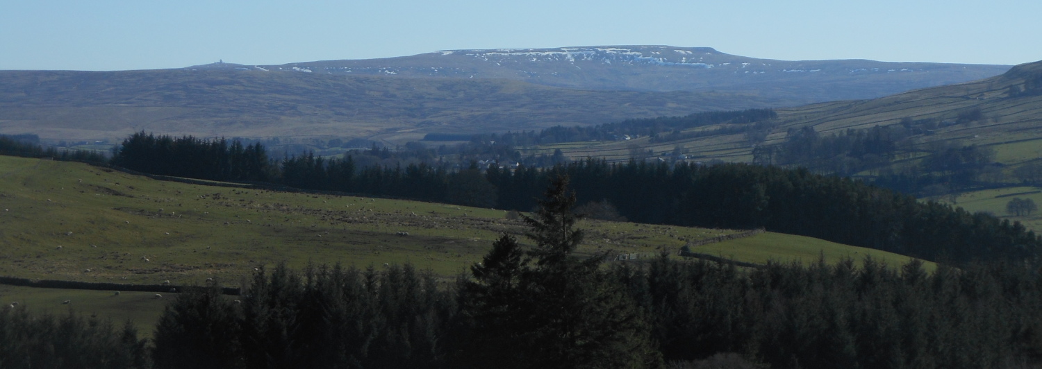

Alston is a pretty town with a market cross and historical houses set in the heart of the North Pennines. It is surrounded by rolling, heather covered fells and is listed as England’s highest market town. Its remote location makes it an ideal area to ‘get away from it all’ and yet is close to numerous areas of beautiful unspoilt countryside, historical features and beautiful coastlines. The surrounding roads are quiet and challenging making them a cyclist’s heaven!

The town is a self contained little community including 4 public houses, 2 supermarkets, 2 petrol stations, cafes, Jack’s Takeaway, gift shops, hairdressers, wholefood shop, post office, library and tourist information and much more! All facilities are within 5 to 10 minutes walk from the Hostel.
The nearest large towns are Penrith – 21 miles to the west, Hexham – 25 miles north east or Carlisle approximately 28 miles north west.
Visit our Face book page www.facebook.com/YHAAlston
Long Distance Walking and Cycling Routes

The Pennine Way – Alston Youth Hostel is situated directly on the Pennine Way and 174 miles into your journey if travelling from the South. The hostel will be a welcome sight after the 20 mile (3000 foot climb) slog over Cross Fell from Dufton. independenthostels.co.uk/pennine-way-accommodation/
The Coast to Coast (C2C) Cycle Route (National Route 7, 14 & 71) – Alston is about half way on the 135 mile C2C route (if you want to be extreme and do it in 2 days!). The hostel makes an ideal place to stay over (and rest those weary legs after the 1903 feet Hartside climb) as we have a large, secure cycle shed which takes up to 20 bikes. If you have any bike problems there is a cycle shop in Nenthead. www.northpenninecycles.co.uk/ David, the owner, will come out to the hostel and try to fix your bike so that you can carry on (or you can hire another bike from him!)

Isaac’s Tea Trail – isaacs-tea-trail.co.uk/
Isaac’s Tea Trail is a long-distance footpath within the North Pennines Area of Outstanding Natural Beauty (AONB) and UNESCO Global Geopark. The 37-mile circuit links Allendale, Nenthead, Alston, and Ninebanks, crossing high moorland and dropping in to the valleys of the rivers East Allen, Nent, South Tyne and the West Allen. The route was inspired by a Victorian grocer, Isaac Holden, who walked many miles in this area delivering tea to remote farms and hamlets while raising funds for community projects. You can start and finish Isaac’s Tea Trail at any point, and can walk it clockwise or anti-clockwise. Most people start in Allendale and follow the clockwise circuit.
Lands End to John O’Groats – Approximately 874 miles from start to finish with Alston being about half way, at 450 miles, into the journey south to north! Most people follow the Pennine Way for this leg of the walk.

South Tyne Trail – 23 miles long following the River South Tyne from its source in the North Pennine Fells to Haltwhistle. It can be done in 1 long day or over 2 days with the hostel being 9 miles into the route if travelling south to north.
A Pennine Journey – A 247 mile round route starting in Settle and taking in the best of the Yorkshire Dales, sections of the Pennine Way, Northumberland and Teesdale. www.penninejourney.org.uk/route-summary.html
Hadrian’s High Way – Hadrian’s High Way is a new 102 mile trail devised and illustrated by acclaimed outdoor writer Mark Richards. The trail starts at Ravenglass on the west Cumbrian coast and finishes at Vindolando fort on Hadrian’s Wall passing through Alston. A great walk along the northernmost frontier of the Roman Empire which the garrisons marched for 300 years.
Hadrian’s Wall Path – Following Hadrian’s Wall from Wallsend in Newcastle Upon Tyne to Bowness-on-Solway the 84 miles route takes in some spectacular scenery and of course historical sites.
Hadrian’s Wall Cycle Route (National Route 72) – 174 mile cycle route from Ravenglass to South Shields. Usually done from west to east. Allow about 3 days to complete or 4-5 days if you want to explore the many interesting sites on route.
Historical Attractions
Killhope Mine Museum – (currently free entry but own wellies required for mine tour – check the website 1st) (8 miles from Alston) Award winning North of England Lead mining museum with lots of activities for all the family including a trip into the mine! www.killhope.org.uk
Nenthead Mines Special Open Days See website for more information www.nentheadmines.com/
Hadrian’s Wall ( approx. 18 miles from Alston). The famous wall was begun in AD 122 by the Emperor Hadrian. Visit Housesteads Fort or Vindolanda or simply park up at Cawfield Craggs just north of Haltwhistle and walk along the Hadrian’s Wall path to take in the fabulous scenery. www.hadrians-wall.org
South Tynedale Railway – (Trains running again at weekends from Alston town station to Slaggyford) The South Tynedale Railway is the North of England’s highest narrow gauge railway. It runs from its home in Alston in Cumbria for 5 miles through stunning scenery into Northumberland to the tiny hamlet of Slaggyford. www.south-tynedale-railway.org.uk/

Epiacum Roman Fort and The Nook Farm Shop & Cafe (3 miles from Alston). Alston’s very own Roman fort described as ‘The best preserved Roman Fort in the Empire’ by Time Team’s Stuart Ainsworth. Visit The Nook Farm shop and cafe for delicious food and drinks along with local produce and gifts. www.epiacumheritage.org/ www.thenookfarmshop.com/
Ashgill Force (4 miles from Alston). Near the village of Garrigill is the stunning waterfall of Ashgill Force. The water drops over 50 feet from the beck above over the natural gorge. You can walk behind the falls and look through the tumbling water – but don’t forget your water proofs!
 High & Low Force Water Falls & Bowlees Visitor Centre (17 miles from Alston) Spectacular water falls in County Durham (High Force with a 21 metre drop) on the Pennine Way route.
Kielder Water & forest (approx. 47 miles from Alston). Britain’s largest man made lake surrounded by forest. Famed for its ‘dark skies’ status. www.visitkielder.com/visit
The Lake District (approx. 30 miles to Ullswater). You are only about 50 minutes away from the north lakes and peaks of the Lake District. The nearest mountains are Blencathra (32 miles) Skiddaw (40 miles) and Helvellyn (40 miles).
Activities
Alston Golf Course (approx. 2 miles outside Alston on the B6277 road to Garrigill). Alston has the highest golf course in England. Set high above Alston town with fantastic views of Alston Moor! Visitors are welcome to pay and play. Anyone staying in one of Alston’s accommodations can play for £10 a round (33% off the normal rate!) www.alstonmoorgolfclub.org.uk/
Yad Moss Ski Slope (approx. 6 miles from Alston) Yes! Alston Moor has its own ski resort when snow permits! (experienced skiers only) Check out their live webcam to see what the piste conditions are like! www.yadmoss.co.uk/