
Route: Circuit of Buttermere
Area: Western Lake District
Date of walk: 2nd February 2019
Walkers: Andrew, Gilly, Phil and Denise
Distance: 6.4 miles
Ascent: 500 feet
Weather: Overcast at first but soon cleared to sun and blue skies
We parked as usual in the National Trust car park at Long How, and walked through Buttermere village, passing the Fish Inn and following the path to the foot of the lake. On the last occasion I was here, exactly four months ago, there was a temporary footbridge in place over Buttermere Dubs, as the old stone bridge is currently being rebuilt. To our surprise, the temporary bridge has been removed, and a sign advised us to follow a diversion to Scale Bridge. This meant retracing our steps back to the edge of the village. It would have been helpful if a diversion had been erected earlier, at the start of the path to Scale Bridge
It’s hard to grumble when walking in such beautiful surroundings and this minor inconvenience was soon forgotten as we reached the far shore of Buttermere and began the walk to its head. As if to compensate us for our troubles, the clouds quickly lifted and we enjoyed some glorious weather for the remainder of the walk
After crossing Peggy’s Bridge at the head of the lake and passing by Gatesgarth Farm we started the return leg along the other shore. We followed the sometimes rocky path back into Buttermere village, passing through the short tunnel in the rocks near Hassness along the way. Before returning to the car park we made a brief detour to the small church of St James to revisit the memorial tablet in honour of Alfred Wainwright, looking towards his favourite fell, Haystacks
This is one of the very best low level walks in the Lake District, one which appears over 20 times on these pages, and we were lucky to have enjoyed it in such good conditions. For anyone following this walk, note that the Maps Page shows the route which we took, but omitting the ‘there and back’ section to the missing bridge. When the bridge is finally restored, hopefully later this year, the route will be as shown here and will be 1 mile shorter than today’s walk
For other walks here, visit my Find Walks page and enter the name in the ‘Search site’ box
Click on the icon below for the route map (subscribers to OS Maps can view detailed maps of the route, visualise it in aerial 3D, and download the GPX file. Non-subscribers will see a base map)

Scroll down – or click on any photo to enlarge it and you can then view as a slideshow

More sheep than cars in the National Trust car park at Long How, just outside Buttermere village

Cragg House Farm, overlooked by High Stile

We pass to the left of the Fish Inn

We arrive at the foot of Buttermere

Buttermere Dubs, where we're surprised to find that the temporary bridge has been removed, so we have to retrace our steps

Heading for Scale Bridge, the nearest alternative crossing

Looking back to Buttermere village

Scale Bridge

After walking beside Buttermere Dubs we arrive back at the foot of Buttermere, just a few yards away from where we'd been 20 minutes ago - but in better weather

Looking across to Whiteless Pike and High Snockrigg

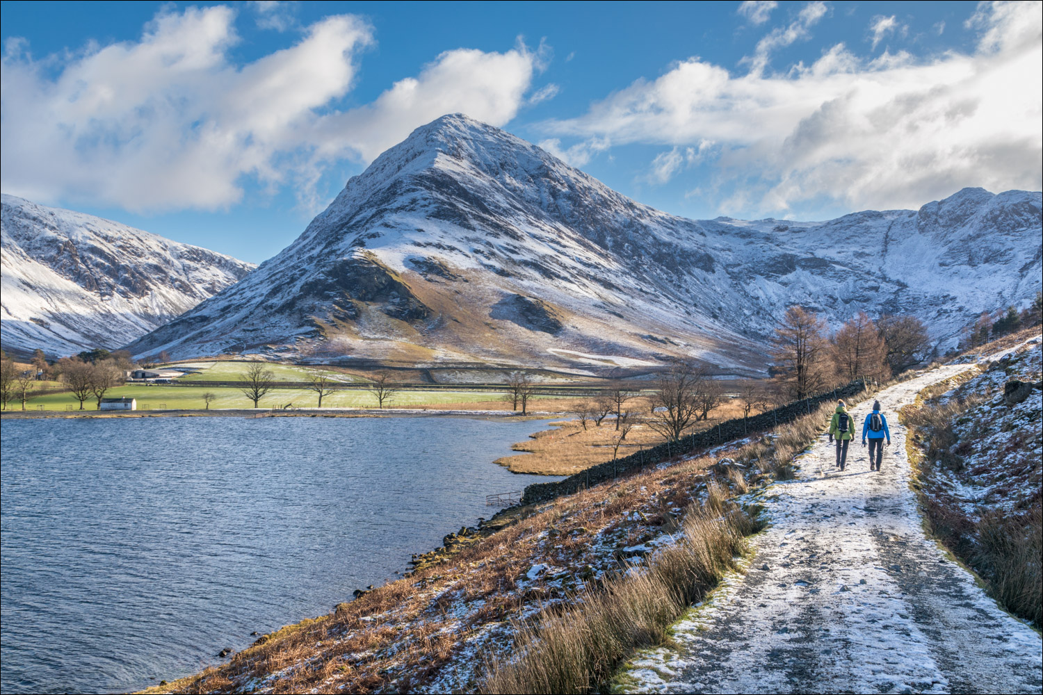
Fleetwith Pike, which will prove to be one of the scenic highlights of the walk

We follow the easy path through Burtness Wood

Hassness and Fleetwith Pike

Hassness again at the foot of Robinson

A view back along the lake

Fleetwith Pike dominates the scene as we continue towards the head of Buttermere

We pass by Hassness

Fleetwith Pike and Warnscale Bottom

The bothy at the head of Buttermere

Highland cattle, which are often seen grazing around here

Fleetwith Pike and the bothy...


A view back along the path, with Mellbreak in the distance

We arrive at the head of Buttermere

Fleetwith Pike and Green Crag

Haystacks is to the right but the sun is directly behind, so I'm unable to record it

Warnscale Beck from Peggy's Bridge

A view towards Buttermere from Peggy's Bridge

Looking back to High Crag as we follow the path across the head of the lake

Approaching Gatesgarth Farm, at which point we'll start the return leg along the other shore

Fleetwith Edge and Fleetwith Pike

Looking along Gatesgarthdale Beck towards the Honister Pass, which is closed to cars today on account of the snow

The High Stile Range - High Crag, High Stile and Red Pike

We walk along the Buttermere road for a short distance, no traffic thanks to the closure of the Honister Pass

Looking across Buttermere, where we can see our earlier path running above the lake

Our route will take us around the promontory by Hassness...


Fleetwith Pike and the head of Buttermere

A couple of canoeists paddle by below High Stile

Mellbreak in the distance

Looking back to the canoeists

We enter the tunnel, which was carved out in the 19th century on behalf of a Manchester mill owner

A last look back to Fleetwith Pike

We continue along the lakeshore path

Pike Rigg

We arrive back in Buttermere village and make a short diversion to St James' Church

Inside the church, the memorial tablet in memory of Alfred Wainwright, looking out to his favourite fell - Haystacks

The view of Haystacks from the small garden in front of the church window

A few minutes later, and a perfect end to a perfect morning in the famous Kirkstile Inn
