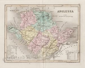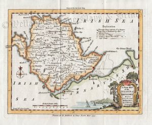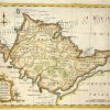
A charming and detailed mid 18th century map of the Island of Anglesey, North Wales (Ynys Môn, Cymru) which was engraved by G. Rollos and published in P. Russell’s England Displayed (London: 1769). This map was published only once and is rare to find.
- This is an original copperplate engraving with later hand colour.
- The approximate size of the printed area is 29cms by 21.4cms.
- The map is in very good condition. There are light folds and the bottom margin is close, as issued. Minor age stains. Click on image for a better view.
- The item comes displayed in a ready to frame museum quality mount.
- Click on ‘Delivery Policy’ for postage costs.
- Guaranteed to be over 240 years old.