Share

Scan the QR code and open PeakVisor on your phone
Scan the QR code and open PeakVisor on your phone
Covering 267 square miles across the counties of Devon and Somerset, Exmoor National Park is among the most popular hiking destinations in Southwest England. The park gets its name from the River Exe, which runs through the center of the park. It's the second smallest of England's 10 national parks (excluding The Broads).

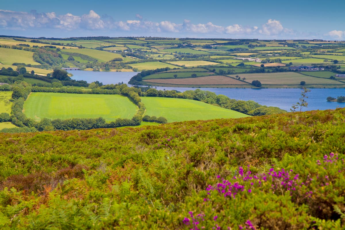
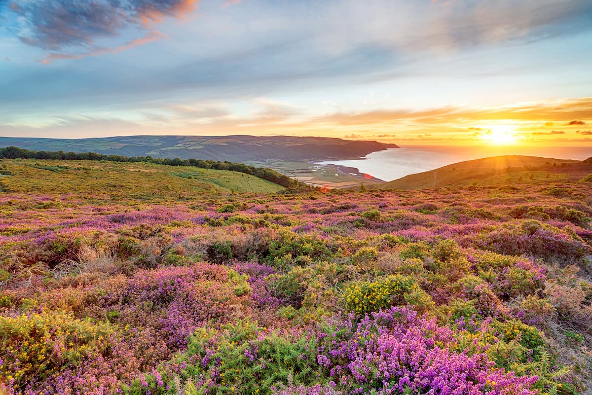
The landscape of Exmoor consists of rugged moorlands and lush wooded valleys stretching from northern Devon through to the Bristol Channel off of Somerset. The shoreline of Exmoor National Park is one of its most notable features. The coastline stretches for 34 miles and features Great Hangman (317 m), the highest sea cliff in England. Another significant point along the Exmoor coast is Culbone Hill (420 m), which is the highest coastal hill in England.
The highest point in Exmoor National Park is Dunkery Beacon (518 m). This hill is one of the only Marilyns in the national park, with a prominence of 413 m, and is the county top of Somerset. Other Marilyns within Exmoor include Selworthy Beacon (302 m) and Periton Hill (303 m).

While exploring the best trails in Exmoor National Park, stop by some of the region's historic sites and watch out for local wildlife. Exmoor contains a staggering 4,000 archeological sites dating as far back as the Mesolithic period.
The park is also home to an array of wildlife, including some species that are unique to the area. There are over 250 bird species and over 1,000 plant species within the park. Exmoor is also home to the largest population of red deer in England. One of the most famous residents in the park is the Exmoor ponies, an endangered semi-feral species of pony that has inhabited the area for hundreds of thousands of years.
Read on to find out about the best hiking trails and areas within one of the most remote regions in Southwest England.

One of England and Wales' 16 National Trails, the South West Coast Path is considered one of the world's best long-distance walks. The full trail runs for 630 miles from Minehead on the western edge of Exmoor all the way along the coast down to Poole Harbour in Dorset.
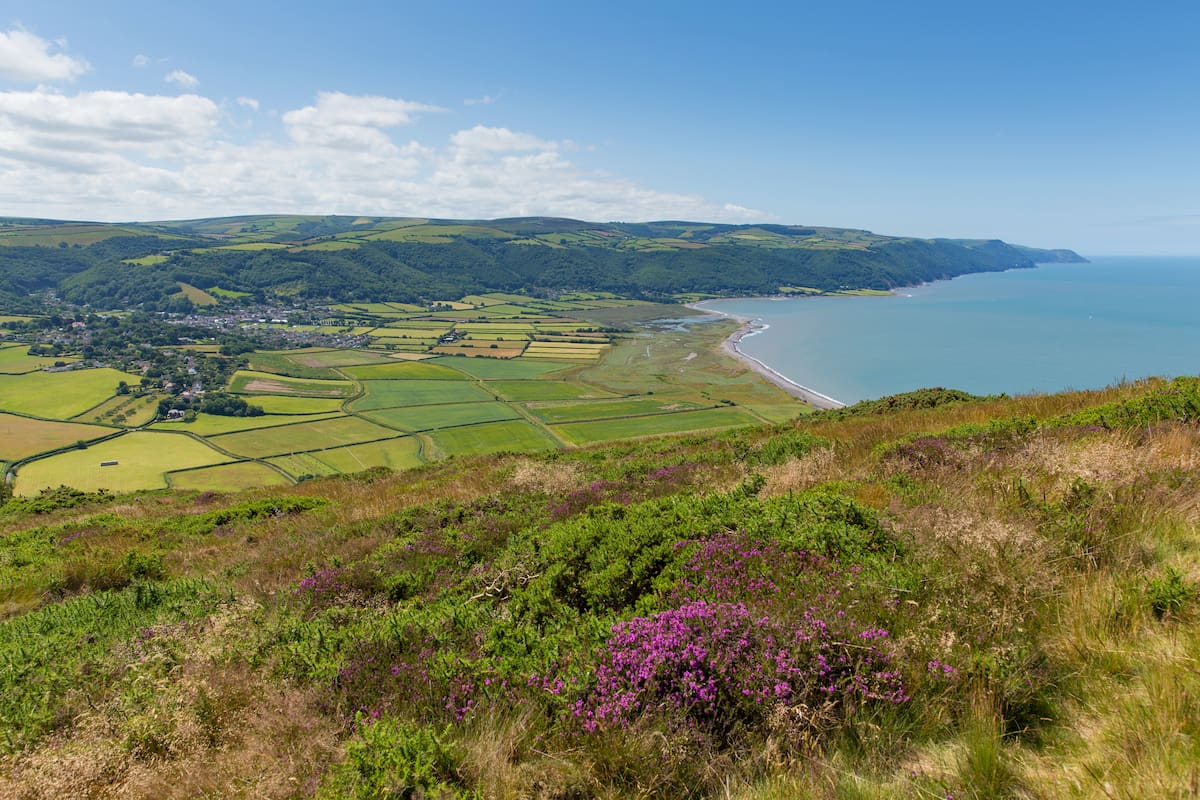
Hikers looking to explore the stretch of the path which runs along Exmoor's coastline can expect to walk 35 miles. This long walk will take most hikers a few days to complete at a leisurely pace. There are several quaint villages along the Exmoor coastline where hikers can spend the night, including Lynwood, Lynmouth, and Porlock.
You can pick up the South West Coast Path from the start of the trail at Minehead's seafront. This ramble is well-marked and easy to follow. The start of the path runs along Minehead Harbour before cutting inland at North Hill (277 m), over Selworthy Beacon, and Bossington Hill (241 m), before rejoining the coast at Hurlstone Point. Next, you'll pass through Bossington along the beach at Porlock Weir before connecting onto the Coleridge Way.

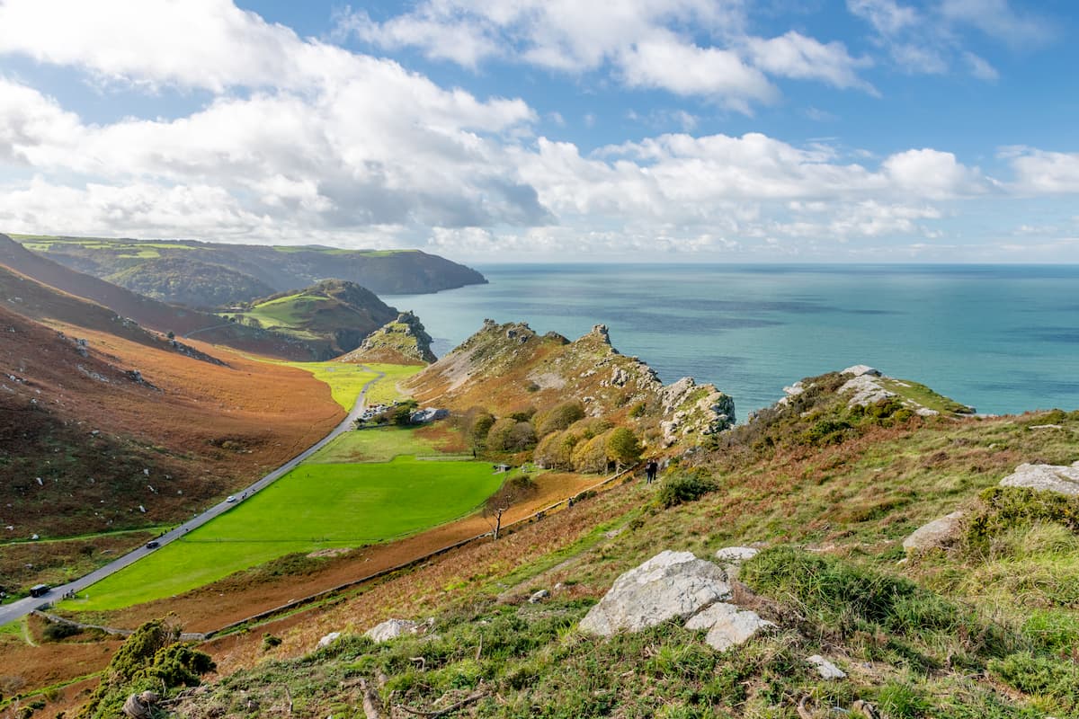
After a few miles, you'll progress through Lynton, at just over halfway through your walk. In the section after Lynton, you'll pass over the sublime Valley of Rocks. This Devonian valley is one of the highlights of the Exmoor coast and is known for inspiring works by Samuel Coleridge and William Wordsworth.
The remainder of the trail runs parallel to the seaside, passing Crock Point before dipping slightly inland at Heddon's Mouth. The final part of your journey will take you up Great Hangman and Little Hangman (212 m), the highest sea cliffs in England. Your journey ends in Combe Martin, just past Wild Pear Beach.
![]()
This looped trail is one of the most popular routes in Exmoor, taking you over moorlands to the top of Dunkery Beacon, the highest point in the park. The Dunkery Beacon Circular Walk is 2.5 miles, ascends 400 m, and takes around 2 hours.
To start your walk, park at the small Dunkery Beacon car park. The path opposite the car park to the northwest runs to the summit of Dunkery Beacon. The trail up the hill is well-worn and easy to follow in most weather conditions. The top of Dunkery Beacon is marked with a cairn. The hill boasts stunning views on clear days, with South Wales to the north and the mountains of Dartmoor National Park to the south.
Enjoy the views as you walk along the ridge towards a path to the southwest. At a row of hedges, a wide walkway will dissect this trail heading south, which you can follow back to your starting point.

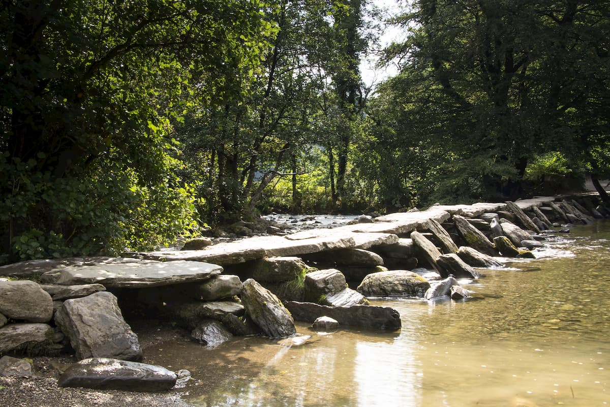
Exmoor National Park contains several beautiful river walks, and a favorite among hikers is to Tarr Steps. This ancient bridge dates back to around 1,000 BC is one of the most interesting historical sights in the park. This walk will also take you across some of the region's moorland and provides superb views of Exmoor. The walk from Dulverton to Tarr Steps 12 miles and takes around 6 hours.
From the center of Dulverton, head northeast following the purple restricted byway signs. The waymarked trail is easy to follow to begin with but it's still worth planning a route in advance. After Marsh Bridge, you'll pass through a field. Head right the fork in the road after exiting the field towards Broford. Turn left onto the tarmac road and left again through the Public Bridleway Mounsey Hill Gate.
Past Highercombe farm, you'll head through a gate and turn right onto Winsford Hill (427 m). From here, locate the road diagonally from Winsford Hill, walking over a cattle grid before turning right onto Tarr Steps. The highlight of the walk, hikers can walk across the 55 m long clapper bridge, which is an excellent spot for a photo.
To return to Dulverton, head west following the blue public bridleway signs. Heading south at Parsonage farms, using the yellow waymarkers as a guide past Hawkridge. At Hawkridge's houses turn left, down the track which leads back to Dulverton.

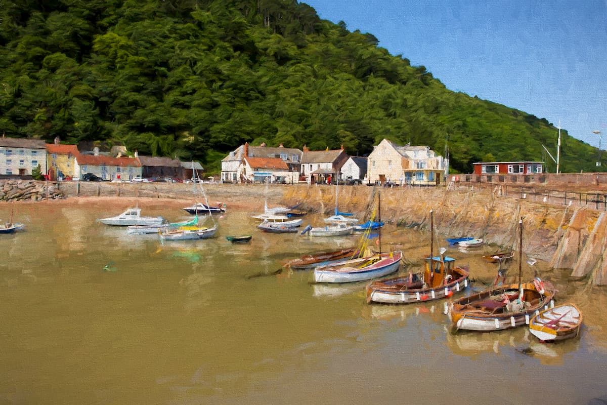
Perched on the northwestern edge of Exmoor National Park, Minehead is one of the region's most popular vacation spots. It's one of the largest towns within proximity of Exmoor and marks the beginning of the South West Coast Path. Minehead is also about seven miles from Dunkery Beacon. With a population of just over 11,000, Minehead is a quiet town with some relaxing excursions such as Blenheim Gardens and Minehead Beach. If you're planning to stay in Minehead, consider booking a room at the Alcombe House Hotel or the Northfield Hotel.

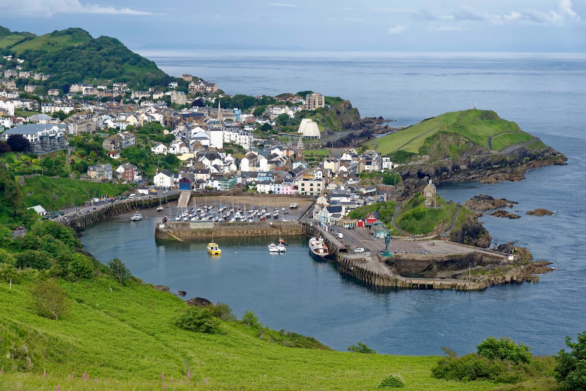
At the opposite edge of Exmoor from Minehead is the coastal town of Ilfracombe. A similar size to Minehead, Ilfracombe is within touching distance of Combe Martin and the end of the Exmoor stage of the South West Coast Path. There are some superb family-friendly attractions in Ilfracombe too, like the Ilfracombe Aquarium and Watermouth Castle. This Devon resort boasts some excellent accommodation, from the Bath House Hotel to the Carlton Hotel.

Located at the center of Exmoor National Park, Exford is perfect for a remote vacation surrounded by beautiful moorlands. While there aren't many attractions around the village, the River Exe runs through the Exford and is excellent for fishing. There's also the picturesque 15th-century Church of St Mary Magdalene, which is well worth visiting. You'll also be within a few miles of Tarr Steps and Dunkery Beacon. There are several high-quality hotels in and around Exford such as the Exmoor White Horse Inn and the 12th-century Royal Oak Inn.

The sleepy seaside settlements of Lynton and Lynmouth are great places to stop while rambling along the South West Coast Path. These small villages sit side by side and feature some interesting attractions, such as the Lynton & Lynmouth Cliff Railway, the world's highest and steepest water-powered funicular. Due to position along the South West Coast Path, Lynton and Lynmouth are home to numerous hotels, including the Seawood Hotel, Highcliffe House, and The Crown Hotel.

Dulverton is a small town encircled by woodlands on the southern edge of Exmoor. Despite having a tiny population, Dulverton is a vibrant town with classy restaurants and charming local stores. You'll also have easy access to the historic Tarr Steps, with the circular walk starting nearby. Travelers staying in Dulverton should consider booking a room at Northmoor House or Town Mills.

Explore Exmoor National Park with the PeakVisor 3D Map and identify its summits.