What is a peace wall or peace line?
The peace walls in Northern Ireland are a series of physical structures that separate predominantly Irish republican, nationalist Catholic neighbourhoods from predominantly British loyalist, unionist Protestant neighbourhoods.
As of July 2023, there are still thought to be around 116 such barriers remaining across Northern Ireland, stretching an estimated 34 kilometres (21 miles).
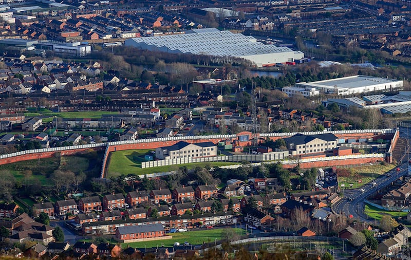
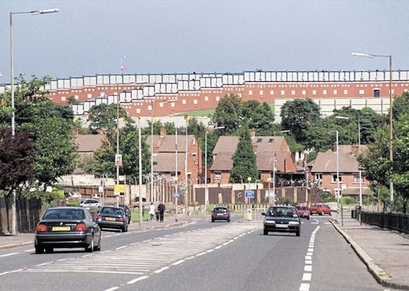
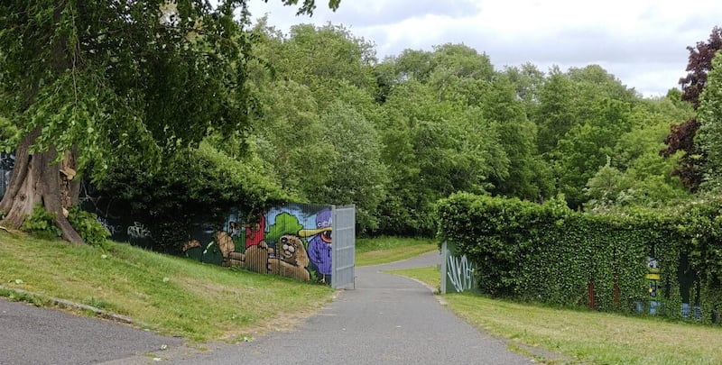
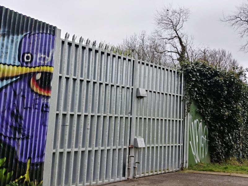
Cupar Way in Belfast is the tallest peace line in Northern Ireland
The tallest peace line in Northern Ireland is situated at Cupar Way between the Falls and Shankill Roads in west Belfast. The structure stands 45ft tall, three times higher than the Berlin Wall and has been in place for twice as long as the notorious barrier dividing east and west Berlin existed.
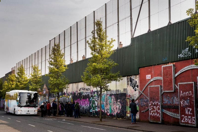
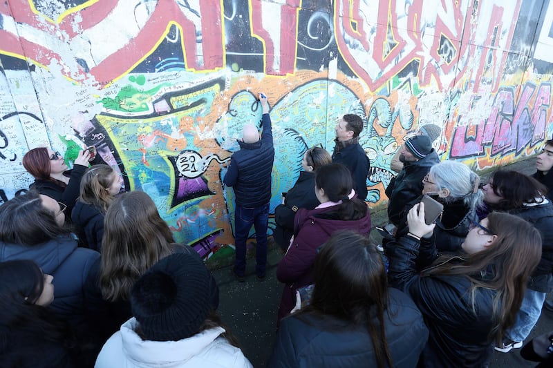
The structures, along with murals, have become an unlikely tourist attraction in post-conflict Northern Ireland.


Derry has peace walls too
While many of the brick or fence structures are situated in Belfast there are also peace lines in Derry, Portadown and Lurgan.
When was the first peace wall built?
It is a popular misconception that the first peace wall was built with the outbreak of the Troubles in 1969.
In fact, the first recorded structure built to separate nationalist and unionist communities was erected in 1866 in Belfast City Cemetery. A nine foot deep underground brick wall was built to separate Catholic and Protestant burial plots. The structure remains to this day.
Read more:
Murals in Belfast and Northern Ireland: An explainer
The first peace line to be built in the 20th century was erected in Belfast in March 1920 at Seaforde Street in the east of the city to separate Catholic residents living in Short Strand from their Protestant neighbours on the Newtownards Road.
In 1935 another temporary divide was built at Nelson Street in north Belfast following an outbreak of sectarian violence.
The first peace line of the Troubles came on August 15 1969, when soldiers from the British Army’s Third Battalion of the Light Infantry formed a human chain across an interface between the Falls and Shankill Roads to separate Catholic and Protestant rioters.
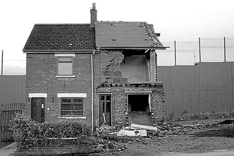
The introduction of British troops on to the streets of Belfast came less than 24 hours after 44 Catholic homes at Bombay Street in the Clonard area of west Belfast were destroyed by loyalist mobs from the Shankill area. In the three days that followed 10 people were killed, 1,500 families were forced to flee their homes and 600 homes were badly damaged.
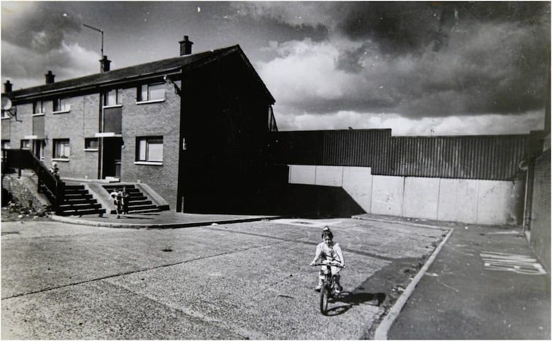
On September 10 1969, British Army engineers began to construct the first peace line at Cupar Street with two lines of 5ft high barbed wire being erected at the interface between the Falls and Shankill. The barbed wire would later be replaced with 10ft high corrugated iron fencing.
A cabinet meeting at Stormont parliament held one week later heard a British army recommendation that the erection of official peace line barriers could help to diffuse interface violence across the city.
By the first day of 1971, the number of peace walls in Belfast had increased to 17.
In 1972 the British Army further reenforced the peace line structures with increased fences and walls. In July of that year barriers were placed on shopping streets in Belfast city centre to prevent car bomb attacks, in what became known as the ‘Ring of Steel’, involving static security checkpoints, grills and fencing through which shoppers and civilian workers had to pass before entering and exiting the centre of the city.
However, the British government did not only use peace walls to divide sections of the city.
In 1983 the Westlink motorway was completed, separating north and west Belfast communities from the economic centre of the city. Several enterprise parks were also established at interface sites, which critics argued were effective physical ‘buffer zones’ deliberately designed to separate the two communities.
Read more: Belfast interface security gate replaced
Despite republican and loyalist paramilitary ceasefire announcements in the latter part of 1994 and growing hope of peace, new interface structures continued to be built.
Peace lines were built in public parks, schools and even down the middle of a street.
In 1994 a peace line fence was erected at Alexandra Park in north Belfast following repeated rioting at the interface.
Even on the day that the Good Friday Agreement was signed on 10 April 1998 another peace line was approved at Gunnell Hill on the outskirts of north Belfast.
In May 2007 an eight metre high fence was erected at Hazelwood Integrated Primary School interface in Newtownabbey on the edge of Belfast.
How many peace walls are there in Belfast?
Agreement between statutory agencies on what even constitutes a peace line is often hard to determine.
In 2011 the Belfast Interface Project (BIP), which is made up of republican and loyalist community interface workers, reported that there were 99 peace walls and similar structures across the city.
However, in 2012 then British prime minister David Cameron, using a different measurement, told politicians at the Northern Ireland Assembly that there were just 48 peace lines.
In an attempt to explain the contradiction in numbers, the Community Relations Council’s Peace Monitoring Report (2103) explained the differing figures existed because the Department of Justice (DoJ) only recognised the existence of peace walls if they have been built by a statutory agency for the purpose of preventing violence between antagonistic communities.
In contrast the Belfast Interface Project (BIP) defines an interface as “any boundary line between a predominantly Protestant/unionist area and a Catholic area”.
Do communities want peace walls taken down?
Read more:Just quarter of peace wall residents have regular contact with community on other side
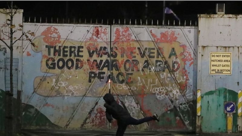
In recent years, there have been calls to remove them. However, this has proved to be a complex and difficult process. The walls are often seen as a symbol of security by the communities that they separate, and there is a fear that removal could lead to an increase in violence.
A 2012 government survey indicated that 69% of those living closest to the security walls believed they should remain in place due to a potential for renewed violence.
In contrast, an International Fund for Ireland (IFI) 2019 survey found that 76% of residents in Belfast were strongly in favour of the barriers being removed “within the lifetime of their children or grandchildren".
Read more: West Belfast peace wall makes way for new £7.5m community centre
Have any peace walls ever been dismantled?
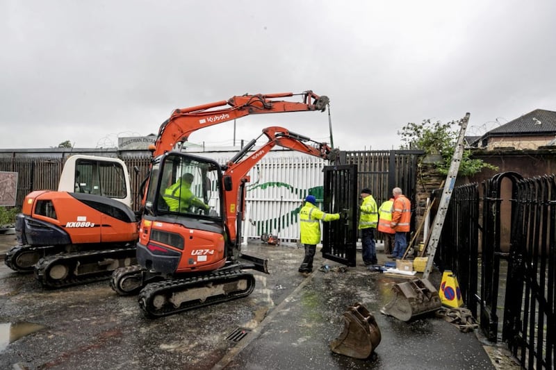
In 2013 the Stormont Assembly set a target for the removal of all peace lines by 2023. This target has not been met.
However, some peace line structures have been dismantled following agreement between the communities on either side of the structure.
In September 2011 a peace line gate was opened at Alexandra Park in the north of Belfast.
Three years later a barrier was removed at Newington Street in the same part of the city. The barrier had originally been erected in the late 1980s following a series of sectarian murders.
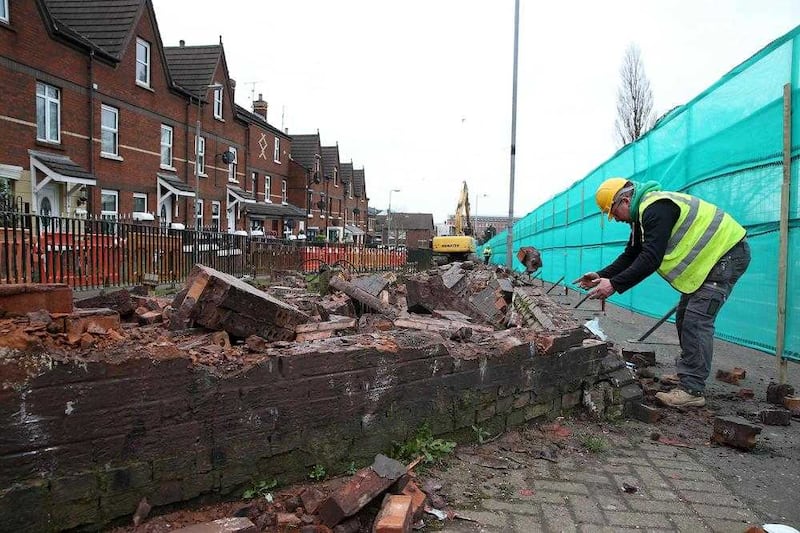
By 2020 a further eight peace line structures in north and west Belfast had been either removed or replaced through community agreement.
In 2021 it was reported that 16 peace lines had been dismantled, nine in Belfast, four in Derry, two in Portadown and one in Lurgan.
Read more: Notorious Ardoyne peace wall demolished after 30 years
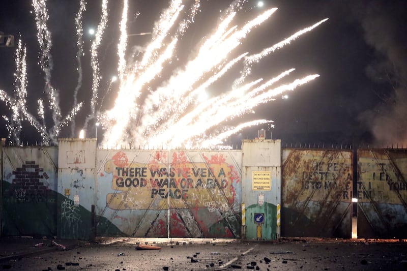
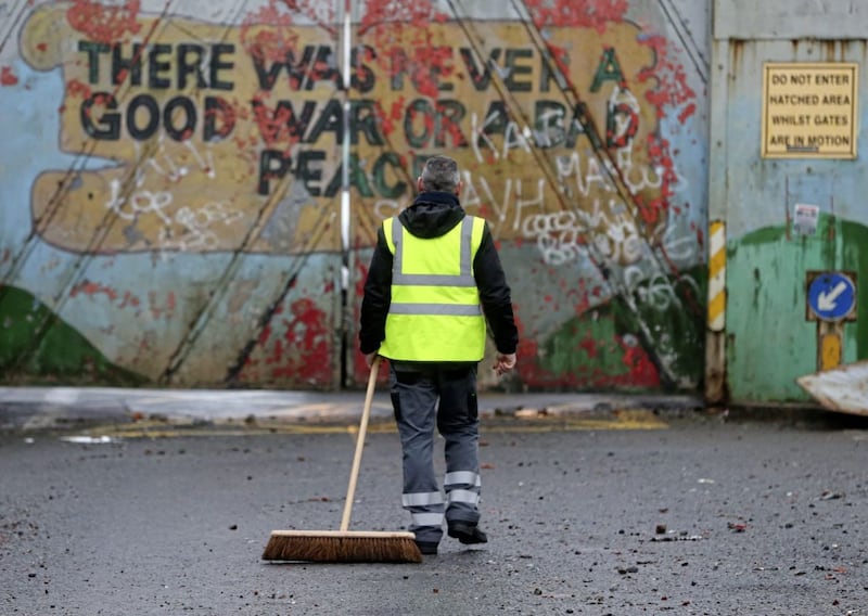
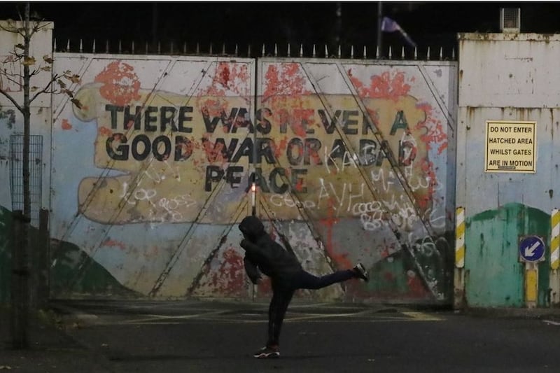
However, even after 50 years’ experience of peace walls the tenuous nature of interface tensions was witnessed once again in April 2021 when rioting broke out at a barrier at Lanark Way between the Shankill and Falls Roads following loyalist protests against the British government and EU Protocol agreement over Brexit.