Six Somerset Walks - 2. Brean Down
From one end of the peninsula to the other, there are classic walks to be enjoyed in every Westcountry parish. That’s my belief – I’ve been making the claim for years – and so far not a soul has ever disagreed.
As if to prove the point our walk today is located at the exact opposite end of the peninsula from last week’s oceanic saunter in the Scillies. I say that because, for me, Brean Down is one of the great portals that stands guard over the West Country frontier.

People have their own ideas about where the land that we call the West Country-proper begins or ends – I have Cornish friends who say the border runs the length of the Tamar – I even know one die-hard lover of the setting sun who believes it consists only of West Penwith.
But I will argue to the last breath in my body that the West Country frontier is along a line that stretches north from Portland Bill in West Dorset up to Brean Down on the Somerset coast.
I have many reasons for saying this – far too many to list here in what is meant to be a walks article – but here’s just one fact plucked out of hundreds… The classic West Country hedge – commonly known as the Devon-style hedge – is to be found across our peninsula until you hit my proposed frontier. I don’t make the claim in an exacting way – but you will not find earthen banks topped by laid trees in the classic Devon style on the Mendip Hills or anywhere east of my line.

I could go on about the westerly penetration of the Saxons and so on, but instead let’s get on with our walk by tramping along the magnificent length of my West Country portal, Brean Down.
The three-and-a-half mile walk from the village of Brean on the shores of Somerset Levels, up the steep limestone ridge and out to the end of the remarkable west-pointing peninsula called Brean Down, offers some of the most extraordinary coastal walking to be found anywhere in the region.

The hike not only provides vast panoramas in just about every direction, it also introduces you to forts ancient and modern, the remains of a Roman temple, medieval field systems and the opportunity to see numerous seabirds and rare plants.

Walking around sea-borne headlands is one of the great outdoor treats of the West Country, you usually get a circular hike with fabulous sea views every step of the way. This particular headland offers one of the best hikes in the genre.
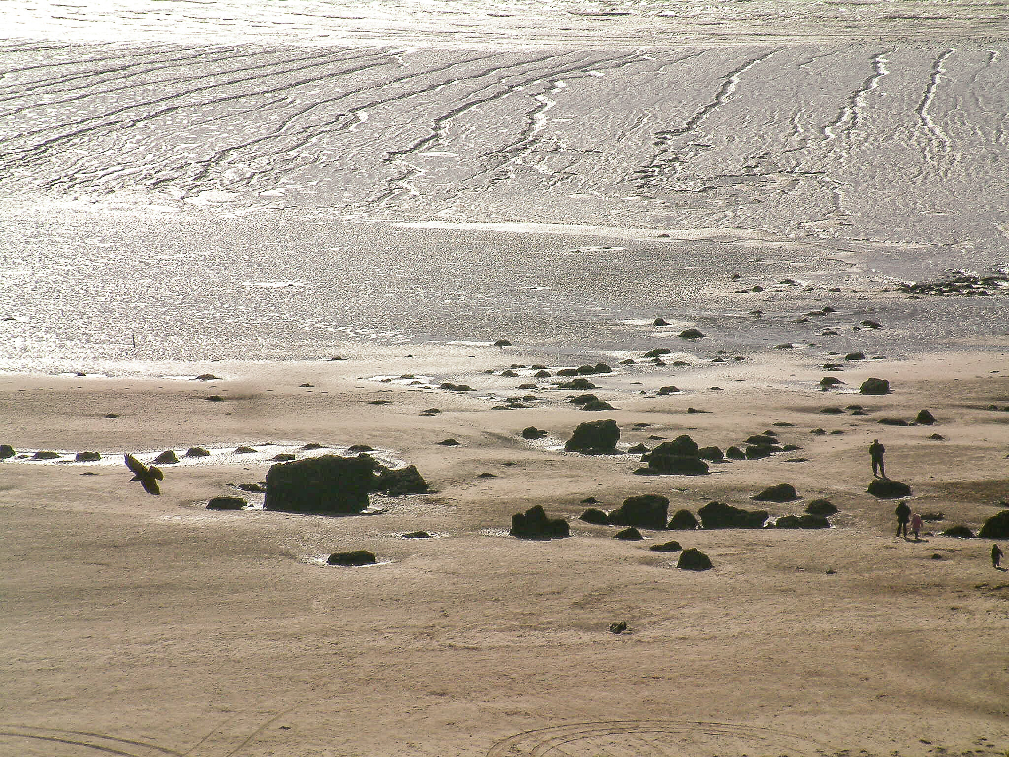
Brean is a long, sprawling, seaside resort perched on the low windswept coast of the Somerset Levels. As you head north along the one and only road from Burnham-on-Sea, you realise that the place is dominated by the massive 160-foot high finger of limestone escarpment that thrusts west into the Bristol Channel. This ridge causes the road to terminate, and where it ends our walk begins.

You can either park on the beach (careful to keep an eye out for the incoming tide) or in the National Trust’s car park just past the cafe.
From the latter, a steep path zigs-zags its way up the southern face of the ridge via countless steps. It’s a bit of a haul, but you reach the top you’ll see that the vast panoramas of the coast and Somerset Levels are well worth the effort.
Simply turn left at the top and head west along the path that clings to Brean Down’s southerly edge. Be warned that unruly or overly excited dogs are in peril along here – the cliff edges are deceptive and the trust says that there have been times when a dog a month has lost its life tumbling to oblivion along the peninsula.

As you ascend to the highest point (100 metres above sea level) you pass both the remains of an old Roman temple and several ancient field systems.
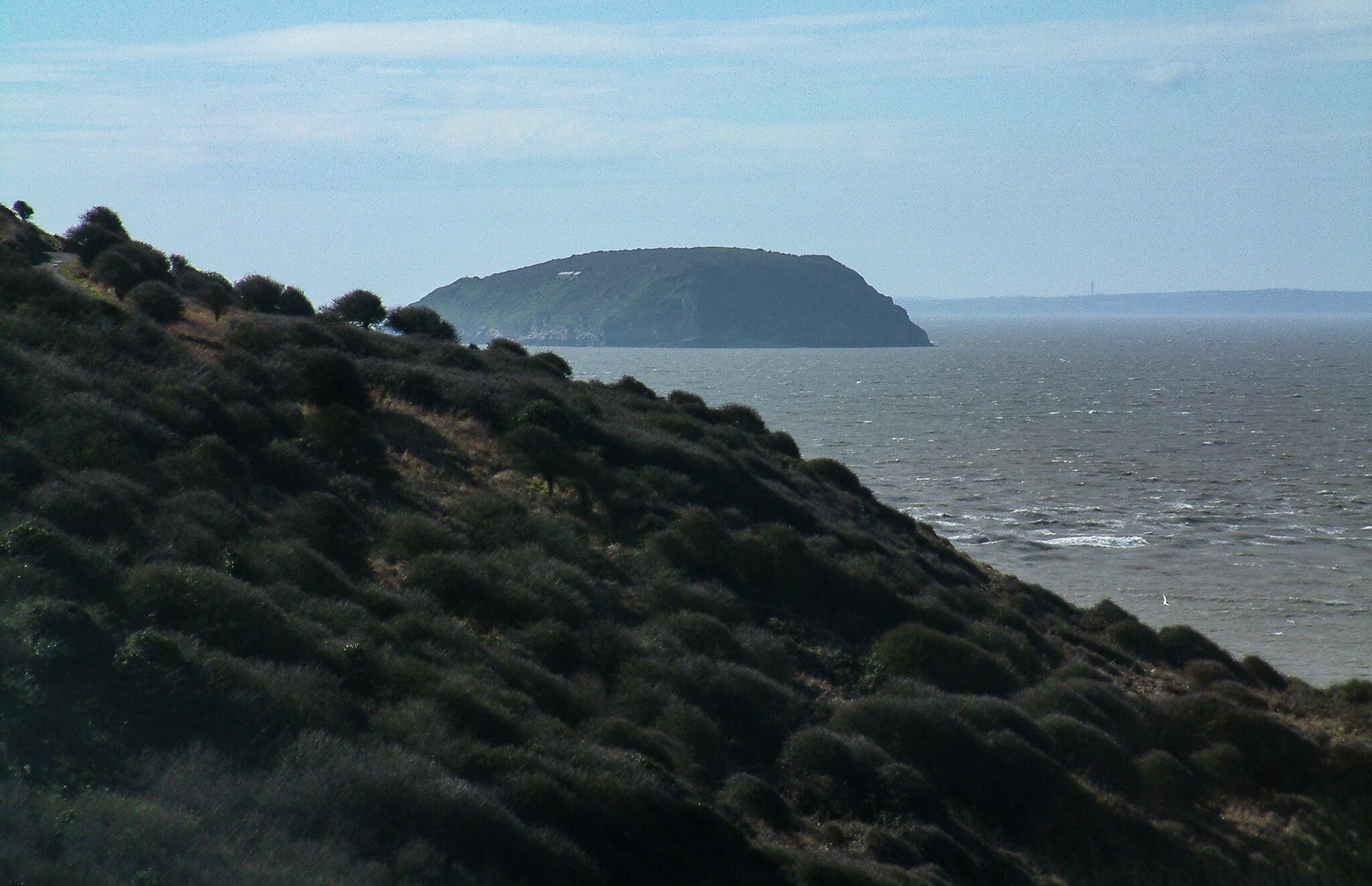
From the trig point at the top you will see how Brean Down is – or was – merely a continuation of the Mendip Hills that lie to the east. Eons ago the River Axe carved its way through to the sea and so cut Brean Down off from the main escarpment. Look west from the trig point and you will see how the island of Steepholm, moored a couple of miles off the end of the peninsula, is yet another old outpost of the hills.

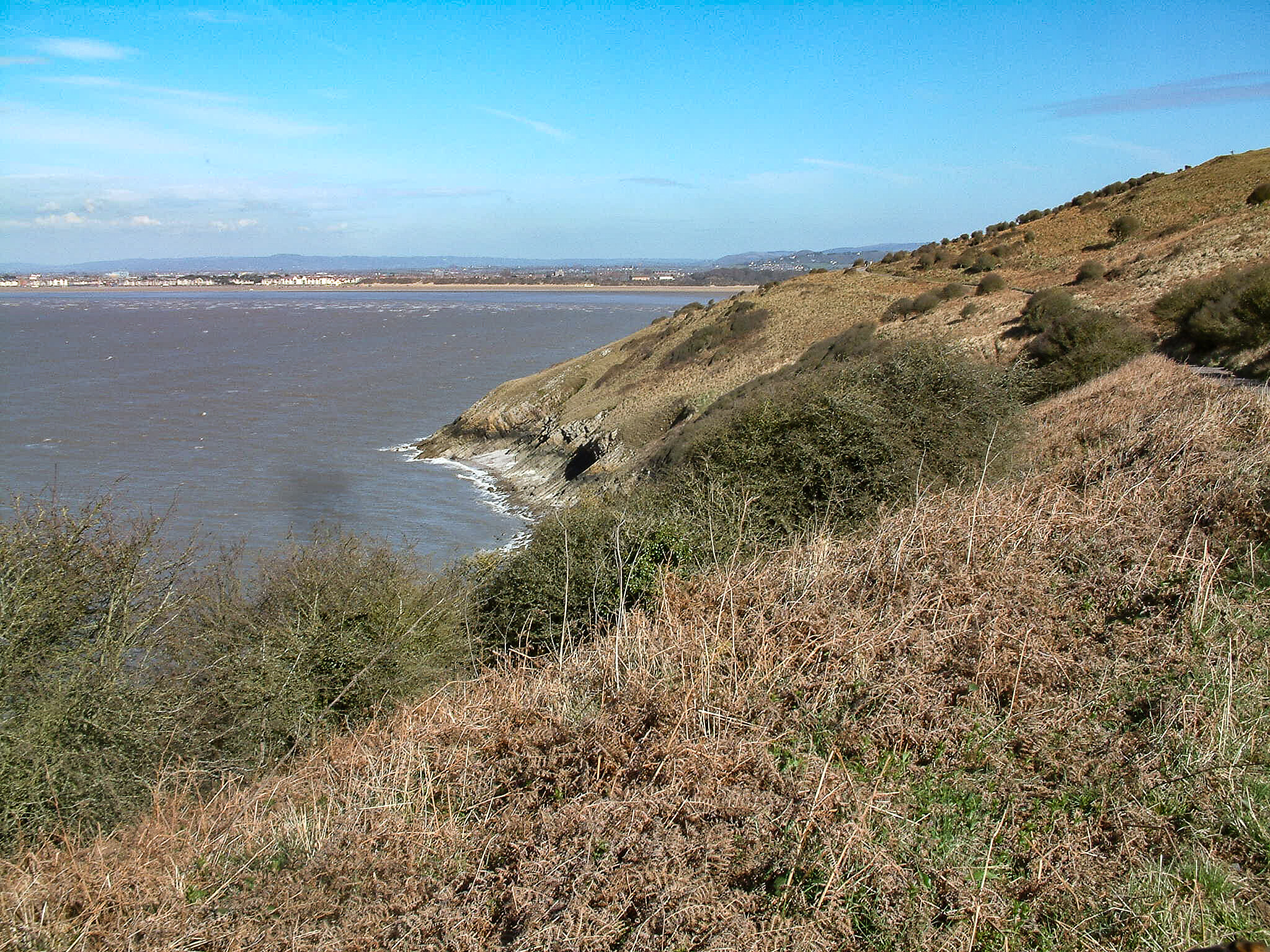
From this high point you are treated to stunning views of just about all the Bristol Channel has to offer. To the south Bridgwater Bay curves past the nuclear power station at Hinkley. West from there, the landscape rises to meet the Quantock Hills and west again there’s the West Somerset coast dominated by the backdrop of Exmoor.
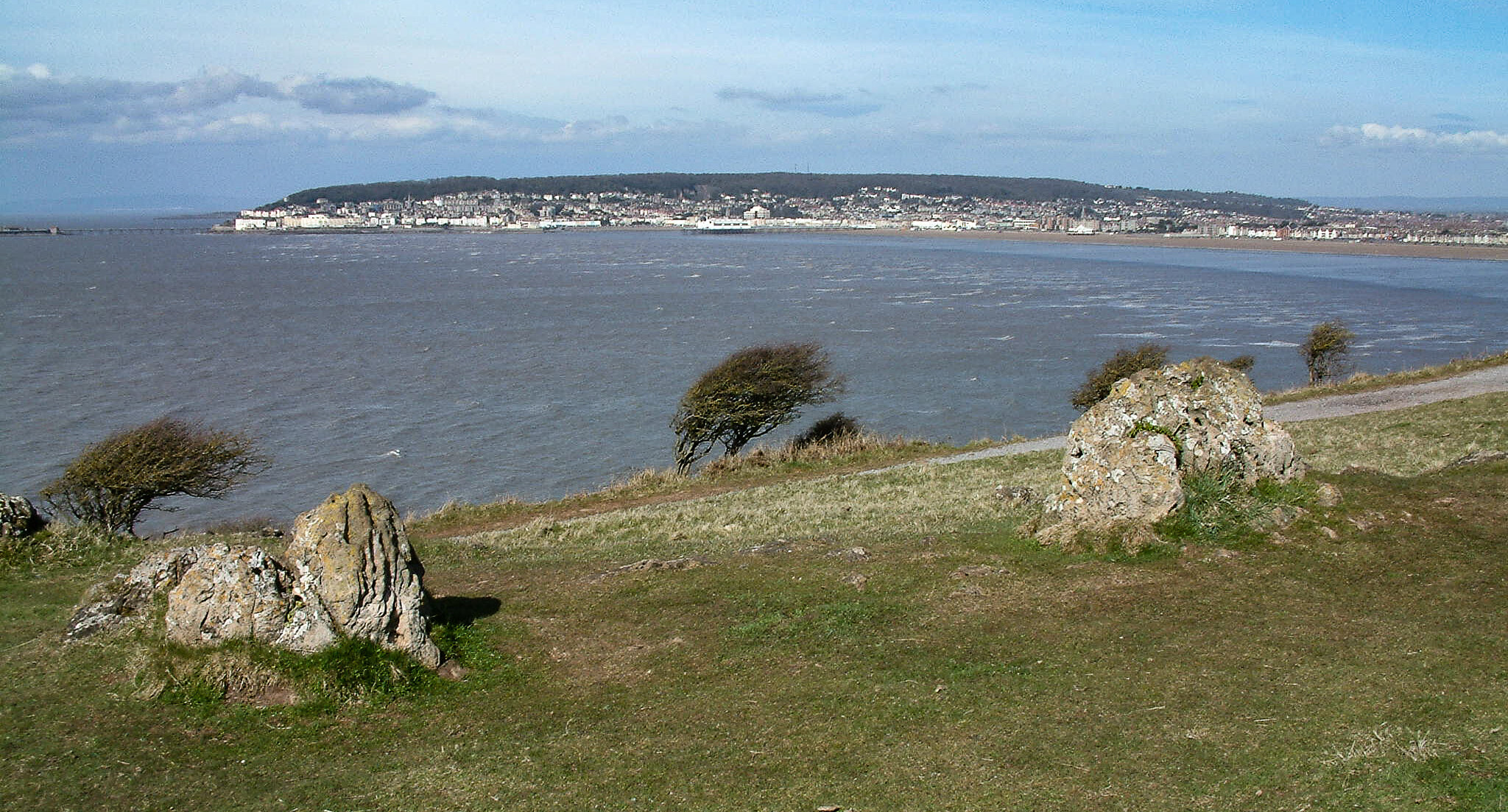
Across the channel you can see all the landmarks of the South Wales coast and, immediately north of Brean Down, there’s another ridge – one that plays host to the rapidly growing town of Weston-Super-Mare.

Weston-Super-Mare is just north of Brean Down
The short springy turf along the top of the down is cropped by sheep, goats and rabbits – and it doesn’t take long to walk the one-and-half miles out to the end.
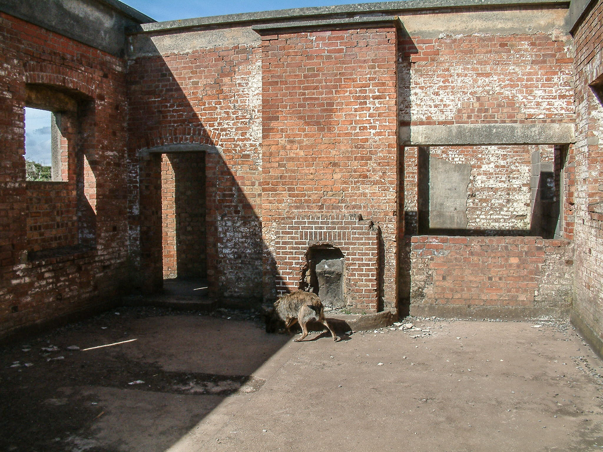
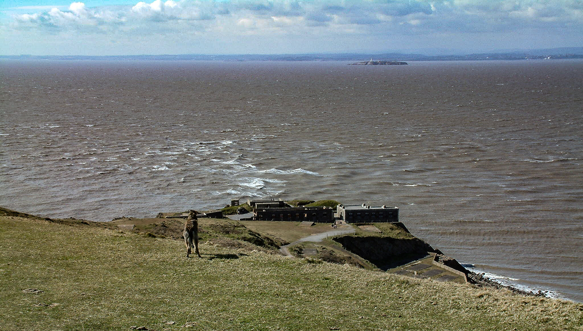
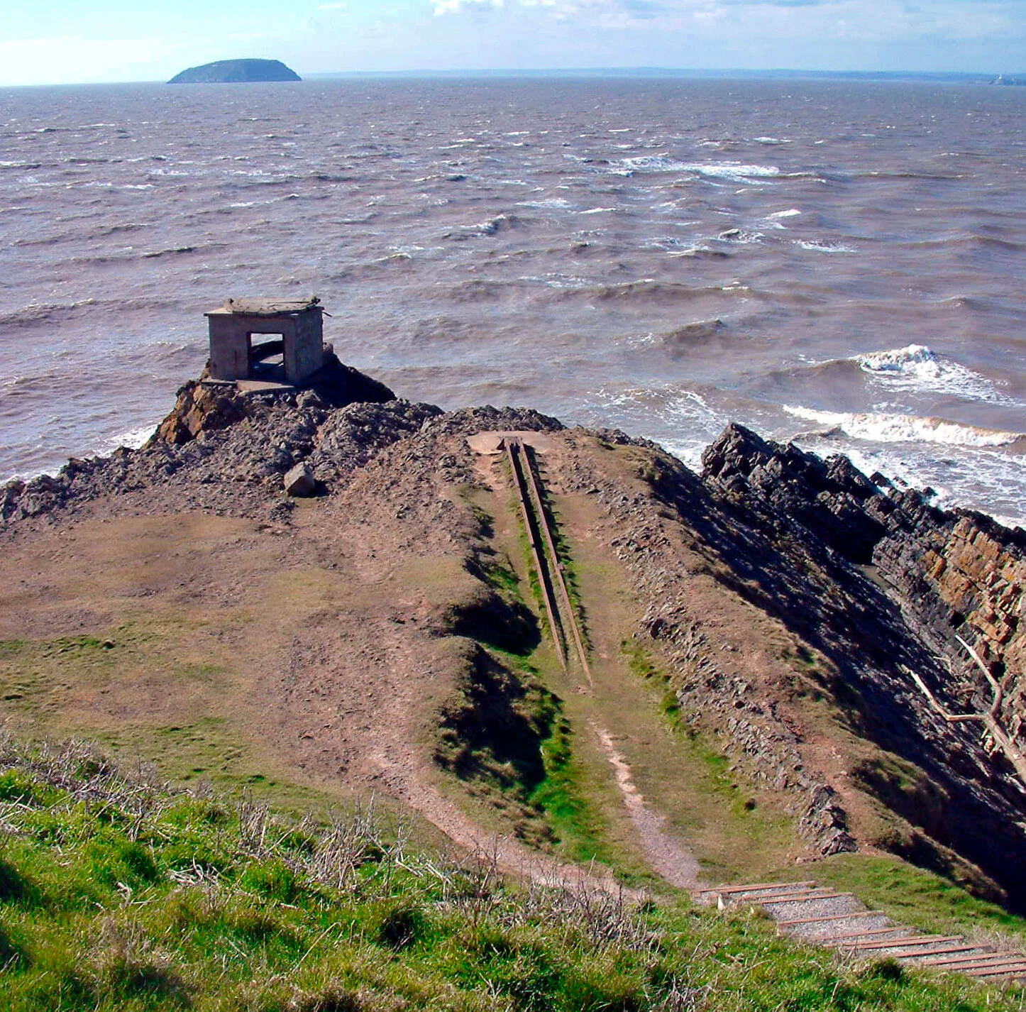
The very tip is crowned by extensive fortifications, built in 1870 as part of a chain of defences designed to defend the upper limits of the Bristol Channel against invasion from the French.

Entry to this remarkable and extensive fort is free and there are interpretation boards all over the place to help you understand how the remote stronghold operated. There were underground magazines that used to be so full of gunpowder that the soldiers had to wear rope sandals to avoid any danger of sparks.
It was a formidable place. The fort had seven gun emplacements with a maximum range of three miles – enough to cover the sea area between Brean and neighbouring Steepholm where there was another fort.

The fort at the end of Brean Down
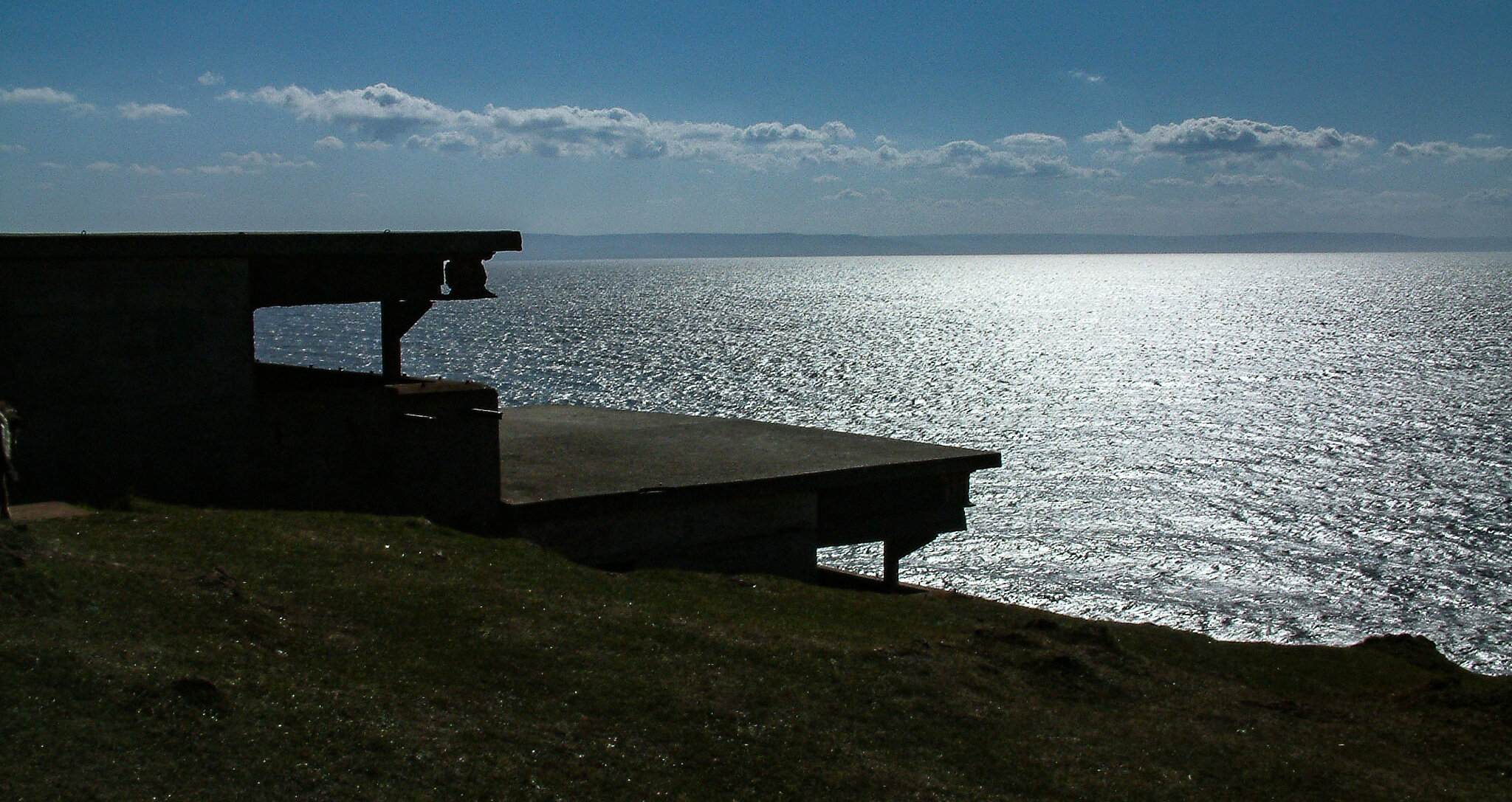
There are also later fortifications, built during the two world wars.
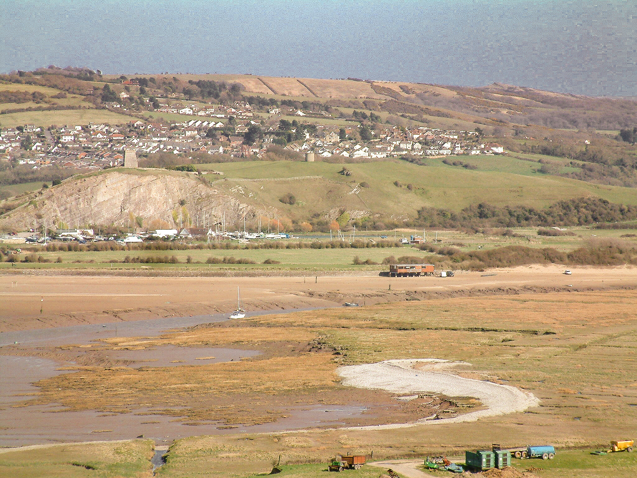
The walk back simply runs past the old quarries and along the disused service track that once ferried munitions and men out to the tip. The eastward facing stroll allows for fantastic views of both Weston-Super-Mare and the Axe estuary.

At the eastern end we pass yet more Second World War gun-emplacements and the remains of an ancient Iron Age fort, before descending gently down the track to the trust car park at northern Brean – and so return, in my opinion, to the West Country-proper.

Fact File
Basic hike: from the terminus of the Brean road on the Somerset coast, up the zig-zag path to the top of the ridge, then west along the footpath to the end of Brean Down, returning via the more northerly disused service road.
Recommended map: Ordnance Survey Explorer 153.
Distance and going: just under four miles, steep at the start, the rest is easy going.